European Organization for Experimental ... - Host Ireland
European Organization for Experimental ... - Host Ireland
European Organization for Experimental ... - Host Ireland
Create successful ePaper yourself
Turn your PDF publications into a flip-book with our unique Google optimized e-Paper software.
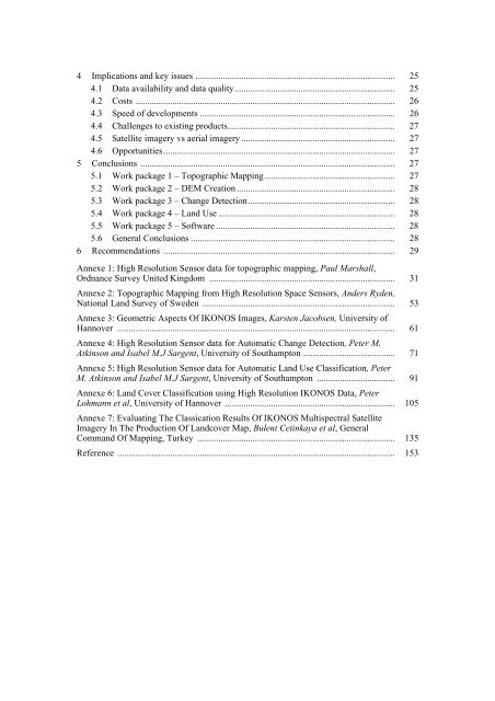
4 Implications and key issues ....................................................................................... 25<br />
4.1 Data availability and data quality...................................................................... 25<br />
4.2 Costs ................................................................................................................. 26<br />
4.3 Speed of developments ..................................................................................... 26<br />
4.4 Challenges to existing products......................................................................... 27<br />
4.5 Satellite imagery vs aerial imagery ................................................................... 27<br />
4.6 Opportunities..................................................................................................... 27<br />
5 Conclusions ............................................................................................................... 27<br />
5.1 Work package 1 – Topographic Mapping......................................................... 27<br />
5.2 Work package 2 – DEM Creation ..................................................................... 28<br />
5.3 Work package 3 – Change Detection................................................................ 28<br />
5.4 Work package 4 – Land Use ............................................................................. 28<br />
5.5 Work package 5 – Software .............................................................................. 28<br />
5.6 General Conclusions ......................................................................................... 28<br />
6 Recommendations ..................................................................................................... 29<br />
Annexe 1: High Resolution Sensor data <strong>for</strong> topographic mapping, Paul Marshall,<br />
Ordnance Survey United Kingdom ................................................................................. 31<br />
Annexe 2: Topographic Mapping from High Resolution Space Sensors, Anders Ryden,<br />
National Land Survey of Sweden .................................................................................... 53<br />
Annexe 3: Geometric Aspects Of IKONOS Images, Karsten Jacobsen, University of<br />
Hannover ......................................................................................................................... 61<br />
Annexe 4: High Resolution Sensor data <strong>for</strong> Automatic Change Detection, Peter M.<br />
Atkinson and Isabel M.J Sargent, University of Southampton ........................................ 71<br />
Annexe 5: High Resolution Sensor data <strong>for</strong> Automatic Land Use Classification, Peter<br />
M. Atkinson and Isabel M.J Sargent, University of Southampton .................................. 91<br />
Annexe 6: Land Cover Classification using High Resolution IKONOS Data, Peter<br />
Lohmann et al, University of Hannover .......................................................................... 105<br />
Annexe 7: Evaluating The Classication Results Of IKONOS Multispectral Satellite<br />
Imagery In The Production Of Landcover Map, Bulent Cetinkaya et al, General<br />
Command Of Mapping, Turkey ...................................................................................... 135<br />
Reference ......................................................................................................................... 153


