CAL FIRE Tulare Unit - Board of Forestry and Fire Protection - State ...
CAL FIRE Tulare Unit - Board of Forestry and Fire Protection - State ...
CAL FIRE Tulare Unit - Board of Forestry and Fire Protection - State ...
Create successful ePaper yourself
Turn your PDF publications into a flip-book with our unique Google optimized e-Paper software.
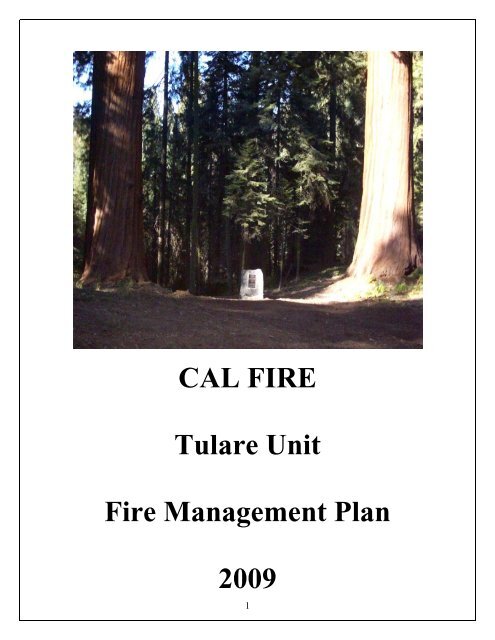
<strong>CAL</strong> <strong>FIRE</strong><br />
<strong>Tulare</strong> <strong>Unit</strong><br />
<strong>Fire</strong> Management Plan<br />
2009<br />
1
Approved by:<br />
<strong>CAL</strong> <strong>FIRE</strong> <strong>Tulare</strong> <strong>Unit</strong><br />
<strong>Fire</strong> Management Plan<br />
2009<br />
Kirk Swartzl<strong>and</strong>er, <strong>Tulare</strong> <strong>Unit</strong> Chief Kirk Swartzl<strong>and</strong>er______<br />
Department <strong>of</strong> <strong>Forestry</strong> & <strong>Fire</strong> <strong>Protection</strong><br />
Aldo Gonzalez, Captain – Pre <strong>Fire</strong> Engineer Aldo Gonzalez________<br />
California Department <strong>of</strong> <strong>Forestry</strong> & <strong>Fire</strong> <strong>Protection</strong><br />
June 1, 2009<br />
<strong>State</strong> <strong>of</strong> California<br />
The Resources Agency<br />
2
Memor<strong>and</strong>um<br />
To: C<strong>and</strong>ace Gregory, Region Chief Date June 1, 2009<br />
California Department <strong>of</strong> <strong>Forestry</strong> & <strong>Fire</strong> <strong>Protection</strong> Phone (559) 732-5954<br />
Southern Region www.fire.ca.gov<br />
From: Kirk Swartzl<strong>and</strong>er, Chief<br />
California Department <strong>of</strong> <strong>Forestry</strong> & <strong>Fire</strong> <strong>Protection</strong><br />
Southern Region- <strong>Tulare</strong><br />
Subject: 2009 Cal <strong>Fire</strong> / <strong>Tulare</strong> <strong>Unit</strong> <strong>Fire</strong> Management Plan<br />
<strong>Tulare</strong> <strong>Unit</strong> has completed the <strong>Fire</strong> Management Plan for 2009. We are using the plan as our<br />
guide to reduce the risk <strong>of</strong> large damaging fires within the <strong>Unit</strong>, as well as catalog past,<br />
present, <strong>and</strong> future projects that not only look towards long range planning, but also act as a<br />
reminder to maintain pre-suppression infrastructure that has been in place for almost sixty<br />
years. This memor<strong>and</strong>um provides the status on where TUU is in terms <strong>of</strong> <strong>Fire</strong> Plan<br />
assessments, data validation, <strong>and</strong> its integration into daily operations. The following<br />
identifies the current status <strong>of</strong> <strong>Fire</strong> Management Plan issues:<br />
• Status <strong>of</strong> <strong>Fire</strong> Plan data layer validations <strong>and</strong> Assessments<br />
* Fuels: Not complete<br />
* Ignition Workload Analysis: Need to update 2006-2009<br />
* Severe <strong>Fire</strong> Weather: Not completed, need RAWS adjustment to accurately<br />
validate.<br />
* Assets at Risk: Completed<br />
<strong>Fire</strong> Plan Assessment outputs are consistent with <strong>Unit</strong> <strong>Fire</strong> Plan staffs<br />
assessment <strong>of</strong> the priority areas.<br />
• <strong>Fire</strong> Plan Integration into Daily Operations<br />
Projects identified in previous <strong>Fire</strong> Plans have cataloged projects completed<br />
<strong>and</strong> identified future projects. Our goal is to have an identified project being<br />
worked on within the field every day. The most affected areas include:<br />
Camp Operations:<br />
3
<strong>Fire</strong> Management Plan activities account for less than ¼ <strong>of</strong> camp project work.<br />
* Field Battalion Operations: - Generate GPS data for pre-attack maps & accurate<br />
fire history.<br />
- Identify areas for fuel reduction projects.<br />
- Post education / information signs to get our message out.<br />
- Maintain TUU’s <strong>Fire</strong> Control Road system which covers 176 miles.<br />
• Notable successes include:<br />
* Lake Kaweah, Lake Success, <strong>and</strong> North Fork Drive “Rat Trail” Project(s)<br />
- These fuel breaks contain road side ignitions annually.<br />
* Mt. Home <strong>State</strong> Forest Fuel Break.<br />
• Notable hindrances include:<br />
* Delays in contract support<br />
- Difficult to coordinate project start dates<br />
- Cooperators lose interest <strong>and</strong> confidence<br />
- Opportunities <strong>and</strong> momentum are lost<br />
- Funding only available through Non Pr<strong>of</strong>it agencies<br />
* Change <strong>of</strong> ownership <strong>and</strong> property splits on established <strong>and</strong> projected<br />
fuel reductions sites<br />
* San Joaquin Valley Air Pollution Control District<br />
- $5.40 per acre smoke mitigation fee discourages perspective participants<br />
- Lack <strong>of</strong> adequate burn windows when project is in prescription<br />
* Staff support for current <strong>and</strong> prospective projects<br />
- GIS specialist<br />
• Key <strong>Fire</strong> Plan Players include:<br />
* Chief, <strong>CAL</strong> <strong>FIRE</strong> <strong>Tulare</strong> <strong>Unit</strong><br />
* Pre-<strong>Fire</strong> Engineer<br />
* VMP Forester I<br />
• Field Support<br />
* Division Chief, Mountain Division<br />
* Division Chief, Mt. Home CC<br />
* Field Battalion, Chiefs<br />
* Station Captains<br />
• Staff Support<br />
* Division Chief, Administrative Officer<br />
* Region Pre-<strong>Fire</strong> Battalion Chief<br />
* Region Contracts staff<br />
* Sacramento Business Services<br />
4
The goal <strong>of</strong> the <strong>Tulare</strong> <strong>Unit</strong> is to make the <strong>Fire</strong> Plan a relevant document while utilizing it to<br />
prevent large <strong>and</strong> damaging fires. A key element in the plans success will be to streamline the<br />
contract process to take advantage <strong>of</strong> cooperator interest, momentum, <strong>and</strong> on the ground<br />
opportunities. While we plan for <strong>and</strong> develop new projects, our primary focus will be to obtain<br />
funding for the maintenance <strong>of</strong> existing projects <strong>and</strong> pre-suppression infrastructure that is in<br />
place.<br />
The <strong>Fire</strong> Plan is in the process <strong>of</strong> undergoing a change to make this a working document that is<br />
useful to field personnel while incorporating data <strong>and</strong> technology that was previously unavailable.<br />
This transformation will require buy in <strong>and</strong> input from the field Battalions, but should make the<br />
<strong>Unit</strong>s <strong>Fire</strong> Plan goals <strong>and</strong> priorities clearly understood at all levels. Changes are continually being<br />
made to make The <strong>Fire</strong> Plan a tool which will assist the newer employees in becoming familiar<br />
with pre-suppression projects which exist within each Battalion.<br />
Kirk Swartzl<strong>and</strong>er<br />
_________________________<br />
Kirk Swartzl<strong>and</strong>er<br />
Chief, Cal <strong>Fire</strong> <strong>Tulare</strong> <strong>Unit</strong><br />
DH; rps<br />
5
TABLE OF CONTENTS<br />
Memor<strong>and</strong>um...........................................................................................................3<br />
Executive Summary..........................................................................................8<br />
Major Stakeholders Review......................................................................10<br />
Sequoia <strong>Fire</strong> Safe Council..................................................................................................11<br />
Assets at Risk......................................................................................................................13<br />
Flooding/ Soil Erosion.........................................................................................................13<br />
Timber..................................................................................................................................13<br />
<strong>Fire</strong> History........................................................................................................................14<br />
Current Projects..........................................................................................................15<br />
Projects by Battalion.................................................................................................15<br />
Badger Battalion (11)........................................................................................................15<br />
Badger / Miramonte Fuel Break:........................................................................................15<br />
Mankin Flat Fuel Break:.....................................................................................................15<br />
Shadequarter to Mankin VMP:...........................................................................................15<br />
Buzzard Roost suppersion tank.....................................................................................15<br />
Kaweah Battalion (12)......................................................................................................16<br />
Pre-Attack plans:................................................................................................................16<br />
North Fork “Rat Trail”:.....................................................................................................16<br />
Kaweah Lake “Rat Trail”:.................................................................................................16<br />
Grouse Valley FCR Fuel Break:.........................................................................................16<br />
Grouse Valley VMP:...........................................................................................................18<br />
Three Rivers FFS Demo Project.........................................................................................19<br />
Sheep Creek Suppression Tank...........................................................................................19<br />
Salt Creek Suppression Pond..............................................................................................20<br />
Blue Ridge Fuel Break........................................................................................................20<br />
Tule Battalion (13)............................................................................................................21<br />
Cow Mountain Fuel Break..................................................................................................21<br />
Rancheria Suppression Tank..............................................................................................21<br />
Wishon Suppression Tank...................................................................................................21<br />
Success Lake Rat Trail........................................................................................................21<br />
Rancheria Fuel Break.........................................................................................................21<br />
Pierpoint Fuel Break..........................................................................................................22<br />
Camp Nelson Fuel Break....................................................................................................22<br />
Battle Mountain VMP.........................................................................................................22<br />
Cow Mountain Suppression Tank.......................................................................................22<br />
Mossy Rock VMP................................................................................................................23<br />
Balch Park Road Suppression Tank...................................................................................24<br />
Fountain Springs Battalion (14)......................................................................................25<br />
Poso Fuel Break.................................................................................................................25<br />
Uhl Pocket Fuel Break.......................................................................................................25<br />
Pine Mt. Fuel Break...........................................................................................................25<br />
Pine Mt. VMP.....................................................................................................................25<br />
6
Gibbons Peak VMP..........................................................................................................25<br />
Mt. Home Demonstration <strong>State</strong> Forest........................................................................26<br />
Mountain Home <strong>State</strong> Forest ……...................................................................................26<br />
Deep Fuel Break..............................................................................................................26<br />
<strong>Unit</strong> Projects..................................................................................................................27<br />
Battalion <strong>Fire</strong> Prevention Signs......................................................................................27<br />
MAPS<br />
Figure 1 <strong>Tulare</strong> <strong>Unit</strong> Fuels Map...................................................................................28<br />
Figure 3 <strong>Tulare</strong> <strong>Unit</strong> Fuel Ranking Map...................................................................29<br />
Figure 4 <strong>Tulare</strong> <strong>Unit</strong> <strong>Fire</strong> History................................................................................30<br />
.<br />
7
Executive Summary<br />
<strong>Tulare</strong> <strong>Unit</strong> is located in Central California <strong>and</strong> makes up part <strong>of</strong> the San Joaquin Valley. It<br />
consists <strong>of</strong> 793,716 acres <strong>of</strong> state responsibility l<strong>and</strong> under direct <strong>CAL</strong> <strong>FIRE</strong> protection, <strong>and</strong><br />
1,429,881 acres <strong>of</strong> l<strong>and</strong>s under Federal Government <strong>Protection</strong>. The total <strong>of</strong> 2,224,697 acres,<br />
.The <strong>Unit</strong> is bordered on the east by Sequoia <strong>and</strong> Kings Canyon National Parks, <strong>and</strong> the<br />
Sequoia National Forest. The counties <strong>of</strong> Kern, Kings <strong>and</strong> Fresno border to the South, West,<br />
<strong>and</strong> North respectively. <strong>Tulare</strong> <strong>Unit</strong> has one Division <strong>and</strong> four Battalions. There are eight<br />
state funded fire stations; one air attack base, one 120-man conservation camp, <strong>and</strong> Mountain<br />
Home Demonstration <strong>State</strong> Forest.<br />
The elevation <strong>of</strong> <strong>Tulare</strong> <strong>Unit</strong> l<strong>and</strong> receiving direct protection by <strong>CAL</strong> <strong>FIRE</strong> ranges from 200<br />
feet along the county’s western boundary to a highest point <strong>of</strong> 9,300 feet on Moses Mountain<br />
to the East. The entire county elevations range from 200 feet on the West Side to the highest<br />
point in the contiguous <strong>Unit</strong>ed <strong>State</strong>s, Mt. Whitney at 14,495 on the eastern boundary. This<br />
wide range <strong>of</strong> elevation supports many areas <strong>of</strong> vegetation consisting <strong>of</strong> grass, oak deciduous,<br />
oak persistent, brush, <strong>and</strong> timber.<br />
The January 1, 2007 Department <strong>of</strong> Finances estimates <strong>Tulare</strong> County’s population at<br />
421,553.The majority <strong>of</strong> the population in the state responsibility area is located along two<br />
east-west highways. Highway 198 which leads to the Sequoia / Kings Canyon National Parks<br />
<strong>and</strong> Highway 190 which accesses a significant portion <strong>of</strong> the Sequoia National Forest / Giant<br />
Sequoia National Monument. <strong>Tulare</strong> <strong>Unit</strong> continues to experience a population growth rate <strong>of</strong><br />
approximately 1 percent annually. <strong>Fire</strong> occurrence spot maps indicate a direct relationship<br />
between use areas <strong>and</strong> fire occurrence. Along with the population increase, mountain areas<br />
have increased wildl<strong>and</strong> urban intermix problems. Structures are being built throughout<br />
wildl<strong>and</strong> areas wherein vegetation fires can spread. Providing adequate fire protection to<br />
those structures has become a major undertaking.<br />
<strong>Tulare</strong> <strong>Unit</strong>’s <strong>Fire</strong> Management Plan is our mechanism to catalog potential hazard areas <strong>and</strong><br />
develop prescriptions to begin mitigating them based upon assessed priorities.<br />
Pre-<strong>Fire</strong> Management: History indicates that it’s not <strong>of</strong> matter <strong>of</strong> “if” we have a fire, but<br />
rather “when” we will have a fire. A good Pre-<strong>Fire</strong> Management Plan will allow us to prevent<br />
those fire starts from becoming large damaging fires. The common denominators for large<br />
wildfires are fuel, slope, weather, <strong>and</strong> assets at risk. We cannot change slope or weather but<br />
we can modify fuels <strong>and</strong> ensure that the individual homes <strong>and</strong> communities have a<br />
defendable space. All new homes being built are subject to PRC 4290 regulations which<br />
assist us in the defense <strong>of</strong> these newest additions to the watershed.<br />
8
Pre- fire Management continued<br />
The first step is to identify the areas with the highest potential for a fire start to become a<br />
large fire (over 300 acres). <strong>Fire</strong> history in this <strong>Unit</strong> shows that many <strong>of</strong> the large fires occur<br />
in the same areas. Therefore, it would seem obvious that if all factors remain the same, the<br />
greatest potential for a large fire will be in the areas where they have burned before. By using<br />
the fire history map <strong>and</strong> overlying the assets at risk, we can determine priorities for projects.<br />
After identifying the high risk areas, it is time to develop fire management projects to provide<br />
solutions to the problem areas. Some examples are:<br />
1. Modifying the fuels in these areas for easier fire containment.<br />
2. Maintain fire breaks from previous fires.<br />
3. Maintain fuel breaks.<br />
4. Look for areas to construct new firebreaks where frequent ignitions occur.<br />
5. Insure that homeowners create a defendable space around their homes <strong>and</strong><br />
communities.<br />
a. Use <strong>Fire</strong> Safe Council’s to conduct community presentations in an effort<br />
to assist in developing solutions for area specific problems.<br />
b. Create community action groups to be proactive in fire safe projects <strong>and</strong> work with<br />
the <strong>Fire</strong> Safe Councils.<br />
c. Increase PRC 4291 compliance <strong>and</strong> educate homeowners on the need to transition<br />
from the 30’ to 100’ clearance requirements. .<br />
d. Work with local cooperating agencies to accomplish fuel reduction projects,<br />
watershed enhancement, range improvement, <strong>and</strong> pre-suppression projects that<br />
benefit all agencies.<br />
Pre-<strong>Fire</strong> Management Staff's goal is to minimize the threat <strong>of</strong> a fire from becoming a large<br />
<strong>and</strong> damaging wildfire. To attain that goal, we must reduce the amount <strong>of</strong> brush covered<br />
l<strong>and</strong>s. We must also develop fuel modification projects in the populated areas to create better<br />
defendable spaces <strong>and</strong> limit the potential for fires to spread from a populated area into the<br />
wildl<strong>and</strong>.<br />
Pre-<strong>Fire</strong> Management’s focus will continue to solicit local ranchers to participate in VMP<br />
projects to reduce the fuel loading, <strong>and</strong> reestablish water generation. <strong>Fire</strong> Safe Councils will<br />
be a key partner to determine successful strategies in minimizing our threat to key assets at<br />
risk. The success <strong>of</strong> these projects will depend on support from willing stakeholders,<br />
motivated field personnel, <strong>and</strong> supportive administrative staff. New projects promoting our<br />
goals must be developed at the Battalion level. Pre-<strong>Fire</strong> Management Staff will support these<br />
new projects <strong>and</strong> assist in its implementation. When the number <strong>of</strong> projects becomes greater<br />
than the resources or budget allows, projects will be prioritized based upon their level <strong>of</strong><br />
threat, stakeholder cooperation, <strong>and</strong> the realistic ability for the project to make it to<br />
completion.<br />
9
Major Stakeholders Review<br />
The following pages list the vested stakeholders in the <strong>Tulare</strong> <strong>Unit</strong>. Each stakeholder has<br />
their own reasons for wanting fuel reduction projects. It may be to increase grazing capacity,<br />
make their l<strong>and</strong> more usable for other reasons, or to protect their investments from an<br />
uncontrolled fire.<br />
Nature used to keep the forests <strong>and</strong> rangel<strong>and</strong>s in check with fire. But for over 130 years we<br />
have actively suppressed <strong>and</strong> extinguished these wildfires. This has consequently increased<br />
the accumulation <strong>of</strong> fuels <strong>and</strong> gradually replaced the once grassl<strong>and</strong>s with brush fields. San<br />
Joaquin Valley Air Pollution District has levied a $5.40 an acre smoke mitigation fee that<br />
make VMP burns very expensive, <strong>and</strong> has hindered current fuel reduction projects.<br />
Proposition 40 funds added to the VMP program should allow VMP projects to progress<br />
again. We are hoping to try some mastication, <strong>and</strong> mechanical fuels treatments which<br />
traditionally have been under utilized in the <strong>Tulare</strong> <strong>Unit</strong>.<br />
There are several ways we can balance the needs for an ecological environment <strong>and</strong> improve<br />
fire safety. Listed below are some <strong>of</strong> the ways we can obtain our objectives.<br />
• Work with Fish <strong>and</strong> Game, U.S. Forest Service, BLM <strong>and</strong> other stakeholders in<br />
implementing fuel modification projects, <strong>and</strong> to keep fire/ flooding damages to a<br />
minimum.<br />
• Continue with VMP projects for fuel reduction in the larger areas.<br />
• Use chippers in residential areas <strong>and</strong> roadside brushing projects. This method is quicker<br />
than burning, <strong>and</strong> reduces the smoke irritants in the air.<br />
• Encourage the local l<strong>and</strong>owner to do preventative maintenance by cleaning their<br />
property <strong>of</strong> the excess fuels, limbing trees, <strong>and</strong> developing greenbelts as described in<br />
PRC 4290.<br />
• Use <strong>CAL</strong> <strong>FIRE</strong> <strong>Tulare</strong> <strong>Unit</strong>, Forest Service, <strong>and</strong> BLM inspectors to continue to insure<br />
PRC 4291 compliance.<br />
• Utilize local <strong>Fire</strong> Safe Councils <strong>and</strong> other local entities to educate homeowners on how<br />
they can create a defensible space. This can be accomplished through demonstration<br />
projects.<br />
• Use the local newspapers <strong>and</strong> media to inform the public on fire safety <strong>and</strong> upcoming<br />
events.<br />
• Utilize <strong>CAL</strong> <strong>FIRE</strong>’s Team Teaching program <strong>and</strong> VIP's to teach fire safety in the local<br />
schools <strong>and</strong> at community events.<br />
• Maintain our massive pre-suppression project inventory. These mainly consist <strong>of</strong><br />
suppression tanks, fire control roads, <strong>and</strong> fire safe areas. Maintaining existing<br />
infrastructure should be the first priority, before development <strong>of</strong> new projects occurs.<br />
10
Sequoia <strong>Fire</strong> Safe Council<br />
The Sequoia <strong>Fire</strong> Safe Council was established in June <strong>of</strong> 2005 to facilitate fuels treatment<br />
<strong>and</strong> large vegetation management projects. Their goal is to obtain funding <strong>and</strong> treat fuels.<br />
They are currently working under <strong>Tulare</strong> County Resource Conservation Districts non pr<strong>of</strong>it<br />
status pending their own 501 (c) 3.<br />
11
Mission <strong>State</strong>ment<br />
Sequoia <strong>Fire</strong> Safe Council is dedicated to increasing community awareness <strong>of</strong> “High <strong>Fire</strong><br />
Threat” danger. We will provide property <strong>and</strong> business owners with the resources needed<br />
to decrease the threat <strong>of</strong> wildl<strong>and</strong> fires. The council brings together public <strong>and</strong> private<br />
partners to accomplish common objectives.<br />
Projects in Progress<br />
Fuel reduction on the Pot Holes fire control road is completed. The priority has now<br />
shifted to the Grouse Valley, Blue Ridge <strong>and</strong> Rancheria <strong>Fire</strong> Control Roads.<br />
Project Description<br />
A Wildfire defense zone will be maintained along existing <strong>CAL</strong> <strong>FIRE</strong> control road<br />
located on private property. Surface vegetation <strong>and</strong> lower branches <strong>of</strong> trees will be<br />
manually removed for a maximum distance <strong>of</strong> 50 feet on either side <strong>of</strong> the road. Treated<br />
vegetation will be disposed by piling <strong>and</strong> burning or chipping.<br />
Participants <strong>of</strong> the Sequoia <strong>Fire</strong> Safe Council<br />
Bobby Kamansky<br />
Brent Huntington, D-K Ranch<br />
California Department <strong>of</strong> <strong>Forestry</strong><br />
Carri Diaz<br />
David Witt<br />
Elizabeth Palmer<br />
Everett Welch<br />
Jim Burr<br />
Jim Sullins<br />
Joe Williams<br />
Joel Hayden<br />
John Shannon<br />
John Vincent Jr., Sequoia Ranch<br />
Kyle Loveall, Elliott L<strong>and</strong> & Cattle Co.<br />
Megan Bidart<br />
National Park Service, Sequoia / Kings National Park<br />
Ron Frazier<br />
Southern California Edison<br />
Tom Daly,<br />
<strong>Tulare</strong> County Cattlemen’s Association<br />
UC Cooperative Extension<br />
<strong>Unit</strong>ed <strong>State</strong>s Forest Service, Sequoia National Forest<br />
Warren Hutchings<br />
12
Assets at Risk<br />
Protecting our local assets remains a concern whether they are man-made such as our<br />
communities, or natural like the giant sequoia redwood trees. One way to protect our assets is<br />
to plan projects where our fire occurrences are high <strong>and</strong> the reasons for these starts are<br />
known. The <strong>State</strong> maintains a GPS coordinate (lat. & long.) for all fire ignitions, <strong>and</strong> maps<br />
fires that burn 10 acres <strong>of</strong> timber, 50 acres <strong>of</strong> brush, 300 acres <strong>of</strong> grass, three or more<br />
structures, or cause more than $300,000 damage in the SRA protection area .The <strong>Tulare</strong> unit<br />
requires all fires will be GPS coordinate (lat. & long ). The waypoints <strong>and</strong> track files are<br />
collected <strong>and</strong> used to create a data layer. At the end <strong>of</strong> each calendar year SRA ignition<br />
points <strong>and</strong> shape files are used to maintain accurate fire history <strong>and</strong> ignition location.<br />
Historically our fire starts occurred along the Highway 198 corridor <strong>and</strong> Highway 190<br />
corridor. The GIS data collected is beneficial to determine specific fire cause locations <strong>and</strong><br />
can direct prevention / education efforts to match historic ignitions.<br />
Flooding / Soil Erosion<br />
Another concern in the event <strong>of</strong> a large <strong>and</strong> devastating fire such as the Mc Nalley <strong>and</strong><br />
Manter <strong>Fire</strong>s is the aftermath. Analysis <strong>of</strong> the topsoil after these types <strong>of</strong> large fires shows a<br />
transformation from good topsoil to a hydrophobic soil. Hydrophobic soil happens when a<br />
large fire consumes the brush that has a natural protective wax on the leaves, leaving a waxy<br />
residue on the ground. The waxy residue left on the ground can be approximately 2” to 3” in<br />
depth <strong>and</strong> prevents the soil from absorbing moisture. This in turn creates flooding, mudslides<br />
<strong>and</strong> threatens other assets such as animal habitat, fisheries, <strong>and</strong> our communities. Extensive<br />
soil erosion can occur <strong>and</strong> replace our water supplies with silt, mud, <strong>and</strong> rocks. Disturbing the<br />
topsoil is a good way to disperse the waxy buildup <strong>and</strong> allow moisture to penetrate the soil.<br />
After the fire has passed, timber salvage operations is one way to reduce the fuel loading,<br />
help restore the l<strong>and</strong>, <strong>and</strong> disperse the hydrophobic soil.<br />
Timber<br />
Timber is another important asset in <strong>Tulare</strong> County, especially to the small community <strong>of</strong><br />
Terra Bella. Home to the Sierra Forest Products, this is one <strong>of</strong> the few major sawmills left in<br />
California. Logging has been a major part <strong>of</strong> <strong>Tulare</strong> County since the late 1880’s. Redwood,<br />
pine, cedar, <strong>and</strong> oak have been sawed <strong>and</strong> lumbered to help supply the nation’s lumber needs.<br />
13
<strong>Fire</strong> History<br />
Generally <strong>Tulare</strong> <strong>Unit</strong>’s <strong>Fire</strong> History consists <strong>of</strong> several small fires <strong>and</strong> on a rare occasion, a<br />
large <strong>and</strong> damaging fire. <strong>Tulare</strong> <strong>Unit</strong>`s last large <strong>and</strong> damaging fires were the Kaweah fire<br />
(1996) <strong>and</strong> the Case Mt. fire (1987). It should be noted that Sequoia / Kings National Park<br />
had the Buckeye <strong>Fire</strong> (1988), <strong>and</strong> Sequoia National Forest had the Stormy Complex (1990),<br />
the Manter <strong>Fire</strong> (2000), Mc Nalley <strong>Fire</strong> (2002), <strong>and</strong> the Deep <strong>Fire</strong> (2004) which were all<br />
considered large <strong>and</strong> damaging fires. In 2004 the <strong>Tulare</strong> <strong>Unit</strong> had four fires that were<br />
considered large <strong>and</strong> damaging. This was about average. With most <strong>of</strong> the fires occurring in<br />
grass covered rangel<strong>and</strong>. The Deep <strong>Fire</strong> occurred on the Sequoia National Forest directly<br />
adjacent to <strong>State</strong> Responsibility Area l<strong>and</strong> <strong>and</strong> the Mountain Home Demonstration Forest.<br />
Secondary containment lines were created on the <strong>State</strong> Forest but the fire did not actually<br />
burn in Mountain Home <strong>State</strong> Forest.<br />
Fuels<br />
The fuels in <strong>Tulare</strong> County range from light grasses in the western end <strong>of</strong> the county, to<br />
Sequoia redwoods in the center portion <strong>of</strong> the county, to a high desert on the eastern end <strong>of</strong><br />
the county. Most <strong>of</strong> the SRA l<strong>and</strong>s protected by <strong>CAL</strong> <strong>FIRE</strong> are grassl<strong>and</strong>s, type four brush,<br />
<strong>and</strong> areas <strong>of</strong> timber starting around the 4,000’ elevation<br />
(see Fuels Map in Appendix). Prescribe fire has been a useful tool in reducing the<br />
accumulation <strong>of</strong> fuels in the unit. There is one burn well into the planning process moving<br />
towards implementation. We are looking into re-treatment <strong>of</strong> projects that we have completed<br />
in the past.<br />
Weather<br />
The weather during the fire season is generally hot, with temperatures between 85°-103°,<br />
humidity in the low teen`s <strong>and</strong> a light wind about 3-5 mph from the NW. The light wind <strong>and</strong><br />
somewhat higher humidity has helped in suppressing fires in the unit. The topography <strong>of</strong> the<br />
l<strong>and</strong> is generally flat to the west <strong>and</strong> becomes steep very quickly from the center <strong>of</strong> the<br />
county to the east.<br />
14
Badger Battalion (11)<br />
.<br />
Projects by Battalion<br />
Badger / Miramonte Fuel Break:<br />
• Build a shaded fuel break along the Badger / Miramonte <strong>Fire</strong> Control Road to provide<br />
an area to stop an established wildfire spreading from the Drum Valley / Highway<br />
245 corridor. The Badger / Miramonte FCR is located on advantageous topography to<br />
provide a suitable control point to limit a fires spread into populated areas <strong>of</strong> <strong>Tulare</strong><br />
<strong>and</strong> Fresno counties. The fuel break should be void <strong>of</strong> any continuous chaparral for<br />
twenty feet on either side <strong>of</strong> the road. Trees should be limbed up <strong>and</strong> thinned to limit<br />
spacing as needed. Funding for this project will be minimal <strong>and</strong> can be absorbed by<br />
the unit(s) for regular fire control road maintenance if there is no available grant<br />
funding sources.<br />
Mankin Flat Fuel Break:<br />
• Engineer the fuels along the Mankin Flat <strong>Fire</strong> Control Road starting at the point where<br />
the Davis Spur <strong>and</strong> Mankin Flat <strong>Fire</strong> Control Roads intersect. The road is<br />
strategically positioned along the ridge which separates the Dry Creek <strong>and</strong> Sheep<br />
Creek drainages. This location would be a valuable control point in containing<br />
wildfires which start on either side <strong>of</strong> it. The fuel break should be void <strong>of</strong> chaparral<br />
for twenty feet on either side <strong>of</strong> the road, <strong>and</strong> trees should be limbed up <strong>and</strong> thinned<br />
to limit spacing as needed. This project due to its size, may take several years to<br />
implement. Funding for this project to could be acquired through available grant<br />
programs.<br />
Shadequarter to Mankin VMP:<br />
• The object <strong>of</strong> this project is to create a series <strong>of</strong> burns along the ridgeline that connects<br />
Shadequarter Mountain to Mankin Flat. The most important aspect <strong>of</strong> this project is<br />
that it would engineer a significant age class reduction <strong>of</strong> fuels from Eshom Valley at<br />
the edge <strong>of</strong> our DPA to where the fuels transition to grass / oak woodl<strong>and</strong>. These<br />
projects should be completed sequentially from north to south to minimize control<br />
difficulties <strong>and</strong> to limit the amount preparation needed. A maintenance cycle should<br />
be established to insure the effectiveness. Funding to be provided through Local,<br />
<strong>State</strong>, <strong>and</strong> Federal grants, as well as Department funds specifically allocated for this<br />
type <strong>of</strong> project.<br />
Buzzard Roost suppression tank<br />
• Build a 5,000 gallon suppression tank on Buzzard Rust <strong>Fire</strong> Control Road at the<br />
intersection <strong>of</strong> Dry Creek Dr. This critical piece <strong>of</strong> infrastructure lies in a remote area<br />
where suppression water is difficult to acquire. This tank requires development <strong>of</strong> a<br />
nearby spring to be able to maintain the tanks capacity. Once this has been<br />
accomplished, maintenance requirements should be minimal.<br />
15
Kaweah Battalion (12)<br />
Pre-Attack plans:<br />
• Develop updated maps utilizing GIS technology to capture all roads, fuel breaks, water<br />
locations, staging locations, <strong>and</strong> plot probable control lines. Possible strategies for<br />
fire suppression could be pre-determined utilizing fire history, typical fire weather<br />
<strong>and</strong> fire behavior models. Distribute the maps so equipment from other stations /<br />
areas can efficiently function within the Kaweah Battalion.<br />
North Fork “Rat Trail”:<br />
• Construct a 4-6 foot by 4.3 mile long fuel break along the county road right-<strong>of</strong>-way<br />
along the East side <strong>of</strong> North Fork Drive. This fuel break begins ¼ mile south <strong>of</strong> the<br />
Sheep Creek <strong>Fire</strong> Control Road <strong>and</strong> proceeds north to the Cherry Falls recreation<br />
area. The fuel break is intended to stop or slow accidental or incendiary road side<br />
ignitions, which it has historically done with much success. Funding to be absorbed<br />
through normal unit operating funds due to its minimal expense.<br />
Kaweah Lake “Rat Trail”:<br />
• Construct a 4-6 foot by 6.7 mile long fuel break along the state highway right-<strong>of</strong>-way,<br />
on the East side <strong>of</strong> Highway 198. This fuel break begins at the bottom <strong>of</strong> “Lemon<br />
Hill” at the end <strong>of</strong> the citrus grove <strong>and</strong> proceeds east / northeast <strong>and</strong> terminates at the<br />
Slick Rock recreation area. This fuel break is intended to stop accidental or<br />
incendiary road side ignitions, which it has historically done with much success. This<br />
annual project should be completed before Memorial Day.<br />
Grouse Valley FCR Fuel Break:<br />
• Engineer the fuels along the Grouse Valley <strong>Fire</strong> Control Road to create a shaded fuel<br />
break, creating an advantageous control point for fire suppression. The Grouse Valley<br />
FCR is located along the east side <strong>of</strong> our unit near the SRA boundary. The<br />
topography is much more suitable than anything to the east for establishing control<br />
lines to protect the homes along South Fork Drive from wildfire established in the<br />
confluence <strong>of</strong> this drainage. The fuel break should be void <strong>of</strong> any chaparral for 100-<br />
150 feet on the downhill side <strong>of</strong> the road <strong>and</strong> 50 feet on the uphill side. Trees should<br />
be limbed <strong>and</strong> thinned to limit spacing as needed. Funding for this project is through<br />
acquired available grant funding via the Sequoia <strong>Fire</strong> Safe Council.<br />
16
Grouse Valley before <strong>and</strong> after<br />
17
Grouse Valley VMP:<br />
• This is a 1500 acre VMP located in the upper reaches <strong>of</strong> the Grouse Creek<br />
Watershed. Grouse Creek is a tributary to the South Fork <strong>of</strong> the Kaweah River.<br />
The objectives are to reduce hazardous fuel buildup <strong>of</strong> 50 year old<br />
chaparral, improve grazing conditions, <strong>and</strong> improve wildlife habitat. The<br />
cooperators in this project would be; California Department <strong>of</strong> Fish & Game, <strong>and</strong><br />
two private cattle ranches. The main environmental issue is air quality to the<br />
adjacent community which lies in area considered to be smoke sensitive. Work is<br />
in progress <strong>and</strong> is scheduled to be completed as soon as Department funding, <strong>and</strong> Air<br />
Pollution Control District fee assessments are exempted for this type project.<br />
18
Three Rivers FFS Demo Project<br />
• Maintain the “<strong>Fire</strong> Safe” l<strong>and</strong>scape area that is visible to all residents <strong>and</strong> visitors to the<br />
Three Rivers Forest <strong>Fire</strong> Station which will demonstrate the “ideal” fire safe<br />
l<strong>and</strong>scaped home. Maintain <strong>and</strong> publicize this project annually to use as the local<br />
model.<br />
Sheep Creek Suppression Tank<br />
• Maintain the 5,000 gallon tank built by <strong>CAL</strong> <strong>FIRE</strong> in the1950’s. This critical piece <strong>of</strong><br />
infrastructure lies in a remote area where suppression water is difficult to acquire.<br />
The tanks maintenance costs are negligible <strong>and</strong> requires little effort. Maintain the<br />
spring box <strong>and</strong> plumbing to insure the unrestricted flow <strong>of</strong> water into the tank <strong>and</strong><br />
stock trough.<br />
19
Salt Creek Suppression Pond<br />
• Maintain the 5,000-10,000 gallon reservoir built by <strong>CAL</strong> <strong>FIRE</strong> in the 1950’s. This<br />
reservoir requires annual brush removal <strong>and</strong> opening / closing <strong>of</strong> the head gate to<br />
allow filling <strong>of</strong> water, <strong>and</strong> removal <strong>of</strong> sediment. This reservoir is adjacent to the<br />
Salt Creek <strong>Fire</strong> Control Road <strong>and</strong> provides critical water storage in an very<br />
remote area.<br />
Blue Ridge Fuel Break<br />
• Maintain the pre-existing shaded fuel break that runs from Blue Ridge road This break<br />
requires annual to semi annual removal <strong>of</strong> new shrubs, <strong>and</strong> dead / dying trees brush.<br />
The road serves as a wild fire defense zone that primarily follows a north-south<br />
oriented ridgeline. Fuels reduction is proposed along 9 miles <strong>of</strong> the fire control road<br />
for a maximum distance <strong>of</strong> 150 feet. Funding for this project is available grant<br />
funding via Sequoia <strong>Fire</strong> Safe Council.<br />
20
Tule Battalion (13)<br />
Cow Mountain Fuel Break<br />
• Maintain the pre-engineered fuels along the Cow Mountain <strong>Fire</strong> Control Road to create<br />
/ maintain a shaded fuel break, creating an advantageous control point for fire<br />
suppression. The Cow Mountain <strong>Fire</strong> Control Road lies on the east side <strong>of</strong> the unit<br />
near the SRA / FRA boundary. The fuel break should be void <strong>of</strong> any chaparral for<br />
100-150 feet on the downhill side <strong>of</strong> the road <strong>and</strong> 50 feet on the uphill side. Trees<br />
should be limbed <strong>and</strong> thinned to limit spacing as needed. This project to be funded<br />
through unit funds <strong>and</strong> available acquired grant funding.<br />
Rancheria Suppression Tank<br />
• Maintain the 5,000 gallon suppression tank built by <strong>CAL</strong> <strong>FIRE</strong> in the 1970s adjacent to<br />
the Rancheria <strong>Fire</strong> Control Road. This critical piece <strong>of</strong> infrastructure lies in a remote<br />
area where suppression water is difficult to acquire. This tank requires development<br />
<strong>of</strong> a nearby spring to be able to maintain the tanks capacity. Once this has been<br />
accomplished, maintenance requirements should be minimal.<br />
Wishon Suppression Tank<br />
• Maintain the 10,000 gallon suppression tank along Wishon Road. below the community<br />
<strong>of</strong> Doyle Springs which was built by <strong>CAL</strong> <strong>FIRE</strong> in the 1990s. This piece <strong>of</strong><br />
infrastructure is critical in the support <strong>and</strong> protection <strong>of</strong> the Doyle Springs cabins.<br />
This tank requires minimal annual maintenance.<br />
Success Lake Rat Trail<br />
• Construct a 4-6 foot by 3 mile long fuel break along the state highway right-<strong>of</strong>-way, on<br />
the east side <strong>of</strong> Highway 190. This fuel break begins at the point where Highway 190<br />
meets the hill near Success Market <strong>and</strong> proceeds east / north east <strong>and</strong> terminates at<br />
the Success Lake Bridge. This fuel break is intended to stop or slow accidental or<br />
incendiary road side ignitions, which it successfully did twice in 2003. Funding to be<br />
absorbed through normal <strong>Unit</strong> operating funds due to its minimal expense.<br />
Rancheria Fuel Break<br />
• Maintain the pre-existing shaded fuel break that runs from Balch Park Road., east to the<br />
Rancheria <strong>Fire</strong> Control Road. This break requires annual to semi annual removal <strong>of</strong><br />
new shrubs, <strong>and</strong> dead / dying trees brush. Funding to be through available acquired<br />
grant funding. Funding for this project is through available grant funding via Sequoia<br />
<strong>Fire</strong> Safe Council.<br />
21
Pierpoint Fuel Break<br />
• Create a shaded fuel break that will be 100 to 300 feet wide <strong>and</strong> 1 ½ miles long forming<br />
a protective ring around the community <strong>of</strong> Pierpoint Springs <strong>and</strong> the western side <strong>of</strong><br />
Camp Nelson. The <strong>Unit</strong>ed <strong>State</strong>s Forest Service is establishing a fuel break on their<br />
jurisdictional ground to tie in with our jurisdictions. The break will utilize existing<br />
roads, natural openings, <strong>and</strong> clearance around structures to form an effective control<br />
point / belt <strong>of</strong> engineered fuels. <strong>CAL</strong> <strong>FIRE</strong> was awarded a grant to accomplish this<br />
project.<br />
Camp Nelson Fuel Break<br />
• Create a shaded fuel break that will be constructed 200 feet wide <strong>and</strong> 1 ½ miles long<br />
around the eastern <strong>and</strong> southern perimeter <strong>of</strong> the community <strong>of</strong> Camp Nelson.<br />
This project would be in cooperation with the <strong>Unit</strong>es <strong>State</strong>s Forest Service <strong>and</strong><br />
multiple private l<strong>and</strong>owners. This project will create a needed buffer between the<br />
community <strong>and</strong> the wildl<strong>and</strong>.<br />
Battle Mountain VMP<br />
• Reintroduce fire to the area previously burned utilizing our Vegetation Management<br />
Program Burn. This will be phase two <strong>of</strong> the 2001 burn to treat the regeneration <strong>of</strong><br />
chaparral <strong>and</strong> try <strong>and</strong> convert the fuel type. Scheduled for 2009 / 2012.<br />
Cow Mountain Suppression Tank<br />
• Maintain the 10,000 gallon suppression tank built by <strong>CAL</strong> <strong>FIRE</strong> in the1970’s. This<br />
piece <strong>of</strong> infrastructure lies in a remote area where suppression water is difficult to<br />
obtain. The tanks maintenance costs are negligible <strong>and</strong> require little effort.<br />
22
Mossy Rock VMP<br />
• This 580 acre VMP is located seven miles north <strong>of</strong> the town <strong>of</strong> Springville adjacent to<br />
Balch Park Road. The objectives are to reduce the fuel loading by chipping, piling,<br />
<strong>and</strong> broad casting the fifty to sixty year old chaparral, Live Oak <strong>and</strong> brush. This<br />
would establish an age class change in the fuel to be utilized as a wildfire control<br />
point, improve wildlife habitat, <strong>and</strong> improve livestock grazing conditions. This<br />
project would be in cooperation with local rancher. This project poses some<br />
challenges due to the location <strong>of</strong> the proposed site in proximity to areas within the<br />
same drainage in respect to air quality issues.<br />
23
Mossy Rock VMP fuel reduction right side <strong>of</strong> photo treated left not treated<br />
Balch Park Road Suppression Tank<br />
• Maintain the 10,000 gallon suppression tank built by <strong>CAL</strong> <strong>FIRE</strong> in the1970’s. This<br />
piece <strong>of</strong> infrastructure lies in a remote area where suppression water is difficult to<br />
obtain. The tanks maintenance costs are negligible <strong>and</strong> require little effort.<br />
24
Fountain Springs Battalion (14)<br />
Posey Fuel Break<br />
• Create a shaded fuel break near the communities <strong>of</strong> Panorama Heights <strong>and</strong> Poso<br />
Park. The fuel break is a joint venture between the U.S. Forest Service, <strong>CAL</strong><br />
<strong>FIRE</strong> <strong>Tulare</strong> <strong>Unit</strong> <strong>and</strong> the local residents requiring little cost to those involved.<br />
The project consists <strong>of</strong> limbing trees, removing excess brush, restrict mistletoe<br />
spread <strong>and</strong> disposing <strong>of</strong> the excess waste by burning or chipping. Most <strong>of</strong> the<br />
treated l<strong>and</strong>s is on federal l<strong>and</strong> next to the <strong>Tulare</strong> County Posey <strong>Fire</strong> Station.<br />
Uhl Pocket Fuel Break<br />
• Maintain the Uhl Pocket fuel break that was created in the late 1990’s. This fuel break<br />
lies on USFS <strong>and</strong> <strong>CAL</strong> <strong>FIRE</strong> jurisdictions. Major treatments have been completed<br />
<strong>and</strong> require 10-20 days <strong>of</strong> cutting <strong>and</strong> burning / chipping per year to maintain it in a<br />
useable condition.<br />
Pine Mt. Fuel Break<br />
• Maintain the Pine Mt. fuel break that was created in the late 1990’s. This fuel break<br />
protects the community <strong>of</strong> Pine Flat <strong>and</strong> lies on USFS l<strong>and</strong>. Major treatments have<br />
been completed <strong>and</strong> require 10-25 days <strong>of</strong> cutting <strong>and</strong> burning / chipping per year to<br />
maintain it in a useable condition.<br />
Pine Mt. VMP<br />
• This proposed project is a 1600 acre VMP 2-3 miles southwest <strong>of</strong> the community <strong>of</strong><br />
Pine Flat. This is mostly on National Forest / Monument l<strong>and</strong>s that lie within <strong>CAL</strong><br />
<strong>FIRE</strong>’s DPA. The objective <strong>of</strong> this burn is to reduce fuel load, improve wildlife<br />
habitat, <strong>and</strong> improve grazing. The effects <strong>of</strong> the burn should create a protection zone<br />
for the communities <strong>of</strong> Pine Flat <strong>and</strong> California Hot Springs.<br />
S<strong>and</strong>y Creek Fuel Break<br />
• Construct a shaded fuel break along the S<strong>and</strong>y Creek <strong>Fire</strong> Control Road to the forest<br />
boundary. This will provide a control point for the protection <strong>of</strong> Poso <strong>and</strong> Panorama<br />
Heights. The fuel break is to be constructed 200’ x 1 mile. The Project is still in<br />
planning stages.<br />
Gibbons Peak VMP<br />
• This proposed project is an 1800 acre VMP 12 miles northwest <strong>of</strong> California Hot<br />
Springs. Roughly 1400 acres on SRA, <strong>and</strong> the remaining on BIA l<strong>and</strong>. Contracts<br />
<strong>and</strong> agreements still need to be obtained for all <strong>of</strong> the cooperators involved. The<br />
objective <strong>of</strong> this burn is to reduce fuel load, improve wildlife habitat, <strong>and</strong> improve<br />
grazing.<br />
25
Mt. Home Demonstration <strong>State</strong> Forest<br />
Continue fuel treatments within 100’ <strong>of</strong> primary roads. Work involves precommercial<br />
thinning <strong>of</strong> conifers typically less than 8 inches DBH <strong>and</strong> full<br />
removal <strong>of</strong> woody brush species. Material generated from the uphill side <strong>of</strong> the<br />
road is either pulled to the road <strong>and</strong> chipped or piled for seasonal burning.<br />
Material generated from below the road is piled for seasonal burning. All cutting,<br />
piling <strong>and</strong> chipping is performed by MHCC crews, USFS “blue card” crews<br />
<strong>and</strong>/or MHDSF staff. Burning is performed by MHDSF staff on permissive burn<br />
days with a permit through the <strong>Tulare</strong> County APCD.<br />
Maintain a defensible fuel pr<strong>of</strong>ile within <strong>and</strong> around day use areas <strong>and</strong><br />
campgrounds. Saplings <strong>and</strong> small poles shall be marked by MHDSF staff for<br />
cutting <strong>and</strong> chipping. This work will take place within the common campground<br />
<strong>and</strong> day use facilities <strong>and</strong> shall extend for a distance <strong>of</strong> at least 100’ from the<br />
campground improvements.<br />
Maintain 4291 clearance around all <strong>State</strong> owned <strong>and</strong> operated structures that are<br />
maintained for human habitation. This shall include the summer <strong>and</strong> winter<br />
headquarters, barracks, Jack’s house <strong>and</strong> pack station. Similar maintenance shall<br />
be performed around the fuel tank, <strong>and</strong> warehouse as well.<br />
Continue fuel treatments in selected areas throughout the forest. Strategically<br />
located areas that are within close proximity to roads or trails shall be selected for<br />
treatment. These areas shall be treated by pre-commercial thinning <strong>of</strong> conifers<br />
typically less than 8 inches DBH <strong>and</strong> full removal <strong>of</strong> woody brush species. All<br />
cut vegetative matter shall be piled for seasonal burning. All cutting <strong>and</strong> piling<br />
shall be performed by MHCC crews, USFS “blue card” crews <strong>and</strong>/or MHDSF<br />
staff.<br />
Deep Fuel Break<br />
Submit Timber Harvest Plan that will exp<strong>and</strong> upon the dozer line that was<br />
constructed during the “Deep <strong>Fire</strong>” in 2004. The harvest area shall extend<br />
approximately 300 to 500 feet on both flanks <strong>of</strong> the ridge line that extends from<br />
the Copper Mine Road at the north end through the Methuselah Campground<br />
area, to the southern forest boundary. This harvest shall focus on leaving a<br />
residual st<strong>and</strong> that contains between 50 to 160 square feet <strong>of</strong> basal area per acre.<br />
Residual trees shall be the largest <strong>and</strong> most fire resistant specimens from the preharvest<br />
st<strong>and</strong>. The intent <strong>of</strong> the fuel break is to slow or stop a wildfire coming<br />
from the Wishon Fork <strong>of</strong> the Tule River before it enters the major l<strong>and</strong> holdings<br />
<strong>of</strong> the <strong>State</strong> Forest. The harvest will further focus on disconnecting the horizontal<br />
<strong>and</strong> vertical fuel ladders creating a defensible fuel pr<strong>of</strong>ile. Large trees shall be<br />
logged conventionally with ground-based heavy equipment while small trees<br />
generally less than 24” DBH shall be logged mechanically with feller bunchers.<br />
Utilizing mechanized harvest equipment will allow for “whole tree” harvest<br />
operations resulting in reduced slash accumulations post harvest. Submerchantable<br />
trees <strong>and</strong> brush shall be treated by either h<strong>and</strong> cutting <strong>and</strong> piling,<br />
h<strong>and</strong> cutting <strong>and</strong> broadcast burning, or mastication. All three methods could<br />
potentially be combined.<br />
26
Deep Fuel Break cont.<br />
This project is necessary to protect the public, infrastructure, <strong>State</strong> property <strong>and</strong><br />
forest resources, watershed <strong>and</strong> habitat values, soil, <strong>and</strong> old-growth giant sequoia.<br />
<strong>Unit</strong> Projects<br />
Battalion <strong>Fire</strong> Prevention Signs<br />
• Identify by Battalion sign locations <strong>and</strong> numbers <strong>of</strong> fire prevention signs. Work with<br />
field battalion staff to determine appropriate sign messages for the time <strong>of</strong> year. Seek<br />
out grant funding to maintain <strong>and</strong> replace dilapidated signs, <strong>and</strong> sign st<strong>and</strong>s. Obtain a<br />
GPS coordinate for each sign location <strong>and</strong> create a data layer that can be used against<br />
our ignition data layer to develop prevention messages to meet the local ignitions.<br />
27


