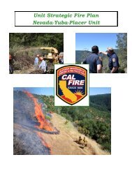
CAL FIRE Tulare Unit - Board of Forestry and Fire Protection - State ...
CAL FIRE Tulare Unit - Board of Forestry and Fire Protection - State ...
CAL FIRE Tulare Unit - Board of Forestry and Fire Protection - State ...

You also want an ePaper? Increase the reach of your titles
YUMPU automatically turns print PDFs into web optimized ePapers that Google loves.
<strong>Fire</strong> History<br />
Generally <strong>Tulare</strong> <strong>Unit</strong>’s <strong>Fire</strong> History consists <strong>of</strong> several small fires <strong>and</strong> on a rare occasion, a<br />
large <strong>and</strong> damaging fire. <strong>Tulare</strong> <strong>Unit</strong>`s last large <strong>and</strong> damaging fires were the Kaweah fire<br />
(1996) <strong>and</strong> the Case Mt. fire (1987). It should be noted that Sequoia / Kings National Park<br />
had the Buckeye <strong>Fire</strong> (1988), <strong>and</strong> Sequoia National Forest had the Stormy Complex (1990),<br />
the Manter <strong>Fire</strong> (2000), Mc Nalley <strong>Fire</strong> (2002), <strong>and</strong> the Deep <strong>Fire</strong> (2004) which were all<br />
considered large <strong>and</strong> damaging fires. In 2004 the <strong>Tulare</strong> <strong>Unit</strong> had four fires that were<br />
considered large <strong>and</strong> damaging. This was about average. With most <strong>of</strong> the fires occurring in<br />
grass covered rangel<strong>and</strong>. The Deep <strong>Fire</strong> occurred on the Sequoia National Forest directly<br />
adjacent to <strong>State</strong> Responsibility Area l<strong>and</strong> <strong>and</strong> the Mountain Home Demonstration Forest.<br />
Secondary containment lines were created on the <strong>State</strong> Forest but the fire did not actually<br />
burn in Mountain Home <strong>State</strong> Forest.<br />
Fuels<br />
The fuels in <strong>Tulare</strong> County range from light grasses in the western end <strong>of</strong> the county, to<br />
Sequoia redwoods in the center portion <strong>of</strong> the county, to a high desert on the eastern end <strong>of</strong><br />
the county. Most <strong>of</strong> the SRA l<strong>and</strong>s protected by <strong>CAL</strong> <strong>FIRE</strong> are grassl<strong>and</strong>s, type four brush,<br />
<strong>and</strong> areas <strong>of</strong> timber starting around the 4,000’ elevation<br />
(see Fuels Map in Appendix). Prescribe fire has been a useful tool in reducing the<br />
accumulation <strong>of</strong> fuels in the unit. There is one burn well into the planning process moving<br />
towards implementation. We are looking into re-treatment <strong>of</strong> projects that we have completed<br />
in the past.<br />
Weather<br />
The weather during the fire season is generally hot, with temperatures between 85°-103°,<br />
humidity in the low teen`s <strong>and</strong> a light wind about 3-5 mph from the NW. The light wind <strong>and</strong><br />
somewhat higher humidity has helped in suppressing fires in the unit. The topography <strong>of</strong> the<br />
l<strong>and</strong> is generally flat to the west <strong>and</strong> becomes steep very quickly from the center <strong>of</strong> the<br />
county to the east.<br />
14