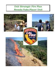
CAL FIRE Tulare Unit - Board of Forestry and Fire Protection - State ...
CAL FIRE Tulare Unit - Board of Forestry and Fire Protection - State ...
CAL FIRE Tulare Unit - Board of Forestry and Fire Protection - State ...

Create successful ePaper yourself
Turn your PDF publications into a flip-book with our unique Google optimized e-Paper software.
Fountain Springs Battalion (14)<br />
Posey Fuel Break<br />
• Create a shaded fuel break near the communities <strong>of</strong> Panorama Heights <strong>and</strong> Poso<br />
Park. The fuel break is a joint venture between the U.S. Forest Service, <strong>CAL</strong><br />
<strong>FIRE</strong> <strong>Tulare</strong> <strong>Unit</strong> <strong>and</strong> the local residents requiring little cost to those involved.<br />
The project consists <strong>of</strong> limbing trees, removing excess brush, restrict mistletoe<br />
spread <strong>and</strong> disposing <strong>of</strong> the excess waste by burning or chipping. Most <strong>of</strong> the<br />
treated l<strong>and</strong>s is on federal l<strong>and</strong> next to the <strong>Tulare</strong> County Posey <strong>Fire</strong> Station.<br />
Uhl Pocket Fuel Break<br />
• Maintain the Uhl Pocket fuel break that was created in the late 1990’s. This fuel break<br />
lies on USFS <strong>and</strong> <strong>CAL</strong> <strong>FIRE</strong> jurisdictions. Major treatments have been completed<br />
<strong>and</strong> require 10-20 days <strong>of</strong> cutting <strong>and</strong> burning / chipping per year to maintain it in a<br />
useable condition.<br />
Pine Mt. Fuel Break<br />
• Maintain the Pine Mt. fuel break that was created in the late 1990’s. This fuel break<br />
protects the community <strong>of</strong> Pine Flat <strong>and</strong> lies on USFS l<strong>and</strong>. Major treatments have<br />
been completed <strong>and</strong> require 10-25 days <strong>of</strong> cutting <strong>and</strong> burning / chipping per year to<br />
maintain it in a useable condition.<br />
Pine Mt. VMP<br />
• This proposed project is a 1600 acre VMP 2-3 miles southwest <strong>of</strong> the community <strong>of</strong><br />
Pine Flat. This is mostly on National Forest / Monument l<strong>and</strong>s that lie within <strong>CAL</strong><br />
<strong>FIRE</strong>’s DPA. The objective <strong>of</strong> this burn is to reduce fuel load, improve wildlife<br />
habitat, <strong>and</strong> improve grazing. The effects <strong>of</strong> the burn should create a protection zone<br />
for the communities <strong>of</strong> Pine Flat <strong>and</strong> California Hot Springs.<br />
S<strong>and</strong>y Creek Fuel Break<br />
• Construct a shaded fuel break along the S<strong>and</strong>y Creek <strong>Fire</strong> Control Road to the forest<br />
boundary. This will provide a control point for the protection <strong>of</strong> Poso <strong>and</strong> Panorama<br />
Heights. The fuel break is to be constructed 200’ x 1 mile. The Project is still in<br />
planning stages.<br />
Gibbons Peak VMP<br />
• This proposed project is an 1800 acre VMP 12 miles northwest <strong>of</strong> California Hot<br />
Springs. Roughly 1400 acres on SRA, <strong>and</strong> the remaining on BIA l<strong>and</strong>. Contracts<br />
<strong>and</strong> agreements still need to be obtained for all <strong>of</strong> the cooperators involved. The<br />
objective <strong>of</strong> this burn is to reduce fuel load, improve wildlife habitat, <strong>and</strong> improve<br />
grazing.<br />
25