Sonoma-Lake-Napa Fire Plan - Board of Forestry and Fire ...
Sonoma-Lake-Napa Fire Plan - Board of Forestry and Fire ...
Sonoma-Lake-Napa Fire Plan - Board of Forestry and Fire ...

Create successful ePaper yourself
Turn your PDF publications into a flip-book with our unique Google optimized e-Paper software.
<strong>Sonoma</strong>-<strong>Lake</strong>-<strong>Napa</strong> Unit<br />
<strong>Fire</strong> Management <strong>Plan</strong><br />
2005<br />
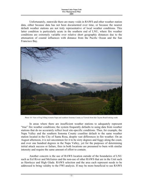
Unfortunately, statewide there are many voids in RAWS <strong>and</strong> other weather station<br />
data, either because data has not been documented over time, or because the nearest<br />
default weather stations are not truly representative <strong>of</strong> local weather conditions. This<br />
latter condition is particularly acute in the southern end <strong>of</strong> LNU, where fire weather<br />
conditions are extremely variable over relative short geographic distances due to the<br />
attenuation <strong>of</strong> coastal influences with distance from the Pacific Ocean <strong>and</strong> the San<br />
Francisco Bay.<br />
Photo 18: View <strong>of</strong> Fog Filling western <strong>Napa</strong> <strong>and</strong> southern <strong>Sonoma</strong> County as Viewed from Ida Clayton Road looking south.<br />
In areas where there are insufficient weather stations to adequately represent<br />
“true” fire weather conditions; the system frequently<br />
defaults to using data from weather<br />
stations that do no accurately reflect local site-specific conditions. Thus, for example, the<br />
<strong>Napa</strong> Valley <strong>and</strong> the southern <strong>Sonoma</strong> County coastline default to the same weather<br />
station located in the City <strong>of</strong> Santa Rosa, despite vast differences in fire weather. On an<br />
August afternoon, it is not uncommon for it to be sixty degrees <strong>and</strong> foggy along the coast,<br />
<strong>and</strong> over one hundred degrees in the <strong>Napa</strong> Valley, yet for the purposes <strong>of</strong> determining<br />
initial attack success or failure, fires in both locations are presumed to burn with similar<br />
intensity <strong>and</strong> require the same amount <strong>of</strong> effort to contain.<br />
Another concern is the use <strong>of</strong> RAWS location outside <strong>of</strong> the boundaries <strong>of</strong> LNU<br />
such<br />
as Eel River <strong>and</strong> McGuires <strong>and</strong> the non-use <strong>of</strong> other RAWS that are in the Unit such<br />
as<br />
Hawkeye <strong>and</strong> High Glade. RAWS selection <strong>and</strong> the area each<br />
represent needs to be<br />
addressed<br />
to bring validity to the FWI analysis. If may be more beneficial to use RAWS<br />
- 52 -