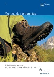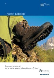
Lech-Zürs - Worlds of hiking
Lech-Zürs - Worlds of hiking
Lech-Zürs - Worlds of hiking

You also want an ePaper? Increase the reach of your titles
YUMPU automatically turns print PDFs into web optimized ePapers that Google loves.
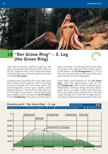
32 Mythological hikes<br />
14 “Der Grüne Ring“ – 3. Leg<br />
(the Green Ring)<br />
Take the <strong>hiking</strong> bus towards Zug from the<br />
hike starting point at the post <strong>of</strong>fice. Get <strong>of</strong>f<br />
at the “Zuger Kirchle” stop. Follow the paved<br />
road through town until you reach the turn<strong>of</strong>f<br />
to the (1) fish pond.<br />
A pasture trail branches <strong>of</strong>f to the right here,<br />
which leads up through the “ditch” to where<br />
the alp is fenced <strong>of</strong>f. From there, follow the<br />
path diagonally to the right, slightly uphill<br />
between pillars 7 and 8 <strong>of</strong> the Zug cable car<br />
to the edge <strong>of</strong> the forest. A forest path then<br />
goes steeply uphill through the (2) Scribbles<br />
to the (3) Balmalp. From here, a wider alpine<br />
Elevation pr<strong>of</strong>il: “Der Grüne Ring“ – 3. Leg<br />
path continues, on level ground at first, then<br />
inclining to the right and then further uphill<br />
to the peak <strong>of</strong> the (4) Kriegerhorn (2,173 m)<br />
(but you can also stay on the alpine path and<br />
walk directly to the Kriegeralpe).<br />
From there, walk downhill to the (6) stone<br />
wall, past the Speichersee Lake to the<br />
(7) Krie geralpe. After some invigorating refreshments,<br />
continue along the wide alpine<br />
path. Soon, you take a path that branches<br />
<strong>of</strong>f to the right. At the next junction, take the<br />
lovely <strong>hiking</strong> trail to the left through blooming<br />
alpine pastures going downhill until you<br />
Distance: 8,7 km Altitude difference: 644 m 1715 m Duration: 4:30 h<br />
Mountain hikes:<br />
Condition: