colloquium proceedings - Unesco
colloquium proceedings - Unesco
colloquium proceedings - Unesco

You also want an ePaper? Increase the reach of your titles
YUMPU automatically turns print PDFs into web optimized ePapers that Google loves.
UNESCO<br />
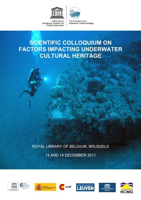
SCIENTIFIC COLLOQUIUM ON<br />
FACTORS IMPACTING UNDERWATER<br />
CULTURAL HERITAGE<br />
ROYAL LIBRARY OF BELGIUM, BRUSSELS<br />
13 AND 14 DECEMBER 2011<br />
0
1.0 General Context<br />
Contents 1<br />
1.1 The significance of underwater cultural heritage…………………………………………………………5<br />
1.2 The future of underwater archaeology..............................................................................................9<br />
2.0 Commercial exploitation, commercial archaeological interventions and international cooperation<br />
2.1 The extent and the prevention of pillaging on submerged archaeological sites – the French<br />
experience.....................................................................................................................................12<br />
2.2 The centenary of the Titanic and the treaty giving legal protection ...............................................17<br />
3.0 Trawling and fishing<br />
3.1 Quantification of trawl damage to pre-modern shipwreck sites: case studies from the Aegean<br />
and Black Seas..............................................................................................................................24<br />
4.0 Developing the seabed, resource extraction and renewable energy development at Sea<br />
4.1 The consideration of archaeological sites in oil and gas drilling operations....................................31<br />
4.2 The significance and contribution of marine aggregates.................................................................38<br />
5.0 Environmental impact and climate change<br />
5.1 The appearance of new bacteria (titanic bacterium) and metal corrosion…….................................44<br />
5.2 Environmental impact assessment and archaeological heritage.....................................................52<br />
6.0 Tourism and the valorisation of underwater cultural heritage<br />
6.1 The impact on and opportunities arising from tourism to submerged sites.................................... 54<br />
6.2 Making a statement for heritage preservation: ratifying the 2001 Convention................................58<br />
6.3 The Nordic experience - access through maritime dive trails and virtual simulation.......................62<br />
7.0 Preventive conservation and development-led-archaeology between science and pragmatism<br />
7.1 The role of archaeologists in understanding and preventing the impacts of marine industries on<br />
the prehistoric environment............................................................................................................66<br />
7.2 The development of measures to mitigate impact on the underwater cultural heritage..................77<br />
7.3 Innovative, non-destructive techniques and methodologies for the survey and the exploration of<br />
submerged cultural remains on the shallow and deep sea floor....................................................78<br />
7.4 Setting national research agendas as a guide to mitigation............................................................84<br />
1 The papers included in this document correspond to some of the contributions presented in the UNESCO Scientific Colloquium on Factors<br />
Impacting the Underwater Cultural Heritage (Royal Library of Belgium, Brussels, 13 & 14 December 2011).<br />
3
The Significance of Underwater Cultural Heritage<br />
Geoff Bailey, Department of Archaeology, University of York, United Kingdom<br />
Abstract<br />
During the past decade, there has been an increase of interest in the underwater world, dating back to earlier examples of<br />
underwater finds as well as landscapes that have been submerged by the rise in sea level at the end of the last glacial period. In<br />
fact, for 90% of human existence on this planet, sea levels have been lower than the present by about 40 m in response to the<br />
growth and decay of the continental ice sheets. The high sea level that we presently enjoy was established about 6,000 years<br />
ago. The submergence of large areas of the continental shelf due to rise in sea-level has long been recognised as a major<br />
factor in changing the palaeogeography of the world’s coastlines. However, it is only within the past decade that there has been<br />
a clear recognition of how important it is as the missing data on the submerged shelf. An increase of prehistoric underwater<br />
archaeological sites, ranging in age from over 6,000 years to 300,000 years ago, has been recovered at a depth ranging from<br />
less than 10m to more than 40m. They often have unusual and spectacular conditions of preservation of organic materials such<br />
as wood and fibres. There is clear evidence that substantial traces of submerged prehistoric landscapes and archaeology are<br />
preserved on the continental shelf that was important for human settlement during long periods of the Pleistocene.<br />
Underwater cultural heritage is typically associated with the study of shipwrecks and what they can tell<br />
us about the history of ship building, maritime trade and migration over the past five millennia. During<br />
the past decade an interest in the underwater world has been extended much further back in time, and<br />
not simply to earlier examples of underwater finds but to whole landscapes that have been drowned by<br />
sea level rise at the end of the last glacial period. In fact, for 90 percent of human existence on this<br />
planet, sea levels have been lower than the present, typically by about 40 m, and for shorter periods<br />
by as much as 130 m, in response to the growth and decay of the continental ice sheets. The period of<br />
high sea level that we presently enjoy was established only about 6,000 years ago. Sea level was then<br />
low throughout the last Ice Age, until we reach back to the previous period of high sea level about<br />
125,000 years ago. And this alternation of high sea levels lasting for about 5–10,000 years, alternating<br />
with periods of low sea level ranging between -40m and -130m below present for periods of about<br />
100,000 years, has been the norm for most of the past 1 million years.<br />
The submergence of large areas of the continental shelf by sea-level rise has long been recognised as<br />
a major factor in changing the palaeogeography of coastlines in Europe. However, archaeologists<br />
have been reluctant to explore the submerged landscapes of the continental shelf or to pursue the<br />
implications of sea level change. The main deterrents to such an exploration are the long-standing<br />
belief that little of interest is likely to have survived the process of marine inundation, and that the costs<br />
of underwater exploration are in any case prohibitive, with little likelihood that much useful information<br />
would be recovered. It is only during the past decade that the climate of opinion has begun to change,<br />
and three factors can be identified as contributing to a growing momentum of interest in this<br />
submerged world.<br />
The first and most compelling fact is that despite the preconceptions of land-based archaeologists,<br />
archaeological sites and extensive features of the pre-inundation landscape do survive inundation and<br />
continue to be preserved underwater, and there has been a steady growth in the numbers of<br />
prehistoric settlements that have been discovered over the past 30 years. Some have been found by<br />
chance exposure and discovery, others by targeted survey, and increasing numbers as a result of<br />
commercial activity on the seabed combined with archaeological monitoring. In Europe alone, it is<br />
estimated that there are as many as 3,000 such underwater sites, ranging in age from over 300,000<br />
years to 6,000 years ago, and at depths ranging from less than 10m to more than 40m, often with<br />
unusual and spectacular conditions of preservation of organic materials such as wood and fibres,<br />
thanks to burial in anaerobic sediments. There is clear evidence that substantial traces of submerged<br />
prehistoric landscapes and archaeology are preserved on the continental shelf and can be recovered,<br />
and as more underwater exploration and excavation are carried out, so the cumulative impact of the<br />
finds becomes more compelling.<br />
Perhaps the best known sites are the underwater Mesolithic sites of Denmark, where the relatively<br />
calm and shallow waters, the relatively easy accessibility of the seabed, and the longstanding<br />
knowledge from dredging and fishing activities that the seabed is littered with prehistoric stone<br />
artefacts, have all encouraged exploration and the development of expertise in underwater survey and<br />
excavation. Sites such as Tybrind Vig, and Mollegebaet II demonstrate the unusual quality of<br />
preservation and the range of finds that can be preserved in these underwater conditions. These<br />
5
include an extensive material culture based on wood, such as fish weirs originally built out from the<br />
shoreline over a distance of several hundred metres, dugout canoes, richly carved and decorated<br />
timber artefacts such as canoe paddles, and human burial grounds. Similar sites of Neolithic and<br />
Mesolithic age have been systematically examined more recently in the offshore regions of the<br />
German Baltic, producing a similar range of finds and including collapsed remains of timber-built<br />
dwellings.<br />
It can of course be objected that the conditions in which these sites occur are atypical and that more<br />
exposed and wave-swept coastlines are inherently unlikely to preserve material. However, it is clear<br />
that underwater preservation occurs in many other locations, in the English Channel off the north coast<br />
of France, on the southern coastline of England offshore from the northern shore of the Isle of Wight,<br />
and in the North Sea. Remains of a Neanderthal skull recently dredged up from the trawler fishing<br />
grounds of the North Sea, along with literally tons of Ice-Age faunal remains of mammoth and walrus<br />
give some indication of the richness of material present on the seabed. Handaxes recently recovered<br />
during the course of commercial seabed operations in the North Sea off the coast of East Anglia,<br />
together with sediments preserving details of the palaeoenvironment, and dating to a period of<br />
300,000 years or more, demonstrate that even in apparently unpromising conditions of preservation,<br />
material can survive intact and be recovered, even though it must have undergone repeated terrestrial<br />
exposure and marine inundation during several cycles of sea level rise and fall. Further afield there are<br />
the submerged Neolithic and Bronze Age villages in the Bulgarian sector of the Black Sea, the<br />
remarkable Pre-Pottery Neolithic village of Atlit Yam of the coastline of Israel, with a stone-lined well,<br />
and evidence of fishing, seafaring and farming. Similar finds of submerged PalaeoIndian settlements<br />
are being discovered in the Americas, in areas like the Gulf of Mexico off the Florida coastline.<br />
The conditions under which archaeological material survives inundation and can later be discovered<br />
is, of course, complex, depending on the interplay between coastal topography and marine currents<br />
during the inundation phase of sea-level rise, and the further interplay between the accumulation of<br />
marine sediments that bury and protect material, and the erosive activities of submarine currents, or<br />
indeed human operations on the seabed, which re-expose the material to view and to systematic<br />
recovery. As more sites are explored, so predictive models about the locations which might have been<br />
attractive to prehistoric people, as fishing locations, or conditions of shelter for tying up boats, and<br />
about the geological conditions in which material is likely to be preserved and discovered, become<br />
more refined, so facilitating the discovery of new material.<br />
A second fact that has contributed to the growth of this field is the improvements in technology for<br />
underwater exploration that have occurred in recent decades, driven in large part by the development<br />
of commercial operations such as oil and gas exploration and geoscientific and biological exploration<br />
of the oceans. Ships equipped with remote sensing equipment for rapid bathymetric survey and subbottom<br />
and side-scan profiling, remotely operated vehicles and cameras, submersibles, a variety of<br />
coring equipment, and more sophisticated techniques for deep diving including mixed gas<br />
technologies, have all expanded the horizons of what is possible.<br />
Thirdly, it has become increasingly obvious just how much of the prehistoric record we are missing by<br />
ignoring these extensive and now submerged landscapes. These are the areas that offered the most<br />
attractive terrain for human settlement during long periods of the Pleistocene. Coastlines are not<br />
uniformly attractive, but they frequently offer greater diversity and richness of resources than their<br />
adjacent hinterland, and support greater concentrations of population and larger settlements. Better<br />
supplies of surface water, greater density and variety of plant and animal life on land, and marine<br />
resources of shellfish and inshore fish or stranded sea mammals, all easily accessible at the shore<br />
margin even without seagoing boats, are likely to have made coastlines powerful attractors of<br />
population at all periods of human prehistory, and at all technological levels, from the very earliest<br />
period and with the simplest level of technology.<br />
These are the areas that are likely to provide the key evidence for some of the most important<br />
transformations in human social evolution, including the early dispersal of ancient humans from Africa,<br />
the extinction of our close cousins such as the Neanderthals, the earliest development of seafaring<br />
and fishing, the early dispersal of agricultural economies, and the roots of many ancient civilizations.<br />
These are developments that took place when sea level was lower than present, and the key evidence<br />
is likely to lie on the now-submerged landscape and in coastal locations that are now underwater.<br />
6
Given that sea levels have been lower than present for 90 percent of human history on this planet, it<br />
seems likely that we are missing a very significant part of the evidence for early human development<br />
and social evolution, and perhaps the most significant part, with the surviving evidence on dry land<br />
forming a truncated fragment of the whole. It is not only whole areas of evidence that we are missing<br />
by ignoring this submerged landscape, or the deeper history and early development of a human<br />
interest in maritime activities. As the evidence accumulates, so the possibility begins to emerge of<br />
focussing on the impact that sea-level change would have had on past human societies and how they<br />
coped with such changes. This is an issue that has recently come more sharply into focus as modern<br />
society begins to appreciate the reality of future sea-level change and the disruptive or destructive<br />
effects that this is likely to have on our own real estate and livelihoods. Yet, much greater changes of<br />
sea level occurred in the past. With the melting of the ice sheets of the last glaciation, sea levels rose<br />
through a vertical height of more than 100 m between about 16,000 and 6,000 years ago. Of course,<br />
that dramatic rise was not experienced within a single lifetime, but it is likely that the effects were<br />
noticeable on the time scale of the individual life, and certainly within the span of collective memory.<br />
Moreover, the effects were sustained over many centuries, resulting in the drowning of huge areas of<br />
previously productive land. How did our ancestors deal with such changes? And how, for that matter,<br />
did they respond when new territories opened up with a corresponding drop in sea level during earlier<br />
cycles of sea level change? These are fascinating questions, the answers to which no longer lie solely<br />
within the realm of speculation, and which, in addition, may give us some insight into the changes that<br />
our modern civilisation is going to have to face in the coming centuries.<br />
Investigation along these lines will not be easy. Underwater exploration is expensive and uncertain in<br />
terms of the likelihood of archaeological discoveries. However, new collaborations are underway<br />
between archaeologists, geoscientists and government agencies responsible for the underwater<br />
heritage, sometimes with the active cooperation and assistance of commercial companies, who<br />
frequently have little to lose by cooperation and a great deal to gain in terms of interest amongst a<br />
wider public.<br />
Moreover, collaborative research between archaeologists and marine geoscientists on the continental<br />
shelf is likely to provide new and more precisely dated evidence of submerged palaeoshorelines, of<br />
importance in refining models of climatic and sea level change, on which predictions about future such<br />
changes will depend. This is a young field of scientific exploration – the last frontier of archaeological<br />
discovery. It is, moreover, a new field that is exciting interest amongst scientists, scholars and policy<br />
makers across many disciplines, which lies at the very heart of our shared existence and identity, and<br />
which is likely to develop a new narrative of our history on Earth that is capable of capturing the wider<br />
public imagination.<br />
7
References<br />
Benjamin, J., Bonsall, C., Pickard, K., Fischer, A. (Eds.) Submerged Prehistory. Oxford: Oxbow.<br />
http://splashcos.org<br />
8
The Future of Underwater Archaeology<br />
Constantin Chera, Former President of the Scientific and Technical Advisory Body of the UNESCO 2001<br />
Convention on the Protection of Underwater Cultural Heritage, Rumania<br />
Abstract<br />
As mankind becomes more aware of its role in preserving its own heritage and in caring about the natural environmental<br />
evolution our world, conventions pertaining to underwater cultural heritage should be a major item on the agenda of the<br />
international community. Future development depends on worldwide recognition of the priceless valuables deposited under<br />
water along with decades of evidence of human existence, as well as the willingness of politicians to act enthusiastically to<br />
preserve our common cultural treasures. A good sign is indicated by the 41 states that have already ratified the 2001<br />
Convention on the Protection of the Underwater Cultural Heritage as of 2012. Archaeology is a sensitive subject when heritage<br />
is presented to the public. Apart from legal provisions, which still need to be improved, practical means for research in this field<br />
are not at the disposal of all nations. This is why technical knowledge achieved during the last decades has to be shared for an<br />
appropriate valorization of underwater archaeological sites. Cooperation from all possible levels is the main goal for future<br />
research of our common past history. An important task in identifying possibilities and in developing a framework for<br />
international cooperation is conferred to the working groups and the advisory bodies initiated by the Convention. The future of<br />
underwater archeology is also dependent upon the practical implementation, resolutions and recommendations by UNESCO<br />
and all interested parties in preserving underwater cultural heritage. An important aspect in this respect is the ecological<br />
evolution of water reserves worldwide.<br />
There are three subjects, which we consider important when trying to develop a strategy regarding the<br />
future of underwater archaeology. They are at the same time linked to the present situation of cultural<br />
heritage all around the world: research, restoration-conservation and legal provisions.<br />
First of all, research in this field has known a spectacular development due to more or less<br />
sophisticated equipment for the location of sunken ships or artifacts, but also of flooded building<br />
structures created by human activity. The evolution of such technical means is one factor, which can<br />
lead us into future better understanding of our civilization by enlarging our knowledge about our<br />
history. Because every single newly discovered element in such until recent difficult to access<br />
environment can contribute to enrich, at least with one page, the history of our planet. As a whole, this<br />
generous environment is a deposit of a large quantity of cultural heritage, more and more accessible<br />
for research and valorization. Even if in future, such heritage will still encounter accidental or intention<br />
destruction by people, enterprises or even states, not responsible or educated enough to understand<br />
the importance of underwater cultural treasures, the results of archaeological research under water<br />
are also in a delicate position, which must be fostered with utmost care. It is the task of future<br />
specialists to decide which of the discovered objects they have to leave on the spot and which to<br />
restore and present to the public, in permanent or temporary exhibitions. In our opinion, one of the<br />
most important issues regarding this particular kind of heritage should be in future to outline an<br />
efficient methodology to advice specialists what measures they have to take, when they encounter one<br />
or another situation. It would be a useful manual for underwater archaeologists, which would contain<br />
not only excavation regulations and recommendations, but also restoration and conservation ones. An<br />
accompanying catalogue and a list of good practices would have to complete the foreseen manual,<br />
with examples for as many situations and materials as possible. The problem how to handle and<br />
manage large dimensions discoveries is one of the most stringent for the future of our investigations. I<br />
would like to bring to your attention only two significant cases: “Gustav Vasa” and “Titanic”, both of<br />
utmost value as cultural heritage. If the first one is safely sheltered in a museum, with all contained<br />
artifacts (after massive investment in its conservation), the second one unfortunately still lies exposed<br />
to looting (even if in great depth, on the bottom of the ocean), due to advanced technical means at the<br />
disposal of individuals, more or less aware of their destructive activities. What will become of the<br />
second if the implied parties will not reach agreements as soon as possible, to protect the site from<br />
further destruction? This symbol, a famous sample of early twentieth century life and navigation, will<br />
suffer further, until it will only be a rotten piece of metal with no significance whatsoever. No<br />
surveillance and deeper probing, with remote operating vehicles and complex technology, endangers<br />
not only the mentioned objective, but also a large number of others, already known to treasure<br />
hunters. The word treasure means not only precious metals, but also all kinds of heritage objects,<br />
which have market value. Examples in this respect could continue and it is the duty of law<br />
enforcement authorities to protect the national and international heritage. As is the case with artifacts<br />
illegally excavated on land (see constant looting in southern Italy, in ancient Basilicata), the ones<br />
9
coming from underwater sites are valuable merchandise for those investing in such illegal activities. A<br />
better surveillance, not only of such individuals or organizations, but also of the markets negotiating<br />
objects with cultural significance, arbitrarily extracted from their archaeological context under water,<br />
should be a constant concern for nations really cherishing their and sometimes universal cultural<br />
heritage.<br />
The future should bring about a more complex surveillance system to monitor all existing evidence of<br />
human history and adverse human activity under water. This system already exists (see military<br />
satellites activities) and it takes only determination from specialists, implied public and private bodies,<br />
but also financial resources, to convince responsible authorities to use these possibilities for protection<br />
of our common heritage.<br />
Even more difficult for archaeologists is now research in rivers, lakes and lagoons, due to sometimes<br />
very poor visibility and other unfavorable circumstances. That brings us back to future development of<br />
special equipments for such environments, sometimes even more difficult to investigate, because of<br />
more or less strong currents. Only advanced solutions will permit such research in future, so existing<br />
technologies must develop to the point of putting at the disposal of archaeologists some secure and<br />
efficient technical means, developed for instance from present applications, such as protective domes<br />
or precincts capable of isolating a certain surface from being flooded. A good example in this respect<br />
is the huge archaeological salvage excavation site in the area of the Byzantine harbor in Istanbul. Of<br />
course, there are also situations when the archaeological layer lies deeply buried under thick sand or<br />
mud deposits and it is again applied technology, which could help us determine the configuration of<br />
respective archaeological structures. Though already used in other fields, investigations must be<br />
adapted to special conditions, very different from site to site.<br />
Such methods would be in future the already known magneto metric measurement scanning of the<br />
waterbed, with different energy parameters, the use of deep probing sensors of different types, but<br />
also taking continuous vertical samples (carrotage), where long term geological deposits can give<br />
some answers, regarding the evolution of human communities, along the sea-, river- or lakeshores.<br />
Not long ago our colleagues at the GEOECOMAR geological institute in Constanta, Romania, have<br />
applied these methods at a Byzantine naval base from the 10 th century, situated partly on an island<br />
and another part in the riverbed of the Danube. The good results we obtained encourage a future<br />
application at other similar locations.<br />
A second important item on the agenda of future archaeological evolution is restoration and<br />
conservation of objects discovered under water, from the tiniest to the largest ones. It is a complex<br />
matter, to which only an inter-disciplinary approach is the answer. Research regarding chemical and<br />
biological on-site and laboratory analysis methods must be an important aspect in future restoration<br />
and conservation of underwater cultural heritage. We have to develop new, efficient and rapidly acting<br />
materials, so that we can adequately treat different types of objects, as soon as we recover them from<br />
the liquid and often salty environment, in which they have stayed for a long time. The large array of<br />
textures and compositions encountered at such documents during excavation, their fragile state and<br />
their long-term storage and preservation are most important for archaeologists and restorers as well, if<br />
they intend to keep them for future generations.<br />
Training specialty personnel for underwater excavation and restoration is one of the subjects on which<br />
the last meeting of State Parties to the Convention has already largely debated. It is a priority for<br />
competent future investigations. It is also a great, substantial step forward that UNESCO and Croatian<br />
authorities recently enhanced quality and material basis for such specialists, by inaugurating the<br />
regional center for underwater research and restoration in Zadar. As already done during last summer,<br />
in future a certain number of interested young archaeologists and restorers will have the opportunity to<br />
attend the courses there and get some knowledge to apply at the underwater investigations in their<br />
countries. As far as I know, there is another such center in Thailand. As this activity will be more and<br />
more attractive to younger generations of archaeologists, the need for developing their professional<br />
skills will probably determine responsible authorities to finance opening more such institutions.<br />
As financial resources for proper excavation, restoration and conservation of large objectives, such as<br />
large sunken vessels, are scarce and there are limited possibilities to finalize work, last<br />
recommendations are to clean and preserve them in situ. All the same, there are solutions for<br />
salvaging endangered objectives by public-private partnerships.<br />
10
A limitation of human intervention in this sensible environment is the best solution too for protected<br />
species living in different areas. Archaeologists and biologists can often establish close connections<br />
between cultural and natural underwater heritage. In our opinion the example of valorizing some<br />
underwater discoveries by archaeologists-guided visits to underwater sites and their video monitoring,<br />
applied in Sicily by Soprintendenza del Mare is a most adequate example for underwater cultural<br />
heritage management. Future can already be reality: anyone interested can experience it himself while<br />
visiting a history museum and looking at a Roman shipwreck on a large screen, in the same position<br />
as it has sunk many centuries ago. Like those we have established on land, we must identify and<br />
outline in future more underwater areas in need of legal protection, exclusive zones where economic,<br />
commercial and traffic activities, even sports diving would be prohibited.<br />
A series of actions and measures could make underwater archaeological objectives more accessible<br />
to the public in future: establishing a network of internet sites, all showing such objectives, making of<br />
educative movies to explain the importance of UCH and prevent looting, more public conferences<br />
about this subject.<br />
Regarding the third important aspect concerning future evolution of underwater archaeology, one must<br />
admit that legal provisions as measures for heritage protection are not at all a priority for certain<br />
states, rather interested in individual, selfish goals than in preserving universal history in this particular<br />
environment. This is why efforts must be done in future to convince public opinion to act responsibly,<br />
to overcome local national interests, to become aware of the risks implied by lack of responsibility, to<br />
lobby for adopting the Convention by explaining its noble goals and to determine politicians to adopt<br />
specific legal measures. It must be clear for everyone that UCH is not only property of one or more<br />
nations, but also a treasure of all humankind. In future, it must reach all interested people by means of<br />
scientific and public valorization. Unauthorized interventions must stop immediately and all efforts are<br />
necessary to prevent destruction of UCH. Cooperation on official, institutional, individual levels<br />
between states will be necessary to reach these objectives. From scientific point of view, for each<br />
country a database is extremely important for future research and valorization strategies.<br />
An open mind is required from all stakeholders, from archaeologists trying to bring the light and culture<br />
of humanity to everyone from beyond the waves, to political personalities capable of understanding<br />
this message.<br />
Each one of the above-mentioned aspects could give us an almost complete image about the future of<br />
underwater archaeology.<br />
Humanity must become more and more aware of its part in preserving its own heritage.<br />
11
The Extent and the Prevention of Pillaging on Submerged Archaeological<br />
Sites: The French Experience<br />
Michel L’Hour, Departement des rechercher archéologiques subaquatiques et sous-marines<br />
(DRASSM), France<br />
Abstract : La mer, chacun aujourd’hui en convient, est le plus grand musée du monde. Malheureusement, c’est aussi le seul<br />
musée qui ne dispose pas de système de sécurité renforcé ni d’un gardiennage adapté à son immensité. Le résultat est que sur<br />
tous les océans, sous toutes les mers du globe, une lutte féroce oppose les partisans d’une protection renforcée de cet héritage<br />
englouti à ceux qui persistent à ne voir dans ce dernier qu’une proie commerciale susceptible d’appartenir au premier qui s’en<br />
saisira. Pays de naissance de l’archéologie sous-marine avec la fouille dans les années 1950 des épaves du grand Congloué, la<br />
France fut aussi le premier pays au monde à se doter en 1966 d’un service officiel chargé d’assurer la protection, l’étude et la<br />
valorisation du patrimoine immergé de ses eaux territoriales, lesquelles couvrent près de 11 millions de km² de l’Atlantique au<br />
Pacifique et de l’océan Indien à la Méditerranée. Disposant d’un arsenal juridique très ancien et très structuré, dotés de moyens<br />
logistique relativement importants, inscrits au cœur d’un réseau de relations institutionnelles très dense les archéologues sousmarins<br />
français n’ont pu empêcher pourtant que de très nombreux sites archéologiques sous-marins des eaux françaises soient<br />
pillés. Il a donc fallu réagir, mettre en place des réseaux d’information et développer des enquêtes dont les résultats aujourd’hui<br />
sont très loin d’être négligeables. Des coups très durs ont ainsi été portés ces dernières années aux trafiquants, non seulement<br />
en France mais aussi dans d’autres pays avec lesquels la France entretient des relations suivies et qu’elle épaule dans ce<br />
combat dont l’issue est la protection du patrimoine de l’humanité. Cette communication sera l’occasion d’évoquer les modes<br />
opératoires mis en place, et d’en montrer quelques résultats. Elle vise à démontrer que le pillage et la destruction de notre<br />
patrimoine immergé n’est pas inéluctable. Le chemin est encore long certes mais le désespoir n’est plus de rigueur. Le bon droit<br />
finira par l’emporter !<br />
Sous toutes les mers du globe, une guerre secrète fait rage. Elle oppose les partisans de la protection<br />
du patrimoine sous-marin à des individus ou à des entreprises qui ne manifestent aucun intérêt pour<br />
cet héritage et n’éprouvent aucun remord à le détruire ; ou pire n’y voient qu’une proie facile et un<br />
nouveau moyen pour s’enrichir rapidement. Comme dans toute guerre, si l’on veut en sortir vainqueur,<br />
il importe de mobiliser des énergies et des moyens logistiques, disposer de réseaux d’information et<br />
trouver des alliés. C’est je pense ce triple objectif qui nous réunit pour deux jours à Bruxelles.<br />
Pour l’heure, si l’on observe les forces en présence, il faut bien admettre que la position des<br />
défenseurs du patrimoine est relativement préoccupante. Notre capacité à protéger notre mémoire<br />
collective engloutie est en effet cruellement insuffisante alors que la menace est omniprésente et très<br />
diversifiée. Elle est même d’autant plus inquiétante qu’elle est souvent la simple conséquence du<br />
développement des activités humaines, lesquelles impactent de plus en plus largement les fonds<br />
marins.<br />
© F. Bassemayousse<br />
12
Le patrimoine culturel subaquatique vit de fait en sursis sous une quadruple menace :<br />
1) - Le développement de la plongée autonome à grande profondeur qui depuis quelques années a<br />
donné à un nombre de plus en plus important de plongeurs sportifs accès à des épaves situées dans<br />
la zone des 70 à 150 mètres et les a donc fragilisées.<br />
2) – Les interventions de plus en plus dévastatrices de chalutiers que la raréfaction du poisson a<br />
conduit depuis 20 ans à tirer leur chalut sur des fonds marins de plus en plus importants. Ainsi, la<br />
profondeur moyenne des épaves dévastées par les chalutiers pélagiques est-elle passée de 150 m à<br />
200 mètres de fond dans les années 1970-1980 à des profondeurs comprises entre 500 et 1300<br />
mètres dans les années 2000.<br />
3) – La recrudescence des activités offshore et en particulier la multiplication des exploitations de<br />
granulats marins et la généralisation des dragages à l’approche des grands ports de commerce afin<br />
de les adapter à l’évolution du transport maritime international.<br />
– Dans le cas des extractions de granulats marins qui se sont multipliées depuis 20 ans,<br />
notamment en Manche, on a pu constater que les entreprises concessionnaires ne déclaraient jamais<br />
la découverte d’aucune épave… Or, si l’on superpose les zones où ces entreprises travaillent<br />
régulièrement et les cartes de localisation d’épaves que les archéologues français ont dressé durant<br />
15 ans pour cette même zone de la Manche, tout donne à penser que ces entreprises ont très<br />
certainement dissimulé toutes ces années, par négligence ou sciemment, la découverte d’épaves.<br />
– De même, des enquêtes conduites auprès des entreprises qui ont la charge de draguer l’accès<br />
– des grands ports commerciaux ont révélé qu’à de nombreuses reprises ces travaux avaient<br />
conduit à la découverte et à la destruction illégale mais immédiate d’épaves historiques<br />
importantes. Cette réticence des entreprises à déclarer la découverte de patrimoine immergé<br />
est d’autant plus préoccupante que les grands ports d’aujourd’hui sont bien souvent ceux vers<br />
lesquels convergeaient déjà dans l’antiquité, au Moyen-Age et à l’époque moderne tous les<br />
trafics maritimes. Il est donc raisonnable de penser que les atterrages de ces grands ports<br />
sont potentiellement aussi des zones extrêmement riches en patrimoine englouti.<br />
4) - La dernière menace enfin qui guette le patrimoine immergé, celle qui retient le plus l’attention du<br />
public car elle est souvent la plus spectaculaire et qu’elle suscite plus que d’autres l’intérêt des média,<br />
est celle qu’incarnent les chasseurs d’épaves professionnels. Le danger que constituent ces groupes<br />
privés est un peu différent des précédents car leur activité est moins systématique et concerne des<br />
zones géographiques nettement mieux circonscrites. En revanche, la menace est clairement plus<br />
précise et elle est souvent définitivement destructrice pour les épaves qu’elle a prises pour cible. Si<br />
l’on veut poursuivre notre métaphore militaire, je dirais que ces entreprises privées sont donc des<br />
spécialistes de la frappe chirurgicale quand les chalutiers pélagiques et les concessionnaires de<br />
granulats marins sont plutôt des armes de destruction massive.<br />
Confronté à cette prolifération des menaces et à une situation qui ne cesse pas depuis plusieurs<br />
décennies d’empirer, il est logique que l’<strong>Unesco</strong> se soit efforcé d’attirer l’attention des gouvernements sur<br />
la nécessité de prendre des mesures fortes pour assurer la sauvegarde du patrimoine culturel<br />
subaquatique. Si les instances internationales ont donc joué leur rôle, il demeure que la protection du<br />
patrimoine sous-marin reste encore et toujours du ressort de chaque pays.<br />
D’où des situations extrêmement diversifiées d’un pays à l’autre car dans de nombreux pays la protection<br />
du patrimoine immergé va surtout poser un problème de moyens financiers, techniques et humains. Dans<br />
la majorité des 41 pays d’ores et déjà signataires de la Convention de l’<strong>Unesco</strong> sur la protection du<br />
patrimoine culturel subaquatique il n’existe de fait aucun service archéologique spécialisé pour<br />
inventorier, étudier et mettre en valeur le patrimoine englouti. Faute de spécialiste pour les stimuler, les<br />
épauler voire les conseiller, les services de police de ces pays sont eux-mêmes insuffisamment armés<br />
pour lutter contre le cancer rampant du pillage qui menace les épaves… Il faut donc hâter les transferts<br />
de compétence, multiplier les formations, assurer une meilleure circulation des informations, en un mot, il<br />
faut créer entre tous les défenseurs du patrimoine cette solidarité sans laquelle on ne peut pas espérer<br />
gagner une guerre.<br />
Ayant rappelé ce constat, je vais, si vous me le permettez, vous présenter maintenant rapidement un<br />
état des lieux de la situation en France.<br />
13
En préambule, je souhaiterais rappeler que la France a adopté une notion du patrimoine sous-marin<br />
moins restrictive que celle qui a été retenue dans la convention de 2001. Cette dernière a en effet<br />
privilégié le seuil de 100 ans d’âge pour définir chronologiquement le patrimoine alors que la<br />
législation française considère que l’archéologie commence dès hier et non pas seulement il y a plus<br />
de 100 ans. J’engloberai donc pour ma part dans ce vaste ensemble du patrimoine menacé le<br />
patrimoine contemporain. D’autant que ce fut à mes yeux une erreur flagrante d’écarter notre héritage<br />
récent des préoccupations de la Convention puisqu’il est précisément l’un des plus directement<br />
menacés aujourd’hui par les plongeurs sportifs et les chalutiers. Il suffit pour s’en convaincre de voir<br />
combien de plongeurs visitent chaque week end les épaves de la seconde guerre mondiale et tentent<br />
d’y prélever des vestiges pour leur collection personnelle ou pour les négocier auprès des<br />
antiquaires…<br />
La seconde singularité de la situation de la France que je veux mettre en exergue tient à la<br />
localisation géographique et au positionnement historique particulière de notre pays au cœur du<br />
continent européen. Située à l’interface des deux mondes maritimes de la Méditerranée et de<br />
l’Atlantique, qui ont tous les deux une forte personnalité, la France dispose d’un patrimoine sous-marin<br />
extrêmement riches et extrêmement divers, depuis les grottes ornées du paléolithique jusqu’aux<br />
vestiges les plus récents, en passant par les chargements d’amphores grecques ou romaines ou les<br />
cargaisons de faïences anglaises du 19 e siècle.<br />
Ce constat et l’opportunité des découvertes ont conduit les archéologues français à se préoccuper<br />
très tôt de la protection du patrimoine sous-marin. Dès 1907, en Tunisie, alors territoire français,<br />
l’archéologue Alfred Merlin a ainsi entrepris avec des scaphandriers grecs l’étude de l’épave de<br />
Mahdia. Immédiatement portés à la connaissance du monde scientifique, les résultats de ses travaux<br />
ont très vite permis de sensibiliser les autorités françaises à la richesse du patrimoine sous-marin et à<br />
la nécessité de le protéger. Signe de cette évolution des esprits, un conservateur de musée, Salomon<br />
Reinach, a publié dès 1928 une phrase restée célèbre tant elle apparaît d’une lucidité prophétique:<br />
« la mer est le plus grand musée du monde » ! On sait aujourd’hui à quel point Salomon Reinach avait<br />
raison, mais force est d’observer que ce musée géant est encore aujourd’hui le seul musée du monde<br />
qui ne dispose d’aucun gardien permanent, ni d’aucun système d’alarme… C’est précisément cette<br />
vacuité des systèmes de sécurité qui rend ses collections si accessibles et si fragiles…<br />
En matière de protection des biens culturels maritimes, la France n’est pas, et de loin, le pays le plus<br />
démuni.<br />
Alors qu’un peu partout sur la planète, le vide juridique favorise le pillage, le trafic illicite et les fouilles<br />
clandestines, la France a en effet la chance d’être dotée d’une législation à la fois très ancienne,<br />
puisqu’elle se fonde sur le droit romain, et périodiquement rajeunie, puisqu’elle est portée par un<br />
grand nombre de lois régulièrement remises au jour depuis le 16 e siècle. Signe du caractère très<br />
vivace de cette législation, la dernière évolution des textes français a d’ailleurs moins de 10 ans. Elle<br />
date de 2004.<br />
Dotée d’une législation très protectrice pour les épaves et pour le patrimoine immergé, la France fut<br />
aussi le premier pays au monde - et il reste aujourd’hui encore l’un des très rares - à s’être donné les<br />
moyens de protéger et de valoriser cet héritage englouti. Notre pays dispose en effet depuis plus de<br />
quarante-cinq ans d’un service et d’un personnel spécialisés aptes à gérer scientifiquement et<br />
administrativement les biens culturels maritimes. Il s’agit du département des recherches<br />
archéologiques sous-marines, le DRASSM pour lequel je travaille depuis plus de 30 ans et que je<br />
dirige depuis 2006.<br />
La création en 1966 de ce département spécialisé ne manquait pas d’ambition puisqu’on a d’emblée<br />
décidé de lui confier la gestion de l’ensemble du patrimoine immergé de l’intégralité des eaux<br />
territoriales françaises. Or la France dispose de la deuxième plus vaste Zone Economique Exclusive<br />
(ZEE) du monde puisqu’elle couvre plus de 11 millions de km² de l’Atlantique au Pacifique et l’on<br />
estime que le nombre des sites archéologiques sous-marins dissimulés au cœur de ces espaces<br />
maritimes est sans doute proche de 150 000 à 200 000.<br />
Pour aider les archéologues du DRASSM, il a été décidé dès 1966 de construire un navire<br />
spécialement équipé pour la recherche archéologique sous-marine : L’Archéonaute. C’est en<br />
particulier avec l’aide de ce navire, mais pas seulement, que les archéologues français ont d’ores et<br />
déjà expertisé ou étudié plus de 1500 épaves en un peu plus de 45 ans. L’Archéonaute étant<br />
aujourd’hui tout à fait obsolète au regard de l’évolution de la discipline, il a été décidé en 2006 de<br />
14
lancer un programme d’étude pour construire un nouveau navire de recherche archéologique sousmarine.<br />
Après 3 années d’étude, le ministère français de la Culture a finalement ordonné en octobre<br />
2009 la construction d’un nouveau navire. En hommage au ministre qui a créé le Drassm en 1966, il a<br />
été décidé de nommer André Malraux le nouveau navire du Drassm.<br />
Après 36 mois d’étude et 18 mois de construction dans les chantiers navals de La Ciotat, près de<br />
Marseille, j’ai donc le plaisir de vous montrer en avant première les photos de notre nouveau navire de<br />
recherche. Il sera baptisé à La Ciotat le 19 janvier prochain.<br />
Dotée d’un organisme d’Etat fort de 45 années d’expérience, disposant d’un personnel bien formé,<br />
bénéficiant d’un navire de recherche spécialisé et animée par près de 500 chercheurs professionnels<br />
ou bénévoles participant à plus d’une centaine de chantiers archéologiques sous-marins par an, la<br />
recherche archéologique sous-marine française pourrait légitimement considérer que sa situation est<br />
presque idéale. Et de fait, elle l’est à coup sûr en regard de presque tous les autres pays dans le<br />
monde ! Pour autant, le patrimoine sous-marin des eaux françaises reste menacé et c’est la raison qui<br />
nous a conduit voici 5 ans à prendre des initiatives pour lutter plus efficacement et de manière plus<br />
déterminée contre le pillage de ce patrimoine.<br />
La première mesure que nous avons prise a été d’établir des contacts plus étroits avec les services de<br />
police, en particulier celui de la Douane judiciaire qui est une branche de la Douane française. Nous<br />
avons privilégié ce service parce que nous avions déjà travaillé avec lui et que ses enquêteurs avaient<br />
manifesté à plusieurs reprises leur intérêt pour la lutte contre le trafic du patrimoine immergé. Puis les<br />
archéologues du DRASSM ont participé régulièrement à des formations spécialisées au profit des<br />
enquêteurs de la Douane et ces derniers nous ont fait bénéficier en retour de leur expérience en<br />
matière d’enquête et de lutte contre les trafics internationaux. Cette démarche est un peu inhabituelle<br />
car si les archéologues disposent bien souvent d’une connaissance approfondie du pillage, ils<br />
répugnent souvent, par suite peut-être d’une certaine culture de l’indulgence, à saisir les services de<br />
police des informations qu’ils possèdent. Or, notre expérience a prouvé que l’association entre les<br />
services de police et les archéologues permet de faire progresser plus vite les enquêtes et de porter<br />
des coups plus rudes aux trafics. Désormais, il n’est ainsi pas de semaine où le Drassm n’ait pas de<br />
réunion ou d’échange téléphonique avec les enquêteurs des Douanes et nous avons mené ces 5<br />
dernières années de nombreuses enquêtes et de missions en commun.<br />
Nous avons ensuite décidé de rechercher méthodiquement des informations, de n’en négliger aucune<br />
et de porter systématiquement plainte contre les plongeurs indélicats ou les sociétés en infraction.<br />
Cette mesure nous a permis de rencontrer plus régulièrement les procureurs et les juges, de mieux<br />
les connaître et de mieux les sensibiliser à la protection du patrimoine sous-marin. En retour, nous<br />
avons nous-mêmes mieux compris comment un dossier devait être présenté à la justice pour retenir<br />
son attention alors même que les tribunaux sont déjà encombrés d’énormément d’affaires de droit<br />
commun auprès desquelles le pillage d’une épave pourrait parfois apparaître comme un dossier de<br />
peu d’importance.<br />
Après 5 ans, le premier bilan de cette nouvelle stratégie offensive est loin d’être négligeable. De vrais<br />
succès ont même été enregistrés. Ainsi, près de 3000 objets archéologiques significatifs ont été saisis<br />
ou récupérés chez des clandestins au cours des seules années 2007-2008.<br />
Fort de ces premiers résultats, nous nous sommes également préoccupés de mieux protéger les<br />
épaves contemporaines dont le pillage avait trop longtemps bénéficié de la clémence des services de<br />
police et de la justice mais également, il faut le reconnaître, des archéologues eux-mêmes. Nous<br />
avons donc réorienté notre stratégie et nous avons entrepris, dans les années 2006 à 2008,<br />
d’informer au cours de nombreuses réunions les plongeurs que les épaves contemporaines aussi<br />
devaient désormais être protégées puis nous avons diligenté après 2009 des enquêtes qui ont permis<br />
de ralentir ces trafics. A cette occasion, nous avons également entrepris de surveiller plus<br />
attentivement les sites de vente en ligne sur Internet et nous avons été amenés à plusieurs reprises à<br />
demander l’intervention des douanes pour faire saisir des objets vendus sur Ebay<br />
Cette reprise en main générale a débordé de loin le seul cadre de nos frontières puisque nos actions<br />
ont permis dans le même temps de faire obstacle à des pillages menés dans d’autres territoires<br />
maritimes que le nôtre, notamment à Madagascar où nous avons pu interrompre le pillage d’une très<br />
rare épave portugaise du début du 16 e siècle et bloquer l’exportation de biens culturels maritimes<br />
d’une très grande valeur archéologique. Notre intervention dans cette affaire ne s’est d’ailleurs pas<br />
bornée à récupérer les objets volés mais nous avons également offert notre aide au Gouvernement<br />
15
Malgache pour assurer notamment la conservation préventive des canons en bronze illégalement<br />
prélevés sur le site et que nous avons fait saisir en Océan Indien par la Douane française<br />
Je voudrais achever ce tour d’horizon des actions entreprises pour lutter contre le pillage en évoquant<br />
rapidement une dernière affaire qui constitue un incontestable succès pour les archéologues et les<br />
services de police mais dont certains épisodes illustrent bien la difficulté pour nous de mener ce<br />
combat.<br />
Il s’agit de l’affaire du trésor monétaire de Lava trouvé en mer voici 25 ans sur les côtes de la Corse.<br />
Ce trésor du 3 e siècle apr J.-C. est considéré par tous les numismates de la planète comme l’un des<br />
trésors monétaires les plus importants au monde. Après sa découverte qui n’a pas été déclarée, il a<br />
fait l’objet dans les années 1985 et 1986 d’un gigantesque pillage qui n’a cessé qu’après l’intervention<br />
en 1986 du DRASSM et de la Police. Une centaine de 100 pièces en or, dont certaines rarissimes<br />
puisqu’elles ne sont connues que par ce trésor corse, ont été récupérées à l’époque par les<br />
enquêteurs. Plus de 1000 autres pièces en or, dont certaines ont une valeur estimée à l’unité à plus<br />
de 300 000 euros, ont en revanche disparu. De même un plat en or, unique pour le 3 e siècle apr. J.-C<br />
a été subtilisé au cours du pillage. Or, en 2006, 20 ans après le pillage, le DRASSM a pu disposer<br />
d’informations qui ont permis de rouvrir l’enquête, de remonter des réseaux clandestins et finalement<br />
de récupérer en octobre 2010 le plat dérobé en 1985. Grâce aux informations recueillies au cours de<br />
l’enquête, un juge français a pu obtenir l’ouverture d’une enquête internationale qui a permis de saisir<br />
dans plusieurs pays, notamment en Belgique, Espagne, Portugal, Allemagne et Autriche…, de<br />
nombreuses monnaies en or détenues illégalement. Interpol a même publié une affiche spécifique<br />
pour alerter les polices internationales sur l’importance de ce trésor. Or, les justices allemandes et<br />
autrichiennes viennent d’ordonner que les monnaies saisies sur leurs territoires soient restituées à<br />
leur propriétaires sous le prétexte que ces derniers les avaient légalement achetées même si elles<br />
étaient illégalement détenues par ceux qui les leur avaient vendues. Si les justices allemande et<br />
autrichienne persistent dans cette attitude, vous comprenez aisément combien il nous sera difficile de<br />
lutter contre les pilleurs d’épaves. Là encore, il faudrait sans doute que les archéologues fassent<br />
pression sur leur gouvernement respectif pour que le droit soit respecté et qu’on ne puisse pas, sous<br />
de quelconques prétextes, contourner les textes et légaliser la détention d’objets qui relève du pillage<br />
d’un patrimoine dont l’<strong>Unesco</strong> a rappelé qu’il était celui de l’humanité.<br />
Pour conclure<br />
La lutte pour la protection du patrimoine immergé est une lutte de tous les jours et j’espère avoir<br />
montré, à travers l’exemple français, que les pays qui disposent de personnels et d’organismes<br />
spécialisés en matière d’archéologie sous-marine sont nécessairement mieux armés pour l’emporter.<br />
Les réunions qui se multiplient de part le monde, souvent sous l’égide de l’<strong>Unesco</strong>, et qui associent de<br />
plus en plus de pays autour du thème de la protection du patrimoine englouti, sont un témoignage fort<br />
de l’attention que l’on porte partout à la protection et à la mise en valeur du patrimoine sous-marin.<br />
Elles montrent qu’une évolution, sinon une révolution est en marche. Elle est nécessaire.<br />
Essentiellement côtiers et de faible fond il y a 30 ans, les pillages ont gagné aujourd’hui la haute mer<br />
et les abysses. De même, aux dragages et déroctages de faible emprise programmés dans les<br />
entrées de port voici 3 décennies, ont succédé des permis d’extraction de granulats marins sur de très<br />
vastes zones maritimes. Il faut donc agir mieux, se concerter mieux, se former mieux. La France,<br />
nation pionnière dans le domaine de l’archéologie sous-marine et qui dispose déjà d’une longue<br />
expérience de la protection et de la valorisation du patrimoine immergé entend contribuer à cette lutte<br />
que la Convention de 2001 de l’<strong>Unesco</strong> sur la protection du patrimoine culturel subaquatique entend<br />
promouvoir. Tout indique que le combat sera long et probablement acharné. Mais j’ai une conviction<br />
et je veux vous la faire partager. Si nous savons rester unis ; si chaque jour nous luttons ensemble<br />
pied à pied pour que le patrimoine culturel sous-marin soit préservé, alors une chose est absolument<br />
sûr : ce combat nous le gagnerons !<br />
16
The Centenary of Titanic and the Treaty Giving Legal Protection<br />
Ole Varmer and Mariano J. Aznar 2<br />
Abstract: As of April 15, 2012, the centennial anniversary of the sinking of RMS Titanic, this iconic wreck is protected by the<br />
United Nations Educational Science and Cultural Organization (UNESCO) Convention on the Protection of Underwater Cultural<br />
Heritage (UCH) (November 2, 2001) (hereinafter 2001 UNESCO Convention) which applies to all historic shipwrecks that<br />
remain underwater for 100 years or more. This paper discusses the application of the more important provisions of this Treaty<br />
and the implications for parties, such as Spain, and non-parties, such as the United States. It also discusses the International<br />
Agreement on Titanic that was negotiated by the United States, the United Kingdom, France and Canada. Additionally, the<br />
paper will discuss the laws in the United States to protect Titanic from looting and unwanted or unauthorized salvage, including<br />
orders protecting Titanic under the maritime law of salvage issued by Chief Judge Rebecca Smith sitting in admiralty jurisdiction<br />
in the United States Federal Court in the Eastern District of Virginia. The court orders prohibit the salvors from disturbing the two<br />
large hull portions that are the final resting place of many of those passengers who did not survive the tragedy. Court orders<br />
also protect the artifacts salvaged from the field around the two large hull portions by requiring proper conservation and curation<br />
of the collection of artifacts as a whole for the public benefit and prohibiting the sale of individual artifacts to private collectors.<br />
Introduction and Background<br />
Titanic sank a century ago on April 15, 1912. Its sinking and the tragic loss of approximately 1,500<br />
lives captivated the hearts and minds of people around the world and significantly influenced the<br />
development of related law of nations, including the U.S. Radio Act of 1912 and the International<br />
Convention for the Safety of Life at Sea (SOLAS) in 1914, among other laws regulating ship design,<br />
lifesaving equipment, distress signals, and international ice patrols. The establishment of the<br />
International Maritime Organization (IMO), an international body overseeing the safety of international<br />
shipping, is also directly attributable to the lawmaking frenzy that occurred in the aftermath of the<br />
Titanic incident. Since its sinking, the legend of Titanic continues to shape culture through songs,<br />
books, plays, and movies, which illustrate the stories of numerous heroes and heroines aboard the illfated<br />
ship who risked their own lives to save the lives of others.<br />
A. Discovery of Titanic by Joint French-U.S. Expedition<br />
The shipwrecked Titanic was discovered on September 1, 1985 by a joint French-U.S. expedition lead<br />
by Jean Luc Michel of the French Research Institute for Exploration of the Sea (IFREMER) and Dr.<br />
Robert Ballard of the Woods Hole Oceanographic Institution (WHOI). The expedition found the wreck<br />
approximately 350 nautical miles (nm) out on the slope of Canada’s continental shelf, at approximately<br />
two and a half miles below the ocean surface (depth of 12,500 ft or 3,800 m). In July 1986, Dr. Ballard<br />
returned and placed a plaque at the Titanic wreck site recording its discovery the previous year and<br />
calling for the wreck to be left undisturbed in memory of those who perished aboard the wreck. In<br />
1987, Titanic Ventures Inc. and IFREMER returned to the wreck and began to salvage artifacts from<br />
the field around the two large hull portions (hereinafter artifact field). As such, the discovery of Titanic<br />
became a catalyst for two different legal initiatives reflecting the broad public interest in Titanic: 1) the<br />
enactment of legislation in the United States in 1986; and 2) the 1987 salvage of Titanic, initially<br />
controlled under the laws of France and subsequently under the laws of the United States. The<br />
enactment of the RMS Titanic Maritime Memorial Act of 1986 in the United States also influenced the<br />
orders of the court in the United States.<br />
B. 1986 U.S. Legislation and International Agreement and Guidelines for Activities Directed at<br />
Titanic<br />
In an effort to address threats from future activities and ensure future preservation of the site as a<br />
maritime memorial, Dr. Ballard urged legislators to enact legislation on Titanic. In 1986, President<br />
Ronald Reagan signed into law the RMS Titanic Maritime Memorial Act. The Act recognizes the wreck<br />
site as an international maritime memorial that should be preserved for present and future<br />
generations. In particular, it encourages the U.S. Department of State (DOS), in consultation with the<br />
National Oceanic and Atmospheric Administration (NOAA), to initiate negotiations with the United<br />
2 The views and opinions expressed in this paper are those of the authors in their respective individual<br />
capacities and do not necessarily reflect the views, opinions or positions of their respective employers or<br />
the governments of the United States or Spain.<br />
17
Kingdom, France, Canada and other foreign governments to develop an international agreement<br />
providing for additional protection of Titanic. Additionally, the Act encourages NOAA, in consultation<br />
with DOS and other governments, to develop international guidelines (NOAA Guidelines) for the<br />
exploration, research, and, if determined appropriate, salvage of Titanic. It was not until the 1990s<br />
that other countries expressed an interest developing an agreement perhaps because of salvage<br />
activities and/ the exhibition of salvaged artifacts.<br />
C. 1993 Salvage Award by France to Titanic Ventures (RMST) of 1987 Salvage Artifacts<br />
In 1987, France’s IFREMER returned to the wreck site with the U.S. company Titanic Ventures Limited<br />
Partnership (hereinafter Titanic Ventures), now known as RMS Titanic Inc. or RMST. The expedition<br />
recovered approximately 1,800 artifacts. IFREMER’s charter agreement with the salvors included<br />
conditions that the salvor would keep all of the salvaged artifacts together as an intact collection for<br />
the public benefit and would not sell individual artifacts. They did not immediately file a claim under<br />
salvage law or return to the site for additional salvage as might be required in order to exercise “due<br />
diligence” under the maritime law of salvage. In 1992, the Marex Company filed for rights to salvage<br />
Titanic in the United States. This is likely to have been a factor in RMST requesting a salvage award in<br />
France.<br />
In a letter from Titanic Ventures to the Office of Maritime Affairs for France (Ministry of Equipment,<br />
Transportation, and Tourism) on September 22, 1993, Titanic Ventures stated that the search for the<br />
1987 recovered artifacts’ heirs was complete and requested title of the unclaimed 1987 artifacts.<br />
Titanic Ventures committed to the “respectful use of the artifacts recovered,” stating “that the artifacts<br />
will only be used [for] a cultural purpose and will not, therefore, be part of any operations which would<br />
lead to their dispersion, but to the exception of exhibition purposes, and none of the artifacts will be<br />
sold.” These conditions, as set forth in the charter agreement and reaffirmed by Titanic Ventures in its<br />
request for ownership, are in the public interest of all nations.<br />
France subsequently awarded the unclaimed 1987 salvaged artifacts to Titanic Ventures (RMS<br />
Titanic, Inc.) pursuant to the same conditions. In a response letter dated October 12, 1993, a chief<br />
administrator in the French Office of Maritime Affairs stated that unclaimed recovered objects “shall be<br />
delivered to the company Titanic Ventures.” The Administrator incorporated Titanic Ventures’<br />
assurances from the company’s September 1993 letter in stating,<br />
“Concerning the delivery of ownership, I have duly noted your intention, entered in the letter of<br />
9/22/93, by which you agreed to make use of such objects in conformity with the respect due to<br />
the memory of their initial owners and to not carry out any commercial transactions concerning<br />
such objects nor any sale of any one of them nor any transaction entailing their dispersion, if not<br />
for the purpose of an exhibition.”<br />
On October 20, 1993, the Administrator declared in formal minutes (a “procès-verbal”) that he<br />
delivered the 1987 recovered artifacts from the Titanic wreck to Titanic Ventures and attached an<br />
exhibit of “the letter of intent of Titanic Ventures Limited Partnership dated September 22, 1993.” The<br />
salvaged objects were conserved and curated by Electricite de France ("EDF"), the French<br />
government-owned utility. In addition to the recovery of historic objects, the Company's 1987<br />
expedition also produced approximately 140 hours of videotape footage and an estimated 7,000 still<br />
photographs from the wreck site which are also part of this Titanic collection that was awarded by the<br />
French government in 1993 after the 1992 filing in U.S. and Admiralty court.<br />
D. 1992 Filing of Salvage Rights by in U.S. l Court Eastern District of Virginia<br />
In 1992, Marex Titanic, Inc. (Marex) sought rights to salvage Titanic in the U.S. District Court for the<br />
Eastern District of Virginia, Norfolk Division. 3 On August 12, 1992, the Court asserted jurisdiction over<br />
the Titanic and issued a warrant to "arrest" the shipwreck. However, it was subsequently determined<br />
that Marex never performed any salvage operations at the Titanic site, much less brought salvaged<br />
artifacts within the territorial jurisdiction of the Court for a proper in rem salvage claim. When Titanic<br />
3 While there were no particular connections to Virginia or the United States mentioned in the filing of the case,<br />
this was the same court that asserted admiralty jurisdiction in year over salvage of the Columbus America<br />
shipwreck more than 100 nautical miles off the coast of Virginia on the continental shelf of the United States<br />
pursuant to a filing by the salvors in that case.<br />
18
Ventures (RMST) learned of the salvage claim, the company filed a complaint to challenge Marex’s<br />
claims and assert its own claim to exclusive rights to salvage based on its 1987 salvage expeditions<br />
and plans for future salvage.<br />
E. 1994 RMST Award of Exclusive Salvage<br />
On August 26, 1993, RMST, the successor in interest to Titanic Ventures, brought a wine decanter<br />
which it had salvaged from the wreck site within the territorial jurisdiction of the Court to assert in rem<br />
jurisdiction and pleaded with the Court that it should be recognized as the exclusive salvor-inpossession<br />
of Titanic. U.S. District Judge J. Calvitt Clarke, Jr. asserted in rem jurisdiction over the<br />
artifact as well as jurisdiction over the salvage of the Titanic wreck site. The Court recognized the U.S.<br />
Marshal as custodian of the Titanic and appointed RMST as substitute custodian of the salvaged<br />
artifacts and the Titanic wreck site. In a court order dated June 7, 1994, the Court granted RMST<br />
exclusive salvage rights to Titanic. 4 RMST and IFREMER returned to Titanic for salvage expeditions<br />
in 1993 and 1994. RMST’s efforts to bring a collection of Titanic up for display in museums with public<br />
access such as the British National Maritime Museum, was appreciated by some. On the other hand,<br />
the fact that the collection was the subject of a commercial expedition by a private company trying to<br />
profit from its salvage raised questions of ethics in the professional archaeological community. The<br />
1994 salvage award and public display of artifacts was also a catalyst for discussions on the need for<br />
laws to protect Titanic and other underwater cultural heritage (UCH).<br />
F. 1995 Exhibition of Artifacts in United Kingdom and the Greenwich Conference<br />
The British National Maritime Museum convened an international conference in Greenwich, England,<br />
in February of 1995 to discuss Titanic and, more importantly, other UCH that was vulnerable to looting<br />
and unscientific salvage. Participants agreed that there was a need to protect UCH from looting and<br />
unwanted salvage and reviewed the International Law Association’s draft Convention to protect UCH.<br />
However, there were questions as to which international organization, such as UNESCO or the<br />
International Maritime Organization (IMO), would be the best forum for further discussions, including<br />
UNESCO. A second international conference took place at the IMO in January of 1996 and resulted in<br />
an official international statement, known as the Greenwich Declaration, concerning the management<br />
of UCH. It became clear at these meetings that the IMO was not interested in expanding its scope<br />
from international shipping activities and that UNESCO was the most appropriate international forum<br />
for negotiating an agreement on historic shipwrecks and other underwater cultural heritage. Thus,<br />
these two conferences appear to have been a catalyst for the subsequent meeting of experts<br />
convened by UNESCO that resulted in the UNESCO Convention on UCH, agreed to on November 2,<br />
2001. These meetings sponsored by the British National Maritime Museum also facilitated the<br />
development of an international agreement on Titanic.<br />
G. International Agreement on Titanic<br />
At these two UCH conferences, the United States, United Kingdom, France, and Canada held informal<br />
sidebar meetings to discuss the purpose, scope, outline, and contents of a potential international<br />
agreement on Titanic. Following up on a sidebar discussion at the 1996 London conference, national<br />
delegations from Canada, France, the United Kingdom, and the United States convened for official<br />
negotiations between 1997 and 2000. The objective of these negotiations was to combine their<br />
individual efforts and governmental capacity for the joint purpose of preserving the Titanic wreck site<br />
and salvaged artifacts. Negotiations concluded on January 5, 2000. Shortly thereafter RMST filed a<br />
suit against U.S. negotiators, Bob Blumberg and Ole Varmer, and ultimately the government agencies<br />
they work for, the U.S. Departments of State and Commerce respectively, to prevent the<br />
implementation of an international agreement on Titanic. RMST argued that the international<br />
agreement and NOAA Guidelines were unconstitutional and an infringement of their rights to salvage<br />
Titanic. The suit was dismissed on the grounds that the agreement and guidelines were not final and<br />
not in force. Thus, the action was not ripe for judicial review. The NOAA Guidelines on the<br />
4 In response to subsequent pleadings that RMST owned Titanic under the law of finds, the Court held that while<br />
RMST continued to have the rights under the law of salvage, RMST does not own Titanic under the law of finds.<br />
Like the French Administrative Tribunal, the Court ordered that the artifacts salvaged from Titanic be kept intact<br />
as a collection for the public benefit and prohibited the sale of individual artifacts. The Court also prohibited any<br />
piercing or penetration of the wreck’s hull or salvage of artifacts from within the hull. Salvage is limited to the field<br />
of artifacts around the large hull portions.<br />
19
Exploration, Research and Salvage were published in final form on April 12, 2001 without further<br />
litigation. Finally, on November 6, 2003, the International Agreement Concerning the Shipwrecked<br />
Vessel RMS Titanic (hereafter “International Agreement”) was signed by the United Kingdom and<br />
open for signature by the other parties. The United States signed the Agreement on June 18, 2004;<br />
however, at the signing, the United States indicated that before it could be bound in international law,<br />
congressional enactment of legislation authorizing the control over activities directed at Titanic and<br />
enforcement of the agreement over those persons over which the U.S. has jurisdiction under<br />
international law was needed. As called for in the RMS Titanic Maritime Memorial Act of 1986, the<br />
U.S. Department of State submitted to Congress draft legislation to implement the agreement a<br />
number of times. While the U.S. Congress has not yet enacted such legislation, it is hoped that the<br />
centenary will be a catalyst for the enactment of such legislation or other actions clarifying the<br />
existence of legal authority for the United States to carry out the obligations under the Agreement.<br />
In sum, the purpose of the International Agreement and draft implementing legislation was to protect<br />
Titanic from looting and unwanted salvage and ensure adherence to the scientific rules for research,<br />
recovery or salvage to help preserve Titanic for present and future generations. To fulfill this purpose,<br />
the International Agreement and draft legislation would prohibit potentially harmful activities directed at<br />
Titanic and establish a permit system to manage the research, exploration, recovery, and salvage of<br />
Titanic. The Annex Rules would require the application of the current professional standards of<br />
scientific and archaeological resource management so that Titanic is properly preserved and<br />
conserved for present and future generations. The scientific standards in the Annex Rules are similar<br />
to the NOAA Titanic Guidelines and the 1996 Charter on the Protection and Management of<br />
Underwater Cultural Heritage on which they are both based. However, the Annex Rules would be<br />
mandatory and clearly enforceable in court. Thus, while court orders under the maritime law of salvage<br />
afford some protection to Titanic, particularly through control of the activities of the salvor in<br />
possession over which the Court has in personam jurisdiction, additional legislation or authority is<br />
needed to enforce the agreement against looters and unauthorized salvage.<br />
One of the questions that congressional staffers and others have raised is how U.S. legislation or even<br />
an international agreement between the United States and the United Kingdom will actually protect<br />
Titanic from looters or unwanted, unscientific salvage by those who are not from the United States or<br />
the United Kingdom. Part of the response is that the United States and United Kingdom can use<br />
international law concepts such as flag State jurisdiction and jurisdiction over nationals and other<br />
persons in their respective nations to control activities of foreign persons directed at the wreck site.<br />
The United States and United Kingdom could also apply their domestic trafficking laws to artifacts<br />
looted from Titanic by foreign persons and vessels, provided the trafficking is within the territorial<br />
jurisdiction of the United States or United Kingdom.<br />
Of course, the more nations that become parties to the International Agreement, the better its<br />
protection will be. Perhaps the most important potential signatory is Canada as Titanic lies on<br />
Canada’s extended continental shelf and most expeditions have used Canadian ports. As a result,<br />
activity at the wreck site would be subject to Canada’s port State jurisdiction. While the United<br />
Kingdom waits for the United States, Canada, France, and perhaps other nations to become parties to<br />
the International Agreement, all of the parties to the 2001 UNESCO Convention will be obligated to<br />
protect Titanic consistent that Treaty as of April 15, 2012, when Titanic falls under the Convention’s<br />
temporal requirement. In the meantime, there are existing international and U.S. laws protecting<br />
Titanic.<br />
II. EXISTING PROTECTION FOR TITANIC UNDER INTERNATIONAL AND U.S. LAW<br />
A. International Law of the Sea: Duty to Protect Titanic and Other UCH<br />
The Law of the Sea Convention (LOSC) has been referred to as the constitution or framework treaty<br />
for activities, including the preservation of UCH, conducted at sea in all of the various maritime zones.<br />
While the United States is not a party to the LOSC, the United States has been a leader in its<br />
development and implementation and recognizes that much of the Convention reflects customary<br />
international law.<br />
The United States has a good track record of cooperating with other nations, such as the United<br />
Kingdom, France, Canada, Spain, Germany, and Japan, to protect UCH. In some cases, the<br />
cooperation has involved U.S. courts sitting in admiralty jurisdiction; for example, the “Black Swan”<br />
case in which Spain successfully argued that its sunken vessels Mercedes is subject to sovereign<br />
20
immunity and may not be salvaged without its consent. While the U.S. pleading to the court did not<br />
express any position on the facts of the case, it did consult with Spain in the filing of its amicus brief,<br />
which, in sum, stated that if the court determined that the “Black Swan” was a sunken Spanish craft,<br />
then it would be subject to sovereign immunity and could not be salvaged without the consent of the<br />
vessel’s flag state, Spain. As such, the U.S. government and particularly NOAA’s Maritime Heritage<br />
Program cooperates with Spain on a Memorandum of Understanding regarding the protection and<br />
management of UCH. This cooperation is consistent with the LOSC.<br />
Article 303(1) of the LOSC recognizes the duty of all states “to protect objects of an archaeological<br />
and historical nature found at sea” and to cooperate for that purpose. As the United States, the United<br />
Kingdom, France, and Canada cooperated in the development of the International Agreement, which<br />
recognizes Titanic as a maritime memorial of historical significance, there is little or no dispute that<br />
other states have a duty to protect Titanic and cooperate for that purpose.<br />
This duty to protect under the LOSC may be carried out in many ways, such as under the International<br />
Agreement on Titanic or the 2001 UNESCO Convention. This cooperation may be carried out under<br />
the private international law of salvage, which allows regulation of private companies, such as the<br />
commercial salvors in the case of the Mercedes (Odyssey Marine Exploration’s Black Swan project)<br />
as opposed to public international law, which regulates the activities of nations. As indicated above,<br />
much of the existing protection of Titanic to date has been accomplished under the maritime law of<br />
salvage in France and recent U.S. court orders. The French Tribunal in its award of the artifacts<br />
recovered from the 1987 expedition required that the collection of artifacts be kept together as an<br />
intact collection for the public benefit, and the U.S. federal court issued similar orders requiring that the<br />
collection of artifacts salvaged be kept together as an intact collection for the benefit of the public and<br />
prohibiting penetration or harm of the hull portions. The U.S. court also recognized that the<br />
International Agreement and the NOAA Guidelines are in the public interest in Titanic. Other U.S.<br />
domestic laws, including the National Historic Preservation Act and the trafficking laws including the<br />
National Stolen Property Act and/or the Archaeological Resources Protection Act section 6(c), may be<br />
available to help enforce the International Agreement.<br />
Under LOSC Article 303(1), the U.S. has a duty to protect objects of a historical or cultural nature like<br />
Titanic and to cooperate with other nations for that purpose. Although the U.S. may not be a party to<br />
the LOSC, it takes a leading role around the work in its implementation of many of its provisions as<br />
they reflect customary international law. For a number of reasons, the U.S. is also not a party to the<br />
2001 UNESCO Convention. Regardless, under customary international law the U.S. has a duty to<br />
cooperate with other nations including those with the additional duty to protect and cooperate for that<br />
purpose under the 2001 UNESCO.<br />
III. THE 2001 UNESCO CONVENTION AND ITS LEGAL PROTECTION OF TITANIC<br />
A. 2001 UNESCO Convention Protects All Wrecks Underwater for at least 100 Years<br />
The 2001 UNESCO Convention provides “blanket protection” to all UCH as defined under Article 1<br />
(Definitions). Under the Convention, UCH is defined as “all traces of human existence having a<br />
cultural, historical or archaeological character which have been partially or totally under water,<br />
periodically or continuously, for at least 100 years . . . .” Included in this definition of UCH are “human<br />
remains,” “vessels . . . or any part thereof, their cargo or other contents,” and “their archaeological and<br />
natural context.”<br />
B. Titanic Subject to 2001 UNESCO Convention as of April 15, 2012<br />
On the night of April 14, 1912, Titanic collided with an iceberg and sank in the early morning of April<br />
15, 1912. Thus, as of April 15, 2012, the wreck site falls under the 2001 UNESCO Convention<br />
definition of UCH and is subject to the Convention’s protection. Parties to the Convention will be<br />
obligated to protect the wreck site. The Titanic shipwreck has been continuously underwater since the<br />
date of its sinking and consists of the vessel, human remains, and the personal cargo and contents of<br />
those who were aboard Titanic at the time of the tragic accident. The shipwreck is of cultural and<br />
21
historical significance, and serves as the gravesite for over 1500 men, women, and children.<br />
Therefore, Titanic is UCH and brought within the scope of the UNESCO Convention as of April 15,<br />
2012.<br />
C. Summary of 2001 UNESCO Provisions Protecting UCH like Titanic<br />
1. Article2 (5): In situ preservation<br />
Article 2(5) of the UNESCO Convention provides that “[t]he preservation in situ of underwater cultural<br />
heritage shall be considered as the first option before allowing or engaging in any activities directed at<br />
this heritage.” As a precautionary management approach to protecting UCH, in situ preservation<br />
provides flexibility for UNESCO Convention State Parties to implement the duties that already exist<br />
under customary international law. These duties, as stated in LOSC Article 303(1), include the “duty<br />
to protect objects of an archaeological and historical nature found at sea” and “to cooperate for this<br />
purpose.”<br />
Similarly, the Annex Rules to the International Agreement call for in situ preservation as the preferred<br />
policy. Under the International Agreement, any activity directed toward Titanic may be authorized only<br />
if “justified by educational, scientific or cultural interests, including the need to protect the integrity of<br />
RMS Titanic and/or its artifacts from a significant threat . . . .” UNESCO Convention State Parties<br />
must implement in situ preservation unless “activities directed at underwater cultural heritage . . . [are]<br />
authorized for the purpose of making a significant contribution to protection or knowledge or<br />
enhancement of underwater cultural heritage.” The rules annexed to both the UNESCO Convention<br />
and the International Agreement required that certain scientific methodology be used for any activity<br />
directed at UCH/Titanic. As indicated above, artifacts around the two large hull portions of Titanic<br />
have been subject to salvage consistent with the charter agreement with IFREMER and NOAA<br />
Guidelines, while the hull portions continue to be preserved in situ. Without project authorization or<br />
proper justification, interested parties and the general public would be limited to non-destructive<br />
activities such as viewing, surveying, photographing, and visiting Titanic. Some critics of the UNESCO<br />
Convention and the International Agreement criticize the in situ preservation policy as actually<br />
resulting in damage to UCH that would be better protected if recovered or salvaged. However, this<br />
reflects a misunderstanding of these agreements and the in situ preservation policy. The Annex Rules<br />
of both agreements contemplate that UCH is going to be subject to intrusive research and recovery<br />
when the UCH is threatened by human activity or nature, or when it is time for the Titanic “time<br />
capsule” to be recovered. In situ preservation is consistently implemented by the UNESCO<br />
Convention and the International Agreement. However, one major issue may be whether the Parties to<br />
the 2001 UNESCO Convention will respect the treatment of Titanic under the U.S. court<br />
implementation of the law of salvage and NOAA Guidelines. The U.S. court and NOAA guidelines in<br />
turn recognize and respect the orders of the court consistent with the RMS Titanic Maritime Memorial<br />
Act of 1986, the LOSC and many provisions of the Agreement, and the 2001 UNESCO Convention<br />
Annex Rules.<br />
2. Article 4: Prohibition Against Application of Law of Salvage and Law of Finds<br />
Article 4 provides an express prohibition against the application of the law of salvage and the law of<br />
finds. Parties to the Convention would generally be prohibited from the unauthorized salvage of<br />
Titanic. In regard to the whether and how the authorizations of salvage of Titanic by the United States<br />
and France would be recognized and treated by parties to the 2001 UNESCO Convention, it should be<br />
noted that Article 4 includes an exception which allows nations to authorized activities through the law<br />
of salvage provided the salvage is conducted in strict accordance with the Convention and Annex<br />
Rules. More specifically, the law of salvage may only be applied if (1) the salvage is controlled or<br />
authorized, (2) the UCH will receive maximum protection, and (3) such authorization is “in full<br />
conformity with this Convention.” As there is a preference for in situ preservation and a general ban<br />
against the law of salvage and finds, none of the Parties to the Convention are likely to authorize an<br />
expedition to recover artifacts under the law of salvage or finds. The question remains as to how they<br />
will view the salvage activities previously authorized by the governments of the United States and<br />
France. However, as no other nations have indicated that they object to these salvage awards and<br />
the salvage company is required to comply with orders that appear consistent with the Convention,<br />
the parties may continue to be silent on the matter, if not respect the orders under the circumstances.<br />
RMST is required by the orders or authorizations of the United States and France to keep the<br />
collection together for the public benefit.<br />
22
3. Other Articles that Apply to Protect Titanic<br />
The blanket protection of UCH of the Convention may also involve a number of other articles under the<br />
2001 UNESCO Convention, including:<br />
• Article 5: Activities incidentally affecting UCH;<br />
• Article 14: Control of entry into the territory, dealing and possession;<br />
• Article 15: Non-use of areas under the jurisdiction of States Parties;<br />
• Article 16: Measures relating to nationals and vessels;<br />
• Article 17: Sanctions;<br />
• Article 18: Seizure and disposition of UCH;<br />
• Article 19: Cooperation and information-sharing; and<br />
• Article 3: Relationship to the LOSC<br />
Also involved are the Annex Rules to the 2001 UNESCO Convention which are very similar to the<br />
Annex Rules in the Titanic Agreement and NOAA Guidelines.<br />
Conclusion<br />
On April 15, 2012, the wreck site of Titanic will have been underwater for 100 years and thus will<br />
become subject to the provisions of the 2001 UNESCO Convention on the Protection of Underwater<br />
Cultural Heritage (UCH), which provides blanket coverage to all shipwrecks and other UCH that have<br />
been underwater for at least 100 years. There are already some duties under customary international<br />
law as reflected in LOSC that apply to Titanic. Some existing U.S. laws and policies also protect<br />
Titanic, including orders of the U.S. federal court sitting in admiralty. Many of these laws and policies<br />
are consistent with the 2001 UNESCO Convention. As the wreck site of Titanic hits the temporal<br />
milestone, legal protection will increase, thus bolstering protection of the wreck site for the benefit of<br />
present and future generations. Even with this increased protection, there are many gaps and<br />
weaknesses in the current protection that would benefit from the enactment of legislation to protect<br />
Titanic and perhaps other UCH from looting and unwanted, unscientific salvage.<br />
23
Quantification of Trawl Damage to Pre-modern Shipwreck Sites: Case Studies<br />
from the Aegean and Black Seas<br />
Michael L. Brennan, Graduate School of Oceanography, University of Rhode Island, USA<br />
Abstract: The past four years of exploration by the E/V Nautilus off the Aegean and Black Sea coasts of Turkey have located<br />
40 pre-modern shipwrecks, ranging from Archaic Greek to early 19th century. More importantly, these wrecks also range in their<br />
state of preservation, due in a large part to the amount each site has been damaged by bottom trawling activities. Analysis was<br />
conducted of the damage reflected by each wreck site, the extent and intensity of trawl scars visible in side-scan sonar<br />
mapping, and the proximity of each site to the coast and other areas of fishing restrictions. In the Black Sea, these results are<br />
correlated with evidence of anoxic events caused by internal wave activity at the oxic/anoxic interface, reflected by the<br />
preservation of wooden shipwrecks. These data show areas of the Turkish coast where sites are more severely threatened or<br />
where they may have already been eradicated. Damage reflected by the dispersal of wooden timbers or by broken ceramic<br />
cargos indicates areas that may be aided by additional establishment and enforcement of marine protected areas.<br />
Introduction<br />
Damage by mobile fishing gear to shipwreck sites is an unfortunate result of humanity’s continued<br />
exploitation of the sea. Recent exploration in the Aegean and Black Seas by the Institute for<br />
Exploration (IFE) with Ocean Exploration Trust’s vessel, E/V Nautilus, has begun to document and<br />
quantify the damage by bottom trawls to ancient shipwreck sites. Forty shipwrecks ranging from<br />
Archaic Greek to the early 19th century have been located and documented since 2008 along the<br />
Turkish coast, comprising a catalogue of deep water sites that now allow us to discuss spatial patterns<br />
of trawl damage on the seabed and how these wreck sites fit into the submarine landscape as modern<br />
features of the seafloor. Ancient wrecks range in preservation state from consolidated, ship-shape<br />
piles of intact amphoras that have been protected in harbors, to disarticulated scatters of smashed<br />
ceramic cargos with very few whole artifacts remaining, in areas of flat seabed far from shore. The<br />
location and amount of damage exhibited by each of these forty wreck sites illustrates the extent and<br />
intensity of bottom trawling along the Turkish coastline. We plan to use these data to argue for the<br />
establishment of additional marine protected areas (MPA) and increased enforcement of trawl<br />
restrictions in key areas. The documentation of this type of damage is essential to understanding the<br />
dismantling of these sites by bottom trawling by quantifying the effects of trawls on both the seabed<br />
and on ancient wreck sites. Severe damage to many of these wrecks highlights the need for better<br />
protection of affected areas as well as more comprehensive surveys of these areas before the wrecks<br />
are damaged to the point that they can no longer be found.<br />
Trawl damage to shipwrecks has been a topic of recent interest and debate, as commercial salvers<br />
have begun citing such damage as a justification for removing cultural material from the seafloor (e.g.,<br />
Kingsley, 2009, 2010; Sinclair, 2010). Technology to access the deep sea is now available to the<br />
private sector, removing the protection a site’s depth used to provide. This only makes the role of an<br />
archaeologist more important in protecting sites, including upholding the principles of the UNESCO<br />
Convention. While in situ preservation of underwater sites is the primary objective, when this is not<br />
possible, they must, in every case, be excavated scientifically, conserved, catalogued, and curated,<br />
not sold off. The “scientific” approach to wreck sites must also be carefully monitored, as some<br />
commercial salvers have begun publishing their work online, creating an “illusion of research” (Greene<br />
et al., 2011:314) that has not been peer reviewed or vetted by the archaeological or scientific<br />
communities. The threat of trawling to shipwreck sites does not change the way they should be<br />
handled, documented, or reported. Contrary to being an excuse for salvage, our work in the Aegean<br />
Sea shows that the establishment of additional marine protected areas around wreck sites and<br />
increased enforcement can do much to keep these sites protected in situ (Brennan et al., in revision).<br />
24
Aegean Sea<br />
We have begun quantifying trawl damage both to the seabed, through side-scan sonar mapping, and<br />
to amphora wrecks, through counts of broken artifacts visible in photomosaics. Side-scan sonar<br />
mapping has focused on depths ranging from 80 to 600 m, as well as in and around areas where<br />
trawling is prohibited, such as within 2.5 km from shore, and along a 100 m swath around submarine<br />
cables (KKGM, 2006). Post-cruise analysis of the sonar data created trawl intensity maps that show<br />
the number of scars per area, illustrating the extent and intensity of recent damage to the seabed, for<br />
example off the coast of Yalikavak, Turkey (Figure 1; Brennan et al., in revision). This figure shows the<br />
intensity of trawl scarring plotted over the shaded 2.5 km coastal boundary, and illustrates that this<br />
restricted area is clearly observed by trawlers. South of Datcha, we observed that heavy trawling is<br />
conducted parallel to submarine cables to avoid catching it, despite the prohibition. These areas,<br />
further from shore, are less easily enforced than the zones close to shore, and are therefore more<br />
likely to be illegally trawled. A number of trawled wreck sites were located in close proximity to these<br />
cables in 2009 (Brennan, 2010).<br />
Figure 1. Map of the Bodrum peninsula and Yalikavak, Turkey, showing side-scan sonar<br />
coverage (light gray), shipwreck locations (gray circles), trawl intensity (black dots), and<br />
the 2.5 km coastal boundary (dark gray). Figure by the author.<br />
Our work off the Bodrum and Datcha peninsulas of southwestern Turkey between 2008 and 2011 has<br />
located 31 ancient shipwrecks, of which 17 are made up of piles of amphora cargo. Photomosaic and<br />
microbathymetry surveys were conducted with the ROV Hercules for each wreck site to obtain detailed<br />
maps, dimensions, and imagery of the sites (Figure 2; Roman et al., 2010). With these high resolution<br />
mosaics, an assessment of the damage to each amphora wreck is possible, through counts of the<br />
whole and broken artifacts that comprise the site. While these are estimates based on the images and<br />
do not reflect total artifact counts, they are useful for comparing each site in regard to its location on<br />
the seafloor, the trawl intensity in that area, and the amount of damage to the site. Other ancient<br />
25
wrecks in areas that have not been trawled were also evaluated for damage to determine what<br />
percentage of the artifacts should be expected to break during the sinking event. Wrecks from Skerki<br />
Bank, the coast of Israel, and the Black Sea that have not been trawled showed
Figure 3a. High definition video captures of Yalikavak II. ©IFE/OET<br />
Figure 3b. High definition video captures of Marmaris B shipwreck sites. ©IFE/OET<br />
27
BLACK SEA<br />
Figure 4. Plot of trawl damage by distance from shore. The black diamonds represent the<br />
amphora wrecks used in the model. Gray triangles represent wreck excluded from the model<br />
due to their location in different environments. Figure by the author.<br />
The 2011 expedition to the Black Sea with the E/V Nautilus focused on mapping the coastal<br />
landscape off Turkey between 100-300 m depth to document changes across the oxic/anoxic<br />
boundary. This survey was a continuation of work conducted by IFE in 1999 and 2000 during which<br />
four shipwrecks were discovered. The 2011 expedition located an additional nine wrecks all between<br />
100 and 115 m deep. These wreck sites are well-preserved, all with wood still visible, and some with<br />
parts of the ships’ structures still standing. The preservation state of the wooden elements of the<br />
shipwrecks is due to the low-oxygen contents of the waters here. While the onset of the suboxic and<br />
anoxic zones of the Black Sea are deeper than these wrecks, density currents along the oxic/anoxic<br />
interface wash anoxic waters higher up onto the shelf, making it hard for wood-boring organisms to<br />
live there, and thereby preserving the structures of the ships (Duman et al., 2006; Trembanis et al.,<br />
2011).<br />
However, the preservation of the wreck sites is also heavily dependent on trawling along the northern<br />
Turkish coast. Heavy trawl scarring was observed with side-scan sonar during the surveys down to<br />
about 100 m, although small numbers of scars were seen as deep as 200 m. In a few cases, it<br />
appeared that trawl activity may have even caused some of the slope failures from the shelf down into<br />
the basin. Some of the wrecks show evidence of trawl damage, while others do not. We revisited the<br />
Sinop A, B, and C wrecks, discovered in 2000 (Ward and Ballard, 2004), and these wrecks, between<br />
95 and 105 m, also appear to have been trawled. Figure 5 shows a photomosaic of Sinop A from<br />
2011, where trawl scars that have swept through the site are visible. While the damage to the<br />
amphora wrecks in the Black Sea can be quantified and related to the extent and intensity of seabed<br />
scarring, the wooden wrecks pose a new problem. Some retain the ship shape, while others have had<br />
the timbers ripped apart by trawls, but a quantification of the extent of the damage to the wrecks is<br />
difficult. Additionally, further data needs to be collected in the region around Sinop to determine why<br />
some wrecks escaped damage and others did not.<br />
28
Figure 5. Preliminary photomosaic of Sinop A shipwreck site in the Black Sea. Figure by Chris Roman.<br />
Marine Protected Areas<br />
The 40 pre-modern shipwrecks we have located in Turkish waters comprise a large enough database<br />
that we can now begin to look at spatial relationships such as geographic location, depth, and<br />
proximity both to shore and to other wrecks in the region. Areas with a high concentration of wrecks,<br />
such as northwest of Sinop and southeast of Knidos, are prime locations for the consideration of<br />
potential marine protected areas. Especially the wrecks off Knidos show clear correlation to increased<br />
trawl damage with distance from the coastline. This general adherence to the coastal trawling<br />
restriction suggests that the combination of an MPA in this area and increased enforcement of this can<br />
provide the protection needed to preserve these sites in situ. Additional research into the preservation<br />
states of the Black Sea wrecks located in 2011 will also allow us to determine the most threatened<br />
areas along the northern Turkish coast, and suggest the establishment of a similar MPA. The<br />
enforcement of such protected areas can also help increase fish populations and allow benthic<br />
habitats to recover, in addition to preserving archaeological sites. The high number of pre-modern<br />
shipwrecks located in the deep waters off Turkey show that the salvage of threatened sites is not only<br />
an ethical issue, but also a logistical one. If the establishment and enforcement of regulations can<br />
protect these sites on the seafloor, then this should be the first action taken.<br />
29
References<br />
Brennan, Michael L., 2010. The disarticulation of ancient shipwreck sites by mobile fishing gear: A<br />
case study from the southeast Aegean Sea. INA Quarterly 36(4), 6-7.<br />
Brennan, Michael L., Robert D. Ballard, Chris Roman, Katherine L. Croff Bell, Bridget Buxton, Dwight<br />
F. Coleman, Gabrielle Inglis, Orkan Koyagasioglu, Tufan Turanli, in revision. Evaluation of the modern<br />
submarine landscape off southwestern Turkey through the documentation of ancient shipwreck sites.<br />
Continental Shelf Research.<br />
Duman, Muhammet, Sukriye Duman, Timothy W. Lyons, Mert Avci, Erol Izdar, Erkan Demirkurt, 2006.<br />
Geochemistry and sedimentology of shelf and upper slope sediments of the south-central Black Sea.<br />
Marine Geology 227: 51-65.<br />
Greene, E.S., Leidwanger, J., Leventhal, R.M., Daniels, B.I., 2011. Mare nostrum? Ethics and<br />
archaeology in Mediterranean waters. American Journal of Archaeology 115, 311-319.<br />
Kingsley, S., 2010. Underwater Cultural Heritage & UNESCO in New Orleans: an introduction.<br />
Odyssey Papers 13. Odyssey Marine Exploration, .<br />
Kingsley, S., 2009. Deep-Sea Fishing Impacts on the Shipwrecks of the English Channel and Western<br />
Approaches. Odyssey Papers 4. Odyssey Marine Exploration, .<br />
Koruma ve Kontrol Genel Müdürlüğü (KKGM), 2006. Circular No. 37/1 of 2006-2008 Fishing Year<br />
Regulating Commercial Fishing in Seas and Inland Waters. Koruma ve Kontrol Genel Müdürlüğü,<br />
Ankara, Turkey. . Accessed December 2009.<br />
Roman, C., Inglis, G., Rutter, J., 2010. Application of structured light imaging for high resolution<br />
mapping of underwater archaeological sites. IEEE OCEANS, Sydney.<br />
Sinclair, James, 2010. Threats to underwater cultural ceritage - real and imagined. Odyssey Papers<br />
13. Odyssey Marine Exploration, .<br />
Trembanis, A., Skarke, A., Nebel, S., Coleman, D.F., Ballard, R.D., Fuller, S.A., Buynevich, I.V., and<br />
Voronov, S., 2011, Bedforms, hydrodynamics, and scour process observations from the continental<br />
shelf of the northern Black Sea, in Buynevich, I., Yanko-Hombach, V., Gilbert, A., and Martin, R.E.,<br />
eds., Geology and Geoarchaeology of the Black Sea Region: Beyond the Flood Hypothesis.<br />
Geological Society of America Special Paper 473, pp. 165-178, doi: 10.1130/2011.2473(10).<br />
Ward, C. and Ballard, R., 2004, Black Sea shipwreck survey 2000: International Journal of Nautical<br />
Archaeology v. 33, p. 2-13.<br />
30
The Consideration of Archaeological Sites in Oil and Gas Drilling Operations<br />
Amanda M. Evans, Tesla Offshore / SHA, USA and Matthew E. Keith, Tesla Offshore, USA<br />
Abstract: In the United States, Gulf of Mexico, oil and gas industry operators are required by the Bureau of Ocean Energy<br />
Management to provide archaeological assessments of potential resources in their project area as a condition of the permit<br />
application process. Permit approval may depend on the investigation, mitigation, or avoidance of a submerged archaeological<br />
resource. All reasonable types of submerged cultural resources must be addressed in the assessment, and in shallow waters<br />
includes both historic shipwrecks and late Pleistocene/early Holocene occupation areas. All areas available for lease by oil and<br />
gas operators require an archaeological assessment, including the ever-increasing depths of deepwater exploration. The area<br />
of impact, as defined in the permit approval process, includes any ground disturbing activity. During construction activities this<br />
may include a drilling site for well installation, pipeline trench, or anchor spread. Ancillary impacts may include drilling splay, or<br />
temporary ground installations such as mud mats or acoustic positioning beacons. This presentation will introduce common<br />
methods used in assessing the potential presence of submerged archaeological resources, as well as oil and gas industry<br />
activities that have the potential to impact or damage submerged cultural resources.<br />
Introduction<br />
The northwestern Gulf of Mexico has experienced over 500 years established nautical history, and the<br />
continental shelf, which was exposed as dry land during the last glacial maximum, was available for<br />
habitation by indigenous populations until nearly 6,000 years ago. Over the last 70 years, the<br />
northwestern Gulf has also been home to one of the most heavily developed oil and gas fields in the<br />
world. The United States federal government requires that oil and gas operators complete an<br />
archaeological survey and assessment of their project area prior to permit approval for ground<br />
disturbing activities on the outer continental shelf (for more on this topic see the preceding paper by<br />
Brian Jordan, BOEM, USA). The purpose of these surveys is to identify any and all potential<br />
archaeological resources that may be present in the survey area in order to avoid damaging or<br />
destroying these resources. The effective protection of archaeological resources depends upon an<br />
understanding of both the impact of the proposed activity and the area of potential effect.<br />
The Gulf of Mexico region was home to the world’s first offshore well and continues to be one of the<br />
densest and most productive continually-used oil and gas fields in the world. The MMS/BOEM has<br />
been at the forefront in terms of regulating submerged archaeological resources in this region making<br />
this area an excellent case study. Although the focus here is on the Gulf of Mexico region, the<br />
technological and archaeological issues are relevant world-wide.<br />
Oil and Gas Industry in the Gulf of Mexico<br />
Oil and gas operators first began drilling in the world’s oceans in the 1890s, but the actual drilling<br />
platforms were connected to land, built on piers extending from the shore. In 1937, the world’s first<br />
freestanding drilling structure was built in the Gulf of Mexico (GOM), located one and a half miles from<br />
shore in approximately 14 feet (4.3 meters) of water (National Commission 2011). In 1947, the first<br />
successful well was drilled out of sight of land. It was located approximately 10.5 miles (17 kilometers)<br />
offshore of Louisiana, in 20 feet (6 meters) of water in the Gulf of Mexico (National Commission 2011).<br />
Since then, over 5,500 platforms, and over 30,000 miles (48,280 kilometers) of pipelines have been<br />
installed in federal waters of the Gulf of Mexico alone (Cranswick 2000). Today, offshore development<br />
can be operationally distinguished by water depth, which ranges from shallow water (less than 656<br />
feet/200 meters BSL), to deepwater (656 to 4,999 feet/200 to ~1,500 meters BSL), and ultradeepwater<br />
(greater than 5,000 feet/1,500 meters BSL). Activity in the Gulf of Mexico prior to 2010 was<br />
high, with an average of 30 drilling rigs active every year from 2006 to 2008, each of which typically<br />
drilled multiple wells each year. In 1986 the first verified deepwater oil field was discovered (Nixon et<br />
al. 2009:10), and marked the beginning of an industry-wide shift away from shallow water reserves to<br />
more profitable deepwater fields. Although the vast majority of infrastructure in the Gulf of Mexico is<br />
located in shallow water, as of 2008, approximately 26% of all new Gulf of Mexico oil and gas industry<br />
leases were in shallow water, while 74% were in deep- and ultra-deepwater (Nixon et al. 2009:24).<br />
31
In the United States, offshore oil and gas industry activities are regulated by the Bureau of Ocean<br />
Energy Management (BOEM). The need to protect submerged archaeological resources in the Gulf of<br />
Mexico from oil and gas development was first recognized by the Bureau of Land Management and<br />
later the Minerals Management Service (now BOEM). Archaeological lease stipulations were first<br />
issued to oil and gas operators in 1973 to protect submerged cultural resources from industry related<br />
damage. The following year geophysical survey guidelines and report specifications were issued.<br />
From the beginning, guidelines addressed both historic shipwrecks and submerged prehistoric sites on<br />
the continental shelf, requiring archaeological assessments in order for an operator to obtain approval<br />
to drill a well, or install a pipeline.<br />
The current survey requirements in shallow water in the GOM require acquisition of sidescan sonar,<br />
magnetometer, subbottom profiler, and bathymetry data utilizing either a maximum of 50 or 300 meter<br />
line spacing. Deep water surveys require only sonar at 300 meter intervals using an acoustically<br />
tracked deep-tow array or Autonomous Underwater Vehicle (AUV). The limitations of the 50 and 300<br />
meter survey line spacing intervals, particularly in regards to shallow water magnetic, are known and<br />
have been discussed by a number of MMS/BOEM funded studies (Garrison et al. 1989; Pearson et al.<br />
2003; Enright et al. 2006). Alternative investigation techniques such as archaeologically directed diver<br />
or remotely operated vehicle (ROV) investigations may also be considered, but are generally atypical<br />
at this point in time. When potentially significant sonar targets, magnetic anomalies, or subbottom<br />
feature are identified, an avoidance zone is assigned to the resource and the operator is required to<br />
ensure that no ground disturbing activities take place within this exclusion zone. Failure to comply<br />
with this avoidance can result in operator-financed mitigation, and even civil penalties. Mitigation can<br />
include any number of measures, such as detailed diver or ROV site documentation and assessment<br />
of historical significance.<br />
Offshore Drilling<br />
Oil and gas wells are drilled offshore using depth-specific techniques and equipment that have<br />
variable levels of impact on the seabed below. Worldwide, seafloor mounted jackup rigs are the most<br />
common type of drilling rig utilized offshore, representing 42% of the world’s offshore rig fleet<br />
(statistics derived from rigzone.com, as of November 2011). In the Gulf of Mexico, semi-submersible<br />
rigs are the next most common type of rig used, and account for the majority of deepwater and ultradeepwater<br />
drilling. Although the permitted area of impact associated with drilling activities on the<br />
continental shelf is typically fairly restricted, the overall disturbance associated with drilling can extend<br />
beyond the footprint of the rig.<br />
Ensco 8502 DP Semi-Submersible Dill Rig (Courtesy Ensco)<br />
In shallow water, drilling operations are typically conducted using seafloor mounted drill rigs, called<br />
jack-up rigs. These rigs are generally towed on site by support vessels. Upon arriving at the drilling<br />
location, the legs of the rig are lowered to the seafloor through the platform. Jack-ups typically have<br />
32
three (3) legs that support the rig, but the mat-supported rig also has a large A-shaped base that<br />
distributes the weight across the legs. In shallow water, both submerged prehistoric sites and historic<br />
shipwrecks may be impacted by drilling activities.<br />
Due to the geomorphology of the Gulf of Mexico and the location of the maximum low sea-level stand,<br />
submerged prehistoric resources are not present beyond the shallow water areas of the continental<br />
shelf, therefore only historic shipwrecks are present in deepwater and ultra-deepwater lease areas.<br />
Wells in these water depths are typically drilled using either dynamically positioned semi-submersible<br />
drilling rigs, or moored semi-submersible drilling rigs. The difference between the two is that the<br />
moored drilling rigs are secured to the seafloor by anchors with mooring lines. A typical anchor spread<br />
utilizes eight anchors, except during hurricane season (June – November) when twelve anchors are<br />
required in the GOM. The typical anchor radius is 2.5 times the water depth, therefore in 5,000 feet<br />
(1,524 meters) of water, the anchors can extend 12,500 feet beyond the well site (3,811 meters).<br />
Dynamically positioned rigs, also known as DP rigs, use advanced thrusters to maintain their position<br />
in the water during drilling operations. Bottom impacts for DP rigs are therefore limited to the actual<br />
drilling site, transponder beacons set around the site for positioning, and associated drilling splay. The<br />
use of moored or anchored rigs causes greater bottom impacts due to the placement of anchors and<br />
associated structures, as well as the sweep of anchor chains or mooring lines.<br />
In addition to the bottom disturbance caused by the rig, the act of drilling creates an impact beyond the<br />
well shaft; drill cuttings, drilling mud or fluid, and produced water may splay outwards from the well site<br />
during drilling operations (Boesch et al. 1987:22). Drill cuttings are fragments of earth produced<br />
during drilling and removed from the well hole via drilling fluid or “mud”. Three (3) different types of<br />
drilling muds or fluids exist: water-based, petroleum-based, and synthetic-based. Drilling mud is<br />
defined as a “freshwater or seawater slurry of clay (or natural organic polymer), barium sulfate,<br />
lignosulfonate, lignite, and sodium hydroxide, plus several minor additives” (Boesch et al. 1987:23).<br />
Drill cuttings consist of crushed rock and sediment produced by the grinding action of the drill bit as it<br />
penetrates through the well shaft towards the target depth (Boesch et al. 1987:23). Drilling fluid or<br />
mud must be continually circulated through the well shaft in order to lubricate the drill bit, prevent the<br />
drill bit from overheating, and remove drilling solids from the well shaft (Neff et al. 1987:150).<br />
Operators will often try to recirculate drilling fluids on the rig deck in order to separate out the drill<br />
cuttings so that they can reuse the drilling fluid (Neff et al. 1987:150). The separated drill cuttings are<br />
disposed of over the side of the rig, and left to settle on the bottom, creating a secondary disposal pile<br />
in addition to the drilling splay at the well site (Neff et al. 1987:150).<br />
Only water-based drilling fluid may be discharged in US coastal and offshore waters. According to<br />
Boesch et al. (1987:23), drilling of an exploratory (non-producing) well can generate “5,000 to 30,000<br />
barrels of drilling fluid (containing 200 – 2,000 metric tons of solids)” and “from 1,000 to 2,000 metric<br />
tons of drill cuttings.” Development wells, added to the site of a successful exploratory well, are often<br />
shallower, and have a smaller diameter than the exploratory well, thus producing less drilling fluid and<br />
cuttings. In water depths greater than 120 feet (37 meters), drill cuttings have been observed to<br />
extend outward from the well site to a radius of 82 feet (25 meters) in diameter (Neff et al. 2000:15).<br />
According to Neff et al. (2000:15), drill solids disposal piles located near platforms can be up to 26<br />
meters high, however most are less than 10 meters in height.<br />
It is possible that drilling splay or cuttings piles could accumulate at or over a previously unobserved<br />
archaeological resource in deepwater. Observations have shown that in shallower waters, however,<br />
drill cuttings typically do not collect on the seabed but instead dissipate due to the high energy effects<br />
of currents and waves (Zingula 1977:548; Neff et al. 2000:15). While numerous studies have been<br />
conducted analyzing the impact of cuttings on biologic communities (NRC 1983; Boesch and Rabalais<br />
1987; Neff et al. 2000; and UKOOA 2005), no known studies have been conducted that examine their<br />
impact on shipwreck sites. Based on research conducted in the wake of the Exxon Valdez oil spill,<br />
contamination of radiocarbon samples was examined at ten (10) different oil-impacted sites. No<br />
adverse impacts to radiocarbon dating were identified (Reger et al. 1992). Without further study<br />
though, it is unknown to what degree, if any, petroleum-based drilling fluid or additives in water-based<br />
or synthetic-based fluids could contaminate a site and adversely impact sample testing or data<br />
recovery. Certainly burial under drilling splay would obscure an archaeological site and make<br />
documentation more difficult or time-consuming.<br />
33
Although drilling is the primary goal of oil and gas operators, a well site is part of a much larger system<br />
and cannot be considered in isolation. This is an important point to recognize when drilling a well<br />
location in proximity to a potential archaeological resource. Although the avoidance zone assigned to<br />
the resource may be adequate to ensure that drilling activities do not impact the site, the site may be<br />
subjected to greater development if the exploratory well is successful. The proximity of the resource to<br />
the construction area can complicate construction plans, or result in inadvertent damage to the site.<br />
This issue can be alleviated by ensuring that future activities are taken into account when a well site is<br />
initially permitted.<br />
Platform Installation<br />
Installation of a permitted structure such as a platform or caisson often takes place at the site of a<br />
successfully drilled well location. During drilling and subsequent platform operation phases, activities<br />
at a well site may include drilling additional wells with a different rig footprint, the use of seafloor<br />
mounted lift boats for maintenance or repair work, and anchoring associated with dive boats or other<br />
support vessels. Materials are frequently discarded from the rig or platform or from other service<br />
support vessels, usually through accidental loss. In addition to ancillary activities associated with<br />
resource extraction, platforms and well caissons often become popular sites for fishermen and<br />
recreational divers who can also produce impacts to archaeological sites. Despite the wide range of<br />
potential impacts associated with drilling a well, the area of impact is generally relatively localized,<br />
focused on the immediate vicinity of the well site.<br />
Pipeline Installation<br />
If a well is successful, then product will need to be transported off-site for refinement and distribution.<br />
The installation and use of subsea pipelines is the most common method for moving oil and gas from<br />
wells to production facilities. Pipelines in the GOM are required to be buried to a depth of at least 0.9<br />
meter (3 feet) below the seafloor in water depths under 61 meters (200 feet). Within shipping<br />
fairways, pipelines are required to be buried 3 meters (10 feet) below the seafloor and within<br />
anchorage areas, 4.9 meters (16 feet) to avoid incidental damage from anchoring (30 CFR<br />
250.1003(a)(1)). The two (2) most common methods for pipeline installation are through the use of<br />
anchored lay-barges or dynamically positioned reel-ships. Although dynamically positioned pipeline<br />
installation can occur in water depths as shallow as 33 meters (100 feet), it is generally not used in<br />
less than 61 meters (200 feet) of water (Cranswick 2001). This installation method does not require<br />
anchoring, limiting the seabed disturbance to the actual footprint of the pipeline.<br />
Anchored lay-barges are the most common pipeline installation method in shallow water. Operational<br />
procedures for anchored lay-barges restrict their use to areas less than 300 meters deep (1,000 feet)<br />
(Cranswick 2001), although the amount of anchor cable available on an individual vessel may restrict<br />
the operating depth to shallower water. Pipeline burial is accomplished during installation through the<br />
use of a jet-sled or plow. The lay-barge deploys the pipe from the surface via a device called a stinger<br />
and the jet-sled or plow digs a trench into the seabed in which the pipeline is laid. Jetting can cause<br />
substantial impacts to a shipwreck, but it should be noted that it is also in the installer’s best interests<br />
to avoid impacting any wrecks, since the wreck could damage the highly specialized and expensive<br />
equipment or cause considerable construction delays.<br />
In addition to the impacts caused by jetting and laying the pipeline, anchors and anchor chain used by<br />
the lay-barge during installation also can cause substantial bottom disturbing activities. A standard<br />
pipeline lay-barge extends anchors equal to a distance of five (5) times the water depth. An anchored<br />
barge typically requires between eight (8) and 12 anchors, each weighing between 30,000 to 50,000<br />
tons (Cranswick 2001). The anchors are lifted onto anchor handling support tugs which are used to<br />
deploy the anchors along the route. Winches aboard the lay-barge are used to move the barge along<br />
the route by tightening up on the foreword anchors. Generally, after anchors are set, they would need<br />
to be repositioned every 610 meters (2,000 feet) along the pipeline route (Cranswick 2001). Ground<br />
disturbance is not limited to the actual anchor touch-down points. During barge movements slack is<br />
placed on the stern lines prior to pulling the vessel forward along the bow anchor lines, which may<br />
allow portions of the chain to rest or drag on the bottom. The large diameter wire rope used to handle<br />
these massive anchors can cause substantial damage to a shipwreck site.<br />
34
Pipeline installation may be the most significant threat to shipwreck sites associated with oil and gas<br />
development. The anchors and anchor chains can cause severe damage to shipwrecks in shallow<br />
water depths, and deepwater pipelines have been laid through or in close proximity to shipwrecks<br />
(Jones 2004; Ford et al. 2008). These incidents have in turn resulted in changes to regulations to<br />
ensure that additional sites are not damaged in the same manner. If operators adhere to current<br />
regulations the risk to submerged resources caused by pipeline installation can be minimized;<br />
although it should be noted that current regulations in the GOM may be insufficient for identifying all<br />
shipwrecks, particularly buried wooden wrecks in shallow water.<br />
Ancillary Activities<br />
Ancillary activities such as those conducted by lift boats and anchored vessels offering support (such<br />
as dive ships) are not explicitly regulated by the BOEM. These vessels can produce fairly significant<br />
bottom disturbances but due to the frequency with which they operate and the number of vessels<br />
involved, it would be difficult to regulate these bottom disturbing activities on a case by case basis.<br />
Bottom disturbing activities associated with lease development or pipeline installation are regulated<br />
under the permitted activity, so it is the operator’s responsibility to ensure that contractors do not<br />
impact targets or anomalies that have been stipulated for avoidance. Off-lease bottom disturbing<br />
activities are typically exempt from survey requirements. These activities are usually risk aversion<br />
activities that cannot be explicitly regulated, and include actions such as anchoring a vessel or setting<br />
a platform on the seafloor during severe weather conditions to mitigate risk to the vessel and crew.<br />
Conclusion<br />
Throughout most of the Gulf of Mexico, BOEM regulations governing oil and gas activities are the only<br />
protection for submerged archaeological sites. The BOEM, however does not have the authority to<br />
regulate other activities that may impact submerged sites, such as offshore fishing or recreational<br />
diving. Due to this lack of regulation, the surveys required by the BOEM are the primary method in<br />
which sites are discovered in this region and the only impetus for subsequent archaeological study of<br />
these resources.<br />
It is not possible to predict every scenario or protect against all potential threats to a site. During<br />
installation, proper regulation and monitoring can ensure that submerged cultural heritage sites are<br />
avoided by vessels, anchors, and the actions of offshore personnel. Post-installation industry presents<br />
few threats to submerged archaeological resources. The most practical way to protect sites against<br />
impacts related to future infrastructure is to ensure that the location is selected in consideration of the<br />
current avoidance zone and potential placement of subsequent installations.<br />
35
References<br />
Boesch, Donald F. and Nancy N. Rabalais (editors)<br />
1987 Long-Term Environmental Effects of Offshore Oil and Gas Development. Elsevier<br />
Applied Science, New York.<br />
Boesch, Donald F., James N. Butler, David A. Cacchione, Joseph R. Geraci, Jerry M. Neff, James P.<br />
Ray, and John M. Teal.<br />
1987 An Assessment of the Long-Term Environmental Effects of US OFfshroe Oil and Gas<br />
development Activities: Future Research Needs. In: Long-Term Environmental Effects of Offshore<br />
Oil and Gas Development, Donald F. Boesch and Nancy N. Rabalais, eds., pp. 1-52. Elsevier<br />
Applied Science, New York.<br />
Cranswick, Deborah<br />
2001 Brief Overview of Gulf of Mexico OCS Oil and Gas Pipelines: Installation, Potential<br />
Impacts, and Mitigation Measures. OCS Report MMS 2001-067.<br />
Enright, J.M., R. Gearhart II, D. Jones, and J. Enright<br />
2006 Study to Conduct National Register of Historic Places Evaluations of Submerged Sites<br />
on the Gulf of Mexico Outer Continental Shelf. U.S. Department of the Interior, Minerals<br />
Management Service, Gulf of Mexico OCS Region, New Orleans, L.A. OCS Study MMS 2006-<br />
036. 136 pp.<br />
Ford, Ben, Amy Borgens, William Bryant, Dawn Marshall, Peter Hitchcock, Cesar Arias, and Donny<br />
Hamilton<br />
2008 Archaeological Excavation of the Mardi Gras Shipwreck (16GM01), Gulf of Mexico<br />
Continental Slope. Prepared by Texas A&M University for the Minerals Management Service,<br />
Gulf of Mexico OCS Region, U. S. Department of the Interior, New Orleans, LA.<br />
Garrison, E. G., Giammona, C. F., Kelly, F. J., Tripp, A. R., and Wolff, G. A.<br />
1989 Historic Shipwrecks and Magnetic Anomalies of the Northern Gulf of Mexico:<br />
Reevaluation of Archaeological Resource Management Zone 7- Volume I executive summary.<br />
OCS Study MMS 89-0023. US DOI, MMS, Gulf of Mexico OCS Region, New Orleans.<br />
Jones, Toby<br />
2004 The Mica Shipwreck: Deepwater Nautical Archaeology in the Gulf of Mexico. Master’s<br />
thesis, Department of Anthropology, Texas A&M University, College Station, TX.<br />
National Commission on the BP Deepwater Horizon Oil Spill and Offshore Drilling<br />
2011 The History of Offshore Oil and Gas in the United States (Long Version). Staff Working<br />
Paper No. 22. http://www.oilspillcommission.gov/resources#staff-working-papers Accessed<br />
14 June 2011.<br />
National Research Council (NRC)<br />
1983 Drilling Discharges in the Marine Environment. National Academy Press, Washington,<br />
D. C.<br />
Neff, Jerry M., Nancy N. Rabalais, and Donald F. Boesch.<br />
1987 Offshore Oil and Gas Development Activities Potentially Causing Long-Term Environmnetla<br />
Effects. In: Long-Term Environmental Effects of Offshore Oil and Gas Development, Donald F.<br />
Boesch and Nancy N. Rabalais, eds., pp. 149-168. Elsevier Applied Science, New York.<br />
Neff, J.M., S. McKelvie, and R.C. Ayers, Jr.<br />
2000 Environmental Impacts of Synthetic Based Drilling Fluids. US Dept of the Interior Minerals<br />
Management Service, Gulf of Mexico OCS Region, OCS Study MMS 2000-064. New Orleans, LA.<br />
Nixon, Lesley D., Nancy K. Shepard, Christy M. Bohannon, Tara M. Montgomery, Eric G. Kazanis,<br />
Mike P. Gravois<br />
36
2009 Deepwater Gulf of Mexico 2009: Interim Report of 2008 Highlights. U.S. Department of<br />
the Interior, Minerals Management Service, Gulf of Mexico Region, OCS Study 2009-016.<br />
New Orleans, LA.<br />
Pearson, C.E., James, Jr., S.R., Krivor, M.C., El Darragi, S.D. and Cunningham, L.<br />
2003 Refining and Revising the Gulf of Mexico Outer Continental Shelf Region High-<br />
Probability Model for Historic Shipwrecks: Final Report. Volume II: Technical Narrative. OCS<br />
Study MMS 2003-061, US DOI, Minerals Management Service, Gulf of Mexico OCS Region,<br />
New Orleans.<br />
Reger, Douglas R., J. David McMahan, and Charles E. Holmes<br />
1992 Effect of Crude Oil Contamination on Some Archaeological Sites in the Gulf of Alaska,<br />
1991 Investigations. Alaska Department of Natural Resources, Division of Parks and Outdoor<br />
Recreation, Office of History and Archaeology Report No. 30, 147 pp.<br />
United Kingdom Offshore Operators Association (UKOOA)<br />
2005 UKOOA JIP: 2004, Drill Cuttings Initiative-Phase III. 20132900.<br />
Zingula, Richard<br />
1977 Environmental Aspects of Drilling Fluid and Drill Cuttings Disposal. Oceans ’77<br />
Conference Record. pp. 546-549.<br />
37
The Significance and Contribution of Marine Aggregates<br />
Dr. Andrew Bellamy, Tarmac Marine Dredging Ltd and the British Marine Aggregate<br />
Producers Association (BMAPA)<br />
Abstract<br />
Marine aggregates off southern Britain commonly originated in fluvial environments during phases of lower than present sea<br />
level in the Quaternary Period. Aggregate extraction from such fluvial terrace and channel infill deposits has revealed evidence<br />
for low sea levels, including faunal remains, peat deposits and, most significantly, flint hand axes. In addition, more recent<br />
maritime and aviation remains are occasionally recovered in aggregate cargoes, including timbers, cannon balls and wartime<br />
aircraft parts. Artefacts found either in dredged cargoes or at the receiving wharf or other landing point are recorded through a<br />
reporting protocol agreed between BMAPA and English Heritage (EH). This involves the participation of dredger crews, wharf<br />
and processing plant staff, industry management, archaeological specialists and officials in English Heritage. The protocol,<br />
underpinned by a partnership between BMAPA and EH, a joint Guidance Note and a high standard of archaeological<br />
investigation and feedback on finds, has been and continues to be a great success.<br />
The significance of marine aggregates as an archaeological repository<br />
The origin and formation of marine aggregates off southern Britain<br />
Marine aggregates are sands and gravels of a quality useful for civil engineering and coastal defence<br />
which lie on the seabed of the continental shelf surrounding the British Isles. Their temperate marine<br />
setting off southern Britain commonly contrasts with a cold climate terrestrial geological origin and in<br />
order to understand aggregate deposit formation events during the Quaternary Period (approximately<br />
the last 2 million years) must be studied. Offshore surveys by both the UK Government (eg James et<br />
al 2011) and by the marine aggregates industry (eg Bellamy, 1998 and 2011 in press) have revealed<br />
that sands and gravels are commonly found within infilled river valleys, now submerged on the<br />
seabed. During episodes of lower than present global sea level in prolonged cold stages of the<br />
Quaternary, rivers draining an arctic-type landscape extended onto the continental shelf and deposited<br />
sands and gravels over their floodplains, typically reaching thicknesses exceeding 5 m (Figure 1).<br />
Rivers draining the English Midlands occasionally carried glacial meltwater whilst those of southern<br />
England and the present English Channel were supplied entirely by snow and ground ice melt in<br />
periglacial environments akin to Arctic Canada. Repetition of cold stages with intervening and<br />
relatively brief interglacials over the past 2 million years led to complex fluvial cut, fill and terrace<br />
sequences which record a long history of sedimentation on the continental shelf off southern Britain<br />
(Figure 2). This clearly implies a significant prehistoric archaeological potential for such deposits,<br />
especially as the sediments are simply the downstream equivalents of deposits found in present river<br />
valleys on land, which themselves are commonly notable for their Palaeolithic archaeological content<br />
(eg Wymer 1999).<br />
The following palaeovalleys contain marine aggregates:<br />
• The ancestral River Yare off Great Yarmouth<br />
• The ancestral Thames and its tributaries off the coast of Suffolk and Essex<br />
• The “Channel River” and its tributaries in the eastern English Channel<br />
• The ancestral Arun off West Sussex<br />
• The Solent River and associated streams east and west of the Isle of Wight<br />
Investigation of the prehistoric archaeological potential of marine aggregate deposits has increased in<br />
recent years (see for example Firth, 2011). Tizzard et al 2011 investigated sediments infilling the<br />
submerged Yare Valley off Norfolk and established a model of depositional events using seismic and<br />
sample data from dredging licence areas. Furthermore, age estimates using the OSL (Optically<br />
Stimulated Luminescence) technique on sediments from the same area show that gravel<br />
sedimentation occurred within the Middle Palaeolithic period, with dates of 207,000 – 283,000 years<br />
before present established from fluvial gravelly sands in 25 m water depth.<br />
In addition, reconstructions of cut and fill events using high resolution shallow seismic and sample<br />
data from other palaeovalleys (eg Bellamy 1995; Emu Ltd and The University of Southampton, 2009)<br />
and emerging age estimates from some of these localities strongly suggest a similarly long<br />
38
evolutionary history and hence a strong potential for in situ or at least locally derived Palaeolithic<br />
remains. This deduction is supported by the absence of glaciation and its erosive effects in the<br />
southern North Sea basin since the Anglian (Elsterian) stage over 450,000 years ago and the lack of<br />
any glaciation or fluvio-glacial activity in the English Channel region, fluvial sedimentation having<br />
occurred here exclusively in nival periglacial or early temperate environments before marine<br />
transgression.<br />
These factors combine to present a fascinating sedimentological record and tantalising archaeological<br />
potential off southern Britain, unaffected by the disruptive effects of recurrent glaciations which have<br />
dominated Quaternary geology in the central and northern British Isles. This potential has recently<br />
been realised in dramatic fashion by the documented recovery of 121 flint artefacts, including 36<br />
handaxes, from several dredged aggregate cargoes taken from a licence area south of the last,<br />
Weichselian, glacial limit (Figure 3). The site, Licence Area 240 off Great Yarmouth, is located over<br />
part of the former Yare Valley floodplain and the artefacts were found at a receiving wharf in the<br />
Netherlands following offloading by the dredger. These finds, many of which are in pristine condition,<br />
provide the first direct evidence of human presence in situ on the UK continental shelf at times of lower<br />
than present sea level and a thorough investigation is continuing. The OSL age estimates referred to<br />
above provide a sound basis for the interpretation of these finds, the dated sediment samples being<br />
taken from the same localities as the handaxes.<br />
Allied to these exceptional and unusual finds, the more common recovery of terrestrial faunal remains<br />
in dredged cargoes and the presence of temperate climate peat deposits beneath the seabed also<br />
demonstrate terrestrial conditions and hence potential human presence. Well preserved bones, teeth<br />
and antlers are also of considerable intrinsic interest (Figure 4) and permit a vivid reconstruction of the<br />
long periods when the entire southern North Sea and English Channel were subaerially exposed,<br />
linking the British landmass to continental Europe.<br />
During the last marine transgression, the plains linking Britain and Europe were rapidly submerged,<br />
relatively small rises in sea level inundating large areas of land. In high energy coastal and shallow<br />
marine environments, surficial reworking of fluvial sediments took place as the shelf adjusted to the<br />
onset of fully marine conditions with associated tidal currents and storm waves. There is therefore the<br />
additional potential for finds in a primary context within submerged gravelly coastal deposits,<br />
analogous for example to those in southern England at Slindon in West Sussex (Roberts 1998). In<br />
addition, scattered faunal and Palaeolithic remains in secondary contexts are likely, after reworking<br />
during marine transgression.<br />
Marine aggregates as a source of maritime and aviation remains<br />
The complete submergence of the continental shelf by approximately 7,000 years ago clearly<br />
precluded human occupation but began the maritime archaeological period. The most common finds<br />
associated with this period are shipwrecks and isolated wreckage. Charted wrecks are carefully<br />
avoided by the marine aggregates industry, not only to preserve their integrity but also to ensure<br />
safety at sea and to avoid damage to dredging vessels. However, uncharted or small isolated remains<br />
exist which cannot be easily detected by pre-dredge seabed surveys and it is these that can be<br />
recovered unintentionally in dredged aggregate cargoes. The most common finds are cannon balls of<br />
various sizes and a wide variety of cargo, although timbers and even domestic items such as<br />
hallmarked silver cutlery and candle holders have been recovered.<br />
Aircraft parts are occasionally recovered in dredging licence areas from uncharted crash sites, these<br />
most commonly relating to WWII. These have included aluminium airframe fragments, engine parts,<br />
guns and ammunition. A human thigh bone dating from the Battle of Britain was recovered in 2007 in<br />
association with the remains of a German Junkers 88 from a dredging area east of Southwold, Suffolk.<br />
An American Flying Fortress which ditched off Great Yarmouth was unintentionally dredged in 2006<br />
and a pistol, flying helmet and machine gun were recovered at the wharf (Figure 4). The aircraft had<br />
sunk almost intact and in the 65 years since its loss had become buried in mobile sand. It is likely that<br />
other uncharted and partly buried remains exist in dredging licence areas some of which will no doubt<br />
be unintentionally recovered in the dredged cargoes of the future.<br />
39
Courtesy of UMA and CEMEX<br />
The contribution of the marine aggregate industry to the development of marine archaeology<br />
Making and recording finds<br />
The preceding discussion has reviewed the great archaeological potential of marine aggregates,<br />
highlighting the wide variety of finds recovered in recent years as part of dredging and shore-side<br />
processing activity. The recovery and recording of this material is only possible with the co-operation<br />
of the industry, most importantly the crew on the dredgers and staff at the receiving wharves who<br />
routinely handle the sediments in their natural state before they enter the processing plants and are<br />
then delivered as aggregates into the construction industry.<br />
To consolidate this co-operation, the industry, in partnership with English Heritage, published a<br />
Guidance Note in 2003 entitled “Marine Aggregate Dredging and the Historic Environment: assessing,<br />
evaluating, mitigating and monitoring the archaeological effects of marine aggregate dredging.” This<br />
was followed in 2005 with a Protocol for the reporting of finds of archaeological interest on dredgers<br />
and at the wharf, again published by the industry in partnership with English Heritage (Figure 5).<br />
The 2003 Guidance Note<br />
The Guidance Note aims to provide practical guidelines on dealing with archaeological issues for<br />
marine aggregate developers, consultants, curators, contractors and industry regulators and built on<br />
the already published Code of Practice for Sea Bed Developers produced by the UK’s Joint Nautical<br />
Archaeology Committee. The Note was prepared by Wessex Archaeology in consultation with the<br />
British Marine Aggregate Producers Association (BMAPA) and English Heritage. Topics covered<br />
included:<br />
• the character and importance of the historic environment<br />
• the regulatory framework<br />
• possible effects of aggregate extraction on the marine historic environment<br />
• the nature of and need for archaeological advice by companies applying for dredging licences<br />
40
• how aggregate extraction proposals should be properly assessed<br />
• sources of archaeological data<br />
• techniques for the evaluation of seabed sites<br />
• mitigation and monitoring measures should permission to extract aggregates be given to an<br />
operator<br />
Since 2003, the Guidance Note has become a standard reference for all environmental impact<br />
assessments for dredging licence applications with the approaches highlighted now widely accepted<br />
as best practice. The Guidance and subsequent Protocol have provided a model for archaeological<br />
management in other industry sectors, notably the offshore wind industry and, most recently, with<br />
some locally based fishing interests.<br />
The 2005 Protocol for reporting finds of archaeological interest<br />
The success of the Guidance Note led English Heritage and BMAPA to discuss how best to<br />
encourage the reporting of archaeological finds made on dredgers and at wharves receiving their<br />
cargoes. Rather than have different protocols in separate licence conditions for each of the operating<br />
companies, BMAPA and EH decided to devise a single protocol applicable to all dredging areas,<br />
vessels and wharves irrespective of which company operated them. The Protocol was designed to<br />
promote awareness in the industry of the high archaeological potential of marine aggregates. In<br />
addition the Protocol set out an approach to the reporting, handling and stabilising of any finds made<br />
on ships and at the wharf which all companies in the UK industry have adopted. With the agreement of<br />
the companies, the single Protocol was intended to ensure consistency of approach and to encourage<br />
the participation of all involved in the running of the industry. Most importantly, the aim of the Protocol<br />
is to reduce any adverse effects of marine aggregate dredging on the historic environment by enabling<br />
those working at sea and at wharves to report their finds conveniently and effectively without undue<br />
disruption to their tasks. Guidelines for indentifying finds are given in the Protocol be they composed<br />
of rubber, plastic, metals, bone, wood, stone, pottery, brick or peat and clay.<br />
The Protocol works by establishing a line of communication for those involved. Finds either in cargoes<br />
or on stockpiles are reported to a Site Champion on the ship or wharf who then reports to a Nominated<br />
Contact acting for or representing the operator concerned, normally a member of the company’s<br />
management team. The Nominated Contact then passes the details of the find to a specialist<br />
archaeological consultancy acting on behalf of English Heritage, currently Wessex Archaeology.<br />
Details of the dredging location, date, find made, photographs and name of the person making the find<br />
are passed by the company to English Heritage and their consultant. At the same time advice is<br />
provided to the industry on how best to stabilise finds in the period immediately after their discovery.<br />
Finds are collected by EH for further examination if they are particularly interesting or unusual.<br />
Once the find is recorded, advice on the identification of the find and its seabed location is provided as<br />
well as how to conserve the find into the future. EH liaises with other archaeological authorities, the<br />
Receiver of Wreck (over possible find ownership) and the Crown Estate (as mineral owner) where<br />
necessary. Advice may also be given on measures to mitigate the effects of dredging on finds, where<br />
needed.<br />
To encourage reporting of finds, which might otherwise go unnoticed or be destroyed in the processing<br />
plant, a poster was issued to ships and wharves displaying the diversity of possible finds and the<br />
means of reporting them (Figure 5). Staff from EH and their consultants regularly visit wharves to<br />
discuss archaeological issues with industry staff and presentations are given to raise awareness and<br />
to provide information on how to recognise finds and keep them safe. A DVD with similar information<br />
is provided to dredger crews because ship visits have proved more difficult to arrange due to<br />
operational constraints. In addition, a popular twice yearly newsletter is issued to the industry with<br />
updates on the Protocol Implementation Service and articles on selected aspects of marine<br />
archaeology. Thirdly, an annual report on the Protocol is published by BMAPA, The Crown Estate and<br />
EH. This contains detailed accounts of all of the finds made in a given year, their collective distribution<br />
and specific identification. A page is devoted to each find, including details on its characteristics and<br />
identification, with the finder and his/her ship or wharf named. The report is sent to all ships and<br />
wharves and is well received, having provided a strong sense of pride and ownership by all involved in<br />
implementing the Protocol.<br />
41
To consolidate this success, shortly after the Protocol was introduced BMAPA and EH decided to<br />
award a small prize to the best find made by both a ship’s crew and a receiving wharf for the year. A<br />
prize is also awarded for the most professional attitude to archaeology shown by a ship or wharf,<br />
irrespective of the type of finds made.<br />
Concluding remarks<br />
The acknowledgement that aggregate dredging can disturb or remove unknown archaeological<br />
evidence is tempered by the high priority the industry affords the subject as part of its routine<br />
operations. Whilst the archaeological sites themselves can be disturbed, their significance can be fully<br />
realised with the recovery of archaeological finds in aggregate cargoes, material which in many cases<br />
would otherwise never have been seen or appreciated, lying beneath the sea within seabed sediment.<br />
The protocol, now in its 6 th year, has helped engender a keen interest in marine archaeology with<br />
those in the industry and is proving to be a success for all involved - operators, curators and regulators<br />
alike. The Guidance Note and Protocol are proving effective in minimising the impact the industry has<br />
on marine archaeology. As a result of the adoption of these measures, over 800 finds have been<br />
reported since 2005, many of which are highly significant and have prompted considerable interest<br />
and ongoing research, ranging from unravelling the record of prehistoric occupation on the continental<br />
shelf to tracing the origin of wartime wreckage.<br />
A further benefit arising from the initiative is the potential for outreach, education and enhancing<br />
museum collections. Finds are frequently donated and lent by BMAPA member companies and EH<br />
for these purposes and help to illustrate the diverse submerged cultural heritage of the British Seas.<br />
42
References<br />
Bellamy, A. G., 1995 Extension of the British landmass: evidence from shelf sediment bodies in the<br />
English Channel. In Preece RC (ed.) Island Britain: a Quaternary perspective, Geological Society<br />
Special Publication 96, pp47-62<br />
Bellamy, A. G., 1998 The UK marine aggregate dredging industry: an application of Quaternary<br />
geology. In Latham, J-P (ed.) Advances in aggregates and armourstone evaluation. Geological<br />
Society Engineering Geology Special Publication 13, pp 33-45.<br />
Bellamy, A. G., 2011 (in press), Extracting marine aggregate resources from the Pleistocene Solent<br />
River east of the Isle of Wight. The 2010 Extractive Industry Geology Conference Proceedings.<br />
Emu Ltd and the University of Southampton, 2009 Outer Thames Estuary Regional Environmental<br />
Characterisation. Report for the Marine Aggregates Levy Sustainability Fund.<br />
Firth, A., 2011, ‘Submerged Prehistory in the North Sea’, in Catsambis, A., Ford, B. and Hamilton, D.<br />
(eds), The Oxford Handbook of Maritime Archaeology, New York, Oxford University Press, 786-808<br />
James, J.W.C, Pearce, B., Coggan, R.A., Leivers, M., Clark, R.W. E., Plim, J.F., Hill, J. M., Arnott,<br />
S.H. L., Bateson, L., De-Burgh Thomas, A. and Baggaley, P.A., 2011 The MALSF synthesis study in<br />
the central and eastern English Channel. British Geological Survey Open Report OR/11/01 for the<br />
Marine Aggregates Levy Sustainability Fund.<br />
Roberts, M. B., 1998 Middle Pleistocene sediments and archaeology at ARC Eartham Quarry,<br />
Boxgrove, West Sussex, in Murton et al (eds) 1998, The Quaternary of Kent and Sussex Fld Guide<br />
Quat. Res. Assoc., pp 187 - 213<br />
Tizzard, L., Baggaley, P.A and Firth, A. J., 2011 Seabed Prehistory: investigating palaeolandsurfaces<br />
with Palaeolithic remains from the southern North Sea. In Benjamin et al (eds) Submerged Prehistory,<br />
Oxbow Books.<br />
Wymer, J., 1999 The Lower Palaeolithic Occupation of Great Britain, Salisbury, The Trust for Wessex<br />
Archaeology.<br />
43
The Appearance of New Bacteria (Titanic Bacterium) and Metal Corrosion<br />
Henrietta Mann, Department of Civil and Resource Engineering, Dalhousie University, Canada<br />
Abstract<br />
The sinking of the Titanic in 1912 resulted in global consequences. Some of the important consequences resulted in marine<br />
research and the development of submersible technology. After the discovery of the wreck in 1985, scientific research reached<br />
a new high due to interest in the well known tragedy. The rusticle samples were obtained from the 1991 expedition to the wreck.<br />
In the years following the attempt to isolate different bacteria which reside in and form the rusticles was undertaken. Due to<br />
different mini environmental niches which exist in the rusticles, one species was isolated and identified as Halomonas titanicae.<br />
This species is characterized as holo-philic and gram negative. They also have polar and lateral points of origin of flagella<br />
indicating that they are peritrichous and motile. It adheres to iron surfaces forming knob-like mounds. The rusticles are highly<br />
porous and support a complex variety of microorganisms.This species can affect marine industry by corroding structures like oil<br />
rigs, oil and gas pipelines etc. It can also be used to dispose of old merchant and naval ships and oil rigs in the ocean after they<br />
have been cleaned of toxins and oil based products.<br />
Introduction<br />
On April 12, 1912 after a two year effort, involving more than 1,700 workers from Harland and Wolff<br />
ship builders, the Royal Mail Steamship (R.M.S.) Titanic was completed and ready to set sail. At that<br />
time it was the largest moveable object, measuring 28.7 m wide, 269.1 m long, by 53.3 m high from<br />
the keel to the top of the four funnels. At 12:00 h the R.M.S Titanic left port in Southampton, England.<br />
The first stop was France and then on to Ireland, with the final destination across the Atlantic Ocean to<br />
New York City, USA (Ballad, 1995). On the third day of the transatlantic voyage, at 23:35 h, the<br />
Titanic struck an iceberg. At 02:00h on April 15, 1912 the proclaimed “unsinkable” R.M.S Titanic sank.<br />
The wreck of the Titanic was discovered in September 1985, 73 years after her sinking by ocean<br />
scientists from America and France. The lead figures were Dr. R. D. Ballard, USA and Dr. Jean-Louis<br />
Michelle, France. The ship was scattered over the North Atlantic Ocean floor, 3.7 km deep.<br />
In 1986 Dr. Ballard returned to the Titanic wreck site using a manned submersible, the Alvin, which<br />
enabled him and his team to view the sunken ship. The organic material had disappeared from the<br />
wreck, but the damage to the inorganic material varied, based on its elemental composition<br />
(Freemantle, 1994). Some objects such as dishes, copper and glass, however, were preserved. The<br />
scientists observed that the ferrous-iron structures, such as cast iron, wrought iron, and steel were<br />
corroded and covered; draped with rust-like precipitates. Ballard (1995) named them “rusticles”<br />
because they hung like icicles but looked like rust.<br />
In June 1991, a group of Russian, Canadian, and American ocean scientists returned to the Titanic<br />
wreck site to produce the IMAX documentary movie “Titanica”. On this dive, they collected samples of<br />
water, sediment cores and rusticles. The water surrounding the wreck was 2.16 °C, the oxygen<br />
concentration was 7.35 % and the salt concentration was 3.5 % w/v (Wells & Mann, 1997). The<br />
Titanic wreck was, however, not covered everywhere by sediments. Some sediment was partially<br />
removed by wave currents from the Western Boundary Undercurrent (Hayson, 1993, Wells, & Mann,<br />
1997).<br />
A Short Discussion on Metallurgy<br />
The Titanic was constructed primarily of steel. Rusticles grow on this metal. It is therefore important to<br />
understand the make-up of the various types of steel used in the Titanic because the type of steel<br />
affects both the types of rusticles and their chemical and crystallographic composition.<br />
44
It is generally assumed that our ancestors found meteorites and, thinking they were ordinary stones,<br />
placed them around their wooden fires. After these fires cooled, however, the meteorites turned to<br />
iron sponge. This happened due to a reduction of iron oxide in the meteorite. The carbon from the<br />
wood had reduced the melting point of the iron within the meteorite. The resulting sponges were<br />
collected, hammered into different shapes and used as tools. By 1,500 BC, what was by then known<br />
as iron ore, was well established in the art of tool making (Borestain, 1984).<br />
For about 3,000 years no change occurred in the use of iron ore. People reduced iron oxide into<br />
sponge and pounded it into different products to produce wrought iron. The Titanic had many pieces<br />
made by this technique i.e. stair wells, ornamental railings, gates, etc.<br />
In the middle ages, the use of blast furnaces was established. The hot air was forced into the iron ore<br />
rocks; thereby further reducing iron oxide, resulting in a change in the chemical reaction. This<br />
technique produced “pig” iron, which has the characteristics of being hard and brittle. It was therefore<br />
difficult to shape by hammering alone. Pig iron is primarily used for creating cast iron. The difference<br />
between wrought iron and pig iron is in the composition of carbon. Wrought iron has 0.005% or less<br />
carbon, while pig iron has 3% or more carbon (Borestain, 1984).<br />
In the science of metallurgy, metal is defined as a pure element made up of only one type of atom and<br />
one crystal structure. It may, however, have some impure atoms within its structure.<br />
An alloy is a combination of two or more chemical elements, one of which must be a metal. An alloy<br />
containing iron as the primary component, and small amounts of carbon as the major alloying element,<br />
is referred to as steel (Borenstain, 1984).<br />
Alloy steels are, in metallurgical terms, steels that contain manganese silicon, chromium,<br />
molybdenum, nickel or copper in quantities greater than those listed for carbon steel. The alloying<br />
process enhances the mechanical properties of the steel, its fabricating characteristics and other<br />
features.<br />
This paper will focus on two types of steel found in the Titanic, carbon steel and cast iron. Carbon<br />
steel was used to build the hull of the ship. It contains less than 1.65% manganese, 0.60% silicone,<br />
and 0.60 % copper with no minimum for other alloying elements.<br />
Cast iron, used in the Titanic’s coal furnaces, is a generic name for a group of cast ferrous alloys in<br />
which the carbon content exceeds the solubility of carbon in austenite face-centered cubic crystal<br />
structure, a high temperature form of iron. The carbon is greater than 2% in cast irons, most being<br />
between 3.0 and 4.5 wt % C (Borenstain, 1994).<br />
Biomineralization<br />
If we simplify the biomineralization process, there are two categories: biologically induced<br />
mineralization and biologically controlled mineralization (Frankel & Bazylinski, 2003). The induced<br />
mineralization process generally starts the extra-cellular growth of crystals, due to the metabolic<br />
activity of bacteria and the chemical reactions of its byproducts. The bacteria secrete metabolic<br />
products that react with ions or compounds in the environment around the Titanic, causing continuous<br />
decomposition of mineral particles, in this case, iron, manganese, nickel, etc.<br />
Bacterially induced mineralization is almost equivalent to inorganic mineralization Fig 1. Under some<br />
environmental conditions, the minerals have crystal chemical characteristics, produced by inorganic<br />
chemical reactions. The bacteria surfaces either in the form of cell walls or sheaths, or as dormant<br />
45
spores, can act as inactive sites for absorption of ions and mineral nucleation and growth (Beveridge,<br />
1989, Bauerlein, 2003).<br />
There are two general types of cell wall surfaces: gram positive and gram negative. This is based on<br />
the staining techniques in light microscopy. The gram negative cell wall is different from gram positive<br />
in that it has a thinner peptidoglycan layer and does not contain secondary polymers Fig 1. It is<br />
sandwiched between two lipid/protein bilayers. This space is called periplasma Fig 2, 3 (Beveridge,<br />
1981, Frankel & Bazylinski, 2003).<br />
Figure 1. An ESM micrograph of bacteria in the initial Figure 2. This TEM micrograph shows a thin section<br />
stages attaching to the RMS Titanic’s metallic structures of a Halomonas titanicae cell with three distinct layers<br />
and forming chain-like configurations. In this stage the of the cell envelope: dense outer membrane [OM],<br />
bacteria i s already b iomineralized. middle<br />
light zone periplasmic space [PS] and inner<br />
dense cell membrane [CM].<br />
Figure 3. Negatively stained cells show varying<br />
numbers of unsheathed flagella, between 2 - 6.<br />
Length of flagella range from 9-12 µm and diameter<br />
from 15 - 18 nm.<br />
46<br />
Figure 4. A foot shaped sample of rusticle taken from<br />
the RMS Titanic in 1991. The chemical reactions of<br />
iron oxide produce the autumnal colours of red,<br />
orange, yellow and brown. The large blackish opening<br />
on the upper right side of the sample is a channel that<br />
circulates water through the rusticle structure.
Iron and manganese minerals, often found in rusticles, are sometimes produced by bacteria. This is<br />
caused by the precipitation of oxides of both metals, at acidic and neutral pH conditions. The changes<br />
of pH in rusticles may occur due to the circulation of the water inside this formation, whereby some of<br />
their internal spaces may have less water, or, in some cases are cut off from water circulation<br />
altogether. Figure 4. The rusticles contain sulfate-reducing bacteria as a part of the rusticle formation<br />
and are responsible for forming small niches in consortia, with almost or completely anerobic<br />
conditions. Mineral formation results from the neutralization of chemically reactive sites on the cell,<br />
and the combination of additional metal ions, with the initially absorbed metals (Southam, 2000). The<br />
outer surface of the cell, the cell wall, is most active where mineralization takes place. Figure 1. Non<br />
living cells can, however, also form minerals (Urrutia et. al, 1992).<br />
Bacterially Induced Corrosion<br />
The corrosion process by bacteria can be characterized as microbiological, metallurgical,<br />
electrochemical and aquatic chemistry. Microbiological corrosion depends on the diversity of<br />
microorganisms in the specific environment. Metallurgical corrosion depends upon the type, structure,<br />
and the process of how this metal was created. Electrochemical corrosion depends upon the<br />
mechanisms by which the corrosion process has occurred. In this case, the metal enters into a<br />
solution in the form of ions and rust forms by subsequent reactions (Borenstain, 1994). Aquatic<br />
chemistry is influenced by local substrate such as sediments, bed rock, water currents and waves.<br />
As discussed above, samples from the Titanic site included water, sediment, rusticles, and metal.<br />
Sediments at the site also included a dense mud (Blasco personal communication, 1996).<br />
Rusticles are made of a brittle 100-200 µm thick oxyhydroxide shell with a smooth, dark, red<br />
lepidocrocite (y-Fe0 (OH)) outer surface Fig 5. There is a rough, orange, geothite (α-Fe0 (OH)) inner<br />
surface Fig 6. Lepidocrocite is a stable, orthorhombic ferric hydroxide mineral which occurs as scaly<br />
aggregates or as occasional elongate crystals (Steffyn-Egli and Buckley, 1998). It is formed under<br />
oxidizing conditions by weathering, or by hydroternal alternation of iron bearing minerals, along with its<br />
polymorph, which is the same chemical composition but different structure of goethite and hematite. It<br />
also forms as a direct inorganic or biogenic precipitate from water. Geothite is also a stable<br />
orthorhombic ferric hydroxide mineral but it occurs as acicular (needle-like) reinform kidney-shaped, or<br />
botryoidal cauliflower shaped aggregate. Like its polymorph, lepidocroite, it is formed under oxidizing<br />
conditions by weathering or hydrothermal alternation of other iron bearing minerals and also forms as<br />
a direct inorganic or biogenic precipitate from water (Wells & Mann, 1997).<br />
Bacteria are the most important group of microorganisms involved in iron mineralization. They are<br />
considered important in the transformation of iron at geological mineral formation sites, and mineral<br />
formation during corrosion of steel and other iron based structures as mentioned previously. Iron<br />
bacteria are also special in their ability to survive at a wide pH and temperature range.<br />
47
Figure 5. Lepidocrocite is an iron oxyhydroxide<br />
mineral occurring on the outside of the rusticle<br />
structure.<br />
Metal Samples Collection<br />
Figure 6. Goethe is an iron bearing oxide mineral<br />
occurring inside the rusticle structure.<br />
Metallic samples were brought up from the Titanic wreck during the 1991 dive. These samples fall in<br />
three broad categories of ferrous materials: cast irons, wrought irons and steels. The research on<br />
these metals was conducted by Metals Technology Laboratories of CANMET in Canada (1992). The<br />
first specimens, a bracket and a screw, were taken from the sediment ~ 200m east of the stern. They<br />
are a gray cast iron consisting of graphite flakes in a pearlitic matrix and show strong corrosion, called<br />
graphitization metallic matrix, whereby it is dissolved leaving behind only graphite flakes. This is<br />
typical of cast iron. The second specimen was a foot casting coming from the same location as the<br />
first. This is pearlite gray cast iron showing extensive corrosion as in the first sample. The third<br />
specimen was found on the deck near the starboard gunwale. It was made of gray cast iron, and<br />
showed graphitization from corrosion. The fourth specimen was a rivet with red paint on the head,<br />
suggesting that it came from the hull plate. This confirms that hull plates were put together with<br />
wrought iron rivets. The fifth and sixth specimen, a small hinge and a large hinge, were recovered from<br />
the forward section of the bow, starboard side, beside the officers’ quarters on the top deck. Both<br />
were made of wrought iron, and show galvanic corrosion. This occurs when two different metals come<br />
in contact, as in this case bolts on screws. The seventh hull plate is low carbon steel (
shades of brown and yellow and also black. The colour is in some instances tied to a crystallized or a<br />
morphic iron compound. eg, goethite, lepidocrocite.<br />
The crystal shapes vary; some can be seen as cubic needle like or orthorhombic shapes. Besides the<br />
bio-organic occupants, sand and small pieces of glass, clay, and coal are buried within the rusticle. It,<br />
therefore also contains water channels.<br />
Rusticles grow from exposure to outside water currents. The debris carried in the currents contributes<br />
to the variety of objects found in and on them. Sea shells, glass and sand found embedded on the<br />
outside of the rusticle provide a historical data of strong water current periods specific for that part of<br />
rusticles growth.<br />
Rusticle Formation from a Bacterial Perspective<br />
1) The microbial adhesion mast occurs as the first step of rusticle formation<br />
2) Consortia are formed by two or more microorganisms with similar ecological niches, but<br />
different physiologies that complement each other (Marshall, 1984). These microorganisms<br />
stay together permanently with normal cell-to-cell contact. Since the members of the<br />
consortia stay together for a long time (as observed since 1985 on the Titanic) during their life<br />
cycle, beneficial interactions between them is assumed.<br />
3) Forms similar to Caulobacter rosettes had been observed in the rusticles. As the rosette cells<br />
had stalks of equal length, the indication is that this could be the second species to appear on<br />
the Titanic wreck.<br />
For a permanent consortium to become newly established, certain conditions have to be met:<br />
1) The species must be in the same environmental location.<br />
2) Both species should have a need for each other as in a stress situation or symbiosis. Extreme<br />
conditions often favour the production of a polymer on the cell surface.<br />
3) The species will have to find each other. A motile central cell may be chemotactically attracted<br />
by excretion of “peripheral” cells.<br />
4) The peripheral organisms may accidentally touch a surface polymer of a central cell and<br />
remain there permanently. Adhesiveness of at least one species must play an important role<br />
in the initial formation of consortia.<br />
5) Chemical/biochemical interactions have to begin (Marshall, 1984).<br />
Synchronous division may depend on syntrophic interactions on cooperative metabolisms of one<br />
substrate and on a constant environment. There must be some kind of symbioses of the rusticle<br />
consortium. There most likely is a bacterial species which excretes or produces only polymers<br />
formations, which attracts nutrients from the environment (Marshall, 1984). This is going to be studied<br />
further.<br />
Characteristics of the New Bacterium Halomonas titanicae<br />
The cells are rods, 0.5-0.8µm in diameter and 1.5-6.0 µm in length. They occur individually or in pairs,<br />
a gram negative, heterotrophic, aerobic, peritrichausly, flagellated and non-endspore forming. Most<br />
importantly they are mobile Fig 2.<br />
The colonies are circular, smooth, convex, and white cream colour, when grown on agar. The liquid<br />
medium cells grow on the surface of the medium. Moderately halophilic optimal growth is at 2-8%<br />
(w/v) NaCl. The temperature range for growth is 4-42 °C, but optimal growth is at 30-37°C, and pH at<br />
a 5.5-7.5 range.<br />
49
Phylogenetic analyses, based on 165 rRNA gene sequence comparison, indicated that bacterium<br />
clustered within the species of Halomonas. The nearest strain was Halomonas neptunia (98.6%) and<br />
the Halomonas variablis (98.4%). On the basis of phenotypic chemotaxonomic and phylogenetic data,<br />
this bacterium was considered as a novel species and named Halomonas titanicae sp. (Sanchez-<br />
Porro, et. al, 2010, Kaur & Mann, 2004).<br />
Recommendation<br />
Rusticles are unique. They contain different species of bacteria, fungi, marine snow, sand clay, small<br />
pieces of glass, and shells in some instances pieces of coal. The coal pieces are from the coal used<br />
to power RMS Titanic. The Titanic is not unique in having rusticles. Other wrecks made of iron and<br />
steel, including oil rigs and gas pipe lines in the deep ocean also have rusticle formations.<br />
Within a year or two of being installed, rusticles begin to form on the moorings of oil rigs. The corrosion<br />
caused by the formation of rusticles, bacteria and normal processes incurs costs in the millions of<br />
dollars to the marine industry.<br />
The identification of the Halomonas titanicae bacteria helps shed light on rusticle formation. This<br />
knowledge can be used to assist the marine industry. These bacteria can also be used to dispose of<br />
old merchant and naval ships and oil rigs in the ocean after they have been cleaned of toxins and oil<br />
based products.<br />
The story of the RMS Titanic is well known internationally. It has captured our imaginations throughout<br />
history. We have explored the wreck, taken artifacts and scientific samples. It is through these<br />
samples that we continue to learn so much about the deterioration of the Titanic wreck and how this<br />
knowledge can be used to help maintain other metal structures in the marine environment.<br />
Unfortunately, due to rusticle consumption, the Titanic wreck cannot be preserved forever as an<br />
underwater heritage site. While it exists, however, we can visit it and continue to learn more about our<br />
marine environment through further scientific study. The story of this ship will live on long after it has<br />
become a rust spot on the ocean floor.<br />
50
References<br />
Ballard, R.D. 1995. The discovery of the Titanic. 3 rd ed. Madison Pub, Inc., Ontario. 287<br />
Bauerlein, E. 2003. Biomineralization of unicellular organisms: An unusual membrane biochemistry<br />
for the production of inorganic nano and microstructures. Angew Chem, Int. Ed. 42, 614-641<br />
Beveridge, T. 1981. Ultrastructure, chemistry, and function of the bacterial cell wall. Int. Rev. cytol. 72,<br />
229-317.<br />
Beveridge, T. 1989. Role of cellular design in bacterial metal accumulation and mineralization. Annu.<br />
Rev. Microbiology 43, 147-171<br />
Blasco, S. 1996. Bedford Institute of Oceanography. Atlantic Geoscience Centre. Dartmouth N.S,<br />
Canada<br />
Borenstein, S.W. 1994. Microbiologically influenced corrosion handbook. Ind. Press. Inc. 288<br />
Brigham, R.J.,& Lafreniere. 1992. Titanic specimen. Metals Technology Laboratories, CANMET,<br />
Ottawa, Canada<br />
Cullimore, R., & Johnson, L. 2000. Voyage 32, 172-176<br />
Frankel, R.B. & Bazylinski, D. 2003. Biologically induced mineralization by bacteria. Reviews in<br />
Mineralogy and Geochemistry. 54, 1, 95-114<br />
Freemantle, M. 1994. Chemical techniques help conserve artifacts raised from Titanic Wreck.<br />
Chemical and Engineering News. 49-52<br />
Haysom, S.J. 1993. Surficial Geology of the area near the Titanic wreck. Atlantic Geology. 29, 272<br />
Kaur, B. & Mann, H., 2004. Ultrastructure and characteristics of a deep-sea bacterium. Proc. NS Inst.<br />
Sci. 42, 421-426<br />
Mann, H., Jackson, D., & Brown, M.R. 1999. New life on the RMS Titanic: Discoveries of microscopic<br />
life aboard Titanic. CD-Rom, Halifax, Nova Scotia: Government of Canada.<br />
Marshall, K.C. 1984. Microbial adhesion and aggregation. Springer-Verlag. 422<br />
Pellegrino, C., & Cullimore, R. 1997. The rebirth of the RMS Titanic. A study of the bioarcheology of a<br />
physically disrupter sunken vessel. 374<br />
Sanchez-Porro, C., Kaur, B., Mann, H., & Ventosa, A. 2010. Halomonas titanicae sp. nov., a<br />
halophilic bacterium isolated from the RMS Titanic<br />
Stoffyn-Egli, P., & Buckley, D. 1998. The imprint of microbiological activity in corrosion products from<br />
the Titanic wreck and from brass artifacts retrieved from the sea floor. Proc. of the 8 th Inter.<br />
Symp. of Microbial Ecology. 314<br />
Southam, G., 2000. Bacterial surface-mediated mineral formation. Environmental microbe-mineral<br />
interactions. Lovley DR(ed) ASM Press, Washington, DC. 257-276<br />
Wells, W., & Mann, H. 1997. Microbiology and formation of rusticles from the RMS Titanic. Resour.<br />
Environ. Biotechnology. 1, 271-281<br />
Urrutia, M., Kemper M., Doyle, R., & Beveridge TJ. 1992. The membrane induced proton motive force<br />
influences the metal binding activity of Bacills subtilis cell walls. Applied Evniron Microbiology.<br />
58, 3837-3844<br />
51
Environmental Impact Assessment and Archaeological Heritage<br />
Stefan Wessman, National Board of Antiquities, Finland<br />
Abstract: Today Environmental Impact Assessment is one of the most important tools for decision makers when it comes to<br />
assessment of the possible positive or negative impact that a proposed may have on the environment. The regulations for which<br />
type of projects needs an EIA vary from nation to nation, but usually the environment consists of natural, social and economic<br />
aspects. In many cases, the assessment of the impact on the cultural heritage seems to be questioned or even regarded<br />
unnecessary. During the planning process for the Nord Stream – natural gas pipeline through the Finnish EEZ, the underwater<br />
cultural heritage turned out to be one of the key issues when among other finds circa 50 previously unknown shipwrecks were<br />
found.<br />
The Nord Stream AG was founded in 2005 to plan, construct and operate a twin pipeline system<br />
through the Baltic Sea from Vyborg, Russia to Lubmin near Greifswald, Germany. The two 1,224kilometre<br />
offshore pipelines are the most direct connection between the vast gas reserves in Russia<br />
and energy markets in the European Union. The pipeline passes through the exclusive economic zone<br />
(EEZ) of five countries; Russia, Finland, Sweden, Denmark and Germany and the territorial waters of<br />
Denmark and Germany. The section running through the Finnish EEZ is 375km long from east to<br />
west.<br />
The preparation of an Environmental Impact Assessment (EIA) report is an important part of public<br />
authority approval in Finland. The EIA is done to identify and assess the environmental impacts and<br />
consequences that can be expected in connection with construction projects. In the EIA report it is<br />
assessed how any negative impact on the environment can be avoided or limited as far as possible. If<br />
there is a major impact on the environment, alternatives are investigated and the impacts are<br />
compared. One part of the EIA concerns the cultural heritage, or in this case underwater cultural<br />
heritage, affected by the planned project.<br />
Several possible threats to cultural heritage during the Nord Stream pipeline construction period were<br />
identified as the following:<br />
The pipeline itself would be a threat if it were laid on top of or very close to existing UCH, thus harming<br />
or restricting access to UCH during the lifetime of the pipeline. The normal installation corridor is +/-<br />
7.5 m. With the use of ROV touchdown monitoring and/or acoustic beacons the accuracy of pipeline<br />
installation can be increased to +/- 1 m.<br />
Anchoring of vessels taking part in the construction work is one of the greatest threats to cultural<br />
heritage. During construction, the pipe-lying barge will be positioned by 12 anchors, each weighing 25<br />
tonnes. Depending on the water depth, the anchoring zone will be at maximum 2 km wide. The barge<br />
will be supported by anchor-positioning vessels that help move the anchors during the construction<br />
phase. In addition, other support vessels may use anchors as well. Anchors from even rather small<br />
vessels can severely damage cultural heritage. Special anchoring plans was required for sites were<br />
anchoring will take place.<br />
According to Nord Stream AG, the only type of seabed rectification that was going to take place in the<br />
Finnish EEZ was rock-dumping. Rock-dumping was carried out to support the pipeline in areas were<br />
freespans otherwise would be too great. The material was placed on the seabed through a fall pipe,<br />
which controlled where the material was placed, thereby limiting the affected area.<br />
Erosion will occur adjacent to the pipeline (
investigated by Nord Stream AG. Most of the wrecks are situated so far away that the ammunition<br />
clearing will only have minor or none effect on them.<br />
Other possible threats to cultural heritage, such as corrosion, have been discussed with the different<br />
partners in the project. Corrosion is not considered a problem in relation to UCH.<br />
In Finland, antiquities are protected under the Antiquities Act (295/63). The Antiquities Act protects Old<br />
shipwrecks by their age. Wrecks of ships and other vessels that can be considered to have sunk more<br />
than 100 years ago, or parts thereof, are all considered ancient sites. All finds in this category must be<br />
reported to the Finnish National Board of Antiquities (FNBA) without delay. If it is obvious that the<br />
owner has abandoned part or all of a wreck, the find is understood to belong to the state. The artefacts<br />
in or outside a wreck of this kind belong to the state as well.<br />
According to the Antiquities Act, those who plan public waterworks must verify whether the execution<br />
of such works will also impact upon ancient monuments. Because the FNBA’s Register for Underwater<br />
Finds is not comprehensive, developers are usually required to survey the sea bottom beforehand. If a<br />
site may be harmed or destroyed during a construction project, the Antiquities Act obliges the<br />
developer to pay for the necessary investigations.<br />
From 2005 to 2009 several large-scale geophysical investigations using different methods were made<br />
as part of the planning process for the natural gas pipeline. The 140m wide pipeline corridor and the<br />
1.6km wide anchoring zone were investigated separately. In all, 74.000 ha of seafloor were surveyed.<br />
Following interpretation of the survey material, target reports were made and targets were selected for<br />
inspection by a remotely operated vehicle (ROV). During the different surveys close to 20.000 targets<br />
were inspected by a ROV. The bottom survey material and the inspected targets were evaluated from<br />
a culture heritage point of view and an impact assessment for each target considered to be cultural<br />
heritage was carried out.<br />
An archaeologist spent three and a half months going trough objects in the survey material. The work<br />
concentrated on checking the quality and coverage of the survey material, comparing the found<br />
wrecks and their positions to known wrecks in databases and going extensively trough survey-material<br />
and to pick out objects of interest and compare them to the target reports. Another three months was<br />
spent on evaluating the wrecks inspected by ROV and writing a report on the evaluation of the cultural<br />
heritage. As a result of the investigations circa 40 wrecks and some other targets were evaluated from<br />
a cultural heritage point of view.<br />
Two different safety-zone protocols were set up in relation to cultural heritage. Archaeological sites<br />
closer than 250 m from the pipeline or the anchoring positions needed to be assessed. If the pipeline<br />
or an anchor was planned to be laid within 50 m of an archaeological site, sustainable protection is not<br />
possible. In such a case, a plan for safeguarding the archaeological information at the site must be<br />
established prior to the construction.<br />
Due to the amount of ammunition and wrecks fond during the surveys, a decision was made by Nord<br />
Stream AG to use a non-anchoring pipeline lying barge in for more than 200km in the Finnish EEZ.<br />
For the remaining part, special anchoring plans was established for cultural heritage sites and<br />
presented prior to the construction and the sites was also be inspected by ROV after the installation of<br />
the pipeline.<br />
Nord Stream AG decided to attend to an avoidance strategy in relation to cultural heritage sites. To<br />
avoid impact on cultural heritage, the pipeline will be routed around shipwreck sites.<br />
53
The Impact on and Opportunities Arising from Tourism to Submerged Sites<br />
James P. Delgado i<br />
Abstract<br />
Access to the underwater cultural heritage by tourists poses both a potential threat and also an opportunity for archaeologists to<br />
present heritage and archaeological work for better appreciation and understanding. The concept of in-situ preservation raises<br />
the need to consider UCH as a “museum IN the sea” as much as a submerged “museum OF the sea” compels us to examine<br />
strategies for appropriate tourist access to the UCH. This presentation examines the approach to shipwrecks undertaken by the<br />
U.S. National Oceanic and Atmospheric Administration and the National Park Service, and concludes with comments on<br />
appropriate tourist access to sites such as the Titanic.<br />
Tourism of historical and archaeological sites predates the development of scientific archaeology;<br />
indeed, one could argue that tourist interest in such sites, especially among the literate, cultured and<br />
wealthy classes of Europe in the 18 th and 19 th centuries, helped to inspire the development of<br />
archaeology as antiquarian interest gave way to a systematic, scientific approach. As archaeology<br />
matured, the practice of complete excavations and the shipment of artifacts (including entire structures<br />
and architectural decoration and sculpture) to institutions large and small, especially those abroad<br />
associated with sponsoring institutions, shifted to retention of material in the country where the<br />
excavation took place, as well as a greater emphasis on preservation in situ. The more recent trend to<br />
greater societal mobility and increased tourism, especially cultural and eco-tourism, has also<br />
encouraged a greater emphasis on in situ preservation and display at archaeological sites.<br />
The twentieth century advent of easier access to submerged sites, and the development of underwater<br />
archaeology conversely led to the rise of underwater tourism, at its “easiest” and simplest through the<br />
modern media of virtual tours, or in the real world through glass-bottomed boat tours. The next point<br />
of access, though more complex in execution, is through scuba or other diver-directed tourism, and<br />
the ultimate is found in submersible tourism, which at its most extreme involves diving to Titanic<br />
depths of 3,800 meters. Tourist dives to Titanic, which began in 1998 and continued in 2000, have<br />
carried approximately three dozen visitors to the wreck, and advertised plans for tourist dives in July<br />
2012 suggest as many as 70 individuals have paid approximately 46,665 € for the experience. ii<br />
The Titanic wreck sank in 1912.<br />
Criticism of tourist visits to Titanic in 2012, the 100 th anniversary of the sinking, have included<br />
opposition to cruise ships visiting the site on the surface during the April commemoration of the wreck<br />
event as well as the dive sea dives. On the other side are thousands of passengers who have booked<br />
the cruises as well as the divers. At the same time, there are concerns voiced by some of what<br />
constitutes “safe” tourist access to submerged sites like Titanic, and if such visits can be conducted<br />
without damaging the fragile nature of the wreck. Properly conducted tourism does not impact sites,<br />
and the dives conducted to date have been accomplished by the world’s leading professionals, in<br />
54
particular the crews of the Shirsov Institute of Oceanology utilizing the Mir submersibles deployed by<br />
the research vessel Akademik Mstislav Keldysh. iii Without entering the debate on what is or is not<br />
appropriate to visit (tourism sites on land include settings of battle, imprisonment, atrocity and<br />
genocide as well as museums, architectural and engineering achievements, gardens and holy places)<br />
the issue is conducting tourism in a manner that is non-disturbing and sustainable for both the<br />
resource and the industry<br />
In this last point, tourism is not an incompatible “use” of heritage resources regardless of whether it is<br />
a land or sea-sited resource, or if it is an iconic shipwreck at 3800 meters or a group of ships resting in<br />
shallower water. Shipwreck sites in a number of nations are the subject of active shipwreck tourism.<br />
Tourism for some is provided by private industry, others by government at various levels (local,<br />
regional, national) and yet others through government/private sector licensing or other forms of<br />
partnership and/or regulation. These include well-known and successful examples such as Canada’s<br />
Full Fathom Five National Marine Park in Lake Huron, Ontario, and in Louisbourg Harbour, Nova<br />
Scotia, or the numerous wrecks that rest off the coast of Bermuda.<br />
In the United States, a wide range of Marine Protected Areas (MPAs) administered by all levels of<br />
government also include shipwrecks which are actively utilized as sustainable tourism resources.<br />
These include dive preserves in Lake Champlain, Vermont, which includes a world-renowned<br />
shoreside museum with an active research and educational program, the Lake Champlain Maritime<br />
Museum, dive trails in Florida, in Lake George, New York, in Maryland, California, Wisconsin, Ohio,<br />
North and South Carolina, and Michigan, where one existing state underwater preserve, at Thunder<br />
Bay, is jointly managed with the federal government as Thunder Bay National Marine Sanctuary and<br />
Underwater Preserve in cooperation with the National Oceanic & Atmospheric Administration. The<br />
federal system, embodied particularly in the national parks and national marine sanctuaries and<br />
monuments, is administered by the National Park Service and NOAA’s Office of National Marine<br />
Sanctuaries. iv<br />
A large number of national parks and monuments, as well as the NOAA sanctuaries contain<br />
submerged cultural heritage and thousands of shipwrecks. While primarily established to protect<br />
nationally significant cultural and natural resources, these federal areas are managed for public<br />
benefit, which includes “recreational and aesthetic” uses such as tourism, as well as management with<br />
an emphasis on education, outreach and support for local communities. This is particularly evident at<br />
Thunder Bay National Marine Sanctuary on Michigan’s north shore of Lake Huron. The lake is a<br />
border between the U.S. and Canada, an active highway for maritime trade for centuries, and a<br />
repository for hundreds of wrecks, especially during the “shipwreck century” of 1830-1930.<br />
Established in 2000 through the designation of 1,160 k², Thunder Bay NMS contains some 200 known<br />
shipwrecks, some fifty of which have been located. As the management plan for the sanctuary notes,<br />
Lake Huron’s cold, fresh water ensures that Thunder Bay’s shipwrecks are among the<br />
best preserved in the world. Many sites remain virtually unchanged for over 150<br />
years.<br />
With masts still standing, deck hardware in place, and the crews’ personal<br />
possessions<br />
often surviving, sites located in deeper waters are true time capsules. Other<br />
shipwrecks<br />
lay well-preserved but broken up in shallower waters. Readily accessible by kayakers,<br />
snorkelers and divers of all abilities, these sites often provide sanctuary users with<br />
their first shipwreck experience. v<br />
That experience comes through on-land museum interpretation at a visitor center, on-line interactive<br />
tours, educational programs, glass-bottom boat and snorkel tours of shallower sites, and dive buoys<br />
and interpretive guides for scuba diving visitors. The visitation to Thunder Bay after the sanctuary’s<br />
establishment has aided and added to the local economy, creating jobs, bringing in tourist dollars, and<br />
generating significant community and regional support for the sanctuary. It has done so in tandem<br />
with a mandate and action to protect the resource while making it accessible.<br />
The Thunder Bay NMS management plan specifically addresses its role and strategies in regard to<br />
tourism under the goal to “Increase and encourage access and responsible use of sanctuary<br />
resources by fostering greater awareness among recreational users,” the plan identifies these actions:<br />
Provide practical information for users such as shipwreck locations and information, access points,<br />
regulations, and contact information.<br />
55
A. Develop outreach materials and Web-based information for recreational users of sanctuary<br />
resources.<br />
B. Explore the use of cell phones and podcasting as a means of allowing recreational users to access<br />
interpretive materials at shipwreck sites.<br />
C. Provide information about shipwrecks, sanctuary regulations, and enforcement contact information<br />
at marinas, boat ramps, and other access points.<br />
Maintain existing and install additional mooring buoys at shipwreck sites to protect shipwrecks from<br />
anchor damage and to facilitate shipwreck access.<br />
A. Develop a five-year plan for increasing the total number of moored shipwrecks in the sanctuary,<br />
including permitting procedures, staffing requirements, and operational and scheduling considerations.<br />
B. Develop an operational plan for annual redeployment and maintenance of existing buoys.<br />
C. Work with local dive charters to monitor moorings throughout the dive season.<br />
D. Investigate the permit requirements for using smaller, easier to maintain marker buoys where<br />
appropriate.<br />
Reduce the impact of divers and snorkelers on Thunder Bay’s maritime landscape by forming a<br />
partnership with commercial operators to educate their customers about maritime heritage resources,<br />
sanctuary, as well as diving and snorkeling etiquette using a program similar to Florida Keys National<br />
Marine Sanctuary’s Blue Star Program.<br />
Work with other agencies, local governments, and non-governmental organizations to improve<br />
recreational access along Lake Huron.<br />
These actions are similar to those employed by the National Park Service and other MPAs, albeit at a<br />
better-funded and more intensive level not always available to other jurisdictions. While there is risk,<br />
and at times damage to the resource, something characterized by Arthur Cohn and Joanne Dennis as<br />
“wear and tear,” there is ongoing interest in access to such sites, and the question of balancing<br />
protection through limited or closed access versus open access remains open ended. As Cohn and<br />
Dennis note, is a successful preserve one “that is visited frequently by divers and brings in revenue to<br />
the local community through tourism,” or measured by a metric in which public access and site<br />
preservation are balanced, and if so, “does the measurement of success have to do with how many<br />
wrecks a system can host, or the amount of attention a wreck receives through educational outreach?”<br />
Like Cohn and Dennis, I see potential to achieve success through new technologies for non-diving<br />
access that have opened the door for new forms of interpretation and a different type of tourism. This<br />
would not replace, but add to and enhance existing tourism on and under the water. Threedimensional<br />
video, interactive online tours that simulate a dive, webcasts, “live from the dive”<br />
presentations by archaeologists and educators presenting interactive live programs from underwater,<br />
robotic-conducted live “over the shoulder” broadcasts of deep wrecks and for the process of discovery<br />
and research, as well as the concept of underwater museums with aquarium-like walk-through tunnels<br />
in shallow environments all offer great potential, in several cases a potential already being<br />
demonstrated. Ultimately, personally and professionally, I believe in interpretation, outreach and<br />
tourism. Without public engagement, interest and awareness, archaeological study of such sites face<br />
the question of for whom are we doing this, for whom are we protecting such places, and to what end?<br />
We protect and study the past to learn and to share what we learned, and we must continue to<br />
embrace public access for the resource’s sustainability and its ability to yield understanding as well as<br />
excitement for generations to come.<br />
56
i The views expressed in this paper are those of the author and are not necessarily the view of the National<br />
Oceanic and Atmospheric Administration.<br />
ii The tourist dives were the subject of litigation by the salvor-in-possession, RMS Titanic, Inc., which claimed<br />
tourist dives and photography and filming of the wreck by other parties would have a negative impact on their<br />
ability to profit from the wreck. Although they initially won their case, the judge’s ruling was overturned on<br />
appeal, opening the shipwreck site up to visitation. See David G. Concannon, “The Battle for the R.M.S. Titanic,”<br />
The Philadelphia Lawyer, Summer 1999, Vol. 62, No. 2.<br />
iii I audited the 2000 tourist dives, made one dive to the wreck site to observe, and reported on them to the<br />
International Congress of Maritime Museums and to the Archaeological Institute of America. I found them<br />
efficiently, safely and respectfully operated by both the tour operator and the crews and team from the Shirsov<br />
Institute. See James P. Delgado, “Diving on the Titanic,” Archaeology, January/February 2001, Vol. 54, No. 1.<br />
iv An excellent and detailed review on this topic is the recently published article by Arthur B. Cohn and Joanne<br />
M. Dennis, “Maritime Archaeology, The Dive Community, and Heritage Tourism,” in Alexis Catsambis, Ben<br />
Ford and Donny L. Hamilton, editors, The Oxford Handbook of Maritime Archaeology. Oxford University Press,<br />
2011.<br />
v Thunder Bay National Marine Sanctuary Final Management Plan, NOAA, 2009.<br />
57
Making a Statement for Heritage Preservation: Ratifying the 2001 Convention<br />
David Blackman, University of Oxford, United Kingdom<br />
Abstract<br />
UNESCO Conventions for the protection of the cultural heritage on land have gradually been ratified by Member States; it is<br />
important to emphasize that the protection of the underwater cultural heritage is equally important. It is not enough for Member<br />
States to say “We will respect the Annex to the Convention, and that is enough.” Of course such undertakings must be<br />
rigorously checked; but this is not enough. Too much concentration on the Annex could, it may be argued, prove a distraction<br />
from the obligation on Member States to proceed to full ratification, and full participation in the working of the Convention. Only<br />
when the major maritime states have thrown their full weight behind the undertaking will it be able to function in the way which<br />
we all desire. The quiet opposition by some can be used as a cover by others.<br />
------------------------------------------------------------------------------------------------------<br />
UNESCO Conventions for the protection of the cultural heritage on land have gradually been ratified<br />
by Member States; it is important to emphasize that the protection of the underwater cultural heritage<br />
(hereafter UCH) is equally important.<br />
We are meeting on the tenth anniversary of the important vote on the adoption of the UNESCO<br />
Convention on the Protection of the UCH, and we have been reviewing progress over the last decade.<br />
I should like to start by recalling the origins of this Convention, which go back almost 35 years!<br />
Origins of the Convention<br />
The campaign for a Convention to protect the UCH in international waters began already in 1977 as a<br />
European initiative, in the Parliamentary Assembly of the Council of Europe in Strasbourg. A report on<br />
the need to fill this gap in the protection of our cultural heritage was prepared by John Roper (a<br />
member of the British Parliament and of the Parliamentary Assembly, with cultural and nautical<br />
interests), and presented to the Assembly’s Committee on Culture and Education. It was adopted by<br />
the Assembly in plenary session on 4 October 1978, after a hearing of experts in committee in March.<br />
It contained a series of recommendations for action at international level (by the Committee of<br />
Ministers of the Council of Europe) and by the individual member states; and it was supported by<br />
detailed proposals on the necessary legal and archaeological procedures; long appendices were<br />
written on the archaeological aspects (by Blackman, an archaeological adviser to the Committee, who<br />
had been involved in the effort to achieve legislation for UK territorial waters) and on the legal aspects<br />
by the legal advisers to the Committee, two young lawyers of the Australian Foreign Service, Lyndel<br />
Prott and Pat O’Keefe, who had just negotiated a bilateral agreement with the Netherlands<br />
Government, on disposal of finds from Dutch East India Company wrecks found on the coast of<br />
Australia, mainly Western Australia. One of our main successes in 1977 was to persuade Prott and<br />
O’Keefe to devote their expertise and energies to this study. They were to become key players for the<br />
next 25 years, and I think it important to pay tribute to them again today!<br />
The report was adopted unanimously by the Parliamentary Assembly, and passed to the Committee of<br />
Ministers for implementation, particularly of the proposal to draw up a European Convention on the<br />
UCH; but the ad-hoc committee set up for this purpose failed to produce a unanimously agreed text,<br />
mainly because of bilateral disputes in the Aegean.<br />
Action through the Council of Europe then seemed to lapse; but those involved in the initiative did not<br />
give up, and continued to press for a Convention (now to be international rather than simply European<br />
in scope) through various channels, notably the International Law Association, where O’Keefe had<br />
played a key role, to arrive eventually in the forum of the competent UN body – UNESCO, where<br />
Lyndel Prott had become Head of the International Standards section of the Secretariat, and was to<br />
play a central role in achieving the Convention.<br />
Over the years a series of notorious cases (e.g. the Skerki Bank affair in 1997) had shown how much<br />
damage could be done to the UCH in international waters, on the deep seabed (now accessible to<br />
remotely operated submersibles - ROVs) where much of the missing information about ancient to late<br />
medieval ships and their cargoes is likely to be found. This built up the political will to move towards an<br />
international protection measure, and a Draft Convention was negotiated at a series of grueling<br />
working meetings; however, a number of delegations ensured the watering down of the text - for which<br />
their representatives did not vote when after long debates. The Draft Convention was adopted by the<br />
58
UNESCO General Assembly in 2001: 15 states abstained and 4 voted against. I note that Spain and<br />
Portugal soon ratified the Convention, and they have a world-wide UCH equivalent to that of the UK.<br />
A number of states (notably the ‘Western Maritime States’) have said that they will not sign or ratify the<br />
Convention, though some have said that they support its general principles and objectives, particularly<br />
those set out in the Annex, based on the Charter that had been prepared in parallel and had recently<br />
been adopted by the International Council on Monuments and Sites (ICOMOS); and would adopt the<br />
Rules set out in the Annex, which represent internationally accepted standards of archaeological<br />
practice. It is fair now to ask of these countries, such as the UK, what they have done to respect and<br />
implement those Rules.<br />
The British problem<br />
A conference on the Convention was organized in London in October 2005 by the Joint Nautical<br />
Archaeology Policy Committee (JNAPC), a British body which brings together informal representatives<br />
of the specialist non-governmental organizations (NGOs) and the relevant government departments,<br />
and as such performs a very useful role; the Nautical Archaeology Society published the Proceedings<br />
on behalf of the JNAPC.<br />
The seminar looked at the situation in other countries, but specially concentrated on the U.K., as did<br />
the Declaration adopted at the end of the seminar: ‘The Burlington House Declaration’. This<br />
Declaration basically welcomed the Convention; it noted that Her Majesty’s Government had already<br />
assumed obligations under the UN Convention on the Law of the Sea (UNCLOS) 1982 (which it had<br />
ratified) ‘to protect archaeological and historical material found in all sea areas and to co-operate for<br />
that purpose’; and welcomed the Government’s support for the general principles and objectives of the<br />
UNESCO Convention 2001, ‘particularly those set out in the Annex, and noting that the Rules in the<br />
Annex represent internationally accepted standards of archaeological good practice.’<br />
The Declaration therefore called on the British Government to ‘re-evaluate its position regarding the<br />
2001 Convention with a view to considering how its specific reservations to that Convention may be<br />
overcome’ (very diplomatic language); in the interim, to pursue the Convention’s principles and<br />
objectives in its own activities at national level; and to co-operate with UNESCO, the States Parties to<br />
the Convention and the International Seabed Authority, in their implementation of the Convention<br />
when it comes into force. The Government more or less rejected the declaration, confirming that its<br />
position was unchanged; and it is sad to note that it was necessary to hold a second Burlington House<br />
Conference in November 2010, because there is no sign of movement by the British Government.<br />
The Convention comes into force<br />
In October 2005 the Convention was simply a draft text and a distant prospect. But gradually the<br />
number of states ratifying the Convention reached the figure 20, when the Convention came into force<br />
(on 2 January 2009). The basic operating committee (Meeting of States Parties) was then set up by<br />
those states which had ratified, and they will make important decisions for the future. They have held a<br />
series of meetings in Paris, and set up a Scientific and Technical Advisory Body, consisting of 11<br />
members (nationals of these states) nominated by the States Parties, whose number has now reached<br />
40. The STAB met in Cartagena in June 2010. The International Centre for Underwater Archaeology in<br />
Zadar, Croatia, has been granted the auspices of UNESCO, in recognition that Croatia was one of the<br />
first states to ratify the convention.<br />
Another important milestone is that Italy has ratified the Convention (January 2010); and now we await<br />
the ratification by France, already announced by Culture Minister Mitterrand; this breaks the hitherto<br />
solid negative front of the North European maritime states (France is both North European and<br />
Mediterranean).<br />
States still outside the Convention<br />
How will this progress affect the states which have refused to ratify the Convention?<br />
We hope that they will feel more and more uncomfortable ‘on the outside’. They should not be allowed<br />
to interfere in a process from which they have opted out, and yet they should be encouraged to<br />
support the operation of the Convention and particularly of its Meetings of States Parties and Scientific<br />
and Technical Advisory Body. After all, as signatories of the UN Convention on the Law of the Sea<br />
59
(weak on cultural heritage, but see article 303) they have a general obligation to protect this specific<br />
UCH.<br />
We must also continue the debate, and try to persuade the ‘non-ratifiers’ of the advantages of<br />
ratification and full participation in decision-making and implementation of the Convention. We must<br />
contest the arguments used against ratification by different governments, and suggest that their fears<br />
are exaggerated: for example, over the question of ‘sovereign immunity’ for warships; the cost of<br />
implementing the Convention; and fears of ‘creeping coastal state jurisdiction’.These seem to be the<br />
principal concerns of the British Government – other ‘non-signatories’ may have different reservations.<br />
More controversial for the British Government in the current situation are commercial operations by<br />
foreign salvage companies, working with all the latest deep-water technology and recovering valuable<br />
material from, e.g., the wreck of a 17 th -century British warship located outside UK territorial waters,<br />
and landing it outside UK jurisdiction. The ‘Black Swan’ (code name) may after all have been a<br />
Spanish, not a British ship, but Odyssey Marine Exploration, Inc. (a leading underwater treasurehunting<br />
company) has filed a claim for salvage rights in respect of wrecks in the English Channel. The<br />
low profile of the British government over the Black Swan dispute has been compared with the<br />
vigorous action of the Spanish government in the US courts. The main reason for the change in the<br />
French position on the Convention has been the increasing activities of treasure-hunters.<br />
Other states like Spain and Portugal, with a long colonial tradition, and warships wrecked all over the<br />
globe, have understood that accession to the Convention could be said actually to reinforce the<br />
Doctrine of ‘Sovereign Immunity’ in relation to such remains, as it puts an obligation upon coastal<br />
states to report the discovery of such remains, to consult, and to co-operate on their protection from<br />
unauthorized interference. For example, British-related wrecks found in international waters can only<br />
be protected by the Convention, but a State must be a Party to the Convention to register an interest<br />
in UCH.<br />
These arguments were presented again at the second Burlington House Seminar in November 2010,<br />
about which Bob Yorke and others have talked in this seminar. We hope that our continuing dialogue<br />
with government officials will encourage a review of the British government’s objections [the JNAPC<br />
has already initiated such a review], and more appreciation of the advantages of ratification; also,<br />
more commitment to what it has already accepted: that the Convention’s Annex is recognized<br />
government policy. This has not been evident in all the British government’s decisions on ‘Marine<br />
Historic Assets’. Also, the strength of the British government’s commitment to the doctrine of<br />
‘Sovereign Immunity’ has been put in doubt by the revelation that in 1954 it sold to a German salvage<br />
company. The salvage rights on three British warships sunk 22 nautical miles off the Dutch coast early<br />
in the First World War. v These are war graves – a matter of considerable sensitivity, which will come to<br />
the fore as First World War maritime graves come within the scope of the Convention in the next few<br />
years.<br />
It would be unfair to highlight only the failures of the British government to respect the Rules of the<br />
Annex. One could cite a recent case in Greece: the Greek Ministry of Culture has just approved the<br />
construction of a massive breakwater, creating a harbour for cruise ships at Aegina, which would<br />
seriously threaten one of the best surviving remains of an ancient dockyard; and this despite the<br />
opposition of the responsible Ephorates (Superintendencies) of Antiquities. This is of course a site<br />
within national jurisdiction, but it would be absurd to argue that a State should not respect the Rules of<br />
the Annex within its own national jurisdiction. The same is the case in Lebanon (a State which has<br />
accepted the Convention), where the Ministry of Culture appears likely to allow the displacement of a<br />
(probably) Phoenician dockyard in Beirut, the first such remains in Lebanon, rather than impede a<br />
high-rise building development.<br />
It is, however, not enough for States to say “We will respect the Annex to the Convention, and that is<br />
enough.” Of course such undertakings must be rigorously checked; but this is not enough. Too much<br />
concentration on the Annex could, it may be argued, prove a distraction from the obligation on<br />
Member States to proceed to full ratification, and full participation in the working of the Convention.<br />
Only when the major maritime states have thrown their full weight behind the undertaking will it be able<br />
to function in the way which we all desire. The quiet opposition by some can be used as a cover by<br />
others. The Russian position seems to be: “We will ratify when the US have.”<br />
60
Issues to pursue<br />
The issue of maritime graves is not just a question of war graves: the centenary of the sinking of the<br />
Titanic comes in April 2012, and will attract much publicity. The Titanic agreement follows the wording<br />
of the Convention.<br />
Bilateral and multilateral agreements will have an important part to play, and the Convention (Art. 6)<br />
encourages States Parties to conclude such agreements. A number of existing bilateral agreements<br />
involve vessels of one state found in the territorial waters of another state, but recently some<br />
multilateral agreements involve wrecks beyond the jurisdiction of any state (e.g., on the Estonia and<br />
the Titanic). So far many of the agreements have come after the location of a wreck and damage to it.<br />
Some now advocate regional agreements for closed or semi-closed seas (an idea that goes back to<br />
Strasbourg, 1977), to provide protection before damage. A regional agreement in the Baltic under the<br />
aegis of the Convention could be a useful development of the existing Baltic Co-operation framework. v<br />
A regional agreement for the Black Sea also deserves consideration.<br />
Another idea is to promote agreements relating to a particular battle-site: the site of the Battle of<br />
Jutland has received much attention. The UNESCO 2001 Convention is affecting the development of<br />
law and policy around the world, even with countries that have not ratified the Convention, in national<br />
legislation as well as in the agreements just mentioned. As Michel L’Hour has said, “We have in a<br />
sense implemented the Convention without ratifying it.” He has also justifiably asked the question:<br />
“What have the States who have ratified the Convention done to implement it at a practical level?”<br />
Michel has also rightly emphasized the importance of archaeologists following more closely the<br />
meetings of states Parties, and not just the STAB. The former meetings must not be left to the lawyers<br />
alone. The role of the National Commissions for UNESCO should not be ignored. If they are not<br />
allowed to be simply mouthpieces of national governments, they can exert a positive influence.<br />
Conclusion<br />
These considerations must not weaken our principal aim, 35 years after the debates in Strasbourg: to<br />
persuade the ‘non-signatory’ states to ratify the 2001 Convention. Apart from Italy, Spain, and soon<br />
France, the ‘non-signatories’ are the states which have the technology to undertake deep-water<br />
recovery work, and their failure to ratify will leave a huge hole in the Convention’s protective network,<br />
which relies to a large extent on flag states controlling the activities of their vessels. With a mixture of<br />
‘quiet diplomacy’ and occasional public pressure, and with the new situation which has emerged with<br />
the coming into force of the Convention, I hope that it will be possible to persuade the ‘non-signatories’<br />
to change their mind.<br />
61
The Nordic Experience – Access Through Maritime Dive Trails and Virtual Simulation<br />
Sallamaria Tikkanen, Vrouw Maria Underwater Project, The National Board of Antiquities, Cultural<br />
Environment Management, Archaeological Field Services, Finland<br />
Abstract: This presentation introduces two projects using different methods to make underwater cultural heritage sites more<br />
accessible in the Nordic and in the Baltic Sea Region. First of the cases describes an international project called Nordic Blue<br />
Parks. The second project is called Vrouw Maria Underwater Project. Nordic Blue Parks Project was an innovating one year<br />
pilot project creating a new concept combining – for the first time – natural and cultural heritage and recreation at underwater<br />
trail and park sites. It aimed to formulate criteria and guidelines for sustainable trails and to set up new trails and to improve old<br />
ones. During the project three new underwater parks were opened and two old ones were improved. Vrouw Maria Underwater<br />
Project aims to make this Dutch shipwreck - sunk in 1771 off coast of Finland - more accessible through a blog site, a virtual<br />
simulation and an exhibition. The interactive, real-time, virtual reality simulation gives for a visitor a feeling of being there at the<br />
actual site and a possibility to experience the wreck, the underwater landscape and the sounds cape. This is especially<br />
important for a site located in an area where sport diving is prohibited. The exhibition introduces also ideas and feelings of those<br />
few divers who have visited the site bringing alive the idea that a heritage is combination of the site and the people who uses it.<br />
The Nordic Blue Parks Project<br />
The Nordic Blue Parks Project was an innovating one year pilot project in 2009 creating a new concept<br />
combining – for the first time – natural and cultural heritage and recreation at underwater trail and park<br />
sites. It aimed to formulate criteria and guidelines for sustainable trails, to set up new trails and to<br />
improve old ones in Denmark, Norway, Sweden and Finland.<br />
Underwater cultural heritage in the Baltic Sea is exceptionally well preserved due to the excellent<br />
preservation conditions, but a problem has been that these underwater secrets have been accessible<br />
only to a small group of sport and scientific divers. A similar situation holds true also for the<br />
underwater nature. To protect this underwater heritage better it is essential to make the sites more<br />
accessible because the visitors of the sites are the best protectors of this heritage when educated with<br />
proper attitudes and awareness. We must bear in mind that heritage is a combination of a site and the<br />
people who are using that site. Our cultural heritage should be used, but not consumed – not exploited<br />
as a product, but linked to the good practices and sustainable development of the whole society.<br />
To protect the underwater cultural heritage better we need to know what there is in the Baltic Sea. It is<br />
not possible to protect something if we don’t know what there is. The modern divers visiting the sites<br />
are important players of the underwater world and their behavior can destroy or save our underwater<br />
heritage. The more they know, the more they care. The idea of my place, local identity and our<br />
common sea was important in the Nordic Blue Parks Project.<br />
The Nordic Blue Parks Project started with GIS analysis to find overlapping areas of high natural and<br />
cultural values. In all four countries ten possible potential park sites were selected. Next step was to<br />
prepare threat/pressure analyses to find areas of particular sensitivity or resilience. From these results<br />
it was decided in principle where the new parks could be placed. One problem was the fact that only a<br />
few places are surveyed for sufficient amount of information concerning underwater culture and<br />
nature.<br />
During the Nordic Blue Parks Project three new underwater parks were opened and two old ones were<br />
improved. The two existing underwater trails in Finland were used as examples. These sites were the<br />
Stora Hästö underwater nature trail in Korppoo (Archipelago Sea) opened in 2005 and the Kronprins<br />
Gustav Adolf underwater shipwreck park in Helsinki opened in 2000. The three new parks were<br />
opened in Finland, Denmark and Sweden. In all parks also non – divers can enjoy the site. This can<br />
be done for example through a museum exhibition, internet site, publications and films.<br />
The first new park in Finland was the Perämeri Underwater Nature Trail which was opened in 2009 in<br />
the Bay of Bothnia in the northwestern corner of the Selkä-Sarvi archipelago. This underwater trail<br />
shows the typical sub-aquatic world of the Bay. The trail has been primarily planned for SCUBA divers<br />
62
with an interest in the underwater nature, culture and the marine biological work carried out in the Bay<br />
of Bothnia.<br />
In Denmark the Højklint site underwater trail was opened in November 2009. The trail tells about the<br />
submerged Stone Age landscapes in the waters around Southern Fyn (Funen). The site offers with<br />
seven information stations a safe and easy dive in good visibility at the maximum depth of three<br />
meters.<br />
In Sweden so called Dalarö Model was developed. The model is based on the idea of controlled<br />
access to protected shipwreck sites. Divers will get a permission to dive on the wrecks when<br />
accompanied by a licensed underwater guide. The guide has relevant competence and training to<br />
educate the divers on the cultural heritage of the area and the shipwrecks. This will increase<br />
professionalism as well as business opportunities among dive charter companies operating in the<br />
area. The model is well received by the Swedish diving community.<br />
In Dalarö model also non-divers can enjoy the underwater cultural heritage in real-time experience<br />
onboard charter boats equipped with ROV’s. In addition digitally enhanced movies and animated<br />
reconstructions of ships can be made for display on widescreen television and on movie screens. The<br />
Dalarö model is a method to simultaneously preserve, use and enrich the underwater cultural heritage<br />
for both divers and the general non diving public.<br />
In July 2010 the Axmar underwater park was opened at Axmar 17th century industrial heritage iron<br />
works. In the park it is possible to enjoy both nature and culture. The many shipwrecks of the park are<br />
located mainly in the shallow waters and they can be visited by divers, boat tourists, canoeist and<br />
some of the sites can be seen even from the shores. In addition Axmar is a nature preserve and<br />
marine protection area which adds the importance of the underwater park.<br />
In Norway plans were made to open an underwater park at the shipwreck site of frigate Lossen sank in<br />
1717. Although the trail will focus on the wreck, it will also include information plates on the animal<br />
and plant life at the site and there will be in addition some general knowledge about the national park<br />
where the wreck is located. The Lossen site has been extensively excavated and most of the<br />
artefacts have already been removed.<br />
The Kronprins Gustav Adolf underwater park was the first maritime historical underwater park in<br />
Finland and in the Baltic Sea region when opened in 2000. The park is situated at the wreck site of the<br />
Swedish ship of the line Kronprins Gustav Adolf which sank off Helsinki in 1788. The wreck was found<br />
in 1995 and underwater investigations were carried out 1997–1999. Diving among the cannons at the<br />
depth of 19–21 meters gives a good picture of the size of an 18 th century military vessel. There are 13<br />
information signs at the site. No special permission is needed for diving at the park. During the Nordic<br />
Blue Parks Project a new bio- sign was planned and placed at the wreck site to explain the<br />
invertebrates of the area. In addition the park internet site was developed placing new texts and<br />
photos. Also a video footage was produced to give a possibility to make a virtual dive at the site along<br />
the underwater cultural path. Now the Kronprins Gustav Adolf Park has been open for over ten<br />
summers and our experience has been very good.<br />
The Stora Hästö underwater nature trail in Finland was opened in 2005 offering two routes with<br />
information plates, a shallower one for snorkelers and a longer, deeper trail for divers. Along the trails<br />
visitors can experience the rocky shores, seaweed communities and sandy seabed with sea grass<br />
meadows. In addition divers can observe small fish, mussels, and many small invertebrates, such as<br />
snails and isopods. There is also a traditional terrestrial nature path on Stora Hästö Island. In July<br />
2010 a new underwater on line - camera was installed at the Stora Hästö Park. With an image refresh<br />
rate of every 10 seconds, the almost live footage shows a clump of bladder wrack in the near distance,<br />
as well as some bedrock. The unit is powered by solar panels set on land.<br />
The Nordic Blue Parks Project was organized through the Nordic Council, and the Nordic Council of<br />
Ministers and it was led by the Natural Heritage Services of Metsähallitus (Finland).<br />
63
The Vrouw Maria Underwater Project 2009 – 2012<br />
Vrouw Maria - a Dutch snow ship - had left the port of Amsterdam destined for St. Petersburg in<br />
September 1771 when it suffered a shipwreck off the coast of South-Western Finland. Vrouw Maria<br />
carried a cargo of typical merchant goods like sugar, cloth, dye stuff and food, but in the cargo there<br />
were also some paintings and other luxuries bought by Russian aristocrats and Catherine the Great.<br />
The paintings bought for Catherine were lost in the accident.<br />
The story of Vrouw Maria has been known from archival sources since the early 1970s and it was also<br />
searched for several times. Finally the wreck was found at a depth of 40 meters in 1999 by Pro Vrouw<br />
Maria Association and Rauno Koivusaari.<br />
Vrouw Maria is a well preserved example of an 18 th century Snow rigged Dutch merchant ship which<br />
sailed between Europe and Russia. Since the discovery of the wreck it has been discussed and<br />
debated lively in Finland, Russia and the Netherlands, the countries essentially related to the story.<br />
Vrouw Maria has a great international cultural historical significance. It is a good example of the<br />
common European maritime heritage or should we even use term global maritime heritage because of<br />
those colonial goods in the cargo like sugar, tobacco and coffee which might have derived from India,<br />
China, Africa, North and South-America. Instead of talking only about common European cultural<br />
heritage, should we even talk about “cultural heritage of humanity” using a term borrowed from the<br />
UNESCO 2001 Convention?<br />
The National Board of Antiquities of Finland has conducted research at the site since 2000. Extensive<br />
documentation has been carried out and the environmental conditions have been studied quite<br />
thoroughly. In addition some objects have been raised. Between the years 2001 – 2004 Vrouw Maria<br />
represented Finland in an international European Union funded project called MoSS (Monitoring,<br />
Safeguarding and Visualizing North-European Shipwreck Sites). The Project was set up with the aim<br />
of monitoring, safeguarding and visualizing shipwrecks in situ.<br />
In 2007 National Board of Antiquities published so called Vrouw Maria Report were five different<br />
options of the future of Vrouw Maria were looked at according to the strengths, weaknesses,<br />
possibilities and threats of the alternatives. The options included also the raising of the wreck. Finally it<br />
was recommended to keep the wreck in situ and to undertake the Vrouw Maria Underwater Project.<br />
The reasons for the in situ solutions were for example, that there were no immediate environmental<br />
risks for the safety of the wreck in the original location and in Finland there was a legal battle going on<br />
concerning the ownership of the wreck. In addition in the early 2000 the staff of the Vasa Musem had<br />
found iron and sulphur compounds problems with Vasa ship and it was recommended that shipwrecks<br />
should not be raised before the problem is understood in more details. It was also clear that the in situ<br />
option was more realistic than raising the wreck because the technological demands, risks, and<br />
resource requirements were moderate. Vrouw Maria Underwater Project offered also solutions to<br />
everyday maritime archaeological questions like in situ protection, maintenance, documentation, and<br />
methods of visualisation and underwater exhibition.<br />
Vrouw Maria Underwater Project shall be operated in 2009 – 2012. It aims to make the wreck more<br />
accessible through a blog site, a virtual simulation and a museum exhibition. The Project aims to show<br />
the best ideas and practices of the in situ – preservation idea recommended by UNESCO and<br />
ICOMOS. In addition we undertake every summer archaeological fieldwork at the site, make research<br />
in the archives, write articles and in April 2012 we shall open an exhibition called ”The Story of Vrouw<br />
Maria and St. Michael” at the Maritime Museum of Finland in Kotka. In the end of 2012 also an<br />
international shipwreck seminar shall be arranged in Kotka. The Project is funded by the Ministry of<br />
Culture and Education.<br />
Vrouw Maria is located in the Archipelago National Park in a Natura 2000 Area. This means that all<br />
activities at the wreck site must be granted by the Finnish nature agencies. In addition the wreck lies<br />
within the so-called “strict preserve” part of the Park where even entering the area is restricted without<br />
a permission. Also diving with apparatus is prohibited. Being so, it is not possible to open an<br />
64
underwater park at the site. These different layers of prohibitions means, that the general public just<br />
can’t go and visit the site above or below the water surface. In this circumstance it is especially<br />
important to make Vrouw Maria accessible in another ways.<br />
The Vrouw Maria interactive, real-time, 3D virtual reality simulation gives for a visitor a feeling of<br />
“being there” at the actual site and a possibility to navigate and experience the wreck, the underwater<br />
landscape and the sound scape. The landscape is based on the multibeamsonar data collected from<br />
the field and the wreck is a 3D – scanning of a traditional model of the Vrouw Maria. The sounds have<br />
been collected from different sources. The underwater sounds have multiple roles in the simulation - to<br />
tell the story, to create a submerging atmosphere of immersion and to give audible feedback for user’s<br />
actions. Non-interactive parts of the simulation (animated scenes) explains the historical events and<br />
passing of the time between the years 1771 – 2011 in the form of visual and audible events. In<br />
addition there are info points for more detailed information. The simulation is used by hand gestures.<br />
The simulation is made in a co-operation with Aalto University. Presenting the underwater scene of<br />
Vrouw Maria as an experience shall add an appealing aspect to the story of the wreck.<br />
The Museum exhibition introduces also in the form of recorded interviews the ideas and feelings of<br />
those few divers who have visited the site bringing alive the idea that a heritage is combination of the<br />
site and the people who uses it. In addition the not- easy to visit site of Vrouw Maria shall be made<br />
accessible showing a video clip of the above water landscape. We aim also to produce a touchable<br />
3D- print of the underwater landscape for blind persons.<br />
The future of Vrouw Maria is still an open case, shall it be managed and safeguarded in situ for ever or<br />
shall it be eventually raised and put on a display in a museum? We must also ask should Vrouw Maria<br />
really be raised and how could it be raised according to the best modern international maritime<br />
archaeological standards and where to have the funding? There are also many other questions to be<br />
answered what it comes for the future of Vrouw Maria. It has been estimated that the raising and<br />
conservation of the wreck and building up a new museum could cost about 100 milj. Euros.<br />
Documenting and displaying the underwater landscape and sound scape of Vrouw Maria becomes all<br />
the more important if the wreck is raised, since the raising operation itself will change the milieu<br />
drastically.<br />
Conclusions<br />
It has been said that the Baltic Sea is a treasure trove of underwater cultural heritage. To protect this<br />
heritage better – in a modern way – it is vital to give the non diving people and the divers possibilities<br />
to visit the sites in many ways, to give them an experience of being there.<br />
The Nordic Blue Park Project’s underwater cultural heritage and nature parks and trails are good<br />
examples of the practical use of the in situ preservation principle recommended by the ICOMOS 1996<br />
Charter and by the UNESCO 2001 Convention and the idea of underwater parks. Experience<br />
gathered around the world have shown that underwater parks - when managed successfully - are an<br />
excellent way to enhance as well the in situ preservation as to improve the accessibility of sites for the<br />
general public whatever they dive or not.<br />
Always it is not possible to open an underwater park, but there are also some other solutions available<br />
to give a stunning experience of a site. For example, virtual simulation technology can give an<br />
opportunity to visit an underwater site and to have a feeling “of being there” without actually diving at<br />
the place. It is understandable that a simulation can never replace a real experience, but it can help us<br />
to explore, to see and to hear the otherwise unseen underwater landscape and unheard sounds cape.<br />
65
The Role of Archaeologists in Understanding and Preventing the Impacts of<br />
Marine Industries on the Prehistoric Environment<br />
Martin R. Bates, School of Archaeology, History and Anthropology, University of Wales Trinity Saint<br />
David, Lampeter, Ceredigion, Wales. SA48 7ED, m.bates@tsd.ac.uk<br />
Abstract<br />
A wide range of impacts are caused by marine industries on the seabed and in some instances these impacts may affect<br />
archaeological remains associated with the seabed or buried in sediments beneath the seabed. Where we understand<br />
something of the nature of the submerged landscapes (such as the southern North Sea), these impacts can be mitigated<br />
through a range of approaches. In other areas deemed to be 'unknown' or of low archaeological potential it is very difficult to<br />
develop an approach to seabed prehistory because of a set of preconceptions about the nature of the seabed among both<br />
archaeologists and developers.<br />
In order to help educate and inform maritime industries about the nature of the archaeological problems associated with<br />
submerged prehistory it is therefore important that as an industry we are clear about what our aims and objectives are when<br />
considering developing projects in the marine sector. Too often we only have vague notions of what we mean when we discuss<br />
the prehistoric record and there is little consideration for example that approaches to late Palaeolithic/Holocene prehistories<br />
require different strategies to those dealing with the Lower and Middle Palaeolithic.<br />
Introduction<br />
The survival of evidence relating to the human use of formerly dry areas presently submerged beneath<br />
the marine waters surrounding our coasts is now well attested (Bailey 2008). Archaeological remains<br />
from the Solent in Southern England (Momber 2011), the English Channel (Cliquet et al. 2011) and<br />
the North Sea (Verhart 2008; Van de Noort, 2011) (Figure 1) clearly demonstrate that before sea<br />
levels attained modern elevations our ancestors accessed and used areas of the continental shelf that<br />
have, at times, been dry. Geophysical evidence for such paleolandscapes has been well publicized<br />
through the work in the southern North Sea by Gaffney and others (Gaffney et al 2007; 2009; Tizzard<br />
et al 2011) that has demonstrated the variety of topography and the scale of inundated valleys and<br />
hills of the area now known as Doggerland. A common feature of the landscapes that have been<br />
investigated is the extensive spreads of sediment containing a record of the inundated environment<br />
either through a series of superimposed depositional events such as those found in the southern North<br />
Sea Basin (Gaffney et al. 2007) (Figure 2A, Figure 3), as terraces and estuarine infills in former valley<br />
systems (Bellamy 1995) (Figure 2B) or as sequences built up at the foot of slopes (Cliquet et al. 2011)<br />
(Figure 2C).<br />
Figure 1. Site location for sites and areas within the English Channel and North Sea.<br />
66
Figure 2. Schematic illustrations indicating geological situations of key terrain types in study area.<br />
A: Basin structure such as present in the southern North Sea characterizing a subsiding situation.<br />
B: Terraces within a valley system undergoing long term uplift such as in the English Channel.<br />
C: Cliffs with associated scree slopes such as at La Mondrée.<br />
Figure 3. Map showing sediment thickness with the southern North Sea basin<br />
(area of subsidence based on Caston (1977)).<br />
67
The archaeological potential of these landscapes is however hard to ascertain. Despite the<br />
abundance of information pertaining to these previous landscapes, except in the shallowest waters<br />
close to the modern coast (Momber et al. 2011; Tizzard et al. 2011), relatively little archaeological<br />
material has been systematically recovered from such contexts. This is in part a function of the vast<br />
scale of the landscapes which would have been open to settlement and activity by local populations,<br />
but is also a function of the environments of deposition of the artefacts. Consequently there are<br />
considerable difficulties in discovering human artefacts that directly confirm a human presence in<br />
these landscapes<br />
By contrast with the aggradational environments there have been few attempts to investigate those<br />
parts of the shelf area that are dominated by bedrock where deposits that may contain the<br />
archaeology are few and erosion may be the dominant mechanism in operation (erosional<br />
environments) (Bates et al., submitted). In such situations (e.g. around the Channel Island of Jersey or<br />
in Orkney) there appears to be a presumption towards minimal archaeological preservation and<br />
consequent low potential. Additionally these areas contain little in the way of mineral aggregates and<br />
have seen only minimal investigation. Such areas may characterise extensive tracts of the English<br />
Channel as well as the interfluves between major drainage basins. However, rather than being barren<br />
tracts of relatively sterile landscape with low archaeological potential, such areas may contain pockets<br />
of sediment with their own unique archaeological signal. Understanding the nature of this submerged<br />
record in these situations requires a different approach in order to obtain an archaeological narrative.<br />
This paper considers some of the problems of investigation both in depositional and erosional<br />
environments with particular reference to the Paleolithic record and concludes with a few thoughts on<br />
future avenues of investigation. It places particular emphasis on issues that we as an industry need to<br />
clarify in order to be able to communicate clearly (with a unified voice) with industry developing areas<br />
of the marine sector.<br />
Paleolithic archaeology: problems, contexts and strategies<br />
Our consideration of the Paleolithic resource in the marine area needs to acknowledge a number of<br />
factors that include:<br />
1. The nature and values of that resource.<br />
2. Problems of investigating the resource and establishing significance.<br />
3. Defining contexts and the use of terrestrial models in the marine zone.<br />
The Paleolithic archaeological resource that we find in terrestrial situations today occurs in a range of<br />
depositional environments, but by far the greatest occur in association with fluvial and lacusterine<br />
sediments of the major river valleys of southern England (Figure 4A) (Wymer 1999). Within these<br />
sediment bodies artefacts commonly occur as derived material within coarse grained (cold climate)<br />
sediments (Figure 4B) or more rarely as in situ material within finer grained sands and silts<br />
(sometimes associated with interglacial regimes (Figure 4C)). Commonly in situ discoveries are<br />
considered to be of greater significance than reworked artefacts because of the behavioral<br />
implications that can be drawn from a knapping scatter or butchery episode such as those at the site in<br />
Boxgrove, West Sussex (Roberts and Parfitt 1999). This stance is clearly taken in many of the recently<br />
published guidelines for investigating the Paleolithic resource in the UK (English Heritage, 1991, 1998,<br />
1999, 2008). However, this perspective requires clarification and careful consideration of the<br />
importance of the questions that an individual may like to ask in relation to the information attached to<br />
an individual discovery (Bates and Wenban-Smith, 2011). For example, a knapping scatter made one<br />
afternoon at Boxgrove may provide significant information on an individual activity, however, it cannot<br />
provide information on long-term population trends or trajectories in tool types and technologies over<br />
the course of the Lower Paleolithic. Questions relating to these latter issues can only be answered by<br />
reference to large collections of aretefacts such as those from derived contexts in river gravels. In<br />
such instances, where patterns being examined change at the scale of glacial/interglacial timescales,<br />
the time averaged sediment packages associated with river gravels and terraces are ideal base units<br />
for study. These considerations have important implications for the prioritization and collection of<br />
material from the seabed and will influence both the foci of investigation and methods of collection of<br />
samples.<br />
Turning now to our ability to investigate the Paleolithic resource we find ourselves presently in an area<br />
of some controversy. Until very recently many of the investigations of our terrestrial Paleolithic<br />
resource over the last 30 years have come from the reinvestigation of sites previously discovered in<br />
quarrying or other forms of ground works (e.g. Swanscombe (Conway et al. 1996), Barnham (Ashton<br />
68
et al. 1998), High Lodge (Ashton et al. 1992)). Other sites have been discovered accidentally during<br />
quarrying (Boxgrove (Roberts and Parfitt 1999); Lyndford (Boismier, in press)) or in the course of<br />
major construction projects (Southfleet Road elephant site; Wenban-Smith et al. 2006). By contrast<br />
purposive exploration for new sites has been, at best, only marginally successful. This is in part a<br />
function of an absence of universally applicable sets of procedures for site investigations (when<br />
compared with guidelines for later periods) including even notions of what constitutes an appropriate<br />
project design for investigating the Paleolithic record in most instances. Where investigation has been<br />
undertaken the scale and levels of investigation vary widely from county to county and usually reflect<br />
the familiarity (or not) of the development control officers with Paleolithic archaeology. This lack of<br />
purpose impacts on what developers perceive as acceptable levels of investigation and makes<br />
determination of the significance of the discovery of, for example, a single artifact within a sequence of<br />
sediments, difficult to determine. As a consequence we are typically facing a varied response to the<br />
Paleolithic in different areas and no universally accepted level of investigation to follow.<br />
There is also the problem of the scale of the area of investigation. For example, the Paleolithic<br />
resource within the Thames Valley (Wymer 1968, 1999) has been built through nearly 150 years of<br />
research mainly through the quarrying industry. Collectors and more recently archaeological teams<br />
have focused on the recovery and/or excavation of artefacts from sites while geologists and biologists<br />
have contextualized, correlated and created environments of deposition for these finds. Despite this<br />
intensity of research significant problems remain regarding the nature of the basic record, how<br />
artefacts behave in these active systems and how we should interpret the results from these studies.<br />
In the marine sector we have virtually no historical data and only a basic understanding of the geology,<br />
correlation of deposits and associated environments of deposition.<br />
Finally a major problem we face within the marine sector is the applicability of the terrestrially derived<br />
logic for determining significance within a body of sediment. The relationship between major mapped<br />
sediment bodies within the fluvial systems in southern England and their associated artefacts is an<br />
important factor in many instances in determining potential. For example in southern England the<br />
fluvial archive within the river Thames appears to suggest the younger terraces of the river contain<br />
fewer Paleolithic artefacts than those associated with the higher terraces (Ashton and Lewis 2002).<br />
This information has been used to model changes in population densities within the UK over these<br />
time frames and the implications of this logic has been used by curatorial staff when determining<br />
strategies in advance of construction. However, projecting terrestrial sequences and terraces into the<br />
offshore zone and onto the shelf area at times of lowered sea levels is fraught with difficulties and at<br />
present has not been demonstrated anywhere around the UK (Figure 5). Furthermore it is likely that<br />
fluvial processes and sedimentary architectures in those areas are likely to be different to those<br />
operating in what is now the lower reaches of our river valleys. Consequently it is difficult to determine<br />
at present how relevant data derived from study of terrestrial situations is to submerged contexts.<br />
The implications for investigating the Paleolithic resource within the marine zone are therefore<br />
considerable and include:<br />
1. The scale of the systems being investigtated and minimal levels of information available for<br />
study.<br />
2. An absence of suitable baseline data sets from terrestrial situations to compare against<br />
marine derived information.<br />
3. The strong possibility that processes operating in landscapes intermittently exposed at times<br />
of lowered sea levels may be very different to those operating higher in the fluvial systems at<br />
the same time.<br />
4. The impact of repetitive transgressions and regressions across these areas.<br />
69
Figure 5. Schematic profiles of terraces of the Solent system east of the Test and the seabed within the<br />
Solent illustrating the difficulty of terrace projection across the transition zone.<br />
The nature of submerged landscapes and the associated archaeology<br />
The concept of a submerged landscape is one that can be traced back to at least Clement Reid’s work<br />
in the late 19 th century in which he considered the significance of the fossil forests around our<br />
coastline (Reid 1913). Today we tend to think of submerged landscapes as relicts of former “dry land”<br />
systems in which we have evidence for rivers, estuaries, coasts etc. These tend to be within areas of<br />
net deposition in which evidence for these former systems are coincident with the seabed or where the<br />
deposits lie close to the seafloor. The southern North Sea (Figure 3) is a case in point in which<br />
continued subsidence over the Pleistocene has resulted in the vertical aggradation of sequences<br />
within the tectonic basin. In such systems archaeological remains associated with the final Paleolithic<br />
and Mesolithic periods are likely to be buried close to the seabed or actually lying on the seabed<br />
surface. Consequently the contemporary landscape for these periods is that immediately beneath the<br />
seabed in most cases.<br />
By contrast evidence for the much of the Paleolithic record is likely to be deeply buried within the<br />
sedimentary stack at the site and where (as a result of erosion) only fragments of former landscapes<br />
are likely to survive. As a result there will be considerable difficulties in reconstructing these<br />
landscapes as well as recovering direct evidence for human activity except in those locations where<br />
local factors bring older sediments to the surface or where older beds reach the surface as sequences<br />
thin towards the margins of the basin.<br />
Away from major zones of deposition in emergent zones or zones of net uplift erosion will become an<br />
increasingly important process in operation. This will result in considerable tracts of bedrock lying<br />
close to the sea bed or actually forming rock skerries on the seabed. In this case, there is usually the<br />
presumption that evidence for submerged landscapes are absent or at best fragmentary, and that this<br />
will also apply to the archaeological signature. Hence the archaeological potential for these areas is<br />
low. While this is undoubtedly true in many locations localized pockets of sediment (perhaps<br />
containing important archaeological remains) may exist and therefore the potential for preserving<br />
archaeology is more complex that those in areas of well preserved buried landscapes.<br />
It is now clear from the discussion above that future investigations of the seabed should clarify at the<br />
outset the differences between investigating the Lower and Middle Paleolithic archaeological resource<br />
from the latest Paleolithic/Holocene archaeological resource. Different approaches, methods,<br />
questions and scales of investigation will be required to investigate each area. This is recognized in<br />
70
terrestrial situations where (usually) guide lines for Paleolithic investigations (English Heritage 1998,<br />
2008) differ from those for Mesolithic investigations. Recognition of these factors in the marine sector<br />
will immediately instill clarity where ambiguity presently exists.<br />
A way forward: an example from the English Channel and Channel Islands<br />
The Paleolithic site at La Cotte de Saint Brelade (Figure 6) on Jersey (Callow and Cornford 1986)<br />
preserves a long record of human occupation perhaps spanning nearly 250,000 years. Although<br />
today the site overlooks the Norman/Breton Gulf, for much of the time during its long occupation a very<br />
different view would have greeted occupants of the cave as lowered sea levels revealed extensive<br />
lowland vistas to the west. The landscapes are dominated by a variety of underlying rock types<br />
including granite, limestones and conglomerates and erosion dominates throughout much of the area.<br />
Today it is clear to us, as Paleolithic archaeologists, that any attempt to understand human activity at<br />
the site must model these landscapes associated with it. However, attempts to do so will be hampered<br />
by fragmentary evidence, incomplete sequences, poor dating control and an absence of material to<br />
examine the faunal and floral aspects of the landscapes. Coupled to these problems is the likelihood<br />
that landscapes do not have modern analogues today. However, there are approaches to the site and<br />
its landscape that can be taken when we consider the context of La Cotte at three discrete scales:<br />
1. Macro-scale landscapes at the scale of the context of the English Channel/Manche (Figure 7)<br />
and the marine isotopic record at 100k year cycles, where even a relatively coarse temporal<br />
framework can be achieved using the available dating methods. Such frameworks are useful<br />
for considering human distribution/dispersal within macro regions and across the full<br />
occupation history of the site. Data sets suitable for this include regional bathymetries,<br />
bedrock and superficial sediment maps and a refined Marine Isotope curve.<br />
2. Meso-scale landscapes at the scale of the Breton/Norman Gulf (including the Channel<br />
Islands) (Figure 8) where geographies at smaller scales and shorter time intervals may<br />
potentially be reconstructed. For example seabed data including bathymetric maps, regional<br />
geologies and seabed samples can provide information at a scale typically of less than 100km<br />
and with temporal resolutions probably down to 10,000 years or less. For example, within the<br />
study area core and grab sample data from the seabed indicates a scatter of fossiliferous units<br />
indicating the presence of former strand lines (Danukalova and Lefort 2009) at number of<br />
locations suggesting that in the future it might be possible to map still stand phases within the<br />
Weichselian. This scale probably approximates to the regional foraging territory of the human<br />
groups that might have occupied La Cotte and such a map would have considerable potential<br />
significance when compared against changing behaviour indicated from stone tool<br />
assemblages within the site.<br />
3. Micro-scale (site) landscape at the scale of travelling distance from La Cotte (1-2 hours, 4-<br />
10km radius) (Figure 9) where detailed survey and sampling may provide records of events at<br />
the finest scale including evidence such as buried landsurfaces, local stratigraphies etc. may<br />
be present (Figure 10).<br />
Indeed mapping of the seabed close to La Cotte (Figure 10) has already altered our perception of the<br />
site within its local territory. We can now view La Cotte as commanding a presence across a lowland<br />
landscape within which La Cotte sits at the end of a blind valley leaving the plains and entering the<br />
uplands of modern Jersey.<br />
71
Figure 6. La Cotte de Saint Brelade, Jersey. Figure 7. Drainage network on floor of the English Channel at<br />
A view into the sea cave looking along times of lowered sea levels during the Weichselian.<br />
the western ravine towards the cone of<br />
Weichselian deposits from which Neanderthal<br />
remains were recovered.<br />
Figure 8. Topography of the seabed around the Channel Islands<br />
showing the position of the coasts during A: MIS 5d and B: MIS 5c/5a.<br />
72
Figure 9. A: Bathymetry for the seabed south of La Cotte de Saint Brelade, Jersey.<br />
B: Geomorphological interpretation of the seabed topography south of La Cotte de Saint Brelade, Jersey.<br />
73
Figure 10. Sea level curve for the last 160,000 years based on Shackleton (2000).<br />
Conclusions<br />
Previously much of the investigation into submerged landscapes of the British coastline has focused<br />
on methodological approaches to identifying the presence, on or beneath the seabed, of sediments<br />
relating to former landscapes and, where possible, locating and excavating archaeological remains<br />
associated with elements of this landscape. This might be viewed as a pioneer phase in working in<br />
the marine environment and perhaps we as group can now move forward towards a phase of<br />
colonizing these areas with targeted questions and by beginning to address the nature and potential of<br />
the resource in both predominantly depositional and erosional landscapes by formulating nested<br />
hierarchies of questions at a variety of scales appropriate to individual sectors of the landscape.<br />
Understanding our submerged heritage is not always about the identification of large, complex and<br />
well preserved landscapes but can also include small scale surveys of packages of sediments<br />
preserving important archaeological remains in areas of our seas that at first seem hostile to<br />
preserving such records. Until now it has been reasonable to focus attention on those large, well<br />
preserved landscapes in order to highlight the importance of the submerged archive however now we<br />
have to move forward as a discipline and embrace those areas in which we have to look more closely<br />
for the archaeological archive.<br />
In developing methodologies for landscapes in which erosion dominates we need to be far more<br />
focused on what information we are trying to extract from the seabed and how that information relates<br />
to a range of archaeological questions that we should be asking of our surveys. It is only by carefully<br />
constructing our research designs in such a fashion that we can meaningfully investigate such areas<br />
and, perhaps more importantly, convince industry that the resources we request from them are being<br />
wisely spent.<br />
74
Bibliography<br />
Ashton, N.M., Cook, J., Lewis, S.G. & Rose, J. 1992. High Lodge: Excavations by G. de G. Sieveking<br />
1962–68 and J. Cook 1988. British Museum Press, London.<br />
Ashton, N.M., & Lewis, S.G. 2002. Deserted Britain: declining populations in the British late Middle<br />
Pleistocene. Antiquity 76, 388-396.<br />
Ashton, NM., Lewis, S.G. and Parfitt, S.A., 1998 Excavations at Barnham 1989-94. British Museum<br />
Occasional Paper 125.<br />
Bailey, G. 2008. Mesolithic Europe: overview and new problems. In G. Bailey and P. Spikins (eds.),<br />
Mesolithic Europe, 357-72. Cambridge: Cambridge University Press.<br />
Bates, M.R. and Wenban-Smith, F.F. 2011 Paleolithic Geoarchaeology: palaeolandscape modeling<br />
and scales of investigation. Landscapes 2011 (1), 69-96.<br />
Bates, M.R., Bates, C. R., Dawson, S., Nayling, N., and Wickham-Jones, C.R. submitted A multidisciplinary<br />
approach to the archaeological investigation of a bedrock dominated shallow marine<br />
landscape: an example from the Bay of Firth, Orkney, UK. Submitted to Journal of Archaeological<br />
Science<br />
Bellamy, A.G. 1995. Extension of the British landmass: evidence from shelf sediment bodies in the<br />
English Channel. 47 – 62. In (Preece, R.C., ed.) Island Britain: a Quaternary perspective. Geological<br />
Society Special Publication No. 96.<br />
Boismeier, W.A. in press Neanderthals among Mammoths: excavations at Lynford Quarry, Norfolk.<br />
English Heritage.<br />
Callow, P. and Cornford, J.M. 1986 La Cotte de St. Brelade. 1961-1978. Excavations by<br />
C.B.M.McBurney. Geobooks: Norwich.<br />
Caston, V.N.D. 1977 Quaternary deposits of the central North Sea. Institute of Geologial Sciences<br />
Report 77/11. HMSO: London.<br />
Cliquet, D., Coutard, S., Clet, M., Allix, J., Tessier, B., Lelong, F., Baltzer, A., Mear, Y,. Poizot, Patrick<br />
Auguste, E., Alix, P., Olive, J., & Guesnon, J, 2011. The Middle Paleolithic Underwater Site of La<br />
Mondrée, Normandy, France. In Benjamin, J., Bonsall, C., Pickard, C. & Fischer, A. (eds) Submerged<br />
Prehistory. Oxford: Oxbow Books.<br />
Conway, B.W., McNabb, J and Ashton, N. 1996 Excavations at Barnfield Pit, Swanscombe, 1968-72.<br />
British Museum Occasional Paper 94. British Museum Press: London.<br />
Danukalova, G. and Lefort, J-P. 2009 The contribution of malacology in dating the Pleistocene<br />
submarine levels of the English Channel. Journal of the Geological Society of London 166, 873 – 878.<br />
English Heritage. 1991. Exploring our Past: Strategies for the Archaeology of England. Historic<br />
Buildings and Monuments Commission for England, London.<br />
English Heritage. 1998. Identifying and Protecting Paleolithic Remains: Archaeological Guidance for<br />
Planning Authorities and Developers. English Heritage, London.<br />
English Heritage. 1999. Research Frameworks for the Paleolithic and Mesolithic of Britain and Ireland.<br />
English Heritage, London<br />
English Heritage. 2008. Research and Conservation Framework for the British Paleolithic. English<br />
Heritage, London<br />
Gaffney, V., Thomson, K. And Fitch, S. 2007. Mapping Doggerland. Oxford: Archaeopress.<br />
75
Gaffney, V., Fitch, S. and Smith, D. 2009. Europe’s Lost World, the rediscovery of Doggerland. York:<br />
CBA Research Report 160.<br />
Momber, G. 2011. Submerged Landscape Excavations in the Solent, Southern Britain: climate change<br />
and cultural development. In Benjamin, J., Bonsall, C., Pickard, C. & Fischer, A. (eds) Submerged<br />
Prehistory. Oxford: Oxbow Books.<br />
Momber, G., Tomalin, D. and Scaife, R. 2011 Mesolithic Occupation at Bouldnor Cliff and the<br />
Submerged Prehistoric Landscapes of the Solent. Council for British Archaeology Report.<br />
Reid, C. 1913 Submerged forests. Cambridge University Press: Cambridge.<br />
Roberts, M.B and Parfitt, S.A. 1999 Boxgrove. A Middle Pleistocene hominid site at Eartham Quarry,<br />
Boxgrove, West Sussex. English Heritage Archaeological Report 17. English Heritage, London.<br />
Shackleton, N.J., 2000. The 100,000-year Ice-Age cycle identified and found to lag temperature,<br />
carbon dioxide and orbital eccentricity. Science 289, 1897 – 1902.<br />
Tizzard, L., Baggaley, P.A. & Firth, A.J. 2011. Seafloor Prehistory: investigating palaeolandsurfaces<br />
with Paleolithic remains from the southern North Sea. In Benjamin, J., Bonsall, C., Pickard, C. &<br />
Fischer, A. (eds) Submerged Prehistory. Oxford: Oxbow Books.<br />
Van de Noort, R. 2011. North Sea Archaeologies, a maritime biography, 10,000 BC – AD<br />
1500. Oxford: Oxford University Press.<br />
Verhart, L. 2008. New Developments in the Study of the Mesolithic of the Low Countries. In G. Bailey<br />
and P. Spikins (eds.), Mesolithic Europe, 158-81. Cambridge: Cambridge University Press.<br />
Wenban-Smith, F.F, Allen, P., Bates, M.R., Parfitt, S.A., Preece, R.C., Stewart, J.R., Turner, C. and<br />
Whittaker, J.E. 2006 The Clactonian elephant butchery site at Southfleet Road, Ebbsfleet, UK.<br />
Journal of Quaternary Science 21, 471-483.<br />
Wymer, J.J. 1968 Lower Paleolithic Archaeology in Britain as represented by the Thames Valley.<br />
John Baker: London.<br />
Wymer, J.J. 1999. The Paleolithic Occupation of Britain. Wessex Archaeology, Salisbury.<br />
76
The Development of Measures to Mitigate Impact on the Underwater Cultural Heritage:<br />
Impact Mitigation in the Management Submerged Archaeological Sites<br />
Martin Segschneider, Archaeological State Office Schleswig-Holstein, Germany<br />
Abstract<br />
Submerged archaeological sites are highly vulnerable to e.g. looting, trawling, gravel extraction, various building activities and<br />
erosion. But on the other side, it is possible to oppose and mitigate these impacts by setting up proper management standards.<br />
In many cases, it is even possible to turn threats into possibilities. An overview of strategies, for example in the planning phase<br />
of building projects, and the potential of pro-active site management and site-monitoring will be presented, which aim not only to<br />
minimize the destruction of the submerged sites, but also to protect and understand them. In doing so, impact mitigation in the<br />
management of submerged archaeological sites in many cases goes well along cooperating e.g. with large development<br />
projects. Therefore, it allows economic progress while also providing better knowledge and understanding of the values of the<br />
underwater cultural heritage.<br />
Impact mitigation strategies:<br />
-Similar to Terrestrial Archaeology<br />
-Part of the Environmental Impact assessment, similar aims and strategies<br />
-Culture - nature<br />
-Pro-active site management<br />
-Site-monitoring<br />
-International Cooperation<br />
Threats<br />
Fishing Industry<br />
Dredging<br />
Off-Shore Industries<br />
Construction works<br />
Aggregates extraction<br />
Tourism<br />
Erosion<br />
Looting<br />
Impact Mitigation Strategies<br />
- Collaboration & information<br />
- Declaration of protection<br />
zones, Supervision<br />
- Adaptation of equipment<br />
- Joint EIA pre-disturbance<br />
survey<br />
- Positioning avoiding UCH<br />
- Management plans<br />
- Reporting &<br />
monitoring system<br />
- Raising awareness<br />
- Guided Tours<br />
- Dive rules/parks<br />
- Cooperation with involved<br />
agencies<br />
- Constant monitoring<br />
- Physical protection, where<br />
possible<br />
- Supervision<br />
- Law enforcement<br />
- Getting involved ?<br />
77<br />
Benefits/Opportunities<br />
New finds and positioning of<br />
obstacles (wrecks etc.)<br />
- New data & finds for<br />
understanding human<br />
activities in the paleo-<br />
landscape<br />
- Pipelines/cables: long<br />
transects<br />
- Public support<br />
- Networking<br />
Understanding “raise and fall” of<br />
submerged cultural landscapes<br />
Dispute/Awareness ?
Innovative, Non-destructive Techniques and Methodologies for the Survey and the<br />
Exploration of Submerged Cultural Remains on the Shallow and Deep Seafloor<br />
Dimitris Sakellariou, Hellenic Centre of Marine Research, Greece<br />
Abstract<br />
Remote sensing techniques have found wide application in underwater archaeological surveys, particularly in deep waters and<br />
self areas. With their use large areas of the seafloor can be surveyed in detail at almost any depth and in very short time.<br />
Spectacular discoveries of ancient shipwrecks in deep waters have been possible with the use of advanced marine geophysical<br />
techniques and sophisticated underwater vehicles (HOVs, ROVs, AUVs) operating from big oceanographic vessels. Opposite to<br />
deep water research, very few archaeological survey in the shallow coastal zone have incorporated remote sensing techniques<br />
for the mapping or detection of archaeological remains. A main reason is that marine survey techniques are predominantly<br />
designed for use in deep waters and their application in shallow water surveys is logistically complicated: requirements for<br />
sufficient power supply and relatively large space on the survey vessel for the installation of the various devises make their use<br />
inconsistent to the concept of low-budget, shallow-water, archaeological or prehistoric landscape surveys from small vessels.<br />
The development of user-friendly, purpose-designed techniques for the high resolution survey, early detection and mapping of<br />
archaeological sites and prehistoric landscapes in shallow waters is a major challenge for the broad marine geo-archaeological<br />
and marine technology community.<br />
Deep vs. shallow water survey techniques<br />
Marine technology and marine geological – geophysical techniques and methodologies for the survey<br />
of the seafloor and its substrate have already been available for over 4 decades. Recent<br />
developments have increased their efficiency and the resolution of the geophysical recordings.<br />
Remote sensing techniques like deep towed side scan sonar, multi beam systems, sub bottom<br />
profilers and magnetometers have found wide application in underwater archaeological surveys,<br />
particularly in deep waters and self areas. With their use large areas of the seafloor can be (and have<br />
been) surveyed with high resolution at almost any depth and in relatively very short time.<br />
Spectacular discoveries of archaeological remains, particularly shipwrecks dated to various historic<br />
periods from the first millennium BC till more recent times (post-Medieval, post-Byzantine and even<br />
recent post 2 nd World War wrecks) in deep waters have been possible with the use of advanced<br />
marine geophysical, remote sensing techniques and sophisticated underwater vehicles, manned<br />
submersibles (HOV), remotely operated (ROVs) and autonomous underwater vehicles (AUVs)<br />
operating from open-sea oceanographic vessels (Hobbs at al. 1994; Sǿreide and Jasinski, 1998; Barto<br />
Arnold III et al. 1999; Ballard et al., 2000; 2001; Quinn et al., 2000; 2002; Blondel and Pouliquen,<br />
2004; Papatheodorou et al., 2005, Sakellariou, 2007; Sakellariou et al 2007, Foley et al, 2009).<br />
Fig. 1 (left): Simplified, synthetic illustration of the use of remote sensing techniques<br />
(deep towed sonar, sub bottom profiler, multi beam) from marine research vessels for<br />
deep-water archaeological surveys. A side scan sonar image has been used for the seafloor<br />
and a section of a seismic sub bottom profile for the substrate. The vessel shown is R/V AEGAEO<br />
of the Hellenic Centre for Marine Research.<br />
78
Fig. 2 (right): Synthetic illustration of the operation of remotely operated<br />
vehicle (ROV Super Achilles) and submersible (Thetis) on an ancient shipwreck.<br />
A section from the photomosaic of a 4 th century BC wreck off Chios Island, Greece<br />
(Foley et al, 2009) has been used for the illustration of the seafloor.<br />
The imperative to investigate shipwrecks at full ocean depths derives from the new views of ancient<br />
cultures they present. Beyond scuba diving depth and wave-induced disruptions, deep waters hold<br />
vast numbers of shipwrecks containing well-preserved artifacts (Ballard et al., 2001; Ballard et al.,<br />
2000; Ballard et al., 2002; McCann & Freed, 1994). Significant advancements has been made in the<br />
last twenty years in the design, engineering and capabilities of underwater vehicles and sensors and<br />
have enabled very detailed imaging of the deep seafloor, detection and characterization of<br />
anthropogenic objects, visual investigation and sampling. Deep towed or autonomous underwater<br />
vehicles, equipped with high resolution side scan sonars, combined or not with chirp profilers and multi<br />
beam systems enable detailed exploration and imaging of the seafloor. Powerful underwater vehicles<br />
(submersibles, ROVs, AUVs) equipped with high definition cameras, sampling tools and various<br />
sensors are capable in producing high definition photomosaics of the wrecks and collecting artifacts.<br />
Opposite to the deep water archaeological research, very few archaeological surveys in the shallow<br />
environment of the coastal zone or shallow lakes have incorporated remote sensing techniques for the<br />
detection, exploration or mapping of archaeological remains. Conventional archaeological survey,<br />
mapping and detailed drawing of remains on the seafloor are carried out by diving archaeologists with<br />
limited or no access to state of the art seafloor mapping facilities and equipment, commonly available<br />
in oceanographic and marine geological institutions. The lack in communication between the<br />
underwater archaeology community and the marine geosciences and engineering communities may<br />
be one of the reasons for the limited use of remote sensing techniques in shallow underwater<br />
archaeological research.<br />
The second reason is that the majority of the available marine survey techniques are designed for use<br />
in the stable environment of deep waters while their operational capabilities in the very dynamic<br />
shallow waters are very limited. Therefore, most of the times these techniques have been used in very<br />
shallow waters they failed to collect data of similar quality to the data collected in deep waters. In<br />
addition to the operational limitations, the use of the remote sensing techniques in shallow waters has<br />
been proved logistically too complicated: the requirements for sufficient power supply for the operation<br />
and for relatively large space on the survey vessel for the installation of the various devises make their<br />
use inconsistent to the concept of low-budget, shallow-water, archaeological or prehistoric landscape<br />
surveys from small vessels. These difficulties have been encountered by many scholars, marine<br />
geoscientists and archaeologists, who attempted to explore very shallow sea- or lake-floors by using<br />
remote sensing techniques.<br />
79
Shallow water submerged cultural heritage<br />
What is the significance of the shallow coastal zone for the submerged cultural heritage? Why it is<br />
important to survey the shallow seafloor for submerged cultural remains?<br />
Most archaeologists worldwide have ignored, till recently, submerged environments in the belief that it<br />
is logistically and technically too difficult to deal with them and that any submerged cultural remains<br />
would have not survived the inundation. In contradiction to these arguments, several thousand<br />
submerged prehistoric and historic archaeological sites have been found on the European continental<br />
shelf and in water depth shallower than 10-12m and many times shallower than 5m from the Baltic to<br />
the eastern Mediterranean and the Black Sea during the last 25 years (Bailey, 2004; Bailey &<br />
Flemming, 2008; Fischer, 2004; ).<br />
The ecstatically driven global sea level rise after the last Ice Age has led to the drowning of numerous<br />
prehistoric and historic sites and their preservation in the shallow coastal zone. Regional and local<br />
processes like the isostatic rebound (uplift) effect in Northern Europe and the active, vertical tectonic<br />
movements (subsidence / uplift) in the Central and Eastern Mediterranean modified the global picture<br />
by moving large or small land masses vertically (Flemming, 1998; Harff et al, 2007). Over 2000<br />
Mesolithic and Neolithic settlements 6000-8000 years old have been found on the Baltic seabed, off<br />
Denmark, Sweden, Germany and Poland. Neolithic villages, 9000 years old, are located at 10m depth<br />
off the coast of Israel while Neolithic and Bronze Age villages have been found in the Black Sea off the<br />
Bulgarian coasts. Many younger sites in the date range 5000-10,000 years old have been identified off<br />
the Mediterranean coasts. Numerous Classical, Hellenistic, Roman and younger archaeological sites,<br />
predominantly harbor installations and constructions are scattered all along the European shoreline at<br />
depths shallower than 5m with the greater density in the Eastern Mediterranean and Black Sea.<br />
Most of the known submerged shallow sites in all sea areas have been discovered by chance. Some<br />
of them are exposed on the shallow sea floor, others are seasonally covered by coastal sediments or<br />
have been recently exposed due to progressing coastal erosion while many others, not yet discovered,<br />
may rest for centuries and millennia below the seafloor, permanently buried by recent and Holocene<br />
coastal deposits. In addition to the drowned archaeological remains, submerged physical prehistoric<br />
landscapes and paleo-sea level indicators are preserved on or beneath the shallow seafloor.<br />
Science-driven technological advances for shallow water surveys<br />
The underwater archaeological community, the marine geoscientific and the marine engineering<br />
communities are facing a major challenge: to work together with the aim to develop science driven,<br />
innovative, non-destructive technologies designed to work in shallow and very shallow waters and able<br />
to support high resolution survey, early detection and mapping of archaeological sites and prehistoric<br />
landscapes.<br />
In the last years, some attempts have been made to incorporate shallow water parametric multi beam<br />
systems, sub bottom profilers, side scan sonar, electric resistivity methods operating from small boats<br />
or even mounted on small autonomous surface or underwater vehicles. First results are promising but<br />
there is still a long way to go till these methods and techniques become operational and standardized.<br />
The necessary first step is to improve mutual understanding between geoscientists, engineers and<br />
archaeologists about appropriate methods of investigation and a wider recognition of the need for<br />
interdisciplinary research on shallow submerged cultural remains.<br />
The aim will be to establish an innovative methodology for the survey, early detection and mapping of<br />
submerged archaeological sites and prehistoric landscapes exposed on or buried beneath the shallow<br />
80
seafloor of the coastal zone or lakebed by developing user friendly, light, portable, “plug-and-play”<br />
combined devices designed to operate from small boats and collect ultra high resolution data.<br />
The major goal is to improve knowledge on the investigation methods and the interpretation of<br />
underwater geological, paleo-environmental and archaeological evidence for the location and<br />
preservation conditions of submerged prehistoric and historic human occupation sites and activities,<br />
create best practices for the new, interdisciplinary field of marine geo-archaeological research and<br />
provide guidance for earth scientists, archaeologists, heritage professionals, government agencies,<br />
commercial organizations, policy makers and a wider public.<br />
81
References<br />
Bailey, G.N. 2004. The wider significance of submerged archaeological sites and their relevance to<br />
world prehistory. In N.C. Flemming (ed.) Submarine prehistoric archaeology of the North Sea:<br />
Research Priorities and Collaboration with Industry. London: CBA Research Report 141, pp. 3-10.<br />
(ISBN 1-902771-46-X).<br />
Bailey, G.N. & Flemming, N. 2008. Archaeology of the continental shelf: marine resources, submerged<br />
landscapes and underwater archaeology. Quaternary Science Reviews 27 (23–24), 2153–65.<br />
Ballard, R. D., McCann, A. M., Yoerger, D., Whitcomb, L., Mindell, D., Oleson, J., Singh, H., Foley, B.,<br />
Adams, J., Piechota, D., and Giagrande, C., 2000, The discovery of ancient history in the deep sea<br />
using advanced deep submergence technology, Deep-Sea Research I 47: 1591-1620<br />
Ballard, R. D., Hiebert, F. T., Coleman, D. F., Ward, C., Smith, J. S., Willis, K., Foley, B., Croff, K.,<br />
Major, C., & Torre, F. (2001). Deepwater archaeology of the Black Sea: The 2000 season at Sinop,<br />
Turkey. American Journal of Archaeology, 105(4), 607–623.<br />
Ballard, R. D., Stager, L. E., Master, D., Yoerger, D.,Mindell, D., Whitcomb, L. L., Singh, H., &<br />
Piechota, D. (2002). Iron age shipwrecks in deep water off Ashkelon, Israel. American Journal of<br />
Archaeology, 106(2), 151–168.<br />
Barto Arnold III, J., Oertling, T. J., and Hall A. W., 1999, The Denbigh project: initial observations on a<br />
Civil War blockade-runner and its wreck-site, IJNA 28: 126-144.<br />
Blondel, P. and Pouliquen, E., 2004, Acoustic textures and detection of shipwreck cargo – example of<br />
a Roman ship near Elba, Italy, in T. Akal, R.D. Ballard, and G.F. Bass (eds), Proceedings of the<br />
Conference on: The application of recent advances in underwater detection and survey techniques<br />
to underwater archaeology, 135-142. Bodrum, Turkey.<br />
Fischer, A. (2004) Submerged Stone Age—Danish examples and North Sea potential. In N. C.<br />
Flemming (ed.) Submarine prehistoric archaeology of the North Sea: research priorities and<br />
collaboration with industry, 23–36. CBA Research Report 141. York, English Heritage and Council<br />
for British Archaeology.<br />
Flemming, N. C. (1998) Archaeological evidence for vertical movement on the continental shelf during<br />
the Palaeolithic, Neolithic and Bronze Age periods. In I. S. Stewart, C. Vita-Finzi (eds.) Coastal<br />
tectonics, 129–46. London, Geological Society Special Publications 146.<br />
Foley, B.P., K. DellaPorta, D. Sakellariou, B. Bingham, R. Camilli, R. Eustice, D. Evagelistis, V. Ferrini,<br />
M. Hansson, K. Katsaros, D. Kourkoumelis, A. Mallios, P. Micha, D. Mindell, C. Roman, H. Singh, D.<br />
Switzer, T. Theodoulou, 2009. New Methods for Underwater Archaeology: The 2005 Chios Ancient<br />
Shipwreck Survey. HESPERIA 78 (2009), pp. 269–305 (publ. by the American Archaeological<br />
School at Athens).<br />
Harff, J, Lemke, W, Lampe, R, Lüth, F, Lübke, H, Meyer, M, Tauber, F, Schmölcke, U. (2007) The<br />
Baltic Sea coast – a model of interrelations among geosphere, climate, and anthroposphere.<br />
Geological Society of America, 133–42. Special Paper 426.<br />
McCann, A. M., & Freed, J. (1994). Deep water archaeology: A late Roman ship fromCarthage and an<br />
ancient trade route near Skerki Bank off northwest Sicily. Journal of Roman Archaeology,<br />
Supplementary Series, 13.<br />
82
Quinn, R., Cooper, A. J. A. G., and Williams, B., 2000, Marine geophysical investigation of the inshore<br />
coastal waters of Northern Ireland, IJNA 29: 294-298.<br />
Quinn, R., Breen, C., Forsythe, W., Barton, K., Rooney, S., and O’Hara, D., 2002. Integrated<br />
geophysical surveys of the French Frigate La Surveillante (1797), Bantry Bay, Co. Cork, Ireland,<br />
Journal of Anthropological Science 29: 413-422.<br />
Papatheodorou, G., Geraga, M. and Ferentinos, G., 2005, The Navarino Naval Battle Site, Greece –<br />
an integrated remote-sensing survey and a rational management approach, IJNA 34: 95-109<br />
Sǿreide, F., and Jasinski, M. E., 1998, The Unicorn wreck, central Norway – underwater<br />
archaeological investigations of an 18 th -century Russian pink, using remotely-controlled equipment,<br />
IJNA 27/2: 95-112.<br />
Sakellariou, D. (2007) Remote sensing techniques in the search for ancient shipwrecks: how to<br />
distinguish a wreck from a rock in geophysical recordings. Bulletin of the Geological Society of<br />
Greece vol. XXXVII/4, p. 1845-1856.<br />
Sakellariou, D., Kourkoumelis, D., Georgiou, P., Micha, P., Mallios, A., Theodoulou, T., Kapsimalis, V.,<br />
and Dellaporta, K., 2007. Searching for ancient shipwrecks in the Aegean Sea: The discovery of<br />
Chios and Kythnos Hellenistic wrecks with the use of marine geological-geophysical methods. Int. J.<br />
Nautical Archaeol., 36/2, p. 365-381.<br />
83
Setting National Research Agendas as a Guide to Mitigation<br />
Mark Dunkley, English Heritage, UK<br />
Abstract: Research frameworks may be seen as vital research tools for guiding, facilitating and integrating research by<br />
individuals and groups that can collectively contribute to a deeper understanding of marine and coastal archaeology. The<br />
fundamental relationship of archaeological activity to its research base is strongly endorsed by English Heritage; the<br />
development of frameworks is advised to give researchers a yardstick against which to formulate ideas, collate their data, and<br />
measure results.<br />
The Maritime, Marine and Coastal Historic Environment Research Framework of England, coordinated by the University of<br />
Southampton, has developed a Resource Assessment and Research Agenda through thematic working groups. This paper will<br />
show how gaps in knowledge identified through the Research Agenda are driving Research Strategies that will be delivered<br />
through English Heritage’s National Heritage Protection Plan (NHPP). Implemented from April 2011, the NHPP is a statement<br />
that sets out priorities to deliver heritage protection over the next four years by making the best use of resources so that<br />
England's vulnerable historic environment is safeguarded in the most cost-effective way at a time of massive social,<br />
environmental, economic and technological change.<br />
Introduction<br />
Research frameworks can be seen as vital research tools for guiding, facilitating and integrating<br />
research by individuals and groups that can collectively contribute to a deeper understanding of<br />
marine and coastal archaeology. The fundamental relationship of archaeological activity to its research<br />
base is strongly endorsed by English Heritage; the development of frameworks is advised to give<br />
researchers a yardstick against which to formulate ideas, collate their data, and measure results.<br />
This paper will attempt to show how gaps in knowledge identified through two Research Agendas are<br />
driving Research Strategies that will be delivered by English Heritage’s National Heritage Protection<br />
Plan (NHPP). Implemented from April 2011, the NHPP is a statement that sets out prioritized<br />
mitigation to deliver heritage protection over the next four years by making the best use of resources<br />
so that England's vulnerable historic environment is safeguarded in the most cost-effective way at a<br />
time of massive social, environmental, economic and technological change.<br />
English Heritage’s Role and Responsibilities<br />
English Heritage is the UK Government’s statutory advisor on the historic environment of England and<br />
provides expert advice about all matters relating to the historic environment and its conservation as set<br />
out in the National Heritage Act 1983. Funding is received direct from Government the form of Grant in<br />
Aid (GIA), with top-up income generated from membership, properties and from fundraising.<br />
English Heritage works in partnership with central government departments, local authorities,<br />
voluntary bodies and the private sector, to conserve and enhance the historic environment, broaden<br />
public access to the heritage and increase people’s understanding of the past.<br />
Functions relating to underwater archaeology derive from the National Heritage Act 2002 which<br />
extended English Heritage’s general powers under s33 of the National Heritage Act 1983 to cover<br />
ancient monuments in, on, or under the seabed within the seaward limits of the UK territorial seas<br />
adjacent to England. These powers include providing grant assistance in respect of any protected<br />
wreck and the provision of advice to any person in relation to any ancient monuments within England’s<br />
inshore region. v English Heritage is also empowered to provide advice, assistance or other services or<br />
information related to monuments and buildings situated beyond the UK inshore region. In fulfilling<br />
these responsibilities, English Heritage advocates a seamless approach to conservation management<br />
which is not determined by where the sea is now – or where it will be.<br />
Research Frameworks<br />
In to secure a sustainable future for the marine historic environment and identify its significant<br />
components, Research Frameworks are seen as vital research tools for guiding, facilitating and<br />
integrating research by individuals and groups that can collectively contribute to a deeper<br />
understanding of marine and coastal archaeology.<br />
It is widely accepted that Research Frameworks should have three parts; a Resource Assessment (a<br />
statement of the current state of knowledge and a description of the archaeological resource), a<br />
Research Agenda (a list of the gaps in that knowledge, of work that could be done, and the potential<br />
for the resource to answer questions), and a Research Strategy (a statement setting out priorities and<br />
method).<br />
84
As research is an iterative process, investigations to answer one question will inevitably raise further<br />
questions, and these in turn will feed back into the framework making a continuously updated and<br />
dynamic document. National frameworks should therefore; i) provide an infrastructure and means of<br />
validating the decision making inherent within the planning process, ii) assist in the formulation of<br />
priorities for the distribution of resources (on a national scale) and iii) couple curation and research.<br />
(Inter)National Research Agendas<br />
Until recently, national Research Frameworks for the study of maritime landscapes and shipwrecks<br />
remained poorly developed, despite the application of regional frameworks in England (see Essex<br />
County Council 2010 & Wessex Archaeology 2004). However, in recent years, two Research<br />
Frameworks have been prepared to specifically guide national agendas for research in the marine and<br />
coastal zones: the collaborative North Sea Prehistory Research and Management Framework<br />
(Peeters et al, 2009) and the Maritime and Marine Historic Environment Research Framework of<br />
England (Ransley et al, forthcoming).<br />
The purpose of the North Sea Prehistory Research and Management Framework (NSPRMF) is to<br />
facilitate the large-scale systematic and interdisciplinary study and preservation (where possible) of a<br />
unique sedimentary and archaeological record of that is currently submerged beneath the waters of<br />
the southern North Sea. Informed by ongoing collaboration with industry, combined with data derived<br />
from the requirements of the EU Strategic Environmental Assessment and Environmental Impact<br />
Assessment Directives, the NSPRMF is intended as a ‘living document’.<br />
To date, the NSPRMF international Research Agenda has identified three priorities for action; i)<br />
increasing the understanding of the paleogeography of the North Sea, ii) developing an improved<br />
chronology and iii) increasing the number of data points and improved prospection techniques for site<br />
detection and characterisation. Current agendas for resource management comprise; i) continued and<br />
improved collaboration with industry and private collectors, ii) data sharing and spatial definition of<br />
research potential and threats and iii) mitigation, conservation and designation. v<br />
The similarly collaborative Maritime, Marine and Coastal Historic Environment Research Framework,<br />
coordinated by the University of Southampton, has drafted a national Research Agenda for England<br />
through ten thematic working groups which range from Palaeolithic to Modern interests, inclusive of an<br />
assessment of cross-theme archaeological archives and collections. When published, the research<br />
framework will provide a coherent overview of previous research into the maritime, marine and coastal<br />
historic environment of England, which will enable long-term strategic planning, inform policy and<br />
provide a statement of agreed research priorities within which researchers can shape and seek<br />
funding for projects. The final draft of the resource assessment and research agenda volume is now<br />
being prepared for publication and is eagerly awaited.<br />
Implementation of the Research Agenda’s derived from the NSPRMF and the Maritime, Marine and<br />
Coastal Historic Environment Research Framework in England is to be delivered strategically<br />
according to priorities driven by threat, character assessment and the need to manage change.<br />
England’s National Research Strategy<br />
As a response to current social, environmental, economic and technological change, English Heritage<br />
is seeking to deliver a national Research Strategy for the qualification, protection and management of<br />
marine heritage assets through the National Heritage Protection Plan (NHPP). Implemented from April<br />
2011, the NHPP is a cross-sector statement that sets out priorities to deliver heritage protection over<br />
the next four years by making the best use of resources so that England's vulnerable historic<br />
environment is safeguarded in the most cost-effective way.<br />
The NHPP will be the national framework for bringing together work by English Heritage and other<br />
partners within the sector to protect the historic environment, whether on land or underwater. It will<br />
allow for the re-alignment of, and apply the full range of expertise and resources towards, protection<br />
activities carried out directly by English Heritage or through supporting others in their protection of<br />
what is valued and significant.<br />
The Plan is focused on understanding and articulating the significance of the historic environment, as<br />
the key to its informed and effective protection and management. At the heart of delivery of the NHPP<br />
does the Action Plan, which is divided into eight Themes, which are further sub-divided into a series of<br />
Activities comprising over 400 projects. The Activities address specific areas of work (such as places<br />
of worship, historic ports, strategic designation) that have been identified as priorities for the Plan<br />
which reflect the need to respond to threats as well as to ensure that significant assets are identified.<br />
85
While publication of the Maritime, Marine and Coastal Historic Environment Research Framework is<br />
progressed, work has already begun to initially audit the current state of knowledge of submerged<br />
Pleistocene and early Holocene deposits, with further provision being made to protect and mitigate<br />
their loss. In addition, a strategic assessment of some 300 recorded early boats and ships (defined as<br />
encompassing vessels dated from the earliest times to about 1840, when the use of steam tugs and<br />
paddle steamers working in estuaries and docks had become relatively common) is due to commence<br />
in 2012 and it is expected that this will be followed by protection of the most significant sites.<br />
Prioritising Priorities!<br />
The NHPP will allow for the identification and understanding of areas where the state of knowledge is<br />
insufficient (such as paleolandscapes and the remains of early boats and ships) to enable the<br />
development of risk mapping, technical advice, guidance and advocacy to support protection work.<br />
The Plan will identify integrated and holistic of activities, which will enable joined-up and co-ordinated<br />
work across the sector in a way that has not been done before.<br />
However, we are all conscious of the magnitude of what needs to be done to protect a historic<br />
environment that is under threat from many directions, not least in the face of the budgetary strains in<br />
England resulting from Government spending plans and the reform of public services across the<br />
period 2011-2015.<br />
As such, not all research identified in national agendas can be undertaken simultaneously. Priorities<br />
will therefore have to be firmly identified to ensure that resources are sharply focused to meet the most<br />
urgent needs first. The best way to do this is to identify the threats that face assets, landscapes, areas<br />
or sites, to understand better the way those threats pose a risk the historic environment, and to<br />
prioritise mitigation activities accordingly, ensuring that the most threatened, or biggest risks are dealt<br />
with first. The NHPP will ensure that the significance of assets is not irretrievably lost while at the<br />
same time providing early warning to address or mitigate threats where possible, before loss becomes<br />
imminent.<br />
One mechanism to facilitate prioritization is English Heritage’s Heritage at Risk programme. This<br />
national programme provides evidence on the condition of the historic environment, highlighting those<br />
designated historic sites that are at risk of neglect, decay or even demolition. Initially focused on<br />
buildings at risk, the assessment method has since been adapted to serve other types of heritage<br />
asset, from archaeological sites and conservation areas to registered parks and gardens, registered<br />
battlefields, and protected shipwrecks. v Its end result is a dynamic picture of the health of the country's<br />
designated heritage that identifies the most vulnerable sites and highlights where strategic intervention<br />
is most urgently needed. Newly released figures for 2011 shows that the strategy works for the<br />
proportion of England’s Protected Wreck Sites at risk fell by 12.5% to 15% of all sites as a result of a<br />
targeted programme of works throughout the year.<br />
Conclusion<br />
The story of England’s marine historic environment is one largely shared by other north-west<br />
European countries. A common ancestry and seafaring tradition of communities bordering the North<br />
Sea basin and Irish Sea has given rise to the development of international Research Agendas in<br />
recent years.<br />
Research Agendas identify gaps in knowledge; they indicate work that can be undertaken to fill those<br />
gaps and they highlight the potential of the historic environment to answer questions about the past.<br />
However, Research Agendas can only ever be a guide research; the prioritisation of the research itself<br />
must be implemented strategically. For England, a national Research Strategy is being delivered<br />
through the National Heritage Protection Plan which recognises the need to respond to threats as well<br />
as identifying the most significant elements of the past.<br />
In addition, the Plan accommodates a wide range of protection measures that are compatible with the<br />
sustainable exploitation and conservation of the marine environment. Coupled with the Heritage at<br />
Risk initiative, opportunities for positive or pro-active measures are a factor in prioritisation, to ensure<br />
that actions can be taken which will forestall or negate threats while ensuring the promotion of the<br />
enjoyment, valuing of, or caring for the historic environment are not overlooked.<br />
86
High-quality research contributes to knowledge and informs and directs policy decisions, advice,<br />
guidance and other forms of action and assistance. Research is therefore the key to understanding<br />
the historic environment: its scope, value and condition, and the threats and opportunities that confront<br />
it. Research also underpins the sustainable management of the historic environment. A national<br />
Research Strategy delivered through the National Heritage Protection Plan encompasses these prime<br />
objectives and enables improved decision making as well as the management of marine heritage<br />
assets to enhance protection while recognising that community action is a key part of helping society<br />
protect the best of our heritage.<br />
87
References<br />
English Heritage, Protected Wreck Sites at Risk: A Risk Management Handbook (2008)<br />
English Heritage, Corporate Plan 2011/2015 (2011)<br />
Essex County Council, (Historic Environment Branch), The Greater Thames Estuary Historic<br />
Environment Research Framework, Update and Revision of the Archaeological Research Framework<br />
for the Greater Thames Estuary (1999), (2010)<br />
S Fitch & V Gaffney, West Coast Palaeolandscapes Survey (2011)<br />
J Ransley, F Sturt, L Blue, J Adams & J Dix (Eds.), The Maritime and Marine Historic Environment<br />
Research Framework of England (forthcoming) HM Government, UK Marine Policy Statement (March<br />
2011)<br />
H Peeters, P Murphy & N Flemming (Eds.), The North Sea Prehistory Research and Management<br />
Framework (2009)<br />
Wessex Archaeology, Draft Dorset Coast Historic Environment Research Framework (2004)<br />
Web links<br />
The Greater Thames Estuary Historic Environment Research Framework<br />
http://www.thamesweb.com/tep-docs/cat_view/89-greater-thames-archaeological-steeringcommittee.html<br />
Maritime and Marine Historic Environment Research Framework<br />
http://www.southampton.ac.uk/archaeology/research/projects/maritime_research_framework.html<br />
National Heritage Protection Plan<br />
http://www.english-heritage.org.uk/professional/protection/national-heritage-protection-plan/<br />
North Sea Prehistory Research and Management Framework<br />
http://uu.academia.edu/KimCohen/Books/136251/North_Sea_Prehistory_Research_and_Managemen<br />
t_Framework_NSPRMF_2009<br />
West Coast Palaeolandscapes Survey<br />
www.dyfedarchaeology.org.uk/lostlandscapes/WCPStechnical.pdf<br />
88