

Leixlip Local Area Plan 2010 (pdf) - Kildare.ie
Leixlip Local Area Plan 2010 (pdf) - Kildare.ie
Leixlip Local Area Plan 2010 (pdf) - Kildare.ie

Create successful ePaper yourself
Turn your PDF publications into a flip-book with our unique Google optimized e-Paper software.
24<br />
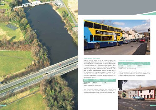
10.8 Transport and Utilit<strong>ie</strong>s<br />
<strong>Leixlip</strong> is currently served by two rail stations – Confey and<br />
Louisa Bridge Stations both of which are served by the ‘Arrow’<br />
service provided by Iarnrod Eireann. It is proposed to provide<br />
a third rail station in the Collinstown area of <strong>Leixlip</strong> to serve<br />
the new community in that location as well as the employees<br />
of the existing industr<strong>ie</strong>s and new industr<strong>ie</strong>s that locate in the<br />
area. The details of this transport objective are dealt with in<br />
the Collinstown LAP. Proposals to increase the capacity of the<br />
Waste Water Treatment <strong>Plan</strong>t to the east of the town at St.<br />
Catherine’s Park are well advanced. This development is due<br />
for completion in 2011.<br />
Zoning <strong>Area</strong> in 2002 <strong>Area</strong> in <strong>2010</strong> <strong>Local</strong><br />
Objective <strong>Local</strong> <strong>Area</strong> <strong>Plan</strong> <strong>Area</strong> <strong>Plan</strong><br />
Transport & 16.9 Ha 4.4 Ha*<br />
Utilit<strong>ie</strong>s<br />
Table 13: Transport and Utilit<strong>ie</strong>s Zoning<br />
*Note: Reduction in area due to separate <strong>Local</strong> <strong>Area</strong> <strong>Plan</strong> being<br />
developed for Collinstown. Land zoned for Transport and Utilit<strong>ie</strong>s in<br />
Collinstown was originally included in the 2002 <strong>Leixlip</strong> <strong>Local</strong> <strong>Area</strong> <strong>Plan</strong>.<br />
10.9 General Development<br />
Zoning<br />
Objective<br />
<strong>Area</strong> in 2002<br />
<strong>Local</strong> <strong>Area</strong> <strong>Plan</strong><br />
<strong>Area</strong> in <strong>2010</strong> <strong>Local</strong><br />
<strong>Area</strong> <strong>Plan</strong><br />
General<br />
Development<br />
0.9 Ha 12.9 Ha*<br />
Table 14: General Development Zoning<br />
* This figure comprises 1.8 ha (General Development) and 11.1 ha (T1 –<br />
General Development) from the <strong>Leixlip</strong> <strong>Local</strong> <strong>Area</strong> <strong>Plan</strong> <strong>2010</strong>. Please refer<br />
to Tables 15 and 16 for specific details with regard to same.<br />
25


