

o - Bad Request
o - Bad Request
o - Bad Request

You also want an ePaper? Increase the reach of your titles
YUMPU automatically turns print PDFs into web optimized ePapers that Google loves.
I 'à<br />
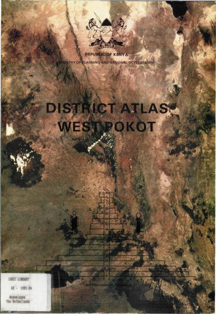
ISIIC LIBRARY<br />
- 1985.04<br />
Wageningen<br />
The Netherlands<br />
BEPU Of KENYA<br />
KNISTRY OF PLANNING AND NATIONAL DEVELOPS/IE
MINISTRY OF PLANNING<br />
AND NATIONAL DEVELOPMENT<br />
DISTRICT ATLAS<br />
WEST PO KOT<br />
Hubert Hendrix<br />
Editor<br />
Michael S. Mwangi<br />
and<br />
Niels de Vos<br />
Cartography<br />
Kapenguria 1985<br />
ISRIC LIBRARY<br />
gelingen, Th« Netherlands<br />
Scanned from original by ISRIC - World Soil Information, as ICSU<br />
World Data Centre for Soils. The purpose is to make a safe<br />
depository for endangered documents and to make the accrued<br />
information available for consultation, following Fair Use<br />
Guidelines. Every effort is taken to respect Copyright of the<br />
materials within the archives where the identification of the<br />
Copyright holder is clear and, where feasible, to contact the<br />
originators. For questions please contact soil.isric@wur.nl<br />
indicating the item reference number concerned.
Copyright: © Reproduction of material from this book is permitted<br />
if proper acknowledgement is made.<br />
Reproduction for commercial purposes is not allowed.<br />
Photographs<br />
Layout and drawings<br />
Text<br />
Typesetting<br />
Typeface<br />
Production coordination<br />
Hubert Hendrix<br />
Nicola Hogg, Nairobi<br />
Produced on Philips P2000 C<br />
Microcomputer with Wordstar<br />
Fotozetterij van leperen,<br />
Amsterdam<br />
Univers<br />
Niels de Vos<br />
Printing General Printers Limited<br />
Homa Bay Road, P.O. Box 18001 Nairobi.<br />
Published: Kapenguria, 1985<br />
Arid and Semi Arid Lands Development Programme<br />
P.O. Box 287, Kapenguria<br />
Kenya
CONTENTS<br />
List of Maps v<br />
List of Plates v<br />
List of Figures vi<br />
List of Tables vi<br />
Preface vii<br />
West Pokot District District Data, 1983 1<br />
Part 1 Topography 3<br />
Location and'topography 5<br />
Spelling of topographical names 6<br />
Part 2 Physical Geography 13<br />
Relief 14<br />
Drainage 16<br />
Geology 18<br />
Mineral deposits 20<br />
Rainfall 21<br />
Agro climatic zones 24<br />
Soils 26<br />
Erosion 28<br />
Part 3 Population 31<br />
History 32<br />
Population development 35<br />
Population characteristics 39<br />
Population projections 41<br />
Part 4 Administration and Government<br />
Staff 43<br />
International boundaries 44<br />
District headquarters and divisions 45<br />
Locations and sublocations 46<br />
Electoral wards and constituencies 48<br />
Development of government<br />
establishment 49<br />
Part 5 Agriculture and Livestock 53<br />
Land adjudication 54<br />
Farming systems 57<br />
Crop development 61<br />
Irrigation 64<br />
Livestock 66<br />
Livestock services and marketing 70<br />
Co-operatives 72<br />
Forests and wildlife 73
Contents<br />
Part 6 Satellite Image Interpretation 75<br />
Part 7<br />
Part 8<br />
Bibliography<br />
Index<br />
Infrastructure 79<br />
Introduction 80<br />
Rural Development Fund projects 81<br />
Water development 84<br />
Roads 88<br />
Public transport 91<br />
Miscellaneous services 92<br />
Business premises 94<br />
Newspapers 96<br />
Town centres 97<br />
Service level by location 102<br />
Social Development 105<br />
Primary education 106<br />
Introduction 106<br />
Primary school enrolment 110<br />
Teachers in primary schools 112<br />
Certificate of primary education 115<br />
Secondary education 116<br />
Adult education 117<br />
Polytechnics and special schools 121<br />
Health services 122<br />
Introduction 122<br />
Static facilities 122<br />
Mobile clinics 126<br />
Level of healthcare 128<br />
Women groups 130<br />
Churches 132<br />
134<br />
136
List of Maps<br />
Number Page Number<br />
1 Location of West Pokot District in Kenya 4<br />
2 Topographical maps Survey of Kenya, Series Y731,<br />
West Pokot District 5<br />
3 West Pokot District topography 7<br />
4 Topography of Kapenguria division in West Pokot District, 1983 8<br />
5 Topography of Kacheliba division in West Pokot District, 1983 9<br />
6 Topography of Chepareria division in West Pokot District, 1983 10<br />
7 Topography of Sigor division in West Pokot District, 1983 11<br />
8 West Pokot District altitude 15<br />
9 Water catchment areas 16<br />
10 West Pokot District drainage 17<br />
11 West Pokot District geology 19<br />
12 Mineral deposits 20<br />
13 Relation between rainfall and potential evaporation in central<br />
West Pokot 21<br />
14 West Pokot District agro climatic zones 25<br />
15 West Pokot District soils 27<br />
16 West Pokot District erosion 29<br />
17a-b Approximate Pokot area around 1880 and 1930 32<br />
18 Estimated population density, 1932 35<br />
19 Population density, 1969 36<br />
20 Population density, 1979 36<br />
21 Population distribution in West Pokot District, 1979 37<br />
22 Proportional population growth, by location, 1969-79 38<br />
23 Sexratio, 1979 40<br />
24 History of migration of 50 households in Alale location 40<br />
25 International boundary between Uganda Protectorate and<br />
British East Africa until 1902 44<br />
26 International boundary between Uganda Protectorate and Kenya<br />
Colony, 1902-26 44<br />
68<br />
69<br />
70<br />
71a-c<br />
72<br />
73<br />
74<br />
75<br />
76a-b<br />
77a-b<br />
27 West Suk/ West Pokot district headquarters, 1910-83 45 Number<br />
28a-c West Suk/ West Pokot District administrative divisions, 1957-83 45<br />
29a-b Administrative boundaries, 1969 and 1979 46 1<br />
30 Administrative boundaries West Pokot District, 1983 47 2<br />
31 Electoral wards for the County Council of Pokot, 1983 48 3<br />
32 Parliamentary constituencies, 1983 48 4<br />
33a-e Development of land adjudication, 1973-83 54/55 5<br />
34 Adjudication sections in West Pokot District, status and 6<br />
characteristics, 1983 56 7<br />
35a-c Modern and traditional farming by location, 1982 57 8<br />
36 Average number of acres per household at nine places, 1982 58 9<br />
37 Location of places in Figure 8 58 10<br />
38 Distribution of crops in West Pokot District, 1982 60 11<br />
39 Irrigation 64 12<br />
40 Traditional grazing areas 66 13<br />
41 Areas affected by cattle rustling 68<br />
42 Distribution of livestock. West Pokot District 67 14<br />
43 Areas affected by tsetse fly 70 15<br />
44 Dips in West Pokot District, 1983 69 16<br />
45 Dams and holding grounds in West Pokot District, 1983 71 17<br />
46 Co-operative societies and co-operative unions, 1983 72<br />
47 Forest areas, tree nurseries and game reserves, 1983 73 18<br />
48 Rural Development Fund Projects in West Pokot District, 19<br />
1974/75-1982/83 83<br />
49 Piped watersupplies in West Pokot District, 1983 85 20<br />
50 Boreholes in West Pokot District, 1983 86 21<br />
51 Roads in West Pokot District, 1983 88<br />
52 Road distances in West Pokot District, 1983 90 22<br />
53 Frequency of matatu service per day, 1983 91 23<br />
54 Miscellaneous services in West Pokot District, 1983 93 24<br />
55 Licensed business premises in West Pokot District, 1983 95 25<br />
56 Daily newspaper sales, November 1983 96 26<br />
57 Makutano commercial area, 1983 98 27<br />
58 Kapenguria (Ramaget) commercial area, 1983 99<br />
59 Physical plan of Kapenguria 100 28<br />
60 Physical plan of Makutano 101<br />
61 Services provided by government, mission and private 29<br />
sector in West Pokot District, 1983 103 30<br />
62a-c Primary schools, 1966-83 106<br />
63 Primary schools in West Pokot District, 1983 109 31<br />
64 Proportional growth of school enrolment, by location, 1979-82 110 32<br />
65a-c Boys and girls enrolled in primary school, by location, 1982 111<br />
66a-b Deviation from mean district enrolment, by location, 1982 112 33<br />
67 Number of students per primary school teacher, 34<br />
by location, 1982 113 35<br />
78<br />
79<br />
80<br />
Trained primary school teachers as proportion of all primary<br />
school teachers, by location, 1982<br />
CPE results of 12 primary schools, 1973-82<br />
Secondary schools, 1983<br />
Distribution of adult education centres, 1983<br />
Polytechnics and special schools, 1983<br />
Static health facilities in West Pokot District, 1983<br />
Mobile eye clinics, 1983<br />
Mobile clinics in West Pokot District. 1982<br />
Level of healthcare services, by location, 1982<br />
Level of healthcare services, after implementation of health<br />
development plan<br />
Women groups in West Pokot District, 1983<br />
Church attendance, by denomination and location, 1982<br />
Denominations in West Pokot District, 1983<br />
List of Plates<br />
V<br />
Page<br />
114<br />
115<br />
117<br />
118<br />
121<br />
123<br />
126<br />
127<br />
128<br />
129<br />
131<br />
132<br />
133<br />
Page<br />
Seasonal river near Morobus 16<br />
Outcrop of marble, south west of Ortum 18<br />
Gold panning 20<br />
Homestead with livestock enclosure of pastoral Pokot 33<br />
Traditonal Pokot household implements 36/39<br />
Pokot elder, wearing traditonal ornaments 38<br />
Young mother and child 38<br />
District Commisioner's office at Kapenguria 49<br />
District Development Office under construction 49<br />
View of an agricultural Pokot house 59<br />
View of a house of pastoral Pokot 59<br />
Citrus fruits at Sebit demonstration plot 65<br />
Main intake canal under construction at Kodich<br />
Irrigation Scheme 65<br />
Traditional irrigation furrow near Ortum 65<br />
Annotated photo map of West Pokot District 76<br />
Landsat image of West Pokot District 77<br />
Prison where Mzee Jomo Kenyatta was held during the trial of<br />
Kapenguria in 1953. 80<br />
Cattle dip at Kapkoris, funded by Rural Development Fund 81<br />
Nursery for tree seedlings at ortum, funded by Rural<br />
Development Fund 81<br />
Borehole with handpump at Natemeri 87<br />
Kitale to Lodwar A1 trunk road, descending north of<br />
Kapenguria 87<br />
Micro wave relay station, north of Kapenguria on Mnagei Hill 92<br />
Makutano township 97<br />
Ortum Mission Hospital 102<br />
Primary school under construction at Chepkopegh 107<br />
Standard 5 class at Cheptuya Primary School 113<br />
Nasokol Primary School, one of the first schools in the<br />
district 114<br />
Kunyao Primary School, obtained the best CPE results during<br />
the last years 114<br />
Ortum Boys Secondary School 116<br />
Chewoyet (Kapenguria) Boys High School, venue of Mzee<br />
Jomo Kenyatta's trial in 1953 117<br />
Carpentry trainees at work at Chepareria Village Polytechnic 120<br />
New masonry and carpentry workshop at Kodich Village<br />
Polytechnic 120<br />
Sewing class at Chepareria Village Polytechnic 121<br />
View of the District Hospital at Kapenguria 122<br />
Nearly completed dispensary and staff houses at Kauriong 126
VI<br />
List of Figures<br />
Number Page<br />
la-d West Pokot District crosssections 14<br />
2a-b Contact metamorphism 18<br />
3a-f Distribution of rainfall per month and per year for six 22/23<br />
stations in West Pokot District<br />
4a-b Relation between erosion and groundcover 28<br />
5 Population growth, 1927-79 35<br />
6a-b Population pyramids West Pokot District, 1969 and 1979 39<br />
7 Crops and livestock on farms at nine places, 1982 58<br />
8 Planting and harvesting periods at various altitudes in 59<br />
West Pokot District<br />
9 Development of maize hectarage, 1967-83 61<br />
10a-b Development of various crops, 1979-83 62/63<br />
11 Quarantaine periods, 1977-83 70<br />
12 Production at tree nurseries, 1974-82 72<br />
13 Rural Development Fund Projects 1974/75-1982/83, by<br />
location and division 82<br />
14 Matatu price schedule, November 1983 91<br />
15 Daily newspaper sales in West Pokot District, November 1983 96<br />
16 Number of primary schools by division, 1966-82 107<br />
17 Number of children enrolled in primary school, 1970-82 110<br />
18 Number of children enrolled in primary school, by division,<br />
1970-82 111<br />
19 Boys/girls enrolled in primary school as proportion of all<br />
boys/girls between 5-14 years, by location, 1982 112<br />
20 Number of trained and untrained primary school teachers,<br />
1971-82 113<br />
21 Number of candidates entered for CPE, 1973-82 115<br />
22 CPE results, 1973-82 115<br />
23 Adult education centres, by division, 1980-83 118<br />
24 Adult education centres, number of students enrolled and<br />
characteristics, by division, 1980-83 119<br />
25 Adult education, CPE enrolment and results, 1973-82 120<br />
26 Outpatients attendence, Kapenguria hospital, 1972-82 124<br />
27 Number of in-patients, Kapenguria hospital, 1972-82 124<br />
28 Number of beds, Kapenguria hospital, 1974-82 124<br />
29 Bed-days and number of bed-days per admission, Kapenguria<br />
hospital, 1974-82 124<br />
30 Occupancy of beds, Kapenguria hospital, 1974-82 125<br />
31 Deliveries and attendance at clinics, Kapenguria hospital,<br />
1974-82 125<br />
32 Surgery, Kapenguria hospital, 1974-82 125<br />
List of Tables<br />
Number Page<br />
1 West Pokot District Data, 1983 1<br />
2 Temperature zones 24<br />
3 Moisture availability zones 24<br />
4 Projected population and population density in West<br />
Pokot District, 41<br />
1979-88, by division<br />
5 Projected population by age group, West Pokot<br />
District, 1983-88 41<br />
6 Administrative divisions, locations and approximate<br />
area, 1983 48<br />
7 Number of government employees by department, district<br />
headquarters and division, January 1983 50/51<br />
8 Piped watersupplies, 1983 84<br />
9 Licensed business premises in West Pokot District, 1982 94<br />
10 Primary schools in West Pokot District, 1983 108<br />
11 Secondary schools in West Pokot District, 1983 116<br />
12 Women groups in West Pokot District, 1983 130
Kapenguria, December 1985<br />
Responsible planning of development activities must be based on reliable, complete<br />
and reasonably up to date information. Such information about West Pokot was lacking<br />
when we approached the District Development Committee in August 1982 with a proposal<br />
to compile a District Atlas.<br />
As elsewhere in Kenya, district information is often not readily available; if it is<br />
available it may be incomplete, sometimes incorrect and often outdated. Valuable data<br />
may be hidden in big reports or academic books, collecting dust on a shelf in<br />
Kapenguria, in an office in Nakuru or in a library in Nairobi. Spatial distribution is rarely<br />
mapped and if maps are drawn, they are often of poor quality, outdated or too big to<br />
handle easily.<br />
The launching of the District Focus for Rural Development in July 1983 made the<br />
availability of district information even more necessary. Residents and leaders of West<br />
Pokot assumed greater responsibility to select, plan and carry out district projects.<br />
When new officers are posted to the district, they need to familiarize themselves with<br />
the circumstances of West Pokot.<br />
Also the new primary school syllabus, under the 8-4-4 educational system, puts more<br />
emphasis on local and district knowledge.<br />
Finally, if we want to evaluate progress in various fields of development in the district<br />
as time goes on, we should have baseline information.<br />
The production of this book has been undertaken as one of the activities of the Arid<br />
and Semi Arid Lands Development Programme in West Pokot. The programme, coordinated<br />
by the Ministry of Planning and National Development, is supported in West<br />
Pokot by the Government of the Netherlands. The Netherlands Government also funded<br />
the production of the atlas.<br />
It took two and half years to complete the production from its first conception to printing.<br />
All stages of the production- collection of information, verification, selection,<br />
design of maps and figures, cartographic drawing, textwriting, typesetting and printingtook<br />
more time and energy than foreseen. This may be a warning for other districts in<br />
Kenya or elsewhere against underestimating production of a similar book. On the other<br />
hand, we think that the quality of information and presentation improved as we progressed.<br />
Part of the information presented here, has already been used to draw up the<br />
District Development Plan 1984-88.<br />
A number of choices had to ba made during the course of the production of the<br />
book. The targeted readership, from ten to twelve year old primary school children to<br />
seasoned planners and scholars, made it sometimes difficult to decide on the level of<br />
detail and sophistication. We do not think that we were always able to satisfy all<br />
categories of readers. Their comments are welcome and might be used to make two<br />
future editions, one for school use and another for planners, administrators and<br />
scholars. We also chose to produce the atlas in black and white on a size which allows<br />
photocopying. We have not imposed copyright restrictions. An acknowledgement of<br />
the source, when material is used for reproduction is however requested.<br />
The atlas benefitted greatly from a Regional Research Project, carried out in 1982 and<br />
1983 by geographers from the University of Amsterdam, affiliated to the Institute of<br />
Development Studies at the University of Nairobi. Annemieke van Haastrecht, Mirjam<br />
Schomaker and Ton Dietz spent one year on library research ano fieldwork. More than<br />
half of the information, presented in this book, was supplied by them. They in turn<br />
depended, as we did later,, on the cooperation of Heads of Department and their staff<br />
in West Pokot District. Special thanks in this respect are due to Nyagah Maina K. and<br />
John Waita of the Ministry of Agriculture and Livestock Development and to Jackson<br />
Katina, Clerk to the County Council of Pokot for a lot of extra effort to assist. Research<br />
assistants Rachel Andiema, Simon Lopeyok, Michael Ptalam Lodiokile, Albino Kotomei<br />
and Romanus Partany Chezupo also deserve special gratitude.<br />
In Nairobi we got generous cooperation from the Regional Centre for Services in<br />
Surveying, Mapping and Remote Sensing, resulting in a specially produced Landsat image<br />
of West Pokot, also printed on the cover of the atlas. Of course, many more people<br />
and institutions assisted. They are too numerous to be mentioned separately but we<br />
owe them all our gratitude.
Table 1 West Pokot District Data, 1983<br />
Topography<br />
Location:<br />
Boundaries:<br />
Size:<br />
Highest Point:<br />
Main Rivers:<br />
Administration<br />
District Headquarters:<br />
Divisions:<br />
Locations:<br />
Sublocations:<br />
1°7' North to 2 0 40 l North; 34°37' East to 35^49' East<br />
Republic of Uganda, Turkana District, Banngo District, Elgevo<br />
Marakwet District, Trans Nzoia District<br />
9 100 square kilometers<br />
Chepkotet Peak, 3 370 meters above sealevel<br />
Suam, Weiwei, Muruny<br />
Kapenguria<br />
Kapenguria<br />
4<br />
15<br />
Political<br />
County Council Headquarters:<br />
Number of Councillors:<br />
Number of Parliamentary Constituencies:<br />
Population<br />
Number of Residents<br />
1979 (Census):<br />
1983 (Estimate):<br />
1988 (Projection):<br />
Agriculture<br />
Land Potential (Estimates)<br />
High Potential Land:<br />
Medium Potential Land:<br />
Marginal Land:<br />
Rangeland:<br />
Other Land:<br />
Livestock<br />
Estimated Numbers<br />
Zebu Cattle: 80 000<br />
Goats: 165 000<br />
Sheep (Traditional): 70 000<br />
Woolsheep: 35 000<br />
Dairy Crossbreed Cows: 4 000<br />
Infrastructure<br />
Roads<br />
Class A (Tarmac):<br />
Class B:<br />
Class C:<br />
Class D:<br />
Class E:<br />
Watersupplies:<br />
Telephone Subsrcibers:<br />
Electricity:<br />
Airstrips:<br />
Licensed Business Premises (1982):<br />
Education<br />
Number of Primary Schools (1982):<br />
Number of Secondary Schools (1982):<br />
Number of Primary School Teachers (1982):<br />
Number of Secondary School Teachers (1982):<br />
Number of Adult Education Centres:<br />
Number of Village Polytechnics:<br />
Percentage of Boys Enrolled 5-14, years. (1982):<br />
Percentage of Girls Enrolled 5-14, years. (1982):<br />
Percentage of All Children, 5-14 years,<br />
Enrolled in Primary Schools (1982):<br />
Chepareria<br />
3<br />
10<br />
Health<br />
Hospitals:<br />
Healthcentres:<br />
Dispensaries:<br />
Hospital Beds:<br />
Annual Number of Out Patients Seen (1982):<br />
Annual Number of Vaccinations (Including BGG):<br />
Child Mortality. Under 2 Years,(1979 Estimate):<br />
Sigor<br />
6<br />
II<br />
Kapenguria<br />
18 elected, 3 nominated, 1 ex-officio<br />
2<br />
Kacheliba<br />
5<br />
IS<br />
158 652 Annual Population Growth: 4 3 per cent<br />
187 800 Population Density: 21 persons per square kilometer<br />
232 700<br />
Annual Production for Some Crops<br />
(Estimates in a reasonable year)<br />
26 500 hectares Maize:<br />
53 600 hectares Beans:<br />
256 600 hectares Sorghum:<br />
402 700 hectares Millet:<br />
170 600 hectares Pyrethrum:<br />
Potatoes:<br />
Coffee:<br />
Cassava:<br />
Livestock Facilities<br />
Cattle Dips:<br />
Watering Dams:<br />
Holding Grounds:<br />
40 000 tons<br />
2 200 tons<br />
1 750 tons<br />
1 800 tons<br />
25 ions<br />
1 100 tons<br />
16 tons<br />
450 tons<br />
25 operational, 23 under construction/<br />
not operational<br />
16 operational, 26 requiring attention<br />
6<br />
119 km<br />
44 km<br />
41 km<br />
234 km<br />
590 km<br />
12 piped supplies, 800 connections, 54 boreholes<br />
51 subscribers. 3 public boxes<br />
no mains<br />
5<br />
Retail 234, Hotel/ Kiosk 141, Bar 27, Posho mill 29. Butcher 51.<br />
Boarding/ Lodging 5, Wholesale 8, Other 21<br />
202 Boys Enrolled: 19 763 Girls Enrolled: 12<br />
b Students Enrolled: 1 513<br />
98b Trained : 540 Untrained: 445<br />
b Approved/Graduate Teachers 15<br />
P1/S1/A Level Teachers:<br />
26<br />
1'J4 Men Enrolled: 1 220 Women Enrolled 990<br />
b<br />
11<br />
Boys Enrolled: 141 Girls Enrolled: 23<br />
• Percentage of Persons over 2 0.<br />
Having Attended Formal Schoo-<br />
58 ling<br />
(1979 census): Men 25 Women 10<br />
2<br />
3<br />
15<br />
204<br />
504 000<br />
52 966<br />
216 per thousand<br />
District Atlas West Pokot, 1985
Topography<br />
District Atlas West Pokot 1965
4<br />
Location of West Pokot District in Kenya<br />
SUDAN<br />
UGANDA<br />
WEST<br />
POKOT<br />
TURKANA<br />
\ S<br />
">-. r<br />
^NZOIA "V'S ( \ f*<br />
M<br />
/<br />
r^<br />
, l/TX^Ns ( BAR,NG0 V-~<br />
1 ( J S I^«AME GA) ^ S H U X | \<br />
-, NANDl\ S- J<br />
S,AVA<br />
-^-^- klSUMl V k ^<br />
,j'<br />
SOUTH (<br />
^YANZA > KIS<br />
\<br />
KERICHO V f^\<br />
V<br />
s )<br />
J<br />
NAROK<br />
6 / /<br />
/ LAIKIPIA<br />
A<br />
J<br />
SAMBURU<br />
. I S\>- ' ^ M\<br />
NAKURU« V » \ NYER| m<br />
. V>W-o i<br />
I O (W MURAN G''<br />
' KIAMBU<br />
JNAIR(<br />
TANZANIA ^ ^ ^ KAjiADo<br />
International boundary<br />
Provincial boundary<br />
District boundary<br />
75 150<br />
_l<br />
34° E 36°E<br />
MAP 1<br />
District Atlas West Pokot, 1985<br />
225 KMS<br />
MARSABIT<br />
r 1<br />
MERU<br />
ETHIOPIA<br />
_/'<br />
/ S<br />
ISIOLO<br />
L_<br />
WAJIR<br />
\._<br />
MANDERA<br />
\J<br />
4°N<br />
2°N_|<br />
SOMALI<br />
REPUBLIC<br />
Ocean<br />
0° —I<br />
2°S—J<br />
Source Atlas of Kenya 197(1
Location and topography<br />
West Pokot District is situated along Kenya's western boundary<br />
with Uganda. From north to south, the district stretches<br />
from 2°40'N to 1°7'N. From west to east it is located between<br />
34°37'E and 35°49'E. The total area covered by West<br />
Pokot District is about 9100 km 2 or 5 per cent of the Rift Valley<br />
Province.<br />
The position of the district in relation to neighbouring districts<br />
is depicted in Map 1.<br />
The distance from the district headquarters, Kapenguria, to<br />
the closest sizeable town, Kitale, is about 42 kilometers. The<br />
distance to the provincial capital, Nakuru, is 250 kilometers,<br />
to Nairobi 435 kilometers by road.<br />
West Pokot District has a great variety of topographical features.<br />
The southeast section of the district is situated in the<br />
Cherangani Hills with altitudes over 3000 meters above sealevel.<br />
The northern and northeastern part of the district on the<br />
other hand streches towards the hot, dry plains of Turkana at<br />
altitudes of less than 900 meters above sea level.<br />
All landscapes which are associated with this range of altitudes,<br />
can thus be found within West Pokot's boundaries,<br />
including spectacular escarpments of more than 700 meters.<br />
West Pokot is also a district where social and economic<br />
development started later than in most other parts of Kenya.<br />
It was remote from the centres of early social and economic<br />
development in the centre of the country, and its rugged<br />
topography made access to many of its resources difficult.<br />
No major towns, industries, large scale farming etc. are to be<br />
found in the district in 1983. Kapenguria is even one of the<br />
few district headquarters which have no electricity. Population<br />
density is considerably below that of other districts with<br />
similar potential.<br />
A third feature of the district is its fast social and economic<br />
development, especially during the last ten years. Roads are<br />
penetrating formerly inaccessible areas, schools are opened<br />
at a high pace, food production is increasing and the money<br />
economy is rapidly replacing the earlier subsistence and barter<br />
economy.<br />
Because of these rapid changes, we have produced new<br />
topographical maps for each of the four divisions of the district.<br />
The presently available Survey of Kenya maps (scales<br />
1:250 000, 1:100 000 and 1:50 000) show great detail in physical<br />
features, but are outdated for such information as roads<br />
and population centres. The maps reproduced in this atlas<br />
(Maps 4 to 7) should be used alongside those available from<br />
the Survey of Kenya.<br />
The most common maps used are in the Survey of Kenya<br />
Series Y503, revised in 1973. Sheets NA-36-12 (Kapenguria),<br />
and NA-36-8 (Moroto) cover the whole of the district on a<br />
scale 1:250 000. Maps on a 1:50 000 and 1:100 000 scale, Survey<br />
of Kenya Series Y731, are summarized in Map 2.<br />
Topographical maps Survey of Kenya, Series Y731, West Pokot District<br />
MAP 2<br />
Q Sheet 1:100 000<br />
1j.2<br />
Sheet 1:50 000<br />
26 Km<br />
5<br />
District Atlas West Pokot, 1985
6<br />
Spelling of topographical names<br />
Another question that is briefly addressed in this section is<br />
the spelling of topographical names. Most of the orthography<br />
of topographical names in Kenya, is based on the phonetic<br />
spelling by colonial administrators and missionaries long<br />
before independence. Also typing errors have found their way<br />
into printed documents.<br />
Throughout this atlas we will use the 'official' spelling of<br />
Usual Orthography<br />
orthography in Pokot<br />
Amakuriat Amekuriot (Aker, Totum)<br />
Amolem Amolem (Lokarkar)<br />
Arpolo Orpollo<br />
Bâtai Patiy (Patei)<br />
Chepareria Chepareria<br />
Chepkobegh Chepkopegh (Chepkot-egh)<br />
Chepkono Chepkono<br />
Chepkorniswa Chepkorniswo<br />
Chepnyal Chepnyal<br />
Chesegon Chesekon<br />
Chesira Chesra<br />
Embokech Empokegh<br />
lyon lyoon<br />
Kacheliba Kocholipai<br />
Kaibichbich Kaipichpich<br />
Kaiboni Kaiponi (Kogh pa Ponot)<br />
Kaibos Kai pos<br />
Kamatira Kamatira<br />
Kamketo Kamketo<br />
Kangelikwan Kangilikwan<br />
Kanyerus Kanyeris (Koghpo Moril)<br />
Kapchemogem Kachemoken<br />
Kapsangar Kapsingar<br />
Kaptabuk Kaptapuk<br />
Kasei Kosei (Nginngin)<br />
Kasitet Kasitit<br />
Kokwotendwo Kokwo Tondwo<br />
Lokitanyala Lokitanyala<br />
Mbara Mpara<br />
Morobus Moropus (Kapcharoy)<br />
Murk wij it Murkwichit (Kokwo-eghian)<br />
Nakwijit Nakwichit (Chepeghian)<br />
Nasolot Nasolot (Songwot)<br />
Natemeri Natimeri<br />
Nauyapong Nauyapong (Ka-Kiress)<br />
Ortum Ortum<br />
Orwa Orwo (Lalwa Orwo)<br />
Parkino Parkino<br />
Psurum Psirim<br />
Ptoyo Ptoyo<br />
Sebit Sepit<br />
Sebukwo Sepukwo<br />
Serewa Serewo (Sera)<br />
Sermach Sarmach<br />
Sielpogh Syalpogh<br />
Sigor Psikor<br />
Sinjo Sinjo<br />
Suam Suom (Turkwel)<br />
Ta mou g h Tamugh<br />
Wakor Wakor (Akor)<br />
Yawyaw Yayaw (Yasian)<br />
District Atlas West Pokot, 1985<br />
Explanation of name<br />
topographic names as normally found on Survey of Kenya<br />
maps and in government documents.<br />
The list below presents the spelling of some topographical<br />
names as it is preferred by the indigenous inhabitants of the<br />
district. The list also gives a brief explanation of the names<br />
and was compiled by the County Council of Pokot in 1983.<br />
Place where traditional dance is held<br />
Flat ground<br />
Place where natural salt is found<br />
Area where a crop, which did well during rainy season, was grown<br />
Place where reddish type of soil is found<br />
Place where water level is not deep<br />
Named after a man called Chepkono, who lived in the area<br />
Place where trees called 'Ptarin' grow<br />
Place where traditional dance 'Nyalat' is held<br />
Place where 'Sekonion' tree grows<br />
'Wild area', used to be a restricted area<br />
Place where sheep are taken to drink water<br />
Zigzag (meandering) river<br />
Place where tax defaulters are detained (Kiswahili: Hajalipa)<br />
Place where strong wind passes<br />
Place where 'Ponit' (wild bees) is found<br />
Place where 'Postin' type of trees grow<br />
Very cold area<br />
Place where dark brown oxen were slaughtered and eaten<br />
Rock/cave/hill where leopard lived<br />
Place where natural salt is found<br />
Psingar, a man, lived in the area<br />
Ptapuk, a man, lived in the area<br />
A place of refuge during war days<br />
Place where 'Sitit' trees grow<br />
Meeting place under Tondwo' tree<br />
Site where traditional dance is held<br />
'Mashamba', place for cultivation<br />
Grey hill with several parts<br />
Place where oxen where slaughtered for special purpose<br />
Place where oxen where slaughtered for special purpose<br />
Place where certain white stone is found<br />
Place where certain tree 'Kreswo' is grown<br />
Named after a certain man<br />
Sound made by flowing water of river Orwo<br />
Meeting place where goats (he goats) are slaughtered and eaten.<br />
Place where 'Rotin' type of tree grows very well<br />
Place where porcupines were killed<br />
Place where porcupines live<br />
Name of Masai killed at the place<br />
Sorghum was grown in the area<br />
A cave in which people lived when animals were there for natural salt<br />
Place where water springs from the ground, as if it is boiling<br />
Fresh green grass grows fast when it is raining<br />
Name of a certain man who lived in the area<br />
An acquired river by begging<br />
Certain type of plant and/or tree which hangs its branches<br />
Meeting place where oxen were slaughtered and eaten<br />
Natural vegetation for watercatchment area<br />
Information about topograprical names was provided by:<br />
Jackson Katina, Hon. James Powon Korrelach M.P. and<br />
Rev. Daniel Tumkou.
West Pokot District topography<br />
MAP 3<br />
Trans Nzoia<br />
35° 30'<br />
I<br />
District boundary<br />
Major road (Tarmac<br />
: Major road<br />
, Minor road<br />
Ü Bridge<br />
o Centre<br />
River<br />
5>;^$fe Mountain<br />
35° 45' E<br />
I<br />
_2° 30' N<br />
_ 2° 15' N<br />
_2° 00' N<br />
— 1° 45' N<br />
/ Vy — 1 ° 30* N<br />
Baringo<br />
Elgeyo Marakwet<br />
_1° 15' N<br />
9 18 Km<br />
7<br />
Based on Topo map 1 : 250 000. Survey of Kenya<br />
Sheets NA-36-8 IMorotol and NA-36-12 (Kapenguria)<br />
District Atlas West Pokot, 1985
8<br />
Topography of Kapenguria division in West Pokot District, 1983<br />
£ •<br />
o<br />
rr<br />
-n<br />
J M M<br />
u il<br />
«3 I- -C<br />
a S m S c<br />
c<br />
m<br />
M o<br />
up<br />
> I "D<br />
m 5<br />
> O<br />
C<br />
0) 1 i<br />
cc O CJ O<br />
MAP 4<br />
District Atlas West Pokot. 1985
Topography of Kacheliba division in West Pokot District, 1983<br />
MAP 5<br />
Divisional boundary<br />
Road<br />
River<br />
^Kimpur Centre<br />
^ Kasei Chief's centre<br />
+ KACHELIBA Divisional headquarters<br />
Mountainous area<br />
18 Km<br />
9<br />
District Atlas West Pokot. 1985
10<br />
Topography of Chepareria division in West Pokot District, 1983<br />
MAP 6<br />
District Atlas West Pokot, 1985<br />
Divisional boundary<br />
• Tarmac road<br />
Road<br />
River<br />
Centre<br />
Chief's centre<br />
CHEPARERIA Divisional headquarters<br />
Mountainous area
Topography of Sigor division in West Pokot District, 1983<br />
*VG°:<br />
MAP 7<br />
11<br />
'Amaler<br />
9 km<br />
District Atlas West Pokot. 1985
13<br />
Physical Geography<br />
District Attas West Pokot, 1985
14<br />
Relief<br />
Several landscapes can be distinguished in West Pokot:<br />
High altitude More than 1800 meters, mountainous<br />
areas such as Cherangani Hills, Sekerr<br />
Mountains and Chemerongit Range.<br />
Medium altitude 1500-2100 meters, rolling to hilly areas.<br />
Low altitude Less than 1500 meters, flat floodplains<br />
along the rivers and undulating peneplains.<br />
West Pokot District crosssections<br />
altitude<br />
in meters<br />
3050. s w M,K.ch.Bjjju chemerongit Range NE<br />
2400J<br />
1800<br />
1200J<br />
6oa<br />
FIGURE 1a<br />
3050-. WNW<br />
2400.<br />
FIGURE 1b<br />
District Atlas West Pokot, 1985<br />
Sekerr hills<br />
,Mt Mtelo<br />
This landscape has faint relief which is a<br />
result of long lasting erosion and denudation,<br />
the old stage of an erosion cycle.<br />
Due to the huge differences in altitude, accessibility is poor<br />
in many parts of the district.<br />
^ Scrubgrowth<br />
Forest<br />
Cherangani hills<br />
Direction of crosssections<br />
93.5
West Pokot District altitude<br />
MAP 8<br />
Altitude above sealevel<br />
Meters Feet<br />
I :| Less than 900 Less than 3000<br />
^_1 900-1200 3000 - 4000<br />
1200-1500<br />
mm<br />
Eiiil 1500-1800<br />
1800-2100<br />
55 2100-2550 nm<br />
2550-3000 mu<br />
More than 3000<br />
••<br />
4000 - 5000<br />
5000- 6000<br />
6000- 7000<br />
7000- 8500<br />
8500-10000<br />
More than 10000<br />
18 Km<br />
j<br />
15<br />
Based on Topo map 1:250 000, Survey of Kenya<br />
Sheets NA-36-8 (Moroto) and NA-36-12 (Kapenguria)<br />
District Atlas West Pokot, 1985
16<br />
Drainage<br />
95 percent of the catchment areas in the district are part of responsible for flash floods, again due to high run-off and<br />
the main Turkwel-catchment. Both Turkwel and Kerio river low storage capacity. In the dry season it hardly contains<br />
drain into the Lake Turkana. water.<br />
Nearly two thirds of the Alale and Suam catchment areas The south-eastern part of this catchment area and the Weicontribute<br />
water only in the wet season, mainly because the wei catchment, both situated in the Cherangani Hills, supply<br />
infiltration capacities and the retention by vegetation are low. continuous flows. Good vegetation cover causes both high<br />
This results in a high run-off and a low water storage capaci- retention and a good soil structure (good infiltration),<br />
ty. Only Suam river is a perennial stream, all the major and Muruny and Weiwei rivers and their tributaries in the Cheranminor<br />
tributaries are seasonal. gani Hills are perennial streams.<br />
The north western part of the Muruny catchment area is also<br />
Water catchment areas<br />
District Atlas West Pokot, 1985<br />
TURKWEL catchment area<br />
PLATE 1. Seasonal river near Morobus
West Po kot District drainage<br />
/<br />
u<br />
y r<br />
MAP 10<br />
/ /<br />
11<br />
\<br />
7 /<br />
I<br />
/<br />
m /<br />
\ V<br />
/ /<br />
Y<br />
—f<br />
y-<br />
Perennial river<br />
Seasonal river<br />
18 Km<br />
17<br />
Based on Topo map, 1 : 250 000, Survey of Kanya,<br />
Sheets NA-36-8 (Moroto) and NA-36-12 (Kapengurie)<br />
Distnct Atlas West Pokot, 1985
18<br />
Geology<br />
West Pokot is mainly occupied by the oldest rocks found at<br />
the earth's surface all over the world: the Precambrium Basement<br />
System Rocks. These rocks are metamorphic. This<br />
means that they are formed when existing rocks are changed<br />
because of high temperatures, high pressures and chemically<br />
active fluids. The process takes place during movements<br />
within the earth's crust and it is called regional metamorphism.<br />
Metamorphic rocks in West Pokot are gneisses. They<br />
contain a wide variety of minerals: biotite, hornblende, and<br />
quartz-muscovite gneisses. The first two rock types usually<br />
provide a rather good natural fertility when weathered. The<br />
latter often produces poorer weathered material. Basement<br />
System Rocks are found in large parts of the African continent.<br />
At some places igneous rocks are found at the surface. In<br />
West Pokot they are of intrusive origin. This means that mol<br />
Contact metamorphism<br />
m Pressure<br />
Basement System rock<br />
{%£%& Contact Metamorphic rock<br />
l^ >l Igneous rock<br />
FIGURE 2a<br />
PLATE 2 Outcrop of marble, south west of Ortum. Marbles I metamorphic<br />
limestone) locally occur in the Basement System<br />
District Atlas West Pokot. 1985<br />
Erosion + Denudation<br />
ten fluid within the earth's crust has intruded into the existing<br />
rocks. These rocks are found at the surface, because the<br />
cover of the older Basement System Rocks has been eroded.<br />
Along the contact zone of the intrusive body and the existing<br />
rocks, metamorphism has been an important process. It is<br />
called contact metamorphism. See Figure 2a-b.<br />
In the south east of West Pokot some sedimentary rocks are<br />
found at the surface. Loose material originating from denuded<br />
existing rocks has been deposited as sediments. In the<br />
lower areas, under the influence of time and pressure, they<br />
have been consolidated. Sedimentary rocks are characterized<br />
by clear, straight layers on top of each other.<br />
Scattered over the area, alluvial sediments are deposited.<br />
These sediments are still unconsolidated and of very young<br />
age.<br />
FIGURE 2b
West Pokot District geology<br />
MAP 11<br />
METAMORPHIC ROCKS<br />
1 Quarts-muscovite gneisses<br />
IGNEOUS ROCKS<br />
Quartzites/granitoid gneisses<br />
Biotite gneisses<br />
Hornblende gneisses<br />
Undifferentiated Basement<br />
Systems Rocks<br />
6 Granite<br />
Gabbro<br />
SEDIMENTARY ROCKS<br />
o Coarse— and fine grained grits<br />
and sandstones<br />
SEDIMENTS<br />
9 Alluvial deposits<br />
Faults<br />
Data on faults is missing for the nothern part of the district<br />
18Km<br />
19<br />
Based on lithological map of North West Kenya, 1981.<br />
Kenya Soil Survey and several geological reports<br />
District Atlas West Pokot, 1985
20<br />
Mineral deposits<br />
Gold is the most important mineral found in West Pokot probably gold can be panned for many more years and it is<br />
nowadays. It is panned near Marich Pass since the beginning likely that new places will be discovered,<br />
of the 1950's, near Korpu/Turkwel Gorge since the early Other minerals found in the district are copper, cobalt, chro-<br />
1970's and in Alale location since 1981. Especially in the zones mite, nickel, kyanite, asbestos, and mica. The quantity howeof<br />
contact metamorphism gold can be found. During wea- ver is low and the old mining places are abandoned because<br />
thering of these rocks single grains are released, transported profits were not sufficient. The Kerio Valley Development<br />
by rivers and deposited in the river beds. Because gold is rela- Authority is presently engaged in detailed surveys to estatively<br />
heavy, the particles are deposited near the source. blish if.some of West Pokot's minerals might be profitably<br />
Gold is panned by the local people. The concentration is not mined,<br />
high enough to start large scale gold mining projects. Most<br />
Mineral deposits<br />
District Atlas West Pokot, 1985
Rainfall<br />
Annual rainfall in West Pokot District varies from less than<br />
400 mm per year in the lowest areas, to more than 1500 mm<br />
per year in the highest areas. The possible deviation from the<br />
yearly and monthly means can be considerable. This is particularly<br />
true for the lower and drier areas of the district.<br />
Total rainfall per year can deviate more than fourty per cent<br />
from the long term average. This is especially serious for those<br />
areas where water is already a limiting factor for plant<br />
growth. Apart from insufficient total rainfall, shortage of<br />
water during critical periods of growth occurs regularly.<br />
Figures 3a-f illustrate the wide range of monthly rainfall. A<br />
look at the monthly rainfall measurements for Kongelai (Figure<br />
3b) shows that in some years, rain in April can be as little<br />
as 10 mm or less. In other years the same month records rainfall<br />
of more than 120 mm.<br />
Finally little has ever been recorded in West Pokot about<br />
21<br />
variation of rainfall within one month. It is evident that cropgrowth<br />
is affected differently when an amount of rain falls<br />
within a number of hours or when it is evenly distributed over<br />
the whole month.<br />
An important factor that influences the contribution of rain<br />
to plantgrowth is potential evaporation. Potential evaporation<br />
in turn depends mainly on temperature. Map 14 shows the<br />
generalized temperature zones for West Pokot District. The<br />
relation between rainfall and evaporation in part of the district<br />
is presented in Maps 13a-b in a generalized form. The map<br />
clearly illustrates that the probability of rainfall in the wet season,<br />
sufficient for reasonable plantgrowth, can vary dramatically<br />
within short distances. Optimal yields of crops can be<br />
expected if rainfall in the wet season (Pr) is more than two<br />
thirds of potential evaporation (Eo).<br />
Relation between rainfall and potential evaporation in central West Pokot District<br />
The probability (P in %) that the rainfall<br />
in the wet season is higher than two-thirds<br />
of the potential evaporation: Pr > 2/3 Eo<br />
MAP 13a<br />
Source based on Kenya Soil Survey report<br />
no R2 1976. "Soil« cA the Kapenguna area<br />
9 5 1p 1,5 2,0 2,5 Km<br />
The probability (Pin %) that the rainfall in<br />
the wet season is higher than two-thirds<br />
of the potential evaporation less 100 mm: Pr<br />
w<br />
MAP 13b<br />
20 — 40% fairly low<br />
40 — 60% moderate<br />
60 — 80% fairly high<br />
80 — 90% very high<br />
2/3 Eo-100<br />
90— 100% extremely high<br />
District Atlas West Pokot, 1985
22<br />
Rainfall<br />
Distribution of rainfall per month and per year for six stations in West Pokot<br />
FIGURE 3a<br />
morethan400<br />
380.<br />
340.<br />
300.<br />
260.<br />
220.<br />
180.<br />
140.<br />
100.<br />
30<br />
Rainfall per monih m 25 years 'n Chepnyal<br />
J f M A M J J A S O N O<br />
11 26 116 163 . "/5 .50<br />
16 96 94 133 42<br />
Rainfall Der month in 26 years in Kongelai<br />
. 8 ~ |j!! Median<br />
20<br />
; ixWi.' m<br />
tSaJUtitil i • j<br />
—T"—r—i 1 i<br />
Month J F M A M J J A S O N D<br />
Median m mm<br />
FIGURE 3b<br />
Rainfall per'month in 46 years in Kapenguna<br />
• . i!' "• ittKjt;; Median<br />
J F M A M J J A S O N D<br />
Maan in mm 15 66 202 192 107 ,60 „„<br />
32 170 126 185 117 29<br />
Median in mm<br />
FIGURE 3c<br />
Distnct Atlas West Pokot, 1985<br />
"*<br />
1200.<br />
400.<br />
Rainfall per year in 25 years in Chepnyal<br />
Rainfall per year in 26 years in Kongelai<br />
63 68<br />
Rainfall per year in 46 years m Kapenguna<br />
i<br />
46 51 56 61<br />
Longiermmean 955 mm per year<br />
Longiermmean 952 mm per yea'<br />
Longiermmean<br />
1265 mm per yeai<br />
No<br />
dan<br />
nyal<br />
Kongelai " Sigor<br />
f Chepsreria<br />
„ V, . " Kail<br />
Kapenguna •
Rainfall<br />
Rainfall per month in 18 vears in KaiblChblCh<br />
morethan400 .<br />
380.<br />
340.<br />
300.<br />
260.<br />
220.<br />
1B0.<br />
140l<br />
100.<br />
• •<br />
..<br />
:<br />
• ••• •<br />
!..<br />
60. : : M ''<br />
20. i: .. .<br />
0. !• : .. .<br />
Mo "< h J ' F ' M ' A ' M ' J ' J ' A ' S ' O ' N ' D<br />
Meanmmm 31 4913917,215161,97227137134,0627<br />
Median m mm 19 27<br />
FIGURE 3d<br />
; than 400.<br />
380J<br />
34a<br />
300.<br />
260.<br />
220.<br />
180.<br />
140.<br />
100.<br />
60.<br />
20.<br />
0.<br />
Rainlall per month in 28 years in Cheparena<br />
J F M A M J J A S O N D<br />
23<br />
13<br />
FIGURE 3e<br />
Rainfall per month ,n 27 years in Sigor<br />
nore than 400<br />
380.<br />
340.<br />
300j<br />
260.<br />
220.<br />
180.<br />
140.<br />
IOC J<br />
60<br />
FIGURE 3f<br />
20JJ<br />
0.<br />
J F M A M J J A S O N D<br />
• ij. Median<br />
Median<br />
2000.<br />
1600.<br />
1200.<br />
800 j<br />
400<br />
2000.<br />
1600.<br />
1200.<br />
800.<br />
Rainlall per year m 18 years in KaiblChblCh<br />
Rainfall pe' year in 28 years in Cheparena<br />
Rainfall per year in 27 years in Sigor<br />
No data<br />
•|| [<br />
1 Î52 57 62 •= • ;<br />
Longtermmean 1553 mm per year<br />
No.<br />
ifHta<br />
2' ' ? 7<br />
Longtermmean 1050 mm per year<br />
Longterm mean 885 mm per yea'<br />
23<br />
District Atlas West Pokot, 1985
24<br />
Agro climatic zones<br />
Agro climatic zones provide information about the ecological<br />
potential of the land. In Map 14 we present a classification<br />
of zones in West Pokot District according to the method used<br />
by the Kenya Soil Survey. Each agro-climatic zone has two<br />
main characteristics. One is water availability. This is expressed<br />
as a ratio of average rainfall and potential evaporation.<br />
Rainfall and evaporation in turn are related to altitude. The<br />
second characteristic of an agro-climatic zone is its average<br />
annual temperature. Temperature is also related to altitude.<br />
Because of the sharp differences of altitude in West Pokot<br />
over a short distance, the information presented in Map 14<br />
should be used with care and considered to be a general guide<br />
only.<br />
In order to evaluate the suitability of land for agricultural purposes,<br />
the agro-climatic classification should be combined<br />
with information about soils, relief and erodibility.<br />
TABLE 2 Temperature zones with an indication of mean maximum, mean<br />
minimum and absolute minimum temperatures, night frost, altitude and<br />
range of various crops<br />
mean annual<br />
temperature<br />
West Pokot District agro climatic zones<br />
MAP 14<br />
Temperature zones See Table 2, page 24<br />
Moisture availability zones See Table 3, page 24<br />
VII<br />
VI<br />
V<br />
IV<br />
III<br />
II<br />
25<br />
Major limitations for maximum production<br />
in approximate order of importance<br />
Zone<br />
fertility, grassland and livestock husbandry, drainage<br />
fertility, grassland and livestock husbandry, drainage<br />
fertility, landmanagement, rainfall<br />
landmanagement, rainfall, fertility<br />
rainfall, landmanagemeht, fertility<br />
rainfall<br />
rainfall<br />
18 Km<br />
Based on Exploratory Soil Map and Agro-Climatic<br />
Zone Map of Kenya, 1980, 1 :1 000 000<br />
District Atlas West Pokot. 1985
26<br />
Soils<br />
In this atlas we give a descriptive characterization of the soils<br />
of West Pokot District. The technical terms used in the discriptions<br />
are explained in the following section.<br />
Also the code for various soil units, used by the Kenya Soil<br />
Survey, is added. This code is based on the legend of the Soil<br />
Map of the World, FAO-Unesco, 1974, scale 1: 5 000 000.<br />
Map 15 and the description of Soil Units are based on the<br />
Exploratory Soil Map of Kenya, Kenya Soil Survey, 1980, scale<br />
1: 1 000 000.<br />
Explanation of terms used:<br />
Soil depth<br />
Rocky<br />
Stony<br />
Calcareous<br />
Saline<br />
Sodic<br />
Acid, humic topsoil<br />
Poorly drained<br />
Imperfectly drained<br />
Moderately well<br />
drained<br />
Well drained<br />
Somewhat excessively<br />
drained<br />
Excessively<br />
drained<br />
Shallow 0- 50 cm causes problems for<br />
penetrating roots<br />
Moderately 50- 80 cm can cause problems<br />
deep for roots<br />
Deep 80- 120 cm no restrictions for<br />
roots<br />
Very deep 120- 180 cm no restrictions for<br />
roots<br />
Extremely >180 cm no restrictions for<br />
deep roots<br />
Rock outcrops are common. Problems for roots and<br />
workability.<br />
Stones and boulders present in the surface layers.<br />
Problems for roots and workability.<br />
Soils contain lime (CaC03) which often favours the<br />
growing conditions.<br />
Soil-moisture contains many soluble salts. Too many<br />
salts are toxic for plants. The salts extract water from<br />
the soil so that not enough is left for the plants.<br />
Soil material contains much sodium (Na). Too much<br />
sodium is toxic for plants and it decreases the soil<br />
structure dramatically. The soil becomes hard and<br />
massive.<br />
Acidity has a negative influence on plant growth.<br />
The humic topsoil increases this acidity.<br />
Water is removed from the soil too slowly. The soil<br />
remains wet for a large part of the year. This results<br />
in a shortage of oxygen in the soil during these<br />
periods. Plantgrowth is threatened by this lack of oxygen.<br />
Water is removed from the soil slowly enough to<br />
keep it wet for significant periods. This can also<br />
result in a shortage of oxygen.<br />
Water is removed from the soil somewhat slowly.<br />
The soil is wet for a small but significant time of the<br />
year. For certain crops these soils may be too wet.<br />
Water is removed from the soil readily but not rapid<br />
ly. These soils commonly retain optimum amounts of<br />
moisture for plantgrowth after rains or application of<br />
irrigation water.<br />
Water is removed from the soil rapidly. The amount<br />
of water which is available for plantgrowth can be a<br />
problem.<br />
Water is removed from the soil very rapidly. The<br />
amount of water available for plants usually is not<br />
sufficient. Large amounts of rainfall or irrigationwater<br />
are necessary for plantgrowth.<br />
Description of Soil Units in West Pokot District.<br />
Soils developed on mountainous areas<br />
Unit Code<br />
no<br />
1 MFbc<br />
MUbe<br />
MUbh<br />
Description<br />
Well drained soils. A complex of shallow, rocky and stony to<br />
deep, non-rocky and non stony soils. Natural fertility is<br />
moderately good. Erosion susceptibility is rather low.<br />
Somewhat excessively drained, shallow, rocky and stony<br />
soils. They are young and little developed. Natural fertility is<br />
moderately good, mainly depending on the mineral com<br />
position of the parent material. The soils are not very<br />
susceptible to erosion.<br />
Well drained, moderately deep soils with an acid, humic topsoil<br />
Natural fertility is rather low. The soils are not very prone<br />
to erosion.<br />
Soils developed on the hilly areas<br />
HUre<br />
HUrd<br />
Somewhat excessively drained, shallow, rocky and stony<br />
soils. Natural fertility is moderately good and the soils are<br />
moderately prone to erosion.<br />
A complex of excessively drained to well drained, shallow<br />
soils In many places they are rocky and stony. In places theyhave<br />
an acid, humic topsoil Natural fertiliy is rather low. The<br />
District Atlas West Pokot, 1985<br />
soils are moderately susceptible to erosion<br />
Soils developed on footslopes<br />
FUlc<br />
FYUIc<br />
-Iv<br />
UhNa-t-<br />
+ bh<br />
Well drained, very deep soils with a loose structure. Natural<br />
fertility is moderately low. Erosion usually is no problem<br />
because of the good infiltration capacity.<br />
Well drained, moderately deep to deep soils. In dry periods<br />
they have deep cracks due to the drying of these clay soils.<br />
Natural fertility is moderately good. Erosion susceptibility is<br />
rather low. In dry periods they are hard, in rainy periods wet<br />
and soft.<br />
Soils developed on almost flat areas<br />
8 YUbk Well drained, deep, moderately calcareous soils. They have<br />
a sodic deeper subsoil.<br />
9 YUxh Moderately well drained, very deep, slightly to moderately<br />
calcareous and slightly sodic soils. They are found in very<br />
dry areas<br />
Soils developed on sloping areas<br />
A complex of two main soil groups.<br />
10 UuUu a) Well drained, in places rocky very dark soils with an acid,<br />
humic topsoil Natural fertility is rather low. The soils are not<br />
very susceptible to erosion.<br />
UuUbh b) Well drained, moderately deep, dark soils with a very thick<br />
acid, humic topsoil Fertility and erosionsusceptibility are the<br />
same as for a)<br />
Well drained, moderately deep to deep soils with a thick<br />
acid, humic topsoil. In places they are shallow and rocky.<br />
Natural fertility is rather low and erosion is not common on<br />
12 UmNal<br />
these soils.<br />
Well drained, moderately deep to deep soils. In places they<br />
have an acid, humic topsoil. Natural fertility is rather low.<br />
The soils are more susceptible to erosion than in units 10 and<br />
11 because the topsoil structure is not as good. After heavy<br />
rains a strong crust can be formed on the surface except<br />
when a humic topsoil exists. This leads to low infiltration and<br />
hence to run-off and erosion.<br />
13 UmNIo Well drained, moderately deep soils. Natrural fertility is<br />
moderately good. Erosion can be severe.<br />
Soils developed on gently sloping areas old peneplains<br />
14 UmUlc+ A complex of well drained, shallow to deep soils.<br />
+ li Fertility and erosion susceptibility are the same as forunit 13<br />
15 UlUlc Well drained, moderately deep to deep soils. In many places<br />
they have a stone-line at a depth of 0.5 to 1.5 meters. This<br />
is a layer of 10 to 50 cm., containing quartz stones. One ex<br />
planation is that it originates from the activity of termites.<br />
They bring the finer material to the surface and leave the<br />
coarser stones behind. Fertility and erosion susceptibility<br />
characteristics are the same as for unit 13.<br />
16 UlUao A complex of well drained to imperfectly drained, shallow to<br />
moderately deep, non- rocky to rocky and non stony to<br />
stony soils. In some cases a hardened layer of ironstone or<br />
a layer with iron concretions within the first meter from the<br />
surface causes problems for cultivation. Fertility and erosion<br />
characteristics are the same as fer uni; 13<br />
17 UxUrc Well drained, shallow, strongly calcareous, moderately to<br />
strongly sodic and saline soils. They have a very gravelly sur<br />
face wich makes arable use almost impossible and extensive<br />
ranching difficult.<br />
Soils developed on flat areas<br />
18 AAjc Well drained to imperfectly drained, very deep soils along<br />
the major rivers. They show stratification due to sedimenta<br />
tion. Finer and coarser material is deposited in layers on top<br />
of each other by flooding. The soils are calcareous and have<br />
a moderately good fertility. In very dry regions they can be<br />
quite saline. There is no erosion in these flat areas. Flooding<br />
and consequently accumulation of new material can cause<br />
problems. Good soil is covered and young plants are damag<br />
ed. On the other hand the new material often has a good<br />
fertility.<br />
19 BUso Imperfectly drained to poorly drained, very deep, dark,<br />
slightly calcareous and strongly sodic soils on the bottom<br />
lands.
West Pokot District soils<br />
MAP 15<br />
(See page 26 for Soil Unit description)<br />
Soils developed on mountainous areas<br />
1<br />
2<br />
3<br />
Soils developed on hilly areas<br />
4<br />
5<br />
Soils developed on footslopes<br />
6<br />
7<br />
Soils developed on almost flat areas<br />
8<br />
9<br />
Soils developed on sloping areas<br />
10<br />
11<br />
12<br />
13<br />
Soils developed on gently sloping areas<br />
-old peneplains—<br />
14<br />
15<br />
16<br />
17<br />
Soils developed on flat areas<br />
10<br />
19<br />
kkààààà Major Escarpment<br />
i i i i i i i Minor Escarpment<br />
27<br />
18 Km<br />
Based on draft of the Exploratory Soil Map of Kenya<br />
1 : 1 000 000. 1981. Kenya Soil Survey<br />
District Atlas West Pokot. 1985
28<br />
Erosion<br />
Erosion in West Pokot is mainly caused by water. The three<br />
processes involved in erosion are: first detachment by<br />
rainsplash and run-off, secondly transport through run-off or<br />
overland flow and finally deposition when the volume and /or<br />
velocity of water drops.<br />
An important factor that influences erosion is the landcover<br />
such as trees, shrub, grass, crops and stones. If the cover is<br />
in bad condition, surface sealing will occur. The infiltration<br />
capacity decreases and surface flow -erosion- will start. If the<br />
cover is good, the structure of the soil remains good due to<br />
root activity: infiltration is high and rainsplash and transport<br />
are reduced. Instead of running off and causing erosion, the<br />
water is absorbed in the soil where it is available for plantgrowth.<br />
Figure 4a illustrates the relation between the groundcover<br />
and erosion. A good forest cover is the best prevention<br />
against erosion. Grassland has a rather low soil conservation<br />
capacity. An agricultural cover lies somewhere in between.<br />
Figure 4b shows the relation between each sort of cover and<br />
erosion.<br />
Other factors that influence erosion are:<br />
Rainfall<br />
erosivity<br />
Soil<br />
erodibiliy<br />
Erosive power of rainfall. This depends on<br />
intensity and duration of the showers. Erosivity<br />
is greatest during the early part of the<br />
rainy season when the cover is poor and the<br />
rains are heavy and long lasting.<br />
A sou has a certain erodibility value depending<br />
on soil texture and soil structure. Erodibility<br />
of the soils of West Pokot District was<br />
Relation between erosion and groundcover<br />
Erosion rate<br />
incm/yr<br />
2 A<br />
1.5 •<br />
1 -<br />
0.5-<br />
20<br />
FIGURE 4a<br />
District Atlas West Pokot, 1985<br />
40 60 80 Ground<br />
cover in<br />
Slope<br />
characteristics<br />
Management<br />
indicated in the section on soils.<br />
On a longer and steeper slope, run-off water<br />
will generate more erosive power than on<br />
shorter and gentler slopes. Terracing and the<br />
interruption of flow by checkdams reduce<br />
the length and steepness and therefore erosion.<br />
Overgrazing and trampling contribute to surface<br />
sealing and therefore erosion. Burning<br />
might destroy the cover, also leading to erosion.<br />
Crop cultivation on steep slopes causes<br />
erosion if proper conservation practices<br />
are not used.<br />
Infrastructure Along roads, footpaths and<br />
tracks erosion can become severe because<br />
the cover is destroyed.<br />
Another problem related to erosion is the deposition of transported<br />
material at the foot slopes and in valleys. Soils are<br />
buried with loose material. One cannot benefit from the good<br />
characteristics of the buried soil. Also young crops can be<br />
damaged.<br />
Erosion is not always man-made as Map 16 shows. In very<br />
dry areas where the soilcover is sparse, natural erosion<br />
occurs. This is the case in a few places in the north eastern<br />
part of West Pokot District. Other eroded parts of the district<br />
however, suffered mainly from man-made erosion. The prevention<br />
of further loss of land through erosion therefore also<br />
lies with the people.<br />
Sediment yield<br />
(t/kmVyr)<br />
10.000<br />
1000 J<br />
100 .<br />
10 .<br />
0 1 2 3<br />
FIGURE 4b<br />
6 7 8 9 10 Mean annual<br />
run-off in mm<br />
X 100<br />
Source Dunne T 1977
West Pokot District erosion<br />
MAP 16<br />
[ | Little erosion<br />
Moderate erosion<br />
I Severe erosion<br />
• • Natural erosion<br />
29<br />
Based on Topo map 1 : 250 000. Survey of Kenya,<br />
Sheets NA-36-8 (Moroto) and NA-36-12 (Kapenguna)<br />
Landsat No 2369-07081 and 2369-07083 of January 1976<br />
District Atlas West Pokot, 1985
31<br />
Population<br />
District Atlas West Pokot. 1985
32<br />
History<br />
The majority of the inhabitants of West Pokot District are<br />
Pokot (singular: Pochon). The Pokot are one of the Kalenjin<br />
group of people to which also the Nandi, Kipsigis, Tugen,<br />
Sabaot, Keiyo and Marakwet belong. In former times the<br />
Kalenjin were also, wrongly, called the 'Nandi-speaking people'.<br />
Outsiders used the word 'Suk' or 'Wasuk' for Pokot. This<br />
Approximate Pokot area around 1880 and 1930<br />
Mt. Moroto<br />
MAP 17a<br />
1880 1930<br />
Turkana<br />
Marakwet<br />
Uasin Gishu Masai<br />
Elgeyo<br />
Turkana<br />
Mt. Tiati<br />
Tuge<br />
Samburu<br />
ake Baringo<br />
N/emps<br />
The Kalenjin group of people all speak related languages.<br />
They probably first formed around 2000 years ago in the area<br />
to the north and the west of Lake Turkana and gradually<br />
moved south towards their present location. Migration to the<br />
other areas took place for various reasons. Among these<br />
were shortage of land,, epidemics among peopie and<br />
iivestock and wars with neighbouring groups.<br />
For the Pokot people the relations with their non-Kalenjin<br />
neighbours the Turkana, Karamojong, Samburu and Masai<br />
have always been important for the land which they could<br />
occupy. Depending on the military strength of each of the<br />
groups and the land needed for their people, boundaries<br />
changed all the time. Raiding of other peoples' land and<br />
livestock by young men was an important and accepted way<br />
to increase the territory and to prove their courage to society.<br />
The Pokot were originally a pastoral people like all other<br />
Kalenjin. When the Kalenjin moved south towards the highlands,<br />
they started practising sedentary agriculture. Most<br />
Kalenjin in Kenya are now sedentary farmers, although<br />
livestock, especially cattle, still plays an important role in their<br />
life and customs.<br />
District Atlas West Pokot, 1985<br />
name is said to be given to the Pokot by the Masai and was<br />
very much disliked by the people of the district.<br />
Until independence West Pokot District was called West Suk<br />
District. Kara Suk (later Karapokot) was the area to the north<br />
and west of Suam river. East Suk, later East Pokot, the northern<br />
part of Baringo District.<br />
MAP 17b<br />
Present West Pokot district boundary<br />
Approximate range of Pokot settlement<br />
jJSÉÉii Approximate agricultural core of Pokoiiand<br />
KIPLEGIT Traditional division of Pokot land<br />
Karama/ong Neighbouring tribe<br />
W Mountain<br />
• Centre<br />
Source : Based on Reynolds 1982 and Barber 1968
History<br />
The Pokot are probably the least sedentary of all Kalenjin. An<br />
estimated fourty per cent of all Pokot in the district are<br />
pastoralists. They are called the 'pi pö tich' people. These<br />
pastoralists live in the lower areas of the district. Their way<br />
of life involves a lot of movement with sections of their herds<br />
to use available grazing and water. The younger men normally<br />
take care of these movements while elder men, women<br />
and children stay with some of the livestock at more permanent<br />
homesteads.<br />
Another section of the Pokot settled in the Cherangani Hills<br />
and the highlands around Kapenguria and Kitale. This section<br />
of the Pokot people is called the 'pi pö pagh'. While they continued<br />
to keep livestock, they are mainly engaged in agriculture,<br />
the most important crop being sorghum. In the foothills<br />
of the Cheranganis and the valleys of the major streams these<br />
farmers developed extended systems of furrow irrigation.<br />
PLATE 4 Homestead with livestock enclosure of pastoral Pokot<br />
33<br />
Between these two sections of the Pokot people exchange<br />
of goods takes place. At markets like Chesegon, Lomut and<br />
Sigor animal products such as milk, skins and honey are<br />
exchanged for grains and fruits from the shambas.<br />
Maps 17a-b show how the approximate boundaries of the<br />
land where the Pokot lived changed between 1880 and 1930.<br />
Clearly visible is that the Pokot moved into areas previously<br />
occupied by Karamojong. On the other hand, they lost some<br />
land to the Turkana, who were invading Pokot territory from<br />
the north and the west. Large tracts of land to the south of<br />
Kapenguria, in the present Trans Nzoia District, had to be<br />
abandoned when the Pokot were forced to make room for<br />
European settlement since the 1920's. This period is still<br />
known to Pokot elders as the time of 'Könyi Kwenda' or the<br />
'Period of Kwenda' which is rude Kiswahili for 'Go'.<br />
District Atlas West Pokot, 1985
34<br />
Historie events<br />
In traditional societies, people relate to specific years in the<br />
past by referring to important events which took place. The<br />
Roman calender, which is now generally used was unknown<br />
to traditional societies. At the time of the census of August<br />
1979, a list was compiled of important events in the past, to<br />
help people establish their ages etc. by referring to these<br />
events. This list is the basis of the list of events printed below.<br />
Year Event<br />
1906 Katkata ket Mbara<br />
1909 Luko Musunjon Kungetuno Kolowo<br />
1910 Kiweru Musunjon nyo tagh Tiayatei nto kwit<br />
Turkwel<br />
1914 Purio Churuman<br />
1919 Luko kirumti<br />
1921 Luko Turkana ngo Pokot ompo Kapedo<br />
1926 Konyi 'Kwenda'<br />
Kima asis<br />
1928 Koringring<br />
1929 Kikitech skul nyo po tagh Kocholipai<br />
1931-43 Kimi chonde koro pokot<br />
1930 Teksio Kapenguria<br />
1931 Kinyaka<br />
1933 Konyomoi<br />
1936 Teksio Nasokol<br />
1939 Purio Churuman nyo po odeny<br />
Kirwokin Adong'o ompo Mnagei<br />
1940 Kirwokin Long'urakol ompo Mnagei<br />
Yatata Makutano/Lityei<br />
1943 Lokumurio .<br />
1944 Wirata oro Marich<br />
1944-6 Ighata oro Psikor<br />
1950 Poryio Kolowo<br />
1951-2 Kirwokin JTapoyo-Mnagei<br />
1952-9 Kirwekin Pkemei Lokit Mnagei<br />
1952 Kimi Poyon Kapenguria<br />
1953 Kikipar Lorika<br />
1954-9 D.C. Shariff<br />
1955 Konyi sehemu<br />
1959 Kirwokin Joshua Kakuko-Mnagei<br />
1960 Konyi tounoto A. D.C.<br />
1961 Rop nyo wow<br />
Konyi Ptolok<br />
1962 Porio Losidok<br />
Aparipar<br />
1963 Konyi Huru<br />
Kulata Lorema ngo Kassachon<br />
Tounoto Sirikwa County council<br />
1965 Kirumuno Tapogh kongasis<br />
Pagha America<br />
1970 Konyi Mpaka (Kopokogh)<br />
1972 Tounoto Pokot County Council<br />
1978 Kirapas Poyon<br />
1979 Konyi Kiparu<br />
1980 Konyi Kumon, Koei, Tapan<br />
District Atlas West Pokot, 1985<br />
Mr. Hunter, D.C, planted foreign trees on Mbara hills<br />
First European War at Kolowo in East Pokot with<br />
Marakwet<br />
First European to pass through Baringo to Turkwel in West Pokot<br />
German fights (1st World war)<br />
The fights of Mr. Crompton (D.C.)<br />
Fights of Turkana and Pokot at Kapendo in in East Suk<br />
The move from Trans Nzoia<br />
The longest eclipse of the sun<br />
The greatest earthquake<br />
The first Government African scnool at Kacheliba<br />
Mr. Chaundy in West Pokot<br />
Kapenguria town built<br />
The greatest swarm of locust<br />
Rinderpest period<br />
Nasokol opened<br />
The German fights (2nd World War)<br />
Mr. Adung'o-Chief Munagei<br />
Pkemei Serma Longurokol was Chief of Mnagei<br />
Makutano shops established<br />
Time people were saved by cassava<br />
The bridge at Marich over Muruny river was built<br />
Making and opening of Kapenguria-Sigor road<br />
Kolowo fight<br />
James Taboyo Chief Mnagei<br />
Pkemei Lokit Chief Mnagei<br />
Mzee Kenyatta at Kapenguria<br />
Lorika was killed<br />
Shireff D.C.<br />
Kongelai and Kipkomo restricted for grazing in dry season<br />
Joshua Kakuko appointed Chief of Mnagei<br />
African District Council (A.D.C.) established<br />
Army worms<br />
Heavy rains<br />
Fight between Karamojong and Pokot<br />
There was heavy loss of lives<br />
Year of Independence<br />
Loiema and Kassachon elected to Lower and Upper Houses<br />
Sirikwa County Council established<br />
Unusual star in the East<br />
Yellow maize from U.S.A.<br />
The Karapokot area was transfered to Kenya<br />
Pokot County Council established<br />
Kenyatta died<br />
Pokot clash with Amin soldiers at Achorichor<br />
The outbreak of cholera in Kopokogh region<br />
Information updated and corrected by: Jackson Katina,<br />
Hon. James Powon Korrelach M.P. and Rev. Daniel Tumkoi
Population development<br />
Most of the information presented in this section is based on<br />
the results of the National Population Census of 1979. This<br />
census was the fourth to be held in Kenya. The earlier ones<br />
were held in 1948, 1962 and 1969. The Central Bureau of Statistics,<br />
in its comments on the last census, is reasonably<br />
satisfied about the validity of its figures. It warns however<br />
that it is impossible to conduct a faultless operation of this<br />
scale, with the means at its disposal.<br />
The Bureau also states that the last census was a vast improvement<br />
over the quality of the 1969 census. The reader is therefore<br />
warned to use the 1969 and earlier figures with even<br />
more caution. An added complication in the comparison of<br />
1969 figures with those of 1979 are a number of changes of<br />
location boundaries during the 1969-79 period.<br />
Figure 5 indicates that the total population of West Pokot<br />
has grown in the period 1927 to 1979 from an estimated less<br />
than 20 thousand to nearly 160 thousand, an increase of<br />
about eight hundred per cent. Even if the earlier figures are<br />
Estimated population density, 1932<br />
MAP 18<br />
Population density per km<br />
1 VJ~l<br />
2<br />
48<br />
Less than 2 |2<br />
p- 79<br />
111 2- 5<br />
iiil 5-10<br />
PH 10-20<br />
| More than 20<br />
* No data<br />
26 Km<br />
irce Proposals or Applications<br />
affecting the Native Reserve<br />
Boundaries<br />
Vol I part D 1932<br />
35<br />
underestimations, the real population growth during the last<br />
20 years is well above the national average of 3.9 per cent per<br />
year. In the period 1969-79 the population increased with a<br />
yearly average of 5.1 per cent and we estimate that in the<br />
years from 1979 to 1983 an above average growth will again<br />
be recorded.<br />
Natural increase, through the surplus of births over deaths,<br />
only partly explains this growth. Although no exact statistics<br />
are available, we suspect that the death rate of children in<br />
West Pokot is higher than the average for Kenya. Especially<br />
outside Kapenguria division, health services are not yet<br />
developed as elswhere in the Republic. On the other hand,<br />
there are no indications that the number of children born per<br />
woman is higher than the Kenya average.<br />
A considerable part of the high yearly population increase<br />
must therefore be explained by the movement of people into<br />
the district. Areas where this occurs are Mnagei, Central and<br />
Lelan locations.<br />
Population growth, 1927-79<br />
m _<br />
Kara Pokot<br />
zzi , v///<br />
10 12 14 16<br />
FIGURE 5 ËÜ West Pokot (excluding Kara Pokot I<br />
Persons x 10 000<br />
District Atlas West Pokot, 1985
36<br />
Population development<br />
Population density is quite low in the district as a whole.<br />
Even the most populated areas around Kapenguria show<br />
densities of less than a quarter of figures that were calculated<br />
for whole divisions in e.g. Kisii, Kakamega or Kiambu Districts.<br />
An estimate of population density around 1932 is presented<br />
in Map 18 (on page 35). The densities shown in this map<br />
must have been based on rough estimates. It is still inte<br />
resting to compare these with the densities and distribution<br />
in 1969 and 1979, presented in Maps 19, 20 and 21.<br />
It appears that concentrations of population then, occupied<br />
the same areas as they do now. Interesting exceptions are<br />
concentrations in the east of the district, especially in Masol<br />
location, which have disappeared of late due to an increase<br />
in cattle rustling.<br />
Population density, 1969 Population density, 1979<br />
c<br />
<<br />
I \ 1<br />
»<br />
I<br />
I<br />
I<br />
»-»<br />
Administered by «<br />
Uganda Government^,<br />
Persons per dot Density per km<br />
75 Less than 8<br />
150 8-12<br />
200 12-18<br />
• 330 18-31<br />
> 600 31-64<br />
1 1250 More than 64<br />
26 Km<br />
MAP 19 Source CBS census 1969 MAP 20 Source CBS census 1979<br />
headrest<br />
PLATE 5 Traditional Pokot household implements<br />
District Atlas West Pokot. 1985<br />
gourd<br />
continued on page 39
Population distribution in West Pokot District, 1979<br />
MAP 21<br />
• *. /<br />
.*»•"••<br />
. % $ • .::,<br />
','*•• ' •<br />
. 100 persons<br />
• 1000 persons<br />
18 Km<br />
37<br />
District Atlas West Pokot. 1985
38<br />
Population development<br />
We have indicated in the introduction that the above average<br />
population growth of West Pokot District must be explained<br />
partly by immigration into the district. This assertion seems<br />
to be supported by the evidence presented in Map 22.<br />
Unfortunately, information about population growth in<br />
Kacheliba division is not available. This part of the district<br />
was administered by Uganda Government by the time of the<br />
1969 Census.<br />
Of the twelve locations shown in Map 22, one shows a decline<br />
in population. This is Masol location, where cattle rustling<br />
intensified during the inter-census period and a number of<br />
people left. Two other locations, Cheptulel and Sook, show<br />
a growth rate lower than the national average. Apart from<br />
Proportional population growth,<br />
by location, 1969-79<br />
MAP 22<br />
I—H<br />
I I<br />
wm<br />
PLATE 7 Young mother and child<br />
District Atlas West Pokot, 1985<br />
Growthrate<br />
in ten years<br />
negative<br />
8 - 20%<br />
20 - 50%<br />
50 — 90%<br />
90% and more<br />
Average annual<br />
growthrate<br />
0 7-18%<br />
1 8—4 1 %<br />
4 1-6 6%<br />
6 6% and more<br />
Source C8S census 1969<br />
and 1979<br />
possible enumeration errors, poor medical facilities and poor<br />
accesibility of these areas must be responsible. Three locations<br />
register population growth comparable to the national<br />
average. These are Weiwei, Mwino, and Lomut.<br />
All the other locations show above average population<br />
increase, two of them over 6.5 per cent annual growth.<br />
The growth of Kapenguria and Makutano as up coming<br />
administrative and trade centres and the relative abundance<br />
of land compared to other parts of Kenya are important factors<br />
to explain this growth. The assumption, worked out in<br />
more detail in the last section of this chapter, is that the district<br />
will continue to experience above average growth for<br />
some time to come.<br />
PLATE 6 Pokot elder, wearing traditional ornaments
Population characteristics<br />
The age structure of the population of West Pokot was only<br />
slightly different from the structure of the total Kenya population<br />
in 1979.<br />
Under fives accounted for 18.7 per cent of the total, for<br />
Kenya as a whole they were 18.6 per cent. The school .age<br />
population, 5-14 years old, in West Pokot was 29.0 per cent<br />
of the total versus 29.8 per cent for Kenya as a whole.<br />
The working age population, 15-54 years old, showed a difference<br />
of one per cent. West Pokot had 46.2 per cent of its<br />
people in this age group. Kenya as a whole showed 45.2 per<br />
cent. This difference is explained by over representation of<br />
adult males, mainly government employees, in Kapenguria<br />
and Makutano. Wives and children of these men often live in<br />
their home areas outside the district. The census figures for<br />
Kapenguria and Makutano are very clear in this respect. Over<br />
55 per cent of all people in these townships are males.<br />
Population pyramids West Pokot District, 1969 and 1979<br />
Age group<br />
60*<br />
50-59<br />
40-49<br />
30-39J<br />
20-29.<br />
10 19<br />
0- 9<br />
Age group<br />
60*<br />
50-59<br />
40-49<br />
30-39 J<br />
20-29<br />
10-19<br />
0- 9<br />
FIGURE 6a<br />
Excludes Kacheliba division<br />
Male<br />
-i i 1 1 r<br />
39<br />
A slight difference occurs in the over 55 age group. The percentage<br />
of this group for West Pokot was 6.0 per cent, for<br />
Kenya as a whole 6.4 per cent.<br />
The accuracy of the statistics available do not allow very<br />
detailed conclusions about differences of age structure<br />
within the district. As already stated, it is difficult to obtain<br />
reliable and complete data about ages of people in traditional<br />
societies. Also, under enumeration of young children occurs<br />
regularly. Parents in traditional societies are reluctant to say<br />
how many young children they have.<br />
A very general conclusion derived from the statistics and the<br />
maps might be that the southern and eastern locations of the<br />
district, where settled agriculture is practized, have a younger<br />
population than the perdominantly semi-nomadic areas in the<br />
west and north of West Pokot District.<br />
R Female<br />
-T 1 1 1 1 1 r<br />
14 12 10 8 6 4 2 00 2 4 6 8 10 12 14 Persons x 1000<br />
i<br />
r~<br />
[<br />
i<br />
m -<br />
i<br />
I<br />
I<br />
-i 1 1 1 r<br />
26 24 22 20 18 16 14 12 10 8 6 4 2 00 2 4 6 8 10 12 14 16 18 20 22 24 26 persons x 1000<br />
FIGURE 6b<br />
(Continued from Plate 5, page 36)<br />
District Atlas West Pokot. «
40<br />
Population characteristics<br />
More reliable are the statistics on which Map 23 is based.<br />
This map indicates very clearly the surplus of males over<br />
females between 15 and 49 years of age in those sublocations<br />
where jobs in the modern sector were found in 1979. Kapenguria,<br />
where all government departments have their headquarters,<br />
is the most important of these. Other sublocations<br />
where considerably more males than females were enumerated,<br />
are Orwa/Mbara, Ortum, and Wakor.<br />
At the time of the 1979 census, all these sublocations housed<br />
large numbers of (male) workers who were engaged in<br />
the construction of the Kitale-Lodwar tarmac road.<br />
Map 23 also suggests that many of these workers came from<br />
neighbouring Weiwei and Cheptulel sublocations, where a<br />
surplus of women was counted. One other sublocation where<br />
considerably more women than men were counted was<br />
Pcholio in Alale location. The low figure for adult males in<br />
this area was probably due to their herding of cattle away<br />
from the homesteads.<br />
Migration of persons from outside into West Pokot District<br />
was mentioned earlier to account for the above average<br />
population growth in the southern part of the district. Until<br />
independence, this in-migration was negligable. West Pokot<br />
was a closed district then. Movements were strictly controlled<br />
and no large scale migration was allowed. Only a small<br />
number of Sebei and Luhya from Trans Nzoia were allowed<br />
to settle in Mnagei location to demonstrate progressive farming<br />
to the Pokot.<br />
After independence in-migration increased. Kenyans from<br />
other parts of the Republic settled in West Pokot and also the<br />
number of government employees from outside increased<br />
sharply. In 1969 just under 10 per cent of the population of<br />
the district was of non-Pokot origin. Nearly 6 per cent was<br />
non-Kalenjin. By 1979 the percentage of non-Kalenjin had<br />
grown 11 per cent. People of Luhya, Kikuyu, and Turkana origin,<br />
in that order, form the major groups of these immigrants.<br />
Migration for work outside the district by residents is marginal<br />
in West Pokot. Apart from the usual movements of<br />
government employees a few hundred Pokot, born in the district,<br />
work outside, mainly in Trans Nzoia.<br />
Another form of migration is found in the pastoral areas of<br />
the district. In the dry areas of Kacheliba and Sigor divisions<br />
people rely on livestock for their survival. Because of irregular<br />
rainfall, sparse vegetation and local or seasonal diseases,<br />
such as sleeping sickness, livestock is moved to the most<br />
appropriate land at all times of the year. The Pokot, like other<br />
semi-nomadic herdsmen, have developed a quite sophisticated<br />
system to get the highest benefit from these movements.<br />
Sexratio, 1979<br />
MAP 23<br />
History of migration of 50 households in Alale location<br />
Place of birth<br />
MAP 24<br />
District Atlas West Pokot. 1985<br />
Number of males (15-49 years)<br />
per 100 females<br />
h~H Less than 77<br />
CD 77-106<br />
• More than 106<br />
18 Km<br />
Of late, a number of factors have developed which reduce<br />
the semi-nomadic way of life. Increased population, international<br />
boundaries, increase in violence related to cattle raiding<br />
with powerful weapons are among these. It is expected that<br />
the semi-nomadic way of life will gradually die out in West<br />
Pokot District.<br />
An illustration of the movement involved in this way of life<br />
is given in Map 24. 50 households living in Alale location<br />
were interviewed about their movements in previous years.<br />
The maps show that nearly all households were concentrated<br />
in a few places within the location in 1981. This year was at<br />
the end of an exceptionally dry period in the area. Nearly everybody<br />
was relying on famine relief and living near food distribution<br />
centres. The maps, showing the location of the heads<br />
of the households in 1979/83, their places of birth and the<br />
places where they lived during their youth, illustrate the<br />
movements of semi-nomadic pastoralists mentioned above.<br />
Youth 1979/1980 1981 1982
Population projections<br />
Tables 4 and 5 below show projections of the 1979 population<br />
to 1988, the end of the 1984-88 plan period. The District<br />
Planning Committee, considering the factors involved in<br />
population growth, assumes a growth rate of 4.3 per cent for<br />
the whole of the district. Ranges are from 3 per cent for<br />
Kacheliba and Sigor divisions to 6 per cent for Kapenguria<br />
division because of continuing in-migration. An unchecked<br />
growth of 4.3 per cent per year would lead to a population<br />
41<br />
of over 385 thousand by the year 2000. A total population of<br />
one million would already be reached in the year 2023.<br />
Another consequence of a fast growing population is an<br />
increasing number of children. Table 5 illustrates that the percentage<br />
of children under five years of age grows by 2.3 per<br />
cent of the total population and the 5-14 year olds by<br />
nearly one per cent.<br />
TABLE 4 Projected population and population density in West Pokot District,<br />
1979-88, by division<br />
KAPENGURIA DIV. CHEPARERIA DIV. SIGOR DIV. KACHELIBA DIV WEST POKOT DISTR<br />
Year Popt dation No /km2 Population No/km2 Population No/km2 Population No/km2 Popi jlation No/km2<br />
1979 55 954 34 35 089 25 34 225 17 33 348 8 158 652 17<br />
1983 70 600 43 41 000 30 38 600 19 37 600 9 187 800 21<br />
1984 74 900 46 42 700 31 39 700 20 38 700 10 196 000 22<br />
1985 79 400 48 44 400 33 40 900 21 39 900 10 204 600 23<br />
1986 84 100 51 46 200 34 42 100 21 41 100 10 213 500 24<br />
1987 89 200 54 48 000 35 43 400 22 42 300 11 222 900 25<br />
1988 94 500 58 49 900 36 44 700 23 43 600 11 232 700 26<br />
Estimated<br />
yearly 6 per cent 4 per cent 3 per cent 3 per cent 4.3 per cent<br />
growth rate<br />
Source: CBS 1979 and District Planning Committee<br />
TABLE 5 Projected population by age group. West Pokot District, 1983-88<br />
Age group<br />
Male + female)<br />
0- 4<br />
5-14<br />
15-54<br />
55 +<br />
1979<br />
abs. perc.<br />
29,663<br />
45,926<br />
73,222<br />
9,548<br />
18.7<br />
29.0<br />
46.3<br />
6.0<br />
1983<br />
abs.<br />
39,600<br />
56.000<br />
82,800<br />
9,400<br />
1984<br />
abs.<br />
41,400<br />
58,400<br />
86,400<br />
9,800<br />
1985<br />
abs.<br />
43,000<br />
61,400<br />
90,000<br />
10,200<br />
1986<br />
abs.<br />
44,900<br />
63,900<br />
94,000<br />
10,700<br />
1987<br />
abs.<br />
46,900<br />
66,700<br />
98,100<br />
11,200<br />
1988<br />
abs. perc.<br />
49,000 21.1<br />
69,600 29.9<br />
102,400 44.0<br />
11,700 5.0<br />
Total 158,359 100.0 187,800 196,000 204,600 213,500 222,900 232,700 100.0<br />
Source: CBS and District Planning Committee<br />
District Atlas West Pokot. 1985
Administration and<br />
Government Staff<br />
District Atlas West Pokot, 1985
44<br />
International boundaries<br />
The modern administration of the present West Pokot District<br />
started in the last years of the 19th century. In those<br />
years the Government of Uganda Protectorate tried to assert<br />
its authority over the area to the north of Mount Elgon and<br />
west of Lake Turkana. Britain claimed this land as a result of<br />
the Anglo-German Agreement of 1890. Through treaties with<br />
the leaders of the Sebei, Karamojong and Pokot people,<br />
some administrative control was established. The present<br />
West Pokot District became part of Uganda's Eastern Province.<br />
In 1902 the Eastern Province of Uganda was transferred to<br />
Kenya Colony. Until 1926 the Suam River, from its origins on<br />
Mount Elgon, through the Turkwel to Lake Turkana, formed<br />
the international boundary between Kenya and Uganda. The<br />
southern and eastern sections of the present district became<br />
part of Naivasha Province of Kenya Colony. The area to the<br />
north of Suam river, presently Kacheliba division, became<br />
part of Rudolf Province of the Uganda Protectorate.<br />
International boundary between<br />
Uganda Protectorate and British<br />
East Africa until 1902<br />
Mt. Elgo<br />
Mbale<br />
I<br />
f<br />
/<br />
/ Kital<br />
Boundary between Uganda Protectorate and<br />
• • • British East Africa/Kenya Colony<br />
MAP 25<br />
Present day boundary between Uganda<br />
and Kenya<br />
W38&M Present day West Pokot district<br />
District Atlas West Pokot, 1985<br />
In 1926 the international boundary was changed again -oi<br />
paper- to where it is nowadays. This last change was ai<br />
attempt to align the border of the two territories with th<br />
boundary between the land of the Pokot and that of thei<br />
western neighbours, the Karamojong. The continuous move<br />
ment of the groups in search of grazing and water for thei<br />
livestock however, is the reason for frequent and longtern<br />
border crossings even now.<br />
Although the area north of Suam was now legally part o<br />
Kenya, it continued to be administered by the Ugand«<br />
Government until 1970, when the administration was formal<br />
ly handed over to the Government of Kenya. After some dis<br />
cussion about a possible special status as a sub-district<br />
Karapokot division or Kacheliba division as it is called nowa<br />
days, became a regular division of West Pokot District ir<br />
1972.<br />
International boundary between<br />
Uganda Protectorate and Kenya<br />
Colony, 1902-26<br />
\<br />
\<br />
MorotoX<br />
i<br />
UGANDA,<br />
PROTECTORATE*<br />
1<br />
Lodwar<br />
Mt. Elgo Kapenguna<br />
Mbale Y Kltale<br />
.7<br />
I<br />
MAP 26 Based on Barber ( 1 968)
District headquarters and divisions<br />
n 1910 the first government post was established at a place<br />
ailed Ngabotok 'to administer the Suk and the Turkana'.<br />
Igabotok does not exist anymore. It was situated near the<br />
resent center of Kainuk in Turkana District. The post moved<br />
1913 to Maerich. Maerich is the present day centre of<br />
Vakor in Sigor division.<br />
/Vest Suk/ West Pokot district<br />
headquarters, 1910-83<br />
MAP 27<br />
18 km<br />
EAST SUK<br />
46<br />
The next move already took place in 1915, when Kacheliba<br />
was designated district headquarters. At that time, Kacheliba<br />
was on the Uganda side of the international border. In June<br />
1929 the district headquarters was moved to its present location<br />
at Kapenguria. The various locations of the district headquarters<br />
are shown on Map 27.<br />
West Suk District was established in 1918, after a period<br />
when it was administered together with Turkana.<br />
Until 1921 it was part of Naivasha Province. From 1921 to<br />
1929 West Suk was part of Kerio Province, then part of Turkana<br />
Province until 1941. In 1941 the district was incorporated<br />
in Rift Valley Province.<br />
The name 'West Suk' was coined by the colonial administration.<br />
'Suk' is said to be derived from the name given to the<br />
Pokot people by the Masai. 'East Suk' was the part of Baringo<br />
District, inhabited by Pokot.<br />
The area to the north of Suam river, the present Kacheliba<br />
division, was called 'Kara Suk'. The name 'West Pokot' is<br />
used since independence.<br />
The colonial government created the first locations in the<br />
period 1920-2 and appointed chiefs. Also local courts were<br />
formed around this time.<br />
The system of divisions, administrative units comprising of<br />
several locations, was established in 1957. In that year the<br />
district was divided into a Kapenguria or Borna division and<br />
a Lower or Sigor division. Karasuk or Karapokot was still<br />
administered by Uganda until 1970.<br />
Map 28b shows the situation from 1970 until 1979, when<br />
West Pokot was divided in three divisions. The present situation,<br />
established in 1979, is shown in Map 28c. In 1979 Chepareria<br />
division was formed incorporating Kipkomo and Sook<br />
locations of Kapenguria division and Batei location of Sigor<br />
division.<br />
/Vest Suk/ West Pokot District administrative divisions, 1957-83<br />
MAP 28a<br />
1957-70 1970-79 Since 1979<br />
18 km<br />
District Atlas West Pokot, 1985
46<br />
Locations and sublocations<br />
Maps 29a and 29b show the location and sublocation boundaries,<br />
as they appear on the maps used for the national<br />
population census in 1969 and 1979 respectively.<br />
The boundaries as at July 1983 are the agreed boundaries<br />
that were used for the parliamentary and local government<br />
elections of September 1983. (Map 30).<br />
Administrative boundaries, 1969 and 1979<br />
MAP 29 a<br />
SOOK<br />
1 Endugh<br />
2 Ptoyo<br />
3 Nakwijit<br />
4 Chepnyal<br />
A<br />
KIPKOMO<br />
5 Chesera<br />
6 Chepkopegh<br />
7 Chepareria<br />
RIWA<br />
8 Chesera<br />
9 Kongelai<br />
10 Kanyarkwat<br />
1969<br />
• Administered by<br />
i Uganda Government<br />
MNAGEI<br />
11 Serewo<br />
12 Kishaunet<br />
13 Kamatira forest<br />
14 Keringet<br />
15 Kapenguria<br />
LELAN<br />
16 Chepkono<br />
17 Kapsangar<br />
18 Kapsait<br />
19 Lelan forest<br />
BATEI<br />
20 Morobus<br />
21 Parua<br />
22 Ortum<br />
District Atlas West Pokot, 1985<br />
Location boundary<br />
Sub-location boundary<br />
13 26 Km<br />
Source CBS populanon cer>sus 1969<br />
WEIWEI<br />
23 Wakor<br />
24 Sangat<br />
25 Korelach<br />
26 Ptokou<br />
MWINO<br />
27 Ptalam<br />
28 Kokwotendwo<br />
29 Kale<br />
30 Kitoyo<br />
LOMUT<br />
31 Ptuasis<br />
32 Mogogh<br />
33 Seito<br />
34 Toghomo<br />
CHEPTULEL<br />
35 Chepkokogh<br />
JU in'yOipùiwu<br />
37 Lepei<br />
MASOL<br />
38 Katangun<br />
39 Nyangaita<br />
40 Akiriamet<br />
41 Chepserem<br />
SEKERR<br />
42 Powei<br />
43 Chepkondol<br />
44 Mpara<br />
45 Sarmai<br />
46 Talon<br />
It is necessary to point out that some boundaries are not £<br />
clearly defined on the ground as they seem to appear in th<br />
maps. In cases where rivers or roads are used as boundaries<br />
there is no problem. Sometimes however they are define<br />
along more doubtful lines.<br />
MAP 29 b<br />
ALALE<br />
1 Lokitanyala<br />
2 Aiaie<br />
3 Pcholio<br />
KASEI<br />
4 Chepropogh<br />
5 Korokou<br />
KAPCHOK<br />
6 Konyao<br />
7 Kodich<br />
SUAM<br />
8 Kacheliba<br />
9 Nakuyen<br />
10 Kanyerus<br />
1979<br />
SOOK<br />
11 Nakwijit<br />
Ï2 Ptoyo<br />
13 Endugh<br />
14 Chepnyal<br />
KIPKOMO<br />
15 Chepkopegh<br />
16 Chesira<br />
17 Chepareria<br />
BATEI<br />
18 Ortum<br />
19 Morobus<br />
20 Parwa<br />
RIWA<br />
21 Chesera<br />
22 Kongelai<br />
23 Kanyarkwat<br />
Source CBS population census 19<br />
MNAGEI<br />
24 Serewo<br />
25 Kishaunet<br />
26 Keringet<br />
27 Talau<br />
28 Siyoi<br />
29 Kapenguria TC<br />
30 Makutano<br />
LELAN<br />
31 Chepkono<br />
32 Kapsait<br />
33 Kapsangar<br />
34 Chebon<br />
MWINO<br />
35 Kale<br />
36 Kokwotendwo<br />
37 Ptalam<br />
LOMUT<br />
38 Toghomo<br />
39 Seito<br />
40 Ptuasis<br />
WEIWEI<br />
41 Wakor<br />
42 Ptokou<br />
43 Korelach<br />
SEKERR<br />
44 Orwa/Mbara<br />
45 Chepkondol<br />
MASOL<br />
46 Masol<br />
CHEPTULEL<br />
47 Nyorpotwo<br />
48 Lepei
Administrative boundaries West Pokot District, 1983<br />
Trans Nzoia "Springes » .s t -, -s<br />
ualau,i^l v i > *^Chepkonci /- , Kapsangar<br />
V<br />
MAP 30 \<br />
*LELAN /<br />
* Chebon S<br />
International boundary<br />
— — District boundary<br />
Division boundary<br />
Location boundary<br />
Sublocation boundary<br />
* K<br />
A " v '"s / ElgeyoMarakwet<br />
47<br />
"•N^/Kapkanyar<br />
Kapsa<br />
•- _ Jr 'X 18 Km<br />
_i<br />
District Atlas West Pokot, 1965
48<br />
Electoral wards and constituencies<br />
A 'Local Native Council' was formed by the colonial Government<br />
in 1925. It was first composed of location chiefs and it's<br />
activities were not significant.<br />
In 1950 this Council was replaced by the 'African District<br />
Council', which gradually became more important on local<br />
issues. Some of its members were elected.<br />
After indepence the Area Council of Pokot was established.<br />
In the first years, it was a unit within the Sirikwa County<br />
Council based at Eldoret. Eventually the County Council of<br />
Pokot was gazetted. Its headquarters are at Kapenguria and<br />
the Council covers the whole of West Pokot District.<br />
Eighteen elected councillors represent the voters. The electo<br />
Electoral wards for the County<br />
Council of Pokot, 1983<br />
MAP 31<br />
= One councillor<br />
ral wards which they represent are shown on<br />
Map 31. Apart from these eighteen elected members, the<br />
Council has also three nominated members, while the District<br />
Commisioner is an ex-officio member.<br />
The first politician to represent West Pokot (or West Suk as<br />
it was called in those days) in a national forum was Daniel<br />
Arap Moi, who is now the President of the Republic o1<br />
Kenya. In 1955 he was elected on the Legislative Council to<br />
represent Rift Valley Province. <<br />
Since 1964 the district is represented in Parliament by two<br />
Members. The boundaries of the constituencies Pokot West<br />
and Pokot East are indicated on Map 32.<br />
Parliamentary constituencies, 1983<br />
MAP 32<br />
One member of parliament<br />
TABLE 6 Administrative divisions, locations and approximate area, 1983<br />
Location Number of<br />
Sublocations<br />
Lelan<br />
Kapenguria<br />
Mnagei<br />
Riwa<br />
5<br />
3<br />
4<br />
3<br />
Area in<br />
square km<br />
514<br />
101<br />
290<br />
733<br />
25 »Cm<br />
Location Number of<br />
Sublocati ons<br />
Kipkomo<br />
Batei<br />
Sook<br />
3<br />
3<br />
4<br />
Area in<br />
square km<br />
KAPENGURIA DIV. 15 1638 CHEPARERIA DIV. 10 1358<br />
Location<br />
Wei wei<br />
Sekerr<br />
Masol<br />
Lomut<br />
Cheptulel<br />
Mwino<br />
Number of<br />
Sublocations<br />
3<br />
4<br />
3<br />
3<br />
?<br />
3<br />
Area in<br />
square km<br />
253<br />
511<br />
622<br />
412<br />
69<br />
110<br />
Location<br />
Suam<br />
Kapchok<br />
Kasei<br />
Chemerongit<br />
Alale<br />
Number of<br />
Sublocations<br />
3<br />
3<br />
3<br />
2<br />
4<br />
321<br />
343<br />
694<br />
Area in<br />
square km<br />
376<br />
724<br />
1265<br />
540<br />
1106<br />
SIGOR DIV. 18 1980 KACHELIBA DIV. 15 4013<br />
District Atlas West Pokot, 1985
Development of government establishment<br />
Until independence, few civil servants were posted to West<br />
Pokot. Generally, the activities of the colonial government<br />
were limited to keeping of law and order.<br />
Only from the 1950's onwards some systematic attempts<br />
were made to generate economic development. The scheme<br />
under which these development projects were organized,<br />
was the ALDEV programme. ALDEV stands for African Land<br />
Development. The programme was the result of a change of<br />
heart by the colonial administration, when nationalism<br />
increased in Kenya and more attention for the development<br />
of the agriculture and livestock industry of the African population<br />
was called for.<br />
The turnover of colonial administrators in West Pokot District<br />
was high. A total of 39 different Commissioners have been<br />
in charge of the district from 1913 to independence in 1964.<br />
For ease of administration. West Pokot has been a 'closed<br />
district' until 1964. The official reason for this isolation was<br />
the protection of the indigenous people against European or<br />
African outsiders, who would take over their land. On the<br />
other hand it also meant isolation from the rest of the nation.<br />
Closed districts such as West Pokot therefore lagged behind<br />
other parts of Kenya in social and economic development at<br />
the time of independence.<br />
While exact numbers of civil servants employed in West<br />
Pokot until the present time are not available to us, it is safe<br />
to state that their numbers increased at least six times since<br />
independence, and more than 20 times since the 1950's. We<br />
49<br />
know for example that in 1957 the district had only eleven<br />
senior and intermediate level (European) civil servants: a District<br />
Commissioner, one District Officer, one forester, one prison<br />
warden, two police officers, one school principal, two<br />
agricultural workers and two veterinary technicians. In 1983<br />
the district boasted 67 senior and 599 intermediate level<br />
government-employees, not counting teaching staff, security<br />
personnel and parastatal employees.<br />
Before independence, only few Ministries had offices and<br />
staff at district level. In many cases Turkana, West Pokot and<br />
Trans Nzoia District were served from Kitale.<br />
The result was that West Pokot and Turkana did not receive<br />
a lot of attention. A final big boost to the full establishment<br />
of all government services in West Pokot was given by inauguration<br />
of the District Focus for Rural Development in July<br />
1983. Under this policy the district will receive even more<br />
qualified staff, while at the same time a number of decisions<br />
formerly made at provincial or national headquarters will now<br />
devolve to the district.<br />
The increase of government employees and services in West<br />
Pokot has severly strained the housing and available office<br />
capacity of the district headquarters. Apart from the Special<br />
Rural Development Programme in the mid seventies and a<br />
major hospital expansion programme which included new<br />
staff housing, not many of such facilities were added since<br />
the great influx of civil servants began.<br />
PLATE 8 Distict Commissioner's Office<br />
at Kapenguria<br />
PLATE 9 District Development Office<br />
under construction<br />
District Attas West Pokot, 1985
50<br />
Government establishment<br />
Table 7 below lists the government employees by department<br />
and according to groups of salary scales. It also indicates<br />
the number working at district headquarters and civil<br />
servants working at divisional, locational and sublocational<br />
level. In the table these last three groups are all listed under<br />
divisional level.<br />
Excluded from the tabulation are security personnel (Kenya<br />
Police, Administration Police, General Service Unit and Kenya<br />
Armed Forces). Also excluded are employees of parastatal<br />
organizations such as Agricultural Finance Corporation, Kerio<br />
TABLE 7<br />
Valley Development Authority, National Youth Service etc.<br />
A third category, not shown in this tabulation, are teachers<br />
in primary and secondary schools. Their numbers, qualifications<br />
and distribution are presented in a separate section of<br />
this atlas (pages 113/114 and 116).<br />
While the total number of employees receiving their salaries<br />
from the government in the table is 2488, a similar number<br />
can safely be added to account for the other categories of<br />
government paid workers, excluded from Table 7.<br />
Number of government employees by department, district headquarters and<br />
division, January 1983 Number of government<br />
employees<br />
Government Department<br />
Agriculture<br />
Adult Education<br />
Basic Education<br />
Coop. Development<br />
County Council<br />
Culture and Social Services<br />
Economic Planning & Development<br />
Forest Department<br />
Health<br />
Information<br />
Land Adjudication<br />
Survey Department<br />
Livestock<br />
National Registration<br />
Prison Department<br />
Provincial Administration<br />
Registrar General<br />
Revenue<br />
Tourism & Wildlife<br />
Trade<br />
Transport & Communication (roads)<br />
Transport & Communication (RARP)<br />
Water Development<br />
Works & Housing<br />
Total<br />
District Atlas West Pokot. 1985<br />
1<br />
• 5<br />
• 10<br />
• 40<br />
District headquarters Kapenguria division Sigor division<br />
Sen Int Jun Oth Sen Int Jun Oth Sen Int Jun Oth<br />
I..<br />
I<br />
I«<br />
.... ••..<br />
•:<br />
i<br />
.*<br />
• ••<br />
•••<br />
>••• ••<br />
:- A •••<br />
52<br />
•- ••<br />
• • •<br />
•••<br />
339 361 61<br />
••<br />
••<br />
••• ••<br />
>••• ••<br />
••••<br />
••••:l<br />
4 83 242 401 4 64 185 71
Government establishment<br />
Interesting differences appear in the establishments of the<br />
major Ministries at the district and the sub-district level. At<br />
the time of compiling the data eight departments were headed<br />
by civil servants lower than jobgroup H. 1t may be expected<br />
that with the implementation of the District Focus for<br />
Rural Development, more senior officers will be posted in<br />
West Pokot soon. Another interesting feature is the distribution<br />
of government employees, over district headquarters<br />
and sub-district level. On the one side of the scale, the<br />
Type of government employees<br />
Sen = Senior(JobgroupsH and above)<br />
Int = Intermediate (Jobgroups D-G)<br />
Jun = Junior (Jobgroups A-C)<br />
Oth = Workspaid and casual workers<br />
Chepareria division<br />
Sen Int<br />
••••<br />
Jun<br />
Oth<br />
•••<br />
Kacheliba division<br />
Sen Int Jun<br />
•••<br />
••••<br />
Oth<br />
54 146 95 69 125 125<br />
51<br />
Ministry of Health maintains a very big and highly qualified<br />
establishment at the district hospital (15 senior, 120 intermediate<br />
and 38 junior staff). The rest of the district (health<br />
centres and dispensaries) had 1 senior health staff, 45 intermediate<br />
and 18 junior workers employed by the Ministry.<br />
The opposite picture appears with the Rural Access Roads<br />
Programme with 469 junior and 17 intermediate staff in the<br />
field, whilst there are only 6 intermediate and one junior level<br />
staff at the district level at January 1983.<br />
Government Department Total West Pokot District<br />
Sen Ini Jun Oth<br />
Agriculture 2 43 47 —<br />
Adult Education 1 8 3 140<br />
Basic Education 9 18 96 13<br />
Coop. Development 4 7 3 -<br />
County Council 3 17 36 —<br />
Culture and Social Services 2 44 15 —<br />
Economic Planning & Development — 3 3 113<br />
Forest Department 2 12 239 —<br />
Health 16 165 57 —<br />
Information — 3 3 —<br />
Land Adjudication 2 27 5 61<br />
Survey Department 1 12 12 28<br />
Livestock 4 46 48 —<br />
iNational Registration 1 10 10 —<br />
Prison Department 1 5 68 —<br />
Provincial Administration 14 86 110 —<br />
Registrar General — 1 1 —<br />
Revenue 1 3 1 —<br />
iTourism & Wildlife 1 6 49 14<br />
'Trade - 7 1 —<br />
.Transport & Communication (roads) — 31 93 —<br />
ITransport & Communication (RARP) — 23 2 470<br />
Water Development 2 13 53 7<br />
(Works & Housing 1 9 21 —<br />
Total 67 599 976 846<br />
District Atlas West Pokot, 1965
Agriculture and Livestock<br />
53<br />
District Attas West Pokot, 1986
54<br />
Land adjudication<br />
In former times land ownership was vested in a clan or a<br />
tribe. Each tribe had its rules governing the use of land by individuals<br />
and families. Also inheritance of the use of land was<br />
regulated by customs. Courts of elders, in some societies<br />
traditional chiefs, decided in case of disagreements or complications<br />
as the guardians of the law of their people.<br />
Also in traditional Pokot society such rules exist. Because<br />
of the nature of their land, the Pokot developed two distinctly<br />
different ways of life, as was indicated in the chapter about<br />
population One section of the Pokot people, called 'pi pö<br />
tich', occupies the lower and drier parts of the district. Their<br />
economy revolves around livestock. A number of their<br />
customs and laws were borrowed from semi-nomadic<br />
neighbours, the Karamojong and the Turkana. The rules they<br />
developed about land use, have to help them to survive in<br />
areas where rainfall and vegetation are scarce. Movement of<br />
their herds and access to seasonal grazing and water are<br />
essential.<br />
The other section of the Pokot, the 'pi pö pagh' or<br />
agricultural people, have a more settled way of life. The traditional<br />
rules to govern their use of land contribute to their survival<br />
as sedentary farmers. Some Pokot practise furrow<br />
irrigation. In that case regulations must exist about the access<br />
to these furrows.<br />
Development of land adjudication, 1973-83<br />
MAP 33b<br />
District Atlas West Pokot. 1985<br />
With the advent of modern commercial farming, influx of<br />
outsiders into the district and increasing population, the old<br />
rules cannot cope anymore. Commercial farming requires investment<br />
of capital in the land. A farmer will only invest such<br />
capital, if he is assured that the land will continue to be his.<br />
Also credit is necessary to develop farming enterprises. To<br />
obtain credit from a bank or another credit source, the farmer<br />
must be able to deposit the certificate of ownership (title<br />
deed) of his land with the credit institution as security against<br />
defaulting on repayment.<br />
The process to transfer land from traditional ownership to<br />
modern freehold or leasehold is called land adjudication. The<br />
Land Adjudication Department in the Ministry of Lands and<br />
Settlement is responsible for its implementation. Councils of<br />
elders, chiefs, Survey Department and District Land Board<br />
are other agencies involved in the process.<br />
The process itself consists of three phases. An area is first<br />
declared adjudication section. People claim their (traditional)<br />
rights on certain pieces of land, an area is set aside for public<br />
purposes, then surveyors measure and map all land. All the<br />
results of this first phase are published for everyone concerned<br />
to study. After publication of the preliminary boundaries<br />
people may raise objections, which are then settled. A section<br />
is finalized when all disputes are settled. Details and<br />
1973<br />
1976<br />
V,<br />
Declared<br />
'T/A Published<br />
Finalized
Land adjudication<br />
cadastral maps of each parcel are centered in a District Land<br />
Registry. After registration the owner can obtain a title deed<br />
to his or her land.<br />
Land adjudication in West Pokot District started in the early<br />
1970's. By that time large tracts of land had already been<br />
registered in other parts of Kenya. The Special Rural<br />
Development Programme in Kapenguria division, which had<br />
improved modern farming as one of its aims, supported the<br />
MAP 33e<br />
55<br />
initial exercise. The progress of adjudication over the years is<br />
shown in Maps 33a-e Nearly a quarter of a million hectares<br />
of land or almost 30 per cent of the land area of West Pokot<br />
was under adjudication in 1983. Of this total about half was<br />
finalized. Of all the land adjudicated, or under adjudication,<br />
approximately one eighth was parcelled up as small holder<br />
farms; the remainder as group ranches.<br />
1979<br />
1981<br />
1983<br />
District Atlas West Pokot, 1985
56<br />
Land adjudication<br />
Adjudication sections in West Pokot District, status and characteristics, 1983<br />
Number Name of the Characteristic Area in Number of Number Name of the Characteristic Area in Number o<br />
on map section hectares parcels on map section hectares parcels<br />
1. Pachu Goupranch 8 207 15. Kodich Groupranch . .<br />
2. Orwa Groupranch 14 638 16. Katikomor Groupranch 600 1<br />
3. Ortum West Groupranch 3 660 17. Kanyarkwat<br />
'B Smallholdings 3 131 154<br />
4. Morobus Groupranch 7 548 18. Keringet 'B' Smallholdings 1 146 129<br />
5. Chepkobegh Groupranch 17 500 19. Kishaunet Smallholdings 4 591 355<br />
6. Nakwijit Groupranch 20 614 20. Keringet 'A' Smallholdings 5 839 730<br />
7. Chesera Groupranch 10 635 21. Chemwochoi<br />
'A' Smallholdings 5 109 378<br />
8. Chemwochoi 'B Groupranch 1 835 22. Siyoi 'A' Smallholdings 7 346 743<br />
9. Kongelai Groupranch 2 221 23. Siyoi 'B' Smallholdings 1 761 46<br />
10. Serewa Groupranch 10 102 4 24 Chepareria Smallholdings - -<br />
11. Kanyarkwat Groupranch 3 131 1 25. Chepkono - - -<br />
12. Kanyerus Groupranch - - 26. Parua 'A' - - -<br />
13. Nakuyen Groupranch - - 27. Ortum East - - -<br />
14. Kacheliba Groupranch - -<br />
MAP 34<br />
District Atlas West Pokot, 1985<br />
•*iip M<br />
IK<br />
S\<br />
Smallholdings<br />
Groupranch<br />
No characteristic yet<br />
/<br />
/<br />
/<br />
/<br />
V<br />
/<br />
•~-~w<br />
...<br />
x<br />
ƒ<br />
S<br />
Farming systems<br />
In the section about land adjudication, we have indicated<br />
that the Pokot people had two distinctly different methods of<br />
subsistence.<br />
In the plains, people were dependent on livestock for their<br />
needs. The important role of livestock in all spheres of their<br />
life, gave rise to the term 'cattle-complex'. This term was<br />
coined by anthropologists. An idea developed that<br />
pastoralists had an irrational love for cattle and that the sheer<br />
number of livestock was the only thing they were interested<br />
in. Such misconceptions still exist today. In the following<br />
section about livestock, we will explain that the way<br />
pastoralists manage their herds are much more rational and<br />
sophisticated than is sometimes suggested. On the other<br />
hand, a number of external factors have developed, which<br />
will surely cause the extinction of this method of subsistence.<br />
Another section of the Pokot people, who lived in the<br />
Cherangani and Sekerr hills and the highlands around<br />
Kapenguria, subsisted as settled farmers. While their<br />
methods were called 'primitive' by colonial observers, closer<br />
observation shows that they also used their environment very<br />
intelligently. One of the features of their farming system is the<br />
use of different agro- climatic zones by one farming family.<br />
Thus the risk of crop failure is spread and harvests are staggered<br />
over the year. The Hill Pokot (and their neighbours the<br />
Marakwet) also developed extensive furrow irrigation<br />
systems. In this respect, they were advanced compared to<br />
other agricultural peoples of Kenya, where irrigation was only<br />
introduced very recently. The major crops grown by the<br />
agricultural Pokot were millet and sorghum, of which they<br />
knew several varieties.<br />
One person who has been very important for the moderniza<br />
Modern and traditional farming by location, 1982<br />
MAP 35a<br />
57<br />
tion of agriculture in West Pokot, and whose name is still<br />
familiar to many people in the district, was Mr. G.H. Chaundy.<br />
This agronomist was posted to West Suk in 1931 ' to<br />
make a close study of the Suk, with respect to the best<br />
methods to adopt in the new school to help them socially<br />
and economically'. He started an agricultural training at the<br />
Government African School at Kapenguria. In this school,<br />
boys of various parts of the district were taught more up to<br />
date methods of farming; new crops were introduced and soil<br />
conservation methods demonstrated. School leavers from<br />
Chaundy's course were posted to various parts of West<br />
Pokot to start demonstration plots and chiefs were encouraged<br />
to invite their people to see and imitate these methods.<br />
Chaundy himself toured the district tirelessly to supervise,<br />
demonstrate and promote modern crops and agricultural<br />
methods. Although his work did not rneet with succes<br />
everywhere at once, he certainly contributed to the development<br />
of modern agriculture in West Pokot. A considerable<br />
number of his students became the progressive farmers one<br />
finds nowadays in the southern part of the district.<br />
Maps 35a-c show, by location, the estimated proportion of<br />
households engaged in modern mixed farming, subsistence<br />
farming and pastoralism respectively. As might be expected,<br />
modern mixed farming -production of crops and livestock<br />
produce mainly for the market- dominates only in Lelan,<br />
Kapenguria and Mnagei locations in the south of West Pokot.<br />
In Kipkomo and Batei locations, this way of farming is gaining<br />
in importance. In the remainder of the district, the majority<br />
of households produce for their own consumption, either<br />
through cultivation of crops or keeping of livestock. Usually<br />
the family has a combination of both. A small surplus may<br />
be traded for cash or other goods.<br />
Modern mixed farming Agriculture for home consumption Semi pastoralism<br />
Percentage of all households involved<br />
less than 10 W l 40-70<br />
10-40 more than 70<br />
18 km<br />
District Atlas West Pokot, 1985
58<br />
Farming systems<br />
The various combinations of crops and livestock at the different<br />
farmtypes in the district are worked out in some more<br />
detail in Figure 7 and Map 36. This figure and map are based<br />
on unpublished data from the Central Bureau of Statistics,<br />
who conducted surveys in clusters of households in the nine<br />
places shown, during 1982 and 1983.<br />
Interesting differences appear in both illustrations. Contrary<br />
to many other parts of Kenya, the average number of acres<br />
under cultivation by one household, depicted on Map 36, is<br />
equally dependent on labour and technology in the<br />
household, as it is on the amount of land a family may have<br />
access to. Only in the southern part of the district, close to<br />
Kapenguria, has subdivision of land started. There, plot sizes<br />
are in some areas being reduced to what is more usual in<br />
other high potential districts in Kenya. Intensive land use<br />
through zero grazing, vegetable growing etc. have to make<br />
up for unavailability of more land. Of the crops, maize is<br />
clearly the most common, while livestock is lead by cattle,<br />
closely followed by goats as the second common animal.<br />
The great variation of altitudes and soils in the district is the<br />
cause of considerable variation in crops and also in planting<br />
and harvesting dates as Figure 8 indicates. More details of<br />
Average number of acres per<br />
household at nine places, 1982<br />
MAP 36<br />
o 8<br />
o 6<br />
© 7<br />
25 Km<br />
Number of acres per household<br />
© less than 5<br />
O 5—10<br />
• more than 10<br />
1 Kishaunet<br />
2 Talau<br />
3 Keringet<br />
4 Chepkono<br />
5 Parus<br />
6 Chepkopegh<br />
7 Chepkondol<br />
8 Chepnyal<br />
9 Toghomo<br />
the various agro-climatic zones and the soils of West Pokot<br />
were given in Part 2 of this atlas.<br />
Estimates about the potential of landuse by the Ministry of<br />
Agriculture and Livestock Development indicate that less<br />
than 3 per cent of the total land of West Pokot is of high<br />
potential. Nearly 6 per cent is medium potential, 28 per cent<br />
is marginal and 44 per cent has range potential. The rest is<br />
taken up by forests and unusable land.<br />
Recent evaluations of the population carrying capacity of the<br />
district show that annual rainfall is critical for the amount of<br />
food the district can produce. This is explained by the large<br />
proportion of marginal land, that will only produce food in<br />
years with sufficient rainfall. In years when rainfall is below<br />
average. West Pokot is a food-deficit district, assuming the<br />
present levels of farm management. With improved management,<br />
cultivation of all arable land and increased use of irrigation,<br />
the district should be able to produce a surplus, any<br />
year, for the present number of people. The picture is more<br />
positive for years with average rainfall. In such years West<br />
Pokot produces considerably more food than the present<br />
population consumes. In fact, calculations show that in such<br />
years the district could support more than half a million people<br />
under present levels of management.<br />
Location of places in Figure 8<br />
MAP 37<br />
Crops and livestock on farms at nine places, 1982<br />
1 Kishaunet £<br />
2 Talau •<br />
3 Keringet •<br />
4 Chepkono 0<br />
5 Parua 4 J<br />
6 Chepkopegh „) »<br />
7 Chepkondol J a »<br />
8 Chepnyal 1 h *<br />
9 Toghomo % » *<br />
FIGURE 7<br />
District Atlas West Pokot, 19a 5<br />
** al KokwoterxKvo<br />
Maize Millet Sorghum Beans Pyrethrum Cassava Bananas Cattle Goats Sheep<br />
*<br />
*<br />
*<br />
Chepareria Tamkat<br />
m<br />
Percentage of all households<br />
growing certain crops<br />
• or keeping certain livestock<br />
J<br />
»<br />
k * less than 25%<br />
» 25-50%<br />
J • 50—75%<br />
a » • more than 75%<br />
9<br />
•<br />
> 9 Source : CBS unpublished 1982/1983<br />
* • k
Farming systems<br />
PLATE 10 View of an agricultural Pokot house PLATE 11 View of a pastoral Pokot house<br />
Planting and harvesting periods at various altitudes<br />
Location and altitude<br />
Lelan—2500 m<br />
Maize (hybrid 614.61 1)<br />
Potatoes<br />
Mnagei—1950 m<br />
Maize (hybrid 625,611)<br />
Potatoes<br />
Kokwotendwo—2150 m<br />
Maize (local)<br />
Fingermillet<br />
Chepareria —1800 m<br />
Maize (hybrid 511.512)<br />
Fingermillet<br />
Sorghum<br />
Tamkal—1500 m<br />
Fingermillet<br />
Tamkal—1350 m<br />
Maize (local)<br />
Sorghum<br />
Fingermillet<br />
Weiwei—1050 m<br />
Sorghum<br />
Fingermillet<br />
Kongelai—1250 m<br />
Maize (511, Katumani. local)<br />
Alale—1700 m<br />
Sorghum<br />
Male—2400 m<br />
FIGURE 8<br />
Maize (local)<br />
Maize (Hybrid 625,611)<br />
March April May June July August Sept<br />
O-o—o—<br />
o •o-o<br />
o-O<br />
a<br />
o-o<br />
o-o<br />
O-o<br />
o-O—<br />
o<br />
o<br />
oo-<br />
O<br />
O-O<br />
o—<br />
o<br />
o<br />
o<br />
o Some planting<br />
Q___) Mam planting<br />
Some harvesting<br />
Mam harvesting<br />
o<br />
59<br />
Oct Nov Dec Jan Feb March April<br />
Planting period<br />
Growing period<br />
Source Porter W 1964<br />
District Atlas West Pokot, 1985
60<br />
Distribution of crops in West Pokot District, 1982<br />
Coffee<br />
Sunflower<br />
Maize<br />
MAP 38<br />
Pyrethrum<br />
District Atlas West Pokot, 1985<br />
*<br />
r y<br />
°ßl<br />
-%<br />
Vi<br />
tijß*e<br />
^<br />
Coffee<br />
Sunflower<br />
Maize<br />
Pyrethrum<br />
Cotton<br />
f* Fruits<br />
Irish Potatoes<br />
Sorghum<br />
Beans<br />
I .V f<br />
G>!<br />
f (I<br />
Irish Potatoes<br />
Fruits (Pawpaw,<br />
Citrus, Bananas)<br />
Wla<br />
• TH<br />
y<br />
°ß<br />
Cotton<br />
Sorghum<br />
Beans<br />
18 Km
Crop development<br />
In the section about farming systems we have said that<br />
fingermillet and sorghum were the two important grain crops<br />
of the Pokot. Fingermillet was the major crop in the hills of<br />
the district. A new plot was cleared every year on a slope.<br />
The reason given for this pratice, which encourages erosion,<br />
was that people said that it prevented a disease called 'Cheptaita'.<br />
This disease would attack millet grown on the flat and<br />
make the seeds rot.<br />
More sophisticated was the growing of sorghum. This crop<br />
was cultivated mainly in the valleys in the north eastern part<br />
of the district. Farmers used five distinctly different varieties<br />
of seed, each adapted to special cicumstances. Sorghum<br />
was sown in April and harvested in September. Often a<br />
second crop was planted in October, or the first crop cut off<br />
to sprout again. The harvest of the second crop would be in<br />
February. Furrow irrigation was used to provide water if rainfall<br />
was insufficient. Irrigated fields, where sorghum was<br />
grown, were more permanent than millet fields. Through a<br />
system of small plots at various altitudes along a slope,<br />
farmers ensured that the risks of crop failure were spread and<br />
also that the harvests were spread over the year. Pokot<br />
farmers in the hills distinguished four zones from high to low:<br />
mösop, kamas, too and kew, all of which were used for farming.<br />
In the early 1930's, a number of new crops were introduced<br />
in the district. They were tried out at the Government African<br />
School at Kapenguria. Seeds, and other planting materials<br />
were distributed to farmers through demonstration plots. The<br />
new crops -maize, English potatoes, cassava, bananas,<br />
pigeon peas, groundnuts and sweet potatoes- proved to do<br />
well in the appropriate agro-climatic zones. However, it was<br />
more difficult to get the crops established as part of the normal<br />
cropping pattern of the Pokot farmers in the hills.<br />
Although people liked the taste of most of the new food,<br />
they were suspicious about its effects and the reasons for the<br />
trouble the colonial government took to introduce them. It<br />
was said that the Europeans were only trying out the new<br />
crops to establish where they would do well, so that they<br />
could later take the land, as had happened in Trans Nzoia<br />
District. Also the crops themselves were looked at with suspicion.<br />
The Pokot reasoned that God had given them cattle,<br />
goats and sheep. If they would add chickens and other<br />
foreign foods God might take one of the old ones away.<br />
Other fears were that the sweet taste of maize might make<br />
the women too fat to be able to bear children.<br />
Still, slowly, the new crops caught on. Especially maize gained<br />
in popularity. The sweet taste, the higher yields compared<br />
to millet and sorghum and the resistance against diseases<br />
and birds were appreciated by the farmers. In the river valleys<br />
of Weiwei, Mwino, Lomut and Cheptulel locations bananas,<br />
sweet potato and cassava became gradually part of the cropping<br />
pattern. Irrigation appeared to be very conducive to<br />
these crops. Later other fruits such as mangoes and<br />
pawpaws were added.<br />
In the period around 1955, two new crops were added. Coffee,<br />
which appeared to do well around Kapenguria and<br />
pyrethrum for the highlands of Lelan, were promoted as cash<br />
crops. In the meantime, beans got established as a popular<br />
foodcrop, normally interplanted with maize. For the lowlands<br />
and irrigated fields, fruits such as mangoes and pawpaw,<br />
received attention again and the planting of citrus fruits was<br />
encouraged.<br />
The latest crops were introduced after independence. These<br />
are sunflowers and cotton. Both are not very important yet,<br />
although the area planted with sunflowers is increasing. On<br />
a smaller scale, a number of other crops have been found<br />
suitable for the circumstances of the district. Sugarcane and<br />
Development of maize<br />
hectarage, 1967-83<br />
FIGURE 9<br />
61<br />
I 1 Local varieties<br />
ES3 Hybrid maut<br />
rice have been grown succesfully, amongst other crops, by<br />
the Kerio Valley Development Authority at an experimental<br />
irrigated farm near Sigor. Also tea, which is not yet grown in<br />
West Pokot, should do well in parts of Kapenguria and Lelan<br />
locations.<br />
Apart from the major field crops mentioned above, the<br />
acreage under vegetables for home consumption and the<br />
local market increased considerably with the growing population<br />
and availability of cash in the district. Tomatoes, cabbages,<br />
onions, carrots, sukumawiki (Kale) etc. are sold daily<br />
at the markets in the district. In Map 38 we have depicted the<br />
major crops in West Pokot and the places where they are<br />
grown.<br />
Figure 9 summarizes the estimated maize hectarage in the<br />
period 1967-83. It must be emphasized that the area under<br />
maize, shown in this figure, is an estimate only. Although the<br />
Departement of Agriculture makes a serious effort* to<br />
establish the acreage under each crop, the size and inaccessibility<br />
of parts of the district make it impossible to do<br />
more than make a well educated guess. Also interplanting of<br />
various crops in one field and shifting cultivation in more<br />
remote areas complicate the measurement of fields under<br />
cultivation.<br />
It is estimated that about 12 thousand hectares are cropped<br />
with maize during the last few years. The hectarage is likely<br />
to increase yearly with a growing population and clearing of<br />
more land for agriculture. The yield in each year is dependent<br />
on the rainfall. This relation is especially critical for the lower<br />
areas of the district. In a year with good rainfall such as the<br />
1982/83 crop year, the district produces about 40 thousand<br />
tons of maize. If rains are erratic or far under the average, the<br />
total yield may be less than half of this.<br />
The maximum amount of maize sold in any one year to the<br />
National Cereals and Produce Board was 120 689 bags in the<br />
1981/82 season. Apart from maize, officially sold to the<br />
Board, a considerable amount is sold unofficially or through<br />
the local market.<br />
Ironically, even in years of considerable surplus, maize is also<br />
imported into West Pokot. Because the district has no major<br />
grain storage facilities to date, maize is transported to storage<br />
in Kitale in the months of January, February and March. In<br />
the highlands of West Pokot people have normally remained<br />
with enough stock to last them to the next harvest. The<br />
lowlands, however, normally experience a shortage starting<br />
District Atlas West Pokot, 1985
62<br />
Crop development<br />
from June or July. Maize is then brought back to the district<br />
from Kitale or further away. Also maize for neighbouring<br />
Turkana District, which experiences a chronic shortage of<br />
this commodity, is normally taken there from Kitale or further<br />
away. Plans are underway to establish a NCPB grain storage<br />
facility at Makutano, thus eliminating transport expenses to<br />
and from Kitale.<br />
Because of its great variation in altitude and consequently<br />
rainfall, all maize seed varieties, marketed in Kenya, are<br />
grown in the district. Figure 9 also shows that local maize<br />
varieties have largely been replaced by commercial varieties,<br />
mainly hybrids, appropriate to the particular altitude.<br />
Figure 10a summarizes the hectarage of other major foodcrops<br />
occuping a large hectarage. Again a warning about<br />
uncertainty of the figures shown, should be given. The beans<br />
hectarage is notoriously difficult to estimate. Beans are normally<br />
interplanted with maize and plant densities vary considerably.<br />
Nevertheless, the trend and the orders of<br />
magnitude are realistic. The total area under beans is increasing<br />
yearly. Beans, which have been part of the menu in other<br />
parts of Kenya for a long time, are gaining popularity as<br />
nutritious food in West Pokot. To date, only little of the<br />
surplus is marketed officially through the NCPB. Most of the<br />
production is consumed locally and surplusses traded<br />
through local markets or transported to other parts of Kenya<br />
in small quantities. The largest quantity ever sold to NCPB<br />
was 3 855 bags in the 1981/82 season, only 15 per cent of the<br />
estimated total production in that year.<br />
The two traditional foodcrops, fingermillet and sorghum,<br />
appear to maintain a steady area of about 1800 and 500 to<br />
600 hectares respectively. A number of years ago, before<br />
maize became the universally popular foodcrop in West<br />
Pokot, the area under these crops must have been more<br />
extensive. Apart from providing grain to be ground and cooked<br />
as ugali, fingermillet is used to brew beer trough fermentation.<br />
Also part of the sorghum crop is used this way.<br />
Sorghum is experiencing a modest revival as ä foodcrop of<br />
late. Its resistance to drought and the availability of varieties,<br />
less susceptible to bird damage, are useful for more secure<br />
food production in the semi arid areas of West Pokot. The<br />
nutritional value of sorghum is also higher than that of maize.<br />
Surplusses of sorghum and millet are only traded locally.<br />
Small quantities may end up as far as Kitale, but the bulk is<br />
consumed locally.<br />
The other crops, shown in Figure 10b, occupy presently less<br />
then one hundred hectares each. Again the warning given<br />
before applies. Our estimates must be treated with caution.<br />
Each of the crops is agronomically suited to certain parts of<br />
the district. Their low hectarage is more a resuit of the<br />
required level of investment and management, sometimes<br />
combined with marketing problems, than anything else.<br />
Of the crops shown in Figure 10b, potatoes, groundnuts,<br />
cassava, bananas and citrus are consumed locally.<br />
Surplusses are traded at local markets. Only small quantities<br />
may end up in neighbouring districts. The potential of each<br />
of the crops is considerably larger than the present production.<br />
It is likely that both the area and the yield per hectare<br />
will increase in the coming years.<br />
Potatoes grow very well in the highlands of Lelan, Mnagei<br />
and Kapenguria locations. Together with beans, their<br />
popularity as a foodcrop is growing. Potatoes presently yield<br />
up to 20 tons per hectare. With good quality seed potatoes,<br />
proper spacing and fertilizing, yields can be doubled in a<br />
good season. One of the problems of potato growing is the<br />
District Atlas West Pokot, 1985<br />
Development of various crops, 1979-83<br />
Ha<br />
6000-1<br />
5000-<br />
4 000-<br />
3 000-<br />
2 000-<br />
1 000-<br />
0-<br />
1979<br />
FIGURE 10a<br />
1980 1982 1983<br />
Sorghum<br />
J Fingermillei<br />
Pulses : Beans<br />
transport to the market. Potatoes are a bulky crop with a<br />
comparatively low value and relatively short storage life.<br />
Good roads to potato growing areas, especially in Lelan, are<br />
therefore essential for its further development<br />
Groundnuts are grown in the lower areas of the district, for<br />
home consumption and local trading. Although some<br />
varieties are reasonably drought resistant, groundnuts benefit<br />
much from irrigation. Improved varieties, proper husbandry<br />
and fertilizing would increase yields considerably. Groundnuts<br />
are a high value crop and fetch good prices at national<br />
and international markets.<br />
Cassava, as elsewhere in Kenya, is liked for its drought resistant<br />
qualities. In West Pokot, it is planted in small plots, or<br />
interplanted with other crops in the lower areas of the<br />
district. A lot of cassava is grown along irrigation furrows in<br />
Sigor division. Of late, the crop was also introduced to<br />
Kacheliba division and Riwa location of Kapenguria division.<br />
Many of the cuttings from local plants suffer from virus<br />
diseases. In order to boost the production of this useful<br />
famine crop, virus free planting material needs to be<br />
distributed.<br />
Bananas are grown in small quantities throughout the<br />
district, except in the highest areas. The largest concentrations<br />
are found in the areas of traditional irrigation in Sigor<br />
and Chepareria divisions. Bananas like fertile soils and plenty<br />
of water. To date, bananas are mainly grown for home consumption<br />
and local trading. Bananas are also bought by<br />
traders, together with other fruits, at markets in Sigor,<br />
Lomut, Chesegon, Tamkal and Sebit and then transported to<br />
Kapenguria or Kitale.<br />
Citrus fruits are a relatively new crop in West Pokot. They<br />
are grown on small acreages in most parts of the district. Like<br />
bananas, citrus fruits -lemons, oranges and grapefruits- do<br />
very well in the lower areas, where irrigation is available.<br />
Nurseries at Kapenguria, Sigor (Kerio Valley Development<br />
Authority) and Amolem Irrigation Scheme supply seedlings<br />
to interested farmers.<br />
Figure 10b also presents information about the estimated<br />
hectarage of a number of pure cashcrops: sunflower,<br />
pyrethrum, cotton and coffee.<br />
Sunflower was introduced in West Pokot District in the mid<br />
1970's. It was taken up as a promising cash crop by a number<br />
of farmers, especially in Mnagei and Kapenguria locations.<br />
Interest soon declined, when it appeared that the prices paid<br />
were disappointing and that the farmers could make a better<br />
profit growing maize. Since 1979 sunflower picked up again,<br />
because the prices increased.<br />
Pyrethrum is another cash crop with fluctuating fortunes. It<br />
was stimulated as a cash crop for Lelan location under the<br />
Special Rural Development Programme since 1973. Later the<br />
promotion was continued under the Integrated Agricultural
Crop development<br />
Development Programme (IADP). The pyrethrum hectarage<br />
more than doubled in the 1979/80 crop year from under 35<br />
to over 70 hectares. A serious problem arose when payments<br />
to farmers started delaying in 1981, 1982 and 1983. In fact,<br />
the hectarage shown for pyrethrum in Figure 10b may be<br />
overestimated as farmers started to uproot some of their<br />
pyrethrum plants when problems with payments continued.<br />
If the Pyrethrum Board can resolve its payment problems, the<br />
area under this crop may increase again. Pyrethrum does<br />
very well in Lelan location. The pyrethrum content of the<br />
flowers grown there is 1.6 per cent, which is high by national<br />
standards.<br />
Cotton is a cash crop which is not yet established among<br />
farmers in the district. To date it is grown on the irrigation<br />
schemes operated by Kerio Valley Development Authority at<br />
Sigor and National Youth Service at Lomut. For the time<br />
being, its requirements of inputs and management and the<br />
difficulty of marketing, prevent its popularity as a cash<br />
earner. Improvement of the main road from Marich to Biretwo<br />
in Elgeyo Marakwet, from where cotton could reach the<br />
new ginnery at Salawa, would make cotton growing more<br />
Development of various crops, 1979-83<br />
Ha<br />
100_<br />
80-<br />
60-<br />
40-<br />
20-<br />
0-<br />
"I 1 1<br />
1979 83<br />
FIGURE 10b<br />
Potatoes<br />
I Sunflower<br />
i — i — i — i — i<br />
79 83<br />
Pyrethrum<br />
79 83 79 83<br />
Cassava<br />
i i i i i<br />
79 83<br />
63<br />
attractive for farmers in Sigor division.<br />
The last cash crop, dealt with in this section, is coffee. Coffee<br />
as a cash crop entered the district around 1955, promoted<br />
under the African Land Development (ALDEV) scheme.<br />
Although the crop was well suited for the land in Mnagei and<br />
Kapenguria locations, its management requirements<br />
appeared quite difficult for most farmers. Nevertheless, a coffee<br />
factory was opened in 1963, near Tartar, about 10<br />
kilometers to the south of Kapenguria. Coffee farmers<br />
struggled on with mixed results for some time until they were<br />
discouraged very much in 1978 through a theft of coffee from<br />
their factory. Many of the coffee trees were left to grow wild<br />
without any care. During the last years, since 1980, a serious<br />
effort is made to revitalize the coffee industry in West Pokot<br />
through the Smallholder Coffee Improvement Project (SCIP).<br />
The factory at Tartar has been rehabilitated, extension<br />
strengthened and seedlings are being raised at a nursery at<br />
Kapenguria. With the good prices the crop fetches and the<br />
increasing sophistication of farmers, it may be expected that<br />
the coffee area will steadily increase.<br />
Groundnuts<br />
• Bananas<br />
i—i—i—i—i<br />
79 83 79 83 79<br />
*<br />
Coffee<br />
i—i—i<br />
83<br />
Citrus<br />
i—i—i—i—i<br />
79 83<br />
District Atlas West Pokot, 1985
64<br />
Irrigation<br />
Contrary to most other peoples of Kenya, where irrigated<br />
agriculture was introduced recently, the Pokot have known<br />
this art for a long time. It is not sure when the first irrigation<br />
furrows appeared in the district, but oral history suggests<br />
that this was hundreds of years ago.<br />
The areas where traditional irrigation is practised are shown<br />
in Map 39. They are concentrated in and around the<br />
Cherangani Hills and the Sekerr Hills. Water is diverted from<br />
the streams in these hills and conveyed by furrows to the<br />
fields. In some cases furrows have a considerable length, up<br />
to ten kilometers and have to descend over hundreds of<br />
meters to reach the crops. The engineering involved in aligning<br />
furrows over such distances and drops in altitude is quite<br />
complicated. The Pokot farmers did this work without any<br />
formal schooling in engineering, or any sophisticated<br />
measuring instruments.<br />
Furrows were used to irrigate land, especially sorghum<br />
crops, when rainfall failed during the growing season. It was<br />
even more vital for growing a second crop from September<br />
to December, when rainfall is usually little. Also other crops,<br />
such as bananas, cassava, and sugarcane received extra<br />
water through irrigation.<br />
The construction and maintenance of the furrows has<br />
always been the work of men in Pokot society. Also the lopping<br />
of trees and fencing of plots is mens' work. Communal<br />
work is organized through the 'Kokwo'. Kokwo is a meeting<br />
of elder men from a number of homesteads, who discuss and<br />
decide upon all matters of public interest. Meetings are normally<br />
held under a big tree and may involve, depending on<br />
the nature of the subject discussed, the slaughter and consumption<br />
of animals.<br />
Cultivation of the land is carried out by women. Also children<br />
are involved, to scare away birds from growing crops and to<br />
look after livestock, which every household has.<br />
The use of furrows for irrigation has decreased during the<br />
last twenty to twenty five years. The introduction of maize -<br />
with larger yields, easier husbandry and good taste- caused<br />
a considerable decline in sorghum and millet production.<br />
Maize was -and is- normally planted at somewhat higher<br />
altitudes, near the tops of hills and escarpments. A lot of<br />
forest has been cleared for maize growing, which in turn led<br />
to erosion, landslides and flashfloods, playing havoc with the<br />
furrow systems. Another factor, leading to a less intensive<br />
use of furrows, was availability of paid work for (young) men<br />
and the pressure on parents to send their children to school.<br />
Also gold panning between Ortum and Marich, in Endugh<br />
sub-location of Sook and on Sekerr Hills, lured many young<br />
men away from farming. The result of these developments<br />
has been that a number of furrows have become disused.<br />
Damage, caused by erosion or landslides, defeated the users;<br />
fftw people were available to maintain and repair iliem.<br />
Of late, a reversal of this trend is noticeable. Failure of the<br />
maize harvest, when rainfall is insufficient, increasing population<br />
and the beginning of marketing of surplus crops,<br />
especially fruits, makes furrow irrigation again a more feasible<br />
and attractive proposition.<br />
The Ministry of Agriculture and Livestock Development<br />
assists farmers in the rehabilitation of furrows and also tries<br />
to improve the use of water on the shambas through extension.<br />
All in all, furrow irrigation has a promising future in<br />
West Pokot District. With very small investments, compared<br />
to modern schemes, large acreages can be irrigated employing<br />
many people productively. If marketing and perhaps processing<br />
of food will gradually be made possible, the area<br />
might produce a large surplus of foodstuffs, apart from the<br />
subsistence for its own people. Serious attention to stop<br />
District Atlas West Pokot, 1985<br />
forest encroachment and continued extension are however a<br />
condition for such a bright future.<br />
Irrigation<br />
West Pokot District had three operational modern irrigation<br />
schemes in 1983 and one under construction.<br />
The first modern scheme is at Amolem, near the boundary<br />
with Turkana District. Amolem was started in 1976 as part of<br />
the so called 'Turkana Irrigation Cluster'. It has been managed<br />
under this project from Lodwar and Nakuru, until part of its<br />
management was transferred to the District Agricultural<br />
Officer of West Pokot recently. The size of the scheme is 31.5<br />
hectares, divided amongst just over 100 farming families.<br />
Initially irrigation water was pumped from Weiwei<br />
(Malmalte) river to the primary canal, while application to the<br />
crops was by ridge and furrow. This system necessitated<br />
considerable machinery and fuel. During the last few years<br />
an intake canal of 2.7 kilometers was dug to allow the water<br />
to reach the scheme through gravity. Application on the<br />
crops is now through basin irrigation. These modifications<br />
reduced the overhead cost considerably. Main crops grown<br />
are maize and sorghum. Other crops are green grams,<br />
sunflower, simsim, groundnuts, bananas, citrus fruits and<br />
vegetables.<br />
The second scheme is at Lomut. It is operated by the<br />
National Youth Service and was started in 1979. About 20<br />
hectares are irrigated. Water is obtained from a traditional<br />
furrow, diverted from Siya river and is stored in a dam before<br />
application through sprinklers. About 250 service men are<br />
based at Lomut to operate the farm. Cotton and maize are<br />
the main crops. Minor crops are vegetables, green grams,<br />
bananas, sorghum and citrus fruits.<br />
The third modern scheme was initiated near Sigor by the<br />
Kerio Valley Development Authority (KVDA). The intake for<br />
this scheme is at Weiwei river, about 10 kilometers from the<br />
farm. Water runs by gravity through a furrow and is stored
igation<br />
dams before application. Flooding and ridge and furrow<br />
îtems are used in the field. KVDA operates tractors and<br />
ne other machinery to run the farm. In times of peak<br />
tour demand, a few hundred casual labourers may be<br />
iployed, apart from about 60 permanent staff. The farm,<br />
lich started in 1981, consisted of about 300 hectares<br />
ared land in 1983.<br />
pending on the season, up to 80 hectares are irrigated.<br />
lize and sunflower are the main crops. Other crops grown<br />
vegetables, bananas, citrus fruits, cassava, sugarcane<br />
|d sorghum. The Authority also operates a fruit tree nursery<br />
the scheme. Extension of the farm to 2000 hectares is<br />
inned.<br />
65<br />
A fourth scheme, in its initial stages of construction in 1983,<br />
is planned near Kodich in Kacheliba division. Implementation<br />
is in the hands of the Ministry of Agriculture and Livestock<br />
Development. The scheme will be run by a farmers' committee,<br />
assisted by extension staff. The planned irrigated area is<br />
about 25 hectares for 60 families. Water from Suam river will<br />
reach the plots by gravity through a 3.5 kilometer intake canal<br />
and be applied through basins. Maize and beans and possibly<br />
seeds for dryland crop varieties will be the most important<br />
crops.<br />
PLATE 12 Citrus fruits at Sebit demonstration plot<br />
ATE T3 Main intake canal under construction at Kodich Irrigation PLATE 14 Traditional irrigation furrow near Ortum<br />
-heme<br />
District Atlas West Pokot, 1985
66<br />
Livestock<br />
Livestock is essential for the subsistence of the Pokot people<br />
in the lowland areas of the district. We have seen before<br />
(page 57), that nearly one third of the residents of the district<br />
can be characterized as predominantly pastoralist. Herds,<br />
belonging to pastoralists are mixed. They normally consists<br />
of cattle, goats and sheep. Along the northern and eastern<br />
edges of the district some (rich) families may also have<br />
camels. In order to survive in their semi-arid habitat, herd<br />
owners have to move their herds from place to place, according<br />
to availability of grazing, shrubs, disease-free areas and<br />
water.<br />
Management of livestock in semi-arid areas is much more<br />
complicated, than is sometimes assumed by outsiders. People<br />
must know the conditions of the range over a large area,<br />
to make the best decisions about movements. The herd has<br />
to be split up to allow a number of animals to remain with<br />
women, children and old people to provide them with nutrition.<br />
Other animals will be taken further away by young men,<br />
to make use of available grazing and water.<br />
A very general indication of the areas where livestock is herded-<br />
during the dry and wet season is given in Map 40. It<br />
shows that the hills of the northern part of Kacheliba, the<br />
Pkopoch Hills and the escarpments towards Kapenguria, the<br />
area between Kerio river and Weiwei and the Kadam Mountains<br />
in Uganda are normally grazed in the dry season, when<br />
fodder is scarce in the plains. Also the area along Suam river<br />
is used for dry season grazing. During the wet season, in normal<br />
years, animals graze and browse in the plains to allow<br />
other vegetation to recover for the dry season and also to<br />
prevent infection by tsetse flies, which occurs along the<br />
Suam river.<br />
Drought and disease, which occur at least once in five to<br />
seven years, can decimate herds of livestock and bring<br />
families to poverty and famine within a short time. One of the<br />
ways through which the Pokot try to reduce the danger of<br />
complete loss of livestock is the so called 'tiliantan'. Tiliantan<br />
is a insurance system among pastoralists, sometimes also<br />
involving the agricultural Pokot in the highlands. Through this<br />
practice, cows are 'loaned' to relatives or friends in other<br />
parts of the district in exchange for a steer. The cows provide<br />
milk for the person who receives it. Its calfs are the property<br />
of the original owner. If a pastoralist has 'loaned' cows to<br />
other people, it gives him prestige. More importantly, it gives<br />
him also the right to claim assistance from his tiliantan partners,<br />
when he is in need of help.<br />
In the diet of pastoralists, milk is the most important item.<br />
When milk is not available or insufficient, blood is taken from<br />
a life animal. Meat is relatively unimportant for the nutrition<br />
of pastoral people. Goats and sheep are slaughtered mainly<br />
at special occasions. Cattle is rarely slaughtered for meat.<br />
Only young steers and old bulls may be consumed communally<br />
at very .special occasions, such as 'sapana', the transition<br />
of young men into adulthood.<br />
A factor that interferes seriously with the social and<br />
economic life of the range areas is cattle rustling. Raiding of<br />
livestock from other tribes has been part of the traditional<br />
culture and indeed the economy of pastoralist in many parts<br />
of the world. It has been a way for young men to show their<br />
quality as warriors. It also was one of the few ways for young<br />
men to start building a herd which they would need to get<br />
a wife and to subsist.<br />
With the introduction of modern weapons, the nature of cattle<br />
rustling changed. In many cases it has degenerated into<br />
ordinary thuggery, murder and theft, without any relation to<br />
the old traditions. Map 41 shows the areas mainly affected by<br />
cattle rustling and the years, when increasing violence caus-<br />
Traditional grazing areas<br />
ed people to abandon such land temporarily or permanent<br />
as is the case in Masol in the east of the district.<br />
The consequences of insecurity are serious. It results<br />
underutilization of dangerous areas, followed by bu<br />
encroachment; the 'safer' areas are overpopulated, overgrc<br />
ed and show serious erosion. Facilities for schooling ar<br />
healthcare are temporarily abandoned, civil servants a<br />
reluctant to work in such areas, police, GSU or array oper<br />
tions are costly in terms of human suffering and expense et<br />
For the social and economic development of the range area<br />
peace is essential. It must also be understood that peace c<<br />
only remain, when all groups involved abandon th(<br />
weapons and pastoralists throughout the region can c<br />
about their business undisturbed. The proximity of the int«<br />
national boundary with Uganda is no help in this respect di<br />
ing the last years.<br />
Distribution of various sorts of livestock throughout WE<br />
Pokot is shown on Map 42. We have omitted a table givir<br />
numbers of various animals in the district. Data availab<br />
especially for traditional (zebu) cattle, goats and sheep she<br />
such variation that they would only confuse the reader. F<br />
a number of reasons, it is very difficult to establish tl<br />
number of livestock in semi- arid areas. Insecurity, leading<br />
the loss of livestock and sudden movement of herds, h<br />
been mentioned before. Seasonal movements, depending (<br />
rainfall and prospects of grazing and water are another facto
istribution of livestock. West Pokot District<br />
Û<br />
fi?<br />
rf _<br />
Zebu cattle<br />
} V<br />
L;<br />
*m<br />
a<br />
Goats and Sheep<br />
Grade cattle<br />
& iamels<br />
0Jf*Tr Wool sheep<br />
6?<br />
/Vool sheep Zebu cattle Goats and sheep<br />
fîr<br />
târ<br />
Grade cattle < ^<br />
MAP 42<br />
for<br />
W<br />
w (rvr<br />
^?<br />
*Hr<br />
«?<br />
fi?<br />
< ^ er<br />
*^ w 51 (j^ 51<br />
e?<br />
18 Km<br />
_i i<br />
67<br />
District Atlas West Pokoi, 1986
68<br />
Livestock<br />
Livestock, owned by Kenyan herders may graze in Uganda<br />
during certain times of the year. Ugandan pastoralists may<br />
bring their animals into Kenya during other times. Diseases<br />
are a major factor, causing tremendous fluctuations in<br />
number of animals. An outbreak of Contagious Bovine<br />
Pleura Pneumonia (CBPP) or Contagious Caprine Pleura<br />
Pneumonia (CCPP) can literally decimate the livestock<br />
population in certain areas, as happened in 1980. The enormous<br />
variation in statistics about zebu cattle, local sheep and<br />
goats is also due to lack of facilities to organize a comprehensive<br />
livestock census.<br />
The West Pokot District Development Plan 1979-83<br />
estimated the number of zebu cattle in 1976 at 177 500, local<br />
sheep at 73 500 and goats at 280 000. Figures prepared by<br />
the Ministry of Agriculture and Livestock Development for<br />
the 1983-88 Development Plan give estimates of 92 030 for<br />
zebu cattle, 66 670 for sheep and 148 700 for goats. The<br />
Kenya Rangeland Ecological Monitoring Unit (KREMU) gave<br />
statistics based on aerial sample counting as follows: zebu<br />
cattle 168 908 (1977) and 53 596 (1981), goats and sheep<br />
together 96 921 (1977) and 41 436 (1981). An extra complication<br />
is that the KREMU census appears to have used the old<br />
district boundaries (changed in 1970!), leaving out the whole<br />
of Kacheliba division. On the other hand, their statistics claim<br />
to cover 9090 square kilometers, which would again include<br />
the whole of Kacheliba division. All in all the numerical information<br />
about traditional livestock is far from satisfactory.<br />
More accurate statistics are available about the number of<br />
grade or cross breed dairy cattle and woolsheep. These<br />
animals are only kept in the highland parts of the district,<br />
more specifically in Mnagei, Kapenguria and Lelan locations.<br />
Part of the milk of improved cattle breeds and all the wool<br />
produced from woolsheep is marketed. Most of the marketed<br />
milk is sold locally, some of it ends up at Kenya Cooperative<br />
Creameries (KCC). All wool is sold through Muruny Farmers<br />
Cooperative Society to the Kenya Farmers Association<br />
(KFA). In 1983, the number of cross breed and pure bred<br />
dairy cattle together was estimated at nearly 4 000.<br />
Woolsheep were estimated to be about 35 000 head. Marketed<br />
milk was estimated to be over 215 000 liters, marketed<br />
wool about 65 000 kg. A total of nearly 40 000 hides and skins<br />
were sold.<br />
Of the other sorts of livestock found in West Pokot camels<br />
vary in number over time from less then one hundred to<br />
possibly a few thousand in other periods.<br />
Donkeys are estimated at just over one thousand.<br />
Poultry, to date, is important for subsistence, mainly in the<br />
higher locations. Their total number is estimated to be<br />
around 200 000. Only a few hundred hybrid layers were kept<br />
for egg sales in 1983. All the other chickens are of the<br />
indigenous type. Sales of surplus eggs and animals are<br />
through local markets. Chepareria developed of iate a reputa-<br />
District Atlas West Pokot, 1985<br />
Areas affected by cattle rustling<br />
MAP 41<br />
tion as a lively poultry and egg market.<br />
A large potential exists for honey production, although it<br />
barely exploited. Kodich Farmers Cooperative Socie<br />
attempts to refine and sell honey, collected in Kapchok loc<br />
tion, with fluctuating succes. The total number of tradition<br />
beehives in the whole district is estimated to be over 10 OX<br />
with a potential production of at least 30 tons of refine<br />
honey per year. Honey, available for refining and sal<br />
increases yearly as refined sugar, soft drinks and bottled bei<br />
replace part of the traditional use of honey for sweetenir<br />
and brewing. i
ps in West Pokot District, 1983<br />
AP 44<br />
o<br />
o<br />
o<br />
O<br />
o<br />
o A<br />
v ?*• €<br />
© B #<br />
O<br />
C<br />
o t)<br />
Cattle dip Sheep dip Spray race<br />
Operational 9<br />
Under construction f)<br />
Not operational Q<br />
o<br />
O A<br />
O<br />
I<br />
•<br />
A<br />
18 Kr<br />
69<br />
District Atlas West Pokot, 1985
70<br />
Livestock services and marketing<br />
We have mentioned before that a number of diseases<br />
threaten the health and productivity of livestock in the<br />
district. Most important among these are Rinderpest, East<br />
Coast Fever, Trypanosomiasis (sleeping sickness), Contagious<br />
Bovine Pleuro Pneumonia, Contagious Caprine<br />
Pleuro Pneumonia and Foot and Mouth disease. Apart from<br />
viruses, which infect animals, tsetse flies and ticks are important<br />
vectors of diseases.<br />
The areas, affected by tsetse flies, the carriers of sleeping<br />
sickness, are indicated on Map 43. Tsetse flies multiply rapidly<br />
in warm, moist and wooded surroundings. Livestock is<br />
therefore kept away, as much as possible, from the bush and<br />
forests along rivers during the rains. Also treatment of<br />
affected animals with drugs is available.<br />
Tick born diseases, such as East Coast Fever, can be<br />
prevented through regular dipping of livestock in a solution<br />
of water and acaracide. Map 44 indicates that all 25 dipping<br />
facilities, claimed to be operational in 1983, were concentrated<br />
in the southern half of the district. More careful<br />
analysis of a survey, carried out in 1983, shows that only a<br />
handful of these dips functioned as required, i.e. regular dipping<br />
with a prescribed concentration of chemicals.<br />
Other diseases can be prevented through vaccination. Campaigns<br />
to vaccinate all cattle against Rinderpest and Contagious<br />
Bovine Pleura Pneumonia are organized yearly<br />
district wide. Depending on availability of sufficient vaccine,<br />
transport, the prevailing security situation, the availability of<br />
grazing and water during the campaign and the assesment of<br />
pastoralists about the seriousness of threats by these<br />
diseases, the exercise will be more or less succesful. Returns<br />
from the 1981/82 campaign show that 73 836 animals were<br />
vaccinated, which was considered a good coverage.<br />
When an outbreak of a contagious livestock disease has<br />
been established, the District Veterinary Officer declares a<br />
quarantaine for the affected area. During such quarantaines,<br />
no movement of livestock is allowed into or out of the<br />
affected areas to prevent further spread of the disease. Figure<br />
11 summarizes the quarantaines in the period 1977-83.<br />
Availability of livestock watering sources, through dams, is<br />
indicated on Map 45. Similar to dips, also these facilities were<br />
concentrated in the southern part of West Pokot. A number<br />
of facilities require rehabilitation, while additional ones are<br />
necessary for the underserved areas.<br />
Livestock marketing, especially marketing of beef cattle, is<br />
less than succesful to date in West Pokot. Several projects<br />
Quarantaine periods, 1977-83<br />
Division<br />
Kapenguria<br />
Kacheliba<br />
Chepareria and Sigor<br />
FIGURE 11<br />
District Atlas West Pokot, 1985<br />
Location 1977<br />
Mnagei<br />
Lelan<br />
Riwa<br />
Suam<br />
Other locations<br />
Keringet<br />
Mwisho farm<br />
m<br />
Quarantaine because of<br />
contagious bovine pleuro<br />
pneumonia<br />
Areas affected by tsetse fly<br />
MAP 43<br />
and programmes have been devised in the course of t<br />
recent history to increase off-take of livestock for slaught<br />
Reluctance by pastoralists to sell off large numbers of animi<br />
is often quoted as the most important reason for low sale<br />
People, depending on livestock for their subsistence and ru<br />
ning the risk of great losses through drought, diseases<br />
theft, may have good reasons to hold on to a considerate<br />
number of animals. On the other hand, general insecurity<br />
some range areas, poor organization of auctions and Ic<br />
prices offered through the official marketing channels, <<br />
also not stimulate trading. We suspect that most of tl<br />
livestock sales, certainly of small stock, take place unoffici;<br />
ly. The total number of animals, inspected after slaughter<br />
1982 was 2 940 cattle, 2 575 goats and 438 sheep. The to<br />
number handled through the Livestock Marketing Division<br />
the Ministry of Agriculture and Livestock Development w<br />
a poor 3 217 head in 1982, of which an unknown numb<br />
were held at Mwisho farm, to be bought by private trade<br />
Records from the Veterinary Department for 1982 show th<br />
only 145 movements of livestock to Kenya Meat Commisk<br />
at Athi River were reported. Apart from Mwisho farm ar<br />
Keringet Outspan the other holding grounds have been bar<br />
ly used from 1978 to 1983.<br />
78 79<br />
•J—'—• ife:.mjjj;::!: :>•••••:«<br />
80 81 82<br />
i i<br />
Quarantaine because of foot<br />
and mouth disease<br />
83
West Pokot District, 1983<br />
3<br />
©<br />
3<br />
3<br />
Dams<br />
# Operational<br />
I Requires desilting but holding water<br />
0 Not operational<br />
A<br />
Holding grounds<br />
1 Mwisho farm<br />
2 Keringet Outspan<br />
3 Nasakutu<br />
4 Sigor<br />
5 Pkopoch<br />
6 Kacheliba<br />
7 Lotongot<br />
A<br />
3<br />
©<br />
3<br />
3 ^<br />
3 «<br />
© 3<br />
J<br />
3<br />
i<br />
3<br />
3<br />
A •<br />
3<br />
9 18 Km<br />
_i i<br />
District Atlas West Pokot, 1985
72<br />
Co-operatives<br />
The first co-operative society, registered in the district, was<br />
Pokot Farmers' Co-operative Society in the early 1960's. Until<br />
the mid 1970's it was the only registered society in the<br />
district. It was affiliated with the then Sirikwa Co-operative<br />
Union, based at Eldoret and handled mainly the marketing of<br />
coffee. In 1983 the district had 14 co-operative societies and<br />
one co-operative union. Membership of ten societies, which<br />
show any activity, was 3 490.<br />
The development of co-operative societies was stimulated in<br />
the period 1972-7 through the Special Rural Development<br />
Programme (SRDP) in Kapenguria division and subsequently<br />
through the Integrated Agricultural Development Programme<br />
(IADP). Map 46 shows that the co-operative movement is<br />
quite strongly established in the southern parts of the district,<br />
while it is nearly absent in the rest of West Pokot. The degree<br />
of commercialization in different parts of the district is<br />
obviously correlated to this distribution.<br />
Of the fourteen societies, nine are mainly marketing agencies<br />
for agricultural produce. The largest and most active of them<br />
is Muruny Farmers Co-operative Society of Lelan location,<br />
which markets pyrethrum, milk and wool. Depending on the<br />
management of the day and the season, the activities of the<br />
other societies vary from dormant to fairly active.<br />
Three credit and saving societies are registered in the district,<br />
none of them are very active. Finally, there is one consumer<br />
co-operative society. Its members are 30 women groups in<br />
the district. West Pokot has one co-operative union, with five<br />
affiliated co-operative societies. This union is relatively new<br />
and is meant to take over some functions of Pokot Farmers<br />
Co-operative Society, which was, unofficialy, handling the<br />
unions' functions.<br />
Records of the co-operative department show that turnover<br />
of agricultural produce through the co-operative societies<br />
amounted to shs 1 642 7000 in 1982, excluding maize and<br />
beans. The largest turnover was for wool, which grossed shs<br />
848 800 in that year. Milk was second with shs 537 000 and<br />
Production at tree nurseries, 1974-82<br />
Name of tree<br />
nursery<br />
1 Kapenguria<br />
(LAS)<br />
2 Kapenguria<br />
(RAES)<br />
3 Kacheliba<br />
(RAES)<br />
4 Lomut<br />
(RAES)<br />
5 Lelan<br />
(RAES)<br />
6 Sigor<br />
(RAES)<br />
7 Chepnyal<br />
(RAES)<br />
FIGURE 12<br />
Year of<br />
establishment<br />
1966<br />
1974<br />
1977<br />
1980<br />
1974<br />
1974<br />
1982<br />
District Adas West Pokot, 1985<br />
1974<br />
mm<br />
» mm tmt «m m*<br />
1976<br />
Ö Ö O a<br />
m<br />
MM •••-•'* »<br />
honey third with shs 96 000 before coffee with shs 86<br />
Gold, which is also meant to be handled through one of<br />
two gold mining co-operative societies, showed a turnovt<br />
only 74 400 Estimates of production indicate that the 1<br />
value of gold mined in West Pokot in 1982, must be well i<br />
shs 6 000 000.<br />
Cooperative societies and<br />
cooperative unions, 1983<br />
MAP<br />
a<br />
B<br />
m<br />
1978<br />
ux*** /gtid M M ..—i<br />
B O B m<br />
mmm<br />
flflfl<br />
1980<br />
fflöflÖ<br />
Ö Ö O f l<br />
»<br />
BB<br />
BB«<br />
m = 20 000 seedlings<br />
flÖflÖ<br />
Ö<br />
1982<br />
-1-*» • "»I ,11,.« ,¥ÄU.\<br />
mmmm&<br />
mm<br />
BB<br />
mm<br />
m&mm<br />
mm<br />
LAS = Local Afforestation Scheme<br />
RAES" Rural Afforestation Extension Schert!
orests and wildlife<br />
ompared to most other districts in Kenya, West Pokot has<br />
•ge forested areas. The Cherangani Hills, Sekerr Hills and<br />
9 hills in the northern part of Kacheliba division cover tens<br />
thousands of hectares of forested land. Only one of these<br />
fests is gazetted to date. This is Kapkanyar/Kapsangar<br />
rest in Leian location. Its size is 39 984 hectares. As time<br />
3nt on, a considerable number of people moved into this<br />
rest and started cultivating and clearing land for crops,<br />
azing of woolsheep and dairy cattle. Presently, a proposal<br />
being finalized to excise approximately 18 000 hectares<br />
>m the original gazetted forest and allow cultivation there,<br />
ie remaining forest is then to be left absolutely free from<br />
iman habitation and cultivation,<br />
lèverai species of indigenous highland trees can be found<br />
the forests of West Pokot. Quite common are the follow-<br />
(g: Podo (Pokot: Sasaito), Podocarpus gracilior. Cedar<br />
okot: Tarokwe), Juniperusprocera, Muiri (Pokot: Tendwo),<br />
unus africanum, Mkorombosi (Pokot: Sororwo), Hagenia<br />
lessin/ca, Bamboo (Pokot: Techam), Arundinatia alpina.<br />
orest areas, tree nurseries<br />
nd game reserves, 1983<br />
73<br />
When population was relatively scarce in West Pokot, trees<br />
were left alone. Small patches were cleared for cultivation,<br />
but left to regenerate after a few years, when farmers moved<br />
on to another plot. Forest products such as timber, honey,<br />
roots, edible fruits, vegetables, medicines and small game<br />
animals were used without disturbing the forest. The relationship<br />
between a good forest cover and retention of water<br />
was well known to the Pokot, who depended on the streams<br />
in the highlands for their irrigation in the low valleys.<br />
With the introduction of maize -more suitable for higher<br />
altitudes-, increasing population, the need to grow surplus<br />
crops for cash and to keep livestock for sale of animal products<br />
and the increasing cash and utility value of timber and<br />
charcoal, trees are cut at a high rate. Large areas, denuded<br />
of natural vegetation, are now visible in West Pokot, especially<br />
in the Cherangani Hills. Farmers in the. lowlands, depending<br />
on irrigation, complain that their brothers in the higher<br />
areas have interfered with the streams and that a lot less<br />
water is available.<br />
The County Council of Pokot and the District Development<br />
Committee have made several attempts to have other<br />
valuable water catchments and hilltops, apart from Kapsangar/Kapkanyar,<br />
gazetted as forest reserves, but so far<br />
without result.<br />
West Pokot had only one planted forest of a reasonable size<br />
in 1983. This is Kamatira forest, about 6 000 hectares, just<br />
north of Kapenguria, planted in the late 1950's by prisoners<br />
detained at Kapenguria during the independence struggle.<br />
To increase the forest cover in the district the Forest Department<br />
operates a number of tree nurseries. The largest is<br />
Kapenguria. The location of forest nurseries is shown on Map<br />
47 and the production of seedlings in Figure 12. Together<br />
with tree nurseries operated by the Ministry of Agriculture<br />
and Livestock Development, chief's nurseries and nurseries<br />
operated by non-governmental agencies, total production of<br />
seedlings in 1982 was well over one million seedlings, nearly<br />
all of them exotic species. While this number is certainly<br />
impressive, the rate of survival of seedlings, after planting in<br />
the field, is less impressive. It is estimated that more than<br />
half, and in dry years possibly as many as three quarters, of<br />
all seedlings do not survive. Neglicence by farmers, drought,<br />
insect damage and destruction by livestock are claimed as<br />
the main reasons for low survival rates.<br />
Free ranging wildlife is not very common in West Pokot.<br />
Although most species of wildlife, occuring in the various<br />
ecological zones of Kenya, have been spotted in the district,<br />
it is not usual to meet large numbers of game animals while<br />
travelling in the district.<br />
The district has one game park. This is Nasolot National<br />
Reserve on the boundary with Turkana District near the<br />
Turkwel Gorge (Map 47). Nasolot National Reserve has a size<br />
of 100 square kilometers. It was gazetted in 1979 and its<br />
development is in the hands of the County Council of Pokot.<br />
The Council receives a yearly Grant in Aid from the Ministry<br />
of Tourism and Wildlife for this purpose.<br />
District Atlas West Pokot, 1985
Satellite Image Interpretation<br />
75<br />
District Atlas West Pokot, 1985
76<br />
Satellite image interpretation<br />
The use of aircraft to obtain vertical photographs of the earth<br />
has been developed into a very sophisticated activity which<br />
produces detailed maps of the earth's surface. From this<br />
technology it became possible to use the photograph itself as<br />
a picture map and very accurate photo maps are known<br />
ortho-photo-maps. In such products, positions are accurately<br />
shown and the photograph has additional information shown<br />
as line detail.<br />
Since 1972 the Landsat series of earth resources orbitting<br />
satellites have been producing views of the earth from an<br />
altitude of some 980 kilometers. These satellites all carry a<br />
sensor, known as a Multispectral Scanner (MSS). From the<br />
data collected by the MSS images, large portions of the<br />
earth's surface can be processed into photographic form.<br />
Such a photograph can then be used to asses the earth's surface<br />
cover over a given area. Forests may be readily<br />
PLATE 15 Annotated photo map of West Pokot District<br />
District Atlas West Pokot. 1985<br />
delineated in many areas and different types of land use cs<br />
be discriminated. The major geological and geomorpholoc<br />
cal features of the area can be seen, together with largi<br />
streams, major rivers and areas devoid of vegetation. In mar<br />
regions, the satellite images contain more detailed inform,<br />
tion than is shown on conventional maps. Although the pi«<br />
ture is in fact a picture map, it is difficult to comprehen<br />
unless certain features in the picture itself are identified s<br />
that the geography of the area can be appreciated.<br />
The image map, Plate 16, of West Pokot has been compile<br />
in this way. Two images from the Landsat satellite, made i<br />
January 1976, were specially processed for this colour prin<br />
Selected point and line information such as place name;<br />
population centres, roads and boundaries have been addec<br />
Additional locational and descriptive information is provide<br />
on the annotated map, Plate 15, opposite the image map<br />
1 The forested areas of the Cherangani Hills, Sekerr Hills<br />
Mt. Elgon, and other elevated areas are green tones o<br />
the colour image. The riparian vegetation along th<br />
Turkwel river in Turkana District is also green toned.<br />
2. Clouds with associated shadows to the north west.<br />
3 Small holder mixed farming area to the south c<br />
Kapenguria.<br />
4. Area of mixed small scale and large scale farms in Tran<br />
Nzoia, ADC farms, large maize farms harvested i<br />
December and January.<br />
5. Extensive grass and bush fire burn scars are dark tonec<br />
Dark brown on the photograph.<br />
6. The very light tones are often areas of little ground cove<br />
often due to overgrazing and subsequent soil erosion<br />
(See also Map 16, page 29).<br />
7 Semi-arid regions of better cover, which may be suitabl<br />
for pastoralism.<br />
8. Major escarpments. (See also Map 15, page 27).<br />
9. Light toned soils and very little vegetation.<br />
10. Site for proposed Turkwel Gorge Dam for hydro- elec<br />
tricity.<br />
11. Water in the Suam and Turkwel river is not visible in thi<br />
image, but the sand and gravel deposits along the watei<br />
way are the very light tones within the riverine vegeta<br />
tion.<br />
PLATE 16 Landsat image of West Poke
X<br />
«t v<br />
*. /<br />
><br />
$ %<br />
W<br />
m<br />
V ^<br />
79<br />
Infrastructure<br />
District Atlas West Pokot, 1985
80<br />
introduction<br />
The modern infrastructure of West Pokot District -roads,<br />
telecommunication, water supplies etc.- was developed during<br />
the last twenty years. At the time of independence, when<br />
the status as closed district was removed, West Pokot was<br />
a remote and barely accesible part of Kenya. The choice of<br />
Kapenguh'a as the place of Mzee Jomo Kenyatta's trial in<br />
1952, was mainly based on the remoteness of the district. It<br />
was safely away from Nairobi and Central Province, where<br />
Kenyatta's supporters and the international press might have<br />
interfered with the proceedings of the trial.<br />
This image of remoteness and backwardness is still in the<br />
minds of people who do not know the district. As we will<br />
show in this part, West Pokot in 1983 is very rapidly being<br />
absorbed in the mainstream of Kenya's social and economic<br />
life. If the high speed of development is maintained during<br />
the coming years, its facilities and economy might well overtake<br />
other so called 'developed' districts in the Republic.<br />
In earlier parts we have shown that the colonial government<br />
restricted itself to law and order in the years before the 1950's.<br />
Minimal attention was given to the economic improvement<br />
of the people in the district. A few exceptions, which were<br />
mentioned before were the activities of Chaundy, who worked<br />
energetically for the improvement of agriculture in the<br />
period 1931-46. Some schools were started, but even here<br />
most activities were undertaken by missionaries of the<br />
Anglican and Roman Catholic churches.<br />
In the 1950's the efforts towards economic development<br />
accelerated with the launching of the African Land Development<br />
Programme (ALDEV). Some of the main issues tackled<br />
through ALDEV were the overgrazing of large parts of the<br />
lowlands of the district and soil erosion in the agricultural<br />
highlands. Rotational grazing -sehemu' in the vocabulary of<br />
the pastoralists- was introduced. Dams ana other watering<br />
points were constructed. Soil conservation measures were<br />
enforced on the hilly shambas in the highlands. People were<br />
encouraged to sell their surplus crops and livestock for cash.<br />
While reports about these projects lead us to believe that the<br />
new practices met with some success, the programmes col<br />
District Atlas West Pokot. 1985<br />
lapsed towards the time of independence. It became clea<br />
that the pastoralists found the controlled grazing something<br />
imposed on them by the colonial government. They wen<br />
glad to see the end of it and reverted to the old system o<br />
land use. Also the farmers abandoned the soil conservator<br />
measures, considering them an unnecessary burden forcée<br />
on them by outsiders. It would take another fifteen yean<br />
before better land use would again be considered an impor<br />
tant issue.<br />
The first big step towards modern economic practices ir<br />
West Pokot was taken in the early 1970's. The credit for th«<br />
spectacular modernization of Kapenguria division, ther<br />
including Kipkomo and Sook locations, should go for a larg«<br />
part to the Special Rural Development Programme. This pro<br />
gramme, meant to be a pilot project in nine administrativ«<br />
divisions throughout the Republic, boosted infrastructure anc<br />
modern agriculture considerably. Land adjudication wai<br />
started, a labour intensive road construction projec<br />
pioneered, new crops such as pyrethrum and potatoes wen<br />
stimulated, improved cattle breeds and animal husbandn<br />
introduced, soil conservation practices and rotational grazing<br />
revived etc.. Kapenguria town developed into a full fledget<br />
district headquarters and neighbouring Makutano becam«<br />
the economic centre of the district.<br />
Since this time West Pokot has not looked back. Govern<br />
ment and non-government investment in public infrastruc<br />
ture increased year by year to a level of over 60 millior<br />
shillings per year in 1983/84. The tarmacing of the Kitale<br />
Lodwar road, passing through the district for over one hun<br />
dred kilometers was completed in 1983. A new distric<br />
hospital with 200 beds and numerous other facilities is nea<br />
completion, new dispensaries, schools, roads, water sup<br />
plies, cattle dips, forest nurseries are added year by year. 0<br />
late the Kerio Valley Development Authority and the Arid am<br />
Semi Arid Lands (ASAL) Development Programme are als«<br />
tackling the economic development of the lowlands of th<br />
district.<br />
PLATE 17 Prison where Mzee Jomo Kenyatta was held during the trial<br />
of 1953
tural Development Fund projects<br />
rhe Rural Development Fund was introduced in the 1974/75<br />
nancial year. Although its allocations are modest in comarison<br />
to the total public investment in the district, it has<br />
ome interesting aspects.<br />
^ural Development Fund (RDF) projects are selected by the<br />
'istrict Development Committee, from priorities forwarded<br />
om the locations and the divisions. The projects have a self<br />
elp contribution, thus supporting the people's own efforts<br />
rith public funds. RDF funds were among the first public<br />
evelopment funds in Kenya to be controlled at the district<br />
ivel. In this way RDF has pioneered some of the procedures<br />
tfiich are now extended for many more development proicts<br />
under the District Focus for Rural Development.<br />
: igure 13 and Map 48 (pages 82 and 83) summarize some<br />
formation about RDF projects, financed in the period from<br />
374/75 to 1982/83. The table shows that a total of shs 2 273<br />
55 was allocated to RDF projects during this period. The<br />
roportion of the total, which each division received, is quite<br />
lose to its proportion of the total district population. Only<br />
hepareria division gets nearly 32 per cent of the total allocaon<br />
with 22 per cent of the district population. The other<br />
ivisions received approximately 3 per cent less of the total<br />
location than their population number would warrant.<br />
LATE 19 Nursery for tree seedlings at Ortum, funded through Rural<br />
development Fund<br />
81<br />
PLATE 18 Cattle dip at Kapkoris, funded by Rural Development Fund<br />
District Atlas West Pokot. 1985
82<br />
Rural Development Fund Projects 1974/75-1982/83, by location and division<br />
Nature of project, allocation, distribution and status of implementation<br />
Kapchok location<br />
shs 22 000<br />
•"Desilting of dams" .<br />
has been divided in two projectsVpÄ,.<br />
One of shs 22 000 in Kapchok N.
*ural Development Fund Projects in West Pokot District,!974/75-1983<br />
r1AP48<br />
â<br />
• .A A<br />
• • •<br />
n<br />
• L<br />
•<br />
Nature of Status of implementation<br />
project<br />
Completed Under implementation<br />
Soil conservation/<br />
Tree nursery ' B<br />
Cattle dip • 4<br />
Water supply/Dam A 1<br />
Other +<br />
0 9 18 Km<br />
• 1 1<br />
83<br />
District Atlas West Pokot, 1985
84<br />
Water development<br />
Clean water, in sufficient quantities within a short distance<br />
of the homestead is a powerful stimulus for social and<br />
economic development. It is important for the health of people,<br />
it reduces the burden of fetching, especially for women,<br />
and it enables economic activities to develop faster.<br />
West Pokot District is blessed with a reasonable potential of<br />
water resources. In the hills throughout the district, surface<br />
water from streams and springs can be tapped. In many<br />
cases, it is possible to use gravity to bring the water closer<br />
to its users. Although this might call for a considerable<br />
investment because of the distances involved, it has several<br />
advantages. There is no need for pumping equipment, no<br />
energy -electricity or diesel- is needed to run pumps and<br />
breakdowns are minimal and normally easy to repair.<br />
In the lowlands, with its seasonal streams, surface water is<br />
not often available. Even if there are surface water sources,<br />
such as along Suam River, development would normally cost<br />
too much for the number of people to benefit from this<br />
investment. Pastoralists, who need considerable amounts of<br />
water for their livestock, therefore move their animals to the<br />
available sources such as rivers, natural wells, riverbed wells<br />
or dams. In order to get the most benefit from grass and<br />
water throughout the year, the movements of the herds have<br />
to be planned carefully. It is important to understand these<br />
movements and their consequences when new waterpoints,<br />
such as dams, are being developed in pastorai areas. To provide<br />
drinking water in lowland places where people live permanently,<br />
shallow wells or deep boreholes are often a good<br />
solution.<br />
A Water Resources Assesment Study, carried out by the<br />
Ministry of Water Development in 1982 and 1983, provided an<br />
assesment of available water resources and opportunities for<br />
development. The area studied was restricted to West Pokot,<br />
south of Kanyangareng river, about two thirds of the total<br />
district area.<br />
The total outflow of the two main rivers, Suam and Muruny,<br />
at Kongelai and Marich respectively, was calculated to be<br />
between 300 and 500 million cubic meter annualy. Ground<br />
TABLE 8 Piped watersupplies , 1983<br />
water, available for development on a sustainable basis, wa<br />
estimated at about 4 million cubic meter per year. Oppoi<br />
tunities for groundwater development are in genere<br />
restricted to hand-pumped wells. In the alluvial deposits nea<br />
river beds shallow, hand dug or hand drilled wells will normal<br />
ly be adequate. In other areas, boreholes to a depth of abou<br />
60 meters, could be succesfully drilled after more detaile«<br />
investigation. Valley bottom reservoirs and subsurface dam<br />
are also feasible and practical solutions for the drier parts c<br />
the district.<br />
The first piped water supply in West Pokot was commission<br />
ed in 1954 in Kapenguria. The intake is near the confluenc<br />
of two small streams to the south of the township. Fror<br />
there, water is pumped to treatment works near Kapenguri<br />
Primary School. After treatment, the water, is pumped up t<br />
high level storage for distribution. The machinery used fc<br />
the supply is old and the capacity insufficient. A large par<br />
of Kapenguria is now served from Makutano Water SuppK<br />
commissioned in 1973. This system has more powerfi<br />
pumps and thus a larger capacity. Diesel is used to power th<br />
watersupplies until (cheaper) electricity has reached th<br />
district. The allocation, which the Ministry of Water Develod<br />
ment makes available for these supplies, is insufficient t<br />
pump continuously. Rationing is therefore used throughoi<br />
the year. A feasibility study has been made te replace th<br />
Kapenguria and Makutano watersuppiies with a gravit<br />
scheme, fed from rivers to the east of Siyoi, about eigr<br />
kilometers from the district headquarters. This scheme wi<br />
go a long way to provide sufficient clean and cheap water fc<br />
the growing population of Kapenguria and Makutan«<br />
including neighbouring areas such as Siyoi, Karas, an<br />
Chewoyet.<br />
By 1983, all divisional headquarters in the district had pipe<br />
watersupplies. Chepareria and Sigor (under construction) ai<br />
served by gravity from neighbouring streams. The intake<br />
Kacheliba Water Supply is a well in Suam river. This la<br />
scheme is due for some improvements, which will increaî<br />
output.<br />
Name Year Pumping or Length of Number of Source Funding<br />
commissioned Gravity piping in km connections<br />
Kapenguria 1954 P 10 300 R MoWD<br />
Makutano 1973 P 11 220 R MoWD<br />
Sigor 1975 G 21 50 R MoWD<br />
Tartar 1979 P 16 70 R MoWD<br />
Karas 1979 P b 40 R RDF<br />
Kanyerus 1980 G 2 3 S MoH<br />
Chepareria 1981 G 17 45 R RDF/CAR<br />
Alale 1981 G 7 3 S AIC<br />
Kacheliba 1982 P 9 15 w MoWD<br />
Ta lau 1982 G 3 20 s H<br />
Kaibichbich 1983 P 19 10 R EEC/MoW<br />
Ort um 1983 G 4 25 R RDF<br />
MoWD = Ministry of Water Development p = Pumping<br />
RDF = Rural Development Fund G = Gravity<br />
MoH = Ministry of Health R = River<br />
EEC = European Economic Community W = Well<br />
AIC = African Inland Church S = Spring<br />
H = Harambee<br />
CARE = CARE-Kenya<br />
District Atlas West Pokot, 1985
Piped watersupplies in West Pokot District, 1983<br />
Kanyarua \<br />
I<br />
/<br />
Kanyarkwat<br />
CD<br />
Nauyapong<br />
1 / '<br />
V<br />
%^*^<br />
EZ)<br />
Kunyai<br />
Under construction<br />
Undar conatructlon<br />
-- Limits of water supply<br />
- Distribution line<br />
O Watertank<br />
• Water pumping station<br />
^ — Rising main or gravity main<br />
r 1 " 1 Gravity intake<br />
[77] Proposed schemes<br />
Distribution network<br />
not to scale<br />
CD<br />
18 Km<br />
District Atlas West Pokot, 1985
86<br />
Boreholes in West Pokot District, 1983<br />
MAP 50<br />
District Atlas West Pokot, 1985<br />
v • Operational borehole fitted with handpump<br />
K<br />
© ©<br />
•$<br />
©<br />
#<br />
$ Dry borehole 01 destroyed borehole<br />
© Borehole to be drilled before March 1984<br />
©<br />
©<br />
©
Water development<br />
All piped water supplies, existing or under construction in<br />
1983, are shown in Map 49 and information about each of<br />
them appears in Table 8. All supplies together serve not more<br />
than 15 to 20 per cent of the district population. However, if<br />
we take into consideration that only one water supply existed<br />
at the time of independence and that in the meantime the<br />
population of the district has more than doubled, than this<br />
is not a bad performance. Moreover several new water supply<br />
schemes are at various stages of consideration and planning.<br />
We have said above, that shallow wells and deep boreholes<br />
are important sources of drinking water in the lower, drier and<br />
more sparsely populated rangeland of West Pokot. Another<br />
source of water in these areas are wells in riverbeds. The sand<br />
n seasonal streambeds stores considerable amounts of<br />
k/vater. By digging down in the sand, water can be reached.<br />
Even in driest periods, water is found in the major<br />
3 LAT E 21 Kitale to Lodwar<br />
Al trunk road, descending north of<br />
Kapenguria<br />
continued from page<br />
naintenance of classified roads is based on four Roads Main-<br />
:enance Camps (Kapenguria, Mtembur, Kogelai and Sigor).<br />
z rom these camps, permanent staff of the Ministry of Trans-<br />
Dort and Communications maintains neighbouring sections<br />
?f classified roads with the use of mechanized graders and<br />
87<br />
streambeds, although one has to dig down a few meters.<br />
About thirty boreholes were drilled in the present Kacheliba<br />
division in 1952 and 1953. The United Nations Children and<br />
Educational Fund (UNICEF) carried out this programme on<br />
behalf of the Uganda Government, who administered the<br />
area until 1970. The boreholes were fitted with the so-called<br />
Uganda Hand Pump. Some of the original pumps are still in<br />
use; others are replaced by an improved version of the same<br />
pump. In 1981 and 1982 a number of these boreholes which<br />
had broken down, were cleaned and rehabilitated and new<br />
ones drilled. By the end of 1983 the district had 54 operational<br />
boreholes while another ten or so were to be drilled<br />
before the end of 1984. At the same time, plans are under<br />
way to set up a Maintenance Unit at Kacheliba to carry out<br />
maintenance and repairs of these water supplies.<br />
PLATE 20 Borehole with hand pump<br />
at Natemeri<br />
other machinery- Frequent breakdowns of equipment, low<br />
allocation for fuel etc. however prevent proper maintenance.<br />
In general, the rural access roads, maintained with hand tools<br />
only are in a better state of repair than the grader maintained<br />
classified roads in the district.<br />
District Atlas West Pokot, 1985
88<br />
Roads in West Pokot District, 1983<br />
MAP 51<br />
District Atlas West Pokot. 1985<br />
(<br />
Tarmac road<br />
1* fr ——^— ^—— Other Motorable Road<br />
\jAlale<br />
)<br />
/<br />
I<br />
l<br />
\ ^<br />
Murkwijit<br />
f-<br />
V<br />
-J<br />
*/<br />
^<br />
Kasei<br />
KapsaitA<br />
\<br />
\<br />
Nasolot^^q<br />
Amolem<br />
18 Km
toads<br />
Motorable roads, passable by ordinary small vehicles througlout<br />
the year, contribute to the social and economic developnent<br />
of a district. The road network of West Pokot in 1983<br />
/vas not of this standard yet. A number of locations, most<br />
notably Sook and Mwino, have only one road reaching their<br />
chiefs camp from the outside. The interiors of these locaties<br />
can only be reached on foot. In some other parts, roads<br />
jre not passable during heavy rains and are few and far between.<br />
The mountainous nature of the terrain in large sections<br />
)f the district and the relatively sparse population, make road<br />
ievelopment difficult, technically as well as economically.<br />
Nevertheless, the road network of West Pokot was extended<br />
md improved considerably since independence. New roads,<br />
nainly through the Rural Access Roads Programme (RARP),<br />
ire still opened year by year, existing roads are improved,<br />
>ridges and culverts inserted etc..<br />
Before the beginning of this century, no roads existed in<br />
West Pokot District. People moved along tracks through the<br />
)lains and the hills. Loads were carried on the head or on the<br />
>ack; sometimes donkeys were used. Traffic of goods was<br />
ittle anyway. Journals from 19th century travellers describe<br />
îunting expeditions as the only contact between West Pokot<br />
md the outside world, besides small scale trading and occational<br />
cattle rustling with neighbours. The hunting expedities<br />
of the late nineteenth and early twentieth centuries<br />
beared most of the large game, which roamed the plains in<br />
jreat numbers. Also neighbouring areas of Karamoja and<br />
îouth Turkana had their game population depleted by huning<br />
caravans.<br />
The first colonial administrators also moved in caravans, with<br />
jroups of porters and askaris. The first routes in West Pokot,<br />
ater converted into more permanent tracks, led from Baringo<br />
'ia the Kerio Valley and followed approximately the alignment<br />
)f the B4 road on Map 51, turning north towards Lotongot<br />
'ia the present D 346 road. When the government post<br />
noved to Wakor in 1913, tracks developed towards the centre<br />
»f the present district. The next move to Kacheliba in 1915<br />
gave rise to a track from Ortum due west through Chepko-<br />
Degh and Chesira to Kongelai opposite Kacheliba on the<br />
Suam river. One section of this track, from Ortum to Chepkojegh<br />
still appears on Survey of Kenya maps but is overgrown<br />
jnd unused. Generally, even the most recent Survey of<br />
90<br />
Road distances in West Pokot District, 1983<br />
Kanyerus<br />
MAP 52<br />
to Lorugumu<br />
to Kitale<br />
District Atlas West Pokot, 1985<br />
to Kitale<br />
Kapsait<br />
_» Distance in kilometres<br />
=^ Bridge*<br />
O Other major rivercrossing'<br />
o Town<br />
'Not all bridges and other nvercrossmgs<br />
are shown
Public transport<br />
The main means of public transport in West Pokot District<br />
is the matatu. The results of a survey carried out in<br />
November 1983 to establish the frequency of services and the<br />
rates are presented in Map 53 and Figure 14. The data are<br />
averages, counted during the month of November 1983. The<br />
matatu business is very competitive and responds<br />
immediately to increased demand. It is therefore likely that<br />
the density of services will increase with the growing commercialization<br />
of the district. The fares vary all the time,<br />
depending on business available and also the cost of<br />
operating the vehicles.<br />
Apart from matatus, three bus services operated from and<br />
to Kapenguria in 1983. Akamba Bus Services and OTC had<br />
daily services to Nairobi. Mawingo operated a daily service to<br />
Kakamega and Kisumu.<br />
The nearest railway station, only accepting freight, is at<br />
Kitale. The nearest airfield, from where public services depart<br />
is also at Kitale. Air Kenya operated five return flights per<br />
week between Kitale and Nairobi in 1983.<br />
Frequency of matatu service per day, 1983<br />
Keiyo farm<br />
MAP 53<br />
to Kitale<br />
to Kitale<br />
91<br />
Matatu price schedule, November 1983<br />
Chepareria<br />
22 Kacheiiba<br />
© 65 Kainuk<br />
© 12 @ Kapenguria<br />
38 40 63 © Kapsangar<br />
18 16 41 8 36 Keringet<br />
@ 23 @©43 18 Kitale<br />
42 @ 65 32 60 36 43 Kunyao<br />
© © © © © © © © Makutano<br />
© 35 © 25 55 31 © 55 @ Marien<br />
© 30 © 20 60 26 © 50 © © Ortum<br />
© 40 © 30 50 36 60 43 @ ® © Sigor<br />
16 14 37 © @ 10 17 34 © @ © ©Siyoi<br />
FIGURE 14<br />
Frequency in both directions<br />
per day<br />
irregular (marketdays)<br />
1- 4<br />
•••••• * 5—14<br />
J 15—24<br />
25 and more<br />
to Lodwar<br />
20 Price in shs.<br />
© Direct connection<br />
District Atlas West Pokot, 1985
92<br />
Miscellaneous services<br />
Police<br />
The whole of West Pokot is one Police Division with headquarters<br />
at Kapenguria. Kapenguria presently has the only<br />
police station in the district. Plans are underway to create a<br />
second police station at Kacheliba. In 1983 the district had<br />
eight police posts and five patrol bases.<br />
A considerable part of police work in West Pokot is related<br />
to cattle rustling, which occurs in the rangelands of the<br />
district, especially in the boundary areas with Uganda in<br />
Kacheliba division and. the boundary with Turkana district in<br />
Sekerr and Masol locations. Apart from Kenya Police, others<br />
involved in the combat of cattle rustling are the Administration<br />
Police, General Service Unit and in exceptional circumstances,<br />
units of the Kenya Army.<br />
Postal services and telephone<br />
The district has one full post office, where all postal services<br />
are offered. This is Kapenguria Post office, upgraded in 1978<br />
to this status. It has its premises at Makutano Trading Centre.<br />
One sub-post office at Sigor offers postal services, savings,<br />
bank and postal orders, while the others offer only postal<br />
orders apart from postal services. For a few years, a sub-post<br />
office has been operational at Lomut. It is planned to reinstall<br />
service there. New sub-post offices are also planned for<br />
Kongelai and Kaibichbich.<br />
Telephone services are available only in Makutano and<br />
Kapenguria and their immediate surroundings. The two centres<br />
together had three public call boxes and 51 subscribers<br />
at the end of 1983. The present telephone exchange is based<br />
at the District Commisioner's office at Kapenguria. It is to be<br />
transferred to Makutano in 1985. The quality of telephone<br />
services will improve considerably when the North West<br />
Kenya Communication Project is fully operational. Through<br />
this project, a chain of microwave stations is constructed to<br />
link Turkana District and West Pokot with Kitale. For the time<br />
being, the chain stretches from Kitale to Lokitaung in Turkana<br />
with a branchline from Lodwar to Lokichogio, altogether 18<br />
stations. It is meant to join similar chains in Sudan and<br />
Ethiopia. The microwave chain carries 120 communication<br />
channels. The station at Makutano beams directly to Kitale,<br />
doing away with the need for cables between the new<br />
exchange and Kitale exchange. With the planned introduction<br />
of Self Trunk Dialling (STD) services in Kitale, telephone<br />
connections from Kapenguria to the rest of the world should<br />
improve considerably.<br />
Airstrips<br />
West Pokot District had four operational airstrips in 1983.<br />
None of these was used for scheduled air services. The<br />
nearest airfield from where scheduled flights depart, is Kitale.<br />
Marich airstrip has been used quite extensively during the<br />
construction of the A1 tarmac road from Kitale to Lodwar. It<br />
also serves movements of people involved in Kerio Valley<br />
Development Authority projects at Sigor and Turkwel Gorge<br />
areas. The other airstrips are not much used. Flying Doctor<br />
Service, Police Airwing and missionary organizations are the<br />
most common users.<br />
Other services<br />
Barclays Bank operates a sub-branch office from Kitale at<br />
Makutano three mornings per week. Plans are under way to<br />
establish a full branch of the Kenya Commercial Bank, also<br />
at Makutano.<br />
Apart from government departments, having their own<br />
storage tanks, there is only one petrol station in the district.<br />
It is at Makutano.<br />
District Atlas West Pokol, 1985<br />
Mains electricity has not reached West Pokot. Together with<br />
Tana River District, West Pokot is the only district in the<br />
Republic where electricity has not reached the District Headquarters.<br />
Plans to extend the national grid from Kitale to<br />
Kapenguria exist for a number of years. Some institutions,<br />
such as Kapenguria hospital, boarding schools, mission stations<br />
etc. operate their own diesel powered generators.<br />
Ironically, West Pokot has great potential for hydro power<br />
generated electricity. Turkwel Gorge, in the north east of the<br />
district on the boundary with Turkana, has a capacity to<br />
generate 120 megawatt. This amounts to 22 per cent of the<br />
total electricity generated in Kenya during 1982. The Kerio<br />
Valley Development Authority is charged with the development<br />
of this potential. The construction of a reservoir and<br />
electricity generating plant is planned for the late 1980's, after<br />
exhaustion of hydro potential in the Tana River. The planned<br />
investment is estimated at shs 2 000 million. It involves the<br />
construction of a dam of 490 meters length, across the gorge,<br />
to a height of 84 meters above the riverbed. The storage<br />
reservoir behind this dam will stretch upstream all the way to<br />
the neighbourhood of Nakujit and Kunyao. Apart from this<br />
major national project at Turkwel Gorge, potential for mini<br />
hydro electric plants has been established at several sites in<br />
the Cherangani Hills.<br />
PLATE 22 Microwave relay station, north of Kapenguria on Mnage<br />
Hill
Miscellaneous services in West Pokot District, 1982<br />
vlAP 54<br />
©<br />
£<br />
©<br />
©<br />
O 4-<br />
©<br />
fi<br />
o ~B à<br />
3*<br />
O<br />
û<br />
# Police station<br />
O Police post<br />
CS Police base<br />
a<br />
i<br />
Police post proposed<br />
Post office (all services)<br />
Sub post office (savings, bank and postal orders)<br />
Sub post office (postal orders only)<br />
Airstrips<br />
1 under construction<br />
2 maintained by M.O.T.C.<br />
3 maintained by M.O.T.C<br />
4 maintained by R.C Church<br />
5 maintained by A.I.C.<br />
Microwave station<br />
Area in which telephone service is<br />
available<br />
Petrol station<br />
Bank<br />
18 Km<br />
93<br />
District Atlas West Pokot, 1985
94<br />
Business premises<br />
The commercial life of West Pokot is dominated by the<br />
southern part of the district, including Chepareria town.<br />
More than half of all licensed business premises in the district<br />
are concentrated within a radius of less than 20 kilometer by<br />
road from Kapenguria, or less than one seventh of the total<br />
area of the district. The largest number of licensed<br />
businesses are to be found at Makutano (99), second is<br />
Chepareria-(78) and the third largest number is at Kapenguria<br />
(66). Eighteen centres have only one or two licensed business<br />
premises.<br />
A shift towards the more remote areas is however noticeable.<br />
The completion of the tarmac road from Kitale via Makutano,<br />
Chepareria and Ortum towards Lodwar in Turkana, assisted<br />
greatly in the economic development of the central part of<br />
the district. Especially in Chepareria and Ortum new shops<br />
were established at a high pace.<br />
Manufacturing is still relatively unimportant in the district<br />
economy. It is restricted to small scale workshops, producing<br />
timber and metal products for local sales.<br />
Markets correspond with the general picture sketched above.<br />
The County Council of Pokot operates one permanent<br />
market building at Makutano. Other daily markets with<br />
makeshift or open air stalls are held at Kapenguria, and Siyoi.<br />
Major weekly markets are held at Chepareria (Thursday),<br />
Ortum (Wednesday), Sebit (Friday), Chepkobegh (Tuesday),<br />
Sigor (Thursday), Lomut (Saturday), Chesegon (Wednesday<br />
and Sunday), Tamkal (Tuesday), Kanyarkwat (Thursday and<br />
Sunday) and Kapsait (Friday).<br />
TABLE 9 Licensed business premises in West Pokot District, 1982<br />
Number Center Shop Hotel Bar Posho Butcher Boarding Whole Other Total<br />
on map Kiosk mill Lodging sale<br />
Kapenguria 34 20 2 2 4 4 66<br />
2 Bendera 3 2 1 6<br />
3 Kamatira 2 1 3<br />
4 Paraywa 1 1 2<br />
5 Siyol 16 7 3 4 2 32<br />
6 Kaibos 3 1 2 1 7<br />
Chorok 5 1 1 1 B<br />
8 Chepyomut 2 1 1 1 1 6<br />
KAPENGURIA LOCATION 66 33 3 10 11 7 130<br />
9 Makutano 43 16 5 5 S 4 8 10 99<br />
10 Kishaunet 6 1 7<br />
Kapkoris 1 1 2<br />
12 Murkwijit 10 3 •• 1 3 1 22<br />
13 Kennget 10 7 2 2 2 23<br />
14 Tatar 2 2<br />
15 Serewa 2 2<br />
16 Mtembur 2 2<br />
MNAGEI LOCATION 74 26 11 9 14 4 8 13 159<br />
17 Kongelai 4 2 6<br />
18 Kanyarkwat 2 2<br />
RIWA LOCATION<br />
19 Chepkono<br />
20 Kaibichbich<br />
6<br />
6<br />
3<br />
2<br />
4<br />
1<br />
1<br />
1 '-- 1<br />
8<br />
10<br />
9<br />
21 Kapsait 1 1 2<br />
22 Kapsangar 1 1<br />
LELAN LOCATION li 5 2 1 3 22<br />
KAPENGURIA DIVISION 157 66 16 20 28 4 8 20 319<br />
23 Chepareria 19 51 2 2 4 78<br />
24 Kapchemogem 1 1 2<br />
25 Chepkopegh 1 1<br />
KIPKOMO LOCATION<br />
26 Onum<br />
21<br />
3<br />
51<br />
6<br />
2<br />
2<br />
i<br />
1<br />
4<br />
6 1 1<br />
B1<br />
26<br />
27 Sebit 3 2 1 6<br />
28 Morobus 1 i<br />
BATEI LOCATION<br />
29 Chepnyal<br />
13<br />
2<br />
8 2 1 7<br />
1<br />
1<br />
•<br />
33<br />
3<br />
30 Tamugh 2 2<br />
SOOK LOCATION 4 1 5<br />
CHEPARERIA DIVISION 38 59 4 4 12 1 1 119<br />
31 Sigor 5 2 . • I3<br />
32 Wakor 1 1 2<br />
33 Chepkoghm 1 1<br />
WEIWEI LOCATION<br />
34 Lomut<br />
LOMUT LOCATION<br />
MWINO LOCATION<br />
7<br />
2<br />
2<br />
3 2 3<br />
1 3<br />
3t> Cnesegon<br />
CHEPTULEL LOCATION<br />
2<br />
1 1<br />
1<br />
1 ' -<br />
5<br />
5<br />
36 Amolem B 9<br />
MASOL LOCATION B 9<br />
37 Manch 2 3 1 7<br />
38 Sermach 1 1<br />
SEKERR LOCATION 3 3 1 1 B<br />
SIGOR DIVISION 22 6 4 1 7 - -<br />
40<br />
39 Kacheliba (3 - 2 • 4 28<br />
SUAM LOCATION 13 a - 1 4 28<br />
40 Kodich 4 4<br />
41<br />
42<br />
Kunyao<br />
Losam<br />
7 2 •<br />
10<br />
3<br />
43 Nakwijit<br />
KAPCHOK LOCATION<br />
KASEI LOCATION<br />
12 '<br />
2 1<br />
1<br />
14<br />
44 Kimpur 1 1<br />
CHEMERONGIT LOCATION 1 1<br />
45 Alale 2 2<br />
46 Amakunet<br />
47 Nauyapong<br />
ALALE LOCATION<br />
5<br />
: 9<br />
5<br />
2<br />
'j<br />
KACHELIBA DIVISION 26 to 3 4 4 47<br />
TOTAL WEST POKOT 243 141 27 29 51 5 8 21 526<br />
District Atlas West Pokot, 1985<br />
Based on licenses issued by County Council of Poko
icensed business premises in West Pokot District, 1982<br />
J 8<br />
•47<br />
• 45<br />
# 39<br />
.41<br />
»40<br />
• 16<br />
-42<br />
.25<br />
.15 ^ .24<br />
_k 9<br />
.30<br />
,28<br />
•# u • 7 •<br />
L29<br />
20<br />
9<br />
#27<br />
.21<br />
33<br />
.32<br />
•22<br />
Number of licensed<br />
business premises per centre<br />
• 1 or 2<br />
• 3 — 12<br />
ft 13 — 35<br />
38<br />
#37<br />
More than 35<br />
131<br />
,36<br />
134<br />
,35<br />
0 9 18 Km<br />
i 1 i<br />
95<br />
District Atlas West Pokot, 1985
96<br />
Newspapers<br />
Nearly one thousand newspapers were sold daily in West<br />
Pokot, when a survey was carried out in November 1983. They<br />
were normally available form 9 a.m. onwards in Makutano and<br />
reached their furthest point of distribution, Kacheliba, by noon.<br />
The Nation was the most popular of all newspapers, with half of<br />
the total sales. Apartfrom newspapers, all magazines published<br />
in Kenya, are normally available in Makutano. Also some international<br />
magazines such as Time and Newsweek are sold in<br />
Makutano.<br />
Daily newspaper sales,<br />
November 1983<br />
MAP 56<br />
Daily newspaper sales in West Pokot District, November 1983<br />
Place and approximate<br />
time of arrival<br />
Makutano 9.00 pm<br />
Kapenguria 9.30 pm<br />
Kesegon 9.30 pm<br />
Ortum 11.30 pm<br />
Kacheliba 12.00 pm<br />
FIGURE 15<br />
District Atlas West Pokot, 1985<br />
Nation<br />
Kenya Times Standard Kenya Leo<br />
Vf?'<br />
O Kacheliba<br />
O Kesegon via Makutano<br />
\_) Ortum<br />
18 km<br />
Kapenguna<br />
Makutano<br />
Taifa Leo<br />
Number of newspapers<br />
^<br />
5<br />
& 25<br />
6?<br />
50
'own centres<br />
laps 57 to 60 (pages 98 to 101) depict the physical developed<br />
plans of Makutano and Kapenguria and the 1983 situa-<br />
>n of the commercial areas of both centres,<br />
lese two main centres in West Pokot District are quite difrent<br />
in character. Kapenguria is an administrative town,<br />
[uated on a ridge with views towards Mount Elgon to the<br />
luth west and the Cherangani Hills to the north east. The<br />
wn was established in 1928, when the colonial government<br />
oved the district headquarters from Kacheliba to its present<br />
;e. Under colonial rule, Kapenguria was reserved for the<br />
iropean administration and few government institutions<br />
ich as a school, a hospital and a prison. The commercial life<br />
the district developed near the junction of roads, leading<br />
Kitale to the south west, Kacheliba and Uganda to the<br />
»rth west and Kapenguria, Lelan and south Turkana to the<br />
irth east. Early commercial life in Makutano, as this junc-<br />
»n was called, was dominated by a few traders of Asian and<br />
>mali origin.<br />
he difference in character between the two places is still<br />
ticeable today, although both Kapenguria and Makutano<br />
ve expanded beyond recognition. The total number of<br />
iidents counted during the 1979 Census was 2 752 and 2<br />
for Kapenguria and Makutano respectively. We suspect<br />
at the population of both townships was<br />
derenumerated. Also the enumeration area was restricted<br />
the immediate centres of the two towns, not counting<br />
ople in sub-urban areas as residents. A third reason why<br />
suspect that the actual number of residents was higher,<br />
the date of the census. The actual counting took place in<br />
igust 1979, during the school holidays. The total populan<br />
of three boarding schools (Kapenguria Primary,<br />
^ewoyet and Nasokol) in the immediate surrounding of<br />
penguria and Makutano would add another 850 to the<br />
mber of residents.<br />
ince 1979 the number of residents of the two towns has<br />
)wn steadily with not less than 6 to 8 per cent yearly. We<br />
timate that the total number of residents of the two<br />
wnships together was not less than 9 000 in 1983. In this<br />
:imate we have included residents of the immediate surjndings<br />
of both centres and the area between Makutano<br />
d Kapenguria, which is rapidly filling up.<br />
move to convert the two townships Kapenguria and<br />
^kutano into one urban centre, was initiated by the County<br />
uncil of Pokot. Although the new status was not gazetted<br />
1983 it is expected that this will happen shortly. The prehrt<br />
areas of Chewoyet, Bendera and the land between<br />
ATE 23 Makutano Township<br />
97<br />
Bendera and Makutano will be included within the proposed<br />
boundaries of the new town. The total area of the new town<br />
council will be 57 square kilometers.<br />
The two physical development plans, depicted on Maps 59<br />
and 60 (pages 100 and 101) will then be obsolete. In fact, the<br />
two plans were already of questionable value in 1983. They<br />
were compiled in 1975, when the growth of Kapenguria and<br />
Makutano was not foreseen to the extent it takes place these<br />
days. The plans also seem to have been put together before<br />
enough detailed survey was carried out in the townships.<br />
Proposed roads are drawn crossing several contours. If such<br />
roads would be constructed only vehicles with very strong<br />
engines would be able to climb them!<br />
We see that the physical development of both townships has<br />
taken place rather haphazardly so far. The County Council of<br />
Pokot, which is the controlling agency for such development,<br />
does not have the manpower and resources, as yet, to keep<br />
construction of new houses, offices and shops within planned<br />
limits. The serious shortage of houses for civil servants<br />
and other persons, working in the town, has given rise to<br />
mushrooming of semi-permanent rental rooms, sometimes in<br />
the most unlikely places.<br />
As far as public services is concerned, Kapenguria and<br />
Makutano still lack a number of facilities, which are provided<br />
in the older established towns. As yet, no sewage system<br />
exists, no buspark, permanent slaughter house, refuse collection<br />
or fire fighting services are provided. Nevertheless, the<br />
construction of permanent buildings of good quality, is taking<br />
place at a growing pace. So far availability of space, has<br />
not necessitated multi-storey buildings. Unavoidably, these<br />
will also start appearing before the turn of the century.<br />
The variety and quantity of business premises in the two<br />
townships is shown on Maps 57 and 58 (pages 98 and 99).<br />
Makutano is clearly the most important centre in the district<br />
in this respect. Quite a number of businesses, established in<br />
Makutano, serve the whole of West Pokot. This is true for<br />
wholesalers, bank, petrol station, photographic studio,<br />
bookshop and newspaper distribution. Makutano is also the<br />
hub of public transport within the district, and from West<br />
Pokot to other parts of the country. In contrast, the shops<br />
and business in the Kapenguria commercial centre (Ramaget),<br />
only serve the local residents and perhaps customers<br />
from nearby villages within walking distance. It also seems<br />
most likely that, if industry is to develop in West Pokot,<br />
Makutano will be the best site, especially after electricity has<br />
reached the district.<br />
District Atlas West Pokot, 1985
98<br />
Makutano commercial area, 1983<br />
LO<br />
masasBHïiw s a°<br />
Î<br />
MAP 57<br />
N<br />
35 m<br />
....<br />
District Atlas West Pokot, 1985<br />
a f a<br />
••<br />
• •<br />
•<br />
•<br />
• •<br />
• .<br />
f<br />
e<br />
b<br />
n<br />
a<br />
d J<br />
D E3<br />
Market<br />
• ••<br />
•<br />
!<br />
II<br />
b o £ J_<br />
( - oV<br />
b<br />
/<br />
ƒ<br />
f<br />
a<br />
a<br />
&<br />
i<br />
k<br />
c<br />
f<br />
e<br />
k<br />
J<br />
k<br />
a b •<br />
P<br />
a<br />
a e<br />
a<br />
a<br />
u<br />
f 3<br />
a<br />
b<br />
<<br />
f «<br />
e<br />
a * •<br />
a $<br />
a<br />
a I<br />
£.<br />
b<br />
_3-<br />
.a<br />
b<br />
-2a<br />
J_<br />
h \<br />
g .<br />
a<br />
m<br />
G .<br />
°fflaD<br />
J J<br />
U Post office<br />
~1 under construction<br />
I 'i\ #1<br />
Makutano primary school<br />
Ü
Capenguria (Ramaget) commercial area, 1983<br />
Under construction/Closed<br />
Shop (selling many things!<br />
General Store (same as b but biggerl<br />
Bakery<br />
Butchery<br />
Butcnery ^\<br />
Hotel/Bar/Restaurant/Lodging/Nightclub \à\<br />
Shoeshop<br />
Laundry<br />
Carpentry<br />
Bicycle repair<br />
Hardware<br />
Photo/Music studio<br />
Bookshop<br />
Barber<br />
Tailor<br />
Whole sale<br />
Kiosk<br />
Garage<br />
Posho mill<br />
Office<br />
Dispensary<br />
Church<br />
Open air business<br />
IAP58<br />
99<br />
District Atlas West Pokot, 1985
100<br />
Physical plan of Kapenguria<br />
MAP 59<br />
District Atlas West Pokot. 1985<br />
Tarmac road<br />
Road not tarmaced<br />
Proposed road<br />
Stream<br />
Boundary between types of landuse<br />
or proposed types of landuse<br />
Built up areas<br />
Proposed type of landuse<br />
Re Residential<br />
I Industrial<br />
E Educational<br />
R Recreational<br />
Pp Public purposes<br />
Pf Publicfacilities<br />
T Transportation<br />
C Commercial<br />
D Deferred<br />
Source: Physical Planning Decartment. Nairobi. 197
Physical plan of Makutano<br />
225 m<br />
1AP 60 Source: Physical Planning Department. Nairobi, 1979<br />
Tarmac road<br />
Major road<br />
Minor road or proposed road<br />
101<br />
Boundary between types of landuse<br />
or proposed types of landuse<br />
Built up areas<br />
I I proposed type of landuse<br />
Re Residential<br />
I Industrial<br />
E Educational<br />
R Recreational<br />
Pp Public purposes<br />
Pf Public facilities<br />
T Transportation<br />
C Commercial<br />
D Deferred<br />
District Atlas West Pokot, 1985
102<br />
Service level by location<br />
Map 61 on page 103 is an attempt to summarize the sen/ice<br />
level by location in 1983. Sen/ices are provided by the government,<br />
church agencies and the private sector.<br />
The map is based on a point system. An agreed number of<br />
points was given for each kind of service. The total is added<br />
and gives the number of service points for that location,<br />
represented by circles of different sizes in the map. The<br />
shading within each circle indicates the proportion of services<br />
in that location, offered by either government, mission or<br />
private sector. An exercise such as this is of course not<br />
foolproof. An element of subjective judgment is involved<br />
when points are awarded, the value of each service being a<br />
matter of interpretation. The following services were taken<br />
into consideration:<br />
- Government administration services: district headquarters,<br />
divisional headquarters, chiefs, assistant chiefs.<br />
- Security services: police station, police posts, General<br />
Service Unit (GSU) camp, prison.<br />
- Roads: tarmac road, classified motorable road, Rural<br />
Acces Road, Road Maintenance Camp.<br />
- Education: number of teachers at primary schools, secondary<br />
schools, village polytechnics, special schools, adult<br />
education centres.<br />
- Water supplies: piped water supply, boreholes.<br />
- Veterinary services: cattle dip, spray races.<br />
- Health care facilities: hospitals, health centres, dispensaries,<br />
mobile clinics.<br />
- Commercial activities: shops, hotels, bars, butcheries, etc.<br />
as per County Council licenses in 1982.<br />
- Public transport: matatu, bus.<br />
- Markets: daily, weekly.<br />
- Women groups.<br />
- Co-operatives.<br />
- Churches: major mission station, church.<br />
- Post office.<br />
- Airfield.<br />
- Tree nursery.<br />
A total of 3430 service points was distributed to all services<br />
in the district. Of this total, 45 per cent were services provided<br />
by the government, 28 per cent through the churches and<br />
27 per cent by the private sector.<br />
Map 61 shows that Kapenguria and Mnagei location exceed<br />
all other locations in services provided. In fact, services provided<br />
in each of these two locations are at least twice those<br />
PLATE 24 Ortum Mission Hospital<br />
District Atlas West Pokot, 1985<br />
in any other location. The largest difference is betweer<br />
Mnagei location (625 points) and Chemerongit (34 servie«<br />
points).<br />
More relevant to judge the level of services in West Poko<br />
District are the number of service points by location, in rela<br />
tion to its number of inhabitants. For the whole of Wes<br />
Pokot District, a ratio of 20 service points per one thousant<br />
people was calculated. Of all 18 locations in the district, 1<br />
are within a range of 18-22 points per one thousam<br />
inhabitants. Exceeding the average service level ar<br />
Kapenguria location (30 points) and Mnagei location (2J<br />
points). Lower scores than the average 18-22 points per thoü<br />
sand people were calculated for Riwa (13 points), Sook (1<br />
points), Lomut (15 points), Alale (10 points) and Chemerong<br />
(5 points).<br />
We have indicated above that the government is responsibl<br />
for nearly half of all services provided in West Pokot. Mis<br />
sions and private sector make up just over one quarter each<br />
The ratio between the three is different for the various locé<br />
tions. In six locations services, provided by government, cor<br />
stitute more than half of the total. In all other location:<br />
except two, government is at least the largest provider of se<br />
vices. One exceptional location in this respect is M nage<br />
where the private sector provides 39 per cent of the service:<br />
the government 35 per cent, the remaining 26 per cent pr<<br />
vided by church agencies. The other unusual location<br />
Kasei, where church agencies are resonsible for 56 per ceil<br />
of the total, government for 43 per cent and the private set<br />
tor for just over 1 per cent only.<br />
As a conclusion for this section, we may state that in generl<br />
the service level throughout West Pokot is surprisingly litt<br />
biased, considering the large differences in potential ar<br />
socio-economic development within the district. Five ser<br />
arid locations -Chemerongit, Alale, Riwa, Sook and Lomi<br />
have a significantly lower level of services than the rest of tl<br />
district. Kapenguria and Mnagei, on the other hand, offer<br />
significantly higher level.<br />
A second conclusion may be that the public sector, whi
Services provided by government, mission and private sector in West Pokot<br />
district, by location, 1983<br />
IAP61<br />
Alale<br />
Kapchok<br />
Mnage<br />
Chemerongit<br />
Kasei<br />
Kapenguria<br />
Sook<br />
Lelan<br />
Number of service points<br />
Provision of services<br />
_ 351-650<br />
_ 201-350<br />
101-200<br />
61-100<br />
30- 60<br />
Government Mission<br />
Sekerr<br />
Private<br />
Masol<br />
Lomut<br />
Cheptulel<br />
• •<br />
18 Km<br />
_J<br />
103<br />
District Atlas West Pokot, 1985
105<br />
Social Development<br />
District Atlas West Pokot, 1985
106<br />
Primary education<br />
Introduction<br />
Formal education in West Pokot District started in 1928. In<br />
that year a government primary school was opened in Kacheliba.<br />
It was transferred, together with the district headquarters<br />
to Kapenguria in the following year. The first teacher<br />
employed by the government was Waita wa Kituto.<br />
Lessons were conducted in Kiswahili and the daily schedule<br />
looked as follows:<br />
7.00- 8.00 am<br />
9.00-10.00 am<br />
10.00-11.00 am<br />
11.00-11.30 am<br />
4.00- 5.00 pm<br />
5.00- 6.00 pm<br />
Physical excercises<br />
Reading<br />
Reading of books by teacher<br />
Cleaning of quarters<br />
Football<br />
Boxing<br />
Missionary organizations contributed much to the development<br />
of education in the district. Even today most schools<br />
are sponsored by the churches.<br />
Primary schools, 1966-83<br />
MAP 62a<br />
Primary schools<br />
The first mission to enter West Pokot was the Bible Churchman's<br />
Missionary Society (BCMS), the predecessor of the<br />
Church of the Province of Kenya (CPK). BCMS started a mission<br />
school in Kacheliba in 1931. The first missionaries were<br />
Rev. and Mrs. Totty. Their names are still well known throughout<br />
the district. The BCMS station and school moved tc<br />
Nasokol, close to Kapenguria, in 1936. BCMS also opened sc<br />
called 'outschools' in Tamkal and Sigor.<br />
The second Christian mission in West Pokot was the Roman<br />
Catholic Church. Their first school opened at Tartar, 8 kilometers<br />
from Kapenguria, in 1942. In 1956 the Catholics moved<br />
their main station to Ortum where a school and a hospita<br />
were founded. Of the eight new schools opened in the disn<br />
trict between 1950 and 1960 six were run by the Catholic<br />
Church.<br />
In 1963 the following schools were operating in the district<br />
22 primary schools up to standard 4 or lower<br />
1 intermediate school (standard 5-7)<br />
5 full primary schools<br />
1 secondary school<br />
1966 1979 1983<br />
Maps 62a-c show how the number and the distribution of<br />
schools developed rapidly after independence. Particularly<br />
after 1979, the increase in the number of primary schools is<br />
spectacular. From 80 schools in 1979 the number rose to 159<br />
in 1980, to 179 in 1981 and to 202 in 1982. It is only during<br />
these last few years that primary education outside the direct<br />
surroundings of Kapenguria is starting to catch up with the<br />
rest of Kenya.<br />
The rapid rise in the number of new primary schools is summarized<br />
in Figure 16. The breakdown by division shows that<br />
District Atlas West Pokot, 1985<br />
MAP 62c<br />
18 ki<br />
the prominent position of Kapenguria division has diminishe<br />
from 1979 onwards. Because so many schools started recen<br />
ly, we see that more than half go only up to standard 3 i<br />
1982. In Kacheliba division less than a third of all primai<br />
schools taught beyond standard 3 in 1982.<br />
It is also necessary to keep in mind that when a new schol<br />
has opened this does not mean that classes are full from tl<br />
beginning. Even if a reasonable number of children are enr(<br />
led at the start of the year, the number per class may dr<<br />
to five or six in some cases.
3ri rimary education<br />
Slumber of primary schools by division, 1966-82<br />
Schools<br />
Kapenguria<br />
3CU<br />
: ^<br />
20-j<br />
10J<br />
0« KSÄ<br />
0 j ^4^(S^^1 ^<br />
oj<br />
20J<br />
lOJ<br />
IGURE 16<br />
1<br />
1<br />
^<br />
0 : ^ N ^ ^<br />
Sigor<br />
^<br />
cssrns^^<br />
Chepareria<br />
ESàsS:<br />
É» E^*^<br />
jsssfSiS<br />
Kacheliba<br />
_ES^<br />
Standard 1, 1-2. 1-3<br />
f???£ $É|<br />
KWtxVV^ Standard 1-7.4-7<br />
1966 76 79 82 1966 76 79 82 1966 76 79 82 1966 76 79 82<br />
Education is something new in many parts of West Pokot<br />
District. Many parents, as yet, do not see the use of it. They<br />
often need their children to look after livestock. Also cattle<br />
rustling, which disturbs the peace in some parts of the district,<br />
makes people leave certain areas, after which schools<br />
close down.<br />
PLATE 25 Primary school under<br />
construction at Chepkopegh<br />
^<br />
Standard 1-4. 1-5<br />
H^.^M Standard 1-6<br />
107<br />
The rapid increase in numbers has also caused a shortage<br />
of trained teachers. Many of the new schools lack basic facilities<br />
such as classrooms, water, sanitation and teachers houses.<br />
District Atlas West Pokot. 1985
108<br />
TABLE 10 Primary schools in West Pokot District, 1983<br />
Numb«! Name of the school<br />
i<br />
I •<br />
-1<br />
i •<br />
6 •<br />
•<br />
7 • •<br />
8 Paraywa<br />
9 Kaprech<br />
10 Siyoi<br />
Kaibos<br />
12 • •<br />
13 •<br />
.<br />
•<br />
IS Cheptuya<br />
Makutano<br />
\asûko.<br />
•<br />
Kam.tü<br />
Lokumo<br />
Nstateng<br />
Miemour<br />
Se.ewö<br />
Tampaiai<br />
Ngoleyo<br />
Bp»<br />
Kangeiivwan<br />
Cheniaiiin<br />
Chepkono<br />
Kapkanvar<br />
Cnafö"<br />
Kalotwar<br />
Kaibichb.cn<br />
Ringring<br />
»Capsöti<br />
KaptabuK<br />
Kspsangar<br />
• •<br />
Potowo<br />
Tapach<br />
Prop<br />
K torn won y<br />
Mukevon<br />
S.rno:Ao<br />
Cheparten<br />
Kapkunyuk<br />
Tangssia<br />
Kode, ga<br />
Kerenger<br />
Kanyarkwai<br />
Cfieptuiymei<br />
Kreswo<br />
Chepkemet<br />
Morolome<br />
Kitalakapel<br />
Adufkoi!<br />
Konyanga<br />
Pooie<br />
Simotvya<br />
Kongelai<br />
Nachecheyai<br />
. .. 'Tomen<br />
Wak or<br />
0 noch<br />
Yawyavy<br />
Sangai<br />
ipeeï<br />
Piokou<br />
Sigor<br />
Chepsetum<br />
Paroo<br />
To-skino<br />
•. - «votendwi<br />
Sondaoy<br />
Tororo<br />
Nyarkulian<br />
Kaie<br />
Soiion<br />
Enaow<br />
Tamkai<br />
Takar<br />
Parkino<br />
Chesta<br />
Chemutioko.yo<br />
Kokvyontit<br />
Otiot<br />
Maros<br />
• • •<br />
Sekerot<br />
Lomut<br />
Kokwomeses<br />
Arpolo<br />
An net<br />
Chesegon<br />
Ptirap<br />
Akariamet<br />
LOKarkar<br />
Amolem<br />
Marien<br />
Sostin<br />
Mbara<br />
Temow<br />
Sengelei<br />
Orwa<br />
Chepîen<br />
Chepkondoi<br />
Ngoyomwo<br />
Siflp<br />
Sarmacri<br />
Tota. Sigo» Division<br />
•<br />
DEB<br />
Kapenguna DEB Da«<br />
Kaoenguria DES<br />
Kapenguna PEFA Day<br />
Kapenguna DES<br />
•<br />
•<br />
•<br />
PK<br />
Kapenguna<br />
Kapenguna<br />
Day<br />
Kapenguna DEB Dat<br />
Kapenquna<br />
Kapenguna<br />
DEB<br />
Kapenguna - c _d.<br />
Mnage. •<br />
•'•<br />
Day<br />
J„»<br />
.,.,.<br />
Mnage. RC Da«<br />
Mnage. RC S & D<br />
Mnage. CPK Day<br />
Mnage. 8 & D<br />
Mnage.<br />
Da«<br />
.'.' ..<br />
...<br />
• Dat<br />
• " - •<br />
v age FH Dat<br />
M ige :PK<br />
Mnagei ..o.<br />
Vlnage. RC Dat<br />
Mnage. CPK Day<br />
M tage CPK Day<br />
OEB Dat<br />
Mnage. RC 3d,<br />
Leian RC 3...<br />
.<br />
Leian<br />
District Atlas West Pokot, 1985<br />
: - N Dat<br />
„o,<br />
RC<br />
-<br />
-:•<br />
„d,<br />
RC Day<br />
ü Day<br />
Day<br />
B & D<br />
Leian RC<br />
Leian AIC<br />
Leian RC Day<br />
Leian RC Day<br />
Leian RC D ly<br />
Leian RC<br />
Man RC Day<br />
Leian RC Day<br />
Leian RC<br />
Lelai<br />
RC<br />
RC 3d,<br />
Leian RC Day<br />
Laten RC Dat<br />
- a RC<br />
a,»va Dat<br />
R.wa PH „o.<br />
Riwa SPK Dat<br />
R.wa AIC Ld.<br />
Riwa FH Dat<br />
Riwa ACCK Dat<br />
Riwa<br />
FH<br />
R.wa RC Day<br />
R<br />
Day<br />
Riwa FH Day<br />
-<br />
FH Day<br />
R ta RG Day<br />
Riwa Fh Day<br />
Riwa RC Tempo<br />
-<br />
I 3<br />
3<br />
4<br />
27!<br />
487<br />
463<br />
349<br />
199<br />
::*<br />
107<br />
69<br />
278<br />
124<br />
556<br />
28S<br />
; 70<br />
r<br />
67<br />
54<br />
24S<br />
21!<br />
32<br />
-<br />
259<br />
4«<br />
161<br />
66<br />
197<br />
.--<br />
299<br />
618<br />
458<br />
221<br />
Tom No of<br />
pupil» lea<br />
che't<br />
272 8<br />
957 25<br />
son f<br />
•<br />
ig<br />
39<br />
338<br />
ne<br />
522<br />
623<br />
y<br />
48<br />
100<br />
266<br />
2 13<br />
489<br />
3 -'ri 3<br />
3G1 M<br />
n, . •<br />
!47<br />
171 9 -.<br />
Sponso r Day Classe» Ne No ot No o< Total No ot<br />
Boarding B Boys Girls pupils tea<br />
Weiwe. RC Day<br />
Weiwe.<br />
Weiwe.<br />
Wei»ve.<br />
Weiwe.<br />
RC<br />
CPK<br />
JPK<br />
:PK<br />
Day<br />
Day<br />
Day<br />
Dat<br />
1 3<br />
: 3<br />
1 7<br />
i 3<br />
We.we. RC Day 1-6<br />
Weiwe. DEB -^dV ; ?<br />
Weiwe. RC Od, : 2<br />
Mwmo RCEA Day ' 6<br />
Myvmo CPK Cd, 1 2<br />
Mwmo CPK 3a« 1 7<br />
Mwmo RCEA 3.-,, 1-3<br />
Mwmo RCEA Day 1 3<br />
Mwmo DEB Day 1-3<br />
Mwino<br />
Mwmo<br />
CPK day<br />
day<br />
M<br />
1 2<br />
.:.-.<br />
. . : • _ Day 2<br />
Mwmo PI Day 1 7<br />
Mwmo ;PK Day 3<br />
Lomul<br />
Lomut<br />
Lomut<br />
RC<br />
unh<br />
UltJ<br />
Day<br />
Board<br />
Day<br />
l-S<br />
1-5<br />
1-3<br />
Lomut RC Day 4<br />
Lomut DEB Day 1-6<br />
Lomut RC day<br />
3C 1-3<br />
Lomut RCEA -a. M<br />
Lomut RC day 1-7<br />
Cheptuiei RC 3a, ' 3<br />
Cheptuiel RC 3av 1 7<br />
Cheptuiei RC Ja. 1-6<br />
Cheptuiel CPK Day 1-7<br />
Cheptuiei RC 3a. 1 3<br />
Masol RCEA Day Temporarily<br />
Masoi RCEA •3 a. 1 5<br />
Masoi RCEA Ja. 1 7<br />
Sekerr RC 3av i 7<br />
Sekerr UM* Day 1 3<br />
Sekerr RC Day 1-4<br />
Sekerr Unti Day • 3<br />
Sekerr Lutti Day 3<br />
Sekerr DEB Day 1-4<br />
Sekerr RCEA Day ' 3<br />
Sekerr RC -•a« 1-4<br />
Saken With Day 13<br />
Sekerr RCEA 3a» 1 3<br />
Sekerr RCEA Day ; 3<br />
206<br />
53<br />
205<br />
"9<br />
31<br />
31<br />
29<br />
'401 16575 492<br />
307<br />
452<br />
167<br />
BS<br />
9<br />
J<br />
:<br />
Numbor Name o' the<br />
:<br />
Che'omooi<br />
i Cheparena<br />
4 Senetwû<br />
b •<br />
tl •<br />
Chep:.:<br />
e<br />
3<br />
10<br />
H<br />
12<br />
•<br />
•<br />
Mcvngorton<br />
•3 •<br />
14 Kapche<br />
• rwaïaieke<br />
16 Msiywon<br />
• ' Pr opoy<br />
Kosuloi<br />
-<br />
.i - Sielpogn<br />
Tamogh<br />
. Empogn<br />
Mungit<br />
... Chepnyal<br />
Cholpogh<br />
.-<br />
.:<br />
.<br />
29 ..-. •<br />
28 - haptoQti<br />
3£<br />
•<br />
:.<br />
34 •:.•<br />
Kap.ata<br />
•<br />
«angwa<br />
Sinjo<br />
Cheotrom<br />
tfa Momoro<br />
>r Kmch<br />
Chewaiany<br />
18 Sam.cn<br />
;<br />
39<br />
41 -<br />
•<br />
Pa-uo<br />
Kochich<br />
42<br />
.:, 44<br />
Morouus<br />
Samor<br />
4b SeOit<br />
46<br />
47 Kapch.k^r<br />
4H Psiywo<br />
49 Orturri<br />
Ortum ..girisi<br />
-> 51<br />
-<br />
Sava<br />
Total Cneparena Division<br />
Num bec Name ot the sen<br />
on map<br />
1 Kanyerus<br />
2 Kapoi.o<br />
3 Makuyen<br />
4<br />
5 Kacheiioaig.ris<br />
g KacheiiDa.mixec<br />
7 Kaiomengor<br />
.-. 9<br />
Kosia<br />
Karon<br />
IU Lokichai<br />
11 Timale<br />
13 .<br />
'4<br />
v. aa<br />
Kodich<br />
lb Karamel<br />
18 Kunyao<br />
1 : Kapchok<br />
19 -<br />
-osam<br />
\atemere.<br />
-<br />
.. a<br />
24<br />
Kamketo<br />
Kaseï<br />
Korokou<br />
Kaptolomwo<br />
Chepk<br />
28 Chelopoy<br />
28 Katunaa<br />
36 Sasa«<br />
37 Kaiapata<br />
38 Nauyapong<br />
Total Kacheliba Division<br />
TOTAL WEST POKOT DISTRICT<br />
Abbreviations of spons<br />
RC<br />
ose<br />
CPK<br />
ACCK<br />
AIC<br />
RCEA<br />
Luth<br />
PEFA<br />
FH<br />
AGC<br />
" No information<br />
Locat.on Spons. Day Classes No ol No ol Total No c<br />
Boarding Boy» G.-1» pupils Isa<br />
cher<br />
3FÏ Si 50 109<br />
Kipkomo RC C ,, 170 157 327 1<br />
Kipkomo<br />
_-;<br />
Day ' 7 36' : ; Kipkomo<br />
K.pkomo<br />
RC<br />
RC<br />
Day<br />
Day<br />
l-fi 153<br />
21<br />
-i<br />
109<br />
'b<br />
621<br />
262<br />
r:<br />
1<br />
< 68<br />
' -<br />
K.pkomo RC I : 30 •<br />
Kipkomo RC Day ' 3<br />
' -<br />
Romar. Catholic Church<br />
District Education Board Mm ot Education I<br />
Church of the Province ot Kenya<br />
Associated Cristian Churches ol Kenya<br />
African Inland Church<br />
Reformed Cnurcn of East Africa<br />
Evangelical Lutheran Churcn ot Kenya<br />
Pentacostal Evangelistic Fellowship of Africa<br />
Faith Homes of Kenya<br />
African Gospel Church<br />
RC Day • E 9G 33 123<br />
Kipkomo RC B Er D 99 IC 109<br />
Kipkomo RC Da«<br />
c.pkomo R : 3a. • 4 6t 37 97<br />
FH Day ' 3 i.: 28 62<br />
Kipkomo FH Day 108 94 200<br />
Kipkomo DES Day 1 t. 38 56 154<br />
Kipkomo CPK 3d« 5 127 110 237<br />
• •<br />
• : • ; -<br />
Kipkomo RC Day 1-3 38 83<br />
Kipkomo Luth Day • s 265<br />
: •<br />
• : •<br />
• • • •<br />
K.pkomo CPK Day 23 43<br />
S ook<br />
Soo«<br />
Sook<br />
Sook<br />
RC<br />
RG<br />
Rl<br />
RC<br />
Day<br />
Day<br />
;=,<br />
1 2<br />
1-3<br />
33<br />
16<br />
40<br />
12<br />
41 -<br />
3<br />
45<br />
19<br />
161<br />
43<br />
Soot RC Day ' C 32 11 43<br />
Sook DES Board 1 7 184 'C 260 !<br />
Sook<br />
Sook<br />
Sook<br />
PK<br />
RC -<br />
Day<br />
Day<br />
Day<br />
' 3 -<br />
i 3<br />
38<br />
58<br />
46<br />
26<br />
.. .6<br />
64<br />
30<br />
72 ;<br />
Sook AGC Day I : 31 19 50<br />
Sook AGC Day 1 3 103 s 163 1<br />
Sook DEB 3d, - i 124 K 159 1<br />
Sook HC .yd. i 3 48 6C<br />
•<br />
Sook<br />
Sook<br />
Sook<br />
RC<br />
RC<br />
3d,<br />
Day<br />
3d,<br />
i 2<br />
' 3<br />
41<br />
^ 51<br />
43<br />
11<br />
10<br />
; 3<br />
52<br />
53 ...<br />
46<br />
So it<br />
Sook<br />
Ban<br />
Bate<br />
Bate.<br />
latei<br />
-c<br />
RC<br />
Rl<br />
DES<br />
RC<br />
Day<br />
Day<br />
Dai<br />
Day<br />
Day<br />
Day<br />
i 3<br />
1 . 3<br />
1 4<br />
1-7<br />
i 3<br />
BS<br />
36<br />
'c<br />
9E<br />
20C<br />
52<br />
12<br />
34 ;<br />
-^ 68<br />
:I<br />
97<br />
37<br />
110<br />
136<br />
268<br />
84<br />
,<br />
- • •<br />
- • ;<br />
Ban RC Day 1 3 52 '3 65<br />
•. RC Day 1 7 131 99 230 <<br />
Batei<br />
Bate<br />
RC<br />
DE8<br />
RC<br />
DEB<br />
3d,<br />
Day<br />
Cu.<br />
3d,<br />
1 3<br />
1 7<br />
b<br />
3<br />
B7<br />
4-<br />
53 -<br />
27<br />
64<br />
X<br />
8<br />
94<br />
205<br />
135<br />
61<br />
1<br />
1<br />
(<br />
Bate. RC Day<br />
31 103<br />
Batei RC B 6 D • 7 6! 474 1<br />
--<br />
: •:<br />
• ;<br />
Bate. Ï: Board 3 7 217 217<br />
Bate. RC Day 1 3 41 114<br />
RC 3,-,, 4 58 '3 68<br />
18<br />
82<br />
441S 2371 6790 233<br />
Location Sponso Day Classes No ol No ol Total No o«<br />
Boarding Boys G.ris pupil» tu<br />
chars<br />
Suam -C Ca, • 4 25 24 49 3<br />
RC Od« Temporar . . osed<br />
Suam C E ; Day Tempora-<br />
Suam Tempor a -<br />
Suam RC B Er D 1-5 168 166 6<br />
Suam RC Day 1-7 397 160 557 13<br />
Suam Cd. Temporar v ciosea<br />
Suam RC Cd« Temporar y closed<br />
Suam RC 3a« Temporar y ciosea<br />
Kapchok RC Day 1-4 72 72 4<br />
Kapchok<br />
Kapcnok<br />
Kapcnok<br />
Kapcnok<br />
Kapcnok<br />
CPK<br />
RC<br />
RC<br />
CPK<br />
RC<br />
B Et D<br />
Day<br />
B Et D<br />
B Er D<br />
Day<br />
1-4<br />
• 7 :<br />
13<br />
97<br />
'3<br />
53<br />
57<br />
28<br />
33<br />
5<br />
38<br />
•" 12<br />
130<br />
18<br />
191<br />
74<br />
40<br />
5<br />
2<br />
11<br />
1<br />
1<br />
Kapcnok<br />
Kapchok<br />
DEB B Er D 1-7 •42 t 250 9<br />
Kapcnok CPK B Et D 14 6' 34 101 4<br />
Kssa RC Day 1-4 i.. 15 97 3<br />
KdS^<br />
Kase.<br />
ACCK<br />
ACCK<br />
Za,<br />
Day<br />
1-3<br />
1 3<br />
sa<br />
6v<br />
Cr<br />
6<br />
89<br />
56<br />
3<br />
2<br />
Kase. RC 3a. 1 36 7 42<br />
Kase:<br />
Kase«<br />
Kase.<br />
Kase.<br />
Kase.<br />
AIC<br />
ACCK<br />
AIC<br />
AIC<br />
ACCK<br />
3d,<br />
3d«<br />
Day<br />
Day<br />
Day<br />
1<br />
1-2<br />
1<br />
1<br />
1-4<br />
28<br />
28<br />
.S<br />
•s<br />
157<br />
12<br />
4 '-<br />
50 :<br />
40<br />
34<br />
32<br />
30<br />
207 4<br />
Kase.<br />
Chemerongit<br />
AIC<br />
RC<br />
3a,<br />
Day<br />
1-4<br />
12<br />
93<br />
9<br />
19<br />
1<br />
111<br />
10<br />
3<br />
1<br />
Chemerongn<br />
Alale<br />
Alale<br />
RC<br />
RC<br />
RC<br />
3d,<br />
Day<br />
B & D<br />
1<br />
• 5 ;<br />
21<br />
31<br />
198<br />
13<br />
19<br />
il<br />
34<br />
50<br />
228 6<br />
Alale MC Day i 21 •3 34<br />
RC Day 12 22 4 26 3<br />
Alale AIC Day 1 32 t 38<br />
Alaie R'C Day 1 20 36 56<br />
910 3070 92<br />
19751 12416 32167 98-
Primary schools in West Pokot District, by division, 1983<br />
O<br />
© A<br />
^ Day school<br />
(?) Boarding school<br />
( ) Temporary closed<br />
See opposite page<br />
Kapenguna<br />
division<br />
S i gor<br />
division<br />
Chepareria<br />
division<br />
Kacheliba<br />
division<br />
109<br />
9 18 Kms<br />
District Atlas West Pokot, 1985
110<br />
Primary education<br />
Primary school enrolment<br />
Primary school enrolment started late and very slow in West<br />
Pokot District compared to many parts of Kenya. In 1935 only<br />
60 children attended school and none of them were Pokot.<br />
Three years later there were a few Pokot among the 75 boys<br />
and 15 girls enrolled. In 1961 the total number of children<br />
going to school was about 1700. Of these, 160 went to standard<br />
5 or higher. At independence, only 11 per cent of all<br />
male residents of West Pokot and less than 3 per cent of the<br />
females had had any schooling. Not many of these literate<br />
people were born in the district.<br />
Between 1966 and 1982 the number of children enrolled in<br />
primary schools increased from 2634 to 32167, or more than<br />
twelve times. The great jump between 1979 and 1980, also<br />
visible in the development of new schools, occurs here again.<br />
In 1979 President Daniel Arap Moi visited West Pokot and<br />
directed that all children in the district should go to school.<br />
In the same year the remainder of school fees was abolished<br />
and free school milk was introduced.<br />
Another factor that influences school attendance is the availability<br />
of food in the district. In times of food shortages,<br />
resulting from drought or livestock djseases, more parents<br />
will send their children to school. They will then at least receive<br />
one meal per day. 1980 and 1981 were years when food<br />
shortages occured in Kacheliba division and parts of Chepareria<br />
and Sigor divisions. The enrolment of girls is especially<br />
affected by these food crises.<br />
The growth of primary school enrolment between 1979 and<br />
1982 is broken down by location in Map 64. This breakdown<br />
shows clearly how enrolment increased spectacularly, outside<br />
those few locations around Kapenguria, where attendance<br />
was already relatively high earlier. One exception is Suam<br />
location, where the bad security situation forced the closure<br />
of a number of schools.<br />
Proportional growth of school<br />
enrolment, by location, 1979-82<br />
MAP 64<br />
Number of children enrolled in primary school, 1970-82<br />
1970<br />
71<br />
72<br />
it<br />
73 till<br />
74<br />
75<br />
76<br />
77<br />
78<br />
79<br />
80<br />
81<br />
8?<br />
FIGURE 17<br />
f'<br />
# tu<br />
III<br />
Boys<br />
illll mu MM u<br />
IÏIÏÏ ftfff tffft m<br />
District Atlas West Pokot, 1985<br />
IZZI 23 100"0<br />
CD 1 00— 1 50"o<br />
E--] 1 50—200%<br />
EH 200-350°o<br />
More than 350%<br />
H<br />
1000 Pupils
Primary education<br />
Boys and girls enrolled in primary school, by location, 1982<br />
MAP 65 a<br />
Boys Girls<br />
Prior to 1979, education was only relatively well developed<br />
in the present Kapenguria division. In the period from 1970 to<br />
1978 children from this division accounted for more than two<br />
thirds of total enrolment in the district. Since 1979 the other<br />
divisions and the two 'remote' locations of Kapenguria divi<br />
111<br />
18 km<br />
sion, Riwa and Lelan, are starting to catch up as Figure 18<br />
illustrates. Figure 18 and Maps 65a-c show at the same time<br />
that they still have a long way to go. They also clearly indicate<br />
that enrolment of girls is lagging even further behind.<br />
Number of children enrolled in primary school, by division, 1970-82<br />
8000 .<br />
6000 .<br />
4000.<br />
2000<br />
FIGURE 18<br />
:ls<br />
Kappngiirm t—i<br />
s<br />
\<br />
\<br />
si<br />
s<br />
SJ<br />
S<br />
s<br />
iSJ<br />
1970 73 76 79 82<br />
Cheparena<br />
ES ^ a<br />
1970 73 76 79 82<br />
Sigor<br />
n. n<br />
1970 73 76 79 82<br />
Kacheliba<br />
1970 73 76 79 82<br />
fcj Girls<br />
Boys<br />
District Atlas West Pokot, 1985
112<br />
Primary education<br />
Boys/girls enrolled in primary school as proportion of all boys/girls between<br />
5-14 years, by location, 1982<br />
Location<br />
Chemerongit<br />
Suam<br />
Alale<br />
Masol<br />
Kapchok<br />
Riwa<br />
Sekerr<br />
Cheptulel<br />
S ook<br />
Lomut<br />
Kipkomo<br />
Kasei<br />
Batei<br />
Weiwei<br />
Mwmo<br />
Mnagei<br />
Lelan<br />
Kapenguna<br />
FIGURE 19<br />
n '"1<br />
Location<br />
|<br />
1 Boys -<br />
1<br />
.Vil<br />
1<br />
1<br />
^_<br />
Chemerongit<br />
Alale<br />
Kapchok<br />
Sook<br />
Cheptulel<br />
Kasei<br />
Masol<br />
Mwmo<br />
Sekerr<br />
Suam<br />
Lomut<br />
Girls I<br />
j<br />
i<br />
i<br />
i<br />
i<br />
i<br />
Riwa<br />
Kipkomo<br />
Weiwei<br />
Lelan<br />
Kapenguna<br />
Mnagei<br />
1" ' i t i r ( i' ' i i i ' i<br />
Batei<br />
20 40 60 80 100 120 20 40 60 80 100 %<br />
Absolute numbers of children enrolled and percentages of<br />
growth tell only part of the story. We must also look at the<br />
number of children enrolled in primary schools as a proportion<br />
of all children between 4 and 15 years in that location.<br />
Figure 19 summarizes the results of this comparison, by location,<br />
for 1982.<br />
Again the vast differences within the district show clearly.<br />
Boys in Kapenguria, Lelan and Mnagei locations score over<br />
100 per cent, because children from outside attend school<br />
there. On the other hand school enrolment in Chemerongit is<br />
less than 10 per cent of all children.<br />
The figures must be interpreted with some caution. They are<br />
based on estimates of the total number of boys and girls between<br />
5 and 14 years of age in every location in 1982. The<br />
base for these estimates are the census returns of 1979. The<br />
number of children enrolled may also be inflated in some<br />
locations when there are a number of boarding schools<br />
attracting children from outside. This is the case in Kapenguria,<br />
Mnagei and Batei locations with many children from outside<br />
the location or even from outside the district.<br />
For the district as a whole, 72 per cent of the boys and 46<br />
per cent of all girls between 5 and 14 years were enrolled<br />
in primary education in 1982. In 1979 only 41 per cent of all<br />
boys and not more than 28 per cent of the girls, or 34 per<br />
cent of all children, attended-school. For Kenya as a whole<br />
the enrolment was already 67 per cent in that year.<br />
Teachers in primary schools<br />
Deviation from mean district enrolment, by location, 1382<br />
Above mean Below mean Above mean<br />
MAP 66 a<br />
District Atlas West Pokot, 1985<br />
Along with the explosive growth of new schools and school<br />
enrolment went an impressive increase in the number of tea<br />
chers. The absolute number of teachers has kept up remarka<br />
bly well with the fast growing number of children (Figure 20)<br />
Only during the boom years 1979 and 1980 did the availability<br />
of teachers lag behind the numbers of new children comind<br />
to school. Apart from those years, the number of pupils pe<br />
teacher varied between 25 and 33 in the period 1966-82 fo<br />
West Pokot.<br />
Although this ratio is very reasonable as an average, there ard<br />
quite a number of exceptions. In some large centres such a;<br />
Kapenguria and Makutano teachers may be having classes o<br />
more than 50 children. In some of the remote areas, classes<br />
may be as small as 5 or 6 pupils. Table 10 (page 108) gives<br />
the details per school. The average number of students pei<br />
teacher for each location in 1982 is shown in Map 67.<br />
MAP 66 b<br />
Girls<br />
Below mean<br />
ê
imary education<br />
lumber of trained and untrained<br />
rimary school teachers, 1971-82<br />
00-,<br />
)0 .<br />
k).<br />
K>.<br />
)o.<br />
X) .<br />
X) .<br />
X) .<br />
X) .<br />
KD . v\<br />
0<br />
/<br />
A /<br />
/<br />
/ '<br />
1971 72 73 74 75 76 77 78 79 80 81 82<br />
SURE 20<br />
ÛJE 26 Standard 5 class, Cheptuya Primary School<br />
',<br />
Number of students per primary<br />
school teacher, by location, 1982<br />
MAP 67<br />
Il II 24-26<br />
Il II 27-32<br />
I II 33-37<br />
UM\ 38-41<br />
113<br />
District Atlas West Pokot, 1385
114<br />
Primary education<br />
The absolute numbers of teachers kept more or less in step<br />
with the growing number of schoolchildren as we have seen.<br />
The proportion of trained teachers however, declined. In<br />
1967, out of a total of 87 teachers 81, or more than 90 per<br />
cent, was trained. In 1973 149 out of a total of 242, or just<br />
over 60 per cent was trained. In 1983 the district had 540 trained<br />
teachers and 444 untrained ones. The academic qualifications<br />
of untrained teachers are very low in some instances.<br />
The distribution of trained teachers over the district is uneven<br />
as Map 68 indicates. Again the central locations of Mnagei<br />
and Kapenguria have considerably more trained teachers<br />
than the rest of the district. The quality of education in locations<br />
such as Alale, Chemerongit and Sekerr must be doubtful<br />
as less than 20 per cent of the teachers in these locations<br />
ate trained.<br />
Of all the teachers in West Pokot nearly four fifth were recruited<br />
from outside the district.<br />
PLATE 27 Nasokol Primary School, one of the first schools in the district<br />
PLATE 28 Kunyao Primary School, obtained the best CPE results<br />
during the last years<br />
District Atlas West Pokot, 1985<br />
Trained primary school teachers<br />
as proportion of all primary<br />
school teachers, by location, 1982<br />
Minage<br />
MAP 68 Kapengut.a<br />
I l Less than 20%<br />
20-40%<br />
40—55%<br />
55—60%<br />
More than 60%
mary education<br />
tificate of primary education<br />
ie statistics about the number of candidates and the Cerate<br />
of Primary Education (CPE) results over the years are<br />
ented in Figures 21 and 22. The number of candidates<br />
steadily over the years as expected.<br />
examination results obtained by the candidates from<br />
t Pokot fluctuated considerably over the years. After bad<br />
ts in 1973 and 1974 the period 1975-8 showed excellent<br />
ts with over 80 per cent passes. The declining percentaf<br />
passes during the last years is probably caused by a<br />
:er number of untrained teachers and very large classes<br />
ime schools. Also a number of 'new' schools, with no<br />
rience in the preparation of students for examinations,<br />
•ed candidates during these last years.<br />
) 69 shows that theresultsof the 'old' schools are above<br />
ige. 'Old' schools are those that already entered candidaor<br />
CPE in 1973. Nasokol Primary School produced the<br />
test number of passes over the 10 years reviewed. 629<br />
ren from this school obtained CPE passes during this<br />
.d.<br />
highest percentage of passes during the period was<br />
Ined by children from Kaibichbich Primary School and<br />
m Boys School with 82 per cent pass rates.<br />
E results, 1973-82<br />
115<br />
Number of candidates entered for CPE,<br />
1973-82<br />
1800<br />
1400<br />
1000.<br />
600.<br />
200.<br />
i i i ' iTi f " Tii i "'""i i i i<br />
1973 74 75 76 77 78 79 80 81 82<br />
FIGURE 21<br />
)73 1974 1975 1976 1977 1978 1979 1980 1981 1982<br />
RE 22<br />
E results of 12 primary schools, 1973-82<br />
Number of candidates<br />
O 200- 400<br />
O 401- 600<br />
O 601- 800<br />
O 801-1000<br />
m pï 8<br />
Irm* à<br />
5 4 2 ' ' '<br />
nly schools in the districtenlering CPE candidates during<br />
iol« pariod<br />
P69<br />
Percentage passes Na me of the school<br />
[ 1 64—70% 1 Chepareria<br />
lui 70—74%<br />
1 74—78%<br />
2<br />
3<br />
4<br />
Kabichbich<br />
Kanyarkwat<br />
Kapenguria<br />
•^B 78—82% 5.<br />
6<br />
Kamorow<br />
Makutano<br />
7. Nasokol<br />
8. Ortum (boys)<br />
9 Ortum (girls)<br />
10 Sigor<br />
11 Tartar<br />
12 Tomena (Kapenguria<br />
I 1 Passed<br />
I I Failed<br />
District Atlas West Pokot, 1985
116<br />
Secondary education<br />
West Pokot District had only five secondary schools in 1983.<br />
As recent as 1977 there were only two, both of them national<br />
schools with a great majority of students from outside the<br />
district.<br />
The oldest secondary school in the district is Kapenguria<br />
(Chewoyet) Boys Secondary School. Chewoyet started it's<br />
life as an agricultural school in 1947. It was converted to<br />
secondary in 1956. A useful reminder of the first period is a<br />
fully developed school farm, of nearly 150 hectares, which<br />
supplies the school residents with food.<br />
Chewoyet is also famous in Kenya history as the place where<br />
the Kapenguria trial of 1953 took place, Two classrooms were<br />
used as the courtroom where Mzee Jomo Kenyatta and five<br />
other nationalists were tried.<br />
The other 'old' secondary school is Nasokol Girls, also close<br />
TABLE 11 Secondary schools in West Pokot District, 1983<br />
Name of the school<br />
Sponsor and government<br />
involvement<br />
Year first opened 1958<br />
Boys/Girls<br />
Boys<br />
Boarding/Day school Boarding<br />
Number of classes, '83 9<br />
Number of students,'833 375<br />
Teachers<br />
P1 A level<br />
S1<br />
4<br />
Approved<br />
1<br />
Graduate<br />
10<br />
Total number<br />
of teachers 15<br />
Kapenguria<br />
Boys Secondary<br />
School (Chewoyet)<br />
Secondary schools, 1983<br />
MAP 70<br />
District Atlas West Pokot, 1985<br />
Nasokol Girls<br />
Secondary School<br />
Government school Started by CPK<br />
Since 1977<br />
government<br />
1965<br />
Girls<br />
Boarding<br />
4<br />
168<br />
1<br />
5<br />
1<br />
1<br />
Tartar Harambee Secondary school<br />
Kapenguria (Chewoyet)<br />
Boys Secondary school<br />
Nasokol Girls Secondary school<br />
Chepareria Girls Secondary school<br />
Ortum Boys Secondary school<br />
to Kapenguria. On the compound of the existing prima<br />
school the Church of the Province of Kenya started a gir<br />
boarding school in 1965. In 1973 the government took ov<br />
responsibility for Form 1 and since 1977 Nasokol is a gover<br />
ment school.<br />
The third secondary school was opened in Ortum, anoth<br />
old centre of education in West Pokot, by the Catho<br />
Church. Since 1980, the government is assisting Ortum Bo<br />
Secondary, through the take-over of one class per year.<br />
The Catholic Church are also sponsors of the two newe<br />
secondary schools, Tartar and Chepareria. These schools <<br />
not receive government assistance so far.<br />
Chewoyet is the only secondary school in West Pokot th<br />
offers A-level courses. The first Form 5 intake took place<br />
1983.<br />
Ortum Boys<br />
Secondary<br />
School<br />
Started by<br />
Catholic Church<br />
Since 1980<br />
government aid<br />
1977<br />
Boys<br />
Boarding<br />
7<br />
304<br />
1<br />
6<br />
1<br />
Tartar Harambee<br />
Secondary School<br />
Catholic Church<br />
No government<br />
assistence<br />
1980<br />
Mixed<br />
Day shool<br />
7<br />
218<br />
6<br />
1<br />
PLATE 29 Ortum Boys Secondary School<br />
1<br />
Chepareria<br />
Harambee Girl<br />
Second. Schoc<br />
Catholic Church<br />
No government<br />
assistance<br />
1983<br />
Girls<br />
Boarding<br />
1<br />
48<br />
2
duit education<br />
duit literacy at independence, defined as percentage of perns<br />
over 20 years of age who had been to school for at least<br />
v years, was estimated to be eleven per cent of all male<br />
ult residents of West Pokot and only three per cent for the<br />
nales. The population census of 1979 recorded that twenty<br />
e per cent of all males over 20 years of age and ten per cent<br />
all females over 20 years of age received at least some for-<br />
)l education. We have seen in the section about primary<br />
ucation that enrolment increased impressively during the<br />
st independence period, especially after 1979. The results<br />
this increased enrolment will only appear in literacy rates<br />
adults after one generation.<br />
dult education classes were only organized by some church<br />
janizations from the time before independence to about<br />
^0. The Bible and religious literature, translated in Pokot or<br />
swahili, were the only textbooks available to teachers and<br />
fdents. By 1970 an adult literacy programme was launched<br />
the district. The campaign received assistance through the<br />
ecial Rural Development Programme and was concentra-<br />
1 in Kapenguria division. 722 students (348 men and 374<br />
imen) were enrolled in 20 classes in 1970. The number of<br />
sses had risen to 42 in 1975. The number of students,<br />
wever, had gone down to 673 (347 men and 326 women).<br />
1978 enrolment stood at 754 students of whom 462 were<br />
in and 292 were women. The number of classes was 38.<br />
3Cords for the four years from 1980 to 1983 are presented<br />
Figure 23 and 24. Some interesting developments can be<br />
KTE 30 Chewoyet (Kapenguria) Boys High School. The classrooms<br />
to the left of the entrance were used as the courtroom<br />
during the trial of Mzee Jomo Kenyatta in 1953.<br />
117<br />
deduced from these records. The maximum number of adult<br />
students enrolled was recorded in 1981. A total of 3 840 students<br />
of whom 2 130 were men and 1 710 women were<br />
registered in that year. Surprisingly, the number went down<br />
by more than a third in the next year and was only 57 per cent<br />
of the 1981 enrolment in the year 1983. The decline is mainly<br />
due to considerable reduction of students in Kapenguria division.<br />
On the other hand, the high enrolment in 1981 was<br />
mainly caused by impressive growth of adult students in<br />
Sigor and Chepareria divisions, where the number of students<br />
in self help and part-time classes was approaching those<br />
of Kapenguria division.<br />
Another interesting conclusion from Figure 24 is that women<br />
exceed men in adult classes in Kapenguria division. Of just<br />
over 1 250 students enrolled in the top year 1981, a total of<br />
700, or 58 per cent, were women. The ratio of men to women<br />
for the whole of the district was exactly the opposite: 58 per<br />
cent men and 42 per cent women.<br />
"Centres with part-time teachers enrol more students than<br />
any of the other types of adult education centres. Figure 23<br />
shows also that the number of centres with part-time teachers<br />
is considerably higher than the others. This is very pronounced<br />
in Kapenguria division where the number of centres<br />
with part-time teachers increased from 30 to 46 in the period<br />
1980-3, while the number of self help centres went down<br />
from 25 to 3 in the same period.<br />
District Atlas West Pokot, 1985
118<br />
Adult education<br />
Distribution of adult education centres, 1983<br />
Self help Part time Full time<br />
MAP 71a MAP 71b ? • 2 . 61 ""' MAP 71c<br />
Adult education centres, by division, 1980-83<br />
Kapenguria (_<br />
Sigor (£;<br />
Chepareria<br />
Kacheliba l^ f**'-<br />
Kapenguria<br />
Sigor<br />
Chepareria<br />
Kacheliba<br />
1980<br />
^ f
Adult education<br />
Adult education centres, number of students enrolled and characteristics,<br />
by division, 1980-83<br />
: .<br />
1980<br />
81<br />
82 m<br />
Self help<br />
Part time Full time<br />
Kapenguria division<br />
83 I Sigor division<br />
1980 m<br />
s, 1<br />
82<br />
jffliiMüsa<br />
Chepareria division<br />
83 Kacheliba division<br />
FIGURE 24<br />
0 50 150 250 350 0 50 150 250 350 450 0 50 150 250 350 «III Illlllllllllllll Male<br />
39 full-time teachers were employed in 1983 by the Department<br />
of Adult Education to man the centres. The establishment<br />
for part-time teachers was 98 in 1983, while the number<br />
of self help teachers is not exactly known but ranges between<br />
fourty to sixty. The missionary organizations still play a role<br />
L Z ~ ~ : i Female<br />
119<br />
in adult education, especially in the self help centres. It is well<br />
possible that the records, reproduced here, do not contain<br />
the full information about these self help adult literacy<br />
groups, as quite a number call themselves Biblestudy groups.<br />
District Atlas West Pokot, 1985
120<br />
Adult education<br />
Figure 25 shows that very few students of adult classes persevere<br />
until they sit for the Certificate of Primary Examination.<br />
The top year for CPE results was again 1981, when 32<br />
candidates were enrolled, of whom 12 obtained a pass. In<br />
order to catch up with the rest of the Republic, and indeed<br />
with the development of other sectors of development within<br />
West Pokot, more input seems to be necessary to increase<br />
literacy of adults in the district.<br />
Adult education, CPE enrolment and<br />
results, 1973-82<br />
1973<br />
1975<br />
1977<br />
1979<br />
1981<br />
1982<br />
FIGURE 25<br />
Males<br />
mitt<br />
ttttt ttt<br />
) flflft<br />
ttttt ttt tt<br />
ttttt ttt<br />
tttt<br />
District Atlas West Pokot, 1985<br />
Females<br />
tt<br />
ttttt<br />
ttt<br />
tttt<br />
m<br />
t<br />
Each figure = 1 student<br />
U enrolled for CPE.<br />
I passed<br />
PLATE 31 Carpentry trainees at work at Chepareria Village Polytec\<br />
nie<br />
PLATE 32 New masonry and carpentry workshops at Kodich Villat<br />
Polytechnic
'olytechnics and special schools<br />
West Pokot had five village polytechnics in 1983 as indicated<br />
>n Map 72. The village polytechnic movement started in the<br />
970's in the district. During colonial times, practical skills<br />
vere part of the syllabus at the so-called Government African<br />
Schools and also a number of mission schools. These subsets<br />
were dropped when the Certificate of Primary Schools<br />
CPE) syllabus was introduced after independence. After<br />
964, practical and technical skills were taught only at the<br />
econdary technical level and at a few other institutions,<br />
iuch as the Institutes of Technology. Before the Village Polyechnic<br />
movement started in the district, some churches<br />
;onducted informal training for youngsters in skills such as<br />
;arpentry, masonry and metal work. Some girls received<br />
nstruction in sewing, needlework and homescience.<br />
The Church of the Province of Kenya (CPK), through its<br />
Christian Rural Service programme, promoted and sponsored<br />
he first village polytechnics in the district in the mid-1970's.<br />
kapenguria, Sigor, Ortum, Chepareria and Kodich in that<br />
»rder were established in the period 1976 to 1981. Gradually<br />
he government, through the Ministry of Culture and Social<br />
îervices, took over the payment of salaries of the teaching<br />
taff. In 1983 the government payed a total of 23 members<br />
if staff as managers and instructors at the five village polyechnics.<br />
According to records from the Ministry of Culture and Social<br />
îervices a total of 164 students were enrolled in the village<br />
lolytechnics of whom 141 were boys and 23 girls. Masonry<br />
nd carpentry were taken as subjects by 129 students, all of<br />
hem boys. The second popular subject was tailoring and<br />
lome economics with 4 boys and 20 girls. The accomodation<br />
nd teaching staff could at least cope with double the num<br />
Polytechnics and special schools, 1983<br />
WAP 72<br />
^ vmage Polytechnic<br />
£) Blind school<br />
25Km<br />
121<br />
ber of students. It is somewhat surprising that a district,<br />
which has at least one thousand school leavers per year who<br />
cannot enter secondary schools, should be unable to fill at<br />
least three hundred polytechnic places.<br />
Map 72 also shows one special school. This is St. Francis<br />
School for the Blind It was started in 1977 as a réhabilitation<br />
centre by the Church of the Province of Kenya (CPK) and<br />
admitted 15 blind youngsters in that year. In 1981, St. Francis<br />
started teaching the primary school syllabus for most of its<br />
pupils. In 1983 the primary school went up to Standard 5 with<br />
47 students in total. By that time the school had five teachers,<br />
seconded by the Ministry of Education. Ten other<br />
pupils, attended rehabilitation, three of them at Kapenguria,<br />
two others at Kongelai near Kacheliba. By 1987, the school<br />
will teach a full primary school curriculum. Apart from the<br />
Ministry of Education, the institution is assisted by the<br />
Christoffel Blinden Mission, a charitable organization based<br />
in Germany.<br />
One other institution, not shown on Map 72, might be grouped<br />
under these special educational institutions. This is the<br />
Family Life Training Centre (FLTC). This centre is also based<br />
at Kapenguria, occupying a large plot between the village<br />
polytechnic and St. Francis School for the Blind. The FLTC<br />
has as its aim to give assistance to malnourished children and<br />
their mothers, through rehabilitation and instruction of the<br />
mothers in childcare and nutrition. In 1983 the centre was still<br />
expanding its facilities. Although the centre had 17 members<br />
of staff, few mothers and children were admitted so. On the<br />
other hand the accomodation was used for seminars of various<br />
kinds, ranging from a few days to six weeks, duration.<br />
PLATE 33 Sewing class at Chepareria Village Polytechnic<br />
District Atlas West Pokot, 1985
122<br />
Health services<br />
Introduction Static facilities<br />
In this section we will first deal with the health facilities and<br />
programmes, based on modern, western medicine. It should<br />
be understood that this sort of medical care is only one part<br />
of the health services in the district. As elsewhere in Kenya,<br />
many people use traditional healing and preventive methods,<br />
often alongside modern medical treatment. No quantitative<br />
data are available about traditional health care. In the section<br />
about Level of health care (pages 128-9), we will try to explain<br />
some of its principles and its importance.<br />
Due to the climatic differences within West Pokot's boundaries<br />
and the different level of socio-economic development of<br />
its residents, nearly all diseases, diagnosed in the Republic,<br />
appear in the district's hospital records. Infectious diseases<br />
are often treated through the 'modern' health care.<br />
Of the infectious diseases, malaria has a high occurence in<br />
the lower areas of the district. Also ailments such as bronchitis<br />
and pneumonia are frequently seen at out-patients departments<br />
or admitted for hospital treatment. In the vernacular<br />
of the patients, seeking cure, these diseases are indicated as<br />
'homa' (fever). In approximate order of frequency other infectious<br />
diseases prevalent in West Pokot are: gastro- enteritis<br />
(infectious diseases of the abdomen), measles, eye infections,<br />
tuberculosis, sexually transmitted diseases, kaia azar,<br />
and typhoid. A serious epidemic of cholera raged in West<br />
Pokot in 1980, especially in Kacheliba division.<br />
Most common of the non-infectious diseases are: obstetric<br />
problems, (spontaneous) abortions, abcesses needing surgery<br />
and complications when giving birth. Also cuts and bruises<br />
are seen regularly at out patient departments.<br />
The prevelance of some diseases is related to the seasons.<br />
The general resistance of people against infections also declines<br />
when the food situation is precarious. Increased mortality<br />
is clearly related to drought and livestock diseases, causing<br />
starvation and malnutrition in the semi-arid areas, as happened<br />
in 1980.<br />
Statistics about mortality of the district's population or<br />
about the status of its health, e.g. percentages of malnourished<br />
children, are not available. Few surveys have ever been<br />
held to obtain this information. The surveys held were based<br />
on too few respondents and were conducted in exceptional<br />
periods of drought. The United Nations Children and Educational<br />
Fund (UNICEF) estimates mortality of children under<br />
24 months in West Pokot District in 1979 at 216 per thousand<br />
PLATE 34 View of the District Hospital at Kapenguria<br />
District Atlas West Pokot, 1985<br />
Modern medical facilities in West Pokot District are opera<br />
by the Ministry of Health or by Church agencies, in so<br />
instances in combination. Only one private clinic operate<<br />
the district in 1983, at Makutano. Distribution of all the st«<br />
medical facilities is depicted in Map 73.<br />
The district has two hospitals. The Ministry of Health op«<br />
tes the District Hospital at Kapenguria. Statistics about 1<br />
hospital and its operations are given on pages 124-5.<br />
second hospital is at Ortum, run by the Catholic Chur<br />
Ortum hospital receives a yearly grant from the Ministry<br />
Health covering about 20 per cent of its expenditure,<br />
remainder is collected through grants from overseas and fe<br />
received for services. Ortum hospital has 104 beds. It é<br />
conducts a training for Enrolled Midwives. Plans to com<br />
this training into a course for Enrolled. Community Nur<br />
were in an advanced stage in 1983. The first intake of ^<br />
dents for this new course is to take place in 1985. The r<br />
training will also use facilities at Kapenguria District Hospj<br />
where accomodation for 38 students was nearly complet<br />
The Ministry of Health operates three health centres<br />
Kacheliba, Sigor and Kaibichbich respectively. Health Cen<br />
are medical facilities, offering more comprehensive servi<br />
than dispensaries. These include beds for patients admissi<br />
ante-natal and maternity services, mother and child he<br />
care, including family planning. Health centres also serv«<br />
referral centres for a number of dispensaries and bases<br />
mobile clinics and have laboratory facilities. An on-gc<br />
construction programme will increase the size and facilitie<br />
the three health centres and the housing available for tl<br />
staff considerably, when completed in 1986.<br />
Non governmental agencies run dispensaries and mobile<br />
nies, apart from the above mentioned Ortum hospital,<br />
practice two of them, Amolem dispensary and Kiwawa cl<br />
-managed by Reformed Church of East Africa (RCEA)<br />
Associated Christian Churches of Kenya (AC(<br />
respectively- offer services comparable to government he<br />
centres.<br />
Of all dispensaries, working in 1983, seven are managed^<br />
the Ministry of Health and eight by Church agencies,<br />
were closed because of insecurity and three were un|<br />
construction.<br />
Statistics on pages 124 and 125 (Figures 26 to 32) are bal<br />
on the returns of the district hospital at Kapenguria. W
Static health facilities in West Pokot District, 1983<br />
m<br />
MAP 73<br />
Nauyapong<br />
i\ A.African Inland Church<br />
'<br />
Amakuriet<br />
O<br />
tCiinvan<br />
Kacheliba<br />
Kacneliba acffelil<br />
A Failh Homes<br />
/ W Kenya<br />
Nakuyen<br />
c<br />
Kanyarkwat<br />
Kiwawa<br />
Catholic Church<br />
Makutano akutc<br />
O<br />
Kauriong<br />
Associated Christian<br />
Churches of Kenya<br />
£<br />
Chepareria<br />
Chepnyal<br />
T8mough<br />
Catholic Church<br />
African Gospel<br />
Church<br />
Kapenguria ^%<br />
Pentacoatal Evangelistic ^ ^<br />
i Fellowship of Africa Kaibichbich<br />
Murkwijit<br />
Ministry of Health<br />
^P Hospital<br />
^} Health centre<br />
#"") Dispensary<br />
(_} Dispensary<br />
under construction<br />
Nasolot<br />
Reformed Church<br />
East Africa<br />
Û<br />
Orwa<br />
/\ Lutheran Church<br />
Sengeiei<br />
Manch<br />
P<br />
Sigor<br />
k Catholic Church<br />
Ortum it<br />
4$<br />
Amoiem<br />
Catholic ÛTTOR Church<br />
Chesta<br />
€<br />
Tamkal<br />
Reformed Church<br />
of East Africa<br />
.Lutheran Church<br />
C<br />
Lomut<br />
Church facilities<br />
J^ Hospital<br />
^ Health centre<br />
i\ Dispensary<br />
A Dispensary<br />
under construction<br />
| I Private clinic<br />
0 Temporary closed<br />
18 Km<br />
_i<br />
123<br />
District Atlas West Pokot, 1985
124<br />
Health services<br />
Outpatients attendence, Kapenguria hospital, 1972-82<br />
150 000.<br />
140 000<br />
130 000<br />
120 000 J<br />
110000<br />
100 000<br />
FIGURE 26<br />
f £?<br />
4^Ä<br />
£ZÂ<br />
1972 73 74 75 76 77 78 79 80 81 82<br />
this hospital is the largest health facility in West Pokot,<br />
employing more than.two thirds of all health staff in the entire<br />
district, it handles less than one third of all cases. As a referral<br />
hospital, Kapenguria hospital is equiped to handle more specialized<br />
treatment and surgery than other facilities.<br />
According to records in the Annual Reports of the Medical<br />
Officer of Health, government institutions handled just over<br />
three quarters of 503 000 patients, seen at all health facilities<br />
in 1983 (including mobile clinics). 81 000 first attendances<br />
and 77 000 re-attendances were recorded at the out-patients<br />
department of the district hospital; by far the busiest in West<br />
Pokot with 31.5 per cent of all recorded attendances. Second<br />
was Kacheliba Health Centre with 46 000 and third Amolem<br />
dispensary with 38 000.<br />
The occupancy rate of hospital beds at the district hospital<br />
(Figure 30) has been as high as nearly 300 per cent average<br />
during some years. This means an average of three patients<br />
per bed. With the completion of the new hospital buildings,<br />
this figure will be reduced considerably, although instances of<br />
Number of beds,<br />
Kapenguria hospital, 1974-82<br />
1974<br />
75<br />
76<br />
77<br />
78<br />
79<br />
80<br />
81<br />
82<br />
FIGURE 28<br />
150n<br />
100<br />
50<br />
0<br />
1974 75 76 77 78 79 80 81 82<br />
District Atlas West Pokot, 1985<br />
a<br />
Number of in-patients,<br />
Kapenguria hospital,<br />
1972-82<br />
1972 (tttt t<br />
74 ttttt t<br />
" »tttt H<br />
78 ttttt ttt<br />
80 ttttt ttt<br />
82 ttttt ttttt<br />
FIGURE 27<br />
= 500 pati(<br />
patients, sharing one bed in certain wards, will continue.<br />
Occupancy rates at Ortum Mission hospital, where patients<br />
pay a fee for medical service, have always been somewhat<br />
lower than those of the government run, free, institutions. A<br />
total of 302 hospital beds was^available in the district in 1982<br />
(180 at the district hospital, 104 at Ortum hospital, 12 at the<br />
three government health centres, and 6 at Kiwawa clinic).<br />
Overall, this gives a ratio of one hospital bed per 622 people,<br />
compared to one bed for 680 people in the whole of the Rift<br />
Valley Province and 565 people per bed nationally.<br />
The number of medical doctors, available for health care in<br />
the district has varied from a minimum of two to a maximum<br />
of six during the years from 1972 to 1983. While Kapenguria<br />
hospital has a establishment of three medical doctors, most<br />
of the time only two are available. Similarly Ortum Hospital,<br />
which should have two medical doctors, has to manage with<br />
only one for long periods. Somewhat better is the situation<br />
of other medical and nursing staff, especially during the last<br />
years of the period under review. It must be noted, however,<br />
Bed-days and number of bed-days<br />
per admission, Kapenguria hospital<br />
1974-82<br />
1974 index = 100<br />
IrvdftX _ . ....<br />
oeuuays inoex i uu - aa uoo days<br />
1 50 -j No of beddays per ad mission index 100= 18 7 days<br />
100-<br />
50-<br />
0_<br />
FIGURE 29<br />
ft A<br />
A<br />
A<br />
1974 75<br />
76 77<br />
( ~$ Beddays<br />
[/ ß Number of<br />
bed- days per<br />
admission<br />
* No data
Health services<br />
hat while the district hospital is well staffed, it is difficult to<br />
>ost sufficient and qualified staff to all health centres and dis-<br />
>ensaries. Some of these are very remote and are not considered<br />
to be attractive stations.<br />
The number of visits to all clinics at Kapenguria hospital shoved<br />
impressive growth during* the period 1974-83, as Figure<br />
11 indicates. Altogether, the number of persons attending<br />
my of these clinics increased from 7 354 in 1974 to 18 684 in<br />
982. Deliveries at the hospital increased from 320 in 1974 to<br />
176 in 1982. A comparative increase was noticeable in other<br />
nstitutions in the district, although the exact statistics are<br />
inavailable.<br />
Records of vaccinations performed, show that the number<br />
)f immunizations varied over the years. A considerable<br />
ncrease of coverage is expected after the introduction of the<br />
Cenya Extended Programme of Immunization (KEPI), which<br />
vas being prepared in 1983. Lack of sufficient and reliable refigerators<br />
and vaccins, especially at health centres and dis-<br />
>ensaries, makes succesful vaccination campaigns difficult,<br />
tecords of the district hospital show that in 1983 less than<br />
iO per cent of all children receiving a first dose of DPT and<br />
'olio vaccin, returned for second and third dose, completing<br />
i succesful immunization. If we assume that the total num-<br />
>er of children, elegible for vaccinations is yearly in the order<br />
)f eight to ten thousand, the total of immunized children is<br />
>nly five to seven per cent. Also immunizations for measles<br />
md tuberculosis (BCG) cover only a fraction of the total<br />
copulation.<br />
Surgery, Kapenguria hospital, 1974-82<br />
General surgery 1978-1982<br />
Major Minor<br />
Occupancy of beds,<br />
Kapenguria hospital, 1974*82<br />
Percent<br />
300<br />
200H<br />
100-<br />
1974 75 76 77 78 79 80 81 82<br />
FIGURE 30 * n ° ' n,orma,lon<br />
125<br />
The number of surgical operations at the district hospital<br />
increased. What is more important: in the 1970's surgery<br />
required the presence of specialists from Nairobi (Flying Doctors<br />
Service) or Nakuru. Since 1980, most surgery is performed<br />
by qualified staff at the hospital.<br />
An important service, offered at Kapenguria Hospital is ophtalmie<br />
(eye) care and surgery. A specialist ophtalmie clinical<br />
officer conducts daily eye clinics at the hospital or elsewhere<br />
in the district through mobile clinics. Once per month, consultant<br />
ophtalmie clinics and surgical operations are performed<br />
by a specialist from Nakuru or Eldoret.<br />
Eye surgery 1979-1982 Dental surgery<br />
Major Minor 1974-1982<br />
974 • ::::: :: ss;<br />
75 ; ::::: :: :::•<br />
76 : ::::: :: ::::;<br />
77 «<br />
::::: :::. ::::::<br />
78<br />
m<br />
• •<br />
•<br />
::::: ::::: :::: ; :::: ::::::<br />
79<br />
80<br />
• < ::::: :::• • : :::::•<br />
• ::::: : • : : : : : < •<br />
81 :. six:: :. < si :::::<br />
82 :• ::::: :: • :: ::::<br />
IGURE 32<br />
= 50 operations<br />
Deliveries and attendance at clinics, Kapenguria hospital, 1974-82<br />
1974 75<br />
IGURE 31<br />
Number of deliveries<br />
Attendance of children under five<br />
Ante natal visits<br />
Family planning<br />
1974 index = 100<br />
Attendance of children under five index 100 - 1 716 children<br />
Number of deliveries index 100 = 320 deliveries<br />
| 1977 and 1978 missing)<br />
Ante natal visits index 100 - 5 419 visits<br />
Family planning index 100 = 219 visits<br />
(1975 missing)<br />
"no information<br />
District Atlas West Pokot, 1988
126<br />
Health services<br />
Mobile clinics Mobile eye clinics, 1983<br />
The mobile eye clinic, operating in West Pokot, was mentioned<br />
before. This mobile clinic visits the places indicated on<br />
Map 74 monthly. The Kenya Society for the Blind funds the<br />
mobile programme, while the Ministry of Health employs the<br />
specialist clinical officer, who conducts the clinics. By far the<br />
most common eye disease is trachoma, a preventable eye<br />
infection, which is the direct result of lack of hygiene, probably<br />
resulting from lack of knowledge. Cataracts, which require<br />
surgery, are often seen with old people.<br />
In a district with large distances and a mobile, relative sparse<br />
population in the lower areas, static facilities cannot provide<br />
sufficient coverage for sick people or prevention. Mobile clinics<br />
are therefore necessary to give people access to modern<br />
health care. The non governmental agencies in West Pokot<br />
are essential to perform such services efficiently. Lack of staff<br />
outside the hospital and especially lack of reliable transport,<br />
prevent the Ministry of Health to carry out such mobile services<br />
regularly. For the succesful implementation of any mobile<br />
programme, reliability is essential. Sick people may have walked<br />
long distances to reach the venue of a mobile clinic and<br />
will loose confidence if the vehicle and staff do not appear<br />
on the appointed day. The returns for 1983, which are even<br />
incomplete as far as non governmental agencies are concerned,<br />
show clearly that missions do a far bigger job in this<br />
respect than the government is able to do. While the only<br />
operational government mobile clinic attended to 412<br />
patients in 1983, the non government mobile clinics saw altogether<br />
12 651 patients. Not available are records for Sengelel<br />
(Sekerr) and Kiwawa mobile clinics, which would add to the<br />
number of patients seen by church agencies.<br />
PLATE 35 Nearly completed new dispensary and staff houses at Kauriong<br />
District Atlas West Pokot, 1985<br />
Places visited monthly from Kapenguria<br />
1 Nauyapong 14 Kwanza Centre<br />
2 Amakuriet 15 Kapenguria<br />
3 Kaunong 16 Chepareria<br />
4 Kiwawa 1 7 Chepkopegh<br />
5 Lossam 18 Tamogh<br />
6 Kunyao 19 Ortum<br />
7 Kodich 20 Sigor<br />
8 Kacheliba 21 Lomut<br />
9 Chesera 22 Chesegon<br />
10 Kreswa 23 Amolem<br />
11 Kanyerus<br />
12 Kanyarkwat<br />
13 Kolongolo
Dbïle clinics in West Pokot District, 1982<br />
75<br />
Mobile clinics managed by government<br />
Mobile clinics managed by church<br />
Managing agency and base for mobile clinics<br />
Catholic mission, Kacheliba<br />
Ministry of Health, Kacheliba<br />
Associated Christian Churches of Kenya, Kiwawa<br />
Full Gospel Church of Kenya, Kapenguria<br />
Ministry of Health, Kapenguria<br />
Catholic mission, Ortum<br />
Ministry of Health, Sigor<br />
Catholic mission, Sigor<br />
Lutheran mission, Sengelel (Sekerr)<br />
Reformed Church of East Africa, Amolem<br />
Lutheran mission. Chesta<br />
127<br />
18 Km<br />
District Atlas West Pokot, 1985
128<br />
Health services<br />
Level of healthcare<br />
Various indicators are used to express the level of healthcare<br />
in a certain area. Each of these methods has advantages and<br />
disadvantages. A definite judgment about the level of healthcare<br />
in West Pokot District is impossible to give. Statistics are<br />
incomplete, the importance and effectiveness of traditional<br />
healthcare is only partly known, the quality and reliability of<br />
prevention and treatment offered by modern healthcare is difficult<br />
to asses, the prevalent food situation affects the vulnerability<br />
of people, especially children, to an unknown extent<br />
etc.. The following remarks about the level of healthcare are<br />
therefore not more than indications.<br />
Traditional healthcare plays an important role in the prevention<br />
and treatment of diseases in rural Kenya. In the available<br />
literature, almost all written by outsiders, the magical elements<br />
of such practices get a lot of attention. Observations<br />
about preventive and curative practices receive little attention.<br />
Of course, there are also examples of traditional beliefs,<br />
which are harmful to health. Female circumcision can lead to<br />
serious complications. Also the belief that flies around a household<br />
indicate wealth (because they are associated with<br />
livestock) and should therefore be left alone, is a threat to<br />
health. The serious eye corfdition of trachoma is the direct<br />
result of infections, caused by flies and lack of washing of the<br />
eyes, and could be prevented. Quite a number of other practices<br />
or beliefs exist, which are also harmful.<br />
Traditional healthcare on the whole, however, is very important<br />
in more remote areas of the Republic, if alone because<br />
other facilities are far away. Interestingly, the concept of<br />
health in traditional societies is very close to the definition by<br />
the World Health Organisation which is: 'a state of complete<br />
physical, mental, and social well-being and not merely the<br />
absence of disease or infirmity'. It often appears, that modern<br />
medical care is reduced to the 'absence of disease or infirmity<br />
7 . In traditional healing, treatment is not restricted to this<br />
aspect. While treatment also involves physical cures, it seeks<br />
at the same time to restore well-being to the individual and<br />
Level of healthcare services, by location, 1982<br />
MAP 76 a<br />
District Atlas West Pokot, 1985<br />
Number of people living<br />
outside 6.4 km radius of<br />
health facility*<br />
§ 0-1000<br />
) 1001-3000<br />
% 3001-5000<br />
5001-7500<br />
Static or mobile facilities<br />
18 km<br />
the society in which the patient lives.<br />
Dr. David Nyamwaya is one of the few scholars, who has<br />
investigated the traditional healthcare system of the Pokot<br />
He notes that about half of a number of people he intervie<br />
wed in Lomut in 1979, do not expect help from moderr<br />
healthcare, because they believe that their own traditiona<br />
ways are more effective. Another ten per cent of the repon<br />
dents was not aware at all about western medicine. Th«<br />
remaining fourty per cent often revert to the old practices<br />
because modern medicine is not available within walking disi<br />
tance.<br />
The Pokot have developed many ways to restore their sic<br />
to health. Amongst these are a number of methods whic<br />
have their equivalent in modern medicine, such as emetic<br />
and purgatives. Herbs, leaves, roots, shrubs etc., provide th<br />
ingredients for many medicines. Surgery, including surgery c<br />
the cranium (skull) is done by specialists. Ointments an<br />
creams are used extensively.<br />
Apart from the physical cures, methods and ceremonie!<br />
exist to restore a sick individual to psychological well-bëini<br />
and to remove the ill effects that his or her sickness may hav<br />
on society. Such ceremonies often go alongside physic«<br />
treatment and many involve songs, clapping, spitting ani<br />
other actions. Treatment of such nature is also given for ps\<br />
chiatric conditions of patients.<br />
According to Nyamwaya the Pokot people of Lomut hav<br />
five major categories of medical experts. These are respect<br />
vely:<br />
Chepsakitian. The most widely known and popular spec<br />
alist. He diagnoses and treajs most diseases. He may alsi<br />
mediate in local disputes.<br />
Werkoyon. Normally each clan has one Werkoyon. He i<br />
a kind of fortune teller, who is held in great respect am<br />
is normally approached in private. He is believed to be abd<br />
to foretell the coming of famine and personal mishap<br />
befalling people.<br />
- Chepsokoyon. This is a female diviner, who is a rare typ<br />
of specialist for matters of witchcraft.<br />
- Keroyokyon. This expert specialises in matters of food an<br />
medicinal use of organs of animals. He also can predic<br />
MAP 76 b<br />
People living outside<br />
6 4 km radius of health facility*<br />
as percentage of all people<br />
per location<br />
I I Less than 15%<br />
I I I 30—45%<br />
H I More than 45%<br />
Static or mobile facilities
ealth services<br />
the possibilities of people falling sick.<br />
Kapolokion. He is related to matters of mental imbalance.<br />
He is greatly feared because he manipulates the mental<br />
health of people. He will guard the mental sanity of people<br />
and their society.<br />
Dart from these specialists the Pokot, as many other peo-<br />
, have their traditional birth attendants. Nearly all children<br />
ural areas are delivered at home and the traditional midwi-<br />
> will attend to all matters, related to the birth of the child<br />
i the recovery of the mother.<br />
jring recent years, the interest in these traditional methods<br />
d practises by the modern sector of the healthcare in<br />
nya has increased. Some attempts have been made to<br />
Jude the traditional birth attendants in the official health-<br />
'e delivery system by improving their knowledge about<br />
giene. If family planning, which very few of the district's<br />
iidents consider important as yet, is to make any impact in<br />
3st Pokot, the traditional birth attendant might well be<br />
lispensable. She knows much more about the beliefs and<br />
irs of the mothers and the customs of the society, than the<br />
)dern trained health worker who comes most often from a<br />
ferent part of the country.<br />
order to bring some of the obvious advantages of modern<br />
althcare closer to the people, and try to combine these<br />
th worthwhile elements of traditional practice, community<br />
alth workers may be an answer. The Catholic church,<br />
ough Ortum hospital, started a programme of community<br />
alth work in 1982, covering Kipkomo and Batei locations,<br />
ro trusted persons are selected from each community. Thepersons<br />
are given basic training in modern medical practis<br />
and issued with a few basic drugs. They do their work<br />
residents of the community. The first experiences with this<br />
Dgramme, which is very cost effective and will also release<br />
assure on dispensaries, health centres and hospitals, are<br />
isitive.<br />
\n attempt to calculate the level of healthcare through<br />
lodern) static and mobile facilities in 1982 is given in Maps<br />
ia-b. A radius of 6.4 kilometers around a health facility is<br />
dicctcd by the Ministry of Health as the maximum distance<br />
129<br />
people should walk. A circle with a diameter of 6.4 kilometer<br />
was therefore drawn around each delivery point. Then, we<br />
calculated the number of people outside this radius. These<br />
numbers are indicated in Map 76a. Map 76b summarizes the<br />
percentage of all people in each location, who have to travel<br />
further than 6.4 kilometers to reach the nearest health facility.<br />
Of the 183 000 residents of West Pokot in 1983, 76 000 (42<br />
per cent) were living outside a radius of 6.4 kilometers of a<br />
delivery point. An estimated 22 000 people lived outside this<br />
radius in Mnagei location. Other locations with a large number<br />
of people outside the proscribed distance were Kapenguria<br />
(18 000), Kipkomo (16 000), Lelan (15 000), Batei and Riwa<br />
(11 000) and Alale (10 000). If we look at the percentage of<br />
people not served within the indicated distance, we see that<br />
Kapchok location tops the list with 85 per cent of its total<br />
population outside 6.4 kilometers. Our calculation has assumed<br />
that Amakuriet (Alale), Kauriong, Kasei, Kanyerus,<br />
Orwa and Nasolot dispensaries were all operational, although<br />
some of these were temporarily closed, while others were not<br />
yet completed.<br />
The above described exercise has been the basis for a development<br />
plan for dispensaries at the following places in order<br />
of priority: Sina, Chepkobegh, Kaptabuk, Serewa, Kokwotendwo,<br />
Kapkecha and Kodich. By 1984 some of these facilities<br />
were already under construction. When these facilities<br />
will be in operation, and a few mobile clinics are added at<br />
strategic points, the percentage of residents with reasonable<br />
access to health facilities will increase from 58 per cent to 90<br />
per cent. The details of coverage by location, after completion<br />
of this plan, are shown in Maps 77a-b.<br />
A last remark about health facilities is necessary. The distribution<br />
of health facilities, already existing in the district, is<br />
not always the best possible. In fact, of all 30 facilities available,<br />
the catchment area of 16 overlap partly. In a few instances<br />
two facilities cover exactly the same area. The Medical<br />
Officer of Health and the District Development Committee<br />
have the important duty to see that proposals for additional<br />
dispensaries are carefully checked to see that these expensive<br />
services do not duplicate in future.<br />
evel of healthcare services, after implementation of health development plan<br />
AP 77 a<br />
Number of people living<br />
outside 6.4 km radius of<br />
health facility*<br />
ft 0-1000<br />
P 1001 -3000<br />
Static or mobile facilities<br />
18 km<br />
MAP 77 b<br />
People living outside<br />
6.4 km radius of health facility'<br />
as percentage of all people<br />
per location<br />
f l Less than 15%<br />
15—30%<br />
30—45%<br />
Static or mobile facilities<br />
District Atlas West Pokot, 1985
130<br />
Women groups<br />
Co-operation of women to perform various tasks in their<br />
communities exists since time immemorial in traditional<br />
Pokot society. Women worked together in various<br />
ceremonies, in harvesting, in making traditional ornaments<br />
etc.. The transition period, when young girls graduate to<br />
adult women through circumcision, brought large groups<br />
together for a considerable period. During this time, the girls<br />
were introduced into all the aspects of married life.<br />
Formalized women groups started their existence in the<br />
district in the 1950's. They were organized by the various missionary<br />
organizations, extending their work in West Pokot.<br />
Knitting and sewing were the favourite occupations of such<br />
groups.<br />
The governments' involvement in the organization of women<br />
groups started in 1969 with the posting of a nutrition field<br />
worker by the Ministry of Health. Five women groups were<br />
formed in Mnagei location, then incorporating the present<br />
Kapenguria location. A major project tackled by these five<br />
women groups, was the construction of a maternity ward at<br />
Kapenguria hospital. Partly through Harambee and partly<br />
through an allocation from the District Development Committee<br />
this maternity ward was officially opened on 12th June<br />
1974. The prefabricated facility with 12 beds, a labour ward,<br />
a mother and child health clinic and a premature unit, served<br />
the hospital until 1980, when it was pulled down to make<br />
room for the new Kapenguria District Hospital.<br />
In the meantime the Special Rural Development Programme<br />
(SRDP) gave special attention to formation and support of<br />
women groups in Kapenguria division (which then included<br />
Sook and Kipkomo locations of the present Chepareria division).<br />
Staff was appointed to motivate and assist women<br />
groups in agriculture, social services and health related<br />
activities. Also small capital grants were made available to<br />
women groups. About 25 women groups were formed in the<br />
SRDP period from 1972 to 1976.<br />
After the completion of the maternity ward, the women<br />
groups came together again to discuss possibilities for other<br />
TABLE 12 Women groups in West Pokot District, 1983<br />
major projects they could undertake together. They resolve<br />
to work towards the construction of a shop to sell their pn<br />
duce. They also resolved to work together under the nan<br />
Kiletat Women Group. 'Kiletat' is the Pokot name of a gra!<br />
species, that grows up immediately after the rains. It has als<br />
the meaning of 'Development' or the Kiswahili woi<br />
'Maendeleo'. The KNetat shop project was finally complete<br />
in 1983 and the women group was registered as a consume<br />
co-operative society. Kiletat had also received assistanc<br />
through the Child Welfare Society of Kenya. It was active<br />
tailoring instruction, organization of seminars on childwelfai<br />
and general assistance to affiliated member groups, wh<br />
numbered 30 in 1983. The total number of members of thes<br />
30 groups stood at 727 in 1983. Quite a number of ambitioi<br />
income generating projects are planned by Kiletat Wome<br />
Group.<br />
Apart from Kiletat, which concentrated most of its membe<br />
ship in the former extended Kapenguria division, oth<<br />
groups continued to be formed. In many cases they are sur,<br />
ported through various churches, active in the distric<br />
Church appointed staff and community developmer<br />
assistants, employed by the government continue to wor<br />
with womengroups. Altogether the district had 78 womd<br />
groups in 1983. Their distribution is indicated in Map 78 an<br />
Table 12<br />
The nature and level of activities of the women groups in th<br />
district varies considerably. Some exist on paper only, whil<br />
others are actively engaged in income generating projecl<br />
such as posho mills, pyrethrum growing, handicraft makin<br />
and sewing. Some operate their own shops or implemer<br />
community projects such as watersupplies. Apart from cor<br />
tributions from members, women groups receive assistanc<br />
from non-governmental sources and also from the goverr<br />
ment through the Ministry of Culture and Social Services<br />
the Ministry of Agriculture and Livestock Development an<br />
the Ministry of Finance and Economic Planning.<br />
Number Womengroup Nu nber Womengroup Number Womengroup Number Womengroup Number Womengroup<br />
on map on map on map on map on map<br />
1 Kanyerus 17 Chelompoy 33 Kabichbich 49 Kachemogen 65 Keroy<br />
2 Karenger 18 Kasongwor 34 Kalotwari 50 Ywalateke 66 Kornis<br />
3 Kanglikwan 19 Chepareria 35 Cheparten 51 Chepkorniswo 67 Marien<br />
4 Keringet 20 Propoi 36 Porowo 52 Cheptulel 68 M ba ra<br />
5 Cheptuya 21 Kapchila 37 Chepkono 53 Arpolo 69 Chepnyal<br />
6 Kaplelachkoror 22 Senenden 38 Kariamakitoi 54 Endou 70 Chepnyal<br />
7 Nateleng 23 Chesupet 39 Kamonges 55 Otiot 71 Orwa Ref.<br />
8 Kishaunet 24 Kamsis 40 Plalang DO (Jhesta 72 Orwa<br />
y Longurotum 25 Kapsait 41 Psukuno 57 Parro 73 Amolem<br />
10 Tilak 26 Kapsangar 42 Sina 58 Lomut 74 Nasolot<br />
11 Kapenguria 27 Imenbet 43 Lain 59 Pachu 75 Lossam<br />
12 Psigirio 28 Sarmach 44 Mokoyon 60 Ptokou 76 Kodich<br />
13 Talau 29 Kapsangar 45 Tapach 61 Sangat 77 Timale<br />
14 Kamariny 30 Mbayai 46 Chepon 62 Sigor 78 Kacheliba<br />
15 Siyoi 31 Tangasia 47 Ptop 63 Wakor<br />
16 Kamatira 32 Kaptabuk 48 Kaporowo 64 Chekoghin<br />
District Atlas West Pokot, 1985
i/omen groups in West Pokot District, 1983<br />
MAP 78 w<br />
©© ©<br />
o ©®<br />
o<br />
131<br />
District Atlas West Pokot, 1985
132<br />
Churches<br />
Religions of many denominations played and continue to<br />
play an important role in the social, cultural and economic<br />
development of West Pokot District. Churches, active in<br />
West Pokot, vary from large established Christian religions<br />
with more than a dozen expatriate workers, such as the<br />
Roman Catholic Church, to splinter groups from existing<br />
foreign or indigenous churches.<br />
In the preceeding chapters, especially in the sections about<br />
infrastructure and social services, the role of the churches<br />
was often mentioned. Apart from their spiritual role, which is<br />
the vocation of any religion, we have seen that in the whole<br />
district 28 per cent of all public services were offered by<br />
church agencies in 1983. In some more remote locations the<br />
church agencies even exceed the government in importance,<br />
as far as public services is concerned. Especially in healthcare<br />
and education, these church sponsored services are essential<br />
for a balanced development of the district.<br />
Map 79 is based on surveys carried out by Daystar Communications<br />
in 1982 and indicates in which location the main<br />
denominations have followers. We cannot guarantee the<br />
accuracy of the survey results but think that it gives a fair<br />
indication. Map 80 shows the distribution of the places of<br />
worship of the main denominations in West Pokot. These<br />
places of worship vary from big, permanent church buildings<br />
to small semi-permanent classrooms.<br />
Church attendance, by denomination and location, 1982<br />
32 Km<br />
Roman Catholic Church Associated Christian<br />
Churches of Kenya<br />
Reformed Church<br />
of East Africa<br />
Church of the Province of Kenya Church of the Rock Church African Gospel Church<br />
MAP 79<br />
District Atlas West Pokot, 1985<br />
Among the Christian churches in West Pokot, the Church <<br />
the Province of Kenya, successor to the Anglican Churc<br />
whose missionaries were members of the Bible Churchmen<br />
Missionary Society was the first to establish its presence i<br />
the district. The Roman Catholic Church had 7 parishes i<br />
the district in 1983, each with a number of expatriate mi!<br />
sionaries and other church workers.<br />
Other important missionary societies, often backed by cor<br />
siderable funding from overseas, are the Reformed Church c<br />
East Africa, operating from Amolem and Nasolot, th<br />
Lutheran Church (Chesta, Chepareria, Kongelai an<br />
Kapenguria), Associated Christian Churches of Keny<br />
(Kiwawa and Kasei), Faith Homes of Kenya (Makutano an<br />
Chepkorniswa), Africa Inland Mission (Amakuriet) and Fu<br />
Gospel Church (Kapenguria).<br />
If any reservation must be made in relation to the work c<br />
the churches, it might be that their large number cause<br />
competition in some cases. This in turn may lead to churche<br />
duplicating scarce services, to attract followers. CoordinatioJ<br />
of all development activities under the umbrella of the Distrid<br />
Development Committee is the best remedy against this. Thi<br />
chances that coordination can take place effectively hav<br />
greatly improved through the launching of the District Focu<br />
for Rural Development in July 1983.<br />
African Inland Church<br />
Church of Kenya<br />
Other denominations<br />
Evangelical Lutheran<br />
Province of Kenya<br />
People of a certain<br />
denomination as percentage!<br />
of all church attending peop<br />
Less than 25%<br />
25—50%<br />
50—75%<br />
More than 75%<br />
no data<br />
Source Daystar Communications<br />
Unreached Peoples Project<br />
1982
Denominations in West Pokot District, 1983<br />
1AP 80<br />
©«><br />
0<br />
0<br />
0<br />
©<br />
0<br />
© 9<br />
©0<br />
9®e m<br />
0<br />
€0<br />
ȩ>ۥ<br />
0<br />
0<br />
0 ® C<br />
0<br />
»c<br />
0<br />
JK)C<br />
©<br />
£«<br />
0<br />
e
134<br />
BIBLIOGRAPHY<br />
The titles listed here are a selection of official and academic<br />
publications about West Pokot District. These texts are<br />
available in the District Information and Documentation Centre<br />
in Kapenguria. The District Information and Documentation<br />
Centre also stocks a number of other publications, such<br />
as Annual Reports, relevant for social and economic development<br />
of the district.<br />
Barber, J., 1968, Imperial Frontier, Nairobi<br />
Barton, J., 1921/ Notes on the Suk Tribe of Kenya Colony', Journal of the Royal Antropological Institute, Vol. 51, pp. 81-100<br />
Beech, M.W.H., 1911, The Suk: Their Language and Folklore, Oxford<br />
Brasnett, J., 1958, 'The Karasuk Problem', The Uganda Journal, Vol. 22> pp. 113-122<br />
Canfield, C, and J. Timberlake, 1979, List of Pokot Flora with Local Names, Kenya Agricultural Research Institute<br />
Chaundy, G.H., 1939, 'Primitive Agricutural Methods of the West Suk Tribe and Some Improvements', The East African Agricultural<br />
Journal, July 1939, pp. 23-30<br />
Conant, F.P., 1965, 'Korok: a Variable Unit of Physical and Social Space among the Pokot of East Africa', American Anthropologist, Vol.<br />
67, pp. 429-434<br />
. i9'Qi( Thorns Paired, Sharply Recurved: Cultural Controls and Rangeland Quality in East Africa', Anthropology and<br />
Desertification, B. Spooner, (ed.), London<br />
Consolata Fathers, not dated, Pokot, Nairobi<br />
Cotron, E., 1968, 'The Pokot or Suk', Restatement of African Law, Kenya, Vol. I, pp. 135-144<br />
Cox, P., 1965, Amudat Story, London<br />
Cox, P.S.V., 1972, The Disease Pattern of the Karapokot and its Relationship to the Environment and Culture, (Unpublished Thesis),<br />
London<br />
Crazzolara, J., 1978, A Study of the Pokot (Suk) Language (Grammar and Vocabulary), Bologna<br />
Dietz, T, and A. van Haastrecht, 1982, Market Integration in Elgeyo Marakwet and West Pokot: Comparing Households and Locations,<br />
Institute for Development Studies, Working Paper 392, Nairobi<br />
, 1983, Rapid Rural Appraisal in Kenya's Wild West: Economic Change and Market Integration in A/a/e Location, West<br />
Pokot District, Institute for Development Studies, Working Paper 396, Nairobi<br />
Dietz, T, A. van Haastrecht, M. Schomaker, a.o, 1983-84, Locational Development Profiles (Riwa/Lower Mnagei, Alale, Kapchok, Sook,<br />
Suam, Chemerongit-Kasei, Mwino, Lelan, Weiwei, Sekerr, Masol-Lomut-Cheptulel), Kapenguria<br />
Docherty, A.J., 1957, 'The Karamojong and the Suk', The Uganda Journal, Vol. 21, pp. 30-40,<br />
Dundas, K.R., 1910, 'Notes on the Tribes Inhabiting the Baringo District', Journal of the Royal Antropological Institute, Nr 40, pp. 49-72<br />
Dyson Hudson, N., 1958, 'The Karamojong and the Suk, Notes', The Uganda Journal, Vol. 22, Nr 2, pp. 173-180<br />
Edgerton, R.B., 1964, 'Pokot Intersexuality: an East African Example of the Resolution of Sexual Incongruity', American Anthropologist,<br />
Vol. 66, pp. 1287-1299<br />
- I9ß5/ 'Cultural' vs. 'Ecological' Factors in the Expression of Values, Attitudes and Personal Characteristics', American<br />
Anthropologist, Vol. 67, Nr 2, pp. 442-7<br />
, 1965, An Ecological View of Witchcraft in Four East African Societies, Philadelphia<br />
, 1966, 'Conception of Psychosis in Four East African Societies', American Anthropologist, Vol. 68, pp. 408-25<br />
,1971, The Individual in Cultural Adaptation. A Study of Four East African Peoples, California<br />
Edgerton, R.B., and F.P. Conant, 1964, 'Kilapat, the Shaming Party among the Pokot of East Africa', Journal of Anthropology, Vol. 20,<br />
Nr 4, pp. 404-18<br />
Evans-Pritchard, E.E., 1940, 'The Political Structure of the Nandi-speaking Peoples of Kenya', Africa, Vol 13, pp. 250-267<br />
Gelens, H.F., H.C.K. Kinyanjui and R.F v.d. Weg (eds.), 1976, Soils of the Kapenguria Area, Kenya Soil Survey, Report No R2, Nairobi<br />
Government of Kenya, District Development Plan, West Pokot District 1974-78, Nairobi<br />
( District Development Plan, West Pokot District 1979-83, Nairobi<br />
, District Development Plan, West Pokot District 1984-88, Nairobi<br />
Haastrecht van , A., and Schomaker, M., 1985, An Estimate of the Population Supporting Capacity of West Pokot District, Kenya:<br />
Methodology and Results, Amsterdam<br />
Henkel, R., 1979, Central Places in Western Kenya, Heidelberg<br />
Hobley, C.W., 1906, 'Notes on ihe Geography and People ot the Baringo District of the East Africa Protectorate', The Geographical<br />
Journal, No 28, pp. 471-81<br />
Huntingford, G.W.B., 1953, 'The Southern Nilo-Hamites', Etnographic Survey of Africa, Part VIII, pp. 78-90, London<br />
Kenya Colony, 1962, ALDEV 1946-62, Nairobi<br />
Kerio Valley Development Authority, 1982, Regional Development Plan for the Kerio Valley Basin, Nairobi<br />
, 1982, The Socio-Economic Impact of the Turkwel Gorge Multi-Purpose Project, Nairobi<br />
Kogi Wambui, 1982, Nutrition and Family Health, a Brief Preliminary Study in West Pokot, AMREF, Nairobi<br />
Kurita, K., 1983, 'Market at Chesegon Village: A Preliminary Report on Economic Activities of the Pokot and the Marakwet', Kerio Valley<br />
Past, Present and Future, Proceedings of a Seminar held in Nairobi at the Institute of African Studies, University of Nairobi, May 21-22,<br />
1981, pp. 61-75<br />
Livingstone, I., 1975, Cowboys in Africa: the Socio-Economics of Ranching in Africa, Institute for Development Studies, Working Paper<br />
220, Nairobi<br />
Mason, P.,and A.B. Gibson, 1957, Geology of the Kalossia-Tiati Area, Geological Survey of Kenya, Report no 41, Nairobi<br />
Mc Call, G.J.H., 1964, Geology of the Sekerr Area, Geological Survey of Kenya, Report No 65, Nairobi<br />
Meyerhoff, E., 1981, The Socio-Economic and Ritual Roles of Pokot Women, (Ph.D. thesis) Cambridge<br />
Meyerhoff, E., and M. Roberts, 1982, 'The Threatened Ways of Kenya's Pokot People', National Geographic, Vol'. 161, No 1<br />
Miller, J.M., 1956, Geology of the Kitale-Cherangani Hills Area, Geological Survey of Kenya, Report No 35, Nairobi<br />
Nyamwaya, D., 1982, Health in West Pokot, Nairobi (Unpublished Ph.D. thesis)<br />
District Atlas West Pokot, 1985
I 135<br />
Ochieng', W.R., 1975, An Outline History of the Rift Valley, Kenya up to A.D. 1900, Nairobi<br />
Patterson, K.D., 1969, The Pokot of Western Kenya 1910-63: the Response of a Conservative People to Colonial Rule, Syracuse<br />
Occasional Paper, No. 53, New York<br />
Peristiany, J.G., 1951, 'The Age-system of the Pastoral Pokot', Africa, Vol. 21, pp. 188-302<br />
-,1954, 'Pokot Sanctions and Structure', Africa, Vol. 24, pp. 17-25<br />
— , 1975, 'The Ideal and the Actual: the Role of Prophets in the Pokot Political System', Studies in Social Anthropology,<br />
J.W.M. Beattie and R.G. Lienhardt (eds.), pp. 167-212, Oxford<br />
Porter, P.H.W., 1963, 'Suk Views on Suk Environment', Annals of the Association of American Geographers, Vol. 53, pp. 615-16<br />
Porter, W. Ph., 1964, 'The Pokot', Ecology and Subsistence Economies in East Africa, Part III, Minnesota<br />
1965, 'Environmental Potentials and Economic Opportunities, a Background for Cultural Adaptations', American<br />
Anthropologist, Vol. 67, pp. 409-420<br />
Porter, Philip W., 1976, 'Climate and Agriculture in East Africa', Contemporary Africa, CG. Knight and J.L. Newman (eds.), pp. 112-39<br />
Price, A., 1970, God in the Valley, London<br />
Reynolds, J.E., 1982, Community Underdevelopment, Ethnicity and Stratification'in a Rural Destination: Mnagei, Kenya, (Ph.D. thesis)<br />
Washington<br />
Schneider, H.K., 1953, The Pakot (Suk) of Kenya with Special Reference to the Role of Livestock in their Subsistence Economy<br />
1 1955/ The Moral System of the Pakot', Vergilius Ferm: Encyclopedia of Morals, New York<br />
, 1956, 'The Interpretation of Pokot Visual Art', Man, pp. 103-6<br />
, 1957, 'The Subsistence Role of Cattle among the Pokot in East Africa', American Anthropologist, Vol.59, pp. 278-300<br />
, 1959, 'Pokot Resistance to Change', Continuity and Change in African Cultures, H. Bascom and M. Herskovits (eds.),<br />
Chicago<br />
, 1967, 'Pokot Folktales, Humor and Values', Journal of the Folklore Institute, Vol. 4, Nr. 4, pp. 265-318<br />
, 1981, 'Livestock as Food and Money', The Future of Pastoral Peoples, pp. 210-23, Ottawa<br />
ranaka, J., 1980, 'Residential Pattern and Livestock Management Among the Pastoral Pokot', A Study of Ecological Anthropology on<br />
Pastoral and Agropastoral Peoples in Northern Kenya, J. Tanaka (ed.)<br />
anno, T, 1980, 'A Study of the Ecological Anthropology of the Upland Pokot, Western Kenya', A Study of Ecological Anthropo/y on<br />
Pastoral and Agropastoral Peoples in Northern Kenya, J. Tanaka (ed.)<br />
escaroli, C, 1979, The Karapokot, a Waiting People, World Mission Vol.30, pp. 28-33<br />
btty, L.H., G.H. Chaundy and G. Huntingford, 1944 (reprint 1952) , The People and District of West Suk, Nairobi<br />
'isser, J.J., 1982, Towards a Missionary Approach among the Pokot, Zandijk<br />
Valsh. J.. 1966. Geology of Karasuk Area. Geoloaical Survev of Kenva. Report No 72. Nairobi<br />
Vidstrand, CG., 1973, 'Pastoral Peoples and Rural Development, a Case Study', Annales Academiae Regiae Scientiarum Upsaliensis, No<br />
17, Stockholm<br />
adeta, Girma, 1985, Dynamic Processes of Development in Marginal Lands, A Case Study from the Pokot of North West Kenya, (PhD<br />
thesis). The Royal University of Lund<br />
District Atias West Pokot, 1985
136<br />
INDEX<br />
adult education 117-120<br />
African District Council 49<br />
African Inland Church (AIC) 108-9. 123, 132-3<br />
African Land Development (ALDEV) 49, 80<br />
agegroup see: population<br />
agro climatic zones 24-5<br />
airfields 92-3<br />
altitude 14-5<br />
Anglo German Agreement 44<br />
Arid and Semi Arid Lands (ASAL) Development Programme 80<br />
Associated Christian Churches of Kenya 108-9, 122-3, 127, 132-33<br />
bananas 61, 63-5<br />
banks 92-3<br />
bars 94-5, 98-9<br />
beans 62<br />
Bible Churchmen's Missionary Society (BCMS) 106, 132<br />
boarding and lodging 94-5, 98-9<br />
boreholes 84-7<br />
boundaries<br />
divisions 45<br />
international 44<br />
locations 45-7<br />
sublocations 46-7<br />
bus service 91<br />
business see: licensed business<br />
butchers 94-5, 98-9<br />
camels 65-7<br />
carrying capacity 59<br />
cassava 63<br />
catchments 16<br />
cattle 65-70<br />
cattle complex 57<br />
cattle rustling 66, 92, 107<br />
census see: population<br />
Certificate of Primary Examination (CPE) 115, 120<br />
Chaundy GH 57, 80<br />
child mortality 122<br />
Child Welfare Society 130<br />
Church of the Province of Kenya (CPK) 106, 108-9, 116, 121, 132-3<br />
churches 102-3. 106, 108-9, 117, 122, 130, 132-3<br />
citrus fruits 60-65<br />
closed district 49<br />
coffee 60, 62, 64<br />
Contagious Caprine Pleuro Pneumonia (CCPP) 66<br />
Contagious Bovine Pleuro Pneumonia (CBPP) 66, 68, 70<br />
cotton 63<br />
County Council of Pokot 6, 48, 73, 94, 95, 97<br />
crop development 61<br />
cropping pattern 58<br />
dams 70-1, 80-1<br />
demography see: population<br />
dips 69-70, 82-3<br />
diseases 122<br />
District Development Committee 72-3, 81, 89-, 130, 132<br />
District Development Plan 66<br />
District Focus for Rural Development 49-50, 81, 132<br />
District Hospital 122-5<br />
District Land Board 54<br />
drainage 16-7<br />
dry season grazing 65-6<br />
East Coast Fever 68-70<br />
East Suk 45<br />
ecological potential 24<br />
education<br />
adult 117-20<br />
examinations 115, 120<br />
history 106-7<br />
polytechnics 121<br />
primary 106-15<br />
secondary i06, llb-7<br />
special 121<br />
teachers 113-4, 116<br />
electricity 92<br />
electoral wards 48<br />
Enrolled Community Nurse Training 122<br />
erosion 28-9, 64, 66, 76-7<br />
European settlement 33, 61<br />
Evangelical Lutheran Church of Kenya 108-9, 123, 127, 132-33<br />
evaporation 21<br />
Faith Homes of Kenya 108-9, 123, 132-3<br />
Family Life Training Centre 121<br />
famine relief 40, 110<br />
farming<br />
modern 54, 57<br />
systems 57-8<br />
traditional 57<br />
fingermillet 58-9, 61-3<br />
Foot and Mouth Disease 68, 70<br />
forest 64, 73, 76-7<br />
fruits 58, 60-5<br />
District Atlas West Pokot, 1985<br />
Full Gospel Church of Kenya 127. 132-3<br />
furrows 57, 64-5<br />
gazetted forest area 73<br />
geology 18-9<br />
goats 65-70<br />
gold 20, 64. 72<br />
groundnuts 63-5<br />
groundwater 84<br />
groupranch 56<br />
handpumps 84-7<br />
headquarters<br />
district 45<br />
division 45<br />
healthcare see: medical facilities<br />
health centres 122-3<br />
history<br />
boundaries 44-7<br />
development projects 80<br />
education 106-7<br />
events 34<br />
government establishment 49-51<br />
population 32-4<br />
Pokot settlement 32-3<br />
holding grounds 70-1<br />
honey 68, 72<br />
hospitals 122-5<br />
hotel 94-5. 98-9<br />
Integrated Agricultural Development Programme (IADP) 63, 72<br />
irrigation 57, 61, 64-5<br />
Kalenjin 32-3<br />
Karamojong 33, 44, 54<br />
Kara Suk 32, 45<br />
Kenya Society for the Blind 126<br />
Kenyatta, Jomo 80, 116<br />
Kerio Valley Development Authority 20. 62-3. 65, 80, 92<br />
kok wo 64<br />
land adjudication 54-6<br />
Landsat 76<br />
Legislative Council 48<br />
licensed business 94-5, 98-9<br />
livestock<br />
distribution 67<br />
diseases 66, 68, 70<br />
marketing 70-1<br />
numbers 76-8<br />
Local Native Council 48<br />
Lutheran Church see; Evangelical Lutheran Church of Kenya<br />
magazines 96<br />
maize<br />
introduction in the district 61<br />
irrigation 64-5<br />
planting, harvesting 59<br />
irrigation 64-5<br />
markets 33, 94-5<br />
market centres 94-5<br />
matatu 91<br />
medical facilities<br />
dispensaries 122-4<br />
hospitals 122-5<br />
health centres 122-4<br />
mobile clinics 126-7<br />
traditional health care 128-9<br />
metamorphism 18<br />
migration 33, 39, 40<br />
millet 61-2<br />
microwave 92-3<br />
milk 66, 68, 72<br />
minerals 20<br />
missions see: churches<br />
moblie clinics 126-7<br />
mobile eye clinics 126<br />
Moi, Daniel Arap 48, 110<br />
Nasolot National Park 73-4<br />
National Cereals and Produce Board (NCPB) 62<br />
newspapers 96<br />
orthography 6<br />
Ortum Mission Hospital 122-5<br />
outpatients 122, 124<br />
parliamentary constituencies 48<br />
pastoralism see: semi-nomadic pastoralism<br />
petrol station 91-2<br />
physical development plans 97, 100-1<br />
Pi po tich 33, 54<br />
Pi po pogh 33, 54<br />
Pochon 32<br />
1
NDEX<br />
lOlice 92-3<br />
lostal services 92-3<br />
lopulation<br />
age groups, composition 39, 40-1<br />
census 35-41<br />
development, growth 35, 38, 41<br />
density 35-7<br />
distribution 37<br />
migration 40<br />
projection 41<br />
sex ratio 40<br />
in townships 97<br />
osho mill 94-5, 98-9<br />
otatoes 63<br />
otential land use 58<br />
rimary schools 106-15<br />
ublic transport 91<br />
lyrethrum 63, 72<br />
uarantaine 70<br />
ïilways 91<br />
äinfall 21-3<br />
leformed Church of East Africa (RCEA) 108-9, 122-3, 127, 132-3<br />
älief 14<br />
îligions see: churches<br />
linderpest 68<br />
vers 16-7, 84<br />
jads 87-9<br />
Dad distances 90<br />
jad maintenance camps 89<br />
loman Catholic Church 106, 108-9, 116, 122-3, 127, 132-3<br />
lural Access Roads Programme (RARP) 87-9<br />
lural Development Fund (RDF) 81-3<br />
iapana 66<br />
latellites 76<br />
ichool enrolment 110-2, 116<br />
secondary schools 106, 116, 117<br />
«mi-nomadic pstoralism 33, 40, 57, 65-6, 76-7, 84, 86<br />
ervice level 102-3<br />
:heep 65-70<br />
ihops 94-5, 98-9<br />
îirikwa County Council 48<br />
deeping sickness 65, 68, 70<br />
Smallholder Coffee Improvement Project (SCIP) 64<br />
ioil conservation 57, 80, 82-3<br />
oils 26-7<br />
iorghum 61-2<br />
Special Rural Development D rogramme (SRDP) 49, 56, 63, 72, 80, 117, 130<br />
ipelling 6<br />
itaff (government) 49, 50-1<br />
>uk 32, 45, 57<br />
lunflower 63<br />
Survev of Kenva 5<br />
feachers<br />
adult education 117-9<br />
primary school 113-4<br />
secondary school 16<br />
trained 113-4<br />
elecommunication 92-3<br />
elephone 92-3<br />
icks 68-9<br />
iliantan 66<br />
opography<br />
district 7<br />
divisions 8-11<br />
Kapenguria township 98<br />
Kenya 4<br />
Makutano township 99<br />
Survey of Kenya maps 5<br />
ourism 73<br />
own centres 97-101<br />
raditional health care 122, 128-9<br />
ree nurseries 73-4, 82-3<br />
setse flies 65. 68<br />
rurkana 32-3, 45, 49, 54, 65, 76<br />
rurkwel Gorge 73, 76-7, 92<br />
mtrained teachers 113-4<br />
'illage Polytechnic 121<br />
Vasuk see: Suk<br />
/ater supply 82-7<br />
/holesale trade 94-5, 98<br />
/ildlife 73-4<br />
/omen groups 130-1<br />
/ool 66, 72<br />
ebu see: cattle<br />
137<br />
District Atlas West Pokot, 1985
**<br />
*'*»<br />
rf . «<br />
W<br />
' : v\<br />
£»£,-:.s • •<br />
»7«<br />
*-r"- •••f


