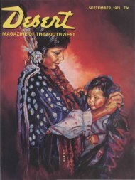
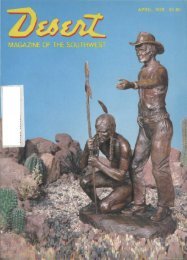
DECEMBER, 1971 50c - Desert Magazine of the Southwest
DECEMBER, 1971 50c - Desert Magazine of the Southwest
DECEMBER, 1971 50c - Desert Magazine of the Southwest

You also want an ePaper? Increase the reach of your titles
YUMPU automatically turns print PDFs into web optimized ePapers that Google loves.
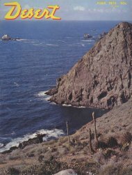
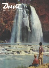
Havasu (above) is a complete<br />
aquatic recreational center. One <strong>of</strong><br />
several interesting arches (right) which<br />
can be seen on <strong>the</strong> road through <strong>the</strong><br />
Whipple Mountains.<br />
sable with S/C units.<br />
At <strong>the</strong> present time, <strong>the</strong>re is only one<br />
public campground on <strong>the</strong> Strip—Empire<br />
Landing at <strong>the</strong> Crossroads. It is<br />
being developed by <strong>the</strong> Bureau <strong>of</strong> Land<br />
Management and, currently, provides<br />
only primitive sanitary facilities.<br />
A circle tour up <strong>the</strong> California (or<br />
Arizona) side <strong>of</strong> <strong>the</strong> River, crossing<br />
Parker Dam and returning along <strong>the</strong> opposite<br />
shore, will treat you to some spectacular<br />
scenery. Through eons <strong>of</strong> time,<br />
<strong>the</strong> Colorado River has cut deep into <strong>the</strong><br />
iron-red sediments and formed a picturesque<br />
canyon between Arizona's Buckskin<br />
Mountains and California's Whipples.<br />
Subsequent erosion has scoured an array<br />
<strong>of</strong> chimney, fortress and castle-like formations<br />
along its length. The contrast <strong>of</strong><br />
rich, red-brown mountains and deep blue<br />
water will keep your color camera busy.<br />
At Parker Dam, stop and view <strong>the</strong><br />
lower end <strong>of</strong> Havasu Lake. This area is<br />
part <strong>of</strong> a National Wildlife Refuge and<br />
you will see numerous waterfowl which<br />
have journeyed south to spend <strong>the</strong> winter.<br />
You will also enjoy taking <strong>the</strong> selfguided<br />
tour <strong>of</strong> <strong>the</strong> power plant which<br />
is informative and educational.<br />
An interesting back country tour via<br />
paved road will take you through <strong>the</strong><br />
nor<strong>the</strong>astern fringes <strong>of</strong> <strong>the</strong> Whipple<br />
Mountains. A wide variety <strong>of</strong> scenery<br />
will be enjoyed as <strong>the</strong> route winds<br />
around mountains and drops into deep<br />
canyons. Begin <strong>the</strong> trip by turning west<br />
from <strong>the</strong> Parker Dam Road at <strong>the</strong> sign<br />
"Black Meadow Landing" which is lo-<br />
cated just south <strong>of</strong> Parker Dam on <strong>the</strong><br />
California side.<br />
In just eight-tenths <strong>of</strong> a mile you will<br />
see dirt tracks leading <strong>of</strong>f to <strong>the</strong> left amid<br />
some trees. Follow this short detour and<br />
you will be rewarded with a palm oasis,<br />
waterfall and stream. It is a delightful<br />
spot for a c<strong>of</strong>fee break or lunch.<br />
Back on <strong>the</strong> paved road a half-mile beyond<br />
<strong>the</strong> oasis, look left into <strong>the</strong> canyon<br />
as you near <strong>the</strong> summit. You will see a<br />
narrow, rocky gorge filled with palm<br />
trees.<br />
Beyond <strong>the</strong> summit, <strong>the</strong> road skirts<br />
<strong>the</strong> Department <strong>of</strong> Water and Power<br />
Field Office Headquarters, <strong>the</strong>n skips<br />
along <strong>the</strong> edge <strong>of</strong> Gene Wash Reservoir<br />
—<strong>the</strong> beginning <strong>of</strong> <strong>the</strong> Colorado River<br />
Aqueduct. The paving narrows, rides<br />
13