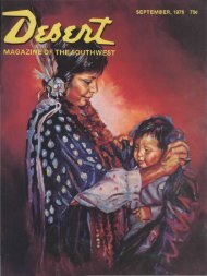
DECEMBER, 1971 50c - Desert Magazine of the Southwest
DECEMBER, 1971 50c - Desert Magazine of the Southwest
DECEMBER, 1971 50c - Desert Magazine of the Southwest

Create successful ePaper yourself
Turn your PDF publications into a flip-book with our unique Google optimized e-Paper software.
^<br />
Yuma; above <strong>the</strong> Morelos dam and probably—but<br />
not positively—from below<br />
<strong>the</strong> Imperial dam.<br />
After seeing this vast area below <strong>the</strong><br />
border, both from <strong>the</strong> ground and <strong>the</strong><br />
air, we were able to arrive at a <strong>the</strong>ory as<br />
to how and why <strong>the</strong> river shifted its<br />
course sometime in <strong>the</strong> late 1700s In<br />
those early days <strong>the</strong> gulf tapered to <strong>the</strong><br />
north, so that as <strong>the</strong> tides progressed up<br />
its 750 mile length from south to north<br />
<strong>the</strong>y became higher and advanced more<br />
rapidly as <strong>the</strong> surface area narrowed.<br />
Tidal bores in excess <strong>of</strong> 20 feet are a<br />
matter <strong>of</strong> record. These great bores were<br />
dissipated when <strong>the</strong>y reached <strong>the</strong> north<br />
<strong>of</strong> <strong>the</strong> gulf and spread out over <strong>the</strong><br />
tidal flats where <strong>the</strong> desert and dunes<br />
now lay, and at ebb tide would deposit<br />
<strong>the</strong>ir vast burdens <strong>of</strong> sand. Surface temperatures<br />
in <strong>the</strong> area have been reported<br />
at 180 degrees in <strong>the</strong> summer months.<br />
The blistering sun dried out <strong>the</strong> top<br />
sands in a matter <strong>of</strong> minutes after <strong>the</strong><br />
tide receded, and <strong>the</strong>y would be drifted<br />
by <strong>the</strong> prevailing westerly winds forming<br />
<strong>the</strong> great dunes as <strong>the</strong>y now exist.<br />
Where <strong>the</strong> force <strong>of</strong> <strong>the</strong> incoming tides<br />
met <strong>the</strong> current <strong>of</strong> <strong>the</strong> river huge sandbars<br />
were formed and were enlarged by <strong>the</strong><br />
debris and silt carried by <strong>the</strong> river.<br />
Francisco de Ulloa, one <strong>of</strong> <strong>the</strong> earliest<br />
explorers to sail to <strong>the</strong> mouth <strong>of</strong> <strong>the</strong> Colorado<br />
in 1647 reported, "A recent downpour<br />
to <strong>the</strong> north had put <strong>the</strong> river in<br />
flood so that down <strong>the</strong> estuary came<br />
floating great clots <strong>of</strong> grass-matted soil,<br />
trunks <strong>of</strong> trees and o<strong>the</strong>r light debris.<br />
Sometimes it was <strong>the</strong> color <strong>of</strong> lime—<strong>the</strong><br />
color <strong>of</strong> a river in flood, <strong>the</strong>n yellow,<br />
<strong>the</strong>n dark brown, and again <strong>the</strong> color <strong>of</strong><br />
chocolate or nearly black from <strong>the</strong> volcanic<br />
contents <strong>of</strong> <strong>the</strong> soil."<br />
With <strong>the</strong> formation <strong>of</strong> <strong>the</strong>se bars <strong>of</strong><br />
silt and sand, <strong>the</strong> channels <strong>of</strong> <strong>the</strong> delta<br />
were choked and eventually dammed.<br />
The river became deeper and its waters<br />
backed up to <strong>the</strong> confluence with <strong>the</strong><br />
Gila River, or far<strong>the</strong>r up both rivers, and<br />
spread across <strong>the</strong> tidal flats surrounding<br />
<strong>the</strong> delta. Finally a trickle overflowed<br />
<strong>the</strong> once-high west bank <strong>of</strong> <strong>the</strong> Colorado.<br />
While <strong>the</strong> bank washed away <strong>the</strong> trickle<br />
became a flow, and <strong>the</strong> flow a torrent<br />
as <strong>the</strong> river rushed out into <strong>the</strong> lower<br />
lands to <strong>the</strong> southwest. Several hundred<br />
square miles were flooded before <strong>the</strong><br />
rampaging river once again settled down<br />
in its ancient stream bed to <strong>the</strong> west.<br />
The water flowing over <strong>the</strong> west bank<br />
cut deep to a ledge <strong>of</strong> bedrock where it<br />
could go no deeper. This, however, was<br />
not as deep as <strong>the</strong> bed <strong>the</strong> river had followed<br />
for several centuries. A greatly<br />
reduced flow continued as it had before.<br />
With <strong>the</strong> diminished volume <strong>of</strong> water<br />
going down <strong>the</strong> channel toward Adair<br />
Bay <strong>the</strong> river and <strong>the</strong> flood waters in<br />
<strong>the</strong> delta gradually stagnated and could<br />
no longer carry away <strong>the</strong> blowing sands<br />
as <strong>the</strong>y settled. Over a period <strong>of</strong> time<br />
<strong>the</strong> channels became filled to <strong>the</strong> top <strong>of</strong><br />
<strong>the</strong>ir banks. Capillary action carried <strong>the</strong><br />
moisture upward, dampening <strong>the</strong> sands<br />
as fast as <strong>the</strong> winds deposited <strong>the</strong>m, first<br />
forming ridges and <strong>the</strong>n dunes that continued<br />
to grow into great sand hills. As<br />
<strong>the</strong> moisture reached <strong>the</strong> top <strong>of</strong> <strong>the</strong> sand<br />
it evaporated where <strong>the</strong> arid desert air<br />
reached it-<br />
Waters gradually drained from <strong>the</strong><br />
flood plains <strong>of</strong> <strong>the</strong> delta, joining <strong>the</strong> flow<br />
still coming down <strong>the</strong> old channels. Bit<br />
by bit <strong>the</strong> water built up pressure when<br />
<strong>the</strong> capillary action and evaporation<br />
could no longer handle it. The flow became<br />
more concentrated and its velocity<br />
increased as seepage broke through under<br />
<strong>the</strong> old barriers and soon became a free<br />
flowing underground river into Adair<br />
Bay.<br />
The last inhabitants who might have<br />
seen this all take place were <strong>the</strong> Arenero<br />
Indians. Most <strong>of</strong> <strong>the</strong>m left while <strong>the</strong><br />
waters were disappearing; <strong>the</strong> last <strong>of</strong><br />
<strong>the</strong>m were run out or killed by a Mexican<br />
posse nearly a century ago—<strong>the</strong>y had<br />
been responsible or were so accused, for<br />
more than 50 murders and robberies<br />
along <strong>the</strong> Camino del Diablo. They left<br />
no written records and <strong>the</strong>ir legends died<br />
with <strong>the</strong>m. Consequently <strong>the</strong> "how" and<br />
"why" <strong>the</strong> river changed is course is a<br />
matter <strong>of</strong> conjecture based on existing<br />
evidence, with a few educated guesses<br />
to fit <strong>the</strong> pieces toge<strong>the</strong>r.<br />
The amount <strong>of</strong> irrigation water being<br />
lost before it reaches <strong>the</strong> Alamo Canal<br />
and possibly, but not probably, from <strong>the</strong><br />
All American Canal is also a matter <strong>of</strong><br />
conjecture until <strong>the</strong> comparative flows<br />
can be measured.<br />
In any event, if you're boating down<br />
<strong>the</strong> lower Colorado take <strong>the</strong> right hand<br />
branch—<strong>the</strong> o<strong>the</strong>r has a very low ceiling.<br />
•<br />
FISH! FISH! FISH!<br />
TROUT, BASS AND CATFISH<br />
Get your share at Hall's Crossing<br />
HALLS'S CROSSING MARINA OFFERS: Gas and oil, live bait and lures, fishing gear, boat repair<br />
facilities, cold beer, ICE, groceries, slips and buoys for rent. Overnight accommodations that<br />
sleep two to eight persons. Write or call for reservations. At <strong>the</strong> general store: fresh milk, eggs,<br />
butter, frozen meat, cold cuts and canned items for camping or picnicking. Take a boat trip to<br />
Rainbow Bridge in one day. 2, 3 and 4-day tours to various parts <strong>of</strong> <strong>the</strong> lake, camping and<br />
sleeping under <strong>the</strong> stars. Ferry service for travelers' with light vehicles. All types <strong>of</strong> pleasure<br />
craft for rent, from 14-ft. to houseboats. Airstrip is 4000 feet with tiedown facilities available.<br />
HALL'S CROSSING MARINA<br />
Write Lake Powell Ferry Service, Blanding Utah or call Moab Mobile Operator, ask for Unit 56<br />
29