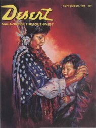
DECEMBER, 1971 50c - Desert Magazine of the Southwest
DECEMBER, 1971 50c - Desert Magazine of the Southwest
DECEMBER, 1971 50c - Desert Magazine of the Southwest

Create successful ePaper yourself
Turn your PDF publications into a flip-book with our unique Google optimized e-Paper software.
Indians and Spanish found in <strong>the</strong> San<br />
Bernardinos not only beauty and shelter,<br />
but trading commodities such as furs<br />
and minerals.<br />
Holcomb Valley gold, discovered in<br />
<strong>the</strong> early 1860s, created some new geographical<br />
problems peculiar to this nor<strong>the</strong>asterly<br />
mountain location. The great Mojave<br />
<strong>Desert</strong> trough <strong>of</strong> Victor, Apple, Lucerne<br />
and Johnson valleys was closer<br />
than <strong>the</strong> southwesterly mountain slopes<br />
into <strong>the</strong> "civilized" basins <strong>of</strong> San Bernardino,<br />
Redlands and Riverside.<br />
While selecting appropriate shipping<br />
routes from <strong>the</strong> Big Bear Lake vicinity,<br />
trailblazers and last-chance prospectors<br />
joined forces in <strong>the</strong> 1860s and began<br />
serious exploring and mapping <strong>of</strong> <strong>the</strong><br />
canyons east and north down to <strong>the</strong> desert<br />
flatlands.<br />
Like all venturers, <strong>the</strong>se men named<br />
areas as <strong>of</strong>ten by whim as by rationale.<br />
Rattlesnakes are common in high desert<br />
canyons leading into <strong>the</strong> mountains, and<br />
<strong>the</strong>re are no less than three canyons and<br />
three springs in this region which still<br />
bear that viperous name. The Rose Mine<br />
is located in ano<strong>the</strong>r Rattlesnake Canyon<br />
(Burns Canyon to Pioneertown); <strong>the</strong><br />
Balanced Rock Mine east <strong>of</strong> <strong>the</strong> Old<br />
Mormon Trail is located near ano<strong>the</strong>r<br />
Rattlesnake Spring (between Apple Valley<br />
and Fawnskin).<br />
By 1870, <strong>the</strong> Black Hawk and Silver<br />
Reef Mining Districts had been established<br />
just a few miles west <strong>of</strong> Old Woman<br />
Springs. It is safe to assume that <strong>the</strong> initial<br />
digs in our Rattlesnake Canyon were<br />
made between I860 and 1880. Generous<br />
samples <strong>of</strong> pre-automation cans and shallow<br />
tunnels marked with hand-hewn<br />
primitiveness hint at this.<br />
Getting into Rattlesnake Canyon today<br />
is not altoge<strong>the</strong>r simple. The westerly<br />
entrance, via Old Woman Springs, is<br />
through private property and prohibited.<br />
On Old Woman Springs Road toward<br />
Yucca Valley a set <strong>of</strong> telephone poles<br />
flanks <strong>the</strong> road on <strong>the</strong> north side. At one<br />
point about three miles east <strong>of</strong> Old Woman<br />
Springs <strong>the</strong>re is a support pole on<br />
<strong>the</strong> south side <strong>of</strong> <strong>the</strong> road, where <strong>the</strong> asphalt<br />
curves. At this bend, where a taut<br />
cable crosses over <strong>the</strong> road, is <strong>the</strong> dirt<br />
road leading southwesterly into <strong>the</strong> Bighorn<br />
Mountains.<br />
Gentle, dipping and dusty, this road<br />
covers some four miles across <strong>the</strong> alluvial<br />
fan toward <strong>the</strong> mouth <strong>of</strong> Rattlesnake<br />
Canyon. The trail narrows and winds<br />
Once used to haul ore from <strong>the</strong> wooden chute (above) <strong>the</strong> old wagon road is now<br />
covered with weeds and shouts <strong>of</strong> <strong>the</strong> wagon masters are no longer heard. Looking<br />
west toward <strong>the</strong> Bighorn Mountains (below) are seen <strong>the</strong> shaft, headframe<br />
and tailings <strong>of</strong> <strong>the</strong> mining operation. Photos by <strong>the</strong> author.