Principles of GIS - Capita
Principles of GIS - Capita
Principles of GIS - Capita
Create successful ePaper yourself
Turn your PDF publications into a flip-book with our unique Google optimized e-Paper software.
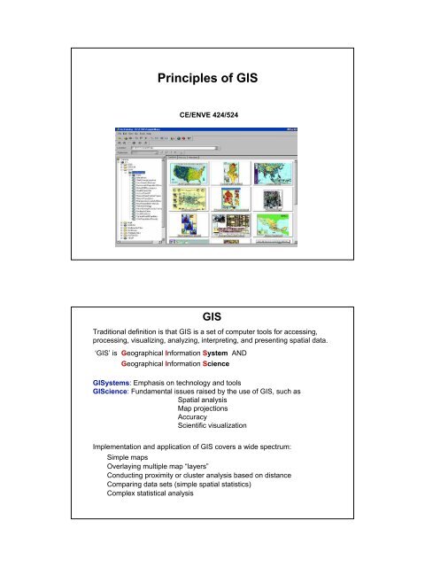
<strong>Principles</strong> <strong>of</strong> <strong>GIS</strong><br />
CE/ENVE 424/524<br />
<strong>GIS</strong><br />
Traditional definition is that <strong>GIS</strong> is a set <strong>of</strong> computer tools for accessing,<br />
processing, visualizing, analyzing, interpreting, and presenting spatial data.<br />
‘<strong>GIS</strong>’ is Geographical Information System AND<br />
Geographical Information Science<br />
<strong>GIS</strong>ystems: Emphasis on technology and tools<br />
<strong>GIS</strong>cience: Fundamental issues raised by the use <strong>of</strong> <strong>GIS</strong>, such as<br />
Spatial analysis<br />
Map projections<br />
Accuracy<br />
Scientific visualization<br />
Implementation and application <strong>of</strong> <strong>GIS</strong> covers a wide spectrum:<br />
Simple maps<br />
Overlaying multiple map “layers”<br />
Conducting proximity or cluster analysis based on distance<br />
Comparing data sets (simple spatial statistics)<br />
Complex statistical analysis
Views to a <strong>GIS</strong><br />
Map view:<br />
Focus on cartographic (mapping) aspects <strong>of</strong> <strong>GIS</strong><br />
Thematic <strong>GIS</strong> layers<br />
Input map => Output map<br />
Database view:<br />
Focus on database management system<br />
Simple queries to retrieve and overlay data<br />
Spatial analysis view:<br />
Focuses on analysis and modelling<br />
Views <strong>GIS</strong> more as information science<br />
Organizational view:<br />
Focuses on decision support systems<br />
An approach to managing an organization’s data,<br />
information, and knowledge<br />
<strong>GIS</strong> as Toolbox<br />
<strong>GIS</strong> is "a powerful set <strong>of</strong> tools for collecting, storing, retrieving at will,<br />
transforming and displaying spatial data from the real world for a<br />
particular set <strong>of</strong> purposes"<br />
(Burrough and McDonnell, 1998)<br />
<strong>GIS</strong> are "automated systems for the capture, storage, retrieval,<br />
analysis, and display <strong>of</strong> spatial data" (Clarke, 1995)<br />
<strong>GIS</strong> is “an information technology which stores, analyses, and displays<br />
both spatial and non-spatial data” (Parker 1988)
<strong>GIS</strong> as Database<br />
<strong>GIS</strong> is “a database system in which most <strong>of</strong> the data are spatially<br />
indexed, and upon which a set <strong>of</strong> procedures operated in order to<br />
answer queries about spatial entities in the database” (Smith et al.,<br />
1987)<br />
"A geographic information system is a special case <strong>of</strong> information<br />
systems where the database consists <strong>of</strong> observations on spatially<br />
distributed features, activities or events, which are definable in<br />
space as points, lines, or areas. A geographic information system<br />
manipulates data about these points, lines, and areas to retrieve<br />
data for ad hoc queries and analyses" (Dueker, 1979)<br />
<strong>GIS</strong> as Spatial Analysis<br />
"An information system that is designed to work with data referenced<br />
by spatial or geographic coordinates. In other words, a <strong>GIS</strong> is both a<br />
database system with specific capabilities for spatially-referenced<br />
data, as well as a set <strong>of</strong> operations for working with the data" (Star<br />
and Estes, 1990)<br />
“The true potential value <strong>of</strong> Geographical Information Systems lies in<br />
their ability to analyze spatial data using the techniques <strong>of</strong> spatial<br />
analysis" (Goodchild, 1988)<br />
"<strong>GIS</strong> technology integrates common database operations such as query<br />
and statistical analysis with the unique visualization and geographic<br />
analysis benefits <strong>of</strong>fered by maps. These abilities distinguish <strong>GIS</strong> from<br />
other information systems and make it valuable to a wide range <strong>of</strong><br />
public and private enterprises for explaining events, predicting<br />
outcomes, and planning strategies." (ESRI 1997)
<strong>GIS</strong> as Organization<br />
“ a decision support system involving the integration <strong>of</strong> spatially<br />
referenced data in a problem-solving environment” (Cowen, 1988)<br />
“ an institutional entity, reflecting an organizational structure that<br />
integrates technology with a database, expertise and continuing<br />
financial support over time” (Carter, 1989)<br />
“organized activity by which people measure and represent<br />
geographic phenomena, and then transform these<br />
representations into other forms while interacting with social<br />
structures.” (Chrisman, 1999)<br />
<strong>GIS</strong> as Science<br />
GI Science addresses "the generic issues that surround the use <strong>of</strong> <strong>GIS</strong><br />
technology, impede its successful implementation, or emerge from<br />
an understanding <strong>of</strong> its potential capabilities." (Goodchild, 1992)<br />
It makes “more sense for the research community to decode the <strong>GIS</strong><br />
acronym in this way, focusing on the generic issues <strong>of</strong> spatial<br />
data, rather than on the limited solutions <strong>of</strong>fered by today's<br />
geographic information system products. “ (Goodchild, 1995)
A Brief History <strong>of</strong> <strong>GIS</strong><br />
• <strong>GIS</strong> is relatively young but mapping and spatial analysis preceded it<br />
by hundreds <strong>of</strong> years<br />
• Manual map overlay as a method was first described<br />
comprehensively in a 1950 textbook<br />
• Mathematics for spatial analysis were developed in the 1930s and<br />
1940s<br />
• <strong>GIS</strong> evolution parallels that <strong>of</strong> general information technology<br />
A Brief History <strong>of</strong> <strong>GIS</strong> – 1960s<br />
• The 1960s saw the advent <strong>of</strong> geographic data and mapping s<strong>of</strong>tware<br />
• First <strong>GIS</strong> was the Canada Geographic Information System developed<br />
for land resource measuring and inventory analysis<br />
• The Harvard Laboratory for Computer Graphics and Spatial Analysis<br />
established<br />
• Aeronautical Charting and Information Center in St. Louis<br />
• US Defense Mapping Agency in St. Louis (now NIMA – National<br />
Imagery and Mapping Agency)
A Brief History <strong>of</strong> <strong>GIS</strong> – 1970s<br />
• Gridded data analysis programs<br />
• Rudimentary graphics<br />
• ESRI (Environmental Science and Research<br />
Institute) established<br />
• Intergraph<br />
• Increased use by government agencies<br />
• Satellite imagery (Landsat)<br />
• Dual Independent Map Encoding (DIME) for census areas<br />
• <strong>GIS</strong> Functions for points and polygons<br />
A Brief History <strong>of</strong> <strong>GIS</strong> – 1980s<br />
• ESRI ArcInfo<br />
• Global Positioning System (GPS)<br />
• <strong>GIS</strong> Journals and Conferences<br />
• MapInfo<br />
• TIGER (Topographically Integrated Geographic<br />
Encoding and Referencing) Census project<br />
• Academic <strong>GIS</strong> courses<br />
• Widespread acceptance<br />
• Increased availability <strong>of</strong> satellite imagery
A Brief History <strong>of</strong> <strong>GIS</strong> – 1990s<br />
• Migration to PC<br />
Open <strong>GIS</strong> Consortium<br />
National Spatial Data Infrastructure (NSDI)<br />
Web <strong>GIS</strong><br />
Integration <strong>of</strong> geospatial data<br />
<strong>GIS</strong> Day<br />
A Brief History <strong>of</strong> <strong>GIS</strong> – 2000s<br />
• Web<strong>GIS</strong><br />
• Wireless (PDAs, cell phones)<br />
• Embedded Sensor Networks<br />
• Distributed Databases<br />
• <strong>GIS</strong>ervices
• Organized collection <strong>of</strong><br />
– Hardware<br />
– S<strong>of</strong>tware<br />
People<br />
– Network<br />
– Data<br />
– People<br />
– Management<br />
Components <strong>of</strong> <strong>GIS</strong><br />
“<strong>GIS</strong> should be viewed as a process rather than as merely<br />
s<strong>of</strong>tware or hardware.” (Malczewski, 1999)<br />
SAPs<br />
Network<br />
Hardware<br />
<strong>GIS</strong> S<strong>of</strong>tware Architecture<br />
User Interface<br />
Tools<br />
Data Management<br />
Data<br />
S<strong>of</strong>tware<br />
Viewers, Controls<br />
Data<br />
Management<br />
Display, Analysis, Manipulation<br />
Data Access, Conversion
<strong>GIS</strong> S<strong>of</strong>tware Classification<br />
Number <strong>of</strong><br />
Users<br />
Internet<br />
Viewer<br />
Component<br />
Hand-held<br />
Desktop<br />
Pr<strong>of</strong>essional<br />
Functionality<br />
<strong>GIS</strong> S<strong>of</strong>tware Packages<br />
Cost<br />
Autodesk ESRI Intergraph MapInfo GE Network<br />
Solutions<br />
Viewer AutoCAD<br />
LT<br />
ArcReader GeoMedia Viewer ProViewer Custom<br />
Desktop World ArcView GeoMedia MapInfo<br />
Spatial<br />
Pr<strong>of</strong>essional Intelligence<br />
Pr<strong>of</strong>ess- AutoCAD / ArcEditor GeoMedia Pro MapInfo<br />
Smallworld <strong>GIS</strong><br />
ional Map ArcInfo<br />
Pr<strong>of</strong>essional<br />
Hand-held OnSite ArcPad IntelliWhere MapXtend Scout<br />
Database<br />
Server<br />
Design<br />
Server<br />
Component In several<br />
products<br />
ArcSDE Uses Oracle<br />
Spatial<br />
Map<br />
Objects<br />
Internet MapGuide ArcIMS GeoMedia Web<br />
Map, GeoMedia<br />
Web Enterprise<br />
CAD AutoCAD<br />
Map<br />
In several<br />
products<br />
SpatialWare Part <strong>of</strong><br />
Smallworld <strong>GIS</strong><br />
Part <strong>of</strong> GeoMedia MapX, MapJ Part <strong>of</strong><br />
Smallworld <strong>GIS</strong><br />
In several<br />
products<br />
MapXtreme,<br />
MapXSite<br />
In several<br />
products<br />
Smallworld<br />
Internet Application<br />
Server<br />
Part <strong>of</strong><br />
Smallworld <strong>GIS</strong>
<strong>GIS</strong> Market<br />
Revenues for 2001 - $1.1 Billion (14.3% growth over previous year)<br />
Market Share (2002)<br />
ESRI - 35%<br />
Intergraph - 13%<br />
GE Network Solutions - 7%<br />
Autodesk - 7%<br />
Leica - 6%<br />
Mapinfo - 6%<br />
IBM - 5%<br />
SICAD - 5%<br />
Logica - 3%<br />
Other - 14%<br />
Largest market for <strong>GIS</strong> S<strong>of</strong>tware: Utilities industry (21%), followed by state and local<br />
governments<br />
Total <strong>GIS</strong> Front-End Business tops $7.7 Billion<br />
<strong>GIS</strong>-Related Services Reach $5.4 Billion<br />
<strong>GIS</strong> Drives $799 Million in Hardware Sales<br />
Others:<br />
Idrisi<br />
GRASS<br />
Arc<strong>GIS</strong> System Architecture
ArcMap<br />
Arc<strong>GIS</strong> Main Components<br />
ArcCatalog<br />
ArcToolbox<br />
ArcMap<br />
Central Arc<strong>GIS</strong> application<br />
Handles map-based tasks
ArcCatalog<br />
Organizes and manages <strong>GIS</strong> data<br />
ArcCatalog
ArcToolbox<br />
<strong>GIS</strong> Data Formats<br />
Contains the tools for<br />
geoprocessing
Working in Arc<strong>GIS</strong><br />
Arc<strong>GIS</strong> Extensions<br />
Special functionality can be added to Arc<strong>GIS</strong> through<br />
extensions. We will be have access to the following<br />
extensions:<br />
•Spatial Analyst<br />
•Geostatistical Analyst<br />
•3D Analyst
Spatial Analyst<br />
Geostatistical Analyst<br />
Raster and Vector<br />
Analysis<br />
Advanced spatial<br />
analysis
3D Analyst


