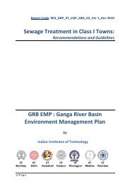
Proposal GRBMP. pdf - GANGAPEDIA
Proposal GRBMP. pdf - GANGAPEDIA
Proposal GRBMP. pdf - GANGAPEDIA

Create successful ePaper yourself
Turn your PDF publications into a flip-book with our unique Google optimized e-Paper software.
IIT<br />
Bombay<br />
IIT<br />
Delhi<br />
G<br />
M<br />
GANGGA<br />
RIIVER<br />
BASIN<br />
MANAAGEMMENT<br />
PLAN<br />
Ministry<br />
off<br />
Environnment<br />
an nd Foressts<br />
Goovernment<br />
of Inddia<br />
New Dellhi<br />
Indian In nstitutess<br />
of Techhnology<br />
IIT<br />
Guwah hati<br />
IITT<br />
Kanppur<br />
P<br />
PROPOSAAL<br />
SUBMITTED<br />
TTO<br />
IIT<br />
IIT IIT<br />
Kharragpur<br />
Madras M RRoorkee
PREFACE<br />
The river Ganga is of unique importance ascribed to reasons that are geographical,<br />
historical, socio-cultural and economic, giving it the status of a National River. It<br />
has been facing serious threat due to discharge of increasing quantities of sewage<br />
effluents, trade effluents and other pollutants on account of rapid urbanization,<br />
industrialization and agricultural growth. The challenge is compounded due to<br />
competing demands for river water for irrigation, domestic purposes, industrial use<br />
and power.<br />
There is need to ensure effective abatement of pollution and conservation of the<br />
river Ganga by adopting a river basin approach to promote inter-sectorial<br />
coordination for comprehensive planning and management. It is equally important<br />
to maintain minimum ecological flows in river Ganga with the aim of ensuring water<br />
quality through environmentally sustainable development.<br />
In exercise of the powers conferred by sub-sections (1) and (3) of Section 3 of the<br />
Environment (Protection) Act, 1986 (29 of 1986), the Central Government has<br />
constituted National Ganga River Basin Authority (NGRBA) as a planning, financing,<br />
monitoring and coordinating authority for strengthening the collective efforts of the<br />
Central and State Government for effective abatement of pollution and conservation<br />
of the river Ganga. One of the important functions of the NGRBA is to prepare and<br />
implement a Ganga River Basin Management Plan (<strong>GRBMP</strong>).<br />
It is proposed to develop the <strong>GRBMP</strong> based on scientific application of modern tools<br />
and technologies combined with traditional wisdom. It has been decided that the<br />
<strong>GRBMP</strong> be prepared jointly by the seven Indian Institutes Technology’s (IITs) namely<br />
IITs at Kanpur, Bombay, Delhi, Guwahati, Kharagpur, Madras and Roorkee. This will<br />
help leverage the vast knowledge base and experience of IITs in various fields.<br />
This document is a proposal to prepare Ganga River Basin Management Plan by the<br />
IITs. This has been prepared based on workshops organized on various thematic<br />
groups at IIT Delhi and IIT Kanpur, and several meetings/consultations with various<br />
groups/people. Contribution of each and every one who participated in the<br />
preparation of this document is highly appreciated. The seed grant provided by the<br />
MoEF, and the trust and confidence put on IITs by Shri Jairam Ramesh, Hon’ble<br />
Minister of State (Independent Charge) is gratefully acknowledged. Guidance,<br />
support and cooperation received from Shri, Rajiv Gauba, IAS, Joint Secretary and<br />
his colleagues from MoEF is highly appreciated.<br />
June 30, 2010 Vinod Tare
CONTENTS<br />
S No Page No<br />
1 Prologue 1<br />
2 Approach and Methodology 2<br />
3 Data Requirement/Sources/Collection 4<br />
4 Environmental Quality and Pollution 7<br />
4.1 Preamble 7<br />
4.2 Objective 7<br />
4.3 Scope 7<br />
4.4 Methodology 8<br />
4.5 Data Required 20<br />
4.6 Deliverables 20<br />
4.7 Work Plan 21<br />
4.8 The Team 22<br />
5 Water Resources Management 23<br />
5.1 Preamble 23<br />
5.2 Objective 26<br />
5.3 Scope 26<br />
5.4 Methodology 26<br />
5.5 Data Required 28<br />
5.6 Deliverables 29<br />
5.7 Work Plan 30<br />
5.8 Data Collection 31<br />
5.9 The Team 31<br />
6 Fluvial Geomorphology 33<br />
6.1 Preamble 33<br />
6.2 Major Objectives 34<br />
6.3 Approach and Methodology 35<br />
6.3.1 Mapping geomorphic condition and river dynamics of the river 35<br />
6.3.2 Generation of stream power distribution pattern 36<br />
6.3.3 Control of river energy and sediment supply on channel morphology 37<br />
6.3.4 Hydrology – Geomorphology - Ecology relationship for the different<br />
reaches of the Ganga River<br />
37<br />
6.3.5 Determination of Environment Flow and role of hydrology for<br />
managing geomorphic condition<br />
6.3.6 Data integration in River style framework 37<br />
6.4 Data Requirements 38<br />
6.5 Distribution of Work 38<br />
6.6 Deliverables 39<br />
6.7 Work Plan 40<br />
6.8 The Team 40<br />
6.9 References Cited 41<br />
7 Ecology and Biodiversity 42<br />
7.1 Preamble 42<br />
7.2 Objectives 44<br />
7.3 Methodology 45<br />
7.3.1 River Basin Divisions 45<br />
7.3.2 Data collection and Analysis 45<br />
7.4 Deliverables 49<br />
7.5 Work Plan 50<br />
7.6 The Team 50<br />
7.7 References 51<br />
37
S No Page No.<br />
8 Socio-Economic-Cultural 52<br />
8.1 Preamble 52<br />
8.2 Objective 53<br />
8.3 Methodology 53<br />
8.4 Deliverables 55<br />
8.5 Distribution of Responsibilities 56<br />
8.6 Time Schedule and Delivery of Reports 56<br />
8.7 The Team 59<br />
9 Policy, Law and Governance 60<br />
9.1 Preamble 60<br />
9.2 Objective 61<br />
9.3 Methodology 61<br />
9.4 Activities 61<br />
9.5 Deliverables 62<br />
9.6 The Team 64<br />
10 Geo-Spatial Database Management 65<br />
10.1 Preamble 65<br />
10.2 Objectives 65<br />
10.3 Scope 67<br />
10.4 Types of Data 67<br />
10.5 Methodology 68<br />
10.6 Work Plan 69<br />
10.7 Deliverables 69<br />
10.8 The Team 69<br />
11 Communication 70<br />
11.1 Preamble 70<br />
11.2 Roles and Responsibility 70<br />
11.3 Typical Communication Plan 71<br />
11.4 Work Packages 72<br />
11.5 Work Plan 72<br />
11.6 The Team 73<br />
12 Deliverables 74<br />
13 The Team 77
1.<br />
Convenntional<br />
wissdom<br />
sugggests<br />
that mmajor<br />
envi ironmental<br />
problemss<br />
that have e arisen<br />
as a result<br />
of devvelopment<br />
can only bbe<br />
tackled through aadoption<br />
off<br />
technolog gies for<br />
pollutioon<br />
control or remediation<br />
of ccontaminax<br />
xted enviroonmental<br />
media. Ho owever,<br />
imposing<br />
controols<br />
on actiivities<br />
thatt<br />
lead to excessive pollution may ofte en be a<br />
better strategy ffor<br />
combaating<br />
envirronmental<br />
pollution. For exaample,<br />
two o major<br />
environnmental<br />
pproblems<br />
oof<br />
the tweentieth<br />
ce entury, vizz.,<br />
eutrophhication<br />
of f water<br />
bodies and deppletion<br />
of stratosphheric<br />
ozon ne layer, could be tackled through t<br />
imposition<br />
of ccontrols<br />
oon<br />
the causative<br />
agents, i. .e., phospphate<br />
con ntaining<br />
detergeents<br />
and oozone<br />
depleting<br />
subsstances<br />
(ODS)<br />
respecctively.<br />
Advances<br />
in science<br />
and teechnology<br />
have plaayed<br />
a ggreat<br />
role in identtifying<br />
andd<br />
analyzing<br />
the<br />
environnmental<br />
prroblems.<br />
However, solution to<br />
such prooblems<br />
oftten<br />
lies in use of<br />
technoologies<br />
witth<br />
minimaal<br />
environmmental<br />
foo otprint. Thhe<br />
vision of great leaders,<br />
philosoophers<br />
andd<br />
thinkers is often reeflective<br />
of such a phhilosophy.<br />
Mahatma Gandhi<br />
stated that, “therre<br />
is enough<br />
for eveeryone’s<br />
need<br />
but noot<br />
sufficient<br />
for even<br />
one’s<br />
greed” . Planet Earth<br />
from a distancee<br />
is just a magic blue<br />
and whitte<br />
pearl where<br />
all<br />
life exists;<br />
all peoople<br />
are thhe<br />
citizens of the world;<br />
all peoople<br />
are deependent<br />
on o each<br />
other, rather all forms of llife<br />
dependdent<br />
on ea ach other. The followwing<br />
shlok ka from<br />
the Brrahmanandd<br />
Puranamm<br />
outlines simple instructionns<br />
for commmon<br />
peo ople to<br />
protectt<br />
water boodies<br />
not oonly<br />
for huuman<br />
uses s but for mmaintenancce<br />
of aqua atic life,<br />
and carries<br />
the saame<br />
meaning.<br />
Many such visioonary<br />
stateements/meessages<br />
are a often qquoted<br />
in various forums. f<br />
However,<br />
the undderlying<br />
mmessage<br />
is rarely imb bibed and implemented.<br />
We propose p<br />
to preppare<br />
the GGanga<br />
Riveer<br />
Basin MManagemen<br />
nt Plan based<br />
on scientific<br />
pri inciples<br />
and appplication<br />
oof<br />
modernn<br />
tools/tecchnologies<br />
but with traditional<br />
wisdom (e.g. as<br />
outlineed<br />
in abovee<br />
shloka). Further, thhe<br />
necessit ty of adoptting<br />
practices<br />
that re equire a<br />
paradiggm<br />
shift on<br />
use of laand,<br />
water and other r natural reesources<br />
inn<br />
the Gang ga Basin<br />
for varrious<br />
purpposes<br />
would<br />
be empphasized<br />
along a withh<br />
suggestioons<br />
for pl lausible<br />
alternaative<br />
appproaches<br />
using innovative<br />
conceptts<br />
and state-of- -the-art<br />
technoologies/meethods.<br />
P<br />
ROLOG GUE<br />
1
2. APPROACH AND METHODOLOGY<br />
An integrated river basin management approach that focuses on “Maintenance and<br />
restoration of wholesomeness of Ganga system and improvement of its ecological<br />
health with due regard to conflict of interest in water uses in entire river basin” will<br />
be adopted. This, entails preparation of plan that has adequate provision for soil,<br />
water and energy in the Ganga Basin to accommodate growing population,<br />
urbanization, industrialization and agriculture while ensuring that the fundamental<br />
aspects of the river system, i.e. (i) river must continuously flow , (ii) river<br />
must have longitudinal and lateral connectivity, (iii) river must have adequate space<br />
for its various functions, (iv) river must function as an ecological entity, and (v) river<br />
must be kept free from any kind of wastes ,, ,are protected. Achieving this<br />
will require development of a framework for coordination whereby all<br />
administrations and stakeholders can come together to formulate an agreed set of<br />
policies and strategies to have a balanced and acceptable approach to land, water,<br />
and natural resource management in the Ganga Basin.<br />
The Ganga River Basin (GRM) is a multifaceted system and requires multidisciplinary<br />
and interdisciplinary approach. For integrated management of Ganga<br />
River Basin several aspects need to be considered. It is proposed that the work<br />
would broadly be undertaken through following broad themes by various teams. It<br />
is expected that the teams working on each of the themes will closely interact.<br />
a) Environmental Quality and Pollution<br />
b) Water Resources Management<br />
c) Fluvial Geomorphology<br />
d) Ecology and Biodiversity<br />
e) Socio-Economic and Cultural<br />
f) Policy, Law and Governance<br />
g) Geo-spatial Data Base Management<br />
h) Communication<br />
Objectives, scope, methodology, deliverables, work plan and the team involved for<br />
various thematic groups are presented in Chapters 4 through 11. In general<br />
following line of action will be followed.<br />
a) Start-up meeting, collection of relevant data/reports from various agencies<br />
including NRCD to assess present state-of-the-art and take lessons from the<br />
past experience of Ganga Action Plan Phase I and II (GAP I and GAP II), Yamuna<br />
Action Plan (YAP) and other River Action Plans (RAPs).<br />
2
) Delineation of basin water bodies and their status: Review of existing<br />
programmes, plans and measures; Collation of data on water bodies;<br />
Identification of sources and estimation of pollution loads; Analysis of existing<br />
hydrological conditions including flow simulation using hydrological models;<br />
Evaluation of impacts of dams/water resources projects; Assessment of existing<br />
water quality status; Preparation of basin atlas; Preparation of tables and maps<br />
(including GIS based maps); Description of basin characteristics, etc.<br />
c) Modeling supportive and assimilative capacities – situation analysis: Select<br />
appropriate simulation models; Model supportive and assimilative capacities,<br />
and develop scenarios; Carryout iterations to firm-up programme of measures.<br />
d) Establishing environmental objectives/principles of river basin planning<br />
e) Evolve measures for improvement: Changes in mechanisms (policy, regulations,<br />
enforcement, etc.); Maintaining desired water quality; Maintaining ecological/<br />
environmental flows; Augmentation of river flow; Catchment area treatment<br />
and floodplain protection; Sustainable river conservation, etc.<br />
f) Public awareness and stakeholders’ consultation: Mapping of all stakeholders;<br />
Review of completed/ongoing public awareness and consultation process;<br />
Undertake public/stakeholders consultations; Develop programme for public<br />
awareness, consultation and participation.<br />
g) Institutional strengthening and capacity building: Review of existing policies<br />
and regulations; Review of existing institutional arrangements and its capacity<br />
assessment; Develop institutional strengthening and capacity building/training<br />
plan, etc.<br />
h) Evaluation and monitoring programme to facilitate mid course correction.<br />
3
3. DATA REQUIREMENT/SOURCES/COLLECTION<br />
The timely collection of required data as available with various agencies, ULBs,<br />
institutes etc. is the key for successful completion of the study within schedule. The<br />
duration of river basin management plan preparation is 15-18 months, which could<br />
only be completed by a highly professional, experienced and exclusively dedicated<br />
team. However the crux of the study depends on planning and execution of a clear<br />
strategy for collecting necessary data from various sources as the <strong>GRBMP</strong> would<br />
essentially be developed mainly based on secondary data. The long-term data<br />
generated in the past, as will be collected and compiled by the mission team, will be<br />
randomly verified/ authenticated by conducting field survey and investigation but the<br />
scope of such data collection would obviously be quite limited. We therefore propose<br />
herein a clear strategy for collecting and analysing available data on various attributes<br />
of the river basin. The key element of our data collection strategy includes:<br />
Identification and establishing the range, depth and coverage of various data in<br />
advance<br />
Determining 'essential' and 'desirable' data needs<br />
Identification of sources of data<br />
Allocating resources for data collection<br />
Allocating sufficient time for data collection in overall work plan<br />
Continuous review and monitoring the progress of data collection<br />
Soliciting active cooperation of NRCD for facilitating the mission team in collecting<br />
data on time<br />
The data and information to be collected shall include but are not limited to:<br />
Urban/rural water supply/sewage collection/sewage treatment facilities, their<br />
volumes, organization of services, operation and maintenance, financial conditions<br />
etc.;<br />
Socio-economic<br />
Agriculture etc.);<br />
conditions (Administrative Division, Population, industries,<br />
Natural conditions (Topography, geology, hydrogeology, meteorology, hydrology,<br />
environment, land use etc.);<br />
Water Quality, Biological, Hydrological, meteorological monitoring system;<br />
Topographical conditions (Topographical maps, hydrogeological maps, satellite<br />
images etc);<br />
Present water use conditions, facilities and problems/issues;<br />
By sector - Irrigation, domestic water, industrial water etc.;<br />
4
By water resources- Surface water, Rain, Groundwater, treated/untreated<br />
<br />
wastewater;<br />
Agriculture: Farm production, cropping pattern, use of agro chemicals, irrigation<br />
system etc.;<br />
Conditions of water related hazards- Water quality and sediment disasters,<br />
damages, casualties, etc.;<br />
Existing water control structures used in the basin and brief description;<br />
Identification and collection of basic data of hotspots in the river basin from water<br />
quality considerations;<br />
Mapping of all relevant stakeholders involved in developing and managing the<br />
water sector in the basin, including their roles, responsibilities, expectations etc.;<br />
Existing environment laws of the Country/States/Local Bodies;<br />
Identification of environmental issues and trends of change.<br />
The type of data and their source(s) are indicated in Table 3.1, which will be<br />
further reviewed.<br />
Physiographic Conditions<br />
Table 3.1: Secondary Data Collection<br />
Type of data Sources of Data<br />
Survey of India Toposheets and maps<br />
Satellite imagery<br />
Climate and Meteorology:<br />
Min-max temperature, relative humidity,<br />
rainfall, rainy days, evapotranspiration<br />
in different parts of the basin<br />
Hydrological Conditions:<br />
Watershed Atlas<br />
River flow data<br />
Ground water data (quantity and<br />
Quality)<br />
Soil and Land use<br />
Soil and landuse maps<br />
District planning map series<br />
satellite imagery<br />
Geology and Geomorphology<br />
Geological map series of GSI<br />
District planning map series<br />
Satellite imagery<br />
Table 3.1 continued from previous page… … … …<br />
Survey of India<br />
NRSC<br />
Google<br />
India Meteorological<br />
Department<br />
State Agriculture<br />
Departments<br />
CGWD / NIC<br />
Central water commission<br />
CGWD/ SGWBs<br />
Survey of India<br />
AISLUS<br />
State Agriculture<br />
Departments<br />
NRSC<br />
Survey of India<br />
Geological Survey of India<br />
AISLUS<br />
NRSC<br />
Table 3.1 continued to next page … … …..<br />
Type of data Sources of Data<br />
5
Water Quality<br />
Surface water quality<br />
Ground water quality<br />
Status of Sewerage and Sanitation<br />
Present sewerage infrastructure in cities<br />
and towns<br />
Present sanitation scenario in rural<br />
areas<br />
Planned outgoing water supply,<br />
sewerage and sanitation projects<br />
Ecological Environment<br />
Aquatic Ecology<br />
Agriculture<br />
Farm production, cropping pattern, use<br />
of agro chemicals, pesticides<br />
Irrigation systems<br />
Socio Economic Conditions<br />
District Statistical Handbooks<br />
Census Handbooks<br />
Grossly Polluted Industries<br />
Type, locations / concentration of GPIs<br />
Status of effluent treatment / discharge<br />
CPCB and SPCBs<br />
ULBs<br />
NRCD<br />
CWC<br />
CGWD and SGWBs<br />
ULBs<br />
State Implementing Agencies<br />
NRCD<br />
MoUD<br />
MoRD<br />
CPCB and SPCBs<br />
Fisheries Departments<br />
CPCB/SPCBs<br />
State Agriculture<br />
Departments<br />
State Irrigation Departments /<br />
Water Resources Departments<br />
Survey of India<br />
AISLUS<br />
NRSC<br />
State Governments Press<br />
CPCB / SPCBs<br />
Directorate of Industries<br />
Others State of Environment Reports<br />
Citizens Reports Published<br />
by CSE<br />
6
4. ENVIRONMENTAL QUALITY AND POLLUTION<br />
4.1 Preamble<br />
There is an ongoing tussle over water resources in the Ganga River Basin amongst<br />
various stakeholders. On one hand, there is an increasing demand for water for<br />
irrigation, industrial and domestic uses and also for power generation. On the other<br />
hand, there is an increasing demand for arresting the decline in groundwater table and<br />
for maintaining an ‘Environmental Flow (E-Flow)’ in the rivers on the basis of geomorphological,<br />
socio-economic, socio-cultural, and ecological-biodiversity<br />
considerations. The above conflict is further compounded by the increasing pollution<br />
of groundwater and surface water resources in the Ganga River Basin through the<br />
disposal of ever increasing pollution loads generated through anthropogenic activity.<br />
Considering the complicated scenario described above, the overall objective of the<br />
proposed Ganga River Basin Management Plan (<strong>GRBMP</strong>) is to devise a long-term<br />
strategy for sustainable use of the water resources in the basin after giving due<br />
considerations to the competing demands of the various stakeholders.<br />
Environmental Quality and Pollution has been identified as one of the major<br />
Thematic Areas for this comprehensive study.<br />
4.2 Objective<br />
The specific objective of the Environmental Quality and Pollution (EQP) component of<br />
the <strong>GRBMP</strong> is to devise a strategy such that over the long-term, the quality of the<br />
water resources available in the Ganga River Basin is maintained at a level<br />
commensurate with the requirements of the various stakeholders.<br />
4.3 Scope<br />
The following is the scope of the present study:<br />
a) Quantification of the current domestic and industrial pollution loads generated at<br />
various locations in the Ganga River Basin through a district-wise survey of the entire<br />
basin.<br />
b) Assessment of future district-wise pollution loads in the Ganga River Basin<br />
from domestic and industrial sources considering increasing levels of<br />
population, urbanization and development activities. A variety of statistical<br />
and predictive modeling techniques will be used for these purposes.<br />
c) Collation of river water quality data for all major rivers of the Ganga river<br />
7
asin as obtained from various agencies. Reconciliation and statistical<br />
analysis of the above data.<br />
d) Risk assessment studies conducted based on river water quality data<br />
collected above and expected river water quality in future. A variety of<br />
models will be used for this purpose.<br />
e) Modeling the river water quality of all major rivers in the Ganga River Basin<br />
using the current pollution loads. Reconciliation of the modeling results with<br />
existing river water quality data through model calibration, leading to model<br />
parameter estimation.<br />
f) Modeling the expected river water quality in future using projected pollution<br />
loads. Multiple scenario generation using a variety of intervention strategies<br />
that may be adopted.<br />
g) Evaluation, selection and standardization of intervention strategies to be<br />
adopted at various locations in the Ganga River Basin with special emphasis<br />
on pollution ‘hot-spots’ like large urban centers and industrial clusters.<br />
h) Specification of a long term water quality surveillance strategy in the Ganga<br />
river basin through (i) development of an online water quality monitoring and<br />
management system, and (ii) developing the long-term monitoring protocol<br />
for emerging pollutants like metals, pesticides, endocrine disrupters,<br />
antibiotics, etc.<br />
i) Integration of all the above components into an ‘Action Plan’, which will<br />
essentially consist of a series of projects/activities to be taken up in a<br />
specified chronological order, such that after the completion of the action<br />
plan, the objectives of the ESE component of the <strong>GRBMP</strong> as stated earlier are<br />
satisfied.<br />
4.4 Methodology<br />
The overall responsibility for the deliverables of the ESE component of <strong>GRBMP</strong> is with<br />
the ESE theme coordinator, who will also represent the ESE group in the project<br />
coordination committee. The tasks have been divided into six work packages (WP1.1 –<br />
WP1.6) and a sub-theme coordinator(s) has been given the responsibility for each work<br />
package. The sub-theme coordinator(s) of each work package will lead the team<br />
researchers working on that package. The theme coordinator will interact with the<br />
sub-theme coordinators to ensure that the work progresses according to plans.<br />
The work packages are as given below,<br />
8
WP 1.1: District-wise inventorization of current and projected domestic and<br />
industrial pollution load in Ganga basin and collection of river water<br />
quality data.<br />
WP 1.2: Current and future risk assessment associated with river water quality in<br />
Ganga basin<br />
WP 1.3: Modeling current and future river water quality: future scenarios<br />
generation<br />
WP 1.4: Evaluation, selection and standardization of intervention technologies for<br />
domestic and industrial pollution sources<br />
WP 1.5: Assessment of future water quality monitoring and surveillance needs:<br />
sediment quality, metals, priority pollutants, pesticides, antibiotics, etc.<br />
WP 1.6: Action plan for improvement and surveillance of water quality in Ganga<br />
river basin<br />
The inter-linkages between the work packages are shown in Figure 4.1.<br />
9
Current Pollution<br />
Load Inventory<br />
Projected Pollution<br />
Load Inventory<br />
Model Calibration<br />
Projected Flow Data<br />
(from WRM Group)<br />
Future Water Quality<br />
Surveillance and<br />
Monitoring Issues<br />
Current Flow Data<br />
(From WRM Group)<br />
Model Output<br />
Water Quality<br />
Model<br />
Current Water<br />
Quality<br />
Water Quality Model Future Water Quality<br />
WP1.1<br />
WP1.2<br />
WP1.3<br />
Intervention<br />
Strategies<br />
Action Plan<br />
WP1.4<br />
WP1.5<br />
WP1.6<br />
Figure 4.1: Inter-Linkages between Work Packages<br />
Future Risk<br />
10<br />
Current Risk
The detailed description of the methodology to be adopted for the completion of each<br />
work package is given as follows.<br />
WP 1.1: District-Wise Inventorization of Current and Projected Domestic and<br />
Industrial Pollution Load in Ganga Basin and Collection of River Water<br />
Quality Data.<br />
In-charge: Prof. A. K. Mittal, IIT Delhi<br />
As shown in Figure 4.2, Pollutants are generated in the Ganga River basin in a variety<br />
of ways. The inventorization of the domestic and industrial pollution loads and water<br />
quality data in Ganga river basin will mainly focus on data regarding various common<br />
pollution parameters like organic carbon (BOD/COD), nutrients and microbial<br />
concentrations, etc., data for which is available. Inventorization of data concerning<br />
other pollutants, e.g., metals, priority pollutants, pesticides, antibiotics, etc. (i.e.,<br />
emerging molecules) will be taken up in WP1.5.<br />
The methodology to be adopted for fulfilling the objectives of WP 1.1 are described<br />
below,<br />
Step 1: Identification of pollution parameters and standardization of templates,<br />
survey protocols, etc. for the determination of pollution loads.<br />
Step 2: Collection and compilation of the water quality data of Ganga River Basin<br />
available from various national and state agencies and institutions.<br />
Step 3: Identification of pollution hot spots, key pollutants and possible sources of<br />
pollution.<br />
Step 4: Estimation of the non-point water pollution. Theoretical approach using<br />
applicable international and national case studies along with real time<br />
satellite imaginaries shall be one of the alternatives. Land use pattern,<br />
urbanization, population growth and patterns shall be used to arrive at the<br />
non-point loads. Schematic representation of the sources of non-point<br />
pollution is shown in Figure 4.3.<br />
Step 5: Source inventory shall be carried out for the complete basin. Field work<br />
could be outsourced if time becomes a constraint.<br />
Step 6: Data from different stretches/districts shall be complied. It shall be<br />
analyzed to obtain pre-defined indicators.<br />
Step 7: Prediction of pollution loads into the future using statistical and predictive<br />
modeling, taking due consideration of population increase, urbanization<br />
and increased industrial and other developmental activities.<br />
11
Step 8: Validation and report writing. A number of national workshops shall be<br />
carried out so as to have a comprehensive pollution load inventory after<br />
considering all sources. Various stakeholders shall participate in these<br />
workshops.<br />
Figure 4.2: Pathways of Pollutant Generation in Ganga River Basin<br />
12
Rain Event<br />
Land use characteristics of Ganga River<br />
Basin<br />
Agricultural Forest Urbanized Area<br />
Slum,<br />
resettlement<br />
colonies<br />
Poor Chemical<br />
Quality Runoff<br />
Commercial and<br />
Residential<br />
Surface water,<br />
Ganga, Yamuna<br />
etc<br />
Special Spots/Activities: Solid<br />
Waste Dumping Sites, Bathing<br />
and Washing Activities,<br />
Dumping of Un-burnt/ half Burnt<br />
Dead Bodies, and Animal<br />
Carcasses and Open Defecation<br />
Institutional Industrial<br />
Poor Microbial<br />
Quality urban<br />
Runoff<br />
Ground Water<br />
(Drinking Water<br />
Source)<br />
Temporary flooding or<br />
Water Logging in Low<br />
Lying Areas<br />
Figure 4.3: Schematic Representation of the Sources of Pollution Load Generation in Ganga<br />
River Basin<br />
13
WP 1.2: Risk Assessment Associated with Current and Future River Water<br />
Quality<br />
In-charge: Prof. A. K. Nema, IIT Delhi<br />
The risk assessment described in this work package will mainly focus on risks<br />
associated with various common pollution parameters like organic carbon (BOD/COD),<br />
nutrients and microbial concentrations, etc. Risks associated with other pollutants,<br />
e.g., metals, priority pollutants, pesticides, antibiotics, etc. will be assessed in WP1.5.<br />
The methodology to be adopted for fulfilling the objectives of WP 1.2 are described<br />
below,<br />
Step 1: Identification of source Pathway Receptor Relationships at selected<br />
pollution hot spots as determined in WP 1.1 with reference to the<br />
selected parameters and key receptors<br />
Step 2: Assessment of human health risk and vulnerability mapping.<br />
Step 3: Assessment of risk associated with the possible technological and policy<br />
level interventions.<br />
Step 4: Identification of low risk high return interventions, minimum level of<br />
intervention required to reduce the risk to acceptable level.<br />
Step 5: Suggestions for strengthening the water quality monitoring network.<br />
Suggestions on the framework for performance monitoring of possible<br />
measures under river action plan.<br />
An<br />
4.4.<br />
overview of the Risk Assessment Methodology is presented in Figure<br />
Identification of the Effects<br />
(Using Field Reports Based on Monitoring, Survey Etc)<br />
Identification of the Problem<br />
(e.g. Analysis of the Specific Information on Key<br />
Pollutants (Stressors) and Environmental<br />
Components/Receptors)<br />
Identification of the Risk<br />
(Comparison of Effects with the Extent of Exposure)<br />
Risk Management/ Risk<br />
(Management of Inputs/Alter practices)<br />
Monitoring<br />
(Use of Early Warning and Rapid Assessment Indicators)<br />
Identification of the Extent of Exposure<br />
(Using Field Reports Based on Monitoring, Survey Etc)<br />
Figure 4.4: Overview of the Risk Assessment Methodology<br />
14
WP 1.3: Modeling Current and Future River Water Quality: Future Scenarios<br />
Generation<br />
In-charge: Prof. Himanshu Joshi, IIT Roorkee<br />
A descriptive water quality model will be employed that predicts the response of the<br />
receiving water body i.e. Ganga River and its tributaries in this case, to a set of<br />
identifiable pollutant loadings, by way of simulating the processes within the river<br />
system.<br />
Prediction of receiving river water quality thus obtained as a function of loads will be<br />
further utilized by desired translation of the information towards water quality<br />
management.<br />
The river water quality modeling activity will be harmoniously synchronized with the<br />
Watershed and Hydrological (river flow) modeling activities of WRM group.<br />
Starting from the simple DO-BOD relationship, subsequent developments in<br />
understanding and mathematical representation of the processes representing<br />
transformation and fate of various constituents have enriched the spectrum of river<br />
water quality model application today. However, in the present project, the model<br />
application would be limited to consideration of organic constituents, nutrients,<br />
bacteria and related parameters.<br />
The methodology is proposed in the following steps:<br />
Step 1: Identification of stretches for application of water quality models on the<br />
basis of inputs received from WP 1.1. Attention will primarily be focused on<br />
those stretches, which display large violations in quality requirements with<br />
respect to the prevalent and projected water use.<br />
Step 2: Selection of model. Considering the time frame and the ease of application,<br />
a model will be selected which is available as a freeware (not proprietary)<br />
and has a demonstrated capability of universal application. Also,<br />
considering the field realities in respect of hydrology and topography, the<br />
model will probably need to be used in different configurations (one or<br />
more dimensions, steady or unsteady state, etc.). In this light, it will be<br />
advisable that the selected model is rich in structure and may allow a<br />
number of configurations. However, the complexity of river system and the<br />
need of data generation will also play a very important role in the selection.<br />
Further, smooth integration with the watershed and river hydrological<br />
models will also be an important criterion in this regard.<br />
Step 3: Data collection and field/lab experiments. The data available from the<br />
existing monitoring networks (run by CPCB, SPCB or CWC etc.) may not be<br />
15
adequate for the purpose of modeling due to factors like inadequate spatial<br />
and temporal distribution of generated data, non-availability of hydraulic<br />
parameters alongwith the water quality data, etc. This may result in a<br />
requirement of additional data generation/collection at the primary level.<br />
Further, it may also be desirable to conduct specific field/lab<br />
experimentation for estimation of few parameters like dispersion<br />
coefficient, Benthic release rates, etc.<br />
Step 4: Model application. Model application protocol will be followed employing<br />
steps of Calibration, Validation and Sensitivity/Uncertainty analysis.<br />
Different sets of data will be used for calibration and validation steps.<br />
Accuracy of prediction will be evaluated through established statistical<br />
measures.<br />
Step 5: Scenario generation for waste load allocation and water quality<br />
management. On the basis of inputs of projected future point/non-point<br />
loads, associated risks and intervention options available from WP 1.2 and<br />
1.4 , future scenarios will be generated keeping in view the waste load<br />
allocation possibilities to achieve sound water quality management. Above<br />
steps are elaborated graphically in Figure 4.5.<br />
Identification of<br />
WP 1.1 WP 1.3<br />
Stretches/hotspots<br />
Selection of Model<br />
Data Collection and<br />
Experiments<br />
Model Applications<br />
Calibration<br />
Validation<br />
Sensitivity Analysis<br />
WP 1.4 Scenario Generation<br />
WP 1.5<br />
Figure 4.5: The River water Quality Modeling Process<br />
16
WP 1.4: Evaluation, Selection and Standardization of Intervention<br />
Technologies for Domestic and Industrial Pollution Sources<br />
In-charge: Prof. Ligy Philip, IIT Madras<br />
The broad methodology to be adopted for fulfilling the objectives of WP 1.4 are<br />
described below,<br />
Step 1: Evaluation of existing major domestic and industrial wastewater treatment<br />
systems in Ganga River basin: Based on the data available on the influent<br />
and effluent characteristics of existing treatment plants and various study<br />
reports, the performances of the treatment plants will be evaluated. If<br />
necessary, possible remedial measures will be suggested. GAP-1 and GAP-<br />
2 reports will be studied in depth to learn lesson for the future.<br />
Step 2: Comparative analysis of various available, emerging and innovative<br />
wastewater (both domestic and industrial) treatment technologies to achieve<br />
prescribed effluent standards: Various domestic wastewater treatment<br />
technologies will be evaluated based on efficiency, operation and<br />
maintenance cost, ease of operation, sustainability, land and energy<br />
requirement and life cycle analysis. The best available technology (BAT) for<br />
treatment of wastewater from various types of industries, in the Ganga Basin<br />
will be specified.<br />
Step 3: Standardize the design of various domestic and industrial wastewater<br />
treatment technologies: Based on the quality and quantity of wastewater to<br />
be treated and the required effluent quality to meet the<br />
disposal/reuse/recycling requirements, the land requirement, the capital<br />
and operation and maintenance costs of various treatment technologies will<br />
be standardized.<br />
Step 4: Prescribe suitable waste management options for various urban centers in<br />
Ganga river basin: Based on the pollution characteristics and pollution load,<br />
treatment systems will be suggested for various urban centers. The<br />
feasibility of the prevention of the discharge of partially treated or untreated<br />
wastewater to rivers in Ganga river basin will be explored. The issue of<br />
wastewater disinfection before discharge will be considered carefully. The<br />
feasibility of reuse of treated domestic wastewater and recycling of<br />
industrial effluent will be explored. Feasibility of adopting decentralized<br />
and community level wastewater treatment systems will be explored as an<br />
alternative to centralized systems. The areas requiring sewer networking<br />
will be identified. The issue of sanitation, especially in areas without sewers<br />
will be explored. The prevalence of polluting practices, such as disposal of<br />
garbage, dead human and animal carcasses and other solid wastes in the<br />
17
ivers, open defecation on river banks, use of pesticides in river bed<br />
cultivation, etc. will be considered and alternative practices recommended.<br />
WP 1.5: Assessment of Future Water Quality Monitoring and Surveillance Needs:<br />
Sediment Quality, Metals, Priority Pollutants, Pesticides, Antibiotics, etc.<br />
In-charge: Prof. Sudha Goel, IIT Kharagpur, Dr. Rakesh Kumar, NEERI<br />
Detailed data about pollution loads and river water quality in the Ganga river basin is<br />
available only for a few pollutants like organic carbon (BOD/COD), nutrients (N and P)<br />
and microbial (i.e., coliform) concentrations. Hence any action plan for improvement<br />
of water quality in the Ganga basin prepared at the present time can only be based on<br />
the information about the above pollutants.<br />
Aqueous and sediment phase concentrations of other pollutants of concern, e.g.,<br />
metals, pesticides, antibiotics and other priority pollutants in the Ganga river basin<br />
have not been monitored extensively. Data about many such pollutants is either not<br />
available or available for limited time-span and only at few locations. Yet many of<br />
these pollutants may already have widespread presence and high concentrations in the<br />
environmental media (i.e., water and soil) of the Ganga river basin and hence may pose<br />
a significant ecological and human health risk. Other such pollutants may become a<br />
cause of concern in the future as anthropogenic activity intensifies in the Ganga river<br />
basin.<br />
Considering the lack of a comprehensive data base regarding these pollutants, no<br />
action plan can be recommended vis-à-vis these pollutants at the present time.<br />
Nonetheless, a comprehensive river water and sediment monitoring and surveillance<br />
plan must be developed for generating the database and risk data regarding these<br />
pollutants. This database will provide a basis for future action regarding the<br />
elimination of risks associated with such pollutants.<br />
The broad methodology to be adopted for fulfilling the objectives of WP 1.5 are<br />
described below,<br />
Step 1: Review and summarize all studies in Ganga river basin concerning the<br />
monitoring of metals, pesticides, antibiotics and other priority pollutants in<br />
various environmental media (i.e., water and sediment/soil).<br />
Step 2: Interlink the available monitoring data with possible natural and<br />
anthropogenic (both point and non-point/distributed) sources for such<br />
pollution.<br />
18
Step 3: Organize a workshop with all concerned stakeholders to prepare a list of<br />
pollutants to be flagged for further investigation as the cause for long-term<br />
risk to the water quality in the Ganga river basin.<br />
Step 4: Review and summarize the available fate, transport and human and<br />
ecological risk information available for the above list of pollutants.<br />
Step 5: Propose a long-term monitoring framework for presence/absence studies<br />
and quantification of the concerned pollutants in various environmental<br />
media all across the Ganga river basin, giving due consideration to<br />
intervention strategies proposed under the <strong>GRBMP</strong>.<br />
WP 1.6: Action Plan for Monitoring, Surveillance and Improvement of Water<br />
Quality in Ganga River Basin<br />
In-charge: Prof. Purnendu Bose, IIT Kanpur<br />
Inputs obtained from the WP1.2, WP1.3, WP1.4 and WP1.5 will be used for formulating<br />
the ‘Action Plan(s)’ for improvement and maintenance of the long-term water quality<br />
in the Ganga river basin.<br />
The broad strategy shall be as follows. Based on inputs on intervention strategies<br />
suggested in WP1.4, various water quality scenarios in the Ganga river basin will be<br />
generated through water quality modelling in WP1.3. These scenarios will be further<br />
examined through WP1.2 for determination of the associated risks. Thus, based on<br />
the combined inputs from WP1.2, WP1.3 and WP1.4, a few scenarios which ensure<br />
acceptable long term water quality in the Ganga river basin will be selected.<br />
It must however be realized that scenarios selected above only consider risks<br />
associated with a few pollutants, i.e., organic carbon (BOD/COD), nutrients and<br />
microbial contamination. Risks associated with other pollutants, i.e., those studied in<br />
WP1.5, will not considered in the above scenario development. The study outlined in<br />
WP1.5 is nonetheless very important, since it will clearly identify the pollutants which<br />
may already pose a substantial risk, or may do so in the future. Such pollutants will be<br />
flagged for extensive monitoring in the Ganga river basin, such that sufficient data for<br />
the calculation of the associated risks may be generated for future action.<br />
The broad methodology to be adopted for fulfilling the objectives of WP 1.6 are<br />
described below,<br />
Step 1: Identification of acceptable scenarios regarding the long-term water<br />
quality in the Ganga river basin. The ‘Action Plan(s)’ corresponding to<br />
these scenarios will be developed.<br />
19
Step 2: Chronological listing of infrastructure projects, e,g., sanitation, sewer<br />
networks, wastewater treatment, etc. to be undertaken in the Ganga river<br />
basin in the future corresponding to each ‘Action Plan’.<br />
Step 3: Clear enunciation of the impact of successful completion of each<br />
infrastructure project on the water quality in the Ganga river basin for<br />
every ‘Action Plan’.<br />
Step 4: Listing of the future water quality surveillance and monitoring needs,<br />
both with respect to the primary pollutants and pollutants flagged for<br />
extensive surveillance based on conclusions of WP1.5, followed by the<br />
preparation of comprehensive and long-term water quality surveillance<br />
and monitoring plan for the entire Ganga river basin.<br />
4.5 Data Required<br />
A visit is planned to all districts in the Ganga River Basin for on-site assessment of<br />
pollution loads, industrial and other associated development potential, urbanization<br />
prospects other relevant details. Other than this visit for primary data collection, the<br />
study will primarily depend on secondary data. Such data shall be collected from a<br />
variety of sources, some of which are listed as follows.<br />
Master plans<br />
Basin identification documents<br />
Monitoring networks<br />
Environmental management plans<br />
Inventory of existing treatment facilities<br />
Socioeconomic data documents of Development Authorities<br />
Published/online water quality data and water quality standards<br />
Hydro meteorological data reports<br />
Census data reports<br />
published documents on water regulatory structures<br />
Available records about industrial water demand and waste generation<br />
Documents/Handbooks about data related to agriculture<br />
Data about toxicology from existing reports (including reports from ICMR)<br />
4.6 Deliverables<br />
A comprehensive report containing all details of the methodology adopted, studies<br />
undertaken, results obtained, conclusions drawn and recommendations made will be<br />
prepared and submitted. However, the main deliverables of the ESE component of the<br />
project shall be the following,<br />
Map and associated GIS representation showing current (2010) pollution load<br />
generation from domestic and industrial sources and other related information<br />
20
(i.e., population, drainage pattern, sanitation levels, etc.) for each district in the<br />
Ganga River Basin<br />
Maps and associated GIS representations showing estimated pollution generation<br />
and other related information in all districts of the Ganga River Basin from 2015-<br />
2055 at 10 year increments.<br />
A map and associated GIS representation showing current (2010) water quality<br />
parameters and associated risks in all major rivers of the Ganga River Basin.<br />
Maps and associated GIS representations showing water quality parameters and<br />
associated risks in all major rivers of the Ganga River Basin in 10 year increments<br />
from 2015 – 2055, assuming that the recommended action plan is implemented.<br />
‘Action Plan(s)’, consisting of a series of projects (including infrastructure<br />
and water quality monitoring and surveillance projects) to be taken up in a<br />
specified chronological order, such that the water quality objectives of the<br />
<strong>GRBMP</strong> are achieved.<br />
4.7 Work Plan<br />
Activity<br />
Work Package 1<br />
Work Package 2<br />
Work Package 3<br />
Work Package 4<br />
Work Package 5<br />
Work Package 6<br />
0-3<br />
Months<br />
4-6<br />
Months<br />
7-9<br />
Months<br />
10-12<br />
Months<br />
13-15<br />
Months<br />
21<br />
16-18<br />
Months
4.8 The Team<br />
S No Name Affiliations Role<br />
1 Shyam Asolekar IIT Bombay Member<br />
2 Suparna Mukherji IIT Bombay Member<br />
3 Sumathi Suresh IIT Bombay Member<br />
4 A K Nema IIT Delhi Member<br />
5 Arun Kumar IIT Delhi Member<br />
6 Atul K Mittal IIT Delhi Member<br />
7 B J Alappat IIT Delhi Member<br />
8 Gazala Habib IIT Delhi Member<br />
9 T R Sreekrishnan IIT Delhi Member<br />
10 Ajay Kalamdhad IIT Guwahati Member<br />
11 Purnendu Bose IIT Kanpur Member<br />
12 Saumyen Guha IIT Kanpur Member<br />
13 Vinod Tare IIT Kanpur Leader<br />
14 A K Gupta IIT Kharagpur Member<br />
15 M M Ghangrekar IIT Kharagpur Member<br />
16 Sudha Goel IIT Kharagpur Member<br />
17 Ligy Philip IIT Madras Member<br />
18 Mukesh Doble IIT Madras Member<br />
19 Ravi Krishna IIT Madras Member<br />
20 Shiva Nagendra IIT Madras Member<br />
21 A A Kazmi IIT Roorkee Member<br />
22 B Prasad IIT Roorkee Member<br />
23 C B Majumder IIT Roorkee Member<br />
24 G J Chakrapani IIT Roorkee Member<br />
25 Himanshu Joshi IIT Roorkee Member<br />
26 I D Mall IIT Roorkee Member<br />
27 I M Mishra IIT Roorkee Member<br />
28 Indu Mehrotra IIT Roorkee Member<br />
29 P Mondal IIT Roorkee Member<br />
30 Pradeep Kumar IIT Roorkee Member<br />
31 V C Srivastav IIT Roorkee Member<br />
32 Vivek Kumar IIT Roorkee Member<br />
33 Prosenjit Ghosh IISc Bangalore Member<br />
34 Prabhat K Singh IT BHU Member<br />
35 C V Chalapati Rao NEERI, Nagpur Member<br />
36 J K Bassin NEERI, Delhi Member<br />
37 Rakesh Kumar NEERI, Mumbai Member<br />
38 Anju Singh NITIE, Mumbai Member<br />
22
5. WATER RESOURCES MANAGEMENT<br />
5.1 Preamble<br />
United Nations sponsored the International Hydrologic Decade from 1965 to 1974.<br />
The primary benefit of this programme was increasing consciousness about regional<br />
and global scale problems and about human impact on the Hydrologic Cycle. The<br />
evolution, from classical viewpoint (Figure 5.1) to the ‘contemporary’ viewpoint (Figure<br />
5.2), of the realisation about interconnectedness of nature and the changes being<br />
brought by humans, may be depicted as follows.<br />
(a) Classical viewpoint:<br />
Atmosphere Earth Surface Man<br />
Figure 5.1: Classical Viewpoint of Man’s Role in the Hydrologic Cycle<br />
(b) Contemporary viewpoint:<br />
Natural Processes<br />
Atmosphere Earth Surface Man<br />
Anthropogenic Process<br />
Figure 5.2: Contemporary Viewpoint of Man’s Role in the Hydrologic Cycle<br />
A river basin is a natural unit for integrated water resources planning and<br />
management, and its integrated hydrologic-environmental-socio-political-economic<br />
model combines an understanding of the dynamics of natural resources system in<br />
terms of the intrinsic intra-component inter-linkages and its evolution, as a whole, in<br />
response to a wide spectrum of external anthropogenic stimuli. Some of these<br />
anthropogenic stimuli are in terms of water use in an environment of competition<br />
between uses and, indeed, amongst various users. As an added complexity, these are<br />
also temporally and spatially distributed.<br />
The interwoven nature of the natural Bio-Physical System, Hydrologic System, Socioeconomic<br />
System, anthropogenic Branch Cycle System and the designed Decision<br />
Support Systems & Models is illustrated in Figure 5.3 below:<br />
23
Man-made Physical<br />
System<br />
[Reservoirs, Dams,<br />
Dykes, Irrigation<br />
Schemes]<br />
Observing System<br />
Physical System of<br />
Nature<br />
[Climate and the<br />
Hydrological Cycle]<br />
Figure 5.3: Interdependencies between the Natural Bio-Physical System, Hydrologic Cycle,<br />
Anthropogenic Influences and Decision Systems and Models.<br />
This is further illustrated in Figure 5.4 given below and depicts the all encompassing<br />
context of the Bio-Physical Cycle-Hydrologic Cycle-Branch Cycle System.<br />
Population<br />
Growth<br />
Economic<br />
Development<br />
Models of Physical<br />
Systems<br />
Decision<br />
Models<br />
Water Resources Use<br />
Change of Geosystems<br />
Socio<br />
Economic<br />
System of<br />
Man<br />
Cycle of Erosion<br />
& Sedimentation<br />
Hydrologic Cycle<br />
Biochemical<br />
Cycles<br />
Figure 5.4: Context of Study of the Bio-Physical Cycle-Hydrologic Cycle-Branch Cycle<br />
System.<br />
The illustration identifies increasing human habitations, irrigated agriculture,<br />
industrialization, urbanisation and deforestation as the main anthropogenic processes<br />
which interfere directly with the natural water cycle. For example, creation of<br />
permanent irrigation systems involve storages and diversion of water for agriculture<br />
which not only reduces the water available for similar end use downstream, it also<br />
reduces the water available for other uses and alters the original eco-system besides<br />
24<br />
Socio<br />
Economic<br />
Impact of<br />
WRM<br />
+ / -<br />
Water Resource<br />
Management<br />
[WRM]<br />
[Decisions]
having a direct impact on the water quality regime. Changes in biochemical cycles,<br />
reflected, for instance, by changes in the regime of biological and chemical indicators<br />
and their linkages with soil and water quality and, importantly, with diversity in flora<br />
and fauna, are profound phenomena that, along with changes in greenhouse gases in<br />
earth’s atmosphere, are shown to impinge on the global and regional climate and,<br />
thus, on hydrologic and other water related cycles. These climatic and anthropogenic<br />
processes have evolved in time and space at fluctuating rates. Therefore, the<br />
magnitude of impact, of changes in these influences, on the water cycle of the river<br />
basin would reflect such temporal and spatial fluctuations.<br />
A preferable concept of introducing ecological requirements, as depicted in Figure 3.4,<br />
must be based, for objectivity, on those ecological quality goals that are congruous<br />
with societal aspirations at various levels. If these are derived from functional<br />
ecosystem principles, and if holistic objects of protection are discussed, a big step<br />
towards sustainable management strategies can be taken along the lines as suggested<br />
below in Figure 5.5.<br />
Structure<br />
Conservation<br />
Sustainable<br />
Ecological<br />
Integrity<br />
Development<br />
Economic<br />
Utility<br />
Figure 5.5: Synergy between Ecological Conservation and Sustainable Development<br />
These aforementioned ideas establish a framework for the proposed study of the<br />
Ganga River Basin. Water is the basic crucible that has the potential to yield a valuable<br />
insight not just into the diagnosis of the state of health of a river basin but also into its<br />
future prognosis. Accordingly, therefore, Water Resources Management is identified as<br />
one of the major Thematic Areas for this comprehensive study. The study includes not<br />
just the natural water cycle but also the external, spatially distributed, epicycles of<br />
anthropogenic interventions for control and use of water resources and their impacts,<br />
both individual as well as integrated, on the bio-chemical cycles that characterize the<br />
spatially varied terrestrial and aquatic eco-systems of the Ganga River Basin.<br />
The study will also focus on the cycles of erosion and sedimentation both as causative<br />
agents that shape the geo-morphologic response of the river basin as well as an<br />
evolutionary process with its etiological basis firmly interlinked with the hydrodynamic<br />
aspect of the hydrologic cycle.<br />
25
5.2 Objective<br />
The objective of this segment is to identify the work elements of the Water Resources<br />
Management component of the <strong>GRBMP</strong> study being undertaken. A comprehensive<br />
water balance study shall be undertaken to help formulate river basin plan for Ganga<br />
system.<br />
5.3 Scope<br />
The following is the scope of the present study:<br />
a) Quantification of available water resources (Surface and Subsurface) in the Ganga<br />
System using hydrological modelling.<br />
b) Assessment of present and future water needs of the system (say 2051) for<br />
irrigation, domestic, industries, power generation, salinity, inland navigation,<br />
fisheries, pollution dispersion, ecological balance, social and religious needs and<br />
all other relevant needs for a sustainable development of the system.<br />
c) Assessment of water quality through hydrological modelling for point and nonpoint<br />
source loads.<br />
d) Simulation of baseline conditions to validate the hydrological model for quantity<br />
and quality.<br />
e) Groundwater flow modelling, stream aquifer interaction and GW pollution<br />
transport modelling.<br />
f) Hydrodynamic simulation of all the major tributaries of Ganga to generate<br />
information required for geomorphological, flood propagation and ecological<br />
studies.<br />
g) Scenario generation for assessment of impacts on account of: present<br />
interventions, ongoing development, and proposed development.<br />
h) Integration of all the above components and the outputs of other theme groups<br />
i) Sustainability studies of the development paths<br />
5.4 Methodology<br />
On the basis of the foregoing discussion, mathematical simulation models, within the<br />
frame work of a macro-scale water balance for Ganga River Basin, are proposed to be<br />
used for the study being reported herein. The underlying significance of the basin<br />
scale water balance for the overall solution to the problem of flow simulation of base<br />
line conditions is recognised and follows in the wake of the keynote address by Prof.<br />
J.C.I. Dooge who proclaimed ‘Enough is enough – our task is constantly to seek better<br />
solutions to the water balance equation’. He further stated ‘… business of hydrology is<br />
to solve the water balance equation’.<br />
In the study of Water Resources of Ganga River Basin, there is, therefore, a need to<br />
develop procedures that enable a differential quantification of impact of anthropogenic<br />
as well as natural climatic factors on the basin’s hydrologic cycle and, in the process,<br />
26
e able to distinguish between the effects of human activities and climatic variability<br />
on hydrologic state variables. These issues assume criticality where there are<br />
competing users and conflicting demands as well as a natural hydrologic cycle which is<br />
facing high levels of unsustainable exploitation.<br />
The keystone concept is the degree to which the study is able to maintain the integrity<br />
of the overall water balance within the region of study and accordingly, therefore, a<br />
general framework of the overall composite water balance is proposed as given below<br />
in Figure 5.6.<br />
Imports<br />
Irrigated<br />
area<br />
Municipal and Industrial use<br />
Precipitation<br />
Rainfall over un-irrigated area<br />
Runoff from non-irrigated Area [Rui]<br />
[Ri]<br />
[Exports De]<br />
Municipal and<br />
Industrial use<br />
[Rw]<br />
[Reservoir or<br />
Anicut]<br />
[Dm]<br />
River Flow<br />
[Dmi]<br />
[Rui-Dmi-Di-De-Dm<br />
+/- Carryover<br />
- Evaporation<br />
[Rmi]<br />
Figure 5.6: Depiction of the Composite Water Balance for a Basin<br />
Suitable hydrologic models would be designed to simulate individual contributions<br />
coming to the overall river flow from each of the paths depicted in Figure 5.6.<br />
Further, and importantly in the context of the headwater reaches of Ganga River Basin,<br />
an additional – and in some seasons, substantial – contribution to the overall water<br />
resources is derived from snow and glacial melt. The presence of snow and glaciers in<br />
the upper part of the Ganga River form a unique reservoir of fresh water. Glaciers act<br />
as natural frozen reservoirs and provide flows in a regulated manner. The runoff<br />
generated from snow and glacial melt in the Ganga basin plays a vital role in making<br />
this river perennial and ensuring, thereby, a continuous availability of water in the<br />
river.<br />
[Rw]<br />
27<br />
Minor<br />
irrigated<br />
area
Water quality in the various reaches of Ganga is central to many current social,<br />
environmental and political issues that have occupied the collective conscience of the<br />
entire nation. Accordingly, a significant effort would be devoted to the study of various<br />
water quality parameters and indicators and their spatial and temporal variations. The<br />
study would include modelling of both point as well as non-point sources of waste<br />
effluents and various other ordinary chemical, bio-chemical and microbiological<br />
pollutants.<br />
It is averred that river water is a primary carrier for pollutant transport as well as a<br />
medium for its dispersion and appropriately, therefore, the proposed Water Resources<br />
Study would entail development of a framework for a coupled hydrologic cum<br />
hydrodynamic model. The hydrodynamic model, besides establishing flood wave<br />
propagation characteristics, would also facilitate the characterization of pollutant<br />
transport and its reaction kinetics.<br />
A central issue in the overall Ganga River Basin Management Plan is the problem posed<br />
by high levels of silt being contributed by the individual sub-catchments. The impact<br />
on water quality and silt loads in river waters of possible changes in land use and<br />
cropping patterns as well as of agricultural and water management practices would<br />
also require a detailed study as part of the overall Water Resources Management<br />
Theme.<br />
Some of the models proposed to be used in the study have been identified as follows:<br />
Hydrological 28rganize – SWAT<br />
Groundwater flow, stream aquifer interaction and GW pollution transport<br />
28rganize – MODFLOW, HYDRO GEO SPHERE, MT 3D, GS Flow, PHAST<br />
Hydrodynamic 28rganize – HECRAS<br />
River network models – FLO-2D and others<br />
Surface Water Quality 28rganize by QUAL 2E/K<br />
Geo-spatial analysis by ARC-GIS<br />
5.5 Data Required<br />
This study shall require a comprehensive database to be used for various modelling<br />
efforts. The following are some of the major data items identified for the study and<br />
their possible sources.<br />
a) Drainage system – SRTM/ASTER<br />
b) Flow data at gauging sites – CWC and State Water Resources Departments<br />
c) Flow cross sections and rating curves at various stream gauging sites – CWC and<br />
State Water Resources Departments<br />
d) Landuse/Landcover and Soil maps of the catchments – Global and National data<br />
sources<br />
e) Data on water 28rganize2828n for agricultural and other uses<br />
28
f) Data on water resources projects including reservoirs and diversion facilities–<br />
National and State departments<br />
g) River cross-section data if available<br />
h) Meteorological data – IMD<br />
i) Sediment data; volume and characterization – CWC/State Govt. agencies<br />
j) Ground water fluctuation data – CGWB/State GW Boards<br />
k) Data on water quality parameters (surface and ground water) – CPCB, CWC,<br />
CGWB, State Pollution Control Boards, MOEF<br />
5.6 Deliverables<br />
The hydrology of Ganga River Basin, similar to other river basins, is governed largely<br />
according to the relative strengths and significance of individual components of its<br />
overall natural hydrologic cycle. This natural cycle, however, also gets suitably<br />
modified and impaired in accordance with the external branch cycle developments. An<br />
important underlying facet to these interacting and mutually interdependent<br />
subsystems is contributed in no small measure by the scale at which the system is<br />
being observed. Furthermore, these attributes have a temporal as well as a spatial<br />
flavour.<br />
Ideally, a comprehensive study would entail a representative description of the various<br />
resident natural and externally forced anthropogenic processes across all scales and,<br />
therefore, suggesting a modelling framework that would also facilitate migration<br />
across the fuzzy and obscure boundaries that separate one scale from the next. It<br />
would also be fair to say that there indeed are no sharp boundaries that separate these<br />
processes at different scales but the perceived differences are on account of the<br />
spatial and temporal scale of integration of these processes.<br />
Across the extremely heterogeneous and diverse nature of physical, geo-<br />
morphological, hydro-meteorological, socio-political and economic conditions that<br />
prevail across the Ganga River Basin, there will be epicycles of natural hydrology at a<br />
farm plot scale that will be in a dynamic integration with an externally driven water use<br />
circuit at the same level. This will be resident within a higher level epicycle of natural<br />
hydrology and external water use system at the farm level and integrated further in a<br />
similar pair of epicycles at the small watershed scale and going further on to the scale<br />
of the overall river basin in which all these small scale epicycles would be nestled in.<br />
It is a reasonable aspiration behind a study, such as the one that is being proposed, to<br />
be able to understand the impacts on the water regime, in terms of quantity as well as<br />
quality, of any form of intervention at all, and including, even the lowest scale.<br />
29
However pragmatism requires setting realistic targets for the study and accordingly,<br />
the study proposes to limit the study of impacts to those that result from large and<br />
medium scale projects. At this stage smaller projects such as minor irrigation<br />
schemes and other interventions at similar scales would not feature individually in the<br />
study but would be collectively incorporated as a lumped and integrated intervention<br />
at appropriate scales.<br />
It is therefore hoped that the study would deliver the following:<br />
Assessment of present and future (say 2051) water needs of the system for<br />
irrigation, domestic consumption, industry, power generation, salinity, inland<br />
navigation, fisheries, pollution dispersion and dilution, ecological balance, social<br />
and religious needs.<br />
Virgin, unregulated, water resources availability across the Ganga River Basin for<br />
this time horizon.<br />
Scenario generation for assessment of impacts of major and medium scale<br />
interventions on water quantity as well as quality over a time horizon extending<br />
upto 2051 on account of: present interventions, ongoing development, and<br />
proposed development<br />
Integration of all the above components and the outputs of other theme groups<br />
Sustainability studies of the suggested alternative development paths<br />
5.7 Work Plan<br />
Activity<br />
Data acquisition and processing<br />
Set up of Hydrological Model on<br />
respective basins for quantity and<br />
quality<br />
Calibration and validation for the<br />
hydrological model after incorporating<br />
the baseline<br />
Set up of Hydrodynamic Model for<br />
quantity and quality<br />
0-3<br />
Months<br />
4-6<br />
Months<br />
7-9<br />
Months<br />
10-12<br />
Months<br />
13-15<br />
Months<br />
30<br />
16-18<br />
Months<br />
Table continued to next page … … … …
… … … … Table continued from previous page<br />
Activity<br />
Calibration and validation for the<br />
hydrodynamic model after<br />
incorporating the baseline<br />
Scenario generation for ongoing, and<br />
proposed level of water resources<br />
development<br />
Analysis of implications of the<br />
development pathways on the water<br />
quantity and quality regimes<br />
Suggesting possible demand<br />
management options through<br />
simulation<br />
Collation and Integration of<br />
information from all water resources<br />
groups<br />
Dissemination of water resources<br />
information through web<br />
Documentation<br />
5.8 Data Collection<br />
0-3<br />
Months<br />
4-6<br />
Months<br />
7-9<br />
Months<br />
10-12<br />
Months<br />
13-15<br />
Months<br />
31<br />
16-18<br />
Months<br />
The Water Resources Management Thematic Group discussed the important issue of<br />
data collection and recognized that the task of collecting representative observed data<br />
posed grave challenges. The Group recognized that the intervention of MOEF would<br />
greatly facilitate this onerous task.<br />
The WRM Thematic Group felt that the task of data collection would be the collective<br />
responsibility of IITs Delhi, Roorkee, Kharagpur, Kanpur, & IT BHU.<br />
5.9 The Team<br />
S No Name Affiliations Role<br />
1 A K Gosain IIT Delhi Leader<br />
2 A K Keshari IIT Delhi Member<br />
3 B R Chahar IIT Delhi Member<br />
4 D R Kaushal IIT Delhi Member<br />
5 R Khosa IIT Delhi Member<br />
6 Subashisa Dutta IIT Guwahati Member<br />
7 Suresh A Kartha IIT Guwahati Member<br />
8 P Mohapatra IIT Kanpur Member<br />
9 Rajesh Srivastava IIT Kanpur Member<br />
10 Anirbhan Dhar IIT Kharagpur Member<br />
Table continued to next page … … … …
… … … … Table continued from previous page<br />
S No Name Affiliations Role<br />
11 Dhrubajyoti Sen IIT Kharagpur Member<br />
12 S N Panda IIT Kharagpur Member<br />
13 B S Murthy IIT Madras Member<br />
14 N Balaji IIT Madras Member<br />
15 Asish Pandey IIT Roorkee Member<br />
16 C S P Ojha IIT Roorkee Member<br />
17 Deepak Khare IIT Roorkee Member<br />
18 K S Hari Prasad IIT Roorkee Member<br />
19 M Perumal IIT Roorkee Member<br />
20 M K Jain IIT Roorkee Member<br />
21 M L Kansal IIT Roorkee Member<br />
22 N K Goel IIT Roorkee Member<br />
23 S K Jain IIT Roorkee Member<br />
24 S K Tripathi IIT Roorkee Member<br />
25 U C Choube IIT Roorkee Member<br />
26 P P Mujumdar IISc Bangalore Member<br />
27 S K Gupta IT BHU Member<br />
28 V Singh IT BHU Member<br />
29 Pratap Singh INRM Member<br />
32
6. FLUVIAL GEOMORPHOLOGY<br />
6.1 Preamble<br />
Scientific approach to river management has moved from the engineering dominated<br />
command and control approach to an integrated ecosystem based approach that relies<br />
on synthesis of hydrological – geomorphological and ecological data. Engineering<br />
solutions will therefore have to be found keeping the scientific framework of the river<br />
system as the basic template for human intervention. The ‘command and control’<br />
approach is based on single purpose, deterministic approach, which remained focused<br />
on site or reach specific scales without serious consideration of upstream and<br />
downstream consequences and related connectivity issues. On the contrary, the<br />
‘ecosystem based’ approach is a cross-disciplinary, holistic approach applied at<br />
catchment scale – a probabilistic approach which recognizes uncertainty and<br />
complexity in the system (Brierley and Fryirs, 2005, 2009). The physical template of a<br />
river system provides the basic structure to analyse the different aspects in an<br />
integrated approach.<br />
Recent research on river systems has also highlighted the importance of<br />
understanding controls on channel morphology as a basis for river management and<br />
rehabilitation work (Gilvear, 1999; Brierley and Fryirs, 2000; Brierley et al., 2002;<br />
Gregory, 2003, Brierley and Fryirs, 2005). River morphology not only varies from<br />
upstream to downstream in a particular system but also from catchment to catchment<br />
in a particular region (Knighton, 1998; Richards, 1982; Schumm, 1977).<br />
Characterisation of the geomorphic conditions of river systems provides the basic and<br />
first order data set for stream management programme.<br />
Channel morphology at any point is controlled by the dominance of aggradation or<br />
degradation processes, which in turn is governed by: (1) energy of flow and (2)<br />
sediment load (Bull, 1979; Graf, 1987, Church, 1992; Lawler, 1992; Montgomery et al.,<br />
1996; Leece, 1997; Knighton, 1999; Reinfelds et al., 2004; Jain et al., 2006). The<br />
energy of river flow is expressed as specific stream power, which is defined as the<br />
power available per unit area of river bed. Variation in stream power defines changes<br />
in the amount of energy available to do work on the bed of the stream. Thus, the<br />
energy distribution in a river system is a major control on channel morphological<br />
variations. Specific stream power () is expressed as (Bagnold, 1966):<br />
= .Q.s/w<br />
where -unit weight of water, Q- discharge, s-channel slope and w-channel width.<br />
33
In an idealised section, progressive downstream reaches are characterized by<br />
reduction in channel slope and an increase in discharge and valley width (Church,<br />
1992). Long profiles with marked channel slope variations are further controlled by<br />
lithology and tectonic forces. These latter considerations dictate the availability and<br />
calibre of the sediment load in each reach. Distribution of stream power distribution<br />
pattern and sediment supply at the particular reaches will explain the geomorphic<br />
condition of the river at the given reach. The understanding will also help to define<br />
potential of river recovery for different reaches.<br />
One of the useful concepts to integrate such diverse parameters for river management<br />
is the River Styles ’ Framework (Brierley and Fryirs, , 2005; Fryirs and Brierley, 2005)<br />
which involves four stages of investigation. The first stage focuses on identification,<br />
interpretation and mapping of river styles throughout the river catchment. The second<br />
stage involves assessing the geomorphic condition of each reach of each River Style in<br />
the catchment. By placing each of these reaches in their catchment context, along with<br />
an interpretation of limiting factors, the geomorphic recovery potential of a given<br />
reach of each River Style is determined. From this, predictions of likely future condition<br />
are determined in the third stage of investigation. Finally, with this information in<br />
hand, realistic target conditions for river rehabilitation programs are identified for<br />
each reach, framed within a catchment-based vision. Working with local/regional river<br />
managers, a physically-meaningful framework for management strategies for river<br />
rehabilitation and conservation is then applied.<br />
6.2 Major Objectives<br />
The major objective of the fluvial geomorphology component of the project will be to<br />
define the geomorphic condition of the Ganga river system in different reaches and to<br />
understand the hydrology-geomorphology-ecology linkage for developing a<br />
sustainable river management programme. The specific objectives and tasks<br />
pertaining to fluvial geomorphological investigations will be as follows:<br />
a) Preparation and compilation of geomorphic map of the Ganga River and<br />
classification of the reaches in terms of their geomorphic condition<br />
b) To map the patterns of river dynamics at different reaches and to understand the<br />
causative factors<br />
c) Generation of stream power distribution pattern of various reaches of the Ganga<br />
river and analysis of its variation in the Ganga River<br />
d) To determine the effects of river energy and sediment supply as controls on<br />
channel morphology<br />
e) To assess the hydrological-geomorphological-ecological relationships to develop<br />
tool for monitoring river health and sustainable river management based on River<br />
Styles Framework.<br />
34
f) To define environment flow for different reaches on the basis of geomorphic<br />
conditions.<br />
6.3 Approach and Methodology<br />
One of the first exercises would be to divide the Ganga River basin into distinct hydrogeomorphic<br />
zones based on topography and primary geomorphic domain. There is<br />
some basic classification available (e.g. Tandon et al., 2008) which can be refined for<br />
use for the present study. It is expected that team members from different institutions<br />
would cover different reaches of the river following a uniform methodology and all<br />
data will be compiled for synthesis and analysis.<br />
6.3.1 Mapping geomorphic condition and river dynamics of the river<br />
Geomorphic mapping will make extensive use of satellite images coupled with ground<br />
truth verification. It is proposed to use IRS LISS IV images for mapping the entire<br />
stretch of the Ganga following a common mapping strategy. The present-day<br />
geomorphic condition would be assessed from the latest set of images whereas the<br />
dynamics of the channel morphology and floodplain modifications would be assessed<br />
from comparative analysis of the older images of Landsat, IRS and topographic sheets<br />
for the last 30-40 years depending upon the availability of data and maps. Changes in<br />
channel configurations as well as channel positions would be mapped and their<br />
influence on habitat in each zone would be investigated. Data will be presented in the<br />
form of a series of maps.<br />
Channel planform measurements will include the computation of channel sinuosity and<br />
braiding indices for the reaches around each selected site (Friend and Sinha, 1993). We<br />
will also measure the changes in these parameters through time and the time intervals<br />
for this analysis will depend upon the data/maps available. Cross sections of the river<br />
at each selected site will be obtained from CWC and different cross-sectional form<br />
parameters will be computed. It will also be useful to get the latest data from the<br />
‘hydraulic group’ generated through field survey in some representative reaches.<br />
Hydro-geomorphic analysis will focus on generating some indices to define the<br />
geomorphic condition of the channel reaches. These indices will combine the<br />
morphological measurements and hydrological parameters. This analysis will also<br />
assess the geomorphic impacts of the human interventions on the river system<br />
particularly in the form of engineering projects. An assessment will also be done of the<br />
future projects being planned in the upper reaches of the Ganga river if the necessary<br />
data for the same is provided.<br />
Study of some of the topologic characteristics of the river networks, like spatial<br />
variation of sinuosity of active and paleo-channels, spatial distribution of confluence<br />
zones, etc. will be carried out. The Vector Digital SOI Toposheets (1:50k or 1:25k) will<br />
35
e required for that purpose. Given the short time frame of this work, if this data could<br />
not be made available, the analysis will be performed on the drainage network<br />
extracted from DEM. A shape and size based classification of water bodies extracted<br />
from RS data will be done and validated by field investigations. The results will be<br />
delivered in the form of a water body map.<br />
6.3.2 Generation of stream power distribution pattern<br />
Specific stream power can be calculated using channel slope, discharge and<br />
channel geometry data and methodology will be followed after Jain et al. (2006).<br />
For channel slope, long profiles will be derived for the river course through<br />
manipulation of Digital Elevation Model (DEM) data using ESRI ArcGIS. The DEM<br />
data will be clipped to the catchment area of the Ganga River and then filled to<br />
ensure there are no sinks in the data. Subsequently, flow direction and flow<br />
accumulation grids will be produced in the GRID module of ArcInfo. A long profile<br />
AML (Arc Macro Language) will be used to produce a database file containing x, y<br />
coordinates and the corresponding downstream distance (km), height (m) and<br />
contributing area (m 2) which will be graphed using Microsoft Excel. Using the long<br />
profiles and DEM data, valley slopes will be measured.<br />
Peak discharge data should be provided by the Central Water Commission (CWC) for<br />
flood frequency analysis and for developing catchment area-discharge relationship for<br />
different return period floods in the Ganga River basin. Discharge-area relationship<br />
will be used to replace discharge by catchment area in the calculation of stream power.<br />
Channel width for each reach will be determined from high-resolution satellite data<br />
and some random sites will be verified in the field. Computed total stream power will<br />
be divided by channel width data to get the specific stream power for different<br />
reaches. Downstream distribution of total stream power and specific stream power<br />
based on the average basic hydrological characteristics for the Ganga River will be<br />
analysed for understanding the energy distribution along the river.<br />
Further, discharge variation due to presence of barrages will be analysed through<br />
seasonal discharge data at downstream of barrages. This discharge data will be used<br />
to determine effect of barrage based discharge variation on the stream power of the<br />
river system. It will help to assess the effect of anthropogenic structures on the ability<br />
of river to carry out geomorphic work.<br />
6.3.3 Control of river energy and sediment supply on channel morphology<br />
Geomorphic map of the Ganga basin generated/compiled by different groups will be<br />
used to define the different reaches on the basis of aggradation or degradation<br />
dominated reaches. Field visits will be carried out to assess the Manning’s roughness<br />
36
condition of the different reaches. Further, sediment load data for various gauging<br />
stations will be collected from the Centre Water Commission (CWC). Grain size data<br />
will be collected from the same reaches and downstream pattern of sediment calibre<br />
will be determined. Sediment supply at different reaches and stream power<br />
distribution pattern in the similar reaches will be compared with the geomorphic map<br />
of the area. A relationship between driving force (stream power), resisting force<br />
(sediment calibre & load, and channel roughness) and output geomorphic condition<br />
(river morphology) for different reaches of the Ganga River will be derived. This<br />
understanding will be the core aspect to explain, predict and modify the geomorphic<br />
condition of the river.<br />
6.3.4 Hydrology – Geomorphology – Ecology relationship for the different reaches of<br />
the Ganga River<br />
Data regarding ecological condition of the river will be obtained from the ‘river ecology<br />
group’. The downstream variation in river ecology will be integrated with the<br />
hydrology-geomorphology relationship to develop the hydrology-geomorphologyecology<br />
relationship. The basic idea here is to understand the geomorphic controls on<br />
biodiversity and a continuous interaction with the biodiversity and ecology group will<br />
be desirable to achieve this. The ecological condition and biotic associations in a river<br />
are significantly influenced by geomorphic condition of the river, and therefore, any<br />
efforts towards river rehabilitation must address these issues to derive a long-term<br />
benefit.<br />
6.3.5 Determination of Environment Flow and role of hydrology for managing<br />
geomorphic condition<br />
The required stream power values for maintaining a particular geomorphic condition<br />
will represent the required discharge and slope at reach scale. The required discharge<br />
will be defined as the Environment Flow value on the basis of geomorphic condition.<br />
Further, Stage-discharge relationship and cross-section data will be obtained from the<br />
‘hydraulic group’. The discharge data will be converted into stage data on the basis of<br />
stage-discharge relationship. The corresponding stage value will be analysed for<br />
ecological condition and final E-flow values will be determined.<br />
6.3.6 Data integration in River Style Framework<br />
Data generated from different morphological investigations of the Ganga River in<br />
different reaches will be integrated using the River Styles Framework for the<br />
assessment of the present geomorphic condition of the river and to determine its<br />
recovery potential and future trajectory. It is expected that some basic data for<br />
building this framework may be ready by the end of this project and the future data<br />
requirements for the same will be identified. We should be able to provide the first<br />
level information on the geomorphic condition of the river in the next 18 months.<br />
37
6.4 Data Requirements<br />
S No Data Purpose Remarks<br />
1 Topographic maps<br />
(Digital and vector)<br />
2 Peak Discharge<br />
Data<br />
3 Seasonal<br />
discharge data at<br />
downstream of<br />
dams/barrages<br />
4 Satellite data<br />
(LISS III for the<br />
entire basin and<br />
LISS IV for<br />
selected windows)<br />
For mapping, georeferencing and<br />
validation<br />
To carry out flood frequency<br />
analysis and generation of stream<br />
power distribution pattern<br />
To analyse effect of engineering<br />
structures on the geomorphic<br />
work on the river<br />
To carry out geomorphic mapping<br />
of the area<br />
5 Cartosat -1 data To prepare DEM for selected<br />
windows<br />
6 Sediment load<br />
data<br />
For stream power-channel<br />
morphology analysis<br />
7 River habitat data To determine hydrologygeomorphology-ecology<br />
relationship<br />
8 River hydraulic<br />
(channel X-section<br />
data)<br />
6.5 Distribution of Work<br />
To suggest environment flow for<br />
the given geomorphic conditions<br />
To be purchased from Survey<br />
of India<br />
To be provided by Central<br />
Water Commission (CWC) on<br />
priority basis<br />
- do -<br />
To be purchased from NRSC<br />
Hyderabad (need to<br />
coordinate with geospatial<br />
Group)<br />
- do -<br />
To be provided by Central<br />
Water Commission (CWC) on<br />
priority basis<br />
To be provided by<br />
biodiversity/ecology group<br />
To be generated by field<br />
measurements (need to<br />
coordinate with hydraulic<br />
modeling group)<br />
We have divided the entire Ganga basin into different stretches based on distinct<br />
geomorphic domains and the work distribution among the different institutions has<br />
been planned. Some institutions will contribute in terms of a specific theme.<br />
38
Stretch of the Ganga<br />
basin/work component<br />
Tributaries Institution and person<br />
responsible<br />
Remarks, if any<br />
1. Gangotri-Haridwar Bhagirathi JNU: S Mukherjee<br />
2. Haridwar-Narora - JNU: S Mukherjee<br />
3. Narora-Allahabad Ramganga IIT Kanpur Would also coordinate the<br />
work among different<br />
groups, 39rganize training<br />
workshops and review<br />
meetings<br />
4. Allahabad-Varanasi Chambal, Ken- AU: Jayant Pati<br />
Betwa, Tons<br />
5. Varanasi – Munger Ghaghra, Sone,<br />
Punpun,<br />
6. Munger-Farakka-<br />
Gangasagar<br />
Gandak<br />
Kosi, Tista,<br />
Mahanadi,<br />
Hugli<br />
BHU: Kuldeep Prakash<br />
PU: K. Prasad<br />
ISI: T. Chakraborty<br />
7. Yamuna System - DU: V. Jain Will also contribute in<br />
computing stream power<br />
for the main Ganga river<br />
8. Sediment transport<br />
and inputs for river<br />
processes<br />
IITG: B. Kumar<br />
and major tributaries<br />
We plan to use LISS III (23.5 m resolution) for the first level mapping of the entire<br />
basin. All available maps for different parts of the basin would also be compiled. Each<br />
group will also take up a smaller window for a detailed geomorphic mapping<br />
highlighting the distinctive features of the region such as river dynamics, flood<br />
geomorphology, gully development etc. for which high resolution data such as LISS IV<br />
and Cartosat-1 data will be used.<br />
6.6 Deliverables<br />
The project will provide a process-based understanding of the geomorphic condition<br />
of the river. It will help to characterize, explain and predict the future changes in the<br />
geomorphic condition of the river. The understanding will act as the basic template to<br />
carry out sustainable stream management programmes. Major deliverables will be as<br />
follows:<br />
Geomorphic map of the Ganga River<br />
Stream power distribution pattern of the Ganga river<br />
Assessment of environmental flow using geomorphic criteria<br />
Assessment of sediment supply and its effect on river morphology and flow<br />
characteristics<br />
Assessment of geomorphic impact of the existing and future engineering projects<br />
Hydrology-geomorphology-ecology relationship as a generic tool for sustainable<br />
river management<br />
39
6.7 Work Plan<br />
Activities<br />
Recruitment of staff<br />
Compilation of available maps<br />
Finalization of geomorphic maps<br />
Investigation of River dynamics<br />
DEM analysis and stream power<br />
distribution<br />
Hydrological and sediment load data<br />
analysis<br />
Integration of hydrological data with<br />
geomorphic analysis<br />
Integration of ecological data<br />
Assessment of environmental flow<br />
Development of river style<br />
Final Report<br />
6.8 The Team<br />
0-3<br />
Months<br />
4-6<br />
Months<br />
7-9<br />
Months<br />
10-12<br />
Months<br />
S No Name Affiliations Role<br />
1 Bimlesh Kumar IIT Guwahati Member<br />
2 Rajiv Sinha IIT Kanpur Leader<br />
3 U C Kothiyari IIT Roorkee Member<br />
4 Nayan Sharma IIT Roorkee Member<br />
5 Jayanta Bandyopadhyay IIM Kolkata Member<br />
6 Parthasarthi Ghosh ISI Kolkata Member<br />
7 Soumendra Nath Sarkar ISI Kolkata Member<br />
8 Tapan Chakraborty ISI Kolkata Member<br />
9 Kuldeep Prakash IT BHU Member<br />
10 S K Tandon Delhi University Advisor<br />
11 Shashank Shekhar Delhi University Member<br />
12 Vikrant Jain Delhi University Member<br />
13 Saumitra Mukherjee Jawaharlal Nehru University Member<br />
14 Kriteshwar Prasad Patna University Member<br />
15 Ramesh Shukla Patna University Member<br />
16 Jayanta Kumar Pati, University of Allahabad Member<br />
17 K Rudra WBPCB, West Bengal Member<br />
40<br />
13-15<br />
Months<br />
16-18<br />
Months
6.9 References cited<br />
Bagnold, R. A., 1966. An approach to the sediment transport problem from general physics, USGS Prof.<br />
Pap. 422I. Pp. 37.<br />
Brierley G.J. & Fryirs, K. 2000. River Styles in Bega Catchment, NSW, Australia: Implications for river<br />
rehabilitation. Environmental Management. 25(6), 661-679.<br />
Brierley, G.J., Fryirs, K., Outhet, D., & Massey, C. 2002. Application of the River Styles framework to river<br />
management programs in New South Wales, Australia. Applied Geography, 22, 91-122.<br />
Brierley G.J. & Fryirs, K. 2005. Geomorphology and river Management: Applications of the River Style<br />
Framework. Blackwell.<br />
Bull, W.B. 1979. Thresholds of critical power in streams. Geological Society of America Bulletin, 90, 453-<br />
464.<br />
Chang, H. H., 1979. Minimum stream power and channel patterns, Journal of Hydrology, 41, 303-27 .<br />
Church, M. 1992. Channel morphology and typology. In Calow, P. and Petts, G.E. (eds.) The Rivers<br />
Handbook. Blackwell Scientific Publications, Oxford, 1, 26-143.<br />
Friend, P. F. and Sinha, R. (1993). “Braiding and Meandering Parameters”, in J. L. Best and C. S. Bristow<br />
(ed.) ‘Braided Rivers’, Geological Society of London Special Publication, 75, p.105-111.<br />
Fryirs, K. and Brierley, G.2005.Practical application of the River Styles ® framework as a tool for<br />
catchment-wide river management: A case study from Bega catchment, New South Wales,<br />
Australia. 230pp.ISBN 1 74138 153 3.<br />
Graf, W.L. 1987. Late Holocene sediment storage in canyons of the Colorado Plateau. Geological Society<br />
of America Bulletin. 99, 261-271.<br />
Gilvear, D. J., 1999. Fluvial geomorphology and river engineering: future roles utilizing a fluvial<br />
hydrosystem framework. Geomorphology, 31, 229-245<br />
Gregory, K. J., 2003, Palaeohydrology, environmental change and river channel management,<br />
Palaeohydrology, understanding global change, In Gregory, K. J. and Benito, G. (eds.) Wiley<br />
Chichester, 357-378<br />
Jain, V., Preston, N., Fryirs, K. and Brierley, G. (2006) Comparative assessment of three approaches for<br />
deriving stream power plots along long profiles in the upper Hunter River catchment, New South<br />
Wales, Australia. Geomorphology, 74, 297-317.<br />
Knighton, D.A. 1998. Fluvial forms and processes: A new perspective. Arnold, London.<br />
Knighton, D.A. 1999. Downstream variation in stream power. Geomorphology. 29:293-306.<br />
Lawler, D.M. 1992. Process dominance in bank erosion systems. In Carling, P.A. & Petts, G.E (eds.)<br />
Lowland Floodplain Rivers: Geomorphological Perspectives. John Wiley & Sons, Chichester.<br />
Leece, S.A. 1997. Nonlinear downstream changes in stream power on Wisconsin’s Blue River. Annals of<br />
the Association of American Geographers. 87, 471-486.<br />
Montgomery D.R., Abbe, T.B., Buffington, J.M., Peterson, N.P., Schmidt, K.M. & Stock, J.D. 1996.<br />
Distribution of bedrock and alluvial channels in forested mountain drainage basins. Nature. 381,<br />
587-589.<br />
Nanson G.C. & Croke, J.C. 1992. A genetic classification of floodplains. Geomorphology. 4, 459-486.<br />
Reinfelds, I., Cohen, T., Batten, P., Brierley, G., 2004. Assessment of downstream trends in channel<br />
gradient, total and specific stream power: a GIS approach. Geomorphology 60, 403– 416.<br />
Richards, K.S. 1982. Rivers: Form and Process in Alluvial Channels. Methuen, London. 358pp.<br />
Schumm, S.A. 1977. The Fluvial System. John Wiley and Sons, New York. 338pp.<br />
Tandon, S.K., Sinha, R., Gibling, M.R., Dasgupta, A.S., Ghazanfari, Parvez (2008) Late Quaternary evolution<br />
of the Ganga Plains: myths and misconceptions, recent developments and future directions.<br />
Memoir Jour. Geol. Soc. India, 66, 259-299.<br />
41
7. ECOLOGY AND BIODIVERSITY<br />
7.1 Preamble<br />
Great rivers basins posses significant ecological value as within their mosaics of<br />
aquatic and terrestrial habitats often reside the majority of a region’s biodiversity<br />
(Bayley, 1995). The benefits derived from rivers are critical for social well being<br />
(Sparks, 2002). However there exists a conflict between the ecosystem or natural<br />
services (such as fish and wildlife production, sediment storage, nutrient retention,<br />
and flood peak attenuation) and the economic services (such as hydropower,<br />
navigation, and floodplain agriculture) rivers provide. This conflict could be negated to<br />
a large extent by developing programs to increase economic profits leading to or<br />
resulting from improved river health (Hesse and Sheets, 1993). To achieve this,<br />
managing water quality and quantity, maintaining ecosystem sustainability and biotic<br />
integrity is essential. However the management of large floodplain ecosystems of great<br />
rivers like Ganga is challenging as it has been extensively modified by interventions<br />
resulting from various activities over the last century. This management challenge is<br />
further being aggravated by the lack of information on the extent and condition of the<br />
Ganga river basin ecosystems at multiple, spatial and temporal scales. A systematic<br />
approach is therefore required for gathering the existing ecological and biodiversity<br />
information of Ganga river basin for assessment of past and present conditions. Based<br />
on this assessment, the data richness and gaps in data could be identified for future<br />
course of monitoring programs for deciding on ecologically benign developmental<br />
activities.<br />
The ecological effects from anthropogenic manipulations of rivers are mostly related<br />
to: modifications of flow regime and water quality, introduction of barriers, isolation of<br />
rivers from their alluvial plain, loss of lotic surface area, and introduction of exotic<br />
species (Gore and Petts 1989). Except the last, the above five riverine stresses result in<br />
habitat loss. Ecological basis of river basin management emphasizes on involving all<br />
actors that are connected to the ecosystem in a planning process, which takes as its<br />
point of departure the functions that the system performs for these stakeholders<br />
rather than first designing what society wants and then trying to force nature into this<br />
human straightjacket. Ecosystem-based river management first take heed of what the<br />
river is, how it functions and what it could be in terms of hydro-morphodynamics,<br />
42
iodiversity, connectivity and integrity and then enter into a give-and-take<br />
relationship between the society and its functioning.<br />
The lentic, lotic and terrestrial ecosystems are fundamentally different from one<br />
another because of differences in energy input and flow, mineral input and circulation.<br />
However there exists an inter relationship between the three systems. Since a river<br />
basin is the main structural and functional component of the circulatory system of the<br />
continental part of the geographic system, the basin wide approach is treated as one<br />
of the principal approaches to the formulation and solution of natural, scientific,<br />
socioeconomic, and other problems of rational use of natural resources.<br />
In general the ecological concept of GRB management is directed to achieve the<br />
following aims:<br />
Protection and restoration of the hydrological regime of GRB, natural (terrestrial<br />
and aquatic) ecosystems as a main condition for the supporting of the vital activity<br />
of the region;<br />
Development of environmental-friendly activity, land use/land cover measures,<br />
sustainable power, agriculture, transport and communication infrastructures;<br />
Development of human potential, preservation of spiritual and cultural welfare,<br />
physical health.<br />
Continuum of e-flow in the main channel and major tributaries at required water<br />
quality level.<br />
Biodiversity (or biological diversity) is the variety of life and its composition, structure<br />
and function, at a range of scales. Within this broad definition, four interconnected<br />
levels of diversity are commonly recognized - genetic diversity, species diversity,<br />
ecosystem diversity and landscape diversity. Biodiversity is essential for stabilization of<br />
ecosystem, protection of overall environmental quality for understanding intrinsic<br />
worth of all species on the earth and for sustaining livelihoods (Ehrlich & Wilson,<br />
1991). Freshwater biodiversity of rivers and their associated wetlands is under threat<br />
worldwide due to flow modification, habitat degradation, pollution, increased salinity,<br />
and overexploitation (e.g., Dudgeon 1999, 2000a, b, c). The Ganges river system is<br />
one of the five major river systems that constitute the reverine fisheries of India<br />
(Shinde et. al. 2009) and is no exception to this trend. Preliminary data indicate that<br />
degraded river systems like Ganga still retain some biodiversity that can be the focus<br />
of rehabilitation efforts. To strengthen these efforts, it is important to identify which<br />
ecological features enhance biodiversity and which ones make rivers more vulnerable<br />
to human impacts.<br />
43
The biodiversity of the Ganga river basin is unique as it is a synthesis of three major<br />
eco-regions of India situated along climatic gradients; the Himalaya, Gangetic Plains<br />
and Central Highlands. While the trunk of the river flows through the Plains, its<br />
tributaries flow down the steep mountains in the Himalaya and gentle hills and plateau<br />
of Vindhyan ranges in the Central Highlands. While the Vindhyan region south of the<br />
Plains has always been a part of the Indian subcontinent the Himalaya is extra<br />
peninsular. These regions have different geological history and hence the biota by<br />
virtue of evolutionary processes should be unique. The trunk of the river Ganga<br />
provides the means for exchange of biota and could facilitate exchanges within<br />
ecoregions too. However, the multiplying needs of the rapidly growing population have<br />
led to numerous developmental activities in the Ganga basin. These have impacted the<br />
unique ecosystem drastically along the length of the river. The main problems of the<br />
Ganga River Basin (GRB) are provoked by irrational use and sharing of water resources.<br />
This pressure affects both the hydrological and ecological state of the GRB through<br />
soil erosion, landslides, increased sediment loads, habitat fragmentation, and species<br />
loss. These diverse problems of ecology and biodiversity with respect to the Ganga<br />
River Basin would be addressed through the following objectives.<br />
7.2 Objectives<br />
To assess the present state of ecology and biodiversity in the basin and the<br />
impacts of dams/barrages/developmental activities on the ecology and<br />
<br />
biodiversity in the basin<br />
To identify the no go areas/Protected area/community reserves<br />
To prepare a ‘Biodiversity Database’ – Ecosystem and Species<br />
To address the issues of exotic, flagship, IUCN, invasive, native species<br />
To carry-out Analysis of land use and land cover dynamics of GRB at decadal<br />
frequency since 1972/75<br />
To carry modeling for Biodiversity Conservation and management through<br />
Ecological Principles using RS & GIS tools<br />
To generate the ‘GRB Ecological and Biodiversity, GRB-EB-DBMS’ (Ganga River<br />
Basin – Environment and Biodiversity-Data Base Management System).<br />
To Assess and Valuate Ecosystem Functions and Services, and assess the existing<br />
programs of community participation in biodiversity management.<br />
To suggest Research and Development projects to achieve the above objectives.<br />
44
7.3 Methodology<br />
7.3.1 River Basin Divisions<br />
For carrying out the Ecology and Biodiversity assessment a tentative division of the<br />
basin as below will be followed.<br />
Himalayan Mountain Region:<br />
Yamunotri-Paonta Sahib & Doon Valley: Yamuna and Tons, Asan<br />
Gangotri-Badrinath to Haridwar Bhagirathi-Alaknanda-Ganga and important<br />
tributaries<br />
Ramganga<br />
Gangetic Plains Region:<br />
Paonta Sahib to Agra; Agra to Allahabad: Yamuna, Chambal, Betwa, Ken<br />
Haridwar to Allahabad; Allahabad to Farakka; Farakka to Bay of Bengal: Ganga and<br />
its tributaries in Gangetic Plains.<br />
7.3.2 Data collection and Analysis<br />
The task of ENB assessment will be divided into various packages and would comprise<br />
of various steps each specific to the packages which are described along with later.<br />
However for each work package the following steps are common to all for<br />
accomplishing the goals.<br />
1. Survey and collection of biodiversity information from secondary sources like<br />
published papers, reviews, books, monographs, gazettes, technical bulletins, etc.<br />
2. Compilation and analysis of secondary data and identification of data gaps.<br />
3. Generation of missing data by collection of primary field data and laboratory data.<br />
In general the Ecology and Biodiversity would be assessed through inputs obtained<br />
from data related to the parameters listed in Table 7.1;<br />
Table 7.1<br />
Biotic Assemblages Habitat<br />
Aquatic biodiversity<br />
Littoral<br />
Microbes & Phages<br />
Vegetation cover<br />
Fish<br />
Substrate<br />
Invertebrates-Littoral benthos, Snags<br />
Woody debris<br />
Zooplankton, Phytoplankton,Periphyton<br />
Riparian<br />
Submersed aquatic vegetation<br />
Terrestial biodiversity-Microbes, Flora, Fauna<br />
Vegetation cover<br />
Invasive/exotic species<br />
… … … … Table continued to next page<br />
45
Table continued from previous page … … …<br />
Water Quality # Sediment #<br />
Dissolved oxygen<br />
Enzyme activity<br />
Dissolved N (NOx, ammonia)<br />
Toxicity<br />
Conductivity<br />
Total and volatile matter<br />
pH<br />
Chemistry<br />
Metals (As, Pb, Se, CU, Fe, Ni)<br />
Temperature<br />
Anions & Cations<br />
Turbidity, suspended matter<br />
Alkalinity<br />
Total & Dissolved P, N, & C<br />
Elemental particle analysis<br />
Particulate stable isotopes<br />
Chlorophyll<br />
#Data would be obtained from Water Quality Group/Environmental Engineering group<br />
The brief outline of each of the work packages (WP) outlining specific steps in addition<br />
to the common steps as listed above are presented in following sections.<br />
WP 7.1: Impacts of Dams/Barrages/Developmental Activities on the Ecology and<br />
Biodiversity in the Basin<br />
Specific Methodical Steps<br />
Identifying the hotspots of critical pollution and anthropogenic stress.<br />
Data analysis to determine saprobity, trophic state using multivariate analysis at<br />
reference and critically polluted locations only<br />
Expected Outcomes<br />
Structural and functional components of the biodiversity and diversity patterns<br />
across the width and length of the Ganga river basin.<br />
Report/Documentation on biological communities useful in ecological surveillance,<br />
assessment of habitats and anthropogenic impacts.<br />
WP 7.2: Developing Biodiversity Management Plan for Ganga River Sub-Basin<br />
The fundamental goal of biodiversity management and conservation plan is to check<br />
the anthropogenic pressures on the natural resources. It needs a sustainable use and<br />
management of resources and habitats and community participation in the<br />
conservation. The biodiversity management and conservation plan for the proposed<br />
Upper Ganga River Sub basin will be formulated considering the wildlife (fauna and<br />
flora) profile of the region, customs, cultures and traditional rights of the local people,<br />
46
conservation significance of the area, State Biodiversity Conservation Strategy Action<br />
plans (SBCSAP) and Biological Diversity Act (2002). Following protocol has been worked<br />
out for the preparation of Biodiversity Management & Conservation Plan.<br />
Specific Methodical Steps<br />
Identification of the No go areas - Protected area/community reserves/Aquatic &<br />
Terrestial Sanctuaries)<br />
Collection of information on exotic species and analysis of the species needed for<br />
reintroduction<br />
Utilization of Economic Valuation Tools<br />
Expected Outcomes<br />
The Biodiversity Management Plan will consist of:<br />
A: Biodiversity Conservation: Threats and Constraints<br />
Habitat fragmentation, degradation and loss, and shrinking of genetic diversity.<br />
Declining natural resource base and overexploitation of resources.<br />
Invasive alien species.<br />
Impact of development projects if any.<br />
Institutional framework and capacity building.<br />
B: Frame Work of Action Plan<br />
Strengthening and integration of in situ and ex situ conservation.<br />
Augmentation of natural resource base and its sustainable utilization.<br />
Regulation of introduction of invasive alien species and their management.<br />
Strengthening implementation of policy, legislative and administrative measures<br />
for biodiversity conservation and management.<br />
Valuation of goods and services and use of economic instruments in decision<br />
making processes.<br />
WP 7.3: Development of a Comprehensive Ganga River Basin Biodiversity<br />
Database (GRBBD)<br />
The short term goal of this pilot project is to develop a prototype database<br />
architecture for hosting the biodiversity information of the Ganga River Basin with a<br />
long term goal to develop a comprehensive Ganga River Basin Biodiversity Database<br />
(GRBBD) that would offer information at different levels (genetic, species, ecosystem)<br />
and scales (spatial and temporal).<br />
To develop a model database for the Ganga River Basin Biodiversity encompassing the<br />
three main levels of genes, species and ecosystems under this work package the<br />
following methodology will be adopted.<br />
47
Specific Methodical Steps<br />
1. Design of the prototype GRBBD based on secondary and primary data and using<br />
the inputs from Table 1 and various work packages within the proposal.<br />
2. For populating the prototype database regions of the river having higher indices of<br />
data richness would be identified and a further selection based on accessibility and<br />
ease of logistics would be made. The regions poor in data availability would be<br />
identified for future research focus with respect to biodiversity studies.<br />
3. Primary data would be generated based on the finally screened location(s) for<br />
filling up the gaps and further enrichment and populating the database.<br />
4. Available genetic and molecular biodiversity would constitute the primary layer of<br />
the database followed by species and ecosystem biodiversity at the secondary and<br />
tertiary layer. This would finally be linked to a GIS layer at the top for completing<br />
the canvass of the GRBBD.<br />
It is proposed to carry out possible molecular biodiversity studies in one or two<br />
locations with 3-4 samplings each in the current phase for meeting the special<br />
requirements of data generation and enrichment. Wherever followed established<br />
standards of ribosomal DNA sequence for microbes and DNA barcoding for higher<br />
organisms for biodiversity analysis and management would be the protocol of choice<br />
for achieving the desired goal of molecular biodiversity assessment. DNA barcoding<br />
would be done preferentially on the river (main channel) fish and other fauna as would<br />
be available from commercial catches. Local fisherman will also be employed to obtain<br />
necessary samples from the main channel. Floral biodiversity studies would be<br />
restricted to the river banks, particularly a chosen cross section of the flood plain. The<br />
choice of sampling sites would be decided based on secondary data analysis in all<br />
cases.<br />
Expected Outcomes<br />
1. Model database for the Ganga River Basin Biodiversity encompassing the three<br />
main levels of genes, species and ecosystems. All data obtained from secondary<br />
and primary sources/studies could be housed in the GRBBD for further use. The<br />
GRBBD would serve as the workhorse for similar studies planned on the Ganga<br />
River Basin in the future as well as any other river basin in the country.<br />
2. A comprehensive resource of data will be generated on the microbial diversity of<br />
the polluted as well as unpolluted (clean) stretches of Ganga River basin. The<br />
knowledge of microbial biodiversity will provide inputs regarding the well being of<br />
components of ecosystems as well as human community health taken together.<br />
Since the study will involve comprehensive analysis of microbes including various<br />
pathogenic strains, it will also help in understanding the disease epidemiology of<br />
aquatic fauna and adjoining human population.<br />
48
WP 7.4: Modeling for Biodiversity Conservation and Management through Ecological<br />
Principles using Remote Sensing and GIS Tools in Ganga River Basin<br />
Specific Methodical Steps<br />
1. Utilization of Remote Sensing, GPS and GIS tools.<br />
2. Ecological modeling to understand the various ecosystem characteristics of RGB<br />
e.g., productivity, community structure and ecosystem services.<br />
Expected Outcomes<br />
Report/Documentation of land use and land cover dynamics of last 3-4 decades to<br />
delineate direction and magnitude of change occurred in GRB. This will serve as<br />
one of inputs for the preparation of <strong>GRBMP</strong>.<br />
Report/Document identifying different drivers responsible for the change and their<br />
‘sensitivity analysis’ to provide inputs for taking measures to restore/undo the<br />
effect(s) on priority basis.<br />
A ‘Biodiversity DBIS’ that would accommodate the flagship, indicator, IUCN<br />
categories, etc. to formulate measures for their restoration/conservation.<br />
‘Functional ecosystem’ report to formulate action plan that would address the total<br />
environmental quality management (TEQM)<br />
‘GRB Ecological and Biodiversity’ database management Information System<br />
(RGBEB-DBMIS) that cann be linked through Gangapedia/Geospatial Data Base<br />
Management Group.<br />
7.4 Deliverables<br />
In addition to the expected outcomes mentioned in the various work packages<br />
reports/documents will be developed to describe the following.<br />
1. Report on ecologically sensitive/significant sites/zones which exist/existed<br />
naturally or due to construction of hydraulic structures or other<br />
2.<br />
natural/anthropogenic processes with analysis of threats to such systems and<br />
suggestions for conservation/restoration.<br />
Report on biodiversity hotspots, e,g, impoundments, wetlands and other areas in<br />
the basin with analysis of threats and suggestions for conservation/restoration.<br />
3. Report on few key native species at or near the top of the food chain in each<br />
stretch of the river, impoundment, wetland, etc. which are severely stressed or no<br />
longer present due to loss of habitat, pollution, insufficient flow or other reasons,<br />
but whose presence will be highly desirable.<br />
4. Stretch-wise specification of the minimum acceptable conditions, i.e., channel<br />
depth, width and velocity, and water quality etc. for the native species to be<br />
viable.<br />
49
5. Specification of conditions, i.e., water availability, water quality and other<br />
considerations for continued and long-term viability of selected native species in<br />
impoundments, wetlands, etc. identified earlier.<br />
6. Documentations on ingress of flora in the region of river flood plain which will<br />
not otherwise survive due to inundation in normal annual wet weather flow.<br />
7.5 Work plan<br />
S No Activity 0-3 Months 4-6 Months 7-9 Months 10-12 Months<br />
1 WP 7.1<br />
2 WP 7.2<br />
3 WP 7.3<br />
4 WP 7.4<br />
5 Items 1-4 & 7 in 7.4<br />
6 Items 5 & 6 in 7.4<br />
7.6 The Team<br />
S No Name Affiliations Role<br />
1 Utpal Bora IIT Guwahati Leader<br />
2 Mukund D Behera IIT Kharagpur Leader<br />
3 R P Singh IIT Roorkee Member<br />
4 Vikash Pruthi IIT Roorkee Member<br />
5 Ranjana Pathania IIT Roorkee Member<br />
6 Partha Roy IIT Roorkee Member<br />
7 Naveen K Navani IIT Roorkee Member<br />
8 Ramasre Prasad IIT Roorkee Member<br />
9 Prakash Nautiyal HNB Garhwal Central University Member<br />
10 Rachna Nautiyal Govt. PG College, Dak Pathar Adviser<br />
11 Sandeep Behera WWF Adviser<br />
12 Kripal D Joshi CIFRI Adviser<br />
13 R P Mathur Former Professor, IIT Roorkee Adviser<br />
14 R C Trivedi Former Director, CPCB Adviser<br />
50
7.7 References<br />
Bayley, P.B.: 1995, ‘Understanding large river-floodplain ecosystems’, Bioscience 45, 153–158.<br />
Dudgeon, D. 1999. Tropical Asian streams: zoobenthos, ecology, and conservation. Hong Kong<br />
University Press, Aberdeen, Hong Kong.<br />
Dudgeon, D. 2000b. The ecology of tropical Asian streams in relation to biodiversity<br />
conservation. Annual Review of Ecology and Systematics 31:239-263.<br />
Dudgeon, D. 2000c. Riverine wetlands and biodiversity conservation in tropical Asia. Pages 35-<br />
60 in B. Gopal, W. J. Junk, and J. A. Davis, editors. Biodiversity in wetlands: assessment,<br />
function, and conservation. Backhuys Publishers, The Hague, The Netherlands.<br />
Dudgeon, D. 2000d. Riverine biodiversity in Asia: a challenge for conservation biology.<br />
Hydrobiologia 418:1-13.<br />
Ehrlich, P.R. and E.O. Wilson, 1991. Biodiversity studies science and policy. Sci., 253: 758-762.<br />
Gore JA, Petts GE (1989) Alternatives in regulated river manage- ment. CRC, Boca Raton.<br />
Hesse, L.W. and Sheets, W.: 1993, ‘The Missouri River hydrosystem’, Fisheries 18, 5–14.<br />
Shinde S.E., Pathan T.S., Raut K.S., Bhandare R.Y. and Sonawane D.l. Fish Biodiversity of Pravara<br />
River at Pravara Sangam District Ahmednagar, (M.S.) IndiaWorld Journal of Zoology 4 (3): 176-<br />
179, 2009.<br />
Sparks, R.E.: 2002, ‘What makes a river great?’, presented at the EMAP Symposium, Kansas City,<br />
MO, http://www.epa.gov/emap/html/pubs/docs/groupdocs/symposia/symp2002/Sparks.<strong>pdf</strong><br />
51
8. SOCIO-ECONOMIC-CULTURAL<br />
8.1 Preamble<br />
Ganga river resources are unique in nature in promoting cultural (social capital),<br />
ecological and economic prosperity of India. The river Ganga not only nurtures a<br />
unique bio-diversity but also provides invaluable river resources for human<br />
livelihoods, viz., fishery, irrigation, ferry, recreation, tourism, rafting, etc. Arising out<br />
of glaciers and further watered by the monsoons, silts carried out by the river enrich<br />
the soil fertility that helps to improve the productivity of rice, wheat, millet, sugar, and<br />
barley needed to feed the world's second most populous nation.<br />
The current problems with the Ganga river basin may be largely attributed to the<br />
growing population and concomitant economic activities along the basin. If this trend<br />
continues without appropriate policy and action-based interventions, the Ganga may<br />
cease to remain as a lifeline to millions of Indians. Therefore, there is a need to<br />
establish institutional mechanisms which promote efficient allocation of river<br />
resources in order to sustain cultural, ecological and economic prosperity. It is, thus,<br />
imperative to understand the size, trend and composition of population in the entire<br />
river basin, livelihood patterns and their possible impact on the Ganga river basin<br />
system. On the basis of the past trend of population, a projection may provide insight<br />
into our perspective towards resource demand in future and its implications for the<br />
river basin management. Besides, varied settlement patterns having had created varied<br />
impacts in terms of quantity and quality of river water and the different water uses and<br />
their impacts across vast expanse of the river also need to be accounted for. Further, it<br />
is important to understand how land use pattern has undergone changes over the<br />
years and what bearings does it have on river basin management. Moreover, a<br />
projection of the demand for land and water use is equally pertinent along with the<br />
projection of population. It is equally important to study the current sources of<br />
livelihood and their implications towards river basin management. Any attempt to<br />
devise basin management plan may require alteration in existing livelihood patterns,<br />
which should be economically rewarding, socially acceptable and physically<br />
executable.<br />
The river basin management plan should, thus, aim at capturing the socio-economic<br />
and cultural dynamics and settlement patterns, in detail, in order to design<br />
appropriate plans and mechanisms/systems. In order to source Ganga water and<br />
52
peripheral services on a sustainable basis, it is necessary to use the resources<br />
economically. At the same time, resource conservation and management involve<br />
enormous costs, which primarily are drawn from the public exchequer. A prudent use<br />
of a scarce resource of this kind requires proper pricing mechanism and incentive and<br />
disincentive structures. If properly determined, these tools may act as deterrents to<br />
improper and wasteful use of water resources and may in turn bring about lasting<br />
solution to the problems. It may thus require development of proper pricing models<br />
for various resource users, subsidy and tax structure as well as suitable institutions for<br />
management. Implementation of Ganga river basin management plan would involve<br />
huge social and economic costs. At the same time, it is expected to generate<br />
significant benefits, both marketed and non-marketed. It is important to know<br />
whether the benefits exceed the cost of the management plan so that the economy<br />
and the society at large remain net beneficiaries. A cost-benefit analysis of the project<br />
should thus be an integral part.<br />
8.2 Objective<br />
The major thrust will be socio-economic analysis of the Ganga River Basin region with<br />
focus on socio-economic issues and cultural engagement of different groups with<br />
River Ganga. The specific objectives are:<br />
To study demographic and socio-cultural profile in Ganga River basin;<br />
To study the livelihood patterns and their implications;<br />
To examine the existing land and water use patterns;<br />
To prepare water resource accounts for Ganga River Basin;<br />
To review the existing water pricing mechanisms and their implications for water<br />
uses;<br />
To gather information on select rituals and religious events and their implications;<br />
To assess present and future water needs in the river basin for various activities;<br />
To gather the feedback from various stakeholders including local bodies in the<br />
management of water resources;<br />
To recommend policy interventions on the basis of findings.<br />
8.3 Methodology<br />
Given the unique nature of the problem, collection of data may require the adoption of<br />
a variety of different approaches. Although the study shall draw primarily upon the<br />
collection of secondary information, primary data shall also be collected from the<br />
identified spots along the Ganga River basin. Secondary data will be collected from<br />
various sources, such as, district statistical handbooks, statistical abstract, databases<br />
of central and state government ministries, CSO and NSSO, database of indiastat.com,<br />
etc. Apart from these sources, required information will also be collected through the<br />
53
eview of the earlier studies on the theme. Further, officials of district line departments<br />
will also be contacted to get the first hand information and their feedbacks. These<br />
departments, such as, agriculture, fishery, horticulture, irrigation, forest, DRDA, rural<br />
and urban panchayat departments, etc. may provide useful raw data for the study.<br />
Information regarding cultural and religious congregation will be collected from<br />
tourism and culture department and Mela authorities, etc.<br />
Since there would be a need to supplement the secondary sources with primary data,<br />
sample surveys may also be conducted at selected rural and urban locations. For the<br />
purpose, the entire river basin area will be classified into several regions based on<br />
some socio-economic, geographical and cultural characteristics. From each selected<br />
region, four to five major locations (such as Haridwar, Varanasi, Allahabad, Gaya,<br />
Ganga Sagar etc.), where major religious congregation events and rituals are carried<br />
out, may be surveyed. The study will cover five states, namely, Uttarakhand, Uttar<br />
Pradesh, Bihar, Jharkhand and West Bengal. For field study, two representative districts<br />
from each state will be selected. From the each selected district, two development<br />
blocks will be randomly selected. From each selected block, five villages will be chosen<br />
randomly. Questionnaires will be developed for collecting the required data. The<br />
effectiveness of the questionnaires will be assessed on the basis of pilot survey to be<br />
carried out.<br />
Besides quantitative data, the qualitative data will also be required for the study which<br />
will be collected through field observations, interaction with various stakeholders viz.,<br />
officials, representatives of local NGOs, rural youths, representatives of community<br />
based organizations, members of farmers’ associations, elected representatives of<br />
local bodies etc. Focused group discussions will also be conducted towards above<br />
purpose. The SEC group also intends to organize a workshop at the block/district<br />
headquarters, inviting all the stakeholders including officials of district line<br />
departments in order to discuss various issues and get their feedback and<br />
suggestions. Similarly, a roundtable discussion with elected representatives of urban<br />
local bodies of the sample urban centers would be organized to discuss pertinent<br />
issues.<br />
54
8.4 Deliverables<br />
The study will comprise following work packages:<br />
Work Package 1:<br />
Demographic and Socio-economic-cultural profile<br />
Settlement patterns<br />
Occupational structure<br />
Anthropogenic activities (industrialization, urbanization etc.) and their implications<br />
for basin management<br />
Work Package 2:<br />
River Resource based Livelihoods (Minor and Major) - past, present and future,<br />
environmental flows and its impact on livelihood.<br />
Work Package 3:<br />
Agriculture land-use and cropping patterns, size of land holdings<br />
Agricultural production, productivity and income<br />
Crop-diversification, agricultural practices, irrigation system and agricultural<br />
extension system<br />
Farm and non-farm income sources of rural households<br />
Use of fertilizers, pesticides, seeds, technology and other inputs, resource use<br />
efficiency.<br />
Problems faced by the farm sector in the river basin area<br />
Work Package 4:<br />
Information on select rituals and religious festivals and their implications<br />
Work Package 5:<br />
Physical supply, use tables, emission accounts, hybrid and economic accounts,<br />
asset accounts, quality accounts and valuation of water accounts<br />
Based on these accounts: Pollution intensity ratios for major industries in the<br />
basin, water use intensity and water productivity indices<br />
Exploitation and consumption index<br />
Water quality indices, river quality generalized index and pattern index<br />
Reports on:<br />
o Use value of the basin (direct, indirect and option values)<br />
o Non-use value (Bequest and Existence Values)<br />
Work Package 6:<br />
Assessment of present and future water needs in the river basin for various<br />
activities<br />
55
Review of the existing water pricing mechanism and their implications for water<br />
uses<br />
Feedback from various stakeholders including local bodies in the management of<br />
water resources<br />
Policy recommendations on the basis of findings of the study<br />
8.5 Distribution of Responsibilities<br />
S. No. Activities Uttarakhand Uttar Pradesh Bihar West Bengal<br />
1 WP 1 IITD/K/R IITD/R/K IITD/K/R IIT KGP<br />
2 WP 2 IITD/K/R IITD/R/K IITD/K/R IIT KGP<br />
3 WP 3 IITD/K/R IITD/R/K IITD/K/R IIT KGP<br />
4 WP 4 IITR IITR/D IITR/D IITR/D<br />
5 WP 5 IITB IITB IITB IITB<br />
6 WP 6 IITD/K/R IITD/R/K IITD/K/R IIT KGP<br />
8.6 Time Schedule and Delivery of Reports<br />
Months Deliverables<br />
1 – 3<br />
Preliminary Activities: Review of literature, identification of data sources,<br />
preparation of questionnaires for primary data, data collection from<br />
secondary sources, recruitment and training of research staff, etc.<br />
Deliverable:<br />
Work Package 1: Demographic and socio-economic-cultural profile,<br />
settlement patterns, and occupational structure.<br />
Work Package 2: Identification of river resource based livelihoods (Major and<br />
Minor), based on secondary data.<br />
Work Package 3: Agriculture land-use and cropping patterns, size of land<br />
holdings, agricultural production, productivity and income, cropdiversification.<br />
Work Package 4: Identification and preparation of inventories of all minor<br />
and major festivals, rituals and religious congregation events on the banks<br />
of Ganga with frequency of their occurrence.<br />
Work Package 5: Physical supply, use tables, emission accounts, hybrid and<br />
economic accounts, asset accounts, quality accounts and valuation of water<br />
accounts.<br />
Work Package 6: Collection of water-use data pertaining to various sectors:<br />
A preliminary analysis<br />
56<br />
Submission<br />
of Reports<br />
Report:<br />
Part-I<br />
table continued to next page … … … …
… … … … … table continued from previous page<br />
Months Deliverables<br />
4 – 6<br />
7 – 9<br />
Work Package 1: Anthropogenic activities (industrialization, urbanization<br />
etc.) and their implications for the basin management.<br />
Work Package 2: Identification of the threats to the livelihood of the<br />
population settled in the river basin and measurement of the environmental<br />
flow: a preliminary analysis.<br />
Work Package 3: Irrigation practices and agricultural extension system. Use<br />
of fertilizers, pesticides, seeds, technology and other inputs, resource use<br />
efficiency (based on primary and secondary data).<br />
Work Package 4: Assessment of the implications of listed rituals and<br />
congregations for water pollution, health, sanitation, etc., based upon field<br />
survey undertaken at two major locations<br />
Tourism influx, statistics and its association with employment and revenue<br />
generation.<br />
Collection and analysis of opinions of various stakeholders on the above<br />
issues.<br />
Work Package 5: Based on accounts prepared in the first quarter: estimation<br />
of pollution intensity ratios for major industries in the basin, water use<br />
intensity and water productivity indices.<br />
Work Package 6: Review of the existing water pricing mechanism and their<br />
implications for water use.<br />
Work Package 1: Population dynamics and settlement patterns and their<br />
implications for river basin management.<br />
Work Package 2: River resource based livelihoods: alternative livelihood<br />
options, environmental flows and its impact on livelihood: A further<br />
analyses.<br />
Work Package 3: Farm and non-farm income sources of rural households in<br />
the river basin area and strategies for livelihood sustainability.<br />
Work Package 4: Assessment of the implications of listed rituals and<br />
congregations for water pollution, health, sanitation, etc., based upon field<br />
survey undertaken at remaining major locations<br />
Collection and analyzing opinions of various stakeholders on the above<br />
issues.<br />
Work Package 5: Exploitation and consumption index of river water<br />
Work Package 6: Feedback from various stakeholders including local bodies<br />
in the management of water resources.<br />
57<br />
Submission<br />
of Reports<br />
Report<br />
Part-II<br />
Report<br />
Part-III<br />
table continued to next page … … … …
… … … … … table continued from previous page<br />
Months Deliverables<br />
10 – 12<br />
13 – 15<br />
16 – 18<br />
Work Package 1: Further analysis of demographic and socio-economiccultural<br />
profile, settlement patterns and occupational structure.<br />
Work Package 2: Analysis of major and minor river based Livelihoods, (based<br />
on primary data).<br />
Work Package 3: Assessment of current technological, institutional and<br />
policy based interventions for irrigation management in the river basin area<br />
Work Package 4: Further analysis of the implications of select rituals and<br />
religious festivals for the river basin management and suggestions<br />
pertaining to the interventions to preserve and maintain the cultural capital<br />
of the basin region<br />
Association of local populace with respect to sustenance of their livelihood<br />
on the basis of festivals, rituals and religious activities viz a viz the aspects<br />
which are creating denigrating effect on the socio-cultural environment on<br />
the GRB.<br />
Work Package 5: Water quality indices, river quality generalized index and<br />
pattern index, Reports on: Use value of the basin (direct, indirect and option<br />
values), Non-use value (Bequest and Existence Values)<br />
Work Package 6: Assessment of present and future water needs in the river<br />
basin for various activities (in collaboration with Water Resources<br />
Management Thematic Group).<br />
Integrating all Work Packages and preparation of the Draft Report along<br />
with the recommendations for the River basin management Plan.<br />
Workshop on draft report, discussion on the inputs received from the<br />
reviewers of the Draft Report and incorporation of the appropriate inputs<br />
into the Draft Report to come up with the Final Report.<br />
Preparation of a blue print for the SEC action plan.<br />
58<br />
Submission<br />
of Reports<br />
Report<br />
Part-IV<br />
Draft<br />
Report<br />
Final Report<br />
Note: The group will submit a quarterly deliverable report that should have some inputs for<br />
policy interventions. Pilot study on any of the work packages may be conducted to prepare the<br />
preliminary report. A workshop on methodology will be organized and the deliverables in each<br />
quarterly report will be decided.
8.7 The Team<br />
S No Name Affiliation Role<br />
1 Pushpa Trivedi IIT Bombay Member<br />
2 Seema Sharma IIT Delhi Member<br />
3 V Upadhyay IIT Delhi Member<br />
4 P Murali Prasad IIT Kanpur Member<br />
5 Bhagirath Behera IIT Kharagpur Member<br />
6 Narayan Chandra Nayak IIT Kharagpur Member<br />
7 Pulak Mishra IIT Kharagpur Member<br />
8 Taraknath Majumdar IIT Kharagpur Member<br />
9 D K Nauriyal IIT Roorkee Member<br />
10 Vinay Sharma IIT Roorkee Member<br />
11 S P Singh IIT Roorkee Leader<br />
Note: Some experts in the area of sociology will be included in the team.<br />
59
9. POLICY, LAW AND GOVERNANCE<br />
9.1 Preamble<br />
The preparation of Ganga River Basin Management Plan (<strong>GRBMP</strong>) is not only a massive<br />
but complex challenge. While rectifying the existing damage done by earlier<br />
interventions and pollution, equally important is to curtail, reduce, and to the extent<br />
possible, eliminate the processes that cause damage to Ganga. In rectifying the<br />
existing damage along with technological interventions, policy interventions play an<br />
equally critical role. While policy is a framework, law provides the legitimacy to it and<br />
its implementation rests with the institutions of governance. The sub theme on “policy,<br />
law and governance” shall deal with this important task of formulating a plan for this<br />
in Ganga Basin.<br />
The diverse causative factors that create the pollution and other harmful processes<br />
(such as flood-plain farming, encroachments by buildings) damaging the river are<br />
addressed. For this purpose, these damaging or harmful processes can be seen as<br />
emerging from diverse human activities in the catchment of the Ganga river system. In<br />
sectoral terms, these processes can be seen as taking place in diverse sectors,<br />
including, agriculture, mining, hydropower, forestry, water resource management,<br />
sanitation, public health, urban and regional development. These processes can also<br />
be traced to different types of causative factors, such as planning failures, technical<br />
failures, technical mis-matches, conflict of jurisdiction and enforcement related<br />
failures, resource shortages, socio-cultural and behavioural factors, institutional<br />
failures and vacuums, policy defects and policy gaps, capacity and knowledge gaps.<br />
Thus, in order to address these causative factors, along with technical interventions,<br />
interventions in the areas of policy, governance, and institutions are necessary. While<br />
the vastness of the basin of the Ganga river system indicated scale of this exercise, the<br />
complexity of the challenge of dealing with the causative factors leading to harmful<br />
processes need not be stressed here. The complexity created by the diverse causative<br />
factors, different sectors, and diverse harmful processes is further aggravated by<br />
multiplicity of policy instruments, multiple legislative provisions, multiplicity of<br />
governing agencies, their overlapping jurisdictions, contradicting provisions as well as<br />
contradictory incentives and disincentives provided in the policy instruments.<br />
Such a massive and complex challenge requires a really comprehensive response<br />
involving not only scientific and technological approaches, but also policy, law and<br />
governance approaches. The policy environment and legislative provision (including<br />
laws) plays a key role in shaping perceptions and behaviour of the stakeholders. In this<br />
process necessary inputs from and joint deliberations with other core groups,<br />
60
appropriate precautionary and restorative mechanisms and processes are to be<br />
developed within the constitutional and other proposed legislative paradigms.<br />
9.2 Objective<br />
To identify and map out—geographically and sectorally—the policy, legal, and<br />
governance deficiencies and gaps<br />
To evolve corrective measures addressing these gaps and deficiencies<br />
To identify the potential opportunities for policy, legal, and governance<br />
instruments to contribute to better management of GRB considering the fact<br />
that river Ganga (i) is a national river with socio-cultural heritage, (ii) has a<br />
unique ecosystem and biodiversity supporting variety of services and functions,<br />
and (iii) is regarded as mother and very sacred to most Indians.<br />
9.3 Methodology<br />
(i) Review of literature including documents such as reports, parliamentary<br />
debates, commentaries and critiques<br />
(ii) Study and review of river basin management systems/approaches adopted<br />
elsewhere in the world, e.g. Murray Darling Basin in Australia, Mekong Basin in<br />
Far East, Rhine Basin in Europe, Nile Basin in Africa, as a source of information<br />
for picking up ideas relevant to the Ganga Basin<br />
(iii) Review of National Water Policy (2002), National Environment Policy (2006)<br />
along with national and state policies related to development sectors like<br />
agriculture, industry, urban development, navigation, tourism, etc.<br />
(iv) Review of the local, state and central laws applicable relating to domestic and<br />
business establishment, sanitation and public health, industrial clusters and<br />
establishment, rural and urban planning, forestry, agriculture, mining, and flood<br />
plain and hydropower<br />
(v) Interviews and group discussions with a broad range of stakeholders<br />
(vi) Consultation meetings and workshops with stakeholders and experts<br />
(vii) Field Visits, Field Work (Questionnaire Surveys, Participatory Research Methods)<br />
9.4 Activities<br />
The activities under this project are divided in two phases. The activities in this project<br />
are organized around certain major Areas of Concerns (such as Water Resources<br />
Management’, Pollution, Sanitation, Ecosystem Management) in the context of the five<br />
states from GRB (Himachal Pradesh, Uttaranchal, Uttar Pradesh, Bihar, West Bengal).<br />
The first phase involves exploratory studies of Key Problems in the major Areas of<br />
Concerns. This Scoping Exercise will bring out a series of short reports at the end of<br />
the first phase. Each short report will elaborate the policy, legal, and governance<br />
deficiencies and gaps related to the Key Problems in each of the Area of Concerns for<br />
one state. An analysis of these reports will throw up various issues related to the<br />
61
theme, especially, the quantitative and qualitative contribution of these to the<br />
problems of GRB. A study using ’80-20’ technique will bring out the dominant<br />
contributors to the problems of GRB. This will help focus and identify the issues of<br />
detailed study for Phase II.<br />
The Phase II will have Short Term (5 months’ duration) and Medium Term (10 months;<br />
duration) studies mostly undertaken by IIT faculty. The report of these studies and<br />
ensuing recommendations will form the output of the second phase. This will also<br />
point to the detailed studies and research themes for sustainable management of GRB.<br />
Figure 9.1 illustrates the sequence of activities.<br />
9.5 Deliverables<br />
Phase I<br />
About 20 Short Reports on Key Problems in selected Areas of Concerns<br />
pertaining to five states from GRB<br />
Identification of Key Themes for in-depth analysis in Phase II<br />
Phase II<br />
About 10 Detailed Reports, with Policy Recommendation at the end of the Short<br />
Term Studies (of 5 months’ duration)<br />
About 10 Detailed Reports, with Policy Recommendation at the end of the<br />
Medium Term Studies (of 10 months’ duration)<br />
Proposed changes in the institutional and governance framework exploring<br />
mechanisms/processes for effective public participation, rather mass<br />
movement, and use of Panchayat Raj Institutions.<br />
Recommend amendment and proposed legislations if required.<br />
62
Steps in Scoping Study<br />
Common methodology<br />
Adaptation for /Areas<br />
Execution by State<br />
Consultant<br />
Monitoring &Compilation<br />
of 5 x X reports/chapters<br />
Comment by experts<br />
Finalization of 5 x X<br />
reports of scoping studies<br />
Methodology for SS<br />
Identification of Areas of<br />
Concern (X)<br />
Identification of Key issues<br />
in each X in each State<br />
Identification of Critical<br />
dimension/aspects of each<br />
Key Issue<br />
Initial elaboration by<br />
consultant<br />
Phase II<br />
Phase III<br />
Initial<br />
Consultation<br />
Workshop<br />
Scoping Study<br />
(Covering 5<br />
states and Areas<br />
of X Concern)<br />
Studies on Research Themes Short Term<br />
(5 months), Medium Term (10 months)<br />
Output of Research Studies<br />
Short-Term (5 months) + Long-term (10<br />
months) studies on “Issues”<br />
Reports on L & S Term studies<br />
Policy and other Recommendation<br />
Detailed Studies or Complex Research<br />
Themes<br />
Responsibility of Faculty<br />
Monitoring of State<br />
consultants<br />
Compilation of Reports<br />
Output of Scoping Study<br />
Identification of ‘y’ types of<br />
issues<br />
Scope, nature of the<br />
issues<br />
Quantitative + Qualitative<br />
contribution to problem in<br />
management of Ganga<br />
River Basin<br />
Figure 9.1: Sequence of Activities of Policy, Law and Governance Group<br />
63
9.6 The Team<br />
S No Name Affiliation Role<br />
1 NC Narayanan IIT Bombay Leader<br />
2 Shyam Asolekar IIT Bombay Member<br />
3 Subodh Wagle IIT Bombay Member<br />
4 P Murali Prasad IIT Kanpur Member<br />
5 Dipa Dube IIT Kharagpur Member<br />
6 Indrajit Dube IIT Kharagpur Member<br />
7 Uday Sankar IIT Kharagpur Member<br />
8 Ashu Khanna IIT Roorkee Member<br />
9 S N Rangnekar IIT Roorkee Member<br />
10 S P Singh IIT Roorkee Member<br />
11 U B Chitranshi IIT Roorkee Member<br />
12 Vivek Kumar IIT Roorkee Member<br />
13 Sudhir Chella Rajan IIT Madras Member<br />
14 G N Kathpalia Independent Advisor<br />
15 Paritosh Tyagi Independent Advisor<br />
64
10. GEO-SPATIAL DATABASE MANAGEMENT<br />
10.1 Preamble<br />
The Ganga river basin management plan is an ambitious and unique proposal. It has<br />
been conceived to understand and rectify the various environmental issues that have<br />
cropped up due to the continuing expansion of human habitat in the basin. In order to<br />
achieve the goals of the project, scientists from different fields need to work in a<br />
synergistic manner. A crucial component of the entire exercise will be an integrated<br />
geo-spatial database management system to be used by all thematic groups and<br />
policy makers. The system will provide data storage, retrieval, visualization and search<br />
capabilities. In addition, it will provide relevant interfaces that can be used by the<br />
different thematic groups for simulation, prediction and analysis of data.<br />
The enhancement of sensor technologies coupled with the advent of advanced<br />
geographic information systems (GIS) provide myriad and virtually limitless<br />
opportunities to applications for assessment and evaluation of natural resources in a<br />
sustainable manner. However, such systems require the capabilities of robust and<br />
large databases in order to be successful in the long run. Thus, the proposed data<br />
centre is an ideal and crucial cog, on which the smooth running of the Ganga basin<br />
project wheel depends.<br />
Several themes have been outlined for managing the different aspects of the plan. A<br />
major common effort will be to collect myriad types of data ranging from climate, soil<br />
conditions, bio-diversity, land usage and socio-economic practices. While the sources<br />
from where these data will be available are different, it will be beneficial from both a<br />
scientific as well as a management point of view to store all the various types of data<br />
in a central repository. The proposed repository or data centre will provide the<br />
additional benefit of linking the data from different themes to get an overall<br />
perspective.<br />
As the data has been (and will be) collected over a period of time across different<br />
spatial sites in the Ganga basin, it will be spatio-temporal in nature. Designing a geospatial<br />
database management system is, therefore, crucial to the entire project.<br />
10.2 Objectives<br />
We envision four important aspects of the system:<br />
A database (henceforth referred to as a data centre) that can house and interconnect<br />
the different types of data,<br />
Query, visualization, and retrieval capabilities of the stored data,<br />
Interfaces that will make the data available to simulation tools, and<br />
65
Data mining, pattern recognition and knowledge modelling.<br />
Creation of a data centre using open source technologies and tools with the aim of<br />
migrating to such a system eventually. It is expected that in the initial stages<br />
proprietary software and tools may have to be used since most end users are<br />
generally familiar with them and will require time and training to migrate.<br />
A unified database that has access to all sorts of data is necessary not only to serve as<br />
a central repository, but also to establish the connections across the different spatial<br />
sites, periods and sources of data. Moreover, these will help the thematic groups to<br />
link their own sources of data to other related data for better understanding of the<br />
problems they work on.<br />
However, since the database is supposed to cover every bit of data collected or<br />
produced by every thematic group, the amount of data will be very large. Such<br />
voluminous and continuously increasing data calls for sophisticated query processing<br />
and indexing techniques. The database must support improved ways of searching and<br />
retrieval in order to be practically useful to the domain scientists. Since the data can<br />
have various attributes, multi-dimensional indexing techniques along with suitable<br />
similarity measures need to be developed. Another important feature of the data<br />
centre is visualization and representation of data in different forms that are more<br />
suitable and amenable to the needs of the domain specialists. It is important that the<br />
provenance of each piece of data can be tracked and can be displayed on a map of the<br />
Ganga basin with the exact time period when it was collected. For a particular site, a<br />
time-series of each type of data needs to be displayed. This will also help in<br />
dissemination of information about the progress of the project and the status of the<br />
river to the general viewers.<br />
Models will require various abstraction layers on top of the raw data, e.g., a flow<br />
abstraction that projects the flows into and out of a chosen object (such as the main<br />
stem of the Ganga or one of its tributaries) giving point and extended source flows.<br />
The comprehensive data gathering and modelling exercise, both qualitative and<br />
quantitative, will also reveal gaps in the existing data and help guide future data<br />
collection efforts.<br />
Another very important aspect of the system will be the data mining and pattern<br />
recognition components. Since the amount of data is extremely large, it is not possible<br />
to sift through them manually and find patterns. Specialized machine learning<br />
techniques need to be applied for pattern discovery and trend analysis. Statistical<br />
methods and models can be incorporated to identify data that is statistically unlikely<br />
and, therefore, points to some unusual physical phenomena that warrants further<br />
exploration. Due to the large area of the Ganga basin, it may not be possible to collect<br />
data from all the spatial sites at all times. Thus, building an appropriate generative<br />
model that describes the different data sources will be a boon. The model will also<br />
66
help to simulate different situations such as flood, drought, etc. and predict the future<br />
values of various physical parameters. This will be a valuable resource for policy<br />
makers and scientists alike. Since the data will be from different sources, linking the<br />
metadata is important to understand the relationships among the various types of<br />
data. Therefore, the construction of knowledge models and ontologies are vital as well.<br />
Research on pattern recognition and statistical analysis can provide value addition as<br />
well as support research of other thematic groups. This research will be long term and<br />
will evolve over time with interactions between other thematic groups to understand<br />
their data and identify their requirements. These include, but are not limited to the<br />
following ideas. Sensitivity tolerance and confidence levels can be added to the models<br />
developed by other thematic groups using statistical analysis. Pattern recognition on<br />
remote sensing data will be an important aspect to develop maps on surface water,<br />
glacier extent (and monitoring), soil composition, land-use, forest cover (and<br />
monitoring), etc. Relevant processed data at different times can feed models of other<br />
thematic groups to make better and/or additional parameter predictions.<br />
10.3 Scope<br />
The scope of the project extends to the entire Ganga basin management plan. The<br />
data centre will include all the data requirements of all the thematic groups. It will also<br />
include a portal cum qualitative knowledge map (Gangapedia) that will sub-serve the<br />
communication needs of the project.<br />
10.4 Types of Data<br />
The collection of data is external to the project. It is assumed that the different<br />
thematic groups will feed the data collected or generated by them to this group. Some<br />
of the typical sources of data that are expected from them are:<br />
a) Data from water sources<br />
b) River water levels<br />
c) Pollution levels<br />
d) Rainfall<br />
e) Ground water levels<br />
f) Ground water pollution levels<br />
g) Glacier sizes and melt rates<br />
h) Bio-diversity maps<br />
i) Chemical substance levels<br />
j) Data from land sources<br />
k) Land use maps<br />
l) Pollution levels<br />
m) Bio-diversity maps<br />
67
n) Remote-sensing data<br />
o) Topographic data<br />
p) Soil composition data<br />
10.5 Methodology<br />
The data objects, attributes, sources, views and interfaces will be identified in close<br />
consultation with representatives of all thematic groups. A consultative group with<br />
representation from each thematic group will be formed to understand the data<br />
requirements of each group and the database group will design and implement the<br />
necessary requirements. It is expected that these requirements will evolve over the<br />
course of the project. The steps below give a more detailed picture of the approach<br />
that will be taken:<br />
a) Identify the objects in the entire system.<br />
b) Identify the attributes for each object - in particular the spatial and temporal<br />
aspects.<br />
c) Identify the type and structure of data elements and the interfaces needed.<br />
d) Identify the meta data tags for the data elements in the system.<br />
e) Design data mining techniques to access the raw and processed data in different<br />
ways.<br />
f) Create a communication portal for within project and external communication<br />
needs.<br />
g) Create qualitative knowledge models showing dependencies and nature of<br />
dependencies.<br />
h) Design a security policy for access to data.<br />
i) Identify the hardware and software needs (e.g., servers, database, GIS and<br />
visualization software, network bandwidth for connectivity, etc.).<br />
j) Design and implement a system that meets the requirements from (a) to (h) above.<br />
k) Design pattern recognition techniques to identify trends and anomalies.<br />
l) Research on other aspects of mapping, modeling, prediction and support to other<br />
thematic groups.<br />
68
10.6 Work Plan<br />
Activity<br />
Setup of the basic data centre<br />
(items (i), (iv) and (viii) with<br />
basic/standard data access<br />
capabilities).<br />
Development of specialized<br />
interfaces for simulation and<br />
modeling; visualization; other<br />
abstraction layers; creation of<br />
qualitative knowledge models.<br />
Initiate research into data<br />
intensive modeling and<br />
prediction - data mining, pattern<br />
recognition, machine learning,<br />
knowledge modeling, and<br />
ontology creation.<br />
10.7 Deliverables<br />
Data centre with appropriate querying, retrieval, visualization, API interfaces and data<br />
abstraction facilities. The data will be acquired by the individual thematic groups and<br />
given to the database group.<br />
10.8 The Team<br />
0-3<br />
Months<br />
3-6<br />
Months<br />
6-9<br />
Months<br />
9-12<br />
Months<br />
S No Name Affiliation Role<br />
1 Alka Bhushan IIT Bombay Member<br />
2 N L Sarada, IIT Bombay Member<br />
3 Smita Sengupta IIT Bombay Member<br />
4 Umesh Bellur IIT Bombay Member<br />
5 A K Gosain IIT Delhi Member<br />
6 Atul K Mittal IIT Delhi Member<br />
7 Arnab Bhattacharya IIT Kanpur Member<br />
8 Bharat Lohani IIT Kanpur Member<br />
9 Harish Karnick IIT Kanpur Member<br />
10 Krithika Venkataramani IIT Kanpur Leader<br />
11 Onkar Dikshit IIT Kanpur Member<br />
12 Purnendu Bose IIT Kanpur Member<br />
13 Rajiv Sinha IIT Kanpur Member<br />
14 T V Prabhakar IIT Kanpur Member<br />
15 Vinod Tare IIT Kanpur Member<br />
12-15<br />
Months<br />
69<br />
15-18<br />
Months
11. COMMUNICATION<br />
11.1 Preamble<br />
For any large project the number one factor is good communication among the project<br />
team members. Everybody claims that they are good communicators and we surely<br />
have the technology to maintain constant communication with land-phones and cellphones<br />
and email, but it is true that they are not used to their maximum ability.<br />
For example, when there is an issue, which needs to be communicated to multiple<br />
people, usually one will email to a number of people who should really be involved. It<br />
is extremely annoying and breaks the communication chain when somebody replies<br />
only to the sender of the email without including the rest of the members.<br />
Preparation of <strong>GRBMP</strong> is a project that involves participation from several institutions<br />
and organizations including the seven IITs. Each IIT has its own characteristics and<br />
traits. As such, constant integration among the teams is of paramount importance.<br />
Not only constant communication is important, but GOOD communication is<br />
important. People must be very clear about what they are talking about. Good and<br />
effective communication support is essential when dealing with complex multithematic<br />
processes that may have small to large overlap, spanning through several<br />
institutions and organizations, and involving anywhere from fifty to hundreds of<br />
contributors to the project.<br />
In order to achieve this type of good communication team members should have their<br />
workplaces physically close, which is not possible for this project. Therefore, a<br />
communication thematic group is proposed.<br />
11.2 Roles and Responsibility<br />
Prepare a communication Plan (Internal and External)<br />
Setup necessary Project Internet Website to support ongoing interaction and<br />
hosting of evolving project documents from different thematic groups.<br />
Engage a professional communication agency for all managed external<br />
<br />
communication through press conferences, press releases, announcements,<br />
communication workshops to special groups as needed.<br />
Evolve a project branding and standards - Project Logo, Document Templates,<br />
Project Brochure, etc.<br />
70
11.3 Typical Communication Plan<br />
What Who/Target Purpose When/Frequency Type/Method(s)<br />
Initiation Meeting All stakeholders*<br />
Distribute Project<br />
Initiation Plan<br />
All stakeholders*<br />
Project Kick Off All stakeholders*<br />
Status Reports<br />
Thematic Group<br />
Meetings<br />
Coordination<br />
Committee<br />
Meetings<br />
Mission<br />
Management<br />
Board Meetings<br />
Project Office<br />
Audit/Review<br />
Post Project<br />
Review<br />
Quarterly Project<br />
Review<br />
All stakeholders and<br />
Project Office<br />
Entire Project Team.<br />
Individual meetings for<br />
sub-teams, technical<br />
team, and Functional<br />
teams as appropriate.<br />
Project Advisory<br />
Group and Project<br />
Manager<br />
Mission Management<br />
Board and Mission<br />
Coordinator<br />
Project Office, Project<br />
Manager, select<br />
stakeholders, and<br />
possibly Sponsor(s) if<br />
necessary.<br />
Project Office, Project<br />
Manager, key<br />
stakeholders, and<br />
sponsor(s).<br />
Project Office, Project<br />
Manager, and key<br />
stakeholders.<br />
Gather information for<br />
Initiation Plan<br />
Distribute Plan to alert<br />
stakeholders of project<br />
scope and to gain buy in.<br />
Communicate plans and<br />
stakeholder<br />
roles/responsibilities.<br />
Encourage communication<br />
among stakeholders.<br />
Update stakeholders on<br />
progress of the project.<br />
To review detailed plans<br />
(tasks, assignments, and<br />
action items).<br />
Update Project Advisory<br />
Group on status and<br />
discuss critical issues.<br />
Work through issues and<br />
change requests here<br />
before escalating to the<br />
Sponsor(s).<br />
Update Management<br />
Board Members on status<br />
and discuss critical issues.<br />
Seek approval for changes<br />
to Project Plan.<br />
Review status reports,<br />
issues, and risks. To<br />
identify and communicate<br />
potential risks and issues<br />
that may effect the<br />
schedule, budget, or<br />
deliverables.<br />
Identify improvement<br />
plans, lessons learned,<br />
what worked and what<br />
could have gone better.<br />
Review accomplishments.<br />
Review overall health of<br />
the project and highlight<br />
areas that need action.<br />
First<br />
Before Project Start<br />
Date<br />
Before Kick Off<br />
Meeting<br />
Before Project Start<br />
Date<br />
At or near Project Start<br />
Date<br />
Regularly Scheduled.<br />
Monthly is<br />
recommended<br />
Regularly Scheduled.<br />
Weekly is<br />
recommended for<br />
entire team. Weekly or<br />
bi-weekly for subteams<br />
as appropriate.<br />
Regularly Scheduled.<br />
Monthly is<br />
recommended.<br />
Regularly scheduled<br />
Recommended at the<br />
start and quarterly, and<br />
also as needed when<br />
issues cannot be<br />
resolved or changes<br />
need to be made to<br />
project plan.<br />
Monthly<br />
Scheduled by the<br />
Project Office<br />
End of Project or end<br />
of major phase<br />
Quarterly depending<br />
on size and criticality of<br />
the project.<br />
Scheduled by the<br />
Project Office.<br />
71<br />
Meeting<br />
Electronic distribution<br />
through email and<br />
posting on<br />
GangaPedia website.<br />
Meeting<br />
Electronic distribution<br />
through email and<br />
posting on<br />
GangaPedia website.<br />
Meeting<br />
Meeting and/or Tele /<br />
Video Conference call<br />
Meeting<br />
Meeting/Report<br />
Project Office will<br />
produce report using<br />
their template.<br />
Meeting/Report<br />
Project Office will<br />
produce report.<br />
Meeting/Report<br />
Project Office will<br />
produce report using<br />
internal template.
What Who/Target Purpose When/Frequency Type/Method(s)<br />
Presentations to<br />
Special Interest<br />
Groups<br />
GANGAPedia<br />
Blackboard Site<br />
Other…<br />
Examples:<br />
NGOs, Religious<br />
Interest Groups etc.<br />
ALL <strong>GRBMP</strong> and<br />
Thematic Group Team<br />
Members.<br />
To be determined by<br />
the <strong>GRBMP</strong> Team<br />
11.4 Work Packages<br />
To update external groups<br />
to promote communication<br />
a create awareness of<br />
project interdependencies.<br />
Central location to house<br />
Status Reports, meeting<br />
minutes, Project<br />
description, and Project<br />
Plan. For any<br />
communications that can<br />
be shared with all <strong>GRBMP</strong><br />
contributors.<br />
At project milestones<br />
so as to communicate<br />
with other interested<br />
parties of changes that<br />
will be introduced<br />
outside of the Project<br />
Team.<br />
Update monthly with<br />
Status Reports;<br />
otherwise, as<br />
necessary.<br />
General communications As needed<br />
72<br />
Presentation/Demonst<br />
ration<br />
Electronic<br />
Communications<br />
Venue<br />
WP1: Build and configure GangaPedia Website to facilitate group discussion and<br />
host project working documents, status reports and project deliverables;<br />
Train end users to use the site<br />
WP2: Select and engage a PR agency; Evolve external communication plan and<br />
standards<br />
WP3: Build Project Branding and Standards<br />
11.5 Work Plan<br />
Activity Description<br />
WP1-<br />
Phase-1<br />
WP1 –<br />
Phase-2<br />
WP1 –<br />
Phase-3<br />
WP2 –<br />
Phase-1<br />
WP2 –<br />
Phase-2<br />
GangaPedia -<br />
Implement Core<br />
Functionality<br />
GangaPedia –<br />
Implement<br />
Extended<br />
Functionality<br />
On going<br />
GandgaPedia<br />
Operations<br />
Select and Engage<br />
PR Agency<br />
Build External<br />
Communication<br />
Plan<br />
Seminars, Workshops<br />
etc.<br />
Months<br />
M1 M2 M3 M4 M5 M6 M7 M8 M9 M10-M18<br />
Table continued to next page … … …. … … …
… … … … … Table continued to next page<br />
Activity Description<br />
M1 M2 M3 M4<br />
Months<br />
M5 M6 M7 M8 M9 M10-M18<br />
WP2 – Comm. Plan<br />
Phase-3 Execution<br />
WP3 – Select and Engage<br />
Phase-1 Creative Art Agency<br />
WP3 –<br />
Phase-2<br />
Build Project<br />
Branding and<br />
Standards<br />
WP3 –<br />
Phase-3<br />
Implement evolving<br />
requirements and<br />
refinements<br />
11.6 The Team<br />
S No Name Affiliation Role<br />
1 A K Gosain IIT Delhi Member<br />
2 Atul K Mittal IIT Delhi Member<br />
3 Arnab Bhattacharya IIT Kanpur Member<br />
4 Harish Karnick IIT Kanpur Member<br />
5 Krithika Venkataramani IIT Kanpur Member<br />
6 T V Prabhakar IIT Kanpur Leader<br />
7 Vinod Tare IIT Kanpur Member<br />
73
12. DELIVERABLES<br />
Main Report: Vision, Mission, Goals, Activities, Tasks, Implications – Ecological,<br />
Environmental, Societal, Demographic, Institutional, Economic and Financial<br />
Status reports and simulated future scenarios on various aspects (e.g. surface and<br />
ground water resources; ecological resources; river flows; pollutant loads –<br />
point/non-point, domestic/industrial, toxic/hazardous; cultural; livelihood;<br />
<br />
agriculture; urbanization, industrialization, etc.) of the Ganga Basin with atlases,<br />
databases, modeling tools, etc.<br />
Reports on suggested Sub-Missions for the Mission on Restoration of the River<br />
Ganga for consideration by NGRBA with phase wise implementation, financial and<br />
other implications, and measurable and verifiable indicators.<br />
The preparation of the main report and the report on suggested sub-missions may<br />
go well beyond first phase of this project which is planned to be completed in 18<br />
months. However, following specific items are expected to be completed within the<br />
first phase.<br />
Gangapedia - Project Internet Website to support ongoing interaction and hosting<br />
of evolving project documents from different thematic groups.<br />
Lessons from the past<br />
Map and associated GIS representation showing current (2010) pollution load<br />
generation from domestic and industrial sources and other related information<br />
(i.e., population, drainage pattern, sanitation levels, etc.) for each district in the<br />
Ganga River Basin<br />
Maps and associated GIS representations showing estimated pollution generation<br />
and other related information in all districts of the Ganga River Basin from 2015-<br />
2055 at 10 year increments.<br />
A map and associated GIS representation showing current (2010) water quality<br />
parameters and associated risks in all major rivers of the Ganga River Basin.<br />
Maps and associated GIS representations showing water quality parameters and<br />
associated risks in all major rivers of the Ganga River Basin in 10 year increments<br />
from 2015 – 2055, assuming that the recommended action plan is implemented.<br />
‘Action Plan(s)’, consisting of a series of projects (including infrastructure and<br />
water quality monitoring and surveillance projects) to be taken up in a specified<br />
chronological order, such that the water quality objectives of the <strong>GRBMP</strong> are<br />
achieved.<br />
Assessment of present and future (say 2051) water needs of the system for<br />
irrigation, domestic consumption, industry, power generation, salinity, inland<br />
navigation, fisheries, pollution dispersion and dilution, ecological balance, social<br />
and religious needs.<br />
74
Virgin, unregulated, water resources availability across the Ganga River Basin for<br />
the time horizon 2011-2051.<br />
Scenario generation for assessment of impacts of major and medium scale<br />
interventions on water quantity as well as quality over a time horizon extending<br />
upto 2051 on account of: present interventions, ongoing development, and<br />
proposed development<br />
Sustainability studies of the suggested alternative development paths<br />
Geomorphic map of the Ganga River<br />
Stream power distribution pattern of the Ganga river<br />
Assessment of environmental flow using geomorphic criteria<br />
Assessment of sediment supply and its effect on river morphology and flow<br />
characteristics<br />
Assessment of geomorphic impact of the existing and future engineering projects<br />
Hydrology-geomorphology-ecology relationship as a generic tool for sustainable<br />
river management<br />
Report on ecologically sensitive/significant sites/zones which exist/existed<br />
naturally or due to construction of hydraulic structures or other<br />
<br />
natural/anthropogenic processes with analysis of threats to such systems and<br />
suggestions for conservation/restoration.<br />
Report on biodiversity hotspots, e,g, impoundments, wetlands and other areas in<br />
the basin with analysis of threats and suggestions for conservation/restoration.<br />
Report on few key native species (i.e., fishes, reptiles, amphibians, mammals,<br />
birds, etc.) at or near the top of the food chain in each stretch which are severely<br />
stressed or no longer present due to loss of habitat, pollution, insufficient flow or<br />
other reasons, but whose presence will be highly desirable.<br />
Report on few key native species (i.e., fishes, reptiles, amphibians, mammals,<br />
birds, etc.) at or near the top of the food chain in each impoundment, wetland,<br />
etc., which are severely stressed or no longer present due to loss of habitat,<br />
pollution, insufficient flow or other reasons, but whose presence will be highly<br />
desirable.<br />
Stretch-wise specification of the minimum acceptable conditions, i.e., channel<br />
depth, width and velocity, and water quality etc. for the native species to be viable.<br />
Specification of conditions, i.e., water availability, water quality and other<br />
considerations for continued and long-term viability of selected native species in<br />
impoundments, wetlands, etc. identified earlier.<br />
Documentations on ingress of flora in the region of river flood plain which will not<br />
otherwise survive due to inundation in normal annual wet weather flow.<br />
District-wise analysis of the current and trends of total income of people engaged<br />
in professions directly related to the river and estimation of total population<br />
dependent on such income.<br />
75
District-wise analysis of the current and trends of total income of people engaged<br />
in tourism-related professions and estimation of total population dependent on<br />
such income.<br />
Region-wise analysis of the threats to the livelihood of the people engaged in<br />
above professions due to the current state of the rivers.<br />
Specification of the minimum water flow (depth and width) and water quality of the<br />
river(s) desirable at various locations for mitigation of above threats to the<br />
livelihood as specified above.<br />
Inventory of all minor and major religious congregation events with frequency of<br />
their occurrence and preparation of specification of the desired channel conditions<br />
(depth and width of water, and velocity of water) and condition of the surrounding<br />
river bed.<br />
Analysis of threats and interventions necessary to sustain socio-cultural<br />
<br />
congregations with implications of financial resources required.<br />
Inventory of all rituals carried out at various locations along the river Ganga from<br />
Gangotri to Gangasagar with involvement of people from various regions within<br />
and outside the Ganga River Basin.<br />
Proposed changes in the institutional and governance framework<br />
Recommended amendment in proposed legislations if required.<br />
Data centre with appropriate querying, retrieval, visualization, API interfaces and<br />
data abstraction facilities.<br />
76
13. THE TEAM<br />
Theme I: Environmental Quality and Pollution<br />
Alappat, Babu J<br />
Department of Civil Engineering, IIT Delhi<br />
M.Tech, Ph.D. (Environmental Engineering, IIT Bombay)<br />
alappat@civil.iitd.ac.in | +91-11-26596254<br />
Asolekar, Shyam R<br />
Centre for Environmental Science and Engineering, IIT Bombay<br />
B.E. (Chemical, UICT, Bombay University); M.S. (Chemical, IISc Bangalore); M.S. (Environmental<br />
Engineering, Syracuse University, USA); Ph.D. (Environmental Engineering, University of Iowa)<br />
asolekar@iitb.ac.in | +91-9820410443<br />
Bassin, J K<br />
NEERI Zonal Lab, Delhi<br />
M.E. (Environmental Engineering, MNIT, Jaipur)<br />
jk_bassin@neeri.res.in | +91-9873038089<br />
Bose, Purnendu<br />
Department of Civil Engineering, IIT Kanpur<br />
B.E. (Civil, Jadavpur University); M.Tech (Environmental Engineering, IIT Kanpur); Ph.D.<br />
(Environmental Engineering, University of Massachusetts, USA)<br />
pbose@iitk.ac.in | +91-9956575604<br />
Chakrapani, Govind Joseph<br />
Department of Earth Sciences, IIT Roorkee<br />
M.Sc. (IIT Bombay); M.Phil (JNU, Delhi); Ph.D. (JNU, Delhi); Post Doc (USA)<br />
gjcurfes@iitr.ernet.in | +91-9411769309<br />
Doble, Mukesh<br />
Department of Biotechnology, IIT Madras<br />
B.Tech (Chemical, IIT Madras); M.Tech (Process Control, IIT Madras); Ph.D. (Process Control,<br />
University of Aston, Birmingham, UK)<br />
mukeshd@iitm.ac.in | +91-9884691871<br />
77
Ghangrekar, Makarand Madhao<br />
Department of Civil Engineering, IIT Kharagpur<br />
B.Tech (Civil, Government College of Engineering, Karad); M.Tech (Environmental Engineering,<br />
VNIT Nagpur); Ph.D. (Environmental Science and Engineering, IIT Bombay)<br />
ghangrekar@civil.iitkgp.ernet.in | +91-9434023357<br />
Ghosh, Prosenjit<br />
Center of Earth Science, IISc Bangalore<br />
Ph.D. (Physics, Physical Research Laboratory/Devi Ahilaya Vishwa vidyalaya, Indore) Post doc<br />
(California Institute for Technology, Pasadena, California, U.S.A.)<br />
pghosh@caos.iisc.ernet.in | +91-9341097622<br />
Goel, Sudha<br />
Department of Civil Engineering, IIT Kharagpur<br />
B.E. (Environmental Engineering, L.D. College of Engineering, Gujarat University); M.S.E.<br />
(Environmental Engineering, Johns Hopkins University, USA); Ph.D. (Environmental Engineering,<br />
Johns Hopkins University, USA)<br />
sudhagoel@civil.iitkgp.ernet.in | +91-9434042840<br />
Guha, Saumyen<br />
Department of Civil Engineering, IIT Kanpur<br />
B.E. (Civil, B.E. College, Shibpur); M.Tech (Environmental Engineering, IIT Kanpur); Ph.D.<br />
(Environmental Engineering, Princeton University, USA)<br />
sguha@iitk.ac.in | +91-9935168271<br />
Gupta, Ashok Kumar<br />
Department of Civil Engineering, IIT Kharagpur<br />
B.Tech (Civil, G. B. Pant University of Agriculture and Technology, Pantnagar); M.E.<br />
(Environmental Engineering, Government Engineering College, Jabalpur); Ph.D. (Environmental<br />
Science and Engineering, IIT Bombay)<br />
agupta@civil.iitkgp.ernet.in | +91- 9434018623<br />
Habib, Gazala<br />
Department of Civil Engineering, IIT Delhi<br />
B.Tech (Civil, NIT Raipur); M.Tech (Environmental Engineering, VNIIT Nagpur); Ph.D.<br />
(Environmental Engineering, IIT Bombay); Post Doc (Environmental Engineering, University of<br />
Illinois at Urbana Champaign, USA and University of California San Diego, USA)<br />
gazalahabib@gmail.com | +91-9311632587<br />
Joshi, Himanshu<br />
Department of Hydrology, IIT Roorkee<br />
B.E. (Civil, University of Roorkee); M.Tech (Environmental Engineering, IIT Kanpur); Ph.D.<br />
(Environmental Engineering, University of Roorkee)<br />
joshifhy@iitr.ernet.in | +91-9412394288<br />
78
Kalamdhad, Ajay<br />
Department of Civil Engineering, IIT Guwahati<br />
B.E. (Rajiv Gandhi Proudyogiki Vishwavidyalaya, Bhopal); M.Tech (Environmental Engineering,<br />
VNIT, Nagpur); Ph.D. (Environmental Engineering, IIT Roorkee)<br />
kajay@iitg.ernet.in | +91-9678621395<br />
Kazmi, Abssar Ahmed<br />
Department of Civil Engineering, IIT Roorkee<br />
M.E. (Environmental Engineering, Asian Institute of Technology, Thailand); Ph.D. (Environmental<br />
Engineering, University of Tokyo, Japan)<br />
kazmifce@iitr.ernet.in | +91-9837262698<br />
Kumar, Pradeep<br />
Department of Civil Engineering, IIT Roorkee<br />
B.E. (Civil, University of Roorkee); M.E. (Public Health Engineering, University of Roorkee); Ph.D.<br />
(Civil, University of Roorkee)<br />
pkumafce@iitr.ernet.in | +91-8126280901<br />
Kumar, Arun<br />
Department of Civil Engineering, IIT Delhi<br />
B.Tech.(Civil, IIT Kanpur); M.Tech. (Environmental Engineering and Management, IIT Kanpur)<br />
Ph.D. (Environmental Engineering, Drexel University, Philadelphia, PA, U.S.A.)<br />
arunku704@gmail.com | +91-9310832617<br />
Kumar, Rakesh<br />
NEERI Mumbai Center<br />
M.Tech (Environmental Science & Engineering, IIT Bombay); Ph.D. (Environmental Engineering)<br />
r_kumar@neeri.res.in | +91-9820839821<br />
Kumar, Vivek<br />
Department of Paper Technology, IIT Roorkee<br />
B.E. (Pulp & Paper, University of Roorkee); M.E. (Chemical Engineering, University of Roorkee);<br />
Ph.D. (IIT Delhi)<br />
vivekfpt@iitr.ernet.in | +91-9412619735<br />
Majumder, Chandrajit Balo<br />
Department of Chemical Engineering, IIT Roorkee<br />
B.Tech. (Chemical Engineering, Kanpur) M.E. (Chemical Engineering, University of Roorkee)<br />
Ph.D. (Chemical Engineering, IIT Roorkee)<br />
bashefch@iitr.ernet.in | +91-9412074970<br />
Mall, Indra D<br />
Department of Chemical Engineering, IIT Roorkee<br />
M.Sc. (Chemical, BHU); Ph.D. (Chemical, BHU)<br />
invigfch@iitr.ernet.in | +91-9412991317<br />
79
Mehrotra, Indu<br />
Department of Civil Engineering, IIT Roorkee<br />
M.Sc. (Chemistry, Agra University); Ph.D. (Chemsitry, IIT Kanpur)<br />
indumfce@iitr.ernet.in | +91-9412071179<br />
Mishra, Indra M<br />
Department of Chemical Engineering, IIT Roorkee<br />
M.Sc. (Chemical, BHU); Ph.D. (Chemical, BHU); Post Doc (Bio-chemical, University of Hannover,<br />
Germany)<br />
imishfch@iitr.ernet.in | +91-9412025464<br />
Mittal, Atul K<br />
Department of Civil Engineering, IIT Delhi<br />
M.Tech (Environmental Engineering, IIT Kanpur); Ph.D. (Environmental Science & Engineering,<br />
IIT Bombay)<br />
akmittal@civil.iitd.ac.in | +91-9811690192<br />
Mondal, Prasenjit<br />
Department of Chemical Engineering, IIT Roorkee<br />
B.Tech. (Chemical Engineering, Calcutta University) M.Tech (Fine Chemical Engineering, Calcutta<br />
University); Ph.D. (Chemical Engineering, IIT Roorkee)<br />
pmondfch@iitr.ernet.in | +91-9897369605<br />
Mukherji, Suparna<br />
Centre for Environmental Science and Engineering, IIT Bombay<br />
B.Tech. (Energy, IIT Kharagpur); M.S. (Civil and Environmental Engineering, Clarkson University,<br />
USA); Ph.D. (Environmental Engineering, The University of Michigan USA)<br />
mitras@iitb.ac.in | +91-9892977751<br />
Nema, Arvind Kumar<br />
Department of Civil Engineering, IIT Delhi<br />
B.E. (Civil, Rani Durgavati University, Jabalpur); M.E. (Environmental Engineering, Rani Durgavati<br />
University, Jabalpur); Ph.D. (Environmental Science & Engineering, IIT Bombay)<br />
aknema@civil.iitd.ac.in | +91-9810827852<br />
Philip, Ligy<br />
Department of Civil Engineering, IIT Madras<br />
B.Tech. (Civil, M.G. University); M.Tech (Environmental Engineering, IIT Kanpur); Ph.D.<br />
(Environmental Engineering, IIT Kanpur)<br />
ligy@iitm.ac.in | +91-9444009092<br />
80
Prasad, Basheshwar<br />
Department of Chemical Engineering, IIT Roorkee<br />
B.E. (Chemical Engineering, University of Roorkee), M.E. (Process Engineering & Plant Design,<br />
University of Roorkee), Ph.D. (Chemical Engineering, University of Roorkee)<br />
bashefch@iitr.ernet.in | +91-1332-285323<br />
Rao, C V Chalapati<br />
Air Pollution Control Division, NEERI, Nagpur<br />
B.E. (Civil, Andhra University); M.E. (Public and Health Engineering, Andhra University); Ph.D.<br />
(NEERI, Nagpur University)<br />
cvc_rao@neeri.res.in | +91-712-2249895<br />
Ravi Krishna, R<br />
Department of Chemical Engineering, IIT Madras<br />
B.Tech (Osmania University, Hyderabad); M.Tech (IIT Madras); Ph.D. (Louisiana State University,<br />
USA)<br />
rrk@iitm.ac.in | +91-9884293063<br />
Shiva Nagendra, S M<br />
Department of Civil Engineering, IIT Madras<br />
B.E. (Civil, University of Mysore); M.Tech (Environmental Engineering, University of Mysore);<br />
Ph.D. (Environmental Engineering, IIT Delhi)<br />
snagendra@iitm.ac.in | +91-9444525799<br />
Singh, Prabhat Kumar<br />
Department of Civil Engineering, IT BHU<br />
M.E. (Environmental Engineering, University of Roorkee); Ph.D. (Water Quality Monitoring and<br />
Control, IIT Kanpur)<br />
dr_pksingh1@rediffmail.com | +91-9450547143<br />
Singh, Anju<br />
National Institute of Industrial Engineering, Mumbai<br />
M.Sc. (Micobiology, Nagpur University) ; Ph.D. (IIT Bombay)<br />
dranjusingh@gmail.com | +91-9867537419<br />
Sreekrishnan, T R<br />
Department of Biochemical Engineering and Biotechnology, IIT Delhi<br />
B.E. (Civil Engineering, Government Engineering Collage, Jabalpur) ; M. Tech (Environmental<br />
Engineering, VNIT Nagpur) ; Ph.D. (IIT Delhi)<br />
sree@dbeb.iitd.ac.in | +91-9678621395<br />
Srivastava, Vimal Chandra<br />
Department of Chemical Engineering, IIT Roorkee<br />
B.E. (Chemical Engineering, CCS University, Meerut)<br />
M.Tech. (Chemical Engineering, IIT Roorkee) Ph.D. (Chemical Engineering, IIT Roorkee)<br />
vimalfch@iitr.ernet.in | +91-9410372170<br />
81
Suresh, Sumathi<br />
Centre for Environmental Science and Engineering, IIT Bombay<br />
M.Sc. (Life Sciences, Central University of Hyderabad); Ph.D. (Biochemistry, IISc Bangalore); Post<br />
Doc (Microbiology, University of Urbana-Champaign, USA, Biochemistry, University of Nebraska,<br />
Lincoln, USA)<br />
sumathis@iitb.ac.in | +91-9867332958<br />
Tare, Vinod<br />
Department of Civil Engineering, IIT Kanpur<br />
B.Tech (Civil, SGSITS, Indore); M.Tech (Environmental Engineering, IIT Kanpur); Ph.D.<br />
(Environmental Engineering, IIT Kanpur); Post Doc (Environmental Engineering, Illinois Institute<br />
of Technology, USA)<br />
vinod@iitk.ac.in | +91-9415130517<br />
Theme II: Water Resources Management<br />
Chahar, B R<br />
Department of Civil Engineering, IIT Delhi<br />
B.E. (Civil, University of Jodhpur); M.Tech (Water Resources, IIT Kharagpur); Ph.D. (Water<br />
Resources, IIT Roorkee)<br />
chahar@civil.iitd.ac.in | +91-9868266407<br />
Chaube, Umesh Chand<br />
Department of Water Resources Development and Management, IIT Roorkee<br />
B.Tech (Civil, IIT Kanpur); M.Tech (Water Resources, IIT Kanpur); Ph.D. (Water Resources, IIT<br />
Delhi)<br />
chaubfwt@iitr.ernet.in | +91-9412071903<br />
Dhar, Anirban<br />
Department of Civil Engineering, IIT Kharagpur<br />
B.E. (Civil, JGEC, North Bengal University); M.Tech (Water Resources, IIT Kanpur); Ph.D. (Water<br />
Resources, IIT Kanpur), Post Doc (James Cook University, Australia)<br />
anirban@civil.iitkgp.ernet.in | +91-9434147950<br />
Dutta, Subashisa<br />
Department of Civil Engineering, IIT Guwahati<br />
B.E. (Civil, Sambalpur University); M.E. (Irrigation and Hydraulics Engineering, Sambalpur<br />
University); Ph.D. (Computational Hydraulics, IIT Kharagpur)<br />
subashisa@iitg.ernet.in | +91-9435104598<br />
82
Goel, N K<br />
Department of Hydrology, IIT Roorkee<br />
B.Tech. (Civil, G.B. Pant University of Agriculture & Technology, Pant Nagar), M.Tech. (Water<br />
Resources Engineering, Indian Institute of Technology, Delhi), Ph.D. (Hydrology, University of<br />
Roorkee, Roorkee)<br />
goelnfhy@iitr.ernet.in | +91-9412393851<br />
Gosain, Ashvin K<br />
Department of Civil Engineering, IIT Delhi<br />
M.Tech (Water Resources, IIT Delhi); Ph.D. (Hydrology, IIT Delhi)<br />
gosain@civil.iitd.ac.in | +91-9810944776<br />
Gupta, S K<br />
Department of Civil Engineering, IT BHU<br />
B.Tech (IIT Delhi); M.Tech (IIT Delhi); Ph.D. (IIT Delhi)<br />
sunkrg@yahoo.com | +91-9415219613<br />
Hariprasad, K S<br />
Department of Civil Engineering, IIT Roorkee<br />
B.E. (Civil, Bengal Engineering College, Shibpur); M.Tech (Geo-informatics, IIT Kanpur); Ph.D.<br />
(Remote Sensing, University of Roorkee)<br />
suryafce@iitr.ernet.in | +91-1332-285405<br />
Jain, M K<br />
Department of Hydrology, IIT Roorkee<br />
B. Tech (Agricultural Engineering, J.N.K.V.V. Jabalpur), M. Tech. (Soil and Water Engineering,<br />
J.N.K.V.V. Jabalpur), PhD (Hydraulics & Water Resources Engineering, Indian Institute of<br />
Technology, Roorkee)<br />
mjainfhy@iitr.ernet.in | +91-9410371758<br />
Jain, Sharad K<br />
Department of Water Resources Development and Management, IIT Roorkee<br />
B.E. (Civil, University of Roorkee); M.Tech (Hydraulics & Water Resources, IIT Kanpur); Ph.D.<br />
(Water Resources, University of Roorkee)<br />
jainsfwt@iitr.ernet.in | +91-9897018550<br />
Kansal, M L<br />
Department of Water Resources Development and Management, IIT Roorkee<br />
M.Tech. (Civil Engineering, K.U. Kurukshetra), Ph.D. (Civil Engineering, Delhi University)<br />
mlkgkfwt@iitr.ernet.in | +91-9412919302<br />
83
Kartha, Suresh A<br />
Department of Civil Engineering, IIT Guwahati<br />
B.Tech (University of Calicut); M.E. (Anna University); Ph.D. (Water Resources, IIT Kanpur)<br />
kartha@iitg.ernet.in | +91-361-2582422<br />
Kaushal, Deo Raj<br />
Department of Civil Engineering, IIT Delhi<br />
M.Sc. (Engineering) (AMU, Aligarh); Ph.D. (Water Resources, IIT Delhi)<br />
kaushal@civil.iitd.ac.in | +91-9818280867<br />
Keshari, A K<br />
Department of Civil Engineering, IIT Delhi<br />
M.Tech (Engineering Geology and Remote Sensing, IIT Kanpur); Ph.D. (Hydraulics and Water<br />
Resources Engineering, IIT Kanpur); Post Doc (Geoenvironmental Sciences, KNU, South Korea)<br />
akeshari@civil.iitd.ac.in | +91-9873211521<br />
Khare, Deepak<br />
Department of Water Resources Development and Management, IIT Roorkee<br />
B.E. (Civil Engineering, S.G.I.T.S., Indore), M.E. (Water Resources, S.G.I.T.S., Indore), Ph.D. (Water<br />
Resources, University of Roorkee)<br />
kharefwt@iitr.ernet.in | +91-9412990808<br />
Khosa, Rakesh<br />
Department of Civil Engineering, IIT Delhi<br />
B.Tech (Civil, BITS Pilani); M.Tech (Water Resources, IIT Delhi); M.S. (Hydrology, National<br />
University of Ireland); Ph.D. (Water Resources, IIT Delhi)<br />
rkhosa@civil.iitd.ac.in | +91- 9810457772<br />
Narasimhan, Balaji<br />
Department of Civil Engineering, IIT Madras<br />
B.E. (Agriculture, Tamil Nadu Agricultural University); M.S. (Biosystems Engineering, University<br />
of Manitoba, Winnipeg, Canada); Ph.D. (Biological and Agricultural Engineering, Texas A&M<br />
University)<br />
nbalaji@iitm.ac.in | +91-9962466161<br />
Mohapatra, Pranab<br />
Department of Civil Engineering, IIT Kanpur<br />
B.E. (Civil, Utkal University); M.Tech (Water Resources, IIT Kanpur); Ph.D. (Water Resources, IIT<br />
Kanpur)<br />
pranab@iitk.ac.in | +91-8090269458<br />
Mujumdar, P P<br />
Department of Civil Engineering, IISc Bangalore<br />
ppmujumdar@gmail.com | +91-80-23600290<br />
84
Murthy, B S<br />
Department of Civil Engineering, IIT Madras<br />
B.E. (Civil, University of Madras); M.E. (Civil, IISc Bangalore); Ph.D. (Civil, Washington State<br />
University, USA)<br />
bsm@iitm.ac.in | +91-9840079587<br />
Ojha, Chandra Shekhar Prasad<br />
Department of Civil Engineering, IIT Roorkee<br />
B.E. (Civil, Gorakhpur University); M.E. (Civil, IISc Bangalore); Ph.D. (Civil, Imperial College,<br />
London, UK)<br />
cojhafce@iitr.ernet.in | +91-9897604320<br />
Panda, Sudhindra Nath<br />
Department of Agricultural and Food Engineering; Head of the Department, School of Water<br />
Resources, IIT Kharagpur<br />
B.Tech (Agriculture, OAUT, Orissa); M.Tech (Soil and Water Engineering, PAU, Ludhiana); Ph.D.<br />
(PAU, Ludhiana)<br />
snp@agfe.iitkgp.ernet.in | +91-9434009156<br />
Pandey, Ashish<br />
Department of Water Resources Development and Management, IIT Roorkee<br />
B.Tech. (Agricultural Engineering, JNKVV, Jabalpur), M.Tech. (Soil and Water Engineering, JNKVV,<br />
Jabalpur), Ph.D. (Soil and Water Conservation Engineering, IIT, Kharagpur)<br />
ashisfwt@iitr.ernet.in | +91- 9412070399<br />
Perumal, M<br />
Department of Hydrology, IIT Roorkee<br />
B.E. (Civil, University of Madras); M.Sc. (Hydrology, National University of Ireland); Ph.D. (Civil,<br />
University of Roorkee)<br />
perumfhy@iitr.ernet.in | +91-9410130958<br />
Sen, Dhrubajyoti<br />
Department of Civil Engineering, IIT Kharagpur<br />
B.Tech (Civil, IIT Kharagpur); M.Tech (Water Resources Engineering, IIT Delhi); Ph.D.<br />
(Computational Hydraulics, IIT Delhi)<br />
djsen.iit@gmail.com | +91-9434721888<br />
Singh, Pratap<br />
INRM Consultants Pvt. Ltd., New Delhi<br />
M.Sc. (Bareilly College); Ph.D. (University of Roorkee)<br />
pratapsingh.iitd@gmail.com | +91-9958249051<br />
85
Singh, Virendra<br />
Engineering & Technology, IT BHU<br />
B.Tech (Civil, IIT Kharagpur); M.Tech (Geotechnical, IIT Kharagpur); Ph.D. (BHU)<br />
vsingh@bhu.ac.in | +91-9336454320<br />
Srivastava, Rajesh<br />
Department of Civil Engineering, IIT Kanpur<br />
rajeshs@iitk.ac.in | +91-9838509824<br />
Tripathi, S K<br />
Department of Water Resources Development and Management, IIT Roorkee<br />
M.Sc. (Agronomy, Allahabad University); Ph.D. (Agriculture, Allahabad University)<br />
sankufwt@iitr.ernet.in | +91-9837349576<br />
Theme III: Fluvial Geomorphology<br />
Bandyopadhyay, Jayanta<br />
Department of Centre for Development and Environmental Policy, IIM Kolkata<br />
B.E. (Engineering, Calcutta University); M.Tech (Engineering, IIT Kanpur); Ph.D. (Engineering, IIT<br />
Kanpur)<br />
jayanta@iimcal.ac.in | +91-9231681656<br />
Chakraborty, Tapan<br />
Geological Studies Unit, Indian Statistical Institute, Kolkata<br />
M.Sc. (Geology, Calcutta University); Ph.D. (Geology, Jadavpur University)<br />
tapan@isical.ac.in | +91-9830345695<br />
Ghosh, Parthasarthi<br />
Geological Studies Unit, Indian Statistical Institute, Kolkata<br />
M.Sc. (Geology, Calcutta University); Ph.D. (Fluvial Sedimentology, Calcutta University)<br />
pghosh@isical.ac.in | +91-9432400301<br />
Jain, Vikrant<br />
Department of Geology, University of Delhi<br />
M.Tech (Applied Geology, IIT Roorkee); Ph.D. (Geomorphology, IIT Kanpur)<br />
vjain@geology.du.ac.in | +91-9650267330<br />
Kothiyari, U C<br />
Department of Civil Engineering, IIT Guwahati<br />
umeshfce@iitr.ernet.in | +91-9897017259<br />
Kumar, Bimlesh<br />
Department of Civil Engineering, IIT Guwahati<br />
M.E. (Civil, IISc Bangalore); Ph.D. (IISc Bangalore)<br />
bimk@iitg.ernet.in | +91-9678000348<br />
86
Mukherjee, Saumitra<br />
Geology and Remote Sensing, School of Environmental Sciences, JNU<br />
M.Sc. (Geology, BHU); Ph.D. (Geology, BHU); Post Doc (Remote Sensing, University of Liverpool,<br />
UK)<br />
saumitra@mail.jnu.ac.in | +91-9313908512<br />
Pati, Jayanta Kumar<br />
Department of Earth and Planetary Sciences, University of Allahabad<br />
M.Tech (Applied Geology, University of Roorkee); D.Phil (University of Allahabad)<br />
jkpati@gmail.com | +91-9450551686<br />
Prakash, Kuldeep<br />
Department of Geology, IT BHU<br />
M.Sc. (Applied Geology, University of Allahabad); D.Phil (Igneous petrology, Remote Sensing &<br />
GIS, University of Allahabad)<br />
kuldeep_prakash@yahoo.com | +91- 9919430067<br />
Prasad, Kriteshwar<br />
Department of Geology, Patna University<br />
M.Sc. (Geology, Patna University); Ph.D. (Patna University)<br />
kriteshwar.geopat@gmail.com | +91-9431078883<br />
Rudra, Kalyan<br />
Project on Status of Rivers in West Bengal, WBPCB, West Bengal<br />
M.A. (Geography, Calcutta University); Ph.D. (Geography, Calcutta University)<br />
rudra.kalyan@gmail.com | +91-9433007176<br />
Sarkar, Soumendra Nath<br />
Geological Studies Unit, Indian Statistical Institute, Kolkata<br />
M.Sc. (Applied Geology, Jadavpur University); Ph.D. (Science, Jadavpur University)<br />
soumendra@isical.ac.in | +91-33-2418-0383<br />
Sharma, Nayan<br />
Department of Water Resources Development and Management, IIT Roorkee<br />
nayanfwt@iitr.ernet.in | +91-9897040762<br />
Shekhar, Shashank<br />
Department of Geology, University of Delhi<br />
M.Sc. (Geology, University of Delhi); Ph.D. (Geology, University of Delhi)<br />
shashankshekhar01@gmail.com | +91-9210600385<br />
Shukla, Ramesh<br />
Department of Geology, Patna University<br />
M.Sc. (Geology, Ranchi University); Ph.D. (Geochemistry, Patna University)<br />
rshuklapat@gmail.com | +91-9431075022<br />
87
Sinha, Rajiv<br />
Department of Civil Engineering, IIT Kanpur<br />
M.Tech (Applied Geology, University of Roorkee); Ph.D. (Fluvial Geomorphology and<br />
Sedimentology, University of Cambridge, UK)<br />
rsinha@iitk.ac.in | +91-9335558218<br />
Tandon, Sampat Kumar<br />
University of Delhi<br />
M.Sc. (Geology, Punjab University); Ph.D. (University of Delhi)<br />
sktand@rediffmail.com | +91-9810437365<br />
Theme IV: Ecology and Biodiversity<br />
Behera, Mukunda Dev<br />
Oceans, Rivers, Atmosphere and Land Sciences, IIT Kharagpur<br />
M.Sc. (Botany, Behrampur University, Orissa); M.Phil. (Vikram University, Ujjain); Professional<br />
Masters (Advanced Geoinformatics, University of Paris, France); Ph.D. (Remote Sensing, IIRS,<br />
Dehradun)<br />
mdbehera@coral.iitkgp.ernet.in | +91- 9434086859<br />
Behera, Sandeep<br />
WWF-India<br />
M.Sc. (Zoology, Jiwaji University) ; Ph.D. (Jiwaji University, Gwaliour)<br />
sbehera@wwfindia.net | +91-9312902040<br />
Bora, Utpal<br />
Department of Biotechnology, IIT Guwahati<br />
M.Sc. (Agricultural Biotechnology, Assam Agricultural University); Ph.D. (Biotechnology, GGS<br />
Indraprastha University, Delhi)<br />
ubora@iitg.ernet.in | +91-9954096847<br />
Joshi, K D<br />
Central Inland Fisheries Research Institute (ICAR)<br />
kdjoshi.cifri@gmail.com | +91- 9456554766<br />
Mathur, R P<br />
rpm_2k1@yahoo.com | +91- 9935168422<br />
Navani, Naveen K<br />
Department of Biotechnology, IIT Roorkee<br />
M Sc., NDRI, Karnal, Animal Biotechnology; PhD, Instt of Microbial Techology(CSIR), Chandigarh<br />
navnifbs@iitr.ernet.in | +91- 9761473482<br />
88
Nautiyal, Prakash<br />
Department of Zoology, H.N.B. Garhwal University, Sri Nagar<br />
M Sc. (Zoology, Bhopal Univ); Ph.D. (Zoology, Garhwal University)<br />
lotic.biodiversity@gmail.com | +91-9412987878<br />
Nautiyal, Rachna<br />
Department of Zoology, Govt. (PG) College, Dak-pathar, Uttarakhand (Affiliated to H.N.B.<br />
Garhwal University)<br />
M Sc (Zoology, Garhwal University); Ph.D. (Zoology, Garhwal University)<br />
rachnanautiyal@gmail.com | +91-9412057391<br />
Pathania, Ranjana<br />
Department of Biotechnology, IIT Roorkee<br />
rpathfbs@iitr.ernet.in | +91-9761305971<br />
Prasad, Ramasare<br />
Department of Biotechnology, IIT Roorkee<br />
M.Sc. (Biochemistry, Banaras Hindu University); Ph.D. (Molecular Microbiology, Jawaharlal Nehru<br />
University, New Delhi)<br />
rapdyfbs@iitr.ernet.in | +91-9897080131<br />
Pruthi, Vikas<br />
Department of Biotechnology, IIT Roorkee<br />
M.Sc. (Microbiology, Delhi University South Campus, Delhi), Ph.D. (Institute of Microbial<br />
Technology, Chandigarh)<br />
vikasfbs@iitr.ernet.in | +91-9997777613<br />
Roy, Partha<br />
Department of Biotechnology, IIT Roorkee<br />
M.Sc. (Zoology, University of Kalyani), Ph.D. (Endocrine Biochemistry & Reproductive Physiology<br />
(Visva Bharati University, India)<br />
paroyfbs@irneitr.et.in | +91-9997302850<br />
Singh, R P<br />
Department of Biotechnology, IIT Roorkee<br />
M.Sc. (Biochemistry, G.B. Pant University of Agriculture & Technology, Pantnagar, India) Ph.D.<br />
(Microbial Biochemistry, CDRI Lucknow, CSJM University, Kanpur)<br />
rpsbsfbs@iitr.ernet.in | +91-9897016575<br />
Trivedi, R C<br />
DHI (India) Water & Environment Pvt Ltd<br />
rctrivedi1@gmail.com | +91- 9868967518<br />
89
Theme V: Socio-Economic-Cultural<br />
Behera, Bhagirath<br />
Department of Humanities and Social Sciences, IIT Kharagpur<br />
M.A. (Economics, University of Hyderabad); M.Phil (Economics, University of Hyderabad); Ph.D.<br />
(University of Bonn, Germany)<br />
bhagirath@hss.iitkgp.ernet.in | +91-9933077258<br />
Mazumder, Tarak Nath<br />
Department of Architecture and Regional Planning, IIT Kharagpur<br />
B. Arch (IIT Kharagpur); M.Tech (City Planning, IIT Kharagpur); Ph.D. (Architecture and Regional<br />
Planning, IIT Kharagpur)<br />
taraknm@arp.iitkgp.ernet.in | +91- 9434039581<br />
Mishra, Pulak<br />
Department of Humanities and Social Sciences, IIT Kharagpur<br />
M.Sc. (Economics and Rural Development, Vidyasagar University, West Bengal); M.Phil (Applied<br />
Economics, JNU); Ph.D. (Vidyasagar University, West Bengal)<br />
pmishra@hss.iitkgp.ernet.in | +91- 9434702587<br />
Murali Prasad, P<br />
Department of Humanities and Social Sciences, IIT Kanpur<br />
M.A. (Economics, S.V. University, Tirupati); M.Phil (Economics, S.V. University, Tirupati); Ph.D.<br />
(Economics, University of Hyderabad)<br />
pmprasad@iitk.ac.in | +91-9936335592<br />
Nauriyal, Dinesh Kumar<br />
Department of Humanities and Social Sciences, IIT Roorkee<br />
M.A. (Economics, Lucknow Univesity) D.Phil., Ph.D.<br />
dknarfhs@iitr.ernet.in | +91-9897179179<br />
Nayak, Narayan Chandra<br />
Department of Humanities and Social Sciences, IIT Kharagpur<br />
M.A. (Economics, Utkal University, Orissa); M.Phil (Economics, Utkal University, Orissa); Ph.D.<br />
(Economics, Utkal University, Orissa)<br />
ncnayak@hss.iitkgp.ernet.in | +91-9434739725<br />
Sharma, Seema<br />
Department of Management Studies, IIT Delhi<br />
M.Sc. (Economics, GNDU Amritsar); Ph.D. (Economics, IIT Delhi)<br />
seemash@dms.iitd.ac.in | +91-9810791153<br />
90
Sharma, Vinay<br />
Department of Management Studies, IIT Roorkee<br />
BBA (VMU, Philippines); MBA (PCU, Philippines); Ph.D. (UPTU, Lucknow)<br />
vinayfdm@iitr.ernet.in | +91-9839022610<br />
Singh, S P<br />
Department of Humanities and Social Sciences, IIT Roorkee<br />
M.A. (Economics, Meerut University); Ph.D. (Agricultural Economics, CCS University Meerut)<br />
singhfhs@iitr.ernet.in | +91-9837714002<br />
Trivedi, Pushpa L<br />
Department of Humanities and Social Sciences, IIT Bombay<br />
M.A. (Economics, University of Mumbai); Ph.D. (Economics, University of Mumbai)<br />
trivedi@hss.iitb.ac.in | +91-9869304162<br />
Upadhyay, V B<br />
Department of Humanities and Social Sciences, IIT Delhi<br />
Ph.D. (University of McMaster, Canada)<br />
upadhyay@hss.iitd.ac.in | +91-9871433606<br />
Theme VI: Policy, Law and Governance<br />
Asolekar, Shyam R<br />
Centre for Environmental Science and Engineering, IIT Bombay<br />
B.E. (Chemical, UICT, Bombay University); M.S. (Chemical, IISc Bangalore); M.S. (Environmental<br />
Engineering, Syracuse University, USA); Ph.D. (Environmental Engineering, University of Iowa)<br />
asolekar@iitb.ac.in | +91-9820410443<br />
Chella Rajan, Sudhir<br />
Department of Humanities and Social Sciences, IIT Madras<br />
B.Tech (Aero, IIT Bombay); M.S. (Meteorology, SDSM&T); DEnv (UCLA, Environmental Science<br />
and Engineering)<br />
scrajan@iitm.ac.in | +91-9811150072<br />
Chitransi, Uday Bhanu<br />
Department of Civil Engineering, IIT Roorkee<br />
B.Tech (Civil, IIT Kanpur); M.Tech. (Environmental Engineering, IIT Kanpur)<br />
udayafce@iitr.ernet.in | +91-9412955766<br />
Dube, Dipa<br />
Rajiv Gandhi School of Intellectual Property Law, IIT Kharagpur<br />
LLB (Calcutta University); LLM (University of Pune); Ph.D. (Calcutta University)<br />
dipadube@rgsoipl.iitkgp.ernet.in | +91-9933020056<br />
91
Dube, Indrajit<br />
Rajiv Gandhi School of Intellectual Property Law, IIT Kharagpur<br />
LLB (Calcutta University); LLM (University of Pune); Ph.D. (Calcutta University)<br />
indrajit@rgsoipl.iitkgp.ernet.in | +91-9933020056<br />
Kathpalia, G N<br />
Alternative Futures<br />
B.E. (Civil, University of Roorkee); M.E. (Soil Mechanics, University of Roorkee)<br />
gnkathpalia@gmail.com | +91-9811150072<br />
Khanna, Ashu<br />
Department of Paper Technology, IIT Roorkee<br />
ashukfpt@iitr.ernet.in | +91- 9710543454<br />
Kumar, Vivek<br />
Department of Paper Technology, IIT Roorkee<br />
B.E. (Pulp & Paper, University of Roorkee), M.E. ( Industrial Pollution Abatement, University of<br />
Roorkee), Ph.D.(Waste Management for small scale Pulp and Paper Industry, IIT Delhi)<br />
vivekfpt@iitr.ernet.in | +91-9412619735<br />
Murali Prasad, P<br />
Department of Humanities and Social Sciences, IIT Kanpur<br />
M.A. (Economics, S.V. University, Tirupati); M.Phil (Economics, S.V. University, Tirupati); Ph.D.<br />
(Economics, University of Hyderabad)<br />
pmprasad@iitk.ac.in | +91-9936335592<br />
Narayanan, N C<br />
CTARA, IIT Bombay<br />
M.Sc. (Geology, University of Kerala); M.Phil (Applied Economics, JNU); Ph.D. (Development<br />
Studies, Institute of Social Studies, The Netherlands)<br />
ncn@iitb.ac.in | +91-9869659510<br />
Rangnekar, Santosh N<br />
Department of Management Studies, IIT Roorkee<br />
LL.B., M.B.A. (Human Rescores Management), Ph.D., PGDPM & IR<br />
snrgnfdm@iitr.ernet.in | +91-9420543454<br />
Shankar, Uday<br />
Rajiv Gandhi School of Intellectual Property Law, IIT Kharagpur<br />
LLB (University of Delhi); LLM (University of Delhi); Ph.D. (University of Delhi)<br />
uday@rgsoipl.iitkgp.ernet.in | +91-9475884472<br />
92
Singh, S P<br />
Department of Humanities and Social Sciences, IIT Roorkee<br />
M.A. (Economics, Meerut University), M.Phil. (Economics, Meerut University)Ph.D. Economics,<br />
CCS University Meerut)<br />
singhfhs@iitr.ernet.in | +91-9837714002<br />
Tyagi, Paritosh<br />
IDC Foundation; Former Chairman, CPCB<br />
B.E. (Civil, IIT Roorkee); M.E. (Public Health Engineering, AIIPHE); Ph.D.<br />
paritoshtyagi@gmail.com | +91-9810823131<br />
Wagle, Subodh<br />
CTARA, IIT Bombay and Trustee, Prayas<br />
B.Tech (Mechanical, IIT Bombay); Ph.D. (Public Policy, University of Delaware, USA)<br />
subodh@prayaspune.org | +91-9922286682<br />
Theme VII: Geo-spatial Database Management<br />
Bellur, Umesh<br />
Department of Computer Science and Engineering, IIT Bombay<br />
B.E. (Electronics, Bangalore University); Ph.D. (Computer Engineering, Syracuse University, USA)<br />
umesh@it.iitb.ac.in | +91-22-25767865<br />
Bhattacharya, Arnab<br />
Department of Computer Science and Engineering, IIT Kanpur<br />
B.E. (Computer Science and Engineering, Jadavpur University); M.S. (Computer Science,<br />
University of California, USA); Ph.D. (Computer Science, University of California, USA)<br />
arnabb@iitk.ac.in | +91-9793487116<br />
Bhushan, Alka<br />
Department of Computer Science and Engineering, IIT Bombay<br />
B.E. (Computer Science, Ch. Charan Singh Univ., Meerut); M.Tech (Computer Science and<br />
Engineering, IIT Guwahati); Ph.D. (Computer Science and Engineering, IIT Guwahati)<br />
abhushan@iitb.ac.in | +91- 22-25764920<br />
Bose, Purnendu<br />
Department of Civil Engineering, IIT Kanpur<br />
B.E. (Civil, Jadavpur University); M.Tech (Environmental Engineering, IIT Kanpur); Ph.D.<br />
(Environmental Engineering, University of Massachusetts, USA)<br />
pbose@iitk.ac.in | +91-9956575604<br />
93
Dikshit, Onkar<br />
Department of Civil Engineering, IIT Kanpur<br />
B.Tech (Civil Engineering, University of Roorkee, Roorkee); M.Tech (Remote Sensing and<br />
Photogrammetry, Civil Engineering, University of Roorkee, Roorkee); Ph.D. (Remote Sensing,<br />
University of Cambridge, UK)<br />
onkar@iitk.ac.in | +91-9450346572<br />
Gosain, Ashvin K<br />
Department of Civil Engineering, IIT Delhi<br />
M.Tech (Water Resources, IIT Delhi); Ph.D. (Hydrology, IIT Delhi)<br />
gosain@civil.iitd.ac.in | +91-9810944776<br />
Karnick, Harish<br />
Department of Computer Science and Engineering, IIT Kanpur<br />
B.Tech (Chemical Engineering, IIT Bombay); M.Tech (Nuclear Engineering and Technology, IIT<br />
Kanpur); Ph.D. (Computer Science and Engineering, IIT Kanpur).<br />
hk@iitk.ac.in | +91-9307324012<br />
Lohani, Bharat<br />
Department of Civil Engineering, IIT Kanpur<br />
B.E. (Civil, MMMEC, Gorakhpur); M.E. (Remote Sensing & Photogrammetric Engineering,<br />
University of Roorkee); Ph.D. (Remote Sensing & Environmental Science, ESSC, The University of<br />
Reading, UK)<br />
blohani@iitk.ac.in | +91-9450346658<br />
Mittal, Atul K<br />
Department of Civil Engineering, IIT Delhi<br />
M.Tech (Environmental Engineering, IIT Kanpur); Ph.D. (Environmental Science & Engineering,<br />
IIT Bombay)<br />
akmittal@civil.iitd.ac.in | +91-9811690192<br />
Prabhakar, T V<br />
Department of Computer Science and Engineering, IIT Kanpur<br />
B. Tech (Electrical, REC Warangal); M. Tech (Electrical, IIT Kanpur); Ph.D. (Computer Science, IIT<br />
Kanpur)<br />
tvp@iitk.ac.in | +91-9935148482<br />
Sarda, Nand Lal<br />
Department of Computer Science and Engineering, IIT Bombay<br />
B.E. (Electrical, Nagpur University); M.Tech (Computer Science and Engineering, IIT Bombay);<br />
Ph.D. (Computer Science and Engineering, IIT Bombay)<br />
nls@cse.iitb.ac.in | +91-9820120045<br />
94
Sengupta, Smita<br />
Department of Computer Science and Engineering, IIT Bombay<br />
M.A. (Geography, Calcutta University); Ph.D. (Geography, Gujarat University)<br />
smitas@cse.iitb.ac.in | +91-9820430648<br />
Sinha, Rajiv<br />
Department of Civil Engineering, IIT Kanpur<br />
M.Tech (Applied Geology, University of Roorkee); Ph.D. (Fluvial Geomorphology and<br />
Sedimentology, University of Cambridge, UK)<br />
rsinha@iitk.ac.in | +91-9335558218<br />
Tare, Vinod<br />
Department of Civil Engineering, IIT Kanpur<br />
B.Tech (Civil, SGSITS, Indore); M.Tech (Environmental Engineering, IIT Kanpur); Ph.D.<br />
(Environmental Engineering, IIT Kanpur); Post Doc (Environmental Engineering, Illinois Institute<br />
of Technology, USA)<br />
vinod@iitk.ac.in | +91-9415130517<br />
Venkataramani, Krithika<br />
Department of Computer Science and Engineering, IIT Kanpur<br />
B.E. (Electronics and Communication, IIT Roorkee); M.S. (Electrical and Computer Engineering,<br />
Carnegie Mellon University, USA); Ph.D. (Electrical and Computer Engineering, Carnegie Mellon<br />
University, USA)<br />
krithika@iitk.ac.in | +91-9532833382<br />
Theme VIII: Communication<br />
Bhattacharya, Arnab<br />
Department of Computer Science and Engineering, IIT Kanpur<br />
B.E. (Computer Science and Engineering, Jadavpur University); M.S. (Computer Science,<br />
University of California, USA); Ph.D. (Computer Science, University of California, USA)<br />
arnabb@iitk.ac.in | +91-9793487116<br />
Gosain, Ashvin K<br />
Department of Civil Engineering, IIT Delhi<br />
M.Tech (Water Resources, IIT Delhi); Ph.D. (Hydrology, IIT Delhi)<br />
gosain@civil.iitd.ac.in | +91-9810944776<br />
Karnick, Harish<br />
Department of Computer Science and Engineering, IIT Kanpur<br />
B.Tech (Chemical Engineering, IIT Bombay); M.Tech (Nuclear Engineering and Technology, IIT<br />
Kanpur); Ph.D. (Computer Science and Engineering, IIT Kanpur).<br />
hk@iitk.ac.in | +91-9307324012<br />
95
Mittal, Atul K<br />
Department of Civil Engineering, IIT Delhi<br />
M.Tech (Environmental Engineering, IIT Kanpur); Ph.D. (Environmental Science & Engineering,<br />
IIT Bombay)<br />
akmittal@civil.iitd.ac.in | +91-9811690192<br />
Prabhakar, T V<br />
Department of Computer Science and Engineering, IIT Kanpur<br />
B.Tech (Electrical, REC Warangal); M.Tech (Electrical, IIT Kanpur); Ph.D. (Computer Science, IIT<br />
Kanpur)<br />
tvp@iitk.ac.in | +91-9935148482<br />
Tare, Vinod<br />
Department of Civil Engineering, IIT Kanpur<br />
B.Tech (Civil, SGSITS, Indore); M.Tech (Environmental Engineering, IIT Kanpur); Ph.D.<br />
(Environmental Engineering, IIT Kanpur); Post Doc (Environmental Engineering, Illinois Institute<br />
of Technology, USA)<br />
vinod@iitk.ac.in | +91-9415130517<br />
Venkataramani, Krithika<br />
Department of Computer Science and Engineering, IIT Kanpur<br />
B.E. (Electronics and Communication, IIT Roorkee); M.S. (Electrical and Computer Engineering,<br />
Carnegie Mellon University, USA); Ph.D. (Electrical and Computer Engineering, Carnegie Mellon<br />
University, USA)<br />
krithika@iitk.ac.in | +91-9532833382<br />
Project Implementation and Co-ordination<br />
Bose, Purnendu<br />
Department of Civil Engineering, IIT Kanpur<br />
B.E. (Civil, Jadavpur University); M.Tech (Environmental Engineering, IIT Kanpur); Ph.D.<br />
(Environmental Engineering, University of Massachusetts, USA)<br />
pbose@iitk.ac.in | +91-9956575604<br />
Hait, Subrata<br />
Department of Civil Engineering, IIT Kanpur<br />
B.E. (Civil, JGEC, North Bengal University); M.E. (Environmental Engineering, Bengal Engineering<br />
and Science University, Shibpur, West Bengal)<br />
subrata.hait@gmail.com | +91-9415511208<br />
Mishra, Rakesh Chandra<br />
Department of Civil Engineering, IIT Kanpur<br />
M.A. (Economics, CSJM University, Kanpur, Uttar Pradesh)<br />
rmishraz@yahoo.com | +91-9935805656<br />
96
Mittal, Atul K<br />
Department of Civil Engineering, IIT Delhi<br />
M.Tech (Environmental Engineering, IIT Kanpur); Ph.D. (Environmental Science & Engineering,<br />
IIT Bombay)<br />
akmittal@civil.iitd.ac.in | +91-9811690192<br />
Tare, Vinod<br />
Department of Civil Engineering, IIT Kanpur<br />
B.Tech (Civil, SGSITS, Indore); M.Tech (Environmental Engineering, IIT Kanpur); Ph.D.<br />
(Environmental Engineering, IIT Kanpur); Post Doc (Environmental Engineering, Illinois Institute<br />
of Technology, USA)<br />
vinod@iitk.ac.in | +91-9415130517<br />
97