Download PDF - Speleogenesis
Download PDF - Speleogenesis
Download PDF - Speleogenesis

Create successful ePaper yourself
Turn your PDF publications into a flip-book with our unique Google optimized e-Paper software.
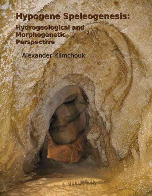
Hypogene <strong>Speleogenesis</strong>:<br />
Hydrogeological and<br />
Morphogenetic<br />
Perspective<br />
Alexander Klimchouk
ii<br />
National Cave and Karst Research Institute<br />
Special Paper №1<br />
2007
Published and distributed by<br />
National Cave and Karst Research Institute<br />
Dr. George Veni, Executive Director<br />
1400 Commerce Drive<br />
Carlsbad, NM 88220<br />
www.nckri.org<br />
Peer-review: Dr. Derek Ford (McMaster University, Canada), Dr. Calvin Alexander (University of Minnesota, USA), Dr.<br />
John Sharp (University of Texas, USA), Dr. Philippe Audra (University of Nice, France),<br />
Dr. Armstrong Osborne (University of Sydney).<br />
Citation information:<br />
Klimchouk, A. B. 2007. Hypogene <strong>Speleogenesis</strong>: Hydrogeological and Morphogenetic Perspective. Special Paper no. 1,<br />
National Cave and Karst Research Institute, Carlsbad, NM, 106 pp.<br />
ISBN-10 0-9795422-0-0<br />
ISBN-13 978-0-9795422-0-6<br />
© 2007 Alexander B. Klimchouk<br />
Second Edition, 2011<br />
This work was prepared in 2006-2007 when the author was staying with the National Cave and Karst Research Institute<br />
(USA) as a Distinguished Visiting Scholar. Minor edits and revisions were made in 2011.<br />
The author's principal affiliation: Ukrainian Institute of Speleology and Karstology, Ministry of Science and Education of<br />
Ukraine and the National Academy of Science of Ukraine.<br />
Tavrichesky National University<br />
4 Prospect Vernadskogo,<br />
Simferopol 95007, Ukraine<br />
Email: institute@speleoukraine.net<br />
Dedication<br />
To Kimberly (Kim) Cunningham, an outstanding person, a genuine friend and a bright cave scientist,<br />
who left an indelible impression on people who where lucky to know him.<br />
Cover photo:<br />
Front: A rising chain of cupolas in Caverns of Sonora, TX, USA (Photo by A. Klimchouk)<br />
Back: A dome possibly leading to a higher story of passages (an exploring caver climbing a rope provides a scale). See<br />
Plate 11 for a broader view. Echo Chamber in Lechuguilla Cave, NM, USA (Photo by S. Allison).
Contents<br />
Foreword . . . . . . . . . . . . . . . . . . . . . . . . . . . . . . . . . . . . . . . . . . . . . . . . . . . . . . . iii<br />
List of Figures, Plates, and Tables . . . . . . . . . . . . . . . . . . . . . . . . . . . . . . . . . . . . iv-vi<br />
.<br />
Abstract . . . . . . . . . . . . . . . . . . . . . . . . . . . . . . . . . . . . . . . . . . . . . . . . . . . . . . . . 1<br />
Introduction . . . . . . . . . . . . . . . . . . . . . . . . . . . . . . . . . . . . . . . . . . . . . . . . . . . . . 3<br />
1. Basic concepts and terminology . . . . . . . . . . . . . . . . . . . . . . . . . . . . . . . . . . . . 5<br />
1.1 Karst and speleogenesis . . . . . . . . . . . . . . . . . . . . . . . . . . . . . . . . . . . . . . . . . . . . . . . . . . . . . . . . . . 5<br />
1.2 Hypogenic, confined and deep-seated speleogenesis . . . . . . . . . . . . . . . . . . . . . . . . . . . . . . . . . . . . 6<br />
2. Karst in the context of the systematized and hierarchical nature<br />
of regional groundwater flow . . . . . . . . . . . . . . . . . . . . . . . . . . . . . . . . . . . . . . . .<br />
3. Ascending hypogenic speleogenesis . . . . . . . . . . . . . . . . . . . . . . . . . . . . . . . . 12<br />
3.1 Cross-formational communication and basinal hydraulic continuity . . . . . . . . . . . . . . . . . . . . . . . . . . 13<br />
3.2 Hydrostratigraphic conversion of soluble formations . . . . . . . . . . . . . . . . . . . . . . . . . . . . . . . . . . . . . 16<br />
3.3 The concept of transverse speleogenesis . . . . . . . . . . . . . . . . . . . . . . . . . . . . . . . . . . . . . . . . . . . . . 16<br />
3.4 Vertical heterogeneity in porosity and permeability . . . . . . . . . . . . . . . . . . . . . . . . . . . . . . . . . . . . . . 18<br />
3.5 Recharge, cave-forming flow and discharge in hypogene settings . . . . . . . . . . . . . . . . . . . . . . . . . . 20<br />
3.6 Dissolution processes in hypogenic speleogenesis . . . . . . . . . . . . . . . . . . . . . . . . . . . . . . . . . . . . . . 24<br />
3.7 Mechanisms of hypogenic transverse speleogenesis . . . . . . . . . . . . . . . . . . . . . . . . . . . . . . . . . . . . 25<br />
3.8 The role of free convection . . . . . . . . . . . . . . . . . . . . . . . . . . . . . . . . . . . . . . . . . . . . . . . . . . . . . . . . . 26<br />
4. Hypogenic cave features . . . . . . . . . . . . . . . . . . . . . . . . . . . . . . . . . . . . . . . . . . 28<br />
4.1 Criteria for distinguishing the hypogenic transverse origin for caves . . . . . . . . . . . . . . . . . . . . . . . . . 30<br />
4.2 Cave patterns . . . . . . . . . . . . . . . . . . . . . . . . . . . . . . . . . . . . . . . . . . . . . . . . . . . . . . . . . . . . . . . . . . 31<br />
4.3 The maze caves controversy . . . . . . . . . . . . . . . . . . . . . . . . . . . . . . . . . . . . . . . . . . . . . . . . . . . . . . . 33<br />
4.4 Cave morphology . . . . . . . . . . . . . . . . . . . . . . . . . . . . . . . . . . . . . . . . . . . . . . . . . . . . . . . . . . . . . . . . 36<br />
4.5 Selected examples of caves formed by hypogenic transverse speleogenesis . . . . . . . . . . . . . . . . . . 57<br />
4.6 Comparison of confined versus unconfined conduit porosity . . . . . . . . . . . . . . . . . . . . . . . . . . . . . . . 84<br />
5. Some implications of the hypogenic transverse speleogenesis concept . . . . . . 87<br />
5.1 Variability in aquifer characteristics and behavior resulting from unconfined and confined<br />
speleogenesis . . . . . . . . . . . . . . . . . . . . . . . . . . . . . . . . . . . . . . . . . . . . . . . . . . . . . . . . . . . . . . . . . . . . . .<br />
5.2 The role of hypogenic speleogenesis in the formation of mineral deposits . . . . . . . . . . . . . . . . . . . . 88<br />
5.3. Implications to petroleum geology and hydrogeology . . . . . . . . . . . . . . . . . . . . . . . . . . . . . . . . . . . . 94<br />
5.4. Implications for sinkhole hazard and site assessments . . . . . . . . . . . . . . . . . . . . . . . . . . . . . . . . . . . 95<br />
Epilogue . . . . . . . . . . . . . . . . . . . . . . . . . . . . . . . . . . . . . . . . . . . . . . . . . . . . . . . . 97<br />
Acknowledgements . . . . . . . . . . . . . . . . . . . . . . . . . . . . . . . . . . . . . . . . . . . . . . . . 98<br />
References . . . . . . . . . . . . . . . . . . . . . . . . . . . . . . . . . . . . . . . . . . . . . . . . . . . . . . 99<br />
ii<br />
8<br />
87
Foreword<br />
In 1998, the National Cave and Karst Research Institute (NCKRI) was established by a U.S. Congressional<br />
mandate to facilitate and support cave and karst research, stewardship, and education. I am delighted to<br />
introduce this new publication series, NCKRI Special Papers, as an essential part of NCKRI’s efforts to meet<br />
that mandate. I’m equally pleased that this first book in the series is the highly important work of NCKRI’s<br />
first visiting scholar, Dr. Alexander B. Klimchouk.<br />
Caves are resources hidden from the view of the general public and most scientists. Their value often goes<br />
unrecognized because they are either not seen or misunderstood. Historically, caves were ignored by many<br />
geoscientists, in part because they did not “follow the rules” of groundwater behavior and thus “had” to be<br />
anomalous features of little significance. While this view has mostly changed, many scientists who realized the<br />
significance of caves had and still have the mistaken notion that areas of carbonate and evaporite rocks that<br />
contain few or no caves are not karst. This book shatters those myths and makes great strides in explaining<br />
what had been some of the most puzzling aspects of karst hydrogeology.<br />
Dr. Klimchouk carefully explains the origin of hypogenic caves and karst, and demonstrates it with a rich,<br />
international array of examples and data. While most karst literature focuses on epigenic karst, formed by<br />
descending groundwater, hypogenic karst stems from ascending groundwater. Understanding the characteristic<br />
set of hypogenic morphological and hydrological features, and the processes that create them, is crucial for<br />
developing accurate models, and effective management plans for these karst systems. This is vital because<br />
hypogenic karst is especially poorly expressed at the surface, and so its vulnerability as a public water supply,<br />
risk of sinkhole collapse, and value as a mineral resource can be severely underestimated.<br />
While this book focuses on karst hydrogeology and speleogenesis, it also has important implications for<br />
many other disciplines, such as understanding the ranges and speciation of cavernicolous organisms, landscape<br />
evolution, and the distribution of paleontological and archeological deposits, to name a few. At a<br />
fundamentally crucial level, the great geographic breadth of hypogenic karst will soon be realized directly as a<br />
result of this work. Certainly, some concepts presented here will be refined with continued research, but this<br />
book firmly establishes a new paradigm that will guide much karst research for decades to come.<br />
Dr. George Veni<br />
Executive Director, NCKRI<br />
April 2007<br />
iii
List of Figures<br />
Figure 1. Epigenic and hypogenic karst in the context of basinal groundwater flow. 10<br />
Figure 2. Evolutionary types of karst and speleogenetic environments. 11<br />
Figure 3. Flow pattern in a multi-story artesian aquifer system. 13<br />
Figure 4. Hydraulic head distribution in cross sections, the Western Canada Sedimentary Basin showing the<br />
influence of topography, particularly river valleys.<br />
14<br />
Figure 5. Hydraulic head distribution in the Upper Devonian Wabamun Group of central and southern Alberta. 15<br />
Figure 6. Conversion of the hydrogeological function of a soluble bed in a multiple-aquifer system in the course of<br />
speleogenesis.<br />
16<br />
Figure 7. A diagram illustrating general concepts of lateral versus ascending transverse flow through a single<br />
fracture and a fissure network encased in a soluble bed.<br />
17<br />
Figure 8. Transverse flow through a fracture network in single level and multiple levels. 17<br />
Figure 9. A cupola at the ceiling of the uppermost story of Caverns of Sonora, Texas, USA. 20<br />
Figure 10. Modes of recharge to a cave formation from a feeding formation, depending on juxtaposed permeability<br />
structures.<br />
21<br />
Figure 11. Variants of hydrostratigraphic position and recharge/discharge relationships for a cave formation in a<br />
layered aquifer system.<br />
22<br />
Figure 12. Regionalization of Optymistychna Cave, western Ukraine, a 214+ km long maze, according to its multistory<br />
structure, and the reconstruction of recharge-discharge arrangements during the time of its formation.<br />
23<br />
Figure 13. Plan of Wind Cave, Black Hills, South Dakota, USA, and a diagram illustrating the concept of the lifting<br />
origin of the Black Hills maze caves and the stair-case effect of recharge-discharge offset.<br />
23<br />
Figure 14. Schematic representation of the relative importance of hypogenic and epigenic components in the<br />
shallow subsurface environment in different climatic settings.<br />
29<br />
Figure 15. Variations in joint patterns and inherited maze patterns between different horizons of the Miocene<br />
gypsum beds in the western Ukraine, example from Optymistychna Cave.<br />
31<br />
Figure 16. Examples of polygonal and systematic network patterns in the same region, Guadalupe Mountains,<br />
USA.<br />
32<br />
Figure 17. Profile of Lechuguilla Cave, New Mexico, USA. 33<br />
Figure 18. Conceptual models of development of a maze cave. 35<br />
Figure 19. The morphologic suite of rising flow, diagnostic of a confined transverse origin of caves. 36<br />
Figure 20. Distribution of point feeders through the network of master passages in maze caves. 37<br />
Figure 21. Theoretical development of simple and complex spheres by condensation corrosion. 39<br />
Figure 22. Patterns of hydrothermal caves of the Buda Mountains, Hungary. 57<br />
Figure 23. Plan view and profile of Frasassi caves, Italy. 58<br />
Figure 24. Schematic cross-section through Monte Cucco karst system, central Italy. 59<br />
Figure 25. Speleological map and schematic cross-section of Rio Garrafo Gorge, showing occurrence of<br />
Acquasanta caves.<br />
59<br />
Figure 26. Speleological map of Parrano Gorge, central Italy. 60<br />
Figure 27. Phreatic shaft Pozzo del Merro in Italy. 60<br />
Figure 28. Hypogenic maze caves in Cretaceous and Triassic limestones in Western Europe. 61<br />
Figure 29. Hypogenic confined mazes in gypsum in Western Europe. 62<br />
Figure 30. Development of hypogenic caves at the base of a sulfate formation due to buoyancy-driven dissolution,<br />
example from South Harz, Germany.<br />
62<br />
Figure 31. Two-dimensional caves formed by transverse flow across a single bed of Miocene limestone,<br />
Prichernomorsky artesian basin, south Ukraine.<br />
62<br />
Figure 32. Patterns of hypogenic maze caves in Miocene gypsum in the western Ukraine. 63<br />
iv<br />
Pages
Figure 33. Maze caves in Siberia: Botovskaya Cave and Bol'shaya Oreshnaya. 64<br />
Figure 34. Geological section across the Judean arch, Israel, and schematic east-west hydrogeological cross- 66<br />
section, showing the conceptual model for groundwater flow and hypogenic transverse speleogenesis, the Yarkon-<br />
Taninim aquifer and the ASA zone.<br />
Figure 35. Stratigraphic section of Cretaceous formations in Samaria Mountain, Israel, and a section of a quarry in<br />
the confined zone showing distribution of caves.<br />
66<br />
Figure 36. Maps of typical caves in the Turonian limestone. 67<br />
Figure 37. Plan view and cross-sections of Jabal Al Qarah caves in the calcareous sandstone of the Upper<br />
Miocene Hofuf Formation, northeastern Saudi Arabia.<br />
67<br />
Figure 38. Simplified map of Sterkfontein Cave and Lincoln-Fault System and de-roofing of breccia body and<br />
breaching of the cave by denudation.<br />
68<br />
Figure 39. Fissure-like caves and ascending pits in eastern Missouri. 69<br />
Figure 40. Map fragment of Jewel Cave, South Dakota, USA, showing superposition of different passage stories. 70<br />
Figure 41. Mystery Cave, Minnesota, USA, presumed to form as a subterranean meander cut-off of the West Fork<br />
of the Root River.<br />
70<br />
Figure 42. Robber Baron Cave, Texas, USA, a maze cave in Cretaceous limestone, above the confined zone of<br />
the Edwards Aquifer.<br />
71<br />
Figure 43. Amazing Maze, Texas, USA, a multi-story maze cave in stratified Cretaceous limestone, an example of<br />
confined transverse speleogenesis in which dissolution by sulfuric acid took part.<br />
72<br />
Figure 44. Map of Caverns of Sonora, Texas, USA. 73<br />
Figure 45. Regional structural setting of the Guadalupe Mountains, USA, and stratigraphic nomenclature of<br />
Permian strata exposed in the Guadalupe Mountains<br />
74<br />
Figure 46. Plans and profiles of some Guadalupe caves: Carlsbad Cavern, Dry Cave, Spider Cave, Endless Cave. 74<br />
Figure 47. Projected vertical profiles through part of Lechuguilla Cave, showing the nearly independent flow<br />
systems through the entrance series and through the Sulfur Shores - Underground Atlanta systems.<br />
76<br />
Figure 48. Line drawing of section through the Capitan Platform on the eastern face of Slaughter Canyon and an<br />
exposure at Indian Shelter in Walnut Canyon, Guadalupe Mountains, New Mexico.<br />
77<br />
Figure 49. A proposed regional speleogenetic model for the Guadalupe Mountains. 78<br />
Figure 50. Longitudinal profile of the Guadalupe ridge from southwest to northeast, with locations, elevations and<br />
vertical ranges of major caves, and age dates from alunite for four caves.<br />
80<br />
Figure 51. Map of Cueva de Villa Luz, Tabasco, Mexico. 81<br />
Figure 52. Profile view of southern most sinkholes of Sistema Zacaton, Tamaulipas, Mexico, showing zones of<br />
varying water types and travertine morphology.<br />
81<br />
Figure 53. Aerial photograph of Sistema Zacaton showing the major features of the area. 81<br />
Figure 54. Geologic map of northeastern Mexico showing locations of deep karst shafts in the region. 82<br />
Figure 55. Toca da Boa Vista and Toca da Barriguda caves in Brazil. 83<br />
Figure 56. Typical hypogenic caves of eastern Australia: Queenslander-Cathedral Cave System and Ashford<br />
Cave.<br />
84<br />
Figure 57. Conceptual model of speleogenetic origin of sulfur deposits in western Ukraine. 90<br />
Figure 58. Conceptual genetic model for sulfur deposits of northern Iraq. 91<br />
Figure 59. Diagrammatic representation of hypogenic karst features in the Delaware Basin and adjacent reef<br />
structures, New Mexico and west Texas, USA.<br />
92<br />
Figure 60. Geologic section in southeast Missouri, and lithostratigraphy of the Ozark Dome region, USA. 93<br />
Figure 61. Distribution of oil and gas fields of west Texas and southeast New Mexico in relation to major features<br />
of regional geology and hypogenic karst.<br />
94<br />
Figure 62. Distribution of breakdown structures in Zoloushka Cave. 96<br />
v
List of Plates<br />
Plate 1. Feeders: side feeders with rising wall channels. 41<br />
Plate 2. Feeders: side feeders with ear-like or domed orifices. 42<br />
Plate 3. Feeders: point features in passage floors. 43<br />
Plate 4. Feeders: point features in passage floors and lower walls. 44<br />
Plate 5. Feeders: fissure- and rift-like feeders in passage floors. 45<br />
Plate 6. Rising chains of ceiling cupolas and upward-convex arches, ceiling channels and serial cupolas in the<br />
ceiling apex.<br />
46<br />
Plate 7. Ceiling channels and cupolas in linear series. 47<br />
Plate 8. Outlets with connecting ceiling channels or formed within a ceiling channel. 48<br />
Plate 9. Outlets in cupolas and domepits. 49<br />
Plate 10. Outlets breaching to the upper discharge boundary. 50<br />
Plate 11. Mega-outlets in Lechuguilla Cave, Guadalupe Mountains, New Mexico, USA. 50<br />
Plate 12. Bedrock partitions between closely-spaced passages in maze caves. 51<br />
Plate 13. Partitions by carbonate fill of fractures in Zoloushka Cave, western Ukraine. 51<br />
Plate 14. Hypogenic morphology in Mystery Cave, Minnesota, USA. 52<br />
Plate 16. Morphological and geological characteristics of Yellow Jacket Cave, Dark Canyon, Guadalupe<br />
Mountains, New Mexico, USA.<br />
53<br />
Plate 17. Hypogenic morphology in Coffee Cave, New Mexico, USA. 54<br />
Plate 18. Hypogenic morphology in Coffee Cave, New Mexico, USA. 55<br />
Plate 19. Megasinkholes (shafts) associated with hydrothermal systems, with travertine deposition near water<br />
table.<br />
56<br />
List of Tables<br />
TABLE 1<br />
Characterization of cave patterns and porosity in unconfined versus confined aquifers 85<br />
TABLE 2<br />
Average characteristics of conduit patterns for unconfined and confined settings 86<br />
vi
vii
Abstract<br />
This book provides an overview of the principal<br />
environments, main processes and manifestations of<br />
hypogenic speleogenesis, and refines the relevant<br />
conceptual framework. It consolidates the notion of<br />
hypogenic karst as one of the two major types of karst<br />
systems (the other being epigenetic karst). Karst is viewed<br />
in the context of regional groundwater flow systems,<br />
which provide the systematic transport and distribution<br />
mechanisms needed to produce and maintain the<br />
disequilibrium conditions necessary for speleogenesis.<br />
Hypogenic and epigenic karst systems are regularly<br />
associated with different types, patterns and segments of<br />
flow systems, characterized by distinct hydrokinetic,<br />
chemical and thermal conditions. Epigenic karst systems<br />
are predominantly local systems, and/or parts of recharge<br />
segments of intermediate and regional systems.<br />
Hypogenic karst is associated with discharge regimes of<br />
regional or intermediate flow systems.<br />
Various styles of hypogenic caves that were<br />
previously considered unrelated, specific either to certain<br />
lithologies or chemical mechanisms are shown to share<br />
common hydrogeologic genetic backgrounds. In contrast<br />
to the currently predominant view of hypogenic<br />
speleogenesis as a specific geochemical phenomenon, the<br />
broad hydrogeological approach is adopted in this book.<br />
Hypogenic speleogenesis is defined with reference to the<br />
source of fluid recharge to the cave-forming zone, and<br />
type of flow system. It is shown that confined settings are<br />
the principal hydrogeologic environment for hypogenic<br />
speleogenesis. However, there is a general evolutionary<br />
trend for hypogenic karst systems to lose their<br />
confinement due to uplift and denudation and due to their<br />
own expansion. Confined hypogenic caves may<br />
experience substantial modification or be partially or<br />
largely overprinted under subsequent unconfined (vadose)<br />
stages, either by epigenic processes or continuing<br />
ABSTRACT<br />
unconfined hypogenic processes, especially when H2S<br />
dissolution mechanisms are involved.<br />
Hypogenic confined systems evolve to facilitate<br />
cross-formational hydraulic communication between<br />
common aquifers, or between laterally transmissive beds<br />
in heterogeneous soluble formations, across cave-forming<br />
zones. The latter originally represented low-permeability,<br />
separating units supporting vertical rather than lateral<br />
flow. Layered heterogeneity in permeability and breaches<br />
in connectivity between different fracture porosity<br />
structures across soluble formations are important<br />
controls over the spatial organization of evolving<br />
ascending hypogenic cave systems. Transverse hydraulic<br />
communication across lithological and porosity system<br />
boundaries, which commonly coincide with major<br />
contrasts in water chemistry, gas composition and<br />
temperature, is potent enough to drive various<br />
disequilibrium and reaction dissolution mechanisms.<br />
Hypogenic speleogenesis may operate in both carbonates<br />
and evaporites, but also in some clastic rocks with soluble<br />
cement. Its main characteristic is the lack of genetic<br />
relationship with groundwater recharge from the<br />
overlying or immediately adjacent surface. It may not be<br />
manifest at the surface at all, receiving some expression<br />
only during later stages of uplift and denudation. In many<br />
instances, hypogenic speleogenesis is largely climateindependent.<br />
There is a specific hydrogeologic mechanism inherent<br />
in hypogenic transverse speleogenesis (restricted<br />
input/output) that suppresses the positive flow-dissolution<br />
feedback and speleogenetic competition in an initial<br />
flowpath network. This accounts for the development of<br />
more pervasive channeling and maze patterns in confined<br />
settings where appropriate structural prerequisites exist.<br />
As forced-flow regimes in confined settings are<br />
commonly sluggish, buoyancy dissolution driven by<br />
1
2<br />
NCKRI Special Paper Series No.1<br />
either solute or thermal density differences is important in<br />
hypogenic speleogenesis.<br />
In identifying hypogenic caves, the primary criteria<br />
are morphological (patterns and meso-morphology) and<br />
hydrogeological (hydrostratigraphic position and<br />
recharge/flow pattern viewed from the perspective of the<br />
evolution of a regional groundwater flow system).<br />
Elementary patterns typical for hypogenic caves are<br />
network mazes, spongework mazes, irregular chambers<br />
and isolated passages or crude passage clusters. They<br />
often combine to form composite patterns and complex 3-<br />
D structures. Hypogenic caves are identified in various<br />
geological and tectonic settings, and in various<br />
lithologies. Despite these variations, resultant caves<br />
demonstrate a remarkable similarity in cave patterns and<br />
meso-morphology, which strongly suggests that the<br />
hydrogeologic settings were broadly identical in their<br />
formation. Presence of the characteristic morphologic<br />
suites of rising flow with buoyancy components is one of<br />
the most decisive criteria for identifying hypogenic<br />
speleogenesis, which is much more widespread than was<br />
previously presumed. Hypogenic caves include many of<br />
the largest, by integrated length and by volume,<br />
documented caves in the world.<br />
The refined conceptual framework of hypogenic<br />
speleogenesis has broad implications in applied fields and<br />
promises to create a greater demand for karst and cave<br />
expertise by practicing hydrogeology, geological<br />
engineering, economic geology, and mineral resource<br />
industries. Any generalization of the hydrogeology of<br />
karst aquifers, as well as approaches to practical issues<br />
and resource prospecting in karst regions, should take into<br />
account the different nature and characteristics of<br />
hypogenic and epigenic karst systems. Hydraulic<br />
properties of karst aquifers, evolved in response to<br />
hypogenic speleogenesis, are characteristically different<br />
from epigenic karst aquifers. In hypogenic systems, cave<br />
porosity is roughly an order of magnitude greater, and<br />
areal coverage of caves is five times greater than in<br />
epigenic karst systems. Hypogenic speleogenesis<br />
commonly results in more isotropic conduit permeability<br />
pervasively distributed within highly karstified areas<br />
measuring up to several square kilometers. Although<br />
being vertically and laterally integrated throughout<br />
conduit clusters, hypogenic systems, however, do not<br />
transmit flow laterally for considerable distances.<br />
Hypogenic speleogenesis can affect regional subsurface<br />
fluid flow by greatly enhancing initially available crossformational<br />
permeability structures, providing higher<br />
local vertical hydraulic connections between lateral<br />
stratiform pathways for groundwater flow, and creating<br />
discharge segments of flow systems, the areas of lowfluid<br />
potential recognizable at the regional scale.<br />
Discharge of artesian karst springs, which are modern<br />
outlets of hypogenic karst systems, is often very large and<br />
steady, being moderated by the high karstic storage<br />
developed in the karstified zones and by the hydraulic<br />
capacity of an entire artesian system. Hypogenic<br />
speleogenesis plays an important role in conditioning<br />
related processes such as hydrothermal mineralization,<br />
diagenesis, and hydrocarbon transport and entrapment.<br />
An appreciation of the wide occurrence of hypogenic<br />
karst systems, marked specifics in their origin,<br />
development and characteristics, and their scientific and<br />
practical importance, calls for revisiting and expanding<br />
the current predominantly epigenic paradigm of karst and<br />
cave science.
Introduction<br />
Most studies of karst systems are concerned with<br />
shallow, unconfined geologic settings, supposing that the<br />
karstification is ultimately related to the Earth's surface<br />
and that dissolution is driven by downward meteoric<br />
water recharge. Such systems are epigenic (hypergenic).<br />
Concepts and theories developed for unconfined karst<br />
systems overwhelmingly predominate in karst and cave<br />
science, particularly in karst hydrology and<br />
geomorphology, forming a core of the current karst<br />
paradigm. Hypogenic karst, originating from depth and<br />
not related to recharge from the overlying surface,<br />
although becoming more recognized during the last two<br />
decades, remains poorly understood and integrated into<br />
the bulk of karst science.<br />
There are specific reasons for this bias, arising from<br />
the historic paths through which the knowledge of the<br />
karst domain evolved. Epigenic karst systems evolve<br />
when soluble rocks occur in the shallow subsurface or<br />
become exposed, so they inherently express surface<br />
components, readily available for observations and<br />
affecting many aspects of human activity. Epigenic karst<br />
systems form by water infiltrating or in-flowing from<br />
overlying or immediately adjacent recharge surfaces and<br />
develop in genetic relation to landscape. Caves commonly<br />
have a hydrologic connection with the surface and<br />
“genetically inherent” entrances. Karst knowledge in<br />
Western Europe and North America had originally<br />
commenced mainly from exploration and study of such<br />
caves. These factors in combination led to a deeply rooted<br />
belief that epigenic unconfined karst systems<br />
overwhelmingly predominate 1 . Karst features, routinely<br />
1 In contrast, in some regions where karstology as a scientific<br />
discipline preceded cave exploration, and where “covered”<br />
(deep-seated) karst settings are widespread, such as in the<br />
former Soviet Union, deep-seated, hypogene, confined karst and<br />
INTRODUCTION<br />
encountered by wells and mines in soluble rocks at<br />
substantial depths, were (and still are) commonly<br />
regarded as paleokarst features, originally formed in<br />
epigenic settings and subsequently buried under younger<br />
sediments.<br />
Some explored caves, however, display patterns,<br />
morphologies, sediments, and minerals that do not readily<br />
conform to established concepts of epigenic karst<br />
development and speleogenesis. Until recently, they were<br />
(and in many cases still are) explained in terms of<br />
epigenic/unconfined speleogenesis, which led to<br />
numerous more or less obvious misconceptions and<br />
controversies. Over the last 20 years there has been a<br />
rapid increase in the development of speleogenetic ideas<br />
implying a hypogenic and/or confined origin of caves,<br />
with reference to a deep source of acidity or to a confined<br />
flow system. However, in the general context of the<br />
predominant karst paradigm, such caves are still largely<br />
regarded as special, aberrant cases. In his classic work on<br />
cave origin, Palmer (1991) estimated that hypogene cave<br />
systems account for only about 10% of the studied cave<br />
systems, although they include some of the largest ones.<br />
Since then, ongoing re-interpretation of some known<br />
caves has probably increased this percentage. Enhanced<br />
understanding of hypogenic speleogenesis and the<br />
refinement of criteria for their recognition are going to<br />
further increase this figure. More important is the fact that<br />
hypogene/confined karst systems are globally much more<br />
widespread than it is now believed, and the relatively<br />
small fraction of known caves of this type is merely an<br />
exploration bias resulting from their genetic irrelevance to<br />
the surface and inherent lack of accessibility.<br />
some relevant processes have been long recognized, at least in<br />
general terms.<br />
3
4<br />
NCKRI Special Paper Series No.1<br />
Significant advances in understanding of<br />
speleogenesis in hypogene (deep-seated) and confined<br />
(artesian) settings made during recent years remain<br />
somewhat fragmented and uncoordinated. This is partly<br />
because discussions of the particular cases of “atypical”<br />
speleogenesis (sulfuric acid, hydrothermal, in some sense<br />
– speleogenesis in evaporites) focus attention on<br />
geochemical processes of solutional porosity creation<br />
with the hydrogeologic framework of cave formation<br />
often remaining poorly understood. There is a misleading<br />
trend to label particular types of speleogenesis, or even<br />
types of karst, by the dissolutional mechanism assumed to<br />
have created the caves. This obscures the fact that most<br />
hypogenic/confined karst systems share many major<br />
common features in their geo/hydrogeological settings,<br />
patterns and morphologies. Although geochemical<br />
attributes and dissolution mechanisms are indispensable<br />
components of the speleogenetic environment, the<br />
principal component is groundwater flow. Other attributes<br />
largely depend on the position of a given karst system in<br />
the basinal groundwater flow system and evolution of<br />
boundary conditions. By way of analogy, in creating<br />
dissolutional porosity the groundwater flow system is a<br />
“master,” the type of recharge is a “tool” and<br />
dissolutional mechanisms are the “fuels” to power the<br />
tools. The shape, pattern and size of holes produced by a<br />
tool (dentist drill, hand drill, borehole drill bit, bulldozer<br />
or excavator) depend more on the intentions of a master<br />
and the type of tool rather than on the fuel that drives it.<br />
This paper intends to give an overview of the<br />
principal environments, main processes and<br />
manifestations of hypogenic speleogenesis, in order to<br />
show the place of hypogenic karst systems in the basinal<br />
groundwater flow systems, thus demonstrating the<br />
common genetic background of various styles of<br />
hypogenic karst and caves that were previously<br />
considered unrelated, specific either to lithologies and/or<br />
chemical mechanisms. I intend to demonstrate the<br />
fundamental importance of the type of flow system in the<br />
formation of hypogenic (confined) karst and caves, and<br />
establish hypogenic karst as one of two major types of<br />
karst systems.<br />
The appreciation of the widespread occurrence of<br />
hypogenic karst systems, marked specifics in their origin<br />
and development, and their scientific and practical<br />
importance, calls for revisiting and expanding the current<br />
paradigm of karst and cave science.
1. Basic concepts and terminology<br />
1.1 Karst and speleogenesis<br />
As this book focuses on phenomena and processes<br />
poorly integrated into the established conceptual framework<br />
of karst, it is necessary to clarify some basic concepts and<br />
terminology.<br />
Most modern texts, encyclopedias, and reviews define<br />
karst from a largely geomorphological perspective: “Karst is<br />
terrain with distinctive hydrology and landforms arising<br />
from the combination of high rock solubility and welldeveloped<br />
solutional channel (secondary) porosity<br />
underground” (Ford and Williams, 1989; Ford, 2004)..<br />
Distinctive landforms and surface hydrology, however, are<br />
not necessarily characteristic for hypogenic karst.<br />
Although it is often claimed that approaches, concepts<br />
and methodologies to study karst differ between<br />
geomorphology and hydrology, the modern conceptual<br />
framework in karst hydrology seems to remain constrained<br />
by the historically prevailing largely geomorphological<br />
paradigm of karst as an epigenic unconfined system, closely<br />
related to surface drainage (White, 2002; Bakalowicz, 2005).<br />
Moreover, earlier firmly rooted, historically biased views<br />
that only karst features in carbonates are considered a true<br />
karst are still reiterated in modern publications:<br />
“Karst features mainly occur in carbonate rocks,<br />
limestone and dolomite, in which formations it is considered<br />
as true karst” (Bakalowicz, 2005);<br />
“Karst: Landforms that have been modified by<br />
dissolution of soluble rocks (limestone and dolostone)”<br />
(Poucher and Copeland, 2006);<br />
“Karst is defined as a limestone landscape with<br />
underground drainage” (Waltham, in Luhr, 2003).<br />
Another illustration of the poor integration of hypogenic<br />
karst into modern karst knowledge is that the recent two<br />
fundamental encyclopedias on caves and karst (Gunn, 2004;<br />
Culver and White, 2004) do not contain distinct entries on<br />
BASIC CONCEPTS AND TERMINOLOGY<br />
hypogenic karst, although they do consider many aspects of<br />
hypogenic karst and certainly hypogenic caves (as they<br />
include some of the largest and most important caves in the<br />
world).<br />
Although such focusing was certainly productive in<br />
consolidating the conceptual framework and methodology in<br />
studying the epigenic type of karst systems, the situation<br />
with the predominantly epigenetic approach to karst,<br />
reflected in general reviews on the subject, hinders progress<br />
in recognition and study of hypogenic karst.<br />
An emerging approach to karst hydrogeology is more<br />
integrative and universal by encompassing the whole range<br />
of karst processes and phenomena. Following proposals of<br />
Huntoon (1995) and Klimchouk and Ford (2000), karst is<br />
defined here as “an integrated mass-transfer system in<br />
soluble rocks with a permeability structure dominated by<br />
conduits dissolved from the rock and organized to facilitate<br />
the circulation of fluids.” Whether karst is expressed at the<br />
surface or not is irrelevant. A karst system can operate in the<br />
subsurface without any apparent relationship to the surface,<br />
being represented exclusively by underground forms that<br />
draw their input water from and discharge their output water<br />
to other non-karstic rocks.<br />
<strong>Speleogenesis</strong> is viewed as “the creation and evolution<br />
of organized permeability structures in a rock that have<br />
evolved as the result of dissolutional enlargement of an<br />
earlier porosity” (Klimchouk and Ford, 2000, p.47), making<br />
it the most essential part of the karst concept. One can assert<br />
that karst is a function of speleogenesis, a statement for<br />
which the validity is particularly evident in cases where the<br />
surface landscape component is absent or subdued as in<br />
hypogenic karst. The notion of “karst,” however, is broader<br />
than that of “speleogenesis,” as it includes features and<br />
phenomena induced by speleogenesis but not encompassed<br />
by it.<br />
5
6<br />
NCKRI Special Paper Series n.1<br />
Though some uncertainties still remain in the scope of<br />
the related and overlapping concepts/terms (discussed in the<br />
next section), three basic genetic settings are broadly<br />
recognized now for caves (Ford and Williams, 1989; 2007;<br />
Klimchouk et al., 2000; Ford, 2006): 1) coastal and oceanic,<br />
in rocks of high matrix porosity and permeability; 2)<br />
hypogenic, predominantly confined, where water enters the<br />
soluble formation from below, and 3) hypergenic (epigenic),<br />
unconfined, where water is recharged from the overlying<br />
surface. Although coastal and oceanic settings are commonly<br />
characterized by unconfined circulation, they are treated<br />
separately because of the specific conditions for<br />
speleogenesis determined by the dissolution of porous,<br />
poorly indurated carbonates by mixing of waters of<br />
contrasting chemistry at the halocline.<br />
1.2 Hypogenic, confined and deep-seated<br />
speleogenesis<br />
Hypogenic (or hypogene) caves are usually considered<br />
the opposite to the common epigenic caves formed by water<br />
recharged from the overlying or immediately adjacent<br />
surface due to carbonic acid dissolution. A more appropriate<br />
antonym to “hypogenic” is hypergenic (or hypergene); the<br />
term widely used in Eastern Europe to denote processes<br />
operating near the surface through the action of descending<br />
solutions.<br />
The term and concept of hypogenic speleogenesis has<br />
seen increasing use during the recent two decades, although<br />
still with some uncertainty in its meaning. Two approaches<br />
appear in recent works. Ford and Williams (1989) and<br />
Worthington and Ford (1995) defined hypogenic caves as<br />
those formed by hydrothermal waters or by waters<br />
containing hydrogen sulfide. Hill (2000a) tends to narrow<br />
the notion of hypogenic karst and speleogenesis to H2Srelated<br />
processes and forms. Palmer (1991) defined<br />
hypogenic caves more broadly, as those formed by acids of<br />
deep-seated origin, or epigenic acids rejuvenated by deepseated<br />
processes. Later on, Palmer (2000a), presented the<br />
definition in a slightly modified, even broader form:<br />
hypogenic caves are formed by water in which the<br />
aggressiveness has been produced at depth beneath the<br />
surface, independent of surface or soil CO2 or other nearsurface<br />
acid sources. This modification is important, as it<br />
formally allows us to include in the class of features formed<br />
by still surface-independent but non-acidic sources of<br />
aggressiveness (such as aggressiveness of water with respect<br />
to evaporites). Reference to acid sources seems to be<br />
confusing however, as it again tacitly implies that features<br />
formed by non-acid dissolution are not pertinent.<br />
Palmer's definition relies on the source of<br />
aggressiveness. The aggressiveness is a transient attribute of<br />
water, which can be delivered from depth or acquired within<br />
a given soluble formation (due to mixing or redox processes,<br />
for instance). It is suggested here that the definition of<br />
hypogenic speleogenesis should rather refer to the source of<br />
groundwater, as it is a medium of transport of aqueous and<br />
nonaqueous matter and energy, a reactive agent and a major<br />
component of the speleogenetic environment. Hypogenic<br />
speleogenesis is defined here, following the recent<br />
suggestion of Ford (2006), as “the formation of caves by<br />
water that recharges the soluble formation from below,<br />
driven by hydrostatic pressure or other sources of energy,<br />
independent of recharge from the overlying or immediately<br />
adjacent surface.”<br />
Hypogenic speleogenesis does not rely exclusively on<br />
certain dissolutional mechanisms; a number of dissolutional<br />
processes and sources of aggressiveness can be involved (see<br />
Section 3.6 below). Its main characteristic is the lack of<br />
genetic relationship with groundwater recharge from the<br />
overlying surface. In many instances, hypogenic<br />
speleogenesis is climate-independent. It may not be<br />
manifested at the surface at all (deep-seated karst).<br />
Hypogenic caves commonly come into interaction with the<br />
surface as relict features, largely decoupled from their<br />
formational environment, when ongoing uplift and<br />
denudation shift them into the shallow subsurface.<br />
The concept of hypogenic speleogenesis is closely<br />
related to the notion of artesian or confined speleogenesis.<br />
These terms refer to the important aquifer condition, where<br />
groundwater is under pressure in a bed or stratum confined<br />
by a less permeable rock or sediment above it. The criterion<br />
of non-relevance of hypogenic speleogenesis to overlying<br />
surface recharge and sources of aggressiveness implies<br />
substantial separation of groundwater circulation from the<br />
overlying surface, i.e. some degree of confinement or rising<br />
flow. Groundwater rises through soluble but initially poorly<br />
permeable or heterogeneous formations. Most hypogenic<br />
speleogenesis initially occurs under confined conditions,<br />
which accounts, as will be shown in the following sections,<br />
for its most essential features (see also Klimchouk, 2000a,<br />
2003a, 2003b, 2004). However, there is an evolutionary<br />
trend for hypogenic karst systems to lose their confinement<br />
in the course of uplift and denudation, and due to their own<br />
expansion. Hypogenic development may continue in<br />
unconfined settings, but confined conditions are the most<br />
essential element of hypogenic speleogenesis.<br />
Other concepts that are relevant to hypogenic<br />
speleogenesis are intrastratal karst and deep-seated karst.<br />
Intrastratal karst is developed within rocks already buried<br />
by younger strata, where karstification is later than<br />
deposition of the cover rocks (Quinlan, 1978; Palmer and<br />
Palmer, 1989). This meaning does not relate to genesis but<br />
implies stratigraphic, although not necessarily<br />
hydrogeologic, separation of karst development from the<br />
surface by overlying non-soluble strata and emphasizes the
evolutionary aspect (i.e. karst is later than the cover).<br />
Intrastratal karst can be deep-seated, subjacent, entrenched<br />
or denuded (the latter represents the former intrastratal<br />
karst); this subdivision has an evolutionary meaning and<br />
relates karst settings to the depth of erosional entrenchment<br />
and the degree of denudational exposure (Klimchouk, 1996a;<br />
Klimchouk and Ford, 2000). Depending on the cover<br />
lithology and the depth of erosional entrenchment,<br />
intrastratal karst can develop in confined or unconfined<br />
BASIC CONCEPTS AND TERMINOLOGY<br />
conditions. Deep-seated karst is developed without any<br />
exposure of the soluble rock to the overlying surface, and is<br />
not related to it. It implies ongoing contemporary<br />
karstification, so it should be differentiated from buried<br />
karst, or paleokarst. Deep-seated karst is always intrastratal,<br />
although the opposite is not always true. Deep-seated karst is<br />
predominantly confined and hypogenic; this is discussed<br />
further in the next section.<br />
7
8<br />
NCKRI Special Paper No.1<br />
2. Karst in the context of the systematized and hierarchical<br />
nature of regional groundwater flow<br />
Artesian basins are principal hydrogeologic structures<br />
at regional scales in predominantly layered sedimentary<br />
rocks (sedimentary basins) that contain stratiform<br />
groundwater bodies (layered aquifers); and<br />
hydrogeological massifs are tectonic block-faulted<br />
groundwater bodies with an overwhelming dominance of<br />
crosscutting fissure-conduit permeability (Zaitzev and<br />
Tolstikhin, 1971; Pinneker, 1977). Transitional types<br />
include disrupted basins and layered massifs. In cratonic<br />
regions and their passive margins, large artesian basins<br />
predominate, with subordinated hydrogeological massifs.<br />
Folded orogenic regions are characterized by the<br />
dominance of hydrogeological massifs, although small<br />
artesian basins are also common. Basins and massifs are<br />
commonly hydraulically connected, with massifs playing<br />
the role of marginal recharge areas.<br />
Broad understanding of karst processes as a<br />
geological agent, one of the most powerful and universal<br />
illustrations of groundwater as a geological agent, is<br />
based on the growing recognition in mainstream<br />
hydrogeology of hydraulic continuity, the systematized<br />
nature and hierarchical organization of regional flow, and<br />
the great role of cross-formational communication in<br />
multiple-aquifer (multi-story) confined systems (e.g.<br />
Pinneker, 1982; Sharp and Kyle, 1988; Shestopalov,<br />
1981, 1989; Tóth, 1995, 1999). Principal categories of<br />
karst-forming environments and resultant karst/<br />
speleogenetic styles can be adequately understood and<br />
classified only within the context of regional groundwater<br />
flow systems, as they are regularly associated with<br />
distinct segments and evolutionary states of these<br />
systems. The works of Tóth (1995, 1999) provide a<br />
particularly useful and inspiring synopsis of the nature of<br />
the system, hierarchical organization, and the geologic<br />
role of regional groundwater flow systems.<br />
<strong>Speleogenesis</strong>, like other natural effects produced by<br />
groundwater flow systems, is a result of interaction<br />
between groundwater and its environment, driven by the<br />
various components and attributes of the two respective<br />
systems seeking equilibration (Tóth, 1999). To cause<br />
speleogenetic development, dissolution effects of<br />
disequilibria have to accumulate over sufficiently long<br />
periods of time and/or to concentrate within relatively<br />
small rock volumes or areas. The systematic transport and<br />
distribution mechanism capable of producing and<br />
maintaining the required disequilibrium conditions is the<br />
groundwater flow system (Tóth, 1999). This is the single<br />
fundamental reason why the principal categories of karst<br />
and speleogenetic environments should be distinguished<br />
primarily on the basis of hydrogeologic considerations,<br />
rather than by the particular dissolutional mechanisms<br />
involved.<br />
The development of groundwater circulation is<br />
broadly cyclic. The hydrogeologic cycle begins with<br />
marine sedimentation that is succeeded by tectonic<br />
subsidence and the formation of connate waters. It then<br />
encompasses uplift, with denudation and progressive<br />
invasion of meteoric waters into the reservoir. It may<br />
include the intrusion of magma with release of juvenile<br />
waters. It closes with a new marine transgression.<br />
Groundwater circulation in a basin adjusts to the<br />
pattern of maximum and minimum fluid potentials.<br />
Large-scale groundwater flow in sedimentary basins can<br />
be driven by several forces, such as sediment compaction<br />
due to burial or tectonic compression, dehydration of<br />
minerals, continental landscape topography gradients, and<br />
density gradients due to temperature or solute variations.<br />
Following uplift and establishment of the continental<br />
regime and topography, gravity-driven flow systems of<br />
meteoric groundwater increasingly flush out connate and<br />
resurgent waters from a basin, although compaction-
KARST IN THE CONTEXT OF REGIONAL GROUNDWATER FLOW<br />
driven flow systems may still predominate in deep parts<br />
of basins. The basinal groundwater system may be even<br />
more complicated, heterogeneous and heterochronous,<br />
when a basin goes through two or more hydrogeologic<br />
cycles, and/or where a basin is deformed and subdivided<br />
by differential tectonic movements and/or intruded with<br />
magma, with sub-systems of different magnitude and<br />
origin, superimposed and mingled (Pinneker, 1982; Tóth,<br />
1995).<br />
Most known karst systems develop in continental<br />
domains dominated by gravity-driven flow systems.<br />
Epigenic unconfined karst is exclusively formed by<br />
gravity flow, but hypogenic speleogenesis is often a part<br />
of mixed flow systems, where groundwater flow is a<br />
result of different energy sources acting simultaneously,<br />
most commonly topography-driven flow and flow driven<br />
by temperature or solute density gradients. Flow driven<br />
by sediment compaction and tectonic compression can<br />
also contribute to mixed systems relevant to hypogenic<br />
speleogenesis, although the former is commonly<br />
volumetrically limited and the latter is temporally limited.<br />
A common misconception about hypogenic karst is that it<br />
is believed to be unrelated or contrasted to meteoric<br />
circulation (e.g. Budd, Saller, and Harris, 1995). Although<br />
non-meteoric waters (such as connate or magmatic<br />
waters) may be involved in some cases, most hypogenic<br />
speleogenesis is produced by predominantly meteoric<br />
waters, even where non-gravity drives for flow are<br />
involved. Meteoric waters in intermediate and deep<br />
(regional) flow systems, coming from distant recharge<br />
areas, can maintain or rejuvenate aggressiveness when<br />
entering a soluble formation from below in discharge<br />
areas to generate features that fall into the hypogenic class<br />
as it is defined above.<br />
Segments of groundwater flow systems are<br />
characterized by three distinctly different flow regimes:<br />
the recharge, midline or throughflow, and discharge, with<br />
respective distinct physical, chemical, and hydrokinetic<br />
conditions. Hence, the rates and products (solutional<br />
porosity styles and patterns) of speleogenesis differ<br />
accordingly in karst systems associated with respective<br />
situations. In regions with substantial relief, composite<br />
flow patterns develop where flow systems at local,<br />
intermediate, and regional scales (types) are recognized.<br />
Figure 1, which is an adopted and modified version of<br />
Figure 1 of Tóth (1999), illustrates these flow regimes<br />
and types, with epigenic and hypogenic karst systems<br />
shown in the context of regional hydrogeology. In terms<br />
of regional hydrogeology, epigenic and hypogenic karst<br />
systems are regularly associated with different types and<br />
segments of flow systems. Epigenic karst systems are<br />
predominantly local flow systems, and/or parts of<br />
recharge segments of intermediate and regional flow<br />
systems. The recharge regime is characterized by<br />
relatively high hydraulic heads, decreasing with depth,<br />
and by downward and divergent flow. Hypogenic karst<br />
systems are associated with the discharge regimes of<br />
regional or intermediate flow systems, with largely the<br />
opposite energy and flow conditions. In discharge areas,<br />
hydraulic heads are relatively low and decrease upward,<br />
resulting in converging and ascending flow. However, in<br />
intermediate to regional confined systems, crossformational<br />
communication causes recharge and<br />
discharge regimes (areas of correspondingly descending<br />
and ascending cross-formational communication) to<br />
laterally alternate in the throughflow area, largely<br />
following the gross topography (Shestopalov, 1981,<br />
1989). For particular aquifers in multiple-aquifer systems,<br />
the relationships between recharge and discharge regimes<br />
are even more complex, with vertically superimposed<br />
recharge and discharge regimes (Section 3.1). From the<br />
perspective of a single formation or a bed, recharge<br />
includes all the ways that fluids enter the strata (Sharp<br />
and Kyle, 1988).<br />
Recharge and discharge areas of basinal groundwater<br />
flow systems also have characteristic distinctions in<br />
groundwater chemistry and thermal regime.<br />
Groundwaters in recharge areas are typically chemically<br />
aggressive and promote dissolution, have low TDS, and<br />
are characterized by oxidizing conditions and negative<br />
anomalies of geothermal heat and gradient. In basinal<br />
groundwater flow systems there are systematic changes in<br />
hydrosomes with depth, from HCO3 through SO4 to Cl.<br />
Discharge areas have largely opposite characteristics:<br />
high TDS, chemical precipitation, accumulation of<br />
transported mineral matter, reducing conditions, and<br />
positive anomalies of geothermal heat and gradient (Tóth,<br />
1999).<br />
While recharge areas display highly variable input<br />
parameters in the groundwater regime (both hydraulic and<br />
chemical), in basinal discharge areas these parameters<br />
vary little over time and have low dependence on climate.<br />
The general characteristics of the discharge regime, in<br />
geochemical terms, may not seem to favor speleogenesis.<br />
However, as demonstrated throughout this book,<br />
hypogenic speleogenesis is commonly associated not with<br />
terminal discharge regimes of basinal groundwater flow<br />
systems but with intermediate discharge limbs of these<br />
systems. Even more importantly, the fundamental feature<br />
of hypogenic speleogenesis is that it is driven by upward<br />
cross-formational hydraulic communication, so that<br />
relatively deep fluids of intermediate and regional<br />
groundwater flow systems interact with contrasting<br />
regimes of shallower aquifers and local systems. This<br />
causes disequilibrium conditions and favors various<br />
dissolutional mechanisms. These aspects are discussed<br />
elsewhere throughout this book.<br />
9
10<br />
NCKRI Special Paper No.1<br />
Figure 1. Epigenic and hypogenic karst in the context of basinal groundwater flow. Adopted and modified from Tóth (1999). The figure<br />
shows mainly gravity-driven flow in an idealized homogenous basin. In reality, most sedimentary sequences are highly heterogeneous,<br />
and gravity-driven flow interacts with other flow mechanisms.<br />
As speleogenesis is a dynamic process capable of<br />
considerably changing primary porosity and permeability,<br />
it can itself create zones of high permeability along<br />
initially insignificant (in terms of regional or intermediate<br />
groundwater flow systems) cross-formational flow paths,<br />
or even without any initially guiding disruptions. In<br />
soluble beds (which originally commonly serve as<br />
confining beds; see Section 3.2) this goes through one of<br />
the mechanisms of ascending transverse speleogenesis,<br />
and in overlying insoluble beds permeability<br />
enhancement occurs via fracturing and brecciation above<br />
cave porosity zones. Thus, hypogenic speleogenesis may<br />
give rise to new discharge zones and contribute to<br />
segmenting laterally extensive “throughflow” regions.<br />
The classification of regional hydrogeologic<br />
structures, introduced at the beginning of this section, can<br />
be presented as an evolutionary succession: artesian<br />
basins - disrupted basins - layered massifs -<br />
hydrogeologic massifs. This corresponds to the successive<br />
stages in the general tectonic and geomorphic evolution<br />
of sedimentary basins. Similarly, this evolutionary trend<br />
provides a framework to classify karst types and<br />
speleogenetic environments based on the evolutionary<br />
history of a soluble-rock aquifer (Klimchouk, 1996a;<br />
Klimchouk and Ford, 2000; Figure 2): from deposition<br />
and early emergence above sea level (syngenetic<br />
/eogenetic karst) through deep burial and re-emergence<br />
(the group of intrastratal karst types: deep-seated karst,<br />
subjacent karst, entrenched karst) to complete exposure<br />
(denuded karst). If karst bypasses burial, or if the soluble<br />
rock is exposed after burial without having experienced<br />
any significant karstification during burial, it represents<br />
the open karst type. Different types of karst, which<br />
concurrently represent the stages of karst development,<br />
are marked by distinct combinations of the structural<br />
prerequisites for groundwater flow and speleogenesis,<br />
flow regimes, recharge/discharge configurations,<br />
groundwater chemistry, and degree of inheritance from<br />
earlier conditions.<br />
Although this classification does not directly specify<br />
the origin of caves, it characterizes dominant<br />
speleogenetic environments and their evolutionary<br />
changes. Karst types are viewed as stages of<br />
hydrogeologic/geomorphic evolution, between which the
KARST IN THE CONTEXT OF REGIONAL GROUNDWATER FLOW<br />
major boundary conditions, the overall circulation pattern,<br />
and extrinsic factors and intrinsic mechanisms of karst<br />
development appear to change considerably. The<br />
classification of karst types correlates well with the three<br />
major types of speleogenetic settings discussed above.<br />
Coastal and oceanic speleogenesis in diagenetically<br />
immature rocks falls into the syngenetic/eogenetic karst<br />
domain. Deep-seated karst is almost exclusively<br />
Figure 2. Evolutionary types of karst and speleogenetic environments (from Klimchouk and Ford, 2000).<br />
hypogenic. Subjacent karst can be induced by both,<br />
hypogenic and/or epigenic speleogenesis, depending on<br />
the scale of the flow system. Entrenched and denuded<br />
karst types are predominantly epigenic, with possible<br />
inheritance of hypogenic features, which are relicts in<br />
most of these cases. Open karst has exclusively epigenic<br />
speleogenesis.<br />
11
12<br />
NCKRI Special Paper No.1<br />
3. Ascending hypogenic speleogenesis<br />
In karst and cave science, three major problems can be<br />
traced that hindered proper understanding of hypogenic<br />
speleogenesis. First, caves formed in hypogenic and<br />
confined domains are accessible for exploration and study<br />
largely when they are brought into the unconfined realm<br />
due to uplift and denudation, hence when they become<br />
relict, decoupled from their formational environment and<br />
often partly overprinted by unconfined speleogenesis.<br />
They were commonly interpreted, despite now apparent<br />
contradictions, in the context of contemporary epigenic<br />
conditions. Classical examples are the works of Davis<br />
(1930) and Bretz (1942) who, in their theorizing of<br />
unconfined speleogenetic conditions, included many caves<br />
now known to have an ascending water origin (Ford,<br />
2006). Although some of the most remarkable “atypical”<br />
caves are now recognized to be of hypogenic origin (e.g.<br />
Wind and Jewel caves of the Black Hills, South Dakota,<br />
USA; Carlsbad Cavern, Lechuguilla Cave, and other caves<br />
of the Guadalupe Mountains, USA; giant gypsum mazes of<br />
western Ukraine), many other caves await reevaluation.<br />
Another example is the former interpretation of the<br />
western Ukrainian giant mazes as being formed by lateral<br />
flow through the gypsum bed between entrenching subparallel<br />
river valleys (Dublyansky and Smol'nikov, 1969;<br />
Dublyansky and Lomaev, 1980). Second, even where a<br />
hypogenic origin was assumed, speleogenetic regularities<br />
and models devised for unconfined conditions were often<br />
simply taken to be equally applicable to the largely<br />
confined realm. And third, in earlier attempts to interpret<br />
some caves (particularly network mazes) in terms of<br />
artesian origin, old simplistic views of artesian flow were<br />
commonly implied, which again led to apparent unresolved<br />
contradictions.<br />
Most stratified sedimentary basins are characterized by<br />
considerable heterogeneity and large contrasts in vertical<br />
permeability, which is, along with basin geometry<br />
conditions, the main cause of the wide occurrence of<br />
multiple-aquifer confined systems. The terms “confined”<br />
and “artesian” refer to hydrodynamic conditions and imply<br />
that groundwater is under pressure in a bed or stratum<br />
confined above and below by units of distinctly lower<br />
permeability. The potentiometric surface in such aquifers<br />
lies above the bottom of the upper confining bed. These<br />
terms are commonly used as synonymous and this usage is<br />
adopted here, although “artesian” was originally applied to<br />
aquifers in which the potentiometric surface lies above<br />
ground level.<br />
Confusion often arises when the terms “artesian”,<br />
(“confined”) and “phreatic” are misleadingly understood as<br />
being equivalent, especially where bathyphreatic<br />
conditions are concerned. The term “phreatic” refers to<br />
conditions where water saturates all voids in a rock or<br />
sediment, in contrast to vadose conditions, above the water<br />
table, where voids are water-filled only temporarily, if<br />
ever. In this sense, phreatic unconfined and confined<br />
conditions are alike. Moreover, water in phreatic conduits<br />
is always confined by the host rock and possesses some<br />
hydraulic head above the conduit ceiling. For example,<br />
Glennie (1954) termed water rising from such deep<br />
phreatic paths “artesian.” Jennings (1971, p.97) noted that<br />
such usage is in a strict sense incorrect, but it serves as a<br />
reminder that consolidated rock can act virtually as its own<br />
aquiclude.<br />
Klimchouk (2000a; 2003a) suggested limiting use of<br />
the term “artesian” (“confined”) to prevailing flow<br />
conditions in an aquifer or a multiple-aquifer system,<br />
rather then to flow conditions within a single conduit. Use<br />
of the term “phreatic” should be restricted to the lower<br />
zone in unconfined aquifers, limited above by a water table<br />
that is free to rise and fall. The distinction between<br />
phreatic and confined conditions is important in the<br />
context of speleogenesis (see Section 3.7).
ASCENDING HYPOGENIC SPELEOGENESIS<br />
A new theory of speleogenesis in a confined multipleaquifer<br />
system has been developed during the last two<br />
decades (Klimchouk, 1990; 1992; 1997a, 2000a; 2003a;<br />
2004). It is based on:<br />
1) Views about close cross-formation communication<br />
between aquifers in multi-story systems,<br />
2) Ideas of hydrostratigraphic conversion of soluble<br />
formations in the system,<br />
3) The concept of ascending transverse speleogenesis, and<br />
4) Recognition of the ultimate control on confined<br />
speleogenesis by transmissivities of adjacent non-soluble<br />
aquifers.<br />
3.1 Cross-formational communication and<br />
basinal hydraulic continuity<br />
The older simplistic notion of artesian flow assumed<br />
that recharge to confined aquifers occurs only in limited<br />
areas where they crop out at the surface at higher<br />
elevations (e.g. at basin margins), and that groundwaters<br />
move laterally through separate aquifers within the<br />
throughflow area with no appreciable communication with<br />
adjacent aquifers across confining beds. Until recently,<br />
such views were commonly adopted in karst literature,<br />
resulting in one of the interpretative problems about<br />
artesian speleogenesis, mentioned above. This notion does<br />
not allow placement of artesian speleogenesis into the<br />
category of hypogenic speleogenesis as defined earlier.<br />
However, the most essential problem with it is that the<br />
implied substantial flow distances and travel times through<br />
soluble rocks generally preclude the possibility for<br />
significant conduit development in the confined flow area<br />
due to dissolution capacity constraints.<br />
Since the middle of the 20th Century, close crossformational<br />
communication between aquifers and basinwide<br />
hydraulic continuity have been acknowledged in<br />
mainstream hydrogeology. It is well recognized that there<br />
are virtually no completely impervious rocks or sediments,<br />
just large contrasts in permeabilities. In modern<br />
hydrogeology the term “confined aquifer” is not used in<br />
the absolute sense of hydraulic isolation; a notion of semiconfinement<br />
is more appropriate as separating aquitards<br />
are commonly leaky at certain time and space scales.<br />
Where there is a vertical head gradient between<br />
aquifers in a layered aquifer system, flow in highpermeability<br />
beds is predominantly lateral but flow in the<br />
separating low-permeability beds is predominantly<br />
vertical, if permeabilities differ by more than two orders of<br />
magnitude (Girinsky, 1947). Further developing these<br />
ideas, Mjatiev (1947) recognized that recharge areas of a<br />
confined aquifer are not just the uplifted marginal<br />
outcrops, but include all of the areas within the basin<br />
where the head is lower than in any adjacent aquifers. In<br />
the western literature, it was the work of Hantush and<br />
Jacob (1955) that introduced a “leakage factor” to account<br />
for hydraulic communication across confining strata and<br />
replaced the “confined aquifer” with the “multiple<br />
aquifer.” The concept of basin-wide hydraulic continuity<br />
has since become well accepted; the importance of crossformational<br />
communication between aquifers has been<br />
recognized on a local scale from numerous aquifer and<br />
well data, and on a regional scale from basin hydraulics<br />
and water-resources evaluations. Shestopalov (1981, 1988;<br />
1989) and Tóth (1995) provided important reviews and<br />
discussion of these characteristics.<br />
This concept implies complex flow patterns in artesian<br />
basins and complex recharge-discharge characteristics for<br />
particular aquifers in the system. Besides marginal<br />
recharge areas and lateral flow components, this pattern<br />
includes laterally alternating recharge and discharge areas<br />
(areas of correspondingly descending and ascending cross<br />
communication) in the confined flow region, juxtaposition<br />
of recharge-discharge regimes for particular aquifers in a<br />
system, and flow systems at different scales.<br />
Figure 3. Flow pattern in a multi-story artesian aquifer system<br />
(from Shestopalov, 1989).<br />
Figure 3 illustrates flow patterns in a typical multipleaquifer<br />
system. Recharge to, and discharge from, a given<br />
aquifer may take place across intervening aquitards<br />
throughout the whole throughflow area. The amount and<br />
direction of hydraulic communication across homogenous<br />
dividing beds of low permeability depends on the<br />
relationships of heads between adjacent aquifers, which, in<br />
turn, are guided significantly by surface topography. For a<br />
given aquifer, there is a gradual vertical transition between<br />
net recharge and discharge, both of which occur<br />
simultaneously. At the regional scale, the respective areas<br />
13
14<br />
NCKRI Special Paper No. 1<br />
of potentiometric highs and lows are the areas of<br />
downward and upward percolation, or zones of recharge<br />
and discharge. Potentiometric highs correspond to<br />
topographic highs, whereas potentiometric lows coincide<br />
with topographic lows, most commonly river valleys.<br />
Detailed studies of regional hydraulics in many<br />
artesian basins around the world strongly support the<br />
above general views. A brief summary of basinal<br />
hydraulics that follows is derived from thorough regional<br />
studies of the major Ukrainian (Shestopalov, 1981, 1988,<br />
1989) and Canadian (Tóth, 1963; Hitchon, 1969a, 1969b)<br />
basins to illustrate some important implications to<br />
hypogenic speleogenesis.<br />
At the basin scale, the overall surface topography,<br />
along with lithologic and structural factors, controls<br />
distribution of potentiometric highs and lows and<br />
determines directions of cross-formational communication<br />
across confining beds. Downward percolation prevails<br />
along major divides, whereas notable upward flow is<br />
characteristic of areas below river valleys and other<br />
topographic lows. Regional confining formations of low<br />
permeability reduce cross-formation communication<br />
within multiple-aquifer systems, but do not isolate aquifers<br />
completely. The effects of topography can be traced to<br />
considerable depths in artesian basins. In particular, the<br />
draining influence of major rivers commonly extends to<br />
depths of 1000-1500 m and more (Shestopalov, 1989;<br />
Hitchon, 1969a; Figure 4).<br />
Permeabilities of confining beds generally decrease<br />
with increasing depth. However, beneath river valleys the<br />
permeabilities in confining beds are considerably (up to 10<br />
times) greater compared to adjacent areas, due to the fact<br />
that valleys often develop in tectonically weakened and<br />
disrupted zones, and/or there is relaxation of rocks from<br />
the load of formations removed by valley erosion.<br />
Ascending transverse speleogenesis in soluble formations,<br />
focused in the valley areas, and subsequent disruptions in<br />
formations that lie above soluble ones, may further<br />
contribute to this effect.<br />
The rate of lateral flow through aquifers decreases<br />
with depth, from the margins toward the interiors of<br />
basins. However, beneath valleys a notable increase in<br />
flow rates is characteristic even for the central parts of the<br />
basins. Despite the fact that permeabilities of confining<br />
beds diminish with depth, the rate of vertical water<br />
exchange remains more stable than the rate of lateral flow,<br />
so that the relative significance of cross-formation flow<br />
increases with depth. The rate of upward percolation<br />
across confining beds under valleys is generally higher<br />
than the rate of downward percolation in the vicinity of<br />
topographic divides.<br />
The influence of adjacent structural uplifts and massifs<br />
on basinal hydraulics is not only that the marginal recharge<br />
areas are located there, but that within the edges of basins<br />
there are particularly favorable conditions for enhanced<br />
cross-formational communication between aquifers. This is<br />
due to: 1) decreasing depths of aquifers and general<br />
reduction in thickness of sedimentary cover; 2) gradual<br />
transition of clay-rich facies to sandy-carbonate ones in<br />
confining beds; and 3) increase of fracturing due to<br />
weathering and unloading toward the basin edges<br />
(Shestopalov, 1989). Hitchon (1969b) discussed the effects<br />
of rapid recent uplifts in terms of upsetting the previously<br />
attained steady-state equilibrium of fluid flow in a basin.<br />
Figure 4. Hydraulic head distribution in cross sections, the Western Canada Sedimentary Basin showing the influence of topography,<br />
particularly river valleys (redrawn from Hitchon, 1969a).
ASCENDING HYPOGENIC SPELEOGENESIS<br />
The above general pattern is commonly complicated<br />
by faults, fault-cored anticlines, structural domes,<br />
stratigraphic “windows,” karstified zones, etc. These<br />
features create additional preferential paths for focused<br />
cross-formational communication, which sometimes<br />
considerably complicate the regional hydrogeologic<br />
pattern. The overall importance of cross-formational flow<br />
can be illustrated by the following estimates for the<br />
Dnieper-Donetsk basin (eastern Ukraine), where the flow<br />
in aquifers is supported largely by vertical water exchange<br />
(up to 88-100%) rather than by lateral communication with<br />
marginal recharge areas. In the central parts of the basin,<br />
lateral inflow from the adjacent areas comprises only 10 to<br />
32% of the total groundwater flux (Shestopalov, 1989).<br />
Hitchon provided an excellent study of basin-wide<br />
distribution of hydraulic heads in the Western Canada<br />
Sedimentary Basin, particularly illustrative for both<br />
topographic (1969a) and geologic (1969b) effects. Both<br />
major and minor topographic features are shown to exert<br />
an important control on the distribution of recharge and<br />
discharge areas and on the regional and local flow systems.<br />
However, the variations of geology, particularly the<br />
presence of highly permeable beds, even quite local<br />
laterally, result in significant changes in the regional<br />
topography-induced flow system. It was demonstrated in<br />
Hitchon (1969b) that a pattern of low fluid potential areas<br />
is largely related to distribution of the Upper Devonian and<br />
Carboniferous carbonate and evaporite rocks, particularly<br />
of carbonate reef complexes. However, the fluid potential<br />
lows and highs are recognized within the carbonate rocks<br />
themselves, indicating laterally uneven permeability<br />
distributions. Even lithofacies changes within a major<br />
soluble formation, such as variations in proportions of<br />
anhydrite in carbonate rocks or changes from dolomite to<br />
limestone, are often reflected at the basinal scale in the<br />
hydraulic head maps for a given formation and juxtaposed<br />
sequences. Some reef complexes are known to lack good,<br />
high permeability continuity in an updip direction but have<br />
excellent hydraulic continuity between the vertically<br />
adjacent reef complexes. Drawdown imposed in some of<br />
the low-fluid-potential areas is reflected through up to 900<br />
m of strata, across several stratigraphic units and a major<br />
unconformity. Clearly, many geology-induced variations<br />
of hydraulic head distribution within the basin, as<br />
described by Hitchon (1969b), could be best interpreted in<br />
terms of, and shown to illustrate the role in the basinal<br />
hydrogeology, of hypogenic transverse speleogenesis as it<br />
is treated in this book. See Figure 5 for a case from<br />
Alberta, which can be conceptually translated to the buried<br />
Capitan reef complex in the eastern Delaware Basin of the<br />
USA, with associated transverse karstification in both the<br />
reef and the overlying evaporite strata (Figure 59). The<br />
model speleogenetic reference for both situations could be<br />
the known hypogenic caves in the presently exhumed part<br />
of the Capitan reef complex in the Guadalupe Mountains.<br />
Figure 5. Hydraulic head distribution in the Upper Devonian<br />
Wabamun Group of central and southern Alberta (from Hitchon,<br />
1969b). As described in that paper, the north-trending trough on<br />
the potentiometric surface in the subscrop of this group, shown on<br />
the figure, is reflected in a corresponding trough on the<br />
potentiometric surface of the overlying Manville Group.<br />
A corresponding trough can be seen in the underlying Winterburn<br />
Group, which in turn overlies the low fluid potential drain formed by<br />
the Crossmont reef complex, a hydraulic extension of the low fluid<br />
potential system of the Rimbey-Meadowbrook reef chain.<br />
Another important generalization from basin-wide<br />
studies is that rates of cross-formational exchange in a<br />
multiple-aquifer system depend not only on permeabilities,<br />
thicknesses, continuity, and number of intervening<br />
15
16<br />
NCKRI Special Paper No. 1<br />
confining beds, but also on the tectonic regime of a region.<br />
The uplift trend and the neotectonic activity favor crossformational<br />
communications between aquifers.<br />
Cross-formational hydraulic communication is one of<br />
the most important factors determining the resources and<br />
chemical composition of groundwaters in the upper<br />
hydrogeodynamic stories of sedimentary basins. It has<br />
been largely overlooked in karst hydrogeology and<br />
speleogenetic studies. It obviously has an immense<br />
importance, and provides a broad perspective for<br />
implications to hypogenic speleogenesis. The above<br />
described regularities of basinal hydraulics determine<br />
locations of zones particularly favorable for speleogenesis.<br />
The place of hypogenic speleogenesis within a basinal<br />
flow domain is shown in Figure 1. It is commonly<br />
associated with discharge segments of regional or<br />
intermediate flow systems. But arguments throughout this<br />
book, supported by numerous field examples worldwide,<br />
strongly suggest that this association is largely because<br />
hypogenic transverse speleogenesis creates these discharge<br />
segments, making them recognizable at the regional scale,<br />
by greatly enhancing initially available cross-formational<br />
permeability structures or even by creating new efficient<br />
ones. The profound effect of a high permeability rock unit<br />
on the regional flow pattern was demonstrated<br />
theoretically by Freeze and Witherspoon (1967) and<br />
validated by many regional hydrogeologic studies. In<br />
basins containing soluble formations, the primary result of<br />
speleogenesis is converging groundwater flow to zones<br />
where ascending cross-formational communication is<br />
greatly enhanced by speleogenesis.<br />
3.2 Hydrostratigraphic conversion of soluble<br />
formations<br />
The hydrostratigraphy of a sedimentary succession is<br />
determined mainly by the relative permeabilities of the<br />
rock units. Aquifers are separated from each other and<br />
from the upper unconfined aquifer by low-permeability<br />
beds. Initial matrix permeabilities of common porous<br />
aquifers (e.g. many medium- to coarse-grained clastic<br />
sediments) are normally several orders of magnitude<br />
greater then that of soluble rocks such as massive<br />
limestones or sulfates prior to speleogenesis. Soluble<br />
formations are commonly vertically conterminous with<br />
formations with initially higher permeability and serve as<br />
intervening beds (aquitards) in a multiple-aquifer system.<br />
However, they change their hydrostratigraphic role to<br />
karstic aquifers in the course of speleogenetic evolution.<br />
As tectonism and uplift impose fracture permeability,<br />
intervening soluble units increasingly transmit<br />
groundwater between (non-karstic) aquifers in zones of<br />
sufficient head gradients. According to Girinsky's (1947)<br />
premise, flow in separating beds is predominantly vertical,<br />
so speleogenesis evolves in transverse communication<br />
paths across the soluble formation. When conduit systems<br />
are developed within soluble formations, conventional<br />
karst wisdom views the situation as a karst aquifer<br />
sandwiched between relative aquitards, without<br />
appreciating that the initial conditions were quite the<br />
opposite (Figure 6). Failure to recognize the proper<br />
relationships commonly causes reverse misconceptions in<br />
hydrostratigraphic interpretations of layered systems:<br />
soluble units, particularly evaporites, may be treated as<br />
impervious beds (aquitards) in a system, or they may be<br />
regarded “by definition” as karstified media.<br />
Switching of hydrogeological functions of different<br />
beds in a sequence during the speleogenetic evolution of<br />
the soluble ones is quite common in confined settings<br />
(Klimchouk, 1990, 1992, 1994, 1996b, 2000a; Lowe,<br />
1992). This is because changes in permeability of soluble<br />
units through time are much more dynamic and drastic<br />
than changes in non-soluble beds. However, it is important<br />
to recognize that hydraulic properties of karst aquifers<br />
evolved in response to hypogenic transverse speleogenesis,<br />
and are characteristically different from epigenic karst<br />
aquifers, the aspects further discussed in the next three<br />
sections.<br />
Figure 6. Conversion of the hydrogeological function of a soluble<br />
bed in a multiple-aquifer system in the course of speleogenesis<br />
(from Klimchouk, 1996b).<br />
3.3 The concept of transverse speleogenesis<br />
In unconfined settings, early conduit development<br />
occurs by lateral flow through an aquifer, from the input<br />
boundary to the output boundary. Furthermore, it was<br />
commonly implied that water flows along the long<br />
dimension of fractures, which are commonly arranged<br />
laterally relative to bedding (Figure 7), or along pathways<br />
that combine long dimensions of several laterally<br />
connected fissures. Long flow lengths and therefore low<br />
discharge/length ratios (sensu Palmer, 1991) are inferred in<br />
such a configuration, which is commonly used in modeling<br />
of early conduit development. Similarly, the parameter of<br />
passage length, or cave development, derived from<br />
speleological mapping, tacitly implies the meaning of the
ASCENDING HYPOGENIC SPELEOGENESIS<br />
length of flow that formed a passage. These views<br />
represent what can be called lateral (or longitudinal)<br />
speleogenesis, a concept that is generally adequate when<br />
applied to unconfined settings. It is deeply rooted in the<br />
speleogenetic literature and was commonly translated to<br />
speleogenesis in confined settings within the older<br />
simplistic artesian flow concept, resulting in misleading<br />
implications.<br />
As shown above, ascending hydraulic communication<br />
across compact soluble beds is predominant in leaky<br />
confined multiple-aquifer systems. However, the<br />
conventional concept of lateral speleogenesis does not<br />
adequately reflect the arrangement of flowpaths and the<br />
flow pattern in this case. Klimchouk (2000a; 2003a)<br />
suggested a concept of transverse speleogenesis to<br />
describe ascending conduit development in a soluble<br />
formation recharged from below.<br />
Figure 7. A diagram illustrating general concepts of lateral (A)<br />
versus ascending transverse (B) flow through a single fracture and<br />
a fissure network encased in a soluble bed (from Klimchouk,<br />
2003a). See also Figure 8.<br />
Where upward flow occurs through a fractured soluble<br />
bed that functions as a leaky aquitard, flow actually<br />
follows the fracture height (Figures 7 and 8-A), or along a<br />
sequence of heights of the vertically connected fractures<br />
(Figure 8-B). Flow distances through a soluble rock are<br />
rather short, commonly on the order of meters or a few<br />
tens of meters, thus allowing rather high discharge/length<br />
ratios. Where laterally continuous fracture networks are<br />
present within certain intervals, flow and speleogenesis<br />
may include a lateral component within the generally<br />
transverse flow pattern. Maps of caves formed in this way<br />
may display tens or even a few hundred kilometers of<br />
integrated passages, spread over hundreds of meters of<br />
straight lateral distance, but these figures have nothing to<br />
do with the actual flow pattern and flow length through the<br />
soluble formation in the case of transverse speleogenesis in<br />
confined settings.<br />
Transverse speleogenesis denotes conduit<br />
development driven by the vertical gradients in hydraulic<br />
head or density across a soluble formation so that flow is<br />
generally directed transversely relative to bedding and<br />
stratiform fracture networks, often arranged in several<br />
superimposed stories (Figure 8-B). The pattern of<br />
transverse speleogenesis may include some lateral<br />
components within laterally extensive and connected<br />
permeability structures, but the overall cave-forming flow<br />
system remains transverse relative to the soluble<br />
formation, linking together its vertically arranged input and<br />
output boundaries.<br />
It is interesting to note that speleogenesis in the vadose<br />
zone is also predominantly transverse in the sense<br />
described above. However, the main regularities and<br />
patterns of speleogenesis are strikingly different in the case<br />
of descending free-flow through the vadose zone than in<br />
the case of ascending flow through a confined system.<br />
Figure 8. A = Transverse flow through a fracture network in a<br />
single level, with fractures crossing a bed for the whole thickness;<br />
B = transverse flow through fracture networks in multiple levels.<br />
Litho- and hydrostratigraphy depicted corresponds to the case of<br />
the western Ukraine, however such multi-level arrangement of<br />
fracture networks is common for stratified carbonate and sulfate<br />
sequences (from Klimchouk, 2003a).<br />
In describing the concept of ascending transverse<br />
speleogenesis, reference to bedding implies “idealized”<br />
settings of sub-horizontal stratification predominant in<br />
most basins. However, it can be misleading in the case of<br />
intensely folded formations, sub-vertical bedding common<br />
in folded regions, and ancient structural stories of many<br />
basins that experienced a long and complex evolution. See<br />
Osborne (2001a) for a case of ascending speleogenesis in<br />
steeply-dipping rocks. In such situations, the concept<br />
should be better taken with reference to sequence<br />
boundaries or simply to the approximate horizontal datum.<br />
17
18<br />
NCKRI Special Paper No. 1<br />
3.4 Vertical heterogeneity in porosity and<br />
permeability<br />
Non-soluble rocks, as well as soluble rocks before<br />
speleogenesis commences, are commonly characterized by<br />
matrix and fracture porosity. In different lithologies and<br />
lithofacies, the relative significance of the porosity types,<br />
as well as permeabilities of respective media and<br />
interaction of respective flow systems, varies broadly<br />
depending on sediment type and diagenetic, tectonic and<br />
geomorphic history. Evaporites and mature carbonates<br />
normally have low matrix permeability and most flow is<br />
transmitted through fractures, with still greater<br />
concentration of flow in conduits when they evolve.<br />
Young carbonates have more diverse and generally greater<br />
matrix porosity, variously combined with fracture and<br />
conduit systems. The touching-vug porosity of Vacher and<br />
Mylroie (2002) is a specific sub-type of matrix porosity,<br />
with greatly enlarged and interconnected pores-vugs, or it<br />
can be considered as a sub-type of conduit porosity.<br />
In a stratified system, vertical (layered) heterogeneity<br />
in the original porosity and permeability structure is<br />
commonly much greater than lateral. In addition to large<br />
contrasts in bulk permeabilities of adjacent beds and<br />
horizons, there are effects of limited connections between<br />
different juxtaposed stratiform porosity systems (Figure 8<br />
and 10). All these vertical heterogeneities play an<br />
important role in configuring groundwater flow in general,<br />
and particularly in ascending transverse speleogenesis.<br />
In the simplest case, there is a thin homogeneous<br />
fractured bed of limestone or gypsum, sandwiched<br />
between diffuse permeability aquifers, in which each<br />
fracture directly connects the bottom and top boundaries<br />
(Figure 8-A). This type of “sandwich aquifer,” where a<br />
thin carbonate unit is overlain and underlain by insoluble<br />
strata, has been described by White (1969), who noted that<br />
network caves are characteristic for this situation. In fact,<br />
actual patterns of resultant caves are strongly dependent on<br />
fracture distribution and arrangement. Network caves are<br />
formed where there is a continuous fracture network<br />
encased in the bed. If the soluble bed is only occasionally<br />
fractured, single, laterally-isolated fissure-like passages<br />
may form with both ends blind-terminated, or small<br />
clusters of several intersecting passages. Illustrative<br />
examples are caves encountered by mines in a thin<br />
Miocene limestone bed in the Prichernomorsky artesian<br />
basin, south Ukraine (see Figure 31).<br />
Apart from major sedimentological heterogeneities in<br />
the vertical section, such as alternating prominent beds of<br />
contrasting lithologies that determine the principal<br />
hydrostratigraphy in a basin, depositional environments<br />
and facies changes within an otherwise “homogeneous”<br />
soluble formation also play an important role in<br />
determining secondary porosity and permeability<br />
distribution and their subsequent evolution through burial<br />
diagenesis and tectonism. Individual beds or formations<br />
commonly differ in nature, patterns, and frequency of<br />
fracture networks. Hence, these conditions will impose<br />
strong control on the structure of subsequent hypogenic<br />
speleogenesis.<br />
In the Miocene gypsum formation in the western<br />
Ukraine, which hosts the giant artesian maze caves, the<br />
section is typically composed of two or three varieties of<br />
gypsum differing in texture and structure. Each bed<br />
encases laterally continuous extensive stratiform fracture<br />
networks, largely independent of the network encased by<br />
adjacent beds (Figure 8-B). Fracture orientation and<br />
frequency differ between the beds (Klimchouk et al.,<br />
1995), so fractures in one bed are rarely co-planar with<br />
fractures in an adjacent bed, but they may have occasional<br />
vertical connections at discrete points. Such discordance in<br />
permeability structure between adjacent beds creates the<br />
flow constraint effect and causes some lateral component<br />
in the generally transverse flow. The same effect is caused<br />
by discordance in permeability structure and overall values<br />
between the lower and upper aquifers and respective<br />
adjacent beds in the gypsum bed. Because of the lateral<br />
component and good fracture connectivity at certain levels,<br />
integrated systems of passages develop on such master<br />
levels, which gives a misleading impression of generally<br />
lateral cave-forming flow through a soluble unit or its<br />
particular bed. Multi-story (three-dimensional) maze caves<br />
with stratiform levels formed in this way may have a few<br />
kilometers to a few hundreds of kilometers of laterally<br />
integrated passages, which further favors the misleading<br />
interpretation of the cave-forming flow to be lateral. In<br />
cases where laterally connected fracture networks are subhorizontal,<br />
the resultant cave levels are commonly<br />
misinterpreted as levels in the evolutionary sense within<br />
the epigenic paradigm, i.e. abandoned tiers of phreatic<br />
development or cave levels at the water table. Another<br />
common misinterpretation of such levels is that the<br />
downward cave development was perched on the<br />
underlying non-soluble bed (which is now a lowpermeability<br />
bed as compared to the already karstified<br />
soluble unit, but that used to be a feeding aquifer at the<br />
time of early speleogenesis – see notes on the conversion<br />
of the hydrostratigraphy above).<br />
The above-described arrangement of the original (prespeleogenetic)<br />
porosity is shown to be one of the main<br />
controls for transverse ascending speleogenesis and the<br />
structure of two to three story cave systems in the western<br />
Ukraine (Klimchouk and Rogozhnikov, 1982; Klimchouk,<br />
1990 and 1992; Klimchouk et al., 1995; see Figure 12).<br />
The structure of the multi-story mazes of Wind and Jewel<br />
caves in the Black Hills, South Dakota, USA is controlled<br />
largely in the same way (Ford, 1989), although bedding,<br />
superimposed stratiform fracture networks, and the<br />
resultant cave “levels” here are dipping.
ASCENDING HYPOGENIC SPELEOGENESIS<br />
The lithostratigraphic cyclicity of various scales is<br />
common within thick carbonate sedimentary successions<br />
of different ages. A number of studies demonstrate that the<br />
distribution of porosity and permeability relates directly to<br />
lithofacies, so that cyclostratigraphy is increasingly used<br />
for characterization of vertical heterogeneity of porosity<br />
and permeability (e.g. Hovorka et al., 1998; Budd and<br />
Vacher, 2004).<br />
Budd and Vacher (2004) show that matrix<br />
permeability of young carbonates in the Upper Floridan<br />
Aquifer ranges over three orders of magnitude between<br />
different lithofacies. Cunningham et al. (2006) developed a<br />
high-resolution cyclostratigraphic model for the carbonate<br />
Biscayne Aquifer, Florida, and demonstrated pronounced<br />
regular variations in porosity structure and permeability<br />
between lithofacies, arranged in cyclic successions of three<br />
types. Permeability of the aquifer is heterogeneous, with<br />
values differing up to two orders of magnitude between the<br />
lithofacies. Three types of flow zones, interbedded with<br />
low-permeability zones, are recognized. High permeability<br />
zones of “touching-vug” type (Vacher and Mylroie, 2002)<br />
provide stratiform passageways for groundwater flow. In<br />
the context of transverse speleogenesis, such diffusely<br />
permeable beds play the role of “aquifers” in<br />
heterogeneous sequences, with vertical flow and conduit<br />
development occurring in the intervening less permeable<br />
beds. This case of young eogenic carbonates is referred to<br />
in order to illustrate the importance of detailed<br />
hydrostratigraphic consideration for karst aquifers, which<br />
is equally important for older successions of wellindurated<br />
carbonate rocks. Unfortunately, such detailed<br />
hydrostratigraphic characterizations are not commonly<br />
available for multiple-aquifer systems containing soluble<br />
units.<br />
In the Ordovician Knox carbonates in Tennessee,<br />
USA, the pattern of transgressive and regressive cycles<br />
creates pronounced hydrostratigraphic heterogeneity<br />
(Montanez, 1997). The facies within regressive cycles are<br />
almost completely replaced by tight, fine-crystalline<br />
dolomite that formed syndepositionally from evaporating<br />
water. They became aquitards afterwards. In contrast,<br />
transgressive cycles, which behaved like aquifers during<br />
burial diagenesis, have considerable porosity and<br />
permeability as they were affected by extensive dissolution<br />
in intermediate to deep-burial settings, according to<br />
petrographic data.<br />
Machel (1999) refers to reef complex carbonates as<br />
another example for depositional control on diagenesis that<br />
leads to a pronounced differentiation into “proto-aquifers”<br />
and “proto-aquitards” at the time of deposition. In addition<br />
to the effect on diagenetic changes of porosity in different<br />
facies, subsequent fracturing develops in distinct styles and<br />
with different frequency in the facies varieties to further<br />
accentuate permeability differences. As a result, ascending<br />
transverse speleogenesis across such vertically<br />
heterogeneous sequences will utilize various kinds of<br />
original (pre-speleogenetic) porosity at different intervals<br />
(cross-bedding and stratiform fracturing of different styles,<br />
touching-vug porosity, etc.) and will be affected by<br />
constraints of their poor connectivity with porosity at other<br />
intervals. Complex 3-D structural organization of the<br />
ascending hypogenic caves in the Permian reef complex of<br />
the Guadalupe Mountains in the southwestern USA<br />
perfectly illustrates the effect of this heterogeneity (see<br />
Section 4.5). A small-scale illustration is presented by the<br />
photo of Figure 9 taken in Caverns of Sonora, Texas, USA.<br />
Numerous cupolas at the ceiling of the uppermost story of<br />
the multi-story cave (view from below) open up into a<br />
distinct horizon of touching-vugs type porosity (“burrowed<br />
bed”), which served as an outlet boundary for the uprising<br />
cave-forming cross-formational flow.<br />
In many evaporitic sequences, gypsum beds of<br />
moderate thickness alternate with densely fractured<br />
limestone or dolomite beds that originally played a role of<br />
aquifers and lateral “carrier” beds. They supply water,<br />
undersaturated with respect to gypsum, to sub-gypsum<br />
beds, from where the water enters the gypsum, with<br />
upward flow driven by the hydraulic head gradient and/or<br />
density gradient (Stafford et al., 2008). With the onset of<br />
transverse speleogenesis, various units in the sequence<br />
receive better hydraulic connection and the whole<br />
sequence then behaves largely as a single multiple-aquifer<br />
system. This is the situation common for many mixed<br />
sulfate-carbonate sequences, e.g. the Permian sequences of<br />
the fore-Ural, Pinega, and North Dvina regions in Russia;<br />
and the Rustler and Seven Rivers Formations in the<br />
Delaware and Roswell basins in New Mexico, USA.<br />
Recognition of the nature of transverse speleogenesis<br />
and aspects discussed above will help to develop more<br />
adequate approaches to flow models in stratified<br />
heterogeneous karst aquifers. Lateral transmission of<br />
groundwater occurs mainly through non-karstic aquifers,<br />
or through specific horizons of the laterally connected<br />
fracture networks or “touching-vug” type porosity within<br />
the soluble sequence. Ascending transverse cave<br />
development provides for vertical communication between<br />
such laterally conductive beds. It is important to recognize<br />
that because speleogenesis in layered confined systems<br />
evolves in response to generally transverse flow across<br />
soluble dividing (originally less-permeable) beds, the<br />
resultant conduit systems, even when mature, do not<br />
provide for significant lateral hydraulic connection at the<br />
basin scale. Even the largest maze systems in soluble beds<br />
have continuous lateral extent through areas of only a few<br />
square kilometers at a maximum, and for a few hundred<br />
meters in any single direction. In the lateral aspect they<br />
remain isolated clusters rather than laterally extensive<br />
systems. However, mature transverse conduit systems<br />
19
20<br />
NCKRI Special Paper No. 1<br />
provide ideal local vertical hydraulic connections between<br />
lateral stratiform passageways for groundwater flow, and<br />
hence significantly affect basinal flow pattern.<br />
Figure 9. A cupola at the ceiling of the uppermost story of<br />
Caverns of Sonora, Texas (view from below; breadth of the photo<br />
is about 2 m). Numerous cupolas at this story open up into a<br />
distinct horizon of touching-vugs type porosity (“burrowed bed”),<br />
which served as a receiving aquifer during the formation of the<br />
cave. Developed at four stories within a vertical range of about 35<br />
m in the layered carbonate Edwards Group, the cave passages are<br />
mainly controlled by fractures encased in distinct beds of compact<br />
limestone, although some more prominent fractures, and hence<br />
passages, cross through several beds.<br />
3.5 Recharge, cave-forming flow and<br />
discharge in hypogene settings<br />
The mode of recharge and discharge, and relationships<br />
between the respective boundaries and zones, are among<br />
the major factors that determine the style of speleogenesis<br />
and resultant cave patterns. In hypogenic speleogenesis,<br />
recharge of water to a given soluble formation occurs from<br />
the adjacent formation below, the main criterion for<br />
distinguishing this class of speleogenesis. Another<br />
important difference is that discharge occurs also through<br />
non-soluble formations. Hydraulic properties of adjacent<br />
formations, and of a major upper confining formation,<br />
impose important controls on speleogenesis in confined<br />
settings (Klimchouk, 2000a; 2003a).<br />
To prevent confusion that arises when referring to<br />
stratigraphic units in terms of their solubility, the<br />
formation that receives recharge from below and hosts<br />
hypogenic caves will be referred to as a cave formation, or<br />
a cave unit, the underlying source formation is a feeding<br />
formation, and the overlying formation into which<br />
discharge occurs is the receiving formation. All of the<br />
formations can be generally soluble, but still with<br />
drastically different capacities to support cave<br />
development under given physical, chemical and<br />
hydrokinetic conditions.<br />
The mode of recharge, in terms of its lateral<br />
distribution, depends on the types, distribution and<br />
connectivity of the original porosity systems in both the<br />
feeding formation and the cave formation as well as the<br />
overall hydrostratigraphy of the system. In the feeding<br />
formation, effective porosity at the contact can be diffuse<br />
and homogenous (A1-A3 in Figure 11), diffuse and<br />
inhomogeneous (zones of enhanced conductivity in<br />
otherwise permeable media; B1-B3), or localized<br />
(tectonically disrupted zones, e.g. fault zones, etc.) In the<br />
latter case, high conductivity zones in the feeding and<br />
receiving formations are commonly co-planar with the<br />
respective major permeability paths across the whole cave<br />
formation (A4). More commonly, there is a disparity of<br />
permeability structures between the feeding and receiving<br />
formations.<br />
Such a disparity is almost always the case at the lower<br />
contact of the cave formation, at its recharge boundary<br />
(Figure 10). Permeability in the feeding formation can be<br />
represented by various combinations of matrix, touchingvug,<br />
fracture or conduit (prominent cross-bedding<br />
fractures) porosity systems, but it never matches the<br />
original permeability structure in the cave formation. The<br />
extreme case of such a disparity is where there are virtually<br />
no hydraulically efficient original flowpaths available in<br />
the cave unit at its lower contact, and hence no perceptible<br />
forced flow through it (Figure 10, F-G). Still, hypogenic<br />
speleogenesis can operate in this situation through the free<br />
convection mechanism.<br />
Vertically across the cave formation, original flow<br />
paths are almost always composed of segments of different<br />
porosity styles and types, as discussed and exemplified in<br />
the previous section. In fact, the relations discussed above<br />
and shown in Figure 10 may be found between adjacent<br />
horizons/units within the inhomogeneous cave formation<br />
itself (see Figure 9). In addition to distinct characteristics<br />
of different porosity segments, the connectivity constraints<br />
between them impose strong effects on speleogenesis.<br />
Complex 3-D structural organization of the most widely<br />
acknowledged ascending hypogenic caves, such as gypsum<br />
mazes in the western Ukraine, limestone mazes of the<br />
Black Hills, South Dakota, USA, composite pattern caves<br />
of the Buda Hills in Hungary and the Capitan reef complex<br />
of the Guadalupe Mountains, New Mexico, USA, illustrate<br />
the effect of this heterogeneity. It is important to<br />
underscore that because hypogenic speleogenesis is often<br />
the product of mixed (topography-driven and densitydriven)<br />
flow systems, buoyancy effects are commonly<br />
involved in establishing hydraulic connections between<br />
different porosity segments (Section 3.8).
ASCENDING HYPOGENIC SPELEOGENESIS<br />
Discharge from the cave formation is commonly<br />
mediated by some kind of aquifer with diffuse<br />
permeability (“receiving formation”; rows 1 and 2 in<br />
Figure 11), but may also occur via localized zones of<br />
enhanced permeability in the immediately overlying leaky<br />
aquitard (rows 3 and 4). In gravity-driven flow systems,<br />
zones of upward flow establish themselves when hydraulic<br />
gradients across the separating beds, particularly across the<br />
major confining formation, are maximized below river<br />
valleys or other prominent topographic lows, and/or where<br />
zones of enhanced vertical permeability across the leaky<br />
aquitard facilitate discharge. The overall discharge from a<br />
system can be diffuse (A1 in Figure 11), or localized in<br />
single (B1, A3, B3, A4) or multiple (A2, B2) fault zones.<br />
Zones of preferential recharge to the cave formation and<br />
zones of overall discharge can be laterally shifted relative<br />
to each other, resulting in a staircase effect in the<br />
arrangement of a multi-story cave system, with offset of<br />
upper stories toward the focuses of discharge. This is<br />
exemplified by Jewel and Wind caves in the Black Hills<br />
(Ford, 1989) and by the Optymistychna caves (Klimchouk<br />
et al., 1995), as shown in Figures 12 and 13.<br />
For cross-formational flow the least permeable units<br />
dominate the system. Initially poorly permeable soluble<br />
beds may develop dramatically increased permeability due<br />
to transverse speleogenesis, although non-soluble beds do<br />
not. Figure 11 (see also Figure 6) illustrates an important<br />
feature of hypogenic, confined transverse speleogenesis,<br />
distinct from epigenic settings; when conduits have<br />
evolved (i.e. after kinetic breakthrough), the flow across<br />
the cave formation is limited by the permeability of the<br />
feeding and receiving formations and boundary conditions<br />
of the respective intermediate or regional flow system.<br />
This has important speleogenetic consequences, as it<br />
suppresses speleogenetic competition in the developing<br />
transverse system and favors the formation of pervasive<br />
cave patterns where proper structural prerequisites exist<br />
(Klimchouk, 2000a; 2003a; Birk et al., 2003; see Section<br />
3.7).<br />
Figure 10. Modes of recharge to a cave formation from a feeding formation, depending on juxtaposed permeability structures. Note that<br />
similar relationships may occur between different beds in the cave formation, leading to complex 3-dimensional organization of ascending<br />
cave systems. Key to legend: permeability styles: 1 = soluble rocks of low matrix permeability; 2 = poorly connected vug-type porosity – low<br />
effective permeability; 3 = high matrix-vug permeability; 4 = high fracture permeability; 5 = insoluble rocks of low permeability; 6 = prominent<br />
fractures and their planes; 7 = recharge to a cave formation; 8 = points of fracture intersections; 9 = lateral flow through aquifers; 10 =<br />
density-driven dissolution.<br />
21
22<br />
NCKRI Special Paper No. 1<br />
Figure 11. Variants of hydrostratigraphic position and recharge/discharge relationships for a cave formation in a layered aquifer system. The<br />
actual mode of recharge and discharge depends also on the permeability structure within the cave formation, which is not specified. It is<br />
assumed to be diffuse in all diagrams but A4. See text for further discussion.
ASCENDING HYPOGENIC SPELEOGENESIS<br />
Figure 12. Regionalization of Optymistychna Cave, western Ukraine, a 214+ km long maze, according to its multi-story structures and the<br />
reconstruction of recharge-discharge arrangement during the time of its formation. Inset diagrammatically shows the hydrostratigraphy and<br />
the stair-case effect of the recharge-discharge offset. The thickness of the gypsum bed (18 m) is exaggerated. From Klimchouk et al. (1995).<br />
Figure 13. A = Plan of Wind Cave, Black Hills, South Dakota, USA (courtesy of Wind Cave National Park); B = a diagram illustrating the<br />
concept of the uplift origin of the Black Hills maze caves and the staircase effect of recharge-discharge offset. Redrawn from Ford (1989).<br />
23
24<br />
NCKRI Special Paper No. 1<br />
3.6 Dissolution processes in hypogenic<br />
speleogenesis<br />
A common view, that confined conditions offer<br />
limited dissolution potential for karstification, is partially<br />
based on the deeply-rooted but generally inadequate<br />
simplistic concept of lateral flow through soluble<br />
formations, viewed as aquifers in an artesian basin.<br />
Alternatively, transverse hydraulic communication across<br />
lithological and stratiform porosity boundaries, which<br />
commonly coincide with major contrasts in water<br />
chemistry, gas composition and temperature, is especially<br />
potent in driving various disequilibrium and reactiondissolution<br />
mechanisms.<br />
Aggressiveness may represent an original<br />
undersaturation of groundwater with respect to the solid<br />
phase that is being entered, such as in the case of lowsulfate<br />
waters from underlying carbonates or sandstones<br />
entering a gypsum bed. Solubility of gypsum, quite high<br />
compared to carbonates, is further enhanced by several<br />
factors commonly operative in deep-seated environments:<br />
The solubility of gypsum increases by up to 3-6 times in<br />
the presence of various other dissolved salts, such as NaCl,<br />
Mg(NO3)2, etc. (the foreign ion effect);<br />
The reduction of dissolved sulfates removes sulfate ions<br />
from the solution and allows more sulfates to dissolve;<br />
Dedolomitization generates further dissolutional<br />
capacity with respect to gypsum, because Ca 2+ is removed<br />
from solution and the sulfate ions react with Mg.<br />
These processes also affect the origin of porosity in<br />
carbonates, so that interbedded evaporites and carbonates,<br />
a common stratigraphic arrangement in many basins, are<br />
particularly favorable for hypogenic speleogenesis<br />
(Palmer, 1995, 2000a).<br />
Carbonic acid dissolution, which dominates<br />
overwhelmingly in epigenic carbonate speleogenesis, also<br />
operates as a hypogenic agent, though the origin of the<br />
acidity is different. It can be related to CO2 generated from<br />
igneous processes, by thermometamorphism of carbonates,<br />
or by thermal degradation and oxidation of deep-seated<br />
organic compounds by mineral oxidants. The latter is<br />
common in hydrocarbon fields, where waters<br />
characteristically contain high CO2 concentrations<br />
(Kaveev, 1963). Hydrogen sulfide is another common<br />
hypogenic source of acidity where there are sufficient<br />
sources of dissolved sulfate for reduction and where H2S<br />
generated can escape from the reducing zones. However, it<br />
is generally believed that creation of significant caves,<br />
where these acids provide the dissolution mechanism,<br />
depends mainly upon rejuvenation of aggressiveness by<br />
mixing or cooling. These conditions are commonly met in<br />
the ascending limbs of intermediate or regional flow<br />
systems, when they interact with shallower flow systems.<br />
Aggressiveness in hypogenic speleogenesis may also<br />
reflect acquisition of new sources of acid within the<br />
soluble formation itself, when groundwater flows<br />
transversely across it, or can be due to a number of<br />
mechanisms that rejuvenate the dissolutional capacity of<br />
fluids, such as the cooling of water, mixing of<br />
groundwaters of contrasting chemistry, and sulfate<br />
reduction and dedolomitization as mentioned above.<br />
In shallower conditions, where H2S-bearing waters rise<br />
to interact with oxygenated meteoric groundwaters,<br />
sulfuric acid dissolution can be a very strong speleogenetic<br />
agent. It is recognized as the main speleogenetic process<br />
for certain large caves (e.g. caves in the Guadalupe reef<br />
complex in the USA and Frasassi Cave in Italy) and many<br />
smaller caves. Based on this, some researchers distinguish<br />
sulfuric acid karst/speleogenesis as a peculiar type (Hill,<br />
1996; 2000a; 2003a). Substantial sulfuric acid dissolution<br />
can also be caused by oxidation of iron sulfides such as<br />
pyrite and marcasite, where it is localized in ore bodies<br />
(Bottrell et al., 2000). Lowe (1992) suggested that<br />
oxidation of pyrite along certain horizons or bedding<br />
planes in carbonates (“inception horizons”) may create<br />
preferential flowpaths that later will be inherited by<br />
epigenic speleogenesis.<br />
The increased solubility of calcite in cooling waters<br />
can cause dissolution along ascending flowpaths. The latter<br />
mechanism is commonly labeled as hydrothermal<br />
speleogenesis, occurring in high-gradient zones where<br />
ascending flow is localized along some highly permeable<br />
paths (Malinin, 1979; Dublyansky V., 1980; Dubljansky<br />
Ju., 1990, 2000a; Ford and Williams, 1989; Palmer, 1991;<br />
Andre and Rajaram, 2005). Solutional aggressiveness can<br />
be renewed or enhanced by mixing of waters of contrasting<br />
chemistry and dissolved gas content (Laptev, 1939; Bogli,<br />
1964; Palmer, 1991), the effect widely cited in the karst<br />
literature as “mixing corrosion”.<br />
There are an increasing number of arguments and<br />
evidence suggesting that more than one process could be<br />
involved in many cases, operating either in combination or<br />
sequentially. Cross-formation flow is the main mechanism<br />
for hypogenic speleogenesis, which can integrate and<br />
trigger many cave-generating processes. Either carbonic<br />
acid or H2S dissolution can operate in hydrothermal<br />
systems, which are essentially ascending transverse<br />
phenomena common in many basins. Mixing of<br />
contrasting waters is also commonly involved in<br />
hypogenic speleogenesis, at least at some stages. This,<br />
again, suggests that labeling types of karst and<br />
speleogenesis by a single dissolutional mechanism is<br />
misleading and should be avoided.
ASCENDING HYPOGENIC SPELEOGENESIS<br />
3.7 Mechanisms of hypogenic transverse<br />
speleogenesis<br />
Field observations and numerous quantitative<br />
modeling studies (summarized in Palmer, Palmer and<br />
Sasowsky, 1999, and Dreybrodt, Gabrovšek and Romanov,<br />
2005) suggest that speleogenesis in epigenic unconfined<br />
settings tends to produce broadly dendritic patterns of<br />
conduits due to highly competing development. Such<br />
development occurs because the positive feedback<br />
relationship between dissolution rate and discharge causes<br />
accelerated growth of selective favorable paths. Discharge<br />
increases with the growth of the conduit before and, more<br />
dramatically, after breakthrough. Discharge through a<br />
developing conduit is governed by the resistance of the<br />
conduit itself, by its narrowest downgradient part until the<br />
amount of available recharge begins to limit the flow.<br />
Another factor favoring the formation of branchwork<br />
patterns is that recharge in epigenic conditions is quickly<br />
rearranged in response to the competitive speleogenetic<br />
development, further concentrating flow through<br />
successful conduits.<br />
In hypogene confined settings several important<br />
hydrogeologic and geochemical conditions account for the<br />
specificity of speleogenetic mechanisms involved, making<br />
them distinct from epigenic speleogenesis. The most<br />
important is that both recharge and discharge occur<br />
through adjacent insoluble formations or rocks of<br />
considerably lower solubility than a given cave formation,<br />
hence there is an external conservative hydraulic control<br />
on the amount of flow through the system. The resistance<br />
of the transverse conduit itself may control the amount of<br />
flow only in the very early stages of its growth. Then<br />
control is ultimately exerted by conductivity of the least<br />
permeable immediately adjacent formation, either the<br />
feeding or receiving one, or by the overall conductivity of<br />
the major confining formation. This suppresses the positive<br />
flow-dissolution feedback and hence speleogenetic<br />
competition in fracture networks, favoring the<br />
development of more pervasive conduit systems (maze<br />
patterns) where appropriate structural prerequisites exist.<br />
Palmer (2000b) has shown that discharge through the<br />
adjacent diffusely permeable formation (the feeding<br />
formation) is hardly affected by variations in width of the<br />
fracture being fed. Discharge to the fracture depends on the<br />
log of the fracture width, thus a ten-fold difference in<br />
fracture width produces only a two-fold difference in<br />
discharge. All fractures at the contact with the feeding<br />
formation receive nearly the same amount of recharge and<br />
grow at uniform rates.<br />
Basic mechanisms of ascending transverse<br />
speleogenesis in a gypsum bed sandwiched between two<br />
non-soluble aquifers have been simulated by numerical<br />
modeling (Birk, 2002; Birk et al, 2003). The model<br />
combines a coupled continuum-pipe flow model,<br />
representing both diffuse-flow and conduit-flow<br />
components of karst aquifers, with a dissolution-transport<br />
model calculating dissolution rates and corresponding<br />
widening of karst conduits. Maze cave development is<br />
favored by the presence of systematic heterogeneities in<br />
vertical conductivity of a fracture network, which is shown<br />
above (Section 3.5) to be a familiar case because of<br />
discordance in the permeability structure between fracture<br />
networks at various intervals of a soluble formation.<br />
Hence, lateral components in speleogenetic development<br />
within certain beds are favored by the limited vertical<br />
connectivity of the adjacent fracture networks. In addition<br />
to structural preferences, the variation of boundary<br />
conditions in time, e.g. increasing hydraulic gradient<br />
across the soluble unit due to river incision into the upper<br />
confining bed, further influences the development of maze<br />
patterns.<br />
Andre and Rajaram (2005) investigated dissolution of<br />
transverse conduits in hypogenic karst systems by rising<br />
thermal waters, using a coupled numerical model of fluid<br />
flow, heat transfer, and reactive transport. The key<br />
dissolution mechanism considered was the increased<br />
solubility of calcite along a cooling flow path. The<br />
physical domain of the model was a 500-m long fracture,<br />
with initial aperture of 0.05 mm and upward fluid flow at<br />
constant gradient. They found that during the very early<br />
stages of fracture growth, there is positive feedback<br />
between flow, heat transfer and dissolution. The period of<br />
relatively slow growth is followed by a short, abrupt period<br />
of rapid growth (“maturation” of Andre and Rajaram, an<br />
analogue to the “breakthrough” in the modeled<br />
development of early epigenic speleogenesis). However,<br />
soon after maturation, thermal coupling between the fluid<br />
and rock leads to negative feedback and a decrease in<br />
thermal gradient, especially near the entrance, resulting in<br />
shifting the growth area farther up into the fracture and in<br />
reduction of the overall fracture growth rate. They suggest<br />
that this suppresses the selectivity in conduit development<br />
in complex flow systems and allows alternative flow paths<br />
in a fracture network to develop, thus resulting in mazelike<br />
patterns.<br />
These modeling attempts gave important insights into<br />
mechanisms of hypogenic transverse speleogenesis.<br />
However, they used highly simplifying assumptions for<br />
domain geometry and boundary conditions. More realistic<br />
fracture networks and more realistic positions of modeling<br />
domains within a regional flow system should be further<br />
studied, as well as effects of time-variant boundary<br />
conditions.<br />
All numerical models studying the early evolution of<br />
dissolution conduits from initial fractures imply forced<br />
convection flow, and none of them account for buoyancy.<br />
It is commonly assumed that the buoyancy effects become<br />
25
26<br />
NCKRI Special Paper No. 1<br />
significant when initial fractures are substantially enlarged.<br />
However, some recent studies demonstrate the pronounced<br />
role of buoyancy in rather small aperture fractures (Dijk<br />
and Berkowitz, 2000, 2002). In any case, it becomes more<br />
obvious now that buoyancy dissolution is of tremendous<br />
importance in hypogenic speleogenesis, which is strongly<br />
suggested by both regional karst and cave morphogenetic<br />
analyses (see next section and Section 4.3).<br />
3.8 The role of free convection<br />
Free convection (buoyancy) develops due to density<br />
variations in groundwater caused by solute concentration<br />
or temperature gradients, both being commonly<br />
pronounced in confined flow systems. Dissolution always<br />
tends to build up the solute concentration gradient that can<br />
drive buoyancy, hence free convection effects can be<br />
assumed to be inherently involved in speleogenesis,<br />
although they are overridden by forced convection in most<br />
unconfined systems. As forced-flow regimes in confined<br />
settings are commonly sluggish, the buoyancy-generating<br />
potential of dissolution itself gives rise to mixed<br />
convection regimes in most confined karst systems. In<br />
mixed-regime flow systems, speleogenesis commences in<br />
zones of upward cross-formational communication<br />
(Section 3.1), where the vertical hydraulic gradient and<br />
buoyancy potential are co-linear and congruous. The<br />
ascending transverse flow pattern is particularly favorable<br />
for density gradients of both types to develop (solute<br />
concentration and thermal) because less dense fluids enter<br />
a cave-forming zone from below, so that buoyancy effects<br />
play a particularly significant role in confined<br />
speleogenesis (Klimchouk, 1997b, 2000a).<br />
Large-scale (regional) convection cells driven by<br />
density gradients are generally recognized to play a<br />
substantial role in groundwater circulation in sedimentary<br />
basins and adjacent massifs. The resultant flow patterns<br />
favor dissolution through various geochemical<br />
mechanisms. These aspects have been discussed in relation<br />
to many karst regions around the world. The effects are<br />
particularly pronounced in high-gradient zones of<br />
hydrothermal systems and where fresh groundwater comes<br />
in contact with evaporites from below.<br />
Anderson and Kirkland (1980) provided a compelling<br />
demonstration that dissolution due to free convection is the<br />
main mechanism of ascending transverse speleogenesis in<br />
the thick sulfate and salt succession of the Castile and<br />
Salado formations in the Delaware Basin (western Texas<br />
and southeastern New Mexico, USA), resulting in the<br />
development of cavities at depth and cross-formational<br />
collapse breccia (breccia “pipes”) and masses of<br />
bioepigenetic calcite (“castiles” or “buttes”). Relatively<br />
fresh water is supplied through the underlying shelf and<br />
basin aquifers of the Delaware Mountain Group.<br />
Dissolutional chambers develop upward from the base of<br />
the Castile evaporites, with subsequent collapsing and<br />
formation of breccia. In other cases, the evolving<br />
transverse high permeability paths gave rise to replacement<br />
of sulfates by bioepigenetic calcite and the formation of<br />
“buttes” (Kirkland and Evans, 1980). The free convection<br />
flow pattern establishes itself in such zones, with rising<br />
fresh water and sinking dense brine components. The<br />
descending brine ultimately flows out through the basal<br />
aquifer to points of natural discharge.<br />
A similar mechanism was shown to form vast<br />
chambers (Schlotten) in the upper Permian gypsum in the<br />
Sangerhausen and Mansfeld districts of Germany (Kempe,<br />
1996). Schlotten are large voids, commonly isometric,<br />
elongated along the major tectonic fissures. About 100<br />
cavities of this type are known in the region, encountered<br />
through the centuries in the course of mining operations at<br />
depths up to 400 m at the base of the Zechstein gypsum.<br />
Small cavities of this type, rising from the top of the<br />
underlying bed and remaining seemingly isolated from any<br />
integrated cave system, are commonly observed in gypsum<br />
quarries in the western Ukraine.<br />
<strong>Speleogenesis</strong> at the base of deep-seated evaporites,<br />
driven by free convection from an underlying aquifer, is<br />
responsible for initiation of vertical breakdown structures<br />
called “breccia pipes,” “breccia chimneys,” “collapse<br />
columns,” “geologic organ pipes,” or “vertical through<br />
structures,” which are abundant in many deep-seated<br />
evaporite karsts as illustrated by many studies from the<br />
United States, Canada, China, Germany and Russia. They<br />
have diameters ranging from tens to over 100 m and<br />
propagate by upward dissolution and stoping from depths<br />
as great as 1200 m (Klimchouk and Andrejchuk, 1996).<br />
Anderson and Kirkland (1980) generalized that “If the<br />
source of the dissolving water is artesian or otherwise<br />
continuous, a flow cycle is developed in which the salt<br />
itself supplies the density gradient that becomes the vehicle<br />
of its own dissolution” (1980, p.66). It can be further<br />
generalized that in confined settings the buoyancy<br />
“vehicle” operates in all major karst lithologies and at<br />
various scales, powered by solute concentration, thermal<br />
gradients, or both.<br />
Curl (1966) provided a theoretical analysis of conduit<br />
enlargement by natural convection in a limestone aquifer,<br />
depicting transitional conditions that determine the<br />
prevalence of natural convection or forced flow regimes.<br />
He found that, with sufficiently slow water circulation<br />
(common in confined settings) convection caused by<br />
density differences might be the primary flow mode for<br />
limestone removal. This is made possible by even<br />
extremely small compositional differences. It is apparent<br />
that the effect becomes much stronger where evaporites are<br />
underlain by aquifers containing relatively fresh waters,<br />
and where thermal gradients are involved.
ASCENDING HYPOGENIC SPELEOGENESIS<br />
Particular morphological features resulting from free<br />
convection are discussed for limestone (hydrothermal<br />
caves), by Szunyogh, 1989; Bakalowicz et al. (1987),<br />
Collignon (1983) and Dublyansky (2000b, 2000c); for<br />
caves in gypsum by Kempe (1972, 1996), Klimchouk<br />
(1996b, 1997b, 2000a, 2000b); and in salt by Frumkin<br />
(1994, 2000). These features include cupolas, rising wall<br />
channels, ceiling channels and pendants, flat ceilings,<br />
inclined wall facets and keyhole cross-sections, although<br />
some of these features can be produced by other processes.<br />
However, when these forms occur in a characteristic suite,<br />
in which particular forms are in paragenetic relationships<br />
reflecting the operation of rising currents of dissolving<br />
water continuously from “feeders” to “outlets,” they offer<br />
the most compelling morphological evidence for uprising<br />
flow patterns and the important role of free convection in<br />
hypogene transverse speleogenesis (see Section 4.3). Such<br />
suites are recognized in caves of many regions throughout<br />
the world, developed in evaporites and in carbonates.<br />
Two types of free convection flow patterns can be<br />
recognized in hypogene speleogenesis (Klimchouk,<br />
2000c). Closed loop patterns include rising limbs of less<br />
dense water and return (sinking) limbs of denser water,<br />
operating in the same pathway or segregated through<br />
adjacent alternative pathways. The solute load outflows via<br />
the same basal aquifer that supplies low-density water.<br />
Open flow patterns develop in mixed convection regime<br />
systems where there is an outflow pathway other than<br />
through the recharging aquifer, commonly an upper aquifer<br />
(above the soluble unit) and/or permeability structures that<br />
provide discharge to the surface through a leaky confining<br />
unit. Anderson and Kirkland (1980) described another<br />
variant of an open flow pattern in the Delaware Basin.<br />
Relatively fresh water is supplied laterally from the reef<br />
aquifer to the dissolving point of the dissolution “wedge”<br />
penetrating laterally deep through the evaporite succession.<br />
The dense brine produced by dissolution is drained<br />
downward into the lower aquifer, and ultimately flows out<br />
through it. For this pattern to operate, high permeability<br />
flow paths across the lower evaporite unit should have<br />
already been established by the upward-progressing<br />
dissolution (through the looped, or ascending open<br />
pattern), so the “descending” open cycle and the<br />
progression of a dissolution “wedge” probably come to<br />
operate during later stages of karst development. Given<br />
that buoyancy flow patterns are generally highly complex,<br />
both types of patterns may operate in a particular karst<br />
system.<br />
It is commonly assumed that the buoyancy effects<br />
become significant when initial fractures are substantially<br />
enlarged. None of the numerical models studying the early<br />
evolution of dissolution conduits from initial fractures<br />
account for buoyancy. However, some recent studies<br />
demonstrate the pronounced role of buoyancy in rather<br />
small aperture fractures. Dijk and Berkowitz (2000, 2002)<br />
applied nuclear magnetic resonance imaging to<br />
quantitatively study the developing morphology, flow and<br />
dissolution patterns in natural, rough-walled, watersaturated<br />
halite fractures with 1-2 mm mean apertures.<br />
They found pronounced effects of buoyancy, resulting in<br />
vertical asymmetry during fracture evolution, with<br />
preferential dissolution at higher elevations. In horizontal<br />
fractures, the lower walls dissolve less rapidly than the<br />
upper walls (by a factor of ~2 to 3). The buoyancy effects<br />
in a vertical fracture with horizontal flow cause more rapid<br />
dissolution at higher elevation. For vertical fractures with<br />
upward flow, it is expected that the increasing saturation of<br />
the solution with elevation will be disturbed by the sinking,<br />
saturated solution. This will inhibit preferential dissolution<br />
at the lower (inflow) region and enhance dissolution<br />
farther downstream at higher elevations. Morphological<br />
studies in hypogene caves provide strong evidence for this<br />
effect.<br />
27
28<br />
NCKRI Special Paper No. 1<br />
4. Hypogenic cave features<br />
Sedimentary basins and fold-and-thrust geological<br />
structures that experienced a variable degree of uplift and<br />
denudation, and contain carbonate and sulfate formations,<br />
are widespread throughout cratonic and fold-and-thrust<br />
regions. Most of them display features of ascending<br />
hypogene transverse speleogenesis, both relict (in the<br />
entrenched and drained sections) and currently operative<br />
(in confined, deep-seated sections, but also in entrenched<br />
settings). It is argued here that hypogene speleogenesis and<br />
resultant caves are much more widespread than commonly<br />
believed.<br />
Identification and recognition of hypogenic caves is<br />
hindered and often confused due to three main causes.<br />
Firstly, as shown in Section 1.2, there is still considerable<br />
uncertainty in the scope of the hypogenic speleogenesis<br />
concept and in defining the term. Instead of restricting<br />
hypogenic speleogenesis to specific dissolutional<br />
mechanisms (hydrothermal or sulfuric acid), it is suggested<br />
here that hypogenic speleogenesis should be defined from<br />
the hydrogeological perspective, i.e. the formation of caves<br />
by recharge from below in leaky confined conditions by a<br />
number of dissolutional mechanisms that can be involved<br />
in specific cases. This approach is strongly corroborated by<br />
the remarkable similarity in morphological features<br />
exhibited by hypogenic caves formed by different<br />
dissolutional processes in different lithologies (Sections<br />
4.2 and 4.4 below), by the overall regularities in the<br />
hydrostratigraphic occurrence of such caves, and by basin<br />
evolution analysis.<br />
Secondly, the identification of hypogenic caves is<br />
difficult because, by the nature of their origin, they lack<br />
genetic relationships with the overlying or adjacent<br />
surface. They become accessible for direct observations<br />
when occasionally intercepted by denudational lowering,<br />
erosional entrenchment or human activities. However, the<br />
lack of genetic relationships with the surface may serve as<br />
one of the diagnostic criteria for hypogenic caves.<br />
Thirdly, hypogenic caves become accessible being<br />
already relict, largely decoupled from their original caveforming<br />
environment. Features created by epigenic<br />
processes often overprint original hypogenic<br />
morphologies, especially in wet climates, and sediment<br />
accumulations tend to mask important diagnostic features,<br />
especially in floors of caves.<br />
Because of these difficulties, and also due to the still<br />
overwhelming dominance of epigenic concepts and models<br />
in karst science, many caves have been genetically<br />
misinterpreted. Even more known caves with “odd”<br />
patterns, which are not large or outstanding enough to<br />
attract specific scientific attention, remain without clear<br />
speleogenetic interpretation. Examples of regional<br />
speleogenetic analyses well connected with regional<br />
geological (hydrogeological and geomorphological)<br />
evolution are still scarce.<br />
Speleogenetic considerations should be based on the<br />
broad evolutionary approach to karst development, as<br />
described in Chapter 2 and suggested by the classification<br />
of karst types presented in Figure 2. The inherent trend of<br />
basinal evolution during uplift is that deeper, confined,<br />
sections are being brought to the epigenic realm due to<br />
denudation, so that hypogenic caves pass through<br />
transitional conditions of initial breaching and draining,<br />
and get fossilized in the vadose zone. Hypogenic caves<br />
may pass the transient stages without major modification<br />
by the newly established unconfined flow patterns, or they<br />
may be considerably overprinted by epigenic processes.<br />
Where observed caves are in the transitional stages and<br />
overprint is obvious, it is most tempting to relate their<br />
origin to the contemporary epigenic conditions.
HYPOGENIC CAVE FEATURES<br />
Hypogenic speleogenesis is largely independent of<br />
climate. Epigenic overprint over the inherited hypogenic<br />
cave features is particularly strong in regions of moderate<br />
and high runoff, from which most karst knowledge<br />
historically originated. In arid and semi-arid regions<br />
epigenic karst development and surface karst morphologies<br />
are normally subdued, but in the subsurface, hypogenic<br />
features are often abundant, resulting in a strong contrast in<br />
the degree of karstification between the surface and<br />
subsurface (Auler and Smart, 2003; Figure 14). The<br />
diagram in Figure 14 serves to clarify another common<br />
misconception about hypogenic karst in the karst literature,<br />
namely that hypogenic karst is peculiar to arid climates<br />
and less common in humid regions. In reality, it is just<br />
more readily recognizable in arid regions but it is overall<br />
equally present, although masked by epigenic development<br />
in shallow systems in humid karst regions.<br />
Synthesis and generalization of available field data<br />
about hypogenic speleogenesis from various geological<br />
settings is crucial for more adequate interpretation of<br />
speleogenesis in particular cases, development of more<br />
adequate modeling scenarios, and for refinement and more<br />
adequate balancing of the theoretical basis of karst and<br />
cave science.<br />
In identifying hypogenic caves, the primary criteria are<br />
morphological (patterns and meso-morphology) and<br />
hydrogeological (hydrostratigraphic position and<br />
recharge/flow pattern viewed from the perspective of the<br />
evolution of a regional groundwater flow system). The<br />
progress in understanding speleomorphogenesis in the<br />
hypogenic environment, and of regional hydrogeological<br />
regularities of hypogenic speleogenesis, makes the<br />
recognition of hypogenic caves easier and more reliable<br />
than before. Other criteria, such as mineralogical and<br />
sedimentological, are also important, although<br />
supplementary, and are useful for drawing inferences about<br />
particular geochemical dissolutional mechanisms and<br />
subsequent evolutionary history.<br />
Various criteria, suggested earlier as diagnostic or<br />
indicative for either hydrothermal speleogenesis<br />
(Bakalowicz et al., 1987; Dubljansky V., 1980;<br />
Dubljansky Ju., 1990, 2000b), sulfuric acid speleogenesis<br />
(Hill, 2000a; 2003a), or hypogenic speleogenesis viewed<br />
as specific only to hydrothermal and sulfuric acid<br />
dissolutional mechanisms (Palmer, 1991; Auler and Smart,<br />
2003), are in fact pertinent to hypogenic transverse<br />
speleogenesis in the broader, hydrogeological sense,<br />
adopted here, regardless of the chemical mechanism<br />
involved.<br />
Figure 14. Schematic representation of the relative importance of hypogenic and epigenic components in shallow subsurface environments<br />
in different climatic settings (from Auler and Smart, 2003).<br />
29
30<br />
NCKRI Special Paper No. 1<br />
4.1 Criteria for distinguishing the hypogenic<br />
transverse origin for caves<br />
The following geologic, morphologic, sedimentologic<br />
and mineralogic criteria are, in certain combinations,<br />
indicative of hypogenic transverse speleogenesis:<br />
1. Presence of a source of recharge to the cave<br />
formation from below. It can be the immediately<br />
underlying aquifer, a laterally conductive bed within the<br />
aquifer system, or discrete vertical high-permeability paths<br />
conducting flow from still deeper aquifers. The common<br />
case is an insoluble porous or fractured bed, such as quartz<br />
sandstone or sand that serves as a regional aquifer and the<br />
source of water for transverse speleogenesis. It can also be<br />
a less soluble and more diffusely permeable material than<br />
the cave unit, such as oolitic limestone, densely fractured<br />
dolomite or marly limestone underlying gypsum or a less<br />
permeable limestone bed. To provide for dispersed and<br />
uniform recharge to the cave unit, the permeability<br />
structure of the source aquifer should be much more<br />
densely spaced than fissures in the soluble unit. Otherwise,<br />
discrete cavities would form in the cave unit, matching<br />
discrete paths of recharge from below.<br />
2. Presence of an overlying aquifer bed. It can occur<br />
immediately above the soluble unit, or be separated by a<br />
thin leaky aquitard. The overlying aquifer acts as a<br />
governor for outflow, and allows transverse speleogenesis<br />
in a soluble bed to occur through areas offset from major<br />
flowpaths or breaches that discharge water out of the<br />
confined system. In some cases there can be no overlying<br />
aquifer, with a confining formation lying immediately<br />
above the cave formation. The confining formation should<br />
be considerably leaky to favor transverse speleogenesis in<br />
the cave formation.<br />
3. Presence of a confining formation,commonly of<br />
regional extent and of low permeability. Transverse<br />
speleogenesis operates where the thickness of the<br />
confining strata is reduced due to erosional incision that<br />
induces considerable leakage, or where faulting or<br />
stratigraphic weaknesses allow discharge from the<br />
confined system to occur.<br />
4. The overall layout of hypogenic cave systems and<br />
the position of their entrances show no genetic relationship<br />
to modern landscapes. However, significant cave<br />
development is normally induced by, and converges<br />
toward, valleys incising into the upper confining<br />
formation. Where modern valleys have incised below the<br />
cave-hosting formation, caves tend to border them.<br />
Paleovalleys, often buried, that cross modern watersheds<br />
could have induced transverse speleogenesis beneath them<br />
so that hypogenic cave systems can be found in the internal<br />
parts of modern intervalley massifs.<br />
5. Cave patterns resulting from ascending transverse<br />
speleogenesis are strongly guided by the permeability<br />
structure in a cave formation. They are also influenced by<br />
the discordance of permeability structure in the adjacent<br />
formations and by the overall hydrostratigraphic<br />
arrangement (recharge-discharge configurations). Three-<br />
dimensional mazes with multiple stories or complex cave<br />
systems are common, although single isolated chambers,<br />
passages or crude clusters of a few intersecting passages<br />
may occur where fracturing is scarce (Section 4.2). Large<br />
rising shafts and collapse sinkholes, associated with deep<br />
hydrothermal systems, are also known.<br />
6. Stories in three-dimensional mazes are guided by<br />
the distribution of initial porosity, which is commonly (but<br />
not always) stratiform. They may be horizontal or inclined,<br />
stratiform or discordant to bedding. Stories in ascending<br />
hypogenic systems form simultaneously within a complex<br />
transverse flow path, in contrast to epigenetic caves where<br />
stories reflect progressive lowering of the water table in<br />
response to the evolution of local river valleys, hence<br />
upper stories being older than lower.<br />
7. When aggressive recharge from below is uniformly<br />
distributed, passages that hold similar positions in the<br />
system in relation to the flowpaths' arrangement (guided by<br />
the same set of fractures, or occurring within a single cave<br />
series or at the same story) are commonly uniform in size<br />
and morphology. A common feature of network mazes is<br />
high passage density. Spongework mazes may also occur<br />
where the initial porosity is represented by interconnected<br />
vugs. Larger volumes may be dissolved where aggressive<br />
recharge from below is concentrated by virtue of hydraulic<br />
properties of the feeding formation.<br />
8. The characteristic features of ascending hypogenic<br />
cave systems are numerous blind terminations of passages<br />
in the lateral dimension and abrupt variations in passage<br />
cross-sections. Lateral changes indicate largely<br />
independent rising development of numerous almost<br />
independent transverse clusters (flow paths), and vertical<br />
changes indicate variations in initial porosity structures<br />
between lithological units.<br />
9. The morphology of hypogenic caves, developed in<br />
varying lithologies by different dissolutional mechanisms,<br />
displays a very characteristic suite of similar forms<br />
indicating rising flow patterns during cave formation. This<br />
suite is the strongest diagnostic feature of hypogenic caves<br />
(Section 4.4) and consists of three major functional<br />
components: feeders (inlets), transitional wall and ceiling<br />
features, and outlet features.<br />
10. Natural convection mechanisms (buoyancy-driven,<br />
upward pointed dissolution), powered either by thermal or<br />
solute differences, are widely operative in hypogenic<br />
caves, contributing significantly to the characteristic<br />
morphologies mentioned above and producing upwarddirected<br />
flow markings (Section 4.4). Directional markings<br />
produced by vigorous flow regimes and lateral flow, e.g.<br />
scallops, are generally absent in hypogenic caves, although<br />
they may be present locally when considerable epigenic<br />
overprint occurs during the subsequent unconfined stage,<br />
e.g. by intercepted streams or backflooding. Water table<br />
markings, such as horizontal notches, may develop if the<br />
respective conditions are stable enough.<br />
11. Clastic cave sediments are represented mainly by<br />
fine-grained clays and silts. These can be partly or largely<br />
autochthonous (comprising insoluble residues), although<br />
they often include considerable allochthonous sediments
HYPOGENIC CAVE FEATURES<br />
brought into confined systems from overlying formations<br />
during the late artesian stages, mainly via breakdown<br />
structures.<br />
12. Fluvial sediments are often absent but they can be<br />
present locally where invasion streams have superimposed<br />
onto a hypogenic system during exposure of the host<br />
formation and erosional entrenchment. Widespread<br />
deposition of backflooded silt sediments can occur during<br />
transitional stages.<br />
13. Hypogenic caves are often barren of common<br />
infiltration speleothems unless the protective caprock is<br />
largely or entirely stripped. If the latter is the case, they<br />
may have abundant speleothems. “Exotic” minerals are<br />
often present, indicative of particular geochemical<br />
processes involved either in the cave formation or<br />
(particularly) in later transformations of geochemical<br />
environments during transition from confined to<br />
unconfined conditions. Hydrothermal minerals and<br />
minerals deposited as the products of redox reactions<br />
characteristic of transitional zones are common.<br />
Although briefly summarized above, morphological<br />
features (cave patterns and cave mesomorphology) deserve<br />
more detailed consideration because they are most<br />
important for identifying cave-forming hydrogeologic<br />
environments, and thus the origin of their caves.<br />
4.2 Cave patterns<br />
Hypogenic caves display variable, often complex<br />
patterns. Branchwork caves, with passages converging as<br />
tributaries in the downstream direction, the most common<br />
pattern for epigenic speleogenesis, never form in<br />
hypogenic settings. Elementary patterns typical for<br />
hypogenic caves are network mazes, spongework mazes,<br />
irregular chambers, isolated passages or crude clusters of<br />
passages, and rising shafts. They often combine to form<br />
composite patterns, including complex 3-D structures. A<br />
variant of such complex patterns is distinguished as a<br />
ramiform (ramifying) pattern, which Palmer (1991, 2000a)<br />
described as “caves composed by irregular rooms and<br />
galleries in a three-dimensional array with branches, that<br />
extend outward from the central portions”“. This<br />
description, however, is simply morphological and does<br />
not necessarily reflect organization (outward) of the caveforming<br />
flow.<br />
Network maze patterns are most common for<br />
hypogenic caves. Passages are strongly controlled by<br />
fractures and form more or less uniform networks, which<br />
may display either systematic or polygonal patterns,<br />
depending on the nature of the fracture networks.<br />
Systematic, often rectilinear, patterns are most common,<br />
reflecting tectonic influence on the formation of fracture<br />
networks. Polygonal patterns are guided by discontinuities<br />
of syndepositional or diagenetic origin. Examples include<br />
predominantly polygonal networks in the upper story of<br />
some western Ukrainian gypsum mazes, guided by early<br />
diagenetic structures (Figure 15) and a polygonal network<br />
of Yellow Jacket Cave in the Guadalupe Mountains, New<br />
Mexico, USA, guided by tepee-type syndepositional<br />
structures (Figure 16; see also Plate 16). Fracture and cave<br />
networks displaying different patterns may be present<br />
within a single area or at various stories/parts of a single<br />
cave, especially when confined to different rock units.<br />
Figure 15. Variations in joint patterns and inherited maze patterns<br />
between different horizons of the Miocene gypsum bed in the<br />
western Ukraine, example from Optymistychna Cave. From<br />
Klimchouk et. al. (1995).<br />
Spongework maze patterns are less typical than<br />
networks. Highly irregular passages develop through<br />
enlargement and coalescing of vuggy-type initial porosity<br />
in those horizons of the cave formation that have no major<br />
fractures but interconnected pores and vugs. Clusters or<br />
levels of spongework-type cavities are commonly<br />
combined with other patterns in adjacent horizons to form<br />
complex cave structures. An enlarged version of<br />
spongework, locally called boneyard, is represented in<br />
parts of some caves of the Guadalupe Mountains. In many<br />
hypogenic caves, it seems that rising buoyancy currents<br />
play a significant role in late stages of spongework<br />
development.<br />
31
32<br />
NCKRI Special Paper No. 1<br />
Figure 16. Examples of polygonal (above: Yellow Jacket Cave in<br />
the Yates Formation) and systematic (below: fragment of<br />
Lechuguilla Cave survey) network patterns in the same region,<br />
Guadalupe Mountains, USA. Yellow Jacket: simplified map from<br />
the original survey drawn by D.Belski, courtesy of the Pecos Valley<br />
Grotto. Lechuguilla: fragment from the original survey drawn by<br />
P.Bosted, courtesy of the US National Park Service.<br />
Irregular chambers can be isolated cavities, or parts of<br />
composite patterns. In hypogenic settings they form in two<br />
situations: 1) by buoyant dissolution at the bottom of the<br />
cave formation, commonly evaporites, where a major<br />
aquifer immediately underlies it; 2) where the recharge<br />
from below is localized and flow and transverse<br />
speleogenesis in the cave formation is guided by prominent<br />
fractures. In the latter case, chamber development is<br />
commonly induced by intersection of the vertical flow path<br />
with a lateral flow-conducting horizon (stratiform<br />
permeability system) that enhances dissolution through<br />
mixing mechanisms. Irregular chambers in hypogenic karst<br />
can attain very large dimensions, such as directly<br />
documented cavities in evaporites of southern Harz,<br />
Germany (cavities of the “schlotten” type; Kempe, 1996),<br />
the Big Room in Carlsbad Cavern, or the indirectly<br />
documented (via drilling) hydrothermal cavity in the<br />
Archean and Proterozoic marbles in southern Bulgaria<br />
with a maximum vertical dimension of 1340 m and an<br />
estimated volume of 237.6 million m 3 (Sebev, 1970;<br />
Dubljansky,V. 2000), probably the largest known,<br />
although not accessible, cave chamber on Earth. It is likely<br />
that hypogenic megasinkholes associated with<br />
hydrothermal systems, such as Sistema El Zacatón in<br />
Mexico (Gary and Sharp, 2006; see Plate 19 and Section<br />
4.5) or obruks (local name in Turkey for cenote-like<br />
sinkholes) in the Konya Basin, Turkey (Plate 19) are<br />
collapse features over giant chambers. However, it is also<br />
possible that they are rising dissolution shafts.<br />
Isolated passages or crude clusters of passages also<br />
form in two situations: 1) in a manner similar to chambers,<br />
by buoyant dissolution at the bottom of the cave formation,<br />
where there is some initial linear guidance (by fractures or<br />
other kinds of weaknesses) but little or no forced flow<br />
across the formation; 2) by forced or mixed flow across a<br />
thin bed, where fracturing is scarce. In the former case<br />
some big irregular passage-like cavities may form, often<br />
associated with chambers, exemplified again by some<br />
“schlottens” in the South Harz (Kempe, 1996). In the latter<br />
case isolated slot-like passages or crude clusters of<br />
passages form, such as those intercepted by mines in the<br />
Neogene limestones in the southern Ukraine (see Figure<br />
31).<br />
Rising shafts are outlets of deep hypogenic systems<br />
and commonly hydrothermal. A type example is the 392 m<br />
deep Pozzo del Merro near Rome, Italy, presumably<br />
formed by rising thermal water charged with CO2 and H2S.<br />
It shows the morphology of a rising shaft (Figure 27), in<br />
contrast with the roughly cylindrical morphology of the<br />
sinkholes of Sistema El Zacatón in Mexico (see below),<br />
where hydrothermal cavities at depth are thought to open<br />
to the surface through collapse.<br />
Consideration of hypogenic cave patterns only in plan<br />
view can be misleading, giving a false impression of<br />
seemingly two-dimensional structures in the case of<br />
laterally extensive network or spongework mazes. Further<br />
confusion arises from the fact that in many relict<br />
hypogenic mazes sediment fill obscures the “root”<br />
morphology at the passage floors, and that minor bottom<br />
features are rarely documented while surveying large maze<br />
caves even when they are recognizable. First recognized in<br />
the Western Ukrainian gypsum mazes and subsequently<br />
found in many maze caves around the world, both in<br />
limestone and gypsum, are numerous feeding conduits at<br />
lower levels, scattered throughout maze patterns at the<br />
master story (Figure 20; see Sections 4.2 and 4.4). With<br />
these feeders and their lower conduits, even largely<br />
horizontal laterally extensive maze patterns become<br />
complex three-dimensional structures.<br />
Complex 3-D cave structures may develop within a<br />
rather thin formation (e.g. two- to four-story mazes in the<br />
western Ukraine confined within the 16-20 m thick gypsum<br />
formation) or extend through a vertical range of several<br />
hundred meters (e.g. Monte Cucco system, Central Italy:<br />
930 m; Lechuguilla Cave in the Guadalupe Mountains,<br />
New Mexico, USA: 490 m). These complex 3-D structures<br />
often display a staircase arrangement of stories within a<br />
system, with cave areas at different stories shifted relative<br />
to each other (as discussed in section 3.5; see Figures 12<br />
and 13), or have feeders at the lower level randomly or<br />
systematically distributed throughout the single master<br />
passage network. Some vertically extensive caves in the<br />
Guadalupe Mountains have prominent feeders as large
HYPOGENIC CAVE FEATURES<br />
isolated steeply ascending passages or clusters of rift-like<br />
passages connecting to some master level, and prominent<br />
outlet segments rising from the bulk of passages and rooms<br />
(Figure 17). These structures are composed of network and<br />
spongework mazes at various levels, coalescing with large<br />
chambers and passages and connected through rising<br />
vertical conduits. Other examples include the Monte Cucco<br />
system in Italy (Figure 24); complex bush-like upwardbranching<br />
structures of hydrothermal caves in the Buda<br />
Hills, Hungary, composed of rising sequences of chambers<br />
and large spherical cupolas (Figure 22, B and C;<br />
Dubljansky Ju, 2000b); and network maze clusters at the<br />
base of the Joachim Dolomite in eastern Missouri, USA,<br />
with ascending staircase limbs of vertical pits and subhorizontal<br />
passages (outlet component; Brod, 1964; Figure<br />
39).<br />
Multi-story mazes are variants of complex 3-D<br />
patterns. In a typical system, lower stories or individual<br />
rising conduits are recharge elements to a cave system.<br />
Master stories develop at intermediate elevations where<br />
there are laterally connected fracture systems. Upper<br />
stories serve as outflow structures (“outflow mazes” of<br />
Ford, 1989). Small patches of maze or lateral extensions of<br />
high cupola structures may develop at higher or highest<br />
elevations without bearing outflow functions<br />
(“adventitious” mazes of Ford), especially in systems<br />
where buoyancy flow plays a role.<br />
In summary, the 3-D structure of hypogenic caves is<br />
controlled mainly by the distribution of initial permeability<br />
structures across the cave formation and adjacent<br />
formations, interaction of different permeability structures<br />
at various levels, and overall recharge/discharge<br />
conditions. Geochemical interaction of flow systems<br />
guided by transverse and lateral permeability pathways<br />
also may play a significant role. Buoyancy effects in free<br />
convection and mixed systems can also be important in<br />
creating complex cave structures.<br />
4.3 The maze caves controversy<br />
The most common (although not the only) pattern for<br />
hypogenic transverse speleogenesis is a network maze.<br />
Network mazes, often with several superimposed stories,<br />
constitute entire caves or parts of complex cave structures.<br />
The formation of maze cave patterns has been<br />
specifically addressed in the karst literature for many<br />
years. Researchers who previously attributed the origin of<br />
maze caves to artesian conditions (e.g. Howard, 1964;<br />
White, 1969; Ford, 1971; Huntoon, 2000) or disregarded<br />
this possibility (Palmer, 1975, 1991, 2000b) implied the<br />
“classical” concept of lateral artesian flow through a<br />
soluble unit. Palmer examined the hydraulic-kinetic<br />
conditions within a simple loop in which water diverges<br />
into two branches that rejoin downstream, and showed that<br />
these branches cannot develop at comparable rates except<br />
at very high discharge to flow length (Q/L) ratios. Such<br />
conditions are not characteristic of lateral artesian flow, so<br />
he concluded that slow groundwater flow near chemical<br />
equilibrium, typical of confined aquifers, is least likely to<br />
produce maze caves (Palmer, 1975; 1991, 2000a).<br />
White (1969) described the type of a “sandwich<br />
aquifer”, where a thin carbonate unit is overlain and<br />
underlain by insoluble strata. He noted that network caves<br />
are characteristic for this situation and pointed out that<br />
such patterns form due to the lack of concentrated recharge<br />
from overlying beds.<br />
Palmer (1975) specifically addressed the problem of<br />
maze patterns and suggested two main settings favorable<br />
for their development:<br />
1) High-discharge or high-gradient flow during floods in<br />
the vicinity of constrictions in the main stream passages<br />
(floodwater mazes) and,<br />
2) Diffuse recharge to a carbonate unit through a<br />
permeable but insoluble caprock such as quartz sandstone.<br />
Figure 17. Profile of Lechuguilla Cave, NM, USA, by National Park Service volunteers, courtesy of US National Park Service. The cave is<br />
currently surveyed at 193.4 km in length and 490 m in depth. This is an example of a complex 3-D structure, in which some prominent inlet<br />
(feeding) and outlet components are easily recognizable.<br />
33
34<br />
NCKRI Special Paper No. 1<br />
Later he added the cases of sustained high gradients,<br />
such as beneath dams, and of mixing zones where the<br />
groundwater aggressiveness is locally boosted, and<br />
generalized that the formation of maze caves requires high<br />
Q/L ratios (Palmer, 2002).<br />
Ford (1989) for the Black Hills caves and Klimchouk<br />
(Klimchouk and Rogozhnikov, 1982; Klimchouk, 1990,<br />
1992; 1994) for the western Ukrainian caves suggested the<br />
model of maze development under confined conditions by<br />
dispersed ascending recharge from an underlying<br />
formation. Klimchouk (2000a, 2003a) generalized that this<br />
is the most common mechanism for confined<br />
speleogenesis.<br />
An interesting suggestion of yet another mechanism of<br />
maze development is due to “phantomization” (rock-ghost<br />
weathering) by slow flow through fractures and dissolution<br />
of cement in the surrounding matrix at depth, followed by<br />
subsequent erosional removal of the impure residue in the<br />
vadose zone (Vergari and Quinif, 1997; Audra et al.,<br />
2007a). As little is known about caves assigned to form by<br />
this mechanism, it is not discussed here.<br />
A floodwater high gradient origin is a feasible<br />
mechanism for producing small mazes proximal to<br />
obstructions along well-defined stream passages<br />
conducting highly variable flow, or larger mazes in the<br />
epiphreatic zone of high-gradient alpine cave systems<br />
subject to quick and high rises of the water table (Audra et<br />
al., 2007a). However, in relatively low-gradient<br />
environments (cratons and low mountains), it is less likely<br />
to create large maze clusters linked to rather small streams,<br />
such as in Skull Cave, New York, USA, often referred to<br />
as an example of floodwater development (Palmer, 2001;<br />
the cave plan on his Figure 10). An alternative possibility<br />
is that clusters of hypogenic transverse mazes, inherited<br />
from the confined stage, are encountered by invasion<br />
stream passages during the subsequent unconfined stage. A<br />
photograph of a typical floodwater (supposedly) passage<br />
on the cited figure shows a hole with a smooth edge in the<br />
bedrock floor, which is a typical example of a feeder (riser)<br />
in hypogenic transverse caves (see next section, photos F,<br />
H and I on Plate 3). Another frequently cited example of a<br />
floodwater maze is 21-km long Mystery Cave in<br />
Minnesota, USA, which is thought to form by the<br />
subterranean meander cutoff of a small river. The cave<br />
does function in this way at the present geomorphic stage,<br />
but recent examination of the cave by C. Alexander and<br />
the author revealed numerous morphologic features that<br />
strongly suggest a hypogenic transverse origin of the cave<br />
(see next section for discussion of hypogenic morphology<br />
and Section 4.5 for Mystery Cave). Meander cutoff flow<br />
has produced considerable morphological overprint and<br />
fluvial sedimentation in certain passages (Plate 14, upper<br />
left photo) but it has not erased hypogenic speleogenesis<br />
even in those central flow routes.<br />
The floodwater model is often applied to explain<br />
mazes near rivers in somewhat static conditions (static<br />
“backflood mazes”). Although this might contribute to<br />
enlargement of already existing caves, it seems unlikely<br />
that mazes can originate in such situations because<br />
uniform early growth of initial porosity cannot be expected<br />
with side recharge and sluggish flow conditions, as shown<br />
with regard to lateral artesian flow (Palmer, 1975, 1991).<br />
Palmer's high Q/L ratio condition for maze development is<br />
not met in this situation. Furthermore, no maze caves<br />
referred to as being formed by backflood waters from the<br />
nearby river exhibit decrease in passage size or other<br />
regular changes in morphology in the direction away from<br />
the side recharge boundary, as would be expected if this<br />
origin were the case. Floodwaters from the nearby river<br />
can contribute to maze cave development where<br />
considerable conduit permeability is already available<br />
during river entrenchment, but it can be a self-standing<br />
speleogenetic mechanism only where there is intense open<br />
jointing.<br />
The mechanism of diffuse recharge through a<br />
permeable but insoluble caprock, proposed by Palmer<br />
(1975) and widely used to explain maze patterns, requires<br />
additional discussion. It contains an important idea about<br />
the governing role of an adjacent porous formation for the<br />
amount of flow to fissures in a soluble unit (also expressed<br />
by White, 1969). This is the mechanism of restricted<br />
input/output that suppresses the positive flow-dissolution<br />
feedback and hence speleogenetic competition, as<br />
discussed in Section 3.7 in relation to confined settings and<br />
upward flow. However, the hydrogeological conceptual<br />
model that implies maze origin in unconfined settings by<br />
downward recharge from the overlying permeable caprock<br />
(Figure 18, A-B) has some problems if it is to be widely<br />
applicable. The hydrogeologic situation depicted<br />
represents certain evolutionary stages of breaching the<br />
caprock and the cave-hosting unit by denudation/erosion,<br />
and implies that it used to be a stratified multi-aquifer<br />
system, a common case in many sedimentary basins<br />
experiencing uplift and denudation. The model ignores the<br />
fact that flow in the low-permeability bed in this<br />
hydrostratigraphic setting (initially limestone) would be<br />
predominantly vertical, cross-formational, with descending<br />
flow within topographic/piezometric highs and ascending<br />
flow from underlying aquifers beneath valleys incising into<br />
the caprock. Most maze caves for which this origin was<br />
suggested are concentrated around river valleys or other<br />
prominent topographic lows (Palmer referred to<br />
diminished thickness of the caprock due to erosion;<br />
2000b), which implies that ascending flow across the cave<br />
unit had been operative. Hence, such caves are fully<br />
compatible with the model of ascending (recharge from<br />
below) transverse speleogenesis.<br />
From the perspective of basinal flow, as shown in<br />
Section 3.1, zones of ascending cross-formational flow in
HYPOGENIC CAVE FEATURES<br />
multi-aquifer systems are more important in supporting<br />
speleogenesis than zones of descending flow due to more<br />
vigorous circulation and a number of dissolution<br />
mechanisms that can be involved. It is significant that a<br />
hydrostratigraphic setting largely similar to that depicted<br />
by Palmer (1975; 2000b) was used to suggest the uprising<br />
development for maze caves (Ford and Williams, 1989;<br />
Figure 18-C), and this is, in fact, one of the basic settings<br />
discussed throughout this paper in the context of confined<br />
transverse speleogenesis.<br />
Figure 18. Conceptual models of development of a maze cave: A,<br />
B = by diffuse recharge from above (from Palmer, 2000b), C = by<br />
upward flow (from Ford and Williams, 1989).<br />
Ford and Williams also pointed out that the Palmer model<br />
can explain only single-story mazes directly beneath the<br />
sandstone cover. It cannot explain development of multistory<br />
mazes, and mazes occurring without direct contact<br />
with the bottom of the caprock, both being the most<br />
common cases of the structure and occurrence of maze<br />
caves.<br />
Morphologically, there is no unambiguous evidence<br />
reported for maze caves that would suggest a descending<br />
flow pattern during their formation. Instead, at least in<br />
some of the caves referred to in various works to be<br />
formed according to this model, unambiguous evidence for<br />
the rising flow pattern has been recently recognized (the<br />
morphologic suite of rising flow; see next section).<br />
Eventually, those maze caves where a descending origin<br />
could be potentially supposed (where there is a permeable<br />
caprock currently exposed) are in all major respects similar<br />
to the caves where this origin can be definitely ruled out,<br />
e.g. beneath low-permeability cover, and where their<br />
confined transverse origin has been unequivocally<br />
established by bulk evidence.<br />
A maze cave origin is frequently attributed to<br />
hydrothermal speleogenesis, the tendency reinforced by<br />
the paper by Bakalowicz et al. (1987), which suggested a<br />
hydrothermal origin for the Black Hills mazes. Other<br />
known examples of network mazes for which a<br />
hydrothermal dissolutional mechanism is well established<br />
are caves in the Buda Hills in Hungary. However, an<br />
emphasis on hydrothermal dissolution should not obscure<br />
the fact that these caves are attributed to a confined flow<br />
system and rising cross-formational flow, and that maze<br />
caves are known to form by a number of dissolutional<br />
mechanisms.<br />
Frequent association of maze caves and hydrothermal<br />
systems can be easily explained by considering that deep<br />
basinal flow is commonly heated. Where structural and<br />
hydrodynamic conditions allow upward cross-formational<br />
flow, this commonly creates high-gradient thermal<br />
anomalies that favor hydrothermal dissolution. However,<br />
the origin of maze patterns is attributed not to<br />
hydrothermal dissolution (or to sulfuric acid dissolution, as<br />
some other work suggests) but to hydraulic conditions that<br />
favor disruption of the discharge-dissolution feedback<br />
mechanism. It was shown in Section 3.6 that a number of<br />
dissolutional mechanisms can operate in hypogenic<br />
transverse speleogenesis.<br />
The broad evolutionary approach to speleogenesis<br />
implies that caves may inherit prior development through<br />
changing settings. Hence, the problem of cave origin<br />
requires specifying the mechanisms that were operative,<br />
and the features produced, during each of the main stages.<br />
The skeletal outline of a cave pattern is perhaps the most<br />
definite feature that can be attributed to certain recharge<br />
modes and flow systems (Palmer, 1991). As confined<br />
settings commonly pass into unconfined ones, phreatic<br />
35
36<br />
NCKRI Special Paper No. 1<br />
through vadose, each subsequent setting may contribute<br />
substantially to cave development, sometimes adding<br />
significant volume to a cave. In this sense, both<br />
mechanisms questioned above with respect to the origin of<br />
maze caves, floodwater (backflooding) dissolution and<br />
dissolution by recharge from overlying permeable caprock,<br />
may certainly contribute to cave development, being<br />
operative during the respective transitional stages.<br />
However, the rapidly growing body of evidence from<br />
regions around the world (see Section 4.5) leads the author<br />
to believe that most known maze caves were formed in<br />
confined conditions, as the product of ascending hypogenic<br />
transverse speleogenesis.<br />
4.4 Cave morphology<br />
As with macro-morphological features (cave patterns),<br />
the meso-morphology of caves is the most important<br />
characteristic of caves indicating their origin. This is<br />
simply because a cave is primarily a form, produced by<br />
interaction between groundwater and its environment. The<br />
analysis of spatial and temporal relationships of different<br />
cave morphologies in the context of the regional<br />
geomorphic and hydrogeologic evolution is the most<br />
powerful tool for inferring cave origin.<br />
As discussed in the preceding section, hypogenic<br />
caves may have variable patterns, controlled mainly by<br />
local geological and structural conditions (which also<br />
determine the mode of recharge from below). Despite<br />
this variability, meso-morphological features of hypogenic<br />
caves exhibit remarkable similarity among caves and<br />
comprise a specific set of forms.<br />
Morphologic suite of rising flow (MSRF)<br />
Some medium-scale morphological features of<br />
ascending hypogenic transverse caves have specific<br />
hydrologic functions and usually occur in a characteristic<br />
suite of forms; therefore they are particularly indicative of<br />
the mode of cave origin. Their occurrence in a suite makes<br />
the interpretation of their hydrologic function and origin<br />
especially unequivocal. Such a regular combination of<br />
forms, called here the morphologic suite of rising flow<br />
(MSRF), was first recognized in western Ukrainian<br />
gypsum mazes unequivocally established as ascending<br />
hypogenic caves, and subsequently found in many maze<br />
caves around the world in both limestone and gypsum.<br />
Some of the caves, where MSRF has been recognized,<br />
were previously attributed to hydrothermal, sulfuric acid or<br />
gypsum speleogenesis, or (maze caves) were viewed as<br />
developed by backflooding, by recharge through a<br />
permeable caprock, or not clearly interpreted genetically.<br />
The recognition of MSRF in such a great variety of caves,<br />
which have been previously seen as genetically different,<br />
suggests a common origin and is the strongest argument in<br />
favor of the dominant role of hydrogeological factors in<br />
speleogenesis, i.e. the type and regime of groundwater<br />
flow and the modes of recharge and discharge.<br />
The morphologic suite of rising flow consists of three<br />
major components: 1) feeders (inlets), 2) transitional wall<br />
and ceiling features, and 3) outlet features (Figure 19).<br />
Figure 19.<br />
The morphologic suite of<br />
rising flow, diagnostic of<br />
confined transverse origin<br />
of caves. The geometry<br />
of a cave segment, the<br />
relative scale of features<br />
and hydrostratigraphy on<br />
this diagram is directly<br />
representative of Ozerna<br />
Cave in western Ukraine.<br />
However, the diagram is<br />
generic and elastic; it can<br />
be stretched vertically,<br />
and a complexity can be<br />
added to account for<br />
multiple lateral stories.<br />
The arrangement of the<br />
forms will repeat itself on<br />
each story, and functional<br />
relationships between the<br />
forms will remain the<br />
same.
HYPOGENIC CAVE FEATURES<br />
Figure 20. Distribution of point feeders (black dots; sub-vertical conduits connecting trunk passages) through the network of master<br />
passages in maze caves: Left = Ozerna Cave, western Ukraine (from Klimchouk, 1990); Right = Coffee Cave, New Mexico, USA (mapped<br />
and sketched by K. Stafford). Lower level passages locally form maze clusters that connect to the master level through sub-vertical point<br />
feeders.<br />
1) Feeders (inlets). Original feeders are basal input<br />
points to hypogenic transverse systems, the lowermost<br />
components, vertical or sub-vertical conduits, through<br />
which fluids rise from the source aquifer. Such conduits<br />
are commonly separate but sometimes they form small<br />
networks at the lowermost story of a system, which bear<br />
the feeding function relative to the upper story. Feeders<br />
join master passages located at the next upper story and<br />
commonly scatter rather uniformly through their networks<br />
(Figure 20). Many feeders are point features; they may join<br />
the passage from a side (Plates 1 and 2), from the end<br />
(Plate 5, A, B and C), or scatter through the passage floor<br />
(Plate 3). Where master networks occur near the base of a<br />
soluble bed, they can receive recharge throughout the<br />
entire length of fissures to guide passage development.<br />
Feeders also can be rift-like features at the floor of master<br />
passages, which extend down to the contact with the<br />
underlying aquifer bed (Plate 5).<br />
Master passages (in multi-story mazes) are passages<br />
that constitute laterally extensive networks within certain<br />
horizons of a soluble unit. They receive dispersed recharge<br />
from numerous feeding channels and represent the lateral<br />
component of flow due to discordance in initial porosity<br />
structure between different horizons. In some complex 3-D<br />
structures, there can be several stories of lateral<br />
development in the system. In that case, feeders of upper<br />
stories are the continuation of outlet features of the<br />
adjacent lower story. Hence, the lower stories function to<br />
recharge the upper stories. Sizes of feeders vary greatly,<br />
from small conduits (tubes, rift-like fissures, etc.) on the<br />
order of tens of centimeters to features many meters in<br />
diameter and tens of meters in vertical extent. In many<br />
instances, dimensions of feeder conduits are smaller in<br />
their lower parts and they often have ear-shaped orifices.<br />
This is due to buoyancy effects, shielding of walls in the<br />
lower parts from dissolution by more saturated water in the<br />
sinking limbs of free convection cells; and to mixing<br />
effects, which cause enhanced dissolution at the orifices<br />
due to mixing of waters of different chemistry.<br />
Feeders are often obscured by the presence of<br />
sediment fill, but still can be identified in many cases by<br />
the presence of rising wall channels, or misinterpreted as<br />
“swallowing” or entrenchment forms rather than forms that<br />
transmitted rising flow.<br />
2) Transitional wall and ceiling features. These<br />
features include rising wall channels, rising sets of<br />
coalesced ceiling cupolas or upward-convex arches, ceiling<br />
channels (half-tubes), and separate ceiling cupolas. They<br />
are usually arranged in continuous series, ultimately<br />
37
38<br />
NCKRI Special Paper No. 1<br />
connecting feeders to outlets, reflecting rising flow<br />
patterns and a considerable role of buoyancy effects<br />
(upward-focused dissolution by buoyant currents – rising<br />
limbs of free convection cells).<br />
Rising wall channels (examples are on Plate 1) and<br />
rising sets of ceiling cupolas are found immediately<br />
adjacent to feeders, continued through ceiling half-tubes to<br />
cupolas and domepits. Rising sets of ceiling cupolas or<br />
series of upward-convex arches are also common for<br />
passages or rooms connecting different stories in a cave<br />
system (Plate 6, A through D).<br />
Cupolas on the ceiling are commonly arranged in<br />
linear series comprising a kind of channel (Plate 6, H, I<br />
and K; Plate 7, B and C) but they can occur separately. In<br />
many cases where bottom features are observable,<br />
prominent cupolas or complex domes with numerous<br />
cupolas match in the plan view to particular feeders or<br />
groups of feeders at the floor, clearly suggesting a<br />
convection origin of the ceiling features. This origin for<br />
cupolas had been well recognized for hydrothermal caves<br />
(Müller and Sarvary, 1977; Dubljansky V., 1980;<br />
Lauritzen and Lundberg, 2000), but largely similar features<br />
at all scales are common for other types of hypogenic<br />
caves (sulfuric acid, “normal” limestone caves, caves in<br />
gypsum). Many cupolas have guiding fractures at their<br />
apexes but others show no such guidance. Cupolas alone<br />
are not exclusive to hypogenic speleogenesis; they may<br />
form in unconfined phreatic caves (reflecting the<br />
confinement of water within a passage itself), but their<br />
occurrence in a suite with other ceiling features as<br />
described here is clearly indicative of hypogenic<br />
speleogenesis and buoyant dissolution effects. Extensive<br />
discussion of cupolas has been recently provided by<br />
Osborne (2004).<br />
Ceiling channels, also often called half-tubes, although<br />
commonly interpreted as paragenetic features formed when<br />
sediment fill directs phreatic dissolution upward, are very<br />
typical for hypogenic caves that have never been filled<br />
with sediment to the ceiling level. Instead, their<br />
relationships with feeders (through rising wall channels),<br />
and outlets in hypogenic caves, and rising patterns from<br />
the former to the latter, clearly suggest an origin due to<br />
buoyancy effects (Figure 19). In large passages or rooms<br />
where multiple feeders are present, several ceiling<br />
channels may braid in close proximity, leaving ceiling<br />
pendants in between. Particularly good examples of such<br />
pendants can be found in some gypsum caves in the<br />
western Ukraine, in the USA at Carlsbad Cavern, New<br />
Mexico, and in Caverns of Sonora, Texas. The vertical<br />
relief between pendants and adjacent channels can be as<br />
great as several meters, and such pendants are often well<br />
prepared to break down when a cave is drained and<br />
buoyant support is lost.<br />
3) Outlet features. These are cupolas and domepits<br />
(vertical tubes) that rise from the ceiling of passages and<br />
rooms at a certain story and connect to the next upper<br />
story, or ultimately to the discharge boundary - the bottom<br />
of the overlying formation, a prominent bedding plane or<br />
the land surface. The ultimate outlets serve as discharge<br />
paths in a confined transverse system. Their ascending<br />
formation is suggested by their smoothed, curving walls,<br />
and by continuous morphology from connecting rising<br />
ceiling/wall features (Plate 8, A, B and D; Plate 9-I). In<br />
many caves, the bottom of the overlying aquifer bed<br />
(“receiving unit”) is exposed at the outlet apex, sometimes<br />
with a gaping contact suggesting outflow via the bedding<br />
plane (Plate 10-A; see also Figure 9). Outlets that break<br />
into the next upper cave story, or to the ultimate discharge<br />
boundary are “successful” outlets, whereas blindterminated<br />
cupolas can be regarded as “undeveloped”<br />
outlets. Closely spaced individual outlets in passages lying<br />
not far below the upper aquifer may merge to open the<br />
upper contact through a broader area along a passage (Plate<br />
9-A), the ultimate case being where the upper contact is<br />
opened at the ceiling along the entire length of a passage<br />
(Plate 9-B).<br />
Individual outlets can vary greatly in size, from less<br />
than a meter to many meters in cross-section and from less<br />
than a meter to tens of meters in vertical extent. Complex<br />
outlets from large systems may have composite<br />
morphology and rise for tens of meters from the main cave<br />
level (the entrance series of Lechuguilla Cave and the<br />
Spirit World above the Big Room in Carlsbad Cavern are<br />
good examples).<br />
Plate 11 shows mega-outlets and gives an example of<br />
the described morphologic suite of rising flow, derived<br />
from the program presenting interactive 360 o panoramic<br />
views of Lechuguilla Cave, NM, created by Four<br />
Chambers Studio in collaboration with the US NPS. These<br />
views, with their three-dimensional range, proved to be a<br />
useful tool to study the cave morphology, enabling capture,<br />
even with certain skewing, of broad panoramas showing<br />
various morphologic components and their relationships.<br />
Subaerial and other alternative possibilities for the<br />
origin of wall and ceiling features<br />
Some individual morphs that compose the abovedescribed<br />
suite were previously interpreted in different<br />
ways. See Ford and Williams (1989, 2007) and Lauritzen<br />
and Lundberg (2000) for overviews of cave mesomorphology,<br />
and Osborne (2004) for discussion of<br />
cupolas.<br />
Cupolas (ceiling pockets) commonly occur in<br />
unconfined phreatic caves, reflecting the confinement of<br />
water within a passage itself. Such cupolas normally have<br />
simple forms and are not connected by ceiling half-tubes in
HYPOGENIC CAVE FEATURES<br />
Figure 21. Theoretical development of simple and complex<br />
spheres by condensation corrosion. Simple sphere develops<br />
upwards and laterally (left); an irregularity in the ceiling produces a<br />
new sphere development that fits within the previous one (right);<br />
two neighbouring spheres diverge toward the greatest zone of heat<br />
transfer (right). After Szunyogh (1989) as adopted by Audra et al.<br />
(2007b).<br />
this case; hence buoyant convection is not a contributing<br />
factor. Another interpretation is that cupolas form in<br />
subaerial conditions by moist air convection driven by the<br />
heat from a pool of thermal water in a chamber that is<br />
closed to outside airflow (Cigna and Forti, 1986). Acidic<br />
vapor (especially when H2S is involved) is condensed onto<br />
cooler cave walls. Szunyogh (1989) showed that spherical<br />
pockets could be shaped in this way (Figure 21). Dreybrodt<br />
(2003), Dreybrodt et al. (2005) and Lismonde (2003)<br />
discussed complications with condensation processes<br />
arising from heat release at the wall surface, which slows<br />
down or terminates condensation. A sufficient gradient has<br />
to be maintained to enable continuing condensation. When<br />
this condition is met (e.g. above warm lakes in caves<br />
located close to the surface), the development of cupolas<br />
by condensation-corrosion (especially spherical and semispherical<br />
ones) is a sound possibility. It is likely that this<br />
process re-shapes original cupola-like forms created in<br />
confined/phreatic conditions. The condensation-corrosion<br />
mechanism does not serve to explain cupolas when they<br />
occur through all parts of extensive 3-D systems with<br />
vertical ranges of several hundred meters, including areas<br />
quite far from where warm lakes at the water table could<br />
be presumed (e.g. Monte Cucco in central Italy, Carlsbad<br />
Cavern and Lechuguilla Cave in the Guadalupe Mountains,<br />
USA, etc.).<br />
There are additional arguments as to why the origin of<br />
cupolas by condensation-corrosion should not be applied<br />
too broadly. Cupolas are common in hypogenic caves for<br />
which neither thermal nor sulfuric acid processes are<br />
applicable, such as hypogenic caves in gypsum. Among<br />
caves whose origin involved hydrothermal or/and sulfuric<br />
processes, cupolas are common also in those where no<br />
signs of water table effects are recognizable, such as maze<br />
caves composed of small passages arranged in inclined<br />
stories. In 3-D cave systems, cupola/domepit complexes<br />
often extend upward from a base passage or chamber for<br />
tens of meters and are terminated at, or interrupted by,<br />
differently oriented stories of maze passages with which<br />
the cupola/domepit complexes show clear functional<br />
relationships. Their development due to condensationcorrosion<br />
seems to be highly unlikely in such situations. In<br />
a broader context, the water table model of hypogenic<br />
speleogenesis is discussed in Section 4.5 in relation with<br />
the Guadalupe Mountains speleogenesis.<br />
Traditional interpretation of ceiling half-tubes (ceiling<br />
channels) is that they are paragenetic features formed when<br />
sediment choke of passages directs phreatic dissolution<br />
upward (Ford and Williams, 1989; Lauritzen and<br />
Lundberg, 2000). This is an obvious case in many epigenic<br />
caves. However, half-tubes are commonly observed in<br />
caves that have never been filled by sediments, such as in<br />
most hypogenic caves. Their incompatibility with the<br />
paragenetic model is especially evident in multi-story and<br />
complex 3-D caves where half-tubes occur at different<br />
levels, are connected by rising forms from below, and<br />
connect to cupolas/domepits at higher ceiling elevations.<br />
Pendants are residual pillars of rock between channels<br />
cut into the ceiling. They are traditionally interpreted as<br />
remnants of bedding plane anastomoses (when the main<br />
body of passages had entrenched down) or as pillars<br />
between closely-spaced paragenetic ceiling channels. This<br />
fits well to observations in many epigenetic caves.<br />
However, both explanations are not applicable to many<br />
hypogenic caves where broadly braiding ceiling channels<br />
(creating pendants in between them) best fit to the model<br />
of buoyancy currents rising from multiple feeders at the<br />
bottom.<br />
Rising wall and ceiling channels are sometimes<br />
explained as trails curved by degassing bubbles in phreatic<br />
thermal CO2-H2S systems (Audra et al. 2002). However,<br />
Palmer and Palmer (2000a) noted that the maximum depth<br />
at which degassing to form bubbles can take place is<br />
limited to a few meters below the water table at commonly<br />
observed concentrations of these gases. Rising channels<br />
are widespread in hypogenic caves at all levels within<br />
vertically extended caves. Furthermore, similar rising<br />
channels are common in gypsum caves and caves where<br />
degassing of rising water and enhanced condensationcorrosion<br />
cannot take place.<br />
Widespread occurrence of the above features in the<br />
characteristic suite of forms (which also includes feeders),<br />
in a variety of caves that share a hypogenic origin in the<br />
hydrogeological sense, strongly suggests their interrelated<br />
origin as described in the previous section and depicted in<br />
Figure 19. In hypogenic transverse systems, local<br />
convection cells can develop from even small density<br />
gradients (either thermal or solute) in mature caves under<br />
39
40<br />
NCKRI Special Paper No. 1<br />
confined conditions of sluggish rising forced flow and<br />
homogenous hydraulic heads. Less dense and more<br />
aggressive water tends to occupy the uppermost position in<br />
the available space geometry, producing upward-directed<br />
imprints such as rising wall channels, ceiling half-tubes,<br />
and cupolas. Buoyancy currents begin from feeders –<br />
points from which water entered a cave or a particular<br />
story. Buoyant dissolution morphologies comprise a<br />
continuous series, well recognizable in caves where the<br />
original morphology was not much disrupted or obscured<br />
by later water table and vadose development, breakdown<br />
processes, or sedimentation. The morphologic suite of<br />
rising flow is best represented in limestone caves where<br />
thermal waters were involved, and in gypsum caves where<br />
the gypsum strata are underlain by an aquifer with<br />
relatively low solute load.<br />
Dead ends, abrupt changes in morphology and<br />
partitions<br />
Some morphologic features in caves, such as blind<br />
terminations of passages (dead ends), abrupt changes in<br />
size and morphology, and various kinds of bedrock<br />
partitions (vertical or horizontal) were always regarded as<br />
odd and puzzling by researchers accustomed to “lateral”<br />
speleogenetic thinking. They are difficult to explain within<br />
the conventional speleogenetic concepts of caves formed<br />
by lateral flow or by dissolution at the water table. These<br />
features are sometimes considered as attributive to sulfuric<br />
acid speleogenesis (e.g. Hill, 2003a, 2006, Hose and<br />
Macalady, 2006) but in fact, these are very common for<br />
most hypogenic caves regardless of the dissolution<br />
chemistry involved and host rock composition. These<br />
features are perfectly consistent with rising transverse<br />
speleogenesis; lateral changes simply indicate largely<br />
independent rising development of numerous transverse<br />
segments (flow paths), and vertical changes indicate<br />
variations in initial porosity structures across a vertical<br />
section.<br />
Blind terminations of passages are inherent elements<br />
in almost all maze caves (see cave maps throughout this<br />
book) and complex 3-D caves. In most cases they are<br />
“dead ends” only from a “lateral” perspective but in the<br />
transverse flow scheme they are open either to recharge<br />
(feeders from below; Plate 2, A-D; Plate 5, A-C) or to<br />
discharge (outlets to above). The transverse speleogenesis<br />
mechanism allows even a single, laterally isolated fracture<br />
to enlarge to a passable size by vertical flow through its<br />
entire length, but the passage will remain blind-terminated<br />
(pinching out) laterally at both ends (Figure 31-A).<br />
Partitions are thin separations between adjacent<br />
passages or chambers made up of bedrock or various kinds<br />
of planar resistant structures exhumed by dissolution, such<br />
as lithified fill of fractures or faults and paleokarstic<br />
bodies. They are common in many densely packed maze<br />
caves, where bedrock separations between passages are<br />
commonly thin (Plates 12 and 13). In the Western<br />
Ukrainian mazes, bedrock separations (“pillars”) between<br />
adjacent passages may be less than a meter thick (Plate 12,<br />
C though G). Sometimes they are only a few centimeters<br />
thick so that a “window” can be broken by a punch. When<br />
water table overprint was locally noticeable on transitional<br />
stages, thin partitions can be easily truncated by<br />
dissolution at the water table (Plate 12, E-G).<br />
Another type of partition is represented by projections<br />
of lithified fracture fill exposed by dissolution. They may<br />
largely or completely partition rather large passages (Plate<br />
13). Common in some mazes of the western Ukraine, such<br />
partitions are quite fragile (being only a few centimeters<br />
thick). The fact that they remain intact, and passage<br />
morphology remains uniform on both sides of such<br />
partitions, indicates a homogenous head field within a<br />
mature cave system and an overall transverse flow pattern.<br />
Horizontal partitions by more resistant beds in a stratified<br />
sequence may create multi-story cave systems, where<br />
passages of different stories are closely spaced in a vertical<br />
cross-section (e.g. Endless and Dry caves in the Guadalupe<br />
Mountains, New Mexico, USA; Archeri Cave in the Minor<br />
Caucasus, Armenia; Coffee Cave in the Roswell Basin,<br />
New Mexico, USA, Stafford et al., 2008). Osborne (2003)<br />
described partitions of various kinds in Australian caves<br />
and recognized that caves containing vertical and subvertical<br />
partitions are likely to be formed by per ascensum<br />
speleogenetic mechanisms.
PLATE 1 MORPHOLOGIC SUITE OF RISING FLOW: FEEDERS<br />
Plate 1. Feeders: side feeders with rising wall channels. A = Optymistychna Cave, western Ukraine (Miocene Gypsum); B, D = Carlsbad<br />
Cavern, Guadalupe Mountains, NM, USA (Permian limestone); C = Fuchslabyrinth Cave, Germany (Triassic Muschelkalk limestone); E =<br />
Mystery Cave, MN, USA (Ordovician limestone); G = Dry Cave, Guadalupe Mountains, NM, USA, (Permian limestone); F, H = Deep Cave,<br />
TX, USA (Cretaceous limestone). Photos by A. Klimchouk.<br />
41
42<br />
PLATE 2 MORPHOLOGIC SUITE OF RISING FLOW: FEEDERS<br />
Plate 2. Feeders: side feeders with ear-like or domed orifices. A = Ozerna Cave, western Ukraine (Miocene gypsum); B, E = Coffee Cave,<br />
NM, USA (Permian gypsum); C = Robber Baron Cave, TX, USA (Cretaceous limestone); D = Spider Cave, NM, USA (Permian limestone);<br />
G = Dzhurinskaja Cave, western Ukraine (Miocene gypsum); F = Carlsbad Cavern, Guadalupe Mountains, NM, USA (Permian limestone); H<br />
= Optymistychna Cave, western Ukraine (Miocene gypsum); I = Endless Cave, NM, USA. Photos by A. Klimchouk.<br />
Note: A feeder in Endless Cave, Guadalupe Mountains, NM (photo I), is rimmed with a massive deposit of endellite (hydrated halloysite), a<br />
clay alteration mineral indicative of sulfuric acid. Other occurrences of endellite rimming feeders are found in Amazing Maze Cave in Texas<br />
(see Plate 4-D).
PLATE 3 MORPHOLOGIC SUITE OF RISING FLOW: FEEDERS<br />
Plate 3. Feeders: point features in passage floors. A = Carlsbad Cavern, Guadalupe Mountains, NM, USA (Permian limestone); B, C, D and<br />
I = Blowing Hole, Florida, USA (Eocene limestone); E = Mlynki Cave, western Ukraine (Miocene gypsum); G = Dry Cave, Guadalupe<br />
Mountains, NM, USA (Permian limestone); F = Robber Baron Cave, TX, USA (Cretaceous limestone); H = Fuchslabyrinth Cave, Germany<br />
(Triassic Muschelkalk limestone). Photos by A. Klimchouk.<br />
43
44<br />
PLATE 4 MORPHOLOGIC SUITE OF RISING FLOW: FEEDERS<br />
Plate 4. Feeders: point features in passage floors and lower walls. A = Deep Cave, TX, USA (Cretaceous limestone); B, C, D and E =<br />
Amazing Maze Cave, TX, USA (Cretaceous limestone); G = Caverns of Sonora, TX, USA (Cretaceous limestone); F = Dry Cave, NM, USA<br />
(Permian limestone). Photos by A. Klimchouk.<br />
Note: A feeder in Amazing Maze Cave, TX (photo D), is rimmed with a massive deposit of endellite (hydrated halloysite), a clay alteration<br />
mineral indicative of sulfuric acid. Other occurrences of endellite rimming feeders are found in Endless Cave, Guadalupe Mountains, NM<br />
(see Plate 2-I).
PLATE 5 MORPHOLOGIC SUITE OF RISING FLOW: FEEDERS<br />
Plate 5. Feeders: fissure- and rift-like feeders at in passage floors. A, B and C = feeders in dead ends, A = Mlynki Cave, western Ukraine<br />
(Miocene gypsum); B = Carlsbad Cavern, Guadalupe Mountains, NM, USA (Permian limestone); C = Coffee Cave, NM, USA (Permian<br />
gypsum); D = Mlynki Cave, western Ukraine (Miocene gypsum); E = Zoloushka Cave, western Ukraine (Miocene gypsum); G = Ozerna<br />
Cave, western Ukraine (Miocene gypsum); F = Carlsbad Cavern, Guadalupe Mountains, NM, USA (Permian limestone); H = Aneva Cave,<br />
Israel (Cretaceous limestone); I = Knock Fell Caverns, Northern Pennines, UK (Carboniferous limestones). Photo E by V. Kisseljov, photo<br />
F by A. Palmer, photo H by A. Frumkin, other photos by A .Klimchouk.<br />
45
46<br />
PLATE 6 MORPHOLOGIC SUITE OF RISING FLOW: CEILING FEATURES AND OUTLETS<br />
Plate 6. Rising chains of ceiling cupolas and upward-convex arches (A through D), ceiling channels (“half-tubes”; E through F) and serial<br />
cupolas in the ceiling apex H through K). A = Optymistychna Cave, western Ukraine (Miocene gypsum); B and E = Caverns of Sonora, TX,<br />
USA (Cretaceous limestone); C = Spider Cave, Guadalupe Mountains, NM, USA (Permian limestone); D = Deep Cave, TX, USA<br />
(Cretaceous limestone); G and F = Dzhurinskaja Cave, western Ukraine (Miocene gypsum); H = Carlsbad Cavern, Guadalupe Mountains,<br />
NM, USA (Permian limestone); I = Mystery Cave, MN, USA (Ordovician limestone); K = Fuchslabyrinth Cave, Germany (Triassic<br />
Muschelkalk limestone). Photos by A.Klimchouk.
PLATE 7 MORPHOLOGIC SUITE OF RISING FLOW: CEILING FEATURES<br />
Plate 7. Ceiling channels and cupolas in linear series. A = Atlantida Cave, western Ukraine (Miocene gypsum); B = Carlsbad Cavern,<br />
Guadalupe Mountains, NM, USA (Permian limestone); C = Mystery Cave, MN, USA (Ordovician limestone); D = Lechuguilla Cave, NM, USA<br />
(Permian limestone). Photo D by S.Allison, other photos by A.Klimchouk.<br />
47
48<br />
PLATE 8 MORPHOLOGIC SUITE OF RISING FLOW: CEILING FEATURES AND OUTLETS<br />
Plate 8. Outlets with connecting ceiling channels (A, B and D) or formed within a ceiling channel, viewed from below. Arrows on solid lines<br />
give a scale (approx. 1 m). Dashed lines indicate direction of the rising ceiling and reflect rising buoyancy currents. A, B, C and D = Carlsbad<br />
Cavern (Permian limestone), Guadalupe Mountains, NM, USA; E = Dry Cave, Guadalupe Mountains, NM, USA (Permian limestone); F =<br />
Blowing Hole, Florida, USA (Eocene limestone). Photos by A.Klimchouk.
PLATE 9 MORPHOLOGIC SUITE OF RISING FLOW: CEILING FEATURES AND OUTLETS<br />
Plate 9. Outlets in cupolas and domepits, viewed from below. A, C and G = Caverns of Sonora, TX, USA (Cretaceous limestone); B =<br />
Optymistychna Cave, western Ukraine (Miocene gypsum); D = Mystery Cave, MN, USA (Ordovician limestone); E = Wind Cave, SD, USA<br />
(Carboniferous limestone); F and H = Amazing Maze Cave, TX, USA (Cretaceous limestone); J = Slavka Cave, western Ukraine (Miocene<br />
gypsum); K = Carlsbad Cavern (Big Room), NM, USA. Photo E by A.Palmer, other photos by A.Klimchouk.<br />
49
50<br />
PLATES 10 AND 11 MORPHOLOGIC SUITE OF RISING FLOW: CEILING FEATURES AND OUTLETS<br />
Plate 10. Outlets breaching to the upper discharge boundary (e.g. prominent bedding plane or diffusely permeable bed). A = closely spaced,<br />
partly merged serial outlet cupolas in the passage ceiling, Fuchslabyrinth Cave, Germany (Triassic limestones); B = the bottom of the upper<br />
aquifer, in this case a fractured dolomite bed, exposed at the ceiling along the entire length of a passage, Coffee Cave, Permian gypsum,<br />
NM, USA. Note irregular gypsum margins on the underside of the upper dolomite layer in photo B indicating coalescence of serial cupolas.<br />
Photo by A. Klimchouk.<br />
Plate 11. Mega-outlets in Lechuguilla Cave, Guadalupe Mountains, NM, USA (Permian limestone), viewed from below. Arrows point to<br />
people for scale. A = Echo Chamber, a mega-outlet at the ceiling (explored by a caver climbing a rope). B = Prickly Ice Cube Room. Note a<br />
large ceiling channel rising from a passage to a mega-outlet in photo B. Snapshots from 360 o panoramic views of Lechuguilla Cave, NM, by<br />
Four Chambers Studio in collaboration with the US National Park Service (with permission).
PLATES 12 AND 13 PARTITIONS<br />
Plate 12. Bedrock partitions between closely-spaced passages in maze caves. A = Parallel slot-like passages opened to the walls of Marble<br />
Canyon, Arizona, USA. Top to bottom height is about 65 m (from Huntoon, 2000); B = Slot-like passages with a thin partition in Wind Cave,<br />
SD, US (photo by A. Palmer); C and D = Thin partitions between passages in Slavka Cave, western Ukraine (photo by A. Klimchouk); E and<br />
G = Thin partitions between passages in Zoloushka Cave, western Ukraine (photos by B. Ridush and V. Kisselev). The pillars were thinned<br />
by dissolution at the water table during a late stage of cave development; F = Thin partition between parallel passages in the Lower Cave<br />
section of Carlsbad Cavern (photo by A. Klimchouk).<br />
Plate 13. Partitions of carbonate fracture fill,<br />
only 1-10 cm thick, completely (left photo) or<br />
partially (right photo) partitioning large<br />
passages in Zoloushka Cave, western<br />
Ukraine. Photos by B. Ridush.<br />
51
52<br />
PLATE 14 HYPOGENIC MORPHOLOGY OF MYSTERY CAVE<br />
Plate 14. Hypogenic morphology in Mystery Cave, Minnesota. Labelling of photos in the reverse order emphasises functional vertical<br />
relationships of the features. A, B and C = feeders; D, E and G = rising wall and ceiling channel; F and H = ceiling channels and outlets;<br />
Upper right photo = epigenic overprint. Photos by A. Klimchouk.
PLATE 16 MORPHOLOGICAL AND GEOLOGICAL AND CHARACTERISTICS OF YELLOW JACKET CAVE<br />
Plate 16. Morphological (1) and geological (2 and 3) characteristics of Yellow Jacket Cave, Dark Canyon, Guadalupe Mountains, NM. The<br />
cave is a slightly inclined maze with an unusual polygonal pattern (A = simplified map from the survey by D.Belski and the Pecos Valley<br />
Grotto), confined within beds of the upper Yates Formation that contain teepee structures. Passages are controlled mainly by axial fractures<br />
of linear teepee structures (photos F and H). The upper limit of the cave is the poorly-permeable siliciclastic bed (photo 2 and line drawing 3<br />
of exposure in proximity to the cave). Note that most of the fractures do not cross the borders of particular beds. Photos B, C and D show<br />
feeders, which are numerous throughout the cave. Photos E and G show ceiling channels and outlet cupolas. Photos by A.Klimchouk.<br />
53
54<br />
PLATE 17 HYPOGENIC MORPHOLOGY OF COFFEE CAVE<br />
Plate 17. Hypogenic morphology in Coffee Cave, NM, USA (Permian gypsum): Feeder features (photos and compilation by K.Stafford, from<br />
Stafford et al., 2008). Black scale bars in figures are all approximately 0.5 m and camera angle is near-horizontal in all feeder features<br />
photos. A = point source feeder showing prominent doming morphology proximal to master passage; B = typical feeder showing<br />
development at the top of a dolomitic interbed; C = complete hypogenic morphologic suite showing riser (white arrow), wall channel (dashed<br />
white lines), ceiling channel (solid yellow lines) and outlet (yellow arrow); D = well developed wall riser with associated wall channel (dashed<br />
yellow lines); E = linear riser developed along axis of master passage; F) dense cluster of small feeders above dolomite interbed with minor<br />
vadose overprinting below dolomite interbed.
PLATE 18 HYPOGENIC MORPHOLOGY OF COFFEE CAVE<br />
Plate 18. Hypogenic morphology in Coffee Cave, NM, USA: Outlet features (photos and compilation by K.Stafford, from Stafford et al.,<br />
2008). Black scale bars in figures are all approximately 0.5 m. A = series of typical ceiling cupolas (camera angle is ~60° up from horizontal,<br />
looking toward the ceiling); B = series of cupolas that are in the process of coalescing (camera angle is ~70° up from horizontal, looking<br />
toward the ceiling); C = ceiling channel formed by complete coalescing of serial cupolas (camera angle is ~30° up from horizontal, looking<br />
toward the ceiling); D = complete hypogenic morphologic suite showing riser (white arrow), wall channel (yellow dashed lines), and ceiling<br />
cupola (yellow arrow) (camera angle is roughly horizontal); E = rift-like passage showing linear feeder (yellow arrow), triangular passage and<br />
upper dolomite bed that has partially collapsed due to loss of buoyant support (white arrow) (camera angle is roughly horizontal). Photo B (by<br />
A. Klimchouk) is from Fuchslabyrinth Cave, Baden-Würtenberg, Germany, instead of Coffee Cave, in order to well-illustrate the intermediate<br />
stage of cupola coalescence.<br />
55
56<br />
PLATE 19 MEGASINKHOLES ASSOCIATED WITH HYDROTHERMAL SYSTEMS:<br />
EL ZACATON (MEXICO) AND KIZOREN (TURKEY)<br />
Plate 19. Megasinkholes (shafts) associated with hydrothermal systems, with travertine deposition near water table.<br />
Upper photo: El Zacatón, Mexico, a 325-m deep shaft, approximately 80 m wide at the surface, (see Chapter 4.5; photo by M.Gary).<br />
Lower photo: Kizoren obruk (obruck is a generic name for large collapse features in Turkey), a 125-m deep, approximately 120-m wide<br />
sinkhole in Konya Basin, Turkey. Travertine is exposed on the walls as the water table declined for ~ 20 m during the last several decades<br />
due to regional groundwater extraction. Photo by A.Klimchouk.
HYPOGENIC CAVE FEATURES<br />
4.5 Selected examples of caves formed by<br />
hypogenic transverse speleogenesis<br />
In this section, a brief overview is provided of some<br />
exemplary caves for which hypogene transverse origin is<br />
firmly established or suspected based on available<br />
publications and personal observations by the author. Not<br />
all of them have been previously interpreted in this way,<br />
but their morphological and geological characteristics,<br />
consistent with the criteria discussed above, strongly<br />
suggest their development by rising flow in confined<br />
settings.<br />
In no way should this overview be considered as<br />
exhaustive for hypogenic caves. The number of such caves<br />
recognized around the world is rapidly growing, and it is<br />
going to expand dramatically by re-interpretation of many<br />
caves, based on the new approach suggested in this book.<br />
Rather, this is a list of reference cases to use in relating,<br />
refining or revising the origin of a great number of caves in<br />
many regions, and an illustration of the variety of<br />
geographic and geologic settings in which ascending<br />
hypogenic speleogenesis occurs.<br />
Central and Western Europe<br />
Hypogenic transverse caves are abundant throughout<br />
Central and Western Europe, occurring in both cratonic<br />
and disrupted (folded) settings.<br />
Probably the most well known and early recognized as<br />
hypogenic (hydrothermal) are caves in the Buda<br />
Mountains, Hungary (e.g. Müller and Sarvary, 1977. There<br />
is abundant literature on Hungarian hydrothermal caves,<br />
summarized in Takács-Bolner and Kraus (1989) and<br />
Dublyansky, Yu. (1995, 2000c). Triassic cherty limestones<br />
are overlain by 40-60 m of Eocene limestones covered by<br />
marls that form a largely impermeable cap. Denudation<br />
and fluvial erosion imposed over the complex block-fault<br />
geologic structure created various situations of breaching<br />
and draining of the cave-hosting limestones. Mean<br />
temperatures of descending waters invading the caves are<br />
8-13 o C. Different thermal springs have mean temperatures<br />
between 20-60 o C, indicating that differing amounts of<br />
mixing take place (Ford and Williams, 2007). Almost the<br />
full range of thermal cave types and evolutionary stages of<br />
development can be found in Budapest, including 2-D and<br />
3-D mazes, relict shafts, chambers, and modern caves<br />
discharging rising thermal waters at the level of the<br />
Danube River.<br />
Ford and Williams (2007) refer to a series of<br />
illustrative examples of the Buda Mountains caves.<br />
Pálvölgyi (Figure 22, A) and Ferenc-hegy caves are multistory<br />
mazes. Szemlöhegy Cave is a more simple outlet rift<br />
from along joints; it has abundant subaqueous calcite<br />
crusts. Molnár János is a modern outlet; its warm waters<br />
have been dove to -70 m, discovering ~4 km of maze at<br />
depth. Jószefhegy Cave is a shaft descending to ramiform<br />
chambers with abundant secondary gypsum deposits,<br />
where Ford and Williams (2007) point out that CO2<br />
(hydrothermal) and H2S dissolution mechanisms may<br />
mingle within a small geographical area.<br />
Sátorkö-puszta Cave and Bátori Cave (Figure 22, B)<br />
are examples of basal chambers with a tree-like branching<br />
pattern of rising passages containing sequences of<br />
spherical cupolas. These passages extend for about 40 m<br />
above the chamber in Sátorkö-puszta. The origin of<br />
cupolas had been attributed earlier to the convectional<br />
condensation mechanism operating above the water table<br />
(Szunyogh, 1989). The chamber walls are largely<br />
converted to gypsum. Ford and Williams (2007) believe<br />
these caves are monogenetic H2S systems, major<br />
enlargements by H2S processes of earlier rising water<br />
shafts.<br />
Figure 22. Patterns of hydrothermal caves of the Buda Mountains, Hungary. A = maze pattern, plan view of Pálvölgyi Cave (by J. Kárpát<br />
and K. Takácsne-Bolner); B = bush-like patterns, 1 = profile of Sátorkö-puszta Cave (by M. Juhasz), 2 = profile of Bátori Cave (by P. Borka<br />
and J. Kárpát). From Dublyansky Yu. (2000c).<br />
57
58<br />
NCKRI Special Paper No. 1<br />
Evidence for hydrothermal hydrogeologic and karst<br />
features is abundant from carbonate-composed folded<br />
structures in many regions of Romania, particularly in the<br />
Codru Moma and Bihor Mountains. In the former region,<br />
thermal waters rise through Mesozoic limestones, along<br />
thrust-related faults and basin-limiting faults, from the<br />
underlying dolomites and quartzitic sandstones, producing<br />
thermal springs (Oraseanu and Mather, 2000). In the Bihor<br />
Mountains, Onac (2002) described skarn-hosted and<br />
classical hydrothermal caves, passages, and rooms with<br />
specific mineralization encountered by ore mines.<br />
Individual caves vary in size and total up to 500 m in<br />
length. The skarn-hosted caves are supposed to form<br />
during contact metamorphism of limestones, which<br />
involves decarbonation and release of CO2. Later on, caves<br />
were formed within the overlying limestones by rising<br />
thermal flow, either by retrograde solubility along cooling<br />
paths or by mixing of ascending hydrothermal fluids with<br />
oxygenated waters of a shallow flow system.<br />
The famous Movile Cave in the Miocene oolitic<br />
limestones of the Dobrogea Plateau, the Black Sea area, is<br />
assumed to have an epigenic origin related to the drop in<br />
sea level of the Black Sea during middle Pleistocene<br />
(Lascu, 2004), but the presence of a confined aquifer in the<br />
deeper sections of the carbonate sequence with low-grade<br />
thermal sulfidic waters, and a highly specific assemblage<br />
of cave fauna indicative of an isolated cave environment,<br />
suggest the possibility of a hypogenic origin for this cave.<br />
This is also supported by the presence of a 4 km long maze<br />
cave nearby.<br />
One of the most outstanding examples of deep-seated<br />
hypogene speleogenesis is a giant cavity encountered by<br />
boreholes in Precambrian marbles in the Rodopy<br />
Mountains, Bulgaria (Dubljansky V., 2000). The top of the<br />
cavity is intercepted at 560-800 m below the surface, and<br />
the greatest measured vertical dimension of the cavity is<br />
more than 1340 m (the borehole did not reach the bottom).<br />
The cavity has an estimated volume of 237.6 million m 3<br />
and is filled with thermal waters. The highest measured<br />
water temperature was 129.6 o C at a depth of -1279 m (359<br />
m below sea level). Hydraulic head is several hundred<br />
meters higher than the top of the cavity. Many smaller<br />
cavities of hydrothermal origin are known in this area.<br />
Outstanding hypogenic caves, formed by rising<br />
thermal H2S waters, are known in central and south Italy<br />
(Umbria and Marche regions), in Jurassic and Paleogene<br />
carbonates of the Neogene fold-and-thrust belt (Galdenzi<br />
and Menichetti, 1995). Jurassic carbonates are variable in<br />
initial porosity, with well-developed sedimentary facies in<br />
4-5 m thick cyclothemic sequences. Some hypogenic caves<br />
occur in Pleistocene travertine. They are large 3dimensional<br />
maze systems, in which patterns of basal input<br />
zones and points are recognized through fractures and<br />
vuggy porosity networks at the bottom of the carbonate<br />
sequence where mineralized water rises up from the<br />
Triassic evaporitic beds. Their morphology displays<br />
characteristic features of uprising flow, including rising<br />
shafts, wall and ceiling half-tubes, roof pendants, cupolas<br />
and blind domepits, through network and spongework<br />
passages situated at different levels. These caves contain<br />
massive gypsum deposits, like those found in the caves of<br />
the Guadalupe Mountains, USA. Galdenzi and Menichetti<br />
(1995) noted the remarkable similarity of internal<br />
morphologies in the caves that have different patterns and<br />
local geological contexts. Relict hypogenic caves are<br />
represented by Monte Cucco caves (31.3 km long and 930<br />
m deep 3-D maze system; Figure 24) and Pozzi della Piana<br />
(3.5 km long network maze in two levels within a vertical<br />
range of 25 m); whereas sections in some caves, such as<br />
those in Frasassi Gorge and Acquasanta Terme, are still<br />
active, presently at the water table, with H2S waters rising<br />
from depth. The principal chemical mechanism for<br />
hypogenic speleogenesis in the region is sulfuric acid<br />
dissolution due to mixing of deep and shallow flow<br />
systems.<br />
Figure 23. Plan view and profile of Frasassi caves. Note inclined<br />
cave stories in the profile (from Hose and Macalady, 2006).<br />
Some caves that display quasi-horizontal levels (e.g.<br />
the Frasassi caves; Figure 23) were interpreted to form in<br />
the shallow phreatic zone near the water table, where H2S<br />
oxidation is most intense in the present setting. However,<br />
Galdenzi and Menichetti (1995) have noted difficulties in<br />
explaining the upper levels of the Frasassi caves by<br />
analogy with the present water table/shallow
HYPOGENIC CAVE FEATURES<br />
phreatic conditions. Many other caves have spatial patterns<br />
that do not show any apparent relation to the water table.<br />
The vertical structure of Acquasanta Cave and other caves<br />
in the Rio Garrafo Gorge (Figure 25), entirely developed<br />
under a low-permeability cover, seems to be controlled by<br />
lithostratigraphy and faulting in the core of a formerly<br />
confined but now breached anticline, showing convergence<br />
of the cave development to the breaching point. The caves<br />
of Monte Cucco (Figure 24) demonstrate a largely<br />
structurally controlled pattern. Together with clearly<br />
phreatic (hypogenic) morphology and stratigraphically<br />
controlled vertical heterogeneities in permeabilities, this<br />
suggests a somewhat confined cave-forming environment.<br />
The Faggeto Tondo cave lies under a low-permeability<br />
level of nodular limestone and developed concordant to<br />
bedding within a vertical range of about 300 m. La Grotta<br />
shows the most complex 3-D structure, with multiple<br />
inclined levels within a vertical range of about 930 m. The<br />
Parano Gorge caves are developed largely beneath very<br />
thick, low-permeability marls and sandstones of Miocene<br />
age, partly breached by a gorge (Figure 26). The cave<br />
system has a complex 3-D pattern with multiple levels,<br />
controlled by stratigraphy and fractures (Galdenzi and<br />
Menichetti, 1995).<br />
Figure 24. Schematic cross-section through the Monte Cucco karst system, central Italy (courtesy of Centro Excusionistico Naturalistico<br />
Speleologico Costacciaro: www.sens.it). The main occurrences of massive gypsum are indicated after Galdenzi and Menichetti (1995).<br />
Figure 25. Speleological map on left and schematic cross-section of Rio Garrafo Gorge on right, showing occurrence of Acquasanta caves.<br />
Key: a = marly, cherty limestone; b = low-permeability cover (marls and sandstone). From Galdenzi and Menichetti (1995).<br />
59
60<br />
NCKRI Special Paper No. 1<br />
Figure 26. Speleological map of Parrano Gorge, Central Italy.<br />
Key: a = low-permeability cover of marl and sandstone; b = cherty<br />
limestone; c = normal fault; d = morphological scarps (from<br />
Galdenzi and Menichetti, 1995).<br />
Pozzo del Merro near Rome, Italy, is the deepest<br />
underwater shaft, presumably formed by rising thermal<br />
CO2 and H2S water. It has been explored by ROV to -392<br />
m underwater and has a total depth of about 500 m,<br />
including the entrance sinkhole. It shows the morphology<br />
of a rising shaft (Figure 27), in contrast with the roughly<br />
cylindrical morphology of Sistema El Zacatón sinkholes in<br />
Mexico (see below) where hydrothermal cavities at depth<br />
are assumed to open to the surface through collapse.<br />
In south Italy, in northern Calabria, hypogenic caves<br />
formed by rising flow are known in isolated limestone<br />
massifs (Triassic through Cretaceous) surrounded by<br />
clastic Pliocene sediments, in the vicinity of the Sangineto<br />
transform fault, a collision zone between the European and<br />
African plates (Galdenzi, 1997). The caves have 3-D<br />
structures, rising morphology and abundant gypsum<br />
deposits. Some caves reach the current water table, with<br />
sulfur-rich water at 40 o C. Despite their chemistry and high<br />
temperature, isotopic signatures of the deep waters<br />
demonstrate a meteoric origin.<br />
Figure 27. Phreatic shaft, Pozzo del Merro, Italy (from Caramana,<br />
2002).<br />
Hypogenic caves of chamber and maze types have<br />
been recently reported in strongly folded Alpine Jurassic<br />
limestones from Provence, France (Audra et al., 2002).<br />
The Adaouste (a 3-D maze) and Champignons (a chamber<br />
with deep rifts) caves are shown to have formed by rising<br />
thermal artesian waters. They display the key elements of<br />
the morphologic suite of rising flow and specific<br />
hydrothermal secondary formations. Complex evolution is<br />
reconstructed for these caves, with major periods of<br />
hypogene speleogenesis assumed to be Miocene (older<br />
than 11 Ma) for Champignons and Upper Tortonian (8.5 to<br />
5.8 Ma) for Adaouste. Chevalley Aven and Serpents Cave<br />
are active thermal-sulfidic caves presently at the water<br />
table stage in the Bauges massif in the northern French<br />
Pre-Alps (Audra et al., 2007b). They have convection<br />
spherical cupolas at the ceiling, active condensationcorrosion<br />
processes, deposition of calcite rims and<br />
replacement gypsum and popcorn. Audra et al. (2007b)<br />
leave an open question as to whether the ceiling pattern is<br />
created by condensation-corrosion in the vadose zone or if
HYPOGENIC CAVE FEATURES<br />
condensation-corrosion is occurring in older conduits of a<br />
phreatic origin.<br />
In their recent review of the Alpine karst in Europe,<br />
Audra et al. (2007a) point out that hypogenic<br />
(hydrothermal) karst appears more widespread in the<br />
region than previously assumed. Rising hydrothermal<br />
systems are usually located near thrust and strike-slip<br />
faults. The hydrothermal origin of these caves can be<br />
recognized from their characteristic convection-related<br />
morphology and presence of calcite spar. Ascending<br />
hydrothermal systems create well-connected cave systems,<br />
which later are generally reused and reshaped by<br />
epigenetic speleogenesis, overwriting many marks of their<br />
hypogenic origin. These were conserved, however, when<br />
caves were rapidly fossilized (Audra et al., 2007a).<br />
Instructive examples of densely packed hypogenic<br />
mazes in Western Europe are Fuchslabyrinth Cave (6.4<br />
km; Figure 28-A; Müller et al, 1994) in Baden-<br />
Würtenberg, Germany, and Moestroff Cave (4 km; Figure<br />
28-B; Massen, 1997) in Luxemburg. Both have a main<br />
story and lower story. The caves were developed within<br />
particular beds of the stratified carbonate Muschelkalk<br />
Formation under former artesian conditions. The presence<br />
of low permeability beds in the caprock prevents vertical<br />
downward percolation to the caves, which perfectly<br />
display the morphological suite of rising flow, described in<br />
Section 4.4 (see Plate 1-C, Plate 3-H, Plate 10-A). No<br />
mineralogical evidence is found pointing to the<br />
involvement of H2S waters, but dissolution due to mixing<br />
or rising flow and lateral flow is clearly an option. Largely<br />
similar network mazes are known in the Carboniferous<br />
limestones of the Northern Pennines, United Kingdom,<br />
some of them intercepted by the denudation surface while<br />
others have been encountered by mines (Ryder, 1975). The<br />
multi-story Knock Fell Caverns (4 km; Figure 28-C) has a<br />
substantial overprint of water table and vadose features but<br />
the morphologic suite of rising flow is still easily<br />
recognizable.<br />
Among gypsum caves in Western Europe,<br />
characteristic examples of hypogenic transverse<br />
speleogenesis are Estremera Cave in the Neogene gypsum<br />
of the Madrid Basin, Spain (Almendros and Anton Burgos,<br />
1983), and Denis Parisis Cave in the Tertiary gypsum of<br />
the Paris Basin, France (Beluche et al, 1996). In Estremera<br />
Cave (3.5 km; Figure 29, right) the morphologic suite of<br />
rising flow is firmly identified. Denis Parisis Cave (3.5<br />
km; Figure 29, left), a joint-controlled stratiform cave, is<br />
encountered by a gypsum mine, being totally isolated from<br />
both lateral and downward potential recharge sources.<br />
Based on published photographs, the characteristic<br />
morphology of “ascending” artesian mazes is recognizable.<br />
A type location for hypogenic speleogenesis in<br />
gypsum with cave development at the base of a thick<br />
soluble formation by buoyancy-driven dissolution from the<br />
basal aquifer, is the South Harz in Germany where large<br />
isolated chambers and other irregularly-shaped cavities<br />
(Schlotten) were encountered by mines at depths up to 400<br />
m (Kempe, 1996; Figure 30).<br />
Figure 28. Hypogenic maze caves in Cretaceous (A) and Triassic (B and C) limestones in Western Europe. A = Fuchslabyrinth Cave,<br />
Germany (6.4 km; from Müller et al, 1994); B = Moestrof Cave, Luxembourg (4 km; from Massen, 1997); C = Knock Fell Cavern, UK<br />
(4 km; from Elliot, 1994).<br />
61
62<br />
NCKRI Special Paper No. 1<br />
Figure 29. Hypogenic confined mazes in gypsum in Western Europe. Denis Parisis Cave, Paris Basin, France, is a 3.5 km long cave<br />
encountered by mines in the Tertiary gypsum (from Beluche et al, 1996). Estremera Cave, Madrid Basin, Spain, also has a length of 3.5 km<br />
and occurs in the Neogene gypsum (Almendros and Anton Burgos, 1983).<br />
Figure 30. Development of<br />
hypogenic caves at the base<br />
of a sulfate formation due to<br />
buoyancy-driven dissolution,<br />
example from South Harz,<br />
Germany (from Kempe,<br />
1996).<br />
Figure 31. Two-dimensional caves formed<br />
by transverse flow across a single bed of<br />
Miocene limestone, Prichernomorsky<br />
artesian basin, south Ukraine (from Pronin,<br />
1995). Numerous slot-like single-passage<br />
caves (A) and small network clusters (B)<br />
are encountered by extensive limestone<br />
mines beneath Odessa city. Passages are<br />
terminated laterally by pinching-out of<br />
fissures.
HYPOGENIC CAVE FEATURES<br />
Eastern Europe<br />
The great artesian basins of the Eastern European<br />
craton provide many excellent examples of hypogene<br />
transverse speleogenesis.<br />
In the Prichernomorsky artesian basin, south Ukraine,<br />
beneath the city of Odessa many small caves were<br />
intersected by extensive mines in a single limestone bed<br />
within the Miocene carbonate sequence, a drained part of<br />
the regionally extensive artesian system. The caves<br />
represent isolated slot-like passages (Figure 31-A) and<br />
crude clusters of intersecting passages (B), the longest<br />
cave being a relatively small maze with 1.4 km of mapped<br />
passages. These caves are simple and unambiguous<br />
examples of transverse speleogenesis; most passages<br />
laterally terminate as narrow, apparently declining fissures.<br />
They were formed by direct flow between the lower and<br />
upper boundaries of a particular limestone bed that<br />
contains a single-story intrastratal set of fractures, which<br />
are poorly connected laterally.<br />
Among the world's foremost examples of hypogene<br />
(confined) transverse speleogenesis are the extensive caves<br />
in the Miocene gypsum in the western Ukraine (Figure 32).<br />
These are 3-D (multiple-story) network mazes confined<br />
within a single 16-20 m thick gypsum bed, sandwiched<br />
between two aquifers. The study of their patterns and<br />
morphology, along with the regional hydrogeologic<br />
analysis, have served as a foundation that firmly<br />
established the artesian transverse origin for the caves and<br />
the conceptual framework presented in this book<br />
(Klimchouk and Rogozhnikov, 1982; Klimchouk and<br />
Andrejchuk, 1988; Klimchouk, 1992, 1994, 1996c, 2000b).<br />
The caves and their regional settings are discussed<br />
elsewhere in this book, and more details can be found in<br />
the cited sources. It is important to mention, however, that<br />
in the confined zone of the same aquifer system, numerous<br />
cavities encountered by exploratory drilling show<br />
morphometric characteristics and distribution (in both plan<br />
view and cross-section) consistent with the patterns of the<br />
explored relict caves (Klimchouk, 1997c).<br />
Figure 32. Patterns of hypogenic maze caves in Miocene gypsum in the western Ukraine. The region contains the five longest gypsum<br />
caves in the world. The longest is Optymistychna, with 214 km of mapped passages (Figure 12). The second and third longest gypsum<br />
caves are Ozerna (117 km) and Zoloushka (90.2 km) shown here. Maps are courtesy of the speleological clubs of Ternopil' (Ozerna,<br />
Kristal'naja, and Mlynki), Chernivtsy (Zoloushka), and Kiev (Slavka).<br />
63
64<br />
NCKRI Special Paper No. 1<br />
In the eastern outskirts of the<br />
Eastern European craton, in the<br />
fore-Urals region, Russia, maze<br />
caves of hypogene origin are<br />
known in both limestones and<br />
gypsum. Kungurskaja Gypsum<br />
Cave (5.6 km) is a good example<br />
of an ascending maze<br />
considerably modified with<br />
lateral enlargement of passages<br />
by backflooding of the nearby<br />
Sylva River.<br />
Siberia<br />
In Siberia, a remarkable<br />
example is the 60.8 km long twodimensional<br />
network maze of<br />
Botovskaya Cave, developed in a<br />
Lower Ordovician limestone bed<br />
sandwiched between sandstone<br />
aquifers (Filippov, 2000; Figure<br />
33 – top map). The area is now<br />
an entrenched and drained part of<br />
the Angaro-Lensky artesian<br />
basin. There are some other maze<br />
caves in the region, which likely<br />
share the same origin. Hypogene<br />
origin is suspected for a number<br />
of complex 3-dimensional caves<br />
known in other regions of Siberia<br />
in limestone (e.g. Dolganskaya<br />
Yama, 5.12 km long, developed<br />
with a vertical range of 125 m in<br />
the Riphean - Lower Cambrian<br />
limestones of the Vitim Upland)<br />
and conglomerates (e.g.<br />
Bol'shaya Oreshnaya Cave, 47<br />
km long, developed with a<br />
vertical range of 250 m in the<br />
Ordovician carbonate<br />
conglomerates of the Eastern<br />
Sayan Upland; Figure 33 –<br />
bottom map).<br />
Caucasus, Central Asia and<br />
Middle East<br />
Hypogenic caves are found in both the Great Caucasus<br />
and the Minor Caucasus, throughout southwestern Russia,<br />
Georgia and Armenia. In the northern ridges of the Great<br />
Caucasus some deep sub-vertical caves display odd<br />
Figure 33. Maze caves in Siberia. Botovskaya Cave (upper map) is a 60.8-km long 2-dimensonal<br />
network maze in a Lower Ordovician limestone bed sandwiched between permeable sandstones<br />
in a stratified succession of the Angaro-Lensky artesian basin (Filippov, 2000). Bol'shaya<br />
Oreshnaya (lower map), Eastern Sayan is a 47 km long cave with a vertical range of 250 m in<br />
Ordovician carbonate conglomerates (map courtesy of Krasnoyarsk Speleo-Club).<br />
patterns and hydrothermal mineralization in their deep<br />
parts, although these aspects remain poorly studied. In the<br />
southern ridges, an outstanding cave of established<br />
hydrothermal origin (Dublyansky V., 1980) is Akhali<br />
Atoni Cave (Novoafonskaya) in Abkhazia, characterized
HYPOGENIC CAVE FEATURES<br />
by the huge volume of its chambers. In the Minor<br />
Caucasus, Armenia, an interesting hypogenic cave is<br />
Archeri (3.7 km long and 130 m deep), which is an<br />
inclined system of wide cavities at five levels along<br />
bedding planes and almost entirely lined with a crust of<br />
palisade hydrothermal calcite.<br />
Hypogenic caves, mainly produced by hydrothermal<br />
and sulfuric acid speleogenesis, are abundant throughout<br />
Central Asia (Turkmenistan, Uzbekistan, Tajikistan, and<br />
Kyrgystan). Opened by surface denudation, small relict<br />
caves are very common throughout the mountains of Tien<br />
Shan, Pamir, and Kopetdag. Some large caves are known,<br />
both fossil and active, e.g. Syjkyrdu Cave in Pamir, Cup-<br />
Coutunn/Promezhutochnaja, Geophizicheskaja, Khashim-<br />
Ouyuk, and other caves in the Kugitang Range in Tien<br />
Shan, and Bakharden Cave in Kopetdag.<br />
The longest cave in Iran, Ghar Alisadr (11.44 km), is<br />
developed in the Jurassic Sanandaj-Sirjan Formation. The<br />
cave has a joint-controlled maze pattern with passages in<br />
several levels and numerous ceiling cupolas (Laumanns et<br />
al, 2001). The cave contains numerous lakes representing<br />
the current water table and sluggish flow conditions, with<br />
lower parts of the cave extending below the water. No<br />
specific speleogenetic studies have been done for the cave<br />
so far, allowing inference about specific dissolution<br />
mechanisms involved. Based on available information<br />
about cave pattern and morphology, it is likely that Ghar<br />
Alisadr falls into the category of hypogenic transverse<br />
speleogenesis.<br />
In Israel, the hypogenic transverse speleogenesis<br />
concept has been successfully applied to interpret cave<br />
origins at a regional scale (Frumkin and Fischhendler,<br />
2005) and to resolve some important issues of regional<br />
hydrogeology (Frumkin and Gvirtzman, 2006). These cited<br />
works are particularly instructive as they offer one of the<br />
few examples of a regional speleogenetic analysis based on<br />
extensive and consistent datasets and performed through a<br />
spectrum of paleohydrogeological conditions.<br />
Caves that have no genetic relationships to the surface<br />
are estimated to comprise about 95% of the caves in Israel.<br />
Many of them are network mazes; others are isolated<br />
chambers. Maze caves occur within the massive limestone<br />
and dolomite beds in upper sections of the late Cretaceous<br />
Judea Group (Bina Formation), beneath the overlying<br />
leaky confining Mt. Scopus Group (massive chalk and<br />
marls). Numerous maze caves (the longest is 3.45 km<br />
long) are distributed along the retreating edges of the<br />
confining cover and beneath the cover in the vicinity of<br />
deep underground faults and related flexures (Figure 34-A;<br />
Frumkin and Fischhendler, 2005). Caves are opened<br />
naturally by denudation and artificially by mining and<br />
construction holes. The lack of maze caves far away (>0.5<br />
km) from the cover is due to erosional removal of the Bina<br />
Formation that contains them. Network patterns are<br />
arranged in several stories (up to three), forming 3-D<br />
systems. Stories are concordant with bedrock stratification,<br />
with horizontal networks in horizontal beds and inclined<br />
networks in inclined beds. Maze networks display many<br />
laterally blind terminations, abrupt changes in morphology<br />
and high passage density (Figure 36).<br />
The study of Frumkin and Gvirtzman (2006) in the<br />
western, still largely confined, sector of the same region<br />
has shown that hypogene transverse speleogenesis is<br />
currently operative in the confined area, being responsible<br />
for the “Ayalon Saline Anomaly” (ASA) at the central part<br />
of the major Yarkon-Taninim aquifer (Figure 34-B).<br />
Analysis of data from quarries and more than 10,000<br />
boreholes suggests locally high porosity within the Bina<br />
Formation and shows that stratigraphic distribution of<br />
intercepted voids is similar to what is observed in the<br />
unconfined area (Figure 35). The analysis of<br />
hydrogeologic data indicates that the ASA contains “hot<br />
spots,” associated with transverse cave clusters of high<br />
permeability, through which warm-brackish groundwater<br />
rises to the upper aquifer section (Bina Formation). In<br />
these spots, water is substantially warmer and enriched in<br />
Cl and H2S, and has lower pH values as compared with<br />
waters a few hundred meters away.<br />
Other than maze caves, isolated chambers are also<br />
common for the region, occurring mainly in the more<br />
massive carbonates of the Weradim and Kefar Shaul units<br />
below the Bina Formation. They range between a few tens<br />
to a few hundred meters in their lateral dimensions and<br />
usually have a shaft or domepit rising upward from their<br />
ceilings, but tapering or terminating at certain higher<br />
intervals. Frumkin and Fischhendler (2005) attributed the<br />
chambers' origin to mixing dissolution in sluggish phreatic<br />
conditions below a water table, where downward vadose<br />
percolation locally occurs. This suggestion is based mainly<br />
on the uniform occurrence of isolated chambers through<br />
the whole area, including areas far away from the<br />
confining cover, where currently water table conditions<br />
prevail. However, chamber-type cavities also occur in the<br />
confined area (Frumkin and Gvirtzman, 2006), and some<br />
caves show combined maze-chamber patterns. An<br />
alternative model for chamber-type cavities is that they<br />
have also formed by rising flow as part of transverse threedimensional<br />
cave systems. Predominant association of<br />
mazes and chambers with different hydrostratigraphic units<br />
(Figure 35) is consistent with the role of vertical<br />
heterogeneities of initial porosity structure, as discussed in<br />
Section 3.4. Regular vertical variations in the distribution<br />
of elementary cave patterns are a common feature of 3-D<br />
hypogenic systems. The differences in the distribution<br />
between mazes and chambers within the exposed sections<br />
of the Judea Group can be explained by the fact that maze<br />
caves are exclusively associated with the Bina Formation,<br />
which is removed by denudation at some distance from the<br />
cover edge (see Figure 34-A).<br />
65
66<br />
NCKRI Special Paper No. 1<br />
Figure 34. A = Geological section across the Judean arch, Israel. Symbols in boxes: 1 = Cenozoic; 2 = Senonian – early Cenozoic (mostly<br />
chalk, confining unit); 3 = dolomite and limestone: Amminadav to Bina Formations of late Cenomanian – Turonian age, with locations of<br />
maze caves (X) and chamber caves (O); 4 = Cretaceous dolomite, limestone, and marl, older than Amminadav Formation.<br />
B = Schematic east-west hydrogeological cross-section showing the conceptual model for groundwater flow and hypogenic transverse<br />
speleogenesis, the Yarkon-Taninim aquifer and the ASA zone. This cross-section runs roughly parallel to the above section of the Judean<br />
arch, but ~ 15 km to south. White arrows = thermal water; black arrow = non-thermal fresh water. Combined from Frumkin and Fischhendler<br />
(2005) and Frumkin and Gvirtzman (2006).<br />
Figure 35. Stratigraphic section of Cretaceous formations in the Samaria Mountains, Israel (left) and a quarry in the confined zone (right)<br />
showing distribution of caves. The Judea Group consists of karstified dolomite and limestone with thin-bedded marl intercalations; Menuha<br />
Formation, composed of chalk and marl, is a confining unit. The histogram with the quarry section represents an arbitrary sample of voids<br />
encountered by the quarry from 1997 to 1999, the best available approximation of actual void frequency in the ASA zone in the confined flow<br />
area. Combined from Frumkin and Fischhendler (2005) and Frumkin and Gvirtzman (2006).
HYPOGENIC CAVE FEATURES<br />
Figure 36. Maps of typical caves in the Turonian limestone.<br />
Network maze patterns commonly develop at two or three levels.<br />
Cave entrances are artificial. Broken lines on the Aneva Cave plan<br />
are rifts at the bottom of passages. Combined from Frumkin and<br />
Fischhendler (2005) and Frumkin and Gvirtzman (2006).<br />
A few papers describing karst and caves in Saudi<br />
Arabia, Qatar and other regions of the Arabian Peninsula<br />
(e.g. Amin and Bankher, 1997; Peters et al., 1990; Sadiq<br />
and Nasir, 2002; Hussain et al., 2006) give strong evidence<br />
in favor of a hypogenic transverse origin of karst features,<br />
although not interpreting them in this way. The vast<br />
regional multi-story (eleven aquifers) artesian system<br />
comprises alternating sulfate, carbonate and clastic beds<br />
within the Mesozoic and Cenozoic Arab, Hith, Silaiy,<br />
Aruma, Umm Ar Radhuma, Rus, Dammam and Hofuf<br />
formations. This offers extremely suitable conditions for<br />
transverse speleogenesis. Numerous caves are mainly<br />
fissure- and slot-like passages or clusters of passages<br />
(“ghar” caves); some are clear rectilinear mazes. None of<br />
the caves show any genetic relationship with the surface.<br />
The regional artesian system discharges via numerous<br />
springs at the Gulf area, many of them being vertical pits<br />
(“ayns”) through which groundwater rises from horizontal<br />
passage clusters at the base (Hötzl et al., 1978). Amin and<br />
Bankher (1997) and Sadiq and Nasir (2002) implied that<br />
karst and caves in the area were formed epigenetically<br />
during past humid epochs of the Plio-Pleistocene. Hussain<br />
et al. (2006) suggested that network caves in the Upper<br />
Miocene calcareous sandstone in the Jabal Al Qarah area<br />
(Figure 37), which are being truncated now by<br />
denudational lowering, have developed due to weathering<br />
and enlargement of the fracture systems. The photographs<br />
in this paper show, in fact, very characteristic<br />
morphologies of confined maze caves, now in the process<br />
of un-roofing. It is argued here that, based on available<br />
information about regional litho- and hydrostratigraphy,<br />
hydrogeology, and cave patterns and morphology, the<br />
dominant mode of karst development in that region is<br />
probably hypogenic transverse speleogenesis. Numerous<br />
deep collapse sinkholes described in the region (e.g. Amin<br />
and Bankher, 1997; Sadiq and Nasir, 2002), some with<br />
unexplored caves at the base, are clearly related to<br />
regionally operating contemporary artesian speleogenesis<br />
rather than to presently inactive epigenic cave systems<br />
formed during past epochs of humid climates, as<br />
commonly assumed for the region.<br />
A hypogenic transverse origin could be assigned to<br />
Magharet Qasir Hafeet Cave in the Jebel Hafeet ridge in<br />
the United Arab Emirates, described by Waltham and Fogg<br />
(1998). The cave has rift-like passages at depths of almost<br />
100 m, connected to the surface through a series of vertical<br />
joints and shafts of apparently rising morphology. It occurs<br />
at the crest of an eroded anticline, in limestones that were<br />
confined by a clay-marl sequence in the past. Although<br />
initially a conventional phreatic origin was suggested for<br />
this cave (Waltham and Fogg, 1998), the possibility of per<br />
ascensum hydrothermal origin has been later<br />
acknowledged (Waltham and Jeannin, 1998).<br />
Figure 37. Plan view and cross-sections (insets) of Jabal Al Qarah<br />
caves formed in the calcareous sandstone of the Upper Miocene<br />
Hofuf Formation, northeastern Saudi Arabia (adapted from Hötzl et<br />
al., 1978, and Hussain et al., 2006).<br />
Africa<br />
Hydrothermal caves in massive Cretaceous limestones,<br />
including complex 3-D and network maze systems, are<br />
reported from northern Algeria (Collignon, 1983, 1990)<br />
and northern Namibia (Martini and Marais, 1996). Quinif<br />
and Dupuis (1989) described the artesian karst system of<br />
Ziaka in Zaire. Ziaka Cave is an emergence of the system<br />
explored by divers. It has the characteristic morphology of<br />
confined caves with numerous cupolas. The piezometric<br />
surface of the aquifer is higher than the base level of the<br />
Kwilu River.<br />
Maze caves are common throughout the Transvaal<br />
Basin in South Africa, in the carbonates of the Malmani<br />
Subgroup of late Archaean age (2.5-2.6 billion years).<br />
Sterkfontein Cave is the best documented example<br />
(Martini et al., 2003), well known for the hominin fauna<br />
found in a breccia fill. It is also an informative example of<br />
67
68<br />
NCKRI Special Paper No. 1<br />
long but rather simple post-confined evolution of a maze<br />
cave. Sterkfontein Cave, together with the adjacent<br />
Lincoln and Fault caves, total 5.23 km in length, and form<br />
a complex, densely packed network of passages in cherty<br />
dolomite over a restricted area of 250x250 m (Figure 38).<br />
Twenty-five entrances open to the surface from near the<br />
top of a hill, the result of intersection of the cave by<br />
denudation lowering. The cave straddles the boundary<br />
between the basal Oaktree Formation and the overlying<br />
chert-rich Monte Christo Formation with distinct oolitic<br />
beds at the contact. The strata dip about 30° to the<br />
northwest and the cave layout shows the overall<br />
stratigraphic control.<br />
In the chert-poor Oaktree Formation (the greater part<br />
of Sterkfontein), the passages are mainly of the fissure<br />
type. They reach heights of 15 m while the widths are on<br />
the order of a few meters. Large chambers can form by<br />
dissolution of partitions separating swarms of tightly<br />
spaced passages. Passages are often superimposed, adding<br />
more complexity to the map. Martini et al. (2003) report<br />
interesting observations of the original joints controlling<br />
passage development on the chert ceilings, which is<br />
unaffected by karst dissolution. The recorded width of<br />
these cracks varies from fractions of a millimeter to one<br />
centimeter. In the up-dip parts of the system where<br />
passages extend to the base of the chert-rich Monte-Christo<br />
Formation, they are broad and low, sandwiched between<br />
chert intercalations. In the down-dip direction, passages<br />
retain the same fissure-like morphology down to and<br />
below the water table over a vertical range of about 50 m.<br />
Caves extend to a greater depth elsewhere in the area, for<br />
instance to 79 m below the water-table, as observed by<br />
exploration after artificial de-watering of the aquifer<br />
(Moen and Martini, 1996).<br />
Sterkfontein is a typical cave of the karst of the<br />
Transvaal basin, characterized by a deficiency of surface<br />
karst morphology but numerous network caves (Martini et<br />
al., 2003). Another notable example is Wonderfontein<br />
Cave, a 9.4 km maze that is confined within an elevation<br />
range of only 3-4 m (Kent et al., 1978). Martini et al.<br />
(2003) point out that the restricted extent of the easily<br />
penetrable passages, forming a dense network in plan<br />
view, is a characteristic shared by the majority of caves of<br />
the Transvaal Basin. This can be readily explained by the<br />
cluster nature of hypogene transverse speleogenesis.<br />
Thirty years ago, when little was known about<br />
hypogenic speleogenesis, Martini and Kavalieris (1976)<br />
placed labyrinthic joint-controlled caves of the region in<br />
the hyperphreatic type, although specifics of this caveforming<br />
mechanism were not really understood at that<br />
time. Apparently, “hyperphreatic” conditions are<br />
essentially confined conditions in cases of a stratified<br />
formation with vertical heterogeneities in permeability. In<br />
the recent work, Martini et al. (2003) guessed that these<br />
caves may have hypogenic origins, forming where deep<br />
water rose up and mixed with shallower flow systems<br />
close to the surface. This model was suggested by<br />
comparison with the caves of northern Namibia, where<br />
there is evidence of such upwelling for some of them<br />
(Martini and Marais, 1996). The confining cover in the<br />
Sterkfontein area was comprised of low-permeability shale<br />
and sandstone of the Ecca Formation (Permian), now<br />
retreated to the south. This suggestion, as well as<br />
characteristics of Sterkfontein described above, is fully<br />
compatible with the hypogenic transverse model.<br />
Figure 38. A = Simplified plan map of Sterkfontein Cave (gray, overlays and details omitted) and Lincoln-Fault Cave System (black). B =<br />
Cross-section of the Sterkfontein Cave showing unroofing of breccia body and breaching of the cave by denudation (adapted from Martini et<br />
al., 2003).
HYPOGENIC CAVE FEATURES<br />
The evolutionary scenario for Sterkfontein suggested<br />
by Martini et al. (2003) and slightly modified here in view<br />
of speleogenetic clarification, is as follows. The hypogenic<br />
transverse development of Sterkfontein could have started<br />
in the early Miocene, about 18 mya, following continental<br />
uplift and tilting of the African surface. The lack of cave<br />
fillings older than Upper Pliocene is explained by the<br />
presence of the protective confining cover during the<br />
African peneplanation. Considering the age of the oldest<br />
sections of the cave-hosted fossiliferous breccia, the<br />
breaching of the confinement might date to the end of the<br />
Miocene (~5 mya). The dating constraints for the<br />
Australopithecus bones found in the younger member of<br />
the breccia indicate that 3.3 mya the cave was already dewatered<br />
at 20-25 m above the present water table. The<br />
secular drop of the water table was irregular, comprising<br />
temporary rises, as evidenced by re-solution of calcified<br />
silt and breccia about 12 m above the present water table.<br />
It is remarkable that water table conditions lasting more<br />
than 3 My did not result in considerable modification of<br />
cave morphology and development of “water table” levels<br />
(see Figure 38-B).<br />
North America<br />
In North America, a hypogenic origin has been<br />
recognized for a number of caves, including such<br />
outstanding examples as the caves of the Black Hills and<br />
Guadalupe Mountains, but the true extent and role of<br />
hypogenic speleogenesis in this part of the world is still to<br />
be properly acknowledged. It is far beyond the scope of<br />
this work to provide a comprehensive and systematic<br />
review and re-interpretation of all cases where a hypogenic<br />
origin of caves was not previously recognized but can be<br />
suspected. Instead, only some instructive cases are<br />
Figure 39. Fissure-like caves and ascending pits in eastern Missouri (from Brod, 1964).<br />
mentioned, most of which are familiar to the present author<br />
through personal experience.<br />
One of the earliest works that suggested a hypogenic<br />
transverse origin of caves in North America is an excellent<br />
study by Brod (1964; Figure 39) from eastern Missouri.<br />
Rectilinear fissure caves and small maze clusters are,<br />
developed along the bottom of the Ordovician Plattin<br />
Limestone by recharge from basal sandstones. These caves<br />
ascend to create a succession of pits and passages which<br />
breach the upper beds of varying lithologies to eventually<br />
provide focused discharge outlets for the artesian aquifer.<br />
Outstanding examples of 3-dimensional (multi-story)<br />
network mazes are Wind and Jewel caves, some of the<br />
longest caves in the world, in the Mississippian Madison<br />
limestone in the Black Hills, South Dakota, USA (Figures<br />
13 and 40). There are many smaller caves of this type in<br />
the area. Multiple stories in these mazes are stratiform,<br />
dipping in accordance with the stratal dip. The origin of<br />
the Black Hills caves is still debated (Palmer and Palmer,<br />
2000b). Ford (1989) suggested the lifting maze model for<br />
the Black Hills caves, which is essentially a hypogenic<br />
transverse model. Bakalowicz et al. (1987) provided<br />
evidence for a hydrothermal origin of these caves and<br />
suggested that they were formed by thermal waters rising<br />
from the basal aquifer into the Madison limestones. Palmer<br />
and Palmer (2000b) suggest that mixing dissolution played<br />
a role in the main cave-forming stage and stress the<br />
importance of paleokarst zones in guiding cave<br />
development. The patterns and morphology of the Black<br />
Hills caves, however, display all the major features of<br />
confined transverse speleogenesis, the model being fully<br />
consistent with regional hydrogeologic settings and<br />
evolution.<br />
69
70<br />
NCKRI Special Paper No. 1<br />
Figure 40. Map fragment of Jewel Cave, South Dakota, USA, showing superposition of different passage stories. Map by H.Conn and<br />
M.Wiles, courtesy of Jewel Cave National Monument. This is a type example of a multi-story maze pattern.<br />
Mystery Cave in Minnesota is believed to be an<br />
example of a floodwater maze formed by a subterranean<br />
meander cutoff of a small river (Palmer, 2001; Figure 41).<br />
The cave is a 21-km long, relatively widely-spaced multistory<br />
maze developed in sub-horizontal stratified<br />
Ordovician limestones. The cave has perfectly expressed<br />
the morphologic suite of rising flow as described in<br />
Section 4.4 (see Plates 1-E; 6-I; 7-C; 9-D and 14 for<br />
photographs of the cave's hypogenic morphology).<br />
Modifications due to epigenetic overprint are represented<br />
mainly by horizontal notching and are most concentrated<br />
in a few central passages (Plate 14, upper left photo). They<br />
do not override hypogenic morphology even in these major<br />
flow routes. The cave is a good setting for a detailed<br />
analysis of the overlap of epigenic development in a<br />
hypogenic cave.<br />
Several network maze caves and complex 3-D cave<br />
structures occur in Texas, developed in various sections of<br />
the thick stratified Cretaceous carbonates. Special<br />
examination of some of them, performed recently by G.<br />
Schindel and the author, strongly suggests their hypogenic<br />
transverse origin.<br />
Robber Baron Cave is a network maze, occurring in<br />
several levels within a 16-m thick limestone interval of the<br />
Austin Chalk, a distinct unit in the upper part of the<br />
carbonate succession. The cave lies above the upper<br />
confining unit of the regional Edwards Aquifer. The<br />
mapped length of the cave is 1.33 km, probably only a part<br />
of the existing system (Figure 42; Elliott and Veni, 1994;<br />
Veni, 1989). One particular level is a master level, within<br />
which most of the passages are developed. The<br />
possibilities that are alternative to the confined per<br />
ascensum genesis - origin by diffuse recharge from above<br />
and by backflooding - can be definitely ruled out due to<br />
local conditions. The cave clearly displays all the features<br />
of the morphologic suite of rising flow (see Section 4.4<br />
and Plates 2-C and 3-F). It was clearly formed under past<br />
confined conditions, probably due to rising flow from the<br />
presently confined Edwards. There are major springs in<br />
proximity to the cave, which discharge water from the<br />
Edwards through the Austin Chalk, a likely analogue of the<br />
past situation at Robber Baron Cave.<br />
Figure 41. Mystery Cave, Minnesota, presumed to form as a<br />
subterranean meander cutoff of the West Fork of the Root River<br />
(from Palmer, 2001). However, the cave morphology strongly<br />
suggests a hypogenic origin (see Plate 13).
HYPOGENIC CAVE FEATURES<br />
Amazing Maze Cave (the cave name) is a very densely<br />
packed 3-D network maze with 9 km of passages surveyed<br />
to date. It was originally opened by a road cut in a lowrelief<br />
hill within a broad valley of Edwards Plateau<br />
outliers. Most of the passages lie at a single level but three<br />
or more other levels, connected by outlet/feeder structures,<br />
can be distinguished in the cave within a 22 m thick<br />
stratified section of the Fredericksburg Formation,<br />
Cretaceous Edwards Group (Figure 43; Elliott and Veni,<br />
1994). The cave has no features indicative of downward<br />
percolation, considerable lateral flow or water table action.<br />
Instead, the morphologic suite of rising flow is perfectly<br />
represented in the cave (Plates 4; 9, F and H). Many<br />
passages on the master level contain massive bodies of<br />
microcrystalline gypsum, commonly coated with calcite<br />
crust. This gypsum is similar to the secondary gypsum<br />
known from the Guadalupe Mountains caves, indicative of<br />
a sulfuric acid dissolution mechanism. Gypsum masses in<br />
Amazing Maze Cave have numerous “vents” in them,<br />
which are morphologically continuous with feeders below.<br />
Some of these holes have gypsum blisters at the top.<br />
71<br />
Figure 42. Robber Baron<br />
Cave, Texas, USA, a maze<br />
cave in Cretaceous limestone,<br />
above the confined zone of the<br />
Edwards Aquifer. Survey: San<br />
Antonio Grotto, 1976-77 (from<br />
Veni, 1989).<br />
Gypsum masses do not fill passages from side to side but<br />
occupy central sections, leaving wide gaps between the<br />
gypsum body and walls. They were apparently formed<br />
under water-filled conditions. During our examination of<br />
the cave we found massive occurrences of endellite of<br />
intense purple color in several parts of the cave. In the<br />
main occurrence, endellite rims a feeder in a small passage<br />
at the upper level developed along a diffusely permeable<br />
bed (Plate 4-D). Identification of endellite has been<br />
confirmed by SEM and elemental analysis by M. Spilde<br />
(University of New Mexico). All of these characteristics<br />
strongly suggest the confined transverse origin of Amazing<br />
Maze Cave, in which, at least during some episodes,<br />
dissolution by sulfuric acid had contributed to<br />
speleogenesis through mixing of uprising H2S-bearing<br />
waters with oxygenated waters flowing laterally through<br />
some more transmissive beds. The cave is located above<br />
the White and Backed Oil Field, and a source of sulfates<br />
could be evaporitic beds in the Trinity Group below.<br />
The presence of the massive gypsum and endellite in a<br />
typical stratiform maze cave, which was apparently formed
72<br />
NCKRI Special Paper No. 1<br />
by rising flow and bears no signs of any water table<br />
development, is important for interpretation of these<br />
secondary formations in the context of sulfuric acid<br />
speleogenesis (see below for discussion of the Guadalupe<br />
Mountains). Both Amazing Maze Cave and Robber Baron<br />
Cave are representative, in morphological and geological<br />
respects, of a great number of maze caves throughout the<br />
United States, so that their identification as transverse<br />
hypogenic caves serves to establish this mode of<br />
speleogenesis as the dominant mechanism for the<br />
formation of maze caves (see Section 4.3 for discussion of<br />
the maze caves controversy).<br />
Figure 43. Amazing Maze Cave, Texas, USA, a multi-story maze cave in stratified Cretaceous limestone, an example of confined transverse<br />
speleogenesis in which dissolution by sulfuric acid took part (see text). Map courtesy of the Texas Speleological Survey (from Elliott and<br />
Veni, 1994).<br />
The renowned Caverns of Sonora, located in the<br />
central portion of the Edwards Plateau within the drainage<br />
basin of the Devils River, is another instructive example of<br />
hypogenic transverse speleogenesis. The 2.3-km long<br />
cave consists of mazy stacks of nearly parallel jointcontrolled<br />
passages stretching along two main trends<br />
(Figure 44), developed on four distinct stratigraphicallyconformable<br />
stories within the vertical range of about 35 m
HYPOGENIC CAVE FEATURES<br />
in the Segovia (Fort Lancaster) Formation of the<br />
Cretaceous Edwards Group (Kastning, 1983; Onac et al.,<br />
2001). The lower stories lie within massive dolomitic<br />
marly units and have generally larger dimensions than the<br />
upper stories. The upper stories with denser maze<br />
development lie within more porous beds separated by a<br />
marly unit. Cupolas at the uppermost story open up into a<br />
distinct bed of touching-vugs type porosity (“burrowed<br />
bed”), which probably served as a “receiving aquifer”<br />
during the ascending formation of the cave (Figure 9).<br />
Most of the cave lies beneath that vuggy bed, which is<br />
overlain by the thick unit of massive limestone that<br />
provides a caprock. Another maze cave in the vicinity,<br />
Felton Cave (2.05 km), is in many respects similar to<br />
Caverns of Sonora but has more diverse trends of passages<br />
(Kastning, 1983).<br />
Figure 44. Map of Caverns of Sonora (by G. Veni and P. Sprouse;<br />
adapted from Elliott and Veni, 1994).<br />
The cave perfectly displays the morphologic suite of<br />
rising flow (Plates 4-G, 6-B and 9 A, C and G). Passages at<br />
different stories are often co-planar, with rift-like or oval<br />
connections between stories. Smaller connections are<br />
domepits from the perspective of a lower story. Where<br />
passages at different stories are not co-planar, they are<br />
connected by steep passages with a rising sequence of<br />
dome-like forms. Ceilings, especially at upper levels,<br />
demonstrate complex half-tube/pendant morphology. The<br />
morphology of Caverns of Sonora bears strong imprints of<br />
dissolution by multiple buoyant currents and shows no<br />
appreciable modification by a water table or epigenic<br />
recharge.<br />
<strong>Speleogenesis</strong> of Caverns of Sonora had been<br />
interpreted by Kastning (1983) in terms of a classic<br />
epigenic concept, assuming passage development by<br />
lateral flow recharged from above, with progressive<br />
shifting from upper levels to lower levels, in response to<br />
lowering of base levels. The ascending hypogenic origin<br />
of the Caverns of Sonora, besides morphological and<br />
hydrostratigraphic considerations, is strongly corroborated<br />
by the recent finding of metatyuyamunite, a uraniumvanadium<br />
mineral diagnostic of sulfuric acid dissolution<br />
(Onac et al., 2001). The cave was formed under confined<br />
conditions in the mixing zone between deep-seated H2Sbearing<br />
warm fluids and an oxygenated shallow flow<br />
system.<br />
The origin of the major caves in the Guadalupe<br />
Mountains, New Mexico, USA, including some of the<br />
largest caves in the United States such as Carlsbad Cavern<br />
(43.2 km long, 315 m deep) and Lechuguilla Cave (193.4<br />
km long, 490 m deep), is firmly attributed to sulfuric acid<br />
speleogenesis (e.g., among others, Davis, 1980; Hill, 1987,<br />
2000a, 2000b; Palmer and Palmer, 2000a; Palmer, 2006).<br />
The caves are formed in carbonate reef and backreef<br />
formations of Permian age, exhumed during several<br />
episodes of uplift (of which the Cenozoic is believed to be<br />
the main one) from beneath largely evaporitic sediments of<br />
the adjacent Delaware Basin (Figure 45). Most of these<br />
caves are developed near the reef-forereef contact in the<br />
largely massive Capitan Formation and the reef-backreef<br />
contact between the Capitan and prominently bedded<br />
Seven Rivers and Yates Formations (DuChene and<br />
Martinez, 2000), but some caves or parts of caves lie<br />
within the backreef succession. Caves are scattered along<br />
the mountain ridge, which plunges from southwest (from<br />
elevations up to 2767 m) to northeast (to elevations of<br />
about 1000 m) for about 70 km. Many of these caves have<br />
stratigraphically-conformable multi-story maze patterns,<br />
network or spongework, or both, but some caves display<br />
complex vertically extended 3-D structures that include<br />
maze and chamber elements at many loosely defined<br />
stories, and sub-vertical conduits connecting them (Figures<br />
16, 17, and 46). The caves show no genetic relationships<br />
with the surface and fit most other criteria for ascending<br />
transverse caves (Section 4.1). It is apparent that<br />
Guadalupian caves, or their segments, utilized various<br />
kinds of original porosity available throughout different<br />
members of the rock succession, including syndepositional<br />
faults and fractures (Koša and Hunt, 2006), other<br />
syndepositional features such as teepees (Plate 16),<br />
paleokarstic cavities and zones, uplift-related<br />
discontinuities, and vuggy porosity. Depending on their<br />
nature and position within the geological structure, various<br />
porosity systems (and hence respective cave elements) can<br />
be distributed conformably within the stratigraphy or be<br />
discordant to the bedrock structure.<br />
Although caves in the region have received much<br />
scientific attention during the last 30 years, speleogenesis<br />
in the Guadalupe Mountains still has many controversial<br />
aspects. A comprehensive overview of speleogenesis in the<br />
Guadalupe Mountains and discussion of relevant issues is<br />
clearly beyond the scope of this book. But this case is<br />
treated here more extensively compared to other entries in<br />
this section because the Guadalupes are a prime reference<br />
region of hypogenic speleogenesis, and interpretations of<br />
their speleogenesis are highly important in illustrating<br />
hypogenic processes.<br />
73
74<br />
NCKRI Special Paper No. 1<br />
Figure 45. Regional structural setting of the Guadalupe Mountains (left; adapted from Koša and Hunt, 2006)<br />
and stratigraphic nomenclature of the Permian strata exposed in the Guadalupe Mountains (right; from Scholle et al., 2004).<br />
Figure 46. Plans and profiles of some Guadalupe caves: 1 = Carlsbad Cavern, plan view and profile (from Palmer and Palmer, 2000a); 2 =<br />
Spider Cave, plan view outline (by S. Allison, Carlsbad Caverns National Park); 3 = Dry Cave, profile outline (courtesy of Carlsbad Caverns<br />
National Park); 4 = Endless Cave, profiles and geology.<br />
It is generally agreed, as a broad speleogenetic concept<br />
that water rich in H2S rose from depth and reacted with<br />
oxygen at shallower levels within the reef/backreef<br />
formations to produce sulfuric acid (Jagnow et al., 2000).<br />
Evidence for sulfuric acid dissolution is abundant, coming<br />
mainly from geochemical and mineralogical findings in<br />
various caves: massive gypsum deposits in many caves<br />
(Davis, 1980), isotopically-light sulfur in massive gypsum<br />
(Kirkland, 1982; Hill, 1987) and massive sulfur<br />
(Cunningham et al., 1994), light-chain aliphatic<br />
hydrocarbons in sulfur and a number of sulfuric-acid related<br />
minerals, such as endellite, alunite, natroalunite, dickite,<br />
tyuyamunite, metatyuyamunite, aluminite and<br />
hydrobasaluminite (Hill, 1987; Palmer and Palmer, 1992;<br />
Polyak and Mosch, 1995; Polyak and Provencio, 1998).<br />
Sulfuric acid as the main dissolutional agent in the<br />
Guadalupian speleogenesis seems to be almost universally<br />
accepted, although some researchers still cast doubt on<br />
whether it was the main cave-forming mechanism (e.g.<br />
Brown, 2006), and others point out that it may be difficult to<br />
separate the effects of sulfuric and carbonic acid dissolution<br />
in a mixing zone setting where CO2 generated by carbonate<br />
dissolution is not allowed to escape from the cave-forming<br />
zone (Palmer and Palmer, 2000a). Although H2S is firmly<br />
established to be the result of sulfate reduction processes<br />
involving hydrocarbons, its exact source is still
HYPOGENIC CAVE FEATURES<br />
debated. Hill's model (1987, 1996) implies that the gas<br />
migrated updip from the adjacent Delaware Basin from the<br />
Bell Canyon Formation, although this view is not well tied<br />
with paleohydrogeology. DuChene and Cunningham<br />
(2006) suggested the Artesia Group of the Northwest Shelf<br />
as an alternative source of H2S. Another option is H2S<br />
derived from deep source rocks below the Capitan reef<br />
(DuChene, 1986). The resolution of this issue will depend<br />
on a revised paleohydrogeological model, as most of the<br />
gas reached the cave-forming zones in aqueous, not in<br />
gaseous, form (Palmer and Palmer, 2000a). In addition,<br />
results of possible hydrothermal speleogenesis during the<br />
Miocene (Phase 3 caves of Hill, 2000b; 1996) would be<br />
apparently utilized and modified by later processes<br />
invoking sulfuric acid; the effects of these processes are<br />
again difficult to separate. Available radiometric dates for<br />
sulfuric acid footprints (alunite from various caves, 12.3-<br />
3.9 myr; Polyak et al., 1998) certainly post-date the main<br />
phase of cave formation for respective caves and do not<br />
necessarily indicate that it was related to sulfuric acid.<br />
However, the primary problem is that the<br />
paleohydrogeologic environment for speleogenesis of the<br />
Guadalupean caves is not well-discerned. Most works on<br />
speleogenesis in the Guadalupe Mountains have been<br />
focused on geochemistry, mineralogy, and speleothems but<br />
have largely left out in-depth studies of the cave-forming<br />
hydrogeologic environment. The notable exceptions<br />
include the paper by Palmer and Palmer (2000a), which<br />
provides, in addition to a sound hydrochemical<br />
background, a hydrogeological discussion based on<br />
regional morphogenetic analysis of cave patterns and<br />
morphology. DuChene and Cunningham (2006) discussed<br />
paleohydrogeological conditions based on analysis of<br />
tectonic/geomorphologic history.<br />
The principal controversy is about whether the main<br />
cave development occurred under phreatic (bathyphreatic)<br />
conditions or was caused by dissolution at the water table<br />
and/or due to subaerial processes such as condensation<br />
corrosion, involving H2S oxidation in water films and<br />
limestone/gypsum replacement. The only possibile<br />
resolution of this controversy lies in a systematic genetic<br />
analysis of cave patterns and meso-morphology, coupled<br />
with paleohydrogeological and paleogeomorphological<br />
analysis, and proper comparison with the broader context<br />
of hypogenic caves.<br />
Most researchers view caves in the Guadalupe<br />
Mountains as a result of combined bathyphreatic and<br />
water table development. According to the original<br />
model (Davis, 1980; Hill, 1987, 2000a, 2000b),<br />
bathyphreatic (deep-water phreatic, rising flow)<br />
conditions were responsible for the strong vertical<br />
development of these caves, and for the formation of<br />
vertical tubes, fissures and pits; and water table<br />
(shallow-water phreatic) conditions were responsible for<br />
the horizontal development of caves along certain levels<br />
(corresponding to past regional base levels).<br />
Palmer and Palmer (2000a) assigned most cave origins<br />
in the Guadalupe Mountains to bathyphreatic conditions,<br />
due to convergence of oxygenated water with deep-seated<br />
rising flow at depths up to 200 m below the water table or<br />
deeper. They acknowledged that the morphology of<br />
complex 3-D caves, such as Lechuguilla and Carlsbad<br />
Cavern, demonstrate rising flow patterns in both meso- and<br />
mega scales, from major feeders at the lowermost parts of<br />
the systems (such as the Rift and Sulfur Shores areas in<br />
Lechuguilla, and the Nicholson Pit and Lake of Clouds in<br />
Carlsbad Cavern) to highest outlet passages in the<br />
uppermost parts, including present entrances that served as<br />
outlets for rising groundwater (Figure 47). Different levels<br />
of the caves are connected by ascending passages, which<br />
show strong evidence for having been formed by rising<br />
aggressive water. Palmer and Palmer (2000a) further<br />
suggested that ascending complexes were formed in one<br />
stage, although they reserved the view that some chambers<br />
may post-date the systems, being enlarged at discrete<br />
episodes of water table development. An ascending flow<br />
pattern for the Guadalupe caves was also discerned, based<br />
on morphological observations, by Davis (1980).<br />
Observations by the author of this book in various caves of<br />
the region strongly support the views about their ascending<br />
transverse origin. In the meso-scale, the continuous<br />
succession of feeder-outlet and transitional features<br />
(MSRF, see Section 4.4) can be clearly traced throughout<br />
different levels and between them within the whole vertical<br />
range of caves. The sets of photographs illustrating MSRF<br />
components from various hypogenic caves (Plates 1-9, 11)<br />
include many examples from the Guadalupian caves.<br />
Overall, large and complex 3-D caves of the Guadalupe<br />
Mountains give compelling morphological demonstrations<br />
of an ever-ascending flow pattern.<br />
Arguments toward the major role of water table<br />
dissolution and condensation corrosion (e.g. Hose and<br />
Macalady, 2006) are chiefly based on 1) comparison with<br />
active H2S caves elsewhere in the world, 2) references to<br />
horizontal levels in caves, 3) references to gypsum and<br />
sulfuric acid-related minerals, and 4) references to specific<br />
morphologies. In addition, Palmer (2006) shows that the<br />
requirements for very low pH to form alunite found in the<br />
Guadalupe caves can be met only in subaerial conditions.<br />
In apparent contrast to his previously cited view, Palmer<br />
(2006) concluded that much, if not most, of the caves'<br />
volume, including the passages that ascend to entrances,<br />
has been produced subaerially due to sulfuric acid<br />
dissolution through absorption of H2S by water films<br />
condensed on walls and ceilings. The above-mentioned<br />
arguments in favor of the major speleogenetic role of the<br />
water table and vadose development are briefly addressed<br />
below.<br />
75
76<br />
NCKRI Special Paper No. 1<br />
Figure 47. Projected vertical profiles through part of Lechuguilla<br />
Cave, showing the nearly independent flow systems through the<br />
entrance series and through the Sulfur Shores – Underground<br />
Atlanta systems (from Palmer and Palmer, 2000a).<br />
1) The situation with reference to active H2S caves that<br />
are currently at the water table stage is similar to the<br />
interpretation of maze caves of non-sulfuric acid origin<br />
(see Section 4.3); it is tempting to extrapolate present<br />
locally observed processes to more general interpretations<br />
of cave genesis. Commonly-cited examples include Kane<br />
Caves (Wyoming, USA), caves of Frasassi Gorge (central<br />
Italy) and Cueva de Villa Luz (Tabasco, Mexico). They do<br />
demonstrate quite aggressive subaerial dissolution by<br />
sulfuric acid (through H2S oxidation by atmospheric<br />
oxygen), both in flowing water and in condensed water<br />
films, which certainly contributes to the morphology of<br />
these caves. This is insufficient, however, to generalize<br />
this as a major speleogenetic mechanism, responsible for<br />
the origin of a wide category of hypogenic caves. Mass<br />
balance considerations and the requirement for removal of<br />
dissolved matter (not met in many occasions, especially in<br />
extensive maze caves with diffuse outflow) make such<br />
generalizations unfeasible. Other caves in the same regions<br />
(or inactive parts of the same caves) include situations that<br />
are a poor fit to the water table/subaerial speleogenesis<br />
model (e.g. see the above description of hypogenic caves<br />
in central Italy).<br />
2) References to horizontal levels in caves often<br />
include stories that are only somewhat horizontal (see<br />
Figure 23 and description above for Frasassi Gorge caves).<br />
Such stories do not correlate throughout adjacent caves and<br />
even between different areas of the same caves, which<br />
would be expected for true water table levels. They are<br />
commonly conterminous either vertically or laterally with<br />
clearly inclined stories within the same cave or in other<br />
caves of the same areas. In most cases, such stories are<br />
controlled by the distribution of initial porosity structures,<br />
either stratigraphically concordant (in most cases) or<br />
discordant to bedding. More discussion of “horizontality”<br />
is given below with regard to the Guadalupe Mountains<br />
caves.<br />
3) Buck et al. (1994) described five types of gypsum<br />
in Guadalupe caves, two of which are basic and most<br />
relevant to the issue under discussion: (a) massive<br />
subaqueous gypsum sediment that forms large bodies in<br />
passages and rooms, and (b) subaerial gypsum crusts that<br />
replace bedrock by sulfuric acid reaction. Thin<br />
replacement gypsum crusts definitely form above the water<br />
table, but these are volumetrically insufficient to account<br />
for the caves' development. Massive gypsum sediments are<br />
found in many caves that show no signs or possibility of<br />
water table development, such as Monte Cucco caves in<br />
central Italy, Amazing Maze Cave in Texas, and Yellow<br />
Jacket, Spider, Dry, and Endless caves in the Guadalupe<br />
Mountains. This gypsum is apparently formed in waterfilled<br />
passages. As to sulfuric-acid related minerals, these<br />
obviously reflect water table conditions due to the low pH<br />
requirement (Palmer, 2006), but this does not support a<br />
high relative significance of this environment in overall<br />
speleogenesis.<br />
4) Some morphologies of the active H2S caves are<br />
commonly referred to as being specific to sulfuric acid<br />
caves of water table/subaerial origin. Such references<br />
include maze patterns, abrupt changes in morphology,<br />
numerous dead-ends, ceiling cupolas, etc. However, these<br />
morphologies are specific neither to the water table<br />
situation nor to sulfuric acid speleogenesis. Instead, these<br />
features are characteristic of a wide class of ascending<br />
transverse caves, as argued throughout this book using<br />
both theoretical reasoning and references to caves, for<br />
which water table development and sulfuric acid<br />
dissolution are definitely ruled out.<br />
The author's contention is that caves in the Guadalupe<br />
Mountains were mainly formed by rising transverse<br />
speleogenesis, possibly by both hydrothermal dissolution<br />
and sulfuric acid dissolution, with water table development<br />
playing secondary, modifying roles. Previous<br />
bathyphreatic hypotheses (Hill, 1987, 2000a, 2000b;<br />
Palmer and Palmer, 2000a) operated with the notion of an<br />
unconfined aquifer in the Capitan platform when<br />
discussing rising flow, i.e. an aquifer in which the water<br />
table under atmospheric pressure forms the upper<br />
boundary. However, speleogenesis in the Capitan platform<br />
prior to its exhumation and erosional lowering of the<br />
adjacent basin surface occurred under confined conditions.<br />
It is assumed by many workers that Salado evaporites and<br />
younger sediments spread across the shelf regions<br />
(Crysdale, 1987; Garber et al., 1989; Ulmer-Scholle et al.,<br />
1993; Scholle et al., 2004; DuChene and Cunningham,<br />
2006), so that they provided a confining cover over the<br />
carbonate platform before they were removed during
HYPOGENIC CAVE FEATURES<br />
Tertiary uplift and erosion. It is also important to recognize<br />
that even after the cover’s removal, a considerable<br />
confinement for rising flow through the Capitan complex,<br />
including the stratified backreef, was maintained due to the<br />
heterogeneous nature of the sequence in which both<br />
layered and discontinuous classes of heterogeneities are<br />
well-expressed.<br />
Despite a general adherence to the unconfined aquifer<br />
notion, Hill (1996) refers to accumulation of H2S in the<br />
Capitan reef in structural and stratigraphic traps, which<br />
implies substantial confinement of a gas-transporting flow.<br />
Palmer and Palmer (2000a) noted that stratigraphic<br />
trapping of rising H2S water (confinement in terms of<br />
hydrogeology – A. K.) at and near the crest of an anticline<br />
accounts for the dense concentration of caves under<br />
McKittrick Hill. Davis (1980) inferred regional<br />
speleogenesis in terms of rising flow under pressure, and<br />
pointed to an analogous situation existing at the northeast<br />
end of the Guadalupes where the Capitan complex dips<br />
beneath the Pecos Valley. This implies confined settings.<br />
Koša and Hunt (2006) provided a detailed study of<br />
syndepositional deformation in the Capitan Platform and<br />
demonstrated their role in speleogenesis. They showed that<br />
most faults and fractures are not cutting across the entire<br />
platform thickness, but terminate upward at some<br />
formational boundaries (Figure 48). This study illustrates<br />
well that various structures of initial porosity are confined<br />
to certain strata or otherwise distinct horizons (not<br />
necessarily stratigraphic) within the rock succession. Our<br />
observations in Yellow Jacket Cave and nearby outcrops<br />
further illustrate this important feature (Plate 16). This is<br />
the primary cause for cave stories in 3-D systems or entire<br />
caves to be restricted to certain horizons, either<br />
stratigraphically controlled or discordant to bedding. Poor<br />
vertical connectivity of initial porosity structures<br />
(fractures, faults and porous horizons), separated by less<br />
permeable massive beds of limestones or non-soluble<br />
rocks (such as low-fractured, dense siliciclastics; see Plate<br />
16-3) creates multiple confining intervals for rising flow<br />
within this heterogeneous succession. The general<br />
importance of vertical heterogeneity across sedimentary<br />
sequences for confined hypogenic speleogenesis has been<br />
discussed in Section 3.4.<br />
Figure 48. Line drawing of the geologic section through the Capitan Platform on the eastern face of Slaughter Canyon (A) and an exposure<br />
at Indian Shelter in Walnut Canyon (B), Guadalupe Mountains, NM. The drawing shows distribution of syndepositional faults and fractures,<br />
and other porosity elements. Note that most faults terminate upward at some formational borders, and that many sub-vertical ruptures<br />
occupy certain elevation horizons within the rock succession (from Koša and Hunt, 2006; see also other figures therein).<br />
77
78<br />
NCKRI Special Paper No. 1<br />
Figure 49. A proposed regional speleogenetic model for the Guadalupe Mountains. Diagrams of tectonic situation on the left are extracted<br />
from the broader tectonic profiles in DuChene and Cunningham (2006).
HYPOGENIC CAVE FEATURES<br />
DuChene and Cunningham (2006) noted that previous<br />
work on the origins of Guadalupe caves were focused on<br />
the Guadalupe Mountains as a discrete block, rather than<br />
examining them in regional structural and tectonic context.<br />
They pointed out that the history of cave development in<br />
the Guadalupes is fundamentally tied to a regional<br />
paleohydrologic system, which developed in response to<br />
Laramide uplift of the Alvarado Ridge in New Mexico and<br />
west Texas. Their work provides an important background<br />
of the regional tectonic and geomorphic evolution, needed<br />
to decipher the paleohydrogeologic context of cave<br />
development. The speleogenetic model for Guadalupe<br />
caves suggested here is based on this evolutionary outline<br />
(Figure 49, diagrams in the left column, extracts from a<br />
broader picture of DuChene and Cunningham), and on the<br />
acknowledgement of vertical heterogeneity in initial<br />
permeability across the Capitan platform, a prerequisite for<br />
a confined aquifer system to develop (diagrams in the right<br />
column). The Alvarado Ridge began to rise in early<br />
Tertiary time, and by 38-35 myr, an elevated regional<br />
erosion surface extending across Colorado and New<br />
Mexico had developed. Prior to opening of the Rio Grande<br />
Rift, the ridge was an immense upland recharge area for<br />
aquifers that drained eastward into basins in eastern New<br />
Mexico and western Texas. The east flank of the Alvarado<br />
Ridge provided the potential for confined hydrodynamic<br />
flow through laterally-transmissive beds and horizons in<br />
the backreef and Capitan aquifers.<br />
Initial erosional entrenchment over the platform, in<br />
response to either the uplift phase and/or climatic changes,<br />
established conditions for restricted discharge and hence<br />
for rising and convergence of shallower oxygenated flow<br />
from the westward recharge areas and the<br />
intermediate/regional deep flow systems (Figure 49, stage<br />
2). As volcanism (Oligocene) and subsequent regional<br />
heating (early Miocene) imposed a substantial thermal<br />
gradient across the sedimentary sequence, speleogenesis<br />
could proceed through the hydrothermal mechanism<br />
(“Stage 3 thermal caves” of Hill, 1996, 2000a, 2000b). As<br />
discussed above, it is still largely an open question when<br />
H2S began to enter the system, and from which source. The<br />
deep flow system could have originated from further<br />
upslope portions of the Alvarado Ridge, rising to the base<br />
of the Capitan platform from the Victorio Peak Formation<br />
or still deeper sediments, or from the Delaware Basin as<br />
suggested by Hill (1987). Palmer and Palmer (2000a)<br />
mentioned a possibility for a compaction/compressiondriven<br />
flow system to rise periodically from the basin to<br />
deliver H2S. It is plausible to assume that both<br />
hydrothermal and sulfuric acid dissolutional mechanisms<br />
operated, either simultaneously or sequentially, with<br />
alternating relative importance at different times through<br />
the main stage of rising transverse speleogenesis<br />
(Oligocene-Miocene). With the declining thermal gradient,<br />
sulfuric acid dissolution became the predominating<br />
mechanism, possibly overprinting much of the<br />
mineralogical evidence for the thermal contribution. The<br />
morphological suites of rising flow, extensively developed<br />
in the Guadalupe caves, contain strong imprints of a<br />
buoyant convection component in the morphology of<br />
already mature cave systems. As solute density variations<br />
are unlikely to be strong enough to drive buoyancy<br />
dissolution in the particular situation of the Guadalupe<br />
Mountains, the thermal density variations were probably<br />
the main cause for the free convection component,<br />
operative until the culminating phase of the confined<br />
development (see below). Vertical, inclined and quasihorizontal<br />
elements of caves including multi-story maze<br />
clusters developed within a single although geologically<br />
quite prolonged, stage of rising transverse speleogenesis,<br />
being guided by distribution of respective initial porosity<br />
systems.<br />
The culmination of this process occurred when erosion<br />
opened and locally truncated the Capitan platform, which<br />
caused vigorous discharge from the confined aquifer<br />
system (Figure 49, stage 3). The main distinction from the<br />
previous speleogenetic period was that rather pervasive<br />
cave development along all available paths changed to<br />
preferential development along select paths or zones<br />
connecting major feeders and ultimate outlets (rising<br />
springs). This phase was geologically short in each<br />
particular sector of the emerging Guadalupe Mountains,<br />
but probably added much of the volume to particularly<br />
large passages and rooms (e.g. Main Corridors in<br />
Cottonwood Cave and Carlsbad Cavern, the Big Room in<br />
Carlsbad Cavern, the Rift–entrance and the Sulfur Shores–<br />
Underground Atlanta series in Lechuguilla Cave; see<br />
Figure 47). It quickly changed to water table conditions<br />
(high initial position) in each emerging sector. The<br />
transition from a confined to unconfined situation began in<br />
the presently highest southwestern sector of the mountains<br />
(Guadalupe Peak), which was first to expose the reef from<br />
beneath the backreef confinement, and shifted in three<br />
main episodes northeastwards, as evidenced by the three<br />
distinct topography levels over the length of the ridge<br />
(DuChene and Martinez, 2000) and by progressively<br />
younger absolute dates from cave alunite (Polyak et al.,<br />
1998; Polyak and Provencio, 2000; Figure 50). The alunite<br />
dates, ranging from 12 to about 4 My between the highest<br />
and lowest caves, record the water table episodes rather<br />
than the main speleogenetic development, so that they<br />
provide upper constraints on the transition (confined to<br />
unconfined) phases in respective sectors.<br />
The water table situation (Figure 49, stage 4) migrated<br />
from the southwestern sector to the northeastern sector of<br />
the ridge through late Miocene-Pliocene. This<br />
speleogenetic stage resulted in the formation of sulfuric<br />
acid-related minerals and replacement gypsum, and<br />
increased the cave's volume due to water table and<br />
condensation dissolution. If stable water positions<br />
coincided with structurally-controlled stories, the latter<br />
79
80<br />
NCKRI Special Paper No. 1<br />
Figure 50. Longitudinal profile of the Guadalupe ridge (along the<br />
escarpment) from southwest (left) to northeast, with locations,<br />
elevations and vertical ranges of major caves. Age dates from<br />
alunite from four caves, and elevation of samples, are indicated<br />
(from Polyak and Provencio, 2000).<br />
could receive better lateral integration. The development<br />
during the water table stage was unlikely to produce most<br />
of the cave volume as assumed by proponents of water<br />
table/condensation corrosion speleogenesis. There is no<br />
unambiguous evidence in cave patterns and morphology<br />
suggesting the prominent speleogenetic role of water table<br />
development. There are no truly horizontal levels in<br />
structural organization of most individual caves, nor<br />
noticeable correlation between quasi-levels in adjacent<br />
caves or in different parts of the same caves. There are no<br />
distinct, laterally continuous, marks in cave mesomorphology<br />
(such as horizontal notching, truncated<br />
partitions, etc.) even at those levels, which are assumed to<br />
be a result of water table development. In contrast, many<br />
parts of complex cave systems and individual caves<br />
demonstrate inclined stories of maze development (Figure<br />
46), which apparently do not fit the water table concept. As<br />
shown by many examples throughout this book, such<br />
stories (including quasi-horizontal ones) are controlled by<br />
distribution of initial porosity structures. This is evident for<br />
stratigraphically concordant stories but is also an<br />
alternative to the water table) explanation for the beddingdiscordant<br />
stories. The study of Koša and Hunt (2006)<br />
suggests that clusters of syndepositional fractures are often<br />
confined to certain elevation levels discordant to bedding<br />
(Figure 48; see also Plate 16). The quasi-levels in cave<br />
development are in many cases related to this control.<br />
The total decline in the water table between the<br />
southwestern and northeastern sectors of the Guadalupe<br />
ridge is estimated to exceed 1000 m (Polyak et al., 1998;<br />
DuChene and Cunningham, 2006), while the vertical<br />
ranges of individual 3-D cave systems vary from 20-30 to<br />
250-490 m. Widespread correlation of cave stories within<br />
the water table concept would not be expected between<br />
caves scattered along the lengthwise direction of the ridge,<br />
as these caves experienced water table conditions at<br />
different times. However, it would be expected between<br />
caves for which elevation ranges overlap, located in<br />
proximity within the same transversal segments of the<br />
ridge. Palmer and Palmer (2000a) noted the lack of level<br />
correlations even between nearby caves and concluded that<br />
the confidence with which cave development (in the water<br />
table sense – A. K.) can be related to regional geomorphic<br />
events is limited. Instead, they suggested an elegant view<br />
in favor of the water table control on levels, namely that<br />
releases of H2S from depth were episodic and occurred in<br />
different times and places. Horizontal levels were<br />
produced when these releases coincided with rather static<br />
water tables, so that bursts of cave enlargement occurred<br />
there. However, given that H2S supply is associated with<br />
regional flow systems and events, it is unlikely that the gas<br />
releases occurred in such an individualized manner to<br />
caves located in close proximity, or only to particular<br />
major feeders within the same large caves. Other<br />
researchers argue that water table effects on cave<br />
development were not focused at particular levels but were<br />
distributed over the vertical range of caves due to water<br />
table fluctuations. This is certainly a sound possibility, but<br />
it gives no ground to claim the major speleogenetic role of<br />
water table development, as morphologic evidence of<br />
rising flow has not been overprinted by new, water-table<br />
related morphologies.<br />
It follows from the above discussion that the origin of<br />
caves in the Guadalupe Mountains fits well with the<br />
broader class of ascending hypogenic transverse<br />
speleogenesis defined on a hydrogeological basis. The<br />
proposed refinement of the regional speleogenetic model is<br />
sufficient to explain virtually any features of cave patterns,<br />
morphology, and mineralogy observed in the region. The<br />
main speleogenetic stage of confined development<br />
probably involved both hydrothermal and sulfuric acid<br />
dissolution mechanisms and was quite prolonged in the<br />
geologic time scale. This discussion, taken within the<br />
overall context of this book, also suggests that caves of the<br />
Guadalupe Mountains, although being outstanding<br />
examples, are not unique, and that most of their<br />
characteristics (except geochemical and mineralogical) are<br />
not exclusive to sulfuric acid dissolution, as many works<br />
have suggested.<br />
Central and South America<br />
It is apparent from publications and exploration reports<br />
that Central and South America have a remarkable<br />
diversity of hypogenic karst. Detailed studies, however, are<br />
still scarce. Below only a few examples are referred to in<br />
order to highlight the diversity and some related<br />
speleogenetic issues.
HYPOGENIC CAVE FEATURES<br />
Cueva de Villa Luz in Tabasco, Mexico, has received<br />
much attention during recent years as an example of active<br />
and dynamic, presently unconfined hypogenic development<br />
(Hose and Pisarowicz, 1999; Hose and Macalady, 2006).<br />
The cave is a 2-km long maze of passages lying almost<br />
horizontally 10-20 m below the surface, connected to it by<br />
numerous skylight entrances (Figure 51). The cave has<br />
more than 20 underground springs rising from conduits (up<br />
to 1 m x 2 m in width) in the floor and coalescing into a<br />
surface resurgence spring. Spring discharge (~270-300 L/s)<br />
is remarkably steady. Together with elevated temperature<br />
(28 o C) and high H2S and CO2 content of the water, this<br />
suggests a deep flow system possibly related to the<br />
magmatic system of El Chichon volcano, 50 km to the<br />
west. Springs inside the cave release H2S and CO2 into the<br />
cave atmosphere at concentrations that vary, respectively,<br />
from 1 to 120 ppm and from 0.03 to >3.2%. Replacement<br />
gypsum coats most walls throughout the cave. Fallen<br />
gypsum forms piles up to 1 m thick and is partially<br />
removed by the stream. The cave has many cupolas which<br />
are presumed to be actively growing due to chemical<br />
stoping. The origin of the cave is presumed to be largely<br />
due to subaerial dissolution at the stage of underground<br />
hypogenic springs (Hose and Macalady, 2006).<br />
Figure 51. Map of Cueva de Villa Luz, Tabasco, Mexico (from Hose<br />
and Pisarowicz, 1999).<br />
Sistema Zacatón (also known as Los Cenotes de<br />
Tamaulipas or Los Cenotes de Aldama) in the Sierra de<br />
Tamaulipas, northeastern Mexico, is one of the most<br />
outstanding examples of deep hypogenic karst, expressed as<br />
a series of extremely deep, phreatic megasinkholes, some of<br />
them being sealed with travertine precipitating at the water<br />
table (Figures 52 and 53, Plate 19 upper photo). Recently<br />
published results of the ongoing study of Sistema Zacatón<br />
provide a detailed description of the system and discussion<br />
of its origin (Gary et al., 2003; Gary and Sharp, 2006).<br />
Besides megasinkholes – deep phreatic shafts – the system<br />
also includes ramiform, currently vadose cave passages,<br />
sub-horizontal phreatic conduits, broad overland travertine<br />
flows and relict spring flow travertine. El Zacatón is the<br />
deepest of the sinkholes, and the second deepest underwater<br />
shaft in the world with its measured depth of at least 329 m<br />
(dove to -284 m).<br />
Figure 52. Profile view of southernmost sinkholes of Sistema<br />
Zacatón showing zones of varying water types and travertine<br />
morphology. The Verde pit is hypothesized to have a travertine<br />
floor formed during periods of low water-table levels (~50 m). This<br />
cap now serves as a flow barrier (from Gary and Sharp, 2006).<br />
Figure 53. Aerial photograph of Sistema Zacatón showing the<br />
major features of the area. Numerous travertine-filled sinkholes are<br />
labeled and water-filled areas appear as black. Water flows<br />
underground from El Zacatón to the resurgence of El Nacimiento<br />
through a phreatic cave passage and then flows overland until<br />
becoming dispersed through broad honeycomb travertine deposits<br />
south of the area (from Gary and Sharp, 2006).<br />
81
82<br />
NCKRI Special Paper No. 1<br />
The system occurs in Lower Cretaceous<br />
forereef/reef/backreef limestones overlain by Upper<br />
Cretaceous argillaceous limestone and shale deposits<br />
(Figure 54) that cover much of northeastern Mexico. The<br />
Laramide orogeny and uplift exhumed the younger strata.<br />
During the Tertiary, igneous activity had a significant<br />
imprint on the regional geomorphology. The Villa Aldama<br />
volcanic complex, located within 5 km of El Zacaton,<br />
consists of Pliocene and Pleistocene lava flows and shield<br />
volcanoes, with the most recent igneous rocks dated at 250<br />
ky (Gary and Sharp, 2006).<br />
Sistema Zacatón is believed to have developed under<br />
the direct influence of Pleistocene volcanic activity, which<br />
provided the thermal gradient, CO2 and H2S to drive<br />
dissolution mechanisms at increased rates (Gary and<br />
Sharp, 2006). The inferred evolutionary model implies that<br />
the development of the karst system began much<br />
earlier, since a deep groundwater flow system with<br />
Figure 54. Geologic map of northeastern Mexico showing<br />
the location of the deep karst shafts in the region (shown<br />
as bull's-eye circles). Major depositional and structural<br />
features are also represented (from Gary and Sharp,<br />
2006).<br />
recharge at upland areas was established by the<br />
early Tertiary. It continued through the middle to<br />
late Tertiary under the influence of intermittent<br />
intrusive volcanic activity. Pleistocene volcanism<br />
accelerated and focused speleogenesis in the area.<br />
Variations in connections with the deep flow<br />
system and in the degree of interaction with<br />
shallow groundwaters and surface waters account<br />
for varying geochemical characteristics of water in<br />
different sinkholes. Water in El Zacatón is<br />
undersaturated with calcite.<br />
The primary trend of sinkholes/pits is roughly<br />
linear, north to south, coinciding with fractures<br />
observed in the area and the axial trace of the<br />
Tamaulipas Arch anticline (Figure 54). There is a<br />
secondary E-W trend in fracture and sinkhole<br />
pattern. El Zacatón's lateral extent and pattern of<br />
cavities at depth is unknown. It is also uncertain<br />
whether the shafts were formed due to collapses<br />
over large chambers at depth or as dissolution<br />
features of rising flow. Gary and Sharp (2006)<br />
believe that the sinkholes formed due to collapse.<br />
Another known deep phreatic shaft, 392-m deep<br />
Pozzo del Merro near Rome, Italy, shows the<br />
morphology of a rising shaft (Figure 27).<br />
Numerous maze caves are known from several<br />
large basins in Brazil, formed in the predominantly<br />
carbonate Precambrian Una Group in the São Francisco<br />
Craton. Outstanding examples described from the Campo<br />
Formoso area are the 125 km long Toca da Boa Vista and<br />
28 km long Toca da Barriguda caves, both developed in<br />
the carbonate sequence of the Salitre Formation (Auler and<br />
Smart, 2003). The caves show no genetic relationships to<br />
the surface, display many features characteristic of<br />
hypogenic caves and no vadose features. The cave plans<br />
exhibit densely packed, joint-controlled patterns,<br />
predominantly network, with some larger passages and<br />
chambers (Figure 55). The cited work mentions continuous<br />
phreatic dissolutional features that can be traced up to the<br />
cave entrances, and suggests that the cave passages once<br />
extended above their present surface elevation, being<br />
intersected by denudational lowering of the surface.<br />
Auler and Smart (2003) suggested a hypogenic origin<br />
for these caves, but their connotation of “hypogenic” is
HYPOGENIC CAVE FEATURES<br />
somewhat controversial, based on the “source of acidity”<br />
definition of the term rather than on hydrogeological<br />
criteria. Referring to the lack of deep ascending passages<br />
that mark the vertical path of the acid source and the<br />
absence of volcanic activity and hydrocarbon deposits in<br />
the area to supply acidity from depth, they proposed that<br />
the caves were “formed when oxic meteoric waters<br />
penetrating from former recharge zones percolated<br />
downwards towards the laterally flowing aquifer, coming<br />
in contact with pyrite contained within the carbonates” (p.<br />
165). For this dissolution mechanism to be a feasible<br />
option, it is necessary to show that pyrite could occur in<br />
considerably higher concentrations than commonly<br />
observed in the carbonate rocks. More importantly, the<br />
suggested cave-forming flow system is essentially epigenic<br />
and unconfined, implying recharge from the surface and<br />
lateral flow through the carbonates. Such a flow system is<br />
unlikely to produce extensive maze caves that have<br />
hypogenic characteristics and display no morphogenetic<br />
relationships to the surface. A possible alternative option is<br />
the hypogenic origin in the hydrogeological sense, with<br />
recharge from a basal unit. Ascending feeders to the master<br />
passages do not necessarily have to be prominent conduits<br />
but could be smaller features scattered through the<br />
network, as documented in many maze caves in other<br />
regions. It is noted in the cited paper that the original<br />
bedrock floor in these caves is almost always obscured by<br />
breakdown or sedimentation, so that structures of recharge<br />
from below may be present but not noticed. More detailed<br />
morphological studies and a consideration of litho- and<br />
hydrostratigraphy and the geomorphic evolution of the<br />
basin are needed to decipher the origin of these remarkable<br />
caves.<br />
Figure 55. Toca da Boa Vista and Toca da Barriguda caves in<br />
Brazil (from Auler and Smart, 2003).<br />
Australia<br />
Osborne (2001b) summarized that many caves in<br />
Paleozoic limestones of eastern Australia have<br />
morphological, hydrological, and mineralogical features<br />
that suggest a hydrothermal or artesian origin. He pointed<br />
to many features that conform to the above criteria of<br />
ascending transverse speleogenesis, disregarding the<br />
possibility of origin due to downward recharge through the<br />
caprock, and concluded that they have developed by<br />
upward recharge from basal aquifers rather than by sinking<br />
meteoric waters. These caves are structurally guided, show<br />
maze patterns (Figure 56), have “halls-and-narrows”<br />
morphology (Osborne, 2001a), numerous dead-end<br />
terminations, blades, partitions (Osborne, 2003), roof<br />
pendants, cupolas and pockets. Previously such caves were<br />
described by the term “nothephreatic” (Jennings, 1985),<br />
with the meaning that they were excavated by diffuse flow<br />
under phreatic conditions, which is a close approximation<br />
to confined settings.<br />
A remarkable example is Exit Cave in Tasmania<br />
consisting of over 40 km of network passages through<br />
which a major stream is captured underground. The<br />
captured stream flows through only some of the passages<br />
and was not responsible for the cave's development<br />
(Osborne, 2001b).<br />
Figure 56. Typical hypogenic caves of Eastern Australia (from<br />
Osborne, 2001a). A = The Queenslander-Cathedral Cave System,<br />
Chillagoe, Queensland; B = Ashford Cave, New South Wales.<br />
83
84<br />
NCKRI Special Paper No. 1<br />
Synopsis<br />
Several general points can be derived from the above<br />
regional overview.<br />
1) Hypogenic speleogenesis is much more widespread<br />
that previously assumed. It is identified in various<br />
lithologies and geological and tectonic settings. Despite<br />
these variations, the resultant caves demonstrate a<br />
remarkable similarity in their patterns and mesomorphology,<br />
which suggests that the hydrogeologic<br />
settings were broadly identical in their formation. The<br />
morphologic suites of rising flow with buoyancy<br />
components are clearly identifiable in most of these caves.<br />
2) In many areas more than one dissolutional process,<br />
such as CO2-driven hydrothermal dissolution and H2S<br />
(sulfuric acid) dissolution, is recognized to form hypogenic<br />
caves. They operated either simultaneously or sequentially,<br />
and it is often difficult to discriminate between their<br />
respective speleogenetic effects.<br />
3) The great majority of accessible hypogenic caves<br />
are relict. Many of them bear signs of overprint by<br />
epigenetic processes. However, many active (in the sense<br />
of continued hypogenic development) caves are<br />
documented, either directly or indirectly. Active hypogenic<br />
caves are found in various current hydrogeologic<br />
environments: at the water table, at depth in presently<br />
unconfined aquifers (rising flow through them indicates<br />
vertical head gradient from still deeper aquifers and the<br />
hypogenic component), and in currently confined<br />
conditions. In many cases these settings (with regard to<br />
cave-hosting formations) occur proximal to each other in<br />
the same region, suggesting a speleogenetic evolutionary<br />
sequence in response to uplift and erosional<br />
lowering/entrenchment.<br />
4) Many maturely developed hypogenic caves with<br />
type morphological characteristics are unambiguously<br />
shown to develop under confined conditions. None of the<br />
morphologically mature caves presently active at a water<br />
table were unambiguously shown to form in the respective<br />
contemporaneous settings. This suggests that confined<br />
settings are the principal hydrogeologic environment for<br />
hypogenic speleogenesis, which is in agreement with the<br />
broad analysis of hydrogeological evolution and the<br />
ascending transverse speleogenetic model. However,<br />
hypogenic caves may experience substantial modification<br />
under subsequent unconfined stages, especially when H2S<br />
dissolution mechanisms are involved.<br />
5) Whether or not water table/subaerial dissolution can<br />
be a major mechanism in also creating features that occur<br />
by hypogenenic processes remains an open debate and<br />
requires more research.<br />
4.6 Comparison of confined versus<br />
unconfined conduit porosity<br />
The distinctions between hypogenic (confined) and<br />
epigenic (unconfined) speleogenesis can be illustrated by<br />
the analysis of morphometric parameters of typical cave<br />
patterns. Klimchouk (2003b) compared two representative<br />
samples of typical cave systems formed in these two<br />
settings. The sample that represents unconfined<br />
speleogenesis consists solely of limestone caves,<br />
characteristically displaying branchwork patterns. Gypsum<br />
caves of this type tend to be less dendritic. The sample that<br />
represents hypogenic-confined speleogenesis consists of<br />
both limestone and gypsum caves that have network maze<br />
patterns.<br />
Passage network density (the ratio of the cave length<br />
to the area of the cave field, km/km 2 ) is one order of<br />
magnitude greater in confined settings than in unconfined<br />
(average 167.3 km/km 2 versus 16.6 km/km 2 ). Similarly, an<br />
order of magnitude difference is observed in cave porosity<br />
(the fraction of the volume of a cave block occupied by<br />
mapped cavities; 5.0% versus 0.4%). This illustrates that<br />
storage in maturely karstified confined aquifers is<br />
generally much greater than in unconfined aquifers.<br />
Average areal coverage (a fraction of the area of the cave<br />
field occupied by passages in a plan view) is about 5 times<br />
greater in confined settings than in unconfined (29.7%<br />
versus 6.4%). This means that conduit permeability in<br />
confined aquifers is appreciably easier to target with<br />
drilling than the widely spaced conduits in unconfined<br />
aquifers.<br />
The results in Tables 1 and 2 clearly demonstrate that<br />
there are considerable differences between confined and<br />
unconfined settings in the average characteristics of cave<br />
patterns and porosity. The fundamental cause of this<br />
difference in conduit porosity is demonstrated to be a<br />
specific hydrogeologic mechanism inherent in confined<br />
transverse speleogenesis (restricted input/output), which<br />
suppresses positive flow-dissolution feedback and<br />
speleogenetic competition in fissure networks (Klimchouk,<br />
2000a, 2003a). This mechanism accounts for the<br />
development of more pervasive channeling and maze<br />
patterns in confined settings where appropriate structural<br />
prerequisites exist. In contrast, the positive flowdissolution<br />
feedback and competition between alternative<br />
flowpaths dominates in unconfined settings to form widely<br />
spaced dendritic cave patterns.<br />
Table 2 shows no appreciable difference of parameters<br />
between gypsum and limestone caves formed in confined<br />
settings. However, there are noticeable differences<br />
between parameters of particular caves even from the same<br />
region (Table 1). For example, compare the characteristics<br />
of Jewel and Wind caves, both occurring within the slopes<br />
of the structural dome of the Black Hills, or characteristics<br />
of the gypsum mazes in the western Ukraine.<br />
There are two explanations for such differences. First,<br />
one of the implications of the hypogenic transverse<br />
speleogenetic model is that virtually all hydrogeologically
HYPOGENIC CAVE FEATURES<br />
TABLE 1<br />
Characterization of cave patterns and porosity in unconfined versus confined aquifers<br />
Length, Area<br />
Cave<br />
km of cave,<br />
m 2 x10 6<br />
Volume<br />
of cave,<br />
m 3 x10 6<br />
Area of<br />
cave field<br />
km 2<br />
Volume<br />
of rock,<br />
m 3 x10 6<br />
Specific<br />
volume,<br />
m 3 /m<br />
“Common” caves – speleogenesis in unconfined settings<br />
Blue Spring Cave, Indiana, USA,<br />
Carboniferous limestones<br />
Mammoth Cave, Kentucky, USA,<br />
Carboniferous limestones<br />
Friars Hole System, WV, USA,<br />
Carboniferous limestones<br />
Krasnaya Cave, Crimea, Ukraine,<br />
Jurassic limestones<br />
Jewel Cave, South Dakota, USA,<br />
Carboniferous limestones<br />
Wind Cave, South Dakota, USA,<br />
Carboniferous limestones<br />
Knock Fell Caverns, N. Pennines,<br />
UK, Carboniferous limestones<br />
Fuchslabyrinth Cave, Germany,<br />
Triassic limestones (Muschelkalk)<br />
Moestroff Cave, Luxembourg,<br />
Triassic limestones (Muschelkalk)<br />
Botovskaya Cave, Siberia, Russia,<br />
Lower Ordovician limestones<br />
Estremera Cave, Madrid, Spain,<br />
Neogene gypsum<br />
Optimistychna Cave, W. Ukraine,<br />
Neogene gypsum<br />
Ozerna Cave, W. Ukraine,<br />
Neogene gypsum<br />
Mlynki Cave, W. Ukraine,<br />
Neogene gypsum<br />
Kristalna Cave, W. Ukraine,<br />
Neogene gypsum<br />
Slavka Cave, W. Ukraine,<br />
Neogene gypsum<br />
Verteba Cave, W. Ukraine,<br />
Neogene gypsum<br />
Atlantida Cave, W. Ukraine,<br />
Neogene gypsum<br />
Ugryn Cave, W. Ukraine,<br />
Neogene gypsum<br />
Jubilejna Cave, W. Ukraine,<br />
Neogene gypsum<br />
Passage<br />
density,<br />
km/km 2<br />
Cave<br />
porosity,<br />
%<br />
85<br />
Areal<br />
coverage,<br />
%<br />
32.0 0.146 0.5 2.65 119.34 15.6 12.07 0.42 5.5<br />
(0.08) (1.1)<br />
550.0 1.386 8.0 36.78 3310.2 14.5 14.95 0.24 3.77<br />
(0.09) (1.4)<br />
70.0 0.3 2.7 4.37 349.92 38.6 16.00 0.77 6.86<br />
(0.28) (2.5)<br />
17.3 0.064 0.27 0.74 37.0 15.5 23.23 0.15 8.55<br />
Maze caves – speleogenesis in confined settings<br />
148.01 0.67 1.49 3.01 135.63 10.00.0<br />
49.11 1.10 22.20<br />
143.2 0.43 1.13 1.36 61.0 7.9 105.68 1.86 31.73<br />
4.0 0.006 0.012 0.02 0.12 3.0 170.94 10.26 25.64<br />
6.4 0.0058 0.007 0.03 0.15 1.1 217.61 4.80 19.55<br />
4.0 0.004 0.0035 0.01 0.05 0.9 406.09 7.14 40.61<br />
23.0 0.067 0.104 0.11 1.37 4.5 201.75 7.62 58.51<br />
3.5 0.008 0.064 0.06 0.71 18.3 59.32 9.04 13.56<br />
188.0 0.26 0.52 1.48 26.03 2.8 127.03 2.00 17.57<br />
111.0 0.33 0.665 0.74 13.2 6.0 150.00 5.04 44.59<br />
24.0 0.047 0.08 0.17 2.38 3.3 141.18 3.36 27.65<br />
22.0 0.038 0.11 0.13 1.82 5.0 169.23 6.04 29.23<br />
9.0 0.019 0.034 0.07 0.98 3.7 139.14 3.47 29.05<br />
7.8 0.023 0.047 0.07 0.66 6.0 117.82 12.00 34.74<br />
2.52 0.0045 0.0114 0.02 0.29 4.5 168.00 4.00 30.00<br />
2.12 0.004 0.008 0.01 0.14 3.8 176.67 5.71 33.33<br />
1.5 0.002 0.0035 0.01 0.08 2.3 277.78 4.00 37.04
86<br />
NCKRI Special Paper No. 1<br />
Komsomol’ska Cave, W. Ukraine,<br />
Neogene gypsum<br />
Dzhurinska Cave, W. Ukraine,<br />
Neogene gypsum<br />
Zoloushka Cave, W. Ukraine,<br />
Neogene gypsum<br />
Bukovinka Cave, W. Ukraine,<br />
Neogene gypsum<br />
Gostry Govdy Cave, W. Ukraine,<br />
Neogene gypsum<br />
1.24 0.0017 0.0026 0.01 0.07 2.1 177.14 3.00 24.29<br />
1.13 0.0016 0.0027 0.01 0.12 2.4 125.56 2.00 17.78<br />
89.5 0.305 0.712 0.63 18.93 8.0 142.06 3.76 48.41<br />
2.4 0.0043 0.006 0.02 0.14 2.5 120.00 4.44 21.50<br />
2.0 0.0013 0.0033 0.01 0.07 1.7 270.27 4.00 17.57<br />
Notes:<br />
1. Length of caves in the table corresponds to portions mapped by the dates when they were taken for this analysis. Further<br />
exploration has increased the length of some caves.<br />
2. In the columns “Cave porosity” and “Areal coverage”, values in brackets for the first three caves are those obtained by<br />
Worthington (1999) using a “rectangular” method for delineation of cave fields.<br />
3. Calculations were performed using basic cave measurements and maps obtained or derived from the following sources:<br />
Blue Spring Cave, Mammoth Cave and Friars Hole System: Worthington (1999), Worthington et al. (2000); Jewel Cave<br />
and Wind Cave: Mark Ohms, personal communication (2000); Knock Fell Caverns: Elliot (1994); Fuchslabyrinth Cave:<br />
Müller et al. (1994); Moestroff Cave: Massen (1997); Botovskaya Cave: Filippov (2000); Estremera Cave: Almendros and<br />
Anton Burgos (1983).<br />
TABLE 2<br />
Average characteristics of conduit patterns for unconfined and confined settings<br />
Parameter Settings<br />
Unconfined Confined<br />
Whole set Gypsum caves Limestone caves<br />
Passage density, km/km 2 16.6 167.3 157.4 191.9<br />
Areal coverage, % 6.4 29.7 28.4 33.0<br />
Cave porosity, % 0.4 5.0 4.8 5.5<br />
active fissures will be exploited in speleogenesis. The<br />
density of passages in the resultant network depends on the<br />
structural prerequisites. Variations in characteristics of<br />
fissure networks, resulting from the particular<br />
geological/tectonic conditions, can account for the above<br />
differences. It should be stressed that even though maze<br />
caves are the typical result of hypogenic transverse<br />
speleogenesis, they cannot form if the structural<br />
prerequisites are not favorable. For instance, on the other<br />
extreme of structurally-dependent hypogenic cave patterns<br />
are single fissure-like passages blind-terminated at both<br />
ends or rarely-intersecting fissure passages as encountered<br />
by mines in many regions such as in the Prichernomorsky<br />
artesian basin of Ukraine (Figure 31).<br />
The second reason lies in the different speleogenetic<br />
history during the late artesian and post-artesian stages<br />
(transitional to unconfined conditions). Some caves or their<br />
parts may experience more intense growth than others<br />
during the transition from confined to unconfined settings,<br />
if they are favorably positioned relative to discharge points<br />
or zones. During the post-artesian stage, substantial<br />
volume in caves can be added due to horizontal notching<br />
during stillstands of the water table.<br />
This study supports the conclusion drawn by<br />
Klimchouk (2003a) that any generalization of<br />
hydrogeology of karst aquifers, as well as approaches to<br />
practical hydrogeological issues in karst regions, should<br />
take into account the different nature and characteristics of<br />
conduit porosity and permeability that evolve in confined<br />
and unconfined settings.
IMPLICATIONS OF HYPOGENIC TRANSVERSE SPELEOGENESIS<br />
5. Some implications of the hypogenic transverse<br />
speleogenesis concept<br />
Despite obvious advances made during the last few<br />
decades, karst and cave science remains of limited<br />
significance and appreciation in such applied fields as<br />
formation of mineral deposits, hydrocarbon prospecting,<br />
groundwater management in artesian basins, mining,<br />
geological engineering, etc. One of the main reasons is that<br />
the predominantly epigenic karst paradigm, and respective<br />
concepts and knowledge of epigenic, unconfined karst,<br />
learned by industry geologists from general geology,<br />
groundwater hydrology and karst textbooks, was<br />
inappropriately and largely unsuccessfully applied to<br />
solving practical problems related to the quite distinct<br />
domain of hypogenic, confined, karst. The conceptual<br />
framework suggested in this book places hypogenic karst<br />
in the systematized context and hierarchical structure of<br />
basinal groundwater flow (in the sense of Tóth, 1999), and<br />
highlights the powerful role of speleogenesis in the<br />
organization of regional flow systems, a consequence of its<br />
unique capacity to dramatically alter the primary porosity<br />
and permeability of soluble formations. This framework<br />
suggests that karstified zones and their function in basinal<br />
groundwater systems are predictable. The new refined<br />
concept of hypogenic speleogenesis has broad implications<br />
in applied fields and promises to make karst and cave<br />
expertise more highly-valued by practicing<br />
hydrogeologists, mining engineers, and economic geology<br />
and mineral resource industries. A detailed discussion of<br />
all possible implications is far beyond the scope of this<br />
book, but below are a few particularly instructive examples<br />
and references given to illustrate the above contentions.<br />
5.1 Variability in aquifer characteristics and<br />
behavior resulting from unconfined<br />
and confined speleogenesis<br />
The specific mechanisms of ascending hypogene<br />
speleogenesis, discussed in Chapter 3, are responsible for<br />
the peculiar features of conduit porosity that develop in<br />
soluble formations under confined settings. This gives rise<br />
to characteristic distinctions between karst systems that<br />
develop in unconfined and confined karst aquifers.<br />
Huntoon (2000) provided an illustrative comparison of<br />
features found in unconfined and confined aquifers in<br />
Arizona, USA. The summary that follows is based on the<br />
discussions in previous sections (see also Klimchouk,<br />
2003a) and the cited work of Huntoon.<br />
Caves formed in unconfined settings tend to form<br />
highly localized linear or dendritic systems that account for<br />
high heterogeneity and extreme anisotropy of unconfined<br />
karst permeability. They receive more or less concentrated<br />
recharge from the immediately overlying or adjacent areas,<br />
with which they have genetic relations. Conduit systems<br />
are hierarchically organized to effectively concentrate and<br />
laterally transmit flow (and hence contaminants) in the<br />
downgradient direction. This organization is frequently<br />
cited to be similar to surface water drainage networks.<br />
Storage is commonly low in karst aquifers that evolved in<br />
unconfined settings, but almost all flow takes place<br />
through conduit systems (Worthington et al., 2000).<br />
System responses to major storm events are characterized<br />
by flow-through hydraulics. Spring discharge from<br />
unconfined conduit systems tends to be flashy and highly<br />
variable.<br />
87
88<br />
NCKRI Special Paper No. 1<br />
The most common patterns for hypogenic caves<br />
formed in confined settings are 2-D or multi-story mazes in<br />
which conduits are densely packed, or complex 3-D<br />
systems. Hypogenic systems evolve to facilitate crossformational<br />
hydraulic communication between common<br />
aquifers, or between laterally transmissive beds in a<br />
heterogeneous soluble formation, across the cave-forming<br />
zones. The latter commonly represent originally lowpermeability<br />
units where vertical flow predominates.<br />
Caves receive either diffuse or localized recharge from the<br />
underlying aquifer or deeper parts of a succession. They do<br />
not have direct genetic relations with the overlying surface.<br />
This type of karstification commonly results in more<br />
isotropic conduit permeability pervasively distributed<br />
within highly karstified areas measuring up to several<br />
square kilometers but the actual pattern depends on the<br />
initial permeability structure. Localization of highly<br />
karstified areas depends on the distribution of head<br />
gradients in the multiple aquifer system (which is partly<br />
guided by erosional topography), heterogeneities in initial<br />
permeability of various beds in the system and on the<br />
nature and distribution of permeability in a feeding aquifer<br />
(source of cave-forming fluids). Although being vertically<br />
and laterally integrated throughout conduit clusters,<br />
confined conduit systems do not transmit flow laterally for<br />
long distances relative to the regional scale. White (1988)<br />
fittingly compared the organization of artesian maze<br />
systems with swamp hydrology.<br />
Huntoon (2000) noticed that well-developed artesian<br />
karst porosity and storage in karst aquifers behave<br />
similarly to their counterparts in porous media, with the<br />
distinction that the “pores” are very large. Ubiquitous<br />
conduit porosity that develops through areas of transverse<br />
speleogenesis accounts for rather high aquifer storage.<br />
Discharge of artesian karst springs is commonly very<br />
steady, being moderated by high karstic storage developed<br />
in soluble units and by the hydraulic capacity of a whole<br />
artesian system.<br />
5.2 The role of hypogenic speleogenesis in<br />
the formation of mineral deposits<br />
The last two decades have seen rapidly growing<br />
recognition of the significance of fluid migration and<br />
groundwater flow systems in the genesis of mineral<br />
deposits; important reviews include Baskov (1987), Sharp<br />
and Kyle (1988) and Tóth (1988, 1999). A recent overview<br />
on the role of speleogenesis is provided by Lowe (2000).<br />
This section refines and reinforces some key aspects from<br />
the perspective of the new hypogene karst concept<br />
presented in this paper, and refers to some particularly<br />
instructive examples.<br />
Sedimentary basins around the world that contain<br />
soluble carbonate and sulfate formations often host major<br />
epigenetic and stratabound deposits of metals (lead, zinc,<br />
barium, fluorine, copper, uranium, etc.) and sulfur, which<br />
appear to be associated with discharge segments of<br />
regional groundwater flow systems. The association of<br />
many such deposits with deep-seated karst features and<br />
high-permeability karstified zones was widely noted in the<br />
relevant literature that discussed their origin, geology, and<br />
hydrogeology. However, an important point was<br />
commonly missed, hindering more adequate understanding<br />
of mineral deposition. In contrast to the common views<br />
that karst porosity simply hosts mineral deposits, the<br />
refined concept of hypogene karst suggests that processes<br />
of deep-seated karstification and the formation of mineral<br />
deposits are dynamically linked (Klimchouk, 2000a).<br />
Mineral deposition not only fills or lines cavities or karst<br />
breccia zones, using them as spaces or guiding<br />
discontinuities, but it occurs because speleogenesis alters<br />
the regional flow system to converge at certain localities<br />
and creates necessary transitory reactive and depositional<br />
environments and geochemical thresholds.<br />
Another aspect of the same problem is that, in<br />
interpreting the paleohydrogeology of mineral deposits<br />
associated with groundwater flow systems, high karst<br />
porosity is commonly taken as a given property of the<br />
hydrostratigraphic framework, assuming that “karst was<br />
always there” (either as paleokarst or with no consideration<br />
of its origin at all) to converge flow and/or host<br />
mineralization. Genetic and paleohydrogeology models for<br />
karst-related deposits almost always imply a<br />
hydrostratigraphic framework with highly permeable<br />
karstified aquifers and intervening non-karstic beds of low<br />
to moderate permeability. This is contrary to the common<br />
“initial” hydrostratigraphic framework that preceded<br />
hypogene speleogenesis.<br />
The result of these misconceptions is the lack of<br />
recognition of the true genetic relationships between<br />
speleogenesis and ore formation, and some unresolved<br />
issues in models of ore genesis. This situation is mainly<br />
due to the fact, discussed in the introduction, that karst and<br />
cave science itself has so far failed to appreciate the<br />
significance of hypogenic/deep-seated speleogenesis, and<br />
to integrate the emerging relevant conceptual framework,<br />
mechanisms and methodology into the general karst<br />
paradigm. Karst and cave scientists had not yet offered<br />
hydrogeologists and ore and petroleum geologists the<br />
appropriate conceptual and terminological arsenal.<br />
The place of hypogenic speleogenesis within a basinal<br />
flow domain is discussed in Section 2 and shown in Figure<br />
1. It is regularly associated with discharge segments of<br />
regional or intermediate flow systems. However, the<br />
arguments of this paper and substantial evidence<br />
worldwide strongly suggest that this association is largely<br />
because speleogenesis creates these discharge segments,<br />
and makes them recognizable at the regional scale. Hence,<br />
in basins containing soluble formations, the primary result of
IMPLICATIONS OF HYPOGENIC TRANSVERSE SPELEOGENESIS<br />
speleogenesis is converging groundwater flow to zones<br />
where ascending cross-formational communication is<br />
greatly enhanced by speleogenesis, a condition commonly<br />
seen as the most important for flow-induced accumulation<br />
of transported mineral matter. In this way, speleogenesis<br />
facilitates the interaction of waters of contrasting<br />
chemistries and different geochemical environments. Thus,<br />
it often creates geochemical thresholds or transitional<br />
environments favorable to precipitation and accumulation<br />
of mineral ores, such as sulfide metals, sulfur, certain types<br />
of uranium deposits, etc.<br />
Sulfur deposits<br />
Large sulfur deposits are associated with gypsum<br />
and/or anhydrite and formed by the oxidation of H2S<br />
generated by reduction of dissolved sulfates in the<br />
presence of hydrocarbons. The overall process results in<br />
epigenetic replacement of sulfate rocks by calcite and<br />
sulfur ores. Although general geochemical conditions and<br />
processes for the formation of epigenetic sulfur deposits<br />
are well established (Feely and Kulp, 1957; Ivanov, 1964;<br />
Yushkin, 1969; Ruckmick et al., 1979; Kirkland and<br />
Evans, 1980; Machel, 1992; Kushnir, 1988), the genetic<br />
models for many deposits are still debatable, mainly in<br />
aspects of their paleohydrogeology. Proper flow models<br />
are crucial for understanding ore genesis since it is the<br />
appropriate conditions in a flow system that allow<br />
particular geochemical processes to operate and produce<br />
massive mineral accumulations. To generate large sulfur<br />
deposits, such hydrogeological systems must accommodate<br />
sources for dissolved sulfate and hydrocarbons, their<br />
interaction in an anaerobic environment to reduce sulfates<br />
to H2S, and proper conditions for sulfide to oxidize to<br />
native sulfur at the boundary between the reducing and<br />
oxidizing environments.<br />
Intense karstification is ubiquitously reported for<br />
virtually all epigenetic 2 sulfur deposits. Klimchouk (1997c)<br />
generalized that karstification is the intrinsically<br />
accompanying process for the formation of epigenetic<br />
sulfur because it supplies the dissolved sulfates needed for<br />
large-scale sulfate reduction. In turn, sulfate reduction<br />
serves to maintain the dissolutional capacity of<br />
groundwaters with respect to gypsum and anhydrite. Even<br />
more importantly, speleogenesis opens up crossformational<br />
hydraulic communication paths and<br />
establishes flow patterns that provide the spatial and<br />
temporal framework within which the processes of the<br />
sulfur cycle take place. In this way, it controls geochemical<br />
environments and the migration of reactants and reaction<br />
products between them.<br />
2 Note that the term epigenetic (not epigenic!) is used here in the<br />
connotation of changes in the mineral content of a rock because<br />
of outside influence, occurring later than deposition of the host<br />
rock.<br />
Epigenetic sulfur deposits form within multi-story<br />
confined aquifer systems. Most of them are associated with<br />
areas where the upper confining sequence is considerably<br />
scoured by erosion, e.g. within fluvial valleys or<br />
paleovalleys, which induces upward discharge in gravitydriven<br />
flow systems and transverse speleogenesis in sulfate<br />
beds. In mixed systems, where there is a prolific aquifer<br />
beneath a sulfate sequence, transverse speleogenesis can be<br />
supported or enhanced by the buoyancy component. Three<br />
regional examples below, from western Ukraine, northern<br />
Iraq and the Delaware Basin in the USA, are particularly<br />
illustrative of the role of speleogenesis in the formation of<br />
sulfur deposits.<br />
Western Ukraine. The Miocene gypsum sequence is<br />
exposed along the southwestern margin of the eastern<br />
European Platform, in the transition zone between the<br />
platform and the Carpathian Foredeep. Gypsum extends<br />
from northwest to southeast for 340 km in a belt ranging<br />
from several kilometers to 40-80 km wide. It is the main<br />
component of the Miocene evaporite formation that girdles<br />
the Carpathian folded region to the northeast, from the<br />
Nida River basin in Poland across western Ukraine and<br />
Moldova to the Tazleu River basin in Romania. The<br />
Miocene succession comprises deposits of Badenian and<br />
Sarmatian age. The Lower Badenian unit, beneath the<br />
gypsum, includes carbonaceous, argillaceous and sandy<br />
beds (10-90 m thick), which comprise the main regional<br />
aquifer. The Middle Badenian gypsum sequence is up to<br />
40 m in thickness and overlain by the Ratynsky evaporitic<br />
(a few meters thick) and epigenetic (up to 30 m thick)<br />
limestone. The latter variety has low δ 13 C signatures<br />
ranging from -32 to -65‰, a diagnostic feature for<br />
bioepigenetic calcite recognized in major sulfur deposits<br />
around the world. This calcite contains sulfur ore in the<br />
deposits and locally replaces the gypsum entirely. The<br />
Ratynsky limestone and the lower parts of the overlying<br />
Kosovsky Formation comprise the upper (supra-gypsum)<br />
aquifer, overlain by the upper confining clays and marls of<br />
the Kosovsky Formation.<br />
The sulfogenic province in the western Ukraine lies<br />
mainly within the confined zone of the Miocene aquifer<br />
system, which is recharged on the northeast where the<br />
confining sequence is eroded and the lower aquifer is<br />
exposed at higher elevations. The confined flow zone<br />
extends to the southwest, where it is dammed by the<br />
tectonic boundary with the Carpathian Foredeep.<br />
Discharge occurs throughout the confined flow zone via<br />
tectonic faults or karst breakdown structures. In the<br />
adjacent interior parts of the platform, the Miocene aquifer<br />
system is presently unconfined due to intense Plio-<br />
Pleistocene uplifts and deep erosional entrenchment.<br />
Extensive maze caves are known there from the same<br />
gypsum sequence, five of which are the longest gypsum<br />
caves in the world. They are shown to be the foremost<br />
examples of artesian transverse speleogenesis, being<br />
formed by dispersed recharge from the sub-gypsum aquifer<br />
(Klimchouk, 1990, 1996c, 2000b).<br />
89
90<br />
NCKRI Special Paper No. 1<br />
Figure 57. Conceptual model of speleogenetic origin of sulfur deposits in the western Ukraine (from Klimchouk (1997c). Key: Quaternary<br />
sediments: 1 = sands and loams. Upper Badenian sediments: 2 = clays and marls; 3 = sandstones; 4 = Ratynsky limestones; 5 = epigenetic<br />
sulfur-bearing and barren limestones; 6 = gypsum and anhydrite. Lower Badenian sediments: 7 = lithothamnion limestones; 8 = sands and<br />
sandstones. Upper Cretaceous sediments: 9 = marls and argillaceous limestones. 10 = dissolutional cavities; 11 = flow patterns in main<br />
aquifers; 12 = flow patterns through karst systems.<br />
The long debates on the origin of sulfur deposits of the<br />
fore-Carpathian region had been hindered by an inadequate<br />
underlying hydrogeological model that treated the gypsum<br />
bed as an aquitard separating the aquifers in the Miocene<br />
system. Despite common awareness of the widespread<br />
occurrence of karst features in the sulfur deposits, both in<br />
the gypsum and limestone, the flow-forming role and<br />
structure of karst systems was not recognized in these<br />
models. Klimchouk (1997c) provided a comprehensive<br />
synthesis of regional geological, hydrogeological and<br />
karstological data to demonstrate that transverse<br />
speleogenesis in the gypsum played a fundamental role in<br />
the origin of sulfur deposits, by creating extensive high<br />
permeability clusters in the gypsum and by providing a<br />
favorable interposition of geochemical environments.<br />
<strong>Speleogenesis</strong> in gypsum created the necessary pattern of<br />
migration of reactants and reaction products between them<br />
to form bioepigenetic calcite and sulfur at the top of the<br />
gypsum. The speleogenetic model of the origin of sulfur<br />
deposits in the fore-Carpathians is shown in Figure 57.<br />
Aerobic conditions within the lower aquifer favored<br />
microbially-mediated transformation of methane to simple<br />
organic compounds that can be readily utilized by sulfatereducing<br />
bacteria. Water from the lower aquifer ascended<br />
through the gypsum, forming aerially pervasive, although<br />
clustered, cave systems, with the upper part of the gypsum<br />
being the arena for intense sulfate reduction and gypsumcalcite<br />
replacement under anaerobic conditions. In the<br />
upper aquifer, the ascending H2S was oxidized by O2bearing<br />
waters that came laterally through the upper<br />
aquifer, and vertically where steady buoyant plumes of<br />
water from the lower aquifer were established through the<br />
mature cave systems (“punctures” of oxidized waters<br />
through an otherwise reducing milieu).<br />
Paleohydrogeological analysis suggests that the most<br />
favorable timing for sulfur-ore formation was from the<br />
early to middle Pleistocene, although in some areas the<br />
same process is operative even today.
IMPLICATIONS OF HYPOGENIC TRANSVERSE SPELEOGENESIS<br />
Northern Iraq. A karst-related origin is demonstrated<br />
for the main sulfur deposits of northern Iraq (Jassim et al.,<br />
1999). The brief description that follows is derived from<br />
the cited work. This sulfogenic province is associated with<br />
the Middle Miocene Fatha Formation, which contains<br />
gypsum and/or anhydrite interbedded with carbonates,<br />
marls and claystones. The Fatha Formation contains<br />
aquifers in its carbonate beds and overlies the major<br />
aquifer in the oil-bearing Lower Miocene carbonates of the<br />
Euphrates-Jeribe Formation (Figure 58). The main deposits<br />
(Lazzaga, Mishrag and Fatha) are located along the course<br />
of the Tigris River, which partly incised into the Miocene<br />
sequence, created a regional piezometric low and induced<br />
upward discharge from the underlying confined system.<br />
Sulfur mineralization is mostly restricted to the lower<br />
member of the Fatha Formation. Isotopic signatures of<br />
sulfur are consistent with the microbial formation of the<br />
source H2S, and calcite that replaces gypsum inherits a<br />
13<br />
C-depleted isotopic composition from hydrocarbons.<br />
The model for the sulfur origin suggested in Jassim et<br />
al. (1999; Figure 58) invokes sulfur accumulation in<br />
cavities, dissolved in a gypsum bed that averages 10 m<br />
thick and is sandwiched between carbonate beds<br />
conducting lateral groundwater flow. Mineralization<br />
concentrates in zones where rising hydrocarbon-bearing<br />
waters from the Lower Miocene carbonates mix with<br />
lateral and downward influxes of oxygen-bearing water.<br />
According to this model, the cavity zone experiences<br />
alternating reducing/oxidizing conditions in response to the<br />
fluctuating rainfall, allowing for alternating reduction of<br />
dissolved sulfate and oxidation of H2S to accumulate<br />
epigenetic calcite and sulfur. The model does not specify a<br />
speleogenetic style for the formation of “a cavity” depicted<br />
in Figure 58, but another work of Jassim et al. (1997)<br />
interprets gypsum karst in the region in conventional terms<br />
of “descending” surface-derived recharge and unconfined<br />
systems. To fit with the stratabound occurrence of the<br />
sulfur ore, the pattern of ore-hosting cave porosity should<br />
be laterally pervasive. This can be produced in the given<br />
hydrostratigraphic conditions only through confined<br />
transverse speleogenesis. The hydrostratigraphic<br />
arrangement described above seems very favorable to<br />
supporting confined speleogenesis and the generation of<br />
maze caves in the gypsum bed. In this case, the model for<br />
the origin of sulfur deposits in Northern Iraq will be<br />
largely like the above described model for the western<br />
Ukraine, suggesting the critical role of speleogenesis.<br />
Delaware Basin, West Texas. Bioepigenetic sulfur<br />
deposits in the Delaware Basin are associated with the<br />
thick evaporitic Castile, Salado and Rustler formations of<br />
Upper Permian (Ochoan) age (see Figure 45 for location<br />
and stratigraphy). The evaporitic sequence conformably<br />
lies on the Lamar Limestone member of the hydrocarbonbearing<br />
aquiferous Bell Canyon Formation, which is<br />
Figure 58. The conceptual genetic model for sulfur deposits of<br />
northern Iraq (from Jassim et al., 1999). Black arrows indicate<br />
rising flow and white arrows indicate influx of oxygen-bearing<br />
water.<br />
composed of limestones, sandstones and marls, a basinal<br />
equivalent of the Capitan Formation. The Castile<br />
Formation is 200 to 600 m thick, has a basal limestone<br />
member, but is mainly composed of anhydrite and gypsum,<br />
with minor halite interbeds largely removed by dissolution<br />
and substituted by homolithic breccia. The Salado<br />
Formation varies in thickness from 30 m at the western<br />
edge to 760 m in the center of the basin and is composed<br />
of sulfates and halite. The upper part of the Salado<br />
Formation contains most of the known sulfur deposits in<br />
the region. The Rustler Formation, 30-200 m in thickness,<br />
includes alternating siltstone, limestone, gypsum and<br />
dolomite. Above the Permian sequence lies the Dewey<br />
Lake Formation, composed of mudstone and siltstone.<br />
Predominantly clastic cretaceous sediments overly the<br />
Permian rocks through part of the basin.<br />
All major works on the geology and origin of sulfur<br />
deposits in the Delaware basin underscore their close<br />
relationship with karst features, particularly with crossformational<br />
features that allowed penetration of<br />
hydrocarbons with upward flow across the thick evaporites<br />
(e.g. Anderson and Kirkland, 1980; Kirkland and Evans,<br />
1980; Miller, 1992; Wallace and Crawford, 1992). Of<br />
particular relevance are those vertical karst structures that<br />
extend from the basal limestone/sandstone aquifer. These<br />
include masses of epigenetic calcite (either barren or<br />
sulfur-bearing) called “buttes” or “castiles,” which form<br />
exhumed hills on the eroded surface of the evaporites, and<br />
heterolithic breccia chimneys (pipes). Anderson and<br />
Kirkland (1980) recognized that density-driven convection<br />
was the important mechanism for deep dissolution beneath<br />
and across the evaporites, with fresh water from the basal<br />
aquifers rising into the evaporites and developing crossformational<br />
cavities, and brines returning to the aquifer to<br />
ultimately outflow through it. At some point, such cavities<br />
collapse to form breccia chimneys, but they persist to act as<br />
91
92<br />
NCKRI Special Paper No. 1<br />
high permeability structures that provide access for<br />
hydrocarbons to reducing zones and sulfates. Such breccia<br />
structures are heterolithic, being formed at different times<br />
from the Triassic-Jurassic through the present, based on<br />
the composition of heterolithic material and distribution in<br />
the basin (Wallace and Crawford, 1992). Epigenetic calcite<br />
bodies and sulfur deposits have been emplaced along<br />
cavities and breccia structures since the late Cenozoic<br />
Basin and Range extensional tectonism (Kirkland and<br />
Evans, 1980; Miller, 1992; Wallace and Crawford, 1992).<br />
Influx of oxygenated waters to interact with H2S to form<br />
native sulfur occurred through shallow subsurface<br />
carbonate beds in otherwise evaporitic sequences (such as<br />
those in the Rustler), as well as through various disruptions<br />
of evaporites, lateral ramifications of the hypogenic karst<br />
structures beneath some barriers, and epigenic karst<br />
features induced by the development of hypogene features<br />
in the deeper zones. the Culberson ore body is an example<br />
of how most of the sulfur accumulations occur at the top of<br />
the Salado Formation, immediately beneath the vertically<br />
heterogeneous Rustler Formation. Some deposits,<br />
however, formed in the lower section of the Castile,<br />
immediately above the Bell Canyon aquifer. The type<br />
example is the Pokorny deposit (Klemmick, 1992), where<br />
the formation of sulfur-bearing calcite bodies was<br />
apparently guided by contact-type buoyancy-driven<br />
speleogenesis.<br />
Figure 59. Diagrammatic representation of hypogenic karst features in the Delaware Basin and adjacent reef structures, New Mexico and<br />
west Texas, USA. Adapted from Martinez et al. (1998) for hypogenic features.<br />
MVT lead-zinc deposits<br />
MVT (Mississippi Valley Type) carbonate-hosted ore<br />
deposits are considered by various researchers to be the<br />
result of the mobilization, transport, and accumulation of<br />
metal ions by regional groundwater flow (Baskov, 1987;<br />
Garven et al. 1999; Tóth, 1999). Despite this general<br />
understanding, geologists continue to debate the<br />
mechanisms of fluid flow and chemical theories for ore<br />
deposition. The relevance of hypogene speleogenesis to the<br />
origin of MVT ore deposits has been recognized by some<br />
workers (e.g. Ford, 1986; Ghazban, et al., 1991; Hill,<br />
1996) but there is much broader potential here. To<br />
illustrate this, below is a summary of the hydrogeological<br />
characterization (based on Garven et al., 1999) of the<br />
world's most important lead-zinc ore district, located in<br />
southeast Missouri, USA.<br />
The sulfide ore districts in the Mississippi Valley<br />
region occur in Upper Cambrian and Lower Ordovician<br />
dolomite strata that blanket the Precambrian rocks on the<br />
Ozark Dome. Deposits are concentrated in a dolomitic reef<br />
facies of the Cambrian Bonnetere Formation, with oremineralization<br />
patterns controlled by pinchouts of the<br />
underlying Lamotte Sandstone (against the Precambrian<br />
granite) and collapse brecciation trends. It is believed that<br />
deep sulfate brines were topography-driven mostly<br />
northward from the source (the Arkoma foreland and<br />
underlying basement), with focusing of flow, heat and<br />
chemical mass within the carbonate formations. The<br />
general interpretation is that ore formation was<br />
concentrated on the Ozark Dome because of regional<br />
groundwater discharge, aquifer pinchouts, and favorable<br />
conditions for geochemical deposition related to<br />
permeability, cooling, and fluid mixing. In the context of
IMPLICATIONS OF HYPOGENIC TRANSVERSE SPELEOGENESIS<br />
the hypogene karst concept presented in this book, it can<br />
be easily seen that these conditions are associated with<br />
confined transverse speleogenesis and are largely created<br />
by it.<br />
At the regional scale, nearly horizontal flow mostly<br />
occurs in the basal aquifer (Lamotte and Bonneterre<br />
Formations), which is confined by the thin Davis Shale.<br />
The hydrostratigraphy is shown in part 3 of Figure 60. The<br />
main deposits are aerially associated with a highpermeability<br />
lens, the Viburnum Trend, which is 20 km<br />
wide and about 100 km long. It is situated over the<br />
basement arch, but where the topographic elevations are<br />
the lowest. The Viburnum Trend affects regional flow<br />
patterns, creates a large discharge zone and focuses flow<br />
upon it, and induces a hydrothermal anomaly. Ore<br />
mineralization patterns at the deposit-scale are controlled<br />
by sandstone pinchouts, karstic channels and breccia zones<br />
(which are also karstic channels in this case).<br />
It is beyond the scope of this paper to offer an<br />
elaborate speleogenetic/ore origin conceptual model for<br />
MVT deposits of the Ozark Dome, but the hydrogeologic<br />
conditions described above seem to be generally favorable<br />
for hypogene speleogenesis, which could be a major factor<br />
in the formation of ores:<br />
In the basal aquifer system regional lateral flow of<br />
brines occurred mainly through sandstone units, with<br />
unkarstified carbonate strata serving as intervening beds.<br />
The Ozark Dome area and local pinchouts of the basal<br />
sandstone within it were favorable sites for transverse<br />
speleogenesis to commence through the overlying<br />
carbonate Bonnetere Formation, due to the combined<br />
ascending potential of both the regional topography-driven<br />
flow system and local thermal anomalies induced by the<br />
direct rise of hot fluids from fractured Precambrian<br />
basement into the carbonates.<br />
Multiple dissolution mechanisms for speleogenesis<br />
could operate; various mixing effects (particularly invoked<br />
in these settings), dissolution due to increased calcite<br />
solubility in cooling hydrothermal paths, sulfuric acid,<br />
dedolomitization, etc. (see Section 3.6); this should be the<br />
subject of a separate region- and deposit-specific analysis.<br />
Transverse speleogenesis changed vertical permeability<br />
and opened migration paths across carbonate units and the<br />
confining bed (through fracturing and collapsing in<br />
response to growing cave porosity below), enhancing flow<br />
and regional discharge and inducing various reactions at<br />
geochemical thresholds that commonly occur along crossformational<br />
paths. Some of these thresholds could favor<br />
ore deposition in previously created karst porosity at some<br />
stages.<br />
Fluid migration, speleogenesis and ore deposition were<br />
transient processes, adapting to the regional dynamics of<br />
landscape evolution as well as to deposit-scale dynamics of<br />
porosity and permeability changes. A number of<br />
geochemical models for ore formation can be adapted to fit<br />
the above hydrogeologic/speleogenetic scheme.<br />
Figure 60. 1 = Geologic section A–A’ in southeast Missouri, USA, showing geology of the Southeast Missouri Ore District. In the Viburnum<br />
Trend, several deposits formed in the reef facies of the Bonneterre Dolomite, and ore-bearing solutions appear to have migrated up from the<br />
Lamotte Sandstone. (from Kaiser et al. 1987). 2 = Lithostratigraphy of the Ozark Dome region; 3 = Hydrostratigraphy of the Ozark Dome<br />
region: 1 = the basal sandstone-carbonate Cambrian-Ordovician aquifer, with “high-permeability lenses” within it, rested on fractured<br />
Precambrian basement; 2 = less permeable Ordovician carbonates and shale; 3 = Permian shale (Adapted from Garven et al., 1999). Note<br />
similarity of litho- and hydrostratigraphy on these sections with those of the speleogenesis model of Brod (1964) (see Figure 39)<br />
93
94<br />
NCKRI Special Paper No. 1<br />
5.3. Implications for petroleum geology and<br />
hydrogeology<br />
As with ore deposits, the role of hypogenic transverse<br />
speleogenesis in converging flow and enhancing crossformational<br />
hydraulic communication between stories in<br />
layered reservoirs can also be demonstrated for migration<br />
and concentration of hydrocarbons. As shown in Chapter<br />
2, hypogenic speleogenesis is able to influence<br />
groundwater flow systems at the regional scale. The<br />
difference with respect to ore deposits is that entrapment of<br />
hydrocarbons, and the formation of oil and gas fields, is<br />
caused not by geochemical barriers but by stratigraphic<br />
and hydrodynamic barriers in overlying or laterally<br />
adjacent insoluble low-permeability units.<br />
Many important deposits of hydrocarbons throughout<br />
the world are associated with karstified formations. An<br />
important issue in hydrocarbon exploration is<br />
characterization of karst porosity in production horizons in<br />
oil and gas fields. It is presently approached almost<br />
exclusively on the basis of general epigenic karst concepts,<br />
taken in the context of paleokarst. The most popular model<br />
is an island hydrology model implying speleogenesis at the<br />
freshwater/saltwater mixing zone beneath a limestone<br />
island. The concept of hypogenic transverse speleogenesis<br />
presented throughout this book opens new perspectives for<br />
interpreting karst features in oil and gas fields and<br />
applying karst and speleogenetic knowledge to industry<br />
needs.<br />
The Permian Basin of west Texas and southeast New<br />
Mexico, USA, provides abundant examples of karst-related<br />
oil fields (Figure 61). Note that oil fields to the north and<br />
east of the Delaware Basin are aligned with buried sections<br />
of the Capitan Reef. In view of the confined hypogene<br />
speleogenesis model suggested for the Guadalupe<br />
Mountains (the presently exposed part of the reef; see<br />
Section 4.5 and Figure 49), it can be presumed that the<br />
buried reef section hosts hypogenic karst systems similar<br />
to those known in the Guadalupe Mountains, and that<br />
speleogenesis also affected the backreef facies (Yates,<br />
Seven Rivers and Queen Formations). On the Northwest<br />
Shelf and the Central Basin Platform, the Seven Rivers<br />
Formation serves as a leaky seal for the San Andres<br />
limestone, a host formation for many oil reservoirs. It now<br />
appears that both formations support intense hypogenic<br />
karst development. In the Guadalupe Mountains, much<br />
cave development occurred in the Seven Rivers and lower<br />
Yates (e.g. parts of Lechuguilla Cave and the McKittrick<br />
Hill caves). In the evaporitic facies of the Seven Rivers<br />
(north of Carlsbad), hypogenic speleogenesis in gypsum is<br />
exemplified by the study of Coffee Cave (Stafford et al.,<br />
2008). The series of huge sinkholes at Bottomless Lakes<br />
State Park on the eastern margin of the Roswell Artesian<br />
Basin (Land, 2003; 2006), and the Wink Sinks above the<br />
eastern sector of the Capitan Reef (Johnson et al., 2003),<br />
are formed by upward artesian flow from the San Andres<br />
and Capitan reef aquifers, further illustrating ongoing<br />
hypogenic speleogenesis under confined conditions. The<br />
oil fields in the south of the Central Basin Platform and the<br />
Midland Basin lie in the area where hypogenic transverse<br />
speleogenesis in the Cretaceous Edwards Group is<br />
exemplified by Amazing Maze Cave and Caverns of<br />
Sonora (see Section 4.5). This type of speleogenesis is<br />
probably dominant throughout the entire region. These are<br />
just brief references to demonstrate that the hypogenic<br />
transverse speleogenesis model is a sound alternative to the<br />
island speleogenesis model (paleokarst) when dealing with<br />
karst in the west Texas and southeastern New Mexico oil<br />
fields. Hill (1996) provided discussion of the relevance of<br />
sulfuric acid speleogenesis to petroleum deposits of this<br />
region.<br />
Figure 61. Distribution of oil and gas fields of west Texas and<br />
southeast New Mexico in relation to major features of regional<br />
geology and hypogenic karst. Compiled using data about regional<br />
geology features from Scholle et al. (2004) and oil and gas field<br />
distribution from Craig (1988) and Ward et al. (1986). Shading<br />
indicates distribution of Permian, lower Guadalupian depositional<br />
facies: 1 = San Andres limestone and dolomite; 2 = Lower Cherry<br />
Canyon & Brushy Canyon formations (basinal sandstone, siltstone<br />
& shale); 3 = Backreef dolomites and sandstones of Yates, Seven<br />
Rivers, & Queen formations; 4 = Evaporite facies. 5 = Oil and gas<br />
fields; 6 = Dissolution troughs in evaporites; 7 = Major features of<br />
hypogenic karst: BL = Bottomless Lakes; CC = Coffee Cave; BF =<br />
Burton Flat; ND = Nash Draw; MHC = McKittrick Hill caves; GMC =<br />
Guadalupe Mountains caves; WC = Wink Sink; AM = Amazing<br />
Maze Cave.<br />
An instructive example of both a karstified oil<br />
reservoir and the classic approach to interpreting karst<br />
features in it, is the Yates oil field on the southeastern<br />
corner of the Central Basin Platform (Craig, 1988). The<br />
field has shown remarkable production characteristics and
IMPLICATIONS OF HYPOGENIC TRANSVERSE SPELEOGENESIS<br />
abundant evidence of intense karstification such as bit<br />
drops, sudden rushes of oil during drilling, extremely high<br />
flow rates, etc. In 92 of 400 wells from this field, used for<br />
the analysis by Craig (1988), unfilled cavities were<br />
documented. This gives a 23% probability of hitting<br />
cavities, which can be compared with an average 29.7% of<br />
areal coverage shown by typical hypogenic maze caves<br />
(see Tables 1 and 2). The above value of areal coverage,<br />
however, is calculated from the “cave fields,” whereas the<br />
probability of wells hitting cavities for the Yates field is<br />
derived from the sample of wells not necessarily located<br />
within cave clusters. Distribution of wells that hit caves in<br />
the field (Figure 16.4 in Craig, 1988) clearly shows a<br />
clustered pattern characteristic of hypogenic transverse<br />
speleogenesis.<br />
Caves encountered in the Yates field average 0.9 m in<br />
height and range from 0.3 m to 6.4 m, which are typical of<br />
confined maze caves such as the presently relict Amazing<br />
Maze Cave, located in an adjacent area above the<br />
production horizon of the White and Backed oil fields.<br />
They are concentrated in the upper 15 m of the San Andres<br />
Formation, but also occur in several other stratigraphic<br />
intervals.<br />
In accordance with established views, karst features in<br />
the Yates field were interpreted as late Permian paleokarst,<br />
and their spatial distribution was speculatively fitted to a<br />
model of a freshwater/saltwater mixing zone beneath a<br />
cluster of small limestone islands, which were<br />
hypothetically emergent in the Permian seas. It is the<br />
present author's contention that the model of ascending<br />
hypogenic speleogenesis is a more feasible alternative not<br />
only to the Yates field but for the majority of carbonatehosted<br />
petroleum reservoirs in the Permian Basin region.<br />
5.4. Implications for sinkhole hazard and site<br />
assessments<br />
The sinkhole hazard problem is commonly approached<br />
from the perspective of surface investigations and studies<br />
of subsurface structures by oblique methods, e.g.<br />
geophysics, drilling, etc. Caves inherently lie at the core of<br />
the problem, but the potential for gaining deeper and more<br />
adequate understanding of sinkhole-forming processes<br />
from a speleological perspective remained largely<br />
unexploited, prompting Klimchouk and Lowe (2002) to<br />
draw attention to this possibility.<br />
The speleogenetic approach to the problem is very<br />
promising. Clearly, the difference in cave porosity<br />
structures created by epigenic and hypogenic speleogenetic<br />
processes and respective groundwater flow systems points<br />
to potential peculiarities of sinkhole formation processes.<br />
Klimchouk and Andrejchuk (2005) provided an<br />
instructive case study of sinkhole formation processes in<br />
intrastratal (entrenched, subjacent and deep-seated)<br />
gypsum karst of the western Ukraine, using extensive<br />
hypogenic maze caves to map and investigate breakdown<br />
structures at the cave level (Figure 62). Extrapolated<br />
density of breakdown structures (localities where cavities<br />
had collapsed and the caprock sediments penetrated into<br />
the cave unit) varies from a few hundred to over 5,000<br />
features per square kilometer between different caves and<br />
morphologically distinct areas of large caves, although<br />
only a small proportion of these structures propagate<br />
through the overburden to cause sinkhole expression at the<br />
surface. It was found that, in contrast to the conventional<br />
wisdom, distribution of breakdown structures does not<br />
appreciably correlate with the size of the passages and<br />
rooms. The study has shown that breakdown is initiated<br />
mainly at specific speleogenetically or geologically<br />
“weakened” localities, which fall into a few distinct types.<br />
Most breakdowns that are potent enough to propagate<br />
through the overburden relate with the outlet<br />
cupolas/domepits that represent places where water had<br />
discharged out of a cave to the upper aquifer during the<br />
period of hypogenic transverse speleogenesis. This is<br />
because, by virtue of their origin and hydrogeological<br />
function within a hypogenic transverse system, such<br />
features had exploited the points of lowest integrity within<br />
the main bridging unit of the upper aquifer and the entire<br />
overburden. The study also gave an important insight into<br />
the mechanisms of breakdown propagation to the surface<br />
and demonstrated numerous potential implications of the<br />
speleogenetic approach for more adequate and efficient<br />
sinkhole hazard assessment in areas of hypogenic karst in<br />
stratified sequences.<br />
Vertically extensive breccia pipes (or vertical<br />
breakdown structures) known from many regions of the<br />
world are related to yet another type of hypogenic<br />
transverse speleogenesis, where large cavities are formed<br />
due to buoyancy-driven upward dissolution at the base of<br />
evaporite formations, with fresh water rising from the<br />
basal aquifer and dense brine sinking and outflowing<br />
through the aquifer (Anderson and Kirkland, 1980;<br />
Kempe, 1996). Subsequent collapsing of cavities gives<br />
rise to the formation of breakdown structures (Figure 59).<br />
These propagate through upward-stoping maintained by<br />
active groundwater circulation, accompanied by<br />
dissolution and suffosion (Huntoon, 1996; Klimchouk and<br />
Andrejchuk, 1996). The developing structures drain any<br />
intercepted aquifers and serve as pathways facilitating and<br />
focusing vertical hydraulic communication across thick<br />
sequences. Outstanding examples are breccia pipes within<br />
the Phanerozoic sedimentary succession of the Grand<br />
Canyon region, Arizona, USA. Recent mapping of<br />
fossilized and epigenetically calcified breccia pipes<br />
(“castiles”), performed in the Gypsum Plain region of the<br />
Delaware Basin, USA, identified 1,020 features over an<br />
area of 1,800 km 2 , which suggests an average density of<br />
0.57 features/km 2 (K .Stafford, personal communication).<br />
95
96<br />
NCKRI Special Paper No. 1<br />
However, their distribution is clustered, with the density of<br />
castiles within clusters reaching 18 features/km 2 . That<br />
hypogenic speleogenesis is an ongoing process throughout<br />
the region and capable of generating large sinkhole<br />
development is exemplified by the Bottomless Lakes series<br />
of sinkholes east of Roswell, New Mexico, or the Wink<br />
Sink collapse on the eastern margin of the Delaware Basin,<br />
Texas (see Figure 61 for their location).<br />
Proper recognition of hypogenic transverse<br />
speleogenesis gives a new perspective to such important<br />
issues as assessment of sites of special concern, such as the<br />
Waste Isolation Pilot Plant (WIPP) near Carlsbad, New<br />
Mexico, or some nuclear power plants. The most karstspecific<br />
studies for the WIPP area addressed the issue from<br />
the perspective of epigenic karst concepts (Bachman,<br />
1990; Hill, 2003b; Lorenz, 2006; Powers et al., 2006),<br />
which leads to a misleading interpretation of observed<br />
features when dealing with hypogenic karst. Recent<br />
identification of the hypogenic origin for many caves in<br />
the Rustler and Seven Rivers Formations (Stafford et al.,<br />
2008) and interpretation of regional karst development in<br />
the context of hypogenic transverse speleogenesis calls for<br />
the need of a reassessment of karst hazard for the WIPP<br />
site. Another example of special concern is the Neckar<br />
nuclear power plant in Germany, situated in a river valley<br />
above a multi-aquifer system containing a sulfate bed, with<br />
ground deformation recorded in the immediate vicinity of<br />
the plant and a major 60 m-deep collapse that occurred in<br />
1964 a few kilometers away. An additional site of concern<br />
is the Rovensky nuclear power plant in Ukraine, where old<br />
and recent collapse and subsidence features were recorded<br />
in the immediate vicinity, induced by hypogenic karst in<br />
the confined Cretaceous chalk aquifer, a part of the<br />
Volyno-Podol'sky artesian basin.<br />
Figure 62. Distribution of breakdown structures in Zoloushka Cave<br />
in plan (A, map fragment) and profile (B). 1 = cave passages; 2 =<br />
passages destroyed by the quarry; 3 = isopachytes; 4 - 7 =<br />
breakdown structures with the breakout cavities positioned at<br />
various levels: 4 - at the bottom of the overlying aquifer, 5 - within<br />
the confining clays, 6 - within the sandy-gravel bed, the upper<br />
aquifer, 7 - within the loam bed; 8 = surface karst features; 9 = the<br />
quarry faces (from Klimchouk and Andrejchuk, 2005).
EPILOGUE<br />
Epilogue<br />
The major points and conclusions of this book are<br />
summarized in the abstract. This book does not pretend,<br />
and hence does not succeed, in covering all aspects of<br />
hypogenic karst and speleogenesis or in providing<br />
comprehensive regional overviews. Such an attempt would<br />
probably be premature because the conceptual framework<br />
of hypogenic speleogenesis is still newly established and<br />
poorly integrated into the main body of karst science.<br />
Instead, the main goal of this work was to consolidate the<br />
notion of hypogenic karst as one of the two major types of<br />
karst systems and to outline an approach that would help to<br />
see the forest behind the trees. This approach implies that<br />
speleogenesis should be viewed in the context of regional<br />
groundwater flow systems (not only of local systems that<br />
evolve through a soluble rock after its exposure), and their<br />
evolution in response to basinal processes, uplift,<br />
denudation and geomorphic development.<br />
Various styles of hypogenic caves that were previously<br />
considered unrelated, specific either to certain lithologies<br />
(e.g. western Ukrainian giant gypsum mazes) or chemical<br />
mechanisms (e.g. sulfuric acid caves or hydrothermal<br />
caves) appear to share common hydrogeologic genetic<br />
backgrounds. They were formed by ascending transverse<br />
speleogenesis, which is responsible for the remarkable<br />
similarity of their most characteristic morphologic<br />
features. It is suggested that confined and semi-confined<br />
settings are the principal hydrogeologic environment for<br />
hypogenic speleogenesis, and that vertical heterogeneity in<br />
permeability is the principal control over hypogenic cave<br />
development. Evidence for this is overwhelming.<br />
However, there is a general evolutionary trend for<br />
hypogenic karst systems to lose their confinement due to<br />
uplift and denudation and due to their own development.<br />
Confined hypogenic systems may experience substantial<br />
modification or be partially or largely overprinted under<br />
subsequent unconfined (vadose) stages, either by epigenic<br />
processes or continuing unconfined hypogenic processes,<br />
especially when H2S dissolution mechanisms are involved.<br />
This means that in dealing with unconfined karst settings<br />
and epigenic caves, a possibility of inheritance from<br />
hypogenic cave development should not be overlooked or<br />
underestimated. It is likely that many caves, previously<br />
explained from the perspective of established epigenetic<br />
models, will be re-interpreted to more adequately account<br />
for such inheritance.<br />
Hypogenic confined systems evolve to facilitate crossformational<br />
hydraulic communication between common<br />
aquifers, or between laterally transmissive beds in<br />
heterogeneous soluble formations, across cave-forming<br />
zones. The notion of cross-formational hydraulic<br />
communication, quite well established in mainstream<br />
hydrogeology, was not properly realized in karst science.<br />
Hypogenic speleogenesis is essentially a cross-formational,<br />
transverse, phenomenon.<br />
One of the main characteristics of hypogenic<br />
speleogenesis is the lack of genetic relationship with<br />
groundwater recharge from the overlying or immediately<br />
adjacent surface. It may not be manifest at the surface at<br />
all, receiving some expression only during later stages of<br />
uplift and denudation. But long before this expression<br />
occurred, and long before we got physical access to<br />
explore them, hypogenic caves were already there! And<br />
they are there 3 , at some depth beneath a non-soluble<br />
confining cover, through vast areas normally not<br />
considered as karst, based on the traditional, largely<br />
geomorphological karst paradigm. There is abundant<br />
evidence of hypogenic caves, including those more than<br />
ten times greater than the largest cave chamber directly<br />
explored by humans, encountered by wells and mines at<br />
depths up to many hundreds of meters. Industry geologists<br />
and hydrogeologists deal with them routinely, but rarely<br />
karst scientists. However, those who deal with deep-seated<br />
karst features often fail to adequately understand them<br />
because the mainly epigenic models for karst and caves are<br />
readily available from geosciences texts. So, the common<br />
approach to deep-seated karst features is to put epigenic<br />
karst models into paleokarst wrapping. But this does not<br />
always help to effectively deal with karst-related issues,<br />
simply because they are often related to hypogenic karst,<br />
not to true paleo (epigenic) karst.<br />
The refined conceptual framework of hypogenic<br />
speleogenesis has broad implications in applied fields and<br />
promises to make karst and cave expertise more highlyvalued<br />
by practicing hydrogeology, geological<br />
engineering, economic geology, and mineral resource<br />
industries. Any generalization of the hydrogeology of karst<br />
aquifers, as well as approaches to practical issues and<br />
resource prospecting in karst regions, should take into<br />
account the different nature and characteristics of<br />
hypogenic and epigenic karst systems.<br />
An appreciation for the wide occurrence of hypogenic<br />
karst systems, specific characteristics of their origin and<br />
development, and their scientific and practical importance,<br />
calls for revisiting and expanding the current<br />
predominantly epigenic paradigm of karst and cave<br />
science.<br />
3 This statement, however, implies not an anthropocentric<br />
definition of caves but the notion of “a karst cave as an opening<br />
enlarged by dissolution to a diameter sufficient for<br />
‘breakthrough’ kinetic rates to apply if the hydrodynamic setting<br />
will permit them. Normally, this means a conduit greater than 5-<br />
15 mm in diameter or width,” after Ford and Williams (2007).<br />
97
98<br />
NCKRI Special Paper No. 1<br />
Acknowledgements<br />
Many individuals and institutions have helped the<br />
author in various ways to gain data, observations,<br />
experience and inspiration to develop ideas and concepts<br />
discussed through this book. I'd have to write another<br />
chapter to properly acknowledge their roles, but this would<br />
be a different genre that would go beyond an allowed<br />
volume and style of this book. I remember them all and I<br />
am grateful to everyone who happened to help me.<br />
First and foremost, I'd like to thank Dr. Derek Ford for<br />
his outstanding contribution to what I have learned about<br />
karst and caves, and for his continuing personal<br />
encouragement since I first met him in 1984. The Institute<br />
of Geological Sciences of the Academy of Science of<br />
Ukraine was my prime affiliation through more than three<br />
decades and provided general support for much of the<br />
original research. Dr. Vjacheslav Shestopalov, my<br />
supervisor at the Ukrainian Academy of Sciences, is<br />
thanked for his tolerance of my karst and cave passion and<br />
shaping my general hydrogeology grasp. The members of<br />
the Institute's Karst and Speleology department (operated<br />
through 1979-1992) contributed greatly to multi-year field<br />
studies in the western Ukrainian gypsum karst, from which<br />
much of this work has grown up. I thank Dr. Arthur<br />
Palmer for leading my first unforgettable trip to<br />
Lechuguilla Cave in 1987, and for his encouragement and<br />
help through the years in making more readable my early<br />
English publications on the topic. Although I dare to<br />
question some of his views in this book, the impact of his<br />
fine works on my understanding of caves is massive.<br />
In karst and cave science, it is particularly important to<br />
have first-hand knowledge of regions and features. Caves<br />
are not an easy subject for documentation and<br />
observations, and most of these science-related activities<br />
are based on original explorations and surveys done by<br />
cavers. My thanks go to many Ukrainian cavers who over<br />
the years explored the great gypsum mazes of the western<br />
Ukraine and assisted in studying them, and to many caving<br />
friends in other countries. Generalizations endeavored in<br />
this book would be impossible without people who were<br />
instrumental in various periods in arranging my field trips<br />
to some exemplary hypogenic caves discussed in this<br />
book: John Scheltens, Ron Kerbo and Jim Goodbar (USA),<br />
Dr. Paolo Forti (Italy), Dr. Jose Maria Calaforra and Sergio<br />
Garsia Dils (Spain), Dr. John Gunn and Dr. John Lamont-<br />
Black (UK), Ralph Müller, Wolfgang Pikart and Graham<br />
Hash (Germany), members of the Speleo-Club of<br />
Luxembourg, and many other caving friends.<br />
Although experience summarized in this book was<br />
gained during many years from different regions, it was<br />
my almost year-long stay in the USA during 2006-2007<br />
when the critical mass accumulated. I am grateful to Dr.<br />
Penny Boston and Dr. Louise Hose who initiated and<br />
arranged my work with the National Cave and Karst<br />
Research Institute (NCKRI). It was the most exciting and<br />
productive period, thanks to wonderful conditions and<br />
atmosphere in the base at New Mexico Tech (Socorro),<br />
and to people in Carlsbad, who not only helped a lot with<br />
fieldwork and collecting data but also provided a<br />
wonderful social environment – Louise Hose, Lewis Land,<br />
Stan Allison, Gosia Allison-Kosior, Aaron Stockton, Jim<br />
Goodbar, Dave Belski, Ray Nance, Michael Queen, Pat<br />
Seiser, and others. Carlsbad Caverns National Park and<br />
Dale Pate provided permission and support for field studies<br />
in the Park's caves, and the Carlsbad Field Office of the<br />
Bureau of Land Management and Jim Goodbar of BLM<br />
are thanked for supporting the work in the BLM caves. My<br />
special thanks go to Kevin Stafford of New Mexico Tech<br />
for his enthusiastic support of hypogenic discussions,<br />
pleasant and efficient field partnerships and generous help<br />
in preparation of the manuscript. His and Stan Allison's<br />
help in correcting my English and names of localities is<br />
highly appreciated.<br />
It was very important for me to learn more about karst<br />
and caves in other regions throughout the US, which was<br />
made possible through a series of visits and field trips by<br />
invitation and support of the following people and<br />
institutions: Geary Schindel, Edwards Aquifer Authority<br />
(San Antonio, Texas); Dr. Chris Groves, Pat Kambesis and<br />
Rick Toomey, Western Kentucky University and the<br />
Mammoth Cave National Park; Dr. Len Vacher, Dr.<br />
Robert Brinkmann, Dr. Bogdan Onac and the outstanding<br />
student Karst Group of the University of South Florida<br />
(Tampa); Dr. Calvin Alexander, University of Minnesota<br />
(Minneapolis) and Dr. Jack Sharp, University of Texas<br />
(Austin). I thank all these colleagues for their expertise,<br />
fabulous hospitality and most enlightening discussions.<br />
I sincerely thank the reviewers of this book for their<br />
highly helpful and constructive comments, which<br />
considerably improved the content: Dr. Derek Ford, Dr.<br />
Calvin Alexander, Dr. John Sharp (University of Texas,<br />
USA), Dr. Philippe Audra and Dr. Armstrong Osborne.<br />
Thanks to Dr. George Veni, NCKRI Executive Director,<br />
and Dr. Penny Boston for their support of this book and<br />
useful comments, and to Lisa Majkowski-Taylor for her<br />
efficient assistance in arranging its production. Dr. Derek<br />
Ford and Dr. George Veni suggested many useful<br />
improvements.<br />
I am very grateful to Lewis Land and Patricia Seiser<br />
for their exceptionally thorough work on reviewing and<br />
editing the book in preparation for this second edition.
REFERENCES<br />
References<br />
Almendros, M.A. and Anton Burgos, F.J. 1983. El<br />
complejo karstico-yesifero subterraneo “Pedro Fernandes”<br />
(Estremera, Provincia de Madrid). In: Vidal Romani, J.R.<br />
and Vilas Martin, F. (Eds), VI Reunion da Grupo Espanol<br />
de Traballo de Quaternario, 333-341.<br />
Amin, A.A. and Bankher, K.H. 1997. Karst hazard<br />
assessment of Eastern Saudi Arabia. Natural Hazards 15,<br />
21-30.<br />
Anderson, R.Y. and Kirkland, D.W. 1980. Dissolution<br />
of salt deposits by brine density flow. Geology 8. 66-69.<br />
Andre, B.J. and Rajaram, H. 2005. Dissolution of<br />
limestone fractures by cooling waters: Early development<br />
of hypogene karst systems. Water Resources Research 41,<br />
doi:10.1029/2004WR003331.<br />
Audra, Ph., Bigot, J.-Y. and Mocochain, L. 2002.<br />
Hypogenic caves in Provence (France): Specific features<br />
and sediments. Acta carsologica 31 (3), 33-50<br />
(http://www.speleogenesis.info/archive/publication.php?Pu<br />
bID=9&Type=publication)<br />
Audra, Ph., Bini, A., Gabrovsek, F., Hauselmann, Ph.,<br />
Hoblea, F., Jeannin, P.-Y., Kunaver, J., Monbaron, M.,<br />
Sustersic, F., Tognini, P., Trimmel, H. and Wildberger, A.<br />
2007a. Cave and karst evolution in the Alps and their<br />
relation to paleoclimate and paleotopography. Acta<br />
carsologica 36 (1), 53-67.<br />
Audra, Ph., Hoblea, F., Bigot, J.-Y. and Nobecourt, J.-<br />
Cl. 2007b. The role of condensation-corrosion in thermal<br />
speleogenesis. Study of a hypogenic sulfidic cave in Aixles-Bains,<br />
France. Acta carsologica 37 (2).<br />
Auler, A.S. and Smart, P.L. 2003. The influence of<br />
bedrock-derived acidity in the development of surface and<br />
underground karst: evidence from the Precambrian<br />
carbonates of semi-arid Northeastern Brasil. Earth Surf.<br />
Process. and Landforms 28, 157-168.<br />
Bachman, G.O. 1990. Evaporite karst in the Pecos River<br />
Drainage, southeastern New Mexico. In: Geological and<br />
Hydrogeological Studies of Evaporites in the Northern<br />
Delaware Basin for the Waste Isolation Pilot Plant<br />
(WIPP), New Mexico, Geological Society of America<br />
Annual Meeting, November 1-4, 1990, Field Trip #14,<br />
Guidebook, 181-186.<br />
Bakalowicz, M. 2005. Karst groundwater: a challenge<br />
for new resources. Hydrogeology Journal 13, 148–160, doi<br />
10.1007/s10040-004-0402-9.<br />
Bakalowicz, M.J., Ford, D.T., Miller, T.E., Palmer,<br />
A.N. and Palmer, M.V. 1987. Thermal genesis of<br />
dissolution caves in the Black Hills, South Dakota. Bull.<br />
Geol. Soc. Amer. 99. 729-738.<br />
Baskov, E.A. 1987. The fundamentals of<br />
paleohydrogeology of ore deposits. Berlin-Heidelberg-<br />
New York, Springer-Verlag.<br />
Beluche, F., Kens, J. and Teyssier, D. 1996. Le reseau<br />
Denis Parisis, Bethemont-la-Foret, Val-d'Oise. Spelunca<br />
63, 31-37.<br />
Birk, S. 2002. Characterisation of karst systems by<br />
simulating aquifer genesis and spring responses: Model<br />
development and application to gypsum karst // Tübinger<br />
Geowissenschaftliche Arbeiten C60, 122 pp.<br />
Birk, S., R. Liedl, M. Sauter, and G. Teutsch. 2003.<br />
Hydraulic boundary conditions as a controlling factor in<br />
karst genesis: A numerical modeling study on artesian<br />
conduit development in gypsum. Water Resour. Res. 39<br />
(1), 1004, doi: 10.1029/2002WR001308.<br />
Bögli, A. 1964. Mischungskorrosion - ein Beitrag zur<br />
Verkarstungsproblem. Erdkunde 18. 83-92.<br />
Bottrell, S.H., Gunn, J. and Lowe, D.J. 2000. Calcite<br />
dissolution by sulfuric acid. In: Klimchouk, A., Ford, D.C.,<br />
Palmer, A.N. and Dreybrodt, W. (Eds.), <strong>Speleogenesis</strong>:<br />
Evolution of karst aquifers. National Speleological<br />
Society, Huntsville, 304-308.<br />
Bretz, J.H. 1942. Vadose and phreatic features of<br />
limestone caves. The Journal of Geology 50 (6), 675-811.<br />
Brod, L.G. 1964. Artesian origin of fissure caves in<br />
Missouri. NSS Bulletin 26 (3), 83-114.<br />
Brown, A. 2006. Unresolved problems with sulfate<br />
speleogenesis of Carlsbad Cavern. In: Land, L., Lueth, V.,<br />
Raatz, B., Boston, P. and Love, D. (Eds.), Caves and Karst<br />
of Southeastern New Mexico: New Mexico Geological<br />
Society, Guidebook 57, 36-37.<br />
Buck, M.J., Ford, D.C. and Schwarcz, H.P. 1994.<br />
Classification of cave gypsum deposits derived from<br />
oxidation of H2S. In: Sasowsky, I.D. and Palmer, M.V.<br />
(Eds.), Breakthroughs in Karst Geomicrobiology and<br />
Redox Geochemistry. Karst Water Institute Special<br />
Publications 1, 5-9.<br />
Budd, A.D., Saller, A.H. and Harris, P.M. 1995.<br />
Foreword. In: Budd, A.D., Saller, A.H. and Harris, P.M.<br />
(Eds.), Unconformities and porosity in carbonate strata.<br />
AAPG Memoir 63, Tulsa, Oklahoma. vii-xii.<br />
Budd, D.A. and Vacher H.L. 2004. Matrix permeability<br />
of the confined Floridan Aquifer, Florida, USA.<br />
Hydrogeology Journal 12, 531–549.<br />
Caramana, G. 2002. Le porte dell’acqua. Speleologia<br />
(Italy) 46, 32-39.<br />
Cigna, A. A. and Forti, P. 1986: The speleogenetic role<br />
of air flow caused by convection. 1st contribution.<br />
International Journal of Speleology 15, 41-52.<br />
Collignon, B. 1983. Speleogenese hydrothermale dans<br />
les Bibans (Atlas Tellen - Nord de l'Algérie). Karstologie<br />
2. 45-54.<br />
Collignon, B. 1990. Les karst hydrothermaux d'Algérie.<br />
Proc. of the 10th International Congress of Speleology,<br />
Budapest 1989, Vol. III, 758-760. Hungarian Speleological<br />
Society, Budapest.<br />
99
100<br />
NCKRI Special Paper No. 1<br />
Craig, D.H. 1988. Caves and other features of Permian<br />
karst in San Andres dolomite, Yates Field reservoir, west<br />
Texas, In: James, N.P., and Choquette, P.W. (Eds.),<br />
Paleokarst: Springer, New York, 342-363.<br />
Crysdale, B.L. 1987. Fluid inclusion evidence for the<br />
origin, diagenesis, and thermal history of sparry calcite<br />
cement in the Capitan limestone, McKittrick Canyon, West<br />
Texas. Unpublished M.S. Thesis, Univ. of Colorado,<br />
Boulder. 78 pp.<br />
Culver, D. and White, W. (Eds.). 2004. Encyclopedia of<br />
Caves. Academic Press, 860 pp.<br />
Cunningham, K.I., DuChene, H.R., Spirakis, C.S. and<br />
McLean, J.S. 1994. Elemental sulfur in caves of the<br />
Guadalupe Mountains, New Mexico (abs.). In: Sasowsky,<br />
I.D. and Palmer, M.V. (Eds.), Breakthroughs in Karst<br />
Geomicrobiology and Redox Geochemistry. Karst Water<br />
Institute Special Publications 1, 11-12.<br />
Cunningham, K.J., Renken, R.A., Wacker, M.A.,<br />
Zygnerski, M.R., Robinson, E., Shapiro, A.M. and<br />
Wingard, G.L. 2006. Application of carbonate<br />
cyclostratigraphy and borehole geophysics to delineate<br />
porosity and preferential flow in the karst limestone of the<br />
Biscayne Aquifer, SE Florida. In: R.S.Harmon and<br />
C.W.Wicks (Eds.), Perspectives on Karst Geomorphology,<br />
Hydrology and Geochemistry, GSA Special Paper 404,<br />
Boulder, Colorado, 191-208.<br />
Curl, R.L., 1966. Cave conduit enlargement by natural<br />
convection. Cave Notes (USA) 8 (1), 4-8.<br />
Davis, D.G. 1980. Cave development in the Guadalupe<br />
Mountains: a critical review of recent hypotheses. NSS<br />
Bulletin 43 (3), 42-48.<br />
Davis, W.M. 1930. Origin of limestone caves. Geol.<br />
Soc. of Am. Bull. 41, 475-628.<br />
Dijk, P.E. and Berkowitz, B. 2000. Buoyancy-driven<br />
dissolution enhancement in rock fractures. Geology 28<br />
(11), 1051–1054.<br />
Dijk, P.E. and Berkowitz, B. 2002. Measurement and<br />
analysis of dissolution patterns in rock fractures. Water<br />
Resour. Res. 38 (2), 1013, doi: 10.1029/2001WR000246.<br />
Dreybrodt, W. 2003. On feasibility of condensation<br />
processes in caves. <strong>Speleogenesis</strong> and Evolution of Karst<br />
Aquifers 1 (2), http://www.speleogenesis.info/archive/<br />
publication.php?PubID=3248&Type=publication<br />
Dreybrodt, W., Gabrovšek, F. and Perne, M. 2005:<br />
Condensation corrosion: a theoretical approach. Acta<br />
carsologica XXXIV/II, 317-348 (http://<br />
www.speleogenesis.info/archive/publication.php?Type=pu<br />
blication&PubID=3285)<br />
Dreybrodt, W., Gabrovsek, F. and Romanov, D. 2005.<br />
Processes of <strong>Speleogenesis</strong>: A Modeling Approach. ZRC<br />
Publishing, Ljubljana, 376 pp.<br />
Dubljansky, Ju.V. 1990. Regularities of the formation<br />
and modelling of hydrothermal karst. Nauka, Novosibirsk,<br />
151 pp. (in Russian).<br />
Dubljansky, Ju.V. 1995. Speleogenetic history of the<br />
Hungarian hydrothermal karst. Environmental Geology 25,<br />
24-35.<br />
Dubljansky, Ju.V. 2000a. Dissolution of carbonates by<br />
geothermal waters. In: Klimchouk, A., Ford, D.C., Palmer,<br />
A.N. and Dreybrodt, W. (Eds.), <strong>Speleogenesis</strong>: Evolution<br />
of karst aquifers. National Speleological Society,<br />
Huntsville, 158-159.<br />
Dubljansky, Ju.V. 2000b. Hydrothermal speleogenesis:<br />
its settings and peculiar features. In: Klimchouk, A., Ford,<br />
D.C., Palmer, A.N. and Dreybrodt, W. (Eds.),<br />
<strong>Speleogenesis</strong>: Evolution of karst aquifers. National<br />
Speleological Society, Huntsville, 292-297.<br />
Dubljansky, Ju.V. 2000c. Hydrothermal speleogenesis<br />
in the Hungarian Karst. In: Klimchouk, A., Ford, D.C.,<br />
Palmer, A.N. and Dreybrodt, W. (Eds.), <strong>Speleogenesis</strong>:<br />
Evolution of karst aquifers. National Speleological<br />
Society, Huntsville, 298-303.<br />
Dubljansky, V.N. 1980. Hydrothermal karst in the<br />
Alpine folded region of the South of the USSR. Kras i<br />
Speleologia (Poland), 3(12). 18-36.<br />
Dubljansky, V.N. 2000. A giant hydrothermal cavity in<br />
the Rhodope Mountains. In: Klimchouk, A., Ford, D.C.,<br />
Palmer, A.N. and Dreybrodt, W. (Eds.), <strong>Speleogenesis</strong>:<br />
Evolution of karst aquifers. National Speleological<br />
Society, Huntsville, 317-318.<br />
Dublyansky, V.N. and Lomaev, A.A. 1980. Karst caves<br />
of Ukraine. Naukova dumka, Kiev, 180 pp. (in Russian).<br />
Dublyansky, V.N. and Smol'nikov, B.N. 1969.<br />
Karstological and geophysical investigations of karst<br />
cavities of the Pridnestrovskaja Podolija I Pokutje.<br />
Naukova dumka, Kiev, 151 pp. (in Russian).<br />
DuChene, H.R. 1986. Observations on previous<br />
hypotheses and some new ideas on cavern formation in the<br />
Guadalupe Mountains. In: Jagnow, D.H. (Ed.), NSS<br />
Convention Guidebook, Tularosa, NM, 96-100.<br />
DuChene, H.R. and Cunningham, K.I. 2006. Tectonic<br />
influences on speleogenesis in the Guadalupe Mountains.<br />
In: Land, L., Lueth, V., Raatz, B., Boston, P. and Love, D.<br />
(Eds.), Caves and Karst of Southeastern New Mexico:<br />
New Mexico Geological Society, Guidebook 57, 211-218.<br />
DuChene, H.R. and Martinez, R. 2000. Postspeleogenetic<br />
erosion and its effect on cave development<br />
in the Guadalupe Mountains. Journal of Cave and Karst<br />
Studies 62 (2), 25-29.<br />
Elliot T. 1994. Knock Fell Caverns, Cumbria: Cave<br />
conservation plan. E/N Ref: F72-05-44. Adas, UK.<br />
Elliott, W. R., and Veni G. (Eds.). 1994. The Caves and<br />
Karst of Texas, 1994 NSS Convention Guidebook.<br />
National Speleological Society, Huntsville, Alabama, 342<br />
pp.<br />
Feely, H.W. and Kulp, J.L. 1957. Origin of Gulf Coast<br />
salt-dome sulfur deposits. Amer. Assoc. of Petrol.<br />
Geologists Bulletin 47, 1802-1853.<br />
Filippov, A.G. 2000. <strong>Speleogenesis</strong> of the Botovskaya<br />
Cave, Eastern Siberia, Russia. In: Klimchouk, A., Ford,<br />
D.C., Palmer, A.N. and Dreybrodt, W. (Eds.),<br />
<strong>Speleogenesis</strong>: Evolution of karst aquifers. National<br />
Speleological Society, Huntsville, 282-286.
REFERENCES<br />
Ford, D.C. 1971. Geologic structure and a new<br />
explanation of limestone cavern genesis. Cave Research<br />
Group Trans. (Great Britain) 13 (2), 81-94.<br />
Ford, D.C. 1986. Genesis of paleokarst and strata-bound<br />
zinc/lead sulfide deposits in a Proterozoic dolostone,<br />
Northern Baffin Island - a discussion. Economic Geology<br />
81(6), 562-1563.<br />
Ford, D.C. 1989. Features of the genesis of Jewel Cave<br />
and Wind Cave, Black Hills, South Dakota. NSS Bulletin<br />
51, 100-110.<br />
Ford, D.C. 2004. Karst. In: Gunn (Ed.), Encyclopedia of<br />
Caves and Karst Science. New York-London, Fitzroy<br />
Dearborn/Taylor and Francis, 473-475.<br />
Ford, D.C. 2006. Karst geomorphology, caves and cave<br />
deposits: A review of North American contributions during<br />
the past half century. In: Harmon, R.S. and Wicks, C.W.<br />
(Eds.), Perspectives on Karst Geomorphology, Hydrology<br />
and Geochemistry, GSA Special Paper 404, Boulder,<br />
Colorado, 1-14.<br />
Ford, D.C. and Williams, P.W. 1989. Karst<br />
Geomorphology and Hydrology. Unwin Human, London,<br />
601 pp.<br />
Ford, D.C. and Williams, P.W. 2007. Karst<br />
Hydrogeology and Geomorphology. John Wiley and Sons,<br />
Chichester, 565 pp.<br />
Freeze, R.A. and Witherspoon, P.A. 1967. Theoretical<br />
analysis of regional groundwater flow. 2. Effect of watertable<br />
configuration and subsurface permeability variations.<br />
Water Resources Research 3 (2), 623-635.<br />
Frumkin, A. 1994. Morphology and development of salt<br />
caves. NSS Bulletin 56 (2). 82-95.<br />
Frumkin, A., 2000. <strong>Speleogenesis</strong> in salt, the Mount<br />
Sedom area, Israel. In: Klimchouk, A., Ford, D.C., Palmer,<br />
A.N. and Dreybrodt, W. (Eds.), <strong>Speleogenesis</strong>: Evolution<br />
of karst aquifers. National Speleological Society,<br />
Huntsville, 443-451<br />
Frumkin, A. and Fischhendler, I. 2005. Morphometry<br />
and distribution of isolated caves as a guide for phreatic<br />
and confined paleohydrological conditions.<br />
Geomorphology 67, 457–471.<br />
Frumkin, A. and Gvirtzman, H. 2006. Cross-formational<br />
rising groundwater at an artesian karstic basin: the Ayalon<br />
Saline Anomaly, Israel. Journal of Hydrology 318, 316–<br />
333.<br />
Galdenzi, S., 1997, Initial geologic observations in<br />
caves bordering the Sibari Plain (southern Italy): Journal<br />
of Cave and Karst Studies 59 (2), 81-86.<br />
Galdenzi, S., and M. Menichetti, 1995, Occurrence of<br />
hypogenic caves in a karst region: examples from central<br />
Italy. Environmental Geology 26, 39-47.<br />
Garber, R.A., Grover, G.A. and Harris, M. 1989.<br />
Geology of the Capitan shelf margin – subsurface data<br />
from the northern Delaware Basin. In: Harris, P.M. and<br />
Grover, G.A. (Eds.), Subsurface and Outcrop Examination<br />
of the Capitan Shelf Margin, Northern Delaware Basin.<br />
Core Workshop, vol. 13. Society of Economic<br />
101<br />
Paleontologists and Mineralogists, Tulsa, Oklahoma. 3-<br />
271.<br />
Garven, G., Appold, M.S., Toptygina, V.I. and Hazlett,<br />
T. J. 1999. Hydrogeologic modeling of the genesis of<br />
carbonate-hosted lead-zinc ores. Hydrogeology Journal 7,<br />
108–126.<br />
Gary, M.O. and Sharp, J.M. 2006. Volcanogenic<br />
karstification of Sistema Zacatón, Mexico. In: Harmon,<br />
R.S. and Wicks, C.W. Perspectives on Karst<br />
Geomorphology, Hydrology and Geochemistry, GSA<br />
Special Paper 404, Boulder, Colorado, 79-89.<br />
Gary, M.O., Sharp, J.M., Jr,. Havens, R.S., and Stone,<br />
W.C., 2003. Sistema Zacaton: Identifying the connection<br />
between volcanic activity and hypogenic karst in a<br />
hydrothermal phreatic cave system. Geo2 (USA) 29 (3-4),<br />
1-14.<br />
Ghazban, F., Schwarcz, H.P. and Ford, D.C. 1991.<br />
Stable isotopic composition of the hydrothermal fluids<br />
responsible for the Nanisivik Zn-Pb deposits, Northwest<br />
Territories, Canada. Applied Geochemistry 6, 257-266.<br />
Girinsky N.K. 1947. Some questions of groundwater<br />
dynamics. Gidrogeologija i Inzhenernaja Geologija 9, 27-<br />
32. (in Russian).<br />
Glennie, E.A. 1954. Artesian flow and cave formation.<br />
Cave Research Group Trans. (Great Britain) 3, 55-71.<br />
Gunn, J. (Ed.). 2004. Encyclopedia of Caves and Karst<br />
Science. New York-London: Fitzroy Dearborn/Taylor and<br />
Francis, 902 pp.<br />
Hantush, M.S. and Jacob, C.E. 1955. Nonsteady radial<br />
flow in an infinite leaky aquifer. Transactions, Amer.<br />
Geoph. Union 36, 95-100.<br />
Hill, C.A. 1987. Geology of Carlsbad Cavern and other<br />
caves in the Guadalupe Mountains, New Mexico and<br />
Texas. New Mexico Bureau of Mines and Mineral<br />
Resources Bulletin 117, 170 pp.<br />
Hill, C.A. 1996. Geology of the Delaware basin,<br />
Guadalupe, Apache, and Glass Mountains, New Mexico<br />
and West Texas. Permian Basin Section–SEPM<br />
Publication 96–39. 480 pp.<br />
Hill, C.A. 2000a. Sulfuric acid hypogene karst in the<br />
Guadalupe Mountains of New Mexico and West Texas. In:<br />
Klimchouk, A., Ford, D.C., Palmer, A.N. and Dreybrodt,<br />
W. (Eds.), <strong>Speleogenesis</strong>: Evolution of karst aquifers.<br />
National Speleological Society, Huntsville, 309-316.<br />
Hill, C.A. 2000b. Overview of geologic history of cave<br />
development in the Guadalupe Mountains, New Mexico<br />
and West Texas. Journal of Cave and Karst Studies 62 (2),<br />
10-21.<br />
Hill, C.A. 2003a. Caves and karst in New Mexico. New<br />
Mexico Earth Matters 3 (1), New Mexico Bureau of<br />
Geology and Mineral Resources, 1-4.<br />
Hill, C.A. 2003b. Intrastratal karst at the Waste<br />
Isolation Pilot Plant site, southeastern New Mexico.<br />
Oklahoma Geological Survey Circular 109, 197-209.<br />
Hill, C.A. 2006. Intrastratal karst at the WIPP site,<br />
southeastern New Mexico. In: Land, L., Lueth, V., Raatz,<br />
B., Boston, P. and Love, D. (Eds.), Caves and Karst of
102<br />
NCKRI Special Paper No. 1<br />
Southeastern New Mexico: New Mexico Geological<br />
Society, Guidebook 57, 233-242.<br />
Hitchon, B. 1969a. Fluid flow in the Western Canada<br />
sedimentary Basin. 1. Effects of topography. Water Resources<br />
Research 5 (1), 186-195.<br />
Hitchon, B. 1969b. Fluid flow in the Western Canada<br />
sedimentary Basin. 1. Effects of geology. Water Resources<br />
Research 5 (2), 460-469.<br />
Hose, L.D. and Macalady, J.L. 2006. Observations from<br />
active sulfidic karst systems: Is the present the key to<br />
understanding Guadalupe Mountain speleogenesis? In: Land,<br />
L., Lueth, V., Raatz, B., Boston, P. and Love, D. (eds), Caves<br />
and Karst of Southeastern New Mexico: New Mexico<br />
Geological Society, Guidebook 57, 185-194.<br />
Hose, L.D. and Pisarowicz, J.A. 1999. Cueva de Villa Luz,<br />
Tabasco, Mexico: Reconnaissance study of an active sulfur<br />
spring cave and ecosystem. Journal of Cave and Karst<br />
Studies 61 (1), 13-21.<br />
Hötzl, H., Maurin, V. and Zotl, J.G. 1978. Geologic history<br />
of the Al Hasa area since the Pliocene. In: Al Sayari S.S. and<br />
Zotl J.G. (Eds.), Quaternary period in Saudi Arabia. Springer-<br />
Verlag, Wein, 58-77.<br />
Hovorka, S.D., Mace, R.E. and Collins, W. 1998.<br />
Permeability structure of the Edwards Aquifer, South Texas –<br />
Implications for aquifer management. Bureau of Economic<br />
Geology Report of Investigations No.250, University of<br />
Texas at Austin, Austin. 55 pp.<br />
Howard, A.D. 1964. Model for cavern development under<br />
artesian ground water flow, with special reference to the<br />
Black Hills. NSS Bulletin 26, 7-16.<br />
Huntoon, P.W. 1995. Is it appropriate to apply porous<br />
media groundwater circulation models to karstic aquifers? In:<br />
Aly I. El-Kadi (Ed.): Groundwater models for resources<br />
analysis and management. Lewis Publishers, Boca Raton,<br />
339-358.<br />
Huntoon, P.W. 1996. Large-basin groundwater circulation<br />
and paleo-reconstruction of circulation leading to uranium<br />
mineralization in Grand Canyon breccia pipes, Arisona. The<br />
Mountain Geologist 33 (3), 71-84.<br />
Huntoon, P.W. 2000. Variability of karstic permeability<br />
between unconfined and confined aquifers, Grand Canyon<br />
region, Arizona. Environmental and Engineering Geoscience<br />
VI (2), 155-170.<br />
Hussain, M., Al-Khalifah, F. and Khandaker, N.I. 2006.<br />
The Jabal Al Quarah caves of the Hofuf area, northeastern<br />
Saudi Arabia: a geological investigation. Journal of Cave and<br />
Karst Studies 68 (1), 12-21.<br />
Ivanov, M.V. 1964. The role of microorganisms in the<br />
genesis of native sulfur deposits. Nauka, Moscow, 367 p. (in<br />
Russian)<br />
Jagnow, D.N., Hill, C.A., Davis, D.G., DuChene, H.R.,<br />
Cunningham, K.I., Northup, D.E. and Queen, J.M. 2000.<br />
Overview of geologic history of cave development in the<br />
Guadalupe Mountains, New Mexico and West Texas. Journal<br />
of Cave and Karst Studies 62 (2), 4-9.<br />
Jassim, S.Z., Jibril, A.S. and Numan, N.M.S. 1997.<br />
Gypsum karstification in the Middle Miocene Fatha<br />
Formation, Mosul area, northern Iraq. Geomorphology 18,<br />
137-149.<br />
Jassim, S.Z., Raiswell, R. and Bottrell, S.H. 1999. Genesis<br />
of the Middle Miocene stratabound sulfur deposits of northern<br />
Iraq. Journal of the Geological Society (London) 156, 25-39.<br />
Jennings, J.N. 1971. Karst. The M.I.T.Press, 252 pp.<br />
Jennings, J.N. 1985. Karst Geomorphology. Basil<br />
Blackwell, Oxford, 293 pp.<br />
Johnson, K.S., Collins, E.W., and Seni, S.J. 2003.<br />
Sinkholes and land subsidence owing to salt dissolution near<br />
Wink, west Texas, and other sites in western Texas and New<br />
Mexico. In: Johnson, K.S. and Neal, J.T. (eds.), Evaporite<br />
karst and engineering/environmental problems in the United<br />
States: Oklahoma Geological Survey Circular 109, 183-195.<br />
Kaiser, C.J, Kelly, W.C, Wagner, R.J, Shanks, W.C. 1987.<br />
Geologic and geochemical controls of mineralization in the<br />
southeast Missouri barite district. Economic Geology 82, 719–<br />
734.<br />
Kastning, E.H. 1983. Relict caves as evidence of landscape<br />
and aquifer evolution in a deeply dissected carbonate terrain:<br />
southwest Edwards Plateau, Texas, U.S.A. Journal of<br />
Hydrology 61, 89-112.<br />
Kaveev, M.C. 1963. About enfluence of carbon dioxide,<br />
originated during destruction of oil deposits, on development<br />
of karst processes. Doklady AN SSSR 152 (3). (in Russian).<br />
Kempe, S., 1972: Cave genesis in gypsum with particular<br />
reference to underwater conditions. Cave Science 49, 1-6.<br />
Kempe, S., 1996: Gypsum karst of Germany. In:<br />
Klimchouk, A., Lowe, D., Cooper, A. and Sauro, U. (Eds.)<br />
Gypsum karst of the world, International Journal of<br />
Speleology Theme issue 25 (3-4), 209-224.<br />
Kent, L.E., Kavalieris, I., Martini, J. and Hugo, P.L.V.<br />
1978. Wonderfontein Cave. Annals Geol. Surv. South Africa<br />
11, 303-308.<br />
Kirkland, D.W. 1982. Origin of gypsum deposits in<br />
Carlsbad Caverns, New Mexico. New Mexico Geology 4, 20-<br />
21.<br />
Kirkland, D.W. and Evans, R. 1980. Origin of castiles on<br />
the Gypsum Plain of Texas and New Mexico. Trans-Pecos<br />
Region, southeastern New Mexico and west Texas. In:<br />
Dickerson, P.W. and Hoffer, J.M. (Eds.), New Mexico<br />
Geological Society, 31st Field Conference Guidebook, 173-<br />
178.<br />
Klemmick, G.F. 1992. Geology and mineralization of the<br />
Pokorny sulfur deposit, Culberson county, Texas. In: Wessel,<br />
G.R. and Wimberly, B.H. (Eds.), Native sulfur. Developments<br />
in geology and exploration. Littleton, Colorado, 109-123.<br />
Klimchouk, A.B. 1990. Artesian genesis of the large maze<br />
caves in the Miocene gypsum of the Western Ukraine.<br />
Doklady Akademii Nauk Ukrainskoj SSR ser.B 7, 28-32. (in<br />
Russian).<br />
Klimchouk, A.B. 1992. Large gypsum caves in the<br />
Western Ukraine and their genesis. Cave Science 19 (1), 3-11.<br />
Klimchouk, A.B. 1994. <strong>Speleogenesis</strong> under confined<br />
conditions, with recharge from adjasent formations. Publ.<br />
Serv. Geol. Luxembourg, vol.XXVII: Comptes Rendus du<br />
Coll. Intern. de Karstologie a Luxembourg, 85-95.
REFERENCES<br />
Klimchouk, A.B. 1996a. The typology of gypsum karst<br />
according to its geological and geomorphological evolution.<br />
In: Klimchouk, A., Lowe, D., Cooper, A., and<br />
Sauro, U. (Eds.), Gypsum Karst of the World, International<br />
Journal of Speleology Theme issue 25 (3-4), 49-60.<br />
Klimchouk, A.B. 1996b. <strong>Speleogenesis</strong> in gypsum. In:<br />
Klimchouk, A., Lowe, D., Cooper, A., and Sauro, U. (Eds.),<br />
Gypsum Karst of the World, International Journal of<br />
Speleology Theme issue 25 (3-4), 61-82.<br />
Klimchouk, A.B. 1996c. Gypsum karst in the Western<br />
Ukraine. In: Klimchouk, A., Lowe, D., Cooper, A., and<br />
Sauro, U. (Eds.), Gypsum Karst of the World, International<br />
Journal of Speleology Theme issue 25 (3-4), 263-278.<br />
Klimchouk, A.B. 1997a. Artesian speleogenetic setting.<br />
Proceedings of the 12th Intern Congress of Speleology,<br />
Vol.1, La Chaux-de-Fonds, Switzerland, 157-160.<br />
Klimchouk, A.B. 1997b. Speleogenetic effects of water<br />
density differences. Proceedings of the 12th Intern. Congr. of<br />
Speleology, Vol.1, La Chaux-de-Fonds, Switzerland, 161-<br />
164.<br />
Klimchouk, A.B. 1997c. The role of karst in the genesis of<br />
sulfur deposits, Pre-Carpathian region, Ukraine.<br />
Environmental Geology 31 (1/2), 1-20.<br />
Klimchouk, A.B. 2000a. <strong>Speleogenesis</strong> under deep-seated<br />
and confined settings. In: Klimchouk, A., Ford, D.C., Palmer,<br />
A.N. and Dreybrodt, W. (Eds.), <strong>Speleogenesis</strong>: Evolution of<br />
karst aquifers. National Speleological Society, Huntsville,<br />
244-260.<br />
Klimchouk, A.B. 2000b. <strong>Speleogenesis</strong> of great gypsum<br />
mazes in the Western Ukraine. In: Klimchouk, A., Ford,<br />
D.C., Palmer, A.N. and Dreybrodt, W. (Eds.), <strong>Speleogenesis</strong>:<br />
Evolution of karst aquifers. National Speleological Society,<br />
Huntsville, 261-273.<br />
Klimchouk, A.B. 2003a. Conceptualisation of<br />
speleogenesis in multi-story artesian systems: a model of<br />
transverse speleogenesis. <strong>Speleogenesis</strong> and Evolution of<br />
Karst Aquifers www.speleogenesis.info 1 (2), 18 p.,<br />
http://www.speleogenesis.info/archive/publication.php?PubI<br />
D=24&Type=publication<br />
Klimchouk, A.B. 2003b. Unconfined versus confined<br />
speleogenetic settings: variations of solution porosity.<br />
<strong>Speleogenesis</strong> and Evolution of Karst Aquifers<br />
www.speleogenesis.info 1 (2), 7 p., http://www.<br />
speleogenesis.info/archive/publication.php?PubID=23&Type<br />
=publication<br />
Klimchouk, A.B. 2004. <strong>Speleogenesis</strong>: Deep-Seated and<br />
Confined Settings. In: Gunn, J. (Ed.), Encyclopedia of Caves<br />
and Karst Science. New York-London: Fitzroy<br />
Dearborn/Taylor and Francis, 681-683.<br />
Klimchouk, A.B. and Andrejchouk, V.N. 1988. Geologic<br />
and hydrogeologic conditions of development of large<br />
gypsum caves in the Western Ukraine and their genesis. In:<br />
Peshchery (Caves). Gypsum and Anhydrite Caves: Perm,<br />
Perm University, 12-25. (In Russian).<br />
Klimchouk, A.B. and Andrejchouk, V.N. 2005. Karst<br />
breakdown mechanisms from observations in the gypsum<br />
caves of the Western Ukraine: implications for subsidence<br />
hazard assessment. Environmental Geology 48, 336–359.<br />
103<br />
Klimchouk, A.B. and Andrejchuk, V.N. 1996.<br />
Breakdown development in cover beds, and landscape<br />
features induced by intrastratal gypsum karst. In: Klimchouk,<br />
A., Lowe, D., Cooper, A., and Sauro, U. (Eds.), Gypsum<br />
Karst of the World, International Journal of Speleology<br />
Theme issue 25 (3-4), 127-144.<br />
Klimchouk, A.B. and Ford, D.C. 2000. Types of karst and<br />
evolution of hydrogeologic settings. In: Klimchouk, A., Ford,<br />
D.C., Palmer, A.N. and Dreybrodt, W. (Eds.), <strong>Speleogenesis</strong>:<br />
Evolution of karst aquifers. National Speleological Society,<br />
Huntsville, 45-53.<br />
Klimchouk, A.B. and Lowe, D.J. (Eds.). 2002. Implication<br />
of Speleological Studies for Karst Subsidence Hazard<br />
Assessment. International Journal of Speleology Theme<br />
issue 31 (1-4).<br />
Klimchouk, A.B. and Rogozhnikov, V.Ja. 1982.<br />
Conjugate analysis of the development history of a large cave<br />
system (on example of the Atlantida cave). Inst. Geol. Nauk,<br />
Kiev, 58 p. (in Russian).<br />
Klimchouk, A.B., 2000c: <strong>Speleogenesis</strong> in gypsum. In:<br />
Klimchouk, A., Ford, D.C., Palmer, A.N. and Dreybrodt, W.<br />
(Eds.), <strong>Speleogenesis</strong>: Evolution of karst aquifers. National<br />
Speleological Society, Huntsville, 431-442.<br />
Klimchouk, A.B., Andrejchouk, V.N. and Turchinov, I.I.<br />
1995. Structural pre-requisites of speleogenesis in gypsum in<br />
the Western Ukraine. Ukrainian Speleol. Assoc., Kiev, 104 p.<br />
Klimchouk, A.B., Ford, D., Palmer, A. and Dreybrodt, W.<br />
(Eds.). 2000. <strong>Speleogenesis</strong>: Evolution of karst aquifers.<br />
National Speleological Society, Huntsville, 527 pp.<br />
Koša, E. and Hunt, D.W. 2006. The effect of<br />
syndepositional deformation within the Upper Permian<br />
Capitan Platform on the speleogenesis and geomorphology<br />
of the Guadalupe Mountains, New Mexico, USA.<br />
Geomorphology 78, 279–308.<br />
Kushnir, S.V. 1988. Hydrogeochemistry of sulfur deposits<br />
of the Pre-Carpathians. Naukova Dumka, Kiev, 179 pp. (in<br />
Russian).<br />
Land, L. 2003. Evaporite karst and regional ground-water<br />
circulation in the lower Pecos Valley of southeastern New<br />
Mexico. In: Johnson, K.S. and Neal, J.T. (eds.), Evaporite<br />
karst and engineering/environmental problems in the United<br />
States: Oklahoma Geological Survey Circular 109, 227-232.<br />
Land, L. 2006. Hydrogeology of Bottomless Lakes State<br />
Park. In: Land, L., Lueth, V., Raatz, B., Boston, P. and Love,<br />
D. (eds), Caves and Karst of Southeastern New Mexico: New<br />
Mexico Geological Society, Guidebook 57, 95-96.<br />
Laptev, F.F. 1939. Agressive action of water on carbonate<br />
rocks, gypsum and concrete. Moscow-Leningrad, 120 pp. (in<br />
Russian).<br />
Lascu, C. 2004. Movile Cave, Romania. In: Gunn, J.<br />
(Ed.), Encyclopedia of Caves and Karst Science. New York-<br />
London: Fitzroy Dearborn/Taylor and Francis, 528-530.<br />
Laumanns, M., Brooks, S., Dorsten, I., Kaufmann, G.,<br />
Lopez-Correa, M. and Köppen B. 2001. Speleological<br />
Project Ghar Alisadr (Hamadan/Iran), Berliner<br />
Höhlenkundliche Berichte, Vol. 4, Speläoclub Berlin, Berlin,<br />
43 pp.
104<br />
NCKRI Special Paper No. 1<br />
Lauritzen, S.-E. and Lundberg, J. 2000. Solutional and<br />
erosional morphology of caves. In: Klimchouk, A., Ford,<br />
D.C., Palmer, A.N. and Dreybrodt, W. (Eds.),<br />
<strong>Speleogenesis</strong>: Evolution of karst aquifers. National<br />
Speleological Society, Huntsville, 408-426.<br />
Lismonde, B. 2003: Limestone wall retreat in a ceiling<br />
cupola controlled by hydrothermal degassing with wall<br />
condensation (Szunyogh model) (Comments to Wolfgang<br />
Dreybrodt remark “On feasibility of condensation<br />
processes in caves”. <strong>Speleogenesis</strong> and Evolution of Karst<br />
Aquifers www.speleogenesis.info 1 (4), http://<br />
www.speleogenesis.info/archive/publication.php?PubID=3<br />
260&Type=comment.<br />
Lorenz, J.C. 2006. Assessment of the geological<br />
evidence for karst in the Rustler Formation at the WIPP<br />
Site. In: Land, L., Lueth, V., Raatz, B., Boston, P. and<br />
Love, D. (Eds.), Caves and Karst of Southeastern New<br />
Mexico: New Mexico Geological Society, Guidebook 57,<br />
243-252.<br />
Lowe, D.J. 1992. The origin of limestone caverns: an<br />
inception horizon hypothesis. Unpublished Ph.D. Thesis,<br />
Manchester Metropolitan University.<br />
Lowe, D.J. 2000. The role of speleogenesis in the<br />
development of hydrocarbon and mineral deposits. In:<br />
Klimchouk, A., Ford, D.C., Palmer, A.N. and Dreybrodt,<br />
W. (Eds.), <strong>Speleogenesis</strong>: Evolution of karst aquifers.<br />
National Speleological Society, Huntsville, 473-480.<br />
Luhr, J.F. (Ed.) 2003. Earth. Smithsonian Institution and<br />
Dorling Kindersley, 520 pp.<br />
Machel, H.G. 1992. Low-temperature and hightemperature<br />
origin of elemental sulfur in diagenetic<br />
environments. In: Wessel, G.R.and Wimberly, B.H. (eds.),<br />
Native sulfur. Developments in geology and exploration,<br />
Littleton, Colorado, 3-22.<br />
Machel, H.G. 1999. Effects of groundwater flow on<br />
mineral diagenesis, with emphasis on carbonate aquifers.<br />
Hydrogeology Journal 7, 94–107.<br />
Malinin, S.D. 1979. Physical chemistry of hydrothermal<br />
systems with carbon dioxide. Nauka, Moscow, 111 pp. (in<br />
Russian).<br />
Martinez, J.D. Johnson, K.S. Neal J.T. 1998. Sinkholes<br />
in Evaporite Rocks. American Scientist 86 (1), 38.<br />
Martini, J.E.J. and Kavalieris, I. 1976. The karst of the<br />
Transvaal (South Africa). International Journal of<br />
Speleology 8, 229-251.<br />
Martini, J.E.J. and Marais, J.C.E. 1996. Grottes<br />
hydrothermales dans le Nord-Ouest de la Namibie.<br />
Karstologia 28 (2), 13-18.<br />
Martini, J.E.J., Wipplinger, P.E., Moen, H.F.G. and<br />
Keyser, A. 2003. Contribution to the speleology of<br />
Sterkfontein Cave, Gauteng Province, South Africa.<br />
International Journal of Speleology 32 (1/4), 2003, 43-69<br />
(available at http://www.speleogenesis.info/archive/<br />
publication.php?PubID=3261&Type=publication)<br />
Massen, F. (Ed.). 1997. The Moestroff Cave: A study of<br />
the geology and climate of Luxembourg's largest maze<br />
cave. Centre de recerche public - Centre Universitaire<br />
Luxemburg, 200 p.<br />
Miller, L.J. 1992. Sulphur ore controls within the<br />
Salado and Castile Formations of West Texas. In: Wessel,<br />
G.R.and Wimberly, B.H. (eds.), Native sulfur.<br />
Developments in geology and exploration, Littleton,<br />
Colorado, 165-192.<br />
Mjatiev, A.N. 1947. Confined complex of underground<br />
waters and wells. Izvestija AN SSSR otd. tekhnich. nauk 9,<br />
33-47. (in Russian).<br />
Moen, H.F.G. and Martini, J.E.J. 1996. The exploration<br />
of Swartgat Sinkhole. South African Spelaeo. Ascn.Bull.<br />
36, 45-49.<br />
Montanez, I.P. 1997. Secondary porosity and late<br />
diagenetic cements in the Upper Knox Group, central<br />
Tennessee region: temporal and spatial history of fluid<br />
flow conduit development within the Knox regional<br />
aquifer. In: Montanez, I.P., Gregg, J.M. and Shelton, K.L.<br />
(Eds), Basin-wide diagenetic patterns: integrated<br />
petrologic, geochemical, and hydrologic considerations.<br />
SEPM Special Publication No. 57, 101–117.<br />
Müller, P. and Sarvary, J. 1977. Some aspects of<br />
development in Hungarian speleology theories during the<br />
last 10 years. Karszt és Balang (Hungary), Special issue,<br />
53-60.<br />
Müller, R., Nething, M. and Rathgeber, T. 1994. Über<br />
das Fuchslabyrinth und die benachbarten Spaltenhöhlen<br />
bei Schmalfelden (Gemende Schrozberg, Landkreis<br />
Schwäbisch Hall). Beiträge zur Höhlen- und Karstkunde in<br />
Südwestdeutschland 37, 1-19.<br />
Onac, B.P. 2002. Caves formed within Upper<br />
Cretaceous skarns at Baita, Bihor county, Romania:<br />
Mineral deposition and speleogenesis. The Canadian<br />
Mineralogist 40, 1693-1703.<br />
Onac, B.P., Veni, G. and White, W.B. 2001.<br />
Depositional environment for metatyuyamunite and related<br />
minerals from Caverns of Sonora, TX (USA). Eur. J.<br />
Mineral. 13, 135-143.<br />
Oraseanu, I. and Mather, J. 2000. Karst hydrogeology<br />
and origin of thermal waters in the Codru Moma<br />
Mountains, Romania. Hydrogeology Journal 8, 379-389.<br />
Osborne, R.A.L. 2001a. Halls and Narrows: Network<br />
caves in dipping limestone, examples from eastern<br />
Australia. Cave and Karst Science 28 (1), 3-14 (available<br />
at<br />
http://www.speleogenesis.info/archive/publication.php?Pu<br />
bID=18&Type=publication)<br />
Osborne, R.A.L., 2001b. Non-meteoric speleogenesis:<br />
evidence from eastern Australia. Proc. 13th International<br />
Congress of Speleology, Brasilia D.F., Brazil, July 15-22,<br />
2001, Vol. 1, 97-101.<br />
Osborne, R.A.L. 2003. Partitions, Compartments and<br />
Portals: Cave Development in internally impounded karst<br />
masses. <strong>Speleogenesis</strong> and Evolution of Karst Aquifers<br />
www.speleogenesis.info 1 (4), 12 p., http://<br />
www.speleogenesis.info/pdf/SG4/SG4_artId3256.pdf.<br />
Osborne, R.A.L. 2004. The troubles with cupolas. Acta<br />
Carsologica 33 (2), 9-36 (available at http://
REFERENCES<br />
www.speleogenesis.info/archive/publication.php?PubID=3<br />
269&Type=publication).<br />
Palmer, A.N. 1975. The origin of maze caves. NSS<br />
Bulletin 37 (3), 56-76.<br />
Palmer, A.N. 1991. Origin and morphology of<br />
limestone caves. Geol. Soc. Am. Bull. 103: 1-21.<br />
Palmer, A.N. 1995. Geochemical models for the origin<br />
of macroscopic solution porosity in carbonate rocks. In:<br />
Budd A.D., Saller A.H. and Harris P.M. (Eds.),<br />
Unconformities and porosity in carbonate strata. AAPG<br />
Memoir 63, Tulsa, Oklahoma, 77-101.<br />
Palmer, A.N. 2000a. Hydrogeologic control of cave<br />
patterns. In: Klimchouk A., Ford D., Palmer A. and<br />
Dreybrodt W. (eds.), <strong>Speleogenesis</strong>: Evolution of Karst<br />
Aquifers. Huntsville: National. Speleological Society, 77-<br />
90.<br />
Palmer, A.N. 2000b. Maze origin by diffuse recharge<br />
through overlying formations. In: Klimchouk A., Ford D.,<br />
Palmer A. and Dreybrodt W. (Eds.), <strong>Speleogenesis</strong>:<br />
Evolution of Karst Aquifers. Huntsville: National.<br />
Speleological Society, 387-390.<br />
Palmer, A.N. 2001. Dynamics of cave development by<br />
allogenic water. Acta Carsologica 30 (2), 14-32 (available<br />
at http://www.speleogenesis.info/archive/publication<br />
.php?PubID=7&Type=publication).<br />
Palmer, A.N. 2002. <strong>Speleogenesis</strong> in carbonate rocks.<br />
In: Gabrovšek, F. (Ed.), Evolution of karst: from prekarst<br />
to cessation. Postojna-Ljubljana, Zalozba ZRC, 43-60.<br />
Palmer, A.N. 2006. Support for a sulfuric acid origin for<br />
caves in the Guadalupe Mountains, New Mexico. In: Land,<br />
L., Lueth, V., Raatz, B., Boston, P. and Love, D. (eds),<br />
Caves and Karst of Southeastern New Mexico: New<br />
Mexico Geological Society, Guidebook 57, 195-202.<br />
Palmer, A.N. and Palmer, M.V. 1992. Geochemical and<br />
petrologic observations on Lechuguilla Cave, New Mexico<br />
(abs.). Friends of Karst Meeting, Tennessee Technological<br />
University, Cookeville, Tennessee, 25-26.<br />
Palmer, A.N. and Palmer, M.V. 2000a. Hydrochemical<br />
interpretation of cave patterns in the Guadalupe<br />
Mountains, New Mexico. Journal of Cave and Karst<br />
Studies 62 (2), 91-108.<br />
Palmer, A.N. and Palmer, M.V. 2000b. <strong>Speleogenesis</strong><br />
of the Black Hills maze caves, South Dakota, USA. In:<br />
Klimchouk A., Ford D. C., Palmer A. N. and Dreybrodt W.<br />
(Eds.), <strong>Speleogenesis</strong>. Evolution of karst aquifers. National<br />
Speleological Society, Huntsville, 274-281.<br />
Palmer, A.N., Palmer, M.V. and Sasowsky, I.D. (Eds),<br />
1999. Karst Modeling. Karst Waters Institute Special<br />
Publication 5, Charles Town, West Virginia.<br />
Palmer, M.V. and A.N. Palmer, 1989. Paleokarst of the<br />
United States. In: Bosak, P., Ford, D., Glazek, J. and<br />
Horacek,I., eds.: Paleokarst: a systematic and regional<br />
review. Academia, Praha. 337-365.<br />
Peters, W.D., Pint, J. and Kremla, N. 1990. Karst<br />
landforms in the Kingdom of Saudi Arabia. NSS Bulletin<br />
52, 21-32.<br />
105<br />
Pinneker, E.V. 1977. Problems of regional<br />
hydrogeology (Regiliarities of distribution and formation<br />
of groundwaters). Nauka, Moscow, 196 pp. (in Russian).<br />
Pinneker, E.V. 1982. Paleohydrogeologic<br />
reconstructions. In: Principles of hydrogeology. Geological<br />
activity and history of water in the Earth subsurface.<br />
Nauka, Novosibirsk, 153-188. (in Russian).<br />
Polyak, V.J. and Mosch, C.J. 1995. Metatyuyamunite<br />
from Spider Cave, Carlsbad Caverns National Park, New<br />
Mexico. NSS Bulletin 57 (2), 85-90.<br />
Polyak, V.J. and Provencio, P. 1998. Hydrobasaluminite<br />
and aluminite in caves of the Guadalupe Mountains.<br />
Journal of Cave and Karst Studies 60 (1), 51-57.<br />
Polyak, V.J. and Provencio, P. 2000. Summary of<br />
timing of sulfuric acid speleogenesis for the Guadalupe<br />
caves based on ages of alunite. Journal of Cave and Karst<br />
Studies 62 (2), 22-24.<br />
Polyak, V.J., McIntosh, W.C., Güven, N. and<br />
Provencio, P. 1998. Age and origin of Carlsbad Cavern<br />
and related caves from 40Ar/39Ar of alunite. Science 279,<br />
1919-1922.<br />
Poucher, S. and Copeland, R. 2006. Speleological and<br />
Karst Glossary of Florida and the Caribbean. 2006. Univ.<br />
Press of Florida.<br />
Powers, D.W., Beauheim, R.L., Holt, R.M. and Huges,<br />
D.L. 2006. Evaporite karst features and processes at Nash<br />
Draw, Eddy County, New Mexico. In: Land, L., Lueth, V.,<br />
Raatz, B., Boston, P. and Love, D. (Eds.), Caves and Karst<br />
of Southeastern New Mexico: New Mexico Geological<br />
Society, Guidebook 57, 253-266.<br />
Pronin, K.K. 1995. Karst caves in the Odessa region.<br />
Dep. Paper No.953 UK95 (Ukraine), 42 pp. (in Russian).<br />
Quinif, Y. and Dupuis, C. 1989. Morphologie et<br />
hydrologie d'un karst couvert: le réseau de Ziaka (Bas-<br />
Zaïre). Karstologia 14, 15-22.<br />
Quinlan, J.F. 1978. Types of karst, with emphasis on<br />
cover beds in their classification and development.<br />
Unpublished PhD Thesis, Univ. of Texas at Austin.<br />
Ruckmick, J.C., Wimberly, B.H., and Edwards, A.F.<br />
1979. Classification and genesis of biogenic sulfur<br />
deposits. Economic Geology 74: 469-474.<br />
Ryder, P.F. 1975. Phreatic neetwork caves in the<br />
Swaledale area, Yorkshire. British Cave Research<br />
Association Transactions 1, 101-124.<br />
Sadiq, A.M. and Nasir, S. J. 2002. Middle Pleistocene<br />
karst evolution in the state of Qatar, Arabian Gulf. Journal<br />
of Karst and Cave Studies 64 (2), 132-139.<br />
Scholle, P.A., Goldstein R.H. and Ulmer-Scholle D.S.<br />
2004. Classic Upper Paleozoic reefs and bioherms of West<br />
Texas and New Mexico (A field guide to the Guadalupe<br />
and Sacramento mountains of West Texas and New<br />
Mexico). New Mexico Institute of Mining and<br />
Technology, Socorro, NM. 166 pp.<br />
Sebev, D.G. 1970. Giant caverns in Rhodopes.<br />
Rodopski Peschernjak (Chepelare) 50, 34 pp. (in<br />
Bulgarian).<br />
Sharp, J. M., Jr., and Kyle, J. R., 1988, The role of<br />
ground-water processes in the formation of ore deposits:<br />
In: Back, W., Rosenshein, J. S., and Seaber, P. R., (Eds.),<br />
The Geology of North America, Hydrogeology, Geol.
106<br />
NCKRI Special Paper No. 1<br />
Soc. America, Boulder, Colorado, v. 0-2, Ch. 47, p. 461-<br />
483.<br />
Shestopalov, V.M. 1981. Natural resources of<br />
underground water of platform artesian basins of the<br />
Ukraine. Naukova Dumka, Kiev, 195 pp. (in Russian).<br />
Shestopalov, V.M. 1989 (Ed.). Water exchange in<br />
hydrogeological structures of the Ukraine. Water exchange<br />
under natural conditions. Naukova dumka, Kiev, 288 pp.<br />
(in Russian).<br />
Shestopalov, V.M., 1988. Methods of study of<br />
underground water natural resources. Nedra, Moscow, 168<br />
pp. (in Russian).<br />
Stafford, K.W., Land, L. and Klimchouk A.B. 2008.<br />
Hypogenic <strong>Speleogenesis</strong> within Seven Rivers Evaporites:<br />
Coffee Cave, Eddy County, New Mexico. Journal of Cave<br />
and Karst Studies 70, 47-61. .<br />
Szunyogh, G. 1989. Theoritical investigation of the<br />
development of spheroidal niches of thermal water origin.<br />
Second approximation. Proc. 10 th Intern. Congress of<br />
Speleology, Budapest 1989, Vol. III, 766-768. Hungarian<br />
Speleological Society, Budapest.<br />
Takács-Bolner, K. and Kraus, S. 1989. The results of<br />
research into caves of hydrothermal origin. Karszt és<br />
Balang (Hungary) Special issue, 31-38.<br />
Tóth, J. 1963. A theoretical analysis of groundwater<br />
flow in small drainage basins. J. Geophys. Res. 68 (16),<br />
4795-4812.<br />
Tóth, J. 1988. Ground water and hydrocarbon<br />
migration. In: Back, W., Rosenshein, J.S. and Seaber<br />
(Eds.), The Geology of North America, Hydrogeology,<br />
Geol. Soc. America, Boulder, Colorado, v. 0-2, Ch. 47,<br />
485-502.<br />
Tóth, J. 1995. Hydraulic continuity in large sedimentary<br />
basins. Hydrogeology Journal 3 (4): 4-15.<br />
Tóth, J. 1999. Groundwater as a geologic agent: An<br />
overview of the cases, processes and manifestations.<br />
Hydrogeology Journal 7, 1-14.<br />
Ulmer-Scholle, D.S., Scholle, A. and Brady, P.V. 1993.<br />
Silicification of evaporites in Permian (Guadalupian) backreef<br />
carbonates of the Delaware Basin, west Texas and<br />
New Mexico. Journal of Sedimentary Petrology 63, 955-<br />
965.<br />
Vacher, H.L. and Mylroie, J.E. 2002. Eogenetic karst<br />
from the perspective of an equivalent porous medium.<br />
Carbonates and Evaporites 17 (2): 182-196.<br />
Veni, G. 1989. The history, legend and continued<br />
exploration of Robber Baron Cave. NSS News 47, 133-138.<br />
Vergari, A. and Quinif, Y. 1997. Les paléokarst du<br />
Hainaut (Belgique). Geodinamica Acta 10, 175-187.<br />
Wallace, C.S.A. and Crawford, J.E. 1992. Geology of<br />
the Culberson ore body. In: Wessel, G.R.and Wimberly,<br />
B.H. (eds.), Native sulfur. Developments in geology and<br />
exploration, Littleton, Colorado, 91-107.<br />
Waltham, T. and Fogg, T. 1998. Limestone caves in<br />
Jebel Hafeet, United Arab Emirates. Cave and Karst<br />
Science 25 (1), 15-22.<br />
Waltham, T. and Jeannin, P-Y. 1998. Caves in the<br />
United Arab Emirates. Cave and Karst Science 25 (3), 149.<br />
Ward, R. F., Kendall, C. G. St. C. and Harris, R. M.<br />
1986, Upper Permian (Guadalupian) facies and their<br />
association with hydrocarbons, Permian basin, west Texas<br />
and New Mexico, AAPG Bulletin 70, 239–262.<br />
White, W.B. 1969. Conceptual models for carbonate<br />
aquifers. Ground Water 7, 15-21.<br />
White, W.B. 1988. Geomorphology and hydrology of<br />
karst terraines. Oxford: Oxford University Press. 464 pp.<br />
White, W.B. 2002. Karst hydrology: recent<br />
developments and open questions. Engineering Geology<br />
65, 85–105.<br />
Worthington, S.R.H. 1999. A comprehensive strategy<br />
for understanding flow in carbonate aquifers. In: Palmer,<br />
A.N., Palmer, M.V., and Sasowsky, I.D. (Eds.), Karst<br />
Modeling. Karst Waters Institute Special Publication 5,<br />
Charles Town, West Virginia, 30-37.<br />
Worthington, S.R.H. and Ford, D.C. 1995. High sulfate<br />
concentrations in limestone springs: an important factor in<br />
conduit initiation? Environmental Geology 25. 9-15.<br />
Worthington, S.R.H., Ford, D.C. and Beddows, P.A.<br />
2000. Porosity and permeability enhancement in<br />
unconfined carbonate aquifers as a result of solution. In:<br />
Klimchouk, A., Ford, D.C., Palmer, A.N. and Dreybrodt,<br />
W. (Eds.), <strong>Speleogenesis</strong>: Evolution of karst aquifers.<br />
National Speleological Society, Huntsville, 463-472.<br />
Yushkin, N.P. 1969. The metasomatic type of native<br />
sulfur deposits and its place in the general scheme of<br />
catagenesis. Geologija mestorozhdenij samorodnoj sery,<br />
Nedra, Moscow, 36-64. (in Russian).<br />
Zaitzev, I.K. and Tolstikhin, N.I. 1971. Classification of<br />
groundwaters and rocks – a basis for hydrogeologic<br />
mapping and regionalization. In: Problemy<br />
gidrogeologicheskogo karstirovanija and rajonirovanija,<br />
Leningrad. (in Russian).
Front cover: A rising chain of cupolas in Caverns of Sonora, TX, USA (Photo by A. Klimchouk)<br />
Back cover: A dome possibly leading to a higher storey of passages (an exploring caver climbing a rope provides a scale).<br />
See Plate 11 for a broader view. Echo Chamber in Lechuguilla Cave, NM, USA (Photo by S. Allison).