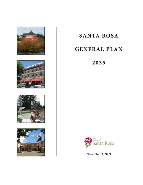
SANTA ROSA GENERAL PLAN 2035 - City of Santa Rosa
SANTA ROSA GENERAL PLAN 2035 - City of Santa Rosa
SANTA ROSA GENERAL PLAN 2035 - City of Santa Rosa

Create successful ePaper yourself
Turn your PDF publications into a flip-book with our unique Google optimized e-Paper software.
<strong>SANTA</strong> <strong>ROSA</strong><br />
<strong>GENERAL</strong> <strong>PLAN</strong><br />
<strong>2035</strong><br />
November 3, 2009
<strong>SANTA</strong> <strong>ROSA</strong> <strong>GENERAL</strong> <strong>PLAN</strong> <strong>2035</strong><br />
<strong>City</strong> Council:<br />
Susan Gorin, Mayor<br />
Marsha Vas Dupre, Vice Mayor<br />
Jane Bender<br />
Veronica Jacobi<br />
Ernesto Olivares<br />
John Sawyer<br />
Gary Wysocky<br />
Advance Planning and Public Policy<br />
General Plan Staff Team:<br />
Wayne G. Goldberg, Director<br />
Lisa Kranz, Senior Planner<br />
Peter Brown, Senior Planner<br />
Troy Eggleston, <strong>City</strong> Planner<br />
Planning Commission:<br />
Vicki Duggan, Chair<br />
Nick Caston, Vice Chair<br />
Michael Allen<br />
Caroline Bañuelos<br />
Scott Bartley<br />
Patti Cisco<br />
David Poulsen
Table Of Contents<br />
List <strong>of</strong> Figures<br />
List <strong>of</strong> Tables<br />
1 Introduction<br />
1-1 Vision ....................................................................................................................1-1<br />
1-2 Role and Purpose ..................................................................................................1-3<br />
1-3 Public Participation ..............................................................................................1-4<br />
1-4 Guiding Principles ................................................................................................1-5<br />
1-5 General Plan Format .............................................................................................1-8<br />
1-6 Relationship To Other Documents ....................................................................1-10<br />
1-7 Changing Th e General Plan ................................................................................1-11<br />
2 Land Use And Livability<br />
2-1 Vision ....................................................................................................................2-1<br />
2-2 Existing Land Uses ...............................................................................................2-2<br />
2-3 Livability ...............................................................................................................2-4<br />
2-4 Land Use Classifi cations .......................................................................................2-5<br />
2-5 Population and Employment .............................................................................2-15<br />
2-6 Goals and Policies ...............................................................................................2-16<br />
3 Urban Design<br />
4 Housing<br />
3-1 Vision ....................................................................................................................3-1<br />
3-2 Downtown .............................................................................................................3-2<br />
3-3 <strong>City</strong> Entries and Corridors ...................................................................................3-2<br />
3-4 Public Spaces .........................................................................................................3-3<br />
3-5 Neighborhood Design ...........................................................................................3-3<br />
3-6 Hillside Development ...........................................................................................3-4<br />
3-7 Goals and Policies .................................................................................................3-4<br />
4-1 Vision ....................................................................................................................4-1<br />
4-2 Housing Needs Analysis .......................................................................................4-1<br />
4-3 Constraints And Resources ................................................................................4-23<br />
4-4 Regional Housing Needs Allocation ..................................................................4-46<br />
4-5 Sites Inventory and Analysis ..............................................................................4-49<br />
4-6 Public Participation ............................................................................................4-63<br />
4-7 Housing Accomplishments ................................................................................4-65<br />
4-8 Goals and Policies ...............................................................................................4-67<br />
Housing Appendix ..............................................................................................4-85
TABLE OF CONTENTS<br />
ii<br />
5 Transportation<br />
5-1 Vision ....................................................................................................................5-1<br />
5-2 Roadway Classifi cation System ............................................................................5-2<br />
5-3 Scenic Roads ..........................................................................................................5-7<br />
5-4 Commuter Rail .....................................................................................................5-9<br />
5-5 Transit Network ....................................................................................................5-9<br />
5-6 Bicycle Facilities ..................................................................................................5-10<br />
5-7 Pedestrian Facilities ............................................................................................5-13<br />
5-8 Goals and Policies ...............................................................................................5-13<br />
Transportation Appendix ...................................................................................5-23<br />
6 Public Services And Facilities<br />
6-1 Vision ....................................................................................................................6-1<br />
6-2 Parks and Recreation ............................................................................................6-1<br />
6-3 Educational Facilities ...........................................................................................6-7<br />
6-4 Police Services .......................................................................................................6-8<br />
6-5 Fire Protection ......................................................................................................6-8<br />
6-6 Water Supply .........................................................................................................6-8<br />
6-7 Wastewater ..........................................................................................................6-12<br />
6-8 Solid Waste ..........................................................................................................6-12<br />
6-9 Stormwater Management ..................................................................................6-13<br />
6-10 Goals and Policies ...............................................................................................6-13<br />
7 Open Space and Conservation<br />
7-1 Vision ....................................................................................................................7-1<br />
7-2 Open Space ............................................................................................................7-1<br />
7-3 Biological Resources and Waterways ...................................................................7-2<br />
7-4 Air Quality .............................................................................................................7-5<br />
7-5 Energy ...................................................................................................................7-6<br />
7-6 Climate Change .....................................................................................................7-6<br />
7-7 Goals and Policies .................................................................................................7-8<br />
8 Growth Management<br />
8-1 Vision ....................................................................................................................8-1<br />
8-2 Urban Growth Boundary ......................................................................................8-2<br />
8-3 Growth Management ...........................................................................................8-2<br />
8-4 Goals and Policies .................................................................................................8-2<br />
9 Youth and Family<br />
9-1 Vision ....................................................................................................................9-1<br />
9-2 Age Distribution ...................................................................................................9-1<br />
9-3 Youth Programs ....................................................................................................9-3<br />
9-4 Child Care ..............................................................................................................9-3<br />
9-5 Seniors ...................................................................................................................9-4<br />
9-6 Goals and Policies .................................................................................................9-5
10 Economic Vitality<br />
10-1 Vision ..................................................................................................................10-1<br />
10-2 Economic Development .....................................................................................10-2<br />
10-3 Goals and Policies ..............................................................................................10-5<br />
11 Historic Preservation<br />
11-1 Vision ..................................................................................................................11-1<br />
11-2 Native American Heritage ..................................................................................11-1<br />
11-3 Historic Resources .............................................................................................11-2<br />
11-4 Goal and Policies .................................................................................................11-3<br />
12 Noise and Safety<br />
12-1 Vision ..................................................................................................................12-1<br />
12-2 Disaster Preparedness .......................................................................................12-1<br />
12-3 Noise ....................................................................................................................12-2<br />
12-4 Geology and Seismicity .....................................................................................12-3<br />
12-5 Flooding .............................................................................................................12-9<br />
12-6 Hazardous Materials ........................................................................................12-10<br />
12-7 Wildland Fires ..................................................................................................12-10<br />
12-8 Goals and Policies .............................................................................................12-10<br />
13 Art and Culture<br />
13-1 Vision ..................................................................................................................13-1<br />
13-2 Public Art ............................................................................................................13-1<br />
13-3 Goals and Policies ...............................................................................................13-2<br />
Greenhouse Gas Appendix<br />
Glossary<br />
<strong>SANTA</strong> <strong>ROSA</strong> <strong>GENERAL</strong> <strong>PLAN</strong><br />
Abbreviations .................................................................................................................... G-1<br />
Defi nitions ......................................................................................................................... G-3<br />
iii
TABLE OF CONTENTS<br />
List <strong>of</strong> Figures<br />
iv<br />
Figure 2-1 Planning Boundaries ...................................................................................................2-3<br />
Figure 2-2 Downtown Land Uses ..................................................................................................2-7<br />
Figure 2-3 Area Plan Boundaries ............................................................................................... 2-28<br />
Figure 3-1 <strong>City</strong> Entries and Corridors ..........................................................................................3-9<br />
Figure 4-1 Housing Opportunity Sites ...................................................................................... 4-53<br />
Figure 5-1 Roadway Network ........................................................................................................5-5<br />
Figure 5-2 Bicycle Corridors ....................................................................................................... 5-11<br />
Figure 6-1 Parks and Recreation ...................................................................................................6-5<br />
Figure 6-2 School Facilities ...........................................................................................................6-9<br />
Figure 6-3 Fire Facilities ............................................................................................................. 6-21<br />
Figure 7-1 Open Space and Community Separators ...................................................................7-3<br />
Figure 7-2 Biological Resources ....................................................................................................7-7<br />
Figure 7-3 Slope and Ridgelines ....................................................................................................7-9<br />
Figure 8-1 Area Not to be Developed Before 2010 ......................................................................8-3<br />
Figure 11-1 Historic Preservation Districts ................................................................................ 11-4<br />
Figure 12-1 Land Use Compatibility Standards .......................................................................... 12-4<br />
Figure 12-2 Noise Contours ......................................................................................................... 12-5<br />
Figure 12-3 Geologic and Seismic Hazards ................................................................................. 12-7<br />
Figure 12-4 FEMA Flood Plain Map/Dam Inundation ............................................................. 12-11
List <strong>of</strong> Tables<br />
<strong>SANTA</strong> <strong>ROSA</strong> <strong>GENERAL</strong> <strong>PLAN</strong><br />
Table 1-1: Organization <strong>of</strong> General Plan Elements ..............................................................................1-8<br />
Table 2-1: Permitted Densities/Intensities under General Plan ..........................................................2-6<br />
Table 2-2: Projected Housing and Population at Buildout ................................................................ 2-15<br />
Table 2-3: Projected Employment at Buildout ................................................................................... 2-15<br />
Table 2-4: Proposed Neighborhood Improvements .......................................................................... 2-18<br />
Table 4-1: Population Characteristics ....................................................................................................4-2<br />
Table 4-2: Population Trends, <strong>Santa</strong> <strong>Rosa</strong> <strong>City</strong> Limits and UGB .........................................................4-3<br />
Table 4-3: Household Trends in <strong>Santa</strong> <strong>Rosa</strong> UGB .................................................................................4-3<br />
Table 4-4: Household Types in <strong>Santa</strong> <strong>Rosa</strong>, 2006 .................................................................................4-4<br />
Table 4-5: Household Tenure in <strong>Santa</strong> <strong>Rosa</strong>, 2006 ...............................................................................4-4<br />
Table 4-6: Employment by Industry .....................................................................................................4-5<br />
Table 4-7: Employment Trends in <strong>Santa</strong> <strong>Rosa</strong> UGB .............................................................................4-5<br />
Table 4-8: Mean Household Income Trends in <strong>Santa</strong> <strong>Rosa</strong> UGB ........................................................4-6<br />
Table 4-9: Maximum Monthly Housing Costs by Income Category, 2007 .........................................4-7<br />
Table 4-10: Extremely Low and Very Low Income Households, 2000 ...............................................4-7<br />
Table 4-11: Median Home Sales Prices, 2007 and 2008 ......................................................................4-9<br />
Table 4-12: Households Paying More than 30 Percent <strong>of</strong> Income for Housing Costs, 2006 .......... 4-10<br />
Table 4-13: Housing Units by Tenure, 1990 and 2000 ...................................................................... 4-10<br />
Table 4-14: Housing Units by Type in <strong>Santa</strong> <strong>Rosa</strong>, 2000 .................................................................. 4-11<br />
Table 4-15: Overcrowding in <strong>Santa</strong> <strong>Rosa</strong>, 2000 ................................................................................ 4-12<br />
Table 4-16: Vacancy Rates, 2000 ....................................................................................................... 4-12<br />
Table 4-17: Persons with Disabilities, 2000 ...................................................................................... 4-13<br />
Table 4-18: Poverty Status and Housing Tenure for Single Parent Families ................................... 4-14<br />
Table 4-19: Large Households by Tenure ........................................................................................... 4-15<br />
v
TABLE OF CONTENTS<br />
vi<br />
Table 4-20: Elderly Households by Tenure ........................................................................................ 4-16<br />
Table 4-21: <strong>Santa</strong> <strong>Rosa</strong>'s Homeless Population ................................................................................. 4-17<br />
Table 4-22: Homeless Special Needs Households by Type .............................................................. 4-17<br />
Table 4-23: Homeless Facilities in <strong>Santa</strong> <strong>Rosa</strong> .................................................................................. 4-18<br />
Table 4-24: Farm Operations in Sonoma County, 2002 ................................................................... 4-21<br />
Table 4-25: Planning Fees .................................................................................................................. 4-25<br />
Table 4-26: Single Family Development Fees .................................................................................... 4-26<br />
Table 4-27: Multifamily Development Fees ...................................................................................... 4-27<br />
Table 4-28: Housing Types Permitted by Zoning District ................................................................ 4-29<br />
Table 4-29: Residential District Regulations .................................................................................... 4-31<br />
Table 4-30: <strong>Santa</strong> <strong>Rosa</strong> Low Income Rental Units at Risk <strong>of</strong> Converting to Market Rate .............. 4-45<br />
Table 4-31: Regional Housing Needs Allocation, 2007 - 2014 ......................................................... 4-47<br />
Table 4-32: Building Permit Issuance by Income Category - 2007 .................................................. 4-47<br />
Table 4-33: Very Low and Low Income Projects Issued Building Permits, 2007 ............................ 4-48<br />
Table 4-34: Quantifi ed Objectives, 2008 - 2014 ............................................................................... 4-48<br />
Table 4-35: Housing Opportunities in the <strong>Santa</strong> <strong>Rosa</strong> <strong>City</strong> Limits ................................................. 4-49<br />
Table 4-36: Housing Opportunities in the Urban Growth Boundary .............................................. 4-50<br />
Table 4-37: Medium Density Sites <strong>of</strong> Two or More Acres in <strong>City</strong> Zoned ........................................ 4-55<br />
Table 4-38: Medium Density Sites <strong>of</strong> Two or More Acres in <strong>City</strong> Not Zoned ................................. 4-55<br />
Table 4-39: Medium High Density Sites <strong>of</strong> Two or More Acres in <strong>City</strong> Zoned ............................... 4-56<br />
Table 4-40: Medium High Density Sites <strong>of</strong> Two or More Acres in <strong>City</strong> Not Zoned ........................ 4-56<br />
Table 4-41: Other Vacant Sites .......................................................................................................... 4-57<br />
Table 4-42: Underutilized or Developed Sites ................................................................................... 4-57<br />
Table 4-43: Very Low Density in <strong>City</strong> Zoned .................................................................................... 4-86<br />
Table 4-44: Very Low Density in <strong>City</strong> Not Zoned ............................................................................. 4-90<br />
Table 4-45: Low Density in <strong>City</strong> Zoned ............................................................................................. 4-92<br />
Table 4-46: Low Density in <strong>City</strong> Not Zoned ...................................................................................... 4-99<br />
Table 4-47: Low Density Open Space in <strong>City</strong> Zoned....................................................................... 4-105
<strong>SANTA</strong> <strong>ROSA</strong> <strong>GENERAL</strong> <strong>PLAN</strong><br />
Table 4-48: Low Density Open Space in <strong>City</strong> Not Zoned ............................................................... 4-106<br />
Table 4-49: Medium Low Density in <strong>City</strong> Zoned ............................................................................ 4-107<br />
Table 4-50: Medium Low Density in <strong>City</strong> Not Zoned ..................................................................... 4-108<br />
Table 4-51: Medium Density in <strong>City</strong> Zoned .................................................................................... 4-108<br />
Table 4-52: Medium Density in <strong>City</strong> Not Zoned ............................................................................. 4-110<br />
Table 4-53: Medium High Density in <strong>City</strong> Zoned ........................................................................... 4-111<br />
Table 4-54: Medium High Density in <strong>City</strong> Not Zoned ................................................................... 4-111<br />
Table 4-55: Transit Village Medium And Transit Village Mixed Use Not Zoned .......................... 4-112<br />
Table 4-56: Retail Medium in <strong>City</strong> Zoned ....................................................................................... 4-112<br />
Table 4-57: Retail Medium in <strong>City</strong> Not Zoned ................................................................................ 4-112<br />
Table 4-58: Offi ce Medium in <strong>City</strong> Zoned ....................................................................................... 4-113<br />
Table 4-59: Intensifi cation Sites Downtown Station Area Specifi c Plan ....................................... 4-113<br />
Table 4-60: Housing Accomplishments ........................................................................................... 4-114<br />
Table 6-1: Existing Neighborhood and Community Parks, 2008 ........................................................6-3<br />
Table 6-2: Undeveloped Parkland, 2008................................................................................................6-3<br />
Table 6-3: Projected Parks and Recreation <strong>2035</strong> ..................................................................................6-4<br />
Table 6-4: Community/Recreational Facilities, 2008 ...........................................................................6-4<br />
Table 6-5: Enrollment in <strong>Santa</strong> <strong>Rosa</strong> School Districts ..........................................................................6-7<br />
Table 8-1: Schedule <strong>of</strong> Housing Units Allotments ...............................................................................8-4<br />
Table 9-1: Age Distribution <strong>of</strong> <strong>Santa</strong> <strong>Rosa</strong> Residents (2007) .............................................................9-2<br />
vii
1<br />
Th is chapter provides the vision <strong>of</strong> <strong>Santa</strong> <strong>Rosa</strong> in <strong>2035</strong>, as identifi ed through<br />
preparation <strong>of</strong> the General Plan. State planning requirements, guidelines developed<br />
by the city’s General Plan Program Management Team (PMT), the citizen participation<br />
process, and plan format are all described.<br />
1-1 VISION<br />
INTRODUC TION<br />
In <strong>2035</strong>, <strong>Santa</strong> <strong>Rosa</strong> is a vibrant community featuring a diverse range <strong>of</strong> housing<br />
and employment opportunities. Urban development is focused within the city’s<br />
Urban Growth Boundary (UGB), and job growth is balanced with the availability <strong>of</strong><br />
housing. Infi ll development is designed to maintain the local quality <strong>of</strong> life through<br />
compatibility with adjacent land uses, provision <strong>of</strong> parks and open spaces, and<br />
connection between neighborhoods and activity centers. Safe, livable residential<br />
neighborhoods provide a variety <strong>of</strong> housing types for households <strong>of</strong> all income<br />
levels. Neighborhood-scale retail and service uses, schools, and recreational facilities<br />
are connected by bicycle and pedestrian paths.<br />
Downtown serves as the heart <strong>of</strong> the community. Historic structures and<br />
districts surrounding downtown are preserved, lending character to the city’s<br />
center. Commercial and multifamily development has occurred along regional/<br />
arterial corridors that provide access to downtown, including <strong>Santa</strong> <strong>Rosa</strong> Avenue<br />
and Sebastopol Road. Community and regional retailers have invested in these<br />
areas, and many <strong>of</strong> the streets have acquired a “boulevard” character, with street<br />
trees, medians, bicycle lanes, and sidewalks. A range <strong>of</strong> higher density housing<br />
opportunities exists within walking distance <strong>of</strong> these regional/arterial streets,<br />
providing residents with convenient access to services and transit without use <strong>of</strong> a<br />
car. Public art is displayed at major activity centers and public spaces.<br />
<strong>Santa</strong> <strong>Rosa</strong> is now a regional leader in environmental stewardship by actively<br />
pursuing programs <strong>of</strong> resource conservation, energy effi ciency and greenhouse<br />
gas (GHG) emission reductions. <strong>Santa</strong> <strong>Rosa</strong> reduced its GHG emissions for city<br />
operations to 20 percent below 2000 levels by 2010 and facilitated community-wide<br />
reductions <strong>of</strong> 25 percent below 1990 levels in 2015.
INTRODUCTION<br />
A wide range <strong>of</strong> transportation alternatives is available to <strong>Santa</strong> <strong>Rosa</strong> residents, including car,<br />
bus, rail, bicycle, and foot. Th e city’s circulation network accommodates bicyclists, motorists,<br />
pedestrians, public transportation users, children, seniors, and persons with disabilities.<br />
Th e majority <strong>of</strong> the city’s vehicle fl eet is composed <strong>of</strong> alternative fueled and hybrid vehicles<br />
while many residents <strong>of</strong> the community are also utilizing sustainable fuel technologies for<br />
transportation. Transit systems provide timed transfers and convenient routes, while bicycle<br />
facilities are provided at large employment centers, shopping areas, and transfer stations.<br />
Major entries to the city’s UGB feature distinct landscaping and signage, while scenic roadways<br />
within the city preserve views <strong>of</strong> signifi cant natural and cultural features. Reduced traffi c<br />
congestion and improved levels <strong>of</strong> service have contributed to better air quality.<br />
Neighborhood and community parks are distributed throughout the city, and <strong>of</strong>f er a variety <strong>of</strong><br />
passive and active recreational opportunities. <strong>City</strong>wide Parks and Special Purpose Parks and<br />
Facilities, containing facilities such as community centers and aquatic facilities are also located<br />
in diff erent parts <strong>of</strong> the city, for convenience and accessibility. Creeks and wetland areas are<br />
preserved for their biological resources and wildlife habitat, as well as their contribution to the<br />
regional storm water system. Multi use paths have been constructed along creek corridors to<br />
provide linkages between diff erent parts <strong>of</strong> the city.<br />
Educational facilities needed to serve <strong>Santa</strong> <strong>Rosa</strong> residents are located throughout the<br />
community. Elementary and middle school facilities are accessible by bicycle and foot from<br />
most neighborhoods. After-school youth programs feature continuing education, music<br />
and dance, sports, culture and arts. <strong>Santa</strong> <strong>Rosa</strong> Junior College provides adult education<br />
opportunities, including training programs for technical skills desired by local employers.<br />
Expansion <strong>of</strong> water supply, sewer treatment, and solid waste collection systems have been<br />
timed with the growth <strong>of</strong> housing and employment uses, and conservation has helped the city<br />
to do more with less. Police and fi re response capabilities match the distribution and needs<br />
<strong>of</strong> land uses. Development is located away from hazardous areas, and incorporates safety<br />
considerations. New development and reuse projects have considered geologic and seismic<br />
hazards during construction. Noise sensitive uses are located in the quieter parts <strong>of</strong> the city<br />
and attenuation programs are in place to reduce noise levels in structures adjacent to the<br />
highways and regional/arterial streets. New developments utilize natural drainage systems,<br />
and where appropriate, capacity <strong>of</strong> the storm water system has been increased with new<br />
development so that fl ooding does not pose risks to persons or property.<br />
<strong>Santa</strong> <strong>Rosa</strong> is a safe, livable community in which to both live and work. Provision <strong>of</strong> housing,<br />
transportation, employment, recreation, and entertainment opportunities result in a high<br />
quality <strong>of</strong> life for residents <strong>of</strong> all ages. Preservation <strong>of</strong> natural and cultural features throughout<br />
the city contributes to the city’s identity and character. Th e city remains a regional leader in<br />
sustainable practices, resource conservation, and effi cient operations with limited GHG<br />
emissions.<br />
1-2
1-2 ROLE AND PURPOSE<br />
<strong>SANTA</strong> <strong>ROSA</strong> <strong>GENERAL</strong> <strong>PLAN</strong><br />
State law requires each California city and county to prepare a general plan. A general plan is<br />
defi ned as “a comprehensive, long-term plan for the physical development <strong>of</strong> the county or city,<br />
and any land outside its boundaries which in the planning agency’s judgment bears relation to<br />
its planning.” State requirements call for general plans that “comprise an integrated, internally<br />
consistent and compatible statement <strong>of</strong> policies for the adopting agency.” State law further<br />
requires each jurisdiction to comply with the adopted GHG emission reduction strategies. Th e<br />
<strong>City</strong> <strong>of</strong> <strong>Santa</strong> <strong>Rosa</strong> is able to do so as a result <strong>of</strong> General Plan policies found throughout this<br />
document as well as specifi c programs such as the <strong>City</strong>’s Greenhouse Gas Reduction Program<br />
and Climate Action Plan. Users <strong>of</strong> <strong>Santa</strong> <strong>Rosa</strong>’s General Plan will note that policies related to<br />
GHG emission reductions are designated by a leaf. All greenhouse gas related goals and<br />
policies are listed in an appendix at the end <strong>of</strong> this general plan.<br />
Th e <strong>Santa</strong> <strong>Rosa</strong> General Plan addresses issues related to physical development, growth<br />
management, transportation services, public facilities, community design, energy effi ciency,<br />
greenhouse gas reduction strategies, and conservation <strong>of</strong> resources in the Planning Area. Th e<br />
General Plan:<br />
• Outlines a vision <strong>of</strong> long-range physical and economic development that refl ects the<br />
aspirations <strong>of</strong> the community, and provides specifi c implementing policies that will<br />
allow this vision to be accomplished;<br />
• Establishes a basis for judging whether specifi c development proposals and public<br />
projects are in harmony with said vision;<br />
• Allows city departments, other public agencies, and private developers to design<br />
projects that will enhance the character <strong>of</strong> the community, preserve and enhance<br />
critical environmental resources, and minimize hazards; and<br />
• Provides the basis for establishing and setting priorities for detailed plans and<br />
implementing programs such as the Zoning Code, specifi c and area plans, and the<br />
Capital Improvement Program.<br />
<strong>GENERAL</strong> <strong>PLAN</strong> REQUIREMENTS<br />
A city’s general plan has been described as its constitution for development – the framework<br />
within which decisions on how to grow, provide public services and facilities, and protect and<br />
enhance the environment must be made. California’s tradition <strong>of</strong> allowing local authority over<br />
land use decisions means that the state’s cities have considerable fl exibility in preparing their<br />
general plans.<br />
1-3
INTRODUCTION<br />
While they allow considerable fl exibility, state planning<br />
laws do establish some requirements for the issues that<br />
general plans must address:<br />
1-4<br />
• Th e General Plan Must Be Comprehensive.<br />
Th e general plan must be geographically<br />
comprehensive – that is, it must apply<br />
throughout the entire incorporated area and<br />
include other areas that the city determines<br />
are relevant to its planning. Also, the general<br />
plan must address the full range <strong>of</strong> issues<br />
that aff ects the city’s physical development.<br />
Twelve neighborhood meetings, and numerous<br />
Program Management Team workshops were<br />
held as part <strong>of</strong> the General Plan update process.<br />
• Th e General Plan Must Be Internally Consistent.<br />
Th e General Plan must fully integrate its separate parts and relate them to each<br />
other without confl ict. “Horizontal” consistency applies to fi gures and diagrams,<br />
background text, data and analysis, and policies. All adopted portions <strong>of</strong> the general<br />
plan, whether required by state law or not, have equal legal weight.<br />
• Th e General Plan Must Be Long Range. Because anticipated development will aff ect<br />
the city and the people who live and work there for years to come, state law requires<br />
every general plan to take a long-term perspective.<br />
State law also requires that the city provide an annual report on the status <strong>of</strong> the plan and<br />
progress in its implementation. Th e Planning Commission and <strong>City</strong> Council hold a joint study<br />
session each March to review the General Plan annual report.<br />
1-3 PUBLIC PARTICIPATION<br />
<strong>Santa</strong> <strong>Rosa</strong> <strong>2035</strong> depends largely on the extensive public participation program conducted<br />
for its predecessor General Plan, <strong>Santa</strong> <strong>Rosa</strong> 2020, since the revision process to develop<br />
<strong>Santa</strong> <strong>Rosa</strong> <strong>2035</strong> was focused on updating the Housing Element, incorporating policies from<br />
recently adopted planning eff orts, and including policies related to climate protection. Public<br />
participation eff orts were centered on the Housing Element and are described in greater detail<br />
there. In response to testimony at Planning Commission public hearings held regarding <strong>Santa</strong><br />
<strong>Rosa</strong> <strong>2035</strong>, commissioners reviewed the General Plan element by element to facilitate increased<br />
public participation, and dialogue between stakeholders.<br />
Public participation in preparation <strong>of</strong> the 2020 General Plan occurred in a variety <strong>of</strong> ways.<br />
An oversight committee - the General Plan Program Management Team (PMT) - was formed<br />
<strong>of</strong> elected and appointed <strong>of</strong>fi cials and members <strong>of</strong> the public. Th e PMT met throughout 2000
<strong>SANTA</strong> <strong>ROSA</strong> <strong>GENERAL</strong> <strong>PLAN</strong><br />
and in early 2001, discussing existing conditions and planning issues related to land use,<br />
housing, public services, transportation, open space and resources, downtown, economics,<br />
and neighborhood livability. Additionally, the PMT reviewed two alternative land use plans,<br />
and provided direction on population, employment growth, and development patterns for the<br />
General Plan.<br />
Twelve community meetings, hosted by the PMT, were held to allow citizens an opportunity<br />
to comment on General Plan related issues. Th ree community meetings were held in each<br />
quadrant <strong>of</strong> the city to encourage discussion <strong>of</strong> neighborhood-specifi c, as well as citywide,<br />
planning issues. At these meetings, <strong>Santa</strong> <strong>Rosa</strong> residents were asked to brainstorm issues<br />
and opportunities for the city, quadrants, and<br />
neighborhoods. Th e community meetings were<br />
advertised through the community cable channel, the<br />
Press Democrat, the city’s quarterly Update newsletter,<br />
the city’s website, and fl yers distributed throughout the<br />
community.<br />
1-4 GUIDING PRINCIPLES<br />
After all <strong>of</strong> the community meetings were held and<br />
planning issues identifi ed, the PMT developed a<br />
set <strong>of</strong> Guiding Principles. Drafted in August 2000,<br />
the Guiding Principles describe the most important<br />
directions which were to be followed in drafting the<br />
General Plan. Additionally, the Guiding Principles were<br />
used in conceptualizing two sketch plan alternatives.<br />
Th e Guiding Principles are advisory only and do not<br />
represent General Plan policy.<br />
<strong>Santa</strong> <strong>Rosa</strong> is a special place set in an agricultural county<br />
with an inviting climate, superior natural beauty, desirable<br />
residential neighborhoods, and a strong, diversifi ed<br />
economy. As the area accepts its share <strong>of</strong> the region’s<br />
growth, these characteristics must not be sacrifi ced.<br />
Instead, the growth must protect the positive qualities<br />
which make the city attractive and build new features which<br />
provide enduring value and beauty and further improve the<br />
quality <strong>of</strong> life. It is our duty to assure that, twenty years<br />
from now, <strong>Santa</strong> <strong>Rosa</strong> is an even more desirable city than it<br />
is today.<br />
Guiding Principles call for linkages, increased<br />
pedestrian and bicycle movement, and high<br />
quality design.<br />
1-5
INTRODUCTION<br />
1-6<br />
1. Because the remaining land within the <strong>Santa</strong> <strong>Rosa</strong><br />
Urban Boundary is limited, all new development<br />
must be <strong>of</strong> high quality, add to the quality <strong>of</strong> life<br />
within the city and substantially further adopted<br />
city objectives.<br />
2. No new development shall be allowed until the<br />
infrastructure necessary to serve it is either<br />
in place or will be provided as a part <strong>of</strong> the<br />
development itself.<br />
3. Match employment growth to housing availability.<br />
4. Reduce dependence on the automobile by<br />
improving pedestrian, bicycle, and transit<br />
alternatives and by locating essential commercial<br />
services in proximity to housing.<br />
5. Development must be done in a way such that<br />
there is the appearance <strong>of</strong> openness and respect for<br />
the site’s natural assets.<br />
Protection <strong>of</strong> <strong>Santa</strong> <strong>Rosa</strong>’s natural assets and<br />
reinforcement <strong>of</strong> downtown are key Guiding<br />
Principles.<br />
6. Downtown is the heart <strong>of</strong> the city and uses added will provide a high level <strong>of</strong> urban activity<br />
and a strong identity.<br />
7. Streets shall be designed and modifi ed to reduce speeding and provide safe and inviting bicycle<br />
and pedestrian elements. Pedestrians=cars=bikes on all streets in <strong>Santa</strong> <strong>Rosa</strong>.<br />
8. New, high quality development shall be used to improve the areas <strong>of</strong> <strong>Santa</strong> <strong>Rosa</strong> which have<br />
undergone deterioration or require increased vitality. Building and zoning codes shall be<br />
enforced.<br />
9. Th e natural assets <strong>of</strong> <strong>Santa</strong> <strong>Rosa</strong>, such as creeks, mature trees and skylines, shall be conserved,<br />
restored, and showcased.<br />
10. Th e entire spectrum <strong>of</strong> housing needs <strong>of</strong> community residents shall be anticipated and<br />
addressed with each new residential development and the rehabilitation <strong>of</strong> existing residences.<br />
In addition, all new non-residential development will participate in meeting local housing<br />
needs.<br />
11. Higher density residential development will be sited to reduce unit costs and provide more<br />
effi cient transportation alternatives and neighborhood amenities.
<strong>SANTA</strong> <strong>ROSA</strong> <strong>GENERAL</strong> <strong>PLAN</strong><br />
12. Excellent facilities and programs shall be provided for leisure time opportunities for our youth,<br />
refl ecting their diversity and mix <strong>of</strong> interests.<br />
13. Th e city shall continually maintain an advance planning function whose purpose is to provide<br />
a comprehensive planning view and assure that short term decisions refl ect long term goals<br />
and vision.<br />
14. Connectivity shall be provided between the east and west parts <strong>of</strong> town through linkages<br />
for pedestrians, bicycles, and automobiles that are free fl owing and unobtrusive to the<br />
neighborhoods.<br />
15. In addition to neighborhood, community, and citywide parks suitable to active recreation,<br />
a number <strong>of</strong> small public plazas and gathering places shall be located to promote social<br />
interaction among residents, provide neighborhood recreational opportunities, and improve<br />
connectivity to pathways, trails, and commercial centers.<br />
16. Downtown development shall contain a mix <strong>of</strong><br />
uses, including residential. Residential uses are<br />
required in new commercial developments on<br />
parcels outside <strong>of</strong> downtown.<br />
17. Th e city shall commit itself to sustainable<br />
development practices.<br />
18. Focus employment development strategies to<br />
retain and expand existing businesses and welcome<br />
new businesses which reinforce the community<br />
identity, exhibit sustainable business practices and<br />
which have a long term, vested interest in <strong>Santa</strong><br />
<strong>Rosa</strong>.<br />
19. Promote development <strong>of</strong> scenic streetscapes and<br />
preserve scenic roads.<br />
20. Reduce land devoted to parking.<br />
21. Expand art and culture in the community.<br />
Guiding principles call for providing a wide<br />
spectrum <strong>of</strong> housing types.<br />
1-7
INTRODUCTION<br />
1-5 <strong>GENERAL</strong> <strong>PLAN</strong> FORMAT<br />
State law requires that a general plan address seven mandatory elements - land use, circulation,<br />
conservation, open space, safety, noise, and housing. Specifi c topic areas are prescribed for<br />
each mandatory element. Th e <strong>Santa</strong> <strong>Rosa</strong> General Plan is organized as shown in Table 1-1,<br />
addressing each <strong>of</strong> the mandatory elements and several optional elements.<br />
Table 1-1: Organization <strong>of</strong> General Plan Elements<br />
1-8<br />
General Plan<br />
Element<br />
2: Land Use and<br />
Livability<br />
Topics Addressed by Element Required by<br />
State Law<br />
This element includes proposed use<br />
classifi cations, distribution <strong>of</strong> land uses<br />
via the General Plan Diagram, buildout<br />
projections, and land use policies.<br />
3: Urban Design Downtown development, key corridors,<br />
city entries, neighborhood design, and<br />
hillside preservation are all addressed in<br />
this element.<br />
4: Housing This element consists <strong>of</strong> an update to<br />
demographic trends, housing characteristics,<br />
housing costs, development potential,<br />
constraints, and special housing<br />
needs. The city’s 2002 Housing Element<br />
policies are reviewed, and accomplishments<br />
noted. Housing opportunity sites<br />
are identifi ed, in addition to a discussion<br />
<strong>of</strong> quantifi ed objectives. Housing policies<br />
address rehabilitation, aff ordable<br />
housing, conversion, homeless shelters,<br />
and energy effi ciency.<br />
5: Transportation This element includes existing and proposed<br />
location <strong>of</strong> the roadway network,<br />
transit systems, bikeways and pedestrian<br />
paths, as well as scenic roadways.<br />
6: Public Services<br />
and Facilities<br />
Parks and recreation, public schools,<br />
water supply and conservation, sewer<br />
collection, solid waste, and fi re and<br />
police protection are all addressed in<br />
this element.<br />
How General Plan Addresses<br />
Mandated Topics<br />
Land Use Location <strong>of</strong> public facilities is addressed<br />
in Chapter 6: Public Services<br />
and Facilities, and areas subject to<br />
fl ooding hazards are defi ned in<br />
Chapter 12: Noise and Safety. Timber<br />
production does not occur within<br />
<strong>Santa</strong> <strong>Rosa</strong>, and is therefore not addressed.<br />
Housing<br />
Circulation
Table 1-1: Organization <strong>of</strong> General Plan Elements<br />
General Plan<br />
Element<br />
7: Open Space<br />
and<br />
Conservation<br />
8: Growth<br />
Management<br />
9: Youth and<br />
Family<br />
10: Economic<br />
Vitality<br />
11: Historic<br />
Preservation<br />
12: Noise and<br />
Safety<br />
13: Arts and<br />
Culture<br />
Topics Addressed by Element Required by<br />
State Law<br />
This element includes analysis <strong>of</strong> open<br />
space, agricultural resources, biological<br />
resources, and air quality.<br />
This element addresses the city’s<br />
Growth Management Program, including<br />
limits on residential development.<br />
<strong>Santa</strong> <strong>Rosa</strong>’s Urban Growth Boundary<br />
(UGB) is also discussed.<br />
This element addresses youth programs<br />
and childcare facilities.<br />
Economic and employment trends,<br />
redevelopment activities, and economic<br />
development strategies are presented<br />
in this element.<br />
This element identifi es historic<br />
structures and preservation districts<br />
within the city. Goals and policies are<br />
presented to ensure conservation, rehabilitation<br />
and reuse, as appropriate.<br />
Noise, geology and seismicity, fl ooding,<br />
hazardous materials, and wildfi res are<br />
all addressed in this element. Geologic,<br />
seismic, and fl ooding hazards are<br />
mapped. Discussion <strong>of</strong> noise includes<br />
noise sources, projected contours, and<br />
mitigation policies.<br />
Public displays <strong>of</strong> art and cultural facilities<br />
are addressed in this element.<br />
Conservation;<br />
Open Space<br />
<strong>SANTA</strong> <strong>ROSA</strong> <strong>GENERAL</strong> <strong>PLAN</strong><br />
How General Plan Addresses<br />
Mandated Topics<br />
Stormwater management and water<br />
supply are discussed in Chapter 6:<br />
Public Services and Facilities. Policies<br />
requiring open space for health and<br />
safety are contained within Chapter<br />
12: Noise and Safety.<br />
Safety; Noise Fire protection and water supply<br />
are addressed in Chapter 6: Public<br />
Services and Facilities.<br />
1-9
INTRODUCTION<br />
GOALS AND POLICIES<br />
Each element <strong>of</strong> the General Plan is organized to provide a short statement <strong>of</strong> existing<br />
conditions and vision, followed by goals and policies. In some instances, commentary is also<br />
included.<br />
1-10<br />
• Goals present broad policy direction; a larger end-state the city is hoping to achieve.<br />
• Policies provide more specifi c direction on how to achieve goals. Policies outline<br />
actions, procedures, programs, or techniques to attain the goals. Some policies<br />
include quantitative statements that can be implemented by city staff .<br />
• Commentary below some policies simply provides further discussion <strong>of</strong> and potential<br />
implementation for the policy statement.<br />
1-6 RELATIONSHIP TO OTHER DOCUMENTS<br />
<strong>Santa</strong> <strong>Rosa</strong> <strong>2035</strong> incorporates signifi cant policy direction from other plans. Policy references<br />
from the following plans are included in this document:<br />
• Bicycle and Pedestrian Master Plan<br />
• <strong>City</strong>wide Creek Master Plan<br />
• Downtown Station Area Specifi c Plan<br />
• North <strong>Santa</strong> <strong>Rosa</strong> Station Area Specifi c Plan<br />
• Economic Sustainability Strategy<br />
• Northern Downtown Pedestrian Linkages Study<br />
• Recreation and Parks Business and Strategic Plan<br />
• Sebastopol Road Urban Vision and Corridor Plan<br />
• Southeast Area Plan<br />
• Southwest Area Plan<br />
• Climate Action Plan<br />
Th e Southeast and Southwest Area Plans are superseded with the adoption <strong>of</strong> this plan. Th e<br />
remainder <strong>of</strong> above-noted plans are in full eff ect and should be consulted for additional goals,<br />
policies, and information.<br />
Th e Climate Action Plan was adopted in 2012 in recognition that climate change poses a<br />
threat to <strong>Santa</strong> <strong>Rosa</strong> and the larger environment. Activities taking place within the <strong>City</strong> have<br />
an impact on global warming and climate change. Th e Climate Action Plan provides specifi c<br />
measures regarding how the <strong>City</strong> plans to reduce greenhouse gas emissions and outlines the<br />
eff ects <strong>of</strong> community wide actions on climate change.
<strong>SANTA</strong> <strong>ROSA</strong> <strong>GENERAL</strong> <strong>PLAN</strong><br />
In preparation <strong>of</strong> the prior general plan, <strong>Santa</strong> <strong>Rosa</strong> 2020, various background reports were<br />
prepared. Th ese reports may be reviewed at the <strong>City</strong> <strong>of</strong> <strong>Santa</strong> <strong>Rosa</strong>’s Department <strong>of</strong> Community<br />
Development.<br />
1-7 CHANGING THE <strong>GENERAL</strong> <strong>PLAN</strong><br />
As the city’s premier policy document, the General Plan is not changed without good cause.<br />
Th e <strong>City</strong> Council, Planning Commission, or staff , in reviewing the General Plan, may fi nd that<br />
certain portions should be changed due to circumstances which arise within the community.<br />
Amendment <strong>of</strong> the General Plan may be necessary due to changing policies <strong>of</strong> the <strong>City</strong> Council<br />
or if it is found through periodic review that certain portions <strong>of</strong> the Plan are inadequate or do<br />
not meet the needs <strong>of</strong> the community.<br />
Th e General Plan Land Use Diagram or the text <strong>of</strong> any element may be amended. General<br />
Plan Amendment applications may be fi led by individual applicants or may be initiated by<br />
the Community Development Director, Planning Commission or <strong>City</strong> Council. Concurrent<br />
processing <strong>of</strong> General Plan Amendments with other land use applications is permitted.<br />
Applications for General Plan Amendment must address why an amendment is warranted,<br />
describe events which have rendered the General Plan inadequate or unattainable, and describe<br />
any studies which have brought policies or portions <strong>of</strong> the plan into question.<br />
Th e General Plan may be amended three times per year. Th e Planning Commission shall<br />
conduct hearings regarding General Plan Amendment applications in February, June and<br />
October <strong>of</strong> each year. Th e <strong>City</strong> Council shall conduct hearings after consideration <strong>of</strong> the<br />
Planning Commission, in March, July and November. To meet this hearing schedule, the<br />
following application deadlines are established: February 1 for hearing in June; June 1 for<br />
hearing in October; and October 1 for hearing in February. When the fi rst day <strong>of</strong> the month<br />
falls on a weekend, the following Monday is the fi nal day for submittal.<br />
1-11
2<br />
LAND USE AND LIVABILITY<br />
Th e text, goals, and policies <strong>of</strong> the Land Use and Livability Element and the Land<br />
Use Diagram (enclosed foldout) constitute the physical framework for the General<br />
Plan. Th e diagram designates the proposed general location, distribution, and<br />
extent <strong>of</strong> land uses. As required by state law, land use classifi cations, shown as<br />
color designations, symbols, or graphic patterns on the diagram, specify a range<br />
for population density and building intensity for each type <strong>of</strong> designated land use.<br />
Th ese standards <strong>of</strong> population density and building intensity allow circulation<br />
and public facility needs to be determined; they also refl ect the environmental<br />
constraints established by other elements <strong>of</strong> the General Plan. In addition, this<br />
element addresses livability – those qualities <strong>of</strong> the city that aff ect everyday<br />
living; such as how well the city works for its residents and workers, as well as how<br />
comfortable and enjoyable neighborhoods are.<br />
Th e Land Use and Livability Element incorporates signifi cant policy direction from<br />
other city planning documents that have relevant land use implications. Th ose<br />
policies are assigned a Land Use and Livability number and shown in the goals and<br />
policy section. Adopted city plans with land use implications and approved policies<br />
include the following:<br />
• North <strong>Santa</strong> <strong>Rosa</strong> Station Area Specifi c Plan<br />
• Downtown Station Area Specifi c Plan<br />
• Northern Downtown Pedestrian Linkages Study<br />
• Sebastopol Road Urban Vision and Corridor Plan<br />
• Southwest Area Plan<br />
• Southeast Area Plan<br />
Th e Southeast and Southwest Area Plans are supers eded with the adoption <strong>of</strong> the<br />
General Plan. Th e remainder <strong>of</strong> above-noted plans are in full eff ect and any physical<br />
development must be consistent with these documents and <strong>Santa</strong> <strong>Rosa</strong> <strong>2035</strong>.<br />
2-1 VISION<br />
<strong>Santa</strong> <strong>Rosa</strong>’s growth has been compact, with urban development in <strong>2035</strong> contained<br />
within the Urban Growth Boundary (UGB). Downtown is the city’s primary activity<br />
node, and retail and multifamily development has occurred along regional/arterial<br />
corridors leading to downtown. Smaller-scale mixed use shopping centers are
LAND USE AND LIVABILITY<br />
interspersed throughout the city to provide residents easy access to daily shopping needs. New<br />
residential development has occurred in a variety <strong>of</strong> settings and housing types to meet the<br />
needs <strong>of</strong> a diverse population.<br />
Downtown is an energetic center <strong>of</strong> commerce in the North Bay. New <strong>of</strong>fi ces, stores, hotels and<br />
cultural facilities have located here. Because <strong>of</strong> new housing development, downtown is vital<br />
during evenings and weekends. Th e new residents <strong>of</strong> downtown – families, students, seniors,<br />
and others – enjoy urban living, and are able to walk to jobs and shops. Railroad Square is a<br />
lively nucleus <strong>of</strong> galleries, shops, arts education workshops, and other cultural facilities. Some<br />
<strong>of</strong> the older industrial buildings to the north have been converted to live/work l<strong>of</strong>ts and higher<br />
density residential.<br />
Major corridors leading into downtown have a boulevard character, with rows <strong>of</strong> trees,<br />
landscaped medians, bicycle lanes, and sidewalks. Sebastopol Road is the focus <strong>of</strong> activity<br />
in southwest <strong>Santa</strong> <strong>Rosa</strong>; it has pedestrian orientation, and among its attractions is an<br />
International Marketplace. Businesses along Mendocino Avenue serve students and workers<br />
<strong>of</strong> the adjacent Junior College. <strong>Santa</strong> <strong>Rosa</strong> Avenue features regional shopping destinations<br />
accessible by automobile, transit, or bicycle. Th e city’s largest retail and <strong>of</strong>fi ce center outside <strong>of</strong><br />
downtown is the Fountaingrove Parkway/Old Redwood Highway area, which is complemented<br />
by adjacent new business parks.<br />
2-2 EXISTING LAND USES<br />
Since its incorporation in 1868, with an area <strong>of</strong> about one square mile and 900 residents,<br />
<strong>Santa</strong> <strong>Rosa</strong> has evolved into the commercial, fi nancial, medical, and industrial center <strong>of</strong> the<br />
North Bay. <strong>Santa</strong> <strong>Rosa</strong> is also the largest city between San Francisco and Eugene, Oregon.<br />
<strong>Santa</strong> <strong>Rosa</strong> voters approved a fi ve-year UGB in 1990, and a 20-year UGB measure in 1996,<br />
assuring that the current UGB will not be signifi cantly changed at least until 2016. Th e UGB<br />
encompasses 45 square miles. Figure 2-1 shows the city limits, UGB, and Planning Area.<br />
<strong>Santa</strong> <strong>Rosa</strong> has a traditional downtown, which, together with the nearby <strong>Santa</strong> <strong>Rosa</strong> Junior<br />
College (JC) area, holds approximately one-quarter <strong>of</strong> the 16.5 million square feet <strong>of</strong><br />
commercial/<strong>of</strong>fi ce space within the UGB. About half <strong>of</strong> the city’s commercial acreage (660 acres<br />
<strong>of</strong> a total <strong>of</strong> 1,370 acres) is in strip retail uses. Another 10.6 million square feet <strong>of</strong> industrial<br />
space is scattered in peripheral locations. Th e city’s residential neighborhoods are diverse,<br />
ranging from the traditional - such as JC, Burbank, and West End – with grid street patterns<br />
and moderately high densities, to low density hillside neighborhoods such as Chanate/Hidden<br />
Valley, Rincon Valley, and Fountaingrove. With the exception <strong>of</strong> downtown, land uses are<br />
contained in single-use districts, and mixed use (residential and non-residential) development<br />
is sparse. Approximately 16 percent <strong>of</strong> land (approximately 4,655 acres <strong>of</strong> a total <strong>of</strong> 29,140<br />
acres) within the UGB is vacant.<br />
2-2
Figure 2-1<br />
Planning Boundaries<br />
MA R K WEST SPRINGS RD<br />
SHILOH RD<br />
Urban Growth Boundary<br />
OLD REDWOOD HWY<br />
101<br />
Planning Area<br />
AIRPORT BLVD<br />
<strong>City</strong> Limits<br />
N LAUGHLIN RD<br />
W E E K S<br />
R I N C O N<br />
C R E E K<br />
BR U SH C REEK<br />
RD<br />
RIVER<br />
Brush Creek Reservoir<br />
CREEK<br />
FOUNTAINGROVE<br />
Fountaingrove Lake<br />
CREEK<br />
COFFEY LN<br />
C R E E K<br />
MONTECITO BL VD<br />
HOPPER AVE<br />
DU CKER<br />
CR E E K<br />
P K Y<br />
PINER<br />
CREEK<br />
L A G U N A<br />
A U S T I N<br />
MIDDLE R I NCON RD<br />
BRUSH CREEK RD<br />
CHA NATE RD<br />
MISSI ON BLVD<br />
D E<br />
C R E E K<br />
FRANKLIN AVE<br />
STEELE LN<br />
C R E E K<br />
C ONTROL<br />
G ORD O N CRE E K<br />
SA N T A R O S A<br />
FLOOD<br />
S A<br />
P E T E R SO N<br />
CREEK<br />
S A N T A R O<br />
4TH ST<br />
PI NER<br />
ABRAMSON<br />
C R E E K<br />
S A N T A R O S A<br />
SONOMA HWY<br />
CREEK<br />
SPRING<br />
5TH ST<br />
D ST<br />
WILSON ST<br />
C R E E K<br />
S A N T A R O S A<br />
BETHA R DS DR<br />
BICE NTENNI AL WA Y<br />
PINER RD<br />
MONTG OMERY<br />
CLEVELAND AVE<br />
12<br />
DR<br />
Spring Lake<br />
Lake Ralphine<br />
NORTH ST<br />
MENDOCINO AVE<br />
GUERNEVILLE RD<br />
SUMMERFIELD RD<br />
SONOMA AVE<br />
COLLEGE AVE<br />
N DUTTON<br />
W COLLEGE AVE<br />
W 9TH ST<br />
HOEN AVE<br />
YULUPA AVE<br />
FARMERS LN<br />
A V E<br />
FULTON RD<br />
Annadel<br />
State<br />
Park<br />
E ST<br />
W 3RD<br />
S E ST<br />
ST<br />
STONY POINT RD<br />
12<br />
BENNETT VALLEY RD<br />
BROOKWOOD AVE<br />
SEBASTOPOL RD<br />
Lake Ilsanjo<br />
OCCIDENTAL RD<br />
C O LG A N<br />
CORBY AVE<br />
DUTTON AVE<br />
C R E E K<br />
NORTHPOINT PKY<br />
HEARN AVE<br />
C R E E K<br />
YOLANDA AVE<br />
R O S E L A N D<br />
S WRIGHT RD<br />
12<br />
Bennett Mountain<br />
BENNETT VALLEY RD<br />
Matanzas Creek Reservoir<br />
LUDWIG AVE<br />
Taylor Mountain<br />
PETALUMA HILL RD<br />
<strong>SANTA</strong> <strong>ROSA</strong> AVE<br />
BELLEVUE AVE<br />
C R E E K<br />
STANDISH AVE<br />
G A N<br />
C O L<br />
STONY POINT RD<br />
TODD RD<br />
Existing/Proposed<br />
101<br />
Highway<br />
Regional/Arterial Street<br />
0 1<br />
2 4<br />
Miles<br />
SNYDER LN<br />
Transitional/Collector Street<br />
Conceptual Local Street
LAND USE AND LIVABILITY<br />
2-3 LIVABILITY<br />
2-4<br />
Public<br />
Open Space<br />
Source: <strong>City</strong> <strong>of</strong> <strong>Santa</strong> <strong>Rosa</strong><br />
Vacant<br />
Land Use Distribution (2007)<br />
<strong>Santa</strong> <strong>Rosa</strong> UGB<br />
Industrial<br />
Residential<br />
Commercial/Office<br />
Th e concept <strong>of</strong> livability is complex and encompasses many aspects <strong>of</strong> daily urban life. For<br />
many urban residents, livability encompasses such diverse qualities as the health <strong>of</strong> the<br />
environment, protection from natural disasters, and absence <strong>of</strong> crime, as well as opportunities<br />
for employment, aff ordability <strong>of</strong> housing, and the quality <strong>of</strong> schools and public services. <strong>Santa</strong><br />
<strong>Rosa</strong> is valued by its residents for its livability – its comfortable neighborhoods, its relaxed<br />
“small town” lifestyle, its vital downtown, its climate, and its beautiful setting in California<br />
farming and wine country.<br />
Livability is aff ected by all scales <strong>of</strong> urban form, from the design <strong>of</strong> individual homes and yards,<br />
to neighborhood streets and parks, to citywide systems <strong>of</strong> regional/arterial streets and open<br />
space corridors. A highly livable city works at each scale. Th e physical form <strong>of</strong> a neighborhood<br />
– the character and pattern <strong>of</strong> streets, the land use pattern, the quality <strong>of</strong> its public spaces,<br />
the landscape and natural features, the quality and character <strong>of</strong> its built form – contributes<br />
signifi cantly to its livability and long term success as a neighborhood. It respects the natural<br />
setting and builds on its landscape qualities as well as on its history, providing visible<br />
connections with its past. Chapter 3: Urban Design Element provides additional discussion and<br />
policy framework relating to neighborhood design.<br />
<strong>Santa</strong> <strong>Rosa</strong> has enhanced its livability through the use <strong>of</strong> sustainable materials and effi cient<br />
design <strong>of</strong> the built environment. With its emphasis on multimodal transportation systems<br />
and initiation <strong>of</strong> green building programs, the city is producing less waste and pollution and<br />
reducing greenhouse gas emissions.
GREEN BUILDING REQUIREMENTS<br />
<strong>SANTA</strong> <strong>ROSA</strong> <strong>GENERAL</strong> <strong>PLAN</strong><br />
<strong>Santa</strong> <strong>Rosa</strong> adopted the voluntary <strong>Santa</strong> <strong>Rosa</strong> Build It Green (SR BIG) Program in 2004.<br />
Shortly thereafter, a more aggressive approach was needed to achieve the greenhouse gas<br />
(GHG) reduction targets the <strong>City</strong> Council established in 2005. In 2007 the <strong>Santa</strong> <strong>Rosa</strong> <strong>City</strong><br />
Council adopted specifi c and mandatory green building standards for all new residential,<br />
commercial, industrial, and municipal construction eff ective in 2008.<br />
In 2010 the <strong>City</strong> Council adopted the Cal Green building code and established a Tier<br />
One standard requirement for all construction, which is one level beyond the basic state<br />
requirements for green building.<br />
Existing building stock in <strong>Santa</strong> <strong>Rosa</strong> is a substantial contributor to energy ineffi ciencies and<br />
community-based GHG emissions. A city program to improve energy effi ciency in existing<br />
buildings will help reduce this impact. Th e state has approved legislation (AB 811) to help<br />
owners <strong>of</strong> existing buildings fi nance the costs <strong>of</strong> energy effi ciency improvements. Th e <strong>City</strong><br />
<strong>of</strong> <strong>Santa</strong> <strong>Rosa</strong> in partnership with the County <strong>of</strong> Sonoma is facilitating the Sonoma County<br />
Energy Independence Program (SCEIP) which provides fi nancing for energy effi ciency upgrades<br />
to homes and businesses in Sonoma County. If <strong>City</strong> Council chooses to provide direction, the<br />
city may develop its own program as well as participate in the county-wide SCEIP program<br />
which establishes parameters for retr<strong>of</strong>i t <strong>of</strong> existing buildings.<br />
2-4 LAND USE CLASSIFICATIONS<br />
Th e classifi cations in this section represent adopted city policy. Th ey are meant to be broad<br />
enough to give the city fl exibility in implementation, but clear enough to provide suffi cient<br />
direction to carry out the General Plan. Th e city’s Zoning Code contains more detailed<br />
provisions and standards. More than one zoning district may be consistent with a single<br />
General Plan land use classifi cation. Table 2-1 shows the allowed density and intensity <strong>of</strong> each<br />
land use classifi cation. Th e section on Parks and Recreation contains information on diff erent<br />
types <strong>of</strong> city parks and with the exception <strong>of</strong> “Parks and Recreation,” does not contain specifi c<br />
land use classifi cations.<br />
Th e General Plan Land Use Diagram is enclosed as a separate fold-out map. Th e Land Use<br />
Diagram and Urban Growth Boundary are parcel specifi c. A parcel’s land use designation can<br />
be determined by viewing the Diagram. Proposed park locations are not parcel specifi c, and red<br />
tree symbols identify the general vicinity <strong>of</strong> a future park. Figure 2-2 illustrates the land use<br />
classifi cations within the downtown area.<br />
2-5
LAND USE AND LIVABILITY<br />
Table 2-1: Permitted Densities/Intensities under General Plan<br />
Residential<br />
2-6<br />
Land Use<br />
Residential Density<br />
(housing units/gross acre)<br />
Residential Density<br />
Mid-Point (housing<br />
units/gross acre)<br />
Square Feet per<br />
Employee<br />
Country 0.05-0.2 – –<br />
Very Low Density 0.2-2.0 1.0 –<br />
Low Density/Open Space 2.0-8.0 4.0 –<br />
Low Density 2.0-8.0 5.0 –<br />
Medium Low Density 8.0-13.0 10.0 –<br />
Medium Density 8.0-18.0 13.0 –<br />
Medium High Density 18.0-30.0 24.0 –<br />
Mobile Home Parks 4.0-18.0 10.0 –<br />
Transit Village Medium 25.0-40.0 - 300<br />
Transit Village Mixed Use<br />
Commercial<br />
40.0 minimum - 300<br />
Retail and Business Services – – 300<br />
Offi ce – – 250<br />
Business Park<br />
Industrial<br />
– – 350<br />
Light Industry – – 400<br />
General Industry – – 400<br />
Public/Institutional – – 300<br />
Notes: 1. Density bonuses granted for provision <strong>of</strong> aff ordable housing or public amenities, up to 25 percent greater than maximum.<br />
2. Density/Intensity standards not included for Parks and Recreation, Open Space and Agriculture land use classifi cations.
9TH ST<br />
WILSON ST<br />
|ÿ 12<br />
DAVIS ST<br />
3RD ST<br />
(/ 101<br />
MENDOCINO AVE<br />
B ST<br />
1ST ST<br />
COLLEGE AVE<br />
7TH ST<br />
D ST<br />
<strong>SANTA</strong> <strong>ROSA</strong> AVE<br />
4TH ST<br />
3RD ST<br />
E ST<br />
SONOMA AVE<br />
BROOKWOOD AVE<br />
Figure 2-2<br />
Downtown Land Uses<br />
KKKKK<br />
Low Density Residential<br />
Medium Low Density Residential<br />
Medium Density Residential<br />
Medium High Density Residential<br />
Transit Village Medium<br />
Transit Village Mixed Use<br />
Retail & Business Services<br />
Office<br />
Light Industry<br />
General Industry<br />
Public/Institutional<br />
Parks and Recreation<br />
Downtown Boundary<br />
Creek<br />
Note: Stripes indicate areas designated<br />
for multipe land uses. Single use or a<br />
mix <strong>of</strong> uses is permitted.
RESIDENTIAL<br />
<strong>SANTA</strong> <strong>ROSA</strong> <strong>GENERAL</strong> <strong>PLAN</strong><br />
Seven residential land use classifi cations are established to provide for development <strong>of</strong> a<br />
full range <strong>of</strong> housing types. Densities are stated as number <strong>of</strong> housing units per gross acre<br />
<strong>of</strong> developable land, provided that at least one housing unit may be built on each existing<br />
legal parcel designated for residential use. Gross acreage includes the entire site acreage.<br />
Development is required within the density range (both maximum and minimum) stipulated in<br />
the classifi cation.<br />
Some residential use classifi cations include descriptions <strong>of</strong> housing types that are permitted<br />
in the classifi cation. Mobile home developments, if within the stipulated density range <strong>of</strong> a<br />
residential classifi cation, are permitted in all residential categories. In addition to housing type<br />
and density standards stipulated below, the Zoning Code establishes development standards,<br />
parking, and other requirements.<br />
Second units permitted by local regulation, as stipulated in the Zoning Code, are in addition to<br />
densities otherwise permitted. Density bonuses may be approved for projects with aff ordable<br />
housing and housing for elderly residents with specifi c amenities designated for residents,<br />
provided the design and development standards are in conformance with those specifi ed in the<br />
Zoning Code.<br />
Country Residential<br />
Five to 20 acres per residential unit, with no service by a public sewer system. Th e term<br />
“Country” is used to avoid confusion with the Rural Residential classifi cation in the Sonoma<br />
County General Plan, which permits much higher densities. Th is designation is applied only to<br />
areas outside the UGB.<br />
Very Low Density<br />
Residential development from 0.2 to 2.0 units per gross acre (i.e., 0.5 to 5.0 acres per unit).<br />
Th is density range accommodates rural and hillside developments within the UGB and is<br />
intended for single family detached units, but clustered single family attached and multifamily<br />
may be permitted.<br />
Low Density/ Open Space<br />
Single family residential development at density <strong>of</strong> 2.0 to 8.0 units per gross acre, assumed at<br />
only 80 percent <strong>of</strong> each site due to wetlands constraints. Th e classifi cation is mainly intended<br />
for detached single family dwellings, but attached single family and multiple family units may<br />
be permitted.<br />
Low Density<br />
Single family residential development at density <strong>of</strong> 2.0 to 8.0 units per gross acre. Th e<br />
2-9
LAND USE AND LIVABILITY<br />
classifi cation is mainly intended for detached single family dwellings, but attached single family<br />
and multiple family units may be permitted.<br />
Medium Low Density<br />
Housing at densities from 8.0 to 13.0 units per gross acre. Th e classifi cation is intended<br />
for attached single family residential development, but single family detached housing and<br />
multifamily development may be permitted. Development at the mid-point <strong>of</strong> the density<br />
range is desirable but not required.<br />
Medium Density<br />
Housing densities from 8.0 to 18.0 units per gross acre. Th is designation permits a range <strong>of</strong><br />
housing types, including single family attached and multifamily developments, and is intended<br />
for specifi c areas where higher density is appropriate. New single family detached housing is<br />
not permitted except in historic preservation districts and historic neighborhoods where single<br />
family detached units are allowed.<br />
Medium High Density<br />
Residential development, with densities ranging from 18.0 to 30.0 units per gross acre. Th is<br />
designation permits a range <strong>of</strong> housing types, including single family attached and multifamily<br />
developments, and is intended for specifi c areas where higher density is appropriate. Single<br />
family detached housing is not permitted.<br />
Mobile Home Parks<br />
Residential mobile home development <strong>of</strong> two or more mobile home units, with densities<br />
ranging from 4.0 to 18.0 units per gross acre. Mobile homes are the only allowed housing type.<br />
MIXED USE SITES AND CENTERS<br />
Mixed use development is planned downtown and in specifi c neighborhood and community<br />
shopping centers. Around existing and proposed rail and bus transfers locations, Transit Village<br />
Medium and Transit Village Mixed Use is designated. While Transit Village Medium is more<br />
residential in nature, ground fl oor retail is desirable, especially downtown. Neighborhood and<br />
community shopping centers designated for a mix <strong>of</strong> retail and medium density residential<br />
land uses are identifi ed with a symbol on the Land Use Diagram.<br />
In addition, there are several areas outside downtown and neighborhood and community<br />
shopping centers which have been designated for multiple land uses. Th ese areas are<br />
distinguished by a striped pattern on the Land Use Diagram. Single or multiple uses are<br />
allowed in these areas, consistent with land use designations.<br />
2-10
Transit Village Medium<br />
Th is classifi cation is intended to accommodate mixed<br />
use development within approximately one-half mile<br />
<strong>of</strong> a transit facility. Development should transition<br />
from less intense uses at the outlying edges to higher<br />
intensity uses near the transit facility. Residential uses<br />
are required, and ground fl oor neighborhood serving<br />
retail and live–work uses are encouraged. Housing<br />
densities range from 25.0 to 40.0 units per gross acre.<br />
Transit Village Mixed Use<br />
Th is classifi cation is intended to accommodate a<br />
well integrated mix <strong>of</strong> higher intensity residential,<br />
<strong>of</strong>fi ce and commercial uses within one-quarter mile<br />
<strong>of</strong> a transit facility. Development is designed and<br />
<strong>SANTA</strong> <strong>ROSA</strong> <strong>GENERAL</strong> <strong>PLAN</strong><br />
Neighborhood and community shopping<br />
centers provide grocery and other daily<br />
services, as well as community gathering<br />
spaces.<br />
oriented to create a central node <strong>of</strong> activity at or near the transit facility. Housing densities<br />
shall be a minimum <strong>of</strong> 40.0 units per acre; there is no maximum density requirement for this<br />
designation.<br />
Community Shopping Center<br />
Th e vision for Community Shopping Centers is a complex <strong>of</strong> retail services and enterprises<br />
anchored by a large grocery store, and serving a community clientele. Typical uses include<br />
restaurants and shops <strong>of</strong>f ering convenience goods. Th ese sites are located in areas surrounded<br />
by residential development and are intended to be walkable centers <strong>of</strong> neighborhoods and<br />
to intensify with a mixture <strong>of</strong> uses that would meet the shopping needs for surrounding<br />
neighborhoods and provide housing integrated with the commercial development.<br />
Residential uses shall be incorporated into the overall design but may be provided over time<br />
as part <strong>of</strong> a phased development. Existing community shopping centers are not required to<br />
include residential uses for minor alterations or reoccupancy, but would be required to evaluate<br />
and demonstrate through site planning that future residential would not be precluded when<br />
signifi cant additions or reconstruction are proposed. Proposed new community shopping<br />
centers include three in southwest, one in southeast, and one in northwest <strong>Santa</strong> <strong>Rosa</strong>.<br />
Neighborhood Shopping Center<br />
A small complex <strong>of</strong> retail and service enterprises providing shopping and services to satisfy<br />
the day-to-day needs <strong>of</strong> local neighborhoods and workplaces. Typical neighborhood center<br />
uses include small grocery stores, restaurants, barber or beauty shops, cleaners, shoe repair,<br />
and shops <strong>of</strong>f ering convenience goods. Residential development is encouraged but not<br />
required. Proposed new neighborhood shopping centers include three in southwest and three<br />
in southeast <strong>Santa</strong> <strong>Rosa</strong>. New neighborhood centers in other areas <strong>of</strong> the city are not shown<br />
on the Land Use Diagram and are allowed in any land use designation where they can be<br />
supported.<br />
2-11
LAND USE AND LIVABILITY<br />
COMMERCIAL<br />
Retail and Business Services<br />
Allows retail and service enterprises, <strong>of</strong>fi ces, and restaurants. Regional centers, which are<br />
large complexes <strong>of</strong> retail and service enterprises anchored by one or more full line department<br />
stores, and destination centers, which are retail centers anchored by discount or warehouse<br />
stores, are allowed. Large grocery stores are expressly permitted in Community Shopping<br />
Centers and downtown only, and may be considered through a Conditional Use Permit process<br />
on other commercial sites.<br />
OFFICE<br />
Provides sites for administrative, fi nancial, business, pr<strong>of</strong>essional, medical, and public <strong>of</strong>fi ces.<br />
BUSINESS PARK<br />
Planned, visually attractive centers for businesses which do not generate nuisances ( noise,<br />
clutter, noxious emissions, etc). Th is designation accommodates campus-like environments for<br />
corporate headquarters, research and development facilities, <strong>of</strong>fi ces, light manufacturing and<br />
assembly, industrial processing, general service, incubator-research facilities, testing, repairing,<br />
packaging, publishing and printing, and research and development facilities. Warehousing and<br />
distribution facilities, retail, hotels, and residential uses are permissible on an ancillary basis.<br />
Restaurants and other related services are permitted as accessory uses. Outdoor storage is not<br />
permitted.<br />
INDUSTRIAL<br />
Light Industry<br />
Accommodates light industrial, warehousing and heavy commercial uses. Uses appropriate<br />
to this land use category include auto repair, bulk or warehoused goods, general warehousing,<br />
manufacturing/assembly with minor nuisances, home improvement retail, landscape<br />
materials retail, freight or bus terminals, research oriented industrial, accessory <strong>of</strong>fi ces, and<br />
employee-serving commercial uses, and services with large space needs, such as health clubs.<br />
Pr<strong>of</strong>essional <strong>of</strong>fi ce buildings are not permitted.<br />
General Industry<br />
Provides areas for manufacturing and distribution activities with potential for creating<br />
nuisances, along with accessory <strong>of</strong>fi ces and retailing. Unrelated retail and service commercial<br />
uses that could be more appropriately located elsewhere in the city are not permitted. Uses<br />
may generate truck traffi c and operate 24 hours a day.<br />
PUBLIC/INSTITUTIONAL<br />
An area or cluster <strong>of</strong> governmental or semi-public facilities, such as hospitals, utility facilities,<br />
2-12
<strong>SANTA</strong> <strong>ROSA</strong> <strong>GENERAL</strong> <strong>PLAN</strong><br />
and government <strong>of</strong>fi ce centers, etc. Minor governmental <strong>of</strong>fi ces located in a private building,<br />
places <strong>of</strong> religious assembly not occupying extensive land areas, and similar facilities are<br />
not shown on the General Plan Diagram. New facilities may be appropriate in any land use<br />
category based on need and subject to environmental review.<br />
PARKS AND RECREATION<br />
Neighborhood, community, and citywide parks and special purpose parks and facilities<br />
including recreation complexes, golf courses, and creekways are all part <strong>of</strong> the city’s park<br />
system. Th e “R” symbol on the Land Use Diagram indicates a resort facility. Park facilities are<br />
categorized as follows:<br />
Neighborhood Parks<br />
<strong>City</strong>- or county-owned land intended to serve the recreation needs <strong>of</strong> people living or working<br />
within one-half mile radius <strong>of</strong> the park. Neighborhood parks are generally more than two acres<br />
in size but less than ten acres. Th ey provide spaces for informal or casual play, family or small<br />
group activities such as picnics, community gardens, children’s play areas, a special feature<br />
such as a splash area, hard court or multi-use fi eld space for fi tness, and passive natural areas.<br />
Th e city aims to provide access to neighborhood parks within one-half mile <strong>of</strong> residential<br />
neighborhoods.<br />
Community Parks<br />
Land with full public access intended to provide recreation opportunities beyond those<br />
supplied by neighborhood parks. Community parks are larger in scale than neighborhood<br />
parks (generally 10-25 acres in size). Th ey provide spaces for organized sports, larger group<br />
events, children’s play areas, several unique features, pathways and natural areas, community<br />
gardens and recreational facilities such as community centers. Th e city aims to provide access<br />
to community parks within one mile <strong>of</strong> residential neighborhoods.<br />
<strong>City</strong>wide Parks<br />
Generally larger than 25 acres, they include special signature elements such as lakes, sports<br />
complexes, an amphitheater, lighted features, recreational facilities and buildings, large play<br />
structures, and spaces for large group activities such as citywide camps or corporate picnics.<br />
Th ese facilities are used by residents throughout the city.<br />
Special Purpose Parks and Facilities<br />
Park lands generally designated for single use such as golf courses, heritage museums, botanical<br />
gardens, and environmental interpretive experiences. Th ese facilities are used by residents<br />
throughout the city.<br />
Park Identifi cation on the General Plan Land Use Diagram: Existing and proposed parks<br />
are identifi ed on the Land Use Diagram. Existing parks are identifi ed in green showing the<br />
2-13
LAND USE AND LIVABILITY<br />
approximate extent and boundaries <strong>of</strong> the park. Proposed neighborhood parks are identifi ed<br />
with small red tree symbols. Proposed community and citywide parks are identifi ed with large<br />
red trees symbols in the vicinity <strong>of</strong> the proposed parkland. Th e location <strong>of</strong> proposed park<br />
facilities is not site specifi c; the tree symbols identify the general vicinity where a park facility is<br />
needed.<br />
Public Plazas and Gathering Places: In addition to neighborhood, community, citywide and<br />
special purpose parks and facilities, the <strong>City</strong> <strong>of</strong> <strong>Santa</strong> <strong>Rosa</strong> encourages the development <strong>of</strong><br />
public plazas and gathering places. While they are not part <strong>of</strong> the park standard <strong>of</strong> 3.5 acres/<br />
thousand residents, these spaces have an important role in connecting residents and visitors<br />
to the wider network <strong>of</strong> parks, creek trails, and bike and pedestrian pathways. Th ese spaces<br />
are defi ned as follows: Generally less than two acres in size; they contain vegetation ( trees,<br />
grass, greenery) when possible and are generally pursued when there is not adequate space for<br />
a neighborhood park. Th ey provide connectivity to pathways and trails or commercial centers.<br />
Th ey can take the form <strong>of</strong> a trailhead that is improved as a small plaza, a small area with special<br />
amenities for relaxation or public art, or areas that are sometimes referred to as “pocket” parks<br />
where benches and/or a tot lot may be available. Th e city aims to provide access to public plazas<br />
and gathering places within one-quarter mile <strong>of</strong> residential neighborhoods.<br />
Open Space Areas: In addition to larger open space areas, some areas <strong>of</strong> open space and<br />
undeveloped parkland are components <strong>of</strong> many <strong>of</strong> the city’s parks within the categories<br />
defi ned above. Other larger open spaces are preserved for a variety <strong>of</strong> purposes, <strong>of</strong>ten in<br />
association with other agencies.<br />
OPEN SPACE<br />
Areas with special environmental conditions or signifi cance, subject to wildfi re or geologic<br />
hazards, or watershed or important wildlife or biotic habitat. Where otherwise not excluded<br />
by noise, aircraft safety or other environmental standards, residential development is generally<br />
permitted at a density not to exceed one housing unit per 40 acres. Th e Sonoma County<br />
Zoning Ordinance may establish larger minimum parcel sizes for areas outside the UGB.<br />
AGRICULTURE<br />
Th is classifi cation is applied only to sites outside the UGB. Includes orchards and cropland,<br />
grasslands, livestock, and related processing and distribution facilities. Residential density may<br />
not exceed one housing unit per 20 acres, provided that one housing unit is allowed on each<br />
existing parcel. Agriculture is permitted with fewer restrictions on keeping animals than in the<br />
residential classifi cations.<br />
2-14
2-5 POPULATION AND EMPLOYMENT<br />
<strong>SANTA</strong> <strong>ROSA</strong> <strong>GENERAL</strong> <strong>PLAN</strong><br />
Given the development pace established in the city’s Growth Management Program, <strong>Santa</strong><br />
<strong>Rosa</strong> has land within its UGB for urban development through <strong>2035</strong>. Th e General Plan<br />
refl ects appropriate urban designations on all lands within the UGB, including vacant and<br />
underdeveloped areas. Th e Growth Management Element <strong>of</strong> the General Plan paces residential<br />
development in order to manage population growth through <strong>2035</strong>.<br />
POPULATION<br />
With the development pace established in the Growth Management Element, population<br />
within <strong>Santa</strong> <strong>Rosa</strong>’s UGB is expected to reach a total <strong>of</strong> 237,000 by <strong>2035</strong>. (Table 2-2).<br />
Approximately 25,225 new housing units will be developed within the UGB. However, it is not<br />
possible to predict the specifi c location or distribution <strong>of</strong> these housing units; market trends<br />
and/or environmental constraints will direct this growth.<br />
Table 2-2: Projected Housing and Population at Buildout<br />
Existing (2007)<br />
Housing Units<br />
Additional Housing<br />
Units<br />
Housing Units<br />
at Buildout<br />
Household<br />
Population at Total Popula-<br />
Buildout tion at Buildout<br />
Employed<br />
Residents at<br />
Buildout<br />
<strong>Santa</strong> <strong>Rosa</strong> UGB 71,070 25,225 96,295 232,360 237,000 125,180<br />
EMPLOYMENT<br />
Buildout <strong>of</strong> non-residential land uses designated in the <strong>Santa</strong> <strong>Rosa</strong> General Plan are estimated<br />
to result in an addition <strong>of</strong> 30,400 jobs, by <strong>2035</strong>. Table 2-3 shows that employment will total<br />
128,400 at full buildout.<br />
Table 2-3: Projected Employment at Buildout<br />
Existing (2007)<br />
Employment<br />
Additional<br />
Employment<br />
Employment<br />
at Buildout<br />
<strong>Santa</strong> <strong>Rosa</strong> UGB 97,980 34,120 132,100<br />
2-15
LAND USE AND LIVABILITY<br />
2-6 GOALS AND POLICIES<br />
LUL-A Foster a compact rather than a scattered development pattern in order to<br />
reduce travel, energy, land, and materials consumption while promoting<br />
greenhouse gas emission reductions citywide.<br />
LUL-A-1 As part <strong>of</strong> plan implementation – including development review, capital<br />
improvements programming, and preparation <strong>of</strong> detailed area plans – foster<br />
close land use/transportation relationships to promote use <strong>of</strong> alternative<br />
transportation modes and discourage travel by automobile.<br />
LUL-A-2 Annex unincorporated land adjacent to city limits and within the Urban<br />
Growth Boundary, when the proposal is timely and only if adequate services<br />
are available. Ensure that lands proposed for annexation provide a rational<br />
expansion and are contiguous to existing urban development.<br />
LUL-A-3 Require development in county areas within the <strong>Santa</strong> <strong>Rosa</strong> Urban Growth<br />
Boundary to be built to <strong>City</strong> <strong>of</strong> <strong>Santa</strong> <strong>Rosa</strong> standards to ensure consistency upon<br />
annexation.<br />
LUL-A-4 Review the policy <strong>of</strong> providing city services to county areas prior to annexation.<br />
Evaluate the following:<br />
2-16<br />
Annexation prior to allowing development;<br />
<strong>City</strong> and county development standards;<br />
Payment <strong>of</strong> development impact fees; and<br />
Agreements with county for provision <strong>of</strong> services.<br />
LUL-B Promote planning as a positive, cooperative community function.<br />
LUL-B-1 Promote and participate in cooperative planning eff orts with Sonoma County<br />
and its cities, especially related to countywide and sub-regional issues such as<br />
transportation, waste management, and aff ordable housing.<br />
LUL-B-2 Review the General Plan annually and assess the implementation <strong>of</strong> its goals and<br />
policies.<br />
LUL-B-3 Conduct regular meetings <strong>of</strong> <strong>Santa</strong> <strong>Rosa</strong> and Sonoma County staff and Planning<br />
Commissions to coordinate land use issues <strong>of</strong> mutual concern within the Urban<br />
Growth Boundary.
DOWNTOWN<br />
<strong>SANTA</strong> <strong>ROSA</strong> <strong>GENERAL</strong> <strong>PLAN</strong><br />
LUL-C Maintain downtown as the major regional <strong>of</strong>fi ce, fi nancial, civic, and<br />
cultural center in the North Bay, and a vital mixed-use center.<br />
LUL-C-1 Promote downtown as the center <strong>of</strong> the business, residential, social, and<br />
civic life <strong>of</strong> <strong>Santa</strong> <strong>Rosa</strong> by directing high intensity <strong>of</strong>fi ce uses, government,<br />
residential, and entertainment uses to locate downtown.<br />
LUL-C-2 Review parking regulations downtown to consider its role as a pedestrian- and<br />
transit-friendly center.<br />
LUL-C-3 Establish development standards in the Zoning Code to reinforce downtown’s<br />
traditional development pattern. Th ese should include:<br />
Maximum build-to lines for development;<br />
Upper-story stepback requirements; and<br />
Reduced setback requirements for residential areas.<br />
LUL-C-4 Control the development <strong>of</strong> new theaters through the Conditional Use Permit<br />
process. If a theater is proposed outside downtown, give consideration to the<br />
economic eff ects <strong>of</strong> the proposed theater on downtown theaters.<br />
LUL-C-5 Encourage the development <strong>of</strong> a performing<br />
arts center in downtown.<br />
LUL-C-6 Encourage a new grocery store in the<br />
downtown area.<br />
LUL-C-7 Permit residential uses in all land use<br />
categories within downtown.<br />
LUL-C-8 Allow buildings up to 10 stories in height<br />
within downtown except buildings up to<br />
12 stories are allowed downtown at 740<br />
Downtown serves as the region’s major<br />
employment center.<br />
and 770 Th ird Street and 100 D Street and up to 14 stories is allowed downtown<br />
at 620 Th ird Street.<br />
LUL-C-9 Preserve and protect the character <strong>of</strong> older established residential<br />
neighborhoods within and adjacent to downtown. Promote the retention <strong>of</strong><br />
existing housing units when possible, especially those located in structures <strong>of</strong><br />
2-17
LAND USE AND LIVABILITY<br />
2-18<br />
architectural or historic interest and signifi cance through a “no net housing loss<br />
policy.” Permit developments that will result in net loss <strong>of</strong> housing units only<br />
with fi ndings that such loss would be unavoidable and that new development<br />
would provide greater public benefi ts.<br />
LUL-D Foster compact, vibrant, and continuous retail at the core <strong>of</strong> downtown.<br />
LUL-D-1 Require that the fi rst fl oor <strong>of</strong> downtown buildings house activity generating<br />
uses such as retailing, entertainment and dining establishments, theaters<br />
and galleries, except as specifi ed in Appendix B <strong>of</strong> the Downtown Station Area<br />
Specifi c Plan. Upper fl oors <strong>of</strong> downtown buildings may also contain such uses.<br />
Th e intent is to foster a compact, walkable core with continuous street-level retail and<br />
activity at the heart <strong>of</strong> downtown.<br />
LUL-D-2 Require that uses such as parking garages and theaters provide ground-level<br />
uses that generate activity or provide visual interest, and are compatible with<br />
surrounding ground-level uses.<br />
RESIDENTIAL<br />
LUL-E Promote livable neighborhoods by requiring compliance with green building<br />
programs to ensure that new construction meets high standards <strong>of</strong> energy<br />
effi ciency and sustainable material use. Ensure that everyday shopping,<br />
park and recreation facilities, and schools are within easy walking distance<br />
<strong>of</strong> most residents.<br />
LUL-E-1 Provide new neighborhood parks and recreation facilities, elementary schools,<br />
and convenience shopping in accordance with the General Plan Land Use<br />
Diagram and Table 2-4 below:<br />
Table 2-4: Proposed Neighborhood Improvements<br />
Quadrant Parks and Recreation Schools Convenience Shopping<br />
Northeast 2 Neighborhood Parks<br />
Northwest 5 Neighborhood Parks Community Shopping Center<br />
Southeast<br />
Southwest<br />
Community Park,<br />
5 Neighborhood Parks<br />
2 Community Parks,<br />
12 Neighborhood Parks<br />
Middle School<br />
Middle School,<br />
4 Elementary Schools<br />
Community Shopping Center<br />
3 Neighborhood Shopping Centers<br />
International Marketplace,<br />
2 Community Shopping Centers,<br />
3 Neighborhood Shopping Centers
<strong>SANTA</strong> <strong>ROSA</strong> <strong>GENERAL</strong> <strong>PLAN</strong><br />
LUL-E-2 As part <strong>of</strong> planning and development review activities, ensure that projects,<br />
subdivisions, and neighborhoods are designed to foster livability.<br />
Utilize the city’s Design Guidelines as a reference when evaluating the following<br />
neighborhood components:<br />
• Streets. Street design, traffi c calming, and landscaping can make great<br />
contributions to the creation <strong>of</strong> successful neighborhoods. Neighborhood<br />
streets should be quiet, safe, and accommodate pedestrians and bicyclists.<br />
• Connections. Neighborhoods should be well connected to local shops and<br />
services, public plazas and gathering places, park lands, downtown, schools,<br />
and recreation by adequate and safe streets, bike lanes, public pathways,<br />
trails, general infrastructure (e.g., sidewalks and crosswalks), and transit.<br />
• Public Spaces. Downtown serves as the most important public place in the<br />
city. Developments in the area should further this by incorporating natural<br />
features and bicycle/pedestrian connections, to encourage use and social<br />
interaction.<br />
• Neighborhood Character. Each neighborhood should maintain a distinct<br />
identity, such as the historic preservation districts featuring Victorian<br />
cottages and California bungalows.<br />
• Diversity and Choice. Neighborhoods should provide choices for residents<br />
with diff erent values. Diff erent housing types and locations within the city<br />
accommodate a diverse range <strong>of</strong> needs.<br />
LUL-E-3 Avoid concentration <strong>of</strong> large community<br />
care facilities in any single residential<br />
neighborhood.<br />
LUL-E-4 Protect the rural quality <strong>of</strong> Very<br />
Low Density areas within the Urban<br />
Growth Boundary through design and<br />
development standards in the Zoning<br />
Code, and development review.<br />
Residential neighborhoods should be designed<br />
to provide a pleasant pedestrian environment.<br />
LUL-E-5 Maintain the lower density character<br />
<strong>of</strong> the residential area west <strong>of</strong> Wright Road upon annexation to the city. Apply<br />
zoning that will disallow increased densities and further subdivision. Should<br />
increased densities be requested, require a land use plan for the entire area west<br />
<strong>of</strong> Wright Road within the Urban Growth Boundary addressing how that can<br />
be accommodated, with particular emphasis on pedestrian, bicycle, and motor<br />
vehicle circulation.<br />
2-19
LAND USE AND LIVABILITY<br />
LUL-E-6 Allow residential or mixed use development in the Retail and Business Services<br />
or Offi ce designations.<br />
LUL-E-7 Develop a zoning category to implement the complete neighborhoods concept<br />
to allow the development <strong>of</strong> compact, walkable, mixed use neighborhoods<br />
including various housing types, non-residential job generating uses, services,<br />
and public facilities which center on a square or green and which include a<br />
transit stop. Include criteria for the district’s application in developed and<br />
undeveloped sites, such as ideal size, and consider the use <strong>of</strong> form-based<br />
regulations.<br />
LUL-F Maintain a diversity <strong>of</strong> neighborhoods and varied housing stock to satisfy a<br />
wide range <strong>of</strong> needs.<br />
LUL-F-1 Do not allow development at less than the minimum density prescribed by each<br />
residential land use classifi cation.<br />
LUL-F-2 Require development at the mid-point or higher <strong>of</strong> the density range in the<br />
Medium and Medium High Density Residential categories. Allow exceptions<br />
where topography, parcel confi guration, heritage trees, historic preservation or<br />
utility constraints make the mid-point impossible to achieve.<br />
LUL-F-3 Maintain a balance <strong>of</strong> various housing types in each neighborhood and ensure<br />
that new development does not result in undue concentration <strong>of</strong> a single<br />
housing type in any one neighborhood. Downtown is excepted.<br />
LUL-F-4 Allow development on sites with a Medium Density Residential designation to<br />
have a maximum density <strong>of</strong> 24 units per gross acre (and up to 30 units per acre<br />
provided at least 20 percent <strong>of</strong> the housing units are aff ordable, as defi ned in<br />
the Housing Element), provided all <strong>of</strong> the following conditions are met:<br />
2-20<br />
• At least half <strong>of</strong> the site is within one-quarter mile <strong>of</strong> a potential rail transit<br />
station, transit mall or transfer station, or Community Shopping Center;<br />
• Direct pedestrian access, to the extent feasible, from the development to the<br />
transit facility or Community Shopping Center is provided;<br />
• Development is not fenced or walled-<strong>of</strong>f from the surroundings; and<br />
• High level <strong>of</strong> pedestrian and bicycle orientation, evidenced through design<br />
review, is provided.
MIXED USE SITES AND CENTERS<br />
LUL-G Promote mixed use sites and centers.<br />
<strong>SANTA</strong> <strong>ROSA</strong> <strong>GENERAL</strong> <strong>PLAN</strong><br />
LUL-G-1 Develop the following areas as mixed use centers (see General Plan Land Use<br />
Diagram):<br />
Community Shopping Centers:<br />
South <strong>of</strong> Hearn Avenue, at Dutton Meadow Avenue<br />
West <strong>of</strong> Corporate Center Parkway, at Northpoint Parkway<br />
Piner Road, at Marlow Road<br />
Petaluma Hill Road, at Yolanda Avenue<br />
LUL-G-2 Require design <strong>of</strong> mixed use projects to focus residential uses in the upper<br />
stories or toward the back <strong>of</strong> parcels, with retail and <strong>of</strong>fi ce activities fronting the<br />
regional/arterial street.<br />
Site design with residential uses at the rear is intended to reduce potential for housing<br />
units to exceed maximum noise levels along a regional/arterial street.<br />
LUL-G-3 Prepare and implement mixed-use zoning district(s) that provide development<br />
standards for mixed use sites and centers. District regulations should address:<br />
Minimum density and intensity requirements;<br />
Allowable uses;<br />
Building heights;<br />
Shared parking standards; and<br />
Prohibition <strong>of</strong> new auto-oriented<br />
and drive-through establishments.<br />
LUL-H Foster development <strong>of</strong> the South<br />
<strong>Santa</strong> <strong>Rosa</strong> Avenue area – from<br />
Bellevue Avenue to just north <strong>of</strong><br />
Todd Road – with a mix <strong>of</strong> retail<br />
and residential uses, and with<br />
development character that is<br />
hospitable to pedestrians and<br />
bicyclists.<br />
Blighted commercial uses along South <strong>Santa</strong><br />
<strong>Rosa</strong> Avenue provide redevelopment and<br />
intensifi cation opportunities.<br />
2-21
LAND USE AND LIVABILITY<br />
LUL-H-1 Work with Sonoma County on appropriate zoning for sites in this<br />
unincorporated stretch <strong>of</strong> <strong>Santa</strong> <strong>Rosa</strong> Avenue that would limit expansion <strong>of</strong><br />
existing single-use, auto-oriented commercial establishments.<br />
LUL-H-2 Require that development and/or redevelopment in this street corridor triggers<br />
installation <strong>of</strong> landscaping, medians, trees, sidewalks, and bike and pedestrian<br />
facilities designed to city standards.<br />
LUL-H-3 Th e Montecito Center mixed use site shall be developed with a minimum <strong>of</strong><br />
180 residential units. Th e residential units may be distributed throughout the<br />
approximately 18-acre site, as determined through the development review<br />
process.<br />
COMMERCIAL, OFFICE, AND INDUSTRIAL<br />
LUL-I Maintain vibrant, convenient, and attractive commercial centers.<br />
LUL-I-1 Provide a range <strong>of</strong> commercial services that are easily accessible and attractive,<br />
that satisfi es the needs <strong>of</strong> people who live and work in <strong>Santa</strong> <strong>Rosa</strong> and that also<br />
attracts a regional clientele.<br />
LUL-I-2 Encourage region-serving, high volume retail outlets to locate near freeway<br />
access (generally within one-half mile <strong>of</strong> Highway 101) to minimize traffi c on<br />
city streets. Do not allow regional-serving uses in residential neighborhoods.<br />
LUL-I-3 Allow neighborhood centers that include small grocery stores, cleaners, and<br />
similar establishments, where they can be supported, within walking distance <strong>of</strong><br />
residential uses. Ensure that neighborhood centers do not create unacceptable<br />
traffi c or nuisances for residents due to the hours and nature <strong>of</strong> their operation,<br />
and are designed to facilitate walking and bicycling.<br />
2-22<br />
Residential developments which are not within walking distance <strong>of</strong> convenience<br />
shopping are encouraged to provide small centers envisioned by this policy.<br />
LUL-I-4 Distribute new Community Shopping Centers so that new centers containing a<br />
large grocery store are located at least one mile away from existing Community<br />
Shopping Centers.<br />
LUL-I-5 Allow large grocery stores on sites that are not designated as a Community<br />
Shopping Center provided that it is demonstrated that the proposed large<br />
grocery store will not impact the viability <strong>of</strong> similar uses at existing and planned<br />
Community Shopping Center sites.
LUL-I-6 Encourage upgrading <strong>of</strong> the area south<br />
<strong>of</strong> Todd Road to <strong>City</strong> <strong>of</strong> <strong>Santa</strong> <strong>Rosa</strong><br />
standards prior to annexation to the<br />
city. Discourage new development along<br />
<strong>Santa</strong> <strong>Rosa</strong> Avenue and Highway 101<br />
until the area is annexed to the city, and<br />
ensure that it is sensitive to residential<br />
uses to the east.<br />
LUL-I-7 Require a detailed land use plan for the<br />
area south <strong>of</strong> Todd Road (including<br />
the <strong>Santa</strong> <strong>Rosa</strong> Avenue corridor and<br />
area west <strong>of</strong> Highway 101) prior to<br />
<strong>SANTA</strong> <strong>ROSA</strong> <strong>GENERAL</strong> <strong>PLAN</strong><br />
High quality architecture contributes to and<br />
enhances community identity.<br />
any annexation to the city or provision <strong>of</strong> services. Th e plan shall consider<br />
development <strong>of</strong> rail facilities, provision <strong>of</strong> services, appropriate mix <strong>of</strong> land uses,<br />
and open space. Th e city entry for both rail and motor vehicles is sensitive and<br />
requires design guidelines. Amend the General Plan upon completion <strong>of</strong> this<br />
plan to refl ect the results.<br />
LUL-I-8 Encourage commercial properties to be retr<strong>of</strong>i tted for energy effi ciency and<br />
water conservation.<br />
LUL-J Maintain the economic vitality <strong>of</strong> business parks and <strong>of</strong>fi ces, and <strong>Santa</strong><br />
<strong>Rosa</strong>’s role as a regional employment center.<br />
LUL-J-1 Maintain an adequate supply <strong>of</strong> employment centers in a variety <strong>of</strong> locations<br />
and settings to ensure the city’s continued economic vitality.<br />
LUL-J-2 Maintain space in business parks for distribution and research uses, not for<br />
primarily <strong>of</strong>fi ce uses. Avoid the intrusion <strong>of</strong> <strong>of</strong>fi ce uses that could diminish the<br />
economic vitality <strong>of</strong> business parks.<br />
LUL-J-3 Allow limited support retail and business services – such as cafes, delis, and<br />
dry-cleaners – where the land use classifi cation on the General Plan Land Use<br />
Diagram is Offi ce or Business Park.<br />
LUL-K Protect industrial land supply and ensure compatibility between industrial<br />
development and surrounding neighborhoods.<br />
LUL-K-1 Require industrial development adjacent to residential areas to provide buff ers,<br />
and institute setback, landscaping, and screening requirements intended to<br />
minimize noise, light, and glare and other impacts.<br />
2-23
LAND USE AND LIVABILITY<br />
LUL-K-2 Require that outdoor storage areas be screened from any public right-<strong>of</strong>-way.<br />
LUL-K-3 Allow continuance <strong>of</strong> existing light industrial uses in the area designated<br />
Retail and Business Services and zoned General Commercial east <strong>of</strong> <strong>Santa</strong><br />
<strong>Rosa</strong> Avenue, south <strong>of</strong> Barham Avenue, west <strong>of</strong> Petaluma Hill Road and north<br />
<strong>of</strong> Flower Avenue until properties are ready to convert to retail uses. Allow<br />
expansion <strong>of</strong> buildings with light industrial uses up to 50 percent <strong>of</strong> existing<br />
fl oor area and reoccupancy <strong>of</strong> existing buildings with light industrial uses<br />
consistent with Light Industrial zoning standards, but do not allow construction<br />
<strong>of</strong> new light industrial buildings.<br />
DOWNTOWN STATION AREA SPECIFIC <strong>PLAN</strong><br />
LUL-L Ensure land uses that promote use <strong>of</strong> transit.<br />
LUL-L-1 Establish land use designations and development standards which will result<br />
in a substantial number <strong>of</strong> new housing units within walking distance <strong>of</strong> the<br />
downtown SMART station site.<br />
LUL-L-2 Improve pedestrian, bicycle, and bus transit connections from surrounding<br />
areas to the downtown SMART station site as well as between neighborhoods<br />
surrounding the SMART station site.<br />
LUL-L-3 Create pedestrian friendly environments and provide convenient connections to<br />
the transit facility for all modes <strong>of</strong> transportation.<br />
LUL-M Ensure new development and streetscape projects provide pedestrian and<br />
bicycle circulation improvements.<br />
LUL-M-1 Coordinate with SMART to implement the regional pedestrian/bicycle pathway<br />
along the rail right-<strong>of</strong>-way.<br />
LUL-M-2 Require dedication <strong>of</strong> right-<strong>of</strong>-way for improvement and/or expansion <strong>of</strong><br />
pedestrian and bicycle facilities where insuffi cient right-<strong>of</strong>-way currently exists.<br />
LUL-M-3 Within the specifi c plan area, give priority to pedestrian and bicycle<br />
improvements in the Railroad Square and Railroad Corridor Sub-Areas to<br />
promote use <strong>of</strong> these travel modes by those living or working in closest<br />
proximity to the station site.<br />
2-24
<strong>SANTA</strong> <strong>ROSA</strong> <strong>GENERAL</strong> <strong>PLAN</strong><br />
LUL-N Provide funding for public services and utilities in the plan area.<br />
LUL-N-1 Ensure private development provides its fair share <strong>of</strong> funding for necessary<br />
improvements to public services and utilities in the plan area.<br />
LUL-N-2 At such time as a citywide Community Facilities District is created and a<br />
requirement that all new development annex to that district, apply a similar<br />
requirement in the specifi c plan area.<br />
LUL-O Provide recreational and cultural facilities for visitors and residents <strong>of</strong> the<br />
specifi c plan area.<br />
LUL-O-1 Allow park fees paid on new residential units within the specifi c plan area to be<br />
used for development and improvement <strong>of</strong> cultural facilities in the downtown<br />
area.<br />
NORTHERN DOWNTOWN PEDESTRIAN LINKAGES STUDY<br />
LUL-P Enhance the Sixth/Seventh Street corridor in the northern downtown area.<br />
LUL-P-1 Work with the adjacent property owners to improve the Sixth/Seventh Street<br />
corridor between Morgan Street and B Street. Improvement eff orts should<br />
focus on:<br />
• Development <strong>of</strong> activity-generating land uses along the corridor;<br />
• Installation <strong>of</strong> roundabouts on A Street;<br />
• Re-alignment <strong>of</strong> Seventh Street between A and B Streets; and<br />
• Creation <strong>of</strong> a public plaza area on the north side <strong>of</strong> Seventh Street between A<br />
and B Streets.<br />
LUL-P-2 Pursue development <strong>of</strong> a park and/or amphitheater on the vacant land<br />
immediately west <strong>of</strong> the 2007 Sixth Street Playhouse.<br />
LUL-P-3 Develop designs and locational criteria for installation <strong>of</strong> features that identify<br />
gateway areas and historic districts within the downtown area.<br />
LUL-P-4 Use techniques such as special lighting, public art, and widened sidewalks to<br />
make the Sixth Street highway underpass area more attractive and comfortable<br />
for the pedestrian to use.<br />
LUL-Q Accommodate all modes <strong>of</strong> transportation along the Sixth/Seventh Street<br />
corridor (pedestrian, bicycle, automobile, and bus).<br />
2-25
LAND USE AND LIVABILITY<br />
LUL-Q-1 Install Class II bicycle lanes from Humboldt Street to Davis Street at the time<br />
the Sixth Street underpass at Highway 101 is opened to vehicular traffi c.<br />
LUL-Q-2 Ensure modifi cations and/or improvements to the public right-<strong>of</strong>-way between<br />
Adams Street and B Street are designed to accommodate bus circulation.<br />
LUL-Q-3 Require new development along the south side <strong>of</strong> West Sixth Street to dedicate<br />
suffi cient right-<strong>of</strong>-way for installation <strong>of</strong> angled parking spaces to <strong>of</strong>f set parking<br />
impacts resulting from the installation <strong>of</strong> Class II bicycle lanes along the<br />
corridor.<br />
LUL-Q-4 Allow implementation <strong>of</strong> alternative approaches for accommodating pedestrian,<br />
bicycle and vehicle travel where right-<strong>of</strong>-way constraints exist and/or where<br />
widening <strong>of</strong> the right-<strong>of</strong>-way may compromise historic structures, scale or<br />
character.<br />
SOUTHWEST AREA <strong>PLAN</strong><br />
LUL-R Establish rational patterns <strong>of</strong> population densities, transportation, and<br />
services<br />
LUL-R-1 Require that neighborhoods be comprised <strong>of</strong> a mix <strong>of</strong> residential housing types<br />
and neighborhood serving facilities which support one another. Regional<br />
serving uses are not permitted within residential neighborhoods.<br />
LUL-S Develop an attractive, safe, and extensive network for pedestrian and<br />
bicyclist movements.<br />
LUL-S-1 Use special pavement treatments to minimize long term maintenance costs, and<br />
consider adopting a performance standard which addresses the expectations and<br />
usage parameter for special pavement treatments.<br />
LUL-S-2 Provide for pedestrian walkways on all major roads and in all highway overcrossing<br />
designs.<br />
LUL-S-3 Link pedestrian and bicycle paths to community destinations ( parks, etc.), the<br />
surrounding rural countryside trail system, and the downtown area.<br />
LUL-S-4 Coordinate with the Sonoma County Parks Department regarding potential<br />
linkages to the rural countryside.<br />
2-26
<strong>SANTA</strong> <strong>ROSA</strong> <strong>GENERAL</strong> <strong>PLAN</strong><br />
LUL-T Preserve the Northwestern Pacifi c Railroad corridor for public and<br />
commercial transportation uses.<br />
LUL-T-1 Utilize the Northwestern Pacifi c corridor for public transportation uses and<br />
improve its long term viability by designating potential future rail stations/stops<br />
and intensive land use.<br />
LUL-U Preserve, as permanent open space, areas which contain state or federally<br />
listed rare and endangered species.<br />
LUL-U-1 Designate areas with state or federally listed endangered species as permanent<br />
open space.<br />
LUL-U-2 Utilize the Residential, Low Density/Open Space land use category as a “holding<br />
zone” for areas where the ultimate disposition <strong>of</strong> resources has not yet been<br />
determined.<br />
LUL-U-3 Develop plans for long term maintenance <strong>of</strong> permanent open space.<br />
LUL-U-4 Protect biologically sensitive habitats and incorporate riparian plant materials in<br />
the landscape plans for projects.<br />
SOUTHEAST AREA <strong>PLAN</strong><br />
LUL-V Establish a land use pattern and residential environment which promotes<br />
effi cient, harmonious relationships between diff erent activities and<br />
reinforces the identity <strong>of</strong> the southeast area.<br />
LUL-W Encourage pedestrian activity at the community shopping center and<br />
neighborhood center and establish the neighborhood center as a visual focal<br />
point and center <strong>of</strong> social activity for local residents.<br />
LUL-W-1 Provide a human scale environment at the community and neighborhood<br />
shopping centers.<br />
LUL-W-2 Provide distinctive, high quality architectural and landscaping treatments in the<br />
design <strong>of</strong> the neighborhood center which promote social activity.<br />
2-27
Figure 2-3<br />
GUERNEVILLE RD<br />
Area Plan Boundaries<br />
SUMMERFIELD RD<br />
C O N T R O L<br />
F L O O D<br />
P I N E R C R E E K<br />
PETERSON CREEK<br />
HWY<br />
SPENCER AVE<br />
RAN GE<br />
JENNINGS AVE<br />
SONOMA<br />
S A N T A R O S A C R E E K<br />
BRYDEN LN<br />
RIDGWAY AVE<br />
AVE<br />
4TH ST<br />
NORTH ST<br />
HUMBOLDT ST<br />
MENDOCINO AVE<br />
MARLOW RD<br />
C R E E K<br />
P I N E R<br />
CREEK<br />
TALBOT AVE<br />
COLLEGE AVE<br />
W COLLEGE AVE<br />
SONOMA AVE<br />
AR R OY O S I E R R A C R EE K<br />
5TH ST<br />
S A N T A<br />
R O S A<br />
SPRING<br />
HOEN<br />
MENDOCINO AVE<br />
CLEVELAND AV E<br />
W 9TH ST<br />
Southeast Area Plan<br />
MATA N Z AS CR E E K<br />
AVE<br />
HOEN AVE<br />
YULUPA AVE<br />
FARMERS LN<br />
E ST<br />
D ST<br />
3RD ST<br />
VALLEJO ST<br />
WILSON ST<br />
C R E E K<br />
HALL RD<br />
Southwest Area Plan<br />
N DUTTON AVE<br />
CYPR ESS WAY<br />
S E ST<br />
STONY POINT RD<br />
W 3RD ST<br />
CREE K SIDE R D<br />
TACHEVAH DR<br />
BRITTAIN LN<br />
BROOKWOOD AVE<br />
OCCIDENTAL RD<br />
FULTON RD<br />
BARHAM AVE<br />
C R E E K<br />
ASTON AVE<br />
BETHARDS DR<br />
DUTTON AVE<br />
SEBASTOPOL RD<br />
BENNETT VALLEY RD<br />
CHICO AVE<br />
COLGAN AVE<br />
WEST AVE<br />
FRESNO AVE<br />
OCCIDENTAL RD<br />
CORBY AVE<br />
BURBANK AVE<br />
CORPORATE CENTER PKY<br />
FINLEY AVE<br />
PRICE AVE<br />
12<br />
GIFFEN AVE<br />
KAWANA SPRINGS RD<br />
NORTHPOINT PKY<br />
COLGAN<br />
HEARN AVE<br />
R O S E L A N D<br />
YOLANDA AVE<br />
PEARBLOSSOM DR<br />
CREEK<br />
BURT ST<br />
DOWD DR<br />
S WRIGHT RD<br />
DUTTON MEADOW<br />
PETALUMA HILL RD<br />
<strong>SANTA</strong> <strong>ROSA</strong> AVE<br />
LUDWIG AVE<br />
BELLEVUE AVE<br />
C R E E K<br />
Taylor Mountain<br />
STANDISH AVE<br />
C O L G A N<br />
MOORLAND AVE<br />
STONY POINT RD<br />
Existing/Proposed<br />
Highway<br />
Regional/Arterial Street<br />
Transitional/Collector Street<br />
TODD RD<br />
LLANO RD<br />
0 0.5<br />
1<br />
Conceptual Local Street<br />
Miles<br />
101<br />
Planning Area<br />
Urban Growth Boundary
SEBASTOPOL ROAD URBAN VISION AND CORRIDOR <strong>PLAN</strong><br />
<strong>SANTA</strong> <strong>ROSA</strong> <strong>GENERAL</strong> <strong>PLAN</strong><br />
LUL-X Create an active, mixed use community shopping center at the Roseland<br />
Village Shopping Center site on Sebastopol Road near Dutton Avenue and<br />
develop the Sebastopol Road area – from Stony Point Road to Dutton Avenue<br />
– with a mix <strong>of</strong> neighborhood uses, focusing on commercial activity and<br />
neighborhood services for the Roseland area.<br />
LUL-X-1 Require a one acre plaza facing Sebastopol Road including landscaping, a water<br />
feature and serving as a gathering place, to be incorporated into the design <strong>of</strong><br />
the new center.<br />
LUL-X-2 Pursue development <strong>of</strong> an International Marketplace <strong>of</strong>f ering crafts, food and<br />
wares <strong>of</strong> the many ethnic groups residing in Roseland.<br />
LUL-X-3 Require new buildings fronting Sebastopol Road to be located adjacent to the<br />
sidewalk to ensure an interactive relationship between the public realm and<br />
ground fl oor uses.<br />
LUL-X-4 Include strong pedestrian and bicycle connections from the shopping center and<br />
its plaza to the Joe Rodota Trail.<br />
LUL-X-5 Prohibit expansion <strong>of</strong> auto-oriented uses and require new development to<br />
be pedestrian-oriented. Require development along Sebastopol Road to have<br />
a majority <strong>of</strong> building frontage with zero setbacks and on-street parking to<br />
support merchants.<br />
LUL-X-6 Ensure that parking lots on adjacent developments provide pedestrian<br />
connections.<br />
LUL-Y Create a pedestrian friendly streetscape with a distinctive ambiance on<br />
Sebastopol Road from Stony Point Road to Olive Street.<br />
LUL-Y-1 Widen sidewalks as specifi ed in the Sebastopol Road Urban Vision and Corridor<br />
Plan to ensure a safe, pleasant pedestrian environment.<br />
LUL-Y-2 Incorporate bicycle lanes and a landscaped median along the corridor.<br />
LUL-Y-3 Install landscaping and new street furniture to tie the corridor together and<br />
make it a more lush and inviting street.<br />
2-29
LAND USE AND LIVABILITY<br />
LUL-Y-4 Require new development be oriented to the street and pedestrian friendly.<br />
LUL-Y-5 Require new development along the Joe Rodota Trail to be oriented to the trail,<br />
and where appropriate, to the proposed neighborhood park.<br />
NORTH <strong>SANTA</strong> <strong>ROSA</strong> STATION AREA SPECIFIC <strong>PLAN</strong><br />
LUL-Z Provide for a comprehensive mix <strong>of</strong> transit-supportive land uses.<br />
LUL-Z-1 Support future transit improvements and ridership, and provide a signifi cant<br />
number <strong>of</strong> new residential units, through intensifi ed land uses and increased<br />
residential densities.<br />
LUL-Z-2 Support transit‐oriented development in the project area by allowing adequate<br />
intensity <strong>of</strong> use and requiring pedestrian‐oriented development (e.g., buildings<br />
along sidewalk, parking lots minimized).<br />
LUL-AA Provide multimodal connections throughout the project area.<br />
LUL-AA-1 Improve connections in the project area by creating new streets or extensions <strong>of</strong><br />
existing streets, as identifi ed in the Plan.<br />
LUL-AA-2 Prioritize pedestrian and bicycle circulation improvements to promote use <strong>of</strong><br />
these travel modes by those living and/or working in proximity to<br />
the SMART station.<br />
LUL-AA-3 Improve connectivity throughout the project area by creating new public or<br />
private streets that follow a grid pattern and by establishing maximum<br />
block lengths <strong>of</strong> no more than 500 feet, where feasible.<br />
LUL-BB Enhance quality <strong>of</strong> life in the project area by providing parks, trails, and<br />
recreational and cultural opportunities.<br />
LUL-BB-1 Require that new development provide pedestrian connections and public open<br />
spaces.<br />
LUL-BB-2 Promote youth and cultural activities within the Plan area.<br />
LUL-CC Promote economic activity that creates jobs and supports the transit-<br />
oriented environment.<br />
2-30
<strong>SANTA</strong> <strong>ROSA</strong> <strong>GENERAL</strong> <strong>PLAN</strong><br />
LUL-CC-1 Expand local‐serving retail and personal services uses to accommodate daily<br />
needs <strong>of</strong> station area users, visitors, employees, and residents within easy<br />
walking distance <strong>of</strong> residential areas and the SMART station.<br />
LUL-CC-2 Encourage unique local retail and service businesses to locate within the Plan<br />
area.<br />
LUL-CC-3 Encourage the development <strong>of</strong> new jobs in the Plan area, including “green‐tech”<br />
jobs.<br />
LUL-DD Create active, pleasant streetscapes and public spaces.<br />
LUL-DD-1 Promote activity‐generating retail establishments, such as cafés, c<strong>of</strong>f ee shops,<br />
and newsstands, near the SMART station and on the ground fl oor <strong>of</strong> any parking<br />
garages developed on the site.<br />
LUL-DD-2 Provide pedestrian amenities, such as lighting, benches and canopy trees, with<br />
a consistent visual appearance throughout the project area to encourage walking,<br />
identify pathways, and make the station area a comfortable and easy place to pass<br />
through or visit.<br />
LUL-EE Support anticipated level <strong>of</strong> development intensity in project area with<br />
adequate infrastructure.<br />
LUL-EE-1 Provide utility upgrades as needed to support increased density and intensity in<br />
the area.<br />
LUL-FF Provide funding for public services and utilities in the plan area.<br />
LUL-FF-1 Ensure that private development provides its fair share <strong>of</strong> funding for necessary<br />
improvements to public services and utilities in the Plan Area.<br />
Please note: Streetscape and design issues are addressed in the Urban Design Element<br />
(Chapter 3). Policies addressing open space designations are located within the Open<br />
Space and Conservation Element (Chapter 7). Parks and recreation uses are located<br />
within the Public Services and Facilities Element (Chapter 6). Flooding is addressed in<br />
the Noise and Safety Element (Chapter 12).<br />
2-31
3<br />
URBAN DESIGN<br />
Th is element addresses the visual quality and character <strong>of</strong> the built environment<br />
<strong>of</strong> <strong>Santa</strong> <strong>Rosa</strong> as well as ways <strong>of</strong> making the city more comfortable and usable for<br />
residents. An important role <strong>of</strong> the Urban Design Element is to identify those<br />
qualities that make <strong>Santa</strong> <strong>Rosa</strong> a special place. Th e major topics addressed by<br />
urban design policies include downtown, major city entries, neighborhood design,<br />
and hillside development. “Livable streets,” which is also an important aspect <strong>of</strong><br />
urban design (design and integration <strong>of</strong> alternative modes), are addressed in the<br />
Transportation Element.<br />
Established in 1973, the Design Review Board is responsible for review <strong>of</strong> public and<br />
private development proposals, with an emphasis on the architectural, aesthetic,<br />
and site planning features <strong>of</strong> changes to the built environment. Th e Design<br />
Review Board uses the Design Guidelines: <strong>City</strong> <strong>of</strong> <strong>Santa</strong> <strong>Rosa</strong> 2002 to review site and<br />
building design in commercial and residential projects. Th ose, together with the<br />
development standards in the Zoning Code, should be consulted prior to project<br />
design.<br />
3-1 VISION<br />
<strong>Santa</strong> <strong>Rosa</strong>’s downtown is the heart <strong>of</strong> the city in <strong>2035</strong>. Th e scale <strong>of</strong> downtown<br />
relates to the pedestrian through ground-fl oor commercial uses, wide sidewalks,<br />
benches, street trees, and trash and recycling bins. Entertainment uses, <strong>of</strong>fi ces,<br />
and restaurants provide a vibrant economic base for the downtown, which draws<br />
residents and visitors both in the daytime and in the evening.<br />
Th e city also features safe, livable neighborhoods. Residents are able to walk and<br />
bike comfortably from their homes to local markets and convenience services.<br />
Neighborhood parks provide youth and adults with varied recreational options. Th e<br />
physical form <strong>of</strong> a neighborhood – the character and pattern <strong>of</strong> streets, the land use<br />
pattern, the quality <strong>of</strong> public spaces, the landscape and natural features, and the<br />
massing <strong>of</strong> materials <strong>of</strong> its built form – contributes signifi cantly to its livability and<br />
long term success as a neighborhood.
URBAN DESIGN<br />
<strong>Santa</strong> <strong>Rosa</strong> also features districts that build on their unique natural and historical features to<br />
achieve identity. Newer neighborhoods feature distinct architectural identities, while street<br />
and path connections provide linkages between diff erent areas. New development respects the<br />
city’s natural setting, located between the Sonoma Mountains and Laguna de <strong>Santa</strong> <strong>Rosa</strong>, and<br />
builds on its landscape qualities.<br />
3-2 DOWNTOWN<br />
Downtown <strong>Santa</strong> <strong>Rosa</strong> is generally bound by College<br />
Avenue on the north, Brookwood Avenue on the east,<br />
<strong>Santa</strong> <strong>Rosa</strong> Creek/Sonoma Avenue on the south,<br />
and the North Western Pacifi c Rail Road (NWPRR)<br />
tracks on the west. Mixed <strong>of</strong>fi ce and retail uses are<br />
focused within the downtown core, surrounding Old<br />
Courthouse Square, and extending both east and west<br />
along Th ird and Fourth Streets. <strong>Santa</strong> <strong>Rosa</strong> Plaza, an<br />
indoor mall, is located between Old Courthouse Square<br />
and Highway 101. Railroad Square, west <strong>of</strong> Highway<br />
101, features retail, services, and hotel uses.<br />
3-3 CITY ENTRIES AND CORRIDORS<br />
3-2<br />
Wide sidewalks and other amenities promote<br />
pedestrian activity along Fourth Street in<br />
downtown <strong>Santa</strong> <strong>Rosa</strong>.<br />
Major highway and regional/arterial entries into the city are visually strengthened to announce<br />
entry into <strong>Santa</strong> <strong>Rosa</strong>. Major corridors connecting various parts <strong>of</strong> the city to downtown<br />
are also emphasized to clarify the structure <strong>of</strong> the city and to provide a more pleasing visual<br />
experience while moving through the community. Th e following list summarizes each <strong>of</strong> <strong>Santa</strong><br />
<strong>Rosa</strong>’s city entries:<br />
Highway 101. Th e major north-south highway through <strong>Santa</strong> <strong>Rosa</strong>, carrying local and<br />
regional traffi c throughout the northern Bay Area. <strong>City</strong> entries occur at the northern<br />
(i.e. Old Redwood Highway) and southern (i.e. <strong>Santa</strong> <strong>Rosa</strong> Avenue interchange) edges <strong>of</strong><br />
the Urban Growth Boundary (UGB).<br />
Highway 12. An east-west highway through western <strong>Santa</strong> <strong>Rosa</strong>, Highway 12 is also<br />
known as Sonoma Highway (a regional/arterial street) east <strong>of</strong> Farmers Lane. <strong>City</strong><br />
entries occur at the UGB in the east (i.e. North Melita Road intersection) and west (i.e.<br />
Fulton Road).<br />
Mendocino Avenue/Old Redwood Highway-Fulton Road-Calistoga Road. Regional/arterial<br />
streets that carry traffi c from the northern edge <strong>of</strong> the UGB into the city. <strong>City</strong> entries<br />
occur at the UGB, generally north <strong>of</strong> Hopper Avenue for Old Redwood Highway and<br />
Fulton Road.
<strong>SANTA</strong> <strong>ROSA</strong> <strong>GENERAL</strong> <strong>PLAN</strong><br />
Guerneville Road-Piner Road-Hall Road/West Th ird Street. Regional/arterial streets that<br />
carry regional traffi c into <strong>Santa</strong> <strong>Rosa</strong> from the west. <strong>City</strong> entries along these roadways<br />
occur at the UGB, which is generally located at Fulton Road.<br />
<strong>Santa</strong> <strong>Rosa</strong> Avenue-Stony Point Road-Petaluma Hill Road. Regional/arterial streets that<br />
mark the southern entries into <strong>Santa</strong> <strong>Rosa</strong>. <strong>City</strong> entries occur at the UGB: Highway 101<br />
for <strong>Santa</strong> <strong>Rosa</strong> Avenue; Bellevue Avenue for Stony Point Road; and Yolanda Avenue for<br />
Petaluma Hill Road.<br />
Bennett Valley Road. A rural regional/arterial street that carries traffi c between Taylor<br />
and Bennett Mountains into <strong>Santa</strong> <strong>Rosa</strong> from the southeast.<br />
3-4 PUBLIC SPACES<br />
<strong>Santa</strong> <strong>Rosa</strong> has many fi ne public open spaces that vary in scale and type, from the formal Old<br />
Courthouse Square, to natural spaces such as the network <strong>of</strong> creeks and large regional parks.<br />
Policies seek to improve the distribution and variety <strong>of</strong> public open spaces so that all districts<br />
<strong>of</strong> the city are well served. Creek corridors will be expanded throughout the city and small<br />
public plazas and gathering places <strong>of</strong> diverse character created. Policies also promote access to<br />
open spaces by integrating all parks and creek corridors into a citywide network <strong>of</strong> pedestrian<br />
and bicycle paths.<br />
OLD COURTHOUSE SQUARE<br />
Courthouse Square is the “town center” <strong>of</strong> <strong>Santa</strong> <strong>Rosa</strong> and is the focal point <strong>of</strong> downtown.<br />
Its landscaped spaces and plaza areas provide for a range <strong>of</strong> activities, performances, and<br />
entertainment right in the heart <strong>of</strong> downtown. It attracts business activity and patrons, retail<br />
facilities and shoppers, and performers and audiences. It is a distinctive place that residents<br />
can take pride in identifying as the center <strong>of</strong> their hometown.<br />
3-5 NEIGHBORHOOD DESIGN<br />
<strong>Santa</strong> <strong>Rosa</strong>’s diverse neighborhoods <strong>of</strong>f er an array<br />
<strong>of</strong> housing choices. Historic neighborhoods <strong>of</strong> Victorian<br />
cottages and California bungalows contrast<br />
dramatically with recent large-scale master planned<br />
developments. Some <strong>of</strong> the most fragile neighborhoods<br />
are the rural enclaves with farmhouses, fi elds, barns,<br />
and outbuildings. Urban Design policies attempt to<br />
preserve the special character <strong>of</strong> older neighborhoods<br />
while ensuring that new development establishes a<br />
sense <strong>of</strong> neighborhood.<br />
Narrow tree-lined streets, such as Beaver<br />
Street, create a distinct neighborhood<br />
environment.<br />
3-3
URBAN DESIGN<br />
General Plan policies also ensure that neighborhoods are well-connected by streets and<br />
pathways to local shops and services, schools, and cultural and recreational activities. Land use<br />
patterns and development guidelines support local centers and assure their contribution to the<br />
local neighborhood environment. Neighborhood and site design policies promote walkability<br />
and use <strong>of</strong> the local street as part <strong>of</strong> the living environment.<br />
3-6 HILLSIDE DEVELOPMENT<br />
<strong>Santa</strong> <strong>Rosa</strong> is framed by the Sonoma Mountain foothills<br />
that are prominently visible from many locations in<br />
the fl atland areas <strong>of</strong> the city. Such views need to be<br />
retained and the natural character <strong>of</strong> the unbuilt hills<br />
protected by regulating development that might occur<br />
on them. Due to potential visual impacts <strong>of</strong> hillside<br />
development, General Plan policies seek to preserve<br />
remaining public views.<br />
3-7 GOALS AND POLICIES<br />
IMAGE AND CHARACTER<br />
3-4<br />
Views <strong>of</strong> <strong>Santa</strong> <strong>Rosa</strong>’s hillsides should be<br />
preserved.<br />
UD-A Preserve and enhance <strong>Santa</strong> <strong>Rosa</strong>’s scenic character, including its natural<br />
waterways, hillsides, and distinctive districts.<br />
UD-A-1 Maintain view corridors to natural ridgelines and landmarks, such as Taylor<br />
Mountain and Bennett Mountain.<br />
UD-A-2 Strengthen and emphasize community focal points, visual landmarks, and<br />
features that contribute to the identity <strong>of</strong> <strong>Santa</strong> <strong>Rosa</strong> using design concepts<br />
and standards implemented through the Zoning Code, Design Guidelines,<br />
Preservation District Plans, Scenic Roads policies, the Downtown Station Area<br />
Specifi c Plan, and the <strong>City</strong>wide Creek Master Plan.<br />
Examples <strong>of</strong> landmarks and community focal points are Old Courthouse Square, De<br />
Turk Round Barn, Railroad Square water tower, St. Rose School, Hotel La Rose, <strong>Santa</strong><br />
<strong>Rosa</strong> Creek, Luther Burbank Home and Gardens, and views to the hills.<br />
UD-A-3 Use changes in tree species, scale, color and spacing to defi ne neighborhoods<br />
and to diff erentiate street types. Update the Master Street Tree Planting Plan to<br />
accomplish this.
<strong>SANTA</strong> <strong>ROSA</strong> <strong>GENERAL</strong> <strong>PLAN</strong><br />
Street trees should relate to scale, function, and visual importance <strong>of</strong> the street, as well<br />
as the character <strong>of</strong> the neighborhood or district in which they are located.<br />
UD-A-4 In new developments, minimize overall grading by limiting site grading to the<br />
minimum necessary for driveways, parking areas, and understructure areas.<br />
UD-A-5 Require superior site and architectural design <strong>of</strong> new development projects to<br />
improve visual quality in the city.<br />
UD-A-6 Review and revise the Master Street Tree Planting Plan to enhance the city’s<br />
streets in accordance with the goals and policies in this General Plan.<br />
UD-A-7 Continue the city’s program <strong>of</strong> utility undergrounding.<br />
UD-A-8 Maintain hillsides in the city as a scenic<br />
backdrop to urban development.<br />
UD-A-9 Prohibit development on hillsides and<br />
ridgelines where structures would<br />
interrupt the skyline.<br />
UD-A-10 Relate landscape design to the natural<br />
setting. Require that graded areas within<br />
new development be revegetated.<br />
DeTurk Round Barn serves as a distinct<br />
landmark, representing <strong>Santa</strong> <strong>Rosa</strong>’s history.<br />
UD-A-11 Require structures within new developments<br />
to step with the slope <strong>of</strong> the site. Absorb site topography through use <strong>of</strong><br />
split-level designs.<br />
UD-A-12 Promote green building design and low impact development projects.<br />
UD-A-13 Review guidelines for parking lots trees to ensure adequate summertime shading.<br />
DOWNTOWN<br />
UD-B Preserve and strengthen downtown as a vital and attractive place.<br />
UD-B-1 Maintain and enhance downtown’s position as the main civic, entertainment,<br />
commercial, and <strong>of</strong>fi ce hub <strong>of</strong> <strong>Santa</strong> <strong>Rosa</strong> and the region.<br />
3-5
URBAN DESIGN<br />
UD-B-2 Encourage, promote, and assist in the<br />
development <strong>of</strong> housing units within<br />
downtown for a mix <strong>of</strong> income levels<br />
and housing types, including integrating<br />
housing into existing buildings as mixed<br />
use.<br />
UD-B-3 Maintain Old Courthouse Square as<br />
the major downtown focal point and<br />
gathering place by not creating other<br />
large new public spaces that would<br />
detract from it, and by programming it<br />
with public activities throughout the year.<br />
3-6<br />
Sidewalk cafés within downtown enhance the<br />
pedestrian environment.<br />
UD-B-4 Respect and relate the scale and character <strong>of</strong> development at the edges <strong>of</strong><br />
downtown to the surrounding Preservation Districts.<br />
UD-B-5 Promote street life in the downtown through attractive building designs with<br />
street level activity and façade windows, public art, trees, fountains, and other<br />
landscaping elements that are pedestrian friendly. Discourage blank parking<br />
garage or <strong>of</strong>fi ce block frontage. Implement this policy through development<br />
review and the city’s Capital Improvement and Downtown Programs.<br />
UD-B-6 Require design review for all new structures and alterations to existing structures<br />
within downtown.<br />
UD-B-7 Strengthen and enhance transportation linkages in downtown, particularly the<br />
Fourth Street link reestablishing the connection between Old Courthouse Square<br />
and Railroad Square.<br />
UD-B-8 Orient buildings along <strong>Santa</strong> <strong>Rosa</strong> Creek within downtown toward the creek to<br />
enhance pedestrian and bicycle activity.<br />
UD-B-9 Seek opportunities to develop small public spaces throughout downtown that<br />
will provide for the comfort <strong>of</strong> pedestrians, enhance street life, and provide<br />
protection from sun and rain.<br />
Small left over spaces between buildings, at street corners, at the edges <strong>of</strong> parking lots,<br />
or along the edges <strong>of</strong> sidewalks can become attractive and lively additions to the street<br />
scene.
CITY ENTRIES AND CORRIDORS<br />
<strong>SANTA</strong> <strong>ROSA</strong> <strong>GENERAL</strong> <strong>PLAN</strong><br />
UD-C Enhance and strengthen the visual quality <strong>of</strong> major entry routes into the<br />
city, as well as major corridors that link neighborhoods with downtown.<br />
UD-C-1 Enhance the appearance <strong>of</strong> the city’s major entries through special design criteria<br />
and streetscape improvements. <strong>City</strong> entries, which occur at the Urban Growth<br />
Boundary, are shown in Figure 3-1: <strong>City</strong> Entries and Corridors:<br />
Highway 101;<br />
Highway 12;<br />
Mendocino Avenue/Old Redwood Highway;<br />
Fulton Road;<br />
Calistoga Road;<br />
Guerneville Road;<br />
Piner Road;<br />
Hall Road/West Th ird Street;<br />
<strong>Santa</strong> <strong>Rosa</strong> Avenue;<br />
Stony Point Road;<br />
Petaluma Hill Road; and<br />
Bennett Valley Road.<br />
Major corridors can be improved as entries to the city through unifi ed planting <strong>of</strong><br />
street trees, appropriately scaled lighting, public art, framing <strong>of</strong> landmarks, sign<br />
controls, and pedestrian and bicycle amenities. Additional policy recommendations<br />
include:<br />
Landscaping to provide continuity, focal elements, and to screen unsightly<br />
development;<br />
Clear expression <strong>of</strong> the community separators as natural open space at the north,<br />
south, west, and east entries; and<br />
Framing <strong>of</strong> key views <strong>of</strong> downtown and landmarks along the routes.<br />
UD-C-2 Pursue permanent preservation <strong>of</strong> Community Separator open space areas<br />
adjacent to city entries, as shown on Figure 7-1: Open Space and Community<br />
Separators.<br />
3-7
URBAN DESIGN<br />
UD-C-3 Screen views <strong>of</strong> development from Highway 101, south <strong>of</strong> Hearn Avenue, with<br />
dense landscape treatments, allowing only glimpses or short breaks to points<br />
<strong>of</strong> interest. North <strong>of</strong> Hearn Avenue along Highway 101, allow openings in the<br />
buff er to views <strong>of</strong> downtown.<br />
UD-C-4 Work with CalTrans to beautify<br />
Highway 101 and Highway 12.<br />
Encourage CalTrans to incorporate<br />
more landscaping, planting <strong>of</strong> trees,<br />
and soundwall mitigation into any improvements<br />
planned for these highways.<br />
Lessen the impact <strong>of</strong> new soundwalls<br />
through the use <strong>of</strong> vegetation.<br />
3-8<br />
Specifi c to Highway 12 (west <strong>of</strong> Highway<br />
101), there are many places where the<br />
median is large enough to safely plant trees<br />
and make other signifi cant landscaping<br />
improvements to enhance the scenic qualities <strong>of</strong> this roadway.<br />
Fulton Road, which serves as a major city entry<br />
in northwestern <strong>Santa</strong> <strong>Rosa</strong>, should include<br />
entry features.<br />
UD-C-5 Work with the County <strong>of</strong> Sonoma to retain and improve the scenic qualities <strong>of</strong><br />
Highway 101 and Highway 12, including the planting <strong>of</strong> trees in the back <strong>of</strong><br />
developments and along the edge <strong>of</strong> the CalTrans rights-<strong>of</strong>-way.<br />
UD-C-6 Require that buildings, sound walls, and other structures highly visible from<br />
Highway 101 or Highway 12 and adjoining neighborhoods be designed to<br />
enhance and improve scenic character.<br />
UD-C-7 Install planted medians on wide regional/arterial streets to make them more<br />
pedestrian friendly. Regional/arterial streets requiring landscaped medians<br />
include:<br />
Corporate Center Parkway;<br />
Fulton Road;<br />
Guerneville Road;<br />
Stony Point Road;<br />
Northpoint Parkway;<br />
Sebastopol Road;<br />
<strong>Santa</strong> <strong>Rosa</strong> Avenue;
Figure 3-1<br />
<strong>City</strong> Entries and Corridors<br />
MA R K WEST SPRINGS RD<br />
SHILOH RD<br />
OLD REDWOOD HWY<br />
101<br />
<strong>City</strong> Entry<br />
AIRPORT BLVD<br />
N LAUGHLIN RD<br />
Landscape Buffer<br />
W E E K S<br />
R I N C O N<br />
Landscaping with Views<br />
<strong>of</strong> Downtown<br />
Regional/Arterial Streets<br />
with Planted Medians<br />
C R E E K<br />
BR U SH C REEK<br />
RD<br />
RIVER<br />
Brush Creek Reservoir<br />
CR EEK<br />
FOUNTAINGROVE<br />
Fountaingrove Lake<br />
CREEK<br />
COFFEY LN<br />
C R E E K<br />
HOPPER AVE<br />
MONTECITO BL VD<br />
DU CKER<br />
C R E E K<br />
PK Y<br />
PINER<br />
CREEK<br />
A U S T I N<br />
MIDDLE R INCON RD<br />
BRUSH CREEK RD<br />
CHA N ATE RD<br />
BICE NT EN NI AL WA Y<br />
MISSI ON BLVD<br />
PINER RD<br />
L AG U N A D E<br />
C R E E K<br />
FRANKLIN AVE<br />
STEELE LN<br />
MONTGOMERY<br />
CLEVELAND AVE<br />
12<br />
DR<br />
C R E E K<br />
Spring Lake<br />
Lake Ralphine<br />
CONTROL<br />
SA N T A R O S A<br />
FLOOD<br />
S A<br />
CREEK<br />
S A N T A R O<br />
NORTH ST<br />
MENDOCINO AVE<br />
PINER<br />
P E T E RS O N<br />
GUERNEVILLE RD<br />
4TH ST<br />
ABRAMSON<br />
C R E E K<br />
S A N T A R O S A<br />
SONOMA HWY<br />
SUM MERFIELD RD<br />
COLLEGE AVE<br />
N DUTTON<br />
SONOMA AVE<br />
W COLLEGE AVE<br />
5TH ST<br />
Annadel<br />
State<br />
Park<br />
C R E E K<br />
S A N T A R O S A<br />
BETHA R DS DR<br />
SPRING CREEK<br />
D ST<br />
WILSON ST<br />
W 9TH ST<br />
HOE N AVE<br />
YULUPA AVE<br />
FARMERS LN<br />
A V E<br />
E ST<br />
FULTON RD<br />
W 3RD<br />
S E ST<br />
ST<br />
STONY POINT RD<br />
12<br />
BROOKWOOD AVE<br />
BENNETT VALLEY RD<br />
SEBASTOPOL RD<br />
Lake Ilsanjo<br />
OCCIDENTAL RD<br />
C O LG A N<br />
CORBY AVE<br />
DUTTON AVE<br />
C R E E K<br />
NORTHPOINT PKY<br />
YOLANDA AVE<br />
HEARN AVE<br />
C R E E K<br />
R O S E L A N D<br />
S WRIGHT RD<br />
12<br />
Bennett Mountain<br />
BENNETT VALLEY RD<br />
Matanzas Creek Reservoir<br />
LUDWIG AVE<br />
Taylor Mountain<br />
PETALUMA HILL RD<br />
<strong>SANTA</strong> <strong>ROSA</strong> AVE<br />
BELLEVUE AVE<br />
STANDISH AVE<br />
C R E E K<br />
G A N<br />
C O L<br />
STONY POINT RD<br />
TODD RD<br />
Existing/Proposed<br />
101<br />
Highway<br />
Regional/Arterial Street<br />
Transitional/Collector Street<br />
0 1<br />
2 4<br />
SNYDER LN<br />
Conceptual Local Street<br />
Miles<br />
Planning Area<br />
Urban Growth Boundary
Mendocino Avenue;<br />
Sonoma Avenue;<br />
Farmers Lane;<br />
Fountaingrove Parkway; and<br />
West Th ird Street.<br />
UD-D Avoid strip patterns <strong>of</strong> commercial<br />
development. Improve the appearance<br />
and functioning <strong>of</strong> existing commercial<br />
strip corridors, such as <strong>Santa</strong> <strong>Rosa</strong><br />
Avenue and Sebastopol Road.<br />
<strong>SANTA</strong> <strong>ROSA</strong> <strong>GENERAL</strong> <strong>PLAN</strong><br />
Landscaped medians, such as the one shown<br />
here on <strong>Santa</strong> <strong>Rosa</strong> Avenue, are planned along<br />
major regional/arterial streets.<br />
UD-D-1 Restructure existing strip developments to cluster commercial uses in<br />
neighborhood nodes, with higher density housing included where possible.<br />
Residential, <strong>of</strong>fi ce, or institutional uses that generate less traffi c should be<br />
located between the nodes.<br />
UD-D-2 Maintain a uniform setback <strong>of</strong> structures from the street. Require parking areas<br />
to be placed to the side or rear <strong>of</strong> structures, not in front.<br />
UD-D-3 Minimize curb cuts through shared access and width reduction.<br />
Excessive curb cuts reduce or completely eliminate pedestrian space and the possibility<br />
<strong>of</strong> curbside parking.<br />
UD-D-4 Provide continuous sidewalks and bicycle lanes on both sides <strong>of</strong> major regional/<br />
arterial streets.<br />
UD-D-5 Provide planting strips with large canopy trees between the road and sidewalk to<br />
buff er pedestrians from traffi c, and help defi ne the street space along commercial<br />
streets. Install pedestrian amenities in the planting strip such as:<br />
Street lighting;<br />
Seating;<br />
Bus stop shelters;<br />
Bicycle racks; and<br />
Mail boxes.<br />
3-11
URBAN DESIGN<br />
PUBLIC SPACES<br />
UD-E Create a framework <strong>of</strong> public spaces at<br />
the neighborhood, city, and regional<br />
scale.<br />
UD-E-1 Provide for new open space opportunities<br />
throughout the city, especially in<br />
neighborhoods that have less access to<br />
open spaces.<br />
3-12<br />
Old Courthouse Square serves as the down-<br />
Th is includes exploring potential for creek town’s primary public space.<br />
corridors, bicycle and pedestrian ways, as<br />
well as new public plazas, gathering places, and conservation areas.<br />
UD-E-2 Provide an open space network that is linked by pedestrian and bicycle paths,<br />
and that preserves and enhances <strong>Santa</strong> <strong>Rosa</strong>’s signifi cant visual and natural<br />
resources.<br />
UD-E-3 Restore <strong>Santa</strong> <strong>Rosa</strong> Creek as a linear park throughout the city for pedestrians<br />
and cyclists.<br />
UD-E-4 Enhance pedestrian activity and safety by designing streets, buildings, pathways,<br />
and trails to provide a visual connection with public spaces such as parks<br />
and <strong>Santa</strong> <strong>Rosa</strong> Creek. Review and revise the Zoning Code and Subdivision<br />
Guidelines to support this policy.<br />
NEIGHBORHOOD DESIGN<br />
UD-F Maintain and enhance the diverse character <strong>of</strong> <strong>Santa</strong> <strong>Rosa</strong>’s neighborhoods.<br />
Promote the creation <strong>of</strong> neighborhoods – not subdivisions – in areas <strong>of</strong> new<br />
development.<br />
UD-F-1 Encourage the sensitive rehabilitation <strong>of</strong> older structures in neighborhoods to<br />
preserve the city’s history, improve energy effi ciency with consideration to the<br />
principles <strong>of</strong> life cycle costs, and to allow for diversity <strong>of</strong> architectural styles.<br />
UD-F-2 Protect natural topographic features such as hillsides, ridgelines and mature trees<br />
and stands <strong>of</strong> trees. Minimize grading <strong>of</strong> natural contours in new development.<br />
UD-F-3 Encourage creative subdivision design that avoids walling <strong>of</strong>f neighborhoods<br />
abutting regional/arterial streets with long monotonous stretches <strong>of</strong> fencing or<br />
walls.
<strong>SANTA</strong> <strong>ROSA</strong> <strong>GENERAL</strong> <strong>PLAN</strong><br />
Streets along edges <strong>of</strong> new residential neighborhoods should have active fronting uses<br />
such as multifamily housing, local commercial uses, institutional uses, or parks.<br />
UD-F-4 Provide visual interest in building, site, and landscape design that avoids the<br />
sense <strong>of</strong> a monotonous tract development.<br />
Visual interest can be created in many<br />
ways: varied massing and ro<strong>of</strong> types,<br />
fl oor plans, detailed planting design, or<br />
color and materials. Overall harmony<br />
should be maintained while providing<br />
smaller scale variety.<br />
UD-G Design residential neighborhoods<br />
to be safe, human-scaled, and<br />
livable by addressing compact<br />
development, multi-modal connectivity<br />
and reducing energy use.<br />
Colgan Creek path provides an example <strong>of</strong> how<br />
pedestrian and bicycle linkages can be used to<br />
showcase natural amenities.<br />
UD-G-1 Establish a defi ned center – such as<br />
a park, school, neighborhood shopping center, or a transit stop – at the core <strong>of</strong><br />
large residential projects.<br />
UD-G-2 Locate higher density residential uses adjacent to transit facilities, shopping, and<br />
employment centers, and link these areas with bicycle and pedestrian paths.<br />
UD-G-3 Design new residential streets to be in scale with the adjacent structures and<br />
uses, and appropriate to their intended purpose. Neighborhood streets should<br />
be scaled for slow moving traffi c, pedestrian and bicycle access, and children’s<br />
play.<br />
Pedestrian and bicyclist needs should receive as much design attention as the<br />
automobile. Residential neighborhoods that have been successful for decades such as<br />
the “streetcar suburbs” <strong>of</strong> many cities typically have streets that are relatively narrow<br />
and are no wider than needed for the type <strong>of</strong> use.<br />
UD-G-4 Provide through-connections for pedestrians and bicyclists in new developments.<br />
Avoid cul-de-sac streets, unless public pedestrian/bikeways interconnect them.<br />
UD-G-5 To promote walkability and connectivity, limit the perimeter length <strong>of</strong> new<br />
residential blocks to no more than 1,600 feet. Very Low Density Residential<br />
development is excepted.<br />
3-13
URBAN DESIGN<br />
UD-G-6 To promote social interaction, houses<br />
in new developments should contain<br />
porches, front gardens, and windows<br />
overlooking front yards and sidewalks.<br />
UD-G-7 Ensure that garages do not dominate<br />
streetscapes by setting them back from<br />
the front <strong>of</strong> houses, locating them at the<br />
rear <strong>of</strong> the site, accessed by an alleyway,<br />
or clustering them on shared driveways.<br />
UD-G-8 Promote personal safety in project<br />
design, particularly in multifamily<br />
3-14<br />
Residential uses along Brown Street provide<br />
a hospitable street environment, with front<br />
porches and walkways.<br />
development, by locating windows and walkways to assure visual access to<br />
common areas. Locate children’s play space within view <strong>of</strong> the nearest units, and<br />
discourage designs with unutilized open space.<br />
UD-G-9 Encourage pedestrian-oriented village character, rather than strip malls, in<br />
neighborhood centers for local shops and services. Shops should front on streets<br />
rather than parking lots. Parking areas should be located in less visible locations<br />
behind buildings and away from the street edge.<br />
HILLSIDE DEVELOPMENT<br />
UD-H Design hillside development to be sensitive to existing terrain, views, and<br />
signifi cant natural landforms or features.<br />
UD-H-1 Minimize the visual prominence <strong>of</strong> hillside development by taking advantage<br />
<strong>of</strong> existing site features for screening, such as tree clusters, depressions in<br />
topography, setback hillside plateau areas, and other natural features.<br />
UD-H-2 Align and construct streets along natural grades. Minimize visibility <strong>of</strong> streets<br />
from other areas within the city.<br />
UD-H-3 Prohibit grading <strong>of</strong> slopes that are greater than 25 percent. During review <strong>of</strong><br />
development plans, ensure that necessary grading respects signifi cant natural<br />
features and visually blends with adjacent properties.<br />
Extensive grading <strong>of</strong> hillsides has the potential to destroy their irregular character and<br />
increase risk <strong>of</strong> geologic and landslide hazards. Encourage developers to grade only<br />
building pads, and to blend the graded area with adjacent hillside properties.
<strong>SANTA</strong> <strong>ROSA</strong> <strong>GENERAL</strong> <strong>PLAN</strong><br />
UD-H-4 Avoid large areas <strong>of</strong> fl at pads in hillside areas. Instead, building forms should be<br />
“stepped” to conform to site topography.<br />
UD-H-5 Allow creative lot layouts such as clustering, fl exible setbacks, or fl ag lots if such<br />
approaches help to preserve contours and other natural features.<br />
UD-H-6 Minimize vegetation removal in hillside areas, and preserve large trees that<br />
partially screen development or help blend new development into views.<br />
UD-I Respect natural features in the design and construction <strong>of</strong> hillside<br />
development.<br />
UD-I-1 Require mapping <strong>of</strong> all natural features as part <strong>of</strong> development applications,<br />
including landforms, mature tree stands, rock outcroppings, creek ways, and<br />
ridgelines. During development review, ensure that site layout is sensitive to<br />
such mapped features.<br />
UD-I-2 Encourage architectural design that refl ects the undulating forms <strong>of</strong> the hillside<br />
setting, such as breaking building masses and ro<strong>of</strong>l ines into several smaller<br />
components.<br />
UD-I-3 Refl ect the predominant colors and<br />
textures within the surrounding landscape<br />
in selection <strong>of</strong> building materials for<br />
hillside development. Ro<strong>of</strong> colors should<br />
tend toward earth tones, so that they<br />
are less visible from adjacent or upslope<br />
properties. Allow darker ro<strong>of</strong>s when they<br />
meet cool ro<strong>of</strong> standards.<br />
UD-I-4 Use irregular planting on graded slopes to<br />
achieve a natural appearance. Maximize<br />
water conservation, fi re resistance, and<br />
Allow creative lot layouts, such as fl exible<br />
setbacks and fl ag lots to preserve natural<br />
contours.<br />
erosion control in landscape design through use <strong>of</strong> sturdy, native species.<br />
Please note: Additional policies addressing the livability <strong>of</strong> <strong>Santa</strong> <strong>Rosa</strong> streets and<br />
neighborhoods are contained within Chapter 2: Land Use and Livability, Chapter 4:<br />
Housing, and Chapter 5: Transportation. Slopes and ridgelines are identifi ed on<br />
Figure 7-3 in Chapter 7: Open Space and Conservation.<br />
3-15
4<br />
HOUSING<br />
Th is element presents a summary <strong>of</strong> the demographic and housing characteristics<br />
<strong>of</strong> <strong>Santa</strong> <strong>Rosa</strong>, as well as an overview <strong>of</strong> available resources and constraints to<br />
housing development. A review <strong>of</strong> housing accomplishments – housing programs<br />
implemented since the last Housing Element – and presentation <strong>of</strong> new housing<br />
programs completes the list.<br />
Development <strong>of</strong> this Housing Element occurred as part <strong>of</strong> a focused update to the<br />
General Plan. Th is approach allowed for development <strong>of</strong> a Housing Element which<br />
is internally consistent with the rest <strong>of</strong> the plan. Any amendment proposed to the<br />
General Plan during the Housing Element period will be reviewed to ensure it does<br />
not compromise the plan’s internal consistency. Additionally, Housing Element<br />
policy proposes to rezone some higher density sites to ensure zoning consistency<br />
with the General Plan, a step toward implementing this element.<br />
4-1 VISION<br />
A diversity <strong>of</strong> housing options is available to <strong>Santa</strong> <strong>Rosa</strong>ns in <strong>2035</strong> – a variety <strong>of</strong><br />
housing sizes and types, such as single family, townhomes, multifamily units, in<br />
diff erent parts <strong>of</strong> the city at varied prices. Adequate housing is available to very low<br />
and low income families as well as those in need <strong>of</strong> group housing facilities, such<br />
as seniors and persons <strong>of</strong> extremely low income. Existing aff ordable units have<br />
been maintained below market rate, and new aff ordable housing construction has<br />
occurred throughout the city.<br />
Home loan, rehabilitation and subsidy programs support the city’s residents in<br />
locating and maintaining their homes. <strong>Santa</strong> <strong>Rosa</strong>’s homeless population and others<br />
with special housing needs, including seniors, disabled persons, single parents, and<br />
farmworkers, are provided for within the local housing supply. Non-pr<strong>of</strong>i t housing<br />
developers work cooperatively with the city to fi nd appropriate sites for aff ordable<br />
and special needs units in areas <strong>of</strong> the city which <strong>of</strong>f er transportation alternatives,<br />
child care, shopping, and daily services.<br />
4-2 HOUSING NEEDS ANALYSIS<br />
Th is section evaluates existing and future housing needs in <strong>Santa</strong> <strong>Rosa</strong>, including<br />
special housing needs which exist for segments <strong>of</strong> the city’s population. Th e purpose
HOUSING<br />
<strong>of</strong> this assessment is to evaluate demographic and<br />
housing trends to provide general direction and focus<br />
for future housing initiatives.<br />
POPULATION<br />
Th e <strong>City</strong> <strong>of</strong> <strong>Santa</strong> <strong>Rosa</strong> experienced population growth<br />
between 1990 and 2000. As illustrated in Table 4-1, the<br />
city’s population grew from 113,313 in 1990 to 147,595<br />
in 2000, an increase <strong>of</strong> 30 percent. Th is represents an<br />
annual average growth rate <strong>of</strong> three percent over the<br />
decade. By comparison, the <strong>City</strong> <strong>of</strong> Rohnert Park, the<br />
4-2<br />
Single family detached housing is one <strong>of</strong> the<br />
many types <strong>of</strong> housing available in <strong>Santa</strong> <strong>Rosa</strong>.<br />
Town <strong>of</strong> Windsor and Sonoma County grew at 2, 7 and 2 percent respectively, between 1990<br />
and 2000, according to the U.S. Census. Th e State Department <strong>of</strong> Finance estimated <strong>Santa</strong><br />
<strong>Rosa</strong>’s 2007 population at nearly 158,000.<br />
<strong>Santa</strong> <strong>Rosa</strong>’s General Plan projects a population <strong>of</strong> 237,000 in the Urban Growth Boundary by<br />
<strong>2035</strong>, as shown in Table 4-2. Th is represents an annual growth rate between 2000 and <strong>2035</strong> <strong>of</strong><br />
1.2 percent. Th is population is greater than the prior General Plan buildout projection and is<br />
attributable to projected changes in the number <strong>of</strong> persons per household from those used in<br />
prior projections as well as increases in group quarters population.<br />
Table 4-1: Population Characteristics<br />
1990 2000 Change<br />
Number % <strong>of</strong> Total Number % <strong>of</strong> Total 1990 - 2000<br />
Total Population 113,313 147,595 30%<br />
Male 54,142 48% 72,078 49% 33%<br />
Female 59,171 52% 75,517 51% 28%<br />
Age<br />
Under 5 8,116 7% 9,606 6% 18%<br />
5 to 9 7,807 7% 10,072 7% 29%<br />
10 to 14 7,035 6% 9,969 7% 42%<br />
15 to 19 7,156 6% 10,139 7% 42%<br />
20 to 24 7,863 7% 10,046 7% 28%<br />
25 to 34 18,751 17% 21,096 14% 13%<br />
35 to 44 19,348 17% 23,216 16% 20%<br />
45 to 54 10,647 9% 21,286 14% 100%<br />
55 to 59 3,827 3% 6,779 5% 77%<br />
60 to 64 4,291 4% 4,810 3% 12%<br />
65 to 74 9,788 9% 8,745 6% -11%<br />
75 to 84 6,724 6% 8,434 6% 25%<br />
85 and older 1,960 2% 3,397 2% 73%<br />
Source: 1990 and 2000 United States Census for <strong>Santa</strong> <strong>Rosa</strong> city limits
Table 4-2: Population Trends, <strong>Santa</strong> <strong>Rosa</strong> <strong>City</strong> Limits and UGB<br />
<strong>SANTA</strong> <strong>ROSA</strong> <strong>GENERAL</strong> <strong>PLAN</strong><br />
Total Population Annual Growth Annual Growth<br />
1990 2000 <strong>2035</strong> 1990-2000 2000-<strong>2035</strong><br />
<strong>Santa</strong> <strong>Rosa</strong> <strong>City</strong> 113,313 147,595 3.0%<br />
<strong>Santa</strong> <strong>Rosa</strong> UGB 134,228 165,850 237,000 2.4% 1.2%<br />
Source: ABAG Projections 2002, ABAG Projections 2007, 1990 and 2000 United States Census, <strong>City</strong> <strong>of</strong> <strong>Santa</strong> <strong>Rosa</strong><br />
Forty-four percent <strong>of</strong> <strong>Santa</strong> <strong>Rosa</strong>ns are between the ages <strong>of</strong> 25 and 54 in 2000. Children and<br />
youth up to 19 years <strong>of</strong> age comprise 27 percent <strong>of</strong> <strong>Santa</strong> <strong>Rosa</strong>’s population, while seniors age<br />
65 and greater made up 14 percent <strong>of</strong> the population.<br />
Th e racial diversity <strong>of</strong> <strong>Santa</strong> <strong>Rosa</strong>’s population is representative <strong>of</strong> the wider Sonoma County<br />
population. According to the 2000 Census, 71 percent <strong>of</strong> <strong>Santa</strong> <strong>Rosa</strong>ns were white, 19 percent<br />
were Hispanic, 4 percent were Asian or Pacifi c Islander, 3 percent were two or more races, 2<br />
percent were African American and 1 percent was other.<br />
Households<br />
Table 4-3 illustrates household growth trends from 1990 to 2000. Household growth remained<br />
steady during that period, averaging an increase <strong>of</strong> 1.6 percent annually. Average household<br />
size increased during the decade. Th e Association <strong>of</strong> Bay Area Governments projects a<br />
decrease in household size between 2000 and <strong>2035</strong>, when it is expected to be 2.54 persons per<br />
household. Th is decrease may be attributed to the regional trend <strong>of</strong> more one and two person<br />
households representing older households and younger, pr<strong>of</strong>essional householders without<br />
children.<br />
Table 4-3: Household Trends in <strong>Santa</strong> <strong>Rosa</strong> UGB<br />
Annual<br />
Growth<br />
Annual<br />
Growth<br />
1990 2000 <strong>2035</strong> 1990-2000 2000-<strong>2035</strong><br />
Total Households 53,500 62,075 96,295 1.6% 1.5%<br />
Household Population 132,145 161,755 232,360 2.2% 1.2%<br />
Average Household Size 2.51 2.61 2.54<br />
Source: ABAG Projections 2002, ABAG Projections 2007, <strong>City</strong> <strong>of</strong> <strong>Santa</strong> <strong>Rosa</strong><br />
In 2006, the largest percentage <strong>of</strong> <strong>Santa</strong> <strong>Rosa</strong>’s households were married couple families.<br />
As shown in Table 4-4, 45 percent <strong>of</strong> households included married couples. Single person<br />
households, headed by either a male or female, comprised 15 percent <strong>of</strong> <strong>Santa</strong> <strong>Rosa</strong> households,<br />
while 40 percent <strong>of</strong> households were non-family households.<br />
4-3
HOUSING<br />
Table 4-5 shows the rate <strong>of</strong> homeownership in <strong>Santa</strong><br />
<strong>Rosa</strong>. According to the 2006 American Community<br />
Survey, 58 percent <strong>of</strong> households were owneroccupied,<br />
while 42 percent were renter-occupied. Th is<br />
is comparable to the 59 percent homeownership and<br />
41 percent rental rates estimated for <strong>Santa</strong> <strong>Rosa</strong> in the<br />
2000 United States Census.<br />
Table 4-4: Household Types in <strong>Santa</strong> <strong>Rosa</strong>, 2006<br />
4-4<br />
Household Type Number<br />
Percent <strong>of</strong> Total<br />
Households<br />
Married Couple Family 26,326 45%<br />
Male Householder 3,105 5%<br />
Female Householder 6,215 10%<br />
Non-family Household 23,436 40%<br />
Total Households 59,082<br />
Source: American Community Survey 2006<br />
Table 4-5: Household Tenure in <strong>Santa</strong> <strong>Rosa</strong>, 2006<br />
Number Percent<br />
Households 59,082<br />
Owner Occupied 33,993 58%<br />
Renter Occupied 25,059 42%<br />
Source: American Community Survey 2006<br />
Availability <strong>of</strong> a range <strong>of</strong> housing types, such<br />
as these multi-family units at Mountainview<br />
Villas, provides a variety <strong>of</strong> housing options.<br />
EMPLOYMENT<br />
<strong>Santa</strong> <strong>Rosa</strong>’s Urban Growth Boundary was estimated to have 94,600 jobs in 2000 by the<br />
Association <strong>of</strong> Bay Area Governments. Th e city continues to be the employment center for<br />
Sonoma County and ranks fi rst among all North Bay cities in total number <strong>of</strong> jobs. As the seat<br />
<strong>of</strong> Sonoma County government and a center <strong>of</strong> commerce, <strong>Santa</strong> <strong>Rosa</strong> will continue to be the<br />
hub <strong>of</strong> medical, government, banking, and other services for the county.<br />
Table 4-6 illustrates jobs by industry for <strong>Santa</strong> <strong>Rosa</strong> according to the 2000 Census. Education,<br />
health and social services jobs, manufacturing, retail and pr<strong>of</strong>essional, scientifi c, administrative,<br />
and waste management jobs made up 57 percent <strong>of</strong> jobs in the city. Major employers in<br />
<strong>Santa</strong> <strong>Rosa</strong> include Agilent Technologies, Amy’s Kitchen, AT&T, <strong>City</strong> <strong>of</strong> <strong>Santa</strong> <strong>Rosa</strong>, County<br />
<strong>of</strong> Sonoma, JDS Uniphase, Kaiser Permanente, Medtronic Vascular, <strong>Santa</strong> <strong>Rosa</strong> <strong>City</strong> Schools,<br />
<strong>Santa</strong> <strong>Rosa</strong> Junior College, State <strong>of</strong> California, and Sutter Medical Center.
Table 4-6: Employment by Industry<br />
<strong>SANTA</strong> <strong>ROSA</strong> <strong>GENERAL</strong> <strong>PLAN</strong><br />
Number Percentage<br />
Agriculture, forestry 790 1%<br />
Construction 5,099 7%<br />
Manufacturing 10,402 15%<br />
Wholesale trade 2,339 3%<br />
Retail trade 8,955 12%<br />
Transportation 2,904 4%<br />
Information 1,788 2%<br />
Finance, insurance 5,881 8%<br />
Pr<strong>of</strong>essional 7,685 11%<br />
Education, health 13,922 19%<br />
Arts, entertainment 5,850 8%<br />
Other services 4,123 6%<br />
Public Administration 2,775 4%<br />
TOTAL 72,513 100%<br />
Source: 2000 United States Census<br />
Employment trends indicate a need for a range <strong>of</strong> housing types to support the employment<br />
existing and projected in <strong>Santa</strong> <strong>Rosa</strong>. A particular need for moderate and lower income housing<br />
units exist to support workers in retail and manufacturing trades since these jobs <strong>of</strong>ten do not<br />
provide the income needed to acquire safe and adequate housing.<br />
Table 4-7 shows employment trends for the <strong>Santa</strong> <strong>Rosa</strong> Urban Growth Boundary area through<br />
<strong>2035</strong>. Projections indicate that <strong>Santa</strong> <strong>Rosa</strong> will add 34,120 jobs between 2007 and <strong>2035</strong>. Th is<br />
is a signifi cant increase given that anticipated job growth has been tempered over the last few<br />
years by the decline in the technology sector countywide, along with the general nationwide<br />
economic downturn in 2008.<br />
Table 4-7: Employment Trends in <strong>Santa</strong> <strong>Rosa</strong> UGB<br />
2000 2007 <strong>2035</strong><br />
Total Jobs 94,600 97,980 132,100<br />
Annual Growth n/a 1% 1%<br />
Employed Residents 83,040 92,330 125,180<br />
Source: ABAG Projections 2007 (2000), <strong>City</strong> <strong>of</strong> <strong>Santa</strong> <strong>Rosa</strong> (2007, <strong>2035</strong>)<br />
Jobs/Employed Residents’ Ratio<br />
Th e jobs/employed residents’ ratio compares the number <strong>of</strong> jobs available within the Urban<br />
Growth Boundary to the total number <strong>of</strong> employed residents who may fi ll jobs in the UGB.<br />
<strong>Santa</strong> <strong>Rosa</strong> has more jobs than employed residents, and experiences net in-commuting.<br />
Projections indicate that this will not change over the next two decades. <strong>Santa</strong> <strong>Rosa</strong>’s jobs/<br />
employed residents’ ratio is projected to be 1.04 in <strong>2035</strong>.<br />
4-5
HOUSING<br />
INCOME AND HOUSING COSTS<br />
Between 1990 and 2000, average annual household income has increased by nearly $14,000.<br />
Table 4-8 shows ABAG’s projections for average household income in <strong>Santa</strong> <strong>Rosa</strong>, which is<br />
anticipated to grow steadily by an average annual growth rate <strong>of</strong> 1.2 percent through <strong>2035</strong>. Th e<br />
average household income in <strong>Santa</strong> <strong>Rosa</strong> is projected to be $111,000 in <strong>2035</strong>.<br />
Table 4-8: Mean Household Income Trends in <strong>Santa</strong> <strong>Rosa</strong> UGB<br />
4-6<br />
1990 2000 2010 2020 <strong>2035</strong><br />
Mean Household Income $64,100 $78,000 $85,700 $94,600 $111,000<br />
Growth<br />
1990 -<br />
2010<br />
Projected<br />
Growth<br />
2010 -<br />
<strong>2035</strong><br />
Annual Growth (by decade) n/a 2.2% 1.0% 1.0% 1.2% 1.7% 1.2%<br />
Source: ABAG Projections 2002, for 1990; ABAG Projections 2007 for 2000 - <strong>2035</strong>.<br />
Housing Affordability<br />
While household incomes have risen steadily over the last 20 years, they have not kept pace<br />
with the rapidly escalating costs <strong>of</strong> housing. Federal regulations and guidelines defi ne the<br />
maximum annual amount that each household can feasibly spend on housing costs (e.g.,<br />
mortgage, rent, utilities) as 30 percent <strong>of</strong> gross household annual income.<br />
Th e income categories, as defi ned by the State Department <strong>of</strong> Housing and Community<br />
Development for a four person household pursuant to the Health and Safety Code, include:<br />
• Extremely Low – households with income less than 30 percent <strong>of</strong> the county’s area<br />
median income.<br />
• Very Low – households with income between 30 and 50 percent <strong>of</strong> the county’s area<br />
median income.<br />
• Low – households with income between 50 and 80 percent <strong>of</strong> the county’s area median<br />
income.<br />
• Moderate – households with income between 80 and 120 percent <strong>of</strong> the county’s area<br />
median income.<br />
• Above Moderate – households with income above 120 percent <strong>of</strong> the county’s area<br />
median income.<br />
Table 4-9 shows housing costs distributed by income categories for Sonoma County. According<br />
to the U.S. Department <strong>of</strong> Housing and Urban Development, the average household income<br />
estimated for Sonoma County for a family <strong>of</strong> four in 2007 was $75,100. Maximum monthly<br />
rent for a moderate income household is $1,877. Low income households, earning between<br />
$37,550 and $60,080 annually, can aff ord to spend between $938 and $1,501 monthly for<br />
housing.
Table 4-9: Maximum Monthly Housing Costs by Income Category, 2007<br />
<strong>SANTA</strong> <strong>ROSA</strong> <strong>GENERAL</strong> <strong>PLAN</strong><br />
Percent <strong>of</strong> Maximum Maximum<br />
Income Category Median Rent Sales Price<br />
Extremely Low 120% $2,253 $406,572<br />
Notes: Sales prices assume 10% down and 6.25% interest with 30 year loan and 30% <strong>of</strong> monthly income spent<br />
for housing (principal and interest only).<br />
Annual income based on 2007 Sonoma County Median Income <strong>of</strong> $75,100 and published by the U.S. Dept. <strong>of</strong><br />
Housing and Urban Development.<br />
Extremely Low Income Households<br />
According to the U.S. Department <strong>of</strong> Housing and Urban Development’s Comprehensive<br />
Housing Aff ordability Strategy (CHAS), in 2000 there were 5,625 households in <strong>Santa</strong> <strong>Rosa</strong><br />
which were <strong>of</strong> extremely low incomes, or those earning less than 30 percent <strong>of</strong> median income.<br />
It was estimated that there were 6,055 households <strong>of</strong> very low income, making between 30 and<br />
50 percent <strong>of</strong> median income.<br />
Table 4-10: Extremely Low and Very Low Income Households, 2000<br />
Renter Owner Total<br />
Total Number <strong>of</strong> ELI Households 4,061 1,564 5,625<br />
Percent with any housing problems 80% 71% 77%<br />
Percent with cost burden (30% <strong>of</strong> income) 78% 71% 76%<br />
% with severe cost burden (50% <strong>of</strong> income) 65% 57% 63%<br />
Total Number <strong>of</strong> VLI Households 3,775 2,280 6,055<br />
Percent with any housing problems 85% 54% 73%<br />
Percent with cost burden (30% <strong>of</strong> income) 80% 52% 69%<br />
% with severe cost burden (50% <strong>of</strong> income) 31% 31% 31%<br />
TOTAL HOUSEHOLDS 23,389 32,647 56,036<br />
Notes: Very Low income households are those between 30 and 50 percent <strong>of</strong> median income.<br />
Numbers <strong>of</strong> households adjusted slightly for consistency.<br />
Source: CHAS data, huduser.org, 2000<br />
Table 4-10 illustrates these households by tenure. Ten percent <strong>of</strong> all households are <strong>of</strong><br />
extremely low income. Of these, seven percent are renter households and nearly three<br />
percent own their homes. Such households have a variety <strong>of</strong> housing situations and needs.<br />
For example, most families and individuals receiving public assistance, such as social security<br />
insurance or disability insurance are considered extremely low-income households. Many<br />
minimum wage workers would also be considered extremely low income households. If the<br />
number <strong>of</strong> extremely low income households remains relatively stable, at 10 percent, there will<br />
be 9,630 extremely low income households in <strong>2035</strong>.<br />
4-7
HOUSING<br />
Of the 11,680 very low income households in <strong>Santa</strong> <strong>Rosa</strong>, 5,625, or 48 percent, have extremely<br />
low incomes. Th e very low income housing need identifi ed for <strong>Santa</strong> <strong>Rosa</strong> from 2007 to 2014 is<br />
1,520 units. Applying the existing 48 percent extremely low income households number to the<br />
overall need identifi ed for very low income units results in a need <strong>of</strong> 730 extremely low income<br />
units during the Housing Element period.<br />
Th e city has adopted a Single Room Occupancy ordinance, the implementation <strong>of</strong> which would<br />
provide housing opportunities for extremely low incomes. Th e Zoning Code also includes<br />
provisions for boardinghouses, an option for lower income households. Transitional or<br />
supportive housing with services can assist extremely low income residents with special needs.<br />
Th e city has made signifi cant eff orts in addressing the need for extremely low incomes in<br />
supported new developments, having helped subsidize the development <strong>of</strong> approximately 218<br />
units since 1997. As <strong>of</strong> mid-2008, there are 171 extremely low income units proposed. Th ese<br />
units include a mix <strong>of</strong> family rentals, senior rentals and special needs beds. Since 1996, the city<br />
has assisted in the development <strong>of</strong> 319 emergency shelter beds, addressing this need <strong>of</strong> some<br />
extremely low income persons. Twelve beds are proposed as <strong>of</strong> mid-2008.<br />
Housing Costs<br />
According to DQ News.com, Real Estate News and Custom Data, <strong>Santa</strong> <strong>Rosa</strong> homes had median<br />
sales prices varying by area from $403,000 to $552,000 as <strong>of</strong> August 2007 and from $257,500<br />
to $390,000 in October 2008. Table 4-11 outlines median sales prices by zip code for each <strong>of</strong><br />
those periods. Th e reduction in median prices in fall 2008 represents the national economic<br />
downturn and a growing proportion <strong>of</strong> home foreclosures.<br />
In the 2007 period, only households in the Above Moderate income category, making more<br />
than $90,000 annually, can aff ord a median priced home in <strong>Santa</strong> <strong>Rosa</strong>, assuming no more<br />
than 30 percent <strong>of</strong> monthly income for housing. Additional income is needed for homeowner<br />
costs such as property taxes, insurance, utilities, and maintenance. In the 2008 period, some<br />
Moderate and Low income households can aff ord a median priced home in some areas <strong>of</strong> the<br />
city. Th e most diffi cult aspect for these groups is securing a downpayment. Financing may<br />
also be diffi cult given the tightening <strong>of</strong> the lending market with the economic downturn which<br />
began in 2007. When the economy rebounds, it is expected that housing costs will climb again,<br />
pricing many households out <strong>of</strong> the market.<br />
4-8
Table 4-11: Median Home Sales Prices, 2007 and 2008<br />
2007 2008<br />
Area Sales Price Sales Price<br />
Northwest <strong>Santa</strong> <strong>Rosa</strong> (95401) $440,000 $257,500<br />
Northwest <strong>Santa</strong> <strong>Rosa</strong> (95403) $449,750 $334,750<br />
East <strong>of</strong> Highway 101 (95404) $552,500 $293,000<br />
Southeast <strong>Santa</strong> <strong>Rosa</strong> (95405) $479,000 $377,500<br />
Southwest <strong>Santa</strong> <strong>Rosa</strong> (95407) $403,000 $288,500<br />
Northeast <strong>Santa</strong> <strong>Rosa</strong> (95409) $526,500 $390,000<br />
Source: DQ News.com<br />
<strong>SANTA</strong> <strong>ROSA</strong> <strong>GENERAL</strong> <strong>PLAN</strong><br />
According to the fall 2008 Sonoma County Rental Survey conducted by Norcal Commercial,<br />
Inc., <strong>Santa</strong> <strong>Rosa</strong> <strong>of</strong>f ers a wide range <strong>of</strong> rental opportunities and prices. Studio apartments<br />
average $722 per month, one bedroom units average $1,038 per month, two bedroom one bath<br />
units average $1,153 per month, two bedroom two bath units average $1,451 per month, and<br />
three bedroom two bath units average $1,598 per month.<br />
From review <strong>of</strong> rental advertisements in the Press Democrat in October 2008, a three bedroom,<br />
two or two and one-half bath single family home rents for approximately $1,685 per month.<br />
Low, Moderate and Above Moderate income households can generally aff ord average priced<br />
rental apartments in <strong>Santa</strong> <strong>Rosa</strong>. Very low income households can aff ord studio apartments,<br />
but larger units for families are generally priced out <strong>of</strong> reach for this group.<br />
Overpayment<br />
Overpayment is defi ned as paying more than 30 percent <strong>of</strong> monthly household income for<br />
housing costs. Th e 2006 American Community Survey estimated that 28,486 <strong>Santa</strong> <strong>Rosa</strong><br />
households, or 48 percent <strong>of</strong> all households, overpaid for housing. Of these, 57 percent <strong>of</strong><br />
renter occupied households and 42 percent <strong>of</strong> owner occupied households were overpaying for<br />
housing in <strong>Santa</strong> <strong>Rosa</strong>. Twenty eight percent <strong>of</strong> renter occupied households and 18 percent <strong>of</strong><br />
owner occupied households are extremely cost burdened, paying 50 percent or more <strong>of</strong> monthly<br />
household income for housing costs.<br />
Table 4-12 outlines households paying more than 30 percent <strong>of</strong> monthly household income<br />
for housing. Lower income rental households pay a greater percentage <strong>of</strong> monthly income for<br />
housing while higher income owner occupied households are more cost burdened than lower<br />
income owner occupied households.<br />
4-9
HOUSING<br />
4-10<br />
Table 4-12: Households Paying More than 30 Percent <strong>of</strong> Income for Housing Costs, 2006<br />
Owners Renters<br />
Income level Households Percentage Households Percentage<br />
Less than $20,000 2,125 15% 5,101 36%<br />
$20,000 to $34,999 1,852 13% 5,579 39%<br />
$35,000 to $49,999 1,402 10% 2,345 16%<br />
$50,000 to $74,999 3,127 22% 1,058 7%<br />
$75,000 or more 5,669 40% 228 2%<br />
14,175 100% 14,311 100%<br />
Source: American Community Survey 2006<br />
LOCAL HOUSING SUPPLY<br />
<strong>Santa</strong> <strong>Rosa</strong>’s housing supply increased by more than 10,000 units between 1990 and 2000,<br />
according to the United States Census Bureau. Table 4-13 illustrates that the percentage <strong>of</strong><br />
owner occupied to renter occupied housing units increased slightly over the decade, from 58 to<br />
59 percent. <strong>Santa</strong> <strong>Rosa</strong>’s overall housing vacancy rate was 2.5 percent in 2000.<br />
Table 4-13: Housing Units by Tenure, 1990 and 2000<br />
1990 2000 Increase<br />
Number % <strong>of</strong> Total Number % <strong>of</strong> Total 1990 - 2000<br />
Total Occupied Units 45,708 100% 56,036 100% 23%<br />
Owner Occupied 26,449 58% 32,798 59% 24%<br />
Renter Occupied 19,259 42% 23,238 41% 21%<br />
Notes: Table does not include vacant units. Table 4-5 illustrates household tenure <strong>of</strong> 2006.<br />
Source: 1990 and 2000 United States Census<br />
Age and Condition<br />
While the majority <strong>of</strong> <strong>Santa</strong> <strong>Rosa</strong>’s housing units have been built since 1970, more than 21,000,<br />
or 37 percent, were built in 1969 or before. Nearly 6,500 units (11 percent <strong>of</strong> <strong>Santa</strong> <strong>Rosa</strong>’s<br />
housing stock) were built prior to 1950. Older units are generally in greater need <strong>of</strong> repair<br />
than newer housing stock. Additionally, these units could benefi t from energy effi ciency<br />
improvements to reduce energy usage and related greenhouse gas emissions.<br />
Another measure <strong>of</strong> substandard housing conditions is the presence <strong>of</strong> kitchen and plumbing<br />
facilities. Census 2000 estimated that 148 <strong>of</strong> <strong>Santa</strong> <strong>Rosa</strong>’s 56,063 dwelling units lack complete<br />
plumbing facilities and 406 lack complete kitchen facilities. Both <strong>of</strong> these numbers represent<br />
less than one percent <strong>of</strong> <strong>Santa</strong> <strong>Rosa</strong>’s total housing stock.<br />
Th e city’s Neighborhood Revitalization Program is designed to improve living conditions and<br />
quality <strong>of</strong> life in deteriorating neighborhoods. Units in need <strong>of</strong> improvements are assisted
<strong>SANTA</strong> <strong>ROSA</strong> <strong>GENERAL</strong> <strong>PLAN</strong><br />
through correction <strong>of</strong> code enforcement issues and rehabilitation loans. More information<br />
on the Neighborhood Revitalization Program is provided in the Aff ordable Housing Programs<br />
section <strong>of</strong> this element.<br />
Unit Type<br />
Table 4-14 shows the distribution <strong>of</strong> housing units by type <strong>of</strong> structure in <strong>Santa</strong> <strong>Rosa</strong> in<br />
2000. A majority <strong>of</strong> all housing units were single family detached structures. Single family<br />
attached structures comprised 10 percent <strong>of</strong> the housing stock, a 2 percent increase since 1990.<br />
Multifamily structures (two or more units per structure) made up 27 percent <strong>of</strong> <strong>Santa</strong> <strong>Rosa</strong>’s<br />
housing units. Th e 2000 Census indicates that nearly half (46 percent) <strong>of</strong> <strong>Santa</strong> <strong>Rosa</strong>’s vacant<br />
units are single family detached units, while 36 percent are multifamily units and 10 percent<br />
are single family attached units.<br />
Table 4-14: Housing Units by Type in <strong>Santa</strong> <strong>Rosa</strong>, 2000<br />
Housing Units Percent <strong>of</strong> Total<br />
1Unit Structure 39,731 69%<br />
Detached 34,120 59%<br />
Attached (townhome) 5,611 10%<br />
2 Unit Structure 1,468 3%<br />
3-4 Unit Structure 3,260 6%<br />
5-9 Unit Structure 2,446 4%<br />
10-19 Unit Structure 2,199 4%<br />
20-49 Unit Structure 1,974 3%<br />
50+ Unit Structure 3,770 7%<br />
Mobile Home or Trailer 2,609 5%<br />
Other (Houseboat, etc.) 57 0%<br />
Total 57,514 100%<br />
Median Units in Structure 1.7<br />
Note: Items may not sum to total due to rounding<br />
Source: 2000 United States Census<br />
Overcrowding<br />
Overcrowding refl ects the inability <strong>of</strong> families to aff ord larger homes. It is defi ned as more<br />
than one person per room, while severe overcrowding is defi ned as more than 1.5 persons<br />
per room. According to the 2000 U.S. Census, 4 percent <strong>of</strong> owner occupied and 13 percent <strong>of</strong><br />
renter occupied housing units were overcrowded. Of the total units considered overcrowded,<br />
ten percent were severely overcrowded. Table 4-15 illustrates that overcrowding has increased<br />
since 1990, particularly for owner occupied households.<br />
4-11
HOUSING<br />
Table 4-15: Overcrowding in <strong>Santa</strong> <strong>Rosa</strong>, 2000<br />
4-12<br />
1990 2000<br />
Number % <strong>of</strong> Total Number % <strong>of</strong> Total Percent Change<br />
Owner Occupied Units 26,449 100% 32,658 100% 23%<br />
Overcrowded 196 1% 749 2% 282%<br />
Severely Overcrowded 72
SPECIAL NEEDS GROUPS<br />
<strong>SANTA</strong> <strong>ROSA</strong> <strong>GENERAL</strong> <strong>PLAN</strong><br />
To provide adequate housing for all people, the city must consider the housing needs <strong>of</strong><br />
disabled persons, female-headed households, large families, elderly persons, the homeless,<br />
and farmworkers. Th e shelter requirements for these special groups may point to the need for<br />
accessible, larger or smaller, secure and/or aff ordable housing.<br />
Persons with Disabilities<br />
Disabilities include a wide variety <strong>of</strong> categories, such as physical, sensory or mental. Persons<br />
with disabilities may have diffi culty caring for themselves, going outside the home, and<br />
working. Disabilities can be permanent, such as blindness, or may be temporary due to injury<br />
or illness.<br />
Eighteen percent <strong>of</strong> <strong>Santa</strong> <strong>Rosa</strong>’s population has one or more disability. Table 4-17 outlines<br />
persons with a specifi c disability. For persons <strong>of</strong> working age, between 16 and 64, there were<br />
17,468 persons with disabilities, or 12 percent <strong>of</strong> the total population according to the 2000<br />
U.S. Census. Of these persons, 60 percent are employed and 40 percent are not employed. Th e<br />
overall percentage <strong>of</strong> persons <strong>of</strong> working age with disabilities has decreased since 1990, when<br />
13 percent were persons with disabilities. Th irty seven percent <strong>of</strong> persons over 65 have one or<br />
more disability in 2000.<br />
Table 4-17: Persons with Disabilities, 2000<br />
Type <strong>of</strong> Disability Persons % <strong>of</strong> Total Population<br />
Sensory 1,902 1%<br />
Physical 3,601 2%<br />
Mental 1,569 1%<br />
Self-care 133
HOUSING<br />
Female Headed Households<br />
Th e 2006 American Community Survey reported that 21 percent <strong>of</strong> all <strong>Santa</strong> <strong>Rosa</strong> families with<br />
children under 18 years <strong>of</strong> age were headed by female householders. Table 4-18 illustrates that<br />
the percentage <strong>of</strong> female headed households with children has remained relatively stable since<br />
2000. Female headed households are considered a special needs group because <strong>of</strong> the higher<br />
incidence <strong>of</strong> poverty in these households compared with that in all families.<br />
Th is is evidenced by the large percentage <strong>of</strong> female headed households in poverty in <strong>Santa</strong> <strong>Rosa</strong>.<br />
Of all the families with children in poverty in the city, 71 percent are headed by single parents:<br />
47 percent are in families headed by a female, and 24 percent in families headed by a male. Th is<br />
percentage <strong>of</strong> female headed households in poverty has decreased since 2000, while the number<br />
<strong>of</strong> male headed households has increased.<br />
Home ownership is unlikely for most female headed households, especially those in poverty.<br />
Female headed households are likely to seek housing aff ordable to lower income households,<br />
particularly aff ordable rental units. Access to transit, schools, parks and daily services is<br />
important for these families.<br />
Of families who own homes and who have children under 18 in <strong>Santa</strong> <strong>Rosa</strong>, 13 percent were<br />
female headed in 2006. Of families who rent homes and who have children under 18 in <strong>Santa</strong><br />
<strong>Rosa</strong>, 28 percent were female headed.<br />
4-14<br />
Table 4-18: Poverty Status and Housing Tenure for Single Parent Families<br />
2000 2006<br />
Families with related children < 18 18,738 18,938<br />
Single parent families 5,874 6,001<br />
Male headed 1,728 9% 1,988 10%<br />
Female headed 4,146 22% 4,013 21%<br />
Families with related children < 18 in poverty 1,503 1,898<br />
Single parent families 957 1,357<br />
Male headed 125 8% 462 24%<br />
Female headed 832 55% 895 47%<br />
Families with children < 18<br />
Home owners 9,720 9,472<br />
Male headed 589 6% 127 1%<br />
Female headed 1,203 12% 1,237 13%<br />
Renters 7,768 8,150<br />
Male headed 934 12% 1,543 19%<br />
Female headed 2,432 31% 2,317 28%<br />
Source: 2000 United States Census, American Community Survey 2006
Large Families<br />
<strong>SANTA</strong> <strong>ROSA</strong> <strong>GENERAL</strong> <strong>PLAN</strong><br />
Large family households, or those with fi ve or more persons, made up nine percent <strong>of</strong> all <strong>Santa</strong><br />
<strong>Rosa</strong> families in 2006. Of these households, 55 percent lived in owner occupied units while 45<br />
percent lived in renter occupied units. By comparison, 58 percent <strong>of</strong> smaller households owned<br />
their units. Table 4-19 provides more detail and <strong>of</strong>f ers a comparison to 2000. According to the<br />
2006 American Community Survey, <strong>of</strong> large families in <strong>Santa</strong> <strong>Rosa</strong>, 19 percent were below the<br />
poverty level.<br />
Finding rental housing with a higher than average number <strong>of</strong> bedrooms is a typical problem<br />
for large families, particularly those with lower income levels. In <strong>Santa</strong> <strong>Rosa</strong>, fewer than four<br />
percent (984) <strong>of</strong> rental units had four or more bedrooms in 2006, and only 20 percent (5,060)<br />
had three bedrooms. Census data does not diff erentiate whether these units are multifamily or<br />
single family units. Th ere were 8,510 owner occupied units with 4 or more bedrooms. While<br />
there are more large units available than large households, not all large households live in<br />
such units. Larger units are more expensive to buy or rent, and therefore, some larger family<br />
households, particularly those <strong>of</strong> lower incomes, live in overcrowded housing situations.<br />
Table 4-19: Large Households by Tenure<br />
Households Households<br />
4 or fewer Percentage 5 or more Percentage<br />
Total Households 2000 50,063 5,973<br />
Owner Occupied 29,646 59% 3,152 53%<br />
Renter Occupied 20,417 41% 2,821 47%<br />
Percent <strong>of</strong> total households 89% 11%<br />
Total Households 2006 53,794 5,288<br />
Owner Occupied 31,078 58% 2,915 55%<br />
Renter Occupied 22,716 42% 2,373 45%<br />
Percent <strong>of</strong> total households 91% 9%<br />
Source: 2000 United States Census, American Community Survey 2006<br />
Elderly<br />
According to the 2000 United States Census, 14 percent <strong>of</strong> <strong>Santa</strong> <strong>Rosa</strong>’s population was age 65<br />
or older. Seniors <strong>of</strong>ten suff er disproportionately from poverty.<br />
As shown in Table 4-20, the 2006 American Community Survey estimated that approximately<br />
23 percent <strong>of</strong> all households in <strong>Santa</strong> <strong>Rosa</strong> were headed by a senior. Seventy six percent <strong>of</strong><br />
these senior households owned homes and 24 percent rented. In comparison, a much greater<br />
proportion <strong>of</strong> non-senior households rented their homes. However, low, fi xed income seniors<br />
are severely aff ected by the shortage <strong>of</strong> aff ordable rentals, both subsidized and open market;<br />
by the number <strong>of</strong> low income rental units at risk <strong>of</strong> converting to market rate; and by steep<br />
increases in mobile home lot rents.<br />
4-15
HOUSING<br />
In 2006, there were 753 senior households below the poverty level, or 6 percent <strong>of</strong> all senior<br />
households in <strong>Santa</strong> <strong>Rosa</strong>. Th ese senior households constituted 14 percent <strong>of</strong> all households<br />
below the poverty level in <strong>Santa</strong> <strong>Rosa</strong>.<br />
4-16<br />
Table 4-20: Elderly Households by Tenure<br />
Householder Householder<br />
15-64 yrs Percentage 65+ Percentage<br />
Total Households 2000 42,720 13,320<br />
Owner Occupied 22,920 54% 9,880 74%<br />
Renter Occupied 19,800 46% 3,440 26%<br />
Percent <strong>of</strong> total households 76% 24%<br />
Total Households 2006 45,333 13,749<br />
Owner Occupied 23,551 52% 10,442 76%<br />
Renter Occupied 21,782 48% 3,307 24%<br />
Percent <strong>of</strong> total households 77% 23%<br />
Source: 2000 United States Census, American Community Survey 2006<br />
Th ere are currently 989 units in aff ordable senior complexes in <strong>Santa</strong> <strong>Rosa</strong>, including 685 very<br />
low, 292 low and 12 moderate income units. Since 2000, 80 very low and 131 low income<br />
senior apartments have been built. Many <strong>of</strong> <strong>Santa</strong> <strong>Rosa</strong>’s senior housing units are in mobile<br />
home parks.<br />
Th e Council on Aging, a local non-pr<strong>of</strong>i t, provides services to support the independence and well<br />
being <strong>of</strong> older residents. It provides services such as fi nance counselors, meals on wheels, legal<br />
assistance and senior day activities, among others. Th e <strong>City</strong> <strong>of</strong> <strong>Santa</strong> <strong>Rosa</strong> operates the Bennett<br />
Valley Senior Center, which <strong>of</strong>f ers classes and special events daily. Fundraising is ongoing for<br />
a second Senior Center at the existing Finley Community Center. Th e Redwood Empire Food<br />
Bank provides supplemental groceries to maintain seniors’ health and independence.<br />
Homeless<br />
Th e very nature <strong>of</strong> homelessness makes it diffi cult to count persons with no permanent shelter.<br />
Th e Sonoma County Continuum <strong>of</strong> Care Planning Group oversees the county’s assessment<br />
<strong>of</strong> homeless persons and conducts point-in-time homeless counts as required by the U.S.<br />
Department <strong>of</strong> Housing and Urban Development. Th e 2005 Point-in-Time Count, conducted<br />
from 2 p.m. January 26 to 2 p.m. January 27, 2005, found 2,232 homeless persons countywide.<br />
Th is estimate utilizes a broader defi nition <strong>of</strong> homelessness than is used by HUD. Of<br />
these persons, 1,160 were located in <strong>Santa</strong> <strong>Rosa</strong>. Table 4-21 provides detail about homeless<br />
persons and families in <strong>Santa</strong> <strong>Rosa</strong>.
Table 4-21: <strong>Santa</strong> <strong>Rosa</strong>'s Homeless Population<br />
<strong>SANTA</strong> <strong>ROSA</strong> <strong>GENERAL</strong> <strong>PLAN</strong><br />
Sonoma <strong>Santa</strong> Percent<br />
County <strong>Rosa</strong> <strong>of</strong> Total<br />
Homeless Persons Counted 2,232 1,160 52%<br />
Individuals 1,513 840 56%<br />
Individuals in families 719 320 45%<br />
Homeless Persons by Age*<br />
Children 0-11 287 149 52%<br />
Children 12-18 177 78 44%<br />
Persons 10-59 1,587 867 55%<br />
Seniors, age 60+ 61 23 38%<br />
*Totals slightly less than overall survey totals due to non-responses to age question.<br />
Source: 2005 Point-in-Time Count: Homeless People Counted in Sonoma County, Sonoma County Task Force on the Homeless.<br />
From the 2005 homeless count, the Planning Group developed the November 2006 report<br />
Housing Sonoma County’s Homeless: Estimates <strong>of</strong> Needed Housing and Strategies to Address<br />
the Need for Sonoma County’s 10-Year Homeless Action Plan. Th is report states that in <strong>Santa</strong><br />
<strong>Rosa</strong>, 804 individuals and 262 families need housing. Many homeless persons have mental<br />
illnesses, substance abuse problems, physical disabilities or a combination <strong>of</strong> these. Table 4-22<br />
illustrates the special housing needs <strong>of</strong> <strong>Santa</strong> <strong>Rosa</strong>’s homeless population. Based on individuals’<br />
and families’ circumstances, some need emergency or short term assistance, some require<br />
transitional housing in a sober living environment, some need permanent, supportive housing,<br />
and others need a very low income dwelling unit. As illustrated in Table 4-22, in <strong>Santa</strong> <strong>Rosa</strong>,<br />
the least need exists for emergency shelter.<br />
Table 4-22: Homeless Special Needs Households by Type<br />
Short Term/ Transitional/ Permanent Very Low TOTAL<br />
Emergency Sober Living Supportive Income NEED<br />
Individuals 62 168 259 315 804<br />
Mentally Ill/Dually Diagnosed w/<br />
Substance Abuse<br />
37 37 71 190 335<br />
Substance Abuse &<br />
Physically Disabled<br />
5 5<br />
Substance Abuse Only 25 44 67 136<br />
Veterans Only 33 22 55<br />
Veterans w/Mental Illness or<br />
Dually Diagnosed w/<br />
Substance Abuse<br />
25 27 10 62<br />
Veterans with Substance<br />
Abuse Only<br />
12 17 12 41<br />
Vets>60 (no MI or SA) 4 5 1 10<br />
Other Disabled 13 108 34 155<br />
Seniors (>60) only (no MI or SA) 4 1 5<br />
4-17
HOUSING<br />
Table 4-22: Homeless Special Needs Households by Type (continued)<br />
4-18<br />
Short Term/ Transitional/ Permanent Very Low TOTAL<br />
Emergency Sober Living Supportive Income NEED<br />
Families 21 43 101 97 262<br />
General Population 14 47 61<br />
Mentally Ill/Dually Diagnosed w/<br />
Substance Abuse<br />
19 5 9 16 49<br />
Substance Abuse Only 2 3 17 22<br />
Veterans w/ Mental Illness or<br />
Dually Diagnosed w/<br />
Substance Abuse<br />
1 4 5<br />
Other Disabled 16 66 15 97<br />
Seniors (>60) only (no MI or SA) 4 22 2 28<br />
Source: Housing Sonoma County's Homeless: Estimates <strong>of</strong> Needed Housing and Strategies to Address the Need<br />
for Sonoma County's 10-Year Homeless Action Plan, November 2006<br />
Th e point in time count, by its nature, does not include information regarding seasonal<br />
fl uctuations in the number <strong>of</strong> homeless persons in <strong>Santa</strong> <strong>Rosa</strong>. No seasonal counts or estimates<br />
are known to exist. Information from homeless service providers suggest that there is some<br />
variation during winter when the weather turns cold and wet or when there is a severe weather<br />
event, such as fl ooding. Often homeless persons who live outside or camp will seek emergency<br />
shelter during the rainy season. For this reason an additional 15 percent capacity is available at<br />
the Samuel Jones and Brookwood shelters from October through April, though the additional<br />
beds have never been fully occupied. Additionally, the local focus has been on developing yearround<br />
shelter to better provide an opportunity for homeless persons to connect with service<br />
providers who can assist in the goal <strong>of</strong> ending long-term homelessness.<br />
In early 2008, the <strong>City</strong> <strong>of</strong> <strong>Santa</strong> <strong>Rosa</strong> estimates 501 year round emergency beds and 44 winter<br />
only beds exist for homeless persons. Table 4-23 outlines the number <strong>of</strong> beds available by<br />
facility. An additional 375 beds are available in transitional housing settings. Th e 2007<br />
Continuum <strong>of</strong> Care Application indicates that another 385 dwelling units <strong>of</strong> permanent,<br />
supportive housing units are available in <strong>Santa</strong> <strong>Rosa</strong>. Th e need illustrated in Table 4-22 is need<br />
above those persons sheltered in existing facilities.<br />
Table 4-23: Homeless Facilities in <strong>Santa</strong> <strong>Rosa</strong><br />
Existing Emergency Shelter Sites<br />
Facility Name Location Capacity Seasonal<br />
CC Family Support Center 465 A Street 138 21<br />
Redwood Gospel Mission - Men 101 Sixth Street 50<br />
Redwood Gospel Mission - Families 1048 Wild Rose 34<br />
CAP Chanate Sloane House - Women 3438 Chanate Road 22<br />
SAY Ripley St C<strong>of</strong>f ee House - Youth 1243 Ripley Street 6<br />
CSN Opportunity House 634 Pressley Street 10<br />
CC Respite-Homeless Svs Center 600 Morgan Street 5
Table 4-23: Homeless Facilities in <strong>Santa</strong> <strong>Rosa</strong> (continued)<br />
<strong>SANTA</strong> <strong>ROSA</strong> <strong>GENERAL</strong> <strong>PLAN</strong><br />
Existing Emergency Shelter Sites<br />
Facility Name Location Capacity Seasonal<br />
<strong>City</strong> Brookwood Shelter 983 Sonoma Avenue 40 6<br />
Sonoma Co. Russell Avenue Shelter 691, 695, 699 Russell Ave 30 5<br />
Samuel Jones Hall 4020 Finley Avenue 80 12<br />
Women's Recovery Services 32<br />
YWCA Women's Shelter 54<br />
Subtotal 501 44<br />
Existing Transitional Housing Sites<br />
Facility Name Location Capacity<br />
CAP Aston Avenue Apartments 623 Aston Avenue 37<br />
CAP Earle Street 400 Earle Street 16<br />
CAP Giff en Gardens 2602 Giff en Avenue 28<br />
CAP Tamayo House 1700 Yulupa Avenue 20<br />
CC DeMeo House 310 Ridgway 6<br />
CC Peri-Natal Housing Program 465 A Street 8<br />
CC Housing Options 18<br />
CSN Dutton House 1552 N. Dutton Ave. 10<br />
CSN South E 201 South E Street 7<br />
CSN Becker House 913 Grand Avenue 6<br />
DAAC Turning Point 3<br />
DeTurk Transitional Training 9<br />
CC Homeless Services Center 600 Morgan Street 10<br />
IFSN Acacia I and II 12<br />
IFSN Barnett I and II Barnett Avenue 10<br />
IFSN Caronella House 913 Stewart Street 8<br />
IFSN Elsa House 10<br />
IFSN Soroptimist House 8<br />
R House - 7 sites 53<br />
Redwood Gospel Mission - Men 101 Sixth Street 30<br />
Redwood Gospel Mission - Master's Sixth and Davis 15<br />
Redwood Gospel Mission Manna Hse 2032 Dennis Lane 16<br />
Salvation Army - SR Transitional Hsg 15<br />
Vietnam Veterans T-House 520 Franquette Ave. 9<br />
Unique Place - Women's Recovery 3<br />
Women's Recovery Services 8<br />
Subtotal 375<br />
TOTAL 876 44<br />
Source: <strong>City</strong> <strong>of</strong> <strong>Santa</strong> <strong>Rosa</strong> Department <strong>of</strong> Economic Development and Housing<br />
Note: There are also 385 units/beds <strong>of</strong> permanent supportive housing in complexes throughout <strong>Santa</strong> <strong>Rosa</strong>, according<br />
to the Continuum <strong>of</strong> Care Housing Inventory, 2007 Continuum <strong>of</strong> Care Application.<br />
Homeless outreach activities are provided by Catholic Charities, the Interfaith Shelter Network,<br />
Sonoma County Health Services, Mental Health Division, Community Action Partnership <strong>of</strong><br />
Sonoma County, Community Support Network and other service providing agencies.<br />
Emergency shelters are allowed with a Conditional Use Permit in every <strong>Santa</strong> <strong>Rosa</strong> zoning<br />
district. Transitional housing is allowed in all zones except the CSC with a Conditional Use<br />
Permit. Supportive housing is not specifi cally defi ned in the Zoning Code. Any new emergency<br />
shelter is subject to the same district requirements as other development projects in the same<br />
4-19
HOUSING<br />
zone. <strong>Santa</strong> <strong>Rosa</strong>’s need for short term or emergency shelter includes 62 individuals and 21<br />
families (see Table 4-22). Ten supportive housing units are being developed in the Rowan Court<br />
project, which reduces the need to 52 individuals and 21 families.<br />
State law eff ective January 1, 2008 requires jurisdictions with an unmet need for emergency<br />
shelters to identify a zoning district where emergency shelters will be allowed as a permitted<br />
use without a Conditional Use Permit or other discretionary permit. Th e identifi ed zone<br />
must have suffi cient capacity to accommodate the shelter need, and at a minimum provide<br />
capacity for at least one year-round shelter. Permit processing, development, and management<br />
standards for emergency shelters must be objective and facilitate the development <strong>of</strong>, or<br />
conversion to, emergency shelters.<br />
In accordance with this requirement, <strong>Santa</strong> <strong>Rosa</strong> zoning districts were reviewed for<br />
appropriateness <strong>of</strong> the “by right” emergency shelter requirement. It was determined that the<br />
General Commercial zone would be the most conducive to provision <strong>of</strong> an emergency homeless<br />
shelter by right. Since many homeless persons do not own cars, it would be advantageous to<br />
locate new emergency shelters in areas with services and transit nearby. Areas designated<br />
Retail Business Service and zoned General Commercial (CG) are the most likely to <strong>of</strong>f er<br />
convenience services such as groceries, pharmacies and shops. In addition, transit service is<br />
most accessible in these areas since the majority <strong>of</strong> Retail and CG designations are located along<br />
arterial streets where buses run.<br />
Th ere are approximately 31 acres <strong>of</strong> vacant land zoned General Commercial in the city. Th is<br />
land would accommodate a shelter or shelters to serve 52 individuals and 21 families while<br />
allowing other retail needs in the city to be met.<br />
Th e city has included a program within the Housing Element to modify the Zoning Code<br />
to permit emergency shelters by right, subject to the same development and management<br />
standards as other permitted uses in the zone. Th e city’s commercial development standards<br />
are appropriate to facilitate emergency shelters, and can be summarized as follows:<br />
4-20<br />
Front yard setback: None, unless adjacent to residential zone or use, then 7.5 feet<br />
Side yard setback: None, unless adjacent to residential zone or use, then 5 feet<br />
Rear Yard Setback: None, unless adjacent to residential zone or use, then 10 feet<br />
Height: 55 feet<br />
Farmworkers<br />
Sonoma County is an agricultural county, with a need for housing for agricultural workers.<br />
While the majority <strong>of</strong> farmworker employment is in unincorporated Sonoma County,<br />
some workers in agricultural jobs will seek housing in <strong>Santa</strong> <strong>Rosa</strong>. Th e State Employment<br />
Development Department estimates that in 2007, Sonoma County had 4,420 farmworkers
<strong>SANTA</strong> <strong>ROSA</strong> <strong>GENERAL</strong> <strong>PLAN</strong><br />
and laborers working in crop, nursery and greenhouse jobs and 370 farmworkers working on<br />
ranches or with animals, for a total <strong>of</strong> 4,790. According to the Sonoma County Farm Bureau,<br />
the county’s value <strong>of</strong> agricultural production was more than $590 million in 2006. Th e top fi ve<br />
crops, by value, include wine grapes, milk, livestock and poultry, cattle and calves and nursery<br />
ornamentals.<br />
According to the 2002 Census conducted by the United States Department <strong>of</strong> Agriculture, there<br />
were 15,467 farm workers in Sonoma County. Of these, 5,597 were permanent, year round<br />
employees, while 9,870 were seasonal workers, or those working less than 150 days per year.<br />
Table 4-24 presents this data. Th e total number <strong>of</strong> farmworkers has remained relatively stable<br />
in Sonoma County, with the Department <strong>of</strong> Agriculture reporting 15,995 workers in 1997 and<br />
15,422 in 1992.<br />
Table 4-24: Farm Operations in Sonoma County, 2002<br />
Farmworkers Farms<br />
Farm Operations with less than 10 Employees<br />
Permanent 1,983 667<br />
Seasonal (less than 150 days) 2,386 806<br />
TOTAL 4,369 1,473<br />
Farm Operations with 10 or more Employees<br />
Permanent 3,614 135<br />
Seasonal (less than 150 days) 7,484 270<br />
TOTAL 11,098 405<br />
Source: 2002 United States Department <strong>of</strong> Agriculture Census<br />
Th e agricultural census does not provide estimates <strong>of</strong> farmworkers living or seeking housing<br />
in <strong>Santa</strong> <strong>Rosa</strong>. Th ere is not a defi nitive source to determine how many <strong>of</strong> Sonoma County’s<br />
farmworkers live or seek housing in <strong>Santa</strong> <strong>Rosa</strong>. Th e 2000 Census indicates that there are 735<br />
persons in <strong>Santa</strong> <strong>Rosa</strong> who are employed in agriculture, forestry, fi shing and hunting industries.<br />
Th us, it can be reasonably assumed that at least this number <strong>of</strong> persons may seek housing in<br />
<strong>Santa</strong> <strong>Rosa</strong>. Th e Census number is not broken down by seasonal or year-round residents.<br />
Many farmworkers do not have access to decent, safe and aff ordable housing. Many may live<br />
in overcrowded or substandard units or may be homeless. Farmworkers seeking housing in<br />
<strong>Santa</strong> <strong>Rosa</strong> need housing which is aff ordable to lower income households, such as a subsidized<br />
apartment or single family unit.<br />
During the last Housing Element period, 35 farmworker units were developed in 4 projects<br />
<strong>Santa</strong> <strong>Rosa</strong>. Eight units were developed in Olive Grove, 12 in Monte Vista, 10 in Colgan<br />
Meadows and 5 in Timothy Commons. Assuming two workers per unit, 70 employees can be<br />
housed in <strong>Santa</strong> <strong>Rosa</strong>. Using the Census Bureau’s 2000 estimate <strong>of</strong> 735 agricultural workers in<br />
4-21
HOUSING<br />
<strong>Santa</strong> <strong>Rosa</strong>, there is a shortfall <strong>of</strong> 665 units specifi cally designated for farmworkers. Th erefore,<br />
seasonal and year round opportunities are needed for farmworkers in the <strong>Santa</strong> <strong>Rosa</strong> area.<br />
Most farmworkers seek and fi nd housing situations which are not specifi cally for farmworkers.<br />
In <strong>Santa</strong> <strong>Rosa</strong>, permanent rental housing is the most likely housing option for farmworkers.<br />
Locations identifi ed for multifamily residential would provide sites for this group.<br />
Housing specifi cally for farmworkers is allowed in <strong>Santa</strong> <strong>Rosa</strong>, consistent with a site’s General<br />
Plan land use designation and policy direction. Additionally, all residential zoning districts<br />
in <strong>Santa</strong> <strong>Rosa</strong> allow boarding houses as a permitted use. Boarding houses are a housing<br />
alternative which could <strong>of</strong>f er reasonably priced lodging for farmworkers.<br />
ENERGY CONSERVATION<br />
In <strong>Santa</strong> <strong>Rosa</strong>, electricity and natural gas are used to light, heat, and cool structures, public<br />
buildings, and home appliances. Fossil fuels are used to move people and products along the<br />
city’s transportation corridors. Most <strong>of</strong> the energy consumed in <strong>Santa</strong> <strong>Rosa</strong> is produced from<br />
traditional sources and delivered to the city through established distribution networks. Pacifi c<br />
Gas and Electric Company (PG&E) provides electrical services and natural gas within the Urban<br />
Growth Boundary and gasoline and other petroleum products are sold through private retailers<br />
throughout the city.<br />
Th e city has made strides in reducing greenhouse gases and utilizing green energy sources. In<br />
2003, the Geysers Recharge Project became operational. Th is project pumps 11 million gallons<br />
<strong>of</strong> treated wastewater from <strong>Santa</strong> <strong>Rosa</strong>’s Laguna Treatment Plant, through 41 miles <strong>of</strong> pipeline,<br />
to the Geysers steamfi eld. Th ere, it is used to generate electricity for 85,000 households in<br />
Sonoma County and the North Bay area.<br />
In August 2005, the <strong>City</strong> Council adopted a resolution establishing greenhouse gas emission<br />
reduction targets for <strong>Santa</strong> <strong>Rosa</strong> <strong>of</strong> 20 percent from 2000 levels by 2010 and resolved to help<br />
with a community wide emission reduction <strong>of</strong> 25 percent from 1990 levels by 2015. Th e city<br />
has been implementing this objective by utilizing solar, biomass, wind, and alternative fuels<br />
into every day city operations.<br />
Th e city has installed photovoltaic systems on some <strong>of</strong> its facilities to produce electricity. In<br />
addition, cogeneration is planned at some city facilities. Algae ponds have been constructed<br />
at the Laguna Treatment Plant to potentially produce renewable energy and remove nutrients<br />
from wastewater.<br />
In August 2004 the <strong>City</strong> <strong>of</strong> <strong>Santa</strong> <strong>Rosa</strong> adopted a voluntary green building program, <strong>Santa</strong> <strong>Rosa</strong><br />
- Build it Green (SR BIG) which promotes building and remodeling homes in a way that reduces<br />
energy demands, releases fewer pollutants into the atmosphere, conserves water and reduces<br />
4-22
<strong>SANTA</strong> <strong>ROSA</strong> <strong>GENERAL</strong> <strong>PLAN</strong><br />
construction waste. Th e city also committed to utilizing guidelines set by Build It Green when<br />
constructing or renovating municipal buildings.<br />
In 2010 Cal Treen Tier One state standards were adopted which exceed the basic level <strong>of</strong><br />
requirements <strong>of</strong> the Cal Green building code. Th is program supports the city’s eff orts to reduce<br />
greenhouse gases to reach the local, regional, and state targets outlined in the <strong>City</strong>’s Climate<br />
Action Plan.<br />
Th e 2008 designation <strong>of</strong> the <strong>City</strong> <strong>of</strong> <strong>Santa</strong> <strong>Rosa</strong> as a Solar America <strong>City</strong> by the U.S. Department<br />
<strong>of</strong> Energy and state law funding renewable energy improvements may invigorate the residential,<br />
municipal, and commercial use <strong>of</strong> solar power and energy effi ciency. Th e opportunity to utilize<br />
solar energy to heat water and generate power is great. <strong>Santa</strong> <strong>Rosa</strong> has an average <strong>of</strong> over 200<br />
days <strong>of</strong> sunshine per year and has a favorable climate for photovoltaic and thermal generation.<br />
4-3 CONSTRAINTS AND RESOURCES<br />
GOVERNMENTAL CONSTRAINTS<br />
Governmental regulations can act to constrain housing production if the regulations increase<br />
costs or limit opportunities for housing development. Constraints to housing development<br />
in <strong>Santa</strong> <strong>Rosa</strong> vary by area, but generally may include infrastructure, residential development<br />
fees, land use controls, development standards, development and building permit application<br />
processing times, and resource preservation.<br />
INFRASTRUCTURE<br />
Wastewater treatment, reuse, and disposal capacity are not expected to be constraints to<br />
housing development during the Housing Element period. Wastewater collection capacity<br />
throughout the city is generally suffi cient to meet anticipated housing development levels<br />
through the planning period. Planning is currently underway to incrementally expand the<br />
existing system to meet 2020 General Plan projections. Th is incremental expansion is expected<br />
to be ongoing through the planning period. While overall system capacity will be available<br />
within the period, some individual properties in the city may not be developable until collection<br />
system capital improvement projects are completed.<br />
Water supply is not expected to be a constraint to housing development during the Housing<br />
Element period. Th e city is currently under contract with the Sonoma County Water Agency for<br />
the delivery <strong>of</strong> up to 56.6 million gallons <strong>of</strong> water per day on average, and up to 29,100 acre feet<br />
<strong>of</strong> water annually. In addition, the city has two groundwater wells that can produce up to 2,300<br />
acre-feet per year, and the city is the owner and operator <strong>of</strong> the Subregional Water Reclamation<br />
System, which produces recycled water for irrigation and other approved uses. During 2006<br />
and 2007, the <strong>City</strong> <strong>of</strong> <strong>Santa</strong> <strong>Rosa</strong> requested implementation <strong>of</strong> voluntary water conservation<br />
4-23
HOUSING<br />
measures to address a temporary condition on the Russian River system due to both the<br />
dry conditions and regulatory constraints because <strong>of</strong> the presence <strong>of</strong> three federally listed<br />
fi sh species in the river – Steelhead, Coho salmon and Chinook salmon. Th is is a temporary<br />
condition, not a condition aff ecting the reliable long range supply that has been developed for<br />
<strong>Santa</strong> <strong>Rosa</strong>. No additional water increment will be needed during the period.<br />
Th e availability <strong>of</strong> urban facilities and services will not be a long term constraint to residential<br />
development, but the phasing <strong>of</strong> infrastructure expansion to meet the requirements <strong>of</strong> new<br />
growth will require continuing planning eff orts. Th e city has adopted policies to ensure that<br />
projects with aff ordable housing units shall receive priority sewer and water service should<br />
capacity be limited.<br />
DEVELOPMENT FEES<br />
Payment <strong>of</strong> development fees is typically a requirement <strong>of</strong> development approvals. Fees are<br />
also charged to process development applications. Fees are tied to the city service provided,<br />
such as application processing and plan checking and are based on the average time to complete<br />
the service. Table 4-25 outlines planning fees for a subdivision and an annexation. Planning<br />
fees are collected when a developer submits development applications.<br />
Th ese fees are considered reasonable since they cover the costs to the city to process these<br />
development applications. <strong>Santa</strong> <strong>Rosa</strong>’s planning fees for a single family dwelling unit in a<br />
small subdivision range from $3,153 to $4,382 per unit.<br />
4-24<br />
Development <strong>of</strong> vacant lands at<br />
higher densities will help to ensure the<br />
housing needs <strong>of</strong> <strong>Santa</strong> <strong>Rosa</strong> are met.
Table 4-25: Planning Fees<br />
Typical 6 Lot Residential Subdivision<br />
Application processing fee $51<br />
Application completion review fee $250<br />
Application Fee $14,065<br />
Fee per lot (@ $123 each) $738<br />
Public hearing (Planning Commission) $1,586<br />
Environmental Review $2,230<br />
$18,920 or $3,153/unit<br />
If rezoning is required $6,391<br />
Public Hearing (<strong>City</strong> Council) $981<br />
$26,292 or $4,382/unit<br />
Typical 11-acre Annexation<br />
<strong>City</strong> Annexation processing fees $7,182<br />
Public Hearings $2,567<br />
Environmental Review $2,230<br />
Maps and legal descriptions (estimate) (Private engineer) $3,000<br />
LAFCO (with 100% landowner consent) $1,800<br />
LAFCO environmental document review (Environmental Impact Report) $2,700<br />
State Board <strong>of</strong> Equalization fee (collected by LAFCO) $800<br />
Source: <strong>City</strong> <strong>of</strong> <strong>Santa</strong> <strong>Rosa</strong> Fee Schedule, October 6, 2008<br />
Development Fees for Single Family Dwellings<br />
Th e fees shown in Table 4-26 are estimates for an<br />
average single family unit in three diff erent areas<br />
<strong>of</strong> <strong>Santa</strong> <strong>Rosa</strong>. Th is sample unit is located in a<br />
subdivision, is 1,800 square feet and has an attached<br />
garage <strong>of</strong> 440 square feet on a 6,000 square foot lot.<br />
Th e parcel is designated Low Density Residential by<br />
the General Plan. Th e <strong>City</strong> <strong>of</strong> <strong>Santa</strong> <strong>Rosa</strong>’s valuation<br />
tables, based on the International Conference <strong>of</strong><br />
Building Offi cials’ valuation, indicate the dwelling unit<br />
is valued at $188,892 and the garage at $12,126 for a<br />
total valuation <strong>of</strong> $201,018.<br />
<strong>SANTA</strong> <strong>ROSA</strong> <strong>GENERAL</strong> <strong>PLAN</strong><br />
TOTAL $20,279<br />
Multifamily housing at Northpoint Apartments<br />
provides smaller, more aff ordable housing within<br />
a pleasant environment.<br />
4-25
HOUSING<br />
4-26<br />
Table 4-26: Single Family Development Fees<br />
Southwest Area Plan Southeast Area Plan<br />
Other Areas <strong>of</strong><br />
the <strong>City</strong><br />
Plan Check $956 $956 $956<br />
Building Permit $1,326 $1,326 $1,326<br />
Misc Building Fees $702 $702 $702<br />
Electrical Permit $112 $112 $112<br />
Mechanical Permit $112 $112 $112<br />
Plumbing Permit $112 $112 $112<br />
Wastewater Demand $9,795 $9,795 $9,795<br />
Water Demand $5,856 $5,856 $5,856<br />
Meter Fees $350 $350 $350<br />
School Impact $3,690 $3,690 $3,690<br />
Housing Allocation Fee $9,427 $9,427 $9,427<br />
Capital Facilities Fee $4,694 $4,694 $4,694<br />
Park Fee $8,288 $9,184 $8,933<br />
SW Area Impact Fee $11,108 $0 $0<br />
SE Area Impact Fee $0 $9,982 $0<br />
Total by Area $56,528 $56,298 $46,065<br />
Source: <strong>City</strong> <strong>of</strong> <strong>Santa</strong> <strong>Rosa</strong> Fee Schedule, October 6, 2008<br />
Notes:<br />
• Miscellaneous building fees include: Application Processing Fee, Energy Effi ciency Standards Permit Fee,<br />
Micrographics Fee, Strong Motion Instrument Fee, Technology Fee, and Advance Planning Fee.<br />
• School fees vary by School District. The Wright District (southwest), the Bellevue District (southeast),<br />
and the <strong>Santa</strong> <strong>Rosa</strong> <strong>City</strong> School District (other areas) currently charge a statutory fee.<br />
If a school mitigation agreement has been executed, school fees will be higher.<br />
• Fees for the Southwest and Southeast areas apply within boundaries established by the Southwest and<br />
Southeast Area Plans. These fees are adjusted annually.<br />
• Some projects may not be subject to the Housing Allocation Plan fee or may pay a diff erent fee.<br />
• Park fees vary by area. Park fee for "other areas" is based on fee for northwest <strong>Santa</strong> <strong>Rosa</strong>.<br />
• The valuation for the dwelling unit does not include air conditioning and fi re sprinkler system valuation increases.<br />
• If the dwelling is in a high fi re severity zone, then it will also be charged fi re plan check ($631) and fi re inspection<br />
($631) fees.<br />
• Plan check fee includes NPDES fee.<br />
Development Fees for Multifamily Development<br />
Th e fees shown in Table 4-27 are estimates for an average multiple family unit in three diff erent<br />
areas <strong>of</strong> <strong>Santa</strong> <strong>Rosa</strong>. Th is sample unit is part <strong>of</strong> a larger apartment project, is 800 square feet<br />
and has a covered carport. Th e site on which the apartment project is located is designated<br />
Medium Density Residential by the General Plan. Th e apartment complex will have a separate<br />
meter for landscape irrigation. Th e <strong>City</strong> <strong>of</strong> <strong>Santa</strong> <strong>Rosa</strong>’s valuation tables, based on the<br />
International Conference <strong>of</strong> Building Offi cials’ valuation, indicate the dwelling unit is valued at<br />
$74,496 and the carport at $12,000 for a total valuation <strong>of</strong> $86,496.
Table 4-27: Multifamily Development Fees<br />
<strong>SANTA</strong> <strong>ROSA</strong> <strong>GENERAL</strong> <strong>PLAN</strong><br />
Southwest Area Plan Southeast Area Plan Other Areas <strong>of</strong> the <strong>City</strong><br />
Plan Check $478 $478 $478<br />
Building Permit $736 $736 $736<br />
Misc Building Fees $492 $492 $492<br />
Electrical Permit $40 $40 $40<br />
Mechanical Permit $40 $40 $40<br />
Plumbing Permit $40 $40 $40<br />
Fire Plan Check/Inspection $736 $736 $736<br />
Wastewater Demand $8,867 $8,867 $8,867<br />
Water Demand $2,954 $2,954 $2,954<br />
Meter Fees $535 $535 $535<br />
School Impact $1,640 $1,640 $1,792<br />
Capital Facilities Fee $3,826 $3,826 $3,826<br />
Park Fee $6,094 $6,753 $6,569<br />
SW Area Impact Fee $8,469 $0 $0<br />
SE Area Impact Fee $0 $8,042 $0<br />
Total by Area $34,947 $35,179 $27,105<br />
Source: <strong>City</strong> <strong>of</strong> <strong>Santa</strong> <strong>Rosa</strong> Fee Schedule, October 6, 2008<br />
Notes:<br />
• Miscellaneous building fees include: Application Processing Fee, Energy Effi ciency Standards Permit Fee,<br />
Micrographics Fee, NPDES Fee, Strong Motion Instrument Fee, Technology Fee, and Advance Planning Fee<br />
• School fees vary by School District. The Wright District (southwest), the Bellevue District (southeast),<br />
and the <strong>Santa</strong> <strong>Rosa</strong> <strong>City</strong> School District (other areas) currently charge a statutory fee.<br />
If a school mitigation agreement has been executed, school fees will be higher<br />
• Fees for the Southwest and Southeast areas apply within boundaries established by the Southwest and<br />
Southeast Area Plans. These fees are adjusted annually.<br />
• Park fees vary by area. Park fee for "other areas" is based on fee for northwest <strong>Santa</strong> <strong>Rosa</strong><br />
Th e development impact fees were adopted following nexus studies completed in accordance<br />
with state law. Th ese fees are indexed annually and can increase or decrease based on<br />
construction cost indices. Impact fees are collected at the time <strong>of</strong> building permit issuance,<br />
unless fees are deferred by the <strong>City</strong> Council.<br />
Th e development fees for single family units amount to 9 to 11 percent <strong>of</strong> total construction<br />
costs (not including land) as outlined in the Land Costs, Construction and Financing section <strong>of</strong><br />
this element. If land costs are included, the percentage <strong>of</strong> cost attributable to fees decreases.<br />
Development fees for multifamily units account for 9 to 12 percent <strong>of</strong> construction costs as<br />
illustrated in the Land Costs, Construction and Financing section.<br />
While fees represent a signifi cant portion <strong>of</strong> residential construction costs, the city fi nds<br />
that these fees are necessary to provide adequate public facilities. Additionally, <strong>Santa</strong> <strong>Rosa</strong>’s<br />
4-27
HOUSING<br />
fees are comparable to fees <strong>of</strong> other Sonoma County communities. According to the Sonoma<br />
County Permit and Resource Management Department (PRMD), fees for a 2,000 square foot<br />
single family unit in Sonoma County and its cities range from around $14,000 to $66,000.<br />
As illustrated in Table 4-26, <strong>Santa</strong> <strong>Rosa</strong>’s single family development fees range from about<br />
$46,000 to $56,000, in the upper range, but not the highest in Sonoma County.<br />
Fees for a 1,000 square foot apartment unit range from around $12,000 to $45,000, in Sonoma<br />
County jurisdictions, according to PRMD. As illustrated in Table 4-27, <strong>Santa</strong> <strong>Rosa</strong>’s multifamily<br />
development fees range from about $27,000 to $35,000, more in the middle <strong>of</strong> the county<br />
range.<br />
Th e <strong>City</strong> Council recognizes that fees can aff ect the cost <strong>of</strong> construction and <strong>of</strong> aff ordable<br />
housing in the community. Th e council authorizes fee deferrals on a case by case basis, allowing<br />
developers to pay development fees over a mutually agreed upon period. Fee deferrals are<br />
granted for aff ordable units in residential projects. Between 1999 and 2006, the city deferred<br />
$9,375,853 <strong>of</strong> development fees for 8 projects with 680 units. Th e <strong>City</strong> Housing Authority also<br />
has provided assistance with development fees for aff ordable projects.<br />
Processing<br />
Th e city is committed to effi cient development application processing, and it has adopted<br />
policy related to application review and processing. Th e development review process has been<br />
streamlined in accordance with the Council-adopted Development Process Review report<br />
(1993), which set forth processing time objectives. Th ese include limiting processing time to<br />
no more than 120 days from the date <strong>of</strong> application submittal to the fi rst action by a decisionmaking<br />
body, with 30 days between sequential actions, 42 days for the fi rst plan check and 15<br />
days for each subsequent check. Th e <strong>City</strong> Council has also initiated implementation <strong>of</strong> a Two<br />
Plan Check Process for engineering plans and requirements for neighborhood meetings prior to<br />
formal application submittal to streamline the development review process.<br />
For major projects processed between 1999 and 2006, the city met target timeframes 38<br />
percent <strong>of</strong> the time. For major project processing timeframes to be met, no changes to<br />
a project can be made, which is not typical in the development process. Between 85 and 90<br />
percent <strong>of</strong> minor projects were processed in less than 30 days. Engineering timeframes were<br />
met an average <strong>of</strong> 90 percent <strong>of</strong> the time. Th e city continues to strive to process development<br />
applications in a timely and effi cient manner.<br />
Two recently constructed projects, Olive Grove and Terracina illustrate the city’s commitment<br />
to expediting the permitting process. Th e Olive Grove project included Design Review and a<br />
Density Increase request, which was considered by the <strong>City</strong> Council. Th e project would have<br />
required a rezoning, but utilized the city’s rezoning exemption, which allows projects consistent<br />
with specifi c provisions <strong>of</strong> the Zoning Code to forego rezoning. Th is project was reviewed by<br />
4-28
<strong>SANTA</strong> <strong>ROSA</strong> <strong>GENERAL</strong> <strong>PLAN</strong><br />
the Design Review Board 30 days after application submittal and approved by the <strong>City</strong> Council<br />
98 days after application submittal. Th e Terracina project included a General Plan Amendment<br />
and rezoning, and was at hearing before the Planning Commission 119 days following<br />
application submittal and before the <strong>City</strong> Council 26 days later.<br />
Permit Procedures<br />
Th e Zoning Code outlines residential development permitted by right (P), permitted by a<br />
Minor Use Permit (MUP) or a Conditional Use Permit (CUP). Table 4-28 illustrates permitting<br />
requirements by zone for various residential uses in <strong>Santa</strong> <strong>Rosa</strong>. Single family and multifamily<br />
developments are permitted by right, consistent with General Plan policies and density ranges.<br />
Single family uses are allowed by right in Rural Residential (RR) and Single Family Residential<br />
(R-1) districts.<br />
Multifamily and single family attached uses are allowed by right in the Medium Density Multi-<br />
Family (R-2) and Multi-Family (R-3) Residential districts, subject to Design Review only.<br />
Table 4-28: Housing Types Permitted by Zoning District<br />
Residential Use RR R-1 R-2 R-3 MH<br />
Community Care
HOUSING<br />
LAND USE CONTROLS<br />
Residential land use control mechanisms used by the <strong>City</strong> <strong>of</strong> <strong>Santa</strong> <strong>Rosa</strong> include the General<br />
Plan, Zoning Code, Building Code, Growth Management program, and the Housing Allocation<br />
Plan.<br />
Zoning Code<br />
Th e <strong>Santa</strong> <strong>Rosa</strong> Zoning Code includes no unusual or onerous provisions which impede the<br />
production <strong>of</strong> housing, either as a whole or for any particular population group, as proven by<br />
recent production. Zoning regulations for residential zones are shown in Table 4-29. Standard<br />
zoning requires varying setback and building height requirements, depending on zone.<br />
Th e Zoning Code was comprehensively updated and adopted in 2004, following the last<br />
revision <strong>of</strong> the General Plan in 2002. Th is Zoning Code includes many provisions which<br />
make development <strong>of</strong> housing, particularly aff ordable housing, easier and in most cases less<br />
expensive, than the prior code. It ensures that the Zoning Code implements General Plan<br />
densities and policy direction.<br />
Th ese include: the parking standard for aff ordable housing was reduced by 0.5 space per unit;<br />
covered parking is not required for aff ordable housing projects; small lot subdivisions can be<br />
processed with a Conditional Use Permit rather than a rezoning; residential uses are allowed<br />
in commercial and <strong>of</strong>fi ce districts; only the building footprint is counted in lot coverage rather<br />
than including paved surfaces; mid-rise policy allows buildings 30 feet taller than previous<br />
regulations; multifamily projects approved by the Design Review Board may have time<br />
extension requests approved by staff rather than the Board; minor changes to plans may now<br />
be approved by the Zoning Administrator, not the original approving body.<br />
In addition, between 1999 and 2006, new provisions were added to the code to encourage the<br />
development <strong>of</strong> aff ordable housing. Th ese include standards for single room occupancy uses<br />
and provisions allowing projects with long term aff ordable units to proceed without a rezoning<br />
if those projects are consistent with existing multifamily zoning districts.<br />
4-30
Table 4-29: Residential District Regulations<br />
A. Minimum lot size (sq ft)<br />
<strong>SANTA</strong> <strong>ROSA</strong> <strong>GENERAL</strong> <strong>PLAN</strong><br />
District R-2 R-3-10 R-3-15 R-3-18 R-3-30 R-3-HD<br />
Exterior lots 7,000 7,000 7,000 7,000 7,000 7,000<br />
Interior lots<br />
B. Minimum width <strong>of</strong> lot (ft)<br />
6,000 6,000 6,000 6,000 6,000 6,000<br />
Interior lot at front setback 60 60 60 80 80 80<br />
Exterior lot at front setback line 70 70 70 90 90 90<br />
C. Maximum density<br />
1 unit per<br />
3,000 sf<br />
1 unit per<br />
4,300 sf<br />
1 unit per<br />
2,900 sf<br />
1 unit per<br />
2,400 sf<br />
1 unit per<br />
1,450<br />
Determined<br />
by<br />
CUP<br />
D. Minimum setback requirements for main<br />
structure(s): (ft)<br />
(1) Front Yard* 10 10 10 10 10 10<br />
(2) Rear Yard 15 15 15 15 15 15<br />
a. When abuts an R-3 District 15 0 0 0 0 0<br />
b. When abuts an R-R or R-1 District<br />
(3) Side Yard<br />
a. Interior Side Yard**<br />
20 20 20 20 20 20<br />
One story portion 5 5 5 5 5 5<br />
Two story portion 10 10 10 10 10 10<br />
Three story portion 15 15 15 15 15 15<br />
b. Exterior side yard*<br />
(4) Accessory structures<br />
10 10 10 10 10 10<br />
a. Front 20 20 20 20 20 20<br />
b. Rear 5 5 5 5 5 5<br />
c. Interior side 5 5 5 5 5 5<br />
d. Exterior side<br />
(5) A garage door/carport entrance facing a street<br />
15 15 15 15 15 15<br />
shall be set back 19 ft from the rear <strong>of</strong> the<br />
sidewalk, street property line or street plan<br />
line, whichever is greater. A garage facing an<br />
alley shall be set back 3 to 5 ft, or 19 ft from the<br />
alley, back <strong>of</strong> curb, sidewalk or pavement edge,<br />
whichever is greater.<br />
E. Maximum Heights: (ft)<br />
Yes Yes Yes Yes Yes Yes<br />
(1) Main building 35 35 45 45 45 45<br />
(2) Accessory structure: 16 16 16 16 16 16<br />
F. Maximum area <strong>of</strong> lot that may be covered by<br />
structures<br />
50% 50% 55% 60% 65% 75%<br />
Note: This table is for reference only. See <strong>Santa</strong> <strong>Rosa</strong> Zoning Code for additional information.<br />
* A one story portion may project 6' and stairs and landings may project 10' into setback.<br />
**Where abutting an R-3 district, setbacks are reduced from 0 to 10 feet, depending on zoning district.<br />
Source: <strong>City</strong> <strong>of</strong> <strong>Santa</strong> <strong>Rosa</strong> Zoning Code, 2006<br />
4-31
HOUSING<br />
Required parking is as follows:<br />
4-32<br />
• Single family development: 4 spaces per unit, with 1 covered for standard lot. Two<br />
spaces per unit with 1 covered for fl ag lots.<br />
• Multifamily development: 1.5 spaces per unit for studio or 1 bedroom, with one<br />
covered, 2.5 spaces per unit for 2 or more bedroom units, with one covered.<br />
• Multi-family aff ordable housing project: 1 space per unit for studio or 1 bedroom; 2<br />
spaces per unit for 2 or more bedrooms.<br />
• Mobile home parks: 1.75 spaces per unit, which may be tandem, with 1 covered.<br />
• Senior multifamily project: 1 space per unit with one-half <strong>of</strong> the spaces covered, plus<br />
1 guest parking space for each 10 units.<br />
• Senior aff ordable housing project: 1 space per unit.<br />
As noted previously, some <strong>of</strong> these standards represent reductions from the prior code. Th e<br />
city has found these requirements to be suffi cient, but not excessive. Parking reductions <strong>of</strong><br />
up to 25 percent may be granted if the review authority fi nds that special circumstances exist<br />
and that the proposed number <strong>of</strong> spaces is suffi cient for the safe, convenient, and effi cient<br />
operation <strong>of</strong> the use. Parking requirements are further reduced within each <strong>of</strong> <strong>Santa</strong> <strong>Rosa</strong>’s<br />
Station Area Plan boundaries (Downtown Station Area and North <strong>Santa</strong> <strong>Rosa</strong> Station Area).<br />
Street widths are not viewed as a constraint to housing development. Minor streets, which<br />
typically serve single family and duplex development, may vary from 24’ (no parking), 30’<br />
(parking on one side) and 36’ (parking on both sides). Avenues range from 24’ (no parking) to<br />
36’ (parking on both sides). Regional boulevards range from 48’ (no parking) to 64’ (parking on<br />
both sides). Variations are allowed for each street type.<br />
Landscape requirements, with an emphasis on drought tolerant plants, are designed to<br />
ensure residential developments are pleasant, livable, and attractive. In <strong>Santa</strong> <strong>Rosa</strong>, all site<br />
development is required to include landscaping. Foreground landscaping, street trees, and<br />
parking area landscaping are required for all development projects.<br />
Requirements <strong>of</strong> on- and <strong>of</strong>f -site improvements vary with the project and the site. On-site<br />
improvements typically include grading, storm drainage, curb, gutter, and sidewalk. Off -site<br />
improvements can include street widening or construction or traffi c light installation.<br />
Design Review<br />
General Plan policy requires that all new architectural and site design be <strong>of</strong> superior quality<br />
to improve and add to <strong>Santa</strong> <strong>Rosa</strong>’s attractiveness. <strong>Santa</strong> <strong>Rosa</strong> has Design Guidelines which<br />
implement the design objectives <strong>of</strong> the General Plan.<br />
Design Review Guidelines were fi rst adopted in 1973, with revised Guidelines adopted in 2001.<br />
Th e city requires project consistency with adopted design policies. General design policies
<strong>SANTA</strong> <strong>ROSA</strong> <strong>GENERAL</strong> <strong>PLAN</strong><br />
require proposals to be compatible and sensitive to surrounding land uses, <strong>of</strong>f er a complete<br />
design concept where architecture, materials, and landscaping are <strong>of</strong> an appropriate scale and<br />
provide human interest. New proposals are not subject to unusual or especially restrictive<br />
conditions.<br />
Th e Crossings, a 49 unit aff ordable housing project on Cleveland Avenue received Design Review<br />
Board approval in one meeting, with minor comments related to landscaping, screening, and<br />
fencing. Rowan Court, a 62 unit aff ordable housing project on West Steele Lane also received<br />
Design Review Board approval in one meeting, with minor comments from the board related<br />
to screening utility meters and landscaping, which will add to the quality <strong>of</strong> life in the project<br />
without adding signifi cant cost or delay.<br />
Compliance with Building Codes<br />
<strong>Santa</strong> <strong>Rosa</strong> uses the California Building Code, which is based on the International Building<br />
Code. Th is code is used state-wide and does not impose any unusual or unique constraints on<br />
housing. <strong>Santa</strong> <strong>Rosa</strong> has not amended the code to negatively aff ect housing development in<br />
any way.<br />
Th e city operates the Neighborhood Revitalization Program to improve building safety and<br />
appearance in targeted areas <strong>of</strong> the city. Th e city is currently focusing on fi ve neighborhoods<br />
which are benefi ting from proactive code enforcement, and enhancing the safety <strong>of</strong> local<br />
dwellings.<br />
Th e city provides general code compliance city-wide. Th is program is complaint-based; staff<br />
does not actively seek code violations. Staff contacts the person against whom a complaint was<br />
fi led to request an inspection to assess whether a code violation does exist. <strong>City</strong> staff works<br />
with individuals to correct violations, with corrections including improvement <strong>of</strong> substandard<br />
housing conditions and blight as well as neighborhood safety. Th e code compliance program<br />
does not impose unusual constraints on housing.<br />
Green Building Ordinance<br />
Since 2004, the city has had a voluntary green building program which promotes building<br />
and remodeling homes in a manner which reduces energy demands, releases fewer pollutants<br />
into the atmosphere, conserves water, and reduces construction waste. A mandatory Green<br />
Building Ordinance became eff ective in mid-2008. Th is program requires new residential<br />
and commercial structures to meet standards which exceed existing State Building Effi ciency<br />
Standards (Title 24).<br />
An analysis was prepared to determine the costs <strong>of</strong> the mandatory green building program<br />
to residential construction. Th is analysis concluded that the incremental cost <strong>of</strong> a green<br />
4-33
HOUSING<br />
building requirement for a single family house is $1,078 and $0.55 per square foot. Th is cost<br />
relates mostly to greater energy effi ciency. Th is represents a very small portion <strong>of</strong> the total<br />
development cost <strong>of</strong> a dwelling unit and is not viewed as a constraint to housing development.<br />
Th e <strong>City</strong> <strong>of</strong> <strong>Santa</strong> <strong>Rosa</strong>’s green building standards will reduce operating costs and energy<br />
consumption for those dwelling units. Housing units built to green standards will cost less to<br />
heat, cool, and maintain. Th is is particularly important for those residents with low or fi xed<br />
incomes.<br />
Housing for Persons with Disabilities<br />
In <strong>Santa</strong> <strong>Rosa</strong>, community care facilities are allowed in all residential and commercial land<br />
use designations and zoning districts, with the exception <strong>of</strong> the Motor Vehicle Sales District.<br />
Facilities <strong>of</strong> six or fewer persons are allowed by right since they are considered a single family<br />
use. Facilities <strong>of</strong> seven or more require review <strong>of</strong> a Minor Conditional Use Permit by the city.<br />
Th is represents a change to the Zoning Code which provides a simpler process for approval <strong>of</strong><br />
community care facilities. In the prior code (2004), a Conditional Use Permit, requiring review<br />
by the Planning Commission was required. In 2007, following application, the process for a<br />
Minor Conditional Use Permit includes a notice <strong>of</strong> pending action by the Zoning Administrator<br />
10 days prior to his or her decision. No public hearing is required (unlike a Conditional Use<br />
Permit) unless it is requested before the date <strong>of</strong> the Zoning Administrator’s decision.<br />
Reasonable Accommodation. Th e city adopted a Reasonable Accommodation Ordinance<br />
in 2002, providing persons with disabilities a procedure to seek equal access to housing<br />
under the Federal Fair Housing Act and the California Fair Employment and Housing Act in<br />
the application <strong>of</strong> zoning laws and other land use regulations. Th e procedures are included<br />
in the Zoning Code, and they allow for modifi cation or exception to the standards for siting,<br />
development, and use <strong>of</strong> housing which would eliminate regulatory barriers and provide<br />
disabled persons with equal housing opportunities.<br />
Since that time, the city has granted requests for reasonable accommodation, including use <strong>of</strong><br />
a single family home on Elsa Drive for 10 persons and 1 caretaker as a transitional house for<br />
formerly homeless persons with disabilities.<br />
Th e <strong>City</strong> <strong>of</strong> <strong>Santa</strong> <strong>Rosa</strong> follows state and federal regulations which require that any new<br />
residential construction <strong>of</strong> three or more apartments or four or more condominium units<br />
be accessible and/or adaptable to disabled persons. Th e city applies standard conditions <strong>of</strong><br />
approval to residential development projects which refl ect this mandate.<br />
Th e city has also taken steps to remove constraints for persons with disabilities. Th ere are no<br />
city initiated constraints on housing for persons with disabilities caused or controlled by the<br />
city.<br />
4-34
<strong>SANTA</strong> <strong>ROSA</strong> <strong>GENERAL</strong> <strong>PLAN</strong><br />
Th e city has established a committee to assess accessibility <strong>of</strong> streets and sidewalks and<br />
funds priority improvements through the Capital Improvement Program. Th is is particularly<br />
important near community care facilities so residents can access nearby services. In addition,<br />
during plan checks <strong>of</strong> new development and remodels, equal facilitation is addressed to ensure<br />
that the same services are available on all fl oors <strong>of</strong> a building.<br />
Th e <strong>City</strong> <strong>of</strong> <strong>Santa</strong> <strong>Rosa</strong> has adopted the California Building Code. Amendments made to the<br />
code have not diminished the ability to accommodate persons with disabilities. Th e city has not<br />
adopted universal design elements in the Building Code as <strong>of</strong> fall 2008, but a program to adopt<br />
such an ordinance is included as a policy in this Housing Element.<br />
Lastly, the Downtown <strong>Santa</strong> <strong>Rosa</strong> Station Area Specifi c Plan, adopted in October 2007, and<br />
this Housing Element, include a policy which calls for development <strong>of</strong> a program which would<br />
evaluate issues <strong>of</strong> “visitability” in residential building design. Visitability is an inclusive design<br />
approach which integrates basic accessibility features into newly constructed residential units.<br />
Such a program would help make more structures accessible to disabled persons who are not<br />
necessarily residents <strong>of</strong> the structures.<br />
Growth Management<br />
Th e city’s Growth Management Program places a limit on the number <strong>of</strong> allotments which can<br />
be granted annually. Th e allotment allows the issuance <strong>of</strong> a building permit. For the period<br />
2006 to 2010, 900 allotments are available annually.<br />
Th e allotments are split evenly into two types: Reserve A and Reserve B. Reserve A allotments<br />
are reserved for small units on small lots, multifamily units, for sale single family attached<br />
units in projects <strong>of</strong> 10 units per acre or more, units in mixed use projects, and aff ordable units.<br />
Reserve A was established to promote housing aff ordability and variety through the Growth<br />
Management Program. Reserve B allotments are for most other units, typically unrestricted<br />
single family units.<br />
To give priority to Reserve A type units, the Growth Management Ordinance allows unused<br />
Reserve A allotments to be added to the following year’s allotments. Th is accrual <strong>of</strong> Reserve<br />
A allotments has made 1,034 available for issuance in 2008. Unused Reserve B allotments<br />
are added to a bank <strong>of</strong> allotments which are used for projects meeting city objectives. Th ere<br />
are 450 allotments available for issuance in 2008 citywide and an additional 250 available for<br />
Southwest <strong>Santa</strong> <strong>Rosa</strong>.<br />
Th rough 2010, 900 annual allotments are available. However, in 2006, the <strong>City</strong> Council<br />
supplemented the Reserve B allotment pool by adding 250 additional allotments each year<br />
through 2009, making 1,000 additional allotments available. In 2011, annual available<br />
allotments decrease to 850. Given the growth management program’s history, this base<br />
4-35
HOUSING<br />
allotment, plus annual carryover, will be suffi cient to allow <strong>Santa</strong> <strong>Rosa</strong>’s regional housing needs<br />
to be met, especially with the allotment supplement granted by the Council. For the 7.5 year<br />
housing element planning period, annual permitting <strong>of</strong> 871 units will be required to meet<br />
overall identifi ed housing needs. To illustrate that there is not a direct correlation between<br />
the growth management’s base allotment and annual permitted units, one can look to building<br />
permit issuance. In 2005, when the growth management program allowed 950 allotments,<br />
there were permits issued for 1,250 dwelling units in <strong>Santa</strong> <strong>Rosa</strong>.<br />
Growth management allotments are granted by the Director <strong>of</strong> Community Development<br />
at the time <strong>of</strong> a project’s fi nal discretionary approval. Th e allotments are granted in the year<br />
requested by the project developer if they are available. If no allotments are available, the<br />
allotments are issued in the next year they are available, and the developer receives allotments<br />
in the desired year when they become available. To ensure allotments for many projects, single<br />
family projects may receive no more than 75 allotments per year; the multifamily maximum is<br />
200 per year.<br />
<strong>Santa</strong> <strong>Rosa</strong>’s growth management program has not prevented a developer from building a<br />
project in the desired year. Given the above noted number <strong>of</strong> allotments available, which would<br />
allow 1,734 units to be built in 2008, it is clear that the housing need can be accommodated<br />
with the growth management program in eff ect. A slowing in the number <strong>of</strong> new units built<br />
annually as a result <strong>of</strong> market conditions may be a greater factor in meeting housing needs.<br />
<strong>Santa</strong> <strong>Rosa</strong> has a 20 year Urban Growth Boundary, which was eff ected by <strong>Santa</strong> <strong>Rosa</strong> voters in<br />
1996. <strong>Santa</strong> <strong>Rosa</strong>’s fi rst voter approved UGB, a 5 year boundary, was ratifi ed in 1990.<br />
It does not appear that growth management or a fi xed UGB has signifi cantly aff ected housing<br />
prices in <strong>Santa</strong> <strong>Rosa</strong>. In 1989, the average home price in <strong>Santa</strong> <strong>Rosa</strong> was $180,000. In 1991,<br />
when the General Plan Growth Management Element was adopted, the average housing price<br />
in <strong>Santa</strong> <strong>Rosa</strong> was $174,250. In 1995, the average housing price was $187,900. In the early<br />
1990s, development slowed due to an economic downturn, and housing prices fell. In the later<br />
1990s, housing prices increased signifi cantly, mirroring regional housing increases. In 2007,<br />
housing prices leveled and dropped for the fi rst time since the early 1990s, with the median<br />
housing price at around $485,000. Th e overall housing price increases cannot be attributed to<br />
the city’s growth management program or the fi xed Urban Growth Boundary.<br />
Housing Allocation Plan<br />
Th e Housing Allocation Plan was adopted by the <strong>City</strong> Council in 1992 to promote the<br />
development <strong>of</strong> aff ordable housing in <strong>Santa</strong> <strong>Rosa</strong>. Projects <strong>of</strong> more than 15 acres are required<br />
to provide aff ordable units on site. Since most residential projects are less than 15 acres in size,<br />
most pay a fee for the development <strong>of</strong> housing for lower income households. Projects approved<br />
after June 14, 2002 are subject to a maximum in lieu fee <strong>of</strong> $8.79 per square foot. Units <strong>of</strong> 900<br />
4-36
<strong>SANTA</strong> <strong>ROSA</strong> <strong>GENERAL</strong> <strong>PLAN</strong><br />
square feet or less are not subject to the fee, and smaller units pay only a fraction <strong>of</strong> the fee.<br />
While the Housing Allocation Plan fee does add to the fees required <strong>of</strong> new development, the<br />
city fi nds that the fee provides needed funding for aff ordable housing.<br />
NATURAL RESOURCES<br />
Natural resources, such as rare and endangered plant and animal species and habitats, coincide<br />
geographically with areas that are designated for housing development, particularly in the<br />
northwest and southwest areas <strong>of</strong> <strong>Santa</strong> <strong>Rosa</strong>. Most <strong>of</strong> these areas are designated for lower<br />
densities or low density/open space, recognizing the location <strong>of</strong> natural resources. Th ese land<br />
use designations do not typically accommodate aff ordable housing projects.<br />
To balance the preservation <strong>of</strong> natural resources while allowing urban growth, a Vernal Pool<br />
Task Force was formed in the early 1990s to bring together government agencies, landowners<br />
and local land use interests. Th e Task Force developed the <strong>Santa</strong> <strong>Rosa</strong> Plain Vernal Pool<br />
Ecosystem Preservation Plan, which identifi ed goals and objectives for preserving natural<br />
resources, incentives for mitigation banks and conservation easements and outlined a<br />
streamlined regulatory process to speed authorization for fi lling low quality wetlands. Criteria<br />
were developed for mitigation banking, and this process is common to the development review<br />
process in <strong>Santa</strong> <strong>Rosa</strong> today.<br />
Th e California Tiger Salamander (CTS) and its habitat were listed as endangered in 2003. Th is<br />
habitat generally corresponds to the location <strong>of</strong> vernal pools and wetlands in northwest and<br />
southwest <strong>Santa</strong> <strong>Rosa</strong>. Since the listing, the city has sought ways to preserve the salamander<br />
and its habitat while allowing development to occur. Th e <strong>Santa</strong> <strong>Rosa</strong> Plain Conservation<br />
Strategy Team, comprised <strong>of</strong> state and federal agencies, the environmental and development<br />
communities, and city and county representatives, has published the <strong>Santa</strong> <strong>Rosa</strong> Plain<br />
Conservation Strategy to address this issue. Th e Strategy, adopted in December 2005, provides<br />
the biological framework for conservation <strong>of</strong> the endangered California Tiger Salamander and<br />
four rare plant species found in conjunction with wetland habitat on the <strong>Santa</strong> <strong>Rosa</strong> Plain. It<br />
identifi es conservation areas and mitigation requirements for development projects that will<br />
impact the habitat <strong>of</strong> these protected species. In fall 2007, the County <strong>of</strong> Sonoma, the cities<br />
<strong>of</strong> <strong>Santa</strong> <strong>Rosa</strong>, Rohnert Park, and Cotati, and the Town <strong>of</strong> Windsor adopted the <strong>Santa</strong> <strong>Rosa</strong><br />
Plain Conservation Strategy Planning Agreement which supports the conservation approach set<br />
forth in the strategy. Th e main purpose <strong>of</strong> the planning agreement is to establish a process and<br />
timeline for the local jurisdictions to fi nalize and develop an implementation program for the<br />
conservation strategy. Th is includes creation <strong>of</strong> the <strong>Santa</strong> <strong>Rosa</strong> Plain Conservation Strategy<br />
Implementation Committee, which meets monthly, to guide this eff ort. Funding has not yet<br />
been identifi ed for environmental work. As illustrated, the city is working to address this<br />
development constraint.<br />
4-37
HOUSING<br />
Higher elevations and steeper slopes are located in the foothills in northeast <strong>Santa</strong> <strong>Rosa</strong>. Such<br />
areas have higher potential for landslide and soil slump hazards. Th e Noise and Safety Element<br />
discusses and illustrates those lands subject to geologic hazards, such as ground shaking<br />
amplifi cation and liquefaction.<br />
LAND AVAILABILITY<br />
Land availability will not prevent the city from meeting its housing needs. Th e city limits<br />
contains suffi cient land for future housing development, and this Housing Element includes<br />
policy to rezone larger higher density parcels which do not currently have zoning classifi cations<br />
consistent with the General Plan.<br />
NON-GOVERNMENTAL CONSTRAINTS<br />
Housing purchase prices, fi nancing costs, cost <strong>of</strong> land and improvements, construction costs,<br />
property taxes, pr<strong>of</strong>i t, and rent rates continue to be the biggest constraints to housing access<br />
for households with very low, low, and moderate incomes. Housing costs will continue to be<br />
a factor in accessibility to housing, especially for people in very low and low income groups.<br />
As recommended in the policies <strong>of</strong> this Housing Element, the <strong>City</strong> <strong>of</strong> <strong>Santa</strong> <strong>Rosa</strong> will continue<br />
all possible eff orts to conserve existing aff ordable housing stock and to increase the number<br />
<strong>of</strong> aff ordable units. Th e larger factors <strong>of</strong> construction and fi nancing are beyond the direct<br />
infl uence <strong>of</strong> the city.<br />
Land Costs, Construction, and Financing<br />
Land, construction, and fi nancing costs represent a signifi cant constraint to residential<br />
development. Land costs are high and construction costs have increased, with the cost <strong>of</strong><br />
materials growing.<br />
Land value for vacant residential parcels is largely dependent on the number and type <strong>of</strong> units<br />
(single family, townhomes, condominiums or apartments) which can be constructed. Based on<br />
February 2008 information from the Multiple Listing Service (greathomes.org), current prices<br />
for vacant land in <strong>Santa</strong> <strong>Rosa</strong> are as follows:<br />
4-38<br />
Average price for parcels <strong>of</strong> less than one acre is $245,800 (sample <strong>of</strong> 6)<br />
Average price for parcels between one and three acres is $664,000 (sample <strong>of</strong> 5)<br />
Construction cost (not including land) <strong>of</strong> an average, 1,800 square foot single family home in<br />
<strong>Santa</strong> <strong>Rosa</strong> is approximately $508,000. Th is estimate assumes a construction cost per square<br />
foot <strong>of</strong> $100 and includes <strong>of</strong>f site and site work, s<strong>of</strong>t costs such as architecture and engineering,<br />
other costs including fees, marketing, insurance, contingency, and pr<strong>of</strong>i t.<br />
Cost for construction <strong>of</strong> new multifamily units hovers at $300,000 based on the average<br />
construction cost for the last seven aff ordable projects assisted by the city. Th ose projects and
<strong>SANTA</strong> <strong>ROSA</strong> <strong>GENERAL</strong> <strong>PLAN</strong><br />
their construction cost per unit include: the Crossings, $353,000; Monte Vista, $290,200;<br />
Arroyo Point, $287,600; Jennings Court, $219,680; Rowan Court, $354,850; Colgan Meadows,<br />
$359,460; and Olive Grove, $248,700.<br />
Financing new residential development can be a signifi cant cost. Residential fi nancing for<br />
both single family and multiple family housing is generally available. Developers <strong>of</strong> single<br />
family projects <strong>of</strong>ten secure loans for land acquisition, installation <strong>of</strong> improvements, and lastly,<br />
construction. Land acquisition and development loan rates are typically the prime rate plus one<br />
half to two percent, which would be fi ve and one half to seven percent in fall 2008. Apartment<br />
loan rates are generally a bit lower.<br />
Developers <strong>of</strong> aff ordable housing face challenges in securing fi nancing. Due to the limited<br />
possible return from rents or sales prices <strong>of</strong> aff ordable units, many private lenders are<br />
concerned with the fi nancial returns for these types <strong>of</strong> projects. Additional fi nancing and<br />
subsidy for aff ordable projects is necessary and is generally available from local sources such<br />
as the Housing Allocation Plan in lieu fee and redevelopment tax increment funding, as well as<br />
state and federal programs such as HOME and Community Development Block Grant.<br />
AFFORDABLE HOUSING PROGRAMS<br />
Th e <strong>City</strong> <strong>of</strong> <strong>Santa</strong> <strong>Rosa</strong> operates numerous programs aimed at maintaining and expanding<br />
housing opportunities in the community. Th e city’s Housing Authority was established in 1971<br />
with a goal to provide decent, safe, and sanitary housing in <strong>Santa</strong> <strong>Rosa</strong>. Th e Housing Authority<br />
has four basic approaches to meeting this goal:<br />
Development <strong>of</strong> new units;<br />
Rehabilitation <strong>of</strong> existing units;<br />
Rental assistance; and<br />
Special housing projects.<br />
In the area <strong>of</strong> new aff ordable housing, the city concentrates mainly on the development <strong>of</strong><br />
rental units. Th is is due to the fact that the need for housing is greatest for very low and low<br />
income households, and many families cannot aff ord a down payment, even at an aff ordable<br />
sales price. Th e city participates in new aff ordable housing developments typically by providing<br />
funds to aff ordable housing developers which then leverage that funding to secure other<br />
funding and fi nancing to develop aff ordable housing projects.<br />
In 2007, the Housing Authority authorized $7,482,289 in support <strong>of</strong> four aff ordable housing<br />
developments including 356 dwelling units. Funding sources for these projects include<br />
Housing Allocation Plan in lieu fee revenues, HOME funds, Community Block Grant Funds,<br />
Redevelopment Low-Mod funds, and the city’s General Fund<br />
4-39
HOUSING<br />
<strong>Santa</strong> <strong>Rosa</strong> Housing Trust<br />
In 2002, the <strong>Santa</strong> <strong>Rosa</strong> Housing Trust was created by the Housing Authority to assist in the<br />
development <strong>of</strong> new aff ordable housing and the acquisition and rehabilitation <strong>of</strong> housing for<br />
low income households. Th e trust is an umbrella for housing funding in the city, and it works<br />
to maximize and leverage available federal, state, and local funding. Funding for the trust is<br />
provided from Community Development Block Grant, HOME funds, Redevelopment Housing<br />
set-aside funds, and the Housing Allocation Plan in lieu fee.<br />
Rehabilitation Loan Program<br />
Th e city’s Rehabilitation Loan Program is funded through federal and state housing funds.<br />
Loans are made to low income owner occupant households, mobile home owners, and<br />
landlords who rent to low income tenants. In 2007, 82 units (79 rental and 3 ownership) were<br />
rehabilitated through rehabilitation loans and the Housing Accessibility Modifi cation Program.<br />
Th e city committed $307,000 to rehabilitate these units, 48 <strong>of</strong> which are aff ordable to low<br />
income households and 34 <strong>of</strong> which are aff ordable to very low income households. Th irty two<br />
<strong>of</strong> the units were modifi ed for disabled residents.<br />
Redevelopment Housing Funds<br />
Th e city receives 20 percent <strong>of</strong> tax increment funds from four redevelopment areas: <strong>Santa</strong> <strong>Rosa</strong><br />
Center/Grace Brothers, Roseland, Southwest, and the Transit Oriented Development Project<br />
Area (TORPA). A fi fth redevelopment area, Gateways, is anticipated to be in eff ect during<br />
2009. Tax increment from the Southwest Redevelopment area was $1,148,797 in 2006/07.<br />
Tax increment <strong>of</strong> $456,760 was realized from the<br />
<strong>Santa</strong> <strong>Rosa</strong> Center/Grace Brothers area.<br />
During the Housing Element period from 2007 to<br />
2014, approximately $12.7 million is anticipated to<br />
accrue to the Low and Moderate Income Housing<br />
Fund. Th ese funds will be utilized predominantly for<br />
construction <strong>of</strong> new units aff ordable to extremely low,<br />
very low, and low income households. Th is includes<br />
$700,000 from the Roseland area, which is half <strong>of</strong><br />
what is expected to be generated since this is a joint<br />
<strong>Santa</strong> <strong>Rosa</strong>/Sonoma County redevelopment area. If<br />
the area is annexed to the city during the period,<br />
4-40<br />
DeTurk Commons features higher density<br />
ownership units for lower income households.<br />
all tax increment generated will go to the city. Tax increment <strong>of</strong> $8.7 million is projected in<br />
the Southwest Project Area. Th e <strong>Santa</strong> <strong>Rosa</strong> Center/Grace Brothers area is anticipated to<br />
generate $3.3 million. No funds are anticipated through the Transit Oriented Redevelopment<br />
Project Area. In addition, in mid-2008, the Redevelopment Agency received a $14.7 million<br />
line <strong>of</strong> credit from Exchange Bank, increasing the aff ordable housing funds available during
<strong>SANTA</strong> <strong>ROSA</strong> <strong>GENERAL</strong> <strong>PLAN</strong><br />
the period. Repayment will occur through revenue realized from the <strong>Santa</strong> <strong>Rosa</strong> Center/Grace<br />
Brothers and Southwest Redevelopment Areas.<br />
If the Gateways Redevelopment Area becomes eff ective, it is estimated that an additional $3.8<br />
million will be generated in housing funds during the period.<br />
Th e Low and Moderate Income Housing Fund plays an important role in funding city housing<br />
programs. In 2007, redevelopment housing funds accounted for about 30 percent <strong>of</strong> the annual<br />
discretionary funds available to support aff ordable housing programs. Due to the anticipated<br />
growth in tax increment, this percentage is expected to increase. Th us, the redevelopment<br />
housing fund is a critical piece <strong>of</strong> the funding puzzle in <strong>Santa</strong> <strong>Rosa</strong>. Th e redevelopment fund<br />
will continue to constitute a large portion <strong>of</strong> funds available for housing development and<br />
rehabilitation in <strong>Santa</strong> <strong>Rosa</strong> in coming years.<br />
Housing Allocation Plan<br />
Housing development in <strong>Santa</strong> <strong>Rosa</strong> is subject to the Housing Allocation Plan, the purpose <strong>of</strong><br />
which is to increase the number <strong>of</strong> aff ordable housing units in the community. While some<br />
large projects are required to provide low income units on site, the majority <strong>of</strong> housing projects<br />
in <strong>Santa</strong> <strong>Rosa</strong> are subject to the Housing Allocation Plan in lieu fee. Between 1992 and the<br />
end <strong>of</strong> 2007, $22,298,865, plus interest and loan repayment, has been collected in Housing<br />
Allocation Plan in lieu fees. Since the inception <strong>of</strong> the Housing Allocation Plan in 1992, 1,178<br />
units have been developed with the assistance <strong>of</strong> in lieu fees. Of these units, 731 are aff ordable<br />
to very low income households and 447 are aff ordable to low income households. Projects<br />
providing aff ordable units on site have developed 15 very low and 93 low income units since<br />
1992.<br />
Community Development Block Grant and HOME Funds<br />
Th e city receives Community Development Block Grant (CDBG) funds from the United States<br />
Department <strong>of</strong> Housing and Urban Development (HUD), a majority <strong>of</strong> which are allocated<br />
for new development and rehabilitation. Home Investment Partnership Program (HOME)<br />
funds are federal funds generally available for acquisition, new development, and homebuyer<br />
downpayment assistance. CDBG funds available to housing in 2007 totaled $1,440,783 and<br />
assisted the development <strong>of</strong> 99 future aff ordable housing units. HOME funds equaled $930,790<br />
in 2007 and supported the development <strong>of</strong> 61 new aff ordable units and the acquisition and<br />
conversion <strong>of</strong> a 12 bed transitional supportive housing facility.<br />
Operating Reserves <strong>of</strong> the Housing Authority<br />
Th e Housing Authority may allocate funds from its reserves for aff ordable housing projects.<br />
Reserves are derived based on the effi ciency <strong>of</strong> operation <strong>of</strong> Housing Authority programs.<br />
Th e amount <strong>of</strong> reserve funds varies, and reserves are not always available, depending on<br />
4-41
HOUSING<br />
market factors and operating costs <strong>of</strong> the Housing Authority. Operating reserves available to<br />
housing in 2006 were $259,635 and were used, in addition to bond funding, for rehabilitation,<br />
infrastructure improvements, and rental subsidies to tenants at Leisure Mobile Home Park.<br />
Half <strong>of</strong> the units in the park were restricted to lower incomes for 55 years, with 36 units<br />
aff ordable to very low income households and 55 units aff ordable to low income households.<br />
Other Sources <strong>of</strong> Revenue<br />
Other sources <strong>of</strong> revenue for development and/or rehabilitation <strong>of</strong> the city’s aff ordable housing<br />
supply include:<br />
4-42<br />
Tax credits (federal and state programs)<br />
Tax Exempt Multifamily Bonds<br />
Mortgage Credit Certifi cates (federal program)<br />
Multifamily Housing Program (state program)<br />
Cal HFA (state program)<br />
Joe Serna Farmworker Housing (state program)<br />
Residential Development Loan Program (state program)<br />
BEGIN (state program)<br />
Cal Home (state program)<br />
Continuum <strong>of</strong> Care (for homeless programs)<br />
Private resources such as the local Loan Consortium, Federal Home Loan Bank<br />
Aff ordable Housing Programs, and Sonoma County Community Foundation<br />
Density Bonus and Infill Programs<br />
Th e Density Bonus Program allows projects to develop at densities higher than that allowed<br />
by the General Plan in return for aff ordable housing, senior housing, donations <strong>of</strong> land for<br />
aff ordable housing, condominium conversions that include aff ordable housing, and child care<br />
facilities. One project, DeTurk Winery Village, was approved in 2007 utilizing the density<br />
bonus provisions <strong>of</strong> state law. Th is project proposes 78 units on 3 acres, with 6 units aff ordable<br />
to very low income households. Th e project received a 35 percent bonus, increasing the overall<br />
project density from an allowed 18 units per acre to 24 units per acre.<br />
Similar to the Density Bonus Program is the city’s infi ll policy. Th is policy allows projects <strong>of</strong><br />
3 acres or less in the Low Density land use category (maximum 8 units per acre) to increase<br />
density up to 15 units per acre as long as compatibility with surrounding uses can be achieved<br />
and 1 very low income unit or 2 low income units are provided for every 10 market rate units.<br />
Th ree projects have been approved utilizing this program: Aston Way Homes (13 units), Clover<br />
Apartments (5 units) and Quilici Minor Subdivision. Each project is expected to provide one<br />
very low income unit.
Fast Track Policy<br />
<strong>SANTA</strong> <strong>ROSA</strong> <strong>GENERAL</strong> <strong>PLAN</strong><br />
Th e Fast Track Policy is a city policy that allows quicker processing <strong>of</strong> development projects in<br />
return for aff ordable units. Th is provision has not been greatly utilized in the last few years<br />
due to the fact that the city’s policy is to process development projects within 90 to 120 days.<br />
In 2008, the Amorosa Village aff ordable housing project requested and received fast track<br />
processing. Th e project was approved 83 days after its development application was submitted.<br />
While this project was appealed, its approval was upheld 130 days after application submittal.<br />
Section 8 Housing Choice Voucher Rental Assistance<br />
Th e Section 8 Housing Choice Voucher Program assists very low income rental households,<br />
including families, seniors, and disabled persons. Funding for the program is from the U.S.<br />
Department <strong>of</strong> Housing and Urban Development. Tenants pay from 30 to 40 percent <strong>of</strong><br />
monthly income toward rent, and the Section 8 subsidy pays the remainder to the property<br />
owner.<br />
Th e Housing Authority administers the Housing Choice Voucher Program, which in 2007 served<br />
1,391 rental households in <strong>Santa</strong> <strong>Rosa</strong>. In addition, the Housing Authority also administered<br />
350 county vouchers being used in the city in 2007.<br />
Neighborhood Revitalization Program<br />
Th e purpose <strong>of</strong> the Neighborhood Revitalization Program is to improve living conditions and<br />
quality <strong>of</strong> life in deteriorating neighborhoods. An inter-departmental city task force works to<br />
achieve this goal.<br />
Th e Economic Development and Housing Department coordinates the program, which also<br />
includes staff from Community Development, Fire, Police, Recreation and Parks, and the <strong>City</strong><br />
Attorney’s Offi ce. Building and fi re inspections are conducted to ensure decent, safe, and clean<br />
housing. A Youth Coordinator and Community Outreach Specialist work with the community<br />
and schools to coordinate youth activities, referrals for job training, and social, educational<br />
and cultural programs for adults. A police <strong>of</strong>fi cer is part <strong>of</strong> the team to provide a presence<br />
and improve the overall neighborhood feeling <strong>of</strong> safety, and the <strong>City</strong> Attorney works with the<br />
owners, residents, and neighborhood associations to gain compliance with local and state law.<br />
In addition, low interest rehabilitation loans are available from city's Economic Development<br />
and Housing Department.<br />
Th e Neighborhood Revitalization Program considers neighborhood characteristics in<br />
determining a course <strong>of</strong> action for improvements. It has registered many successes,<br />
including neighborhood cleanup days, new playground equipment, paving, landscaping, and<br />
rehabilitation <strong>of</strong> numerous housing units. Th e program has fi ve focus neighborhoods: Apple<br />
Valley/Papago, Aston, Corby/Olive, South Park, and Sunset/Delport.<br />
4-43
HOUSING<br />
Mobile Home Rent Control<br />
Th e city implemented rent control for mobile home spaces in 1993 in order to ensure<br />
aff ordability for homeowners, most <strong>of</strong> whom are on fi xed incomes. At the same time, rent<br />
stabilization is intended to allow mobile home park owners to maintain a fair and reasonable<br />
return.<br />
Rent control applies to spaces which have a rental agreement term <strong>of</strong> 12 months or less.<br />
Annual rent increases are limited to the percent change in the Consumer Price Index, but any<br />
increase is limited to a maximum <strong>of</strong> six percent.<br />
Th ere are over 2,000 mobile home spaces in parks in <strong>Santa</strong> <strong>Rosa</strong>, and in 2007 there were<br />
approximately 1,439 which were subject to rent control.<br />
Preservation <strong>of</strong> Affordable Units<br />
For at least 30 years, a variety <strong>of</strong> programs have provided incentives for the development<br />
<strong>of</strong> aff ordable rental housing in <strong>Santa</strong> <strong>Rosa</strong>. Th ese programs are administered by the U.S.<br />
Department <strong>of</strong> Housing and Urban Development (HUD), insured by the Federal Housing<br />
Administration (FHA), fi nanced by Multifamily Revenue Bond issuance or tax credits or<br />
governed by a Density Increase Program or Housing Allocation Plan contract. In return for<br />
certain considerations, developers signed contracts to provide units at aff ordable rents from<br />
10 to 55 years. Once the term <strong>of</strong> the contract is up, the owner <strong>of</strong> the rental units can raise<br />
the rents to “market rate.” Th is can have the eff ect <strong>of</strong> displacing the low and very low income<br />
tenants who cannot aff ord increased rents.<br />
As illustrated in Table 4-30, a total <strong>of</strong> 793 units are at risk <strong>of</strong> converting to “market rate”<br />
between 2009 and 2014, and 180 are at risk between 2015 and 2019. Of these units, 144 are<br />
occupied by elderly residents. Many <strong>of</strong> these housing units are owned by non-pr<strong>of</strong>i t housing<br />
organizations and are at low risk <strong>of</strong> converting to market rate rentals. Th ese low risk units<br />
include 144 elderly units and 94 non-elderly units for a total <strong>of</strong> 238. Th erefore, there are 735<br />
non-senior units which are at greatest risk <strong>of</strong> losing current aff ordability between 2009 and<br />
2019.<br />
At an estimated cost <strong>of</strong> $300,000 to construct new aff ordable units, it would cost $237.9<br />
million to replace the 793 units at risk between 2009 and 2014, and $54 million to replace the<br />
180 units at risk between 2015 and 2019 (total $291.9 million). Preserving the units would be<br />
considerably less expensive than building new units. At an estimated cost <strong>of</strong> $200,000 per unit,<br />
it would cost $194.6 million. Funds which could be available to preserve at risk units include<br />
Community Development Block Grant and redevelopment funds.<br />
4-44
<strong>SANTA</strong> <strong>ROSA</strong> <strong>GENERAL</strong> <strong>PLAN</strong><br />
Aff ordable housing developers with the legal and managerial capacity to acquire, build<br />
and manage aff ordable housing developments in <strong>Santa</strong> <strong>Rosa</strong> include Burbank Housing<br />
Development Corporation, Bridge Housing Corporation, Urban Housing Communities, USA<br />
Properties, Ecumenical Aff ordable Housing, Petaluma Ecumenical Properties, and Episcopal<br />
Homes.<br />
Table 4-30: <strong>Santa</strong> <strong>Rosa</strong> Low Income Rental Units at Risk <strong>of</strong> Converting to Market Rate<br />
At Risk <strong>of</strong> Conversion 2009 - 2014<br />
Assistance Total Units<br />
Project Name/Location Program Units at Risk Earliest Conversion Date<br />
Coddingtown Mall Apartments MRB 230 8 11/27/2011<br />
2001 Range Avenue<br />
Country Manor Estates SRDIP 16 1 06/10/2009<br />
1425, 1430 Country Manor 1 09/30/2010<br />
Edwards Avenue Townhomes SRDIP 11 1 04/21/2012<br />
948, 1074, 1052 Edwards Avenue 1 04/18/2011<br />
1 12/01/2011<br />
Hastings Place Investor/Owner 10 9 05/01/2014<br />
2610 Stony Point & 1908 Hearn Ave Rehab<br />
Maribelle Apartments MRB 287 58 3/01/2001<br />
750 Apple Creek Lane<br />
Meadowbrook View SRDIP 18 1 12/01/2011<br />
2155 Meadowbrook View Court<br />
Oak Court Apartments SRDIP 12 1 04/01/2011<br />
3022 C<strong>of</strong>f ey Lane<br />
Rotary Park Homes SRDIP 10 1 07/31/2011<br />
1012 B Aston Avenue<br />
<strong>Santa</strong> <strong>Rosa</strong> Garden Apartments Tax Credits 111 111 12/31/2012<br />
4601 Montgomery Drive<br />
Silvercrest Residence (E)* HUD 236 (J)(1) 187 144 07/31/2009<br />
1050 Third Street<br />
Sonoma Creekside Townhomes* Tax Credits 43 43 04/30/2011<br />
5150 & 5155 Sonoma Highway Housing Trust<br />
Sunrise at the Chanate MRB 120 24 12/01/2013<br />
3250 Chanate Road<br />
Valley Oak Park I* HUD 236 (J)(1) 100 100 09/30/2009<br />
2600 Northcoast Street<br />
Valley West Subdivision SRDIP 64 1 08/03/2010<br />
2441 Lemur Drive<br />
Victoria Rose SRDIP 9 1 12/31/2013<br />
421 Eighth Street #8<br />
Walnut Grove Apartments* HUD 221 (D)(4) 104 104 11/30/2011<br />
450 Stony Point Road<br />
4-45
HOUSING<br />
4-46<br />
Table 4-30: <strong>Santa</strong> <strong>Rosa</strong> Low Income Rental Units at Risk <strong>of</strong> Converting to Market Rate (continued)<br />
Whitesgate II SRDIP 77 1 08/07/2012<br />
829 Aston Avenue #53F<br />
Woodcreek Village<br />
101 Boas Drive<br />
Cal HFA 50 50 05/07/2014<br />
SUBTOTAL 1,590 793 (144 Elderly)<br />
Assistance Total Units<br />
Project Name/Location<br />
At Risk <strong>of</strong> Conversion 2015 - 2019<br />
Program Units at Risk Earliest Conversion Date<br />
Marlow Apartments MRB 116 24 9/10/12015<br />
3076 Marlow Road<br />
Redwood Park MRB 156 32 05/16/2016<br />
2001 Piner Road<br />
3899 Sonoma Highway Investor/Owner 1 1 09/01/2018<br />
Rehab<br />
Ventura Avenue Investor/Owner 18 11 07/08/2018<br />
2801 - 2817 Ventura Avenue Rehab<br />
Village Square MRB 128 26 04/01/2017<br />
2605 Range Avenue<br />
Vineyard Gardens MRB 180 36 02/19/2018<br />
240 Burt Street<br />
Windham Village Cal HFA 50 44 10/30/2015<br />
1101 Prospect Avenue Investor/Owner<br />
Rehab<br />
6 02/02/2016<br />
SUBTOTAL 649 180<br />
GRAND TOTAL 2,239 973 (144 Elderly)<br />
*Denotes project in which all or a portion <strong>of</strong> tenants use Section 8 vouchers.<br />
(E) denotes senior units.<br />
Sources: <strong>City</strong> <strong>of</strong> <strong>Santa</strong> <strong>Rosa</strong> Department <strong>of</strong> Economic Development and Housing, California Tax Credit Allocation<br />
Committee website, National Housing Trust Data Clearinghouse, California Housing Partnership Corporation<br />
4-4 REGIONAL HOUSING NEEDS ALLOCATION<br />
State law establishes that regional councils <strong>of</strong> government, in <strong>Santa</strong> <strong>Rosa</strong>’s case the Association<br />
<strong>of</strong> Bay Area Governments (ABAG), shall identify for each city and county its “fair share<br />
allocation” <strong>of</strong> its most recent Regional Housing Needs Allocation (RHNA). Adopted in May<br />
2008, the RHNA considers several factors in determining the allocation, including household<br />
growth, employment growth, existing employment, and household and employment growth<br />
near transit. Needs are assessed for the period from January 2007 to July 2014. Cities and<br />
counties must address these local shares <strong>of</strong> regional housing in the Housing Element.
<strong>SANTA</strong> <strong>ROSA</strong> <strong>GENERAL</strong> <strong>PLAN</strong><br />
State law also requires that the RHNA consider the need for housing at all income levels. ABAG<br />
bases the total number <strong>of</strong> units by income category based on the regional average distribution<br />
<strong>of</strong> households across the various income categories. Table 4-31 shows the distribution <strong>of</strong><br />
housing needs by income category for <strong>Santa</strong> <strong>Rosa</strong> as assigned by ABAG. Th e income categories<br />
are described in the preceding Housing Aff ordability section.<br />
Table 4-31: Regional Housing Needs Allocation, 2007 - 2014<br />
Income Category<br />
Housing<br />
Need<br />
Very Low Income 1,520<br />
Low Income 996<br />
Moderate Income 1,122<br />
Above Moderate Income 2,896<br />
Total Projected Need 6,534<br />
Average Annual Need 871<br />
Source: ABAG Regional Housing Needs Allocation, May 2008<br />
QUANTIFIED OBJECTIVES<br />
As shown in Table 4-32, ABAG projects a total need <strong>of</strong> 6,534 units between 2007 and 2014.<br />
Th e table illustrates the number <strong>of</strong> building permits issued in 2007 by income category and the<br />
remaining need over the planning period. Th e annualized need is 875 units.<br />
Table 4-32: Building Permit Issuance by Income Category - 2007<br />
Above<br />
Very Low Low Moderate Moderate TOTAL<br />
ABAG RHNA 2007 - 2014 1,520 996 1,122 2,896 6,534<br />
Building Permits, 2007 154 96 58 537 845<br />
Remaining Need, 6.5 years 1,366 900 1,064 2,359 5,689<br />
Annualized 210 138 164 363 875<br />
Source: <strong>City</strong> <strong>of</strong> <strong>Santa</strong> <strong>Rosa</strong> General Plan Annual Review Report 2007<br />
Th e units developed in 2007 which are contracted as aff ordable to very low and low income<br />
households for at least 30 years are illustrated in Table 4-33. Additional non-contract low<br />
income units include mobile homes and second dwelling units issued permits during 2007.<br />
Developers <strong>of</strong> second dwelling units indicate that <strong>of</strong>ten when families purchase a unit with a<br />
second unit that a family member lives in the unit. For those buyers who rent their second<br />
units, advertised rents illustrate between $850 and $900 per month, which are aff ordable to<br />
one or two person low income households.<br />
4-47
HOUSING<br />
Moderate income units include duplexes or triplexes and some townhouse units which rent or<br />
sell at market rates. An example is sales prices in the Western Gardens Subdivision. Models<br />
sold in 2007 for $349,735 and $389,000, sales prices which are aff ordable to moderate income<br />
households in <strong>Santa</strong> <strong>Rosa</strong>.<br />
4-48<br />
Table 4-33: Very Low and Low Income Projects Issued Building Permits, 2007<br />
Very Low Low<br />
Rowan Court 61<br />
Dauenhauer Ranch 24<br />
Colgan Meadows 66 17<br />
Woodbridge 4<br />
Orchard at Oakmont 2<br />
North Village 6<br />
Varenna 27 5<br />
Source: <strong>City</strong> <strong>of</strong> <strong>Santa</strong> <strong>Rosa</strong><br />
154 58<br />
Land is available to meet the housing need identifi ed, as illustrated in Tables 4-35 and 4-36.<br />
<strong>Santa</strong> <strong>Rosa</strong> will continue to strive toward attaining the regional fair share goals.<br />
Table 4-34 identifi es the city’s quantifi ed housing objectives for the period between January<br />
1, 2008 and June 30, 2014. Policies in this Housing Element illustrate programs which will be<br />
undertaken to meet these objectives.<br />
Table 4-34: Quantified Objectives, 2008 - 2014<br />
Income Group New Construction Rehabilitation Conservation<br />
Extremely Low 200 1,305<br />
Very Low 1,166 163 800<br />
Low 900 162 1,693<br />
Moderate 1,064 300<br />
Above Moderate 2,359<br />
TOTAL 5,689 325 4,098<br />
Source: <strong>City</strong> <strong>of</strong> <strong>Santa</strong> <strong>Rosa</strong><br />
Th e following provides additional objectives and annual fi gures to explain the 6.5 year program<br />
fi gures in the table above.<br />
1. Help fund the development <strong>of</strong> 210 very low and 138 low income units annually to meet<br />
the ABAG Regional Housing Needs Allocation.<br />
2. Assist in the rehabilitation <strong>of</strong> 50 units annually (25 very low and 25 low income housing<br />
units).
<strong>SANTA</strong> <strong>ROSA</strong> <strong>GENERAL</strong> <strong>PLAN</strong><br />
3. Promote development <strong>of</strong> 30 second units annually.<br />
4. Preserve the existing emergency shelter beds and units <strong>of</strong> transitional and supportive<br />
housing. Th is includes 501 year round and 44 winter only beds in emergency shelters,<br />
375 units <strong>of</strong> transitional housing and 385 units <strong>of</strong> permanent, supportive housing.<br />
5. Preserve the existing inventory <strong>of</strong> federally and locally funded aff ordable units including<br />
the 793 units with the potential to lose aff ordability between 2009 and 2014.<br />
6. Preserve the 2,000 existing mobile homes, which are largely occupied by lower income<br />
seniors.<br />
4-5 SITES INVENTORY AND ANALYSIS<br />
State law requires a parcel specifi c inventory <strong>of</strong> appropriately zoned, available, and suitable<br />
sites which provide opportunities for the provision <strong>of</strong> housing for all segments <strong>of</strong> the<br />
community. <strong>Santa</strong> <strong>Rosa</strong> addresses this requirement primarily through the identifi cation <strong>of</strong><br />
vacant residential sites, though some underutilized sites are included. Th e city limits contain<br />
suffi cient land to allow for identifi ed housing needs to be met.<br />
Th e city’s evaluation <strong>of</strong> adequate sites lists individual sites by General Plan designation and<br />
separates the sites which are currently zoned consistently with the General Plan and those<br />
which are not zoned consistently. Each record also includes the site’s zoning, size, unit<br />
capacity, whether it is currently served with water and sewer service, near transit, or is within<br />
the range <strong>of</strong> the California Tiger Salamander.<br />
Th e city’s land inventory was developed utilizing the city’s GIS land use database, which is<br />
based on Assessor’s data and fi eld surveys. Each <strong>of</strong> the sites designated Medium or Medium<br />
High Density was reviewed in the fi eld to ensure site viability. Land is available throughout the<br />
city as well as in the Urban Growth Boundary and includes small and large sites. Th e inventory<br />
was developed in late 2007. Th e parcel specifi c charts are in the appendix to this element, in<br />
Tables 4-43 through 4-59.<br />
Table 4-35 illustrates the aggregation <strong>of</strong> the land inventory by land use category for lands in<br />
the city limits. More than 2,000 acres <strong>of</strong> land are available for residential development in <strong>Santa</strong><br />
<strong>Rosa</strong>’s city limits, and more than 13,000 units can be developed on that land.<br />
Table 4-35: Housing Opportunities in the <strong>Santa</strong> <strong>Rosa</strong> <strong>City</strong> Limits<br />
ZONED VLD LD LOS MLD MD MHD R/MD O/MD TVM TVMU Total<br />
Acres 603 401 172 55 119 51 29 0.56 0 0 1,431<br />
Units 607 2,688 686 552 1,735 1,226 342 7 0 0 7,843<br />
4-49
HOUSING<br />
Table 4-35: Housing Opportunities in the <strong>Santa</strong> <strong>Rosa</strong> <strong>City</strong> Limits (continued)<br />
4-50<br />
NOT ZONED VLD LD LOS MLD MD MHD R/MD O/MD TVM TVMU Total<br />
Acres 187 370 77 28 66 10 62 0 1 7 808<br />
Units 187 2,478 306 283 956 257 741 0 33 323 5,564<br />
TOTAL ACRES 790 771 249 83 185 61 91 0.56 1 7 2,239<br />
TOTAL UNITS 794 5,166 992 835 2,691 1,483 1,083 7 33 323 13,407<br />
Source: <strong>City</strong> <strong>of</strong> <strong>Santa</strong> <strong>Rosa</strong><br />
In addition to land in the city limits, there are nearly 1,600 acres <strong>of</strong> residentially designated<br />
land outside the city limits within the Urban Growth Boundary which can be annexed and<br />
developed, adding to land potentially available for development. Th is land can accommodate<br />
8,000 units. Table 4-36 illustrates vacant land by land use category in the UGB.<br />
Table 4-36: Housing Opportunities in the Urban Growth Boundary<br />
Land Use Designation Total Acres Units<br />
Very Low Density 811 811<br />
Low Density 446 2,985<br />
Low Density Open Space 43 171<br />
Medium Low Density 86 855<br />
Medium Density 165 2,408<br />
Medium High Density 19 456<br />
Retail/Medium Density 16 197<br />
Transit Village Medium 0.21 5<br />
Source: <strong>City</strong> <strong>of</strong> <strong>Santa</strong> <strong>Rosa</strong><br />
TOTAL 1,586 7,888<br />
<strong>Santa</strong> <strong>Rosa</strong> anticipates development <strong>of</strong> approximately 25,225 new housing units at General<br />
Plan buildout in <strong>2035</strong> – 21,400 on vacant land and 3,750 in the two Station Area Specifi c Plan<br />
areas, where most land is currently developed and will be redeveloped at higher residential<br />
densities. <strong>Santa</strong> <strong>Rosa</strong> has land available in the city limits for the identifi ed housing need <strong>of</strong><br />
6,534 units to be developed. Land zoned consistently with the General Plan will accommodate<br />
approximately 7,700 units.<br />
Th e Downtown and North <strong>Santa</strong> <strong>Rosa</strong> Station Area Specifi c Plan areas provide additional<br />
opportunities for housing development near existing and planned transit. Th e Downtown<br />
station area was designated a Priority Development Area in late 2007, soon after the plan’s<br />
adoption. Th e North Station Plan was designated a Priority Development Area in early<br />
2012. Th is designation is available to jurisdictions which are planning increased residential<br />
development around existing or planned transit. Both plans includ land use categories which<br />
provide opportunities for higher densities than prior categories – there is no maximum density,<br />
in the Transit Village Mixed Use designation. Priority Development Area designation will<br />
allow the city to compete for funding to implement the plans. Two <strong>Santa</strong> <strong>Rosa</strong> transportation
<strong>SANTA</strong> <strong>ROSA</strong> <strong>GENERAL</strong> <strong>PLAN</strong><br />
corridors are Priority Development Areas – Sebastopol Road and Mendocino/<strong>Santa</strong> <strong>Rosa</strong><br />
Avenue. New development with increased densities around these corridors will support use <strong>of</strong><br />
bus transit.<br />
VARIETY OF HOUSING TYPES<br />
Th e sites identifi ed will allow for development <strong>of</strong> a variety <strong>of</strong> housing types throughout the<br />
city, including single and multiple family residential, townhomes, second dwelling units, farm<br />
employee housing, single room occupancy facilities, community care facilities, manufactured<br />
housing, supportive and transitional housing, and emergency shelters.<br />
Single family dwellings can be accommodated on sites designated Very Low Density, Low<br />
Density, Low Density/Open Space and Medium Low Density and corresponding zoning<br />
districts. Second dwelling units are allowed on any parcel which allows a single family dwelling.<br />
An application for a second dwelling unit shall accompany a building permit, which shall be<br />
issued without a public hearing if the proposed unit meets development standards outlined in<br />
the Zoning Code.<br />
Multifamily residential uses and townhomes are permitted in the Medium Low Density,<br />
Medium Density, Medium High Density and Retail/Medium Density designations and<br />
corresponding zoning districts. Th e Transit Village Medium and Transit Village Mixed Use land<br />
use categories also allow these housing types, along with some non-residential uses. As noted<br />
above, sites are available for this type <strong>of</strong> development, and larger higher density sites will be<br />
rezoned to ensure new development is facilitated on these sites.<br />
Th e city allows single room occupancy facilities in the Downtown Commercial, General<br />
Commercial, and Community Shopping Center zoning districts. Single room occupancy<br />
facilities can assist extremely low income persons and farmworkers.<br />
Housing for farmworkers could also include multifamily rentals as described above and<br />
boarding houses which are allowed by right in all residential zoning districts. Th is Housing<br />
Element includes a policy to include a Zoning Code provision allowing employee housing for<br />
six or fewer residents as a permitted residential use in residential zoning districts, as a possible<br />
way to provide farmworker housing. Th is provision would be similar to that <strong>of</strong> community<br />
care facilities in <strong>Santa</strong> <strong>Rosa</strong>, which, with six or fewer residents, are permitted by right in all<br />
residential districts.<br />
Th e Zoning Code allows manufactured housing in all residential zoning districts by right,<br />
subject to the same development standards. Th e city has established design criteria for<br />
manufactured housing consistent with state law.<br />
Supportive, transitional, and emergency shelter zoning is addressed in the Special Needs<br />
Groups section <strong>of</strong> this Housing Element.<br />
4-51
HOUSING<br />
REALISTIC DEVELOPMENT CAPACITY<br />
Th ere are 185 acres <strong>of</strong> undeveloped land designated Medium Density and 61 acres designated<br />
Medium High Density in the city limits. Of this, 119 acres <strong>of</strong> Medium Density land and 51<br />
acres <strong>of</strong> Medium High Density land are zoned consistently with the General Plan. Th e Medium<br />
Density range is 8 to 18 units per acre; Medium High is 18 to 30 units per acre. Th ere are<br />
nearly six acres <strong>of</strong> vacant Transit Village Mixed Use, with a minimum density <strong>of</strong> 40 units per<br />
acre, with no maximum, and three-quarters acre vacant Retail Business Services, with no<br />
maximum density range, where residential use is anticipated.<br />
To determine realistic development capacity, the city considered recent development trends.<br />
Projects developed in the Medium Density category over the last few years had an average<br />
density <strong>of</strong> 14.6 units per acre. Two projects in the Medium High category were at 30 units<br />
per acre, one which had a density bonus. Another project was at 22 units per acre. Th us, the<br />
midpoint <strong>of</strong> 24 units per acre was used to estimate unit yields <strong>of</strong> vacant Medium High Density<br />
sites. Th e Transit Village Mixed Use designation, a land use category introduced with the<br />
Station Area Plan, utilizes the midpoint <strong>of</strong> 50 to determine a site’s unit generation.<br />
In these higher density categories, sites were included if they were a quarter acre or more. An<br />
exception was made in a few cases where vacant parcels less than a quarter acre were located<br />
adjacent to other vacant parcels <strong>of</strong> the same land use category. Th ese instances are called out<br />
in the tables in the appendix. Th is site inventory relies on a variety <strong>of</strong> sites to accommodate<br />
the Regional Housing Needs Allocation. Lands in Medium and Medium High Density <strong>of</strong> one<br />
or more acre in size are available to meet this need, along with sites designated Transit Village<br />
Mixed Use, Retail Business Services, and underutilized sites, described more fully below. Th ere<br />
are 163 acres <strong>of</strong> undeveloped Medium Density land <strong>of</strong> on sites <strong>of</strong> 1 acre or more in the city<br />
which will accommodate 2,367 units. In the Medium High Density category, there are 61 acres<br />
on sites <strong>of</strong> 1 acre or more which will accommodate 1,472 units. Other vacant and underutilized<br />
sites will accommodate over 1,100 units.<br />
Tables 4-37 through 4-42 show higher density sites in the city limits. Most sites are 2 acres or<br />
more. Th ese sites are illustrated in Figure 4-1. Th e city’s RHNA for very low and low income<br />
units is 2,266 units for the remaining planning period (after 2007 permitting is considered);<br />
the sites identifi ed could accommodate these units. Sites which can develop at 30 units per<br />
acre or more will accommodate 2,594 units. Larger Medium Density Residential sites, which<br />
have supported numerous past aff ordable housing projects, will accommodate about 2,008<br />
units.<br />
4-52
Figure 4-1<br />
Housing Opportunity Sites<br />
MAR K WEST SPRINGS RD<br />
!<br />
SHILOH RD<br />
Medium Density<br />
£¤ 101<br />
Medium High Density<br />
OLD REDWOOD HWY<br />
AIRPORT BLVD<br />
!<br />
Retail Business Services<br />
N LAUGHLIN RD<br />
W E E K S<br />
CALISTOG A RD<br />
!<br />
Transit Village Medium<br />
C R EE K<br />
!<br />
Transit Village Mixed Use<br />
!<br />
RIVER RD<br />
Brush<br />
Creek<br />
Reservoir<br />
R I N C O N C R E E K<br />
!<br />
!<br />
!<br />
MONTECITO BL VD<br />
FOUNTAINGROVE PKY<br />
Fountaingrove<br />
Lake<br />
COFFEY LN<br />
HOPPER AVE<br />
!<br />
!<br />
!<br />
!<br />
D U C K E R C R E E K<br />
AIRWAY DR<br />
CHANA TE RD<br />
BICENTEN NIAL WAY<br />
!<br />
!<br />
MISSION<br />
BRUSH CREEK RD<br />
P I N E R C R E E K<br />
26<br />
PINER RD<br />
!<br />
!<br />
9<br />
A U S T I N C R E E K<br />
7<br />
!<br />
!<br />
12 |ÿ<br />
BLVD<br />
!<br />
FULTON RD<br />
L A G U N A D E<br />
35<br />
P A U L I N C R E E K<br />
!<br />
C R E E K<br />
!<br />
!<br />
FRANKLIN AVE<br />
STEELE LN<br />
MONTGO MERY DR<br />
S A N T A R O S A<br />
!<br />
C R E E K<br />
!<br />
!<br />
S A N T A R O S A<br />
17<br />
Lake<br />
Ralphine<br />
!<br />
!<br />
!<br />
BRYDEN LN<br />
!<br />
!<br />
!<br />
4TH ST<br />
MENDOCINO AVE<br />
CLEVELAND AVE<br />
10<br />
GUERNEVILLE RD<br />
Spring<br />
Lake<br />
NORTH ST<br />
C O N T R O L<br />
32<br />
P E T E R SO N<br />
SONOMA HWY<br />
!<br />
COLLEGE AVE<br />
!<br />
!<br />
N DUTTON AVE<br />
30<br />
F L O O D<br />
ABRAMSON CREEK<br />
CREEK<br />
PINER<br />
C R E E K<br />
S A N T A R O S A<br />
SONOMA AVE<br />
OA K MO NT DR<br />
S P R I N G C R E E K<br />
36<br />
PINER CREEK<br />
!<br />
!<br />
5TH ST<br />
!<br />
!<br />
W 9TH ST<br />
!<br />
!<br />
! State<br />
3RD ST<br />
!<br />
!<br />
!<br />
D ST<br />
!<br />
FARMERS LN<br />
41<br />
Annadel<br />
8<br />
E ST<br />
!<br />
!<br />
!<br />
12 |ÿ<br />
!<br />
Park<br />
YULUPA<br />
M A T A NZ A S<br />
S E ST<br />
!<br />
!<br />
C R E E K<br />
!<br />
!<br />
!<br />
W 3RD ST<br />
STONY POINT RD<br />
!<br />
!<br />
AVE<br />
A R R O Y O S I ER R A C R E E K<br />
S A N T A R O S A<br />
BENNETT VALLEY RD<br />
BROOKWOOD AVE<br />
39<br />
42<br />
40<br />
! 37<br />
! !<br />
43<br />
46<br />
C R E E K<br />
38<br />
1<br />
20<br />
!<br />
!<br />
44<br />
45<br />
Lake<br />
Ilsanjo<br />
!<br />
2<br />
!<br />
!<br />
!<br />
!<br />
!<br />
!<br />
BET H A RDS DR<br />
!<br />
CORBY AVE<br />
DUTTON AVE<br />
25<br />
31<br />
SEBASTOPO L RD<br />
OCCIDENTAL RD<br />
33<br />
34<br />
!<br />
19<br />
29<br />
18<br />
! Bennett Mountain<br />
13<br />
!<br />
NORTHPOINT PKY<br />
28<br />
!<br />
3<br />
12 |ÿ<br />
HEARN AVE<br />
15<br />
11<br />
C R E E K<br />
24<br />
16<br />
!<br />
5<br />
YOLANDA AVE<br />
4<br />
14<br />
S WRIGHT RD<br />
!<br />
!<br />
R O S E L A N D<br />
Matanzas<br />
Creek<br />
Reservoir<br />
LUDWIG AVE<br />
BENNETT<br />
!<br />
! Taylor M ountain<br />
VALLEY RD<br />
PETALUMA HILL RD<br />
<strong>SANTA</strong> <strong>ROSA</strong> AVE<br />
12<br />
6<br />
23<br />
21<br />
22<br />
27<br />
C R E E K<br />
M A T A N Z<br />
STANDISH AVE<br />
A S<br />
Existing/Proposed<br />
£¤ 101<br />
TODD RD<br />
Highway<br />
STONY POINT RD<br />
Regional/Arterial Street<br />
Transitional/Collector Street<br />
SNYDER LN<br />
0 1<br />
2 4<br />
Conceptual Local Street<br />
Miles ²<br />
Planning Area<br />
Urban Growth Boundary
<strong>SANTA</strong> <strong>ROSA</strong> <strong>GENERAL</strong> <strong>PLAN</strong><br />
Rezoning <strong>of</strong> those larger sites designated Medium and Medium High Density which are not<br />
zoned consistently with the General Plan at the time <strong>of</strong> adoption <strong>of</strong> the Housing Element will<br />
facilitate their development. Sites within the Downtown Station Area Specifi c Plan boundary<br />
are proposed to be rezoned for general plan consistency in 2010, which will assist in their<br />
development. In addition, <strong>of</strong> sites designated Retail Business Services/Medium Density, there<br />
are 29 acres zoned consistently with the General Plan and 62 acres not zoned consistently.<br />
Th ese sites are estimated to generate 342 and 741 units, respectively.<br />
Table 4-37: Medium Density Sites <strong>of</strong> Two or More Acres in <strong>City</strong> Zoned<br />
MAP UNIT<br />
KEY APN ZONING ACRES CAPACITY QUAD<br />
32 013400002 PD 14.91 218 SE<br />
1 125031022<br />
10311028<br />
R-3-15 10.13 148 SW<br />
22 134072012 R-3-18 9.22 135 SW<br />
17 031050062 R-3-18 9.20 134 SE<br />
12 043121006 R-3-18 8.15 119 SW<br />
21 043133013 R-3-18 6.00 88 SW<br />
16 035191013<br />
035191010<br />
PD 4.75 69 SW<br />
18 035141025 PD 4.52 66 SW<br />
14 125551016 R-3-18 4.41 64 SW<br />
27 043121007 R-3-18 4.19 61 SW<br />
2 035063005 R-3-18 3.81 56 SW<br />
15 125521004<br />
125521003<br />
R-3-18 3.35 49 SW<br />
25 125071014 R-3-15 3.27 48 SW<br />
6 043122007 R-3-18 2.90 42 SW<br />
11 044460070 PD 2.29 33 SE<br />
4 043200004 PD 2.10 31 SW<br />
93.21 1,361<br />
Table 4-38: Medium Density Sites <strong>of</strong> Two or More Acres in <strong>City</strong> Not Zoned<br />
MAP UNIT<br />
KEY APN ZONING ACRES CAPACITY QUAD<br />
20 009410001 PI 9.70 142 SE<br />
33 044180021 PD 6.34 93 SE<br />
23 134042025 PI 5.51 80 SW<br />
26 153080006 R-1-6-SR 5.05 74 NE<br />
24 043072015 OSC 4.35 64 SW<br />
31 009420001 PI 4.01 59 SE<br />
4-55
HOUSING<br />
4-56<br />
Table 4-38: Medium Density Sites <strong>of</strong> Two or More Acres i n <strong>City</strong> Not Zoned (continued)<br />
MAP UNIT<br />
KEY APN ZONING ACRES CAPACITY QUAD<br />
9 153060017 R-1-6-SR 3.90 57 NE<br />
3 044041010 CG 2.17 32 SE<br />
44.30 647<br />
Table 4-39: Medium High Density Sites <strong>of</strong> Two or More Acres in <strong>City</strong> Zoned<br />
MAP UNIT<br />
KEY APN ZONING ACRES CAPACITY QUAD<br />
10 041161021 R-3-30 18.54 445 NW<br />
5 035141025 PD 4.36 105 SW<br />
8 009081053 PD 3.37 81 NE<br />
29 035141024 PD 7.30 175 SW<br />
28 035141026- PD 1.42 34 SW<br />
28 035141034 PD 0.22 5 SW<br />
13 044041096 PD 2.81 67 SE<br />
7 036011041~ R-3-30 10.41 250 NW<br />
34 038141035 R-3-30 1.85 45 SE<br />
34 038141033 R-3-30 0.18 4 SE<br />
34 038141008 R-3-30 0.34 8 SE<br />
34 038141036 R-3-30 0.35 8 SE<br />
~ Denotes site under annexation<br />
Denotes adjacent parcels<br />
51.15 1,226<br />
Table 4-40: Medium High Density Sites <strong>of</strong> Two or More Acres in <strong>City</strong> Not Zoned<br />
MAP UNIT EXISTING<br />
KEY APN ZONING ACRES CAPACITY QUAD USE<br />
30 010510021 R-1-6 3.53 85 NW<br />
19 044021072 R-1-6 2.25 54 SE<br />
19 044021019 R-1-6 1.45 35 SE<br />
19 044021035 R-1-6 0.17 4 SE SFD<br />
19 044021071 R-1-6 0.19 5 SE 2 SFD<br />
19 044021022 R-1-6 0.14 3 SE SFD<br />
35 182520087 RR-40 1.32 44 NE<br />
Denotes adjacent parcels<br />
9.71 246
<strong>SANTA</strong> <strong>ROSA</strong> <strong>GENERAL</strong> <strong>PLAN</strong><br />
Table 4-41: Other Vacant Sites<br />
UNIT LAND<br />
APN ZONING ACRES CAPACITY QUAD ZONED USE DES.<br />
36 009061050 CD-7 0.76 52 NE Y RBS<br />
37 010171004 CD-5-H 3.5 175 NW N TVMX<br />
37 010166003 CD-5-H 2.17 109 NW N TVMX<br />
6.43 336<br />
Table 4-42: Underutilized or Developed Sites<br />
UNIT EXISTING LAND<br />
APN ZONING ACRES CAPAC. QUAD ZONED USE SERVED TRANSIT CTS USE DES.<br />
39 010091001 R-3-18-H 1.45 35 NW Y Warehouse Y Y Y TVM<br />
39 010091007 R-3-18-H 1.6 38 NW Y Warehouse Y Y Y TVM<br />
38 010171011 CD-5-H 1.5 93 NW Y Mostly<br />
Vacant<br />
Y Y Y TVMX<br />
40 010091005 CD-5 1.83 42 NW Y Warehouses Y Y Y TVM<br />
42 009071026 CD-10 0.59 116 NE Y Theater Y Y Y RBS<br />
43 010184029 IG 1.9 57 SW N Warehouse,<br />
mill<br />
Y Y Y TVM<br />
44 125123010 IL 1.63 49 SW N WH, damaged<br />
cars,<br />
<strong>of</strong>fi ces<br />
Y Y Y TVM<br />
45 125123004 IL 1.17 35 SW N Warehouses Y Y Y TVM<br />
41 010101031 IL 3.22 97 NW N Offi ces,<br />
trucks<br />
Y Y Y TVM<br />
46 010320029 PD 7.46 223 NW N Offi ces Y Y Y MHD<br />
22.35 786<br />
As illustrated in Table 4-35, lower density sites in the city zoned consistently with the General<br />
Plan can accommodate 4,533 units on 1,231 acres. Th ese lands designated Very Low, Low,<br />
Low Density/Open Space and Medium Low Density can accommodate the moderate and above<br />
moderate need <strong>of</strong> 4,018 identifi ed for <strong>Santa</strong> <strong>Rosa</strong>. Additionally, there are 662 acres in these<br />
land use categories which are not currently zoned consistently with the General Plan which<br />
could accommodate 3,254 units.<br />
Considering recent development trends, the average density for Low Density developments<br />
is 6.7 units per acre and for Medium Low, 10 units per acre. Th ese densities were utilized to<br />
determine the realistic capacity <strong>of</strong> sites in those designations. For Very Low Density, 1 unit per<br />
acre was used, and for Low Density/Open Space, 4 units per acre was utilized.<br />
Potential Constraints<br />
Water and sewer service. Sewer and water service are not considered constraints to housing<br />
development during the period, as outlined in the Constraints section <strong>of</strong> this element. Th e<br />
4-57
HOUSING<br />
majority <strong>of</strong> Medium and Medium High Density sites are within 300 feet <strong>of</strong> existing sewer<br />
and water lines, and are therefore considered “served” in this analysis. Th e majority <strong>of</strong> sites<br />
designated Very Low, Low, and Medium Low Density are also considered served. Th ree<br />
hundred feet is the distance at which connection to the public sewer and water system can be<br />
required.<br />
Proximity to transit. Distance from transit service is not considered a constraint. All <strong>of</strong> the<br />
higher density sites are within one-half mile <strong>of</strong> a <strong>City</strong>Bus transit stop. Th e majority <strong>of</strong> the<br />
lower density sites are also proximate to transit with the exception <strong>of</strong> Very Low Density sites,<br />
which are <strong>of</strong>ten in hillside and more remote locations <strong>of</strong> the city, and Low Density/Open Space<br />
areas which are located generally near the edge <strong>of</strong> the city where less development has occurred<br />
due to the presence <strong>of</strong> wetlands and natural resources.<br />
A majority <strong>of</strong> sites in the inventory are shown to be within the range <strong>of</strong> the California Tiger<br />
Salamander, an endangered species. When the listing <strong>of</strong> the salamander and its habitat were<br />
fi rst made in 2003, a wide area, including large parts <strong>of</strong> southwest, northwest and southeast<br />
<strong>Santa</strong> <strong>Rosa</strong>, was identifi ed. Since the listing, there has been study and refi nement <strong>of</strong> the CTS<br />
range, but no <strong>of</strong>fi cial mapping <strong>of</strong> the smaller area has been completed. Preliminary mapping<br />
eliminates the southeast and most <strong>of</strong> the northwest parts <strong>of</strong> the city. Potential habitat is<br />
reduced in the southwest. Th erefore, the analysis which illustrates site constraints due to CTS<br />
is overstated. It is unknown at this writing, the exact number <strong>of</strong> sites which might be aff ected<br />
by the salamander.<br />
However, local agencies continue to address this issue, and have developed the <strong>Santa</strong> <strong>Rosa</strong><br />
Plain Conservation Strategy, more fully described in the Constraints section <strong>of</strong> this element.<br />
Th e strategy provides the biological framework for conservation <strong>of</strong> the endangered California<br />
Tiger Salamander and four rare plant species found in conjunction with wetland habitat on the<br />
<strong>Santa</strong> <strong>Rosa</strong> Plain. It identifi es conservation areas and mitigation requirements for development<br />
projects that will impact the habitat <strong>of</strong> these protected species. A series <strong>of</strong> mitigation banks<br />
have been established which have allowed development to continue in aff ected areas.<br />
Mitigation at ratios <strong>of</strong> 1:1, 2:1 or 3:1 are required based on the project’s distance from the<br />
protected resources.<br />
Th e Colgan Meadows project, an 84 unit aff ordable housing development issued building<br />
permits in 2007, mitigated for impacts to wetlands and the California Tiger Salamander. Th e<br />
<strong>City</strong> <strong>of</strong> <strong>Santa</strong> <strong>Rosa</strong> provided $1.16 million for project proponents to purchase wetlands and CTS<br />
credits. Mitigation at a 2:1 ratio for the 4.54 acre project resulted in approximately 10.1 acres<br />
or 101 credits.<br />
4-58
<strong>SANTA</strong> <strong>ROSA</strong> <strong>GENERAL</strong> <strong>PLAN</strong><br />
Zoning Appropriate to Accommodate Housing for Lower Income Households<br />
Sites designated Medium and Medium High Density are viewed as the most likely location<br />
for new aff ordable housing development in <strong>Santa</strong> <strong>Rosa</strong> since new aff ordable projects have<br />
traditionally been located in these land use designations. Aff ordable projects in the Medium<br />
Density land use category include Northpoint Village Apartments (110 very low at 17.8 units<br />
per acre), West Oak Apartments (16 very low, 36 low at 15.1 units per acre), Panas Place<br />
Apartments (22 very low, 44 low at 15.6 units per acre), Timothy Commons (20 very low, 11<br />
low at 17.2 units per acre), Jay’s Place (26 very low, 14 low at 18.1 units/acre). Aff ordable<br />
projects in Medium High Density include Monte Vista (65 very low, 40 low at 30.2 units per<br />
acre), Th e Crossings (48 very low, at 22.4 units per acre), and Terracina (68 very low, 30 low at<br />
23.9 units per acre).<br />
Burbank Housing Development Corporation, an aff ordable housing developer in <strong>Santa</strong> <strong>Rosa</strong>,<br />
builds aff ordable housing on sites designated Medium Density in the city. While projects have<br />
<strong>of</strong>ten utilized density bonuses to increase densities, this is not always the case. Construction<br />
at densities greater than 18 units per acre is desirable to spread land costs over more units,<br />
but aff ordable projects have been and can be accomplished at and under 18 units per acre.<br />
According to Burbank Housing, projects at this density can be built at two stories, which<br />
<strong>of</strong>f ers lower construction costs than taller structures. Th is density range is also positive<br />
in neighborhood acceptance <strong>of</strong> aff ordable housing since it may be more compatible with<br />
surrounding uses.<br />
Since 2005, most development <strong>of</strong> higher density housing has been aff ordable housing projects<br />
subsidized by the city and other entities or apartments constructed to meet the requirements<br />
<strong>of</strong> the Housing Allocation Plan. Th e following projects are not subsidized, and their rents reach<br />
some lower income households. Rents at the 755 Farmers Lane project range from $1,600 to<br />
$2,000 per month; at the Moore Center project in downtown, rents are from $1,500 to $1,900<br />
per month; and at the Railroad Square Terraces, rents are from $990 to $1,650, some within<br />
the low and some within the moderate range.<br />
Zoning to implement the Medium and Medium High Density land use designations include<br />
the R-3-15 and R-3-18 for Medium Density and the R-3-30 and R-3-HD for Medium High.<br />
Development standards for these zones are:<br />
Setbacks<br />
Front setback: 10 feet (though a 1 story portion may project 6 feet into the setback and<br />
stairs and landings may project 10 feet into the setback)<br />
Side setbacks:<br />
Interior 1 story portion: 5 feet, except when abutting an R-3 district, then 0 setback<br />
required<br />
Interior 2 story portion: 10 feet, except when abutting an R-3 district, then 0 setback<br />
required<br />
4-59
HOUSING<br />
4-60<br />
Interior 3 story portion: 15 feet, except when abutting an R-3 district, then 0 setback<br />
required<br />
Abutting non-residential district: 10 feet<br />
Corner: 10 feet (though a 1 story portion may project up to 6 feet into the setback and<br />
stairs and landings may project 10 feet into the setback)<br />
Rear setback: 15 feet except when abutting an RR or R-1 district, when 20 feet is required<br />
Lot Coverage: 55 percent for R-3-15, 60 percent for R-3-18, 65 percent for R-3-30 and 75 percent<br />
for R-3-HD<br />
Building Height: For all R-3 zones, 45 feet<br />
Th ese development standards were designed to implement the Medium and Medium High<br />
Density categories, and projects have been developed utilizing these standards. Projects in<br />
these density categories meeting the R-3-18 or R-3-30 zoning standards but not currently<br />
zoned consistently with the General Plan are eligible for a rezoning exemption. Such projects<br />
must provide 25 percent <strong>of</strong> total project units aff ordable to very low or low income households<br />
for 30 years. Several projects have taken advantage <strong>of</strong> this exemption, verifying that the<br />
development standards are not a constraint to housing development.<br />
Underutilized or Developed Sites<br />
Underutilized and developed sites which can develop at 30 units per acre or above are identifi ed<br />
in Table 4-42. Four sites developed with single family units are identifi ed in Table 4-40 since<br />
they are designated Medium High Density. Development <strong>of</strong> these sites is discussed below.<br />
Downtown Station Area Specifi c Plan Sites. Th e Downtown Station Area Specifi c Plan was<br />
adopted in October 2007. Th e intent <strong>of</strong> the plan is to provide transit supportive development<br />
by intensifying uses within walking distance <strong>of</strong> the Sonoma Marin Area Rail Transit (SMART)<br />
station. Approximately 2,300 new units are assumed.<br />
Within the Station Area Plan boundary, 284 units are anticipated on vacant land and 562 units<br />
on underutilized land during the period. Interest has been expressed in development <strong>of</strong> four <strong>of</strong><br />
these mostly developed sites, supporting their potential to develop within the housing element<br />
period. Th ese potential projects also illustrate the city’s support <strong>of</strong> adaptive reuse <strong>of</strong> buildings,<br />
particularly historic buildings, and the recent trend toward development <strong>of</strong> underutilized or<br />
developed sites.<br />
Four additional sites within the Downtown Station Area Specifi c Plan boundary, near the rail<br />
corridor, are identifi ed. Interest in development has been expressed on two <strong>of</strong> these parcels in<br />
2008. Th ree are on Sebastopol Road and are generally low intensity uses including warehousing<br />
and auto storage. Th e sites identifi ed are adjacent parcels which total 4.7 acres. Th ey are large
<strong>SANTA</strong> <strong>ROSA</strong> <strong>GENERAL</strong> <strong>PLAN</strong><br />
enough to be developed independently. Th e other site is on West Ninth Street, and includes<br />
3.22 acres with a tilt-up building, a shed, and storage for large trucks.<br />
All these sites are designated Transit Village Medium, which allow densities <strong>of</strong> 25 to 40 units<br />
per acre. Th e four sites could contain between 198 and 316 units.<br />
All <strong>of</strong> these sites are underutilized with low intensity uses. Th e Sebastopol Road sites’<br />
development is generally older warehouses, and on one site, an old mill exists. Th is building is<br />
in disrepair and according to the <strong>Santa</strong> <strong>Rosa</strong> Fire Department, should be removed due to safety<br />
issues.<br />
Th e Sebastopol Road sites are within the Joint <strong>City</strong>/County Roseland Redevelopment Area,<br />
and the West Ninth site is located within the Gateways Redevelopment Area. Th is provides<br />
a development incentive in that the city has greater ability to assist through provision <strong>of</strong><br />
redevelopment assistance to facilitate residential development. In addition, interest has<br />
been expressed in developing two <strong>of</strong> the Station Area sites: 1 Sebastopol Avenue and 5 West<br />
Ninth Street. A concept for a residential project at about 40 units per acre was prepared for<br />
the Sebastopol Avenue site, but has not been submitted. A proposal for the West Ninth Street<br />
site is expected to be submitted by summer 2009. Th is interest, and the proposed rezoning <strong>of</strong><br />
Station Area sites discussed below makes these sites good candidates for development within<br />
the planning period and catalysts for additional residential development.<br />
Other sites. Th e Sonoma County Water Agency has moved its <strong>of</strong>fi ces from its former site<br />
on West College Avenue and is pursuing redevelopment <strong>of</strong> the site for workforce housing,<br />
including some aff ordable housing units. Th is 7.46 acre site designated Medium High Density<br />
could accommodate from 134 to 223 units. Th e Water Agency intends to redevelop this site<br />
within the planning period.<br />
Th ree small sites, including four single family dwellings, are included in the analysis since they<br />
are adjacent to two larger, mostly vacant parcels (one parcel has three single family dwellings)<br />
designated Medium High Density. All 5 parcels are owned by the same owner and comprise<br />
about 4.86 acres. In spring 2009, city staff met with an aff ordable housing developer which<br />
is anticipating acquiring the site, removing all the existing structures and developing between<br />
110 and 120 units. Th e single owner, the size <strong>of</strong> the site when including all the parcels, its<br />
location near shopping and transit, and the city’s rezoning <strong>of</strong> the site make it a good candidate<br />
for development in the planning period.<br />
Potential Constraints<br />
Downtown Station Area Specifi c Plan Sites. Th e Environmental Impact Report (EIR) for the<br />
Downtown Station Area Specifi c Plan provides the most recent information regarding potential<br />
development constraints in this area. Station area sites are served with water and sewer<br />
4-61
HOUSING<br />
service, though some water main resizing may need to occur to ensure adequate fi re fl ow. In<br />
the Sebastopol Road area, existing mains will likely need to be resized to accommodate new<br />
development. Most existing sewer pipe is anticipated to contain higher fl ows associated with<br />
new development.<br />
Th e above analysis in the constraints section regarding transit service and the California Tiger<br />
Salamander also applies to the sites in the Station Area Plan and the other underutilized/<br />
developed sites.<br />
Th e site at 1 Sebastopol Avenue is identifi ed in the Station Plan EIR as a site containing<br />
hazardous materials. Leaking underground tanks have been removed from the site and cleanup<br />
is ongoing for soil and water contamination. Other sites in the Station Plan area are not<br />
identifi ed as having hazardous materials.<br />
Zoning Appropriate to Accommodate Housing for Lower Income Households<br />
While this housing element identifi es adequate sites which will allow 30 units per acre or more,<br />
some <strong>of</strong> those sites are not yet zoned to allow residential uses by right. Of sites allowing 30<br />
units per acre, 1,848 are zoned or will be zoned consistent with policy H-C-4. With a remaining<br />
need <strong>of</strong> 2,266 very low and low income units, this leaves a shortfall <strong>of</strong> 418 units which still<br />
need to be zoned to allow implementation <strong>of</strong> their sites’ higher density land use designations.<br />
Th is housing element includes a program action to rezone sites in the Downtown Station Area<br />
Specifi c Plan boundary, addressed more below. Th ese sites will accommodate 522 units. Th e<br />
West College Avenue site, discussed above, will accommodate 223 units at 30 units per acre.<br />
Its Medium High Density designation allows only residential uses and could accommodate half<br />
<strong>of</strong> the zoning shortfall. All the sites allow 20 units per acre and will permit development <strong>of</strong> at<br />
least 16 units per site.<br />
In summer 2009, the city has commenced a rezoning program to ensure consistency between<br />
the Downtown Station Area Specifi c Plan and the zoning code. Part <strong>of</strong> this program includes<br />
development <strong>of</strong> zoning which will implement the new Transit Village Medium and Transit<br />
Village Mixed Use land use categories. Once these zoning districts are developed and others<br />
are altered for consistency with the Specifi c Plan, sites including those identifi ed in this<br />
housing element, will be rezoned. Development and modifi cation <strong>of</strong> zoning districts and<br />
subsequent rezoning for general plan consistency will expedite future development proposals<br />
and facilitate housing development in the Specifi c Plan area. Rezoning <strong>of</strong> sites through this<br />
process is viewed as an incentive to private sector investment in the Downtown Station Area.<br />
Th is program is expected to be complete in mid-2010.<br />
Other Considerations<br />
Th is general plan contains a policy which allows increases in density in some circumstances.<br />
Medium Density sites can be developed at up to 30 units per acre if at least 20 percent <strong>of</strong><br />
4-62
<strong>SANTA</strong> <strong>ROSA</strong> <strong>GENERAL</strong> <strong>PLAN</strong><br />
units are aff ordable if the following criteria are met: 1) at least half the site is within onequarter<br />
mile <strong>of</strong> a potential rail transit station, transit mall or transfer station, or Community<br />
Shopping Center; 2) Direct pedestrian access, to the extent feasible, from the development to<br />
the transit facility or Community Shopping Center is provided; 3) Development is not fenced<br />
or walled-<strong>of</strong>f from the surroundings; and 4) High level <strong>of</strong> pedestrian and bicycle orientation,<br />
evidenced through design review, is provided. Th e 128 unit Olive Grove Apartment project took<br />
advantage <strong>of</strong> this policy to develop 76 very low, 50 low, and 2 unrestricted units at 28.4 units<br />
per acre. Th is policy is available to Medium Density sites meeting the above-noted criteria.<br />
Lastly, a unique aff ordable housing project is in the planning stages in summer 2009. Th e<br />
Crossroads is located in Sonoma County, but within <strong>Santa</strong> <strong>Rosa</strong>’s Urban Growth Boundary.<br />
Both Sonoma County and the <strong>City</strong> <strong>of</strong> <strong>Santa</strong> <strong>Rosa</strong> have committed funding to the project and<br />
intend to share, 50-50, credit toward each jurisdictions’ Regional Housing Needs Allocation<br />
when the project is issued building permits. Th is example <strong>of</strong> a city-county-aff ordable housing<br />
developer partnership benefi ts the community and will provide an additional 39 units outside<br />
those included in <strong>Santa</strong> <strong>Rosa</strong>’s adequate sites analysis.<br />
4-6 PUBLIC PARTICIPATION<br />
Th is Housing Element was prepared with public outreach and participation. Th e city held<br />
three public meetings to seek housing solutions and solicit comments and recommendations<br />
regarding housing in <strong>Santa</strong> <strong>Rosa</strong>.<br />
Th e Housing Element was prepared along with other elements in a housing-focused General<br />
Plan revision. Public participation in the process was centered on the Housing Element.<br />
At the fi rst meeting, participants were asked to identify housing issues which should be<br />
addressed in the Housing Element update and to discuss the eff ectiveness <strong>of</strong> <strong>Santa</strong> <strong>Rosa</strong>’s<br />
current housing policies and programs.<br />
General comments about housing included:<br />
Change the city’s inclusionary program to require more on-site aff ordable housing,<br />
at a higher percentage than currently required, eliminate the exemption for mixed<br />
use projects, and make land dedication provisions more eff ective;<br />
Adopt a non-residential linkage fee;<br />
Increase the percentage <strong>of</strong> tax increment for aff ordable housing;<br />
Provide incentives for fi rst time home buyers;<br />
Require large senior projects to include aff ordable component;<br />
Retain existing aff ordable units;<br />
Create mixed income communities; and<br />
Locate aff ordable housing in central locations and near transit.<br />
4-63
HOUSING<br />
Following this meeting, background data was developed for the Housing Element. A<br />
background report on the Housing Allocation Plan, the city’s inclusionary ordinance,<br />
was also completed, addressing many <strong>of</strong> the issues voiced at the fi rst public workshop. A<br />
second meeting was held to provide information and receive feedback on these documents.<br />
Additionally, the <strong>City</strong> Council received a presentation about the Housing Allocation Plan<br />
report and took public testimony about it. Suggestions and comments received at these public<br />
meetings were considered and some are included in this Housing Element.<br />
Notices for the meetings were sent to stakeholder groups by e-mail and standard mail. In<br />
addition, notices were posted at <strong>City</strong> Hall and on the city’s website. Th e meeting locations<br />
were ADA accessible and served by public transit. Th e following groups were notifi ed <strong>of</strong> the<br />
meetings.<br />
Accountable Development Coalition<br />
Becoming Independent<br />
Black Chamber <strong>of</strong> Commerce<br />
Bridge Housing<br />
Burbank Housing Development Corporation<br />
California Human Development Corporation<br />
California Parenting Institute<br />
Catholic Charities<br />
Community Housing Sonoma County<br />
Community Action Partnership<br />
Community Resources for Independence<br />
Continuum <strong>of</strong> Care Group<br />
Ecumenical Association for Housing<br />
Eritrean Community<br />
Face to Face<br />
Fair Housing <strong>of</strong> Sonoma County<br />
Federated Indians <strong>of</strong> Graton Rancheria<br />
Habitat for Humanity Sonoma County<br />
Hispanic Chamber <strong>of</strong> Commerce<br />
Home Builders’ Association<br />
Housing Advocacy Group<br />
Housing Land Trust<br />
Interfaith Shelter Network<br />
KBBF Bilingual Radio<br />
KRRS Radio La Maquina<br />
La Voz Newspaper<br />
Las <strong>Rosa</strong>s Local Business and Pr<strong>of</strong>essional Women<br />
Leadership Institute for Ecology and the Economy<br />
4-64
Local Lending Institutions<br />
Local Religious Institutions<br />
Local Residential Builders<br />
Neighborhood Alliance<br />
Northbay Family Homes<br />
Northbay Association <strong>of</strong> Realtors<br />
North Coast Builders’ Exchange<br />
Oaks <strong>of</strong> Hebron<br />
Padres Unidos<br />
Rebuilding Together<br />
Senior Advocacy Services<br />
Sonoma County Council on Aging<br />
Sonoma County Department <strong>of</strong> Mental Health<br />
Sonoma County Faith Based Coalition<br />
Sonoma County Housing Coalition<br />
Task Force on the Homeless<br />
Th e Housing Company<br />
United Farmworkers<br />
Vineyard Workers’ Service<br />
Women’s Recovery Services<br />
<strong>SANTA</strong> <strong>ROSA</strong> <strong>GENERAL</strong> <strong>PLAN</strong><br />
A third meeting is planned in early 2009 to introduce the draft Housing Element when it is<br />
released along with the draft General Plan for public review and comment. Public hearings will<br />
also be scheduled with the Planning Commission and <strong>City</strong> Council, <strong>of</strong>f ering opportunities for<br />
input prior to adoption <strong>of</strong> the General Plan and Housing Element.<br />
4-7 HOUSING ACCOMPLISHMENTS<br />
Table 4-60, in the appendix to this element, outlines the city’s accomplishments in<br />
implementing Housing Element programs since 2002. Accomplishments are quantifi ed where<br />
appropriate.<br />
As illustrated by this table, the <strong>City</strong> <strong>of</strong> <strong>Santa</strong> <strong>Rosa</strong> has made a diligent, consistent eff ort to<br />
implement Housing Element policies. Signifi cant progress has been made in implementing<br />
housing policies and in providing assistance for the preservation, rehabilitation, and<br />
development <strong>of</strong> aff ordable housing for lower income and/or special needs households. Because<br />
<strong>of</strong> their eff ectiveness, the majority <strong>of</strong> these policies remain in this Housing Element.<br />
For analysis <strong>of</strong> the eff ectiveness and appropriateness <strong>of</strong> these policies, the main goal is<br />
reviewed. Quantifi cation <strong>of</strong> each policy implementing the goal in included in Table 4-60.<br />
Goal H-A-1 is “Meet the housing needs <strong>of</strong> all <strong>Santa</strong> <strong>Rosa</strong> residents.” Th e policies to implement<br />
4-65
HOUSING<br />
this goal have been eff ective in that the Zoning Code was revised following adoption <strong>of</strong> the<br />
General Plan to implement its policies, additional higher density land was designated through<br />
general plan amendments approved during the housing element period, and conservation and<br />
rehabilitation <strong>of</strong> the city’s housing stock has continued. Th is goal has been retained in the<br />
element, and most <strong>of</strong> these policies are deemed appropriate and have been revised and included<br />
as well.<br />
Goal H-B-1 is “Maintain and rehabilitate, as needed, the existing aff ordable housing supply<br />
within <strong>Santa</strong> <strong>Rosa</strong>.” Th e policies to implement this goal have been eff ective in that numerous<br />
units have been rehabilitated during the planning period, the Neighborhood Revitalization<br />
Program has helped improve deteriorating neighborhoods, and the city has administered<br />
various programs to assist persons in achieving an aff ordable housing unit or getting a loan<br />
to rehabilitate their unit. Th e goal has been retained, as are a number <strong>of</strong> the policies. One<br />
policy which will change relates to the city’s Condominium Conversion Ordinance. During the<br />
planning period, the city received a number <strong>of</strong> requests to convert rental units to ownership.<br />
Th e existing ordinance aff ects projects which were constructed prior to 1979, which allows<br />
conversion <strong>of</strong> units constructed after that if they meet the requirements <strong>of</strong> state law. Th e<br />
Planning Commission found this to be problematic, and staff also fi nds that this ordinance<br />
should be reviewed and revised so the city will have more discretion in condominium<br />
conversions.<br />
Goal H-C-1 is “Expand the supply <strong>of</strong> housing available to lower income households.” Th e<br />
policies to implement this goal have been eff ective in that signifi cant funds have been collected<br />
through the city’s inclusionary program to produce aff ordable units, a Housing Trust was<br />
established to facilitate housing aff ordability in the community, signifi cant numbers <strong>of</strong> second<br />
dwelling units have been built, and the city has successfully garnered state and federal funds for<br />
the provision <strong>of</strong> aff ordable housing. A commercial linkage fee was not adopted because the <strong>City</strong><br />
Council did not fi nd that it was the best direction for the community at that time. Goal H-C-1<br />
remains appropriate and has been retained in this element, as have most <strong>of</strong> the policies.<br />
Goal H-D-1 is “Promote housing for households with special needs.” Th e policies to implement<br />
this goal have been eff ective in that the city has assisted in rehabilitating new community care<br />
facilities for special needs housing, the city has adopted a Single Room Occupancy Facilities<br />
Ordinance, the city has supported new farmworker housing in the community, and two new<br />
emergency shelters have been developed. While the goal and many <strong>of</strong> the policies remain<br />
appropriate, the policy supporting the National Guard Armory has been removed since this<br />
facility is no longer available for wintertime homeless use.<br />
Goal H-E-1 is “Promote equal access to housing.” Th e policies to implement this goal have<br />
been eff ective in that the city continues to fund Fair Housing as the equal opportunity housing<br />
agency and this group has been proactive in providing services. Additionally, the city adopted<br />
4-66
<strong>SANTA</strong> <strong>ROSA</strong> <strong>GENERAL</strong> <strong>PLAN</strong><br />
a reasonable accommodation ordinance. Th e policies supporting equal access to housing<br />
are appropriate and retained in this element; the policy regarding creation <strong>of</strong> a reasonable<br />
accommodation ordinance has been removed since this action has been completed.<br />
Goal H-F-1 is “Remove constraints to very low and low income housing production.” Th e<br />
policies to implement this goal have been eff ective in that the city’s Zoning Code was amended<br />
as outlined to facilitate housing development, the Rezoning Exemption Ordinance was adopted<br />
to facilitate the development process for projects containing aff ordable units, and fees were<br />
deferred to assist numerous aff ordable projects. Th e rezoning exemption and the zoning<br />
disincentive policies have been removed since these programs were completed, but the other<br />
policies have been retained, having been deemed appropriate.<br />
Goal H-G-1 is “Develop and rehabilitate energy effi cient residential units.” Th e policies to<br />
implement this goal have been eff ective, but more can be done. Th e existing policies are<br />
appropriate and are retained in this element and additional policies are added to address<br />
greenhouse gas emissions.<br />
4-8 GOALS AND POLICIES<br />
Th e following goals and policies represent the city’s fi ve year housing program during the 2009<br />
– 2014 period. Th e program includes goals, which are guides to specifi c actions. Policies are<br />
the specifi c actions, and following each is a target date for completing the action along with<br />
the entity responsible. Where applicable, funding sources are identifi ed. Th e Departments <strong>of</strong><br />
Community Development, Advance Planning and Public Policy, and Economic Development<br />
and Housing are principally responsible for implementing the housing program. In the case <strong>of</strong><br />
ordinance amendments, stakeholder participation will be sought in the process to ensure public<br />
input.<br />
H-A Meet the housing needs <strong>of</strong> all <strong>Santa</strong> <strong>Rosa</strong> residents.<br />
H-A-1 Ensure adequate sites are available for development <strong>of</strong> a variety <strong>of</strong> housing types<br />
for all income levels, including single and multifamily units, mobile homes,<br />
transitional housing, and homeless shelters.<br />
Year: Ongoing<br />
Entity: Departments <strong>of</strong> Community Development, Advance Planning<br />
H-A-2 Pursue the goal <strong>of</strong> meeting <strong>Santa</strong> <strong>Rosa</strong>’s housing needs through increased<br />
densities, when consistent with preservation <strong>of</strong> existing neighborhoods.<br />
Higher density sites are illustrated on the General Plan Land Use Diagram,<br />
which will allow the development <strong>of</strong> dwellings for 210 very low and 138 low<br />
4-67
HOUSING<br />
4-68<br />
income households annually. Development <strong>of</strong> these sites or proposals for new<br />
higher density sites must be designed in context with existing, surrounding<br />
neighborhoods. Th e number <strong>of</strong> aff ordable units permitted each year and the<br />
adequacy <strong>of</strong> higher density sites shall be reported as part <strong>of</strong> the General Plan<br />
Annual Review report.<br />
Year: Ongoing<br />
Entity: Departments <strong>of</strong> Community Development, Advance Planning<br />
H-A-3 Promote conservation and rehabilitation <strong>of</strong> the existing housing stock and<br />
discourage intrusion <strong>of</strong> incompatible uses into residential neighborhoods which<br />
would erode the character <strong>of</strong> established neighborhoods or lead to use confl icts.<br />
Year: Ongoing<br />
Entity: Department <strong>of</strong> Community Development<br />
H-A-4 Meet and confer with Sonoma County Planning staff on a regular basis to<br />
address housing needs <strong>of</strong> lower income and special needs groups, to coordinate<br />
regarding issues including infrastructure, zoning and land use, annexations,<br />
community acceptance strategies, homeless shelters, farmworkers, persons with<br />
disabilities, environmental issues, funding, and impact fees.<br />
Year: Ongoing<br />
Entity: Department <strong>of</strong> Community Development<br />
H-A-5 Improve community acceptance <strong>of</strong> higher density housing through community<br />
based outreach, recognition <strong>of</strong> existing livable neighborhoods, and assurance <strong>of</strong><br />
well-designed high density projects.<br />
Year: 2013<br />
Entity: Department <strong>of</strong> Community Development<br />
AFFORDABLE HOUSING<br />
H-B Maintain and rehabilitate, as needed, the existing aff ordable housing<br />
supply.<br />
H-B-1 Rehabilitate 50 housing units annually through the city’s rehabilitation<br />
programs, focusing on very low and low income benefi ciaries. Utilize the<br />
following programs:
• Th e Housing Rehabilitation and<br />
Conservation Program (HRCP),<br />
which targets very low and low<br />
income owner-occupied units and<br />
certain investor owned projects<br />
providing aff ordable rental units;<br />
• Th e Mobile Home Repair Loan<br />
Program, which provides low interest<br />
loans to very low and low income<br />
mobile home owners for necessary<br />
repairs; and<br />
<strong>SANTA</strong> <strong>ROSA</strong> <strong>GENERAL</strong> <strong>PLAN</strong><br />
High density development projects should<br />
include play space for children, as shown above<br />
at West Oak Apartments.<br />
• Th e Neighborhood Revitalization<br />
and Housing Quality Standard Code<br />
Compliance Program <strong>of</strong> the Section 8 rental assistance program, which,<br />
through code compliance, improve health and safety <strong>of</strong> local rental units.<br />
Year: Ongoing<br />
Entity: Department <strong>of</strong> Economic Development and Housing<br />
Funding: HOME and Community Development Block Grant, Housing Authority<br />
Reserves<br />
H-B-2 Discourage the subdivision <strong>of</strong> mobile home parks or conversion to other uses<br />
through enforcement <strong>of</strong> the Conversion <strong>of</strong> Mobilehome Parks chapter <strong>of</strong> the <strong>City</strong><br />
Code.<br />
Year: Ongoing<br />
Entity: Departments <strong>of</strong> Community Development and Economic Development<br />
and Housing<br />
H-B-3 Retain federal, state and locally subsidized aff ordable units which may be lost<br />
through contract termination. Utilize the following techniques:<br />
• Continue to monitor (i.e., at least bi-annually) at-risk units and assure<br />
property owners comply with noticing requirements;<br />
• Work with property owners to maintain the projects for lower incomes;<br />
• Work with non-pr<strong>of</strong>i t housing providers to purchase and operate projects at<br />
risk <strong>of</strong> converting to market rate, including providing technical assistance<br />
resources and funding application support;<br />
• Use Redevelopment Low and Moderate Income Housing funds;<br />
4-69
HOUSING<br />
4-70<br />
• Investigate the use <strong>of</strong> revenue sources such as CDBG, HUD 202 and Section<br />
8 project based vouchers; and<br />
• Work with tenants <strong>of</strong> at-risk units to provide them with education regarding<br />
tenant rights and conversion procedures. Th e city will also provide tenants in<br />
at-risk projects information regarding Section 8 rent subsidies through the<br />
Housing Authority, and other aff ordable housing opportunities in the city.<br />
Year: Bi-annually<br />
Entity: Department <strong>of</strong> Economic Development and Housing<br />
H-B-4 Recognize existing nonconforming residential uses which are located in nonresidential<br />
land use categories. Allow such uses to be zoned residential and to<br />
be found consistent with the General Plan on an interim basis, until the area is<br />
ready to convert and rezone to non-residential uses.<br />
Year: Ongoing<br />
Entity: Department <strong>of</strong> Community Development<br />
H-B-5 Continue improving living conditions in the city’s neighborhoods through active<br />
code enforcement and the Neighborhood Revitalization Program.<br />
Year: Ongoing<br />
Entity: Departments <strong>of</strong> Economic Development and Housing, Community<br />
Development, Police, Fire, <strong>City</strong> Attorney, Recreation and Parks<br />
Funding: <strong>City</strong> General Fund, State Grants<br />
H-B-6 Revise the Condominium Conversion Ordinance to preserve rental apartments<br />
from conversion to ownership units.<br />
Year: 2010<br />
Entity: Department <strong>of</strong> Community Development<br />
H-B-7 Administer the federal Section 8 Housing Choice Voucher rental assistance<br />
program.<br />
Year: Ongoing<br />
Entity: Department <strong>of</strong> Economic Development and Housing<br />
H-B-8 Continue to operate the Mobile Home Repair Loan and Mobile Home Rent<br />
Deferral programs.
Year: Ongoing<br />
Entity: Department <strong>of</strong> Economic Development and Housing<br />
<strong>SANTA</strong> <strong>ROSA</strong> <strong>GENERAL</strong> <strong>PLAN</strong><br />
H-B-9 Continue to designate a portion <strong>of</strong> the Real Property Transfer Tax, through<br />
annual budget appropriations, to aff ordable housing programs.<br />
Year: Ongoing<br />
Entity: <strong>City</strong> Council<br />
H-B-10 Review and document the performance <strong>of</strong> aff ordable housing programs annually.<br />
Report the number <strong>of</strong> aff ordable units developed from various funding sources,<br />
the number and income levels <strong>of</strong> households assisted through various programs<br />
and the number <strong>of</strong> existing homes sold at aff ordable prices.<br />
Year: Annually, 2009 through 2014<br />
Entity: Departments <strong>of</strong> Advance Planning and Economic Development and<br />
Housing<br />
H-C Expand the supply <strong>of</strong> housing available to lower income households.<br />
H-C-1 Amend the Housing Allocation Plan, the city’s inclusionary housing ordinance,<br />
to change the trigger for provision <strong>of</strong> aff ordable units from acres to units and<br />
to consider elimination <strong>of</strong> the exemption for mixed use developments and<br />
a commercial linkage fee. Establish a unit trigger which will allow for a more<br />
balanced program <strong>of</strong> on site production and fee payment. Ensure that the<br />
Housing Allocation Plan is a mechanism to meet ABAG’s Regional Housing<br />
Needs Allocation. Ensure that amendments to the Housing Allocation Plan<br />
grant fl exibility to developers to meet the unit requirements in or near the<br />
development project through land dedication, joint development agreements, or<br />
other equivalent arrangements. Ensure that changes to the Housing Allocation<br />
Plan are developed through a collaborative, public process which will bring the<br />
city and stakeholders together to develop a program to implement the updated<br />
housing element policies.<br />
Year: 2010<br />
Entity: Department <strong>of</strong> Advance Planning<br />
H-C-2 Implement the Housing Allocation Plan to increase the number <strong>of</strong> aff ordable<br />
units in <strong>Santa</strong> <strong>Rosa</strong>, both on site and through collection <strong>of</strong> in lieu fees and<br />
subsequent development <strong>of</strong> aff ordable units.<br />
4-71
HOUSING<br />
4-72<br />
Year: Ongoing<br />
Entity: Department <strong>of</strong> Community Development<br />
H-C-3 Utilize fees generated through the Housing Allocation Plan for the development<br />
<strong>of</strong> housing units aff ordable to extremely low, very low, and low income<br />
households.<br />
Year: Ongoing<br />
Entity: Department <strong>of</strong> Economic Development and Housing<br />
H-C-4 Consider a Commercial Linkage Fee for non-residential development to increase<br />
funds available for the development <strong>of</strong> housing units aff ordable to very low and<br />
low income households.<br />
Year: 2012<br />
Entity: Department <strong>of</strong> Community Development<br />
H-C-5 Rezone Medium and Medium High Density sites <strong>of</strong> two acres or more<br />
concurrent with the adoption <strong>of</strong> this Housing Element to facilitate the<br />
development <strong>of</strong> higher density sites.<br />
Year: 2009<br />
Entity: Department <strong>of</strong> Advance Planning<br />
H-C-6 Rezone residential and mixed use sites in the Downtown Station Area Specifi c<br />
Plan boundary to allow residential uses by right.<br />
Th e Transit Village Medium and Transit Village Mixed Use land use designations<br />
allow 25 to 40 and a minimum <strong>of</strong> 40 units per acre (no maximum density),<br />
respectively. Work is underway in the summer 2009 to develop zoning categories<br />
to implement these designations and to rezone properties to achieve consistency to<br />
facilitate housing development in the station area plan boundary. Th is action will<br />
address a shortfall <strong>of</strong> sites needed to meet <strong>Santa</strong> <strong>Rosa</strong>’s housing need.<br />
Year: 2010<br />
Entity: Department <strong>of</strong> Community Development<br />
H-C-7 Utilize the <strong>Santa</strong> <strong>Rosa</strong> Housing Trust to maximize and leverage available federal,<br />
state, and local funding to assist in the development <strong>of</strong> aff ordable housing, the<br />
preservation and rehabilitation <strong>of</strong> low income housing, the development and<br />
maintenance <strong>of</strong> homeless shelters, and the acquisition and development <strong>of</strong>
facilities for the physically and developmentally disabled.<br />
Year: Ongoing<br />
Entity: Department <strong>of</strong> Economic Development and Housing<br />
<strong>SANTA</strong> <strong>ROSA</strong> <strong>GENERAL</strong> <strong>PLAN</strong><br />
H-C-8 Continue to provide funding for aff ordable housing projects, particularly if a<br />
portion <strong>of</strong> the project units are targeted to extremely low income households.<br />
Year: Annually<br />
Entity: Department <strong>of</strong> Economic Development and Housing<br />
H-C-9 Allow Low Density sites <strong>of</strong> 3 acres or less to develop at densities up to 15 units<br />
per acre under the following conditions:<br />
• Where infrastructure is suffi cient to support the increased density;<br />
• When the project design is compatible with the surrounding residential<br />
neighborhood in terms <strong>of</strong> building mass, setbacks and landscaping;<br />
• Where at least one very low or two low income rental units are included for<br />
every 10 market rate units with aff ordability maintained for 10 years; and<br />
• Where aff ordable housing units are incorporated into the neighborhood<br />
using superior design such that aff ordable units are indistinguishable from<br />
market rate units.<br />
Encourage the development <strong>of</strong> townhomes in the range <strong>of</strong> 8 to 13 units per acre.<br />
Year: Ongoing<br />
Entity: Department <strong>of</strong> Community Development<br />
H-C-10 Encourage production <strong>of</strong> residential units downtown as envisioned by the<br />
Downtown Station Area Specifi c Plan.<br />
Year: Ongoing<br />
Entity: Departments <strong>of</strong> Community Development and Economic Development<br />
and Housing<br />
In 2010, the city plans to rezone parcels in the plan boundary for consistency with<br />
plan land use designations. Th is action will facilitate the future development <strong>of</strong><br />
units in the plan area. In 2009, the city has committed redevelopment funds to<br />
assist development <strong>of</strong> new units on the Sonoma Marin Area Rail Transit site. It<br />
is anticipated that similar opportunities to provide assistance to spur housing<br />
4-73
HOUSING<br />
4-74<br />
development will be available during the planning period.<br />
H-C-11 Provide opportunities for higher density and aff ordable housing development on<br />
regional/arterial streets and near the rail transit corridor for convenient access<br />
to bus and rail transit.<br />
Year: Ongoing<br />
Entity: Departments <strong>of</strong> Advance Planning and Community Development<br />
Th is General Plan designates many higher density sites along regional/arterial streets<br />
and the rail corridor to provide residents easy access to existing and future planned<br />
transit. Land use designations within the Downtown Station Area Specifi c Plan<br />
boundary are the highest in the city, designated to be transit supportive, to improve<br />
connectivity, and to create walkable, livable environments.<br />
H-C-12 Promote the development <strong>of</strong> second units. Discuss this option with residential<br />
developers during initial development application meetings.<br />
Year: Ongoing<br />
Entity: Department <strong>of</strong> Community Development<br />
H-C-13 Support aff ordable housing sponsors by continuing to provide funds to subsidize<br />
the production <strong>of</strong> aff ordable housing.<br />
Year: Annually<br />
Entity: Department <strong>of</strong> Economic Development and Housing<br />
H-C-14 Continue commitment <strong>of</strong> redevelopment area tax increment funds for aff ordable<br />
housing programs. Utilize the Redevelopment Low and Moderate Income<br />
Housing Fund for aff ordable housing targeting extremely low, very low, low, and<br />
moderate income households.<br />
Year: Annually<br />
Entity: Department <strong>of</strong> Economic Development and Housing<br />
Th e fund will be used to rehabilitate existing dwelling units, acquire land for<br />
development <strong>of</strong> new aff ordable units, and fi nancially assist development <strong>of</strong> emergency<br />
shelters and transitional housing.<br />
H-C-15 Participate in tax credit and mortgage revenue bond programs which provide<br />
tax exempt, low cost fi nancing to developers <strong>of</strong> projects making a portion <strong>of</strong> the<br />
units aff ordable.
Year: Ongoing<br />
Entity: Department <strong>of</strong> Economic Development and Housing<br />
<strong>SANTA</strong> <strong>ROSA</strong> <strong>GENERAL</strong> <strong>PLAN</strong><br />
H-C-16 Aggressively participate in available federal, state, and private non-pr<strong>of</strong>i t<br />
programs for the provision <strong>of</strong> aff ordable housing.<br />
Year: Annually<br />
Entity: Department <strong>of</strong> Economic Development and Housing<br />
H-C-17 Allow mobile homes on single family lots through issuance <strong>of</strong> a certifi cate <strong>of</strong><br />
compatibility.<br />
Year: Ongoing<br />
Entity: Department <strong>of</strong> Community Development<br />
H-C-18 Continue participation in the Mortgage Credit Certifi cate program to assist<br />
lower income and/or fi rst time homebuyers in purchasing new homes.<br />
Year: Ongoing<br />
Entity: Department <strong>of</strong> Economic Development and Housing<br />
H-C-19 Investigate development <strong>of</strong> a Community Land Trust program for <strong>Santa</strong> <strong>Rosa</strong> to<br />
determine its feasibility and aff ordable housing production possibilities.<br />
Year: 2012<br />
Entity: Departments <strong>of</strong> Advance Planning and Economic Development and<br />
Housing<br />
H-C-20 Encourage the development <strong>of</strong> units with three or more bedrooms in aff ordable<br />
housing projects.<br />
Year: Ongoing<br />
Entity: Department <strong>of</strong> Community Development<br />
SPECIAL NEEDS GROUPS<br />
H-D Provide housing for households with special needs.<br />
H-D-1 Continue existing programs for persons with special needs, including disabled<br />
persons, elderly, homeless, large families, single parent households, and<br />
farmworkers. Such programs include:<br />
4-75
HOUSING<br />
4-76<br />
• Community Development Block Grant and HOME funds;<br />
• Mobile Home Repair Loan and Mobile Home Rent Deferral programs;<br />
• Housing Rehabilitation and Conservation Program; and<br />
• Section 8 Housing Choice Voucher Rental Assistance Program.<br />
Year: Ongoing<br />
Entity: Department <strong>of</strong> Economic Development and Housing<br />
H-D-2 Require new units specifi cally for households with special needs by conditioning<br />
new multifamily construction to meet federal and state requirements for<br />
accessibility and/or adaptability for disabled persons.<br />
Year: Ongoing<br />
Entity: Department <strong>of</strong> Community Development<br />
H-D-3 Evaluate issues <strong>of</strong> “visitability” in residential building design and develop a<br />
program for implementation <strong>of</strong> appropriate policies and/or standards.<br />
Year: 2011<br />
Entity: Department <strong>of</strong> Community Development<br />
H-D-4 Investigate and promote incorporation <strong>of</strong> universal design features in new<br />
residential construction by developing an ordinance based on the state’s<br />
voluntary model ordinance.<br />
Year: 2011<br />
Entity: Department <strong>of</strong> Community Development<br />
H-D-5 Encourage special housing arrangements, including shared and congregate<br />
housing and single room occupancy facilities (SROs), by helping sponsors<br />
obtain federal and state funds. Commit city funds (to the extent such funds are<br />
available for the purpose in light <strong>of</strong> competing housing objectives) to help nonpr<strong>of</strong>i<br />
t developers <strong>of</strong> such housing types.<br />
Year: Ongoing<br />
Entity: Department <strong>of</strong> Economic Development and Housing<br />
H-D-6 Encourage the development <strong>of</strong> Single Room Occupancy facilities, consistent with<br />
the Single Room Occupancy Ordinance.
Year: Ongoing<br />
Entity: Department <strong>of</strong> Community Development<br />
<strong>SANTA</strong> <strong>ROSA</strong> <strong>GENERAL</strong> <strong>PLAN</strong><br />
H-D-7 Support the development <strong>of</strong> rental housing for seasonal and permanent<br />
farmworkers.<br />
Year: Ongoing<br />
Entity: Departments <strong>of</strong> Economic Development and Housing and Community<br />
Development<br />
Th irty fi ve units for farmworkers were developed in recent aff ordable housing projects<br />
assisted by the Housing Authority and through the Joe Serna, Jr. Farmworker<br />
Housing Grant Program. Th e city will continue to encourage inclusion <strong>of</strong> units<br />
for farmworkers in new aff ordable housing projects and will provide consultation<br />
assistance and support in the state funding application process to aff ordable housing<br />
developers providing farmworker units.<br />
H-D-8 Amend the Zoning Code to include a provision allowing agricultural employee<br />
housing for six or fewer residents as a permitted residential use in residential<br />
zoning districts.<br />
Year: 2010<br />
Entity: Department <strong>of</strong> Community Development<br />
H-D-9 Provide funding to groups providing shelter and other services to the homeless.<br />
Year: Ongoing<br />
Entity: Department <strong>of</strong> Economic Development and Housing<br />
H-D-10 Amend the Zoning Code to allow emergency shelters as a permitted use in the<br />
General Commercial (CG) district, subject to the same development standards as<br />
other permitted uses in the CG zone.<br />
Th is eff ort will include creation <strong>of</strong> objective standards related to the development <strong>of</strong><br />
emergency shelters, including the number <strong>of</strong> beds, required parking, client areas, onsite<br />
management, proximity to other shelters, lighting, length <strong>of</strong> stay, and security.<br />
Year: 2010<br />
Entity: Department <strong>of</strong> Community Development<br />
4-77
HOUSING<br />
H-D-11 Amend the Zoning Code to defi ne supportive housing in the glossary and to<br />
allow transitional and supportive housing as residential uses, subject to the<br />
same regulations as other residential uses in the same zoning district.<br />
4-78<br />
Year: 2010<br />
Entity: Department <strong>of</strong> Community Development<br />
H-D-12 Support programs which address long term solutions to homelessness including<br />
job training and placement and which provide other supportive services.<br />
Year: Ongoing<br />
Entity: Department <strong>of</strong> Economic Development and Housing<br />
H-D-13 Provide incentives for development <strong>of</strong> housing for the elderly, particularly<br />
for those in need <strong>of</strong> assisted and skilled nursing care. Incentives may include<br />
density bonuses, reduced parking requirements or deferred development fees<br />
.<br />
Year: Ongoing<br />
Entity: Department <strong>of</strong> Community Development<br />
H-D-14 In new senior housing built receiving any development incentives or money<br />
from the city, require that a substantial portion, at least 25 percent, be available<br />
to low income seniors.<br />
Year: Ongoing<br />
Entity: Department <strong>of</strong> Economic Development and Housing and Community<br />
Development<br />
H-D-15 Encourage development <strong>of</strong> senior housing not receiving city funding or<br />
concessions to provide a substantial number <strong>of</strong> units aff ordable to low income<br />
seniors.<br />
Year: Ongoing<br />
Entity: Department <strong>of</strong> Community Development<br />
H-D-16 Th rough fl exibility in design guidelines which encourage innovative housing<br />
programs, stimulate development <strong>of</strong> senior housing which addresses the<br />
housing needs <strong>of</strong> the senior population.<br />
Year: Ongoing<br />
Entity: Departments <strong>of</strong> Economic Development and Housing and Community<br />
Development
H-E Promote equal access to housing.<br />
<strong>SANTA</strong> <strong>ROSA</strong> <strong>GENERAL</strong> <strong>PLAN</strong><br />
H-E-1 Eliminate discrimination in housing opportunities in <strong>Santa</strong> <strong>Rosa</strong> and assure<br />
that access to housing will not be denied on the basis <strong>of</strong> race, ethnic or national<br />
origin, religion, marital status, sexual orientation, age or physical disability. As<br />
an exception, mobile home parks and other developments designed specifi cally<br />
for seniors or the disabled will be permitted to exclude children as permanent<br />
residents.<br />
Year: Ongoing<br />
Entity: Department <strong>of</strong> Economic Development and Housing<br />
H-E-2 Continue to fund and support Fair Housing <strong>of</strong> Sonoma County, which serves as<br />
the city’s equal opportunity housing agency.<br />
Year: Ongoing<br />
Entity: <strong>City</strong> Council<br />
Fair Housing <strong>of</strong> Sonoma County provides a number <strong>of</strong> services including mediation<br />
and resolution <strong>of</strong> tenant/landlord disputes, helping tenants complete state and<br />
federal complaint forms, and providing outreach services. Fair housing information is<br />
disseminated in a variety <strong>of</strong> ways. Fair Housing <strong>of</strong> Sonoma County prints brochures<br />
which it provides to the <strong>City</strong> <strong>of</strong> <strong>Santa</strong> <strong>Rosa</strong> for distribution to every Section 8 client<br />
and to others wishing this information. Brochures are also provided to local service<br />
providers such as Becoming Independent and Disability Services and Legal Center.<br />
Between July 1, 2007 and June 30, 2008, Fair Housing provided information<br />
regarding fair housing and landlord-tenant laws and practices to 3,597 low income<br />
households. Additionally, 312 individuals received one-on-one information,<br />
91 community/agency presentations were conducted, and 705 handbooks were<br />
distributed. Th e Fair Housing website received 53,777 hits during the year.<br />
Numerous referrals are made to legal and other services based on phone and personal<br />
consultations.<br />
GOVERNMENTAL CONSTRAINTS<br />
H-F Remove constraints to very low and low income housing production.<br />
H-F-1 Ensure that residential projects are heard by the fi rst decision-making<br />
board, within a period not to exceed 120 days <strong>of</strong> receipt <strong>of</strong> an application for<br />
development approval.<br />
4-79
HOUSING<br />
4-80<br />
Year: Ongoing<br />
Entity: Department <strong>of</strong> Community Development<br />
H-F-2 Fast track all development projects which are comprised fully <strong>of</strong> units aff ordable<br />
to extremely low, very low, and low income households with long term<br />
aff ordability restrictions. Utilize a fast track schedule mutually acceptable to the<br />
project applicant and the city.<br />
Year: Ongoing<br />
Entity: Department <strong>of</strong> Community Development<br />
H-F-3 Acquire sites for potential aff ordable housing projects, with subsequent<br />
disposition to aff ordable housing providers.<br />
Year: Annually as part <strong>of</strong> the Housing Authority budget process<br />
Entity: Departments <strong>of</strong> Economic Development and Housing and Community<br />
Development<br />
Th e Housing Allocation Plan allows land dedication for the provision <strong>of</strong> aff ordable<br />
housing. When sites are dedicated to the city, it will provide this land to developers<br />
<strong>of</strong> aff ordable housing. Additionally, the city, through its annual budgeting process,<br />
determines how aff ordable housing funds will be spent. In certain circumstances,<br />
the Housing Authority funds property acquisition and banks land acquired for later<br />
provision to aff ordable housing developers. Th e Economic Development and Housing<br />
staff will continue to seek opportunities to acquire sites throughout the planning<br />
period.<br />
H-F-4 Defer payment <strong>of</strong> development fees for aff ordable units.<br />
Year: Ongoing<br />
Entity: <strong>City</strong> Council<br />
H-F-5 Revise the local Density Bonus Ordinance to ensure it refl ects state law and to<br />
simplify the city process <strong>of</strong> obtaining a density bonus.<br />
Year: 2010<br />
Entity: Department <strong>of</strong> Advance Planning<br />
H-F-6 Develop a checklist specifi c to aff ordable housing developments which will<br />
facilitate such projects in the Design Review process.
Year: 2011<br />
Entity: Department <strong>of</strong> Community Development<br />
<strong>SANTA</strong> <strong>ROSA</strong> <strong>GENERAL</strong> <strong>PLAN</strong><br />
H-F-7 Ensure that regulations contained in the <strong>Santa</strong> <strong>Rosa</strong> Zoning Code provide<br />
development standards, parking requirements, and use allowances which<br />
facilitate the development <strong>of</strong> housing for all income groups.<br />
Year: Ongoing<br />
Entity: Department <strong>of</strong> Community Development<br />
H-F-8 Continue to participate in regional conservation eff orts regarding sensitive<br />
habitat and endangered species to ensure that mitigation opportunities are<br />
available to maintain adequate sites at appropriate densities to accommodate<br />
the city’s regional housing needs allocation.<br />
ENERGY EFFICIENCY<br />
Year: Ongoing<br />
Entity: Department <strong>of</strong> Community Development<br />
H-G Develop energy effi cient residential units and rehabilitate existing units to<br />
reduce energy consumption<br />
H-G-1 Maximize energy effi ciency in residential areas. Utilize the following techniques:<br />
Implement Cal Green Tier One Standards;<br />
Fund energy conservation through the Housing Authority’s rehabilitation<br />
loans;<br />
Promote home improvement strategies for energy effi ciency;<br />
Promote energy effi ciency improvements that are sensitive to the historic<br />
signifi cance <strong>of</strong> the residential structure;<br />
Consider a program which would require energy effi ciency improvements<br />
when a residential structure undergoes transfer <strong>of</strong> title or major renovation;<br />
Th e Sonoma County Energy Independence Program, which funds energy and<br />
water conservation improvements; and<br />
Consider a program which requires energy audits and cost eff ective energy<br />
upgrades for existing residential structures.<br />
Year: Cal Green Tier One Standards: daily through building permit review;<br />
4-81
HOUSING<br />
4-82<br />
energy conservation: annually through budget process; effi ciency strategies and<br />
audit program: 2011.<br />
Entity: Departments <strong>of</strong> Community Development and Economic Development<br />
and Housing<br />
H-G-2 Require, as allowed by Cal Green Tier One standards, energy effi ciency<br />
through site planning and building design by assisting residential developers<br />
in identifying energy conservation and effi ciency measures appropriate to the<br />
<strong>Santa</strong> <strong>Rosa</strong> area. Utilize the following possible techniques:<br />
Use <strong>of</strong> site daylight;<br />
Solar orientation;<br />
Cool ro<strong>of</strong>s and pavement;<br />
Window design and insulation;<br />
Solar water heaters;<br />
Solar heating <strong>of</strong> swimming pools;<br />
Use <strong>of</strong> sustainable practices and materials;<br />
Use <strong>of</strong> building materials which use fewer resources (water, electricity);<br />
Energy and water use reductions;<br />
Use <strong>of</strong> trees for summertime shading;<br />
Bicycle and pedestrian connections; and<br />
Mixed land uses to reduce vehicle trips.<br />
Year: Ongoing<br />
Entity: Department <strong>of</strong> Community Development<br />
H-G-3 Promote energy effi ciency in the provision and use <strong>of</strong> water in all residential<br />
developments.<br />
Year: Ongoing<br />
Entity: Department <strong>of</strong> Community Development<br />
H-G-4 Reduce the amount <strong>of</strong> water used, encourage the use <strong>of</strong> recycled water for<br />
landscaping where available, and require compliance with the city’s Water<br />
Effi cient Landscape Policy.<br />
Year: Ongoing<br />
Entity: Department <strong>of</strong> Community Development
<strong>SANTA</strong> <strong>ROSA</strong> <strong>GENERAL</strong> <strong>PLAN</strong><br />
H-G-5 Continue to require the use <strong>of</strong> fuel effi cient heating and cooling equipment and<br />
other appliances, in accordance with the city’s green building program.<br />
Year: Ongoing<br />
Entity: Department <strong>of</strong> Community Development<br />
H-G-6 Continue to fund energy conservation through the Housing Authority’s<br />
rehabilitation loans and develop programs to assist low income households and<br />
rental properties in meeting weatherization and energy conservation needs.<br />
Year: Ongoing<br />
Entity: Department <strong>of</strong> Economic Development and Housing<br />
H-G-7 Work with organizations specializing in green building measures to develop<br />
public-private partnerships supporting energy effi ciency retr<strong>of</strong>i t programs for<br />
existing residential structures.<br />
Year: Ongoing<br />
Entity: Department <strong>of</strong> Community Development<br />
H-G-8 Increase local energy awareness.<br />
Year: Ongoing<br />
Entity: Departments <strong>of</strong> Community Development and Economic Development<br />
and Housing<br />
Th e city is considering development <strong>of</strong> a climate protection education and outreach<br />
program to inform residents on ways to reduce local greenhouse gas emissions. In<br />
2009, the city is also developing a Climate Change and Sustainability Task Force<br />
which includes an education and outreach component. Th e city website provides tips<br />
on what citizens can do to reduce greenhouse gas emissions, including saving energy.<br />
Th e website also includes information regarding the city’s green building program.<br />
4-83
4<br />
HOUSING APPENDIX<br />
<strong>SANTA</strong> <strong>ROSA</strong> <strong>GENERAL</strong> <strong>PLAN</strong><br />
Th e following tables provide additional detail regarding vacant residential land in the<br />
city and the Urban Growth Boundary.<br />
4-85
HOUSING<br />
Table 4-43: Very Low Density in <strong>City</strong> Zoned<br />
4-86<br />
APN ZONING ACRES<br />
UNIT<br />
CAPACITY QUAD ZONED SERVED TRANSIT CTS<br />
173810007 PD 138.05 68 NE Y Y Y<br />
038261010 PD 55.03 55 SE Y Y Y Y<br />
031133018 RR-40 37.65 38 SE Y Y Y<br />
014431005 RR-20 17.76 18 SE Y Y Y Y<br />
157020001 RR-40 15.61 16 NW Y N Y Y<br />
173070001 RR-20 15.55 16 NE Y Y Y<br />
153590009 PD 12.48 35 NE Y N N<br />
153290003 RR-40 10.58 11 NE Y Y N<br />
153230001 RR-40 10.42 10 NE Y Y N<br />
173400004 RR-40 10.23 10 NE Y Y N<br />
173370015 RR-40 9.92 10 NE Y Y N<br />
173180020 RR-20 9.90 10 NE Y Y Y<br />
182020017 RR-20 9.77 10 NE Y Y Y<br />
044460036 PD 9.42 8 SE Y N Y Y<br />
173370005 RR-20 8.46 8 NE Y Y Y<br />
013331081 RR-40 8.20 8 SE Y Y Y<br />
157070077 PD 6.00 50 NW Y Y Y Y<br />
031110043 R-1-9-SR 5.95 10 NE Y Y N<br />
031101026 RR-40-SR 5.84 6 NE Y Y N<br />
173050009 RR-40 5.44 5 NE Y Y Y<br />
030680022 RR-20 5.24 9 NE Y Y Y<br />
173400005 RR-40 4.47 4 NE Y Y N<br />
173400019 RR-40 4.46 4 NE Y Y N<br />
153230002 RR-40 4.41 4 NE Y Y N<br />
173300013 RR-40 4.18 4 NE Y Y Y<br />
036091066 RR-40 4.01 4 NW Y Y Y Y<br />
029280003 RR-20 3.60 4 NE Y N N<br />
049430020 RR-20 3.50 3 SE Y Y N Y<br />
173790008 RR-40 3.47 3 NE Y Y N<br />
173790006 RR-40 3.24 3 NE Y Y N<br />
173370006 RR-20 3.15 3 NE Y Y Y<br />
173380004 RR-40 3.07 3 NE Y Y N<br />
031070059 RR-40 3.00 3 SE Y Y N<br />
173260020 RR-40 2.87 3 NE Y Y N<br />
157010003 RR-20 2.86 3 NW Y Y Y Y<br />
031090001 RR-20 2.75 3 SE Y N N<br />
029270010 RR-20 2.74 3 NE Y N Y<br />
181480015 RR-40 2.71 3 NE Y Y Y<br />
013331084 RR-40 2.69 3 SE Y Y N<br />
049430017 RR-20 2.58 3 SE Y Y N
Table 4-43: Very Low Density in <strong>City</strong> Zoned (continued)<br />
<strong>SANTA</strong> <strong>ROSA</strong> <strong>GENERAL</strong> <strong>PLAN</strong><br />
APN ZONING ACRES<br />
UNIT<br />
CAPACITY QUAD ZONED SERVED TRANSIT CTS<br />
013331072 RR-20 2.54 3 SE Y Y Y<br />
031080001 RR-20-SR 2.52 3 NE Y Y N<br />
049181051 RR-20 2.29 2 SE Y Y N<br />
173300014 RR-40 2.29 2 NE Y Y Y<br />
181010013 RR-40 2.28 2 NE Y Y Y<br />
173380003 RR-40 2.23 2 NE Y Y N<br />
013331051 RR-20 2.19 2 SE Y Y Y<br />
049181052 RR-20 2.17 2 SE Y Y N<br />
173790012 RR-40 2.07 2 NE Y Y N<br />
181390022 RR-40 2.02 2 NE Y Y N<br />
173380002 RR-40 2.02 2 NE Y Y N<br />
173170021 RR-40 1.95 2 NE Y Y Y<br />
180040032 RR-20 1.94 2 NE Y Y Y Y<br />
173370009 RR-20 1.91 2 NE Y Y Y<br />
031110048 RR-20-SR 1.84 2 NE Y Y N<br />
029280005 RR-20 1.74 2 NE Y N N<br />
049181053 RR-20 1.73 2 SE Y Y N<br />
031110047 RR-20-SR 1.73 2 NE Y Y N<br />
013331052 RR-20 1.73 2 SE Y Y Y<br />
181230024 RR-20 1.70 2 NE Y Y Y<br />
031120020 RR-20-SR 1.63 2 NE Y Y N<br />
180040030 RR-20 1.61 2 NE Y Y Y Y<br />
029270011 RR-20 1.61 2 NE Y N Y<br />
173790009 RR-40 1.52 2 NE Y Y N<br />
031050028 RR-40-SR 1.52 2 SE Y N Y<br />
173790010 RR-40 1.51 2 NE Y Y N<br />
031050007 RR-40 1.47 1 SE Y N Y<br />
029280004 RR-20 1.46 1 NE Y N N<br />
031080002 RR-20-SR 1.45 1 NE Y Y N<br />
030330011 RR-40 1.43 1 NE Y Y N<br />
173790001 RR-40 1.43 1 NE Y Y N<br />
147420068 RR-20 1.41 1 SE Y Y N<br />
031120043 RR-20-SR 1.39 1 NE Y Y Y<br />
031101059 RR-20-SR 1.39 1 NE Y Y N<br />
157010015 RR-20 1.34 1 NW Y Y Y Y<br />
183160033 RR-20 1.31 1 NE Y Y Y<br />
030330014 RR-40-SR 1.31 1 NE Y N N<br />
030330007 RR-40 1.30 1 NE Y Y N<br />
030330019 RR-40 1.30 1 NE Y Y N<br />
183240031 RR-20 1.29 1 NE Y Y Y<br />
4-87
HOUSING<br />
Table 4-43: Very Low Density in <strong>City</strong> Zoned (continued)<br />
4-88<br />
APN ZONING ACRES<br />
UNIT<br />
CAPACITY QUAD ZONED SERVED TRANSIT CTS<br />
157010020 RR-20-G 1.24 1 NW Y Y Y Y<br />
182020015 RR-20 1.23 1 NE Y Y N<br />
180040031 RR-20 1.21 1 NE Y Y Y Y<br />
030330012 RR-40-SR 1.20 1 NE Y N N<br />
029270009 RR-20 1.19 1 NE Y Y Y<br />
181010015 RR-20 1.16 1 NE Y Y N<br />
031120037 RR-20-SR 1.16 1 NE Y Y Y<br />
181510005 RR-40 1.14 1 NE Y Y N<br />
181090013 RR-40 1.12 1 NE Y Y N<br />
173380006 RR-40 1.11 1 NE Y Y N<br />
173790007 RR-40 1.09 1 NE Y Y N<br />
049430021 RR-20 1.08 1 SE Y Y N Y<br />
183440018 RR-20 1.08 1 NE Y Y Y<br />
173790004 RR-40 1.08 1 NE Y Y N<br />
031120037 RR-20-SR 1.07 1 NE Y Y Y<br />
173790005 RR-40 1.07 1 NE Y Y N<br />
181540046 RR-40-SR 1.05 1 NE Y Y Y<br />
031101035 RR-20-SR 1.03 1 NE Y Y N<br />
036036027 RR-20 1.01 2 NW Y Y Y Y<br />
030350015 RR-40-SR 1.00 1 NE Y Y N<br />
030330008 RR-40 0.99 1 NE Y Y N<br />
030330005 RR-40 0.99 1 NE Y N N<br />
029270013 RR-20 0.97 1 NE Y Y Y<br />
031101028 RR-40-SR 0.95 1 NE Y Y N<br />
173400023 RR-20 0.88 1 NE Y Y N<br />
029270012 RR-20 0.88 1 NE Y Y Y<br />
031120056 RR-20-SR 0.87 1 NE Y N N<br />
183230010 RR-40 0.87 1 NE Y Y Y<br />
013380002 PD 0.84 1 SE Y Y Y<br />
182030046 RR-20 0.83 1 NE Y Y Y<br />
049181058 RR-20 0.83 1 SE Y Y N<br />
031101064 RR-20-SR 0.77 1 NE Y Y N<br />
181010009 RR-40 0.75 1 NE Y Y Y<br />
182050021 PD-SR 0.75 1 NE Y Y Y<br />
153430024 RR-20 0.74 1 NE Y Y Y<br />
153310003 PD 0.74 1 NE Y Y Y<br />
031110012 RR-20-SR 0.73 1 NE Y Y N<br />
031110005 RR-20 0.71 1 NE Y Y N<br />
183430002 RR-20 0.70 1 NE Y Y Y<br />
181230017 RR-20 0.69 1 NE Y Y Y
Table 4-43: Very Low Density in <strong>City</strong> Zoned (continued)<br />
<strong>SANTA</strong> <strong>ROSA</strong> <strong>GENERAL</strong> <strong>PLAN</strong><br />
APN ZONING ACRES<br />
UNIT<br />
CAPACITY QUAD ZONED SERVED TRANSIT CTS<br />
183430027 RR-20 0.69 1 NE Y Y Y<br />
183430001 RR-20 0.68 1 NE Y Y Y<br />
183430005 RR-40 0.67 1 NE Y Y Y<br />
031101038 RR-20 0.66 1 SE Y Y N<br />
180040029 RR-20 0.65 1 NE Y Y Y Y<br />
036036023 RR-40 0.64 1 NW Y Y Y Y<br />
173540063 RR-20 0.63 1 NE Y Y N<br />
147420063 RR-20 0.63 1 SE Y Y N<br />
183430031 RR-20 0.62 1 NE Y Y Y<br />
031110012 RR-20-SR 0.62 1 NE Y Y N<br />
181430002 RR-20 0.60 1 NE Y Y Y<br />
181010008 RR-40 0.60 1 NE Y Y Y<br />
181030016 RR-20-SR 0.60 1 NE Y Y Y<br />
181520007 RR-20 0.59 1 NE Y Y Y<br />
031070043 RR-40 0.59 1 SE Y Y N<br />
049181063 RR-20 0.58 1 SE Y Y N<br />
036036031 RR-20 0.57 1 NW Y Y Y Y<br />
036034006 RR-40 0.56 1 NW Y Y Y Y<br />
183440022 RR-20 0.55 1 NE Y Y Y<br />
173250037 RR-20 0.54 1 NE Y Y Y<br />
049430027 RR-20 0.54 1 SE Y Y N Y<br />
183440021 RR-20 0.54 1 NE Y Y Y<br />
183430030 RR-20 0.53 1 NE Y Y Y<br />
153430007 RR-20 0.53 1 NE Y Y Y<br />
153430022 RR-20 0.53 1 NE Y Y Y<br />
153430025 RR-20 0.52 1 NE Y Y Y<br />
030570027 PD-SR 0.52 1 NE Y Y N<br />
153430021 RR-20 0.52 1 NE Y Y Y<br />
182040019 RR-20-SR 0.52 1 NE Y Y Y<br />
153430026 RR-20 0.52 1 NE Y Y Y<br />
153430018 RR-20 0.52 1 NE Y Y Y<br />
153430023 RR-20 0.52 1 NE Y Y Y<br />
153430027 RR-20 0.52 1 NE Y Y Y<br />
153430017 RR-20 0.51 1 NE Y Y Y<br />
153430028 RR-20 0.51 1 NE Y Y Y<br />
153430029 RR-20 0.51 1 NE Y Y Y<br />
153430030 RR-20 0.51 1 NE Y Y Y<br />
181320025 RR-20 0.50 1 NE Y Y N<br />
4-89
HOUSING<br />
Table 4-43: Very Low Density in <strong>City</strong> Zoned (continued)<br />
4-90<br />
APN ZONING ACRES<br />
UNIT<br />
CAPACITY QUAD ZONED SERVED TRANSIT CTS<br />
036091055 RR-40 0.50 1 NW Y Y Y Y<br />
183240019 RR-40 0.50 1 NE Y N Y<br />
031070058 RR-40 0.50 1 SE Y Y N<br />
602.73 607<br />
Table 4-44: Very Low Density in <strong>City</strong> Not Zoned<br />
UNIT<br />
APN ZONING ACRES CAPACITY QUAD ZONED SERVED TRANSIT CTS<br />
173770004 PD 54.85 55 NE N N N<br />
157020009 R-1-6 21.96 22 NW N Y Y Y<br />
031050019 PD 7.06 7 SE N Y Y<br />
031050018 PD 6.52 7 SE N Y Y<br />
031050064 PD 5.91 6 SE N Y Y<br />
031050067 PD 5.79 6 SE N Y Y<br />
173530004 PD 4.67 5 NE N Y N<br />
173270003 R-1-6 4.41 4 NE N Y Y<br />
013311052 PD 4.39 4 SE N Y Y<br />
173300003 PD 3.97 4 NE N Y Y<br />
031050069 PD 3.71 4 SE N Y Y<br />
173270002 R-1-6 3.61 4 NE N Y Y<br />
031050068 PD 3.54 4 SE N Y Y<br />
031050066 PD 3.46 3 SE N N Y<br />
031050063 PD 3.44 3 SE N Y Y<br />
181360001 R-1-15-SR 3.04 3 NE N Y N<br />
181160003 R-1-6 2.82 3 NE N Y Y<br />
035071061 OSC 2.80 3 SW N Y Y Y<br />
181120028 R-1-6 2.44 2 NE N Y Y<br />
031380007 PD 2.00 2 SE N Y Y<br />
173820003 PD 2.00 2 NE N Y N<br />
013331079 R-2 1.91 2 SE N Y Y<br />
031061003 PD 1.86 2 SE N Y Y<br />
031050067 PD 1.70 2 SE N N Y<br />
031370011 PD 1.65 2 SE N Y Y<br />
031380002 PD 1.45 1 SE N Y Y<br />
031370001 PD 1.44 1 SE N Y Y<br />
031380020 PD 1.43 1 SE N Y N<br />
031050065 PD 1.39 1 SE N Y Y<br />
031370014 PD 1.37 1 SE N Y Y
Table 4-44: Very Low Density in <strong>City</strong> Not Zoned (continued)<br />
<strong>SANTA</strong> <strong>ROSA</strong> <strong>GENERAL</strong> <strong>PLAN</strong><br />
APN ZONING ACRES<br />
UNIT<br />
CAPACITY QUAD ZONED SERVED TRANSIT CTS<br />
173520025 PD 1.32 1 NE N Y N<br />
031380008 PD 1.22 1 SE N Y Y<br />
173490045 PD 1.00 1 NE N Y N<br />
173040007 R-1-15 1.00 1 NE N Y Y Y<br />
173450012 PD 0.82 1 NE N Y N<br />
031050070 PD 0.81 1 SE N Y Y<br />
173820024 PD 0.81 1 NE N Y N<br />
180420021 R-1-6 0.80 1 NE N Y Y<br />
035071065 OSC 0.79 1 SW N Y Y Y<br />
181530005 R-1-6 0.78 1 NE N Y Y<br />
173500023 PD 0.77 1 NE N Y N<br />
181460008 PD 0.77 1 NE N Y Y<br />
031050065 PD 0.75 1 SE N N Y<br />
013350003 PD 0.74 1 SE N Y Y<br />
173300011 PD 0.70 1 NE N Y Y<br />
173500044 PD 0.66 1 NE N Y N<br />
173300015 PD 0.64 1 NE N Y Y<br />
173500021 PD 0.63 1 NE N Y N<br />
173550024 PD 0.62 1 NE N Y Y<br />
181390021 R-1-6 0.62 1 NE N Y N<br />
034460021 R-1-15 0.59 1 NW N Y Y Y<br />
181460006 PD 0.58 1 NE N Y Y<br />
173520007 PD 0.57 1 NE N Y Y<br />
181460004 PD 0.55 1 NE N Y Y<br />
031133023 R-1-15 0.55 1 SE N Y Y<br />
181370003 R-1-15 0.51 1 NE N Y N<br />
034110057 PD 0.51 1 NW N Y Y Y<br />
186.71 187<br />
4-91
HOUSING<br />
4-92<br />
Table 4-45: Low Density in <strong>City</strong> Zoned<br />
APN ZONING ACRES<br />
UNIT<br />
CAPACITY QUAD ZONED SERVED TRANSIT CTS<br />
034030070 PD 26.31 176 NW Y Y N Y<br />
034030091 PD 19.05 128 NW Y Y N Y<br />
016850020 PD 17.72 119 SE Y Y Y<br />
038261009 PD 17.32 116 SE Y Y Y Y<br />
044460062 PD 17.15 115 SE Y N Y Y<br />
034030090 PD 12.84 86 NW Y Y N Y<br />
034041012 R-1-6 12.35 83 NW Y Y N Y<br />
034030013 PD 12.00 80 NW Y Y N Y<br />
044450002 PD 8.89 60 SE Y Y Y Y<br />
034024035 PD 8.56 57 NW Y Y N Y<br />
034800009 PD 8.15 55 NW Y Y N Y<br />
134022007 R-1-6 7.40 50 SW Y Y Y Y<br />
044091038 R-1-6 7.17 48 SE Y Y Y Y<br />
038300004 PD 6.62 44 SE Y Y N Y<br />
035850057 PD 6.15 41 SW Y Y Y Y<br />
034820099 PD 5.85 39 NW Y Y N Y<br />
173760040 PD 5.55 37 NE Y Y N<br />
134042041 R-1-6 5.38 36 SW Y N Y Y<br />
173760039 PD 5.23 35 NE Y Y N<br />
173760038 PD 5.19 35 NE Y Y N<br />
043111005 R-1-6 5.11 34 SW Y Y Y Y<br />
038350018 R-1-6 5.09 34 SE Y Y Y Y<br />
034022003 PD 4.34 29 NW Y Y N Y<br />
035101004 PD 4.17 28 SW Y N Y Y<br />
034030014 PD 4.08 27 NW Y Y N Y<br />
043191024 PD 3.99 27 SW Y Y Y Y<br />
034810001 R-1-6 3.88 26 NW Y Y N Y<br />
016100006 R-1-6 3.24 22 SE Y Y Y<br />
036830047 R-1-6 3.12 21 NW Y Y Y Y<br />
036850020 R-1-6 2.94 20 NW Y Y Y Y<br />
043111006 R-1-6 2.75 18 SW Y Y Y Y<br />
153570011 PD 2.74 18 NE Y Y N<br />
034022004 PD 2.71 18 NW Y Y N Y<br />
034030068 PD 2.62 18 NW Y N N Y<br />
034030071 PD-G 2.61 18 NW Y N N Y<br />
181220049 R-1-6 2.42 16 NE Y Y Y<br />
147110004 R-1-6 2.16 15 SE Y Y Y<br />
034041008 R-1-6 2.11 14 NW Y Y Y Y<br />
035860007 R-1-6 2.03 14 SW Y Y Y Y<br />
043340012 R-1-6 1.99 13 SW Y Y Y Y
Table 4-45: Low Density in <strong>City</strong> Zoned (continued)<br />
<strong>SANTA</strong> <strong>ROSA</strong> <strong>GENERAL</strong> <strong>PLAN</strong><br />
APN ZONING ACRES<br />
UNIT<br />
CAPACITY QUAD ZONED SERVED TRANSIT CTS<br />
125461024 R-1-6 1.92 13 SW Y Y Y Y<br />
014652021 R-1-6 1.89 13 SE Y Y Y Y<br />
049830008 PD 1.84 12 SE Y Y Y Y<br />
173120001 R-1-6 1.74 12 NE Y Y Y<br />
173120002 R-1-6 1.73 12 NE Y Y Y<br />
013321040 R-1-6 1.73 12 SE Y Y Y<br />
043350018 PD 1.68 11 SW Y Y Y Y<br />
014601019 R-1-6 1.64 11 SE Y Y Y Y<br />
014461068 R-1-6 1.62 11 SE Y Y Y<br />
034030030 PD 1.58 11 NW Y N N Y<br />
014571008 R-1-6 1.52 10 SE Y Y Y Y<br />
035091025 R-1-6 1.51 10 SW Y Y Y Y<br />
059010016 R-1-6 1.50 10 NW Y N Y Y<br />
035102036 R-1-6 1.48 10 SW Y N Y Y<br />
036191010 R-1-6 1.47 10 NW Y Y Y Y<br />
036261032 R-1-6 1.47 10 NW Y Y Y Y<br />
034030049 PD 1.44 10 NW Y Y N Y<br />
034760027 R-1-6 1.43 10 NW Y Y Y Y<br />
035063021 R-1-6 1.43 10 SW Y Y Y Y<br />
035690100 PD 1.41 9 SW Y Y Y Y<br />
036061051 R-1-6 1.38 9 NW Y Y Y Y<br />
044032006 R-1-6 1.36 9 SE Y Y Y Y<br />
034030050 PD 1.35 9 NW Y Y N Y<br />
044450039 PD 1.32 9 SE Y Y N Y<br />
036261003 R-1-6 1.30 9 NW Y Y Y Y<br />
014071093 R-1-6 1.28 9 SE Y Y Y<br />
038290063 PD 1.26 8 SE Y Y Y Y<br />
036171032 R-1-6 1.26 8 NW Y Y Y Y<br />
180080015 R-1-6 1.21 8 NE Y Y Y<br />
044021079 R-1-6 1.18 8 SE Y Y Y Y<br />
034121046 PD 1.16 8 NW Y Y Y Y<br />
152310004 R-1-6 1.16 8 NW Y Y Y Y<br />
173100001 R-1-6 1.14 8 NE Y Y Y<br />
038320015 R-1-6 1.09 7 SE Y Y Y Y<br />
031140069 R-1-6 1.06 7 NE Y Y Y<br />
034022005 PD 1.04 7 NW Y Y N Y<br />
035690103 PD 1.01 7 SW Y Y Y Y<br />
059010010 R-1-6 1.00 7 NW Y Y N Y<br />
013321044 R-1-6 1.00 7 SE Y Y Y<br />
182520050 R-1-6 0.97 6 NE Y Y Y<br />
4-93
HOUSING<br />
4-94<br />
Table 4-45: Low Density in <strong>City</strong> Zoned (continued)<br />
APN ZONING ACRES<br />
UNIT<br />
CAPACITY QUAD ZONED SERVED TRANSIT CTS<br />
034131068 R-1-6 0.96 6 NW Y Y Y Y<br />
034690027 R-1-6 0.94 6 NW Y Y N Y<br />
034121045 PD 0.94 6 NW Y Y Y Y<br />
034121058 R-1-6 0.93 6 NW Y Y Y Y<br />
034121043 PD 0.89 6 NW Y Y Y Y<br />
125311009 R-1-6 0.87 6 SW Y Y Y Y<br />
010700014 R-1-6-H 0.85 6 NW Y Y Y Y<br />
034680045 R-1-6 0.83 6 NW Y Y N Y<br />
182520079 PD 0.82 6 NE Y Y Y<br />
049800002 PD 0.82 5 SE Y Y Y Y<br />
036261027 R-1-6 0.82 5 NW Y Y Y Y<br />
044021020 R-1-6 0.81 5 SE Y Y Y Y<br />
036061028 R-1-6 0.81 5 NW Y Y Y Y<br />
010264012 R-1-6 0.80 5 NW Y Y Y Y<br />
148100064 R-1-6 0.78 5 NW Y Y Y Y<br />
153430012 R-1-6 0.77 5 NE Y Y Y<br />
182520050 R-1-6 0.76 5 NE Y Y Y<br />
036121038 R-1-6 0.75 5 NW Y Y Y Y<br />
031140023 R-1-6 0.73 5 SE Y Y Y<br />
044032010 R-1-6 0.73 5 SE Y Y Y Y<br />
036061052 R-1-6 0.71 5 NW Y Y Y Y<br />
036061047 R-1-6 0.70 5 NW Y Y Y Y<br />
059010045 PD 0.69 5 NW Y Y N Y<br />
044032009 R-1-6 0.69 5 SE Y Y Y Y<br />
034041003 R-1-6 0.68 5 NW Y Y Y Y<br />
034650011 R-1-6 0.68 5 NW Y Y Y Y<br />
013321038 R-1-6 0.68 5 SE Y Y Y<br />
125311013 R-1-6 0.66 4 SW Y Y Y Y<br />
035710003 CN 0.65 4 SW Y Y Y Y<br />
044032011 R-1-6 0.64 4 SE Y Y Y Y<br />
034121044 PD 0.63 4 NW Y Y Y Y<br />
034030052 PD 0.63 4 NW Y Y N Y<br />
043112044 R-1-6 0.63 4 SW Y N Y Y<br />
031240047 R-1-6 0.62 4 NE Y Y Y<br />
043112057 R-1-6 0.61 4 SW Y Y Y Y<br />
014221013 R-1-6 0.61 4 SE Y Y Y Y<br />
035063021 R-1-6 0.58 4 SW Y N Y Y<br />
014391029 R-1-6 0.58 4 SE Y Y Y<br />
014391030 R-1-6 0.58 4 SE Y Y Y<br />
049830009 PD 0.57 4 SE Y Y Y Y
Table 4-45: Low Density in <strong>City</strong> Zoned (continued)<br />
<strong>SANTA</strong> <strong>ROSA</strong> <strong>GENERAL</strong> <strong>PLAN</strong><br />
APN ZONING ACRES<br />
UNIT<br />
CAPACITY QUAD ZONED SERVED TRANSIT CTS<br />
153430011 R-1-6 0.56 4 NE Y Y Y<br />
031140061 R-1-6 0.55 4 NE Y Y Y<br />
043340006 R-1-6 0.55 4 SW Y Y Y Y<br />
180350002 PD 0.54 4 NE Y Y Y Y<br />
152080067 R-1-6 0.53 4 NW Y Y Y Y<br />
153430008 R-1-6 0.53 4 NE Y Y Y<br />
043192026 R-1-6 0.52 3 SW Y Y Y Y<br />
180820007 R-1-7.5 0.51 3 NE Y Y Y<br />
035092008 R-1-6 0.50 3 SW Y N Y Y<br />
147110011 R-1-7.5 0.50 3 SE Y Y Y<br />
031140064 R-1-6 0.50 3 NE Y Y Y<br />
034030047 PD 0.49 3 NW Y N N Y<br />
173080043 R-1-6 0.49 3 NE Y Y Y<br />
182560031 R-1-6 0.47 3 NE Y Y Y<br />
031240010 R-1-6 0.46 3 NE Y Y Y<br />
013321042 R-1-6 0.46 3 SE Y Y Y<br />
036800032 R-1-6 0.46 3 NW Y Y Y Y<br />
035113029 PD 0.45 3 SW Y Y Y Y<br />
152030021 R-1-6 0.45 3 NW Y Y Y Y<br />
031140065 R-1-6 0.44 3 NE Y Y Y<br />
180040006 R-1-6 0.43 3 NE Y Y Y Y<br />
036261044 R-1-6 0.41 3 NW Y Y Y Y<br />
036061068 R-1-6 0.40 3 NW Y Y Y Y<br />
180580001 PD 0.39 3 NE Y Y Y Y<br />
038290099 PD 0.39 3 SE Y Y Y Y<br />
059010064 R-1-6 0.39 3 NW Y Y Y Y<br />
038290087 PD 0.37 2 SE Y Y Y Y<br />
035093025 R-1-9 0.37 2 SW Y N Y Y<br />
180110005 R-1-6 0.36 2 NE Y Y Y<br />
034024009 R-1-6 0.36 2 NW Y Y N Y<br />
044021053 R-1-6 0.36 2 SE Y Y Y Y<br />
044021050 R-1-6 0.35 2 SE Y Y Y Y<br />
036061047 R-1-6 0.34 2 NW Y N Y Y<br />
059010063 R-1-6 0.34 2 NW Y Y Y Y<br />
044021044 R-1-6 0.34 2 SE Y Y Y Y<br />
182090045 PD-SR 0.34 2 NE Y Y Y<br />
038141007 R-1-6 0.33 2 SE Y Y Y Y<br />
014133026 R-1-6 0.33 2 SE Y Y Y Y<br />
180820006 R-1-7.5 0.33 2 NE Y Y Y<br />
036183044 R-1-6 0.32 2 NW Y Y Y Y<br />
4-95
HOUSING<br />
4-96<br />
Table 4-45: Low Density in <strong>City</strong> Zoned (continued)<br />
APN ZONING ACRES<br />
UNIT<br />
CAPACITY QUAD ZONED SERVED TRANSIT CTS<br />
044021042 R-1-6 0.31 2 SE Y Y Y Y<br />
034121044 PD 0.31 2 NW Y Y Y Y<br />
010522027 R-3-15 0.31 2 NW Y Y Y Y<br />
031240010 R-1-6 0.31 2 NE Y Y Y<br />
182520045 R-1-6 0.30 2 NE Y Y Y<br />
031240065 R-1-6 0.30 2 NE Y Y Y<br />
036730023 R-1-9 0.29 2 NW Y Y Y Y<br />
043111002 R-1-6 0.28 2 SW Y Y Y Y<br />
173220001 R-1-6 0.28 2 NE Y Y Y<br />
036191052 R-1-6 0.28 2 NW Y Y Y Y<br />
049561004 R-1-7.5 0.28 2 SE Y Y Y<br />
180670033 PD-H 0.28 2 NE Y Y Y Y<br />
153430041 R-1-6 0.27 2 NE Y Y Y<br />
152090007 R-1-6 0.27 2 NW Y Y Y Y<br />
035092011 R-1-9 0.27 2 SW Y Y Y Y<br />
182200004 R-1-6 0.26 2 NE Y Y Y<br />
059010062 R-1-6 0.26 2 NW Y Y Y Y<br />
043112056 R-1-6 0.26 2 SW Y Y Y Y<br />
180520062 PD 0.26 2 NE Y Y Y Y<br />
153430038 R-1-6 0.26 2 NE Y Y Y<br />
153201035 R-1-6-SR 0.25 2 NE Y Y Y<br />
153430042 R-1-6 0.25 2 NE Y Y Y<br />
153430039 R-1-6 0.25 2 NE Y Y Y<br />
044021059 R-1-6 0.24 2 SE Y Y Y Y<br />
182090001 PD-SR 0.24 2 NE Y Y Y<br />
012451069 R-1-6 0.24 2 NW Y Y Y Y<br />
036183041 R-1-6 0.24 2 NW Y Y Y Y<br />
031460023 R-1-6 0.24 2 NE Y Y Y<br />
044021046 R-1-6 0.24 2 SE Y Y Y Y<br />
014391028 R-1-6 0.23 2 SE Y Y Y<br />
034170058 R-1-6 0.22 1 NW Y Y Y Y<br />
044021047 R-1-6 0.21 1 SE Y Y Y Y<br />
034441017 PD 0.21 1 NW Y Y Y Y<br />
012451003 R-1-6 0.21 1 NW Y Y Y Y<br />
038300005 PD 0.21 1 SE Y Y N Y<br />
036061068 R-1-6 0.21 1 NW Y Y Y Y<br />
044021066 R-1-6 0.21 1 SE Y Y Y Y<br />
181210027 R-1-6 0.21 1 NE Y Y Y<br />
182200046 R-1-6 0.21 1 NE Y Y Y<br />
009024043 R-1-6-H 0.20 1 NE Y Y Y Y
Table 4-45: Low Density in <strong>City</strong> Zoned (continued)<br />
<strong>SANTA</strong> <strong>ROSA</strong> <strong>GENERAL</strong> <strong>PLAN</strong><br />
APN ZONING ACRES<br />
UNIT<br />
CAPACITY QUAD ZONED SERVED TRANSIT CTS<br />
181300032 R-1-6 0.20 1 NE Y Y Y<br />
014391027 R-1-6 0.20 1 SE Y Y Y<br />
152080025 R-1-6 0.20 1 NW Y Y Y Y<br />
182090021 PD 0.19 1 NE Y Y Y<br />
035091019 R-1-9 0.19 1 SW Y Y Y Y<br />
182090022 PD 0.19 1 NE Y Y Y<br />
049370047 R-1-6 0.18 1 SE Y Y Y Y<br />
038141006 R-1-6 0.18 1 SE Y Y Y Y<br />
173100003 R-1-6 0.18 1 NE Y Y Y<br />
014082026 R-1-6 0.18 1 SE Y Y Y Y<br />
180330035 PD 0.18 1 NE Y Y Y Y<br />
180520003 PD 0.17 1 NE Y Y Y Y<br />
034730010 R-1-6 0.17 1 NW Y Y Y Y<br />
182090023 PD 0.17 1 NE Y Y Y<br />
173220005 R-1-6 0.17 1 NE Y Y Y<br />
014082012 R-1-6 0.17 1 SE Y Y Y Y<br />
182110028 R-1-6 0.16 1 NE Y Y Y<br />
180690060 PD 0.16 1 NE Y Y Y Y<br />
183390017 R-1-6 0.16 1 NE Y Y Y<br />
183390015 R-1-6 0.16 1 NE Y Y Y<br />
180330024 PD 0.16 1 NE Y Y Y Y<br />
010510028 R-1-6 0.15 1 NW Y Y Y Y<br />
031240046 R-1-6 0.15 1 NE Y Y Y<br />
134301038 R-1-6 0.15 1 SW Y Y Y Y<br />
134301043 R-1-6 0.15 1 SW Y Y Y Y<br />
134301047 R-1-6 0.15 1 SW Y Y Y Y<br />
182080009 PD 0.15 1 NE Y Y Y<br />
182200045 R-1-6 0.15 1 NE Y Y Y<br />
049370053 R-1-6 0.15 1 SE Y Y Y Y<br />
010432004 R-1-6 0.15 1 NW Y Y Y Y<br />
182360050 PD-SR 0.15 1 NE Y Y Y<br />
035670065 R-1-6 0.14 1 SW Y Y Y Y<br />
182360049 PD-SR 0.14 1 NE Y Y Y<br />
036780017 R-1-6 0.13 1 NW Y Y Y Y<br />
180340072 PD 0.13 1 NE Y Y Y Y<br />
181250030 R-1-6 0.13 1 NE Y Y Y<br />
036261045 R-1-6 0.13 1 NW Y Y Y Y<br />
180460027 PD 0.12 1 NE Y Y Y Y<br />
173170029 R-1-6 0.12 1 NE Y Y Y<br />
036780035 R-1-6 0.12 1 NW Y Y Y Y<br />
4-97
HOUSING<br />
4-98<br />
Table 4-45: Low Density in <strong>City</strong> Zoned (continued)<br />
APN ZONING ACRES<br />
UNIT<br />
CAPACITY QUAD ZONED SERVED TRANSIT CTS<br />
182520083 R-1-6 0.12 1 NE Y Y Y<br />
035860003 R-1-6 0.12 1 SW Y Y Y Y<br />
035860004 R-1-6 0.12 1 SW Y Y Y Y<br />
035670061 R-1-6 0.12 1 SW Y Y Y Y<br />
036780028 R-1-6 0.11 1 NW Y Y Y Y<br />
010162008 PD-H 0.11 1 NW Y Y Y Y<br />
031460004 R-1-6 0.11 1 NE Y Y Y<br />
035860001 R-1-6 0.11 1 SW Y Y Y Y<br />
173170024 R-1-6 0.11 1 NE Y Y Y<br />
173170027 R-1-6 0.10 1 NE Y Y Y<br />
031460011 R-1-6 0.10 1 NE Y Y Y<br />
035860006 R-1-6 0.10 1 SW Y Y Y Y<br />
034730006 R-1-6 0.10 1 NW Y Y Y Y<br />
173170026 R-1-6 0.10 1 NE Y Y Y<br />
180340012 PD 0.10 1 NE Y Y Y Y<br />
173170025 R-1-6 0.10 1 NE Y Y Y<br />
035670064 R-1-6 0.10 1 SW Y Y Y Y<br />
173170028 R-1-6 0.10 1 NE Y Y Y<br />
031140055 R-1-6 0.10 1 SE Y Y Y<br />
180790041 PD 0.09 1 NE Y Y Y Y<br />
035860002 R-1-6 0.09 1 SW Y Y Y Y<br />
035670063 R-1-6 0.09 1 SW Y Y Y Y<br />
043340011 R-1-6 0.09 1 SW Y Y Y Y<br />
036141068 PD 0.09 1 NW Y Y Y Y<br />
035580049 R-1-6 0.09 1 SW Y Y Y Y<br />
182520069 PD 0.09 1 NE Y Y Y<br />
180270003 R-1-6 0.09 1 NE Y Y Y Y<br />
036850017 R-1-6 0.08 1 NW Y Y Y Y<br />
049370070 R-1-6 0.08 1 SE Y Y Y Y<br />
173110016 R-1-6 0.08 1 NE Y Y Y<br />
180320037 PD 0.08 1 NE Y Y Y Y<br />
035580051 R-1-6 0.08 1 SW Y Y Y Y<br />
031140058 R-1-6 0.08 1 SE Y Y Y<br />
035860005 R-1-6 0.07 1 SW Y Y Y Y<br />
401.06 2,688
Table 4-46: Low Density in <strong>City</strong> Not Zoned<br />
<strong>SANTA</strong> <strong>ROSA</strong> <strong>GENERAL</strong> <strong>PLAN</strong><br />
APN ZONING ACRES<br />
UNIT<br />
CAPACITY QUAD ZONED SERVED TRANSIT CTS<br />
035141034 PD 42.01 281 SW N Y Y Y<br />
035141031 PD 26.56 178 SW N Y Y Y<br />
035141033 PD 18.28 122 SW N N Y Y<br />
035141039 PD 16.47 110 SW N N Y Y<br />
044180023 PD 15.48 104 SE N Y N Y<br />
035141025 PD 12.17 82 SW N Y Y Y<br />
173020029 PD 12.03 81 NE N Y Y<br />
173670016 PD 10.40 70 NE N Y Y<br />
173670001 PD 9.66 65 NE N Y N<br />
035141030 PD 7.83 52 SW N Y Y Y<br />
044200028 PD 7.51 50 SE N Y N Y<br />
173670012 PD 6.53 44 NE N Y Y<br />
016090013 DUAL 6.26 42 SE N Y Y<br />
044180023 PD 5.86 39 SE N N N Y<br />
173270005 PD 5.69 38 NE N Y Y<br />
180820002 PD 3.91 26 NE N Y Y<br />
134042009 RR-40 3.88 26 SW N Y Y Y<br />
044032005 PD 3.71 25 SE N Y Y Y<br />
134042010 RR-40 3.48 23 SW N N Y Y<br />
173670015 PD 3.40 23 NE N Y Y<br />
043121001 PD 3.19 21 SW N Y Y Y<br />
173020046 PD 3.16 21 NE N Y Y<br />
035063028 RR-40 3.05 20 SW N Y Y Y<br />
043111007 PD 2.83 19 SW N Y Y Y<br />
031050061 PD 2.78 19 SE N N Y<br />
038252004 PD 2.75 18 SE N Y Y Y<br />
134290006 RR-40 2.70 18 SW N Y Y Y<br />
134310115 PD 2.64 18 SW N Y<br />
034024015 RR-20 2.39 16 NW N Y Y Y<br />
034041009 OSC 2.27 15 NW N Y Y Y<br />
125401018 RR-40 2.22 15 SW N Y Y Y<br />
173670004 PD 2.14 14 NE N Y N<br />
044200028 PD 2.10 14 SE N Y N Y<br />
173120003 RR-40 2.03 14 NE N Y Y<br />
031050014 PD 1.97 13 SE N N Y<br />
044190005 PD-G 1.97 13 SE N Y Y Y<br />
044200029 PD 1.96 13 SE N Y N Y<br />
010311017 RR-40 1.88 13 SW N Y Y Y<br />
173310055 PD 1.84 12 NE N Y Y<br />
125311008 RR-40 1.76 12 SW N Y Y Y<br />
4-99
HOUSING<br />
4-100<br />
Table 4-46: Low Density in <strong>City</strong> Not Zoned (continued)<br />
APN ZONING ACRES<br />
UNIT<br />
CAPACITY QUAD ZONED SERVED TRANSIT CTS<br />
043111001 PD 1.74 12 SW N Y Y Y<br />
038300066 PD 1.55 10 SE N Y Y Y<br />
125291050 PD 1.55 10 SW N Y Y Y<br />
034011036 RR-40 1.51 10 NW N Y Y Y<br />
134301001 RR-40 1.49 10 SW N Y Y Y<br />
038252005 PD 1.42 10 SE N Y Y Y<br />
038252006 PD 1.42 10 SE N Y Y Y<br />
173020048 PD 1.34 9 NE N Y Y<br />
044031021 RR-40 1.23 8 SE N Y Y Y<br />
031050007 RR-40 1.22 8 SE N Y Y<br />
010522020 CG 1.21 8 NW N Y Y Y<br />
134042063 RR-40 1.20 8 SW N N Y Y<br />
125281024 PD 1.19 8 SW N Y Y Y<br />
035063008 RR-40 1.14 8 SW N Y Y Y<br />
043121011 PD 1.13 8 SW N N Y Y<br />
049380005 RR-40 1.12 7 SE N Y Y Y<br />
134290018 RR-40 1.11 7 SW N Y Y Y<br />
125291042 PD 1.08 7 SW N Y Y Y<br />
134290005 PD 1.07 7 SW N Y Y Y<br />
125401016 RR-40 1.07 7 SW N Y Y Y<br />
049370038 RR-40 1.04 7 SE N Y Y Y<br />
125271009 PD 1.03 7 SW N Y Y Y<br />
134022037 RR-20 1.01 7 SW N Y Y Y<br />
035094003 RR-40 1.00 7 SW N Y Y Y<br />
059010025 RR-20 1.00 7 NW N Y Y Y<br />
059010027 RR-20 1.00 7 NW N Y Y Y<br />
125291045 PD 0.99 7 SW N Y Y Y<br />
034041010 OSC 0.98 7 NW N Y Y Y<br />
036011034 RR-20 0.96 6 NW N Y Y Y<br />
04311<strong>2035</strong> PD 0.91 6 SW N Y Y Y<br />
031050060 PD 0.91 6 SE N N Y<br />
036091066 RR-40 0.89 6 NW N Y Y Y<br />
183300027 RR-20 0.88 6 NE N Y Y<br />
035091017 RR-40 0.88 6 SW N Y Y Y<br />
059010005 RR-20 0.87 6 NW N Y N Y<br />
037151007 PD 0.86 6 SW N Y Y Y<br />
182150069 R-1-15-SR 0.85 6 NE N Y Y<br />
037151006 PD 0.84 6 SW N Y Y Y<br />
173650020 PD 0.82 6 NE N Y N<br />
059010033 RR-20 0.82 6 NW N Y N Y
Table 4-46: Low Density in <strong>City</strong> Not Zoned (continued)<br />
<strong>SANTA</strong> <strong>ROSA</strong> <strong>GENERAL</strong> <strong>PLAN</strong><br />
APN ZONING ACRES<br />
UNIT<br />
CAPACITY QUAD ZONED SERVED TRANSIT CTS<br />
059010032 RR-20 0.81 5 NW N Y N Y<br />
035063020 RR-40 0.81 5 SW N N Y Y<br />
043112060 RR-40 0.79 5 SW N N Y Y<br />
035134021 RR-40 0.79 5 SW N Y Y Y<br />
059010039 RR-20 0.76 5 NW N Y Y Y<br />
125291050 PD 0.73 5 SW N Y Y Y<br />
049554018 RR-20 0.72 5 SE N Y Y<br />
038192014 PD 0.71 5 SE N Y Y Y<br />
125271005 PD 0.67 4 SW N Y Y Y<br />
173310056 PD 0.65 4 NE N Y Y<br />
031050035 RR-40 0.65 4 SE N N Y<br />
173650021 PD 0.63 4 NE N Y N<br />
035101004 PD 0.61 4 SW N Y Y Y<br />
035101004 PD 0.61 4 SW N Y Y Y<br />
148090021 RR-20 0.59 4 NW N Y Y Y<br />
035610015 RR-40 0.58 4 SW N Y Y Y<br />
134022047 RR-40 0.57 4 SW N Y Y Y<br />
059010019 RR-20 0.57 4 NW N Y Y Y<br />
125291049 PD 0.57 4 SW N Y Y Y<br />
035063023 RR-40 0.55 4 SW N N Y Y<br />
035700077 PD 0.55 4 SW N Y Y Y<br />
173290040 PD 0.55 4 NE N Y Y<br />
036011042 RR-40 0.55 4 NW N Y Y Y<br />
043310039 PD 0.54 4 SW N Y Y Y<br />
035102011 RR-40 0.54 4 SW N Y Y Y<br />
125161021 PD 0.53 4 SW N Y Y Y<br />
152080024 RR-20 0.51 3 NW N Y Y Y<br />
134290019 RR-40 0.51 3 SW N Y Y Y<br />
134290015 RR-20 0.51 3 SW N Y Y Y<br />
125161036 PD 0.51 3 SW N Y Y Y<br />
035102017 RR-20 0.51 3 SW N Y Y Y<br />
059010035 RR-20 0.50 3 NW N Y Y Y<br />
059010044 RR-20 0.50 3 NW N Y N Y<br />
059010036 RR-20 0.50 3 NW N N Y Y<br />
148090015 RR-20 0.49 3 NW N Y Y Y<br />
125271036 PD 0.48 3 SW N Y Y Y<br />
059010012 RR-20 0.48 3 NW N N N Y<br />
059010011 RR-20 0.48 3 NW N Y N Y<br />
134042064 RR-20-G 0.48 3 SW N N Y Y<br />
010521027 RR-20 0.48 3 NW N Y Y Y<br />
4-101
HOUSING<br />
4-102<br />
Table 4-46: Low Density in <strong>City</strong> Not Zoned (continued)<br />
APN ZONING ACRES<br />
UNIT<br />
CAPACITY QUAD ZONED SERVED TRANSIT CTS<br />
035063027 RR-20 0.48 3 SW N N Y Y<br />
059010009 RR-20 0.47 3 NW N Y N Y<br />
059010065 RR-20 0.47 3 NW N Y N Y<br />
059010007 RR-20 0.47 3 NW N Y N Y<br />
059010006 RR-20 0.47 3 NW N Y N Y<br />
059010031 RR-20 0.46 3 NW N Y N Y<br />
125521008 R-3-18 0.45 3 SW N N Y Y<br />
043112029 RR-20 0.44 3 SW N N Y Y<br />
173670011 PD 0.44 3 NE N Y N<br />
043111012 PD 0.43 3 SW N Y Y Y<br />
049370039 RR-40 0.43 3 SE N Y Y Y<br />
173270004 PD 0.43 3 NE N Y Y<br />
049370034 RR-40 0.42 3 SE N Y Y Y<br />
059010004 RR-20 0.42 3 NW N Y N Y<br />
059010003 RR-20 0.41 3 NW N Y N Y<br />
148090018 RR-20 0.40 3 NW N Y Y Y<br />
035063024 RR-20 0.39 3 SW N N Y Y<br />
173650001 PD 0.39 3 NE N Y Y<br />
152133003 RR-20 0.39 3 NW N Y Y Y<br />
173290041 PD 0.39 3 NE N Y Y<br />
035121057 CG 0.38 3 SW N Y Y Y<br />
125271026 PD 0.37 2 SW N Y Y Y<br />
152102001 RR-20 0.37 2 NW N Y Y Y<br />
038254016 R-1-15 0.36 2 SE N Y N Y<br />
059010026 RR-20 0.36 2 NW N Y Y Y<br />
059010053 RR-20 0.36 2 NW N Y Y Y<br />
035102003 RR-40 0.36 2 SW N N Y Y<br />
125271006 PD 0.35 2 SW N Y Y Y<br />
038194001 PD 0.35 2 SE N Y Y Y<br />
152102011 RR-20 0.34 2 NW N Y Y Y<br />
035141011 PI 0.34 2 SW N N Y Y<br />
152102006 RR-20 0.34 2 NW N Y Y Y<br />
152102008 RR-20 0.33 2 NW N Y Y Y<br />
152101036 RR-20 0.33 2 NW N Y Y Y<br />
152101035 RR-20 0.33 2 NW N Y Y Y<br />
043112034 PD 0.33 2 SW N Y Y Y<br />
182230008 RR-20 0.32 2 NE N Y Y<br />
125271026 PD 0.32 2 SW N Y Y Y<br />
152102007 RR-20 0.32 2 NW N Y Y Y<br />
044021070 CG 0.32 2 SE N Y Y Y
Table 4-46: Low Density in <strong>City</strong> Not Zoned (continued)<br />
<strong>SANTA</strong> <strong>ROSA</strong> <strong>GENERAL</strong> <strong>PLAN</strong><br />
APN ZONING ACRES<br />
UNIT<br />
CAPACITY QUAD ZONED SERVED TRANSIT CTS<br />
134301006 RR-40 0.32 2 SW N Y Y Y<br />
182520042 RR-40 0.31 2 NE N Y Y<br />
035092015 RR-20 0.31 2 SW N N Y Y<br />
134290029 RR-20 0.31 2 SW N Y Y Y<br />
059010014 RR-20 0.31 2 NW N N N Y<br />
035092010 RR-20 0.30 2 SW N N Y Y<br />
134290033 RR-20 0.30 2 SW N Y Y Y<br />
173310050 PD 0.30 2 NE N Y Y<br />
182320012 DUAL 0.30 2 NE N Y Y<br />
035670040 RR-40 0.29 2 SW N Y Y Y<br />
148090012 RR-20 0.29 2 NW N Y Y Y<br />
125172031 PD 0.28 2 SW N Y Y Y<br />
183160008 RR-40 0.28 2 NE N Y Y<br />
183160007 RR-40 0.28 2 NE N Y Y<br />
125281004 PD 0.28 2 SW N Y Y Y<br />
183150016 RR-40 0.28 2 NE N Y Y<br />
035102013 RR-20 0.27 2 SW N Y Y Y<br />
038194003 PD 0.27 2 SE N Y Y Y<br />
173670003 PD 0.27 2 NE N Y N<br />
183150017 RR-40 0.26 2 NE N Y Y<br />
035102012 RR-20 0.26 2 SW N Y Y Y<br />
152102004 RR-20 0.25 2 NW N Y Y Y<br />
059010043 RR-20 0.25 2 NW N N N Y<br />
152102005 RR-20 0.25 2 NW N Y Y Y<br />
152102002 RR-20 0.25 2 NW N Y Y Y<br />
182360030 RR-20-SR 0.25 2 NE N Y Y<br />
152090008 RR-20 0.24 2 NW N Y Y Y<br />
173780019 PD 0.24 2 NE N Y Y<br />
049361008 RR-20 0.24 2 SE N Y Y Y<br />
152080044 RR-20 0.24 2 NW N Y Y Y<br />
049554019 RR-20 0.24 2 SE N Y Y<br />
152101018 RR-20 0.24 2 NW N Y Y Y<br />
010521028 RR-20 0.23 2 NW N Y Y Y<br />
059010002 RR-20 0.23 2 NW N Y N Y<br />
152080009 RR-20 0.23 2 NW N Y Y Y<br />
059010013 RR-20 0.23 2 NW N N N Y<br />
180740004 R-3-18-H 0.22 2 NE N Y Y Y<br />
035134024 RR-40 0.22 2 SW N Y Y Y<br />
152080035 RR-20 0.22 1 NW N Y Y Y<br />
173660029 PD 0.21 1 NE N Y Y<br />
4-103
HOUSING<br />
4-104<br />
Table 4-46: Low Density in <strong>City</strong> Not Zoned (continued)<br />
APN ZONING ACRES<br />
UNIT<br />
CAPACITY QUAD ZONED SERVED TRANSIT CTS<br />
173780001 PD 0.21 1 NE N Y Y<br />
012451068 R-2 0.21 1 NW N Y Y Y<br />
152102010 RR-20 0.21 1 NW N Y Y Y<br />
173120025 R-2 0.20 1 NE N Y Y<br />
152101017 RR-20 0.20 1 NW N Y Y Y<br />
012451067 R-2 0.20 1 NW N Y Y Y<br />
043310038 PD 0.20 1 SW N Y Y Y<br />
152080001 RR-20 0.19 1 NW N Y Y Y<br />
152102003 RR-20 0.19 1 NW N Y Y Y<br />
037180042 PD 0.19 1 SW N Y Y Y<br />
173310053 PD 0.19 1 NE N Y Y<br />
152133004 RR-20 0.18 1 NW N Y Y Y<br />
035134020 RR-40 0.18 1 SW N Y Y Y<br />
043320042 PD 0.17 1 SW N Y Y Y<br />
152101020 RR-20 0.17 1 NW N Y Y Y<br />
153400006 PD 0.17 1 NE N Y N<br />
173310049 PD 0.16 1 NE N Y Y<br />
035103012 RR-20 0.16 1 SW N Y Y Y<br />
034021004 RR-40 0.16 1 NW N Y Y Y<br />
173310052 PD 0.16 1 NE N Y Y<br />
049260020 RR-40 0.16 1 SE N Y Y Y<br />
038300054 PD 0.16 1 SE N Y N Y<br />
152102003 RR-20 0.15 1 NW N Y Y Y<br />
152101019 RR-20 0.15 1 NW N Y Y Y<br />
010521008 RR-20 0.14 1 NW N Y Y Y<br />
009315008 PD 0.14 1 SE N Y Y Y<br />
134301075 PD 0.14 1 SW N Y Y Y<br />
173310054 PD 0.14 1 NE N Y Y<br />
043112050 PD 0.14 1 SW N Y Y Y<br />
016850070 PD 0.14 1 SE N Y Y<br />
173670002 PD 0.12 1 NE N Y N<br />
035223006 0.12 1 SW N N N Y<br />
035221008 0.12 1 SW N N N Y<br />
038185013 PD 0.12 1 SE N Y Y Y<br />
173310051 PD 0.11 1 NE N Y Y<br />
010143010 PD-H 0.11 1 NW N Y Y Y<br />
038182006 PD 0.11 1 SE N Y Y Y<br />
014133027 CN 0.10 1 SE N Y Y Y<br />
013321026 R-2 0.09 1 SE N Y Y<br />
043330037 PD 0.09 1 SW N Y Y Y
Table 4-46: Low Density in <strong>City</strong> Not Zoned (continued)<br />
<strong>SANTA</strong> <strong>ROSA</strong> <strong>GENERAL</strong> <strong>PLAN</strong><br />
APN ZONING ACRES<br />
UNIT<br />
CAPACITY QUAD ZONED SERVED TRANSIT CTS<br />
173310046 PD 0.08 1 NE N Y Y<br />
009111013 R-2 0.08 1 NE N Y Y Y<br />
173310044 PD 0.08 1 NE N Y Y<br />
182140051 RR-20 0.07 1 NE N Y Y<br />
173310042 PD 0.07 1 NE N Y Y<br />
009022018 PD-H 0.07 1 NE N Y Y Y<br />
010021013 PD-H 0.07 1 NE N Y Y Y<br />
369.55 2,478<br />
Table 4-47: Low Density Open Space in <strong>City</strong> Zoned<br />
UNIT<br />
APN ZONING ACRES CAPACITY QUAD ZONED SERVED TRANSIT CTS<br />
035141040 R-1-6 13.42 54 SW Y Y Y Y<br />
035141034 PD 12.32 49 SW Y Y Y Y<br />
035182001 PD 11.65 47 SW Y N N Y<br />
035211026 R-1-6 11.23 45 SW Y N N Y<br />
035141039 PD 10.95 44 SW Y Y Y Y<br />
035141030 PD 10.53 42 SW Y Y Y Y<br />
035141031 PD 9.49 38 SW Y N N Y<br />
035201006 PD 8.80 35 SW Y N N Y<br />
035181045 R-1-6 7.47 30 SW Y N N Y<br />
035201058 PD 6.89 28 SW Y N N Y<br />
134042011 R-1-6 6.05 24 SW Y Y Y Y<br />
035201013 PD 4.13 17 SW Y N N Y<br />
035201041 PD 4.09 16 SW Y N N Y<br />
035201038 PD 3.90 16 SW Y N N Y<br />
035201037 PD 3.34 13 SW Y N N Y<br />
035141038 R-1-6 3.32 13 SW Y N Y Y<br />
035201057 PD 3.17 13 SW Y N N Y<br />
035211013 R-1-6 2.98 12 SW Y N N Y<br />
035201011 PD 2.86 11 SW Y N N Y<br />
035201046 PD 2.60 10 SW Y N N Y<br />
035201016 PD 2.52 10 SW Y N N Y<br />
035201012 PD 2.47 10 SW Y N N Y<br />
035141033 PD 2.36 9 SW Y N Y Y<br />
035141016 PD 2.33 9 SW Y N N Y<br />
035211018 R-1-6 2.20 9 SW Y N N Y<br />
4-105
HOUSING<br />
4-106<br />
Table 4-47: Low Density Open Space in <strong>City</strong> Zoned (continued)<br />
APN ZONING ACRES<br />
UNIT<br />
CAPACITY QUAD ZONED SERVED TRANSIT CTS<br />
035201035 PD 2.19 9 SW Y N N Y<br />
035182007 PD 1.84 7 SW Y N N Y<br />
035211011 R-1-6 1.68 7 SW Y N N Y<br />
043111007 PD 1.60 6 SW Y N Y Y<br />
035201047 PD 1.46 6 SW Y N N Y<br />
035201045 PD 1.45 6 SW Y N N Y<br />
035211006 R-1-6 1.42 6 SW Y N N Y<br />
035211012 R-1-6 1.38 6 SW Y N N Y<br />
035201053 R-1-6 0.99 4 SW Y N N Y<br />
035201054 R-1-6 0.97 4 SW Y N N Y<br />
035181018 R-1-6 0.96 4 SW Y N Y Y<br />
035181048 R-1-6 0.88 4 SW Y N Y Y<br />
043111006 R-1-6 0.85 3 SW Y Y Y Y<br />
035182013 R-1-6 0.78 3 SW Y N N Y<br />
035211013 R-1-6 0.68 3 SW Y N N Y<br />
035141033 PD 0.64 3 SW Y N Y Y<br />
035181048 R-1-6 0.63 3 SW Y N Y Y<br />
171.49 686<br />
Table 4-48: Low Density Open Space in <strong>City</strong> Not Zoned<br />
UNIT<br />
APN ZONING ACRES CAPACITY QUAD ZONED SERVED TRANSIT CTS<br />
035182011 OSC 17.19 69 SW N Y Y Y<br />
134042043 RR-40 8.27 33 SW N Y Y Y<br />
035141013 PI 7.98 32 SW N Y Y Y<br />
134042025 PI 7.53 30 SW N Y Y Y<br />
035141011 PI 3.96 16 SW N N Y Y<br />
035211004 OSC 3.91 16 SW N N N Y<br />
035201018 OSC 3.10 12 SW N N N Y<br />
035141014 OSC 3.03 12 SW N Y Y Y<br />
035201048 OSC 3.02 12 SW N N N Y<br />
035211024 OSC 1.86 7 SW N N N Y<br />
035211007 OSC 1.72 7 SW N N N Y<br />
035101006 DUAL 1.55 6 SW N Y Y Y<br />
035181008 OSC 1.48 6 SW N N N Y<br />
035201052 OSC 1.48 6 SW N N N Y<br />
035182009 OSC 1.43 6 SW N N N Y<br />
035182002 RR-40 1.10 4 SW N N N Y
Table 4-48: Low Density Open Space in <strong>City</strong> Not Zoned (continued)<br />
<strong>SANTA</strong> <strong>ROSA</strong> <strong>GENERAL</strong> <strong>PLAN</strong><br />
APN ZONING ACRES<br />
UNIT<br />
CAPACITY QUAD ZONED SERVED TRANSIT CTS<br />
134042042 RR-40 0.88 4 SW N N Y Y<br />
035201017 RR-40 0.84 3 SW N N N Y<br />
134042010 RR-40 0.83 3 SW N N Y Y<br />
035211007 OSC 0.77 3 SW N N N Y<br />
035101006 DUAL 0.72 3 SW N N Y Y<br />
134042017 RR-40 0.70 3 SW N N Y Y<br />
035201051 RR-40 0.57 2 SW N N N Y<br />
035201002 OSC 0.55 2 SW N N N Y<br />
035063008 RR-40 0.54 2 SW N Y Y Y<br />
134042009 RR-40 0.54 2 SW N N Y Y<br />
035201027 OSC 0.50 2 SW N N N Y<br />
035201033 OSC 0.48 2 SW N N N Y<br />
76.54 306<br />
Table 4-49: Medium Low Density in <strong>City</strong> Zoned<br />
UNIT<br />
APN ZONING ACRES CAPACITY QUAD ZONED SERVED TRANSIT CTS<br />
035141033 PD 10.10 101 SW Y Y Y Y<br />
034021034 R-1-6 8.00 80 NW Y Y Y Y<br />
035132039 R-1-6 7.04 70 SW Y Y Y Y<br />
034790026 PD 6.91 69 NW Y Y Y Y<br />
043072018 PD 4.86 49 SW Y Y Y Y<br />
035104001 R-1-6 3.79 38 SW Y N Y Y<br />
037240064 PD 3.07 31 SW Y Y Y Y<br />
043071010 R-1-6 2.61 26 SW Y Y Y Y<br />
036091051 R-1-6 2.25 22 NW Y Y Y Y<br />
035103020 R-1-6 1.56 16 SW Y N Y Y<br />
044460004 PD 1.55 16 SE Y N Y Y<br />
043071025 R-1-6 0.99 10 SW Y Y Y Y<br />
043191021 R-1-6 0.83 8 SW Y Y Y Y<br />
035103023 R-1-6 0.66 7 SW Y Y Y Y<br />
043071026 R-1-6 0.47 5 SW Y Y Y Y<br />
035092003 R-1-6 0.27 3 SW Y Y Y Y<br />
037125017 PD 0.12 1 SW Y Y Y Y<br />
134400013 R-1-6 0.09 1 SW Y Y Y Y<br />
55.17 552<br />
4-107
HOUSING<br />
4-108<br />
Table 4-50: Medium Low Density in <strong>City</strong> Not Zoned<br />
APN ZONING ACRES<br />
UNIT<br />
CAPACITY QUAD ZONED SERVED TRANSIT CTS<br />
134022049 R-3-18 4.91 49 SW N Y Y Y<br />
044031046 PD 4.65 47 SE N Y Y Y<br />
044032004 PD 4.34 43 SE N Y Y Y<br />
43072014 OSC 3.06 31 SW N Y Y Y<br />
043071022 PD 2.83 28 SW N Y Y Y<br />
043191019 PD 1.22 12 SW N Y Y Y<br />
035201049 PD 1.20 14 SW N N N Y<br />
035201025 PD 0.85 10 SW N N N Y<br />
043191016 PD 0.90 9 SW N Y Y Y<br />
035103016 RR-40 0.80 8 SW N N Y Y<br />
035103018 RR-40 0.78 8 SW N N Y Y<br />
035103015 RR-40 0.72 7 SW N N Y Y<br />
043072003 RR-40 0.65 7 SW N N Y Y<br />
043071027 RR-40 0.54 5 SW N Y Y Y<br />
043191024 PD 0.50 5 SW N Y Y Y<br />
27.94 283<br />
Table 4-51: Medium Density in <strong>City</strong> Zoned<br />
UNIT<br />
APN ZONING ACRES CAPACITY QUAD ZONED SERVED TRANSIT CTS<br />
013400002 PD 14.91 218 SE Y Y Y<br />
125031022<br />
10311028<br />
R-3-15 10.13 148 SW Y Y Y Y<br />
134072012 R-3-18 9.22 135 SW Y Y Y Y<br />
031050062 R-3-18 9.20 134 SE Y Y Y<br />
043121006 R-3-18 8.15 119 SW Y Y Y Y<br />
043133013 R-3-18 6.00 88 SW Y Y Y Y<br />
035191013<br />
035191010<br />
PD 4.75 69 SW Y Y Y Y<br />
035141025 PD 4.52 66 SW Y N Y Y<br />
125551016 R-3-18 4.41 64 SW Y Y Y Y<br />
043121007 R-3-18 4.19 61 SW Y Y Y Y<br />
035063005 R-3-18 3.81 56 SW Y Y Y Y<br />
125521004<br />
125521003<br />
R-3-18 3.35 49 SW Y Y Y Y<br />
125071014 R-3-15 3.27 48 SW Y Y Y Y<br />
043122007 R-3-18 2.90 42 SW Y Y Y Y<br />
044460070 PD 2.29 33 SE Y Y Y Y<br />
043200004 PD 2.10 31 SW Y N Y Y<br />
035063006 R-3-18 1.89 28 SW Y N Y Y
Table 4-51: Medium Density in <strong>City</strong> Zoned (continued)<br />
UNIT<br />
<strong>SANTA</strong> <strong>ROSA</strong> <strong>GENERAL</strong> <strong>PLAN</strong><br />
APN ZONING ACRES CAPACITY QUAD ZONED SERVED TRANSIT CTS<br />
044460002 PD 1.87 27 SE Y N Y Y<br />
125521008 R-3-18 1.74 25 SW Y Y Y Y<br />
182510015 R-3-15 1.56 23 NE Y Y Y<br />
044051055 CSC 1.29 19 SE Y Y Y Y<br />
38360005 PD 1.22 18 SE Y Y Y Y<br />
032520029 PD 1.22 18 NE Y Y Y<br />
180680056 R-3-18 1.16 17 NE Y Y Y Y<br />
035141006 R-3-18 1.16 17 SW Y N Y Y<br />
013100090 PD 1.15 17 SE Y Y Y<br />
044280076 PD 1.04 15 SE Y Y Y Y<br />
041042012 R-3-15 1.00 15 NW Y Y Y Y<br />
038172014 R-3-15 0.94 14 SE Y Y Y Y<br />
044041087 R-3-15 0.89 13 SE Y Y Y Y<br />
038172022 R-3-15 0.71 10 SE Y Y Y Y<br />
041250014 PD 0.64 9 NW Y Y Y Y<br />
038141051 R-3-15 0.53 8 SE Y Y Y Y<br />
182120052 R-3-18 0.51 8 NE Y Y Y<br />
035141034 PD 0.51 7 SW Y N Y Y<br />
032510006 PD 0.50 7 NE Y Y Y<br />
032300005 R-3-18 0.39 6 NE Y Y Y<br />
044280075 PD 0.36 5 SE Y Y Y Y<br />
009181018 R-3-18 0.32 5 SE Y Y Y Y<br />
032300014 R-3-18 0.31 5 NE Y N Y<br />
009181019 R-3-18 0.31 4 SE Y Y Y Y<br />
009391027 R-3-18 0.31 4 SE Y Y Y Y<br />
009274032 R-3-18 0.29 4 SE Y Y Y Y<br />
125521010 R-3-18 0.28 4 SW Y Y Y Y<br />
038171020 PD 0.27 4 SE Y Y Y Y<br />
182510016 R-3-15 0.26 4 NE Y Y Y<br />
009274033 R-3-18-H 0.25 4 SE Y Y<br />
180050004** R-3-18 0.49 7 NE Y Y Y Y<br />
180050006** R-3-18 0.07 1 NE Y Y Y Y<br />
180050005** R-3-18 0.19 3 NE Y Y Y Y<br />
118.83 1,735<br />
**Denotes adjacent small parcels<br />
4-109
HOUSING<br />
4-110<br />
Table 4-52: Medium Density in <strong>City</strong> Not Zoned<br />
UNIT<br />
APN ZONING ACRES CAPACITY QUAD ZONED SERVED TRANSIT CTS<br />
009410001 PI 9.70 142 SE N Y Y Y<br />
044180021 PD 6.34 93 SE N Y Y Y<br />
134042025 PI 5.51 80 SW N Y Y Y<br />
153080006 R-1-6-SR 5.05 74 NE N Y Y<br />
043072015 OSC 4.35 64 SW N Y Y Y<br />
009420001 PI 4.01 59 SE N Y Y Y<br />
153060017 R-1-6-SR 3.90 57 NE N Y Y<br />
044041010 CG 2.17 32 SE N Y Y Y<br />
016090013 DUAL 1.94 28 SE N Y Y<br />
035104001 R-1-6 1.81 26 SW N N Y Y<br />
036061064 RR-40 1.58 23 NW N Y Y Y<br />
044041082 RR-20 1.52 22 SE N Y Y Y<br />
037101003 PD 1.35 20 SW N Y Y Y<br />
036061051 R-1-6 1.17 17 NW N Y Y Y<br />
041021066 RR-20 1.14 17 NW N Y Y Y<br />
031260007 RR-40 1.03 15 NE N Y Y<br />
125461024 R-1-6 0.98 14 SW N Y Y Y<br />
041021066 RR-20 0.94 14 NW N Y Y Y<br />
031260008 RR-40 0.94 14 NE N Y Y<br />
125521006 RR-40 0.79 11 SW N N Y Y<br />
041021071 RR-20 0.77 11 NW N Y Y Y<br />
148130044 RR-20 0.77 11 NW N Y Y Y<br />
180580064 PD 0.58 9 NE N Y Y Y<br />
180580065 PD 0.58 8 NE N Y Y Y<br />
044041045 RR-20 0.55 8 SE N Y Y Y<br />
180520008 PD 0.51 8 NE N Y Y Y<br />
038172010 PD 0.46 7 SE N Y Y Y<br />
037101038 PD 0.42 6 SW N Y Y Y<br />
134290006 RR-40 0.41 6 SW N Y Y Y<br />
032300001 R-1-6 0.37 5 NE N Y Y<br />
038202022 PD 0.35 5 SE N Y Y Y<br />
037101037 PD 0.35 5 SW N Y Y Y<br />
036183045 R-1-6 0.34 5 NW N Y Y Y<br />
037101009 PD 0.34 5 SW N Y Y Y<br />
036061052 R-1-6 0.34 5 NW N N Y Y<br />
134290004 RR-40 0.33 5 SW N Y Y Y<br />
182510002 RR-20 0.32 5 NE N Y Y<br />
036101041 RR-20 0.32 5 NW N Y Y Y
Table 4-52: Medium Density in <strong>City</strong> Not Zoned (continued)<br />
<strong>SANTA</strong> <strong>ROSA</strong> <strong>GENERAL</strong> <strong>PLAN</strong><br />
UNIT<br />
APN ZONING ACRES CAPACITY QUAD ZONED SERVED TRANSIT CTS<br />
125551013 R-1-15 0.29 4 SW N Y Y Y<br />
036101018 RR-40 0.28 4 NW N Y Y Y<br />
038202008 PD 0.28 4 SE N Y Y Y<br />
009325004 R-2 0.26 4 SE N Y Y Y<br />
65.47 956<br />
Table 4-53: Medium High Density in <strong>City</strong> Zoned<br />
UNIT<br />
APN ZONING ACRES CAPACITY QUAD ZONED SERVED TRANSIT CTS<br />
041161021 R-3-30 18.54 445 NW Y Y Y Y<br />
035141025 PD 4.36 105 SW Y Y Y Y<br />
009081053 PD 3.37 81 NE Y Y Y Y<br />
035141024** PD 7.30 175 SW Y N Y Y<br />
035141026** PD 1.42 34 SW Y N Y Y<br />
035141034** PD 0.22 5 SW Y N Y Y<br />
044041096 PD 2.81 67 SE Y Y Y Y<br />
038141035** R-3-30 1.85 44 SE Y Y Y Y<br />
038141036** R-3-30 0.35 8 SE Y Y Y Y<br />
038141008** R-3-30 0.34 8 SE Y Y Y Y<br />
038141033** R-3-30 0.18 4 SE Y Y Y Y<br />
036011041◊ R-3-30 10.41 250 NW Y Y Y Y<br />
51.15 1,226<br />
**Denotes adjacent small parcels<br />
◊ Under Annexation<br />
Table 4-54: Medium High Density in <strong>City</strong> Not Zoned<br />
UNIT<br />
APN ZONING ACRES CAPACITY QUAD ZONED SERVED TRANSIT CTS<br />
010510021 R-1-6 3.53 85 NW N Y Y Y<br />
044021072** R-1-6 2.91 70 SE N Y Y Y<br />
044021019** R-1-6 1.45 35 SE N Y Y Y<br />
044021071** R-1-6 0.19 5 SE N Y Y Y<br />
044021035** R-1-6 0.17 4 SE N Y Y Y<br />
044021022** R-1-6 0.14 3 SE N Y Y Y<br />
182520087 RR-40 1.32 44 NE N Y Y<br />
044390061 R-3-15 0.45 11 SE N Y Y Y<br />
10.16 257<br />
**Denotes adjacent small parcels<br />
4-111
HOUSING<br />
4-112<br />
MIXED USE DESIGNATIONS IN CITY<br />
Table 4-55: Transit Village Medium and Transit Village Mixed Use Not Zoned<br />
UNIT<br />
APN ZONING ACRES CAPACITY QUAD ZONED SERVED TRANSIT CTS LU Des<br />
010086014 CD-5 0.50 12 NW N Y Y Y TVM<br />
010133006 IL 0.50 12 NW N Y Y Y TVM<br />
125121002 IL 0.39 9 SW N Y Y Y TVM<br />
010166003 CD-5-H 2.17 109 NW N Y Y Y TVMX<br />
010175005 CD-7 0.33 13 NW N Y Y Y TVMX<br />
010171004 CD-5-H 3.50 175 NW N Y Y Y TVMX<br />
010166006 CD-5-H 0.65 26 NW N Y Y Y TVMX<br />
8.04 356<br />
Table 4-56: Retail Medium in <strong>City</strong> Zoned<br />
UNIT<br />
APN ZONING ACRES CAPACITY QUAD ZONED SERVED TRANSIT CTS<br />
043071029* PD 10.41 125 SW N Y Y Y<br />
044051055 CSC 8.98 108 SE Y Y Y Y<br />
043071007* PD 7.66 92 SW N Y Y Y<br />
044051035 CSC 1.02 12 SE Y Y Y Y<br />
044051039 CSC 0.40 5 SE Y Y Y Y<br />
28.48 342<br />
*Denotes site with approved project<br />
Table 4-57: Retail Medium in <strong>City</strong> Not Zoned<br />
UNIT<br />
APN ZONING ACRES CAPACITY QUAD ZONED SERVED TRANSIT CTS<br />
043200004 PD 15.15 182 SW N Y Y Y<br />
182180021 PD 12.06 145 NE N Y Y<br />
035141026 PD 7.89 95 SW N Y Y Y<br />
035141024 PD 7.60 91 SW N Y Y Y<br />
043191019 PD 3.76 45 SW N Y Y Y<br />
036011046 RR-40 3.59 43 NW N Y Y Y<br />
036011053 CG 2.01 24 NW N Y Y Y<br />
044180021 PD 1.71 21 SE N Y Y Y<br />
043191021 PD 1.51 18 SW N Y Y Y<br />
035063005 DUAL 1.34 16 SW N Y Y Y<br />
043071028 PD 1.30 16 SW N N Y Y<br />
035201055 PD 1.46 17 SW Y N N Y<br />
035201056 PD 0.53 6 SW Y N N Y
Table 4-57: Retail Medium in <strong>City</strong> Not Zoned (continued)<br />
<strong>SANTA</strong> <strong>ROSA</strong> <strong>GENERAL</strong> <strong>PLAN</strong><br />
UNIT<br />
APN ZONING ACRES CAPACITY QUAD ZONED SERVED TRANSIT CTS<br />
036790052 PD 0.67 8 NW N Y Y Y<br />
173060015 CG 0.64 8 NE N Y Y<br />
173060020 CG 0.51 6 NE N Y Y<br />
61.73 741<br />
Table 4-58: Office Medium in <strong>City</strong> Zoned<br />
UNIT<br />
APN ZONING ACRES CAPACITY QUAD ZONED SERVED TRANSIT CTS<br />
010092014** PD 0.22 3 NW Y Y Y Y<br />
010092012** PD 0.17 2 NW Y Y Y Y<br />
010092013** PD 0.17 2 NW Y Y Y Y<br />
0.56 7<br />
**Denotes adjacent small parcels<br />
Table 4-59: Intensification Sites Downtown Station Area Specific Plan<br />
CITY<br />
ZONED<br />
R/MD TVM TVMU RBS Total<br />
Acres 8 4 1 31 44<br />
Units<br />
NOT ZONED<br />
146 107 80 1,273 1,606<br />
Acres 38 38<br />
Units 1,029 1,029<br />
Total Acres 8 42 1 31 82<br />
Total Units 146 1,136 80 1,273 2,635<br />
COUNTY<br />
Acres 5 5<br />
Units<br />
Grand Total<br />
143 143<br />
Acres 8 47 1 31 87<br />
Units 146 1,279 80 1,273 2,778<br />
Table 4-59a: Intensification Sites North <strong>Santa</strong> <strong>Rosa</strong> Station Area Specific Plan<br />
CITY LDR MDR MHDR TVM TVMU Total<br />
Acres 13 1 94 14 29 151<br />
Units 76 24 1253 202 685 2240<br />
COUNTY<br />
Acres 1 13 21 35<br />
Units<br />
Grand Total<br />
6 192 503 701<br />
Acres 14 14 115 14 29 186<br />
Units 82 216 1756 202 685 2941<br />
Note: Table includes vacant and developed land and illustrates development potential in the plan area.<br />
4-113
HOUSING<br />
Table 4-60: Housing Accomplishments<br />
4-114<br />
2002 Housing Element Policy Implementation<br />
H-A-1 Ensure adequate sites are available for development <strong>of</strong><br />
a variety <strong>of</strong> housing types for all income levels, including<br />
single and multifamily units, mobile homes, transitional<br />
housing and homeless shelters.<br />
H-A-2 Review provisions <strong>of</strong> the Zoning Code to ensure that it<br />
allows for development <strong>of</strong> a variety <strong>of</strong> housing types-including<br />
single family residences on small lots, apartments,<br />
condominiums, standard single family subdivisons and<br />
mixed use projects.<br />
H-A-3 Improve community acceptance <strong>of</strong> higher density housing<br />
through community-based outreach, recognition <strong>of</strong><br />
existing livable neighborhoods, and assurance <strong>of</strong> welldesigned<br />
high density projects.<br />
H-A-4 Pursue the goal <strong>of</strong> meeting <strong>Santa</strong> <strong>Rosa</strong>’s housing needs<br />
through increased densities, when consistent with preservation<br />
<strong>of</strong> existing neighborhoods. Higher density sites are<br />
illustrated on the General Plan Land Use Diagram, which<br />
will allow the development <strong>of</strong> dwellings for 264 very low<br />
and 125 low income households annually, as outlined in<br />
Table 4-28: Quantifi ed Objectives. Development <strong>of</strong> these<br />
sites or proposals for new higher density sites must be<br />
designed in context with existing, surrounding neighborhoods.<br />
The number <strong>of</strong> aff ordable units permitted annually<br />
and the adequacy <strong>of</strong> higher density sites shall be reported<br />
as part <strong>of</strong> the General Plan Review.<br />
H-A-5 Promote conservation and rehabilitation <strong>of</strong> the existing<br />
housing stock, and discourage intrusion <strong>of</strong> non-compatible<br />
uses into residential neighborhoods, which would<br />
erode the character <strong>of</strong> established neighborhoods or lead<br />
to use confl icts.<br />
H-A-6 Meet and confer with Sonoma County Planning Staff on<br />
a regular basis to address housing needs <strong>of</strong> lower income<br />
and special needs groups to coordinate regarding issues<br />
including infrastructure, zoning and land use, annexations,<br />
community acceptance strategies, homeless shelters,<br />
farmworkers, persons with disabilities, environmental<br />
issues, funding and impact fees.<br />
H-B-1 Rehabilitate 50 housing units annually through the <strong>City</strong>’s<br />
rehabilitation loan programs, focusing on Very Low and<br />
Low Income benefi ciaries. Utilize the following programs:<br />
The Housing Rehabilitation and Conservation Program<br />
(HRCP), which targets Very Low and Low Income owneroccupied<br />
units and certain investor owned projects<br />
providing aff ordable rental units; and the Mobile Home<br />
Repair Loan Program, which provides low interest loans<br />
to Very Low and Low Income mobile homes owners for<br />
necessary repairs.<br />
H-B-2 Prevent the conversion <strong>of</strong> mobile home parks to other<br />
uses through enforcement <strong>of</strong> the Mobile Home Park Conversion<br />
Ordinance, consistent with State law.<br />
In its 2002 Housing Element, the city designated land which would<br />
allow for a variety <strong>of</strong> housing types and densities and would allow for<br />
housing needs to be met.<br />
A revised Zoning Code was adopted in August 2004. The Code<br />
revisions were prepared to implement the General Plan, and they<br />
provide for all the housing types described in the policy.<br />
This 2004 program has not been undertaken.<br />
Between 1999 and 2006, permits for 2,675 multifamily units were<br />
issued. There were 1,929 permits for very low and low income units<br />
issued during this period, most <strong>of</strong> which were developed on higher<br />
density sites. Since adoption <strong>of</strong> the Housing Element, additional<br />
higher density sites have been added through the approval <strong>of</strong> General<br />
Plan amendments, including 25 acres <strong>of</strong> Medium Density and 9<br />
acres <strong>of</strong> Medium High Density land.<br />
The city assists in the conservation and rehabilitation <strong>of</strong> existing<br />
housing stock through its Housing Rehabilitation and Conservation<br />
Program (HRCP), the Mobile Home Repair Loan Program and through<br />
the Neighborhood Revitalization Program (NRP) and Section 8 Rental<br />
Assistance Program, where repairs for code compliance are generally<br />
completed. Achievements under these programs are outlined in the<br />
implementation <strong>of</strong> Policy H-B-1, below.<br />
Planning directors from Sonoma County and its cities meet regularly<br />
to discuss issues <strong>of</strong> mutual concern, including housing.<br />
Between 1999 and 2006, the Housing Authority assisted in the rehabilitation<br />
<strong>of</strong> 223 units through its Housing Rehabilitation and Conservation<br />
Program (HRCP) and Mobile Home Repair Loan Program. Of<br />
these 223 units, 128 are single family, owner occupied units and 95<br />
are mulitfamily, investor-owned units with households at the following<br />
income levels: 9 extremely low income; 108 very low income and<br />
106 low income. Seventy fi ve <strong>of</strong> the units assisted are households<br />
with family members who have disabilities. As a result <strong>of</strong> compliance<br />
inspections completed through the Neighborhood Revitalization<br />
Section 8 programs, an additional 2,998 units were rehabilitated.<br />
No conversion <strong>of</strong> mobile home parks has occurred during the last<br />
Housing Element period. In addition, the city adopted an Ordinance<br />
in 2007 addressing conversions to ownership to ensure the city<br />
process met state law provisions and outlined the process for such<br />
conversions.
Table 4-60: Housing Accomplishments (continued)<br />
2002 Housing Element Policy Implementation<br />
H-B-3 Retain HUD and other locally subsidized aff ordable units<br />
that may be lost through contract termination. Utilize<br />
the following techniques: Work with property owners to<br />
maintain the projects for lower incomes; Work with nonpr<strong>of</strong>i<br />
t housing providers to purchase and operate projects<br />
at risk <strong>of</strong> converting to market rate; Use Redevelopment<br />
Low and Moderate Income Housing funds; and Investigate<br />
the use <strong>of</strong> revenue sources such as CDBG and HUD 202.<br />
H-B-4 Recognize existing nonconforming residential uses<br />
which are located in non-residential land use categories.<br />
Allow such uses to be zoned residential and to be found<br />
consistent with the General Plan on an interim basis, until<br />
the area is ready to convert and rezone to non-residential<br />
uses.<br />
H-B-5 Continue improving living conditions in the <strong>City</strong>’s<br />
neighborhoods through active code enforcement and the<br />
Neighborhood Revitalization Program.<br />
H-B-6 Preserve rental apartments from conversion to ownership<br />
units by enforcing the Condominium Conversion<br />
Ordinance.<br />
H-B-7 Administer the federal Section 8 Housing Choice Voucher<br />
Program.<br />
H-B-8 Continue to operate the Mobile Home Repair Loan (MRL)<br />
and the Mobile Home Rent Deferral (MHRD) programs.<br />
H-B-9 Continue to designate a portion <strong>of</strong> the Real Property<br />
Transfer Tax (RPTT), through annual budget appropriations,<br />
to aff ordable housing programs.<br />
H-B-10 Review and document the performance <strong>of</strong> aff ordable<br />
housing programs annually. Record the number <strong>of</strong> aff ordable<br />
units developed from various funding sources, the<br />
number and income levels <strong>of</strong> households assisted through<br />
various programs, and the number <strong>of</strong> existing homes sold<br />
at aff ordable prices.<br />
H-C-1 Implement the Housing Allocation Plan, the <strong>City</strong>’s inclusionary<br />
program, to increase the number <strong>of</strong> aff ordable<br />
units in <strong>Santa</strong> <strong>Rosa</strong>, both on site through new developments<br />
or 15 or more acres and through collection <strong>of</strong> in lieu<br />
fees and subsequent development <strong>of</strong> aff ordable units.<br />
H-C-2 Amend the Housing Allocation Plan to ensure it is a mechanism,<br />
in concert with the <strong>City</strong>’s other housing programs,<br />
to meet ABAG’s Regional Housing Needs Determination.<br />
<strong>SANTA</strong> <strong>ROSA</strong> <strong>GENERAL</strong> <strong>PLAN</strong><br />
There were 116 low income rental units which converted to market<br />
rate during the period between 1999 and 2006. These units were<br />
provided through the sale <strong>of</strong> mortgage revenue bonds and the <strong>Santa</strong><br />
<strong>Rosa</strong> Density Increase Program.<br />
This policy is implemented as applicable. It has been used to allow<br />
residential uses in non-residential land use categories to be rezoned<br />
for fi nancing purposes.<br />
The Neighborhood Revitalization Program is active in fi ve <strong>Santa</strong> <strong>Rosa</strong><br />
neighborhoods. A interdepartmental team is focused on improving<br />
living conditions and the quality <strong>of</strong> life in these targeted neighborhoods.<br />
The Condominium Conversion Ordinance applies only to projects<br />
which were built prior to 1979. Three conversions have occurred for<br />
projects subject to the Ordinance, aff ecting 84 dwelling units. 884<br />
units not subject to the Ordinance have been approved for conversion<br />
to condominiums.<br />
Between 1999 and 2006, the Housing Authority has administered approximately<br />
1,900 vouchers annually. At the beginning <strong>of</strong> 2008, the<br />
Housing Authority adminstered 1,391 city vouchers and 350 county<br />
vouchers.<br />
Between 1999 and 2006, the Housing Authority assisted in the<br />
rehabilitation <strong>of</strong> 50 mobile homes through the Mobile Home Repair<br />
Program which targets very low and low income households. In 1999<br />
the Mobile Home Rent Deferral Program assisted 12 households, and<br />
in 2006 it assisted 8 households.<br />
The city’s policy is to designate 20% <strong>of</strong> the Real Property Transfer Tax<br />
to aff ordable housing programs. This refl ects a change to this policy<br />
during the Housing Element period which has redirected a portion<br />
<strong>of</strong> the RPTT to other funding needs, which has resulted in reduced<br />
general fund funding for aff ordable housing.<br />
This reporting has been accomplished annually with a written and<br />
oral report presented to the Planning Commission and <strong>City</strong> Council<br />
each March. The General Plan Annual Report is also submitted to<br />
the Offi ce <strong>of</strong> Planning and Research and Housing and Community<br />
Development.<br />
Between 1999 and 2006, $17,211,889 accrued to the Housing Allocation<br />
Plan fund, through collection <strong>of</strong> in lieu fees, interest and loan<br />
repayment. These fees supported the development <strong>of</strong> 870 units, 499<br />
aff ordable to very low and 371 aff ordable to low income households.<br />
During the same period, 48 low income units were provided on-site<br />
(36 rental and 12 ownership).<br />
The Housing Allocation Plan was amended to: increase the number<br />
<strong>of</strong> projects subject to on-site aff ordable housing provision; base<br />
in lieu fees on a unit’s size, increasing as unit size increases; and<br />
eliminate the exemption for qualifying units, thereby making more<br />
new units subject to the in lieu fee. These amendments assisted in<br />
providing additional funding for aff ordable housing production to<br />
meet housing needs.<br />
4-115
HOUSING<br />
Table 4-60: Housing Accomplishments (continued)<br />
4-116<br />
2002 Housing Element Policy Implementation<br />
H-C-3 Utilize fees generated through the Housing Allocation<br />
Plan for the development <strong>of</strong> housing units aff ordable to<br />
Very Low and Low Income households.<br />
H-C-4 Consider a Commercial Linkage Fee for non-residential<br />
development to increase funds available for the development<br />
<strong>of</strong> housing units aff ordable to Very Low and Low<br />
Income households.<br />
H-C-5 Investigate the establishment <strong>of</strong> a Housing Trust Fund<br />
to provide an additional source <strong>of</strong> funding for aff ordable<br />
housing.<br />
H-C-6 Allow Low Density sites <strong>of</strong> 3 acres or less to develop at<br />
densities up to 15 dwelling units per acre under the following<br />
conditions: Where infrastructure is suffi cient to<br />
support the increased density; When the project design<br />
is compatible with the surrounding residential neighborhood<br />
in terms <strong>of</strong> building mass, setbacks and landscaping;<br />
Where at least one Very Low or two Low Income rental<br />
units are included for every 10 market rate units, and<br />
aff ordability is maintained for 10 years; and Where aff ordable<br />
housing units are incorporated into the neighborhood<br />
using superior design such that aff ordable units are<br />
indistinguishable from market rate units. Encourage the<br />
development <strong>of</strong> townhomes in the range <strong>of</strong> 8 to 13 units<br />
per acre on Low Density infi ll sites.<br />
As noted above, 499 very low and 371 low income units were developed<br />
through the collection <strong>of</strong> in lieu fees during the 1999 to 2006<br />
period.<br />
The <strong>City</strong> Council considered a “Jobs/Housing Linkage Fee” in August<br />
2003. The Council did not adopt a fee, fi nding that it would act as a<br />
deterrent to job creation.<br />
In 2002, the <strong>Santa</strong> <strong>Rosa</strong> Housing Trust was created by the Housing<br />
Authority to improve the quality and aff ordability <strong>of</strong> housing units<br />
available in the city. The Trust works to maximize and leverage availble<br />
federal, state and local funding to assist in the development <strong>of</strong> affordable<br />
housing, the preservation and rehabilitation <strong>of</strong> low income<br />
housing, the development and maintenance <strong>of</strong> homeless shelters<br />
and the acquisition and development <strong>of</strong> facilities for the physically<br />
and developmentally disabled. The Trust was awarded $1 million<br />
from the State <strong>of</strong> California’s Proposition 46 Local Housing Trust Fund<br />
Program. These funds were used to assist with the development <strong>of</strong><br />
two aff ordable rental projects totaling 161 units.<br />
The following projects have been allowed increased density in return<br />
for providing one very low income unit: Clover Apartments (5 units),<br />
Quilici Minor Subdivision (5 units) and Aston Way Homes (13 units).<br />
H-C-7 Encourage production <strong>of</strong> residential units downtown. Between 1999 and 2006, building permits were issued for 55<br />
condominum units, 80 multifamily units and 12 live/work units<br />
downtown. 285 condominum units are approved but not built and<br />
125 condominum and 35 live work units are in process in 2007.<br />
H-C-8 Promote development <strong>of</strong> second units. Discuss this<br />
option with residential developers during initial development<br />
application meetings.<br />
H-C-9 Support non-pr<strong>of</strong>i t housing sponsors by continuing to<br />
provide funds to subsidize the production <strong>of</strong> aff ordable<br />
housing.<br />
H-C-10 Continue commitment <strong>of</strong> Redevelopment Area increment<br />
to aff ordable housing programs. Utilize the Redevelopment<br />
Low and Moderate Income Housing Fund for<br />
aff ordable housing targeting Very Low, Low and Moderate<br />
Income households.<br />
H-C-11 Participate in tax credit and mortgage revenue bond<br />
(MRB) programs that provide tax exempt, low-cost fi nancing<br />
to developers <strong>of</strong> projects making a portion <strong>of</strong> the units<br />
aff ordable.<br />
H-C-12 Allow mobile homes on single family lots through issuance<br />
<strong>of</strong> a certifi cate <strong>of</strong> compatibility.<br />
The city has issued building permits for the development <strong>of</strong> 513<br />
second dwelling units between 1999 and 2006, which is an average<br />
<strong>of</strong> 64 units per year and a signifi cant increase over the prior Housing<br />
Element period.<br />
The Housing Authority has supported non-pr<strong>of</strong>i t housing sponsors<br />
by providing $60,562,654 in loan funds between 1999 and 2006.<br />
These funds resulted in a total <strong>of</strong> 1,478 units being constructed or rehabilitated<br />
for extremely low, very low, and low income households.<br />
Between 1999 and 2006, the Housing Authority committed a total <strong>of</strong><br />
$12,339,291 in redevelopment area tax increment funds to aff ordable<br />
housing. These funds assisted in the development or rehabilitation<br />
<strong>of</strong> 981 units for extremely low, very low, and low income households.<br />
Between 1999 and 2006, projects located in <strong>Santa</strong> <strong>Rosa</strong> were<br />
awarded $127,232,865 in tax credits, and $72,325,000 in multifamily<br />
revenue bonds were issued to assist in the fi nancing <strong>of</strong> the development<br />
<strong>of</strong> new aff ordable units.<br />
This policy is implemented as applicable.
Table 4-60: Housing Accomplishments (continued)<br />
2002 Housing Element Policy Implementation<br />
H-C-13 Aggressively participate in available federal, State and<br />
private non-pr<strong>of</strong>i t programs for the provision <strong>of</strong> aff ordable<br />
housing.<br />
H-C-14 Continue participation in the Mortgage Credit Certifi cate<br />
and Loan Pledge Pool programs to assist lower income<br />
and/or fi rst-time homebuyers in purchasing new homes.<br />
H-C-15 Review residential land use designations <strong>of</strong> unincorporated<br />
areas within the Urban Growth Boundary. Amend<br />
the General Plan to ensure consistency where <strong>Santa</strong> <strong>Rosa</strong>’s<br />
Plan designates lower residential densities that the County<br />
General Plan.<br />
H-C-16 Working cooperatively with Sonoma County and its cities,<br />
identify and comment on proposed General Plan Amendments<br />
and development projects which may improve or<br />
worsen the countywide jobs/housing balance.<br />
H-D-1 Continue existing programs for persons with special<br />
needs, including disabled persons, elderly, homeless, large<br />
families, single parent households and farmworkers. Such<br />
programs include: Housing Rehabilitation and Conservation<br />
Program (HRCP); Community Development Block<br />
Grant (CDBG) and HOME funds; Mobile Home Repair Loan<br />
(MRL) and Mobile Home Rent Deferral (MHRD) programs;<br />
and Section 8 Housing Choice Voucher Program.<br />
H-D-2 Provide units specifi cally for households with special<br />
needs by ensuring that all new multifamily construction<br />
meets the accessibility requirements <strong>of</strong> the federal and<br />
State Fair Housing Act through the installation <strong>of</strong> accessibility<br />
modifi cations in handicapped-adaptable units,<br />
to the extent that such modifi ed units are in demand for<br />
households with special needs.<br />
H-D-3 Encourage special housing arrangements, including<br />
shared and congregate housing and single-room occupancy<br />
hotels (SROs), by helping sponsors obtain federal<br />
and State funds. Commit <strong>City</strong> funds (to the extent such<br />
funds are available for the purpose in light <strong>of</strong> competing<br />
housing objectives) to help non-pr<strong>of</strong>i t or for-pr<strong>of</strong>i t developers<br />
<strong>of</strong> such housing types.<br />
H-D-4 Inventory existing properties, including vacant and underutilized<br />
non-residential parcels and existing older motels,<br />
in order to identify non-residential land with SRO development<br />
potential. Develop additional incentives and<br />
programs which would encourage new SRO development,<br />
rehabilitate existing motel rooms for SRO occupancy and<br />
sustain the housing units provided. SRO housing will help<br />
address the needs <strong>of</strong> seasonal farmworkers, seniors and<br />
persons with disabilities.<br />
H-D-5 Revise existing regulations as necessary to expand the<br />
potential supply <strong>of</strong> SRO units by allowing such uses in<br />
non-residential zoning districts.<br />
<strong>SANTA</strong> <strong>ROSA</strong> <strong>GENERAL</strong> <strong>PLAN</strong><br />
The city participates in the HOME, CDBG, Section 8 and downpayment<br />
assistance programs. In addition, between 1999 and 2006,<br />
projects located in <strong>Santa</strong> <strong>Rosa</strong> were awarded $27,379,568 in Multifamily<br />
Housing Program funds and $3,490,000 in Joe Serna funds.<br />
Both are State Department <strong>of</strong> Housing and Community Development<br />
programs.<br />
The city, along with Sonoma County and other cities in the county,<br />
recently assigned its Mortgage Credit Certifi cate allocation to CalRural<br />
Housing Fund (CHF) to increase funds available to assist fi rst time<br />
homebuyers through CHF’s programs.<br />
The analysis was completed in 2004 and concluded that the number<br />
<strong>of</strong> units which might result from amending the General Plan was not<br />
signifi cant enough to warrant amending the plan. In addition, the<br />
city and county completed the Sebastopol Road Urban Vision Plan<br />
jointly, which resulted in the county redesignating industrial land to<br />
Medium Density Residential.<br />
No formal comments have been provided to other cities regarding<br />
General Plan Amendment applications.<br />
The <strong>City</strong> <strong>of</strong> <strong>Santa</strong> <strong>Rosa</strong> operates many housing programs to assist<br />
persons with special needs, including rehabilitation, rental assistance<br />
and Section 8 programs. In addition, the city provides funds for<br />
homeless assistance and owns and provides funds for the operation<br />
<strong>of</strong> two emergency shelters.<br />
The <strong>City</strong> <strong>of</strong> <strong>Santa</strong> <strong>Rosa</strong> follows state and federal regulations which<br />
require that any new residential construction <strong>of</strong> three or more<br />
apartments or four or more condominium units be accessible and/or<br />
adaptable to disabled persons. The city applies standard conditions<br />
<strong>of</strong> approval to residential development projects which refl ect this<br />
mandate.<br />
Between 1999 and 2006 the Housing Authority provided $233,341<br />
in local funds and $1,198,004 in federal funds for the acquisition <strong>of</strong> 3<br />
existing residential care facilities which were rehabilitated to provide<br />
special needs housing. These include: 1) Stony Point Commons, a 16<br />
bed single room occupancy, permanent supportive housing facilitiy<br />
for mentally ill adults; 2) Brown Street House, a 15 bed single room<br />
occupancy, permanent supportive housing and licensed residential<br />
care facility for mentally ill women; and 3) Tamayo House, a 22 bed<br />
single room occupancy, transitional supportive housing facility for<br />
young adults.<br />
The Single Room Occupancy Ordinance, adopted in 2005, allows<br />
redevelopment <strong>of</strong> existing buildings in some commercial zoning<br />
districts.<br />
The Zoning Code was amended in 2005 to allow Single Room Occupancy<br />
Facilities in the General Commercial, Downtown Commercial<br />
and Community Shopping Center zoning districts.<br />
4-117
HOUSING<br />
Table 4-60: Housing Accomplishments (continued)<br />
4-118<br />
2002 Housing Element Policy Implementation<br />
H-D-6 Adopt an ordinance specifi cally addressing the development<br />
<strong>of</strong> SROs. Include incentives which will encourage<br />
their development, including: development fee payment<br />
by the <strong>City</strong>, density bonus, reduced parking requirements<br />
and fast track processing.<br />
H-D-7 Support the development <strong>of</strong> rental housing for seasonal<br />
and permanent farmworkers.<br />
H-D-8 Provide funding to groups providing shelter and other<br />
services to the homeless.<br />
H-D-9 Obtain available federal and State funds to increase the<br />
number <strong>of</strong> beds in homeless shelters, with a goal <strong>of</strong> providing<br />
shelter to meet <strong>Santa</strong> <strong>Rosa</strong>’s unmet need.<br />
H-D-10 Allow development <strong>of</strong> homeless shelters or transitional<br />
housing in any land use designation, with a Conditional<br />
Use Permit. Ensure that future sites are distributed<br />
throughout the <strong>City</strong>. Ensure that any conditions imposed<br />
through the Conditional Use Permit process will not constrain,<br />
but will encourage and facilitate the development<br />
and operation <strong>of</strong> emergency shelters and transitional<br />
housing, unless such conditions are necessary to protect<br />
public health and safety.<br />
H-D-11 Continue to study the feasibility <strong>of</strong> additional year-round<br />
homeless shelters throughout <strong>Santa</strong> <strong>Rosa</strong>, including but<br />
not limited to the Armory and Fairground sites (see Figure<br />
4-1: Homeless Facilities) and work with entitites which can<br />
provide and operate such shelters.<br />
H-D-12 Focus eff orts toward development <strong>of</strong> a new homeless<br />
shelter near Finley Avenue and South Wright Road, as<br />
shown on Figure 4-1: Homeless Facilities.<br />
H-D-13 Support interim use <strong>of</strong> the National Guard Armory for<br />
winter-time shelter for homeless adults.<br />
Single Room Occupancy Facility development standards were incorporated<br />
into the Zoning Code in 2005.<br />
The Housing Authority has committed its fi nancial resources to<br />
the development <strong>of</strong> aff ordable housing. The Housing Authority’s<br />
fi nancial commitment leveraged $3,490,000 in state funding from the<br />
Joe Serna Farmworker Housing Program which has resulted in the<br />
creation <strong>of</strong> 35 rental units in four projects aff ordable to low income<br />
farmworker households.<br />
Between 1999 and 2006, the Housing Authority provided $3,035,210<br />
to non-pr<strong>of</strong>i t organizations providing homeless services. Of this,<br />
$1,243,474 were CDBG funds and $1,791,736 were local funds.<br />
<strong>Santa</strong> <strong>Rosa</strong> received $1,500,000 in funding from the state Department<br />
<strong>of</strong> Housing and Community Development to be used for the<br />
acquisition and rehabilitation <strong>of</strong> the Samuel Jones Hall Homeless<br />
Shelter, an 80 bed, year round emergency shelter. The Community<br />
Action Partnership <strong>of</strong> Sonoma County also received $403,179 in<br />
funding from HCD for the construction <strong>of</strong> a new, 24 bed women’s<br />
emergency shelter in <strong>Santa</strong> <strong>Rosa</strong>.<br />
This policy is implemented as applicable. Between 1999 and 2006,<br />
the city has acquired property and opened two emergency homeless<br />
shelters, which provide a total <strong>of</strong> 120 year round beds, and an additional<br />
18 beds during winter months. A 30 bed year round shelter<br />
was opened by Sonoma County near its Administration Center<br />
during this period. The Chanate Women’s Shelter was relocated and<br />
expanded by nine beds, to create a new, 24 bed emergency shelter.<br />
Lastly, 10 transitional units were constructed on Aston Avenue in<br />
2004 for homeless households. Two <strong>of</strong> the units are aff ordable to<br />
very low income households and eight are aff ordable to low income<br />
households.<br />
Between 1999 and 2006, the city opened two, year round homeless<br />
shelters providing 120 beds. In December 2006, the <strong>City</strong> Council<br />
approved a 15 percent increase (18 additional beds) in shelter<br />
occupancy between October and April to address winter weather<br />
conditions.<br />
In 2003, the <strong>City</strong> Council identifi ed the site at the corner <strong>of</strong> Finley<br />
Avenue and Wright Road as the location <strong>of</strong> a new homeless shelter.<br />
The city was awarded $500,000 from the State Department <strong>of</strong> Housing<br />
and Community Development (HCD) for site acquisition and<br />
the Housing Authority contributed $800,000. In order to conduct<br />
the necessary rehabilitation <strong>of</strong> the facility, the city was awarded<br />
$1,000,000 from HCD, and the city Department <strong>of</strong> Recreation and<br />
Parks provided $300,000 for the work. The shelter opened in November<br />
2005 and provides 80 year round beds.<br />
The National Guard Armory was used as a winter only shelter until<br />
Spring 2005. Since that time the city has opened Samuel Jones Hall,<br />
with 80 year round beds.
Table 4-60: Housing Accomplishments (continued)<br />
2002 Housing Element Policy Implementation<br />
H-D-14 Provide incentives for development <strong>of</strong> housing for the elderly,<br />
particularly for those in need <strong>of</strong> assisted and skilled<br />
nursing care. Incentives may include density bonus,<br />
reduced parking requirements or deferred development<br />
fees.<br />
H-D-15 In new senior housing built receiving any development<br />
incentives or money from the <strong>City</strong>, require that a substantial<br />
portion, at least 25 percent, be available to low income<br />
seniors.<br />
H-D-16 Encourage development <strong>of</strong> senior housing not receiving<br />
<strong>City</strong> funding or concessions to provide a substantial number<br />
<strong>of</strong> units aff ordable to low income seniors.<br />
H-D-17 Through fl exibility in design guidelines, which encourage<br />
innovative housing programs, stimulate development <strong>of</strong><br />
senior housing which addresses the housing needs <strong>of</strong> the<br />
senior population.<br />
H-E-1 Eliminate discrimination in housing opportunities in <strong>Santa</strong><br />
<strong>Rosa</strong>, and assure that access to housing will not be denied<br />
on the basis <strong>of</strong> race, ethnic or national origin, religion,<br />
marital status, sexual orientation, age or physical disability.<br />
As an exception, mobile homes parks and other developments<br />
designed specifi cally for seniors or the disabled will<br />
be permitted to exclude children as permanent residents.<br />
H-E-2 Continue to fund and support Fair Housing <strong>of</strong> Sonoma<br />
County, which serves as the <strong>City</strong>’s equal opportunity housing<br />
agency.<br />
H-E-3 Complete the Zoning Code amendment program which<br />
will result in a procedure to request reasonable accommodation<br />
for persons with disabilities seeking fair access to<br />
housing in the application <strong>of</strong> zoning laws.<br />
H-F-1 Ensure that residential projects are heard by the fi rst<br />
decision-making board, within a period not to exceed<br />
120 days <strong>of</strong> receipt <strong>of</strong> an application for development<br />
approval.<br />
H-F-2 Amend the Zoning Code to allow projects in Medium<br />
and Medium High Density General Plan Designations<br />
as a matter <strong>of</strong> right if they contain at least 25 percent <strong>of</strong><br />
total project units aff ordable to very low and low income<br />
households for at least 30 years. This allowance will<br />
facilitate the development <strong>of</strong> aff ordable and farmworker<br />
housing by eliminating a rezoning from the development<br />
process. Such a Zoning Code provision will apply to 350<br />
acres <strong>of</strong> Medium and Medium High Density land in the<br />
<strong>City</strong>, with potential for approximately 5,400 units.<br />
H-F-3 Acquire sites for potential aff ordable housing projects,<br />
with subsequent disposition to aff ordable housing providers.<br />
<strong>SANTA</strong> <strong>ROSA</strong> <strong>GENERAL</strong> <strong>PLAN</strong><br />
Between 1999 and 2006, the Housing Authority provided $5,585,230<br />
in funding for 183 units targeted to low income households over 62<br />
years in age. Through the city’s Density Increase Program and review<br />
<strong>of</strong> tax credit applications, 398 units aff ordable to low income senior<br />
households were created. The city also issued bonds for Varenna<br />
Assisted Living, which provides 13 units for low income senior<br />
households. In addition, <strong>Santa</strong> <strong>Rosa</strong>’s Zoning Code <strong>of</strong>f ers reduced<br />
parking requirements for senior residential projects. Density bonus<br />
provisions are available to senior projects. Development fees may be<br />
deferred if a senior development includes aff ordable housing units.<br />
There were 907 senior units developed between 1999 and 2006. Of<br />
those projects receiving city funds, there were 43 units for very low<br />
income households and 165 units for low income households. These<br />
projects were 100 percent aff ordable.<br />
The Vista Sonoma project, containing 189 units for low income<br />
seniors, was developed without city funding.<br />
<strong>Santa</strong> <strong>Rosa</strong>’s Design Guidelines do <strong>of</strong>f er fl exibility in the use <strong>of</strong> materials<br />
and landscaping and encourage innovative design consistent<br />
with the guidelines for all housing, including senior projects.<br />
Since July 2000, the city has contracted with Fair Housing <strong>of</strong> Sonoma<br />
County to ensure equal access to housing. These services are funded<br />
jointly by the <strong>City</strong> <strong>of</strong> <strong>Santa</strong> <strong>Rosa</strong> and Sonoma County.<br />
Since July 2000, the city has contracted with Fair Housing <strong>of</strong> Sonoma<br />
County to ensure equal access to housing. These services are funded<br />
jointly by the <strong>City</strong> <strong>of</strong> <strong>Santa</strong> <strong>Rosa</strong> and Sonoma County.<br />
The city’s Reasonable Accommodation Ordinance was adopted on<br />
October 8, 2002, in compliance with the Federal Fair Housing and the<br />
State Fair Employment and Housing Acts.<br />
For major projects processed between 1999 and 2006, the city met<br />
target timeframes 38 percent <strong>of</strong> the time. Between 85 and 90 percent<br />
<strong>of</strong> minor projects were processed in less than 30 days.<br />
The Zoning Code was amended in October 2003, exempting projects<br />
containing at least 25 percent <strong>of</strong> total project units aff ordable to<br />
very low or low income households for 30 years from an otherwise<br />
required rezoning if certain conditions are met.<br />
No sites have been acquired, however the Housing Authority prepared<br />
an in depth study <strong>of</strong> possible sites suitable for aff ordable housing<br />
in 2003, and will consider acquisition <strong>of</strong> sites in the future.<br />
H-F-4 Defer payment <strong>of</strong> development fees for aff ordable units. Between 1999 and 2006, the city deferred $9,375,853 <strong>of</strong> development<br />
fees for 8 projects with 680 units. The city Housing Authority<br />
also has provided assistance with development fees for aff ordable<br />
projects.<br />
4-119
HOUSING<br />
Table 4-60: Housing Accomplishments (continued)<br />
4-120<br />
2002 Housing Element Policy Implementation<br />
H-F-5 Eliminate aspects <strong>of</strong> existing zoning regulations that pose<br />
a disincentive to housing production, and include new<br />
incentives for housing production (e.g., density bonuses).<br />
Review zoning regulations as part <strong>of</strong> the revision to the<br />
<strong>City</strong>’s Zoning Code.<br />
H-F-6 Initiate a revision and amendment <strong>of</strong> the local Residential<br />
Density Bonus Ordinane to clarify that granting a density<br />
bonus shall not be interpreted, in and <strong>of</strong> itself, to require<br />
a general plan amendment, zone change or other discretionary<br />
approval.<br />
H-F-7 Review Housing Authority policies which may discourage<br />
potential developers from undertaking construction <strong>of</strong><br />
lower income housing to ensure these policies are not a<br />
constraint to aff ordable housing production.<br />
H-G-1 Maximize energy effi ciency in residential areas. Utilize<br />
the following techiniques: Continue to enforce California<br />
Title 24 energy requirements; Use the guidelines set forth<br />
in the Design Review Guidelines; Fund energy conservation<br />
through the Housing Authority’s rehabilitation loans;<br />
and Promote home improvement strategies for energy<br />
effi ciency.<br />
H-G-2 Promote energy effi ciency through site planning and<br />
building design by establishing a technical assistance<br />
program to aid residential developers in identifying<br />
energy conservation and effi ciency measures appropriate<br />
to the <strong>Santa</strong> <strong>Rosa</strong> area. Measures may include: Use <strong>of</strong> site<br />
daylight; Solar orientation; Cool ro<strong>of</strong>s; Window design and<br />
insulation; Shade landscaping; Solar water heaters; Solar<br />
heating <strong>of</strong> swimming pools; Bicycle and pedestrian connections;<br />
and Mixed land uses to reduce vehicle trips.<br />
H-G-3 Continue to fund energy conservation through the Housing<br />
Authority’s rehabilitation loans, and develop programs<br />
to assist low-income households and rental properties in<br />
meeting weatherization and energy conservation needs.<br />
Numerous incentives were added during the 2004 update to the<br />
Zoning Code: the parking standard for aff ordable housing was<br />
reduced by 0.5 space per unit; covered parking is not required for<br />
aff ordable housing projects; small lot subdivisions can be processed<br />
with a Conditional Use Permit rather than a rezoning; rear yard<br />
setbacks for multifamily districts were reduced from 15 feet to 5 feet;<br />
residential uses are allowed in commercial and <strong>of</strong>fi ce districts; only<br />
the building footprint is counted in lot coverage rather than including<br />
paved surfaces; mid-rise policy allows buildings 30 feet taller than<br />
previous regulations; multifamily projects approved by the Design<br />
Review Board may have time extension requests approved by staff<br />
rather than the Board; minor changes to plans may now be approved<br />
by the Zoning Administrator, not the original approving body.<br />
The <strong>City</strong>’s Density Bonus Ordinance was revised and adopted in<br />
September 2003. No zoning change is required for a density bonus,<br />
facilitating the review process.<br />
In July 2003, the Housing Authority repealed the Developer Fee<br />
Agreement, which required the restricted portion <strong>of</strong> the Developer<br />
Fee accessed by the developer to be spent on projects within the city<br />
limits <strong>of</strong> <strong>Santa</strong> <strong>Rosa</strong>. The Restricted Developer Fee requirement may<br />
have discouraged potential developers from undertaking construction<br />
<strong>of</strong> lower income housing in the <strong>City</strong> <strong>of</strong> <strong>Santa</strong> <strong>Rosa</strong>.<br />
Staff enforces the energy requirements in California Title 24 and<br />
utilizes design guidelines set forth in the Design Guidelines: <strong>City</strong><br />
<strong>of</strong> <strong>Santa</strong> <strong>Rosa</strong> 2002. In addition, <strong>Santa</strong> <strong>Rosa</strong> has a “Build it Green”<br />
program which requires energy effi cient design.<br />
The Rehabilitation Loan Program has funded rehabilitation <strong>of</strong> mobile<br />
homes which has included replacement <strong>of</strong> windows, which are generally<br />
more energy effi cient. Also, the city <strong>of</strong>ten recommends clients<br />
contact Pacifi c Gas and Electric to participate in its Energy Partners<br />
Program, which <strong>of</strong>ten replaces ineffi cient appliances.
Table 4-60: Housing Accomplishments (continued)<br />
2002 Housing Element Quantifi ed Objectives Implementation<br />
1. Help fund the development <strong>of</strong> 264 Very Low and 125 Low<br />
income units annually to meet the ABAG regional housing<br />
needs determination.<br />
2. Assist in the rehabilitation <strong>of</strong> 50 units annually (25 Very<br />
Low and 25 Low income housing units).<br />
3. Promote development <strong>of</strong> 30 second units annually.<br />
These units are expected to be aff ordable to Low income<br />
households.<br />
4. Preserve the existing 473 beds and 12 cribs located in<br />
emergency shelters and the 188 beds <strong>of</strong> transitional housing<br />
for homeless persons. Support development <strong>of</strong> 200<br />
additional beds for homeless persons.<br />
5. Preserve the existing inventory <strong>of</strong> federally and locally<br />
funded aff ordable units including the 432 very low and<br />
107 low income units which may be subject to termination<br />
<strong>of</strong> federal mortgage or rent subsidies between 2001<br />
and 2006.<br />
6. Preserve the 2,500 existing mobile homes, which are<br />
largely occupied by lower income seniors.<br />
<strong>SANTA</strong> <strong>ROSA</strong> <strong>GENERAL</strong> <strong>PLAN</strong><br />
Through building permit issuance between 1999 and 2006, the<br />
housing need for Low, Moderate, and Above Moderate Income<br />
Households has been met. There is remaining need <strong>of</strong> 928 units for<br />
Very Low Income Households. Also during this period, funding was<br />
provided for 1,154 new units, through the Housing Authority’s Low<br />
Income Housing Production Program or the city’s Multifamily Housing<br />
Revenue Bond Program. Of these 1,154 units, 580 are for very<br />
low and 574 are for Low income households.<br />
Between 1999 and 2006, the Housing Authority assisted in the rehabilitation<br />
<strong>of</strong> 223 units through its Housing Rehabilitation and Conservation<br />
Program (HRCP) and Mobile Home Repair Loan Program. Of<br />
these 223 units, 128 are single family, owner occupied units and 95<br />
are multifamily, investor-owned units with households at the following<br />
income levels: 9 extremely low income, 108 very low income, and<br />
106 low income. Seventy fi ve <strong>of</strong> the units assisted are households<br />
with family members who have disabilities. As a result <strong>of</strong> compliance<br />
inspections completed through the Neighborhood Revitalization<br />
Section 8 programs, an additional 2,998 units were rehabilitated.<br />
The city has issued building permits for the development <strong>of</strong> 513<br />
second dwelling units between 1999 and 2006, which is an average<br />
<strong>of</strong> 64 units per year, more than twice the annual goal.<br />
While some beds have been lost during the period, most notably<br />
those at the Armory during winter, at the end <strong>of</strong> 2007, there were 418<br />
year round and 50 seasonal emergency beds and 407 transitional<br />
beds for homeless individuals, an overall increase. There are also 385<br />
units <strong>of</strong> permanent, supportive housing, according to the Contiuum<br />
<strong>of</strong> Care Planning Group.<br />
Eighty-fi ve low income units converted to market rate between 2001<br />
and 2006.<br />
No mobile homes were converted to other uses between 1999 and<br />
2006.<br />
4-121
5<br />
TRANSPORTATION<br />
Th is element contains goals and policies related to the transportation system in<br />
<strong>Santa</strong> <strong>Rosa</strong>, including streets and highways, the public transit network, bicycle<br />
routes, pedestrian connections, and a commuter rail line. Goals and policies are<br />
identifi ed, addressing each <strong>of</strong> the alternative modes with the objective <strong>of</strong> creating a<br />
safe, effi cient, and convenient transportation system.<br />
5-1 VISION<br />
In <strong>2035</strong>, cars, buses, trains, bicycles, and walking are all options for moving<br />
around <strong>Santa</strong> <strong>Rosa</strong>. Transportation management programs and bicycle/pedestrian<br />
improvements have reduced the number <strong>of</strong> single-occupancy cars on regional/<br />
arterial streets. New development projects provide funding for roadway, transit,<br />
bicycle, and pedestrian improvements, in addition to the city’s Capital Improvement<br />
Program. Complete streets provide safe access for pedestrians, bicyclists, motorists,<br />
and transit users <strong>of</strong> all ages and abilities. Many regional/arterial streets feature<br />
landscaped medians and other streetscape amenities. Roadways located at the<br />
edges <strong>of</strong> the Urban Growth Boundary (UGB) feature distinct landscaping and signs<br />
announcing entry into <strong>Santa</strong> <strong>Rosa</strong>.<br />
Natural features and vistas have been preserved along scenic roadways within<br />
<strong>Santa</strong> <strong>Rosa</strong>. Natural topography, landscape forms (e.g., rock outcroppings), tree<br />
stands, and vegetation provide a pleasant driving experience through the city.<br />
Traffi c calming techniques have been implemented within neighborhoods to<br />
ensure safe streets and sidewalks. Bicycle and pedestrian improvements include<br />
better connections between neighborhoods and access to shopping, schools, and<br />
recreational facilities. Multi-use paths are developed along local creeks, providing<br />
<strong>of</strong>f -street linkages for <strong>Santa</strong> <strong>Rosa</strong>ns.<br />
Transit stops and shelters are provided within new residential neighborhoods,<br />
and more convenient locations adjacent to shopping and employment centers.<br />
Frequent, convenient transit service allows local residents to use transit as an<br />
alternative to driving. Many regional and local transit routes stop at the Downtown<br />
Transit Mall, thereby allowing transit users access to the region. Connections<br />
between transit hubs and rail stations are seamless.
TRANSPORTATION<br />
5-2 ROADWAY CLASSIFICATION SYSTEM<br />
Th is General Plan classifi cation system for streets represents a major departure from the<br />
conventional approach to street design, which is based upon a hierarchal system that focuses<br />
on concentrating automobile traffi c onto a limited number <strong>of</strong> major streets. Under the<br />
classifi cation system, the functional emphasis will shift from concentration to dispersal. A<br />
greater concern for providing equality among all modes <strong>of</strong> transportation – particularly<br />
pedestrians and bicyclists – is refl ected in the classifi cation system as well as the importance<br />
<strong>of</strong> the streetscape to the character and quality <strong>of</strong> the public realm that leads to Complete<br />
Streets. Complete Streets provide a safe network <strong>of</strong> transportation options. Complete Streets<br />
are designed and operated to enable safe access for all users. Pedestrians, bicyclists, motorists,<br />
and transit riders <strong>of</strong> all ages and abilities are able to safely move along and across a complete<br />
street. Th ese multimodal transportation options are examples <strong>of</strong> how the city is addressing<br />
GHG emissions.<br />
Th e classifi cation system, street categories, and defi nitions are described below. Figure 5-1<br />
illustrates the city’s existing and proposed roadway network.<br />
5-2<br />
Highways. Highways supplement the city’s local roadway system by carrying longdistance<br />
traffi c at relatively high speeds to and through <strong>Santa</strong> <strong>Rosa</strong>. Highway 101<br />
is the major north-south route <strong>of</strong> the North San Francisco Bay Area, and Highway<br />
12 is a major east-west route in Sonoma County. Th ese highways serve cross-town<br />
and intra-county trips, and provide regional linkages to the Bay Area, the coast, and<br />
northern California. Highways are the responsibility <strong>of</strong> the State Department <strong>of</strong><br />
Transportation (CalTrans), not the <strong>City</strong> <strong>of</strong> <strong>Santa</strong> <strong>Rosa</strong>.<br />
Regional Streets. Boulevards and parkways connect town centers to the greater<br />
region. Boulevards and parkways are essential for combining motorized and nonmotorized<br />
traffi c in safe, effi cient, welcoming environments. Since the success <strong>of</strong><br />
commerce and traffi c circulation depends<br />
on eff ective street design, much attention<br />
has to be paid to the orderly and balanced<br />
movement <strong>of</strong> all transportation modes on<br />
boulevards and parkways. On these streets,<br />
car traffi c, delivery trucks, emergency<br />
responders, and transit must operate with<br />
high levels <strong>of</strong> effi ciency. Pedestrians and<br />
bicyclists must also be welcomed and are<br />
in greater need <strong>of</strong> support, due to higher<br />
vehicle speeds and amounts <strong>of</strong> traffi c. Th e<br />
Regional Streets category includes the<br />
following street types:<br />
Fountaingrove Parkway serves as a major<br />
arterial street in northeastern <strong>Santa</strong> <strong>Rosa</strong>.
<strong>SANTA</strong> <strong>ROSA</strong> <strong>GENERAL</strong> <strong>PLAN</strong><br />
» Boulevards. Boulevards provide multi-lane access to commercial and mixed use<br />
buildings and they carry regional traffi c. For these reasons, speeds on these<br />
streets are higher (30-35 mph). Boulevards have medians, bike lanes and they<br />
may have sections with parking to support adjacent commerce, parks, schools,<br />
and other attractions along their route.<br />
» Parkways. Parkways bring people into town, or they carry traffi c through natural<br />
areas. Parkways are not designed to accommodate adjoining development.<br />
Roadway speeds may be 45 mph or higher. When parkways enter town, they<br />
become boulevards, and speeds are reduced to 30 to 35 mph. Bike lanes are<br />
typically included in Parkways, although it may also be separated.<br />
Transitional Streets. Transitional streets connect residential neighborhoods to<br />
commercial centers and service commercial districts. Avenues and Main Streets are<br />
transitional roadways. In addition to providing access, they carry large and more<br />
diverse amounts <strong>of</strong> traffi c. Avenues and main streets host deliveries and effi cient<br />
emergency responses. Th ey anchor neighborhood commerce, serve bicyclists and<br />
pedestrians, and improve transit operations. Transitional streets must operate at<br />
low to moderate speeds, since many people live, work, shop, and play within these<br />
street environments. Parking is found on many, but not all avenues and main<br />
streets. Th e Transitional Streets category includes the following street types:<br />
» Avenues. Avenues connect neighborhoods to town centers, commercial centers,<br />
and other neighborhoods. A raised center median is preferred allowing for<br />
a triple canopy <strong>of</strong> street trees. Avenues are richly landscaped, since they are<br />
civic spaces that serve as gateways to town centers. Since avenues serve as the<br />
transitions between neighborhoods and commercial districts, speeds should be<br />
kept low, typically 35 mph. Avenues also serve as major transit routes. Avenues<br />
may circulate around a square or neighborhood park.<br />
» Main Streets. Main streets provide access to neighborhood commercial and<br />
mixed use buildings and districts. On-street parking is very desirable and<br />
recommended. Low speeds (25-30 mph) are desirable to protect pedestrians<br />
and enhance commercial activity. To help pedestrians safely cross streets and<br />
to calm traffi c, bulbouts (wider sidewalks that extend into the parking lane) or<br />
raised pavement should be provided at intersections and if blocks are long, at<br />
mid-block crossings.<br />
Local Streets. Local streets, which form the heart <strong>of</strong> quiet neighborhoods, function<br />
primarily to provide access to neighborhood destinations and make numerous<br />
connections within neighborhoods. All <strong>of</strong> these streets provide vehicle, pedestrian,<br />
5-3
TRANSPORTATION<br />
5-4<br />
and utility access. Traffi c speed <strong>of</strong> not more than 15-25 mph is appropriate for<br />
such streets. A measure <strong>of</strong> how successful a local street is performing its intended<br />
function is how well it adds to the quality <strong>of</strong> the neighborhood by <strong>of</strong>f ering access,<br />
parking, tranquility, and safety. Local streets should provide indirect connection<br />
between Transitional or Regional Streets. Long straight connections will encourage<br />
“shortcut” traffi c through neighborhoods. Th e Local Streets category includes the<br />
following street types:<br />
» Trails. Trails are pedestrian path connectors through neighborhoods or along<br />
creeks not intended for motorized vehicles. Th ey <strong>of</strong>ten follow their own<br />
independent rights-<strong>of</strong>-way or utility corridors. Serving as an alternative<br />
transportation system, trails connect many homes to parks, schools, transit<br />
stops, join cul-de-sacs, provide access to transitional streets, and other common<br />
destinations. Trails can provide access into commercial districts, for added access<br />
to more distant commercial districts, employment centers and major transit<br />
hubs. Neighborhood trails also make connection to natural areas and parks,<br />
and should provide access to regional greenways and open spaces. In healthy<br />
neighborhoods, trails may comprise 20-40 percent <strong>of</strong> the total residential<br />
connectors. Trails should provide pedestrian amenities at intervals such as<br />
shade, benches, water fountains, and restrooms. Sitting areas with benches at<br />
vista points and along creeks should be included.<br />
» Alleys. Alleys are slow speed (10 mph) secondary access ways running behind<br />
and sometimes between rows <strong>of</strong> houses, or commercial buildings. Alleys can<br />
provide service workers easy access to utilities and sanitation and give residents<br />
easy access to garages, backyards, and any accessory units.<br />
» Lanes. Th ese narrow roads (typically 16-20 feet wide) are useful in accessing<br />
small numbers <strong>of</strong> homes (up to approximately 12 homes). Parking, when<br />
needed, can be placed on one side or in parking bays. One-way lanes can operate<br />
around parks or nature preserves. Th ey also work well as two-way facilities in<br />
many other contexts. Landscaping and sidewalks fi ll the remainder <strong>of</strong> the<br />
available public right-<strong>of</strong>-way.<br />
» Neighborhood Streets. Neighborhood streets are the most common type <strong>of</strong> access<br />
road in healthy neighborhoods. Th is is the preferred street to service residential<br />
areas when the street does not exceed 100 homes or 1,000 average daily trips<br />
(ADT). Streets are short, terminating in two to six blocks. Th ese streets can also<br />
encircle a square or other public space. On-street parking is encouraged as it<br />
helps to provide needed parking and slows traffi c.
Figure 5-1<br />
Roadway Network<br />
MAR K WEST SPRINGS RD<br />
!<br />
SHILOH RD<br />
")<br />
£¤ 101<br />
Highway<br />
Highway Interchange<br />
Regional/Arterial Street<br />
Transitional/Collector Street<br />
Conceptual Local Street<br />
Existing/Proposed<br />
RIEBLI RD<br />
AIRPORT BLVD<br />
( )"<br />
")<br />
OLD<br />
!<br />
") ")<br />
N LAUGHLIN RD<br />
CALISTOGA RD<br />
R I N C O N<br />
REDWOOD HWY<br />
!<br />
W E E KS<br />
C R E E K<br />
")<br />
C R E E K<br />
!<br />
Potential Rail Station<br />
k<br />
WALLACE RD<br />
!<br />
BARNES RD<br />
RIVER RD<br />
SLUSSER RD<br />
!<br />
Brush<br />
Creek<br />
Reservoir<br />
BAIRD RD<br />
BADGER RD<br />
!<br />
C R E E K<br />
DENNIS LN<br />
MONTECITO B LVD<br />
!<br />
C R E E K<br />
D U C K E R CR E E K<br />
FOUNTAINGROVE PKY<br />
Fountaingrove<br />
Lake<br />
COFFEY LN<br />
HOPPER AVE<br />
!<br />
!<br />
!<br />
YERBA B UENA RD<br />
C R E E K<br />
CHANATE RD<br />
BICENTE N N IAL WAY<br />
AIRWAY DR<br />
!<br />
")")<br />
C R E E K<br />
SAN MIGUEL AVE<br />
WALTZER RD<br />
ST FRANCIS RD<br />
DR<br />
DUPO NT<br />
!<br />
A U S T I N<br />
!<br />
MIDDLE R INCON RD<br />
BRUSH CREEK RD<br />
!<br />
!<br />
!<br />
!<br />
MONTECITO AVE<br />
V ALLEY DR<br />
VENTURA AVE<br />
RANGE AVE<br />
LOS ALAMOS RD<br />
!<br />
12 |ÿ<br />
!<br />
MARSH RD<br />
PETERSON LN<br />
PINER RD<br />
OLIVET RD<br />
HIDDEN<br />
!<br />
P A U L I N<br />
MELITA RD<br />
C R E E K<br />
!<br />
B R U S H<br />
FRANKLIN AVE<br />
STEELE LN<br />
CLEVELAND AVE<br />
PINER RD<br />
MONTGOMERY DR<br />
!<br />
S A N TA R O S A<br />
!<br />
!<br />
!<br />
!<br />
!<br />
!<br />
!<br />
!<br />
!<br />
!<br />
!<br />
!<br />
!<br />
!<br />
!<br />
!<br />
!<br />
! State<br />
") ") " ) ")<br />
W STEELE LN<br />
C R E E K<br />
k !<br />
P I N E R<br />
L A G U N A D E S A N TA R O S A<br />
Lake<br />
Ralphine<br />
E FOOTHI L L DR<br />
PACIFIC AVE<br />
HUMBOLDT ST<br />
P E TE R S O N<br />
GUERNEVILLE RD<br />
Spring<br />
Lake<br />
BRYDEN LN<br />
MENDOCINO AVE<br />
MARLOW RD<br />
CREEK<br />
4TH ST<br />
NORTH ST<br />
PINER<br />
ABRAMSON CREEK<br />
WILLOWSIDE RD<br />
J ENNINGS AVE<br />
C R E E K<br />
S A N T A R O S A<br />
SONOMA HWY<br />
COLLEGE AVE<br />
STONE BRIDGE RD<br />
OAKMONT DR<br />
HOEN AVE<br />
SPRING CRE E K<br />
TALBOT AVE<br />
5TH ST<br />
N DUTTON A VE<br />
W COLLEGE AVE<br />
Annadel<br />
SUMMERFIELD RD<br />
SONOMA AVE<br />
!<br />
!<br />
!<br />
!<br />
!<br />
!<br />
k !<br />
S A N T A<br />
HALL RD<br />
H OEN AVE<br />
ST<br />
VALLEJ O<br />
RO S A<br />
!<br />
!<br />
12 |ÿ<br />
!<br />
YULUPA AVE<br />
E ST<br />
D ST<br />
W 9TH ST<br />
FULTON RD<br />
3RD ST<br />
Park<br />
OAKS D R<br />
CREEKSI DE RD<br />
!<br />
!<br />
!<br />
C R E E K<br />
!<br />
!<br />
!<br />
")<br />
S E ST<br />
STONY POINT RD<br />
W 3RD ST<br />
!<br />
")<br />
!<br />
!<br />
VALLEY<br />
!<br />
")<br />
BRITTAIN LN<br />
DR<br />
!<br />
TACHEVAH<br />
BENNETT VALLEY RD<br />
OCCIDENTAL RD<br />
SANFORD RD<br />
Lake<br />
Ilsanjo<br />
!<br />
SEBASTOPOL RD<br />
( )"<br />
!<br />
OAKMONT DR<br />
BETHARDS DR<br />
!<br />
M A TAN Z A S<br />
ASTON AVE<br />
!<br />
IRWIN LN<br />
OCCIDENTAL RD<br />
!<br />
!<br />
!<br />
!<br />
COLGAN AVE<br />
WEST AVE<br />
FINLEY AVE<br />
CHICO AVE<br />
!<br />
!<br />
! Bennett Mountain<br />
!<br />
")")<br />
CORBY AVE<br />
DUTTON AVE<br />
BURBANK AVE<br />
PRICE AVE<br />
GIFFEN AVE<br />
CORPORATE CENTER PKY<br />
12 |ÿ<br />
NORTHPOINT PKY<br />
HEARN AVE<br />
!<br />
YOLANDA AVE<br />
DOWD DR<br />
C R E E K<br />
BU R T<br />
!<br />
ROSELANDCREEK<br />
S WRIGHT RD<br />
ST<br />
DUTTON MEADOW<br />
!<br />
Matanzas<br />
Creek<br />
Reservoir<br />
!<br />
( )"<br />
k !<br />
LUDWIG AVE<br />
LLANO RD<br />
BENNETT VALLEY RD<br />
! Taylor Mountain<br />
BELLEVUE AVE<br />
SONOMA MNT RD<br />
PETALUMA HILL RD<br />
<strong>SANTA</strong> <strong>ROSA</strong> AVE<br />
MOORLAND AVE<br />
STANDISH AVE<br />
GRANGE RD<br />
101 £¤<br />
")<br />
MOUNTAIN VIEW AVE<br />
STONY POINT RD<br />
TODD RD<br />
Planning Area<br />
SNYDER LN<br />
SCENIC AVE<br />
Urban Growth Boundary<br />
0 1<br />
2 4<br />
")<br />
Miles ²
<strong>SANTA</strong> <strong>ROSA</strong> <strong>GENERAL</strong> <strong>PLAN</strong><br />
» Minor Streets. Minor streets are utilized when the traffi c volume exceeds 1,000<br />
average daily trips. Although eff orts should be made to create interconnected<br />
street layouts which disperse traffi c, in many cases a concentration <strong>of</strong> traffi c is<br />
unavoidable.<br />
Additional detail on street categories and street types can be found in the city’s Design<br />
Guidelines.<br />
A variety <strong>of</strong> transportation improvements to the city’s roadway system are planned. Th e<br />
appendix following this element includes a list <strong>of</strong> planned regional/arterial streets in<br />
<strong>2035</strong>. Th ese represent a compilation <strong>of</strong> improvements from various specifi c plans, long<br />
range transportation plans, and other documents. Proposed roadway and/or intersection<br />
improvements include, but are not limited to:<br />
Widening <strong>of</strong> Highway 101 to six lanes and improvements to the Bellevue Avenue<br />
and Todd Road interchanges;<br />
Expansion <strong>of</strong> Highway 12 interchanges at Hoen Avenue, Fulton/South Wright Road<br />
interchanges;<br />
Extension <strong>of</strong> Farmers Lane and Northpoint Parkway; and<br />
Widening <strong>of</strong> Bellevue Avenue, Dutton Avenue, Petaluma Hill Road, Sebastopol Road,<br />
and Stony Point Road.<br />
Despite proposed improvements, levels <strong>of</strong> service (LOS) on several <strong>of</strong> the city’s regional/<br />
arterial streets and highways are projected to degrade in the long term. LOS measures<br />
the relative ease or diffi culty <strong>of</strong> traffi c movement at designated points along a roadway.<br />
General Plan policies support construction <strong>of</strong> roadway improvements to accommodate new<br />
developments, and improve motor vehicle LOS on congested roadways. General Plan policies<br />
also encourage alternative modes <strong>of</strong> transportation be incorporated into the city circulation<br />
network which adhere to Complete Street objectives.<br />
5-3 SCENIC ROADS<br />
Several roads in <strong>Santa</strong> <strong>Rosa</strong> have unique scenic qualities because <strong>of</strong> their natural setting as well<br />
as historical and cultural features. A scenic road is a highway, road, drive, or street that, in<br />
addition to its transportation function, provides opportunities for the enjoyment <strong>of</strong> natural<br />
and man-made scenic resources. Scenic roads direct views to areas <strong>of</strong> exceptional beauty,<br />
natural resources or landmarks, or historic or cultural interest. Th e aesthetic values <strong>of</strong> scenic<br />
routes can be protected and enhanced by regulations governing the development <strong>of</strong> property<br />
and the placement <strong>of</strong> outdoor advertising.<br />
5-7
TRANSPORTATION<br />
Th e following lists <strong>Santa</strong> <strong>Rosa</strong> roadways which are designated as scenic roads by the General<br />
Plan. Th ese roads have the potential to remain scenic with appropriate and thoughtful urban<br />
planning.<br />
5-8<br />
1. Melita Road<br />
2. Los Alamos Road<br />
3. Calistoga Road (north <strong>of</strong> Badger Road)<br />
4. Highway 12 (from Highway 101 west to Fulton Road)<br />
5. Highway 12 (from Farmers Lane to Calistoga Road )<br />
6. Montecito Avenue (north <strong>of</strong> Norte Way)<br />
7. Brush Creek and Wallace Roads<br />
8. Fountaingrove Parkway<br />
9. Bennett Valley Road (south <strong>of</strong> Farmers Lane)<br />
10. Montgomery Drive (from Mission Boulevard to Melita Road)<br />
11. Chanate Road (from Mendocino Avenue to Fountaingrove Parkway)<br />
12. Petaluma Hill Road (from Colgan Avenue to UGB)<br />
13. Highway 101 (contiguous from northern to southern city limit)<br />
14. Los Olivos Road<br />
15. Manzanita Road<br />
16. Newanga Avenue<br />
17. Francisco Avenue<br />
18. Channel Drive<br />
19. Wright Road South<br />
20. Ludwig Avenue<br />
Unique and natural features should be<br />
preserved along scenic roads, such as this rock<br />
wall on Brush Creek Road.
21. Farmers Lane Extension (planned south <strong>of</strong> Bennett Valley Road)<br />
22. Burbank Avenue<br />
<strong>SANTA</strong> <strong>ROSA</strong> <strong>GENERAL</strong> <strong>PLAN</strong><br />
While scenic roads have traditionally run through natural open-space areas, they can also<br />
include routes that pass through interesting, unique urban sites or neighborhood boundaries.<br />
A scenic highway or road can also include related facilities within the scenic corridor, such as<br />
bicycle and pedestrian pathways, trails, parks, and roadside stops. Preservation <strong>of</strong> the scenic<br />
character, aesthetic value, and natural/cultural integrity <strong>of</strong> <strong>Santa</strong> <strong>Rosa</strong>’s roadways requires<br />
special planning, as provided in General Plan policies.<br />
5-4 COMMUTER RAIL<br />
Development <strong>of</strong> commuter rail service along the<br />
Northwestern Pacifi c Railroad right-<strong>of</strong>-way could<br />
partially reduce traffi c congestion created by workers<br />
traveling to <strong>Santa</strong> <strong>Rosa</strong>. In 1998, a commission made<br />
up <strong>of</strong> local public <strong>of</strong>fi cials was formed to evaluate<br />
feasibility <strong>of</strong> commuter rail and develop plans for a<br />
“start-up” level <strong>of</strong> rail service. Plans being considered<br />
envision several rail stops in the <strong>Santa</strong> <strong>Rosa</strong> area, with<br />
service available between the northern and southern<br />
ends <strong>of</strong> the county. General Plan policies support<br />
commuter rail service, including accommodating<br />
bicycle and pedestrian pathways, by requiring the<br />
Depot station is one <strong>of</strong> several potential rail<br />
station stops in <strong>Santa</strong> <strong>Rosa</strong>.<br />
establishment <strong>of</strong> transit supportive land uses in areas within close proximity to rail station<br />
sites.<br />
5-5 TRANSIT NETWORK<br />
<strong>Santa</strong> <strong>Rosa</strong> <strong>City</strong>Bus is the principal transit service within <strong>Santa</strong> <strong>Rosa</strong>. Operated by the city,<br />
<strong>City</strong>Bus provides regularly scheduled fi xed route service to residential neighborhoods, major<br />
activity centers, and facilities that serve transit-dependent populations (i.e., the elderly and<br />
disabled). All regularly scheduled service vehicles are equipped with wheelchair lifts or ramps<br />
and are accessible to disabled persons. Other transit service providers that operate in the <strong>Santa</strong><br />
<strong>Rosa</strong> area include:<br />
• Golden Gate Transit<br />
• Sonoma County Transit<br />
• Mendocino Transit Authority<br />
• Napa Vine<br />
5-9
TRANSPORTATION<br />
5-10<br />
• Greyhound Lines<br />
• Amtrak California<br />
• Private shuttles/charter buses (to airports/regional destinations, for trips)<br />
In addition, the city contracts for paratransit services to provide curb-to-curb transportation<br />
for eligible elderly and disabled persons who cannot use fi xed route bus services.<br />
Transit service is coordinated at four transit hubs within the city: the Downtown Transit Mall,<br />
Southwest Community Park, Eastside Transfer Station (Montgomery Village) and Westside<br />
Transfer Station. Th ese facilities allow bus riders to make timely transfers between <strong>City</strong>Bus<br />
routes or routes operated by other transit service providers. To increase and encourage<br />
ridership in the future, General Plan policies ensure that transit routes and facilities are<br />
conveniently located and easily accessible to all riders.<br />
5-6 BICYCLE FACILITIES<br />
Currently, there are approximately 174 miles <strong>of</strong> designated bikeways that provide intra-area<br />
and cross-town connections to recreational facilities, employment areas, schools, and other<br />
major activity centers. Bikeways, as illustrated in Figure 5-2, are classifi ed by one <strong>of</strong> three<br />
categories:<br />
• Class I Bikeways (bike path) provide for bicycle travel on a right-<strong>of</strong>-way completely<br />
separated from any street or highway.<br />
• Class II Bikeways (bike lane) provide a striped lane for one-way travel on a street or<br />
highway.<br />
• Class III Bikeways (bike route by sign) provide for shared use with pedestrian and auto<br />
traffi c.<br />
Of the city’s total bikeways, 47 miles are designated as Class III, 87 miles are designated as<br />
Class II, 35 miles are designated as Class I, and 5.6 miles are designated as a bicycle boulevard.<br />
Th e <strong>City</strong> <strong>of</strong> <strong>Santa</strong> <strong>Rosa</strong>’s Bicycle and Pedestrian Master Plan outlines future bikeway<br />
improvements. Th e seven criteria used to prioritize pedestrian and bikeway projects include<br />
traffi c volume, collision history, current demand, community interest, closure <strong>of</strong> a gap/<br />
increases connectivity, technical ease <strong>of</strong> implementation and land use. Implementation <strong>of</strong><br />
bicycle connections, both north-south and east-west, throughout the city will enable safer and<br />
more effi cient bicycle circulation for <strong>Santa</strong> <strong>Rosa</strong>ns in <strong>2035</strong>.
Figure 5-2<br />
Bicycle Corridors<br />
MAR K WEST SPRINGS RD<br />
!<br />
SHILOH RD<br />
£¤ 101<br />
Existing / Planned<br />
Class I: Bicycle Path<br />
RIEBLI RD<br />
AIRPORT BLVD<br />
!<br />
Class II: Bicycle Lane<br />
C ALISTOGA RD<br />
OLD<br />
N LAUGHLIN RD<br />
R I N C O N<br />
REDWOOD HWY<br />
!<br />
Class III: Bicycle Route<br />
W E E KS<br />
C RE E K<br />
C R E E K<br />
!<br />
Boulevard<br />
WALLACE RD<br />
!<br />
BARNES RD<br />
RIVER RD<br />
!!!!!!!!<br />
! ! ! ! ! ! ! ! Bicycle<br />
SLUSSER RD<br />
!!!!!!!!<br />
Brush<br />
Creek<br />
Reservoir<br />
!<br />
C R E E K<br />
RINCON AVE<br />
D U C K E R<br />
BAIRD RD<br />
!<br />
C R E E K<br />
DENNIS LN<br />
BADGER RD<br />
!<br />
MONTECITO B LVD<br />
F OUNTAINGROVE PKY<br />
Fountaingrove<br />
Lake<br />
COFFEY LN<br />
HOPPER AVE<br />
!<br />
!<br />
!<br />
YERBA B UENA RD<br />
C R E E K<br />
!<br />
C R E E K<br />
SAN MIGUEL AVE<br />
C R E E K<br />
ST FRANCIS RD<br />
MIDDLE<br />
CHANAT E RD<br />
BICENTE N N IAL WAY<br />
AIRWAY DR<br />
L A G U N A<br />
DUPO NT<br />
!<br />
!<br />
WALTZER RD<br />
DR<br />
!<br />
A U S T I N<br />
!<br />
!<br />
!<br />
MONTECITO AVE<br />
!<br />
LOS ALAMOS RD<br />
!<br />
12 |ÿ<br />
HIDDEN VALLEY DR<br />
VENTURA AVE<br />
RANGE AVE<br />
P INER RD<br />
RINCON RD<br />
BRUSH CREEK RD<br />
PINER RD<br />
OLIVET RD<br />
MISSION<br />
P A ULI N<br />
! ! ! ! ! ! ! ! ! ! ! ! ! ! ! ! ! !<br />
!<br />
!<br />
P I N E R<br />
MARSH RD<br />
D E S A N TA<br />
MELITA RD<br />
C R E E K<br />
!<br />
!<br />
S A N TA<br />
B R U S H<br />
FRANKLIN AVE<br />
STEELE LN<br />
CLEVELAND AVE<br />
MONTGOMERY DR<br />
W STEELE LN<br />
BL VD<br />
ELLIOTT AVE<br />
!<br />
C R E E K<br />
R O S A<br />
R OS A<br />
Lake<br />
Ralphine<br />
E FOOTHI L L DR<br />
!<br />
HUMBOLDT ST<br />
PETERSON LN<br />
PACIFIC AVE<br />
!<br />
!<br />
!<br />
! ! ! ! ! ! ! ! ! ! ! !! ! ! ! ! ! ! !<br />
! ! ! ! ! !<br />
C O N T R O L<br />
RIDGWAY AVE<br />
! ! ! ! ! !<br />
! ! ! ! ! ! ! !<br />
!<br />
!<br />
!<br />
F L O O D<br />
!<br />
!<br />
!<br />
P E T E R S O N<br />
GUERNEVILLE RD<br />
SONOMA HWY<br />
Spring<br />
Lake<br />
BRYDEN LN<br />
JENNINGS AVE<br />
4TH ST<br />
MENDOCINO AVE<br />
MARLOW RD<br />
NORTH ST<br />
WILLOWSIDE RD<br />
!<br />
PINER<br />
C R E E K<br />
S A N T A R O S A<br />
STONE BRIDGE RD<br />
!<br />
W COLLEGE AVE<br />
SONOMA AVE<br />
OA K MO NT DR<br />
TALBOT AVE<br />
!<br />
!<br />
!<br />
!<br />
!<br />
!<br />
! State<br />
C R E E K<br />
! !<br />
!<br />
!<br />
!<br />
! !<br />
!<br />
! !<br />
! !<br />
!<br />
!<br />
!<br />
!<br />
12 |ÿ<br />
!<br />
!<br />
!<br />
!<br />
!<br />
!<br />
A R R O Y O S I ERRA C R EE K<br />
5TH ST<br />
N DUTTON A VE<br />
Annadel<br />
SUMMERFIELD RD<br />
W 9TH ST<br />
YULUPA AVE<br />
S P R I N G<br />
S A N T A R O S A<br />
HOEN AVE<br />
FARMERS LN<br />
E ST<br />
HALL RD<br />
ST<br />
3RD ST<br />
D ST<br />
ST ONY POINT<br />
VALL E JO<br />
WILSON ST<br />
C R E E K<br />
!<br />
!<br />
!<br />
!<br />
VA LL E Y OAKS D R<br />
Park<br />
S E ST<br />
RD<br />
W 3RD ST<br />
FULTON RD<br />
CREEKSIDE RD<br />
D R<br />
BRITTAIN LN<br />
!<br />
!<br />
TACHEVAH<br />
BENNETT VALLEY RD<br />
OCCIDENTAL RD<br />
SANFORD RD<br />
Lake<br />
Ilsanjo<br />
!<br />
!<br />
B ETHARDS DR<br />
SEBASTOPOL RD<br />
OAKMONT<br />
!<br />
M A TAN Z A S<br />
ASTON AV E<br />
!<br />
IRWIN LN<br />
CORBY AVE<br />
!<br />
!<br />
DR<br />
!<br />
!<br />
COLGAN AVE<br />
FINLEY AVE<br />
CHICO AVE<br />
PRICE AVE<br />
GIFFEN AVE<br />
!<br />
!<br />
DUTTON AVE<br />
OCCIDENTAL RD<br />
WEST AVE<br />
! Bennett Mountain<br />
!<br />
BURBANK AVE<br />
CORPORATE CENTER PKY<br />
NORTHPOINT PKY<br />
12 |ÿ<br />
YOLANDA AVE<br />
HEARN AVE<br />
!<br />
DOWD DR<br />
C R<br />
BURT ST<br />
S WRIGHT RD<br />
E EK<br />
!<br />
DUTTON MEADOW<br />
!<br />
Matanzas<br />
Creek<br />
Reservoir<br />
BENNETT<br />
!<br />
! Taylor Mountain<br />
BELLEVUE AVE<br />
LUDWIG AVE<br />
VALLEY RD<br />
C R E E K<br />
SONOMA MNT RD<br />
PETALUMA HILL RD<br />
<strong>SANTA</strong> <strong>ROSA</strong> AVE<br />
MOORLAND AVE<br />
STANDISH AVE<br />
GRANGE RD<br />
£¤ 101<br />
C O L G A N<br />
LLANO RD LLANO RD<br />
Existing/Proposed<br />
MOUNTAIN VIEW AVE<br />
STONY POINT RD<br />
TODD RD<br />
Highway<br />
Regional/Arterial Street<br />
SNYDER LN<br />
SCENIC AVE<br />
Transitional/Collector Street<br />
Conceptual Local Street<br />
0 1<br />
2 4<br />
Miles ²<br />
Planning Area<br />
Urban Growth Boundary
5-7 PEDESTRIAN FACILITIES<br />
<strong>SANTA</strong> <strong>ROSA</strong> <strong>GENERAL</strong> <strong>PLAN</strong><br />
Walking is the most basic and reliable form <strong>of</strong> transportation. Th e design <strong>of</strong> pedestrianfriendly<br />
neighborhoods, with well-connected streets and sidewalks and nearby shopping,<br />
encourages walking. Th e installation <strong>of</strong> sidewalks for pedestrian travel has long been a<br />
requirement <strong>of</strong> new development in the city; therefore, most neighborhoods have sidewalks.<br />
Th ere are sidewalks in many <strong>of</strong> the older neighborhoods (pre-1950s) in and around downtown.<br />
Th e exception is in some rural neighborhoods, which lack continuous pedestrian paths. Recent<br />
city eff orts have included provision <strong>of</strong> safe pedestrian crossings for school routes.<br />
Provision <strong>of</strong> continuous sidewalks and <strong>of</strong>f -street paths encourages walking to local recreation<br />
facilities, schools, and shopping areas as an alternative to driving. Development <strong>of</strong> mixed use<br />
neighborhood shopping centers also contributes to pedestrian travel to and within shared<br />
destinations.<br />
5-8 GOALS AND POLICIES<br />
T-A Provide a safe and sustainable transportation system.<br />
T-A-1 Expand Transportation Systems Management (TSM) programs for employers,<br />
and reduce peak hour single-occupancy automobile trips through the following<br />
techniques.<br />
• Promotion <strong>of</strong> transit service;<br />
• Staggering <strong>of</strong> work shifts;<br />
• Flextime (e.g. 9/80 work schedule);<br />
• Telecommuting;<br />
• Carpool and vanpool incentives;<br />
• Provision <strong>of</strong> bicycle facilities;<br />
• Trip reduction incentive programs;<br />
• Parking disincentives for single-occupant vehicles; and<br />
• Car sharing programs.<br />
T-A-2 Work with employers and business associations to meet employee transportation<br />
needs that will lead to reduction <strong>of</strong> the use <strong>of</strong> single occupant vehicles.<br />
T-A-3 Evaluate corridor levels <strong>of</strong> service (LOS) and develop strategies to improve<br />
service levels.<br />
5-13
TRANSPORTATION<br />
T-A-4 Cooperate with CalTrans and public transit providers to establish park-and-ride<br />
lots.<br />
T-A-5 Pursue cooperation between local and regional transportation agencies to<br />
coordinate multi-modal connections throughout the city.<br />
5-14<br />
Examples <strong>of</strong> multi-modal connections include timed transfers connecting diff erent<br />
transit routes and future rail service, bicycle parking and lockers at transit centers,<br />
and transit stops at park-and-ride lots.<br />
T-A-6 Support tourist rail excursions on the Northwestern Pacifi c Railroad as well as<br />
rail service for commuting and other travel purposes.<br />
T-A-7 Expand non-motorized and bus infrastructure throughout the city such that<br />
greater amenities exist for cyclists, pedestrians and transit users in order to<br />
promote a healthy, sustainable city and further reduce GHG emissions.<br />
ROADWAY NETWORK<br />
T-B Provide a safe, effi cient, free-fl owing circulation system.<br />
T-B-1 Require site design to focus through-traffi c on regional/arterial streets. Employ<br />
the following design techniques to increase driver safety and traffi c effi ciency:<br />
• Reduce the number <strong>of</strong> driveways and intersections;<br />
• Combine driveways to serve numerous small parcels;<br />
• Avoid residential access;<br />
• Install and facilitate timing <strong>of</strong> traffi c signals; and<br />
• Ensure continuous sidewalks.<br />
T-B-2 Locate uses generating heavy traffi c so that they have direct access or immediate<br />
secondary access to regional/arterial streets or highways.<br />
T-B-3 Minimize the disruption <strong>of</strong> historic sites and architectural resources by street<br />
and highway improvements.<br />
T-B-4 Promote the use <strong>of</strong> roundabouts in lieu <strong>of</strong> stop/signal controlled intersections<br />
to improve safety, reduce delay and idling time, and lower vehicle emissions at<br />
new/existing intersections.
T-C Reduce traffi c volumes and speeds in neighborhoods.<br />
<strong>SANTA</strong> <strong>ROSA</strong> <strong>GENERAL</strong> <strong>PLAN</strong><br />
T-C-1 Minimize through traffi c in residential neighborhoods and avoid excessive<br />
traffi c volumes greater than that dictated by street design and classifi cation, by<br />
providing attractive regional/arterial streets to accommodate cross-town traffi c.<br />
T-C-2 Encourage grid street patterns in new residential areas to disperse local<br />
neighborhood traffi c, thereby limiting volumes on any one street.<br />
T-C-3 Implement traffi c calming techniques<br />
on streets subject to high speed and/or<br />
cut-through traffi c, in order to improve<br />
neighborhood livability. Techniques<br />
include:<br />
• Narrow streets;<br />
• On-street parking;<br />
• Chokers or diverters;<br />
• Speed bumps;<br />
• Rough paved crosswalks;<br />
• Rumble strips; and<br />
• Planted islands.<br />
Traffi c calming techniques such as this planted<br />
island at the intersection <strong>of</strong> Spring and<br />
Sixteenth Streets help to reduce traffi c speeds<br />
on residential streets.<br />
Traffi c calming should be incorporated into the Design Guidelines, Subdivision<br />
Ordinance, and Department <strong>of</strong> Public Works (DPW) Policy, Design, and Construction<br />
Manuals, and the Capital Improvement Program.<br />
T-C-4 Improve traffi c fl ow and reduce neighborhood traffi c impacts in all quadrants <strong>of</strong><br />
the city by completing needed improvements, such as road widening and traffi c<br />
calming. Seek innovative funding mechanisms in order to maximize the number<br />
<strong>of</strong> projects completed.<br />
T-D Maintain acceptable motor vehicle traffi c fl ows.<br />
T-D-1 Maintain a Level <strong>of</strong> Service (LOS) D or better along all major corridors.<br />
Exceptions to meeting the standard include:<br />
• Within downtown;<br />
• Where attainment would result in signifi cant environmental degradation;<br />
5-15
TRANSPORTATION<br />
5-16<br />
• Where topography or environmental impact makes the improvement<br />
impossible; or<br />
• Where attainment would ensure loss <strong>of</strong> an area’s unique character.<br />
Th e LOS is to be calculated using the average traffi c demand over the highest<br />
60-minute period.<br />
T-D-2 Monitor LOS at intersections to assure that improvements or alterations to<br />
improve corridor LOS do not cause severe impacts at any single intersection.<br />
T-D-3 Require traffi c studies for development projects that may have a substantial<br />
impact on the circulation system.<br />
T-D-4 Monitor regional/arterial street LOS at regular intervals to determine if the<br />
LOS goal is being met, and provide information needed to maintain a calibrated<br />
citywide traffi c model.<br />
T-D-5 Coordinate transportation plans with those <strong>of</strong> Sonoma County, the<br />
Metropolitan Transportation Commission, and the State <strong>of</strong> California.<br />
T-E Complete needed transportation improvements in a timely manner.<br />
T-E-1 Complete the projected street and highway improvements in time to<br />
accommodate the traffi c that will be generated by future development.<br />
T-E-2 Require development projects to pay a fair share <strong>of</strong> costs for multi-modal<br />
transportation systems improvements. Periodically update the city’s impact<br />
fees to assure the adequacy <strong>of</strong> funding for needed transportation system<br />
improvements.<br />
T-E-3 Evaluate the costs and benefi ts <strong>of</strong> delaying or diverting development in areas<br />
where traffi c mitigation requires costly improvements that are beyond near-term<br />
funding capability, until the construction <strong>of</strong> the needed improvements can be<br />
assured.<br />
T-F Develop a viable solution for regional through traffi c on north-south and<br />
east-west corridors.<br />
T-F-1 Participate in discussions addressing regional through-traffi c with the<br />
County <strong>of</strong> Sonoma, the Metropolitan Transportation Commission, and other<br />
municipalities.
<strong>SANTA</strong> <strong>ROSA</strong> <strong>GENERAL</strong> <strong>PLAN</strong><br />
T-F-2 Support eff orts to acquire local, regional, state, and federal funding for<br />
transportation improvements, including widening <strong>of</strong> Highway 101.<br />
T-F-3 Explore alternative circulation network improvements to accommodate regional<br />
through-traffi c, focusing on regional/arterial street circulation and regional<br />
transportation routes.<br />
SCENIC ROADS<br />
T-G Identify, preserve, and enhance scenic roads throughout <strong>Santa</strong> <strong>Rosa</strong> in both<br />
rural and developed areas.<br />
T-G-1 Develop protective standards for the scenic roads identifi ed below so that they<br />
may be added to the Scenic Roads Overlay zone. Roads marked with an asterisk<br />
(*) should be paid special attention as they provide a transition between the<br />
rural countryside and the city’s Urban Growth Boundary.<br />
• Fountaingrove Parkway<br />
• Bennett Valley Road (south <strong>of</strong> Farmers Lane)<br />
• Farmers Lane Extension (planned south <strong>of</strong> Bennett Valley Road)*<br />
• Montgomery Drive (from Mission Boulevard to Melita Road)<br />
• Chanate Road (from Mendocino Avenue to Fountaingrove Parkway)<br />
• Petaluma Hill Road (from Colgan Avenue to UGB)*<br />
• Highway 12 (from Farmers Lane to Calistoga Road)<br />
• Highway 12 (from Highway 101 west to Fulton Road)<br />
• Highway 101 (contiguous from northern to southern city limit)<br />
• Newanga Avenue<br />
• Channel Drive<br />
• Francisco Avenue*<br />
• Wright Road South*<br />
• Ludwig Avenue*<br />
• Burbank Avenue<br />
T-G-2 Modify the Scenic Road Combining District to provide limited fl exibility in the<br />
application <strong>of</strong> the standards.<br />
T-G-3 Allow any person or group <strong>of</strong> persons to submit a General Plan Amendment<br />
application to the city to request that a public road be designated as a Scenic<br />
Road. Such request must be accompanied by a written description <strong>of</strong> the<br />
5-17
TRANSPORTATION<br />
5-18<br />
characteristics <strong>of</strong> the road that qualify it for a Scenic Road Designation.<br />
T-G-4 Respect natural topography and landscaping during alignment <strong>of</strong> scenic roads.<br />
Protect land through careful grading.<br />
T-G-5 Retain existing trees and vegetation along scenic roads, as possible. Enhance<br />
roadway appearance through landscaping, using native plant material.<br />
T-G-6 Provide large setbacks from scenic roads, as possible, to avoid encroachment <strong>of</strong><br />
buildings on the view <strong>of</strong> the roadway.<br />
T-G-7 Provide bikeways along scenic roads, where right-<strong>of</strong>-way exists or where its<br />
acquisition will not jeopardize roadway character.<br />
T-G-8 Disallow on-street parking along scenic roads. Bus stops or scenic overlooks may<br />
be provided at appropriate intervals.<br />
T-G-9 Require curbs and gutters only where they are necessary for drainage and<br />
pedestrian safety purposes.<br />
Curbs and gutters should be avoided on existing roads, unless absolutely<br />
necessary and only after exhausting all other options.<br />
T-G-10 Ensure any signage along scenic roads does not detract from the area’s scenic<br />
character.<br />
T-G-11 Underground utility lines along scenic roads.<br />
T-G-12 Scenic road alignments (horizontal and vertical curves) should be free fl owing<br />
rather than unnaturally forced or kinked. Grading should be fi tted to the<br />
existing topography to avoid sharp and artifi cial appearing transitions in<br />
landform.<br />
T-G-13 Plant graded areas to avoid erosion and maintain a pleasing appearance.<br />
T-G-14 Use <strong>of</strong> natural materials such as stone, brick, and wood is preferable to metal<br />
posts and rails for roadside appurtenances.<br />
T-G-15 Require that scenic road rights-<strong>of</strong>-way are wide enough to preserve natural<br />
vegetation. Provide appropriate construction setbacks to retain views along the<br />
corridor.
TRANSIT SYSTEMS<br />
<strong>SANTA</strong> <strong>ROSA</strong> <strong>GENERAL</strong> <strong>PLAN</strong><br />
T-H Expand the existing transit network to reduce greenhouse gas emissions<br />
and to provide convenient and effi cient public transportation to<br />
workplaces, shopping, SMART stations, and other destinations.<br />
T-H-1 Provide convenient, effi cient routes to major employment centers throughout<br />
the city.<br />
T-H-2 Implement the Long and Short Range Transit Plans which include <strong>City</strong>Bus<br />
proposals for transit and TSM improvements.<br />
T-H-3 Require new development to provide<br />
transit improvements, where a rough<br />
proportionality to demand from<br />
the project is established. Transit<br />
improvements may include:<br />
• Direct and paved pedestrian access to<br />
transit stops;<br />
• Bus turnouts and shelters; and<br />
• Lane width to accommodate buses.<br />
Transit shelters should be provided as part <strong>of</strong><br />
new development.<br />
T-H-4 Coordinate transit services and transfers between the various transit operators<br />
serving <strong>Santa</strong> <strong>Rosa</strong>.<br />
T-H-5 Encourage ridership on public transit systems through marketing and<br />
promotional eff orts.<br />
T-H-6 Provide full access to transit services for all persons, including children, the<br />
elderly, and those with disabilities.<br />
T-H-7 Require community care facilities and senior housing projects with more than<br />
25 units to provide accessible transportation services for the convenience <strong>of</strong><br />
residents.<br />
Provision <strong>of</strong> transportation services at large facilities will reduce demand on the<br />
paratransit and fi xed route transit systems.<br />
T-H-8 Improve transit service along corridors where increased densities are planned.<br />
5-19
TRANSPORTATION<br />
T-I Support implementation <strong>of</strong> rail service along the Northwest Pacifi c<br />
Railroad.<br />
T-I-1 Support eff orts to implement rail service along the NWPRR.<br />
T-I-2 Preserve options for future rail stations along the NWPRR corridor by zoning<br />
land in proximity to the potential station sites for higher residential densities<br />
and/or mixed use development.<br />
PEDESTRIANS AND BICYCLES<br />
T-J Provide attractive and safe streets for pedestrians and bicyclists.<br />
T-J-1 Pursue implementation <strong>of</strong> walking and bicycling facilities as envisioned in the<br />
city’s Bicycle and Pedestrian Master Plan.<br />
T-J-2 Provide street lighting that is attractive, functional, and appropriate to the<br />
character and scale <strong>of</strong> the neighborhood or district, and that contributes to<br />
vehicular and pedestrian safety.<br />
T-J-3 Strengthen and expand east-west linkages across the Highway 101 corridor.<br />
T-J-4 Provide street trees to enhance the city’s livability and to provide identity to<br />
neighborhoods and districts.<br />
T-J-5 Support Safe Routes to School by pursuing available grants for this program<br />
and ensuring that approaches to schools are safe for cyclists and pedestrians by<br />
providing needed amenities such as sidewalks, crosswalks, bike lanes, and traffi c<br />
calming on streets near schools.<br />
T-K Develop a safe, convenient, and<br />
continuous network <strong>of</strong> pedestrian<br />
sidewalks and pathways that link<br />
neighborhoods with schools, parks,<br />
shopping areas, and employment<br />
centers.<br />
T-K-1 Link the various citywide pedestrian<br />
paths, including street sidewalks, Pedestrian and bicycle paths surrounding<br />
downtown walkways, pedestrian areas in Spring Lake provide recreational<br />
shopping centers and work complexes,<br />
opportunities for local residents.<br />
park pathways, and other creekside and open space pathways.<br />
5-20
<strong>SANTA</strong> <strong>ROSA</strong> <strong>GENERAL</strong> <strong>PLAN</strong><br />
T-K-2 Allow the sharing or parallel development <strong>of</strong> pedestrian walkways with bicycle<br />
paths, where this can be safely done, in order to maximize the use <strong>of</strong> public<br />
rights-<strong>of</strong>-way.<br />
T-K-3 Orient building plans and pedestrian facilities to allow for easy pedestrian access<br />
from street sidewalks, transit stops, and other pedestrian facilities, in addition<br />
to access from parking lots.<br />
T-K-4 Require construction <strong>of</strong> attractive pedestrian walkways and areas in new<br />
residential, commercial, <strong>of</strong>fi ce, and industrial developments. Provide<br />
landscaping or other appropriate buff ers between sidewalks and heavily traveled<br />
vehicular traffi c lanes, as well as through and to parking lots. Include pedestrian<br />
amenities to encourage and facilitate walking.<br />
T-K-5 Ensure provision <strong>of</strong> safe pedestrian access for students <strong>of</strong> new and existing<br />
school sites throughout the city.<br />
T-K-6 Integrate multi-use paths into all creek corridors, railroad rights-<strong>of</strong>-way, and<br />
park designs.<br />
T-L Develop a citywide system <strong>of</strong> designated bikeways that serves both<br />
experienced and casual bicyclists, and which maximizes bicycle use for<br />
commuting, recreation, and local transport.<br />
T-L-1 Provide bicycle lanes along all regional/arterial streets and high volume<br />
transitional/collector streets.<br />
T-L-2 Provide bicycle lanes on major access routes to all schools and parks.<br />
T-L-3 Improve bicycle networks by fi nishing incomplete or disconnected bicycle routes.<br />
T-L-4 Maintain all roadways and bicycle-related facilities so they provide safe and<br />
comfortable conditions for bicyclists.<br />
T-L-5 Consider bicycle operating characteristics and safety needs in the design for<br />
roadways, intersections, and traffi c control systems.<br />
T-L-6 Promote and facilitate the use <strong>of</strong> bicycles with other transportation modes.<br />
T-L-7 As part <strong>of</strong> the city’s Capital Improvement Program, or street and intersection<br />
projects constructed by private developers, install and construct bicycle<br />
5-21
TRANSPORTATION<br />
5-22<br />
facilities, including:<br />
• Class I paths, Class II lanes, Class III route signs;<br />
• Signal detectors; and/or<br />
• Other facilities.<br />
Implementation shall occur as opportunities arise<br />
throughout the entire bikeway network.<br />
T-L-8 Require new development to dedicate land<br />
and/or construct/install bicycle facilities, and<br />
provide bicycle parking as specifi ed in the<br />
Zoning Code, where a rough proportionality<br />
to demand from the project is established.<br />
Facilities such as showers and bicycle storage<br />
shall also be considered.<br />
T-L-9 Maintain and update, as appropriate, the city’s<br />
Bicycle and Pedestrian Master Plan.<br />
AIR TRANSPORTATION<br />
T-M Continue the availability <strong>of</strong> air trans-portation services.<br />
Provision <strong>of</strong> bicycle lanes along<br />
arterial roadways, such as Calistoga<br />
Road, enable residents to bicycle to<br />
and from local activity centers and<br />
recreational areas.<br />
T-M-1 Encourage the provision <strong>of</strong> convenient air travel opportunities for <strong>Santa</strong> <strong>Rosa</strong><br />
residents.<br />
T-M-2 Work with Sonoma County to maintain Charles M. Schulz-Sonoma County<br />
Airport’s continued safe and successful operation by discouraging the<br />
development <strong>of</strong> incompatible uses in airport safety zones.<br />
T-M-3 Support eff orts at the Charles M. Schulz-Sonoma County Airport to minimize<br />
negative eff ects <strong>of</strong> air transportation, such as surface street congestion, air<br />
pollution, noise, and safety concerns.<br />
T-M-4 Support continued operation <strong>of</strong> commercial air services at Charles M. Schulz-<br />
Sonoma County Airport.<br />
T-M-5 Support continued operation <strong>of</strong> private shuttle services to San Francisco and<br />
Oakland International Airports.
5<br />
TRANSPORTATION APPENDIX<br />
<strong>PLAN</strong>NED REGIONAL/ARTERIAL STREETS<br />
Th e following is a list <strong>of</strong> planned regional/arterial streets in <strong>2035</strong>. Interim<br />
improvements may occur, especially in established areas. Th e number <strong>of</strong> lanes<br />
indicated is the number <strong>of</strong> travel lanes, and does not include turn lanes.<br />
Two lane Regional/Arterial Streets<br />
Two lane regional/arterial streets consist <strong>of</strong> one travel lane each direction.<br />
Airway Drive<br />
B Street (Healdsburg Avenue to Seventh Street)<br />
Bennett Valley Road<br />
Brookwood Avenue (Sonoma Avenue to Aston Avenue, except Bennett<br />
Valley Road to Maple Avenue)<br />
Brush Creek Road<br />
Bryden Lane<br />
Calistoga Road (north <strong>of</strong> Montecito Blvd. And Highway 12 to<br />
Montgomery Drive)<br />
Chanate Road (Franklin Avenue to Montecito Avenue)<br />
Cleveland Avenue (College Avenue to Ninth Street)<br />
C<strong>of</strong>f ey Lane<br />
E Street (Sonoma Avenue to Bennett Valley Road)<br />
First Street (B Street to <strong>Santa</strong> <strong>Rosa</strong> Avenue)<br />
Fountaingrove Parkway (with merge lanes-Stagecoach Road to Brush<br />
Creek Road)<br />
Healdsburg Avenue (Tenth Street to B Street)<br />
Hoen Avenue (Farmers Lane to Summerfi eld Road)<br />
Industrial Drive<br />
Lewis Road<br />
Los Alamos Road (Highway 12 to Montgomery Drive)<br />
Middle Rincon Road<br />
Montecito Avenue (Chanate Road to Fountaingrove Parkway)<br />
Montgomery Drive (except Summerfi eld Road to Mission Blvd.)<br />
Ninth Street (North Dutton Avenue to Morgan Street)
TRANSPORTATION<br />
5-24<br />
Sonoma Avenue (Farmers Lane to Summerfi eld Road)<br />
Pacifi c Avenue<br />
Summerfi eld Road (Hoen Avenue to Montgomery Drive)<br />
Th ird Street (<strong>Santa</strong> <strong>Rosa</strong> Avenue to Montgomery Drive)<br />
West Steele Lane (McBride Lane to Marlow Road)<br />
West Th ird Street (Apple Creek Lane to Stony Point Road)<br />
Wilson Street<br />
Yulupa Avenue (Montgomery Drive to Sonoma Avenue)<br />
Three Lane Regional/Arterial Streets<br />
Th ree lane regional/arterial streets consist <strong>of</strong> one travel lane in one direction, and two lanes in<br />
the other direction.<br />
Farmers Lane (Petaluma Hill Road To Kawana Springs Road)<br />
Healdsburg Avenue (College Avenue to Tenth Street)<br />
Kawana Springs Road<br />
Morgan Street (three lanes one-way)<br />
Th ird Street (B Street to <strong>Santa</strong> <strong>Rosa</strong> Avenue)<br />
Yolanda Avenue<br />
Four Lane Regional/Arterial Streets<br />
Four lane regional/arterial streets consist <strong>of</strong> two travel lanes in each direction.<br />
B Street (Seventh Street to First Street)<br />
Bethards Drive<br />
Bellevue Avenue<br />
Bicentennial Way<br />
Brookwood Avenue (Bennett Valley Road to Maple Avenue, and College Avenue to<br />
Sonoma Avenue)<br />
Calistoga Road (Montecito Blvd. to Highway 12)<br />
College Avenue<br />
Chanate Road (Mendocino Avenue to Humboldt Street)<br />
Cleveland Avenue<br />
Corby Avenue (Baker Avenue to Hearn Avenue)<br />
Corporate Center Parkway (Northpoint Parkway to Sebastopol Road)<br />
Dutton Avenue (College Avenue to Sebastopol Road)<br />
Dutton Avenue Extension (Hearn Avenue to Bellevue Avenue)<br />
E Street (College Avenue to Sonoma Avenue)<br />
Farmers Lane (Fourth Street to Kawana Springs Road)<br />
Fountaingrove Parkway (Mendocino Avenue to Stagecoach Road)
<strong>SANTA</strong> <strong>ROSA</strong> <strong>GENERAL</strong> <strong>PLAN</strong><br />
• Fourth Street (E Street to Brush Creek Road)<br />
• Fulton Road<br />
• Franklin Avenue (Lewis Road to North Street)<br />
• Guerneville Road<br />
• Hearn Avenue (east <strong>of</strong> Dutton Avenue)<br />
• Highway 12 (Brush Creek Road to Pythian Road)<br />
• Hopper Avenue (C<strong>of</strong>f ey Lane to Cleveland Avenue)<br />
• Marlow Road<br />
• Mendocino Avenue (College Avenue to Old Redwood Highway)<br />
• Mission Boulevard<br />
• Montecito Boulevard<br />
• Montgomery Drive (Summerfi eld Road to Mission Blvd.)<br />
• North Street<br />
• Northpoint Parkway (east <strong>of</strong> Fresno Avenue)<br />
• Oakmont Drive (Highway 12 to White Oak Drive)<br />
• Old Redwood Highway<br />
• Petaluma Hill Road<br />
• Piner Road<br />
• Range Avenue (from south <strong>of</strong> Guerneville Road to north <strong>of</strong> West Steele Lane; Russell<br />
Avenue to Piner Road)<br />
• <strong>Santa</strong> <strong>Rosa</strong> Avenue<br />
• Sebastopol Road<br />
• Sonoma Avenue (<strong>Santa</strong> <strong>Rosa</strong> Avenue to Farmers Lane)<br />
• Steele Lane (McBride Lane to Mendocino Avenue)<br />
• Stony Point Road (West Th ird Street to Guerneville Road, and Sebastopol Road to<br />
Todd Road)<br />
• Summerfi eld Road (Bethards Drive to Hoen Avenue)<br />
• Th ird Street (Apple Creek Lane to Morgan Street, and Fulton Road to Stony Point<br />
Road)<br />
• West Ninth Street (Stony Point Road to Dutton Avenue)<br />
• Yulupa Avenue (south <strong>of</strong> Sonoma Avenue)<br />
• Wright Road (north <strong>of</strong> Sebastopol Road)<br />
Six Lane Regional/Arterial Streets<br />
Six lane regional/arterial streets consist <strong>of</strong> three travel lanes in each direction.<br />
• Stony Point Road (Sebastopol Road to West Th ird Street)<br />
• Th ird Street (Morgan Street to B Street)<br />
5-25
6<br />
PUBLIC SERVICES AND FACILITIES<br />
Th e purpose <strong>of</strong> this element is to plan for a variety <strong>of</strong> public service needs, including<br />
parks and recreation, public schools, police services, fi re protection, water supply<br />
and conservation, sewer and solid waste, and stormwater management. Th e<br />
following sections discuss existing public services and facilities, their respective<br />
managing agencies, anticipated future demand on these services, and planned<br />
expansions or improvements.<br />
6-1 VISION<br />
In <strong>2035</strong>, a high standard <strong>of</strong> public services is available to <strong>Santa</strong> <strong>Rosa</strong> residents.<br />
Infrastructure keeps pace with new development, without jeopardizing the level<br />
<strong>of</strong> service to existing residents. All residences are located within walking distance<br />
<strong>of</strong> neighborhood park facilities with playground equipment appropriate for tots<br />
and school age children, and picnic areas, while playing fi elds and clubhouses are<br />
featured at the larger community and citywide parks. Linear parks along <strong>Santa</strong><br />
<strong>Rosa</strong>’s network <strong>of</strong> creeks connect regional open spaces such as the Laguna trail<br />
system and Taylor Mountain. School facilities are an integral part <strong>of</strong> neighborhoods,<br />
and <strong>of</strong>f er superior educational opportunities, community gathering places and<br />
additional recreational areas.<br />
Th e city’s police and fi re personnel ensure the safety <strong>of</strong> local residents.<br />
Improvements to the water and sewer systems accommodate new and infi ll<br />
development within the Urban Growth Boundary. Increased recycling eff orts<br />
and water reclamation programs signifi cantly improve the city’s sustainability,<br />
as fewer resources are consumed. Flooding hazards are minimal, as storm drain<br />
improvements are made to accommodate urban run<strong>of</strong>f . Together, the public<br />
services and facilities provided by the city enhance the quality <strong>of</strong> life <strong>of</strong> <strong>Santa</strong> <strong>Rosa</strong>’s<br />
residents and employees.<br />
6-2 PARKS AND RECREATION<br />
Public plazas and gathering places and neighborhood, community, citywide and<br />
special purpose parks and facilities are all important components <strong>of</strong> <strong>Santa</strong> <strong>Rosa</strong> in<br />
<strong>2035</strong>, both as recreational and as aesthetic resources that contribute to the city’s<br />
character. In addition to the established older parks in the east side <strong>of</strong> the city, new<br />
parks are being developed to meet the diverse needs <strong>of</strong> a growing community.
PUBLIC SERVICES AND FACILITIES<br />
In 2008, the <strong>City</strong> <strong>of</strong> <strong>Santa</strong> <strong>Rosa</strong> had a total <strong>of</strong> approximately 531 acres <strong>of</strong> neighborhood and<br />
community parks, 170 acres <strong>of</strong> undeveloped parkland, and 14 additional community and/or<br />
recreational facilities. Table 6-1 presents existing (2008) parks facilities and acreages, while<br />
Figure 6-1 illustrates them graphically. Table 6-2 lists undeveloped city-owned parkland. Two<br />
additional parks-Spring Lake County Park (320 acres, including the 72-acre lake) and Annadel<br />
State Park (5,000 acres)-are not operated by the <strong>City</strong> <strong>of</strong> <strong>Santa</strong> <strong>Rosa</strong>; however, they enhance and<br />
complement recreational opportunities available to <strong>Santa</strong> <strong>Rosa</strong>ns.<br />
<strong>Santa</strong> <strong>Rosa</strong>’s parkland is found mainly in neighborhood and community parks. Neighborhood<br />
parks are located within about one-half mile <strong>of</strong> the residents they serve, and are between two<br />
and ten acres in size. Facilities at neighborhood parks <strong>of</strong>ten include picnic areas and playground<br />
equipment. At about 10 to 25 acres, community parks contain more specialized recreational<br />
facilities such as ball fi elds and tennis courts. Community parks are sited so that most residents<br />
will be no further than one mile from a community park facility. Th e <strong>City</strong> <strong>of</strong> <strong>Santa</strong> <strong>Rosa</strong> also has<br />
several citywide parks (i.e. Howarth Park) and special purpose parks and facilities (i.e., Luther<br />
Burbank Home and Gardens) which are enjoyed by residents throughout the city.<br />
In addition to neighborhood, community, and citywide parks and special purpose parks and<br />
facilities, the <strong>City</strong> <strong>of</strong> <strong>Santa</strong> <strong>Rosa</strong> supports the development <strong>of</strong> public plazas and gathering<br />
places that are generally less that two acres in size; they contain vegetation (trees, grass, and<br />
greenery) when possible and provide connectivity to pathways and trails or commercial centers.<br />
Th ey are generally developed in areas where adequate space is not available for a neighborhood<br />
park. While public plazas and gathering places are not part <strong>of</strong> the park standard <strong>of</strong> 3.5 acres<br />
per thousand residents, the city encourages the development <strong>of</strong> these spaces to provide access<br />
to the wider network <strong>of</strong> parklands. Th e city supports the development <strong>of</strong> public plazas and<br />
gathering places within one-quarter mile <strong>of</strong> the residents they serve.<br />
Open space areas <strong>of</strong> diff erent sizes are also integrated into many <strong>of</strong> the city’s parks. Th ese areas<br />
have minimal improvements such as benches or picnic tables but add to the variety <strong>of</strong> resources<br />
and activities that can be enjoyed within the city’s park system.<br />
Th e city maintains a park standard <strong>of</strong> six acres <strong>of</strong> parkland per 1,000 residents. Within<br />
the standard, the ratio <strong>of</strong> city parks, school recreational land, and open space is determined<br />
by <strong>City</strong> Council resolution. Currently, the city’s standard includes 3.5 acres <strong>of</strong> city parks,<br />
(neighborhood, community, citywide and special purpose parks and facilities) per 1,000<br />
residents, plus 1.4 acres <strong>of</strong> publicly accessible school recreational land and 1.1 acres <strong>of</strong> publicserving<br />
open space.<br />
Public plazas and gathering spaces are generally developed at the same time that land uses are<br />
developed at an urban scale. Th ey are generally privately owned, but are publicly accessible.<br />
6-2
Table 6-1: Existing Neighborhood and Community Parks, 2008<br />
<strong>SANTA</strong> <strong>ROSA</strong> <strong>GENERAL</strong> <strong>PLAN</strong><br />
Park Acreage Park Acreage Park Acreage<br />
A Place to Play 30.0 Haydn Park 0.3 Peterson Lane Park 5.0<br />
Bayer Park 6.0 Hidden Valley Park 8.0 Pioneer Park 5.0<br />
Bellevue Park 3.4 Howarth Community Park 152.0 Prince Memorial Greenway<br />
Phase I & II<br />
Bicentennial Park 6.0 Humboldt Park 0.5 Railroad Park 0.5<br />
Brendon Park 2.0 J.X. Wilson Park 5.0 Rae Street Park 0.5<br />
Brush Creek Park 3.0 Jacobs Memorial Park 8.0 Redhawk Park 0.3<br />
Luther Burbank Gardens 1.5 Jennings Park 6.0 Rincon Valley Community<br />
Park<br />
C<strong>of</strong>f ey Park 5.0 Juilliard Park 9.0 Rinconada Park 3.0<br />
Colgan Creek Park 3.0 Live Oak Park 5.0 Rincon Ridge 11.0<br />
Cook Park 1.0 Martin Luther King Jr Park 8.0 Skyhawk Park 18.0<br />
DeMeo Park 1.0 Matanzas Park 1.0 Skyhawk Village 0.5<br />
DeTurk Park 1.0 Mesquite Park 5.0 Sonoma Avenue Park 2.0<br />
Doyle Community Park 22.0 Nagasawa Community Park<br />
at Fountaingrove<br />
3.8<br />
25.0<br />
10.0 South Davis Park 1.0<br />
Dutch Flohr Park 2.0 Nielsen Park 5.0 Southwest Community<br />
Park<br />
Eastside Park 0.5 North Park 1.0 Steele Lane Park 3.0<br />
Finley Community Park 22.0 Northwest Community Park 25.0 Strawberry Park 4.0<br />
Fir Ridge Park 1.0 Oak Lake Green Park 7.0 Tanglewood Park 8.0<br />
Franklin Community Park 13.0 Old Courthouse Square 2.0 Trailhead Park 1.0<br />
Fremont Park 2.0 Olive Park 1.0 Village Green Park 1.5<br />
Galvin Community Park 22.0 Pearblossom Park 2.9 Westgate Park 3.0<br />
Source: <strong>City</strong> <strong>of</strong> <strong>Santa</strong> <strong>Rosa</strong> Recreation and Parks Department<br />
Table 6-2: Undeveloped Parkland, 2008<br />
Peter Springs Park 1.0 Youth Community Park 6.0<br />
Undeveloped Parkland Acreage<br />
Airfi eld Park 3.7<br />
Dauenhauer Park 2.3<br />
Harvest 3.5<br />
Nagasawa Community Park at Fountaingrove 23<br />
A Place To Play 53<br />
Prince Gateway Park 0.5<br />
Thomas Lake Harris Drive 8<br />
Upper Brush Creek 10<br />
Youth Community Park expansion 66<br />
Total Undeveloped Park Acreage 170<br />
Source: <strong>City</strong> <strong>of</strong> <strong>Santa</strong> <strong>Rosa</strong> Recreation and Parks Department<br />
19.0<br />
Total Existing Parks 531.15<br />
6-3
PUBLIC SERVICES AND FACILITIES<br />
Larger open space areas in the city are generally developed in association with agencies such as<br />
the Sonoma County Agricultural Preservation and Open Space District and the Sonoma County<br />
Water Agency under joint acquisition and maintenance agreements. Open space lands are set<br />
aside for a variety <strong>of</strong> purposes such as watershed and resource protection. Th ese areas have<br />
few improvements but generally allow some public access, primarily for passive recreation such<br />
as hiking and wildlife viewing. Th ese areas are counted as part <strong>of</strong> the standard <strong>of</strong> 1.1 acres <strong>of</strong><br />
public-serving open space per 1,000 residents indicated above.<br />
Twenty-seven neighborhood and community<br />
park sites are proposed to serve the city’s growing<br />
population, as illustrated in Figure 6-1, and<br />
listed in Table 2-4 in the Land Use and Livability<br />
Element; however, these projected locations are<br />
not site specifi c, they merely indicate a park is<br />
needed in the vicinity. Assuming development<br />
<strong>of</strong> all undeveloped and proposed park facilities<br />
within the 25-year General Plan timeframe the<br />
city’s parks and recreation facilities will total<br />
approximately 864 acres (see Table 6-3). Based on a <strong>2035</strong> population <strong>of</strong> 233,520 the city parks<br />
portion <strong>of</strong> the standard will be 3.7 acres <strong>of</strong> parks per 1,000 residents. Th e parks ratio exceeds<br />
the city standard due to two large recreational amenities that are being expanded: Youth<br />
Community Park and A Place to Play.<br />
In addition to neighborhood and community parks,<br />
<strong>Santa</strong> <strong>Rosa</strong> has two community centers, two aquatic<br />
facilities, Bennett Valley Golf Course, and the Senior<br />
Center on Bennett Valley Road, all <strong>of</strong> which <strong>of</strong>f er a<br />
wide variety <strong>of</strong> sports and recreation programs. Table<br />
6-4 illustrates the city’s community and recreational<br />
facilities.<br />
Specifi c recreational needs include more youth athletic<br />
fi elds, an additional aquatic facility, a skate park on the<br />
east side <strong>of</strong> <strong>Santa</strong> <strong>Rosa</strong>, a major group picnic facility, a<br />
large outdoor amphitheater, a downtown performing<br />
arts center, and restroom facilities in community parks.<br />
General Plan policies focus on provision <strong>of</strong> a variety <strong>of</strong><br />
parks and recreation facilities accessible to all <strong>Santa</strong><br />
<strong>Rosa</strong> residents.<br />
6-4<br />
Table 6-3: Projected Parks and Recreation<br />
<strong>2035</strong><br />
Acreage<br />
Existing Parks (2008) 531.15<br />
Undeveloped Parkland 170<br />
Proposed Parks 163<br />
Total Parks Facilities<br />
Source: <strong>City</strong> <strong>of</strong> <strong>Santa</strong> <strong>Rosa</strong> Recreation and<br />
Parks Department<br />
864.15<br />
Table 6-4: Community/Recreational<br />
Facilities, 2008<br />
Community/Recreational Facilities<br />
Artstart Gallery<br />
Bennett Valley Golf Course<br />
Benton Clubhouse<br />
Luther Burbank Home<br />
Church <strong>of</strong> One Tree Museum<br />
DeTurk Round Barn<br />
Doyle Park Clubhouse<br />
Finley Swim and Community Centers<br />
Franklin Park Clubhouse<br />
Prince Memorial Greenway<br />
Ridgway Swim Center<br />
<strong>Santa</strong> <strong>Rosa</strong> Rural Cemetery<br />
<strong>Santa</strong> <strong>Rosa</strong> Senior Center<br />
Steele Lane Recreation Center<br />
Source: <strong>City</strong> <strong>of</strong> <strong>Santa</strong> <strong>Rosa</strong> Recreation and Parks<br />
Department
Figure 6-1<br />
Parks and Recreation<br />
MAR K WEST SPRINGS RD<br />
Shiloh<br />
Ranch<br />
Regional<br />
SH I L OH R D<br />
O LD R ED W O O D H W Y<br />
101<br />
Existing Park<br />
AI R P O R T BL VD<br />
Schopflin<br />
Fields<br />
N LAUGHLIN RD<br />
Proposed Neighborhood Park<br />
R D<br />
W E E K S<br />
Proposed Community Park<br />
C AL I S T O G A<br />
C R E E K<br />
BR U SH C REEK<br />
Fir<br />
Ridge<br />
Fountain<br />
Grove Golf<br />
Course<br />
RINCON CR E EK<br />
Rincon<br />
Ridge<br />
R D<br />
R IV ER<br />
Brush Creek Reservoir<br />
CREEK<br />
DUCKER<br />
F O UNT A IN G ROVE P K Y<br />
COFFEY L N<br />
Rincon<br />
Valley<br />
Community<br />
Fountaingrove Lake<br />
Nagasawa<br />
Community<br />
H O P PE R A V E<br />
MO N T EC ITO B L V D<br />
C R E E K<br />
CREEK<br />
B R U SH C R E EK R D<br />
Hidden<br />
Valley<br />
MI DD LE<br />
CH A N A T E R D<br />
AI R W AY D R<br />
C<strong>of</strong>fey<br />
Nielsen<br />
Oak Lake<br />
Green<br />
Tanglewood<br />
CREEK<br />
L A G U N A<br />
RI NC O N R D<br />
Rinconada<br />
RD<br />
PI N E R<br />
AUSTI N<br />
D E<br />
PAULIN CREEK<br />
C R E E K<br />
R O S A<br />
DR<br />
C L E VEL A N D AV E<br />
Pioneer<br />
Bicentennial<br />
Skyhawk<br />
Brush<br />
Creek<br />
Youth<br />
Community<br />
Franklin<br />
Steele<br />
Lane<br />
12<br />
MONTGOMERY<br />
Trailhead<br />
S T E EL E L N<br />
Peterson<br />
Lane<br />
C R E E K<br />
P I N E R<br />
S A N T A<br />
M EN D OC IN O A VE<br />
Northwest<br />
Community<br />
Humboldt<br />
SA N T A R O S A<br />
Spring Lake<br />
County Park<br />
Lake Ralphine<br />
N O R T H ST<br />
N D UT TO N<br />
P E T E R S O N<br />
G U E R N E VI L L E R D<br />
Howarth<br />
Community<br />
BRYDEN LN<br />
Brendon<br />
CREEK<br />
Spring Lake<br />
North<br />
S ON OM A H W Y<br />
PINER<br />
ABRAMSON<br />
S UMM E RF I E L D R D<br />
Eastside<br />
Haydn<br />
4 TH ST<br />
Dutch<br />
Flohr<br />
Peter<br />
Springs<br />
C R E E K<br />
S A N T A R O S A<br />
S O N O M A A V E<br />
W C OL L EG E A VE<br />
OAKMO NT DR<br />
CREE K<br />
AVE<br />
S A N T A<br />
SPRING<br />
5 T H S T<br />
W 9 TH ST<br />
HO E N AV E<br />
FA R ME RS L N<br />
C R E E K<br />
S T ON Y<br />
R O S A<br />
Y U L U P A<br />
PO I N T<br />
F U LT O N R D<br />
W<br />
3 R D S T<br />
AV E<br />
BRO O K W O OD AV E<br />
D ST<br />
Jacobs<br />
Memorial<br />
Matanzas<br />
Old<br />
Courthouse Fremont<br />
Square<br />
DeTurk<br />
Rae<br />
Railroad<br />
DeMeo<br />
Street<br />
Luther<br />
Ollive Burbank<br />
Juilliard Gardens<br />
Jennings<br />
Finley<br />
Community<br />
Annadel<br />
State Park<br />
Doyle<br />
Community<br />
A Place<br />
to Play<br />
Oakmont<br />
Golf<br />
Course<br />
Strawberry<br />
Westgate<br />
Live Oak<br />
12<br />
BENNETT VALLEY RD<br />
R D<br />
JX Wilson<br />
South<br />
Davis<br />
S EB AS T OP O L R D<br />
Lake Ilsanjo<br />
Martin<br />
Mesquite<br />
Luther<br />
King, JR. Bennett<br />
Kawana<br />
Valley Golf<br />
Community<br />
Course<br />
D U T T ON A VE<br />
OCC ID ENTAL RD<br />
BET H A R D S D R<br />
Colgan<br />
Creek<br />
C O R B Y A VE<br />
Cook<br />
C R EE K<br />
C O L G A N<br />
CORPORATE CENTER PKY<br />
Village<br />
Green<br />
Courtside<br />
Village<br />
Bayer<br />
Garden<br />
Galvin<br />
Community<br />
Bennett Mountain<br />
AV E<br />
N O R T H P O IN T PK Y<br />
YO L A N D A AV E<br />
HE A R N<br />
Pear<br />
Blossom<br />
Southwest<br />
Community<br />
S W R I G H T R D<br />
12<br />
Bellevue<br />
BE N N E T T<br />
Matanzas Creek Reservoir<br />
R D<br />
VA L L E Y<br />
P ET A LU MA H IL L R D<br />
SA N T A R O S A AV E<br />
L U D W I G A VE<br />
Redhawk<br />
BE L L E VU E A VE<br />
Taylor Mountain<br />
C R E E K<br />
M A T A N Z A S<br />
S T AN D I S H AV E<br />
G A N<br />
Existing/Proposed<br />
C R E E K<br />
C O L<br />
Highway<br />
T OD D R D<br />
101<br />
S T O N Y P O I N T R D<br />
Regional/Arterial Street<br />
Transitional/Collector Street<br />
0 1<br />
2 4<br />
SNYDER LN<br />
Conceptual Local Street<br />
Miles<br />
Planning Area<br />
Urban Growth Boundary
6-3 EDUCATIONAL FACILITIES<br />
<strong>SANTA</strong> <strong>ROSA</strong> <strong>GENERAL</strong> <strong>PLAN</strong><br />
Th e <strong>Santa</strong> <strong>Rosa</strong> public school system is comprised <strong>of</strong> a middle and high school district and nine<br />
elementary districts. <strong>Santa</strong> <strong>Rosa</strong> <strong>City</strong> High School District is a 7-12 district, and the elementary<br />
school districts serve grades K-6. Th e elementary districts include Bellevue, Bennett Valley,<br />
Piner-Olivet, Rincon Valley, Roseland, <strong>Santa</strong> <strong>Rosa</strong> <strong>City</strong>, and Wright. Additionally, the boundaries<br />
<strong>of</strong> Mark West and Kenwood Elementary School Districts overlap the <strong>Santa</strong> <strong>Rosa</strong> Urban Growth<br />
Boundary (UGB). Students from the elementary school districts later attend <strong>Santa</strong> <strong>Rosa</strong> <strong>City</strong><br />
High School’s facilities.<br />
Within the <strong>Santa</strong> <strong>Rosa</strong> UGB, there are a total <strong>of</strong> 33 elementary schools, fi ve middle schools, fi ve<br />
comprehensive high schools, and one continuation high school. School locations are illustrated<br />
in Figure 6-2. During the 2006-2007 school year, the <strong>Santa</strong> <strong>Rosa</strong> <strong>City</strong> School District served<br />
an estimated 16,400 students from kindergarten through twelfth grade. Table 6-5 displays<br />
enrollment numbers for the various school districts in the <strong>Santa</strong> <strong>Rosa</strong> UGB.<br />
Currently, many schools are at<br />
or near capacity. School district<br />
boundaries will be adjusted<br />
periodically based on shifts in the<br />
school-age population. Th e number<br />
<strong>of</strong> students enrolled in <strong>Santa</strong> <strong>Rosa</strong><br />
schools is projected to increase<br />
assuming a city population <strong>of</strong><br />
233,520 in <strong>2035</strong>. Enrollment <strong>of</strong> high<br />
school students in public schools<br />
will increase moderately, whereas<br />
enrollment <strong>of</strong> middle school-aged<br />
and elementary school-aged children<br />
is expected to increase.<br />
Table 6-5: Enrollment in <strong>Santa</strong> <strong>Rosa</strong> School Districts<br />
School District 2006-2007 Enrollment<br />
Bellevue (K-6) 1,700<br />
Bennett Valley (K-6) 941<br />
Kenwood (K-6) 148<br />
Mark West (K-6) 1,391<br />
Piner-Olivet (K-8) 1,685<br />
Rincon Valley (K-6) 2,758<br />
Roseland (K-6) 2,261<br />
<strong>Santa</strong> <strong>Rosa</strong> <strong>City</strong> (K-6) 4,435<br />
<strong>Santa</strong> <strong>Rosa</strong> <strong>City</strong> High (7-12) 11,969<br />
Wright (K-6) 1,440<br />
TOTAL 28,728<br />
Notes: Piner-Olivet and Roseland School Districts operate charter schools which<br />
enroll grades K-8. Items may not sum to total due to rounding.<br />
In response to projected demand for new middle and elementary schools during the next<br />
25 years, the city has identifi ed potential school facilities in Figure 6-2. Two middle school<br />
sites and four elementary school sites are identifi ed in the event that they are needed to<br />
accommodate <strong>Santa</strong> <strong>Rosa</strong>’s student population. Th e proposed locations are not site specifi c,<br />
they merely indicate a school is needed in the vicinity. General Plan policies seek to maximize<br />
safe walking and bicycling routes to school sites, and provide a wide range <strong>of</strong> library facilities.<br />
6-7
PUBLIC SERVICES AND FACILITIES<br />
6-4 POLICE SERVICES<br />
Th e <strong>Santa</strong> <strong>Rosa</strong> Police Department is responsible for the protection <strong>of</strong> life and property<br />
within the city. Th e department provides a variety <strong>of</strong> law enforcement services and<br />
programs, including day-to-day patrol activities, criminal investigations, traffi c enforcement,<br />
environmental enforcement, and other specialized operations. Th rough its neighborhoodoriented<br />
approach to policing, the department has built positive relationships within the<br />
community and has prevented crime by initiating and participating in discussion that focuses<br />
on crime awareness and prevention. As a result, a safe city environment enhances the quality<br />
<strong>of</strong> life enjoyed by <strong>Santa</strong> <strong>Rosa</strong> residents.<br />
6-5 FIRE PROTECTION<br />
Th e <strong>Santa</strong> <strong>Rosa</strong> Fire Department is responsible for protecting life, property, and the<br />
environment from fi re, explosion, and hazardous materials incidents. Th e Fire Department<br />
responds to calls including structure, wildland, and other fi res; alarm responses; medical<br />
emergencies; hazardous materials incidents; automobile accidents; and citizen calls for<br />
assistance.<br />
Th e city operates ten fi re stations - including the Roseland contract station - which are<br />
strategically located throughout the community to<br />
provide timely response. In addition, the city has an<br />
agreement with the Rincon Valley Fire District, which<br />
integrates its station on Todd Road into the citywide<br />
response matrix.<br />
To continue to provide high service levels in the future,<br />
the relocation <strong>of</strong> two fi re stations and development <strong>of</strong><br />
one new station will be necessary. Figure 6-3 illustrates<br />
existing, relocated, and future fi re stations. Th e<br />
locations are not parcel specifi c and merely indicate<br />
that fi re station is needed in the vicinity.<br />
6-6 WATER SUPPLY<br />
6-8<br />
<strong>Santa</strong> <strong>Rosa</strong> Fire Department provides<br />
emergency response to fi res, accidents, and<br />
other calls for assistance.<br />
Th e majority <strong>of</strong> the city’s potable water supply is derived from the Russian River watershed and<br />
is delivered under contractual agreement by the Sonoma County Water Agency (SCWA). Th e<br />
SCWA, which is the primary provider <strong>of</strong> potable water in Sonoma County, holds water rights<br />
to divert 92 million gallons <strong>of</strong> water per day (mgd) with an annual maximum <strong>of</strong> 75,000 acrefeet-per<br />
year from the Russian River. SCWA also has three groundwater wells in the <strong>Santa</strong><br />
<strong>Rosa</strong> Plain which provide an average additional supply <strong>of</strong> 3,870 acre-feet per year. SCWA<br />
supply is delivered through the agency’s transmission and delivery system to eight major water
Figure 6-2<br />
School Facilities<br />
MA R K WEST SPRINGS RD<br />
SHILOH RD<br />
OLD REDWOOD HWY<br />
101<br />
Existing Schools<br />
AIRPORT BLVD<br />
Proposed Elementary School<br />
N LAUGHLIN RD<br />
Proposed Middle School<br />
W E E K S<br />
R I N C O N<br />
C R E E K<br />
BR U SH C REEK<br />
RD<br />
RIVER<br />
Brush Creek Reservoir<br />
CREEK<br />
FOUNTAINGROVE<br />
Fountaingrove Lake<br />
Rincon<br />
Valley MS<br />
Maria<br />
Carillo HS<br />
HOPPER AVE<br />
COFFEY LN<br />
C R E E K<br />
DU CKER<br />
CR E E K<br />
CREEK<br />
L A G U N A<br />
A U S T I N<br />
BRUSH CREEK RD<br />
P K Y<br />
Hidden<br />
Valley<br />
Hidden<br />
Valley<br />
Satellite<br />
MIDDLE<br />
AIRWAY DR<br />
Jack<br />
London<br />
CHANATE RD<br />
Austin<br />
Creek<br />
Binkley<br />
Sequoia<br />
Douglas<br />
Whited<br />
Schaefer<br />
Madrone<br />
RINCON RD<br />
MISSI ON BLVD<br />
D E<br />
C R E E K<br />
FRANKLIN AVE<br />
STEELE LN<br />
C R E E K<br />
C ONTROL<br />
G ORD O N CRE E K<br />
P E T E R SO N<br />
SA N T A R O S A<br />
FLOOD<br />
SUMMERFIELD RD<br />
S A<br />
CREEK<br />
S A N T A R O<br />
MENDOCINO AVE<br />
MARLOW RD<br />
4TH ST<br />
PI NER<br />
ABRAMSON<br />
C R E E K<br />
S A N T A R O S A<br />
SONOMA HWY<br />
E ST<br />
C R E E K<br />
S A N T A R O S A<br />
FULTON RD<br />
BROOKWOOD AVE<br />
D ST<br />
S E<br />
WILSON ST<br />
ST<br />
BETHA R DS DR<br />
BICE NTENNI AL WA Y<br />
PINER RD<br />
Steele<br />
Lane<br />
MONTG OMERY<br />
CLEVELAND AVE<br />
Piner HS<br />
Hilliard<br />
Comstock MS<br />
12<br />
DR<br />
Spring Lake<br />
Lake Ralphine<br />
Proctor<br />
Terrace<br />
<strong>Santa</strong><br />
<strong>Rosa</strong> HS<br />
James<br />
Monroe<br />
GUERNEVILLE RD<br />
Herbert<br />
Slater MS<br />
PACIFIC AVE<br />
John C<br />
Fremont<br />
<strong>Santa</strong><br />
<strong>Rosa</strong> MS<br />
COLLEGE AVE<br />
W 9TH ST<br />
N DUTTON A VE<br />
Helen<br />
Lehman<br />
W COLLEGE AVE<br />
Albert<br />
Biella<br />
Annadel<br />
State<br />
Park<br />
Village Spring<br />
Creek<br />
Montgomery HS<br />
HOEN AVE<br />
Doyle<br />
Park<br />
Abraham<br />
Lincoln<br />
Matanzas<br />
W 3RD<br />
Brook<br />
Hill<br />
Luther<br />
Burbank<br />
ST<br />
STONY POINT RD<br />
12<br />
Strawberry<br />
J X<br />
Wilson<br />
BENNETT VALLEY RD<br />
Roseland<br />
SEBASTOPOL RD<br />
Lake Ilsanjo<br />
Yulupa<br />
YULUPA A V E<br />
OCCIDENTAL RD<br />
Kawana<br />
C O LG A N<br />
CORBY AVE<br />
DUTTON AVE<br />
Sheppard<br />
Lawrence<br />
Cook MS<br />
NORTHPOINT PKY<br />
Wright<br />
Bennett Mountain<br />
C R E E K<br />
Robert<br />
Stevens<br />
HEARN AVE<br />
C R E E K<br />
YOLANDA AVE<br />
R O S E L A N D<br />
S WRIGHT RD<br />
12<br />
Meadow<br />
View<br />
Ellsie<br />
Allen HS<br />
BENNETT VALLEY RD<br />
Matanzas Creek Reservoir<br />
Taylor Mountain<br />
PETALUMA HILL RD<br />
Taylor<br />
Mountain<br />
<strong>SANTA</strong> <strong>ROSA</strong> AVE<br />
BELLEVUE AVE<br />
LUDWIG AVE<br />
C R E E K<br />
STANDISH AVE<br />
G A N<br />
Existing/Proposed<br />
C O L<br />
Highway<br />
STONY POINT RD<br />
TODD RD<br />
101<br />
Regional/Arterial Street<br />
Transitional/Collector Street<br />
0 1<br />
2 4<br />
SNYDER LN<br />
Conceptual Local Street<br />
Miles<br />
Planning Area<br />
Urban Growth Boundary
<strong>SANTA</strong> <strong>ROSA</strong> <strong>GENERAL</strong> <strong>PLAN</strong><br />
contractors, <strong>of</strong> whom <strong>Santa</strong> <strong>Rosa</strong> is the largest. Under its current agreement with the SCWA,<br />
the city is entitled to receive 56.6 million gallons <strong>of</strong> water per day (average-day peak month) up<br />
to an annual volume <strong>of</strong> 29,100 acre feet.<br />
Th e short-term ability <strong>of</strong> the SCWA to deliver water at contractual levels has been impaired<br />
due to a delay in construction <strong>of</strong> certain transmission system components required to meet<br />
peak water demands. Th e delay is due to challenges to the environmental studies for the<br />
transmission system project. To address what is considered to be a “temporary impairment<br />
condition,” the city and other water contractors agreed to accept an allocated portion <strong>of</strong> its<br />
transmission system entitlement from 2001 through September 2008. Th e water contractors<br />
are in discussion regarding further agreement to address this temporary condition. Th is<br />
condition aff ects only transmission system capacity and does not modify annual volume<br />
entitlement. Based on projected city transmission capacity needs, the past and potential future<br />
limits due to the impairment condition are not anticipated to result in water supply shortages.<br />
Long-term delivery <strong>of</strong> the city’s full entitlement (56.6 mgd) is contingent upon completion<br />
<strong>of</strong> water transmission and delivery system improvements planned as part the SCWA’s Water<br />
Supply, Transmission, and Reliability Project (Water Project). Th ese improvements will increase<br />
the capacity <strong>of</strong> the agency’s transmission and delivery system from 92 mgd to 149 mgd. Th e<br />
project is currently under review by state agencies and the SCWA has submitted petitions to<br />
the State Water Resources Control Board to increase its annual Russian River diversions from<br />
75,000 acre-feet to 101,000 acre-feet per year. When this approval is secured, SCWA intends<br />
to supply not less than 1,830 acre-feet per year <strong>of</strong> additional supply to <strong>Santa</strong> <strong>Rosa</strong>. Once all<br />
necessary approvals have been obtained, the Water Project will be incrementally constructed<br />
over the next 20 years.<br />
In addition to SCWA supply, the city has two other sources <strong>of</strong> water supply. Th e city has two<br />
active production wells which provide up to 2,300 acre-feet annually. Th e city is also the owner<br />
and operator <strong>of</strong> the Subregional Water Reuse System, providing approximately 350 acre-feet<br />
per year <strong>of</strong> recycled water for approved uses.<br />
Population and employment increases anticipated during this planning period are projected<br />
to result in an average-day water demand ranging between 29 and 33.4 mgd, with average-day<br />
peak month demand reaching 50 mgd (West Yost & Associates, 2001). In the long-term, <strong>Santa</strong><br />
<strong>Rosa</strong>’s current water entitlement <strong>of</strong> 29,100 acre-feet from the SCWA, local supply <strong>of</strong> 2,300<br />
acre feet annually, and recycled water supply <strong>of</strong> 350 acre-feet annually will not be suffi cient to<br />
meet projected demand. Additional sources <strong>of</strong> water supply will need to be developed, possibly<br />
including utilization <strong>of</strong> the city’s groundwater resources, securing additional water supply from<br />
the SCWA, and increased use <strong>of</strong> <strong>Santa</strong> <strong>Rosa</strong>’s own recycled water to <strong>of</strong>f set current and future<br />
water uses which are approved for recycled water use. Development <strong>of</strong> these additional sources<br />
<strong>of</strong> water supply and continued implementation <strong>of</strong> <strong>Santa</strong> <strong>Rosa</strong>’s aggressive water conservation<br />
program will enable the city to meet projected water demand in <strong>2035</strong>.<br />
6-11
PUBLIC SERVICES AND FACILITIES<br />
6-7 WASTEWATER<br />
Sewage generated from residential, commercial and industrial uses within the city is collected<br />
and transported to the Laguna Subregional Wastewater Treatment Plant (WTP) for treatment<br />
and disposal. Th e Laguna WTP, managed by the <strong>City</strong> <strong>of</strong> <strong>Santa</strong> <strong>Rosa</strong>, also serves Rohnert Park,<br />
Cotati, Sebastopol, and the South Park Sanitation District. Depending upon the amount <strong>of</strong><br />
rainfall received in any year, between 85 to 90 percent <strong>of</strong> the wastewater treated at the Laguna<br />
WTP is recycled for urban and agricultural irrigation and the geysers steam fi elds to make<br />
power. A second wastewater treatment plant serving the Oakmont community operates from<br />
May to October. Treated wastewater from this plant is reused to irrigate the Oakmont Golf<br />
Course.<br />
Th e Laguna WTP is currently rated to treat up to 21.34 million gallons <strong>of</strong> wastewater per day.<br />
Th e Incremental Recycled Water Program (IRWP) has been approved and will be implemented<br />
as growth occurs, eventually increasing the plant’s capacity rating to 25.79 mgd – 18.25 <strong>of</strong><br />
which will be allocated to <strong>Santa</strong> <strong>Rosa</strong>. Th is expanded capacity will be suffi cient to meet the city’s<br />
wastewater needs until 2025.<br />
As the managing partner <strong>of</strong> the Subregional System, the city will need to work with other<br />
system partners to develop and implement an expansion strategy that will ensure longer-term<br />
wastewater services.<br />
6-8 SOLID WASTE<br />
Th e <strong>City</strong> <strong>of</strong> <strong>Santa</strong> <strong>Rosa</strong>, together with the other cities and unincorporated areas <strong>of</strong> Sonoma<br />
County, disposes <strong>of</strong> solid waste to three county landfi lls within the Bay Area. As <strong>of</strong> 2005, solid<br />
waste generated from the county’s waste system is delivered to the Redwood Landfi ll in Marin<br />
County, Keller Canyon Landfi ll in Contra Costa County, or Potrero Hills Landfi ll in Solano<br />
County. An estimated 39 percent (106,870 tons) <strong>of</strong> the total 2007 waste stream (274,093 tons)<br />
is transported through the county waste system to these landfi lls.<br />
Th e State <strong>of</strong> California has mandated a 50 percent waste diversion rate that must be met by<br />
all counties. In 2006, Sonoma County had a waste diversion rate <strong>of</strong> 67 percent. Th is rate is<br />
expected to rise due to continued waste reduction programs such as composting, special waste,<br />
and household toxics. Th e Sonoma County Integrated Waste Management Plan (CoIWMP) has<br />
a goal <strong>of</strong> achieving a 70 percent diversion rate by 2015.<br />
<strong>Santa</strong> <strong>Rosa</strong> presently has several waste reduction and recycling programs in place to divert the<br />
amount <strong>of</strong> waste that is transported to other landfi lls. Expansion <strong>of</strong> curb-side recycling eff orts<br />
in multi-family and commercial projects, as well as single family neighborhoods, will contribute<br />
to increased waste diversion. Education and outreach programs will also assist in waste<br />
reduction.<br />
6-12
6-9 STORMWATER MANAGEMENT<br />
<strong>SANTA</strong> <strong>ROSA</strong> <strong>GENERAL</strong> <strong>PLAN</strong><br />
Stormwater run<strong>of</strong>f is collected and disposed <strong>of</strong> through an integrated system <strong>of</strong> curbside<br />
gutters, underground pipelines, drainage ditches, and creeks. <strong>Santa</strong> <strong>Rosa</strong>’s stormwater system<br />
incorporates detention facilities that minimize potential downstream impacts such as erosion<br />
or fl ooding.<br />
Stormwater generated in <strong>Santa</strong> <strong>Rosa</strong> drains through six drainage basins to the Laguna de <strong>Santa</strong><br />
<strong>Rosa</strong>. Th e city’s largest drainage basin includes <strong>Santa</strong> <strong>Rosa</strong> Creek, which drains the northern<br />
<strong>Santa</strong> <strong>Rosa</strong> area by six major creeks and various tributaries. Four creeks (Brush, Austin, Spring,<br />
and Matanzas) primarily drain the easterly portion, while Paulin and Piner Creeks drain the<br />
westerly portion. <strong>Santa</strong> <strong>Rosa</strong> Creek also drains stormwater run<strong>of</strong>f generated downtown and in<br />
surrounding neighborhoods. Th e number and location <strong>of</strong> creeks in northern <strong>Santa</strong> <strong>Rosa</strong> result<br />
in adequate stormwater drainage capacity in the northern area. However, the southern area is<br />
susceptible to fl ooding along Colgan and Roseland Creeks.<br />
Stormwater discharge and maintenance activities are regulated and monitored under a<br />
National Pollutant Discharge Elimination System<br />
(NPDES) permit. A Stormwater Management Program<br />
identifying the activities to be undertaken to control<br />
and/or eliminate stormwater pollution was developed<br />
as part <strong>of</strong> the permit process. General Plan policies<br />
support construction <strong>of</strong> storm drain improvements,<br />
stormwater detention and infi ltration areas, and<br />
erosion reduction measures to preserve operational<br />
drainage system capacity. Reduced discharge <strong>of</strong> non-<br />
point source pollutants into the storm drain system is<br />
essential to the city’s surface water quality.<br />
6-10 GOALS AND POLICIES<br />
PARKS AND RECREATION<br />
New development should incorporate natural<br />
fl ood control channels, such as this one in<br />
Roseland.<br />
PSF-A Provide recreational facilities and parks for all sectors <strong>of</strong> the community.<br />
PSF-A-1 Provide recreation and park facilities and services needed by various segments<br />
<strong>of</strong> the population – including specifi c age groups, persons with special physical<br />
requirements, and groups interested in particular activities – and make these<br />
facilities and services easily accessible and aff ordable to all users.<br />
6-13
PUBLIC SERVICES AND FACILITIES<br />
PSF-A-2 Acquire and develop new park facilities to achieve a citywide standard <strong>of</strong> 6 acres<br />
<strong>of</strong> parkland per thousand residents:<br />
6-14<br />
• 3.5 acres <strong>of</strong> city park land;<br />
• 1.4 acres <strong>of</strong> publicly accessible school recreational park land (defi ned as<br />
parkland that is open to the public during standard park hours when school<br />
is not in session);<br />
• 1.1 acres <strong>of</strong> public serving open space.<br />
Th is will require a total <strong>of</strong> 1,401 acres <strong>of</strong> city parks, publicly accessible school<br />
recreation areas, and open space to be available in <strong>2035</strong>.<br />
PSF-A-3 Develop a balanced park system throughout the city by incorporating the<br />
following parkland classifi cation system into the 3.5 acres per thousand<br />
residents <strong>of</strong> city park land.<br />
• Neighborhood Parks: generally more than two acres but less than ten acres;<br />
provide spaces for informal or casual play, family or small group activities<br />
such as picnics, community gardens, children’s play areas, a special feature<br />
such as a splash area, hard court or multiuse fi eld space for fi tness, and<br />
passive natural areas. Th e city aims to provide access to neighborhood parks<br />
within one-half mile <strong>of</strong> residential neighborhoods.<br />
• Community Parks: generally 10 to 25 acres; provide spaces for organized<br />
sports, larger group events, several unique features, pathways and natural<br />
areas, community gardens, and recreational facilities such as community<br />
centers. Th e city aims to provide access to community parks within one mile<br />
<strong>of</strong> residential neighborhoods.<br />
• <strong>City</strong>wide Parks: generally larger than 25 acres; include special signature<br />
elements such as lakes, sports complexes, amphitheaters, lighted features,<br />
recreational facilities and buildings, large play structures, and spaces for<br />
large play structures, and spaces for large group activities such as citywide<br />
camps or corporate picnics.<br />
• Special Purpose Parks and Facilities: park lands generally designated for<br />
single use such as golf courses, heritage museums, botanical gardens, and<br />
environmental interpretive experiences.<br />
It should be noted that the city also encourages the development <strong>of</strong> public<br />
plazas and gathering places. While these areas are not part <strong>of</strong> the city’s parkland<br />
standard <strong>of</strong> 3.5 acres <strong>of</strong> parkland per thousand residents, these spaces connect
<strong>SANTA</strong> <strong>ROSA</strong> <strong>GENERAL</strong> <strong>PLAN</strong><br />
residents to the wider network <strong>of</strong> parks, creek trails, and bicycle and pedestrian<br />
paths.<br />
Public plazas and gathering places are generally less than two acres in size;<br />
they contain vegetation (trees, grass, and greenery) when possible and provide<br />
connectivity to pathways, trails, community gardens or commercial centers;<br />
they can take the form <strong>of</strong> a trailhead that is improved as a small plaza, a small<br />
area with amenities for relaxation or public art, or areas that are sometimes<br />
referred to as “pocket” parks where benches are or a tot lot may be available.<br />
Th e city encourages the development <strong>of</strong> these spaces within one-quarter mile <strong>of</strong><br />
residential neighborhoods.<br />
It should also be noted that open<br />
space areas generally used for passive<br />
recreation are integrated into many <strong>of</strong><br />
the city’s neighborhood, community, and<br />
citywide parks. Th ey contain just a few<br />
improvements such as a trail, bench or<br />
picnic table, but add to passive recreation<br />
opportunities such as walking, bicycling,<br />
wildlife viewing, and relaxing. Th ey also<br />
contribute to connectivity with regional<br />
open spaces such as the Laguna Trail<br />
System and Taylor Mountain, resulting<br />
in benefi ts for people and wildlife.<br />
Th e Prince Memorial Greenway includes<br />
bicycle and pedestrian paths along <strong>Santa</strong> <strong>Rosa</strong><br />
Creek.<br />
PSF-A-4 Continue planning eff orts to acquire and develop parklands for all <strong>Santa</strong> <strong>Rosa</strong><br />
residents, families, and neighborhoods that promote and encourage access by a<br />
variety <strong>of</strong> alternative methods such as biking and walking, and connect public<br />
spaces using the following guidelines:<br />
• Provide access to public plazas and gathering places within one-quarter mile<br />
<strong>of</strong> residential neighborhoods.<br />
• Provide access to neighborhood parks within one-half mile <strong>of</strong> residential<br />
neighborhoods.<br />
• Provide access to community parks within one mile <strong>of</strong> residential<br />
neighborhoods.<br />
PSF-A-5 Developing areas <strong>of</strong> the city (e.g., southwest <strong>Santa</strong> <strong>Rosa</strong>) should be given a<br />
higher priority for new park development, and underserved neighborhoods<br />
should be given priority during redevelopment and renovation <strong>of</strong> the park<br />
6-15
PUBLIC SERVICES AND FACILITIES<br />
6-16<br />
system. Priority for park development should also be given to areas <strong>of</strong><br />
greatest density and areas that allow for safe and easy access and visibility.<br />
Priority should also be given to locations that minimize impacts to sensitive<br />
environmental resources that could require extensive and expansive mitigation;<br />
the most sensitive environmental resource areas should generally be preserved<br />
for more passive recreation that assures their protection.<br />
PSF-A-6 Design new parks so that they are highly visible from adjacent streets and<br />
neighborhoods to increase safety and enhance visual quality.<br />
PSF-A-7 Acquire park sites adjacent to existing and proposed schools, where possible, and<br />
develop these sites as joint use facilities. Develop joint use agreements to ensure<br />
public access and provide for sustainable resources to maintain parks.<br />
PSF-A-8 Integrate the bicycle and pedestrian path networks envisioned in both the<br />
<strong>City</strong>wide Creek Master Plan and updated Bicycle and Pedestrian Master Plan<br />
with regional park plans, so that users can safely and comfortably access the full<br />
range <strong>of</strong> public open spaces.<br />
PSF-A-9 When building new parks, consider<br />
expanding existing parks or<br />
consolidating proposed parks to provide<br />
larger acreage and greater range <strong>of</strong><br />
recreation activities, while maintaining<br />
park standards.<br />
PSF-A-10 Schedule activities in Prince Memorial<br />
Greenway, the <strong>Santa</strong> <strong>Rosa</strong> Creek park/<br />
promenade connecting downtown to<br />
Railroad Square.<br />
Finley Community and Aquatic Center<br />
provides recreational and cultural facilities for<br />
the community.<br />
Th e <strong>Santa</strong> <strong>Rosa</strong> <strong>City</strong>wide Creek Master Plan provides more detail on development <strong>of</strong><br />
Prince Memorial Greenway, and additional creek improvements.<br />
PSF-A-11 Community gardens are encouraged within city parks and on city-owned<br />
property. As part <strong>of</strong> the master plan process for new parks, the city shall<br />
consider implementing new community gardens based on input from residents.<br />
PSF-A-12 Hold neighborhood meetings when new facilities are proposed to discuss<br />
major recreation and parks issues and solicit comments from groups and<br />
individuals with special needs, including those unable to attend public meetings.
<strong>SANTA</strong> <strong>ROSA</strong> <strong>GENERAL</strong> <strong>PLAN</strong><br />
Incorporate the community sentiments into ongoing recreation and parks<br />
planning, and General Plan updates.<br />
PSF-A-13 Allow location <strong>of</strong> golf course facilities outside the Urban Growth Boundary in<br />
Community Separators, and fi nd this use and its accessory structures consistent<br />
with the Community Separator Concept. Such proposals must ensure that:<br />
• Accessory buildings such as clubhouses are unobtrusive to the separator and<br />
are not a highly visible feature <strong>of</strong> the development;<br />
• Only non-illuminated facilities are permissible;<br />
• Driving ranges not accessory to golf course are not permissible; and<br />
• Landscaping is used to ensure screening and a sense <strong>of</strong> open space.<br />
PSF-A-14 Develop multi-use athletic fi elds to accommodate the changing community<br />
needs for organized sporting and fi tness activities.<br />
PSF-A-15 Require the provision <strong>of</strong> private play space and/or recreation centers for<br />
children, families, and older adults in small lot subdivisions, multifamily<br />
developments, and gated communities, on each lot or in common open space<br />
areas as part <strong>of</strong> the development project.<br />
PSF-A-16 Pursue development <strong>of</strong> public plazas and gathering places where provision <strong>of</strong><br />
a neighborhood park is not feasible or where they can be connected to existing<br />
public spaces utilizing pathways, trails, and bridges.<br />
PSF-A-17 Develop special purpose parks and facilities for each recreation and park<br />
planning area throughout the city, including but not limited to multigenerational<br />
recreational centers, aquatic centers, education and community<br />
service centers and other unique facilities, with priority given to areas<br />
experiencing high growth.<br />
PSF-A-18 Develop multi-use pathways and linear parks along creeks designated by the<br />
<strong>Santa</strong> <strong>Rosa</strong> <strong>City</strong>wide Creek Master Plan. Create a system <strong>of</strong> interconnected linear<br />
parks that provide access to parks used for active recreation as well as to open<br />
space preserve areas that are used primarily for more passive recreation such as<br />
hiking and wildlife viewing.<br />
PSF-A-19 Provide recreational opportunities and establish bike and pedestrian paths along<br />
<strong>Santa</strong> <strong>Rosa</strong> Creek through implementation <strong>of</strong> the <strong>Santa</strong> <strong>Rosa</strong> <strong>City</strong>wide Creek<br />
Master Plan.<br />
6-17
PUBLIC SERVICES AND FACILITIES<br />
PSF-A-20 Encourage multiple use <strong>of</strong> waterways, including:<br />
6-18<br />
• Flood control;<br />
• Wildlife habitats;<br />
• Passive open space uses;<br />
• Nature study;<br />
• Pedestrian and bicycle circulation; and<br />
• Other compatible outdoor uses.<br />
PSF-A-21 Expand equestrian facilities in <strong>Santa</strong> <strong>Rosa</strong> and consider development <strong>of</strong> a<br />
trailhead at Hall Road with equestrian access to <strong>Santa</strong> <strong>Rosa</strong> Creek.<br />
PSF-B Ensure adequate funding for recreation and parks improvements and<br />
maintenance.<br />
PSF-B-1 Project acquisition and maintenance costs for new park facilities, and ensure<br />
that sustainable resources and funding mechanisms are available to meet<br />
approved maintenance management plans and acceptable levels <strong>of</strong> maintenance<br />
services.<br />
PSF-B-2 Annually evaluate the in-lieu fees allowed under the Quimby Act for park<br />
acquisition to ensure suffi cient funds to acquire parks consistent with General<br />
Plan acreage totals.<br />
PSF-B-3 Annually evaluate Park Impact Fees to ensure suffi cient funds for park<br />
acquisition and development from proposals that do not meet Quimby<br />
guidelines.<br />
PSF-B-4 Establish and annually evaluate mitigation fees for environmentally sensitive<br />
resource lands and/or endangered species habitat areas that are subject to<br />
development, and apply mitigation fees according to the quadrant <strong>of</strong> the city<br />
where these issues are applicable. Evaluate fees annually to update land costs<br />
and mitigation ratios.<br />
PSF-B-5 Establish limitations on the amounts <strong>of</strong> private recreational facilities, such as<br />
swimming pools and tennis courts, which may be substituted for park dedication<br />
or in-lieu payments.<br />
PSF-B-6 Develop a citywide Resource Management Plan for park and facility maintenance<br />
that addresses core versus non core services, appropriate levels <strong>of</strong><br />
service, and factors that aff ect park maintenance practices.
<strong>SANTA</strong> <strong>ROSA</strong> <strong>GENERAL</strong> <strong>PLAN</strong><br />
PSF-B-7 Encourage innovative approaches for maintenance <strong>of</strong> parks and open space<br />
areas, by advocating and facilitating school, neighborhood, and business<br />
sponsorships and partnerships.<br />
EDUCATIONAL FACILITIES<br />
PSF-C Provide superior educational opportunities for children and all members <strong>of</strong><br />
the community.<br />
PSF-C-1 Assist the various school districts in developing school sites and facilities to<br />
serve all neighborhoods in the city, and to respond to the educational needs <strong>of</strong><br />
various sectors <strong>of</strong> the population.<br />
PSF-C-2 Maintain good communication with area school districts on all matters<br />
pertaining to the need for and the provision <strong>of</strong> school sites and facilities.<br />
Integrate the planning eff orts <strong>of</strong> the city and the school districts by:<br />
• Locating school facilities that allow<br />
safe pedestrian and bicycle access,<br />
as well as ensuring construction<br />
<strong>of</strong> traffi c calming measures in the<br />
vicinity; and<br />
• Designing attractive facilities that<br />
contribute to neighborhood identity<br />
and pride.<br />
PSF-C-3 Continue cooperation with <strong>Santa</strong> <strong>Rosa</strong><br />
Junior College administration to further<br />
the accessibility to and the quality <strong>of</strong><br />
local community college education.<br />
Encourage the improvement <strong>of</strong> campus<br />
Roseland Elementary School in southwest<br />
<strong>Santa</strong> <strong>Rosa</strong> is one <strong>of</strong> nine elementary schools<br />
serving the area. Additional elementary schools<br />
are planned to meet a growing school-age<br />
population.<br />
parking in order to reduce parking impacts on adjacent neighborhoods.<br />
PSF-D Provide library facilities necessary to meet the needs <strong>of</strong> the community.<br />
PSF-D-1 Provide a wide range <strong>of</strong> library services through a strong central facility and local<br />
branches needed to serve a growing and varied population.<br />
PSF-D-2 Develop additional library facilities and assist the library administration in its<br />
attempts to secure state and federal funds for facilities and services.<br />
6-19
PUBLIC SERVICES AND FACILITIES<br />
PSF-D-3 Require community shopping centers and other major developments to consider<br />
incorporating sites and/or building spaces for branch facilities, when the<br />
locations coincide with the library administration’s Master Plan.<br />
PSF-D-4 Explore new ways in which the city can support the goal <strong>of</strong> expanded facilities<br />
and services.<br />
POLICE AND FIRE<br />
PSF-E Provide fi re and police services that ensure the safety <strong>of</strong> the community.<br />
PSF-E-1 Provide for citizen safety through expedient response to emergency calls.<br />
6-20<br />
1. Th e Fire Department shall achieve 90 percent performance <strong>of</strong> arrival <strong>of</strong> the fi rst<br />
fi re company at an emergency within 5 minutes <strong>of</strong> notifi cation by the dispatch center.<br />
2. Th e Fire Department shall achieve 90 percent performance <strong>of</strong> arrival <strong>of</strong> all units on<br />
fi rst alarm fi re suppression incidents within 9 minutes <strong>of</strong> notifi cation by the dispatch<br />
center.<br />
PSF-E-2 Provide for the safety <strong>of</strong> <strong>Santa</strong> <strong>Rosa</strong> citizens by maintaining effi cient, welltrained,<br />
and adequately equipped police and fi re personnel.<br />
PSF-E-3 Collaborate with other local jurisdictions in the provision <strong>of</strong> some police and fi re<br />
services, if such collaboration can improve service levels and is cost eff ective.<br />
PSF-E-4 Require implementation <strong>of</strong> fi re protection measures, such as non-combustible<br />
ro<strong>of</strong>i ng materials and fi re sprinklers in areas <strong>of</strong> high fi re hazard.<br />
PSF-E-5 Assist neighborhoods and increase community contact through the<br />
Neighborhood Oriented Policing Program.<br />
PSF-E-6 Develop a new fi re station in southeast <strong>Santa</strong> <strong>Rosa</strong>.<br />
Th e <strong>City</strong> has a site for a station on the south side <strong>of</strong> Kawana Springs Road just east <strong>of</strong><br />
Petaluma Hill Road.<br />
PSF-E-7 To better serve the community, move the fi re station on Parker Hill Road to a<br />
new location near Fountaingrove Parkway and Parker Hill Road and move the<br />
fi re station on Burbank Avenue to a new location near Sebastopol Road and<br />
Timothy Road.
Figure 6-3<br />
Fire Facilities<br />
MA R K WEST SPRINGS RD<br />
SHILOH RD<br />
Existing Station<br />
OLD REDWOOD HWY<br />
101<br />
Existing Station<br />
to be Relocated<br />
Future Station<br />
AIRPORT BLVD<br />
N LAUGHLIN RD<br />
R I N C O N<br />
W E E K S<br />
C R E E K<br />
BR U SH C REEK<br />
HARVILLE RD<br />
WALLACE RD<br />
BARNES RD<br />
RD<br />
SLUSSER RD<br />
RIVER<br />
Brush Creek Reservoir<br />
RINCON AVE<br />
CREEK<br />
BADGER RD<br />
RD<br />
FOUNTAINGROVE<br />
Fountaingrove Lake<br />
DENNIS LN<br />
BAIRD<br />
HOPPER AVE<br />
COFFEY LN<br />
C R E E K<br />
MONTECITO BL VD<br />
DU CKER<br />
CR E E K<br />
C R E E K<br />
SAN MIGUEL AVE<br />
CREE K<br />
BUENA RD<br />
YERBA<br />
WALTZER RD<br />
ST FRANCIS RD<br />
L A G U N A<br />
A U S T I N<br />
BRUSH CREEK RD<br />
PK Y<br />
BICENTE N N IAL WAY<br />
AIRWAY DR<br />
MIDDLE R INCON RD<br />
CHA NATE RD<br />
DR<br />
PINER RD<br />
HIDDEN V ALLEY<br />
D E<br />
LOS ALAMOS RD<br />
MELITA<br />
MISSI ON BLVD<br />
MONTECITO AVE<br />
VENTURA AVE<br />
RANGE AVE<br />
PINER RD<br />
OLIVET RD<br />
LEWIS RD<br />
MARSH RD<br />
LN<br />
C R E E K<br />
R D<br />
MONTGOMERY<br />
CLEVELAND AVE<br />
W STEELE LN<br />
DR<br />
FRANKLIN AVE<br />
STEELE LN<br />
12<br />
P I N E R<br />
PETERSON<br />
Spring Lake<br />
Lake Ralphine<br />
E FOOTHIL L DR<br />
HUMBOLDT ST<br />
PACIFIC AVE<br />
MENDOCINO AVE<br />
C ONTROL<br />
FLOOD<br />
S A<br />
CREEK<br />
S A N T A R O<br />
PI NER<br />
P E T E RS O N C R E E K<br />
SA N T A R O S A<br />
JENNINGS AVE<br />
MARLOW RD<br />
GUERNEVILLE RD<br />
RIDGWAY AVE<br />
N DUTTON<br />
ABRAMSON<br />
WILLOWSIDE RD<br />
C R E E K<br />
S A N T A R O S A<br />
SONOMA HWY<br />
STONE BRIDGE RD<br />
SUMMERFIELD RD<br />
4TH ST<br />
NORTH ST<br />
SONOMA AVE<br />
W COLLEGE AVE<br />
CREEK<br />
SPRING<br />
TALBOT AVE<br />
5TH ST<br />
COLLEGE AVE<br />
YULUPA AVE<br />
A V E<br />
C R E E K<br />
S A N T A R O S A<br />
FULTON RD<br />
HALL RD<br />
ST<br />
VALLEJO<br />
D R<br />
Annadel<br />
State<br />
Park<br />
FARMERS LN<br />
E ST<br />
D ST<br />
WILSON ST<br />
W 9TH ST<br />
S E ST<br />
VA LLEY O AKS<br />
CREEKSIDE RD<br />
BRITTAIN LN<br />
OCCIDENTAL RD<br />
SANFORD RD<br />
TACHEVAH DR<br />
BENNETT VALLEY RD<br />
BROOKWOOD AVE<br />
W 3RD<br />
ST<br />
STONY POINT RD<br />
12<br />
SEBASTOPOL RD<br />
Lake Ilsanjo<br />
OAKMONT<br />
ASTON AVE<br />
DR<br />
WEST AVE<br />
FINLEY AVE<br />
CHICO AVE<br />
PRICE AVE<br />
GIFFEN AVE<br />
C O LG A N<br />
BURBANK AVE<br />
IRWIN LN<br />
OCCIDENTAL RD<br />
BETHA R DS DR<br />
CORBY AVE<br />
DUTTON AVE<br />
C OLGAN AVE<br />
C R E E K<br />
NORTHPOINT PKY<br />
HEARN AVE<br />
C R E E K<br />
YOLANDA AVE<br />
BURT ST<br />
DOWD DR<br />
DUTTON MEADOW<br />
R O S E L A N D<br />
S WRIGHT RD<br />
12<br />
Bennett Mountain<br />
BENNETT VALLEY RD<br />
Matanzas Creek Reservoir<br />
LUDWIG AVE<br />
Taylor Mountain<br />
PETALUMA HILL RD<br />
BELLEVUE AVE<br />
C R E E K<br />
LLANO RD<br />
SONOMA MNT RD<br />
<strong>SANTA</strong> <strong>ROSA</strong> AVE<br />
MOORLAND AVE<br />
STANDISH AVE<br />
G A N<br />
Existing/Proposed<br />
GRANGE RD<br />
C O L<br />
Highway<br />
MOUNTAIN VIEW AVE<br />
STONY POINT RD<br />
TODD RD<br />
101<br />
Regional/Arterial Street<br />
SCENIC AVE<br />
Transitional/Collector Street<br />
0 1<br />
2 4<br />
SNYDER LN<br />
Conceptual Local Street<br />
Miles<br />
Planning Area<br />
Urban Growth Boundary
PUBLIC SERVICES AND FACILITIES<br />
WATER, WASTEWATER, AND SOLID WASTE<br />
PSF-F Ensure that an adequate supply <strong>of</strong> water is available to serve existing and<br />
future needs <strong>of</strong> the city.<br />
PSF-F-1 Utilize high quality water from the Sonoma County Water Agency (SCWA)<br />
aqueduct system as the primary water supply.<br />
PSF-F-2 Ensure that water supply capacity and infrastructure are in place prior to<br />
occupancy <strong>of</strong> new development.<br />
PSF-F-3 Develop available groundwater resources for the purpose <strong>of</strong> providing a<br />
supplemental source <strong>of</strong> water in the event <strong>of</strong> an emergency.<br />
PSF-F-4 Maintain existing levels <strong>of</strong> water service by preserving and improving<br />
infrastructure, replacing water mains as necessary, and improving water<br />
transmission lines.<br />
PSF-F-5 Decline requests for extension <strong>of</strong> water beyond the Urban Growth Boundary,<br />
except in cases <strong>of</strong> existing documented health hazards and in areas where the<br />
city has agreements to provide services.<br />
PSF-F-6 Evaluate the city’s long-term water supply strategies, including development<br />
<strong>of</strong> new sources <strong>of</strong> water supply, improved water conservation and re-use, and<br />
implementation <strong>of</strong> appropriate growth control measures if necessary.<br />
PSF-G Ensure that adequate sewer capacity is available to serve existing and<br />
future needs <strong>of</strong> the city.<br />
PSF-G-1 Continue to explore and develop new uses for treated wastewater, including<br />
expanding existing programs such as urban and agricultural irrigation,<br />
consistent with objectives adopted by the Board <strong>of</strong> Public Utilities and the <strong>City</strong><br />
Council. Examples <strong>of</strong> urban reuse include park and landscaping irrigation.<br />
PSF-G-2 Maintain existing levels <strong>of</strong> wastewater service by preserving and improving<br />
infrastructure, including replacing sewer mains as necessary.<br />
PSF-G-3 Decline requests for extension <strong>of</strong> sewer services beyond the Urban Growth<br />
Boundary, except in cases <strong>of</strong> existing documented health hazards and in areas<br />
where the city has agreements to provide services.<br />
6-22
<strong>SANTA</strong> <strong>ROSA</strong> <strong>GENERAL</strong> <strong>PLAN</strong><br />
PSF-H Meet the city’s solid waste disposal needs, while maximizing opportunities<br />
for waste reduction and recycling.<br />
PSF-H-1 Continue contracting for garbage and recycling collection services. Expand the<br />
single-stream recycling program (all recyclables in one container) to all users.<br />
PSF-H-2 Work with Sonoma County to identify alternatives to meet the need for solid<br />
waste disposal.<br />
PSF-H-3 Expand recycling eff orts in multifamily residential and commercial projects, and<br />
continue to encourage recycling by all residents.<br />
PSF-H-4 Require provision <strong>of</strong> attractive, convenient recycling bins and trash enclosures in<br />
residential and non-residential development.<br />
PSF-H-5 Continue public education programs about waste reduction, including recycling,<br />
yard waste, wood waste, and household hazardous waste.<br />
PSF-H-6 Consider development <strong>of</strong> a residential and commercial food waste composting<br />
program.<br />
STORMWATER MANAGEMENT<br />
PSF-I Manage, maintain, and improve stormwater drainage and capacity.<br />
PSF-I-1 Require dedication, improvement, and maintenance <strong>of</strong> stormwater fl ow and<br />
retention areas as a condition <strong>of</strong> approval.<br />
PSF-I-2 Require developers to cover the costs <strong>of</strong> drainage facilities needed for surface<br />
run<strong>of</strong>f generated as a result <strong>of</strong> new development.<br />
PSF-I-3 Require erosion and sedimentation control measures to maintain an operational<br />
drainage system, preserve drainage capacity, and protect water quality.<br />
PSF-I-4 Require measures to maintain and improve the storm drainage system,<br />
consistent with goals <strong>of</strong> the <strong>Santa</strong> <strong>Rosa</strong> <strong>City</strong>wide Creek Master Plan, to preserve<br />
natural conditions <strong>of</strong> waterways and minimize paving <strong>of</strong> creek channels.<br />
PSF-I-5 Cooperate with the Sonoma County Water Agency and the Northern California<br />
Regional Water Quality Control Board to conduct regular assessment <strong>of</strong><br />
stormwater drainage facilities, to ensure that adequate drainage capacity is<br />
6-23
PUBLIC SERVICES AND FACILITIES<br />
6-24<br />
maintained throughout the system to accommodate increases in residential and<br />
commercial development.<br />
PSF-I-6 Require implementation <strong>of</strong> Best Management Practices to reduce drainage<br />
system discharge <strong>of</strong> non-point source pollutants originating from streets,<br />
parking lots, residential areas, businesses, industrial operations, and those open<br />
space areas involved with pesticide application.<br />
PSF-I-7 Prepare and distribute information to increase awareness <strong>of</strong> businesses and<br />
residents about the need to reduce drainage system discharge <strong>of</strong> non-pollutants.<br />
PSF-I-8 Implement the Standard Urban Storm Water Mitigation Plan (SUSMP) in order<br />
to reduce pollutants and run<strong>of</strong>f s fl ows from new development and signifi cant<br />
redevelopment projects.<br />
PSF-I-9 Consider installation <strong>of</strong> creekside pathways, consistent with the <strong>City</strong>wide Creek<br />
Master Plan and Bicycle and Pedestrian Master Plan, when possible as part <strong>of</strong><br />
stormwater improvement projects along the city’s creek corridors.
7<br />
OPEN SPACE AND CONSERVATION<br />
Th is element presents a discussion <strong>of</strong> open space and natural resource conservation<br />
eff orts undertaken by the <strong>City</strong> <strong>of</strong> <strong>Santa</strong> <strong>Rosa</strong>. Preservation <strong>of</strong> open spaces,<br />
agricultural lands, biological resources and habitat, air quality, and energy are each<br />
discussed, and policies ensure continued conservation eff orts.<br />
7-1 VISION<br />
In <strong>2035</strong>, conservation <strong>of</strong> open spaces and natural resources within and near the city<br />
contribute to <strong>Santa</strong> <strong>Rosa</strong>’s enviable quality <strong>of</strong> life. <strong>Santa</strong> <strong>Rosa</strong>’s natural resources—<br />
including creeks, wetlands, mature trees, ridgelines, rock outcroppings, and open<br />
spaces—are conserved and incorporated into the design <strong>of</strong> new development. Multiuse<br />
trails provide access to community and regional open space areas, and views <strong>of</strong><br />
open space areas are protected throughout the city.<br />
Th e Prince Memorial Greenway is completed and <strong>Santa</strong> <strong>Rosa</strong> Creek is restored,<br />
providing a riparian corridor amenity for residents and visitors. Th e natural features<br />
<strong>of</strong> several other waterways are restored and enhanced, with the addition <strong>of</strong> trails and<br />
passive recreational uses.<br />
Agricultural uses—including farms, co-ops, dairies, livestock ranches, and<br />
vineyards—surround the city’s Urban Growth Boundary (UGB). Air quality is high<br />
due to the use <strong>of</strong> cleaner fuels, reduced automobile dependence, and increased<br />
transit use.<br />
7-2 OPEN SPACE<br />
Open space provides a variety <strong>of</strong> benefi ts, including visual enjoyment, natural<br />
resource conservation (e.g., plant and wildlife habitats, creek corridors, hillsides,<br />
and soils), watershed protection, recreation use, and hazard reduction. Open space<br />
areas within the UGB generally include undeveloped lands containing signifi cant<br />
wildlife habitat or natural resources. Th e city’s UGB encompasses 180 acres <strong>of</strong><br />
land designated as open space. Open space lands outside the UGB include Taylor<br />
Mountain and other hillside and ridgeline areas. Figure 7-1 illustrates the open space<br />
lands designated within the Planning Area.
OPEN SPACE AND CONSERVATION<br />
Community separators are greenbelt areas designated by the Sonoma County General Plan to<br />
ensure protection <strong>of</strong> open space, and prevent expansion <strong>of</strong> urban development between cities.<br />
Th ese separators are intended to preserve the county’s sense <strong>of</strong> rural character by preserving<br />
open space corridors between existing communities. Th e community separators are also shown<br />
on Figure 7-1.<br />
Th e Sonoma County Agricultural Preservation and Open Space District (SCAPOSD) publication<br />
Connecting Communities and the Land - A Long Range Acquisition Plan (2006) addresses<br />
acquisition and preservation <strong>of</strong> open space resources in Sonoma County. Four types <strong>of</strong> open<br />
space identifi ed near <strong>Santa</strong> <strong>Rosa</strong> include agriculture, greenbelts (community separators),<br />
natural resources, and recreation areas. Preservation <strong>of</strong> open space for each <strong>of</strong> these activities<br />
is important to the quality <strong>of</strong> life and rural character valued by local residents. General Plan<br />
policies address public access to such areas, as well as expansion <strong>of</strong> the regional open space<br />
network. A continuous network <strong>of</strong> open space land can be more benefi cial for plant and habitat<br />
conservation than piecemeal open spaces.<br />
AGRICULTURAL RESOURCES<br />
Agricultural resources within the <strong>Santa</strong> <strong>Rosa</strong> Planning Area provide residents with a sense<br />
<strong>of</strong> rural character and access to fresh produce and agricultural goods. Agricultural resources<br />
—including crop fi elds and vineyards, open rangeland, barns and other farm structures—<br />
outside <strong>of</strong> the UGB but within the Planning Area include a total <strong>of</strong> 18,200 acres <strong>of</strong> farmland,<br />
according the State Department <strong>of</strong> Conservation’s Farmland Mapping and Monitoring<br />
Program.<br />
Working with SCAPOSD to preserve lands outside <strong>of</strong> the city’s UGB that contain highly<br />
productive soils for growing crops, and that are suitable for community agricultural<br />
operations—such as farmers’ markets, small family farms, and co-ops—will sustain the sense<br />
<strong>of</strong> rural character within the greater <strong>Santa</strong> <strong>Rosa</strong> area. Continued operation <strong>of</strong> active farms will<br />
also contribute to the region’s economic vitality.<br />
7-3 BIOLOGICAL RESOURCES AND WATERWAYS<br />
Biological resources found within <strong>Santa</strong> <strong>Rosa</strong> include sensitive plants and animals, creeks, and<br />
wetlands, including vernal pools. Figure 7-2 illustrates the areas with potential for sensitive<br />
species identifi ed by the California Department <strong>of</strong> Fish and Game (CDFG).<br />
<strong>Santa</strong> <strong>Rosa</strong> Creek, which originates in the headwaters <strong>of</strong> Mount Hood, runs from east to<br />
west through the city, and on to the Laguna de <strong>Santa</strong> <strong>Rosa</strong>. Other streams, including the<br />
lower reaches <strong>of</strong> Matanzas Creek, run through or near the city on their way to joining <strong>Santa</strong><br />
<strong>Rosa</strong> Creek. Creek related policies from several previous planning documents including the<br />
7-2
Figure 7-1<br />
Open Space and<br />
Community Separators<br />
MA R K WEST SPRINGS RD<br />
SHILOH RD<br />
OLD REDWOOD HWY<br />
101<br />
AIRPORT BLVD<br />
N LAUGHLIN RD<br />
R I N C O N<br />
Open Space<br />
W E E K S<br />
BR U SH C REEK<br />
Community Separators<br />
C R E E K<br />
RD<br />
RIVER<br />
Brush Creek Reservoir<br />
CREEK<br />
FOUNTAINGROVE<br />
Fountaingrove Lake<br />
CREEK<br />
COFFEY LN<br />
C R E E K<br />
MONTECITO BL VD<br />
HOPPER AVE<br />
DU CKER<br />
CR E E K<br />
P K Y<br />
PINER<br />
CREEK<br />
L A G U N A<br />
A U S T I N<br />
MIDDLE R I NCON RD<br />
BRUSH CREEK RD<br />
CHA NATE RD<br />
MISSI ON BLVD<br />
D E<br />
C R E E K<br />
FRANKLIN AVE<br />
STEELE LN<br />
C R E E K<br />
C ONTROL<br />
G ORD O N CRE E K<br />
SA N T A R O S A<br />
FLOOD<br />
S A<br />
P E T E R SO N<br />
CREEK<br />
S A N T A R O<br />
4TH ST<br />
PI NER<br />
ABRAMSON<br />
C R E E K<br />
S A N T A R O S A<br />
SONOMA HWY<br />
CREEK<br />
SPRING<br />
5TH ST<br />
D ST<br />
WILSON ST<br />
C R E E K<br />
S A N T A R O S A<br />
BETHA R DS DR<br />
BICE NTENNI AL WA Y<br />
PINER RD<br />
MONTG OMERY<br />
CLEVELAND AVE<br />
12<br />
DR<br />
Spring Lake<br />
Lake Ralphine<br />
NORTH ST<br />
MENDOCINO AVE<br />
GUERNEVILLE RD<br />
SUMMERFIELD RD<br />
SONOMA AVE<br />
COLLEGE AVE<br />
N DUTTON<br />
W COLLEGE AVE<br />
W 9TH ST<br />
HOEN AVE<br />
YULUPA AVE<br />
FARMERS LN<br />
A V E<br />
FULTON RD<br />
Annadel<br />
State<br />
Park<br />
E ST<br />
W 3RD<br />
S E ST<br />
ST<br />
STONY POINT RD<br />
12<br />
BENNETT VALLEY R D<br />
BROOKWOOD AVE<br />
SEBASTOPOL RD<br />
Lake Ilsanjo<br />
OCCIDENTAL RD<br />
C O LG A N<br />
CORBY AVE<br />
DUTTON AVE<br />
C R E E K<br />
NORTHPOINT PKY<br />
HEARN AVE<br />
C R E E K<br />
YOLANDA AVE<br />
R O S E L A N D<br />
S WRIGHT RD<br />
12<br />
Bennett Mountain<br />
BENNETT VALLEY RD<br />
Matanzas Creek Reservoir<br />
LUDWIG AVE<br />
Taylor Mountain<br />
PETALUMA HILL RD<br />
<strong>SANTA</strong> <strong>ROSA</strong> AVE<br />
BELLEVUE AVE<br />
C R E E K<br />
STANDISH AVE<br />
G A N<br />
Existing/Proposed<br />
C O L<br />
STONY POINT RD<br />
TODD RD<br />
101<br />
Highway<br />
Regional/Arterial Street<br />
Transitional/Collector Street<br />
0 1<br />
2 4<br />
SNYDER LN<br />
Conceptual Local Street<br />
Miles<br />
Planning Area<br />
Urban Growth Boundary
OPEN SPACE AND CONSERVATION<br />
<strong>Santa</strong> <strong>Rosa</strong> Creek Master Plan (1993), and the <strong>Santa</strong> <strong>Rosa</strong> Waterways Plan (1996) have been<br />
reorganized into the <strong>City</strong>wide Creek Master Plan (2007). Th e city recognizes the importance <strong>of</strong><br />
its waterway resources, and has established the <strong>Santa</strong> <strong>Rosa</strong> <strong>City</strong>wide Creek Master Plan (2007)<br />
as the leading document that ensures creek conservation and restoration.<br />
Biological resources within the <strong>Santa</strong> <strong>Rosa</strong> area can be roughly divided between those found<br />
on the western plain and those located in the uplands to the east, with connections formed<br />
by creeks. Sensitive resources on the plain include numerous vernal pools and their associated<br />
species and surrounding grasslands, while upland resources to the east include hillside open<br />
spaces and woodlands.<br />
CITYWIDE CREEK MASTER <strong>PLAN</strong><br />
Th e <strong>City</strong>wide Creek Master Plan presents a range <strong>of</strong> goals and policies for specifi c waterways<br />
in the <strong>City</strong> <strong>of</strong> <strong>Santa</strong> <strong>Rosa</strong>. Th e plan details the various creek environments that exist in the<br />
city while also designating a procedure for improving or maintaining their current condition.<br />
Implementing the recommended improvements specifi c to <strong>Santa</strong> <strong>Rosa</strong>’s local waterways will<br />
improve wildlife habitats, increase recreational opportunities, drainage capacity, and fl ood<br />
control.<br />
Key creek related goals and policies have been extracted<br />
from the <strong>City</strong>wide Creek Master Plan. In order to review<br />
all the graphics and tables that are available in the <strong>City</strong>wide<br />
Creek Master Plan, please refer to the full document.<br />
VEGETATION<br />
<strong>Santa</strong> <strong>Rosa</strong>’s UGB includes a variety <strong>of</strong> vegetation types,<br />
including grasslands, woodlands, riparian areas, and vernal<br />
pools. Some, like annual grasslands that now contain<br />
primarily exotic annual grasses, have been altered from<br />
their natural state. Others, including vernal pool areas,<br />
either remain in their natural state (in terms <strong>of</strong> species<br />
composition and ecological function) or have been only<br />
slightly altered.<br />
7-4<br />
Piner Creek, adjacent to Marlow Road,<br />
provides rich riparian habitat within the<br />
Urban Growth Boundary.<br />
Th e smaller areas <strong>of</strong> discrete habitat, such as vernal pools, support their own distinctive species<br />
associations. In these limited areas, the populations <strong>of</strong> individual species may be small and<br />
sensitive to disturbance. In recognition <strong>of</strong> the ecological importance <strong>of</strong> vernal pools, the <strong>Santa</strong><br />
<strong>Rosa</strong> Plain Vernal Pool Ecosystem Preservation Plan was developed in 1995.
WILDLIFE<br />
<strong>SANTA</strong> <strong>ROSA</strong> <strong>GENERAL</strong> <strong>PLAN</strong><br />
Diverse vegetation types within the UGB provide for a variety <strong>of</strong> wildlife habitats, and the<br />
interspersion <strong>of</strong> diff erent habitats is advantageous for species that use the “edges” between<br />
them. Open space areas support smaller species, including songbirds, rodents, and a variety<br />
<strong>of</strong> invertebrates. Th ey also provide habitat for a number <strong>of</strong> sensitive species, including nesting<br />
raptors.<br />
Th e streams fl owing through the city provide both instream and riparian habitat. Riparian<br />
habitat supports a distinct community <strong>of</strong> plants and animals, including amphibians, and may<br />
form movement corridors that allow other wildlife to travel between suitable habitats that are<br />
otherwise separated by development. Th e instream habitat is also important; trout are found<br />
in <strong>Santa</strong> <strong>Rosa</strong> Creek and breed in its upland areas. Both <strong>of</strong> these habitats support a variety <strong>of</strong><br />
animal species, from streambed invertebrates to the larger fi shes and animals such as herons<br />
and egrets that feed upon them. Preservation <strong>of</strong> existing wildlife habitat and restoration <strong>of</strong><br />
riparian corridors ensures that wildlife species are protected, as well as provides tranquil open<br />
spaces within the city’s urban landscape.<br />
7-4 AIR QUALITY<br />
Reduction <strong>of</strong> air pollutants contributes to quality <strong>of</strong> life for <strong>Santa</strong> <strong>Rosa</strong>ns by improving<br />
the health <strong>of</strong> residents and workers. Th e <strong>City</strong> <strong>of</strong> <strong>Santa</strong> <strong>Rosa</strong> participates with the Bay Area<br />
Air Quality Management District (BAAQMD) to address improvement <strong>of</strong> air quality. Th e<br />
Pacifi c Ocean infl uences the moderate climate <strong>of</strong> Sonoma County. In summer, afternoon<br />
northwesterly winds blow contaminants south toward San Francisco. In winter, periods <strong>of</strong><br />
stagnant air can occur, especially in periods between storms.<br />
<strong>Santa</strong> <strong>Rosa</strong> currently has one monitoring station that measures criteria pollutants, including<br />
ozone, carbon monoxide, nitrogen dioxide, lead, sulfates, and particulates 10 microns or<br />
smaller (PM10). Th e air quality in <strong>Santa</strong> <strong>Rosa</strong> has generally improved, as motor vehicles have<br />
become cleaner, agricultural and residential burning has been curtailed, and consumer products<br />
have been reformulated or replaced. From 2003 to 2007, <strong>Santa</strong> <strong>Rosa</strong> exceeded state standards<br />
only once, for ozone, in 2003. Carbon monoxide, a product <strong>of</strong> incomplete combustion, was<br />
formerly a problem for the city; but with improved motor vehicles and fuels, <strong>Santa</strong> <strong>Rosa</strong> air<br />
easily meets state and federal standards.<br />
Maintaining and improving air quality will contribute to good health for all <strong>Santa</strong> <strong>Rosa</strong>ns.<br />
Policies addressing land use patterns, connections between diff erent land uses, use <strong>of</strong> energy<br />
sources, alternative transportation modes, preservation <strong>of</strong> open spaces, and construction dust<br />
abatement all contribute to the reduction <strong>of</strong> air pollutants within <strong>Santa</strong> <strong>Rosa</strong>.<br />
7-5
OPEN SPACE AND CONSERVATION<br />
7-5 ENERGY<br />
Th e <strong>City</strong> <strong>of</strong> <strong>Santa</strong> <strong>Rosa</strong> depends on energy to maintain a vital economy and desirable lifestyle.<br />
It uses electricity and natural gas to light, heat, and cool structures and to power its <strong>of</strong>fi ce<br />
equipment, industrial machinery, public services, and home appliances. Th e city also uses<br />
petroleum products to move people and products along its transportation corridors. Energy is<br />
vital to the continued functioning <strong>of</strong> housing, employment, transportation, and public services<br />
and facilities in <strong>Santa</strong> <strong>Rosa</strong>.<br />
Reduced energy use in housing, commercial structures, public facilities, and transportation<br />
helps maintain local economic vitality and reduces the need for new infrastructure to<br />
deliver energy to the city. Better use <strong>of</strong> materials, insulation, and increased harnessing <strong>of</strong><br />
solar incidence in building design reduces demand on natural gas and heating products.<br />
Transportation measures that facilitate pedestrian use and bicycling reduce dependence on<br />
petroleum. Together, these steps will lead to a more reliable, sustainable, economic energy<br />
future.<br />
7-6 CLIMATE CHANGE<br />
In 2005, the nine cities and Sonoma County set a mutual greenhouse gas target in partnership<br />
with the Climate Protection Campaign (CPC) within its Community Climate Action Plan<br />
(CCAP). On August 2, 2005 the <strong>City</strong> Council adopted Resolution 26341 which established<br />
a municipal greenhouse gas reduction target <strong>of</strong> 20 percent from 2000 levels by 2010 and<br />
facilitates the community-wide greenhouse gas reduction target <strong>of</strong> 25 percent from 1990 levels<br />
by 2015 that was included in the CCAP.<br />
Th e <strong>Santa</strong> <strong>Rosa</strong> Climate Action Plan (CAP) addresses emissions specifi c to the <strong>City</strong>’s Urban<br />
Growth Boundary. Th e CAP provides a roadmap to achieving GHG emissions reduction and<br />
attaining local emission reduction targets as well as those targets set at the regional and state<br />
level. Th e CAP recognizes the reduction targets, forecasts the amount <strong>of</strong> reductions necessary<br />
to meet those targets, indentifi es specifi c measures that will reduce emissions, outlines<br />
implementation <strong>of</strong> the measures and provides for the long term tracking <strong>of</strong> emissions.<br />
Th e CAP and the General Plan work in conjunction to facilitate GHG emissions reductions.<br />
Th is plan acknowledges the environmental leadership <strong>Santa</strong> <strong>Rosa</strong> has achieved and supports<br />
the responsibility <strong>of</strong> continued greenhouse gas (GHG) emissions reductions. Measures, policies<br />
and projects that reduce community-wide GHGs presented in the Climate Action Plan are<br />
aligned with the goals and policies in the General Plan. In addition, the General Plan provides<br />
the basis for analyzing proposed development to determine consistency with the CAP goals<br />
and measures. Th e measures presented in the Climate Action Plan are referenced generally<br />
throughout the General Plan.<br />
7-6
Figure 7-2 7-2<br />
Biological Resources<br />
SHILOH RD<br />
Areas Where Sensitive Species<br />
Might be Present<br />
Mark West Creek<br />
FAUGHT RD<br />
OLD REDWOOD HWY<br />
AIRPORT BLVD<br />
Potential High Quality<br />
Vernal Pool Habitat<br />
RIEBLI RD<br />
SONOMA MANZANITA<br />
RINCON RIDGE CEANOTHUS<br />
CALISTOGA CEANOTHUS<br />
NORTHWESTERN<br />
POND TURTLE<br />
LAUGHLIN<br />
MARK WEST SPRINGS RD<br />
Lakes and Reservoirs<br />
ST ANDREWS DR<br />
101<br />
FULTON RD<br />
RD<br />
Mark West Creek<br />
RIVER RD<br />
SLUSSER RD<br />
Creeks<br />
Brush Creek<br />
Middlefork<br />
Reservoir<br />
WALLACE<br />
THOMAS LAKE HARRIS RD<br />
HARVILLE<br />
RD<br />
RD<br />
CALISTOGA RD<br />
FOUNTAINGROVE PKWY<br />
Fountaingrove<br />
Lake<br />
OLD REDWOOD<br />
BAIRD RD<br />
BARNES<br />
RINCON AVE<br />
STAGE-<br />
COACH<br />
RD<br />
RIVER RD<br />
HWY<br />
FOUNTAINGROVE PKWY<br />
DENNIS LN<br />
BADGER RD<br />
HOPPER AVE<br />
MONTECITO BLVD<br />
PARKER HILL<br />
RD<br />
PARKHURST<br />
DR<br />
YERBA BUENA RD<br />
Ducker Creek<br />
DR<br />
BRUSH CREEK RD<br />
RD<br />
PINER<br />
COFFEY LN<br />
OLIVET RD<br />
INDUSTRIAL<br />
RD<br />
AVE<br />
FRANCISCO AVE<br />
CANYON<br />
DR<br />
MIDDLE<br />
RD<br />
AIRWAY DR<br />
SAN MIGUEL<br />
BICENTENNIAL WY<br />
LOS ALAMOS RD<br />
RINCONADA<br />
DR<br />
CHANATE<br />
WALTZER RD<br />
Laguna de <strong>Santa</strong><br />
ST FRANCIS RD<br />
DUPONT<br />
DR<br />
Austin Creek<br />
RINCON<br />
FULTON RD<br />
DR<br />
MONTGOMERY<br />
RANGE AVE<br />
PINER RD<br />
RD<br />
SONOMA HWY<br />
MISSION BLVD<br />
MONTECITO AVE<br />
HIDDEN VALLEY DR<br />
MENDOCINO<br />
ADMINIS-<br />
LN<br />
FRANKLIN AVE NORTH AVE<br />
W. STEELE LNSTEELE<br />
CLEVELAND AVE<br />
<strong>Rosa</strong><br />
TRATION DR<br />
LEWIS RD<br />
MARSH RD<br />
MELITA RD<br />
Brush Creek<br />
Paulin Creek<br />
RINCON RIDGE CEANOTHUS<br />
CALISTOGA CEANOTHUS<br />
SONOMA CEANOTHUS<br />
COLUSA LAYIA<br />
SONOMA BEARDTONGUE<br />
HUMBOLDT ST<br />
LN<br />
Lake<br />
Ralphine<br />
ELLIOT AVE<br />
12<br />
AVE<br />
JENNINGS AVE<br />
MARLOW RD<br />
PETERSON<br />
Spring<br />
Lake<br />
<strong>Santa</strong> <strong>Rosa</strong> Creek<br />
E FOOTHILL DR<br />
PACIFIC AVE<br />
ROGERS<br />
WY<br />
<strong>Santa</strong> <strong>Rosa</strong> Creek<br />
BRYDEN LN<br />
SPENCER AVE<br />
GUERNEVILLE RDGUERNEVILLE RD<br />
RIDGWAY AVE<br />
MONTGOMERY DR<br />
4TH ST<br />
OAKMONT<br />
Annadel<br />
State<br />
Park<br />
SUMMERFIELD RD<br />
ALDERBROOK<br />
SONOMA AVE<br />
DR<br />
COLLEGE AVE<br />
W. COLLEGE AVE<br />
HOEN AVE<br />
YULUPA AVE<br />
FRANQUETTE AVE<br />
DR<br />
RIDLEY AVE<br />
WILLOWSIDE RD<br />
Creek<br />
EXETER<br />
DR<br />
Piner<br />
TALBOT<br />
<strong>Santa</strong> <strong>Rosa</strong> Flood Control Channel<br />
BRIDGE RD<br />
Creek<br />
7TH ST<br />
FARMERS LN<br />
9TH ST<br />
Spring<br />
5TH ST<br />
HOEN<br />
VALLEJO<br />
DR<br />
BROOKWOOD AVE<br />
3RD ST<br />
AVE<br />
ST<br />
SONOMA SUNSHINE<br />
DWARF DOWNINGIA<br />
BURKE’S GOLDFIELDS<br />
E ST<br />
5TH ST<br />
N. DUTTON<br />
<strong>Santa</strong> <strong>Rosa</strong> Creek<br />
HALL RD<br />
DR<br />
WHITE OAK<br />
STONY POINT RD<br />
W. 3RD ST<br />
OAKS DR<br />
Spring<br />
CREEKSIDE RD<br />
12<br />
OAK LEAF<br />
DR<br />
PYTHIAN<br />
RD<br />
VALLEY<br />
<strong>SANTA</strong> <strong>ROSA</strong><br />
AVE<br />
Creek<br />
Matanzas Creek<br />
BETHARDS DR<br />
TACHEVAH DR<br />
Lake<br />
Ilsanjo<br />
BENNETT VALLEY RD<br />
BARHAM AVE<br />
AVE<br />
SEBASTOPOL RD<br />
BRITTAIN LN<br />
12<br />
IRWIN LN<br />
SEBASTOPOL MEADOWFOAM<br />
BAKER’S NAVARRETIA<br />
CALIFORNIA LINDERIELLA<br />
CALIFORNIA TIGER SALAMANDER<br />
NORTHERN HARDPAN VERNAL POOL<br />
SANFORD RD<br />
KAWANA SPRGS<br />
RD<br />
CORPORATE CENTER<br />
OCCIDENTAL RD<br />
S. WRIGHT RD<br />
ASTON AVE<br />
COLGAN<br />
AVE<br />
WEST AVE<br />
LEO DR<br />
BURBANK AVE<br />
CHICO AVE<br />
LAZZINI<br />
AVE<br />
FRESNO AVE<br />
FINLEY AVE<br />
PRICE AVE<br />
GIFFEN AVE<br />
HEARN AVE<br />
NORTHPOINT PKWY<br />
Bennett Mountain<br />
YOLANDA AVE<br />
PKWY<br />
DOWD DR<br />
ST<br />
BURT<br />
CORBY AVE<br />
Taylor Mountain<br />
PETALUMA HILL RD<br />
WILJAN<br />
CT<br />
BELLEVUE AVE<br />
DUTTON MEADOW<br />
PYLE DR<br />
ASH<br />
DR<br />
YUBA DR<br />
Matanzas<br />
Creek Reservoir<br />
Existing/Proposed<br />
DR<br />
Highway<br />
LUDWIG AVE BURGESS<br />
SONOMA ALOPECURUS<br />
CALISTOGA CEANOTHUS<br />
DWARF DOWNINGIA<br />
FRAGRANT FRITILLARY<br />
BAKER’S NAVARRETIA<br />
CALIFORNIA RED-LEGGED FROG<br />
NORTHWESTERN POND TURTLE<br />
NORTHERN SPOTTED OWL<br />
NORTHERN VERNAL POOL<br />
VALLEY NEEDLEGRASS GRASSLAND<br />
SONOMA MOUNTAIN RD<br />
<strong>SANTA</strong> <strong>ROSA</strong> AVE<br />
W ROBLES AVE<br />
GRANGE RD<br />
MOORLAND AVE<br />
DUTTON AVE<br />
Regional/Arterial<br />
Matanzas Creek<br />
Transitional/Collector<br />
TODD RD<br />
101<br />
Colgan Creek Flood Control Channel<br />
Conceptual Local Street<br />
SNYDER LN<br />
MOUNTAIN VIEW AVE<br />
SCENIC AVE<br />
STONY POINT RD<br />
Planning Area<br />
Urban Growth Boundary<br />
CITY OF<br />
<strong>SANTA</strong> <strong>ROSA</strong><br />
0 1 2 4<br />
MILES<br />
DYETT & BHATIA<br />
Urban and Regional Planners
OPEN SPACE AND CONSERVATION<br />
7-7 GOALS AND POLICIES<br />
OPEN SPACE<br />
OSC-A Maximize the benefi ts <strong>of</strong> open space.<br />
OSC-A-1 Cooperate with various public and private entities to create new public access<br />
trails to parks, open spaces, and drainage ways within the city, as well as to trail<br />
systems outside the UGB. Priorities for trail access outside <strong>of</strong> the UGB should<br />
include:<br />
7-8<br />
Joe Rodota Trail (from <strong>Santa</strong> <strong>Rosa</strong> to Sebastopol);<br />
Bay Area Ridge Trail;<br />
<strong>Santa</strong> <strong>Rosa</strong> Creek Trail;<br />
Laguna Trail;<br />
Roseland Creek Trail;<br />
Colgan Creek Trail; and<br />
Paulin Creek Trail.<br />
OSC-A-2 Collaborate with other agencies and private development to link non-access<br />
open spaces, where such linking would benefi t the protection <strong>of</strong> special<br />
environments and life systems such as wetlands, plant communities, and wildlife<br />
habitats and corridors.<br />
OSC-A-3 Cooperate with the County <strong>of</strong> Sonoma in preserving and, where appropriate,<br />
acquiring open space outside the UGB, for both growth management and open<br />
space purposes.<br />
OSC-A-4 Encourage the Sonoma County Agricultural Preservation and Open Space District<br />
to appropriate funds for acquisition <strong>of</strong> open space within and surrounding <strong>Santa</strong><br />
<strong>Rosa</strong>. Priorities for acquisition include:<br />
Community Separator between <strong>Santa</strong> <strong>Rosa</strong> and Rohnert Park;<br />
Taylor Mountain;<br />
Areas west and north <strong>of</strong> the Urban Growth Boundary; and<br />
<strong>Santa</strong> <strong>Rosa</strong> Creek corridor.<br />
OSC-A-5 Monitor the progress <strong>of</strong> the Sonoma County Agricultural Preservation and Open<br />
Space District in acquiring <strong>Santa</strong> <strong>Rosa</strong> priority properties.<br />
OSC-A-6 Protect the Annadel and Spring Lake regional parks from intrusion by<br />
inappropriate uses. Conserve the biotic systems in those parks.
Figure 7-3<br />
Slope and Ridgelines<br />
Slope 10-25%<br />
Slope greater than 25%<br />
Ridgelines<br />
WALLACE RD<br />
CALISTOGA RD<br />
MONTECITO BLVD<br />
FOUNTAINGROVE PKWY<br />
PKWY<br />
FOUNTAINGROVE<br />
YERBA BUENA RD<br />
MIDDLE RINCON RD<br />
BRUSH CREEK RD<br />
RD<br />
BICENTENNIAL WY<br />
LOS ALAMOS RD<br />
MENDOCINO<br />
12<br />
STEELE LN<br />
MONTGOMERY DR<br />
MISSION BLVD<br />
MONTECITO AVE<br />
DR<br />
CHANATE<br />
HIDDEN VALLEY<br />
FRANKLIN AVE<br />
PACIFIC AVE<br />
HWY<br />
SONOMA<br />
NORTH AVE<br />
MONTGOMERY DR<br />
SONOMA AVE<br />
OAKMONT<br />
SUMMERFIELD RD<br />
4TH ST<br />
COLLEGE AVE<br />
3RD ST<br />
HOEN RD<br />
DUTTON AVE<br />
DR<br />
DR<br />
YULUPA AVE<br />
12<br />
VALLEY OAKS<br />
BROOKWOOD AVE<br />
BETHARDS DR<br />
BENNETT VALLEY RD<br />
ASTON AVE<br />
RD<br />
KAWANA<br />
SPRGS<br />
YOLANDA AVE<br />
Bennett Mountain<br />
PETALUMA HILL RD<br />
<strong>SANTA</strong> <strong>ROSA</strong> AVE<br />
ARN AVE<br />
Source: <strong>City</strong> <strong>of</strong> <strong>Santa</strong> <strong>Rosa</strong>, Community<br />
Development Department,<br />
July, 2002.<br />
101<br />
40 Acres<br />
10<br />
Acres<br />
CITY OF<br />
<strong>SANTA</strong> <strong>ROSA</strong><br />
0 1 2 4<br />
MILES
<strong>SANTA</strong> <strong>ROSA</strong> <strong>GENERAL</strong> <strong>PLAN</strong><br />
OSC-A-7 Encourage preservation <strong>of</strong> open space in the Community Separators (see<br />
Figure 7-1: Open Space and Community Separators) between <strong>Santa</strong> <strong>Rosa</strong> and<br />
neighboring communities. Work with regional agencies to ensure maintenance<br />
<strong>of</strong> the separators as permanent open space.<br />
OSC-A-8 Coordinate with public and private entities to link open spaces with a network<br />
<strong>of</strong> paths and trails, including Sonoma County Water Agency access roads and the<br />
Bay Area Ridge Trail.<br />
OSC-B Conserve the city’s open spaces and signifi cant natural features.<br />
OSC-B-1 Prohibit development on hillsides and ridgelines where structures would<br />
interrupt the skyline.<br />
OSC-B-2 Minimize alteration <strong>of</strong> the topography, drainage patterns and vegetation <strong>of</strong> land<br />
with slopes <strong>of</strong> ten percent or more. Prohibit alteration <strong>of</strong> slopes greater than 25<br />
percent.<br />
OSC-B-3 Require that new subdivisions, multifamily, and non-residential development<br />
abutting creek corridors are appropriately designed with respect to the creek.<br />
Development may orient toward the creek as an amenity, but adequate setbacks<br />
shall be used to ensure riparian habitat is protected.<br />
OSC-B-4 Require that graded areas within new developments be revegetated.<br />
OSC-B-5 Require a Hillside Development Permit as part <strong>of</strong> a proposed subdivision,<br />
proposed development or new land use on that portion <strong>of</strong> a site with a slope <strong>of</strong><br />
10 percent or greater (see Figure 7-3: Slope and Ridgelines).<br />
AGRICULTURAL RESOURCES<br />
OSC-C Conserve agricultural soils.<br />
OSC-C-1 Support eff orts by the Sonoma County Agricultural Preservation and Open Space<br />
District to protect and/or acquire Prime Agricultural Land outside <strong>of</strong> the Urban<br />
Growth Boundary.<br />
OSC-C-2 During the next update <strong>of</strong> the Sonoma County General Plan, encourage<br />
preservation <strong>of</strong> unincorporated lands adjacent to and near the <strong>Santa</strong> <strong>Rosa</strong> Urban<br />
Growth Boundary as viable agricultural resources.<br />
7-11
OPEN SPACE AND CONSERVATION<br />
OSC-C-3 Preserve and enhance agriculture within<br />
the Planning Area as a component <strong>of</strong> the<br />
economy and as a part <strong>of</strong> <strong>Santa</strong> <strong>Rosa</strong>’s<br />
environmental quality.<br />
OSC-C-4 Work with the County <strong>of</strong> Sonoma to<br />
encourage the conservation <strong>of</strong> mineral<br />
resources and the protection <strong>of</strong> access to<br />
those resources.<br />
BIOLOGICAL RESOURCES AND WATERWAYS<br />
OSC-D Conserve wetlands, vernal pools, wildlife<br />
ecosystems, rare plant habitats, and<br />
waterways.<br />
OSC-D-1 Utilize existing regulations and procedures,<br />
including Subdivision Guidelines, Zoning,<br />
Design Review, and environmental law, to<br />
conserve wetlands and rare plants. Comply<br />
7-12<br />
<strong>Santa</strong> <strong>Rosa</strong> Creek provides biological<br />
habitat, stormwater collection, and an<br />
open space amenity for local residents.<br />
with the federal policy <strong>of</strong> no net loss <strong>of</strong> wetlands using mitigation measures such<br />
as:<br />
Avoidance <strong>of</strong> sensitive habitat;<br />
Clustered development;<br />
Transfer <strong>of</strong> development rights; and/or<br />
Compensatory mitigation, such as restoration or creation.<br />
OSC-D-2 Protect high quality wetlands and vernal pools from development or other<br />
activities as determined by the Vernal Pool Ecosystem Preservation Plan.<br />
OSC-D-3 Preserve and restore the elements <strong>of</strong> wildlife habitats and corridors throughout<br />
the Planning Area.<br />
OSC-D-4 Continue to consult with the California Department <strong>of</strong> Fish and Game to<br />
identify signifi cant environments. Identify priorities for acquisition or<br />
maintenance <strong>of</strong> open space areas based on biological and environmental<br />
concerns, and develop an overall strategy for the maintenance <strong>of</strong> areas that<br />
will preserve the populations <strong>of</strong> plants and animals currently found within the<br />
Urban Growth Boundary.
<strong>SANTA</strong> <strong>ROSA</strong> <strong>GENERAL</strong> <strong>PLAN</strong><br />
OSC-D-5 Consult with North Coast Regional Water Quality Control Board staff as part <strong>of</strong><br />
the CEQA process for proposed developments to help them identify wetland and<br />
vernal pool habitat that has candidacy for restoration/protection based on actual<br />
and potential benefi cial uses, and determine appropriate locations for mitigation<br />
banking.<br />
OSC-D-6 Preserve waterways by informing residents <strong>of</strong> the environmental eff ects <strong>of</strong><br />
dumping yard waste into creeks, or other wastes, such as motor oil, into storm<br />
drains that empty into creeks.<br />
OSC-D-7 Rehabilitate existing channelized waterways, as feasible, to remove concrete<br />
linings and allow for a connection with the stream channel and the natural<br />
water table. Avoid creating additional channelized waterways, unless no other<br />
alternative is available to protect human health, safety, and welfare.<br />
OSC-D-8 Restore channelized waterways to a more natural condition which allows for<br />
more natural hydraulic functioning, including development <strong>of</strong> meanders, pools,<br />
riffl es, and other stream features. Restoration should also allow for growth<br />
<strong>of</strong> riparian vegetation which eff ectively stabilizes banks, screens pollutants<br />
from run<strong>of</strong>f entering the channel, enhances fi sheries, and provides other<br />
opportunities for natural habitat restoration.<br />
OSC-D-9 Ensure that construction adjacent to creek channels is sensitive to the natural<br />
environment. Ensure that natural topography and vegetation is preserved<br />
along the creek, and that construction activities do not disrupt or pollute the<br />
waterway.<br />
OSC-D-10 Orient development and buildings toward creeks, while providing privacy,<br />
security, and an open transition between public and private open spaces.<br />
OSC-D-11 New development along channelized waterways should allow for an ecological<br />
buff er zone between the waterway and development. Th is buff er zone should<br />
also provide opportunities for multi-use trails and recreation.<br />
OSC-D-12 New development should maintain an adequate setback from channelized<br />
waterways to recognize the 100-year fl ood elevation, and allow for stream<br />
corridor restoration. Setbacks identifi ed in the Zoning Code should serve<br />
as minimum setbacks. Larger setbacks are encouraged in accordance with<br />
Restoration Concept Plans to meet restoration and enhancement goals.<br />
7-13
OPEN SPACE AND CONSERVATION<br />
CITYWIDE CREEK MASTER <strong>PLAN</strong><br />
OSC-E Ensure local creeks and riparian corridors are preserved, enhanced, and<br />
restored as habitat for fi sh, birds, mammals and other wildlife.<br />
OSC-E-1 Maintain creek areas using practices that protect and support fi sh and wildlife as<br />
well as help retain hydraulic capacity.<br />
OSC-E-2 Plan and perform stream maintenance activities that respect the balance <strong>of</strong><br />
fl ood protection and environmental protection.<br />
OSC-E-3 Continue to support eff orts towards healthy, clean, and safe creeks.<br />
OSC-F Construct trail corridors and other recreational opportunities along local<br />
waterways.<br />
OSC-F-1 Accommodate connections to regional trail systems that enhance or support the<br />
creek trail systems network.<br />
OSC-F-2 Cooperate with various public and private entities to create new public access<br />
trails along creeks to parks and open spaces within the Urban Growth Boundary,<br />
as well as connections to regional trail systems.<br />
OSC-G Provide educational opportunities along the waterways in the city.<br />
OSC-G-1 Continue with the distribution <strong>of</strong> the Creek Stewardship Guide that addresses,<br />
in part, erosion control techniques, vegetation management, and water quality.<br />
Th e guide should also explain how an individual or organization can protect and<br />
enhance the creek environment.<br />
OSC-G-2 Support volunteer Creek Stewards who help serve to identify and report<br />
undesirable conditions and activities. Creek Stewards also perform minor<br />
maintenance and monitoring tasks and provide suggestions to enhance creek<br />
areas.<br />
OSC-H Conserve signifi cant vegetation and trees and plant new trees.<br />
OSC-H-1 Preserve trees and other vegetation, including wildfl owers, both as individual<br />
specimens and as parts <strong>of</strong> larger plant communities.<br />
OSC-H-2 Preserve and regenerate native oak trees.<br />
OSC-H-3 Preserve the Highway 12 scenic route in eastern <strong>Santa</strong> <strong>Rosa</strong>, including the<br />
corridor <strong>of</strong> oak trees. Encourage CalTrans to preserve the oaks on site where<br />
possible, and to replace destroyed trees.<br />
7-14
<strong>SANTA</strong> <strong>ROSA</strong> <strong>GENERAL</strong> <strong>PLAN</strong><br />
OSC-H-4 Require incorporation <strong>of</strong> native plants into landscape plans for new<br />
development, where appropriate and feasible, especially in areas adjacent to<br />
open space areas or along waterways.<br />
OSC-H-5 Plant trees on public property including park strips, open space<br />
and park areas and encourage tree planting on private property to<br />
help <strong>of</strong>f set carbon emissions.<br />
WATER CONSERVATION AND AIR QUALITY<br />
OSC-I Conserve water and maintain water quality.<br />
OSC-I-1 Maintain high levels <strong>of</strong> water quality for human consumption and for other life<br />
systems in the region by regularly monitoring water quality.<br />
OSC-I-2 Require non-residential projects requesting Conditional Use Permit or Design<br />
Review approval to provide water effi cient landscaping in accordance with the<br />
city’s Water Effi cient Landscape Policy.<br />
OSC-I-3 Promote water conservation through public education, provision <strong>of</strong><br />
conservation kits, and information about low-fl ow plumbing fi xtures and leak<br />
detection.<br />
OSC-I-4 Consider water conservation measures in the review <strong>of</strong> new residential<br />
development projects.<br />
OSC-I-5 Expand the infrastructure network as possible to allow use <strong>of</strong> reclaimed water<br />
for use at residences, businesses, and city parks and facilities.<br />
AIR QUALITY<br />
OSC-J Take appropriate actions to help <strong>Santa</strong> <strong>Rosa</strong> and the larger Bay Area region<br />
achieve and maintain all ambient air quality standards.<br />
OSC-J-1 Review all new construction projects and require dust abatement actions as<br />
contained in the CEQA Handbook <strong>of</strong> the Bay Area Air Quality Management<br />
District.<br />
OSC-J-2 Budget for clean fuels and vehicles in the city’s long-range capital expenditure<br />
plans, to replace and improve the existing fl eet <strong>of</strong> gasoline and diesel powered<br />
vehicles. Initiate a policy to make its fl eet among the cleanest in the North Bay<br />
by:<br />
7-15
OPEN SPACE AND CONSERVATION<br />
7-16<br />
Purchasing electric vehicles wherever possible, and especially for stop-and-go<br />
units such as parking meter readers.<br />
Purchasing electric or hybrid electric fl eet vehicles for general staff use,<br />
especially for building inspectors and other uses primarily within the city.<br />
Purchasing alternative fuel vehicles, such as natural gas, as the existing<br />
diesel-powered fl eet is replaced. Alternatively, purchase diesel vehicles only<br />
if they meet or exceed emission specifi cations for available natural gas fuel<br />
vehicles.<br />
Purchasing biodiesel fuel for use by the city diesel truck fl eet.<br />
As possible, use lo-NOx fuel additives, such as Purinox, in all diesel vehicles.<br />
OSC-J-3 Reduce particulate matter emissions from wood burning appliances through<br />
implementation <strong>of</strong> the city’s Wood Burning Appliance code.<br />
ENERGY<br />
OSC-K Reduce energy use in existing and new commercial, industrial, and public<br />
structures.<br />
OSC-K-1 Promote the use <strong>of</strong> site planning, solar orientation, cool ro<strong>of</strong>s, and landscaping<br />
to decrease summer cooling and winter heating needs. Encourage the use <strong>of</strong><br />
recycled content construction materials.<br />
OSC-K-2 Identify opportunities for decreasing energy use through installation <strong>of</strong> energy<br />
effi cient lighting, reduced thermostat settings, and elimination <strong>of</strong> unnecessary<br />
lighting in public facilities.<br />
OSC-K-3 Identify and implement energy conservation measures that are appropriate for<br />
public buildings. Implement measures that are at least as eff ective as those in<br />
the retr<strong>of</strong>i t ordinances for commercial and <strong>of</strong>fi ce buildings.<br />
OSC-K-4 Advance the city’s environmentally sensitive preferred purchasing and green<br />
fl eet conversion programs.<br />
OSC-K-5 Implement measures <strong>of</strong> the Climate Action Plan which increase energy<br />
effi ciency, including retr<strong>of</strong>i tting existing buildings and facilitating energy<br />
upgrades.<br />
OSC-L Encourage the development <strong>of</strong> nontraditional and distributed sources <strong>of</strong><br />
electrical generation.
<strong>SANTA</strong> <strong>ROSA</strong> <strong>GENERAL</strong> <strong>PLAN</strong><br />
OSC-L-1 Reconsider any existing codes and policies that constrain or prohibit the<br />
installation <strong>of</strong> environmentally acceptable forms <strong>of</strong> distributed generation.<br />
Distributed generation is small-scale sources <strong>of</strong> electrical generation, such as<br />
microturbines, fuel cells, photovoltaics, and other sources <strong>of</strong> electrical power that can<br />
be eff ectively located in <strong>of</strong>fi ce parks, industrial facilities, and other consumer buildings.<br />
OSC-L-2 Participate in state and local eff orts to develop appropriate policies and review<br />
procedures for the installation <strong>of</strong> photovoltaic solar and other environmentally<br />
acceptable forms <strong>of</strong> distributed generation.<br />
OSC-L-3 Establish a city renewable energy program which will allow the city to generate<br />
or receive a signifi cant portion <strong>of</strong> energy from renewable sources.<br />
OSC-M Reduce Greenhouse Gas Emissions<br />
OSC-M-1 Meet local, regional and state targets for reduction <strong>of</strong> greenhouse gas emissions<br />
through implementation <strong>of</strong> the Climate Action Plan.<br />
Please note: Residential energy effi ciency is addressed in Chapter 4: Housing<br />
Element. Energy effi ciency in the transportation sector is addressed in Chapter 5:<br />
Transportation Element.<br />
7-17
8<br />
GROWTH MANAGEMENT<br />
Growth management was added to the <strong>Santa</strong> <strong>Rosa</strong> General Plan as a separate,<br />
optional element in 1991, in response to record growth in the mid-1980s and<br />
concern regarding the city’s ability to provide adequate services. Th e purpose <strong>of</strong><br />
growth management is to balance new development with:<br />
1. Th e city’s ability to supply necessary public services and facilities;<br />
2. Protection <strong>of</strong> social and economic values in existing residential neighborhoods,<br />
commercial centers and industrial areas;<br />
3. Conservation <strong>of</strong> vital open spaces and natural resources;<br />
4. Achievement <strong>of</strong> decent housing for all income categories;<br />
5. Attainment <strong>of</strong> community goals for the overall size and character <strong>of</strong> <strong>Santa</strong><br />
<strong>Rosa</strong>; and<br />
6. A stable, moderate growth rate suffi cient to support a healthy business<br />
economy.<br />
Th is element presents an overview <strong>of</strong> the city’s Growth Management Program. Th e<br />
topics in this element include orderly and compact growth within the city’s Urban<br />
Growth Boundary (UGB), development intensity and the pace <strong>of</strong> population growth.<br />
8-1 VISION<br />
In <strong>2035</strong>, <strong>Santa</strong> <strong>Rosa</strong> is a balanced community featuring a mix <strong>of</strong> residential,<br />
commercial, <strong>of</strong>fi ce, industrial, public, and recreational uses within the Urban<br />
Growth Boundary. <strong>Santa</strong> <strong>Rosa</strong> is a nearly built out city with defi ned edges,<br />
surrounded by open space and agriculture.<br />
Residential development has increased at a comfortable pace over the preceding<br />
two decades, both allowing construction <strong>of</strong> new housing units for <strong>Santa</strong> <strong>Rosa</strong>ns<br />
and maintaining a feeling <strong>of</strong> openness through scattered vacant parcels. Th e city’s
GROWTH MANAGEMENT<br />
job supply has grown at a consistent pace, maintaining <strong>Santa</strong> <strong>Rosa</strong>’s position as the center <strong>of</strong><br />
government, business and commerce in Sonoma County. Public services and infrastructure are<br />
available, and have been expanded to keep pace with new growth.<br />
8-2 URBAN GROWTH BOUNDARY<br />
<strong>Santa</strong> <strong>Rosa</strong> voters approved a fi ve-year Urban Growth Boundary (UGB) in 1990, and a 20year<br />
UGB measure in 1996, assuring that the current UGB will not be signifi cantly changed<br />
at least until 2016. Th e UGB contains 29,140 acres, a little more than 45 square miles, and<br />
encompasses all incorporated land as well as unincorporated land that will eventually be<br />
annexed and served by the city. Th e city’s Planning Area extends outside <strong>of</strong> the UGB on all sides<br />
<strong>of</strong> <strong>Santa</strong> <strong>Rosa</strong>, and includes the Charles M. Schulz-Sonoma County Airport to the northwest<br />
and Annadel State Park to the southeast. Th e Planning Area encompasses approximately<br />
75,200 acres, or 118 square miles. Th ese boundaries are shown in Figure 8-1.<br />
Th e General Plan assumes all urban development through <strong>2035</strong> will be contained within the<br />
city’s Urban Growth Boundary. All land use classifi cations outside the UGB on the General<br />
Plan Land Use Diagram refl ect Sonoma County General Plan designations – primarily rural<br />
residential and agricultural uses. Development outside the UGB is discouraged in order to<br />
promote open areas around the city and to demarcate an obvious end to urban development.<br />
8-3 GROWTH MANAGEMENT<br />
Growth continues to be one <strong>of</strong> the most important issues to <strong>Santa</strong> <strong>Rosa</strong>ns. In 1992, the<br />
Growth Management Ordinance was adopted to implement the policies <strong>of</strong> the Growth<br />
Management Element. Th is ordinance, still in eff ect, limits the number <strong>of</strong> residential units<br />
that can be approved each year. Upon city approval, a project receives an “allotment” that can<br />
later be used to receive a building permit. Because <strong>of</strong> carryovers from previous years allowed by<br />
the ordinance, the number <strong>of</strong> permits issued in any one year can be higher than the maximum<br />
allotment.<br />
Th e Growth Management Element limits allotments through <strong>2035</strong>. If all projected allotments<br />
were used, a <strong>2035</strong> population <strong>of</strong> approximately 237,000 residents within the Urban Growth<br />
Boundary would result.<br />
8-4 GOALS AND POLICIES<br />
GM-A Prevent urban sprawl by focusing growth within the Urban Growth<br />
Boundary<br />
GM-A-1 Contain urban development in the <strong>Santa</strong> <strong>Rosa</strong> area within the city’s Urban<br />
Growth Boundary.<br />
8-2
Figure 8-1<br />
Area Not to be Developed<br />
Before 2010<br />
MA R K WEST SPRINGS RD<br />
SHILOH RD<br />
OLD REDWOOD HWY<br />
101<br />
AIRPORT BLVD<br />
N LAUGHLIN RD<br />
Planning Area<br />
W E E K S<br />
R I N C O N<br />
Urban Growth Boundary<br />
C R E E K<br />
BR U SH C REEK<br />
<strong>City</strong> Limits<br />
RD<br />
RIVER<br />
Brush Creek Reservoir<br />
CREEK<br />
FOUNTAINGROVE<br />
Fountaingrove Lake<br />
Area Not to be Developed<br />
Before 2010<br />
CREEK<br />
COFFEY LN<br />
C R E E K<br />
MONTECITO BL VD<br />
HOPPER AVE<br />
DU CKER<br />
CR E E K<br />
P K Y<br />
PINER<br />
CREEK<br />
L A G U N A<br />
A U S T I N<br />
MIDDLE R I NCON RD<br />
BRUSH CREEK RD<br />
CHA NATE RD<br />
MISSI ON BLVD<br />
D E<br />
C R E E K<br />
FRANKLIN AVE<br />
STEELE LN<br />
C R E E K<br />
C ONTROL<br />
G ORD O N CRE E K<br />
SA N T A R O S A<br />
FLOOD<br />
S A<br />
P E T E R SO N<br />
CREEK<br />
S A N T A R O<br />
4TH ST<br />
PI NER<br />
ABRAMSON<br />
C R E E K<br />
S A N T A R O S A<br />
SONOMA HWY<br />
CREEK<br />
SPRING<br />
5TH ST<br />
D ST<br />
WILSON ST<br />
C R E E K<br />
S A N T A R O S A<br />
BETHA R DS DR<br />
BICE NTENNI AL WA Y<br />
PINER RD<br />
MONTG OMERY<br />
CLEVELAND AVE<br />
12<br />
DR<br />
Spring Lake<br />
Lake Ralphine<br />
NORTH ST<br />
MENDOCINO AVE<br />
GUERNEVILLE RD<br />
SUMMERFIELD RD<br />
SONOMA AVE<br />
COLLEGE AVE<br />
N DUTTON<br />
W COLLEGE AVE<br />
W 9TH ST<br />
HOEN AVE<br />
YULUPA AVE<br />
FARMERS LN<br />
A V E<br />
FULTON RD<br />
Annadel<br />
State<br />
Park<br />
E ST<br />
W 3RD<br />
S E ST<br />
ST<br />
STONY POINT RD<br />
12<br />
BENNETT VALLEY R D<br />
BROOKWOOD AVE<br />
SEBASTOPOL RD<br />
Lake Ilsanjo<br />
OCCIDENTAL RD<br />
C O LG A N<br />
CORBY AVE<br />
DUTTON AVE<br />
C R E E K<br />
NORTHPOINT PKY<br />
HEARN AVE<br />
C R E E K<br />
YOLANDA AVE<br />
R O S E L A N D<br />
S WRIGHT RD<br />
12<br />
Bennett Mountain<br />
BENNETT VALLEY RD<br />
Matanzas Creek Reservoir<br />
LUDWIG AVE<br />
Taylor Mountain<br />
PETALUMA HILL RD<br />
<strong>SANTA</strong> <strong>ROSA</strong> AVE<br />
BELLEVUE AVE<br />
C R E E K<br />
Approximately 453 Acres<br />
STANDISH AVE<br />
G A N<br />
C O L<br />
STONY POINT RD<br />
TODD RD<br />
Existing/Proposed<br />
101<br />
Highway<br />
Regional/Arterial Street<br />
0 1<br />
2 4<br />
SNYDER LN<br />
Transitional/Collector Street<br />
Miles<br />
Conceptual Local Street
GROWTH MANAGEMENT<br />
8-4<br />
Th e current voter-approved Urban Growth Boundary (UGB) will expire in 2016.<br />
While it is likely that the General Plan will be comprehensively updated before then,<br />
current projections indicate that there is suffi cient land available within the UGB to<br />
accommodate growth needs until <strong>2035</strong>.<br />
GM-A-2 Clarify to project applicants that the low-intensity General Plan designations<br />
are not “interim” and that the intent <strong>of</strong> these designations is to accommodate<br />
a variety <strong>of</strong> housing types within the UGB, rather than reserve areas for future<br />
development.<br />
Th is applies specifi cally to the rural Very Low Density Residential designation, as<br />
rural residential pockets will be retained within <strong>Santa</strong> <strong>Rosa</strong>’s UGB to accommodate all<br />
lifestyles.<br />
GM-A-3 Work with the Local Agency Formation Commission (LAFCO) to amend the<br />
city’s Sphere <strong>of</strong> Infl uence to be coterminous with the adopted Urban Growth<br />
Boundary.<br />
GM-B Program infrastructure improvements to keep pace with new residential<br />
growth, and ensure that such growth incorporates aff ordable housing<br />
provisions and is balanced with conservation <strong>of</strong> resources.<br />
GM-B-1 Limit the number <strong>of</strong> new housing units granted allotments per year, as provided<br />
in Table 8-1.<br />
Table 8-1: Schedule <strong>of</strong> Housing Units Allotments<br />
Timeframe<br />
Maximum Housing<br />
Allotments per year<br />
2006-2010 900<br />
2011-2015 850<br />
2016-2020 850<br />
2021-2025 800<br />
2026-2030 800<br />
2031-<strong>2035</strong> 800<br />
GM-B-2 Ensure that the city’s Growth Management Ordinance continues to be a<br />
mechanism to achieve the community’s housing goals.
<strong>SANTA</strong> <strong>ROSA</strong> <strong>GENERAL</strong> <strong>PLAN</strong><br />
GM-B-3 Strongly encourage the development <strong>of</strong> <strong>of</strong>f -site improvements through the use<br />
<strong>of</strong> reimbursement agreements, assessment districts and Mello Roos districts.<br />
Th e city will identify areas where a lack <strong>of</strong> infrastructure is creating negative,<br />
community-wide impacts to prioritize needed <strong>of</strong>f -site improvements.<br />
GM-B-4 Direct growth to areas where services and infrastructure can be provided<br />
effi ciently. Do not allow any development in the approximately 453 acre area<br />
generally east <strong>of</strong> <strong>Santa</strong> <strong>Rosa</strong> Avenue and north <strong>of</strong> Todd Road (as mapped in<br />
Figure 8-1), until 2010.<br />
GM-B-5 Require a detailed land use plan for the area within the 2010 boundary, east<br />
<strong>of</strong> <strong>Santa</strong> <strong>Rosa</strong> Avenue and north <strong>of</strong> Todd Road prior to any annexation. Th e<br />
plan shall address specifi c land uses – including mobile homes - provision <strong>of</strong><br />
services, circulation, parks and open space, and the impact <strong>of</strong> this development<br />
on downtown. Th e plan shall also include design guidelines. Require project<br />
proponents to enter into a comprehensive development agreement that, at a<br />
minimum, addresses the fi nancing <strong>of</strong> the Farmers Lane extension and the Todd<br />
sewer trunk.<br />
8-5
9<br />
YOUTH AND FAMILY<br />
Th e purpose <strong>of</strong> this element is to affi rm that the health, safety, welfare and<br />
development <strong>of</strong> youth and families are a high priority for the <strong>City</strong> <strong>of</strong> <strong>Santa</strong> <strong>Rosa</strong>.<br />
Youth and family issues are included in the city’s policy framework so that these<br />
factors are considered when important decisions are made, including commitment<br />
<strong>of</strong> city resources. Th is element provides direction for youth-oriented programs, child<br />
care, and senior services.<br />
9-1 VISION<br />
In <strong>2035</strong>, <strong>Santa</strong> <strong>Rosa</strong>’s high quality <strong>of</strong> life demonstrates the positive eff ects <strong>of</strong> city<br />
services and resources devoted to youth and families. A wide variety <strong>of</strong> facilities<br />
and programs aimed at satisfying diverse youth interests provide numerous<br />
opportunities for leisure-time activities. Th rough Measure “O” and other programs,<br />
the coordinated eff ort <strong>of</strong> the city and various organizations has lessened the<br />
detrimental eff ects <strong>of</strong> gang activities and youth drug and alcohol use.<br />
Th e child care needs <strong>of</strong> the city’s residents and workers are met with a network <strong>of</strong><br />
facilities distributed throughout the city in close proximity to neighborhoods and<br />
employment centers. Overall, residents feel proud <strong>of</strong> the city’s eff orts to provide a<br />
safe, secure, and positive family environment.<br />
9-2 AGE DISTRIBUTION<br />
According to the 2007 American Community Survey, <strong>Santa</strong> <strong>Rosa</strong> had a population<br />
<strong>of</strong> approximately 147,500 within the city limits. Of this population, 25 percent were<br />
children ages 19 or younger, while approximately 14 percent were seniors age 65 or<br />
older. Table 9-1 depicts the age distributions <strong>of</strong> <strong>Santa</strong> <strong>Rosa</strong>’s population.<br />
An estimated 36,740 children (ages 19 and under) lived in <strong>Santa</strong> <strong>Rosa</strong> in 2007<br />
according to the American Community Survey. Th e city’s youth population<br />
necessitates high quality services and facilities accessible to the city’s families and<br />
their children. Facilities envisioned by the General Plan include public and private<br />
schools, parks and playgrounds, safe walking and bicycling paths, recreational afterschool<br />
programs, convenient transit routes, walkable shopping areas, and child care<br />
services.
YOUTH AND FAMILY<br />
Table 9-1: Age Distribution <strong>of</strong> <strong>Santa</strong> <strong>Rosa</strong><br />
Residents (2007)<br />
9-2<br />
Age Group Population<br />
Percentage <strong>of</strong><br />
Total<br />
Under 5 years 8,531 5.8%<br />
5 to 9 years 7,518 5.1%<br />
10 to 14 years 9,440 6.4%<br />
15 to 19 years 11,251 7.6%<br />
20 to 24 years 11,689 7.9%<br />
25 to 29 years 10,402 7.1%<br />
30 to 34 years 8,038 5.4%<br />
35 to 39 years 8,802 6.0%<br />
40 to 44 years 11,409 7.7%<br />
45 to 49 years 11,267 7.6%<br />
50 to 54 years 10,795 7.3%<br />
55 to 59 years 11,181 7.6%<br />
60 to 64 years 6,780 4.6%<br />
65 to 69 years 3,785 2.6%<br />
70 to 74 years 4,560 3.1%<br />
75 to 79 years 4,246 2.9%<br />
80 to 84 years 4,108 2.8%<br />
85 years and over 3,714 2.5%<br />
Total 147,516 100%<br />
Source: 2007 American Community Survey<br />
Percentage <strong>of</strong> Total<br />
Population<br />
9%<br />
8%<br />
7%<br />
6%<br />
5%<br />
4%<br />
3%<br />
2%<br />
1%<br />
0%<br />
Chart 9-1; Trends in Youth Population<br />
Sonoma County 2000-2040<br />
2000 2010 2020 2030 2040<br />
Source: California Department <strong>of</strong> Finance 2007<br />
Th e overall percentage <strong>of</strong> youth (ages 5<br />
through 19) in the city’s population has<br />
declined from 27 percent in 1990 to 21<br />
percent in 2000, and for the last year that<br />
data is available, to 19 percent in 2007.<br />
Th e percentages <strong>of</strong> older youths (ages 10<br />
through 14 and 14 through 19) increased to<br />
5.5 percent (10 through 14) and 6.5 percent<br />
(15 through 19) in each age cohort by 2007.<br />
However, as illustrated in Chart 9-1, the<br />
percentages <strong>of</strong> youth in all age groups are<br />
expected to drop between 2000 and <strong>2035</strong><br />
due to demographic changes in Sonoma<br />
County as a whole. Th is anticipated rise in<br />
the proportion <strong>of</strong> youth within the city’s<br />
total population is based upon the aging<br />
<strong>of</strong> the baby boomers as a general aging<br />
trend in the Sonoma County population<br />
distribution. Because <strong>of</strong> the overall aging <strong>of</strong><br />
the population and medical advances, people<br />
are living longer. Among large United States<br />
cities, <strong>Santa</strong> <strong>Rosa</strong> is ranked sixth in the<br />
nation for having the largest percentage <strong>of</strong><br />
its population age 85 or older (2.2 percent in<br />
2007).<br />
0-4<br />
5-9<br />
10-14<br />
15-19
9-3 YOUTH PROGRAMS<br />
<strong>SANTA</strong> <strong>ROSA</strong> <strong>GENERAL</strong> <strong>PLAN</strong><br />
Involvement in youth programs can increase students’ success in school and increase<br />
graduation rates. Programs may also help prevent <strong>Santa</strong> <strong>Rosa</strong> youth from becoming involved<br />
in gangs, drugs and alcohol use and other youth crime. Th e Parks and Recreation section <strong>of</strong><br />
Chapter 6: Public Services and Facilities Element describes many <strong>of</strong> the recreational facilities<br />
available to community members; this section highlights some <strong>of</strong> the programs that are most<br />
tailored or attractive to <strong>Santa</strong> <strong>Rosa</strong>’s youth.<br />
Th e Steele Lane Community Center and the Finley Community Center provide space for classes,<br />
workshops, special events, meetings, and sports. Th ese facilities also hold social events such as<br />
dances and tiny tot programs. In addition to public swimming sessions, <strong>Santa</strong> <strong>Rosa</strong>’s aquatic<br />
facilities feature swimming, scuba and kayaking classes. Th e city also <strong>of</strong>f ers many sports and<br />
neighborhood recreation services, and sports fi elds are <strong>of</strong>ten reserved for s<strong>of</strong>tball, soccer, and<br />
other team sports. Other examples <strong>of</strong> youth and teen programs include arts and crafts, boating<br />
and sailing, drama, math and computers, cooking, rock climbing, and Spanish. Some <strong>Santa</strong><br />
<strong>Rosa</strong> schools <strong>of</strong>f er after school programs such as theater arts; many <strong>of</strong> these programs are<br />
operated by the Recreation and Parks Department. Many <strong>of</strong> the neighborhood parks provide<br />
free summer playground programs for elementary school<br />
aged children. Finally, youngsters may attend nine weeks<br />
<strong>of</strong> activities at three summer day camps.<br />
Th e Chop’s Teen Center, located on West Sixth Street in<br />
the West End Neighborhood, provides many programs<br />
and activities for youth between the ages <strong>of</strong> 13 and<br />
19. Programming for the facility includes ongoing<br />
communication with teens in order to assess which<br />
activities are currently the most popular. Favorite<br />
activities identifi ed by teens include rock climbing and<br />
photography. General Plan policies support continued<br />
programming <strong>of</strong> recreational and cultural events and<br />
classes for local youth.<br />
9-4 CHILD CARE<br />
Neighborhood parks and playgrounds serve<br />
the city’s children during after-school hours.<br />
Th ere is a signifi cant demand for private and public child care programs and services in <strong>Santa</strong><br />
<strong>Rosa</strong>. Th is is due to the growth <strong>of</strong> the city, as well as to demographic trends such as the increase<br />
<strong>of</strong> two-income and single parent families. Th e <strong>City</strong> <strong>of</strong> <strong>Santa</strong> <strong>Rosa</strong> recognizes this demand and<br />
the importance <strong>of</strong> available, aff ordable, quality child care for the health and well being <strong>of</strong> the<br />
community.<br />
9-3
YOUTH AND FAMILY<br />
Th e need for child care in <strong>Santa</strong> <strong>Rosa</strong> depends upon<br />
a variety <strong>of</strong> factors. Th e most prominent factor is<br />
the employment <strong>of</strong> parents, including number <strong>of</strong><br />
hours, types <strong>of</strong> work shifts and job locations. Parental<br />
preference and choice <strong>of</strong> child care, family income,<br />
and child age also play a critical role in designing<br />
appropriate child care options for the community.<br />
According to the Community Child Care Council <strong>of</strong><br />
Sonoma County (4C’s), in 2008, there were 6,596<br />
licensed child care spaces in <strong>Santa</strong> <strong>Rosa</strong>, <strong>of</strong> which 1,164<br />
are licensed Family Care spaces and 5,432 are licensed<br />
Center Care spaces. Th e 4C’s records indicate that in<br />
2008 there are 2,371 children in <strong>Santa</strong> <strong>Rosa</strong> whose<br />
9-4<br />
Child care services should be located in<br />
residential neighborhoods, employment centers,<br />
and at school facilities.<br />
families have applied for and are waiting for state-subsidized child care. Th is number is up 42<br />
percent from 1,668 in 2006. Th ese children meet the eligibility criteria (family income and<br />
parent need), but there are no funds at the state or local level to provide them with subsidized<br />
services.<br />
Both infant/toddler and school-age child care capacity is needed. Th e 4C’s estimates that<br />
45 percent <strong>of</strong> children under fi ve years <strong>of</strong> age need out-<strong>of</strong>-home child care, and 30 percent<br />
<strong>of</strong> school-age children need before or after-school care to fully cover parents’ working and<br />
commute hours. Th e 4C’s also indicate that <strong>Santa</strong> <strong>Rosa</strong> families are in need <strong>of</strong> late-night/<br />
weekend and summer child care. Many parents, especially those in low-paying jobs, such as<br />
retail and restaurant jobs, need evening and weekend care, times when most centers and family<br />
care homes are closed. Most summer camps and other programs are only open six to seven<br />
hours during the day, so parents must schedule additional morning and evening child care.<br />
9-5 SENIORS<br />
Senior citizens are valuable economic, social, and political contributors to our society, <strong>of</strong>ten<br />
with a unique set <strong>of</strong> needs and perspectives. Th e community service needs <strong>of</strong> the senior citizen<br />
population can be more substantial and specialized. Th e majority <strong>of</strong> senior citizens are retired<br />
or semi-retired. While senior citizens may enjoy more leisure time, they may also be limited<br />
by fi xed incomes, less mobility, and health problems. It is important for the city to address<br />
these needs which arise due to aging. Th ey include aff ordable housing, health and day care,<br />
transportation, recreation, and social services.
9-6 GOALS AND POLICIES<br />
YF-A Create an environment where<br />
children can grow and develop in<br />
secure and supportive families and<br />
neighborhoods.<br />
<strong>SANTA</strong> <strong>ROSA</strong> <strong>GENERAL</strong> <strong>PLAN</strong><br />
YF-A-1 Work with project applicants to<br />
identify sites (in areas slated for new<br />
development or reuse) that would<br />
be suitable for child care or youthoriented<br />
facilities. Promote this type <strong>of</strong><br />
Th e Chop’s Teen Center provides for diverse<br />
leisure time activities for local youth.<br />
development in areas where such facilities are lacking.<br />
YF-A-2 Collaborate with parents, youth, schools, libraries, businesses, non-pr<strong>of</strong>i t<br />
agencies, religious organizations, law enforcement, and others to prioritize<br />
needs and establish programs and services for children and youth.<br />
Daily needs <strong>of</strong> local children include adult supervision, transportation, recreation,<br />
education, job training, and employment opportunities.<br />
YF-A-3 Promote development <strong>of</strong> multi-use buildings/community centers that can be<br />
utilized for youth and teen activities and child care.<br />
<strong>City</strong> parks and shopping centers may be ideal locations for such facilities.<br />
YF-A-4 Expand the placement <strong>of</strong> police <strong>of</strong>fi cers at middle and high schools to positively<br />
interact with students.<br />
YF-B Expand child care services to meet the existing and future needs <strong>of</strong> <strong>Santa</strong><br />
<strong>Rosa</strong>.<br />
YF-B-1 Endorse the development <strong>of</strong> new child care facilities in all areas <strong>of</strong> the city,<br />
including residential neighborhoods, employment centers, and school sites.<br />
Promote development <strong>of</strong> new child care facilities during review <strong>of</strong> development<br />
projects at sites designated Community Shopping Center on the Land Use<br />
Diagram.<br />
YF-B-2 Allow utilization <strong>of</strong> a portion <strong>of</strong> city parkland for a child care center to be<br />
developed and maintained by outside resources.<br />
9-5
YOUTH AND FAMILY<br />
YF-B-3 Continue the city’s permitting fee deferral and rebate program for provision <strong>of</strong><br />
child care facilities.<br />
YF-B-4 Encourage the school districts to continue and expand the provision <strong>of</strong> before-<br />
and after-school care on or near school sites.<br />
YF-B-5 Foster partnerships between the business community and the child care<br />
community to provide information to employees about child care options.<br />
YF-C Maintain the high quality mix <strong>of</strong> recreation programs, classes and current<br />
maintenance standards for city parks and recreational facilities.<br />
YF-C-1 Increase the number <strong>of</strong> organized and alternative sports programs, especially for<br />
elementary-aged children and teens.<br />
YF-C-2 Facilitate cooperative agreements between schools and community-based<br />
organizations and youth sports organizations for the purpose <strong>of</strong> expanding<br />
after-school programs.<br />
YF-C-3 Create opportunities for joint-venturing with the <strong>Santa</strong> <strong>Rosa</strong> area school<br />
districts, the county, private developers, and nonpr<strong>of</strong>i t groups in order to further<br />
youth programs.<br />
YF-D Develop an outreach program to encourage teen participation in organized<br />
activities.<br />
YF-D-1 Solicit direct involvement from teens in planning future community parks,<br />
recreational activities, and programs for teens. Provide recreational programs<br />
geared toward modern interests.<br />
YF-D-2 Cooperate with businesses, governmental agencies, non-pr<strong>of</strong>i t groups, and<br />
educational institutions to develop apprenticeship programs for teens and young<br />
adults.<br />
YF-D-3 Continue to support the Teen Council and its programs.<br />
YF-E Establish and continue to pursue programs, mechanisms, and liaison<br />
activities which will increase the provision <strong>of</strong> modern senior citizen services<br />
in the community, in accordance with local and state codes.<br />
9-6
<strong>SANTA</strong> <strong>ROSA</strong> <strong>GENERAL</strong> <strong>PLAN</strong><br />
YF-E-1 Continue to develop, manage, and expand the city’s senior services and<br />
programs as an important social service within the community.<br />
YF-E-2 Continually monitor and analyze the overall needs <strong>of</strong> the city’s senior citizen<br />
population in order to investigate and implement new and additional programs<br />
and activities and meet the needs <strong>of</strong> this segment <strong>of</strong> the community in an<br />
aggressive and eff ective manner.<br />
YF-E-3 Specifi cally investigate and pursue, principally through the Community<br />
Development Department, Recreation and Parks Department, and other<br />
departments as appropriate, the provision <strong>of</strong> programs and services for the<br />
“frail” elderly.<br />
YF-E-4 Continue to pursue and assist in the assemblage <strong>of</strong> land, planning, funding and<br />
construction <strong>of</strong> aff ordable senior housing.<br />
9-7
10<br />
ECONOMIC VITALITY<br />
Th is element provides goals and policies to promote sustainable economic<br />
development and stability in <strong>Santa</strong> <strong>Rosa</strong>. General Plan policies seek to maximize<br />
economic opportunities, including ensuring a diverse employment base and<br />
providing a variety <strong>of</strong> goods and services to meet the needs <strong>of</strong> city residents and<br />
businesses. Economic vitality policies acknowledge the city’s role as a regional center<br />
for retail, <strong>of</strong>fi ce, and industrial activities. Th e <strong>City</strong> <strong>of</strong> <strong>Santa</strong> <strong>Rosa</strong> seeks to increase<br />
employment opportunities while generating the revenues necessary to provide<br />
municipal services and facilities (e.g., parks, libraries, police, and fi re protection).<br />
Th is element provides policies to promote economic sustainability and development<br />
in <strong>Santa</strong> <strong>Rosa</strong>.<br />
Th e objective <strong>of</strong> the Economic Vitality Element is to ensure that the General Plan<br />
and all related policies acknowledge and prioritize the importance <strong>of</strong> economic<br />
sustainability, ensuring the city maximizes its economic opportunities for the<br />
community.<br />
10-1 VISION<br />
<strong>Santa</strong> <strong>Rosa</strong> is an economically diverse city in <strong>2035</strong>. A vibrant downtown –<br />
featuring a mix <strong>of</strong> <strong>of</strong>fi ce, retail, services, and residential – continues its role<br />
as the government, commerce, and entertainment center <strong>of</strong> Sonoma County<br />
while attracting residents, employees, and visitors to centralized service<br />
and entertainment opportunities. A positive economic climate supports<br />
environmentally friendly businesses, active shopping and service centers,<br />
pr<strong>of</strong>essional <strong>of</strong>fi ces, restaurant and entertainment uses. Community shopping<br />
centers dispersed throughout the city provide places for social interaction as well<br />
as daily and regional shopping opportunities in proximity to most residential areas.<br />
Smaller, convenient neighborhood shopping centers allow <strong>Santa</strong> <strong>Rosa</strong>ns to walk or<br />
bike to local grocery and service retailers.<br />
A number <strong>of</strong> business park complexes throughout the city contain light industrial,<br />
research and development, processing and manufacturing, and <strong>of</strong>fi ce uses. A<br />
diversity <strong>of</strong> jobs are provided in the city’s employment centers, while the <strong>Santa</strong> <strong>Rosa</strong><br />
Junior College provides job training courses to match the skills <strong>of</strong> local residents to<br />
those needed by the local job market. New employers are drawn to the city because<br />
<strong>of</strong> the educated employee population, positive business climate, natural amenities,<br />
and quality <strong>of</strong> life.
ECONOMIC VITALITY<br />
10-2 ECONOMIC DEVELOPMENT<br />
REGIONAL SETTING<br />
Th e San Francisco Bay Area is one <strong>of</strong> the most populous regions in the United States, with<br />
nearly seven million residents. Climatologically, topographically, socially, and ethnically<br />
diverse, the Bay Area is made up <strong>of</strong> nine counties, more than one hundred cities and three<br />
and a half million jobs. Th e region totals 7,000 square miles, approximately 1,000 <strong>of</strong> which are<br />
developed. Seventy percent <strong>of</strong> this developed land is in residential use.<br />
Th e Bay Area’s economy has grown substantially in the last decade, and has prospered due to<br />
diverse economic opportunities. High-technology manufacturing and growth in wholesale and<br />
retail trade have been the region’s strongest growth sectors. Th is growth has been accompanied<br />
by cost <strong>of</strong> living increases that surpass other areas. Th e cost <strong>of</strong> living increased 25 percent<br />
between 2000 and 2008, with most <strong>of</strong> those gains in 2007 and 2008. As a result, economic<br />
development is critical to maintain the city’s positive business climate through such actions as<br />
business retention, attraction and expansion.<br />
<strong>Santa</strong> <strong>Rosa</strong> is a member <strong>of</strong> the region’s council <strong>of</strong> governments, called the Association <strong>of</strong> Bay<br />
Area Governments (ABAG). ABAG was formed to plan for the future and promote cooperation<br />
on area wide issues, and part <strong>of</strong> ABAG’s responsibility includes making economic projections.<br />
North Bay Subregion<br />
Th e <strong>City</strong> <strong>of</strong> <strong>Santa</strong> <strong>Rosa</strong> is included within the four-county North Bay economy, which includes<br />
Napa, Marin, Solano, and Sonoma counties. Over the last decade, these counties experienced<br />
high levels <strong>of</strong> growth; eleven percent in population and ten percent in jobs within the region.<br />
Th e emergence <strong>of</strong> telecommunications companies, expansion <strong>of</strong> the region’s wine industry<br />
and population growth have contributed to a dynamic regional economy. Job growth in the<br />
North Bay area has been higher than the region as a whole as job growth has occurred outside<br />
major urban centers (e.g. San Francisco, Oakland, San Jose). <strong>Santa</strong> <strong>Rosa</strong> had approximately the<br />
same number <strong>of</strong> jobs in 2000 and 2006, 72,513 and 72,077 according to the U.S. Census and<br />
American Community Survey, respectively. ABAG projects a 56 percent job growth rate and 18<br />
percent population increase between 2005 and <strong>2035</strong> within Sonoma County.<br />
Th e economic expansion <strong>of</strong> the 1996-2006 decade has been followed by a period <strong>of</strong> contraction.<br />
Job creation has slowed and overall economic growth has been hampered by macro-level<br />
economic factors such as a declining housing market, changes in the lending industry, energy<br />
costs, and infl ation. However, the <strong>Santa</strong> <strong>Rosa</strong> and Sonoma County economies remain relatively<br />
strong and are expected to persevere fairly well during any period <strong>of</strong> economic downturn due<br />
to strong local economies, a diverse production base, and skilled workforce. Because <strong>of</strong> recent<br />
economic growth and its historical role, <strong>Santa</strong> <strong>Rosa</strong> continues to be a viable and major regional<br />
center <strong>of</strong> trade for the North Bay.<br />
10-2
ECONOMIC DEVELOPMENT IN <strong>SANTA</strong> <strong>ROSA</strong><br />
Farming, Fishing &<br />
Forestry<br />
1%<br />
Distribution <strong>of</strong> <strong>Santa</strong> <strong>Rosa</strong> Jobs, 2006<br />
Construction and<br />
Maintenance<br />
11%<br />
Sales and Office<br />
29%<br />
Production and<br />
Transportation<br />
10%<br />
Management and<br />
Pr<strong>of</strong>essional<br />
31%<br />
Service<br />
18%<br />
<strong>SANTA</strong> <strong>ROSA</strong> <strong>GENERAL</strong> <strong>PLAN</strong><br />
<strong>Santa</strong> <strong>Rosa</strong> is Sonoma County’s seat <strong>of</strong> government and center <strong>of</strong> trade and commerce. It also<br />
serves as the regional <strong>of</strong>fi ce location for several state and federal government <strong>of</strong>fi ces, which<br />
together with local government and educational institutions, account for the majority <strong>of</strong> public<br />
sector employment in the city. As a major private sector employment center, <strong>Santa</strong> <strong>Rosa</strong>’s<br />
economic base is dominated by services, including high-technology, research and development,<br />
and retailing. Manufacturing products include electronic test equipment, medical devices,<br />
optical products, and telecommunications. Growth during the 1990s has allowed <strong>Santa</strong> <strong>Rosa</strong><br />
to become a viable center for major regional services for the wholesale and industrial sectors as<br />
well.<br />
<strong>Santa</strong> <strong>Rosa</strong> recognizes the need to proactively facilitate job growth and retention in order<br />
to sustain local economic interests. Programs which promote local spending and highlight<br />
successful, locally produced goods and services not only benefi t the city’s economic and<br />
business interests but also are touted for their environmentally sound practice <strong>of</strong> reducing<br />
greenhouse gas emissions by limiting the energy needed to transport people, goods,<br />
and services. Th e city’s economic strategy recommends attracting businesses to existing<br />
employment centers through promotion or incentives, improving infrastructure, and<br />
promoting an entrepreneurial image for the <strong>City</strong> <strong>of</strong> <strong>Santa</strong> <strong>Rosa</strong> as ways <strong>of</strong> creating jobs. Th e<br />
strategy also recommends growing dollars spent in the community by promoting tourism and<br />
attracting visitors to the city’s surrounding wine country and its downtown and entertainment<br />
venues, along with promoting arts and cultural events and retail opportunities. All <strong>of</strong> these<br />
actions combine to promote economic growth and sustainability by making <strong>Santa</strong> <strong>Rosa</strong> a<br />
destination city for prospective residents, employers and tourists.<br />
ABAG estimates that <strong>Santa</strong> <strong>Rosa</strong> contained approximately 93,500 jobs in 2005, which<br />
comprises 42 percent <strong>of</strong> Sonoma County jobs and 16 percent <strong>of</strong> the jobs within the four county<br />
North Bay region. Th e General Plan projects approximately 132,100 total jobs through year<br />
<strong>2035</strong>.<br />
Source: American Community Survey (ACS) 2006<br />
10-3
ECONOMIC VITALITY<br />
REDEVELOPMENT<br />
Redevelopment is an integral component <strong>of</strong> local economic activity in <strong>Santa</strong> <strong>Rosa</strong>. Th e<br />
purpose <strong>of</strong> redevelopment is to revitalize physically and economically disadvantaged areas<br />
<strong>of</strong> the city, provide aff ordable housing and home ownership opportunities, assist private<br />
development projects and build needed capital improvements, such as roads, sewer and<br />
water lines, sidewalks, greenways, parks, and libraries. Redevelopment activities have created<br />
thousands <strong>of</strong> new jobs and have provided millions <strong>of</strong> dollars to construct and rehabilitate<br />
vital civic improvements. Redevelopment is also benefi cial because it helps communities to<br />
grow with infi ll development, reduce crime and long commutes, reuse historic structures, and<br />
preserve the environment. Within the <strong>Santa</strong> <strong>Rosa</strong> Urban Growth Boundary (UGB), the city’s<br />
Redevelopment Agency has the following plans in place:<br />
10-4<br />
• Southwest Redevelopment Plan. Th is project area encompasses approximately<br />
2,000 acres, addressing deteriorating and inadequate infrastructure, ground water<br />
contamination, and unsafe and deteriorating structures. Th e area is generally<br />
changing from an agricultural to a suburban character. Redevelopment fi nancing<br />
is necessary to provide new infrastructure to the area; the project will use tax<br />
increment fi nancing to attract fi nancial investment. Resolution <strong>of</strong> health and safety<br />
concerns caused by hazardous materials contamination, a lack <strong>of</strong> public utilities, and<br />
circulation defi ciencies are a priority for the southwest.<br />
• <strong>Santa</strong> <strong>Rosa</strong> Center Redevelopment Plan. Th is project area encompasses 84 acres <strong>of</strong><br />
<strong>Santa</strong> <strong>Rosa</strong>’s downtown core and represents over 40 years <strong>of</strong> redevelopment history,<br />
helping to transform the central business district into the commercial, cultural,<br />
governmental and service center for the region. Approximately 70 buildings were<br />
constructed or substantially rehabilitated with the help <strong>of</strong> redevelopment programs.<br />
In addition, redevelopment in the project area created over 5,000 permanent jobs<br />
and 3,000 construction-related jobs; completed numerous public improvements,<br />
including Old Courthouse Square Plaza,<br />
Sonoma Avenue Park, the Fourth Street<br />
pedestrian mall, the Comstock pedestrian<br />
mall, various parking garages and parking<br />
lots, and infrastructure; and constructed or<br />
substantially rehabilitated more than 1,800<br />
aff ordable housing units citywide.<br />
• Grace Brothers Redevelopment Plan.<br />
Th e Grace Brothers Project is an eight acre<br />
site located adjacent to Historic Railroad<br />
Square along <strong>Santa</strong> <strong>Rosa</strong> Creek. Th e project<br />
Preservation <strong>of</strong> historic structures, such as the<br />
Western Hotel in Railroad Square, is important<br />
during redevelopment and reuse projects.
<strong>SANTA</strong> <strong>ROSA</strong> <strong>GENERAL</strong> <strong>PLAN</strong><br />
transformed a contaminated site into a hotel, conference center and restaurant with<br />
on-site parking. Th e project attracts local residents, tourists, and business visitors<br />
and it stimulates economic activity through enhanced activity as well as spin-<strong>of</strong>f<br />
restaurant and retail sales in the community.<br />
Transit-Oriented Redevelopment Plan. Th e 11 acre project area, commonly<br />
known as “TORPA” is located within Historic Railroad Square adjacent to <strong>Santa</strong> <strong>Rosa</strong><br />
Creek along the rail corridor. Major goals for the area include creating a destination;<br />
promoting downtown, and creating a pleasant space for social interaction,<br />
commerce and civic display; supporting rail and bus transit use; and integrating with<br />
adjacent properties through superior architectural design and circulation.<br />
Roseland Redevelopment Plan. Th e Roseland Redevelopment Project is a joint<br />
<strong>Santa</strong> <strong>Rosa</strong> and Sonoma County eff ort to revitalize the Sebastopol Road commercial<br />
corridor and to strengthen existing neighborhoods and expand the stock <strong>of</strong><br />
aff ordable housing. Th e project area includes approximately 264 acres generally<br />
along Sebastopol Road east <strong>of</strong> Stony Point Road. Th is plan’s priorities are economic<br />
development, including infrastructure improvements, open space, public facilities,<br />
commercial revitalization, and aff ordable housing. Th e County <strong>of</strong> Sonoma currently<br />
administers this project area.<br />
Th e Gateways Redevelopment Plan. Th e project area includes approximately<br />
1,100 acres, primarily along the central north-south axis <strong>of</strong> <strong>Santa</strong> <strong>Rosa</strong>, including<br />
many <strong>of</strong> the major corridors and adjacent areas that serve as “gateways” to the civic<br />
heart <strong>of</strong> <strong>Santa</strong> <strong>Rosa</strong>, namely downtown and Historic Railroad Square. Some <strong>of</strong> these<br />
major corridor areas include <strong>Santa</strong> <strong>Rosa</strong> Avenue, Petaluma Hill Road, Steele Lane,<br />
Mendocino Avenue, Fourth Street, Brookwood Avenue, Wilson Street, Cleveland<br />
Avenue, Range Avenue, West Ninth Street, North Dutton Avenue, Jennings Avenue,<br />
and College Avenue. Infrastructure improvements, historic preservation, civic<br />
structures, commercial enhancements, and aff ordable housing are all recognized<br />
needs. Redevelopment activities in this project area are expected to commence in<br />
2009.<br />
10-3 GOALS AND POLICIES<br />
EV-A Maintain a positive business climate in the community.<br />
EV-A-1 Continue to promote <strong>Santa</strong> <strong>Rosa</strong> as the North Bay’s premier location for<br />
technology, clean/green technologies, and entrepreneurial businesses, which<br />
create new products and business models that will attract national and<br />
international markets.<br />
10-5
ECONOMIC VITALITY<br />
EV-A-2 Maintain close city/business contacts and a Business Visitation Program to<br />
conduct visits to local businesses by city <strong>of</strong>fi cials to ensure that mutual goals are<br />
compatible.<br />
EV-A-3 Survey the business community periodically to determine its evaluation <strong>of</strong> city<br />
services and to seek suggestions for improvement.<br />
EV-A-4 Provide expedited permit review processing for time-sensitive development<br />
proposals which meet General Plan goals.<br />
EV-A-5 Maintain diversity in the types <strong>of</strong> jobs available in <strong>Santa</strong> <strong>Rosa</strong> to lessen the<br />
impact <strong>of</strong> economic cycles.<br />
EV-B Facilitate the retention and expansion <strong>of</strong> existing businesses and provide<br />
suffi cient land for business expansion and attraction <strong>of</strong> new employers that<br />
utilize the area’s existing labor pool.<br />
EV-B-1 Monitor land use and development trends in the city to ensure an adequate<br />
supply <strong>of</strong> land that <strong>of</strong>f ers diverse use designations and development intensities.<br />
EV-B-2 Identify industries whose employee needs will utilize the area’s existing talent<br />
pool, and develop strategies to attract such employers.<br />
EV-B-3 Promote the establishment and expansion <strong>of</strong> workplace alternatives, including<br />
home occupations and telecommuting. Continue to allow home occupations in<br />
all residential districts.<br />
EV-B-4 Develop specifi c strategies to increase business-to-business commerce within<br />
<strong>Santa</strong> <strong>Rosa</strong>.<br />
EV-B-5 Work with <strong>Santa</strong> <strong>Rosa</strong> Junior College and private educators to encourage local<br />
job training that is suited to local job availability.<br />
EV-B-6 Work with business, labor, and community oriented groups to encourage<br />
businesses to use the area labor force to reduce commuting impacts on city<br />
roadways.<br />
EV-B-7 Focus business attraction eff orts on fi lling vacancies in commercial and<br />
industrial structures. With the Redevelopment Agency and Economic Development<br />
and Housing Department, develop incentives for those eff orts such<br />
as low cost loans for tenant improvements, façade improvements, and new<br />
business incubation.<br />
10-6
<strong>SANTA</strong> <strong>ROSA</strong> <strong>GENERAL</strong> <strong>PLAN</strong><br />
EV-C Promote new retail and higher density uses along the city’s regional/<br />
arterial corridors.<br />
EV-C-1 Develop a retail and business services strategy to locate regional and local<br />
serving industries, and ensure appropriate location <strong>of</strong> such uses along major<br />
regional/arterial corridors. Incorporate initiatives to retain and expand existing<br />
retail and business service uses.<br />
Retail and business services need to be located in areas with heavy pass-by traffi c, good<br />
visibility, and image.<br />
EV-C-2 Establish an inventory <strong>of</strong> ready-to-go non-residential sites complete with zoning,<br />
infrastructure, and environmental clearances.<br />
EV-C-3 During pre-application meetings with non-residential developers, discuss<br />
General Plan policies relating to the development <strong>of</strong> retail and residential<br />
activities along regional/arterial corridors and mixed uses within community<br />
shopping centers.<br />
EV-D Maintain the economic vitality <strong>of</strong> the downtown, business parks, <strong>of</strong>fi ces and<br />
industrial areas.<br />
EV-D-1 Continue to promote <strong>Santa</strong> <strong>Rosa</strong>’s role as a regional center.<br />
EV-D-2 Maintain space in business parks for distribution and research uses. Attract<br />
a wide range <strong>of</strong> industries which serve local and regional needs and contribute<br />
to the community’s economic vitality, and at the same time protect the local<br />
environment and quality <strong>of</strong> life.<br />
EV-D-3 Focus <strong>of</strong>fi ce development within downtown. Encourage business services to<br />
locate within downtown to support pr<strong>of</strong>essional and administrative <strong>of</strong>fi ce uses.<br />
EV-D-4 Seek innovative ways to reduce the cost burden <strong>of</strong> infrastructure provision on<br />
industrial and commercial development, without transferring the burden to the<br />
residential sector.<br />
EV-D-5 Preserve and enhance structures that contribute to the unique character <strong>of</strong><br />
downtown and add to the downtown pedestrian retail attraction.<br />
EV-D-6 Pursue expansion <strong>of</strong> the number <strong>of</strong> hotel rooms and conference facilities<br />
in order to attract more meetings and conventions to the city. Aggressively<br />
10-7
ECONOMIC VITALITY<br />
10-8<br />
promote the city to the visitor and<br />
convention markets.<br />
EV-D-7 Facilitate additional attractions and<br />
amenities that bring people downtown,<br />
including restaurants, local<br />
shopping, festivals/special events, and<br />
entertainment.<br />
A wide variety <strong>of</strong> industries in business parks<br />
strengthens <strong>Santa</strong> <strong>Rosa</strong>’s economic vitality.<br />
EV-D-8 Encourage retail diversity in the<br />
downtown, including the establishment <strong>of</strong> small specialty retail shops,<br />
boutiques, arts, winery, restaurant, and entertainment uses, as well as<br />
residential and convenience shopping.<br />
EV-D-9 Facilitate and promote the expansion <strong>of</strong> arts, cultural and entertainment<br />
opportunities downtown which will attract retail customers during nonpeak<br />
hours.<br />
EV-E Utilize economic incentives in a cost-eff ective manner and ensure the use <strong>of</strong><br />
incentives which result in substantial benefi ts to the city.<br />
EV-E-1 Utilize funds from the statewide Community Infrastructure Program for local<br />
improvements.<br />
EV-E-2 Utilize city-sponsored incentives for those businesses that demonstrate a longterm<br />
commitment to the community.<br />
EV-E-3 Ensure that city-sponsored incentives serve as catalyst projects for downtown<br />
which will result in further investments.
11<br />
HISTORIC PRESERVATION<br />
Th is element presents an overview <strong>of</strong> the prehistory and history <strong>of</strong> <strong>Santa</strong> <strong>Rosa</strong>, and<br />
establishes goals and policies for identifying and preserving signifi cant prehistoric<br />
and historic resources. Resources include buildings and neighborhoods <strong>of</strong> historic<br />
architectural signifi cance, places <strong>of</strong> special historic or archaeological interest, and<br />
other features that have special value to the community.<br />
In the following sections, the term prehistoric resource is synonymous with Native<br />
American resource; this type <strong>of</strong> resource dates back to pre-Euroamerican contact.<br />
Historic (or historic-period) resources date back no further than the time <strong>of</strong><br />
Euroamerican contact.<br />
11-1 VISION<br />
In <strong>2035</strong>, several <strong>Santa</strong> <strong>Rosa</strong> neighborhoods are designated as historic preservation<br />
districts, ensuring protection <strong>of</strong> historic structures that contribute to the city’s character<br />
and charm. Restoration <strong>of</strong> historic structures continues, preserving <strong>Santa</strong> <strong>Rosa</strong>’s<br />
architectural heritage. <strong>Santa</strong> <strong>Rosa</strong>’s Native American resources are fully evaluated<br />
and protected, providing valuable information about the area’s prehistory.<br />
11-2 NATIVE AMERICAN HERITAGE<br />
<strong>Santa</strong> <strong>Rosa</strong> is rich with Native American heritage. Archaeologists speculate that<br />
Native American habitation in the region began approximately 7,000 years ago. A<br />
2001 review <strong>of</strong> records and literature on fi le with the California Historical Resources<br />
Information System indicates that <strong>Santa</strong> <strong>Rosa</strong> contains 190 recorded Native<br />
American resources.<br />
<strong>Santa</strong> <strong>Rosa</strong>’s Planning Area encompasses the <strong>Santa</strong> <strong>Rosa</strong> Basin with six major<br />
drainages, including <strong>Santa</strong> <strong>Rosa</strong>, Matanzas, Piner, Rincon, Austin, and Brush Creeks.<br />
Th ese creeks are signifi cant with respect to prehistoric resources because Native<br />
American archaeological sites tend to be located near waterways, as well as along<br />
ridge tops, midslope terraces, alluvial fl ats, the base <strong>of</strong> hills, and near vegetation<br />
ecotones. In addition, Annadel State Park constitutes an important obsidian source<br />
for Native American tool manufacture. Native American resources may include chert<br />
or obsidian fl akes, projectile points, mortars, pestles, dark friable soil containing<br />
shell and bone dietary debris, heat-aff ected rock, or human burials.
HISTORIC PRESERVATION<br />
Remnants <strong>of</strong> Native American civilization have been<br />
discovered along <strong>Santa</strong> <strong>Rosa</strong> Creek and its tributaries,<br />
in the adjacent alluvial valleys and surrounding plains,<br />
in the hills, in the Annadel State Park area, in the<br />
Laguna de <strong>Santa</strong> <strong>Rosa</strong>, and in the Windsor area. Th e<br />
remains <strong>of</strong> entire settlements, including three former<br />
villages, have been found in northern <strong>Santa</strong> <strong>Rosa</strong>.<br />
Given the environmental settings, the archaeologically<br />
rich nature <strong>of</strong> the <strong>Santa</strong> <strong>Rosa</strong> area, and the amount <strong>of</strong><br />
unsurveyed land (at least half <strong>of</strong> the Planning Area has<br />
not been surveyed for archaeological resources), there is<br />
a high potential for fi nding additional Native American<br />
sites in <strong>Santa</strong> <strong>Rosa</strong>.<br />
11-3 HISTORIC RESOURCES<br />
11-2<br />
A Victorian home at Cherry and Orchard<br />
Streets lends the city a sense <strong>of</strong> history and<br />
identity.<br />
Historic resources include sites, structures, districts, landmarks, or other physical evidence <strong>of</strong><br />
past human activity generally greater than 50 years old. <strong>Santa</strong> <strong>Rosa</strong> has a rich architectural<br />
heritage spanning many periods, with Mexican Period adobes, 19 th century Gothic, Greek<br />
Revival and Italianate houses, turn <strong>of</strong> the century Stick/Eastlake styles, early 20 th century<br />
Craftsman and California bungalows, 1920s Spanish Revival, and 1930s art deco buildings.<br />
Th e city’s eclectic collection <strong>of</strong> diff erent styles and periods is represented by numerous wellpreserved<br />
structures, which form part <strong>of</strong> the city’s character and identity. Some <strong>of</strong> the more<br />
notable historic resources are the Luther Burbank Home and Gardens, Sonoma County<br />
Museum (U.S. Post Offi ce), DeTurk Round Barn, Church <strong>of</strong> the One Tree, Carrillo Adobe,<br />
Fountaingrove Winery, Fountaingrove Round Barn, and <strong>Santa</strong> <strong>Rosa</strong> Air Center and its compass<br />
rose.<br />
<strong>Santa</strong> <strong>Rosa</strong> has 21 landmarks and 8 designated historic preservation districts, established to<br />
<strong>of</strong>fi cially recognize individual properties and whole neighborhoods as key components <strong>of</strong> the<br />
city’s heritage. A landmark is any site having a specifi c historical, archaeological, cultural, or<br />
architectural value, and preservation districts are areas that have special historic signifi cance<br />
or represent one or more architectural periods or styles typical to the city’s history. Historic<br />
preservation districts include: Cherry Street, Saint Rose, Olive Park, Railroad Square, West<br />
End, McDonald, Burbank Gardens and Ridgway. <strong>Santa</strong> <strong>Rosa</strong>’s historic preservation districts are<br />
shown in Figure 11-1.<br />
Adopted in 1988, the Historic and Cultural Preservation Ordinance created the Cultural<br />
Heritage Board. Th e Board recommends to the <strong>City</strong> Council designation <strong>of</strong> landmarks and<br />
preservation districts, reviews permits for alterations to landmarks, and promotes public<br />
awareness <strong>of</strong> historic resources. Although many historic structures have been lost through
<strong>SANTA</strong> <strong>ROSA</strong> <strong>GENERAL</strong> <strong>PLAN</strong><br />
reconstruction, fi re, and neglect, there remain many restoration opportunities. A growing<br />
interest in the city’s historic resources and appreciation <strong>of</strong> the value <strong>of</strong> special historic<br />
architecture is resulting in continued restoration and preservation eff orts.<br />
Owners <strong>of</strong> landmark properties and individual historic properties within a preservation district<br />
can take advantage <strong>of</strong>: State Historic Building Code (which provides safe alternatives to the<br />
Uniform Building Code), Housing Rehabilitation Assistance, possible federal income tax credits,<br />
technical assistance from the Community Development Department, increased property values,<br />
neighborhood protection, and <strong>of</strong>fi cial recognition.<br />
General Plan policies strive to ensure long-term historic preservation in <strong>Santa</strong> <strong>Rosa</strong> by encouraging<br />
preservation <strong>of</strong> historic structures, as well as their surrounding setting in areas <strong>of</strong> new<br />
development and redevelopment, and by discouraging demolition <strong>of</strong> historic resources and misguided<br />
home improvements.<br />
11-4 GOAL AND POLICIES<br />
HP-A Protect Native American heritage.<br />
HP-A-1 Review proposed developments and work in conjunction with the California<br />
Historical Resources Information System, Northwest Information Center at<br />
Sonoma State University, to determine whether project areas contain known<br />
archaeological resources, either prehistoric and/or historic-era, or have the<br />
potential for such resources.<br />
HP-A-2 Require that project areas found to contain signifi cant archaeological resources<br />
be examined by a qualifi ed consulting archaeologist for recommendations concerning<br />
protection and preservation.<br />
HP-A-3 If cultural resources are encountered during development, work should be<br />
halted to avoid altering the materials and their context until a qualifi ed<br />
consulting archaeologist and Native American representative (if appropriate)<br />
have evaluated the situation, and recorded identifi ed cultural resources and<br />
determined suitable mitigation measures.<br />
HP-A-4 Consult with local Native American tribes to identify, evaluate, and<br />
appropriately address cultural resources and tribal sacred sites through the<br />
development review process.<br />
HP-A-5 Ensure that Native American human remains are treated with sensitivity and<br />
dignity and assure compliance with the provisions <strong>of</strong> California Health and<br />
11-3
HISTORIC PRESERVATION<br />
Figure 11-1<br />
Historic Preservation Districts<br />
11-4<br />
TERRACE WAY<br />
ARMORY DR<br />
JENNINGS AVE<br />
RANGE AVE<br />
PACIFIC AVE<br />
CLEVELAND AVE<br />
BRYDEN LN<br />
MENDOCINO AVE<br />
SPENCER AVE<br />
RIDGWAY<br />
PRESERVATION<br />
DISTRICT<br />
NORTH ST<br />
HUMBOLDT ST<br />
RIDGWAY AVE<br />
CHERRY STREET<br />
PRESERVATION<br />
DISTRICT<br />
ST. ROSE<br />
PRESERVATION<br />
DISTRICT<br />
ALDERBROOK DR<br />
W COLLEGE AVE<br />
TALBOT AVE<br />
4TH ST<br />
MC DONALD<br />
PRESERVATION<br />
DISTRICT<br />
MENDOCINO AVE<br />
WEST END<br />
PRESERVATION<br />
DISTRICT<br />
MONTGOMERY DR<br />
7TH ST<br />
SONOMA AVE<br />
E ST<br />
W 9TH ST<br />
Downtown<br />
5TH ST<br />
D ST<br />
3RD ST<br />
101<br />
WILSON ST<br />
BURBANK GARDENS<br />
PRESERVATION<br />
DISTRICT<br />
RAILROAD SQUARE<br />
PRESERVATION<br />
DISTRICT<br />
BENNETT VALLEY RD<br />
BROOKWOOD AVE<br />
12<br />
W 3RD ST<br />
12<br />
<strong>SANTA</strong> <strong>ROSA</strong> AVE<br />
OLIVE PARK<br />
PRESERVATION<br />
DISTRICT<br />
BOYD ST
<strong>SANTA</strong> <strong>ROSA</strong> <strong>GENERAL</strong> <strong>PLAN</strong><br />
Safety Code Section 7050.5 and California Public Resources Code Section<br />
5097.98.<br />
HP-B Preserve <strong>Santa</strong> <strong>Rosa</strong>’s historic structures and neighborhoods.<br />
HP-B-1 Ensure that alterations to historic buildings and their surrounding settings are<br />
compatible with the character <strong>of</strong> the structure and the neighborhood. Ensure<br />
that specifi c rehabilitation projects follow the Secretary <strong>of</strong> Interior’s Standards<br />
for Rehabilitation to a reasonable extent, taking into consideration economic<br />
and technical feasibility.<br />
HP-B-2 Preserve signifi cant historic structures. Consider the life cycle costs when<br />
evaluating the alternatives to demolition <strong>of</strong> these structures, including the<br />
adaptive reuse <strong>of</strong> historic buildings for contemporary uses.<br />
HP-B-3 Establish priorities and pursue designating new landmarks and historic<br />
preservation districts, following study by the Cultural Heritage Board, to<br />
preserve historic areas.<br />
HP-B-4 Allow for the adaptive reuse <strong>of</strong> historic landmark structures for institutional,<br />
<strong>of</strong>fi ce, or limited commercial uses, incorporating improvements to minimize<br />
negative impacts on existing neighborhoods to the extent feasible.<br />
HP-B-5 Update the Survey <strong>of</strong> Historic Properties Inventory <strong>of</strong> 1990, taking into<br />
consideration buildings, neighborhoods and other features <strong>of</strong> historic,<br />
architectural or cultural signifi cance.<br />
HP-B-6 Provide historic street name signs for<br />
each designated preservation district.<br />
HP-B-7 In establishing zoning designations for<br />
historic properties, consider historic<br />
uses and establish provisions to<br />
encourage retention <strong>of</strong> the historic use<br />
and/or setting.<br />
HP-B-8 Preserve sites that are eligible for the<br />
National Register <strong>of</strong> Historic Places,<br />
and pursue listing eligible sites in the<br />
Register.<br />
General Plan policies seek to ensure that new<br />
development is designed in character with historic<br />
structures, such as the Hotel La Rose in Railroad<br />
Square.<br />
11-5
HISTORIC PRESERVATION<br />
HP-B-9 Integrate the common goals <strong>of</strong> the city’s green ordinances and historic<br />
preservation objectives. Provide building owners <strong>of</strong> older and historic structures<br />
clear and cost eff ective options to measurably enhance energy effi ciency while<br />
maintaining the structure’s historic character to the greatest degree possible.<br />
HP-C Increase public participation in the historic preservation process.<br />
HP-C-1 Prepare and distribute educational guides and walking tour brochures <strong>of</strong> places<br />
<strong>of</strong> historical, architectural or cultural interest in <strong>Santa</strong> <strong>Rosa</strong>, to increase public<br />
awareness <strong>of</strong> these resources.<br />
HP-C-2 Hold neighborhood meetings to achieve the following:<br />
11-6<br />
• Increase public awareness <strong>of</strong> preservation issues and opportunities;<br />
• Provide information on the historic designation process;<br />
• Publicize low-impact/low-cost/high benefi t options for energy effi ciency<br />
upgrades in context <strong>of</strong> green building program requirements; and<br />
• Alert neighborhoods, when necessary, to the pending loss <strong>of</strong> signifi cant<br />
buildings or other features.<br />
HP-C-3 Educate citizens about <strong>Santa</strong> <strong>Rosa</strong>’s historic past by creating a lecture program<br />
for presentation to community groups and school classes.<br />
HP-D As part <strong>of</strong> the development <strong>of</strong> the Old Naval Air Station, create<br />
opportunities for the development and placement <strong>of</strong> a Historical Air<br />
Museum and Nature Center.<br />
HP-D-1 Consider locating the museum and nature center within the community<br />
shopping center designated on the Old Naval Air Station site, as part <strong>of</strong> the new<br />
community park in the vicinity <strong>of</strong> the south runway or with a new branch library<br />
in southwest <strong>Santa</strong> <strong>Rosa</strong>.<br />
HP-D-2 Coordinate development <strong>of</strong> the Historical Air Museum/Nature Center between<br />
the city, neighborhood interest groups and private interest parties.<br />
HP-D-3 Seek funding for development <strong>of</strong> the museum/nature center from private<br />
sources such as fund raising activities, donations or grants.
12<br />
NOISE AND SAFETY<br />
Th is element presents an overview <strong>of</strong> the environmental and man-made hazards<br />
aff ecting <strong>Santa</strong> <strong>Rosa</strong>. Noise generation, geology and seismicity, fl ooding, hazardous<br />
materials, and wildland fi res are all addressed.<br />
12-1 VISION<br />
<strong>Santa</strong> <strong>Rosa</strong> has safe and livable neighborhoods, shopping areas, workplaces, and<br />
recreation facilities in <strong>2035</strong>. Noise levels along highways and regional/arterial<br />
streets are reduced through improved levels <strong>of</strong> service and noise attenuation<br />
measures, such as wide setbacks, landscaping, and traffi c control signals. Noise<br />
along Highways 101 and 12 is buff ered through construction <strong>of</strong> attractive sound<br />
walls adjacent to residential neighborhoods.<br />
All new rehabilitated structures are constructed according to the California Building<br />
Code to ensure safety. Geologic hazards are considered in site and building design,<br />
and storm water improvements ensure that development along creek corridors is<br />
protected from fl ooding hazards. New structures built within downtown or along<br />
the Rodgers Creek Fault Zone are designed to withstand seismic activity. Potential<br />
for wildland fi res is addressed through site and landscaping design. Education about<br />
safety in the event <strong>of</strong> disaster continues, to ensure that <strong>Santa</strong> <strong>Rosa</strong> residents are<br />
well prepared for earthquakes, fl oods, and fi res.<br />
12-2 DISASTER PREPAREDNESS<br />
Th e <strong>Santa</strong> <strong>Rosa</strong> Emergency Operations Plan addresses how the city will respond to<br />
extraordinary events or disasters, from preparation through recovery. It includes a<br />
comprehensive assessment <strong>of</strong> potential hazards and threats, and sets forth policies<br />
and procedures pertaining to emergency planning, organization, and response.<br />
Th e plan is based on the principles and functions <strong>of</strong> the Standardized Emergency<br />
Management System (SEMS). Additionally, in 2006 the city adopted a Local<br />
Hazard Mitigation Plan. Th e plan’s overall goal is to make <strong>Santa</strong> <strong>Rosa</strong> a disaster<br />
resistant community by reducing the potential loss <strong>of</strong> life, property damage, and<br />
environmental degradation from natural disasters while accelerating economic<br />
recovery.
NOISE AND SAFETY<br />
12-3 NOISE<br />
Noise is defi ned as unwanted sound. In most <strong>of</strong> <strong>Santa</strong> <strong>Rosa</strong>, noise can be characterized as<br />
routine background sounds, and unusual or intermittent events. Cars, trucks, buses, trains,<br />
air conditioning systems, and aircraft generate background city noise. Intermittent, and<br />
sometimes excessive, noise can come from leaf blowers, helicopters, train whistles (at grade<br />
crossings), chain saws, un-muffl ed motor vehicles, and similar sources. Excessive noise can<br />
cause annoyance, health problems, economic loss, and ultimately hearing impairment.<br />
Sound waves, traveling outward from a source, exert a sound pressure level usually measured<br />
in decibels (dB). Environmental noise is usually measured in A-weighted decibels; a metric<br />
corrected for the human ear’s response to various frequencies (some animals can hear sounds<br />
outside the human range). Th is plan describes noise in A-weighted scale. Most people can<br />
detect a change in sound level at about 3 dB. An increase <strong>of</strong> 10 dB is perceived as a doubling <strong>of</strong><br />
loudness.<br />
PROJECTED NOISE SOURCES<br />
Th e major sources <strong>of</strong> noise in <strong>Santa</strong> <strong>Rosa</strong> throughout the General Plan timeframe include:<br />
12-2<br />
U.S. Highway 101 and State Highway 12. Widening Highway 101 to six lanes through the<br />
city may increase noise levels as traffi c is attracted from alternate routes (i.e. Petaluma Hill<br />
Road). Noise is created by tire interaction with the roadbed, and truck engines. In terms <strong>of</strong><br />
sound energy, noise from one truck is equivalent to 20 autos.<br />
Regional/Arterial streets. Major regional/arterial streets with substantial noise levels include<br />
Fulton Road, Guerneville Road, Bellevue Avenue, Stony Point Road, Mendocino Avenue,<br />
Fountaingrove Parkway, Calistoga Road, Summerfi eld Road, and College Avenue. In general,<br />
auto traffi c volumes will increase by <strong>2035</strong>, along with greater noise levels.<br />
Railroad operations. When freight service resumes and passenger rail commences on the<br />
Northwestern Pacifi c Railroad, a number <strong>of</strong> large trucks and some vehicles may be removed<br />
from travel on Highway 101. Railroad noise will be most noticeable from horn soundings at<br />
grade crossings.<br />
Emergency medical helicopters and vehicles. Emergency medical vehicles with sirens create<br />
intermittent but signifi cant noise. Helicopter operations can aff ect a large population; the<br />
city has received complaints regarding the medical helicopter operations at Memorial and<br />
Sutter hospitals.<br />
Landscaping equipment. Landscaping equipment, such as gasoline powered leaf blowers,<br />
generate noise and are regulated by the city’s Noise Ordinance.
<strong>SANTA</strong> <strong>ROSA</strong> <strong>GENERAL</strong> <strong>PLAN</strong><br />
Charles M. Schulz-Sonoma County Airport. Operation <strong>of</strong> the Charles M. Schulz-Sonoma<br />
County Airport is addressed in the Sonoma County Transportation Element and the<br />
Airport Land Use Plan. Th e city regulates the type <strong>of</strong> development permitted on a small<br />
portion <strong>of</strong> land within the noise-shed <strong>of</strong> the airport runways.<br />
Industrial and commercial facilities. To a lesser extent, industrial and commercial facilities<br />
are sometimes the sources <strong>of</strong> noise, particularly auto wrecking and commercial loading<br />
operations. Th e city receives infrequent complaints about noises occasionally generated by<br />
these businesses.<br />
Th e noise standards used by the <strong>City</strong> <strong>of</strong> <strong>Santa</strong> <strong>Rosa</strong> include the Land Use Compatibility<br />
Standards for Community Noise environment (Figure 12-1), State <strong>of</strong> California Noise<br />
Insulation Standards (California Code <strong>of</strong> Regulations, Title 24, Part 2), and applicable<br />
standards in the <strong>City</strong> <strong>of</strong> <strong>Santa</strong> <strong>Rosa</strong> Noise Ordinance. General Plan policies address noise<br />
attenuation along major regional/arterial streets through location <strong>of</strong> land uses, site design,<br />
architectural standards, barriers, and street materials.<br />
Figure 12-2 illustrates projected noise contours. A larger, separate fold-out map illustrating<br />
projected 2020 noise contours, along with data tables specifying projected distances to 2020<br />
noise contours, is available from the <strong>Santa</strong> <strong>Rosa</strong> Community Development Department.<br />
12-4 GEOLOGY AND SEISMICITY<br />
<strong>Santa</strong> <strong>Rosa</strong> is within the natural region <strong>of</strong> California known as the Coast Ranges geomorphic<br />
province. Th e geology <strong>of</strong> <strong>Santa</strong> <strong>Rosa</strong> can vary from bedrock uplands to alluvial fl atlands.<br />
Because <strong>of</strong> this varied geology, geologic hazards that could aff ect the <strong>City</strong> <strong>of</strong> <strong>Santa</strong> <strong>Rosa</strong> include:<br />
Expansive soils. Expansive soils possess a “shrink-swell” characteristic (cyclic change<br />
in volume due to the increase or decrease in moisture content) that occurs in fi negrained<br />
clay sediments. Expansion and contraction over the long term causes<br />
structural damage, usually the result <strong>of</strong> inadequate soil and foundation engineering<br />
or the placement <strong>of</strong> structures directly on expansive soils.<br />
Landsliding. A landslide is a mass <strong>of</strong> rock, soil, and debris displaced down-slope by<br />
sliding, fl owing, or falling. Steep slopes and down-slope creep (slow downward slope<br />
movement) <strong>of</strong> surface materials characterize areas most susceptible to landsliding.<br />
Th e landslide hazard is increased with steep slopes located close to the Rodgers<br />
Creek Fault Zone.<br />
12-3
NOISE AND SAFETY<br />
12-4<br />
Residential - Low Density Single Family,<br />
Duplex, Mobile Homes<br />
Residential - Multifamily<br />
Transient Lodging - Motels, Hotels<br />
Schools, Libraries, Churches, Hospitals,<br />
Nursing Homes<br />
Auditorium, Concert Halls, Amphitheaters<br />
Sports Arena, Outdoor Spectator Sports<br />
Playgrounds, Neighborhood Parks<br />
Golf Courses, Riding Stables,<br />
Water Recreation, Cemeteries<br />
Office Buildings, Business Commercial<br />
and Pr<strong>of</strong>essional<br />
Industrial, Manufacturing Utilities,<br />
Agriculture<br />
LEGEND:<br />
NORMALLY ACCEPTABLE<br />
Specified land use is satisfactory, based<br />
upon the assumption that any building<br />
involved is <strong>of</strong> normal conventional<br />
construction, without any special noise<br />
insulation requirements.<br />
CONDITIONALLY ACCEPTABLE<br />
New construction or development should be<br />
undertaken only after a detailed analysis <strong>of</strong><br />
the noise reduction requirements is made<br />
and needed noise insulation features<br />
included in the design. Conventional<br />
construction, but with closed windows and<br />
fresh air supply systems or air conditioning<br />
will normally suffice.<br />
Source: Environmental Science Associates, 2001<br />
Figure 12-1<br />
Land Use Compatibility Standards<br />
COMMUNITY NOISE EXPOSURE<br />
L dn or CNEL, dB<br />
55 60 65 70 75 80<br />
NORMALLY UNACCEPTABLE<br />
New construction or development should<br />
generally be discouraged. If new<br />
construction or development does<br />
proceed, a detailed analysis <strong>of</strong> the noise<br />
reduction requirements must be made<br />
and needed noise insulation features<br />
included in the design.<br />
CLEARLY UNACCEPTABLE<br />
New construction or development<br />
should generally not be undertaken.
Figure 12-2<br />
Noise Contours<br />
Noise Contours<br />
OLD REDWOOD HWY<br />
SHILOH RD<br />
AIRPORT BLVD<br />
MARK WEST SPRINGS RD<br />
101<br />
RIVER RD<br />
70 dba<br />
18<br />
65 dba<br />
WALLACE RD<br />
24<br />
60 dba<br />
OLD REDWOOD<br />
FULTON RD<br />
RIVER RD<br />
76<br />
CALISTOGA RD<br />
MONTECITO BLVD<br />
FOUNTAINGROVE PKWY<br />
HWY<br />
Highway Interchange<br />
Existing/Proposed<br />
29<br />
34<br />
Planning Area<br />
HOPPER AVE<br />
64<br />
Urban Growth Boundary<br />
FOUNTAINGROVE PKWY<br />
COFFEY LN<br />
75<br />
73<br />
74<br />
AVE<br />
28<br />
YERBA BUENA RD<br />
17<br />
SAN MIGUEL<br />
BRUSH CREEK RD<br />
RD<br />
MIDDLE<br />
19<br />
BICENTENNIAL WY<br />
RD<br />
PINER<br />
13<br />
49<br />
RINCON RD<br />
CHANATE<br />
14<br />
MENDOCINO AVE<br />
PINER RD<br />
LOS ALAMOS RD<br />
RANGE AVE<br />
PETERSON<br />
12<br />
MONTGOMERY DR<br />
MISSION BLVD<br />
MONTECITO AVE<br />
HIDDEN VALLEY DR<br />
61<br />
20<br />
12<br />
39<br />
15<br />
40<br />
FRANKLIN AVE<br />
16<br />
STEELE LN<br />
W. STEELE LN<br />
GUERNEVILLE RD<br />
MARLOW RD<br />
48<br />
27<br />
63<br />
69<br />
65<br />
23<br />
22<br />
LN<br />
21<br />
33<br />
PACIFIC AVE<br />
NORTH AVE<br />
JENNINGS AVE<br />
30<br />
60<br />
GUERNEVILLE RD<br />
72<br />
HWY<br />
80<br />
11<br />
SONOMA<br />
52<br />
47<br />
YULUPA AVE HOEN RD<br />
MONTGOMERY DR<br />
COLLEGE AVE<br />
W. COLLEGE AVE<br />
SONOMA AVE<br />
4TH ST<br />
OAKMONT DR VALLEY<br />
SUMMERFIELD RD<br />
70<br />
10<br />
66<br />
8 9<br />
26<br />
71<br />
67<br />
38<br />
3RD ST<br />
DR<br />
BROOKWOOD AVE<br />
32<br />
N. DUTTON AVE<br />
41 42<br />
82<br />
W. 3RD ST<br />
OAKS<br />
35<br />
12<br />
FULTON RD<br />
12<br />
DR<br />
BENNETT VALLEY RD<br />
36<br />
7<br />
SEBASTOPOL RD<br />
BETHARDS<br />
ASTON AVE<br />
KAWANA SPRINGS RD<br />
PETALUMA HILL RD<br />
<strong>SANTA</strong> <strong>ROSA</strong> AVE<br />
STONY POINT RD<br />
CORPORATE CTR PKWY<br />
59<br />
51<br />
6<br />
53<br />
43<br />
37<br />
62<br />
77<br />
HEARN AVE<br />
4<br />
YOLANDA AVE<br />
5<br />
S. WRIGHT RD<br />
25<br />
101<br />
31<br />
44<br />
50<br />
78<br />
BELLEVUE AVE<br />
3<br />
1<br />
2<br />
BENNETT VALLEY RD<br />
46<br />
54<br />
SONOMA MTN RD<br />
DUTTON AVE<br />
45<br />
GRANGE RD<br />
56<br />
55<br />
TODD RD<br />
57<br />
58<br />
68<br />
<strong>SANTA</strong> <strong>ROSA</strong> AVE<br />
81<br />
79<br />
STONY POINT RD<br />
SCENIC AVE<br />
40 Acres<br />
10<br />
Acres<br />
CITY OF<br />
<strong>SANTA</strong> <strong>ROSA</strong><br />
0 1 2 4<br />
MILES<br />
DYETT & BHATIA<br />
Urban and Regional Planners
Figure 12-3<br />
Figure 12-2<br />
Geologic and Seismic Hazards<br />
Geologic and Seismic Hazards<br />
SHILOH RD<br />
Mark West Creek<br />
Active Fault<br />
Potentially Active Fault with<br />
Displacement within the Last<br />
700,000 Years.<br />
Potentially Active Faults with<br />
Displacement Occurring within the<br />
Last 2 Million Years.<br />
Approximate Limits <strong>of</strong> Area <strong>of</strong><br />
Violent Groundshaking During an<br />
Earthquake on Rodgers Creek Fault.<br />
Area <strong>of</strong> Very Violent<br />
Groundshaking During an<br />
Earthquake on Rodgers Creek Fault<br />
Alquist-Priolo Fault Zone<br />
FAUGHT RD<br />
OLD REDWOOD HWY<br />
AIRPORT BLVD<br />
RIEBLI RD<br />
LAUGHLIN<br />
MARK WEST SPRINGS RD<br />
ST ANDREWS DR<br />
101<br />
FULTON RD<br />
RD<br />
Mark West Creek<br />
RIVER RD<br />
SLUSSER RD<br />
WALLACE<br />
THOMAS LAKE HARRIS RD<br />
HARVILLE<br />
RD<br />
OLD REDWOOD<br />
BAIRD RD<br />
Brush Creek<br />
Middlefork<br />
Reservoir<br />
RD<br />
CALISTOGA RD<br />
FOUNTAINGROVE PKWY<br />
BARNES<br />
RINCON AVE<br />
STAGE-<br />
COACH<br />
RD<br />
RIVER RD<br />
Fountaingrove<br />
Lake<br />
HWY<br />
FOUNTAINGROVE PKWY<br />
DENNIS LN<br />
BADGER RD<br />
HOPPER AVE<br />
MONTECITO BLVD<br />
PARKER HILL<br />
RD<br />
PARKHURST<br />
DR<br />
YERBA BUENA RD<br />
Ducker Creek<br />
DR<br />
BRUSH CREEK RD<br />
RD<br />
PINER<br />
COFFEY LN<br />
OLIVET RD<br />
INDUSTRIAL<br />
RD<br />
AVE<br />
FRANCISCO AVE<br />
CANYON<br />
DR<br />
MIDDLE<br />
RD<br />
AIRWAY DR<br />
USGS Seismometer Station<br />
SAN MIGUEL<br />
BICENTENNIAL WY<br />
LOS ALAMOS RD<br />
RINCONADA<br />
DR<br />
CHANATE<br />
WALTZER RD<br />
Laguna de <strong>Santa</strong><br />
Epicenter <strong>of</strong> 1969 Earthquake<br />
ST FRANCIS RD<br />
DUPONT<br />
DR<br />
Austin Creek<br />
RINCON<br />
FULTON RD<br />
DR<br />
MONTGOMERY<br />
RANGE AVE<br />
PINER RD<br />
RD<br />
SONOMA HWY<br />
MISSION BLVD<br />
MONTECITO AVE<br />
HIDDEN VALLEY DR<br />
MENDOCINO<br />
ADMINIS-<br />
LN<br />
FRANKLIN AVE NORTH AVE<br />
W. STEELE LNSTEELE<br />
CLEVELAND AVE<br />
<strong>Rosa</strong><br />
TRATION DR<br />
Paulin Creek<br />
Areas <strong>of</strong> Relatively Unstable Rock<br />
on Slopes greater than 15%<br />
LEWIS RD<br />
MARSH RD<br />
MELITA RD<br />
Brush Creek<br />
HUMBOLDT ST<br />
LN<br />
ELLIOT AVE<br />
12<br />
AVE<br />
Spring<br />
Lake<br />
E FOOTHILL DR<br />
JENNINGS AVE<br />
MARLOW RD<br />
PETERSON<br />
Landslide Complex<br />
(Previous Failure)<br />
Lake<br />
Ralphine<br />
<strong>Santa</strong> <strong>Rosa</strong> Creek<br />
PACIFIC AVE<br />
ROGERS<br />
WY<br />
<strong>Santa</strong> <strong>Rosa</strong> Creek<br />
GUERNEVILLE RDGUERNEVILLE RD<br />
BRYDEN LN<br />
SPENCER AVE<br />
RIDGWAY AVE<br />
MONTGOMERY DR<br />
4TH ST<br />
OAKMONT<br />
Annadel<br />
State<br />
Park<br />
SUMMERFIELD RD<br />
ALDERBROOK<br />
SONOMA AVE<br />
DR<br />
COLLEGE AVE<br />
W. COLLEGE AVE<br />
HOEN AVE<br />
YULUPA AVE<br />
FRANQUETTE AVE<br />
DR<br />
RIDLEY AVE<br />
WILLOWSIDE RD<br />
Creek<br />
EXETER<br />
DR<br />
Piner<br />
TALBOT<br />
<strong>Santa</strong> <strong>Rosa</strong> Flood Control Channel<br />
BRIDGE RD<br />
Creek<br />
7TH ST<br />
FARMERS LN<br />
9TH ST<br />
Spring<br />
5TH ST<br />
HOEN<br />
VALLEJO<br />
DR<br />
BROOKWOOD AVE<br />
3RD ST<br />
AVE<br />
ST<br />
E ST<br />
5TH ST<br />
N. DUTTON<br />
<strong>Santa</strong> <strong>Rosa</strong> Creek<br />
HALL RD<br />
DR<br />
WHITE OAK<br />
STONY POINT RD<br />
W. 3RD ST<br />
OAKS DR<br />
Spring<br />
OAK LEAF<br />
DR<br />
PYTHIAN<br />
RD<br />
CREEKSIDE RD<br />
12<br />
VALLEY<br />
<strong>SANTA</strong> <strong>ROSA</strong><br />
AVE<br />
Creek<br />
Matanzas Creek<br />
BETHARDS DR<br />
TACHEVAH DR<br />
BENNETT VALLEY RD<br />
BARHAM AVE<br />
AVE<br />
SEBASTOPOL RD<br />
BRITTAIN LN<br />
12<br />
Lake<br />
Ilsanjo<br />
IRWIN LN<br />
SANFORD RD<br />
KAWANA SPRGS<br />
RD<br />
CORPORATE CENTER<br />
OCCIDENTAL RD<br />
S. WRIGHT RD<br />
ASTON AVE<br />
COLGAN<br />
AVE<br />
WEST AVE<br />
LEO DR<br />
BURBANK AVE<br />
CHICO AVE<br />
LAZZINI<br />
AVE<br />
FRESNO AVE<br />
FINLEY AVE<br />
PRICE AVE<br />
GIFFEN AVE<br />
HEARN AVE<br />
NORTHPOINT PKWY<br />
Bennett Mountain<br />
YOLANDA AVE<br />
PKWY<br />
DOWD DR<br />
ST<br />
BURT<br />
CORBY AVE<br />
Taylor Mountain<br />
PETALUMA HILL RD<br />
WILJAN<br />
CT<br />
BELLEVUE AVE<br />
DUTTON MEADOW<br />
PYLE DR<br />
ASH<br />
DR<br />
YUBA DR<br />
Matanzas<br />
Creek<br />
Reservoir<br />
DR<br />
Existing/Proposed<br />
LUDWIG AVE BURGESS<br />
Highway<br />
SONOMA MOUNTAIN RD<br />
<strong>SANTA</strong> <strong>ROSA</strong> AVE<br />
W ROBLES AVE<br />
Matanzas Creek<br />
GRANGE RD<br />
MOORLAND AVE<br />
DUTTON AVE<br />
Regional/Arterial<br />
TODD RD<br />
101<br />
Colgan Creek Flood Control Channel<br />
Transitional/Collector<br />
SNYDER LN<br />
MOUNTAIN VIEW AVE<br />
SCENIC AVE<br />
0 1 2 4<br />
STONY POINT RD<br />
Conceptual Local Street<br />
Planning Area<br />
MILES<br />
Urban Growth Boundary<br />
CITY OF<br />
<strong>SANTA</strong> <strong>ROSA</strong><br />
DYETT & BHATIA<br />
Urban and Regional Regional Planners
NOISE AND SAFETY<br />
SEISMICITY<br />
Earthquakes pose especially high risks to <strong>Santa</strong> <strong>Rosa</strong> because <strong>of</strong> the city’s proximity to active<br />
faults, as shown in Figure 12-3. Th e Rodgers Creek Fault Zone, approximately eight miles<br />
southeast <strong>of</strong> the Maacama Fault Zone, and 20 miles northeast <strong>of</strong> the San Andreas Fault Zone<br />
runs through the central part <strong>of</strong> <strong>Santa</strong> <strong>Rosa</strong>. Th e Rodgers Creek and San Andreas faults are the<br />
two principally active, Bay Area “strike-slip” faults and have experienced movement within<br />
the last 150 years--strike-slip faults primarily exhibit displacement in a horizontal direction.<br />
Th e San Andreas Fault Zone is a major structural feature in the region. Other principal faults<br />
capable <strong>of</strong> producing ground shaking in <strong>Santa</strong> <strong>Rosa</strong> include the Hayward, San Gregorio-Hosgri<br />
Fault Zone, the Calaveras fault, and the Concord-Green Valley fault.<br />
<strong>Santa</strong> <strong>Rosa</strong> could experience a major Rodgers Creek Fault Zone earthquake or an earthquake on<br />
any one <strong>of</strong> the active or potentially active faults in the greater San Francisco Bay Area. General<br />
Plan policies seek to ensure that the new structures are built with consideration <strong>of</strong> the four<br />
major hazards associated with earthquakes.<br />
12-8<br />
Surface Fault Rupture. Surface fault rupture, displacement at the earth’s surface<br />
resulting from fault movement, is typically observed close to or on the active fault<br />
trace. Th e Rodgers Creek Fault Zone extends beneath downtown and has the highest<br />
potential for signifi cant fault rupture.<br />
Ground Shaking. <strong>Santa</strong> <strong>Rosa</strong> could be aff ected by strong ground shaking caused by<br />
a major earthquake during the next 30 years. Ground shaking can be described in<br />
terms <strong>of</strong> peak acceleration, peak velocity, and displacement <strong>of</strong> the ground. Areas<br />
that are underlain by bedrock tend to experience less ground shaking than those<br />
underlain by unconsolidated sediments such as artifi cial fi ll. Ground shaking may<br />
aff ect areas hundreds <strong>of</strong> miles away from the earthquake’s epicenter.<br />
Liquefaction and Ground Failure. Liquefaction is the process by which water-saturated<br />
soil materials lose strength and fail during strong seismic ground shaking. Th e<br />
shaking causes the pore-water pressure in the soil to increase, thus transforming the<br />
soil from a solid to a liquid. Liquefaction has been responsible for ground failures<br />
during almost all <strong>of</strong> California’s great earthquakes.<br />
Earthquake-Induced Landslides. Seismically induced landsliding is typical <strong>of</strong> upland<br />
areas with slopes greater than 25 percent. Earthquake groundshaking can trigger<br />
slope movements such as earth fl ows and rotational landslides, or dislodge fractured<br />
bedrock material resulting in a rockfall.
12-5 FLOODING<br />
<strong>SANTA</strong> <strong>ROSA</strong> <strong>GENERAL</strong> <strong>PLAN</strong><br />
Flooding hazards may be considered in two categories: natural fl ooding and dam inundation.<br />
Natural fl ooding hazards are those associated with major rainfall events, which result in the<br />
fl ooding <strong>of</strong> developed areas due to overfl ows <strong>of</strong> nearby waterways, or inadequacies in local<br />
storm drain facilities. In the <strong>City</strong> <strong>of</strong> <strong>Santa</strong> <strong>Rosa</strong>, most <strong>of</strong> the annual precipitation falls between<br />
the months <strong>of</strong> November and April. Th e Federal Emergency Management Agency (FEMA)<br />
has identifi ed a 100-year fl ood zone, approximately 7 square blocks in area, at the confl uence<br />
<strong>of</strong> Spring Creek and Matanzas Creek in <strong>Santa</strong> <strong>Rosa</strong>. Figure 12-4 illustrates areas subject to<br />
fl ooding and dam inundation.<br />
Major creeks in <strong>Santa</strong> <strong>Rosa</strong> have the potential to cause fl ooding during a large storm event.<br />
In northern <strong>Santa</strong> <strong>Rosa</strong>, the number and geographic distribution <strong>of</strong> creeks, combined with<br />
favorable topography creates a condition in which fl ooding risks are expected to remain<br />
minimal during the planning period. In southern <strong>Santa</strong> <strong>Rosa</strong>, drainage conditions are less<br />
favorable due to fl at topography and the limited number <strong>of</strong> drainageways (creeks and conduits)<br />
that are available for storm water disposal. Currently, the majority <strong>of</strong> collected storm water<br />
in southern <strong>Santa</strong> <strong>Rosa</strong> is channeled into Colgan and Roseland creeks. Limited capacity and<br />
concentrated discharge place these creeks at the greatest risk <strong>of</strong> fl ooding during a 100-year<br />
storm event. Drainage improvements to both creeks will be necessary to minimize fl ooding<br />
risks in the future.<br />
Dam inundation hazards are those associated with the downstream inundation that<br />
would occur given a major structural failure in a nearby reservoir. A major earthquake<br />
could potentially cause damage or failure to a dam structure, and cause localized fl ooding.<br />
Although dam failure is unlikely due to current state regulations for design, maintenance, and<br />
monitoring <strong>of</strong> dams, <strong>Santa</strong> <strong>Rosa</strong> is exposed to the hazard <strong>of</strong> inundation from failure <strong>of</strong> local<br />
dams such as Lake Ralphine.<br />
Improvements to the storm drain system consistent with expansion or intensifi cation <strong>of</strong> urban<br />
development is essential to protecting <strong>Santa</strong> <strong>Rosa</strong>ns from fl ooding hazards. Additionally,<br />
General Plan policies require provision <strong>of</strong> open space areas for storm water retention and<br />
infi ltration. Monitoring urban run<strong>of</strong>f resulting from planned development will allow for<br />
controlled stormdrain discharge into existing creeks while also adding to groundwater supply in<br />
order to replenish existing aquifers. Limiting the amount <strong>of</strong> stormwater run<strong>of</strong>f discharged into<br />
the city stormdrain system will help reduce fl ooding events. Th e city will maintain and monitor<br />
the city hydraulic corridors in order to prevent future hazards associated with fl ooding.<br />
12-9
NOISE AND SAFETY<br />
12-6 HAZARDOUS MATERIALS<br />
Hazardous materials are used in the city for industrial, commercial, and household purposes,<br />
and are regulated by federal, state, and local government agencies. Th ese regulations are<br />
intended to protect both the environment and public health and safety from improper use,<br />
handling, storage, and transport <strong>of</strong> hazardous materials and waste. For example, the U.S.<br />
Department <strong>of</strong> Transportation (DOT) regulates transportation <strong>of</strong> hazardous materials. Th e<br />
North Coast Regional Water Quality Control Board has jurisdiction over water quality issues,<br />
including groundwater contamination. Th e Sonoma County Hazardous Materials Division<br />
and <strong>Santa</strong> <strong>Rosa</strong> <strong>City</strong> Fire Department oversee underground and aboveground storage tanks<br />
containing hazardous materials and petroleum products. Th e <strong>Santa</strong> <strong>Rosa</strong> <strong>City</strong> Fire Department<br />
Hazardous Materials Response Unit responds to hazardous materials spills.<br />
Potential environmental and health and safety risks associated with hazardous materials in<br />
<strong>Santa</strong> <strong>Rosa</strong> include automobile accidents involving vehicles transporting hazardous materials<br />
or wastes (particularly along the Highway 101 corridor), accidental spills or leaks associated<br />
with seismic events, and improper use, handling, storage, transport, and disposal <strong>of</strong> hazardous<br />
materials.<br />
<strong>Santa</strong> <strong>Rosa</strong> strictly adheres to federal, state, and local regulations to prevent chemical storage<br />
and handling activities associated with industrial and commercial uses. Th ese regulations<br />
ensure that underground storage tanks do not release hazardous materials such as petroleum<br />
products into the soil and groundwater. Public education eff orts reduce improper disposal <strong>of</strong><br />
household-generated hazardous waste such as used motor oil, paints, and solvents which can<br />
impact local waterways and drinking water supplies.<br />
12-7 WILDLAND FIRES<br />
Hillside residential neighborhoods located in the northern and eastern portions <strong>of</strong> the city<br />
are subject to risk <strong>of</strong> wildland fi re. Open areas and slopes covered with tall grasses and/or<br />
chaparral provide fuels to feed wildfi res, once started. Fire-resistant building materials and<br />
landscaping contribute to prevention <strong>of</strong> damage to residences in case <strong>of</strong> a wildfi re. General Plan<br />
policies requiring adequate fi re fl ows and community fi re breaks in residential subdivisions also<br />
minimize potential for fi re damage.<br />
12-8 GOALS AND POLICIES<br />
NS-A Prepare for disasters.<br />
NS-A-1 Maintain the Emergency Operations Plan as the city’s disaster-response plan.<br />
Work with Sonoma County to update joint-emergency response and disaster<br />
response plans, as needed.<br />
12-10
Figure 12-4<br />
FEMA Flood Plain Map/<br />
Dam Inundation<br />
M AR K WEST SPRINGS RD<br />
SHILOH RD<br />
C ALISTOGA RD<br />
OLD REDWOOD HWY<br />
101<br />
AIRPORT BLVD<br />
N LAUGHLIN RD<br />
W E E K S<br />
R I N C O N<br />
FEMA Flood Areas<br />
C R E E K<br />
BR U SH C REEK<br />
Dam Inundation Areas<br />
RIVER RD<br />
Brush Creek Reservoir<br />
CREEK<br />
FOUNTAINGROVE<br />
Fountaingrove Lake<br />
CREEK<br />
COFFEY LN<br />
MONTECITO BLVD<br />
HOPPER AVE<br />
DU CKER<br />
CR E E K<br />
P K Y<br />
PINER<br />
CREEK<br />
L A G U N A<br />
C R E E K<br />
A U S T I N<br />
MIDDLE R I NCON RD<br />
BRUSH CREEK RD<br />
CHA NATE RD<br />
BICENT EN NIAL WA Y<br />
MISSI ON BLVD<br />
PINER RD<br />
D E<br />
C R E E K<br />
MONTGOMERY<br />
CLEVELAND AVE<br />
12<br />
FRANKLIN AVE<br />
STEELE LN<br />
DR<br />
C R E E K<br />
Spring Lake<br />
Lake Ralphine<br />
CONTROL<br />
SA N T A R O S A<br />
FLOOD<br />
CREEK<br />
S A<br />
S A N T A R O<br />
NORTH ST<br />
4TH ST<br />
PI NER<br />
P E T E R SO N<br />
ABRAMSON<br />
C R E E K<br />
S A N T A R O S A<br />
SONOMA HWY<br />
COLLEGE AVE<br />
MENDOCINO AVE<br />
GUERNEVILLE RD<br />
N DUTTON<br />
SONOMA AVE<br />
W COLLEGE AVE<br />
CREEK<br />
SPRING<br />
5TH ST<br />
A R R O Y O S I ER R A C R E E K<br />
S A N T A<br />
D ST<br />
WILSON ST<br />
W 9TH ST<br />
C R E E K<br />
HOEN AVE<br />
FARMERS LN<br />
A V E<br />
FULTON RD<br />
Annadel<br />
State<br />
Park<br />
SUMMERFIELD RD<br />
YULUPA AVE<br />
E ST<br />
R O S A<br />
W 3RD<br />
S E ST<br />
ST<br />
STONY POINT RD<br />
12<br />
BROOKWOOD AVE<br />
BENNETT VALLEY RD<br />
Lake Ilsanjo<br />
SEBASTOPOL RD<br />
OCCIDENTAL RD<br />
BETHA RD S DR<br />
C O L G A N<br />
CORBY AVE<br />
C R E E K<br />
DUTTON AVE<br />
NORTHPOINT PKY<br />
YOLANDA AVE<br />
HEARN AVE<br />
C R E E K<br />
R O S E L A N D<br />
S WRIGHT RD<br />
12<br />
Bennett Mountain<br />
BENNETT VALLEY RD<br />
Matanzas Creek Reservoir<br />
LUDWIG AVE<br />
Taylor Mountain<br />
PETALUMA HILL RD<br />
<strong>SANTA</strong> <strong>ROSA</strong> AVE<br />
BELLEVUE AVE<br />
C R E E K<br />
STANDISH AVE<br />
G A N<br />
C O L<br />
STONY POINT RD<br />
TODD RD<br />
101<br />
0 1<br />
2 4<br />
Miles<br />
SNYDER LN
<strong>SANTA</strong> <strong>ROSA</strong> <strong>GENERAL</strong> <strong>PLAN</strong><br />
NS-A-2 Continue to promote the Citizens Organized to Prepare for Emergencies (COPE)<br />
public awareness program on the nature and extent <strong>of</strong> natural hazards in the<br />
Planning Area, and ways <strong>of</strong> minimizing the eff ects <strong>of</strong> disasters.<br />
NS-A-3 Establish community programs which train volunteers to assist police, fi re, and<br />
civil defense personnel during and after disasters.<br />
NS-A-4 Implement the Local Hazard Mitigation Plan to better prepare <strong>Santa</strong> <strong>Rosa</strong> for<br />
disaster.<br />
NOISE<br />
Th e Local Hazard Mitigation Plan is an adopted “implementation appendix” to this<br />
Safety Element. It can be viewed on the <strong>City</strong> <strong>of</strong> <strong>Santa</strong> <strong>Rosa</strong> website.<br />
NS-B Maintain an acceptable community noise level to protect the health and<br />
comfort <strong>of</strong> people living, working and/or visiting in <strong>Santa</strong> <strong>Rosa</strong>, while<br />
maintaining a visually appealing community.<br />
NS-B-1 Do not locate noise-sensitive uses in proximity to major noise sources, except<br />
residential is allowed near rail to promote future ridership.<br />
NS-B-2 Encourage residential developers to provide buff ers other than sound walls,<br />
where practical. Allow sound walls only when projected noise levels at a site<br />
exceed land use compatibility standards in Figure 12-1.<br />
In some established neighborhoods and subdivisions, sound walls may provide the only<br />
alternative to reduce noise to acceptable community standards. Th e Design Review<br />
process shall evaluate sound wall aesthetics and landscaping to ensure attractiveness<br />
along with functionality.<br />
NS-B-3 Prevent new stationary and transportation noise sources from creating a<br />
nuisance in existing developed areas. Use a comprehensive program <strong>of</strong> noise<br />
prevention through planning and mitigation, and consider noise impacts as a<br />
crucial factor in project approval.<br />
Th e Land Use Compatibility Standards specify normally acceptable levels for<br />
community noise in various land use areas.<br />
NS-B-4 Require new projects in the following categories to submit an acoustical study,<br />
prepared by a qualifi ed acoustical consultant:<br />
12-13
NOISE AND SAFETY<br />
12-14<br />
All new projects proposed for areas with existing noise above 60dBA DNL.<br />
Mitigation shall be suffi cient to reduce noise levels below 45 dBA DNL<br />
in habitable rooms and 60 dBA DNL in private and shared recreational<br />
facilities. Additions to existing housing units are exempt.<br />
All new projects that could generate noise whose impacts on other existing<br />
uses would be greater than those normally acceptable (as specifi ed in the<br />
Land Use Compatibility Standards).<br />
NS-B-5 Pursue measures to reduce noise impacts primarily through site planning.<br />
Engineering solutions for noise mitigation, such as sound walls, are the least<br />
desirable alternative.<br />
NS-B-6 Do not permit existing uses to generate new noises exceeding normally<br />
acceptable levels unless:<br />
Th ose noises are mitigated to acceptable levels; or<br />
Th e activities are specifi cally exempted by the <strong>City</strong> Council on the basis <strong>of</strong><br />
community health, safety, and welfare.<br />
NS-B-7 Allow reasonable latitude for noise generated by uses that are essential to<br />
community health, safety, and welfare. Th ese include emergency medical<br />
helicopter and vehicle operations, and emergency vehicle sirens.<br />
NS-B-8 Adopt mitigations, including reduced speed limits, improved paving<br />
texture, and traffi c controls, to reduce noise to normally acceptable levels in<br />
areas where noise standards may be exceeded (e.g., where homes front regional/<br />
arterial streets and in areas <strong>of</strong> mixed use development.)<br />
NS-B-9 Encourage developers to incorporate acoustical site planning into their projects.<br />
Recommended measures include:<br />
Incorporating buff ers and/or landscaped earth berms;<br />
Orienting windows and outdoor living areas away from unacceptable noise<br />
exposure;<br />
Using reduced-noise pavement (rubberized-asphalt);<br />
Incorporating traffi c calming measures, alternative intersection designs, and<br />
lower speed limits; and<br />
Incorporating state-<strong>of</strong>-the-art structural sound attenuation and setbacks.<br />
NS-B-10 Work with private enterprises to reduce or eliminate nuisance noise from<br />
industrial and commercial sources that impact nearby residential areas. If<br />
progress is not made within a reasonable time, the city shall issue abatement<br />
orders or take other legal measures.
<strong>SANTA</strong> <strong>ROSA</strong> <strong>GENERAL</strong> <strong>PLAN</strong><br />
NS-B-11 Work with CalTrans to assign a high priority to traffi c noise mitigation programs.<br />
Support construction <strong>of</strong> attractive sound walls, as necessary along Highway 101<br />
and Highway 12.<br />
NS-B-12 Cooperate with <strong>Santa</strong> <strong>Rosa</strong> Memorial Hospital, Sutter Medical Center, and other<br />
hospitals proposing helipads. Minimize the noise and safety impacts <strong>of</strong> medical<br />
emergency helicopters through location and design <strong>of</strong> landing pads, regulation<br />
<strong>of</strong> fl ight times and frequency and, if necessary, sound attenuating alterations to<br />
nearby residences.<br />
NS-B-13 Prohibit new helipads in developments <strong>of</strong> industrial, commercial, <strong>of</strong>fi ce, or<br />
business park uses. Th e city may make an exception if the helipad will provide a<br />
signifi cant benefi t for community health, safety, and welfare.<br />
NS-B-14 Discourage new projects that have potential to create ambient noise levels<br />
more than 5 dBA DNL above existing background, within 250 feet <strong>of</strong> sensitive<br />
receptors.<br />
GEOLOGY AND SEISMICITY<br />
NS-C Prohibit development in high-risk geologic and seismic hazard areas to<br />
avoid exposure to seismic and geologic hazards.<br />
NS-C-1 Prior to development approval, require appropriate geologic studies to identify<br />
fault trace locations within active fault zones as designated by the provisions <strong>of</strong><br />
the Alquist-Priolo Earthquake Fault Zoning Act. California registered geologists<br />
or engineers must conduct these studies and investigation methodologies must<br />
comply with guidelines set forth by the Alquist-Priolo Earthquake Fault Zoning<br />
Act.<br />
Compliance with the Act would insure proper setback or appropriate design to minimize<br />
the potential hazards resulting from fault movement and surface displacement.<br />
NS-C-2 Require comprehensive geotechnical investigations prior to development<br />
approval, where applicable. Investigations shall include evaluation <strong>of</strong> landslide<br />
risk, liquefaction potential, settlement, seismically-induced landsliding, or weak<br />
and expansive soils. Evaluation and mitigation <strong>of</strong> seismic hazards, including<br />
ground shaking, liquefaction, and seismically-induced landslides, shall comply<br />
with guidelines set forth in the most recent version <strong>of</strong> the California Division <strong>of</strong><br />
Mines and Geology (CDMG) Special Publication 117.<br />
12-15
NOISE AND SAFETY<br />
12-16<br />
Th e level <strong>of</strong> investigation would depend on physical site location, local or regional<br />
geologic or seismic hazards, and recommendations by a consulting engineer.<br />
NS-C-3 Restrict development from areas where people might be adversely aff ected by<br />
known natural or manmade geologic hazards. Hazards might include unstable<br />
slopes, liquefi able soils, expansive soils or weak poorly engineered fi lls, as<br />
determined by a California registered geologist or engineer.<br />
NS-C-4 Restrict development <strong>of</strong> critical facilities--such as hospitals, fi re stations,<br />
emergency management headquarters, and utility lifelines, including broadcast<br />
services, sewage treatment plants, and other places <strong>of</strong> large congregations--in<br />
areas determined as high-risk geologic hazard zones (e.g. Rodgers Creek Fault<br />
zone, liquefi able soils, areas <strong>of</strong> slope instability).<br />
NS-C-5 Require identifi cation and evaluation <strong>of</strong> existing structural hazards related<br />
to unreinforced masonry, poor or outdated construction techniques, and<br />
lack <strong>of</strong> seismic retr<strong>of</strong>i t. Abate or remove any structural hazard that creates an<br />
unacceptable level <strong>of</strong> risk, including requiring post-earthquake buildings that are<br />
not currently retr<strong>of</strong>i tted and are located within areas determined to experience<br />
strong ground shaking during an earthquake.<br />
NS-C-6 Require appropriate and feasible seismic retr<strong>of</strong>i t, as determined by a registered<br />
structural engineer, <strong>of</strong> commercial, industrial, and public buildings that are<br />
not currently retr<strong>of</strong>i tted and are located within areas determined to experience<br />
strong ground shaking during an earthquake.<br />
NS-C-7 Require inspection for structural integrity <strong>of</strong> water storage facilities, water<br />
conveyance facilities, electricity transmission lines, roadways, water detention<br />
facilities, levees, and other utilities after a major seismic event, especially on the<br />
San Andreas or Rodgers Creek faults.<br />
NS-C-8 Adopt mandatory, minimum erosion control measures for current properties<br />
and those under construction that exhibit high erosion potential, are in areas <strong>of</strong><br />
steep slopes, or have experienced past erosion problems. Control measures shall<br />
reduce soil erosion from primary erosional agents, including wind, construction<br />
operations, and storm water run<strong>of</strong>f .
FLOODING<br />
NS-D Minimize hazards associated with storm fl ooding.<br />
<strong>SANTA</strong> <strong>ROSA</strong> <strong>GENERAL</strong> <strong>PLAN</strong><br />
NS-D-1 Ensure fl ood plain protection by retaining existing open areas and creating new<br />
open areas needed to retain stormwater, recharge aquifers, and prevent fl ooding.<br />
Creek beds that are dry most <strong>of</strong> the year provide fl ood retention needed for public<br />
safety.<br />
NS-D-2 Maintain current fl ood hazard data, and coordinate with the Army Corps <strong>of</strong><br />
Engineers, FEMA, Sonoma County Water Agency, and other responsible agencies<br />
to coordinate fl ood hazard analysis and management activities.<br />
NS-D-3 Require that new development incorporate features that are consistent with the<br />
Standard Urban Storm Water Mitigation Plan (SUSMP) into site drainage plans<br />
that would reduce impermeable surface area, increase surface water infi ltration,<br />
and minimize surface water run<strong>of</strong>f during storm events. Such features may<br />
include:<br />
Additional landscape areas;<br />
Parking lots with bio-infi ltration systems;<br />
Permeable paving designs; and<br />
Stormwater detention basins.<br />
NS-D-4 Incorporate features and appropriate standards that reduce fl ooding hazards, as<br />
described in Policy NS-D-3 into the city’s design standards.<br />
NS-D-5 Apply design standards to new development that help reduce project run<strong>of</strong>f into<br />
local creeks, tributaries, and drainage ways.<br />
NS-D-6 Locate new essential public facilities such as hospitals and fi re stations outside<br />
<strong>of</strong> fl ood areas or areas subject to dam inundation.<br />
NS-E Provide protection <strong>of</strong> public and private properties from hazards associated<br />
with dam inundation.<br />
NS-E-1 Support eff orts to conduct periodic inspections <strong>of</strong> local dams to ensure all safety<br />
measures are in place.<br />
12-17
NOISE AND SAFETY<br />
HAZARDOUS MATERIALS<br />
NS-F Minimize dangers from hazardous materials.<br />
NS-F-1 Require remediation and cleanup, and evaluate risk prior to reuse, in identifi ed<br />
areas where hazardous materials and petroleum products have impacted soil or<br />
groundwater.<br />
NS-F-2 Require that hazardous materials used in business and industry are transported,<br />
handled, and stored in accordance with applicable local regulations.<br />
NS-F-3 Restrict siting <strong>of</strong> businesses, including hazardous waste repositories, incinerators<br />
or other hazardous waste disposal facilities, that use, store, process, or dispose<br />
large quantities <strong>of</strong> hazardous materials or wastes in areas subject to seismic fault<br />
rupture or very violent ground shaking.<br />
NS-F-4 Where applicable, identify and regulate appropriate regional and local routes for<br />
transportation <strong>of</strong> hazardous materials and hazardous waste. Require that fi re<br />
and emergency personnel can easily access these routes for response to spill<br />
incidences.<br />
NS-F-5 Require commercial and industrial compliance with the Sonoma County<br />
Hazardous Materials and Waste Management Plan.<br />
NS-F-6 Generate and support public awareness and participation in household waste<br />
management, control, and recycling through county programs including the<br />
Sonoma County Household Hazardous Waste Management Plan.<br />
WILDLAND FIRES<br />
NS-G Minimize the potential for wildland fi res.<br />
NS-G-1 Require proposed developments in high or medium fi re hazard areas to<br />
investigate a site’s vulnerability to fi re and to minimize risk accordingly.<br />
NS-G-2 Require new development in areas <strong>of</strong> high wildfi re hazard to utilize fi re-resistant<br />
building materials. Require the use <strong>of</strong> on-site fi re suppression systems, including<br />
automatic sprinklers, smoke and/or detection systems, buff ers and fuel breaks,<br />
and fi re retardant landscaping.<br />
NS-G-3 Prohibit untreated wood shake ro<strong>of</strong>s in areas <strong>of</strong> high fi re hazard.<br />
12-18
<strong>SANTA</strong> <strong>ROSA</strong> <strong>GENERAL</strong> <strong>PLAN</strong><br />
NS-G-4 Continue monitoring water fi re-fl ow capabilities throughout the city and<br />
improving water availability at any locations having fl ows considered inadequate<br />
for fi re protection.<br />
NS-G-5 Require detailed fi re prevention and control measures, including community<br />
fi rebreaks, for development projects in high fi re hazard zones.<br />
NS-G-6 Minimize single-access residential neighborhoods in development areas near<br />
open space, and provide adequate access for fi re and other emergency response<br />
personnel.<br />
NS-H Prepare for climate changes<br />
NS-H-1 Participate in regional eff orts to prepare for the impacts <strong>of</strong> climate change.<br />
NS-H-2 Enage the community in preparing for climate change through the promotion<br />
<strong>of</strong> Climate Action Plan measures, distribution <strong>of</strong> information, and through local<br />
schools.<br />
12-19
13<br />
Th is element recognizes that art and culture pay important economic, educational<br />
and social dividends for the city. Provisions for public art displays, facilities to house<br />
art production and performance and art programs are all addressed.<br />
13-1 VISION<br />
In <strong>2035</strong>, arts and culture contribute to an elevated quality <strong>of</strong> life in <strong>Santa</strong> <strong>Rosa</strong><br />
through economic vitality, local cultural pride, inspired education and productive art<br />
jobs. Policy decisions regarding city services and allocation <strong>of</strong> city resources include<br />
and support arts and cultural activities.<br />
Public art and centralized cultural facilities enhance the city’s identity, pride, and<br />
image. Th ese gathering places contribute to a positive business climate, as well as<br />
provide a draw for tourism. Because the city recognizes the contributions <strong>of</strong> arts and<br />
culture to the community, dedicated resources are established to support an Arts<br />
Commission within the city’s structure. Th is Commission has a leadership role in<br />
shaping <strong>Santa</strong> <strong>Rosa</strong> as the cultural hub <strong>of</strong> Sonoma County.<br />
13-2 PUBLIC ART<br />
ART AND CULTURE<br />
Approximately 150 art-related organizations exist in the <strong>City</strong> <strong>of</strong> <strong>Santa</strong> <strong>Rosa</strong>. In<br />
1995, the <strong>Santa</strong> <strong>Rosa</strong> <strong>City</strong> Council requested, at the suggestion <strong>of</strong> the Board <strong>of</strong><br />
Community Services, that research be conducted about responsibility for art and<br />
culture within the city. Th e Board <strong>of</strong> Community Services, the Cultural Arts Council<br />
<strong>of</strong> Sonoma County, Design Review Board and the Redevelopment Agency all had<br />
served to advise the city. In 1995, the Art in Public Places Committee was formed to<br />
oversee the integration <strong>of</strong> art in public spaces according to the Art in Public Places<br />
Policy (#000-42).<br />
Public art and centralized cultural facilities enhance the city’s identity, pride and<br />
image. Th ese gathering places contribute to a positive business climate, as well as<br />
provide a draw for tourism. Arts districts can help revitalize blighted areas, fulfi ll the<br />
need for aff ordable live/work space for artists and bring increased tax revenue to the<br />
city.
ART AND CULTURE<br />
Th e city’s art and culture programs recognize and build<br />
on the city’s rich culture and ethnic diversity. Art in<br />
educational programs can provide skills to develop creative<br />
and critical thinking needed for the contemporary work<br />
force. Constructive self-expression <strong>of</strong> creative work, <strong>of</strong>f ering<br />
positive reinforcement, contributes to guiding youth into<br />
positive directions.<br />
13-3 GOALS AND POLICIES<br />
AC-A Develop places for art activities to take<br />
place.<br />
AC-A-1 Support the development <strong>of</strong> centrally located<br />
multipurpose facilities to house visual and<br />
performing arts activities, such as exhibition,<br />
studio/class, performance, and theater/lecture<br />
space.<br />
13-2<br />
Visitors to Railroad Square are greeted<br />
by Charlie Brown and Snoopy.<br />
AC-A-2 Develop outdoor locations that encourage cultural events for the enjoyment <strong>of</strong><br />
the citizens as well as attract tourism.<br />
Such outdoor cultural facilities might include a band shell in Juilliard Park, and<br />
performance space/amphitheatre on the Prince Memorial Greenway.<br />
AC-A-3 Explore innovative zoning to allow artists to obtain aff ordable live/work space.<br />
AC-A-4 Increase public art throughout <strong>Santa</strong> <strong>Rosa</strong>, while focusing art and cultural<br />
activities in the Downtown Arts District. Encourage the placement <strong>of</strong> art in<br />
locations that are interactive and accessible to the public and at entryways into<br />
the city.<br />
AC-A-5 Integrate public art with streetscape design in portions <strong>of</strong> the city’s regional/<br />
arterial streets that may redevelop as boulevards.<br />
AC-B Establish strategic planning and programs for expansion <strong>of</strong> the arts<br />
community in <strong>Santa</strong> <strong>Rosa</strong>.<br />
AC-B-1 Establish an Arts Commission to provide leadership in the arts community, and<br />
advise the <strong>City</strong> Council regarding all matters relating to the arts and culture <strong>of</strong><br />
the city. Th e Arts Commission shall:
<strong>SANTA</strong> <strong>ROSA</strong> <strong>GENERAL</strong> <strong>PLAN</strong><br />
Act as a clearinghouse for all matters relating to arts and culture;<br />
Establish cooperative partnerships with private, public and educational<br />
agencies to promote and advocate for the arts; and<br />
Promote information exchanges with artists, businesses, schools and<br />
community leaders to develop mutual opportunities for art awareness,<br />
marketing, tourism, art education, and social benefi ts.<br />
AC-B-2 Develop and maintain a dynamic and concise Arts and Culture Plan.<br />
AC-B-3 Consider the diverse cultural needs and talents <strong>of</strong> the community, and encourage<br />
participation in such a manner that all facets have a voice in the cultural plan.<br />
AC-B-4 Work cooperatively with all local school districts to encourage and nurture the<br />
development <strong>of</strong> cultural arts programs for youth and children.<br />
AC-C Develop a funding strategy to ensure adequate funding to support the arts<br />
and culture programs.<br />
AC-C-1 Increase city General Fund support for the arts. Make the Art in Public Places<br />
Policy more eff ective by integrating art with capital improvement projects, both<br />
public and private.<br />
AC-C-2 Explore dedicated tax support for the arts – such as a percent for art allocation<br />
from the Transient Occupancy Tax (TOT), special taxes on cable company<br />
fees, video rentals, theater/concert tickets, business licenses, or other fees and<br />
transactions.<br />
AC-C-3 Off er and encourage opportunities for private sponsorship and partnerships for<br />
art activities and programs.<br />
AC-C-4 Establish a nonpr<strong>of</strong>i t organization<br />
– “Friends <strong>of</strong> <strong>Santa</strong> <strong>Rosa</strong> Arts and<br />
Culture” to actively raise funds for the<br />
city.<br />
AC-C-5 Explore a variety <strong>of</strong> granting possibilities<br />
from federal and state agencies,<br />
such as:<br />
National Endowment for the Arts;<br />
Americans for the Arts;<br />
Public art, such as the Veterans’ Memorial<br />
outside <strong>City</strong> Hall, lends a sense <strong>of</strong> character to<br />
the city.<br />
13-3
ART AND CULTURE<br />
13-4<br />
National Endowment for the Humanities;<br />
California Arts Council;<br />
State Department <strong>of</strong> Education;<br />
Intermodal Surface Transportation Enhancement Act;<br />
Federal Economic Development Administration;<br />
Federal Community Development Block Grants; and<br />
State Department <strong>of</strong> Community Development.
Goal or Policy<br />
Number<br />
GREENHOUSE GAS APPENDIX<br />
SUMMARY OF <strong>SANTA</strong> <strong>ROSA</strong> <strong>GENERAL</strong> <strong>PLAN</strong> <strong>2035</strong><br />
GREENHOUSE GAS EMISSION REDUCTION GOALS AND POLICIES<br />
2 - LAND USE AND LIVABILITY<br />
LUL-A Foster a compact rather than a scattered development pattern in order to<br />
reduce travel, energy, land, and materials consumption while promoting<br />
greenhouse gas emission reductions citywide.<br />
LUL-A-1 As part <strong>of</strong> plan implementation – including development review, capital<br />
improvements programming, and preparation <strong>of</strong> detailed area plans – foster<br />
close land use/transportation relationships to promote use <strong>of</strong> alternative<br />
transportation modes and discourage travel by automobile.<br />
LUL-C-2 Review parking regulations downtown to consider its role as a pedestrian-<br />
and transit-friendly center.<br />
LUL-D-1 Require that the fi rst fl oor <strong>of</strong> downtown buildings house activity generating<br />
uses such as retailing, entertainment and dining establishments, theaters<br />
and galleries, except as specifi ed in Appendix B <strong>of</strong> the Downtown Station<br />
Area Specifi c Plan. Upper fl oors <strong>of</strong> downtown buildings may also contain<br />
such uses.<br />
LUL-E Promote livable neighborhoods by requiring compliance with green building<br />
programs to ensure that new construction meets high standards <strong>of</strong> energy<br />
effi ciency and sustainable material use. Ensure that everyday shopping,<br />
park and recreation facilities, and schools are within easy walking distance<br />
<strong>of</strong> most residents.<br />
LUL-E-2 As part <strong>of</strong> planning and development review activities, ensure that projects,<br />
subdivisions, and neighborhoods are designed to foster livability.<br />
LUL-E-6 Allow residential or mixed use development in the Retail and Business<br />
Services or Offi ce designations.
GREENHOUSE GAS APPENDIX<br />
Goal or Policy<br />
Number<br />
GHG-2<br />
LUL-E-7 Develop a zoning category to implement the complete neighborhoods<br />
concept to allow the development <strong>of</strong> compact, walkable, mixed use<br />
neighborhoods including various housing types, non-residential job<br />
generating uses, services, and public facilities which center on a square or<br />
green and which include a transit stop. Include criteria for the district’s<br />
application in developed and undeveloped sites, such as ideal size, and<br />
consider the use <strong>of</strong> form-based regulations.<br />
LUL-F-4 Allow development on sites with a Medium Density Residential designation<br />
to have a maximum density <strong>of</strong> 24 units per gross acre (and up to 30 units<br />
per acre provided at least 20 percent <strong>of</strong> the housing units are aff ordable, as<br />
defi ned in the Housing Element).<br />
LUL-G Promote mixed use sites and centers.<br />
2 - LAND USE AND LIVABILITY<br />
LUL-G-1 Develop the following areas as mixed use centers (see General Plan Land<br />
Use diagram): South <strong>of</strong> Hearn Avenue, at Dutton Meadow Avenue, West <strong>of</strong><br />
Corporate Center Parkway, at Northpoint Parkway, Piner Road at Marlow<br />
Road, and Petaluma Hill Road, at Yolanda Avenue.<br />
LUL-G-2 Require design <strong>of</strong> mixed use projects to focus residential uses in the upper<br />
stories or toward the back <strong>of</strong> parcels, with retail and <strong>of</strong>fi ce activities fronting<br />
the regional/arterial street.<br />
LUL-G-3 Prepare and implement mixed-use zoning district(s) that provide<br />
development standards for mixed use sites and centers. District regulations<br />
should address minimum density and intensity requirements; allowable<br />
uses; building heights; shared parking standards; and prohibition <strong>of</strong> new<br />
auto-oriented and drive-through establishments.<br />
LUL-H Foster development <strong>of</strong> the South <strong>Santa</strong> <strong>Rosa</strong> Avenue area – from Bellevue<br />
Avenue to just north <strong>of</strong> Todd Road – with a mix <strong>of</strong> retail and residential<br />
uses, and with development character that is hospitable to pedestrians and<br />
bicyclists.<br />
LUL-H-1 Work with Sonoma County on appropriate zoning for sites in this<br />
unincorporated stretch <strong>of</strong> <strong>Santa</strong> <strong>Rosa</strong> Avenue that would limit expansion <strong>of</strong><br />
existing single-use, auto-oriented commercial establishments.
Goal or Policy<br />
Number<br />
2 - LAND USE AND LIVABILITY<br />
<strong>SANTA</strong> <strong>ROSA</strong> <strong>GENERAL</strong> <strong>PLAN</strong><br />
LUL-H-2 Require that development and/or redevelopment in this street corridor<br />
triggers installation <strong>of</strong> landscaping, medians, trees, sidewalks, and bike and<br />
pedestrian facilities designed to city standards.<br />
LUL-I-3 Allow small neighborhood convenience centers with less than 5,000 square<br />
feet <strong>of</strong> total retail fl oor area that include corner groceries, cleaners, and<br />
similar establishments, where they can be supported, within walking<br />
distance <strong>of</strong> residential uses. Ensure that neighborhood centers do not<br />
create unacceptable traffi c or nuisances for residents due to the hours<br />
and nature <strong>of</strong> their operation, and are designed to facilitate walking and<br />
bicycling.<br />
LUL-I-8 Encourage commercial properties to be retr<strong>of</strong>i tted for energy effi ciency and<br />
water conservation.<br />
LUL-L Ensure land uses that promote use <strong>of</strong> transit.<br />
LUL-L-1 Establish land use designations and development standards which will<br />
result in a substantial number <strong>of</strong> new housing units within walking<br />
distance <strong>of</strong> the downtown SMART station site.<br />
LUL-L-2 Improve pedestrian, bicycle, and bus transit connections from<br />
surrounding areas to the downtown SMART station site as well as between<br />
neighborhoods surrounding the SMART station site.<br />
LUL-L-3 Create pedestrian friendly environments and provide convenient<br />
connections to the transit facility for all modes <strong>of</strong> transportation.<br />
LUL-M Ensure new development and streetscape projects provide pedestrian and<br />
bicycle circulation improvements.<br />
LUL-M-1 Coordinate with SMART to implement the regional pedestrian/bicycle<br />
pathway along the rail right-<strong>of</strong>-way.<br />
LUL-M-2 Require dedication <strong>of</strong> right-<strong>of</strong>-way for improvement and/or expansion <strong>of</strong><br />
pedestrian and bicycle facilities where insuffi cient right-<strong>of</strong>-way currently<br />
exists.<br />
LUL-M-3 Within the specifi c plan area, give priority to pedestrian and bicycle<br />
improvements in the Railroad Square and Railroad Corridor Sub-Areas to<br />
promote use <strong>of</strong> these travel modes by those living or working in closest<br />
proximity to the station site.<br />
GHG-3
GREENHOUSE GAS APPENDIX<br />
Goal or Policy<br />
Number<br />
GHG-4<br />
2 - LAND USE AND LIVABILITY<br />
LUL-P-1 Work with the adjacent property owners to improve the Sixth/Seventh<br />
Street corridor between Morgan Street and B Street. Improvement eff orts<br />
should focus on installation <strong>of</strong> roundabouts on A Street.<br />
LUL-P-4 Use techniques such as special lighting, public art, and widened sidewalks<br />
to make the Sixth Street highway underpass area more attractive and<br />
comfortable for the pedestrian to use.<br />
LUL-Q Accommodate all modes <strong>of</strong> transportation along the Sixth/Seventh Street<br />
corridor (pedestrian, bicycle, automobile, and bus).<br />
LUL-Q-1 Install Class II bicycle lanes from Humboldt Street to Davis Street at the<br />
time the Sixth Street underpass at Highway 101 is opened to vehicular<br />
traffi c.<br />
LUL-Q-2 Ensure modifi cations and/or improvements to the public right-<strong>of</strong>-way<br />
between Adams Street and B Street are designed to accommodate bus<br />
circulation.<br />
LUL-Q-3 Require new development along the south side <strong>of</strong> West Sixth Street to<br />
dedicate suffi cient right-<strong>of</strong>-way for installation <strong>of</strong> angled parking spaces<br />
to <strong>of</strong>f set parking impacts resulting from the installation <strong>of</strong> Class II bicycle<br />
lanes along the corridor.<br />
LUL-Q-4 Allow implementation <strong>of</strong> alternative approaches for accommodating<br />
pedestrian, bicycle, and vehicle travel where right-<strong>of</strong>-way constraints<br />
exist and/or where widening <strong>of</strong> the right-<strong>of</strong>-way may compromise historic<br />
structures, scale or character.<br />
LUL-R-1 Require that neighborhoods be comprised <strong>of</strong> a mix <strong>of</strong> residential housing<br />
types and neighborhood serving facilities which support one another.<br />
Regional serving uses are not permitted within residential neighborhoods.<br />
LUL-S Develop an attractive, safe, and extensive network for pedestrian and<br />
bicyclist movements.<br />
LUL-S-2 Provide for pedestrian walkways on all major roads and in all highway overcrossing<br />
designs.<br />
LUL-S-3 Link pedestrian and bicycle paths to community destinations (parks, etc.),<br />
to the surrounding rural countryside trail system, and the downtown area.
Goal or Policy<br />
Number<br />
2 - LAND USE AND LIVABILITY<br />
<strong>SANTA</strong> <strong>ROSA</strong> <strong>GENERAL</strong> <strong>PLAN</strong><br />
LUL-S-4 Coordinate with the Sonoma County Parks Department regarding<br />
potential linkages to the rural countryside.<br />
LUL-T Preserve the Northwestern Pacifi c Railroad corridor for public and<br />
commercial transportation uses.<br />
LUL-T-1 Utilize the Northwestern Pacifi c corridor for public transportation uses<br />
and improve its long term viability by designating potential future rail<br />
stations/stops and intensive land use.<br />
LUL-W Encourage pedestrian activity at the community shopping center and<br />
neighborhood center and establish the neighborhood center as a visual<br />
focal point and center <strong>of</strong> social activity for local residents.<br />
LUL-X Create an active, mixed use community shopping center at the Roseland<br />
Village Shopping Center site on Sebastopol Road near Dutton Avenue<br />
and develop the Sebastopol Road area – from Stony Point Road to Dutton<br />
Avenue – with a mix <strong>of</strong> neighborhood uses, focusing on commercial<br />
activity and neighborhood services for the Roseland area.<br />
LUL-X-3 Require new buildings fronting Sebastopol Road to be located adjacent<br />
to the sidewalk to ensure an interactive relationship between the public<br />
realm and ground fl oor uses.<br />
LUL-X-4 Include strong pedestrian and bicycle connections from the shopping<br />
center and its plaza to the Joe Rodota Trail.<br />
LUL-X-5 Prohibit expansion <strong>of</strong> auto-oriented uses and require new development<br />
to be pedestrian-oriented. Require development along Sebastopol Road<br />
to have a majority <strong>of</strong> building frontage with zero setbacks and on-street<br />
parking to support merchants.<br />
LUL-X-6 Ensure that parking lots on adjacent developments provide pedestrian<br />
connections.<br />
LUL-Y Create a pedestrian friendly streetscape with a distinctive ambiance on<br />
Sebastopol Road from Stony Point Road to Olive Street.<br />
LUL-Y-1 Widen sidewalks as specifi ed in the Sebastopol Road Urban Vision and<br />
Corridor Plan to ensure a safe, pleasant pedestrian environment.<br />
GHG-5
GREENHOUSE GAS APPENDIX<br />
Goal or Policy<br />
Number<br />
GHG-6<br />
2 - LAND USE AND LIVABILITY<br />
LUL-Y-2 Incorporate bicycle lanes and a landscaped median along the corridor.<br />
LUL-Y-4 Require new development be oriented to the street and pedestrian<br />
friendly.<br />
LUL-Y-5 Require new development along the Joe Rodota Trail to be oriented to the<br />
trail, and where appropriate, to the proposed neighborhood park.<br />
LUL-Z Provide for a comprehensive mix <strong>of</strong> transit-supportive land uses.<br />
LUL-Z-1 Support future transit improvements and ridership, and provide a<br />
signifi cant number <strong>of</strong> new residential units, through intensifi ed land uses<br />
and increased residential densities.<br />
LUL-Z-2 Support transit-oriented development in the project area by allowing<br />
adequate intensity <strong>of</strong> use and requiring pedestrian-oriented development<br />
(e.g., buildings along sidewalk, parking lots minimized).<br />
LUL-AA Provide multimodal connections throughout the project area.<br />
LUL-AA-1 Improve connections in the project area by creating new streets or<br />
extensions <strong>of</strong> existing streets, as identifi ed in the Plan.<br />
LUL-AA-2 Prioritize pedestrian and bicycle circulation improvements to promote use<br />
<strong>of</strong> these travel modes by those living and/or working in proximity to the<br />
SMART station.<br />
LUL-AA-3 Improve connectivity throughout the project area by creating new public<br />
or private streets that follow a grid pattern and by establishing maximum<br />
block lengths <strong>of</strong> no more than 500 feet, where feasible.<br />
LUL-BB Enhance quality <strong>of</strong> life in the project area by providing parks, trails, and<br />
recreational and cultural opportunities.<br />
LUL-BB-1 Require that new development provide pedestrian connections and public<br />
open spaces.<br />
LUL-CC Promote economic activity that creates jobs and supports the transitoriented<br />
environment.
Goal or Policy<br />
Number<br />
2 - LAND USE AND LIVABILTY<br />
<strong>SANTA</strong> <strong>ROSA</strong> <strong>GENERAL</strong> <strong>PLAN</strong><br />
LUL-CC-1 Expand local-serving retail and personal services uses to accommodate<br />
daily needs <strong>of</strong> station area users, visitors, employees, and residents within<br />
easy walking distance <strong>of</strong> residential areas and the SMART station.<br />
LUL-CC-3 Encourage the development <strong>of</strong> new jobs in the Plan area, including “greentech”<br />
jobs.<br />
LUL-DD Create active, pleasant streetscapes and public spaces.<br />
LUL-DD-1 Promote activity-generating retail establishments, such as cafes, c<strong>of</strong>f ee<br />
shops, and newsstands, near the SMART station and on the ground fl oor<br />
<strong>of</strong> any parking garages developed on the site.<br />
LUL-DD-2 Provide pedestrian amenities, such as lighting, benches and canopy<br />
trees, with a consistent visual appearance throughout the project area<br />
to encourage walking, identify pathways, and make the station area a<br />
comfortable and easy place to pass through or visit.<br />
LUL-EE Support anticipated level <strong>of</strong> development intensity in project area with<br />
adequate infrastructure.<br />
LUL-EE-1 Provide utility upgrades as needed to support increased density and<br />
intensity in the area.<br />
Goal or Policy<br />
Number<br />
3 - URBAN DESIGN<br />
UD-A-10 Relate landscape design to the natural setting. Require that graded areas<br />
within new development be revegetated.<br />
UD-A-12 Promote green building design and low impact development projects.<br />
UD-A-13 Review guidelines for parking lot trees to ensure adequate summertime<br />
shading.<br />
UD-B-2 Encourage, promote, and assist in the development <strong>of</strong> housing units<br />
within downtown for a mix <strong>of</strong> income levels and housing types, including<br />
integrating housing into existing buildings as mixed use.<br />
GHG-7
GREENHOUSE GAS APPENDIX<br />
Goal or Policy<br />
Number<br />
GHG-8<br />
3 - URBAN DESIGN<br />
UD-B-5 Promote street life in the downtown through attractive building designs<br />
with street level activity and façade windows, public art, trees, fountains,<br />
and other landscaping elements that are pedestrian friendly. Discourage<br />
blank parking garage or <strong>of</strong>fi ce block frontage. Implement this policy<br />
through development review and the city’s Capital Improvement and<br />
Downtown Programs.<br />
UD-B-7 Strengthen and enhance transportation linkages in downtown,<br />
particularly the Fourth Street link reestablishing the connection between<br />
Old Courthouse Square and Railroad Square.<br />
UD-B-8 Orient buildings along <strong>Santa</strong> <strong>Rosa</strong> Creek within downtown toward the<br />
creek to enhance pedestrian and bicycle activity.<br />
UD-C-4 Work with CalTrans to beautify Highway 101 and Highway 12. Encourage<br />
CalTrans to incorporate more landscaping, planting <strong>of</strong> trees, and<br />
soundwall mitigation into any improvements planned for these highways.<br />
Lessen the impact <strong>of</strong> new soundwalls through the use <strong>of</strong> vegetation.<br />
UD-C-7 Install planted medians on wide regional/arterial streets to make them<br />
more pedestrian friendly.<br />
UD-D-1 Restructure existing strip developments to cluster commercial uses in<br />
neighborhood nodes, with higher density housing included where possible.<br />
Residential, <strong>of</strong>fi ce, or institutional uses that generate less traffi c should be<br />
located between the nodes.<br />
UD-D-4 Provide continuous sidewalks and bicycle lanes on both sides <strong>of</strong> major<br />
regional/arterial streets.<br />
UD-D-5 Provide planting strips with large canopy trees between the road and<br />
sidewalk to buff er pedestrians from traffi c, and help defi ne the street space<br />
along commercial streets. Install pedestrian amenities in the planting<br />
strip.<br />
UD-E-1 Provide for new open space opportunities throughout the city, especially<br />
in neighborhoods that have less access to open spaces.<br />
UD-E-2 Provide an open space network that is linked by pedestrian and bicycle<br />
paths, and that preserves and enhances <strong>Santa</strong> <strong>Rosa</strong>’s signifi cant visual and<br />
natural resources.
Goal or Policy<br />
Number<br />
3 - URBAN DESIGN<br />
<strong>SANTA</strong> <strong>ROSA</strong> <strong>GENERAL</strong> <strong>PLAN</strong><br />
UD-E-3 Restore <strong>Santa</strong> <strong>Rosa</strong> Creek as a linear park throughout the city for<br />
pedestrians and cyclists.<br />
UD-E-4 Enhance pedestrian activity and safety by designing streets, buildings,<br />
pathways, and trails to provide a visual connection with public spaces such<br />
as parks and <strong>Santa</strong> <strong>Rosa</strong> Creek. Review and revise the Zoning Code and<br />
Subdivision Guidelines to support this policy.<br />
UD-F-2 Protect natural topographic features such as hillsides, ridgelines and<br />
mature trees and stands <strong>of</strong> trees. Minimize grading <strong>of</strong> natural contours in<br />
new development.<br />
UD-G Design residential neighborhoods to be safe, human-scaled, and livable by<br />
addressing compact development, multi-modal connectivity, and reducing<br />
energy use.<br />
UD-G-2 Locate higher density residential uses adjacent to transit facilities,<br />
shopping, and employment centers, and link these areas with bicycle and<br />
pedestrian paths.<br />
UD-G-3 Design new residential streets to be in scale with the adjacent structures<br />
and uses, and appropriate to their intended purpose. Neighborhood<br />
streets should be scaled for slow moving traffi c, pedestrian and bicycle<br />
access, and children’s play.<br />
UD-G-4 Provide through-connections for pedestrians and bicyclists in new<br />
developments. Avoid cul-de-sac streets, unless public pedestrian/bikeways<br />
interconnect them.<br />
UD-G-5 To promote walkability and connectivity, limit the perimeter length <strong>of</strong><br />
new residential blocks to no more than 1,600 feet. Very Low Density<br />
Residential development is excepted.<br />
UD-G-9 Encourage pedestrian-oriented village character, rather than strip malls, in<br />
neighborhood centers for local shops and services. Shops should front on<br />
streets rather than parking lots. Parking areas should be located in less<br />
visible locations behind buildings and away from the street edge.<br />
UD-H-6 Minimize vegetation removal in hillside areas, and preserve large trees<br />
that partially screen development or help blend new development into<br />
views.<br />
GHG-9
GREENHOUSE GAS APPENDIX<br />
Goal or Policy<br />
Number<br />
GHG-10<br />
3 - URBAN DESIGN<br />
UD-I-3 Refl ect the predominant colors and textures within the surrounding<br />
landscape in selection <strong>of</strong> building materials for hillside development. Ro<strong>of</strong><br />
colors should tend toward earth tones, so that they are less visible from<br />
adjacent or upslope properties. Allow darker ro<strong>of</strong>s when they meet cool<br />
ro<strong>of</strong> standards.<br />
UD-I-4 Use irregular planting on graded slopes to achieve a natural appearance.<br />
Maximize water conservation, fi re resistance, and erosion control in<br />
landscape design through use <strong>of</strong> sturdy, native species.<br />
Goal or Policy<br />
Number<br />
4 - HOUSING<br />
H-C-11 Provide opportunities for higher density and aff ordable housing<br />
development on regional/arterial streets and near the rail transit corridor<br />
for convenient access to bus and rail transit.<br />
H-G Develop energy effi cient residential units and rehabilitate existing units to<br />
reduce energy consumption<br />
H-G-1 Maximize energy effi ciency in residential areas. Utilize the following<br />
techniques: implement Cal Green Tier 1 Standards; fund energy<br />
conservation through the Housing Authority’s rehabilitation loans;<br />
promote home improvement strategies for energy effi ciency; promote<br />
energy effi ciency improvements that are sensitive to the historic<br />
signifi cance <strong>of</strong> the residential structure; consider a program which<br />
would require energy effi ciency improvements when a residential<br />
structure undergoes transfer <strong>of</strong> title or major renovation; the Sonoma<br />
County Energy Independence Program, which funds energy and water<br />
conservation improvements; and consider a program which requires<br />
energy audits and cost eff ective energy upgrades for existing residential<br />
structures.<br />
H-G-2 Require, as allowed by Cal Green Tier One standards, energy effi ciency<br />
through site planning and building design by assisting residential<br />
developers in identifying energy conservation and effi ciency measures<br />
appropriate to the <strong>Santa</strong> <strong>Rosa</strong> area.<br />
H-G-3 Promote energy effi ciency in the provision and use <strong>of</strong> water in all<br />
residential developments.
Goal or Policy<br />
Number<br />
<strong>SANTA</strong> <strong>ROSA</strong> <strong>GENERAL</strong> <strong>PLAN</strong><br />
H-G-4 Reduce the amount <strong>of</strong> water used, encourage the use <strong>of</strong> recycled water for<br />
landscaping where available, and require compliance with the city’s Water<br />
Effi cient Landscape Policy.<br />
H-G-5 Continue to require the use <strong>of</strong> fuel effi cient heating and cooling equipment<br />
and other appliances, in accordance with the city’s green building program.<br />
H-G-6 Continue to fund energy conservation through the Housing Authority’s<br />
rehabilitation loans and develop programs to assist low income<br />
households and rental properties in meeting weatherization and energy<br />
conservation needs.<br />
H-G-7 Work with organizations specializing in green building measures to<br />
develop public-private partnerships supporting energy effi ciency retr<strong>of</strong>i t<br />
programs for existing residential structures.<br />
H-G-8 Increase local energy awareness.<br />
Goal or Policy<br />
Number<br />
4 - HOUSING<br />
5 - TRANSPORTATION<br />
T-A-1 Expand Transportation Systems Management (TSM) programs for<br />
employers, and reduce peak hour single-occupancy automobile trips<br />
through the following techniques: promotion <strong>of</strong> transit service; staggering<br />
<strong>of</strong> work shifts; fl extime (9/80 work schedules); telecommuting; carpool<br />
and vanpool incentives; provision <strong>of</strong> bicycle facilities; trip reduction<br />
incentive programs; parking disincentives for single-occupant vehicles;<br />
and car sharing programs.<br />
T-A-2 Work with employers and business associations to meet employee<br />
transportation needs that will lead to reduction <strong>of</strong> the use <strong>of</strong> single<br />
occupant vehicles.<br />
T-A-4 Cooperate with CalTrans and public transit providers to establish parkand-ride<br />
lots.<br />
T-A-5 Pursue cooperation between local and regional transportation agencies to<br />
coordinate multi-modal connections throughout the city.<br />
GHG-11
GREENHOUSE GAS APPENDIX<br />
Goal or Policy<br />
Number<br />
GHG-12<br />
5 - TRANSPORTATION<br />
T-A-7 Expand non-motorized and bus infrastructure throughout the city such<br />
that greater amenities exist for cyclists, pedestrians and transit users<br />
in order to promote a healthy, sustainable city and further reduce GHG<br />
emissions.<br />
T-B-4 Promote the use <strong>of</strong> roundabouts in lieu <strong>of</strong> stop/signal controlled<br />
intersections to improve safety, reduce delay and idling time, and lower<br />
vehicle emissions at new/existing intersections.<br />
T-G-7 Provide bikeways along scenic roads, where right-<strong>of</strong>-way exists or where its<br />
acquisition will not jeopardize roadway character.<br />
T-H Expand the existing transit network to reduce greenhouse gas emissions<br />
and to provide convenient and effi cient public transportation to<br />
workplaces, shopping, SMART stations, and other destinations.<br />
T-H-3 Require new development to provide transit improvements, where a rough<br />
proportionality to demand from the project is established.<br />
T-H-5 Encourage ridership on public transit systems through marketing and<br />
promotional eff orts.<br />
T-H-8 Improve transit service along corridors where increased densities are<br />
planned.<br />
T-I Support implementation <strong>of</strong> rail service along the Northwest Pacifi c<br />
Railroad.<br />
T-I-1 Support eff orts to implement rail service along the NWPRR.<br />
T-I-2 Preserve options for future rail stations along the NWPRR corridor<br />
by zoning land in proximity to the potential station sites for higher<br />
residential densities and/or mixed use development.<br />
T-J Provide attractive and safe streets for pedestrians and bicyclists.<br />
T-J-1 Pursue implementation <strong>of</strong> walking and bicycling facilities as envisioned in<br />
the city’s Bicycle and Pedestrian Master Plan.<br />
T-K Develop a safe, convenient, and continuous network <strong>of</strong> pedestrian<br />
sidewalks and pathways that link neighborhoods with schools, parks,<br />
shopping areas, and employment centers.
Goal or Policy<br />
Number<br />
5 - TRANSPORTATION<br />
<strong>SANTA</strong> <strong>ROSA</strong> <strong>GENERAL</strong> <strong>PLAN</strong><br />
T-K-1 Link the various citywide pedestrian paths, including street sidewalks,<br />
downtown walkways, pedestrian areas in shopping centers and work<br />
complexes, park pathways, and other creekside and open space pathways.<br />
T-K-2 Allow the sharing or parallel development <strong>of</strong> pedestrian walkways with<br />
bicycle paths, where this can be safely done, in order to maximize the use<br />
<strong>of</strong> public rights-<strong>of</strong>-way.<br />
T-K-3 Orient building plans and pedestrian facilities to allow for easy pedestrian<br />
access from street sidewalks, transit stops, and other pedestrian facilities,<br />
in addition to access from parking lots.<br />
T-K-6 Integrate multi-use paths into all creek corridors, railroad rights-<strong>of</strong>-way,<br />
and park designs.<br />
T-L Develop a citywide system <strong>of</strong> designated bikeways that serves both<br />
experienced and casual bicyclists, and which maximizes bicycle use for<br />
commuting, recreation, and local transport.<br />
T-L-1 Provide bicycle lanes along all regional/arterial streets and high volume<br />
transitional/collector streets.<br />
T-L-2 Provide bicycle lanes on major access routes to all schools and parks.<br />
T-L-3 Improve bicycle networks by fi nishing incomplete or disconnected bicycle<br />
routes.<br />
T-L-4 Maintain all roadways and bicycle-related facilities so they provide safe<br />
and comfortable conditions for bicyclists.<br />
T-L-5 Consider bicycle operating characteristics and safety needs in the design<br />
for roadways, intersections, and traffi c control systems.<br />
T-L-6 Promote and facilitate the use <strong>of</strong> bicycles with other transportation<br />
modes.<br />
T-L-7 As part <strong>of</strong> the city’s Capital Improvement Program, or street and<br />
intersection projects constructed by private developers, install and<br />
construct bicycle facilities.<br />
GHG-13
GREENHOUSE GAS APPENDIX<br />
Goal or Policy<br />
Number<br />
T-L-8 Require new development to dedicate land and/or construct/install bicycle<br />
facilities, and provide bicycle parking as specifi ed in the Zoning Code,<br />
where a rough proportionality to demand from the project is established.<br />
Facilities such as showers and bicycle storage shall also be considered.<br />
T-M-3 Support eff orts at the Charles M. Schulz-Sonoma County Airport to<br />
minimize negative eff ects <strong>of</strong> air transportation, such as surface street<br />
congestion, air pollution, noise, and safety concerns.<br />
T-M-5 Support continued operation <strong>of</strong> private shuttle services to San Francisco<br />
and Oakland International Airports.<br />
Goal or Policy<br />
Number<br />
GHG-14<br />
6 - PUBLIC SERVICES AND FACILITIES<br />
PSF-A-8 Integrate the bicycle and pedestrian path networks envisioned in both the<br />
<strong>City</strong>wide Creek Master Plan and updated Bicycle and Pedestrian Master<br />
Plan with regional park plans, so that users can safely and comfortably<br />
access the full range <strong>of</strong> public open spaces.<br />
PSF-A-18 Develop multi-use pathways and linear parks along creeks designated<br />
by the <strong>Santa</strong> <strong>Rosa</strong> <strong>City</strong>wide Creek Master Plan. Create a system <strong>of</strong><br />
interconnected linear parks that provide access to parks used for active<br />
recreation as well as to open space preserve areas that are used primarily<br />
for more passive recreation such as hiking and wildlife viewing.<br />
PSF-A-19 Provide recreational opportunities and establish bike and pedestrian<br />
paths along <strong>Santa</strong> <strong>Rosa</strong> Creek through implementation <strong>of</strong> the <strong>Santa</strong> <strong>Rosa</strong><br />
<strong>City</strong>wide Creek Master Plan.<br />
PSF-I-9 Consider installation <strong>of</strong> creekside pathways, consistent with the <strong>City</strong>wide<br />
Creek Master Plan and Bicycle and Pedestrian Master Plan, when possible<br />
as part <strong>of</strong> stormwater improvement projects along the city’s creek<br />
corridors.<br />
Goal or Policy<br />
Number<br />
OSC-A-1<br />
5 - TRANSPORTATION<br />
7 - OPEN SPACE AND CONSERVATION<br />
Cooperate with various public and private entities to create new public<br />
access trails to parks, open spaces, and drainage ways within the city, as<br />
well as to trail systems outside the UGB.
Goal or Policy<br />
Number<br />
OSC-D-8<br />
<strong>SANTA</strong> <strong>ROSA</strong> <strong>GENERAL</strong> <strong>PLAN</strong><br />
7 - OPEN SPACE AND CONSERVATION<br />
Restore channelized waterways to a more natural condition which<br />
allows for more natural hydraulic functioning, including development <strong>of</strong><br />
meanders, pools, riffl es, and other stream features. Restoration should<br />
also allow for growth <strong>of</strong> riparian vegetation which eff ectively stabilizes<br />
banks, screens pollutants from run<strong>of</strong>f entering the channel, enhances<br />
fi sheries, and provides other opportunities for natural habitat restoration.<br />
OSC-D-11 New development along channelized waterways should allow for an<br />
ecological buff er zone between the waterway and development. Th is buff er<br />
zone should also provide opportunities for multi-use trails and recreation.<br />
OSC-E Ensure local creeks and riparian corridors are preserved, enhanced, and<br />
restored as habitat for fi sh, birds, mammals, and other wildlife.<br />
OSC-F Construct trail corridors and other recreational opportunities along local<br />
waterways.<br />
OSC-F-1 Accommodate connections to regional trail systems that enhance or<br />
support the creek trail systems network.<br />
OSC-F-2 Cooperate with various public and private entities to create new public<br />
access trails along creeks to parks and open spaces within the Urban<br />
Growth Boundary, as well as connections to regional trail systems.<br />
OSC-H Conserve signifi cant vegetation and trees and plant new trees.<br />
OSC-H-5 Plant trees on public property including park strips, open space and park<br />
areas and encourage tree planting on private property to help <strong>of</strong>f set<br />
carbon emissions.<br />
OSC-I-5 Expand the infrastructure network as possible to allow use <strong>of</strong> reclaimed<br />
water for use at residences, businesses, and city parks and facilities.<br />
OSC-J Take appropriate actions to help <strong>Santa</strong> <strong>Rosa</strong> and the larger Bay Area region<br />
achieve and maintain all ambient air quality standards.<br />
OSC-J-1 Review all new construction projects and require dust abatement<br />
actions as contained in the CEQA Handbook <strong>of</strong> the Bay Area Air Quality<br />
Management District.<br />
GHG-15
GREENHOUSE GAS APPENDIX<br />
Goal or Policy<br />
Number<br />
GHG-16<br />
7 - OPEN SPACE AND CONSERVATION<br />
OSC-J-2 Budget for clean fuels and vehicles in the city’s long-range capital<br />
expenditure plans, to replace and improve the existing fl eet <strong>of</strong> gasoline<br />
and diesel powered vehicles. Initiate a policy to make its fl eet among the<br />
cleanest in the North Bay.<br />
OSC-J-3 Reduce particulate matter emissions from wood burning appliances<br />
through implementation <strong>of</strong> the city’s Wood Burning Appliance code.<br />
OSC-K Reduce energy use in existing and new commercial, industrial, and public<br />
structures.<br />
OSC-K-1 Promote the use <strong>of</strong> site planning, solar orientation, cool ro<strong>of</strong>s, and<br />
landscaping to decrease summer cooling and winter heating needs.<br />
Encourage the use <strong>of</strong> recycled content construction materials.<br />
OSC-K-2 Identify opportunities for decreasing energy use through installation <strong>of</strong><br />
energy effi cient lighting, reduced thermostat settings, and elimination <strong>of</strong><br />
unnecessary lighting in public facilities.<br />
OSC-K-3 Identify and implement energy conservation measures that are<br />
appropriate for public buildings. Implement measures that are at least<br />
as eff ective as those in the retr<strong>of</strong>i t ordinances for commercial and <strong>of</strong>fi ce<br />
buildings.<br />
OSC-K-4 Advance the city’s environmentally sensitive preferred purchasing and<br />
green fl eet conversion programs.<br />
OSC-K-5 Implement measures <strong>of</strong> the Climate Action Plan which increase energy<br />
effi ciency, including retr<strong>of</strong>i tting existing buildings and facilitating energy<br />
upgrades.<br />
OSC-L Encourage the development <strong>of</strong> nontraditional and distributed sources <strong>of</strong><br />
electrical generation.<br />
OSC-L-1 Reconsider any existing codes and policies that constrain or prohibit the<br />
installation <strong>of</strong> environmentally acceptable forms <strong>of</strong> distributed generation.<br />
OSC-L-2 Participate in state and local eff orts to develop appropriate policies and<br />
review procedures for the installation <strong>of</strong> photovoltaic solar and other<br />
environmentally acceptable forms <strong>of</strong> distributed generation.<br />
OSC-L-3 Establish a city renewable energy program which will allow the city to<br />
generate or receive a signifi cant portion <strong>of</strong> energy from renewable sources.
OSC-M Reduce greenhouse gas emissions.<br />
<strong>SANTA</strong> <strong>ROSA</strong> <strong>GENERAL</strong> <strong>PLAN</strong><br />
OSC-M-1 Meet local, regional and state targets for reduction <strong>of</strong> greenhouse gas<br />
emissions through implementation <strong>of</strong> the Climate Action Plan.<br />
Goal or Policy<br />
Number<br />
8 - GROWTH MANAGEMENT<br />
GM-A Prevent urban sprawl by focusing growth within the Urban Growth<br />
Boundary.<br />
GM-A-1 Contain urban development in the <strong>Santa</strong> <strong>Rosa</strong> area within the city’s Urban<br />
Growth Boundary.<br />
GM-B-4 Direct growth to areas where services and infrastructure can be provided<br />
effi ciently. Do not allow any development in the approximately 453-acre<br />
area generally east <strong>of</strong> <strong>Santa</strong> <strong>Rosa</strong> Avenue and north <strong>of</strong> Todd Road (as<br />
mapped in Figure 8-1), until 2010.<br />
Goal or Policy<br />
Number<br />
10 - ECONOMIC VITALITY<br />
EV-A-1 Continue to promote <strong>Santa</strong> <strong>Rosa</strong> as the North Bay’s premier locatin for<br />
technology, clean/green technologies, and intrepreneurial businesses,<br />
which create new products and business models that will attract national<br />
and international markets.<br />
EV-B-3 Promote the establishment and expansion <strong>of</strong> workplace alternatives,<br />
including home occupations and telecommuting. Continue to allow home<br />
occupations in all residential districts.<br />
EV-B-6 Work with business, labor, and community oriented groups to encourage<br />
businesses to use the area labor force to reduce commuting impacts on city<br />
roadways.<br />
EV-C Promote new retail and higher density uses along the city’s regional/<br />
arterial corridors.<br />
Goal or Policy<br />
Number<br />
11 - HISTORIC PRESERVATION<br />
HP-B-9 Integrate the common goals <strong>of</strong> the city’s green ordinances and historic<br />
preservation objectives. Provide building owners <strong>of</strong> older and historic<br />
structures clear and cost eff ective options to measurably enhance energy<br />
effi ciency while maintaining the structure’s historic character to the<br />
greatest degree possible.<br />
GHG-17
GREENHOUSE GAS APPENDIX<br />
HP-C-2 Hold neighborhood meetings to achieve the following: increase public<br />
awareness <strong>of</strong> preservation issues and opportunities; provide information<br />
on the historic designation process; publicize low-impact/low-cost/high<br />
benefi t options for energy effi ciency upgrades in context <strong>of</strong> green building<br />
program requirements; and alert neighborhoods, when necessary, to the<br />
pending loss <strong>of</strong> signifi cant buildings or other features.<br />
Goal or Policy<br />
Number<br />
GHG-18<br />
12 - NOISE AND SAFETY<br />
NS-F-6 Generate and support public awareness and participation in household<br />
waste management, control, and recycling through county programs<br />
including the Sonoma County Household Hazardous Waste Management<br />
Plan.<br />
NS-H Prepare for climate change.<br />
NS-H-1 Participate in regional eff orts to prepare for the impacts <strong>of</strong> climate change.<br />
NS-H-2 Engage the community in preparing for climate change through the<br />
promotion <strong>of</strong> Climate Action Plan measures, distribution <strong>of</strong> information,<br />
and through local schools.
ABBREVIATIONS<br />
ADT: Average daily trips made by<br />
vehicles or persons in a 24-hour<br />
period<br />
ALUC: Airport Land Use Commission<br />
BMR: Below-market-rate dwelling unit<br />
CBD: Central Business District<br />
CC&Rs: Covenants, Conditions, and<br />
Restrictions<br />
CDBG: Community Development Block<br />
Grant<br />
CEQA: California Environmental<br />
Quality Act<br />
CFD: A Mello-Roos Community<br />
Facilities District<br />
CHFA: California Housing Finance<br />
Agency<br />
CIP: Capital Improvements Program<br />
CNEL: Community Noise Equivalent<br />
Level<br />
CMP: Congestion Management Plan<br />
COG: Council <strong>of</strong> Governments<br />
GLOSSARY OF TERMS<br />
CRA: Community Redevelopment<br />
Agency<br />
dB: Decibel<br />
dBA: “A-weighted” decibel<br />
EIR: Environmental Impact Report<br />
(State)<br />
EIS: Environmental Impact<br />
Statement (Federal)<br />
FAR: Floor Area Ratio<br />
FAUS: Federal Aid to Urban Systems<br />
FEMA: Federal Emergency Management<br />
Agency<br />
FHWA: Federal Highway Administration<br />
FIR: Fiscal Impact Report<br />
FIRM: Flood Insurance Rate Map<br />
FmHA: Farmers Home Administration<br />
GMI: Gross Monthly Income<br />
HAP: Housing Assistance Plan<br />
HCD: Housing and Community<br />
Development Department <strong>of</strong> the<br />
State <strong>of</strong> California
GLOSSARY OF TERMS<br />
HOV: High Occupancy Vehicle<br />
HUD: U.S. Dept. <strong>of</strong> Housing and Urban<br />
Development<br />
JPA: Joint Powers Authority<br />
LAFCo: Local Agency Formation<br />
Commission<br />
Ldn: Day and Night Average Sound<br />
Level<br />
Leq: Sound Energy Equivalent Level<br />
LHA: Local Housing Authority<br />
LOS: Level <strong>of</strong> Service<br />
LRT: Light (duty) Rail Transit<br />
NEPA: National Environmental Policy<br />
Act<br />
OPR: Offi ce <strong>of</strong> Planning and Research,<br />
State <strong>of</strong> California<br />
PUD: Planned Unit Development<br />
SRO: Single Room Occupancy<br />
TDM: Transportation Demand<br />
Management<br />
TDR: Transfer <strong>of</strong> Development Rights<br />
TSM: Transportation Systems<br />
Management<br />
UBC: Uniform Building Code<br />
G-2<br />
UHC: Uniform Housing Code<br />
UMTA: Urban Mass Transportation<br />
Administration<br />
VMT: Vehicle Miles Traveled
DEFINITIONS<br />
<strong>SANTA</strong> <strong>ROSA</strong> <strong>GENERAL</strong> <strong>PLAN</strong><br />
Acceptable Risk. A hazard deemed to be a tolerable exposure to danger given the expected<br />
benefi ts to be obtained. Diff erent levels <strong>of</strong> acceptable risk may be assigned according to the<br />
potential danger and the criticalness <strong>of</strong> the threatened structure. Th e levels may range from<br />
“near zero” for nuclear plants and natural gas transmission lines to “moderate” for open space,<br />
ranches and low-intensity warehouse uses.<br />
Access/Egress. Th e ability to enter a site from a roadway and exit a site onto a roadway by<br />
motorized vehicle.<br />
Acoustical Engineer. An engineer specializing in the measurement and physical properties <strong>of</strong><br />
sound. In environmental review, the acoustical engineer measures noise impacts <strong>of</strong> proposed<br />
projects and designs measures to reduce those impacts.<br />
Acoustics. Th e physical qualities <strong>of</strong> a room, enclosure or space (such as size, shape and amount<br />
<strong>of</strong> noise) that determine the audibility and perception <strong>of</strong> sound.<br />
Acres, Gross. Th e entire acreage <strong>of</strong> a site. Most communities calculate gross acreage to the<br />
centerline <strong>of</strong> proposed bounding streets and to the edge <strong>of</strong> the right-<strong>of</strong>-way <strong>of</strong> existing or<br />
dedicated streets.<br />
Acres, Net. Th e portion <strong>of</strong> a site that can actually be built upon. Th e following generally are<br />
not included in the net acreage <strong>of</strong> a site: public or private road rights-<strong>of</strong>-way, public open space,<br />
and fl ood ways.<br />
Adaptive Reuse. Th e conversion <strong>of</strong> obsolescent or historic buildings from their original<br />
or most recent use to a new use. For example, the conversion <strong>of</strong> former hospital or school<br />
buildings to residential use, or the conversion <strong>of</strong> an historic single-family home to <strong>of</strong>fi ce use.<br />
Adverse Impact. A negative consequence for the physical, social, or economic environment<br />
resulting from an action or project.<br />
Aff ordability Requirements. Provisions established by a public agency to require that a<br />
specifi c percentage <strong>of</strong> housing units in a project or development remain aff ordable to very low-<br />
and low- income households for a specifi ed period.<br />
Aff ordable Housing. Housing capable <strong>of</strong> being purchased or rented by a household with<br />
very low, low, or moderate income, based on a household’s ability to make monthly payments<br />
necessary to obtain housing. Housing is considered aff ordable when a household pays less than<br />
30 percent <strong>of</strong> its gross monthly income (GMI) for housing including utilities.<br />
G-3
GLOSSARY OF TERMS<br />
Agricultural employee. Person engaged in the tillage <strong>of</strong> soil, dairying, production,<br />
cultivation, growing and harvesting <strong>of</strong> any agricultural or horticultural commodities; raising<br />
livestock, bees, furbearing animals, or poultry; practices including forestry and lumbering; and<br />
preparation and transport <strong>of</strong> products to market, as further defi ned by Section 1104.4 <strong>of</strong> the<br />
California Labor Code.<br />
Agriculture. Use <strong>of</strong> land for the production <strong>of</strong> food and fi ber, including the growing <strong>of</strong> crops<br />
and/or the grazing <strong>of</strong> animals on natural prime or improved pasture land.<br />
Agriculture-related Business. Feed mills, dairy supplies, poultry processing, creameries,<br />
auction yards, veterinarians and other businesses supporting local agriculture.<br />
Air Pollution. Concentrations <strong>of</strong> substances found in the atmosphere that exceed naturally<br />
occurring quantities and are undesirable or harmful in some way.<br />
Airport-related Use. A use that supports airport operations including, but not limited to,<br />
aircraft repair and maintenance, fl ight instruction, and aircraft chartering.<br />
Alquist-Priolo Act, Seismic Hazard Zone. A seismic hazard zone designated by the State <strong>of</strong><br />
California within which specialized geologic investigations must be prepared prior to approval<br />
<strong>of</strong> certain new development.<br />
Alteration. Any change, particularly to a hillside area, including grading or removal <strong>of</strong><br />
vegetation.<br />
Ambient. Surrounding on all sides; used to describe measurements <strong>of</strong> existing conditions with<br />
respect to traffi c, noise, air and other environments.<br />
Americans with Disabilities Act. Th e Americans with Disabilities Act <strong>of</strong> 1990 provides<br />
civil rights protections to individuals with disabilities and guarantees equal opportunity for<br />
individuals with disabilities in public accommodations, employment, transportation, state and<br />
local government services, and telecommunications.<br />
Annex, v. To incorporate a land area into an existing district or municipality, with a resulting<br />
change in the boundaries <strong>of</strong> the annexing jurisdiction.<br />
Apartment. (1) One or more rooms <strong>of</strong> a building used as a place to live, in a building<br />
containing at least one other unit used for the same purpose. (2) A separate suite, not<br />
owner occupied, which includes kitchen facilities and is designed for and rented as the home,<br />
residence, or sleeping place <strong>of</strong> one or more persons living as a single housekeeping unit.<br />
G-4
<strong>SANTA</strong> <strong>ROSA</strong> <strong>GENERAL</strong> <strong>PLAN</strong><br />
Approach Zone. Th e air space at each end <strong>of</strong> a landing strip that defi nes the glide path or<br />
approach path <strong>of</strong> an aircraft and that should be free from obstruction.<br />
Appropriate. An act, condition, or state that is considered suitable.<br />
Aquifer. An underground, water-bearing layer <strong>of</strong> earth, porous rock, sand, or gravel, through<br />
which water can seep or be held in natural storage. Aquifers generally hold suffi cient water to<br />
be used as a water supply.<br />
Archaeological. Relating to the material remains <strong>of</strong> past human life, culture, or activities.<br />
Area; Area Median Income. As used in State <strong>of</strong> California housing law with respect to income<br />
eligibility limits established by the U.S. Department <strong>of</strong> Housing and Urban Development<br />
(HUD), “area” means metropolitan area or non-metropolitan county. In non-metropolitan<br />
areas, the “area median income” is the higher <strong>of</strong> the county median family income or the<br />
statewide non-metropolitan median family income.<br />
Army Corps <strong>of</strong> Engineers (ACOE). A federal agency responsible for the design and<br />
implementation <strong>of</strong> publicly supported engineering projects. Any construction activity that<br />
involves fi lling a watercourse, pond, lake (natural or man-made), or wetlands (including<br />
seasonal wetlands and vernal pools), may require an ACOE permit.<br />
Arterial. (See “Regional/Arterial Streets.”)<br />
Article 34 Referendum. Article 34 <strong>of</strong> the Constitution <strong>of</strong> the State <strong>of</strong> California requires<br />
passage <strong>of</strong> a referendum within a city or county for approval <strong>of</strong> the development or acquisition<br />
<strong>of</strong> a publicly fi nanced housing project where more than 49 percent <strong>of</strong> the units are set aside for<br />
low-income households.<br />
Assisted Housing. Generally multi-family rental housing, but sometimes single-family<br />
ownership units, whose construction, fi nancing, sales prices, or rents have been subsidized by<br />
federal, state, or local housing programs including, but not limited to Federal Section 8 (new<br />
construction, substantial rehabilitation, and loan management set-asides), Federal Sections<br />
213, 236, and 202, Federal Section 221(d)(3) (below-market interest rate program), Federal<br />
Section 101 (rent supplement assistance), CDBG, FmHA Section 515, multi-family mortgage<br />
revenue bond programs, local redevelopment and in lieu fee programs, and units developed<br />
pursuant to local inclusionary housing and density bonus programs.<br />
Attainment Area. An area determined to have met federal or State air quality standards,<br />
as defi ned in the federal Clean Air Act or the California Clean Air Act. An area may be an<br />
attainment area for one pollutant and a non-attainment area for others.<br />
G-5
GLOSSARY OF TERMS<br />
Auto-oriented Uses. Land uses designed to accommodate customers who use autos to travel<br />
to the site, including automobile sales and service, building supplies and materials and drive-up<br />
or drive-through uses.<br />
Below-market-rate (BMR) Housing Unit. (1) Any housing unit specifi cally priced to be<br />
sold or rented to low- or moderate-income households for an amount less than the fair-market<br />
value <strong>of</strong> the unit. Both the State <strong>of</strong> California and the U.S. Department <strong>of</strong> Housing and Urban<br />
Development set standards for determining which households qualify as “low income” or<br />
“moderate income.” (2) Th e fi nancing <strong>of</strong> housing at less than prevailing interest rates.<br />
Bicycle Boulevard. A residential street with low volume, low speed where bicycles have<br />
priority over automobiles by discouraging non-local motor vehicle traffi c. Confl icts between<br />
bicycles and automobiles are minimized and bicycle travel time is reduced by the removal <strong>of</strong><br />
unwarranted stop signs and other impediments to bicycle travel. Design features include<br />
a variety <strong>of</strong> diff erent street treatments such as traffi c calming, traffi c diverters, and bicycle<br />
actuated traffi c signals.<br />
Bicycle Lane (Class II facility). A corridor expressly reserved for bicycles, existing on a street<br />
or roadway in addition to any lanes for use by motorized vehicles.<br />
Bicycle Path (Class I facility). A paved route not on a street or roadway and expressly<br />
reserved for bicycles traversing an otherwise unpaved area. Bicycle paths may parallel roads<br />
but typically are separated from them by landscaping.<br />
Bicycle Route (Class III facility). A facility shared with motorists and identifi ed only by<br />
signs, a bicycle route has no pavement markings or lane stripes.<br />
Bikeways. A term that encompasses bicycle lanes, bicycle paths, and bicycle routes.<br />
Biotic Community. A group <strong>of</strong> living organisms characterized by a distinctive combination <strong>of</strong><br />
both animal and plant species in a particular habitat.<br />
Biotic Diversity. Species diversity – i.e., number <strong>of</strong> diff erent species occurring in a location or<br />
under some condition.<br />
Blight. A condition <strong>of</strong> a site, structure, or area that may cause nearby buildings and/or areas<br />
to decline in attractiveness and/or utility. Th e Community Redevelopment Law (Health and<br />
Safety Code, Sections 33031 and 33032) contains a defi nition <strong>of</strong> blight used to determine<br />
eligibility <strong>of</strong> proposed redevelopment project areas.<br />
Building. Any structure used or intended for supporting or sheltering any use or occupancy.<br />
G-6
<strong>SANTA</strong> <strong>ROSA</strong> <strong>GENERAL</strong> <strong>PLAN</strong><br />
Building Height. Th e vertical distance from the average contact ground level <strong>of</strong> a building to<br />
the highest point <strong>of</strong> the coping <strong>of</strong> a fl at ro<strong>of</strong> or to the deck line <strong>of</strong> a mansard ro<strong>of</strong> or to the mean<br />
height level between eaves and ridge for a gable, hip, or gambrel ro<strong>of</strong>. Th e exact defi nition<br />
varies by community. For example, in some communities building height is measured to the<br />
highest point <strong>of</strong> the ro<strong>of</strong>, not including elevator and cooling towers.<br />
Buildout; Build-out. Development <strong>of</strong> land to its full potential or theoretical capacity as<br />
permitted under current or proposed planning or zoning designations. (See “Carrying Capacity<br />
(3).”)<br />
California Environmental Quality Act (CEQA). A State law requiring State and local<br />
agencies to regulate activities with consideration for environmental protection. If a proposed<br />
activity has the potential for a signifi cant adverse environmental impact, an Environmental<br />
Impact Report (EIR) must be prepared and certifi ed as to its adequacy before taking action on<br />
the proposed project. General Plans require the preparation <strong>of</strong> a “program EIR.”<br />
California Housing Finance Agency (CHFA). A State agency, established by the Housing<br />
and Home Finance Act <strong>of</strong> 1975, which is authorized to sell revenue bonds and generate funds<br />
for the development, rehabilitation, and conservation <strong>of</strong> low-and moderate-income housing.<br />
Capital Improvements Program (CIP). A program, administered by a city or county<br />
government and reviewed by its planning commission, which schedules permanent<br />
improvements, usually for a minimum <strong>of</strong> fi ve years in the future, to fi t the projected fi scal<br />
capability <strong>of</strong> the local jurisdiction. Th e program generally is reviewed annually, for conformance<br />
to and consistency with the general plan.<br />
Carbon Dioxide. A colorless, odorless, non-poisonous gas that is a normal part <strong>of</strong> the<br />
atmosphere.<br />
Carbon Monoxide. A colorless, odorless, highly poisonous gas produced by automobiles and<br />
other machines with internal combustion engines that imperfectly burn fossil fuels such as oil<br />
and gas.<br />
Carrying Capacity. Used in determining the potential <strong>of</strong> an area to absorb development:<br />
(1) Th e level <strong>of</strong> land use, human activity, or development for a specifi c area that can be<br />
accommodated permanently without an irreversible change in the quality <strong>of</strong> air, water, land,<br />
or plant and animal habitats. (2) Th e upper limits <strong>of</strong> development beyond which the quality <strong>of</strong><br />
human life, health, welfare, safety, or community character within an area will be impaired. (3)<br />
Th e maximum level <strong>of</strong> development allowable under current zoning. (See “Buildout.”)<br />
Census. Th e <strong>of</strong>fi cial decennial enumeration <strong>of</strong> the population conducted by the federal<br />
government.<br />
G-7
GLOSSARY OF TERMS<br />
Channelization. (1) Th e straightening and/or deepening <strong>of</strong> a watercourse for purposes <strong>of</strong><br />
storm-run<strong>of</strong>f control or ease <strong>of</strong> navigation. Channelization <strong>of</strong>ten includes lining <strong>of</strong> stream<br />
banks with a retaining material such as concrete. (2) At the intersection <strong>of</strong> roadways, the<br />
directional separation <strong>of</strong> traffi c lanes through the use <strong>of</strong> curbs or raised islands that limit the<br />
paths that vehicles may take through the intersection.<br />
Character. Special physical characteristics <strong>of</strong> a structure or area that set it apart from its<br />
surroundings and contribute to its individuality.<br />
Circulation Element. One <strong>of</strong> the seven State-mandated elements <strong>of</strong> a local general plan,<br />
it contains adopted goals, policies, and implementation programs for the planning and<br />
management <strong>of</strong> existing and proposed thoroughfares, transportation routes, and terminals, as<br />
well as local public utilities and facilities, all correlated with the land use element <strong>of</strong> the general<br />
plan.<br />
<strong>City</strong>. <strong>City</strong> with a capital “C” generally refers to the government or administration <strong>of</strong> a city. <strong>City</strong><br />
with a lower case “c” may mean any city or may refer to the geographical area <strong>of</strong> a city (e.g., the<br />
city bikeway system.)<br />
<strong>City</strong>wide Parks. Generally larger than 25 acres; include special signature elements such as<br />
lakes, sports complexes, amphitheater, lighted features, recreational facilities and buildings,<br />
large play structures and spaces for large group activities such as citywide camps or corporate<br />
picnics. Th ey are used by residents throughout the <strong>City</strong>.<br />
Clear Zone. Th at section <strong>of</strong> an approach zone <strong>of</strong> an airport where the plane defi ning the glide<br />
path is 50 feet or less above the center-line <strong>of</strong> the runway. Th e clear zone ends where the height<br />
<strong>of</strong> the glide path above ground level is above 50 feet. Land use under the clear zone is restricted.<br />
Clustered Development. Development in which a number <strong>of</strong> dwelling units are placed in<br />
closer proximity than usual, or are attached, with the purpose <strong>of</strong> retaining an open space area.<br />
Collector. (See “Transitional/Collector Streets.”)<br />
Commercial. A land use classifi cation that permits facilities for the buying and selling <strong>of</strong><br />
commodities and services.<br />
Commercial Strip. Commercial development, usually one store deep, that fronts on a major<br />
street for a distance <strong>of</strong> one city block or more. Includes individual buildings on their own lots,<br />
with or without on-site parking, and small linear shopping centers with shallow on-site parking<br />
in front <strong>of</strong> the stores.<br />
G-8
<strong>SANTA</strong> <strong>ROSA</strong> <strong>GENERAL</strong> <strong>PLAN</strong><br />
Community Care Facility. Elderly housing licensed by the State Health and Welfare Agency,<br />
Department <strong>of</strong> Social Services, typically for residents who are frail and need supervision.<br />
Services normally include three meals daily, housekeeping, security and emergency response,<br />
a full activities program, supervision in the dispensing <strong>of</strong> medicine, personal services such as<br />
assistance in grooming and bathing, but no nursing care. Sometimes referred to as residential<br />
care or personal care.<br />
Community Child Care Agency. A non-pr<strong>of</strong>i t agency established to organize community<br />
resources for the development and improvement <strong>of</strong> child care services.<br />
Community Development Block Grant (CDBG). A grant program administered by the U.S.<br />
Department <strong>of</strong> Housing and Urban Development (HUD) on a formula basis for entitlement<br />
communities, and by the State Department <strong>of</strong> Housing and Community Development<br />
(HCD) for non-entitled jurisdictions. Th is grant allots money to cities and counties for<br />
housing rehabilitation and community development, including public facilities and economic<br />
development.<br />
Community Facilities District. Under the Mello-Roos Community Facilities Act <strong>of</strong> 1982<br />
(Government Code Section 53311 et seq), a legislative body may create within its jurisdiction<br />
a special district that can issue tax-exempt bonds for the planning, design, acquisition,<br />
construction, and/or operation <strong>of</strong> public facilities, as well as provide public services to district<br />
residents. Special tax assessments levied by the district are used to repay the bonds.<br />
Community Noise Equivalent Level (CNEL). A 24-hour energy equivalent level derived from<br />
a variety <strong>of</strong> single-noise events, with weighting factors <strong>of</strong> 5 and 10 dBA applied to the evening<br />
(7 PM to 10 PM) and nighttime (10 PM to 7 AM) periods, respectively, to allow for the greater<br />
sensitivity to noise during these hours.<br />
Community Park. Land with full public access intended to provide recreation opportunities<br />
beyond those supplied by neighborhood parks. Community parks are larger in scale than<br />
neighborhood parks (generally 10-25 acres in size). Th ey provide spaces for organized sports,<br />
larger group events, children’s play areas, several unique features, pathways and natural areas,<br />
community gardens and recreational facilities such as community centers. Th e city aims to<br />
provide access to community parks within one mile <strong>of</strong> residential neighborhoods.<br />
Community Separator. Largely open, natural areas with low intensity development between<br />
cities and communities in Sonoma County.<br />
Compatible. Capable <strong>of</strong> existing together without confl ict or ill eff ects.<br />
G-9
GLOSSARY OF TERMS<br />
Condominium. A structure <strong>of</strong> two or more units, the interior spaces <strong>of</strong> which are individually<br />
owned; the balance <strong>of</strong> the property (both land and building) is owned in common by the owners<br />
<strong>of</strong> the individual units. (See “Townhouse.”)<br />
Congestion Management Plan (CMP). A mechanism employing growth management<br />
techniques, including traffi c level <strong>of</strong> service requirements, standards for public transit, trip<br />
reduction programs involving transportation systems management and jobs/housing balance<br />
strategies, and capital improvement programming, for the purpose <strong>of</strong> controlling and/or<br />
reducing the cumulative regional traffi c impacts <strong>of</strong> development. AB 1791, eff ective August 1,<br />
1990, requires all cities, and counties that include urbanized areas, to adopt by December 1,<br />
1991, and annually update a Congestion Management Plan.<br />
Conservation. Th e management <strong>of</strong> natural resources to prevent waste, destruction, or neglect.<br />
Th e state mandates that a Conservation Element be included in the general plan.<br />
Conservation Element. One <strong>of</strong> the seven State-mandated elements <strong>of</strong> a local general plan,<br />
it contains adopted goals, policies, and implementation programs for the conservation,<br />
development, and use <strong>of</strong> natural resources including water and its hydraulic force, forests, soils,<br />
rivers and other waters, harbors, fi sheries, wildlife, minerals, and other natural resources.<br />
Consistent. Free from variation or contradiction. Programs in the General Plan are to be<br />
consistent, not contradictory or preferential. State law requires consistency between a general<br />
plan and implementation measures such as the zoning ordinance.<br />
Convenience Goods. Retail items generally necessary or desirable for everyday living, usually<br />
purchased at a convenient nearby location. Because these goods cost relatively little compared<br />
to income, they are <strong>of</strong>ten purchased without comparison shopping.<br />
Creek. Natural or once natural fl owing waterway. Some creeks are channelized and used as<br />
drainage systems.<br />
County. County with a capital “C” generally refers to the government or administration <strong>of</strong> a<br />
county. County with a lower case “c” may mean any county or may refer to the geographical<br />
area <strong>of</strong> a county (e.g., the county road system).<br />
Critical Facility. Facilities housing or serving many people, which are necessary in the event<br />
<strong>of</strong> an earthquake or fl ood, such as hospitals, fi re, police, and emergency service facilities,<br />
utility “lifeline” facilities, such as water, electricity, and gas supply, sewage disposal, and<br />
communications and transportation facilities.<br />
Cul-de-sac. A short street or alley with only a single means <strong>of</strong> ingress and egress at one end<br />
and with a large turnaround at its other end.<br />
G-10
<strong>SANTA</strong> <strong>ROSA</strong> <strong>GENERAL</strong> <strong>PLAN</strong><br />
Culvert. A drain, ditch or conduit not incorporated in a closed system that carries drainage<br />
water under a driveway, roadway, railroad, pedestrian walk or public way. Culverts are <strong>of</strong>ten<br />
built to channelize streams and as part <strong>of</strong> fl ood control systems.<br />
Cumulative Impact. As used in CEQA, the total impact resulting from the accumulated<br />
impacts <strong>of</strong> individual projects or programs over time.<br />
Curb Cut. Th e opening along the curb line at which point vehicles or other wheeled forms <strong>of</strong><br />
transportation may enter or leave the roadway. Curb cuts are essential at street corners for<br />
wheelchair users.<br />
Day-Night Average Sound Level (Ldn). Th e A-weighted average sound level in decibels<br />
during a 24-hour period with a 10 dB weighing applied to nighttime sound levels (10 p.m. to<br />
7 a.m.). Th is exposure method is similar to the CNEL, but deletes the additional weight given in<br />
that measurement to noise during the evening time period (7 p.m. to 10 p.m.).<br />
Decibel, dB. A unit used to express the relative intensity <strong>of</strong> a sound as it is heard by the human<br />
ear.<br />
Decibel, A-weighted, dBA. Th e “A-weighted” scale for measuring sound in decibels; weighs<br />
or reduces the eff ects <strong>of</strong> low and high frequencies in order to simulate human hearing. Every<br />
increase <strong>of</strong> 10 dBA doubles the perceived loudness though the noise is actually ten times more<br />
intense.<br />
Dedication. Th e turning over by an owner or developer <strong>of</strong> private land for public use, and the<br />
acceptance <strong>of</strong> land for such use by the governmental agency having jurisdiction over the public<br />
function for which it will be used. Dedications for roads, parks, school sites, or other public<br />
uses <strong>of</strong>ten are made conditions for approval <strong>of</strong> a development by a city or county.<br />
Dedication, In lieu <strong>of</strong>. Cash payments that may be required <strong>of</strong> an owner or developer as a<br />
substitute for a dedication <strong>of</strong> land, usually calculated in dollars per lot, and referred to as in lieu<br />
fees or in lieu contributions.<br />
Density, Residential. Th e number <strong>of</strong> permanent residential dwelling units per acre <strong>of</strong> land.<br />
Densities specifi ed in the General Plan may be expressed in units per gross acre or per net<br />
developable acre. (See “Acres, Gross,” and “Developable Acres, Net.”)<br />
Density Bonus. Th e allocation <strong>of</strong> development rights that allow a parcel to accommodate<br />
additional square footage or additional residential units beyond the maximum for which the<br />
parcel is zoned, usually in exchange for the provision or preservation <strong>of</strong> an amenity at the<br />
same site or at another location. Under California law, a housing development that provides<br />
G-11
GLOSSARY OF TERMS<br />
20 percent <strong>of</strong> its units for lower income households, or 10 percent <strong>of</strong> its units for very lowincome<br />
households, or 50 percent <strong>of</strong> its units for seniors, is entitled to a density bonus. (See<br />
“Development Rights, Transfer <strong>of</strong>.”)<br />
Density, Employment. A measure <strong>of</strong> the number <strong>of</strong> employed persons per specifi c area (for<br />
example, employees/acre).<br />
Density, Gross. Th e number <strong>of</strong> dwelling units per gross acre <strong>of</strong> developable residential land<br />
designated on the General Plan Diagram.<br />
Design Capacity. Th e capacity at which a street, water distribution pipe, pump or reservoir, or<br />
a wastewater pipe or treatment plant is intended to operate.<br />
Design Review. Th e comprehensive evaluation <strong>of</strong> a development and its impact on neighboring<br />
properties and the community as a whole, from the standpoint <strong>of</strong> site and landscape design,<br />
architecture, materials, colors, lighting, and signs, in accordance with a set <strong>of</strong> adopted criteria<br />
and standards. “Design Control” requires that certain specifi c things be done and that other<br />
things not be done. Design Control language is most <strong>of</strong>ten found within a zoning ordinance.<br />
“Design Review” usually refers to a system set up outside <strong>of</strong> the zoning ordinance, whereby<br />
projects are reviewed against certain standards and criteria by a specially established design<br />
review board or committee.<br />
Detention Dam/Basin/Pond. Dams may be classifi ed according to the broad function they<br />
serve, such as storage, diversion, or detention. Detention dams are constructed to retard fl ood<br />
run<strong>of</strong>f and minimize the eff ect <strong>of</strong> sudden fl oods. Detention dams fall into two main types. In<br />
one type, the water is temporarily stored, and released through an outlet structure at a rate<br />
which will not exceed the carrying capacity <strong>of</strong> the channel downstream. Often, the basins are<br />
planted with grass and used for open space or recreation in periods <strong>of</strong> dry weather. Th e other<br />
type, most <strong>of</strong>ten called a Retention Pond, allows for water to be held as long as possible and<br />
may or may not allow for the controlled release <strong>of</strong> water. In some cases, the water is allowed to<br />
seep into the permeable banks or gravel strata in the foundation. Th is latter type is sometimes<br />
called a Water-Spreading Dam or Dike because its main purpose is to recharge the underground<br />
water supply. Detention dams are also constructed to trap sediment. Th ese are <strong>of</strong>ten called<br />
Debris Dams.<br />
Developable Acres, Net. Th e portion <strong>of</strong> a site that can be used for density calculations. Some<br />
communities calculate density based on gross acreage. Public or private road rights-<strong>of</strong>-way are<br />
not included in the net developable acreage <strong>of</strong> a site.<br />
Developable Land. Land that is suitable as a location for structures and that can be developed<br />
free <strong>of</strong> hazards to, and without disruption <strong>of</strong>, or signifi cant impact on, natural resource areas.<br />
G-12
<strong>SANTA</strong> <strong>ROSA</strong> <strong>GENERAL</strong> <strong>PLAN</strong><br />
Development. Th e physical extension and/or construction <strong>of</strong> urban land uses. Development<br />
activities include: subdivision <strong>of</strong> land; construction or alteration <strong>of</strong> structures, roads, utilities,<br />
and other facilities; installation <strong>of</strong> septic systems; grading; deposit <strong>of</strong> refuse, debris, or fi ll<br />
materials; and clearing <strong>of</strong> natural vegetative cover (with the exception <strong>of</strong> agricultural activities).<br />
Routine repair and maintenance activities are exempted.<br />
Development Rights, Transfer <strong>of</strong> (TDR). Also known as “Transfer <strong>of</strong> Development Credits,”<br />
a program that can relocate potential development from areas where proposed land use or<br />
environmental impacts are considered undesirable (the “donor” site) to another (“receiver”) site<br />
chosen on the basis <strong>of</strong> its ability to accommodate additional units <strong>of</strong> development beyond that<br />
for which it was zoned, with minimal environmental, social, and aesthetic impacts.<br />
Disabled. A person determined to have a physical impairment or mental disorder expected to<br />
be <strong>of</strong> long or indefi nite duration. Many such impairments or disorders are <strong>of</strong> such a nature that<br />
a person’s ability to live independently can be improved by appropriate housing conditions.<br />
Discourage, v. To advise or persuade to refrain from.<br />
District. (1) An area <strong>of</strong> a city or county that has a unique character identifi able as diff erent<br />
from surrounding areas because <strong>of</strong> distinctive architecture, streets, geographic features, culture,<br />
landmarks, activities, or land uses. (2) A portion <strong>of</strong> the territory <strong>of</strong> a city or county within<br />
which uniform zoning regulations and requirements apply; a zone.<br />
Diversity. Diff erences among otherwise similar elements that give them unique forms and<br />
qualities. E.g., housing diversity can be achieved by diff erences in unit size, tenure, or cost.<br />
Downtown. Th e major commercial center <strong>of</strong> the community. Th e Downtown’s general<br />
boundaries are Sonoma Avenue, Brookwood Avenue, College Avenue, and the Northwestern<br />
Pacifi c Railroad tracks.<br />
Dwelling Unit. A room or group <strong>of</strong> rooms (including sleeping, eating, cooking, and sanitation<br />
facilities, but not more than one kitchen), which constitutes an independent housekeeping<br />
unit, occupied or intended for occupancy by one household on a long-term basis.<br />
Easement. Usually the right to use property owned by another for specifi c purposes or to gain<br />
access to another property. For example, utility companies <strong>of</strong>ten have easements on the private<br />
property <strong>of</strong> individuals to be able to install and maintain utility facilities.<br />
Easement, Conservation. A tool for acquiring open space with less than full-fee purchase,<br />
whereby a public agency buys only certain specifi c rights from the land owner. Th ese may be<br />
G-13
GLOSSARY OF TERMS<br />
positive rights (providing the public with the opportunity to hunt, fi sh, hike, or ride over the<br />
land), or they may be restrictive rights (limiting the uses to which the land owner may devote<br />
the land in the future.)<br />
Embodied Energy. A measure <strong>of</strong> the energy required to grow, harvest, mine, and otherwise<br />
extract raw materials; process/manufacture the material/product (ideally including factory<br />
heating, lighting, employee transportation and pro-rated capital equipment); transportation<br />
<strong>of</strong> raw materials and fi nished product/materials at each stage <strong>of</strong> the process and fi nally; fi eld<br />
preparation and installation at the point <strong>of</strong> use.<br />
Emergency Shelter. A facility that provides immediate and short-term housing and<br />
supplemental services for the homeless. Shelters come in many sizes, but an optimum size is<br />
considered to be 20 to 40 beds. Supplemental services may include food, counseling, and access<br />
to other social programs.<br />
Emission Factor. Th e rate at which pollutants are emitted into the atmosphere by one source<br />
or a combination <strong>of</strong> sources.<br />
Emission Standard. Th e maximum amount <strong>of</strong> pollutant legally permitted to be discharged<br />
from a single source, either mobile or stationary.<br />
Encourage, v. To stimulate or foster a particular condition through direct or indirect action by<br />
the private sector or government agencies.<br />
Endangered Species, California. A native species or subspecies <strong>of</strong> a bird, mammal, fi sh,<br />
amphibian, reptile, or plant, which is in serious danger <strong>of</strong> becoming extinct throughout all or a<br />
signifi cant portion <strong>of</strong> its range, due to one or more factors, including loss in habitat, change in<br />
habitat, over-exploitation, predation, competition, or disease. Th e status is determined by the<br />
State Department <strong>of</strong> Fish and Game together with the State Fish and Game Commission.<br />
Endangered Species, Federal. A species which is in danger <strong>of</strong> extinction throughout all<br />
or a signifi cant portion <strong>of</strong> its range, other than the species <strong>of</strong> the Class Insect determined to<br />
constitute a pest whose protection under the provisions <strong>of</strong> the 1973 Endangered Species Act,<br />
as amended, would present an overwhelming and overriding risk to humans. Th e status is<br />
determined by the US Fish and Wildlife Service and the Department <strong>of</strong> the Interior.<br />
Enhance, v. To improve existing conditions by increasing the quantity or quality <strong>of</strong> benefi cial<br />
uses or features.<br />
Environment. CEQA defi nes environment as “the physical conditions which exist within<br />
the area which will be aff ected by a proposed project, including land, air, water, mineral, fl ora,<br />
fauna, noise, and objects <strong>of</strong> historic or aesthetic signifi cance.”<br />
G-14
<strong>SANTA</strong> <strong>ROSA</strong> <strong>GENERAL</strong> <strong>PLAN</strong><br />
Environmental Impact Report (EIR). A report required <strong>of</strong> general plans by the California<br />
Environmental Quality Act and which assesses all the environmental characteristics <strong>of</strong> an<br />
area and determines what eff ects or impacts will result if the area is altered or disturbed by a<br />
proposed action.<br />
Environmental Setting. Th e physical conditions in an area, including land, air, water,<br />
minerals, fl ora, fauna, ambient noise, and objects <strong>of</strong> historical or aesthetic signifi cance, which<br />
will be aff ected by a proposed project. Th e area involved shall be the area in which signifi cant<br />
eff ects would occur either directly or indirectly as a result <strong>of</strong> the project. Th e “environment”<br />
includes both natural and man-made conditions.<br />
Equivalent Noise Level (Leq). A single-number representation <strong>of</strong> the fl uctuating sound level<br />
in decibels over a specifi ed period <strong>of</strong> time. It is a sound-energy average <strong>of</strong> the fl uctuating level.<br />
Erosion. (1) Th e loosening and transportation <strong>of</strong> rock and soil debris by wind, rain, or running<br />
water. (2) Th e gradual wearing away <strong>of</strong> the upper layers <strong>of</strong> earth.<br />
Exaction. A contribution or payment required as an authorized precondition for receiving<br />
a development permit; usually refers to mandatory dedication (or fee in lieu <strong>of</strong> dedication)<br />
requirements found in many subdivision regulations.<br />
Fair Market Rent. Th e rent, including utility allowances, determined by the United States<br />
Department <strong>of</strong> Housing and Urban Development for purposes <strong>of</strong> administering the Section 8<br />
Existing Housing Program.<br />
Family. (1) Two or more persons related by birth, marriage, or adoption [U.S. Bureau <strong>of</strong> the<br />
Census]. (2) An individual or a group <strong>of</strong> persons living together who constitute a bona fi de<br />
single-family housekeeping unit in a dwelling unit, not including a fraternity, sorority, club, or<br />
other group <strong>of</strong> persons occupying a hotel, lodging house or institution <strong>of</strong> any kind [California].<br />
Fault. A fracture in the earth’s crust forming a boundary between rock masses that have<br />
shifted.<br />
Feasible. Capable <strong>of</strong> being done, executed, or managed successfully from the standpoint <strong>of</strong> the<br />
physical and/or fi nancial abilities <strong>of</strong> the implementer(s).<br />
Federal Candidate Species, Category 1 (Candidate 1). Species for which the U.S. Fish and<br />
Wildlife Service has suffi cient biological information to support a proposal to list as Endangered<br />
or Th reatened.<br />
G-15
GLOSSARY OF TERMS<br />
Federal Candidate Species, Category 2 (Candidate 2). Species for which existing information<br />
indicates that these species may warrant listing, but for which substantial biological<br />
information to support a proposed rule is lacking.<br />
Finding(s). Th e result(s) <strong>of</strong> an investigation and the basis upon which decisions are made.<br />
Findings are used by government agents and bodies to justify action taken by the entity.<br />
Fire Hazard Zone. An area where, due to slope, fuel, weather, or other fi re-related conditions,<br />
the potential loss <strong>of</strong> life and property from a fi re necessitates special fi re protection measures<br />
and planning before development occurs.<br />
Flood, 100-Year. Th e magnitude <strong>of</strong> a fl ood expected to occur on the average every 100 years,<br />
based on historical data. Th e 100-year fl ood has a 1/100, or one percent, chance <strong>of</strong> occurring in<br />
any given year.<br />
Flood Insurance Rate Map (FIRM). For each community, the <strong>of</strong>fi cial map on which the<br />
Federal Insurance Administration has delineated areas <strong>of</strong> special fl ood hazard and the risk<br />
premium zones applicable to that community.<br />
Flood Plain. Th e relatively level land area on either side <strong>of</strong> the banks <strong>of</strong> a stream regularly<br />
subject to fl ooding. Th at part <strong>of</strong> the fl ood plain subject to a one percent chance <strong>of</strong> fl ooding<br />
in any given year is designated as an “area <strong>of</strong> special fl ood hazard” by the Federal Insurance<br />
Administration.<br />
Floor Area, Gross. Th e total horizontal area in square feet <strong>of</strong> all fl oors within the exterior<br />
walls <strong>of</strong> a building, but not including the area <strong>of</strong> unro<strong>of</strong>ed inner courts or shaft enclosures.<br />
Floor Area Ratio (FAR). Th e gross fl oor area permitted on a site divided by the total net area<br />
<strong>of</strong> the site, expressed in decimals to one or two places. For example, on a site with 10,000 net<br />
sq. ft. <strong>of</strong> land area, a Floor Area Ratio <strong>of</strong> 1.0 will allow a maximum <strong>of</strong> 10,000 gross sq. ft. <strong>of</strong><br />
building fl oor area to be built. On the same site, a FAR <strong>of</strong> 1.5 would allow 15,000 sq. ft. <strong>of</strong><br />
fl oor area; a FAR <strong>of</strong> 2.0 would allow 20,000 sq. ft.; and a FAR <strong>of</strong> 0.5 would allow only 5,000<br />
sq. ft. Also commonly used in zoning, FARs typically are applied on a parcel-by-parcel basis as<br />
opposed to an average FAR for an entire land use or zoning district.<br />
Freeway. A high-speed, high-capacity, limited-access transportation facility serving regional<br />
and county-wide travel. Such roads are free <strong>of</strong> tolls, as contrasted with “turnpikes” or other<br />
“toll roads” that are now being introduced into Southern California. Freeways generally are<br />
used for long trips between major land use generators. At Level <strong>of</strong> Service “E,” they carry<br />
approximately 1,875 vehicles per lane per hour, in both directions. Major streets cross at a<br />
diff erent grade level.<br />
G-16
<strong>SANTA</strong> <strong>ROSA</strong> <strong>GENERAL</strong> <strong>PLAN</strong><br />
Gateway. A point along a roadway entering a city or county at which a motorist gains a sense<br />
<strong>of</strong> having left the environs and <strong>of</strong> having entered the city or county.<br />
General Plan. A compendium <strong>of</strong> city or county policies regarding its long-term development,<br />
in the form <strong>of</strong> maps and accompanying text. Th e General Plan is a legal document required <strong>of</strong><br />
each local agency by the State <strong>of</strong> California Government Code Section 65301 and adopted by the<br />
<strong>City</strong> Council or Board <strong>of</strong> Supervisors. In California, the General Plan has 7 mandatory elements<br />
(Circulation, Conservation, Housing, Land Use, Noise, Open Space, Safety and Seismic Safety)<br />
and may include any number <strong>of</strong> optional elements (such as Air Quality, Economic Development,<br />
Hazardous Waste, and Parks and Recreation). Th e General Plan may also be called a “<strong>City</strong> Plan,”<br />
“Comprehensive Plan,” or “Master Plan.”<br />
Geographic Information System (GIS). A computer-based database to organize spatial<br />
information.<br />
Geological. Pertaining to rock or solid matter.<br />
Goal. A general, overall, and ultimate purpose, aim, or end toward which the <strong>City</strong> or County<br />
will direct eff ort.<br />
Groundwater. Water under the earth’s surface, <strong>of</strong>ten confi ned to aquifers capable <strong>of</strong> supplying<br />
wells and springs.<br />
Groundwater Recharge. Th e natural process <strong>of</strong> infi ltration and percolation <strong>of</strong> rainwater<br />
from land areas or streams through permeable soils into water-holding rocks that provide<br />
underground storage (“aquifers”).<br />
Growth Management. Th e use by a community <strong>of</strong> a wide range <strong>of</strong> techniques in combination<br />
to determine the amount, type, and rate <strong>of</strong> development desired by the community and to<br />
channel that growth into designated areas. Growth management policies can be implemented<br />
through growth rates, zoning, capital improvement programs, public facilities ordinances,<br />
urban limit lines, standards for levels <strong>of</strong> service, and other programs. (See “Congestion<br />
Management Plan.”)<br />
Habitat. Th e physical location or type <strong>of</strong> environment in which an organism or biological<br />
population lives or occurs.<br />
Hazardous Material. Any substance that, because <strong>of</strong> its quantity, concentration, or physical<br />
or chemical characteristics, poses a signifi cant present or potential hazard to human health<br />
and safety or to the environment if released into the workplace or the environment. Th e term<br />
includes, but is not limited to, hazardous substances and hazardous wastes.<br />
G-17
GLOSSARY OF TERMS<br />
Hazardous Waste. Waste which requires special handling to avoid illness or injury to persons<br />
or damage to property. Includes, but is not limited to, inorganic mineral acids <strong>of</strong> sulfur,<br />
fl uorine, chlorine, nitrogen, chromium, phosphorous, selenium and arsenic and their common<br />
salts; lead, nickel, and mercury and their inorganic salts or metallo-organic derivatives; coal, tar<br />
acids such as phenol and cresols and their salts; and all radioactive materials.<br />
High Occupancy Vehicle (HOV). Any vehicle other than a driver-only automobile (e.g., a<br />
vanpool, a bus, or two or more persons to a car).<br />
Highways. Highways supplement the <strong>City</strong>’s local roadway system by carrying long-distance<br />
traffi c at relatively high speeds to and through <strong>Santa</strong> <strong>Rosa</strong>. Highway 101 is the major northsouth<br />
route <strong>of</strong> the North San Francisco Bay Area, and Highway 12 is a major east-west route in<br />
Sonoma County. Th ese highways serve cross-town and intra-county trips, and provide regional<br />
linkages to the Bay Area, the coast, and northern California. Highways are the responsibility <strong>of</strong><br />
the State Department <strong>of</strong> Transportation (Caltrans), not the <strong>City</strong> <strong>of</strong> <strong>Santa</strong> <strong>Rosa</strong>.<br />
Hillside. Land having an average slope equal to or exceeding ten percent.<br />
Historic; Historical. An historic building or site is one that is noteworthy for its signifi cance<br />
in local, state, or national history or culture, its architecture or design, or its works <strong>of</strong> art,<br />
memorabilia, or artifacts.<br />
Historic Preservation. Th e preservation <strong>of</strong> historically signifi cant structures and<br />
neighborhoods until such time as, and in order to facilitate, restoration and rehabilitation <strong>of</strong><br />
the building(s) to a former condition.<br />
Home Occupation. A commercial activity conducted solely by the occupants <strong>of</strong> a particular<br />
dwelling unit in a manner incidental to residential occupancy.<br />
Homeless. Persons and families who lack a fi xed, regular, and adequate nighttime residence.<br />
Includes those staying in temporary or emergency shelters or who are accommodated with<br />
friends or others with the understanding that shelter is being provided as a last resort.<br />
California Housing Element law, Section 65583(c)(1) requires all cities and counties to address<br />
the housing needs <strong>of</strong> the homeless. (See “Emergency Shelter” and “Transitional Housing.”)<br />
Hotel. A facility in which guest rooms or suites are <strong>of</strong>f ered to the general public for lodging<br />
with or without meals and for compensation, and where no provision is made for cooking in<br />
any individual guest room or suite.<br />
Household. All those persons--related or unrelated--who occupy a single housing unit. (See<br />
“Family.”)<br />
G-18
<strong>SANTA</strong> <strong>ROSA</strong> <strong>GENERAL</strong> <strong>PLAN</strong><br />
Housing and Community Development Department <strong>of</strong> the State <strong>of</strong> California (HCD).<br />
Th e State agency that has principal responsibility for assessing, planning for, and assisting<br />
communities to meet the needs <strong>of</strong> low- and moderate-income households.<br />
Housing Authority, Local (LHA). Local housing agency established in State law, subject to<br />
local activation and operation. Originally intended to manage certain federal subsidies, but<br />
vested with broad powers to develop and manage other forms <strong>of</strong> aff ordable housing.<br />
Housing Element. One <strong>of</strong> the seven State-mandated elements <strong>of</strong> a local general plan, it assesses<br />
the existing and projected housing needs <strong>of</strong> all economic segments <strong>of</strong> the community, identifi es<br />
potential sites adequate to provide the amount and kind <strong>of</strong> housing needed, and contains<br />
adopted goals, policies, and implementation programs for the preservation, improvement, and<br />
development <strong>of</strong> housing. Under State law, Housing Elements must be updated every fi ve years.<br />
Housing and Urban Development, U.S. Department <strong>of</strong> (HUD). A cabinet-level department<br />
<strong>of</strong> the federal government that administers housing and community development programs.<br />
Housing Unit. Th e place <strong>of</strong> permanent or customary abode <strong>of</strong> a person or family. A housing<br />
unit may be a single-family dwelling, a multi-family dwelling, a condominium, a modular home,<br />
a mobile home, a cooperative, or any other residential unit considered real property under State<br />
law. A housing unit has, at least, cooking facilities, a bathroom, and a place to sleep. It also is a<br />
dwelling that cannot be moved without substantial damage or unreasonable cost.<br />
Human Scale. Features <strong>of</strong> such a proportion to allow harmonious interaction between people<br />
and their urban surroundings.<br />
Hydrocarbons. A family <strong>of</strong> compounds containing carbon and hydrogen in various<br />
combinations. Th ey are emitted into the atmosphere from manufacturing, storage and handling,<br />
or combustion <strong>of</strong> petroleum products and through natural processes. Certain hydrocarbons<br />
interact with nitrogen oxides in the presence <strong>of</strong> intense sunlight to form photochemical air<br />
pollution.<br />
Identity. A consistent quality that makes a city, place, area, or building unique and gives it a<br />
distinguishing character.<br />
Impact. Th e eff ect <strong>of</strong> any direct man-made actions or indirect repercussions <strong>of</strong> man-made<br />
actions on existing physical, social, or economic conditions.<br />
Impact Fee. A fee, also called a development fee, levied on the developer <strong>of</strong> a project by a city,<br />
county, or other public agency as compensation for otherwise-unmitigated impacts the project<br />
will produce. California Government Code Section 66000 et seq specifi es that development<br />
G-19
GLOSSARY OF TERMS<br />
fees shall not exceed the estimated reasonable cost <strong>of</strong> providing the service for which the fee<br />
is charged. To lawfully impose a development fee, the public agency must verify its method <strong>of</strong><br />
calculation and document proper restrictions on use <strong>of</strong> the fund.<br />
Impervious Surface. Surface through which water cannot penetrate, such as ro<strong>of</strong>, road,<br />
sidewalk, and paved parking lot. Th e amount <strong>of</strong> impervious surface increases with development<br />
and establishes the need for drainage facilities to carry the increased run<strong>of</strong>f .<br />
Implementation. Actions, procedures, programs, or techniques that carry out policies.<br />
Improvement. Th e addition <strong>of</strong> one or more structures or utilities on a parcel <strong>of</strong> land.<br />
Inclusionary Requirement. Regulations that increase housing choice by providing the<br />
opportunity to construct more diverse and economical housing to meet the needs <strong>of</strong> low- and<br />
moderate-income families. Often such regulations require a minimum percentage <strong>of</strong> housing<br />
for low- and moderate-income households in new housing developments and in conversions <strong>of</strong><br />
apartments to condominiums.<br />
Indirect Source. Any structure or installation which attracts an activity which creates<br />
emissions <strong>of</strong> pollutants. For example, a major employment center, a shopping center, an<br />
airport or a stadium can all be considered to be indirect sources.<br />
Industrial. Th e manufacture, production, and processing <strong>of</strong> consumer goods. Industrial is<br />
<strong>of</strong>ten divided into “heavy industrial” uses, such as construction yards, quarrying, and factories;<br />
and “light industrial” uses, such as research and development and less intensive warehousing<br />
and manufacturing.<br />
Infi ll Development. Development <strong>of</strong> vacant land (usually individual lots or left-over<br />
properties) within areas that are already largely developed.<br />
Infi ltration. Th e introduction <strong>of</strong> underground water, such as groundwater, into wastewater<br />
collection systems. Infi ltration results in increased wastewater fl ow levels.<br />
Infrastructure. Public services and facilities, such as sewage-disposal systems, water-supply<br />
systems, other utility systems, and roads.<br />
In Lieu Fee. (See “Dedication, in lieu <strong>of</strong>.”)<br />
Institutional Use. (1) Publicly or privately owned and operated activities that are institutional<br />
in nature, such as hospitals, museums, and schools; (2) churches and other religious<br />
organizations; and (3) other nonpr<strong>of</strong>i t activities <strong>of</strong> a welfare, educational, or philanthropic<br />
nature that can not be considered a residential, commercial, or industrial activity.<br />
G-20
<strong>SANTA</strong> <strong>ROSA</strong> <strong>GENERAL</strong> <strong>PLAN</strong><br />
Intersection Capacity. Th e maximum number <strong>of</strong> vehicles that has a reasonable expectation<br />
<strong>of</strong> passing through an intersection in one direction during a given time period under prevailing<br />
roadway and traffi c conditions.<br />
Intrusive Noise. Th e noise which intrudes over and above the existing ambient noise at a<br />
given location. Th e relative intrusiveness <strong>of</strong> a sound depends upon its amplitude, duration,<br />
frequency, and time <strong>of</strong> occurrence.<br />
Issues. Important unsettled community matters or problems that are identifi ed in a<br />
community’s general plan and dealt with by the plan’s goals, objectives, policies, plan proposals,<br />
and implementation programs.<br />
Jobs/Employed Residents’ Balance. Total jobs divided by total employed residents (i.e.<br />
people who live in the area, but may work anywhere). A ratio <strong>of</strong> 1.0 indicates a balance. A ratio<br />
greater than 1.0 indicates a net in-commute; less than 1.0 indicates a net out-commute.<br />
Jobs/Housing Balance; Jobs/Housing Ratio. Th e availability <strong>of</strong> aff ordable housing for<br />
employees. Th e jobs/housing ratio divides the number <strong>of</strong> jobs in an area by the number <strong>of</strong><br />
employed residents. A ratio <strong>of</strong> 1.0 indicates a balance. A ratio greater than 1.0 indicates a net<br />
in-commute; less than 1.0 indicates a net out-commute.<br />
Joint Powers Authority (JPA). A legal arrangement that enables two or more units <strong>of</strong><br />
government to share authority in order to plan and carry out a specifi c program or set <strong>of</strong><br />
programs that serves both units.<br />
Landmark. (1) A building, site, object, structure, or signifi cant tree, having historical,<br />
architectural, social, or cultural signifi cance and marked for preservation by the local, state, or<br />
federal government. (2) A visually prominent or outstanding structure or natural feature that<br />
functions as a point <strong>of</strong> orientation or identifi cation.<br />
Landscaping. Planting (including trees, shrubs, and ground covers) suitably designed, selected,<br />
installed, and maintained as to enhance a site or roadway permanently.<br />
Landslide. A general term for a falling mass <strong>of</strong> soil or rocks.<br />
Land Use. Th e occupation or utilization <strong>of</strong> land or water area for any human activity or any<br />
purpose defi ned in the General Plan.<br />
Land Use Classifi cation. A system for classifying and designating the appropriate use <strong>of</strong><br />
properties.<br />
G-21
GLOSSARY OF TERMS<br />
Land Use Element. A required element <strong>of</strong> the General Plan that uses text and maps to<br />
designate the future use or reuse <strong>of</strong> land within a given jurisdiction’s planning area. Th e land<br />
use element serves as a guide to the structuring <strong>of</strong> zoning and subdivision controls, urban<br />
renewal and capital improvements programs, and to <strong>of</strong>fi cial decisions regarding the distribution<br />
and intensity <strong>of</strong> development and the location <strong>of</strong> public facilities and open space.<br />
Land Use Regulation. A term encompassing the regulation <strong>of</strong> land in general and <strong>of</strong>ten used<br />
to mean those regulations incorporated in the General Plan, as distinct from zoning regulations<br />
(which are more specifi c).<br />
Less than Signifi cant Impact. An impact that would not result in a substantial and adverse<br />
change in the environment and would not require mitigation.<br />
Level <strong>of</strong> Service (LOS). (1) A scale that measures the amount <strong>of</strong> traffi c a roadway may be<br />
capable <strong>of</strong> handling on a roadway or at the intersection <strong>of</strong> roadways. Levels range from A to F,<br />
with A representing the highest level <strong>of</strong> service, as follows:<br />
G-22<br />
LOS A. Indicates a relatively free fl ow <strong>of</strong> traffi c, with little or no limitation on vehicle<br />
movement or speed.<br />
LOS B. Describes a steady fl ow <strong>of</strong> traffi c, with only slight delays in vehicle movement and<br />
speed. All queues clear in a single signal cycle.<br />
LOS C. Denotes a reasonably steady, high-volume fl ow <strong>of</strong> traffi c, with some limitations on<br />
movement and speed, and occasional backups on critical approaches.<br />
LOS D. Denotes the level where traffi c nears an unstable fl ow. Intersections still function,<br />
but short queues develop and cars may have to wait through one cycle during short peaks.<br />
LOS E. Describes traffi c characterized by slow movement and frequent (although<br />
momentary) stoppages. Th is type <strong>of</strong> congestion is considered severe, but is not uncommon<br />
at peak traffi c hours, with frequent stopping, long-standing queues, and blocked<br />
intersections.<br />
LOS F. Describes unsatisfactory stop-and-go traffi c characterized by “traffi c jams” and<br />
stoppages <strong>of</strong> long duration. Vehicles at signalized intersections usually have to wait<br />
through one or more signal changes, and “upstream” intersections may be blocked by the<br />
long queues.<br />
(2) Some communities in California are developing standards for levels <strong>of</strong> service relating to<br />
municipal functions such as police, fi re, and library service. Th ese standards are incorporated<br />
in the General Plan or in separate “Level <strong>of</strong> Service Plans.”
<strong>SANTA</strong> <strong>ROSA</strong> <strong>GENERAL</strong> <strong>PLAN</strong><br />
Life Cycle Assessment. Th e comprehensive examination <strong>of</strong> a product’s environmental<br />
and economic aspects and potential impacts throughout its lifetime, including raw material<br />
extraction, transportation, manufacturing, use, and disposal. It incorporates, but is distinct<br />
from Embodied Energy, which does not include use or disposal. Life Cycle Assessment (LCA) is<br />
relevant to historic buildings in that, through their use and adapted reuse, much less energy is<br />
used than building a new building as using LCA.<br />
Linkage. With respect to jobs/housing balance, a program designed to <strong>of</strong>f set the impact <strong>of</strong><br />
employment on housing need within a community, whereby project approval is conditioned on<br />
the provision <strong>of</strong> housing units or the payment <strong>of</strong> an equivalent in-lieu fee. Th e linkage program<br />
must establish the cause-and-eff ect relationship between a new commercial or industrial<br />
development and the increased demand for housing.<br />
Liquefaction. Th e transformation <strong>of</strong> loose water-saturated granular materials (such as sand<br />
or silt) from a solid into a liquid state. A type <strong>of</strong> ground failure that can occur during an<br />
earthquake.<br />
Local Agency Formation Commission (LAFCo). A fi ve- or seven-member commission<br />
within each county that reviews and evaluates all proposals for formation <strong>of</strong> special districts,<br />
incorporation <strong>of</strong> cities, annexation to special districts or cities, consolidation <strong>of</strong> districts, and<br />
merger <strong>of</strong> districts with cities. Each county’s LAFCo is empowered to approve, disapprove, or<br />
conditionally approve such proposals. Th e fi ve LAFCo members generally include two county<br />
supervisors, two city council members, and one member representing the general public. Some<br />
LAFCos include two representatives <strong>of</strong> special districts.<br />
Local Streets. Local streets, which form the heart <strong>of</strong> quiet neighborhoods, function primarily<br />
to provide access to neighborhood destinations and make numerous connections within<br />
neighborhoods. All <strong>of</strong> these streets provide vehicle, pedestrian and utility access. Traffi c speed<br />
<strong>of</strong> not more than 15-25 mph is appropriate for such streets. A measure <strong>of</strong> how successful a local<br />
street is performing its intended function is how well it adds to the quality <strong>of</strong> the neighborhood<br />
by <strong>of</strong>f ering access, parking, tranquility, and safety.<br />
Local Streets, Trails. Trails are pedestrian path connectors through neighborhoods or along<br />
creeks not intended for motorized vehicles. Th ey <strong>of</strong>ten follow their own independent rights<strong>of</strong>-way<br />
or utility corridors. Serving as an alternative transportation system, trails connect<br />
many homes to parks, schools, transit stops, join cul-de-sacs, provide access to transitional<br />
streets and other common destinations. Trails can provide access into commercial districts,<br />
for added access to more distant commercial districts, employment centers and major transit<br />
hubs. Neighborhood trails also make connection to natural areas and parks, and should provide<br />
access to regional greenways and open spaces. In healthy neighborhoods, trails may comprise<br />
20-40 percent <strong>of</strong> the total residential connectors. Trails should provide pedestrian amenities at<br />
G-23
GLOSSARY OF TERMS<br />
intervals such as shade, benches, water fountains and restrooms. Sitting areas with benches at<br />
vista points and along creeks should be included.<br />
Local Streets, Alleys. Alleys are slow speed (10 mph) secondary access ways running behind<br />
and sometimes between rows <strong>of</strong> houses, or commercial buildings. Alleys can provide service<br />
workers easy access to utilities and sanitation and give residents easy access to garages,<br />
backyards, and any accessory units.<br />
Local Streets, Lanes. Th ese narrow roads (typically 16-20 feet wide) are useful in accessing<br />
small numbers <strong>of</strong> homes (up to approximately 12 homes). Parking, when needed, can be placed<br />
on one side or in parking bays. One-way lanes can operate around parks or nature preserves.<br />
Th ey also work well as two-way facilities in many other contexts. Landscaping and sidewalks fi ll<br />
the remainder <strong>of</strong> the available public right-<strong>of</strong>-way.<br />
Local Streets, Neighborhood Streets. Neighborhood streets are the most common type <strong>of</strong><br />
access road in healthy neighborhoods. Th is is the preferred street to service residential streets<br />
when the street does not exceed 100 homes or 1000 average daily trips (ADT). Streets are short,<br />
terminating in two to six blocks. Th ese streets can also encircle a square or other public space.<br />
On-street parking is encouraged as it helps to provide needed parking and slows traffi c.<br />
Local Streets, Minor Streets. Minor streets are utilized when the traffi c volume exceeds<br />
1000 average daily trips. Although eff orts should be made to create interconnected street<br />
layouts which disperse traffi c, in many cases a concentration <strong>of</strong> traffi c is unavoidable.<br />
Low-income Household. A household with an annual income usually no greater than 80<br />
percent <strong>of</strong> the area median family income adjusted by household size, as determined by a<br />
survey <strong>of</strong> incomes conducted by a city or a county, or in the absence <strong>of</strong> such a survey, based on<br />
the latest available eligibility limits established by the U.S. Department <strong>of</strong> Housing and Urban<br />
Development (HUD) for the Section 8 housing program. (See “Area.”)<br />
Maintain, v. To keep in an existing state. (See “Preserve, v.”)<br />
Materials Recovery Facility (MRF). A permitted solid waste facility which sorts or<br />
separates, by hand or by use <strong>of</strong> machinery, solid wastes or materials for the purposes <strong>of</strong><br />
recycling, composting, or transformation.<br />
Maximum Credible Earthquake. Th e largest Richter magnitude (M) seismic event that<br />
appears to be reasonably capable <strong>of</strong> occurring under the conditions <strong>of</strong> the presently known<br />
geological framework.<br />
Median Strip. Th e dividing area, either paved or landscaped, between opposing lanes <strong>of</strong> traffi c<br />
on a roadway.<br />
G-24
<strong>SANTA</strong> <strong>ROSA</strong> <strong>GENERAL</strong> <strong>PLAN</strong><br />
Mercalli Intensity Scale. A subjective measure <strong>of</strong> the observed eff ects (human reactions,<br />
structural damage, geologic eff ects) <strong>of</strong> an earthquake. Expressed in Roman numerals from I to<br />
XII.<br />
Metropolitan. Of, relating to, or characteristic <strong>of</strong> a large important city.<br />
Mineral Resource. Land on which known deposits <strong>of</strong> commercially viable mineral or aggregate<br />
deposits exist. Th is designation is applied to sites determined by the State Division <strong>of</strong> Mines<br />
and Geology as being a resource <strong>of</strong> regional signifi cance, and is intended to help maintain the<br />
quarrying operations and protect them from encroachment <strong>of</strong> incompatible land uses.<br />
Minimize, v. To reduce or lessen, but not necessarily to eliminate.<br />
Mitigate, v. To ameliorate, alleviate, or avoid to the extent reasonably feasible.<br />
Mitigation. A specifi c action taken to reduce environmental impacts. Mitigation measures<br />
are required as a component <strong>of</strong> an environmental impact report (EIR) if signifi cant impacts are<br />
identifi ed.<br />
Mitigation Measure. Action taken to reduce or eliminate environmental impacts. Mitigation<br />
includes: avoiding the impact altogether by not taking a certain action or parts <strong>of</strong> an action;<br />
minimizing impacts by limiting the degree or magnitude <strong>of</strong> the action and its implementation;<br />
rectifying the impact by repairing, rehabilitating, or restoring the aff ected environment;<br />
reducing or eliminating the impact over time by preservation and maintenance during the life<br />
<strong>of</strong> the action; and compensating for the impact by replacing or providing substitute resources<br />
or environments.<br />
Mixed Use. Properties on which various uses, such as <strong>of</strong>fi ce, commercial, institutional, and<br />
residential, are combined in a single building or on a single site in an integrated development<br />
project with signifi cant functional interrelationships and a coherent physical design. A “single<br />
site” may include contiguous properties.<br />
Mobile Home. A structure, transportable in one or more sections, built on a permanent chassis<br />
and designed for use as a single-family dwelling unit and that (1) has a minimum <strong>of</strong> 400 square<br />
feet <strong>of</strong> living space; (2) has a minimum width in excess <strong>of</strong> 102 inches; (3) is connected to all<br />
available permanent utilities; and (4) is tied down (a) to a permanent foundation on a lot either<br />
owned or leased by the homeowner or (b) is set on piers, with wheels removed and skirted, in a<br />
mobile home park.<br />
Mobile Sources. A source <strong>of</strong> air pollution that is related to transportation vehicles, such as<br />
automobiles or buses.<br />
G-25
GLOSSARY OF TERMS<br />
Moderate-income Household. A household with an annual income between the lower income<br />
eligibility limits and 120 percent <strong>of</strong> the area median family income adjusted by household size,<br />
usually as established by the U.S. Department <strong>of</strong> Housing and Urban Development (HUD) for<br />
the Section 8 housing program.<br />
National Ambient Air Quality Standards. Th e prescribed level <strong>of</strong> pollutants in the outside<br />
air that cannot be exceeded legally during a specifi ed time in a specifi ed geographical area.<br />
National Flood Insurance Program. A federal program that authorizes the sale <strong>of</strong> federally<br />
subsidized fl ood insurance in communities where such fl ood insurance is not available<br />
privately.<br />
National Historic Preservation Act. A 1966 federal law that established a National Register<br />
<strong>of</strong> Historic Places and the Advisory Council on Historic Preservation, and that authorized<br />
grants-in-aid for preserving historic properties.<br />
National Register <strong>of</strong> Historic Places. Th e <strong>of</strong>fi cial list, established by the National Historic<br />
Preservation Act, <strong>of</strong> sites, districts, buildings, structures, and objects signifi cant in the nation’s<br />
history or whose artistic or architectural value is unique.<br />
Natural State. Th e condition existing prior to development.<br />
Need. A condition requiring supply or relief. Th e city or county may act upon fi ndings <strong>of</strong> need<br />
within or on behalf <strong>of</strong> the community.<br />
Neighborhood. A physical environment recognized by some common, identifying character.<br />
Neighborhood Park. <strong>City</strong>- or county-owned land intended to serve the recreation needs<br />
<strong>of</strong> people living or working within one-half mile radius <strong>of</strong> the park. Neighborhood parks are<br />
generally more than two acres in size but less than ten acres. Th ey provide spaces for informal or<br />
casual play, family or small group activities such as picnics, community gardens, children’s play<br />
areas, a special feature such as a splash area, hard court or multi-use fi eld space for fi tness, and<br />
passive natural areas.<br />
Neighborhood Unit. According to one widely-accepted concept <strong>of</strong> planning, the neighborhood<br />
unit should be the basic building block <strong>of</strong> the city. It is based on the elementary school, with<br />
other community facilities located at its center and arterial streets at its perimeter. Th e<br />
distance from the school to the perimeter should be a comfortable walking distance for a<br />
school-age child; there would be no through traffi c uses. Limited industrial or commercial<br />
would occur on the perimeter where arterials intersect. Th is was the model for American<br />
suburban development after World War II.<br />
G-26
<strong>SANTA</strong> <strong>ROSA</strong> <strong>GENERAL</strong> <strong>PLAN</strong><br />
Nitrogen Dioxide (NO2). A reddish brown gas that is a byproduct <strong>of</strong> the combustion process<br />
and is a key to the ozone production process.<br />
Nitrogen Oxides (NOx). Chemical compounds containing nitrogen and oxygen; reacts with<br />
volatile organic compounds, in the presence <strong>of</strong> heat and sunlight to form ozone. It is also a<br />
major precursor to acid rain.<br />
Noise. Any sound that is undesirable because it interferes with speech and hearing, or is<br />
intense enough to damage hearing, or is otherwise annoying. Noise, simply, is “unwanted<br />
sound.”<br />
Noise Attenuation. Reduction <strong>of</strong> the level <strong>of</strong> a noise source using a substance, material, or<br />
surface, such as earth berms and/or solid concrete walls.<br />
Noise Contour. A line connecting points <strong>of</strong> equal noise level as measured on the same scale.<br />
Noise levels greater than the 60 Ldn contour (measured in dBA) require noise attenuation in<br />
residential development.<br />
Noise Element. One <strong>of</strong> the seven State-mandated elements <strong>of</strong> a local general plan, it assesses<br />
noise levels <strong>of</strong> highways and freeways, local arterials, railroads, airports, local industrial plants,<br />
and other ground stationary sources, and adopts goals, policies, and implementation programs<br />
to reduce the community’s exposure to noise.<br />
Non-conforming Use. A use that was valid when brought into existence, but by subsequent<br />
regulation becomes no longer conforming. “Non-conforming use” is a generic term and<br />
includes (1) non-conforming structures (by virtue <strong>of</strong> size, type <strong>of</strong> construction, location on<br />
land, or proximity to other structures), (2) non-conforming use <strong>of</strong> a conforming building, (3)<br />
non-conforming use <strong>of</strong> a non-conforming building, and (4) non-conforming use <strong>of</strong> land. Th us,<br />
any use lawfully existing on any piece <strong>of</strong> property that is inconsistent with a new or amended<br />
General Plan, and that in turn is a violation <strong>of</strong> a zoning ordinance amendment subsequently<br />
adopted in conformance with the General Plan, will be a non-conforming use. Typically, nonconforming<br />
uses are permitted to continue for a designated period <strong>of</strong> time, subject to certain<br />
restrictions.<br />
Non-point Source. A pollutant source introduced from dispersed points and lacking a single,<br />
identifi able origin. Examples include automobile emissions or urban run-<strong>of</strong>f .<br />
Objective. A specifi c statement <strong>of</strong> desired future condition toward which the <strong>City</strong> or County<br />
will expend eff ort in the context <strong>of</strong> striving to achieve a broader goal. An objective should be<br />
achievable and, where possible, should be measurable and time-specifi c. Th e State Government<br />
Code (Section 65302) requires that general plans spell out the “objectives,” principles,<br />
G-27
GLOSSARY OF TERMS<br />
standards, and proposals <strong>of</strong> the general plan. “Th e addition <strong>of</strong> 100 units <strong>of</strong> aff ordable housing<br />
by 1995” is an example <strong>of</strong> an objective.<br />
Offi ce Use. Th e use <strong>of</strong> land by general business <strong>of</strong>fi ces, medical and pr<strong>of</strong>essional <strong>of</strong>fi ces,<br />
administrative or headquarters <strong>of</strong>fi ces for large wholesaling or manufacturing operations, and<br />
research and development.<br />
Open Space Element. One <strong>of</strong> the seven State-mandated elements <strong>of</strong> a local general plan, it<br />
contains an inventory <strong>of</strong> privately and publicly owned open-space lands, and adopted goals,<br />
policies, and implementation programs for the preservation, protection, and management <strong>of</strong><br />
open space lands.<br />
Open Space. Any parcel or area <strong>of</strong> land or water that is essentially unimproved and devoted<br />
to an open space use for the purposes <strong>of</strong> (1) the preservation <strong>of</strong> natural resources, (2) the<br />
managed production <strong>of</strong> resources, (3) outdoor recreation, or (4) public health and safety.<br />
Open space areas are <strong>of</strong>ten preserved in association with agencies such as the Sonoma County<br />
Agricultural Preservation and Open Space District and the Sonoma County Water Agency<br />
through joint acquisition and maintenance partnerships.<br />
Ordinance. A law or regulation set forth and adopted by a governmental authority, usually a<br />
city or county.<br />
Overlay. A land use designation on the Land Use Map, or a zoning designation on a zoning<br />
map, that modifi es the basic underlying designation in some specifi c manner.<br />
Oxidant. Th e production <strong>of</strong> photochemical reactions in the atmosphere between reactive<br />
organic gases and oxides <strong>of</strong> nitrogen.<br />
Ozone. A tri-atomic form <strong>of</strong> oxygen (O3) created naturally in the upper atmosphere by a<br />
photochemical reaction with solar ultraviolet radiation. In the lower atmosphere, ozone is a<br />
recognized air pollutant that is not emitted directly into the environment, but is formed by<br />
complex chemical reactions between oxides <strong>of</strong> nitrogen and reactive organic compounds in the<br />
presence <strong>of</strong> sunlight, and becomes a major agent in the formation <strong>of</strong> smog.<br />
Parcel. A lot, or contiguous group <strong>of</strong> lots, in single ownership or under single control, usually<br />
considered a unit for purposes <strong>of</strong> development.<br />
Parks. Open space lands whose primary purpose is recreation. (See “Public Plazas and<br />
Gathering Places”, “Neighborhood Park”, “Community Park”, “<strong>City</strong>wide Park”, and “Special<br />
Purpose Parks and Facilities”).<br />
G-28
<strong>SANTA</strong> <strong>ROSA</strong> <strong>GENERAL</strong> <strong>PLAN</strong><br />
Passive Solar System. A system that distributes collected heat via direct transfer from a<br />
thermal mass rather than mechanical power. Passive systems rely on building design and<br />
materials to collect and store heat and to create natural ventilation for cooling.<br />
Peak Hour/Peak Period. For any given roadway, a daily period during which traffi c volume<br />
is highest, usually occurring in the morning and evening commute periods. Where “F” Levels<br />
<strong>of</strong> Service are encountered, the “peak hour” may stretch into a “peak period” <strong>of</strong> several hours’<br />
duration.<br />
Pedestrian-oriented Development. Development designed with an emphasis on the street<br />
sidewalk and on pedestrian access to the building, rather than on auto access and parking areas.<br />
Percent Slope. A common way <strong>of</strong> expressing the steepness <strong>of</strong> the slope <strong>of</strong> terrain, which is<br />
derived by dividing the change in elevation by the horizontal distance traversed. For example,<br />
an increase <strong>of</strong> 20 feet elevation over a 100-foot distance is a 20 percent slope.<br />
Performance Standards. Zoning regulations that permit uses based on a particular set <strong>of</strong><br />
standards <strong>of</strong> operation rather than on particular type <strong>of</strong> use. Performance standards provide<br />
specifi c criteria limiting noise, air pollution, emissions, odors, vibration, dust, dirt, glare, heat,<br />
fi re hazards, wastes, traffi c impacts, and visual impact <strong>of</strong> a use.<br />
Personal Services. Services <strong>of</strong> a personal convenience nature, as opposed to products that are<br />
sold to individual consumers, as contrasted with companies. Personal services include barber<br />
and beauty shops, shoe and luggage repair, fortune tellers, photographers, laundry and cleaning<br />
services and pick-up stations, copying, repair and fi tting <strong>of</strong> clothes, and similar services.<br />
Planned Unit Development (PUD). A description <strong>of</strong> a proposed unifi ed development,<br />
consisting at a minimum <strong>of</strong> a map and adopted ordinance setting forth the regulations<br />
governing, and the location and phasing <strong>of</strong> all proposed uses and improvements to be included<br />
in the development.<br />
Planning Area. Th e Planning Area is the land area addressed by the General Plan. For a city,<br />
the Planning Area boundary typically coincides with the Sphere <strong>of</strong> Infl uence that encompasses<br />
land both within the <strong>City</strong> Limits and potentially annexable land.<br />
Plume. Th e volume <strong>of</strong> air, surface water or groundwater space containing any <strong>of</strong> the substance<br />
emitted from a point source.<br />
PM-10. Th e current standard for measuring the amount <strong>of</strong> solid or liquid matter suspended<br />
in the atmosphere (“particulate matter including dust”). Refers to the amount <strong>of</strong> particulate<br />
matter over 10 micrometers in diameter. Th e smaller PM-10 particles penetrate to the deeper<br />
G-29
GLOSSARY OF TERMS<br />
portions <strong>of</strong> the lung, aff ecting sensitive population groups such as children and people with<br />
respiratory diseases.<br />
Point Source. A source <strong>of</strong> pollutants which may be traced to a discrete point <strong>of</strong> emission.<br />
Policy. A specifi c statement <strong>of</strong> principle or <strong>of</strong> guiding actions that implies clear commitment<br />
but is not mandatory. A general direction that a governmental agency sets to follow, in order to<br />
meet its goals and objectives before undertaking an action program. (See “Program.”)<br />
Pollutant. Any introduced gas, liquid, or solid that makes a resource unfi t for its normal or<br />
usual purpose<br />
Pollution. Th e presence <strong>of</strong> matter or energy whose nature, location, or quantity produces<br />
undesired environmental eff ects.<br />
Pollution, Non-Point. Sources for pollution that are less defi nable and usually cover broad<br />
areas <strong>of</strong> land, such as agricultural land with fertilizers that are carried from the land by run<strong>of</strong>f ,<br />
or automobiles.<br />
Pollution, Point. In reference to water quality, a discrete source from which pollution is<br />
generated before it enters receiving waters, such as a sewer outfall, a smokestack, or an<br />
industrial waste pipe.<br />
Precursor. A chemical compound that leads to the formation <strong>of</strong> a pollutant. Reactive organic<br />
gases and nitrogen oxides are precursors <strong>of</strong> photochemical oxidants.<br />
Preserve, n. An area in which benefi cial uses in their present condition are protected; for<br />
example, a nature preserve or an agricultural preserve. v. To keep safe from destruction or<br />
decay; to maintain or keep intact.<br />
Program. An action, activity, or strategy carried out in response to adopted policy to achieve<br />
a specifi c goal or objective. Policies and programs establish the “who,” “how” and “when” for<br />
carrying out the “what” and “where” <strong>of</strong> goals and objectives.<br />
Protect, v. To maintain and preserve benefi cial uses in their present condition as nearly as<br />
possible.<br />
Public and Quasi-public Facilities. Institutional, academic, governmental and community<br />
service uses, either publicly owned or operated by non-pr<strong>of</strong>i t organizations.<br />
Public Plazas and Gathering Places. Generally less than two acres in size; they contain<br />
vegetation (trees, grass, and greenery) when possible and provide connectivity to pathways<br />
G-30
<strong>SANTA</strong> <strong>ROSA</strong> <strong>GENERAL</strong> <strong>PLAN</strong><br />
and trails, or commercial centers. Th ey can take the form <strong>of</strong> a trailhead that is improved as a<br />
small plaza, a small area with special amenities for relaxation or public art, or an area that is<br />
sometimes referred to as a “pocket” park where benches and/or a tot lot may be available. Th e<br />
city aims to provide access to public plazas and gathering places within one-quarter mile <strong>of</strong><br />
residential neighborhoods. Th ey are not part <strong>of</strong> the park standard <strong>of</strong> 3.5 acres per thousand<br />
population.<br />
Quality <strong>of</strong> Life. A personal measure <strong>of</strong> satisfaction with one’s living environment. Quality <strong>of</strong><br />
life can be measured by beauty or location <strong>of</strong> living environment, ease in traveling through an<br />
area or city, and/or cultural and recreational opportunities available.<br />
Rare or Endangered Species. A species <strong>of</strong> animal or plant listed in: Sections 670.2 or 670.5,<br />
Title 14, California Administrative Code; or Title 50, Code <strong>of</strong> Federal Regulations, Section 17.11<br />
or Section 17.2, pursuant to the Federal Endangered Species Act designating species as rare,<br />
threatened, or endangered.<br />
Reactive Organic Gases (ROG). Classes <strong>of</strong> hydrocarbons (olefi ns, substituted aromatics, and<br />
aldehydes) that are likely to react with ozone and nitrogen dioxide in the atmosphere to form<br />
photochemical smog.<br />
Reclaimed Wastewater. Treated sewage or excess irrigation water with chlorine or other<br />
chemical disinfectants added.<br />
Recreation, Active. A type <strong>of</strong> recreation or activity that requires the use <strong>of</strong> organized play<br />
areas including, but not limited to, s<strong>of</strong>tball, baseball, football and soccer fi elds, tennis and<br />
basketball courts and various forms <strong>of</strong> children’s play equipment.<br />
Recreation, Passive. Type <strong>of</strong> recreation or activity that does not require the use <strong>of</strong> organized<br />
play areas.<br />
Recycle, v. Th e process <strong>of</strong> extraction and reuse <strong>of</strong> materials from waste products.<br />
Redevelop, v. To demolish existing buildings; or to increase the overall fl oor area existing on a<br />
property; or both; irrespective <strong>of</strong> whether a change occurs in land use.<br />
Redevelopment Agency (RDA). A local agency created under California Redevelopment Law,<br />
or a local legislative body that has elected to exercise the powers granted to such an agency, for<br />
the purpose <strong>of</strong> planning, developing, re-planning, redesigning, clearing, reconstructing, and/<br />
or rehabilitating all or part <strong>of</strong> a specifi ed area with residential, commercial, industrial, and/or<br />
public (including recreational) structures and facilities. Th e redevelopment agency’s plans must<br />
be compatible with adopted community general plans.<br />
G-31
GLOSSARY OF TERMS<br />
Regional. Pertaining to activities or economies at a scale greater than that <strong>of</strong> a single<br />
jurisdiction, and aff ecting a broad geographic area.<br />
Regional Housing Needs Plan. A quantifi cation by a COG or by HCD <strong>of</strong> existing and<br />
projected housing need, by household income group, for all localities within a region.<br />
Regional Park. A park typically 150-500 acres in size focusing on activities and natural<br />
features not included in most other types <strong>of</strong> parks and <strong>of</strong>ten based on a specifi c scenic or<br />
recreational opportunity.<br />
Regional/Arterial Streets. Regional streets connect town centers to the greater region. Th ey<br />
are essential for combining motorized and non-motorized traffi c in safe, effi cient, welcoming<br />
environments. Since the success <strong>of</strong> commerce and traffi c circulation depends on eff ective street<br />
design, much attention has to be paid to the orderly and balanced movement <strong>of</strong> all transportation<br />
modes. On these streets, car traffi c, delivery trucks, emergency responders, and transit must<br />
operate with high levels <strong>of</strong> effi ciency. Pedestrians and bicyclists must also be welcomed and are in<br />
greater need <strong>of</strong> support, due to higher vehicle speeds and amounts <strong>of</strong> traffi c.<br />
Regional Streets, Boulevards. Boulevards provide multi-lane access to commercial and<br />
mixed use buildings and they carry regional traffi c. For these reasons, speeds on these streets<br />
are higher (30 to 35 mph). Boulevards have medians, bike lanes and they may have sections<br />
with parking to support adjacent commerce, parks, schools and other attractions along their<br />
route.<br />
Regional Streets, Parkways. Parkways bring people into town, or they carry traffi c through<br />
natural areas. Parkways are not designed to accommodate adjoining development. Roadway<br />
speeds may be 45 mph or higher. When Parkways enter town, they become boulevards, and<br />
speeds are reduced to 30 to 35 mph. Bike lanes are typically included in Parkways, although it<br />
may also be separated.<br />
Regulation. A rule or order prescribed for managing government.<br />
Rehabilitation. Th e repair, preservation, and/or improvement <strong>of</strong> substandard housing.<br />
Research and Development Use. A use engaged in study, testing, design, analysis, and<br />
experimental development <strong>of</strong> products, processes, or services.<br />
Residential. Land designated in the <strong>City</strong> or County General Plan and zoning ordinance for<br />
buildings consisting only <strong>of</strong> dwelling units. May be improved, vacant, or unimproved. (See<br />
“Dwelling Unit.”)<br />
G-32
<strong>SANTA</strong> <strong>ROSA</strong> <strong>GENERAL</strong> <strong>PLAN</strong><br />
Residential, Multiple Family. Usually three or more dwelling units on a single site, which<br />
may be in the same or separate buildings.<br />
Residential, Single-family. A single dwelling unit on a building site.<br />
Single-family, Attached. A dwelling unit occupied or intended for occupancy by only one<br />
household that is structurally connected with at least one other such dwelling unit.<br />
Single-family, Detached. A dwelling unit occupied or intended for occupancy by only one<br />
household that is structurally independent from any other such dwelling unit or structure<br />
intended for residential or other use.<br />
Response Time. Th e amount <strong>of</strong> time for an emergency service response, measured from the<br />
time <strong>of</strong> the distress call until arrival on the scene.<br />
Rideshare. A travel mode other than driving alone, such as buses, rail transit, carpools, and<br />
vanpools.<br />
Ridgeline. A line following the highest point formed by the meeting <strong>of</strong> slopes.<br />
Right-<strong>of</strong>-way. A strip <strong>of</strong> land occupied or intended to be occupied by certain transportation<br />
and public use facilities, such as roadways, railroads, and utility lines.<br />
Riparian. Pertaining to the bank <strong>of</strong> a natural course <strong>of</strong> water, whether seasonal or annual.<br />
Riparian habitat is defi ned by the surrounding vegetation or presence <strong>of</strong> known wildlife<br />
movement pathways; it borders or surrounds a waterway.<br />
Risk. Th e danger or degree <strong>of</strong> hazard or potential loss.<br />
Safe Routes to School Program. A program created by Section 1404 <strong>of</strong> the Safe, Accountable,<br />
Flexible, Effi cient Transportation Equity Act: A Legacy for Users Act (SAFETEA-LU) to increase the<br />
number <strong>of</strong> children who walk or bicycle to school. Funds are provided to projects which remove<br />
the barriers to walking and bicycling such as lack <strong>of</strong> infrastructure, unsafe infrastructure,<br />
and lack <strong>of</strong> programs that promote walking and bicycling through education/encouragement<br />
programs aimed at children, parents, and the community.<br />
Safety Element. One <strong>of</strong> the seven State-mandated elements <strong>of</strong> a local general plan, it contains<br />
adopted goals, policies, and implementation programs for the protection <strong>of</strong> the community<br />
from any unreasonable risks associated with seismic and geologic hazards, fl ooding, and<br />
wildland and urban fi res. Many safety elements also incorporate a review <strong>of</strong> police needs,<br />
objectives, facilities, and services.<br />
G-33
GLOSSARY OF TERMS<br />
Sanitary Landfi ll. Th e controlled placement <strong>of</strong> refuse within a limited area, followed by<br />
compaction and covering with a suitable thickness <strong>of</strong> earth and other containment material.<br />
Scattered Site Policy. Th e <strong>City</strong>’s policy to disperse lower income units throughout the<br />
community and within residential developments to avoid a concentration <strong>of</strong> lower income units<br />
in one area.<br />
Scenic Highway/Scenic Route. A highway, road, drive, or street that, in addition to its<br />
transportation function, provides opportunities for the enjoyment <strong>of</strong> natural and man-made<br />
scenic resources and access or direct views to areas or scenes <strong>of</strong> exceptional beauty or historic<br />
or cultural interest. Th e aesthetic values <strong>of</strong> scenic routes <strong>of</strong>ten are protected and enhanced by<br />
regulations governing the development <strong>of</strong> property or the placement <strong>of</strong> outdoor advertising.<br />
Until the mid-1980s, general plans in California were required to include a Scenic Highways<br />
element.<br />
Second Unit. A self-contained living unit, either attached to or detached from, and in addition<br />
to, the primary residential unit on a single lot. Sometimes called “Granny Flat.”<br />
Secretary <strong>of</strong> the Interior’s Standards for Rehabilitation. Standards which have been<br />
developed by the Secretary <strong>of</strong> the Interior to guide work undertaken on historic buildings.<br />
Th e standards are used to determine if rehabilitation qualifi es as a certifi ed rehabilitation<br />
for tax purposes and have guided Federal agencies in carrying out their historic preservation<br />
responsibilities.<br />
Section 8 Rental Assistance Program. A federal (HUD) rent-subsidy program that is one<br />
<strong>of</strong> the main sources <strong>of</strong> federal housing assistance for low-income households. Th e program<br />
operates by providing “housing assistance payments” to owners, developers, and public<br />
housing agencies to make up the diff erence between the “Fair Market Rent” <strong>of</strong> a unit (set by<br />
HUD) and the household’s contribution toward the rent, which is calculated at 30 percent <strong>of</strong><br />
the household’s adjusted gross monthly income (GMI). “Section 8” includes programs for new<br />
construction, existing housing, and substantial or moderate housing rehabilitation.<br />
Seismic. Caused by or subject to earthquakes or earth vibrations.<br />
Seniors. Persons age 62 and older.<br />
Sensitive Receptors. Persons or land uses that are most sensitive to negative eff ects <strong>of</strong> air<br />
pollutants. Persons who are sensitive receptors include children, the elderly, the acutely ill, and<br />
the chronically ill. Th e term “sensitive receptors” can also refer to the land use categories where<br />
these people live or spend a signifi cant amount <strong>of</strong> time. Such areas include residences, schools,<br />
playgrounds, child care centers, hospitals, retirement homes, and convalescent homes.<br />
G-34
Setback. Th e horizontal distance between the property line and any structure.<br />
<strong>SANTA</strong> <strong>ROSA</strong> <strong>GENERAL</strong> <strong>PLAN</strong><br />
Shopping Center. A group <strong>of</strong> commercial establishments, planned, developed, owned, or<br />
managed as a unit, with common <strong>of</strong>f -street parking provided on the site.<br />
Shopping Center, Community. A complex <strong>of</strong> retail services and enterprises anchored by a<br />
supermarket and/or a super-drugstore, and serving a community clientele. Typical uses include<br />
restaurants and shops <strong>of</strong>f ering convenience goods. Residential uses shall be incorporated into<br />
the overall design.<br />
Shopping Center, Neighborhood. A small complex <strong>of</strong> retail and service enterprises providing<br />
shopping and services to satisfy the day-to-day needs <strong>of</strong> local neighborhoods and workplaces.<br />
Typical neighborhood center uses include small food stores, restaurants, barber or beauty<br />
shops, cleaners, shoe repair, and shops <strong>of</strong>f ering convenience goods. Residential uses shall be<br />
incorporated into the overall design.<br />
Should. Signifi es a directive to be honored if at all possible.<br />
Sign. Any representation (written or pictorial) used to convey information, or to identify,<br />
announce, or otherwise direct attention to a business, pr<strong>of</strong>ession, commodity, service, or<br />
entertainment, and placed on, suspended from, or in any way attached to, any structure,<br />
vehicle, or feature <strong>of</strong> the natural or manmade landscape.<br />
Signifi cant and Unavoidable Impact. An impact that would result in a substantial adverse<br />
eff ect on the environment which would not be mitigable to a less-than-signifi cant level. A<br />
project with such an impact could still proceed, provided the <strong>City</strong> prepare a Statement <strong>of</strong><br />
Overriding Considerations, pursuant to Section 15093 <strong>of</strong> the CEQA Guidelines, explaining why<br />
the <strong>City</strong> would proceed with the project despite the occurrence <strong>of</strong> such an impact.<br />
Signifi cant Impact. CEQA (§ 21068) defi nes a signifi cant impact as that which has “a<br />
substantial, or potentially substantial, adverse change in the environment.” Mitigation<br />
measures are proposed, where feasible, to reduce the magnitude <strong>of</strong> signifi cant impacts.<br />
Single Room Occupancy (SRO). A single room, typically 80-250 square feet, with a sink and<br />
closet, but that requires the occupant to share a communal bathroom, shower, and kitchen.<br />
Site. A parcel <strong>of</strong> land used or intended for one use or a group <strong>of</strong> uses and having frontage on a<br />
public or an approved private street. A lot.<br />
Skyline. An outline <strong>of</strong> a ridge against the background <strong>of</strong> the sky.<br />
G-35
GLOSSARY OF TERMS<br />
Slope. Land gradient described as the vertical rise divided by the horizontal run, and expressed<br />
in percent.<br />
Soil. Th e unconsolidated material on the immediate surface <strong>of</strong> the earth created by natural<br />
forces that serves as natural medium for growing land plants.<br />
Solid Waste. Any unwanted or discarded material that is not a liquid or gas. Includes organic<br />
wastes, paper products, metals, glass, plastics, cloth, brick, rock, soil, leather, rubber, yard<br />
wastes, and wood, but does not include sewage and hazardous materials. Organic wastes and<br />
paper products comprise about 75 percent <strong>of</strong> typical urban solid waste.<br />
Source Separation. A process in which solid waste materials are produced as an autonomous<br />
waste product which are stored separately at the site <strong>of</strong> generation, or a physically separated from<br />
all other solid wastes into recyclable, compostable, or other fractions at the site <strong>of</strong> generation.<br />
Special Purpose Parks and Facilities. Park lands generally designated for single use<br />
such as golf courses, heritage museums, botanical gardens, and environmental interpretive<br />
experiences. Th ese facilities are used by residents throughout the city.<br />
Specifi c Plan. Under Article 8 <strong>of</strong> the Government Code (Section 65450 et seq), a legal tool for<br />
detailed design and implementation <strong>of</strong> a defi ned portion <strong>of</strong> the area covered by a General Plan.<br />
A specifi c plan may include all detailed regulations, conditions, programs, and/or proposed<br />
legislation that may be necessary or convenient for the systematic implementation <strong>of</strong> any<br />
General Plan element(s).<br />
Sphere <strong>of</strong> Infl uence (SOI). Th e probable ultimate physical boundaries and service area <strong>of</strong><br />
a local agency (city or district) as determined by the Local Agency Formation Commission<br />
(LAFCo) <strong>of</strong> the County.<br />
Standard Urban Stormwater Mitigation Plan. A program which addresses stormwater<br />
discharge from new development and redevelopment projects to prevent and control potential<br />
detrimental eff ects <strong>of</strong> such projects on stormwater quality and run<strong>of</strong>f . Generally, new or<br />
redevelopment projects which create more than one acre <strong>of</strong> impervious surfaces or are directly<br />
adjacent to a waterway are required to implement source and treatment control practices to<br />
reduce project run<strong>of</strong>f and eliminate stormwater pollutants.<br />
Standards. (1) A rule or measure establishing a level <strong>of</strong> quality or quantity that must be<br />
complied with or satisfi ed. Th e State Government Code (Section 65302) requires that general<br />
plans spell out the objectives, principles, “standards,” and proposals <strong>of</strong> the general plan.<br />
Examples <strong>of</strong> standards might include the number <strong>of</strong> acres <strong>of</strong> park land per 1,000 population<br />
that the community will attempt to acquire and improve, or the “traffi c Level <strong>of</strong> Service” (LOS)<br />
that the plan hopes to attain. (2) Requirements in a zoning ordinance that govern building and<br />
G-36
<strong>SANTA</strong> <strong>ROSA</strong> <strong>GENERAL</strong> <strong>PLAN</strong><br />
development as distinguished from use restrictions)for example, site-design regulations such as<br />
lot area, height limit, frontage, landscaping, and fl oor area ratio.<br />
Stationary Source. A source <strong>of</strong> air pollution that is not mobile, such as a heating plant or an<br />
exhaust stack from a laboratory.<br />
Storm Run<strong>of</strong>f . Surplus surface water generated by rainfall that does not seep into the earth<br />
but fl ows overland to fl owing or stagnant bodies <strong>of</strong> water.<br />
Street Furniture. Th ose features associated with a street that are intended to enhance that<br />
street’s physical character and use by pedestrians, such as benches, trash receptacles, kiosks,<br />
lights, newspaper racks.<br />
Structure. Anything constructed or erected that requires location on the ground (excluding<br />
swimming pools, fences, and walls used as fences).<br />
Subdivision. Th e division <strong>of</strong> a tract <strong>of</strong> land into defi ned lots, either improved or unimproved,<br />
which can be separately conveyed by sale or lease, and which can be altered or developed.<br />
“Subdivision” includes a condominium project as defi ned in Section 1350 <strong>of</strong> the California Civil<br />
Code and a community apartment project as defi ned in Section 11004 <strong>of</strong> the Business and<br />
Pr<strong>of</strong>essions Code.<br />
Subdivision Map Act. Division 2 (Sections 66410 et seq) <strong>of</strong> the California Government Code,<br />
this act vests in local legislative bodies the regulation and control <strong>of</strong> the design and improvement<br />
<strong>of</strong> subdivisions, including the requirement for tentative and fi nal maps. (See “Subdivision.”)<br />
Subsidence. Th e gradual settling or sinking <strong>of</strong> an area with little or no horizontal motion.<br />
Subsidize. To assist by payment <strong>of</strong> a sum <strong>of</strong> money or by the granting <strong>of</strong> terms or favors that<br />
reduce the need for monetary expenditures. Housing subsidies may take the forms <strong>of</strong> mortgage<br />
interest deductions or tax credits from federal and/or state income taxes, sale or lease at less<br />
than market value <strong>of</strong> land to be used for the construction <strong>of</strong> housing, payments to supplement<br />
a minimum aff ordable rent, and the like.<br />
Substandard Housing. Residential dwellings that, because <strong>of</strong> their physical condition, do not<br />
provide safe and sanitary housing.<br />
Substantial. Considerable in importance, value, degree, or amount.<br />
Sulfur Dioxide (SO2). A heavy, pungent, colorless air pollutant formed primarily by the<br />
combustion <strong>of</strong> fossil fuels. It is a respiratory irritant, especially for asthmatics and is the major<br />
precursor to the formation <strong>of</strong> acid rain.<br />
G-37
GLOSSARY OF TERMS<br />
Tax Increment. Additional tax revenues that result from increases in property values within<br />
a development area. State law permits the tax increment to be earmarked for redevelopment<br />
purposes but requires at least 20 percent to be used to increase and improve the community’s<br />
supply <strong>of</strong> very low-and low-income housing.<br />
Th reatened Species, California. A species <strong>of</strong> animal or plant is endangered when its survival<br />
and reproduction in the wild are in immediate jeopardy from one or more causes, including<br />
loss <strong>of</strong> habitat, change in habitat, over-exploitation, predation, competition, disease, or other<br />
factors: or when although not presently threatened with extinction, the species is existing in<br />
such small numbers that it may become endangered if its environment worsens. A species <strong>of</strong><br />
animal or plant shall be presumed to be rare or endangered as it is listed in: Sections 670.2<br />
or 670.5, Title 14, California Code <strong>of</strong> Regulations; or Title 50, Code <strong>of</strong> Federal Regulations<br />
Sections 17.11 or 17.12 pursuant to the Federal Endangered Species Act as rare, threatened, or<br />
endangered.<br />
Th reatened Species, Federal. A species which is likely to become an endangered species<br />
within the foreseeable future throughout all or a signifi cant portion <strong>of</strong> its range.<br />
Th reshold <strong>of</strong> Signifi cance. Th e established and identifi able quantitative, qualitative, or<br />
performance levels <strong>of</strong> environmental eff ect beyond which environmental impacts are considered<br />
to be signifi cant. Th resholds <strong>of</strong> signifi cance are based on current <strong>City</strong> policy and other normally<br />
accepted standards for environmental review.<br />
Topography. Confi guration <strong>of</strong> a surface, including its relief and the position <strong>of</strong> natural and<br />
man-made features.<br />
Tourism. Th e business <strong>of</strong> providing services for persons traveling for pleasure, tourism<br />
contributes to the vitality <strong>of</strong> the community by providing revenue to local business. Tourism<br />
can be measured through changes in the transient occupancy tax, or restaurant sales.<br />
Townhouse; Townhome. A one-family dwelling in a row <strong>of</strong> at least three such units in which<br />
each unit has its own front and rear access to the outside, no unit is located over another unit,<br />
and each unit is separated from any other unit by one or more common and fi re-resistant<br />
walls. Townhouses usually have separate utilities; however, in some condominium situations,<br />
common areas are serviced by utilities purchased by a homeowners’ association on behalf <strong>of</strong> all<br />
townhouse members <strong>of</strong> the association.<br />
Traffi c Calming. Techniques to slow traffi c including physical design modifi cations such<br />
as directive landscaping, narrow streets, traffi c islands, speed bumps, innovative traffi c<br />
enforcement, and other innovative methods.<br />
G-38
<strong>SANTA</strong> <strong>ROSA</strong> <strong>GENERAL</strong> <strong>PLAN</strong><br />
Traffi c Model. A mathematical representation <strong>of</strong> traffi c movement within an area or region<br />
based on observed relationships between the kind and intensity <strong>of</strong> development in specifi c<br />
areas. Many traffi c models operate on the theory that trips are produced by persons living in<br />
residential areas and are attracted by various non-residential land uses.<br />
Transit. Th e conveyance <strong>of</strong> persons or goods from one place to another by means <strong>of</strong> a local,<br />
public transportation system.<br />
Transient Occupancy Tax (TOT). Levied on those staying in overnight facilities such as<br />
hotels, to help defray provision <strong>of</strong> <strong>City</strong> services related to the occupancy.<br />
Transit, Public. A system <strong>of</strong> regularly-scheduled buses and/or trains available to the public on<br />
a fee-per-ride basis. Also called “Mass Transit.”<br />
Transitional/Collector Streets. Transitional streets connect residential neighborhoods<br />
to commercial centers and service commercial districts. In addition to providing access, they<br />
carry large and more diverse amounts <strong>of</strong> traffi c, and host deliveries and effi cient emergency<br />
responses. Th ey anchor neighborhood commerce, serve bicyclists and pedestrians, and improve<br />
transit operations. Transitional streets must operate at low to moderate speeds, since many<br />
people live, work, shop, and play within these street environments. Parking is found on many,<br />
but not all, avenues and main streets.<br />
Transitional Streets, Avenues. Avenues connect neighborhoods to town centers,<br />
commercial centers, and other neighborhoods. A raised center median is preferred<br />
allowing for a triple canopy <strong>of</strong> street trees. Avenues are richly landscaped, since they are<br />
civic spaces that serve as gateways to town centers. Since avenues serve as the transitions<br />
between neighborhoods and commercial districts, speeds should be kept low, typically 35<br />
mph. Avenues also serve as major transit routes. Avenues may circulate around a square or<br />
neighborhood park.<br />
Transitional Streets, Main Streets. Main streets provide access to neighborhood<br />
commercial and mixed use buildings and districts. On-street parking is very desirable and<br />
recommended. Low speeds (25-30 mph) are desirable to protect pedestrians and enhance<br />
commercial activity. To help pedestrians safely cross streets and to calm traffi c, bulbouts<br />
(wider sidewalks that extend into the parking lane) or raised pavement should be provided<br />
at intersections and if blocks are long, at mid-block crossings.<br />
Transitional Housing. Shelter provided to the homeless for an extended period, <strong>of</strong>ten as long<br />
as 18 months, and generally integrated with other social services and counseling programs<br />
to assist in the transition to self-suffi ciency through the acquisition <strong>of</strong> a stable income and<br />
permanent housing.<br />
G-39
GLOSSARY OF TERMS<br />
Transportation Demand Management (TDM). A strategy for reducing demand on the road<br />
system by reducing the number <strong>of</strong> vehicles using the roadways and/or increasing the number<br />
<strong>of</strong> persons per vehicle. TDM attempts to reduce the number <strong>of</strong> persons who drive alone on the<br />
roadway during the commute period and to increase the number in carpools, vanpools, buses<br />
and trains, walking, and biking. TDM can be an element <strong>of</strong> TSM (see below).<br />
Transportation Systems Management (TSM). A comprehensive strategy developed to<br />
address the problems caused by additional development, increasing trips, and a shortfall in<br />
transportation capacity. Transportation Systems Management focuses on more effi ciently<br />
utilizing existing highway and transit systems rather than expanding them. TSM measures are<br />
characterized by their low cost and quick implementation time frame, such as computerized<br />
traffi c signals, metered freeway ramps, and one-way streets.<br />
Trees, Heritage. Trees planted by a group <strong>of</strong> citizens or by the <strong>City</strong> or County in<br />
commemoration <strong>of</strong> an event or in memory <strong>of</strong> a person fi guring signifi cantly in history.<br />
Trees, Street. Trees strategically planted--usually in parkway strips, medians, or along streets-<br />
-to enhance the visual quality <strong>of</strong> a street.<br />
Trip. A one-way journey that proceeds from an origin to a destination via a single mode <strong>of</strong><br />
transportation; the smallest unit <strong>of</strong> movement considered in transportation studies. Each trip<br />
has one “production end,” (or origin--<strong>of</strong>ten from home, but not always), and one “attraction<br />
end,” (destination). (See “Traffi c Model.”)<br />
Trip Generation. Th e dynamics that account for people making trips in automobiles or by<br />
means <strong>of</strong> public transportation. Trip generation is the basis for estimating the level <strong>of</strong> use for<br />
a transportation system and the impact <strong>of</strong> additional development or transportation facilities<br />
on an existing, local transportation system. Trip generations <strong>of</strong> households are correlated with<br />
destinations that attract household members for specifi c purposes.<br />
Truck Route. A path <strong>of</strong> circulation required for all vehicles exceeding set weight or axle<br />
limits, a truck route follows major arterials through commercial or industrial areas and avoids<br />
sensitive areas.<br />
Undevelopable. Specifi c areas where topographic, geologic, and/or surfi cial soil conditions<br />
indicate a signifi cant danger to future occupants and a liability to the <strong>City</strong> or County are<br />
designated as “undevelopable” by the <strong>City</strong> or County.<br />
Uniform Building Code (UBC). A national, standard building code that sets forth minimum<br />
standards for construction.<br />
G-40
<strong>SANTA</strong> <strong>ROSA</strong> <strong>GENERAL</strong> <strong>PLAN</strong><br />
Uniform Housing Code (UHC). State housing regulations governing the condition <strong>of</strong><br />
habitable structures with regard to health and safety standards, and which provide for the<br />
conservation and rehabilitation <strong>of</strong> housing in accordance with the Uniform Building Code<br />
(UBC).<br />
Urban Design. Th e attempt to give form, in terms <strong>of</strong> both beauty and function, to selected<br />
urban areas or to whole cities. Urban design is concerned with the location, mass, and design<br />
<strong>of</strong> various urban components and combines elements <strong>of</strong> urban planning, architecture, and<br />
landscape architecture.<br />
Urban Growth Boundary (UGB). Boundary adopted in 1996 by the <strong>Santa</strong> <strong>Rosa</strong> voters within<br />
which all urban development is to be contained for 20 years (i .e., until 2016).<br />
Urban Sprawl. Haphazard growth or outward extension <strong>of</strong> a city resulting from uncontrolled<br />
or poorly managed development.<br />
Use. Th e purpose for which a lot or structure is or may be leased, occupied, maintained,<br />
arranged, designed, intended, constructed, erected, moved, altered, and/or enlarged in<br />
accordance with the <strong>City</strong> or County zoning ordinance and General Plan land use designations.<br />
Use Permit. Th e discretionary and conditional review <strong>of</strong> an activity or function or operation<br />
on a site or in a building or facility.<br />
Vacant. Lands or buildings that are not actively used for any purpose.<br />
Variance. A departure from any provision <strong>of</strong> the zoning requirements for a specifi c parcel,<br />
except use, without changing the zoning ordinance or the underlying zoning <strong>of</strong> the parcel. A<br />
variance usually is granted only upon demonstration <strong>of</strong> hardship based on the peculiarity <strong>of</strong> the<br />
property in relation to other properties in the same zone district.<br />
Vehicle Miles Traveled (VMT). A key measure <strong>of</strong> overall street and highway use. Reducing<br />
VMT is <strong>of</strong>ten a major objective in eff orts to reduce vehicular congestion and achieve regional<br />
air quality goals.<br />
Very Low-income Household. A household with an annual income usually no greater than<br />
50 percent <strong>of</strong> the area median family income adjusted by household size, as determined by a<br />
survey <strong>of</strong> incomes conducted by a <strong>City</strong> or County, or in the absence <strong>of</strong> such a survey, based on<br />
the latest available eligibility limits established by the U.S. Department <strong>of</strong> Housing and Urban<br />
Development (HUD) for the Section 8 housing program. (See “Area.”)<br />
G-41
GLOSSARY OF TERMS<br />
View Corridor. Th e line <strong>of</strong> sight (identifi ed as to height, width, and distance) <strong>of</strong> an observer<br />
looking toward an object <strong>of</strong> signifi cance to the community (e.g., ridgeline, river, historic<br />
building, etc.); the route that directs the viewer’s attention.<br />
Viewshed. Th e area within view from a defi ned observation point.<br />
Volatile Organic Compounds (VOCs). A group <strong>of</strong> chemicals that react in the atmosphere<br />
with nitrogen oxides in the presence <strong>of</strong> heat and sunlight to form ozone: does not include<br />
methane and other compounds determined by EPA to have negligible photochemical reactivity.<br />
Examples <strong>of</strong> VOCs include gasoline fumes and oil-based paints.<br />
Volume-to-Capacity Ratio. A measure <strong>of</strong> the operating capacity <strong>of</strong> a roadway or intersection,<br />
in terms <strong>of</strong> the number <strong>of</strong> vehicles passing through, divided by the number <strong>of</strong> vehicles that<br />
theoretically could pass through when the roadway or intersection is operating at its designed<br />
capacity. Abbreviated as “v/c.” At a v/c ratio <strong>of</strong> 1.0, the roadway or intersection is operating at<br />
capacity. If the ratio is less than 1.0, the traffi c facility has additional capacity. Although ratios<br />
slightly greater than 1.0 are possible, it is more likely that the peak hour will elongate into a<br />
“peak period.” (See “Peak Hour” and “Level <strong>of</strong> Service.”)<br />
Wastewater Irrigation. Th e process by which wastewater that has undergone appropriate<br />
treatment is used to irrigate land.<br />
Watershed. Th e total area above a given point on a watercourse that contributes water to<br />
its fl ow; the entire region drained by a waterway or watercourse that drains into a lake, or<br />
reservoir.<br />
Wetlands. Transitional areas between terrestrial and aquatic systems where the water table<br />
is usually at or near the surface, or the land is covered by shallow water. Under a “unifi ed”<br />
methodology now used by all federal agencies, wetlands are defi ned as “those areas meeting<br />
certain criteria for hydrology, vegetation, and soils.”<br />
Wildlife Corridors. A natural corridor, such as an undeveloped ravine, that is frequently used<br />
by wildlife to travel from one area to another.<br />
Wildlife Refuge. An area maintained in a natural state for the preservation <strong>of</strong> both animal and<br />
plant life.<br />
Williamson Act. Known formally as the California Land Conservation Act <strong>of</strong> 1965, it was<br />
designed as an incentive to retain prime agricultural land and open space in agricultural use,<br />
thereby slowing its conversion to urban and suburban development. Th e program entails a<br />
10-year contract between the <strong>City</strong> or County and an owner <strong>of</strong> land whereby the land is taxed<br />
G-42
<strong>SANTA</strong> <strong>ROSA</strong> <strong>GENERAL</strong> <strong>PLAN</strong><br />
on the basis <strong>of</strong> its agricultural use rather than the market value. Th e land becomes subject to<br />
certain enforceable restrictions, and certain conditions need to be met prior to approval <strong>of</strong> an<br />
agreement.<br />
Zero Lot Line. A detached single family unit distinguished by the location <strong>of</strong> one exterior wall<br />
on a side property line.<br />
Zone, Traffi c. In a mathematical traffi c model, the area to be studied is divided into zones,<br />
with each zone treated as producing and attracting trips. Th e production <strong>of</strong> trips by a zone is<br />
based on the number <strong>of</strong> trips to or from work or shopping, or other trips produced per dwelling<br />
unit.<br />
Zoning. Th e division <strong>of</strong> a city or county by legislative regulations into areas, or zones, which<br />
specify allowable uses for real property and size restrictions for buildings within these areas; a<br />
program that implements policies <strong>of</strong> the General Plan.<br />
Zoning Code. Th e <strong>City</strong> ordinance which divides <strong>Santa</strong> <strong>Rosa</strong> into districts and establishes<br />
regulations governing the use, placement, spacing, and size <strong>of</strong> buildings, open spaces and other<br />
facilities.<br />
Zoning District. A designated section <strong>of</strong> a <strong>City</strong> or County for which prescribed land use<br />
requirements and building and development standards are uniform.<br />
Zoning Map. Government Code Section 65851 permits a legislative body to divide a county,<br />
a city, or portions there<strong>of</strong>, into zones <strong>of</strong> the number, shape, and area it deems best suited to<br />
carry out the purposes <strong>of</strong> the zoning ordinance. Th ese zones are delineated on a map or maps,<br />
called the Zoning Map.<br />
G-43
S L U S S E R RD<br />
S A N F O RD R D<br />
R IVE R<br />
Existing / Proposed<br />
Elementary School<br />
O L I V E T R D<br />
Middle School<br />
High School<br />
Neighborhood Park<br />
Community Park<br />
Charles M. Schulz-<br />
Sonoma County Airport<br />
Community Shopping Center<br />
Neighborhood Shopping Center<br />
Resort<br />
Planning Area<br />
Urban Growth Boundary<br />
Area Not to be Developed Prior to 2010<br />
Station Area Plan<br />
* See Downtown Station Area Specific Plan<br />
Sebastopol Road Urban Vision Plan<br />
* See Sebastopol Road Urban Vision Plan for Additional Parks Information<br />
W I L L O W S I D E RD<br />
R D<br />
N LAUGHLIN RD<br />
P I N E R R D<br />
G U E R N E V I L L E R D<br />
L L A N O R D<br />
H A L L RD<br />
I R W I N L N<br />
S H I L O H R D<br />
12<br />
101<br />
AIRPORT BLVD<br />
OCCIDENTAL<br />
GORDON CR E EK<br />
LUDWIG<br />
PINER CREEK<br />
RD<br />
C H I C O A V E<br />
P R I C E A V E<br />
FULTON R D<br />
P I N E R<br />
AVE<br />
L L A N O R D<br />
F U L TO N R D<br />
S W R I G H T R D<br />
C R E E K<br />
S A N T A<br />
P E T E R S O N<br />
L N<br />
OL D R E D W O O D H W Y<br />
W C O L L E G E A V E<br />
O C C I D E N T A L R D<br />
CORPORATE CENTER PKY<br />
S E B A S TOPOL RD<br />
F I N L EY A V E<br />
B A R N E S RD<br />
R O S A<br />
F R E S N O A V E<br />
D E N N I S L N<br />
W A L T Z E R R D<br />
M A R S H R D<br />
C R E E K<br />
S A N M IG UE L A V E<br />
B R I T T A I N L N<br />
MARLOW RD<br />
T O D D R D<br />
C O F FEY L N<br />
STONY POINT RD<br />
W 3 R D S T<br />
NORTHPOINT<br />
H O P PER A VE<br />
G I F F E N A V E<br />
S T O N Y P O I N T R D<br />
PKY<br />
PEARBLOSSOM DR<br />
AIRWAY D R<br />
COFFEY LN<br />
P A U L I N<br />
J ENN I N G S A V E<br />
PINER RD<br />
W 9T H S T<br />
B U R B AN K A V E<br />
HEARN AVE<br />
C L EVEL A N D A VE<br />
B ELLEVUE A V E<br />
S C E N I C A V E<br />
RA N G E A VE<br />
W S T EE L E L N<br />
C R E E K<br />
W E S T A V E<br />
D U T T O N M E AD O W<br />
N DUTTON<br />
BICENTENNIAL WAY<br />
AVE<br />
MARK<br />
V EN T U R A A V E<br />
D U T TO N AVE<br />
A V E<br />
ST A N D I S H<br />
WEST SPRINGS RD<br />
S T E EL E L N<br />
E L L I O T T A V E<br />
R I D G W A Y A V E<br />
W I LS O N S T<br />
M E N D O C I N O A VE<br />
C O L L EG E AVE<br />
B AR H A M A V E<br />
DO W D D R<br />
A V E<br />
C OR B Y<br />
3 R D S T<br />
101<br />
S T A NDREWS D R<br />
Fountaingrove<br />
Lake<br />
A V E<br />
M O O R L A N D<br />
L E W IS R D<br />
S AN T A R O S A A VE<br />
H U M B O L D T S T<br />
S P EN C ER A V E<br />
F R A N K L I N A V E<br />
C H AN AT E<br />
P A C I F I C A VE<br />
N O R T H S T<br />
COLGAN AVE<br />
KAWANA SPRINGS RD<br />
Y O L A N D A A V E<br />
B U R T<br />
R I EB L I<br />
ST<br />
S E ST<br />
A S T O N AV E<br />
R D<br />
H I D D E N<br />
R D<br />
V A L L E Y<br />
BRYDEN LN<br />
4 T H S T<br />
VALLEJO ST<br />
D R<br />
T A L B OT A V E<br />
BROOKWOOD AVE<br />
M O U N T A I N V I E W A V E<br />
MONTECITO AVE<br />
FO U N T A I N G R OVE PK Y<br />
S O N O M A A V E<br />
H O E N<br />
PE TAL U M A H I L L R D<br />
E FOOTHILL DR<br />
FARMERS<br />
LN<br />
S N Y D E R L N<br />
W A LLA C E<br />
A VE<br />
BRUSH CREEK RD<br />
FRANQUETTE AVE<br />
RD<br />
C Y P RES S W A Y<br />
B A D G E R R D<br />
M I S S ION BL V D<br />
Y U L U P A<br />
TA C H EV A H<br />
Brush<br />
Creek<br />
Reservoir<br />
MONTECITO<br />
MIDDLE<br />
R I N C O N AD A D R<br />
S U M M E R F I E L D<br />
CREEKSIDE<br />
BET H A R D S<br />
B A I RD R D<br />
M ONTGO M ERY<br />
B EN N ETT<br />
HOEN AVE<br />
A V E<br />
D R<br />
H A R V I L L E R D<br />
RINCON RD<br />
Lake<br />
Ralphine<br />
RD<br />
R I N C O N A V E<br />
D R<br />
Taylor Mountain<br />
R D<br />
BLVD<br />
V ALLEY<br />
CA L ISTO G A<br />
DUPONT<br />
D R<br />
Spring<br />
Lake<br />
Matanzas<br />
Creek<br />
Reservoir<br />
R D<br />
D R<br />
S T F R A N C I S R D<br />
ME LI T A R D<br />
R D<br />
Y E R B A B U E N A RD<br />
Annadel<br />
State<br />
Park<br />
G RANGE R D<br />
SONOMA<br />
General Plan Land Use Diagram<br />
L O S A L A M O S R D<br />
12<br />
Lake<br />
Ilsanjo<br />
S O N O M A M N T R D<br />
HWY<br />
Country Residential<br />
(0.05-0.2 units per acre)<br />
Very Low Densitiy Residential<br />
(0.2-2.0 units per acre)<br />
Low Density/Open Space<br />
(2.0-8.0 units per acre)<br />
Low Density Residential<br />
(2.0-8.0 units per acre)<br />
Medium Low Density Residential<br />
(8.0-13.0 units per acre)<br />
Medium Density Residential<br />
(8.0-18.0 units per acre)<br />
Medium High Density Residential<br />
(18.0-30.0 units per acre)<br />
Transit Village Medium<br />
(25.0-40.0 units per acre)<br />
Mobile Homes<br />
(4.0-18.0 units per acre)<br />
S T O N E B RI DG E R D<br />
Bennett Mountain<br />
O A KS<br />
VA L L E Y<br />
DR<br />
O AKM O N T D R<br />
Existing/Proposed<br />
Notes: 1. Densities are housing units/gross acre<br />
2. Stripes indicate areas designated for<br />
multiple land uses. Single use or a mix<br />
<strong>of</strong> uses is permitted.<br />
3. Areas outside the UGB generally reflect<br />
the designations <strong>of</strong> the Sonoma County<br />
General Plan.<br />
40 Acres<br />
10<br />
Acres<br />
P Y T H I A N R D<br />
Highway<br />
12<br />
Regional/Arterial Street<br />
Transitional/Collector Street<br />
Conceptual Local Street<br />
Highway Interchange<br />
0 0.5 1 2 3 4 Miles<br />
Transit Village Mixed Use<br />
Retail & Business Services<br />
Office<br />
Business Park<br />
Light Industry<br />
General Industry<br />
Public/Institutional<br />
Parks and Recreation<br />
Open Space<br />
Agriculture<br />
Parcel Lines<br />
Creeks
Aff ordable Housing 4-6, 4-39, 4-68<br />
Agricultural Resources 7-1, 7-2, 7-11<br />
Air Quality 7-1, 7-5, 7-15<br />
Arterials see Regional Streets<br />
INDEX<br />
Bicycles 2-24, 2-25, 2-26, 5-1, 5-10, 5-11, 5-20, 5-21, 6-14<br />
Biological Resources 7-1, 7-2, 7-7, 7-11<br />
Building Heights 2-21<br />
Business Climate 10-1, 10-2, 10-5<br />
California Tiger Salamander 4-37, 7-7<br />
Child Care 9-1, 9-3, 9-4, 9-5<br />
<strong>City</strong>wide Creek Master Plan 1-10, 6-16, 6-17, 6-23, 6-24, 7-4, 7-13<br />
Collectors see Transitional Streets<br />
Community Separators 3-7, 6-17, 7-2, 7-3<br />
Community Shopping Center 2-10, 2-11, 2-12, 2-18, 2-20, 2-21, 2-22, 2-27, 2-29, 9-5, 10-1, 10-7<br />
Commuter Rail 5-1, 5-9<br />
Creeks 6-13, 6-17, 7-1, 7-2, 7-4, 7-7, 7-12, 7-13<br />
Dam Inundation 12-9, 12-11, 12-17<br />
Density Bonus 2-9, 4-42, 4-78, 4-80<br />
Disaster Preparedness 12-1, 12-10<br />
Downtown 1-1, 2-1, 2-2, 2-7, 2-17, 2-18, 2-24, 2-25, 3-2, 3-5, 3-6, 10-7, 10-8, 13-2<br />
Downtown Station Area Specifi c Plan 1-10, 2-1, 2-24, 3-4<br />
Drainage 6-13, 6-23, 7-8, 12-9, 12-17<br />
Economic Development 10-2, 10-3<br />
Employment 2-15, 2-23, 4-4, 10-1<br />
Energy 4-22, 4-33, 4-81, 7-1, 7-6, 7-15<br />
Entries 3-2, 3-7, 3-9<br />
Fire Hazards 12-10, 12-18<br />
Fire Protection 6-8, 6-20, 6-21<br />
Flooding 6-1, 12-9, 12-11, 12-17
INDEX<br />
General Plan 1-3, 1-4, 1-11, 2-1, 2-5, 2-16<br />
Geology 12-3, 12-15<br />
Green Building 2-5, 2-18, 3-5, 4-22, 4-33, 4-83, GHG-1<br />
Greenhouse Gas Emissions 1-3, 1-10, 2-5, 2-16, 4-22, 5-19, 10-3<br />
Growth Management 4-35, 8-1, 8-2<br />
Guiding Principles 1-5<br />
Hazardous Materials 12-10, 12-18<br />
Highway 101 2-22, 2-23, 2-25, 3-2, 3-7, 3-8, 5-2, 5-7, 5-17, 12-2, 12-10, 12-15<br />
Highway 12 3-2, 3-7, 3-8, 5-2, 5-7, 5-17, 12-2, 12-15<br />
Hillside Development 2-9, 3-4, 3-14, 3-15, 7-11<br />
Historic Preservation 2-10, 2-20, 11-1, 11-2, 11-4<br />
Homeless Shelters 4-16, 4-21, 4-67, 4-68, 4-72<br />
Infi ll Development 4-42<br />
Jobs/Employed Residents’ Ratio 4-5<br />
Landscaping 2-22, 2-23, 2-27, 3-6, 3-8, 3-9<br />
Land Use Classifi cations 2-5<br />
Land Use Diagram 2-1, 2-5, 2-10, 2-11<br />
Level <strong>of</strong> Service 5-7, 5-15<br />
Libraries 6-7, 6-19<br />
Livability 2-1, 2-4, 2-19<br />
Local Streets 5-3, 5-5<br />
Mixed Use 2-10, 2-11, 2-17, 2-21, 2-29, 3-6, 5-20<br />
Native American Heritage 11-1, 11-3<br />
Neighborhood Shopping Center 2-11, 2-18, 2-27, 3-13, 5-13, 10-1<br />
Noise 2-21, 2-23, 5-22, 12-1, 12-2, 12-13<br />
Noise Standards 12-3, 12-14<br />
Northern Downtown Pedestrian Linkages Study 1-10, 2-1, 2-25<br />
Open Space 2-14, 2-27, 3-3, 3-12, 6-2, 6-4, 7-1, 7-3, 7-6, 7-8<br />
Parks 2-5, 2-13, 2-14, 2-18, 3-3, 6-1— 6-5, 6-13<br />
I-2
Park Standards 6-2, 6-14<br />
Pedestrians 5-20<br />
Planning Commission 1-4, 1-11, 2-16<br />
Police Services 6-1, 6-8, 6-20<br />
Population 1-5, 2-15, 4-2, 6-4, 6-7<br />
Public Art 13-1, 13-2<br />
Recycling 6-12, 6-23<br />
Redevelopment 2-22, 4-40, 4-44, 4-61, 4-69, 4-74, 10-4<br />
Regional Housing Needs Allocation 4-46, 4-47, 4-52, 4-71, 4-81<br />
Regional Streets 2-4, 5-2, 5-7, 5-14, 5-21, 5-23<br />
Ridgelines 3-4, 3-5, 3-12, 3-15, 7-8, 7-9<br />
Roadway Classifi cations 5-2<br />
Scenic Roads 3-4, 5-7, 5-8, 5-17, 5-18<br />
Schools 2-18, 5-20, 6-7, 6-9, 6-19<br />
Sebastopol Road Urban Vision and Corridor Plan 1-10, 2-1, 2-29<br />
Seismicity 12-3, 12-8, 12-15<br />
Seniors 9-1, 9-4, 9-6<br />
Solid Waste 6-12, 6-23<br />
Sound Walls 3-8, 12-13, 12-14, 12-15<br />
Southeast Area Plan 1-10, 2-1, 2-27, 2-28<br />
Southwest Area Plan 1-10, 2-1, 2-26, 2-28<br />
Stormwater 6-13, 6-23, 12-9, 12-17<br />
Traffi c Calming 5-15<br />
Transit 2-11, 2-17, 2-20, 2-24, 3-13, 5-1, 5-9, 5-19<br />
Transitional Streets 5-3, 5-21<br />
Transportation 5-1, 5-13<br />
Trees 3-8, 3-11, 3-12, 3-15, 7-14<br />
<strong>SANTA</strong> <strong>ROSA</strong> <strong>GENERAL</strong> <strong>PLAN</strong><br />
Urban Design 3-1<br />
Urban Growth Boundary (UGB) 2-1, 2-5, 3-2, 4-36, 6-17, 6-22, 7-1, 7-11, 8-2, 8-3<br />
Wastewater 4-23, 6-12, 6-22<br />
Water 4-23, 6-8, 6-11, 6-22<br />
Water Conservation 6-11, 6-22<br />
I-3
INDEX<br />
Water Quality 6-23<br />
Wetlands 4-37, 4-58, 7-11<br />
Youth 9-2, 9-3, 9-6<br />
I-4