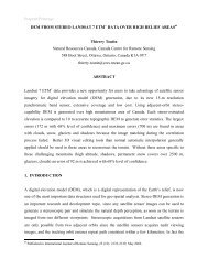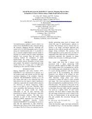
The Use of Radar Remote Sensing for Identifying Environmental ...
The Use of Radar Remote Sensing for Identifying Environmental ...
The Use of Radar Remote Sensing for Identifying Environmental ...

Create successful ePaper yourself
Turn your PDF publications into a flip-book with our unique Google optimized e-Paper software.
Preprint/Prétirage<br />
<strong>The</strong> <strong>Use</strong> <strong>of</strong> <strong>Radar</strong> <strong>Remote</strong> <strong>Sensing</strong> <strong>for</strong> <strong>Identifying</strong> <strong>Environmental</strong><br />
Factors Associated with Malaria Risk in Coastal Kenya<br />
S. Kaya 1 , T.J.Pultz 1 , C.M.Mbogo 2 , J.C.Beier 3 , and E. Mushinzimana 4<br />
1 Natural Resources Canada, Canada Centre <strong>for</strong> <strong>Remote</strong> <strong>Sensing</strong>, 588 Booth Street, Ottawa, ON. K1A 0Y7<br />
CANADA Tel: (613) 947-1271 Fax: (613) 947-1385 shannon.kaya@ccrs.nrcan.gc.ca<br />
2 Kenya Medical Research Institute, Center <strong>for</strong> Geographic Medicine Research, Coast, P.O. Box 428 Kilifi, KENYA<br />
3 Tulane University, Department <strong>of</strong> Tropical Medicine, 1430 Tulane Avenue, New Orleans, LA 70112 USA<br />
4 International Centre <strong>of</strong> Insect Physiology and Ecology (ICIPE), Kasarani, P.O. Box 30772, Nairobi, KENYA<br />
ABSTRACT - Malaria remains one <strong>of</strong> the greatest killers <strong>of</strong><br />
human beings, particularly in the developing world. <strong>The</strong><br />
World Health Organization has estimated that over one<br />
million cases <strong>of</strong> Malaria are reported each year, with more<br />
than 80% <strong>of</strong> these found in Sub-Saharan Africa. <strong>The</strong><br />
anopheline mosquito transmits malaria, and breeds in<br />
areas <strong>of</strong> shallow surface water that are suitable to the<br />
mosquito and parasite development. <strong>The</strong>se<br />
environmental factors can be detected with satellite<br />
imagery, which provide enhanced spatial and temporal<br />
coverage <strong>of</strong> most <strong>of</strong> the earth’s surface. <strong>The</strong> combined<br />
use <strong>of</strong> remote sensing and GIS provides an effective tool<br />
<strong>for</strong> monitoring environmental conditions that are<br />
conducive to malaria, and mapping the disease risk to<br />
human populations.<br />
Since many vector-borne diseases such as malaria are<br />
prevalent in tropical areas, persistent cloud cover <strong>of</strong>ten<br />
presents a challenge to remote sensing operations.<br />
<strong>Radar</strong> remote sensing has the capability <strong>of</strong> penetrating<br />
clouds, providing a solution to the cloud-cover problem<br />
<strong>of</strong>ten experienced with optical satellite remote sensing.<br />
This research investigates the use <strong>of</strong> RADARSAT-1 data<br />
<strong>for</strong> monitoring and mapping malaria risk in coastal<br />
Kenya. An object-oriented approach to image<br />
classification is taken in order to circumvent some <strong>of</strong> the<br />
limitations <strong>of</strong> traditional pixel-based classification <strong>of</strong><br />
radar imagery. GIS routines are used to assess how<br />
classified land cover variables relate to the presence and<br />
abundance <strong>of</strong> malaria-carrying mosquitoes and their<br />
proximity to populated areas, in order to generate a<br />
malaria risk map.<br />
I. STUDY AREA<br />
<strong>The</strong> study site is located along the eastern coastal plain<br />
<strong>for</strong> Kenya, near the town <strong>of</strong> Mombasa, where malaria is<br />
a severe health concern. <strong>The</strong> environment consists <strong>of</strong> a<br />
mix <strong>of</strong> indigenous <strong>for</strong>est, grassland savanna, mangrove<br />
swamps, and wetland vegetation. Agriculture<br />
plantations (mainly coconut, sisal and cashews) are<br />
also found along the coast. <strong>The</strong> ground elevation<br />
ranges from sea level to approximately 400 metres<br />
above sea-level (ASL) and there are several small<br />
rivers that flow from the highlands to the Indian Ocean.<br />
Mosquito larval habitats in this area are diverse and<br />
change with the season. During the dry season, some<br />
rivers and streams become completely dry, while others<br />
have reduced flow and numerous isolated, residual<br />
pools <strong>of</strong> water in the main riverbed. Portions <strong>of</strong><br />
mangrove swamps stay permanently flooded<br />
throughout the whole year. Seasonal swamps are also<br />
present and some are used <strong>for</strong> rice cultivation during<br />
the rainy season. <strong>The</strong>se land cover types are<br />
particularly conducive to mosquito breeding.<br />
II. DATA<br />
<strong>The</strong> focus <strong>of</strong> this research is on the usefulness <strong>of</strong><br />
RADARSAT-1 data <strong>for</strong> monitoring and mapping malaria<br />
in coastal Kenya. Four multi-temporal standard mode<br />
ascending pass scenes were acquired, with a nominal<br />
spatial resolution <strong>of</strong> 25m and swath coverage <strong>of</strong> 100<br />
km 2 .<br />
<strong>The</strong> RADARSAT-1 images were acquired <strong>for</strong> both the<br />
dry season (20/03/1999 and 09/03/2001) and <strong>for</strong> the<br />
wet season (11/10/2001 and 4/11/2001). In this region<br />
<strong>of</strong> Kenya, March marks the end <strong>of</strong> the dry season with<br />
average monthly rainfall <strong>of</strong> 60 mm. <strong>The</strong> October 2001<br />
and November 2001 images were both acquired during<br />
the short annual rainy season, with average monthly<br />
rainfalls <strong>of</strong> 90.2 mm and 96.4 mm respectively<br />
(www.worldclimate.com).<br />
Six main land cover classes were identified <strong>for</strong> this<br />
study: water, <strong>for</strong>est type 1, <strong>for</strong>est type 2, agriculture,<br />
grassland, wetland and urban areas. Forest type 1<br />
consists mainly <strong>of</strong> indigenous trees and rain <strong>for</strong>est, and<br />
<strong>for</strong>est type 2 consists mainly <strong>of</strong> mangrove <strong>for</strong>est. For<br />
each class, 7-12 ground truth areas were identified and<br />
used as training sites in the image classification routine.<br />
III. METHODOLOGY<br />
Images were processed, geo-corrected, registered,<br />
filtered and enhanced, in order to obtain useful input<br />
images <strong>for</strong> the image classification. Speckle reduction<br />
was done with an adaptive filter, to smooth the data
while preserving edges. Texture analysis was also<br />
carried out on the original images to extract in<strong>for</strong>mation<br />
about the variations in image tone.<br />
Image analysis was per<strong>for</strong>med using eCognition<br />
s<strong>of</strong>tware - a classification analysis package that uses<br />
an object-based approach rather than the traditional<br />
pixel-based routine. Image data is classified based on<br />
parcels <strong>of</strong> pixels known as ‘objects’ that are created<br />
using a segmentation routine, which separates<br />
significantly contrasted adjacent regions in an image<br />
based on image brightness values, and extracts the<br />
homogeneous regions as individual objects [1].<br />
Following segmentation, a classification was per<strong>for</strong>med<br />
using the multi-temporal filtered and texture analysis<br />
images as input. A standard nearest neighbour<br />
classification was per<strong>for</strong>med based on user-specified<br />
training objects. <strong>The</strong> resulting classification was<br />
validated with test sites.<br />
Classified polygons were extracted as GIS layers <strong>for</strong><br />
use in the malaria risk map generation procedure. <strong>The</strong><br />
premise <strong>for</strong> assessing areas at risk <strong>of</strong> malaria infection<br />
is based on the maximum distance a malaria-carrying<br />
mosquito can travel from its breeding ground to infect<br />
human hosts. For this study, a two-kilometre buffer<br />
zone around the classified larval breeding grounds was<br />
used [2] [3], and the wetland class was considered to<br />
be most conducive to larval breeding [4] [5] [6] [7]. With<br />
this in<strong>for</strong>mation, a risk map was generated to show the<br />
populated areas that lie within the two-kilometre buffer<br />
zone around the wetland areas.<br />
IV. RESULTS<br />
<strong>The</strong> resulting classification was assessed at 85.5%<br />
overall accuracy. Figure 1 shows the classification<br />
results <strong>for</strong> the populated areas. <strong>The</strong> town <strong>of</strong> Mombasa<br />
(island in south part <strong>of</strong> image) is clearly identified as<br />
populated, as well as smaller villages found in the<br />
middle part <strong>of</strong> the image. <strong>The</strong> bright radar backscatter<br />
response and textural in<strong>for</strong>mation allowed <strong>for</strong> accurate<br />
classification <strong>of</strong> the populated areas, at 93.2%.<br />
Classified as wetlands are shown in figure 2. <strong>The</strong><br />
accuracy <strong>for</strong> this class was found to be 65.3%, with<br />
significant confusion found between the wetland and<br />
<strong>for</strong>est type 1 classes. Forest type 1 (mangrove <strong>for</strong>ests),<br />
are characterised by flooded areas with emergent<br />
vegetation. For this reason, backscattering<br />
characteristics, as well as textural in<strong>for</strong>mation are<br />
similar to wetlands. Due to the similarities in<br />
environmental conditions, both landscape variables<br />
may be considered as high risk in terms <strong>of</strong> malaria<br />
breeding sites.<br />
Figure 1 Map <strong>of</strong> populated areas in the coastal Kenya study site<br />
Figure 2 Map <strong>of</strong> wetland areas in coastal Kenya study site<br />
A radius <strong>of</strong> two kilometres around the wetland objects<br />
served to determine the areas where malaria-carrying<br />
mosquitoes may be present. A buffering algorithm was<br />
used to produce the results seen in figure 3.<br />
A final step identified populated areas that fall within the<br />
two-kilometre radius <strong>of</strong> the wetland areas. Figure 4<br />
shows the results <strong>of</strong> this routine – a map <strong>of</strong> populated<br />
areas at risk <strong>of</strong> malaria.
Figure 3 Map <strong>of</strong> 2 km. buffer zones around wetland areas.<br />
Figure 4 Map <strong>of</strong> populated areas at risk <strong>of</strong> malaria in coastal Kenya<br />
98.6% accuracy was achieved <strong>for</strong> water targets as the<br />
dominant scattering mechanism (specular reflection)<br />
produces a consistently dark tone. <strong>The</strong> large areas <strong>of</strong><br />
grassland savannah in the highlands <strong>of</strong> the study site<br />
are relatively homogeneous and were classified with<br />
97.3% accuracy. More complex targets such as<br />
wetlands and <strong>for</strong>ests were classified between 60-75%<br />
accuracy. Agriculture targets produced an accuracy <strong>of</strong><br />
only 53.8%, due to the different tones and textures from<br />
various crop types and growth stages.<br />
V. CONCLUSIONS<br />
This study demonstrates the methodology <strong>of</strong> using SAR<br />
images <strong>for</strong> identification <strong>of</strong> land cover variables that<br />
may be associated with malaria-carrying mosquito<br />
breeding. <strong>The</strong> use <strong>of</strong> eCognition s<strong>of</strong>tware<br />
demonstrated the importance <strong>of</strong> object-oriented<br />
classification <strong>for</strong> SAR data, which allows <strong>for</strong><br />
quantification <strong>of</strong> surface patterns that are not<br />
adequately accomplished with per-pixel approaches [8]<br />
[9]. <strong>The</strong> use <strong>of</strong> RADARSAT-1 imagery in this research<br />
filled a gap where no cloud-free optical satellite data<br />
were available. This, as well as SAR’s sensitivity to<br />
surface geometry and target moisture conditions, is the<br />
main advantages <strong>of</strong> SAR data <strong>for</strong> disease monitoring<br />
applications.<br />
Many tropical areas like the Kenya coast face a serious<br />
and growing problem relating to environmental health.<br />
<strong>The</strong>re is a strong need <strong>for</strong> an operational disease<br />
surveillance tool in these areas. This research<br />
demonstrates how SAR remote sensing could play a<br />
critical role in addressing this need.<br />
ACKNOWLEDGMENTS<br />
Thanks to Willy Bruce <strong>for</strong> his critical review <strong>of</strong> this work.<br />
This research was made possible through funding from<br />
the CCRS, as well as NIH grants to Tulane University<br />
(U19 AI45511 and D43 TW01142).<br />
REFERENCES<br />
[1] Benz, U., et al. “OSCAR – Object Oriented Segmentation and<br />
Classification <strong>of</strong> Advanced <strong>Radar</strong> Allow Automated In<strong>for</strong>mation<br />
Extraction”, in proceedings <strong>of</strong> the International Geoscience and<br />
<strong>Remote</strong> <strong>Sensing</strong> Symposium, Hawaii, USA, 2001.<br />
[2] Hay, S.I. “<strong>Remote</strong> sensing and disease control: Past, present and<br />
future”, in Transactions <strong>of</strong> the Royal Society <strong>of</strong> Tropical Medicine and<br />
Hygiene, 91, pp. 105-106, 1997.<br />
[3] Connor, S.J, et al. “<strong>The</strong> <strong>Use</strong> <strong>of</strong> Low-Cost <strong>Remote</strong> <strong>Sensing</strong> and<br />
GIS <strong>for</strong> <strong>Identifying</strong> and Monitoring the <strong>Environmental</strong> Factors<br />
Associated with Vector-Borne Disease Transmission”, in GIS <strong>for</strong><br />
Health and the Environment, International Development and<br />
Research Centre (IDRC). Ottawa, Canada, 1995.<br />
[4] Hugh-Jones, M. “Applications <strong>of</strong> remote sensing to the<br />
identification <strong>of</strong> the habitats <strong>of</strong> parasites and disease vectors”, in<br />
Parasitology Today, 5, pp. 244-251, 1989.<br />
[5] Washino, R.K. and B.L. Wood. “Application <strong>of</strong> remote sensing to<br />
vector arthropod surveillance and control”, in the American Journal <strong>of</strong><br />
Tropical Medicine and Hygiene, 50, pp. 134-144, 1993.<br />
[6] Beck, L.R., et al. “<strong>Remote</strong> sensing as a landscape epidemiologic<br />
tool to identify villages at high risk <strong>for</strong> malaria transmission”, in the<br />
American Journal <strong>of</strong> Tropical Medicine and Hygiene, 51, pp. 271-280,<br />
1994.<br />
[7] Thomson, M.C., et al. “Mapping malaria risk in Africa: What can<br />
satellite data contribute?”, in Parasitology Today, 13(8), pp. 313-318,<br />
1997.<br />
[8] Bauer, T. and K. Steinnocher. “Per-parcel land use classification<br />
in urban areas applying a rule based technique”, in GIS, pp. 24-27,<br />
6/2001.<br />
[9] Blaschke, T. and J. Strobl. “What’s wrong with pixels? Some<br />
recent developments interfacing remote sensing and GIS”, in GIS, pp.<br />
12-17, 6/2001.