

3 - Are you looking for one of those websites
3 - Are you looking for one of those websites
3 - Are you looking for one of those websites

Create successful ePaper yourself
Turn your PDF publications into a flip-book with our unique Google optimized e-Paper software.
Partners <strong>for</strong> Water Programme<br />
International Agricultural Centre<br />
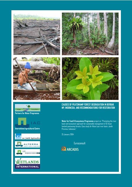
CAUSES OF PEATSWAMP FOREST DEGRADATION IN BERBAK<br />
NP, INDONESIA, AND RECOMMENDATIONS FOR RESTORATION<br />
Water <strong>for</strong> Food & Ecosystems Programme project on: ”Promoting the river<br />
basin and ecosystem approach <strong>for</strong> sustainable management <strong>of</strong> SE Asian<br />
lowland peatswamp <strong>for</strong>ests: Case study Air Hitam Laut river basin, Jambi<br />
Province, Ind<strong>one</strong>sia.”<br />
25 January 2004<br />
Euroconsult
CAUSES OF PEAT SWAMP FOREST<br />
DEGRADATION IN BERBAK NP,<br />
INDONESIA, AND RECOMMENDATIONS<br />
FOR RESTORATION<br />
by Wim Giesen<br />
ARCADIS Euroconsult<br />
Part <strong>of</strong> the project on<br />
“Promoting the river basin and ecosystem approach <strong>for</strong> sustainable management <strong>of</strong> SE Asian<br />
lowland peat swamp <strong>for</strong>ests: Case study Air Hitam Laut river basin, Jambi Province, Ind<strong>one</strong>sia.”<br />
Water <strong>for</strong> Food and Ecosystems Programme<br />
INTERNATIONAL AGRICULTURAL CENTRE (IAC)<br />
IN COOPERATION WITH<br />
ALTERRA<br />
ARCADIS EUROCONSULT<br />
WAGENINGEN UNIVERSITY / LEI<br />
WL / DELFT HYDRAULICS<br />
WETLANDS INTERNATIONAL<br />
25 JANUARY 2004
CAUSES OF PEAT SWAMP FOREST DEGRADATION IN BERBAK NP, INDONESIA, AND RECOMMENDATIONS FOR RESTORATION<br />
Contents<br />
Abbreviations, acronyms & glossary ______________________________________________ 4<br />
Background ____________________________________________________________________ 6<br />
Summary _______________________________________________________________________ 7<br />
Acknowledgements _____________________________________________________________ 9<br />
1 Introduction ________________________________________________________________ 11<br />
1.1 Introduction to Southeast Asian peat swamp <strong>for</strong>ests___________________________ 11<br />
1.1.1 Brief introduction to Peat swamp <strong>for</strong>ests in Southeast Asia _______________ 11<br />
1.1.2 Recent history <strong>of</strong> SE Asian peat swamp <strong>for</strong>ests _________________________ 14<br />
1.2 Introduction to Berbak NP_________________________________________________ 16<br />
1.2.1 Brief description <strong>of</strong> the natural conditions <strong>of</strong> the Park ___________________ 16<br />
1.2.2 Brief history <strong>of</strong> the Park_____________________________________________ 18<br />
2 Assessment <strong>of</strong> present condition <strong>of</strong> Berbak NP ________________________________ 20<br />
2.1 Condition <strong>of</strong> Berbak NP as reported by others ________________________________ 20<br />
2.2 Assessment <strong>of</strong> condition <strong>of</strong> Berbak NP based on satellite imagery________________ 22<br />
2.3 Fieldwork and observations <strong>of</strong> state <strong>of</strong> habitats at Berbak NP ___________________ 27<br />
2.3.1 Fieldwork methodology ____________________________________________ 27<br />
2.3.2 Fieldwork results __________________________________________________ 29<br />
2.3.3 General observations during fieldwork ________________________________ 32<br />
3 Cause(s) <strong>of</strong> peat swamp <strong>for</strong>est degradation in Berbak NP ______________________ 34<br />
3.1 Assessments by others____________________________________________________ 34<br />
3.1.1 General assessments _______________________________________________ 34<br />
3.1.2 Hotspot analyses __________________________________________________ 36<br />
3.2 Assessment based on present field observations ______________________________ 36<br />
3.3 Likely history/scenarios leading to present condition <strong>of</strong> Berbak NP _______________ 38<br />
3.4 Conclusions & discussion__________________________________________________ 39<br />
4 Peat swamp <strong>for</strong>est restoration opportunities__________________________________ 44<br />
4.1 Degradation seres and natural regeneration <strong>of</strong> peat swamp <strong>for</strong>est in Southeast Asia 44<br />
4.1.1 Degradation seres & regeneration in the region ________________________ 44<br />
4.1.2 Degradation seres & regeneration in Ind<strong>one</strong>sia _________________________ 47<br />
4.2 Attempts at peat swamp <strong>for</strong>est restoration in Southeast Asia ___________________ 49<br />
4.2.1 Peat swamp <strong>for</strong>est restoration in Southeast Asia________________________ 49<br />
4.2.2 Restoration attempts In and around Berbak NP _________________________ 54<br />
4.3 Identification <strong>of</strong> promising species <strong>for</strong> restoration programmes__________________ 57<br />
4.3.1 Recognised by others ______________________________________________ 57<br />
4.3.2 Identified during the present survey __________________________________ 61<br />
4.4 Requirements <strong>for</strong> replanting programmes____________________________________ 63<br />
Final Draft ARCADIS 2
CAUSES OF PEAT SWAMP FOREST DEGRADATION IN BERBAK NP, INDONESIA, AND RECOMMENDATIONS FOR RESTORATION<br />
5 Recommendations <strong>for</strong> restoration <strong>of</strong> degraded peat swamp <strong>for</strong>est at Berbak NP _ 66<br />
5.1 Mid-upper catchment <strong>of</strong> the Air Hitam Laut river basin ________________________ 66<br />
5.2 Centre <strong>of</strong> Berbak NP _____________________________________________________ 67<br />
6 Recommendations <strong>for</strong> the Project’s peat swamp <strong>for</strong>est restoration programme __ 69<br />
6.1 Recommendations <strong>for</strong> improvement <strong>of</strong> the existing programme _________________ 69<br />
6.2 Budget and recommended Work Plan <strong>for</strong> the current project ___________________ 73<br />
7 Recommendations <strong>for</strong> capacity building in re<strong>for</strong>estation techniques & peat swamp<br />
management _______________________________________________________________ 75<br />
7.1 Local concession holder___________________________________________________ 75<br />
7.2 National Park staff _______________________________________________________ 75<br />
8 Conclusions ________________________________________________________________ 77<br />
References ____________________________________________________________________ 82<br />
Annex 1 Itinerary ________________________________________________________________ 90<br />
Annex 2 Site survey results: relevees ________________________________________________ 94<br />
Annex 3 Summary <strong>of</strong> site characteristics____________________________________________ 102<br />
Annex 4 Bird observations _______________________________________________________ 103<br />
Annex 5 Species common in burnt areas ___________________________________________ 106<br />
Annex 6 Terms <strong>of</strong> reference <strong>for</strong> SRS _______________________________________________ 108<br />
Annex 7 Photographic summary __________________________________________________ 111<br />
Final Draft ARCADIS 3
CAUSES OF PEAT SWAMP FOREST DEGRADATION IN BERBAK NP, INDONESIA, AND RECOMMENDATIONS FOR RESTORATION<br />
Abbreviations, acronyms & glossary<br />
AHD Air Hitam Dalam<br />
AHL Air Hitam Laut<br />
asl Above Sea Level<br />
CCFPI Climate Change, Forests and Peatlands in Ind<strong>one</strong>sia (project)<br />
CIFOR Center <strong>for</strong> International Forestry Research (based in Bogor)<br />
CPI Caltex Pacific Ind<strong>one</strong>sia<br />
cukong Local term <strong>for</strong> broker, mainly used in a negative sense<br />
DANCED Danish Cooperation <strong>for</strong> Environment and Development<br />
dbh Diameter at breast height (= <strong>for</strong>estry term)<br />
Dinas Kehutanan Forest Service<br />
FFPCP Forest Fire Prevention and Control Project<br />
FRIM Forest Research Institute Malaysia<br />
GEF Global Environment Facility<br />
GIS Geographic In<strong>for</strong>mation System<br />
ha Hectares<br />
HLG Hutan Lindung Gambut (Peat Protection Forest)<br />
HP Hutan Produksi (Normal Production Forest)<br />
HPH Hak Pengusahan Hutan (Forest Concession Right)<br />
HPT Hutan Produksi Terbata (Limited Production Forest)<br />
HTI Hutan Tanaman Industri (Industrial Tree-crop Estate)<br />
IPB Institut Pertanian Bogor (Agricultural Institute Bogor)<br />
IUCN International Union <strong>for</strong> the Conservation <strong>of</strong> Nature and Natural<br />
Resources (World Conservation Union)<br />
jelutung Dyera species; in the PSF <strong>of</strong> eastern Sumatra this is Dyera lowii<br />
(Apocynaceae)<br />
JICA Japan International Cooperation Agency<br />
kempas Koompassia malaccensis (Leguminosae)<br />
KSDA Konservasi Sumber Daya Alam (Conservation <strong>of</strong> Natural Resources)<br />
department representing PHPA (now PKA) in the provinces<br />
LIPI National Science Agency Ind<strong>one</strong>sia<br />
Nipa Nypa fruticans (<strong>Are</strong>caceae)<br />
NP National Park<br />
NTFP Non-Timber Forest Product<br />
OKI Ogan-Komering Ilir district (in South Sumatra)<br />
PHPA (Direktorat Jenderal) Perlindungan Hutan dan Pelestarian Alam<br />
(Directorate General <strong>of</strong>) Forest Protection and Nature Conservation;<br />
now DG <strong>of</strong> Nature Conservation<br />
PSF Peat Swamp Forest<br />
PT. Limited Company<br />
Final Draft ARCADIS 4
CAUSES OF PEAT SWAMP FOREST DEGRADATION IN BERBAK NP, INDONESIA, AND RECOMMENDATIONS FOR RESTORATION<br />
PT. DHL Dyera Hutan Lestari (plantation concession company with a 8,000<br />
ha area located at Sungai Aur, near Berbak NP; main species<br />
planted are jelutung, with some pulai).<br />
PT. PDIW Putra Duta Indah Wood (logging concession company with a<br />
concession to the west/southwest <strong>of</strong> Berbak NP<br />
PT. SDR Satia Djaya Raya (now defunct logging concession company)<br />
pulai Alstonia species ; in the swamp <strong>for</strong>ests <strong>of</strong> Berbak NP this is<br />
predominantly Alstonia pneumatophora (Apocynaceae)<br />
PUSDALKARHUTLA Pusat Pengendalian Kebakaran Hutan dan Lahan (Centre <strong>for</strong><br />
Prevention <strong>of</strong> Forest and Land Fires)<br />
ramin Gonystylus bancanus (Thymelaeaceae)<br />
rasau Pandanus helicopus (Pandanaceae)<br />
RIL Reduced Impact Logging (Malaysian system, esp. Sarawak)<br />
sere Ecological term <strong>for</strong> a series <strong>of</strong> plant communities resulting from the<br />
process <strong>of</strong> succession. Various types exist, depending on type <strong>of</strong><br />
disturbance or influence, e.g. fire sere, xerosere, hydrosere.<br />
SM Simpang Melaka<br />
SMPSF Sustainable Management <strong>of</strong> Peat Swamp Forests in Peninsular<br />
Malaysia (project)<br />
SRS Silviculture/Rehabilitation Specialist<br />
Sungai (or sungei) River<br />
TM Thematic Mapper (type <strong>of</strong> Landsat stellite image)<br />
TPTI Ind<strong>one</strong>sian selective logging process<br />
WI-IP Wetlands International – Ind<strong>one</strong>sia Programme<br />
YAPENTA Yayasan Pembangunan Tanjung Jabung (Tanjung Jabung<br />
Development Foundation)<br />
Final Draft ARCADIS 5
CAUSES OF PEAT SWAMP FOREST DEGRADATION IN BERBAK NP, INDONESIA, AND RECOMMENDATIONS FOR RESTORATION<br />
Background<br />
This study is a comp<strong>one</strong>nt <strong>of</strong> the project on “Promoting the river basin and ecosystem<br />
approach <strong>for</strong> sustainable management <strong>of</strong> SE Asian lowland peat swamp <strong>for</strong>ests: Case study<br />
Air Hitam Laut river basin, Jambi Province, Ind<strong>one</strong>sia” (a.k.a. Air Hitam Laut project),<br />
funded by the Netherlands Government as part <strong>of</strong> the Water <strong>for</strong> Food and Ecosystems<br />
Programme. Implementation <strong>of</strong> the Air Hitam Laut project is lead by the International<br />
Agricultural Centre (IAC) in Wageningen, the Netherlands, in cooperation with ARCADIS<br />
Euroconsult (Arnhem, the Netherlands), Alterra – Green World Research (Wageningen),<br />
Wetlands International (Wageningen and Bogor), Waterloopkundig Laboratorium<br />
(WL|Delft Hydraulics) and the Landbouw Economisch Instituut (LEI/Wageningen). In<br />
Ind<strong>one</strong>sia, the project cooperates with the Ministry <strong>of</strong> Forestry, Ministry <strong>of</strong> Environment,<br />
Ministry <strong>of</strong> Public Works, BAPPEDA (Provincial Planning Bureau), University <strong>of</strong> Jambi,<br />
Agricultural University <strong>of</strong> Bogor and the University <strong>of</strong> Sriwijaya, Palembang. Regionally,<br />
the project collaborates with the Global Environment Centre, based in Kuala Lumpur.<br />
The goal <strong>of</strong> the Air Hitam Laut project is defined as: The project will assess the nature and<br />
impact <strong>of</strong> human activities on the functioning <strong>of</strong> the greater Berbak ecosystem, analyse the hydrology<br />
<strong>of</strong> the Air Hitam Laut river, and the dependency <strong>of</strong> the coastal communities on the ecosystem health.<br />
This will provide improved understanding <strong>of</strong> the hydrological and ecological functioning <strong>of</strong> Southeast<br />
Asian lowland peat swamp <strong>for</strong>ests, and contribute to an enhanced baseline <strong>for</strong> policy and decision<br />
making in relation to integrated management <strong>of</strong> peat swamp river basins in the tropics, and in<br />
particular the Berbak National Park.<br />
The bulk <strong>of</strong> the Air Hitam Laut project focuses on hydrological assessments, analysis and<br />
modeling, with smaller inputs devoted to socio-economic studies, policy analysis and<br />
awareness, and ecology-cum-peat swamp <strong>for</strong>est regeneration. The Terms <strong>of</strong> Reference <strong>for</strong><br />
the 25-day input <strong>of</strong> the peat swamp <strong>for</strong>est ecologist focuses on:<br />
Assessment <strong>of</strong> recent developments with respect to existing re<strong>for</strong>estation<br />
techniques in peatlands and their potential <strong>for</strong> improvement;<br />
<br />
<br />
<br />
<br />
Assessment <strong>of</strong> the requirements <strong>for</strong> re<strong>for</strong>estation interventions in Berbak NP;<br />
Recommendations on sustainable options <strong>for</strong> rehabilitating burnt and logged peat<br />
swamp <strong>for</strong>est in the mid-upper catchment <strong>of</strong> the Air Hitam Laut river basin and<br />
the centre <strong>of</strong> Berbak National Park;<br />
Support to the preparation <strong>of</strong> a peat swamp <strong>for</strong>est rehabilitation programme; and<br />
Support <strong>for</strong> the development <strong>of</strong> capacity building activities <strong>for</strong> concession holder<br />
and NP staff in re<strong>for</strong>estation techniques and peat swamp management.<br />
The peat swamp <strong>for</strong>est ecologist carried out fieldwork in Ind<strong>one</strong>sia from 30 September to 24<br />
October, <strong>of</strong> which three weeks were spent in Jambi. This output is to provide a basis <strong>for</strong><br />
practical restoration attempts by the Silviculture/Rehabilitation Specialist (Iwan Cahyo<br />
Wibisono), who will continue up until the end <strong>of</strong> the project (late 2004). The report will also<br />
provide a basis <strong>for</strong> two students <strong>of</strong> Wageningen Agricultural University (Pieter Leenman<br />
and Pieter van Eijk) and two students <strong>of</strong> Jambi University (Dian Febriyanti and Muhammad<br />
Fadli) who will carry out ecological studies on burnt peat swamp <strong>for</strong>est in Berbak in<br />
January-April 2004.<br />
Final Draft ARCADIS 6
CAUSES OF PEAT SWAMP FOREST DEGRADATION IN BERBAK NP, INDONESIA, AND RECOMMENDATIONS FOR RESTORATION<br />
Summary<br />
Chapter <strong>one</strong> provides an introduction to the peat swamp <strong>for</strong>ests <strong>of</strong> Southeast Asia,<br />
including a brief overview <strong>of</strong> past studies, remaining area <strong>of</strong> this habitat (33 million ha, <strong>of</strong><br />
which 82% in Ind<strong>one</strong>sia), and a general description <strong>of</strong> features. It also provides an<br />
introduction to floristics and vegetation <strong>of</strong> Southeast Asian and Sumatran peat swamp<br />
<strong>for</strong>ests> It also focuses on plant species diversity, with up to 240 species in a single location,<br />
but usually in the range <strong>of</strong> 35-130 tree species occurring in a single 1-5 ha plot. A recent<br />
history <strong>of</strong> this habitat in Southeast Asia is given, indicating the rapid rate at which peat<br />
swamp <strong>for</strong>ests have disappeared due to felling, fires, and conversion to agriculture or<br />
pulpwood plantations. In 1993, only 2% <strong>of</strong> Sumatra’s <strong>for</strong>mer peat and freshwater swamp<br />
<strong>for</strong>ests was both gazetted in the Protected <strong>Are</strong>a system and remained in a good condition –<br />
this can only have declined further since then. An introduction is provided to the 185,000 ha<br />
Berbak National Park, which is the focus <strong>of</strong> this study and is located in the coastal z<strong>one</strong> <strong>of</strong><br />
Jambi Province, Sumatra. Berbak NP mainly consists <strong>of</strong> two habitat types – freshwater<br />
swamp <strong>for</strong>est and peat swamp <strong>for</strong>est – that extend over 60,000 hectares (32% <strong>of</strong> the park)<br />
and 110,000 hectares (59%), respectively. Large fires – mainly in the mid-1990s – have lead to<br />
significant loss <strong>of</strong> these habitats. A description is given <strong>of</strong> habitats and Park history.<br />
Chapter two focuses on the present condition <strong>of</strong> Berbak NP, split into two sections: <strong>one</strong><br />
providing an assessment based on previous studies and satellite imagery, the second based<br />
on field work carried out as part <strong>of</strong> the present study. Others report that about 17,000 ha<br />
(roughly 10%) <strong>of</strong> the Park has been affected by recent fires (esp. 1997-98). Analysis <strong>of</strong><br />
satellite imagery confirms this, but shows that significant disturbances in the Park between<br />
1983 and August 1997 created the conditions that lead to the highly destructive fires <strong>of</strong><br />
September 1997, and again in 1998. Most <strong>of</strong> these disturbances appear to be linked to illegal<br />
logging, as indicated by a pattern <strong>of</strong> clearing and thinning <strong>of</strong> canopy cover. Field work<br />
carried out in October 2003 shows that illegal logging still appears to be nothing short <strong>of</strong><br />
rampant throughout the Park: 26 illegal logging camps – most operational – were observed<br />
in the Park along the upper Air Hitam Laut river. Sawn timber was observed along the<br />
river, in camps, and being loaded from the AHL onto lorries on PDIW’s rail system, which<br />
at present is the main outlet <strong>of</strong> timber and logs being poached from the western side <strong>of</strong><br />
Berbak NP. Similarly, timber poaching was observed to be common and active along the Air<br />
Hitam Dalam.<br />
Chapter three attempts to assess the causes <strong>of</strong> peat swamp <strong>for</strong>est degradation in Berbak NP.<br />
Previous analyses do not identify a single cause, but instead identify a host <strong>of</strong> contributing<br />
factors including lowering <strong>of</strong> water levels by transmigrants, fires escaping from agricultural<br />
fields and fires used by poachers, illegal logging, clearing by fishermen, unsustainable use<br />
<strong>of</strong> resources (esp. jelutung and nipa), insufficient patrolling and en<strong>for</strong>cement, unclear<br />
boundaries and (linked to the latter) conversion to agriculture. The direct cause <strong>of</strong> the 1997-<br />
98 fires is <strong>of</strong>ten reported to be ‘unknown’. Based on an analysis <strong>of</strong> satellite images and field<br />
work, however, it can be concluded that the most significant threat by far is posed by illegal<br />
logging activities in the National Park. Large-scale destructive fires that occurred at Berbak<br />
NP in 1997-98 appear to be directly linked to illegal logging that occurred in the same<br />
locations in the preceding decade. These activities largely went unnoticed/unreported, as<br />
they were being carried out in areas that were inaccessible to park staff. However, they can<br />
Final Draft ARCADIS 7
CAUSES OF PEAT SWAMP FOREST DEGRADATION IN BERBAK NP, INDONESIA, AND RECOMMENDATIONS FOR RESTORATION<br />
be clearly observed on satellite images dating from this period. A likely sequence <strong>of</strong> events<br />
leading to the present level <strong>of</strong> degradation is provided, along with an assessment <strong>of</strong> whom /<br />
which companies were involved.<br />
Chapter four provides an overview <strong>of</strong> what is known about natural regeneration <strong>of</strong> peat<br />
swamp <strong>for</strong>ests in Southeast Asia in general, and Sumatra in particular. It recognizes various<br />
degradation seres, and plant species characteristic <strong>of</strong> secondary peat swamp habitats. It also<br />
provides an overview <strong>of</strong> past and ongoing attempts at peat swamp <strong>for</strong>est restoration, both<br />
in the region (notably in Thailand, but also Vietnam and Malaysia) and in Ind<strong>one</strong>sia.<br />
Attempts in Thailand were initiated more than 40 years ago and appear to be successful,<br />
while other initiatives in the region remain at a pilot stage. Various attempts at replanting<br />
degraded peat swamp <strong>for</strong>est have been carried out in and around Berbak NP, but all are<br />
small scale and can be regarded as trials only: there is no active restoration or rehabilitation<br />
programme ongoing. An exception to this is the jelutung and pulai plantation <strong>of</strong> PT. Dyera<br />
Hutan Lestari (PT. DHL). This study identifies species that have a high survival or<br />
recolonisation rate and may be considered <strong>for</strong> restoration activities at Berbak NP. These<br />
species include Alstonia pneumatophora (pulai), Combretocarpus rotundatus (tanah-tanah),<br />
Dyera lowii (jelutung), Elaeocarpus petiolatus, Eugenia spicata (gelam tikus), Ganua motleyana,<br />
Gluta wallichii (rengas), Gonystylus bancanus (ramin), Licuala paludosa (palas), Macaranga<br />
pruinosa (mahang), Mallotus muticus (perupuk), Neolamarckia cadamba (bengkal/medang<br />
keladi), Palaquium spp. (nyatoh), Pandanus helicopus (rasau), Pholidocarpus sumatranus (liran),<br />
Shorea pauciflora (meranti rawa), and Syzygium (Eugenia) cerina, (temasaman). Issues<br />
regarding species provenance, nurseries, planting regimes and timing, and tending<br />
requirements are described.<br />
Chapter five provides recommendations <strong>for</strong> which degraded areas within Berbak NP are to<br />
be targeted by the restoration programme. These include the Mid-upper catchment <strong>of</strong> the<br />
Air Hitam Laut river, the central Air Hitam Laut burnt area (about 12,000 ha), and the<br />
Simpang Melaka burnt area (4,000 ha).<br />
Chapter six provides recommendations <strong>for</strong> the Project’s peat swamp <strong>for</strong>est restoration<br />
programme, focusing on species identification, site identification, the use <strong>of</strong> trial areas,<br />
where and how to establish nurseries, and how to improve the actual (ongoing) restoration<br />
programme itself. A draft budget, implementation schedule, and draft terms <strong>of</strong> reference are<br />
provided.<br />
Chapter seven provides recommendations <strong>for</strong> capacity building in re<strong>for</strong>estation techniques<br />
and peat swamp management. Because <strong>of</strong> proven lack <strong>of</strong> genuine interest, any investment in<br />
capacity building <strong>of</strong> the logging concessionaire (PT. PDIW) is considered a waste <strong>of</strong> scarce<br />
resources, better spent on other comp<strong>one</strong>nts <strong>of</strong> the Project. Training <strong>of</strong> National Park staff is<br />
proposed <strong>for</strong> i) establishing and managing the two nurseries, to produce material <strong>for</strong><br />
replanting in Berbak NP; and ii) planting techniques and managing replanted areas.<br />
Chapter eight provides conclusions drawn from the various chapters, and is followed by a<br />
list <strong>of</strong> references and appendices on: i) field work itinerary, ii) site survey results, iii) site<br />
characteristics, iv) bird observations, v) list <strong>of</strong> plant species common in burnt areas, vi) ToR<br />
<strong>for</strong> the Silviculture/Rehabilitation Specialist, and vii), a photographic summary.<br />
Final Draft ARCADIS 8
CAUSES OF PEAT SWAMP FOREST DEGRADATION IN BERBAK NP, INDONESIA, AND RECOMMENDATIONS FOR RESTORATION<br />
Acknowledgements<br />
The author would like to thank the following agencies and persons, without whom this<br />
study would not have been possible:<br />
<br />
<br />
<br />
<br />
<br />
<br />
<br />
<br />
<br />
<br />
<br />
<br />
Wetlands International – Ind<strong>one</strong>sia Programme, especially Pak Dibyo, Nyoman<br />
Suryadiputra, Iwan Cahyo (Yoyok) Wibisono, Yus Rusila Noor, Anggie, Labueni<br />
S., Triana, Pak Umar and Ibu Lusi. I would particularly like to thank Yoyok <strong>for</strong> the<br />
fine arrangements in the field, and his excellent insights in peat swamp <strong>for</strong>est<br />
restoration. Thanks also to Pak Nyoman and Yoyok <strong>for</strong> their comments on the first<br />
draft <strong>of</strong> this report, Labueni <strong>for</strong> her help in arranging visits to various <strong>of</strong>fice and<br />
helping with the identification <strong>of</strong> herbarium specimens, and Pak Umar <strong>for</strong> his<br />
excellent driving skills.<br />
The field team in Jambi, especially Iwan Cahyo (Yoyok) Wibisono, Suhendra (both<br />
<strong>of</strong> Wetlands International – Ind<strong>one</strong>sia Programme) and Habibie (TN Berbak staff).<br />
Staff <strong>of</strong> Taman Nasional Berbak, especially Pak Istanto (Kepala Balai TN Berbak),<br />
Mr. H. Soemarno (Wakil Kepala TN), Habibie (<strong>for</strong> his active participation in all the<br />
field trips), Mr. Rohman Fauzi (field staff Berbak NP), Pak Aziz Sembiring, Pak<br />
Ponimon, and Pak Farit (TN) <strong>for</strong> advice and assistance.<br />
Bogor Herbarium, especially Ms Afriastini <strong>for</strong> her kind help in identifying the<br />
plant specimens collected at Berbak, and Herwint Simbolon, <strong>for</strong> discussions on<br />
regeneration plot monitoring and in<strong>for</strong>mation about peat swamp <strong>for</strong>est<br />
regeneration in general.<br />
The Center <strong>for</strong> International Forestry Research (CIFOR, Bogor), especially Dr<br />
Takeshi Toma, Dr Daniel Murdiyarso, Tini Gumartini, Yulia Siagian and Nia<br />
Sabarniati, <strong>for</strong> in<strong>for</strong>mation provided about peat swamp <strong>for</strong>est regeneration, and<br />
discussions held about their research programmes. Special thanks go to Iwan<br />
Kurniawan <strong>for</strong> assisting with satellite imagery <strong>of</strong> Berbak NP, as this made it<br />
possible to analyse the events leading up to the fires <strong>of</strong> the mid-1990s.<br />
Dinas Kehutanan Jambi, especially Ir. Gatot Moeryanto (Kepala Dinas)<br />
BAPPEDA Jambi, especially Ir. Helbar, <strong>for</strong> provision <strong>of</strong> maps.<br />
PT Dyera Hutan Lestari, especially Mr. Hamri P. Rosera (Director <strong>of</strong> Production)<br />
and Mr. Bambang Handoko (Director Field Operations) <strong>for</strong> the in<strong>for</strong>mation<br />
provided, and <strong>for</strong> their kind assistance and hospitality in the field.<br />
BP-DAS <strong>of</strong> Jambi, especially Ir. H. Ahriman Ahmed (head), <strong>for</strong> the lively<br />
discussion <strong>of</strong> problems associated with re<strong>for</strong>estation.<br />
PUSDALKARHUTLA, especially Ir. Joko Fajar Kiswanto (Coordinator) and Mr. O.<br />
Soeparman (technical head), <strong>for</strong> discussions on the fire management programme<br />
PT Putra Duta Indah Wood), especially Ir. Hari Subagyo and the field staff (Pak<br />
Kadri, Pak Eden S. Tanga), <strong>for</strong> logistical assistance and their hospitality in the field.<br />
Dinas Pertambangan dan Energi (Mining & Energy Service), especially Ir. Akhmad<br />
Bakhtiar Amin, Kepala Dinas, <strong>for</strong> his advice.<br />
Final Draft ARCADIS 9
CAUSES OF PEAT SWAMP FOREST DEGRADATION IN BERBAK NP, INDONESIA, AND RECOMMENDATIONS FOR RESTORATION<br />
<br />
<br />
<br />
<br />
<br />
<br />
<br />
<br />
Wim Giesen<br />
Faizal Parish (Global Environment Center) <strong>for</strong> discussions and advice on peat<br />
swamp <strong>for</strong>est management.<br />
Dr. Yadi Setiadi, Head <strong>of</strong> Forest Biotechnology Laboratory and Environmental<br />
Biotechnology Research Center. Bogor Agriculture University <strong>for</strong> in<strong>for</strong>mation on<br />
peat swamp <strong>for</strong>est regeneration trials in Sumatra.<br />
Dr. Ismail Parlan <strong>of</strong> FRIM (Forest Research Institute Malaysia), <strong>for</strong> in<strong>for</strong>mation<br />
about trials on peat swamp <strong>for</strong>est restoration in Malaysia.<br />
Dr. Jack Rieley <strong>of</strong> the Department <strong>of</strong> Life Science, University <strong>of</strong> Nottingham, <strong>for</strong> a<br />
splendid overview <strong>of</strong> recent developments in the field <strong>of</strong> peat swamp <strong>for</strong>est<br />
restoration in Southeast Asia.<br />
Dr. Tanit Nuyim, Princess Sirindhorn Peat Swamp Forest Research and Nature<br />
Study Center, Sungaikolok, Narathiwat, Thailand, <strong>for</strong> his kind advice and<br />
in<strong>for</strong>mation about peat swamp <strong>for</strong>est restoration activities in Thailand.<br />
Mizuki Tomita, <strong>of</strong> the Graduate School <strong>of</strong> Environment and In<strong>for</strong>mation Sciences,<br />
Yokohama National University, <strong>for</strong> in<strong>for</strong>mation about Melaleuca recovery on burnt<br />
peat swamp <strong>for</strong>est.<br />
Mr. Tony Sebastian <strong>of</strong> Aonyx Environmental, Kuching, <strong>for</strong> providing in<strong>for</strong>mation<br />
on peat swamp <strong>for</strong>est activities and contacts in Malaysia.<br />
Lastly, I would like to thank my colleagues on the project on “Promoting the river<br />
basin and ecosystem approach <strong>for</strong> sustainable management <strong>of</strong> SE Asian lowland<br />
peat swamp <strong>for</strong>ests”, especially Ingrid Gevers, Marcel Silvius, Henk Wösten and<br />
Aljosja Hooijer.<br />
ARCADIS Euroconsult<br />
Arnhem, The Netherlands<br />
25 January 2004<br />
w.giesen@arcadis.nl<br />
www.euroconsult.nl<br />
Final Draft ARCADIS 10
1.1<br />
CAUSES OF PEAT SWAMP FOREST DEGRADATION IN BERBAK NP, INDONESIA, AND RECOMMENDATIONS FOR RESTORATION<br />
CHAPTER<br />
1Introduction<br />
INTRODUCTION TO SOUTHEAST ASIAN PEAT SWAMP FORESTS<br />
1.1.1 BRIEF INTRODUCTION TO PEAT SWAMP FORESTS IN SOUTHEAST ASIA<br />
General<br />
Peat swamp <strong>for</strong>ests <strong>of</strong> Southeast Asia have long been poorly studied, and our current<br />
knowledge <strong>of</strong> their composition, dynamics and ecology remains incomplete in spite <strong>of</strong> a<br />
surge in studies during the past decade. For a long time, Anderson (1963, 1972, 1978) and<br />
Brünig (1973, 1990), summarised by Whitmore (1984) were the only widely known studies<br />
on this habitat. Less well known were a series <strong>of</strong> papers by Coulter (1950, 1957), Wyatt-<br />
Smith (1959, 1961) and Lee (1979) in Malaya, and by Dutch <strong>for</strong>esters (e.g. van der Laan, 1925;<br />
Bodegom, 1929; Boon, 1936; Sewandono 1937, 1938), botanists (Endert, 1932; van Steenis<br />
1938, 1957; Kostermans, 1958) and soil scientists (Polak 1933, 1941; Schophuys, 1936;<br />
Driessen, 1978; Andriesse, 1986) in Ind<strong>one</strong>sia.<br />
During the past decade-and-a-half interest in this habitat increased significantly,<br />
culminating in a series <strong>of</strong> workshops and symposiums:<br />
1987: Tropical Peat and Peatlands <strong>for</strong> Development, held in Yogyakarta, and sponsored<br />
by the International Peat Society and the Ind<strong>one</strong>sian Peat Association.<br />
<br />
<br />
<br />
1991: 2 nd International Symposium on Tropical Peat and Peatlands <strong>for</strong> Development, held<br />
in Kuching and published as a book in 1992.<br />
1992: Workshop on Integrated Planning and Management <strong>of</strong> Tropical Lowland Peatlands,<br />
held in Cisarua, Ind<strong>one</strong>sia, 3-8 July 1992, and published by the IUCN Wetlands<br />
Programme in 1996 (Maltby et al., 1996).<br />
1995: International Symposium on Biodiversity, Environmental Importance and<br />
Sustainability <strong>of</strong> Tropical Peat and Peatlands, held in Palangkaraya, Central<br />
Kalimantan, 4-8 September 1995, with proceedings published by Samara<br />
Publishing Ltd. (Rieley & Page, 1997).<br />
The total area <strong>of</strong> peat swamps in Southeast Asia are estimated by Rieley et al. (1996) to be<br />
about 33 million hectares, <strong>of</strong> which the vast majority in Ind<strong>one</strong>sia (82%), Papua New Guinea<br />
(8.8%) and Malaysia (8.3%), with smaller areas in the Philippines (240,000 ha), Vietnam<br />
(183,000 ha) and Thailand (65,000 ha; Nuyim, 2000). However, these figures probably<br />
represent maximum areas as vast tracts <strong>of</strong> peat swamp <strong>for</strong>est have been subjected to<br />
clearing, drainage and conversion throughout the region during the past two decades.<br />
Final Draft ARCADIS 11
CAUSES OF PEAT SWAMP FOREST DEGRADATION IN BERBAK NP, INDONESIA, AND RECOMMENDATIONS FOR RESTORATION<br />
Most <strong>of</strong> the peat swamp <strong>for</strong>ests in Southeast Asia have developed in or near coastal plains<br />
during the past 5,000-10,000 years, either developing in fresh or brackish waters overlying<br />
marine sediments, or in depressions between rivers somewhat further inland. In these areas<br />
water tables are permanently high and peat depth may be as much as 24 metres, although<br />
depths usually range from 4-8 metres. pH’s are generally low, usually ranging from 3.0-4.5.<br />
In many areas peat domes have developed, whereby the central areas are raised and their<br />
only source <strong>of</strong> water is rainwater.<br />
According to Whitmore (1984), most <strong>of</strong> the tree families <strong>of</strong> lowland evergreen dipterocarp<br />
rain <strong>for</strong>est are found in the peat swamp <strong>for</strong>est, except <strong>for</strong> the Combretaceae, Lythraceae,<br />
Proteaceae, Styraceae and Palmae (<strong>Are</strong>caceae) 1<br />
. This habitat has few endemics, probably due<br />
to the fact that most areas are less than 11,000 years old. According to Rieley and Achmad-<br />
Shah (1996), plants found in tropical peat swamp <strong>for</strong>est are usually restricted to this type <strong>of</strong><br />
habitat. In spite <strong>of</strong> this, however, few species are endemic to the peat swamp <strong>for</strong>est <strong>of</strong> a<br />
single country. The authors list seven species, all <strong>of</strong> which are restricted to either Thailand<br />
or Malaysia. Following Wyatt-Smith (1959 and 1963), Ibrahim and Chong (1992) regard this<br />
<strong>for</strong>est as uniquely adapted to waterlogging, poor nutrients and high acidity <strong>of</strong> the soil. They<br />
add that very few <strong>of</strong> the tree species are found outside this habitat, but according to Corner<br />
(1994), floristics do not bear this out. They list 50 species <strong>for</strong> the Kuala Langat peat swamp<br />
<strong>for</strong>est in Peninsular Malaysia, but at least 38 <strong>of</strong> these occur, apparently indiscriminately, in<br />
freshwater swamp <strong>for</strong>ests <strong>of</strong> Johore (Corner, 1994). Brünig (1973) also shows that floristically<br />
there is a significant overlap between peat swamp <strong>for</strong>ests and so-called heath <strong>for</strong>ests<br />
(kerangas) in Sarawak and Brunei, with 146 tree species common to both habitats, including<br />
11 <strong>of</strong> the 15 dipterocarps recorded.<br />
Tree species diversity <strong>for</strong> Southeast Asian lowland <strong>for</strong>ests vary significantly, among others<br />
depending on location, habitat and plot size. For 1.0 hectare plots, tree diversity in Malesian<br />
plots listed by Whitmore (1984) vary from 70 to more than 220 species. Compared to dry<br />
lowland rain <strong>for</strong>est, however, species diversity <strong>of</strong> peat swamp <strong>for</strong>ests is relatively low. In<br />
Sarawak and Brunei, a total <strong>of</strong> 1800-2300 tree species occur in dry lowland <strong>for</strong>est while a<br />
total <strong>of</strong> only 234 tree species have been recorded in peat swamp <strong>for</strong>ests (Whitmore, 1984).<br />
Nevertheless, vegetation <strong>of</strong> lowland peat swamps in Southeast Asia may be diverse, with<br />
communities having up to 240 plant species (e.g. in Rieley et al., 1994; Shepherd et al., 1997).<br />
At the other end <strong>of</strong> the spectrum are species-poor communities dominated by <strong>one</strong> or only a<br />
few species, <strong>for</strong> example, the Combretocarpus rotundatus dominated central domes in<br />
Sarawak described by Whitmore (1984), or degradation seres described by Giesen (1990) in<br />
South Kalimantan. Examples <strong>of</strong> species diversity in Southeast Asian peat swamp <strong>for</strong>ests:<br />
Disturbed mixed peat swamp <strong>for</strong>est in South Kalimantan: 20 tree species (range 9-<br />
51); Shorea balangeran degraded peat swamp <strong>for</strong>est: 10 tree species (range 2-14),<br />
Combretocarpus rotundatus degraded peat swamp <strong>for</strong>est: 7 tree species (range 3-12);<br />
Giesen (1990).<br />
Giesen and van Balen (1991a) noted 103 species in a rapid survey <strong>of</strong> peat swamp<br />
<strong>for</strong>ests on Pulau Padang, Riau, with tree species varying from 17 (padang or pole<br />
<strong>for</strong>est) to 37 (mixed peat swamp <strong>for</strong>est) along transects <strong>of</strong> 100m. Total species<br />
diversity ranged from 94 in the mixed peat swamp <strong>for</strong>est to 37 in the padang<br />
<strong>for</strong>est.<br />
1<br />
Apparently contradicting this is the fact that 28 palm species have been recorded in Berbak NP<br />
(Giesen, 1991), although most <strong>of</strong> these may occur in peripheral, swamp <strong>for</strong>est and riperian habitats.<br />
Final Draft ARCADIS 12
CAUSES OF PEAT SWAMP FOREST DEGRADATION IN BERBAK NP, INDONESIA, AND RECOMMENDATIONS FOR RESTORATION<br />
<br />
<br />
<br />
<br />
<br />
<br />
<br />
54 tree species (27 families) recorded in a 3.8 ha plot <strong>of</strong> primary peat swamp <strong>for</strong>est<br />
in Kuala Langat, Peninsular Malaysia (Shamsudin & Chong, 1992).<br />
95 tree species (35 families) recorded in a 4.5 ha plot at Sungai Karang, Peninsular<br />
Malaysia (Schilling, 1992, in Ibrahim, 1997).<br />
30 common tree species and 50 rarer tree species in 37 30x30 metre (=3.33 ha) plots<br />
in peat swamp <strong>for</strong>ests <strong>of</strong> Brunei (St<strong>one</strong>man, 1997).<br />
132 tree species (39 families) recorded in a 5 ha plot <strong>of</strong> peat swamp <strong>for</strong>est in Pekan,<br />
Pahang, Peninsular Malaysia (Ibrahim, 1997), with the highest diversity being in<br />
the Lauraceae (14 species), followed by the Euphorbiaceae (13), Guttiferae (12),<br />
Rubiaceae (11) and Myristicaceae (9).<br />
130 tree species recorded in a variety <strong>of</strong> peat swamp <strong>for</strong>est habitats in the Sungai<br />
Sebangau region <strong>of</strong> Central Kalimantan, Ind<strong>one</strong>sia (Shepherd et al., 1997).<br />
131 plant species in all were recorded at three peat swamp <strong>for</strong>est sites in Riau,<br />
Sumatra, ranging from 68-78 spp at each 2-8 ha site (Mogea & Mansur, 2000); there<br />
were five dominant species: Calophyllum soulattri, Campnosperma coriaceum,<br />
Gonystylus macrophyllus, Palaquium hexandrum, Shorea uliginosa. Herbs were<br />
dominated by Asplenium nidus, Crinum asiaticum, Gleichenia linearis, Lygodium sp.,<br />
Nepenthese ampullaria, Nephrolepis biserrata, Nephrolepis exceltata and Scleria laevis.<br />
44 tree species were recorded by Purwaningsih and Yusuf (2000) on a 1.6 ha peat<br />
swamp <strong>for</strong>est site, 15-20 m asl, in Kluet, South Aceh, dominated by Gluta renghas,<br />
along with Shorea palembanica, Parinarium corymbosum, Sandoricum emarginatum,<br />
Garcinia celebica, Eugenia sexangulata, Horsfieldia crassifolia, Mangifera longipetiolata<br />
and Litsea gracilipes.<br />
Peat swamp <strong>for</strong>ests are <strong>of</strong>ten regarded as being low in biodiversity. However, a full 20% <strong>of</strong><br />
freshwater fish species found in Peninsular Malaysia are found in streams <strong>of</strong> this habitat,<br />
and this is thought to be mainly due to the occurrence <strong>of</strong> various microhabitats (Ahmad et<br />
al., 2002). Some fish species are unique to this habitat and can be regarded as threatened due<br />
habitat loss. Although much peat swamp <strong>for</strong>est has been lost to logging and fire, it remains<br />
the dominant habitat in most <strong>of</strong> the current range <strong>of</strong> the false gavial Tomistoma schlegelii,<br />
which is found only in Sumatra, Borneo and Peninsular Malaysia and is listed as Vulnerable<br />
on the IUCN Red Data List (Bezuijden et al., 2001). It is also the preferred habitat <strong>of</strong> the hairy<br />
nosed otter Lutra sumatrana, Storm’s stork Ciconia stormi, white-winged wood-duck Cairina<br />
scutulata, grey-headed fish-eagle Haliaeetus ichthyophaga, and the largest remaining habitat<br />
<strong>for</strong> Bornean populations <strong>of</strong> orangutan Pongo pygmaeus (Meijaard, 1997).<br />
Sumatran swamp <strong>for</strong>ests<br />
The first studies on Sumatran peat swamp <strong>for</strong>ests were carried out in the 1930s by the<br />
<strong>for</strong>esters van Bodegom (1929), Boon (1936) and Sewandono (1937, 1938), who mainly<br />
worked in what is now Riau province. Their papers record general observations on the<br />
ecology and management <strong>of</strong> logging concessions. Sewandono (1937) noted that <strong>for</strong>ests<br />
decreased in stature when proceeding from the periphery towards the centre <strong>of</strong> a peat<br />
dome, with species such as dipterocarps and Palaquium decreasing and Calophyllum and<br />
Tristania increasing in abundance. He also noted that central areas <strong>of</strong> islands in the<br />
Bengkalis region were characterised by an abundance <strong>of</strong> Eugenia’s, Tristania, Calophyllum<br />
species, Tetramerista glabra, Campnosperma and Shorea species, with sedges dominating the<br />
undergrowth. Most <strong>of</strong> these latter areas had stunted trees, although (according to<br />
Sewandono, 1938) there did not appear to be a link with peat depth.<br />
Final Draft ARCADIS 13
CAUSES OF PEAT SWAMP FOREST DEGRADATION IN BERBAK NP, INDONESIA, AND RECOMMENDATIONS FOR RESTORATION<br />
The first detailed ecological study on Sumatran peat swamp <strong>for</strong>ests is that by Silvius et al.<br />
(1984) in Berbak NP (then Berbak Game Reserve). This landmark study focused on a wide<br />
range <strong>of</strong> aspects <strong>of</strong> peat swamp and freshwater swamp ecology, including soils, vegetation<br />
and fauna (see 1.2.1). Detailed studies have been also carried out in peat swamps in Padang<br />
Sugihan NP in South Sumatra and Pulau Padang in Riau by Brady (1997), who mainly<br />
focused on peat development processes and models <strong>of</strong> peat accumulation. Some rapid<br />
ecological surveys were carried out in Sumatran peat swamp <strong>for</strong>ests in 1990-91 by Giesen<br />
(1991) and Giesen and van Balen (1991a, 1991b). In their overview <strong>of</strong> peat swamp <strong>for</strong>est<br />
vegetation, Rieley and Achmad-Shah (1996) note that tree species common to all peat<br />
swamp <strong>for</strong>ests are (in decreasing order <strong>of</strong> abundance) Garcinia spp., Shorea spp., Palaquium<br />
spp. and Campnosperma auriculata.<br />
1.1.2 RECENT HISTORY OF SE ASIAN PEAT SWAMP FORESTS<br />
General<br />
Although large tracts <strong>of</strong> peatland remain, peat swamp <strong>for</strong>ests in Southeast Asia have been<br />
reduced to a fraction <strong>of</strong> their <strong>for</strong>mer area. Braatz et al. (1992) report that by 1990, 54.6% <strong>of</strong> all<br />
wetland and marsh ecosystem had been lost in the Indo-Malayan realm – much <strong>of</strong> this<br />
habitat <strong>for</strong>merly consisted <strong>of</strong> swamp <strong>for</strong>est. With most <strong>of</strong> the remaining peat swamp <strong>for</strong>ests<br />
occurring in Ind<strong>one</strong>sia and Malaysia, developments in these two countries is particularly<br />
pertinent to the conservation and sustainable use <strong>of</strong> these ecosystems.<br />
Of the 1.45 million hectares <strong>of</strong> peat swamp <strong>for</strong>est remaining in Malaysia, more than 80%<br />
occurs in Sarawak. Of the 200,000 hectares remaining in Peninsular Malaysia, more than<br />
160,000 hectares is found in Pahang state, mostly in <strong>one</strong> contiguous area. Recent<br />
developments (e.g. felling <strong>of</strong> <strong>for</strong>mer Virgin Jungle Reserves) have lead to the disappearance<br />
<strong>of</strong> some <strong>of</strong> the last remaining peat swamp <strong>for</strong>ests in Selangor and Johore.<br />
Ind<strong>one</strong>sian swamp <strong>for</strong>ests<br />
Most <strong>of</strong> western Ind<strong>one</strong>sia’s 2 swamp <strong>for</strong>ests have not fared well during the past decades,<br />
and much has disappeared, either being converted <strong>for</strong> agriculture (esp. rice paddies) or tree<br />
crop estates (HTI, e.g. oil palm), or having been severely degraded and aband<strong>one</strong>d (e.g.<br />
large tracts <strong>of</strong> sedge-fern belukar). Many areas <strong>of</strong> deep peat were earmarked <strong>for</strong> conversion<br />
(inappropriately, according to Silvius & Giesen, 1996), which permitted clear-felling <strong>of</strong> vast<br />
tracts <strong>of</strong> land following a first round <strong>of</strong> selective logging (TPTI). The sale <strong>of</strong> timber and logs<br />
from clear-felled areas was usually more than sufficient <strong>for</strong> the following investment, <strong>for</strong><br />
example, in plantation crops such as Acacia or oil palm, and subsequent failure <strong>of</strong> these<br />
ventures did not result in bankruptcy <strong>of</strong> the companies involved. The Forestry Department<br />
has just completed a round <strong>of</strong> evaluation <strong>of</strong> HTI estates and will cancel the concessions <strong>of</strong><br />
<strong>those</strong> considered to be unviable. A large number are expected to be affected.<br />
2 Apart from Papua, where vast tracts still remain, eastern Ind<strong>one</strong>sia has only a very limited area <strong>of</strong><br />
swamp <strong>for</strong>est.<br />
Final Draft ARCADIS 14
FIGURE 1.1<br />
Peat swamp <strong>for</strong>ests in<br />
Western Ind<strong>one</strong>sia, 1988-90<br />
(based on Giesen, 1994).<br />
CAUSES OF PEAT SWAMP FOREST DEGRADATION IN BERBAK NP, INDONESIA, AND RECOMMENDATIONS FOR RESTORATION<br />
Production <strong>for</strong>ests (HP, HPT) 3 in peat and freshwater swamp areas have on the whole not<br />
fared much better and have been poorly to very poorlymanaged by concession holders<br />
(HPHs). After a first round <strong>of</strong> selective logging by the HPH, these <strong>for</strong>ests have usually been<br />
subjected to continued rounds <strong>of</strong> illegal logging, leading to severe degradation and <strong>of</strong>ten to<br />
(repeated) fires. Once an area is severely degraded, the HPHs <strong>of</strong>ten request a change <strong>of</strong><br />
status <strong>of</strong> the area to that <strong>of</strong> HTI, after which the area is clear-felled and planted with estate<br />
crops.<br />
Ostensibly, large areas <strong>of</strong> swamp <strong>for</strong>est are protected in a number <strong>of</strong> reserves in Western<br />
Ind<strong>one</strong>sia, <strong>for</strong> example Berbak NP (Jambi), Way Kambas NP (Lampung), Tanjung Putting<br />
NP (Central Kalimantan), and Danau Sentarum NP (West Kalimantan). On the whole,<br />
protection is limited and widespread poaching <strong>of</strong> timber resources is rampant in all<br />
reserves, all <strong>of</strong> which have also suffered from fires. This used to be a problem during the<br />
Suharto era, but has increased significantly since 1998, with the advent <strong>of</strong> decentralisation.<br />
According to the head <strong>of</strong> the Forestry Service (Dinas Kehutanan) in Jambi province,<br />
poaching <strong>of</strong> timber has increased six fold since 1998.<br />
Sumatran swamp <strong>for</strong>ests<br />
According to Giesen (1993, 1994), peat swamp and freshwater swamp <strong>for</strong>ests in Sumatra<br />
<strong>for</strong>merly covered an area <strong>of</strong> 92,865 km², but by 1982-3 only two-thirds (63,790 km² or 68.7%)<br />
remained. By 1988 this had decreased to 57,506 km² (61.9% <strong>of</strong> original area), <strong>of</strong> which only<br />
8,683 km² (9.3%) could be considered primary <strong>for</strong>est. Similar figures <strong>for</strong> Jambi show that <strong>of</strong><br />
the original area <strong>of</strong> 8,813 km², only 2,604 could be considered primary <strong>for</strong>est by 1988, <strong>of</strong><br />
which most occurred in and around what is now Berbak NP 4 . By 2003, most <strong>of</strong> the logging<br />
concession companies have discontinued operations as the resource has been depleted, and<br />
the logging industry is now largely the realm <strong>of</strong> rogue companies. Peat swamp <strong>for</strong>ests –<br />
most <strong>of</strong> which had the status limited production <strong>for</strong>est (HPT) or peat protection <strong>for</strong>est<br />
(HLG) – have been severely degraded, converted (e.g. <strong>for</strong> pulp production), and have been<br />
the locus <strong>of</strong> widespread fires that have been common in lowland Sumatra since the mid-<br />
1990s.<br />
Ha (x1000)<br />
12000<br />
10000<br />
8000<br />
6000<br />
4000<br />
2000<br />
0<br />
Java<br />
Sumatra<br />
Kalimantan<br />
primary remaining<br />
degraded<br />
g<strong>one</strong><br />
3 HP = Hutan Produksi or (normal) production <strong>for</strong>est; HPT = Hutan Produksi Terbatas or limited<br />
production <strong>for</strong>est ; most peat swamp <strong>for</strong>est is included in the HPT category.<br />
4 At the time Berbak’s status was that <strong>of</strong> Wildlife Reserve.<br />
Final Draft ARCADIS 15
CAUSES OF PEAT SWAMP FOREST DEGRADATION IN BERBAK NP, INDONESIA, AND RECOMMENDATIONS FOR RESTORATION<br />
In 1993, 187,050 hectares <strong>of</strong> undisturbed peat and freshwater swamp <strong>for</strong>est had been<br />
incorporated into the Ind<strong>one</strong>sian Protected <strong>Are</strong>a system, <strong>of</strong> which 80% occurred in Berbak.<br />
(Giesen, 1993; Silvius & Giesen, 1996). A further 433,000 hectares <strong>of</strong> <strong>for</strong>mer peat swamp<br />
<strong>for</strong>est and freshwater swamp <strong>for</strong>est were located in gazetted reserves, but much had already<br />
been degraded or disappeared altogether. By 1993, only 10% <strong>of</strong> the <strong>for</strong>mer peat and<br />
freshwater swamp <strong>for</strong>ests occurred in Kurumutan Baru Nature Reserve (Riau), while that <strong>of</strong><br />
Padang Sugihan Wildlife Reserve (South Sumatra) and Giam-Siak Kecil Wildlife Reserve<br />
(Riau) had disappeared altogether.<br />
By 1993, only 2% <strong>of</strong> Sumatra’s <strong>for</strong>mer peat and freshwater swamp <strong>for</strong>ests was gazetted in<br />
Protected <strong>Are</strong>as and remained in a good condition. As noted above, illegal logging has<br />
increased significantly (reportedly six fold) since 1998, and as a result it is expected that very<br />
little intact swamp <strong>for</strong>est remains outside the Berbak NP area, and even that has been<br />
affected (see below). Since the early 1990s, widespread wildfires have added a new<br />
dimension to peat swamp management, and according to Tacconi (2003), a total <strong>of</strong> 308,000<br />
hectares <strong>of</strong> peat swamp and freshwater swamp <strong>for</strong>est burnt in Sumatra al<strong>one</strong> during the<br />
1997-98 fires.<br />
1.2 INTRODUCTION TO BERBAK NP<br />
1.2.1 BRIEF DESCRIPTION OF THE NATURAL CONDITIONS OF THE PARK<br />
The following description is mainly derived from Silvius et al. (1984), with some additions from<br />
Giesen (1991), or based on the current study.<br />
Berbak NP is located in the coastal z<strong>one</strong> <strong>of</strong> Jambi Province, Sumatra, and extends over an<br />
area <strong>of</strong> approximately 185,000 hectares (Figure 1.2). Berbak <strong>for</strong>ms part <strong>of</strong> the vast alluvial<br />
coastal plain <strong>of</strong> eastern Sumatra, that is assumed to have <strong>for</strong>med about 5,000 years BP.<br />
Evidence indicates that sea levels have dropped about two metres during the past 5,000<br />
years, with sediments – mainly supplied by the Batanghari River – accumulating along the<br />
accreting coastline. On the highly weathered sediments, peat has <strong>for</strong>med, with an average<br />
age <strong>of</strong> about 4,500 years, and in some areas with a depth <strong>of</strong> more than 20 metres (Scholtz,<br />
1983). Berbak is very flat, and at no point is the elevation more than about 15 metres.<br />
Berbak is mainly drained by the Air Hitam Laut River system and its main tributaries the<br />
Simpang Kubu and the Simpang Melaka, which lie almost entirely within the park. These<br />
are blackwater systems, draining peat domes, that have a pH <strong>of</strong> 3.5-3.9 and are naturally<br />
oligotrophic. The Benuh River, which <strong>for</strong>ms the southern boundary <strong>of</strong> the park, also drains<br />
peat dome areas and is similar to the a<strong>for</strong>ementi<strong>one</strong>d rivers. The Air Hitam Dalam River to<br />
the northwest differs from the other rivers in the park as it also receives floodwaters 5 from<br />
the Batanghari River that are markedly richer in silt and nutrients.<br />
Until the mid-1980s, Berbak mainly consists <strong>of</strong> two habitat types – freshwater swamp <strong>for</strong>est<br />
and peat swamp <strong>for</strong>est – that extend over 60,000 hectares (32% <strong>of</strong> the park) and 110,000<br />
5<br />
On 15-16 October 2003, Batanghari River waters were observed to be flowing into the Air Hitam Dalam<br />
River; these waters were coloured a milky brown, unlike the tannin/tea coloured waters <strong>of</strong> the Air<br />
Hitam Laut River.<br />
Final Draft ARCADIS 16
CAUSES OF PEAT SWAMP FOREST DEGRADATION IN BERBAK NP, INDONESIA, AND RECOMMENDATIONS FOR RESTORATION<br />
hectares (59%), respectively. Other habitats included riverine (
1.2.2<br />
CAUSES OF PEAT SWAMP FOREST DEGRADATION IN BERBAK NP, INDONESIA, AND RECOMMENDATIONS FOR RESTORATION<br />
At least 227 bird species have been recorded at Berbak, including nine hornbill species, and<br />
rare species such as milky stork Mycteria cinerea, white-winged wood-duck Cairina scutulata,<br />
and Storm’s stork Ciconia stormi. Mammals recorded at Berbak include Sumatran rhino<br />
Dicerorhinus sumatrensis, Malay tapir Tapirus indicus, Sumatran tiger Panthera tigris and sun<br />
bear Helarctos malayanus. Reptiles include the rare river terrapin Batagur baska, and two<br />
crocodilians, false gavial Tomistoma schlegli and estuarine crocodile Crocodylus porosus.<br />
BRIEF HISTORY OF THE PARK<br />
Berbak was first gazetted as a protected area in 1935, when it was proclaimed a<br />
‘wildreservaat’ (i.e. game reserve) by a decree by the Governor General <strong>of</strong> the Netherlands-<br />
Indies on 29 October 1935. The (then) Ind<strong>one</strong>sian Directorate General <strong>of</strong> Forest Protection<br />
and Nature Conservation (PHPA) 7 began management activities in Jambi in 1972, and<br />
boundary demarcation <strong>of</strong> Berbak was completed by 1974. Nevertheless, there were still<br />
some areas <strong>of</strong> dispute at the time, including overlap with logging concessions and<br />
encroachment by Buginese settlers along the coast. Management at provincial level by<br />
PHPA is carried out via KSDA (Balai Konservasi Sumber Daya Alam, or the Natural resource<br />
Management <strong>of</strong>fice), that established a reserve headquarters in Nipah Panjang in 1975, and<br />
field <strong>of</strong>fices (‘resorts’) at Air Hitam Laut (1975), Air Hitam Dalam, Sungai Benuh and<br />
Simpang Datuk (all 1983; see Figure 1.2). Apart from these four resorts, a network <strong>of</strong> guard<br />
posts (pos jaga) were also established, notably at Simpang Melaka and Simpang Kanan.<br />
A first management plan was developed in 1991-1992 <strong>for</strong> Berbak Game Reserve as part <strong>of</strong><br />
the Sumatra Wetlands Project, executed jointly by PHPA and the Asian Wetland Bureau. It<br />
was recognised as Ind<strong>one</strong>sia’s first Ramsar wetland <strong>of</strong> international importance, on 8 April<br />
1992, and was the target <strong>of</strong> several management-oriented projects in the mid-1990s (mainly<br />
focusing on sustainable bufferz<strong>one</strong> development). Under the new ministerial decree on<br />
<strong>for</strong>estry (No. 185/Kpts-II/1997) dated 31 March 1997, Berbak’s status was upgraded to that<br />
<strong>of</strong> national park, and management handed over from KSDA to the Provincial National Park<br />
Unit (Taman Nasional) section <strong>of</strong> the Forestry Department in 1998. Taman Nasional have<br />
maintained the infrastructure established by KSDA, expanding this with several boats and<br />
replacing 90% <strong>of</strong> <strong>for</strong>mer reserve staff.<br />
7 PHPA is now the Directorate General <strong>of</strong> Nature Protection and Conservation (NPC)<br />
Final Draft ARCADIS 18
FIGURE 1.2<br />
Map <strong>of</strong> Berbak NP, adapted<br />
from Silvius et al., 1984.<br />
CAUSES OF PEAT SWAMP FOREST DEGRADATION IN BERBAK NP, INDONESIA, AND RECOMMENDATIONS FOR RESTORATION<br />
Final Draft ARCADIS 19
2.1<br />
TABLE 2.1<br />
Monthly rainfall figures<br />
recorded at Kenten,<br />
Palembang<br />
CAUSES OF PEAT SWAMP FOREST DEGRADATION IN BERBAK NP, INDONESIA, AND RECOMMENDATIONS FOR RESTORATION<br />
2Assessment <strong>of</strong> present<br />
condition <strong>of</strong> Berbak NP<br />
CHAPTER<br />
CONDITION OF BERBAK NP AS REPORTED BY OTHERS<br />
Management Plan <strong>for</strong> Berbak NP<br />
Wetlands International – Ind<strong>one</strong>sia Programme produced a management plan <strong>for</strong> Berbak<br />
NP (WI-IP, 2000). This plan includes sections on degradation <strong>of</strong> the park due to fires, and<br />
refers to two major fires in Berbak NP in the 1990s, namely in 1994 and 1997. It goes on to<br />
state that these <strong>for</strong>est fires took place during a prolonged dry season related to the El-Niño<br />
phenomenon (Table 2.1). Surveys were carried out in 1998 in order to assess impacts,<br />
concluding that an estimated 18,000 ha (or about 11% <strong>of</strong> the park) <strong>of</strong> peat swamp <strong>for</strong>est<br />
burnt during the 1997 fires in three isolated locations inside the park.<br />
YEAR<br />
JAN FEB MAR APR<br />
Monthly Total (mm)<br />
MAY JUN JUL AUG SEP OCT NOV DEC<br />
1996 244 292 304 231 53 271 173 99 126 303 314 294<br />
1997 139 292 319 336 215 65 6 4 0 6 124 330<br />
1998 207 165 402 282 177 137 181 119 213 137 310 390<br />
48 year<br />
average<br />
(1951-98)<br />
240 247 322 283 181 136 125 113 143 197 303 331<br />
Source: Anderson et al. (1999)<br />
Forest Fire Prevention and Control Project<br />
Anderson and Bowen (2000) recognise seven major fire z<strong>one</strong>s in Sumatra, <strong>of</strong> which <strong>one</strong> – the<br />
Batanghari River Wetlands and Berbak NP – encompasses the Air Hitam Laut peatlands.<br />
Around 17,000 ha or about 10% <strong>of</strong> the park was destroyed by fires in 1997. The grassland<br />
nucleus caused by the 1997 fires coupled with the boundary felling and illegal logging has<br />
opened up the whole park to destruction by fire in the next El Niño year. Based on imagery<br />
from September 2000. at least 10% <strong>of</strong> the Park has been damaged by fire.<br />
Final Draft ARCADIS 20
FIGURE 2.1<br />
AREAS BURNT IN THE 1997-<br />
1998 EL NIÑO YEAR<br />
CAUSES OF PEAT SWAMP FOREST DEGRADATION IN BERBAK NP, INDONESIA, AND RECOMMENDATIONS FOR RESTORATION<br />
Conservation In<strong>for</strong>mation Forum (WARSI) Ind<strong>one</strong>sia<br />
According to the Ind<strong>one</strong>sian Conservation in<strong>for</strong>mation Forum (WARSI; www.warsi.or.id),<br />
3,406 hectares had been cleared and burned to the north <strong>of</strong> Berbak NP by the 1 st <strong>of</strong> May 1998,<br />
after the 1997 El Niño. At the same time, two large fires had significantly affected the core <strong>of</strong><br />
the park: <strong>one</strong> extending over 12,669 hectares along both sides <strong>of</strong> the Air Hitam Laut,<br />
upstream <strong>of</strong> the Simpang Kubu, the second covering 4,133 hectares on both banks <strong>of</strong> the<br />
Simpang Melaka River (see Figure 2.1, adapted from the WARSI website).<br />
<br />
<br />
<br />
<br />
30 May 1997<br />
(adapted from the WARSI website; www.warsi.or.id)<br />
Assessment by Wetlands International<br />
<br />
1 May 1998<br />
Wetlands International – Ind<strong>one</strong>sia Programme carried out a DGIS 8<br />
-funded study on the<br />
burnt areas in 2002 (WI-IP, 2002). According to the report on this study, “fire has changed<br />
the properties <strong>of</strong> the peat swamp <strong>for</strong>est ecosystem in Berbak. Closed canopy <strong>of</strong> tall trees<br />
with lower vegetation on the <strong>for</strong>est floor has been replaced by a mosaic <strong>of</strong> open patches <strong>of</strong><br />
burnt stands dominated by pi<strong>one</strong>er species consisting <strong>of</strong> grass and shrubs. Regeneration <strong>of</strong><br />
pi<strong>one</strong>er species has been detected by the emergence <strong>of</strong> several typical pi<strong>one</strong>er species in<br />
peat swamp <strong>for</strong>est such as the occurrence <strong>of</strong> Macaranga. Repeated and frequent fire events<br />
will eventually alter the ecosystem in the direction <strong>of</strong> a grass swamp ecosystem or open<br />
secondary swamp <strong>for</strong>est.” It goes on to describe the large, central burnt area along the Air<br />
Hitam Laut, which “ was estimated at around 12,000 ha. It was reported that during the<br />
rainy season it was covered by water which made it look like a large open lake, and that<br />
during the dry season some fire resistant plant species with a height <strong>of</strong> almost 4 metres<br />
(locally known as “mahang”; = Macaranga) appeared.” According to Lubis (2002), <strong>of</strong> the<br />
294,314 ha <strong>of</strong> peatland in Berbak and the surrounding area (i.e. the bufferz<strong>one</strong>), 211,024 <strong>of</strong><br />
peat swamp <strong>for</strong>est is still left, representing a loss <strong>of</strong> about 28%.<br />
8 Netherlands Directorate General <strong>of</strong> Foreign Aid.<br />
Final Draft ARCADIS 21
CAUSES OF PEAT SWAMP FOREST DEGRADATION IN BERBAK NP, INDONESIA, AND RECOMMENDATIONS FOR RESTORATION<br />
2.2 ASSESSMENT OF CONDITION OF BERBAK NP BASED ON SATELLITE IMAGERY<br />
FIGURE 2.2<br />
Satellite images <strong>of</strong> Berbak<br />
NP, showing changes from<br />
1983-2002.<br />
In order to assess development within and around Berbak over the past two decades, a time<br />
series <strong>of</strong> Landsat satellite images from 1983-2002 were obtained from the Landsat website<br />
(http//www.landsat.org) as quick looks, and as processed images from CIFOR in Bogor.<br />
These were assessed <strong>for</strong> changes in land use/land cover in and around Berbak NP. From<br />
these, the following emerges (see Figure 2.2).<br />
Images Date & notes<br />
16 April 1983 (fig. 2.2a)<br />
Clouds obscure much, but<br />
<strong>one</strong> may conclude that<br />
Berbak NP appears to be<br />
(largely) intact.<br />
9 June 1989 (fig. 2.2b)<br />
The large central part <strong>of</strong><br />
Berbak NP along the Air<br />
Hitam Laut has a paler<br />
appearance, indicating a<br />
difference compared to<br />
adjacent areas (darker<br />
green) and possible<br />
disturbance (see Figure<br />
2.3)<br />
Final Draft ARCADIS 22
CAUSES OF PEAT SWAMP FOREST DEGRADATION IN BERBAK NP, INDONESIA, AND RECOMMENDATIONS FOR RESTORATION<br />
16 May 1992 (fig. 2.2c)<br />
Apparent are some small<br />
fires (red) along the Air<br />
Hitam Laut, upstream <strong>of</strong><br />
the large area burnt in<br />
1997/1998, but well<br />
within the park. The<br />
image is too unclear to<br />
conclusively assess<br />
disturbance along the<br />
central AHL area.<br />
18 August 1997 (fig.<br />
2.2d)<br />
This image was taken just<br />
be<strong>for</strong>e the major 1997 El<br />
Niño fires, which started<br />
in September. Note along<br />
AHL: small fires (red),<br />
pale green vegetation<br />
(possibly indicating<br />
secondary vegetation<br />
and/or clearing); and a<br />
rectangle <strong>of</strong> clear-felling<br />
at Simpang Kubu. For<br />
detail <strong>of</strong> latter see fig. 2.4.<br />
Final Draft ARCADIS 23
CAUSES OF PEAT SWAMP FOREST DEGRADATION IN BERBAK NP, INDONESIA, AND RECOMMENDATIONS FOR RESTORATION<br />
1 May 1998 (fig. 2.2e)<br />
Widespread fire damage<br />
is visible on the 1998<br />
image (red), showing that<br />
a large central area along<br />
AHL has burnt again in<br />
1998, along with smaller<br />
patches along the<br />
upstream section <strong>of</strong> AHL,<br />
a large area along the<br />
Simpang Melaka, the<br />
upper part <strong>of</strong> the Air<br />
Hitam Dalam, and the<br />
downstream part <strong>of</strong> AHL<br />
close to AHL village.<br />
Black line indicates<br />
approximate boundary <strong>of</strong><br />
Berbak NP.<br />
1 September 1999<br />
(fig. 2.2f)<br />
By 1999, secondary<br />
vegetation had developed<br />
on most <strong>of</strong> the large burnt<br />
areas in Berbak (pale<br />
green), but new fires (red)<br />
had again affected 10-30%<br />
<strong>of</strong> the disturbed areas<br />
along the AHL and<br />
Simpang Melaka. Note<br />
the ongoing fire at Sungai<br />
Aur (N. <strong>of</strong> Batanghari).<br />
Final Draft ARCADIS 24
CAUSES OF PEAT SWAMP FOREST DEGRADATION IN BERBAK NP, INDONESIA, AND RECOMMENDATIONS FOR RESTORATION<br />
8 August 2002 (fig. 2.2g)<br />
Although the image is<br />
somewhat obscured by<br />
clouds, the same pattern<br />
as in 1999 emerges, with<br />
some central areas in<br />
Berbak being subjected to<br />
recent (2002) burning<br />
(red), and the rest covered<br />
with secondary vegetation<br />
(pale green).<br />
It would appear that between 1983 and August 1997 (fig.’s 2.2a and 2.2d), significant<br />
disturbances occurred within the park, leading up to the highly destructive fires <strong>of</strong><br />
September 1997, and again in 1998. The 1989 image (fig. 2.2b) already shows what appears<br />
to be a paler vegetation, but this is not visible on the 1992 image (fig. 2.2c), which is less<br />
clear. An enlarged black-and-white detail <strong>of</strong> the 1992 image (16 May) adapted from<br />
www.eelaart.com is provided in Figure 2.3. This image – on which the approximate area<br />
burnt in 1997 is indicated by means <strong>of</strong> a thick black line – clearly shows that the area that<br />
was later burnt had a finer grained vegetation, indicating smaller canopy size, than the<br />
surrounding vegetation. It also shows some open areas directly along the AHL, and used<br />
logging trails to the west <strong>of</strong> the AHL.<br />
Most peat swamps have evidence <strong>of</strong> concentric <strong>for</strong>est z<strong>one</strong>s, <strong>of</strong> which the innermost in<br />
extreme cases comprise stunted trees commonly <strong>of</strong> markedly xeromorphic aspect<br />
(Whitmore, 1984). Sewandono (1938) discovered a similar phenomenon when studying the<br />
peat swamps <strong>of</strong> Bengkalis Island, <strong>of</strong>f the coast <strong>of</strong> Riau. He found that when heading inland<br />
from the coast, the cover <strong>of</strong> herbaceous terrestrial species and small palms increased,<br />
including species such as Zingiberaceae, Cyperaceae, Araceae, Eleiodoxa (Salacca) conferta,<br />
Licuala, some rattans, Cyrtostachys lakka and Pandanus. Where trees had been felled there was<br />
an abundance <strong>of</strong> Cyperaceae and ferns. In the middle <strong>of</strong> the islands he discovered many<br />
dead and dying trees, that were <strong>of</strong>ten diminutive in size, and a dense undergrowth mainly<br />
consisting <strong>of</strong> sedges. Sewandono recorded no evidence <strong>of</strong> fires, nor did the phenomenon<br />
appear to be linked with increasing peat depth. Since then, studies have indicated that<br />
extreme nutrient deficiency in central parts <strong>of</strong> ombrogenous peat domes can lead to such<br />
patterns (Whitmore, 1984). However, as this central part <strong>of</strong> the AHL straddles the river<br />
system this seems an unlikely explanation, and a more logical explanation <strong>for</strong> the observed<br />
pattern is that illegal logging had degraded the central AHL <strong>for</strong>ests already by 1992, and<br />
that logs were being transported out <strong>of</strong> the National Park via the logging trail.<br />
Final Draft ARCADIS 25
FIGURE 2.3<br />
Disturbances along the<br />
central Air Hitam Laut,<br />
16 May 1992.<br />
FIGURE 2.4<br />
Disturbances along central<br />
Air Hitam Laut area,<br />
18 August 1997.<br />
CAUSES OF PEAT SWAMP FOREST DEGRADATION IN BERBAK NP, INDONESIA, AND RECOMMENDATIONS FOR RESTORATION<br />
The image dating from 18 August 1997 (fig. 2.2d) – taken just be<strong>for</strong>e the catastrophic fires,<br />
shows some signs <strong>of</strong> disturbance that may have been the direct cause. An enlargement <strong>of</strong><br />
this image (fig.2.4) shows that some smaller fires had already occurred along the Air Hitam<br />
Laut between Simpang “T” and Simpang Kubu, and that a rectangle <strong>of</strong> 120-150 hectares had<br />
been cleared at Simpang Kubu. These are clear signs <strong>of</strong> disturbance and human activities in<br />
the park’s core area, and are likely to be directly responsible <strong>for</strong> the occurrence <strong>of</strong> the<br />
catastrophic fires. The cleared rectangle is already showing signs <strong>of</strong> revegetation (most <strong>of</strong> it<br />
is pale green in colour), and this may have been cleared 1-2 seasons be<strong>for</strong>e August 1997.<br />
Final Draft ARCADIS 26
CAUSES OF PEAT SWAMP FOREST DEGRADATION IN BERBAK NP, INDONESIA, AND RECOMMENDATIONS FOR RESTORATION<br />
2.3 FIELDWORK AND OBSERVATIONS OF STATE OF HABITATS AT BERBAK NP<br />
2.3.1 FIELDWORK METHODOLOGY<br />
Fieldwork was carried out in and around Berbak NP in October (see attached itinerary,<br />
Appendix 1 and Figure 2.5), entering the Park from the following three main access routes:<br />
western side, via the logging trail <strong>of</strong> PT Putra Duta Indah Wood along the Air<br />
Hitam Laut River up to where it is completely blocked by bakung (Hanguana<br />
malayana) at Simpang “T” (from 4-8 October);<br />
<br />
<br />
eastern side, via the coast and up the Air Hitam Laut up to where it is completely<br />
blocked by bakung (Hanguana malayana) and rasau (Pandanus helicopus) just<br />
downstream <strong>of</strong> Simpang Kubu; also up the Simpang Melaka River to where it is<br />
blocked by a similar vegetation (from 10-14 October); and<br />
north-western side, up the Air Hitam Dalam, to the areas that have been burnt in<br />
1991, 1994 and 1997/8 (from 16-17 October).<br />
In all three areas, known burnt sites (as previously identified on the satellite images) were<br />
visited, and rapid surveys were conducted at each site. This involved recording the soil<br />
type, indications <strong>of</strong> (recent) flooding (e.g. depth), total vegetation cover, total tree cover,<br />
plus a record <strong>of</strong> all macrophytic plant species found at the site with an indication <strong>of</strong><br />
abundance (+=present; ++= common; +++=dominant). For comparison, rapid surveys were<br />
also conducted in riparian/swamp <strong>for</strong>est vegetation. Plant species not immediately<br />
recognised were photographed and a herbarium specimen collected (72 specimens in all,<br />
some in duplicate). Specimens were later dried at the laboratory <strong>of</strong> the Hydrology<br />
Department <strong>of</strong> the University <strong>of</strong> Jambi, and taken to Bogor <strong>for</strong> identification. For the latter,<br />
use was made <strong>of</strong> the Flora Malesiana (esp. <strong>for</strong> Anacardiaceae, Brackenridgea,<br />
Lentibulariaceae, Nepenthes, Scleria spp.), Whitmore and Tantra (1986, <strong>for</strong> local tree names),<br />
Piggott (1988, <strong>for</strong> Gleichenia and Nephrolepis), Giesen (1992, esp. <strong>for</strong> grasses and sedges) and<br />
Whitmore (1973, <strong>for</strong> palms) <strong>for</strong> the identification <strong>of</strong> a number <strong>of</strong> key species. The remainder<br />
(52 specimens) were submitted to the Herbarium Bogoriense <strong>for</strong> identification.<br />
A record was also kept <strong>of</strong> bird species observed at each site, as it was hypothesized that they<br />
might play a role in seed dispersal. Bird species were identified using Binolyt 10x28 DCF<br />
waterpro<strong>of</strong> binoculars, and referring to MacKinnon and Phillipps (1993). A photographic<br />
record was made <strong>of</strong> each field trip, especially <strong>of</strong> the regenerating burnt areas and <strong>of</strong> key<br />
plant species, and a CD with 372 digital photographs was provided to the head <strong>of</strong> Berbak<br />
NP (Mr. Istanto), the project’s coordinator in Jambi (Mr. Iwan Tricahyo Wibisono) and<br />
Wetlands International – Ind<strong>one</strong>sia Programme (Mr. Nyoman Suryadiputra). Un<strong>for</strong>tunately,<br />
exact locations (latlongs) <strong>of</strong> each site surveyed could not be provided due to malfunctioning<br />
<strong>of</strong> the consultant’s GPS from the first day onward. However, as most burnt areas are easily<br />
identifiable on recent satellite images, these sites can be indicated with an acceptable degree<br />
<strong>of</strong> accuracy.<br />
Final Draft ARCADIS 27
FIGURE 2.5<br />
Survey route and<br />
relevee sites<br />
CAUSES OF PEAT SWAMP FOREST DEGRADATION IN BERBAK NP, INDONESIA, AND RECOMMENDATIONS FOR RESTORATION<br />
Final Draft ARCADIS 28
2.3.2 FIELDWORK RESULTS<br />
FIGURE 2.6<br />
Plant species diversity in<br />
various habitats and<br />
locations<br />
CAUSES OF PEAT SWAMP FOREST DEGRADATION IN BERBAK NP, INDONESIA, AND RECOMMENDATIONS FOR RESTORATION<br />
Survey results are summarised in the following four tables:<br />
Site survey results (Annex 2)<br />
Summary <strong>of</strong> site characteristics (Annex 3)<br />
Bird observations (Annex 4)<br />
Species common in burnt areas (Annex 5),<br />
– while a ToR <strong>for</strong> the Silviculture/Rehabilitation Specialist is provided in Annex 6, and a<br />
photographic summary – especially covering the survey sites and key species – is provided<br />
in Annex 7.<br />
In all, 142 plant species belonging to 57 families and representing 119 genera were identified<br />
during the rapid surveys (Annex 3). On average, 18.6 species were identified per site<br />
surveyed, varying from only 2 species (site 1; a repeatedly burnt site) on the upper AHL, to<br />
68 species (site 19, riparian) on the Air Hitam Dalam. It must be noted, however, that the<br />
number <strong>of</strong> species recorded at site 8, and to a lesser extent at site 9, were not exhaustive but<br />
indicative. On the whole, there is little difference in species diversity between burnt sites<br />
and riparian vegetation in the Air Hitam Laut and Simpang Melaka area, while in the Air<br />
Hitam Dalam area riparian vegetation is about twice as biodiverse (Figure 2.6). There is a<br />
marked difference in diversity between Air Hitam Laut and Simpang Melaka on the <strong>one</strong><br />
side, and Air Hitam Dalam on the other side, and the latter is 2-4 times as diverse,<br />
depending on the condition <strong>of</strong> the site.<br />
average no. <strong>of</strong> species<br />
80<br />
70<br />
60<br />
50<br />
40<br />
30<br />
20<br />
10<br />
0<br />
burnt<br />
AHL<br />
riparian<br />
AHL<br />
burnt<br />
SM<br />
riparian<br />
SM<br />
burnt<br />
AHD<br />
riparian<br />
AHD<br />
AHL = Air Hitam Laut; AHD = Air Hitam Dalam; SM = Simpang Melaka<br />
A total <strong>of</strong> 87 plant species were recorded at the burnt sites (see Annex 2), <strong>of</strong> which 26 species<br />
can be considered common in these areas (i.e. occurring at more than two sites; see Annex<br />
5). These include 11 tree species, 6 climbers, 3 ferns, 3 sedges 2 palms and 2 grasses, listed<br />
below in Table 2.2. Burnt areas are <strong>of</strong>ten characterised by a prolific growth <strong>of</strong> a limited<br />
number <strong>of</strong> species. In the upstream Air Hitam Laut area and along the Simpang Melaka,<br />
Final Draft ARCADIS 29
TABLE 2.2<br />
Plant species common in<br />
burnt areas<br />
CAUSES OF PEAT SWAMP FOREST DEGRADATION IN BERBAK NP, INDONESIA, AND RECOMMENDATIONS FOR RESTORATION<br />
most sites are dominated by the ferns Stenochlaena palustis and Blechnum indicum, <strong>of</strong>ten<br />
accompanied by sedges Thoracostachyum bancanum, T. sumatranum and Scleria purpurescens<br />
and Pandanus helicopus. In the downstream section <strong>of</strong> the large burnt area along the Air<br />
Hitam Laut, near Simpang Kubu, secondary vegetation is dominated by Macaranga and<br />
palms (esp. Licuala). Burnt areas along the Air Hitam Dalam are characterised by the<br />
presence <strong>of</strong> many saplings, and dense thickets <strong>of</strong> bamboo and Zingiberaceae. Figs (Ficus<br />
spp.) are a common feature in many burnt area, although not always the same species are<br />
involved, and they may be present as either climbers (<strong>of</strong>ten starting as epiphytes) or small<br />
trees.<br />
No. Habit Species<br />
1 Trees a. Alstonia pneumatophora<br />
b. Combretocarpus rotundatus<br />
c. Diospyros siamang<br />
d. Elaeocarpus petiolatus<br />
e. Eugenia spicata<br />
f. Ficus spp.<br />
g. Macaranga pruinosa<br />
h. Mallotus muticus<br />
(Coccoceras borneense)<br />
i. Neolamarckia cadamba<br />
(Anthocephalus indicus)<br />
j. Pandanus helicopus<br />
k. Syzygium (Eugenia) cerina<br />
2 Shrubs a. Gigantochloa sp.<br />
b. Melastoma malabathricum<br />
3 Climbers a. Ficus spp.<br />
b. Flagellaria indica<br />
c. Lygodium microphyllum<br />
d. Morinda philippensis<br />
e. Stenochlaena palustris<br />
f. Uncaria glabrata<br />
4 Palms a. Licuala paludosa<br />
b. Pholidocarpus sumatranus<br />
5 Sedges a. Scleria purpurescens<br />
b. Thoracostachyum bancanum<br />
c. Thoracostachyum sumatranum<br />
6 Grasses a. Hymenachne acutigluma<br />
b. Paspalum conjugatum<br />
7 Ferns a. Blechnum indicum<br />
b. Lygodium microphyllum*<br />
c. Stenochlaena palustris*<br />
* Note that these two climbing ferns appear twice in this list.<br />
The burnt areas varied widely in terms <strong>of</strong> total vegetation cover and tree cover (Annex 3). At<br />
some sites <strong>of</strong> repeated burning (sites 3, 7, 10) the total vegetation cover was very low, and<br />
not more than about 5-10 %. These same sites also had virtually no tree cover (all
FIGURE 2.7<br />
Bird feeding behaviour in<br />
burnt areas<br />
FIGURE 2.8<br />
Bird feeding behaviour in all<br />
habitats combined<br />
CAUSES OF PEAT SWAMP FOREST DEGRADATION IN BERBAK NP, INDONESIA, AND RECOMMENDATIONS FOR RESTORATION<br />
all, though, total vegetation cover in the burnt sites averaged at 67%, while that <strong>of</strong> riparian<br />
habitats, primary peat swamp and selectively logged peat swamp was close to 100%. Tree<br />
cover in the non-burnt sites varied from 1-10% in the riparian habitats, and was 90-100% in<br />
the primary and selectively logged peat swamp sites. Most trees found in the burnt areas<br />
appeared to be newly established (esp. Alstonia and Macaranga), but it was also observed<br />
that Mallotus (Coccoceras), Combretocarpus and Eugenia species were resprouting from<br />
previously established and partly charred trunks. Although most <strong>of</strong> the Alstonia specimens<br />
seen appeared to have established from seed stock, it was observed that this species is also<br />
capable <strong>of</strong> resprouting from fire-damaged trunks. Both <strong>of</strong> the palm species found in burnt<br />
areas – Licuala paludosa and Pholidocarpus sumatranus – appear able to withstand fires, and<br />
especially large specimens <strong>of</strong> Pholidocarpus were observed remaining in several <strong>for</strong>mer peat<br />
swamp areas now virtually devoid <strong>of</strong> tree cover due to (repeated) fires.<br />
Annex 4 (bird observations) lists 45 species observed during field surveys. Of these 45<br />
species, almost half (20 species) were observed in the burnt areas. Species found in the burnt<br />
areas are predominantly invertebrate (esp. insect) and fish feeders, which together comprise<br />
more than three-quarter <strong>of</strong> the species encountered (Figure 2.7). This is not vastly dissimilar<br />
to the pattern <strong>for</strong> all habitats combined (Figure 2.8).<br />
Burnt areas<br />
fish/amphibians<br />
invertebrates<br />
fruit/seeds<br />
other<br />
All habitats<br />
fish/amphibians<br />
invertebrates<br />
fruit/seeds<br />
other<br />
Final Draft ARCADIS 31
CAUSES OF PEAT SWAMP FOREST DEGRADATION IN BERBAK NP, INDONESIA, AND RECOMMENDATIONS FOR RESTORATION<br />
2.3.3 GENERAL OBSERVATIONS DURING FIELDWORK<br />
Floristics<br />
As already indicated by Giesen (1991), a comparison <strong>of</strong> the three main rivers in the area –<br />
Air Hitam Laut (AHL), Air Hitam Dalam (AHD) and Simpang Melaka (SM) – shows a<br />
significant difference between the AHL and SM on the <strong>one</strong> hand, and the AHD on the other<br />
hand. The AHL and SM are dominated by dense groves <strong>of</strong> Pandanus helicopus, <strong>of</strong>ten together<br />
with Hanguana malayana and a variety <strong>of</strong> Myrtaceae. River transport is <strong>of</strong>ten blocked by<br />
Pandanus and Hanguana, that in some areas may <strong>for</strong>m impenetrable barriers (e.g. between<br />
Simpang Kubu and Simpang “T”). Conspicuously absent along the AHL and SM are typical<br />
near coastal riparian species such as Cerbera odollam, Fagraea crenulata, Ficus microcarpa,<br />
Flacourtia rukam, Gluta renghas, Hibiscus tiliaceus, Kleinhovia hospita, Lagerstroemia speciosa and<br />
Pometia pinnata, all <strong>of</strong> which are found along the AHD. On the whole, the AHD is vastly<br />
richer in terms number <strong>of</strong> species found than either the AHL or SM.<br />
Changes since 1990<br />
During surveys conducted by the consultant in December 1990 (Giesen, 1991) along the Air<br />
Hitam Dalam, lower Air Hitam Laut and Simpang Melaka, there was little sign <strong>of</strong> tree<br />
felling along the last two rivers, but evidence <strong>of</strong> significant tree felling going on along the<br />
Air Hitam Dalam. At the same time, there was no evidence <strong>of</strong> burning or wildfires occurring<br />
or having occurred in the area. This has taken a dramatic turn <strong>for</strong> the worse since then,<br />
however, as there is evidence <strong>for</strong> illegal logging in almost all areas (see below), and there are<br />
vast tracts <strong>of</strong> <strong>for</strong>mer <strong>for</strong>est that have been burnt during the past decade (see 2.1 and 2.2).<br />
Illegal logging<br />
Illegal logging appears to be nothing short <strong>of</strong> rampant throughout the Park. On the upper<br />
section <strong>of</strong> the Air Hitam Laut river, 8 pondok camps were observed on 6-7 October between<br />
PDIW’s Kem Pembinaan and the border <strong>of</strong> Berbak NP, while a further 26 camps were<br />
observed in the Park, between the border and Simpang “T” (located in the centre <strong>of</strong> the large<br />
burnt area on the AHL). Some camps have only <strong>one</strong> pondok, while some have as many as six<br />
or seven. Most <strong>of</strong> these camps are used <strong>for</strong> illegal logging activities, although they are also<br />
used by fisherfolk and jelutung collectors. An exception are the three camps in the burnt area<br />
(e.g. near Simpang Raket and Simpang “T”) that are used only by fisherfolk now that <strong>for</strong>ests<br />
have disappeared over a vast area since the 1997 fires. Sawn timber <strong>of</strong> kempas Koompassia<br />
malaccensis, meranti Shorea spp., ramin Gonystylus bancanua and punak Tetramerista glabra was<br />
observed along the river, in camps, and being loaded from the AHL onto lorries on PDIWs<br />
rail system, which is the main outlet <strong>of</strong> timber and logs being poached from the western side<br />
<strong>of</strong> Berbak NP. According to Mr. Istanto (Head <strong>of</strong> Berbak NP in Jambi), a major drive was last<br />
undertaken against illegal logging from the western part <strong>of</strong> the NP in 2001, but the persons<br />
involved reacted violently and were well-armed (with rifles and parang), attacking staff and<br />
burning down PDIW’s Kem Pembinaan.<br />
Similarly, timber poaching was also observed on 16-17 October along the Air Hitam Dalam,<br />
with two rafts <strong>of</strong> timber (<strong>one</strong> consisting <strong>of</strong> sawn meranti, the other consisting <strong>of</strong> ramin) lying<br />
ready <strong>for</strong> transport out <strong>of</strong> the Park. The <strong>for</strong>ests along the AHD have a very open canopy,<br />
and everywhere there are signs <strong>of</strong> entry into the <strong>for</strong>est (trails, slip marks, some sawn<br />
remains <strong>of</strong> timber). Large pompongs (e.g. from Sungai Rambut) were observed to readily<br />
enter the Park via the new gate. The sawn timber was later observed to be transferred from<br />
Final Draft ARCADIS 32
CAUSES OF PEAT SWAMP FOREST DEGRADATION IN BERBAK NP, INDONESIA, AND RECOMMENDATIONS FOR RESTORATION<br />
pompongs to Buginese vessels waiting <strong>for</strong> cargo on the Batanghari River, not far upstream<br />
from AHD and Sungai Rambut.<br />
There were few signs <strong>of</strong> poaching <strong>of</strong> timber along the lower course <strong>of</strong> the Air Hitam Laut,<br />
apart from some trees having been felled near the Pos Jaga (guardpost) at Simpang Melaka.<br />
However, as there are numerous canals entering into the swamp <strong>for</strong>est from the coast, there<br />
is no direct need <strong>for</strong> poachers to use the AHL as a conduit <strong>for</strong> poached timber. Recent<br />
satellite images (e.g. Landsat TM image <strong>of</strong> 18 September 2002) clearly show signs <strong>of</strong><br />
thinning <strong>of</strong> the <strong>for</strong>ests between Air Hitam Laut village and the burnt areas along the<br />
Simpang Melaka and central AHL (see Figure 2.2).<br />
Evidence <strong>of</strong> logging in burnt areas?<br />
No sign <strong>of</strong> logging was found in the surveyed burnt areas, but this absence <strong>of</strong> evidence does<br />
not mean evidence <strong>of</strong> absence, as such signs can easily be obscured by the large amounts <strong>of</strong><br />
unburnt fuel and prolific growth <strong>of</strong> secondary vegetation, especially <strong>of</strong> ferns and shrubs.<br />
Also, moving around in such areas is difficult to very difficult, as large amounts <strong>of</strong> fallen<br />
tree trunks, <strong>of</strong>ten completely overgrown by ferns, provide a significant obstacle to any kind<br />
<strong>of</strong> movement.<br />
Large burnt area near Simpang “T”<br />
As indicated in 2.2 and Figure 2.3, the large burnt area along the AHL appeared to have a<br />
different vegetation (notably smaller canopy size) than surrounding areas already well in<br />
advance <strong>of</strong> the 1997-1998 fires. Soil at Simpang “T” was found to consist primarily <strong>of</strong> clay,<br />
with some (shallow?) peat. In addition to regrowth <strong>of</strong> secondary vegetation, quite a number<br />
<strong>of</strong> dead trees remained standing at Simpang ‘T’ (see Photo 12, Annex 7). These appear to be<br />
small and straight, supporting satellite image evidence that trees in this area were small in<br />
stature.<br />
Final Draft ARCADIS 33
3.1<br />
CAUSES OF PEAT SWAMP FOREST DEGRADATION IN BERBAK NP, INDONESIA, AND RECOMMENDATIONS FOR RESTORATION<br />
3Cause(s) <strong>of</strong> peat<br />
swamp <strong>for</strong>est degradation in<br />
Berbak NP<br />
CHAPTER<br />
ASSESSMENTS BY OTHERS<br />
3.1.1 GENERAL ASSESSMENTS<br />
Swamp <strong>for</strong>ests in general in Southeast Asia<br />
According to Van Steenis (1957), “Fire is <strong>one</strong> <strong>of</strong> the greatest enemies <strong>of</strong> the swamp <strong>for</strong>est, as<br />
during exceptionally dry years – which occur regularly about every 5 years in the everwet parts <strong>of</strong> Malaysia – this types <strong>of</strong> <strong>for</strong>est is definitely inflammable<br />
and is attacked by fishermen. … There is no doubt that the extensive open spaces now<br />
occupied by the floating grass-mats in the lake districts <strong>of</strong> Borneo were once swamp <strong>for</strong>est<br />
areas.” Fire has sometimes a distinctly selective effect in swamp <strong>for</strong>ests, leading to<br />
gregarious stands <strong>of</strong> fire-resistant species.”<br />
Greater Berbak-Sembilang Integrated Coastal Wetland Conservation Project<br />
According to Wetlands International – Ind<strong>one</strong>sia Programme (2001), the main threats in the<br />
Berbak NP area are:<br />
Forest fires, caused by:<br />
o Transmigrants excavating drainage canals and lowering water tables.<br />
o Logging, leading to degradation <strong>of</strong> the PSF.<br />
o Small fires (e.g. <strong>for</strong> cooking) getting out <strong>of</strong> control.<br />
o Fishermen clearing sites <strong>for</strong> fishing.<br />
o Farmers preparing sites <strong>for</strong> cultivation, and fires used getting out <strong>of</strong><br />
control.<br />
Illegal logging. Mainly in the logging concessions outside the proposed national park.<br />
Unsustainable use <strong>of</strong> resources, especially jelutung (in Sungai Merang area in South<br />
Sumatra), and nipa leaves (in the Sungai Bungin area).<br />
Poaching. Mainly <strong>of</strong> crocodiles (Crocodylus porosus and Tomistoma schlegelii),<br />
monitor lizards (esp. Varanus salvator), snakes (Elephant-trunk snake Acrochordus<br />
javanicus, Sunbeam snake Xenopeltis unicolor, Reticulated python Python reticulatus)<br />
and the occasional stork (Milky Stork Mycteria cinerea, Lesser Adjutant Leptoptilos<br />
javanicus).<br />
Land conversion.<br />
Final Draft ARCADIS 34
CAUSES OF PEAT SWAMP FOREST DEGRADATION IN BERBAK NP, INDONESIA, AND RECOMMENDATIONS FOR RESTORATION<br />
<br />
<br />
<br />
Unclear boundaries.<br />
Insufficient patrol system and law en<strong>for</strong>cement.<br />
Use <strong>of</strong> cyanide <strong>for</strong> fishing.<br />
Management Plan <strong>for</strong> Berbak NP<br />
The Management Plan produced <strong>for</strong> Berbak NP by Wetlands International – Ind<strong>one</strong>sia<br />
Programme (WI-IP, 2000), reports that the fires <strong>of</strong> 1994 and during a prolonged dry season,<br />
related to the El-Niño phenomenon, and that jelutung and wood poachers – some from the<br />
Sembilang area – were responsible <strong>for</strong> initiating these and other remote fires. The plan also<br />
identifies ‘local communities’ and immigrants as being the cause <strong>of</strong> these problems.<br />
Fire Assessment by Wetlands International<br />
Wetlands International – Ind<strong>one</strong>sia Programme carried out a DGIS 9<br />
-funded study on the<br />
burnt areas in 2002 (WI-IP, 2002). Regarding causes, the report adheres to conclusions<br />
drawn by others (on various fire-related projects in the province), listing an array <strong>of</strong> possible<br />
culprits such as farmers, plantation estates, ‘cigarettes and camp fires’ <strong>of</strong> illegal loggers and<br />
fishermen, or wildlife poachers burning the <strong>for</strong>est to flush out the animals they wanted to<br />
catch.<br />
Forest Fire Prevention and Control Project<br />
Anderson and Bowen (2000) recognise seven major fire z<strong>one</strong>s in Sumatra, <strong>of</strong> which <strong>one</strong> – the<br />
Batanghari River Wetlands and Berbak NP – encompasses the Air Hitam Laut peatlands.<br />
According to these authors, the sequence <strong>of</strong> events that led to the <strong>for</strong>mation <strong>of</strong> this fire z<strong>one</strong><br />
are as follows:<br />
Logging concessions to the west <strong>of</strong> the Berbak NP and spontaneous Bugis settlers<br />
along the coast and rivers to the east heavily damaged considerable areas <strong>of</strong><br />
swamp <strong>for</strong>est. The destruction was both direct by over-intensive cutting and<br />
indirect by the digging <strong>of</strong> canals to float the logs out.<br />
Extensive illegal cutting, again with canalisation, began outside and now extends<br />
somewhat within the National Park.<br />
Around 17,000 ha or about 10% <strong>of</strong> the park was destroyed by fires in 1997.<br />
According to Anderson and Bowen, how and why the fires were lit is not know.<br />
The grassland nucleus caused by the 1997 fires coupled with the boundary felling<br />
and illegal logging has opened up the whole park to destruction by fire in the next<br />
El Niño year.<br />
Based on imagery from September 2000: at least 10% <strong>of</strong> the Park has been damaged<br />
by fire. Reports <strong>of</strong> widespread illegal logging <strong>of</strong> ramin (Gonystylus bancanus) in the<br />
Park.<br />
Project Inception Workshop<br />
According to the participants <strong>of</strong> the project planning workshop held in Jambi on 21-22 May<br />
2003 (Klaas & Gevers, 2003), :<br />
Illegal logging in Berbak NP particularly targets species such as jelutung, ramin and<br />
kempas.<br />
Logging is mainly carried out by outsiders from South Sumatra province, using<br />
chainsaws provided by local cukong.<br />
9 Netherlands Directorate General <strong>of</strong> Foreign Aid.<br />
Final Draft ARCADIS 35
CAUSES OF PEAT SWAMP FOREST DEGRADATION IN BERBAK NP, INDONESIA, AND RECOMMENDATIONS FOR RESTORATION<br />
<br />
3.1.2 HOTSPOT ANALYSES<br />
3.2<br />
Illegally logged trees are usually transported via hand-made canals, particularly in<br />
the Labuhan Pering village area where these canals 10<br />
were first constructed in 1972<br />
by YAPENTA, to support economic activities and to be used to transport<br />
agricultural products or as irrigation canal. In 1998 the canals were extended by<br />
another 3.5 kilometres 11<br />
and then primarily used to transport logs and timber<br />
poached from Berbak NP. These new canals were developed by cukong consisting<br />
<strong>of</strong> <strong>for</strong>mer and still active government <strong>of</strong>ficials, such as AIRUD and sectors <strong>of</strong> the<br />
police department. Villages involved are Telaga Lima, Labuan Pering, Air Hitam<br />
Laut, Pematang Raman, Sungai Kapas, Sungai Aur And Sungai Cemara.<br />
Hotspots prior to and during the 1997 fires<br />
Anderson et al. (1999) provide an overview <strong>of</strong> hotspots in Sumatra from 1996-1998, and<br />
these maps indicate the existence <strong>of</strong> the following hotspots<br />
between January 1996 – January 1999:<br />
in and around Berbak NP<br />
October 1996: northeast Berbak NP, on coast<br />
December 1996: PDIW area, near Kem Pembinaan.<br />
July 1997: on coast: AHL village<br />
August 1997: many areas, throughout most <strong>of</strong> PDIW, central AHL, northern central<br />
area, AHL village area, S. Benuh<br />
September 1997: same as in August, but fewer hotspots<br />
May 1998: AHL village<br />
Recent hotspots<br />
30 September 2003 had the greatest number <strong>of</strong> hotspots so far this year – 428 hotspots, <strong>of</strong><br />
which 21 within Berbak NP, and 4 at PT Putra Duta Indah Wood (pers. comm., Messrs.<br />
Kiswanto and Soeparman 12 ). Up to that date there had only been 11 hotspots in the Park<br />
during the previous 9 months. On the map seen at their <strong>of</strong>fice, it could be observed that the<br />
hotspots in the Park are located mainly in a cluster along the north-western border, to the<br />
mid-west, along the upper Air Hitam Laut, and near Sungai Benuh. By the 2 nd<br />
<strong>of</strong> October<br />
2003 it had rained, and all hotspots in the Park had disappeared.<br />
ASSESSMENT BASED ON PRESENT FIELD OBSERVATIONS<br />
A wide variety <strong>of</strong> non-timber <strong>for</strong>est products (NTFPs) are harvested in Berbak NP,<br />
including jelutung, h<strong>one</strong>y, fruit and rattan. Also, the area has long been populated by<br />
fisherfolk that mainly target large species such as Wallago catfish and snakeheads Channa<br />
species. These are kept in cages and sold as fresh fish to traders. Turtles – especially Orlitia<br />
bornense – are also caught and sold to Chinese traders. Although these activities add to a<br />
general disturbance in the park, lead to the decline or disappearance <strong>of</strong> certain species, and<br />
their presence may be the direct cause <strong>of</strong> accidental fires, harvesters <strong>of</strong> NTFPs and fisherfolk<br />
are not considered to be the main threat to the integrity <strong>of</strong> the park.<br />
10<br />
2.5 km long, 3 metres wide and 70 cm deep.<br />
11<br />
150 cm wide and 50 cm deep.<br />
12<br />
Ir. Joko Fajar Kiswanto (Coordinator) & Mr. O. Soeparman (technical head), Pusat Pengendalian<br />
Kebakaran Hutan dan Lahan (PUSDALKARHUTLA), 3 October 2003.<br />
Final Draft ARCADIS 36
CAUSES OF PEAT SWAMP FOREST DEGRADATION IN BERBAK NP, INDONESIA, AND RECOMMENDATIONS FOR RESTORATION<br />
The clearing observed on the satellite image <strong>of</strong> 18 August 1997 (Figure 2.4) remains<br />
puzzling. Being a clear rectangle <strong>of</strong> 120-150 hectares it has obviously been cleared by human<br />
hands – but <strong>for</strong> which reason? The area is too large <strong>for</strong> helicopter landing pads (these are<br />
usually 1-2 ha) or even a temporary oil industry field camp (the national oil company<br />
Pertamina has carried out exploratory activities in the area). Also, the area is seasonally<br />
deeply flooded and has absolutely no potential <strong>for</strong> agriculture. Staff <strong>of</strong> KSDA <strong>for</strong>merly<br />
based at Berbak when this was still a Wildlife Reserve reported that a few hectares were<br />
cleared at Simpang Kubu <strong>for</strong> shifting cultivation (ladang), but that the person involved was<br />
apprehended on time after only a few hectares had been cleared, and <strong>for</strong>ced to leave the<br />
area. Although the time appears about correct (these staff report the mid-1990s <strong>for</strong> this<br />
event), a ’few hectares’ is not consistent with an area <strong>of</strong> 120-150 hectares.<br />
Although some fires spread into the park from adjacent agricultural land (esp. in the<br />
northern part <strong>of</strong> the park, and along the coast), most <strong>of</strong> the major fires at Berbak NP do not<br />
appear to have been caused by farmers. This is especially the case <strong>for</strong> the large, central burnt<br />
area along the Air Hitam Laut, and perhaps also holds <strong>for</strong> the fires at Simpang Melaka and<br />
to the south near the Benuh River.<br />
The most significant threat by far is posed by illegal logging activities in the National Park,<br />
which are rampant, <strong>of</strong> a very significant scale, and present in most parts <strong>of</strong> the park. From<br />
the magnitude <strong>of</strong> these activities it is clear that this is well organised and funded – 26<br />
logging camps along the upper part <strong>of</strong> the Air Hitam Laut, in the NP al<strong>one</strong>. From various<br />
sources the consultant has understood that the driving <strong>for</strong>ce behind illegal logging are the<br />
local administration (at Kabupaten level, e.g. the Bupati), police and army, probably<br />
supported by local businessmen. From analysis <strong>of</strong> satellite imagery, it is obvious that all<br />
burnt areas were degraded – in all likelihood by illegal logging 13<br />
– prior to destructive fires.<br />
Given the rate <strong>of</strong> <strong>for</strong>est disappearance in Berbak NP, the park is rapidly losing its value to<br />
conservation and might be considered ‘lost’ if current activities are not curbed and are<br />
allowed to continue <strong>for</strong> another decade.<br />
Illegal logging seems to have been most active in four areas: i) central Air Hitam Laut; ii)<br />
Simpang Melaka; iii) Benuh River, and iv) Air Hitam Dalam. Each <strong>of</strong> these areas appears to<br />
be targeted by a different group:<br />
i) Air Hitam Laut. Because <strong>of</strong> infestation with Pandanus helicopus and Hanguana<br />
malayana (see below) it is impossible to export logs or timber out <strong>of</strong> the large,<br />
central part <strong>of</strong> AHL (where 12,000 hectares <strong>of</strong> <strong>for</strong>est were burnt in 1997) via the<br />
river, and the only option is that these were taken out via a logging rail<br />
system. There are two rail systems in the upper part <strong>of</strong> the AHL, namely that<br />
<strong>of</strong> PDIW and that <strong>of</strong> PT. Satia Djaya Raya (SDR). The rail system <strong>of</strong> PDIW was<br />
extended up to the AHL after the 1997 fires, so this seems an unlikely<br />
candidate. PT SDR (based at Sungei Aur), however, was investigated in 1990<br />
following illegal incursions into north-western Berbak in 1988-1990. A KSDA<br />
team investigated the illegal logging activities, found that SDR had entered the<br />
park by more than 1 km (by logging rail), that linked up with AHL river. This<br />
was reported to the Ministry in Jakarta, and as a result all <strong>of</strong> the permits were<br />
revoked by the Minister (including izin areal, izin fabrik, izin industrian) – this<br />
although the then Governor <strong>of</strong> Jambi was part-owner <strong>of</strong> PT SDR. PT SDR left<br />
13 This is confirmed by reports from KSDA staff <strong>for</strong>merly based at Berbak.<br />
Final Draft ARCADIS 37
3.3<br />
CAUSES OF PEAT SWAMP FOREST DEGRADATION IN BERBAK NP, INDONESIA, AND RECOMMENDATIONS FOR RESTORATION<br />
ii)<br />
iii)<br />
iv)<br />
the area immediately, but all <strong>of</strong> their infrastructure was left behind in the field,<br />
and according to local sources, the rails were still being used until recently.<br />
On the 1992 satellite image (fig. 2.3) <strong>one</strong> can see that this rail system extends<br />
up to the AHL. In October 2003, 26 camps – most <strong>of</strong> them belonging to illegal<br />
loggers – were observed along the Air Hitam Laut between the border <strong>of</strong><br />
Berbak NP and Simpang ‘T’ in the central burnt part <strong>of</strong> the AHL. Rafts <strong>of</strong><br />
poached timber were being taken out <strong>of</strong> the park via the AHL up to the rail<br />
system <strong>of</strong> PDIW, from where they were further transported via ‘lorries’ on the<br />
PDIW rail system.<br />
Simpang Melaka. On the satellite images (Fig. 2.2) <strong>one</strong> may observe that the<br />
area along the Simpang Melaka that was burnt in 1997, is contiguous with a<br />
larger burnt area that extends right up to the coast. There have been various<br />
reports <strong>of</strong> local farmers extending irrigation and drainage canals from the<br />
coastal z<strong>one</strong> into the park (this already began decades ago; see Silvius et al.<br />
1984). These canals also <strong>for</strong>m a possible conduit <strong>for</strong> transport <strong>of</strong> illegal timber<br />
out <strong>of</strong> the park.<br />
Benuh River. PDIW illegally encroached upon Berbak NP in 1990 in the Sungei<br />
Benuh area, at Simpang Kiri. They were caught red-handed by KSDA staff and<br />
<strong>for</strong>ced to leave, but apparently no permits were revoked. Since then, illegal<br />
activities have resumed, reportedly mainly by groups operating out <strong>of</strong><br />
adjacent South Sumatra.<br />
Air Hitam Dalam. Illegal logging has been ongoing <strong>for</strong> decades in this area,<br />
mainly being carried out by small operators out <strong>of</strong> Sungai Aur and Sungai<br />
Rasau villages, near the confluence with the Batanghari River. Sawn timber is<br />
smuggled out <strong>of</strong> the park in pompongs (large, diesel-powered boats), and<br />
transferred to large pinisi vessels lying in wait on the Batanghari River.<br />
The two largest burnt areas – the central Air Hitam Laut and the Simpang Melaka area – are<br />
largely inaccessible from the downstream side because <strong>of</strong> vast mats <strong>of</strong> floating Hanguana<br />
malayana and Pandanus helicopus vegetation. This was already the case in 1983 (Silvius et al.,<br />
1984) and 1990 (Giesen, 1991), and is not caused by the fires, although the abundance <strong>of</strong> dead<br />
trees in the water and the release <strong>of</strong> nutrients at the time <strong>of</strong> the fires may have made access<br />
even more difficult. In all likelihood, these areas were subject to illegal logging because they<br />
were inaccessible from the downstream side, where KSDA (and later Taman Nasional) staff<br />
are based, and could there<strong>for</strong>e avoid scrutiny from park staff.<br />
LIKELY HISTORY/SCENARIOS LEADING TO PRESENT CONDITION OF BERBAK NP<br />
Likely sequence <strong>of</strong> events at Berbak NP<br />
Related to the burning <strong>of</strong> the Core Z<strong>one</strong> along the Air Hitam Laut and Simpang Melaka<br />
rivers.<br />
1. Pristine Forest phase – up to the mid-1980s.<br />
2.<br />
a. 1983: <strong>for</strong>est appears intact – still pristine.<br />
Large-scale illegal logging and burning phase – mid to late 1980s to mid-1990s.<br />
a. Satellite images <strong>of</strong> 1989 and 1992 show that the core area has a vegetation<br />
that has a very fine grain, indicative <strong>of</strong> small canopies, compared to<br />
adjacent areas. This vegetation in all likelihood consists <strong>of</strong> secondary<br />
scrub (belukar), following logging and burning. Large-scale illegal logging<br />
seems the cause, and the probable route <strong>of</strong> access is via the logging trail <strong>of</strong><br />
Final Draft ARCADIS 38
3.4<br />
CAUSES OF PEAT SWAMP FOREST DEGRADATION IN BERBAK NP, INDONESIA, AND RECOMMENDATIONS FOR RESTORATION<br />
3.<br />
4.<br />
PT SDR, that runs from the Batanghari River (at Sungai Aur) to the Air<br />
Hitam Laut, just upstream <strong>of</strong> what is now the large, central burnt area.<br />
Illegal logging at Simpang Melaka appears to be occurring by means <strong>of</strong><br />
access from the coast (via canals).<br />
b. 1994. The Berbak Management Plan (Wetlands International – Ind<strong>one</strong>sia<br />
Programme, 2000) mentions the occurrence <strong>of</strong> fires in Berbak NP in this<br />
year.<br />
Second stage <strong>of</strong> large scale illegal activities & associated fires – 1996-1997.<br />
a. Two relatively small (
CAUSES OF PEAT SWAMP FOREST DEGRADATION IN BERBAK NP, INDONESIA, AND RECOMMENDATIONS FOR RESTORATION<br />
awareness, poor training, and lack <strong>of</strong> resources is leading to mismanagement (vie<br />
Management Plan <strong>for</strong> Berbak NP, and WI-IP, 2002). Judging from the scale <strong>of</strong> illegal logging<br />
and the reported role <strong>of</strong> local government in these activities, <strong>one</strong> may include that i) they are<br />
aware <strong>of</strong> the value <strong>of</strong> the park, but mainly see this in terms <strong>of</strong> the value <strong>of</strong> standing timber;<br />
and ii), mismanage existing resources in order to extract resources from the park (e.g. the<br />
extending <strong>of</strong> canals in order to create better access).<br />
Direct effects on habitats At present, a true fire sere (vegetation type) has not yet emerged at Berbak NP, but likely to<br />
consist <strong>of</strong> a combination <strong>of</strong> surviving species, along with pi<strong>one</strong>er species. Following largescale<br />
fires, only a few plant species survive, as this phenomenon is uncommon under<br />
natural conditions and selective pressures <strong>for</strong> this characteristic have generally been absent.<br />
Species that may survive <strong>one</strong> or more fires include:<br />
palms (Pholidocarpus, Licuala), which have their growth points in the upper regions<br />
that may be out <strong>of</strong> reach <strong>of</strong> the flames. Fire seres dominated by palms are common<br />
in South America (so-called ‘palmares’ or palm savannahs<br />
<br />
<br />
14 ; Walter, 1979), and<br />
palm tolerance <strong>of</strong> burning was noted by Nuyim (2003) in Thailand, where<br />
especially sago palms were found to survive fires;<br />
species with a thick, protective bark such as Combretocarpus rotundatus, several<br />
Eugenia’s (and possibly Melaleuca cajuputi; however, the latter has as yet not been<br />
recorded in Berbak NP); and<br />
species that resprout from the roots, such as Mallotus muticus 15<br />
, Combretocarpus<br />
rotundatus and Elaeocarpus petiolatus.<br />
This list is not exhaustive, and extensive surveys in burnt areas are likely to identify more<br />
surviving species. The ability <strong>of</strong> these species to survive fires will <strong>of</strong> course depend on the<br />
nature <strong>of</strong> the fires (e.g. how hot, which in turn depends on fuel, humidity, wind, etc…), and<br />
how <strong>of</strong>ten these fires occur.<br />
In addition to surviving species, burnt areas are characterised by a secondary vegetation<br />
dominated by fast-growing pi<strong>one</strong>er species such as the trees Alstonia pneumatophora,<br />
Syzygium spp. (esp. S.cerina), Ficus spp., Macaranga spp., Neolamarckia cadamba. and Pandanus<br />
helicopus, climbers such as Morinda philippensis, Stenochlaena palustris and Uncaria glabrata,<br />
ferns such as Blechnum indicum, Lygodium microphyllum and Stenochlaena palustris, and<br />
sedges/grasses such as Hymenachne acutigluma, Paspalum conjugatum, Scleria purpurescens<br />
and Thoracostachyum species. As fires are likely to have killed most seeds in situ, the<br />
seeds/fruits <strong>of</strong> most <strong>of</strong> these species are likely to have been transported via wind (e.g.<br />
Alstonia penumatophora) and water (e.g. Syzygium, Morinda, Pandanus). In the Air Hitam<br />
Dalam area, many more species are involved as this area is floristically much richer.<br />
Characteristics <strong>of</strong> Ind<strong>one</strong>sian pi<strong>one</strong>er species are listed in Table 3.1, which may be used as a<br />
guide to identify other potential pi<strong>one</strong>er species. Tomita et al. (2000) found that Melaleuca<br />
recolonising burnt peatland arrived as wind-borne seeds, while Blechnum, Stenochlaena and<br />
Lepironia large recovered from their subterranean parts (see 4.1.1).<br />
14<br />
According to Walter (1979), palms are resistant to fire because they possess no damageable cambium.<br />
The dead leaves sheathing the trunk are burned, and the outermost vascular bundles are charred, but<br />
the resulting layer <strong>of</strong> carbon acts as an insulation against later fires. The apical meristem, surrounded by<br />
<strong>you</strong>ng leaves, survives.<br />
15<br />
Formerly known as Coccoceras borneense.<br />
Final Draft ARCADIS 40
TABLE 3.1<br />
Characteristics <strong>of</strong> pi<strong>one</strong>er<br />
species<br />
CAUSES OF PEAT SWAMP FOREST DEGRADATION IN BERBAK NP, INDONESIA, AND RECOMMENDATIONS FOR RESTORATION<br />
Characteristic Adaptation<br />
Seeds abundant<br />
produced by even very small plants<br />
rigid epicarp, adding to longevity, sometimes requiring fire<br />
<strong>for</strong> germination (esp. cracking & absorbing water)<br />
macrobiocarpy: ripe fruits may continue to grow and become<br />
woody, while still borne on the mother plant (e.g.<br />
Leptospermum, Melaleuca)<br />
Growth fast-growing, especially by ephemeral plants (esp. annuals).<br />
Flowering abundant flowering, <strong>of</strong>ten all year round and apparently<br />
independent <strong>of</strong> the season<br />
very small and <strong>you</strong>ng specimens may already begin flowering<br />
Morphology bark: thick and even fleshy, or thin but consisting <strong>of</strong> many<br />
layers - fire resistant, able to protect the cambium against<br />
heat; species include: Melaleuca, Fragraea fragrans, Morinda<br />
tinctoria<br />
tunica: protective sheath consisting <strong>of</strong> layers <strong>of</strong> leaves<br />
remaining around <strong>you</strong>ng shoots – protects against frost<br />
and/or fire; possessed by many sedges (Gahnia, Fimbristylis<br />
sericea)<br />
resprouting from the trunk/base <strong>of</strong> the trunk (e.g. Leea<br />
aquatica, Grewia)<br />
resprouting from the roots (e.g. Casuarina, Trema)<br />
runners: especially beach species<br />
geophytes: species that may survive belowground by means <strong>of</strong><br />
bulbs, or specially adapted roots or shoots<br />
thorns: e.g. Flacourtia indica, Gmelina asiatica, Zizyphus,<br />
Randia dumetorum Soils and roots survives on many types <strong>of</strong> soil<br />
Climate<br />
Source: Van Steenis (1941)<br />
apparently unaffected by different climate regimes<br />
Final Draft ARCADIS 41
FIGURE 3.1<br />
Hypothetical succession<br />
following fires in peat<br />
swamp <strong>for</strong>est in Berbak NP<br />
Mixed peat swamp <strong>for</strong>est in<br />
undisturbed areas:<br />
characterised by many tree<br />
and shrub species, and a<br />
limited herbaceous layer.<br />
A fire in mixed peat swamp<br />
<strong>for</strong>est leads to a decline in<br />
the peat layer, and habitats<br />
characterised by survivers<br />
(e.g. Combretocarpus<br />
rotundatus, palms),<br />
resprouting from surviving<br />
roots, and occurrence <strong>of</strong><br />
pi<strong>one</strong>er shrubs/trees and<br />
annuals.<br />
Repeated fires leads to a<br />
loss <strong>of</strong> survivor species, and<br />
an increase in pi<strong>one</strong>er<br />
species and especially<br />
annuals. Where fires have<br />
significantly reduced the<br />
peat layer, prolonged deep<br />
flooding may lead to the<br />
arise <strong>of</strong> seasonal lake<br />
habitats, where only<br />
Pandanus helicopus and<br />
Thoracostachyum<br />
bancanum occurs.<br />
CAUSES OF PEAT SWAMP FOREST DEGRADATION IN BERBAK NP, INDONESIA, AND RECOMMENDATIONS FOR RESTORATION<br />
Final Draft ARCADIS 42
CAUSES OF PEAT SWAMP FOREST DEGRADATION IN BERBAK NP, INDONESIA, AND RECOMMENDATIONS FOR RESTORATION<br />
In addition to the eventual emergence <strong>of</strong> s true fire sere, the occurrence <strong>of</strong> repeated fires will<br />
also lead to the emergence <strong>of</strong> (seasonal) lake habitats (see Figure 3.1). Usup et al. (2000)<br />
typically report a loss <strong>of</strong> 100-150 cm <strong>of</strong> peat in the areas studied in Central Kalimantan, but<br />
in Berbak NP this loss appears to have been less, more in the range <strong>of</strong> 50-100 cm. As peat<br />
layers are burnt, it will become more and more difficult <strong>for</strong> peat swamp <strong>for</strong>est species to<br />
establish themselves in the degraded areas, as the depth and duration <strong>of</strong> flooding will<br />
become inimical to their growth. The emergence <strong>of</strong> the peat swamp lake habitat can already<br />
be observed along the Air Hitam Laut, where the only species that can be found in areas that<br />
have burnt repeatedly are Pandanus helicopus and Thoracostachyum bancanum. Pandanus<br />
helicopus may float and thereby survive deep, prolonged flooding, while Thoracostachyum<br />
bancanum dies <strong>of</strong>f aboveground during floods, and later resprouts or re-emerges from the<br />
abundant ‘seeds’. Satellite images taken in the wet season show that large areas are covered<br />
with extensive water bodies, and reports by others (e.g. Wetlands International – Ind<strong>one</strong>sia<br />
Programme, 2002) indicate that the central burnt area along the Air Hitam Laut ‘appears like<br />
a lake during the wet season’. Kostermans (1958) considers the shallow lakes <strong>of</strong> Kayu<br />
Agung (near Palembang in South Sumatra) to have <strong>for</strong>merly been peat areas. The string <strong>of</strong><br />
lakes that have developed along the Siak Kecil River in Riau (Giesen and van Balen, 1991b),<br />
have probably also developed after burning had removed (part <strong>of</strong>) the peat layer nearest to<br />
the river.<br />
Final Draft ARCADIS 43
4.1<br />
SERES<br />
A series <strong>of</strong> plant<br />
communities resulting from<br />
the process <strong>of</strong> succession.<br />
Various types exist,<br />
depending on type <strong>of</strong><br />
disturbance or influence,<br />
e.g. fire sere, xerosere,<br />
hydrosere.<br />
CAUSES OF PEAT SWAMP FOREST DEGRADATION IN BERBAK NP, INDONESIA, AND RECOMMENDATIONS FOR RESTORATION<br />
4Peat swamp <strong>for</strong>est<br />
restoration opportunities<br />
CHAPTER<br />
DEGRADATION SERES AND NATURAL REGENERATION OF PEAT SWAMP FOREST IN<br />
SOUTHEAST ASIA<br />
According to Van Steenis (1957), nothing was known at the time about (fire) seres in peat<br />
swamp <strong>for</strong>ests, although Kostermans (1958) tried to rectify this by providing some initial<br />
notes. The occurrence <strong>of</strong> fire seres in humid Southeast Asian peat swamp <strong>for</strong>ests is an<br />
anomaly. As Rieley et al. (1996) point out, most pristine tropical peat swamps are<br />
permanently wet, with the water table close to, or above, the surface throughout the year.<br />
Fluctuation <strong>of</strong> the water table in an ombrogenous peat swamp in Sarawak, <strong>for</strong> example, was<br />
19 centimetres in the centre and 10 centimetres near the edge, throughout the year. Also,<br />
relative humidity is high: in wet season this is 90-96% both in <strong>for</strong>ested and gap areas, and in<br />
the dry season this is 80-84%. However, it is obvious that fire (and other degradation) seres<br />
have emerged, and have been subjected to various studies/targeted by various management<br />
regimes during the past decades. Summaries are provided below.<br />
4.1.1 DEGRADATION SERES & REGENERATION IN THE REGION<br />
Malaysia<br />
According to Wyatt-Smith (1959) there is a comparative wealth <strong>of</strong> natural regeneration <strong>of</strong> all<br />
sizes <strong>of</strong> economic species in the peat swamp <strong>for</strong>ests <strong>of</strong> Malaysia. He notes, however, that<br />
even a slight drop in the mean water table may result in changes to the species composition<br />
<strong>of</strong> the <strong>for</strong>est, with plants that are more suited to the drier soils succeeding <strong>those</strong> <strong>of</strong> the<br />
original wetter conditions. Thus Tetramerista glabra and Gonystylus bancanus <strong>of</strong>ten do not<br />
regenerate following logging. However, Koompassia malaccensis, Calophyllum retusum and<br />
Shorea spp. do well – so good timber crop can be expected in regenerated <strong>for</strong>est.<br />
Natural regeneration and re<strong>for</strong>estation studies in the peat swamp <strong>for</strong>ests <strong>of</strong> Sarawak by Lee<br />
(1979) found that in the Alan Batu <strong>for</strong>est, the amount <strong>of</strong> Shorea albida dropped from 28% to<br />
2% over a period <strong>of</strong> 17 years, as S. albida seedlings are quickly out competed after logging.<br />
Fast-growing species such as Xylopia coriifolia, Litsea spp. and Cratoxylon spp. increase<br />
significantly after logging, while <strong>those</strong> with medium rates <strong>of</strong> growth such as Dactylocladus<br />
stenostachys, Ganua spp. and Shorea inaequilateralis showed about 20% increase in<br />
distribution. Slower growing species such as Combretocarpus rotundatus, Melanorrhoea spp.<br />
(now Gluta), Palaquium spp. and Gonystylus bancanus decreased in distribution by about 30%.<br />
Final Draft ARCADIS 44
CAUSES OF PEAT SWAMP FOREST DEGRADATION IN BERBAK NP, INDONESIA, AND RECOMMENDATIONS FOR RESTORATION<br />
Silvicultural treatment aimed at eliminating vegetation competing with a potential tree crop,<br />
appear to have a stimulating effect (as measured after 10 years) on growth <strong>of</strong> fast growing<br />
species such as Cratoxylon spp., Dryobalanops rappa, Shorea spp. and Dactylocladus bancanus.<br />
Whitmore (1984) describes secondary vegetation types in peat swamp areas. Melaleuca<br />
cajuputi is an understorey tree that become gregarious after repeated burning, owing to<br />
thick, loose, corky bark, and the production <strong>of</strong> root suckers and coppice shoots. In Malaysia,<br />
species commonly associated with Melaleuca cajuputi are Alstonia spatulata, Cratoxylum<br />
cochinchinense, Excoecaria agallocha, Fagraea fragrans, Ilex cymosa, Macaranga pruinosa, Ploiarium<br />
alternifolium, Randia dasycarpa, Scleria species and Stenochlaena palustris.<br />
Whitmore (1984) found that following logging <strong>of</strong> Shorea albida-Gonystylus-Stemonurus <strong>for</strong>est<br />
in Sarawak, Shore albida presence dropped from 28% to 2% as seedlings were killed by<br />
competition. In contrast, fast growers such as Cratoxylon, Litsea species and Xylopia coriifolia<br />
had greatly increased; medium growers such as Dactylocladus stenostachys, Ganua species<br />
and Shorea inequilateralis increased by 20%, and slow growers such as Combretocarpus<br />
rotundatus, Gluta species, Palaquium species and Gonystylus bancanus decreased by about<br />
30%. In the Shorea albida-Litsea-Parastemon <strong>for</strong>est type, natural regeneration <strong>of</strong> Shorea albida,<br />
and other large trees such as Litsea crassifolia and Combretocarpus rotundatus is mainly<br />
vegetative, by suckers or coppice shoots. This <strong>for</strong>est then has no value <strong>for</strong> timber, but low<br />
extraction costs and high volume makes it valuable <strong>for</strong> chips or pulp. Extensive pure stands<br />
<strong>of</strong> Macaranga pruinosa and Campnosperma coriaceum in Malaysia <strong>of</strong> same-sized trees with an<br />
even canopy are believed to represent stages in a secondary succession back to mixed<br />
swamp <strong>for</strong>est after clearing (Whitmore, 1984).<br />
Appanah et al. (1989) note that in peat swamp <strong>for</strong>ests <strong>of</strong> Peninsular Malaysia there is an<br />
increase in the regeneration <strong>of</strong> Shorea species, Koompassia malaccensis and Calophyllum<br />
retusum after final felling or when the surrounding <strong>for</strong>est is converted to agriculture. This<br />
increase has been attributed to the desiccation <strong>of</strong> the <strong>for</strong>est, favouring these species at the<br />
expense <strong>of</strong> species such as Gonystylus<br />
According to Bruenig (1990), commercial tree felling results in a drastic shift in species<br />
composition in favour <strong>of</strong> species which are tolerant to sudden change, such as Cratoxylon<br />
arborescens, but not species such as ramin Gonystylus bancanus. The latter is a naturally slow<br />
starting species, and in silvicultural trials, reacted poorly to felling and release operations. In<br />
renegerating areas with even canopies there is a risk <strong>of</strong> a dense, slender pole vegetation<br />
resulting which is susceptible to wind damage. Another hazard <strong>of</strong> commercially felled areas<br />
is that <strong>of</strong> nutrient loss by interrupting the nutrient cycle. Growth can be almost static in<br />
secondary growth areas in Borneo (e.g. dominated by Ploiarium), where monitored<br />
secondary <strong>for</strong>est showed almost zero growth even after 30 years.<br />
Under post-logging conditions in peat swamp <strong>for</strong>ests in Malaysia, Ibrahim (1996) reports<br />
that cleaning operations are required to reduce competition <strong>for</strong> sunlight and nutrients.<br />
Where this does not occur, disturbed peat swamp <strong>for</strong>ests are rapidly dominated by fast<br />
growing species such as Macaranga. In Sarawak, defective and weakened trees are removed<br />
by means <strong>of</strong> girdling and liberation in the first year after logging, and again after 10 years.<br />
Some enrichment planting has been carried out, especially <strong>of</strong> Gonystylus bancanus in<br />
Sarawak, but no routine silvicultural treatments are per<strong>for</strong>med in logged-over peat swamp<br />
<strong>for</strong>est in Peninsular Malaysia. Seedlings and small trees <strong>of</strong> commercial trees tend to cluster<br />
Final Draft ARCADIS 45
CAUSES OF PEAT SWAMP FOREST DEGRADATION IN BERBAK NP, INDONESIA, AND RECOMMENDATIONS FOR RESTORATION<br />
around the mother tree, and removal <strong>of</strong> the latter in uncontrolled logging operations results<br />
in serious damage , and reduced opportunities <strong>for</strong> natural regeneration.<br />
Enrichment planting is probably the most logical solution if natural regeneration fails to<br />
restock degraded peat swamp <strong>for</strong>est. The main problems associated with enrichment<br />
planting <strong>of</strong> peat swamp <strong>for</strong>ests is obtaining an adequate seed supply <strong>of</strong> selected species, the<br />
remoteness <strong>of</strong> planting areas, and a lack <strong>of</strong> process planting techniques in areas which<br />
contain much undecomposed organic matter.<br />
Brunei Darussalam<br />
In his study on secondary succession in logged over peat swamp <strong>for</strong>est dominated by Shorea<br />
albida, at Sungei Damit, Belait, Kobayashi (2000) found that natural regeneration <strong>of</strong> Shorea<br />
albida <strong>for</strong>ests following logging operations is poor. After a four year recovery period he<br />
found that less than 10% <strong>of</strong> the <strong>for</strong>mer Shorea albida <strong>for</strong>ests were likely to recover as S. albida<br />
<strong>for</strong>est, while more than 80% was found to be heavily colonised by Pandanus andersonii and<br />
Nepholepis biserrata and developing into a shrub-fern vegetation.<br />
Thailand<br />
Only a relatively small area (64,000 ha) <strong>of</strong> peat swamp <strong>for</strong>est remains in Thailand (Hankaew,<br />
2003). Whereas a total <strong>of</strong> 437 angiosperms were recorded in primary peat swamp <strong>for</strong>est,<br />
only 82 species are found in secondary, degraded peat swamp <strong>for</strong>ests. The latter are<br />
dominated by Melaleuca cajuputi and are characterised by the presence <strong>of</strong> many Cyperaceae.<br />
Peat swamp <strong>for</strong>est disturbed by repeated fires loses all or most <strong>of</strong> its peat layer, and<br />
underlying clay soils are invariably potential acid sulphate soils. Upon exposure to the air<br />
these become strongly acidic, and this favours Melaleuca, which is generally tolerant <strong>of</strong> such<br />
conditions. If fires are not only incidental, Melaleuca–dominated communities may be<br />
replaced by a further degraded Cyperaceae ‘grassland’.<br />
Mixed peat swamp <strong>for</strong>ests are generally <strong>of</strong> two types, <strong>one</strong> dominated by Eugenia kunstleri,<br />
the second dominated by Ganua motleyana. Upon opening <strong>of</strong> the canopy, <strong>for</strong> example, by<br />
felling <strong>of</strong> trees, the vegetation becomes dominated by Macaranga pruinosa. Further<br />
disturbance and especially fires then leads to the fourth community type already described,<br />
dominated by Melaleuca cajuputi. Herbaceous species commonly associated with the latter<br />
secondary vegetation are Cyperus spp., Lepironia articulata, Lygodium microphyllum, Medinilla<br />
crassifolia, Melastoma decemfidum, Nepenthes gracilis, Stenochlaena palustris and various grasses.<br />
According to Hankaew (2003), recovery <strong>of</strong> disturbed peat swamp <strong>for</strong>ests via natural<br />
succession occurs via the following stages:<br />
Melaleuca cajuputi community type<br />
Macaranga pruinosa community type<br />
Eugenia kunstleri – Goniothalamus giganteus – Macaranga pruinosa community sub-type<br />
Eugenia kunstleri – Ganua motleyana community sub-type<br />
Ganua motleyana – Xylopia fusca community type.<br />
For natural regeneration to occur, it is most important that fires are prevented, and other<br />
factors appear to be secondary to this.<br />
Tomita et al. (2000) studied in detail the natural regeneration process <strong>of</strong> Melaleuca–<br />
dominated peat swamp <strong>for</strong>est in southern Thailand following a severe fire. The area<br />
studied had been drained, cleared, aband<strong>one</strong>d and burnt, after which the area was rapidly<br />
colonised by Melaleuca cajuputi, along with Melastoma malabathricum, a host <strong>of</strong> ferns<br />
including Blechnum indicum, Stenochlaena palustris and Lygodium microphyllum, and the<br />
Final Draft ARCADIS 46
CAUSES OF PEAT SWAMP FOREST DEGRADATION IN BERBAK NP, INDONESIA, AND RECOMMENDATIONS FOR RESTORATION<br />
sedges Lepironia articulata and Scleria sumatrana. According to Tomita et al. (2000), who<br />
studied dispersal and recovery in great detail, these species either arrived as wind-borne<br />
seeds (Melaleuca) or from surviving subterranean cl<strong>one</strong>s (Lepironia, Blechnum). In the three<br />
year study, Melaleuca was observed to grow very rapidly, increasingto a height <strong>of</strong> 2-3<br />
metres, covering much <strong>of</strong> the quadrats analysed, and out-competing other species after only<br />
1.5 years.<br />
Papua New Guinea<br />
According to Eden (1973), the current distribution <strong>of</strong> savannah and grassland in southern<br />
Papua is not wholly consistent with environmental conditions, and he concludes that these<br />
habitats have been <strong>for</strong>med as a result <strong>of</strong> clearing and burning, perhaps influenced by recent<br />
climatic fluctuations.<br />
4.1.2 DEGRADATION SERES & REGENERATION IN INDONESIA<br />
Ind<strong>one</strong>sia in general<br />
In their assessment <strong>of</strong> the TPTI selective logging system in Ind<strong>one</strong>sia, Dwiyono and<br />
Rachman (1996) conclude that this system does not always allow regeneration, due to:<br />
poor felling techniques which severely damage <strong>you</strong>ng/valuable trees;<br />
use <strong>of</strong> <strong>you</strong>ng trees (20-30cm dbh class) to construct logging tracks, ramps, etc..;<br />
some tree species produce seed only once a decade or so;<br />
suppression <strong>of</strong> preferred species by other (less valuable) species;<br />
luxuriant growth <strong>of</strong> climbers, creepers or rattans; and<br />
appropriateness <strong>of</strong> enrichment planting not examined and suitable species<br />
unknown.<br />
As a result <strong>of</strong> felling, there is a decrease in old and large trees, with higher densities <strong>of</strong><br />
<strong>you</strong>nger and smaller <strong>one</strong>s as a result. In peripheral peat swamps, Shorea species tend to<br />
dominate regrowth, while in most open places (e.g. along extraction routes) Cratoxylon<br />
arborescens, C. glaucum and Dactylocladus stenostachys are pi<strong>one</strong>er species colonizing newly<br />
available space. On the whole, such fast growing trees become dominant in the regenerating<br />
peat swamp <strong>for</strong>est. Regeneration is also <strong>of</strong>ten quite patchy, and <strong>for</strong>est stands are <strong>of</strong>ten<br />
replaced by low growing species such as ferns and shrubs. Other changes noted by<br />
Dwiyono and Rachman are structural changes, a reduced structural diversity, and changes<br />
in micro-climate.<br />
South Kalimantan<br />
Giesen (1990) considers that virtually all vegetation types in the Sungai Negara wetlands <strong>of</strong><br />
South Kalimantan are <strong>of</strong> a secondary nature, derived from primary types by tree felling and<br />
burning. Mixed freshwater swamp <strong>for</strong>ests were found to have all been converted to<br />
Melaleuca cajuputi (gelam) 16 dominated swamp <strong>for</strong>est, sedge and grass swamp or rice<br />
paddies, a process that was already observed and noted early in the 20 th century. Elsewhere<br />
(West Kalimantan, East Kalimantan) freshwater swamp <strong>for</strong>est is observed to be converted to<br />
16 Melaleuca cajuputi is an understorey tree in the primary swamp<strong>for</strong>est (Whitmore, 1984).<br />
Final Draft ARCADIS 47
CAUSES OF PEAT SWAMP FOREST DEGRADATION IN BERBAK NP, INDONESIA, AND RECOMMENDATIONS FOR RESTORATION<br />
a vegetation dominated by Shorea balangeran. This also appear to have been the case in South<br />
Kalimantan, and historic accounts record gelam and S. balangeran fire seres being replaced by<br />
sedge, fern and grass swamps. Giesen (1990) notes that the herb layer <strong>of</strong> degraded wetlands<br />
<strong>of</strong>ten dominated by Stenochlaena palustris and Blechnum indicum.<br />
Giesen (1990) further describes five types <strong>of</strong> secondary peat swamp <strong>for</strong>ests (fire seres)<br />
derived from mixed peat swamp <strong>for</strong>est that <strong>for</strong>merly included Gonystylus bancanus,<br />
dipterocarps and wild mangoes. These five types are:<br />
Eugenia – dominated fire/logging sere.<br />
Shorea balangeran – dominated fire/logging sere.<br />
Combretocarpus rotundatus – pure stands; also a fire sere, possibly intermediate<br />
between the <strong>for</strong>mer two.<br />
Melaleuca cajuputi swamp <strong>for</strong>est – possibly a next degradation stage, following a<br />
long history <strong>of</strong> fires in peat swamp <strong>for</strong>ests on acid sulphate soils.<br />
Sedge and grass swamp – final stage <strong>of</strong> degradation. Many species <strong>of</strong> sedge<br />
(Cyperus, Scleria, Eleocharis, Fimbristylis, Fuirena, Scirpus, Rhynchospora) and grass<br />
(Ischaemum, Echinochloa, Phragmites, Rottboellia), and invasive Mimosa pigra shrubs.<br />
Central Kalimantan<br />
Kostermans (1958) reports that species such as Alstonia, Campnosperma and Ctenolophon<br />
lophopetalum only develop alongside Combretocarpus rotundatus if burning is not too frequent.<br />
Both Shorea balangeran and Combretocarpus rotundatus appear to be stimulated by fire, and<br />
show a marked tendency towards gregariousness, each <strong>for</strong>ming nearly pure stands.<br />
According to Rieley et al. (1996), Bornean dipterocarps are not only tolerant <strong>of</strong> shade in early<br />
stages <strong>of</strong> growth, but develop faster under these conditions. Opening up <strong>of</strong> the canopy<br />
during logging operations may there<strong>for</strong>e have adverse effects on these species. Regeneration<br />
<strong>of</strong> burnt areas may be hampered by falling timber, and Rieley et al., (1996) found that “since<br />
the fires ended there has been a constant collapse <strong>of</strong> burned trees to the <strong>for</strong>est<br />
floor causing damage to new growth.”<br />
In their assessment <strong>of</strong> the effects <strong>of</strong> the 1997/98 <strong>for</strong>est fires and de<strong>for</strong>estation in Central<br />
Kalimantan, D’Arcy and Page (2002) found that mixed peat swamp <strong>for</strong>est lost about 75% <strong>of</strong><br />
tree density in burnt areas, compared to a maximum loss <strong>of</strong> 40% in selectively logged areas.<br />
Primary <strong>for</strong>est had the highest mean number <strong>of</strong> saplings per plot, while burnt areas had the<br />
highest mean dbh. Interestingly, they found that Combretocarpus rotundatus is <strong>one</strong> <strong>of</strong> the<br />
main species able to survive fires (see 4.3.1). Forest fires can greatly restrict the regeneration<br />
<strong>of</strong> an area through the deterioration <strong>of</strong> seed banks, the reduction in plants that normally<br />
resprout post disturbance, and a decline <strong>of</strong> soil fertility due to the loss <strong>of</strong> organic material.<br />
An IPB study <strong>of</strong> the recovery <strong>of</strong> a large area <strong>of</strong> <strong>for</strong>mer peat swamp <strong>for</strong>est at Kelampangan,<br />
Central Kalimantan, has produced some interesting results. A 1 ha plot <strong>of</strong> 100 by 100 metres<br />
was studied over the course <strong>of</strong> several years after the 1997 fires. Immediately after the fires it<br />
was concluded that all species had died, apart from two specimens <strong>of</strong> jelutung Dyera lowii<br />
that had miraculously escaped. In the first four months after the fire, very little regeneration<br />
occurred except <strong>for</strong> resprouting <strong>of</strong> Combretocarpus rotundatus, and it was there<strong>for</strong>e concluded<br />
that the seed bank in the peat soil had also been killed. By May 2003, i.e. 6 years after the<br />
Final Draft ARCADIS 48
CAUSES OF PEAT SWAMP FOREST DEGRADATION IN BERBAK NP, INDONESIA, AND RECOMMENDATIONS FOR RESTORATION<br />
fires, Simbolon et al. (2003) found that there were 1158 individual trees (with a dbh <strong>of</strong> 15 cm<br />
or more) growing in the plot. 103 tree species were identified, dominated by Combretocarpus<br />
rotundatus, Cratoxylon arborescens, Palaquium gutta, Shorea teysmanniana and Syzygium<br />
ochneocarpa. Common species (in terms <strong>of</strong> number) were: C. arborescens (256 indiv.), S.<br />
teysmanniana (104), S. ochneocarpa (50), Horsfieldia crassifolia (47) and Campnosperma<br />
squamatum (46). On the whole, the investigators were surprised by the vigorous regrowth.<br />
According to Simbolon (pers. comm., 2003), the seeds did not arrive by wind, as most are<br />
too heavy, and they were probably brought by birds and mammals, or by floodwaters.<br />
However, the latter happened only once since the IPB team began monitoring the area. One<br />
must note, however, that the plot is located only 300 metres from a patch <strong>of</strong> good peat<br />
swamp <strong>for</strong>est. Simbolon expected dbh to have recovered by 30-40 years, but full floristic<br />
recovery would take more than 100 years, and perhaps even several hundred years. In any<br />
case, this will depend on the proximity <strong>of</strong> good <strong>for</strong>est as a source <strong>of</strong> seeds.<br />
A WWF-Ind<strong>one</strong>sia team conducted an initial fire impact study in the peat swamp <strong>for</strong>ests <strong>of</strong><br />
Tanjung Puting National Park, Central Kalimantan in December 1997 17<br />
. They found that the<br />
average number <strong>of</strong> tree species declined from 60 per hectare in unburned areas to fewer<br />
than 15 after burning, that the total number <strong>of</strong> trees that survived the burn is highly<br />
correlated with the degree <strong>of</strong> prior disturbance, and that areas that had burned twice or<br />
more generally were devoid <strong>of</strong> trees. Peat swamps differ from other <strong>for</strong>ests in that fires can<br />
travel below the ground surface killing trees by destroying their root systems.<br />
Sumatra<br />
Kostermans (1958) regarded the lakes at Kayu Agung in South Sumatra as being the result<br />
<strong>of</strong> peat disappearance due to extensive burning. Giesen and van Balen (1991b) describe the<br />
lakes along the Siak Kecil River in Riau, which <strong>for</strong>ms part <strong>of</strong> a large peat dome where the<br />
deepest peat in Ind<strong>one</strong>sia has been recorded – 24 metres. The string <strong>of</strong> lakes along the Siak-<br />
Kecil – like pearls on a string – and the ongoing peat degradation and burning strongly<br />
suggest that the lakes are in the process <strong>of</strong> being <strong>for</strong>med due to peat degradation.<br />
4.2 ATTEMPTS AT PEAT SWAMP FOREST RESTORATION IN SOUTHEAST ASIA<br />
4.2.1 Peat swamp FOREST RESTORATION IN SOUTHEAST ASIA<br />
Peat swamp <strong>for</strong>est restoration and rehabilitation in Thailand<br />
Although Thailand has little peat swamp <strong>for</strong>est (
CAUSES OF PEAT SWAMP FOREST DEGRADATION IN BERBAK NP, INDONESIA, AND RECOMMENDATIONS FOR RESTORATION<br />
Village-based ef<strong>for</strong>ts at re<strong>for</strong>estation have been undertaken in Thailand, <strong>for</strong> example, at<br />
Phru Kantulee18 . Phru Kantulee was heavily degraded and largely drained <strong>for</strong> rice paddies,<br />
when 40 years ago ef<strong>for</strong>ts began to convince local villagers <strong>of</strong> the importance <strong>of</strong> restoring<br />
this area. Each village household was asked to manage 30-40 ‘rai’ (1 rai measures about 40<br />
by 40 metres), improve by means <strong>of</strong> planting and prevent outsiders from cutting trees.<br />
Almost 400 rai has been revised and re<strong>for</strong>estation ef<strong>for</strong>ts have turned rice paddies and fruit<br />
orchards into <strong>one</strong> <strong>of</strong> South Thailand’s most pristine peat swamp <strong>for</strong>ests. The area is<br />
important <strong>for</strong> supplying water to adjacent orchards, and has become an important area <strong>for</strong><br />
both fish and wildlife. Reportedly, the project has been so successful that the swamp is now<br />
being considered <strong>for</strong> listing as a wetland <strong>of</strong> national and international importance.<br />
According to Urapeepatanapong and Pitayakajornwute (1996), programmes initiated by the<br />
RFD in the 1990s that are relevant to PSF restoration and rehabilitation include:<br />
Silvicultural traits <strong>of</strong> peat swamp <strong>for</strong>est trees project; this was initiated to identify<br />
which species have the greatest potential <strong>for</strong> regeneration and plantations.<br />
Species selection experimental project; focused on 15 tree species (Acacia mangium,<br />
Baccaurea bracteata, Dialium patens, Eugenia kunstleri, Eugenia oblata, Fagraea fragrans,<br />
Ganua motleyana, Litsea johorensis, Melaleuca spp., Polyalthia glauca, Stemonurus<br />
secundiflora), to determine appropriate methods <strong>for</strong> re<strong>for</strong>estation.<br />
Soils improvement <strong>for</strong> tree planting, examining fertility constraints <strong>for</strong> five species<br />
(Baccaurea bracteata, Eugenia kunstleri, Eugenia oblata, Macaranga spp., Polyalthia<br />
glauca) under different fertiliser conditions.<br />
Growth rate studies under different plant spacings (1x1, 2x2, 3x3, 4x4 metres) <strong>for</strong><br />
five species (Baccaurea bracteata, Blumeodendron kurzii, Eugenia kunstleri, Syzygium<br />
obloatum (Eugenia oblata), Macaranga sp.).<br />
Nursery techniques study, <strong>for</strong> raising seedlings on <strong>for</strong>est floor, tested on four<br />
palm species: <strong>Are</strong>ca triandra, Cyrtostachys lakka, Eleiodoxa (Salacca) conferta and<br />
Licuala spinosa.<br />
Relationship between weeds and growth rates study, to study effects <strong>of</strong> different<br />
weeding regimes (every 1,2,4 or 6 months) on the growth <strong>of</strong> Macaranga sp. planted<br />
in 20x20 metre plots.<br />
In order to develop re<strong>for</strong>estation techniques <strong>for</strong> degraded peat swamp and sand dunes in<br />
Narathiwat, Southeast Thailand, physiological characteristics <strong>of</strong> Melaleuca cajuputi Powell<br />
were studied (Satohoko et al., undated). Melaleuca cajuputi is a main pi<strong>one</strong>er species in peat<br />
swamp and sand dune habitats in the Narathiwat region. M. cajuputi germinated, survived<br />
and grew well under flooding conditions, and its seeds did not lose their germination<br />
capacity even after heating to 100oC <strong>for</strong> <strong>one</strong> hour. These characteristics are advantageous <strong>for</strong><br />
M. Cajuputi to grow and develop in peat swamps.<br />
According to Nuyim (2003), dominant tree species in primary peat swamp <strong>for</strong>est are<br />
Syzygium pyrifolium, Ganua motleyana, Campnosperma coriaceum, Macaranga pruinosa,<br />
Calophyllum teysmannii, Neesia malayana, Endiandra macrophylla, Syzygium obatum, Sterculia<br />
bicolor, Stermonurus secundiflorus, Syzygium muelleri and Baccaurea bracteata. Dominant tree<br />
species in secondary peat swamp <strong>for</strong>est are Melaleuca cajuputi and Macaranga pruinosa.<br />
18<br />
www.BangkokPost.com, 5 February 2003<br />
Final Draft ARCADIS 50
CAUSES OF PEAT SWAMP FOREST DEGRADATION IN BERBAK NP, INDONESIA, AND RECOMMENDATIONS FOR RESTORATION<br />
Peat swamp <strong>for</strong>est degradation has mainly occurred due to drainage, followed by<br />
subsequent fires. Following fires, three scenarios may follow: i) Melaleuca cajuputi regrowth<br />
area; ii) Macaranga spp. regrowth area, and iii). no tree regrowth. Fruits <strong>of</strong> Melaleuca are<br />
opened by the high temperatures that occur during fires, and the seeds are dispersed to the<br />
ground, so it is not surprising that this species is a dominant pi<strong>one</strong>er following fires. The<br />
areas dominated by Macaranga are a bit puzzling, as Macaranga species are rarely found in<br />
these area be<strong>for</strong>e fire damage, and Nuyim recommends that Macaranga’s seed disperse<br />
system needs to be studied.<br />
Nuyim (2003) found that native palm species (esp. sago, Metroxylon sagu) have very strong<br />
tolerance to fire and easily recover their growth; he considers that they may be useful as a<br />
barrier <strong>for</strong> fire protection. <strong>Are</strong>as that a repeatedly burnt, however, are soon dominated by<br />
Melaleuca cajuputi. Because <strong>of</strong> this, natural regeneration <strong>of</strong> de<strong>for</strong>ested (mainly fire damaged)<br />
peat swamp areas there<strong>for</strong>e seems to lead to Melaleuca <strong>for</strong>ests, and there<strong>for</strong>e assisted<br />
re<strong>for</strong>estation is required <strong>for</strong> recovery <strong>of</strong> original peat swamp <strong>for</strong>est.<br />
Re<strong>for</strong>estation techniques have been developed <strong>for</strong> peat swamp areas by the Royal Forest<br />
Department during the past 10 years, which has replanted a total area <strong>of</strong> 640 hectares.<br />
Experience during these ten years <strong>of</strong> re<strong>for</strong>estation has shown that the following species are<br />
most suited: Ganua motleyana, Melaleuca cajuputi, Syzygium oblatum, Syzygium pyrifolium,<br />
Sterculia bicolor, Sandoricum beccarianum, Alstonia spathulata, Calophyllum teysmannii, Ixora<br />
grandifolia and Alstonia spathulata.<br />
Nuyim (2000) reports that under natural conditions, peat swamp <strong>for</strong>est trees appear to grow<br />
best on naturally occurring mounds. In restoration programmes, the effect <strong>of</strong> artificial<br />
mound construction was tested on five species, and it was found that trees grew better on<br />
mounds than the same species planted in untreated areas. Tree height <strong>of</strong> Syzygium species,<br />
<strong>for</strong> example, was found to be almost double on mounds compared to unmounded areas<br />
(Nuyim, 2000; 2003). However, as mound cconstruction is expensive, Nuyim recommends<br />
further studies be<strong>for</strong>e recommending this <strong>for</strong> larger areas. Application <strong>of</strong> organic or<br />
chemical fertiliser and liming did not have any significant effects on growth. Regular<br />
(monthly) weeding, however, significantly improved stem diameter, stem biomass and<br />
branch biomass (at rates <strong>of</strong> 2-6x), but survival percentage, tree height, and width <strong>of</strong> crown<br />
were not affected.<br />
Peat swamp <strong>for</strong>est restoration and rehabilitation in Malaysia<br />
PSF restoration activities in Malaysia are still at an early stage, and to date are limited to<br />
trials and small-scale activities undertaken by the Forestry Department and FRIM (pers.<br />
comm., Ismail Parlan, 2003 19 ). The project on Sustainable Management <strong>of</strong> Peat Swamp Forest in<br />
Peninsular Malaysia (SMPSF) was initiated in September 1996 and had a duration <strong>of</strong> 3 years. 20<br />
This was a bilateral project between the governments <strong>of</strong> Malaysia and Denmark, and was<br />
implemented by the Forestry Department <strong>of</strong> Peninsular Malaysia and DANCED (Danish<br />
Cooperation <strong>for</strong> Environment and Development). The project’s main objective was to<br />
19 FRIM, Malaysia.<br />
20 http://www.usm.my/bio/peat swamp/abstracts/Palle_Havmoller.html<br />
Final Draft ARCADIS 51
CAUSES OF PEAT SWAMP FOREST DEGRADATION IN BERBAK NP, INDONESIA, AND RECOMMENDATIONS FOR RESTORATION<br />
ensure that sustained social, economic and environmental benefits are derived from the<br />
management <strong>of</strong> the peat swamp <strong>for</strong>ests. Baseline studies were carried out in and around the<br />
heavily logged over peat swamp <strong>for</strong>est areas in North Selangor (70,000 ha) and still<br />
untouched peat swamp <strong>for</strong>ests in Pahang (80,000ha). The studies have focused on<br />
silviculture and <strong>for</strong>est management, growth and yield, ecology, hydrology and socioeconomics.<br />
Field activities have included establishment and monitoring <strong>of</strong> peat swamp<br />
plots, conducting <strong>of</strong> reduced impact logging trials (RIL), rehabilitation trials in disturbed<br />
areas, thinning intensity trials, flora and fauna inventories and collection and monitoring <strong>of</strong><br />
hydrology data, socio-economic survey and GIS - mapping including <strong>for</strong>est zoning and<br />
infrastructure. Guidelines <strong>for</strong> integrated, sustainable management <strong>of</strong> peat swamp <strong>for</strong>ests<br />
have been produced, to <strong>for</strong>m the basis <strong>for</strong> the production <strong>of</strong> 10 years management plans <strong>for</strong><br />
the two different peat swamp <strong>for</strong>ests areas.<br />
As part <strong>of</strong> the SMPSF project, the Forest Research Institute Malaysia (FRIM) has been<br />
involved in the production <strong>of</strong> PSF planting materials, and the rehabilitation <strong>of</strong> degraded<br />
PSF. Planting trials were carried out in previously burnt grassland areas, secondary <strong>for</strong>ests,<br />
logging trails, and fern vegetation, in order to provide guidelines to <strong>for</strong>est managers on PSF<br />
restoration. FRIM also has plans <strong>for</strong> larger scale trials in secondary Macaranga <strong>for</strong>est.<br />
The trials on replanting <strong>of</strong> Imperata cylindrica (alang-alang) grassland areas were carried out<br />
on an area <strong>of</strong> 1.55 ha in the Raja Musa Forest Reserve in Kuala Selangor, Peninsular<br />
Malaysia (Ismail et al., 2001). Six indigenous PSF species were used: Anisoptera marginata<br />
(Mersawa paya), Calophyllum ferrugenium (Bintangor gambut), Durio carinatus (Durian paya),<br />
Madhuca motleyana (Nyatoh ketiau), Gonystylus bancanus (Ramin melawis) and Shorea<br />
platycarpa (Meranti paya). Four planting techniques were tried: open planting, open planting<br />
with mulching, open planting with topsoil and open planting with nursery trees. These<br />
techniques were tried <strong>for</strong> all six species under three different relative light intensities (RLI):<br />
100%, 70% and 30%. Results show that the most cost effective approach is open planting,<br />
using A. marginata, M. motleyana, G. bancanus and S. platycarpa, which have survival rates <strong>of</strong><br />
73-92% under these conditions. Other planting techniques do not result in significantly<br />
higher survival rates; also, C. ferrugineum and D. carinatus have a low survival rate and<br />
require low to moderate RLIs.<br />
Peat swamp <strong>for</strong>est restoration and rehabilitation in Vietnam<br />
Melaleuca-dominated peat swamp <strong>for</strong>ests in the Mekong Delta were largely destroyed<br />
during the Vietnam-American war by chemical defoliants, napalm and bombing, and more<br />
recently by clearing <strong>for</strong> agriculture, and draining by canals and <strong>for</strong> road construction<br />
(Maltby et al., 1996). In 1991, the IUCN Wetlands Programme was asked by the Vietnamese<br />
authorities to provide technical assistance to rehabilitate Melaleuca dominated swamps in An<br />
Giang province. Since 1975, considerable ef<strong>for</strong>ts were made in re-establishing 50,000ha <strong>of</strong><br />
Melaleuca, but by the mid-1990s only 3,000ha remained, due to a combination <strong>of</strong>:<br />
poor management (broadcast seeding; no thinning; build-up <strong>of</strong> litter leading to fire<br />
hazard; canals used as fire breaks provide unwanted access; poor seed stock used),<br />
social problems (few economic alternatives to exploiting newly established<br />
Melaleuca stands; intentional fires; preference <strong>for</strong> agriculture to Melaleuca),<br />
land use conflicts (short-term benefits from even poor rice harvests appear better<br />
than long-term benefits from Melaleuca; central government support <strong>for</strong> agriculture<br />
Final Draft ARCADIS 52
CAUSES OF PEAT SWAMP FOREST DEGRADATION IN BERBAK NP, INDONESIA, AND RECOMMENDATIONS FOR RESTORATION<br />
and irrigation/drainage; little coordination between government departments),<br />
and<br />
lack <strong>of</strong> financial resources (insufficient funds <strong>for</strong> successful rehabilitation and<br />
management <strong>of</strong> Melaleuca stands).<br />
The IUCN programme aimed at tackling these issues, <strong>for</strong> example, by better land use<br />
planning, improving inter-agency coordination, improved seed selection, thinning regimes,<br />
reduction <strong>of</strong> fire hazard, improvement <strong>of</strong> water management, and provision <strong>of</strong> financial<br />
assistance.<br />
U Minh Thuong NP<br />
Building upon ef<strong>for</strong>ts initiated by IUCN and the Royal Holloway College, Melaleuca peat<br />
swamp restoration activities at U Minh Thuong National Park have been carried out with<br />
assistance from BirdLife International since 1997 (BirdLife International, 2002). The main<br />
problem has been devastation by fires, which was the focus <strong>of</strong> a workshop held in Ho Chi<br />
Minh City in June 2002. Key conclusions reached at this workshop were that:<br />
no new canals should be constructed in the area, and a new hydrological<br />
management regime is needed, in order to keep the peat wet all year round;<br />
Melaleuca <strong>for</strong>est should be allowed to regenerate by itself. Re-seeding is not<br />
necessary, as Melaleuca cajuputi is a robust species, tolerant <strong>of</strong> fire, drought and<br />
poor soils. It rapidly re-grows and colonises areas after fire.<br />
Fire is part <strong>of</strong> Melaleuca ecology. Hydrological restoration is essential <strong>for</strong> the proper<br />
control, management and use <strong>of</strong> fire.<br />
Peat swamp <strong>for</strong>est restoration and rehabilitation in Ind<strong>one</strong>sia<br />
Kalimantan<br />
The project on Rehabilitation <strong>of</strong> peatlands and establishment <strong>of</strong> sustainable agro-system in Central<br />
Kalimantan, carried out under the LIPI – JSPS Core University Program on “Environmental<br />
Conservation and Land Use Management <strong>of</strong> Wetland Ecosystems in Southeast Asia”,<br />
focused on the rehabilitation <strong>of</strong> intensively disturbed peat swamp <strong>for</strong>est areas in Central<br />
Kalimantan (Takahashi et al., 2001). Activities include trial planting <strong>of</strong> 0.75ha <strong>of</strong> disturbed<br />
PSF under different regimes (with and without clearing, fertilizer application, and mounds)<br />
and with different species (Shorea balangeran, S. pinanga, S. seminis, Per<strong>one</strong>ma canescens,<br />
Palaquium sp.), and observations on natural regeneration in a fixed sample plot <strong>of</strong> 50m²<br />
affected by wildfire, compared with a non-affected reference plot <strong>of</strong> 100m². Trials indicate<br />
that Shorea balangeran and Palaquium are best suited <strong>for</strong> replanting, as they have<br />
considerably higher survival rates (65-100%) compared to the other species (6-65%), and this<br />
seems irrespective <strong>of</strong> preparation techniques. Also, both species appear to be suited to<br />
heavily disturbed areas affected by repeated fires, and do not require innoculation by<br />
mycorrhizal fungi.<br />
Riau, Sumatra<br />
Bogor Agricultural University (Institut Pertanian Bogor/IPB) carried out a restoration<br />
programme (Implementation <strong>of</strong> Native Forest Restoration pilot project) <strong>for</strong> PT Caltex Pacific<br />
Ind<strong>one</strong>sia in 2002, in the Duri and Minas Oil Field Operation areas in Riau province. The<br />
programme has five objectives, namely to:<br />
ensure that the nursery is developed correctly in terms <strong>of</strong> lay-out, capacity,<br />
supporting facilities and equipment; and supporting seedling growth;<br />
Final Draft ARCADIS 53
4.2.2<br />
CAUSES OF PEAT SWAMP FOREST DEGRADATION IN BERBAK NP, INDONESIA, AND RECOMMENDATIONS FOR RESTORATION<br />
<br />
<br />
<br />
<br />
provide technology transfer to CPI’s re-vegetation field personnel re-vegetation<br />
including native species selection and their planting stock propagation techniques;<br />
develop a re-vegetation plan and strategy that considers the varied conditions <strong>of</strong><br />
proposed restoration areas (including degraded peat areas, heavily disturbed<br />
secondary <strong>for</strong>est, moderately disturbed secondary <strong>for</strong>est);<br />
provide technical assistance <strong>for</strong> implementation <strong>of</strong> the re-vegetation activities <strong>for</strong><br />
restoration program.<br />
develop Standard Operating Procedures <strong>for</strong> key nursery operation, re-vegetation<br />
activities and monitoring.<br />
Activities involved a preliminary study on selecting native pi<strong>one</strong>er species as catalytic<br />
species to speed up recolonization <strong>of</strong> heavily degraded and moderately degraded land<br />
(including peat swamp) after oil extraction operations (pers. comm., Yadi Setiadi, 2003 21<br />
).<br />
Among the species tested, Macaranga hypoleuca (potted seedling) and Hibiscus sp. (stem<br />
cuttings) seem to be best adapted to poor, degraded peat sites. IPB are still monitoring their<br />
survival, growth per<strong>for</strong>mance, root development, recolonization <strong>of</strong> native species, crown<br />
recovery and litter production. In addition to this, IPB are also evaluating the mycorrhizal<br />
status <strong>of</strong> pi<strong>one</strong>er species grown in peat swamps, as this may help early seedling<br />
establishment in peatlands. They are also expanding their programme by selecting native<br />
pi<strong>one</strong>er species and developed propagation techniques, as this seems very imprortant in<br />
support <strong>of</strong> the peat rehabilitation programme.<br />
Prior to the activities with IPB (2001-2003), PT Caltex Pacific Ind<strong>one</strong>sia developed activities<br />
in the same locations with the private firm PT. Hatfindo Prima. These aimed at establishing<br />
and operating the nursery, and developing a plan and strategy <strong>for</strong> <strong>for</strong>est restoration by<br />
considering variations in local conditions in the degraded areas.<br />
RESTORATION ATTEMPTS IN AND AROUND BERBAK NP<br />
Various attempts at replanting degraded peat swamp <strong>for</strong>est have been carried out in and<br />
around Berbak NP, but all are small scale and can be regarded as trials only: there is no<br />
active restoration or rehabilitation programmme ongoing. An exception to this is the<br />
jelutung and pulai plantation <strong>of</strong> PT. Dyera Hutan Lestari (PT. DHL), as this company has<br />
successfully replanted large areas – a significant achievement given the constraints.<br />
However, the latter remain plantations and are virtually monocultures rather than mixed<br />
<strong>for</strong>ests characteristic <strong>of</strong> the <strong>for</strong>mer natural vegetation.<br />
PT Dyera Hutan Lestari PT. Dyera Hutan Lestari (PT. DHL) has a concession area <strong>of</strong> 8,000 hectares near Sungai Aur,<br />
<strong>of</strong> which 7,200 hectares can effectively be used. The aim <strong>of</strong> the company is to establish a<br />
viable jelutung Dyera lowii plantation in a secondary, degraded peat swamp. In the first year<br />
<strong>of</strong> operation, 1991-1992, 60 hectares were planted, followed by 260 hectares in 1992-1993,<br />
and 593 hectares in 1993-1994. Initially, enrichment line planting in secondary scrub was<br />
carried out using Dyera lowii, Gonystylus bancanus and Endospermum diadenum (Muub, 1996),<br />
but although relatively successful this was soon switched to clearing followed by line<br />
planting. Survival rates have been high – on the whole more than 90%, and growth has been<br />
21 Head <strong>of</strong> Forest Biotechnology Laboratory and Environment, Biotechnology Research Center. Bogor<br />
Agriculture University, Campus IPB, PO Box 01. Darmaga Bogor.<br />
Final Draft ARCADIS 54
CAUSES OF PEAT SWAMP FOREST DEGRADATION IN BERBAK NP, INDONESIA, AND RECOMMENDATIONS FOR RESTORATION<br />
rapid: an average girth increment <strong>of</strong> more than 2 centimetres per year has been recorded. PT<br />
DHL has also begun tapping latex, and trials tappings under different regimes have been<br />
carried out.<br />
In spite <strong>of</strong> this apparent success, there have been many pitfalls. Firstly, investments in<br />
infrastructure have been high because <strong>of</strong> the difficulty <strong>of</strong> access in the peat swamp <strong>for</strong>est.<br />
Secondly, obtaining a sufficient supply <strong>of</strong> jelutung seeds has proven to be difficult, as Dyera<br />
lowii flowers and sets seed only every 4-5 years, and during operations seed has been set<br />
only in 1993 and 1997. (PT. DHL has a large and pr<strong>of</strong>essional, 2-hectare nursery at its main<br />
field station along the Batanghari River.) Thirdly, security is a problem, and company staff<br />
have been threatened and attacked on various occasions, <strong>for</strong> example, by local illegal<br />
loggers caught felling ‘mother trees’ in the PT DHL concession area. Lastly, there is the issue<br />
<strong>of</strong> wildfires. In 1997, 7,000 hectares burnt including 1,769 hectares <strong>of</strong> jelutung plantation, due<br />
to a fire that began in the adjacent HPH PT. Kamiaka Surya. In June 2003 a second fire raged<br />
through PT DHL’s concession, burning 5,000 hectares including 1,775 hectares <strong>of</strong> jelutung<br />
and pulai plantation; this fire began at an illegal sawmill located along the Batanghari 1<br />
kilometre upstream <strong>of</strong> the concession area. Interestingly, not all jelutung trees were killed by<br />
the 1997 fire, and it was observed that >10% survived.<br />
PT Putra Duta Indah Wood<br />
According to the Management Plan <strong>for</strong> Berbak NP (WI-IP, 2000), PDIW’s ef<strong>for</strong>ts at<br />
re<strong>for</strong>estation appear to be economically motivated rather than aiming to restoration <strong>of</strong> the<br />
natural peat swamp <strong>for</strong>est. Lubis (2002), reports that ef<strong>for</strong>ts by PDIW <strong>for</strong> restoration <strong>of</strong><br />
degraded areas since 2001 have focused on planting meranti rawa Shorea pauciflora, durian<br />
burung Durio carinatus, ramin and jelutung.<br />
The consultant visited the nurseries <strong>of</strong> PDIW, both at their main camp at Suka Berajo (on 4<br />
October 2003) and at their field camp (Kem Pembinaan) on 5 October 2003. The Suka Berajo<br />
nursery included a wide array <strong>of</strong> species indigenous to peat swamp <strong>for</strong>ests such as ramin<br />
Gonystylus bancanus, rengas Gluta (<strong>for</strong>merly Melanorrhoea) wallichii, jelutung Dyera lowii,<br />
meranti rawa Shorea pauciflora, nyatoh Palaquium sp., durian Durio carinatus, tanah-tanah<br />
Combreocarpus rotundatus and punak Tetramerista glabra. Most <strong>of</strong> these seedlings were<br />
wildlings gathered as seedlings in the <strong>for</strong>est and tended further in the nursery. However,<br />
the nursery is tiny (providing <strong>for</strong> only 10-20,000 seedlings at most) given the area requiring<br />
replanting (PT PDIW’s concession area measures at least several tens <strong>of</strong> thousands <strong>of</strong><br />
hectares). Also, the focus seems to have moved to commercial species <strong>of</strong> interest to local<br />
villagers, such as papaya, cocoa, duku, mengkudu and kemiri.<br />
The nursery at Kem Pembinaan is larger, with three shaded seedbed areas catering <strong>for</strong><br />
>30,000 seedlings, but even this is far too small <strong>for</strong> a full-scale re<strong>for</strong>estation drive. Also,<br />
while species such as jelutung, nyatoh, rengas, ramin and arang-arang are being raised, PDIW<br />
appears to be placing a major emphasis on planting the exotic Acacia crassicarpa. Several<br />
replanted areas were visited along the rail linking Suka Berajo and Kem Pembinaan – n<strong>one</strong><br />
<strong>of</strong> these sites provided evidence <strong>of</strong> PDIW’s restoration <strong>of</strong> natural peat swamp <strong>for</strong>est. At<br />
some sites, Acacia crassicarpa was the main species being planted, while at other sites canals<br />
had been excavated prior to planting (<strong>of</strong> rengas and Acacia) in order to lower the water table<br />
and reduce flooding.<br />
Final Draft ARCADIS 55
CAUSES OF PEAT SWAMP FOREST DEGRADATION IN BERBAK NP, INDONESIA, AND RECOMMENDATIONS FOR RESTORATION<br />
PT Wana Teladan<br />
In addition to PDIW and PT DHL, a third private company has been involved in re<strong>for</strong>estion<br />
attempts in peat swamps <strong>of</strong> Jambi Province, namely PT Wana Teladan. This company<br />
planted pulai Alstonia penumatophora in peat swamp areas, but has now apparently stopped<br />
all activities (pers. comm., H. Rosera22 ).<br />
Department Kehutanan and Berbak NP<br />
According to H. Soemarna (pers. comm., 2003 23<br />
) a 1 ha trial plot (plot percobaan) <strong>of</strong> burnt<br />
<strong>for</strong>mer peat swamp <strong>for</strong>est was replanted along the Air Hitam Laut River in 2001-2002. Trees<br />
were planted on the burnt peat, and not on mounds. Two species were planted: jelutung<br />
Dyera lowii and pulai Alstonia pneumatophora. Seedlings were obtained locally, and from<br />
Pemerinta Daerah (Local Government), while locals assisted with the planting. Mr.<br />
Soemarna has not seen the results, and does not know <strong>of</strong> an evaluation report – he fears that<br />
because they weren’t planted on mounds that all succumbed during subsequent floods.<br />
Two trial plantings carried out in 2002 by the Forestry Department at the burnt area along<br />
the Simpang Melaka river in Berbak NP, namely at:<br />
a 1 hectare site in the first, smaller burnt area to the east <strong>of</strong> the Simpang Melaka<br />
river, closest to the confluence with the Air Hitam Laut; and<br />
5 hectares, in the middle <strong>of</strong> the large burnt area, also to the east <strong>of</strong> the Simpang<br />
Melaka.<br />
At both sites a combination <strong>of</strong> pulai, jelutung and medang were planted at a density <strong>of</strong> <strong>one</strong><br />
seedling per 10 m². Seedlings were planted directly in the soil, straight into the soil 24 ,<br />
without mound construction. Seedlings were small (in the case <strong>of</strong> jelutung and medang), and<br />
about 1m tall in the case <strong>of</strong> pulai. Seedlings were not <strong>of</strong> a high quality as most were from<br />
cuttings rather than seeds. The seedlings were taken from the polybag be<strong>for</strong>e planting,<br />
which occurred in August (1 ha site) and December (5 ha site) 2002. A quick survey <strong>of</strong> both<br />
areas on 12 October 2003 revealed that seedling mortality is close to or at 100%, probably<br />
due to long, deep flooding (about 1.2-1.3 m, as observed on marks left on trees). According<br />
to a local fisherman living near the site (Pak Leman), a few seedlings may have survived at<br />
the far end <strong>of</strong> the 5 ha plot (not observed). A proposal <strong>for</strong> replanting trial areas in the large,<br />
central burnt area along the Air Hitam Laut has been submitted to the central government<br />
by Berbak NP staff <strong>for</strong> approval and funding <strong>for</strong> 2004.<br />
South Sumatra<br />
Two other companies in South Sumatra province Ogan-Komering district have tried<br />
restoration <strong>of</strong> PSF, namely PT Sribunian and PT SBA Wood. The emphasis is on changing<br />
the status <strong>of</strong> the sites to Industrial Plantations (HTI), and planting has focused on Acacia,<br />
rubber and oil palm. Evaluation by Lubis is that rehabilitation is geared towards improving<br />
economic gains, rather than ecological restoration, and that this process is supported by the<br />
Forestry Department and local universities.<br />
22<br />
Mr. Hamri P. Rosera (Director <strong>of</strong> Production, PT. Dyera Hutan Lestari), 3 October 2003.<br />
23<br />
Mr. H. Soemarna, Wakil Kepala (Acting/Deputy Head) <strong>of</strong> Berbak NP; 2 October 2003.<br />
24<br />
Largely mineral, with patches <strong>of</strong> shallow peat, at the 5 ha site; shallow peat at the first 1 ha site.<br />
Final Draft ARCADIS 56
4.3<br />
CAUSES OF PEAT SWAMP FOREST DEGRADATION IN BERBAK NP, INDONESIA, AND RECOMMENDATIONS FOR RESTORATION<br />
CCFPI<br />
4.3.1 RECOGNISED BY OTHERS<br />
The Climate Change and Fire Prevention in Ind<strong>one</strong>sia project is undertaking trial replanting<br />
in the western part <strong>of</strong> Berbak NP, along the Air Hitam Laut. Use is made <strong>of</strong> the PT. PDIW<br />
nursery located at Kem Pembinaan, and local community members are involved. At the time<br />
<strong>of</strong> the survey in the area (5-8 October 2003), mound construction was ongoing (see Photo 24,<br />
Annex 7), but planting had not yet started. Three types <strong>of</strong> areas have been chosen <strong>for</strong> the<br />
re<strong>for</strong>estation programme: i) open areas, ii) areas with some regrowth occurring, and iii)<br />
areas with a cover <strong>of</strong> shrubs/small trees. In all, 20 hectares will be treated. In October 2003<br />
there were five teams preparing mounds, on which later (once the wet season has truly<br />
arrived) seedlings were to be planted from the PDIW nursery. Each team will prepare 4,000<br />
mounds, so in all 20,000 trees will be planted (about 1000/ha). In practice, 50 centimetre tall<br />
mounds are built on the highest parts <strong>of</strong> the micro-topography, and the edges <strong>of</strong> the mound<br />
supported (e.g. by compacting or adding some branches) to prevent rapid erosion. Species<br />
to be planted are jelutung Dyera lowii, ramin Gonystylus bancanus, temasam Eugenia spp., punak<br />
Tetramerista glabra, tanah-tanah Combreocarpus rotundatus, and rengas Gluta wallichii.<br />
IDENTIFICATION OF PROMISING SPECIES FOR RESTORATION PROGRAMMES<br />
Traditional <strong>for</strong>estry approaches to re<strong>for</strong>estation in Ind<strong>one</strong>sia (e.g. Soekotjo, undated), focus<br />
primarily on dipterocarps, Pinus merkusii and exotics such as Acacia mangium, Pinus radiata<br />
and various eucalypts. Species used in various re<strong>for</strong>estation and rehabilitation programmes<br />
in Southeast Asia including Ind<strong>one</strong>sia are listed below in Table 4.1. Of these, nine species<br />
have both been successfully planted and are known to occur at Berbak National Park,<br />
namely Alstonia pneumatophora (pulai), Combretocarpus rotundatus (tanah-tanah), Dyera lowii<br />
Ganua motleyana, (jelutung), Gluta wallichii (rengas), Gonystylus bancanus (ramin), Macaranga<br />
sp. (mahang), Palquium sp. (nyatoh) and Shorea pauciflora (meranti rawa).<br />
Final Draft ARCADIS 57
TABLE 4.1<br />
Species used in PSF<br />
re<strong>for</strong>estation in SE Asia<br />
CAUSES OF PEAT SWAMP FOREST DEGRADATION IN BERBAK NP, INDONESIA, AND RECOMMENDATIONS FOR RESTORATION<br />
Species Family<br />
Per<strong>for</strong>mance<br />
**<br />
Occurs<br />
at BNP<br />
Author/<br />
company*<br />
Location/<br />
country<br />
Alstonia pneumatophora Apoc. ++ + PT.DHL Jambi<br />
Anisoptera marginata Dipt. ++ 2 Malaysia<br />
Baccaurea brateata Euph. ++ 1 Thailand<br />
Calophyllum ferrugineum Gutt. ± 2 Malaysia<br />
Combretocarpus rotundatus Rhiz. ++ + PT.PDIW Jambi<br />
Dialium patens Legum. ± 1 Thailand<br />
Durio carinatus Bomb. ± + PT.PDIW<br />
Dyera lowii Apoc. ++ + PT.DHL<br />
2<br />
PT.PDIW<br />
Jambi<br />
Malaysia<br />
Jambi<br />
Eugenia kunsterli Myrt. ++ 1 Thailand<br />
Ganua motleyana<br />
aka Madhuca motleyana<br />
Sapot. ++ + 1,2 Thailand,<br />
Malaysia<br />
Gluta wallichii Anac. ++ + PT.PDIW Jambi<br />
Gonystylus bancanus Thymel. ++ + PT.PDIW,<br />
2<br />
Jambi<br />
Malaysia<br />
Hibiscu sp. Malva. ++ 5 Riau<br />
Litsea johorensis<br />
Laura. ± 1 Thailand<br />
Macaranga hypoleuca Euph. ++ 5 Riau<br />
Macaranga sp. Euph. ++ (+) 1 Thailand<br />
Melaleuca cajuputi Myrt. ++ 2,3 Thailand<br />
Vietnam<br />
Palaquium sp. Sapot. ++ (+) PT.PDIW Jambi<br />
Kalimantan<br />
Per<strong>one</strong>ma canescens Verb. ± 4 Kalimantan<br />
Polyalthia glauca Annon. ++ 1 Thailand<br />
Shorea balangeran Dipt. ++ 4 Kalimantan<br />
Shorea pauciflora Dipt. ++ + PT.PDIW Jambi<br />
Shorea pinanga Dipt. ± 4 Kalimantan<br />
Shorea platycarpa Dipt. ++ 2 Malaysia<br />
Shorea seminis Dipt. ± 4 Kalimantan<br />
Stemonurus secundiflora Icacin. ± 1 Thailand<br />
Syzygium oblatum (Eugenia<br />
oblata)<br />
Myrt. ++ 1 Thailand<br />
Tetramerista glabra Theac. ± + PT.PDIW Jambi<br />
* 1 = Urapeepatanapong and Pitayakajornwute (1996); 2 = Ismail et al., 2001<br />
3 = Maltby et al., 1996<br />
5 = Setiadi, pers. Comm. 2003<br />
** ++ = grows well ; ± = does not grow well.<br />
4 = Takahashi et al., 2001<br />
Alstonia pneumatophora Backer ex den Berger pulai<br />
Alstonia is a member <strong>of</strong> the Apocynaceae (see Photo 28, Annex 7), characterised by a milky<br />
latex (as jelutung, another member <strong>of</strong> this family) and paired seed pods. According to the<br />
Tree Flora <strong>of</strong> Malaya (vol. 2, p.11), this species may attain a height <strong>of</strong> up to 39 metres and a<br />
girth <strong>of</strong> 240 centimetres. Found in freshwater swamp <strong>for</strong>ests and peat swamp <strong>for</strong>ests <strong>of</strong><br />
Peninsular Malaysia, Sumatra, Borneo and Sulawesi. Observed in field to have small, fluffy<br />
seeds that are easily dispersed by wind. Often found as a pi<strong>one</strong>er in burnt and disturbed<br />
habitats (observed during present survey). Fast growing, with s<strong>of</strong>t wood that is used <strong>for</strong><br />
pencils and boxes.<br />
Final Draft ARCADIS 58
CAUSES OF PEAT SWAMP FOREST DEGRADATION IN BERBAK NP, INDONESIA, AND RECOMMENDATIONS FOR RESTORATION<br />
Combretocarpus rotundatus (Miq.) Danser tanah-tanah<br />
Combreocarpus is a monotypic genus <strong>of</strong> the Rhizophoraceae 25<br />
, found in Sumatra, Banka,<br />
Belitung and on Borneo, from sealevel to about 100 m asl (Ding Hou, 1958; see Photo 25,<br />
Annex 7). It was also previous found in Johore, but is now regarded as extinct in Peninsular<br />
Malaysia (Kochummen, 1989). C. rotundatus is a gregarious species <strong>of</strong> coastal swamps,<br />
mixed swamps, padang paya, and kerangas heath <strong>for</strong>ests. According to Ding Hou,<br />
Combretocarpus rotundatus tends to coppice vigorously, <strong>for</strong> example after felling, and<br />
branches <strong>of</strong> wind-blown trees may easily take root. He also notes that when an old tree<br />
disintegrates, 4-6 <strong>you</strong>ng trees may take its place. Kostermans (1958) reports that<br />
Combretocarpus rotundatus appears to be stimulated by fire. D’Arcy and Page (2002) found<br />
that “In the burnt <strong>for</strong>est, the largest number <strong>of</strong> trees that survived the fires, albeit with<br />
scarring, were Combretocarpus rotundatus. This species has an extremely thick bark that<br />
allows scorching <strong>of</strong> the outer lignified layer, without damage to underlying vascular and<br />
cambium tissues. The data indicate, however, that only large trees were able to survive.’<br />
During present survey, <strong>of</strong>ten observed in secondary vegetation <strong>of</strong> burnt areas.<br />
Dyera lowii Hook.f. jelutung<br />
This is the swamp <strong>for</strong>est and peat swamp <strong>for</strong>est jelutung, closely related to and <strong>of</strong>ten<br />
confused with Dyera costulata, which is a dryland species. As Alstonia, it is a member <strong>of</strong> the<br />
Apocynaceae and is characterised by white latex and paired pods. Dyera lowii is common in<br />
peat swamp <strong>for</strong>ests <strong>of</strong> Sumatra, Malaysia and Borneo, where it may either <strong>for</strong>m a<br />
canopy/emergent species or <strong>for</strong>m part <strong>of</strong> the understorey stratum. On Borneo it is <strong>of</strong>ten<br />
found together with Alan Shorea albida. Apart from the latex, which is used in chewing gum,<br />
the wood is highly valued <strong>for</strong> the production <strong>of</strong> high quality pencils. It flowers irregularly,<br />
probably only every 4-5 years. In nurseries, it does not germinate if the seed is not planted<br />
upright, with the rachis pointing down. Most <strong>of</strong> the latex is harvested from wild<br />
populations, which are becoming increasingly scarce, and much is now poached from<br />
populations remaining in protected areas such as Berbak NP.<br />
Ganua motleyana (de Vr.) Pierre ex Dubard<br />
Formerly also known as Madhuca motleyana, this species is a member <strong>of</strong> the Sapotaceae, as is<br />
Palaquium. The species is common in both freshwater and peat swamp <strong>for</strong>ests <strong>of</strong> Thailand,<br />
Peninsular Malaysia, Sumatra and Borneo. It is a medium to very large tree, attaining a<br />
height <strong>of</strong> up to 40 metres, and a girth <strong>of</strong> more than 2.5 metres. Not obserbed in burnt areas<br />
during the present survey.<br />
Gluta wallichii (Hook.f.) Ding Hou rengas<br />
Gluta is a genus belonging to the Anacardiaceae (Ding Hou, 1978), most <strong>of</strong> which have an<br />
irritating clear resin that turns black after exposure to air (hence the <strong>for</strong>mer name <strong>of</strong> this<br />
genus: Melanorrhoea). Rengas is a generic name <strong>for</strong> various Gluta species, plus some other<br />
genera in the family. However, only a few are commonly found in peat swamp <strong>for</strong>ests, and<br />
Gluta wallichii is sometimes also referred to as rengas manuk, which was also used by locals<br />
<strong>for</strong> this species during fieldwork. Gluta wallichii is a large tree, growing up to 45 metres tall<br />
and a trunk diameter <strong>of</strong> 70 centimetres. Identified using Department <strong>of</strong> Forestry (1986).<br />
Being replanted by PT. PDIW (see Photo 18, Annex 7).<br />
25<br />
Some plant taxonomists place the genus Combretocarpus in the family Anisophylleaceae together with<br />
the genus Anisophyllea. However, the author prefers to adhere to the opinions <strong>of</strong> Ding Hou (1958),<br />
Hutchinson (1959), Hsuan Keng (1983), Heywood (1993) and Kochummen (1989), who recognise both<br />
genera as members <strong>of</strong> the Rhizophoraceae.<br />
Final Draft ARCADIS 59
CAUSES OF PEAT SWAMP FOREST DEGRADATION IN BERBAK NP, INDONESIA, AND RECOMMENDATIONS FOR RESTORATION<br />
Gonystylus bancanus (Miq.) Kurz ramin<br />
Gonystylus bancanus is a gregarious, (<strong>for</strong>merly) <strong>of</strong>ten dominant tree <strong>of</strong> lowland freshwater<br />
swamp<strong>for</strong>est and peat swamp <strong>for</strong>est. The species – a member <strong>of</strong> the Thymelaeaceae family<br />
(Airy-Shaw, 1953) – occurs in Ind<strong>one</strong>sia (Sumatra, Kalimantan and Papua) and Malaysia<br />
(Peninsular Malaysia, Sarawak and Sabah). Usually in coastal peat and freshwater swamps<br />
(on sandy soil), but also in dryland areas up to 100 metres asl (Airy-Shaw, 1953). Once the<br />
premier species harvested in these habitats, it is now vastly over-exploited in most areas and<br />
has become heavily depleted (www.unep-wcmc.org/species/tree_study/asia). It is listed as<br />
Vulnerable by IUCN, and logging <strong>of</strong> this species has been banned in Ind<strong>one</strong>sia since 2000.<br />
Not observed in burnt areas during the present survey.<br />
Macaranga species mahang<br />
Macaranga species belong to the Euphorbiaceae family, and are all fast-growing, short-lived<br />
pi<strong>one</strong>er species. Many are associated with ants, and have special secreting glands and/or<br />
hollow stems to accommodate these ‘guests’. A number <strong>of</strong> species are regularly found in<br />
peat swamp <strong>for</strong>ests, and some (e.g. Macaranga hypoleuca) have been used in replanting trials.<br />
Wyatt-Smith (1959) reports that Macaranga maingayi (=M. pruinosa) is interesting ecologically<br />
as it is dominant in natural succession ten years or so after the felling <strong>of</strong> any low-lying wet<br />
<strong>for</strong>est including peat swamp <strong>for</strong>est; under these circumstances it can <strong>for</strong>m an almost<br />
complete upper canopy 9-15 metres. Several species have also been recorded in the past at<br />
Berbak NP, namely Macaranga conifera and Macaranga triloba (Giesen, 1991). During the<br />
present surveys, three Macaranga species were collected and identified by the Herbarium<br />
Bogoriense as Macaranga pruinosa (Miq.) M.A., Macaranga cf. semiglobosa J.J.Sm. and<br />
Macaranga motleyana (M.A.) M.A.. Commonly observed in burnt areas during the present<br />
survey (See Photo’s 13 and 14, Annex 7).<br />
Palaquium sp. nyatoh<br />
As with Ganua, Palaquium is a member <strong>of</strong> the Sapotaceae, and is characterised by a thick,<br />
milky latex – this is tapped from some species and sold as gutta percha. There are about 20-30<br />
Palaquium species in Sumatra, <strong>of</strong> which at least eight are known to occur in swamp <strong>for</strong>ests<br />
(P. burckii, P.confertum, P.hexandrum, P.macrocarpum, P.ridleyi, P.rostratum, P.semaram,<br />
P.xanthochymum). The most common species in peat swamp <strong>for</strong>ests is Palaquium ridleyi. This<br />
is a large tree, up to 40 metres tal and with a girth <strong>of</strong> 3 metres (Tree Flora <strong>of</strong> Malaya, vol. 1,<br />
p.426).<br />
Shorea pauciflora King. J.R. meranti rawa<br />
Meranti rawa is a large, buttressed dipterocarp. The identity is uncertain, as according to<br />
Ashton (1982), this species occurs on “deep soils on undulating ground and hills below<br />
700m”. However, this is the identity given by PDIW and CCFPI, and until this is locally<br />
collected and identified by a trained botanist, the name Shorea ?pauciflora will be used.<br />
In addition to species used in re<strong>for</strong>estation <strong>of</strong> degraded peat swamp areas, other species<br />
useful <strong>for</strong> replanting may also be recognised based on a description <strong>of</strong> their characterisctics.<br />
Van der Laan (1925), <strong>for</strong> example, recognises a number <strong>of</strong> “weed species <strong>of</strong> wet areas”, such<br />
as Campnosperma macrophylla, Combetocarpus rotundatus, Elaeocarpus petiolatus, Fagraea<br />
crenulata, Polyalthia, Shorea balangeran and Trema orientalis. These are generally occurring, fast<br />
growing pi<strong>one</strong>er species, and are likely to be promising <strong>for</strong> restoration programmes. Lee<br />
(1979) observed Melaleuca ‘leucadendron’ (in all likelihood Melaleuca cajuputi) in Alan (Shorea<br />
albida) peat swamp <strong>for</strong>ests <strong>of</strong> Sarawak. This species has not yet been identified at Berbak, but<br />
Final Draft ARCADIS 60
CAUSES OF PEAT SWAMP FOREST DEGRADATION IN BERBAK NP, INDONESIA, AND RECOMMENDATIONS FOR RESTORATION<br />
as it is very common in freshwater swamps <strong>of</strong> adjacent South Sumatra (e.g. OKI and Kayu<br />
Agung), it may also eventually be found here as well.<br />
4.3.2 IDENTIFIED DURING THE PRESENT SURVEY<br />
During the present survey, the following trees and palms were identified as being common<br />
in burnt areas (see Table 2.2), and there<strong>for</strong>e <strong>of</strong> interest to future restoration programmes in<br />
Berbak NP:<br />
trees: Alstonia pneumatophora, Combretocarpus rotundatus, Elaeocarpus petiolatus,<br />
Eugenia spicata, Ficus spp., Macaranga pruinosa, Mallotus muticus (also known as<br />
Coccoceras borneense), Neolamarckia cadamba, Pandanus helicopus, Syzygium (Eugenia)<br />
cerina;<br />
palms: Licuala paludosa and Pholidocarpus sumatranus.<br />
Some <strong>of</strong> these tree species have already been described above (in 4.3.1) as they are being<br />
used in other re<strong>for</strong>estation programmes. Species not listed in 4.3.1 are described in relative<br />
detail below.<br />
Elaeocarpus petiolatus Wall. Ex Steud.<br />
Giesen (1991) identified the following Elaeocarpus species at Berbak NP: Elaeocarpus glaber, E.<br />
littoralis, E. oxypyren, E. palembanica and E. cf. palembanica. Elaeocarpus petiolatus is <strong>one</strong> <strong>of</strong> the<br />
most common lowland species <strong>of</strong> this genus, being very common in old secondary <strong>for</strong>est,<br />
<strong>for</strong>est edges and low hills from India to Borneo (Tree Flora <strong>of</strong> Malaya/IV-p.92).<br />
Eugenia spicata Lamk. gelam tikus<br />
This member <strong>of</strong> the Myrtaceae is usually found along rivers, including streams in peat<br />
swamp areas. Can either be shrubby or a small tree, usually less than 10 metres tall (Corner,<br />
1988), but occasionally up to 18 metres (Tree Flora <strong>of</strong> Malaya, vol.3 p.217). Usually flowers<br />
pr<strong>of</strong>usely and nearly all year round – small white flowers, and small white fruit, readily<br />
taken by frugivorous birds, tupai and squirrels. Found resprouting after fires, and<br />
colonising (riparian edges <strong>of</strong>) burnt areas along the Air Hitam Laut.<br />
Syzygium cerina Hend. temasaman<br />
Synonym: Eugenia cerina Hend. Giesen (1991) identified the following Eugenia/Syzygium<br />
species at Berbak NP: Eugenia chloroleuca, E. jambos, E. punctata, E. cf. pseudosubtilits, E.<br />
spicata, E. zippeliana, Syzygium antisepticum, S.cumini, S.lineatum, S.racemosum, S.zeylanicum.<br />
Other Syzygium species identified during the present study are S. cf. nigricans and S. setosa.<br />
Described in the Tree Flora <strong>of</strong> Malaya and by Corner (1988) as being common in lowland<br />
swamp <strong>for</strong>ests and along rivers, from Penang to Singapore, Sumatra and Borneo.<br />
Licuala paludosa Griff. palas<br />
Licuala paludosa is <strong>one</strong> <strong>of</strong> several fan palms found in swamps <strong>of</strong> lowland Sumatra; however,<br />
unlike the similar Licuala spinosa the swamp fan palm is unarmed and does not have an<br />
array <strong>of</strong> spines along the petiole (see Photo 1, Annex 7). In all, there are about 25-30 species<br />
<strong>of</strong> Licuala in Sumatra, <strong>of</strong> which several may occur at any <strong>one</strong> locality. All are small, and<br />
Licuala paludosa – found throughout Southeast Asia – may <strong>for</strong>m dense clumps <strong>of</strong> up to about<br />
4 metres tall. It is fairly common in some <strong>for</strong>mer burnt areas, and it appears likely that the<br />
species survives fires rather than being an invading pi<strong>one</strong>er following burning <strong>of</strong> a site.<br />
Synonyms include Licuala amplifrons, L. oxleyi, L. paniculata and L. auricutiaca.<br />
http://www.pacsoa.org.au/palms/Licuala/paludosa.html<br />
Final Draft ARCADIS 61
CAUSES OF PEAT SWAMP FOREST DEGRADATION IN BERBAK NP, INDONESIA, AND RECOMMENDATIONS FOR RESTORATION<br />
Macaranga pruinosa (Miq.) M.A. mahang<br />
Typical <strong>for</strong> lowland freshwater and peat swamps on Borneo (Airy Shaw, 1975), W. Malaysia<br />
(Corner, 1988) and called Macaranga maingayi Hk.f. in all older Malaysian publications (Tree<br />
Flora <strong>of</strong> Malaya, vol. 2; see Photo 13, Annex 7). Occasionally on dry land, at least on Borneo.<br />
It is the Macaranga maingayi refered to by Wyatt-Smith (1959) as being interesting<br />
ecologically as it is dominant in natural succession ten years or so after the felling <strong>of</strong> any<br />
low-lying wet <strong>for</strong>est including peat swamp <strong>for</strong>est; under these circumstances it can <strong>for</strong>m an<br />
almost complete upper canopy 9-15 metres. Extensive pure stands <strong>of</strong> Macaranga pruinosa in<br />
Malaysia <strong>of</strong> same-sized trees with an even canopy are believed to represent stages in a<br />
secondary succession back to mixed swamp <strong>for</strong>est after clearing (Whitmore, 1984). Upon<br />
opening <strong>of</strong> the canopy <strong>of</strong> peat swamp <strong>for</strong>est in Thailand, <strong>for</strong> example, by felling <strong>of</strong> trees, the<br />
vegetation becomes dominated by Macaranga pruinosa (Hankaew, 2003).<br />
Mallotus muticus (Muell.Arg.) Airy Shaw perupuk<br />
Mallotus muticus (also known as Coccoceras borneense) is a member <strong>of</strong> the Euphorbiaceae,<br />
common in both freshwater swamp <strong>for</strong>ests and peat swamp <strong>for</strong>ests. It has characteristic,<br />
large pneumatophores that may extend <strong>for</strong> up to more than 1 metre out <strong>of</strong> the substrate<br />
(Photo 26, Annex 7). Skin contact with it’s bark may cause irritation and/or violent rashes.<br />
Found in Borneo, Sumatra and Peninsular Malaysia. A tall tree, up to 35 metres, found in<br />
primary and secondary lowland vegetation, up to an altitude <strong>of</strong> 300 metres, on river banks,<br />
in swamps, usually on clayey soils and alluvium (Airy Shaw, 1975).<br />
Neolamarckia cadamba (Roxb.) Bosser bengkal<br />
Neolamarckia cadamba (also known as Anthocephalus cadamba, A.indicus, A. chinensis, Nauclea<br />
indica) is a member <strong>of</strong> the Rubiaceae. The species is a very common species in Peninsular<br />
Malaysia, where it commonly occurs in secondary <strong>for</strong>est, lowland <strong>for</strong>est and along river<br />
banks and in swampy areas (Corner, 1988). Found from India through Southeast Asia,<br />
Sumatra, Borneo, up to New Guinea. It is a fast growing pi<strong>one</strong>er species that may be up to<br />
30 metres (Corner, 1988) or even 40 metres tall (Tree Flora <strong>of</strong> Malaya, vol. 4, p.381-382).<br />
Frequently gregarious, up to an elevation <strong>of</strong> 1,000 metres; seeds dispersed by bats. Good<br />
source <strong>of</strong> pulpwood and <strong>for</strong> plywood, sort and pliable, occasionally grown in plantations.<br />
Pandanus helicopus Kurz. rasau<br />
This is <strong>one</strong> <strong>of</strong> the comm<strong>one</strong>st members <strong>of</strong> the screwpine family (Pandanaceae) in Southeast<br />
Asia, being common in waterways from Peninsular Malaysia to Sumatra., Borneo and<br />
Sulawesi (http://users.bart.nl/~edcolijn/floraputing.html; Giesen et al., 1991). Stems are<br />
much branched and 5-7(8) metres tall, 8-10 centimetres diameter. Forms dense thickets in<br />
rivers, <strong>of</strong>ten <strong>for</strong> many kilometres, completely blocking waterways (Ridley, 1925; p.77).<br />
Pandanus helicopus colonises and dominates in deeply flooded areas, including burnt areas<br />
where a significant layer <strong>of</strong> peat has disappeared. Propagation can be both from fruit (which<br />
is not present all year round) and from vegetative cuttings.<br />
Pholidocarpus sumatranus Becc. liran Pholidocarpus sumatranus is known from Sumatra only, where it occurs both in west Sumatra<br />
and along the east coast (http://www.pacsoa.org.au/palms/Pholidocarpus/index.html). Of<br />
the six species <strong>of</strong> this genus, it is the only <strong>one</strong>knownfrom Sumatra. It is a tall palm,<br />
distinguishable from Livistona saribus (also known as liran, occasionally confused with serdang,<br />
the local name <strong>for</strong> Livistona fan palms) by the deeply incised leaves and the larger, characteristic<br />
fruit. Often <strong>one</strong> <strong>of</strong> the few surviving species found in burnt swamp <strong>for</strong>est areas (see Photo 12,<br />
Annex 7).<br />
Final Draft ARCADIS 62
CAUSES OF PEAT SWAMP FOREST DEGRADATION IN BERBAK NP, INDONESIA, AND RECOMMENDATIONS FOR RESTORATION<br />
4.4 REQUIREMENTS FOR REPLANTING PROGRAMMES<br />
Species & provenance<br />
The restoration/rehabilitation programme at Berbak NP should focus on the following tree<br />
and palm species: Alstonia pneumatophora, Combretocarpus rotundatus, Dyera lowii, Elaeocarpus<br />
sp.43, Eugenia spicata, Eugenia sp.8, Ganua motleyana, Gluta wallichii, Gonystylus bancanus,<br />
Licuala paludosa, Macaranga pruinosa, Mallotus mutica, Neolamarckia cadamba, Palaquium sp.,<br />
Pandanus helicopus, Pholidocarpus sumatranus and Shorea pauciflora (meranti rawa). Seeds, fruits<br />
and cuttings <strong>of</strong> these species should be <strong>of</strong> local provenance (i.e. obtained locally in or<br />
around Berbak NP), as specimens <strong>of</strong> the same species taken from other populations may<br />
have other characteristics (e.g. not as well adapted to flooding and/or being resistant to<br />
fires).<br />
Nurseries<br />
At least two new nurseries should be established <strong>for</strong> restoration/rehabilitation programmes,<br />
namely: i) near the newly refurbished National Park resort <strong>of</strong>fice near the mouth <strong>of</strong> the Air<br />
Hitam Dalam, and ii) in the lower course <strong>of</strong> the Air Hitam Laut, between Air Hitam Laut<br />
village and the park border. NP staff should be trained in nursery management and<br />
propagation techniques and involved from the beginning, while local community members<br />
should be recruited <strong>for</strong> planting trials and eventual replanting programmes. The nurseries<br />
will need to be established in areas that are not subject to prolonged, deep flooding<br />
(although some flooding would be permissible), and should be able to eventually increase to<br />
a size <strong>of</strong> about 1-2 ha. Netting will be required <strong>for</strong> shading, along with plastic sheeting <strong>for</strong><br />
establishing beds, polybags, trays, soil <strong>for</strong> planting medium, fertiliser and labels. Training<br />
should be provided by a skilled person – intensively during nursery establishment, and<br />
intermittently thereafter to solve possible problems encountered. A small boat (ketek) will be<br />
required <strong>for</strong> obtaining propagules, and <strong>for</strong> transport <strong>of</strong> seedlings during trials. Various trials<br />
will be needed, as knowledge <strong>of</strong> propagation <strong>of</strong> peat swamp <strong>for</strong>est species is limited,<br />
although it appears that propagation by seeds, from wildlings, and from vegetative cuttings<br />
are all viable methods <strong>for</strong> most species (Ismail & Shamsudin, 2003). Training may be<br />
provided by nursery staff <strong>of</strong> PT. PDIW or PT. DHL, <strong>for</strong> example at their own nurseries. The<br />
western part <strong>of</strong> the park can be covered from the PT. PDIW nursery located at Kem<br />
Pembinaan, as is currently being d<strong>one</strong> by CCFPI planting trials. Although this dependence<br />
on PDIW is not ideal, it does not make any sense to establish a new, independent nursery as<br />
long as Berbak NP does not have a resort in this part <strong>of</strong> Berbak. The two proposed nurseries<br />
should be established as soon as possible, so that the first seedlings will become available by<br />
the middle <strong>of</strong> 2004, and trial planting can be undertaken.<br />
Planting regime & timing<br />
Trials will need to be carried out to assess the best planting regime and timing <strong>of</strong> replanting.<br />
Trials carried out by Forestry Department staff in 2002 along the Simpang Melaka had a<br />
failure rate <strong>of</strong> almost 100%, so it would appear that planting without mounds just be<strong>for</strong>e the<br />
wet season is not ideal. Mound-planting trials being carried out by the CCFPI project in the<br />
south-western part <strong>of</strong> the park has only just begun, and results will not be available until the<br />
middle <strong>of</strong> 2004. By that time the first seedlings may become available from the CCFPI<br />
mound trials. It is recommended, however, that more systematic trials be undertaken as<br />
well, as the CCFPI approach (locate higher ground, add about 50cm <strong>of</strong> ‘soil’ and plant) may<br />
not lead to clear results applicable elsewhere. Although choice <strong>of</strong> seedling, timing <strong>of</strong><br />
Final Draft ARCADIS 63
FIGURE 4.1<br />
Recommended mound trials,<br />
with mound levels varied<br />
relative to the maximum<br />
level <strong>of</strong> flooding<br />
CAUSES OF PEAT SWAMP FOREST DEGRADATION IN BERBAK NP, INDONESIA, AND RECOMMENDATIONS FOR RESTORATION<br />
planting, adding <strong>of</strong> fertiliser, and possible tending <strong>of</strong> seedling after planting are important,<br />
flooding regime <strong>of</strong> the site being planted appears to be the most important factor<br />
determining success <strong>of</strong> replanting.<br />
A more systematic approach would be to identify the level <strong>of</strong> maximum flooding at a given<br />
site, and in planting trials plant seedlings at various levels relative to this reference. For<br />
example, if the maximum flooding level is +1.35 metres, trials should be carried out by<br />
constructing a series <strong>of</strong> mounds that attain levels <strong>of</strong>, <strong>for</strong> example, zero, +0.25, +0.50, +0.75,<br />
+1.00, +1.25, +1.35, +1.50 metres (say, 20-50 mounds at each level, <strong>for</strong> each species being<br />
tried), all measured relative to the maximum flooding depth. The aim <strong>of</strong> this would be to<br />
find an optimum mound level <strong>for</strong> each species, where this has a good/acceptable survival<br />
rate. For <strong>one</strong> species, <strong>for</strong> example, a survival rate <strong>of</strong> 100% may be attained at 1.50 metres, but<br />
at 0.75 metres it may still have a survival rate <strong>of</strong> 95%. Given the cost <strong>of</strong> mound construction,<br />
mounds <strong>of</strong> 0.75 metres may there<strong>for</strong>e be the optimum<br />
The consultant initially had some misgivings about the construction <strong>of</strong> mounds, as such<br />
structures seemed “unnatural” and appeared to be adding to the level <strong>of</strong> disturbance.<br />
However, as attention was paid to this aspect, it became apparent that mounds were a<br />
natural phenomenon in the swamp <strong>for</strong>ests <strong>of</strong> Berbak NP, especially in freshwater swamp<br />
<strong>for</strong>ests, where virtually all large trees appear to be located on natural elevations in the<br />
micro-topography. What appears to be occurring in such swamps is that when a tree topples<br />
(e.g. during a storm or after dying), a mound <strong>of</strong> soil is raised by the roots. This is then<br />
colonised, and as such an elevation reduces the level <strong>of</strong> flooding while at the same time<br />
providing access to nutrients (raised soil and a decomposing tree), trees colonising these<br />
natural mounds are probably more successful. Over the course <strong>of</strong> time, a swamp <strong>for</strong>est may<br />
there<strong>for</strong>e have a hummocky appearance, with most large trees occurring on natural mounds<br />
(Photo 23, Annex 7).<br />
Tending <strong>of</strong> seedlings<br />
Apart from varying species and mound size, trials should vary size <strong>of</strong> seedlings, timing <strong>of</strong><br />
planting (e.g. end <strong>of</strong> wet season, dry season, beginning <strong>of</strong> wet season), amount <strong>of</strong> fertiliser<br />
applied (n<strong>one</strong>, small amount, significant amount), and amount <strong>of</strong> tending (clearing prior to<br />
planting, clearing again after 6 months and <strong>one</strong> year). This way, an optimum strategy can be<br />
identified, both <strong>for</strong> individual species and <strong>for</strong> the overall planting programme.<br />
Final Draft ARCADIS 64
CAUSES OF PEAT SWAMP FOREST DEGRADATION IN BERBAK NP, INDONESIA, AND RECOMMENDATIONS FOR RESTORATION<br />
Burnt areas are <strong>of</strong>ten characterised by a pr<strong>of</strong>use growth <strong>of</strong> ferns and climbers (Photo 16,<br />
Annex 7). While this may help prevent fires by rapidly providing a dense ground cover that<br />
reduces desiccation, such a dense growth may smother tree seedlings and retard or even<br />
prevent regeneration <strong>of</strong> peat swamp <strong>for</strong>est. Especially species such as the climbing fern<br />
Stenochlaena palustris was be troublesome, as it not only <strong>for</strong>ms a dense ground cover, but<br />
may also climb and smother larger saplings as well. Some tending <strong>of</strong> replanted areas is<br />
there<strong>for</strong>e probably required, at least to clear the growth on and immediately around the<br />
<strong>you</strong>ng trees. Recommended is that this is d<strong>one</strong> upon planting, and again after 6 and 12<br />
months.<br />
Final Draft ARCADIS 65
5.1<br />
CAUSES OF PEAT SWAMP FOREST DEGRADATION IN BERBAK NP, INDONESIA, AND RECOMMENDATIONS FOR RESTORATION<br />
5Recommendations <strong>for</strong><br />
restoration <strong>of</strong> degraded peat<br />
swamp <strong>for</strong>est at Berbak NP<br />
CHAPTER<br />
MID-UPPER CATCHMENT OF THE AIR HITAM LAUT RIVER BASIN<br />
The areas outside Berbak NP but within the bufferz<strong>one</strong> area – the Hutan Produksi Terbatas<br />
(HPT; Limited Production Forest) and the Hutan Lindung Gambut (HLG; Peat Protection<br />
Forest), have both been heavily logged by PT. PDIW and are in the process <strong>of</strong> being stripped<br />
clear <strong>of</strong> all utilisable timber by many groups <strong>of</strong> illegal loggers. 26<br />
There is no difference<br />
between limited production <strong>for</strong>est (HPT) and peat protection <strong>for</strong>est (HLG), both have been<br />
equally heavily damaged. No actions are being undertaken to stop illegal logging, and<br />
poachers make free and frequent use <strong>of</strong> PT. PDIW’s infrastructure to take timber out <strong>of</strong> the<br />
area – indeed, all timber poached in the western part <strong>of</strong> Berbak NP, and the adjacent HPT<br />
and HLG are taken out <strong>of</strong> the area via PT. PDIW’s rail system. As this process continues<br />
unabated, it is only a matter <strong>of</strong> time be<strong>for</strong>e fires break out and this area is degraded even<br />
further.<br />
PT. PDIW’s attempt at re<strong>for</strong>estation <strong>of</strong> ‘selectively logged’ areas is very limited in scope (i.e.<br />
only covering a small, readily accessible area), and appears to be window dressing only.<br />
Much <strong>of</strong> what has been replanted has been d<strong>one</strong> with the exotic Acacia crassicarpa, and d<strong>one</strong><br />
in conjunction with lowering <strong>of</strong> the water table by means <strong>of</strong> canals excavated explicitly <strong>for</strong><br />
this purpose. This is in complete violation <strong>of</strong> Forestry Department regulations, as the <strong>for</strong>est<br />
is to be allowed to recover as a natural <strong>for</strong>est, and at most this natural regeneration process<br />
is allowed to be assisted by means <strong>of</strong> enrichment planting. Lowering <strong>of</strong> the water table<br />
further increases the fire risk in the area. It is reported that PT. PDIW (together with Local<br />
Government) has applied <strong>for</strong> a change <strong>of</strong> status <strong>of</strong> the concession area from HPT to that <strong>of</strong><br />
Conversion Forest, in order to establish a pulpwood plantation. In their application, Local<br />
Government has reportedly stated that “peat layers are thin and negligible”, although<br />
average peat depth is more than six metres.<br />
26<br />
A total <strong>of</strong> 8 illegal logging camps were seen between PT. PDIW’s Kem Pembinaan and the border <strong>of</strong><br />
Berbak NP. A further 26 camps were seen from the border up to Simpang ‘T’, i.e. within the Park.<br />
Final Draft ARCADIS 66
5.2<br />
CAUSES OF PEAT SWAMP FOREST DEGRADATION IN BERBAK NP, INDONESIA, AND RECOMMENDATIONS FOR RESTORATION<br />
At present, restoration <strong>of</strong> this area is not the primary concern. What urgently needs to be<br />
d<strong>one</strong> is:<br />
i) Immediately halt illegal logging activities in the area. As the main outlet <strong>for</strong> illegally<br />
felled timber is PT. PDIW’s rail system, the best option <strong>for</strong> protection <strong>of</strong> remaining<br />
<strong>for</strong>ests is to close dismantle the rail system as soon as possible. This should not pose<br />
significant problems with PT. PDIW, as their logging operations are completed, the<br />
company describes itself as ‘dormant’, and their licence is up <strong>for</strong> renewal or<br />
cancellation next year. As two canals run parallel to the rail system, these must also<br />
be filled in so that this does not provide an alternative route. This process should be<br />
checked, as when PT. SDR was evicted from what is now the Berbak NP bufferz<strong>one</strong><br />
in 1990-91, it simply left its infrastructure in place, and logging continued under<br />
another guise.<br />
ii) Lobby the Ministry <strong>of</strong> Forestry in Jakarta to prevent the change in status <strong>of</strong> the area<br />
from HPT to that <strong>of</strong> Conversion Forest. This area is <strong>one</strong> <strong>of</strong> the last production <strong>for</strong>est<br />
areas in lowland Jambi Province, and given the peat depth generally unsuitable <strong>for</strong><br />
the establishment <strong>of</strong> pulpwood plantation. Also, conversion will involve drainage,<br />
and this will have highly significant negative impacts on Berbak NP.<br />
iii) Establish a Berbak NP (Taman Nasional) presence in the western half <strong>of</strong> the Park. At<br />
least <strong>one</strong> well-staffed resort needs to be established on the western side <strong>of</strong> the Park, in<br />
the PDIW area, where there is currently no BNP presence. Boats, housing, <strong>of</strong>fice,<br />
radios, operational budget will be required. Also, apart from a small, inconspicuous<br />
border post (pal batas) there is no signage indicating that <strong>one</strong> is entering Berbak NP<br />
from the western side.<br />
Parallel to this, trials need to be carried out to assess the possibilities and best approach <strong>for</strong><br />
re<strong>for</strong>estation <strong>of</strong> degraded areas, so that once the area has been safeguarded, restoration<br />
activities can commence. However, unless i) and ii) have taken place, it is useless and a<br />
waste <strong>of</strong> resources to invest in peat swamp <strong>for</strong>est restoration in this area.<br />
CENTRE OF BERBAK NP<br />
Within Berbak NP, two main areas that warrant immediate attention when it comes to<br />
restoration and rehabilitation <strong>of</strong> peat swamp <strong>for</strong>est, namely the central Air Hitam Laut<br />
burnt area (about 12,000 ha), and the Simpang Melaka burnt area (4,000 ha).<br />
Air Hitam Laut<br />
The central Air Hitam Laut burnt area <strong>for</strong>ms a major part <strong>of</strong> the Core Z<strong>one</strong> <strong>of</strong> Berbak NP,<br />
and unless regulations are changed or the Core Z<strong>one</strong> status is transferred to another (more<br />
intact) part <strong>of</strong> Berbak NP, restoration activities are not permitted. Forests to the west and<br />
southwest <strong>of</strong> this burnt area are still actively been felled by many teams <strong>of</strong> illegal loggers,<br />
(see footnote 24) and unless this process is halted, it is not recommended that ef<strong>for</strong>ts be<br />
invested in re<strong>for</strong>estation and peat swamp <strong>for</strong>est restoration (see 5.1). Trials should, however,<br />
be carried out so that when prospects have improved, large-scale restoration may<br />
commence. Once illegal felling appears to have more-or-less stopped it would be<br />
worthwhile investing in large-scale restoration activities. The best approach <strong>for</strong> the large<br />
central area in the park would be to directly involve local communities, and replant these<br />
areas with indigenous species, including <strong>one</strong>s that are locally considered as ‘useful’, such as<br />
jelutung. Local communities involved in the replanting should be granted the right to exploit<br />
Final Draft ARCADIS 67
CAUSES OF PEAT SWAMP FOREST DEGRADATION IN BERBAK NP, INDONESIA, AND RECOMMENDATIONS FOR RESTORATION<br />
these non-timber <strong>for</strong>est product resources sustainably, and boundaries <strong>of</strong> which areas may<br />
be used by which village should be clearly defined. At present, this approach is not possible,<br />
<strong>for</strong> various reasons: replanting is not allowed in core z<strong>one</strong>s, and such rights cannot be<br />
granted. Apparently, a proposal <strong>for</strong> such an approach has been submitted by Berbak NP<br />
management to their headquarters, and this is currently being discussed within the<br />
Ministry. While trials should <strong>of</strong> course be conducted at various sites, to test species, planting<br />
regimes and provide examples, large scale restoration should only occur once the area can<br />
be regarded as ‘secure’, as if planted areas should subsequently burn within a few years, this<br />
may mean the end <strong>of</strong> local support and input.<br />
Simpang Melaka<br />
The Simpang Melaka burnt area does not <strong>for</strong>m part <strong>of</strong> the Core Z<strong>one</strong> <strong>of</strong> Berbak NP, and<br />
regulations <strong>of</strong> what can and cannot be undertaken are less strict. The Forestry Department<br />
has already undertaken (unsuccessful) re<strong>for</strong>estation trials in this area in 2002, and wants to<br />
undertake additional trials in 2004. As in the Air Hitam Laut burnt area, however, illegal<br />
logging must be halted prior to large-scale investment in restoration. Most poached timber<br />
appears to be taken out <strong>of</strong> the area via canals to the east – these should be investigated and<br />
sections that have encroached upon the part filled in. Also, patrolling by Park staff should<br />
also include patrolling <strong>of</strong> this part <strong>of</strong> the coast, to ascertain that these canals remain closed,<br />
and that the remaining canals are not be used <strong>for</strong> similar purposes.<br />
A nursery <strong>for</strong> providing seedlings <strong>for</strong> both trial plantings and <strong>for</strong> restoration activities is to<br />
be established between Air Hitam Laut village and the Park border (see 4.4). This is to be<br />
managed and operated by Berbak NP staff, while replanting programmes are will need to be<br />
based on temporary recruitment <strong>of</strong> local community members. As in the Air Hitam Laut<br />
area, the planting <strong>of</strong> indigenous species that are useful to the local community (such as<br />
jelutung) should be considered, so that the granting <strong>of</strong> local exploitation <strong>of</strong> NTFPs may be<br />
considered in order to generate local interest in restoration programmes and protection <strong>of</strong><br />
the Park.<br />
Final Draft ARCADIS 68
6.1<br />
CAUSES OF PEAT SWAMP FOREST DEGRADATION IN BERBAK NP, INDONESIA, AND RECOMMENDATIONS FOR RESTORATION<br />
6Recommendations <strong>for</strong><br />
the Project’s peat swamp <strong>for</strong>est<br />
restoration programme<br />
CHAPTER<br />
RECOMMENDATIONS FOR IMPROVEMENT OF THE EXISTING PROGRAMME<br />
Based on the present assessment <strong>of</strong> the conditions at Berbak NP, restoration/rehabilitation<br />
<strong>of</strong> degraded peat swamp <strong>for</strong>est at Berbak NP will require the following:<br />
i) Species identification. Species suitable <strong>for</strong> restoration programmes at Berbak have<br />
been identified and are being used by locally based companies and projects (e.g.<br />
PT.PDIW, PT. DHL, CCFPI). Some additional species have also been identified by<br />
the present study, but this needs to be refined to identify further additional species<br />
suitable <strong>for</strong> restoration and rehabilitation. This will be continued by two Dutch<br />
students who are scheduled to carry out an ecological study in the first quarter <strong>of</strong><br />
2004, focusing on natural regeneration process in burnt areas. Two Ind<strong>one</strong>sian<br />
students are to focus on modes <strong>of</strong> seed dispersal – this will also help identify which<br />
areas may restore unassisted under natural circumstances, or at least understand<br />
the underlying processes. 27<br />
27<br />
SEED DISPERSAL study. Natural regeneration <strong>of</strong> peat swamp <strong>for</strong>ests in burnt sites is to a large degree<br />
dependent on the arrival <strong>of</strong> seeds/fruit, as fire destroys most – if not all – <strong>of</strong> the seed stock in the soil.<br />
Also, only a few species survive fires and resprout from charred trunks or roots. Seed dispersal is<br />
mainly via three avenues: wind, water and via wildlife. Peat swamps that are regularly flooded<br />
probably receive most (floating) seeds via incoming waters, while wind and wildlife dispersal may play<br />
a more important role in areas that are rarely flooded. Seeds and fruits <strong>of</strong> common peat swamp <strong>for</strong>est<br />
species are to be studied and an assessment made <strong>of</strong> the main mode <strong>of</strong> dispersal. Seeds and fruit can be<br />
tested <strong>for</strong> buoyancy (can they float? And <strong>for</strong> how long?). <strong>Are</strong> they adapted <strong>for</strong> wind dispersal (light,<br />
with wings, hairs, and other adaptations <strong>for</strong> drifting in the wind)? <strong>Are</strong> they readily ingested by animals<br />
and can they germinate after passing through the digestive tract? Do they stick to feathers or fur? For<br />
each type <strong>of</strong> dispersal (wind, water, wildlife), a scoring system is to be developed (e.g. 1=n<strong>one</strong>; 5=very<br />
likely mode <strong>of</strong> dispersal), and each seed/fruit given a score. For example, pulai (Alstonia pneumatophora)<br />
has small, light seeds adapted <strong>for</strong> wind, but they also can float somewhat; wind score =5; water score=3;<br />
wildlife score=1.<br />
Final Draft ARCADIS 69
CAUSES OF PEAT SWAMP FOREST DEGRADATION IN BERBAK NP, INDONESIA, AND RECOMMENDATIONS FOR RESTORATION<br />
ii)<br />
iii)<br />
Site identification. Vast areas (>20,000 ha) in Berbak NP are heavily degraded and<br />
all degraded sites may potentially be targeted by restoration programmes.<br />
However, funds are limited, and there are various constraints to such a ‘blanket’<br />
approach:<br />
a. Legal. Restoration programmes are currently not permitted in the central<br />
core z<strong>one</strong> <strong>of</strong> Berbak NP (along the Air Hitam Laut). Secondly, planting <strong>of</strong><br />
useful NTFP species in restoration programmes (<strong>for</strong> later use by local<br />
communities involved in restoration) is also not permitted. These issues<br />
are being addressed by Berbak NP staff in Jambi, and Taman Nasional in<br />
Jakarta.<br />
b. Social. Restoration programmes at Berbak NP will be impossible to<br />
implement without active participation <strong>of</strong> the local communities, as<br />
Taman Nasional does not have the staff or resources to implement<br />
planting, and local community support is required to ensure that<br />
replanted areas are well tended. Once sites are selected on a physical basis<br />
(see below), discussions must be held with local communities to identify<br />
their willingness to participate. This will depend on possibilities to<br />
provide some <strong>for</strong>m <strong>of</strong> incentive (e.g. the outcome <strong>of</strong> a), above). Such<br />
discussions should be held by the Silviculture/Rehabilitation Specialist,<br />
perhaps assisted by Berbak NP staff.<br />
c. Physical. Not all degraded areas are equally suitable <strong>for</strong> restoration. Some<br />
sites may be able to regenerate naturally (e.g. due to proximity <strong>of</strong> natural<br />
<strong>for</strong>est), while some are so degraded and deeply flooded that significant<br />
investments are required (e.g. very tall mounds) <strong>for</strong> restoration. One <strong>of</strong><br />
the outputs <strong>of</strong> the Dutch student project will be a decision support system<br />
to guide the selection process, based on physical criteria. The Ind<strong>one</strong>sian<br />
students are to focus on modes <strong>of</strong> seed dispersal – this will also help<br />
identify which areas may restore unassisted under natural circumstances,<br />
or at least understand the underlying processes.<br />
d. Site selection plan. Once a), b) and c) are completed or have been clarified,<br />
a site selection plan may be developed by the Silviculture/Rehabilitation<br />
Specialist, together with Berbak NP staff. This plan should focus on high<br />
priority areas first (high value, high chance <strong>of</strong> success) and be realistic:, i.e.<br />
being aware that not all areas can be restored, and operating within the<br />
budgetary, time and human constraints. One major caveat is required<br />
here, and that is that large-scale restoration/rehabilitation should not take<br />
place unless illegal logging is brought to a halt (see v) below). This major<br />
hurdle must be cleared, otherwise any investment in restoration is a waste<br />
<strong>of</strong> funds, and may squander local community goodwill.<br />
Trials. These can and should be carried out parallel to the above, as in<strong>for</strong>mation<br />
and experience regarding the per<strong>for</strong>mance <strong>of</strong> species, planting and tending<br />
techniques is urgently required. These trials should be carried out by the<br />
Silviculture/Rehabilitation Specialist, supported by 1-2 field assistants, Berbak NP<br />
staff, and members <strong>of</strong> the local community. Trials should focus on:<br />
a. Sourcing. Identification <strong>of</strong> suitable sites/populations <strong>for</strong> sourcing seeds,<br />
fruits, cuttings <strong>of</strong> each species to be used in planting trials.<br />
b. Propagation techniques, both in nurseries and <strong>for</strong> planting in the field:<br />
with/without clearing, using various levels <strong>of</strong> fertiliser application,<br />
various <strong>for</strong>ms <strong>of</strong> shading, etc…<br />
Final Draft ARCADIS 70
CAUSES OF PEAT SWAMP FOREST DEGRADATION IN BERBAK NP, INDONESIA, AND RECOMMENDATIONS FOR RESTORATION<br />
iv)<br />
v)<br />
c. Tending: determining which level <strong>of</strong> tending is required once seedlings<br />
have been planted in the field<br />
d. Hydrology. Trials using various mound levels relative to maximum<br />
e.<br />
flooding need to be carried out to determine an optimum mound level (<strong>for</strong><br />
each species; see 4.4).<br />
Regular reporting on monitoring and evaluation. Trial planting to be<br />
carried out in readily accessible and tended areas, which are to be<br />
regularly evaluated and reported on, so that timely adjustments in<br />
techniques can be carried out.<br />
f. Apart from evaluation reports, <strong>one</strong> <strong>of</strong> the main outcomes <strong>of</strong> the trials is to<br />
be a “Manual <strong>for</strong> restoration/rehabilitation <strong>of</strong> degraded peat swamp<br />
<strong>for</strong>ests”, that includes guidelines on silvicultural techniques, species<br />
selection and propagation, and site selection. This is to be produced by the<br />
Silviculture/ Rehabilitation Specialist.<br />
Nurseries. As indicated in 4.4, At least two new nurseries should be established as<br />
soon as possible <strong>for</strong> restoration/rehabilitation programmes, namely: a) near the<br />
newly refurbished National Park resort <strong>of</strong>fice near the mouth <strong>of</strong> the Air Hitam<br />
Dalam, and b) in the lower course <strong>of</strong> the Air Hitam Laut, between Air Hitam Laut<br />
village and the park border. NP staff should be trained in nursery management<br />
and propagation techniques and involved from the beginning, while local<br />
community members should be recruited <strong>for</strong> planting trials and eventual<br />
replanting programmes. The nurseries will need to be established in areas that are<br />
not subject to prolonged, deep flooding (although some flooding would be<br />
permissible), and should be able to eventually increase to a size <strong>of</strong> about 1-2 ha.<br />
Netting will be required <strong>for</strong> shading, along with plastic sheeting <strong>for</strong> establishing<br />
beds, polybags, trays, soil <strong>for</strong> planting medium, fertiliser and labels. Training<br />
should be provided by a skilled person – intensively during nursery establishment,<br />
and intermittently thereafter to solve possible problems encountered. A small boat<br />
(ketek) will be required (at each nursery) <strong>for</strong> obtaining propagules, and <strong>for</strong><br />
transport <strong>of</strong> seedlings during trials. A section on propagation techniques and<br />
nursery establishment and management is to be included in the manual menti<strong>one</strong>d<br />
in iii.f.<br />
Restoration/rehabilitation programme. This is to be based on the site selection<br />
plan and the outcome <strong>of</strong> the trials, but will also be strongly dependent on local<br />
willingness to participate and the availability <strong>of</strong> funds. With the exception <strong>of</strong> PT.<br />
DHL’s jelutung plantation, only trial planting has been carried out in and around<br />
peat swamp <strong>for</strong>ests at Berbak NP to date. The present project will also not be able<br />
to achieve more than trials as well, as there are too many uncertainties regarding<br />
species suitability, planting methodology, tending required after planting. More<br />
importantly, the situation in and around Berbak NP is not conducive to a largescale<br />
replanting programme, as illegal logging is widespread and rampant. This<br />
will need to be controlled be<strong>for</strong>e any significant investment is made in restoration.<br />
Such a programme should be developed by the SRS towards the end <strong>of</strong> the current<br />
project.<br />
Final Draft ARCADIS 71
TABLE 6.1<br />
Comments on the present<br />
rehabilitation programme<br />
CAUSES OF PEAT SWAMP FOREST DEGRADATION IN BERBAK NP, INDONESIA, AND RECOMMENDATIONS FOR RESTORATION<br />
The rehabilitation/restoration programme developed by the Project and presented at the<br />
Inception Workshop in Jambi on 21-22 May 2003, identified eight activities that are to be<br />
carried out at Berbak NP. These are commented on in Table 6.1. A Terms <strong>of</strong> Reference <strong>for</strong><br />
the Silviculture/Rehabilitation Specialist is provided in Annex 6.<br />
Activity identified during inception workshop Comments<br />
1. Survey to identify Rehabilitation Sites in Dutch students will focus on 1.i, and the<br />
BNP. a. Physical survey b.Social survey related Silviculture/Rehabilitation Specialist (SRS)<br />
to rehabilitation activity. Target <strong>of</strong> the survey: should focus on discussions with local<br />
i) identification <strong>of</strong> indigenous species; ii) community members (1.iv) and the production<br />
identification <strong>of</strong> appropriate sites <strong>for</strong><br />
<strong>of</strong> a site selection plan (1.ii/1.v).<br />
rehabilitation; iii) supporting data, consisting<br />
<strong>of</strong> soil, depth <strong>of</strong> peat, vegetation, etc; iv)<br />
perception and willingness to rehabilitate; and<br />
v) grouping <strong>of</strong> rehabilitation sites into z<strong>one</strong>s.<br />
2. Formulating <strong>of</strong> rehabilitation plan. This is to One <strong>of</strong> the main outputs <strong>of</strong> the project is to be<br />
include a work plan <strong>for</strong> rehabilitation<br />
a “Manual <strong>for</strong> restoration/rehabilitation <strong>of</strong><br />
including: silviculture techniques, appropriate degraded peat swamp <strong>for</strong>ests”, which should<br />
species, schedule, budget, etc.<br />
largely be drafted by the SRS, with inputs from<br />
other specialists.<br />
3. Community empowerment in villages While awareness creation will occur during<br />
surrounding BNP. Community awareness <strong>of</strong> discussions with the SRS, a fully-fledged<br />
the importance <strong>of</strong> rehabilitation.<br />
awareness programme is uncalled <strong>for</strong> until<br />
initiation <strong>of</strong> a large-scale restoration<br />
programme; this is beyond the scope <strong>of</strong><br />
present project.<br />
4. Rehabilitation training <strong>for</strong> villagers<br />
This will occur when local community members<br />
surrounding BNP.<br />
are involved in restoration trials and nursery<br />
establishment/management. Further training is<br />
beyond the scope <strong>of</strong> present project.<br />
5. Ex-burnt <strong>for</strong>est rehabilitation in BNP; a. Apart from nursery establishment and trials<br />
seedling production; b. planting; c. tending. planting, this is beyond the scope <strong>of</strong> present<br />
project.<br />
6. Provide small grant to villagers to carry out While some incentive is required to generate<br />
rehabilitation in degraded peatlands.<br />
local interest in participating in restoration<br />
trials and nursery establishment, simply<br />
providing grants to locals <strong>for</strong> peatland<br />
rehabilitation is unlikely to be effective and is<br />
not advised.<br />
7. Monitoring and Evaluation. M&E <strong>for</strong>ms an essential part <strong>of</strong> any project or<br />
programme, and is vital in order to learn from<br />
restoration trials, nursery establishment, and<br />
species selection programme.<br />
8. Inventory <strong>of</strong> existing seedlings in Hutan Unnecessary and not advised, apart from a<br />
Lindung Gambut (peat protected <strong>for</strong>est), rapid assessment <strong>of</strong> each site targeted by the<br />
Taman hutan raya (grand <strong>for</strong>est park), and site selection programme prior to restoration<br />
BNP; to determine the treatment <strong>for</strong> each site; trials.<br />
is there a need or no need <strong>for</strong> “enrichment<br />
planting. Present <strong>for</strong>est condition <strong>of</strong> peat<br />
swamp <strong>for</strong>est, Tahura , Berbak National Park<br />
identified.<br />
Final Draft ARCADIS 72
CAUSES OF PEAT SWAMP FOREST DEGRADATION IN BERBAK NP, INDONESIA, AND RECOMMENDATIONS FOR RESTORATION<br />
6.2 BUDGET AND RECOMMENDED WORK PLAN FOR THE CURRENT PROJECT<br />
TABLE 6.2<br />
Budget <strong>for</strong> the restoration &<br />
rehabilitation programme<br />
As described in 6.1, activities <strong>of</strong> the Silviculture/Rehabilitation Specialist should concentrate<br />
on site identification <strong>for</strong> trials, implementation <strong>of</strong> restoration trials, and the establishment <strong>of</strong><br />
nurseries. In addition, species selection is to be refined, and this can best be d<strong>one</strong> by<br />
drawing upon the studies that are to be carried out by the Dutch and Ind<strong>one</strong>sian students in<br />
the first quarter <strong>of</strong> 2004. A proposed budget <strong>for</strong> the restoration and rehabilitation<br />
programme is provided in table 6.2, and a proposed time table <strong>for</strong> implementation is given<br />
in table 6.3.<br />
No. ACTIVITY Items covered US$<br />
Ind<strong>one</strong>sian Rupiah<br />
equivalent<br />
1. Suitable species identification support <strong>for</strong> 2 Ind<strong>one</strong>sian students<br />
identification <strong>of</strong> species at Bogor<br />
1500 Rp12.450.000,00<br />
Herbarium 1500 Rp12.450.000,00<br />
Subtotal 1: 3000 Rp24.900.000,00<br />
2. Site identification<br />
a. Legal aspects meetings<br />
transportation, awareness material,<br />
200 Rp1.660.000,00<br />
b. Social aspects<br />
meetings 2000 Rp16.600.000,00<br />
c. Physical aspects ketek, fuel, maps 3500 Rp29.050.000,00<br />
d. Site Selection Plan meetings, transportation 1200 Rp9.960.000,00<br />
Subtotal 2: 6900 Rp57.270.000,00<br />
3. Trials<br />
a. Sourcing <strong>of</strong> plants transport, daily labour 3000 Rp24.900.000,00<br />
b. Propagation techniques 7000 Rp58.100.000,00<br />
c. Tending 5000 Rp41.500.000,00<br />
d. Hydrology<br />
construction <strong>of</strong> mounds at various<br />
levels, planting 15000 Rp124.500.000,00<br />
e. Reporting on M&E Report production<br />
Report production, including colour<br />
200 Rp1.660.000,00<br />
f. Manual <strong>for</strong> restoration/rehabilitation prints 3500 Rp29.050.000,00<br />
Subtotal 3: 33700 Rp279.710.000,00<br />
4. Nurseries<br />
a. Site selection compensation & transportation 12500 Rp103.750.000,00<br />
b. Site preparation clearing, mulching, netting, field camp 5000 Rp41.500.000,00<br />
c. Purchase <strong>of</strong> materials & equipment<br />
fertilisers, polybags, sprays, obat,<br />
shovels, pruners, secateurs, bags, rope 2500 Rp20.750.000,00<br />
d. Trial planting <strong>of</strong> propagules daily wages 7500 Rp62.250.000,00<br />
4. M&E reports reports 350 Rp2.905.000,00<br />
Subtotal 4: 27850 Rp231.155.000,00<br />
5. Restoration & Rehabilitation programme<br />
<strong>for</strong>mulation draft and final report 1000 Rp8.300.000,00<br />
Study tour(s) 2500<br />
Assistants (field assistant + support<br />
staff) 4900 Rp40.670.000,00<br />
TOTAL 79850 Rp662.755.000,00<br />
Final Draft ARCADIS 73
TABLE 6.3<br />
Work Plan <strong>for</strong> the restoration & rehabilitation programme<br />
CAUSES OF PEAT SWAMP FOREST DEGRADATION IN BERBAK NP, INDONESIA, AND RECOMMENDATIONS FOR RESTORATION<br />
ARCADIS 74
7.1<br />
CAUSES OF PEAT SWAMP FOREST DEGRADATION IN BERBAK NP, INDONESIA, AND RECOMMENDATIONS FOR RESTORATION<br />
7Recommendations <strong>for</strong><br />
capacity building in re<strong>for</strong>estation<br />
techniques & peat swamp<br />
management<br />
CHAPTER<br />
LOCAL CONCESSION HOLDER<br />
7.2 NATIONAL PARK STAFF<br />
The ToR <strong>of</strong> the consultant states that he should “Support the development <strong>of</strong> capacity<br />
building activities <strong>for</strong> concession holder and National Park staff in re<strong>for</strong>estation techniques<br />
and peat swamp management”. However, there appears to be a lack <strong>of</strong> genuine interest by<br />
PT. PDIW in peat swamp <strong>for</strong>est restoration (e.g. the company’s minimal investment to date,<br />
inappropriate techniques used 28<br />
, and it’s proposal to convert the area), and PDIW also<br />
appears to be involved in illegal logging activities in Berbak NP (at a minimum, by default,<br />
by allowing teams <strong>of</strong> illegal loggers to use its rail system). The consultant there<strong>for</strong>e<br />
considers any investment in capacity building <strong>of</strong> PT. PDIW as a waste <strong>of</strong> scarce resources,<br />
better spent on other comp<strong>one</strong>nts <strong>of</strong> the Project.<br />
National Park staff are to be closely involved in the restoration and rehabilitation<br />
programme, and will be ultimately responsible <strong>for</strong> implementing the programme beyond<br />
the life <strong>of</strong> the Project. Training will be required <strong>for</strong>:<br />
establishing and managing the two nurseries, to produce material <strong>for</strong> replanting in<br />
Berbak NP; and<br />
planting techniques and managing replanted areas.<br />
Most <strong>of</strong> this will be achieved by on-the-job training, i.e. provided by the SRS, who will<br />
involve Berbak NP staff in all field activities. Berbak NP should appoint staff who are to be<br />
primarily responsible <strong>for</strong> these field activities, notably <strong>one</strong> staff member at Air Hitam<br />
Dalam resort, and a second at Air Hitam Laut resort. At the same time, <strong>one</strong> staff member<br />
based in Nipah Panjang park field hq and <strong>one</strong> based in Jambi should also be involved. The<br />
latter are to be responsible <strong>for</strong> coordination within Park administration, and need not to be<br />
28<br />
Especially the widespread planting <strong>of</strong> the exotic Acacia crassicarpa, and the excavation <strong>of</strong> drainage<br />
canals in the few areas that have been replanted are considered totally inappropriate.<br />
Final draft ARCADIS 75
CAUSES OF PEAT SWAMP FOREST DEGRADATION IN BERBAK NP, INDONESIA, AND RECOMMENDATIONS FOR RESTORATION<br />
physically involved, but only have an understanding <strong>of</strong> activities to be undertaken. The SRS<br />
will produce a manual <strong>for</strong> peat swamp <strong>for</strong>est restoration, in cooperation with other<br />
specialists on the Project, and this will include techniques <strong>for</strong> sourcing <strong>of</strong> material,<br />
propagation, nursery establishment and management, replanting <strong>of</strong> degraded areas, and<br />
tending and further management <strong>of</strong> replanted areas.<br />
In addition to on-the-job training, Berbak NP staff may also receive training by<br />
apprenticeship at an already established nursery in the area, <strong>for</strong> example at PT. DHL or PT.<br />
PDIW. The <strong>for</strong>mer would seem most suitable, as this is by far the more pr<strong>of</strong>essional<br />
example in the area.<br />
Provided that trial results are positive and that both client (PT. Caltex Pacific Ind<strong>one</strong>sia)<br />
and implementing agency (IPT, Bogor) agree, a study tour to the trial areas in Riau by the<br />
SRS and several staff <strong>of</strong> Berbak NP may also be considered.<br />
Final draft ARCADIS 76
CAUSES OF PEAT SWAMP FOREST DEGRADATION IN BERBAK NP, INDONESIA, AND RECOMMENDATIONS FOR RESTORATION<br />
CHAPTER<br />
8Conclusions<br />
1. Peat swamp <strong>for</strong>ests <strong>of</strong> Southeast Asia have long been poorly studied, and our current<br />
knowledge <strong>of</strong> their composition, dynamics and ecology remains incomplete in spite <strong>of</strong> a<br />
surge in studies during the past decade. During the past decade-and-a-half interest in this<br />
habitat increased significantly.<br />
2. Although large tracts <strong>of</strong> peatland remain, peat swamp <strong>for</strong>ests in Southeast Asia have been<br />
reduced to a fraction <strong>of</strong> their <strong>for</strong>mer area. By 1990, 54.6% <strong>of</strong> all wetland and marsh<br />
ecosystem had been lost in the Indo-Malayan realm – much <strong>of</strong> this habitat <strong>for</strong>merly<br />
consisted <strong>of</strong> swamp <strong>for</strong>est. With most <strong>of</strong> the remaining peat swamp <strong>for</strong>ests occurring in<br />
Ind<strong>one</strong>sia and Malaysia, developments in these two countries is particularly pertinent to the<br />
conservation and sustainable use <strong>of</strong> these ecosystems.<br />
3. Most <strong>of</strong> western Ind<strong>one</strong>sia’s swamp <strong>for</strong>ests have not fared well during the past decades,<br />
and much has disappeared, either being converted <strong>for</strong> agriculture (esp. rice paddies) or tree<br />
crop estates (HTI, e.g. oil palm), or having been severely degraded and aband<strong>one</strong>d (e.g.<br />
large tracts <strong>of</strong> sedge-fern belukar). Peat swamp and freshwater swamp <strong>for</strong>ests in Sumatra<br />
<strong>for</strong>merly covered an area <strong>of</strong> 92,865 km², but by 1982-3 only two-thirds (63,790 km² or 68.7%)<br />
remained. By 1988 this had decreased to 57,506 km² (61.9% <strong>of</strong> original area), <strong>of</strong> which only<br />
8,683 km² (9.3%) could be considered primary <strong>for</strong>est. Logging and conversion has continued<br />
in these habitats since then. By 2003, most <strong>of</strong> the logging concession companies have<br />
discontinued operations as the resource has been depleted, and the logging industry is now<br />
largely the realm <strong>of</strong> rogue companies. Peat swamp <strong>for</strong>ests – most <strong>of</strong> which had the status<br />
limited production <strong>for</strong>est (HPT) or peat protection <strong>for</strong>est (HLG) – have been severely<br />
degraded, converted (e.g. <strong>for</strong> pulp production), and have been the locus <strong>of</strong> widespread fires<br />
that have been common in lowland Sumatra since the mid-1990s.<br />
4. A significant proportion (>3/4’s) <strong>of</strong> the remaining peat swamp <strong>for</strong>est in Jambi province<br />
occurs in Berbak NP. The part has, un<strong>for</strong>tunately, been degraded since 1990, mainly due to<br />
illegal logging and fires. Fires occurred in 1994, and major fires occurred again in 1997,<br />
destroying >12,000ha in the central, core area <strong>of</strong> the Park along the Air Hitam Laut, and<br />
±4,000ha along the Simpang Melaka River. It is estimated that at least 25% <strong>of</strong> the Park has<br />
been affected by ilegal logging and subsequent fires.<br />
Final draft ARCADIS 77
CAUSES OF PEAT SWAMP FOREST DEGRADATION IN BERBAK NP, INDONESIA, AND RECOMMENDATIONS FOR RESTORATION<br />
5. A wide variety <strong>of</strong> non-timber <strong>for</strong>est products (NTFPs) are harvested in Berbak NP,<br />
including jelutung, h<strong>one</strong>y, fruit and rattan. Also, the area has long been populated by<br />
fisherfolk that mainly target large species such as Wallago catfish and snakeheads Channa<br />
species. Although these activities add to a general disturbance in the park, lead to the<br />
decline or disappearance <strong>of</strong> certain species, and their presence may be the direct cause <strong>of</strong><br />
accidental fires, harvesters <strong>of</strong> NTFPs and fisherfolk are not considered to be the main threat<br />
to the integrity <strong>of</strong> the park.<br />
6. The main cause <strong>of</strong> the fires appears to be illegal logging – analysis <strong>of</strong> satellite images from<br />
1983-2003 shows logging disturbance occurring in areas that were later burnt. In spite <strong>of</strong> an<br />
upgrade in status to that <strong>of</strong> National Park following the 1997 fires, illegal logging is still<br />
rampant and widespread in Berbak NP. During October 2003, 26 illegal camps – mainly<br />
being used by illegal loggers – were recorded in the Park along the upper course <strong>of</strong> the Air<br />
Hitam Laut River al<strong>one</strong>. Active signs <strong>of</strong> illegal felling were also recorded at the Air Hitam<br />
Dalam and along the Simpang Melaka. Reportedly, local government, military and police<br />
are actively involved in illegal logging, along with local entrepreneurs. HPH’s also share in<br />
the blame <strong>for</strong> illegal logging activities. Most <strong>of</strong> the illegal logging in the core z<strong>one</strong> <strong>of</strong> the<br />
Park prior to the 1997 fires made use <strong>of</strong> the infrastructure put in place by PT. SDR, while<br />
current illegal logging along the upper course <strong>of</strong> the Air Hitam Laut makes full and<br />
unimpeded use <strong>of</strong> PT. PDIW’s rail system, which is the only outlet <strong>for</strong> timber poached in the<br />
western part <strong>of</strong> the Park.<br />
7. The current survey visited Berbak NP from three sides: upper Air Hitam Laut (via PT.<br />
PDIW’s rail system and along the river), lower Air Hitam Laut and Simpang Melaka (via the<br />
coast), and the Air Hitam Dalam (via the Batanghari River). In all three areas, known burnt<br />
sites (as previously identified on the satellite images) were visited, and rapid surveys were<br />
conducted at each site. The consultant had previously visited the latter two areas in 1990,<br />
and concludes that the changes in these areas (and degradation <strong>of</strong> the Park) during the past<br />
13 years have been very significant.<br />
8. In all, 142 plant species belonging to 57 families and representing 119 genera were<br />
identified during the rapid surveys. On average, 18.6 species were identified per site<br />
surveyed, varying from only 2 species (site 1; a repeatedly burnt site) on the upper AHL, to<br />
68 species (site 19, riparian) on the Air Hitam Dalam. On the whole, there is little difference<br />
in species diversity between burnt sites and riparian vegetation in the Air Hitam Laut and<br />
Simpang Melaka area, while in the Air Hitam Dalam area riparian vegetation is about twice<br />
as biodiverse. There is a marked difference in diversity between Air Hitam Laut and<br />
Simpang Melaka on the <strong>one</strong> side, and Air Hitam Dalam on the other side, and the latter is 2-<br />
4 times as diverse, depending on the condition <strong>of</strong> the site.<br />
9. A total <strong>of</strong> 87 plant species were recorded at the burnt sites, <strong>of</strong> which 26 species can be<br />
considered common in these areas. These include 11 tree species, 6 climbers, 3 ferns, 3<br />
sedges 2 palms and 2 grasses. Burnt areas are <strong>of</strong>ten characterised by a prolific growth <strong>of</strong> a<br />
limited number <strong>of</strong> species. In the upstream Air Hitam Laut area and along the Simpang<br />
Melaka, most sites are dominated by the ferns Stenochlaena palustis and Blechnum indicum,<br />
<strong>of</strong>ten accompanied by Pandanus helicopus and the sedges Thoracostachyum bancanum, T.<br />
sumatranum and Scleria purpurescens. In the downstream section <strong>of</strong> the large burnt area along<br />
the Air Hitam Laut, near Simpang Kubu, secondary vegetation is dominated by Macaranga<br />
Final draft ARCADIS 78
CAUSES OF PEAT SWAMP FOREST DEGRADATION IN BERBAK NP, INDONESIA, AND RECOMMENDATIONS FOR RESTORATION<br />
and palms (esp. Licuala). Burnt areas along the Air Hitam Dalam are characterised by the<br />
presence <strong>of</strong> many saplings, and dense thickets <strong>of</strong> bamboo and Zingiberaceae.<br />
10. The burnt areas varied widely in terms <strong>of</strong> total vegetation cover and tree cover. At some<br />
sites <strong>of</strong> repeated burning, total vegetation cover was very low and not more than about 5-10<br />
%. In all, though, total vegetation cover in the burnt sites averaged at 67%, while that <strong>of</strong><br />
riparian habitats, primary peat swamp and selectively logged peat swamp was close to<br />
100%.<br />
11. Tree cover in the non-burnt sites varied from 1-10% in the riparian habitats, and was 90-<br />
100% in the primary and selectively logged peat swamp sites. Most trees found in the burnt<br />
areas appeared to be newly established (esp. Alstonia and Macaranga), but it was also<br />
observed that Mallotus, Combretocarpus and Eugenia species were resprouting from<br />
previously established and partly charred trunks. Both <strong>of</strong> the palm species found in burnt<br />
areas – Licuala paludosa and Pholidocarpus sumatranus – appear able to withstand (limited)<br />
fires.<br />
12. In addition to the eventual emergence <strong>of</strong> s true fire sere, the occurrence <strong>of</strong> repeated fires<br />
is expected to lead to the emergence <strong>of</strong> (seasonal) lake habitats. As peat layers are burnt, it<br />
will become more and more difficult <strong>for</strong> peat swamp <strong>for</strong>est species to establish themselves<br />
in the degraded areas, as the depth and duration <strong>of</strong> flooding will become inimical to their<br />
growth. The emergence <strong>of</strong> the peat swamp lake habitat can already be observed along the<br />
Air Hitam Laut, where the only species that can be found in areas that have burnt<br />
repeatedly (and are deeply flooded) are Pandanus helicopus and Thoracostachyum bancanum.<br />
13. Although Thailand has little peat swamp <strong>for</strong>est compared to Malaysia and Ind<strong>one</strong>sia, it<br />
has the most experience and longest history <strong>of</strong> peat swamp <strong>for</strong>est restoration and<br />
rehabilitation in the region. Some <strong>of</strong> these ef<strong>for</strong>ts date back to more than 40 years, while<br />
<strong>those</strong> <strong>of</strong> the Royal Forest Department date back more than a decade. Examples from<br />
Vietnam and Malaysia are limited and most consist <strong>of</strong> trials still at an early stage. There has<br />
been very little restoration and rehabilitation <strong>of</strong> peat swamp <strong>for</strong>ests in Ind<strong>one</strong>sia, and the<br />
few examples available (e.g. Rehabilitation <strong>of</strong> peatlands and establishment <strong>of</strong> sustainable agrosystem<br />
in Central Kalimantan, and IPB’s re<strong>for</strong>estation <strong>of</strong> degraded areas <strong>for</strong> PT Caltex Pacific<br />
Ind<strong>one</strong>sia in 2002, in the Duri and Minas Oil Field Operation areas in Riau province) are<br />
little more than trials. Various attempts at replanting degraded peat swamp <strong>for</strong>est have been<br />
carried out in and around Berbak NP, but all are small scale and can be regarded as trials<br />
only: there is no active restoration or rehabilitation programmme ongoing. An exception to<br />
this is the jelutung and pulai plantation <strong>of</strong> PT. Dyera Hutan Lestari (PT. DHL), as this<br />
company has successfully replanted large (albeit monoculture) areas (>1700 ha) – a<br />
significant achievement given the constraints. Two trial plantings were carried out in 2002<br />
by the Forestry Department at the burnt area along the Simpang Melaka River in Berbak NP,<br />
on a 1-ha and on a 5-ha site, using jelutung, pulai and medang. However, both areas had a<br />
100% mortality rate, probably due to deep, prolonged flooding. CCFPI is carrying out trials<br />
using mounds (October 2003) to overcome the flooding problem, but these are only just<br />
being planted at present, and results will not be available until mid-2004.<br />
Final draft ARCADIS 79
CAUSES OF PEAT SWAMP FOREST DEGRADATION IN BERBAK NP, INDONESIA, AND RECOMMENDATIONS FOR RESTORATION<br />
14. About 28 species are used in various re<strong>for</strong>estation and rehabilitation programmes in<br />
Southeast Asia, and <strong>of</strong> these, nine species have both been successfully planted and are<br />
known to occur at Berbak National Park, namely Alstonia pneumatophora (pulai),<br />
Combretocarpus rotundatus (tanah-tanah), Dyera lowii Ganua motleyana, (jelutung), Gluta wallichii<br />
(rengas), Gonystylus bancanus (ramin), Macaranga sp. (esp. M. pruinosa - mahang), Palquium sp.<br />
(nyatoh) and Shorea pauciflora (meranti rawa). During the present survey, the following trees<br />
and palms were identified as being common in burnt areas, and there<strong>for</strong>e <strong>of</strong> interest to<br />
future restoration programmes in Berbak NP:<br />
trees: Alstonia pneumatophora, Combretocarpus rotundatus, Elaeocarpus sp.43, Eugenia<br />
spicata, Eugenia sp.8, Ficus spp., Macaranga pruinosa, Mallotus muticus (also known as<br />
Coccoceras borneense), Neolamarckia cadamba (‘Nauclea’ sp.47), Pandanus helicopus;<br />
<br />
palms: Licuala paludosa and Pholidocarpus sumatranus.<br />
15. Restoration <strong>of</strong> the concession areas adjacent Berbak NP is not <strong>of</strong> primary concern at<br />
present, but what urgently needs to be d<strong>one</strong> is:<br />
Immediately halt illegal logging activities in the area. As the main outlet <strong>for</strong><br />
illegally felled timber is PT. PDIW’s rail system, the best option <strong>for</strong> protection <strong>of</strong><br />
remaining <strong>for</strong>ests is to close and dismantle the rail system (and associated canals)<br />
as soon as possible.<br />
Lobby the Ministry <strong>of</strong> Forestry in Jakarta to prevent the change in status <strong>of</strong> the area<br />
from HPT to that <strong>of</strong> Conversion Forest (the latter is being lobbied by PT. PDIW and<br />
Local Government).<br />
Establish a Berbak NP (Taman Nasional) presence in the western half <strong>of</strong> the Park<br />
(notably absent at present).<br />
16. Based on the present assessment <strong>of</strong> the conditions at Berbak NP, restoration and<br />
rehabilitation <strong>of</strong> degraded peat swamp <strong>for</strong>est at Berbak NP will require the following:<br />
1. Species identification, <strong>of</strong> species suitable <strong>for</strong> restoration programmes.<br />
2. Site identification. Vast areas (>20,000 ha) in Berbak NP are heavily degraded and all<br />
degraded sites may potentially be targeted by restoration programmes. However, funds are<br />
limited, and there are various constraints to such a ‘blanket’ approach, including legal,<br />
social and physical contraints. These will need to be addressed, followed by the subsequent<br />
production <strong>of</strong> a Site Selection Plan.<br />
3. Trials. Trials should be carried out by the Silviculture/Rehabilitation Specialist, supported<br />
by 1-2 field assistants, Berbak NP staff, and members <strong>of</strong> the local community. Trials should<br />
focus on sourcing, propagation techniques, tending techniques, (coping with changes in)<br />
hydrology, regular reporting on monitoring and evaluation, and the production <strong>of</strong> a<br />
“Manual <strong>for</strong> restoration/rehabilitation <strong>of</strong> degraded peat swamp <strong>for</strong>ests’.<br />
4. Nurseries. At least two new nurseries should be established as soon as possible, <strong>one</strong> in the<br />
lower Air Hitam Laut area, the second near the mouth <strong>of</strong> the Air Hitam Dalam.<br />
5. Restoration/rehabilitation programme. This is to be based on the site selection plan and<br />
the outcome <strong>of</strong> the trials, but will also be strongly dependent on local willingness to<br />
participate and the availability <strong>of</strong> funds. More importantly, the current situation in and<br />
around Berbak NP is not conducive to a large-scale replanting programme, as illegal logging<br />
is widespread and rampant. This will need to be controlled be<strong>for</strong>e any significant<br />
investment is made in restoration.<br />
Final draft ARCADIS 80
CAUSES OF PEAT SWAMP FOREST DEGRADATION IN BERBAK NP, INDONESIA, AND RECOMMENDATIONS FOR RESTORATION<br />
17. As there appears to be a lack <strong>of</strong> genuine interest by PT. PDIW in peat swamp <strong>for</strong>est<br />
restoration, and PDIW also appears to be involved in illegal logging activities in Berbak NP,<br />
any investment in capacity building <strong>of</strong> PT. PDIW is considered a waste <strong>of</strong> scarce funds,<br />
better spent on other comp<strong>one</strong>nts <strong>of</strong> the Project.<br />
18. National Park staff are to be closely involved in the restoration and rehabilitation<br />
programme, and will be ultimately responsible <strong>for</strong> implementing the programme beyond<br />
the life <strong>of</strong> the Project. Training will mainly be required <strong>for</strong> establishing and managing the<br />
two nurseries, to produce material <strong>for</strong> replanting in Berbak NP; and planting techniques and<br />
managing replanted areas.<br />
Final draft ARCADIS 81
CAUSES OF PEAT SWAMP FOREST DEGRADATION IN BERBAK NP, INDONESIA, AND RECOMMENDATIONS FOR RESTORATION<br />
References<br />
Ahmad, A., A.B. Ali & M. Mansor (2002) – Conserving a Highly Diverse aquatic ecosystem<br />
<strong>of</strong> Malaysia: A case study <strong>of</strong> freshwater fish diversity in peat swamp habitat. Tropeat 2002<br />
Workshop Bali. Paper S7 O9.<br />
Airy Shaw, H.K. (1953) – Thymelaeaceae - Gonystyloideae. In: van Steenis (editor), Flora<br />
Malesiana, Series I volume 4, p:349-365.<br />
Airy Shaw, H.K. (1975) – The Euphorbiaceae <strong>of</strong> Borneo. Kew Bulletin Additional Series IV,<br />
Royal Botanic Gardens Kew, London, Her Majesty’s Stati<strong>one</strong>ry Office, 245 pp.<br />
Anderson, J.A.R. (1963) – The flora <strong>of</strong> the peat swamp <strong>for</strong>ests <strong>of</strong> Sarawak and Brunei,<br />
including a catalogue <strong>of</strong> all recorded species <strong>of</strong> flowering plants, ferns and fern allies. The<br />
Garden’s Bulletin, Singapore, 20:131-228.<br />
Anderson, J.A.R. (1972) – Trees <strong>of</strong> the peat swamp <strong>for</strong>ests <strong>of</strong> Sarawak. Forest Department,<br />
Sarawak, 1972, 200 pp.<br />
Anderson, J.A.R. (1976) – Observations on the ecology <strong>of</strong> five peat swamp <strong>for</strong>ests in<br />
Sumatra and Kalimantan. In: Proceedings <strong>of</strong> a seminar on Peat and Podsolic Soils and their<br />
potential <strong>for</strong> agriculture in Ind<strong>one</strong>sia. Tugu, October 1976. Soils Res. Inst., Bogor, p:45-55.<br />
Anderson, I.P., M.R. Bowen, I.D.Imanda & Muhnandar (1999) – Fire. Vegetation fires in<br />
Ind<strong>one</strong>sia: the fire history <strong>of</strong> the Sumatra Provinces 1996-1998 as a predictor <strong>of</strong> future areas<br />
<strong>of</strong> risk. Forest Fire Prevention and Control Project, Ministry <strong>of</strong> Forestry & Estate Crops and<br />
European Union, Jakarta, May 1999, 36 pp.<br />
Anderson, I.P. & M.R. Bowen (2000) – Fire Z<strong>one</strong>s and the threat to the wetlands <strong>of</strong> Sumatra,<br />
Ind<strong>one</strong>sia. Forest Fire Prevention and Control Project, Departemen Kehutanan, Kantor<br />
Wilayah Propinsi Sumatera Selatan & European Union. November 2000, 46 pp.<br />
Andriesse, J.P. (1986) – Characteristics and management <strong>of</strong> tropical peat soils. Royal<br />
Tropical Institute, Amsterdam, the Netherlands, typescript, 99 pp.<br />
Appanah, S., H.T. Chan & K.A. Hamzah (1989) – Peat swamp <strong>for</strong>ests <strong>of</strong> Peninsular<br />
Malaysia: current status, ecology, management and conservation. Forest Research Institute<br />
Malaysia, Report #51, August 1989, p:1-9.<br />
Bezuijen, M., G.J.W. Webb, P. Hartoyo & Samedi (2001) – Peat swamp <strong>for</strong>est and the false<br />
gharial Tomistoma schlegelii (Crocodilia, Reptilia) in the Merang River, eastern Sumatra,<br />
Ind<strong>one</strong>sia. Oryx, 35:301-307.<br />
BirdLife International (2002) – Workshop on the rehabilitation <strong>of</strong> U Minh Thuong National<br />
Park following devastating <strong>for</strong>est fires. The Babbler – BirdLife International in Indochina, Vol.<br />
1(2):3-4.<br />
Final draft ARCADIS 82
CAUSES OF PEAT SWAMP FOREST DEGRADATION IN BERBAK NP, INDONESIA, AND RECOMMENDATIONS FOR RESTORATION<br />
Boon, D.A. (1936) – De inrichting van de voor exploitatie in aanmerking komende bosschen<br />
in de afdeeling Bengkalis, benevens eenige opmerkingen omtrent de samenstelling der<br />
terplaatse voorkomende moerasbosschen. Tectona, 29:344-373. (The distribution <strong>of</strong> <strong>for</strong>ests<br />
suitable <strong>for</strong> exploitation in the Bengkalis region, along with some observations regarding the<br />
swamp <strong>for</strong>ests in this area. In Dutch.)<br />
Braatz, S., G.Davis, S.Shen & C.Rees (1992) – Conserving Biological Diversity. A Strategy <strong>for</strong><br />
Protected <strong>Are</strong>as in the Asia-Pacific Region. World Bank Technical Paper No.193, Asia<br />
Technical Department Series, 66 pp.<br />
Bruenig, E.F. (1990) – Oligotrophic <strong>for</strong>ested wetlands in Borneo. In: A.E.Luga, M.Brinson &<br />
S.Brown (editors), Forested Wetlands – Ecosystems <strong>of</strong> the World No. 15. Elsevier,<br />
Amsterdam, Ox<strong>for</strong>d, New York, Tokyo, p: 299-334.<br />
Corner, E.J.H. (1994) – Short Note on: Peat swamp <strong>for</strong>est in the Malay Peninsula. Malayan<br />
Nature Journal, 47 :373-374.<br />
Coulter, J.K. (1950) – Peat <strong>for</strong>mations in Malaya. Malay. Agric. J., 33:63-81.<br />
Coulter, J.K. (1957) – Development <strong>of</strong> the peat soils <strong>of</strong> Malaya. Malay. Agric. J., 40:188-199.<br />
D’Arcy, L.J. and Page, S.E. (2002) Assessment <strong>of</strong> the effects <strong>of</strong> the 1997/98 <strong>for</strong>est fires and<br />
anthropogenic de<strong>for</strong>estation on the peat swamp <strong>for</strong>est habitat <strong>of</strong> Central Kalimantan,<br />
Ind<strong>one</strong>sia. Proceedings <strong>of</strong> the International Symposium on Tropical Peatland: Peatlands <strong>for</strong><br />
People- Natural Resource Functions and Sustainable Management, (eds. Rieley, J.O. & Page,<br />
S.E.), Jakarta, Ind<strong>one</strong>sia 22-24 August 2001. pp. 179-185. ISBN 979-95183-3-4.<br />
Department <strong>of</strong> Forestry (1986) – Ind<strong>one</strong>sian Wood Atlas Volume 1. Agency <strong>for</strong> Forestry<br />
Research. Forestr Product Research and Development Centre, Bogor.<br />
Ding Hou (1958) – Rhizophoraceae. In: van Steenis (editor), Flora Malesiana, Series I volume<br />
5, p:429-493.<br />
Ding Hou (1978) – Anacardiaceae. In: van Steenis (editor), Flora Malesiana, Series I volume<br />
8, p:395-548.<br />
Driessen, P.M. (1978) – Peat soils. In: IRRI, Soils and Rice. IRRI, Los Baños, the Philippines,<br />
p:763-779.<br />
Dwiyono, A. & S. Rachman (1996) – Management and conservation <strong>of</strong> the tropical peat<br />
<strong>for</strong>est <strong>of</strong> Ind<strong>one</strong>sia. In: E.Maltby, C.P.Immirzi & R.J.Saf<strong>for</strong>d (editors), Tropical Lowland<br />
Peatlands <strong>of</strong> Southeast Asia. Proceedings <strong>of</strong> a Workshop on Integrated Planning and<br />
Management <strong>of</strong> Tropical Lowland Peatlands. IUCN Wetlands Programme/IUCN The World<br />
Conservation Union, Gland, Switzerland, p:103-117.<br />
Eden, M.J. (1973) – The origin and status <strong>of</strong> savanna and grassland in southern Papua.<br />
Institute <strong>of</strong> British Geograph. Trans. No. 63:97-110.<br />
Final draft ARCADIS 83
CAUSES OF PEAT SWAMP FOREST DEGRADATION IN BERBAK NP, INDONESIA, AND RECOMMENDATIONS FOR RESTORATION<br />
Endert, F.H. (1932) – Het natuurmonument Danau in Bantam. Tectona, 25:963-986. (In Dutch)<br />
Giesen, W. (1990) - Vegetation <strong>of</strong> the Negara River Basin. Proceedings <strong>of</strong> the workshop on<br />
“Integrating Wetland Conservation with Land-use Development, Sungai Negara, Barito<br />
Basin, Ind<strong>one</strong>sia”. Banjarbaru, South Kalimantan, 6-8 March 1989, p: 1-51.<br />
Giesen, W. (1991) - Berbak Wildlife Reserve, Jambi, Sumatra. Final Draft Survey Report.<br />
PHPA/AWB Sumatra Wetland Project Report No. 13, Bogor.<br />
Giesen, W. & B.van Balen (1991a) – Padang Island and Lake Tanjung Padang, Riau. Final<br />
Draft Survey Report. PHPA/AWB Sumatra Wetland Project Report No. 12, Bogor.<br />
Giesen, W. & B.van Balen (1991b) – The Wetlands <strong>of</strong> Giam-Siak Kecil Wildlife Reserve,<br />
Riau, Sumatra. Final Draft Survey Report. PHPA/AWB Sumatra Wetland Project Report No.<br />
22, Bogor.<br />
Giesen, W, M. Baltzer & R. Baruadi (1991) – Integrating conservation with land-use<br />
development in wetlands <strong>of</strong> South Sulawesi, Ind<strong>one</strong>sia. - AWB / PHPA, Bogor, 230pp.<br />
Giesen, W. (1992) - Checklist <strong>of</strong> Ind<strong>one</strong>sian Freshwater Aquatic Herbs (including an<br />
introduction to freshwater aquatic vegetation). PHPA/AWB Sumatra Wetland Project<br />
Report No. 27, Bogor, 38 pp.<br />
Giesen, W. (1993) – The State <strong>of</strong> Natural Wetlands in Sumatra. Implications <strong>for</strong><br />
conservation, and the general trend in Ind<strong>one</strong>sia. Paper presented at the Workshop on<br />
Tropical Environmental Management: Biodiversity <strong>for</strong> Sustainable Development in SE Asia.<br />
Wallace Research University, Dumoga B<strong>one</strong> NP, North Sulawesi, 8-18 February 1993, 39 pp.<br />
+ maps.<br />
Giesen, W. (1994) - Habitat changes in wetlands <strong>of</strong> the Greater Sunda’s and implications <strong>for</strong><br />
biodiversity. Presented at “Symposium pertama mengenai Berang-berang di Ind<strong>one</strong>sia,<br />
dengan tema: Berang-berang bagi Manusia”, held at PHPA, Bogor, 7 April 1994, p:45-55.<br />
Hankaew, C. (2003) – Approaches <strong>for</strong> integrated and wise use <strong>of</strong> peatlands in Thailand.<br />
Paper presented at the workshop on peatland management, Thailand, May 2003, 9 pp.<br />
Heywood, V. (Editor) (1993) – Flowering plants <strong>of</strong> the world. B.T. Bats<strong>for</strong>d, London, 336 pp.<br />
Hsuan Keng (1983) – Orders and families <strong>of</strong> Malayan Seed Plants. Singapore University<br />
Press, 3rd edition, Singapore, 441 pp.<br />
Hutchinson, J. (1959) – The families <strong>of</strong> flowering plants. 2 volumes, 2nd edition, Ox<strong>for</strong>d<br />
University Press, at the Clarendon Press, 792 pp.<br />
Ibrahim, S. (1996) – Forest management systems in peat swamp <strong>for</strong>est: a Malaysian<br />
perspectve. In: E.Maltgy, C.P.Immirzi & R.J.Saf<strong>for</strong>d (editors), Tropical Lowland Peatlands <strong>of</strong><br />
Southeast Asia. Proceedings <strong>of</strong> a Workshop on Integrated Planning and Management <strong>of</strong><br />
Tropical Lowland Peatlands. IUCN Wetlands Programme/IUCN The World Conservation<br />
Union, Gland, Switzerland, p:175-180.<br />
Final draft ARCADIS 84
CAUSES OF PEAT SWAMP FOREST DEGRADATION IN BERBAK NP, INDONESIA, AND RECOMMENDATIONS FOR RESTORATION<br />
Ibrahim, S. (1997) – Diversity <strong>of</strong> Tree Species in Peat swamp Forest in Peninsular Malaysia.<br />
In: J.O.Rieley and S.E. Page (editors), Biodiversity and Sustainability <strong>of</strong> Tropical Peatlands,<br />
Proceedings <strong>of</strong> the International Symposium on Biodiversity, Environmental Importance<br />
and Sustainability <strong>of</strong> Tropical Peat and Peatlands, held in Palangkaraya, Central<br />
Kalimantan, Ind<strong>one</strong>sia, 4-8 September 1995. Samara Publishing Ltd., Cardigan, p:211-220.<br />
Ismail, P., Shamsudin, I., Nik Muhamad, N. M. & Faridah Hanum, I. (2001) – Rehabilitation<br />
<strong>of</strong> grassland areas in peat swamp <strong>for</strong>ests in Peninsular Malaysia. In: Ahyaudin, A. et al.<br />
(eds.), Proceedings <strong>of</strong> the Asian Wetland Symposium 2001 “Bringing Partnerships into Good<br />
Wetland Practices”, 27-30 August 2001, Penang, Malaysia. Pp. 42-49.<br />
Ismail, P. and I. Shamsudin (2003) – Raising planting materials <strong>of</strong> peat swamp <strong>for</strong>est<br />
species. Journal <strong>of</strong> Tropical Forest Science, 15: 237-240.<br />
Klaas, D. & I.Gevers (2003) – Promoting the river basin and ecosystem approach <strong>for</strong><br />
sustainable management <strong>of</strong> SE Asian lowland peat swamp <strong>for</strong>est; case study Air Hitam Laut<br />
river basin, Jambi Province, Ind<strong>one</strong>sia. Planning Workshop Report, May 21-22, 2003, Jambi,<br />
Sumatra, Ind<strong>one</strong>sia, 24 pp.<br />
Kobayashi, S. (2000) – Initial phase <strong>of</strong> secondary succession in the exploited peat swamp<br />
<strong>for</strong>est (Shorea albida) at Sungei Damit, Belait in Brunei Darussalam. In: T. Iwakuma et al.<br />
(editors), Proceedings <strong>of</strong> the International Symposium on Tropical Peatlands, Bogor,<br />
Ind<strong>one</strong>sia, 22-23 November 1999. Hokkaido University and Ind<strong>one</strong>sian Institute <strong>of</strong> Science,<br />
Bogor, p:205-214.<br />
Kochummen, K.M. (1989) – Rhizophoraceae. In: F.S.P. Ng (Editor), Tree Flora <strong>of</strong> Malaya, A<br />
Manual <strong>for</strong> Foresters, Volume 4, 302-323. Longman Malaysia Press.<br />
Kostermans, A.J.G.H. (1958) – Secondary growth on areas <strong>of</strong> <strong>for</strong>mer peat swamp<strong>for</strong>est. In:<br />
Proceedings <strong>of</strong> a Symposium on humid tropics vegetation, Tjiawi (Ind<strong>one</strong>sia), December<br />
1958. Council <strong>for</strong> Sciences <strong>of</strong> Ind<strong>one</strong>sia and UNESCO, p:155-163.<br />
Lee H.S. (1979) – Natural regeneration and re<strong>for</strong>estation in the peat swamp <strong>for</strong>ests <strong>of</strong><br />
Sarawak. Trop. Agric. Res. Center., 12:51-60.<br />
Lubis, I.R. (2002) – Management <strong>of</strong> the fire-damaged peat swamp <strong>for</strong>est area <strong>of</strong> Berbak-<br />
Sembilang, Sumatra. Wetlands International Ind<strong>one</strong>sia Programme, October 2002, 22 pp. &<br />
appendices.<br />
MacKinnon, J. & K. Phillipps (1993) – The Birds <strong>of</strong> Borneo, Sumatra, Java and Bali. The<br />
Greater Sunda Islands. Ox<strong>for</strong>d University Press, Ox<strong>for</strong>d, New York and Tokyo, 491 pp.<br />
Maltby, E., P.Burbridge & A.Fraser (1996) – Peat and acid sulphate soils: a case study from<br />
Vietnam. In: E.Maltby, C.P.Immirzi & R.J.Saf<strong>for</strong>d (editors), Tropical Lowland Peatlands <strong>of</strong><br />
Southeast Asia. Proceedings <strong>of</strong> a Workshop on Integrated Planning and Management <strong>of</strong><br />
Tropical Lowland Peatlands. IUCN Wetlands Programme/IUCN The World Conservation<br />
Union, Gland, Switzerland, p:187-197.<br />
Final draft ARCADIS 85
CAUSES OF PEAT SWAMP FOREST DEGRADATION IN BERBAK NP, INDONESIA, AND RECOMMENDATIONS FOR RESTORATION<br />
Meijaard, E. (1997) – The importance <strong>of</strong> Swamp Forest <strong>for</strong> the Conservation <strong>of</strong> the Orang<br />
Utan (Pongo pygmaeus) in Kalimantan, Ind<strong>one</strong>sia. In: J.O.Rieley and S.E. Page (editors),<br />
Biodiversity and Sustainability <strong>of</strong> Tropical Peatlands, Proceedings <strong>of</strong> the International<br />
Symposium on Biodiversity, Environmental Importance and Sustainability <strong>of</strong> Tropical Peat<br />
and Peatlands, held in Palangkaraya, Central Kalimantan, Ind<strong>one</strong>sia, 4-8 September 1995.<br />
Samara Publishing Ltd., Cardigan, p:243-254.<br />
Mogea, J.P. and M. Mansur (2000) – Plant diversity <strong>of</strong> peat swamp <strong>for</strong>est in Riau Province,<br />
Sumatra. In: T. Iwakuma et al. (editors), Proceedings <strong>of</strong> the International Symposium on<br />
Tropical Peatlands, Bogor, Ind<strong>one</strong>sia, 22-23 November 1999. Hokkaido University and<br />
Ind<strong>one</strong>sian Institute <strong>of</strong> Science, Bogor, p:191-203.<br />
Muub, U. (1996) – Anreicherungspflanzungen im tropischen Feuchtwald Sumatras – eine<br />
waldbauliche Heraus<strong>for</strong>derung. FORSTARCHIV, 67:65-70. (Enrichment planting in tropical<br />
rain <strong>for</strong>est <strong>of</strong> Sumatra – a challenge in <strong>for</strong>est structure. In German, with English summary.)<br />
Noerdjito, M. & I.Maryanto (2001) – Jenis-jenis Hayati yang Dilindungi Perundangundangan<br />
Ind<strong>one</strong>sia. Bidang Zoologi (Museum Zoologicum Bogoriense), Puslit Biologi,<br />
LIPI, The Nature Conservancy and USAID. (Key Species Protected by Ind<strong>one</strong>sian<br />
Legislation. In Ind<strong>one</strong>sian.)<br />
Nuyim, T. (2000) – Whole aspects <strong>of</strong> nature and management <strong>of</strong> peat swamp <strong>for</strong>est in<br />
Thailand. In: T. Iwakuma et al. (editors), Proceedings <strong>of</strong> the International Symposium on<br />
Tropical Peatlands, Bogor, Ind<strong>one</strong>sia, 22-23 November 1999. Hokkaido University and<br />
Ind<strong>one</strong>sian Institute <strong>of</strong> Science, Bogor, p:109-117.<br />
Nuyim, T. (2003) – Experience in Research and Management <strong>of</strong> Peat Swamp Forest in<br />
Thailand. Paper presented at the workshop on “Workshop on wise use and sustainable<br />
peatlands management practices”, held in Bogor, Ind<strong>one</strong>sia, on 13-14 October 2003, 25 pp.<br />
Piggott, A.G. (1988) – Ferns <strong>of</strong> Malaysia in colour. Tropical Press, Kuala Lumpur, Malaysia,<br />
458 pp.<br />
Purwaningsih and R. Yusuf (2000) – Vegetation analysis <strong>of</strong> Suaq Balimbing peat swamp<br />
<strong>for</strong>est, Gunung Leuser National Park – South Aceh. In: T. Iwakuma et al. (editors),<br />
Proceedings <strong>of</strong> the International Symposium on Tropical Peatlands, Bogor, Ind<strong>one</strong>sia, 22-23<br />
November 1999. Hokkaido University and Ind<strong>one</strong>sian Institute <strong>of</strong> Science, Bogor, p:275-282.<br />
Ridley, H.N. (1925) – The Flora <strong>of</strong> the Malay Peninsula. Volume V. Monocotyled<strong>one</strong>s<br />
(concluded), Gymnospermae, General Indices. L.Reeve & Co., Ltd, London, 470 pp.<br />
Rieley, J., S. Page and G. Sieffermann (1994) – Tropical peat swamp <strong>for</strong>ests <strong>of</strong> South-East<br />
Asia: Ecology and Environmental Importance. Paper presented at the Third International<br />
Conference on Geography <strong>of</strong> the Asean Region, Kuala Lumpur, 25-29 October, 1994.<br />
Final draft ARCADIS 86
CAUSES OF PEAT SWAMP FOREST DEGRADATION IN BERBAK NP, INDONESIA, AND RECOMMENDATIONS FOR RESTORATION<br />
Rieley, J.O. & A.A. Ahmad-Shah (1996) – The vegetation <strong>of</strong> tropical peat swamp <strong>for</strong>ests. In:<br />
E.Maltgy, C.P.Immirzi & R.J.Saf<strong>for</strong>d (editors), Tropical Lowland Peatlands <strong>of</strong> Southeast Asia.<br />
Proceedings <strong>of</strong> a Workshop on Integrated Planning and Management <strong>of</strong> Tropical Lowland<br />
Peatlands. IUCN Wetlands Programme/IUCN The World Conservation Union, Gland,<br />
Switzerland, p:55-73.<br />
Satohoko, S., Y.Hisayoshi, Y.Takashi, M.Masaya, K.Katsumi, T.Takeshi, T.Nuyim, &<br />
C.Niyomdham (undated) – Re<strong>for</strong>estation Trial <strong>of</strong> Degraded Peat Swamp Forests and Sand<br />
Dune in Narathiwat, Thailand. http://www.start.or.th/GCRC/abstract/GCTE2/226.htm<br />
Scholtz, U. (1983) – The Natural Regions <strong>of</strong> Sumatra and their agricultural production<br />
pattern. A Regional Analysis. Ministry <strong>of</strong> Agriculture, Ind<strong>one</strong>sia. Gaya Teknik Press, Bogor,<br />
257 pp. + separate volume (2) with maps.<br />
Schophuys, H.J. (1936) – Het Stroomgebied van de Barito. Thesis Agric. Univ. Wageningen,<br />
the Netherlands. (The Barito River basin. In Dutch.)<br />
Sewandono, M. (1937) – Inventarisatie en inrichting van de veenmoerasbosschen in het<br />
Panglonggebied van Sumatra’s Oostkust. Tectona 30:660-679. (Inventory and distribution <strong>of</strong><br />
peat swamp <strong>for</strong>ests in the Panglong area along Sumatra’s east coast. In Dutch.)<br />
Sewandono, M. (1938) – Het Veengebied van Bengkalis. Tectona 31:99-135. (The peat area <strong>of</strong><br />
Bengkalis. In Dutch.).<br />
Shamsudin, I. & P.F. Chong (1992) – Floristic composition <strong>of</strong> Virgin Jungle Reserve (VJR) at<br />
Kuala Langat South peat swamp <strong>for</strong>est, Selangor, Peninsular Malaysia. Malayan Nature<br />
Journal, 46 :85-95.<br />
Shepherd, P.A., J.O.Rieley & S.E.Page (1997) – The Relationshop between Forest Vegetation<br />
Characteristics in the Upper Catchment <strong>of</strong> Sungai Sebangau, Central Kalimantan. In:<br />
J.O.Rieley and S.E. Page (editors), Biodiversity and Sustainability <strong>of</strong> Tropical Peatlands,<br />
Proceedings <strong>of</strong> the International Symposium on Biodiversity, Environmental Importance<br />
and Sustainability <strong>of</strong> Tropical Peat and Peatlands, held in Palangkaraya, Central<br />
Kalimantan, Ind<strong>one</strong>sia, 4-8 September 1995. Samara Publishing Ltd., Cardigan, p:191-207.<br />
Silvius, M.J., H.W.Simons & W.J.M.Verheugt (1984) – Soils, vegetation, fauna and nature<br />
conservation <strong>of</strong> the Berbak Game Reserve, Sumatra, Ind<strong>one</strong>sia. Research Institute <strong>for</strong> nature<br />
Management, Arnhem, The Netherlands. RIN Contributions to research on management <strong>of</strong><br />
natural resources, 1984-3, 146 pp. + appendices.<br />
Silvius, M.J. & W. Giesen (1996) - Towards integrated management <strong>of</strong> swamp <strong>for</strong>ests: a case<br />
study from Sumatra. In: E. Maltby, C.P. Immirzi & R.J. Saf<strong>for</strong>d, 1996, Tropical Lowland<br />
Peatlands <strong>of</strong> Southeast Asia. IUCN Wetlands Programme, IUCN The World Conservation<br />
Union, Proceedings <strong>of</strong> a Workshop on Integrated Planning and Management <strong>of</strong> Tropical<br />
Lowland Peatlands held at Cisarua, Ind<strong>one</strong>sia, 3-8 July 1992. IUCN Gland, Switzerland,<br />
p:247-267.<br />
Final draft ARCADIS 87
CAUSES OF PEAT SWAMP FOREST DEGRADATION IN BERBAK NP, INDONESIA, AND RECOMMENDATIONS FOR RESTORATION<br />
Simbolon, H., S. Kahono, T. Artiningsih, D. Girmansyah & A. Sadeli (2003) – Hutan Gambut<br />
Kelampangan, Kalimantan Tengah Pasca Kebakaran: Monitoring keadaan hutan, jamur dan<br />
seranga perombak dan penyerbuk. Laporan Perjalanan Lapangan, 27 mei-8 juni 2003, Bogor<br />
14 pp.<br />
Soekotjo (undated) – Jenis Prioritas Untuk Af<strong>for</strong>estasi. Unpublished <strong>for</strong>stry paper, 15 pp.<br />
(Priority species <strong>for</strong> re-af<strong>for</strong>estation. In Ind<strong>one</strong>sian.)<br />
St<strong>one</strong>man, R. (1997) – Ecological Studies in the Badas Peat Swamps, Brunei Darussalam. In:<br />
J.O.Rieley and S.E. Page (editors), Biodiversity and Sustainability <strong>of</strong> Tropical Peatlands,<br />
Proceedings <strong>of</strong> the International Symposium on Biodiversity, Environmental Importance<br />
and Sustainability <strong>of</strong> Tropical Peat and Peatlands, held in Palangkaraya, Central<br />
Kalimantan, Ind<strong>one</strong>sia, 4-8 September 1995. Samara Publishing Ltd., Cardigan, p:221-230.<br />
Tacconi, L. (2003) – Fires in Ind<strong>one</strong>sia. Causes, Costs and Policy Implications. CIFOR<br />
Occasional Paper No. 38, Bogor, Ind<strong>one</strong>sia, 24 pp.<br />
Takahashi, K., M.Shybuya, Y.Tamai, H.Saito, Istomo, S.H.Limin, H.Segah & P.Erosa (2001) –<br />
Rehabilitation <strong>of</strong> intensively disturbed sites in peat swamp <strong>for</strong>est area in Central<br />
Kalimantan. In: M.Osaki, H.Wijaya & S.H.Limin (project leaders), Rehabilitation <strong>of</strong><br />
peatlands and establishment <strong>of</strong> sustainable agro-system in Central Kalimantan. LIPI – JSPS<br />
Core University Program, Environmental Conservation and Land Use Management <strong>of</strong> Wetland<br />
Ecosystems in Southeast Asia.<br />
wwwgeo.ees.hokudai.ac.jp/memberhome/~JspsLipi/core-univ/agric/page3.htm<br />
Tomita, M., Y.Hirabuki, K.Suzuki, K.Hara, N.Kaita & U.Araki (2000) – Drastic recovery <strong>of</strong><br />
Melaleuca-dominant scrub after a severe wild fire: a three-year period study in a degraded<br />
peat swamp, Thailand. ECO-HABITAT: JISE Research vol.7, p:81-87.<br />
Urapeepatanapong, C. & P. Pitayakajornwute (1996) – The peat swamp <strong>for</strong>ests <strong>of</strong> Thailand.<br />
In: E.Maltby, C.P.Immirzi & R.J.Saf<strong>for</strong>d (editors), Tropical Lowland Peatlands <strong>of</strong> Southeast<br />
Asia. Proceedings <strong>of</strong> a Workshop on Integrated Planning and Management <strong>of</strong> Tropical<br />
Lowland Peatlands. IUCN Wetlands Programme/IUCN The World Conservation Union,<br />
Gland, Switzerland, p:119-136.<br />
Usup, A., S.H. Limin and H. Takahashi (2000) – Aspects and mechanisms <strong>of</strong> peat fire in<br />
tropical peatland: a case study in Central Kalimantan, 1997. In: T. Iwakuma et al. (editors),<br />
Proceedings <strong>of</strong> the International Symposium on Tropical Peatlands, Bogor, Ind<strong>one</strong>sia, 22-23<br />
November 1999. Hokkaido University and Ind<strong>one</strong>sian Institute <strong>of</strong> Science, Bogor, p: 79-87.<br />
Van Bodegom, A.H. (1929) – De vloedbosschen in het gewest Riouw en onderhoorigheden.<br />
Tectona, 22:1302-1332. (The swamp <strong>for</strong>ests in Riau region and subregions. In Dutch.)<br />
Van der Laan, E. (1925) – De bosschen van de Zuider en Oosterafdeeling van Borneo.<br />
Tectona, 18:925-952. (The Forests <strong>of</strong> the Southern and Eastern regions <strong>of</strong> Borneo. In Dutch.)<br />
Van Steenis, C.G.G.J. (1938) – Het gelam bosch bij Angké-Kapoek (Batavia). Tectona, 31:889-<br />
901. (The Gelam <strong>for</strong>est near Angké-Kapoek. In Dutch.)<br />
Final draft ARCADIS 88
CAUSES OF PEAT SWAMP FOREST DEGRADATION IN BERBAK NP, INDONESIA, AND RECOMMENDATIONS FOR RESTORATION<br />
Van Steenis, C.G.G.J. (1941) – Oekologische eigenschappen van pionierplanten. Verslag van<br />
de 28ste vergadering van de Vereeniging van Proefstation-Pers<strong>one</strong>el, Maart 1941. Archipel<br />
Drukkerij, Buitenzorg, p: 195-205. (Ecological characteristics <strong>of</strong> pi<strong>one</strong>er plant species. In<br />
Dutch.)<br />
Van Steenis, C.G.G.J. (1957) – Outline <strong>of</strong> some vegetation types in Ind<strong>one</strong>sia and some<br />
adjacent regions. Proc. Eight Pacific Science Congress, Vol. IV, p:61-97. Publ. National<br />
Research Council <strong>of</strong> the Philippines, Univ. <strong>of</strong> the Philippines, Diliman, Quezon City.<br />
Walter, H. (1979) – Vegetation <strong>of</strong> the Earth and Ecological Systems <strong>of</strong> the Geo-biosphere.<br />
Second edition, 4th print, Springer Verlag, New York, 274 pp.<br />
Wetlands International – Ind<strong>one</strong>sia Programme (2000) – The guideline to the<br />
implementation: A case <strong>of</strong> Berbak National Park. Integrated Wetland Conservation <strong>Are</strong>a<br />
Management Plan <strong>for</strong> Sustainable Development. The Third Work Programme <strong>of</strong><br />
Cooperation in the field <strong>of</strong> Environmental Management between the Republic <strong>of</strong> Ind<strong>one</strong>sia<br />
and the Kingdom <strong>of</strong> Norway. Jakarta 2000 (=management plan <strong>for</strong> Berbak NP)<br />
Wetlands International – Ind<strong>one</strong>sia Programme (2001) – The Greater Berbak-Sembilang<br />
Integrated Coastal Wetland Conservation Project – GEF MSP (TF-0240011). Current Threats<br />
to Berbak-Sembilang. Workshop Report, Project Document No. 6, 9 pp.<br />
Wetlands International – Ind<strong>one</strong>sia Programme (2002) – Management <strong>of</strong> the ex-peat swamp<br />
<strong>for</strong>est fire areas <strong>of</strong> Berbak-Sembilang, Sumatra, Ind<strong>one</strong>sia. DGIS and DoF.<br />
Whitmore, T.C. (1973) – Palms <strong>of</strong> Malaya. Ox<strong>for</strong>d University Press, Kuala Lumpur, 132 pp.<br />
Whitmore, T.C. & I.G.M Tantra (1986) – Tree flora <strong>of</strong> Ind<strong>one</strong>sia. Check list <strong>for</strong> Sumatra.<br />
Forest research and Development Centre, Bogor, Ind<strong>one</strong>sia, 381 pp.<br />
Wyatt-Smith, J. (1959) – Peat Swamp Forest in Malaya. Malayan Forester, 22:5-32.<br />
Wyatt-Smith, J. (1961) – A note on the fresh-water swamp, lowland and hill <strong>for</strong>est types <strong>of</strong><br />
Malaya. Malayan Forester, 24:110-121.<br />
Final draft ARCADIS 89
ANNEX<br />
1 Itinerary<br />
CAUSES OF PEAT SWAMP FOREST DEGRADATION IN BERBAK NP, INDONESIA, AND RECOMMENDATIONS FOR RESTORATION<br />
Date Location Activities<br />
29 September Amsterdam – Jakarta Leave home base at 06:30, flight MH 711 from<br />
Amsterdam to Kuala Lumpur at 12:00.<br />
30 September Jakarta – Bogor Arrive in Jakarta Cengkareng at 10:30, and in Bogor<br />
at 12:30. Meeting at Wetlands International –<br />
Ind<strong>one</strong>sia Programme <strong>of</strong>fice from 15:00-17:30. Meet<br />
and discuss project with Nyoman Suryadiputra and<br />
Yus Rusila Noor.<br />
1 October Bogor 08:30 WI-IP meet with Nyoman and Pak Dibyo.<br />
10:00-11:00 Bogor Herbarium, meet with:<br />
Herwint Simbolon (research scientist LIPI) to<br />
discuss regeneration plot monitoring<br />
Ms. Afriastini (plant taxonomist <strong>of</strong> herbarium) to<br />
discuss plant identification<br />
1:30-14:30 CIFOR, meet with:<br />
Takeshi Toma (Scientist Rehabilitation <strong>of</strong><br />
Degraded Tropical Forest Ecosystems), discuss<br />
rehabilitation programme & evaluation study<br />
Daniel Murdiyarso (Scientist), discuss past<br />
activities on <strong>for</strong>est fire programme in<br />
Jambi/Sumsel<br />
Tini Gumartini (Research Assistant <strong>of</strong> TT)<br />
Nia Sabarniati (Communications Administration)<br />
2 October Bogor – Jambi Leave Bogor <strong>for</strong> Cenkareng airport at 07:00; flight<br />
Mandala 020 to Jambi at 10:50; arrive Jambi 12:00,<br />
check in at Hotel Tepian Ratu. Meet with Iwan<br />
Tricahyo Wibisono (Yoyok), responsible <strong>for</strong> the<br />
project’s rehabilitation programme. 14:00-15:00,<br />
Dinas Kehutanan, meet with<br />
Ir. Gatot Moeryanto (Kepala Dinas)<br />
15:00-16:00, meet at Taman Nasional, meet with:<br />
H. Soemarno (Wakil Kepala TN)<br />
Mr. Rohman Fauzi (field staff Berbak NP)<br />
3 October Jambi<br />
Meeting with Yoyok & Pak Farit (TN) 19:30-20:45 to<br />
discuss field work itinerary, further meetings, and<br />
student involvement.<br />
08:30-9:45 meeting at BP-DAS (<strong>for</strong>merly RLKT):<br />
Ir. H. Ahriman Ahmed (head) to discuss problems<br />
associated with re<strong>for</strong>estation, previously and<br />
under the current decentralisation programme.<br />
09:45-10:30 meeting with PUSDALKARHUTLA, met:<br />
Ir. Joko Fajar Kiswanto (Coordinator)<br />
Final draft ARCADIS 90
CAUSES OF PEAT SWAMP FOREST DEGRADATION IN BERBAK NP, INDONESIA, AND RECOMMENDATIONS FOR RESTORATION<br />
4 October Jambi-BNP<br />
(western section)<br />
5 October BNP<br />
(western section)<br />
6 October BNP<br />
(western section)<br />
Mr. O. Soeparman (technical head), to discuss fire<br />
monitoring programme, and # fires in Berbak NP.<br />
10:30-11:15 meeting at Bappeda, with:<br />
Ir. Helbar (MTP), to discuss land use issues in and<br />
around Berbak NP<br />
11:30-12:15 meeting at PT Dyera Hutan Lestari, met:<br />
Mr. Hamri P. Rosera (Director <strong>of</strong> Production), to<br />
discuss their jelutung Dyera lowii plantation on<br />
deep peat near Sungai Aur, along the Batanghari<br />
River.<br />
10:00-11:00 meet Ir. Hari Subagyo, Alas Kusuma<br />
Group (PT Putra Duta Indah Wood).<br />
12:45 leave Jambi <strong>for</strong> Suka Berajo, ±60km from Jambi;<br />
arrive 13:45; take boat (pompong) from there to<br />
PDIW’s Log Pond Camp located along the Sungei<br />
Kumpei (10 minute journey). Visit camp nursery.<br />
Leave camp at 19:00 by logging rail (naik lori) to<br />
PDIW’s Kem Pembinaan, located 13 km from the Log<br />
Pond Camp; arrive 20:30. Spend night at Kem<br />
Pembinaan. Field team = WG, Iwan Tricahyo Wibisono<br />
& Hendarto (both WI) & Habibi (TNB).<br />
Leave Kem Pembinaan at 07:00 with a small ketek,<br />
boatsman is Dawi M. from Pematang Ram; team<br />
further includes Kadri (PDIW). Survey a number <strong>of</strong><br />
burnt sites, and spend the night at Kem Panjang, a<br />
location with 6 pondok (huts), about 1.5 km from the<br />
large burnt area in the BNP core z<strong>one</strong>.<br />
07:00: Travel to Simpang “T”, located at the centre <strong>of</strong><br />
the burnt core z<strong>one</strong> area, and survey burnt sites on<br />
the way back to Kem Panjang. Stop at Kem Raket <strong>for</strong><br />
lunch and discussion with fishermen and the<br />
Pemadam Kebakaran TN. Berbak (BNP’s fire-fighting<br />
team). Spend night at Kem Panjang.<br />
7 October BNP<br />
Leave Kem Panjang at 07:15; stop at hydrology<br />
(western section) transect #3 in ‘intact’ <strong>for</strong>est (the site is in fact being<br />
illegally logged); meet up with the hydrology team<br />
and two Dutch guests (including Henk Wösten, Henk<br />
Ritzema). Travel to Kem Pembinaan. Visit and survey<br />
hydrology transects 1 & 2 in afternoon. Spend night<br />
in Kem Panjang.<br />
8 October BNP-Jambi 07:30, leave Kem Pembinaan by lori. Visit PDIW’s<br />
re<strong>for</strong>estation sites – Acacia crassicarp and rengas –<br />
on the way to the Log Pond Camp. Arrive at LPC at<br />
10:00; take boat to Suka Berajo, spend the better part<br />
<strong>of</strong> an hour locating a vehicle to take us to Jambi.<br />
Arrive in Jambi at 12:30; spend night in Abadi Hotel.<br />
Final draft ARCADIS 91
CAUSES OF PEAT SWAMP FOREST DEGRADATION IN BERBAK NP, INDONESIA, AND RECOMMENDATIONS FOR RESTORATION<br />
9 October Jambi 09:00-10:00 meeting at Dinas Pertambangan dan<br />
Energi (Mining & Energy Service); meet with:<br />
Ir. Akhmad Bakhtiar Amin, Kepala Dinas, to<br />
discuss possible mining activities in and around<br />
BNP.<br />
10:15-11:30, meeting at the KSDA <strong>of</strong>fice with<br />
Aziz Sembiring (ex head <strong>of</strong> Berbak Wildlife<br />
Reserve, be<strong>for</strong>e it became a NP; now kepala Seksi<br />
Wilayah 2, Batanghari) & Pak Saring (KSDA) to<br />
discuss past activities / disturbances in/around<br />
BNP.<br />
10 October Jambi-Nipah Panjang<br />
12:00-13:45: meeting and lunch with the field team to<br />
prepare/discuss the next field trip.<br />
Prepare field notes <strong>for</strong> report.<br />
By vehicle to Suak Kandis (80 km from centre <strong>of</strong><br />
Jambi township); from there take project speedboat<br />
to Nipah Panjang. Arrive early afternoon. Arrange<br />
large boat (pompong) <strong>for</strong> trip to Air Hitam Laut the<br />
next day. Discussions with Berbak NP staff (esp. Pak<br />
Ismail) at the park headquarters.<br />
11 October Nipah Panjang-Air Leave Nipah Panjang by pompong at 09:00 (awaiting<br />
Hitam Laut-Simpang incoming tide), arrive at Air Hitam Laut at 14:15.<br />
Melaka<br />
Meet with Kepala Desa to discuss itinerary. Meet with<br />
BNP Air Hitam Laut Resort staff (including Ponimon,<br />
Farit). Move on to Simpang Melaka to spend the<br />
night (some on the boat, some in the pos jaga /<br />
guardpost).<br />
12 October Simpang Melaka Survey <strong>of</strong> the burnt areas along the Simpang Melaka,<br />
the riverine <strong>for</strong>est, and the trial planting areas <strong>of</strong> the<br />
Forestry Department. Spend night as on 11 October.<br />
13 October Simpang Melaka-Air Survey <strong>of</strong> burnt areas along the Air Hitam Laut in the<br />
Hitam Laut<br />
direction <strong>of</strong> Simpang Kubu.Return to Air Hitam Laut<br />
village in the late afternoon – spend the night at the<br />
‘Resort’ <strong>of</strong>fice.<br />
14 October Air Hitam Laut-Nipah Leave Air Hitam Laut by pompong at 06:00; arrive at<br />
Panjang-Jambi<br />
Nipah Panjang at 11:00. Visit the Berbak NP <strong>of</strong>fice.<br />
Travel back to Jambi by speedboat, arriving midafternoon.<br />
15 October Jambi Morning: field note compilation + meeting with<br />
Yoyok.<br />
Afternoon: meeting from 14:30-15:30 with:<br />
Istanto (Kepala Balai TN Berbak), and<br />
Indra Arinal (WI-IP Sumatra Site Coordinator <strong>for</strong><br />
the CCFPI project), to discuss changes Berbak NP.<br />
Late afternoon meeting with Agus (University <strong>of</strong><br />
Jambi, Hydology Department) to discuss drying <strong>of</strong><br />
herbarium samples at their laboratory.<br />
Final draft ARCADIS 92
CAUSES OF PEAT SWAMP FOREST DEGRADATION IN BERBAK NP, INDONESIA, AND RECOMMENDATIONS FOR RESTORATION<br />
16 October Jambi-Air Hitam<br />
Dalam<br />
08:30 leave <strong>for</strong> Air Hitam Dalam by speedboat. Visit<br />
PT Dyera Hutan Lestari; meet with manager Mr.<br />
Bambang Handoko; discuss management issues, and<br />
visit the nursery. Head <strong>for</strong> AHD; visit new BNP AHD<br />
resort (under construction); survey riparian section <strong>of</strong><br />
AHD. Spend night at DHL field station.<br />
17 October Air Hitam Dalam – Leave <strong>for</strong> AHD at 07:00; travel by sampan and survey<br />
Jambi<br />
burnt areas. Return to DHL at 14:00. Visit jelutung<br />
plantation with field operations manager, Mr. Tulus.<br />
Leave <strong>for</strong> Jambi at 16:00, arriving at 18:30. Spend<br />
evening handling herbarium samples.<br />
18 October Jambi – Bogor Morning: work on field notes and produce photo CDs<br />
<strong>of</strong> Berbak NP <strong>for</strong> Yoyok and Mr. Istanto, head <strong>of</strong> TN.<br />
Meet with Pak Nyoman (WI-IP) at 13:30-14:00. Join<br />
CCFPI evaluation workshop from 14:00-16:00. Leave<br />
<strong>for</strong> Jakarta via Merpati at 17:40, arriving 19:00. Arrive<br />
in Bogor at 21:00.<br />
19 October Bogor Treat herbarium samples with methylated spirits.<br />
Work on field notes, and draft outline <strong>for</strong> final<br />
report.<br />
20 October Bogor Visit Herbarium Bogoriense to submit herbarium<br />
samples from Berbak NP. Work on draft report at<br />
Wetlands International <strong>of</strong>fice. Return to herbarium in<br />
afternoon to collect dried samples <strong>of</strong> specimens to be<br />
identified by the consultant.<br />
21 October Bogor Identification <strong>of</strong> subset <strong>of</strong> herbarium samples at the<br />
Wetlands International <strong>of</strong>fice, using flora’s available<br />
at the <strong>of</strong>fice (e.g. Flora Malesiana). Work on draft<br />
report.<br />
22 October Bogor Works on draft report at the Wetlands International<br />
<strong>of</strong>fice. Visit Bogor Herbarium; check specimens and<br />
leave note on which priority species to concentrate on<br />
<strong>for</strong> identifcation.<br />
23 October Bogor Early morning: work on report. Rest <strong>of</strong> day = leave.<br />
24 October Bogor Leave.<br />
25 October Bogor-JKT-Kuala Meeting with Faizal Parish (Global Environment<br />
Lumpur<br />
Center) from 09:00-10:00. Leave <strong>for</strong> airport at 10:15.<br />
Flight to Kuala Lumpur (MH720) at 15:00. Arrive at KL<br />
at 18:00; work on report until 22:00. Flight MH 016 to<br />
AMS leaves at 23:45.<br />
Final draft ARCADIS 93
ANNEX 2<br />
CAUSES OF PEAT SWAMP FOREST DEGRADATION IN BERBAK NP, INDONESIA, AND RECOMMENDATIONS FOR RESTORATION<br />
2 Site survey results: relevees<br />
Final draft ARCADIS 94
CAUSES OF PEAT SWAMP FOREST DEGRADATION IN BERBAK NP, INDONESIA, AND RECOMMENDATIONS FOR RESTORATION<br />
ANNEX 2.<br />
Site survey results: relevees<br />
Relevee Sites<br />
Family<br />
Species<br />
Coll. Local name 1 2 3 4 5 6 7 8 9 10 11 12 13 14 15 16 17 18 19 20 21<br />
Amaryllidaceae Crinum asiaticum ? +<br />
Anacardiaceae Campnosperma auriculata terentang + + + +<br />
Anacardiaceae Gluta renghas rengas +<br />
Anacardiaceae Gluta wallichi<br />
rengas (manuk)<br />
+ + + + + +<br />
mangga<br />
Anacardiaceae Mangifera foetida<br />
hutan +<br />
Annonaceae ? pisang-pisang + +<br />
Apocynaceae Alstonia pneumatophora pulai + + + + + + ++ +<br />
Apocynaceae Cerbera odollam ? +<br />
Apocynaceae Dyera lowii jelutung + + + +<br />
Apocynaceae Palaquium sp. balam +<br />
Araceae Lasia spinosa ? + +<br />
Araliaceae Schefflera sp. +<br />
<strong>Are</strong>caceae Calamus sp. rotan + +<br />
<strong>Are</strong>caceae Caryota mitis ? +<br />
<strong>Are</strong>caceae Eleiodoxa (Salacca) conferta asem payau +<br />
<strong>Are</strong>caceae Korthalsia ?flagellaria rotan + + + +<br />
<strong>Are</strong>caceae Licuala paludosa palas + + ++ ++<br />
<strong>Are</strong>caceae Pinanga salicifolia #29 ? + + +<br />
<strong>Are</strong>caceae Oncosperma horridum ? +<br />
<strong>Are</strong>caceae Oncosperma tigillaria nibung +<br />
<strong>Are</strong>caceae Pholidocarpus sumatranus liran + + +<br />
Final draft ARCADIS 95
Family Species Coll. Local name<br />
Asclepiadaceae Dischidia nummularia ? + +<br />
Aspleniaceae Asplenium nidus ? +<br />
CAUSES OF PEAT SWAMP FOREST DEGRADATION IN BERBAK NP, INDONESIA, AND RECOMMENDATIONS FOR RESTORATION<br />
1 2 3 4 5 6 7 8 9 10 11 12 13 14 15 16 17 18 19 20 21<br />
Asteraceae Mikania micrantha ? +<br />
Asteraceae Crassocephalum crepidioides #68 ? +<br />
Asteraceae Emilia sonchifolia #69 ? +<br />
Bambusidae Gigantochloa sp. #62 bambu + ++ +<br />
Blechnaceae Blechnum indicum #12 pakis + ++ + ++ +++ ++ ++ ++<br />
Blechnaceae Stenochlaena palustris pakis ++ ++ + +++ ++ ++ + +++ +++ ++ +++ ++ +++ ++ +++ ++ ++<br />
Bombaceae Durio carinatus<br />
durian<br />
burung + +<br />
kedondong<br />
Burseraceae ?<br />
hutan +<br />
Clusiaceae Garcinia sp. asem-asem + + + +<br />
Combretaceae Terminalia catappa ketapang +<br />
Connaraceae Connarus sp. #32 ? ++<br />
Cyperaceae Cyperus halpan ? + +<br />
Mapania cuspidata var.<br />
Cyperaceae cuspidata #63 ? +<br />
Cyperaceae Rhynchospora corymbosa #35 ? +<br />
Cyperaceae Scirpus grossus ? +<br />
Cyperaceae Scleria purpurascens #14+15 ? ++ ++ + + + ++ + + + +<br />
Cyperaceae Scleria sumatrana #13 ? +<br />
Cyperaceae Scleria terrestris #19 ? + +<br />
Cyperaceae Thoracostachyum bancanum ? +++ + + + + + + +<br />
Cyperaceae Thoracostachyum sumatranum ? + ++ ++ + + ++ + +<br />
Final draft ARCADIS 96<br />
Relevee Sites
Family Species Coll. Local name<br />
CAUSES OF PEAT SWAMP FOREST DEGRADATION IN BERBAK NP, INDONESIA, AND RECOMMENDATIONS FOR RESTORATION<br />
1 2 3 4 5 6 7 8 9 10 11 12 13 14 15 16 17 18 19 20 21<br />
Dilleniaceae Dillenia serrata + +<br />
Dilleniaceae Dillenia excelsa #55 simpur + +<br />
Dipterocarpaceae Shorea palembanica #59 gelabak +<br />
Dipterocarpaceae Shorea pauciflora meranti rawa + + +<br />
Ebenaceae Diospyros sp. #58 kayu hitam + +<br />
Ebenaceae Diospyros siamang #18 arang-arang + + + + + + +<br />
Euphorbiaceae Aleurites moluccana kemiri +<br />
Elaeocarpaceae Elaeocarpus palembanicus #43 ? +<br />
Elaeocarpaceae Elaeocarpus petiolatus #23 ? + ++ + + +<br />
Euphorbiaceae Bridelia stipularis #51 +<br />
Euphorbiaceae Croton caudatus #52 +<br />
Euphorbiaceae Macaranga pruinosa #6 mahang<br />
mahang<br />
sarang<br />
+ + + ++ + ++ ++ + + +<br />
Euphorbiaceae Macaranga cf. semiglobosa #17 semut<br />
sarang<br />
+ + + +<br />
Euphorbiaceae Macaranga motleyana #66 semut + ++ +<br />
Euphorbiaceae Mallotus muticus (Coccoceras borneensperupuk + + + + + +<br />
Flacourtiaceae Flacourtia rukam rukam + +<br />
Flagellariaceae Flagellaria indica ? + + + +<br />
Flagellariaceae Hanguana malayana bakung + ++ + ++<br />
Gleicheniaceae Dicranopteris linearis #33 ++ +++<br />
Hypericaceae Cratoxylon ?arborescens gerongang +<br />
Hypolepidaceae Pteridium aquilinum ? + +<br />
Icacinaceae Stemonurus secundifolius pasir-pasir +<br />
Lauraceae ? medang + +<br />
Lecythidaceae Barringtonia reticulata #31 putat + + + + + +<br />
Final draft ARCADIS 97<br />
Relevee Sites
Family Species Coll. Local name<br />
CAUSES OF PEAT SWAMP FOREST DEGRADATION IN BERBAK NP, INDONESIA, AND RECOMMENDATIONS FOR RESTORATION<br />
1 2 3 4 5 6 7 8 9 10 11 12 13 14 15 16 17 18 19 20 21<br />
Lecythidaceae Barringtonia racemosa #57 putat +<br />
Leguminosae Archidendron clypearia ? + +<br />
Leguminosae Derris heterophylla #30 ? +<br />
Leguminosae Derris tetraphylla #60<br />
kacangkacang<br />
+<br />
Leguminosae Koompassia malaccensis kempas +<br />
Lentibulariaceae Utricularia exoleta ? + +<br />
Lythraceae Lagerstroemia speciosa bungur +<br />
Malvaceae Hibiscus tiliaceus waru +<br />
Malvaceae Thespesia populnea waru +<br />
Marantaceae Donax canae<strong>for</strong>mis #67 berembang + +<br />
Melastomaceae Medinilla ?motleyi #7 ? + + + +<br />
Melastomaceae Melastoma affine harendong +<br />
Melastomaceae Melastoma malabathricum harendong + + + ++ + + + ++<br />
Melastomaceae Memecylon myrsinoides #40 +<br />
Moraceae Artocarpus elasticus terap + +<br />
Moraceae Ficus deltoidea #27+28ara + + + +<br />
Moraceae Ficus globosa #24 ara + +<br />
Moraceae Ficus microcarpa beringin +<br />
Moraceae Ficus sumatrana ara +<br />
Moraceae Ficus sundaica #41 ara +<br />
Moraceae Ficus sp. 1 ara + +<br />
Moraceae Ficus sp. 2 #45 ara +<br />
Moraceae Poikilospermum suaveolens #9 arah hantu + + + +<br />
Moraceae Poikilospermum scortechinii #61 ? +<br />
Myristicaceae Myristica iners #56 ? + +<br />
Myristicaceae ? ? +<br />
Final draft ARCADIS 98<br />
Relevee Sites
Family Species Coll. Local name<br />
CAUSES OF PEAT SWAMP FOREST DEGRADATION IN BERBAK NP, INDONESIA, AND RECOMMENDATIONS FOR RESTORATION<br />
1 2 3 4 5 6 7 8 9 10 11 12 13 14 15 16 17 18 19 20 21<br />
Myrtaceae Eugenia spicata temasaman + + + + + + + + +<br />
Myrtaceae Eugenia sp.2 ? +<br />
Myrtaceae Syzygium cerina #8 ? + + + + + + + + + + +<br />
Myrtaceae Syzygium setosa #20 ? +<br />
Myrtaceae Syzygium zippelianum #39 ? +<br />
Nepenthaceae Nepenthes mirabilis ? + +<br />
NephrolepidaceaeNephrolepis biserrata #34 pakis ++ + + + + +<br />
Ochnaceae Brackenridgea palustris #37<br />
?arangarang<br />
+<br />
Pandanaceae Freycinetia sp. ? + + +<br />
Pandanaceae Pandanus helicopus rasau ++ ++ + +++ + + + +++ +<br />
Poaceae Hymenachne acutigluma #11 ++ + ++ +++ ++<br />
Poaceae Imperata cylindrica alang-alang +++ ++<br />
Poaceae Paspalum conjugatum #10 ++ +++ ++ +<br />
Poaceae Phragmites karka ? ++<br />
Poaceae Saccharum spontaneum gelagah +<br />
Polygonaceae Polygonum barbatum ? +<br />
Polypodaceae Drynaria quercifolia ? +<br />
eceng<br />
Pontederiaceae Eichhornia crassipes<br />
gondok +<br />
Pteridaceae Acrostichum aureum piai + +<br />
Rhamnaceae Zizyphus calophylla #70 + + +<br />
Rhizophoraceae Carallia brachiata tenggeris +<br />
Rhizophoraceae Combretocarpus rotundatus #16 tanah-tanah + + ++<br />
Rosaceae Parastemon urophyllum malas +<br />
Rubiaceae Gardenia tubifera #46 asem-asem +<br />
Rubiaceae Ixora blumei #36 kopi-kopi + ++ + +<br />
Final draft ARCADIS 99<br />
Relevee Sites
Family Species Coll. Local name<br />
CAUSES OF PEAT SWAMP FOREST DEGRADATION IN BERBAK NP, INDONESIA, AND RECOMMENDATIONS FOR RESTORATION<br />
1 2 3 4 5 6 7 8 9 10 11 12 13 14 15 16 17 18 19 20 21<br />
Rubiaceae Morinda philippensis #4 ? + + +<br />
Rubiaceae Mussaendopsis beccariana #53 +<br />
Rubiaceae Neolamarckia cadamba bengkal + + ++ +<br />
Rubiaceae Psychotria montensis ? + + +<br />
Rubiaceae Timonius flavescens #26 ? +<br />
Rubiaceae Uncaria glabrata #3 akar elang + + + + + + + + + + +<br />
Rutaceae Acronychia porteri #2 +<br />
Rutaceae Evodia aromatica #21 + + + +<br />
Sapindaceae Pometia pinnata matoa +<br />
Sapotaceae Ganua motleyana #49 +<br />
Schizaceae Lygodium microphyllum ? + ++ ++ + ++ ++ ++ ++<br />
Theaceae Thea sp. #64 +<br />
Theaceae Tetramerista glabra punak + +<br />
Thymelaeaceae Gonystylus bancanus ramin + +<br />
Verbenaceae Premna ?corymbosa ? +<br />
Verbenaceae Teysmanniodendron hollrungii #54 ? + + +<br />
Verbenaceae Teysmanniodendron pteropodum#65+5 gak + + +<br />
Verbenaceae Teysmanniodendron simplicifolium ? +<br />
Vitaceae Cayratia trifolia ? +<br />
Vitaceae Tetrastigma lanceolarium #50 ? +<br />
Zingiberaceae Nicolaia speciosa #72 puak + +<br />
?Rubiaceae ? #38 +<br />
#42 kacang-kacang +<br />
medang seluang + +<br />
pagar +<br />
TOTAL number <strong>of</strong> species: 2 9 11 19 18 13 3 18 28 14 24 13 21 15 13 17 12 19 68 27 27<br />
Final draft ARCADIS 100<br />
Relevee Sites
CAUSES OF PEAT SWAMP FOREST DEGRADATION IN BERBAK NP, INDONESIA, AND RECOMMENDATIONS FOR RESTORATION<br />
site 1 burnt area, 3 km upstream <strong>of</strong> BNP boundary<br />
5 October<br />
site 2 riparian z<strong>one</strong>, between 1 and 3, along river<br />
5 October<br />
site 3 burnt area, large area within BNP, several km upstream <strong>of</strong> border<br />
5 October<br />
site 4 riparian z<strong>one</strong>, along AHL in burnt core z<strong>one</strong><br />
6 October<br />
site 5 burnt area Simpang T<br />
6 October<br />
site 6 2nd site in burnt core, 2 km southwest <strong>of</strong> Simpang T<br />
6 October<br />
site 7 Simpang Raket burnt area (part <strong>of</strong> core area)<br />
6 October<br />
site 8 IF#1 (first hydrology transect, in undisturbed <strong>for</strong>est) (NOTE: not exhaustive survey)<br />
7 October<br />
site 9 IF#2 (second hydrology transect, in selectively logged <strong>for</strong>est)<br />
7 October<br />
site 10 IF#3 (third hydrology transect, in logged and burnt area)<br />
7 October<br />
site 11 burnt and regrown area between two PDIW camps<br />
8 October<br />
site 12 Simpang Melaka 1 12 October<br />
st burnt area on eastern bank<br />
site 13 riparian z<strong>one</strong>, along Simpang Melaka river in burnt area<br />
12 October<br />
site 14 about 1 km (from SE) into large burnt area along Simpang Melaka<br />
12 October<br />
site 15 5 ha replanting trial area in middle <strong>of</strong> burnt area along Simpang Melaka<br />
12 October<br />
site 16 burnt area Air Hitam Laut, east bank, 3 km into large burnt area approached from downstream side (coast) 13 October<br />
site 17 riparian z<strong>one</strong>, along AHL river in large burnt area<br />
13 October<br />
site 18 burnt area Air Hitam Laut, west bank, 2 km into large burnt area approached from downstream side (coast) 13 October<br />
site 19 riparian z<strong>one</strong> along the Air Hitam Dalam 16-17 October<br />
site 20 first large area on east bank, burnt in 1997 17 October<br />
site 21 first area on west bank burnt in 1994 (closer to Batanghari than site 20) 17 October<br />
Final draft ARCADIS 101
ANNEX<br />
CAUSES OF PEAT SWAMP FOREST DEGRADATION IN BERBAK NP, INDONESIA, AND RECOMMENDATIONS FOR RESTORATION<br />
3 Summary <strong>of</strong> site characteristics<br />
%tree<br />
vegetation<br />
site # type <strong>of</strong> site<br />
degraded peatswamp<br />
cover cover burning soil flooding<br />
1 <strong>for</strong>est 0* 40-50 repeated deep peat deep<br />
2 riparian habitat<br />
degraded peatswamp<br />
1 100 edge effects mineral? very deep<br />
3 <strong>for</strong>est
ANNEX 4 Bird observations<br />
CAUSES OF PEAT SWAMP FOREST DEGRADATION IN BERBAK NP, INDONESIA, AND RECOMMENDATIONS FOR RESTORATION<br />
Final draft ARCADIS 103
ANNEX 4.<br />
Bird observations at<br />
Berbak NP,<br />
October 2003<br />
No.<br />
Species*<br />
Common name*<br />
CAUSES OF PEAT SWAMP FOREST DEGRADATION IN BERBAK NP, INDONESIA, AND RECOMMENDATIONS FOR RESTORATION<br />
Date <strong>of</strong> Approximate<br />
observation (-s) location***<br />
Habitat type Primary food source<br />
(peat-)<br />
Degraded Fish, Insects &<br />
swamp-<br />
/ burnt amphibians, other Fruit &<br />
<strong>for</strong>est Riparian habitat crustaceans invertebrates seeds Other<br />
1 Alcedo atthis Common Kingfisher 5, 12 October AHLhulu/ hilir + +<br />
2 Alcedo meninting Blue-eared Kingfisher 5 October AHL hulu + + +<br />
3 Anhinga melanogaster Oriental Darter 7 October AHL hulu + +<br />
4 Anthracoceros albirostris Oriental Pied Hornbill 5 October AHL hulu + +<br />
5 Anthracoceros malayanus Asian Black Hornbill 11,12 October AHL hilir, SM + +<br />
6 Ardea purpurea Purple Heron 5,6,13 October AHL hulu, hilir + +<br />
7 Artamus leucorhynchus White-breasted Wood-Swallow 6 October AHL hulu + + +<br />
8 Butorides striatus Striated Heron 7,13 October AHL hulu, hilir + +<br />
9 Cairina scutulata White-winged Duck 13, 16 October SM confl.; AHD + + +<br />
10 Centropus sinensis Greater Coucal 12 October SM hilir + + +<br />
11 Chloropsis venusta Blue-masked Leafbird 7 October AHL hulu + (+) +<br />
12 Ciconia stormi** Storms Stork 17 October AHD + + + +<br />
13 Collocalia fuciphaga Edible-nest Swiftlet 10 October AHL hilir, SM + + +<br />
14 Copsychus saularis Magpie Robin 5,12 October AHL hulu, SM + + + +<br />
15 Corvus enca Slender-billed Crow 6 October AHL hulu + +<br />
16 Cymbirhynchus macrorhync Black-and-red Broadbill 16 October AHD + + +<br />
17 Dicrurus hottentottus Hair-crested Drongo 5 October AHL hulu + +<br />
18 Dicrurus paradiseus Greater Racket-tailed Drongo 6 October AHL hulu + + +<br />
19 Dryocopus javensis White-bellied Woodpecker 12,13 October SM, AHL hilir + + + +<br />
20 Ducula aenea Green Imperial-Pigeon 11 October AHL hilir, SM + +<br />
21 Eurystomus orientalis Dollarbird daily most locations (+) + +<br />
22 Gracula religiosa Hill myna 12 October SM + + + +<br />
Final draft ARCADIS 104
CAUSES OF PEAT SWAMP FOREST DEGRADATION IN BERBAK NP, INDONESIA, AND RECOMMENDATIONS FOR RESTORATION<br />
Habitat type<br />
Primary<br />
Primary food source<br />
(peat-)<br />
Degraded Fish, Insects &<br />
Date <strong>of</strong> Approximate swamp-<br />
/ burnt amphibians, other Fruit &<br />
No. Species* Common name*<br />
observation (-s)<br />
location*** <strong>for</strong>est Riparian habitat crustaceans invertebrates seeds Other<br />
23 Halcyon smyrnensis White-throated Kingfisher 5 October AHL hulu + +<br />
24 Haliastur indus Brahminy Kite 6 October AHL hulu + + + +<br />
25 Hirundo rustica Barn Swallow 6 October AHL hulu + + +<br />
26 Hypothymis azurea Black-naped Monarch 17 October AHD + +<br />
27 Ichthyophaga ichthyaetus Grey-headed Fish-Eagle 6,13,17 October AHL hulu, hilir + + + +<br />
28 Ixobrychus cinnamomeus Cinnamon Bittern 12 October SM hilir + + +<br />
29 Ketupa ketupa Buffy Fish-Owl 12 October SM hilir + +<br />
30 Leptoptilos javanicus** Lesser Adjutant 6 October AHL hulu + + + +<br />
31 Loriculus galgulus Blue-crowned Hanging-Parrot 12 October AHL hilir, SM + + + +<br />
32 Megalaima rafflesii Red-crowned Barbet 7 October AHL hulu + + +<br />
33 Merops philippinus Blue-tailed Bee-Eater daily most locations (+) + +<br />
34 Microhierax fringillarius Black-thighed Falc<strong>one</strong>t 6 October AHL hulu + + + +<br />
35 Muscicapa sp. Flycatcher 5,6 October AHL hulu + + +<br />
36 Nectarinia sp. Sunbird 13 October SM confluence + + +<br />
37 Pelargopsis capensis Stork-billed Kingfisher 5 October AHL hulu + + +<br />
38 Psittacula longicauda Long-tailed Parakeet 11 October most locations + + + +<br />
39 Pycnonotus simplex Cream-vented Bulbul 13 October SM confluence + (+) +<br />
40 Rhinomyias sp. Jungle-Flycatcher 7 October AHL hulu + +<br />
41 Rhipidura javanica Pied Fantail 5,7,12 October AHL hulu, SM (+) + +<br />
42 Spilornis cheela Crested Serpent-Eagle 6,12 October AHL hulu, SM + + + +<br />
43 Streptopelia chinensis Spotted Dove 6,7 October AHL hulu + + +<br />
44 Todirhamphus chloris Collared Kingfisher 13 October AHL hilir + +<br />
45 Treron sp. Green-Pigeon daily most locations + +<br />
* names follow MacKinnon & Phillipps (1993); **observed flying overhead; ***AHL = Air Hitam Laut; AHD= Air Hitam Dalam; SM = Simpang Melaka<br />
Final draft ARCADIS 105
ANNEX 5<br />
CAUSES OF PEAT SWAMP FOREST DEGRADATION IN BERBAK NP, INDONESIA, AND RECOMMENDATIONS FOR RESTORATION<br />
5 Species common in burnt areas<br />
Final draft ARCADIS 106
ANNEX 5.<br />
Plant species common in<br />
burnt areas<br />
Family Species<br />
Habit Coll. Local name<br />
CAUSES OF PEAT SWAMP FOREST DEGRADATION IN BERBAK NP, INDONESIA, AND RECOMMENDATIONS FOR RESTORATION<br />
Relevee Sites<br />
times<br />
1 3 5 6 7 10 11 12 14 15 16 18 20 21 observed<br />
Apocynaceae Alstonia pneumatophora tree pulai + + + ++ + 5<br />
<strong>Are</strong>caceae Licuala paludosa palm palas + + ++ 3<br />
<strong>Are</strong>caceae Pholidocarpus sumatranus palm liran + + + 3<br />
Bambusidae Gigantochloa sp. shrub #62 bambu + ++ + 3<br />
Blechnaceae Blechnum indicum fern #12 pakis + ++ +++ ++ ++ ++ 6<br />
Blechnaceae Stenochlaena palustris climbing fern pakis ++ + +++ ++ + +++ +++ +++ ++ +++ +++ ++ ++ 13<br />
Cyperaceae Scleria purpurascens sedge #14+15 ? ++ ++ + + + ++ + + + 9<br />
Cyperaceae Thoracostachyum bancanum sedge ? +++ + + + + 5<br />
Cyperaceae Thoracostachyum sumatranum sedge ? + ++ + + + 5<br />
Ebenaceae Diospyros siamang tree #18 arang-arang + + + + + 5<br />
Elaeocarpaceae Elaeocarpus petiolatus tree #23 ? ++ + + 3<br />
Euphorbiaceae Macaranga pruinosa tree #6 mahang + + ++ + ++ ++ + + 8<br />
Euphorbiaceae Mallotus muticus (Coccoceras tree perupuk + + + + + 5<br />
Flagellariaceae Flagellaria indica climber ? + + + 3<br />
Melastomaceae Melastoma malabathricum shrublet harendong + + + ++ + + ++ 7<br />
Moraceae Ficus spp. tree, climber many ara + + + 3<br />
Myrtaceae Eugenia spicata tree temasaman + + + 3<br />
Myrtaceae Syzygium cerina tree #8 ? + + + + + + + + 8<br />
Pandanaceae Pandanus helicopus small tree rasau ++ + + + 4<br />
Poaceae Hymenachne acutigluma grass #11 ++ + +++ ++ 4<br />
Poaceae Paspalum conjugatum grass #10 ++ +++ ++ + 4<br />
Rhizophoraceae Combretocarpus rotundatus tree #16 tanah-tanah + + ++ 3<br />
Rubiaceae Morinda philippensis climber #4 ? + + + 3<br />
Rubiaceae Uncaria glabrata climber #3 ? + + + + + + + 7<br />
Rubiaceae Ixora blumei tree #36 kopi-kopi + ++ + 3<br />
Rubiaceae Neolamarckia cadamba tree bengkal + + ++ + 4<br />
Schizaceae Lygodium microphyllum climbing fern ? + ++ ++ + ++ ++ ++ ++ 8<br />
Final draft ARCADIS 107
ANNEX<br />
CAUSES OF PEAT SWAMP FOREST DEGRADATION IN BERBAK NP, INDONESIA, AND RECOMMENDATIONS FOR RESTORATION<br />
6 Terms <strong>of</strong> reference <strong>for</strong> SRS<br />
The Silviculture/Rehabilitation Specialist (SRS) is to be responsible <strong>for</strong> the development <strong>of</strong><br />
the peat swamp <strong>for</strong>est restoration and rehabilitation programme at Berbak NP, the<br />
supervision <strong>of</strong> support staff and students involved in this programme, and close<br />
coordination <strong>of</strong> these activities with Wetlands International – Ind<strong>one</strong>sia Programme in<br />
Bogor and Berbak NP administration in Jambi.<br />
Specifically, the SRS will focus on:<br />
1. Species identification. Species suitable <strong>for</strong> restoration programmes at Berbak have already<br />
been identified and are being used by locally based companies and projects (e.g. PT.PDIW,<br />
PT. DHL, CCFPI). Some additional species have also been identified by Giesen (2003), but<br />
this needs to be refined to identify further additional species suitable <strong>for</strong> restoration and<br />
rehabilitation. This will be continued by two Dutch students who are scheduled to carry out<br />
an ecological study in the first quarter <strong>of</strong> 2004, focusing on natural regeneration process in<br />
burnt areas. Two Ind<strong>one</strong>sian students are to focus on modes <strong>of</strong> seed dispersal – this will also<br />
help identify which areas may restore unassisted under natural circumstances, or at least<br />
understand the underlying processes. The SRS will supervise these student activities, and<br />
following these studies, identify a final selection <strong>of</strong> species. This is to be reported in a<br />
progress report. A reference herbarium collection is to be established by the SRS, supported<br />
by the students; this should be made at least in duplicate, with <strong>one</strong> set sent to Bogor<br />
Herbaium <strong>for</strong> identification, and a second set retained in Jambi. The latter should be<br />
transferred to Berbak NP (Jambi hq) after the project has been finalised.<br />
2. Site identification. Vast areas (>20,000 ha) in Berbak NP are heavily degraded and all<br />
degraded sites may potentially be targeted by restoration programmes. However, funds are<br />
limited, and there are various constraints to such a ‘blanket’ approach.<br />
2.1 Legal constraints. Restoration programmes are currently not permitted in the central<br />
core z<strong>one</strong> <strong>of</strong> Berbak NP (along the Air Hitam Laut). Secondly, planting <strong>of</strong> useful NTFP<br />
species in restoration programmes (<strong>for</strong> later use by local communities involved in<br />
restoration) is also not permitted. These issues are being addressed by Berbak NP staff in<br />
Jambi, and Taman Nasional in Jakarta. The SRS is to liaise with BNP administration on this<br />
matter, and report on developments in progress reports.<br />
2.2 Social limitations. Restoration programmes at Berbak NP will be impossible to<br />
implement without active participation <strong>of</strong> the local communities, as Taman Nasional does<br />
not have the staff or resources to implement planting, and local community support is<br />
required to ensure that replanted areas are well tended. Once sites are selected on a physical<br />
basis (see 2.3), the SRS is to hold discussion with local community representatives to identify<br />
villagers’ willingness to participate. Berbak NP staff are also to be involved in these<br />
discussions as much as possible, and the outcome is to be reported on in progress reports.<br />
Final draft ARCADIS 108
CAUSES OF PEAT SWAMP FOREST DEGRADATION IN BERBAK NP, INDONESIA, AND RECOMMENDATIONS FOR RESTORATION<br />
2.3 Physical constraints. Not all degraded areas are equally suitable <strong>for</strong> restoration. Some<br />
sites may be able to regenerate naturally (e.g. due to proximity <strong>of</strong> natural <strong>for</strong>est), while some<br />
are so degraded and deeply flooded that significant investments are required (e.g. very tall<br />
mounds) <strong>for</strong> restoration. One <strong>of</strong> the outputs <strong>of</strong> the Dutch student project will be a decision<br />
support system to guide the selection process, based on physical criteria. The Ind<strong>one</strong>sian<br />
students are to focus on modes <strong>of</strong> seed dispersal – this will also help identify which areas<br />
may restore unassisted under natural circumstances. The SRS is to supervise these student<br />
activities in the field.<br />
2.4 Site selection plan. Once a), b) and c) are completed or have been clarified, a site selection<br />
plan may be developed by the Silviculture/Rehabilitation Specialist, together with Berbak<br />
NP staff. This plan should focus on high priority areas first (high value, high chance <strong>of</strong><br />
success) and be realistic:, i.e. being aware that not all areas can be restored, and operating<br />
within the budgetary, time and human constraints.<br />
3. Trials. These can and should be carried out by the SRS parallel to 1 and 2, as in<strong>for</strong>mation<br />
and experience regarding the per<strong>for</strong>mance <strong>of</strong> species, planting and tending techniques is<br />
urgently required. Support <strong>for</strong> implementation <strong>of</strong> these trials will be provided by 2 field<br />
assistants (to be recruited b y the SRS), Berbak NP staff, and members <strong>of</strong> the local<br />
community. Trials should focus on:<br />
a. Sourcing. Identification <strong>of</strong> suitable sites/populations <strong>for</strong> sourcing seeds, fruits,<br />
cuttings <strong>of</strong> each species to be used in planting trials.<br />
b. Propagation techniques, both in nurseries and <strong>for</strong> planting in the field:<br />
c.<br />
with/without clearing, using various levels <strong>of</strong> fertiliser application, various <strong>for</strong>ms<br />
<strong>of</strong> shading, etc…<br />
Tending: determining which level <strong>of</strong> tending is required once seedlings have been<br />
planted in the field<br />
d. Hydrology. Trials using various mound levels relative to maximum flooding need<br />
to be carried out to determine an optimum mound level (<strong>for</strong> each species; see 4.4).<br />
e. Regular reporting on monitoring and evaluation. Trial planting to be carried out in<br />
readily accessible and tended areas, which are to be regularly evaluated and<br />
reported on, so that timely adjustments in techniques can be carried out.<br />
f. Apart from evaluation reports, <strong>one</strong> <strong>of</strong> the main outcomes <strong>of</strong> the trials is to be a<br />
“Manual <strong>for</strong> restoration/rehabilitation <strong>of</strong> degraded peat swamp <strong>for</strong>ests”, that<br />
includes guidelines on silvicultural techniques, species selection and propagation,<br />
and site selection. This is to be produced by the Silviculture/ Rehabilitation<br />
Specialist in draft <strong>for</strong>m by July 2004, and finalised by the end <strong>of</strong> November 2004.<br />
4. Nurseries. Two new nurseries are to be established as soon as possible <strong>for</strong><br />
restoration/rehabilitation programmes, namely: a) near the newly refurbished National<br />
Park resort <strong>of</strong>fice near the mouth <strong>of</strong> the Air Hitam Dalam, and b) in the lower course <strong>of</strong> the<br />
Air Hitam Laut, between Air Hitam Laut village and the park border. The SRS is to begin<br />
with site selection as soon as possible, together with Berbak NP administration, and<br />
involving local community representatives. The nurseries will need to be established in<br />
areas that are not subject to prolonged, deep flooding (although some flooding would be<br />
permissible), and should be able to eventually increase to a size <strong>of</strong> about 1-2 ha.<br />
NP staff are to be provided on-the-job training in nursery establishment, management and<br />
propagation techniques, and are to be involved from the beginning. Training should be<br />
Final draft ARCADIS 109
CAUSES OF PEAT SWAMP FOREST DEGRADATION IN BERBAK NP, INDONESIA, AND RECOMMENDATIONS FOR RESTORATION<br />
provided intensively during nursery establishment, and intermittently thereafter to solve<br />
possible problems encountered. It should be made clear from the beginning that the<br />
nurseries are to be fully transferred to Berbak NP administration at the end <strong>of</strong> the project,<br />
and BNP commitment should be verified early in this process. Local community members<br />
should be recruited <strong>for</strong> planting trials and eventual replanting programmes.<br />
The SRS will be responsible <strong>for</strong> supervision <strong>of</strong> site preparation, and the pruchase <strong>of</strong><br />
equipment and materials required. E.g., netting will be required <strong>for</strong> shading, along with<br />
plastic sheeting <strong>for</strong> establishing beds, polybags, trays, soil <strong>for</strong> planting medium, fertiliser<br />
and labels. A small boat (ketek) will be required (at each nursery) <strong>for</strong> obtaining propagules,<br />
and <strong>for</strong> transport <strong>of</strong> seedlings during trials. The SRS is to draft a section on propagation<br />
techniques and nursery establishment and management; this is to be included in the manual<br />
menti<strong>one</strong>d in 3.f.<br />
5. Restoration/rehabilitation programme. This programme is to be drafted by the SRS<br />
towards the end <strong>of</strong> the project, with a draft completed by the end <strong>of</strong> October 2004, and a<br />
final draft programme ready by December 2004. This programme is to be based on the site<br />
selection plan and the outcome <strong>of</strong> the trials, but will also be strongly dependent on local<br />
willingness to participate and the availability <strong>of</strong> funds.<br />
Final draft ARCADIS 110
ANNEX<br />
PHOTO 1.<br />
Primary swamp <strong>for</strong>est along<br />
the Simpang Melaka<br />
PHOTO 2.<br />
Primary swamp <strong>for</strong>est along<br />
the Air Hitam Dalam is at<br />
least twice as rich in species<br />
as the Air Hitam Laut and<br />
Simpang Melaka <strong>for</strong>ests<br />
CAUSES OF PEAT SWAMP FOREST DEGRADATION IN BERBAK NP, INDONESIA, AND RECOMMENDATIONS FOR RESTORATION<br />
7 Photographic summary<br />
Final draft ARCADIS 111
PHOTO 3.<br />
The orchid Vanda<br />
hookeriana, which occurs<br />
naturally in Hanguana<br />
malayan and Pandanus<br />
helicopus dominated<br />
swamps, used to be fairly<br />
common, but due to the<br />
disappearance <strong>of</strong> much <strong>of</strong><br />
this primary habitat it has<br />
become quite rare.<br />
PHOTO 4.<br />
Teijsmanniodendron<br />
hollrungii (Verb.) is an<br />
uncommon tree species <strong>of</strong><br />
swamp and riverine<br />
habitats. At Berbak NP it is<br />
found in the Air Hitam<br />
Dalam area.<br />
CAUSES OF PEAT SWAMP FOREST DEGRADATION IN BERBAK NP, INDONESIA, AND RECOMMENDATIONS FOR RESTORATION<br />
Final draft ARCADIS 112
PHOTO 5.<br />
Latex <strong>of</strong> jelutung Dyera<br />
lowii is collected from trees<br />
and allowed to harden in<br />
large box-like molds. It is<br />
sold on the regional market<br />
in these 20kg blocks (photo<br />
taken along Air Hitam Laut).<br />
Virtually all jelutung is<br />
derived from wild trees,<br />
which are becoming scarce<br />
as primary <strong>for</strong>ests disappear<br />
and unsustainable tapping<br />
procedures are used.<br />
PHOTO 6.<br />
Many fisherfolk live in<br />
Berbak NP, at least on a<br />
temporary basis. Large<br />
catfish (Wallago) and<br />
snakehead fish (Channa) are<br />
kept in cages <strong>for</strong> sale to<br />
traders as fresh fish.<br />
CAUSES OF PEAT SWAMP FOREST DEGRADATION IN BERBAK NP, INDONESIA, AND RECOMMENDATIONS FOR RESTORATION<br />
Final draft ARCADIS 113
PHOTO 7.<br />
Sawn timber poached from<br />
Berbak NP is transported out<br />
<strong>of</strong> the western part <strong>of</strong> the<br />
Park via the rail and lorry<br />
system <strong>of</strong> PT. Putra Duta<br />
Indah Wood. Each day large<br />
quantities were observed<br />
being taken along this<br />
route. Depicted is where the<br />
rail crosses the Air Hitam<br />
Laut, near PT PDIW’s field<br />
camp.<br />
PHOTO 8.<br />
Rafts <strong>of</strong> sawn timber<br />
poached in Berbak NP along<br />
the Air Hitam Dalam, were<br />
observed being taken out <strong>of</strong><br />
the area.<br />
CAUSES OF PEAT SWAMP FOREST DEGRADATION IN BERBAK NP, INDONESIA, AND RECOMMENDATIONS FOR RESTORATION<br />
Final draft ARCADIS 114
PHOTO 9.<br />
At least 17,000 ha <strong>of</strong> swamp<br />
<strong>for</strong>est in Berbak NP has<br />
burnt during the past<br />
decade, such as here along<br />
the upper reaches <strong>of</strong> the Air<br />
Hitam Laut. Almost all <strong>of</strong><br />
this appears to be linked to<br />
illegal logging in the Park.<br />
PHOTO 10.<br />
Repeatedly burnt areas are<br />
deeply flooded during the<br />
wet season, and the only<br />
species that survive are the<br />
sedge Thoracostachyum<br />
bancanum, and Pandanus<br />
helicopus (background),<br />
depicted here along the<br />
upper reaches <strong>of</strong> the Air<br />
Hitam Laut.<br />
CAUSES OF PEAT SWAMP FOREST DEGRADATION IN BERBAK NP, INDONESIA, AND RECOMMENDATIONS FOR RESTORATION<br />
Final draft ARCADIS 115
PHOTO 11.<br />
The Air Hitam Laut is<br />
blocked by a very dense<br />
growth <strong>of</strong> floating bakung<br />
Hanguana malayana, along<br />
much <strong>of</strong> its length, from<br />
Simpang T (depicted here)<br />
to Simpang Kubu. It is<br />
virtually impassible <strong>for</strong><br />
boats.<br />
PHOTO 12.<br />
Regrowth <strong>of</strong> the large<br />
central burnt area along the<br />
Air Hitam Laut, here near<br />
Simpang T. Note the small<br />
size <strong>of</strong> the still standing<br />
trunks, the undergrowth <strong>of</strong><br />
Imperata cylindrica, and the<br />
surviving palm liran<br />
Pholidocarpus sumatranus.<br />
CAUSES OF PEAT SWAMP FOREST DEGRADATION IN BERBAK NP, INDONESIA, AND RECOMMENDATIONS FOR RESTORATION<br />
Final draft ARCADIS 116
PHOTO 13.<br />
Secondary vegetation on a<br />
burnt area along the<br />
Simpang Melaka. Note the<br />
<strong>you</strong>ng pulai Alstonia<br />
pneumatophora in the<br />
<strong>for</strong>eground, along with<br />
mahang Macaranga<br />
pruinosa (back left) and<br />
climbing fern Stenochlaena<br />
palustris (back right).<br />
PHOTO 14.<br />
Secondary vegetation on a<br />
burnt area along the Air<br />
Hitam Dalam. Note the<br />
pr<strong>of</strong>use growth <strong>of</strong> wild<br />
gingers (Nicolaia speciosa)<br />
to the left, and mahang<br />
Macaranga motleyana to<br />
the right.<br />
CAUSES OF PEAT SWAMP FOREST DEGRADATION IN BERBAK NP, INDONESIA, AND RECOMMENDATIONS FOR RESTORATION<br />
Final draft ARCADIS 117
PHOTO 15.<br />
Lareg amounts <strong>of</strong><br />
combustible material remain<br />
in some <strong>for</strong>mer peat swamp<br />
<strong>for</strong>est areas affected by fire.<br />
This hinders recovery, but<br />
also <strong>for</strong>ms a major threat as<br />
the danger <strong>of</strong> future fires<br />
looms ahead.<br />
PHOTO 16.<br />
A very dense cover <strong>of</strong> ferns –<br />
here mainly Stenochlaena<br />
palustris, but also Blechnum<br />
indicum and Nephrolepis<br />
biserrata – competes <strong>for</strong><br />
space with shrubs and trees<br />
and may prevent recovery<br />
processes.<br />
CAUSES OF PEAT SWAMP FOREST DEGRADATION IN BERBAK NP, INDONESIA, AND RECOMMENDATIONS FOR RESTORATION<br />
Final draft ARCADIS 118
PHOTO 17.<br />
PT. Putra Duta Indah Wood’s<br />
nursery at Suka Berajo<br />
camp. A second nursery is<br />
located at Kem Pembinaan -<br />
the field camp. Indigenous<br />
species are grown, along<br />
with some local garden<br />
species. Activities in this area<br />
are small-scale, certainly<br />
compared to re<strong>for</strong>estation<br />
ef<strong>for</strong>ts required.<br />
PHOTO 18.<br />
Planting <strong>of</strong> renghas Gluta<br />
wallichii along the central<br />
part <strong>of</strong> PT. PDIW’s rail<br />
system. The approach used<br />
by PDIW is <strong>one</strong> whereby<br />
water tables are lowered by<br />
means <strong>of</strong> drainage ditches<br />
prior to planting. This is<br />
inappropriate and adds to<br />
the risk <strong>of</strong> future fires in the<br />
area.<br />
CAUSES OF PEAT SWAMP FOREST DEGRADATION IN BERBAK NP, INDONESIA, AND RECOMMENDATIONS FOR RESTORATION<br />
Final draft ARCADIS 119
PHOTO 19.<br />
PT. Dyera Hutam Lestari’s<br />
nursery along the<br />
Batanghari River, between<br />
Suak Kandis and Sungai<br />
Rambut. Grown are mainly<br />
jelutung Dyera lowii and<br />
pulai Alstonia<br />
pneumatophora. The<br />
nursery is large, efficient<br />
and <strong>of</strong> an apprpriate scale.<br />
PHOTO 20.<br />
PT. Dyera Hutan Lestari’s 12year<br />
old jelutung plantation<br />
on deep peat – a <strong>for</strong>mer<br />
peat swamp <strong>for</strong>est area.<br />
Growth is good, and latext<br />
has been tapped on an<br />
experimental basis. The<br />
greatest threat is <strong>for</strong>m by<br />
fire escaping from adjacent<br />
areas – two such events over<br />
the past decade have wiped<br />
out much <strong>of</strong> what has been<br />
invested in this otheriwse<br />
very successful operation.<br />
CAUSES OF PEAT SWAMP FOREST DEGRADATION IN BERBAK NP, INDONESIA, AND RECOMMENDATIONS FOR RESTORATION<br />
Final draft ARCADIS 120
PHOTO 21.<br />
Berbak NP’s <strong>for</strong>est fire<br />
fighting unit (Tim Pemadam<br />
Kebakaran) seen here<br />
training at Simpang Raket,<br />
along the upstream part <strong>of</strong><br />
large burnt area along the<br />
Air Hitam Laut. Although<br />
perhaps effective at<br />
managing a small fire that<br />
has just been detected, this<br />
approach is likely to be<br />
totally ineffective in<br />
managing large fires that<br />
have ravaged the Park<br />
during the past decade.<br />
PHOTO 22.<br />
In 2002, Berbak NP staff<br />
carried out two trial<br />
re<strong>for</strong>estation ef<strong>for</strong>ts in<br />
burnt areas along the<br />
Simpang Melaka, <strong>one</strong><br />
covering 5ha, the other 2ha,<br />
using Alstonia, Dyera and<br />
‘medang’. Mortality <strong>of</strong><br />
planted seedlings was<br />
observed to be 100%,<br />
possibly due to planting just<br />
prior to a prolonged period<br />
deep flooding.<br />
CAUSES OF PEAT SWAMP FOREST DEGRADATION IN BERBAK NP, INDONESIA, AND RECOMMENDATIONS FOR RESTORATION<br />
Final draft ARCADIS 121
PHOTO 23.<br />
In peat swamp and<br />
freshwater swamp <strong>for</strong>ests,<br />
many trees appear to thrive<br />
best on natural mounds,<br />
such as here in swamp <strong>for</strong>est<br />
along the upper Air Hitam<br />
Laut. Re<strong>for</strong>estation trials<br />
carried out in Thailand show<br />
that growth rates can be<br />
twice as high on artificial<br />
mounds, but are relatively<br />
expensive.<br />
PHOTO 24.<br />
Artificial mound contructed<br />
in a burnt peat swamp area<br />
in Berbak NP, along the<br />
upper part <strong>of</strong> the Air Hitam<br />
Laut, under the CCFPI<br />
project. 50-cm high mounds<br />
are constructed on the<br />
highest points in the<br />
microtopography. These are<br />
to be planted with<br />
indigenous peat swamp<br />
<strong>for</strong>est tree species once<br />
water levels drop.<br />
CAUSES OF PEAT SWAMP FOREST DEGRADATION IN BERBAK NP, INDONESIA, AND RECOMMENDATIONS FOR RESTORATION<br />
Final draft ARCADIS 122
PHOTO 25.<br />
Combretocarpus rotundatus<br />
(tanah-tanah) is a promising<br />
species <strong>for</strong> restoration <strong>of</strong><br />
disturbed peat swamp<br />
<strong>for</strong>est, as it is fire tolerant,<br />
grows relatively fast, and<br />
readily produces large<br />
amounts <strong>of</strong> seeds.<br />
PHOTO 26.<br />
Another promising species<br />
<strong>for</strong> peat swamp <strong>for</strong>est<br />
restoration is Mallotus<br />
muticus (perupuk, a.k.a.<br />
Coccoceras bornensis). This<br />
species produces typical<br />
pneumatophores, and like<br />
tanah-tanah it is fire<br />
tolerant.<br />
CAUSES OF PEAT SWAMP FOREST DEGRADATION IN BERBAK NP, INDONESIA, AND RECOMMENDATIONS FOR RESTORATION<br />
Final draft ARCADIS 123
PHOTO 27.<br />
Species <strong>of</strong> Eugenia (a.k.a<br />
Syzygium) <strong>of</strong>ten rapidly<br />
colonise disturbed and burnt<br />
areas. Fruits float and are<br />
easily dispersed by<br />
floodwaters. Also, many<br />
fruits are also eaten by birds<br />
and mammals which also<br />
adds to dispersal.<br />
PHOTO 28.<br />
Pulai Alstonia<br />
pneumatophora was found<br />
to be <strong>one</strong> <strong>of</strong> the first<br />
colonising species found in<br />
burnt areas. Pulai trees<br />
produce large amounts <strong>of</strong><br />
seed, which are small, fluffy<br />
and easily dispersed by wind<br />
over long distances. The tree<br />
itself grows rapidly, and may<br />
be <strong>one</strong> <strong>of</strong> the tallest swamp<br />
<strong>for</strong>est emergents.<br />
CAUSES OF PEAT SWAMP FOREST DEGRADATION IN BERBAK NP, INDONESIA, AND RECOMMENDATIONS FOR RESTORATION<br />
Final draft ARCADIS 124
PHOTO 29.<br />
The robust sedge<br />
Thoracostachyum<br />
sumatranum is <strong>one</strong> <strong>of</strong> the<br />
main herb species that<br />
rapidly colonises burnt<br />
areas.<br />
PHOTO 30.<br />
The fern Stenochlaena<br />
palustris occurs in both peat<br />
and freshwater swamp<br />
<strong>for</strong>ests, where it may <strong>for</strong>m a<br />
dense ondergrowth or<br />
adopt a climbing habit.<br />
Dense, prolific growth <strong>of</strong><br />
this species may slow down<br />
the recovery <strong>of</strong> peat swamp<br />
<strong>for</strong>est if it outcompetes<br />
trees and shrubs. On the<br />
other hand it also reduces<br />
evaporation and lowers<br />
temperatures, lowering the<br />
fire risk.<br />
CAUSES OF PEAT SWAMP FOREST DEGRADATION IN BERBAK NP, INDONESIA, AND RECOMMENDATIONS FOR RESTORATION<br />
Final draft ARCADIS 125


![CynefinFramework final [Read-Only]](https://img.yumpu.com/19017304/1/190x135/cynefinframework-final-read-only.jpg?quality=85)