Transportation Plan - City of Williston
Transportation Plan - City of Williston
Transportation Plan - City of Williston

Create successful ePaper yourself
Turn your PDF publications into a flip-book with our unique Google optimized e-Paper software.
INTRODUCTION<br />
The <strong>City</strong> <strong>of</strong> <strong>Williston</strong> is experiencing a period <strong>of</strong> significant growth, in part due to the renewed<br />
expansion <strong>of</strong> energy related industries in western North Dakota. This growth has resulted in a<br />
need to update the city’s Comprehensive <strong>Plan</strong> and <strong>Transportation</strong> <strong>Plan</strong>. The Comprehensive <strong>Plan</strong><br />
established goals, objective and policies that guide the city’s future growth. Future growth can’t<br />
occur without expansion <strong>of</strong> the city’s transportation system. The <strong>Transportation</strong> <strong>Plan</strong> which was<br />
developed in conjunction with the Comprehensive <strong>Plan</strong> addresses future truck routes, and<br />
encourages access management and safety improvements. The plan also addresses future<br />
improvements to non-motorized forms <strong>of</strong> transportation.<br />
The <strong>Transportation</strong> <strong>Plan</strong> identifies a series <strong>of</strong> roadway improvement needs based on projected<br />
growth in the short range (year 2020) and for the long range (year 2035). The implementation <strong>of</strong><br />
these improvements will be based on development needs and financial constraints. The plan is a<br />
guide that, when used in conjunction with the Comprehensive <strong>Plan</strong>, insures that the future<br />
transportation system will provide for the safe and efficient movement <strong>of</strong> people and goods in<br />
the <strong>City</strong> <strong>of</strong> <strong>Williston</strong> and surrounding region.<br />
Study Area<br />
The <strong>City</strong> <strong>of</strong> <strong>Williston</strong> is located in the northwestern corner <strong>of</strong> the state <strong>of</strong> North Dakota in<br />
Williams County. The city is bordered by <strong>Williston</strong> Township to the south and west, Missouri<br />
Ridge Township to the northwest, Pherrin Township to the northeast, and Stony Creek Township<br />
to the East. The east side <strong>of</strong> the city is bordered by the Little Muddy River (with the exception <strong>of</strong><br />
a small annexed area east <strong>of</strong> the river), while the south side is bordered by the Missouri River.<br />
The city’s extraterritorial area (ETA) includes the areas in the surrounding townships, within<br />
one-mile <strong>of</strong> the city boundary. Figure 1 shows the study area for this transportation plan, which<br />
includes the <strong>City</strong> <strong>of</strong> <strong>Williston</strong> and the surrounding Townships.<br />
Study Purpose<br />
The purpose <strong>of</strong> the <strong>Transportation</strong> <strong>Plan</strong> is to provide the policy and program guidance needed to<br />
make appropriate transportation related decisions as development occurs and elements <strong>of</strong> the<br />
transportation system need to be upgraded. The <strong>Transportation</strong> <strong>Plan</strong> demonstrates how the <strong>City</strong><br />
<strong>of</strong> <strong>Williston</strong> will provide for an integrated transportation system that will serve the future needs<br />
<strong>of</strong> its residents and businesses, support the city’s development plans, and accommodate the<br />
increases in heavy truck traffic through the city, resulting from new industrial development.<br />
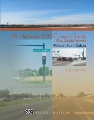
Highway 2 (West Dakota Parkway) Corridor Study<br />
The city is bisected by US Highway 2/85, which traverses the city in a southwest to northeast<br />
direction. The four-lane highway originally served as a bypass route for through traffic; however,<br />
as growth within the city has occurred, the areas surrounding the highway (north and west) have<br />
developed and traffic volumes have increased. This has raised concerns over impact <strong>of</strong> the<br />
highway on the local system. In order to address these concerns, the US Highway 2/85 (West<br />
Dakota Parkway) Corridor Study was undertaken. The purpose <strong>of</strong> this study was to determine<br />
how to address traffic operations and safety concerns on the highway as the city continues to<br />
grow and traffic volumes continue to increase.<br />
The corridor study was prepared as a separate document, but is tied to the <strong>Transportation</strong> <strong>Plan</strong> as<br />
the same growth assumptions and traffic projection methodology were used for both. As part <strong>of</strong><br />
<strong>Williston</strong> <strong>Transportation</strong> <strong>Plan</strong> 1<br />
August 2010