Transportation Plan - City of Williston
Transportation Plan - City of Williston
Transportation Plan - City of Williston

Create successful ePaper yourself
Turn your PDF publications into a flip-book with our unique Google optimized e-Paper software.
city, with most locations accounting for only one or two crashes. This suggests that many crashes<br />
were random occurrences. However, there were higher concentrations <strong>of</strong> crashes at select<br />
locations. These high crash locations are listed in Table 2 and illustrated in Figure 10.<br />
It should be noted that there is a correlation between the frequency <strong>of</strong> crashes and traffic<br />
volumes. Roadways with higher traffic volumes are expected to have more total crashes than<br />
lower volume roadways.<br />
The highest concentration <strong>of</strong> crashes within the city occurred along the 2nd Avenue West<br />
corridor, especially from 26th Street to 11th Street. The locations along this corridor with the<br />
highest frequency <strong>of</strong> crashes include the intersections with 26th Street, 18th Street, 14th Street,<br />
and 11th Street, all <strong>of</strong> which had more than 20 crashes in the three-year study period. Based on<br />
this safety analysis, further investigation is warranted in order to identify potential safety<br />
improvements along the 2nd Avenue West corridor.<br />
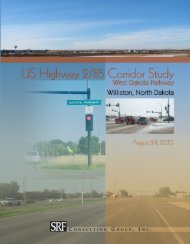
In addition, a high concentration <strong>of</strong> crashes occurred at the intersections along the Dakota<br />
Parkway West (US Highway 2/85) corridor. A detailed safety analysis, as well as<br />
recommendations to improve safety, were prepared as part <strong>of</strong> the Highway 2 (Dakota Parkway)<br />
Corridor Study available for review from the <strong>City</strong> <strong>of</strong> <strong>Williston</strong> or NDDOT.<br />
<strong>Williston</strong> <strong>Transportation</strong> <strong>Plan</strong> 17<br />
August 2010