Mapping at the Speed of Flight
Mapping at the Speed of Flight
Mapping at the Speed of Flight

You also want an ePaper? Increase the reach of your titles
YUMPU automatically turns print PDFs into web optimized ePapers that Google loves.
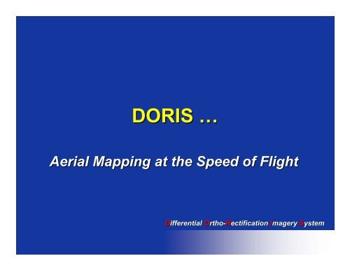
DORIS …<br />
Aerial <strong>Mapping</strong> <strong>at</strong> <strong>the</strong> <strong>Speed</strong> <strong>of</strong> <strong>Flight</strong><br />
Differential ifferential Ortho rtho-Rectific<strong>at</strong>ion<br />
ectific<strong>at</strong>ion Imagery magery System ystem
Photogrammetry …<br />
Development Cycles *<br />
– Plane table photogrammetry, from about 1850<br />
to 1900<br />
– Analog photogrammetry (mechanical<br />
stereoscopic plotting), from about 1900 to 1960<br />
– Analytical photogrammetry (computer-based<br />
(computer based<br />
analytical stereo-plotter), stereo plotter), from about 1960 to<br />
present<br />
– S<strong>of</strong>tcopy (Digital) photogrammetry (electronic<br />
ortho-photographs), ortho photographs), current industry standard<br />
*Adopted from “A Short History <strong>of</strong> Photogrammetry” by Robert Burtch,<br />
THE INSTITUTE FOR DIGITAL MAPPING, FERRIS STATE UNIVERSITY
Photogrammetry …<br />
The New Trend<br />
• Imagery … from digital sensors<br />
• DTM … from LiDAR systems<br />
• Geo-referencing<br />
Geo referencing … direct using<br />
GPS/INS systems
Technology<br />
Aerial Aerial Surveys Surveys<br />
Laser terrain<br />
scanning<br />
direct geo-<br />
referencing<br />
High-resolution<br />
High resolution<br />
highly accur<strong>at</strong>e 3D<br />
ortho-rectified<br />
ortho rectified<br />
digital image-map<br />
image map<br />
GIS Base Layer<br />
Resource Resource <strong>Mapping</strong> <strong>Mapping</strong><br />
Digital<br />
imaging
DORIS System …<br />
Airborne imaging system th<strong>at</strong><br />
combines a laser scanner digital<br />
elev<strong>at</strong>ion model with simultaneously<br />
captured digital images to produce<br />
geo-referenced geo referenced and highly accur<strong>at</strong>e<br />
ortho-rectified ortho rectified image-map<br />
image map
DORIS System …<br />
LiDAR<br />
Camera<br />
• Customized for<br />
Integr<strong>at</strong>ed Laser/Camera
DORISys GeoCam …<br />
• Kodak 4096x4096 ccd<br />
with MegaVision<br />
Back, lens and<br />
RGB/CIR Filters<br />
• NovAtel BDS-IMU BDS IMU-11 11<br />
with OEM4<br />
• Mount and power<br />
module
True Color and Color Infra- Infra<br />
Red DORIS Imagery<br />
• 0.15 m (6”) (6 ) Ground Sampled Distance RGB and CIR Images
Camera Geom<strong>at</strong>ric Calibr<strong>at</strong>ion<br />
• Target Field<br />
– Precisely Pre-Surveyed<br />
Pre Surveyed<br />
(0.1 mm 1σ) 1<br />
• Calibr<strong>at</strong>ion Para<br />
– Intrinsic Camera<br />
Parameters<br />
– Radial Lens Distortion
Camera/IMU Fine Alignment<br />
• In-flight In flight Calibr<strong>at</strong>ion<br />
– 1-3 3 pixel (1σ) (1σ)<br />
• Lever-arm Lever arm Offset<br />
Estim<strong>at</strong>ion<br />
– 0.01-0.1 0.01 0.1 m (1σ) (1σ)<br />
• Bore-sight Bore sight angles fine<br />
tuning (fap d<strong>at</strong>a)<br />
– 0.01-0.05 0.01 0.05 deg (1σ) (1σ)
DORIS Inform<strong>at</strong>ion Flow<br />
• Real-time Real time Acquisition <strong>of</strong><br />
Imagery and Geo-referencing<br />
Geo referencing<br />
inform<strong>at</strong>ion<br />
• Image and Geo-referencing<br />
Geo referencing<br />
inform<strong>at</strong>ion development<br />
• ImageMap production
Processing Overview<br />
• DEM gener<strong>at</strong>ion from laser points<br />
– Handling large d<strong>at</strong>a sets<br />
• Rectify individual image frames<br />
– Corrects for<br />
• Sensor pl<strong>at</strong>form orient<strong>at</strong>ion<br />
• Relief displacement<br />
• Lens distortion<br />
Digital Imagery<br />
raw form<strong>at</strong><br />
Image Manipul<strong>at</strong>ion<br />
Standard Tiff Images<br />
• Combine rectified images into<br />
mosaic<br />
– Color balancing and Autom<strong>at</strong>ed<br />
seams<br />
• Tiling<br />
– Efficient file management and speed<br />
GPS Event Markers<br />
exposure st<strong>at</strong>ions<br />
Acquisition System<br />
Raw D<strong>at</strong>a<br />
Lab Alignment<br />
Coarse Geo-Referencing<br />
Fine Alignment<br />
Fine Geo-Referencing<br />
Differential Rectific<strong>at</strong>ion<br />
Mosaicking<br />
GPS/INS<br />
flight trajectory<br />
Laser D<strong>at</strong>a<br />
XYZ Points<br />
Points Gridding<br />
DEM Gener<strong>at</strong>ion
Processing Overview (cont)<br />
Non Rectified Image<br />
DEM<br />
Rectified Image<br />
Mosaic<br />
Tiff/Geotiff Tiff/ Geotiff image form<strong>at</strong> utilized
Tile Processing Efficiency<br />
1:20:38<br />
1:09:07<br />
0:57:36<br />
0:46:05<br />
0:34:34<br />
0:23:02<br />
0:11:31<br />
0:00:00<br />
DEM Gener<strong>at</strong>ion<br />
4x4 2x2<br />
Tile Size<br />
1x1<br />
1:40:48<br />
1:26:24<br />
1:12:00<br />
0:57:36<br />
0:43:12<br />
0:28:48<br />
0:14:24<br />
0:00:00<br />
Differential Rectific<strong>at</strong>ion<br />
4x4 km 2x2 km<br />
Tile Size<br />
1x1km<br />
4:48:00<br />
3:50:24<br />
2:52:48<br />
1:55:12<br />
0:57:36<br />
0:00:00<br />
Mosaic<br />
4x4 km 2x2 km<br />
Tile Size<br />
1x1km
Quick Processing<br />
• Why?<br />
– Same day quality check <strong>of</strong> d<strong>at</strong>a<br />
– Preview d<strong>at</strong>a prior to processing<br />
• How?<br />
– Cre<strong>at</strong>e reduced-resolution reduced resolution images (1/10)<br />
– Thin laser points (1 <strong>of</strong> 1,000)<br />
– Use real-time real time Geo-referencing Geo referencing info<br />
– DEM gener<strong>at</strong>ion, rectific<strong>at</strong>ion & mosaic<br />
(reduced resolution)
DORIS Advantage<br />
• Flexibility<br />
– Acquisition <strong>of</strong> images <strong>of</strong> tens <strong>of</strong><br />
thousands <strong>of</strong> hectares per day<br />
– Ready-to Ready to-use use digital d<strong>at</strong>a<br />
– Autom<strong>at</strong>ed fine alignment<br />
• Quality Control<br />
– Real-time Real time D<strong>at</strong>a Quality Assurance<br />
– Near-zero Near zero d<strong>at</strong>a loss
DORIS Advantage (cont.)<br />
• Turn-Around Turn Around Time<br />
– Near real-time real time quick mosaics<br />
– Better than 5:1 d<strong>at</strong>a processing time for<br />
full resolution image maps<br />
• Accuracy<br />
– High-resolution High resolution imagery<br />
– One image pixel rms ground truthing<br />
– 30-50 30 50 cm accuracy (1-1.5 (1 1.5 pixel)
DORIS Advantage (cont.)<br />
• Current St<strong>at</strong>e <strong>of</strong> <strong>the</strong> System<br />
– St<strong>at</strong>e-<strong>of</strong> St<strong>at</strong>e <strong>of</strong>-<strong>the</strong> <strong>the</strong>-art art Fully Digital<br />
– Easy to Use<br />
– Detailed, Accur<strong>at</strong>e, Autom<strong>at</strong>ed<br />
– Tested and Oper<strong>at</strong>ional<br />
– Real-time Real time Navig<strong>at</strong>ion and Orhto-<br />
rectific<strong>at</strong>ion … in <strong>the</strong> works
Quick Mosaic:<br />
Haynes Creek<br />
20,000 ha<br />
523 images<br />
10,000 laser pts<br />
10m pixels<br />
5m contours<br />
Processing time<br />
1.75 hours<br />
Processing Computer:<br />
1 GHz CPU 256 Mb RAM
Full Resolution Mosaic:<br />
Haynes Creek<br />
Haynes Creek Quick Mosaic <strong>at</strong> 10m<br />
Mosaic <strong>of</strong> 2kmx2km block <strong>at</strong> 0.75m
Accuracy Assessment<br />
• LiDAR<br />
• Fine alignment <strong>of</strong> Sensors<br />
• Rectify and mosaic imagery<br />
• Compare target positions in imagery<br />
with ground survey
LiDAR Accuracy<br />
Assessment<br />
• LiDAR Target Painting
LiDAR Accuracy<br />
Assessment (cont.)<br />
• LiDAR Hits<br />
• Surveyed Marker<br />
Top View<br />
Elev<strong>at</strong>ion<br />
Error [cm]<br />
20<br />
15<br />
10<br />
5<br />
0<br />
-5<br />
-10<br />
-15<br />
LiDAR Point Accuracy<br />
COP Low Pass 1<br />
A1 A2 A3 A4 A5 A6 A7 A8<br />
Target Point<br />
DE<br />
DN<br />
DH<br />
rmse:<br />
8 cm (1D)<br />
11 cm (2D)<br />
13 cm (3D)<br />
Flying Height<br />
AGL: 150'<br />
Point Spacing:<br />
6"<br />
TargetSize: 8'x2"<br />
X 8'x2"<br />
Post Height: 4'-<br />
12'<br />
• +/- +/ 10 cm error envelope
Imagery Accuracy<br />
Assessment<br />
# <strong>of</strong> RMS RMS<br />
targets (m) (pix)<br />
• Quebecor 15 0.48 1.6<br />
• Millwoods 30 0.46 1.5<br />
• Calgary 22 0.32 1.1<br />
• Toronto 65 0.29 0.8
Accuracy Assessment:<br />
Millwoods<br />
Mosaic <strong>of</strong> 15 images <strong>of</strong> ARC/Millwoods. The red crosses in <strong>the</strong><br />
enlargements are ground survey positions overlaid on <strong>the</strong> targets. Kodak<br />
DCS 520 Camera.
DORIS ImageMap Applic<strong>at</strong>ions<br />
• Wh<strong>at</strong> Does a DORIS ImageMap Add?<br />
– Accur<strong>at</strong>e high-resolution high resolution 2D sp<strong>at</strong>ial inform<strong>at</strong>ion<br />
– Multi-Spectral Multi Spectral Texture/Content inform<strong>at</strong>ion<br />
• ImageMap + DEM<br />
– 3D Sp<strong>at</strong>ial Base Layer in a GIS system<br />
– Fully Digital and Autom<strong>at</strong>ed Resource <strong>Mapping</strong><br />
System (e.g. Forestry)<br />
– Complete Aerial Survey System (mapping<br />
agencies, municipalities, reconnaissance,<br />
surveillances, right-<strong>of</strong> right <strong>of</strong>-way way (oil, hydro, power, …<br />
etc.), … etc.)
DORIS ImageMap Applic<strong>at</strong>ions<br />
• Kinsella 3D Fly<br />
though - DORIS<br />
ImageMap<br />
draped over DEM
Mosaic ImageMap Draped onto DEM Image