Structural-Geologic Map Relationships in the Salcito Ranch Area,
Structural-Geologic Map Relationships in the Salcito Ranch Area,
Structural-Geologic Map Relationships in the Salcito Ranch Area,
You also want an ePaper? Increase the reach of your titles
YUMPU automatically turns print PDFs into web optimized ePapers that Google loves.
CONTRIBUTED REPORT CR-11-C<br />
Arizona <strong>Geologic</strong>al Survey<br />
416 W. Congress St., Ste. 100, Tucson, AZ 85701<br />
www.azgs.az.gov<br />
<strong>Structural</strong>-GeoloGic <strong>Map</strong> relationShipS<br />
<strong>in</strong> <strong>the</strong> <strong>Salcito</strong> ranch area,<br />
r<strong>in</strong>con Mounta<strong>in</strong>S, Sou<strong>the</strong>rn arizona<br />
G.H. Davis, K.N. Constenius, E.P.R. Ornelas and L.J. Cox<br />
Department of Geosciences<br />
University of Arizona<br />
March 2011
Arizona <strong>Geologic</strong>al Survey Contributed Report and Contributed <strong>Map</strong> Series<br />
The Contributed Report and Contributed <strong>Map</strong> Series provide non-AZGS authors with a forum<br />
for publish<strong>in</strong>g documents concern<strong>in</strong>g Arizona geology. While review comments may have been<br />
<strong>in</strong>corporated, this document does not necessarily conform to AZGS technical, editorial, or policy<br />
standards.<br />
The Arizona <strong>Geologic</strong>al Survey issues no warranty, expressed or implied, regard<strong>in</strong>g <strong>the</strong> suitability<br />
of this product for a particular use. Moreover, <strong>the</strong> Arizona <strong>Geologic</strong>al Survey shall not be<br />
liable under any circumstances for any direct, <strong>in</strong>direct, special, <strong>in</strong>cidental, or consequential<br />
damages with respect to claims by users of this product.<br />
The author(s) is solely responsible for <strong>the</strong> data and ideas expressed here<strong>in</strong>.
<strong>Structural</strong>-<strong>Geologic</strong> <strong>Map</strong> <strong>Relationships</strong><br />
<strong>in</strong> <strong>the</strong> <strong>Salcito</strong> <strong>Ranch</strong> <strong>Area</strong>,<br />
R<strong>in</strong>con Mounta<strong>in</strong>s, Sou<strong>the</strong>rn Arizona<br />
G.H. Davis, K.N. Constenius, E.P.R. Ornelas, and L.J. Cox<br />
Department of Geosciences<br />
University of Arizona<br />
Arizona <strong>Geologic</strong>al Survey Contributed Report CR-11-C<br />
Arizona <strong>Geologic</strong>al Survey<br />
416 W. Congress St., Suite 100, Tucson, AZ 85701<br />
March, 2011<br />
Version 1.0<br />
19 p. text and one 11″ x 17″ sheet<br />
www.azgs.az.gov
<strong>Structural</strong>-<strong>Geologic</strong> <strong>Map</strong> <strong>Relationships</strong> <strong>in</strong> <strong>the</strong> <strong>Salcito</strong> <strong>Ranch</strong> <strong>Area</strong>,<br />
R<strong>in</strong>con Mounta<strong>in</strong>s, Sou<strong>the</strong>rn Arizona<br />
Davis, G. H., Constenius, K. N., Ornelas, E. P. R., and Cox, L. J.,<br />
Department of Geosciences, The University of Arizona, Tucson, Arizona 85721<br />
Introduction<br />
Formerly known as <strong>the</strong> Mart<strong>in</strong>ez <strong>Ranch</strong> area (e.g., see Davis, 1975; Davis and<br />
o<strong>the</strong>rs, 2004), <strong>the</strong> <strong>Salcito</strong> <strong>Ranch</strong> area is located at <strong>the</strong> sou<strong>the</strong>astern-most corner of <strong>the</strong><br />
R<strong>in</strong>con Mounta<strong>in</strong>s (Figure 1) and conta<strong>in</strong>s a magnificent display of <strong>the</strong> structural<br />
characteristics of <strong>the</strong> Catal<strong>in</strong>a-R<strong>in</strong>con metamorphic core complex and superposed<br />
Bas<strong>in</strong> and Range fault<strong>in</strong>g. We carried out large-scale mapp<strong>in</strong>g of <strong>the</strong> geology of a part<br />
of this area <strong>in</strong> <strong>the</strong> mid-1990s. This mapp<strong>in</strong>g, which was <strong>in</strong>itiated as a class project,<br />
expanded to become part of a larger study of geologic structures associated with<br />
extensional tectonics <strong>in</strong> a region centered on <strong>the</strong> Catal<strong>in</strong>a and R<strong>in</strong>con Mounta<strong>in</strong>s.<br />
Observations and conclusions based on this larger work were published <strong>in</strong> <strong>the</strong><br />
<strong>Geologic</strong>al Society of America (GSA) Bullet<strong>in</strong> (Davis and o<strong>the</strong>rs, 2004). The GSA<br />
Bullet<strong>in</strong> journal article conta<strong>in</strong>s a simplified, generalized version of <strong>the</strong> more detailed<br />
geological map of <strong>the</strong> <strong>Salcito</strong> <strong>Ranch</strong> area. Fur<strong>the</strong>rmore, practical page limits for <strong>the</strong><br />
article prevented an elaboration on certa<strong>in</strong> descriptive details that may be of <strong>in</strong>terest.<br />
Thus we take this opportunity to release this more comprehensive account<strong>in</strong>g of our<br />
f<strong>in</strong>d<strong>in</strong>gs as an Arizona <strong>Geologic</strong>al Survey Contributed Report, with <strong>the</strong> expectation that<br />
<strong>the</strong> map (Plate 1) and this text will be useful to o<strong>the</strong>rs.<br />
Broad Tectonic <strong>Relationships</strong><br />
Cenozoic extension <strong>in</strong> <strong>the</strong> sou<strong>the</strong>rn part of <strong>the</strong> Bas<strong>in</strong> and Range prov<strong>in</strong>ce <strong>in</strong> <strong>the</strong><br />
western Cordillera is <strong>the</strong> product of two major deformations, dist<strong>in</strong>guishable both <strong>in</strong><br />
3
Figure 1. Top: Index map and show<strong>in</strong>g location of <strong>Salcito</strong> <strong>Ranch</strong> study area.<br />
Bottom: Photograph show<strong>in</strong>g profile of R<strong>in</strong>con Mounta<strong>in</strong>s that parallels Catal<strong>in</strong>a detachment fault. View<br />
look<strong>in</strong>g from sou<strong>the</strong>ast to northwest. <strong>Salcito</strong> <strong>Ranch</strong> study area is located <strong>in</strong> lower left where <strong>the</strong> valley<br />
floor meets <strong>the</strong> lower flank of <strong>the</strong> range. Mart<strong>in</strong>ez <strong>Ranch</strong> normal fault expressed <strong>in</strong> steep mountai-flank<br />
topography on right side of photo.<br />
4
tim<strong>in</strong>g and style. In <strong>the</strong> late Oligocene-middle Miocene, between about 25 and 18 Ma<br />
(Crittenden and o<strong>the</strong>rs, 1980; Davis, 1980, 1981; Dick<strong>in</strong>son, 1991; Force, 1997; Davis<br />
and o<strong>the</strong>rs, 2004; Damon and Shafiqullah, 2006), <strong>the</strong> crust was extended by<br />
deformation accommodated by regional brittle-ductile shear zones, now expressed <strong>in</strong><br />
<strong>the</strong> form of metamorphic core complexes and detachment faults. Then, <strong>in</strong> middle<br />
Miocene-Pliocene time, between ~15 and 5 Ma, <strong>the</strong> crust was extended by deformation<br />
accommodated by normal faults that cross cut and exposed deep levels of <strong>the</strong> core<br />
complex. Rock fabrics and structural trends <strong>in</strong>dicate that local core-complex extension<br />
was NE-SW oriented, <strong>in</strong> contrast to later E-W Bas<strong>in</strong> and Range extension.<br />
The geology and regional tectonic significance of <strong>the</strong> Catal<strong>in</strong>a-R<strong>in</strong>con<br />
metamorphic core complex has received significant attention <strong>in</strong> <strong>the</strong> literature. This work<br />
focuses on late Oligocene-early Miocene shear<strong>in</strong>g and detachment fault<strong>in</strong>g circa 25 to<br />
20 Ma along <strong>the</strong> Catal<strong>in</strong>a brittle/ductile shear zone at <strong>the</strong> sou<strong>the</strong>ast corner of <strong>the</strong> R<strong>in</strong>con<br />
Mounta<strong>in</strong>s. The <strong>in</strong>ferred depth level for <strong>the</strong> most deformed (sheared) rock <strong>in</strong> <strong>the</strong> <strong>Salcito</strong><br />
<strong>Ranch</strong> area is ~10 km (Davis and o<strong>the</strong>rs, 2004). Though exposures of Bas<strong>in</strong> and<br />
Range faults are rare with<strong>in</strong> sou<strong>the</strong>rn Arizona, <strong>the</strong> <strong>Salcito</strong> <strong>Ranch</strong> area conta<strong>in</strong>s one of<br />
<strong>the</strong>se (<strong>the</strong> Mart<strong>in</strong>ez <strong>Ranch</strong> fault), which truncates <strong>the</strong> core-complex fabrics (Drewes,<br />
1974, 1977).<br />
Basic <strong>Map</strong> <strong>Relationships</strong><br />
We mapped <strong>the</strong> <strong>Salcito</strong> <strong>Ranch</strong> area at a scale of 1:6000 (see Plate 1, Figure 2).<br />
It conta<strong>in</strong>s a superb display of metamorphic core complex fabrics and structures.<br />
Mylonites, ultramylonities, and microbrecciated mylonites are very well exposed, and<br />
<strong>the</strong>y are derived from a granitic protolith. Fur<strong>the</strong>rmore, not only is <strong>the</strong> gently dipp<strong>in</strong>g<br />
5
Catal<strong>in</strong>a detachment fault well exposed, it is accompanied by a similarly oriented<br />
“subdetachment” fault ly<strong>in</strong>g a few tens of meters beneath it, and with<strong>in</strong> <strong>the</strong> mylonities<br />
(see Plate 1, Figure 2). A subdetachment fault (named <strong>the</strong> Javal<strong>in</strong>a fault) was<br />
discovered and mapped by Davis (1987) <strong>in</strong> Saguaro National Park (East) along <strong>the</strong><br />
western marg<strong>in</strong> of <strong>the</strong> R<strong>in</strong>con Mounta<strong>in</strong>s. Its actual physical (topographic) expression is<br />
nil, and yet its trace can be placed consistently with<strong>in</strong> several meters because of <strong>the</strong><br />
profound contrasts <strong>in</strong> rock and fabric above and below. In contrast, <strong>the</strong> physical<br />
expression of <strong>the</strong> subdetachment fault with<strong>in</strong> <strong>the</strong> <strong>Salcito</strong> <strong>Ranch</strong> area is magnificent.<br />
Ano<strong>the</strong>r attraction of <strong>the</strong> <strong>Salcito</strong> <strong>Ranch</strong> area is <strong>the</strong> presence of well exposed,<br />
though th<strong>in</strong>ned, upper plate stratigraphy with units rang<strong>in</strong>g from Precambrian to<br />
Miocene <strong>in</strong> age (see Plate 1, Figure 2). Fur<strong>the</strong>rmore, along <strong>the</strong> eastern marg<strong>in</strong> of <strong>the</strong><br />
area <strong>the</strong> Mart<strong>in</strong>ez <strong>Ranch</strong> fault, of Bas<strong>in</strong> and Range orig<strong>in</strong>, truncates <strong>the</strong> upper-plate<br />
stratigraphy, core-complex mylonites, detachment fault, subdetachment fault, and<br />
crystall<strong>in</strong>e protolith. The Mart<strong>in</strong>ez Fault def<strong>in</strong>es <strong>the</strong> steep eastern marg<strong>in</strong> of <strong>the</strong> R<strong>in</strong>con<br />
Mounta<strong>in</strong>s (see Plate 1, Figure 2) (Drewes, 1974, 1977).<br />
___________________________________________________________________<br />
6
Figure 2 . <strong>Geologic</strong> map of <strong>the</strong> <strong>Salcito</strong> <strong>Ranch</strong> locality emphasiz<strong>in</strong>g faults and fault rocks related to <strong>the</strong> Catal<strong>in</strong>a detachment fault. Key to<br />
fault-rock units (also see Table 1) : c, cataclasite, cohesive microbreccia, and breccia derived from mylonite; cl, cataclasite as above only<br />
beneath sub-detachment; g, gouge; m, mylonite, protomylonite and ultramylonite. Protolith for fault rocks is considered to be Eocene<br />
Wilderness Suite Granite (quartz monzonite). Rock unit abbreviations: Yr, P<strong>in</strong>al Schist and Johnny Lyon Granodiorite; Cb, Cambrian Bolsa<br />
Quartzite; Ca, Cambrian Abrigo Formation; Dm, Devonian Mart<strong>in</strong> Formation; Ph, Pennsylvanian Horquilla Limestone; PPe, Pennsylvanian-<br />
Permian Earp Formation; Tp, Oligocene-Miocene Pantano Formation; Tdb, Oligocene-Miocene(?) diabase dikes and sills; Qal, Quaternary<br />
alluvium. <strong>Map</strong> based on field mapp<strong>in</strong>g by <strong>the</strong> authors and compilation of previous mapp<strong>in</strong>g by Drewes 1974, 1977; Lim<strong>in</strong>g, 1974.<br />
7
Catal<strong>in</strong>a Detachment Fault<br />
The Catal<strong>in</strong>a detachment fault is readily traced, east-west, though <strong>the</strong> sou<strong>the</strong>rn<br />
part of <strong>the</strong> map area where it dips 10º to 20º southward. It separates non-mylonitic and<br />
non-cataclasitic upper plate rocks from underly<strong>in</strong>g cataclastic and mylonitic rocks (see<br />
Plate 1, Figure 2). The location of <strong>the</strong> detachment fault is easy to spot, for it separates<br />
non-mylonitic, non-cataclastic upper plate rocks from an underly<strong>in</strong>g ledge of brown or<br />
gray cataclasite and ultracataclasite. In places <strong>the</strong> trace of <strong>the</strong> fault has clear<br />
expression as a smooth surface. At a number of locations directly above <strong>the</strong> Catal<strong>in</strong>a<br />
detachment fault, gouge zones as thick as 10 m are developed at <strong>the</strong> expense of upper<br />
plate rocks. One of <strong>the</strong>se zones of gouge, formed <strong>in</strong> Precambrian granite, conta<strong>in</strong>s<br />
abundant, faceted, fist-size nodules of granite that survived mill<strong>in</strong>g. These are<br />
enveloped <strong>in</strong> a talc-like gouge.<br />
Upper Plate Rocks<br />
Upper plate rocks above <strong>the</strong> detachment fault were mapped by Lim<strong>in</strong>g (1974)<br />
and Drewes (1977), and both Lim<strong>in</strong>g (1974) and Davis (1975) carried out detailed<br />
structural analysis of folds. Although we spent some time mapp<strong>in</strong>g and measur<strong>in</strong>g<br />
structural features with<strong>in</strong> <strong>the</strong> upper plate (see Plate 1), this was not a focus of study.<br />
The upper plate of <strong>the</strong> Catal<strong>in</strong>a detachment fault consists of slices of recognizable<br />
Precambrian, Paleozoic, and Oligocene-Miocene units, most of which are <strong>in</strong>ternally<br />
deformed <strong>in</strong> one way or ano<strong>the</strong>r (Figure 3). Most of <strong>the</strong> slices eventually lose cont<strong>in</strong>uity<br />
along strike, reflect<strong>in</strong>g younger-on-older truncations by fault<strong>in</strong>g (see Plate 1). The<br />
overall dip of <strong>the</strong> upper plate rocks is gently to moderately northward, i.e., back-tilted<br />
toward <strong>the</strong> Catal<strong>in</strong>a detachment fault.<br />
8
Figure 3 . Stratigraphy and fault-rocks of <strong>the</strong> <strong>Salcito</strong> <strong>Ranch</strong> map area.<br />
9
Directly above <strong>the</strong> Catal<strong>in</strong>a detachment fault <strong>in</strong> <strong>the</strong> sou<strong>the</strong>astern part of <strong>the</strong> area<br />
are Precambrian rocks, <strong>in</strong>clud<strong>in</strong>g P<strong>in</strong>al Schist and Johnny Lyon Granodiorite, both<br />
Proterozoic <strong>in</strong> age (see Plate 1). Tectonic slices conta<strong>in</strong><strong>in</strong>g each of <strong>the</strong>se formations<br />
are no greater than 15 m thick. Above <strong>the</strong> tectonic slices of Precambrian rocks are<br />
slices of Paleozoic formations, all <strong>in</strong> <strong>the</strong> correct stratigraphic order but each dim<strong>in</strong>ished<br />
<strong>in</strong> thickness compared to measured thicknesses <strong>in</strong> nearby ranges outside of <strong>the</strong><br />
Catal<strong>in</strong>a-R<strong>in</strong>con metamorphic core complex (see Figure 3). The sequence of<br />
Paleozoic formations, from older to younger, <strong>in</strong>cludes Bolsa Quartzite (middle<br />
Cambrian), Abrigo Formation (upper and middle Cambrian), Mart<strong>in</strong> Formation (Upper<br />
Devonian), Escabrosa Limestone (Mississippian), Horquilla Limestone (upper and<br />
middle Pennsylvanian), and Earp Formation (Lower Permian and upper Pennsylvanian).<br />
The contrast between <strong>the</strong> normal section versus <strong>the</strong> tectonically th<strong>in</strong>ned section reveals<br />
a reduction <strong>in</strong> thickness to 10 to 50 percent of orig<strong>in</strong>al.<br />
Th<strong>in</strong>n<strong>in</strong>g of <strong>the</strong> upper plate has been accomplished by down-to-<strong>the</strong>-southwest<br />
shear<strong>in</strong>g and fault<strong>in</strong>g. As reported by Davis (1975, 1981, 1987) and Lim<strong>in</strong>g (1974), <strong>the</strong><br />
Horquilla Formation is replete with overturned fold structures which verge south to<br />
southwest and which can be <strong>in</strong>terpreted via separation arc methodology as a response<br />
to top to <strong>the</strong> southwest movement. Axial surfaces for <strong>the</strong>se folds are <strong>in</strong>cl<strong>in</strong>ed to <strong>the</strong><br />
north and nor<strong>the</strong>ast. Some faults which are <strong>in</strong> part responsible for th<strong>in</strong>n<strong>in</strong>g of <strong>the</strong> section<br />
are quite mappable with<strong>in</strong> <strong>the</strong> upper plate of <strong>the</strong> Catal<strong>in</strong>a detachment fault.<br />
Oligocene-Miocene sandstones and conglomerates of <strong>the</strong> Pantano Formation<br />
10
also are part of <strong>the</strong> upper plate of <strong>the</strong> Catal<strong>in</strong>a detachment fault, and <strong>the</strong>se rocks rest <strong>in</strong><br />
fault contact upon upper Paleozoic sedimentary rocks, <strong>in</strong> most cases <strong>the</strong><br />
Pennsylvanian-Permian Earp Formation (see Plate 1; Figure 2). These rocks<br />
structurally comprise a tilt panel that strikes east-west and dips north. Deposition of <strong>the</strong><br />
Oligocene-Miocene sequence is thought to have accompanied detachment fault<strong>in</strong>g.<br />
Lower Plate – Cataclastic Rocks<br />
Below <strong>the</strong> Catal<strong>in</strong>a detachment surface are highly <strong>in</strong>durated cataclastic rocks<br />
that comprise <strong>the</strong> brittle part of <strong>the</strong> Catal<strong>in</strong>a brittle-ductile shear zone. Thickness of <strong>the</strong><br />
zone where mylonites are cataclastically overpr<strong>in</strong>ted is ~330 m. The top of <strong>the</strong> zone of<br />
cataclastic rocks was simple to map, because it is demarcated by <strong>the</strong> Catal<strong>in</strong>a<br />
detachment fault (see Plate 1; Figure 2). The immediate footwall physical expression of<br />
<strong>the</strong> Catal<strong>in</strong>a fault is a 1 to 2-m thick highly resistant ledge of cataclasite and<br />
ultracataclasite that commonly has a conspicuous physiographic expression.<br />
Downward at different levels through <strong>the</strong> zone of cataclasitc deformation is a gently<br />
dipp<strong>in</strong>g fault surface that we have called <strong>the</strong> „subdetachment fault‟ (see Plate 1; Figure<br />
2). Over much of <strong>the</strong> east-west length of <strong>the</strong> map area, <strong>the</strong> subdetachment fault is<br />
straightforward to trace; <strong>in</strong> fact locally its surface is so smooth and wide that it looks like<br />
a road surface (Figure 4). But <strong>the</strong>re are subregions with<strong>in</strong> <strong>the</strong> map area where <strong>the</strong><br />
subdetachment fault is more difficult to trace, especially toward <strong>the</strong> east.<br />
11
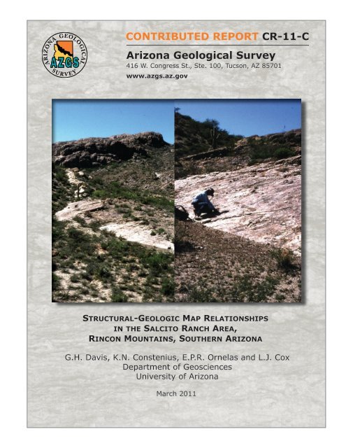
Figure 4 . Subdetachment photographed look<strong>in</strong>g west with “Breccia Mounta<strong>in</strong>” <strong>in</strong> background.<br />
Subdetachment fault appears as slop<strong>in</strong>g surface <strong>in</strong> fore and middle ground and base of cliff <strong>in</strong><br />
background (left photograph) with<strong>in</strong> zone of cataclastic deformation below Catal<strong>in</strong>a detachment fault <strong>in</strong><br />
Mart<strong>in</strong>ez <strong>Ranch</strong> area. Note geologist for scale <strong>in</strong> both photographs.<br />
Above <strong>the</strong> subdetachment fault <strong>the</strong> cataclastic rocks tend to be relatively coarse<br />
gra<strong>in</strong>ed, and it is possible to recognize <strong>in</strong> hand samples and outcrops <strong>the</strong> protolith <strong>in</strong> <strong>the</strong><br />
form of mylonite and ultramylonite overpr<strong>in</strong>ted by <strong>the</strong> cataclasis. Directly beneath <strong>the</strong><br />
subdetachment fault, over a distance of several meters, <strong>the</strong> rock is reduced to very f<strong>in</strong>e-<br />
gra<strong>in</strong>ed cataclasite and ultracataclasite, <strong>in</strong> a manner resembl<strong>in</strong>g <strong>the</strong> fault rock directly<br />
beneath <strong>the</strong> Catal<strong>in</strong>a detachment surface.<br />
12
Significant variations <strong>in</strong> thickness of <strong>the</strong> cataclastic unit are seen beneath <strong>the</strong><br />
subdetachment fault, and it requires very careful mapp<strong>in</strong>g to accurately p<strong>in</strong> <strong>the</strong> exact<br />
location of <strong>the</strong> base of <strong>the</strong> zone of cataclastic deformation. The base is marked by a<br />
sharp transition, usually over a distance of less than several meters, from cataclastic<br />
deformation to mylonitic deformation, similar to what Davis (1987) recognized <strong>in</strong><br />
Saguaro National Park - East. Yet, from place to place below <strong>the</strong> mapped base of <strong>the</strong><br />
cataclastic unit it is possible to see th<strong>in</strong> zones of cataclastic deformation that are<br />
traceable for many tens of meters. The overall geometry of <strong>the</strong> base of <strong>the</strong> zone of<br />
cataclasis, as viewed <strong>in</strong> map pattern, is systematically corrugated (Spencer, 1999; Plate<br />
1, Figure 2). The pattern is best seen <strong>in</strong> down-plunge view, i.e., southwestward <strong>in</strong> <strong>the</strong><br />
direction of tectonic transport. In this view <strong>the</strong> lower contact resembles a fault-mullioned<br />
surface<br />
Figure 5. Down-plunge view of mapped structural relationships <strong>in</strong> <strong>the</strong> <strong>Salcito</strong> <strong>Ranch</strong> locality show<strong>in</strong>g<br />
mullioned nature of Catal<strong>in</strong>a detachment and subdetachment faults.<br />
13
<strong>Structural</strong> relationships with<strong>in</strong> <strong>the</strong> zone of cataclasis <strong>in</strong>clude <strong>the</strong> presence of<br />
discrete fault surfaces whose l<strong>in</strong>ked geometries resemble extensional duplexes<br />
bound<strong>in</strong>g horses. In this context, <strong>the</strong> subdetachment fault may well represent a "flat"<br />
that fur<strong>the</strong>r down-dip is connected with <strong>the</strong> ma<strong>in</strong> Catal<strong>in</strong>a detachment fault by a ramp.<br />
Mylonites<br />
Beneath <strong>the</strong> zone of cataclasis are beautiful mylonites, and some ultramylonites.<br />
Gently dipp<strong>in</strong>g, <strong>the</strong> mylonitic fabric imparts a ledgy characteristic to <strong>the</strong> landscape<br />
(Figure 6). Protolith is of two varieties: a coarse porphyritic quartz monzonite that may<br />
represent a part of <strong>the</strong> Precambrian Oracle/Ru<strong>in</strong> suite; and a much more volum<strong>in</strong>ous,<br />
f<strong>in</strong>er gra<strong>in</strong>ed, muscovite granite, that may represent a part of <strong>the</strong> Laramide Wilderness<br />
Granite suite (Keith and o<strong>the</strong>rs, 1980). Streaky m<strong>in</strong>eral l<strong>in</strong>eation pervades all of <strong>the</strong><br />
mylonites and ultramylonites, and it plunges very gently S50ºW. The ubiquitous sense<br />
of shear <strong>in</strong>dicator <strong>in</strong> <strong>the</strong> muscovite granite mylonite is fish-flash (Davis and Reynolds,<br />
1996, p. 523), and everywhere (with one special exception yet to be discussed) reveals<br />
a top-to-<strong>the</strong>-southwest sense of shear. In mylonite derived from Precambrian<br />
Oracle/Ru<strong>in</strong> suite, <strong>the</strong> top-to-<strong>the</strong>-southwest shear sense is aga<strong>in</strong> apparent, disclosed<br />
through S-C fabrics.<br />
The transformation of granite protolith to mylonite and ultramylonite, and to<br />
cataclasite and ultracataclasite, is beautifully recorded <strong>in</strong> microstructures <strong>in</strong> th<strong>in</strong> section.<br />
We have described this transition <strong>in</strong> Davis and o<strong>the</strong>rs (1998). To <strong>the</strong> north of <strong>the</strong> map<br />
area, we would expect that <strong>the</strong> mylonite gives way downward to nonmylonitic granitic<br />
protolith. In fact, even with<strong>in</strong> <strong>the</strong> map area we see small pockets of nonmylonitic<br />
protolith where <strong>the</strong> orig<strong>in</strong>al granites escaped complete mylonitization. We imag<strong>in</strong>e <strong>in</strong><br />
14
<strong>the</strong> transition between (totally) mylonitic rocks above and (totally) unsheared protolith<br />
below that <strong>in</strong>dividual shear zones are anastomos<strong>in</strong>g or <strong>in</strong>osculat<strong>in</strong>g and that <strong>the</strong>se<br />
zones locally envelope “lenses” of protolith that were bypassed dur<strong>in</strong>g <strong>the</strong> shear<strong>in</strong>g.<br />
Figure 6. View of <strong>Salcito</strong> <strong>Ranch</strong> map area look<strong>in</strong>g from north of Breccia Mounta<strong>in</strong> east-sou<strong>the</strong>ast toward<br />
small hill capped by Pennsylvanian Horquilla Limestone. Gouge zone of ma<strong>in</strong> Catal<strong>in</strong>a detachment fault<br />
and Camrbrian Abrigo Formation seen as lighter colored swath at base of hill. Foreground comprised of<br />
mylonite and protomylonite <strong>in</strong> footwall of detachment fault. Ridge <strong>in</strong> middle distance is cataclasite rest<strong>in</strong>g<br />
on subdetachment fault.<br />
Mart<strong>in</strong>ez <strong>Ranch</strong> Fault<br />
Along <strong>the</strong> eastern marg<strong>in</strong> of <strong>the</strong> map area <strong>the</strong> upper plate rocks, <strong>the</strong> Catal<strong>in</strong>a<br />
detachment fault, <strong>the</strong> cataclastic rocks, and <strong>the</strong> mylonitic rocks are truncated and offset<br />
by <strong>the</strong> Mart<strong>in</strong>ez <strong>Ranch</strong> fault. The Mart<strong>in</strong>ez <strong>Ranch</strong> fault, like <strong>the</strong> Pirate fault, is a Bas<strong>in</strong><br />
and Range fault with several kilometers of down-to-<strong>the</strong>-east normal displacement<br />
15
(Drewes, 1974, 1977). The Mart<strong>in</strong>ez <strong>Ranch</strong> fault demarcates <strong>the</strong> eastern marg<strong>in</strong> of <strong>the</strong><br />
R<strong>in</strong>con Mounta<strong>in</strong>s, strik<strong>in</strong>g N-S and dipp<strong>in</strong>g 70ºE.<br />
Dick<strong>in</strong>son (1998) mapped <strong>the</strong> full extent of <strong>the</strong> Mart<strong>in</strong>ez <strong>Ranch</strong> fault at <strong>the</strong><br />
1:24,000 scale along a 30 km stretch from <strong>the</strong> I-10 freeway to <strong>the</strong> eastern edge of Mica<br />
Mounta<strong>in</strong>. The Mart<strong>in</strong>ez <strong>Ranch</strong> fault strikes essentially north-south, and dips eastward.<br />
In <strong>the</strong> study area, where <strong>the</strong> Mart<strong>in</strong>ez <strong>Ranch</strong> fault cuts and displaces <strong>the</strong> Catal<strong>in</strong>a<br />
detachment fault, it dips 55º east. At a much higher structural level, Dick<strong>in</strong>son (1998)<br />
notes that it dips more steeply, at ~70º east. The locale where this is observed is along<br />
Interstate10, where Neogene gravels are down faulted aga<strong>in</strong>st Lower Cretaceous<br />
Bisbee Group rocks. Offset along <strong>the</strong> Mart<strong>in</strong>ez <strong>Ranch</strong> fault <strong>in</strong> <strong>the</strong> study area is<br />
estimated to be ~ 2 km (Dick<strong>in</strong>son, 1998). Separat<strong>in</strong>g <strong>the</strong> R<strong>in</strong>con Mounta<strong>in</strong>s and <strong>the</strong><br />
Little R<strong>in</strong>con Mounta<strong>in</strong>s is a half graben of bas<strong>in</strong> fill, bordered on <strong>the</strong> west by <strong>the</strong><br />
Mart<strong>in</strong>ez <strong>Ranch</strong> fault (Dick<strong>in</strong>son, 1998)<br />
The map trace can be tightly p<strong>in</strong>ned <strong>in</strong> <strong>the</strong> sou<strong>the</strong>astern corner of our map area<br />
(see Plate 1), where upper plate sandstones and limestones (transformed to quartzite<br />
and marble) are <strong>in</strong> sharp contact with cataclasite or mylonite to <strong>the</strong> west. Both <strong>the</strong><br />
quartzite and marble strike parallel to <strong>the</strong> trace of <strong>the</strong> Mart<strong>in</strong>ez <strong>Ranch</strong> fault, and dip very<br />
steeply eastward. The resistant nature of <strong>the</strong> quartzite calls attention to <strong>the</strong> location of<br />
<strong>the</strong> fault, for <strong>the</strong> quartzite forms a tall strike wall, locally highly brecciated, right along <strong>the</strong><br />
contact.<br />
Our mapp<strong>in</strong>g reveals that mylonitic foliation and several structural geologic<br />
contacts are broadly dragged <strong>in</strong>to <strong>the</strong> Mart<strong>in</strong>ez <strong>Ranch</strong> fault (Plate 1, Figure 2). Note<br />
<strong>the</strong> change <strong>in</strong> dip of <strong>the</strong> subdetactment from its characteristic southwest trend to<br />
16
sou<strong>the</strong>ast and east-sou<strong>the</strong>ast <strong>in</strong> proximity to <strong>the</strong> Mart<strong>in</strong>ez <strong>Ranch</strong> fault. Mylonite <strong>in</strong> <strong>the</strong><br />
immediate footwall is locally strongly folded to a steep easterly dip. It is along this zone<br />
that fish-flash sense-of-shear <strong>in</strong>dicators are high-angle reverse, east block up.<br />
Unfold<strong>in</strong>g <strong>the</strong> folded mylonites restores <strong>the</strong> pre-Mart<strong>in</strong>ez <strong>Ranch</strong> fault top-to-<strong>the</strong>-<br />
southwest sense of shear. Also along this zone are marble and quartzite mylonites<br />
overpr<strong>in</strong>ted by tectonic breccia related to movement on <strong>the</strong> Mart<strong>in</strong>ez <strong>Ranch</strong> Fault.<br />
General Interpretation<br />
Consistent with <strong>the</strong> broader geologic relationships <strong>in</strong> <strong>the</strong> R<strong>in</strong>con Mounta<strong>in</strong> region,<br />
<strong>the</strong> Catal<strong>in</strong>a brittle-ductile shear zone accommodated at least 15 km of top-to-<strong>the</strong>-<br />
southwest displacement. The extensional deformation expressed <strong>in</strong> this shear<strong>in</strong>g<br />
raised deep granites and mylonites upward to structural locations adjacent to Miocene<br />
bas<strong>in</strong> fill, which is a stratigraphic separation of at least 8 km. Then, relative to hang<strong>in</strong>g<br />
wall sedimentary rocks, <strong>the</strong> mylonites and granites and cataclasites were raised ano<strong>the</strong>r<br />
2 to 3 km (or more) by <strong>the</strong> Bas<strong>in</strong> and Range Mart<strong>in</strong>ez fault event (Davis and o<strong>the</strong>rs,<br />
2004). Deformation mechanisms range from ductile to semi-brittle to brittle, reflect<strong>in</strong>g<br />
<strong>the</strong> progressive deformation by shear<strong>in</strong>g <strong>in</strong> environments that ranged from high to low<br />
temperature/pressure over <strong>the</strong> course of tectonic denudation. Deepest level shear is<br />
represented by mylonites and ultramylonites. Shallowest levels of fault<strong>in</strong>g and shear<strong>in</strong>g<br />
are represented by upper plate gouge zones. Intermediate levels of fault<strong>in</strong>g and brittle<br />
shear<strong>in</strong>g are represented by cataclasites whose fabrics overpr<strong>in</strong>t mylonitic and<br />
ultramylonitic fabrics. We <strong>in</strong>terpret discrete fault surfaces with<strong>in</strong> <strong>the</strong> zones of cataclasis<br />
to represent some of <strong>the</strong> youngest faults; <strong>the</strong>y survived because <strong>the</strong>y were not<br />
17
<strong>the</strong>mselves overpr<strong>in</strong>ted by yet younger fault<strong>in</strong>g and brecciation. The best such example<br />
is <strong>the</strong> subdetachment fault.<br />
References<br />
Crittenden, M.D., Jr., Coney, P.J., and Davis, G.H., 1980, Cordilleran metamorphic core<br />
complexes: <strong>Geologic</strong>al Society of America Memoir 153, 18 articles, 490 pp.<br />
Damon, P.E., and Shafiqullah, M., 2006, K-Ar dates of fault rocks along <strong>the</strong> Catal<strong>in</strong>a<br />
detachment fault, Tanque Verde Ridge, R<strong>in</strong>con Mounta<strong>in</strong>s, Arizona: Arizona<br />
<strong>Geologic</strong>al Survey Contributed Report CR-06-A, 18 p.<br />
Davis, G.H., 1975, Gravity-<strong>in</strong>duced fold<strong>in</strong>g off a gneiss dome complex, R<strong>in</strong>con<br />
Mounta<strong>in</strong>s, Arizona: <strong>Geologic</strong>al Society of America Bullet<strong>in</strong>, v. 86, pp. 979-990.<br />
Davis, G. H., 1980, <strong>Structural</strong> characteristics of metamorphic core complexes, sou<strong>the</strong>rn<br />
Arizona, <strong>in</strong> M.D. Critenden, Jr., P. J. Coney, and G. H. Davis (eds.), Cordilleran<br />
metamorphic core complexes: <strong>Geologic</strong>al Society of America Memoir 153, p. 35-<br />
77.<br />
Davis, G.H., 1981, Regional stra<strong>in</strong> of <strong>the</strong> superposed deformations <strong>in</strong> sou<strong>the</strong>astern<br />
Arizona and <strong>the</strong> eastern Great Bas<strong>in</strong> <strong>in</strong> Dick<strong>in</strong>son, W.R., and Payne, W.D. (eds.),<br />
Relation of tectonics to ore deposits <strong>in</strong> <strong>the</strong> sou<strong>the</strong>rn Cordillera: Arizona<br />
<strong>Geologic</strong>al Society Digest, v. 14, pp. 155-172.<br />
Davis, G.H., 1983, Shear-zone model for <strong>the</strong> orig<strong>in</strong> of metamorphic core complexes:<br />
Geology, v. 2, pp. 342-347.<br />
Davis, G.H., 1987, A shear-zone model for <strong>the</strong> structural evolution of metamorphic core<br />
complexes <strong>in</strong> sou<strong>the</strong>astern Arizona, <strong>in</strong> Coward, M.P., Dewey, J.F., and Hancock,<br />
P.L. (eds.), Cont<strong>in</strong>ental Extensional Tectonics: <strong>Geologic</strong>al Society of London<br />
Special Publication No. 28, p. 247-266.<br />
Davis, G.H., and Hardy, J., 1981, The Eagle Pass detachment sou<strong>the</strong>astern Arizona:<br />
Product of mid-Miocene listric normal fault<strong>in</strong>g <strong>in</strong> <strong>the</strong> sou<strong>the</strong>rn Bas<strong>in</strong> and Range:<br />
<strong>Geologic</strong>al Society of America Bullet<strong>in</strong>, Part I, v. 92, p. 749-762.<br />
Davis, G.H., 1987, Saguaro National Monument Arizona: Outstand<strong>in</strong>g display of <strong>the</strong><br />
structural characteristics of metamorphic core complexes: <strong>Geologic</strong>al Society of<br />
America Centennial Field Guide -- Cordilleran Section, pp. 35-40.<br />
Davis, G.H. and Reynolds, S.J., 1996, <strong>Structural</strong> geology of rocks and regions (2nd<br />
edition): John Wiley and Sons, New York, 776 p.<br />
Davis, G.H., Cox, L. J., Ornelas, R., Constenius, K. N., Johnson, J. A., Kong, F.,<br />
Bedford, J. M., Pecha, M., and Rodriguez, E. P., 1998, Protomylonite, augen<br />
mylonite, mylonite, protocataclasite, and cataclasite <strong>in</strong> granitic footwall of a<br />
detachment fault, <strong>in</strong> Snoke, A.W., Tullis, J.A., and Todd, V.R., eds., Fault-related<br />
rocks: a photographic atlas: Pr<strong>in</strong>ceton University Press, Pr<strong>in</strong>ceton, p. 160-163.<br />
Davis, G. H., Constenius, K. N., Dick<strong>in</strong>son, W. R., and Rodriguez, E. P., 2004, Fault and<br />
fault-rock characteristics associated with Neogene extension <strong>in</strong> <strong>the</strong> Catal<strong>in</strong>a-<br />
R<strong>in</strong>con region of sou<strong>the</strong>astern Arizona: <strong>Geologic</strong>al Society of America Bullet<strong>in</strong>, v.<br />
116, no. 1/2, p. 128-141.<br />
18
Dick<strong>in</strong>son, W. R., 1988, <strong>Geologic</strong> relations of Mart<strong>in</strong>ez <strong>Ranch</strong> fault and Happy Valley<br />
Neogene Bas<strong>in</strong>, east flank of R<strong>in</strong>con Mounta<strong>in</strong>s, Pima County, Arizona: Arizona<br />
<strong>Geologic</strong>al Survey Contributed <strong>Map</strong> CM-98-B, 16p., 1 plate.<br />
Dick<strong>in</strong>son, W. R., 1991, Tectonic sett<strong>in</strong>g of faulted Tertiary strata associated with <strong>the</strong><br />
Catal<strong>in</strong>a core complex <strong>in</strong> sou<strong>the</strong>rn Arizona: <strong>Geologic</strong>al Society of America<br />
Special Paper 264, 106p.<br />
Dick<strong>in</strong>son, W. R., 1998, Facies map of post-mid-Miocene Quiburis Formation, San<br />
Pedro Trough, P<strong>in</strong>al, Pima, Graham, and Cochise Counties, Arizona: Arizona<br />
<strong>Geologic</strong>al Survey Contributed <strong>Map</strong> CM-98-A, 10 sheets, 1:24,000.<br />
Drewes, H. D., 1974, <strong>Geologic</strong> map and sections of <strong>the</strong> Happy Valley Quadrangle,<br />
Cochise County, Arizona: U. S. <strong>Geologic</strong>al Survey Miscellaneous Investigations<br />
Series <strong>Map</strong> I-832, scale 1:48,000.<br />
Drewes, H. D., 1977, <strong>Geologic</strong> map and sections of <strong>the</strong> R<strong>in</strong>con Valley quadrangle, Pima<br />
County, Arizona: U. S. <strong>Geologic</strong>al Survey Miscellaneous Investigations Series<br />
<strong>Map</strong> I-997, scale 1:48,000.<br />
Force, E. R., 1997, Geology and m<strong>in</strong>eral resources of <strong>the</strong> Santa Catal<strong>in</strong>a Mounta<strong>in</strong>s,<br />
sou<strong>the</strong>astern Arizona: A cross-sectional approach: Tucson, University of<br />
Arizona Center for M<strong>in</strong>eral Resources Monographs <strong>in</strong> M<strong>in</strong>eral Resource Science<br />
1, 135p.<br />
Keith, S. B., Reynolds, S. J., Damon, P. E., Shafiqullah, M., Liv<strong>in</strong>gston, D. E., and<br />
Pushkar, P. D., 1980, Evidence for multiple <strong>in</strong>trusion and deformation with<strong>in</strong><br />
<strong>the</strong>Santa Catal<strong>in</strong>a-R<strong>in</strong>con-Tortolita crystall<strong>in</strong>e complex, sou<strong>the</strong>astern Arizona, <strong>in</strong><br />
Crittenden, M. D., Jr., Coney, P. J., and Davis, G. H., eds, Cordilleran<br />
metamorphic core complexes: <strong>Geologic</strong>al Society of America Memoir 153, p.<br />
217-267.<br />
Lim<strong>in</strong>g, R. B., 1974, Geology and k<strong>in</strong>ematic analysis of deformation <strong>in</strong> <strong>the</strong> Mart<strong>in</strong>ez<br />
<strong>Ranch</strong> area, Pima County, Arizona [M.S. <strong>the</strong>sis]: Tucson, University of Arizona,<br />
86 p.<br />
Spencer, J. E., 1999, <strong>Geologic</strong> cont<strong>in</strong>uous cast<strong>in</strong>g below cont<strong>in</strong>ental and deep-sea<br />
detachment faults and at <strong>the</strong> striated extrusion of Sacsayhuaman, Peru:<br />
Geology, v. 27, p. 327-330.<br />
19


