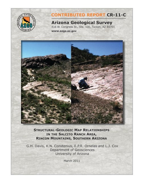
Structural-Geologic Map Relationships in the Salcito Ranch Area,
Structural-Geologic Map Relationships in the Salcito Ranch Area,
Structural-Geologic Map Relationships in the Salcito Ranch Area,
Create successful ePaper yourself
Turn your PDF publications into a flip-book with our unique Google optimized e-Paper software.
CONTRIBUTED REPORT CR-11-C<br />
Arizona <strong>Geologic</strong>al Survey<br />
416 W. Congress St., Ste. 100, Tucson, AZ 85701<br />
www.azgs.az.gov<br />
<strong>Structural</strong>-GeoloGic <strong>Map</strong> relationShipS<br />
<strong>in</strong> <strong>the</strong> <strong>Salcito</strong> ranch area,<br />
r<strong>in</strong>con Mounta<strong>in</strong>S, Sou<strong>the</strong>rn arizona<br />
G.H. Davis, K.N. Constenius, E.P.R. Ornelas and L.J. Cox<br />
Department of Geosciences<br />
University of Arizona<br />
March 2011
Arizona <strong>Geologic</strong>al Survey Contributed Report and Contributed <strong>Map</strong> Series<br />
The Contributed Report and Contributed <strong>Map</strong> Series provide non-AZGS authors with a forum<br />
for publish<strong>in</strong>g documents concern<strong>in</strong>g Arizona geology. While review comments may have been<br />
<strong>in</strong>corporated, this document does not necessarily conform to AZGS technical, editorial, or policy<br />
standards.<br />
The Arizona <strong>Geologic</strong>al Survey issues no warranty, expressed or implied, regard<strong>in</strong>g <strong>the</strong> suitability<br />
of this product for a particular use. Moreover, <strong>the</strong> Arizona <strong>Geologic</strong>al Survey shall not be<br />
liable under any circumstances for any direct, <strong>in</strong>direct, special, <strong>in</strong>cidental, or consequential<br />
damages with respect to claims by users of this product.<br />
The author(s) is solely responsible for <strong>the</strong> data and ideas expressed here<strong>in</strong>.
<strong>Structural</strong>-<strong>Geologic</strong> <strong>Map</strong> <strong>Relationships</strong><br />
<strong>in</strong> <strong>the</strong> <strong>Salcito</strong> <strong>Ranch</strong> <strong>Area</strong>,<br />
R<strong>in</strong>con Mounta<strong>in</strong>s, Sou<strong>the</strong>rn Arizona<br />
G.H. Davis, K.N. Constenius, E.P.R. Ornelas, and L.J. Cox<br />
Department of Geosciences<br />
University of Arizona<br />
Arizona <strong>Geologic</strong>al Survey Contributed Report CR-11-C<br />
Arizona <strong>Geologic</strong>al Survey<br />
416 W. Congress St., Suite 100, Tucson, AZ 85701<br />
March, 2011<br />
Version 1.0<br />
19 p. text and one 11″ x 17″ sheet<br />
www.azgs.az.gov
<strong>Structural</strong>-<strong>Geologic</strong> <strong>Map</strong> <strong>Relationships</strong> <strong>in</strong> <strong>the</strong> <strong>Salcito</strong> <strong>Ranch</strong> <strong>Area</strong>,<br />
R<strong>in</strong>con Mounta<strong>in</strong>s, Sou<strong>the</strong>rn Arizona<br />
Davis, G. H., Constenius, K. N., Ornelas, E. P. R., and Cox, L. J.,<br />
Department of Geosciences, The University of Arizona, Tucson, Arizona 85721<br />
Introduction<br />
Formerly known as <strong>the</strong> Mart<strong>in</strong>ez <strong>Ranch</strong> area (e.g., see Davis, 1975; Davis and<br />
o<strong>the</strong>rs, 2004), <strong>the</strong> <strong>Salcito</strong> <strong>Ranch</strong> area is located at <strong>the</strong> sou<strong>the</strong>astern-most corner of <strong>the</strong><br />
R<strong>in</strong>con Mounta<strong>in</strong>s (Figure 1) and conta<strong>in</strong>s a magnificent display of <strong>the</strong> structural<br />
characteristics of <strong>the</strong> Catal<strong>in</strong>a-R<strong>in</strong>con metamorphic core complex and superposed<br />
Bas<strong>in</strong> and Range fault<strong>in</strong>g. We carried out large-scale mapp<strong>in</strong>g of <strong>the</strong> geology of a part<br />
of this area <strong>in</strong> <strong>the</strong> mid-1990s. This mapp<strong>in</strong>g, which was <strong>in</strong>itiated as a class project,<br />
expanded to become part of a larger study of geologic structures associated with<br />
extensional tectonics <strong>in</strong> a region centered on <strong>the</strong> Catal<strong>in</strong>a and R<strong>in</strong>con Mounta<strong>in</strong>s.<br />
Observations and conclusions based on this larger work were published <strong>in</strong> <strong>the</strong><br />
<strong>Geologic</strong>al Society of America (GSA) Bullet<strong>in</strong> (Davis and o<strong>the</strong>rs, 2004). The GSA<br />
Bullet<strong>in</strong> journal article conta<strong>in</strong>s a simplified, generalized version of <strong>the</strong> more detailed<br />
geological map of <strong>the</strong> <strong>Salcito</strong> <strong>Ranch</strong> area. Fur<strong>the</strong>rmore, practical page limits for <strong>the</strong><br />
article prevented an elaboration on certa<strong>in</strong> descriptive details that may be of <strong>in</strong>terest.<br />
Thus we take this opportunity to release this more comprehensive account<strong>in</strong>g of our<br />
f<strong>in</strong>d<strong>in</strong>gs as an Arizona <strong>Geologic</strong>al Survey Contributed Report, with <strong>the</strong> expectation that<br />
<strong>the</strong> map (Plate 1) and this text will be useful to o<strong>the</strong>rs.<br />
Broad Tectonic <strong>Relationships</strong><br />
Cenozoic extension <strong>in</strong> <strong>the</strong> sou<strong>the</strong>rn part of <strong>the</strong> Bas<strong>in</strong> and Range prov<strong>in</strong>ce <strong>in</strong> <strong>the</strong><br />
western Cordillera is <strong>the</strong> product of two major deformations, dist<strong>in</strong>guishable both <strong>in</strong><br />
3
Figure 1. Top: Index map and show<strong>in</strong>g location of <strong>Salcito</strong> <strong>Ranch</strong> study area.<br />
Bottom: Photograph show<strong>in</strong>g profile of R<strong>in</strong>con Mounta<strong>in</strong>s that parallels Catal<strong>in</strong>a detachment fault. View<br />
look<strong>in</strong>g from sou<strong>the</strong>ast to northwest. <strong>Salcito</strong> <strong>Ranch</strong> study area is located <strong>in</strong> lower left where <strong>the</strong> valley<br />
floor meets <strong>the</strong> lower flank of <strong>the</strong> range. Mart<strong>in</strong>ez <strong>Ranch</strong> normal fault expressed <strong>in</strong> steep mountai-flank<br />
topography on right side of photo.<br />
4
tim<strong>in</strong>g and style. In <strong>the</strong> late Oligocene-middle Miocene, between about 25 and 18 Ma<br />
(Crittenden and o<strong>the</strong>rs, 1980; Davis, 1980, 1981; Dick<strong>in</strong>son, 1991; Force, 1997; Davis<br />
and o<strong>the</strong>rs, 2004; Damon and Shafiqullah, 2006), <strong>the</strong> crust was extended by<br />
deformation accommodated by regional brittle-ductile shear zones, now expressed <strong>in</strong><br />
<strong>the</strong> form of metamorphic core complexes and detachment faults. Then, <strong>in</strong> middle<br />
Miocene-Pliocene time, between ~15 and 5 Ma, <strong>the</strong> crust was extended by deformation<br />
accommodated by normal faults that cross cut and exposed deep levels of <strong>the</strong> core<br />
complex. Rock fabrics and structural trends <strong>in</strong>dicate that local core-complex extension<br />
was NE-SW oriented, <strong>in</strong> contrast to later E-W Bas<strong>in</strong> and Range extension.<br />
The geology and regional tectonic significance of <strong>the</strong> Catal<strong>in</strong>a-R<strong>in</strong>con<br />
metamorphic core complex has received significant attention <strong>in</strong> <strong>the</strong> literature. This work<br />
focuses on late Oligocene-early Miocene shear<strong>in</strong>g and detachment fault<strong>in</strong>g circa 25 to<br />
20 Ma along <strong>the</strong> Catal<strong>in</strong>a brittle/ductile shear zone at <strong>the</strong> sou<strong>the</strong>ast corner of <strong>the</strong> R<strong>in</strong>con<br />
Mounta<strong>in</strong>s. The <strong>in</strong>ferred depth level for <strong>the</strong> most deformed (sheared) rock <strong>in</strong> <strong>the</strong> <strong>Salcito</strong><br />
<strong>Ranch</strong> area is ~10 km (Davis and o<strong>the</strong>rs, 2004). Though exposures of Bas<strong>in</strong> and<br />
Range faults are rare with<strong>in</strong> sou<strong>the</strong>rn Arizona, <strong>the</strong> <strong>Salcito</strong> <strong>Ranch</strong> area conta<strong>in</strong>s one of<br />
<strong>the</strong>se (<strong>the</strong> Mart<strong>in</strong>ez <strong>Ranch</strong> fault), which truncates <strong>the</strong> core-complex fabrics (Drewes,<br />
1974, 1977).<br />
Basic <strong>Map</strong> <strong>Relationships</strong><br />
We mapped <strong>the</strong> <strong>Salcito</strong> <strong>Ranch</strong> area at a scale of 1:6000 (see Plate 1, Figure 2).<br />
It conta<strong>in</strong>s a superb display of metamorphic core complex fabrics and structures.<br />
Mylonites, ultramylonities, and microbrecciated mylonites are very well exposed, and<br />
<strong>the</strong>y are derived from a granitic protolith. Fur<strong>the</strong>rmore, not only is <strong>the</strong> gently dipp<strong>in</strong>g<br />
5
Catal<strong>in</strong>a detachment fault well exposed, it is accompanied by a similarly oriented<br />
“subdetachment” fault ly<strong>in</strong>g a few tens of meters beneath it, and with<strong>in</strong> <strong>the</strong> mylonities<br />
(see Plate 1, Figure 2). A subdetachment fault (named <strong>the</strong> Javal<strong>in</strong>a fault) was<br />
discovered and mapped by Davis (1987) <strong>in</strong> Saguaro National Park (East) along <strong>the</strong><br />
western marg<strong>in</strong> of <strong>the</strong> R<strong>in</strong>con Mounta<strong>in</strong>s. Its actual physical (topographic) expression is<br />
nil, and yet its trace can be placed consistently with<strong>in</strong> several meters because of <strong>the</strong><br />
profound contrasts <strong>in</strong> rock and fabric above and below. In contrast, <strong>the</strong> physical<br />
expression of <strong>the</strong> subdetachment fault with<strong>in</strong> <strong>the</strong> <strong>Salcito</strong> <strong>Ranch</strong> area is magnificent.<br />
Ano<strong>the</strong>r attraction of <strong>the</strong> <strong>Salcito</strong> <strong>Ranch</strong> area is <strong>the</strong> presence of well exposed,<br />
though th<strong>in</strong>ned, upper plate stratigraphy with units rang<strong>in</strong>g from Precambrian to<br />
Miocene <strong>in</strong> age (see Plate 1, Figure 2). Fur<strong>the</strong>rmore, along <strong>the</strong> eastern marg<strong>in</strong> of <strong>the</strong><br />
area <strong>the</strong> Mart<strong>in</strong>ez <strong>Ranch</strong> fault, of Bas<strong>in</strong> and Range orig<strong>in</strong>, truncates <strong>the</strong> upper-plate<br />
stratigraphy, core-complex mylonites, detachment fault, subdetachment fault, and<br />
crystall<strong>in</strong>e protolith. The Mart<strong>in</strong>ez Fault def<strong>in</strong>es <strong>the</strong> steep eastern marg<strong>in</strong> of <strong>the</strong> R<strong>in</strong>con<br />
Mounta<strong>in</strong>s (see Plate 1, Figure 2) (Drewes, 1974, 1977).<br />
___________________________________________________________________<br />
6
Figure 2 . <strong>Geologic</strong> map of <strong>the</strong> <strong>Salcito</strong> <strong>Ranch</strong> locality emphasiz<strong>in</strong>g faults and fault rocks related to <strong>the</strong> Catal<strong>in</strong>a detachment fault. Key to<br />
fault-rock units (also see Table 1) : c, cataclasite, cohesive microbreccia, and breccia derived from mylonite; cl, cataclasite as above only<br />
beneath sub-detachment; g, gouge; m, mylonite, protomylonite and ultramylonite. Protolith for fault rocks is considered to be Eocene<br />
Wilderness Suite Granite (quartz monzonite). Rock unit abbreviations: Yr, P<strong>in</strong>al Schist and Johnny Lyon Granodiorite; Cb, Cambrian Bolsa<br />
Quartzite; Ca, Cambrian Abrigo Formation; Dm, Devonian Mart<strong>in</strong> Formation; Ph, Pennsylvanian Horquilla Limestone; PPe, Pennsylvanian-<br />
Permian Earp Formation; Tp, Oligocene-Miocene Pantano Formation; Tdb, Oligocene-Miocene(?) diabase dikes and sills; Qal, Quaternary<br />
alluvium. <strong>Map</strong> based on field mapp<strong>in</strong>g by <strong>the</strong> authors and compilation of previous mapp<strong>in</strong>g by Drewes 1974, 1977; Lim<strong>in</strong>g, 1974.<br />
7
Catal<strong>in</strong>a Detachment Fault<br />
The Catal<strong>in</strong>a detachment fault is readily traced, east-west, though <strong>the</strong> sou<strong>the</strong>rn<br />
part of <strong>the</strong> map area where it dips 10º to 20º southward. It separates non-mylonitic and<br />
non-cataclasitic upper plate rocks from underly<strong>in</strong>g cataclastic and mylonitic rocks (see<br />
Plate 1, Figure 2). The location of <strong>the</strong> detachment fault is easy to spot, for it separates<br />
non-mylonitic, non-cataclastic upper plate rocks from an underly<strong>in</strong>g ledge of brown or<br />
gray cataclasite and ultracataclasite. In places <strong>the</strong> trace of <strong>the</strong> fault has clear<br />
expression as a smooth surface. At a number of locations directly above <strong>the</strong> Catal<strong>in</strong>a<br />
detachment fault, gouge zones as thick as 10 m are developed at <strong>the</strong> expense of upper<br />
plate rocks. One of <strong>the</strong>se zones of gouge, formed <strong>in</strong> Precambrian granite, conta<strong>in</strong>s<br />
abundant, faceted, fist-size nodules of granite that survived mill<strong>in</strong>g. These are<br />
enveloped <strong>in</strong> a talc-like gouge.<br />
Upper Plate Rocks<br />
Upper plate rocks above <strong>the</strong> detachment fault were mapped by Lim<strong>in</strong>g (1974)<br />
and Drewes (1977), and both Lim<strong>in</strong>g (1974) and Davis (1975) carried out detailed<br />
structural analysis of folds. Although we spent some time mapp<strong>in</strong>g and measur<strong>in</strong>g<br />
structural features with<strong>in</strong> <strong>the</strong> upper plate (see Plate 1), this was not a focus of study.<br />
The upper plate of <strong>the</strong> Catal<strong>in</strong>a detachment fault consists of slices of recognizable<br />
Precambrian, Paleozoic, and Oligocene-Miocene units, most of which are <strong>in</strong>ternally<br />
deformed <strong>in</strong> one way or ano<strong>the</strong>r (Figure 3). Most of <strong>the</strong> slices eventually lose cont<strong>in</strong>uity<br />
along strike, reflect<strong>in</strong>g younger-on-older truncations by fault<strong>in</strong>g (see Plate 1). The<br />
overall dip of <strong>the</strong> upper plate rocks is gently to moderately northward, i.e., back-tilted<br />
toward <strong>the</strong> Catal<strong>in</strong>a detachment fault.<br />
8
Figure 3 . Stratigraphy and fault-rocks of <strong>the</strong> <strong>Salcito</strong> <strong>Ranch</strong> map area.<br />
9
Directly above <strong>the</strong> Catal<strong>in</strong>a detachment fault <strong>in</strong> <strong>the</strong> sou<strong>the</strong>astern part of <strong>the</strong> area<br />
are Precambrian rocks, <strong>in</strong>clud<strong>in</strong>g P<strong>in</strong>al Schist and Johnny Lyon Granodiorite, both<br />
Proterozoic <strong>in</strong> age (see Plate 1). Tectonic slices conta<strong>in</strong><strong>in</strong>g each of <strong>the</strong>se formations<br />
are no greater than 15 m thick. Above <strong>the</strong> tectonic slices of Precambrian rocks are<br />
slices of Paleozoic formations, all <strong>in</strong> <strong>the</strong> correct stratigraphic order but each dim<strong>in</strong>ished<br />
<strong>in</strong> thickness compared to measured thicknesses <strong>in</strong> nearby ranges outside of <strong>the</strong><br />
Catal<strong>in</strong>a-R<strong>in</strong>con metamorphic core complex (see Figure 3). The sequence of<br />
Paleozoic formations, from older to younger, <strong>in</strong>cludes Bolsa Quartzite (middle<br />
Cambrian), Abrigo Formation (upper and middle Cambrian), Mart<strong>in</strong> Formation (Upper<br />
Devonian), Escabrosa Limestone (Mississippian), Horquilla Limestone (upper and<br />
middle Pennsylvanian), and Earp Formation (Lower Permian and upper Pennsylvanian).<br />
The contrast between <strong>the</strong> normal section versus <strong>the</strong> tectonically th<strong>in</strong>ned section reveals<br />
a reduction <strong>in</strong> thickness to 10 to 50 percent of orig<strong>in</strong>al.<br />
Th<strong>in</strong>n<strong>in</strong>g of <strong>the</strong> upper plate has been accomplished by down-to-<strong>the</strong>-southwest<br />
shear<strong>in</strong>g and fault<strong>in</strong>g. As reported by Davis (1975, 1981, 1987) and Lim<strong>in</strong>g (1974), <strong>the</strong><br />
Horquilla Formation is replete with overturned fold structures which verge south to<br />
southwest and which can be <strong>in</strong>terpreted via separation arc methodology as a response<br />
to top to <strong>the</strong> southwest movement. Axial surfaces for <strong>the</strong>se folds are <strong>in</strong>cl<strong>in</strong>ed to <strong>the</strong><br />
north and nor<strong>the</strong>ast. Some faults which are <strong>in</strong> part responsible for th<strong>in</strong>n<strong>in</strong>g of <strong>the</strong> section<br />
are quite mappable with<strong>in</strong> <strong>the</strong> upper plate of <strong>the</strong> Catal<strong>in</strong>a detachment fault.<br />
Oligocene-Miocene sandstones and conglomerates of <strong>the</strong> Pantano Formation<br />
10
also are part of <strong>the</strong> upper plate of <strong>the</strong> Catal<strong>in</strong>a detachment fault, and <strong>the</strong>se rocks rest <strong>in</strong><br />
fault contact upon upper Paleozoic sedimentary rocks, <strong>in</strong> most cases <strong>the</strong><br />
Pennsylvanian-Permian Earp Formation (see Plate 1; Figure 2). These rocks<br />
structurally comprise a tilt panel that strikes east-west and dips north. Deposition of <strong>the</strong><br />
Oligocene-Miocene sequence is thought to have accompanied detachment fault<strong>in</strong>g.<br />
Lower Plate – Cataclastic Rocks<br />
Below <strong>the</strong> Catal<strong>in</strong>a detachment surface are highly <strong>in</strong>durated cataclastic rocks<br />
that comprise <strong>the</strong> brittle part of <strong>the</strong> Catal<strong>in</strong>a brittle-ductile shear zone. Thickness of <strong>the</strong><br />
zone where mylonites are cataclastically overpr<strong>in</strong>ted is ~330 m. The top of <strong>the</strong> zone of<br />
cataclastic rocks was simple to map, because it is demarcated by <strong>the</strong> Catal<strong>in</strong>a<br />
detachment fault (see Plate 1; Figure 2). The immediate footwall physical expression of<br />
<strong>the</strong> Catal<strong>in</strong>a fault is a 1 to 2-m thick highly resistant ledge of cataclasite and<br />
ultracataclasite that commonly has a conspicuous physiographic expression.<br />
Downward at different levels through <strong>the</strong> zone of cataclasitc deformation is a gently<br />
dipp<strong>in</strong>g fault surface that we have called <strong>the</strong> „subdetachment fault‟ (see Plate 1; Figure<br />
2). Over much of <strong>the</strong> east-west length of <strong>the</strong> map area, <strong>the</strong> subdetachment fault is<br />
straightforward to trace; <strong>in</strong> fact locally its surface is so smooth and wide that it looks like<br />
a road surface (Figure 4). But <strong>the</strong>re are subregions with<strong>in</strong> <strong>the</strong> map area where <strong>the</strong><br />
subdetachment fault is more difficult to trace, especially toward <strong>the</strong> east.<br />
11
Figure 4 . Subdetachment photographed look<strong>in</strong>g west with “Breccia Mounta<strong>in</strong>” <strong>in</strong> background.<br />
Subdetachment fault appears as slop<strong>in</strong>g surface <strong>in</strong> fore and middle ground and base of cliff <strong>in</strong><br />
background (left photograph) with<strong>in</strong> zone of cataclastic deformation below Catal<strong>in</strong>a detachment fault <strong>in</strong><br />
Mart<strong>in</strong>ez <strong>Ranch</strong> area. Note geologist for scale <strong>in</strong> both photographs.<br />
Above <strong>the</strong> subdetachment fault <strong>the</strong> cataclastic rocks tend to be relatively coarse<br />
gra<strong>in</strong>ed, and it is possible to recognize <strong>in</strong> hand samples and outcrops <strong>the</strong> protolith <strong>in</strong> <strong>the</strong><br />
form of mylonite and ultramylonite overpr<strong>in</strong>ted by <strong>the</strong> cataclasis. Directly beneath <strong>the</strong><br />
subdetachment fault, over a distance of several meters, <strong>the</strong> rock is reduced to very f<strong>in</strong>e-<br />
gra<strong>in</strong>ed cataclasite and ultracataclasite, <strong>in</strong> a manner resembl<strong>in</strong>g <strong>the</strong> fault rock directly<br />
beneath <strong>the</strong> Catal<strong>in</strong>a detachment surface.<br />
12
Significant variations <strong>in</strong> thickness of <strong>the</strong> cataclastic unit are seen beneath <strong>the</strong><br />
subdetachment fault, and it requires very careful mapp<strong>in</strong>g to accurately p<strong>in</strong> <strong>the</strong> exact<br />
location of <strong>the</strong> base of <strong>the</strong> zone of cataclastic deformation. The base is marked by a<br />
sharp transition, usually over a distance of less than several meters, from cataclastic<br />
deformation to mylonitic deformation, similar to what Davis (1987) recognized <strong>in</strong><br />
Saguaro National Park - East. Yet, from place to place below <strong>the</strong> mapped base of <strong>the</strong><br />
cataclastic unit it is possible to see th<strong>in</strong> zones of cataclastic deformation that are<br />
traceable for many tens of meters. The overall geometry of <strong>the</strong> base of <strong>the</strong> zone of<br />
cataclasis, as viewed <strong>in</strong> map pattern, is systematically corrugated (Spencer, 1999; Plate<br />
1, Figure 2). The pattern is best seen <strong>in</strong> down-plunge view, i.e., southwestward <strong>in</strong> <strong>the</strong><br />
direction of tectonic transport. In this view <strong>the</strong> lower contact resembles a fault-mullioned<br />
surface<br />
Figure 5. Down-plunge view of mapped structural relationships <strong>in</strong> <strong>the</strong> <strong>Salcito</strong> <strong>Ranch</strong> locality show<strong>in</strong>g<br />
mullioned nature of Catal<strong>in</strong>a detachment and subdetachment faults.<br />
13
<strong>Structural</strong> relationships with<strong>in</strong> <strong>the</strong> zone of cataclasis <strong>in</strong>clude <strong>the</strong> presence of<br />
discrete fault surfaces whose l<strong>in</strong>ked geometries resemble extensional duplexes<br />
bound<strong>in</strong>g horses. In this context, <strong>the</strong> subdetachment fault may well represent a "flat"<br />
that fur<strong>the</strong>r down-dip is connected with <strong>the</strong> ma<strong>in</strong> Catal<strong>in</strong>a detachment fault by a ramp.<br />
Mylonites<br />
Beneath <strong>the</strong> zone of cataclasis are beautiful mylonites, and some ultramylonites.<br />
Gently dipp<strong>in</strong>g, <strong>the</strong> mylonitic fabric imparts a ledgy characteristic to <strong>the</strong> landscape<br />
(Figure 6). Protolith is of two varieties: a coarse porphyritic quartz monzonite that may<br />
represent a part of <strong>the</strong> Precambrian Oracle/Ru<strong>in</strong> suite; and a much more volum<strong>in</strong>ous,<br />
f<strong>in</strong>er gra<strong>in</strong>ed, muscovite granite, that may represent a part of <strong>the</strong> Laramide Wilderness<br />
Granite suite (Keith and o<strong>the</strong>rs, 1980). Streaky m<strong>in</strong>eral l<strong>in</strong>eation pervades all of <strong>the</strong><br />
mylonites and ultramylonites, and it plunges very gently S50ºW. The ubiquitous sense<br />
of shear <strong>in</strong>dicator <strong>in</strong> <strong>the</strong> muscovite granite mylonite is fish-flash (Davis and Reynolds,<br />
1996, p. 523), and everywhere (with one special exception yet to be discussed) reveals<br />
a top-to-<strong>the</strong>-southwest sense of shear. In mylonite derived from Precambrian<br />
Oracle/Ru<strong>in</strong> suite, <strong>the</strong> top-to-<strong>the</strong>-southwest shear sense is aga<strong>in</strong> apparent, disclosed<br />
through S-C fabrics.<br />
The transformation of granite protolith to mylonite and ultramylonite, and to<br />
cataclasite and ultracataclasite, is beautifully recorded <strong>in</strong> microstructures <strong>in</strong> th<strong>in</strong> section.<br />
We have described this transition <strong>in</strong> Davis and o<strong>the</strong>rs (1998). To <strong>the</strong> north of <strong>the</strong> map<br />
area, we would expect that <strong>the</strong> mylonite gives way downward to nonmylonitic granitic<br />
protolith. In fact, even with<strong>in</strong> <strong>the</strong> map area we see small pockets of nonmylonitic<br />
protolith where <strong>the</strong> orig<strong>in</strong>al granites escaped complete mylonitization. We imag<strong>in</strong>e <strong>in</strong><br />
14
<strong>the</strong> transition between (totally) mylonitic rocks above and (totally) unsheared protolith<br />
below that <strong>in</strong>dividual shear zones are anastomos<strong>in</strong>g or <strong>in</strong>osculat<strong>in</strong>g and that <strong>the</strong>se<br />
zones locally envelope “lenses” of protolith that were bypassed dur<strong>in</strong>g <strong>the</strong> shear<strong>in</strong>g.<br />
Figure 6. View of <strong>Salcito</strong> <strong>Ranch</strong> map area look<strong>in</strong>g from north of Breccia Mounta<strong>in</strong> east-sou<strong>the</strong>ast toward<br />
small hill capped by Pennsylvanian Horquilla Limestone. Gouge zone of ma<strong>in</strong> Catal<strong>in</strong>a detachment fault<br />
and Camrbrian Abrigo Formation seen as lighter colored swath at base of hill. Foreground comprised of<br />
mylonite and protomylonite <strong>in</strong> footwall of detachment fault. Ridge <strong>in</strong> middle distance is cataclasite rest<strong>in</strong>g<br />
on subdetachment fault.<br />
Mart<strong>in</strong>ez <strong>Ranch</strong> Fault<br />
Along <strong>the</strong> eastern marg<strong>in</strong> of <strong>the</strong> map area <strong>the</strong> upper plate rocks, <strong>the</strong> Catal<strong>in</strong>a<br />
detachment fault, <strong>the</strong> cataclastic rocks, and <strong>the</strong> mylonitic rocks are truncated and offset<br />
by <strong>the</strong> Mart<strong>in</strong>ez <strong>Ranch</strong> fault. The Mart<strong>in</strong>ez <strong>Ranch</strong> fault, like <strong>the</strong> Pirate fault, is a Bas<strong>in</strong><br />
and Range fault with several kilometers of down-to-<strong>the</strong>-east normal displacement<br />
15
(Drewes, 1974, 1977). The Mart<strong>in</strong>ez <strong>Ranch</strong> fault demarcates <strong>the</strong> eastern marg<strong>in</strong> of <strong>the</strong><br />
R<strong>in</strong>con Mounta<strong>in</strong>s, strik<strong>in</strong>g N-S and dipp<strong>in</strong>g 70ºE.<br />
Dick<strong>in</strong>son (1998) mapped <strong>the</strong> full extent of <strong>the</strong> Mart<strong>in</strong>ez <strong>Ranch</strong> fault at <strong>the</strong><br />
1:24,000 scale along a 30 km stretch from <strong>the</strong> I-10 freeway to <strong>the</strong> eastern edge of Mica<br />
Mounta<strong>in</strong>. The Mart<strong>in</strong>ez <strong>Ranch</strong> fault strikes essentially north-south, and dips eastward.<br />
In <strong>the</strong> study area, where <strong>the</strong> Mart<strong>in</strong>ez <strong>Ranch</strong> fault cuts and displaces <strong>the</strong> Catal<strong>in</strong>a<br />
detachment fault, it dips 55º east. At a much higher structural level, Dick<strong>in</strong>son (1998)<br />
notes that it dips more steeply, at ~70º east. The locale where this is observed is along<br />
Interstate10, where Neogene gravels are down faulted aga<strong>in</strong>st Lower Cretaceous<br />
Bisbee Group rocks. Offset along <strong>the</strong> Mart<strong>in</strong>ez <strong>Ranch</strong> fault <strong>in</strong> <strong>the</strong> study area is<br />
estimated to be ~ 2 km (Dick<strong>in</strong>son, 1998). Separat<strong>in</strong>g <strong>the</strong> R<strong>in</strong>con Mounta<strong>in</strong>s and <strong>the</strong><br />
Little R<strong>in</strong>con Mounta<strong>in</strong>s is a half graben of bas<strong>in</strong> fill, bordered on <strong>the</strong> west by <strong>the</strong><br />
Mart<strong>in</strong>ez <strong>Ranch</strong> fault (Dick<strong>in</strong>son, 1998)<br />
The map trace can be tightly p<strong>in</strong>ned <strong>in</strong> <strong>the</strong> sou<strong>the</strong>astern corner of our map area<br />
(see Plate 1), where upper plate sandstones and limestones (transformed to quartzite<br />
and marble) are <strong>in</strong> sharp contact with cataclasite or mylonite to <strong>the</strong> west. Both <strong>the</strong><br />
quartzite and marble strike parallel to <strong>the</strong> trace of <strong>the</strong> Mart<strong>in</strong>ez <strong>Ranch</strong> fault, and dip very<br />
steeply eastward. The resistant nature of <strong>the</strong> quartzite calls attention to <strong>the</strong> location of<br />
<strong>the</strong> fault, for <strong>the</strong> quartzite forms a tall strike wall, locally highly brecciated, right along <strong>the</strong><br />
contact.<br />
Our mapp<strong>in</strong>g reveals that mylonitic foliation and several structural geologic<br />
contacts are broadly dragged <strong>in</strong>to <strong>the</strong> Mart<strong>in</strong>ez <strong>Ranch</strong> fault (Plate 1, Figure 2). Note<br />
<strong>the</strong> change <strong>in</strong> dip of <strong>the</strong> subdetactment from its characteristic southwest trend to<br />
16
sou<strong>the</strong>ast and east-sou<strong>the</strong>ast <strong>in</strong> proximity to <strong>the</strong> Mart<strong>in</strong>ez <strong>Ranch</strong> fault. Mylonite <strong>in</strong> <strong>the</strong><br />
immediate footwall is locally strongly folded to a steep easterly dip. It is along this zone<br />
that fish-flash sense-of-shear <strong>in</strong>dicators are high-angle reverse, east block up.<br />
Unfold<strong>in</strong>g <strong>the</strong> folded mylonites restores <strong>the</strong> pre-Mart<strong>in</strong>ez <strong>Ranch</strong> fault top-to-<strong>the</strong>-<br />
southwest sense of shear. Also along this zone are marble and quartzite mylonites<br />
overpr<strong>in</strong>ted by tectonic breccia related to movement on <strong>the</strong> Mart<strong>in</strong>ez <strong>Ranch</strong> Fault.<br />
General Interpretation<br />
Consistent with <strong>the</strong> broader geologic relationships <strong>in</strong> <strong>the</strong> R<strong>in</strong>con Mounta<strong>in</strong> region,<br />
<strong>the</strong> Catal<strong>in</strong>a brittle-ductile shear zone accommodated at least 15 km of top-to-<strong>the</strong>-<br />
southwest displacement. The extensional deformation expressed <strong>in</strong> this shear<strong>in</strong>g<br />
raised deep granites and mylonites upward to structural locations adjacent to Miocene<br />
bas<strong>in</strong> fill, which is a stratigraphic separation of at least 8 km. Then, relative to hang<strong>in</strong>g<br />
wall sedimentary rocks, <strong>the</strong> mylonites and granites and cataclasites were raised ano<strong>the</strong>r<br />
2 to 3 km (or more) by <strong>the</strong> Bas<strong>in</strong> and Range Mart<strong>in</strong>ez fault event (Davis and o<strong>the</strong>rs,<br />
2004). Deformation mechanisms range from ductile to semi-brittle to brittle, reflect<strong>in</strong>g<br />
<strong>the</strong> progressive deformation by shear<strong>in</strong>g <strong>in</strong> environments that ranged from high to low<br />
temperature/pressure over <strong>the</strong> course of tectonic denudation. Deepest level shear is<br />
represented by mylonites and ultramylonites. Shallowest levels of fault<strong>in</strong>g and shear<strong>in</strong>g<br />
are represented by upper plate gouge zones. Intermediate levels of fault<strong>in</strong>g and brittle<br />
shear<strong>in</strong>g are represented by cataclasites whose fabrics overpr<strong>in</strong>t mylonitic and<br />
ultramylonitic fabrics. We <strong>in</strong>terpret discrete fault surfaces with<strong>in</strong> <strong>the</strong> zones of cataclasis<br />
to represent some of <strong>the</strong> youngest faults; <strong>the</strong>y survived because <strong>the</strong>y were not<br />
17
<strong>the</strong>mselves overpr<strong>in</strong>ted by yet younger fault<strong>in</strong>g and brecciation. The best such example<br />
is <strong>the</strong> subdetachment fault.<br />
References<br />
Crittenden, M.D., Jr., Coney, P.J., and Davis, G.H., 1980, Cordilleran metamorphic core<br />
complexes: <strong>Geologic</strong>al Society of America Memoir 153, 18 articles, 490 pp.<br />
Damon, P.E., and Shafiqullah, M., 2006, K-Ar dates of fault rocks along <strong>the</strong> Catal<strong>in</strong>a<br />
detachment fault, Tanque Verde Ridge, R<strong>in</strong>con Mounta<strong>in</strong>s, Arizona: Arizona<br />
<strong>Geologic</strong>al Survey Contributed Report CR-06-A, 18 p.<br />
Davis, G.H., 1975, Gravity-<strong>in</strong>duced fold<strong>in</strong>g off a gneiss dome complex, R<strong>in</strong>con<br />
Mounta<strong>in</strong>s, Arizona: <strong>Geologic</strong>al Society of America Bullet<strong>in</strong>, v. 86, pp. 979-990.<br />
Davis, G. H., 1980, <strong>Structural</strong> characteristics of metamorphic core complexes, sou<strong>the</strong>rn<br />
Arizona, <strong>in</strong> M.D. Critenden, Jr., P. J. Coney, and G. H. Davis (eds.), Cordilleran<br />
metamorphic core complexes: <strong>Geologic</strong>al Society of America Memoir 153, p. 35-<br />
77.<br />
Davis, G.H., 1981, Regional stra<strong>in</strong> of <strong>the</strong> superposed deformations <strong>in</strong> sou<strong>the</strong>astern<br />
Arizona and <strong>the</strong> eastern Great Bas<strong>in</strong> <strong>in</strong> Dick<strong>in</strong>son, W.R., and Payne, W.D. (eds.),<br />
Relation of tectonics to ore deposits <strong>in</strong> <strong>the</strong> sou<strong>the</strong>rn Cordillera: Arizona<br />
<strong>Geologic</strong>al Society Digest, v. 14, pp. 155-172.<br />
Davis, G.H., 1983, Shear-zone model for <strong>the</strong> orig<strong>in</strong> of metamorphic core complexes:<br />
Geology, v. 2, pp. 342-347.<br />
Davis, G.H., 1987, A shear-zone model for <strong>the</strong> structural evolution of metamorphic core<br />
complexes <strong>in</strong> sou<strong>the</strong>astern Arizona, <strong>in</strong> Coward, M.P., Dewey, J.F., and Hancock,<br />
P.L. (eds.), Cont<strong>in</strong>ental Extensional Tectonics: <strong>Geologic</strong>al Society of London<br />
Special Publication No. 28, p. 247-266.<br />
Davis, G.H., and Hardy, J., 1981, The Eagle Pass detachment sou<strong>the</strong>astern Arizona:<br />
Product of mid-Miocene listric normal fault<strong>in</strong>g <strong>in</strong> <strong>the</strong> sou<strong>the</strong>rn Bas<strong>in</strong> and Range:<br />
<strong>Geologic</strong>al Society of America Bullet<strong>in</strong>, Part I, v. 92, p. 749-762.<br />
Davis, G.H., 1987, Saguaro National Monument Arizona: Outstand<strong>in</strong>g display of <strong>the</strong><br />
structural characteristics of metamorphic core complexes: <strong>Geologic</strong>al Society of<br />
America Centennial Field Guide -- Cordilleran Section, pp. 35-40.<br />
Davis, G.H. and Reynolds, S.J., 1996, <strong>Structural</strong> geology of rocks and regions (2nd<br />
edition): John Wiley and Sons, New York, 776 p.<br />
Davis, G.H., Cox, L. J., Ornelas, R., Constenius, K. N., Johnson, J. A., Kong, F.,<br />
Bedford, J. M., Pecha, M., and Rodriguez, E. P., 1998, Protomylonite, augen<br />
mylonite, mylonite, protocataclasite, and cataclasite <strong>in</strong> granitic footwall of a<br />
detachment fault, <strong>in</strong> Snoke, A.W., Tullis, J.A., and Todd, V.R., eds., Fault-related<br />
rocks: a photographic atlas: Pr<strong>in</strong>ceton University Press, Pr<strong>in</strong>ceton, p. 160-163.<br />
Davis, G. H., Constenius, K. N., Dick<strong>in</strong>son, W. R., and Rodriguez, E. P., 2004, Fault and<br />
fault-rock characteristics associated with Neogene extension <strong>in</strong> <strong>the</strong> Catal<strong>in</strong>a-<br />
R<strong>in</strong>con region of sou<strong>the</strong>astern Arizona: <strong>Geologic</strong>al Society of America Bullet<strong>in</strong>, v.<br />
116, no. 1/2, p. 128-141.<br />
18
Dick<strong>in</strong>son, W. R., 1988, <strong>Geologic</strong> relations of Mart<strong>in</strong>ez <strong>Ranch</strong> fault and Happy Valley<br />
Neogene Bas<strong>in</strong>, east flank of R<strong>in</strong>con Mounta<strong>in</strong>s, Pima County, Arizona: Arizona<br />
<strong>Geologic</strong>al Survey Contributed <strong>Map</strong> CM-98-B, 16p., 1 plate.<br />
Dick<strong>in</strong>son, W. R., 1991, Tectonic sett<strong>in</strong>g of faulted Tertiary strata associated with <strong>the</strong><br />
Catal<strong>in</strong>a core complex <strong>in</strong> sou<strong>the</strong>rn Arizona: <strong>Geologic</strong>al Society of America<br />
Special Paper 264, 106p.<br />
Dick<strong>in</strong>son, W. R., 1998, Facies map of post-mid-Miocene Quiburis Formation, San<br />
Pedro Trough, P<strong>in</strong>al, Pima, Graham, and Cochise Counties, Arizona: Arizona<br />
<strong>Geologic</strong>al Survey Contributed <strong>Map</strong> CM-98-A, 10 sheets, 1:24,000.<br />
Drewes, H. D., 1974, <strong>Geologic</strong> map and sections of <strong>the</strong> Happy Valley Quadrangle,<br />
Cochise County, Arizona: U. S. <strong>Geologic</strong>al Survey Miscellaneous Investigations<br />
Series <strong>Map</strong> I-832, scale 1:48,000.<br />
Drewes, H. D., 1977, <strong>Geologic</strong> map and sections of <strong>the</strong> R<strong>in</strong>con Valley quadrangle, Pima<br />
County, Arizona: U. S. <strong>Geologic</strong>al Survey Miscellaneous Investigations Series<br />
<strong>Map</strong> I-997, scale 1:48,000.<br />
Force, E. R., 1997, Geology and m<strong>in</strong>eral resources of <strong>the</strong> Santa Catal<strong>in</strong>a Mounta<strong>in</strong>s,<br />
sou<strong>the</strong>astern Arizona: A cross-sectional approach: Tucson, University of<br />
Arizona Center for M<strong>in</strong>eral Resources Monographs <strong>in</strong> M<strong>in</strong>eral Resource Science<br />
1, 135p.<br />
Keith, S. B., Reynolds, S. J., Damon, P. E., Shafiqullah, M., Liv<strong>in</strong>gston, D. E., and<br />
Pushkar, P. D., 1980, Evidence for multiple <strong>in</strong>trusion and deformation with<strong>in</strong><br />
<strong>the</strong>Santa Catal<strong>in</strong>a-R<strong>in</strong>con-Tortolita crystall<strong>in</strong>e complex, sou<strong>the</strong>astern Arizona, <strong>in</strong><br />
Crittenden, M. D., Jr., Coney, P. J., and Davis, G. H., eds, Cordilleran<br />
metamorphic core complexes: <strong>Geologic</strong>al Society of America Memoir 153, p.<br />
217-267.<br />
Lim<strong>in</strong>g, R. B., 1974, Geology and k<strong>in</strong>ematic analysis of deformation <strong>in</strong> <strong>the</strong> Mart<strong>in</strong>ez<br />
<strong>Ranch</strong> area, Pima County, Arizona [M.S. <strong>the</strong>sis]: Tucson, University of Arizona,<br />
86 p.<br />
Spencer, J. E., 1999, <strong>Geologic</strong> cont<strong>in</strong>uous cast<strong>in</strong>g below cont<strong>in</strong>ental and deep-sea<br />
detachment faults and at <strong>the</strong> striated extrusion of Sacsayhuaman, Peru:<br />
Geology, v. 27, p. 327-330.<br />
19


