Geologic Map of the Clark Ranch - AZGS Document Repository
Geologic Map of the Clark Ranch - AZGS Document Repository
Geologic Map of the Clark Ranch - AZGS Document Repository

You also want an ePaper? Increase the reach of your titles
YUMPU automatically turns print PDFs into web optimized ePapers that Google loves.
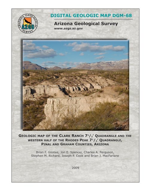
DiGitAl GeoloGic MAp DGM-68<br />
Arizona <strong>Geologic</strong>al Survey<br />
www.azgs.az.gov<br />
GeoloGic map <strong>of</strong> <strong>the</strong> clark ranch 7 1 /2’ QuadranGle and <strong>the</strong><br />
western half <strong>of</strong> <strong>the</strong> rhodes peak 7 1 /2’ QuadranGle,<br />
pinal and Graham counties, arizona<br />
Brian F. Gootee, Jon E. Spencer, Charles A. Ferguson,<br />
Stephen M. Richard, Joseph P. Cook and Brian J. MacFarlane<br />
2009
<strong>Geologic</strong> <strong>Map</strong> <strong>of</strong> <strong>the</strong> <strong>Clark</strong> <strong>Ranch</strong> 7½' Quadrangle and<br />
<strong>the</strong> western half <strong>of</strong> <strong>the</strong> Rhodes Peak 7½' Quadrangle,<br />
Pinal and Graham Counties, Arizona<br />
by<br />
Brian F. Gootee, Jon E. Spencer, Charles A. Ferguson,<br />
Stephen M. Richard, Joseph P. Cook, and Bryan MacFarlane<br />
Arizona <strong>Geologic</strong>al Survey Digital <strong>Geologic</strong> <strong>Map</strong> DGM-68<br />
version 1.0<br />
August, 2009<br />
Scale 1:24,000 (1 sheet, with text)<br />
Arizona <strong>Geologic</strong>al Survey<br />
416 W. Congress St., #100, Tucson, Arizona 85701<br />
This geologic map was funded in part by <strong>the</strong> USGS National Cooperative<br />
<strong>Geologic</strong> <strong>Map</strong>ping Program, award no. 07HQAG0110. The views and<br />
conclusions contained in this document are those <strong>of</strong> <strong>the</strong> authors and should not<br />
be interpreted as necessarily representing <strong>the</strong> <strong>of</strong>ficial policies, ei<strong>the</strong>r expressed<br />
or implied, <strong>of</strong> <strong>the</strong> U.S. Government.
INTRODUCTION<br />
<strong>Geologic</strong> <strong>Map</strong> <strong>of</strong> <strong>the</strong> <strong>Clark</strong> <strong>Ranch</strong> 7½' Quadrangle and<br />
<strong>the</strong> western half <strong>of</strong> <strong>the</strong> Rhodes Peak 7½' Quadrangle,<br />
Pinal and Graham Counties, Arizona<br />
by<br />
Brian F. Gootee, Jon E. Spencer, Charles A. Ferguson,<br />
Stephen M. Richard, Joseph P. Cook, and Bryan MacFarlane<br />
The <strong>Clark</strong> <strong>Ranch</strong> 7½' Quadrangle and <strong>the</strong> western half <strong>of</strong> <strong>the</strong> Rhodes Peak 7½' Quadrangle include part <strong>of</strong><br />
<strong>the</strong> San Pedro River, flanking valley fill, and bedrock on <strong>the</strong> east side <strong>of</strong> <strong>the</strong> valley that forms part <strong>of</strong> <strong>the</strong><br />
Galiuro Mountains range front (Fig. 1). Production <strong>of</strong> this new geologic map continues <strong>the</strong> Arizona<br />
<strong>Geologic</strong>al Survey mapping program <strong>of</strong> <strong>the</strong> San Pedro River valley. This mapping was done under <strong>the</strong><br />
joint State-Federal STATEMAP program, as specified in <strong>the</strong> National <strong>Geologic</strong> <strong>Map</strong>ping Act <strong>of</strong> 1992,<br />
and was jointly funded by <strong>the</strong> Arizona <strong>Geologic</strong>al Survey and <strong>the</strong> U.S. <strong>Geologic</strong>al Survey under<br />
STATEMAP Program Contract award number 07HQAG0110. <strong>Map</strong>ping was compiled digitally using<br />
ESRI ArcGIS s<strong>of</strong>tware. Parts <strong>of</strong> <strong>the</strong> <strong>Clark</strong> <strong>Ranch</strong> and Rhodes Peak Quadrangles were mapped previously<br />
by Creasey et al. (1961), Dickinson (1987, 1991, 1998), Marsh (2001), and Skotnicki (undated)). Studies<br />
<strong>of</strong> Cenozoic sedimentary strata in <strong>the</strong> <strong>Clark</strong> <strong>Ranch</strong> 7½' Quadrangle include those by Blake (1902, 1903),<br />
Bollaert (1952, 1953, 1962), Heindl (1963), Agenbroad (1967), Krieger et al. (1974), Ladd (1975),<br />
Scarborough and Wilt (1979), Utley (1980), Lindsay (1984), Dickinson (1988), Shenk (1990), and<br />
Dickinson (2003). The regional geochronology <strong>of</strong> <strong>the</strong> Oligo-Miocene volcanic rocks is outlined by<br />
Dickinson and Shafiqullah (1989). Studies <strong>of</strong> <strong>the</strong> Copper Canyon mineral district include those by Marsh<br />
(2001), Creasey et al., (1981), Guthrie (1994), Guthrie and Moore (1978), Hausen et al. (1988), Walker<br />
(1979) and Eichenlaub and Seedorff (2008).<br />
<strong>Geologic</strong> Setting<br />
The map area is located within <strong>the</strong> San Pedro River valley in <strong>the</strong> Basin and Range Province <strong>of</strong><br />
sou<strong>the</strong>astern Arizona. Most <strong>of</strong> <strong>the</strong> <strong>Clark</strong> <strong>Ranch</strong> Quadrangle is underlain by late Cenozoic, valley-filling<br />
clastic and chemical sedimentary strata <strong>of</strong> <strong>the</strong> Quiburis Formation (Dickinson, 1998, 2003). These<br />
consist mostly <strong>of</strong> sandstone and conglomerate in alluvial fans that flank <strong>the</strong> valley and an axial lacustrine<br />
facies that includes a diatomite sub-facies. Well preserved ash deposits are found throughout stratigraphic<br />
intervals in <strong>the</strong> lacustrine facies and diatomite sub-facies. Each facies <strong>of</strong> <strong>the</strong> Quiburis Formation have an<br />
interfingering relationship. The uppermost lacustrine facies are overlain by distal alluvial fan (sandflat)<br />
and conglomeratic facies, respectively, thus representing progradational <strong>of</strong> alluvial fans over <strong>the</strong><br />
lacustrine strata.<br />
Integration <strong>of</strong> <strong>the</strong> San Pedro drainage system with <strong>the</strong> Gila River terminated basin-filling sedimentation<br />
and began a period <strong>of</strong> incision that continues to <strong>the</strong> present (Dickinson, 2003). Geomorphic modification<br />
<strong>of</strong> <strong>the</strong> valley during incision has produced a complex Quaternary landscape with many Quaternary units<br />
reflecting different periods <strong>of</strong> Quaternary aggradation and incision.<br />
1
<strong>Geologic</strong> Hazards<br />
<strong>Geologic</strong> hazards within <strong>the</strong> mapping area include flooding in <strong>the</strong> San Pedro River channel, flash flooding<br />
from tributaries to <strong>the</strong> San Pedro River and groundwater contamination from mine tailings. Flooding in<br />
<strong>the</strong> San Pedro River corridor is constricted to a valley floor delineated on both sides by a bluff<br />
approximately 10 to 15 meters above Holocene river and tributary alluvial fan deposits. Tributaries are<br />
capable <strong>of</strong> transporting coarse sand and gravel and occasionally cobbles in response to run<strong>of</strong>f from flash<br />
floods following intense thunderstorms. Contamination from mine tailings presents a possible long-term<br />
hazard to groundwater and potentially gaining portions to <strong>the</strong> San Pedro River.<br />
O<strong>the</strong>r geologic hazards include soil expansion, soil creep, small landslides and dust. Soil expansion can<br />
occur where <strong>the</strong>re is substantial soil clay accumulation, commonly associated with Qi2 and Qi3 terrace<br />
deposits. Soil creep can occur on gentle to steep slopes associated with silt, mud or clay widespread in <strong>the</strong><br />
Quiburis playa and lacustrine facies. The playa and lacustrine facies <strong>of</strong> <strong>the</strong> Quiburis Formation contain<br />
substantial amounts <strong>of</strong> gypsum, which is quite soluble. Wetting <strong>of</strong> <strong>the</strong>se deposits may result in gypsum<br />
dissolution and soil compaction or collapse. Small landslides can occur in areas where cliffs <strong>of</strong> loose<br />
material are undercut by erosion. An uncommon geologic hazard unique to <strong>the</strong> mapping area may include<br />
silicosis due to prolonged exposure to silica-rich dust generated from diatomite and volcanic ash beds<br />
common in <strong>the</strong> diatomite sub-facies <strong>of</strong> Quiburis formation. For more information on <strong>the</strong> character and<br />
mitigation <strong>of</strong> many <strong>of</strong> <strong>the</strong> aforementioned geologic hazards, see <strong>AZGS</strong> Down-to-Earth series No. 13<br />
(Harris and Pearthree, 2002).<br />
REFERENCES CITED<br />
Agenbroad, L.D., 1967, Cenozoic stratigraphy and paleo-hydrology <strong>of</strong> <strong>the</strong> Redington-San Manuel area,<br />
San Pedro Valley, Arizona: Tucson, University <strong>of</strong> Arizona, unpublished Ph.D. Dissertation, 119p.<br />
Blake, W.P., 1902a, Lake Quiburis, an ancient Pliocene lake in Arizona: University <strong>of</strong> Arizona Monthly,<br />
v.4, no.14, p. 107-108.<br />
Blake, W.P., 1902b, Lake Quiburis, an ancient Pliocene Lake in Arizona (abstract): Science, new series,<br />
v.15, p. 413-414.<br />
Blake, W.P., 1902c, Diatom-earth in Arizona: American Institute <strong>of</strong> Mining Engineers Transactions, v.33,<br />
p. 38-45.<br />
Blake, W.P., 1903, Arizona diatomites: Wisconsin Academy <strong>of</strong> Science Transactions, v.14, part 1, p. 107-<br />
111.<br />
Bollaert, A.R., 1952, A preliminary crude evaluation <strong>of</strong> <strong>the</strong> “White Cliffs” diatomite deposit, Mammoth,<br />
Arizona: unpublished private report, 23 p., appendices: from library <strong>of</strong> Arizona <strong>Geologic</strong>al Survey.<br />
Bollaert, A.R., 1953, A crude survey <strong>of</strong> <strong>the</strong> “White Cliffs” diatomite deposit, Mammoth, Arizona:<br />
unpublished private report, 25 p., appendices, plates: from library <strong>of</strong> Arizona <strong>Geologic</strong>al Survey.<br />
Bollaert, A.R., 1962, An evaluation <strong>of</strong> <strong>the</strong> Mammoth, Arizona diatomaceous earth deposit: unpublished<br />
private report, 49p., appendices, plates: from library <strong>of</strong> Arizona <strong>Geologic</strong>al Survey.<br />
Creasey, S.C., Jackson, E.D., and Gulbrandson, R.A., 1961, Reconnaissance geologic map <strong>of</strong> parts <strong>of</strong> <strong>the</strong><br />
San Pedro and Aravaipa valleys, south-central Arizona: U.S. <strong>Geologic</strong>al Survey Mineral<br />
Investigations Field Studies <strong>Map</strong> MF-238, scale 1:125,000.<br />
Creasey, S.C., Jinks, J.E., Williams, F.E., and Meeves, H.C., 1981, Mineral resources <strong>of</strong> <strong>the</strong> Galiuro<br />
Wilderness and contiguous Fur<strong>the</strong>r Planning Areas, Arizona: U.S. <strong>Geologic</strong>al Survey Bulletin 1490,<br />
94 p., 2 sheets, scale 1:62,500.<br />
Dickinson, W.R., 1987, General geologic map <strong>of</strong> Catalina core complex and San Pedro trough, Arizona:<br />
Arizona <strong>Geologic</strong>al Survey Miscellaneous <strong>Map</strong> MM-87-A, 15 sheets, scale 1:62,500, with 18 p. text.<br />
2
Dickinson, W.R., 1991, Tectonic setting <strong>of</strong> faulted Tertiary strata associated with <strong>the</strong> Catalina core complex<br />
in sou<strong>the</strong>rn Arizona: <strong>Geologic</strong>al Society <strong>of</strong> America, Special Paper 264, 106 p.<br />
Dickinson, W.R., and Shafiqullah, M., 1989, K-Ar and F-T ages for syntectonic mid-Tertiary<br />
volcanosedimentary sequences associated with <strong>the</strong> Catalina core complex and San Pedro trough in<br />
sou<strong>the</strong>rn Arizona: Isochron/West, n. 52, p. 15-27.<br />
Dickinson, W.R., 1998, Facies map <strong>of</strong> post-mid-Miocene Quiburis Formation, San Pedro trough, Pinal,<br />
Pima, Gila, Graham, and Cochise Counties, Arizona: Arizona <strong>Geologic</strong>al Survey Contributed <strong>Map</strong><br />
CM-98-A, Ten sheets, scale 1:24,000, with 6 p. text.<br />
Dickinson, W.R., 2003, Depositional facies <strong>of</strong> <strong>the</strong> Quiburis Formation, basin fill <strong>of</strong> <strong>the</strong> San Pedro trough,<br />
sou<strong>the</strong>astern Arizona Basin and Range Province, in Raynolds, R.G., and Flores, R.M., eds., 2003,<br />
Cenozoic systems <strong>of</strong> <strong>the</strong> Rocky Mountain region: Denver, Rocky Mountain Section, SEPM (Society<br />
for Sedimentary Geology), p. 157-181.<br />
Eichenlaub, A.B., and Seedorff, E., 2008, Exploration <strong>of</strong> genetic links between breccia pipes and<br />
porphyry copper deposits in a Laramide hydro<strong>the</strong>rmal system, Sombrero Butte, Pinal County,<br />
Arizona, USA, in Spencer, J.E., and Titley, S.R., eds., Ores and orogenesis: Circum-Pacific tectonics,<br />
geologic evolution, and ore deposits: Arizona <strong>Geologic</strong>al Society Digest 22, p. 591-599.<br />
Guthrie, J.O., and Moore, D.G., 1978, The geology <strong>of</strong> <strong>the</strong> Copper Creek area, Bunker Hill mining district,<br />
Galiuro Mountains, Arizona, in Jenney, J.P., and Hauck, H.R., eds., Proceedings <strong>of</strong> <strong>the</strong> Porphyry<br />
Copper Symposium, Tucson, Ariz., March 18-20, 1976: Arizona <strong>Geologic</strong>al Society Digest, v. 11, p.<br />
25-31.<br />
Guthrie, J.O., 1994, Trip 8: Copper Creek, Tiger, San Manuel open pit, Kalamazoo, October 1994 -<br />
Bootprints Along <strong>the</strong> Cordillera, Porphyry Copper Deposits from Alaska to Chile: Arizona<br />
<strong>Geologic</strong>al Society Field Trip Guidebook, [24] p.<br />
Harris, R.C., and Pearthree, P.A., 2002, A Home Buyer’s Guide to <strong>Geologic</strong> Hazards in Arizona, <strong>AZGS</strong><br />
DTE-13, 36p.<br />
Hausen, D.M., Guthrie, J.O., and Thomas, L.A., 1988, Alteration study <strong>of</strong> <strong>the</strong> American Eagle breccia<br />
pipe and associated copper porphyry occurrence, Copper Creek, Arizona: Minerals, Metals, and<br />
Materials Society, Process Mineralogy, v. 8, p. 109-128.<br />
Heindl, L.A., 1963, Cenozoic geology in <strong>the</strong> Mammoth area, Pinal County, Arizona: U.S. <strong>Geologic</strong>al<br />
Survey Bulletin 1141-E, 41p., plates.<br />
Krieger, M.H., Cornwall, H.R., and Banks, N.G., 1974, The Big Dome Formation and revised Tertiary<br />
stratigraphy in <strong>the</strong> Ray-San Manuel area, Arizona: U.S. <strong>Geologic</strong>al Survey Bulletin 1394-A, p. 54-64.<br />
Ladd, T.W., 1975, Stratigraphy and petrology <strong>of</strong> <strong>the</strong> Quiburis Formation near Mammoth, Pinal County,<br />
Arizona: Tucson, University <strong>of</strong> Arizona, unpublished M.S. Thesis, 103p, 1 plate.<br />
Lindsay, E.H., 1984, Windows to <strong>the</strong> past: fossils <strong>of</strong> <strong>the</strong> San Pedro Valley: Arizona Bureau <strong>of</strong> Geology<br />
and Mineral Technology Fieldnotes, v.14, no.4, p.1-9, 12.<br />
Marsh, T.M., 2001, <strong>Geologic</strong> field guide to <strong>the</strong> Copper Creek district: Arizona <strong>Geologic</strong>al Society, Field-<br />
Trip Guidebook, February 24, 2001, 26 p.<br />
Scarborough, R.B., and Wilt, J.C., 1979, A study <strong>of</strong> uranium favorability <strong>of</strong> Cenozoic sedimentary rocks,<br />
Basin and Range province, Arizona - Part I. General geology and chronology <strong>of</strong> pre-late Miocene<br />
Cenozoic sedimentary rocks: Tucson, Arizona Bureau <strong>of</strong> Geology and Mineral Technology Open-File<br />
Report 79-1, 101 p.<br />
Shenk, J.D., 1990, Economic Geology <strong>of</strong> <strong>the</strong> White Cliffs Diatomite Deposit, Mammoth, Arizona:<br />
Tucson, University <strong>of</strong> Arizona, unpublished M.S. Thesis, 157 p.<br />
Skotnicki, S.J., undated, <strong>Geologic</strong> map <strong>of</strong> <strong>the</strong> sou<strong>the</strong>rn half <strong>of</strong> <strong>the</strong> <strong>Clark</strong> <strong>Ranch</strong> and Mammoth<br />
Quadrangles and nor<strong>the</strong>rn half <strong>of</strong> <strong>the</strong> Peppersauce Quadrangle: Unpublished map prepared for SRK<br />
Consulting, Tucson, Arizona.<br />
Utley, K.W., 1980, Stratigraphy <strong>of</strong> <strong>the</strong> Pliocene Quiburis Formation, near Mammoth, Arizona: Tempe,<br />
Arizona State University, unpublished M.S. Thesis, 178p.<br />
Walker, V.A., 1979, Relationships among several breccia pipes and a lead-silver vein in <strong>the</strong> Copper Creek<br />
mining district, Pinal County, Arizona: University <strong>of</strong> Arizona, unpublished M.S. <strong>the</strong>sis, 163 p.<br />
3
SURFICIAL MAP UNITS<br />
San Pedro River Alluvium<br />
MAP UNITS<br />
Qycr Active River Channel Deposits - Deposits are dominantly unconsolidated, very poorly<br />
sorted sandy to cobbly beds exhibiting bar and swale microtopography but can range from<br />
fine silty beds to coarse gravelly bars in meandering reaches based on position within <strong>the</strong><br />
channel. Clasts are typically well-rounded but may be angular to sub angular. Qycr deposits<br />
are typically unvegetated to lightly vegetated and exhibit no soil development. Qycr deposits<br />
are entrenched from 30 cm to 10 meters or more below adjacent early historical floodplain<br />
deposits depending on location, geomorphic relationship, and local channel conditions.<br />
Although much <strong>of</strong> <strong>the</strong> San Pedro was a perennial stream historically, some sections are dry<br />
or marshy at <strong>the</strong> surface during much <strong>of</strong> <strong>the</strong> year. These deposits are <strong>the</strong> first to become<br />
submerged during moderate to extreme flow events and can be subject to deep, high velocity<br />
flow and lateral bank erosion.<br />
Qy4r Flood channel and low terrace deposits - Deposits are found adjacent to active channels<br />
that form lightly vegetated in-channel bars, small planar fluvial terraces within 30 cm <strong>of</strong><br />
river elevation, and recent erosional meanders outside <strong>the</strong> presently active channel. Terrace<br />
deposits are inset into older river alluvium and usually narrow, rarely more than 100 meters<br />
across. Qy4r deposits are composed <strong>of</strong> poorly sorted unconsolidated sediments ranging from<br />
fine silts to gravel bars depending on location in <strong>the</strong> channel at <strong>the</strong> time <strong>of</strong> deposition.<br />
Pebbles and cobbles are well-rounded to sub-rounded. These surfaces are commonly<br />
inundated under moderate to extreme flow events and can be subject to deep, high velocity<br />
flow and lateral bank erosion. These deposits do not exhibit soil development but may<br />
exhibit a light vegetation cover <strong>of</strong> small trees and bushes and grasses due to <strong>the</strong>ir relatively<br />
frequent inundation.<br />
Qy3r Historical river terrace deposits - Terrace deposits that occupy elevations from 1 to 2<br />
meters above Qy4r deposits and are inset below <strong>the</strong> pre-incision historical floodplain. These<br />
surfaces are generally planar but exhibit bar and swale microtopography. Although no soil<br />
development is present, dense grasses and small mesquite trees abound. Sediments<br />
composing <strong>the</strong>se deposits are poorly sorted silt, sand, pebbles and cobbles. Pebbles and<br />
cobbles are well-rounded to sub-angular. Trough crossbedding, ripple marks, and stacked<br />
channel deposits viewable in cross-section indicate deposition in a low to moderate energy<br />
braided stream environment. These deposits are prone to flooding during extreme flow<br />
events, and undercutting and rapid erosion <strong>of</strong> Qy3r surfaces is possible during lower flow<br />
events.<br />
Qy2r Latest Holocene to historical river deposits - Deposits associated with <strong>the</strong> floodplain that<br />
existed prior to <strong>the</strong> early historical entrenchment <strong>of</strong> <strong>the</strong> San Pedro River (Hereford, 1993;<br />
Huckleberry, 1996; Wood, 1997). Qy2r deposits are associated with broadly planar surfaces<br />
that locally retain <strong>the</strong> shape <strong>of</strong> historical river meanders. Qy2r surfaces are up to 7 meters<br />
above modern Qycr deposits and are <strong>the</strong> most extensive river terraces in <strong>the</strong> valley. Qy2r<br />
sediments were deposited when <strong>the</strong> San Pedro was a widespread, shallowly-flowing river<br />
system and are dominated by fine grained floodplain deposits. Dense mesquite bosque and<br />
tall grass is typically present on <strong>the</strong>se surfaces except where historic plowing or grazing has<br />
taken place. These surfaces appear predominantly fine grained at <strong>the</strong> surface due in part to<br />
5
<strong>the</strong> input <strong>of</strong> organic matter and windblown dust deposition but are composed <strong>of</strong><br />
interfingering coarse sandy to pebbly braided channel and fine sand to silty river floodplain<br />
deposits. Where Qy2r deposits are moderately to deeply incised <strong>the</strong>y not subject to<br />
inundation by river floods, but <strong>the</strong>y may be flood-prone in areas with less channel incision.<br />
Qy2r deposits are subject to catastrophic bank failure due to undercutting and lateral erosion<br />
during flow events. Distal piedmont fan deposits (Qy2 and Qy2f) onlap onto Qy2r deposits<br />
although an interfingering relationship likely exits in <strong>the</strong> subsurface.<br />
Qy1r Late to Early Holocene San Pedro terrace deposits - Deposits associated with slightly<br />
higher terraces that represent ei<strong>the</strong>r higher elements <strong>of</strong> <strong>the</strong> early historical floodplain or<br />
remnants <strong>of</strong> older Holocene aggradation periods. These fine-grained terrace deposits<br />
commonly have been disturbed by plowing or cattle grazing. When undisturbed, Qy1r<br />
deposits are densely vegetated by mature mesquite trees (mesquite bosque) and tall grasses.<br />
Soil development is moderate and surface color ranges from 10 to 7.5 YR 4/4. Due to <strong>the</strong><br />
dense vegetation input <strong>of</strong> organic matter at <strong>the</strong> surface is high and <strong>of</strong>ten results in a thin (<<br />
10 cm) organic soil horizon. A light dusting (incipient stage I) calcium carbonate<br />
accumulation is evident on <strong>the</strong> undersides <strong>of</strong> some buried clasts. Qy1r surfaces are up to 7<br />
meters above <strong>the</strong> active channel in highly incised locales and typically are less than 1.5 m<br />
higher than adjacent Qy2r surfaces.<br />
Qi3r Late Pleistocene river terrace deposits - Terrace deposits are up to 10 to 25 m higher than<br />
<strong>the</strong> San Pedro channel. These deposits consist <strong>of</strong> well rounded pebbles, cobbles and boulders<br />
exhibiting stage I+ calcium carbonate accumulation with cross-bedded coarse sandy<br />
interbeds. Shallow clay accumulation varies from light to moderate in color, similar to Qi3<br />
soil development (7.5 YR 4/4). Clast composition is varied and includes rock types not<br />
found in <strong>the</strong> mountains from which modern piedmont material is derived from. Qi3r terrace<br />
surfaces are planar, <strong>of</strong>ten surrounded by distal piedmont alluvium, and are generally lightly<br />
vegetated except for creosote, small weeds and grasses, and occasional cacti. Commonly,<br />
Qi3r deposits are inset into adjacent piedmont alluvial deposits but can also be inset into<br />
older river gravel terraces and underlying Quiburis basin fill deposits. Soil development is<br />
weak, possibly due to <strong>the</strong> porous nature <strong>of</strong> <strong>the</strong>se deposits.<br />
Qi2r Middle to late Pleistocene river terrace deposits - Terrace deposits are similar to Qi3r<br />
deposits but occupying higher positions in <strong>the</strong> landscape. Terrace surfaces are slightly to<br />
moderately rounded. Clast composition is varied and includes rock types not found in <strong>the</strong><br />
mountains from which modern piedmont material is derived from. Well-rounded pebbles,<br />
cobbles and boulders with stage I-II calcium carbonate accumulation armor Qi2r surfaces. In<br />
some places characteristic euhedral calcite crystals form interstitial cement which mold and<br />
radiate around clasts. Commonly, Qi2r deposits are inset into adjacent piedmont alluvial<br />
deposits but can also be inset into older river gravel terraces and underlying Quiburis basin<br />
fill deposits. Soil development is generally weak on Qi2r surfaces, but where well preserved<br />
soil color is light to moderate (5 YR 5/4). Vegetation is sparse, consisting <strong>of</strong> small shrubs,<br />
grasses and cacti. Qi2r surfaces are typically found as high-standing isolated mounds<br />
surrounded by distal fan alluvium or as small terraces inset into older fan or basin fill<br />
alluvium.<br />
Qi1r Early to middle Pleistocene river gravel terraces - Fluvial facies includes moderately to<br />
well-cemented sandstone and conglomerate beds with river bedding structures, and lacks<br />
fine-grained deposits. River bedding structures include channel lag boulders in trough crossbeds<br />
overlain by climbing sets <strong>of</strong> tabular cross-beds (up to 1m thick). These deposits are<br />
scoured into Tqc and Tqp deposits and wea<strong>the</strong>r as a cliff-forming unit typically. Clast<br />
6
Piedmont Deposits<br />
composition is varied and includes rock types not found in <strong>the</strong> mountains from which<br />
modern piedmont material is derived from. In some localities a relict stage III+ to IV<br />
calcrete is present, lacking any remnant <strong>of</strong> an argillic horizon. Characteristic euhedral calcite<br />
crystals form interstitial cement commonly molded and radiating around clasts. The type<br />
locality for this facies is at <strong>the</strong> mouth <strong>of</strong> Tar Wash in <strong>the</strong> Mammoth Quadrangle. This facies<br />
can be traced intermittently from <strong>the</strong> mouth <strong>of</strong> Tar Wash down <strong>the</strong> west flank <strong>of</strong> <strong>the</strong> San<br />
Pedro River into <strong>the</strong> southwest portion <strong>of</strong> <strong>the</strong> <strong>Clark</strong> <strong>Ranch</strong> Quadrangle. Paleo-flow<br />
directions are down-gradient to <strong>the</strong> northwest, sub-parallel to <strong>the</strong> San Pedro River. Sparse<br />
small shrubs, weeds, and cacti are present on <strong>the</strong>se surfaces. This facies is interpreted to be<br />
lateral-bank fluvial deposits that mark <strong>the</strong> initial formation <strong>of</strong> <strong>the</strong> San Pedro River.<br />
Qyc Active tributary channel alluvium - Unconsolidated, very poorly sorted sandy to cobbly<br />
piedmont channel sediments. Channels may exhibit bar and swale micro-topography with<br />
bars composed <strong>of</strong> coarser sediments. Qyc deposits are typically unvegetated and exhibit no<br />
soil development although small shrubs and grasses can be found on slightly elevated bars.<br />
Qyc deposits commonly become submerged during moderate to extreme flow conditions<br />
and can be subject to deep, high velocity flow and lateral bank erosion. Channels are<br />
generally incised 1 to 2 m below adjacent Holocene alluvium and may be incised into<br />
adjacent Pleistocene alluvium by 10 m or more.<br />
Qy3 Latest Holocene alluvium - Recently active piedmont alluvium located primarily along<br />
active tributary drainages including floodplain, low-lying terrace, and overflow channels.<br />
Qy3 deposits are composed <strong>of</strong> unconsolidated to very weakly consolidated silty to cobbly<br />
deposits and exhibit greater vegetation than Qyc deposits. These deposits generally exhibit<br />
bar and swale meso-scale topography and are susceptible to inundation during moderate to<br />
extreme flow conditions when channel flow exceeds capacity. Soil development is generally<br />
absent or incipient on Qy3 deposits which exhibit pale buff to light brown (10 YR) surface<br />
coloration.<br />
Qy2 Late Holocene alluvium - Piedmont terrace deposits located primarily along <strong>the</strong> flanks <strong>of</strong><br />
incised drainages and ephemeral floodplains, broad low-relief distal fan deposits onlapping<br />
onto Holocene river alluvium, and active tributary drainage deposits. These deposits consist<br />
<strong>of</strong> predominantly fine grained unconsolidated to weakly consolidated sediments although<br />
isolated sub-rounded to sub-angular cobbles and boulders may be present at <strong>the</strong> surface in<br />
small quantities. Where inset into older alluvium, Qy2 deposits are planar with remnant bar<br />
and swale meso-scale topography. Distal fan Qy2 deposits are broad and sandy with<br />
numerous small braided channel systems. Rarely active Qy2 tributary drainages are<br />
generally <strong>of</strong> limited extent, relatively steep, and more densely vegetated than Qy3 tributary<br />
drainages. Soil development on Qy2 deposits is weak, characterized by incipient stage I<br />
calcium carbonate accumulation in <strong>the</strong> form <strong>of</strong> small filaments and medium brown (10 YR)<br />
surface coloration. Vegetation on Qy2 surfaces ranges from numerous small mesquite trees<br />
and grasses in distal fan environments to medium creosote, acacia, and cholla in tributaries<br />
and inset terraces. These surfaces are subject to inundation during moderate to extreme flow<br />
conditions when channel flow exceeds capacity or due to channel migration on low-relief<br />
portions <strong>of</strong> broad distal fan deposits. Qy2 terraces are typically elevated from 30 cm to 1.5 m<br />
above active channels.<br />
7
Qyaf Late Holocene alluvial fan deposits - Qy2f deposits consist <strong>of</strong> active alluvial fan deposits<br />
in <strong>the</strong> San Pedro valley. These deposits have distributary drainage patterns and are prone to<br />
flooding and channel migration. Sediments are unconsolidated and consist <strong>of</strong> poorly sorted<br />
silt to cobbles. Vegetation includes small mesquite trees, shrubby acacia, prickly pear, and<br />
creosote.<br />
Qy1 Early to late Holocene alluvium - Deposits consist <strong>of</strong> broad, low-relief, undulating fan<br />
deposits that sit higher in <strong>the</strong> landscape than younger Holocene alluvium. Portions <strong>of</strong> <strong>the</strong>se<br />
deposits are mantled by coarse to very coarse angular quartz sand and exhibit diverse<br />
vegetation patterns dominated by cholla, prickly pear, small (1-1.5 m tall) mesquite, and<br />
numerous small shrubs and grasses. Overall relief between broad fan crests and incised<br />
drainages on gently rolling Qy1 deposits typically does not exceed 1.5 meters. Numerous<br />
shallow braided channels drain widespread portions <strong>of</strong> Qy1 surfaces. Qy1 deposits exhibit<br />
incipient calcium carbonate accumulation (stage I) and soil development characterized by<br />
medium brown (10-7.5 YR) coloration where unincised. Deposition <strong>of</strong> Qy1 sediments in a<br />
braided channel aggrading alluvial fan environment has, in places, resulted in shallow burial<br />
<strong>of</strong> adjacent piedmont deposits. This relationship is visible along incised channels where thin<br />
Qy1 deposits overly redder, grusy, clay-rich Qi3 deposits.<br />
Qi3 Late Pleistocene alluvium - Qi3 deposits form widespread planar reddish fan terraces<br />
mantled by angular to sub-angular pebbles to boulders. These deposits exhibit moderate<br />
calcium carbonate accumulation (stage I to II) and soil development with reddish shallow<br />
subsurface coloration (7.5 YR 4/4). This color varies with position in <strong>the</strong> piedmont due to<br />
differences in parent material (mixed granitic, metamorphic and volcanic clasts west <strong>of</strong> San<br />
Pedro and volcanic clasts to <strong>the</strong> east). Qi3 deposits have saguaro, palo verde, mesquite,<br />
cholla, prickly pear, creosote, acacia, and numerous small grasses and shrubs. Qi3 deposits<br />
stand between 5 to 20 meters higher in <strong>the</strong> landscape than adjacent Qy1 and Qyc deposits<br />
depending on local incision and position within <strong>the</strong> piedmont.<br />
Qi2 Middle to late Pleistocene alluvium - Qi2 deposits form broad planar fan and terrace<br />
surfaces that cap Quiburis basin fill deposits. These deposits generally exhibit reddish (5 YR<br />
5/4) soils and moderate calcium carbonate accumulation (stage I to IV). Varnish and<br />
pavement development is moderate to poorly exhibited. Qi2 deposits are overall planar but<br />
can exhibit mild to moderate rounding near incised channels or inset terraces. Vegetation on<br />
Qi2 surfaces consists <strong>of</strong> saguaro, palo verde, medium mesquite, prickly pear, cholla, barrel<br />
cactus, and numerous small shrubs and short grasses. Where incised, <strong>the</strong>se deposits <strong>of</strong>ten<br />
exhibit a cap up to 1 meter thick <strong>of</strong> moderately calcium carbonate cemented clasts. This cap<br />
preserves underlying, less-indurated portions <strong>of</strong> <strong>the</strong> Qi2 deposit as well as any older deposits<br />
it may overly. Qi2 terraces deposited onto basin fill deposits may stand as much as 30 to 40<br />
meters above active piedmont channels.<br />
QTa Quaternary-Tertiary alluvium – Coarse gravelly deposits that erosionally overlie Quiburis<br />
basin-fill conglomeratic facies and form <strong>the</strong> upper parts <strong>of</strong> high, very rounded ridges. QTa<br />
deposits are composed <strong>of</strong> carbonate-cemented fanglomerate cap which armors <strong>the</strong><br />
underlying, basin-fill sediment. The flanks <strong>of</strong> QTa ridges are also armored against erosion<br />
due to <strong>the</strong> mantle <strong>of</strong> coarse clast cover derived from wea<strong>the</strong>red sections <strong>of</strong> <strong>the</strong> cap.<br />
Exposures <strong>of</strong> QTa deposits are generally poor, but <strong>the</strong>y may locally be at least 30-40 meters<br />
thick and are commonly <strong>the</strong> highest standing deposits in <strong>the</strong> proximal piedmont. Exposures<br />
<strong>of</strong> this unit are likely more widely distributed than shown on <strong>the</strong> geologic map.<br />
8
O<strong>the</strong>r Surficial Units<br />
d Disturbed deposits (upper Holocene) – Disturbed ground due to mining activity,<br />
agriculture, extensive excavation, or construction <strong>of</strong> earth dams.<br />
Plowed Plowed areas – Historically or actively plowed fields, irrigated pasture, and o<strong>the</strong>r lightly<br />
disturbed ground, including <strong>the</strong> White Cliffs Diatomite Mine.<br />
Mine Mine tailings – Tailings derived from processing ore from <strong>the</strong> San Manuel mine.<br />
tailings<br />
Qtc Quaternary talus and colluvium deposits – Unconsolidated to weakly consolidated, very<br />
poorly sorted, massive to weakly bedded, angular rock debris deposited at <strong>the</strong> base <strong>of</strong><br />
bedrock slopes.<br />
Qs Quaternary alluvial deposits, undivided – Undivided terrace gravels and alluvial deposits<br />
within mountain valleys.<br />
Basin Fill Deposits<br />
Tqc Late Miocene to Pliocene Quiburis deposits, alluvial facies - sandy conglomerate,<br />
conglomeratic sandstone, some sandstone, rare mudrock formed as alluvial fans and<br />
braidplain deposits. Generally very light gray and moderately to strongly indurated.<br />
Outcrops <strong>of</strong> Tqc wea<strong>the</strong>r moderately to well rounded. Sand is poorly sorted, angular,<br />
medium grained to granule sand, with abundant disaggregated granite particles <strong>of</strong> quartz or<br />
feldspar. Clasts in conglomerate typically include significant percentage <strong>of</strong> Oracle granite,<br />
also Cloudburst volcanics, and sparse Apache Group clasts. Percentages <strong>of</strong> granite and<br />
volcanics vary as much as 50% depending on location and proximity to source terrain.<br />
Bedding generally massive yet distinguishable by grain size variations, locally by parting<br />
between beds. Tqc overlies <strong>the</strong> playa facies in sharp contact, most noticeably near cliffs,<br />
along <strong>the</strong> west and east basin margins, interpreted to be a progradational event.<br />
Tqs Late Miocene to Pliocene Quiburis deposits, fan toe and sandflat facies – distal-fan and<br />
deltaic sandflat and lake margin facies include massive to laminated sandstone, siltstone,<br />
mudstone, and gypsum. This facies varies in grain size, relative distribution and depositional<br />
environment between laterally equivalent alluvial-fan/braidplain (Tqc) and lacustrine (Tql)<br />
facies. Interstitial gypsum in fine-grained clastic deposits is common and characteristic <strong>of</strong><br />
<strong>the</strong>se distal fan- to basin-axis deposits. Occasional beds <strong>of</strong> diatomite up to 0.75m thick and<br />
10 to 30cm beds <strong>of</strong> green-brown mudstone are interbedded. Volcanic ash beds have been<br />
documented in this facies and are locally reworked into clastic beds. Tqs wea<strong>the</strong>rs<br />
commonly into slopes, although where gypsum, massive siltstone and sandstone<br />
predominate, cliff and stair-step exposures appear to be more common. Tqs gradationally<br />
overlies <strong>the</strong> lacustrine facies east <strong>of</strong> <strong>the</strong> San Pedro River, interpreted to be a progradational<br />
event.<br />
Tql Late Miocene to Pliocene Quiburis deposits, lacustrine facies - Laminated lacustrine<br />
facies includes interbedded mudstone, limestone, gypsum, and diatomite beds <strong>of</strong> varying<br />
thickness, with sparse and thin intercalations <strong>of</strong> laminated lacustrine sandstone. Diatomite<br />
beds range from 20cm to 1.5m thick. Where diatomite beds interbedded with siltstone<br />
9
dominate this facies exhibits a characteristic white outcrop color, although silt and mud<br />
commonly coat outcrop surfaces. Diatomite beds are resistant to wea<strong>the</strong>ring and commonly<br />
form cliff-slope-cliff topography. Relatively s<strong>of</strong>ter beds are composed <strong>of</strong> a mix <strong>of</strong> mudstone,<br />
siltstone, and limestone. Rare beds <strong>of</strong> s<strong>of</strong>t, unconsolidated volcanic ash are preserved best<br />
underlying resistant beds <strong>of</strong> gypsiferous siltstone and diatomite. Insects commonly burrow<br />
in <strong>the</strong> volcanic ash layers.<br />
Tqd Late Miocene to Pliocene Quiburis deposits, diatomite facies - Bedded diatomaceous<br />
facies include predominantly medium to thick beds <strong>of</strong> diatomite interbedded mudstone,<br />
limestone and sparse lacustrine sandstone. Diagnostic green chert beds are also present at<br />
lower stratigraphic intervals. Diatomite beds range from 20cm to 1.5m thick. Where<br />
diatomite beds interbedded with siltstone dominate this facies exhibits a characteristic white<br />
outcrop color, although silt and mud commonly coat outcrop surfaces. Diatomite beds are<br />
resistant to wea<strong>the</strong>ring and commonly form cliff-slope-cliff topography. Relatively s<strong>of</strong>ter<br />
beds are composed <strong>of</strong> a mix <strong>of</strong> mudstone, siltstone, and limestone. Rare beds <strong>of</strong> s<strong>of</strong>t,<br />
unconsolidated volcanic ash are preserved best underlying resistant beds <strong>of</strong> gypsiferous<br />
siltstone and diatomite. Insects commonly burrow in <strong>the</strong> volcanic ash layers.<br />
BEDROCK MAP UNITS<br />
Oligocene to lower Miocene volcanic and sedimentary units<br />
Tdu Dark vitric dacitic lava (Oligocene to lower Miocene) – Fine-grained, phenocryst-poor,<br />
dark vitric lava with feldspar xenocrysts and elongate spherulitic lenses
Tap Andesite porphyry lava flows (Oligocene to lower Miocene) – Dark brown to dark gray<br />
lava flows with 5-25%,
Most clasts are 1-10 cm, locally to 20 cm (20 cm is common in coarse beds). Clasts are<br />
composed <strong>of</strong> dacite like nearby bedrock.<br />
Taf Fine-grained andesite lava flow (Oligocene to lower Miocene) – Vesicular andesite lava<br />
with
pyroxene(?) as indicated by at least second-order birefringance, high relief, pale to medium<br />
greenish color, and weak pleochroism. Field examination indicates variable feldspar<br />
content, from ~2 to 40%, which indicates that <strong>the</strong> unit is derived from a heterogeneous<br />
source. Vitrophyre is present very locally, as are biotite- and hornblende-bearing breccias.<br />
The breccia also contains ~4 x 20 mm voids, possibly pumice or vugs, that are parallel to<br />
anastomosing, parallel fractures. Chemical analysis <strong>of</strong> a single sample indicates that this<br />
unit is a trachyandesite (Fig. 2; Tables 1, 2, and 3).<br />
Tr Rhyolitic to trachyitic lavas (Oligocene to lower Miocene) – Rhyolitic lava, autobreccia,<br />
and local block and ash flow. This unit contains 5-10% feldspar generally
clay, within silica and sericite matrix that in some breccias is more resistant to wea<strong>the</strong>ring<br />
than <strong>the</strong> clasts.<br />
TKvt Tourmaline vein (Upper Cretaceous to lower Tertiary) – This black tourmaline vein is<br />
associated, in <strong>the</strong> general area, with black tourmaline replacement <strong>of</strong> Pinal Schist and sparse<br />
to abundant sprays <strong>of</strong> black tourmaline up to several cm across in Laramide granite to<br />
granodiorite.<br />
TKa Andesite lava and autobreccia (Upper Cretaceous to lower Tertiary) – Locally<br />
vesicular, dark- to medium-gray volcanic rocks with 8-30%,
YXa Argillite (Mesoproterozoic or Paleoproterozoic) – This unit consists <strong>of</strong> very fine grained,<br />
tan, brown, and dark gray phyllite and argillite, with very low metamorphic grade. Bedding<br />
laminations are preserved locally. A weak phyllitic fabric is present in most outcrops. A<br />
small body <strong>of</strong> fine-grained diabase consisting <strong>of</strong> 1- 2 mm crystals <strong>of</strong> plagioclase altered to<br />
white sericite or clay, enclosing black chlorite-epidote altered mafic minerals, apparently<br />
intrudes <strong>the</strong> unit. Contact at base <strong>of</strong> overlying Dripping Spring or Troy quartzite unit appears<br />
to be depositional with a thin, discontinuous conglomeratic unit along <strong>the</strong> contact which<br />
contains subangular fragments <strong>of</strong> argillite and fine-grained quartzite. The conglomerate is<br />
lithologically more similar to Scanlon that Barnes. Contact with Laramide andesitic rocks is<br />
concordant to apparent bedding orientation, but is nowhere exposed well enough to<br />
determine <strong>the</strong> nature <strong>of</strong> <strong>the</strong> contact. The contact is mapped as a fault because <strong>of</strong> <strong>the</strong> stratal<br />
discontinuity. This argillite unit could be a very low-grade Pinal Schist equivalent, or a<br />
slightly metamorphosed Pioneer Formation.<br />
Xp Pinal Schist (Paleoproterozoic) – Dark gray to greenish gray siltstone and thin-bedded,<br />
fine-grained quartzose sandstone. Includes thin-bedded to laminated argillite and siltstone.<br />
Paleoproterozoic Pinal Schist is distinguished from younger units by its schistosity that<br />
obscures lithologic layering (and locally imparts wea<strong>the</strong>ring to pencil shaped fragments), by<br />
common quartz veinlets, and by quartz-rich hydro<strong>the</strong>rmal or metamorphic segregations that<br />
partly define lithologic layering. Tight to isoclinals folds are locally present. Lithologic<br />
layering (2-20 cm scale) in very fine grained metasandstone is inferred to represent<br />
transposed bedding. Preferential fracturing and wea<strong>the</strong>ring parallel to lithologic layering are<br />
inferred to result from oriented microphyllosilicates that parallel lithologic layering.<br />
15
Figure 2. Alkali-silica plot <strong>of</strong> geochemical data (Le Bas, 1986) from volcanic rocks in <strong>the</strong> map area (see<br />
Tables 1, 2, and 3 for analytical data and sample locations).<br />
REFERENCES CITED<br />
Cooper, J.R., 1961, Turkey-track porphyry--a possible guide for correlation <strong>of</strong> Miocene rocks in<br />
sou<strong>the</strong>astern Arizona: Arizona <strong>Geologic</strong>al Society Digest, v. 4, p. 17-33.<br />
Dickinson, W.R., 1991, Tectonic setting <strong>of</strong> faulted Tertiary strata associated with <strong>the</strong> Catalina core complex<br />
in sou<strong>the</strong>rn Arizona: <strong>Geologic</strong>al Society <strong>of</strong> America, Special Paper 264, 106 p.<br />
Dickinson, W.R., and Shafiqullah, M., 1989, K-Ar and F-T ages for syntectonic mid-Tertiary volcanosedimentary<br />
sequences associated with <strong>the</strong> Catalina core complex and San Pedro trough in sou<strong>the</strong>rn<br />
Arizona: Isochron/West, n. 52, p. 15-27.<br />
Drewes, H., 1974, <strong>Geologic</strong> map and sections <strong>of</strong> <strong>the</strong> Happy Valley Quadrangle, Cochise County, Arizona:<br />
U.S. <strong>Geologic</strong>al Survey Miscellaneous Investigations Series <strong>Map</strong> I-832, scale 1:48,000.<br />
Hereford, R., 1993, Entrenchment and widening <strong>of</strong> <strong>the</strong> upper San Pedro River, Arizona: <strong>Geologic</strong>al<br />
Society <strong>of</strong> America Special Paper 182, 46 p.<br />
Le Bas, M.J., Le Maitre, R.W., Streckeisen, A., and Zanettin, B., 1986, A chemical classification <strong>of</strong> volcanic<br />
rocks based on <strong>the</strong> total alkali-silica diagram: Journal <strong>of</strong> Petrology, v. 27, p. 745-750.<br />
Shafiqullah, M., Damon, P.E., Lynch, D.J., Kuck, P.H., and Rehrig, W.A., 1978, Mid-Tertiary<br />
magmatism in sou<strong>the</strong>astern Arizona, in Callender, J. F., Wilt, J.C., and Clemons, R.E., eds., Land <strong>of</strong><br />
Cochise: Socorro, New Mexico <strong>Geologic</strong>al Society 29th Field Conference Guidebook, p. 231-241.<br />
16
TABLE 1. MAJOR-ELEMENT CHEMISTRY<br />
V<br />
(ppm)<br />
Be<br />
(ppm)<br />
Zr<br />
(ppm)<br />
Sc<br />
(ppm)<br />
Y<br />
(ppm)<br />
Sr<br />
(ppm)<br />
Ba<br />
(ppm)<br />
Total<br />
(%)<br />
LOI<br />
(%)<br />
P2O5 (%)<br />
TiO2 (%)<br />
K2O (%)<br />
Na2O (%)<br />
CaO<br />
(%)<br />
MgO<br />
(%)<br />
MnO<br />
(%)<br />
map<br />
unit SiO2 (%) Al2O3 (%) Fe2O3(T) (%)<br />
Sample<br />
number<br />
21821 Ta 55.12 15.58 6.87 4.54 5.66 3.68 2.43 0.4 3.48 98.78 732 268 122<br />
2-7-08-3 Ta 51.84 16.4 8.41 0.092 3.79 6.26 3.61 2.89 1.396 0.68 4.11 99.49 1105 807 27 17 301 2 162<br />
21737 Tapf 54.27 15.83 8.27 4.39 6.05 3.6 2.96 0.52 2.36 99.76 618 321 159<br />
23549 Tapf 52.58 17.2 9.01 2.48 6.01 3.75 3.13 0.72 2.59 99.34 561 469 141<br />
21819 Tb 54.67 15.68 6.63 5.57 7.16 3.63 2.44 0.37 2.1 99.27 767 226 148<br />
1-16-08-4 Td 70.36 14.02 2.25 0.078 0.3 0.71 3.34 5.9 0.344 0.09 0.84 98.22 1841 114 33 6 417 2 < 5<br />
1-30-08-3 Td 68.13 14.96 3.37 0.072 0.47 2.02 4.18 4.67 0.597 0.21 0.5 99.19 1466 316 28 6 334 3 33<br />
2-13-08-3 Td 66.58 14.28 1.88 0.092 0.27 1.03 5.3 3.27 0.298 0.05 5.75 98.8 868 51 36 6 420 3 < 5<br />
2-14-08-2 Td 66.11 14.3 2.37 0.082 0.47 1.46 4.68 3.13 0.382 0.1 5.95 99.05 1378 317 35 5 348 3 5<br />
2-21-08-1 Td 66.02 14.4 2.24 0.08 0.48 1.2 4.1 4.38 0.369 0.09 4.98 98.33 1382 202 35 5 359 3 7<br />
23552 Tdu 64.03 15.65 4.66 0.069 1.76 3.77 3.5 3.59 0.587 0.28 2.72 100.6 1040 527 18 7 246 2 76<br />
21782 Tf 57.77 16.6 8.16 0.07 2.04 5.12 4.04 2.75 1.238 0.32 1.47 99.57 993 636 20 12 190 2 156<br />
2-26-08-5 Tmbx 58.84 18.09 6.71 0.069 0.86 2.89 7.35 1.57 0.989 0.33 1.07 98.78 586 495 13 9 160 1 100<br />
22375 Tro 68.58 13.83 1.77 0.079 0.24 0.94 4.6 3.83 0.263 0.07 5.37 99.56 1377 126 37 5 304 3 < 5<br />
21677 Trp 66.31 14.5 2.35 0.074 0.52 1.64 4.15 3.41 0.343 0.11 6.16 99.56 1983 445 35 6 433 3 < 5<br />
21801 Trx 65.49 15.21 3.34 0.071 1.07 2.08 3.77 4.32 0.729 0.2 2.37 98.66 1218 311 41 7 413 3 41<br />
22381 Trx 69.24 13.76 1.51 0.104 0.15 0.77 4.52 3.68 0.195 0.02 5.44 99.4 128 85 46 4 256 4 < 5<br />
2-26-08-3A Tts 66.3 14.41 2.47 0.067 0.5 1.33 3.82 5.27 0.492 0.1 3.42 98.18 1071 178 45 5 438 4 20<br />
Detection Limit 0.01 0.01 0.01 0.001 0.01 0.01 0.01 0.01 0.001 0.01 0.01 2 2 1 1 2 1 5<br />
All analyses by Activation Laboratories Ltd.<br />
Sample preparation by lithium metaborate/tetraborate fusion. Analysis by inductively coupled plasma - mass spectrometry (Actlab whole-rock package code 4B (2008))
TABLE 2. TRACE-ELEMENT ANALYSES<br />
Analyte Symbol MnO TiO 2 Au Ag As Ba Be Bi Br Cd Co Cr Cs Cu Hf Hg Ir Mo Ni Pb<br />
Unit Symbol % % ppb ppm ppm ppm ppm ppm ppm ppm ppm ppm ppm ppm ppm ppm ppb ppm ppm ppm<br />
Detection Limit 0.01 0.005 5 0.5 2 3 1 2 1 0.5 1 1 0.5 1 0.5 1 5 2 1 5<br />
MULT<br />
INAA /<br />
FUS-ICP FUS-ICP TD-ICP INAA TD-ICP INAA INAA INAA TD-ICP INAA INAA INAA TD-ICP TD-ICP TD-ICP<br />
MULT<br />
INAA /<br />
TD-ICP INAA<br />
Analysis Method*<br />
FUS-ICP FUS-ICP INAA<br />
map<br />
unit<br />
sample number<br />
21821 Ta 0.08 0.948 < 5 < 0.5 < 2 940 2 < 2 < 1 < 0.5 27 182 < 0.5 47 5 < 1 < 5 < 2 142 8<br />
21737 Tapf 0.11 1.412 < 5 < 0.5 < 2 875 3 < 2 < 1 0.5 32 115 3 69 7 < 1 < 5 < 2 97 15<br />
23549 Tapf 0.12 1.764 < 5 0.6 < 2 937 3 < 2 < 1 < 0.5 25 35 3 124 9 < 1 < 5 < 2 48 13<br />
21819 Tb 0.1 0.946 < 5 < 0.5 < 2 903 2 < 2 < 1 < 0.5 37 164 3 54 4 < 1 < 5 < 2 175 11<br />
TABLE 2. TRACE-ELEMENT ANALYSES, CONTINUED<br />
Analyte Symbol Rb S Sb Sc Se Ta Th U W Y Zn La Ce Nd Sm Eu Tb Yb Lu Mass<br />
Unit Symbol ppm % ppm ppm ppm ppm ppm ppm ppm ppm ppm ppm ppm ppm ppm ppm ppm ppm ppm g<br />
Detection Limit 20 0.001 0.2 0.1 3 1 0.5 0.5 3 1 1 0.2 3 5 0.1 0.1 0.5 0.1 0.05<br />
Analysis Method* INAA TD-ICP INAA INAA INAA INAA INAA INAA INAA FUS-ICP TD-ICP INAA INAA INAA INAA INAA INAA INAA INAA INAA<br />
map<br />
unit<br />
sample number<br />
21821 Ta 50 0.001 < 0.2 15 < 3 < 1 8.7 1.3 < 3 18 67 51.4 75 28 5.9 1.6 < 0.5 1.6 0.11 1.93<br />
21737 Tapf 110 0.009 0.4 19 < 3 < 1 13.8 2 < 3 31 76 63.2 95 42 8.2 2.2 < 0.5 2.9 0.3 2.18<br />
23549 Tapf 120 0.004 < 0.2 17.8 < 3 3 12 < 0.5 < 3 43 84 72.2 113 42 10.1 2.5 < 0.5 3.9 0.43 2.06<br />
21819 Tb 90 0.001 0.2 18.2 < 3 < 1 7.2 1.9 < 3 17 63 43.2 63 27 5.2 1.5 < 0.5 1.6 0.06 1.77<br />
All analyses by Activation Laboratories Ltd. (analysis code 4E: ICP, INAA, ICP/MS and XRF are all used for analysis)<br />
*FUS: Sample preparation by lithium metaborate/tetraborate fusion. ICP: Analysis by inductively coupled plasma - mass spectrometry. INAA: Instrumental neutron activiation analysis.<br />
TD: Total digestion by acid. MULT: Multicollector mass spectrometry.
TABLE 3. GEOCHEMISTRY SAMPLE LOCATIONS<br />
Area sample number GPS station NAD Grid zone UTM East UTM North<br />
Sombrero 21677 CAF-2-21677 83 12 551630 3619925<br />
Sombrero 21737 CAF-2-21737 83 12 552682 3622248<br />
Sombrero 21782 CAF-2-21782 83 12 551543 3619490<br />
Sombrero 21801 CAF-2-21801 83 12 552400 3618420<br />
Sombrero 21819 CAF-2-21819 83 12 551247 3618716<br />
Sombrero 21821 CAF-2-21821 83 12 551331 3618824<br />
Sombrero 22375 CAF-2-22375 83 12 552019 3615763<br />
Sombrero 22381 CAF-2-22381 83 12 552486 3616265<br />
Sombrero 23549 CAF-2-23549 83 12 552570 3619610<br />
Sombrero 23552 CAF-2-23552 83 12 552859 3619282<br />
Sombrero 1-16-08-4 JES-08-143 83 12 548898 3619457<br />
Sombrero 1-30-08-3 JES-08-180 83 12 547496 3613360<br />
Sombrero 2-7-08-3 JES-08-210 83 12 546491 3618293<br />
Sombrero 2-13-08-3 JES-08-218 83 12 550288 3616479<br />
Sombrero 2-14-08-2 JES-08-231 83 12 549282 3617534<br />
Sombrero 2-21-08-1 JES-08-255 83 12 546471 3617556<br />
Sombrero 2-26-08-3A JES-08-269 83 12 547965 3619651<br />
Sombrero 2-26-08-5 JES-08-271 83 12 546609 3619951