Monitoring River and Lake Levels from Space - ESA
Monitoring River and Lake Levels from Space - ESA
Monitoring River and Lake Levels from Space - ESA

You also want an ePaper? Increase the reach of your titles
YUMPU automatically turns print PDFs into web optimized ePapers that Google loves.
The Two New Products<br />
As mentioned above, two novel types of<br />
product have been designed <strong>and</strong> are<br />
currently available as samples. The <strong>River</strong>-<br />
<strong>Lake</strong> Hydrology (RLH) product, intended<br />
for hydrologists with no special knowledge<br />
of radar altimetry, is grouped by river/lake<br />
crossing point (one product per crossing<br />
point). The RLH product is distributed in<br />
XML format, which makes access <strong>and</strong><br />
visualisation very simple. The <strong>River</strong>-<strong>Lake</strong><br />
Altimetry (RLA) product, designed for<br />
radar-altimetry experts, is grouped by<br />
satellite orbital revolution. A detailed<br />
product description can be found in the<br />
Product H<strong>and</strong>book, downloadable <strong>from</strong><br />
the <strong>River</strong> <strong>and</strong> <strong>Lake</strong> Project web site<br />
(http://earth.esa.int/river<strong>and</strong>lake).<br />
To familiarise the hydrology community<br />
with these novel products <strong>and</strong> to gather<br />
feedback concerning their suitability <strong>and</strong><br />
use, a set of 22 representative seven-yearlong<br />
time-series samples were distributed<br />
at the Hydrology <strong>from</strong> <strong>Space</strong> Workshop in<br />
Toulouse (F) last October. The 22 products<br />
focused on two regions:<br />
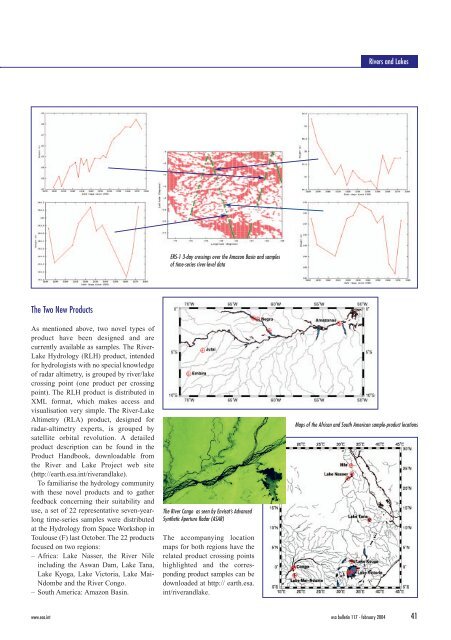
– Africa: <strong>Lake</strong> Nasser, the <strong>River</strong> Nile<br />
including the Aswan Dam, <strong>Lake</strong> Tana,<br />
<strong>Lake</strong> Kyoga, <strong>Lake</strong> Victoria, <strong>Lake</strong> Mai-<br />
Ndombe <strong>and</strong> the <strong>River</strong> Congo.<br />
– South America: Amazon Basin.<br />
ERS-1 3-day crossings over the Amazon Basin <strong>and</strong> samples<br />
of time-series river-level data<br />
The <strong>River</strong> Congo as seen by Envisat’s Advanced<br />
Synthetic Aperture Radar (ASAR)<br />
The accompanying location<br />
maps for both regions have the<br />
related product crossing points<br />
highlighted <strong>and</strong> the corresponding<br />
product samples can be<br />
downloaded at http:// earth.esa.<br />
int/river<strong>and</strong>lake.<br />
<strong>River</strong>s <strong>and</strong> <strong>Lake</strong>s<br />
Maps of the African <strong>and</strong> South American sample-product locations<br />
www.esa.int esa bulletin 117 - february 2004 41