WTPD Conservation Assessment - Endangered Species & Wetlands ...
WTPD Conservation Assessment - Endangered Species & Wetlands ...
WTPD Conservation Assessment - Endangered Species & Wetlands ...

Create successful ePaper yourself
Turn your PDF publications into a flip-book with our unique Google optimized e-Paper software.
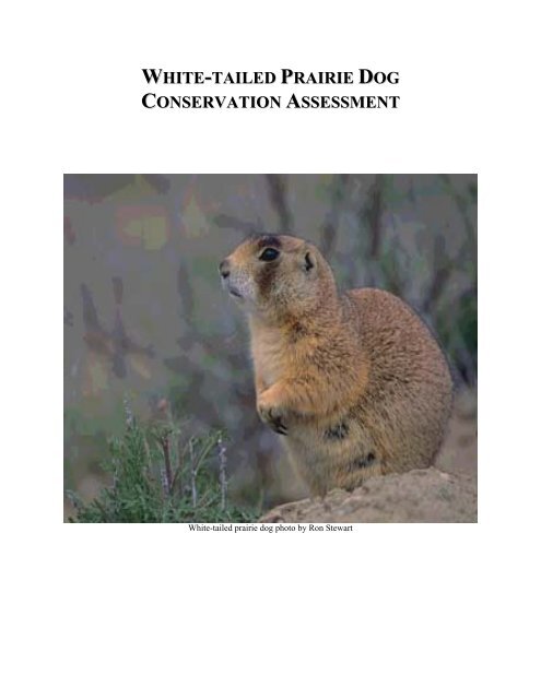
WHITE-TAILED PRAIRIE DOG<br />
CONSERVATION ASSESSMENT<br />
White-tailed prairie dog photo by Ron Stewart
RECOMMENDED CITATION<br />
Seglund, A.E., A.E. Ernst, M. Grenier, B. Luce, A. Puchniak and P. Schnurr. 2004.<br />
White-tailed Prairie Dog <strong>Conservation</strong> <strong>Assessment</strong>.<br />
ACKNOWLEDGEMENTS<br />
We received significant input from a number of sources or their publications. We especially<br />
wish to acknowledge the following people and organizations: Dean Biggins, U.S. Geological<br />
Survey; Brent Bibles, Utah State University Extension in Vernal, Utah; Bart Zwetzig, Ed<br />
Hollowed, Steve Madsen, Robin Sell, Dave Roberts, Mike Albee and Jay Parks, U.S. Bureau of<br />
Land Management; Erin Robertson, Center for Native Ecosystems; Lonnie Renner, contractor<br />
for the Colorado Division of Wildlife; Larry Nelson, Colorado Division of Wildlife; Heidi<br />
Youmans, Montana Department of Fish, Wildlife and Parks; Brian Maxfield and Craig<br />
McLaughlin, Utah Division of Wildlife Resources; Bob Oakleaf, Wyoming Game and Fish<br />
Department; Craig Knowles, Fauna West Consulting; Bob Leachman, Laura Romin, Renee Chi,<br />
U.S. Fish and Wildlife Service; and Sterling Miller, National Wildlife Federation.<br />
2
TABLE OF CONTENTS<br />
RECOMMENDED CITATION .............................................................................................................2<br />
ACKNOWLEDGEMENTS....................................................................................................................2<br />
TABLE OF CONTENTS ......................................................................................................................3<br />
LIST OF TABLES...............................................................................................................................6<br />
LIST OF FIGURES .............................................................................................................................7<br />
EXECUTIVE SUMMARY ....................................................................................................................9<br />
WHITE-TAILED PRAIRIE-DOG CONSERVATION ASSESSMENT.....................................................12<br />
Introduction..................................................................................................................................12<br />
WHITE-TAILED PRAIRIE DOG........................................................................................................14<br />
Taxonomy .....................................................................................................................................14<br />
Description....................................................................................................................................15<br />
Distribution...................................................................................................................................16<br />
Natural History ............................................................................................................................16<br />
Habitat requirements..............................................................................................................16<br />
Dietary requirements..............................................................................................................18<br />
Population dynamics..............................................................................................................20<br />
Ecology and behavior ............................................................................................................21<br />
EVALUATION OF WHITE-TAILED PRAIRIE-DOG POPULATION STATUS BY STATE ......................23<br />
Methods.........................................................................................................................................24<br />
Population analysis ................................................................................................................24<br />
Changes in occupied habitat ..................................................................................................26<br />
Predicted range model............................................................................................................27<br />
Colorado........................................................................................................................................30<br />
Historic information...............................................................................................................30<br />
Monitoring efforts..................................................................................................................31<br />
Population analysis ................................................................................................................33<br />
Changes in occupied habitat ..................................................................................................34<br />
Current occupancy .................................................................................................................36<br />
Predicted range model............................................................................................................36<br />
Limiting factors......................................................................................................................37<br />
Montana........................................................................................................................................38<br />
Changes in occupied habitat ..................................................................................................38<br />
Predicted range model............................................................................................................40<br />
Limiting factors......................................................................................................................40<br />
Utah ...............................................................................................................................................40<br />
Monitoring efforts..................................................................................................................40<br />
Population analysis ................................................................................................................41<br />
Changes in occupied habitat ..................................................................................................43<br />
Current occupancy .................................................................................................................45<br />
Predicted range model............................................................................................................46<br />
Limiting factors......................................................................................................................46<br />
Wyoming (authored by Martin Grenier and Bob Luce)................................................................47<br />
Monitoring efforts..................................................................................................................48<br />
3
Population analysis ................................................................................................................50<br />
Changes in occupied habitat ..................................................................................................51<br />
Current occupancy .................................................................................................................53<br />
Predicted range model............................................................................................................54<br />
CURRENT MANAGEMENT STATUS BY STATE ...............................................................................54<br />
Colorado........................................................................................................................................54<br />
Montana........................................................................................................................................56<br />
Utah ...............................................................................................................................................57<br />
Wyoming.......................................................................................................................................58<br />
RISK ASSESSMENT.........................................................................................................................58<br />
1) Present or Threatened Destruction, Modification or Curtailment of Habitat or Range..59<br />
Current Information....................................................................................................................59<br />
Agricultural land conversion..................................................................................................59<br />
Urbanization...........................................................................................................................59<br />
Oil/Gas exploration and extraction ........................................................................................60<br />
Livestock grazing...................................................................................................................64<br />
Altered fire regimes ...............................................................................................................65<br />
Evaluation.....................................................................................................................................66<br />
Agricultural land conversion..................................................................................................66<br />
Urbanization...........................................................................................................................66<br />
Oil/Gas exploration and extraction ........................................................................................66<br />
Livestock grazing...................................................................................................................66<br />
Altered fire regimes ...............................................................................................................67<br />
Options for <strong>Conservation</strong> in a <strong>Conservation</strong> Strategy .............................................................73<br />
Research Needs.............................................................................................................................69<br />
2) Overutilization for Commercial, Recreational, Scientific or Educational Purposes ........70<br />
Current Information....................................................................................................................70<br />
Shooting .................................................................................................................................70<br />
Commercial, scientific or educational purposes ....................................................................72<br />
Evaluation.....................................................................................................................................72<br />
Shooting .................................................................................................................................72<br />
Commercial, scientific or educational purposes ....................................................................73<br />
Options for <strong>Conservation</strong> in a <strong>Conservation</strong> Strategy .............................................................73<br />
Shooting .................................................................................................................................73<br />
Research Needs.............................................................................................................................73<br />
3) Disease or Predation................................................................................................................74<br />
Current Information....................................................................................................................74<br />
Disease ...................................................................................................................................74<br />
Predation ................................................................................................................................75<br />
Evaluation.....................................................................................................................................75<br />
Disease ...................................................................................................................................75<br />
Predation ................................................................................................................................77<br />
Options for <strong>Conservation</strong> in a <strong>Conservation</strong> Strategy .............................................................77<br />
Disease ...................................................................................................................................77<br />
4
Predation ................................................................................................................................78<br />
Research Needs.............................................................................................................................78<br />
4) Inadequacy of Existing Regulatory Mechanisms .................................................................78<br />
Current Information....................................................................................................................78<br />
Evaluation.....................................................................................................................................79<br />
Options for <strong>Conservation</strong> in a <strong>Conservation</strong> Strategy .............................................................80<br />
Research Needs.............................................................................................................................80<br />
5) Other Natural or Manmade Factors Affecting its Continued Existence............................80<br />
Current Information....................................................................................................................80<br />
Poisoning................................................................................................................................80<br />
Drought ..................................................................................................................................82<br />
Evaluation.....................................................................................................................................82<br />
Poisoning................................................................................................................................82<br />
Drought ..................................................................................................................................83<br />
Options for <strong>Conservation</strong> in a <strong>Conservation</strong> Strategy .............................................................83<br />
Poisoning................................................................................................................................83<br />
Drought ..................................................................................................................................83<br />
Research Needs.............................................................................................................................84<br />
WHITE-TAILED PRAIRIE-DOG WORKING GROUP’S RECOMMENDATION FOR LISTING OF THE<br />
WHITE-TAILED PRAIRIE-DOG AS THREATENED UNDER THE ESA: ...........................................84<br />
1) Present or Threatened Destruction, Modification, or Curtailment of Habitat or Range.84<br />
Agricultural land conversion..................................................................................................84<br />
Urbanization...........................................................................................................................85<br />
Oil/Gas exploration and extraction ........................................................................................85<br />
Livestock grazing...................................................................................................................85<br />
Altered fire regimes ...............................................................................................................86<br />
2) Overutilization for Commercial, Recreational, Scientific or Educational Purposes ........86<br />
Shooting .................................................................................................................................86<br />
3) Disease or Predation................................................................................................................86<br />
Disease ...................................................................................................................................86<br />
Predation ................................................................................................................................87<br />
3) Inadequacy of Existing Regulatory Mechanisms .................................................................87<br />
4) Other Natural or Man-made Factors Affecting its Continued Existence ..........................88<br />
Poisoning................................................................................................................................88<br />
Drought ..................................................................................................................................88<br />
LITERATURE CITED.......................................................................................................................90<br />
LIST OF PERSONAL COMMUNICATIONS......................................................................................108<br />
Appendix I. ..................................................................................................................................148<br />
Appendix II. .................................................................................................................................151<br />
Appendix III.................................................................................................................................153<br />
Appendix IV.................................................................................................................................155<br />
Appendix V..................................................................................................................................157<br />
5
LIST OF TABLES<br />
Table 1. Estimate of white-tailed prairie dog occupied habitat per state and hectares within gross<br />
range and predicted range of each state based on the Predicted Range Model. ..... 109<br />
Table 2. NLCD Landcover classes found to be suitable and not suitable for development of the<br />
Predicted Range Model........................................................................................... 110<br />
Table 3. White-tailed prairie dog population analysis determined from surveys evaluating<br />
suitability of habitat for black-footed ferrets at Wolf Creek Black-footed Ferret<br />
Management Area, Colorado.................................................................................. 111<br />
Table 4. Summary statistics for surveys evaluating suitability of black-footed ferret habitat at<br />
Management Areas in Colorado from 1997-2003. Statistics have been calculated for the<br />
entire sample area and not just for good habitat. .................................................... 112<br />
Table 5. White-tailed prairie dog population analysis determined from surveys evaluating<br />
suitability of habitat for black-footed ferrets at Coyote Basin Black-footed Ferret<br />
Management Area, Colorado.................................................................................. 113<br />
Table 6. The amount of hectares impacted by agriculture within the gross range of the whitetailed<br />
prairie dog. .................................................................................................... 114<br />
Table 7. Urban areas located within the gross range of the white-tailed prairie dog. ... 115<br />
Table 8. Landownership within the gross and predicted range of the white-tailed prairie dog in<br />
Colorado.................................................................................................................. 116<br />
Table 9. White-tailed prairie dog colonies located in Montana during surveys in 1975-1977 and<br />
in 2003. ................................................................................................................... 117<br />
Table 10. Landownership within the gross and predicted range of the white-tailed prairie dog in<br />
Montana. ................................................................................................................. 118<br />
Table 11. White-tailed prairie dog population analysis determined from surveys evaluating<br />
suitability of habitat for black-footed ferrets at 4 Black-footed Ferret Management Areas in<br />
Utah......................................................................................................................... 119<br />
Table 12. Summary statistics for surveys evaluating suitability of black-footed ferret habitat at 4<br />
Management Areas in Utah from 1997-2003. ........................................................ 120<br />
Table 13. Comparison of mapped white-tailed prairie dog occupied habitat in Utah from 1985-<br />
2002......................................................................................................................... 121<br />
Table 14. Landownership within the gross and predicted range of the white-tailed prairie dog in<br />
Utah......................................................................................................................... 122<br />
Table 15. Annual drilling results from completion reports submitted by well operators as of<br />
3/26/04 for total wells drilled by county in Utah within the gross range of the white-tailed<br />
prairie dog. .............................................................................................................. 123<br />
Table 16. White-tailed prairie dog complexes and estimated hectares in Wyoming..... 124<br />
Table 17. White-tailed prairie dog population analysis determined from surveys evaluating<br />
suitability of habitat for black-footed ferrets at Shirley Basin/Medicine Bow Black-footed<br />
Management Area, Wyoming................................................................................. 125<br />
Table 18. White-tailed prairie dog population analysis determined from surveys evaluating<br />
suitability of habitat for black-footed ferrets at Meeteetse Black-footed Ferret Management<br />
Area, Wyoming....................................................................................................... 126<br />
6
Table 19. Landownership within the gross and predicted range of the white-tailed prairie dog in<br />
Wyoming................................................................................................................. 127<br />
Table 20. Hectares poisoned in cooperative and federal prairie dog and ground squirrel<br />
eradication campaigns (adapted from Bell 1921). .................................................. 128<br />
LIST OF FIGURES<br />
Figure 1. White-tailed prairie dog gross range, predicted range and location of identified whitetailed<br />
prairie dog colonies from 1985-2003............................................................ 129<br />
Figure 2. Location of known white-tailed prairie dog complexes/sub-complexes within the gross<br />
range of the species identified from 1985-2003. .................................................... 130<br />
Figure 3. White-tailed prairie dog population analysis determined from surveys evaluating<br />
suitability of habitat for black-footed ferrets at Coyote Basin and Wolf Creek Black-footed<br />
Ferret Management Areas in Colorado and average population estimates across all surveys.<br />
................................................................................................................................. 131<br />
Figure 4. Change in mapped white-tailed prairie dog occupied habitat in the Little Snake Blackfooted<br />
Ferret Management Area in Colorado between 1989 and 1999.................. 132<br />
Figure 5. White-tailed prairie dog gross range, predicted range and location of identified<br />
colonies in Colorado from 1989-2003. ................................................................... 133<br />
Figure 6. White-tailed prairie dog gross range, predicted range and location of identified<br />
colonies in Montana from 1975-2003..................................................................... 134<br />
Figure 7. White-tailed prairie dog population analysis determined from surveys evaluating<br />
suitability of habitat for black-footed ferrets at 4 Black-footed Ferret Management Areas in<br />
Utah and average population estimates across all surveys. .................................... 135<br />
Figure 8. Changes in white-tailed prairie dog occupied habitat at selected areas mapped in Utah<br />
from 1985-2002. ..................................................................................................... 136<br />
Figure 9. Study areas in Utah where comparisons were made to document changes in whitetailed<br />
prairie dog occupied habitat from 1985-2002............................................... 137<br />
Figure 10. Study areas in Utah where comparisons were made to document changes in whitetailed<br />
prairie dog occupied habitat from 1985-2002............................................... 138<br />
Figure 11. Study areas in Utah where comparisons were made to document changes in whitetailed<br />
prairie dog occupied habitat from 1985-2002............................................... 139<br />
Figure 12. White-tailed prairie dog gross range, predicted range and location of identified<br />
colonies in Utah from 1985-2003. .......................................................................... 140<br />
Figure 13. Distribution of townships with at least 405 ha (1,000 ac) of occupied white-tailed<br />
prairie dog habitat prior to 1995 in Wyoming. ....................................................... 141<br />
Figure 14. Shirley Basin/Medicine Bow Black-footed Ferret Management Area, Wyoming.<br />
................................................................................................................................. 142<br />
Figure 15. Comparison of white-tailed prairie dog estimate for 4 colonies monitored at the<br />
Shirley Basin/Medicine Bow Black-footed Ferret Management Area, Wyoming, from 1991<br />
to 2000. ................................................................................................................... 143<br />
Figure 16. Comparison of 1991 and 2001 mapping efforts within the Shirley Basin/Medicine<br />
Bow Black-footed Ferret Management Area, Wyoming........................................ 144<br />
Figure 17. Comparison of 1991 and 2004 mapping efforts within the Shirley Basin/Medicine<br />
Bow Black-footed Ferret Management Area, Wyoming........................................ 145<br />
7
Figure 18. Comparison of white-tailed prairie dog mapping efforts within the Sweetwater<br />
Complex, Wyoming from pre-1995 to 2002........................................................... 146<br />
Figure 19. White-tailed prairie dog gross range, predicted range and location of identified<br />
colonies in Wyoming from surveys before 1995.................................................... 147<br />
8
EXECUTIVE SUMMARY<br />
On 11 July 2002, the U.S. Fish and Wildlife Service (USFWS) was petitioned by the Center for<br />
Native Ecosystems, Biodiversity <strong>Conservation</strong> Alliance, Southern Utah Wilderness Alliance, America<br />
Lands Alliance, Forest Guardians, Terry Tempest Williams, Ecology Center and Sinapu to list the<br />
white-tailed prairie dog (Cynomys leucurus) under the Federal <strong>Endangered</strong> <strong>Species</strong> Act (ESA). After<br />
the petition was received, the White-tailed Prairie Dog Working Group of the 12-State Prairie Dog<br />
<strong>Conservation</strong> Team began development of a <strong>Conservation</strong> <strong>Assessment</strong> for the white-tailed prairie dog<br />
to assess the current status of the species range-wide and address possible threats limiting<br />
conservation. Data integrated into the <strong>Conservation</strong> <strong>Assessment</strong> came from an assemblage of sources<br />
including published literature, Environmental Impact Statement reports for energy clearances on<br />
potential black-footed ferret (Mustela nigripes) habitat, and State and Federal grey literature. These<br />
sources provided the information used to index temporal population changes, evaluate gross changes<br />
in occupied habitat, and examine current management of white-tailed prairie dogs within each State.<br />
A risk assessment for the species based upon the five listing criteria used by the USFWS when<br />
evaluating a species’ potential for listing under the ESA is included.<br />
In order to provide the most scientifically accurate assessment regarding the current status of<br />
the white-tailed prairie dog, two types of data were analyzed. The first data set indexed population<br />
changes at Black-footed Ferret Management Areas. The second data set evaluated gross changes in<br />
occupied habitat at mapped locations in individual States. Both data sets have weaknesses and<br />
limitations as described in the text, but are the best available data for this assessment. The<br />
incorporation of both data sources provided a more complete assessment of the range-wide status of<br />
the white-tailed prairie dog by describing changes not only with regard to numbers of animals, but also<br />
examining the distribution of occupied habitat across the range. In addition to the population and<br />
occupied habitat data analysis, a Geographic Information Systems (GIS) spatially detailed, Predicted<br />
Range Model for the white-tailed prairie dog was produced. This model provided information on the<br />
number of hectares in the gross and predicted ranges of the species and the amount of its range being<br />
impacted by anthropogenic disturbances.<br />
In 1981 with the discovery of black-footed ferrets at Meeteetse, Wyoming, States within the<br />
historic range of this species initiated programs to identify complexes of white-tailed prairie dogs as<br />
potential reintroduction sites for black-footed ferrets. Because white-tailed prairie dogs and<br />
black-footed ferrets occur sympatrically, evaluation of suitable habitat for black-footed ferrets was<br />
dependent upon describing the size and spatial arrangement of colonies and densities of prairie dogs<br />
within these areas (Forrest et al. 1985, Biggins et al. 1989, 1993). To aid in further evaluation of<br />
prairie dog habitat, Biggins et al. (1989, 1993) developed a technique that involved counting active<br />
burrows within 1 km x 3 m transects distributed over colonies. The active burrow data was then<br />
converted to prairie dog counts and finally to an estimate of density. Although burrow counts may be<br />
inaccurate at producing precise population estimates of white-tailed prairie dogs, they are useful for<br />
indexing abundance over large scales of time and space. Since no long-term monitoring data are<br />
available from sites where black-footed ferret reintroduction is not a consideration, the evaluation of<br />
temporal population changes of white-tailed prairie dog populations is based solely on surveys at<br />
black-footed ferrets reintroduction sites.<br />
9
To quantify gross spatial changes that have occurred in occupied habitat within the range<br />
of the white-tailed prairie dog, colonies and complexes that were mapped in response to specific<br />
energy project clearances as well as those mapped in the identification of potential black-footed<br />
ferret reintroduction sites were compared to more recent mapping efforts. Direct comparison in<br />
the estimation of occupied hectares of prairie dog colonies is problematic and needs to be<br />
evaluated with caution. White-tailed prairie dogs exhibit a mosaic pattern of distribution making<br />
accurate mapping of colony boundaries difficult. Distribution, burrow density and activity levels<br />
are also extremely variable throughout a complex or colony. Much of the mapping of colonies<br />
therefore relies upon use of topographic features, substrate variations or the best estimate of the<br />
investigator, making many mapping efforts a reflection of suitable rather than occupied habitat.<br />
Until variation between mapping efforts can be described and compensated for, mapping can<br />
only provide a gross approximation of white-tailed prairie dog occupied hectares. These gross<br />
approximations however, are meaningful in areas that have experienced significant declines or<br />
increases. In areas where changes have been less extreme, mapping cannot produce comparable<br />
results.<br />
Population information analyzed in the <strong>Conservation</strong> <strong>Assessment</strong> show that white-tailed prairie<br />
dog populations can fluctuate year-to-year with calculated coefficient of variations ranging from 14 to<br />
91% in areas surveyed in Utah and Colorado. Large annual fluctuations of white-tailed prairie dog<br />
estimates within colonies were reported in Shirley Basin, Wyoming. Continued population monitoring<br />
is needed to assess the level of observed fluctuations and resultant long-term projections of population<br />
viability. The data available are not sufficient to evaluate whether white-tailed prairie dogs currently<br />
exist at lower densities and experience more extreme fluctuations in numbers than they did<br />
historically.<br />
Changes in occupied habitat show that white-tailed prairie dog distribution is dynamic, with<br />
white-tailed prairie dog occupation shifting on a landscape scale. No clear pattern emerged to account<br />
for increases or decreases in occupied habitat, though information such as plague monitoring and<br />
periodic habitat evaluations were not available for most sites. Significant declines and increases in<br />
occupied habitat that could not be attributed to mapping error were apparent in the Little Snake<br />
Black-footed Ferret Management Area, Colorado (92% decline from 1994-1999); Cisco complex,<br />
Utah (84% decline from 1985-2002); for all colonies in Montana (83% decline from 1975-2003); and<br />
portions of Shirley Basin, Wyoming (50% increase from 1990-2004). This evaluation of occupied<br />
habitat underscores the importance of evaluating white-tailed prairie dog populations on a landscape<br />
scale in order to provide an accurate range-wide assessment of the status and distribution of this<br />
species. Colonies must remain arrayed across the range in both viable, isolated colonies and<br />
complexes that allow repopulation of depleted colonies and complexes, yet do not encourage spread of<br />
plague between complexes.<br />
Concern over the long-term viability of white-tailed prairie dog populations is warranted. It<br />
appears that some individual colonies and complexes are prone to significant declines without<br />
recovery to previous occupied habitat or population levels (e.g., Little Snake, Colorado). Other areas<br />
however, appear able to recover rapidly after significant population declines (e.g., Kennedy Wash<br />
increased from a low of 3,670 white-tailed prairie dogs (3.07 prairie dogs per ha) in 2001 to<br />
10,282 white-tailed prairie dogs (8.60 prairie dogs per ha) in 2002). Why there is a difference between<br />
10
ecovery sites is unknown. It may be due to the continued re-nfection of areas by plague and lack of<br />
immigration into areas after infection. Plague may be the reason that colonies and complexes show<br />
such dramatic oscillations in densities and shifts in occupied habitat. Prior to the introduction of the<br />
disease, populations were likely more stable, providing a reliable prey source for such species as<br />
ferruginous hawks (Buteo regalis) and development of a specialized predator like the black-footed<br />
ferret. The role that plague has and will play in the overall decline and biogeographic dynamics of<br />
white-tailed prairie dogs is a critical question for future management and research. Plague remains the<br />
unknown factor in the equation for conserving the white-tailed prairie dog. Though work is being<br />
conducted on the ecology of the disease and oral vaccine development is proceeding, managing for the<br />
effects of plague epizootics will be an immense challenge for resource managers and scientists.<br />
Historically, white-tailed prairie dogs have been displaced from areas by conversion to<br />
agriculture, urbanization, and oil/gas exploration and extraction, and negatively impacted by habitat<br />
alterations due to livestock grazing and fire suppression. Conversion of habitat to cultivated<br />
agriculture is not occurring at a significant rate today and currently only 3.6% of the gross range is<br />
being impacted by this activity. Urbanization is a concern in local areas but does not represent a<br />
significant range-wide threat affecting only 0.2% of the gross range. Loss of habitat due to oil/gas<br />
development under current Bureau of Land Management (BLM) policies may be a significant threat.<br />
In Wyoming, 77% of the white-tailed prairie dog predicted range is being developed at some level for<br />
oil and gas.<br />
Livestock grazing practices have impacted the white-tailed prairie dog range by drastically<br />
altering the landscape through introduction of non-native annuals, increased shrub cover, loss of cool<br />
season grasses and lowered water tables. The BLM, which manages 56% of the white-tailed prairie<br />
dog gross range, has reduced stocking rates and improved range conditions in some areas, but upland<br />
habitats are difficult to restore and options for their restoration are lacking. Thus, continued research<br />
into the impacts of habitat alterations on white-tailed prairie dogs and techniques to restore upland<br />
habitats need to be undertaken.<br />
Shooting has the potential to contribute to reduction and fragmentation of populations, lower<br />
colony productivity and slow or preclude recovery rates of colonies reduced by plague or other<br />
disturbances. Shooting has been shown to result in the removal of pregnant females and young of the<br />
year, promote increased emigration, and negatively impact behavior in black-tailed prairie dogs.<br />
Coupling shooting with population unknowns such as size, body sex and age structure, fecundity,<br />
survival rates and disease cycles, makes it impossible to predict the long-term affects of shooting on<br />
white-tailed prairie dog populations. However, shooting, unlike plague, is a manageable threat to<br />
white-tailed prairie dogs. State wildlife agencies need to develop programs to evaluate their current<br />
regulatory authorities and measures to ensure that they have mechanisms to regulate take of<br />
white-tailed prairie dogs.<br />
As early settlement of the Intermountain West occurred, the prairie dog became the focus of<br />
widespread eradication efforts largely as a result of their reputation as range and agricultural pests<br />
(Clark 1989). Poisoning became less common after the 1970s because the government began to<br />
regulate poisons and early eradication efforts appeared to be successful. Limited poisoning continues<br />
today, mostly on private lands and is used for containment rather than large-scale eradication. Only<br />
toxicants registered by the Environmental Protection Agency (EPA) may be legally used to control<br />
11
prairie dogs. Because the bulk of the white-tailed prairie dog range is located on public land,<br />
poisoning can be controlled by agencies.<br />
White-tailed prairie dogs have become a focal species for many State and Federal management<br />
agencies over the past few years. Utah and Montana have implemented State-wide seasonal shooting<br />
closures on public lands to help conserve this species. The U.S. Geological Survey (USGS) and U.S.<br />
Department of Agriculture (USDA) are working on programs to monitor plague, develop methods to<br />
help prevent epizootics from impacting colonies and predict areas susceptible to infection. State<br />
agencies have started to monitor known colonies/complexes, map additional areas and work<br />
cooperatively with other agencies and among States to develop intensive monitoring programs using<br />
statistically valid estimation techniques. Elimination of detrimental management activities can be<br />
instituted to manage and potentially expand the occupied hectares of this species. By implementing<br />
management actions at local, State, and Federal levels, including regulation of shooting, elimination of<br />
mandatory control and pest status, incorporating better grazing and fire management practices,<br />
adopting incentive programs for private land owners, field research to provide a scientific basis for<br />
decisions, long-term monitoring of populations, and public outreach and education, the long-term<br />
viability of this species will be assured.<br />
At this time the White-tailed Prairie Dog Working Group does not believe listing the<br />
white-tailed prairie dog as threatened under the ESA is justified. The information analyzed across the<br />
range of the white-tailed prairie dog showed that some individual colonies and complexes are prone to<br />
significant declines with little post recovery to pre-decline levels, while other colonies and complexes<br />
exhibit rapid recovery to pre-decline levels. With the current data available it is impossible to<br />
determine whether populations across the range occur at lower densities and occupy less area than they<br />
did historically. It is also impossible to predict a long-term trend due to the short-duration in past<br />
monitoring (3-7 years) and the lack of definitive patterns emerging among the populations monitored.<br />
The fact remains however, that white-tailed prairie dog populations are continuing to maintain<br />
themselves even when faced with disease and human disturbances. The biggest concern is that the<br />
ecosystem as a whole is not as productive or stable as it was historically. Colonies and complexes<br />
show dramatic oscillations in densities and shifts in occupied habitat. With the possibility that current<br />
populations are more dynamic, there is concern over the viability of associated wildlife species that are<br />
dependent on white-tailed prairie dog populations.<br />
WHITE-TAILED PRAIRIE-DOG CONSERVATION ASSESSMENT<br />
Introduction<br />
Five species of prairie dog inhabit western North America and they differ with regard to<br />
current conservation status. The Mexican prairie dog (Cynomys mexicanus) is federally listed as<br />
endangered in Mexico (50 C.F.R), the Utah prairie dog (C. parvidens) is listed as threatened<br />
(17.11 CFR.) and the black-tailed prairie dog (C. ludovicianus), formerly a candidate species for<br />
listing (65 FR 5476-5488) is still of conservation concern. The white-tailed prairie dog was<br />
petitioned to be listed as threatened under the ESA on July 11, 2002, by the Center for Native<br />
Ecosystems, Biodiversity <strong>Conservation</strong> Alliance, Southern Utah Wilderness Alliance, America<br />
Lands Alliance, Forest Guardians, Terry Tempest Williams, Ecology Center and Sinapu. The<br />
Gunnison’s prairie dog (C. gunnisoni) was petitioned to be listed on February 23, 2004 (Forest<br />
12
Guardians 2004). Both the white-tailed and Gunnison’s prairie dog petitions cited habitat loss,<br />
shooting, disease, a history of eradication efforts and inadequate Federal and State regulatory<br />
mechanisms as threats to the long-term viability of this prairie dog species. After the petition to<br />
list the white-tailed prairie dog was filed, the National Wildlife Federation and Environmental<br />
Defense contracted with Dr. Craig Knowles to prepare a status review summarizing current<br />
knowledge of white-tailed and Gunnison’s prairie dogs. This contract resulted in the publication,<br />
Status of White-tailed and Gunnison’s Prairie Dogs (Knowles 2002). In this document, Dr.<br />
Knowles stated, “It is clear that state and federal conservation agencies need to make a<br />
range-wide effort to develop credible status reports on these two species.”<br />
The 11 States included in the range of the black-tailed prairie dog began a multi-State<br />
conservation effort in 1998 with the formation of the Black-tailed Prairie Dog <strong>Conservation</strong><br />
Team. This team was responsible for development of a range-wide <strong>Conservation</strong> <strong>Assessment</strong><br />
and Strategy for the Black-tailed Prairie Dog (Van Pelt 1999). In addition, the team published an<br />
addendum to the <strong>Conservation</strong> <strong>Assessment</strong> and Strategy entitled, A Multi-State <strong>Conservation</strong><br />
Plan for the Black-tailed Prairie Dog in the United States (Luce 2003). In March 2002, the<br />
Black-tailed Prairie Dog <strong>Conservation</strong> Team was expanded to include both white-tailed and<br />
Gunnison’s prairie dogs. Expansion of the team was warranted because many of the<br />
management issues such as survey protocols, identification and ranking of threats, regulation<br />
changes, recreational shooting, management plan frameworks, relocation techniques and<br />
long-term monitoring are similar for all prairie dog species. State wildlife agency biologists<br />
from the white-tailed and Gunnison’s prairie dog States, all of whom except Utah were already<br />
on the Black-tailed Prairie Dog <strong>Conservation</strong> Team, formed a White-tailed/Gunnison’s Prairie<br />
Dog Working Group which agreed to emulate, where possible, methodologies and expertise<br />
developed during the black-tailed prairie dog multi-State conservation effort. The Black-tailed<br />
Prairie Dog <strong>Conservation</strong> Team was subsequently renamed the Prairie Dog <strong>Conservation</strong> Team<br />
in September 2002 and the Western Association of Fish and Wildlife Agencies’ Interstate<br />
Coordinator’s duties were expanded to include coordination of conservation for all three prairie<br />
dog species. The Prairie Dog <strong>Conservation</strong> Team continues to meet annually to evaluate and<br />
discuss range-wide management goals for black-tailed, white-tailed and Gunnison’s prairie dogs.<br />
Following the process used to address range-wide conservation of black-tailed prairie<br />
dogs, the Western Association of Fish and Wildlife Agencies’ agreed at its July 2002 meeting to<br />
develop a range-wide Memorandum of Understanding that would implement a similar<br />
collaborative effort and result in <strong>Conservation</strong> Agreements for white-tailed and Gunnison’s<br />
prairie dogs. Specific conservation objectives in the draft Memorandum of Understanding were:<br />
1. Quantify current population status and trends of both white-tailed and Gunnison’s prairie<br />
dogs by collecting and analyzing population estimates and distribution data throughout<br />
their ranges and from this information develop multi-State management planning efforts.<br />
2. Develop partnerships with communities, industries, interested entities, private landowners<br />
and government agencies to design and implement conservation strategies to preserve<br />
and/or restore suitable habitat as well as maintain and enhance present distribution and<br />
abundance of white-tailed and Gunnison’s prairie dogs.<br />
13
3. Conduct monitoring of temporal and spatial population trends on a landscape scale to<br />
evaluate conservation strategies to stabilize and increase white-tailed and Gunnison’s<br />
prairie dog occupancy and abundance.<br />
4. Conduct rigorous and repeatable scientific experiments to determine detrimental effects of<br />
human induced disturbances and disease on white-tailed and Gunnison’s prairie dog<br />
populations and from this research develop responsible management objectives.<br />
On March 4, 2003 the Western Association of Fish and Wildlife Agencies’ President Jeff<br />
Koenings sent letters to the USFWS Regional Directors, Dale Hall and Ralph Morgenweck,<br />
detailing the intent of the States to prepare <strong>Conservation</strong> <strong>Assessment</strong>s for both white-tailed and<br />
Gunnison’s prairie dogs. The Western Association of Fish and Wildlife Agencies’ proposed to<br />
the USFWS that the States take the lead role in writing the <strong>Conservation</strong> <strong>Assessment</strong>s, and that<br />
the USFWS use the documents produced as the basis for the 90-day and 12-month finding for<br />
both the white-tailed prairie dog and Gunnison’s prairie dog petitions.<br />
In December 2002, the White-tailed/Gunnison’s Prairie Dog Working Group began<br />
development of a <strong>Conservation</strong> <strong>Assessment</strong> for the white-tailed prairie dog. The objectives put<br />
forth by White-tailed/Gunnison’s Prairie Dog Working Group to be incorporated in the<br />
White-tailed Prairie Dog <strong>Conservation</strong> <strong>Assessment</strong> were--1) summarize and evaluate the current<br />
distribution and population status of the white-tailed prairie dog across its historic gross range;<br />
2) develop a Predicted Range Model; 3) identify specific threats impacting the viability of the<br />
species and 4) identify management and research options for consideration in the future<br />
development of a conservation strategy for the white-tailed prairie dog. Data used to meet the<br />
objectives of the White-tailed Prairie Dog <strong>Conservation</strong> <strong>Assessment</strong> included published<br />
literature, Environmental Impact Statements for energy clearances on black-footed ferret habitat<br />
and State and Federal grey literature. From the information collected, temporal population<br />
changes and gross spatial changes in occupied habitat across the range were examined, current<br />
and historic management of white-tailed prairie dogs within each State was evaluated and a risk<br />
assessment for the species based upon the five listing criteria used by the USFWS when<br />
evaluating a species’ potential for listing under the ESA was completed.<br />
WHITE-TAILED PRAIRIE DOG<br />
Taxonomy<br />
The family Scuiridae is a successful and widespread family comprised of 49 genera and<br />
262 species. Included in this family are tree and ground squirrels, chipmunks, marmots and<br />
prairie dogs. Prairie dogs, like other ground squirrels, have characteristic flattened heads,<br />
straight claws, short tails and unspecialized ankles (Lawlor 1979). As a group, prairie dogs<br />
diverged from ground squirrels about 1.8 million years ago during the late Pliocene or early<br />
Pleistocene (Clark et al. 1971).<br />
Today there are five extant species of prairie dogs, all of which inhabit western North<br />
America and belong to the genus Cynomys. The genus has been divided into two subgenera<br />
based on pelage color and tail length (Clark et al. 1971, Pizzimenti 1975). The white-tailed,<br />
14
Utah and Gunnison’s prairie dogs comprise the subgenus Leucocrossuromys. This group is<br />
distinguished by relatively short, white-tipped tails, weaker social organizations and less<br />
specialized dentition and morphology than the black-tailed forms (Pizzimenti 1975). The<br />
black-tailed subgenera, Cynomys, which includes the black-tailed and the Mexican prairie dogs,<br />
have characteristic long, black-tipped tails and are more specialized morphologically,<br />
behaviorally and ecologically (Pizzimenti 1975). The black-tailed prairie dog occupies short or<br />
mixed-grass prairies across much of the Great Plains while the Mexican prairie dog is restricted<br />
to a small area of grasslands in northeastern Mexico (Goodwin 1995). The Cynomys subgenera,<br />
shows the greatest divergence from ancestral ground squirrel stock (Pizzimenti 1975).<br />
Within the subgenus Leucocrossuromys, the Gunnison’s prairie dog is genetically,<br />
morphologically and behaviorally distinct from the other two white-tailed species (Pizzimenti<br />
1975). The Gunnison’s prairie dog retains a chromosomal makeup more closely resembling that<br />
of other ground squirrels suggesting a more recent divergence (Pizzimenti 1975, Goodwin 1995).<br />
Genetic analysis conducted on populations of white-tailed and Gunnison’s prairie dogs in Ouray,<br />
Delta and Montrose counties in Colorado, confirmed that the genetic makeup of these two<br />
species was unique (Pizzimenti 1975).<br />
In general, both Utah and white-tailed prairie dogs inhabit more xeric habitats at<br />
relatively lower elevations than the Gunnison's prairie dog which is commonly found at mesic,<br />
high elevation sites (Pizzimenti and Nadler 1972). Utah and white-tailed prairie dogs are<br />
antigenically similar and may have once belonged to a single interbreeding species (Pizzimenti<br />
1975, McCullough et al. 1987). Pizzimenti (1975) described the white-tailed and Utah prairie<br />
dogs as allospecies due to the geographic isolation of their populations by the Fish Lake and<br />
Wasatch Plateaus of central Utah. The white-tailed prairie dog is considered a monotypic<br />
species with no suggestion of the existence of a subspecies (Fitzgerald et al. 1994).<br />
Description<br />
The white-tailed prairie dog can be distinguished by the presence of a short white-tipped<br />
tail and distinct facial markings that consist of dark black or brown cheek patches that extend<br />
above the eye (Fitzgerald et al. 1994). The white-tailed prairie dog differs from the Gunnison’s<br />
prairie dog by lacking a black-band on the tail and retaining white for the entire terminal half<br />
(Clark et al. 1971). The Gunnison’s prairie dog is also smaller, has a darker coloration, and the<br />
facial marking are less striking than those exhibited by the white-tailed prairie dog (Fitzgerald<br />
et al. 1994). The white-tailed prairie dog differs from the Utah prairie dog by having a pelage<br />
coloration that is less reddish and more grayish (Hollister 1916).<br />
The white-tailed prairie dog weighs between 650-1,700 g (Fitzgerald et al. 1994). The<br />
total body length of the white-tailed prairie dog is 315-400 mm with a tail length of 40-65 mm<br />
(Fitzgerald et al. 1994). Male white-tailed prairie dogs are typically larger than females<br />
(Fitzgerald et al. 1994).<br />
15
Distribution<br />
The white-tailed prairie dog occupies the third largest geographic range within the genus<br />
Cynomys (Knowles 2002). White-tailed prairie dogs inhabit intermountain basins, open<br />
shrublands, semi-arid to arid shortgrass steppes and agricultural lands of Utah, Montana,<br />
Wyoming and Colorado (Pizzimenti 1976a, Hall 1981, Clark and Stromberg 1987, Fitzgerald et<br />
al. 1994) (Figure 1). Their gross range occurs from extreme south-central Montana (0.9% of<br />
range), south through Wyoming (62% of range), extending into western Colorado (21% of<br />
range) and eastern Utah (16% of range) (Table 1; Figure 1). The gross range of the white--tailed<br />
prairie dog encompasses 20,224,807 ha (49,974,813 ac) (Table 1; Figure 1).<br />
The gross range of this species is thought to have changed little since historic times, but<br />
occupied habitat and population densities probably declined within the last century (Knowles<br />
2002). Attempting to quantify a decline is difficult due to the lack of accurate historical data<br />
prior to the introduction of plague, habitat alteration and loss and onset of historic eradication<br />
campaigns (Anderson et al. 1986, Knowles 2002). Even today, estimates of distribution,<br />
occupied habitat and densities across the range and at known complexes are inadequate for<br />
management purposes.<br />
Natural History<br />
Habitat Requirements<br />
White-tailed prairie dogs occur at elevations ranging from 1,150 m (3,772 ft) in Montana<br />
(Flath 1979) to 3,200 m (10,498 ft) in Colorado (Tileston and Lechleitner 1966, Fitzgerald et al.<br />
1994). In Utah, white-tailed prairie dogs have been found at elevations from 1,280 to 2,438 m<br />
(4,199-7,999 ft) (Boschen 1986, Cranney and Day 1994, Intermountain Ecosystems 1994). Luce<br />
(Interstate Coordinator Prairie Dog <strong>Conservation</strong> Team, pers. comm.) recorded elevations at<br />
11 white-tailed prairie dog complexes in Wyoming that ranged from 1,300 m (4,265 ft) near<br />
Manderson in the Bighorn Basin to 2,300 m (7,546 ft) along the Wyoming-Colorado border<br />
south of Rawlins. Other researchers documented white-tailed prairie dog occupied habitat in<br />
Wyoming within the same elevational range (Menkens 1987, Orabona-Cerovski 1991, Grant<br />
1995).<br />
White-tailed prairie dogs require deep, well-drained soils for development of burrows.<br />
Utah prairie dogs require burrows to be located on soils at least 1 m (3.3 ft) deep over the caliche<br />
layer for successful hibernacula establishment (Coffeen and Pederson 1993 in Wagner and<br />
Drickamer 2002). Soils commonly found on white-tailed prairie dog colonies are derived from<br />
sandstone or shale parent rocks and are described as clay-loam, silty clay or sandy loam (Forrest<br />
et al. 1985, Clark et al. 1986, Boschen 1986, Patton 1989, Wolf Creek Work Group 2001).<br />
Topography of inhabited areas is flat to gently rolling with slopes of less than 30% (Forrest et al.<br />
1985, Collins and Lichvar 1986).<br />
A majority of white-tailed prairie dog habitat occurs in semi-arid to arid areas with mixed<br />
stands of shrubs and grasses. These habitats occur in areas that have high evaporation rates and<br />
low precipitation rates (Wolf Creek Work Group 2001, Knowles 2002). Documented annual<br />
16
precipitation ranges from 18 to 30 cm (7-12 in) (Flath 1979, Collins and Lichvar 1986, Patton<br />
1989) and diurnal temperature can be extreme ranging from > 30°C (86°F) in summer to < -15°C<br />
(-59°F) in winter (McDonal et al. 1981, Forrest et al. 1985, Patton 1989). The majority of native<br />
plant communities within white-tailed prairie dog habitats have their main growing season from<br />
mid-April to the end of June (Wolf Creek Work Group 2001). Cool season plants that are able to<br />
use their stored winter moisture for growth dominate white-tailed prairie dog habitats that are<br />
generally dry from mid-June to mid-August. Late summer rains in August and September<br />
promote growth making early fall another period when nutritious and abundant food sources are<br />
available (Wolf Creek Work Group 2001).<br />
Common vegetation associations on white-tailed prairie dog habitats are saltbush<br />
(Atriplex spp.) and sagebrush (Artemisia spp.) shrub communities that contain an understory of<br />
grasses and forbs (Kelso 1939, Gilbert 1977, Flath 1979, Forrest et al. 1985, Boschen 1986, Beck<br />
1994, Cranny and Day 1994, Wolf Creek Work Group 2001, Knowles 2002). Saltbush<br />
associations occupy areas with fine-textured soils and are characterized by low growing,<br />
widely-spaced plants that vary in composition and density (Wolf Creek Work Group 2001).<br />
White-tailed prairie dog habitats in northwestern Colorado and Utah are dominated by shadscale<br />
(Atriplex confertifolia), mat (Atriplex corrugata) and Gardner’s saltbush (A. gardneri); and to a<br />
lesser extent, Wyoming big sagebrush (Artemeisa tridentata), black greasewood (Sarcobatus<br />
vermiculatus) and rabbitbrush (Chrysothamnus spp.) (Gilbert 1977, Boschen 1986, Cranney and<br />
Day 1994, E. Hollowed, BLM, personnel communication). Annual grasses (e.g., cheatgrass<br />
[Bromus tectorum]) and forbs dominate the herbaceous communities comprising much of the<br />
white-tailed prairie dog habitat in both Colorado and Utah (Boschen 1986, Wolf Creek Work<br />
Group 2001). In Montana, some colonies are dominated by saltbush with a variety of perennial<br />
forbs and a scant cover of big sagebrush (Artemisia tridentata) (Flath 1979). Others sites are<br />
dominated by winterfat (Eurotia lanata) and poverty sump weed (Iva axillaris) (Flath 1979). In<br />
Wyoming, species composition has been found to consist of western wheatgrass (Agropyron<br />
smithii), blue grama (Bouteloua gracilis), junegrass (Koeleria cristata), Indian ricegrass<br />
(Oryzopsis hymenoides), needle-and-thread (Stipa comata), broom snakeweed (Gutierrizia<br />
sarothrae), plains prickly pear (Opuntia polycantha), big sagebrush, greasewood (Sarcobatus<br />
spp.) and rabbitbrush (Menkens 1987, Orabona-Cerovski 1991, Grant 1995).<br />
White-tailed prairie dogs, like other prairie dog species, are found in relatively open plant<br />
communities with short-stature vegetation (Tileston and Lechleitner 1966, Clark 1977, Collins<br />
and Lichvar 1986, Menkens 1987, Orabona-Cerovski 1991). Preference for open areas is<br />
probably due to their dependence on visual surveillance for predators and intraspecific<br />
interactions (Fitzgerald and Lechleitner 1974). Menkens (1987) near Laramie and Meeteetse,<br />
Wyoming, found that median shrub densities varied from slightly greater than 0 shrubs per m 2 to<br />
0.3 shrubs per m 2 (0-3.2 shrubs per ft 2 ) and only rarely did he find shrubs to cover more than 5%<br />
of a sample grid. Median shrub heights measured on grids ranged from 24 to 35 cm<br />
(9.4-13.8 in). Similarly, Collins and Lichvar (1986) found shrub densities to range from 0.1 to<br />
2.5 stems per m 2 (1.1-27 stems per ft 2 ) and shrub heights to be generally less than 66 cm (26 in)<br />
at occupied habitats in Meeteetse, Wyoming. From their analysis, Collins and Lichvar (1986)<br />
stated that plant height, rather than vegetation type, determined white-tailed prairie dog<br />
17
distribution. This has also been demonstrated for the Utah prairie dog where percent plant cover<br />
and plant height were considered more important than botanical composition in depicting<br />
distribution (Collier 1975, Crocker-Bedford 1976, Player and Urness 1982).<br />
Total vegetative cover on white-tailed prairie dog colonies is highly variable with an<br />
average of 38% reported in Shirley Basin, Wyoming (Orabona-Cerovski 1991); a range of 45 to<br />
83% at Meeteetse and Laramie, Wyoming (Collins and Lichvar 1986, Menkens 1987); and from<br />
10 to 70% reported in Colorado (Tileston and Lechleitner 1966). Grasses generally comprise the<br />
highest percent of plant cover (Tileston and Lechleitner 1966, Collins and Lichvar 1986,<br />
Menkens 1987, Orabona-Cerovski 1991). White-tailed prairie dogs do not alter above ground<br />
vegetation structure as do black-tailed prairie dogs (Coppock et al. 1983, Collins and Lichvar<br />
1986). Menkens et al. (1987) found no visual difference in the vegetation between colonized and<br />
uncolonized white-tailed prairie dog sites.<br />
Dietary Requirements<br />
White-tailed prairie dogs are primarily herbivorous with grasses making up the bulk of<br />
the diet, though other plants are consumed as plant phenology progresses. For example,<br />
sagebrush and saltbush are browsed by white-tailed prairie dogs during early spring before other<br />
green food is available, forbs are selected as they develop in early summer and after grasses and<br />
sedges flower, seed heads become the dominant food item in the diet (Tileston and Lechleitner<br />
1966). Rabbitbrush flowers are consumed in late September and early October prior to<br />
hibernation (Tileston and Lechleitner 1966). Kelso (1939) found in examining the contents of<br />
169 stomachs collected from white-tailed prairie dogs in Montana, that plants of the<br />
Chenopodiaceae family (saltbush, Russian thistle [Salsola pestifer], winterfat and goosefoot<br />
[Chenopodium spp.]) were found most often in the diet except during the months of April, July,<br />
August, and October when grasses appeared to dominate. In the Chenopodiaceae diet, Nuttall<br />
saltbush (Atriplex nuttallii) had the highest consumption rate whereas in the grass diet, wheat<br />
grass (Agropyron spp.) had the highest rate. Also found in stomach contents were sagebrush,<br />
wild onion bulbs (Allium spp.), pricklypear (Opuntia spp.), false mallow (Malrastrum<br />
coccineum) and a small amount of animal matter. Stockard (1930) examined 92 stomachs<br />
collected during the spring near Laramie, Wyoming and found them to contain weed and grass<br />
seeds, cactus roots and stems, sagebrush leaves, grasses and insects. Renner (Colorado Division<br />
of Wildlife (CDOW), pers. comm.) observed white-tailed dogs capturing and consuming<br />
Mormon crickets (Anabrus simplex) as well as foraging on the seed heads of wheat grass at Wolf<br />
Creek, Colorado.<br />
The dietary requirements of the Utah prairie dog have been studied to a greater extent<br />
than those of the white-tailed prairie dog and because these two species inhabit similar arid<br />
habitats and are the most closely related of the five prairie dog species, the diet of the Utah<br />
prairie dog is discussed. Crocker-Bedford and Spillett (1981) found that Utah prairie dogs<br />
selected foods in the following order: Cicadidae insects, alfalfa, grasses, forbs, shrubs and dead<br />
vegetation. The preferred plant parts, ranked from most to least preferred, were flowers and<br />
seeds, young leaves, old leaves and stems. Hasenyager (1984) found that the Utah prairie dog<br />
18
diet was similar to that of the white-tailed prairie dog (Tileston and Lechleitner 1966) with cool<br />
season grasses dominating the diet in spring and other plants consumed at various times during<br />
the year.<br />
White-tailed prairie dogs inhabit unpredictable, heterogeneous environments with short<br />
growing seasons and because of this do not remain active all year. During their active periods<br />
however, they must mate, give birth and build fat stores within a limited time frame making the<br />
quality and quantity of vegetation available to individuals an important mechanism in survival<br />
and reproductive ability (Beck 1994). High quality forage is considered necessary for<br />
reproductive females that must double their daily energy requirements to support reproductive<br />
needs and for accelerated ontogeny in juveniles (Crocker-Bedford and Spillett 1981). The<br />
amount of available cool season forage has been correlated with Utah prairie dog density<br />
estimates (Crocker-Bedford 1976). Rayor (1985) found that Gunnison’s prairie dog colonies<br />
located in habitats with higher quality vegetation resulted in Gunnison’s prairie dogs having a<br />
greater mass, accelerated sexual maturity and earlier dispersal than colonies located in lower<br />
quality vegetation sites.<br />
Juvenile emergence in late May to June allows young prairie dogs to take advantage of<br />
abundant green vegetation in spring and early summer. Juvenile white-tailed prairie dogs mature<br />
physically and behaviorally more quickly than do black-tailed prairie dogs (Tileston and<br />
Lechleitner 1966, Clark 1977). After emergence, white-tailed prairie dog juveniles reach 88 to<br />
100% of adult size within 120 days, approximately 2.5 months before black-tailed juveniles<br />
(Tileston and Lechleitner 1966, Clark 1977). Juvenile Utah prairie dogs have been found to<br />
consume up to 157 kcal per day (36 dry-grams of forage) (Crocker-Bedford and Spillett 1981)<br />
whereas juvenile black-tailed prairie dogs, who remain active throughout the year and live in a<br />
more stable environment, consume, on average, a 110 kcal per day (25 dry-grams of forage)<br />
(Hansen and Cavender 1973 in Crocker-Bedford and Spillett 1981). Grant (1995) found the<br />
most significant growth and increase in body mass of juvenile white-tailed prairie dogs occurred<br />
between emergence in early June and mid-July, the period which coincided with abundant<br />
above-ground biomass of succulent, highly nutritious grasses and forbs. After mid-July, juvenile<br />
body mass plateaus at approximately 120 days of age (Cooke 1993). During hibernation body<br />
mass for juveniles was found to decrease by 26 to 30% (Cooke 1993).<br />
Prairie dogs lack an effective system for conserving water (Vorhies 1945,<br />
Schmidt-Nielsen and Schmidt-Nielsen 1952) and obtain most of their needed liquid from the<br />
plants they eat. White-tailed prairie dogs can become water stressed during their active season if<br />
sufficient succulent vegetation is not available. Collier (1975) found that higher moisture<br />
content in plants was correlated with higher population densities of Utah prairie dogs and higher<br />
moisture content was crucial to maintaining populations during times of drought. Utah prairie<br />
dogs have been found to travel 300 to 400 m in summer to access vegetation in moist areas<br />
(Crocker-Bedford 1976, Crocker-Bedford and Spillett 1981). Similarly, Koford (1958) found<br />
that black-tailed prairie dogs congregate near moist vegetation and new colonies and colony<br />
expansion will be more likely to occur in these areas. Gunnison’s prairie dogs also use areas<br />
near the edges of wet meadows (Longhurst 1944). The presence of moist vegetation may be<br />
19
crucial to the maintenance of white-tailed prairie dog populations because without it, they can<br />
not remain active long enough to put on sufficient weight to guarantee winter survival (Beck<br />
1994).<br />
Population Dynamics<br />
White-tailed prairie dog populations are reported to fluctuate by more than 50% between<br />
consecutive years (Menkens 1987, Menkens and Anderson 1989). In most cases adult variation<br />
in density (27-167%) was less than that reported for juveniles (124-348%) (Menkens 1987).<br />
Variation in densities between years and also among habitats is likely driven partly by local<br />
ecology such as site-specific topography, soil type, climate and vegetation quantity and quality.<br />
Hyper-productive environments have been found to correlate with higher densities of prairie<br />
dogs. For example, a comparison study examining the life history traits of the Utah prairie dog<br />
at three different locations found prairie dog densities to range from 2.3 prairie dogs per ha<br />
(0.9 per ac) at a high elevation site, 16 prairie dogs per ha (6.5 per ac) at a low elevation site and<br />
36 prairie dogs per ha (14.6 per ac) at a low elevation site associated with an alfalfa field<br />
(Crocker-Bedford 1976). The difference in densities was attributed to quantity and quality of<br />
available vegetation. Turner (2001) found that after a plague epizootic severely reduced a<br />
population of Utah prairie dogs in Bryce Canyon, survival of juveniles, juvenile mass and the<br />
number of females successfully weaning young increased. These factors were thought to<br />
contribute to the rapid recovery of the population. The mechanism driving the increase in these<br />
three factors was unclear, but was thought to be due to the increase in resource availability after a<br />
population decline. Cooke (1993) found both yearling and adult females were more successful at<br />
weaning litters on sites with high quality food resources than those on poorer sites. In addition,<br />
female juveniles remained resident on their natal home ranges on higher quality sites.<br />
Disease, especially the introduced pathogen Yersinia pestis responsible for sylvatic<br />
plague, may play a role in amplifying population fluctuations. Historically, white-tailed prairie<br />
dog populations were probably not static, but with the evolution of an obligate predator such as<br />
the black-footed ferret that relies on prairie dogs as their main food source, it is unlikely that<br />
populations fluctuated as dramatically as they do today. A plague free black-tailed prairie dog<br />
colony in the Wind Cave National Park, South Dakota provides an example (Hoogland 1995).<br />
Plague has never been detected within this colony and yearly population levels are relatively<br />
stable. This differs from a population at the Rocky Mountain Arsenal National Wildlife Refuge<br />
near Denver, Colorado where epizootics of plague are frequent and extreme population<br />
fluctuations are common (Biggins and Kosoy 2001b).<br />
Reports on burrow densities vary greatly from location-to-location ranging from 0.8 to<br />
291 per ha, (0.3-118 per ac) with a mean of 2.1 to 41.7 per ha (0.8-16.8 per ac) (Tileston and<br />
Lechleitner 1966, Clark et al. 1986, Menkens 1987, Orabona-Cerovski 1991). Collins and<br />
Lichvar (1986) found that burrows were widely distributed and equidistant from one another in<br />
white-tailed prairie dog colonies located in contiguous homogeneous suitable habitat. However,<br />
if colonies occurred within a mosaic of habitat types with not all areas suitable for prairie dogs,<br />
burrows were are ranged in a clumped pattern.<br />
20
Ecology and Behavior<br />
White-tailed prairie dogs cease above ground activity during periods when they are<br />
unable to meet metabolic needs (Michener 1977, Bakko and Nahorniak 1986, Harlow and<br />
Menkens 1986, Rayor et al. 1987). Lack of precipitation, extreme daily temperatures and/or lack<br />
of forage and water appear to be the ultimate factors in induced dormancy (Hudson and<br />
Bartholomew 1946 in Collier and Spillett 1975). White-tailed prairie dogs generally hibernate<br />
for 4 to 5 months during the winter and may aestivate during mid- to late summer, however<br />
timing of these patterns varies with latitude and elevation (Hollister 1916, Tileston and<br />
Lechleitner 1966, Bakko and Brown 1967, Pizzimenti 1976, Harlow and Menkens 1986, L.<br />
Renner, CDOW, pers. comm.). In Colorado and Wyoming, white-tailed prairie dog colonies<br />
have been reported to be active above ground from 7 to 9 months of the year with sexes and age<br />
groups maintaining different activity periods (Tileston and Lechleitner 1966, Clark 1977, B.<br />
Luce, Interstate Coordinator Prairie Dog <strong>Conservation</strong> Team, pers. comm.). Staggered activity<br />
periods among sexes and ages have been postulated as an evolutionary adaptive strategy for<br />
reducing competition for limited resources (Clark 1977).<br />
Adult males are the first to emerge in mid-February to early March, about 2 to 3 weeks<br />
before adult females (Tileston and Lechleitner 1966, Clark 1977, Cooke 1993). After emergence<br />
of females, the breeding season begins and lasts for about 2 to 3 weeks (Bakko and Brown<br />
1967). Pups emerge in mid- May to June at about 5 to 7 weeks of age, at which time the colony<br />
experiences a dramatic increase in above ground densities (150-400%) (Tileston and Lechleitner<br />
1966, Clark 1977). The first week after emergence pups remain very close to their natal<br />
burrows, but by week three they become entirely independent of both their mothers and natal<br />
burrows (Clark 1977). Surface activity begins to cease for adult males in late July to mid-August<br />
and for adult females about 2 to 4 weeks later (Bakko and Nahorniak 1986). Juveniles remain<br />
active above ground until late fall.<br />
Both male and female white-tailed prairie dogs are reproductively mature at one year of<br />
age (Cooke 1993). Females are monestrous and produce an average of 5.64 + 0.74 embryos per<br />
litter on the basis of uterine swellings (Bakko and Brown 1967). However, mean litter size at<br />
juvenile emergence is lower. Tileston and Lechleitner (1966) found 40% of the embryos were<br />
lost in the interval from implantation to emergence. Flath (1979) found an average of 4.58 pups<br />
per litter at 7 weeks based on a sample size of seven litters. Hoogland (2001) found fewer than<br />
4 juveniles emerging from nursery burrows in Gunnison’s and Utah prairie dogs and indicated<br />
that black-tailed, Gunnison’s and Utah prairie dogs reproduce slowly for five reasons--<br />
1) survivorship is less than 60% for all three species and remains low in subsequent years,;<br />
2) females produce a single litter per year regardless of available resources; 3) the percentage of<br />
males that copulate as yearlings is less than 50% for all three species; 4) the average probability<br />
of weaning a litter varies from 43 to 82% among the three species and 5) the mean litter size at<br />
juvenile emergence varies from 3.08 to 3.77 for all three species.<br />
Cynomys species are known to be colonial and gregarious; however, variations in the<br />
degree of colonialism and social patterns exist among the five different species. White-tailed<br />
prairie dogs are one of the least colonial within the genus and often colonize in a sporadic pattern<br />
over the landscape. Unlike black-tailed prairie dog colonies where boundaries are normally easy<br />
21
to define, white-tailed prairie dog colonies are extremely difficult to characterize (Tileston and<br />
Lechleitner 1966, Forrest et. al. 1985, Mariah Associates, Inc. 1986, 1987, 1988, Bio/West Inc.<br />
1988, Patton 1989). In addition, densities of adults and yearlings within a colony are usually<br />
significantly lower than those found in other prairie dog species (Lechleitner 1969, Clark 1977,<br />
Hoogland 1979, 1981).<br />
Sociality is less pronounced in the white-tailed prairie dog than in the black-tailed dog<br />
and this may be due to their staggered activity periods and unpredictable environments. The<br />
social system of the white-tailed prairie dog has been classified as a single-family female kin<br />
cluster (Tileston and Lechleitner 1966, Michener 1983) comprised of several reproductive<br />
females, occasionally one or two males of reproductive age and dependent young (Cooke 1993).<br />
Females within a cluster are generally members of the same matriline (Cooke 1993). Within the<br />
cluster, white-tailed prairie dogs spend little time in social maintenance and most of their active<br />
time feeding (approximately 60%) (Tileston and Lechleitner 1966, Clark 1977,<br />
Orabona-Cerovski 1991, Grant 1995). Conversely, black-tailed prairie dogs form polygenous<br />
harems and spend much of their time in social integration (Michener 1983). Juvenile<br />
white-tailed prairie dogs are more gregarious than adults for the first few weeks after emergence,<br />
but by late summer their behavior resembles adults (Clark 1977). Overt defense of individual<br />
white-tailed prairie dog cluster territories does not occur. However, during the breeding season<br />
individual males monitor the reproductive condition of females and defend specific plots around<br />
burrows allowing only receptive females to enter for copulation (Clark 1977, Cooke 1993).<br />
Clark (1977) also found that females showed a weak defense around nest burrows just prior to<br />
the emergence of young, but adult female-pup relations terminated soon after juveniles appeared<br />
above ground (Tileston and Lechleitner 1966, Clark 1977).<br />
Little work has been done examining home range sizes in different habitats and for<br />
different sex and age classes with regard to white-tailed prairie dogs. In southeastern Wyoming<br />
white-tailed prairie dogs home ranges ranged from 0.5 to 1.9 ha (1.2-4.7 ac) (Clark 1977) and in<br />
north-central Colorado home range sizes ranged from 1,481.1 m 2 to 2,017.2 m 2<br />
(1,771-2,412 yd 2 )(Cooke 1993). Home range sizes calculated for the Utah prairie dog were<br />
found to range from 0.5 to 1.77 ha (1.2-4.4 ac) with the size of the home range inversely related<br />
to density (Wright-Smith 1978 in McDonald 1992).<br />
Emigration and immigration occur in early spring at the onset of the reproductive period<br />
and again in late summer and early fall as young of the year disperse (Clark 1977). At study<br />
sites near Laramie and Meeteetse, Wyoming, the percentage of immigrants into populations<br />
ranged from 0% to 50% of the total animals captured with an average of 24% for all six colonies<br />
examined (Menkens 1987). Anderson and Williams (1997) examined white-tailed prairie dog<br />
colonies near Meeteetse during a plague epizootic. After plague was no longer present in the<br />
area, colonies showed rapid increases and had high proportions of juvenile males. This led the<br />
investigators to postulate that immigration led to the rapid increase in animal numbers. Menkens<br />
(1987), Tileston and Lechleitner (1966), and Clark (1977) all have suggested that immigration<br />
and emigration can contribute greatly in some years to white-tailed prairie dog population<br />
dynamics.<br />
22
Clark (1977) found that young of the year began to disperse when the population<br />
densities within colonies was greatest (late June to early July). Competition and changes in<br />
social climate during this time probably initiated dispersal. Five of the 6 dispersing young on his<br />
study grid were males and the greatest distance moved was 300 m (328 yds). The other animals<br />
moved less than 60 m (67 yds). Dispersing young usually occupied old, uninhabited burrow<br />
systems but were also able to dig new burrows. At Shirley Basin, Wyoming dispersal from natal<br />
dens did not always occur (Orabona-Cerovski 1991, Grant 1995). Orabona-Cerovski (1991)<br />
found only 1% of all males dispersed more than 200 m (218 yd) with the majority moving less<br />
than 50 m (55 yd). The majority of juvenile females also moved less than 50 m (55 yd) from<br />
their natal burrows with most individuals not moving at all. Only 3% of females moved greater<br />
than 200 m (218 yd). Grant (1995) found that none of his radio-collared juveniles dispersed<br />
from their natal areas. Two translocated animals traveled 823 m (900 yd) and 767 m (839 yd),<br />
respectively, back to their original trap location. In Montana, Flath (1979) documented a<br />
dispersal distance of 2.4 km (1.5 mi) of a single white-tailed prairie dog in the fall. In<br />
north-central Colorado, Cooke (1993) found dispersal to occur by both male and female juvenile<br />
white-tailed prairie dogs in July and August. Dispersal distances ranged from 0.4 to 2.4 km<br />
(0.14-1.44 mi) with one female dispersing 8.0 km (4.8 mi). Dispersal in the Utah prairie dog<br />
occurs mainly among juveniles with dispersal distances of up to 1.2 km (0.75 mi) (Wright-Smith<br />
1978 in McDonald 1992).<br />
White-tailed prairie dogs are diurnal with peak activity periods in the morning and late<br />
afternoon in the warmer summer months and in the afternoon during the cooler spring and fall<br />
months (Tileston and Lechleitner 1966). White-tailed prairie dog activity is greatest between<br />
ambient temperature of 18º C (64º F) and 28º C (82º F) (Grant 1995). Individual animals within<br />
colonies can be seen throughout the day except in inclement weather such as heavy rain, high<br />
winds, snow or hail storms.<br />
White-tailed prairie dogs may spend up to two-thirds of their life underground in burrows<br />
(Clark et al. 1971). Burrows provide shelter from inclement weather, protection from predators,<br />
a refuge for bearing and rearing young and as hibernacula (Burns et al. 1989). A single<br />
white-tailed prairie dog may use several burrows and within active colonies, there may be<br />
unused burrows. Mounds at maternity burrows are significantly larger than at other types of<br />
burrows (Flath 1979). Burrow maintenance is generally confined to the spring when materials<br />
that collected in the burrow during the winter are removed (Clark 1977).<br />
EVALUATION OF WHITE-TAILED PRAIRIE-DOG POPULATION STATUS BY STATE<br />
Accurate evaluation of the range-wide population status of the white-tailed prairie dog<br />
was difficult due to the absence of historical information prior to the mid-1980s. This<br />
significantly limited our ability to document changes or project long-term trends. In addition,<br />
because agencies lack valid estimation techniques to monitor white-tailed prairie dog<br />
populations, inconsistencies in survey methods and variable time periods between surveys made<br />
analysis of range-wide trends impossible. In order to provide the most accurate assessment<br />
regarding the current status of this species, two types of data were analyzed. The first data<br />
examined were those collected at black-footed reintroduction sites. This survey information was<br />
used to index population changes at localized scales. The second data set used evaluated gross<br />
23
changes in occupied habitat within each State at selected sites. Both data sets have weaknesses<br />
and limitations as described below, but are the best available data for this assessment. The<br />
incorporation of both data sources provided a more complete assessment of the range-wide status<br />
of the white-tailed prairie dog by describing changes not only with regard to numbers of animals<br />
but also examining the distribution of occupied habitat across the range.<br />
The Colorado, Montana and Utah sections were evaluated with the methods described<br />
below and were authored by Amy Seglund. The Wyoming section was written by Martin<br />
Grenier and Bob Luce.<br />
Methods<br />
Population Analysis<br />
In 1981 with the discovery of black-footed ferrets at Meeteetse, Wyoming, States within<br />
the historic range of this species initiated programs to identify complexes (Appendix I) of<br />
white-tailed prairie dogs as potential reintroduction sites for black-footed ferrets (Figure 2).<br />
Because white-tailed prairie dogs and black-footed ferrets occur sympatrically, evaluation of<br />
suitable habitat for black-footed ferrets is dependent on describing white-tailed prairie dog<br />
factors such as size and spatial arrangement of colonies and densities of prairie dogs within these<br />
areas (Forrest et al. 1985, Biggins et al. 1989, 1993). To aid in evaluation of prairie dog habitat,<br />
Biggins et al. (1989, 1993) developed a technique that involved counting active burrows within<br />
1 km x 3 m transects distributed over colonies. Transects were designed to sample the mean<br />
burrow density for an entire complex within 10% at the 95% confidence level. The number of<br />
active burrows was then converted from burrows to prairie dog counts and finally to an estimate<br />
of density. This method (Biggins et al. 1989, 1993) also attempted to define and standardize<br />
mapping of colonies and complexes. Because this method has been consistently used at<br />
black-footed ferret reintroduction sites and no other long-term monitoring data are available, the<br />
evaluation of temporal population changes of white-tailed prairie dog populations is based on<br />
surveys conducted at black-footed ferret reintroduction sites.<br />
Concerns were raised among the White-tailed Prairie Dog Working Group members<br />
regarding the use of the black-footed ferret survey data to evaluate the status of white-tailed<br />
prairie dog populations due to the questionable correlation between counts of active burrows and<br />
densities of animals. A review of the literature found that Severson and Plumb (1998), Menkens<br />
(1987) and Powell et al. (1994) did not find a relationship between burrow density and above<br />
ground counts of either white-tailed or black-tailed prairie dogs. Similarly, Van Horne et al.<br />
(1997) did not detect a consistent relationship between burrow entrance counts and Townsend’s<br />
ground squirrel (Spermophilus townsendii) population estimates. These authors recommended<br />
that burrow counts not be used to index population density unless first thoroughly verified.<br />
However, other studies involving ground squirrels (Owings and Borchert 1975, Nydegger and<br />
Smith 1986, Weddell 1989 in Van Horne et al. 1997) correlated counts of burrows with densities.<br />
The reason for discrepancies among studies may be the result of a number of factors.<br />
One may be an observer’s ability to reliably differentiate between active and inactive burrows.<br />
Biggins et al. (1989, 1993) defines active prairie dog burrows as those that have fresh fecal<br />
24
material detected within 0.5 m of a burrow entrance. Thus active burrow designation is not left<br />
up to the subjective judgment of an observer. The second problem that may occur when<br />
correlating burrow density with above ground counts is timing of surveys. Both ground squirrels<br />
and white-tailed prairie dogs limit above ground activity in winter, and conducting surveys too<br />
early in the year may provide an inaccurate measurement of activity. Surveys at black-footed<br />
ferret reintroduction sites using Biggins et al. (1989, 1993) are conducted at the same time each<br />
year to provide a better estimate of activity. Finally, the scale at which the surveys are<br />
conducted may affect correlation between active burrow density and population estimates.<br />
Burrow indices appear to be better suited for indexing trend over larger geographic scales and<br />
over longer time periods (Biggins 2004).<br />
Consensus among the White-tailed Prairie Dog Work Group was that the Biggins et al.<br />
(1989, 1993) method provided the best available technique to index white-tailed prairie dog<br />
populations and that, although burrow counts may be inaccurate at producing precise population<br />
estimates of white-tailed prairie dogs, they are useful for indexing abundance of the species at<br />
the landscape scale. In addition, because the methodology uses strip transects to sample<br />
burrows, it may provide a more accurate method for sampling an unevenly distributed species<br />
such as the white-tailed prairie dog (Biggins 2003b).<br />
When developing the <strong>Conservation</strong> <strong>Assessment</strong>, the White-tailed Prairie Dog Working<br />
Group recognized the value of standardizing reporting methods for white-tailed prairie dog<br />
survey data collected at black-footed ferret management areas in order to establish a range-wide<br />
trend for the white-tailed prairie dog. The Working Group reviewed the survey techniques based<br />
on the Biggins et al. (1989, 1993) methodology used over the past 15 years by Brent Bibles, Utah<br />
State University, in Colorado and Utah; Bob Luce, former Nongame Mammal Biologist for the<br />
Wyoming Game and Fish Department (WGFD) in Shirley in Wyoming; and Dean Biggins,<br />
USGS in Meeteetse, Wyoming. Though the Biggins et al. (1989,1993) methodology was the<br />
foundation for black-footed ferret habitat sampling completed in all three States, there were<br />
departures in both sampling methodology and analysis from the original Biggins et al. (1989,<br />
1993) protocol (Appendix II). These departures made standardizing the data between States<br />
impossible. For this reason, the <strong>Conservation</strong> <strong>Assessment</strong> does not compare population changes<br />
on a range-wide basis, but rather presents data State-by-State.<br />
White-tailed prairie dogs reproduce once per year and because populations have been<br />
found to fluctuate widely from year-to-year, collection of a population estimate at a single point<br />
in time may represent a low, high or average point (if one exists) in the population cycle. Thus<br />
only black-footed ferret reintroduction sites surveyed for > 3 years were evaluated. In addition,<br />
because burrow indices appear to be better suited for indexing trend over larger geographic<br />
scales, only surveys conducted on areas greater than 1,500 ha (3,706 ac) were used in the<br />
population analysis. To evaluate the variability in population estimates calculated over time at<br />
survey sites, coefficient of variations and standard deviations were calculated. Sites used for<br />
temporal population analysis in the <strong>Conservation</strong> <strong>Assessment</strong> were: Coyote Basin (Utah and<br />
Colorado), Wolf Creek (Colorado), Kennedy Wash (Utah), Shiner Basin (Utah), Snake John<br />
(Utah), Meeteetse (Wyoming) and Shirley Basin (Wyoming) (Figure 2). Additional large<br />
complexes were mapped and surveyed but did not provide sufficient data to document trends.<br />
25
These areas included Cisco (Utah) and Little Snake (Colorado). No complexes suitable for<br />
black-footed ferret reintroduction have been identified in Montana and thus no surveys were<br />
available to develop a population trend for this State.<br />
Changes in Occupied Habitat<br />
The geographical range of the white-tailed prairie dog has changed little since historic<br />
times; however, it is thought that occupied habitat has decreased (Knowles 2002). Quantifying<br />
the magnitude of this decline is difficult due to the lack of accurate estimates of occupied habitat<br />
prior to the introduction of plague, alteration of landscapes and implementation of eradication<br />
campaigns (Anderson et al. 1986, Knowles 2002). Even today, estimates of occupied<br />
white-tailed prairie dog habitat are not accurately quantified.<br />
Techniques used to map white-tailed prairie dog habitat have relied on delineating colony<br />
boundaries based on burrow distribution. Because white-tailed prairie dogs exhibit a mosaic<br />
pattern of distribution with burrow densities and activity levels being extremely variable<br />
throughout a colony, boundaries are often determined using topographic features, substrate<br />
variations or the best estimate of the investigator. Thus mapping efforts can become a reflection<br />
of suitable rather than occupied habitat. In addition, individual burrow activity is not always<br />
assessed which results in both active and inactive areas included in estimates of occupied habitat.<br />
Little information is available on the length of time a burrow persists on the landscape and it is<br />
likely that the rate of deterioration varies with activity of remnant prairie dogs, other mammals<br />
(e.g., badgers, ground squirrels) and weather conditions (e.g., precipitation, wind). Biggins<br />
(2003b) examined a subset of 7 colonies at Meeteetse, Wyoming that underwent sudden, steep<br />
declines and found that burrows began to deteriorate at a rather steady rate. On 5 of the 7<br />
colonies, no burrows were found on sample transects by year 6; no burrows were detected by<br />
year 4 on 1 of the colonies, and by year 5 on 2 others. Anecdotal evidence from locations in<br />
Colorado found burrows collapsing 6 years after a known die-off (Squires et al. 1999) and in<br />
Montana, there is evidence that siltation of vacant burrows occurs within in 1 to 3 years<br />
(Montana Prairie Dog Working Group 2002). The consequence of mapping both active and<br />
inactive areas is an overestimation of occupied habitat, with declines not accurately documented.<br />
Because of the problems stated above, direct comparisons in the estimation of occupied<br />
habitat of white-tailed prairie dog colonies is not accurate enough to determine trends except at a<br />
gross level. Until a systematic measure of variation between mapping efforts can be developed,<br />
mapping can only provide a gross approximation of occupied white-tailed prairie dog habitat.<br />
Gross approximations are meaningful in areas that have experienced significant declines or<br />
increases, but in areas where changes have been less extreme, mapping cannot produce<br />
comparative results. Most data collection over the last 20 years has report only “occupied area,”<br />
without a density or population estimate, therefore Work Group had no other large-scale data set<br />
to use to compare past versus current white-tailed prairie dog status. It is beyond the scope of<br />
this document to include specific actions to address this situation however, the <strong>Conservation</strong><br />
<strong>Assessment</strong> recognizes that consistency in occupied area and density estimates must be<br />
addressed in white-tailed prairie dog mapping efforts in the future.<br />
26
To assess the changes in occupied habitat as accurately as possible, only areas that were<br />
mapped with similar effort and methodology were compared to evaluate State-wide trends. The<br />
bulk of historic information came from colonies and complexes that were mapped in response to<br />
specific energy project clearances as well as those mapped in the identification of potential<br />
black-footed ferret reintroduction sites. Energy clearances were conducted in response to the<br />
USFWS recommendation that inventories be completed on all projects or actions that involved<br />
white-tailed prairie dog colonies of greater than 101 ha (250 ac) or at aggregations of colonies,<br />
that combined, could support a black-footed ferret population (USFWS 1986). Recent mapping<br />
used for comparisons include Statewide efforts to locate and map occupied white-tailed prairie<br />
dog habitat as well as re-mapping of colonies at black-footed ferret reintroduction sites. The<br />
goal of the current Statewide mapping in Colorado, Montana and Utah is to develop baseline<br />
knowledge of white-tailed prairie dog occurrence for conservation planning and eventual<br />
long-term monitoring of occupied habitat.<br />
Predicted Range Model<br />
Typically lacking for most species is a spatially detailed, regional representation of the<br />
species’ range map. With the advancement of computer-aided mapping and the accessibility of<br />
digital GIS datasets, a spatially detailed, Predicted Range Model for the white-tailed prairie dog<br />
was produced.<br />
The first step in the development of the Predicted Range Model was to acquire pre- existing<br />
digital GIS data layers via the Internet:<br />
Bureau of Land Management (BLM) Ownership: Bureau of Land Management. 2001.<br />
Representation of Statewide and regional land ownership of 11 western States.<br />
1:100,000. Landholders in the dataset are Federal, State, local governments, universities,<br />
tribal and private lands.<br />
State Boundaries: Environmental Systems Research Institute, Inc. (ESRI) Data Team.<br />
2001. A generalized representation of the fifty U.S. States and the District of Columbia.<br />
1:3,000,000. ESRI, Redlands, California 92373.<br />
County Boundaries: Environmental Systems Research Institute, Inc. (ESRI) Data Team.<br />
2001. A generalized representation of the counties of the fifty U.S. States and the District<br />
of Columbia. 1:3,000,000. ESRI, Redlands, California 92373.<br />
Gross Range Map: Modified from Hall (1981). CDOW and the WGFD provided a more<br />
detailed and accurate description of the current white-tailed prairie-dog range. The<br />
modified CDOW map included areas in Colorado, such as the Bookcliffs and Roan<br />
Plateau, which are known not to contain white-tailed prairie dogs. The range map outer<br />
boundary identifies the external extent of the distribution and does not infer that all areas<br />
contained are suitable for white-tailed prairie dogs. The Utah portion of the range map<br />
was modified from the Utah Gap Analysis program.<br />
Colony Data: Both current and historical colony localities were provided by the individual<br />
State agencies.<br />
27
National Elevation Dataset: U.S. Geological Survey. 2000. Designed to provide<br />
national elevation data in a seamless form with a consistent datum, elevation unit (30meter),<br />
and projection. http://gisdata.usgs.net/ned/default.asp<br />
National Land Cover Dataset: U.S. Geological Survey. 2001. Derived from the early to<br />
mid-1990s Landsat Thematic Mapper satellite data, at a 30-meter spatial resolution, the<br />
National Land Cover Data (NLCD) is a 21-class land cover classification scheme applied<br />
consistently over the United States. http://landcover.usgs.gov/natllandcover.asp<br />
Colorado Oil and Gas <strong>Conservation</strong> Commission (COGCC) Oil and Gas Well Spatial<br />
Data Set. 2004. A representation of more than 57,000 oil and gas well locations in<br />
Colorado.<br />
Utah Division of Oil, Gas and Mining. State of Utah- Department of Natural Resources.<br />
2004. Individual records of basic information for each well in the Utah Division of Oil,<br />
Gas and Mining database.<br />
Potential Exploitable Minerals for the State of Wyoming. U.S. Bureau of Mines. 1990.<br />
Availability of Federally Owned Minerals for Exploration and Development in the<br />
Western United States. 1:500,000. A general, small-scale view of where potential<br />
exploitable minerals areas are located in the State of Wyoming.<br />
http://www.wygisc.uwyo.edu/clearinghouse/metadata/mineral.html<br />
2000 Urbanized Areas Cartographic Boundary. 2000. U.S. Census Bureau. Consists of a<br />
densely settled territory that contains 50,000 or more people.<br />
The second step in creating the Predicted Range Model was to process the unrelated input<br />
data layers. The individual data layers were imported into Erdas Imagine 8.6 and then projected<br />
to a common coordinate system called Albers Equal-Area map projection. This projection<br />
system is used in the United States and other countries that have a larger east-west than<br />
north-south extent, thus portraying areas over the entire map with the same proportional<br />
relationship as the actual geographic areas that they represent on Earth. The National Elevation<br />
Dataset (NED), downloaded in individual 1:250 quadrangles, was then map-joined to create one<br />
complete layer for each individual State. The National Land Cover Dataset (NLCD) was<br />
downloaded in complete State sections including a 300-meter (10 pixel) buffer added to the outer<br />
boundary. For these reasons, the NED and NLCD datasets were clipped to each corresponding<br />
State jurisdictional boundary. The final pre-processing step was to derive percent slope from the<br />
NED dataset using the algorithm incorporated into Erdas Imagine 8.6.<br />
The third step in producing the Predicted Range Model was to separate specific habitat<br />
associations from those considered as non-appropriate habitat. These associations were based on<br />
the scientific literature and known species occurrences. We selected three input data layers as<br />
indicators of potentially appropriate white-tailed prairie dog habitat. These data layers included an<br />
elevation range between 1,150 m (3,773 ft) and 3,050 m (10,006 ft), 0 to 20% slope and two<br />
generalized land cover classes, specifically called Grasslands and Shrublands (Table 2). Land cover<br />
28
characteristics that were removed from the Predicted Range Model were classes in the NLCD<br />
dataset called Water, Developed, Barren, Forest, Non-Natural Woody, Agriculture and <strong>Wetlands</strong><br />
(Table 2).<br />
The fourth step was to calculate the actual Predicted Range Model. This was accomplished<br />
by using the additive overlay technique in which each data layer is added together as an equally<br />
weighted component in the model. Although the process is referred to as an additive approach, the<br />
calculations produce only a combination of the important variables, removing any areas not fitting<br />
the appropriate criteria. A model was calculated for each individual State and then assembled<br />
together to form one complete, seamless dataset. An additional filter, which eliminates isolated<br />
patches of pixels smaller than 202 ha (500 ac), was performed. This function was used based on the<br />
assumption that small, isolated pixels may not provide appropriate habitat for the white-tailed<br />
prairie dog. Finally, the large mosaic was clipped to the gross range boundary, creating the outer<br />
extent of the Predicted Range Model. The gross range map was produced by acquiring<br />
State-specific range information from the State wildlife agencies and then editing and edge<br />
matching the specific range maps at State boundaries to portray a smooth, continuous range<br />
boundary. The gross range boundary identifies the outer extent of the white-tailed prairie dog range.<br />
Within the boundary areas exist that do not provide, nor have ever provided suitable white-tailed<br />
prairie dog habitat. The hectares within the Predicted Range Model were then calculated in Erdas<br />
8.6. The gross range boundary, along with the additional data layers, such as the landownership,<br />
census data, and oil and gas well locations were used to facilitate analysis for the risk assessment. It<br />
is important to note these calculations were accomplished using a combination of Erdas 8.6 and<br />
ArcGIS 8.3 software. The use of other software or different map projections may result in a slight<br />
difference in hectare estimates.<br />
The Predicted Range Model was produced as a more accurate, spatial depiction of the<br />
potential range of the white-tailed prairie dog. The main constraint of the model is the<br />
availability of pre-existing GIS data layers at the regional scale. Although the NLCD dataset<br />
provided a consistent, region-wide land cover data layer, it depicted only general land cover<br />
associations. The NLCD does not contain information associated with shrub density, shrub<br />
height or shrub species; and current, detailed land cover information, along with a data layer<br />
depicting detailed soil characteristics, are not available in a digital, GIS format. Thus the<br />
Predicted Range Model overestimates suitable habitat for the white-tailed prairie dog due to<br />
critical indicators of white-tailed prairie dog occupation that the model cannot address.<br />
Additionally, the data layer was created from 30-meter Landsat Thematic Mapper (TM) data<br />
captured between 1991 and 1993, which limits our ability to evaluate current landscape<br />
characteristics. Given these constraints, this model was developed as a first-cut guide to help<br />
locate appropriate areas for more intensive on the ground field surveys or used to identify habitat<br />
connections and corridors. This model is not meant to imply the entire area could be or is<br />
appropriate for white-tailed prairie dog occupation.<br />
29
Colorado<br />
Historic Information<br />
The U.S. Department of Agriculture (1911) provided the following description of<br />
white-tailed prairie dog occupied range and economic concerns of this species in Colorado:<br />
“The white-tailed prairie dog replaces the Gunnison’s and black-tailed prairie dog on the<br />
sage plains of northwestern Colorado, where it occupies much of the open country west<br />
of the Park and Gore Range and north of the Lower Gunnison Valley. It occurs also in<br />
North Park, but was not found in the Laramie Valley, east of the Medicine Bow Range,<br />
nor does it range across the Rabbit Ear Mountains into Middle Park and Blue River<br />
Valley. In the Snake River Valley it is found east to Honnold, and in White River Valley<br />
it is common as far up as the mouth of the South Fork. Prairie dogs occur throughout the<br />
Bear River Region, and follow this stream to its headwaters in Egeria Park, thence,<br />
sparingly, south across the divide to McCoy and Grand River, and again across Piney<br />
Divide to Wolcott, on Eagle River, and West in the Grand Valley to Gypsum. They do<br />
not extend through the Grand Canyon above Glenwood, nor do they pass around it, and<br />
they are absent from the Grand valley between Glenwood and Grand Junction. On the<br />
desert areas between Grand Junction and the Utah boundary, prairie dogs are common,<br />
doubtless coming in from the west, where the range is probably continuous around the<br />
western end of the Bookcliffs in Utah. They range from Axial Basin south across the<br />
lowest passes of the Danforth Hills to the White River Valley at Meeker, but apparently<br />
do not cross the White River Plateau or its western extension, the Book Plateau, at any<br />
point in the State.<br />
Instead of extending northeast from Grand Junction in the narrow Grand Valley, C.<br />
leucurus ranges to the southeast in the broad Gunnison and Uncompahgre Valleys, and<br />
occurs over a wide area between the Grand Mesa and Uncompahgre Plateau. In the<br />
Uncompahgre Valley it was noted south to a point on Dallas Creek, a few miles west of<br />
Ridgeway. East of Montrose it was abundant along the railroad at Cedar Creek, and a<br />
few were seen almost to the summit of Cerro Ridge, between Cedar Creek and Cimarron.<br />
None were observed at Cimarron, and the divide between the Cimarron and<br />
Uncompahgre Rivers appears to mark the eastern limit of the range in this region. The<br />
species extends east along the North Fork of the Gunnison to Hotchkiss and Paonia, and<br />
was abundant at the west base of the West Elk Mountains, between Hotchkiss and<br />
Crawford. The majority observed in this section were on dry adobe flats, where the only<br />
vegetation worthy of mention was the prostrate, scrubby, desert-growing Atriplex nuttallii<br />
and a sparse Dondia in damp alkaline spots.<br />
Wherever white-tailed prairie dogs live in the neighborhood of cultivated ground they are<br />
very injurious to green crops. In the vicinity of Grand Junction the burrows are usually in<br />
the dry banks of irrigating ditches, and the prairie dogs inflict considerable damage on the<br />
adjacent truck farms by eating cabbages, cantaloupes, and other crops. They destroy<br />
considerable areas of range grasses and feed extensively in alfalfa fields and hay<br />
meadows in the river valleys throughout their range.”<br />
30
The approximate range of the white-tailed prairie dog in the northwestern portion of the<br />
State was also documented in 1910 by a scientific trip conducted by the University of Colorado<br />
(Ramaley 1910). This scientific expedition documented numerous white-tailed prairie dog<br />
colonies between Rifle and Meeker, noted them to be common locally from Meeker to Axial and<br />
along Little Beaver Creek, and found a few scattered colonies remaining from Meeker up to<br />
White River to a point just below Buford where the last white-tailed prairie dogs were seen.<br />
Monitoring Efforts<br />
The majority of surveys and mapping of white-tailed prairie dog colonies has occurred<br />
within the boundary of the BLM’s White River Resource Area. This area comprises much of<br />
Rio Blanco County, the southern portion of Moffat County below the Little Snake Resource<br />
Area and the northern section of Garfield County. It extends west to the Utah border and east to<br />
the White River National Forest. Approximately 24,282 ha (60,000 ac) of white-tailed prairie<br />
dog occupied habitat was thought to be distributed more or less continuously north of the White<br />
River from Pinyon Ridge west along US State Highway 40 corridor to Utah, south through Coal<br />
Oil Basin and Coyote Basin. Since the earliest surveys, white-tailed prairie dog populations in<br />
the White River Resource Area have been unpredictable with often rapid fluctuations in both<br />
abundance and distribution. Biologists believe that these fluctuations have been driven primarily<br />
by disease and to a lesser extent changes in the composition and structure of plant communities<br />
due to grazing, resource extraction and fire suppression (Wolf Creek Work Group 2001).<br />
Gilbert (1977) surveyed for active white-tailed prairie dog colonies on approximately<br />
97,000 ha (239,683 ac) in the west-central part of the White River Resource Area. Colonies<br />
were mapped on USGS topographic maps (1:24,000) and occupied habitat was calculated by<br />
hand. Eighty-two colonies encompassing 10,843 ha (26,792 ac) were mapped. Colony size<br />
averaged 132 ha (326 ac) with the largest being 3,350 ha (8,277 ac). Sixty-eight percent of the<br />
colonies were located on BLM lands, 28% on private lands, and 4% on State lands. Twenty-one<br />
belt transects (500 m x 5 m) were completed in 14 colonies to sample burrow density as an index<br />
to activity. The mean density of active burrows in colonies sampled was 68 per ha (27 per ac)<br />
with the number of active burrows exceeding inactive burrows in all but one of the colonies<br />
transected. Transecting was prematurely halted when Gilbert noted evidence of a possible<br />
plague epizootic within the study area.<br />
A number of surveys were conducted in the White River Resource Area in the 1980s.<br />
Almost all of the surveys found that white-tailed prairie dogs began to decline around 1985 with<br />
subsequent increases in white-tailed prairie dog numbers by 1988. A summary of these surveys<br />
are described below.<br />
A decrease in white-tailed prairie dog numbers was documented around Blue Mountain<br />
and Massadona during a long-term prey availability study conducted as part of a ferruginous<br />
hawk nesting mitigation study in Moffat and Rio Blanco counties (Stalmaster 1985, 1988).<br />
White-tailed prairie dogs densities were estimated annually by walking or driving established<br />
transects in April and June from 1982 to 1988 and counting the number of white-tailed prairie<br />
dogs seen along transects. The white-tailed prairie dog numbers observed along transects<br />
declined significantly from a high of 119 prairie dogs per km 2 (309 per mi 2 ) in 1983 to extreme<br />
31
lows of 8 and 9 prairie dogs per km 2 (20.8 and 23.4 mi 2 ) in 1986 and 1987, respectively. By<br />
1988, white-tailed prairie dog densities appeared to be improving with 52 prairie dogs per km 2<br />
(135 per mi 2 ).<br />
A decline in occupied habitat of white-tailed prairie dogs in the mid-1980s was also<br />
demonstrated during a pre-construction ecological study completed along a proposed route for<br />
the Craig-Bonanza transmission line in Utah and Colorado in 1988 (Bio/West Inc. 1988). The<br />
survey was conducted to determine amount of occupied habitat and activity status of white-tailed<br />
prairie dog colonies in an area extending from Bonanza, Utah north towards Dinosaur, Colorado,<br />
and then east along US State Highway 40 to Maybell, Colorado. A preliminary helicopter<br />
survey conducted in 1987 identified 30 colonies encompassing 6,102 ha (15,080 ac) of which 6<br />
were active on 2,072 ha (5,120 ac) (Department of Energy 1987). In the 1988 ground surveys,<br />
28 of the previous 30 colonies were verified and an additional 7 colonies were mapped. All<br />
35 colonies located were active and total occupied habitat mapped in 1988 was 4,540 ha<br />
(11,218 ac). These surveys again indicated that white-tailed prairie dog populations in the White<br />
River Resource Area declined in the mid-1980s, but by 1988 were beginning to rebound.<br />
Chevron Oil Company conducted mapping surveys of white-tailed prairie dog colonies<br />
within Coal Oil Basin from 1985 to 1988 (Mariah Associates, Inc. 1986, 1987, 1988). Coal Oil<br />
Basin is comprised of Colorado’s largest oil field, the Rangely oil field (12,141 ha [30,000 ac]).<br />
The Rangely oil field was first explored in 1933, and was fully developed with 478 wells at<br />
16 ha (40 ac) spacing by 1949. Beginning in 1963, Chevron began infill drilling and by 1984, a<br />
majority of the field had been drilled at 8 ha (20 ac) spacing. Since 1991 no new wells have<br />
been drilled, but considerable maintenance activity remains and in 2001, a limited-scale 3-D<br />
seismic effort was undertaken. Surveys within this area from 1985 to1988 mapped 2,446 ha<br />
(6,044 ac) of occupied habitat with little apparent difference in occupancy between years.<br />
Burrow densities however were not estimated. In 1988, the survey team found three white-tailed<br />
prairie dog carcasses in a curled-up position near burrow entrances with no apparent external<br />
injuries, possibly implying the presence of plague. White-tailed prairie dog populations<br />
appeared to maintain themselves throughout Coal Oil Basin from the mid- to late 1980s whereas<br />
other areas within the White River Resource Area declined. Relative to other occupied<br />
white-tailed prairie dog habitats in the White River Resource Area, Coal Oil Basin supports the<br />
most consistently abundant white-tailed prairie dog population (E. Hollowed, BLM, pers.<br />
comm.).<br />
In 1985, lands exhibiting past and present occupation of white-tailed prairie dogs were<br />
mapped by White River Field Office in Meeker (E. Hollowed, BLM, pers. comm.). These<br />
surveys indicated that about 16,000 ha (39,536 ac) of occupied habitat occurred in an area<br />
roughly described as west of Pinyon Ridge, south of US State Highway 40, and north and east of<br />
US State Highway 64 in Moffat and Rio Blanco counties. In 1985 a presumed plague epizootic<br />
severely reduced (>75%) prairie dog abundance in Divide Creek, Wolf Creek and Coal Creek<br />
Drainages (CDOW 1986).<br />
One additional area was surveyed in the 1980s, but it was surveyed one time and no data<br />
on trends were reported. The surveys occurred at 2 Known Recoverable Coal Resource Areas<br />
near Rangely Colorado. The areas were surveyed for white-tailed prairie dogs in 1981 in<br />
32
esponse to prospective coal leasing activity by the BLM (McDonal et al. 1981). During the<br />
surveys, 14 white-tailed prairie dogs colonies covering 3,621 ha (8,947 ac) were mapped, with<br />
private and State land holdings comprising < 28% of the prairie dog occupied area.<br />
Population Analysis<br />
Within the State of Colorado three areas were evaluated as to their potential as<br />
black-footed ferret reintroduction sites. These areas included Coyote Basin, Little Snake and<br />
Wolf Creek (Figure 2). All three sites are located in northwestern Colorado in Rio Blanco and<br />
Moffat Counties. The Little Snake Black-footed Ferret Management Area is located within the<br />
BLM’s Little Snake Resource Area and both Wolf Creek and Coyote Basin are located within<br />
the BLM’s White River Resource Area. Wolf Creek and the Colorado portion of Coyote Basin<br />
were selected to serve as black-footed ferret reintroduction sites and reintroduction was approved<br />
in the Record of Decision for the White River Resource Area Management Plan, July 1997<br />
(Wolf Creek Work Group 2001). Selection of the two areas was due to favorable land use<br />
practices, landownership pattern and suitability of white-tailed prairie dog resources. Population<br />
data were examined for Wolf Creek and Coyote Basin. The Little Snake Black-footed Ferret<br />
Management Area could not be evaluated due to lack of survey data but it is included in the<br />
change in occupied habitat analysis.<br />
Wolf Creek -- The Wolf Creek Management Area lies predominantly in southwestern<br />
Moffat County, about 18 miles northeast of Rangely with about 10% of the Management Area in<br />
Rio Blanco County; US State Highway 40 crosses the northern portion of the Management Area<br />
between Massadona and Elk Springs (Figure 2). Comprised primarily of Federal land, this<br />
33 km 2 (81 mi 2 ) Management Area encompasses nearly one-half of the white-tailed prairie dog<br />
habitat found on BLM lands within the White River Resource Area (Wolf Creek Work Group<br />
2001).<br />
The first white-tailed prairie dog mapping of the Wolf Creek Management Area was<br />
completed in 1989. Both active and inactive colonies were delineated on topographic maps by<br />
an observer scanning colonies from an elevated vantage point. Remapping of the area in 1993<br />
excluded areas of inactivity thus a decline in mapped occupied habitat resulted (Table 3).<br />
Surveys within the Wolf Creek Management Area have been inconsistent: in 1993/94,<br />
surveys were conducted in an area from Pinyon Ridge on the east to Deserado Mine road on the<br />
west; in 2000 only the west side of the mapped area between Pinyon Ridge on the east and Coal<br />
Ridge road on the west was transected (colonies 1-13); and in 2001, the east side of this area was<br />
transected (colonies 14-26) (L. Renner, CDOW; B. Bibles, Utah State University, pers. comm.).<br />
The 2002 and 2003 surveys were the first time that the entire mapped area was transected with<br />
the CDOW transecting the east end and Utah State University and the BLM transecting the west.<br />
Because of the discrepancies in data collection and protocol within the Management Area, data<br />
collected on the west and east sides are presented separately to describe population changes.<br />
In Wolf Creek, like other areas within the White River Resource Area, plague appeared<br />
to negatively impact the Management Area beginning on the east side in 1985 and progressing<br />
west to eventually affect the entire area (L. Renner, CDOW, pers. comm.). Populations began to<br />
33
increase in the early 1990s and by 1993/94 they were thought to be near pre-plague levels (L.<br />
Renner, CDOW, pers. comm.). Survey data from the east side of Wolf Creek showed a<br />
relatively stable population from 2001 to 2003 with a coefficient of variation of 14% (Tables 3<br />
and 4; Figure 3). The white-tailed prairie dog population on the west side of Wolf Creek<br />
however, declined significantly after the 2000 surveys and has not recovered to pre-decline<br />
levels (Table 3; Figure 3). This population showed a high measure of variability with a<br />
coefficient of variation of 55% (Table 4).<br />
Coyote Basin--The Coyote Basin Management Area encompasses about 4 km 2 (10 mi 2 ) in<br />
extreme western Rio Blanco County and is located about 11 miles west-northwest of Rangely<br />
(Figure 2). This site is contiguous with the Coyote Basin Black-footed Ferret Management Area<br />
in Utah and was selected as a logical expansion site for the Utah-Colorado Basin reintroduced<br />
black-footed ferret population. Colorado, Utah and Wyoming share the same black-footed ferret<br />
experimental population area, but unique management plans were developed for Colorado and<br />
Utah. Coyote Basin, Utah was chosen to receive the first black-footed ferrets under this<br />
program. The Coyote Basin Management Area in Colorado was intensively surveyed in 1997<br />
and from 1999 to 2003.<br />
Despite the short-term of monitoring (6 years) in Coyote Basin, white-tailed prairie dog<br />
populations showed a relatively high level of dispersion in population estimates with a<br />
coefficient of variation of 49.7% (Tables 4 and 5; Figure 3). The Coyote Basin Management<br />
Area saw a doubling in prairie dog abundance between 1997 when the population estimate for<br />
the Management Area was 3,132 and 2000 when the prairie dog population estimate was 6,666.<br />
Beginning in 2001, prairie dog populations began to decline in Coyote Basin with a decrease in<br />
numbers of white-tailed prairie dogs to 1,055 during the 2003 surveys.<br />
Changes in Occupied Habitat<br />
The Little Snake Management Area is located in Moffat County and is bounded on the<br />
north by the Colorado-Wyoming State line and on the south by Colorado US State Highway 318<br />
(Figure 2). This Management Area encompasses approximately 251,885 ha (548,270 ac) and is<br />
located within the BLM’s Little Snake Resource Area. Federal land represents 88% of the<br />
Management Area, 8% is State land and 4% is private land.<br />
Standardized prairie dog sampling (Biggins et al. 1989, 1993) was used to delineate<br />
31,506 ha (77,851 ac) of occupied white-tailed prairie dog habitat within the Management Area<br />
in 1989 (Patton 1989). The Little Snake Management Area straddles the Colorado-Wyoming<br />
Border and the Wyoming portion of the complex supported an additional 7,215 ha (17,828 ac) of<br />
occupied white-tailed prairie dog habitat. However in both 1989 and 1990, greater than 50% of<br />
the Wyoming portion was either inactive or contained very low densities of white-tailed prairie<br />
dogs (B. Luce, Interstate Coordinator Prairie Dog <strong>Conservation</strong> Team, pers. comm.). In 1989,<br />
occupied habitat for both the Wyoming and Colorado portion of the Little Snake Management<br />
Area consisted of 38,721 ha (95,678 ac).<br />
34
Mapping of the Colorado section of the Little Snake Management Area in 1989 identified<br />
two complexes: 1) the Hiawatha- Powder Wash complex (complex A) comprising 98% of the<br />
mapped hectares lying largely between the Little Snake River on the east and the Cold Spring<br />
Mountain-Middle Mountain highlands to the west and 2) a much smaller complex located just<br />
south of Irish canyon near Dinosaur National Monument (complex B) (Patton 1989). Complex<br />
A contained 276 colonies on 31,000 ha (76,601 ac) and complex B consisted of 14 colonies on<br />
506 ha (1,250 ac). Approximately 7% of the area mapped in 1989 was inactive due to some<br />
colonies recovering from a possible disease outbreak first suspected in 1983 when dramatic<br />
population declines were recognized by BLM biologists.<br />
In 1990, black-footed ferret habitat surveys were conducted on 24,220 ha (59,847 ac) of<br />
complex A (Hyde 1990). For ease of mapping, complex A was divided into four sub-complexes:<br />
A1 (Little Snake) = 46 colonies on 5,262 ha (13,002 ac); A2 (Vermillion) = 91 colonies on<br />
7,843 ha (19,380 ac); A3 (Powder Wash) = 18 colonies on 4,010 ha (9,909 ac); and A4<br />
(Hiawatha) = 71 colonies on 8,942 ha (22,095 ac). Hectares sampled within each sub-complex<br />
varied: A1 = 34 colonies totaling 4,642 ha (11,470 ac); A2 = 66 colonies totaling 7,395 ha<br />
(18,272 ac); A3 = 14 colonies totaling 3,787 ha (9,357 ac); and A4 = 44 colonies totaling<br />
8,397 ha (20,748 ac). Complex B was not surveyed. Thirteen of the 158 colonies sampled met<br />
the minimum criteria for good black-footed ferret habitat having at least 25 active burrows per ha<br />
(10 per ac). The white-tailed prairie dog population estimate for the four sub-complexes<br />
combined was 14,381.<br />
In 1993 and 1994, black-footed ferret habitat surveys were conducted within the 4 subcomplexes<br />
of complex A to further examine population trends and distribution of white-tailed<br />
prairie dogs (Albee 1993, Albee and Savage 1994). In 1993 a total of 360 transects were<br />
completed on 115 white-tailed prairie dog colonies covering 14,824 ha (36,629 ac) (47% of the<br />
complex). Thirty-eight of the 115 colonies or 9,129 ha (22,557 ac) met the minimum criteria of<br />
good black-footed ferret habitat (29% of the complex). The 1993 surveys showed shifts in<br />
white-tailed prairie dog activity from the 1990 surveys. For example, sub-complexes that had<br />
the highest numbers of white-tailed prairie dogs in 1990 had reduced activity in 1993, and other<br />
sub-complexes that had low numbers of animals in 1990 had increased levels in 1993.<br />
In 1994, only colonies that had densities of equal to or greater than 763 white-tailed<br />
prairie dogs recorded in 1993 were sampled (Albee and Savage 1994). A total of 218 transects<br />
were completed on 32 colonies covering 7,088 ha (17,514 ac) (22% of the complex). Thirteen of<br />
the 32 colonies comprising 3,403 ha (8,408 ac) (11% of the complex) met the minimum<br />
requirement for good black-footed ferret habitat. Again, significant changes in activity were<br />
noticed with the most active colonies in 1993 almost completely devoid of activity in 1994, and<br />
colonies having little activity in 1993 appearing active.<br />
The Center for Disease Control in Fort Collins, Colorado confirmed plague in the Little<br />
Snake Management Area from flea samples collected in 1994 and from coyote blood samples in<br />
1995 (Albee and Savage 1994, USFWS et al. 1995). White-tailed prairie dog populations<br />
throughout the Little Snake Management Area were severely impacted by plague and virtually<br />
35
disappeared after the 1994 surveys. Because of this, the area was dropped from consideration as<br />
a reintroduction site and surveys were discontinued until populations could recover to their<br />
pre-plague levels.<br />
In 1999, occupied habitat in sub-complexes A1 and A3 was remapped and transected to<br />
evaluate recovery rates and black-footed ferret habitat potential (Squires 1999). This remapping<br />
resulted in identification of 41 colonies covering 735 ha (1,816 ac); a decline of 92% in occupied<br />
habitat from 1990 when sub-complexes A1 and A3 contained 64 colonies on 9,272 ha<br />
(20,827 ac) (Figure 4). Area of good black-footed ferret habitat in 1999 was 465 ha (1,148 ac)<br />
with an estimated white-tailed prairie dog population of 5,064 (10.3-11.6 white-tailed prairie<br />
dogs per ha [4.2-4.69 per ac]). Most of the burrows outside of the areas mapped as active<br />
revealed signs of collapse indicating that they had not been occupied since the 1994 population<br />
decline.<br />
In 2002, the active colonies in sub-complexes A1 and A3 were remapped and<br />
white-tailed prairie dog activity in other sub-complexes was informally assessed. From this<br />
effort there appeared to be little change from the 1999 survey and what changes did occur were<br />
largely negative (Renner 2002). In 2003, white-tailed prairie dog colonies in sub-complexes A2<br />
and A4 were remapped and other areas informally assessed (Renner 2003). The 2003 survey<br />
showed modest improvement over the 2002 surveys however, there was concern that this<br />
observed recovery may not continue due to the continued drought conditions causing significant<br />
amounts of sagebrush and saltbush to become dormant or die over large portions of the area<br />
(Renner 2003). The areas surveyed had virtually no forb or grass cover forcing prairie dogs to<br />
subsist on underground roots. This lack of plant growth may ultimately decrease winter survival<br />
and subsequent reproductive rates.<br />
Current Occupancy<br />
In 2002, the CDOW embarked on a Statewide effort to document occupied white-tailed<br />
prairie dog habitat by interviewing field personnel from CDOW, the USFWS and the BLM<br />
(CDOW 2003). White-tailed prairie dog colonies were mapped on 1:50,000 USGS county<br />
sheets and were designated as active (known to have white-tailed prairie dogs inhabiting the<br />
colony within the last 3 years) or as unknown (white-tailed prairie dogs were known to occur<br />
historically, but current status was unknown). From this mapping, a total of 77,648 ha<br />
(191,866 ac) of active and 19,021 ha (47,001 ac) of unknown white-tailed prairie dog colonies<br />
were documented. These data are preliminary and represent only those colonies and areas<br />
identified by agency personnel. Field verification of identified colonies is planned and budgeted<br />
for spring 2005.<br />
Predicted Range Model<br />
Twenty-one percent of the white-tailed prairie dog gross range and 11% of the<br />
white-tailed prairie dog predicted range occurs in Colorado (Table 1, Figure 5). The gross range<br />
boundary overestimates percent of habitat in Colorado as it includes large areas within it that are<br />
not, nor have ever been suitable habitat for white-tailed prairie dogs. Six percent of the<br />
white-tailed prairie dog gross range in Colorado is located on agricultural lands and 0.2% it is<br />
36
located in urban areas (Tables 6 and 7). Forty-two percent of the gross range and 37% of the<br />
predicted range is located on private land within the State (Table 8). Colorado currently<br />
maintains 9,952 oil wells within the white-tailed prairie dog gross range and 4,953 in the<br />
predicted range.<br />
Limiting Factors<br />
Disease -- The significant fluctuations in white-tailed prairie dog numbers recorded for<br />
Wolf Creek and Coyote Basin Management Areas may be due to plague or other diseases such as<br />
tularemia. Since evaluation of the areas began, populations in Coyote Basin and Wolf Creek<br />
west have shown fluctuations in white-tailed prairie dogs numbers (Table 4). These fluctuations<br />
may stem from plague infiltrating these areas and infecting populations as soon as densities of<br />
white-tailed prairie dogs become sufficient to increase transmission rates and spread the disease.<br />
Disease monitoring has not taken place at either location and thus it is unknown if plague is the<br />
culprit for the dynamic nature of these white-tailed prairie dog populations.<br />
The Little Snake Management Area was the first area to be selected as a black-footed<br />
ferret reintroduction site in Colorado. However a dramatic die-off of white-tailed prairie dogs in<br />
1994 precluded the area from further consideration. Nine years after a plague epizootic was first<br />
documented, white-tailed prairie dog numbers and occupied habitat within the Little Snake<br />
Management Area remain severely depressed. Why this area has been unable to recover is<br />
unknown.<br />
Human disturbance-- Historic rodent control was significant in the White River Resource<br />
Area, but in the last 25 years, little if any poisoning of either white-tailed prairie dogs or ground<br />
squirrels has taken place (USFWS et al. 2001). Rodent control on BLM lands in Moffat County<br />
has not been authorized since 1975, and large scale eradication of white-tailed prairie dogs<br />
through poisoning no longer occurs (USFWS et al. 1995).<br />
A majority of lands in the White River Resource Area have been classified as valuable<br />
for oil and gas, though most of the development within the last 20 years has been outside of the<br />
Wolf Creek and Coyote Basin Management Areas (USFWS et al. 2001). Oil and gas<br />
developments occur in the northern portion of the Little Snake Resource Area with the two<br />
primary fields located in the Hiawatha and Powder Wash sub-complexes. Both of these<br />
sub-complexes have high densities of oil wells (USFWS et al. 1995).<br />
Winter and spring sheep and cattle grazing occur in all 3 Black-footed Ferret<br />
Management Areas. Stocking rates and timing of grazing were historically sufficient to deplete<br />
availability of cool season grasses and increase encroachment of shrub cover. However today,<br />
the BLM attempts to manage grazing with the objective of providing sufficient rest during the<br />
critical growing season to allow for reproduction and replenishment of plant reserves (E.<br />
Hollowed, BLM, pers. comm.).<br />
37
Shooting remains popular in the White River Resource Area though the number of<br />
shooters and white-tailed prairie dogs harvested each year is not adequately monitored to<br />
evaluate the effects of shooting on viability of populations. Shooting of white-tailed prairie dogs<br />
has been documented to occur in the Little Snake Resource Area but is not considered to be<br />
widespread (USFWS et al. 1995).<br />
Anthropogenic disturbances in northwestern Colorado do not appear to occur at high<br />
enough levels to cause significant declines in white-tailed prairie dog populations, but these<br />
disturbances may act in conjunction with disease epizootics resulting in amplification of<br />
population declines and delayed recovery of white-tailed prairie dog populations.<br />
Montana<br />
Montana is the northern extent of the white-tailed prairie dog’s range, where it<br />
historically inhabited shrub-grassland habitats in the intermountain valleys between the<br />
Beartooth and Pryor Mountain Ranges in the south central portion of the State (Hollister 1916,<br />
Flath 1979). No pre-settlement records concerning distribution and abundance exist for the<br />
State, but anecdotal information from the 20 th century indicated white-tailed prairie dogs were<br />
restricted to a triangular area bounded by Bridger, Crooked Creek and Robertson Draw (Montana<br />
Prairie Dog Working Group 2002).<br />
Today, white-tailed prairie dog colonies in Montana are small and isolated with few<br />
opportunities for widespread expansion and immigration between colonies. Because of this, the<br />
area has not been considered suitable habitat for black-footed ferret reintroduction. Information<br />
regarding population status of the white-tailed prairie dog in the State is based on a comparison<br />
of spatial mapping data from “historic” mapped colonies to maps of occupied habitat within the<br />
same areas in 2003.<br />
Changes in Occupied Habitat<br />
During the past century, a decline in numbers of white-tailed prairie dogs and a<br />
contraction in occupied habitat have been observed (Flath 1979). Between 1975 and 1977,<br />
15 white-tailed prairie dog colonies totaling 280 ha (692 ac) were mapped in southern Carbon<br />
County (Flath 1979) (Table 9, Figure 6). After revisiting 14 of the 15 colonies in 1997, Flath<br />
found only 2 colonies comprising 39 ha (96 ac) remaining. Two additional small, previously<br />
unmapped colonies were located in 1999, increasing white-tailed prairie dogs occupied habitat in<br />
the State to 41 ha (101 ac) (Montana Prairie Dog Working Group 2002).<br />
In 2003, 22 known white-tailed prairie dog colonies were revisited and 6 active colonies<br />
were mapped. Since 1999, little change in the total amount of white-tailed prairie occupied<br />
habitat was documented. The 2003 mapping identified approximately 48 ha (119 ac) of<br />
white-tailed prairie dog habitat in 6 colonies (C. Knowles, Fauna West Consulting, pers. comm.)<br />
(Table 9). Thus from 1975 to 2003, known occupied habitat in Montana has declined by 83%.<br />
Ongoing surveys are being conducted in Montana to locate additional white-tailed prairie dog<br />
occupied habitat where historic populations existed.<br />
38
Currently the BLM, Montana Natural Heritage Program and Fauna West Consulting are<br />
conducting aerial surveys throughout the white-tailed prairie dog range in Montana to identify<br />
additional colonies. Much of the white-tailed prairie dog occupied habitat in Montana is located<br />
on private lands. All colonies mapped in 2003 were located on public lands, adjacent to<br />
roadways, and thus may not accurately represent the total occupied habitat for the State. If new<br />
colonies can be located, each will be evaluated for its conservation potential based on land<br />
ownership, habitat, topography, estimated population and proximity to other colonies.<br />
The current observed decline of the white-tailed prairie dog in Montana during this<br />
century represents a range contraction for the species and risk of extirpation in the short-term is<br />
high. In an attempt to maintain the viability of the white-tailed prairie dog in Montana, the BLM<br />
and Montana Fish Wildlife and Parks prepared a draft environmental assessment, as documented<br />
in the <strong>Conservation</strong> Plan for Black-tailed and White-tailed Prairie Dogs in Montana, proposing<br />
reintroduction of white-tailed prairie dogs to formerly occupied sites (Montana Prairie Dog<br />
Working Group 2002). A successful reintroduction could ensure continued existence of the<br />
white-tailed prairie dog in the most northern portion of its natural range and would help meet the<br />
mandate of Section 87-5-103(1), Montana Codes Annotated, which states in part, that nongame<br />
wildlife species should be “perpetuated as members of ecosystems.”<br />
The initial target for reintroduction efforts is to translocate approximately 60 to<br />
350 white-tailed prairie dogs into 1 to 5 release sites. Adjustments to this target will be made<br />
depending on white-tailed prairie dog catch rates, success of translocations and time required for<br />
monitoring. Records of number, sex, age, and location of all captures and releases will be<br />
maintained to facilitate monitoring and active white-tailed prairie dog occupied habitat resulting<br />
from translocations will be mapped annually for at least 3 years with subsequent mapping<br />
completed at 2 to5 year intervals. Colonies on private lands will only be augmented with<br />
landowner permission.<br />
Two actions will precede the translocation of white-tailed prairie dogs in Montana. First,<br />
a public comment period on the proposed Translocation Protocol ARM rule, as prepared by the<br />
Montana Prairie Dog Working Group, needs to be completed. In July these comments will be<br />
reviewed by the Montana Fish, Wildlife and Parks Commission and Montana Fish, Wildlife and<br />
Parks staff prior to final approval and adoption of the rule. In addition, an exemption to the<br />
recently enacted Federal ban on the movement of prairie dogs (in response to the presence of<br />
Monkey Pox in prairie dogs associated with the pet trade) will need to be obtained. The second<br />
action is the reassessment of white-tailed prairie dog donor populations and colonies identified in<br />
2002 as potential release sites. Source white-tailed prairie dog colonies were originally<br />
identified north of Greybull, Wyoming and near Chance Bridge, Montana. However, since the<br />
reintroduction effort was initially planned, many, if not all, of the potential source populations in<br />
Wyoming and Montana may have suffered significant declines and may now be considered<br />
unsuitable as donor populations. In addition, recent changes in habitat at proposed release sites<br />
may require reconsideration and/or mitigation. Efforts are currently underway to identify new<br />
donor populations and additional reintroduction sites at some of the historically successful<br />
white-tailed prairie dog colonies in Montana.<br />
39
Predicted Range Model<br />
Montana represents 0.9% of both the gross and predicted range of the white-tailed prairie<br />
dog (Table 1). Agricultural lands impact 7% of the gross range within Montana and 0% of the<br />
gross range is being impacted by urban development (Table 6 and 7). Forty-seven percent of the<br />
gross range and 49% of the predicted range in Montana occurs on private lands (Table 10). With<br />
the possible exception of a single colony, urban and oil and gas development are not currently<br />
threatening habitats within the predicted range of the white-tailed prairie dog in Montana.<br />
Limiting Factors<br />
Disease, historic eradication efforts and conversion of shrub/grassland habitats to<br />
agriculture were most likely causes for the decline of white-tailed prairie dog populations in<br />
Montana. In one of the currently occupied colonies, highway traffic may pose some risk to the<br />
local population. On one colony where plague was suspected, sagebrush plants were found<br />
growing in silted-in mouths of old burrows during a 1997 survey. Of the three plants collected,<br />
one was 5 years old and two were 4 years old. This evidence implies that burrows were silted in,<br />
to the point of providing a suitable seed bed for sagebrush, as early as 1992. Considering soil<br />
type and precipitation in this area, it is logical to assume that siltation of vacant burrows would<br />
take place in 1 to 3 years. Therefore, white-tailed prairie dog colonies may have been impacted<br />
by plague as early as 1989 to 1991 (Montana Prairie Dog Working Group 2002).<br />
Utah<br />
Monitoring Efforts<br />
A Statewide evaluation of the distribution and population status of white-tailed prairie<br />
dogs in Utah is confounded by a history of incomplete and inconsistent surveys, and variable<br />
time periods between estimates at specific sites. The only comprehensive effort to quantify<br />
prairie dog distribution was conducted by Utah Division of Wildlife Resources (UDWR) in 2002<br />
to 2003. Previous efforts to account for the Statewide distribution of white-tailed prairie dogs<br />
were incomplete. Therefore, trends in occupied habitat of white-tailed prairie dogs in Utah over<br />
time must be inferred from evaluation of quantitative data collected on a limited number of sites.<br />
In addition, white-tailed prairie dog colonies occur on private lands, and trespass restrictions<br />
prevent foot access for field surveys. Consequently, the data presented below represent<br />
minimum estimates of both white-tailed prairie dog distribution and abundance.<br />
The first concerted effort to document prairie dog distribution and abundance throughout<br />
Utah occurred in 1968 when the Division of Wildlife, Bureau of Sport Fisheries and Wildlife<br />
(later renamed the UDWR) compiled a map of Utah, Gunnison’s and white-tailed prairie dog<br />
colonies using knowledge from professional biologists throughout the State (Bureau of Sport<br />
Fisheries and Wildlife 1968). The effort produced a rough map of white-tailed prairie dog<br />
distribution, but did not attempt to quantify occupied habitat by each species. This collaboration<br />
identified both the Uintah Basin in northeastern Utah and Castle Valley in eastern Utah (south of<br />
Price and west and east of US State Highway 10) as areas supporting the greatest amount of<br />
40
white-tailed prairie dog occupied habitat. In far eastern Utah, the Cisco Desert along<br />
Interstate 70, and Rich County near Evanston, Wyoming, were thought to contain the lowest<br />
concentrations of white-tailed prairie dogs.<br />
The next major effort to document white-tailed prairie dog distribution and abundance in<br />
Utah occurred in 1985 (Boschen 1986, Cedar Creek Associates 1986). Since 1985, State and<br />
Federal agencies, and occasionally private consultants, have sporadically surveyed portions of<br />
the species’ range. In addition to surveys to document occupied habitat, a handful of<br />
white-tailed prairie dog sites have been intensively monitored to evaluate their suitability as<br />
black-footed ferret habitat.<br />
Population Analysis<br />
Surveys of white-tailed prairie dog populations have been conducted at 4 Black-footed<br />
Ferret Management Areas in the Uintah Basin of northeastern Utah from 1997 to 2003<br />
(Table 11; Figure 2). Although white-tailed prairie dog density in the Cisco Desert complex in<br />
southeastern Utah was also monitored, differences in survey protocols prevent meaningful<br />
assessment of population changes. The Cisco Desert complex is discussed in the change in<br />
occupied habitat analysis.<br />
Coyote Basin, Kennedy Wash and Snake John are all sub-complexes located within the<br />
larger Wolf Creek/Coyote Basin complex. Coyote Basin (release site for black-footed ferret) is<br />
located south of Snake John along the Utah-Colorado border; Kennedy Wash is located<br />
northwest of Coyote Basin; and Snake John is located along the Utah-Colorado border along<br />
US State Highway 40 east of Jensen (Figure 2). Shiner Basin is located northeast of Vernal and<br />
south of Diamond Mountain (Figure 2). Within these 4 Black-footed Ferret Management Areas,<br />
white-tailed prairie dog colonies were mapped, evaluated as to their potential as black-footed<br />
ferret reintroduction sites and monitored annually to track continued habitat suitability for<br />
black-footed ferrets (Biggins et al. 1989, 1993).<br />
Coyote Basin-- Little was known about the Coyote Basin sub-complex before initiation of<br />
black-footed ferret habitat surveys, but it was thought that a die-off had occurred here in 1990<br />
(Boschen 1993). Windshield surveys from 1992 to 1993 showed an increase in white-tailed<br />
prairie dog numbers throughout the sub-complex (Boschen 1993). Intensive black-footed ferret<br />
habitat surveys (Biggins et al. 1989, 1993) were conducted in Coyote Basin from 1997 to 2003<br />
(Table 11; Figure 7). Surveys from 1997 to 2000 showed the Coyote Basin population declining<br />
slightly. In 2001, the population began to increase and in 2002, the population of white-tailed<br />
prairie dogs was the highest recorded since transecting began in 1997. Subsequent surveys in<br />
2003 showed a significant decline in the number of white-tailed prairie dogs. The coefficient of<br />
variation for Coyote Basin was 33% (Table 12).<br />
Kennedy Wash-- From 1982 to 1988 a ferruginous hawk mitigation study was conducted<br />
in the Kennedy Wash area of the Uintah Basin (Stalmaster 1985, 1988). During this research<br />
project, white-tailed prairie dog densities were determined by counting white-tailed prairie dogs<br />
seen along established transects in April and June. Numbers of white-tailed prairie dogs<br />
observed varied from a high of 242 white-tailed prairie dogs per km 2 (629 per mi 2 ) in 1983 to a<br />
41
low in 1987 of 13 white-tailed prairie dogs per km 2 (33.8 per mi 2 ). In 1988, the white-tailed<br />
prairie dog population increased and was estimated at 65 white-tailed prairie dogs per km 2<br />
(169 per mi 2 ).<br />
Black-footed ferret habitat surveys were conducted in the Kennedy Wash sub-complex<br />
from 1998 to 2003 (Table 11; Figure 7). The Kennedy Wash sub-complex showed a pattern of<br />
trend similar to that documented in Coyote Basin; the population declined slightly from 1998 to<br />
2001, increased sharply in 2002 and declined significantly in 2003. The coefficient of variation<br />
for Kennedy Wash was 48% (Table 12).<br />
Snake John-- Black-footed ferret habitat surveys were completed in the Snake John subcomplex<br />
from 2001 to 2003 (Table 11; Figure 7). White-tailed prairie dog population estimates<br />
were similar in 2001 and 2002, but like Kennedy Wash and Coyote Basin, populations declined<br />
significantly in 2003. The coefficient of variation for Snake John was 25% (Table 12).<br />
Shiner Basin-- Shiner Basin was surveyed from 1997 to 2000 (Table 11; Figure 7).<br />
White-tailed prairie dog populations declined from a high of 47,551 in 1998 to an estimated low<br />
of 5,383 in 1999. Due to this significant decline, Shiner Basin was removed from consideration<br />
as a black-footed ferret release site even though transecting in 2000 documented an increase in<br />
the white-tailed prairie dog population estimate. For the 4 years of surveys, Shiner Basin had a<br />
coefficient of variation of 91% (Table 12).<br />
In 2002 and 2003, a low intensity survey effort (~ 60% of area sampled) was conducted<br />
within the Shiner Basin Management Area in order to evaluate white-tailed prairie dog<br />
population recovery (B. Zwetzig, BLM, pers. comm.). Survey results showed presence of<br />
white-tailed prairie dogs but at extremely low densities.<br />
Averaging white-tailed prairie dog population estimates for all four Black-footed Ferret<br />
Management Areas surveyed in Utah from 1997-2003 showed a pattern of populations reaching<br />
high densities with subsequent declines in both 1999 and in 2003 (Figure 7). White-tailed prairie<br />
dog populations at all 4 Black-footed Ferret Management Areas within the Uintah Basin<br />
fluctuated despite the short term duration in monitoring (3-7 years/site) with coefficients of<br />
variations ranging from 25% to 91% (Table 12; Figure 7). Population estimates demonstrated<br />
dramatic increases and decreases in numbers of white-tailed prairie dogs within a one-year<br />
period (e.g., Kennedy Wash increased from an estimated 3,670 prairie dogs [3/ha] in 2001 to<br />
10,282 prairie dogs [8.6/ha] in 2002 and Shiner Basin saw a decline in white-tailed prairie dogs<br />
from 47,551 [10.99/ha] in 1998 to 5,383 in 1999 [1.76/ha]) (Table11). Because white-tailed<br />
prairie reproduce only one time per year and produce an average of 5.64 + 0.74 embryos per<br />
litter on the basis of uterine swellings (Bakko and Brown 1967), these oscillations in population<br />
estimates are biologically significant. Whether these fluctuations are normal is unknown and<br />
can not be determined with the short-term duration in sampling. Additional long-term data is<br />
needed to evaluate trends.<br />
42
Changes in Occupied Habitat<br />
Mapping of occupied habitat in Utah has been undertaken by a number of governmental<br />
agencies and consulting firms. Methods used and location of areas selected to compare changes<br />
in the amount of occupied habitat between surveys are described below.<br />
Cedar Creek Associates (1986)-- Colonies were located with aerial surveys. Aerial<br />
surveys were flown along parallel transects spaced approximately 1 km apart. All colonies<br />
located during aerial surveys were visited on the ground to map colony boundaries based on<br />
distribution of both active and inactive burrows. Occupied habitat was calculated by placing a<br />
calibrated grid over each mapped colony and counting the number of grid and partial grid<br />
squares contained within the colony boundary. The total number of grid squares was then<br />
multiplied by the known hectare of one grid square.<br />
Boschen (1986)-- Colony boundaries were determined by driving an ATV around the<br />
perimeter of burrows and hand drawing boundaries onto a topographic map. Colonies were<br />
defined as “areas with 10+ burrow openings per/ha”. Burrow activity was not assessed during<br />
surveys.<br />
Intermountain Ecosystems (1994)-- White-tailed prairie dog colonies were first identified<br />
with helicopter surveys and then on-the-ground inventories were conducted to map extent of<br />
colonies, document other colonies not recorded during aerial surveys and estimate white-tailed<br />
prairie dog densities using belt transects. Percent activity was estimated by recording active<br />
versus non-active burrows found along transects. Both active and inactive burrows were<br />
included in estimate of occupied habitat.<br />
Seglund (2002)-- White-tailed prairie dog colonies were located from existing roads.<br />
Once a colony was located, an observer drove the perimeter of the colony on an ATV delineating<br />
the boundary with an on-board Trimble GPS unit. To classify white-tailed prairie dog activity<br />
level, observers randomly walked throughout each colony counting the number of active and<br />
inactive burrows based on the presence of fresh white-tailed prairie dog fecal material. A colony<br />
was considered active if the number of active burrows was greater then 25% of the total counted.<br />
Both inactive and active areas were mapped and included in estimate of occupied habitat.<br />
Maxfield (2002)-- Colonies were located from existing roads. Colony boundaries were<br />
mapped by a stationary observer located at an elevated point within or near a colony that visually<br />
estimated colony boundaries. Boundaries were hand-marked onto topographic maps and<br />
digitized into GIS. Colony activity was not evaluated during this process.<br />
1993).<br />
All other mapping completed for comparisons was done following Biggins et al. (1989,<br />
The occupied habitat analysis measured changes over intervals from 8 to 17 years.<br />
Annual percent change in occupied habitat at all sites varied from -10.8% to 30.6% (Table 13,<br />
Figure 8). For sites monitored for 17 years the average annual percent change in occupied<br />
habitat was 1.74% (n = 6, range = -4.9% to 8.7%); for sites measured for 8 years average annual<br />
43
percent change in occupied habitat was 19.8% (n = 2, range = -10.8% to 30.6%); and for the<br />
single site sampled at a 12 year interval annual percent change was 17.8%. Site locations and<br />
changes in occupied habitat are described below.<br />
Huntington-- In 1994 within a project area of 250 km 2 (97 mi 2 ), an Environmental<br />
<strong>Assessment</strong> was completed on a proposed coalbed methane project near Price (Intermountain<br />
Ecosystems 1994). The project area extended south of Helper to Huntington, west to Hiawatha<br />
and east to Elmo and Wellington (Figure 9). In 1994, 2,352 ha (5,813 ac) were located and<br />
mapped. In 2002, the area was resurveyed resulting in 795 ha (1,964 ac) of occupied habitat<br />
(Seglund 2002).<br />
Buckhorn and Woodside-- Mapped habitat within these two areas extended south of<br />
Huntington to Interstate 70 along US State Highway 10, east to US State Highway 6 (Figure 9).<br />
Cedar Creek Associates (1986) located and mapped 3,555 ha (8,784 ac) within these two areas.<br />
In 2002, the areas was resurveyed resulting in 3,908 ha (9,656 ac) of occupied habitat (Seglund<br />
2002).<br />
Crescent Junction-- Mapped habitat within this area extended along Interstate 70 just east<br />
of Thompson Springs and west of Green River in Emery and Grand counties (Figure 10). Cedar<br />
Creek Associates (1986) located and mapped 4,089 ha (10,103 ac) within this area. In 2002, the<br />
area was resurveyed resulting in 3,973 ha (9,817 ac) of occupied habitat (Seglund 2002).<br />
Cisco Desert-- Between July 1985 and February 1986, mapping and estimation of burrow<br />
densities for white-tailed prairie dogs was undertaken by UDWR (Boschen 1986) in an area<br />
encompassed by the Book Cliffs, Arches National Park and the Colorado River (Figure 10).<br />
Surveys resulted in 16,729 ha (41,336 ac) being located and mapped. A majority of the colonies<br />
contained an average of 2 to 10 active burrows per ha (4.94 -9.88 per ac). Only 499 ha<br />
(1,233 ac) had greater than 20 active burrows per ha (49.4 per ac).<br />
In August of 1991 and 1992, the Cisco Desert complex was revisited to estimate<br />
white-tailed prairie dog density (Boschen 1991, 1992). This area was reevaluated because<br />
white-tailed prairie dogs appeared to have declined after the mapping in 1985/86. Random line<br />
transects were placed within portions of the 1985/86 mapped colonies and the number of<br />
white-tailed prairie dogs observed while driving transects was recorded. From 1991 to 1992<br />
there was a marked increase (360%) in the number of white-tailed prairie dogs detected along<br />
transects. In the 1991 surveys, a mean of 67 white-tailed prairie dogs was recorded per colony<br />
(12 colonies transected) with densities along transects ranging from 0 to 278 white-tailed prairie<br />
dogs. In 1992, a mean of 452 white-tailed prairie dogs was counted per colony (8 colonies<br />
transected) with a range of 14 to 1,297 animals recorded.<br />
In 1997 and 2001, black-footed ferret habitat surveys (Biggins et al. 1989, 1993) were<br />
completed in the 1985/86 mapped areas of the Cisco Desert. In 1997, 11,182 ha (27,630 ac)<br />
(67% of the complex) were sampled with 55.7% or 6,228 ha (15,389 ac) rated as good<br />
black-footed ferret habitat. A total of 2,322 active and 2,609 inactive burrows were counted<br />
along transects resulting in a white-tailed prairie dog population estimate for the entire complex<br />
of 50,089 (4.84 prairie dogs per ha [12 per ac]). In 2001, a total of 5,451 ha (13,469 ac) (33% of<br />
44
the complex) were evaluated. Only 17% of burrows were found to be active (208 active<br />
burrows/1,186 of total burrows detected) with 83% inactive (978 inactive/1,186 total burrows<br />
detected). Because of the low activity level recorded in 2001, remapping of the Cisco complex<br />
in 2002 was undertaken. This mapping effort resulted in 2,682 ha (6,627ac) of occupied habitat<br />
(Seglund 2002).<br />
Eightmile Flat, Twelvemile, Sunshine Bench-- A Resource Management Plan identified<br />
sites within the Diamond Mountain Resource Area as potential black-footed ferret reintroduction<br />
sites (U.S. Department of the Interior 1993). The area is located west and north of the Green<br />
River in northeastern Utah. Two sites, Eightmile Flat and Twelvemile Flat, were first mapped in<br />
1985 by Cedar Creek Associates (1986) (Figure 11). In 1985, Twelvemile Flat contained 363 ha<br />
(897 ac) and Eightmile Flat contained 2,673 ha (6,605 ac) of occupied habitat. In 1992 and<br />
1993, Eightmile Flat and Twelvemile Flat were reevaluated as to their suitability as black-footed<br />
ferret reintroduction sites and a third site, Sunshine Bench, was also surveyed (Cranney and Day<br />
1994) (Figure 11). Mapping on Sunshine Bench yielded a total of 2,085 ha (5,151 ac) of<br />
occupied habitat. Twelvemile Flat was remapped during the 1992/93 surveys showing an<br />
increase in size from 363 ha (897 ac) in 1985 to 771 ha (1,905 ac) in 1993 (Cranney and Day<br />
1994). Remapping of Eightmile Flat was not completed in the 1992/93 surveys. Within the<br />
3 areas, a total of 548 burrow density transects were sampled covering 164 ha (405 ac) (Biggins<br />
et al. 1989, 1993). Active burrow densities ranged from 0 to 10.37 per ha (0 - 25.62 ac) and the<br />
white-tailed prairie dog densities from 0 to 1.53 per ha (0 -3.78 per ac). None of the transects<br />
sampled met the minimum criteria for classification of good black-footed ferret habitat (Cranney<br />
and Day 1994).<br />
In 1999, Eightmile Flat was remapped by the BLM resulting in a 9% increase in occupied<br />
habitat from 1985 (B. Zwetzig, BLM, pers. comm.). In 2002, Sunshine Bench and Twelvemile<br />
Flat were remapped by UDWR showing an increase in occupied habitat of 73% and 60%,<br />
respectively (Maxfield 2002).<br />
Coyote Basin-- This area was first mapped in 1985 by Cedar Creek Associates (1986)<br />
(Figure 11). During this mapping effort 2,424 ha (5,990 ac) of occupied habitat was delineated.<br />
Remapping of this area in 1997 following Biggins et al. (1989, 1993) yielded an increase in<br />
occupied habitat to 7,604 ha (18,789 ac) (B. Zwetzig, BLM, pers. comm.).<br />
Current Occupancy<br />
UDWR began a Statewide mapping effort to quantify the current area occupied by<br />
white-tailed prairie dog colonies on public lands in 2002. Methods of data collection varied<br />
slightly among UDWR administrative regions, but all relied upon site visits to describe colony<br />
size and activity. The 2002 to 2003 surveys estimated that white-tailed prairie dog colonies<br />
occupied 57,463 ha (141,808 ac) in Utah. Colonies in Grand, Emery and Carbon Counties in<br />
south central Utah occupied 10,869 ha (26,856 ac) on public lands (Seglund 2002). Within the<br />
Uintah Basin of northeastern Utah, 46,521 ha (114,951 ac) of occupied habitat were recorded<br />
(Maxfield 2002). In northern Utah, five colonies consisting of 73 ha (180 ac) were mapped in<br />
2003 (A. Kozlowski, UDWR, pers. comm.).<br />
45
Predicted Range Model<br />
Sixteen percent of the white-tailed prairie dog gross range and 13% of the predicted range<br />
occurs in Utah (Table 1, Figure 12). Three percent of the white-tailed prairie dog gross range in<br />
Utah is located on agricultural lands, while 0.2% of the predicted range is impacted by urban<br />
areas (Tables 6 and 7). Twenty percent of both gross range and predicted range is located on<br />
private land within the State (Table 14). Within Utah, 11,187 oil wells are currently located in<br />
the gross range and 8,835 oil wells are located in the predicted range.<br />
Limiting Factors<br />
Disease -- Sylvatic plague monitoring has been conducted by the USGS in Coyote Basin<br />
and Kennedy Wash since 2000 (Biggins 2003a). Blood samples have been collected from<br />
white-tailed prairie dogs, Peromyscus maniculatus and P. truei. This monitoring is in response<br />
to the use of Deltamethrin as a tool to study the ecology of plague as well as examine its<br />
effectiveness at controlling flea populations. Plague was detected in Kennedy Wash in 2001 and<br />
2002 and in Coyote Basin in 2002 (Biggins 2001, 2003a). Serological test results in 2002 found<br />
2 sero-positive white-tailed prairie dogs in Coyote Basin (109 sampled) and one in Kennedy<br />
Wash (45 sampled) (Biggins 2003a). Plague was not detected at either site in 2003 (D. Biggins,<br />
USGS, pers. comm.). Though low levels of plague have been detected in Coyote Basin and<br />
Kennedy Wash, surveys do not suggest an epizootic level of the disease.<br />
Changing plant communities and drought -- Within much of the white-tailed prairie dog<br />
habitat in Utah, cheatgrass establishment over native perennial grasses and forbs has been<br />
extensive (Boschen 1986, B. Maxfield, UDWR, pers. comm.). Cheatgrass competes for<br />
moisture with other more desirable species due to its winter and early spring growth (Whitson et<br />
al. 2000). After cheatgrass reaches maturity in early summer, it provides little nutrition and<br />
moisture either above or below ground for herbivores (Stubbendieck et al. 1997). This may<br />
hinder the ability of white-tailed prairie dogs to build sufficient fat reserves, resulting in<br />
decreased overwinter survival, subsequent reduced reproductive rates and increased rates of<br />
parasitism. Utah prairie dog colony extinction rates have been found to increase as the number<br />
of native, locally occurring plant species declined (Ritchie 1999).<br />
Ongoing drought conditions in Utah over the past 5 years may have negatively impacted<br />
white-tailed prairie dog populations. In the past few years, white-tailed prairie dogs have been<br />
observed foraging on plant species during the early summer months that they usually do not use<br />
until early to late fall (B. Zwetzig, BLM, pers. comm.). These species include Gardner’s<br />
saltbush and cactus. They have also been seen foraging throughout the summer months on ants.<br />
The changes in observed foraging activities may indicate that preferred species are not available<br />
for consumption and that they are instead relying on alternative sources for nutritional needs. In<br />
addition, white-tailed prairie dogs have been observed emerging throughout the winter months<br />
possibly indicating inadequate body condition to maintain hibernation (P. Schnurr, CDOW; B.<br />
Zwetzig, BLM, pers. comm.). During the hibernation phase, mass losses of 26-30% have been<br />
recorded for yearling white-tailed prairie dogs (Cooke 1993). Thus an inability of white-tailed<br />
prairie dogs to build sufficient mass to compensate for overwinter losses is detrimental to<br />
46
survival and subsequent reproduction. Rayor (1985) found that Gunnison’s prairie dogs on<br />
lower quality habitats had lower overwinter survival than those occupying habitats with high<br />
quality vegetation.<br />
Human Disturbance -- Human disturbances on white-tailed prairie dog habitats in Utah<br />
are limited mainly to shooting, oil and gas development and agriculture. Shooting closures<br />
during the breeding season (1 April-15 June) were implemented in 2003 on all public lands.<br />
Previous to this closure, only Coyote Basin and Kennedy Wash were protected from shooting by<br />
having a year-round closure since 1999. The UDWR does not maintain harvest data on the<br />
number of recreational shooters or the number of white-tailed prairie dogs taken from areas,<br />
making it impossible to evaluate the impact of this disturbance. However, there does not appear<br />
to be a difference in population trends between the two areas closed to shooting in 1999 versus<br />
those left open. Continued research is needed to accurately determine the effects of this activity<br />
on the long-term viability of this species.<br />
Oil and gas development within white-tailed prairie dog habitat has accelerated within the<br />
past few years. Utah ranked 14th in the United States in crude oil production and 12th in natural<br />
gas (marketed) production (including Federal Offshore areas) during 2002 (Utah Department of<br />
Natural Resources 2004). Most oil and gas activities occur in Uintah, Dueschne and Carbon<br />
counties (Utah Department of Natural Resources 2004) (Table 15). Oil and gas wells affect<br />
small areas averaging less than 0.8 ha (2 ac), but with the proposed 8.1 ha (20 ac) spacing of<br />
wells in Utah, this accelerated development will result in large amounts of habitat lost due to<br />
road development and well pad construction. States have reclamation rules that require impacted<br />
lands to be restored to their original condition after a well is abandoned, however for the life of a<br />
well, habitat will remain fragmented and lost. Conversely, these disturbances can cause<br />
reductions in shrub cover providing additional habitats for white-tailed prairie dogs to colonize<br />
after a well is removed.<br />
Agriculture conversion is also a threat to white-tailed prairie dogs in Utah. Much of this<br />
land conversion is occurring in the Uintah Basin and in Rich, Carbon and Emery counties.<br />
White-tailed prairie dogs in Carbon and Emery counties have seen declines in occupied habitat,<br />
while many sites in the Uintah Basin have increased in occupied habitat. Agriculture conversion<br />
can negatively impact white-tailed prairie dogs when associated with poisoning and shooting of<br />
animals on private lands. Possibly due to these disturbances, white-tailed prairie dogs become<br />
widely dispersed and isolated into colonies of less than a hectare to a few hectares in size. On<br />
the other hand, these hyper-productive lands can provide high quality nutrition leading to higher<br />
densities of animals and increased colonization.<br />
Wyoming (authored by Martin Grenier and Bob Luce)<br />
The last known free-ranging black-footed ferret population was discovered in 1981 at a<br />
white-tailed prairie dog complex in Park County near Meeteetse, Wyoming. This discovery<br />
initiated the development of the Strategic Plan for Management of the Black-footed Ferret in<br />
Wyoming (WGFD 1987). The completion of the document spurred prairie dog mapping efforts<br />
for both black and white-tailed prairie dogs in Wyoming. The WGFD, with the assistance of the<br />
University of Wyoming Cooperative Fish and Wildlife Unit (UW), mapped over 202,350 ha<br />
47
(500,000 ac) of prairie dogs throughout the State between 1987 and 1990 (B. Oakleaf, WGFD,<br />
pers. comm.). Mapping conducted during this time was a culmination of many efforts (e.g.,<br />
reintroduction site evaluation, follow-ups of reported black-footed ferret sightings, Section 7<br />
Clearance Surveys on pipeline, powerline and other projects, etc). The results were compiled<br />
and townships were classified into two categories: 1) townships containing 405 ha – 810 ha<br />
(1,000-2,000 ac) of occupied prairie dog habitat; and 2) townships with over 810 ha (2,000 ac) of<br />
occupied habitat (Figure 13).<br />
As part of this effort, the WGFD identified 18 complexes within the range of the<br />
white-tailed prairie dog (Table 16, Figure 2). A range-wide survey has not been conducted in<br />
Wyoming since 1990. Therefore there are no current State-wide data with which to compare<br />
1987 - 1990 distribution and population with 2004 to document an occupied habitat or<br />
population trend for white-tailed prairie dogs in Wyoming. However, trend can be inferred from<br />
evaluation of quantitative data collected at several sites where data are available for both<br />
1987 - 1990 and 2002 - 2004. The data presented below represent only a sample of the total<br />
occupied habitat, and a minimum estimate of both white-tailed prairie dog distribution and<br />
abundance.<br />
Due to variation in sampling efforts attributed to the following: lack of resources and<br />
staff; weather; conflicts associated with other reintroduction program priorities; and<br />
inconsistencies in colonies surveyed between survey years, often due to lack of access to private<br />
land (P. Hnilicka, USFWS, pers. comm.); comparisons of occupied area, data evaluations and<br />
conclusions will be limited to areas that received consistent and similar sampling efforts between<br />
areas.<br />
Monitoring Efforts<br />
The Meeteetse and Shirley Basin/Medicine Bow (Shirley Basin) complexes were the only<br />
two complexes in Wyoming seriously considered for the release of black-footed ferrets. These<br />
two complexes have been subjected to intensive prairie dog mapping efforts over the last two<br />
decades. The remaining 16 complexes, with the exception of those addressed in this section of<br />
the <strong>Conservation</strong> <strong>Assessment</strong>, have not been remapped since 1990 (B. Oakleaf, WGFD, pers.<br />
comm.). Despite obvious similarities (e.g., intensive monitoring, presence of sylvatic plague,<br />
etc.) between Meeteetse and Shirley Basin, the two complexes actually differ dramatically in at<br />
least two ways, and these differences have likely accounted for the differences in the trend in<br />
occupied hectares at these two sites. First, the two complexes varied significantly in size,<br />
4,865 ha (12,021 ac) in Meeteetse and 62,114 ha (153,483 ac) in Shirley Basin. Second, only the<br />
Meeteetse complex was surveyed in its entirety during multiple sample years (Biggins 2003b).<br />
From 1992 to 2001, transecting in Shirley Basin to evaluate black-footed ferret habitat potential<br />
focused only on portions of the Primary Management Zone 1 (PMZ1) rather than on the entire<br />
complex (Hnilicka and Luce 1993, Luce and Steiner 1994, Luce et al. 1997, Luce 1998, Luce<br />
2000b, Van Fleet et al. 2001, Grenier et al. 2002) (Table 17).<br />
Since the last known population of black-footed ferrets was discovered near Meeteetse,<br />
the area has been the focus of a great deal of research (Forrest et al. 1985, Clark 1986, Clark et<br />
al. 1986, Collins and Lichvar 1986, Forrest et al. 1988, Ubico et al. 1988, Clark 1989, Menkens<br />
48
and Anderson 1991). A standard mapping method was not used to map the Meeteetse complex<br />
in 1981 to 1984, but the complex was remapped in 1988 according to the Biggins et al. (1989,<br />
1993) methodology (Black-footed Ferret Advisory Team 1990). The Biggins et al. (1989, 1993)<br />
methodology was subsequently adopted as a standardized survey method for evaluating<br />
black-footed ferret habitat potential, and all surveys completed after 1988 in Meeteetse utilized<br />
this methodology. The Center for Disease Control in Fort Collins confirmed plague in the<br />
Meeteetse complex in 1985 (Clark 1989).<br />
Shirley Basin was subdivided into two sub-complexes in order to prioritize black-footed<br />
ferret reintroductions and facilitate monitoring on the mega-complex: 1) PMZ1 includes the<br />
northern portion of the complex and has a higher proportion of public lands; and 2) Primary<br />
Management Zone 2 (PMZ2) includes the southern portion of the complex and is primarily<br />
private lands (Figure 14). PMZ1 represents approximately 31% of the potential habitat that<br />
existed in Shirley Basin in 1991. Prior to 2001, when cursory surveys indicated that little habitat<br />
potential existed (e.g., colonies sizes were small, dispersed and appeared to be below the<br />
energetic threshold for ferrets) some colonies in PMZ1 were not remapped or surveyed.<br />
Unfortunately, the reported survey results for PMZ1 have become synonymous with trends (e.g.,<br />
perceived declines) for the entire Shirley Basin complex between 1991 and 2001 (Biggins and<br />
Kosoy 2001), although only a fraction of the entire Shirley Basin complex was transected on an<br />
annual basis (Table 17).<br />
Following the initial black-footed ferret releases in 1991, active sylvatic plague was<br />
documented in PMZ1 by collection of prairie dog carcasses found during mapping (Hnilicka and<br />
Luce 1993). Survey efforts in Shirley Basin between 1992 and 2001 were focused entirely in<br />
PMZ1, and due to the constraints previously discussed; the survey efforts in any given year<br />
represented only between 18% and 85% of the available habitat within PMZ1, making trend<br />
analysis problematic. Furthermore, annual survey efforts only represented between 6 and 26%<br />
of the entire Shirley Basin complex (Table 17).<br />
In addition to the above-mentioned monitoring efforts at Meeteetse and Shirley Basin,<br />
some of the 16 additional <strong>WTPD</strong> complexes in Wyoming, including Kinney Rim, Sweetwater<br />
and several other smaller complexes, have been evaluated for black-footed ferret habitat<br />
potential on at least two separate occasions. Those were as follows--1) The Kinney Rim<br />
complex was sampled in 1989 (Conway 1989) and again in 1993 (Albee 1993); 2) Biggins<br />
(2003c) reevaluated 10 complexes in Wyoming between 1997 and 1998, complexes, which were<br />
originally surveyed in 1975 to 1981. However, because the Biggins (2003c) methodologies<br />
differed from the original survey efforts, results are not directly comparable but trend may be<br />
inferred; 3) in 2002 the WGFD conducted surveys at three historic complexes (e.g., Dad, Moxa,<br />
Sweetwater) in an effort to evaluate historic versus current occupied hectares. The Dad and<br />
Moxa complexes had very low white-tailed prairie dog densities and were therefore not surveyed<br />
further, while the Sweetwater complex received additional survey effort.<br />
49
Population Analysis<br />
Limited current data and lack of consistent past survey information for white-tailed<br />
prairie dog complexes in Wyoming makes long-term trend analysis biologically and statistically<br />
unsupportable for most individual complexes and at the Statewide level. However trends can be<br />
inferred from a few areas that have comparable survey efforts.<br />
Declines in the white-tailed prairie dog estimate at the Meeteetse complex have been<br />
documented and reported by Biggins (2003b). Biggins (2003b) reported an estimated<br />
25,494 white-tailed prairie dogs within the Meeteetse complex in 1988, but by 1989, the reported<br />
white-tailed prairie dog estimate decreased to 17,692, and then dropped to a low of 1,299 in<br />
1993. These declines followed, and were probably the result of, the sylvatic plague epizootic of<br />
the mid-1980s. By 1997, the white-tailed prairie dog estimate for Meeteetse had increased to<br />
7,095 (Table 18).<br />
Sample transects in 10 of the 11 white-tailed prairie dog colonies (Colonies # 2-11)<br />
mapped by Luce in 2000 (Luce 2000a) did not reveal any transects with greater than 8 total<br />
burrows, therefore sampling using Biggins et al. (1989,1993) was not conducted. Small areas of<br />
high white-tailed prairie dog densities and/or large areas of low white-tailed prairie dog densities<br />
both tended to fall out of the Biggins et al. (1993) model. Colony #1, with a mapped area of<br />
35 ha (87 ac), was transected, however, only three transects had greater than 8 total burrows, and<br />
no transect had greater than 25 active burrows. All data combined indicate very low densities,<br />
and the colonies surveyed in 2000 combined for only 14% (1,066) of the total white-tailed prairie<br />
dog estimate reported in 1997 by Biggins (2003b) for the same area. Data are not available to<br />
estimate population trends for the entire Meeteetse complex after 1997 however Biggins (2003b)<br />
suggests that white-tailed prairie dogs remained scattered throughout the larger area.<br />
Sylvatic plague was first documented in Shirley Basin in 1987 (Orabona-Cerovski 1991)<br />
and impacted colonies to at least some extent through 1995. The WGFD conducted surveys of<br />
selected prairie dog colonies between 1992 and 2001 in Shirley Basin PMZ1. Results indicated<br />
that white-tailed prairie dog abundance appeared to have decreased, as a result of sylvatic plague<br />
and at least in one year, flooding. However, Grenier et al. (2003) indicated a different trend.<br />
White-tailed prairie dog abundance appeared to be increasing in PMZ1 and adjacent areas, in<br />
part due to increases in occupied hectares both in areas previously mapped, and in new areas.<br />
This trend is difficult to document from the transecting data (Luce 2000b, Grenier et al. 2003).<br />
Large annual fluctuations of white-tailed prairie dog estimates within colonies were reported in<br />
Shirley Basin (Luce 2000b). Consistent comparative data are available for four colonies (#165,<br />
#166, #167 and #168). These colonies were surveyed during each year from 1991 to 2000,<br />
including in 1994 when only 6% of PMZ1 was transected (Figure 15). For example, Colony<br />
#166 decreased from an estimated high of 7,321 prairie dogs in 1991 to low of 0 in 1995, then<br />
rebounded to 5,480 in 1996 and decreased again to 0 in 1999 and 2000. Colony #168 decreased<br />
from an estimated 4,066 prairie dogs in 1992 to 404 in 1995, then increased to 2,433 in 1997,<br />
dropped to 0 in 1999 and increased again to 638 in 2000 (Figure 15). Despite those fluctuations,<br />
the changes in distribution of white-tailed prairie dogs within the Shirley Basin complex,<br />
especially pioneering of new colonies, reported in Grenier et al. (2002), have increased the<br />
white-tailed prairie dog occupied area. Ocular estimates of white-tailed prairie dog populations<br />
50
within colonies mapped in 2004 indicate increased densities and abundance, although no<br />
quantified estimates of the population is available (Grenier et al. in press). Population trends for<br />
the entire Shirley Basin complex cannot necessarily be projected from the above-presented data,<br />
but the trend is inferred.<br />
The Kinney Rim complex, when sampled in 1989, had a white-tailed prairie dog estimate<br />
of zero using Biggins et al. (1989, 1993) (Conway 1989). Conway reported that area was very<br />
spotty with low densities and suspected that sylvatic plague was impacting the complex. Four<br />
years later, the complex was re-sampled (Albee 1993) and only 10 of the original 38 colonies<br />
were transected. However, the 10 colonies had a white-tailed prairie dog estimate of 8,111, an<br />
increase from 1989 (Albee 1993). In 1997, WGFD re-sampled 6 colonies within the complex.<br />
The 6 transected colonies had a white-tailed prairie dog estimate of 2,822. No further attempts<br />
have been made to quantify trends at this complex.<br />
Biggins (2003c) reported that 6 of the 10 (60%) complexes first mapped in 1975 to 1981,<br />
and reevaluated in 1997 and 1998 in Wyoming, had positive relative changes in total number of<br />
burrows, even though less area was surveyed in 1997 and 1998. These results indicate that the<br />
area occupied by white-tailed prairie dogs increased in density between sample years.<br />
Additionally, Biggins (2003c) stated that on a positive note, the detection of both declines and<br />
increases seems to suggest that white-tailed prairie dogs are not in imminent jeopardy, even if<br />
their ecological function has been impaired by the introduction of plague.<br />
Changes in Occupied Habitat<br />
Mapping efforts prior to 1989 did not follow Biggins et al. (1989, 1993), therefore it is<br />
impossible to project trends in populations of white-tailed prairie dogs between 1987 - 1990<br />
versus 2002 within the majority of complexes, even though some complexes were resurveyed in<br />
2002.<br />
White-tailed prairie dog occupied habitat has been quantified in only a few complexes<br />
(Table 16). However, WGFD personnel have noted changes in occupied hectares resulting in<br />
both increases and decreases in occupied area since the mid-1990s in Carbon, Fremont, Park and<br />
Sweetwater counties. However, because these changes were not quantified, our analysis in this<br />
section will be limited to areas where the magnitude of change has been quantified with<br />
on-the-ground surveys.<br />
Declines of white-tailed prairie dog hectares at the Meeteetse complex have been<br />
documented and reported by Biggins (2003b) and Luce (2000a). The Meeteetse complex was<br />
surveyed annually from 1988 to 1993, again in 1997 (Biggins 2003b) (Table 18) and the<br />
Pitchfork Ranch portion was resurveyed in 2000 at the request of the landowner. The 1988 data<br />
delineated 15 prairie dog colonies encompassing 4,860.5 ha (12,010 ac) (Biggins et al. 1989).<br />
Remapping in 1989 increased the number of reported towns to 16 and occupied hectares to<br />
4,931.5 (12,186 ac) (2003b). By 1993, the occupied hectares had increased to 5,170 (12,775 ac).<br />
The same number of hectares was documented in 1997. Biggins (2003b) suggested that whitetailed<br />
prairie dogs remained scattered throughout the larger area. Small areas of high whitetailed<br />
prairie dog densities and/or large areas of low white-tailed prairie dog densities both<br />
51
tended to fall out of the Biggins et al. (1993) model. In 2000, Luce (2000a) surveyed the East<br />
Core, West Core, Pickett Creek and Rose Creek colonies on the Pitchfork Ranch portion of the<br />
Meeteetse Complex. Luce reported that only 57 ha (140.8 ac) remained where approximately<br />
2,705.5 ha (6,689 ac) previously existed, a net decline of 2,648 ha (6,543 ac).<br />
At Shirley Basin, Grenier et al. (2002) reported a net increase of occupied hectares within<br />
approximately 20% of the surface area of the complex between 1991 and 2001 (Figure 16).<br />
Although overall, the number of prairie dog colonies declined from 14 to 11 in 1991 and 2001,<br />
respectively, the associated occupied hectares increased during that same time from 4,894 ha<br />
(12,092 ha) to 5,814 ha (14,366 ac).<br />
During the summer of 2004 the survey effort within the Shirley Basin/Medicine Bow<br />
Black-footed Ferret Management Area (Figure 17) was expanded. Approximately 72% of<br />
PMZ1, originally mapped in 1990, and 83% of the colonies mapped in 2001 were all remapped<br />
in 2004. Mapping was conducted by circumscribing the perimeter of the colonies on-foot using<br />
a GPS unit. Sixty colonies were located and mapped in 2004 totaling 15,059 ha (37,212 ac)<br />
(Grenier et al. in press). Results indicated that number of colonies have doubled from the 1990<br />
estimate of 30. Occupied habitat in 2004 represents approximately a 50% increase from the<br />
1990 estimate of 10,427 ha (25,768 ac).<br />
Similarly, Grenier et al. (2003) reported a net increase in occupied hectares for the<br />
Sweetwater complex. The number of prairie colonies mapped increased from 40 in the 1980s to<br />
45 in 2002. In addition, the 2002 survey results indicated that approximately twice as many<br />
hectares were mapped in 2002, 4,544 ha (11,228 ac), than were formerly mapped, 2,428 ha<br />
(6,000 ac) (Figure 18). Occupied hectares within the areas surveyed in the Shirley Basin and<br />
Sweetwater complexes have increased for a combined 3,036 ha (7,502 ac) through 2001 and<br />
2002, respectively.<br />
The Kinney Rim complex was first sampled by Conway (1989). Conway (1989) reported<br />
that the area was very spotty with low densities and irregular activity making mapping difficult.<br />
In addition, a significant number of hectares also existed in Colorado in the same complex, as<br />
defined by (Biggins et al. 1989, 1993). Conway (1989), having documented several dead prairie<br />
dogs during transecting, suspected that sylvatic plague was impacting the complex during the<br />
1989 survey, although no attempts were made to confirm presence of plague. The occupied<br />
hectares reported in 1989 were 7,215 ha (17,828 ac) (Conway 1989). In 1993, the complex was<br />
again re-sampled as part of the larger Little Snake Black-footed Ferret Management Area. Albee<br />
(1993) sampled 10 of the original 38 towns mapped by Conway (1989) and reported an increase<br />
in occupied hectares in Wyoming, a total of 7,281 ha (17,991 ac). Albee (1993) credited this<br />
increase primarily to differences in delineating colony boundaries for at least one town on the<br />
Kinney Rim complex. Consequently, he questioned the mapping accuracy for the complex even<br />
in 1993 (Albee 1993).<br />
Biggins’ Prairie Dog Research Update #9 (2003c), reported on a research project<br />
designed to compare prairie dog densities in selected complexes surveyed in 1975-81, and again<br />
in 1998. Due to differences in mapping methodologies, both the authors and Biggins caution<br />
that the 1975 to 1981 density and occupied area data presented for the 10 complexes in<br />
52
Wyoming (Biggins 2003c) cannot be compared directly to the more recent mapping efforts<br />
(1998) by Biggins. The comparison cannot be made due to use of different methods of defining<br />
colonies and complexes between the 1975 - 1981 and 1998 (D. Biggins, USGS, pers. comm.). It<br />
is however, important to note that overall, the net difference in occupied hectares among the<br />
10 complexes was a potential decline of 1,593.6 ha (3,938 ac). Unfortunately it is unclear<br />
whether the changes in occupied hectares between sample years are in fact declines or simply an<br />
artificial result of differences in methodologies (D. Biggins, USGS, pers. comm.).<br />
Although recent mapping efforts by the Kemmerer BLM Field Office are incomplete (J.<br />
Wright, BLM, pers. comm.) trend in occupied hectares can be compared for some colonies<br />
present during past mapping efforts, and new colonies present during 2003 mapping efforts.<br />
Historic records indicate that 14,312 ha (35,365 ac) may have been occupied within the area<br />
surveyed by BLM pre-1981. The 2003 surveys reveal that a minimum of 11,798 ha (29,153 ac)<br />
are still present in the Kemmerer BLM Field Office. If we limit our comparison to prairie dog<br />
occupied hectares known to present in both the pre-1981 and again in 2003, occupied hectares<br />
have increased from 8,229 ha (20,334 ac) to 11,798 (29,153 ac). This supports data previously<br />
presented for Shirley Basin and Sweetwater that show shifts in occupied area occurring on a<br />
landscape scale. However the actual trend for the entire area is unknown as mapping efforts are<br />
incomplete and therefore not directly comparable between years.<br />
A potential black-footed ferret sighting was reported to the WGFD near the Saratoga<br />
complex in late July 2004. In order to investigate the report, on August 16, 2004 we conducted<br />
aerial surveys of the Saratoga complex, in order to evaluate prairie dog occupancy within the<br />
area. Aerial surveys were conducted from a low altitude fixed-wing aircraft with the observer<br />
having both the historic map of the complex and a BLM 1:100,000 map in hand. B. Oakleaf<br />
reported that the Saratoga complex and the Bolton Ranch complexes had grown dramatically<br />
from the previous estimate of 12,194 ha (30,132 ac) and 2,718 ha (6,717 ac) respectively. The<br />
two complexes occupied only a few selected townships previously (Grenier 2005). The exact<br />
increase in occupied hectares is unknown, however, B. Oakleaf, reported that white-tailed prairie<br />
dogs now occupied habitat south to Encampment, west to the Sierra Madre, east to the Elk<br />
Mountain and north to I-80. The two complexes appeared to now be one large complex, and the<br />
new complex is suspected to be connected to the Shirley Basin complex. B. Oakleaf also<br />
reported that the occupied habitat was very dense and that black-footed ferret surveys were<br />
warranted.<br />
Current Occupancy<br />
There have been no efforts since 1995 to determine current Statewide occupancy for the<br />
white-tailed prairie dog in Wyoming. Several incomplete estimates between 1987 and 1995<br />
indicated that Wyoming probably had a minimum of 185,988 ha (459,576 ac) of white-tailed<br />
prairie dog colonies (Figure 19), although no effort was made to quantify active versus not active<br />
hectares during the surveys. Analysis indicates that greater than 61% (114,160 ha) of the<br />
white-tailed prairie dog colonies in Wyoming occur on public lands.<br />
53
Predicted Range Model<br />
Wyoming represents 62% of the gross range and 75% of the predicted range of the<br />
white-tailed prairie dog (Table 1). Thirty-five percent of the gross range and 33% of the<br />
predicted range of the white-tailed prairie dog in Wyoming is on private land (Table 19). From<br />
these data it appears that current occupancy on public versus private land is comparable to<br />
available habitat (65% of the gross range is public land and >61% of <strong>WTPD</strong> occupied habitat is<br />
on public land). Three percent of the predicted range is agricultural land and
terminated. In general, results from the small game survey provide a reasonably precise<br />
estimate of harvest for resident small game species. Unfortunately, this is not the case for prairie<br />
dogs.<br />
There are several reasons for our inability to provide good harvest estimates for prairie<br />
dogs. First, Colorado regulations do not specify a bag limit for prairie dogs as is found with the<br />
majority of small game species. Secondly, because prairie dogs are not “hunted” in the<br />
traditional manner, there are relatively few hunters. Low hunter numbers make it difficult to<br />
sample (randomly) enough hunters to provide the basis for a reasonable estimate of harvest. This<br />
is difficult enough at a Statewide level and becomes very problematic at the county level where<br />
one or two hunters may form the basis for the estimate.<br />
Colorado has no bag limit for prairie dogs; hence the number reported harvested varies<br />
greatly. For the 2002/03 survey, hunters reported harvesting from 0 to 2000 prairie dogs. The<br />
large variation in prairie dogs harvested greatly increases the variance around the harvest<br />
estimate. In comparison, pheasant hunters (a bag limit of 3 and 9 in possession) reported<br />
harvesting between 0 to 90 birds and of those hunters 94% had harvested between 1 and 10 birds.<br />
The variance around this harvest estimate is much smaller and allows for a much greater level of<br />
precision.<br />
Coupling the variance in numbers harvested with the relatively small number of hunters<br />
contacted through the survey (especially at the county level) makes the situation even worse. In<br />
2002/03, the survey began with a sample of 8,289 hunters. A total of 3,562 hunters were<br />
contacted. Of these, 212 reported hunting prairie dogs and 189 reported harvesting prairie dogs.<br />
In comparison, the number of pheasant hunters contacted was 843.<br />
The limitations of the survey for prairie dogs are further illustrated by noting the number<br />
of hunters contacted for individual counties. Hunters reported hunting prairie dogs in<br />
43 counties. The number of hunters contacted for a given county ranged from 1 (8 counties) to<br />
23 (1 county). The number of counties with 10 or fewer hunters contacted was 37.<br />
Because of the wide variation in numbers harvested as well as the need to estimate<br />
harvest based on the response of a small number of individuals, Colorado’s prairie dog estimates<br />
should always be accompanied with the standard errors and ranges around the estimates that are<br />
provided on the CDOW home page. This information makes it clear that the estimates are not<br />
nearly as precise as others generated via the General Small Game Survey.<br />
The CDOW recognizes the limitation of current surveys for accurately estimating prairie<br />
dog harvest. Steps are underway to revise the hunting survey to improve the prairie dog harvest<br />
estimates. These improvements will be in place for the next survey period; spring, 2005.<br />
Some toxicants may be used by licensed applicators to control white-tailed prairie and are<br />
regulated by the Colorado Department of Agriculture or the EPA. Gas cartridges can be used<br />
without a license. Relocation of prairie dogs requires a permit and the permit must include a<br />
management plan specifically addressing the applicant’s long-term plans for maintenance or<br />
55
control of relocated white-tailed prairie dog populations (Regulation #302A.3). Colorado<br />
currently has no management or conservation plan for white-tailed prairie dogs and they are not<br />
included on the State <strong>Species</strong> of Concern or State threatened and endangered list.<br />
Montana<br />
In January 2002, the Montana Prairie Dog Working Group released the “<strong>Conservation</strong><br />
Plan for Black-tailed and White-tailed Prairie Dogs in Montana”. This plan was approved by<br />
Montana Fish Wildlife and Parks, the Montana Department of Agriculture and the Montana<br />
Department of Natural Resources and <strong>Conservation</strong>, and cooperation was pledged by the BLM,<br />
U.S. Forest (USFS), the Bureau of Indian Affairs (BIA), Natural Resources <strong>Conservation</strong> Service<br />
(NRCS) and the USDA/Animal and Plant Health Inspection (APHIS). The plan can be accessed<br />
online at www.fwp.state.mt.us/publicnotices and following the links through ‘management<br />
plans’ to the prairie dog plan. The stated goal of the plan is to “provide for management of<br />
prairie dog populations and habitats to ensure the long-term viability of prairie dogs and<br />
associated species.” The five objectives deemed necessary to achieve this goal are as follows--<br />
1) Confer legal status that is consistent with policy provisions of Sections 87-5 102 and 103,<br />
MCA (completed, see designation below), 2) Develop Statewide and regional prairie dog<br />
distribution and abundance standards (underway), 3) Develop a management protocol for prairie<br />
dog conservation on Federal, State, and private lands, 4) Develop and implement a prairie<br />
ecosystem education program and 5) Identify and support or conduct research designed to form<br />
solutions to short-term and long-term biological and social problems related to prairie dogs. The<br />
proposed translocation of white-tailed prairie dogs to augment Montana colonies is described in<br />
the <strong>Conservation</strong> Plan.<br />
White-tailed prairie dogs are listed on the <strong>Species</strong> of Concern List compiled by the<br />
Montana Natural Heritage Program and Montana Fish Wildlife and Parks. Status is defined as<br />
critically imperiled because of rarity or because some factor(s) of its biology make it extremely<br />
vulnerable to extinction. The informal designation of <strong>Species</strong> of Concern does not change the<br />
legal status of a species and is used by Montana Fish Wildlife and Parks to prioritize research<br />
and management needs among nongame wildlife species.<br />
White-tailed prairie dogs are designated “Nongame wildlife in need of management” in<br />
the Nongame and <strong>Endangered</strong> <strong>Species</strong> <strong>Conservation</strong> Act of Montana (87-5-101, MCA et seq.).<br />
An annual rule regulating prairie dog recreational shooting jointly adopted by the Montana Fish<br />
Wildlife and Parks Commission under the authority of 87-5-105, MCA in 2002 and 2003 applies<br />
to public lands only (not including State school trust lands). This rule was adopted again in<br />
2004. The regulations will be in effect until 28 February 2006. The department and the<br />
Montana Fish Wildlife and Parks Commission will determine management regulations for prairie<br />
dogs annually.<br />
By order of Montana Fish Wildlife and Parks and the Montana Fish Wildlife and Parks<br />
Commission, the recreational shooting of white-tailed prairie dogs occupying public<br />
lands other than State school trust lands within the following described portion of Carbon<br />
County will be closed year-round, beginning March 1, 2003. The portion of Carbon<br />
County within the following described boundary: where the Beartooth highway<br />
56
(Highway 212) crosses the Wyoming State line, then north along highway 212 to its<br />
junction with Highway 72 at Rockvale, then south along Highway 72 to Edgar, then east<br />
along the Edgar to Pryor Road to the Crow Reservation boundary, then south and east<br />
along the Crow Reservation boundary to Bighorn Lake, then south along the west shore<br />
of Bighorn Lake to the Wyoming State line, then west along the Wyoming State line to<br />
its junction with the Beartooth Highway (Highway 212), the point of beginning. Within<br />
this area, white-tailed prairie dogs occupy approximately 48.5 ha (120 ac).<br />
It should be noted that the area described above includes the entire known range of<br />
white-tailed prairie dogs in Montana. Additionally, the Department of Natural Resources and<br />
<strong>Conservation</strong> has closed prairie dog shooting on the Warren colony, which occurs on school<br />
State trust land.<br />
Montana Department of Agriculture continues to provide technical assistance to private<br />
landowners with regard to prairie dog control. In Montana, poisoning of prairie dogs is<br />
conducted primarily by private individuals and is geared toward containment rather than<br />
landscape-scale eradication (Montana Prairie Dog Working Group 2002). Any use of toxicants<br />
for control must follow Environmental Protection Agency label directions. No take is permitted<br />
on National Wildlife Refuges.<br />
The 2002 Montana Prairie Dog <strong>Conservation</strong> Plan addressed both white-tailed and<br />
black-tailed prairie dogs. Accomplishments to date that have benefited white-tailed prairie dogs<br />
include the reclassification of white-tailed prairie dogs as ‘non-game wildlife species in need of<br />
management’, the application of a year-round shooting closure on white-tailed prairie dogs<br />
occupying Federal lands, and a draft Environmental <strong>Assessment</strong> anticipating translocation of<br />
prairie dogs from Montana and Wyoming sites to formerly occupied colonies.<br />
Utah<br />
The white-tailed prairie dog is designated as a “nongame” mammal in Utah under Rule<br />
R657-19-2, Taking Nongame Mammals. R657-19 provides the standards and requirements for<br />
taking and possessing nongame mammals under authority of State Statute (23-13-3, 23-4-18,<br />
23-14-19). The live capture of white-tailed prairie dogs and other nongame mammals is<br />
governed by Rule R657-3; Collection, Importation, Transportation and Subsequent Possession of<br />
Zoological Animals.<br />
No license is required to take white-tailed prairie dogs (R657-19-10). White-tailed<br />
prairie dogs may be taken 24-hours-a-day, without bag or possession limits (R657-19-5). Take<br />
of white-tailed prairie dogs is prohibited on public lands from 1 April through 15 June, but they<br />
may be taken on private lands year-round. White-tailed prairie dogs may be taken in the<br />
following counties, which describe the limits of their gross range in Utah: Carbon, Daggett,<br />
Duchesne, Emery, Morgan, Rich, Summit, Uintah and all areas west and north of the Colorado<br />
River in Grand County. No take of white-tailed prairie dogs is permitted within the Primary<br />
Management Zone for black-footed ferret recovery bordering Colorado in eastern Uintah County<br />
(R657-19-2(b)). This year-round shooting closure was imposed in 1999 [Subsection (2)(b)(i)].<br />
The closed area boundary begins at the Utah-Colorado State line and Uintah County Road 403,<br />
57
also known as Stanton Road, northeast of Bonanza, southwest along this road to SR 45 at<br />
Bonanza, north along this highway to Uintah County Road 328, also known as Old Bonanza<br />
Highway, north along this road to Raven Ridge, just south of US 40, southeast along Raven<br />
Ridge to the Utah-Colorado State line, south along this State line to point of beginning.<br />
In 2003, UDWR added the white-tailed prairie dog to the agency’s Sensitive <strong>Species</strong> List.<br />
The State Sensitive <strong>Species</strong> list was prepared pursuant to The State of Utah, Division of Wildlife<br />
Resources Administrative Rule R657-48. By rule, wildlife species that are federally listed,<br />
candidate for Federal listing or for which a conservation agreement is in place are automatically<br />
placed on the list. Additional species on the Utah list are those “wildlife species of concern” for<br />
which there is credible scientific evidence to substantiate a threat to continued population<br />
viability. The list is intended to stimulate development and implementation of management<br />
actions to precluded Federal listing of these species under the ESA. However at this time, Utah<br />
does not have a management or conservation plan for the white-tailed prairie dog.<br />
Wyoming<br />
Under the Wyoming Game and Fish Commission Regulations, the white-tailed prairie<br />
dog is classified as a nongame wildlife species (Chapter 52 [Nongame Wildlife], Section 6) and<br />
is classified as a <strong>Species</strong> of Special Concern with Native <strong>Species</strong> Status of 4 (NSS4) by the<br />
WGFD. Currently, Wyoming does not have a management or conservation plan for the whitetailed<br />
prairie dog. Within the State of Wyoming, white-tailed prairie dogs may be taken<br />
throughout the calendar year without a permit. The Wyoming Department of Agriculture<br />
classifies the white-tailed prairie dog as a pest under statute W.S. 11-5-101 through 11-5-119<br />
(Weed and Pest Control Act of 1973) and unregulated take is allowed.<br />
RISK ASSESSMENT<br />
The July 11, 2002 petition to list the white-tailed prairie dog as threatened under the ESA<br />
asserted that all 5 USFWS ESA listing criteria apply to the white-tailed prairie dog (Center for<br />
Native Ecosystems et al. 2002). In this Risk <strong>Assessment</strong>, current information regarding threats is<br />
summarized, followed by an evaluation based on our current understanding of each identified<br />
threat. From this evaluation, options to be considered in a conservation strategy, and research<br />
needs required to adequately understand their impacts, were presented.<br />
The threats to the white-tailed prairie dog that will be evaluated in the USFWS’s 90-day<br />
and 12-month findings are:<br />
1) The present or threatened destruction, modification or curtailment of its habitat or range<br />
2) Over-utilization for commercial, recreational, scientific or educational purposes<br />
3) Disease or predation<br />
4) Inadequacy of existing regulatory mechanisms<br />
5) Other natural or man-made factors affecting its continued existence<br />
58
1) PRESENT OR THREATENED DESTRUCTION, MODIFICATION OR<br />
CURTAILMENT OF HABITAT OR RANGE<br />
CURRENT INFORMATION<br />
Throughout the 19th and 20th century, lasting changes in white-tailed prairie dog habitat<br />
have occurred. These changes resulted from conversion of rangelands to seeded pastures and<br />
croplands, urbanization, oil/gas exploration and extraction, intensive livestock grazing, alteration<br />
in fire regimes and proliferation of non-native plant species. How these changes have affected<br />
white-tailed prairie dog populations is difficult to determine since information is not available<br />
regarding white-tailed prairie dog populations prior to human induced alterations across the<br />
western landscape. Possible consequences (positive and negative) of these impacts are presented<br />
below.<br />
Agricultural Land Conversion<br />
Agricultural land conversions in conjunction with historic eradication efforts caused<br />
significant declines for all prairie dog species (Knowles 2002). This is because prairie dogs were<br />
not tolerated on agricultural croplands and disturbance by them on cultivated lands brought about<br />
control or eradication of local populations. Agriculture currently affects 6% of the gross range in<br />
Colorado, 7% in Montana and 3% in both Utah and Wyoming (Table 6).<br />
Agricultural lands can be beneficial to white-tailed prairie dogs by providing<br />
highly-productive foraging habitat in place of their native arid landscape. In many areas,<br />
white-tailed prairie dog burrows can be found located adjacent to productive agricultural fields<br />
that provide white-tailed prairie dogs with highly nutritious forage. Due to this new abundant<br />
resource, white-tailed prairie dog populations may inhabit previously unsuitable areas and<br />
experience higher densities. This has been demonstrated for the Utah prairie dog where densities<br />
were found to be lower at sites not associated with agriculture (16 prairie dogs per ha [6.5 per<br />
ac]) and higher (36 prairie dogs per ha [14.6 per ac]) at sites associated with alfalfa fields<br />
(Crocker-Bedford 1976). The differences in densities were attributed to differing nutritional<br />
planes based upon quantity and quality of available forage.<br />
Urbanization<br />
In urban areas not only outright eradication of prairie dogs occurs, but habitat<br />
fragmentation and colony isolation are common. The impact of urbanization on white-tailed<br />
prairie dog habitat has not been studied. However, Collinge (2003) found that burrow and<br />
prairie dog densities were higher in black-tailed prairie dog colonies that were surrounded by<br />
urbanization and roads. These higher densities of prairie dogs created greater competition for<br />
resources and reduced habitat quality, leading to eventual population declines. Furthermore,<br />
dispersal was reduced or eliminated in urbanized landscapes making re-colonization after a<br />
plague epizootic or other population decline improbable. Irrigation of lawns and pastures, which<br />
accompanies urbanization, may somewhat offset the negative impact of urbanization by<br />
providing succulent forage. However this is a localized situation, and is not significant on a<br />
range-wide basis.<br />
59
Oil/Gas Exploration and Extraction<br />
A large portion of the white-tailed prairie dog range is classified as valuable for oil and<br />
gas development (Center for Native Ecosystems et al. 2002). Individual oil and gas wells affect<br />
an area averaging less than 0.8 ha (2 ac), but with close spacing of wells and significantly more<br />
wells proposed in the white-tailed prairie dog’s range, this development has the potential to<br />
significantly decrease the amount of available white-tailed prairie dog habitat. States have<br />
reclamation rules that require impacted lands to be restored to their original condition after a well<br />
is abandoned however, for the life of a well, habitats will remain lost.<br />
Possible direct negative impacts associated with oil and gas development include clearing<br />
and crushing of vegetation, reduction in available habitat due to pad construction, road<br />
development and well operation, displacement and killing of animals, alteration of surface water<br />
drainage and increased compaction of soils (USFWS 1990). Vibroseis (seismic exploration)<br />
may also affect prairie dogs by collapsing tunnel systems, causing auditory impairment and<br />
disrupting social systems (Clark 1986). Indirect effects include increased access into remote<br />
areas by shooters and OHV users. Gordon et al. (2003) found that shooting pressure was<br />
greatest at colonies with easy road access as compared to more remote colonies.<br />
Many initial surveys of white-tailed prairie dog colonies were conducted in response to<br />
oil and gas companies evaluating potential black-footed ferret habitat within project areas as<br />
required by the USFWS (USFWS 1989). In Wyoming, each field office has had numerous<br />
"small scale" inventories of prairie dog colonies that were conducted as part of activity<br />
clearances, including clearances for oil and gas applications for permit to drill and associated<br />
road, pipeline, and powerline rights-of-way. While these clearances were conducted using the<br />
1989 USFWS procedures for black-footed ferret clearances, they yielded temporal data on the<br />
geographic extent and activity of prairie dog colonies. In some instances, intensive prairie dog<br />
colony mapping efforts were the direct result of terms and conditions and conservation measures,<br />
required by ESA Section 7 consultations with the USFWS (e.g., Continental Divide / Wamsutter<br />
II O&G EIS, etc.) for other species, usually the black-footed ferret. In other cases, the BLM<br />
Field Office funded, or cost shared on the funding of up-dated, baseline prairie dog inventories<br />
(e.g., Pinedale and Kemmerer PDT inventories). Many of these surveys will not take place<br />
under the new black-footed ferret block clearance policy.<br />
Though inventories have been required prior to development activities, post-development<br />
monitoring of white-tailed prairie dogs and their habitats has not been required. Only one study<br />
has attempted to demonstrate the effects of oil and gas disturbances on white-tailed prairie dogs<br />
and information from this study is preliminary (Baroch et al. 2004). The objective of this study<br />
is to assess the current status of colonies in an area undergoing rapid resource development in<br />
western Wyoming at the Pinedale Anticline natural gas field. The 2003 survey data found no<br />
activity at 48% of colonies that were surveyed in 2001, and the area occupied by white-tailed<br />
prairie dogs had declined by 95%. Unfortunately the researchers did not monitor colonies for<br />
plague, so reasons for this decline are unknown. Rapid declines in white-tailed prairie dogs also<br />
occur in areas not being heavily impacted by oil and gas development (see State section of this<br />
document).<br />
60
Coalbed methane wells are a relatively new technology that relies on the extraction of<br />
methane gas from coal 200 to 5,500 feet below the surface. The Rocky Mountain Region has<br />
extensive coal deposits with untapped resources of coalbed methane in the Greater Green River<br />
Basin of Wyoming, Atlantic Rim in Carbon County, Wyoming (M. Read, BLM, pers. comm.);<br />
and the Uintah-Piceance Basin of Colorado and Utah. Wells are currently being developed near<br />
Price, Utah where small colonies of white-tailed prairie dogs exist and in the Piceance Basin in<br />
Western Colorado where white-tailed prairie dogs occur (E. Hollowed, BLM, pers. comm.).<br />
Potential problems associated with coalbed methane development are increased human<br />
disturbance and habitat losses or fragmentation due to well development, pipelines, roads, and<br />
compressor sites; increased potential for shooting due to additional road development, and direct<br />
project-induced mortality. In addition, water disposal from methane extraction activities may<br />
have negative impacts on sagebrush-steppe habitats due to the high alkalinity of the water<br />
released.<br />
Natural gas development has the potential to impact large areas in the white-tailed prairie<br />
dog range. The Continental Divide/Wamsutter II Project in Sweetwater and Carbon Counties,<br />
and Desolation Flats Project, Pinedale Anticline, Seminoe, Pathfinder, and Myton Bench are<br />
examples where exploration is taking place.<br />
BLM offices in the respective States within the range of the white-tailed prairie dog<br />
address management of the species in relation to oil and gas development in colonies and/or<br />
complexes using different approaches. The BLM in Wyoming has no consistent, Statewide<br />
policy for the management of white-tailed prairie dogs on Public Lands at this time (D. Roberts,<br />
BLM, personnel communication) (Appendix III). There are 8 resource areas in Wyoming within<br />
the range of the white-tailed prairie dog (Worland, Cody, Rawlins, Rock Springs, Lander,<br />
Casper, Kemmerer and Pinedale), and 6 (excluding Rawlins and Casper) of these resource areas<br />
are exclusively white-tailed prairie dogs. All of these resource areas are conducting some form of<br />
prairie dog management and the white-tailed prairie dog has been declared a BLM sensitive<br />
species in Wyoming.<br />
BLM land use planning efforts (Resource Management Plan [RMP] revisions) are<br />
underway at this time in the white-tailed prairie dog range in Wyoming (Rawlins, Pinedale,<br />
Casper, Kemmerer and Lander). These RMP revisions are primarily driven by the recent<br />
emphasis on oil and gas development activity. Each of these land use planning efforts is<br />
currently, or will be, addressing white-tailed prairie dogs in the plan revisions. BLM has also<br />
had nominations submitted by several environmental groups for the designation of prairie dog<br />
“areas of critical environmental concern” (ACECs) in the land use plans for public lands within<br />
white-tailed prairie dog range. A BLM Statewide, programmatic, biological evaluation is being<br />
prepared for white-tailed prairie dogs, the results of which will be incorporated into RMPs. The<br />
State of Wyoming, through WGFD, recently completed a draft conservation plan for black-tailed<br />
prairie dogs in Wyoming. While this plan was never adopted by the Game and Fish<br />
Commission, it did contain a number of management recommendations and planned actions that<br />
could apply to white-tailed prairie dogs. The BLM has referred to the State conservation plan to<br />
help focus white-tailed prairie dog management efforts and budgeting requests.<br />
61
In Colorado, the white-tailed prairie dog range occurs within the jurisdiction of six Field<br />
Offices, with four of these Field Offices having no stipulations for oil and gas development in<br />
white-tailed prairie dog habitat (R. Sell, BLM, pers. comm.) (Appendix IV). The Little Snake<br />
and White River Field Office include black-footed ferret reintroduction areas and have<br />
stipulations related to black-footed ferret habitat protection, but do not specifically address<br />
white-tailed prairie dog conservation. The white-tailed prairie dog is not on the Colorado BLM<br />
Sensitive <strong>Species</strong> List.<br />
Little Snake Field Office, Colorado<br />
• Black-footed Ferret Management Plan objective is to maintain at least 90% of the known or<br />
potential white-tailed prairie dog habitat mapped on BLM surface in 1989.<br />
• BLM Lease Notice LS-13 has the following stipulation:<br />
“No surface disturbance activities will be allowed that may significantly alter the prairie dog<br />
complex making it unsuitable for reintroduction of the black-footed ferret” meaning that a<br />
lease could not be developed in a manner that would harm the integrity of a white-tailed<br />
prairie dog complex.<br />
• Design and location of proposed development may be adjusted per standard lease rights to<br />
request delays of implementation up to 60 days and relocation of operations up to 200 meters<br />
to avoid or minimize direct impacts to active white-tailed prairie dog colonies.<br />
White River Field Office<br />
• Black-footed Ferret Management Plan objective is to maintain at least 90% of the occupied<br />
prairie dog acreage on BLM surface in the Wolf Creek and Coyote Basin black-footed Ferret<br />
Management Areas.<br />
• Black-footed Ferret Plan states: “Whenever possible, mineral development and utility<br />
installation activities will be designed to avoid adverse influence on prairie dog habitat. In<br />
the event adverse impacts to prairie dog habitat are unavoidable, activities will be designed to<br />
influence the smallest area practicable and/or those areas with the lowest prairie dog densities<br />
and compensatory mitigation may be required.”<br />
• Design and location of proposed development may be adjusted per standard lease rights to<br />
request delays of implementation up to 60 days and relocation of operations up to 200 m.<br />
In Utah, the white-tailed prairie dog range occurs within the jurisdiction of the Vernal<br />
Field Office which includes Coyote Basin Black-footed Ferret Reintroduction Area and has<br />
stipulations related to black-footed ferret habitat protection but does not specifically address<br />
white-tailed prairie dog conservation (B. Zwetzig, BLM, pers. comm.). The white-tailed prairie<br />
dog range also occurs within the jurisdiction of the Price and Moab Field Offices which do not<br />
have directives with regard to white-tailed prairie dog management. However, both of these<br />
62
field offices are currently revising their Land Use Plans and in the new plans they will consider<br />
the white-tailed prairie dog in special status species alternatives (S. Madsen, P. Riddle, BLM,<br />
pers. comm.).<br />
Vernal Field Office<br />
Diamond Mountain RMP<br />
• White-tailed prairie dog is on the list of <strong>Species</strong> Status <strong>Species</strong><br />
• White-tailed prairie dog occupied habitat is recognized only as potential black-footed ferret<br />
habitat<br />
• Only active white-tailed prairie dog colonies are considered<br />
• Coyote Basin is the designated black-footed ferret reintroduction area<br />
• Focuses on maintaining 4,047 ha (10,000 ac) of white-tailed prairie dog colonies<br />
Diamond Mountain Record of Decision (ROD)<br />
• Maintain existing white-tailed prairie dog colonies as potential black-footed ferret habitat<br />
• In Eight Mile Flat, new surface disturbing activities will be limited to a maximum of a<br />
cumulative total of 10% within the potential black-footed ferret habitat area<br />
• White-tailed prairie dog occupied habitat will be allowed to expand 10% from date of<br />
ROD<br />
• Vegetation treatments will be planned to replace Animal Unit Months (AUM) lost to<br />
white-tailed prairie dog expansion<br />
• FW33: Authorize no action in suitable habitat for Threatened and <strong>Endangered</strong> species<br />
• Surface disturbing activities will avoid potential black-footed ferret habitat<br />
• If black-footed ferret habitat cannot be avoided, impact will be confined to areas with
• Manage habitat for prairie dogs according to USFWS and UDWR recommendations and<br />
Recovery Plans<br />
• Develop cooperative agreements with other agencies to inventory prairie dog densities<br />
and provide suitable habitat for expansion<br />
• Protect occupied colonies. Place and protect a 0.5-mile buffer around active colonies to<br />
allow for expansion<br />
• OHV use restricted to designated roads<br />
• No new road development within active colonies and buffer zones<br />
• No new oil and gas development or exploration in or within 0.5 miles of active colonies<br />
• Adjust grazing to allow spring plant growth (livestock off by March 31)<br />
• Ban prairie dog poisoning on BLM lands<br />
• Develop an ACEC for the Cisco complex<br />
The Montana policy regarding white-tailed prairie dogs is related to potential blackfooted<br />
ferret reintroductions (J. Parks, BLM, personnel communication) (Appendix V). “Prior to<br />
surface disturbance, prairie dog colonies and complexes of 32 ha (80 ac) or greater in size will be<br />
examined to determine the absence or presence of black-footed ferrets.” Currently Montana has<br />
only about 48 ha (118 ac) of active white-tailed prairie dog habitat and so currently the State has<br />
no conflict with oil and gas leasing. Biologists do review lease parcels and will identify any<br />
parcels involving white-tailed prairie dog colonies in order to avoid any conflicts or disturbance.<br />
Because occupied habitat in the State is so small, Montana has not encountered any conflicts to<br />
date.<br />
Livestock Grazing<br />
Ungulate herbivory existed within the range of the white-tailed prairie dog prior to the<br />
introduction of livestock, but it differed with respect to composition of herbivores, timing and<br />
selective pressures of grazing (Miller et al. 1994 in Crawford et al. in press). Domestic livestock<br />
grazing was instituted during European settlement in the latter 1800s, and since its establishment,<br />
it has exerted the most widespread influence on native ecosystems in western North America<br />
(Wagner 1978, Crumpacker 1984). However, evaluating the influence of domestic livestock on<br />
white-tailed prairie dog habitats and populations is problematic. Non-grazed habitats within the<br />
white-tailed prairie dog range are rare and no clear ecological benchmarks exist to evaluate<br />
changes. Also, determination of range-wide effects is difficult because the impact of grazing on<br />
ecological communities inhabited by white-tailed prairie dogs has varied depending on site<br />
potential, ecological condition, climate, timing and intensity of grazing. Overall assessments of<br />
livestock grazing throughout the west indicate that it has had profound ecological consequences<br />
including alteration in species composition within plant communities, disruption of ecosystem<br />
function and alteration of ecosystem structure (Fleischner 1984).<br />
64
Alteration of plant species composition by grazing occurred due to active selection of<br />
preferred species by livestock and differential vulnerability of plants to grazing (Fleischner<br />
1994). Livestock grazing contributed to the establishment and proliferation of exotic plant<br />
species by destabilizing plant communities, creating microsites conducive to infiltration by<br />
exotics and by dispersal of exotic seeds in fur and dung. Some of the long-term changes incurred<br />
due to grazing were changes in vegetation from predominantly grasslands to browse range<br />
(Cottam and Stewart 1940 in Collier and Spillett 1975), loss of early cool season forage and<br />
proliferation of non-native annual grasses (Crocker-Bedford 1976, Beck 1994, Young et al.<br />
1972, 1976 in Crawford et al. in press). Alteration in plant species composition may affect the<br />
suitability of the environment for the white-tailed prairie dog by decreasing availability of forage<br />
during critical periods (e.g., as juveniles emerge, prior to hibernation, and during the<br />
reproductive season), degrading the overall quality and quantity of forage and reducing<br />
biological diversity that had historically allowed white-tailed prairie dogs to consume different<br />
plant species and parts of plants as plant phenology progressed. Ritchie (1999) found that<br />
frequency of extinction at Utah prairie dog colonies declined dramatically as the number of<br />
locally occurring plant species increased.<br />
Disruption of ecosystem function by livestock grazing in arid environments is partly due<br />
to livestock degradation of cryptogamic crusts (Fleischner 1994). These crusts play a major role<br />
in nutrient cycling (Rychert et al. 1978), provide favorable sites for the germination of vascular<br />
plants (St. Clair et al. 1984) and are important to soil hydrology (Fleischner 1994). Research on<br />
Utah prairie dogs indicates that these changes could impact white-tailed prairie dog by affecting<br />
forage availability (Ritchie 1999).<br />
Livestock grazing in arid areas causes the formation of deep, erosive gullies (Cottam<br />
1961), increased soil compaction and decreased water infiltration (Kauffman and Krueger 1984,<br />
Abdel-Magid et al. 1987, Ordoho et al. 1990). The culmination of these impacts results in an<br />
altered ecosystem structure. One of the most important impacts of this alteration is the lowering<br />
of water tables leading to desertification of habitats (Fleischner 1984). There are estimates that<br />
over 1,618,800 ha (4,000,000 ac) of western rangeland have undergone desertification (Dregne<br />
1983 in Fleischner 1994). This desertification could severely impact white-tailed prairie dogs by<br />
decreasing the availability of forage and causing a reduction in the vigor of cool season grasses.<br />
In Utah, heavy livestock grazing within the range of the Utah prairie dog has been<br />
blamed for a marked decline in this species. Arid areas inhabited by Utah and white-tailed<br />
prairie dogs are simply not adapted to heavy grazing by large ungulates. This practice has<br />
caused a decline in occupied habitat and population densities for the Utah prairie dog (Collier<br />
and Spillett 1975). Similar impacts to the closely related white-tailed prairie dog are suspected,<br />
although unproven at present, due to lack of research.<br />
Altered Fire Regimes<br />
Since the 1860s, the ecological role of fire has changed dramatically within sagebrushsteppe<br />
habitats and grasslands. At lower elevation sites within the range of the white-tailed<br />
prairie dog, the most notable change has been an increase in non-native annual species and a<br />
consequent increase in fire frequencies (Crawford et al. in press). The end result of these altered<br />
65
fire regimes are fluctuations in herbaceous cover from year-to-year, loss of shrub cover,<br />
shortened seasonal availability of green plant material, a decrease in high quality perennial forbs<br />
and absence of forage in the late summer. In higher elevation sagebrush habitats, fire frequency<br />
has declined resulting in a subsequent expansion of woody species (shrubs and trees) and<br />
contraction of perennial forbs and grasses (Crawford et al. in press).<br />
EVALUATION<br />
Agricultural Land Conversion<br />
Within the gross range of the white-tailed prairie dog, agriculture impacts 748,538 ha<br />
(1,849,612 ac) or 3.7% of the gross range (Table 6). Although white-tailed prairie dogs may not<br />
be tolerated on these lands, they represent only a small fraction of habitat within the gross range<br />
of the species and thus overall habitat loss to agriculture is significant only on a local scale and<br />
not on a range-wide scale.<br />
Urbanization<br />
In the gross range of the white-tailed prairie dog, few large metropolitan areas exist.<br />
Within the gross range of the white-tailed prairie dog, only 0.2% is impacted by urbanization<br />
(Table 7). Thus overall habitat loss due to this type of disturbance is significant only at a local<br />
scale and is not a range-wide concern.<br />
Oil/Gas Exploration and Extraction<br />
Oil and gas development is occurring at an unprecedented rate and because much of this<br />
development is occurring on BLM lands, the BLM must recognize the importance of<br />
incorporating white-tailed prairie dog management into Land Use Plans and adding it to their<br />
list of sensitive species to insure long-term, effective management of this species. Many State<br />
Field Offices currently do not consider this species in oil and gas development unless it is<br />
associated with black-footed ferret reintroduction efforts. Because of this, the BLM does not<br />
address white-tailed prairie dog species-specific needs, but addresses white-tailed prairie dog as<br />
black-footed ferret habitat. In addition, they do not address maintaining habitat for expansion<br />
and shifts in occurrence outside of currently mapped colonies and they address impacts at a<br />
colony level rather than a complex or landscape level. Finally, RMPs do not address the impact<br />
of road development and the potential for an increase in shooting/direct take of white-tailed<br />
prairie dog as a result of oil and gas development. The BLM needs to clearly designate where<br />
habitat protection will and will not be the priority and emphasis should be shifted from<br />
black-footed ferret management to management of white-tailed prairie dogs as a potentially<br />
threatened species.<br />
Livestock Grazing<br />
The numbers of sheep and cattle on western rangelands peaked in the early 1900s with<br />
livestock grazing centered on season-long use and stocking rates routinely exceeding carrying<br />
capacity of habitats (Cottam and Stewart 1940 in Collier and Spillett 1975, Young and Sparks<br />
1985 in Crawford et al. in press). Within the last 40 years, stocking rates have been reduced by<br />
66
more than 25% (USDI-BLM 1990) and concurrent with these reductions, public rangelands have<br />
seen improvements (Box 1990, Laycock et al. 1996 in Crawford et al. in press). However,<br />
intervention is still needed to restore the ecological health of western rangelands because<br />
although improvements have occurred, the BLM still considers over 68% of the lands they<br />
manage to be in “unsatisfactory” condition (US General Accounting Office 1991 in Fleischner<br />
1994). Riparian areas impacted by grazing have demonstrated rapid recovery upon removal of<br />
livestock, but xeric uplands have demonstrated less capacity for healing. In addition, most<br />
rehabilitation projects in upland habitats have focused on restoration of livestock forage rather<br />
than restoring an intact ecosystem.<br />
Since the early 1930s grazing in white-tailed prairie dog habitats has centered on<br />
winter/spring/fall sheep grazing, but due to a declining sheep market within the last 10<br />
to15 years, spring cattle grazing was instituted in some areas. The BLM attempts to manage<br />
grazing with the objective of providing adequate rest during the critical growing season to allow<br />
for reproduction and replenishment of plant reserves (E. Hollowed, BLM, pers. comm.).<br />
However, there is currently no formal drought management and range health assessments may<br />
not be adequate to adjust for environmental conditions and current grazing levels. For example<br />
in 2002, grazing operators held 18,142 BLM grazing permits and leases. These permits and<br />
leases allowed for as many as 12.7 million AUMs of grazing use, with 7.9 million AUMs<br />
authorized as active use and 4.8 million AUMs authorized as temporary nonuse or conservation<br />
use. In 2003, AUM usage declined to 6.9 million. This decline was the result of<br />
decreased forage growth due to extended drought, fire and other factors. This decrease in<br />
forage resulted in ranchers reducing their herds and using fewer AUMs than allowed under<br />
grazing permits and leases.<br />
Altered Fire Regimes<br />
A majority of the research conducted on changes in fire frequency and the effects on<br />
ecosystem function have been in the Great Basin. The arid grasslands and shrub-steppe<br />
ecosystem comprising the white-tailed prairie dog range differs from the Great Basin, and<br />
therefore direct inference of Great Basin research to white-tailed prairie dog range is<br />
questionable. Similar research efforts are needed across the range of the white-tailed prairie dog<br />
to adequately assess the effects of altered fire regimes on white-tailed prairie dog habitat.<br />
OPTIONS FOR CONSERVATION IN A CONSERVATION STRATEGY<br />
The ability of resource managers to address the impacts of habitat alteration, conversion<br />
and loss on the management of species at a landscape scale has improved significantly due to<br />
advanced technologies. GIS data can be used to discern the spatial pattern of suitable habitat.<br />
Knowledge of where habitat loss has and will occur on both a local and landscape scales and in<br />
what spatial patterns is crucial for proper management of white-tailed prairie dogs. Identifying<br />
habitat patches and corridors between these patches will help determine the long-term viability<br />
of local populations, probability of dispersal among populations, and areas important for<br />
conservation. Critical areas identified during these analyses must be incorporated into Land Use<br />
Plans (RMPs) with conservation actions focusing on protecting unoccupied and occupied habitat,<br />
protecting corridors for immigration and emigration and allowing maintenance and expansion of<br />
67
white-tailed prairie dog colonies and complexes. In addition, protection of white-tailed prairie<br />
dog habitat on private lands may be addressed by modeling private landowner incentive<br />
programs after the High Plains Partnership Initiative developed for black-tailed prairie dogs. In<br />
addition, programs such as the UDWR habitat initiative have potential to improve white-tailed<br />
prairie dog habitat.<br />
Oil and gas development must be designed to minimize adverse iimpacts on existing<br />
white-tailed prairie dog colonies/complexes, and areas identified for expansion of<br />
colonies/complexes. To assess impacts at proposed sites, white-tailed prairie dog occupied and<br />
potential habitat should be documented prior to development. A minimal analysis should include<br />
mapping of white-tailed prairie dog suitable and occupied habitat, use of GIS to determine<br />
spatial distribution of these areas, estimate of local population densities, and evaluation of<br />
dispersal potential between suitable habitat patches within each complex, e.g., between colonies.<br />
Baseline information will help determine whether the loss of occupied and suitable habitat due to<br />
resource extraction activities could be compensated for by better managing other suitable habitat<br />
within a proposed project site and/or avoiding suitable and occupied habitat entirely and<br />
allowing development only in habitat not suitable for white-tailed prairie dog occupation. In<br />
addition, project design of oil and gas facilities in and adjacent to occupied and suitable habitat<br />
should include location of wells and roads outside of these areas, consideration of directional<br />
drilling when wells are proposed within suitable and occupied habitat, timing restrictions to<br />
vehicle travel to periods when white-tailed prairie dogs are less active and regulation of type of<br />
vehicle traffic. Guidelines should be developed to aid decision-makers in designating when and<br />
where to permit planned resource extraction and what steps must be followed to ensure<br />
long-term maintenance of white-tailed prairie dog populations. Finally, because knowledge of<br />
the effects of resource extraction on white-tailed prairie dog populations is limited, monitoring at<br />
sites before, during and after development should be required.<br />
It is beyond the scope of this document to provide a complete review of land<br />
management practices related to livestock grazing, but the working group believes that a<br />
reevaluation of management goals and strategies on BLM public lands to improve native habitats<br />
that benefit white-tailed prairie dogs should be instituted using additions and/or amendments to<br />
Land Use Plans. In general, based on individual land manager decisions, ecological health could<br />
be improved by instituting the following practices in white-tailed prairie dog occupied areas:<br />
1. Allow periodic rest or deferment from grazing during critical growth, seed dispersal and<br />
establishment. Fencing of high priority areas may be considered.<br />
2. Develop grazing management practices that consider the season, duration, distribution,<br />
frequency and intensity of grazing use on areas to maintain sufficient vegetation on both<br />
upland and riparian sites to protect the soil from wind and water erosion, to assist in<br />
maintaining appropriate soil infiltration and permeability and to buffer temperature<br />
extremes. Emphasize maintenance of native plant species and natural re-vegetation to<br />
support and sustain ecological functions and site integrity. Reseeding of disturbed and<br />
burned areas should be done using native, locally adapted, plant species where<br />
appropriate.<br />
68
3. Where appropriate, incorporate the use of mechanical, chemical and biological methods<br />
of weed control to manage noxious weeds.<br />
4. Natural occurrences such as fire, drought, flooding and prescribed land treatments should<br />
be integrated with livestock management practices to move toward the sustainability of<br />
biological diversity across the landscape, including the maintenance, restoration or<br />
enhancement of habitat to provide natural vegetation patterns, a mosaic of successional<br />
stages and vegetation corridors.<br />
Studies of fire regimes in the Great Basin do not necessarily mimic regimes on the<br />
Colorado Plateau. CDOW is currently completing a Best Management Practices guideline<br />
document for shrub-steppe and sagebrush systems, and when completed, it will include sections<br />
on fire regimes and recommendations for management of shrub-steppe and sagebrush<br />
ecosystems. These recommended conservation actions, which will be included in the<br />
<strong>Conservation</strong> Strategy, should be integrated into habitat management planning and implemented<br />
by land management agencies.<br />
<strong>Conservation</strong> actions developed should be implemented on a range-wide scale and<br />
coordinated on a multi-State level. After conservation actions are implemented, continued longterm<br />
monitoring of white-tailed prairie dog populations should be conducted to evaluate<br />
effectiveness of programs. A monitoring protocol has been developed by Colorado State<br />
University, CDOW and UDWR (Andelt et al. 2003), and is currently being implemented in<br />
Colorado and tested in Utah. This protocol uses occupancy rate, instead of mapped occupied<br />
habitat, to monitor spatial and temporal population changes throughout the range of the whitetailed<br />
prairie dog. This methodology provides an objective, repeatable estimation technique to<br />
measure the response of white-tailed prairie dog populations to factors affecting their viability.<br />
RESEARCH NEEDS<br />
Studies should be conducted to identify habitat characteristics required to maintain viable<br />
populations and that address the direct and indirect effects of land conversions on white-tailed<br />
prairie dogs. Research needed to better manage white-tailed prairie dog populations includes,<br />
but are not limited to:<br />
1. Determine the effects of timing and intensity of grazing regimes on the use of habitats by<br />
white-tailed prairie dogs.<br />
2. Determine the positive and negative effects of agricultural land conversions on<br />
population densities, reproductive output and long-term viability.<br />
3. Determine the effects of fragmentation and development of barriers due to urbanization<br />
and agricultural development on dispersal and maintenance of colonies.<br />
4. Determine the spatial and temporal effects of fire on white-tailed prairie dog colonization<br />
rates and re-colonization rates.<br />
69
5. Determine the difference between non-native annual grasses and native plants on<br />
population trends, reproductive output and viability over the long-term.<br />
6. Determine the dispersal ability of white-tailed prairie dogs, affects of barriers on<br />
dispersal and types of corridors needed for dispersal to occur.<br />
7. Evaluate changes in distribution and population densities at sites prior, during and after<br />
oil and gas development.<br />
8. Evaluate colonization rates after wells are removed.<br />
9. Monitor vegetation changes after wells are constructed and when they are removed.<br />
10. Evaluate the effects of Vibroseis on white-tailed prairie dogs.<br />
11. Examine the genetic structure of metapopulations of white-tailed prairie dogs.<br />
2) OVERUTILIZATION FOR COMMERCIAL, RECREATIONAL, SCIENTIFIC OR<br />
EDUCATIONAL PURPOSES<br />
CURRENT INFORMATION<br />
Shooting<br />
Limited research exists on the affects of shooting on prairie dog populations and all of it<br />
conducted thus far has focused on black-tailed prairie dogs. Extrapolation of the data to<br />
white-tailed prairie dogs can only be inferred, but in general, the data is probably relevant.<br />
Below is a summary of studies conducted:<br />
• Vosburgh and Irby (1998) compared 18 prairie dog colonies from 1994 to 1995 in areas<br />
protected from recreational shooting to those open to it. Colonies subjected to shooting<br />
declined by 20% (15% versus 35%) more than colonies that were not subjected to<br />
shooting and prairie dogs were more vigilant in shot colonies. The authors postulated<br />
that recreational shooting might, with additional research, be an effective management<br />
tool to limit populations but was not a viable technique to eliminate prairie dogs.<br />
• Vosburgh (1999) compared four colonies subjected to shooting to three colonies without<br />
shooting on Fort Belknap Reservation in Montana. The number of prairie dogs declined<br />
by 20% on shot colonies and 10% on colonies without shooting.<br />
• Knowles (1988) conducted a controlled shooting experiment on two colonies subjected to<br />
shooting and 1 that was not. The results of the study showed that shooting reduced<br />
prairie dog activity levels, and by the second year of shooting, the smallest colony had<br />
been extirpated.<br />
70
• Stockrahm and Seabloom (1988) compared reproductive rates on two colonies that<br />
experienced intensive recreational shooting to two colonies that did not. They found that<br />
colonies experiencing heavy recreational shooting pressure had fewer males, smaller<br />
litter sizes and very few females breeding as yearlings. These authors suggested that<br />
shooting disrupted the social system of the black-tailed prairie dog.<br />
• Buskirk and Pauli (2003) examined 10 black-tailed prairie dog colonies on private lands<br />
surrounding Thunder Basin National Grassland in northeastern Wyoming. The colonies<br />
were paired, one a treatment and one a control colony. Shooting events were<br />
implemented between June and mid-July. Results from this study are preliminary but so<br />
far have shown that treatment colonies exhibited reduced above ground activity,<br />
decreased foraging and sociality, juveniles experienced reduced body condition and<br />
animals on treatment plots had increased ecoparasite loads.<br />
• Gordon et al. (2003) also examined the affects of shooting on black-tailed prairie dogs at<br />
the Thunder Basin National Grassland. They found that shooting did not appear to<br />
substantially affect black-tailed prairie dog behavior, short-term population levels or<br />
physiology. High levels of shooting did result in mass emigration from the study plot.<br />
A review conducted by the CDOW, BLM and the USFWS (2002) described the effects of<br />
shooting closures on prairie dog populations in place at black-footed ferret reintroduction sites.<br />
The sources of information for this review included black-footed ferret allocation proposals and<br />
communication with individuals participating in reintroduction efforts. The non-quantified<br />
results of the review showed that shooting restrictions at some sites positively influenced the<br />
abundance of black-tailed prairie dogs. There were no data to adequately address shooting<br />
closures and their effectiveness on white-tailed prairie dog populations. Though shooting<br />
closures have been established in some States, there are currently no data to adequately measure<br />
their effectiveness in maintaining and/or expanding white-tailed prairie dog populations. In<br />
Utah, white-tailed prairie dog population estimates derived from black-footed ferret habitat<br />
surveys in Coyote Basin (closed) do not appear to differ significantly from similar surveys<br />
conducted in the Uintah Basin at sites that have not been closed to shooting (Table 11; Figure 7).<br />
Shooting in white-tailed prairie dog habitats consists mainly of local shooters and not the<br />
large number of nonresidents participating in shooting of black-tailed prairie dogs (Knowles<br />
2002). Gordon et al. (2003) found that there was a dichotomy between local and out-of-State<br />
shooters with out-of-State shooters spending more time shooting prairie dogs and using<br />
customized guns, rests and other equipment to improve their accuracy. The reason that<br />
out-of-State shooters prefer to shoot black-tailed prairie dogs over white-tailed prairie dogs is<br />
primarily due to the differences in habitats and life history of the two species. Black-tailed<br />
prairie dogs are the preferred target because colony boundaries are easily discernable, colonies<br />
have higher densities of prairie dogs, mounds are more conspicuous and the colony is generally<br />
more open and devoid of plants to obscure a shooter’s vision.<br />
Many shooters today use weapons that enable them to be consistently accurate at<br />
distances of greater than 366 m (400 yds) and to take significant numbers of prairie dogs per day.<br />
A study conducted by the BLM and Montana Fish, Wildlife and Parks indicated that the average<br />
71
shooter hits 60 black-tailed prairie dogs per day during 7 hours of shooting (Knowles and<br />
Vosburgh 2001). Additional studies have documented shooters discharging approximately 150<br />
rounds per day, hitting 40 to 50 black-tailed prairie dogs and others documented shooters<br />
spending 2 to 3 days shooting and killing about 200 black-tailed prairie dogs during their visit<br />
(Vosburgh and Irby 1998, Vosburgh 1999). The Lower Brule Sioux Reservation in central South<br />
Dakota provided 8 years of black-tailed prairie dog harvest data (1993-2000) indicating that<br />
hunters shot an average of 15,000 black-tailed prairie dogs per year. Each hunter killed an<br />
average of 119 black-tailed prairie dogs per year or 38 per day of hunting (Reeve and Vosburgh<br />
2003).<br />
Peak shooting pressure on white-tailed prairie dog colonies tends to occur in May and<br />
June when the weather is cooler and juveniles are emerging. This timing in shooting pressure<br />
makes lactating females and young of the year more vulnerable and causes loss of dependent<br />
young when females are killed. Significant take of these individuals reduces the yearly<br />
reproductive output of a population and may be additive to natural mortality.<br />
Lead poisoning has been suggested as an indirect consequence of shooting and a source<br />
of mortality for bird species associated with prairie dog colonies. Stephens et al. (2003)<br />
examined lead concentration in ferruginous hawk and golden eagle (Aquila chrysaetos) nestlings,<br />
and feather samples of burrowing owls for clinical signs of lead poisoning in Thunder Basin<br />
National Grasslands, Wyoming. They failed to detect lead poisoning in any of the raptors and<br />
concluded that low-intensity shooting does not contribute to lead poisoning, but high intensity<br />
shooting impacts remain unclear.<br />
Commercial, Scientific, or Educational Purposes<br />
Wild prairie dogs of all species are collected and shipped to Asian markets as part of the<br />
commercial pet trade. However, the number of prairie dogs taken from the wild for this purpose<br />
is insignificant.<br />
EVALUATION<br />
Shooting<br />
Shooting closures for white-tailed prairie dogs have been implemented year-round in<br />
Coyote Basin, Utah to improve black-footed ferret habitat. In 2003, a seasonal shooting closure<br />
from April 1 to June 15 was implemented on all public lands throughout the State of Utah.<br />
Montana Fish, Wildlife and Parks and the Montana Fish, Wildlife and Parks Commission<br />
adopted a year-round shooting closure on white-tailed prairie dogs throughout their range in<br />
Montana (not including school State trust lands, private or tribal lands) beginning March 1, 2002.<br />
An extension of this closure was approved in 2003 and 2004. In both Montana and Utah,<br />
shooting closures have been well accepted by the public. In Wyoming, a permanent shooting<br />
closure was implemented on a conservation easement in the Shirley Basin/Medicine Bow<br />
Management Area covering approximately 1,917 ha (4,737 ac). In Colorado, no shooting<br />
closures have been instituted in white-tailed prairie dog habitat.<br />
72
The effect of shooting on the long-term viability of white-tailed prairie dog populations is<br />
unknown because shooting can introduce a level of uncertainty in the demographics of whitetailed<br />
prairie dog populations. Coupling shooting, which can result in removal of pregnant<br />
females and young of the year, promote increased emigration and affect behavior, with<br />
population unknowns such as body size, sex and age structure, fecundity, survival rates and<br />
disease cycles, makes it impossible to predict the long-term affects of shooting on white-tailed<br />
prairie dog populations. Also the time of year that shooting takes place will have differing<br />
effects on white-tailed prairie dog populations. Shooting has the potential to locally reduce<br />
population densities and could slow or preclude recovery rates of colonies reduced by plague or<br />
other disturbances by being an additive factor to mortality. Conversely, if shooting can be<br />
managed to regulate populations and maintain them at a threshold density, it may a useful<br />
management tool for prairie dog conservation.<br />
Commercial, Scientific, or Educational Purposes<br />
In 2003, a black-tailed prairie dog within the commercial pet trade industry became<br />
infected with monkey pox (Department of Health and Human Services, Food and Drug<br />
Administration 2003). As a result, the Food and Drug Administration has banned all transfer of<br />
wild prairie dogs within the commercial pet trade in order to protect wild populations.<br />
Overutilization from commercial, scientific and/or educational purposes is not considered to be a<br />
threat to the long-term viability of the species.<br />
Options for <strong>Conservation</strong> in a <strong>Conservation</strong> Strategy<br />
Shooting<br />
Shooting, unlike plague, is a manageable threat to prairie dogs. State wildlife agencies<br />
must develop programs to evaluate their current regulatory authorities and measures to ensure<br />
that they have mechanisms to regulate take of white-tailed prairie dogs. With the exception of<br />
Colorado, States within the range of the white-tailed prairie dog do not gather harvest<br />
information. The Colorado Harvest Program extrapolates estimates of the number of harvested<br />
prairie dogs from phone survey responses of hunters but they have no statistics on proportion of<br />
the population harvested and/or geographic areas of take, making interpretation of the influence<br />
of shooting on white-tailed prairie dog populations impossible.<br />
Shooting restrictions should include seasonal closures when females and pups are most<br />
vulnerable (April 1-July 15) and a requirement that shooters obtain a prairie dog shooting permit.<br />
This would give State wildlife agencies, through harvest surveys, the ability to quantify annual<br />
harvest. In addition, States need to develop monitoring techniques to assess the impacts of<br />
shooting and the potential need for regulations to limit take.<br />
Research Needs<br />
No research has been conducted on the effects of shooting on white-tailed prairie dog<br />
distribution and population viability. Therefore research is needed to evaluate this disturbance<br />
and provide managers with information needed to regulate the take of white-tailed prairie dogs<br />
on public lands.<br />
73
1. Studies comparing exploited and non-exploited white-tailed prairie dog populations<br />
should be conducted. Analysis should include effects on social interactions, foraging,<br />
distribution, emigration, population trends and reproductive output. Studies should be<br />
conducted on a large scale over an extended time period to accurately evaluate effects of<br />
this disturbance.<br />
2. Studies should be conducted that evaluate different levels of take on white-tailed prairie<br />
dog populations. This would provide information to help manage harvest levels and<br />
timing to protect populations.<br />
3. Development of a monitoring technique that would allow managers to adjust harvest<br />
quotas to make shooting sustainable overtime and avoid causing extinction of<br />
populations.<br />
3) DISEASE OR PREDATION<br />
Current Information<br />
Disease<br />
The primary factor limiting white-tailed prairie dog populations and distribution today is<br />
sylvatic plague, a flea-transmitted disease caused by the bacterium Yersinia pestis (Heller 1991,<br />
Cully and Williams 2001). Plague is a non-native pathogen that originated in Asia, arriving in<br />
North America around 1899. It was first recorded in native mammals in California in 1908<br />
(Barnes 1982). Since then the disease has spread from the Pacific Coast, east to the 100 th<br />
meridian, infecting 76 species in 6 mammalian orders (Barnes 1993). The first confirmation of<br />
plague in white-tailed prairie dogs was in Wyoming in 1936 (Eskey and Haas 1940). Today,<br />
plague-free white-tailed prairie dog populations do not exist (Biggins and Kosoy 2001b).<br />
Susceptibility to plague varies among mammalian species, with some displaying no<br />
symptoms and acting as carriers of the disease (primary host) and others, such as prairie dogs,<br />
being highly susceptible, acting to transmit and amplify the disease (secondary host) (Barnes<br />
1982, Cully 1997, Gage 2004). One or more primary hosts maintain plague in the environment<br />
for extended periods of time in a given geographical area (polyhostal) (Gage 2004). These host<br />
species differ in their susceptibilities to plague and the circulation of the pathogen among them<br />
may be the mechanism perpetuating plague between outbreaks (Baltazard 1960, Kalabukhov<br />
1965, Kartman et al. 1966, Pollitzer and Meyer 1961 in Turner 2001). A salient and apparently<br />
universal characteristic of sylvatic plague is that it has a local (foci) and discontinuous<br />
distribution (Heller 1992). Local foci are the reservoir mechanism that perpetuates the pathogen<br />
between outbreaks (Stark 1958, Stark et al. 1996 in Turner 2001).<br />
White-tailed prairie dogs have been found to experience slower rates of transmission and<br />
less consistent population declines (85%-96%) than other prairie dog species (Clark 1977,<br />
Anderson and Williams 1997). Black-tailed and Gunnison’s prairie dogs experience nearly<br />
100% mortality during epizootics and eradication of populations can occur within one active<br />
season (Lechleitner et al. 1962, 1968, Rayor 1985, Cully 1989, Cully and Williams 2001). The<br />
susceptibility of populations to epizootics is thought to be a function of high population densities<br />
74
in addition to abundant flea vectors, and uniformly low resistance (Biggins and Kosoy 2001a).<br />
White-tailed prairie dog populations which generally occur in low-density colonies with<br />
dispersed aggregations of animals, may experience lower transmission rates due to their spatial<br />
pattern and distribution. However, possible long-term consequences of continued plague<br />
infection on white-tailed prairie dog populations may be local extirpation of colonies, reduced<br />
colony size, increased variance in local population sizes and increased inter-colony distances.<br />
Tularemia (Francisella tularensis), a native to North America, is another pathogen that<br />
can cause disease-related declines in white-tailed prairie dog populations (Davis 1935). The<br />
long-term impact of this disease on white-tailed prairie dog populations is unknown (Barnes<br />
1982). Another new disease that may be of a concern is West Nile Virus. A black-tailed prairie<br />
dog was reported to have died of this disease in Boulder, Colorado in 2003. The susceptibility of<br />
white-tailed prairie dogs to this disease and long-term consequences of it cannot currently be<br />
determined.<br />
Predation<br />
White-tailed prairie dogs are a prey species for many predators including black-footed<br />
ferrets, hawks, eagles, badgers (Taxidea taxus) and coyotes (Canis latrans). However, predation<br />
does not appear to exert a controlling influence on density (King 1955, Tileston and Lechleitner<br />
1966, Clark 1977).<br />
Evaluation<br />
Disease<br />
Research on plague during the past century has clarified certain aspects of the ecology of<br />
the disease, but many questions remain unanswered, particularly those related to how plague<br />
maintains itself in natural foci and under what conditions epizootics will occur. Without answers<br />
to these questions it is currently impossible to predict the movement, impact and/or timing of<br />
plague epizootics. In addition, information is needed to investigate the effects of changes in<br />
population demographics and recovery rates on colonies following a plague epizootic.<br />
Recovery rates of colonies within localized white-tailed prairie dog populations have<br />
been reported to occur within as little as 1 to 2 years (Menkens and Anderson 1991, Anderson<br />
and Williams 1997) or experience little or no recovery within 10 years (Cully and Williams<br />
2001, Little Snake, Colorado as described in document). Some of the difficulty in predicting<br />
recovery rates may be due to the continued re-infection of colonies over time and/or lack of<br />
immigration into areas. Many times when a colony begins to regain its former population size, it<br />
again becomes susceptible to plague epizootics, confounding the ability to track recovery rates<br />
(Barnes 1982). Research on the recovery rates of Gunnison’s and Utah prairie dog colonies<br />
2 years post-epizootic found Gunnison’s prairie dogs experienced 100% mortality and remained<br />
depopulated (Turner 2001). The Utah prairie dog colony however, maintained 1 adult female<br />
and 11 untagged individuals after infection and the population was able to rebound to 37% of the<br />
pre-plague population of adults 2 years post-epizootic. Following the severe reduction by<br />
plague, the percent of females weaning litters and juvenile survival both increased, contributing<br />
75
to the recovery of the population. It is extremely important to note that immigration into the area<br />
may also be an important mechanism in supporting recovery, a factor that works against<br />
persistence of isolated colonies. The absence of immigrants into the Gunnison’s prairie dog<br />
population may have been the reason for lack of colony recovery.<br />
When evaluating the overall impacts of plague in white-tailed prairie dogs, both temporal<br />
and spatial scales are important to consider. Evaluation on a large scale, examining complexes<br />
across hundreds of square-kilometers for extended time periods, would result in a more<br />
informative portrayal of plague across the range of white-tailed prairie dogs. For example, since<br />
recovery rates appear to be quite different among localized populations and shifts in occupied<br />
habitat may occur after plague epizootics, investigation of impacts on a small scale may not<br />
adequately characterize the effect of the disease on the range-wide status of white-tailed prairie<br />
dogs. Cully (1997) found that after plague invaded an area, individual Gunnison’s prairie dogs<br />
remained widely dispersed. In the following breeding season however, remaining individuals<br />
aggregated into new colonies that expanded into suitable habitat. Biggins (2003b) also observed<br />
this pattern at Meeteetse, Wyoming. In Shirley Basin between 1991 and 2001, the number of<br />
prairie dog colonies on a monitored portion of the complex declined from 14 to 11, but the<br />
associated occupied hectares increased during that same period from 4,894 ha (12,092 ac) to<br />
5,814 ha (14,366 ac) (Grenier 2002). Conversely, Seery (2004) found that during and after a<br />
plague epizootic, the number of black-tailed prairie dog colonies increased while the amount of<br />
occupied habitat declined.<br />
Evaluation of plague over longer time periods may provide better insight into how<br />
white-tailed prairie dog populations are able to cope with this introduced pathogen.<br />
Environmental stochastic events and anthropogenic disturbances in combination with plague<br />
could ultimately decrease the ability of a population to recover to historical densities and<br />
jeopardize the long-term persistence of white-tailed prairie dog populations. In addition, a loss<br />
of genetic diversity due to periodic population bottlenecks caused by epizootics may occur.<br />
White-tailed prairie dogs have been found to have lower genetic variation than either black-tailed<br />
prairie dogs or ground squirrels and reduced gene flow between populations could be a concern<br />
(Cooke 1993).<br />
There is evidence that some mammalian species are evolving a reduced susceptibility to<br />
plague (Williams et al. 1979, Thomas et al. 1988 in Cully 1993). Resistance to plague may<br />
differ among populations of the same species, and it may change depending on amount of<br />
exposure (Biggins and Kosoy 2001b). Antibody titers have been found in Utah, Gunnison’s and<br />
white-tailed prairie dogs indicating individual exposure to plague and subsequent recovery<br />
(Cully and Williams 2001, Biggins 2003a). The long-term consequence of repeated exposure to<br />
plague in white-tailed prairie dogs may lead to selection of individuals that are genetically more<br />
resistant to the disease and are able to maintain plague in an enzootic form in the environment.<br />
However, populations of while-tailed prairie dogs thus far have remained highly susceptible to<br />
plague even after being subjected to repeated exposure (Biggins and Kosoy 2001b).<br />
Plague will likely continue to be an ever-present threat throughout the range of the whitetailed<br />
prairie dog in the foreseeable future. White-tailed prairie dog responses to plague<br />
epizootics have not been intensively studied, but at the complex and possibly the colony level,<br />
76
they have been found to survive plague epizootics better than other prairie dog species (Clark<br />
1977, Anderson and Williams 1997). One reason for this could be that transmission rates of<br />
plague are density dependent (Cully 1989) and because white-tailed prairie dogs occur at lower<br />
densities, transmission may be slowed or stopped before it affects the entire colony or complex.<br />
While these “characteristics” may prove to aid white-tailed prairie dogs in maintaining<br />
population numbers in the face of plague, dramatic die-offs of 85% or greater will over the longterm<br />
negatively impact white-tailed prairie dog populations. Biggins (2003b) also states that<br />
though detection of both declines and increases seems to suggest that white-tailed prairie dogs<br />
are not in imminent jeopardy of extinction, their ecological function has been impaired by the<br />
introduction of plague.<br />
Human actions may compound the impacts of plague, at least in the short term, and<br />
should be addressed where possible to lessen the impacts or duration of plague. The effects of<br />
plague may be amplified and recovery rates slowed when additional stresses such as shooting,<br />
poisoning and habitat loss/conversion occur. All of these pressures acting together may<br />
exacerbate isolation of white-tailed prairie dog populations. If plague infiltrates isolated areas<br />
and localized populations are eradicated, source animals may not be present to re-colonize the<br />
area.<br />
Predation<br />
Although white-tailed prairie dogs are susceptible to predation from a wide array of<br />
sources, predation is not believed to be limiting populations and is not currently believed to be<br />
significant threat to the long-term viability of the species. Only the black-footed ferret preys<br />
exclusively on prairie dogs. Other predators are known to utilize a wide array of prey species<br />
and are generally opportunistic prairie dog predators.<br />
Considerations for the <strong>Conservation</strong> Strategy<br />
Disease<br />
The effect of plague on the long-term viability of white-tailed prairie dogs is unknown.<br />
Currently there are no techniques available for effective control or management of plague on<br />
large scales because the ecology of plague differs between habitats, populations and prairie dog<br />
species and because current methods are costly and labor-intensive. Flea control can be used<br />
successfully on small scales (D. Biggins, USGS, personnel communication). An integral part of<br />
managing this disease and protecting white-tailed prairie dog populations will be to understand<br />
the range-wide dynamics of plague. Technologies that may be useful in doing this will include<br />
GIS/Remote Sensing, population and climate modeling.<br />
The long-term impact of tularemia on white-tailed prairie dog populations is unknown<br />
(Barnes 1982) but is not considered a significant threat to the long-term viability of the species.<br />
The susceptibility of white-tailed prairie dogs to West Nile Virus and the long-term<br />
consequences of the disease cannot be currently determined.<br />
77
Predation<br />
As previously stated, white-tailed prairie dogs are susceptible to predation from a wide<br />
array of sources, but predation is not believed to be limiting populations nor a significant threat<br />
to the long-term viability of the species. Therefore, no action is necessary to address predation<br />
as a threat.<br />
Research Needs<br />
1. Determine what happens to the disease between epizootics (maintenance mechanisms).<br />
2. Determine the role of associated mammals in the maintenance and transmission of plague.<br />
3. Further examine under what conditions the disease is likely to flare up (e.g., climate).<br />
4. Examine flea biology including ability to reproduce during epizootics, depression of flea<br />
numbers after an epizootic, time to recovery for fleas.<br />
5. Evaluate ramifications of plague to long-term persistence of white-tailed prairie dog<br />
populations at a landscape scale.<br />
6. Examine recovery rates and population dynamics in infected colonies.<br />
7. Determine consequences of inbreeding depression in recovering colonies.<br />
8. Evaluate metapopulation dynamics - dispersal/movement, colonization, gene flow.<br />
9. Institute a plague monitoring protocol to document plague events annually and maintain a<br />
range-wide database similar to that recommended for the black-tailed prairie dog (Luce<br />
2003).<br />
10. Continue research to develop an oral plague vaccine that can be economically dispersed over<br />
large areas occupied by white-tailed prairie dogs.<br />
11. Continue research on using dusting with pesticides for flea control as a management tool.<br />
White-tailed prairie dog colonies with plague have been found to have both a higher<br />
percentage of burrows infested with fleas and a greater number of fleas per infested burrow<br />
than plague free colonies, indicating that fleas may drive the cycle (Heller 1991).<br />
4) INADEQUACY OF EXISTING REGULATORY MECHANISMS<br />
Current Information<br />
All States within the range of the white-tailed prairie dog classify it as a pest and permit<br />
poisoning and killing year long on private lands. Wyoming classifies the white-tailed prairie dog<br />
as a Nongame <strong>Species</strong> of Special Concern with a Native Status <strong>Species</strong> of 4 (NSS4). Take is<br />
unrestricted. Poisoning on private lands in Wyoming is currently limited to reduction of<br />
occupied hectares or limiting colony expansion rather than colony elimination (R. Reichenbach,<br />
Wyoming Dept. of Agriculture, pers. comm.). The situation is similar in Utah, Montana and<br />
78
Colorado, with a large percentage of the poisoning in Colorado attributed to either control<br />
adjacent to agricultural areas or where urban expansion is taking place. Montana has a<br />
<strong>Conservation</strong> Plan that includes both black-tailed and white-tailed prairie dogs and, with the<br />
Montana Natural Heritage Program, has designated the species S1 (critically imperiled) on the<br />
<strong>Species</strong> of Concern List. In Utah, UDWR added the white-tailed prairie dog to its Sensitive<br />
<strong>Species</strong> List in 2003. For species placed on this list, management programs are to be developed<br />
to proactively prevent listing of the species under the ESA.<br />
The BLM manages the bulk of the white-tailed prairie dog habitat and currently State<br />
Field Offices do not manage this species unless it is associated with black-footed ferret<br />
reintroduction efforts. Thus, the BLM does not address white-tailed prairie dog species-specific<br />
needs, but only addresses the white-tailed prairie dog as black-footed ferret habitat.<br />
Implementation of land management actions on public lands across the State of Wyoming vary<br />
somewhat from office to office. A number of prairie dog colonies, and some major complexes,<br />
are intermingled with oil and gas development and production activities. However, most Field<br />
Offices do not afford prairie dogs any special management status, although to the extent deemed<br />
reasonable, most offices attempt to avoid prairie dog colonies, and particularly complexes, with<br />
surface disturbing activities. The terms and conditions, and conservation measures, resulting<br />
from ESA Section 7 consultations with the USFWS for other species sometimes dictate the<br />
actual prairie dog management measures applied (e.g., distance setbacks from colonies,<br />
monitoring, etc.). Some offices attach lease notices to oil and gas leases, and some offices apply<br />
conditions of approval. The BLM in Wyoming has issued limited policy for black-tailed prairie<br />
dog management (IM No. 99-146, IM No. WY-2000-46, and IM No. 2000-140), and some of<br />
this policy instruction has been carried over to white-tailed prairie dogs where it regards<br />
commercial hunting activities, shooting and use of rodenticides for animal damage control.<br />
Small amounts of white-tailed prairie dog habitat can be found on National Monuments,<br />
National Recreation Areas, Wildlife Refuges and USFS lands where management of this species<br />
is not addressed. However, poisoning is either banned or closely controlled.<br />
Shooting is not addressed by current Federal regulations on Federal lands. The CDOW<br />
and the WGFD permit unlimited shooting of white-tailed prairie dogs year-round. Utah recently<br />
implemented a shooting closure on public lands from April 1 to June 15 and Montana has a<br />
year-round shooting closure on white-tailed prairie dogs on public lands (not including school<br />
State trust lands).<br />
Evaluation<br />
On Federal lands, impacts due to shooting, oil and gas development, livestock grazing,<br />
road development, poisoning and mineral extraction are not addressed by current regulations.<br />
However, protection from conversion of habitat to agriculture and urbanization is afforded. In<br />
areas where black-footed ferrets have been reintroduced, programs are in place to monitor<br />
white-tailed prairie dog populations in order to protect black-footed ferret habitat.<br />
79
The Wyoming Game and Fish Commission and the WGFD recently reviewed existing<br />
regulatory regulations that address both the white-tailed and black-tailed prairie dog and agreed<br />
that current regulations would allow the Commission to implement a shooting closure if<br />
necessary for conservation of the species. The Commission and WGFD concur that existing data<br />
does not warrant a Statewide shooting closure at this time. As stated previously, Montana<br />
recently completed a <strong>Conservation</strong> Plan for black-tailed and white-tailed prairie dogs and has a<br />
seasonal shooting closure in effect. Utah has implemented a seasonal shooting closure on public<br />
lands. Colorado is the only State that has proactively addressed shooting by conducting shooter<br />
harvest surveys to establish the level of take. To date Colorado has not implemented a shooting<br />
closure.<br />
Options for <strong>Conservation</strong> in a <strong>Conservation</strong> Strategy<br />
State and Federal agencies should review and evaluate current laws and regulations<br />
regarding white-tailed prairie dogs. State wildlife agencies and the BLM should cooperate on<br />
the development of the new RMPs to address the conservation of white-tailed prairie dogs and<br />
their habitat with regard to oil and gas development, livestock grazing, poisoning, shooting and<br />
road development. Special protection for large white-tailed prairie dog complexes should be<br />
employed by designating them as ACECs or “special management areas” on public lands.<br />
Standardized range-wide monitoring and management strategies for white-tailed prairie dog<br />
colonies and complexes, other than those associated with reintroduction of black-footed ferrets,<br />
should be implemented to measure and potentially mitigate the impacts of disturbances.<br />
Research addressing many of the issues associated with white-tailed prairie dog biology, ecology<br />
and responses to disturbances should be funded. Coordination with private land holders to<br />
protect and promote colonization on private properties should be instituted. Mitigation options<br />
for development in areas currently occupied by white-tailed prairie dogs and design and<br />
implementation of translocation program, primarily in Montana, should be explored.<br />
Research Needs<br />
1. Develop a range-wide technique to monitor white-tailed prairie dog distribution and rate<br />
of occupancy.<br />
2. Refine habitat suitability models on a State-by-State basis to better manage white-tailed<br />
prairie dog habitat.<br />
5) OTHER NATURAL OR MANMADE FACTORS AFFECTING ITS CONTINUED<br />
EXISTENCE<br />
Current Information<br />
Poisoning<br />
As early settlement of the Intermountain West occurred, control of mammalian species<br />
considered “vermin” became common practice. Prairie dog species became the focus of<br />
widespread eradication efforts largely as a result of their reputation as range and agricultural<br />
pests (Clark 1989). The Biological Survey initiated systematic prairie dog control programs in<br />
80
1915, and by 1919, cooperative poisoning campaigns had begun in all four States where the<br />
white-tailed prairie dog occurs (Table 20). The majority of the poisoning effort was targeted at<br />
black-tailed prairie dogs, but major efforts were also expended to eliminate the Wyoming ground<br />
squirrel (Spermophilus elegans), causing indirect poisoning of white-tailed prairie dogs. In<br />
portions of their range, the white-tailed prairie dog was specifically targeted for eradication.<br />
After the 1970s some toxicants (e.g. strychnine and 1080) previously used for prairie dog control<br />
were banned, and although prairie dog control continues today, it occurs at a reduced rate with<br />
less effective toxicants. Broad-scale control programs essentially remove all animals from the<br />
treated area and directly contribute to vegetation changes that may limit future re-colonization, as<br />
has proven to be the case for the black-tailed prairie dog (Van Pelt 1999). Populations are<br />
impacted at a landscape level if control is 100% effective, not only directly, but because<br />
immigration sources are removed, genetic exchange is obstructed and susceptibility to stochastic<br />
events are magnified.<br />
Between 1903 and 1912 efforts to exterminate prairie dogs in Colorado were initiated<br />
primarily by individual cattlemen (Clark 1989). Organized State-wide efforts began with the<br />
Pest Inspection Acts of 1911 and 1915. In 1912, the first systematic efforts of eradication began<br />
with nearly every part of the state of Colorado being treated at one time or another with most<br />
parts being poisoned annually (Clark 1989). Between 1923 and 1958, rodent control records<br />
reported that from 65 to 41,057 ha (160 to 101,450 ac) of Wyoming ground squirrels were<br />
treated annually (Wolf Creek Work Group 2001). This poisoning most likely impacted<br />
white-tailed prairie dogs as well. Between 1935 and 1957 up to 22,428 ha (55,420 ac) of prairie<br />
dogs were controlled annually State-wide by the Civilian <strong>Conservation</strong> Corps at Elk Springs,<br />
Massadona and Sunbeam. From 1958 to the present, records were not kept. Prairie dog control<br />
was conducted throughout the lower White-River Valley, Massadona and Elk Springs, including<br />
Wolf Creek and Coyote Basin Management Areas from 1935 to 1942.<br />
In Utah, poisoning to eliminate the Utah prairie dog began in 1920. This poisoning<br />
program was successful at reducing Utah prairie dogs from approximately 37,232 ha (92,000 ac)<br />
in 1920 to 971 ha (2,400 ac) in 1971 (Collier and Spillett 1975). Though little poisoning<br />
information for the white-tailed prairie dog is available for this time frame, similar reductions<br />
likely occurred.<br />
Prairie dog control programs began in the 1880s near Meeteetse, Wyoming (Edgar and<br />
Turnell 1978) and continued sporadically in the State until the 1930s. Kill rates were estimated<br />
at 50 to 100% during Federal poisoning programs (Tietjen 1976 in Clark 1986). Limited<br />
poisoning after the 1930s suggested that this campaign was effective at eliminating a majority of<br />
prairie dogs. The poison 1080 was introduced in 1946 and became very effective and popular.<br />
Clark (1989) summarized the poisoning program in Wyoming from 1966 to 1972. During this<br />
period an average of 33,860 kg of strychnine-poisoned grain, 4,730 kg of 1080 and 39,401 gas<br />
bombs were used annually on an average of 27,140 ha (67,062 ac).<br />
In Montana, historic prairie dog declines are partially attributed to intensive eradication<br />
programs (Anderson et al. 1986). The Biological Survey Program for rodent control was used in<br />
Montana from 1916 to 1940 (Montana Prairie Dog Working Group 2002). Use of the compound<br />
1080 was initiated in 1948 and tapered off after 1974.<br />
81
Drought<br />
Annual moisture is thought to be one of the most important factors influencing the<br />
distribution of Utah prairie dogs (Collier and Spillett 1975). Drought conditions produce<br />
negative effects on plant cover and vegetative moisture (Collier and Spillett 1975). Studies have<br />
found that Utah prairie dogs on productive, wet sites have greater body mass, higher population<br />
densities and faster expansion rates (Crocker-Bedford and Spillett 1981, Collier 1975).<br />
White-tailed prairie dog colonies located on sites lacking sufficient quality and quantity of<br />
vegetation may have a difficult time obtaining adequate nutrition and water resulting in animals<br />
spending less time foraging and longer periods in aestivation. White-tailed prairie dogs have<br />
been found to graze preferentially on watered plots and were more active on these plots than on<br />
unwatered ones (Beck 1994). Higher quality habitats also promoted higher weaning success for<br />
both adult and yearling female white-tailed prairie dogs (Cooke 1993).<br />
The effects of drought have been amplified within the past century due to land use<br />
practices that have resulted in the invasion of non-native plant species, alterations in plant<br />
species composition and lowering of water tables. The proliferation of exotic annual weeds over<br />
native perennial grasses and forbs may impact the ability of white-tailed prairie dogs to meet<br />
their dietary needs especially during drought years (Ritchie 1999). This is because these<br />
invasive species may not provide sufficient above or below ground forage or water stores which<br />
white-tailed prairie dogs need to subsist. They also out-compete and eradicate native species<br />
with which white-tailed prairie dogs have evolved. Utah prairie dog colony extinction rates have<br />
been found to increase as the number of locally occurring plant species declined (Ritchie 1999).<br />
Because much of the white-tailed prairie dog range occurs in arid shrub-steppe habitats,<br />
prolonged drought may have serious adverse impacts on white-tailed prairie dog populations by<br />
lowering animal body condition resulting in lower overwinter survival rates, lower reproductive<br />
output and increased rates of parasitism.<br />
Evaluation<br />
Poisoning<br />
Assessing the extent of poisoning on white-tailed prairie dogs in the past is difficult<br />
because the accounts of poisoning are not usually site or species specific. Black-tailed prairie<br />
dogs were the main focus of eradication campaigns, but white-tailed prairie dogs were targeted,<br />
directly and indirectly. Poisoning became less common after the 1970s due to Federal regulation<br />
of poisons. Poisoning on private lands still continues today, but is often used for containment<br />
rather than large-scale eradication. Only toxicants registered by the EPA may be legally used to<br />
control prairie dogs.<br />
Knowles (1982) and Apa et al. (1990) found that black-tailed prairie dogs were able to<br />
recover from poisoning within a relatively short time frame due to an increase in the intrinsic rate<br />
of growth. For example, colonies reduced by 45% were able to rebound within 10 months while<br />
those completely controlled required 5 years or more to return to pre-control densities. These<br />
data provide evidence that if black-tailed prairie dogs are protected from landscape-scale<br />
eradication efforts that they can rebound, implying similar potential for the white-tailed prairie<br />
82
dog. Long-term impacts to white-tailed prairie dogs and their habitats from poisoning are<br />
unknown, and may or may not mimic the black-tailed prairie dog. The Wyoming Game and Fish<br />
Commission and Wyoming Department of Agriculture are currently developing a Memorandum<br />
of Understanding that would allow the State to curtail or halt toxicant application in Wyoming<br />
for either the short-term or long-term if necessary in order to effectively manage the white-tailed<br />
prairie dog. Colorado, Utah and Montana are not considering this approach at the current time.<br />
Drought<br />
White-tailed prairie dogs have evolved to live in arid areas that experience periodic<br />
droughts. However, livestock grazing throughout the west has had profound ecological<br />
consequences including alteration in species composition within plant communities, disruption<br />
of ecosystem function and alteration of ecosystem structure (Fleischner 1984). Because of this,<br />
white-tailed prairie dogs may not be able to survive prolonged drought conditions as well as they<br />
did historically. Also due to global warming, the number and duration of drought conditions<br />
may be increasing making it more difficult for white-tailed prairie dogs to survive. Thus,<br />
drought may be a significant factor limiting white-tailed prairie dog distribution and affecting<br />
population trends.<br />
Options for <strong>Conservation</strong> in a <strong>Conservation</strong> Strategy<br />
Poisoning<br />
Ultimately, poisoning must be managed either by the State wildlife agency or State<br />
department of agriculture if regulation of take of white-tailed prairie dogs is to become a reality.<br />
These entities need to have the authority to limit or prohibit take by poisoning. The development<br />
of incentive programs to motivate private landowners to maintain white-tailed prairie dog<br />
colonies on their lands should also be advocated. Translocation options to supplement existing<br />
complexes and colonies or create new ones and/or rescue individuals from colonies threatened<br />
with imminent destruction could be incorporated into management plans to help maintain or<br />
recover population densities.<br />
Drought<br />
Climate conditions negatively impacting prairie dogs are difficult to manage on a<br />
site-specific basis, but perhaps can be addressed on a range-wide scale through multi-State<br />
cooperation and planning. GIS data layers could be used to rate sites on their ability to sustain<br />
white-tailed prairie dogs during times of drought based on the composition of vegetation and<br />
location of the habitat. Areas that are composed of native/nutritious vegetation would be<br />
considered to be at less risk than those occupying areas predominated by a greater proportion of<br />
cheatgrass or other vegetation less suitable to white-tailed prairie dog survival and productivity.<br />
This would aid land managers in focusing their energies in improving high risk areas by better<br />
managing timing and intensity of grazing to promote forb and perennial grass production, control<br />
invasive weeds and restoration of the historical density of woody species. Also managers could<br />
83
work to alleviate additional stressors such as shooting, which may impact the amount of time a<br />
white-tailed prairie dog spends foraging, to help during times of unfavorable environmental<br />
conditions.<br />
Research Needs<br />
Information is needed to provide better management decisions regarding land use<br />
practices such as grazing, habitat restoration and resource extraction. These data will aid in<br />
design of management strategies that alleviate additive stresses during difficult environmental<br />
conditions and provide information on when poisoning may be warranted and what level of<br />
control will be adequate to address the concerns.<br />
1. Monitor white-tailed prairie dog populations during various environmental conditions<br />
over a significant part of the range.<br />
2. Examine land use practices and their ability to influence white-tailed prairie dog<br />
responses to environmental changes.<br />
3. Work on developing non-lethal options for controlling white-tailed prairie dogs.<br />
4. Examine the ability of white-tailed prairie dog populations to rebound after use of<br />
poisons on colonies.<br />
THE WORKING GROUP’S RECOMMENDATION REGARDING THE NEED TO LIST THE WHITE-<br />
TAILED PRAIRIE-DOG AS THREATENED UNDER THE ESA:<br />
The White-tailed Prairie-Dog Working Group of the 12-State Prairie-Dog <strong>Conservation</strong><br />
Team has examined the data presented in this <strong>Conservation</strong> <strong>Assessment</strong> and evaluated whether<br />
or not it provides sufficient justification for listing the white-tailed prairie dog as threatened<br />
under the ESA. Based on the data, the Working Group does not support listing at this time. The<br />
Working Group believes the following factors argue against the need to list:<br />
1) PRESENT OR THREATENED DESTRUCTION, MODIFICATION, OR<br />
CURTAILMENT OF HABITAT OR RANGE<br />
Agricultural Land Conversion<br />
Neither past nor current levels of land conversion rise to the level of a threat to the<br />
continued existence of the species over a significant portion of its range in the foreseeable future,<br />
and therefore does not justify listing under the ESA. Loss of habitat due to agricultural land<br />
conversion occurred historically, but at a relatively low level. Data presented in Table 6 do not<br />
indicate that a significant portion of the range in any individual State is impacted, and current<br />
trends in agricultural land conversion discussed in this <strong>Conservation</strong> <strong>Assessment</strong> do not suggest<br />
this impact is likely to increase in the foreseeable future.<br />
84
Urbanization<br />
This impact does not rise to the level of a threat to the continued existence of the species<br />
over a significant portion of its range in the foreseeable future, and therefore does not justify<br />
listing under the ESA. Data presented in Table 7 show that less than 1% of the gross range is<br />
impacted by urbanization. Loss of habitat due to urbanization is almost exclusively localized in<br />
the area of Grand Junction, Colorado. Throughout the remainder of the range it is a very minor<br />
impact.<br />
Oil/Gas Exploration and Extraction<br />
This impact has the potential to rise to the level of a threat to the continued existence of<br />
the species over a significant portion of its range, and therefore has the potential to justify listing<br />
under the ESA in the foreseeable future. Oil and gas exploration is occurring at a phenomenal<br />
rate on public lands. Since the BLM owns and manages 55% of the land in the predicted range<br />
of the white-tailed prairie dog, significant impacts are possible, primarily during development of<br />
oil and gas fields with close well spacing and associated roads. As stated previously in this<br />
<strong>Conservation</strong> <strong>Assessment</strong>, recent data from Colorado, Wyoming and Utah indicate that<br />
white-tailed prairie dog complexes shift on a landscape scale, possibly in response to plague or<br />
other factors not currently identified. Therefore all suitable habitat within and adjacent to<br />
complexes must be protected from direct habitat loss on a landscape scale if expansion<br />
opportunities are to be retained. Current BLM policies do not adequately protect white-tailed<br />
prairie dogs during oil and gas development. With the increased amount of leasing and oil and<br />
gas development in the white-tailed prairie dog range (77% of the white-tailed prairie dog range<br />
in Wyoming has the potential to be impacted by oil and gas development) this could lead to the<br />
need for listing the species under the ESA. Revision of BLM Land Use Plans to control leasing<br />
and development in white-tailed prairie dog complexes to address prairie dog management needs<br />
and maximize habitat potential must be initiated on a State-by-State basis to prevent further,<br />
more drastic actions, including listing the white-tailed prairie dog under the ESA.<br />
Livestock Grazing<br />
Livestock grazing has negatively impacted the white-tailed prairie dog range by<br />
disrupting the ecosystem and drastically altering the landscape. Many of the changes brought<br />
about by this practice will continue to impact the white-tailed prairie dog such as the presence of<br />
non-native annuals, increased shrub cover, loss of cool season grasses and lowered water tables.<br />
This impact could rise to the level of a threat to the continued existence of the species over a<br />
significant portion of its range. However, as stated previously in this <strong>Conservation</strong> <strong>Assessment</strong>,<br />
the BLM manages 55% of the white-tailed prairie dog predicted range and has been working to<br />
reduce stocking rates. Though improvements have been made, upland habitats are difficult to<br />
restore and currently, options for their restoration are lacking. Information is needed to clearly<br />
evaluate the effects grazing practices have on white-tailed prairie dog populations. Until this<br />
information is made available the influence of this altered landscape on the population status and<br />
viability cannot be determined.<br />
85
Altered Fire Regimes<br />
This impact does not rise to the level of a threat to the continued existence of the species<br />
over a significant portion of its range in the foreseeable future, and therefore does not justify<br />
listing under the ESA. No evidence exists that there is a significant impact to white-tailed prairie<br />
dogs from altered fire regimes.<br />
2) OVERUTILIZATION FOR COMMERCIAL, RECREATIONAL, SCIENTIFIC OR<br />
EDUCATIONAL PURPOSES<br />
Shooting<br />
Shooting does not rise to the level of a threat to the continued existence of the species<br />
over a significant portion of its range, and therefore does not justify listing under the ESA.<br />
Shooting, if managed correctly, is not a threat that will significantly limit the distribution of the<br />
white-tailed prairie dog, or a threat that will adversely affect population size and density such<br />
that recovery cannot be achieved in subsequent years. However, it is a threat that may act in<br />
conjunction with other threats to slow or preclude recovery rates of colonies reduced by plague<br />
or other disturbances.<br />
Currently, there is a lack of scientific data suggesting that shooting has a significant<br />
impact on the viability of white-tailed prairie dog populations. Anecdotal information and field<br />
observation by State and Federal biologists suggest that impacts are not widespread or<br />
significant. In addition, in States that have both black-tailed and white-tailed prairie dogs,<br />
biologists are unanimous in their opinion that shooting is of longer duration and more intense on<br />
black-tailed than on white-tailed prairie dog colonies. Therefore, we consider it to be significant<br />
that in the 2002 Black-tailed Prairie Dog Candidate <strong>Assessment</strong>, the USFWS stated “we are not<br />
aware of data that support a conclusion that reductions in density are sufficient to reduce<br />
population persistence at a given site,” and that “no information is available that demonstrates<br />
that any black-tailed prairie dog population has been extirpated or nearly extirpated by this<br />
activity.” The USFWS’s conclusion was that for the black-tailed prairie dog, the effects due to<br />
shooting do not rise to the level of a threat pursuant to the definitions and constraints of the ESA.<br />
The best data available to the State wildlife agencies in the range of the white-tailed prairie dog,<br />
and Knowles (2002), indicate it is reasonable to assume that the situation is at least similar, if not<br />
less threatening, for the white-tailed prairie dog.<br />
3) DISEASE OR PREDATION<br />
Disease<br />
Sylvatic plague has the potential to rise to the level of a threat to the continued existence<br />
of the species, but the threat is non-imminent. Concern over the long-term viability of<br />
white-tailed prairie dog populations is warranted. However, current available population trend<br />
and occupied hectare data do not show that this species is in imminent danger of extinction due<br />
to plague. It does appear that individual colonies and complexes are prone to significant declines<br />
during epizootics, but some colonies/complexes also exhibit rapid recovery. Thus, there is<br />
significant temporal and spatial variation in size of colonies and densities of white-tailed prairie<br />
86
dogs within colonies. Populations across the range may or may not occur at lower densities than<br />
they did historically, but the fact remains that they are continuing to maintain populations even<br />
when faced with plague. The role that plague has played and will play in the overall decline of<br />
white-tailed prairie dogs is a critical question for future management and research. Plague<br />
remains the unknown factor in the equation for conserving the white-tailed prairie dog. Though<br />
work is being conducted on the ecology of the disease and possible oral vaccine development,<br />
managing for the effects of plague epizootics will be an immense challenge for resource<br />
managers and scientists.<br />
The biggest concern is that the ecosystem as a whole is not as productive as it was<br />
historically. Research presented in this <strong>Conservation</strong> <strong>Assessment</strong> indicates that continued reinfection<br />
by plague may be the reason that colonies and complexes show such dramatic<br />
oscillations in densities and spatial variation in occupied habitat. Prior to the introduction of<br />
disease, populations may have been more stable and provided a reliable prey source for such<br />
species as ferruginous hawks and a specialized predator like the black-footed ferret. With<br />
populations now more dynamic, there is concern over the viability of species dependent on<br />
white-tailed prairie dog populations, therefore it is imperative that the approaches to plague<br />
management presented in this <strong>Conservation</strong> <strong>Assessment</strong> be implemented by State and Federal<br />
agencies.<br />
Predation<br />
No scientific evidence exists to indicate that predation at the level currently experienced<br />
limits white-tailed prairie dog populations or distribution.<br />
3) INADEQUACY OF EXISTING REGULATORY MECHANISMS<br />
The Working Group believes that current regulatory mechanisms of both State and<br />
Federal agencies should be improved to help conserve the white-tailed prairie dog. The<br />
development and implementation of appropriate management actions such as developing<br />
accurate survey techniques, incorporating progressive grazing and fire management especially<br />
during times of drought, incentive programs for private landowners, long-term monitoring of<br />
populations, and public outreach and education will all contribute to the long-term viability of<br />
this species. The BLM must also consider the white-tailed prairie dog in their Land Use Plans.<br />
Shooting seasons should be implemented. Plague monitoring should be instituted and research<br />
funded. The majority of the white-tailed prairie dog range is on public lands and agencies need<br />
to develop conservation strategies for this species if it is to remain off the ESA. It will also be<br />
imperative that conservation programs for this species take into account the interests of all<br />
affected parties so that alienation of segments of populations or stakeholders such as private and<br />
public land ranchers does not occur. Successful preservation of this species will require<br />
involvement by tribal, State, Federal, private and local parties that agree to participate in the<br />
conservation effort.<br />
87
4) OTHER NATURAL OR MAN-MADE FACTORS AFFECTING ITS CONTINUED<br />
EXISTENCE<br />
Poisoning<br />
The Working Group does not believe that poisoning is a threat to the continued existence<br />
of the species, and therefore does not justify listing under the ESA. Control by poisoning on<br />
BLM lands, which contain 55% of the predicted range, is currently banned. Data presented in<br />
this <strong>Conservation</strong> <strong>Assessment</strong> indicate that poisoning is mostly a threat near cultivated or<br />
irrigated agricultural areas. In addition, the Working Group believes that less poisoning takes<br />
place in the white-tailed range than in the black-tailed prairie dog range. Therefore, the<br />
USFWS’s 2002 Candidate <strong>Assessment</strong> for the black-tailed prairie dog, which considers the<br />
threat to be moderate but non-imminent for the black-tailed prairie dog, supports the supposition<br />
that it is also non-imminent for the white-tailed prairie dog.<br />
Drought<br />
The Working Group does not believe that drought is a threat to the continued existence of<br />
the species, and therefore it does not justify listing under the ESA. In the State sections of the<br />
<strong>Conservation</strong> <strong>Assessment</strong> no pattern emerged within the population analysis to account for the<br />
affects of drought. For example in Utah during the 6 years of drought, some populations have<br />
declined as others increased. In Colorado, Wolf Creek east has remained relatively stable,<br />
whereas Wolf Creek West declined and then began to increase at the same time Utah populations<br />
were declining. In Wyoming, Shirley Basin increased occupied habitat by 50% in 2004. If<br />
drought alone was driving these fluctuations, assuming widespread drought, all populations<br />
would be following the same cycle and this does not appear to be the case. The working group<br />
does believe that drought can negatively impact white-tailed prairie dog populations and the<br />
differences observed between areas may be due to habitat quality. If land managers can work to<br />
improve habitat conditions within the range of the white-tailed prairie dog, the negative affects<br />
of drought can be lessened.<br />
CONCLUSION<br />
After careful analysis of the information presented in this <strong>Conservation</strong> <strong>Assessment</strong>, the<br />
White-tailed Prairie Dog Working Group of the 12-State Prairie Dog <strong>Conservation</strong> Team<br />
believes that while active management and development of conservation strategies for the<br />
species and its habitat is needed, justification does not exist for listing the white-tailed prairie<br />
dog as threatened under the ESA at the current time. However, the threat posed by oil and gas<br />
exploration and extraction could justify listing unless it is immediately addressed on public lands<br />
managed by the BLM. It is critical that the BLM through its Land Use Plans, manage oil and gas<br />
leasing and development in white-tailed prairie dog complexes to maximize prairie dog habitat<br />
potential. Land Use Plans must be revised on a State-by-State basis and white-tailed prairie dog<br />
protection initiated in order to prevent further, more drastic actions, possibly including listing the<br />
white-tailed prairie dog under the ESA.<br />
88
The threat posed by plague could also justify listing. The reason that some occupied<br />
habitat has declined and not recovered (e.g. Little Snake, Colorado; Meeteetse, Wyoming; Cisco,<br />
Utah) is unknown. Continued re-infections may ultimately decrease the ability of a population to<br />
recover to historical densities and occupied habitat levels. The Working Group recognizes that<br />
plague may be the primary cause of large fluctuations in population densities that could lead to<br />
extermination on a landscape scale if additive impacts from a variety of sources combine with<br />
plague. Therefore, the Working Group believes that State wildlife agencies should continue to<br />
explore agreements to monitor plague on a range-wide scale, reduce and eliminate impacts from<br />
other anthropogenic sources and encourage research on ways to control plague.<br />
Other potential impacts will be addressed in the <strong>Conservation</strong> Strategy to prevent them<br />
from rising to the level of a threat. These include:<br />
1) BLM, through Land Use Plans revision, must manage grazing on white-tailed prairie dog<br />
habitats so that adequate rest occurs during the critical growing season to allow for<br />
reproduction and replenishment of plant reserves such that lack of quantity and quality of<br />
forage does not become an additive impact to the impacts of plague, shooting, poisoning<br />
and oil/gas exploration and extraction. In addition, all practices need to be revised and<br />
monitored during times of drought to ensure that the habitat is not being further degraded<br />
during these extreme environmental conditions.<br />
2) Although the Working Group believes that shooting alone is not a threat that significantly<br />
limits the distribution of the white-tailed prairie dogs on a landscape scale, State wildlife<br />
agencies should continue to explore options and/or regulations to establish shooting<br />
closures to prevent take during the breeding and whelping season. States should also<br />
measure the level of take by implementing harvest surveys.<br />
3) Data presented in this <strong>Conservation</strong> <strong>Assessment</strong> indicate that poisoning is mostly a threat<br />
near cultivated or irrigated agricultural areas, but State wildlife agencies should continue<br />
to work to acquire adequate regulatory authority for conservation of white-tailed prairie<br />
dogs by establishing through law, regulation or cooperative agreement the ability of the<br />
State to limit or prohibit take by poisoning if necessary. To address the threat to the<br />
species posed by unregulated poisoning, the States must not only have the regulatory<br />
authority, but also be willing to use it. In addition, State wildlife agencies and other<br />
interested parties should continue to pursue laws or regulations to require reporting<br />
amount and location of use of toxicants by control agencies so amount and location of<br />
toxicant use can be tracked on an annual basis. Control by poisoning should continue to<br />
be banned on BLM lands, which contains the bulk of the gross and predicted range.<br />
89
LITERATURE CITED<br />
Abdel-Magid, A.H., M.J. Trlica, and R.H. Hart. 1987. Soil and vegetation responses to<br />
stimulated trampling. Journal of Range Management 40:303-306.<br />
Albee, M. 1993. Inventory and monitoring of potential black-footed ferret habitat in the Little<br />
Snake Black-footed Ferret Management Area 1993. Report for U.S. Bureau of Land<br />
Management, U.S. Fish and Wildlife Service, and Colorado Division of Wildlife. Bureau<br />
of Land Management, Craig, Colorado.<br />
______, and S. Savage. 1994. Inventory and monitoring of potential black-footed ferret habitat<br />
in the Little Snake Black-footed Ferret Management Area 1994. Report for U.S. Bureau<br />
of Land Management, U.S. Fish and Wildlife Service, and Colorado Division of Wildlife.<br />
Bureau of Land Management, Craig, Colorado.<br />
Andelt, W.F, G.C. White, P.M. Schnurr and A. Seglund. 2003. Inventory of white-tailed and<br />
Gunnison’s prairie dogs in Colorado and Utah. Colorado State University, Colorado<br />
Division of Wildlife and Utah Division of Wildlife Resources. Grand Junction,<br />
Colorado.<br />
Anderson, E., S.C. Forest, T.W. Clark and L. Richardson. 1986. Paleobiology, biogeography<br />
and systematics of the black-footed ferret, Mustela nigripes (Audubon and Bachman).<br />
1851. Great Basin Naturalist Memoirs 8:11-62.<br />
Anderson, S.H. and E.S. Williams. 1997. Plague in a complex of white-tailed prairie dogs and<br />
associated small mammals in Wyoming. Journal of Wildlife Diseases 33(4):720-732.<br />
Apa, A.D., D.W. Uresk and R.L. Linder. 1990. Black-tailed prairie dog populations one year<br />
after treatment with rodenticides. Great Basin Naturalist 50(2):107-113.<br />
Bakko, E.B. and L.N. Brown. 1967. Breeding biology of the white-tailed prairie dog, Cynomys<br />
leucurus, in Wyoming. Journal of Mammalogy 48(1):100-112.<br />
______ and J. Nahorniak. 1986. Torpor patterns in captive white-tailed prairie dogs (Cynomys<br />
leucurus). Journal of Mammalogy 67(3):576-578.<br />
Baltazard, M. 1960. Epidemiology of plague. World Health Organization Chronicle<br />
14:419-426.<br />
Barnes, A.M. 1982. Surveillance and control of bubonic plague in the United States. Symposia<br />
of the Zoological Society of London 50:237-270.<br />
90
_______ 1993. A review of plague and its relevance to prairie dog populations and the<br />
black-footed ferret. Pages 28-37 in J.L. Oldemeyer, D.E. Biggins, B.J. Miller and R.<br />
Crete, editors. Proceedings of the symposium on the management of prairie dog<br />
complexes for the reintroduction of the black-footed ferret. Biological Report 13. U.S.<br />
Department of the Interior, U.S. Fish and Wildlife Service, Washington, D.C.<br />
Baroch, J., J. Carroll and D. Plume. 2004. White-tailed prairie dog population survey in western<br />
Wyoming. Poster presented at the Proceedings for the Symposium on the Status of the<br />
Black-footed Ferret and its Habitat. Fort Collins, Colorado.<br />
Beck, E.W. 1994. The effect of resource availability on the activity of white-tailed prairie dogs.<br />
M.S. thesis. Utah State University, Logan, Utah.<br />
Bell, W.B. 1921. Death to the rodents. Pages 421-438 in United States Department of<br />
Agriculture Yearbook 1920. Government Printing Office, Washington.<br />
Bibles, B. 2001. 2001 Coyote Basin black-footed ferret reintroduction site report. Utah State<br />
University. Vernal, Utah.<br />
_______ 2002. Results of 2002 Wolf Creek prairie dog transecting and implications for ferret<br />
spotlighting and release. Utah State University. Vernal, Utah.<br />
Biggins, D.E., B.J. Miller, L.R. Hanebury, B. Oakleaf, A.H. Farmer, R. Creete and A. Dood.<br />
1989. A system for evaluating black-footed ferret habitat. Report prepared for the<br />
Black-footed Ferret Interstate Coordinating Committee.<br />
_______ B.J. Miller, L.R. Hanebury, B. Oakleaf, A.H. Farmer, R. Creete and A. Dood. 1993.<br />
A technique for evaluating black-footed ferret habitat. Pages 73-88 in J.L. Oldemeyer,<br />
D.E. Biggins, B.J. Miller, and R. Crete, editors. Proceedings of the symposium on the<br />
management of prairie dog complexes for the reintroduction of the black-footed ferret.<br />
Biological Report 13. July 1993. U.S. Department of the Interior, U.S. Fish and Wildlife<br />
Service, Washington, D.C.<br />
_______ 2001. Prairie dog research update #2. 17 August 2001. Unpublished Report, U.S.<br />
Geological Survey, Fort Collins Science Center, Colorado.<br />
_______ and M.Y. Kosoy. 2001a. Influences of introduced plague on North American<br />
mammals: implications from ecology of plague in Asia. Journal of Mammalogy<br />
82(4):906-916.<br />
_______ and M.Y. Kosoy. 2001b. Disruptions of ecosystems in western North America due to<br />
invasion by plague. Pages 21-23 in <strong>Conservation</strong> Biology of Ground Squirrels and the<br />
Shrub-steppe Ecosystem. Proceedings of the Symposium, Idaho Academy of Sciences,<br />
Caldwell, Idaho.<br />
91
_______. 2003a. Prairie dog update #6 for prairie dog studies: plague evaluations from blood<br />
and fleas – all sites. U.S. Geological Survey, Fort Collins Science Center, Colorado.<br />
_______. 2003b. Prairie Dog Update #8: decline of white-tailed prairie dog population near<br />
Meeteetse, Wyoming. U.S. Geological Survey, Fort Collins Science Center, Colorado.<br />
_______. 2003c. Changes in complexes of white-tailed prairie dog colonies, 1975-1998. Prairie<br />
dog research update #9. Unpublished report. U.S. Geological Survey, Fort Collins<br />
Science Center.<br />
_______. 2004. Habitat selection by black-footed ferrets. Proceedings for the symposium on<br />
the status of the black-footed ferret and its habitat. Fort Collins, Colorado.<br />
Bio/West, Inc. 1988. Sensitive species clearance survey of the proposed Craig-Bonanza<br />
transmission line: Phase III: prairie dog mapping. Bio/West, Inc. Logan, Utah.<br />
Black-footed Ferret Advisory Team. 1990. A cooperative management plan for black-footed<br />
ferrets at Meeteetse. Wyoming Game and Fish Department.<br />
Boschen, N.S. 1986. Black-footed ferret study in the Cisco Desert area of Utah introductory<br />
report. Utah Division of Wildlife Resources, Salt Lake City, Utah.<br />
_______. 1991. Prairie dog mapping in SE Utah, Aug. 1991. Unpublished report. Utah<br />
Division of Wildlife Resources, Salt Lake City, Utah.<br />
_______. 1992. Cisco Desert prairie dog surveys Aug. 1992. Unpublished report. Utah<br />
Division of Wildlife Resources, Salt Lake City, Utah.<br />
_______. 1993. Coyote Basin prairie dog densities late July and early August 1993. Utah<br />
Division of Wildlife Resources. Vernal, Utah.<br />
Box, T.W. 1990. Rangelands. Pages 101-120 in R.N. Sampson and W. Hair, editors. Natural<br />
Resources for the 21 st Century. Island Press, Washington, D.C.<br />
Bureau of Land Management. 2001. Representation of state wide and regional land ownership<br />
of 11 western states. Land holders in the dataset are Federal, State, local governments,<br />
universities, tribal and private lands.<br />
Bureau of Sport Fisheries and Wildlife. 1968. Prairie dog distribution map-state of Utah. Utah<br />
Division of Wildlife Resources. Salt Lake City, Utah.<br />
Burns, J.A., D.L. Flath and T.W. Clark. 1989. On the structure and function of white-tailed<br />
prairie dog burrows. Great Basin Naturalist 49(4):517-524.<br />
Buskirk, S.W. and J.N. Pauli. 2003. Biology of black-tailed prairie dog populations subjected to<br />
recreational shooting. Progress Report, CESU Cooperative Agreement No. KAA000011.<br />
Bureau of Land Management, Wyoming.<br />
92
Cedar Creek Associates, Inc. 1986. Prairie dog and black-footed ferret surveys in northeastern<br />
and east-central Utah for the U.S. Bureau of Land Management. Salt Lake City, Utah.<br />
Center for Native Ecosystems, Biodiversity <strong>Conservation</strong> Alliance, Southern Utah Wilderness<br />
Alliance, American Lands Alliance, Forest Guardians, Terry Tempest Williams, Ecology<br />
Center, and Sinapu. 2002. Petition for a rule to list the white-tailed prairie dog<br />
(Sciuridae: Cynomys leucurus) as threatened or endangered under the endangered species<br />
act. Submitted to the U.S. Fish and Wildlife Service 11 July 2002.<br />
Clark, T.W., R.S. Hoffmann and C.F. Nadler. 1971. Cynomys Leucurus. Mammalian <strong>Species</strong><br />
7:1-4.<br />
_______. 1977. Ecology and ethology of the white-tailed prairie dog. Milwaukee Public<br />
Museum Publications in Biology and Geology 3. Milwaukee Public Museum,<br />
Milwaukee, Wisconsin.<br />
_______. 1986. Some guidelines for management of the black-footed ferret. Great Basin<br />
Naturalist Memoirs 8:160-168.<br />
_______ and M. Stromberg. 1987. Mammals in Wyoming. University of Kansas Press,<br />
Lawrence, Kansas.<br />
_______. 1989. <strong>Conservation</strong> biology of the black-footed ferret, Mustela nigripes. Wildlife<br />
Preservation Trust Special Scientific Report No. 3. Wildlife Preservation Trust<br />
International, Philadelphia.<br />
Coffeen, M.P. and J.C. Pederson. 1993. Techniques for transplant of Utah prairie dogs. Pages<br />
60-66 in J.L. Oldemeyer, D.E. Biggins, B.J. Miller, and R. Crete, editors. Proceedings of<br />
the symposium on the management of prairie dog complexes for the reintroduction of the<br />
black-footed ferret. Biological Report 13. July 1993. U.S. Department of the Interior,<br />
U.S. Fish and Wildlife Service, Washington, D.C.<br />
Collier, G.D. 1975. The Utah prairie dog: abundance, distribution, and habitat requirements.<br />
Utah Division of Wildlife Resources Pub. No. 75-10., Salt Lake City, Utah.<br />
_______ and J.J. Spillett. 1975. Factors influencing the distribution of the Utah prairie dog,<br />
Cynomys parvidens. Southwest Naturalist 20:151-158.<br />
Collinge, S.K. 2003. Grassland fragmentation, prairie dogs, and plague dynamics in the front<br />
range. Colorado Prairie Dog Technical Conference. Fort Collins, Colorado.<br />
Collins, E.I. and R.W. Lichvar. 1986. Vegetation inventory of current and historic black-footed<br />
ferret habitat in Wyoming. Great Basin Naturalist Memoirs 8:85-93.<br />
Colorado Division of Wildlife. 1986. Draft annual report: northwest Colorado black-footed<br />
ferret search. March 1986. Colorado Division of Wildlife, Northwest Regional Office,<br />
Grand Junction, Colorado.<br />
93
_______. 2003. Report of acreages of active colonies for Gunnison’s and white-tailed prairie<br />
dogs.<br />
_______, Bureau of Land Management, U.S. Fish and Wildlife Service. 2002. Prairie dog<br />
recreational shooting and black-footed ferret recovery in northwest Colorado.<br />
Colorado Natural Heritage Program. 2001b. Element State Ranking form as of 15 May 2001,<br />
Cynomys leucurus. Colorado Natural Heritage Program, Fort Collins, Colorado.<br />
Colorado Oil and Gas <strong>Conservation</strong> Commission (COGCC) Oil and Gas Well Spatial Data Set.<br />
2004. A representation of more than 57,000 oil and gas well locations in Colorado.<br />
Conway, C. 1989. Evaluation of potential black-footed ferret reintroduction sites in Wyoming.<br />
Wyoming Cooperative Fish and Wildlife Research Unit, Laramie, Wyoming.<br />
Cooke, L. 1993. The role of life history traits in the evolution of sociality in the white-tailed<br />
prairie dog (Cynomys leucurus). Final Report to Arapaho National Wildlife Refuge,<br />
Walden, Colorado. Department of Biology, College of the Holy Cross, Worchester,<br />
Massachusetts.<br />
Coppock, D.L., J.K. Detling, J.E. Ellis and M.I. Dyer. 1983. Plant-herbivore interactions in a<br />
North American mixed-grass prairie II. Responses of bison to modification of vegetation<br />
by prairie dogs. Oecologia 56:10-15.<br />
Cottam, W.P. 1961. Our renewable wildlands-a challenge. University of Utah Press, Salt Lake<br />
City, Utah.<br />
_______ and G. Stewart. 1940. Plant succession as a result of grazing and of meadow<br />
desiccation by erosion since settlement in 1862. Journal of Forestry 38:613-626.<br />
Cranney, S.J. and K.S. Day. 1994. 1993 prairie dog density surveys in the Diamond Mountain<br />
Resource Area. Utah Division of Wildlife, Northeast Region, Vernal, Utah.<br />
Crawford, J.A, R.A. Olson, N.E. West, J.C. Mosley, M.A. Schroeder, T.D. Whitson, R.F. Miller,<br />
M.A. Gregg and C.S. Boyd. In press. Ecology and management of sage-grouse and<br />
sage-grouse habitat.<br />
Crocker-Bedford, D.C. 1976. Food interaction between Utah prairie dogs and cattle. M.S.<br />
Thesis. Utah State University, Logan, Utah.<br />
_______ and J.J. Spillett. 1981. Habitat relationships of the Utah prairie dog. Publication<br />
No.1981-0-677-202/4. U.S. Dept. of Agric., Forest Service, Intermountain Region,<br />
Ogden, Utah.<br />
94
Crumpacker, D.W. 1984. Regional riparian research and a multi-university approach to the<br />
special problem of livestock grazing in the rocky mountains and Great Plains. Pages<br />
413-422 in R.E. Warner and K. Hendrix, editors. California riparian systems: Ecology,<br />
conservation, and productive management. University of California Press, Berkeley,<br />
California.<br />
Cully, J.F., Jr. 1989. Plague in prairie dog ecosystems: importance for black-footed ferret<br />
management. Pages 47-55 in T.W. Clark, D. Hinckley, and T. Rich, editors. The prairie<br />
dog ecosystem: managing for biological diversity. Montana BLM Wildlife Technical<br />
Bulletin No. 2. August 1989. Bureau of Land Management, Billings, Montana.<br />
_______. 1993. Plague, prairie dogs, and black-footed ferrets. Pages 38-49 in J.L. Oldemeyer,<br />
D.E. Biggins, B.J. Miller, and R. Crete, editors. Proceedings of the symposium on the<br />
management of prairie dog complexes for the reintroduction of<br />
the black-footed ferret. Biological Report 13. July 1993. U.S. Department of the Interior, U.S.<br />
Fish and Wildlife Service, Washington, D.C.<br />
_______. 1997. Growth and life-history changes in Gunnison’s prairie dogs after a plague<br />
epizootic. Journal of Mammalogy 78(1):146-157.<br />
_______ and E.S. Williams. 2001. Interspecific comparisons of sylvatic plague in prairie dogs.<br />
Journal of Mammalogy 82(4):894-905.<br />
Davis, G.E. 1935. Tularemia susceptibility of the white-tailed prairie dog, Cynomys leucurus.<br />
U.S. Public Health Department Bulletin 50:731-732.<br />
Department of Energy. 1987. Biological assessment, Craig-Bonanza 345-kV transmission line<br />
project. Department of Energy, Western Area Power Administration, Billings, Montana.<br />
Department of Health and Human Services, Food and Drug Administration. 2003. Control of<br />
communicable diseases: restrictions on African rodents, prairie dogs, and certain other<br />
animals. Centers for Disease Control and Prevention. 42 CFR Part 71. Federal Register,<br />
Volume 68, No. 213, Tuesday, November 4, 2003, Page 62353.<br />
Dregne, H.E. 1983. Desertification of arid lands. Hardwood Academic Publishers, Switzerland.<br />
Edgar, B. and J. Turnell. 1978. Brand of a legend. Stockade Publishing, Cody, Wyoming.<br />
Environmental Systems Research Institute, Inc. (ESRI) Data Team. 2001. A generalized<br />
representation of the fifty U.S. States and the District of Columbia. 1:3,000,000. ESRI,<br />
Redlands, CA. 92373.<br />
. 2001. A generalized representation of the counties of the fifty U.S. States and the<br />
District of Columbia. 1:3,000,000. ESRI, Redlands, CA. 92373.<br />
95
Eskey, C.R. and V.H. Haas. 1940. Plague in the western part of the United States. Public<br />
Health Bulletin 254:1-83.<br />
Fitzgerald, J.P. 1993. The ecology of plague in Gunnison’s prairie dogs and suggestions for the<br />
recovery of black-footed ferrets. Pages 50-59 in J.L. Oldemeyer, D.E. Biggins, B.J.<br />
Miller, and R. Crete, editors. Proceedings of the symposium on the management of<br />
prairie dog complexes for the reintroduction of the black-footed ferret. Biological Report<br />
13. July 1993. U.S. Department of the Interior, Fish and Wildlife U.S. Fish and Wildlife<br />
Service, Washington, D.C.<br />
_______ and R.R. Lechleitner. 1974. Observations on the biology of Gunnison’s prairie dog in<br />
central Colorado. American Midland Naturalist 92:142-163.<br />
_______, C.A. Meaney and D.M. Armstrong. 1994. Mammals of Colorado. Denver Museum<br />
of Natural History and University Press, Colorado.<br />
Flath, D.L. 1979. Status of the white-tailed prairie dog in Montana. Proceedings of the<br />
Montana Academy of Sciences 38:63-67.<br />
Fleischner, T.L. 1994. Ecological costs of livestock grazing in western North America.<br />
<strong>Conservation</strong> Biology 8(3): 629-644.<br />
Forest Guardians. 2004. Petition to the U.S. Fish and Wildlife Service to list the Gunnison’s<br />
prairie dog as an endangered or threatened species under the endangered species act,<br />
16U.S.C. & 1531 et Seq. (1973 as amended), and to designate critical habitat. Submitted<br />
to the U.S. fish and Wildlife Service 23 February 2004.<br />
Forrest, D.L., T.W. Clark, L. Richardson and T.M. Campbell III. 1985. Black-footed ferret<br />
habitat: some management and reintroduction considerations. Wyoming BLM Wildlife<br />
Technical Bulletin No. 2. U.S. Bureau of Land Management, Cheyenne, Wyoming.<br />
________, D.E. Biggins, L. Richardson, T.W. Clark, T.M. Campbell III, K.A. Fagerstone and<br />
E.T. Thorne. 1988. Population attributes for the black-footed ferret (Mustela nigripes) at<br />
Meeteetse, Wyoming 1981-1985. Journal of Mammalogy 69(2):261-273.<br />
Gage, K. 2004. Plague ecology and research: an update. Proceeding for the symposium on the<br />
status of the black-footed ferret and its habitat. Fort Collins, Colorado.<br />
Gilbert, G.L. 1977. Inventory of potential black-footed ferret habitat in the White River<br />
Resource Area, Colorado. Cooperative Education Publication No. 1. August 1977. U.S.<br />
Department of the Interior, Bureau of Land Management, Craig, Colorado.<br />
Goodwin, Thomas H. 1995. Pliocene-Pleistocene biogeographic history of prairie dogs, genus<br />
Cynomys (Sciuridae). Journal of Mammalogy 76(1):100-122.<br />
Gordon, K. M., K. C. Keffer, and S. H. Anderson. 2003. Impacts of recreational shooting on<br />
black-tailed prairie dog behavior, population, and physiology. Wyoming Cooperative<br />
Fish and Wildlife Research Unit, University of Wyoming, Laramie, Wyoming.<br />
96
Grant, J.H. IV. 1995. Dispersal, activity, and behavior of white-tailed prairie dogs. M.S.<br />
Thesis, Dept. of Zoology and Physiology, University of Wyoming, Laramie.<br />
Grenier, M., L. Van Fleet, J. Griffin, C. Hutchmacher and B. Wirchansky. 2002. Habitat<br />
evaluation of primary management zone 1 in the Shirley Basin/Medicine Bow Blackfooted<br />
Ferret Management Area, Wyoming. Wyoming Game and Fish, Laramie,<br />
Wyoming.<br />
_______, A. Carpenter, M. Martin, M. Purcell and J. Stephens. 2003. Black-footed ferret<br />
habitat evaluation of historical white-tailed prairie dog complexes in Wyoming<br />
completion report. Wyoming Game and Fish Department, Laramie, Wyoming.<br />
_______, T. Filipi, and D. Webber. In press. Prairie dog mapping within the primary<br />
management zone 1 in the Shirley Basin/Medicine Bow Black-footed Ferret Management<br />
Area, Wyoming. Threatened, <strong>Endangered</strong>, and Nongame Bird and Mammal<br />
Investigations. Wyoming Game and Fish Department, Cheyenne, Wyoming.<br />
_______. In press. Evaluation of black-footed ferret block clearances in Wyoming completion<br />
report. Threatened, <strong>Endangered</strong>, and Nongame Bird and Mammal Investigations.<br />
Wyoming Game and Fish Department, Cheyenne, Wyoming.<br />
Hall, E.R. 1981. The Mammals of North America. Second Edition. John Wiley & Sons, New<br />
York. 2 vols.<br />
Hansen, R.M. and B.R. Cavender. 1973. Food intake and digestion by black tailed prairie dogs<br />
under laboratory conditions. Acta Theriologica 18:191-200.<br />
Harlow, H.J. and G.E. Menkens Jr. 1986. A comparison of hibernation in the black-tailed<br />
prairie dog, white-tailed prairie dog, and Wyoming ground squirrel. Canadian Journal of<br />
Zoology 64: 793-796.<br />
Hasenyager, R.N. 1984. Diet selection of the Utah prairie dog (Cynomys parvidens) as<br />
determined by histological fecal analysis. M.S. Thesis. Utah State University, Logan,<br />
Utah.<br />
Heller, G.L. 1991. The dynamics of plague in a white-tailed prairie dog complex in Wyoming.<br />
M. S. thesis. University of Wyoming, Laramie, Wyoming.<br />
Hnilicka, P. and B. Luce. 1992. Habitat evaluation of the Shirley Basin/Medicine Bow Blackfooted<br />
ferret Management Area and selection criterion for the premier reintroduction site.<br />
Pages 39-51 in Oakleaf, B., B. Luce, E. T. Thorne, and S. Torbit, editors. Black-footed<br />
ferret reintroduction, Shirley Basin, Wyoming, 1991. Wyoming Game and Fish<br />
Department, Cheyenne, Wyoming.<br />
97
_____ and _____. 1993. Habitat evaluation of primary management zone 1 in the Shirley<br />
Basin/Medicine Bow Black-footed Ferret Management Area and habitat comparisons of<br />
black-footed ferret release cage groups, 1992. Pages 31-38 in Oakleaf, B., B. Luce, E. T.<br />
Thorne, and E. S. Williams, editors. Black-footed ferret reintroduction, Shirley Basin,<br />
Wyoming, 1992. Wyoming Game and Fish Department, Cheyenne, Wyoming.<br />
Hollister, N. 1916. A systematic account of the prairie dogs. North American Fauna 40:5-36.<br />
Hoogland, J.L. 1979. The effect of colony size on individual alertness of prairie dogs<br />
(Sciuridae: Cynomys spp.). Animal Behavior 27:394-407.<br />
_______. 1981. The evolution of coloniality in white-tailed and black-tailed prairie dogs<br />
(Sciuridae: Cynomys leucurus and C. ludovicianus). Ecology 62(1):252-272.<br />
_______. 1995. The black-tailed prairie dog: social life of a burrowing mammal. University of<br />
Chicago Press, Chicago, Illinois.<br />
_______. 2001. Black-tailed, Gunnison’s, and Utah prairie dogs reproduce slowly. Journal of<br />
Mammalogy 82(4):917-927.<br />
Hudson, J.W. and G.A Bartholomew. 1946. Terrestrial animals in dry heat: estivators. in<br />
Handbook of physiology IV. Adaptation to the environment. American Physiological<br />
Society.<br />
Hyde, R.M. 1990. Inventory of potential black-footed ferret habitat in northwestern Colorado.<br />
Bureau of Land Management, Colorado State Office.<br />
Intermountain Ecosystems, L.C. 1994. Proposed Price coalbed methane project prairiedog<br />
inventory. River Gas of Utah, Inc. Newport, Alabama.<br />
Kalabukhov, N.I. 1965. The structure and dynamics of natural plague foci. The Journal of<br />
Hygiene, Epidemiology, Microbiology, Immunology 9:147-158.<br />
Kartman, L., S. Quan and R.R. Lechleitner. 1962. Die-off of a Gunnison’s prairie dog colony in<br />
central Colorado. II. Retrospective determination of plague in flea vectors, rodent, and<br />
man. Zoonoses Research 1:201-204.<br />
Kauffman, J.B. and W.C. Krueger. 1984. Livestock impacts on riparian ecosystems and<br />
streamside management implications: a review. Journal of Range Management 37:430-<br />
437.<br />
Kelso, L.H. 1939. Food habits of prairie dogs. USDA Circular 529.<br />
King, J.A. 1955. Social behavior, social organization, and population dynamics in a black-tailed<br />
prairie dog town in the Black Hills of South Dakota. University of Michigan<br />
Contribution of the Laboratory of Vertebrate Biology 67:1-123.<br />
98
Knowles, C.J. 1982. Habitat affinity, populations, and control of black-tailed prairie dogs on the<br />
Charles M. Russell National Wildlife Refuge. Dissertation, University of Montana,<br />
Missoula.<br />
________. 1988. An evaluation of recreational shooting and habitat alteration for control of<br />
black-tailed prairie dogs. Pages 53-56 in D.W. Uresk, G.L. Schenbeck, and R.Cefkin,<br />
editors. Eighth Great Plains wildlife damage control workshop proceedings 28-30 April<br />
1987, Rapid City, South Dakota. USDA Forest Service General Technical Report RM-<br />
154.<br />
_______ and T. Vosburgh. 2001. An evaluation of the impacts of recreational shooting on<br />
black-tailed prairie dogs. Montana Dept. Fish, Wildlife and Parks, Montana Dept.<br />
Natural resources and <strong>Conservation</strong>, and Montana Dept. of Agriculture. Unpublished<br />
Report.<br />
_______. 2002. Status of the white-tailed and Gunnison’s prairie dog. Environmental Defense<br />
and National Wildlife Federation. Fauna West Wildlife Consultants. Boulder, Colorado.<br />
Koford, C.B. 1958. Prairie dogs, white faces, and blue gramma. Wildlife Monograph 3.<br />
Lawlor, T.E. 1979. Handbook to the orders and families of living mammals. Mad River Press,<br />
Eureka, California.<br />
Laycock, W.A., D. Loper, F.W. Obermiller, L. Smith, S.R. Swanson, P.J. Urness and M. Vavra.<br />
1996. Grazing on public lands. Council for Agricultural Science Technical Task Force<br />
Report No 129, Ames, Iowa.<br />
Lechleitner, R.R., J.V. Tileston and L. Kartman. 1962. Die-off of a Gunnison’s prairie dog<br />
colony in central Colorado. Ecological observations and description of the epizootic.<br />
Zoonoses Research 1:185-199.<br />
_______, L. Kartman, M.I. Goldenberg and B.W. Hudson. 1968. An epizootic of plague in<br />
Gunnison’s prairie dogs (Cynomys gunnisoni) in south-central Colorado. Ecology<br />
49:734-743.<br />
_______. 1969. Wild mammals of Colorado: their appearance, habits, distribution, and<br />
abundance. Pruett Publishing Company, Boulder, Colorado.<br />
Longhurst, W. 1944. Observations on the ecology of the Gunnison prairie dog in Colorado.<br />
Journal of Mammalogy 25:24-36.<br />
Luce, B. and R. Steiner. 1994. Habitat evaluation of primary management zone 1 in the Shirley<br />
Basin/Medicine Bow Black-footed Ferret Management Area. Pages 7-11 in Luce, B., B.<br />
Oakleaf, E. T. Thorne, and E. S. Williams, editors. Black-footed ferret reintroduction,<br />
Shirley Basin, Wyoming, 1993. Wyoming Game and Fish Department, Cheyenne,<br />
Wyoming.<br />
99
_______, B. Oakleaf and E. S. Williams. 1997. Black-footed ferret reintroduction, Shirley<br />
Basin, Wyoming, completion report. Wyoming Game and Fish Department, Cheyenne,<br />
Wyoming.<br />
_______. 1998. Black-footed ferret reintroduction, Shirley Basin, Wyoming, completion report.<br />
Pages 165-168 in Threatened, <strong>Endangered</strong>, and Nongame Bird and Mammal<br />
Investigations. Wyoming Game and Fish Department, Cheyenne, Wyoming.<br />
_______. 2000. Habitat evaluation of primary management zone 1 in the Shirley<br />
Basin/Medicine Bow Black-footed Ferret Management Area, completion report. Pages 90-107<br />
in A. Orabona-Cerovski, editor. Threatened, <strong>Endangered</strong>, and Nongame Bird and Mammal<br />
Investigations. Wyoming Game and Fish Department, Cheyenne, Wyoming.<br />
_______. 2003. A multi-state conservation plan for the black-tailed prairie dog, Cynomys<br />
ludovicianus, in the United States. Western Association of Fish and Wildlife Agencies<br />
Prairie Dog <strong>Conservation</strong> Team.<br />
Mariah Associates, Inc. 1986. Black-footed ferret survey of the Rangely oil field Rio Blanco<br />
County, Colorado. Chevron, USA, Inc. Denver, Colorado.<br />
_______. 1987. Black-footed ferret survey on a water segment of the pipeline for the water<br />
gathering system at the Rangely Weber County sand unit, Blanco County, Colorado.<br />
Chevron, USA, Inc. Denver, Colorado.<br />
_______. 1988. Black-footed ferret survey on a water segment of the pipeline for the water<br />
gathering system at the Rangely Weber County sand unit Rio Blanco County, Colorado.<br />
Chevron, USA, Inc. Denver, Colorado.<br />
Maxfield, B. 2002. White-tailed prairie dog information. Utah Division of Wildlife Resources,<br />
Northeast Region, Vernal, Utah.<br />
McCullough, D.A., R.K. Chesser and R.D. Owen. 1987. Immunological systematics of prairie<br />
dogs. Journal of Mammalogy 68(3):561-568.<br />
McDonal, W.N., S.J. Martin and M.H. Schroeder. 1981. Black-footed ferret surveys on coal<br />
occurrence areas in northwestern Colorado. U.S. Fish and Wildlife Service, Denver<br />
Wildlife Research Center, Fort Collins, Colorado.<br />
McDonald, K.P. 1992. Analysis of the Utah prairie dog recovery program, 1972-1992. Utah<br />
Division of Wildlife Resources, Cedar City, Utah.<br />
Menkens, G.E., Jr. 1987. Temporal and spatial variation in white-tailed prairie dog (Cynomys<br />
leucurus) populations and life histories in Wyoming. Dissertation, University of<br />
Wyoming, Laramie, Wyoming.<br />
_______ and S.H. Anderson. 1985. The effects of vibroseis on white-tailed prairie dog<br />
populations on the Laramie plains of Wyoming. #WY910-IA2-1187 Final Report,<br />
Wyoming Cooperative Fishery and Wildlife Unit, Laramie, Wyoming.<br />
100
_______ and S.H. Anderson. 1989. Temporal-spatial variation in white-tailed prairie dog<br />
demography and life histories in Wyoming. Canadian Journal of Zoology 67:343-349.<br />
_______ and S.H. Anderson. 1991. Population dynamics of white-tailed prairie dogs during an<br />
epizootic of sylvatic plague. Journal of Mammalogy 72(2):328-331.<br />
Merriam, C.H. 1890. Description of a new prairie dog from Wyoming. North American Fauna<br />
4:33-35.<br />
Michener, G.R. 1977. Effect of climate conditions on the annual activity and hibernation cycle<br />
of Richardson’s ground squirrels and Colombian ground squirrels. Canadian Journal of<br />
Zoology 55:693-703.<br />
_______. 1983. Spring emergence schedules and vernal behavior of Richardson’s ground<br />
squirrels: why do males emerge from hibernation before females? Behavioral Ecology<br />
and Sociobiology 14:29-38.<br />
Miller, R.F., T.J. Svejcar and N.E. West. 1994. Implications of livestock grazing in the<br />
Intermountain sagebrush region: plant composition. Pages 101-146. in M. Vavra, W.A.<br />
Laycock, and R.D. Pieper editors. Ecological implications of livestock herbivory in the<br />
west. Society for Range Management. Denver, Colorado.<br />
Montana Fish, Wildlife & Parks. 2001. Environmental checklist MEPA/NEPA. Amend an<br />
existing ARM (Administrative Rules of Montana) rule, ARM 12.2.501, and implement a<br />
new rule. Montana Fish, Wildlife & Parks, Helena.<br />
_______. 2002. FWP Notices, Annual Rule, regulating prairie dog recreational shooting on<br />
public lands. Online at: http://www.fwp.state.mt.us/notices/default.asp<br />
Montana Natural Heritage Program. 2001. Database records for Cynomys leucurus. Electronic<br />
document.<br />
_______ and Montana Fish, Wildlife & Parks. 2001. Animal <strong>Species</strong> of Concern. August 2001.<br />
Montana Natural Heritage Program, Helena, Montana.<br />
Montana Prairie Dog Working Group. 2002. <strong>Conservation</strong> plan for black-tailed and white-tailed<br />
prairie dogs in Montana. April 2001. Montana Fish, Wildlife and Parks.<br />
Nydegger, N.C. and G.W. Smith. 1986. Prey populations in relation to Artemisia vegetation<br />
types in southwestern Idaho. Pages 152-156 in E.D. MacArthur and B.L. Welch editors.<br />
Proceeding of the Symposium on the biology of Artemisia and Chrysothamnus. U.S.<br />
Forest Service Int. Res. Sta., Ogden, Utah.<br />
Olsen, P.F. 1981. Sylvatic plague. Pages 232-243 in J.W. Davis, L.H. Karstad, and D.O.<br />
Trainer, editors. Infectious Diseases of Wild Mammals. Iowa State University Press,<br />
Ames, IA.<br />
101
Orabona-Cerovski, A. 1991. Habitat characteristics, population dynamics, and behavioral<br />
interactions of white-tailed prairie dogs in Shirley Basin, Wyoming. M.S. thesis,<br />
Department of Zoology and Physiology, University of Wyoming, Laramie, Wyoming.<br />
Ordoho, A.B., M.J. Trlica and C.D. Bonham. 1990. Long-term heavy-grazing effects on soil<br />
and vegetation in the four corner region. Southwestern Naturalist 35:9-14.<br />
Owings, D.H. and M. Borchert. 1975. Correlates of burrow locations in Beechey ground<br />
squirrels. Great Basin Naturalist 35:402-404.<br />
Parrish, T.L. and B. Luce. 1990. Evaluation of potential black-footed ferret reintroduction sites<br />
in Wyoming. Wyoming Cooperative Fish and Wildlife Research Unit and Wyoming<br />
Game and Fish Department.<br />
Patton, G.D. 1989. Black-footed ferret habitat inventory and evaluation project northwest<br />
Colorado: phase I. Bureau of Land Management, Colorado Division of Wildlife.<br />
Pizzimenti, J.J. and C.F. Nadler. 1972. Chromosomes and serum proteins of the Utah prairie<br />
dog, Cynomys parvidens (Sciuridae). Southwestern Naturalist 17:279-286.<br />
_______. 1975. Evolution of the prairie dog genus Cynomys. Occasional Papers of the<br />
Museum of Natural History, The University of Kansas, Lawrence, Kansas 39: 1-73.<br />
_______. 1976a. Genetic divergence and morphological convergence in the prairie dogs,<br />
Cynomys gunnisoni and Cynomys leucurus. I. Morphological and Ecological Analyses.<br />
Evolution 30:345-366.<br />
_______. 1976b. Genetic divergence and morphological convergence in the prairie dogs,<br />
Cynomys gunnisoni and Cynomys leucurus. II. Genetic analyses. Evolution 30: 367-379.<br />
Player, R.L. and P.L. Urness. 1982. Habitat manipulation for reestablishment of Utah prairie<br />
dogs in Capitol Reef National Park. Great Basin Naturalist 42:517-523.<br />
Pollitzer, R. and K.D. Meyer. 1961. The ecology of plague. Pages 433-501 in J.F. May, editors.<br />
Studies in disease ecology. Hafner Co., New York.<br />
Potential Exploitable Mineral for the State of Wyoming. 1990. Availability of Federally Owned<br />
Minerals for Exploration and Development in the Western United States.<br />
Powell, K.L., R.J. Robel, K.E. Kemp and M.D. Nellis. 1994. Above ground counts of black<br />
tailed prairie dogs: temporal nature and relationship to burrow entrance density. Journal<br />
of Wildlife Management 58:361-366.<br />
Ramaley, F. 1910. The University of Colorado studies. University of Colorado, Boulder,<br />
Colorado.<br />
Rayor, L.S. 1985. Dynamics of a plague outbreak in Gunnison’s prairie dog. Journal of<br />
Mammalogy 66(1):194-196.<br />
102
_______, A.K. Brody and C. Gilbert. 1987. Hibernation in the Gunnison’s prairie dog. Journal<br />
of Mammalogy 68(1):147-150.<br />
Reeve, A.F. and T.C. Vosburgh. 2003. Second Draft, Chapter 10, recreational shooting.<br />
Unpublished Manuscript. Black-footed Ferret Recovery Foundation and PIC<br />
Technologies, Inc., Laramie, Wyoming.<br />
Renner, L. 2002a. Status of prairie dog populations Little Snake Black-footed Ferret<br />
Management Area. Colorado Division of Wildlife. West Regional Office, Grand<br />
Junction, Colorado.<br />
________. 2002b. Habitat evaluation east end Wolf Creek Black-footed Ferret Management<br />
Area. Colorado Division of Wildlife. West Regional Office, Grand Junction, Colorado.<br />
_______. 2003. Status of prairie dog populations Little Snake Black-footed Ferret Management<br />
Area. Colorado Division of Wildlife. West Regional Office, Grand Junction, Colorado.<br />
Ritchie, M.E. 1999. Biodiversity and reduced extinction risks in spatially isolated rodent<br />
populations. Ecology Letters 2(1): 11-13.<br />
Rychert, R.C., J. Skujins, D. Sorensen, and D. Porcella. 1978. Nitrogen fixation by lichens and<br />
free-living organisms in deserts. Pages 20-30 in N.E. West and J. Skujins, editors.<br />
Nitrogen in desert ecosystems. Dowden, Hutchinson, and Ross, Inc., Stroudsburg,<br />
Pennsylvania.<br />
Schmidt-Nielsen, K. and B. Schmidt-Nielsen. 1952. Water metabolism of desert mammals.<br />
Physiological Review 32:135-166.<br />
Seery, D. 2004. Use of pesticides to mitigate the effect of plague. Proceedings for the<br />
symposium on the status of the black-footed ferret and its habitat. Fort Collins,<br />
Colorado.<br />
Seglund, A.E. 2002. White-tailed and Gunnison’s prairie dog colony mapping: southeastern<br />
Utah. Utah Division of Wildlife Resources, Southeastern Region, Price, Utah.<br />
Severson, K.E. and G.E. Plumb. 1998. Comparison of methods to estimate population densities<br />
of black-tailed prairie dogs. Wildlife Society Bulletin 26(4):859-866.<br />
Shirley Basin/Medicine Bow Black-footed Ferret Working Group. 1991. A cooperative<br />
management plan for black-footed ferrets, Shirley Basin/Medicine Bow, Wyoming.<br />
August 1991. BLM HMP No. Wyoming-030-T-32. Wyoming Game and Fish<br />
Department, Cheyenne, Wyoming.<br />
Smith, R.E. 1958. Natural history of the prairie dog in Kansas. Museum Natural History and<br />
State Biological Survey, University of Kansas Museum Natl. Hist. Misc. Publ. 16.<br />
103
Squires, L., W. Stroh and B. Zwetzig. 1999. Prairie dog inventory in black-footed ferret habitat,<br />
Little Snake and Powder Wash Management Areas, Colorado, 1999. Utah State<br />
University, Uintah Basin Branch Campus, Vernal, Utah.<br />
St. Clair, L.L., B.L. Webb, J.R. Johansen, and G.T. Nebeker. 1984. Cryptogamic soil crusts:<br />
Enhancement of seedling establishment in disturbed and undisturbed areas. Reclamation<br />
and Re-vegetation Research 3:129-136.<br />
Stalmaster, M.V. 1985. Ferruginous hawk mitigation study: final report. ERO Resources<br />
Corporation Consultants in Land and Water Resource Planning, Denver, Colorado.<br />
_______. 1988. Ferruginous hawk mitigation study: final report. ERO Resources Corporation<br />
Consultants in Land and Water Resource Planning, Denver, Colorado.<br />
Stark, H.E., B.W. Hudson and B. Pittman. 1966. Plague epidemiology. U.S. Public Health<br />
Service, Atlanta, Georgia.<br />
Stephens, R. M., A. S. Johnson, R. E. Plumb, K. Dickerson, M. C. McKinstry, and S. H. Anderson.<br />
2003. Secondary lead poisoning in birds of prey from scavenging shot black-tailed prairie<br />
dogs. Wyoming Cooperative Fish and Wildlife Research Unit, University of Wyoming,<br />
Laramie, Wyoming.<br />
Stockard, A.H. 1930. Observations on the seasonal activities of the white-tailed prairie dog,<br />
Cynomys leucurus. Michigan Academy of Sciences, Arts and Letters 11:471-479.<br />
Stockrahm, D.M. and R.W. Seabloom. 1988. Comparative reproductive performance of blacktailed<br />
prairie dog populations in North Dakota. Journal of Mammalogy 69:160-164.<br />
Stubbendieck, J., S.L. Hatch and C. H. Butterfield. 1997. North American range Plants. Fifth<br />
edition. University of Nebraska Press, Lincoln, Nebraska.<br />
Thomas, R.E., A.M. Barnes, T.J. Quan, M.L. Beard, L.G. Carter and C.E. Hopla. 1988.<br />
Susceptibility to Yersinia pestis in the northern grasshopper mouse (Onychomys<br />
leucogaster). Journal of Wildlife Diseases 24:327-333.<br />
Tietjen, H.P. 1976. Zinc phosphate and its development as a control agent for black-tailed<br />
prairie dogs. U.S. Department of the Interior, U.S. Fish and Wildlife Service, Special<br />
Scientific Report on Wildlife 195, Washington, D.C.<br />
Tileston, J.V. and R.R. Lechleitner. 1966. Some comparisons of the black-tailed and whitetailed<br />
prairie dogs in north-central Colorado. The American Midland Naturalist<br />
75(2):292-316.<br />
Turner, G.G. 2001. Recovery of Utah and Gunnison’s prairie dog colonies following epizootics<br />
of sylvatic plague. M.S. Thesis, Frostburg State University, Frostburg, Maryland.<br />
104
Ubico, S.R., G.O. Maupin, K.A. Fagerstone and R.G. McLean. 1988. A plague epizootic in the<br />
white-tailed prairie dogs (Cynomys leucurus) of Meeteetse, Wyoming. Journal of<br />
Wildlife Diseases 24(3):399-406.<br />
Urbanized Areas Cartographic Boundary. 2000. U.S. Census Bureau. Consists of a densely<br />
settled territory that contains 50,000 or more people.<br />
USDI, Bureau of Land Management. 1990. State of the public rangelands. BLM, U.S.<br />
Department of the Interior, Washington, D.C.<br />
_______. 1993. Diamond Mountain Resource Area, resource management plan and<br />
environmental impact statement. Vernal District, BLM, Vernal, Utah. 2 vols.<br />
U.S. Department of Agriculture Biological Survey. 1911. North American Fauna No. 33.<br />
U.S. Fish and Wildlife Service. 1986. Black-footed ferret survey guidelines for compliance with<br />
the ESA. Unpublished Report, U.S. Fish and Wildlife Service, Denver, Colorado and<br />
Albuquerque, New Mexico.<br />
_______. 1990. Guidelines for oil and gas activities in prairie dog ecosystems managed for<br />
black-footed ferret recovery. Draft Document. Denver Regional Office, Colorado.<br />
_______. Bureau of Land Management and Colorado Division of Wildlife. 1995. A<br />
cooperative management plan for black-footed ferrets Little Snake Management Area,<br />
Colorado.<br />
_______. 2000. 12-month finding for a petition to list the black-tailed prairie dog as<br />
threatened. Federal Register, February 4, 2000. Vol. 65, No. 24, Pages 5476-<br />
5488.<br />
_______, Region 6, Bureau of Land Management, White River Field Office, and Colorado<br />
Division of Wildlife. 2001. Supplement Environmental <strong>Assessment</strong>: black-footed ferret<br />
reintroduction Wolf Creek Management Area northwest Colorado.<br />
U.S. General Accounting Office. 1991. Rangeland management: Comparison of rangeland<br />
condition reports. GAO/RCED-91-191. U.S. General Accounting Office, Washington,<br />
D.C.<br />
U.S. Geological Survey. 2001. Derived from the early to mid-1990s Landsat Thematic Mapper<br />
satellite data, at a 30-meter spatial resolution, the National Land Cover Data (NLCD) is a<br />
21-class land cover classification scheme applied consistently over the United States.<br />
Utah Department of Natural Resources. Utah Division of Oil, Gas, and Mining. 2004.<br />
Individual records of basic information for each well in the Utah Division of Oil, Gas,<br />
and Mining database.<br />
Utah Division of Wildlife Resources. 1989. White-tailed prairie dog burrow density data 1989<br />
Cisco-Vernal site ranking. Utah Division of Wildlife Resources, Salt Lake City, Utah.<br />
105
_______. 2003. Utah Sensitive <strong>Species</strong> list. Utah Division of Wildlife Resources, Salt Lake<br />
City, Utah.<br />
Van Fleet, L., B. Luce, M. Grenier, T. Spivey and B. Hotchkiss. 2001. Habitat evaluation of<br />
primary management zone 1 in the Shirley Basin/Medicine Bow Black-footed Ferret<br />
Management Area, completion report. Pages 17-34 in Orabona-Cerovski, A. O., editor.<br />
Threatened, <strong>Endangered</strong>, and Nongame Bird and Mammal Investigations. Wyoming Game<br />
and Fish Department, Cheyenne, Wyoming.<br />
Van Horne, B., R.L. Schooley, S.T. Knick, G.S. Olson and K.P. Burnham. 1997. Use of burrow<br />
entrances to indicate densities of Townsend’s ground squirrels. Journal of Wildlife<br />
Management 61(1):92-101.<br />
Van Pelt, William E. 1999. The Black-tailed prairie dog conservation assessment and strategy.<br />
Arizona Game and Fish Department. Phoenix, Arizona.<br />
Vorhies, C.T. 1945. Water requirements of desert animals in the southwest. University of<br />
Arizona Agricultural Experiment Station Technical Bulletin 107:487-525.<br />
Vosburgh, T.C. and L.R. Irby. 1998. Effects of recreational shooting on prairie dog colonies.<br />
Journal of Wildlife Management 62(1):363-372.<br />
________. 1999. Impacts of recreational shooting of prairie dogs on Fort Belknap Reservation.<br />
In Vosburgh, T. and R. Stoneberg. 1999 Annual Report. Black-footed Ferret Recovery<br />
Activities on Fort Belknap Reservation. Unpublished Report.<br />
Wagner, F.H. 1978. Livestock grazing and the livestock industry. Pages 121-145 in H.P.<br />
Brokaw, editors. Wildlife and America. Council on Environmental Quality,<br />
Washington, D.C.<br />
Wagner, D.M. and L.C. Drickamer. 2003. Distribution, habitat use, and plague in Gunnison’s<br />
prairie dogs in Arizona. Arizona Game and Fish Department. Unpublished Report<br />
I20009.<br />
Weddell, B.J. 1989. Dispersion of Columbian ground squirrels (Spermophilus columbianus) in<br />
meadow steppe and coniferous forests. Journal of Mammalogy 70:842-845.<br />
Whitson, T.D., L.C. Burrill, S.A. Dewey, D.W. Cudney, B.E. Nelson, R.D. Lee, and R. Parker.<br />
2000. Ninth Edition. The Western society for Weed Science in cooperation with<br />
Western United States Land Grant Universities Cooperative Extension Service and<br />
University of Wyoming.<br />
Williams, J.E., M.A. Moussa and D.C. Cavanaugh. 1979. Experimental plague in the California<br />
ground squirrel. Journal of Infectious Diseases 140:618-621.<br />
106
Wolf Creek Work Group. 2001. A cooperative plan for black-footed ferret reintroduction and<br />
management: Wolf Creek and Coyote Basin Management Areas, Moffat and Rio Blanco<br />
Counties, Colorado. Colorado Division of Wildlife, Bureau of Land Management, and<br />
U.S. Fish and Wildlife Service.<br />
Wright-Smith, M.A. 1978. The ecology and social organization of Cynomys parvidens (Utah<br />
prairie dog) in south central Utah. M.A. Thesis. Indiana University, Bloomington,<br />
Indiana.<br />
. 1987. A strategic plan for the management of black-footed ferrets in Wyoming.<br />
Wyoming Game and Fish Department, Cheyenne, WY.<br />
Wyoming Game and Fish Commission. 2001. Draft 10/1/2001, Wyoming Game and Fish<br />
Commission, Chapter 52, Nongame Wildlife Regulation. Wyoming Game and Fish<br />
Department, Cheyenne, Wyoming.<br />
Young, J.A., R.A. Evans and J. Major. 1972. Alien plants in the Great Basin. Journal of Range<br />
Management 25:194-201.<br />
_______, R.A. Evans and P.T. Tueller. 1976. Great Basin plant communities-pristine and<br />
grazed. Pages 187-215 in R. Elston and P. Headrick, editors. Holocene environmental<br />
change in the Great Basin. Nev. Arch. Surv. Res. Paper No. 6, University of Nevada,<br />
Reno 5: 194-201.<br />
_______ and B.A. Sparks. 1985. Cattle in the cold desert. Utah Sate Univ. Press, Logan, Utah.<br />
107
LIST OF PERSONAL COMMUNICATIONS<br />
Bibles, B. 2003. Extension Research Associate, Utah State University, Vernal, UT.<br />
Biggins, D. 2003. Wildlife Research Biologist, U.S. Department of the Interior, U.S. Geological<br />
Survey, Fort Collins, CO.<br />
Hollowed, E. 2003. Bureau of Land Management, Meeker, CO.<br />
Knowles, C. 2003. Fauna West Consulting, Boulder, MT.<br />
Kozlowski, A. 2003. Sensitive <strong>Species</strong> Biologist, UDWR, Ogden, UT.<br />
Luce, B. 2003. Interstate Coordinator Prairie Dog <strong>Conservation</strong> Team, Sierra Vista, AZ .<br />
Madsen, S. 2004. State BLM Biologist, Salt lake City, UT.<br />
Maxfield, B. 2003. Sensitive <strong>Species</strong> Biologist, UDWR, Vernal, UT.<br />
Oakleaf, B. 2003. Wyoming Game and Fish Dept. Lander, WY.<br />
Read, M. 2004. Bureau of Land Management, Wyoming.<br />
Reichenbach, R. 2004. Wyoming Department of Agriculture.<br />
Renner, L. 2003. Colorado Division of Wildlife, Grand Junction, CO.<br />
Roberts, D. 2004. Wyoming State BLM Biologist, Laramie, WY.<br />
Sell, R. 2004. Colorado State BLM Biologist, Grand Junction, CO.<br />
Wright, J. 2003. Bureau of Land Management, Kemmerer, WY.<br />
Zwetzig, B. 2003. Bureau of Land Management, Vernal, UT.<br />
108
Table 1. Estimate of white-tailed prairie dog occupied habitat per State and hectares within<br />
gross range and predicted range of each state based on the Predicted Range Model.<br />
State<br />
Estimate of<br />
Occupied<br />
Habitat a<br />
White-tailed<br />
Prairie Dog<br />
Gross<br />
Range b (ha)<br />
% of<br />
Gross<br />
Range b<br />
a. Colorado, Montana and Utah white-tailed prairie dog habitat estimates are from the most<br />
current statewide surveys (2002-2003). Wyoming estimates of white-tailed prairie dog<br />
occupied habitat are from mapping of statewide complexes pre-1995.<br />
b. Gross range is the outer boundary identifying white-tailed prairie dog distribution and does<br />
not imply that all lands contained within the boundary are occupied or have the potential to<br />
be occupied by white-tailed prairie dogs.<br />
c. The predicted range was developed from a GIS model to depict a more accurate, spatial<br />
range of the white-tailed prairie dog. This model does not imply that the area could be or is<br />
appropriate for white-tailed prairie dog occupation.<br />
109<br />
White-tailed<br />
Prairie Dog<br />
Predicted Range c<br />
(ha)<br />
% of<br />
Predicted<br />
Range c<br />
Colorado 96,669 4,213,595 21 1,470,390 11<br />
Montana<br />
48 181,663 0.9 111,694 0.9<br />
Utah 57,765 3,200,492 16 1,693,108 13<br />
Wyoming 185,988 12,629,083 62 9,791,694 75<br />
Total 340,470 20,224,807 13,066,887
Table 2. NLCD Landcover classes found to be suitable and not suitable for development of the<br />
Predicted Range Model.<br />
NLCD Land Cover Classification System Key - Rev. 20 July 1999<br />
Open Water Not Suitable<br />
Perennial Ice/Snow Not Suitable<br />
Low Intensity Residential Not Suitable<br />
High Intensity Residential Not Suitable<br />
Commercial/Industrial/Transportation Not Suitable<br />
Bare Rock/Sand/Clay Not Suitable<br />
Quarries/Strip Mines/Gravel Pits Not Suitable<br />
Transitional Not Suitable<br />
Deciduous Forest Not Suitable<br />
Evergreen Forest Not Suitable<br />
Mixed Forest Not Suitable<br />
Shrubland Suitable<br />
Orchards/Vineyards/Other Not Suitable<br />
Grasslands/Herbaceous Suitable<br />
Pasture/Hay Not Suitable<br />
Row Crops Not Suitable<br />
Small Grains Not Suitable<br />
Fallow Not Suitable<br />
Urban/Recreational Grasses Not Suitable<br />
Woody <strong>Wetlands</strong> Not Suitable<br />
Emergent Herbaceous <strong>Wetlands</strong> Not Suitable<br />
110
Table 3. White-tailed prairie dog population analysis determined from surveys evaluating<br />
suitability of habitat for black-footed ferrets at Wolf Creek Black-footed Ferret Management<br />
Area, Colorado.<br />
Year Surveyed<br />
1989/90<br />
(BLM/FWS) a<br />
Size<br />
(ha)<br />
% of<br />
Good<br />
Habitat i<br />
White-tailed<br />
Prairie<br />
Dog/ha Good<br />
Habitat j<br />
a. The 1989/90 data was derived from mapping that included all lands showing evidence of<br />
white-tailed prairie dog occupation, past and present. Subsequent mapping was more<br />
selective and did not include inactive sites.<br />
b. Transecting conducted by USU/BLM crew. Transecting was completed on the west side of<br />
the complex (colonies #1-13).<br />
c. Transecting conducted by USU/BLM crew. Transecting was completed on the east side of<br />
the complex (colonies #14-26).<br />
d. Entire complex was transected by USU/BLM crew and L. Renner (contracted by CDOW).<br />
USU/BLM crew transected colonies #1-13 (west side). Renner transected the east side using<br />
two different mappings (see f and g below). Totals calculated using the west side data and<br />
Renner’s transects based on his new mapping in 2002.<br />
e. Transecting based on BLM mapping by USU/BLM crew on colonies #1-13. This data was<br />
used in calculation of complex totals for 2002-2003.<br />
f. Transecting based on BLM mapping by L. Renner on colonies #14-26.<br />
g. Transecting based on mapping conducted in 2002 by L. Renner. These colonies overlap<br />
previously mapped colonies on the east side of the complex and have been designated #’s 27-<br />
39. This data used in calculation of complex totals for 2002-2003.<br />
h. Totals for complex calculated using USU/BLM west side data and L. Renner’s east side data<br />
based on the 2002 east side mapping. Numbers are comparable to the 2002 totals.<br />
i. Estimated area of good habitat was determined by multiplying proportion of good habitat by<br />
colony size.<br />
j. Good Habitat (equal to habitat capable of supporting black-footed ferret reproduction) is the<br />
number of transects with at least 25 active white-tailed prairie dog burrows per ha divided by<br />
the total number of transects.<br />
111<br />
Population<br />
Estimate<br />
for Good<br />
Habitat<br />
White-tailed<br />
Prairie Dog/ha for<br />
Entire Area<br />
Sampled<br />
Population<br />
Estimate for<br />
Entire Area<br />
Sampled<br />
11,426 42 6.3 30,102 -- --<br />
1993/94 (CDOW) 6,830 87 7.4 43,967 -- --<br />
2000 (USU/BLM) b 3,998 56 7.7 17,274 4.9 19,719<br />
2001 (USU/BLM) c 2,823 37 7.5 7,782 3.7 10,331<br />
Total d 5878 38 6.6 14,846 3.2 18,843<br />
West e East<br />
4,050 18 5.5 3,922 1.8 7,266<br />
f 2002<br />
2,840 30 6.5 5,554 2.9 8,212<br />
East g 1,828 83 7.2 10,924 6.3 11,576<br />
Total h 5,878 41 6.8 16,564 3.4 19,968<br />
West e 2003<br />
4,050 23 6.8 6,275 2.3 9,214<br />
East f 1,828 83 6.8 10,289 5.9 10,754
Table 4. Summary statistics for surveys evaluating suitability of black-footed ferret habitat at<br />
Management Areas in Colorado from 1997-2003. Statistics have been calculated for the entire<br />
sample area and not just for good habitat.<br />
Black-footed Ferret<br />
Management Area<br />
Mean Population<br />
Estimate<br />
Standard<br />
Deviation<br />
a. Transecting was completed on the west side of the complex (colonies #1-13).<br />
b. Transecting was completed on the east side of the complex (colonies #4-26).<br />
112<br />
Coefficient of<br />
Variation (%)<br />
Monitoring<br />
Period (years)<br />
Wolf Creek West a 12,066 6698.594 55 3<br />
Wolf Creek East b 9,765 1362.04 14 3<br />
Coyote Basin 3,931 1954.154 49.7 6
Table 5. White-tailed prairie dog population analysis determined from surveys evaluating<br />
suitability of habitat for black-footed ferrets at Coyote Basin Black-footed Ferret Management<br />
Area, Colorado.<br />
Year<br />
Size<br />
(ha)<br />
% of<br />
Good<br />
Habitat a<br />
White-tailed<br />
Prairie Dog<br />
/ha Good<br />
Habitat b<br />
113<br />
Population<br />
Estimate for<br />
Good<br />
Habitat<br />
White-tailed<br />
Prairie Dog /ha<br />
for Entire Area<br />
sampled<br />
Population<br />
Estimate for<br />
Entire Area<br />
Sampled<br />
1997 708 52.2 6.84 2,527 4.42 3,132<br />
1998 - - - - - -<br />
1999 529 85.9 11.57 5,260 10.41 5,509<br />
2000 529 100 12.60 6,666 12.60 6,666<br />
2001 529 85.9 7.38 3,355 6.70 3,545<br />
2002 529 94.4 7.22 3,604 6.95 3,677<br />
2003 529 16.6 6.39 571 1.99 1,055<br />
a.<br />
Estimated area of good habitat was determined by multiplying proportion of good habitat by<br />
colony size.<br />
b. Good Habitat (equal to habitat capable of supporting black-footed ferret reproduction) is the<br />
number of transects with at least 25 active white-tailed prairie dog burrows per ha divided by<br />
the total number of transects.
Table 6. The amount of hectares impacted by agriculture within the gross range of the<br />
white-tailed prairie dog.<br />
State Colorado Montana Utah Wyoming<br />
Orchards/<br />
Vineyards<br />
1,284 0 78 0<br />
Pasture/Hay 183,231 4,980 80,230 275,395<br />
Row Crops 74,330 3,605 9,270 70,971<br />
Small Grains 182 2,458 3,605 21,767<br />
Fallow 235 1,756 2 15,153<br />
Total 259,263 12,799 93,189 383,287<br />
Percent of<br />
Gross Range<br />
6% 7% 3% 3%<br />
a. Gross range is the outer boundary identifying white-tailed prairie dog distribution and<br />
does not imply that all lands contained within the boundary are occupied or have the<br />
potential to be occupied by white-tailed prairie dogs.<br />
114
Table 7. Urban areas located within the gross range of the white-tailed prairie dog.<br />
Urban Area a Urban (ha) in Gross Range b<br />
Battlement Mesa, CO 601<br />
Cody, WY 1,783<br />
Craig, CO 1,287<br />
Delta, CO 1,309<br />
Eagle, CO 230<br />
Evanston, WY 2,436<br />
Fruita, CO 1,038<br />
Grand Junction, CO 14,547<br />
Green River, WY 1,002<br />
Gypsum, CO 517<br />
Kemmerer, WY 323<br />
Lander, WY 613<br />
Laramie, WY 3,644<br />
Montrose, CO 2,767<br />
Powell, WY 1,039<br />
Price, UT 1,817<br />
Rawlins, WY 1,199<br />
Riverton, WY 2,074<br />
Rock Springs, WY 3,114<br />
Roosevelt, UT 572<br />
Steamboat Springs, CO 798<br />
Thermopolis, WY 555<br />
Vernal, UT 3,090<br />
Worland, WY 613<br />
Total 46,968<br />
Percent 0.2%<br />
a. Urban designations were derived from the 2000 Census data.<br />
115
. Gross range is the outer boundary identifying white-tailed prairie dog distribution and<br />
does not imply that all lands contained within the boundary are occupied or have the<br />
potential to be occupied by white-tailed prairie dogs.<br />
Table 8. Landownership within the gross and predicted range of the white-tailed prairie dog in<br />
Colorado.<br />
Landownership<br />
Private<br />
BLM<br />
USFS<br />
NPS<br />
USFWS<br />
State<br />
Other Federal<br />
% of Landownership in<br />
White-tailed Prairie Dog<br />
Gross Range a (ha)<br />
42<br />
(1,753,944)<br />
45<br />
(1,908,349)<br />
6<br />
(272,631)<br />
2<br />
(77,173)<br />
0.3<br />
(272,631)<br />
4<br />
(169,749)<br />
0.5<br />
(19,776)<br />
116<br />
% of Landownership in<br />
White-tailed Prairie Dog<br />
Predicted Range b (ha)<br />
37<br />
(536,717)<br />
56<br />
(825,648)<br />
0.5<br />
(7,629)<br />
0.9<br />
(14,409)<br />
0.4<br />
(6,594)<br />
5<br />
(79,024)<br />
0.00<br />
(367)<br />
a. Gross range is the outer boundary identifying white-tailed prairie dog distribution and does<br />
not imply that all lands contained within the boundary are occupied or have the potential to<br />
be occupied by white-tailed prairie dogs.<br />
b. The predicted range was developed from a GIS model to depict a more accurate, spatial<br />
range of the white-tailed prairie dog. This model does not imply that the area could be or is<br />
appropriate for white-tailed prairie dog occupation.
Table 9. White-tailed prairie dog colonies located in Montana during surveys in 1975-1977 and<br />
in 2003.<br />
Colony Name<br />
Colony Size (ha)<br />
1975-1977<br />
117<br />
Colony Size (ha)<br />
1999-2003<br />
1 2-4 -<br />
2 0.8 -<br />
3 (Chance Bridge) 30-34 5.1<br />
4 8 -<br />
5 (Robertson Draw) 100 16.4<br />
6 1 -<br />
7 28-40 -<br />
8 4-8 -<br />
9 32 -<br />
10 20-32 -<br />
11 16-24 -<br />
12 8-20 -<br />
13 1 -<br />
14 0.4-1 -<br />
15 1-4 -<br />
Duplex 9.1<br />
S. Sage Creek 5.9<br />
Warren 7.5<br />
Inferno Creek 4.2<br />
Total 15 colonies = 280 ha 6 colonies = 48 ha
Table 10. Landownership within the gross and predicted range of the white-tailed prairie dog in<br />
Montana.<br />
Landownership<br />
Private<br />
BLM<br />
USFS<br />
State<br />
Other Federal<br />
% of Landownership in the<br />
White-tailed Prairie Dog<br />
Gross Range a (ha)<br />
47<br />
(84,496)<br />
37<br />
(67,846)<br />
12<br />
(21,329)<br />
4<br />
(7,804)<br />
0.00<br />
(87)<br />
118<br />
% of Landownership in the<br />
White-tailed Prairie Dog<br />
Predicted Range b (ha)<br />
49<br />
(54,760)<br />
44<br />
(48,824)<br />
2<br />
(2,314)<br />
5<br />
(5,719)<br />
0.00<br />
(29)<br />
a. Gross range is the outer boundary identifying white-tailed prairie dog distribution and<br />
does not imply that all lands contained within the boundary are occupied or have the<br />
potential to be occupied by white-tailed prairie dogs.<br />
b.<br />
The predicted range was developed from a GIS model to depict a more accurate, spatial<br />
range of the white-tailed prairie dog.
Table 11. White-tailed prairie dog population analysis determined from surveys evaluating<br />
suitability of habitat for black-footed ferrets at 4 Black-footed Ferret Management Areas in Utah.<br />
Black-footed<br />
Ferret<br />
Management<br />
Area Year<br />
Coyote Basin<br />
Kennedy Wash<br />
Shiner Basin<br />
Snake John<br />
Size<br />
(ha)<br />
% of<br />
Good<br />
Habitat b<br />
White-tailed<br />
Prairie Dog/ha<br />
Good Habitat c<br />
a.<br />
Differences in ha surveyed from year-to-year are due to small colonies being either surveyed<br />
or not surveyed in a given year.<br />
b.<br />
Estimated area of good habitat was determined by multiplying proportion of good habitat by<br />
colony size.<br />
c.<br />
Good Habitat (equal to habitat capable of supporting black-footed ferret reproduction) is the<br />
number of transects with at least 25 active white-tailed prairie dog burrows per ha divided by<br />
the total number of transects.<br />
119<br />
Population<br />
Estimate<br />
for Good<br />
Habitat<br />
White-tailed<br />
Prairie Dog<br />
/ha Entire<br />
Area<br />
Sampled<br />
Population<br />
Estimate<br />
for Entire<br />
Area<br />
Sampled<br />
1997 4075 a 91.2 11.45 42,541 10.60 43,205<br />
1998 4539 a 91.4 9.30 38,605 8.72 39,565<br />
1999 4544 77.8 10.12 35,783 8.40 38,180<br />
2000 4527 a 74.7 9.47 32,035 7.39 33,438<br />
2001 4544 74.8 10.33 35,108 8.24 37,424<br />
2002 4544 91.5 12.86 53,451 11.98 54,444<br />
2003 4544 30.4 6.73 9,300 3.09 14,031<br />
1998 1196 82.2 10.41 10,240 8.94 10,697<br />
1999 1196 52.6 8.13 5,118 5.36 6,411<br />
2000 1196 47.9 8.65 4,949 4.79 5,725<br />
2001 1196 30.7 7.73 2,840 3.07 3,670<br />
2002 1196 73.6 10.80 9,504 8.60 10,282<br />
2003 1196 33.0 5.76 2,272 2.77 3,313<br />
1997 1774 a 95.7 8.76 14,877 8.49 15,065<br />
1998 4327 a 99.3 11.04 47,447 10.99 47,551<br />
1999 3057 a 10.3 7.03 2,221 1.76 5,383<br />
2000 4332 a 40.4 6.24 10,915 3.16 13,707<br />
2001 5020 89.9 10.71 48,319 9.83 49,346<br />
2002 5020 81.3 11.93 48,680 10.05 50,437<br />
2003 5020 61.1 9.06 27,803 6.20 31,118
Table 12. Summary statistics for surveys evaluating suitability of black-footed ferret habitat at 4<br />
Management Areas in Utah from 1997-2003.<br />
Black-footed Ferret<br />
Management Area<br />
Mean<br />
Population<br />
Estimate<br />
Standard<br />
Deviation<br />
120<br />
Coefficient of<br />
Variation (%)<br />
Monitoring<br />
Period (years)<br />
Coyote Basin 37,184 12185.871 33 7<br />
Kennedy Wash 6,683 3177.7921 48 6<br />
Shiner Basin 20,427 18582.633 91 4<br />
Snake John 43,633 10852.6 25 3
Table 13. Comparison of mapped white-tailed prairie dog occupied habitat in Utah from<br />
1985-2002.<br />
Survey Area Year Mapped ha No. of Colonies<br />
Huntington<br />
Buckhorn<br />
Woodside<br />
Crescent<br />
Junction<br />
Cisco<br />
Eightmile<br />
Flat<br />
Twelvemile<br />
Flat<br />
Sunshine<br />
Bench<br />
1994 2,352 31<br />
2002 321 6<br />
1985 2,684 11<br />
2002 3,739 3<br />
1985 871 6<br />
2002 169 1<br />
1985 4,089 33<br />
2002 3,973 10<br />
1985 16,729 122<br />
2002 2,684 12<br />
1985 2,673 3<br />
1999 2,936 24<br />
1985 363 3<br />
2002 901 24<br />
1993 2,085 7<br />
2002 7,837 38<br />
1985 2,424 26<br />
Coyote Basin 1997/98 7,604 44<br />
121<br />
% Annual Change in<br />
Mapped ha<br />
-10.8<br />
2.3<br />
-4.7<br />
-0.16<br />
-4.9<br />
0.7<br />
8.7<br />
30.6<br />
17.8
Table 14. Landownership within the gross and predicted range of the white-tailed prairie dog in<br />
Utah.<br />
Landownership<br />
Private<br />
BLM<br />
USFS<br />
NPS<br />
BIA<br />
State<br />
USFWS<br />
Other Federal<br />
% of Landownership in<br />
White-tailed Prairie Dog Gross<br />
Range a (ha)<br />
20<br />
(636,908)<br />
58<br />
(1,857,259)<br />
0.7<br />
(2,222)<br />
1<br />
(36,347)<br />
9<br />
(281,593)<br />
11<br />
(353,846)<br />
0.1<br />
(3,622)<br />
0.2<br />
(7,867)<br />
122<br />
% of Landownership in<br />
White-tailed Prairie Dog<br />
Predicted Range b (ha)<br />
20<br />
(343,413)<br />
60<br />
(1,022,606)<br />
0.4<br />
(6,733)<br />
0.9<br />
(15,123)<br />
7<br />
(111,949)<br />
11<br />
(188,908)<br />
0.1<br />
(2,416)<br />
0.09<br />
(1,490)<br />
a. Gross range is the outer boundary identifying white-tailed prairie dog distribution and does<br />
not imply that all lands contained within the boundary are occupied or have the potential to<br />
be occupied by white-tailed prairie dogs.<br />
b. The predicted range is a more accurate, spatial depiction of the range of the white-tailed<br />
prairie dog. This model does not imply that the area could be or is appropriate for whitetailed<br />
prairie dog occupation.
Table 15. Annual drilling results from completion reports submitted by well operators as of<br />
3/26/04 for total wells drilled by county in Utah within the gross range of the white-tailed prairie<br />
dog.<br />
County 2003 2002 2001 2000 1999 1998 1997 1996 1995 19994 1993 1992 1991<br />
Carbon 34 51 103 122 110 74 41 13 19 47 28 35 5<br />
Daggett 0 0 0 0 0 0 0 0 0 1 0 0 1<br />
Duchesn<br />
e<br />
89 44 74 63 10 123 160 151 57 50 43 31 37<br />
Emery 14 53 44 55 16 3 23 12 18 8 0 6 2<br />
Grand 6 4 6 4 1 6 4 2 1 8 7 2 13<br />
Rich 0 0 6 2 0 0 0 0 0 0 0 0 0<br />
Summit 0 0 1 0 2 3 5 5 5 7 3 1 1<br />
Uintah 333 226 386 288 140 186 154 63 99 76 33 262 141<br />
123
Table 16. White-tailed prairie dog complexes and estimated hectares in Wyoming.<br />
Complex Pre-1995 Estimated Ha<br />
Big Piney 5,581<br />
Bolton Ranch 2,718<br />
Baxter Basin 2,827<br />
Carter 2,236<br />
Cumberland 9,159<br />
Dad 2,746<br />
Fifteen Mile 4,060<br />
Flaming Gorge 2,436<br />
Kinney Rim 7,215<br />
Manderson 4,553<br />
Meeteetse 4,371<br />
Moxa 13,219<br />
Pathfinder 5,061<br />
Saratoga 12,194<br />
Seminoe 698<br />
Shamrock Hills 8,005<br />
Shirley Basin / Medicine Bow 56,453<br />
Sweetwater 5,752<br />
124
Table 17. White-tailed prairie dog population analysis determined from surveys evaluating<br />
suitability of habitat for black-footed ferrets at Shirley Basin/Medicine Bow Black-footed<br />
Management Area, Wyoming.<br />
Year<br />
Total Uncorrected<br />
Ha<br />
Total<br />
Corrected<br />
Ha a<br />
Percent of<br />
Complex<br />
Transected b<br />
125<br />
No. of Colonies<br />
Transected<br />
Prairie<br />
Dogs/Ha<br />
Prairie Dog<br />
Estimate<br />
1991 19,274 17,025 31% 26 15.30 30,389<br />
1992 16,301 14,373 26% 24 15.30 29,828<br />
1993 13,656 11,609 22% 14 14.53 14,551<br />
1994 3,444 3,363 6% 4 14.99 5,916<br />
1995 12,306 10,821 20% 17 13.96 7,564<br />
1996 11,538 10,293 19% 27 15.43 19,876<br />
1997 9,835 8,240 16% 25 14.59 10,343<br />
1998 9,928 8,956 16% 26 14.26 6,547<br />
1999 11,116 8,681 18% 26 13.26 7,161<br />
2000 10,196 8,402 16% 24 14.42 6,669<br />
2001 c 11,491 10,165 19% 20 17.21 34,698<br />
a. Corrected area was calculated by proportionally discounting area attributed to transects<br />
with < 8 total burrows in the uncorrected area.<br />
b. Percent of complex transected per survey year was calculated taking the Total Uncorrected<br />
Ha and dividing by 62,114 ha (1991 complex estimate Parrish and Luce 1991), therefore,<br />
the percentage does not account for remapping efforts.<br />
c. A total of 6,444 (56%) uncorrected hectares were not surveyed between 1991 and 2000.
Table 18. White-tailed prairie dog population analysis determined from surveys evaluating<br />
suitability of habitat for black-footed ferrets at Meeteetse Black-footed Ferret Management Area,<br />
Wyoming.<br />
Year Hectares<br />
No. of Colonies<br />
Transected Prairie Dogs/Ha<br />
126<br />
Prairie Dog<br />
Estimate<br />
1988 4,861 15 9.72 25,494<br />
1989 4,932 16 7.34 17,692<br />
1990 4,999 16 7.88 14,278<br />
1991 5,107 16 7.83 10,390<br />
1992 5,107 16 5.76 2,169<br />
1993 5,107 16 6.70 1,299<br />
1997 5,107 16 7.51 7,095
Table 19. Landownership within the gross and predicted range of the white-tailed prairie dog in<br />
Wyoming.<br />
Landownership<br />
Private<br />
BLM<br />
USFS<br />
NPS<br />
BIA<br />
State<br />
USFWS<br />
Other Federal<br />
% of Landownership in<br />
White-tailed Prairie Dog<br />
Gross Range a (ha)<br />
34<br />
(4,362,479)<br />
49<br />
(6,142,433)<br />
5<br />
(620,696)<br />
0.06<br />
(7,990)<br />
3<br />
(411,381)<br />
6<br />
(724,714)<br />
0.09<br />
(12,045)<br />
3<br />
(346,295)<br />
127<br />
% of Landownership in<br />
White-tailed Prairie Dog Predicted<br />
Range b (ha)<br />
33<br />
(3,244,833)<br />
54<br />
(5,301,009)<br />
0.8<br />
(82,552)<br />
0.03<br />
(3,457)<br />
3<br />
(322,574)<br />
6<br />
(575,991)<br />
0.1<br />
(10,696)<br />
3<br />
(249,939)<br />
a. Gross range is the outer boundary identifying white-tailed prairie dog distribution and does<br />
not imply that all lands contained within the boundary are occupied or have the potential to<br />
be occupied by white-tailed prairie dogs.<br />
b. The predicted range distribution model was produced as a more accurate, spatial depiction of<br />
the range of the white-tailed prairie dog. This model does not imply that the area could be or<br />
is appropriate for white-tailed prairie dog occupation.
Table 20. Hectares poisoned in cooperative and Federal prairie dog and ground squirrel<br />
eradication campaigns (adapted from Bell 1921).<br />
State 1916 1917 1918 1919 1920<br />
Colorado 16,553 16.853 64,392 321,912 311,409<br />
Montana 29,776 33,491 1,489,973 1,837,905 2,803,334<br />
Utah - - 1,721 128,678 238,674<br />
Wyoming 137,918 179,139 290,246 163,753 54,715<br />
128
Figure 1. White-tailed prairie dog gross range, predicted range and location of identified<br />
white-tailed prairie dog colonies from 1985-2003.<br />
129
Figure 2. Location of known white-tailed prairie dog complexes/sub-complexes within the<br />
gross range of the species identified from 1985-2003.<br />
130
Figure 3. White-tailed prairie dog population analysis determined from surveys evaluating<br />
suitability of habitat for black-footed ferrets at Coyote Basin and Wolf Creek Black-footed Ferret<br />
Management Areas in Colorado and average population estimates across all surveys.<br />
White-tailed Prairie Dog Population Estimate<br />
25000<br />
20000<br />
15000<br />
10000<br />
5000<br />
0<br />
1997 1999 2000 2001 2002 2003<br />
Year Surveyed<br />
131<br />
Wolf Creek West<br />
Wolf Creek East<br />
Coyote Basin<br />
Average
Figure 4. Change in mapped white-tailed prairie dog occupied habitat in the Little Snake<br />
Black-footed Ferret Management Area in Colorado between 1989 and 1999.<br />
132
Figure 5. White-tailed prairie dog gross range, predicted range and location of identified<br />
colonies in Colorado from 1989-2003.<br />
133
Figure 6. White-tailed prairie dog gross range, predicted range and location of identified<br />
colonies in Montana from 1975-2003.<br />
134
Figure 7. White-tailed prairie dog population analysis determined from surveys evaluating<br />
suitability of habitat for black-footed ferrets at 4 Black-footed Ferret Management Areas in Utah<br />
and average population estimates across all surveys.<br />
White-tailed Prairie Dog Population Estimate<br />
60000<br />
50000<br />
40000<br />
30000<br />
20000<br />
10000<br />
0<br />
1997 1998 1999 2000 2001 2002 2003<br />
Year Surveyed<br />
135<br />
Coyote Basin<br />
Kennedy Wash<br />
Shiner Basin<br />
Snake John<br />
Average
Figure 8. Changes in white-tailed prairie dog occupied habitat at selected areas mapped in Utah<br />
from 1985-2002.<br />
Mapped Occupied White-tailed Prairie Dog<br />
Hectares<br />
18000<br />
16000<br />
14000<br />
12000<br />
10000<br />
8000<br />
6000<br />
4000<br />
2000<br />
0<br />
Huntington Buckhorn Woodside Crescent<br />
Junction<br />
Cisco Eightmile<br />
Flat<br />
Area Sampled<br />
136<br />
Twelvemile<br />
Flat<br />
Sunshine<br />
Bench<br />
Coyote<br />
Basin<br />
1985-1993<br />
1997-2002
Figure 9. Study areas in Utah where comparisons were made to document changes in<br />
white-tailed prairie dog occupied habitat from 1985-2002.<br />
137
Figure 10. Study areas in Utah where comparisons were made to document changes in<br />
white-tailed prairie dog occupied habitat from 1985-2002.<br />
138
Figure 11. Study areas in Utah where comparisons were made to document changes in<br />
white-tailed prairie dog occupied habitat from 1985-2002.<br />
139
Figure 12. White-tailed prairie dog gross range, predicted range and location of identified<br />
colonies in Utah from 1985-2003.<br />
140
Figure 13. Distribution of townships with at least 405 ha (1,000 ac) of occupied white-tailed<br />
prairie dog habitat prior to 1995 in Wyoming.<br />
141
Figure 14. Shirley Basin/Medicine Bow Black-footed Ferret Management Area, Wyoming.<br />
142
Figure 15. Comparison of white-tailed prairie dog estimate for 4 colonies monitored at the<br />
Shirley Basin/Medicine Bow Black-footed Ferret Management Area, Wyoming, from 1991 to<br />
2000.<br />
Prairie Dog Estimate<br />
7000<br />
6000<br />
5000<br />
4000<br />
3000<br />
2000<br />
1000<br />
0<br />
1991 1992 1993 1994 1995 1996 1997 1998 1999 2000<br />
Year<br />
143<br />
165<br />
166<br />
167<br />
168
Figure 16. Comparison of 1991 and 2001 mapping efforts within the Shirley Basin/Medicine<br />
Bow Black-footed Ferret Management Area, Wyoming.<br />
144
Figure 17. Comparison of 1991 and 2004 mapping efforts within the Shirley Basin/Medicine<br />
Bow Black-footed Ferret Management Area, Wyoming.<br />
145
Figure 18. Comparison of white-tailed prairie dog mapping efforts within the Sweetwater<br />
Complex, Wyoming from pre-1995 to 2002.<br />
146
Figure 19. White-tailed prairie dog gross range, predicted range and location of identified<br />
colonies in Wyoming from surveys before 1995.<br />
147
GLOSSARY OF TERMS<br />
Appendix I.<br />
Associated <strong>Species</strong>- <strong>Species</strong> that benefit from white-tailed prairie dogs, either directly or<br />
indirectly, but are not dependent on them for survival.<br />
Candidate <strong>Species</strong>- Plants and animals that the USFWS, through review of available<br />
information, has determined should be proposed for addition to the federal threatened or<br />
endangered species list.<br />
Colony- A concentration of white-tailed prairie dogs with a minimum of 20 burrow openings per<br />
ha on 5 ha parcels (Biggins et al. 1993).<br />
Complex- A group of white-tailed prairie dog colonies distributed so that individual<br />
black-footed ferrets can migrate between them commonly and frequently. Colonies<br />
within a complex are not separated from the nearest adjacent colony by more than 7 km<br />
and no impassable barriers exist between colonies that would hinder black-footed ferret<br />
movement.<br />
<strong>Conservation</strong>- (a) From section 3(3) of the federal <strong>Endangered</strong> <strong>Species</strong> Act: “… the use of all<br />
methods and procedures which are necessary to bring any endangered species or<br />
threatened species to the point at which the measures provided under {the} Act are no<br />
longer necessary;” (b) The retention of natural balance, diversity, and evolutionary<br />
change in the environment.<br />
Control Measures- Actions taken to reduce the numbers and/or occupied habitat of white-tailed<br />
prairie dogs, primarily through lethal means.<br />
Corrected ha - The occupied habitat of the white-tailed prairie dog colony where there is > 8<br />
burrows per survey transect.<br />
Coterie- A territorial, harem-polygynous family group of prairie dogs, typically consisting of a<br />
breeding adult male, two or three adult females and several yearlings or juveniles<br />
(Hoogland 1995).<br />
Dispersal- The outward spreading of organisms from their point of origin or release; the outward<br />
extensions of a species’ range.<br />
Ecosystem- Dynamic and interrelating complex of plant and animal communities and their<br />
associated nonliving (e.g., physical and chemical) environment.<br />
<strong>Endangered</strong> <strong>Species</strong>- A species which is in danger of extinction throughout all or a significant<br />
portion of its range [ESA§3(8)].<br />
Extirpated <strong>Species</strong>- A species no longer occurring in a region that was once part of its range.<br />
148
Good Black-footed Ferret Habitat – This is equal to habitat capable of supporting<br />
black-footed ferret reproduction. It is determined from transect data and is the number of<br />
transects with at least 25 active white-tailed prairie dog burrows per ha divided by the<br />
total number of transects.<br />
Gross Range- The outer boundary identifying white-tailed prairie dog distribution. This does<br />
not imply that all lands contained within the boundary are occupied or have the potential<br />
to be occupied by white-tailed prairie dogs.<br />
Habitat- The local environment occupied by an organism and those components required to<br />
complete its life cycles, including air, food, cover, water, and spatial requirements.<br />
Historic Range- Those geographic areas the species was known or believed to occupy in the<br />
past.<br />
Incentive- Assistance, financial payment or other action which encourages individuals or<br />
organizations to participate in an effort or activity, or which offsets any sacrifices an<br />
individual or organization may make to participate in an effort or activity.<br />
Listing - The formal process through which the USFWS adds species to the Federal List of<br />
Threatened and <strong>Endangered</strong> Wildlife and Plants.<br />
Mapping – Estimates amount of area occupied by white-tailed prairie dogs by locating colonies<br />
and plotting a line around the outermost burrows within a colony. Most mapping<br />
includes both active and inactive burrows.<br />
Petition (for Listing)- A formal request, with the support of adequate biological data, suggesting<br />
that a species be listed, reclassified, or delisted, or that critical habitat be revised for a<br />
listed species: section 4(b)(3)(A) of ESA.<br />
Predicted Range - The predicted range was determined using a GIS model to produce a more<br />
accurate, spatial depiction of the range of the white-tailed prairie dog. This model is not<br />
meant to imply that the entire area could be or is appropriate for white-tailed prairie dog<br />
occupation.<br />
Population - All individuals of one species occupying a defined area and usually isolated to<br />
some degree from other similar groups.<br />
Occupied Habitat- Land (hectares) that has white-tailed prairie dogs in residence.<br />
Obligate <strong>Species</strong>- <strong>Species</strong> that, either directly or indirectly, are dependent on black-tailed prairie<br />
dogs for survival.<br />
Re-establish- To restore (reintroduce) a species to an area that it historically inhabited.<br />
<strong>Species</strong>- A group of individuals that can actually or potentially breed with each other and<br />
produce fertile offspring under natural conditions, but cannot breed with other such<br />
groups.<br />
149
<strong>Species</strong> of Concern- An informal term, conferring no legal status, given to species that are of<br />
management concern due to declining numbers and/or loss of habitat. State wildlife<br />
agencies maintain a list of species of special concern that identifies species whose<br />
occurrence may be in jeopardy.<br />
State Trust lands- Lands entrusted to the state by the Federal government and managed by the<br />
State Land Department for revenue for Trust beneficiaries (e.g., public schools, colleges,<br />
hospitals, charitable institutions). These are not public lands except in Arizona, Montana<br />
and Wyoming (access permit required) and South Dakota (no access permit required).<br />
Sub-complex - An aggregation of colonies not separated from the nearest adjacent group by<br />
more than 7 km, but due to various factors (e.g. state boundaries, land ownership) the<br />
whole complex is not surveyed and management occurs on only a portion of the entire<br />
complex.<br />
Subspecies- A group of interbreeding natural populations differing morphologically and<br />
genetically, and often isolated geographically from other such groups within a biological<br />
species but interbreeding successfully with them where their ranges overlap.<br />
Sylvatic Plague- An acute, infectious disease caused by the bacteria Yersinia pestis that<br />
primarily affects rodents, rabbits, and associated carnivore and scavenger species. The<br />
agent is transmitted through the bite of an infected flea or through direct contact with an<br />
infected carcass. It is known as bubonic plague in humans and sylvatic plague in the wild.<br />
Threatened <strong>Species</strong>- A species that is likely to become endangered throughout all or a<br />
significant portion of its range.<br />
Tularemia- Is a pathogen native to North America that can cause disease-related declines in<br />
white-tailed prairie dog populations (Davis 1935).<br />
Uncorrected Hectares - Includes the total area of a white-tailed prairie dog colony regardless of<br />
activity levels.<br />
150
Appendix II.<br />
Summary of Biggins et al. (1989, 1993) methodology used in Colorado, Utah and Wyoming.<br />
The Biggins et al. (1989, 1993) methodology is based on estimated prairie dog biomass as food<br />
for black-footed ferrets to maintain themselves within given stages of life. Reproductive stages<br />
(e.g., gestation, lactation, post-weaning, post-dispersal replenishment, and young development)<br />
represent 70% of the estimate and were determined to be the most restrictive, highest demand of<br />
prairie dog biomass for black-footed ferrets. The methodology then works backwards from the<br />
estimated prairie dog biomass to derive a prairie dog estimate that can theoretically support<br />
reproductive states of black-footed ferrets.<br />
Biggins Methodology used to evaluate black-footed ferret habitat suitability:<br />
1. Use strip transects 1,000 m x 3 m within mapped prairie dog colonies.<br />
2. Run strip transects along the width (long axis) of a colony.<br />
3. Provide a 60 m spacing from the end of one transect to the start of another<br />
transect as well.<br />
4. as a 60 m side-to-side spacing between transects.<br />
5. Number of transects varies year-to-year depending on colony size and distribution<br />
of animals<br />
6. Maintain a straight line while transecting and reverse course and continue<br />
transects after reaching colony boundary. Results in U-shaped transects.<br />
7. Select random starting point for transecting each year.<br />
Alterations in methodology made by Colorado and Utah:<br />
1. Strip transects are 3 m wide but may not equal 1,000 m. Transects < 1,000 m are<br />
proportionately corrected for in the analysis.<br />
2. Many transects are conducted along the short axis of the town.<br />
3. 250-m side-to-side spacing between transects. Utah (Coyote Basin) has two<br />
groups of transects run at much narrower spacing, for higher sampling intensity.<br />
The majority are at the lower sampling intensity, and only these are used in<br />
calculations.<br />
4. Number of transects is permanently fixed and repeated every sample year<br />
regardless of change in animal distribution.<br />
5. Fixed annual starting point, repeated every sample year.<br />
151
Alterations in methodology made by Wyoming:<br />
1 200 m side-to-side spacing between transects.<br />
The Wyoming Game and Fish Department discussed changes in side-to-side spacing with D.<br />
Biggins, and he agreed that a smaller sample could be taken by shifting distance between parallel<br />
transects from 60 m to 200 m without adversely affecting the output (B. Luce, Interstate<br />
Coordinator Prairie Dog <strong>Conservation</strong> Team, pers. comm.). The subsequent change to the<br />
methodology in 1990 has since served as the basis for all transecting conducted by the WGFD in<br />
Wyoming.<br />
152
Appendix III.<br />
Letter from Wyoming BLM to working group with regard to oil and gas development in the<br />
white-tailed prairie dog range.<br />
“The BLM in Wyoming has no consistent, statewide policy for the management of white-tailed<br />
prairie dogs on Public Lands at this time.” That’s not to say that we are not doing anything for<br />
W-T Prairie Dogs, however. We have eight resource areas in Wyoming within the range of the<br />
white-tailed prairie dog (Worland, Cody, Rawlins, Rock Springs, Lander, Casper, Kemmerer,<br />
and Pinedale), and six of these resource areas are exclusively white-tailed prairie dogs (excluding<br />
Rawlins and Casper). The Cody Resource Area contains a couple of small, isolated, black-tailed<br />
prairie dog colonies of unknown origin. All of these resource areas are conducting some form of<br />
prairie dog management. The white-tailed prairie dog is declared a BLM sensitive species in<br />
Wyoming. Black-footed ferrets have been reintroduced into white-tailed prairie dog colonies in<br />
Shirley Basin as a “non-essential, experimental population”, and seem to be thriving.<br />
We have old inventories for prairie dogs of various extents and quality in each resource<br />
area, some of which date back decades. Each field office has numerous “small scale” inventories<br />
of dog towns that were conducted as part of activity clearances, including clearances for oil and<br />
gas (O&G) applications for permit to drill (APDs) and associated road, pipeline, and powerline<br />
Rights-of-Way (ROWs). While these clearances were conducted using the 1989 U.S. Fish and<br />
Wildlife Service (FWS) procedures for black-footed ferret (BFF) clearances, they yielded a lot of<br />
de facto prairie dog information, particularly temporal data on the geographic extent and activity<br />
of prairie dog colonies. In some instances, intensive prairie dog colony mapping efforts were the<br />
direct result of terms and conditions, and conservation measures, coming from ESA Sec. 7<br />
consultations with the FWS (e.g., Continental Divide / Wamsutter II O&G EIS, etc.) conducted<br />
for other species. In other cases, the field office funded, or cost shared on the funding, of updated,<br />
baseline, prairie dog town inventories (e.g., Pinedale and Kemmerer PDT inventories).<br />
The new (i.e., February, 2004) FWS policy on “block clearances” for BFFs, while good in some<br />
respects, now makes many routine clearances unnecessary, thereby eliminating some PD town<br />
inventories that might otherwise occur.<br />
In regard to planning – there are several BLM land use planning efforts (Resource<br />
Management Plan [RMP] revisions) underway at this time in W-T PD range in Wyoming<br />
(Rawlins, Pinedale, Casper, Kemmerer, and Lander). These RMP revisions are primarily driven<br />
by the most recent emphasis on oil and gas development activity. Each of these land use<br />
planning efforts are currently, or will be, addressing W-T PDs in the plan revisions. BLM has<br />
also had nominations submitted by several environmental groups for the designation of prairie<br />
dog “areas of critical environmental concern” (ACECs) in the land use plans for Public Lands<br />
within W-T PD range. A statewide, programmatic, biological evaluation is being prepared for<br />
white-tailed prairie dogs, the results of which will be incorporated into the RMPs when it is<br />
finished. As you well know, the State of Wyoming, through the Wyoming Game and Fish<br />
Department (WGFD), completed a conservation plan for black-tailed prairie dogs in Wyoming a<br />
couple of years ago. While this plan was never adopted by the Game and Fish Commission, it<br />
did contain a number of management recommendations and planned actions that could apply to<br />
153
white-tailed prairie dogs, as well as B-T PDs. The BLM (WY) has referred to the state<br />
conservation plan (even in its unadopted form) to help us focus our prairie dog management<br />
efforts and budgeting requests. And, of course, we are anxiously awaiting the completion of the<br />
W-T PD <strong>Conservation</strong> <strong>Assessment</strong> for the same reasons.<br />
Implementation of land management actions on Public Lands across the state varies<br />
somewhat from office to office. A number of prairie dog towns, and some major complexes, are<br />
intermingled with oil and gas development and production activities. Generally speaking, most<br />
offices do not afford prairie dogs any special sanctuary, although to the extent deemed<br />
reasonable, most offices do attempt to avoid prairie dog colonies, and particularly complexes,<br />
with surface disturbing development activities. The terms and conditions, and conservation<br />
measures, resulting from ESA Sec. 7 consultations with the FWS for other species sometimes<br />
dictate the actual prairie dog management measures applied (e.g., distance setbacks from towns,<br />
monitoring, etc.). Some offices attach lease notices to O&G leases, and some offices apply<br />
conditions of approval (COAs) to APDs. BLM (WO and the WSO) have issued some limited<br />
policy for black-tailed prairie dog management (IM No. 99-146, IM No. WY-2000-46, and IM<br />
No. 2000-140), and some of this policy instruction has been carried over to white-tailed prairie<br />
dogs where it regards commercial hunting activities, recreational shooting, and use of<br />
rodenticides for animal damage control.<br />
Monitoring and evaluation of management activities on prairie dogs on BLM<br />
administered Public Lands in Wyoming has been nearly non-existent. What little monitoring has<br />
occurred has been the result of the outcome of ESA Sec. 7 consultations for other species, or has<br />
been incidental discoveries while managing other resource activities. We do hope to collaborate<br />
with the WGFD for population and habitat monitoring, as funding allows, when they complete<br />
their monitoring protocols for the conservation strategy implementation.<br />
Dave Roberts<br />
Wildlife Program Leader<br />
U.S.D.I. – Bureau of Land Management (BLM)<br />
Wyoming State Office – 930<br />
5353 Yellowstone Road; Cheyenne, Wyoming 82009<br />
P.O. Box 1828; Cheyenne, Wyoming 82003-1828<br />
Phone: (307) 775-6099<br />
FAX: (307) 775-6082<br />
E-Mail: dave_a_roberts@blm.gov<br />
154
Appendix IV.<br />
Letter from Colorado BLM to working group with regard to oil and gas development in the<br />
white-tailed prairie dog range.<br />
Colorado BLM<br />
White-tailed Prairie Dog Management related to O&G development<br />
July 12, 2004<br />
There are six field offices in Colorado that have some population or geographic distribution of<br />
White-tailed prairie dogs (<strong>WTPD</strong>) within their administrative boundaries. Two of these offices,<br />
Little Snake Field Office (FO) and White River FO, include ‘Experimental Non-essential<br />
Population’ Areas for re-introduction efforts of the Black-footed Ferret (BFF), thus providing<br />
protection for <strong>WTPD</strong> through management for BFF’s. The following are stipulations and/or<br />
management regularly applied to oil and gas development by office.<br />
LSFO – Per local BFF management plan, prairie dog (<strong>WTPD</strong>) management on Bureau lands<br />
will be designed to maintain at least 90 % of the known or potential prairie dog acreage mapped<br />
on those lands in 1989.<br />
<strong>WTPD</strong> colonies are protected by the BLM through lease notice LS-13, which states that “No<br />
surface disturbing activities will be allowed that may significantly alter the prairie dog complex<br />
making it unsuitable for reintroduction of the black-footed ferret”. A leaseholder would not be<br />
permitted to develop a lease in a manner that would harm the integrity of a white-tailed prairie<br />
dog colony.<br />
WRFO – BFF management objectives include maintaining at least 90% of the occupied extent<br />
of prairie dog (<strong>WTPD</strong>) habitat on BLM surface in the Wolf Creek Management Area (i.e.,<br />
15,500 acres) and in the Coyote Basin, CO Management Area (i.e., 700 acres).<br />
The Plan states “Whenever possible, mineral development and utility installation activities will<br />
be designed to avoid adverse influence on prairie dog habitat. In the event adverse impacts to<br />
prairie dog habitat are unavoidable, activities will be designed to influence the smallest area<br />
practicable and/or those areas with the lowest prairie dog densities and compensatory mitigation<br />
may be required.”<br />
For both field offices, design and location of proposed development may be adjusted per<br />
standard lease rights to request delays of implementation up to 60 days and relocation of<br />
operations up to 200 meters. There is no standard language related to this protection, but one<br />
example could read as follows – ‘Proposed well locations will be moved out of active prairie dog<br />
towns to minimize direct impacts to the species or associated burrow complex.’<br />
155
The remaining field offices (Glenwood Springs, Uncompahgre, Grand Junction, and<br />
Kremmling) do not have stipulations for oil & gas exploration specific to <strong>WTPD</strong>’s. All offices<br />
use to require prairie dog inventories prior to exploration for evaluation of potential BFF habitat<br />
(1980s/early 1990s). FWS no longer requires this due to past inventory efforts. In addition, all<br />
offices have a stipulation recognizing that modifications of a proposed activity may occur to<br />
protect special status species (could apply controlled surface use stipulation, timing stipulation<br />
etc). Currently <strong>WTPD</strong>’s are not on the CO BLM sensitive species list. This list is due to be<br />
reviewed and/or updated in the near future and <strong>WTPD</strong>’s may be considered for inclusion at that<br />
time.<br />
Of these four offices, none have large <strong>WTPD</strong> complexes, and very few/if any have been in close<br />
proximity to recent oil and gas development. Two of the offices said they would request a<br />
permittee to locate well sites out of an active PD town within standard lease rights, and the other<br />
two have stated this has not been an issue to date.<br />
There are no restrictions, protective measures or discussions related to <strong>WTPD</strong> expansions within<br />
complex boundaries in the state. The focus to date has been maintenance of existing towns and<br />
burrows in relation to potential habitat for BFF. Formal protection for the species is incorporated<br />
into the local RMP through an associated O&G/BFF amendment (LSFO, WRFO). A few other<br />
field offices are incorporating conservation measures informally on a case by case basis. We are<br />
in the process of conducting a biological evaluation for this species statewide, analyzing<br />
potential impacts from management on BLM lands. Any conservation measures adopted thru<br />
this effort will be amended on to all applicable RMP’s in 2005 and 2006.<br />
The minerals staff also reviewed the <strong>WTPD</strong> CA quickly and added a point of clarification. They<br />
felt the discussion on potential loss of habitat was misleading. Average well spacing may well<br />
be 8.1 ha (20 acres). However, while the initial development of a single well pad affects about 2<br />
acres, shortly after the well is drilled, interim reclamation takes place and the well pad is reduced<br />
in size from 2 acres to about .75 acres. Interim reclamation includes seeding of BLM approved<br />
plants, and in some cases may actually improve habitat for the species. In addition, co-located<br />
wells (as a result of directional drilling) affect proportionately fewer acres than a cumulative well<br />
number might represent. Local biologists may agree with this general conclusion as the Rangely<br />
oil field in Colorado is a good example of a densely developed production area that appears to<br />
have a thriving white-tailed prairie dog population.<br />
156
Appendix V.<br />
Letter from Montana BLM to working group with regard to oil and gas development in the<br />
white-tailed prairie dog range.<br />
The only policy we have regarding W-T prairie dogs and B-T prairie dogs is also related to<br />
potential Black-footed ferret reintroductions. “Prior to surface disturbance, prairie dog colonies<br />
and complexes of 80 acres or more in size will be examined to determine the absence or<br />
presence of black-footed ferrets.” -1992, Oil and Gas RMP/ EIS Amendment.<br />
Because we have only about 118 acres of active W-T prairie dog towns, we have had no conflict<br />
with O/G leasing. I do review lease parcels and definitely will identify any parcels involving<br />
W-T dog towns, with the intention of avoidance of any conflicts or disturbance. Because the<br />
acreage of dog towns is so small we have not encountered any conflicts to date.<br />
The Custer National Forest did have a conflict with a potential lease offering and a W-T dog<br />
town. I have an email requesting a final resolution to that issue. I'm not sure how they resolved<br />
the issue.<br />
157