Inside Papua New Guinea - ExxonMobil
Inside Papua New Guinea - ExxonMobil
Inside Papua New Guinea - ExxonMobil

Create successful ePaper yourself
Turn your PDF publications into a flip-book with our unique Google optimized e-Paper software.
carbon-bearing reservoirs below<br />
these displaced salt features.<br />
However, the imaging technology<br />
allowing geoscientists to plan<br />
exploration wells to determine the<br />
commercial potential of subsalt<br />
prospects was still in very early<br />
development.<br />
A faint bump<br />
That didn’t stop <strong>ExxonMobil</strong><br />
seismic interpreter Flip Koch from<br />
putting pencil to paper to analyze<br />
newly acquired seismic data prior<br />
to a 1999 Gulf lease sale.<br />
Koch detected a structure<br />
beneath the subsalt that<br />
appeared as a faint “bump” on<br />
several seismic lines in an unexplored<br />
area that possibly others<br />
had not detected. As it turned<br />
out, <strong>ExxonMobil</strong> was the only<br />
7<br />
company to bid on the Keathley<br />
Canyon blocks that would eventually<br />
yield hundreds of millions of<br />
barrels of oil.<br />
Ricardo Livieres played a key<br />
role on the technical team that<br />
followed up Koch’s work to confirm<br />
that the Hadrian blocks represented<br />
a “good neighborhood”<br />
for oil and gas exploration.<br />
“We learned that a strong system<br />
was present for generating<br />
hydrocarbons, a number of reservoirs<br />
were available to explore<br />
and that the structure covered a<br />
large area,” says Livieres. “But you<br />
never know for sure until you drill.”<br />
Hadrian-1, drilled in 2004-<br />
2005 to a total depth of 27,973<br />
feet, proved dry in the deep<br />
objective. However, hydrocarbon-bearing<br />
reservoirs were<br />
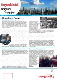
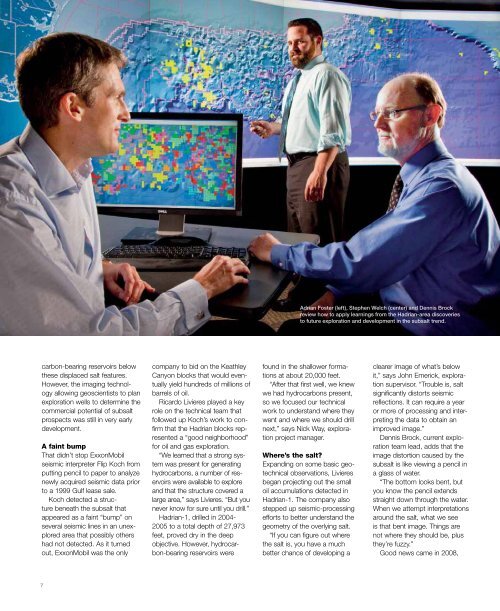
Adrian Foster (left), Stephen Welch (center) and Dennis Brock<br />
review how to apply learnings from the Hadrian-area discoveries<br />
to future exploration and development in the subsalt trend.<br />
found in the shallower formations<br />
at about 20,000 feet.<br />
“After that first well, we knew<br />
we had hydrocarbons present,<br />
so we focused our technical<br />
work to understand where they<br />
went and where we should drill<br />
next,” says Nick Way, exploration<br />
project manager.<br />
Where’s the salt?<br />
Expanding on some basic geotechnical<br />
observations, Livieres<br />
began projecting out the small<br />
oil accumulations detected in<br />
Hadrian-1. The company also<br />
stepped up seismic-processing<br />
efforts to better understand the<br />
geometry of the overlying salt.<br />
“If you can figure out where<br />
the salt is, you have a much<br />
better chance of developing a<br />
clearer image of what’s below<br />
it,” says John Emerick, exploration<br />
supervisor. “Trouble is, salt<br />
significantly distorts seismic<br />
reflections. It can require a year<br />
or more of processing and interpreting<br />
the data to obtain an<br />
improved image.”<br />
Dennis Brock, current exploration<br />
team lead, adds that the<br />
image distortion caused by the<br />
subsalt is like viewing a pencil in<br />
a glass of water.<br />
“The bottom looks bent, but<br />
you know the pencil extends<br />
straight down through the water.<br />
When we attempt interpretations<br />
around the salt, what we see<br />
is that bent image. Things are<br />
not where they should be, plus<br />
they’re fuzzy.”<br />
Good news came in 2008,