Chalo Taluke - Gujarat Information Bureau
Chalo Taluke - Gujarat Information Bureau
Chalo Taluke - Gujarat Information Bureau

You also want an ePaper? Increase the reach of your titles
YUMPU automatically turns print PDFs into web optimized ePapers that Google loves.
October, 2011<br />
anganwadis, local government<br />
infrastructure etc. The geospatial<br />
database of nagar-palikas includes<br />
properties and amenities captured on<br />
city and town planning maps with more<br />
than 100 GIS layers. Similar work for<br />
villages has been initiated as a pilot<br />
project.<br />
The applications of space<br />
technology and Geo-informatics have<br />
become operational in almost all the<br />
developmental sectors of the State.<br />
(ii) <strong>Gujarat</strong> SATCOM Network<br />
(GUJSAT):<br />
<strong>Gujarat</strong> SATCOM Network<br />
provides a facility for interactive<br />
distance education, training, awareness<br />
and extension. It operates through<br />
ISRO's Edusat and Training and<br />
D e v e l o p m e n t C o m m u n i c a t i o n<br />
channels (TDCC). The central facility<br />
of modern studios, digital uplink<br />
facility for extended C-band and Ku-<br />
band TV broadcast and two way video<br />
has been established and is operational<br />
since a decade. The receiving network<br />
for one way video and two way audio<br />
has been established by user<br />
departments. This includes educational<br />
institutes, primary, secondary and<br />
higher secondary schools, colleges of<br />
higher education, medical and technical<br />
colleges, ITIs and departmental<br />
networks.<br />
Augmentation in terms of studio,<br />
channels, technology is done on regular<br />
basis to meet with the increasing<br />
demands of the user community.<br />
Government departments, agencies,<br />
organizations are being approached<br />
proactively to enhance the utilization of<br />
SATCOM network. During this period,<br />
channels, out-reach, beneficiaries,<br />
connectivities has increased manifold.<br />
During the current year, there are plans<br />
to take up virtual education up-to<br />
homes through increase in number of<br />
Direct to home Ku band channels.<br />
This has enabled a link between<br />
government and the people. for the<br />
execution of education and extension<br />
programmes which may not have been<br />
conducted due to limited space, time<br />
and money. Experts, Government<br />
functionaries, specialists and<br />
Government Initiatives<br />
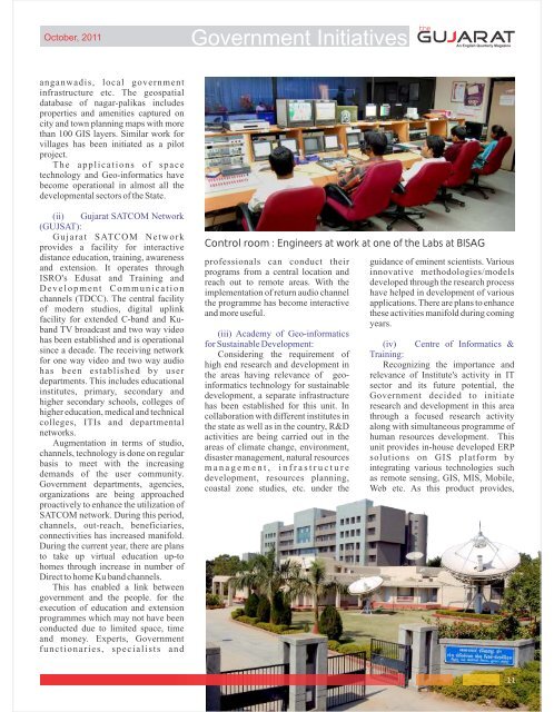
Control room : Engineers at work at one of the Labs at BISAG<br />
professionals can conduct their guidance of eminent scientists. Various<br />
programs from a central location and innovative methodologies/models<br />
reach out to remote areas. With the developed through the research process<br />
implementation of return audio channel have helped in development of various<br />
the programme has become interactive applications. There are plans to enhance<br />
and more useful.<br />
(iii) Academy of Geo-informatics<br />
these activities manifold during coming<br />
years.<br />
for Sustainable Development: (iv) Centre of Informatics &<br />
Considering the requirement of Training:<br />
high end research and development in Recognizing the importance and<br />
the areas having relevance of geo- relevance of Institute's activity in IT<br />
informatics technology for sustainable sector and its future potential, the<br />
development, a separate infrastructure Government decided to initiate<br />
has been established for this unit. In research and development in this area<br />
collaboration with different institutes in through a focused research activity<br />
the state as well as in the country, R&D along with simultaneous programme of<br />
activities are being carried out in the human resources development. This<br />
areas of climate change, environment, unit provides in-house developed ERP<br />
disaster management, natural resources solutions on GIS platform by<br />
m a n a g e m e n t , i n f r a s t r u c t u r e integrating various technologies such<br />
development, resources planning, as remote sensing, GIS, MIS, Mobile,<br />
coastal zone studies, etc. under the Web etc. As this product provides,<br />
11