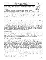
Thompson Nickel Belt Project: Progress on a New Compilation Map ...
Thompson Nickel Belt Project: Progress on a New Compilation Map ...
Thompson Nickel Belt Project: Progress on a New Compilation Map ...

You also want an ePaper? Increase the reach of your titles
YUMPU automatically turns print PDFs into web optimized ePapers that Google loves.
GS-3<br />
THOMPSON NICKEL BELT PROJECT: PROGRESS ON A NEW COMPILATION MAP OF THE<br />
THOMPSON NICKEL BELT (PARTS OF NTS 63F, 63G, 63J, 63O AND 63P)<br />
by J.J. Macek, C.R. McGregor and H.V. Zwanzig<br />
Macek, J.J., McGregor, C.R. and Zwanzig, H.V. 2000: <str<strong>on</strong>g>Thomps<strong>on</strong></str<strong>on</strong>g> <str<strong>on</strong>g>Nickel</str<strong>on</strong>g> <str<strong>on</strong>g>Belt</str<strong>on</strong>g> project: progress <strong>on</strong> a new compilati<strong>on</strong> map of the<br />
<str<strong>on</strong>g>Thomps<strong>on</strong></str<strong>on</strong>g> <str<strong>on</strong>g>Nickel</str<strong>on</strong>g> <str<strong>on</strong>g>Belt</str<strong>on</strong>g> (parts of NTS 63F, 63G, 63J, 63O and 63P); in Report of Activities 2000, Manitoba Industry, Trade and Mines,<br />
Manitoba Geological Survey, p. 13-15.<br />
SUMMARY<br />
Geological compilati<strong>on</strong> of NTS sheets 63F/08, 63F/09, 63G/14 and<br />
63J/03 was completed during last winter as part of an <strong>on</strong>going compilati<strong>on</strong><br />
map program for the <str<strong>on</strong>g>Thomps<strong>on</strong></str<strong>on</strong>g> <str<strong>on</strong>g>Nickel</str<strong>on</strong>g> <str<strong>on</strong>g>Belt</str<strong>on</strong>g> (TNB). The program is<br />
a collaborative project involving the Manitoba Geological Survey, Inco<br />
Ltd., Falc<strong>on</strong>bridge Limited and Huds<strong>on</strong> Bay Explorati<strong>on</strong> and<br />
Development Company Limited (HBED).<br />
During the summer, diam<strong>on</strong>d-drill core from 317 holes, drilled in a<br />
broad area around Wabowden, was re-examined. Thirty per cent of these<br />
drillholes c<strong>on</strong>tain Ospwagan Group rocks. This is notable, as no<br />
Ospwagan Group rocks were shown <strong>on</strong> the 1972 compilati<strong>on</strong> map of this<br />
area. It is well known that, in the northern part of the TNB, the<br />
Ospwagan Group metasedimentary sequence hosts large nickel deposits,<br />
including the <str<strong>on</strong>g>Thomps<strong>on</strong></str<strong>on</strong>g> Mine deposits.<br />
Although <strong>on</strong>ly <strong>on</strong>e-third of the available core was examined this<br />
summer, major lithological trends will be compiled <strong>on</strong>to maps from<br />
the newly obtained data. Relogging of additi<strong>on</strong>al drillholes will be<br />
undertaken next summer to further refine the compilati<strong>on</strong> map.<br />
COMPILATION MAP PROGRESS<br />
Work <strong>on</strong> the new compilati<strong>on</strong> map of the TNB, sub-Paleozoic<br />
porti<strong>on</strong> (Macek et al., 1999a) c<strong>on</strong>tinued during the winter m<strong>on</strong>ths by<br />
extending the compilati<strong>on</strong> (Fig. GS-3-1) to:<br />
1) the extreme southwest (NTS sheets 63F/08 and 63F/09); and<br />
2) the central part (NTS sheets 63G/14 and 63J/03), filling the gap<br />
between Falc<strong>on</strong>bridge Limited and HBED permit data.<br />
Compilati<strong>on</strong> work in the southern part of the exposed TNB around<br />
Wabowden (Fig. GS-3-1, dotted pattern) was delayed until re-examinati<strong>on</strong><br />
of the diam<strong>on</strong>d-drill core, originally stored at the Bucko mine site<br />
(Macek et al., 1999b), had begun. Relogging of this core was initiated<br />
this summer. Out of the 15 000 boxes of core, 5000 were relogged,<br />
providing new regi<strong>on</strong>al lithological informati<strong>on</strong> <strong>on</strong> 317 diam<strong>on</strong>d-drill<br />
holes. Most of these holes are randomly distributed thorough the area,<br />
which straddles Phillips, Halfway, Setting, Bowden, Rock Island,<br />
Resting, C<strong>on</strong>lin, Gormley, Key and Muningwari lakes.<br />
RESULTS<br />
A variety of ultramafic rocks, such as serpentinized dunite,<br />
metaperidotite, metapyroxenite, porphyroblastic metapicrite and derived<br />
ultramafic schists, was identified in 57% of the examined holes (Fig.<br />
GS-3-2a). Ospwagan Group metasedimentary rocks were identified in<br />
30% of the relogged holes (Fig. GS-3-2b). The frequency with which all<br />
Ospwagan Group formati<strong>on</strong>s were intersected is shown in Figure<br />
GS-3-2c, where M, T, P, S and B stand for Manasan, <str<strong>on</strong>g>Thomps<strong>on</strong></str<strong>on</strong>g>, Pipe,<br />
Setting and Bah formati<strong>on</strong>s, respectively.<br />
The abundance of Pipe Formati<strong>on</strong> rocks encountered in the drillholes<br />
(57%) is mainly a result of ‘target drilling’ of str<strong>on</strong>g magnetic<br />
anomalies associated with electromagnetic c<strong>on</strong>ductors. In the TNB,<br />
magnetic anomalies are usually caused by ultramafic rocks and magnetiferous<br />
silicate-facies ir<strong>on</strong>-formati<strong>on</strong>. Those c<strong>on</strong>ductors caused by<br />
graphite-enriched, sulphide-facies ir<strong>on</strong>-formati<strong>on</strong> occur in the Pipe<br />
Formati<strong>on</strong> (Macek and Bleeker, 1989; Bleeker, 1990).<br />
CONCLUSIONS<br />
The abundance of Ospwagan Group<br />
rocks in the re-examined drillcore is quite<br />
significant, because the previous compilati<strong>on</strong><br />
map of the TNB (Coats et al., 1972) does not show any occurrences<br />
of the Ospwagan Group metasedimentary sequence (unit 5) in the<br />
Wabowden area. Previously, the most southerly occurrence of Ospwagan<br />
Group rocks was recorded <strong>on</strong> Brostrom Lake, just north of Sasagiu<br />
Rapids. The re-examinati<strong>on</strong> of the retrieved core, initiated this summer,<br />
will substantially c<strong>on</strong>tribute to the accuracy of the new compilati<strong>on</strong> map<br />
of the TNB. Although two-thirds of the available core have yet to be<br />
examined, major lithological trends have emerged and will be added to<br />
the compilati<strong>on</strong> map during the coming winter.<br />
ACKNOWLEDGMENTS<br />
The authors gratefully acknowledge the generous logistical and<br />
pers<strong>on</strong>nel support of Falc<strong>on</strong>bridge Limited, including free access to<br />
proprietary data; without this assistance, the compilati<strong>on</strong> work would not<br />
have been possible.<br />
We also thank our summer assistants, C. Lettley, F. McGregor, N.<br />
Cates, S. Johnst<strong>on</strong>, K. Salzsauler and J. Thackeray, for their valuable<br />
help during work that was often c<strong>on</strong>ducted under difficult c<strong>on</strong>diti<strong>on</strong>s.<br />
REFERENCES<br />
Bleeker, W. 1990: <str<strong>on</strong>g>Thomps<strong>on</strong></str<strong>on</strong>g> area – general geology and ore deposits; in<br />
Geology and Mineral Deposits of the Flin Fl<strong>on</strong> and <str<strong>on</strong>g>Thomps<strong>on</strong></str<strong>on</strong>g><br />
<str<strong>on</strong>g>Belt</str<strong>on</strong>g>s, Manitoba (Field Trip 10), (ed.) A.G. Galley, A.H. Bailes,<br />
E.C. Syme, W. Bleeker, J.J. Macek and T.M.Gord<strong>on</strong>;<br />
Geological Survey of Canada, Open File 2165, p. 93–125.<br />
Coats, C.J.A., Quirke, T.T., Bell, C.K., Cranst<strong>on</strong>e, D.A. and Campbell,<br />
F.H.A. 1972: Geology and mineral deposits of the Flin Fl<strong>on</strong>,<br />
Lynn Lake and <str<strong>on</strong>g>Thomps<strong>on</strong></str<strong>on</strong>g> areas, Manitoba, and the<br />
Churchill–Superior fr<strong>on</strong>t of the western Precambrian shield;<br />
XXIV Internati<strong>on</strong>al Geological C<strong>on</strong>gress, M<strong>on</strong>treal, Canada,<br />
Field Excursi<strong>on</strong> A31–C31 Guidebook.<br />
Macek, J.J. and Bleeker, W. 1989: <str<strong>on</strong>g>Thomps<strong>on</strong></str<strong>on</strong>g> <str<strong>on</strong>g>Nickel</str<strong>on</strong>g> <str<strong>on</strong>g>Belt</str<strong>on</strong>g> project: Pipe<br />
Pit mine, Setting and Ospwagan Lakes; in Report of Field<br />
Activities 1989, Manitoba Energy and Mines, Geological<br />
Services, p. 73–87.<br />
Macek, J.J., Zwanzig, H.V. and McGregor, C.R. 1999a: <str<strong>on</strong>g>Thomps<strong>on</strong></str<strong>on</strong>g><br />
<str<strong>on</strong>g>Nickel</str<strong>on</strong>g> <str<strong>on</strong>g>Belt</str<strong>on</strong>g> project: progress <strong>on</strong> a new compilati<strong>on</strong> map of the<br />
<str<strong>on</strong>g>Thomps<strong>on</strong></str<strong>on</strong>g> <str<strong>on</strong>g>Nickel</str<strong>on</strong>g> <str<strong>on</strong>g>Belt</str<strong>on</strong>g> (parts of NTS 63G, 63J, 63O and 63P);<br />
in Report of Activities 1999, Manitoba Industry, Trade and<br />
Mines, Geological Services, p. 14.<br />
Macek, J.J., Ducharme, E.B., Lettley, C. and McGregor, C.R. 1999b:<br />
<str<strong>on</strong>g>Thomps<strong>on</strong></str<strong>on</strong>g> <str<strong>on</strong>g>Nickel</str<strong>on</strong>g> <str<strong>on</strong>g>Belt</str<strong>on</strong>g> project: retrieval of the diam<strong>on</strong>d drill<br />
core from Falc<strong>on</strong>bridge Limited’s Bucko explorati<strong>on</strong> site near<br />
Wabowden (parts of NTS 63J, 630 and 63P); in Report of<br />
Activities 1999, Manitoba Industry, Trade and Mines,<br />
Geological Services, p. 15–17.<br />
13
Figure GS-3-1: Status of the <str<strong>on</strong>g>Thomps<strong>on</strong></str<strong>on</strong>g> <str<strong>on</strong>g>Nickel</str<strong>on</strong>g> <str<strong>on</strong>g>Belt</str<strong>on</strong>g> compilati<strong>on</strong>, showing boundaries of the geological data c<strong>on</strong>tributed by all partners.<br />
14
Figure GS-3-2: Main rock types encountered in the re-examined diam<strong>on</strong>d-drill holes in the regi<strong>on</strong> around Wabowden.<br />
15