

The Use of Wetlands for Flood Attenuation FINAL REPORT - An Taisce
The Use of Wetlands for Flood Attenuation FINAL REPORT - An Taisce
The Use of Wetlands for Flood Attenuation FINAL REPORT - An Taisce

You also want an ePaper? Increase the reach of your titles
YUMPU automatically turns print PDFs into web optimized ePapers that Google loves.
<strong>The</strong> <strong>Use</strong> <strong>of</strong> <strong>Wetlands</strong> <strong>for</strong> <strong>Flood</strong> <strong>Attenuation</strong><br />
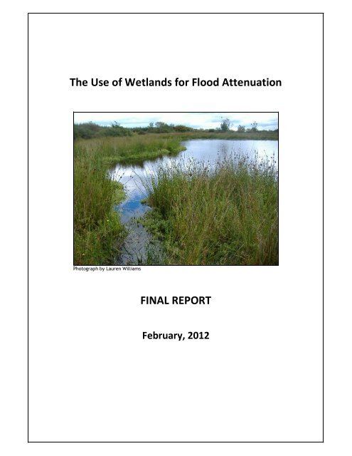
Photograph by Lauren Williams<br />
<strong>FINAL</strong> <strong>REPORT</strong><br />
February, 2012
<strong>The</strong> <strong>Use</strong> <strong>of</strong> <strong>Wetlands</strong> <strong>for</strong> <strong>Flood</strong> <strong>Attenuation</strong> Aquatic Services Unit, UCC<br />
Report by: Lauren Williams<br />
Aquatic Services Unit (ASU)<br />
University College Cork (UCC)<br />
ERI Building<br />
Lee Road<br />
Cork<br />
Ireland<br />
Dr. Simon Harrison<br />
School <strong>of</strong> Biological, Earth & Environmental Sciences (BEES), UCC.<br />
Dr. <strong>An</strong>ne Marie O’Hagan<br />
Law, Policy and Environment,<br />
Hydraulics and Maritime Research Centre (HMRC), UCC.<br />
For: <strong>An</strong> <strong>Taisce</strong><br />
National Trust <strong>for</strong> Ireland<br />
Tailors Hall<br />
Back Lane<br />
Dublin 8<br />
Reference as: Williams, L., Harrison, S. and O’Hagan A M. (2012) <strong>The</strong> use <strong>of</strong> wetlands <strong>for</strong> flood<br />
attenuation. Report <strong>for</strong> <strong>An</strong> <strong>Taisce</strong> by Aquatic Services Unit, University College Cork.<br />
Front cover photograph: Groundwater fed depression wetland (fen), Watergrasshill, Co. Cork.<br />
<strong>FINAL</strong> <strong>REPORT</strong>, February, 2012 2
<strong>The</strong> <strong>Use</strong> <strong>of</strong> <strong>Wetlands</strong> <strong>for</strong> <strong>Flood</strong> <strong>Attenuation</strong> Aquatic Services Unit, UCC<br />
TABLE OF CONTENTS<br />
EXECUTIVE SUMMARY .......................................................................................................... 6<br />
PART I <strong>The</strong> role <strong>of</strong> wetlands in <strong>Flood</strong> <strong>Attenuation</strong> ......................................................... 11<br />
1. Introduction ....................................................................................................... 11<br />
1.1 <strong>Flood</strong>ing ............................................................................................................................... 11<br />
1.2 <strong>Wetlands</strong> and flood attenuation ......................................................................................... 12<br />
1.3 Issues concerning the use <strong>of</strong> wetlands in flood attenuation............................................... 13<br />
1.4 Policy implications ............................................................................................................... 14<br />
2. How do wetlands attenuate flooding? ............................................................... 15<br />
2.1 Overview .............................................................................................................................. 15<br />
2.2 <strong>The</strong> process <strong>of</strong> flood attenuation ........................................................................................ 15<br />
3. Wetland hydrology and flood attenuation properties ....................................... 19<br />
3.1 Alluvial floodplains .............................................................................................................. 20<br />
3.2 Peatlands ............................................................................................................................. 24<br />
3.2.1 Raised and blanket bogs ............................................................................................. 24<br />
3.2.2 Fens ............................................................................................................................. 26<br />
3.3 Karstic landscapes ............................................................................................................... 29<br />
3.4 Coastal wetlands .................................................................................................................. 30<br />
3.5 Function specific constructed wetlands .............................................................................. 32<br />
3.5.1 Integrated Constructed <strong>Wetlands</strong> (ICWs) ................................................................... 32<br />
3.5.2 Sustainable Drainage Systems (SuDS)......................................................................... 33<br />
4. Management <strong>of</strong> wetlands .................................................................................. 36<br />
4.1 <strong>Flood</strong>plain management ...................................................................................................... 36<br />
4.2 Peatland management ........................................................................................................ 38<br />
4.3 Variables affecting wetland management and flood attenuation ...................................... 40<br />
5. Conflicts between flood attenuation and other wetland functions.................... 42<br />
5.1 Biodiversity .......................................................................................................................... 42<br />
5.2 Water quality ....................................................................................................................... 43<br />
6. Methods to enhance and mimic natural drainage processes ............................. 45<br />
6.1 Overview .............................................................................................................................. 45<br />
6.2 Restoring alluvial floodplain function .................................................................................. 45<br />
6.3 Managed coastal realignment ............................................................................................. 46<br />
6.4 International examples ........................................................................................................ 46<br />
6.4.1 <strong>Flood</strong>plain restoration: Southlake Moor, UK. ............................................................. 46<br />
6.4.2 Polder creation: Altenheim Polders, Germany ........................................................... 48<br />
6.4.3 Wetland storage: Whangamarino wetland, New Zealand ......................................... 48<br />
<strong>FINAL</strong> <strong>REPORT</strong>, February, 2012 3
<strong>The</strong> <strong>Use</strong> <strong>of</strong> <strong>Wetlands</strong> <strong>for</strong> <strong>Flood</strong> <strong>Attenuation</strong> Aquatic Services Unit, UCC<br />
6.4.4 <strong>Flood</strong>plain and river restoration: Eschweiler, Germany ............................................. 49<br />
6.4.5 Coastal Realignment: Hesketh Out Marshes, UK. ....................................................... 50<br />
6.4.6 Washland creation: Long Eau, Lincolnshire, UK.......................................................... 51<br />
6.4.7 NFM demonstration project: Holnicote, UK ............................................................... 52<br />
6.5 Irish examples ...................................................................................................................... 52<br />
7. Cost effectiveness .............................................................................................. 60<br />
7.1 Overview .............................................................................................................................. 60<br />
7.2 Estimating economic value <strong>of</strong> wetlands in a flood attenuation role................................... 62<br />
7.3 Agricultural subsidies ........................................................................................................... 65<br />
7.4 Cost benefit case studies ..................................................................................................... 65<br />
7.4.1 Maple River Watershed, Red River Valley, North Dakota, USA .................................. 66<br />
7.4.2 Cuckmere River mouth, East Sussex, UK .................................................................... 66<br />
7.4.3 Medmerry Coastal Realignment, West Sussex, UK..................................................... 67<br />
7.4.4 OPW flood relief schemes, Ireland ............................................................................. 68<br />
PART II Law and policy relating to wetlands in a flood attenuation role ........................ 73<br />
1. Introduction ....................................................................................................... 73<br />
2. Biodiversity and conservation ............................................................................ 74<br />
2.1 International Conventions ................................................................................................... 74<br />
2.2 European law on biodiversity .............................................................................................. 75<br />
2.3 European policy on biodiversity .......................................................................................... 76<br />
2.4 National law on biodiversity and conservation ................................................................... 77<br />
2.5 National policy on biodiversity and conservation ............................................................... 77<br />
3. Climate change................................................................................................... 78<br />
3.1 International Conventions ................................................................................................... 78<br />
3.2 European policy on climate change ..................................................................................... 78<br />
3.3 National level work on climate change and adaptation ...................................................... 79<br />
4. Water Management ........................................................................................... 80<br />
4.1 European law on water management ................................................................................. 80<br />
4.2 National level River Basin Management Planning............................................................... 81<br />
5. <strong>Flood</strong> Risk Management..................................................................................... 82<br />
5.1 European law relating to flood risk management ............................................................... 82<br />
5.2 National level implementation <strong>of</strong> flood risk management ................................................. 82<br />
5.2.1 <strong>Flood</strong> risk management in the planning system ......................................................... 82<br />
5.2.2 National policy on <strong>Flood</strong> Risk Management ............................................................... 84<br />
6. Coastal and Marine ............................................................................................ 86<br />
6.1 European law relating to status <strong>of</strong> marine and coastal waters ........................................... 86<br />
6.2 National level implementation <strong>of</strong> the MSFD ....................................................................... 86<br />
<strong>FINAL</strong> <strong>REPORT</strong>, February, 2012 4
<strong>The</strong> <strong>Use</strong> <strong>of</strong> <strong>Wetlands</strong> <strong>for</strong> <strong>Flood</strong> <strong>Attenuation</strong> Aquatic Services Unit, UCC<br />
7. Impact Assessment ............................................................................................ 87<br />
7.1 European law on Impact Assessment .................................................................................. 87<br />
7.2 National Planning, Development and Impact Assessment ................................................. 87<br />
8. Agriculture and rural development .................................................................... 89<br />
8.1 European law and policy ..................................................................................................... 89<br />
8.2 National policy on agriculture and rural development ....................................................... 90<br />
8.3 Arterial drainage .................................................................................................................. 91<br />
8.4 Agri-environment schemes ................................................................................................. 92<br />
8.5 Potential future developments ........................................................................................... 93<br />
8.6 Forestry ................................................................................................................................ 94<br />
9. Policy frameworks abroad ................................................................................. 94<br />
9.1 United Kingdom - Making Space <strong>for</strong> Water ......................................................................... 95<br />
9.2 <strong>The</strong> Netherlands – Room <strong>for</strong> Rivers ..................................................................................... 96<br />
PART III Conclusions and Recommendations ................................................................... 98<br />
1. Technical review ................................................................................................ 98<br />
2. Law and policy ................................................................................................. 102<br />
3. Recommendations ........................................................................................... 104<br />
REFERENCES ...................................................................................................................... 105<br />
<strong>FINAL</strong> <strong>REPORT</strong>, February, 2012 5
<strong>The</strong> <strong>Use</strong> <strong>of</strong> <strong>Wetlands</strong> <strong>for</strong> <strong>Flood</strong> <strong>Attenuation</strong> Aquatic Services Unit, UCC<br />
EXECUTIVE SUMMARY<br />
<strong>The</strong> Aquatic Services Unit (ASU) with technical assistance from the School <strong>of</strong> Biological<br />
and Earth Sciences (BEES) and the Hydraulics and Maritime Research Centre (HMRC), all<br />
part <strong>of</strong> UCC, were commissioned by <strong>An</strong> <strong>Taisce</strong>, the National Trust <strong>for</strong> Ireland, to carry out<br />
this review <strong>of</strong> the role <strong>of</strong> wetlands in flood attenuation in Ireland.<br />
As required under the EU <strong>Flood</strong>s Directive (2007/60/EC), Ireland is currently developing<br />
a catchment based approach to flood risk management. <strong>An</strong> integral part <strong>of</strong> this process,<br />
as directed by European best practise guidance, is the identification <strong>of</strong> strategies to<br />
improve water retention within the catchment.<br />
<strong>The</strong> following review examines relevant wetlands types and their potential <strong>for</strong> flood<br />
attenuation in an Irish context, with an aim to their inclusion in future flood risk<br />
management in Ireland. Part I examined technical aspects and provides examples <strong>of</strong><br />
wetlands in a flood attenuation role. Cost-effectiveness and economic values that can<br />
be attached to wetlands in a flood attenuation role are examined, through both market<br />
and ‘ecosystem services’ views. Part II identifies national legislation and policy affecting<br />
wetland habitat that may influence the potential <strong>for</strong> wetlands to become accepted as<br />
part <strong>of</strong> a national strategy <strong>for</strong> flood management. <strong>The</strong> report makes recommendations<br />
and is intended to in<strong>for</strong>m national discussion on the future consideration <strong>of</strong> the use <strong>of</strong><br />
wetlands <strong>for</strong> flood attenuation in Ireland.<br />
<strong>The</strong> importance <strong>of</strong> wetlands <strong>for</strong> flood attenuation<br />
Continuing urban and agricultural expansion in recent decades, <strong>of</strong>ten onto historic<br />
floodplains, has accentuated the need <strong>for</strong> cost effective flood prevention measures,<br />
particularly given future climate change scenarios <strong>of</strong> increasing frequency <strong>of</strong> extreme<br />
rainfall and storm surge events. At the same time, there has been a shift in focus in<br />
Europe and North America away from ‘hard’ engineering solutions, such as channel<br />
alteration and river embankment construction, towards encouraging more natural flood<br />
management (NFM) solutions within catchments. <strong>The</strong> UK’s ‘Making Space <strong>for</strong> Water’<br />
and Netherland’s ‘Room <strong>for</strong> Rivers’ approaches, <strong>for</strong> example, promote spatial rather<br />
than purely technical flood management solutions by the provision <strong>of</strong> more room <strong>for</strong><br />
peak river discharges. In this context, wetlands are increasingly seen as providing a<br />
potential valuable ecosystem service <strong>of</strong> flood attenuation. This is additional to their<br />
purported role as ‘buffers’ to prevent excess sediment and nutrient inputs into<br />
waterways and as conservation and biodiversity hotspots within intensively-used<br />
landscapes. <strong>The</strong> value <strong>of</strong> wetlands <strong>for</strong> flood attenuation is, however, <strong>of</strong>ten exaggerated<br />
and many wetlands in fact play only a very weak role, if at all, in attenuating floods. This<br />
is largely due to the very heterogeneous nature <strong>of</strong> wetlands in terms <strong>of</strong> location within a<br />
catchment, hydrological function and physical dimension.<br />
<strong>The</strong> role <strong>of</strong> different types <strong>of</strong> wetland with respect to flood control<br />
<strong>The</strong> main natural wetland types can be divided, hydrologically, into alluvial mineral soil<br />
floodplains (‘washlands’), which can temporarily store water which spills over the<br />
channel banks and headwater peatsoil wetlands (chiefly bogs and fens) which can slow<br />
the movement <strong>of</strong> water from hillslope into channels. Coastal wetlands / estuarine<br />
<strong>FINAL</strong> <strong>REPORT</strong>, February, 2012 6
<strong>The</strong> <strong>Use</strong> <strong>of</strong> <strong>Wetlands</strong> <strong>for</strong> <strong>Flood</strong> <strong>Attenuation</strong> Aquatic Services Unit, UCC<br />
floodplains can be considered a type <strong>of</strong> washland, which also attenuate waves and<br />
storm surges. <strong>The</strong> two broad types <strong>of</strong> wetland differ both in their position in the<br />
catchment and in the hydrological properties <strong>of</strong> their soils. <strong>Flood</strong>plain wetlands are<br />
typically inundated by river floods during major storm events and, by allowing<br />
floodwater to move over the banks and ‘spill’ over onto low-gradient land adjacent to<br />
the river, can mitigate the peak water volume in the channel. Headwater peatsoil<br />
wetlands, in contrast, typically are not inundated by overbank flow to any great extent,<br />
but instead receive water from rainwater and hillslopes after precipitation events and<br />
can mitigate the speed with which water moves from land into headwater drainage<br />
channels. <strong>The</strong> peat soils <strong>of</strong> headwater wetlands are saturated <strong>for</strong> much <strong>of</strong> the time and<br />
there<strong>for</strong>e possess little soil storage capacity compared with the drier mineral soils <strong>of</strong> the<br />
lowland floodplains. Taken together, the flood attenuation potential <strong>for</strong> alluvial soil<br />
floodplains is typically much greater than that <strong>of</strong> peatsoil headwater wetlands, and this<br />
tends to be supported by most recent empirical evidence.<br />
Wetland hydrological function and effectiveness in flood control<br />
Within a wetland type, the physical nature <strong>of</strong> individual wetlands will play a large role in<br />
determining its flood attenuation value. <strong>Flood</strong>plains receive water from four sources:<br />
river, rainwater, groundwater and hillslope. River water will inundate floodplains<br />
intermittently resulting from over-bank flow during periods <strong>of</strong> high fluvial discharge.<br />
<strong>The</strong> water that moves from channel to floodplain is stored temporarily on the rough<br />
floodplain surface, consisting <strong>of</strong> a complex <strong>of</strong> depressions, pools and ancient channels,<br />
and in floodplain soils, delaying the flood peak, be<strong>for</strong>e being released later as channel<br />
water drops to below that <strong>of</strong> the water level in the bank. Rough topography - both <strong>of</strong><br />
land <strong>for</strong>m and woody, coarse vegetation – and unsaturated soils will also aid temporary<br />
water storage, and the high water evaporation and evapotranspiration <strong>of</strong> intact<br />
wetlands can also potentially reduce catchment run<strong>of</strong>f. <strong>The</strong> flood attenuation properties<br />
<strong>of</strong> individual floodplains will vary considerably, depending on their physical and<br />
hydrological characteristics. <strong>Flood</strong>plains with small surface area, high gradient, high<br />
hillslope flow and high groundwater levels will store water less effectively than large flat<br />
floodplains with low hillslope flow and low groundwater levels. <strong>The</strong> complex interaction<br />
between a given flood level and all these physical and biological characteristics <strong>of</strong> a<br />
floodplain makes it difficult to ascribe a quantitative flood protection value <strong>for</strong> particular<br />
wetlands without some kind <strong>of</strong> individual assessment.<br />
<strong>The</strong> hydrology <strong>of</strong> headwater peatlands is very different to alluvial floodplains and they<br />
generally receive much <strong>of</strong> their water either as rainwater (particularly bogs) or<br />
groundwater and hillslope (fens), rather than overbank flood water from channels. Bogs<br />
and fens can attenuate floods by delaying the run<strong>of</strong>f <strong>of</strong> these sources <strong>of</strong> water into<br />
headwater channels. As their peat soils are saturated <strong>for</strong> much <strong>of</strong> the time, particularly<br />
<strong>for</strong> blanket bogs, they generally have little effective soil storage capacity and their<br />
attenuation value comes from their rough surface topography slowing the movement <strong>of</strong><br />
surface and sub-surface water, and their capacity to reduce catchment run<strong>of</strong>f through<br />
enhanced evaporation. Peatlands possessing tall woody or coarse vegetation, many<br />
small surface depressions and pools and with little surface channel connectivity will tend<br />
to hold surface water <strong>for</strong> longer, so delaying water discharge to downstream channels.<br />
Whilst water retention by peatland surfaces may attenuate and delay run<strong>of</strong>f events, the<br />
<strong>FINAL</strong> <strong>REPORT</strong>, February, 2012 7
<strong>The</strong> <strong>Use</strong> <strong>of</strong> <strong>Wetlands</strong> <strong>for</strong> <strong>Flood</strong> <strong>Attenuation</strong> Aquatic Services Unit, UCC<br />
flood mitigation role <strong>of</strong> peatsoil wetlands is <strong>of</strong>ten overstated and it has been recognised<br />
<strong>for</strong> many years that not all peatlands reduce storm flows, particularly in winter, nor<br />
provide higher flows in summer.<br />
<strong>Wetlands</strong> in Irish karstic landscapes (turloughs) are temporary in nature. Turloughs hold<br />
water in winter, when groundwater levels are high and fill valley basins and smaller<br />
depressions within the landscape. <strong>The</strong> seasonal inundation <strong>of</strong> these depressions in a<br />
function <strong>of</strong> complex surface-groundwater interactions, in which water levels are both<br />
drained and recharged through sinkholes. <strong>The</strong>ir flood attenuation property is similar to<br />
that <strong>of</strong> fens and likely is determined by the rate at which they can temporarily store<br />
surface water, via soil storage and also in their somewhat greater evapotranspiration <strong>of</strong><br />
water relative to non-wetlands. <strong>The</strong> complex nature <strong>of</strong> each catchment area and<br />
discharge route makes prediction <strong>of</strong> the flood attenuation <strong>of</strong> turloughs problematic, and<br />
the understanding <strong>of</strong> turlough hydrology and drainage is far from complete.<br />
Coastal wetlands can attenuate seaward flooding, resulting from storm surges, high<br />
waves and high tides and landward flooding resulting from rivers spilling over banks<br />
onto estuarine floodplains. Salt marshes are effective dissipators <strong>of</strong> wave energy and<br />
provide a first line <strong>of</strong> defence against tides and waves, particularly during stormy<br />
conditions. Highly resilient emergent and near emergent salt marsh vegetation creates<br />
roughness that reduces wave height and speed as it travels across the intertidal surface,<br />
so attenuating waves. <strong>The</strong> large water storage capacity <strong>of</strong> the large expanse <strong>of</strong> flat<br />
estuarine wetlands will also be extremely important in attenuating water spilling over<br />
channel banks either due to high river levels or high tidal levels. Tidal flood attenuation<br />
is particularly important in areas where sea water is confined in narrow inlets, bays and<br />
natural harbours, such that the tidal flow cannot be displaced along the coast. <strong>The</strong><br />
important function <strong>of</strong> riverine floodplains <strong>of</strong> delaying floodwater run<strong>of</strong>f, via a rough<br />
surface topography, is probably less important in coastal or estuarine wetlands than<br />
available storage volume capacity, as downstream flooding is rarely an issue, except in<br />
cases where urban settlements are located in the lower estuary.<br />
<strong>The</strong> flood attenuation potential <strong>of</strong> function-specific constructed wetlands and artificial<br />
wetlands will depend largely on their location within a landscape and design and be<br />
governed by the same constraints and factors as <strong>for</strong> floodplains and headwater<br />
peatlands. It is important to note that their flood attenuation function may not<br />
necessarily be complementary with their primary function. For example, a wetland with<br />
saturated soils may have high denitrification, but low flood attenuation potential.<br />
Similarly, wetlands that are designed to store particulate phosphorus and sediment on<br />
their surface and shallow sub-soil may shed these to downstream receiving waters, with<br />
negative consequences <strong>for</strong> water quality, in the event <strong>of</strong> flood waters spilling onto the<br />
wetland.<br />
<strong>Flood</strong> attenuation and land use changes<br />
Human management can potentially increase or decrease the capacity <strong>of</strong> a given<br />
wetland to attenuate floods. Encouraging extensive surface water <strong>for</strong> long periods on<br />
natural floodplains (<strong>for</strong> example, to benefit wetland plant and animal communities,<br />
particularly wading birds) can raise groundwater levels, reduce soil moisture deficits and<br />
<strong>FINAL</strong> <strong>REPORT</strong>, February, 2012 8
<strong>The</strong> <strong>Use</strong> <strong>of</strong> <strong>Wetlands</strong> <strong>for</strong> <strong>Flood</strong> <strong>Attenuation</strong> Aquatic Services Unit, UCC<br />
infiltration rates and speed run<strong>of</strong>f, so negatively affecting flood attenuation potential.<br />
As <strong>for</strong> artificial or constructed wetlands, enhancing wetland biodiversity is <strong>of</strong>ten<br />
conflated with enhancing flood attenuation potential, whereas in fact the two may not<br />
be necessarily wholly compatible. Agricultural intensification <strong>of</strong> floodplains can have<br />
positive and negative effects on flood attenuation potential. Increased soil compaction<br />
and surface drainage may act negatively by reducing the infiltration <strong>of</strong> flood waters into<br />
floodplain soils, and speeding the run<strong>of</strong>f <strong>of</strong> surface water to the river channel. Greater<br />
surface drainage to dry out floodplains can, on the other hand, reduce groundwater<br />
levels and soil moisture, potentially leading to enhanced flood water storage. Removal<br />
<strong>of</strong> hedgerows, woody vegetation and surface depressions (including relict channels and<br />
pools) will all tend to reduce surface storage <strong>of</strong> flood waters. For peatsoil wetlands, the<br />
drainage channels cut in the past to drain bogs and fens can increase the soil moisture<br />
deficit <strong>of</strong> the peat surface, enhancing soil water storage capacity, but also speed water<br />
flow to channels. Similarly, rapidly removing floodwaters in wetlands with seasonally<br />
high groundwater levels, via run<strong>of</strong>f drainage channels, will lessen the overland water<br />
storage capacity <strong>of</strong> the wetland, although may enhance soil moisture storage capacity.<br />
Blocking drainage channels – a practice sometimes undertaken to ‘restore’ disturbed<br />
bogs and fens - may retard water flow to downstream streams but can also elevate soil<br />
moisture levels, so reducing soil water storage capacity. Although many wetlands have<br />
the potential to attenuate flooding, the planning process requires more definite and<br />
detailed in<strong>for</strong>mation on the impact <strong>of</strong> individual wetlands and also on the likely impact<br />
<strong>of</strong> landuse changes, such as agricultural intensification, af<strong>for</strong>estation and urbanisation.<br />
However, the complex interactions between soil type, land use, landscape configuration<br />
and climate at a local sub-catchment level make it difficult to scale these processes up to<br />
large catchment scales.<br />
‘Hydrological’ floods vs ‘economic’ floods<br />
Where a particular wetland has the potential to attenuate downstream flooding, the<br />
realised attenuation will depend strongly on the rainfall and flood event. In general the<br />
influence <strong>of</strong> wetlands in reducing flood peaks is greatest <strong>for</strong> high frequency, low to<br />
medium rainfall events that occur when wetlands have a large capacity <strong>for</strong> storage. It is<br />
least <strong>for</strong> large events, particularly following a long period <strong>of</strong> prior rainfall, when soil and<br />
wetland storage are saturated. In this regard, a distinction can be made between<br />
‘hydrological’ floods (high frequency, low to medium rainfall events that occur<br />
commonly without economic damage) and “economic” floods (low frequency events<br />
following high intensity rainfall, potentially causing economic damage). <strong>Wetlands</strong> may<br />
readily attenuate ‘hydrological’ floods but are much less likely to attenuate ‘economic’<br />
floods. As flood height may be a critical determinant <strong>of</strong> the economic cost <strong>of</strong> a flood,<br />
the management <strong>of</strong> alluvial floodplains upstream <strong>of</strong> sensitive areas so as to maximise<br />
flood storage and thus to reduce flood height (although not duration) is likely to be the<br />
most cost-effective use <strong>of</strong> wetlands <strong>for</strong> flood attenuation.<br />
<strong>Wetlands</strong> and <strong>Flood</strong> Management Policy<br />
Irelands present Catchment <strong>Flood</strong> Risk Assessment and Management (CFRAM) approach<br />
indicates that policy is in place that recognises catchment scale processes in flood<br />
generation and management. However, there are significant hurdles that need to be<br />
overcome in order to achieve sustainable flood management, such as conflicts with<br />
<strong>FINAL</strong> <strong>REPORT</strong>, February, 2012 9
<strong>The</strong> <strong>Use</strong> <strong>of</strong> <strong>Wetlands</strong> <strong>for</strong> <strong>Flood</strong> <strong>Attenuation</strong> Aquatic Services Unit, UCC<br />
statutory drainage maintenance and, critically, socio-economic obstacles that prevent<br />
land use and/or land management changes required to achieve NFM solutions.<br />
Dedicated agri-environmental schemes will be essential in Ireland to encourage the use<br />
<strong>of</strong> wetlands <strong>for</strong> flood attenuation, particularly in the most effective parts <strong>of</strong> the<br />
catchment, i.e., alluvial floodplains. <strong>The</strong> currently available mechanisms under CAP and<br />
national agri-environmental schemes are insufficient to encourage such changes. <strong>The</strong><br />
opportunity should be explored <strong>for</strong> incorporating flood risk management at the farm<br />
level, perhaps under new ‘greening’ measures proposed <strong>for</strong> CAP 2014-2020. Measures<br />
such as 7% set aside <strong>of</strong> ‘ecological’ areas and use <strong>of</strong> ‘innovative practices’ could be<br />
applied to the concept <strong>of</strong> floodplain management. Two measures to enhance the flood<br />
attenuation potential <strong>of</strong> floodplains are: (1) restoring the natural hydrological<br />
connectivity between river and floodplain so allowing land to inundate more frequently;<br />
and, (2) retaining or restoring ‘rough’ floodplain surfaces, in the <strong>for</strong>m <strong>of</strong> walls, hedges,<br />
coarse and woody vegetation, relict channels and depressions. Both <strong>of</strong> these measures<br />
can clearly conflict with the needs <strong>of</strong> intensive agriculture (with its emphasis on large<br />
uninterrupted field systems) and their implementation will require financial incentives<br />
or compensation.<br />
International experience has shown the importance <strong>of</strong> agri-environment schemes to<br />
allow <strong>for</strong> NFM and successful catchment based flood management solutions. Effective,<br />
widely supported adoption <strong>of</strong> the types <strong>of</strong> land use changes required needs alteration <strong>of</strong><br />
existing, or the development <strong>of</strong> new, mechanisms capable <strong>of</strong> providing long term<br />
support to co-operating farmers. <strong>The</strong> UK’s ‘Farming <strong>Flood</strong>plains <strong>for</strong> the Future’ initiative<br />
provides a useful model by examining new incentives tailored to the delivery <strong>of</strong> flood<br />
management objectives through land use change. Using a template similar to agrienvironment<br />
grants, it was suggested that a one-<strong>of</strong>f capital payment to cover initial<br />
outlay, plus regular incentive payments, could be made to farmers who participate.<br />
<strong>The</strong> creation, restoration and use <strong>of</strong> wetlands <strong>for</strong> flood attenuation (primarily floodplain<br />
storage, washland, polder and coastal sites) have become increasingly popular abroad<br />
over the past 20 years. Ireland clearly lags behind in this field. By far the most<br />
influential shift behind the growth <strong>of</strong> NFM solutions was the philosophical and practical<br />
adoption <strong>of</strong> an approach that promotes the controlled spreading out <strong>of</strong> excess water<br />
over the landscape as in ‘Making Space <strong>for</strong> Water’ and ‘Room <strong>for</strong> Rivers’. <strong>The</strong> UK, in<br />
particular, has implemented a number <strong>of</strong> floodplain restoration, managed floodplain<br />
storage schemes, and coastal realignment schemes. <strong>The</strong>se have realised flood<br />
alleviation benefits, and <strong>of</strong>ten a range <strong>of</strong> associated benefits, such as biodiversity<br />
enhancement and sediment control. Benefits, however, need to be examined on a caseby-case<br />
basis as flood alleviation and biodiversity goals are not always synonymous.<br />
A key element in the process <strong>of</strong> utilising wetlands <strong>for</strong> flood attenuation abroad has been<br />
the involvement <strong>of</strong> other public and semi-State authorities as well as the general public.<br />
Funding <strong>for</strong> public consultation in particular is a central element <strong>of</strong> NFM. If the use <strong>of</strong><br />
wetlands <strong>for</strong> flood attenuation is to be considered at certain locations in future, public<br />
engagement will be essential from the earliest stage <strong>of</strong> the catchment management<br />
planning process.<br />
<strong>FINAL</strong> <strong>REPORT</strong>, February, 2012 10
<strong>The</strong> <strong>Use</strong> <strong>of</strong> <strong>Wetlands</strong> <strong>for</strong> <strong>Flood</strong> <strong>Attenuation</strong> Aquatic Services Unit, UCC<br />
PART I <strong>The</strong> role <strong>of</strong> wetlands in <strong>Flood</strong> <strong>Attenuation</strong><br />
1. Introduction<br />
Although the use <strong>of</strong> wetlands <strong>for</strong> flood attenuation is receiving much greater attention<br />
than previously, both in Ireland and abroad, there remains a degree <strong>of</strong> uncertainty about<br />
the relative value <strong>of</strong> different wetland types, in different parts <strong>of</strong> a catchment, <strong>for</strong> flood<br />
storage and attenuation. <strong>The</strong> commonly held belief that all wetlands always serve to<br />
reduce flooding and regulate river flows is not supported by readily available empirical<br />
data. <strong>The</strong> purpose <strong>of</strong> this review is to investigate literature and reported current<br />
practice, in Ireland and abroad, to examine what is known about the effectiveness <strong>of</strong><br />
wetlands in a flood attenuation role and to assist in the understanding <strong>of</strong> their potential<br />
within future flood risk planning.<br />
1.1 <strong>Flood</strong>ing<br />
<strong>Flood</strong>ing is a natural part <strong>of</strong> the hydrological cycle and occurs whenever the capacity <strong>of</strong><br />
the drainage system is exceeded by high channel discharges. <strong>Flood</strong>ing is also important<br />
<strong>for</strong> maintaining the ecological functioning <strong>of</strong> wetlands. Three types <strong>of</strong> flooding and their<br />
associated wetland habitats in Ireland have been considered <strong>for</strong> the purpose <strong>of</strong> this<br />
review, (1) river flooding, where heavy rainfall causes flow to exceed the capacity <strong>of</strong> the<br />
river channel, overtop the banks and flood the surrounding areas (2) coastal flooding,<br />
where combinations <strong>of</strong> extreme weather conditions, high tides, surges and wave<br />
overtopping cause sea water to inundate land (Farrell, 2005), and (3) groundwater<br />
flooding, primarily confined to karst landscapes <strong>of</strong> the western seaboard, occurring<br />
when turloughs overflow their bounds (Peach & Wheater, 2009).<br />
<strong>Flood</strong>s vary considerably in size and duration. Local intense rainfall events can deliver<br />
high water volumes, chiefly via overland flow, into small headwater channels, but also<br />
via excess groundwater recharge. In the case <strong>of</strong> surface flows, smaller channels quickly<br />
develop a short acute peak flood discharge, which may overspill banks and lead to local<br />
flooding. <strong>The</strong>se flood events are usually short in duration and rarely extend far away<br />
from banks owing to the generally steep nature <strong>of</strong> riparian habitats along headwater<br />
streams. Prolonged high rainfall over a wide area, however, can deliver high discharges<br />
from multiple tributaries into higher order channels. Peak discharges arrive later and<br />
take longer to reduce than those in the headwaters, giving a characteristic attenuated<br />
shape to the flood hydrograph. <strong>Flood</strong> events then may last <strong>for</strong> longer as it takes longer<br />
<strong>for</strong> water to drain from the system and extend far from the banks owing to the lower<br />
gradient <strong>of</strong> large order river floodplains (Gordon et al., 2004)<br />
<strong>Flood</strong>ing continues to pose a threat worldwide to life, property and infrastructure.<br />
Recent flooding in Ireland, the UK, Australia and Brazil, have shown that extreme events<br />
can overwhelm the capacity <strong>of</strong> large, populated catchments to shed water in a<br />
controlled manner. <strong>Flood</strong> flows have historically been managed in two ways, by: (1)<br />
increasing channel capacity or, (2) temporarily storing excess water. Traditional<br />
drainage methods <strong>of</strong> deepening and widening channels, or increasing flow velocity by<br />
<strong>FINAL</strong> <strong>REPORT</strong>, February, 2012 11
<strong>The</strong> <strong>Use</strong> <strong>of</strong> <strong>Wetlands</strong> <strong>for</strong> <strong>Flood</strong> <strong>Attenuation</strong> Aquatic Services Unit, UCC<br />
channel straightening, provides increased capacity and reduces the depth <strong>of</strong> local<br />
flooding, but will tend to increase flood risk downstream. Temporary storage <strong>of</strong> water,<br />
either on the catchment surface be<strong>for</strong>e it reaches a channel, or on floodplains once it<br />
has spilled over channel banks will reduce channel discharges and attenuate the flood.<br />
Those parts <strong>of</strong> the catchment that can retain surface water and retard its movement<br />
into channels, thus, provide a valuable function in flood mitigation.<br />
1.2 <strong>Wetlands</strong> and flood attenuation<br />
In response to climate change predictions, the understanding <strong>of</strong> how weather patterns<br />
create flood events has risen in prominence in recent years. However, there is still<br />
considerable interest in predicting the interactive effect <strong>of</strong> catchment land use and<br />
cover on flood generation. In particular, the potential <strong>for</strong> parts <strong>of</strong> the catchment to<br />
delay run-<strong>of</strong>f during high risk, low frequency, precipitation events is <strong>of</strong> high importance<br />
<strong>for</strong> statutory bodies charged with managing floods and flood risk, e.g., UK Environment<br />
Agency (EA) and Irelands Office <strong>of</strong> Public Works (OPW) as these may <strong>of</strong>fer a relatively<br />
low cost alternative to flood management compared with traditional, hard engineering<br />
solutions. In many places (e.g. UK, Netherlands) natural flood management (NFM)<br />
measures are now considered as an important part <strong>of</strong> sustainable flood management.<br />
<strong>Wetlands</strong> are widely held to be important components <strong>of</strong> a natural landscape, through<br />
their value to local and regional biodiversity and particularly their functional hydrological<br />
role. Inland wetlands are <strong>of</strong>ten said to mediate groundwater recharge and discharge; to<br />
‘buffer’ excess sediment and nutrient inputs, regulate base flow and, critical to this<br />
review, attenuate flooding (Maltby, 1991, MA, 2005).<br />
Most prominent <strong>of</strong> possible, inland, sustainable flood management solutions is the use<br />
<strong>of</strong> catchment floodplains. <strong>The</strong> flooding <strong>of</strong> riparian land, leading to temporary storage <strong>of</strong><br />
flood water, attenuation <strong>of</strong> the peak discharge <strong>of</strong> a flood event and reduction <strong>of</strong> flooding<br />
likelihood downstream has been well documented (e.g., Acreman, 2003; Bullock &<br />
Acreman, 2003; Morris et al., 2004, 2010).<br />
Less well known is the ability <strong>of</strong> peatlands (bogs and fens) to attenuate flooding,<br />
although this is the focus <strong>of</strong> current and ongoing field studies (Holden et al., 2009,<br />
Grayson et al., 2010) and catchment based flood risk management simulations such as<br />
the Ripon Land Management Study, UK (JBA Consulting, 2007). Whilst some studies<br />
suggest that peatlands within a catchment can reduce floods, others imply that since<br />
peatland soils are normally saturated, they instead can act more as flood generating<br />
areas (Bullock & Acreman, 2003).<br />
<strong>Attenuation</strong> and hydraulic per<strong>for</strong>mance <strong>of</strong> certain types <strong>of</strong> constructed wetland are<br />
more readily recognised since these are constructed to a design standard specific to the<br />
role. <strong>The</strong> ability <strong>of</strong> carefully designed wetlands or detention basins to slow the flood<br />
peak and alter downstream hydrographs is demonstrated by Sustainable Drainage<br />
Systems (SuDS) facilities, but less so by Integrated Constructed <strong>Wetlands</strong> (ICWs).<br />
Many, if not all natural wetlands thus have the potential to alter downstream peak flows<br />
which gives them considerable economic and political value within a regional planning<br />
<strong>FINAL</strong> <strong>REPORT</strong>, February, 2012 12
<strong>The</strong> <strong>Use</strong> <strong>of</strong> <strong>Wetlands</strong> <strong>for</strong> <strong>Flood</strong> <strong>Attenuation</strong> Aquatic Services Unit, UCC<br />
framework (MA, 2005; TEEB, 2010). <strong>Flood</strong> attenuation provided by wetland water<br />
storage is increasingly seen as a useful complement to conventional flood defence (JBA<br />
Consulting 2005; OPW, 2004, Wheater & Evans, 2009, Morris et al., 2004) and has<br />
already been considered within large scale flood defence schemes within Ireland (OPW<br />
2003a, 2003b, 2003c, 2005a, 2005b).<br />
In Ireland, evidence is required <strong>of</strong> the level <strong>of</strong> flood alleviation that can be gained, be<strong>for</strong>e<br />
statutory and/or regulatory bodies may routinely include the role <strong>of</strong> wetlands in future<br />
flood risk management (Nathy Gilligan, OPW, pers. comm). Under the EU <strong>Flood</strong>s<br />
Directive 1 , the OPW are currently preparing the framework <strong>for</strong> Catchment <strong>Flood</strong> Risk<br />
Management Plans (CFRMPs) and this presents an excellent opportunity to examine the<br />
role <strong>of</strong> wetlands in a flood attenuation role in the context <strong>of</strong> a catchment based<br />
approach to flood risk management. <strong>The</strong> content <strong>of</strong> this review should assist such a<br />
task as it presents what is known about the effectiveness <strong>of</strong> wetlands in a flood<br />
attenuation role (Part I, section 3), which has a bearing on the prospect <strong>of</strong> accurately<br />
assessing cost-benefit scenarios <strong>for</strong> alternative flood relief strategies (Part I, section 7).<br />
Furthermore, possible opportunities and conflicts between the use <strong>of</strong> wetlands <strong>for</strong> flood<br />
attenuation and biodiversity roles are examined (Part I, section 5) along with the way in<br />
which management <strong>of</strong> wetlands affects their flood attenuation role (Part I, section 4). A<br />
review <strong>of</strong> international and national policy and legislation in relation to wetlands <strong>for</strong><br />
flood attenuation is also presented in Part II <strong>of</strong> this report.<br />
1.3 <strong>The</strong> use <strong>of</strong> inland wetlands in flood attenuation<br />
<strong>The</strong>re are two major issues concerning the function <strong>of</strong> inland wetlands as flood<br />
mitigation. First, although the proportion <strong>of</strong> a catchment that is wetland can be<br />
substantial, there appears to be little consensus on the role <strong>of</strong> the various types <strong>of</strong><br />
wetland in flood attenuation (Bullock and Acreman, 2003; Kværner and Kløve, 2008).<br />
Second, they are under severe threat from conversion to other more pr<strong>of</strong>itable land<br />
uses, chiefly agriculture, urbanisation and <strong>for</strong>estry. Each <strong>of</strong> these land uses brings a<br />
significant change in the hydrological functioning <strong>of</strong> the previously wetland land area,<br />
ranging from increased drainage <strong>of</strong> wetland surface water to complete loss <strong>of</strong> wetland<br />
habitat in the case <strong>of</strong> housing developments.<br />
Drainage <strong>of</strong> wetlands, particularly valley wetlands and floodplains, has been a historical<br />
process in Europe, with considerable drainage in the 17 th century onwards. Agricultural<br />
intensification in the latter half <strong>of</strong> the 20 th century accelerated this process and today<br />
little remains <strong>of</strong> the extensive naturally-vegetated floodplains <strong>of</strong> the larger European<br />
rivers. Both alluvial and coastal floodplains <strong>of</strong>fer an enticing location <strong>for</strong> developers as<br />
they are generally flat and have aesthetic river or coastal views and locations. Estuarine<br />
floodplains have been extensively drained and reclaimed in Ireland <strong>for</strong> both agricultural<br />
and urban development and, as towns are <strong>of</strong>ten located on rivers, the historically<br />
undeveloped floodplains <strong>of</strong>fer relatively cheap greenfield sites within easy reach <strong>of</strong><br />
populated urban centres. House-building on these floodplains both can reduce the flood<br />
storage capacity <strong>of</strong> the floodplain and <strong>of</strong>ten will be accompanied by hard-engineered<br />
1 EU Council Directive 2007/60/EC on the assessment and management <strong>of</strong> flood risks<br />
<strong>FINAL</strong> <strong>REPORT</strong>, February, 2012 13
<strong>The</strong> <strong>Use</strong> <strong>of</strong> <strong>Wetlands</strong> <strong>for</strong> <strong>Flood</strong> <strong>Attenuation</strong> Aquatic Services Unit, UCC<br />
flood protection to protect the newly built houses, thus eliminating any flood protection<br />
function (Wheater & Evans, 2006).<br />
1.4 Policy implications<br />
In response to recent flooding events, and in anticipation <strong>of</strong> more frequent and perhaps<br />
more severe events in the future owing to climate change, restoring the natural<br />
functioning <strong>of</strong> wetlands (floodplains in particular) to accommodate more frequent and<br />
severe flooding may provide a range <strong>of</strong> benefits including flood defence <strong>for</strong> urban areas,<br />
biodiversity enhancement and improved water quality (English Nature Joint Statement,<br />
2003). Murphy & Charlton (2006) report predictions <strong>of</strong> rainfall increases <strong>of</strong> 17% in<br />
western areas <strong>of</strong> Ireland; possibly as much as 25% in places under climate change<br />
scenarios. <strong>The</strong> likelihood <strong>of</strong> increased frequency <strong>of</strong> storms and rising sea levels could<br />
threaten to overwhelm sea defences and increase the risk <strong>of</strong> coastal flooding to lowlying<br />
towns and cities.<br />
Increasing national and international attention is there<strong>for</strong>e being paid to wetlands <strong>for</strong><br />
their potential in flood attenuation and planning authorities will be expected to give<br />
much greater emphasis to this role in future. Questions remain, however, about the<br />
ability <strong>of</strong> individual wetlands to attenuate floods and the relative value <strong>of</strong> the various<br />
types <strong>of</strong> wetland.<br />
<strong>FINAL</strong> <strong>REPORT</strong>, February, 2012 14
<strong>The</strong> <strong>Use</strong> <strong>of</strong> <strong>Wetlands</strong> <strong>for</strong> <strong>Flood</strong> <strong>Attenuation</strong> Aquatic Services Unit, UCC<br />
2. How do wetlands attenuate flooding?<br />
2.1 Overview<br />
<strong>Wetlands</strong> are transitional habitats between dry land and deep water. <strong>The</strong>y are<br />
characterised by land periodically or permanently inundated by relatively shallow water,<br />
with plant communities adapted to anaerobic soils and flooding (Keddy, 2000). <strong>The</strong><br />
hydrology <strong>of</strong> wetlands is complex and varies widely both between wetland types and<br />
between individual wetlands <strong>of</strong> the same type, which is a function <strong>of</strong> the relative<br />
complexity <strong>of</strong> their physical habitat (Acreman, 2011). It is thus difficult to make<br />
generalisations about flood reduction services <strong>of</strong> wetlands.<br />
Notwithstanding, there is potential <strong>for</strong> wetlands <strong>of</strong> various sizes and at different<br />
locations within a catchment to play complementary roles in flood attenuation and<br />
prevention. <strong>Wetlands</strong> in the upper catchment can, theoretically, reduce and delay flood<br />
peaks by temporarily storing water be<strong>for</strong>e it enters stream channels, whilst large<br />
floodplains downstream can store water that has flooded over channel banks.<br />
Since this review primarily examines flood attenuation, it must be based on<br />
consideration <strong>of</strong> the impact that wetlands may have on downstream flood peaks. This<br />
depends largely on the wetland’s available water storage capacity and the intensity <strong>of</strong><br />
the flooding at a particular time. <strong>Flood</strong> attenuation estimates need to be made on a<br />
case-by-case basis, preferably using continuous hydrological modelling that can take into<br />
account site specific and local factors. Factors to consider are spatial and temporal<br />
variations in precipitation and soil moisture, available storage capacity, outflow rate and<br />
flood route. Past and present disturbances, drainage patterns and local soil type<br />
differences also influence the hydrological processes <strong>of</strong> individual wetlands (Bullock &<br />
Acreman, 2003, JBA Consulting, 2005, Ramchunder et al., 2009).<br />
It is, there<strong>for</strong>e, difficult to generalise in terms <strong>of</strong> which wetland habitat types are most<br />
effective <strong>for</strong> flood attenuation, since each wetland differs in direct relation to climatic,<br />
topographic and geological variation within Ireland. <strong>The</strong> only general statement that can<br />
be made is that the influence <strong>of</strong> wetlands in reducing flood peaks is probably greatest<br />
<strong>for</strong> high frequency, low to medium rainfall events that occur when wetlands have a large<br />
capacity <strong>for</strong> water storage. It is least <strong>for</strong> low frequency, large rainfall events, particularly<br />
when soils are saturated and wetland storage capacity has been reduced by preceding<br />
high rainfall - as is common in Ireland.<br />
This review examines types <strong>of</strong> wetlands that may have a role in flood attenuation in<br />
Ireland. This is done on the basis <strong>of</strong> empirical data and demonstrated principles <strong>of</strong><br />
wetlands in a flood attenuation role, and also through consideration <strong>of</strong> existing Irish and<br />
NFM projects.<br />
2.2 <strong>The</strong> process <strong>of</strong> flood attenuation<br />
“<strong>Attenuation</strong>” refers to loss <strong>of</strong> intensity <strong>of</strong> flux through any type <strong>of</strong> medium. <strong>Flood</strong><br />
attenuation is achieved where there is a measurable change to the downstream<br />
<strong>FINAL</strong> <strong>REPORT</strong>, February, 2012 15
<strong>The</strong> <strong>Use</strong> <strong>of</strong> <strong>Wetlands</strong> <strong>for</strong> <strong>Flood</strong> <strong>Attenuation</strong> Aquatic Services Unit, UCC<br />
hydrograph 2 at a certain location in the catchment. Changes to the hydrograph (in very<br />
simple terms) that can signify attenuation are: (1) a reduction in flood peak 3 ; and/or, (2)<br />
a delay in flood peak.<br />
<strong>The</strong> ability <strong>of</strong> a wetland to attenuate flooding depends on two critical factors: wetland<br />
storage capacity, and the wetland storage-outflow relationship (Potter, 1994). <strong>The</strong>se, in<br />
turn, are affected by an array <strong>of</strong> local factors, such as climate, terrain, soil type, inflow<br />
source (surface water, groundwater, and precipitation), drainage features and not least,<br />
management <strong>of</strong> the storage-outflow relationship within the wetland. It is the water<br />
storage function <strong>of</strong> wetlands that allows <strong>for</strong> flood attenuation. <strong>The</strong> critical factor<br />
influencing whether wetlands have an impact in reducing peak flood stages is the<br />
available storage capacity at a particular time (Schultz & Leitch, 2001), plus the rate at<br />
which excess water within the wetland is shed to either a downstream surface<br />
waterbody or via subsurface drainage.<br />
2.2.1 Wetland Storage<br />
Storage <strong>of</strong> water in a wetland during precipitation events attenuates and delays<br />
downstream flood peaks (Potter, 1994), although delaying a flood peak does not<br />
necessarily mean reducing it. This is important in cases where the volume <strong>of</strong> wetland<br />
storage is small compared with flood volumes. Evaluation <strong>of</strong> the impact <strong>of</strong> peak delay in<br />
specific cases requires careful attention to the spatial and temporal characteristics <strong>of</strong><br />
rainfall, stormflow generation, and stormflow conveyance.<br />
<strong>The</strong> delay in flood peak has the potential nonetheless to be very important at a<br />
catchment scale, since a time lag in flood peak from one tributary can reduce the overall<br />
flood peak much lower in the catchment. This may result in increased duration <strong>of</strong><br />
downstream flooding but a reduction in flood depth (JBA Consulting, 2007). Delaying<br />
the flood peak may have positive implications <strong>for</strong> water quality by slowing the speed <strong>of</strong><br />
run<strong>of</strong>f, thereby reducing channel erosion and limiting sediment export.<br />
Wetland storage capacity is temporally variable, reflecting climatic conditions and, to<br />
varying degrees, land management. Table 1 broadly shows the factors that influence<br />
wetland storage capacity, and hence attenuation potential.<br />
Variables (other than management practices) that increase useable storage tend to<br />
occur in summer months when rainfall is low. Factors that decrease storage capacity are<br />
common in the winter months when rainfall is high and temperatures are low. Wetland<br />
storage can be increased by management such as damming the outflow route to<br />
increase available overland water storage capacity or, conversely, by floodplain drainage<br />
to increase soil water storage capacity.<br />
2 Hydrograph = a graph showing changes in the discharge <strong>of</strong> a river over a period <strong>of</strong> time.<br />
3 <strong>Flood</strong> peak = he highest value <strong>of</strong> the stage or discharge attained by a flood; thus, peak stage or peak<br />
discharge.<br />
<strong>FINAL</strong> <strong>REPORT</strong>, February, 2012 16
<strong>The</strong> <strong>Use</strong> <strong>of</strong> <strong>Wetlands</strong> <strong>for</strong> <strong>Flood</strong> <strong>Attenuation</strong> Aquatic Services Unit, UCC<br />
Table 1: Factors influencing water storage potential <strong>of</strong> wetlands<br />
Factor Influenced by: Storage capacity<br />
Decrease Increase<br />
< Winter Summer ><br />
Soil moisture deficit Precipitation,<br />
drainage<br />
Surface water level Precipitation;<br />
abstraction; drainage<br />
Ground water level Precipitation;<br />
abstraction; drainage<br />
Evaporation Air temperature;<br />
wind speed; solar<br />
radiation; humidity<br />
Evapotranspiration Air temperature;<br />
wind speed; solar<br />
radiation; humidity<br />
Wetland vegetation Seasonal growth<br />
patterns;<br />
biogeography;<br />
wetland<br />
management<br />
Management – high to<br />
medium frequency<br />
floods (small events)<br />
Management – low<br />
frequency floods<br />
(large events)<br />
Drainage pattern and<br />
frequency, land use.<br />
Drainage pattern and<br />
frequency, land use.<br />
2.2.2 Wetland storage-outflow relationship<br />
Low – reduced soil High<br />
infiltration<br />
High – wetland is “full” Low – wetland has<br />
useable storage<br />
capacity<br />
High – reduced<br />
infiltration due to high<br />
water table<br />
Low High<br />
Low High<br />
High levels can decrease<br />
pooling, but have the<br />
ability to retard surfaceflow<br />
by increasing<br />
“roughness”.<br />
High drainage decreases<br />
storage capacity and<br />
speeds up run-<strong>of</strong>f.<br />
Low levels <strong>of</strong> drainage<br />
can prolong ‘recovery<br />
time’ <strong>of</strong> storage<br />
potential following large<br />
events as they remain<br />
saturated <strong>for</strong> longer.<br />
Low – increased<br />
infiltration due to low<br />
water table<br />
Low levels <strong>of</strong> vegetation<br />
may increase pooling,<br />
but the absence <strong>of</strong><br />
“roughness” can<br />
increase surface- flow.<br />
Less drainage increases<br />
storage availability.<br />
Increased drainage<br />
shortens ‘recovery time’<br />
<strong>of</strong> storage potential<br />
following large events<br />
as they dry out more<br />
quickly.<br />
<strong>The</strong> relationship between storage capacity and outflow rate is critical in determining the<br />
effectiveness <strong>of</strong> any particular wetland in flood attenuation. <strong>Wetlands</strong> naturally drain to<br />
downstream waterbody connections through surface flow and/or infiltration 4 .<br />
Infiltrated water remains in the soil, drains to the ground water table, or joins a<br />
subsurface run<strong>of</strong>f route. Water is also lost from wetlands through a combination <strong>of</strong><br />
evaporation 5 and evapotranspiration 6 . It is difficult to quantify available storage<br />
capacity in a natural wetland and estimates rely on hydrological models that generally<br />
have a number <strong>of</strong> limitations (Doeing & Forman, 2001). Apart from the obvious<br />
variables <strong>of</strong> wetland surface area and depth pr<strong>of</strong>ile, other important factors include soil<br />
absorption characteristics, vegetation type and cover and artificial drainage, all <strong>of</strong> which<br />
will change seasonally. Holcova et al. (2009) traced the movement <strong>of</strong> water through a<br />
4 Infiltration = the process by which water on the ground surface enters the soil.<br />
5 Evaporation = the process by which water changes from liquid to gas<br />
6 Evapotranspiration = the loss <strong>of</strong> water from a vegetated surface through the combined processes <strong>of</strong> soil<br />
evaporation and plant transpiration.<br />
<strong>FINAL</strong> <strong>REPORT</strong>, February, 2012 17
<strong>The</strong> <strong>Use</strong> <strong>of</strong> <strong>Wetlands</strong> <strong>for</strong> <strong>Flood</strong> <strong>Attenuation</strong> Aquatic Services Unit, UCC<br />
constructed wetland system using fluorescein solution and found there was a 14 day<br />
retention time during the summer, vegetative period compared to 8.1 days during the<br />
winter, non-vegetative period <strong>of</strong> the year. Throughflow in the wetland was significantly<br />
greater during the non-vegetated period even though inflow rates were consistent<br />
between the studied seasons. <strong>The</strong> effect was attributed to higher evapotranspiration in<br />
the reed stand during the summer growing season.<br />
<strong>An</strong>thropogenic drainage <strong>of</strong> wetlands, unsurprisingly, can also markedly alter their<br />
storage-outflow relationship. Haan and Johnson (1968, cited in Leibowitz, 2003) found<br />
that increased drainage produced greater peak flows during long duration, low intensity<br />
rain events, but not <strong>for</strong> large volume, high intensity events. Similarly, Miller (1999; cited<br />
Shultz & Leitch, 2001) found that drainage <strong>of</strong> wetlands increased annual peak flood<br />
discharge by up to 57 percent during high-frequency (small) flood events but had little<br />
effect on low-frequency (large) flood events. Both drained and undrained wetlands<br />
have the capacity to store water; but because an undrained wetland empties much<br />
more slowly, it tends to store more water in a given storm event, despite the potentially<br />
higher storage capacity <strong>of</strong> drained soils. This slowly-draining nature <strong>of</strong> a natural wetland<br />
also means that all <strong>of</strong> its potential storage may not be available at the time <strong>of</strong> a<br />
subsequent flood. This is especially important <strong>for</strong> large regional floods, such as those<br />
encountered in Ireland during late 2009, whereby elevated flood waters accumulated<br />
over a period <strong>of</strong> days and weeks. <strong>An</strong>alysis <strong>of</strong> the hydrological conditions that have<br />
previously given rise to severe flooding in the Tolka River, North County Dublin, showed<br />
that the conditions <strong>for</strong> such flooding occurred during winter, when heavy rain in<br />
previous days and weeks led to saturated conditions and were then followed by a<br />
sustained severe rainstorm event <strong>of</strong> around 48 hours duration (OPW, 2005). Under such<br />
conditions, most <strong>of</strong> a catchments soils and wetland areas are fully saturated. When the<br />
volume <strong>of</strong> wetland storage is too small compared with the volume <strong>of</strong> flood entering, the<br />
peak discharge remains unaffected, i.e., when wetlands are “full”, there is little or no<br />
attenuation effect. This is a critical aspect <strong>of</strong> wetland water storage which has major<br />
implications <strong>for</strong> other wetland functions, explored below.<br />
<strong>FINAL</strong> <strong>REPORT</strong>, February, 2012 18
<strong>The</strong> <strong>Use</strong> <strong>of</strong> <strong>Wetlands</strong> <strong>for</strong> <strong>Flood</strong> <strong>Attenuation</strong> Aquatic Services Unit, UCC<br />
3. Wetland hydrology and flood attenuation properties<br />
Much <strong>of</strong> the confusion about the value <strong>of</strong> wetlands <strong>for</strong> flood attenuation is probably<br />
owing to their highly variable nature. Not only do they consist <strong>of</strong> several major and<br />
multiple minor types <strong>of</strong> habitat, based on their hydrology, vegetation and location, but<br />
there is great physical and hydrologic variation among individual wetlands <strong>of</strong> the same<br />
type (Cole et al., 2003). <strong>The</strong> major divisions are related to their hydrological properties<br />
and broadly distinguish between: (1) wetlands in the lower part <strong>of</strong> a catchment<br />
dependent on water from parent water bodies such as rivers, lakes and coastal waters;<br />
and, (2) wetlands in the upper headwater parts <strong>of</strong> a catchment which are independent<br />
<strong>of</strong> any water body (Keddy, 2000; Regan & Johnston, 2011).<br />
Fringing wetlands have a permanent connection with the parent water body, such as<br />
lakes or rivers and are flooded periodically during high flow events (Cole et al., 2003).<br />
<strong>The</strong>se floodplains can readily store water in soil (particularly following extended dry<br />
periods in summer) and as surface water. <strong>Flood</strong>plains are <strong>for</strong>med from the deposition <strong>of</strong><br />
alluvial sediments in river valleys and have a rather flat, low gradient such that flood<br />
water tends to invade a large proportion <strong>of</strong> the wetland surface once banks have been<br />
overtopped. In their natural state, floodplains consist <strong>of</strong> a complex <strong>of</strong> abandoned relict<br />
channels, oxbow lakes, relict river pools and other depressions and aggradations <strong>of</strong><br />
riverine gravels. <strong>The</strong>se features fill with water during flooding and release it via<br />
subsurface drainage once the flood has receded. Natural floodplains are dominated by<br />
hydrologically rough woody wetland vegetation (carr or swamp) or tall reeds/rushes<br />
(marsh or reedswamp). This vegetation further increases the time that floodplains store<br />
water by retarding the flow <strong>of</strong> water back into the river. <strong>The</strong> natural levees which also<br />
<strong>for</strong>m along many rivers, as a result <strong>of</strong> sediment deposition patterns, can also retard the<br />
return flow <strong>of</strong> water to the channel.<br />
Non-fringing, independent, wetlands are supplied by groundwater (fen) or rainwater<br />
(bog, sometimes called mire), rather than river water. Bogs can be further divided into<br />
blanket bogs and raised bogs. Raised bogs tend to develop in groundwater-rich basins<br />
(on top <strong>of</strong> fens), blanket bogs on flat or undulating ground. <strong>The</strong> permanently wet<br />
conditions <strong>of</strong> these wetlands leads to anoxic waterlogged soils, such that decomposition<br />
<strong>of</strong> vegetation is retarded, leading to the build up <strong>of</strong> poorly decomposed plant material in<br />
the <strong>for</strong>m <strong>of</strong> fen peat (grasses, sedges, reeds, woody shrubs) and bog peat (mosses,<br />
particularly Sphagnum spp). Peat soil wetlands occur in the headwaters <strong>of</strong> river<br />
catchments and supply water continuously to downstream channels, the rate fluctuating<br />
seasonally. <strong>The</strong>y are not inundated by overbank flow to any great extent, but instead<br />
receive water from rainwater and hillslopes after precipitation events. <strong>The</strong>y can<br />
attenuate high flows by retarding the flow <strong>of</strong> water from land into channels, rather than<br />
acting to store water flowing over channel banks, as <strong>for</strong> floodplains. <strong>The</strong> rate at which<br />
they retard water depends largely on; (1) soil (peat) storage <strong>of</strong> water; and, (2) retention<br />
<strong>of</strong> surface water by physical relief and vegetation.<br />
<strong>FINAL</strong> <strong>REPORT</strong>, February, 2012 19
<strong>The</strong> <strong>Use</strong> <strong>of</strong> <strong>Wetlands</strong> <strong>for</strong> <strong>Flood</strong> <strong>Attenuation</strong> Aquatic Services Unit, UCC<br />
<strong>The</strong> widespread view that wetlands, as a single habitat, are valuable <strong>for</strong> flood<br />
attenuation has arisen in the absence <strong>of</strong> synthesis <strong>of</strong> empirical data. <strong>The</strong> most<br />
comprehensive literature review on the hydrological properties <strong>of</strong> wetlands to date<br />
(Bullock & Acreman, 2003) found that:<br />
• <strong>The</strong> large majority <strong>of</strong> wetlands studied were found to have significant impacts on<br />
the hydrological cycle;<br />
• 82% <strong>of</strong> lowland floodplains (‘washlands’) but only 45% <strong>of</strong> headwater wetlands<br />
studied were found to attenuate flooding. Almost half <strong>of</strong> headwater wetlands<br />
studied (up to 2003) were found to increase either flood peaks or generate<br />
higher flood volumes.<br />
• Evaporation rates <strong>of</strong> all wetland types were generally higher than other land use<br />
types with the result that 66% <strong>of</strong> wetlands reduced downstream flows during dry<br />
periods, and only 20% <strong>of</strong> wetlands increased river flows during dry periods.<br />
Although the majority <strong>of</strong> wetlands reduce flood peaks, a significant number <strong>of</strong><br />
those studied either had little effect or may enhance flood flows (Bullock and<br />
Acreman 2003).<br />
For the purpose <strong>of</strong> this review, we have assigned 6 broad categories <strong>of</strong> wetland types:<br />
(1) alluvial floodplains; (2) peatlands; (3) karstic landscapes; (4) coastal wetlands; and,<br />
(5) function-specific constructed wetlands. A process <strong>of</strong> literature review and<br />
consultation was undertaken to investigate basic hydrological principles and flood<br />
attenuation potential <strong>of</strong> these, presented in sections 3.1 to 3.5.<br />
3.1 Alluvial floodplains<br />
<strong>Flood</strong>plains are alluvial soil, fringing wetlands that receive water from four origins: river,<br />
rainwater, groundwater and hillslope (Burt, 2001) (Fig. 1). River water will inundate<br />
floodplains intermittently resulting from over-bank flow during periods <strong>of</strong> high fluvial<br />
discharge. <strong>The</strong> water that moves from channel to floodplain is stored temporarily on the<br />
floodplain surface and in floodplain soils, delaying the flood peak, be<strong>for</strong>e being released<br />
later as channel water drops to below that <strong>of</strong> the water level in the bank (Hunt, 1990;<br />
Whiting & Pomeranets, 1997).<br />
<strong>The</strong> flood attenuation properties <strong>of</strong> individual floodplains will vary considerably,<br />
however, depending on their physical and hydrological characteristics. <strong>The</strong> ability <strong>of</strong> a<br />
floodplain to receive and discharge surface- and groundwater, as well as its ability to<br />
store flood water, will be dictated largely by local climate (particularly rainfall pattern),<br />
topography, geomorphology and soil, both <strong>of</strong> the entire catchment and the wetland<br />
area itself (Gleason & Tangen, 2008; Shane & Regan, 2011). This complexity would make<br />
it difficult to ascribe a quantitative flood protection value <strong>for</strong> particular wetlands<br />
without some kind <strong>of</strong> individual assessment (Acreman & Miller, 2006; Acreman, 2011).<br />
<strong>FINAL</strong> <strong>REPORT</strong>, February, 2012 20
<strong>The</strong> <strong>Use</strong> <strong>of</strong> <strong>Wetlands</strong> <strong>for</strong> <strong>Flood</strong> <strong>Attenuation</strong> Aquatic Services Unit, UCC<br />
Fig. 1. Schematic diagram <strong>of</strong> the water balance <strong>of</strong> a floodplain. INPUTS: UOF =<br />
Overland flow from upland slope, USSQ = subsurface flow from upland slope, RF =<br />
precipitation directly onto flood plain, GW = Groundwater discharge from bedrock,<br />
BS = seepage from river channel through banks, OBI = overbank inundation.<br />
OUTPUTS: FOF = overland flow from floodplain to river, FSSQ = subsurface drainage<br />
to river, ET = evaporation loss, PERC = percolation to bedrock below. Adapted from<br />
Burt (2002).<br />
<strong>The</strong> relative contribution <strong>of</strong> the four water sources to the water on floodplains will<br />
depend on many local factors particular to each floodplain. <strong>The</strong> water balance <strong>of</strong> a<br />
wetland is a function <strong>of</strong> the quantity <strong>of</strong> water transferred into and out <strong>of</strong> a wetland<br />
(Table 2).<br />
Table 2: Balancing potential water transfer mechanism inputs to and outputs from a wetland<br />
(from Acreman and Miller, 2006)<br />
If inputs exceed outputs, storage (V) will increase and the water level in the wetland will<br />
rise. If inputs are less than outputs, storage (V) will decline and the water level in the<br />
wetland will fall. It is not possible to measure any rates <strong>of</strong> water transfer exactly, and it<br />
is inevitable that quantification <strong>of</strong> the water balance will not be precise (Acreman &<br />
Miller, 2006).<br />
<strong>FINAL</strong> <strong>REPORT</strong>, February, 2012 21
<strong>The</strong> <strong>Use</strong> <strong>of</strong> <strong>Wetlands</strong> <strong>for</strong> <strong>Flood</strong> <strong>Attenuation</strong> Aquatic Services Unit, UCC<br />
<strong>The</strong> storage potential <strong>of</strong> the floodplain wetland will depend both on the geomorphic<br />
properties <strong>of</strong> floodplain (wider, low gradient floodplains storing more than narrow,<br />
steeper floodplains), soil type, the antecedent 7 conditions (groundwater levels, volumes<br />
<strong>of</strong> water in depressions and pools, soil saturation levels) and prevailing conditions at the<br />
time <strong>of</strong> high channel flows. If, following prolonged wet periods, the floodplain<br />
groundwater level is high, surface depressions full <strong>of</strong> water and soils saturated, the flood<br />
retention capacity <strong>of</strong> the flood plain will be much reduced (Bengston & Padmanabhan,<br />
1999; Ahilan et al., 2009). Wet floodplain soils also allow water to flow from floodplain<br />
and hillslopes into channel, such that flood peaks are higher (Burt et al., 2002).<br />
<strong>Flood</strong>plain water tables will be dictated by the geomorphology <strong>of</strong> the floodplain within<br />
its valley and preceeding rainfall. High water tables characterise many floodplains,<br />
particularly in winter (Burt, 1996).<br />
Available flood storage will be similarly reduced if hillslope and rainwater contribute<br />
relatively high volumes to floodplains during floods (Archer, 1989; Okruszko and<br />
Querner, 2006). Lateral hillslope flow, consisting <strong>of</strong> overland flow and soil interflow,<br />
plays an important hydrological role in the water balance <strong>of</strong> floodplains, although is<br />
relatively more important in headwater catchments (Burt, 2001; Burt et al., 2002).<br />
Hillslope contribution will be particularly high where extensive, steep hillsides with thin<br />
peaty soils surround narrow valleys, typical <strong>of</strong> many upland and western regions in<br />
Ireland.<br />
Water flow through a floodplain (route and speed <strong>of</strong> water) is influenced by a complex<br />
pattern <strong>of</strong> natural and artificial drainage channels and surface roughness (Nicholas and<br />
Mitchell, 2003). <strong>Wetlands</strong> characteristically develop rough vegetation that slows flow,<br />
whereas channel roughness may only be important during smaller floods, where shallow<br />
flood waters will interact more strongly with surface vegetation. Deeper water on<br />
floodplains will allow surface water to flow over vegetation more easily, such that the<br />
attenuation effect is lessened (Ahilan et al., 2009). As water levels rise in river channels,<br />
a certain amount <strong>of</strong> water will move from river channel to bankside soils – a process<br />
known as bank storage, and distinct from flood storage. Bank storage is a significant<br />
hydrologic process because it can attenuate a flood wave in a river (Squillage, 1996, Burt<br />
et al., 2002). In extreme events, rivers can burst their banks and cause large volumes <strong>of</strong><br />
flood water to inundate the floodplain.<br />
Evaporation and evapotranspiration can also remove large quantities <strong>of</strong> water from a<br />
floodplain, particularly during growing seasons (Gleason & Tangen, 2008). <strong>The</strong>y will be<br />
less significant both during winter, when most flooding tends to occur and during large<br />
flood events (Bengston & Padmanabhan, 1999).<br />
Murphy and Charleton (2006) modelled the impact <strong>of</strong> climate change on the storage<br />
potential <strong>of</strong> nine different catchments in Ireland based on soil type. By 2020, reductions<br />
in soil moisture storage throughout the year were predicted <strong>for</strong> each catchment, with<br />
the greatest reductions being during winter. This reflects the loss <strong>of</strong> infiltration capacity<br />
7 <strong>An</strong>tecedent = pre-existing, i.e., the saturation level <strong>of</strong> the wetland at the time <strong>of</strong> a new flood event.<br />
This is temporally veriable depending on rainfall and drainage characteristics <strong>of</strong> the wetland.<br />
<strong>FINAL</strong> <strong>REPORT</strong>, February, 2012 22
<strong>The</strong> <strong>Use</strong> <strong>of</strong> <strong>Wetlands</strong> <strong>for</strong> <strong>Flood</strong> <strong>Attenuation</strong> Aquatic Services Unit, UCC<br />
owing to increased precipitation. More extreme reductions were found <strong>for</strong> some<br />
catchments by the 2050s. <strong>The</strong> extent <strong>of</strong> decreases in storage depended on the soil<br />
characteristics <strong>of</strong> each catchment. Highly permeable soils <strong>of</strong> the Suir, Barrow,<br />
Blackwater and Ryewater all showed substantial reductions in storage, while reductions<br />
were not predicted to be as significant <strong>for</strong> the less permeable Boyne and Moy. This has<br />
parallels in terms <strong>of</strong> wetland storage and flood attenuation capacity, especially on<br />
floodplains, since wetland hydrology is closely linked with soil characteristics.<br />
Full understanding <strong>of</strong> spatial and temporal hydrological patterns <strong>of</strong> floods on wetlands<br />
requires the use <strong>of</strong> complex models that have explicit representation <strong>of</strong> water table<br />
gradients and groundwater flow and how these change with time (Acreman and Miller,<br />
2006; Gleason & Tangen, 2008). <strong>The</strong>re are few field studies that allow a determination<br />
<strong>of</strong> the relative importance <strong>of</strong> each process in lowland regions, or provide field data with<br />
which to calibrate numerical models (Stewart et al. 1999).<br />
Irish rivers experience considerable periods <strong>of</strong> out-<strong>of</strong>-bank flow and models from other<br />
countries most likely fail to reflect accurately floodplain attenuation effects in Ireland<br />
(Oliver Nicholson, OPW, pers.comm.). To address this, the <strong>Flood</strong> Studies Update (FSU) <strong>of</strong><br />
the Office <strong>of</strong> Public Works (OPW) 8 is seeking to create an accurate model <strong>of</strong> Irish<br />
floodplain attenuation effects. <strong>The</strong> FSU study by Ahilan et al. (2009) used hydrometric<br />
data from the Suir catchment to model floodplain effects on simulated out <strong>of</strong> bank flow<br />
events. <strong>The</strong>y found that the dominant influences on floodplain attenuation in this<br />
context were: flood duration, floodplain width and floodplain slope. <strong>The</strong> results <strong>of</strong> the<br />
study were somewhat inconclusive because <strong>of</strong> low resolution in the Digital Elevation<br />
Model (DEM) used. A rerun <strong>of</strong> the model at higher DEM resolution is planned, which<br />
can allow <strong>for</strong> generation <strong>of</strong> accurate flood risk maps required <strong>for</strong> the next stage <strong>of</strong><br />
Catchment <strong>Flood</strong> Risk Management Plans (CFRMP). <strong>The</strong> current absence <strong>of</strong> good flood<br />
risk mapping in Ireland places considerable limitation on the potential to implement<br />
more natural flood management solutions (Oliver Nicholson, OPW, pers.comm.).<br />
Wet woodland contributes to the natural flood retention function <strong>of</strong> floodplains by<br />
increasing the hydraulic roughness <strong>of</strong> floodplain areas, slowing the release <strong>of</strong> water<br />
stored on the floodplain surface. In Ireland, native woodland habitat associated with<br />
lowland floodplains is Alluvial Forest. Typical species include birch, willow, alder, ash,<br />
oak, hazel, (NPWS, 2008). <strong>Flood</strong>plain <strong>for</strong>ests depend on particular flood regimes <strong>for</strong><br />
their continued existence, as many <strong>of</strong> their tree species require flood disturbance and<br />
newly deposited sediments in order to regenerate. Bog Woodland occurs on intact bog<br />
or fen peat dominated by birch and some willow and is the native woodland habitat<br />
associated with raised bog (NPWS, 2008). Bog woodlands grow in permanently<br />
waterlogged soils and, as a result, have specialised flora and fauna. Typical tree species<br />
include birch, willow, alder and rowan 9 .<br />
8<br />
http://www.opw.ie/en/<strong>Flood</strong>RiskManagement/BackgroundPolicy/Managing<strong>Flood</strong>Risk/StrategicIn<strong>for</strong>mation<br />
DevelopmentProgrammes/<strong>Flood</strong>StudiesUpdate/<br />
9 http://www.woodlandrestoration.ie/priority-woodland-types.php<br />
<strong>FINAL</strong> <strong>REPORT</strong>, February, 2012 23
<strong>The</strong> <strong>Use</strong> <strong>of</strong> <strong>Wetlands</strong> <strong>for</strong> <strong>Flood</strong> <strong>Attenuation</strong> Aquatic Services Unit, UCC<br />
On the Weinfluss (River) near Vienna a test section <strong>of</strong> “wooded” “floodplain” was<br />
constructed. It was an outdoor flume with channel and floodplain into which artificial<br />
floods were released from an upstream reservoir. Experiments using tracer solutions<br />
showed that the flood wave becomes attenuated as it flows across the floodplain and<br />
moves downstream. <strong>The</strong> experiments also showed that wooded floodplain can have<br />
the effect <strong>of</strong> increasing flood water levels upstream <strong>of</strong> the reach (FLOBAR2, 2003).<br />
In a simulation modelling study conducted on Australian rivers, the additional resistence<br />
to flow provided by natural riparian vegetation was found to reduce peak discharge, so<br />
reducing the incidence <strong>of</strong> downstream flooding. Importantly, this effect is more marked<br />
during smaller floods, which are more sensitive to vegetation conditions than larger<br />
floods (<strong>An</strong>derson et al., 2005, 2006). Similarly, Thomas and Nisbet (2007) conducted<br />
hydrological simulation studies on the ability <strong>of</strong> a floodplain woodland to attenuate<br />
flooding. <strong>The</strong>y found that water velocities decreased within the woodland during floods,<br />
so leading to higher water levels and the creation <strong>of</strong> a backwater effect extending<br />
considerable distances upstream. <strong>Flood</strong> storage was increased and peak discharge<br />
downstream reduced. <strong>The</strong>y concluded that strategically placed floodplain woodland<br />
could potentially alleviate downstream flooding.<br />
3.2 Peatlands<br />
<strong>The</strong> hydrology <strong>of</strong> peatlands is very different to alluvial floodplains and they generally<br />
receive much <strong>of</strong> their water either as rainwater (particularly bogs) or groundwater and<br />
hillslope (fens) (Fig. 2). Very little water flows onto peatlands from channel-fed overland<br />
flow because <strong>of</strong> the small size <strong>of</strong> channels owing to their headwater nature. Critical to<br />
understanding the flood attenuation ability <strong>of</strong> peatlands is knowledge <strong>of</strong> how surface<br />
water in the wetland, derived from rainwater, hillslope or groundwater interacts with<br />
the peat soil and surface vegetation (Gibson, 2000).<br />
Within peatlands, water flow can include vertical and horizontal movement within the<br />
various layers and sheet flow and channel flow over the surface as well as water<br />
exchanges with upland systems (Kværner and Kløve, 2008). Whilst water retention by<br />
peatland surfaces may attenuate and delay run<strong>of</strong>f events, the flood mitigation role <strong>of</strong><br />
peatsoil wetlands is <strong>of</strong>ten overstated (Keddy, 2000; Bullock and Acreman, 2003) and it<br />
has been recognised <strong>for</strong> many years that not all peatlands reduce storm flows nor<br />
provide higher flows in summer (Kay, 1960). In contrast to the knowledge <strong>of</strong> the<br />
hydrological properties <strong>of</strong> floodplains, the role <strong>of</strong> headwater peatlands in run<strong>of</strong>f<br />
generation and flood attenuation is still contentious (Kværner and Kløve, 2008).<br />
3.2.1 Raised and blanket bogs<br />
Raised- and blanket bog peatlands consist <strong>of</strong> two layers with distinctly different<br />
hydrological properties - the upper aerated ‘acrotelm’ and lower, anoxic ‘catotelm’<br />
(Holden and Burt, 2003). <strong>The</strong> catotelm is darker and more humified than acrotelm and<br />
consists <strong>of</strong> more well-decomposed and denser peat. <strong>The</strong> catotelm is also constantly<br />
saturated, whereas the water level in the acrotelm can fluctuate more. Water flow<br />
through peat is related to the pore size between particles <strong>of</strong> peat. In poorly<br />
decomposed peat, consisting <strong>of</strong> larger particles <strong>of</strong> woody vegetation or stems and leaves<br />
<strong>FINAL</strong> <strong>REPORT</strong>, February, 2012 24
<strong>The</strong> <strong>Use</strong> <strong>of</strong> <strong>Wetlands</strong> <strong>for</strong> <strong>Flood</strong> <strong>Attenuation</strong> Aquatic Services Unit, UCC<br />
<strong>of</strong> reeds, rushes and grasses, the relatively large pore sizes allows high hydraulic<br />
conductivity. In well decomposed peat consisting <strong>of</strong> small pieces <strong>of</strong> Sphagnum stem and<br />
leaves, water flow is lower. For deeper bogs that have a high density layer <strong>of</strong> catotelm<br />
peat, most <strong>of</strong> the lateral flow through bog peat will be through the upper acrotelm.<br />
Fig. 2. Morphology and hydrological relationships <strong>of</strong> three mire types. Water fluxes: P,<br />
precipitation; N, surface water supply; U, lateral seepage in peat; E, evapotranspiration;<br />
F, surface water efflux; and G, exchange with deep groundwater (leakage). From Bragg,<br />
2002.<br />
Most research into surface run<strong>of</strong>f, there<strong>for</strong>e, concerns the more permeable acrotelm<br />
(Branfireun & Roulet, 1998; Holden & Burt, 2003). <strong>The</strong> position <strong>of</strong> the water table in the<br />
acrotelm, which is restricted to a layer less than 0.1m thick <strong>for</strong> most <strong>of</strong> each water year,<br />
controls the run<strong>of</strong>f response <strong>of</strong> a peatland to rainfall input. <strong>The</strong> efficiency <strong>of</strong> the<br />
acrotelm peat to temporarily store water, there<strong>for</strong>e, can strongly determine the role <strong>of</strong><br />
bog peatlands in run<strong>of</strong>f generation and flood attenuation, but only if a well-developed<br />
acrotelm is present (Regan & Johnston, 2011). <strong>The</strong> available soil storage capacity <strong>of</strong> a<br />
bog peatland is thus usually small, so that precipitation gives rise to increasingly rapid<br />
run<strong>of</strong>f as the water table rises through the superficial living acrotelm (Bragg, 2002). Bog<br />
peatland run<strong>of</strong>f is then dominated by saturation-excess overland flow on more gentle<br />
<strong>FINAL</strong> <strong>REPORT</strong>, February, 2012 25
<strong>The</strong> <strong>Use</strong> <strong>of</strong> <strong>Wetlands</strong> <strong>for</strong> <strong>Flood</strong> <strong>Attenuation</strong> Aquatic Services Unit, UCC<br />
slopes with impeded drainage, and a greater contribution from within the near-surface<br />
layers <strong>of</strong> blanket peat on steeper slopes (Holden & Burt, 2003). Topography and<br />
preferential flow paths are important controls on the spatial production <strong>of</strong> run<strong>of</strong>f. No<br />
significant discharge emerges from the lower layers <strong>of</strong> peat except from preferential<br />
flow pathways (‘soil pipes’), which contribute around 10% <strong>of</strong> the discharge to the<br />
catchment. Most flood storage arises, there<strong>for</strong>e, from a rough micro-topography and<br />
minimised sub-surface flow (Holden & Burt, 2003). <strong>The</strong> run-<strong>of</strong>f hydrograph <strong>of</strong> a bog can<br />
thus be characterised by a small but perennial baseflow with superimposed storm peaks.<br />
Storage effects are unlikely to contribute significantly to attenuation <strong>of</strong> winter floods,<br />
although they may affect run<strong>of</strong>f arising from storms following long dry periods (Bragg,<br />
2002).<br />
Stream flow downstream <strong>of</strong> a bog peatland is a function <strong>of</strong> the amount and intensity <strong>of</strong><br />
precipitation, antecedent conditions, the nature <strong>of</strong> the peat pr<strong>of</strong>ile, the location <strong>of</strong> the<br />
wetland within the landscape and the topographic <strong>for</strong>ms within the wetland (Bay, 1969;<br />
Verry et al., 1988; Branfireun & Roulet, 1998). <strong>The</strong> variation in these parameters can<br />
lead to very different conclusions about the flood storage potential <strong>of</strong> bog peatlands. In<br />
a study <strong>of</strong> a Minnesota raised bog peatland, Verry et al. (1988) found that effluent<br />
streamflow responded to large storms almost the same way as streamflow from a level,<br />
unregulated, reservoir, and that thehe peat, hummock-hollow topography, and tree<br />
boles reduced the streamflow rate slightly. Flow rates from the peatland following a very<br />
high storm event were actually higher than a reservoir, when wedge storage and a<br />
channel-like flow system developed in the lagg area <strong>of</strong> the peatland. Similar raised bogs<br />
in the same location were found earlier to have relatively little impact on streamflow,<br />
but that they did store storm run<strong>of</strong>f, particularly after summer dry periods when bog<br />
water tables were low (Bay 1969). In contrast to these findings, Bragg (2002) found that<br />
the effluent discharge response <strong>of</strong> a Scottish raised bog to individual storm events was<br />
delayed by up to 22 h relative to that <strong>of</strong> streams draining nearby, non-bog catchments,<br />
after a long dry spell in summer. <strong>The</strong> time lag amounted to 3–6 h even under conditions<br />
<strong>of</strong> zero storage deficits, indicating that the bog was more effective than the surrounding<br />
mineral slopes in delaying run<strong>of</strong>f, even in wet weather.<br />
3.2.2 Fens<br />
Few studies have been carried out on the flood attenuation properties <strong>of</strong> groundwater<br />
(fen) peatlands, and there is no great consensus as to their flood attenuation properties.<br />
<strong>The</strong> high groundwater tables prevalent in many fens will reduce their storage capacity<br />
and so limit their ability in many cases to reduce storm-flow volumes (Paavilainen &<br />
Päivänen, 1995). In flatter and larger fens, temporary surface water storage may<br />
however potentially regulate and attenuate peak run<strong>of</strong>f. In a study <strong>of</strong> the flood<br />
attenuation potential <strong>of</strong> Norwegian flat fen, run<strong>of</strong>f peaks following precipitation events<br />
were found to be delayed and attenuated by the fen through the temporary storage <strong>of</strong><br />
water in surface depressions and to surface topography-induced friction to overland<br />
flow (Kværner & Kløve, 2008). Peak outflow was retarded more strongly during small<br />
run<strong>of</strong>f events, a function <strong>of</strong> the greater friction to overland flow at lower water-table<br />
levels. During large events, peak flow retardation occurred because <strong>of</strong> water storage<br />
provided by flooding and filling <strong>of</strong> local depressions. Further, water-table observations<br />
revealed that increasing areas <strong>of</strong> fen became saturated (leading to greater spatial extent<br />
<strong>FINAL</strong> <strong>REPORT</strong>, February, 2012 26
<strong>The</strong> <strong>Use</strong> <strong>of</strong> <strong>Wetlands</strong> <strong>for</strong> <strong>Flood</strong> <strong>Attenuation</strong> Aquatic Services Unit, UCC<br />
<strong>of</strong> temporary surface storage) at increasing run<strong>of</strong>f, indicating the importance <strong>of</strong> the size<br />
<strong>of</strong> the storage basin and the narrowness <strong>of</strong> the fen water outlet (Kværner & Kløve,<br />
2008). <strong>The</strong> importance <strong>of</strong> temporary water storage in surface depressions <strong>of</strong> fens has<br />
been supported by recent work by Frei et al. (2010) who showed, using virtual models <strong>of</strong><br />
wetlands, that the complex micro-topography efficiently buffered rainfall inputs and<br />
produced a hydrograph that was characterized by subsurface flow during most <strong>of</strong> the<br />
year and only temporarily shifted to surface flow dominance (> 80% <strong>of</strong> total discharge)<br />
during intense rainstorms. <strong>The</strong>se recent studies demonstrate that intact peatlands with<br />
a well-developed micro-topography, (i.e., small pools and hollows) can attenuate storm<br />
flows by allowing greater surface water storage. In fens with extensive areas <strong>of</strong> peat<br />
diggings, the increase in depressions and hollows is likely to increase flood water<br />
storage.<br />
North American ‘Prairie potholes’ and European fens are both groundwater-dominated<br />
depression peatlands and thus functionally similar hydrologically. As in Ireland, wetland<br />
drainage <strong>for</strong> agriculture has significantly decreased wetland storage volume (Gleason &<br />
Tangen, 2008) and this reduction has been linked to increased frequency <strong>of</strong> flooding in<br />
the Prairie Pothole Region. In an ef<strong>for</strong>t to mitigate wetland losses, wetland restoration<br />
has been widely advocated, leading to increased research to estimate the flood<br />
attenuation properties <strong>of</strong> such wetlands. Gleason and Tangen (2008) used<br />
morphometry data from multiple wetlands in the Prairie Pothole Region to estimate<br />
maximum water-storage capacity and interception area <strong>of</strong> wetlands on the studied<br />
lands. <strong>The</strong>y found that pothole wetlands had significant potential to intercept and store<br />
precipitation that otherwise might contribute to downstream flooding. A similar pattern<br />
<strong>of</strong> the flood attenuation potential <strong>of</strong> depression wetlands was found by Lindsay et al.<br />
(2004) in a study <strong>of</strong> Canadian Shield groundwater wetlands. In their study, catchments<br />
containing extensive wetlands were marked by a significant decrease in maximum peak<br />
discharge and increase in duration <strong>of</strong> flow during wet periods.<br />
<strong>The</strong> value <strong>of</strong> such wetlands to attenuate large flood events may, however, be<br />
overstated. In a case study on the flood attenuation value <strong>of</strong> wetlands within the Red<br />
River Basin, Manitoba, Canada, Simonovic et al. (2001) showed that although an<br />
increase in wetland area could potentially reduce total flood volume, the capacity <strong>of</strong><br />
wetlands to attenuate large flood events was limited. Similarly, the results <strong>of</strong> simulation<br />
modelling in a US study found that Prairie Pothole wetlands reduced flooding <strong>of</strong> an<br />
annual event by 9–23%, compared with only 5–10% <strong>for</strong> a 100-year event (SAST, 1994,<br />
cited in Leibowitz, 2003). Bengtson and Padmanabahn (1999; cited Schultz & Leitch,<br />
2001) found that restoration <strong>of</strong> 2,700ha <strong>of</strong> upland depression wetlands in the North<br />
Dakota’s Maple River Watershed (US) resulted in flood peak reductions <strong>of</strong> 3.8% <strong>for</strong> small<br />
events, 2.2% <strong>for</strong> medium events, 1.7% <strong>for</strong> large events and 1.6% <strong>for</strong> very large events,<br />
with the assumption <strong>of</strong> 1 foot <strong>of</strong> storage ‘bounce’ 10 . When storage ‘bounce’ was<br />
increased to 2 foot the figures increased to 5.4, 3.2, 2.4 and 2.4 percent, respectively.<br />
10 ‘Bounce’ refers to the available storage potential <strong>of</strong> a wetland. This changes depending on the level <strong>of</strong><br />
saturation. <strong>Wetlands</strong> can be at full capacity after heavy and/or prolonged rainfall, at which stage they<br />
would have no ‘bounce’.<br />
<strong>FINAL</strong> <strong>REPORT</strong>, February, 2012 27
<strong>The</strong> <strong>Use</strong> <strong>of</strong> <strong>Wetlands</strong> <strong>for</strong> <strong>Flood</strong> <strong>Attenuation</strong> Aquatic Services Unit, UCC<br />
Fig. 3 Example <strong>of</strong> isolated inter-drumlin fens and lakes, south <strong>of</strong> Bellanode, Co. Monaghan<br />
<strong>The</strong> Drumlin Regions <strong>of</strong> the north east <strong>of</strong> Ireland are peppered with small groundwaterfed<br />
depression wetlands (fens) (Foss & Crushell, 2007; 2008), and although many have<br />
been drained and converted to pasture, numerous small, isolated fens also occur in<br />
parts <strong>of</strong> Munster. <strong>The</strong> ability <strong>of</strong> these small, widely dispersed wetlands to decrease<br />
flooding at a catchment scale ultimately depends upon the total available water storage<br />
capacity relative to the volume <strong>of</strong> floodwater and the water balance (Potter, 1994).<br />
Individual wetlands probably have quite limited storage and attenuation potential on<br />
their own, but to illustrate the potential impact that isolated wetlands in a landscape<br />
may collectively have on flood attenuation, three examples are used:<br />
(1) <strong>The</strong> increased severity and frequency <strong>of</strong> flooding at Devils Lake, North Dakota,<br />
prompted an investigation into the level <strong>of</strong> flood storage that could be gained by<br />
restoring the wetland resource within the lake’s various sub-catchments. <strong>The</strong> region is<br />
characterised by many isolated groundwater wetlands, many <strong>of</strong> which have been<br />
drained <strong>for</strong> conversion to agriculture. Modelling estimated the storage potential in; (1)<br />
possibly 11 intact/undrained wetlands; and, (2) possibly drained wetlands. A number <strong>of</strong><br />
scenarios were modelled, such as gains in storage capacity derived from restoring 25%,<br />
50%, 75% or 100% <strong>of</strong> drained wetlands. <strong>The</strong> run<strong>of</strong>f reduction estimates based on<br />
possible storage capacity increases indicated that depression wetland restoration could<br />
reduce the volume <strong>of</strong> run<strong>of</strong>f entering Devils Lake, and contribute to reduction <strong>of</strong> flood<br />
risk (Doeing & Forman, 2001). Despite limitations within the model, the study shows the<br />
potential <strong>for</strong> a collective, isolated-wetland resource to contribute to flood risk<br />
management.<br />
11 <strong>The</strong> prefix ‘possibly’ was used as depressions were located and assessed using remote methods. Lack <strong>of</strong><br />
ground-truthing is a major limitation to modelling <strong>for</strong> this purpose.<br />
<strong>FINAL</strong> <strong>REPORT</strong>, February, 2012 28
<strong>The</strong> <strong>Use</strong> <strong>of</strong> <strong>Wetlands</strong> <strong>for</strong> <strong>Flood</strong> <strong>Attenuation</strong> Aquatic Services Unit, UCC<br />
(2) Lane & D’Amico (2010) used remotely-sensed Light Detection and Ranging<br />
(LiDAR) data to estimate potential water storage capacity <strong>of</strong> isolated wetlands in north<br />
central Florida. <strong>The</strong>y also modelled the water storage potential <strong>of</strong> what they highlighted<br />
as >8500 polygons identified as isolated wetlands and found that, collectively; they<br />
stored 1619 m 3 /ha on average, with a median value <strong>of</strong> 876 m 3 /ha. <strong>The</strong>y discussed the<br />
difficulty <strong>of</strong> quantifying wetland ecosystem services, especially the difficulty <strong>of</strong> scaling<br />
the loss <strong>of</strong> numerous individual wetlands to effects at the catchment scale. <strong>The</strong>ir results<br />
could be used to improve watershed models that incorporate isolated wetland recharge,<br />
discharge, and flow-through hydrodynamic processes, which may enable estimation <strong>of</strong><br />
the potential attenuation role <strong>of</strong> such wetlands.<br />
(3) Schultz and Leitch (2001) simulated restoration <strong>of</strong> depression wetlands in the<br />
Red River Catchment, North Dakota. <strong>The</strong>y found that wetland restoration could improve<br />
flood attenuation at a catchment scale, but that wetland restoration was not a cost<br />
effective solution given the scale <strong>of</strong> the flooding problem (see section 8.3 <strong>for</strong> cost<br />
effectiveness in relation to this example).<br />
<strong>The</strong> picture that emerges <strong>of</strong> the flood attenuation properties <strong>of</strong> peatlands is one <strong>of</strong><br />
potential, rather than realised flood storage. Increasing flood storage potential is gained<br />
where: (1) surface water run<strong>of</strong>f is delayed and temporarily stored within dips and<br />
hollows <strong>of</strong> a hummocky, uneven surface topography , (2) peatland gradient is low, (3)<br />
peatland areal extent is large, (4) vegetation is dense and rough and retards surface<br />
flows, and (5) soil saturation is low. Thus, <strong>for</strong> undisturbed peatlands with a large surface<br />
area, low gradient, relatively unsaturated surface soils and rough surface topography,<br />
flood storage potential is high. Small, steeper wetlands with a high water table,<br />
smoother surface and enhanced drainage run<strong>of</strong>f (such as occur <strong>for</strong> grazed peatlands)<br />
would likely have lower flood attenuation potential. Ireland has a significant peatland<br />
resource (Conaghan, 2001) and better knowledge <strong>of</strong> the catchment scale effects <strong>of</strong><br />
peatland management in Ireland is critical to in<strong>for</strong>m flood management policy and<br />
strategy, and to in<strong>for</strong>m conservation goals.<br />
3.3 Karstic landscapes<br />
Karstified areas <strong>of</strong> Carboniferous Limestone, common in the west <strong>of</strong> Ireland, are<br />
vulnerable to groundwater flooding and are categorized as either upland or lowland<br />
systems (Zaidman et al., 2010). Upland karst systems (such as the Burren, Co. Clare) are<br />
characterized by low or poorly-connected storage and a steep hydraulic gradient. <strong>The</strong>se<br />
areas are subject to localized flash flooding, with little or no surface storage.<br />
Lowland karst systems possess complex surface-groundwater interactions that influence<br />
the seasonal inundation <strong>of</strong> turloughs in which water levels are both drained and<br />
recharged through sinkholes (Zaidman et al., 2010). <strong>The</strong> conservation status <strong>of</strong><br />
turloughs is currently being investigated through an NPWS project undertaken by the<br />
School <strong>of</strong> Natural Sciences, Trinity College Dublin (TCD), coordinated by Dr Steve<br />
Waldren. <strong>The</strong> work has involved investigations <strong>of</strong> ecology and hydrology at 22 Irish<br />
turloughs. Preliminary indications are that the hydrological processes <strong>of</strong> each individual<br />
turlough are unique and complex (Dr Laurence Gill, pers. comm.). <strong>Flood</strong> mitigation<br />
assessments at each site must, there<strong>for</strong>e, be evaluated on an individual basis (Ní Bhrion,<br />
<strong>FINAL</strong> <strong>REPORT</strong>, February, 2012 29
<strong>The</strong> <strong>Use</strong> <strong>of</strong> <strong>Wetlands</strong> <strong>for</strong> <strong>Flood</strong> <strong>Attenuation</strong> Aquatic Services Unit, UCC<br />
2008). As the understanding <strong>of</strong> turlough hydrology and drainage is far from complete<br />
(Zaidman et al., 2010), this is likely to be a costly and difficult exercise.<br />
Irish turlough floodplains have been extensively drained to protect rural and urban<br />
infrastructure (Ní Bhrion, 2008). Individual basins, drained or undrained, probably have<br />
very limited flood mitigation potential. Nevertheless, it is likely that collective turlough<br />
floodplains within a catchment, taken as a whole, have a high potential <strong>for</strong> storage<br />
during large flood events. <strong>The</strong> largest remaining naturally functioning turlough<br />
floodplain in Ireland is at Rahasane Turlough, near Craughwell, Co, Galway. A<br />
designated cSAC ( 12 Site code 000322) and SPA ( 13 Site code 004089), the area floods<br />
annually to an area <strong>of</strong> approximately 256ha. It is presently the subject <strong>of</strong> a study to<br />
ascertain the hydrological and ecological impact within the turlough <strong>of</strong> a proposed OPW<br />
drainage scheme upstream and downstream <strong>of</strong> the turlough.<br />
3.4 Coastal wetlands<br />
Coastal wetlands are the at the transition zone between land and sea and provide<br />
retention areas which can provide both riverine floodwater storage and tidal seawater<br />
storage (PWA, 2004). <strong>The</strong>y thus per<strong>for</strong>m an essential flood defence and coastal<br />
protection role (MA, 2005). Two types <strong>of</strong> coastal flooding processes have to be<br />
considered: (1) tidal flooding as a result <strong>of</strong> storm surges, high waves and high tides; and<br />
(2) flooding from a river catchment following heavy rainfall (Farrell, 2005). <strong>The</strong>se can<br />
<strong>of</strong>ten occur together during storms and prolonged rainfall periods present a severe flood<br />
threat to many coastal settlements.<br />
Field and laboratory studies have shown that salt marsh vegetation attenuates waves<br />
(Augustin et al. 2009; Feagin et al., 2011; Möller & Spencer, 2002). Salt marshes are<br />
particularly efficient at this because highly resilient emergent and near emergent rough<br />
vegetation reduces wave height and speed as it travels across the intertidal surface. <strong>The</strong><br />
vegetation also binds sediment together, thus, increasing shoreline stability (Augustin et<br />
al., 2009). Möller and Spencer (2002) studied wave/tide datasets at 2 sites in the Dengie<br />
marshes, eastern England, addressing the effect <strong>of</strong> (1) marsh edge topography; (2)<br />
marsh width; (3) inundation depths; and (4) seasonal changes in marsh surface<br />
vegetation cover on wave height and wave energy dissipation. <strong>The</strong>y pooled data from a<br />
similar previous study (Möller et al., 1999, cited Möller & Spencer, 2002) and found that<br />
on average >40% <strong>of</strong> wave energy arriving at permanently vegetated marsh edges was<br />
attenuated across the first 10m <strong>of</strong> a marsh; the following 28m attenuated a further 60%<br />
<strong>of</strong> the wave energy. <strong>The</strong> width and quality <strong>of</strong> salt marsh habitat clearly had a direct<br />
effect on wave attenuation properties. Salt marshes are, thus, effective in dissapating<br />
tidal and wave energy and provide a first line <strong>of</strong> defence, particularly during stormy<br />
conditions.<br />
Coastal wetlands in Ireland include estuaries, tidal flats and mudflats, coastal lagoons,<br />
shallow inlets and bays; many with associated salt marsh, salt meadow and sand dune<br />
habitats. <strong>The</strong> Status <strong>of</strong> EU Protected Habitats and Species Report (NPWS, 2008)<br />
12 http://www.npws.ie/protectedsites/specialareas<strong>of</strong>conservationsac/rahasaneturloughsac/<br />
13 http://www.npws.ie/media/npwsie/content/images/protectedsites/sitesynopsis/SY004089.pdf<br />
<strong>FINAL</strong> <strong>REPORT</strong>, February, 2012 30
<strong>The</strong> <strong>Use</strong> <strong>of</strong> <strong>Wetlands</strong> <strong>for</strong> <strong>Flood</strong> <strong>Attenuation</strong> Aquatic Services Unit, UCC<br />
recorded infilling, land reclamation, embankment and coastal protection works as<br />
significant threats to the extent and quality <strong>of</strong> these areas. Curtis and Sheehy-<br />
Skeffington (1998) recorded 238 salt marshes in the Republic <strong>of</strong> Ireland and found that<br />
reclamation had greatly reduced the national area <strong>of</strong> salt marsh, primarily through<br />
embankment and agriculture (particularly in Water<strong>for</strong>d, Wex<strong>for</strong>d, Wicklow, Donegal and<br />
Clare), and to a lesser extent owing to industrial and port development (Shannon, Cork,<br />
Dublin).<br />
<strong>An</strong>y removal or reduction in the functional area <strong>of</strong> coastal wetland is likely to impact on<br />
flood storage / defence capability, as well as affecting habitat and important<br />
depositional and hydraulic processes in the coastal zone.<br />
<strong>The</strong> flood relief role <strong>of</strong> coastal wetlands is widely recognised <strong>for</strong> coastal protection. <strong>The</strong><br />
natural resilience and resistance to frequent inundation provided by salt marshes and<br />
estuarine floodplains has meant that their use is becoming a recognised alternative to<br />
hard engineering approaches <strong>for</strong> coastal protection. <strong>The</strong> strategy <strong>of</strong> ‘managed coastal<br />
realignment’ involves setting back the line <strong>of</strong> defence and allowing an area to become<br />
flooded, rather than trying to hold the sea at bay. It almost always involves a reversion<br />
<strong>of</strong> previously reclaimed land, where maintenance <strong>of</strong> specific design-standard seawalls is<br />
not economically viable in the long term. Methods and examples <strong>of</strong> coastal realignment<br />
are reported in sections 6 and 7. <strong>The</strong> solution has gained increasing international<br />
interest as countries recognise the need <strong>for</strong> long-term cost effectiveness in coastal<br />
adaptation strategies in the face <strong>of</strong> predicted sea level rise. <strong>The</strong> UK, in particular, have<br />
embraced ‘s<strong>of</strong>t’ coastal protection solutions decision making is increasingly based on<br />
between 50 and 100 year futures with climate change scenarios in mind.<br />
Climate change-driven increases in rainfall and storminess, coupled with sea level rise,<br />
would have wide coastal repercussions in Ireland (Devoy, 2008). <strong>The</strong> combined effects<br />
<strong>of</strong> river floods and marine surges create notable flood events in coastal areas, and these<br />
are predicted to increase in severity. Coastal flooding and storm surge damage has<br />
become more frequent and widespread in Ireland (Casey, 2009). In Ireland, even with a<br />
modest 0.4m rise in mean sea level, a 1 in a 100 year coastal flooding event will occur at<br />
least every 5 years, if not more <strong>of</strong>ten (IAE, 2007). Storm surge events are predicted to<br />
increase along all but southern Irish coasts in the future, with a significant increase in<br />
the height <strong>of</strong> extreme surges along the west and east coasts (over 1m), especially during<br />
winter (Wang et. al., 2008). Coastal wetlands are projected to be negatively affected by<br />
sea level rise, especially where they are constrained on their landward side (i.e., ‘coastal<br />
squeeze’). Devoy (2008) predicts Ireland could lose 30% <strong>of</strong> its’ coastal wetlands given a<br />
1m sea level rise. With room to encroach landward, salt marsh-mudflat systems would<br />
provide some resilience or resistance to climate change generated sea level rise, through<br />
accretion <strong>of</strong> saltmarsh.<br />
<strong>The</strong> OPW are responsible <strong>for</strong> coastal protection and flood risk management 14 and local<br />
authorities are responsible <strong>for</strong> identifying and implementing strategies. Schemes tend<br />
to predominantly involve hard engineering solutions in response to erosion. <strong>The</strong><br />
Environmentally Friendly Coastal Protection – Code <strong>of</strong> Practice (ECOPRO, 1996) issued to<br />
all Irish local authorities (O’Connor et al., 2009) outlines many coastal protection<br />
14 http://www.opw.ie/en/<strong>Flood</strong>RiskManagement/WhatWeDo/RolesResponsibilities/<br />
<strong>FINAL</strong> <strong>REPORT</strong>, February, 2012 31
<strong>The</strong> <strong>Use</strong> <strong>of</strong> <strong>Wetlands</strong> <strong>for</strong> <strong>Flood</strong> <strong>Attenuation</strong> Aquatic Services Unit, UCC<br />
solutions including consideration <strong>of</strong> coastal realignment and spatial planning approaches<br />
in addition to traditional, hard engineering strategies, but it is unclear to what extent<br />
this has been implemented. It was not possible to locate any Irish examples <strong>of</strong> coastal<br />
realignment during this review, although, with regard to spatial planning, the recent<br />
Fingal County Development Plan (2011-2017), <strong>for</strong> example, does specify that<br />
“Development should be set-back a sufficient distance from s<strong>of</strong>t defences and erodible<br />
coastline to allow <strong>for</strong> natural processes, such as erosion and flooding, to take place”<br />
(p180).<br />
Part II, Section 6.2, highlights the lack <strong>of</strong> a national coastal policy. Although a national<br />
policy document on Integrated Coastal Zone Management (ICZM) was published in 1997,<br />
it has never been taken <strong>for</strong>ward in any Government department. It should be noted that<br />
all <strong>for</strong>eshore responsibilities were transferred to the DEHLG in February 2010, under the<br />
provisions <strong>of</strong> the Foreshore & Dumping at Sea (Amendment) Act, 2009, which means<br />
that <strong>for</strong> the first time in the history <strong>of</strong> the State, <strong>for</strong>eshore responsibilities are housed<br />
within the same Government department that is responsible <strong>for</strong> spatial planning,<br />
conservation <strong>of</strong> species/habitats, river basin planning and management. Given that local<br />
authorities are also under the aegis <strong>of</strong> the DEHLG all <strong>of</strong> this should, in theory, facilitate a<br />
more integrated approach to marine and coastal resource management but this has not,<br />
so far, transpired. A lack <strong>of</strong> national policy means that there is no framework within<br />
which to consider approaches to erosion management such as managed realignment.<br />
3.5 Function specific constructed wetlands<br />
3.5.1 Integrated Constructed <strong>Wetlands</strong> (ICWs)<br />
Irelands <strong>Flood</strong> Risk Guidelines (DEHLG & OPW, 2009) state that “<strong>The</strong> Department has<br />
commenced the preparation <strong>of</strong> good practice guidance on constructed wetlands which<br />
will look at, inter alia, the use and per<strong>for</strong>mance <strong>of</strong> constructed wetlands in the<br />
attenuation <strong>of</strong> flood hazard.” <strong>The</strong> ensuing ICW Guidelines (DEHLG, 2010) reported that<br />
adequately designed, shallow, vegetated wetlands provide cost effective,<br />
environmentally sustainable solutions in the treatment <strong>of</strong> waste water and make generic<br />
reference to their potential benefit in a flood management role. <strong>The</strong> document did not<br />
explore technical flood management aspects <strong>of</strong> ICWs further and, in fact, recommended<br />
in that they should not be considered if they can’t be protected from flood damage.<br />
Harrington et al. (2007) carried out an ICW demonstration project in the 25 km 2<br />
catchment <strong>of</strong> the Dunhill-<strong>An</strong>nestown stream in south county Water<strong>for</strong>d. A per<strong>for</strong>mance<br />
assessment <strong>of</strong> 12 ICWs that intercept dirty farmyard water was conducted finding that<br />
ICWs are: (1) capable <strong>of</strong> treating farmyard dirty water; and, (2) effectively reduce<br />
nutrient and contaminant loss from farmyards, whilst providing additional new<br />
landscape values (flora, wildlife and aesthetic appeal). <strong>The</strong> authors argue that ICWs<br />
mimic the function <strong>of</strong> a once widespread wetland resource that has been lost.<br />
Whilst hydraulic retention times and design standards <strong>for</strong> the ICWs were not reported,<br />
annual water balance was examined, showing that 23% <strong>of</strong> water exited the wetland<br />
through evapotranspiration, with 73% discharging into the ground. Almost half <strong>of</strong> the<br />
total inflow volume was lost at the fourth pond in the system. Only 4% <strong>of</strong> the total<br />
<strong>FINAL</strong> <strong>REPORT</strong>, February, 2012 32
<strong>The</strong> <strong>Use</strong> <strong>of</strong> <strong>Wetlands</strong> <strong>for</strong> <strong>Flood</strong> <strong>Attenuation</strong> Aquatic Services Unit, UCC<br />
inflow discharged to the surface water stream, and this was seasonal, occurring only <strong>for</strong><br />
a short period in the winter/spring. This data suggests that the ponds have some level<br />
<strong>of</strong> flood storage, but their per<strong>for</strong>mances during high rainfall events were not reported.<br />
<strong>The</strong> work principally showed that attenuation <strong>of</strong> dirty water in ICW’s provides short to<br />
medium term P-retention, N-immobilisation and significant reductions in concentrations<br />
<strong>of</strong> organic material, suspended material and faecal bacteria.<br />
ICWs (<strong>for</strong> the treatment <strong>of</strong> polluted waste water) have been endorsed under the<br />
Department’s Statement <strong>of</strong> Strategy and in the Water Services Investment Programme<br />
2010-2012 (DEHLG, 2010). It is envisaged that ICWs will play an increasingly important<br />
role in Ireland’s requirement to reach WFD water quality targets. In relation to flood<br />
attenuation, the ICW Guidelines suggest that additional ponds be incorporated into ICW<br />
design <strong>for</strong> a number <strong>of</strong> reasons including “increased capacity to store water <strong>for</strong> longer<br />
periods be<strong>for</strong>e discharge to surface water thus aiding flood control” (p 60).<br />
It is important to note, however, that the various proposed functions <strong>of</strong> ICWs may not<br />
necessarily be compatible. <strong>The</strong> fact that these wetlands store sediment, organic matter<br />
and nutrients means there is a risk, during larger flood events, that these are mobilised<br />
downstream, with negative water quality implications. Such a situation has been<br />
observed by the authors <strong>for</strong> a constructed wetland south <strong>of</strong> Cork City, on the River<br />
Curraheen. It is likely that, as with any small isolated wetland, an ICW may have limited<br />
flood attenuation capacity during smaller events, but very little during large events. In<br />
fact, given the potential risk to water quality from flood-driven inputs <strong>of</strong> these stored<br />
materials, it can be argued that flooding <strong>of</strong> ICWs is highly undesirable and that their<br />
flood attenuation potential be strongly downplayed.<br />
3.5.2 Sustainable Drainage Systems (SuDS)<br />
Sustainable Drainage Systems (SuDS) have been mandatory in the Greater Dublin Area<br />
since 2006. This was introduced on foot <strong>of</strong> the 2005 Greater Dublin Strategic Drainage<br />
Study (GDSDS), which assessed Dublin’s entire drainage system to take account <strong>of</strong> all<br />
potential development that might affect the city and environs up to 2030. SuDS are a<br />
management solution that deals with the problem <strong>of</strong> surface run-<strong>of</strong>f at source as<br />
opposed to the traditional approach <strong>of</strong> rapidly conveying water elsewhere. It relies on<br />
strategies such as swales 15 , filter drains, detention basins, porous paving and the use <strong>of</strong><br />
storm water attenuation ponds, which can be developed into attractive and biologically<br />
important wetlands. Macdonald & Jefferies (2003) reported to the Irish Hydrological<br />
Seminar on the monitoring <strong>of</strong> fourteen different SuDS facilities in Scotland.<br />
Per<strong>for</strong>mance assessments between 1997 and 2003 showed they all provided flow<br />
attenuation to varying degrees (Macdonald & Jefferies, 2003). Two attenuation ponds<br />
recorded flow lag times 16 <strong>of</strong> 100 and 130 minutes compared with equivalent areas <strong>of</strong><br />
hard paving. Peak flows from all the SuDS components studied were at least 50% <strong>of</strong> the<br />
peak flow from the equivalent paved surface. In addition, ponds had become integrated<br />
into the urban landscape, were visually pleasing, and had recorded increases in flora and<br />
fauna, creating a focus <strong>for</strong> biodiversity. A survey <strong>of</strong> public perception showed that the<br />
15 Swale = roadside detention<br />
16 Lag time = the time from the center <strong>of</strong> mass <strong>of</strong> excess rainfall to the hydrograph peak.<br />
<strong>FINAL</strong> <strong>REPORT</strong>, February, 2012 33
<strong>The</strong> <strong>Use</strong> <strong>of</strong> <strong>Wetlands</strong> <strong>for</strong> <strong>Flood</strong> <strong>Attenuation</strong> Aquatic Services Unit, UCC<br />
more natural the ponds appeared (plantings <strong>of</strong> appropriate vegetation and presence <strong>of</strong><br />
wildlife) the more aesthetically pleasing they were, and the greater the amenity value.<br />
Property developers had located housing <strong>of</strong> a higher value in view <strong>of</strong> ponds. This is a<br />
clear demonstration, albeit at a local scale, <strong>of</strong> the potential <strong>for</strong> wetland creation <strong>for</strong><br />
flood attenuation with additional benefits.<br />
<strong>The</strong> River Carmac (a tributary <strong>of</strong> the Liffey) flows through Corkagh Park about midway<br />
between its source and its point <strong>of</strong> discharge near Heuston Station. Elements <strong>of</strong> the<br />
River Camac Improvement Scheme were devised to help alleviate flood risk following a<br />
significant, 1993, flood event in the vicinity <strong>of</strong> Clondalkin, Co. Dublin. <strong>The</strong> Scheme<br />
provided a design <strong>for</strong> the attenuation <strong>of</strong> floodwaters within constructed wetlands (large<br />
stromwater retention ponds) at Corkagh Park, a 120 hectare public park and amenity<br />
area maintained by South Dublin County Council. Hydrological modelling established:<br />
(1) the allowable peak flow <strong>of</strong> the river channel downstream was 12.5 m 3 /s; (2) an event<br />
<strong>of</strong> 25-year return period was the appropriate basis <strong>for</strong> a cost-effective design, (3) storage<br />
volume required was 55,000m 3 .<br />
Fig 4: Corkagh Park flood attenuation ponds – River Carmac.<br />
Five <strong>of</strong>f-line lakes (Fig. 4), controlled by weirs, were constructed on the floodplain <strong>of</strong> the<br />
River Camac within Corkagh Park (Matt Rudden, pers.comm). This required removal <strong>of</strong><br />
approximately 60,000 m 3 <strong>of</strong> soil which was used to create an elevated section <strong>of</strong> the<br />
park, from which views <strong>of</strong> the park and surrounding mountains were gained. One <strong>of</strong> the<br />
ponds is maintained with a permanent water level to facilitate a ‘put and take’ fishery<br />
that was designed into the project as an amenity 17 . <strong>The</strong> permanent wetland can<br />
17 Corkagh Park<br />
http://parks.southdublin.ie/index.php?option=com_content&task=view&id=73&Itemid=133<br />
Constructed<br />
wetlands<br />
<strong>FINAL</strong> <strong>REPORT</strong>, February, 2012 34
<strong>The</strong> <strong>Use</strong> <strong>of</strong> <strong>Wetlands</strong> <strong>for</strong> <strong>Flood</strong> <strong>Attenuation</strong> Aquatic Services Unit, UCC<br />
accommodate a further 0.5m water level increase, which was estimated to yield a<br />
13,500 m 3 storage capacity, equating to 25% <strong>of</strong> total emergency capacity required.<br />
When not in use, the remaining flood attenuation ponds act as wetland meadows. A<br />
combined area <strong>of</strong> 3.54 hectares is covered by the wetlands and they have a maximum<br />
water depth <strong>of</strong> 1.2m (Murray, 2000). Upstream floodgates are operated manually, with<br />
managed outflows controlled by pressure release which slowly discharges floodwaters.<br />
<strong>FINAL</strong> <strong>REPORT</strong>, February, 2012 35
<strong>The</strong> <strong>Use</strong> <strong>of</strong> <strong>Wetlands</strong> <strong>for</strong> <strong>Flood</strong> <strong>Attenuation</strong> Aquatic Services Unit, UCC<br />
4. Management <strong>of</strong> wetlands<br />
In northern temperate regions, waterlogged or flooded land is rarely considered useful<br />
<strong>for</strong> agriculture or urban settlement. Exceptions (almost all commercially extinct) include<br />
harvesting <strong>of</strong> wetland products such as summer hay, thatching reed, wildfowl and fish<br />
and the ancient practice <strong>of</strong> allowing water meadows to flood in early spring to provide a<br />
spring flush <strong>of</strong> new grass. Since the onset <strong>of</strong> agricultural intensification and increased<br />
urban settlements in the 19 th and 20 th centuries, intensive ef<strong>for</strong>ts have been made to<br />
drain wet land so as to increase yields. Many river systems have been deepened,<br />
widened and straightened to as to lower local water tables and to speed the drainage <strong>of</strong><br />
water from catchments (Blann et al., 2009). For many lowland catchments, this has<br />
effectively completely removed overbank flooding onto floodplains or when it does<br />
occur, rapid flow back into the channel is facilitated (Acreman et al., 2007). <strong>Flood</strong>plain<br />
changes typically include hedgerow loss, increases in field size, the installation <strong>of</strong> land<br />
drains connecting hilltop to river channel, and channelised rivers with no riparian zone.<br />
<strong>The</strong>se landscape changes have been accompanied by increasing intensity <strong>of</strong> land use<br />
(Wheater & Evans, 2009).<br />
For headwater catchments, many peat soil wetlands have been drained, particularly<br />
shallow fens, and converted to more productive pasture (Burt, 1995). It is estimated<br />
that 78% <strong>of</strong> Irish fens have been drained and reclaimed 18 . Large areas <strong>of</strong> blanket and<br />
raised bog in Ireland have been planted with exotic conifer, which require the bog peat<br />
surface to be drained. Bogs have also been drained <strong>for</strong> peat extraction and, <strong>for</strong> shallow<br />
peats, <strong>for</strong> conversion to pasture. In upland catchments in Ireland, <strong>of</strong>ten dominated by<br />
peaty podsols, sheep densities increased (driven by grant aid) between 1970 and the<br />
1990s (Coulter et al., 1998). Whilst there has been a more recent stock density decline<br />
(around the magnitude <strong>of</strong> a 15% reduction between 2000 and 2010 (Behan & McQuinn,<br />
2004)) there has been considerable pasture improvement in upland areas involving<br />
drainage, ploughing, and reseeding. This process is continuing in Ireland with the<br />
potential <strong>for</strong> more land being converted to intensive grazing as a result <strong>of</strong> new CAP<br />
payments to support expansion <strong>of</strong> the dairy sector (DAFF, 2010; also see Part II, section<br />
8.2).<br />
<strong>The</strong> impact on flood attenuation <strong>of</strong> these types <strong>of</strong> land use changes to wetlands is<br />
explored in sections 4.1 - 4.3.<br />
4.1 <strong>Flood</strong>plain management<br />
<strong>The</strong> impact <strong>of</strong> more intensive agricultural land management practices on flooding in<br />
Europe, is thought to be largely a result <strong>of</strong> their impact on soil structure (Wheater,<br />
2006). Land management can significantly affect the local generation <strong>of</strong> surface and<br />
subsurface run<strong>of</strong>f by influencing the soil structural conditions that determine both the<br />
inherent storage capacity, macropore structure and flow pathways within the upper soil<br />
layers and their saturated hydraulic conductivity (O’Connell et al., 2004). In lowland<br />
catchments, changes in crop type and land cultivation practices resulting from the more<br />
intensive use <strong>of</strong> floodplain land can increase run<strong>of</strong>f due to lower infiltration capacity <strong>of</strong><br />
18 http://www.ipcc.ie/<br />
<strong>FINAL</strong> <strong>REPORT</strong>, February, 2012 36
<strong>The</strong> <strong>Use</strong> <strong>of</strong> <strong>Wetlands</strong> <strong>for</strong> <strong>Flood</strong> <strong>Attenuation</strong> Aquatic Services Unit, UCC<br />
intensively managed, compacted soils (O’Connell et al., 2004; Wheater & Evans, 2009).<br />
In the uplands, increased stock densities, exacerbated by removal <strong>of</strong> hedgerows and<br />
woodland buffer strips, can also lead to soil compaction and a greater amount <strong>of</strong> bare,<br />
eroded soils. <strong>The</strong> hydrological effects <strong>of</strong> such changes include reduced infiltration,<br />
increased overland flow and potentially higher flood peaks (Wheater, 2006). From an<br />
extensive meta-survey <strong>of</strong> published studies, O’Connell et al. (2004) found substantial<br />
evidence that land management practices affect local surface run<strong>of</strong>f and the timing and<br />
magnitude <strong>of</strong> field drain responses. Run<strong>of</strong>f was found to be more rapid and acute on<br />
intensively managed soils due to lower infiltration capacity. Old established grassland<br />
and woodland has the highest infiltration capacity (O’Connell et al., 2004). Overgrazing<br />
and trampling by stock can markedly decrease surface infiltration and can double<br />
surface run<strong>of</strong>f at the field and hillslope scale. <strong>The</strong>y also found that both af<strong>for</strong>estation<br />
and field drainage can affect flows in the surface water network but the impacts depend<br />
on the local soil type and specific management practices used. Although it is generally<br />
accepted that such land use changes can lead to greater flood risk at local scales, the<br />
complex interactions <strong>of</strong> soil type, land use, landscape configuration and local climate at<br />
a local sub-catchment level make it difficult to scale these processes up to large<br />
catchment scales (Wheater & Evans, 2009). <strong>The</strong>re is very little direct evidence that land<br />
management practices can affect flooding at larger scales (O’Connell et al., 2004).<br />
Further studies aimed at detecting such effects are needed, with the particular aim <strong>of</strong><br />
detecting the impact <strong>of</strong> changing land management with other confounding factors.<br />
In some cases, in fact, agricultural intensification <strong>of</strong> wetlands may, in fact, increase flood<br />
storage potential. <strong>Flood</strong>plain drainage can lower groundwater levels, reduce or divert<br />
hillslope flow and increase soil moisture deficit during dry periods. If hydrologic<br />
connectivity with the river channel is maintained, such that overbank flooding can still<br />
occur, the greater water uptake capacity <strong>of</strong> such dry floodplain may result in enhanced<br />
flood attenuation potential. <strong>The</strong> realised impact on flood attenuation from land use<br />
intensification <strong>of</strong> wetlands is then a sum <strong>of</strong> the various positive and negative impacts on<br />
water storage and run<strong>of</strong>f.<br />
<strong>The</strong> concern over the loss <strong>of</strong> floodplains and the perceived reduction in floodplain water<br />
storage is leading to increased interest in reversing large-scale engineering <strong>of</strong> river<br />
corridors and restoring floodplain function. Reinstating more natural infiltration rates<br />
on floodplains can reduce run<strong>of</strong>f at the field scale. Allowing more natural wetland<br />
vegetation growth can also help to reduce post-inundation run<strong>of</strong>f rates, although may<br />
be accompanied by higher groundwater levels which may act to reduce soil storage<br />
capacity. Such restoration and rehabilitation ef<strong>for</strong>ts thus needs careful evaluation about<br />
their potential benefits. Although restoration <strong>of</strong> infiltration rates should reduce surface<br />
run<strong>of</strong>f at the field scale, greater subsurface run<strong>of</strong>f could also increase as a result, so<br />
mitigating the net impact (O’Connell et al., 2004).<br />
Some floodplain management measures can have more straight<strong>for</strong>ward and concrete<br />
impacts on flood attenuation. Acreman et al. (2003) simulated the effects <strong>of</strong><br />
embankment on the River Cherwell, (UK). Modelling showed that, at high flows, not<br />
allowing water to spill onto the floodplain could potentially increase downstream flood<br />
peaks by 150%. Conversely, restoration <strong>of</strong> more natural overbank flooding by reducing<br />
<strong>FINAL</strong> <strong>REPORT</strong>, February, 2012 37
<strong>The</strong> <strong>Use</strong> <strong>of</strong> <strong>Wetlands</strong> <strong>for</strong> <strong>Flood</strong> <strong>Attenuation</strong> Aquatic Services Unit, UCC<br />
the width and depth <strong>of</strong> the channel to pre-engineered dimensions increased water levels<br />
on the floodplain considerably and led to a 10-15% reduction in downstream flood peak<br />
estimates. This indicates that restoration <strong>of</strong> overbank flooding can alleviate<br />
downstream flood risk and points to the potentially beneficial role <strong>of</strong> restoring more<br />
frequent flooding to floodplains. However, it is important to recognise that restoring<br />
floodplain hydrology may not alleviate cumulative flood risk if floodplain water tables<br />
are maintained at a high level. In a subsequent study, Acreman et al. (2007) simulated<br />
the effect <strong>of</strong> wetland ‘restoration’ (raising water levels by ditch-blocking and allowing<br />
greater water residence time) in a SW English catchment with floodplains dominated by<br />
low-lying peatsoil wetlands. <strong>The</strong>y showed that restoring riparian wetlands by raising<br />
water levels, particularly in winter, actually reduced potential flood storage which could<br />
have an impact on downstream flooding. Restoring or recreating wetlands by<br />
encouraging land to flood, particularly in winter, may there<strong>for</strong>e not bring about the<br />
expected flood attenuation benefits. This issue is explored further in section 5 below.<br />
Given the hydrological complexities <strong>of</strong> floodplains, constructing artificial or ‘recreating’<br />
wetlands to mimic the natural flood attenuation <strong>of</strong> natural wetlands is an uncertain<br />
exercise. Cole and Brooks (2000) compared the hydrological function <strong>of</strong> natural and<br />
artificial wetlands in Pennsylvania, USA. <strong>The</strong>y found that natural wetlands had lower<br />
water tables, shorter periods <strong>of</strong> soil saturation and inundation and greater soil<br />
infiltration, and hence greater flood storage potential, than artificial wetlands.<br />
Restoring or enhancing the natural floodplain vegetation may be feasible in some<br />
catchments or locations, particularly in areas <strong>of</strong> marginal agricultural value. Woody<br />
riparian or floodplain vegetation can provide a rougher channel pr<strong>of</strong>ile during floods,<br />
slowing down flood flows and enhancing flood storage, so attenuating peak discharges<br />
and providing some measure <strong>of</strong> downstream flood protection (Thomas & Nisbet, 2007;<br />
<strong>An</strong>derson et al., 2006). Natural wetland vegetation, such as reed swamp, rushes and<br />
carr, may need elevated water tables, however, thus reducing the benefit <strong>of</strong> reduced<br />
run<strong>of</strong>f rates.<br />
It is clear from these examples that the flood storage potential created by riparian and<br />
floodplain vegetation management needs to be assessed from a scale-dependent view,<br />
both in terms <strong>of</strong> the flood attenuation benefit at larger, downstream scales and the<br />
capacity <strong>of</strong> such management measures to operate effectively during more extreme<br />
flood events.<br />
4.2 Peatland management<br />
Peatsoil wetlands have been intensively managed in recent decades, to facilitate grazing<br />
and <strong>for</strong>estry. In upland peaty catchments subject to intensification, the prevailing<br />
management practice is to cut drains (‘grips’ in the UK) through the peat in order to<br />
facilitate the flow <strong>of</strong> water from the saturated peat soils to create a drier soil surface,<br />
allowing <strong>for</strong> grass and tree growth.<br />
<strong>The</strong>se upland drain networks can drain large areas <strong>of</strong> peatsoil wetland. During rainfall<br />
events, flow velocities within drains have been shown to be much greater than over the<br />
hillslope surface, increasing flood generation. On the other hand, the drier soils <strong>of</strong><br />
<strong>FINAL</strong> <strong>REPORT</strong>, February, 2012 38
<strong>The</strong> <strong>Use</strong> <strong>of</strong> <strong>Wetlands</strong> <strong>for</strong> <strong>Flood</strong> <strong>Attenuation</strong> Aquatic Services Unit, UCC<br />
drained peatsoil wetlands can increase soil moisture deficit and thereby increase<br />
available water storage, leading to reduced hillslope discharge to channels (O’Connell et<br />
al., 2004). <strong>The</strong> effects <strong>of</strong> an individual drainage network, there<strong>for</strong>e, depends upon its<br />
location within the landscape; slope, local rainfall and peat depth all having an important<br />
role (Lane et al., 2003). Further complicating the picture is that drains cut in the<br />
peatland, whilst increasing throughflow in soils, can significantly reduce overland flows<br />
by increasing the ability <strong>of</strong> water to flow through the lower peat layers (Holden et al.<br />
2006). Conversely, the Sphagnum moss on intact peat bogs provides greater hydraulic<br />
resistance to overland flow on improved, drained peatlands (Holden, 2008). Grayson<br />
(2009) showed that, whilst relative surface flow velocities depend on hillslope and water<br />
depth, flows over Sphagnum covered peat were slowest and flows over bare peat were<br />
significantly faster. Surface flows, where vegetation such as Eriophorum spp. (bog<br />
cotton) or Juncus spp. dominated, were intermediate. Flow velocity was slower within<br />
vegetated drains, even ones without dams and pools, compared with bare peat drains<br />
by at least 10-fold (Holden et al., 2008a, in Holden, 2009). <strong>The</strong>re has been no work<br />
published on the effects <strong>of</strong> drain-blocking on catchment-scale flooding, but modeling<br />
work is ongoing in the UK at Newcastle University and Imperial College (Holden, 2009).<br />
Wilson et al. (2010) demonstrated the complexity in predicting the effect <strong>of</strong> drainage<br />
management in peatsoil uplands. <strong>The</strong>y showed that drains cut in an upland Welsh<br />
blanket bog led to the creation <strong>of</strong> drier peat soils around drains, particularly downslope.<br />
Blocking the drains reversed this effect and led to a re-wetting <strong>of</strong> the near-drain soils,<br />
with much greater surface water occurrence. Drain blocking increased the ability <strong>of</strong><br />
surrounding peat to hold rainwater, whereas previously it would have flushed through<br />
more rapidly. It was found that, at this site, restoration increased water retention within<br />
the peat. This was further supported by observed declines in average and peak flow<br />
rates in streams draining the peat. <strong>An</strong> increased buffering between rainfall and<br />
discharge led to a decline in the occurrence and magnitude <strong>of</strong> local scale peak flows.<br />
<strong>The</strong> apparent contradiction between the increased water retention <strong>of</strong> peat during dry<br />
periods and reduction in discharge during rainfall events was explained by the<br />
diminished connectivity <strong>of</strong> the drainage network. By blocking drains, the importance <strong>of</strong><br />
overland flow increased, which was significantly slower that flow through drainage<br />
channels, there<strong>for</strong>e leading to reduced peak flows. <strong>The</strong> rougher Sphagnum-dominated<br />
vegetation that is likely to recover over ‘smoother’ vegetation on drier peat soils will<br />
further enhance this effect.<br />
<strong>The</strong> Ripon Land Management Study (JBA Consulting, 2007) modelled peatland<br />
management impact on flood flows in northern England. <strong>The</strong> study involved a<br />
catchment area <strong>of</strong> 120 km 2 comprised <strong>of</strong> about 22% moorland and wet blanket bog,<br />
located in the headwaters. Simulated changes to drainage <strong>of</strong> these areas produced<br />
discernable effects on hydrograph response at Alma Weir, lower in the catchment.<br />
Maintaining drainage channels on bogs and moors (‘grip maintenance’), in association<br />
with other catchment wide soil degradation did not change the timing <strong>of</strong> flood peaks at<br />
a downstream point, but increased their magnitude (3-9%). Interestingly, within the<br />
main sub-catchment comprised <strong>of</strong> bog and moorland, a ‘grip maintenance’ scenario<br />
produced a 7-21% flood peak increase within that sub-catchment, despite floodplain<br />
attenuation effects there. In contrast, grip-blocking (simulated as a 1 hour delay in peak<br />
<strong>FINAL</strong> <strong>REPORT</strong>, February, 2012 39
<strong>The</strong> <strong>Use</strong> <strong>of</strong> <strong>Wetlands</strong> <strong>for</strong> <strong>Flood</strong> <strong>Attenuation</strong> Aquatic Services Unit, UCC<br />
discharge) had the effect <strong>of</strong> reducing flood peak by 1-8% at Alma Weir with up to half an<br />
hour delay compared with baseline. In terms <strong>of</strong> design events, it was found that a<br />
moorland improvement scenario (<strong>of</strong> grip blocking) had little effect on the magnitude <strong>of</strong><br />
the 10 year peak but reduced the peak <strong>of</strong> the 50 year and 100 year events by 5-7%. It<br />
must be noted that the same ‘moorland improvement’ scenario did produce a more<br />
gradual recession limb on the hydrograph, indicating a longer flood duration at Alma<br />
Weir.<br />
Blocking drains in peatsoil wetlands may there<strong>for</strong>e have the same effect as reducing the<br />
run<strong>of</strong>f from floodplains, i.e., a reduction in speed <strong>of</strong> run<strong>of</strong>f so attenuating downstream<br />
peak discharges. <strong>The</strong> role <strong>of</strong> peat saturation levels may thus be <strong>of</strong> secondary<br />
importance to the role <strong>of</strong> drains facilitating run<strong>of</strong>f. Overall, there<strong>for</strong>e, the effectiveness<br />
<strong>of</strong> restoring drained peatlands in order to reduce run<strong>of</strong>f and attenuate downstream<br />
flooding is still uncertain. Whilst there is evidence <strong>of</strong> local scale attenuation, it is not yet<br />
known how peatland restoration impacts flood peaks at a catchment scale.<br />
<strong>An</strong> example <strong>of</strong> hydrometric response to catchment scale land management change has<br />
been reported <strong>for</strong> the Munster Blackwater, Ireland, as part <strong>of</strong> the Mallow Drainage<br />
Scheme Engineering Report (OPW 2003b). Since EU accession in 1973, wide scale<br />
intensification <strong>of</strong> land drainage and <strong>for</strong>estry has occurred within the catchment. Using<br />
historical data available from Killevullen hydrometric station, the periods 1955-1973<br />
(pre- EU accession) and 1973-2003 (post- EU accession) were compared. Revealingly,<br />
only a minor difference was detected in mean annual flooding between the periods,<br />
which was attributed to higher average rainfall in the 1990s. No evidence was found<br />
that catchment-scale land management change had contributed to an increase in peak<br />
flood flows. This type <strong>of</strong> study requires replication using data sets from other<br />
catchments with varying soil types and should include a more rigorous land<br />
management correlation <strong>for</strong> any strong conclusions to be drawn. In addition, whilst<br />
there were no significant changes to flood peak height at Killevullen, the study could not<br />
account <strong>for</strong> the timing or frequency <strong>of</strong> flood peaks.<br />
4.3 Variables affecting wetland management and flood attenuation<br />
From the above account <strong>of</strong> how management <strong>of</strong> wetlands may affect their ability to<br />
attenuate floods, it is clear that there are two main variables driving the impact <strong>of</strong> a<br />
particular wetland to mitigate flooding – surface storage (soil moisture deficit and<br />
storage <strong>of</strong> water in pools and small depressions) and run<strong>of</strong>f rate (affected by surface<br />
‘roughness’ and vegetation cover). For effective mitigation, the <strong>for</strong>mer should be<br />
enhanced and the latter reduced. <strong>The</strong> issue <strong>of</strong> drainage ditches, then, represents a<br />
particular management problem. Removing or blocking drains may retard the run<strong>of</strong>f <strong>of</strong><br />
water during a flood, but will also tend to make the wetland ‘wetter’ outside <strong>of</strong> rainfall<br />
periods, leading to a greater soil water and, potentially, surface water content, in turn<br />
reducing the water storage capacity <strong>of</strong> the wetland. On the other hand, coverage and<br />
diversity <strong>of</strong> bog vegetation has been shown to increase as a result <strong>of</strong> drain-blocking<br />
(Holden, 2009, Section 4.2) which, as well as having biodiversity benefits (Section 6), is<br />
believed to contribute to the attenuation <strong>of</strong> surface water run<strong>of</strong>f.<br />
<strong>FINAL</strong> <strong>REPORT</strong>, February, 2012 40
<strong>The</strong> <strong>Use</strong> <strong>of</strong> <strong>Wetlands</strong> <strong>for</strong> <strong>Flood</strong> <strong>Attenuation</strong> Aquatic Services Unit, UCC<br />
A distinction in this regard may be made between wetlands in the west <strong>of</strong> Ireland and<br />
those in the east. Westerly wetlands could receive almost double the rainfall <strong>of</strong> those in<br />
the east. <strong>The</strong> value <strong>of</strong> soil or surface storage capacity during floods would be less where<br />
high rainfall allows little drying <strong>of</strong> soils. Reducing the run<strong>of</strong>f from westerly wetlands<br />
(e.g., through drain blocking) may there<strong>for</strong>e be the best management option. For<br />
easterly wetlands, there is greater potential <strong>for</strong> drier soils prior to flood events, so that<br />
encouraging drier wetlands may also be a viable management option. At a smaller scale,<br />
differences in slope and soil type will also influence wetland management <strong>for</strong> flood<br />
attenuation. <strong>The</strong>re is very little research into this area, and wetland management <strong>for</strong><br />
flood alleviation remains either conceptual or untested. Clearly, there is a need <strong>for</strong> a<br />
great deal more research into this area.<br />
<strong>FINAL</strong> <strong>REPORT</strong>, February, 2012 41
<strong>The</strong> <strong>Use</strong> <strong>of</strong> <strong>Wetlands</strong> <strong>for</strong> <strong>Flood</strong> <strong>Attenuation</strong> Aquatic Services Unit, UCC<br />
5. Conflicts between flood attenuation and other wetland functions<br />
Several authors have made the point that encouraging greater flood storage on<br />
floodplain wetlands can not only potentially alleviate downstream flooding but will<br />
materially affect the pr<strong>of</strong>itability <strong>of</strong> agriculture on the wetlands. <strong>The</strong> benefit <strong>of</strong> flood<br />
alleviation (difficult to estimate and accruing to downstream populations) then needs to<br />
be set against the cost <strong>of</strong> lost productivity (easy to calculate and bourne by individual<br />
landowners). <strong>An</strong>y proposed scheme to enhance natural storage options must take due<br />
regard <strong>for</strong> all natural and man-made assets on the floodplain affected. All the<br />
environmental, economic and social issues should be given adequate consideration<br />
(Rose et al., 2005).<br />
5.1 Biodiversity<br />
<strong>Wetlands</strong> have potentially high biodiversity potential compared with many other<br />
ecosystems, principally as a result <strong>of</strong> their high habitat heterogeneity and productivity<br />
(McBride et al., 2010). Many wetland species are currently threatened (Trochlell &<br />
Bernthal, 1998). <strong>The</strong> isolated nature <strong>of</strong> natural wetlands also makes their populations<br />
naturally vulnerable to local extinctions. Approximately 17% <strong>of</strong> <strong>An</strong>nex 1 habitat types<br />
<strong>of</strong> the EU Habitats Directive are found in close association with river systems and at<br />
least 30 types are found in association with floodplains (Platteeuw & Kotowski, 2006).<br />
Many animals and plants referred to in the EU Habitats Directive are <strong>of</strong>ten found in<br />
floodplain habitats. Eight species <strong>of</strong> mammals, four reptiles, 24 amphibians and 63 fish<br />
from <strong>An</strong>nex II <strong>of</strong> the Habitats Directive commonly occur in and around riverine and<br />
floodplain environments and many <strong>of</strong> these are also mentioned in <strong>An</strong>nex IV. Birds are<br />
among the most conspicuous <strong>of</strong> wetland animals and are the focus <strong>of</strong> many<br />
conservation ef<strong>for</strong>ts. Water conditions are one <strong>of</strong> the main factors affecting the<br />
composition and abundance <strong>of</strong> bird communities on floodplains (Morris et al., 2004).<br />
Water level fluctuations influence the physical structure <strong>of</strong> habitats, the availability and<br />
accessibility <strong>of</strong> food and the presence <strong>of</strong> safe roosting or breeding sites. Out <strong>of</strong> 194<br />
<strong>An</strong>nex 1 bird species <strong>of</strong> the EU Birds Directive, approximately 90 regularly occur in<br />
wetland landscapes (Platteeuw & Kotowski, 2006). Amphibians are also a notable<br />
feature <strong>of</strong> many European wetlands and are under global threat, primarily on account <strong>of</strong><br />
habitat destruction.<br />
Protecting biodiversity and enhancing the flood attenuation potential <strong>of</strong> a wetland are<br />
<strong>of</strong>ten thought to be compatible and the two objectives are <strong>of</strong>ten conflated. However,<br />
the biodiversity <strong>of</strong> a given wetland is largely driven by its particular hydrological nature,<br />
which may conflict with flood management. Conflict between flood management and<br />
biodiversity objectives on floodplains can arise with respect to the duration and<br />
seasonality <strong>of</strong> flooding (Morris et al., 2004). <strong>Flood</strong> management generally requires the<br />
storage <strong>of</strong> flood water during the period <strong>of</strong> peak flows followed by evacuation <strong>of</strong> flood<br />
water as soon as possible in order to secure the storage facility <strong>for</strong> re-use. Biodiversity<br />
objectives, however, usually require some retention <strong>of</strong> water beyond the flood period.<br />
<strong>The</strong> management <strong>of</strong> wetlands <strong>for</strong> birds illustrates this problem. Areas <strong>of</strong> shallow, smallscale<br />
flooding within floodplains are <strong>of</strong> critical importance <strong>for</strong> breeding wading birds.<br />
For example, small drains containing standing water are very important <strong>for</strong> breeding<br />
lapwings, Vanellus vanellus, both <strong>for</strong> nesting adults and feeding chicks (Eglington et al.,<br />
<strong>FINAL</strong> <strong>REPORT</strong>, February, 2012 42
<strong>The</strong> <strong>Use</strong> <strong>of</strong> <strong>Wetlands</strong> <strong>for</strong> <strong>Flood</strong> <strong>Attenuation</strong> Aquatic Services Unit, UCC<br />
2008). Retaining shallow standing water on floodplains throughout the breeding season<br />
is vital <strong>for</strong> the successful breeding <strong>of</strong> this species. Such features, however, have been<br />
shown to reduce the potential water storage <strong>of</strong> a floodplain (Acreman et al., 2007).<br />
Changes in soil moisture levels can also have significant impacts on a range <strong>of</strong> wading<br />
bird species that use floodplains and obtain their food predominantly by probing the soil<br />
(Rhymer et al., 2010). Prime conditions <strong>for</strong> both invertebrate survival and reproduction<br />
and <strong>for</strong> <strong>for</strong>aging waders require a trade-<strong>of</strong>f between soil conditions. Dry summer soil<br />
conditions can result in mortality <strong>of</strong> invertebrate larvae and <strong>for</strong>ce earthworms to<br />
descend deeper into the soil, thus reducing prey availability. Conversely, prolonged<br />
flooding results in invertebrate prey that are accessible but at low abundance because<br />
excessive waterlogging reduces populations (Rhymer et al., 2010).<br />
Given the complex relationship between a particular bird species, seasonal water levels,<br />
soil moisture levels and prey availability, it is not a simple task to devise general rules <strong>for</strong><br />
floodplain management. If all species, including birds, amphibians, plants, invertebrates,<br />
fish and mammals are taken into account, the task <strong>of</strong> managing water levels to maximise<br />
wetland conservation values becomes very large. Morris et al. (2004) created a ‘habitat<br />
matrix’ to classify washlands by flood and soil water regimes and identified<br />
modifications that could alter the relationship between them to enhance either flood<br />
protection or biodiversity aspects <strong>of</strong> a washland creation project. To integrate habitat<br />
specifics with managing wetland water levels to optimise flood attenuation in Ireland<br />
would require much greater knowledge and resources than are currently available.<br />
Rose et al. (2005) found that the managed use <strong>of</strong> natural floodplains <strong>for</strong> attenuation <strong>of</strong><br />
extreme, low frequency events, cannot provide concomitant benefits <strong>for</strong> biodiversity.<br />
By their nature, extreme floods would not provide the regular inundation (usually at<br />
least yearly) required to promote changes to existing biodiversity, particularly if land has<br />
been converted from productive agricultural use. In the case <strong>of</strong> peatlands, however, an<br />
improvement in the coverage and diversity <strong>of</strong> bog vegetation on restored blanket bog as<br />
a result <strong>of</strong> drain blocking has been shown to increase retention <strong>of</strong> surface flows (Wilson<br />
et al., 2010).<br />
Clearly, however, natural flood regimes and wetland biodiversity are entirely compatible<br />
with each other – in fact, the hydrological regime <strong>of</strong> a wetland very largely governs its<br />
ecology. What is difficult to predict and assess is the impact <strong>of</strong> a particular management<br />
strategy on both flood levels and biodiversity. This is the subject <strong>of</strong> many inland and<br />
estuarine floodplain restoration projects, with examples documenting biodiversity gains<br />
in many cases (see Table 3, section 6, and EA, 2010b). However, there are cases where,<br />
in the absence <strong>of</strong> specific management to provide <strong>for</strong> habitat creation, biodiversity<br />
benefits would be minimal, e.g., Beckingham Marshes flood storage area (Table 3,<br />
Section 6, and Morris et al., 2004). What should be avoided are management strategies<br />
based on simplistic assumptions about how wetlands function ecologically and<br />
hydrologically.<br />
5.2 Water quality<br />
Wetland flood attenuation is <strong>of</strong>ten conflated with their nutrient and sediment retention<br />
properties, but caution must be applied to this assumption not least owing to lack <strong>of</strong><br />
<strong>FINAL</strong> <strong>REPORT</strong>, February, 2012 43
<strong>The</strong> <strong>Use</strong> <strong>of</strong> <strong>Wetlands</strong> <strong>for</strong> <strong>Flood</strong> <strong>Attenuation</strong> Aquatic Services Unit, UCC<br />
experimental evidence that shows all three functions coexist. ICWs are a prime example<br />
(see Section 3.5.1), where high levels <strong>of</strong> particulate nutrients and sediment stored within<br />
the wetland are vulnerable to erosive flood flows, which may export such pollutants to<br />
the downstream channel, with negative consequences <strong>for</strong> water quality.<br />
During overbank flooding, water velocities over extensive, low gradient lowland<br />
floodplains are, however, likely to be low, allowing particulate material to be deposited<br />
on the floodplain from the floodwater’s suspended load. Though <strong>for</strong> floodplains<br />
constrained between narrow valley sides (which are relatively common in Ireland),<br />
overbank flood flows may attain relatively high velocities and erode, rather than deposit<br />
fine particulate material. <strong>The</strong> nutrient and sediment retention function <strong>of</strong> such<br />
floodplain wetlands may there<strong>for</strong>e conflict with their flood attenuation function when<br />
located in these valley <strong>for</strong>ms.<br />
A preliminary study showed that drain blocking on upland peatlands in Britain reduced<br />
the production (through biotic processes) <strong>of</strong> dissolved organic carbon (DOC) with the<br />
potential to reduce DOC export to watercourses (Bonnett et al., 2008). Blocking <strong>of</strong><br />
eroding gullies on upland peat was effective in reducing both stream flow and DOC flux<br />
in another UK study (O’Brien et al., 2008). Such potential <strong>for</strong> DOC export reduction in<br />
conjunction with increased water retention function <strong>of</strong> peatlands is positive <strong>for</strong><br />
downstream water quality. Elevated DOC can impact negatively on water quality and<br />
aquatic ecology through its influence on acidity, trace metal flux, light penetration and<br />
energy supply (Evans et al., 2005).<br />
<strong>FINAL</strong> <strong>REPORT</strong>, February, 2012 44
<strong>The</strong> <strong>Use</strong> <strong>of</strong> <strong>Wetlands</strong> <strong>for</strong> <strong>Flood</strong> <strong>Attenuation</strong> Aquatic Services Unit, UCC<br />
6. Methods to enhance and mimic natural drainage processes<br />
6.1 Overview<br />
<strong>The</strong> concept <strong>of</strong> allowing space <strong>for</strong> water to inundate tidal wetland and alluvial<br />
floodplains has been crystalised in policies such as the UKs “Making Space For Water”<br />
and the Netherlands “Room <strong>for</strong> Rivers” (see Part II, section 9). Such policies have been<br />
driven by increased frequency <strong>of</strong> severe flooding in Europe and the need to find costeffective<br />
long-term strategies <strong>for</strong> flood defence that take future climate change<br />
scenarios into account. This has led to an array <strong>of</strong> solutions that protect, restore and<br />
emulate the natural regulating function <strong>of</strong> catchments, rivers, floodplains and coasts.<br />
A recent UK Environment Agency report – Working with Natural Processes to Manage<br />
<strong>Flood</strong> and Coastal Erosion Risk (2010) 19 provides a comprehensive overview <strong>of</strong> a range <strong>of</strong><br />
techniques <strong>for</strong> working with ‘natural’ drainage methods in all areas <strong>of</strong> a catchment –<br />
upland, lowland, urban, rural, and coastal. <strong>The</strong> report includes a comprehensive list <strong>of</strong><br />
some UK and international schemes, and a detailed description <strong>of</strong> some <strong>of</strong> these. <strong>The</strong>re<br />
are further international examples <strong>of</strong> similar projects in ECOFLOOD (2006), Morris et al.<br />
(2004) and Rose et al. (2005). Table 3 summarises a range <strong>of</strong> different techniques and<br />
projects with demonstrable flood mitigation properties. <strong>The</strong> examples were chosen to<br />
include schemes within different parts <strong>of</strong> a catchment, from headwater to coastal, with<br />
an international scope to demonstrate that such schemes have broad acceptance.<br />
Within Ireland, other than small SuDS-type facilities (retention ponds and basins) and<br />
existing dams and resevoirs, only one example <strong>of</strong> specific use <strong>of</strong> wetlands <strong>for</strong> flood<br />
attenuation was found (Corkagh Park). Instead, methods that have been considered <strong>for</strong><br />
floodplain storage options during design and feasibility stages <strong>for</strong> large OPW Drainage<br />
Schemes are reported on in section 7.3.<br />
6.2 Restoring alluvial floodplain function<br />
By far the most common strategy <strong>of</strong> employing wetlands <strong>for</strong> flood attenuation is the<br />
utilisation <strong>of</strong> floodplain function. This almost always involves a combination <strong>of</strong><br />
engineered and non-engineered strategies. At one end <strong>of</strong> the spectrum is allowing<br />
water to spill over natural (or artificially raised) banks - spread out over the floodplain<br />
and drain, by gravity, back to the channel. At the other end <strong>of</strong> the spectrum is the use <strong>of</strong><br />
engineered inflow/outflow and containment structures to hold water within floodplain<br />
storage areas (‘washlands’).<br />
<strong>The</strong> solutions at a particular location will always be determined in relation to specific site<br />
attributes, such as, storage requirements, available area, topography, geography,<br />
biodiversity and economic constraints. Section 8 examines cost effectiveness issues. In<br />
general, strategies employed to restore river connectivity to floodplains are: removal <strong>of</strong><br />
bank fixation; allowing/increasing lateral channel migration or river mobility;<br />
remeandering <strong>of</strong> water courses; shallowing <strong>of</strong> water courses; lowering river banks or<br />
floodplains to enlarge area <strong>for</strong> inundation; removal <strong>of</strong> hard engineering structures that<br />
impede lateral connectivity and setting back <strong>of</strong> embankments. Strategies employed to<br />
19 http://publications.environment-agency.gov.uk/pdf/GEHO0310BSFI-e-e.pdf<br />
<strong>FINAL</strong> <strong>REPORT</strong>, February, 2012 45
<strong>The</strong> <strong>Use</strong> <strong>of</strong> <strong>Wetlands</strong> <strong>for</strong> <strong>Flood</strong> <strong>Attenuation</strong> Aquatic Services Unit, UCC<br />
control inundation and storage <strong>of</strong> water on floodplains include: use <strong>of</strong> weirs; sluice<br />
gates; raised earth embankments; controlled inflow and outflow valves and<br />
mechanisms, including pumping (Morris et al., 2004).<br />
6.3 Managed coastal realignment<br />
A primary driver <strong>for</strong> managed realignment is the provision <strong>of</strong> sustainable and effective<br />
flood and coastal defence, with the creation <strong>of</strong> wildlife habitat <strong>of</strong>ten being a<br />
complementary goal. Managed realignment involves the deliberate removal <strong>of</strong> existing<br />
sea defences and re-introducing tidal regimes to previously reclaimed land and is<br />
accomplished by combination <strong>of</strong> excavation work and natural recolonisation processes.<br />
Projects differ depending on the size and site characteristics, but usually involve -<br />
breaching <strong>of</strong> seawalls, repr<strong>of</strong>iling <strong>of</strong> shore gradient, excavation <strong>of</strong> lagoons and relic<br />
creeks, and construction <strong>of</strong> new inland seawalls (ECOPRO, 1996). <strong>The</strong> newly established<br />
mudflat-salt marsh system will act to absorb wave energy and accommodate water<br />
during flooding and extreme weather. New sea barriers can usually be built to a lower<br />
height, reducing costs, whilst <strong>of</strong>ten increasing the level <strong>of</strong> protection af<strong>for</strong>ded.<br />
6.4 International examples<br />
6.4.1 <strong>Flood</strong>plain restoration: Southlake Moor, UK.<br />
Fig 5: Southlake Moor, Somerset Levels and Moors, UK, winter 2009/10 (Image: Parrett<br />
Internal Drainage Board 20 )<br />
Table 3 summarises the Southlake Moor project which has been praised by the UK’s<br />
Royal Society <strong>of</strong> Protection <strong>for</strong> Birds (RSPB) <strong>for</strong> its success in attracting a large<br />
population <strong>of</strong> winter waterbirds since its inception 21 . It was the first wetland restoration<br />
scheme to be completed in the Parrett catchment, marking a fundamental change in the<br />
Somerset Drainage Board’s activities towards multi-functional and sustainable<br />
management <strong>of</strong> floodplain wetland systems. It involved the decommissioning <strong>of</strong> old<br />
water level management structures on the River Sowy and the use <strong>of</strong> inlet and outflow<br />
20 From http://www.somersetdrainageboards.gov.uk/Southlake_FC_IDB_newsletter_2_Autumn_2010.pdf<br />
21 http://www.rspb.org.uk/news/269060-rspb-welcomes-floodplain-restoration<br />
<strong>FINAL</strong> <strong>REPORT</strong>, February, 2012 46
<strong>The</strong> <strong>Use</strong> <strong>of</strong> <strong>Wetlands</strong> <strong>for</strong> <strong>Flood</strong> <strong>Attenuation</strong> Aquatic Services Unit, UCC<br />
control mechanisms, plus raised banks, to manage water levels and flows across the<br />
whole moor (Parrett Drainage Board, 2010).<br />
<strong>The</strong> project <strong>for</strong>ms part <strong>of</strong> a much larger initiative managed under the Parrett Catchment<br />
Project (PCP) 22 , which received funding through the Joint Approach <strong>for</strong> Managing<br />
<strong>Flood</strong>ing (JAF) 23 , a European partnership <strong>of</strong> five organisations (in Netherlands, Germany<br />
and the UK, active in water management. JAF is subsidised by the European Regional<br />
Development fund. <strong>The</strong> PCP received £650,000 from JAF, which was match-funded by<br />
the UK Environment Agency and the PCP funding partners. <strong>The</strong> PCP is itself a<br />
partnership <strong>of</strong> 27 organisations including farming, nature and recreational interest<br />
groups as well as Drainage Boards, Environment Agency and local councils, that are<br />
working together to solve the flooding problems <strong>of</strong> the catchment through an integrated<br />
approach to land and water management. Devastating flooding in the Parrett<br />
catchment in 1999/2000 initiated the PCP approach which is introducing methods based<br />
on 50 year projections, a time frame within which climate change is expected to have<br />
further major impacts. <strong>The</strong> 12 areas <strong>of</strong> action that, when combined, were identified to<br />
have a significant part in reducing the adverse effects <strong>of</strong> flooding were:<br />
1. Changes to agricultural land management;<br />
2. Creating temporary flood storage areas on farmland;<br />
3. Controlling run<strong>of</strong>f from development;<br />
4. Creating new wetland habitats;<br />
5. Dredging and maintaining river channels;<br />
6. Raising riverbanks;<br />
7. Upgrading pumping stations;<br />
8. Spreading floodwater across the moors;<br />
9. Building a tidal sluice or barrier downstream <strong>of</strong> Bridgwater;<br />
10. Upgrading channels to enhance gravity drainage;<br />
11. Restricting new development on the floodplain; and<br />
12. Woodland development.<br />
Southlake is the first <strong>of</strong> 10 similar proposed PCP projects on the Somerset Levels and<br />
Moors (SLM) whereby water levels will be managed more effectively in the aim to<br />
provide a high standard <strong>of</strong> water level management, flood protection, and suitable<br />
conditions <strong>for</strong> wildlife (Parrett Drainage Board, 2010). Details on the cost-effectiveness<br />
<strong>of</strong> the Southlake project were not readily available. Considering it is part <strong>of</strong> a catchment<br />
wide solution, it may not be possible to attach a figure to a single approach.<br />
22 http://www.parrettcatchment.info/introduction/<br />
23 From http://www.jaf.nu/nieuw/eng/home/index.html<br />
<strong>FINAL</strong> <strong>REPORT</strong>, February, 2012 47
<strong>The</strong> <strong>Use</strong> <strong>of</strong> <strong>Wetlands</strong> <strong>for</strong> <strong>Flood</strong> <strong>Attenuation</strong> Aquatic Services Unit, UCC<br />
6.4.2 Polder creation: Altenheim Polders, Germany<br />
Fig. 6: Altenheim Polders (from Morris et al., 2004)<br />
<strong>The</strong> Rhine Action Plan on <strong>Flood</strong> Defence endorsed<br />
in 1998, empowered by the Rhine Protection<br />
Commission advocated the removal <strong>of</strong> human<br />
interferences with the river regime as far as<br />
possible, the main principles <strong>of</strong> the Convention<br />
were:<br />
1. All future channel engineering projects<br />
must take cognizance <strong>of</strong> the impacts on<br />
the entire river basin;<br />
2. A cessation, and in some cases reversal, <strong>of</strong><br />
land reclamation along the Rhine:<br />
wherever possible agricultural land were<br />
to be returned to floodplain - where land<br />
had been permanently lost to<br />
urbanization and industry, polders <strong>for</strong><br />
flood storage were to be created.;<br />
3. All superfluous dams and overly high banks were to be removed to allow the<br />
river to expand, channels redesigned to allow more natural overspilling.<br />
<strong>The</strong> Rhine Action Plan is being implemented in phases, with a timescale operating<br />
between 1995 and 2020. <strong>The</strong> high level <strong>of</strong> development along the Rhine places limits<br />
on what can be achieved, but within the entire Rhine Basin, the plan currently <strong>for</strong>sees<br />
(1) the restoration <strong>of</strong> 1000 km 2 <strong>of</strong> <strong>for</strong>mer floodplain and 11,000 km <strong>of</strong> feeder streams,<br />
(2) creation <strong>of</strong> polders with a total storage capacity <strong>of</strong> 364 million m 3 on the Rhine and<br />
73 million m 3 on the tributaries – these will function as the main flood protection<br />
mechanisms (Cioc, 2002). Table 3 describes an example <strong>of</strong> polder creation on the Rhine<br />
at Altenheim.<br />
6.4.3 Wetland storage: Whangamarino wetland, New Zealand<br />
<strong>The</strong> Waikato-Waipa flood control scheme managed by the regional council (Environment<br />
Waikato) imitates the natural water storage functions <strong>of</strong> Lake Waikare and<br />
Whangamarino Wetland, but in a controlled way. Details <strong>of</strong> the method and storage<br />
capacity are shown in Table 3. A study showed that during a 100-year event in 1998,<br />
peak flow on the Waikato River was 1565 m 3 /s, <strong>of</strong> which 200 m 3 /s flowed into the<br />
wetland complex. This meant that flooding <strong>of</strong> an extra 7300ha was avoided,<br />
representing damages savings <strong>of</strong> NZ$3.8 million ($1998).<br />
<strong>FINAL</strong> <strong>REPORT</strong>, February, 2012 48
<strong>The</strong> <strong>Use</strong> <strong>of</strong> <strong>Wetlands</strong> <strong>for</strong> <strong>Flood</strong> <strong>Attenuation</strong> Aquatic Services Unit, UCC<br />
Fig.7: Whangamarino wetland complex – storing excess river flows as part <strong>of</strong> the<br />
Lower Waikato-Waipa flood control scheme.<br />
6.4.4 <strong>Flood</strong>plain and river restoration: Eschweiler, Germany<br />
<strong>Flood</strong>plain storage on the River Inde was created upstream <strong>of</strong> the town <strong>of</strong> Eschweiler,<br />
northern Germany to help manage downstream flood risk. <strong>The</strong> Inde, a tributary <strong>of</strong> the<br />
River Rur, had historically been straightened with narrowing <strong>of</strong> the channel and<br />
floodplain. Modern water management in Germany requires more space <strong>for</strong> water, to<br />
allow rivers to meander and overflow within safe limits. Giving more space to rivers is<br />
the aim <strong>of</strong> the Riparia project undertaken by the District Water Board, enabling <strong>for</strong> the<br />
increase <strong>of</strong> storage capacity <strong>of</strong> the Rur and tributaries in parts <strong>of</strong> the catchment basin. A<br />
1.5km dike was removed from the river bank and moved further inland; meanders were<br />
excavated and the surrounding floodplain was lowered to create a larger storage<br />
capacity than three dams that were previously used <strong>for</strong> flood control. This project also<br />
received funding from JAF and provides a very good demonstration <strong>of</strong> a reasonably small<br />
scale river and floodplain restoration with direct benefit <strong>for</strong> the urban area in close<br />
proximity downstream. Fig. 8 shows plans and images <strong>of</strong> the situation be<strong>for</strong>e and after<br />
completion <strong>of</strong> the project. <strong>The</strong> photograph on the right illustrates the site as the river<br />
flowed back into the newly created channel, with a broad pr<strong>of</strong>ile, low banks and wide<br />
floodplain.<br />
<strong>FINAL</strong> <strong>REPORT</strong>, February, 2012 49
<strong>The</strong> <strong>Use</strong> <strong>of</strong> <strong>Wetlands</strong> <strong>for</strong> <strong>Flood</strong> <strong>Attenuation</strong> Aquatic Services Unit, UCC<br />
BEFORE AFTER<br />
Fig. 8: <strong>Flood</strong>plain storage and restoration <strong>of</strong> meanders on the Inde River, upstream <strong>of</strong>,<br />
Eschweiler, Germany (images from the JAF website 24 )<br />
6.4.5 Coastal Realignment: Hesketh Out Marshes, UK.<br />
<strong>The</strong> site is located on the south bank <strong>of</strong> the Ribble Estuary, Lancashire. <strong>The</strong> marshes had<br />
been reclaimed <strong>for</strong> 30 years by the time managed coastal realignment began. <strong>The</strong> dual<br />
driving <strong>for</strong>ces behind the project, undertaken by the UK Environment Agency (EA), were<br />
to (1) increase flood storage potential and defence standard, and (2) restore salt marsh<br />
habitat <strong>for</strong> wildlife. Breaching was completed <strong>for</strong> the first part <strong>of</strong> the project in 2009.<br />
15km <strong>of</strong> creeks were excavated (widths ranging from 17 to 2m), essentially reinstating<br />
historic creek system (most <strong>of</strong> which had been destroyed due to arable works); 11 saline<br />
lagoons were created and field boundary ditches were infilled.<br />
Partnership between agencies (including the Environment Agency, Natural England and<br />
RSPB) made the scheme possible. Funding sources included the EA’s flood risk<br />
management budget, and a contribution by Lancaster City Council – the latter to<br />
compensate <strong>for</strong> damage to another SPA in the region caused by defence works. Land<br />
purchase costs were higher than originally expected which was a problem on the<br />
scheme. Also, whilst the public were generally supportive <strong>of</strong> the project, concerns were<br />
raised about land drainage which the EA responded to by undertaking additional work to<br />
the land drainage system (a series <strong>of</strong> constructed upstream pools) (ABPmer web<br />
database 25 ). Tides first inundated the entire site in March/April 2009 and, beneficially,<br />
the observed tidal inundation exceeded modelling predictions. It covers a total <strong>of</strong> 180ha<br />
comprised <strong>of</strong> 40ha mudflat, c.110ha saltmarsh, 7ha saline lagoons and 23ha transitional<br />
and floodbank habitat. Figure 9 illustrates the scheme.<br />
24 http://www.jaf.nu/nieuw/eng/home/index.html<br />
25 http://www.abpmer.net/omreg/easycontrols/database/details1.asp?ID=93&lstType=Managed%20breach<br />
<strong>FINAL</strong> <strong>REPORT</strong>, February, 2012 50
<strong>The</strong> <strong>Use</strong> <strong>of</strong> <strong>Wetlands</strong> <strong>for</strong> <strong>Flood</strong> <strong>Attenuation</strong> Aquatic Services Unit, UCC<br />
N<br />
River Ribble<br />
Fig. 9: Aerial map <strong>of</strong> the Ribble Estuary with a plan <strong>of</strong> the nature reserve created at Hesketh<br />
Out Marshes through managed realignment. Further fields to the east are planned <strong>for</strong><br />
restoration (lower image from the RSPB Liverpool 26 )<br />
6.4.6 Washland creation: Long Eau, Lincolnshire, UK<br />
<strong>The</strong> Long Eau, typical <strong>of</strong> many rivers with engineered flood defence banks <strong>for</strong><br />
agricultural improvement, had little connection between river and floodplain. In the mid<br />
1990s embankments were set-back along a section <strong>of</strong> the Long Eau at Manby<br />
(Lincolnshire) at a cost <strong>of</strong> £60,000 (in 1995), opening up the area <strong>for</strong> seasonal flooding to<br />
help alleviate downstream flooding. <strong>The</strong> National Rivers Authority (lead agency at the<br />
time) funded the setback out <strong>of</strong> an environmental conservation budget designed to<br />
26 http://www.rspbliverpool.org.uk/RSPB%20Hesketh%20Out%20Marsh.htm<br />
Seawall breaches<br />
<strong>FINAL</strong> <strong>REPORT</strong>, February, 2012 51
<strong>The</strong> <strong>Use</strong> <strong>of</strong> <strong>Wetlands</strong> <strong>for</strong> <strong>Flood</strong> <strong>Attenuation</strong> Aquatic Services Unit, UCC<br />
promote biodiversity aspects <strong>of</strong> flood defence and river management works. A further<br />
£2,000 <strong>of</strong> capital funding <strong>for</strong> flood defence was used to undertake engineering works.<br />
Stewardship funding provides annual compensation to the farmer, which was essential<br />
to the implementation <strong>of</strong> the project. <strong>The</strong> resulting floodplain ‘washland’ had a storage<br />
capacity <strong>of</strong> 18,500m 3 <strong>of</strong>fering flood defence benefits to downstream houses. <strong>The</strong> site<br />
has natural inflow and outflow with very limited control, flooding when river levels<br />
exceed a breach point in the low banks on the river (Morris et al., 2004). <strong>The</strong> site has<br />
developed a mosaic <strong>of</strong> marsh and grassland habitat attracting a variety <strong>of</strong> birdlife and<br />
improving biodiversity in the area. <strong>The</strong>se gains are not as significant as they could be if<br />
the site had managed inflow/outflow as the site is naturally only flooded <strong>for</strong> an average<br />
annual period <strong>of</strong> 3 days to 2 weeks. In isolation, the flood mitigation benefits were<br />
deemed to be modest, because <strong>of</strong> the small storage capacity gained and limited control,<br />
but Morris et al. (2004) noted that if applied throughout a catchment this type <strong>of</strong> set<br />
back scheme may have considerable aggregate effects that are positive <strong>for</strong> flood<br />
management. This example was included since it may represent an achievable option in<br />
an Irish context given that many lowland rivers have similarly altered hydromorphology.<br />
6.4.7 NFM demonstration project: Holnicote, UK<br />
<strong>The</strong> Holnicote Estate, near Porlock, North Somerset, UK is managed by the National<br />
Trust and comprises approximately 5,000 hectares <strong>of</strong> land, from the uplands <strong>of</strong> Exmoor<br />
to the sea. In a joint initiative with the Environment Agency, they are undertaking a 3<br />
year project whereby catchment wide changes to rural land management will be<br />
facilitated to reduce flood risk whilst also providing additional benefits (e.g.,<br />
environmental, recreational, heritage and landscape). <strong>The</strong> project involves both<br />
monitoring and modelling elements (Steve Rose, pers. comm.). Focus will be on<br />
controlling headwater drainage, creating new woodlands, slowing down water flows<br />
through steep valleys and retaining water on lowland flood meadows. <strong>The</strong> project is<br />
being monitored (2009-2013) in terms <strong>of</strong> ecology, hydrology and water quality (JBA<br />
Consulting, Fact Sheet 27 ). No further in<strong>for</strong>mation is currently available but the outcomes<br />
from this project should be watched as they may add considerable empirical evidence to<br />
the body <strong>of</strong> in<strong>for</strong>mation in relation to sustainable catchment-based flood management.<br />
6.5 Irish examples<br />
Corkagh Park flood attenuation ponds appear, other than some SuDS facilities, to be the<br />
only example <strong>of</strong> the utilisation <strong>of</strong> wetlands <strong>for</strong> flood attenuation in Ireland.<br />
Upstream storage options were investigated during design and feasibility investigations<br />
<strong>for</strong> large-scale OPW flood relief schemes (OPW 2003 a, b, c, d; OPW 2005a, b). Schemes<br />
include: Ennis (River Fergus), Mallow (Munster Blackwater River), Fermoy (Munster<br />
Blackwater River), Templemore (River Mall) and Clonmel. Table 5, Section 7,<br />
summarises these options, detailing feasibility outcomes <strong>for</strong> the schemes. All schemes<br />
used standard protection levels <strong>of</strong> 1 in 100 year design-flow (1% AEP 28 ). <strong>The</strong> options <strong>for</strong><br />
upstream storage in the OPW schemes reviewed included:<br />
27 http://www.jbaconsulting.co.uk/Holnicote_Estate<br />
28 AEP = <strong>An</strong>nual Exceedance Probability<br />
<strong>FINAL</strong> <strong>REPORT</strong>, February, 2012 52
<strong>The</strong> <strong>Use</strong> <strong>of</strong> <strong>Wetlands</strong> <strong>for</strong> <strong>Flood</strong> <strong>Attenuation</strong> Aquatic Services Unit, UCC<br />
1. Creation <strong>of</strong> on-line dams/reservoirs with a managed storage-outflow relationship<br />
(e.g., Templemore, Ennis, Mallow);<br />
2. Management and enhancement <strong>of</strong> <strong>of</strong>f-line floodplain washlands to increase<br />
storage (e.g., Mallow);<br />
3. Lowering <strong>of</strong> downstream floodplain to create extra capacity (e.g., Mallow);<br />
4. Increasing storage capacity <strong>of</strong> downstream floodplain or washlands (e.g., Ennis)<br />
None <strong>of</strong> these options reached the final design phase primarily on cost-effectiveness<br />
grounds (see Section 7.4.4). Studies <strong>of</strong> options did place emphasis on the positive<br />
attenuation role <strong>of</strong> floodplain washlands, but land acquisition costs were the primary<br />
deterrent. Woodland planting in the catchment headwaters was suggested as positive<br />
<strong>for</strong> flood attenuation, but under the caveat that benefits <strong>of</strong> increased<br />
evapotranspiration 29 and interception <strong>of</strong> rainfall reduce significantly as magnitude <strong>of</strong><br />
rainfall increases and <strong>for</strong> events greater than mean annual, af<strong>for</strong>estation has little effect<br />
(OPW, 2003b).<br />
In line with international best practice and in order to meet the requirements <strong>of</strong> the EU<br />
<strong>Flood</strong>s Directive 30 , Catchment <strong>Flood</strong> Risk Assessment and Management<br />
Studies(CFRAMS) are presently being conducted in Ireland. This new direction in<br />
national policy requires the development <strong>of</strong> Catchment <strong>Flood</strong> Risk Management Plans<br />
(CFRMP). <strong>The</strong> Draft Lee CFRMP was published in 2010, and whilst floodplain storage or<br />
wetland creation is not mentioned, the option <strong>of</strong> optimising the storage potential <strong>of</strong><br />
Iniscarra and Carrigdrohid Resevoirs is proposed, so long as there would be no<br />
significant impacts on habitats and species <strong>of</strong> the Gearagh cSAC and SPA. <strong>The</strong> Dodder<br />
CFRAMS has proposed two large retention ponds at quarries at Firhouse / Tallaght as a<br />
climate change adaptation option. Fingal East Meath’s Draft FRMP sets objectives <strong>for</strong><br />
wetland and riparian habitats as a result <strong>of</strong> flood relief measures with the minimum<br />
requirement that there be “No net loss <strong>of</strong> or permanent damage to existing riverine,<br />
riparian, estuarine, wetland and coastal habitats as a result <strong>of</strong> flood risk management<br />
measures”, and the aspiration that there be an “Increase in extent <strong>of</strong> riverine, riparian,<br />
estuarine, wetland and coastal habitats as a result <strong>of</strong> flood risk management measures.”<br />
(FEM FRAMS, 2011). It does not outline how this might be achieved.<br />
Increased water storage within Lough Allen and Lough Ree has been suggested since<br />
1956 to help solve the problem <strong>of</strong> flooding in the Shannon. A 2003 report investigating<br />
the control <strong>of</strong> water levels in the Shannon in response to recurring flooding found that<br />
management <strong>of</strong> water storage at Lough Allen and Lough Ree would not help alleviate<br />
flooding on the Shannon to any significant degree (SRBMP, 2003). It was shown that the<br />
Shannon system has experienced a history <strong>of</strong> severe flooding incidents over the past 200<br />
years, owing to the natural characteristics <strong>of</strong> the system especially the floodplain in the<br />
low gradients from downstream <strong>of</strong> Lough Allen to Parteen Weir. Photographs included<br />
in the report illustrate the nature <strong>of</strong> flooding in the Shannon as it spreads out over the<br />
floodplain and show that this is a natural phenomenon that brings to mind the concepts<br />
<strong>of</strong> ‘Making Space <strong>for</strong> Water and ‘Room <strong>for</strong> Rivers’ that could be applied in this<br />
catchment. Hooijer (1996, cited by Acreman, 2003) calculated that flooding <strong>of</strong> 3500ha<br />
29 Evapotranspiration = the sum <strong>of</strong> evaporation and plant transpiration from land surface to atmosphere.<br />
30 EU Council Directive 2007/60/EC on the assessment and management <strong>of</strong> flood risks<br />
<strong>FINAL</strong> <strong>REPORT</strong>, February, 2012 53
<strong>The</strong> <strong>Use</strong> <strong>of</strong> <strong>Wetlands</strong> <strong>for</strong> <strong>Flood</strong> <strong>Attenuation</strong> Aquatic Services Unit, UCC<br />
<strong>of</strong> this <strong>for</strong>mer natural floodplain in the Shannon valley, to an average depth <strong>of</strong> 1m would<br />
represent a storage equivalent to one day <strong>of</strong> peak discharge (around 400 m 3 /s),<br />
representing a significant attenuation potential. <strong>The</strong> Rydell Report <strong>of</strong> 1956 on flood<br />
management in the Shannon Basin suggested measures should be utilised that work in<br />
support <strong>of</strong> the flood-prone nature <strong>of</strong> the Shannon rather than against it. <strong>The</strong>se included:<br />
re<strong>for</strong>estation <strong>of</strong> suitable non-agricultural lands; relocation <strong>of</strong> farm dwellings and raising<br />
<strong>of</strong> roads in places where benefits might not result from traditional measures. Exploring<br />
the potential <strong>of</strong> maximising development <strong>of</strong> the fishery, wildlife, recreational and<br />
navigation potential <strong>of</strong> the Shannon, its lakes, channel and tributaries in association with<br />
the flood control measures, was advocated (SRBMP, 2003). None <strong>of</strong> these suggestions<br />
were implemented, the reason <strong>for</strong> which is unknown.<br />
<strong>FINAL</strong> <strong>REPORT</strong>, February, 2012 54
<strong>The</strong> <strong>Use</strong> <strong>of</strong> <strong>Wetlands</strong> <strong>for</strong> <strong>Flood</strong> <strong>Attenuation</strong> Aquatic Services Unit, UCC<br />
Table 3: International and Irish examples <strong>of</strong> wetlands used in flood attenuation<br />
Project Objectives Wetland<br />
Type<br />
Corkagh Park,<br />
South County<br />
Dublin, Ireland<br />
River Carmac<br />
Beckingham<br />
Marshes, UK.<br />
River Trent<br />
Southlake<br />
Moor,<br />
Somerset, UK.<br />
River Sowy<br />
<strong>Flood</strong> storage and<br />
control<br />
<strong>Flood</strong> storage and<br />
control<br />
<strong>Flood</strong> storage and<br />
control<br />
<strong>Flood</strong>plain<br />
attenuation<br />
ponds<br />
Washland, tidal<br />
flood storage<br />
resevoir<br />
Washland,<br />
floodplain<br />
storage<br />
Project description, methods and outcomes Additional benefits Project Lead/<br />
Reference<br />
Creation <strong>of</strong> 5 <strong>of</strong>fline flood attenuation ponds covering<br />
3.54 hectares with a 55,000m3 storage capacity.<br />
Inflow controlled by weirs with outflow controlled by<br />
pressure valve to regulate discharge.<br />
Site designed to store 2,000,000m 3 <strong>of</strong> flood water on<br />
<strong>for</strong>mer floodplain, <strong>for</strong> protection from events with a 1<br />
in 10 year return period. Utilises embankments, inflow<br />
spillways and flapped outfalls to the River Trent, with a<br />
pumping station as back-up to control water levels.<br />
<strong>The</strong> water regime is highly controlled to allow <strong>for</strong><br />
arable farming on the site, but restoration <strong>of</strong> 488ha to<br />
wet grassland is currently underway. This is an<br />
example <strong>of</strong> a highly controlled hydraulic storage<br />
scheme where wetland habitat creation was not the<br />
primary driver. If the site was managed <strong>for</strong> wetland<br />
habitat it would probably lose some <strong>of</strong> it’s flood<br />
defence benefit.<br />
Extensive works to improve inlet and outflow<br />
structures and raised banks allowed the contrlloed<br />
flooding <strong>of</strong> the moors during an 8 weeks period <strong>of</strong> high<br />
discharge on the Sowy in the winter <strong>of</strong> 2009/10 when it<br />
stored 600,000m 3 with a maximum water depth in the<br />
centre <strong>of</strong> the moor <strong>of</strong> 30 – 50cm. Total capacity <strong>of</strong> the<br />
1. Recreation – one <strong>of</strong> the attenuation<br />
ponds is permanently wetted and<br />
supports a ‘put and take’ fishery.<br />
2. Amenity – Numerous walking paths;<br />
c<strong>of</strong>fee shop and timber viewing deck<br />
surrounding the ponds. A raised area was<br />
created in the park using material<br />
excavated <strong>for</strong> pond creation, from which<br />
views <strong>of</strong> the park and Dublin mountains<br />
are gained.<br />
1. Biodiversity – work began in 2010, as a<br />
joint RSPB UK and UK EA 31 initiative, to<br />
restore 488ha <strong>of</strong> natural wet grassland<br />
habitat to support wading birds,<br />
waterfowl, water voles, brown hares,<br />
dragonflies and barn owls 32 . Biodiversity<br />
aspects are presently secondary to flood<br />
defence benefits, but this is a very useful<br />
example <strong>of</strong> where conflicts can arise<br />
between large scale flood attenuation role<br />
and viable wetland habitat creation.<br />
1. Biodiversity – new flooding regime has<br />
provided habitat <strong>for</strong> winter water birds<br />
such as wigeon, teal and lapwing.<br />
2. Socio-economic - a wide range <strong>of</strong><br />
partners are working together to return<br />
wetlands to favourable condition in<br />
South Dublin<br />
County Council<br />
Murray (2000)<br />
UK Environment<br />
Agency<br />
Morris et al.<br />
(2004)<br />
Parrett Internal<br />
Drainage Board<br />
as part <strong>of</strong> a<br />
multi-agency<br />
project.<br />
31<br />
RSPB = Royal Society <strong>for</strong> the Protection <strong>of</strong> Birds (UK and Scotland); EA = Environment Agency (UK)<br />
32<br />
http://news.bbc.co.uk/local/lincolnshire/hi/people_and_places/nature/newsid_8977000/8977590.stm<br />
<strong>FINAL</strong> <strong>REPORT</strong>, February, 2012 55
<strong>The</strong> <strong>Use</strong> <strong>of</strong> <strong>Wetlands</strong> <strong>for</strong> <strong>Flood</strong> <strong>Attenuation</strong> Aquatic Services Unit, UCC<br />
Insh Marshes<br />
<strong>Flood</strong>plain,<br />
Scotland<br />
River Spey<br />
Meddat, Nigg<br />
Bay, Cromarty<br />
Firth, Highland<br />
Region,<br />
Scotland<br />
Skinflats Tidal<br />
Exchange<br />
Project, Firth <strong>of</strong><br />
Forth;<br />
Conservation <strong>of</strong><br />
natural flood plain<br />
with recognized<br />
attenuation role<br />
Managed retreat<br />
<strong>of</strong> reclaimed salt<br />
marsh<br />
Managed retreat<br />
<strong>of</strong> reclaimed salt<br />
marsh<br />
Open water,<br />
scrub, basin<br />
mire, swamp,<br />
tall fen, marsh.<br />
Coastal<br />
grassland/<br />
mudflat/ sand<br />
flat/ saltmarsh<br />
Semi-improved<br />
pasture<br />
reverting to salt<br />
marsh and tidal<br />
moor is 1,200,000m3. <strong>The</strong> new inlet was used to<br />
evacuate flood water back to the river and by early<br />
February all fields were drained and ditches were back<br />
to their normal winter level. <strong>The</strong> area is used <strong>for</strong><br />
summer grazing. <strong>The</strong> site is one <strong>of</strong> a number <strong>of</strong> sites on<br />
the Somerset Levels and Moors that are having<br />
floodplain potential restored as part <strong>of</strong> catchment flood<br />
management strategy.<br />
Protected, naturally functioning floodplain adjacent to<br />
River Spey. Covers approx. 1000 ha <strong>of</strong> flat, poorly<br />
drained land, which extends approximately 7.5 km in<br />
length and up to 1.5km in width. <strong>Flood</strong>s periodically,<br />
acting as a natural flood defence system – able to take<br />
water levels <strong>of</strong> 2m over the 1000ha - thus preventing<br />
extensive flooding to farms and properties<br />
downstream, including the town <strong>of</strong> Aviemore.<br />
Two 20m wide breaches were made in existing sea<br />
walls to allow the tide to flood a 25ha field. <strong>The</strong> area<br />
had been reclaimed from Nigg Bay in the 1950s and<br />
was constantly in need <strong>of</strong> maintenance to keep the sea<br />
at bay. Approx. 2/3 <strong>of</strong> the field now floods at spring<br />
high tides. <strong>The</strong> site required some preparation to<br />
return it to coastal salt marsh, including culvert<br />
blocking, topping and grazing <strong>of</strong> terrestrial vegetation<br />
and tree removal.<br />
Involved 14ha <strong>of</strong> RSPB Scotland’s land on Skinflats<br />
Reserve. 1m diameter pipe was installed through the<br />
sea wall leading to an internal weir; excavation <strong>of</strong> a<br />
creek network and 2 lagoons; creation <strong>of</strong> 2 shingle<br />
33 http://www.somersetdrainageboards.gov.uk/Southlake_FC_IDB_newsletter_2_Autumn_2010.pdf<br />
conjunction with flood defence goals - this<br />
has become a focus <strong>for</strong> sustainable<br />
management at a community level.<br />
Farmers co-operate by removing stock<br />
overwinter to allow flooding.<br />
3. Amenity - local communities have<br />
access to new wildlife area.<br />
1. Biodiversity – important, largely<br />
unspoilt, wetland habitats plus breeding<br />
waders, wintering populations <strong>of</strong><br />
whooper swans and hen harriers and rich<br />
diversity <strong>of</strong> plants and invertebrates.<br />
Owned and managed by RSPB Scotland.<br />
2. Recreation and tourism – people<br />
attracted to the area <strong>for</strong> birding, fishing<br />
and wildlife interests.<br />
3. Agriculture – managed grazing <strong>of</strong> wet<br />
meadows helps conserve biodiversity<br />
values.<br />
1. Biodiversity – by 2005 the site had<br />
developed 3 zones (i) upper zone <strong>of</strong><br />
terrestrial grasses, (ii) intermaediate zone<br />
<strong>of</strong> salt marsh species; (iii) lower zone,<br />
<strong>of</strong>ten inundated, where fine sediments<br />
have replaced terrestrial grasses. <strong>The</strong><br />
RSPB recorded 19 species <strong>of</strong> wader and<br />
wildfowl during winter 04/05 (RSPB,<br />
2005, cited Rose et al., 2005).<br />
2. Education – the project has high value<br />
in in<strong>for</strong>ming.<br />
1. Biodiversity: owned and managed by<br />
RSPB Scotland who will monitor changes<br />
in vegetation and birdlife <strong>for</strong> 5 years from<br />
2009 onwards.<br />
Parrett Drainage<br />
Board (2010) 33<br />
<strong>FINAL</strong> <strong>REPORT</strong>, February, 2012 56<br />
N/A<br />
Rose et al. (2005)<br />
RSPB Edinburgh<br />
SNIFFER (2010)<br />
RSPB Scotland<br />
SNIFFER (2010)
<strong>The</strong> <strong>Use</strong> <strong>of</strong> <strong>Wetlands</strong> <strong>for</strong> <strong>Flood</strong> <strong>Attenuation</strong> Aquatic Services Unit, UCC<br />
Grangemouth,<br />
Scotland<br />
Lower Waikato<br />
– Waipa<br />
Control Scheme<br />
Whangamarino<br />
Swamp, New<br />
Zealand<br />
Altenheim<br />
Polders<br />
(Germany)<br />
River Rhine<br />
<strong>Flood</strong> storage and<br />
control<br />
<strong>Flood</strong> storage and<br />
control<br />
flats. topped islands. Difficulties were reported (SNIFFER,<br />
2010) with a pipe joint breaking leading to erosion and<br />
sedimentation <strong>of</strong> the drainage creek, to be remedied by<br />
installation <strong>of</strong> a sluice structure instead.<br />
Peat bog,<br />
mineralised and<br />
semimineralised<br />
swamplands<br />
34 http://www.wildlifeextra.com/go/news/skinflats-mudflats.html#cr<br />
Lake Waikare- Whangmarino natural wetland complex<br />
is utilized by the regional council to store floodwaters<br />
from the lower Waikato River. During high river flows<br />
water enters Lake Waikare over a spillway, then<br />
artificial canals then connect the lake to the wetland<br />
where flood gates at the lower end close and store<br />
water until flood peak has passed on the river. <strong>The</strong><br />
wetlands’ storage capacity is 94.8 million m 3 , enough to<br />
reduce the flood peak on the Waikato by 40-60cm and<br />
protect significant downstream flooding <strong>of</strong> lands.<br />
<strong>The</strong> water levels can be managed at levels to facilitate<br />
habitat requirements <strong>of</strong> wading birds (shallower areas)<br />
as well as other open water species.<br />
Polder Creation <strong>of</strong> 520 ha <strong>of</strong> washland in 2 polders adjacent to<br />
the Rhine, resulting in a storage capacity <strong>of</strong> 17.5 million<br />
m 3 . Land use on washlands is 50% wooded; 35% gravel<br />
pits and small waterbodies; 15% arable (maize /<br />
tobacco).<br />
Polders fill through inlet structures in the embankment<br />
when discharge on Rhine exceeds 3800 m 3 /s.<br />
Controlled outflow structures limit discharge.<br />
2. Demonstration site: the aim is to<br />
demonstrate the potential <strong>of</strong> a flood<br />
management scheme, whereby <strong>for</strong>mer<br />
saltmarsh can be reinstated to<br />
accommodate floods, thus protecting<br />
more developed areas and improving<br />
wildlife habitat.<br />
3. Amenity: planned walkway and<br />
birdwatching hide to allow close up views<br />
<strong>of</strong> birdlife 34 .<br />
1. Biodiversity: 5690ha <strong>of</strong> wetland habitat<br />
is protected at Whangamarino, important<br />
<strong>for</strong> it’s diversity <strong>of</strong> native wetland birds,<br />
fish and plants.<br />
2. Recreation /harvesting: Commercial<br />
and recreational fishing <strong>for</strong> eels and other<br />
fish species.<br />
3. Socio –economic: <strong>Flood</strong> storage<br />
function <strong>of</strong> the wetland saves millions in<br />
reduced flood damages. <strong>The</strong> cost <strong>of</strong><br />
replacing the flood control service<br />
provided by the wetland would be many<br />
millions <strong>of</strong> dollars.<br />
4. Amenity: walkway has created outdoor<br />
amenity in close proximity to a major city.<br />
1. Biodiversity: ‘Ecological flooding’ –<br />
controlled flooding <strong>of</strong> the site to<br />
encourage biodiversity – has resulted in<br />
measurable rehabilitation <strong>of</strong> the<br />
floodplain ecosystems, e.g., increase in<br />
plant and animal species tolerant to<br />
periodic inundation.<br />
Environment<br />
Waikato<br />
DoC (2007)<br />
Project lead<br />
unknown<br />
Morris et al.<br />
(2004)<br />
<strong>FINAL</strong> <strong>REPORT</strong>, February, 2012 57
<strong>The</strong> <strong>Use</strong> <strong>of</strong> <strong>Wetlands</strong> <strong>for</strong> <strong>Flood</strong> <strong>Attenuation</strong> Aquatic Services Unit, UCC<br />
Harberton<br />
<strong>Flood</strong><br />
Alleviation<br />
Scheme<br />
River<br />
Harbourne, UK<br />
Łacha River,<br />
Poland<br />
Upper Drava<br />
River, Austria<br />
<strong>Flood</strong>plain storage <strong>Flood</strong>plain<br />
washlands<br />
<strong>Flood</strong> alleviation<br />
through Increased<br />
retention capacity<br />
in the Łacha<br />
Valley, plus<br />
restoration <strong>of</strong> wet<br />
meadows.<br />
Improve flood<br />
protection<br />
function and<br />
restore and<br />
improve habitats<br />
<strong>for</strong> riparian<br />
species.<br />
Wet meadow,<br />
constructed<br />
retention<br />
ponds.<br />
<strong>Flood</strong>plain<br />
restoration<br />
Establishment <strong>of</strong> a 4.1ha flood storage area with a<br />
capacity <strong>of</strong> 150,000 m 3 , 1km upstream <strong>of</strong> the village <strong>of</strong><br />
Harberton<strong>for</strong>d where flooding had occurred on average<br />
1 in 3 years, and on 6 occasions between 1998 and<br />
2000. Clay core earth dam, with sluice gates to allow<br />
normal flows outside <strong>of</strong> flooding. This closes once<br />
flows exceed a 1 in 10 year event. This causes excess<br />
water to spread out over the washlands behind the<br />
dam creating flood storage. <strong>The</strong> dam has a 1 in 40 year<br />
design standard after which water overtops and flows<br />
safely into the channel below. <strong>The</strong> river bed<br />
downstream <strong>of</strong> the dam was raised, with riffle-pool<br />
sequences created to increase sediment transfer,<br />
reducing the need to dredge silt.<br />
Following pond construction and wet meadow<br />
restoration, the increases in floodwater retention<br />
capacities <strong>of</strong> two restored areas were estimated as<br />
102,000 m3 and 43 000 m 3 . During a spring flood in<br />
2001 the measures significantly reduced the d/s flood<br />
peak. Project supervision and co-ordination was<br />
financed by the EcoFund Foundation (Poland) and the<br />
Whitley Awards Foundation (UK), Land purchase was<br />
subsidized.<br />
Restoration <strong>of</strong> 7 km <strong>of</strong> river channel over a 57km<br />
stretch resulted in an estimated increase in water<br />
retention capacity <strong>of</strong> the floodplain <strong>of</strong> 10 million m 3<br />
over an area <strong>of</strong> 200 ha, which when modelled was<br />
shown to slow the flood wave by more than one hour.<br />
Methods used were - widening the main channel and<br />
reconnecting the side channels and other storage<br />
areas. <strong>The</strong> ability <strong>of</strong> the natural landscape to mitigate<br />
flood events was to be further enhanced by the<br />
restoration <strong>of</strong> floodplain <strong>for</strong>ests in the same reaches.<br />
<strong>The</strong> project (€6.3million) was financed mainly by the<br />
Federal Ministry <strong>for</strong> Agriculture and Forestry (51%) and<br />
EU LIFE funds (26%).<br />
1. Biodiversity: washlands have become a<br />
mix <strong>of</strong> wet grassland and planted<br />
woodland biodiversity value. Site<br />
contributes to UK BAP targets. Children<br />
from a local school have monitored the<br />
process as part <strong>of</strong> nature studies.<br />
2. Socio-economic - awareness <strong>of</strong><br />
wetlands encouraged by local school<br />
involvement in planting and learning<br />
about flood risk.<br />
At a capital cost <strong>of</strong> £2.5m, including land<br />
purchase and river works downstream <strong>of</strong><br />
the storage area, the scheme was justified<br />
in terms <strong>of</strong> flood defence benefits.<br />
1. Biodiversity – marked increased in<br />
diversity <strong>of</strong> amphibians and wetland<br />
plants recorded following flood retention<br />
works.<br />
2. Socio-economic - Biodigestion unit built<br />
at local school to run on hay cut from the<br />
wet meadows.<br />
1. Biodiversity - Alpine and floodplain<br />
habitats were re- created, including<br />
over 50 ha <strong>of</strong> islands, gravel banks and<br />
steep banks. <strong>The</strong>se habitats support rare<br />
fish species such as the Danube Salmon<br />
(Hucho hucho) and Gray-<br />
ling (Thymallus thymallus), plus<br />
numerous birds and other species.<br />
2. Morphology - <strong>The</strong> riverbed stopped<br />
eroding, and in some<br />
locations deposition has occurred.<br />
Environment<br />
Agency, UK<br />
Morris et al.<br />
(2004)<br />
Polish Society <strong>of</strong><br />
Wildlife Friends<br />
ECOFLOOD<br />
(2006)<br />
Water<br />
Management<br />
Authority <strong>of</strong><br />
Carinthia plus<br />
others.<br />
ECOFLOOD<br />
(2006)<br />
<strong>FINAL</strong> <strong>REPORT</strong>, February, 2012 58
<strong>The</strong> <strong>Use</strong> <strong>of</strong> <strong>Wetlands</strong> <strong>for</strong> <strong>Flood</strong> <strong>Attenuation</strong> Aquatic Services Unit, UCC<br />
Orda River,<br />
Poland<br />
Decrease flood<br />
risk by preserving<br />
and restoring<br />
floodplain habitats<br />
and their<br />
biodiversity.<br />
<strong>Flood</strong>plain and<br />
wet woodland<br />
Removal <strong>of</strong> the existing embankments away from the<br />
river, allowing floodwaters to inundate floodplain areas<br />
- creating a natural floodwater retention area <strong>of</strong> 670<br />
ha. Gravity fed flooding and draining is possible due to<br />
topography. <strong>The</strong> new embankment will be lower than<br />
the existing one - built on the river terrace, which<br />
further reduces flood risk. More detailed hydrological<br />
predictions were in preparation but could not be<br />
sourced. Initiated by WWF-Poland and implemented<br />
with funding from the ‘Green Action Fund’ (a local<br />
NGO), state bodies and NGOs.<br />
Biodiversity – restoration and<br />
conservation <strong>of</strong> important floodplain<br />
<strong>for</strong>est and meadow ecosystems along<br />
river. <strong>The</strong> size and quality <strong>of</strong> floodplain<br />
<strong>for</strong>ests makes them some <strong>of</strong> the best<br />
examples <strong>of</strong> the type in Europe.<br />
WWF-Poland<br />
ECOFLOOD<br />
(2006)<br />
<strong>FINAL</strong> <strong>REPORT</strong>, February, 2012 59
<strong>The</strong> <strong>Use</strong> <strong>of</strong> <strong>Wetlands</strong> <strong>for</strong> <strong>Flood</strong> <strong>Attenuation</strong> Aquatic Services Unit, UCC<br />
7. Cost effectiveness<br />
7.1 Overview<br />
This section outlines, briefly, concepts and methods <strong>of</strong> economic valuation <strong>of</strong> wetlands<br />
in relation to flood attenuation services. Examples are also presented to examine the<br />
cost effectiveness <strong>of</strong> a number <strong>of</strong> projects that have been undertaken internationally.<br />
It must be said at the outset that evidence tends to show that a number <strong>of</strong> factors<br />
additional to flood alleviation benefits <strong>of</strong> wetlands appear to have considerable bearing<br />
on whether a particular project is implemented:<br />
1. Provision <strong>of</strong> ecosystem services additional to flood control, e.g., habitat creation,<br />
biodiversity, recreation, amenity.<br />
2. Policy drivers, e.g., in the UK and Netherlands: ‘making space <strong>for</strong> water’ and<br />
‘room <strong>for</strong> rivers’; fulfillment <strong>of</strong> EU and national biodiversity targets under the<br />
Habitats Directive and Biodiversity Action Plans (BAPs).<br />
3. Access to funding sources and mechanisms other than capital expenditure<br />
specific to flood defence, i.e., <strong>for</strong> community engagement processes; purchase or<br />
land tenure agreements; project management and monitoring.<br />
4. Inclusion <strong>of</strong> cost-benefit estimation that encompasses long term climate change<br />
considerations (over 50 to 100 years), such as sea level rise and increased flood<br />
frequency and severity.<br />
<strong>The</strong> issue <strong>of</strong> additional funding is raised here as it is particularly important <strong>for</strong> cost<br />
effectiveness, since independent funding (other than capital expenditure <strong>for</strong> flood<br />
defence) subsidises the cost <strong>of</strong> NFM solutions. At this stage it is questionable whether,<br />
in the absence <strong>of</strong> additional funding, NFM projects such as those outlined in this report<br />
would reach implementation. Biodiversity funding has been a common theme <strong>of</strong> NFM<br />
strategy (Morris et al. 2004, Rose et al., 2005, ECOFLOOD, 2005), whilst funding towards<br />
an initial and ongoing community engagement process has also been central to a<br />
number <strong>of</strong> partnership projects (Forum <strong>for</strong> the Future, 2005; EA, 2009). In some cases<br />
NFM sites have been purchased and subsequently managed by the RSPB as nature<br />
reserves. <strong>The</strong> need <strong>for</strong> additional funding may become less important when much<br />
longer term cost-benefit analyses become the norm under a climate change adaptation<br />
scenarios, i.e., NFM may be less cost-effective <strong>for</strong> a 20 year future, but the most costeffective<br />
solution over a 50 or 100 year future when climate change is taken into<br />
account (e.g., Schultz & Leitch, 2001; Forum <strong>for</strong> the Future, 2005, EA, 2009). <strong>The</strong> costs<br />
<strong>of</strong> the community engagement process may also decrease as positive public perception<br />
<strong>of</strong> these types <strong>of</strong> projects grows and NFM solutions become an accepted component <strong>of</strong><br />
flood risk management activity. Private ownership <strong>of</strong> land, costs and difficulties<br />
involved in land acquisition, and attitudes to land use changes are a few <strong>of</strong> the problems<br />
that can place constraints on the implementation <strong>of</strong> such schemes. Experience has<br />
shown that the costs <strong>of</strong> engineering works <strong>for</strong> traditional defences are likely to be minor<br />
<strong>FINAL</strong> <strong>REPORT</strong>, February, 2012 60
<strong>The</strong> <strong>Use</strong> <strong>of</strong> <strong>Wetlands</strong> <strong>for</strong> <strong>Flood</strong> <strong>Attenuation</strong> Aquatic Services Unit, UCC<br />
compared to land purchase costs (Halcrow, 2008). In addition to land costs, initial and<br />
ongoing funding is important to support the critical process <strong>of</strong> ensuring public<br />
awareness and acceptance which can involve issues arising from; (1) land use and land<br />
management change; (2) alteration <strong>of</strong> perceptions towards flood defence and safety<br />
issues; (3) education about habitat creation and biodiversity goals, (4) managing,<br />
monitoring and maintaining NFM sites. It is <strong>of</strong>ten political and socio-economic<br />
conditions (e.g., property; status <strong>of</strong> the area; community attitude; political decisionmaking)<br />
that play a key role in the successful implementation <strong>of</strong> NFM projects, as<br />
opposed to the primary benefits <strong>of</strong> the scheme (Morris et al. 2004, Forum <strong>for</strong> the<br />
Future, 2005, Broadhead & Jones, 2010). Examples <strong>of</strong> how additional funding has<br />
contributed to implementation <strong>of</strong> NFM schemes are:<br />
(1) <strong>The</strong> Parrett Catchment Project (PCP) in Somerset was set up in 2000 in response<br />
to widespread local concern about regular flooding. <strong>The</strong> project developed as a<br />
partnership to examine long term sustainable solutions to flood management (a 50 year<br />
Action Strategy) involving both land and water management at a catchment scale. <strong>The</strong><br />
initial vision and strategy were made possible by funding from an EU-LIFE environment<br />
initiative - the “Wise <strong>Use</strong> <strong>of</strong> <strong>Flood</strong> Plains” (Forum <strong>for</strong> the Future, 2005), with further<br />
financial input since gained from the ‘<strong>Wetlands</strong> Vision’ 35 , a partnership between the<br />
RSPB, the Wildlife Trusts, English Heritage, the Environment Agency and Natural<br />
England. <strong>The</strong> Wetland Vision seeks to improve the quality, distribution and functionality<br />
<strong>of</strong> the UK’s wetlands. <strong>The</strong>ir contribution to the PCP match-funded a further £650,000<br />
grant from JAF. <strong>The</strong>se funds have been used to support the project in aspects such as:<br />
community engagement; creating flood storage and retention areas; wetland creation;<br />
riparian woodland planting; developing SuDS facilities in urban areas; maintaining<br />
traditional drainage and introducing new techniques such as JAF’s ‘farming water’.<br />
(2) Following a UK EA decision to withdraw maintenance <strong>of</strong> flood defences due to<br />
economic constraints at the Cuckmere Estuary, East Sussex (Section 7.4.2) a partnership<br />
was <strong>for</strong>med by local councils, landowners, heritage and conservation agencies to<br />
investigate future options <strong>for</strong> the Estuary. <strong>The</strong> group was awarded almost £250,000<br />
through DEFRA’s 36 coastal change adaptation pathfinder, which has enabled a full<br />
community engagement process so that the public, in association with the Partnership,<br />
can reach a consensus on alternative strategies. <strong>The</strong> preferred option at Cuckmere is <strong>for</strong><br />
a managed coastal retreat to re-create the <strong>for</strong>mer estuarine floodplain and salt marsh to<br />
achieve flood relief, biodiversity and recreational benefits in the area.<br />
(3) <strong>The</strong> Regional Habitat Creation Programme in the UK funded by DEFRA, provides<br />
financial assistance to coastal projects that establish compensatory habitat to <strong>of</strong>fset<br />
losses incurred by engineered ‘hard’ flood defence works elsewhere. <strong>The</strong> funds have<br />
been used to create coastal wetlands <strong>for</strong> flood management in cases where newly<br />
35 www.wetlandvision.org.uk.<br />
36 DEFRA = Department <strong>for</strong> Environment, Food and Rural Affairs, UK.<br />
<strong>FINAL</strong> <strong>REPORT</strong>, February, 2012 61
<strong>The</strong> <strong>Use</strong> <strong>of</strong> <strong>Wetlands</strong> <strong>for</strong> <strong>Flood</strong> <strong>Attenuation</strong> Aquatic Services Unit, UCC<br />
<strong>for</strong>med habitat contributes to UK Biodiversity Action Plan (BAP) targets (DEFRA, 2005).<br />
<strong>The</strong> Royal Society <strong>for</strong> the Protection <strong>of</strong> Birds (RSPB) in both England and Scotland are<br />
also a source <strong>of</strong> additional funding <strong>for</strong> NFM projects, specifically, those that result in<br />
recreating or protecting wetlands that are good bird habitat. Hesketh Out Marsh<br />
(section 6.4.5), was purchased by the RSPB in 2006 as a nature reserve. <strong>The</strong>y received<br />
further funding from Biffaward and Natural England that has enabled them to monitor<br />
changes; provide visitor facilities, and manage stock to sustainably graze the marshes. 37<br />
Biodiversity funding in particular alters the cost-benefit ratio <strong>of</strong> a project not only by<br />
subsidising costs, but by increasing perceived benefits in recognition <strong>of</strong> additional<br />
ecosystem services provided.<br />
(4) Paris is highly vulnerable to severe flooding which has led to a planned scheme<br />
to create a controlled polder area <strong>of</strong> some 2,500 ha on the Seine River at la Bassée,<br />
about 70 km upstream <strong>of</strong> the city. <strong>The</strong> primary driver <strong>for</strong> the project is the reduction <strong>of</strong><br />
annual damages from flooding (estimated as £29 million in 2003). Though it is a large<br />
and complex project, local opposition has been minimised by enmeshing the flood<br />
defence measures in a broader programme <strong>of</strong> regional economic development to<br />
promote benefits <strong>for</strong> the affected region. <strong>The</strong> need <strong>for</strong> a mechanism <strong>of</strong> inter-regional<br />
compensation <strong>for</strong> the affected region by the downstream beneficiaries was critical to<br />
the success <strong>of</strong> the idea. This is a very interesting example <strong>for</strong> Ireland because flood risk<br />
management at river basin level will require inter-regional co-operation. <strong>The</strong> French<br />
National Action Plan on <strong>Wetlands</strong>, which has a wider ecosystem services approach (e.g.,<br />
biodiversity and habitat), has also been a major driver behind this project (FLOBAR2,<br />
2003). <strong>The</strong> detailed design study (2009-2012) is preparing <strong>for</strong> the project<br />
implementation, with goals <strong>for</strong> a flexible land use future in the water storage area,<br />
including gravel extraction, agriculture, tourism, leisure activities, and ecological<br />
zones 38 .<br />
7.2 Estimating economic value <strong>of</strong> wetlands in a flood attenuation role<br />
<strong>The</strong> Millenium Ecosystem Assessment (MA, 2005) states that “wetlands provide<br />
numerous ecosystem services that have the potential <strong>for</strong> significant cost avoidance<br />
through the use <strong>of</strong> natural ecological capital to freely per<strong>for</strong>m functions that are costly<br />
<strong>for</strong> humans to recreate.” This concept <strong>of</strong> ecosystem services has gained considerable<br />
international and national interest over recent years (e.g., MA, 2005, TEEB, 2010,<br />
Bullock et.al., 2008; Comhar, 2009). Ecosystem services are the benefits that people<br />
derive from functioning ecosystems; that is, actual and perceived value that flows from<br />
natural capital (TEEB, 2010). <strong>The</strong> Millennium Ecosystem Assessment (MEA), in a global<br />
review <strong>of</strong> ecosystem services defined four different categories: provisioning services<br />
(e.g. food, fibre, water), regulating services (e.g., pollination, climate regulation, flood<br />
protection), cultural services (e.g., aesthetics, recreation) and supporting services (e.g.,<br />
37 http://www.rspb.org.uk/reserves/guide/h/heskethoutmarsh/about.aspx<br />
38 http://www.alfa-project.eu/en/regional/seine/<br />
<strong>FINAL</strong> <strong>REPORT</strong>, February, 2012 62
<strong>The</strong> <strong>Use</strong> <strong>of</strong> <strong>Wetlands</strong> <strong>for</strong> <strong>Flood</strong> <strong>Attenuation</strong> Aquatic Services Unit, UCC<br />
photosynthesis) (MA, 2005). From an economic perspective they can be thought <strong>of</strong> as<br />
the ‘dividend’ that human society receives from natural capital (TEEB, 2010). <strong>The</strong><br />
economic importance <strong>of</strong> ecosystems has gained ground because <strong>of</strong> an increased focus<br />
on how we can preserve natural capital to allow ongoing provision <strong>of</strong> essential services<br />
and benefits. This is especially true in the face <strong>of</strong> climate change predictions. In terms<br />
<strong>of</strong> flood attenuation, cost benefit calculations need to take account <strong>of</strong> an array <strong>of</strong><br />
ecosystem services that might accrue from use <strong>of</strong> wetlands in this role.<br />
Estimating the economic value <strong>of</strong> flood control services provided by wetlands has <strong>of</strong>ten<br />
been based on calculating the construction and ongoing maintenance costs <strong>of</strong> the<br />
engineered structures that would need to be built in the absence <strong>of</strong> the wetland. For<br />
example, the value <strong>of</strong> conserving wetlands <strong>for</strong> flood protection in the city <strong>of</strong> Vientiane<br />
(Lao PDR) has been estimated at just under US$ 5 million, based on the value <strong>of</strong> flood<br />
damages avoided (TEEB, 2010). <strong>An</strong> assessment <strong>of</strong> the economic benefits <strong>of</strong> the 1,150 -<br />
hectare Insh Marshes Ramsar Site in Scotland (UK) found that the capital costs <strong>of</strong><br />
building replacement flood defences would be several million pounds (Ramsar 39 ). Most<br />
flood relief scheme feasibility studies are based on such market value assessments, but<br />
these generally do not to take account the potential <strong>of</strong> provision <strong>of</strong> other beneficial<br />
ecosystem services.<br />
<strong>The</strong> ecosystem services approach is based on the non-market 40 economic significance <strong>of</strong><br />
the wetland. Value is estimated using complex models, but generally involves<br />
calculating the ‘replacement cost’ required if particular services are lost (per head <strong>of</strong><br />
population dependant upon those services). <strong>The</strong> approach was taken to assess the<br />
economic value <strong>of</strong> some <strong>of</strong> Co. Monaghan’s wetland resources (eftec, 2010), taking into<br />
account service provision such as flood control, water quality and quantity, recreation,<br />
aesthetics, biodiversity and carbon sequestration. <strong>The</strong> study involved a review <strong>of</strong> many<br />
methods <strong>of</strong> calculating the non-market value <strong>of</strong> wetlands (35 studies) in order to select<br />
a suitable model to represent the value per hectare <strong>of</strong> lost service provisions at the<br />
Monaghan wetland sites 41 . In summary, Table 4 shows the study results <strong>for</strong> the<br />
wetland habitat types. Note that the value <strong>of</strong> the flood control function is included<br />
within each <strong>of</strong> these figures, but due to the complexity <strong>of</strong> the model it was not possible<br />
to determine the relative proportion. Also these figures are not shown on a per hectare<br />
basis, so the larger sites like the Eshbrack bogs have a higher value. Given that most <strong>of</strong><br />
the value generated by the wetlands are outside the market, these figures <strong>for</strong>m the<br />
basis <strong>of</strong> more sustainable cost-benefit analysis when considering relative costs and<br />
benefits <strong>of</strong> development versus conservation (eftec, 2010). It’s important to note that<br />
the study has been criticised since it is not possible to transfer the methodology<br />
between wetland types or in different geographic areas. <strong>The</strong> figures are, thus, indicative<br />
39<br />
Wetland Ecosystem Services - Factsheet 1: <strong>Flood</strong> Control. Available at<br />
http://www.ramsar.org/pdf/info/services_01_e.pdf (January, 2011)<br />
40<br />
Refers to uses and services supported by environmental resources that are not traded in markets and<br />
are consequently ‘un-priced’.<br />
41<br />
<strong>The</strong> model is too complex to show in any detail here and there are many important caveats that apply<br />
within both calculations and interpretations.<br />
<strong>FINAL</strong> <strong>REPORT</strong>, February, 2012 63
<strong>The</strong> <strong>Use</strong> <strong>of</strong> <strong>Wetlands</strong> <strong>for</strong> <strong>Flood</strong> <strong>Attenuation</strong> Aquatic Services Unit, UCC<br />
in relation to one another only, since the model was devised using data from different<br />
geographic areas and wetland types which is not technically robust.<br />
Table 4: Economic value <strong>of</strong> Monaghan wetlands (from eftec, 2010)<br />
Study site Average value <strong>of</strong> site loss in € per year<br />
(2008)<br />
Blackwater <strong>Flood</strong> Plain 16,000<br />
Dromore <strong>Wetlands</strong> 31,700<br />
Eshbrack bogs 135,500*<br />
Cornaglare 2,170<br />
Grove Lough 453<br />
Castle Leslie constructed wetlands 2,286<br />
A 2008 report on the economic and social aspects <strong>of</strong> biodiversity in Ireland examined<br />
the value <strong>of</strong> biodiversity as an ecosystem service within a number <strong>of</strong> sectors (Bullock et.<br />
al., 2008). Benefits <strong>of</strong> biodiversity were set against costs <strong>of</strong> failing to protect it, but<br />
given the range <strong>of</strong> topics covered, the study did not present full cost benefit analyses.<br />
<strong>Wetlands</strong> and peatlands in particular were recognised as acting as a buffer against<br />
flooding and as carbon sinks. <strong>The</strong> marginal annual value <strong>of</strong> the status quo on flood<br />
mitigation by wetlands is stated as being €20 million per year with a caveat that this is<br />
likely to increase ‘steeply with climate change’ (p.179). No detail was given as to how<br />
the figure was arrived at, and without any empirical evidence <strong>of</strong> flood mitigation by<br />
wetlands.<br />
A more recent concept <strong>of</strong> “Green Infrastructure” builds on the ecosystem services<br />
approach by recognising that “the protection and enhancement <strong>of</strong> ecosystem goods and<br />
services, should be viewed as critical infrastructure, in the same way as transport and<br />
energy networks and as vital to sustainable development”. Comhar (2010) explored the<br />
application <strong>of</strong> a green infrastructure approach in Ireland noting that floodplains, coastal<br />
areas and wetlands, amongst the many other benefits they provide, have a role to play<br />
in flood attenuation and there<strong>for</strong>e carry an economic value though they did not back<br />
this up with empirical evidence. In relation to how Green Infrastructure relates to North<br />
East Dublin city, Comhar suggested that “watercourses and marginal land around the<br />
coast are important <strong>for</strong> flood protection and will become increasingly important to<br />
mitigate <strong>for</strong> sea level rise caused by climate change. All unbuilt land including farmland,<br />
parks and gardens provide <strong>for</strong> flood attenuation”. <strong>The</strong> green concept may underpin<br />
future policy direction given that best practice as a basis <strong>for</strong> an EU strategy is being<br />
investigated.<br />
<strong>The</strong> ‘ecosystem services’ and ‘green infrastructure’ approach to establishing the<br />
economic feasibility <strong>of</strong> proposed NFM projects should receive more focus in Ireland.<br />
<strong>FINAL</strong> <strong>REPORT</strong>, February, 2012 64
<strong>The</strong> <strong>Use</strong> <strong>of</strong> <strong>Wetlands</strong> <strong>for</strong> <strong>Flood</strong> <strong>Attenuation</strong> Aquatic Services Unit, UCC<br />
7.3 Agricultural subsidies<br />
Given the high degree <strong>of</strong> out <strong>of</strong> bank flow that characterises Irish rivers and the large<br />
proportion <strong>of</strong> lowland floodplain area under agricultural use, the impact <strong>of</strong> agricultural<br />
subsidies on NFM strategy is an important factor. Landowners are currently subsidised<br />
<strong>for</strong> land management which has led to intensification through, <strong>for</strong> example, Common<br />
Agricultural Policy (CAP) payments and OPW funded drainage maintenance. In 2009,<br />
the highest CAP single farm payment was €432,564 42 . <strong>The</strong> question must be asked<br />
whether, in order to promote flood reduction benefits through, <strong>for</strong> example, floodplain<br />
attenuation, de-intensification could be subsidised instead. Current CAP re<strong>for</strong>m is<br />
discussed in this context in Part II, Section 8.1. Importantly, this would not mean an end<br />
to agriculture on lands in strategic locations, but would require a reversion to less<br />
intensive practises, which would have existed historically that allowed <strong>for</strong> periodic<br />
flooding <strong>of</strong> land (e.g., low stock density, cutting <strong>of</strong> wet meadows, limited or no<br />
drainage). CAP payments, <strong>for</strong> instance, could be made based on provision <strong>of</strong> flood<br />
alleviation services, with any ef<strong>for</strong>ts to incorporate other benefits such as habitat<br />
creation and woodland planting (to increase attenuation effects) rewarded financially.<br />
This needs to be aligned with national agri-environment schemes which can incentivise<br />
the use <strong>of</strong> wetlands, especially floodplains, <strong>for</strong> flood alleviation benefits, in the same<br />
way that, <strong>for</strong> example, stewardship funding operates in the UK <strong>for</strong> such purposes. This<br />
is an aspect that requires further detailed investigation as it is unlikely, in the absence <strong>of</strong><br />
agri-environmental schemes or cross compliance linkages to CAP payments, that land<br />
management will change in a way that encourages the use <strong>of</strong> wetlands <strong>for</strong> flood<br />
alleviation.<br />
7.4 Cost benefit case studies<br />
<strong>The</strong> idea that wetlands can provide cost-effective solutions to flood management<br />
pervades conceptual literature, but it is difficult to find detailed evidence to support<br />
this. Four international examples are provided, <strong>for</strong> which some degree <strong>of</strong> the project’s<br />
cost-benefit analysis detail could be found. <strong>The</strong>re was evidence that schemes do show<br />
cost-effectiveness, but there is also evidence to the contrary. Evidence is confounded<br />
by a lack <strong>of</strong> detail in how costs and benefits are accounted <strong>for</strong> and whether these take a<br />
wider ecosystem services approach. Arguments in support <strong>of</strong> NFM schemes utilising<br />
wetlands draw strongly on the financial benefits in terms <strong>of</strong> reductions in the cost <strong>of</strong><br />
downstream flood damages, however, the cost <strong>of</strong> implementing such schemes has not<br />
been found to be fully reported. Whilst capital costs <strong>of</strong> engineering works; maintenance<br />
and so on are <strong>of</strong>ten reported, it is unclear if, and how, the cost <strong>of</strong> aspects such as a<br />
community engagement process, land purchase, and ongoing management <strong>for</strong><br />
biodiversity goals are included. As already discussed above, many <strong>of</strong> these projects may<br />
not be feasible under traditional cost-benefit scenarios, and would not have reached<br />
implementation without some <strong>for</strong>m <strong>of</strong> additional funding. Where possible the examples<br />
42 http://irishfarming.ie/2009/05/06/top-earners-from-cap-payments/<br />
<strong>FINAL</strong> <strong>REPORT</strong>, February, 2012 65
<strong>The</strong> <strong>Use</strong> <strong>of</strong> <strong>Wetlands</strong> <strong>for</strong> <strong>Flood</strong> <strong>Attenuation</strong> Aquatic Services Unit, UCC<br />
in Table 3 showed how the projects were implemented due to funding from, <strong>for</strong><br />
example, WWF, EU LIFE funds, EcoFund Foundation (Poland) and Green Action Fund’<br />
(Polish NGO) (ECOFLOOD, 2006).<br />
7.4.1 Maple River Watershed, Red River Valley, North Dakota, USA<br />
A dedicated feasibility study within the Maple River Watershed in the Red River Valley,<br />
North Dakota, USA (Schultz & Leitch, 2001) found that wetland restoration <strong>for</strong> the<br />
purpose <strong>of</strong> flood attenuation was not economically viable based on cost-benefit<br />
calculations <strong>for</strong> 20-year futures. Natural depression wetlands had been extensively<br />
drained throughout the catchment <strong>for</strong> agriculture. <strong>The</strong> study simulated potential<br />
reduction in peak flooding associated with a number <strong>of</strong> wetland restoration scenarios,<br />
namely: partial restoration by plugging existing drains, partial restoration using drain<br />
plugging with outlet control devices, and complete restoration intended to provide a full<br />
range <strong>of</strong> wetland-based ecosystem services. <strong>The</strong> available wetland storage capacity<br />
was modelled as 1 acre foot per surface acre (afpsa) <strong>for</strong> simple restoration and 2 afpsa<br />
with outlet devices. Benefits were calculated as downstream flood damage reductions<br />
based on peak flow dynamics, whilst costs were accounted <strong>for</strong> by capital expenditure <strong>for</strong><br />
restoration work. <strong>The</strong> further inclusion <strong>of</strong> non-flood related wetland benefits (e.g.,<br />
sedimentation; recreation) did not make any <strong>of</strong> the wetland restoration scenarios<br />
economically feasible. It was found that the use <strong>of</strong> public funds could not be justified<br />
<strong>for</strong> extensive wetland restoration projects throughout the Maple River Watershed or<br />
the Red River Valley in order to reduce flood damage, but did add that these<br />
implications were limited to the local geographic area. <strong>The</strong>y also found that this does<br />
not negate the potential feasibility <strong>of</strong> wetland restoration <strong>for</strong> flood control and/or the<br />
generation <strong>of</strong> other wetland-based environmental goods and services on a more limited<br />
and site-specific basis. This could apply in cases where simple restoration on low cost<br />
land can provide two or more additional feet <strong>of</strong> available storage capacity, have clear<br />
impacts on localized flood damage, and provide the additional (non-flood related)<br />
benefits.<br />
7.4.2 Cuckmere River mouth, East Sussex, UK<br />
Cost effectiveness has prompted a decision by the UK EA to withdraw maintenance <strong>of</strong><br />
flood defences at the mouth <strong>of</strong> the Cuckmere River, East Sussex, UK. <strong>The</strong> river,<br />
including the stretches that were once estuarine has been highly managed in the past,<br />
with evidence that embankment <strong>of</strong> the Cuckmere River began in the 1300s. <strong>The</strong> river<br />
was straightened in the 1840s. Natural fluvial processes are interrupted by the existing<br />
inland and coastal flood defences meaning that shingle has to be dredged from the river<br />
mouth twice a year to prevent the mouth from blocking up, at a cost to the UK EA <strong>of</strong><br />
£30,000 - £50,000 pa. In the face <strong>of</strong> predicted sea level rise over the next 100 years it<br />
would cost £18m to continue with the current coastal flood defence strategy. This was<br />
deemed no longer to be a viable approach since no homes were at risk <strong>of</strong> flooding.<br />
Maintenance will be withdrawn in April 2011, meaning that flood defences will<br />
eventually fail with the preferred option being that the area will revert to estuarine<br />
<strong>FINAL</strong> <strong>REPORT</strong>, February, 2012 66
<strong>The</strong> <strong>Use</strong> <strong>of</strong> <strong>Wetlands</strong> <strong>for</strong> <strong>Flood</strong> <strong>Attenuation</strong> Aquatic Services Unit, UCC<br />
floodplain and salt marsh (EA, 2009). Since the decision, the Cuckmere Estuary<br />
Partnership, a coalition <strong>of</strong> local councils, heritage and conservation agencies 43 , <strong>for</strong>med<br />
and is developing a long-term management plan <strong>for</strong> the estuary to reflect the views <strong>of</strong><br />
local residents and businesses. <strong>The</strong> Partnership currently favours working with natural<br />
processes, i.e., managed realignment, to restore to the estuary. A number <strong>of</strong><br />
approaches to the future <strong>of</strong> the site are still under investigation 44 , with a final decision<br />
expected in April, 2011. Importantly, funding from DEFRA’s coastal change adaptation<br />
pathfinder DEFRA (c. £250,000) has facilitated the Partnership in community<br />
engagement, as well as looking at how to support the local economy through any<br />
change to the landscape.<br />
In relation to both the Cuckmere and Medmerry (below) projects, at present there exists<br />
considerable uncertainty regarding benefits and costs <strong>of</strong> managed realignment<br />
particularly concerning salt marsh vegetation and invertebrate colonization, ecologists<br />
having found that succession in re-created salt marsh can be slow (e.g., Hemingway et<br />
al., 2008). In some cases land acquisition costs have been higher than expected. <strong>The</strong>re<br />
can also be costly delays in the process because <strong>of</strong> public consultation and planning<br />
complexities that were not envisaged (Halcrow, 2008).<br />
7.4.3 Medmerry Coastal Realignment, West Sussex, UK<br />
<strong>The</strong> UK EA were granted planning permission in November, 2010 <strong>for</strong> a large managed<br />
realignment scheme at Medmerry (Pagham to East Head Coastal Defence Strategy). It is<br />
one <strong>of</strong> the stretches <strong>of</strong> coastline most at risk <strong>of</strong> flooding in southern England. Long term<br />
sustainable flood protection and cost effectiveness has been the main driver behind the<br />
project, but creation <strong>of</strong> new salt marsh and intertidal habitat has been equally<br />
important. Each year floods have threatened to break through existing sea defences –<br />
the maintenance <strong>of</strong> which was projected to become very costly over the next 100 years.<br />
<strong>The</strong> scheme will involve construction <strong>of</strong> new defences inland from the coast and allow a<br />
new intertidal area to <strong>for</strong>m seaward by the breaching <strong>of</strong> old defences (Fig. 10). This will<br />
increase flood protection in the area by a factor <strong>of</strong> 1000, safeguarding 348 properties,<br />
and other existing infrastructure (EA, 2010a).<br />
Most <strong>of</strong> the area was purchased by the Environment Agency Regional Habitat Creation<br />
Programme through negotiation with private landowners. <strong>The</strong> project was funded on<br />
the basis that creation <strong>of</strong> new salt marsh habitat <strong>of</strong>fsets cumulative losses <strong>of</strong> intertidal<br />
habitat in other parts <strong>of</strong> the southern coast. Land prices were calculated as price per<br />
acre based on market value plus disturbance compensation and a premium <strong>for</strong> where<br />
the land had an irrigation system in place 45 . 263 hectares <strong>of</strong> new habitat is projected,<br />
43 <strong>The</strong> National Trust, Sea<strong>for</strong>d Town Council, Natural England, EA, South Downs Joint Committee, East<br />
Sussex County Council, Wealdon County Council, Owners <strong>of</strong> the lower coastguard cottage.<br />
44 http://cuckmerepathfinder.org.uk/Escc.CuckmerePathfinder/media/Cuckmere-<br />
Documents/Community-Forum-Options-report---Dec-workshop---website.pdf<br />
45 http://www.environmentagency.gov.uk/static/documents/Leisure/Medmerry_MR__Frequently_asked_questions.pdf<br />
<strong>FINAL</strong> <strong>REPORT</strong>, February, 2012 67
<strong>The</strong> <strong>Use</strong> <strong>of</strong> <strong>Wetlands</strong> <strong>for</strong> <strong>Flood</strong> <strong>Attenuation</strong> Aquatic Services Unit, UCC<br />
including 183 hectares <strong>of</strong> intertidal/saltmarsh and a further 80 hectares <strong>of</strong> transitional<br />
grassland. <strong>The</strong> intertidal area will contribute towards UK Biodiversity Action Plan (BAP)<br />
targets, hence the additional funding. <strong>The</strong> following was included in the cost-benefit<br />
summary, though details were not provided (EA, 2008):<br />
1. realignment construction cost = £10m (plus £6m <strong>for</strong> habitat creation).<br />
2. cost <strong>of</strong> ‘holding the line’ (maintaining old defences) = £30m<br />
3. overall long-term benefits = £92m<br />
4. overall benefit : cost ratio = 5 : 1<br />
Works have commenced and the seaward breach is proposed <strong>for</strong> Autumn/Winter, 2012.<br />
. Fig. 10 illustrates the scheme.<br />
7.4.4 OPW flood relief schemes, Ireland<br />
Cost-benefit analyses were carried out at design phase <strong>for</strong> six <strong>of</strong> Irelands more recent<br />
large town <strong>Flood</strong> Relief Schemes (Tolka River, Templemore, Mallow, Fermoy, Ennis and<br />
Clonmel) including consideration <strong>of</strong> NFM strategies. Cost effectiveness summaries <strong>for</strong><br />
the NFM options are shown in Table 4. None <strong>of</strong> the options were considered viable in<br />
any <strong>of</strong> the catchments based on one, or a combination <strong>of</strong>, factors, including lack <strong>of</strong> cost<br />
effectiveness; a low level <strong>of</strong> flood protection <strong>of</strong>fered; land acquisition issues and safety<br />
issues (OPW 2003a, b, c; OPW 2005a, b; OPW 2006) It is unclear how costs and benefits<br />
were assigned and whether these took into account a wider ecosystem approach. It is<br />
important to note that feasibility assessments were based on expected peak flow<br />
reduction at a specified point in each catchment, e.g., the town <strong>of</strong> Ennis, the town <strong>of</strong><br />
Mallow, etc.. In many cases it was acknowledged that certain strategies, such as<br />
floodplain storage and provision <strong>of</strong> washlands, would have a locally positive effect on<br />
flood mitigation, but that these would not necessarily provide cost-effective flood<br />
reduction at the specific landmark or town in question.<br />
<strong>FINAL</strong> <strong>REPORT</strong>, February, 2012 68
<strong>The</strong> <strong>Use</strong> <strong>of</strong> <strong>Wetlands</strong> <strong>for</strong> <strong>Flood</strong> <strong>Attenuation</strong> Aquatic Services Unit, UCC<br />
Selsey<br />
Seaward<br />
Breach<br />
Fig 10: Medmerry coastal realignment scheme, West Sussex, UK, showing projected intertidal<br />
habitat creation following construction <strong>of</strong> new inner seawall and outer seawall breaching<br />
(lower image by ABP MER from EA, 2010a, Contains Environment Agency in<strong>for</strong>mation ©<br />
Environment Agency and database right)<br />
<strong>FINAL</strong> <strong>REPORT</strong>, February, 2012 69
<strong>The</strong> <strong>Use</strong> <strong>of</strong> <strong>Wetlands</strong> <strong>for</strong> <strong>Flood</strong> <strong>Attenuation</strong> Aquatic Services Unit, UCC<br />
Table 5: Feasibility <strong>of</strong> floodplain storage options assessed as part <strong>of</strong> OPW flood alleviation schemes, Ireland.<br />
Scheme <strong>Flood</strong>plain storage option Feasibility<br />
River Tolka <strong>Flood</strong>ing<br />
Study.<br />
OPW (2003a)<br />
Templemore <strong>Flood</strong><br />
Relief Design Study.<br />
OPW (2005b)<br />
.<br />
Possible retention areas in the catchment were identified and investigated in detail<br />
during the modeling stage but found that large-scale floodplain attenuation schemes<br />
<strong>of</strong>fered limited flood mitigation - flood reduction confined to local downstream<br />
reaches. 6 small potential attenuation schemes were looked at and were considered<br />
to <strong>of</strong>fer mitigation potential under existing conditions with the potential to help<br />
protect against increased flood risk from climate change and future development.<br />
<strong>The</strong>se areas had a combined storage capacity <strong>of</strong> approximately 600,000m³.<br />
<strong>The</strong> report did acknowledge the value <strong>of</strong> existing floodplain storage where it was<br />
located unhindered by development and urban infrastructure – a recognition,<br />
perhaps, <strong>of</strong> the need <strong>for</strong> spatial planning restrictions on such lands. In areas that<br />
required traditional flood defence approaches (e.g., embankments) it was<br />
acknowledged that this would decrease floodplain storage, which would necessitate<br />
design <strong>of</strong>fsets to accommodate extra downstream flood peaks.<br />
2 options <strong>for</strong> upstream storage on the River Mall, Co. Tipperary.<br />
Option 1: ABBEY ROAD FIELDS<br />
<strong>The</strong>se fields flood naturally during events, so the function would have been<br />
<strong>for</strong>malized by construction <strong>of</strong> raised embankments to create a flood storage unit that<br />
included the fields and the existing Town Park lake, with a controlled discharge<br />
mechanism. This would alleviate downstream flooding in parts <strong>of</strong> Templemore town.<br />
Option 2: FIELDS UPSTREAM OF BIDDY’S BRIDGE<br />
Would have involved construction <strong>of</strong> embankments to contain water on fields<br />
upstream <strong>of</strong> the bridge during events, with controlled discharge and emergency<br />
spillway. Embankment height <strong>of</strong> 114.15mOD (limited by existing demesne walls)<br />
would create a storage capacity <strong>of</strong> 320,000m 3 .<br />
46 PMF = Probable Maximum <strong>Flood</strong> (average return period 1,000,000 years) – in this case a peak flow <strong>of</strong> 73m 3 s -1<br />
Not Feasible: <strong>The</strong> issues <strong>of</strong> land acquisition, detailed design,<br />
construction, and potential consequence <strong>of</strong> failure indicated attenuation<br />
schemes were not viable alternatives to traditional flood protection<br />
measures in the Tolka catchment.<br />
Combined, smaller, local storage possibilities could have a useful role in<br />
the future in augmenting the safety margin to take account <strong>of</strong><br />
development or climate change impacts and these areas were to be<br />
preserved as options. Overall, it was concluded that increased flood<br />
storage may have benefits where schemes could be located just<br />
upstream <strong>of</strong> vulnerable areas, but the scale <strong>of</strong> works involved were (i)<br />
too substantial and (ii) had potential to increase flood risk and public<br />
safety risk locally, while the benefits were relatively minor and could not<br />
significantly mitigate flooding in high risk areas.<br />
Option 1 - Not Feasible: Additional flow to the existing Town Lake<br />
would actually increase flood risk given that the lake’s storage structures<br />
would overtop even in small events and the attenuation role would be<br />
negligible. A new spillway from the lake would be required to increase<br />
the viability <strong>of</strong> the option, which raised the issue <strong>of</strong> liability in the case<br />
<strong>of</strong> dam failure. OPW could not take on the responsibility <strong>of</strong> the Town<br />
Lake structures given that they were (i) aging and unsuitable <strong>for</strong><br />
impoundment use and (ii) were outside their remit.<br />
Option 2 - Not Feasible: <strong>The</strong> impoundment required would be classed a<br />
‘Category A’ due to proximity <strong>of</strong> residential housing and Templemore<br />
town. Outflow structures would have to be able to pass a PMF 46 ,<br />
conferring considerable costs plus maintenance and inspection<br />
obligations on the OPW (<strong>for</strong> which OPW staff were unqualified).<br />
Furthermore, freeboard <strong>for</strong> wave run-up would require the level <strong>of</strong> the<br />
spillway to be lowered meaning storage capacity would only provide a<br />
2m 3 s -1 flow reduction. In view <strong>of</strong> the amount <strong>of</strong> capital works entailed<br />
(840m <strong>of</strong> new embankment over 1.7m high, 80m long spillway) and the<br />
legal and maintenance liability incurred through the construction <strong>of</strong> a<br />
Category A dam, it would not be reasonable to combine this option with<br />
other capital works to achieve a reduction in flow <strong>of</strong> merely 2 m 3 /s.<br />
<strong>FINAL</strong> <strong>REPORT</strong>, February, 2012 70
<strong>The</strong> <strong>Use</strong> <strong>of</strong> <strong>Wetlands</strong> <strong>for</strong> <strong>Flood</strong> <strong>Attenuation</strong> Aquatic Services Unit, UCC<br />
Scheme <strong>Flood</strong>plain storage proposals Opinions on the feasibility <strong>of</strong> proposals<br />
Munster Blackwater<br />
(Mallow) Drainage<br />
Scheme.<br />
OPW (2003b)<br />
Munster Blackwater<br />
River: Fermoy <strong>Flood</strong><br />
Alleviation Scheme<br />
OPW (2003c)<br />
Clonmel Urban<br />
<strong>Flood</strong> Relief<br />
Scheme.<br />
River Suir<br />
OPW (2006)<br />
Option 1: UPSTREAM STORAGE – RESEVOIRS and WASHLANDS<br />
To remove the necessity <strong>for</strong> defences within Mallow an upstream storage volume <strong>of</strong><br />
10 million m 3 would have been required. <strong>The</strong> construction <strong>of</strong> dams to store water in<br />
some <strong>of</strong> the narrower upstream valleys was briefly considered.<br />
<strong>The</strong> use <strong>of</strong> managed, <strong>of</strong>fline storage on floodplain washlands was considered -using<br />
all available washlands from Mallow through to Allow, with control structures <strong>for</strong><br />
inflow (low bunds) and outflow the achievable storage (at 1.4m depth) was 3.5<br />
million m3. This would reduce the peak flow from 549 to 445 m3/s and with climate<br />
change from 631 – 510 m3/s. Overall a 0.5m decrease in water levels in Mallow<br />
could be achieved. <strong>The</strong> merits <strong>of</strong> river restoration (e.g., introducing meanders,<br />
planting woodland in the upper catchment) were also considered.<br />
Option 2: LOWERING OF DOWNSTREAM FLOODPLAIN<br />
It was acknowledged that opening up the floodplain downstream may reduce peak<br />
flow in Mallow. Most practical was the option to construct a lowered section<br />
through the floodplain south <strong>of</strong> the town bridge in a way that angling usage and<br />
other amenity values were not interfered with. A 10m wide lowered floodplain<br />
channel <strong>of</strong> >2.9km was modelled and achieved a projected reduction <strong>of</strong> water levels<br />
in Mallow <strong>of</strong> 0.5m.<br />
Required an estimated upstream storage area <strong>of</strong> 25km 2 i.e. 6175 acres. Aerial footage<br />
on the video <strong>of</strong> the 2000 flood showed that most <strong>of</strong> the available floodplains are<br />
already utilised during big events. <strong>The</strong> report stated that to be most effective the<br />
storage area ought to be provided immediately upstream <strong>of</strong> the flood risk area.<br />
Option 1: UPSTREAM STORAGE USING HYDROELECTRIC DAM<br />
<strong>The</strong> construction <strong>of</strong> a dam and hydroelectric power station in an upper catchment<br />
valley was investigated. A 500m long dam, 34m high would create significant storage<br />
capacity and power generation in the region <strong>of</strong> €20,000 pa, but would only reduce<br />
the flood risk in Clonmel by 1.3% (26mm).<br />
Option 2: UPSTREAM FLOODPLAIN STORAGE.<br />
To retain channel flow to normal levels (279 m 3 /s) through the town, 12 million m 3 <strong>of</strong><br />
upstream storage capacity would have been required at the location investigated.<br />
This would have involved constructing berms, 10m high, to retain floodwaters at an<br />
estimated cost <strong>of</strong> €30 million. Hard engineering defences downstream could be built<br />
to a lower height under this scenario.<br />
Option 1 - Not Feasible: Overall the upstream flood storage option was<br />
not feasible as it was too expensive in comparison with the degree <strong>of</strong><br />
protection achieved. It was also considered to have had potential <strong>for</strong><br />
major impacts on the aquatic environment (in the case <strong>of</strong> dams) and a<br />
social impact on landowners close to the various facilities.<br />
Management <strong>of</strong> washlands could not provide the necessary level <strong>of</strong><br />
protection. It was concluded that these works would not cause<br />
sufficient reduction in flood levels to remove the requirement <strong>for</strong> flood<br />
defences in the town. <strong>The</strong> cost <strong>of</strong> upstream storage options was<br />
estimated at €42.4 million which was well in excess <strong>of</strong> other options<br />
during cost-benefit stage.<br />
River restoration solutions were rejected as a part <strong>of</strong> the scheme since<br />
the levels <strong>of</strong> flood reduction were considered negligible in relation to<br />
the risks in Mallow. Woodland planting in the upper catchment was<br />
considered to have a very small localized attenuation effect.<br />
Option 2 - Not Feasible <strong>The</strong> cost <strong>of</strong> this option was estimated at €8m<br />
and was rejected on basis that it would fail cost-benefit analysis and<br />
would cause significant environmental impacts (river ecology and<br />
archaeology).<br />
Not Feasible: Due to the topography <strong>of</strong> the Blackwater River in the<br />
reaches upstream <strong>of</strong> Fermoy, there were no available large floodplains<br />
adjacent to the river that could be managed to store large volumes<br />
during extreme floods. This option was deemed not feasible due to the<br />
little effective additional storage that could be utilised.<br />
Option 1 - Not Feasible: <strong>The</strong> reduction <strong>of</strong> the impact <strong>of</strong> the 100 year<br />
flood was not considered great enough to justify the cost or<br />
environmental impacts <strong>of</strong> a large dam construction.<br />
Option 2 - Not feasible: <strong>The</strong> reduced cost <strong>of</strong> constructing defences<br />
downstream <strong>of</strong> the floodplain storage area were not enough to justify<br />
the greater expense <strong>of</strong> constructing and managing the upstream storage<br />
option.<br />
<strong>FINAL</strong> <strong>REPORT</strong>, February, 2012 71
<strong>The</strong> <strong>Use</strong> <strong>of</strong> <strong>Wetlands</strong> <strong>for</strong> <strong>Flood</strong> <strong>Attenuation</strong> Aquatic Services Unit, UCC<br />
Scheme <strong>Flood</strong>plain storage option Feasibility<br />
River Fergus (Ennis)<br />
Certified Drainage<br />
Scheme<br />
Stage 1 – Outline<br />
Design Report<br />
OPW (2005a)<br />
Option 1 : UPSTREAM STORAGE<br />
Creation <strong>of</strong> an upstream lake to store flood waters considered. On the River Fergus<br />
this required a storage volume <strong>of</strong> 8.7 million m 3 and a lake area <strong>of</strong> 15km 2 i.e.<br />
3700acres. Existing lakes did not have the required capacity and widespread flooding<br />
<strong>of</strong> large land areas would be required.<br />
On the Claureen River estimated total volume <strong>of</strong> required storage was 165,000 m 3 ;<br />
achieved by an impoundment <strong>of</strong> 0.5 km2, a weir length <strong>of</strong> 3m and a rise in water<br />
depth <strong>of</strong> 0.5m which would have resulted in flow reduction from 20 to 15 m 3 /s.<br />
Option 2: DOWNSTREAM STORAGE<br />
Consideration was given to increasing downstream storage which would be managed<br />
by the existing Clarecastle Tidal Barrage. Lands would have been required <strong>for</strong><br />
flooding. A valuation on the estimate <strong>of</strong> compensation was completed <strong>for</strong> a portion<br />
<strong>of</strong> these lands – ranged from approx. €8000/acre <strong>for</strong> agricultural lands and up to<br />
€80,000 <strong>for</strong> lands with development potential (some lands had been zoned and/or<br />
had development proposals).<br />
Not Feasible: In summary, land compensation costs rendered flood<br />
storage options unacceptable and the recommended design option<br />
instead was improving conveyance through Ennis town.<br />
<strong>The</strong> use <strong>of</strong> storage was seen to have potential to be partially effective in<br />
the Claureen catchment since land area required was smaller, but it was<br />
decided that in view <strong>of</strong> the fact that no lakes already existed, benefits<br />
were unlikely to match the cost <strong>of</strong> the disruption involved.<br />
<strong>FINAL</strong> <strong>REPORT</strong>, February, 2012 72
<strong>The</strong> <strong>Use</strong> <strong>of</strong> <strong>Wetlands</strong> <strong>for</strong> <strong>Flood</strong> <strong>Attenuation</strong> Aquatic Services Unit, UCC<br />
PART II Law and policy relating to wetlands in a flood attenuation role<br />
1. Introduction<br />
Whilst the case <strong>for</strong> the use <strong>of</strong> some wetland types in future flood mitigation strategy is<br />
good, there also remains a degree <strong>of</strong> contention. Notwithstanding, European Best<br />
Practise dictates that retention <strong>of</strong> water within the landscape should underpin all future<br />
flood risk management policy. This section, there<strong>for</strong>e, investigates law and policy that<br />
applies in Ireland with regard to wetlands in this role. <strong>The</strong> legal instruments are<br />
separated into different levels <strong>of</strong> governance, namely, international, European and<br />
national. <strong>An</strong> overview is provided <strong>of</strong> the coverage by various legislative and policy<br />
instruments that could be best utilised to support the use <strong>of</strong> wetlands in a flood<br />
attenuation role. It is important to note that there is currently no legislation in Ireland<br />
that specifically applies to wetlands <strong>for</strong> flood attenuation. A somewhat broader legal<br />
framework is, there<strong>for</strong>e, presented as many instruments recognise the value <strong>of</strong> wetlands<br />
and the ecosystem services they provide. <strong>The</strong>se may act as drivers <strong>for</strong> action as well as<br />
help promote the use <strong>of</strong> wetland function in flood attenuation.<br />
It should be stated at the outset that policy is not law. A policy is a set <strong>of</strong> rules<br />
<strong>for</strong>mulated to achieve certain goals and should comply with the law. In Ireland, there is<br />
no national policy on wetlands per se, which is in contrast to other jurisdictions. Given<br />
the lack <strong>of</strong> a dedicated policy, it may be useful to look briefly at both wetland policies<br />
and policies which could be applied to wetlands, such as those applicable to coastal<br />
erosion and flood management, in other European Member States and further afield.<br />
This includes the ‘Making Space <strong>for</strong> Water’ policy in the United Kingdom which<br />
addresses flood and coastal erosion risk management in England and the ‘Room <strong>for</strong><br />
Rivers’ approach in the Netherlands.<br />
<strong>Wetlands</strong> cover a broad range <strong>of</strong> land and water types and consequently they are<br />
affected by almost all aspects <strong>of</strong> government policy in Ireland. As is clear from Ireland’s<br />
experience with coastal and marine management, however, integrated management<br />
approaches tend not to exist and sectoral inconsistencies are pronounced. It is not<br />
possible, within the scope <strong>of</strong> this work, to review all potentially relevant national law<br />
and policy. For this reason, the key sectors, in an Irish context, are presented here.<br />
<strong>The</strong>se are drawn from where: (1) the use <strong>of</strong> wetlands in flood attenuation has been<br />
specifically mentioned, and/or (2) where there exists potential <strong>for</strong> such inclusion. <strong>The</strong>se<br />
sectors are: biodiversity and conservation; climate change adaptation; river basin and<br />
flood management; planning, development and impact assessment; and finally<br />
agricultural and rural development policy.<br />
<strong>FINAL</strong> <strong>REPORT</strong>, February, 2012 73
<strong>The</strong> <strong>Use</strong> <strong>of</strong> <strong>Wetlands</strong> <strong>for</strong> <strong>Flood</strong> <strong>Attenuation</strong> Aquatic Services Unit, UCC<br />
2. Biodiversity and conservation<br />
2.1 International Conventions<br />
Convention on <strong>Wetlands</strong> (Ramsar)<br />
<strong>The</strong> Ramsar Convention on <strong>Wetlands</strong> 47 is an inter-governmental treaty that provides the<br />
framework <strong>for</strong> national action and international cooperation <strong>for</strong> the conservation and<br />
“wise use” <strong>of</strong> wetlands and their resources. <strong>The</strong> Convention does not mention the<br />
potential <strong>of</strong> wetlands <strong>for</strong> flood attenuation as such, however, many <strong>of</strong> its more recent<br />
resolutions highlight the potential <strong>of</strong> wetlands in climate change mitigation and<br />
adaptation and by that rationale their role in flood attenuation is implicit. <strong>The</strong> ‘wise use<br />
<strong>of</strong> wetlands’ is central to the Convention and applies not only to Ramsar listed sites<br />
(Ireland has 45 <strong>of</strong> these), but to all wetlands in the territory <strong>of</strong> the Contracting Party.<br />
Central to the implementation <strong>of</strong> the concept <strong>of</strong> wise use is the development <strong>of</strong> a<br />
national wetland policy (Ramsar Convention Secretariat, 2007). Ireland does not<br />
currently have such a dedicated policy, though wetland protection is implicit in many<br />
other policy documents.<br />
<strong>The</strong> Ramsar Convention is the only international instrument protecting migratory<br />
species that makes explicit reference to climate change calling upon parties, inter alia, to<br />
‘manage wetlands to increase their resilience to climate change and extreme climatic<br />
events, and to reduce the risk <strong>of</strong> flooding … through promoting wetland and watershed<br />
and protections’ (Resolution VIII.3, para. 14). In addition to the value <strong>of</strong> wetlands in<br />
climate change adaptation and mitigation, the Ramsar Secretariat have continuously<br />
strived to promote the ecosystem services provided by wetlands, including their role in<br />
flood control, groundwater replenishment, shoreline stabilisation and storm protection.<br />
<strong>The</strong>re is widespread recognition within the Convention Secretariat <strong>of</strong> the role <strong>of</strong><br />
wetlands in flood attenuation. No national report is available on implementation<br />
progress <strong>for</strong> Ireland since 2002. A draft policy on wetland protection was supposed to<br />
be in place by 2005, but this has not materialised.<br />
Most recently at COP10 in Korea in 2008, Contracting Parties were urged to include in<br />
their national climate change strategies the protection <strong>of</strong> mountain wetlands, to reduce<br />
the impacts <strong>of</strong> extremes in precipitation, restore water storage in mountain areas and<br />
restore management <strong>of</strong> degraded lowland and coastal wetlands, resulting in the<br />
attenuation <strong>of</strong> large storms and sea-level rise (Ramsar Resolution X.24 para 31). It is up<br />
to Contracting Parties to progress the actions contained in the Resolution.<br />
Convention on Biological Diversity (UNCBD)<br />
<strong>The</strong> 1992 Convention on Biological Diversity 48 links traditional conservation ef<strong>for</strong>ts to<br />
the economic goal <strong>of</strong> using biological resources sustainably. A Memorandum <strong>of</strong><br />
Cooperation between the Ramsar and Biodiversity Convention Secretariats was signed in<br />
1996 to promote cooperation, exchange and joint conservation action. This has resulted<br />
in a number <strong>of</strong> Joint Work Programmes between the two Conventions. With respect to<br />
adaptation to climate change it is recognised that the conservation and sustainable use<br />
47 http://www.ramsar.org/cda/en/ramsar-home/main/ramsar/1_4000_0__<br />
48 http://www.cbd.int/<br />
<strong>FINAL</strong> <strong>REPORT</strong>, February, 2012 74
<strong>The</strong> <strong>Use</strong> <strong>of</strong> <strong>Wetlands</strong> <strong>for</strong> <strong>Flood</strong> <strong>Attenuation</strong> Aquatic Services Unit, UCC<br />
<strong>of</strong> biodiversity can provide opportunities <strong>for</strong> adaptation and is an adaptation option<br />
itself. <strong>The</strong> protection or restoration <strong>of</strong> salt marshes, <strong>for</strong> example, can <strong>of</strong>fer increased<br />
protection <strong>of</strong> coastal areas to sea level rise and extreme weather events. Likewise,<br />
rehabilitation <strong>of</strong> coastal wetlands can help regulate the flow in watersheds, thereby<br />
moderating floods from heavy rain and ameliorating water quality.<br />
Without expressly endorsing the precautionary principle, the Convention states that<br />
measures should not be avoided or postponed where there is a lack <strong>of</strong> full scientific<br />
certainty. This is particularly important in the context <strong>of</strong> using wetlands <strong>for</strong> flood<br />
attenuation as many management agencies state lack <strong>of</strong> evidence as a reason not to<br />
consider this as an option. Under the CBD Parties must develop national strategies,<br />
plans or programmes and policies with an ecosystem approach as the primary<br />
framework <strong>for</strong> action. <strong>The</strong> Ecosystem Approach can be defined as a strategy <strong>for</strong><br />
integrated management <strong>of</strong> land, water and living resources that promotes conservation<br />
and sustainable use in an equitable way. Within the CBD wetlands are addressed in a<br />
number <strong>of</strong> thematic and cross-cutting programmes. All <strong>of</strong> these have implications <strong>for</strong><br />
the use <strong>of</strong> wetlands in flood attenuation. <strong>The</strong>matically, the CBD’s programme on inland<br />
waters recognises the importance <strong>of</strong> wetlands <strong>for</strong> flood management, mitigation against<br />
the impacts <strong>of</strong> natural catastrophes and climate change. Adaptation to Climate change<br />
is also one <strong>of</strong> the cross-cutting areas <strong>of</strong> work in the CBD (CBD Secretariat, 2009).<br />
2.2 European law on biodiversity<br />
Directive on the conservation <strong>of</strong> wild birds (79/409/EEC as amended by 97/49/EC and<br />
2009/147/EC)<br />
<strong>The</strong> Birds Directive (BD) seeks to protect, manage and regulate all bird species naturally<br />
living in the wild within the European territory <strong>of</strong> the Member States, including their<br />
habitats. It is the protection <strong>of</strong> these habitats which is <strong>of</strong> most relevance to wetlands<br />
and their uses. If any proposed plan or project is likely to have a significant adverse<br />
effect on an SPA but must go ahead <strong>for</strong> reasons <strong>of</strong> overriding public interest,<br />
compensatory habitat must be provided. Provision <strong>of</strong> habitat <strong>for</strong> breeding waders and<br />
wildfowl, including access to funding <strong>for</strong> this purpose, has been highly instrumental in<br />
the implementation <strong>of</strong> a number <strong>of</strong> large UK flood management projects that protect or<br />
utilise wetlands or washlands.<br />
In terms <strong>of</strong> potential implications <strong>of</strong> the Birds Directive <strong>for</strong> use <strong>of</strong> wetlands in flood<br />
attenuation, it is suggested that where compensatory grounds are to be provided, these<br />
grounds could also provide an ecosystem service in terms <strong>of</strong> af<strong>for</strong>ding coastal protection<br />
or buffering from flood risk.<br />
Directive on the conservation <strong>of</strong> natural habitats and <strong>of</strong> wild fauna and flora<br />
(92/43/EEC).<br />
<strong>The</strong> Habitats Directive (HD), on the conservation <strong>of</strong> natural and semi-natural habitats<br />
and species <strong>of</strong> flora and fauna establishes a European ecological network known as<br />
‘Natura 2000’ comprising Special Areas <strong>of</strong> Conservation (SACs), designated under the<br />
Habitats Directive, and Special Protected Areas (SPAs). A large proportion <strong>of</strong> SACs in<br />
Ireland include riparian and associated riverine habitats and consequently appropriate<br />
<strong>FINAL</strong> <strong>REPORT</strong>, February, 2012 75
<strong>The</strong> <strong>Use</strong> <strong>of</strong> <strong>Wetlands</strong> <strong>for</strong> <strong>Flood</strong> <strong>Attenuation</strong> Aquatic Services Unit, UCC<br />
restoration measures and management is required to fulfil the Habitats Directive<br />
criteria. Wetland areas in general and floodplains in particular may play crucial roles in<br />
this pan-European network <strong>of</strong> protected nature reserves. River maintenance and<br />
drainage operations are all subject to restrictions under the HD (see section 8.3).<br />
Restoration <strong>of</strong> floodplain wetlands <strong>for</strong> attenuation may help fulfil HD requirements to<br />
maintain favourable ecological status <strong>of</strong> wetland dependant species, although it’s<br />
important to note that biodiversity and flood management goals are not always<br />
compatible (see Part I, section 5).<br />
2.3 European policy on biodiversity<br />
In May 2006, the European Commission adopted a Communication entitled “Halting<br />
Biodiversity Loss by 2010 – and Beyond: Sustaining ecosystem services <strong>for</strong> human wellbeing"<br />
(COM/2006/216 final). In order to achieve this, the Commission also adopted a<br />
detailed Biodiversity Action Plan (BAP). Objective 2 <strong>of</strong> the Communication contains a<br />
specific target - that flood risk management plans (FRMPs) will be in place and designed<br />
in such a way as to prevent and minimise biodiversity loss and optimise biodiversity<br />
gains by 2015. <strong>The</strong> associated action is to ensure that FRMPs optimise benefits <strong>for</strong><br />
biodiversity through allowing necessary freshwater input to wetland and floodplain<br />
habitats, and creating where possible and appropriate additional wetland and floodplain<br />
habitats which enhance capacity <strong>for</strong> flood water retention [by 2015].<br />
<strong>The</strong> UK has developed specific BAP targets <strong>for</strong> habitats and species 49 and these have<br />
contributed to the implementation <strong>of</strong> a number <strong>of</strong> UK wetland projects <strong>for</strong> flood<br />
management. Ireland does not currently have BAP targets (Dr Jim Ryan, NPWS,<br />
pers.comm.).<br />
A Communication in January 2010 (COM(2010) 4 final) recognised that appropriate<br />
<strong>for</strong>ms <strong>of</strong> land and maritime management are needed to maintain and enhance<br />
ecosystems that provide ecosystem services to society at large. It was stated that<br />
Common Agricultural Policy (CAP) is the policy tool having the most significant impacts<br />
on biodiversity in rural areas (see below). This resulted in the identification <strong>of</strong><br />
biodiversity as one <strong>of</strong> the five new challenges <strong>of</strong> the CAP, the introduction <strong>of</strong> a new<br />
optional standard on the establishment and/or retention <strong>of</strong> habitats and the<br />
introduction <strong>of</strong> a new compulsory standard on the establishment <strong>of</strong> “buffer strips” along<br />
watercourses.<br />
While the EU has not <strong>for</strong>mulated a specific policy to encourage action on the use <strong>of</strong><br />
wetlands <strong>for</strong> flood attenuation, many <strong>of</strong> their recent policy documents recognise the<br />
ecosystem services wetlands provide. A new policy area in this regard is the<br />
development <strong>of</strong> green infrastructure (see Part I, section 7.3). <strong>The</strong> Commission is<br />
supporting exchanges <strong>of</strong> best practice as a basis <strong>for</strong> an EU strategy on green<br />
infrastructure to be developed after 2010 (COM(2010) 4 final). Currently development<br />
and strengthening <strong>of</strong> green infrastructure is primarily achieved through the LIFE<br />
programme (see EU, 2010) which outlines a number <strong>of</strong> projects where wetlands have<br />
49 http://ukbapreporting.org.uk/outcomes/targets.asp?C=3&X=&P=&F=&submitted=1&flipLang=&txtLogout=<br />
<strong>FINAL</strong> <strong>REPORT</strong>, February, 2012 76
<strong>The</strong> <strong>Use</strong> <strong>of</strong> <strong>Wetlands</strong> <strong>for</strong> <strong>Flood</strong> <strong>Attenuation</strong> Aquatic Services Unit, UCC<br />
been restored to provide their full range <strong>of</strong> ecosystem services including flood<br />
attenuation.<br />
In addition to biodiversity law and policy some European floodplain habitats have also<br />
been <strong>of</strong>fered protection by the Pan-European Biological and Landscape Diversity<br />
Strategy (UNEP, 1996) and many other habitats have also recently been included on the<br />
lists <strong>of</strong> protected habitats and priorities <strong>of</strong> European Member States to comply with agrienvironment<br />
schemes (Council Regulation EC No. 1257/1999; and Council Regulation EC<br />
No. 1750/1999) (see below).<br />
2.4 National law on biodiversity and conservation<br />
Ireland’s law on biodiversity and conservation is encapsulated primarily in the Wildlife<br />
Acts, 1976-2000. <strong>Wetlands</strong> are not mentioned per se in either legal instrument.<br />
Likewise neither are they mentioned in any <strong>of</strong> the statutory instruments 50 transposing<br />
the Birds and Habitats Directives. <strong>The</strong> <strong>for</strong>eshore is, however, covered by all these<br />
instruments and this area may have associated wetland habitat(s).<br />
2.5 National policy on biodiversity and conservation<br />
In April 2002, Ireland’s National Biodiversity Plan was published (DAHGI, 2002). Inland<br />
waters and wetlands were specifically included within the Plan, but no attention was<br />
given to ecosystem services or the use <strong>of</strong> wetlands <strong>for</strong> flood attenuation. Similarly<br />
neither climate change nor climate change adaptation featured in the Plan. <strong>The</strong> Plan<br />
had a time frame <strong>of</strong> five years. <strong>An</strong> Interim Review <strong>of</strong> the National Biodiversity Plan was<br />
published in 2005 and found ‘further action’ was required in developing local<br />
biodiversity action plans (DEHLG, 2005). Climate change was mentioned under<br />
implementation <strong>of</strong> many <strong>of</strong> the actions but not adaptation. Along with a number <strong>of</strong><br />
other recommendations, the review <strong>of</strong> the Plan recommended that prioritised targets<br />
and timescales <strong>for</strong> species and habitat protection and conservation be established, but<br />
this has not happened. As mentioned above, experience in the UK has shown this can<br />
have implications <strong>for</strong> the implementation <strong>of</strong> ‘natural flood management’ strategy.<br />
50 S.I. No. 94 <strong>of</strong> 1997; S.I. No. 233 <strong>of</strong> 1998; S.I. No. 378 <strong>of</strong> 2005; or S.I. No. 293 <strong>of</strong> 2010.<br />
<strong>FINAL</strong> <strong>REPORT</strong>, February, 2012 77
<strong>The</strong> <strong>Use</strong> <strong>of</strong> <strong>Wetlands</strong> <strong>for</strong> <strong>Flood</strong> <strong>Attenuation</strong> Aquatic Services Unit, UCC<br />
3. Climate change<br />
3.1 International Conventions<br />
UN Framework Convention on Climate Change<br />
<strong>The</strong> Framework Convention on Climate Change is associated primarily with the<br />
stabilisation <strong>of</strong> greenhouse gas concentrations in the atmosphere. However, it is also a<br />
key driver <strong>for</strong> adaptation actions. Article 4 calls on contracting parties to implement<br />
programmes containing “measures to facilitate adequate adaptation to climate change”<br />
(Art. 4(1) (b)). While the concept <strong>of</strong> adaptation has been included since the beginning<br />
<strong>of</strong> the Convention, the Bali Action Plan recognised that there was a need <strong>for</strong> enhanced<br />
action on adaptation. As a result <strong>of</strong> the Bali Action Plan, adaptation is now one <strong>of</strong> the<br />
five key building blocks (along with shared vision, mitigation, technology and financial<br />
resources) <strong>for</strong> a strengthened future response to climate change up to and beyond 2012.<br />
Effectively this places the concept <strong>of</strong> adaptation on an equal footing to mitigation <strong>for</strong> the<br />
first time in the history <strong>of</strong> the Convention. Increasing the natural defence function <strong>of</strong><br />
inland and coastal wetlands is recognised as something that can help mitigate against<br />
flooding and is an appropriate adaptation to increasing flood risk. In Copenhagen, the<br />
COP invited all Parties to the Convention to undertake to plan, prioritise and implement<br />
adaptation actions including specific projects and programmes 51 and actions identified in<br />
national adaptation plans and other relevant national documents<br />
(UNFCCC/AWGLCA/2009/L.7/Add.1, 2009). Irish work on adaptation is outlined in the<br />
policy section below.<br />
3.2 European policy on climate change<br />
In light <strong>of</strong> the fact that utilising or restoring wetlands <strong>for</strong> flood attenuation could be an<br />
adaptation to the impacts <strong>of</strong> climate change, this section will focus solely on EU work on<br />
climate change adaptation. Work on adaptation in the European institutions is still in<br />
the early stages. Progress includes, <strong>for</strong> example, the Environment Impact Assessment<br />
Directive, the Strategic Environmental Assessment Directive, the Habitats Directive, the<br />
<strong>Flood</strong>s Directive, the Water Framework Directive and the Marine Strategy Framework<br />
Directive. <strong>The</strong> Commission launched the European Climate Change Programme (ECCP) II<br />
in October 2005 establishing a Working Group to look at adaptation to climate change<br />
(ECCP Working Group II, 2006a). <strong>Wetlands</strong> <strong>for</strong> flood attenuation have not been,<br />
specifically looked at.<br />
In the agriculture and <strong>for</strong>estry sector, several potential adaptation responses have been<br />
well explored. Proactive adaptation options identified include, <strong>for</strong> example, suitable<br />
upland farm or land management so that upland areas are used to slow run <strong>of</strong>f and<br />
reduce peak water flows and restoring natural features (ECCP Working Group II, 2006b).<br />
<strong>The</strong> sectoral report on water management makes no mention <strong>of</strong> wetlands but<br />
recognises the need <strong>for</strong> flood risk management. It states that the WFD is a key<br />
instrument in climate adaptation policies in the water sector which includes the<br />
requirements needed <strong>for</strong> addressing climate impacts (ECCP Working Group II, 2006c). It<br />
is important that the EU has stated consistently that the development <strong>of</strong> national<br />
51 in the areas <strong>of</strong> water resources, health, agriculture and food security, infrastructure and settlements,<br />
ecosystems, oceans and coastal zones (para. 4(a), FCCC/AWGLCA/2009/L.7/Add.1)<br />
<strong>FINAL</strong> <strong>REPORT</strong>, February, 2012 78
<strong>The</strong> <strong>Use</strong> <strong>of</strong> <strong>Wetlands</strong> <strong>for</strong> <strong>Flood</strong> <strong>Attenuation</strong> Aquatic Services Unit, UCC<br />
climate change adaptation strategies is the responsibility <strong>of</strong> the individual Member<br />
State, not the EU. In future, however, the EU could mandate Member States to develop<br />
national adaptation strategies (ECCP Working Group II, 2006d, p7).<br />
More recently the European Council’s conclusions from March 2010 52 explicitly<br />
recognised the fact that, when it comes to helping countries adapt to climate change,<br />
biodiversity provides many <strong>of</strong> the same services as man-made technological solutions,<br />
<strong>of</strong>ten at significantly lower cost, e.g., “green infrastructure”. Protecting and restoring<br />
biodiversity may provide some cost-effective opportunities <strong>for</strong> climate change<br />
mitigation or adaptation, though this is not thoroughly proven <strong>for</strong> flood attenuation (see<br />
Part 1, section 5). <strong>The</strong> December 2009 Conclusions include a recommendation that<br />
ecosystem-based approaches <strong>for</strong> the mitigation <strong>of</strong>, and adaptation to, climate change be<br />
developed and used. 53<br />
3.3 National level work on climate change and adaptation<br />
Ireland’s response to climate change focuses more on mitigation <strong>of</strong> climate change, with<br />
the sectoral analysis fixed on reduction <strong>of</strong> emissions. Less attention is paid to<br />
adaptation which is more relevant in the context <strong>of</strong> the use <strong>of</strong> wetlands <strong>for</strong> flood<br />
attenuation. <strong>The</strong> section on adaptation begins by outlining the possible impacts <strong>of</strong><br />
climate change in Ireland, highlighting the probable increase in flooding, storms and<br />
extreme events. McElwain & Sweeney (2007), <strong>for</strong> example, state that as temperatures<br />
rise, there will be a greater capacity to store water in the atmosphere with the result<br />
that rainfall could increase by 17% in western areas and possibly as much as 25% in<br />
places. <strong>The</strong> strategy states that “as part <strong>of</strong> a comprehensive policy position on climate<br />
change, the Government is committed to developing a national adaptation strategy over<br />
the next two years” (DEHLG, 2007, p.45). This is intended to provide a framework <strong>for</strong><br />
the integration <strong>of</strong> adaptation issues into decision-making at national and local level.<br />
Progress on the development <strong>of</strong> a national adaptation plan has been slow. In December<br />
2010, the Climate Change Response Bill 2010 was published and it remains to be seen<br />
how it will progress under the new Government. <strong>The</strong> national plan must address climate<br />
change mitigation and adaptation issues.<br />
52 http://www.countdown2010.net/2010/wp-content/uploads/Council-Conclusions-new-biodiversity-<br />
target.pdf<br />
53 See http://www.consilium.europa.eu/uedocs/cms_Data/docs/pressdata/en/ec/113591.pdf<br />
<strong>FINAL</strong> <strong>REPORT</strong>, February, 2012 79
<strong>The</strong> <strong>Use</strong> <strong>of</strong> <strong>Wetlands</strong> <strong>for</strong> <strong>Flood</strong> <strong>Attenuation</strong> Aquatic Services Unit, UCC<br />
4. Water Management<br />
4.1 European law on water management<br />
Directive establishing a framework <strong>for</strong> Community action in the field <strong>of</strong> water policy<br />
(2000/60/EC).<br />
<strong>The</strong> central objective <strong>of</strong> the Water Framework Directive (WFD) is to prevent the<br />
deterioration <strong>of</strong> ecological quality and the restoration <strong>of</strong> polluted surface and<br />
groundwaters by the end <strong>of</strong> 2015. To achieve Good Ecological Status (GES), Member<br />
States are required to adopt implementation strategies as stipulated by the WFD. <strong>The</strong><br />
impact <strong>of</strong> pressures on wetlands will have consequences <strong>for</strong> achievement <strong>of</strong> WFD<br />
objectives. Drainage <strong>of</strong> floodplains, <strong>for</strong> example, alters the physical extent and biological<br />
composition <strong>of</strong> the water body; changes surrounding vegetation and changes some<br />
physical elements <strong>of</strong> the water body, including flow regime, depth, substrates all <strong>of</strong><br />
which has relevance to objectives set <strong>for</strong> surface water bodies.<br />
Member States must establish a Programme <strong>of</strong> Measures (POMs) to achieve the<br />
objectives <strong>of</strong> the Directive, including ‘basic’ and ‘supplementary’ measures. Under<br />
POMs, wetland creation, restoration and management, may prove a cost-effective and<br />
socially acceptable mechanism <strong>for</strong> helping to achieve the environmental objectives <strong>of</strong><br />
the Directive (Article 11.4; <strong>An</strong>nex VI, Part B(vii)). Guidance issued to date recognises<br />
that wetlands “have the potential to <strong>of</strong>fer benefits in terms <strong>of</strong> flood prevention, nutrient<br />
and pollutant load abatement, wildlife protection, tourism and recreation” (EC, 2003).<br />
Importantly, in some circumstances, wetland management may be necessary to achieve<br />
the objectives <strong>of</strong> the WFD thus making wetland restoration and creation obligatory.<br />
Specific measures are required to ensure that the hydro-morphological conditions <strong>of</strong><br />
water bodies are consistent with ecological status objectives. In the context <strong>of</strong> wetlands<br />
this could include measures to control pressures on wetlands where changes to those<br />
wetlands could cause a significant adverse effect on the status <strong>of</strong> the water body.<br />
Guidance on this aspect <strong>of</strong> the WFD lists indicative hydro-morphological pressures that<br />
could affect water quality status. This list includes traditional ‘hard’ engineering<br />
solutions to flooding (such as the canalisation <strong>of</strong> rivers, and the construction <strong>of</strong> walls,<br />
embankments, culverts and reservoirs) as well as land infrastructure, land reclamation<br />
and/or agricultural enhancement (EC/IMPRESS, 2003). This is a very important point,<br />
since the disconnection <strong>of</strong> the floodplain from the river channel through engineering has<br />
the potential to increase downstream flood peaks (Acreman et al., 2003). <strong>The</strong>re may be<br />
scope to address, <strong>for</strong> example, restoration <strong>of</strong> floodplain functionality through<br />
hydromorphological criteria under the WFD.<br />
Implementation <strong>of</strong> measures under the WFD can be closely linked with the objectives <strong>of</strong><br />
the Habitats Directive (see Section 2.2) in that maintenance and improvement <strong>of</strong> the<br />
status <strong>of</strong> water may be necessary to improve the conservation status <strong>of</strong> certain habitats<br />
and species (Mayes, 2008). Water dependant habitats in Ireland fall into the following<br />
groups: coastal marine habitats; coastal transitional and intertidal habitats; coastal<br />
onshore habitats: surface water dependent habitats; groundwater dependent habitats<br />
(e.g. turloughs) and precipitation dependent habitats (e.g. bogs). Increasing the flood<br />
<strong>FINAL</strong> <strong>REPORT</strong>, February, 2012 80
<strong>The</strong> <strong>Use</strong> <strong>of</strong> <strong>Wetlands</strong> <strong>for</strong> <strong>Flood</strong> <strong>Attenuation</strong> Aquatic Services Unit, UCC<br />
attenuation potential <strong>of</strong> wetlands may be a consequence or driver behind measures<br />
implemented under the WFD / HD.<br />
Guidance states that “consideration <strong>of</strong> how wetlands can be used to manage floods and<br />
droughts in a manner compatible with WFD objectives could greatly assist Member<br />
States with implementation, and in integrating flood management strategies with<br />
RBMPs” (EC, 2003).<br />
Under the Common Implementation Strategy (CIS) group research and action specifically<br />
on Climate Change and Water began in 2007. A 2009 guidance was produced on how to<br />
incorporate climate change into the next phase <strong>of</strong> river basin management planning (EC,<br />
2009). <strong>The</strong> CIS group are working to ensure that the requirements <strong>of</strong> the WFD and the<br />
<strong>Flood</strong>s Directive (see below) complement each other. In this respect, the CIS has also<br />
established a separate working group on floods. 54 Adaptation could be explicitly<br />
incorporated into the WFD through a climate change impact assessment <strong>for</strong> each river<br />
basin district and inclusion <strong>of</strong> associated catchment-wide actions in the programmes <strong>of</strong><br />
measures.<br />
4.2 National level River Basin Management Planning<br />
<strong>The</strong> Water Framework Directive was transposed into Irish Legislation by the EC (Water<br />
Policy) Regulations 2003 55 . <strong>The</strong> River Basin Management Plans (RBMPs) published to<br />
date do not explore how wetlands could be used to manage flooding. All seven plans<br />
mentioned flooding and flood prevention with the exact same wording that “sustainable<br />
flood management measures such as floodplain reclamation and restoration, have<br />
ancillary benefits <strong>for</strong> climate change, biodiversity and nutrient attenuation and have an<br />
important role to play in flood risk management planning”. It is also recognised within<br />
each Plan that “measures to reconnect wetlands and riparian ecosystems to the river<br />
channels may have an important role to play, e.g. in terms <strong>of</strong> water storage, nutrient<br />
attenuation and can also contribute towards providing habitat <strong>for</strong> native species”.<br />
However, no greater exploration <strong>of</strong> the topic is evident from any <strong>of</strong> the supporting<br />
documentation.<br />
All <strong>of</strong> the River Basin Management Plans published to date mention climate change and<br />
flood management specifically. No consideration is given to adaptation actions or<br />
improving resilience <strong>of</strong> the region more generally. <strong>An</strong> ESBI (2008) report states that with<br />
sea level rise and increased flooding certain physical modifications will be required<br />
within river basins. Given the emphasis the European Commission has placed on<br />
integrated climate change considerations into other sectoral policy areas, climate<br />
change adaptation actions are likely to appear much more strongly in the next round <strong>of</strong><br />
River Basin Management Plans.<br />
This presents an opportunity to include ecosystem services in river basin management planning,<br />
specifically, the use <strong>of</strong> wetlands <strong>for</strong> flood management.<br />
54 See http://ec.europa.eu/environment/water/water-framework/objectives/implementation_en.htm<br />
55 S.I. No. 722 <strong>of</strong> 2003.<br />
<strong>FINAL</strong> <strong>REPORT</strong>, February, 2012 81
<strong>The</strong> <strong>Use</strong> <strong>of</strong> <strong>Wetlands</strong> <strong>for</strong> <strong>Flood</strong> <strong>Attenuation</strong> Aquatic Services Unit, UCC<br />
5. <strong>Flood</strong> Risk Management<br />
5.1 European law relating to flood risk management<br />
Directive on the assessment and management <strong>of</strong> floods (2007/60/EC)<br />
<strong>The</strong> aim <strong>of</strong> the <strong>Flood</strong>s Directive (FD) is to reduce and manage the risks that floods pose<br />
to human health, the environment, infrastructure and property. Climate change is<br />
explicitly included in the <strong>Flood</strong>s Directive under Article 4. Under the <strong>Flood</strong>s Directive,<br />
Member States are firstly required to carry out a preliminary assessment to identify the<br />
river basins and associated coastal areas at risk <strong>of</strong> flooding by 2011. <strong>Flood</strong> risk maps<br />
need to be produced by 2013 and <strong>Flood</strong> Risk Management Plans (FRMPs) by 2015. <strong>The</strong><br />
Directive applies to both inland waters and coastal waters across the European Union.<br />
<strong>The</strong> <strong>Flood</strong>s Directive can there<strong>for</strong>e be said to provide a comprehensive mechanism <strong>for</strong><br />
assessing and monitoring increased risks <strong>of</strong> flooding owing to climate change and <strong>for</strong><br />
developing appropriate adaptation approaches.<br />
With respect to the preliminary assessment, Member States are required under Article<br />
4(2), to include an assessment <strong>of</strong> the potential adverse consequences <strong>of</strong> future floods<br />
<strong>for</strong> human health, the environment, cultural heritage and economic activity, taking into<br />
account as far as possible issues such as the topography, the position <strong>of</strong> watercourses<br />
and their general hydrological and geomorphological characteristics, including<br />
floodplains as natural retention areas, the effectiveness <strong>of</strong> existing man-made flood<br />
defence infrastructures, the position <strong>of</strong> populated areas, areas <strong>of</strong> economic activity and<br />
long-term developments including impacts <strong>of</strong> climate change on the occurrence <strong>of</strong><br />
floods.<br />
<strong>The</strong> Common Implementation Strategy referred to above (under the WFD) also supports<br />
the implementation <strong>of</strong> the <strong>Flood</strong>s Directive. In terms <strong>of</strong> tangible outputs the Working<br />
Group proposes to deliver (by mid 2011) a catalogue <strong>of</strong> good practices <strong>of</strong> ‘no regret’ and<br />
‘win-win’ measures in view <strong>of</strong> climate change - that is, measures that turn out to be <strong>of</strong><br />
benefit no matter how or if the predicted climate change impacts materialise. <strong>An</strong>other<br />
output will be a dedicated report on flood risk management and economics and decision<br />
making support which is due in late 2011 (Water Directors, 2009). It is hoped that this<br />
material will address the lack <strong>of</strong> in<strong>for</strong>mation currently available on the use <strong>of</strong> wetlands<br />
<strong>for</strong> flood attenuation under the <strong>Flood</strong>s Directive.<br />
5.2 National level implementation <strong>of</strong> flood risk management<br />
5.2.1 <strong>Flood</strong> risk management in the planning system<br />
In Ireland, flooding is, and always has been, a regular occurrence and this is expected to<br />
continue, or increase, owing to the potential impacts <strong>of</strong> climate change. Similarly there<br />
is a tradition <strong>of</strong> development in flood-prone lands, a fact that is being addressed through<br />
the <strong>Flood</strong> Risk Management Guidelines <strong>for</strong> Planning Authorities (2009), reviewed below.<br />
In Ireland the Office <strong>of</strong> Public Works (OPW) is the lead agency <strong>for</strong> flood risk<br />
management. Traditionally, the <strong>of</strong>fice was tasked with property maintenance and<br />
management, architectural and engineering services, project management and<br />
procurement services. This includes the maintenance <strong>of</strong> arterial drainage and<br />
<strong>FINAL</strong> <strong>REPORT</strong>, February, 2012 82
<strong>The</strong> <strong>Use</strong> <strong>of</strong> <strong>Wetlands</strong> <strong>for</strong> <strong>Flood</strong> <strong>Attenuation</strong> Aquatic Services Unit, UCC<br />
embankment schemes and monitoring <strong>of</strong> maintenance by Local Authorities <strong>of</strong> drainage<br />
districts schemes. <strong>The</strong> <strong>Flood</strong> Review Group recognised a need to manage flood risk on a<br />
proactive basis, resulting in publication <strong>of</strong> draft Planning Guidelines in 2008 followed by<br />
agreed Planning Guidelines <strong>for</strong> <strong>Flood</strong> Risk Management in November 2009. <strong>The</strong><br />
approach Ireland has taken is to ensure that risks <strong>of</strong> flooding in the future are integrated<br />
into the planning process, first through the spatial planning process at regional, city,<br />
county and local levels, and also in the assessment <strong>of</strong> development proposals by<br />
planning authorities and <strong>An</strong> Bord Pleanála. According to the Planning Guidelines “flood<br />
hazard and potential flood risk from all sources should be identified and considered at<br />
the earliest possible stage in the planning process and as part <strong>of</strong> an overall hierarchy <strong>of</strong><br />
national responses coupled to regional appraisal and local and site-specific assessments<br />
<strong>of</strong> flood risk” (DEHLG & OPW, 2009, p.21).<br />
<strong>The</strong> Guidelines recognise that many wetland habitats are dependent on annual flooding<br />
<strong>for</strong> their sustainability and can contribute to the storage <strong>of</strong> flood waters to reduce flood<br />
risk elsewhere (DEHLG & OPW, 2009, p.11). Furthermore, the Guidelines expressly state<br />
that it is important to “identify and, where possible, safeguard areas <strong>of</strong> floodplain<br />
against development in both urban and rural areas” (p.18). <strong>The</strong>y state that land<br />
required <strong>for</strong> current and future flood management, e.g. conveyance and storage <strong>of</strong> flood<br />
water and flood protection schemes, should be proactively identified on Development<br />
Plan and Local Area Plan maps and safeguarded from development.<br />
Fig. 1 Sequential approach mechanism in the planning process (DEHLG & OPW, 2009, p.23)<br />
<strong>FINAL</strong> <strong>REPORT</strong>, February, 2012 83
<strong>The</strong> <strong>Use</strong> <strong>of</strong> <strong>Wetlands</strong> <strong>for</strong> <strong>Flood</strong> <strong>Attenuation</strong> Aquatic Services Unit, UCC<br />
With respect to new developments, the Guidelines assert that these should be managed<br />
through “location, layout and design incorporating SuDs and compensation <strong>for</strong> any loss<br />
<strong>of</strong> floodplain as a precautionary response to the potential incremental impacts in the<br />
catchment” (p.22). In the Guidelines a schematic sets out the sequential approach<br />
mechanism to be used in the planning process. This is reproduced in Fig. 1. It is clear<br />
that at the mitigation stage detailed proposals <strong>for</strong> flood risk and surface water<br />
management as part <strong>of</strong> flood risk assessment must be incorporated. <strong>The</strong> use <strong>of</strong><br />
wetlands, or other s<strong>of</strong>t measures, <strong>for</strong> flood attenuation could easily be accommodated<br />
here.<br />
<strong>The</strong> second process is the Development Management Justification Test which is used at<br />
the planning application stage where applications have been made to develop land at<br />
moderate or high risk <strong>of</strong> flooding <strong>for</strong> uses or development vulnerable to flooding that<br />
would generally be unsuitable <strong>for</strong> that land. At the strategic level identification <strong>of</strong> areas<br />
<strong>of</strong> natural floodplain to be safeguarded should be one outcome <strong>of</strong> the process.<br />
<strong>The</strong> Guidelines state that Development Plans should be “pro-active in addressing<br />
flooding by including, <strong>for</strong> example, general policies to protect, improve or restore<br />
floodplains or the coastal margins. Planning authorities are encouraged to consider<br />
whether there are areas where a previous and natural flood risk management function<br />
can be restored through appropriate actions, such as managed re-alignment <strong>of</strong> existing<br />
coastal defences or river or wetland restoration projects and the provision <strong>of</strong> flood<br />
storage (DEHLG & OPW, 2009, p.38). It is conceivable that a map <strong>of</strong> wetlands and their<br />
potential <strong>for</strong> accommodating flood waters would be a useful inclusion here. If wetland<br />
creation or floodplain restoration is to be given consideration it would be helpful <strong>for</strong><br />
both developers and planners to know where this is a possibility.<br />
Generally the Planning Guidelines advocate a precautionary approach in order to reflect<br />
uncertainties in flooding datasets and risk assessment and the ability to predict the<br />
future per<strong>for</strong>mance <strong>of</strong> existing flood defences. This fits well with adaptation to climate<br />
change. Both the flood maps and the identification and outline design <strong>of</strong> flood risk<br />
management measures, under the CFRAMS programme (below), will consider a range <strong>of</strong><br />
potential future scenarios, including the potential impacts <strong>of</strong> climate change, ensuring<br />
that capacity <strong>for</strong> adaptation is built into the flood risk management strategy and<br />
measures.<br />
5.2.2 National policy on <strong>Flood</strong> Risk Management<br />
Parallel to consideration <strong>of</strong> flood risk management within the planning system is<br />
Ireland’s implementation <strong>of</strong> the <strong>Flood</strong>s Directive, transposed by the European<br />
Communities (Assessment and Management <strong>of</strong> <strong>Flood</strong> Risks) Regulations 2010. 56<br />
Implementation <strong>of</strong> the Directive at national scale will be through the CFRAM programme<br />
which began in 2006. One <strong>of</strong> the objectives <strong>of</strong> the CFRAM is to identify viable structural<br />
and non-structural measures and options <strong>for</strong> managing the flood risks. It would appear,<br />
however, that non-structural measures in this context may be limited to development<br />
control and flood <strong>for</strong>ecasting mechanisms (e.g., Lee CFRAMS, 2010). <strong>The</strong> CFRAMS puts<br />
56 S.I. No. 122 <strong>of</strong> 2010<br />
<strong>FINAL</strong> <strong>REPORT</strong>, February, 2012 84
<strong>The</strong> <strong>Use</strong> <strong>of</strong> <strong>Wetlands</strong> <strong>for</strong> <strong>Flood</strong> <strong>Attenuation</strong> Aquatic Services Unit, UCC<br />
<strong>for</strong>ward the measures and policies that should be pursued by Local Authorities and the<br />
OPW to achieve the most cost effective and sustainable management <strong>of</strong> flood risk.<br />
Other pilot CFRAM Studies are progressing in the Dodder and Suir Catchments, and in<br />
the Fingal – East Meath (FEM FRAMS), with a view to a national plan. <strong>The</strong> Regulations<br />
state that preliminary flood risk assessments should include at least: “an assessment <strong>of</strong><br />
the potential adverse consequences <strong>of</strong> future floods … taking into account as far as<br />
possible issues such as the topography, the position <strong>of</strong> watercourses and their general<br />
hydrological and geomorphological characteristics, including floodplains as natural<br />
retention areas” and should include impacts <strong>of</strong> climate change (Article 7(2)(d)). <strong>Flood</strong><br />
risk management plans may also include the “promotion <strong>of</strong> sustainable land use<br />
practices, improvement <strong>of</strong> water retention as well as the controlled flooding <strong>of</strong> certain<br />
areas in the case <strong>of</strong> a flood event” (Article 15(3)).<br />
<strong>The</strong> Environmental Scoping report associated with the Lee CFRAM study recognised that<br />
increased flooding, either naturally or deliberately, presents opportunities <strong>for</strong> the<br />
expansion <strong>of</strong> wetland habitat, both freshwater and estuarine, within the catchment with<br />
benefits to associated species (Halcrow, 2007). With the CFRAM approach, policy is now<br />
in place in Ireland that recognises the importance <strong>of</strong> understanding catchment scale<br />
processes, which is also the underlying philosophy <strong>of</strong> the WFD. If the use <strong>of</strong> wetlands <strong>for</strong><br />
flood attenuation is considered in certain locations in future, public engagement will be<br />
essential from the earliest stage <strong>of</strong> the catchment management planning process.<br />
<strong>FINAL</strong> <strong>REPORT</strong>, February, 2012 85
<strong>The</strong> <strong>Use</strong> <strong>of</strong> <strong>Wetlands</strong> <strong>for</strong> <strong>Flood</strong> <strong>Attenuation</strong> Aquatic Services Unit, UCC<br />
6. Coastal and Marine<br />
6.1 European law relating to status <strong>of</strong> marine and coastal waters<br />
Marine Strategy Framework Directive (MSFD) (2008/56/EC)<br />
This directive follows a similar approach to the WFD, in calling on EU Member States to<br />
ensure “good environmental status” <strong>of</strong> all <strong>of</strong> Europe’s marine regions and sub-regions as<br />
its core objective.<br />
6.2 National level implementation <strong>of</strong> the MSFD<br />
Ireland so far has no statutory instrument to enact the MSFD. A national policy<br />
document on Integrated Coastal Zone Management (ICZM) was published in 1997 but<br />
this has not been effectively adapted by any Government department. <strong>The</strong> lack <strong>of</strong> a<br />
national coastal policy has implications <strong>for</strong> management <strong>of</strong> other pressures on the<br />
coastal zone, including wetland habitats. <strong>The</strong>re is no national plan or strategy on coastal<br />
erosion, <strong>for</strong> example, which can lead to different approaches being taken in different<br />
locations. A lack <strong>of</strong> national policy also means that there is no framework within which<br />
to consider more recent approaches to erosion and coastal flood risk management such<br />
as managed realignment.<br />
<strong>FINAL</strong> <strong>REPORT</strong>, February, 2012 86
<strong>The</strong> <strong>Use</strong> <strong>of</strong> <strong>Wetlands</strong> <strong>for</strong> <strong>Flood</strong> <strong>Attenuation</strong> Aquatic Services Unit, UCC<br />
7. Impact Assessment<br />
7.1 European law on Impact Assessment<br />
Directive on the assessment <strong>of</strong> the effects <strong>of</strong> certain public and private projects on the<br />
environment (85/337/EEC as amended by Directives 97/11/EC, 2003/35/EC and<br />
2009/31/EC).<br />
This Directive requires an assessment <strong>of</strong> the environmental impact (an EIA) <strong>of</strong> any<br />
project likely to have significant effects on the environment be<strong>for</strong>e consent can be<br />
granted. <strong>The</strong> EIA Directive is currently under review. <strong>The</strong> Commission’s Communication<br />
on the effectiveness <strong>of</strong> the EIA Directive (COM(2009) 378 final) explicitly states that<br />
adaptation to climate change is not sufficiently considered within the EIA.<br />
Directive on the assessment <strong>of</strong> the effects <strong>of</strong> certain plans and programmes on the<br />
environment [SEA Directive] (2001/42/EC).<br />
<strong>The</strong> Strategic Environmental Assessment (SEA) Directive involves the systematic<br />
identification and evaluation <strong>of</strong> the impacts <strong>of</strong> a strategic action (e.g. a plan or<br />
programme) on the environment. It works in conjunction with the EIA Directive. <strong>The</strong><br />
consideration <strong>of</strong> alternatives within project planning is a legal requirement <strong>of</strong> the SEA<br />
Directive. Under Irish SEA planning guidelines it is argued that alternatives must be<br />
realistic and capable <strong>of</strong> implementation, and should represent a range <strong>of</strong> different<br />
approaches (DEHLG, 2004). Arguably, the SEA could be viewed as a more suitable<br />
process within which to consider alternatives such as s<strong>of</strong>t approaches to flood<br />
management, as traditionally by the EIA stage there is little opportunity <strong>for</strong> considering<br />
alternatives to the proposal (Lee and Walsh, 1992). <strong>The</strong> inclusion <strong>of</strong> alternatives at the<br />
strategic planning and programme level provides the opportunity <strong>for</strong> more sustainable<br />
decision making.<br />
Potential impacts should include secondary and cumulative effects. Climate change is a<br />
cumulative effect yet to date SEAs have tended to focus almost entirely on mitigation <strong>of</strong><br />
climate change and not adaptation which is more directly related to the use <strong>of</strong> wetlands<br />
<strong>for</strong> flood attenuation.<br />
7.2 National Planning, Development and Impact Assessment<br />
7.2.1 Development Planning<br />
Under the Planning & Development Act 2000, local authorities must publish a<br />
development plan <strong>for</strong> their area which is the main instrument <strong>for</strong> regulation and control<br />
<strong>of</strong> development. County Development Plans must take all practicable steps to ensure<br />
the prior identification <strong>of</strong> any areas at risk <strong>of</strong> flooding and flood zones in order to<br />
effectively shape the drafting process (DEHLG & OPW, 2009). This is done in<br />
consultation with the OPW. Alongside the County Development Plans, sit the Local Area<br />
Plans (LAPs) which allow <strong>for</strong> more detailed and area-based planning. Many LAPs are<br />
equivalent in size to smaller development plans.<br />
<strong>Flood</strong> risk assessment at the site-specific level in areas at risk <strong>of</strong> flooding is required <strong>for</strong><br />
all planning applications, even developments appropriate to the particular flood zone.<br />
Planning legislation allows <strong>for</strong> permission to be refused on the basis <strong>of</strong> flood risk without<br />
<strong>FINAL</strong> <strong>REPORT</strong>, February, 2012 87
<strong>The</strong> <strong>Use</strong> <strong>of</strong> <strong>Wetlands</strong> <strong>for</strong> <strong>Flood</strong> <strong>Attenuation</strong> Aquatic Services Unit, UCC<br />
attracting compensation. No studies have been conducted on the number <strong>of</strong> planning<br />
applications that have been denied on the basis <strong>of</strong> flood risk. If a catchment<br />
management approach is to be fully adopted in Ireland, only developments which are<br />
consistent with the overall policy and technical approaches <strong>of</strong> the Guidelines should be<br />
permitted. Likewise if the use <strong>of</strong> wetlands <strong>for</strong> flood attenuation is to gain ground, an<br />
argument could be made <strong>for</strong> ‘graded’ protection <strong>of</strong> floodplains within the regional,<br />
county-level and local planning systems. Naturally available floodplain areas upstream<br />
<strong>of</strong> a town or in coastal locations, <strong>for</strong> example, should warrant a higher degree <strong>of</strong><br />
development control than other areas given the potential role such habitat could have in<br />
flood attenuation.<br />
Development Plans are sufficiently flexible to replicate such an approach and could<br />
derive this in<strong>for</strong>mation from the flood risk mapping process that is already underway.<br />
Generally the spatial planning system has the potential to play a more far-reaching and<br />
imperative role than it currently does regarding future land use.<br />
7.2.2 National level issues in Impact Assessment<br />
One issue arising with respect to impact assessment in Ireland may be the fact that, in<br />
most cases, EIA is restricted to individual projects and does not fully address cumulative<br />
and indirect effects <strong>of</strong> several projects and strategic plans, programmes and policies. <strong>An</strong><br />
indirect impact, <strong>for</strong> example, would be one where a development changes the water<br />
table and thus affects a nearby wetland causing an impact on hydrology (and ecology) <strong>of</strong><br />
that wetland. In the context <strong>of</strong> the use <strong>of</strong> wetlands <strong>for</strong> flood attenuation, it would be<br />
very important to ensure that EIAs address external influences and interactions (i.e.<br />
upstream/downstream impacts) among components <strong>of</strong> water systems at the catchment<br />
level. <strong>The</strong>re is no clear guidance on using EIA in a catchment sense though this may be<br />
something to be developed as implementation <strong>of</strong> the WFD and <strong>Flood</strong>s Directive<br />
progresses. A useful exercise may be to examine completed EIAs to determine to what<br />
extent both wetlands, and flood risk more generally, have been taken into account in<br />
the EIA process. It should be noted that wetlands are specifically included in <strong>An</strong>nex III <strong>of</strong><br />
the EIA Directive as a specific area where particular attention should be paid to the<br />
absorption capacity <strong>of</strong> the natural environment (emphasis added).<br />
7.2.3 Future national planning law developments<br />
<strong>The</strong> Planning and Development Bill 2009 put <strong>for</strong>ward a number <strong>of</strong> provisions to support<br />
implementation <strong>of</strong> the WFD. <strong>The</strong> Bill includes a new mandatory objective requiring local<br />
authorities to integrate water management with broader planning policies (NWIRBD,<br />
2010, p.50). In the context <strong>of</strong> wetland storage capacity, an important stipulation was<br />
included in the Bill that would remove the exemption status <strong>for</strong> infill <strong>of</strong> wetlands carried<br />
out under the Land Reclamation Acts, as amended (NWIRBD, 2010, p.50). Other <strong>for</strong>ms<br />
<strong>of</strong> planning exemption <strong>for</strong> wetland infill would also be restricted or removed in<br />
<strong>for</strong>thcoming amendments to the Planning Regulations. This has considerable positive<br />
implications <strong>for</strong> flood attenuation potential <strong>of</strong> wetlands. It needs to be recognised that<br />
a drained wetland still retains water storage capacity to some extent, whilst a reclaimed<br />
or infilled wetland does not.<br />
<strong>FINAL</strong> <strong>REPORT</strong>, February, 2012 88
<strong>The</strong> <strong>Use</strong> <strong>of</strong> <strong>Wetlands</strong> <strong>for</strong> <strong>Flood</strong> <strong>Attenuation</strong> Aquatic Services Unit, UCC<br />
8. Agriculture and rural development<br />
8.1 European law and policy<br />
Common Agricultural Policy<br />
This specifies the principles under which agri-environment and rural development<br />
schemes should operate, and the contents <strong>of</strong> agriculture support payments. <strong>The</strong> CAP is<br />
determined at EU level and is then operated by the Member States. Many accuse the<br />
CAP <strong>of</strong> being one <strong>of</strong> the main <strong>of</strong>fenders in the promotion <strong>of</strong> river and floodplain<br />
degradation in recent times (ECOFLOOD Guidelines, 2006). Historically, the CAP has<br />
promoted intensification through the increased use <strong>of</strong> fertilisers, pesticides, high<br />
stocking densities and land drainage. <strong>The</strong> ‘Agenda 2000’ re<strong>for</strong>m attempted to address<br />
these issues along with reductions in surplus production. <strong>The</strong> re<strong>for</strong>m placed an<br />
emphasis on more environmentally sound farming. In order <strong>for</strong> farmers to receive a<br />
payment under the Single Payment Scheme they must follow rules, known as ‘cross<br />
compliance’, on environment, public health, animal health, plant health, animal welfare<br />
and land maintenance. In Ireland, cross compliance was phased in from 2005 onwards<br />
and an element <strong>of</strong> this relates to Good Agricultural and Environmental Condition (GAEC).<br />
Following a “health check” <strong>of</strong> the CAP in 2009, the GAECs <strong>of</strong> cross-compliance were<br />
amended. 57 In order to ensure that all agricultural land, particularly land that is no<br />
longer used <strong>for</strong> production, is maintained in good agricultural and environmental<br />
condition, Member States define minimum requirements, at national or at regional<br />
level 58 .<br />
<strong>The</strong>re is obviously an inherent degree <strong>of</strong> flexibility in the application <strong>of</strong> the GAEC which<br />
may be useful in the context <strong>of</strong> wetlands. Given the Commission’s emphasis on<br />
integration <strong>of</strong> environmental concerns into broader policy areas there is nothing to<br />
<strong>for</strong>bid the recognition <strong>of</strong> flood attenuation potential <strong>of</strong>, say, lowland floodplain areas<br />
and include recommendations within future policy on CAP cross-compliance or future<br />
‘greening’ measures (see below).<br />
GAEC mainly covers soil (erosion, organic matter and structure) as well as minimum<br />
levels <strong>of</strong> protection and management <strong>of</strong> water, all <strong>of</strong> which are interrelated in terms <strong>of</strong><br />
run<strong>of</strong>f retention. A new measure to establish buffer strips along water courses must be<br />
implemented by January 2012 at the latest. Again while this does not explicitly pertain<br />
to wetlands <strong>for</strong> flood attenuation there is potential <strong>for</strong> this to be included under such a<br />
standard. Riparian woodlands <strong>for</strong> flood attenuation, <strong>for</strong> example, could be explored in<br />
this context.<br />
CAP has a role to play in facilitating climate change adaptation by providing wider<br />
ecosystem services dependent on land management (SEC(2009) 417, p.2). At farm level,<br />
improving soil management by increasing water retention to conserve soil moisture; and<br />
57 Following the ‘health check’ compulsory set-aside was abolished which was seen as a setback as regards<br />
biodiversity. Set aside had been made compulsory in 1992 and provided significant benefits <strong>for</strong> the<br />
protection and enhancement <strong>of</strong> biodiversity.<br />
58 In the context <strong>of</strong> cross-compliance, the term ‘standard’ means the standards as defined by the Member<br />
States according to <strong>An</strong>nex IV <strong>of</strong> Council Regulation (EC) No 73/2009.<br />
<strong>FINAL</strong> <strong>REPORT</strong>, February, 2012 89
<strong>The</strong> <strong>Use</strong> <strong>of</strong> <strong>Wetlands</strong> <strong>for</strong> <strong>Flood</strong> <strong>Attenuation</strong> Aquatic Services Unit, UCC<br />
landscape management, such as maintaining landscape features, can help the sector<br />
adapt to climate change.<br />
In October 2011, the EC presented proposals to re<strong>for</strong>m CAP <strong>for</strong> the period 2014-2020,<br />
under which further ‘greening’ measures were proposed (D’Oultremont, 2011). This<br />
would link direct payments with the delivery <strong>of</strong> public goods, <strong>for</strong> example: biodiversity,<br />
water quality, countryside, climate change adaptation. Presently the proposal is that<br />
30% <strong>of</strong> single farm payments are conditional on greening measures. One aspect <strong>of</strong><br />
proposed greening measures requires farmers to devote 7% <strong>of</strong> their land <strong>for</strong> ‘ecological’<br />
purposes, but detail as to the focus <strong>of</strong> this measure has not been given. <strong>An</strong>other<br />
suggestion is that greening measures include use <strong>of</strong> ‘innovative practises and<br />
technologies’ that provide a better use <strong>of</strong> soil and water, <strong>for</strong> example. This presents an<br />
opportunity <strong>for</strong> ‘ecological’ land to be devoted to innovative flood management<br />
practises, e.g., use <strong>of</strong> floodplains as washlands, with potential biodiversity benefits.<br />
8.2 National policy on agriculture and rural development<br />
Irish policy on agriculture is in<strong>for</strong>med and guided by the CAP. Consequently, CAP re<strong>for</strong>m<br />
(2014-2020) will have important implications <strong>for</strong> the future. <strong>The</strong> Rural Development<br />
Programme (RDP), under Pillar II <strong>of</strong> the Common Agricultural Policy (CAP), and the<br />
National Rural Development Strategy, was introduced in 2007. This sets out three main<br />
priorities: competitiveness, protection <strong>of</strong> the environment through land management<br />
and the improvement <strong>of</strong> the quality <strong>of</strong> life in the wider rural economy. A major revision<br />
<strong>of</strong> the programme took place as a result <strong>of</strong> the changed economic situation, the<br />
introduction <strong>of</strong> the Health Check and the European Economic Recovery Package (EERP).<br />
This resulted in the closure <strong>of</strong> the Rural Environment Protection Scheme (REPS) scheme<br />
to new applicants and the introduction <strong>of</strong> a number <strong>of</strong> new schemes including a new<br />
agri-environment scheme and a targeted investment scheme. Under the CAP Health<br />
Check an additional €120 million was made available under the RDP from 2010 to 2015.<br />
Furthermore an additional €26.8 million was allocated under the EERP (DAFF, 2010).<br />
<strong>The</strong> EU funding under the HC and EERP has been specifically assigned to meet broader<br />
EU requirements relating to climate change adaptation and mitigation, renewable<br />
energies, water management, biodiversity, innovation, restructuring <strong>of</strong> the dairy sector<br />
and broadband internet infrastructure in rural areas. In addressing the new challenges<br />
Ireland opted to prioritise biodiversity, water management, climate change and<br />
broadband (DAFF, 2010), though it is unclear, to date, how these aspirations have been<br />
furthered. <strong>An</strong> investigation into the outcome <strong>of</strong> any work undertaken in these priority<br />
areas would be useful especially since natural flood management would come within the<br />
remit <strong>of</strong> biodiversity and water management.<br />
Re<strong>for</strong>m <strong>of</strong> the CAP <strong>for</strong> the period 2014-2020 has included, apart from ‘greening’, a<br />
number <strong>of</strong> possible developments could have more negative implications <strong>for</strong> wetlands<br />
and their use in flood attenuation. One example has been as a result <strong>of</strong> challenges faced<br />
by the European dairy industry since 2009. In response to this, the EC reactivated a<br />
range <strong>of</strong> support measures provided <strong>for</strong> in the CAP Health Check (intervention, export<br />
refunds, aid <strong>for</strong> private storage) to help stabilise the dairy sector. Arguably this<br />
represents a retrograde action, towards intensification <strong>of</strong> a specific sector. At a meeting<br />
<strong>of</strong> the Agriculture Council in November (2009), approval was given <strong>for</strong> some short-term<br />
<strong>FINAL</strong> <strong>REPORT</strong>, February, 2012 90
<strong>The</strong> <strong>Use</strong> <strong>of</strong> <strong>Wetlands</strong> <strong>for</strong> <strong>Flood</strong> <strong>Attenuation</strong> Aquatic Services Unit, UCC<br />
measures to be implemented to assist the dairy sector. This took the <strong>for</strong>m <strong>of</strong> an<br />
additional €300 million made available to the dairy sector in the 2010 budget <strong>of</strong> which<br />
Ireland will receive approximately €11 million (DAFF, 2010). <strong>The</strong> issue arising is that it<br />
could cause an increase in both stocking densities, causing compaction, and conversion<br />
<strong>of</strong> rough pasture to improved agriculture. <strong>The</strong> latter usually requires drainage works<br />
which can be detrimental to wetland habitats. In Nagoya, at COP10 <strong>of</strong> the CBD, the EU<br />
agreed to end, reduce or re<strong>for</strong>m economic incentives that negatively impact biodiversity<br />
which obviously includes farming subsidies. CAP re<strong>for</strong>m is an important means <strong>for</strong><br />
facing up to this challenge. Further research is needed on the effects <strong>of</strong> farming<br />
practices on ecosystem services at several scales <strong>of</strong> analysis: from farm level to<br />
catchment level.<br />
8.3 Arterial drainage<br />
Certain legislation has had pr<strong>of</strong>ound impacts on the intensification <strong>of</strong> agriculture in<br />
Ireland. At least 30% <strong>of</strong> the land area <strong>of</strong> the country has been drained through arterial<br />
drainage programmes and widespread field drainage under the Arterial Drainage Acts,<br />
as amended (Heritage Council, 2003). <strong>The</strong> OPW maintains these schemes, delivered<br />
through their arterial drainage maintenance programme. Alongside are older Drainage<br />
Districts, managed by Local Authorities. Under section 9 <strong>of</strong> the 1945 Act, the OPW may<br />
consent to alterations to existing watercourses or structures in Drainage Schemes if the<br />
proposed works would not increase the risk <strong>of</strong> flooding or have a negative impact on<br />
drainage <strong>of</strong> land. This applies to re-grading or relocation <strong>of</strong> watercourses, replacement<br />
or relocation <strong>of</strong> embankments and various other works on Drainage Schemes. Section 9<br />
could allow <strong>for</strong> the setting bank <strong>of</strong> embankments on lowland rivers that may reduce<br />
downstream floodpeaks.<br />
Under the Planning & Development Act 2000, the following are considered as exempted<br />
development meaning they do not require planning permission: (1) development<br />
consisting <strong>of</strong> the use <strong>of</strong> any land <strong>for</strong> the purpose <strong>of</strong> agriculture; and (2) development<br />
consisting <strong>of</strong> the carrying out <strong>of</strong> any <strong>of</strong> the works referred to in the Land Reclamation<br />
Act, 1949. Proposals to amend these were tabled by the Green Party, but were not<br />
implemented. <strong>The</strong> DEHLG have stated that there are plans to amend Planning &<br />
Development Regulations 2001 to provide that Class 11 (Land Reclamation) shall not<br />
apply to any development where that development involves an area in excess <strong>of</strong> revised<br />
EIA thresholds. A strict reading <strong>of</strong> Class 11 (f) relating to “the reclamation <strong>of</strong> estuarine<br />
marsh land or <strong>of</strong> callows, where the preservation <strong>of</strong> such land or callows is not an<br />
objective <strong>of</strong> a development plan <strong>for</strong> the area” would suggest that where this is an<br />
objective <strong>of</strong> the development plan it could not be considered exempted development.<br />
However, given that the EIA threshold is >50ha, many wetland areas would clearly still<br />
be exempt. By not subjecting drainage works to the planning process it is unlikely that<br />
ecosystem services can be taken into account, <strong>of</strong> which flood attenuation potential is <strong>of</strong><br />
great relevance here. Reclaimed and infilled coastal and inland wetlands signify a loss to<br />
the natural water storage potential <strong>of</strong> these landscape features. This appears to go<br />
against the catchment management and ecosystem based management approaches<br />
advocated in European best practise (UN & EC, 2003) and national policy documents<br />
acoss a range <strong>of</strong> governance scales.<br />
<strong>FINAL</strong> <strong>REPORT</strong>, February, 2012 91
<strong>The</strong> <strong>Use</strong> <strong>of</strong> <strong>Wetlands</strong> <strong>for</strong> <strong>Flood</strong> <strong>Attenuation</strong> Aquatic Services Unit, UCC<br />
Inconsistency between biodiversity and drainage legislation has already become an<br />
issue, resulting in the OPW undertaking Ecological Impact Assessments (EcIAs)<br />
pertaining to ecological effects <strong>of</strong> statutory drainage maintenance activities on<br />
protected habitats and species (e.g., raised bog, fens and mires, turloughs, whiteclawed<br />
crayfish, freshwater pearl mussel, otters and atlantic salmon). <strong>The</strong> OPW have adopted a<br />
new suite <strong>of</strong> Environmental Management Protocols and Stanadard Operating<br />
Procedures 59 designed to reduce environmental damage and, in places, to enhance river<br />
habitat in the course <strong>of</strong> river maintenance work. This was developed in conjunction with<br />
Inland Fisheries Ireland (IFI, <strong>for</strong>merly Central Fisheries Board) under the Environmental<br />
Drainage Maintenance (EDM) Programme 60 . A further development has been the<br />
Environmental River Enhancement Programme (EREP) which utilises river restoration<br />
methods <strong>for</strong> habitat and water quality improvement. Strategies include replacing hard<br />
substrates, increasing flow diversity and encouraging riparian vegetation 61 . <strong>The</strong>re is a<br />
need to further investigate potential and inherent conflicts between flood risk<br />
management policy / legislation, and statutory arterial drainage. European best practise<br />
states stipulates that enhancing and protecting water retention capacity within<br />
catchments (including soil and wetlands) is important at all landscape scales (UN & EC,<br />
2003). National law and policy should be consistent with this, and be consistent within<br />
the legislative tools <strong>of</strong> a jurisdiction.<br />
It should be noted that the EC (Assessment and Management <strong>of</strong> <strong>Flood</strong> Risks) Regulations<br />
2010 explicitly states that “Notwithstanding anything in the Arterial Drainage Acts, 1945<br />
- 1995 or in any other Act or Regulation, the Commissioners shall not be required to do<br />
anything that is contrary to or inconsistent with the aims, provisions or requirements <strong>of</strong><br />
the [<strong>Flood</strong>s] Directive” (Article 24(2)). <strong>The</strong> Regulations also permit the Minister [<strong>for</strong><br />
Finance] to designate an existing drainage scheme, which is vested in the Commissioners<br />
[OPW], as a flood risk management scheme by Order and the Minister may also make an<br />
order under these Regulations abolishing the drainage district containing the drainage<br />
scheme and its works (Article 55(1)). This process may be critical to allow <strong>for</strong> the<br />
controlled flooding <strong>of</strong> certain stretches <strong>of</strong> riparian floodplain, or creation <strong>of</strong> washlands<br />
and storage areas, <strong>for</strong> example.<br />
8.4 Agri-environment schemes<br />
‘Farming water’ is the subject <strong>of</strong> at least 2 UK pilot projects 62 , plus others in the<br />
Netherlands and Germany 63 . <strong>The</strong>se aim to demonstrate how the farmed landscape can<br />
be viably managed in ways that reduce flood risk downstream, whilst enhancing the<br />
natural environment. One UK initiative is a partnership project hosted by Staf<strong>for</strong>dshire<br />
Wildlife Trust and funded by DEFRA through its <strong>Flood</strong> and Coastal Erosion Risk<br />
Management Innovation Fund (see Staf<strong>for</strong>dshire Wildlife Trust, 2010, <strong>for</strong> further<br />
in<strong>for</strong>mation). Such schemes involve compensating landowners <strong>for</strong> lost agricultural<br />
production as well as supporting a reversion to farming practises that work with the<br />
59<br />
http://www.opw.ie/media/OPW%20Environmental%20Management%20Protocols%20&%20SOPs%20April%202<br />
011.pdf<br />
60 http://www.opw.ie/en/media/Issue%20No.%203%20EcIA%20Atlantic%20Salmon.pdf<br />
61 http://www.opw.ie/en/media/EREP%20Leaflet.pdf<br />
62 http://www.parrettcatchment.info/ and Staf<strong>for</strong>dshire Wildlife Trust, 2010.<br />
63 See Joint Approach <strong>for</strong> managing <strong>Flood</strong>ing (JAF) http://www.jaf.nu/nieuw/eng/projecten/farming.html<br />
<strong>FINAL</strong> <strong>REPORT</strong>, February, 2012 92
<strong>The</strong> <strong>Use</strong> <strong>of</strong> <strong>Wetlands</strong> <strong>for</strong> <strong>Flood</strong> <strong>Attenuation</strong> Aquatic Services Unit, UCC<br />
flood prone nature <strong>of</strong> their land, e.g., washland creation, reducing stock density and haycutting<br />
on wet meadows.<br />
In Ireland, under REPS, there was a requirement to retain all habitats identified on the<br />
REPS Plan including wetlands such as callows, turloughs, bogs, fens, marshes and<br />
swamps. This measure, however, had a biodiversity basis, not a flood attenuation one<br />
(DAFF, 2007). Whilst this was a pilot measure, its inclusion showed opportunity to<br />
promote alternative farming practices through REPS. A policy, plus financial incentives<br />
advocating ‘farming water’ could have important implications <strong>for</strong> increasing the water<br />
storage potential <strong>of</strong> wetlands, or washland creation in Irelnd .<br />
Agri-environmental schemes have potential to contribute to the use <strong>of</strong> washlands <strong>for</strong><br />
flood attenuation if they are linked into strategic planning <strong>of</strong> an area. Because REPS was<br />
not designed to deliver flood protection benefits, funding <strong>for</strong> it was generally only<br />
<strong>for</strong>thcoming where there was also strong delivery <strong>for</strong> biodiversity targets. <strong>Use</strong> <strong>of</strong><br />
wetlands <strong>for</strong> flood attenuation may be <strong>of</strong> limited immediate or localised benefit to<br />
farmers, but can provide a wider public benefit.. Studies have shown that other drivers<br />
may encourage landowner participation into such schemes, but ultimately financial<br />
mechanisms are necessary to secure delivery, including both capital outlay and<br />
compensation <strong>for</strong> pr<strong>of</strong>its <strong>for</strong>gone. This is where, in Ireland, CAP re<strong>for</strong>m could play a<br />
major role to incentivise land use change <strong>for</strong> flood risk reduction, however, the whole<br />
area <strong>of</strong> financial incentives needs to be explored in much greater detail than can be<br />
included in this report.<br />
Experience to date with the Farming <strong>Flood</strong>plains <strong>for</strong> the Future scheme found that<br />
where a farmer was already in receipt <strong>of</strong> an agri-environment payment <strong>for</strong> biodiversity<br />
management, and implementation <strong>of</strong> a flood management scheme did not require a<br />
major change in that management, no further incentive was necessary to secure cooperation<br />
(Staf<strong>for</strong>dshire Wildlife Trust, 2010). <strong>The</strong> project team, however, added a<br />
caveat that on farms visited where agri-environment schemes did not apply, farmers<br />
asked the question ‘what’s in it <strong>for</strong> me?’ This confirmed the need to provide incentives<br />
<strong>for</strong> land use change to acheive flood management benefits, but the implication from the<br />
case studies was that payments required need not be prohibitively expensive<br />
(Staf<strong>for</strong>dshire Wildlife Trust, 2010).<br />
<strong>The</strong>re needs to be some communication mechanism to enable in<strong>for</strong>mation on, <strong>for</strong><br />
example, county level biodiversity targets, river basin management objectives and/or<br />
flood management, to be incorporated into both agricultural and rural development<br />
policy and individual farm level planning. Farming and <strong>for</strong>estry are crucial in rural areas.<br />
<strong>The</strong>re ought to be a concentrated ef<strong>for</strong>t on integrating these sectors into spatial<br />
planning <strong>of</strong> catchments with regard to flood attenuation potential.<br />
8.5 Potential future developments<br />
Recent CAP re<strong>for</strong>m proposals <strong>for</strong> 2014-2020, could have implications <strong>for</strong> wetlands and<br />
run<strong>of</strong>f generation at local scales. Along with the removal <strong>of</strong> current milk quotas in 2015,<br />
EU total milk quota will be increased by 1% per annum. <strong>The</strong> Irish government allocated<br />
a quarter <strong>of</strong> the 1% increase in Ireland to new entrants to the industry. This has, so far,<br />
<strong>FINAL</strong> <strong>REPORT</strong>, February, 2012 93
<strong>The</strong> <strong>Use</strong> <strong>of</strong> <strong>Wetlands</strong> <strong>for</strong> <strong>Flood</strong> <strong>Attenuation</strong> Aquatic Services Unit, UCC<br />
resulted in about 230 new dairy operations (81% <strong>of</strong> which are concentrated in the south<br />
and south east) with milk quotas <strong>of</strong> 200,000 litres (Teagasc, 2012). <strong>The</strong> change from<br />
predominantly beef and mixed beef/sheep and tillage to dairy farming involves<br />
significant land management change, and potential water quality issues arising from<br />
concentrated run-<strong>of</strong>f from dairy facilities. Increased stocking densities can also cause<br />
soil compaction (reduced infiltration) and encourage conversion <strong>of</strong> rough pasture to<br />
improved grassland through drainage. Apart from water quality issues, there are<br />
implications in terms <strong>of</strong> flood generation at the local scale as a result <strong>of</strong> land compaction<br />
and increased run-<strong>of</strong>f potential (O’Connell et al., 2007).<br />
In Nagoya, at COP10 <strong>of</strong> the CBD, the EU agreed to end, reduce or re<strong>for</strong>m economic<br />
incentives that negatively impact biodiversity which obviously includes subsidies. CAP<br />
re<strong>for</strong>m is an important means <strong>for</strong> facing up to this challenge. Further research is needed<br />
on the effects <strong>of</strong> farming practices on ecosystem services at several scales <strong>of</strong> analysis:<br />
from farm level to catchment level. <strong>The</strong> relationship between CAP and its related<br />
instruments and the WFD is the subject <strong>of</strong> on-going research. It is unclear whether<br />
similar considerations are being made with regard to the relationship between CAP and<br />
run<strong>of</strong>f generation at similar scales. Such widespread, policy driven, agricultural land<br />
management change should require SEA.<br />
8.6 Forestry<br />
<strong>An</strong>y new <strong>for</strong>ests in Ireland must be managed in accordance with Sustainable Forest<br />
Management principles, including a requirement that broadleaf buffer strips be planted<br />
in commercial <strong>for</strong>ests adjacent to streams and rivers to decrease the speed <strong>of</strong> run<strong>of</strong>f<br />
from new developments and enhance the riparian environment (Forest Service, 2000b).<br />
<strong>The</strong> Forest Environment Protection Scheme (FEPS) requires that 18-20% <strong>of</strong> new<br />
plantation must qualify as an ‘Area <strong>of</strong> Biodiversity Enhancement’, which can include<br />
buffer zones along aquatic zones (DAFF, 2008a). Creation <strong>of</strong> new habitat such as ponds<br />
or extension <strong>of</strong> wet areas, creation <strong>of</strong> ecological corridors between habitats, increases in<br />
riparian zone and planting with suitable species are some examples <strong>of</strong> the optional<br />
measures that can be carried out under FEPS (DAFF, 2008b). Most <strong>of</strong> these measures<br />
have to be carried out in consultation with the Forest Service. Clearly there is scope <strong>for</strong><br />
promoting flood attenuation by the strategic planting <strong>of</strong> permanent buffer areas with<br />
suitable (wet or floodplain) woodland species or by altering the shape and location <strong>of</strong><br />
such plantings to maximise flood attenuation potential. <strong>The</strong>se are factors amongst<br />
others that have been identified as having an impact on flood attenuation potential <strong>of</strong><br />
floodplain and riparian woodland (Nisbet & Thomas, 2008). However, there may also be<br />
conflicts arising due to increased levels <strong>of</strong> drainage required <strong>for</strong> productive woodland<br />
areas. Buffer zones should be designed <strong>for</strong> maximum retention between the planted<br />
areas and watercourses.<br />
In the context <strong>of</strong> the use <strong>of</strong> wetlands <strong>for</strong> flood attenuation it would be useful to explore<br />
how Forest Service objectives could ensure that broader regional flood management<br />
considerations could be delivered through the FEPS and other af<strong>for</strong>estation-related<br />
grants.<br />
9. Policy frameworks abroad<br />
<strong>FINAL</strong> <strong>REPORT</strong>, February, 2012 94
<strong>The</strong> <strong>Use</strong> <strong>of</strong> <strong>Wetlands</strong> <strong>for</strong> <strong>Flood</strong> <strong>Attenuation</strong> Aquatic Services Unit, UCC<br />
Owing to increased flooding in recent years and the enormous economic cost associated<br />
with maintaining engineered flood defences, “allowing more space <strong>for</strong> rivers” has been<br />
gaining ground across Europe (Moss and Monstadt, 2008; Ostaficzuk and Ostrowski,<br />
2003). This is evidenced through the change in terminology used by many regulatory<br />
bodies. Adaptation to climate change has been an important driver to engage national,<br />
regional and local planners into floodplain and wetland management, as have recent<br />
large flooding incidents such as those that occurred in Ireland in 2009. Already a<br />
number <strong>of</strong> strategic initiatives have been launched to facilitate this process. A brief<br />
overview <strong>of</strong> some <strong>of</strong> these is presented below.<br />
9.1 United Kingdom - Making Space <strong>for</strong> Water<br />
DEFRA launched ‘Making Space <strong>for</strong> Water’ in 2004 64 . <strong>The</strong> objective is to implement a<br />
holistic approach to managing flood and coastal erosion risks (DEFRA, 2004). Making<br />
Space <strong>for</strong> Water aims to include flood risk assessments at all stages <strong>of</strong> the planning<br />
process and includes “greater use <strong>of</strong> rural land-use solutions such as the creation <strong>of</strong><br />
wetlands and washlands, and managed realignment <strong>of</strong> coasts and rivers” (DEFRA, 2005,<br />
p.9). Where land and property is needed <strong>for</strong> works associated with managed<br />
realignment under a flood management scheme, the UK Government will provide the<br />
finance.<br />
Catchment scale land-use management impacts are being investigated as part <strong>of</strong> Making<br />
Space <strong>for</strong> Water (DEFRA, 2007). Studies highlight where successful rural land<br />
management practices have been implemented through flood management schemes,<br />
and where barriers to the uptake <strong>of</strong> agri-environment schemes lie (DEFRA, 2007). <strong>The</strong><br />
Innovation Fund was also established under the Strategy to encourage the development<br />
<strong>of</strong> new solutions <strong>for</strong> flood and coastal erosion risk management. Six projects were<br />
funded from a pool <strong>of</strong> £1.5 million over a 3 year period. <strong>The</strong>se are presented with a<br />
brief description in Table 6.<br />
Table 6: Projects funded under DEFRA’s Innovation Fund<br />
Project Name Aim Further<br />
in<strong>for</strong>mation<br />
Development <strong>of</strong><br />
an Educational<br />
Tool <strong>for</strong> Shoreline<br />
Management<br />
Farming<br />
<strong>Flood</strong>plains <strong>for</strong><br />
the Future –<br />
Staf<strong>for</strong>dshire<br />
Washlands<br />
To develop an educational tool to improve public<br />
understanding <strong>of</strong> difficult decisions required in relation to<br />
coastal management and thereby assist in the uptake <strong>of</strong><br />
more sustainable long term management policies.<br />
To enhance land management practices in the Staf<strong>for</strong>dshire<br />
Washlands catchment <strong>of</strong> the Rivers Trent, Sow and Penk.<br />
<strong>The</strong> project will provide a positive model <strong>of</strong> holistic flood<br />
risk management, with added socio-economic and<br />
environmental benefits. This in turn will introduce more<br />
sustainable methods to land management - in line with<br />
Making Space <strong>for</strong> Water.<br />
http://www.defra.go<br />
v.uk/environment/fl<br />
ooding/risk/innovati<br />
on/sld2313.htm<br />
http://www.defra.go<br />
v.uk/environment/fl<br />
ooding/risk/innovati<br />
on/sld2314.htm<br />
64 http://archive.defra.gov.uk/environment/flooding/documents/policy/strategy/strategy-response1.pdf<br />
<strong>FINAL</strong> <strong>REPORT</strong>, February, 2012 95
<strong>The</strong> <strong>Use</strong> <strong>of</strong> <strong>Wetlands</strong> <strong>for</strong> <strong>Flood</strong> <strong>Attenuation</strong> Aquatic Services Unit, UCC<br />
Table 6 (continued): Projects funded under DEFRA’s Innovation Fund<br />
Project Name Aim Further in<strong>for</strong>mation<br />
A Collaborative<br />
Approach to<br />
Sustainable<br />
Coastal Land<br />
Management<br />
Restoring<br />
<strong>Flood</strong>plain<br />
Woodland <strong>for</strong><br />
<strong>Flood</strong> Alleviation<br />
Slapton Coastal<br />
Zone Adaptation<br />
Plan<br />
LIFE – Long-term<br />
Initiatives <strong>for</strong><br />
<strong>Flood</strong> Risk<br />
Environments<br />
To promote and enable change in land management on the<br />
Essex coast by providing groups <strong>of</strong> landowners with the<br />
tools they need to adapt to political and climate change.<br />
This project will review existing studies into the future flood<br />
management <strong>of</strong> the Essex coast, and identify coastal strips,<br />
management units or ‘cells’ where ‘quick wins’ are possible.<br />
To facilitate the establishment <strong>of</strong> floodplain woodland (c.15<br />
ha) in the River Laver catchment to demonstrate and help<br />
communicate the benefits <strong>of</strong> this <strong>for</strong> flood alleviation.<br />
<strong>The</strong>re is also an opportunity to develop win-win solutions<br />
given the ability <strong>of</strong> floodplain woodland to benefit water<br />
quality and freshwater habitats, which would contribute to<br />
meeting the targets set out under the WFD.<br />
To develop and implement an innovative and sustainable<br />
community-based adaptation programme <strong>for</strong> Slapton in<br />
South Devon which is very vulnerable to coastal erosion and<br />
not suitable <strong>for</strong> hard, engineered protection works.<br />
To demonstrate the benefits <strong>of</strong> integrating a number <strong>of</strong><br />
important environmental approaches within developments;<br />
such as sustainability, natural flood mitigation, zero<br />
carbon/zero waste in such a way the whole is greater than<br />
the sum <strong>of</strong> the parts. <strong>The</strong> long-term ambition <strong>of</strong> the project<br />
is to see these ideas implemented across the country.<br />
9.2 <strong>The</strong> Netherlands – Room <strong>for</strong> Rivers<br />
http://www.defra.go<br />
v.uk/environment/fl<br />
ooding/risk/innovati<br />
on/sld2315.htm<br />
http://www.defra.go<br />
v.uk/environment/fl<br />
ooding/risk/innovati<br />
on/sld2316.htm<br />
http://www.defra.go<br />
v.uk/environment/fl<br />
ooding/risk/innovati<br />
on/sld2317.htm<br />
http://www.defra.go<br />
v.uk/environment/fl<br />
ooding/risk/innovati<br />
on/sld2318.htm<br />
In the Netherlands, the Room <strong>for</strong> the Rivers initiative 65 aims to address flood protection,<br />
master landscaping and the improvement <strong>of</strong> environmental conditions in the areas<br />
surrounding Holland’s rivers. <strong>The</strong> project began in 2006 and is expected to run until<br />
2015. Specifically the initiative applies to the lower reaches <strong>of</strong> Rhine and Meuse rivers<br />
and follows-on from earlier preliminary studies on the feasibility <strong>of</strong> spatial rather than<br />
purely technical flood solutions providing more room <strong>for</strong> peak river discharges<br />
(Blackwell and Maltby, 2006). This Plan has three objectives:<br />
• by 2015 the branches <strong>of</strong> the Rhine will cope with a discharge capacity <strong>of</strong> 16,000<br />
cubic metres <strong>of</strong> water per second without flooding;<br />
• the measures implemented to increase safety will also improve the overall<br />
environmental quality <strong>of</strong> the river region;<br />
• the extra room the rivers will need in the coming decades to cope with higher<br />
discharges due to the <strong>for</strong>ecast climate changes, will remain permanently<br />
available.<br />
To achieve this, <strong>for</strong>ty projects will be completed in the period up to 2015, with a budget<br />
<strong>of</strong> €2.2 billion, making more room at a total <strong>of</strong> 39 locations (Room <strong>for</strong> River factsheet,<br />
undated). <strong>The</strong> types <strong>of</strong> measures to be carried out include lowering <strong>of</strong> floodplains and<br />
groynes, relocating dikes, de-poldering, removing obstacles, deepening summer beds,<br />
high water channels and creating water storage. Projects underway include, <strong>for</strong><br />
65 http://www.ruimtevoorderivier.nl/<br />
<strong>FINAL</strong> <strong>REPORT</strong>, February, 2012 96
<strong>The</strong> <strong>Use</strong> <strong>of</strong> <strong>Wetlands</strong> <strong>for</strong> <strong>Flood</strong> <strong>Attenuation</strong> Aquatic Services Unit, UCC<br />
example, the lowering <strong>of</strong> the floodplain at Millingerwaard on the Rhine where a 9cm<br />
decrease in water levels will be achieved during peak discharge. <strong>The</strong> excavated<br />
floodplain will be managed as a nature reserve. Room <strong>for</strong> Rivers involves co-operation<br />
between numerous authorities at local, regional and national levels. Netherlands<br />
Ministry <strong>of</strong> Transport, Public Works and Water Management carries overall<br />
responsibility, with assistance in the provinces from water boards and municipalities in<br />
the river regions (Dutch Government/Room <strong>for</strong> River, 2010).<br />
9.3 Sustainable <strong>Flood</strong> Risk Management Planning in Europe<br />
<strong>The</strong> <strong>Flood</strong>s Directive (FD) is a primary driver behind Sustainable <strong>Flood</strong> Risk Management<br />
Planning (SFRMP) in Europe. To assist member states in implementing SFRMP, the EU<br />
has responded by <strong>for</strong>ming the Strategic Alliance <strong>for</strong> Water Management Actions (SAWA)<br />
- a consortium <strong>of</strong> 22 partner institutions from Norway, Sweden, Germany, <strong>The</strong><br />
Netherlands and the United Kingdom that are co-operating to develop guidance<br />
documents and tools to help member states implement SFRM strategies that comply<br />
under both the WFD and the FD 66 . One output from SAWA has been the development<br />
<strong>of</strong> a guidance manual that provides a rapid assessment tool <strong>for</strong> the survey <strong>of</strong> water<br />
bodies with Sustainable <strong>Flood</strong> Retention Basins (SFRB) (McMinn et al., 2009). SFRBs can<br />
contribute to flood mitigation within a catchment and can range from engineered<br />
Hydraulic <strong>Flood</strong> Retention Basins (HFRBs) to Natural <strong>Flood</strong> Retention <strong>Wetlands</strong> (NFRWs).<br />
<strong>The</strong> classification tool provides a rapid screening method <strong>for</strong> water bodies and flood<br />
defence structures, assessing both flood and diffuse pollution control purpose. This can<br />
be applied as a rapid screening method to identify water bodies and impoundments,<br />
which have the potential to be used as part <strong>of</strong> a SFRM strategy. <strong>The</strong> tool uses field<br />
methodology that takes into account variables such as: catchment size, urban catchment<br />
proportion, mean annual rainfall, floodplain height, drainage, vegetation cover, seasonal<br />
influence, dam height and length, outlet arrangement, etc. <strong>The</strong> result is a numerical<br />
categorisation <strong>of</strong> a particular SFRB and provides a quantifiable measure to identify<br />
infrastructure (including green infrastructure) with the potential to contribute to flood<br />
risk management planning. <strong>The</strong> guidance manual suggests that each site assessment<br />
can be completed within one hour; however, this would involve both expertise and<br />
experience to achieve given the list <strong>of</strong> variables that must be considered. Bullock and<br />
Acreman (2004) proposed that a rapid assessment methodology was needed to classify<br />
the likely hydrological functioning <strong>of</strong> wetlands since it is not feasible to study every site<br />
in detail. This is essential to underpin policy making and planning decisions and still<br />
remains a challenge in the realm <strong>of</strong> water management with regard to the flood<br />
attenuation potential <strong>of</strong> various wetlands.<br />
66 http://www.sawa-project.eu/index.php?page=sfrb-edin<br />
<strong>FINAL</strong> <strong>REPORT</strong>, February, 2012 97
<strong>The</strong> <strong>Use</strong> <strong>of</strong> <strong>Wetlands</strong> <strong>for</strong> <strong>Flood</strong> <strong>Attenuation</strong> Aquatic Services Unit, UCC<br />
PART III Conclusions and Recommendations<br />
1. Technical review<br />
1. <strong>Wetlands</strong> have a major impact on the hydrological cycle and certain wetland<br />
types have been shown to have a role in flood attenuation but there is<br />
uncertainty as to the effectiveness <strong>of</strong> this <strong>for</strong> some wetland types.<br />
2. <strong>Wetlands</strong> represent a heterogeneous group <strong>of</strong> habitats, each with unique<br />
hydrological processes. <strong>Attenuation</strong> potentials are affected by many geographic,<br />
climatic, seasonal and land management variables, but are primarily a function <strong>of</strong><br />
wetland water storage capacity at any specific time. i.e., when a wetland is<br />
saturated it’s water retention capability is diminished, or nil.<br />
3. <strong>The</strong> main natural wetland types can be divided, hydrologically, into a number <strong>of</strong><br />
broad categories: (1) peatsoil wetlands which can slow the movement <strong>of</strong> water<br />
from hillslope into channels; (2) alluvial floodplains, which can temporarily store<br />
water which spills over the channel banks, and (3) coastal wetlands / estuarine<br />
floodplains, which store riverine and tidal flood water and attenuate the erosive<br />
action <strong>of</strong> waves.<br />
4. Within a category <strong>of</strong> wetland, there can exist considerable variation in the ability<br />
<strong>of</strong> a particular wetland to attenuate flooding, making it difficult to predict the<br />
flood attenuation value <strong>of</strong> a particular wetland.<br />
5. Alluvial floodplains have been shown in most studies to provide considerable<br />
flood attenuation potential, but there is little strong consensus on the same role<br />
<strong>for</strong> peatsoil wetlands.<br />
6. Alluvial floodplain attenuation effects are the subject <strong>of</strong> ongoing studies in<br />
Ireland by the <strong>Flood</strong> Studies Update (OPW) to establish a reliable model that<br />
accounts <strong>for</strong> the large amount <strong>of</strong> out <strong>of</strong> bank flow experienced by lowland Irish<br />
rivers.<br />
7. This review has led us to make a distinction between ‘hydrological’ floods (high<br />
frequency, low to medium rainfall events that occur commonly without<br />
economic damage) and “economic” floods (low frequency events following high<br />
intensity rainfall, potentially causing economic damage). <strong>Wetlands</strong> may readily<br />
attenuate ‘hydrological’ floods but may fail to attenuate ‘economic’ floods. <strong>The</strong><br />
literature doesn’t distinguish between these events, and tends to group ‘floods’<br />
into a single meaning.<br />
8. In general the influence <strong>of</strong> wetlands in reducing flood peaks is greatest <strong>for</strong> high<br />
frequency, low to medium rainfall events that occur when wetlands have a large<br />
capacity <strong>for</strong> storage. It is least <strong>for</strong> large events when soil and wetland storage are<br />
saturated in advance.<br />
<strong>FINAL</strong> <strong>REPORT</strong>, February, 2012 98
<strong>The</strong> <strong>Use</strong> <strong>of</strong> <strong>Wetlands</strong> <strong>for</strong> <strong>Flood</strong> <strong>Attenuation</strong> Aquatic Services Unit, UCC<br />
9. Although it is generally accepted that many land use changes can lead to greater<br />
flood risk at local scales, the complex interactions <strong>of</strong> soil type, land use,<br />
landscape configuration and local climate at a local sub-catchment level make it<br />
difficult to scale these processes up to large catchment scales. This is an area <strong>of</strong><br />
ongoing international research.<br />
10. Most evidence <strong>of</strong> flood plain attenuation effects are derived from modelling<br />
rather than empirical studies. Factors influencing flood attenuation properties <strong>of</strong><br />
floodplains include: surface water levels, contribution <strong>of</strong> hillslope flow, soil<br />
moisture deficit, topography (particularly surface depressions), antecedent<br />
rainfall conditions, surface vegetation characteristics, drainage characteristics<br />
and the degree <strong>of</strong> connectivity between channel and floodplain.<br />
11. For floodplain wetlands, large surface area, low gradient, relatively unsaturated<br />
surface soils and rough surface topography increase the potential <strong>for</strong> more<br />
effective flood storage.<br />
12. For undisturbed peatlands with a large surface area, low gradient, relatively<br />
unsaturated surface soils and rough surface topography; the flood storage<br />
potential is high. Small, steeper wetlands with a high water table, smoother<br />
surface and enhanced drainage run<strong>of</strong>f (such as occur <strong>for</strong> grazed peatlands) would<br />
likely have lower flood attenuation potential.<br />
13. Increased flood storage potential is gained from peatlands that store surface<br />
water effectively through complex surface topography, rough vegetation and by<br />
soil saturation, but more evidence is required on how this affects flood peaks at<br />
stream and catchment levels.<br />
14. Factors that are generally thought to enhance ‘hydrological’ flood attenuation<br />
(<strong>for</strong> floodplain wetlands) or enhance surface water storage (peatsoil wetlands),<br />
such as tall, woody semi-natural vegetation and complex surface topography are<br />
unlikely to provide much benefit <strong>for</strong> attenuating large, low frequency ‘economic’<br />
flood events.<br />
15. Coastal wetlands, especially salt marshes, attenuate wave energy very<br />
effectively, providing a first line <strong>of</strong> defence against tides and waves, particularly<br />
during stormy conditions. <strong>The</strong> natural resilience and resistance to frequent<br />
inundation provided by salt marshes and tidal floodplains has meant that their<br />
utilisation is becoming a recognised alternative to hard engineering approaches<br />
<strong>for</strong> coastal protection. This is especially important in Ireland given climate<br />
change predictions <strong>of</strong> rising sea level and increased coastal surge and storminess.<br />
16. Small isolated groundwater wetlands within a landscape probably have limited<br />
storage capacity and flood attenuation potential on an individual basis, but<br />
modelling studies show that when many small wetlands occur within a<br />
catchment, the aggregate storage capacity may give rise to considerable flood<br />
attenuation potential. This however depends on numerous factors that affect<br />
<strong>FINAL</strong> <strong>REPORT</strong>, February, 2012 99
<strong>The</strong> <strong>Use</strong> <strong>of</strong> <strong>Wetlands</strong> <strong>for</strong> <strong>Flood</strong> <strong>Attenuation</strong> Aquatic Services Unit, UCC<br />
the available storage in such wetlands, particularly antecedent groundwater<br />
levels and soil moisture saturation.<br />
17. Some function specific constructed wetlands have demonstrable flood peak<br />
attenuation properties (e.g., SuDS). In addition to the same variables that govern<br />
the storage capacity <strong>of</strong> natural wetlands, their effectiveness in flood attenuation<br />
relies heavily on their size and design-standard.<br />
18. Human management or interference can potentially increase or decrease the<br />
capacity <strong>of</strong> a given wetland to attenuate floods. For floodplains, encouraging<br />
extensive surface water (typically those occurring in ‘restored’ wetlands) can<br />
raise groundwater levels, reduce soil moisture deficits and infiltration rates and<br />
speed run<strong>of</strong>f. Agricultural intensification can increase soil compaction, leading to<br />
reduced infiltration rates and enhance surface drainage, leading to increased<br />
run<strong>of</strong>f. More natural vegetation, particularly trees and rough vegetation can<br />
increase infiltration rates and slow run<strong>of</strong>f rates. For peatsoil wetlands, increased<br />
drainage <strong>of</strong> wetlands can increase the soil moisture deficit <strong>of</strong> peat surface,<br />
enhancing soil water storage capacity, but also speed water flow to channels.<br />
Blocking drainage channels can elevate soil moisture levels, so reducing soil<br />
water storage capacity, but also retard water flow to channels.<br />
19. Drainage interactions with wetland storage potential are complex and even<br />
paradoxical and require careful consideration to estimate attenuation effects.<br />
20. It is important to recognise that there is interaction between the storage effects<br />
<strong>of</strong> soil, wetlands and vegetation, and each is capable <strong>of</strong> retaining water <strong>for</strong> a<br />
certain length <strong>of</strong> time. In light <strong>of</strong> this, catchment land-use management needs to<br />
consider the role <strong>of</strong> wetlands relative to other catchment features in flood<br />
attenuation. Soil degradation and compaction, and removal <strong>of</strong> rough vegetation,<br />
can increase local flood generation. <strong>Wetlands</strong> can thus be pushed beyond their<br />
ability to attenuate run<strong>of</strong>f at a local scale because <strong>of</strong> excessive inflows. but this<br />
does not mean that they are not functioning in terms <strong>of</strong> attenuation.<br />
21. Wetland flood attenuation function is commonly conflated in the literature with<br />
their role in nutrient and sediment retention and biodiversity enhancement. <strong>The</strong><br />
evidence , however, tends to show that these functions do not necessarily<br />
coexist. <strong>The</strong> flood attenuation potential <strong>of</strong> ICWs, <strong>for</strong> example, should be strongly<br />
downplayed given the potential <strong>for</strong> flooding to mobilise pollutants and impact<br />
negatively on downstream water quality<br />
22. It appears that alluvial floodplain wetland and coastal wetland have the greatest<br />
known potential to contribute attenuation services to address ‘economic’<br />
flooding. Peatland attenuation effects are not as well understood, as yet.<br />
Isolated wetlands may play a considerable role, cumulatively, within a catchment<br />
but not enough is known about this in an Irish context.<br />
23. In terms <strong>of</strong> using floodplains as ‘washlands’ within large scale flood relief<br />
schemes, there is a spectrum in terms <strong>of</strong> degree <strong>of</strong> engineering involved in<br />
<strong>FINAL</strong> <strong>REPORT</strong>, February, 2012 100
<strong>The</strong> <strong>Use</strong> <strong>of</strong> <strong>Wetlands</strong> <strong>for</strong> <strong>Flood</strong> <strong>Attenuation</strong> Aquatic Services Unit, UCC<br />
managing these areas <strong>for</strong> flood control. At one end <strong>of</strong> the spectrum are natural<br />
floodplains (such as Insh Marshes, Scotland), and at the other are highly<br />
engineered washlands with various levels <strong>of</strong> water level management (e.g.,<br />
Beckingham Marshes, UK, or Altenheim Polders, Germany).<br />
24. <strong>The</strong>re is a large body <strong>of</strong> conceptual literature on the cost effectiveness <strong>of</strong><br />
employing wetlands in flood management strategy. Whilst many <strong>of</strong> these gave<br />
examples <strong>of</strong> projects that demonstrated flood alleviation benefits, few gave<br />
transparent, detailed, cost-benefit analyses. It was <strong>of</strong>ten unclear as to what<br />
criteria were used to assess costs and benefits, such as whether, <strong>for</strong> example,<br />
agricultural subsidies and biodiversity funding were included, or whether<br />
provision <strong>of</strong> additional ‘ecosystem services’ were factored in.<br />
25. It was not possible to assess the true cost effectiveness <strong>of</strong> many natural flood<br />
management solutions that have been implemented. Most projects have availed<br />
<strong>of</strong> additional funding over and above infrastructural expenditure, mainly <strong>for</strong><br />
biodiversity goals (e.g., RSPB reserve creation and BAP target funding) and public<br />
consultation.<br />
26. <strong>The</strong> creation, restoration and use <strong>of</strong> wetlands <strong>for</strong> flood attenuation has become<br />
increasingly popular over the past 20 years (primarily floodplain storage,<br />
washland, polder and coastal sites). This has been driven, largely, by European<br />
Guidance and subsequent policies that promote strategies such as ‘Making Space<br />
<strong>for</strong> Water’ (UK) and ‘Room <strong>for</strong> Rivers (Netherlands). Sucessful floodplain<br />
restoration, managed floodplain storage schemes, and coastal realignment<br />
schemes are well documented, particularly in the UK. In addition to flood<br />
alleviation benefits, a range <strong>of</strong> associated benefits, such as biodiversity<br />
enhancement and sediment control have been realised. Benefits, though, need<br />
to be examined on a case-by-case basis as flood alleviation and biodiversity goals<br />
are not always synonymous.<br />
27. Ireland clearly lags behind with regard to NFM approaches and has no<br />
underpinning policy to embrace the concept <strong>of</strong> making space <strong>for</strong> water. <strong>The</strong> one<br />
operational Irish example - Corkagh Park flood attenuation ponds - were<br />
reported to have been a cost effective solution, resulting in protection <strong>of</strong><br />
downstream urban areas. <strong>The</strong> fact that the land was already in public ownership<br />
almost certainly contributed to this.<br />
28. In Ireland, to date, NFM options considered as part <strong>of</strong> large OPW flood relief<br />
schemes have not been found to be feasible. Though upstream storage is <strong>of</strong>ten<br />
considered at the design stage <strong>of</strong> large flood relief schemes, socio-economic<br />
factors preclude this as a viable option, primarily owing to the cost <strong>of</strong> agricultural<br />
land and also to potential safety, planning, cost and insurance issues surrounding<br />
the storage <strong>of</strong> a large body <strong>of</strong> water. Consultation with OPW revealed that there<br />
is a will to incorporate NFM strategies into larger projects, but it was felt that<br />
limitations currently exist, primarily in the lack <strong>of</strong> empirical evidence that<br />
wetlands help attenuate large events (1 in a 100) and also owing to the current<br />
absence <strong>of</strong> realistic catchment flood risk maps (progressing under CFRAMS).<br />
<strong>FINAL</strong> <strong>REPORT</strong>, February, 2012 101
<strong>The</strong> <strong>Use</strong> <strong>of</strong> <strong>Wetlands</strong> <strong>for</strong> <strong>Flood</strong> <strong>Attenuation</strong> Aquatic Services Unit, UCC<br />
2. Law and policy<br />
1. Almost all legislation and policy documents at international, European and<br />
national level recognise the importance <strong>of</strong> wetlands and the ecosystem services<br />
they provide. What appears from this review is that while there is little or no<br />
legislation which enables the use <strong>of</strong> wetlands <strong>for</strong> flood attenuation per se a<br />
number <strong>of</strong> legal instruments and policies contain sufficient flexibility to be<br />
adapted <strong>for</strong> this purpose. It is clear that there is scope, and indeed an<br />
imperative, to develop national policy on the ecosystem services <strong>of</strong> wetlands,<br />
including flood attenuation where this can be demonstrated to be effective.<br />
2. <strong>The</strong> Ramsar Convention Secretariat (2007) has expressed concern over the lack<br />
<strong>of</strong> direction from governments, generally, in wetlands policy, stating that this<br />
results in a lack <strong>of</strong> ‘pr<strong>of</strong>ile <strong>for</strong> wetland issues’. In turn, inadequate attention is<br />
being paid to wetland values when land use decisions are made or are subject to<br />
review. From the review <strong>of</strong> European and national law it is clear that there is<br />
limited connection made between various sectoral policies. Attempts are being<br />
made to address this, <strong>for</strong> example, by integrating spatial planning with flood risk<br />
management and river basin management.<br />
3. <strong>The</strong> CFRAM approach indicates that policy is in place that recognises the<br />
importance <strong>of</strong> understanding catchment scale processes, nevertheless there are<br />
still hurdles that need to be overcome in order to achieve sustainable river<br />
enhancement (e.g., conflicts with statutory drainage maintenance). A key<br />
element <strong>of</strong> this process is involvement <strong>of</strong> other public and semi-State authorities<br />
as well as the general public. If the use <strong>of</strong> wetlands <strong>for</strong> flood attenuation is to be<br />
considered in certain locations in future, public engagement will be essential<br />
from the earliest stage <strong>of</strong> the catchment management planning process.<br />
4. <strong>The</strong> CFRAM approach could be more specific in advocating the use <strong>of</strong> wetlands<br />
and washlands in flood risk management, perhaps through criteria to identify<br />
and map existing wetlands and areas where, <strong>for</strong> example, floodplain restoration<br />
could contribute to flood alleviation.<br />
5. One <strong>of</strong> the main objectives <strong>of</strong> any future national wetlands policy must be to<br />
provide a coherent framework <strong>for</strong> management <strong>of</strong> wetlands within a broad<br />
context. <strong>The</strong> lack <strong>of</strong> accurate in<strong>for</strong>mation on the distribution and status <strong>of</strong> many<br />
<strong>of</strong> Ireland’s wetlands gives rise to the need <strong>for</strong> a thorough inventory, the<br />
production <strong>of</strong> a specialised wetland map and specifically a mapping <strong>of</strong><br />
opportunities <strong>for</strong> spatial planning restrictions where undeveloped floodplains, <strong>for</strong><br />
instance, are located upstream <strong>of</strong> developed areas.<br />
6. Although conservation must remain a key pillar <strong>of</strong> EU biodiversity policy, any new<br />
target must factor in the role <strong>of</strong> ecosystems and ecosystem services. <strong>The</strong><br />
importance <strong>of</strong> ecosystem services is already recognised in the current policy and<br />
is <strong>for</strong> instance an important element <strong>of</strong> the Marine Strategy Framework<br />
Directive, as a part <strong>of</strong> the EU Integrated Maritime Policy, but this has not yet<br />
<strong>FINAL</strong> <strong>REPORT</strong>, February, 2012 102
<strong>The</strong> <strong>Use</strong> <strong>of</strong> <strong>Wetlands</strong> <strong>for</strong> <strong>Flood</strong> <strong>Attenuation</strong> Aquatic Services Unit, UCC<br />
sufficiently been turned into specific measures. It is important to identify and<br />
assess key ecosystem services and to factor them in to future targets.<br />
7. A review <strong>of</strong> available schemes under CAP indicate that agri-environment<br />
schemes in their current <strong>for</strong>m do not provide sufficient incentives <strong>for</strong> flood<br />
management benefit. Effective, widespread adoption <strong>of</strong> such change requires<br />
the alteration <strong>of</strong> existing, or the development <strong>of</strong> new, mechanisms capable <strong>of</strong><br />
providing long term support to co-operating farmers. Experience in the UK from<br />
the ‘Farming <strong>Flood</strong>plains <strong>for</strong> the Future’ initiative provides a useful model. This<br />
examined new incentives specifically tailored to the delivery <strong>of</strong> flood<br />
management objectives through land use change. Using a template similar to<br />
agri-environment grants, it was suggested that a one-<strong>of</strong>f capital payment to<br />
cover initial outlay, plus regular incentive payments, could be made to farmers<br />
who participate. Funding mechanisms to support alternative flood management<br />
solutions in Ireland needs to be explored.<br />
8. Opportunities <strong>for</strong> incorporating flood risk management at the farm level should<br />
be explored under new ‘greening’ measures proposed <strong>for</strong> CAP 2014-2020.<br />
Measures such as 7% set aside <strong>of</strong> ‘ecological’ areas and use <strong>of</strong> ‘innovative<br />
practices’ could be applied to the concept <strong>of</strong> floodplain management in Ireland.<br />
9. <strong>The</strong> current lack <strong>of</strong> a national coastal management strategy results in a<br />
somewhat piecemeal approach to erosion management and this could have<br />
implications <strong>for</strong> future decisions dealing with coastal flooding and coastal zone<br />
management as an impact <strong>of</strong> climate change. Management <strong>of</strong> erosion in Ireland<br />
has tended to focus on hard, engineered protection works. Consideration should<br />
also be given to coastal realignment, river corridor widening and some river<br />
restoration techniques such as reconnection <strong>of</strong> floodplain function, setting bank<br />
<strong>of</strong> embankments and raising channel bed levels.<br />
10. At a national level, when considering the linkages between water, wetlands,<br />
agriculture and <strong>for</strong>ests, serious consideration needs to be given to how the<br />
various Government departments, semi-State bodies and other interested<br />
parties can communicate and integrate their various policy goals and objectives<br />
so as to achieve as many objectives as possible and benefit society as a whole.<br />
11. NFM options are becoming common in practise and underpin policy in<br />
neighbouring countries in response to climate change predictions and severe<br />
flooding experiences. Given that Ireland faces the same ‘economic flooding’<br />
issues, there seems to be a limit to the extent to which Ireland is prepared to<br />
integrate such strategies at present. <strong>The</strong> reasons <strong>for</strong> this are unknown. <strong>The</strong> Lee<br />
and Dodder CFRAMS did not appear to be very far reaching in identifying NFM<br />
solutions within the approach. Fingal East Meath FRMP is aspirational, but did<br />
not show a definite commitment to the use <strong>of</strong> NFM. Arguably this is because<br />
adequate flood risk maps are not yet produced. <strong>The</strong>re is a scope <strong>for</strong> inclusion <strong>of</strong><br />
a dedicated ‘Making Space <strong>for</strong> Water’ type strategy within the current CFRAMS<br />
process.<br />
<strong>FINAL</strong> <strong>REPORT</strong>, February, 2012 103
<strong>The</strong> <strong>Use</strong> <strong>of</strong> <strong>Wetlands</strong> <strong>for</strong> <strong>Flood</strong> <strong>Attenuation</strong> Aquatic Services Unit, UCC<br />
12. CFRAMS, whilst catchment based, does not encapsulate the ethos <strong>of</strong> a strategy<br />
that seeks to accommodate excess water in the catchment rather than contain it.<br />
If policy makers adopted a self-explanatory, narrrative terminology, alongside<br />
CFRAMS ,<strong>for</strong> a similar approach in Ireland (like ‘Making Space <strong>for</strong> Water’ and<br />
‘Room <strong>for</strong> Rivers’), it would be likely to increase the acceptance and<br />
understanding <strong>of</strong> the approach during community engagement processes.<br />
Education and ultimately public acceptance <strong>of</strong> NFM is required to promote its<br />
use in response to increased flood risk in Ireland.<br />
3. Recommendations<br />
1. Experimental studies that measure attenuation effects <strong>for</strong> different wetland<br />
types are required in Ireland, especially on peatlands. <strong>The</strong> OPW <strong>Flood</strong> Studies<br />
Update (FSU) is investigating floodplain attenuation effects through hydrological<br />
simulation, but little is known about run<strong>of</strong>f generation and attenuation on Irish<br />
peatlands.<br />
2. It may be useful to study full hydrometric datasets in combination with land use<br />
change statistics across different catchments types in Ireland to help determine<br />
the impact <strong>of</strong> catchment land use change on flooding. This may help target<br />
where land management changes can influence water retention in the future.<br />
3. Given the highly variable nature <strong>of</strong> wetlands, even within each wetland type,<br />
considerably more study is needed to develop a rapid and cost-effective method<br />
to estimate the attenuation potential <strong>of</strong> individual wetlands.<br />
4. <strong>The</strong> Corkagh Park scheme in Ireland is a modest but good example <strong>of</strong> what can<br />
be achieved, but, ultimately, Ireland needs a number <strong>of</strong> pilot NFM projects. It is<br />
only by demonstrating and working through the issues involved in undertaking<br />
such schemes (e.g., public participation, compensation, design) that the way can<br />
be opened <strong>for</strong> NFM as a broadly acceptable strategy.<br />
5. In terms <strong>of</strong> realising flood alleviation benefits <strong>of</strong> (in particular) floodplain<br />
restoration or managed storage options in Ireland there are three main areas <strong>of</strong><br />
investigation required: (1) a review <strong>of</strong> additional funding sources <strong>for</strong> biodiversity<br />
goals and the community engagement process; (2) a review <strong>of</strong> economic<br />
incentives and compensation mechanisms <strong>for</strong> landowners; (3) a review <strong>of</strong> the<br />
social mechanisms <strong>for</strong> encouraging landowners, particularly on alluvial and tidal<br />
floodplains and to change management practices that could incorporate set<br />
aside land <strong>for</strong> the purpose <strong>of</strong> flood relief; (4) a review <strong>of</strong> the Partnership<br />
approach to realising land-use and management changes that are required to<br />
deliver natural flood management schemes; and possibly (5) a review <strong>of</strong><br />
engineering issues that may limit use <strong>of</strong> NFM in Ireland, e.g., safety <strong>of</strong> dam<br />
structures (raised embankments <strong>for</strong> flood storage) upstream <strong>of</strong> populated areas.<br />
<strong>FINAL</strong> <strong>REPORT</strong>, February, 2012 104
<strong>The</strong> <strong>Use</strong> <strong>of</strong> <strong>Wetlands</strong> <strong>for</strong> <strong>Flood</strong> <strong>Attenuation</strong> Aquatic Services Unit, UCC<br />
REFERENCES<br />
Acreman, M., 2011. Do wetlands reduce floods? Presentation to joint conference by Natural England and<br />
the British Ecological Society: ‘Adapting Conservation to a Changing Climate1. Jan. 11 th -12 th , 2011,<br />
Charles Darwin House, London.<br />
Acreman, M.C., Miller, F., 2007. Hydrological impact assessment <strong>of</strong> wetlands. In Proceedings <strong>of</strong> the<br />
ISGWAS Conference on Groundwater Sustainability, Spain, 225- 255<br />
Acreman, M.C., Riddington, R. and Booker, D.J., 2003. Impacts <strong>of</strong> floodplain restoration: a case study <strong>of</strong><br />
the river Cherwell, UK. Hydrology and Earth System Sciences: 7 (1), 75-86.<br />
Ahilan, S., O’ Sullivan, J.J. and Bruen, M., 2009. Empirical Investigation <strong>of</strong> the influence <strong>of</strong> floodplain<br />
attenuation and effects on flood flow. Irish National Hydrology Conference 2009. Centre <strong>for</strong> Water<br />
Resources Research, School <strong>of</strong> Architecture, Landscape and Civil Engineering, University College<br />
Dublin.<br />
<strong>An</strong>derson, B.G., Rutherfurd, I.D. and Western, A.W., 2006. <strong>An</strong> analysis <strong>of</strong> the influence <strong>of</strong> riparian<br />
vegetation on the propagation <strong>of</strong> flood waves. Environmental Modelling & S<strong>of</strong>tware, 21, 1290-1296.<br />
<strong>An</strong>derson, Brett G; Rutherfurd, Ian D and Western, <strong>An</strong>drew W., 2005. Vegetation Roughness and <strong>Flood</strong><br />
Magnitude: A Case Study <strong>of</strong> the Relative Impact <strong>of</strong> Local and Catchment Scale Effects. In: 29th<br />
Hydrology and Water Resources Symposium, Canberra, Australia, 608-615.<br />
<strong>An</strong>on, 2010. Working with natural processes to manage flood and coastal erosion risk. Compiled by a<br />
working group and published by Environment Agency, Rio House, Waterside Drive, Aztec West,<br />
Almondsbury, Bristol BS32 4UD. Available at: http://publications.environmentagency.gov.uk/pdf/GEHO0310BSFI-e-e.pdf<br />
(January, 2011)<br />
Archer, DR (1989. <strong>Flood</strong> Wave <strong>Attenuation</strong> Due to Channel and <strong>Flood</strong>plain Storage and Effects on <strong>Flood</strong><br />
Frequency. In: <strong>Flood</strong>s: Hydrological, Sedimentological and Geomorphological Implications. John Wiley<br />
& Sons New York, pp. 37-46.<br />
Augustin, L.N., Irish, J.L. and Lynett, P., 2009. Laboratory and numerical studies <strong>of</strong> wave damping by<br />
emergent and near-emergent wetland vegetation. Coastal Engineering 56, 332–340.<br />
Bay, R.R., 1969. Run<strong>of</strong>f from small peatland watersheds. Journal <strong>of</strong> Hydrology, 9, 90-102.<br />
Blackwell, M.S.A. and Maltby, E. (Eds). 2005. Ec<strong>of</strong>lood Guidelines: How to use floodplains <strong>for</strong> flood risk<br />
reduction. <strong>The</strong> Ec<strong>of</strong>lood Project, European Commission, 144pp.<br />
Blann, K.L., <strong>An</strong>derson, J.L., Sands, G.R. and Vondracek, B., 2009. Effects <strong>of</strong> Agricultural Drainage on<br />
Aquatic Ecosystems: A Review. Critical Reviews in Environmental Science and Technology, 39, 909–<br />
1001.<br />
Blumenfeld, S., Lu, C., Christophersen, T. and Coates, D., 2009. Water, <strong>Wetlands</strong> and Forests. A Review <strong>of</strong><br />
Ecological, Economic and Policy Linkages. CBD Technical Series No. 47.Secretariat <strong>of</strong> the Convention on<br />
Biological Diversity and Secretariat <strong>of</strong> the Ramsar Convention on <strong>Wetlands</strong>, Montreal and Gland.<br />
Bonnett, S.A.F., Leah, R., Maltby, E. and O’Connor, M (2008) Short-term effectiveness <strong>of</strong> drain-blocking in<br />
suppressing enzymic peat decomposition and DOC export. Report <strong>for</strong> North Pennines AONB<br />
Partnership’s Peatscapes project. University <strong>of</strong> Liverpool.<br />
Bragg, O.M., 2002. Hydrology <strong>of</strong> peat-<strong>for</strong>ming wetlands in Scotland. <strong>The</strong> Science <strong>of</strong> the Total<br />
Environment, 294, 111–129.<br />
<strong>FINAL</strong> <strong>REPORT</strong>, February, 2012 105
<strong>The</strong> <strong>Use</strong> <strong>of</strong> <strong>Wetlands</strong> <strong>for</strong> <strong>Flood</strong> <strong>Attenuation</strong> Aquatic Services Unit, UCC<br />
Branfireun, B.A. and Roulet, N.T., 1998. <strong>The</strong> baseflow and stormflow hydrology <strong>of</strong> a precambrian shield<br />
headwater peatland. Hydrological Processes, 12, 57-72.<br />
Broadhead, A. and Jones, J., 2010. Managing rivers and floodplains to reduce flood risk and improve<br />
biodiversity. Water 21 30 St Georges Place, Cheltenham.<br />
Bullock, C. and Acreman, M., 2003. <strong>The</strong> Role <strong>of</strong> <strong>Wetlands</strong> in the Hydrological Cycle. Hydrology and Earth<br />
System Sciences 7 (3), 358-389.<br />
Burt, T.P., 1995. <strong>The</strong> role <strong>of</strong> wetlands in run<strong>of</strong>f generation from headwater catchments. In: Hughes, J.M.R.<br />
and Heathwaite, A.L., editors, Hydrology and hydrochemistry <strong>of</strong> British <strong>Wetlands</strong>. Chichester: John<br />
Wiley and Sons, pp. 21–38.<br />
Burt, T.P., 1997. <strong>The</strong> hydrological role <strong>of</strong> floodplains within the drainage basin system. In: Haycock, N. E.,<br />
T. P. Burt, K. W. T. Goulding, and G. Pinay (eds. 1997. Buffer zones: their processes and potential in<br />
water protection. Proceedings <strong>of</strong> the International Conference on Buffer Zones, September 1996.<br />
Quest Environmental, Hert<strong>for</strong>dshire, UK.<br />
Burt T.P., Pinay G., Matheson F.E., Haycock N.E., Butturini A., Clément J.C., Danielescu S., Dowrick D.J.,<br />
Hefting M.M., Hilbricht-Ilkowska A. and Maitre V., 2002. Water table fluctuations in the riparian zone:<br />
comparative results from a pan-European experiment. J. Hydrol., 265, 129–148.<br />
Bullock, C., Kretsch, C. and Candon, E., 2008. <strong>The</strong> Economic and Social Aspects <strong>of</strong> Biodiversity. Benefits<br />
and Costs <strong>of</strong> Biodiversity in Ireland Report <strong>for</strong> the Department <strong>of</strong> Environment, Heritage and Local<br />
Government (DEHLG), Government Publications, Sun Alliance House, Molesworth Street, Dublin 2.<br />
Available at http://www.npws.ie/en/media/NPWS/Publications/Biodiversity/Media,6432,en.pdf<br />
(January, 2011)<br />
Burdon, D.J., 1986. Hydrogeological aspects <strong>of</strong> agricultural drainage in Ireland. Environmental Geology, 9,<br />
41-65.<br />
Casey, J. 2009. Geological Survey <strong>of</strong> Ireland Landslides Workshop. Development <strong>of</strong> Irelands Coastal<br />
Protection Strategy. Presentation by OPW. Avaialbale at http://www.gsi.ie/NR/rdonlyres/F91CA367-<br />
59A1-45FA-AB51-B72DB283D139/0/GSIPres_Apr09.pdf (February, 2012)<br />
Cioc, M. 2002. <strong>The</strong> Rhine: <strong>An</strong> Eco-Biography, 1815 – 2000. University <strong>of</strong> Washington Press. E-book:<br />
http://books.google.ie/books?id=wtW1qDz574MC&pg=PA194&lpg=PA194&dq=altenheim+polders&so<br />
urce=bl&ots=7sGC8dfsuX&sig=m8nmx-<br />
UxkgJob2l4zvMONAMPrwk&hl=en&ei=dZROTavRF6GAhAf6tbGoDg&sa=X&oi=book_result&ct=result&<br />
resnum=4&ved=0CCcQ6AEwAw#v=onepage&q&f=false (January, 2011)<br />
Coillte, 2008. Restoring Active Blanket Bog in Ireland. Technical Final Report. LIFE02 NAT/IRL/8490. Coillte<br />
Teoranta, Central Park, Harbour Street, Mullingar, County Westmeath.<br />
Cole, C.A and Brooks, R.P., 2000. A comparison <strong>of</strong> the hydrologic characteristics <strong>of</strong> natural and created<br />
mainstem floodplain wetlands in Pennsylvania. Ecological Engineering, 14, 221-231.<br />
Cole, C.A., Brooks, R.P. and Wardrop, D.H., 2003. Wetland hydrology as a function <strong>of</strong> hydrogeomorphic<br />
(HGM) subclass. <strong>Wetlands</strong>, 17, 456-467.<br />
Comhar, 2010. Creating green infrastructure <strong>for</strong> Ireland. Enhancing natural capital <strong>for</strong> human wellbeing.<br />
Available at:<br />
http://www.comharsdc.ie/_files/Comhar%20Green%20infrastructure%20report%20final.pdf (January,<br />
2011)<br />
<strong>FINAL</strong> <strong>REPORT</strong>, February, 2012 106
<strong>The</strong> <strong>Use</strong> <strong>of</strong> <strong>Wetlands</strong> <strong>for</strong> <strong>Flood</strong> <strong>Attenuation</strong> Aquatic Services Unit, UCC<br />
Commission <strong>for</strong> Environmental Assessment (CEA). 2006. Background Document to CBD Decision VIII/28:<br />
Voluntary Guidelines on Biodiversity-Inclusive Impact Assessment. Commission <strong>for</strong> Environmental<br />
Assessment, <strong>The</strong> Netherlands. ISBN 9789042118119. 81pp.<br />
Conaghan, J., 2001. <strong>The</strong> distribution, on a ten kilometer square basis, <strong>of</strong> selected habitats in the Rebublic<br />
<strong>of</strong> Ireland. Report <strong>for</strong> National Parks and Wildlife, 7 Ely Place, Dublin 2.<br />
Convention on Biological Diversity (CBD) Secretariat, 2009. Biodiversity and Climate Change Action<br />
Activities <strong>of</strong> the Convention on Biological Diversity (CBD): In<strong>for</strong>mation Note 2 <strong>for</strong> UNFCCC COP15.<br />
November 2009.<br />
Convention on Biological Diversity (CBD) Secretariat. 2010. In-depth Review <strong>of</strong> the Programme <strong>of</strong> Work on<br />
the Biological Diversity <strong>of</strong> Inland Water Ecosystems: Summary <strong>of</strong> Background In<strong>for</strong>mation and Key<br />
Messages. Document UNEP/CBD/SBSTTA/14/INF/3. Available at:<br />
http://www.cbd.int/doc/meetings/sbstta/sbstta-14/in<strong>for</strong>mation/sbstta-14-inf-03-en.pdf (January, 2011)<br />
Convention on <strong>Wetlands</strong> <strong>of</strong> International Importance especially as Waterfowl Habitat. Ramsar, Iran. 2<br />
February 1971. UN Treaty Series No. 14583. As amended by the Paris Protocol, 3 December 1982, and<br />
Regina Amendments, 28 May 1987. Available at: http://www.ramsar.org/cda/en/ramsar-documentstexts-convention-on/main/ramsar/1-31-38%5E20671_4000_0__<br />
(January, 2011)<br />
Curtis, G.F. and Sheehy-Skeffington, M. J., 1998. <strong>The</strong> saltmarshes <strong>of</strong> Ireland: <strong>An</strong> inventory and account <strong>of</strong><br />
their geographical variation. Biology and Environment: Proceedings <strong>of</strong> the Royal Irish Academy, 98B<br />
(2), 87-104.<br />
DAFF. 2007. Rural Environment Protection Scheme – farmer’s Handbook <strong>for</strong> REPS 4. Department <strong>of</strong><br />
Agriculture, Fisheries and Food, Dublin. 82pp.<br />
DAFF, 2008. Forestry Environment Protection (Af<strong>for</strong>estation) Scheme. Department <strong>of</strong> Agriculture,<br />
Fisheries and Food, Dublin. 15pp. Available at:<br />
http://www.agriculture.gov.ie/<strong>for</strong>estservice/grantandpremiumschemes/fepsgrantpremiumrates/<br />
(January, 2011)<br />
DAFF, 2008. FEPS Measures – Guidance Notes. Department <strong>of</strong> Agriculture, Fisheries and Food, Dublin.<br />
15pp. Available at:<br />
http://www.agriculture.gov.ie/<strong>for</strong>estservice/grantandpremiumschemes/fepsgrantpremiumrates/<br />
(January, 2011)<br />
DAFF, 2010. <strong>An</strong>nual Review & Outlook <strong>for</strong> Agriculture, Fisheries & Food 2009/2010. Department <strong>of</strong><br />
Agriculture, Fisheries and Food, Dublin. 152pp.<br />
DEFRA. 2004. Making space <strong>for</strong> water: developing a new Government strategy <strong>for</strong> flood and coastal<br />
erosion risk management in England: a consultation exercise. PB 9792. Available at:<br />
www.defra.gov.uk/corporate/consult/waterspace/consultation.pdf (January, 2011)<br />
DEFRA, 2005. Coastal Squeeze - Implications <strong>for</strong> <strong>Flood</strong> Management. <strong>The</strong> Requirements <strong>of</strong> <strong>The</strong> European<br />
Birds and Habitats Directives. DEFRA Policy Guidance. Available at:<br />
http://www.defra.gov.uk/environment/flooding/documents/policy/guidance/coastalsqueeze.pdf<br />
DEFRA. 2005. Taking <strong>for</strong>ward a new Government strategy <strong>for</strong> flood and coastal erosion risk management<br />
in England. First Government response to the autumn 2004 Making space <strong>for</strong> water consultation<br />
exercise. PB 10516. 45pp. Available at:<br />
http://www.defra.gov.uk/environment/flooding/documents/policy/strategy/strategy-response1.pdf<br />
(January, 2011)<br />
DEFRA, 2007. Making Space <strong>for</strong> Water Quarterly Update. <strong>Flood</strong> Management Division, Department <strong>for</strong><br />
Environment, Food and Rural Affairs, London. December 2007. 27pp. Available at:<br />
<strong>FINAL</strong> <strong>REPORT</strong>, February, 2012 107
<strong>The</strong> <strong>Use</strong> <strong>of</strong> <strong>Wetlands</strong> <strong>for</strong> <strong>Flood</strong> <strong>Attenuation</strong> Aquatic Services Unit, UCC<br />
http://www.defra.gov.uk/environment/flooding/documents/policy/strategy/strategy-update.pdf<br />
(January, 2011)<br />
DEHLG, 2004. Implementation <strong>of</strong> SEA Directive (2001/42/EC): Assessment <strong>of</strong> the Effects <strong>of</strong> Certain Plans<br />
and Programmes on the Environment. <strong>The</strong> Stationery Office, Dublin.<br />
DEHLG and OPW, 2009. <strong>The</strong> Planning System and <strong>Flood</strong> Risk Management – Guidelines <strong>for</strong> Planning<br />
Authorities. Published by the Department <strong>of</strong> the Environment, Heritage and Local Government and the<br />
Office <strong>of</strong> Public Works, Dublin. November 2009. 81pp. Available at:<br />
http://www.opw.ie/en/media/Planning%20System%20&%20<strong>Flood</strong>%20Risk%20Management%20-<br />
%20Guidelines%20301109.pdf (January, 2011)<br />
DEHLG, 2010. Integrated Constructed <strong>Wetlands</strong>. Guidance document <strong>for</strong> farmyard soiled water and<br />
domestic wastewater applications. Department <strong>of</strong> Environment, Heritage and Local Government,<br />
Ireland.<br />
DEHLG and OPW., 2009. <strong>The</strong> Planning System and <strong>Flood</strong> Risk Management – Guidelines <strong>for</strong> Planning<br />
Authorities. Published by the Department <strong>of</strong> the Environment, Heritage and Local Government and the<br />
Office <strong>of</strong> Public Works, Dublin. November 2009. 81pp. Available at:<br />
http://www.opw.ie/en/media/Planning%20System%20&%20<strong>Flood</strong>%20Risk%20Management%20-<br />
%20Guidelines%20301109.pdf (January, 2012)<br />
Devoy R.J.N., 2008. Coastal Vulnerability and the Implications <strong>of</strong> Sea-Level Rise <strong>for</strong> Ireland. Journal <strong>of</strong><br />
Coastal Research 24 (2), 325-341.<br />
DoC, 2007. <strong>The</strong> economic values <strong>of</strong> Whangamarino wetland. Department <strong>of</strong> Conservation, New Zealand.<br />
Available at: http://www.doc.govt.nz/upload/documents/conservation/threats-and-impacts/benefits<strong>of</strong>-conservation/economic-values-whangamarino-wetland.pdf<br />
(January, 2011)<br />
Doeing, B.J. and Forman, S.M., 2001. Final Report: Devils Lake Upper Basin Storage Evaluation. Prepared<br />
by West Consultants, Inc., <strong>for</strong> United States Army Corps <strong>of</strong> Engineers Available at:<br />
http://www.swc.state.nd.us/4dlink9/4dcgi/GetContentPDF/PB-517/Wet_Storage_Final.PDF (February,<br />
2011)<br />
D’Oultremont, C. 2011 <strong>The</strong> CAP post-2013: more equitable, green and market orientated? Europena<br />
Policy Brief, No.5. Available at: http://www.egmontinstitute.be/papers/11/eur/EPB5.pdf<br />
Drew, D.P. and Coxon, C. 1988 <strong>The</strong> effects <strong>of</strong> land drainage on groundwater resources in karstic areas <strong>of</strong><br />
Ireland. IAH 21 st Congress. Karst Hydrogeology and Karst Environment Protection. Guilan, China.<br />
Dutch Government / Room <strong>for</strong> River project, 2010. Room <strong>for</strong> the River brochure. Available at:<br />
http://www.ruimtevoorderivier.nl/meta-navigatie/english.aspx (January, 2011)<br />
EA, 2008. Pagham to East Head draft coastal defence strategy. Environment Agency summary document,<br />
Guildbourne House, Chatsworth Road, Worthing, West Sussex BN11 1LD, UK.<br />
EA, 2009. Managing flood risk in the Cuckmere Estuary. Environment Agency Fact Sheet. Available at:<br />
http://www.environment-agency.gov.uk/static/documents/Leisure/cuckmere_web_(2).pdf (January,<br />
2011)<br />
EA, 2010a. Medmerry coastal defences. Available at: http://www.environmentagency.gov.uk/static/documents/Leisure/Fact_sheet_from_July_2010_exhibitions.pdf<br />
EA, 2010b. Working with natural processes to mange flood and coastal erosion risk. Environment Agency<br />
Rio House Waterside Drive, Aztec West Almondsbury, Bristol BS32 4UD, UK.<br />
<strong>FINAL</strong> <strong>REPORT</strong>, February, 2012 108
<strong>The</strong> <strong>Use</strong> <strong>of</strong> <strong>Wetlands</strong> <strong>for</strong> <strong>Flood</strong> <strong>Attenuation</strong> Aquatic Services Unit, UCC<br />
ECCP Working Group II on Impacts and Adaptation, 2006a. Marine and Coastal Zones Sectoral Report.<br />
Produced <strong>for</strong> the European Commission by Ec<strong>of</strong>ys BV under contract number<br />
070501/2006/432780/MAR/C2. 7pp.<br />
ECCP Working Group II on Impacts and Adaptation, 2006b. Agriculture and Forestry Sectoral Report.<br />
Produced <strong>for</strong> the European Commission by Ec<strong>of</strong>ys BV under contract number<br />
070501/2006/432780/MAR/C2. 17pp.<br />
ECCP Working Group II on Impacts and Adaptation, 2006c. Water Management Sectoral Report. Produced<br />
<strong>for</strong> the European Commission by Ec<strong>of</strong>ys BV under contract number 070501/2006/432780/MAR/C2.<br />
10pp.<br />
ECCP Working Group II on Impacts and Adaptation, 2006d. Building National Adaptation Strategies:<br />
Sectoral Report. Produced <strong>for</strong> the European Commission by Ec<strong>of</strong>ys BV under contract number<br />
070501/2006/432780/MAR/C2. 10pp.<br />
Ecologic, 2005. WFD and Agriculture – Linkages at the EU Level. Final Report about Rural Development<br />
Programmes. Institute <strong>for</strong> International and European Environmental Policy, Berlin, Germany. EC<br />
Contract No. SSP-CT-2005-006618. 54pp.<br />
European Commission, 2001. Guidance on EIA Scoping. Office <strong>for</strong> Official Publications <strong>of</strong> the European<br />
Communities, Luxembourg. 38pp. ISBN 9289413352.<br />
European Commission, 2003. Common Implementation Strategy <strong>for</strong> the Water Framework Directive<br />
(2000/60/EC) Guidance Document No. 12 - Horizontal Guidance on the Role <strong>of</strong> <strong>Wetlands</strong> in the Water<br />
Framework Directive. Office <strong>for</strong> Official Publications <strong>of</strong> the European Communities, Luxembourg. 69pp.<br />
ISBN 9289469676.<br />
European Commission/IMPRESS, 2003. Common Implementation Strategy <strong>for</strong> the Water Framework<br />
Directive (2000/60/EC). Guidance Document No. 3 - <strong>An</strong>alysis <strong>of</strong> Pressures and Impacts. Office <strong>for</strong><br />
Official Publications <strong>of</strong> the European Communities, Luxembourg. 157pp. ISBN 9289451238.<br />
European Commission, 2009. Common Implementation Strategy <strong>for</strong> the Water Framework Directive<br />
(2000/60/EC). Guidance document No. 24 – River Basin Management in a Changing Climate. Office <strong>for</strong><br />
Official Publications <strong>of</strong> the European Communities, Luxembourg. 141pp. ISBN 9789279142987.<br />
ECOFLOOD, 2006. How to use floodplains <strong>for</strong> flood risk reduction. Office <strong>for</strong> Official Publications <strong>of</strong> the<br />
European Communities, Luxembourg. Available at http://www.fnca.eu/fnca/docu/docu155.pdf<br />
(February, 2011)<br />
ECOPRO, 1996. Environmentally friendly coastal protection: ECOPRO code <strong>of</strong> practice. Dublin: <strong>The</strong><br />
Stationery Office. Available at<br />
http://www.agriculture.gov.ie/media/migration/fisheries/engineering/publications/ECOPRO.pdf<br />
EEA, 2007. Climate Change and Water Adaptation Issues. Technical Report No.2/2007. European<br />
Environment Agency, Copenhagen, Denmark. ISBN 9789291679171. 110pp.<br />
eftec, 2010. Wetland Ecosystem Economics: evaluating the benefits derived from Monaghan’s wetlands.<br />
Report <strong>for</strong> Monaghan County Council and the Heritage Council by Economics <strong>for</strong> the Environment<br />
Consultancy (eftec), 73 – 75 Mortimer St, London, W1W 7SQ.<br />
Eglington, S.M., Gill, J.A., Bolton, M., Smart, M.A., Sutherland, W. J. and Watkinson, A.R., 2008.<br />
Restoration <strong>of</strong> wet features <strong>for</strong> breeding waders on lowland grassland. Journal <strong>of</strong> Applied Ecology, 45,<br />
305–314.<br />
<strong>FINAL</strong> <strong>REPORT</strong>, February, 2012 109
<strong>The</strong> <strong>Use</strong> <strong>of</strong> <strong>Wetlands</strong> <strong>for</strong> <strong>Flood</strong> <strong>Attenuation</strong> Aquatic Services Unit, UCC<br />
English Nature Joint Statement, 2003. <strong>Wetlands</strong>, land use change and flood management. A joint<br />
statement prepared by English Nature, <strong>The</strong> Environment Agency, the Department <strong>for</strong> Environment,<br />
Food and Rural Affairs (DEFRA) and the Forestry Commission.<br />
European Union. 2010. LIFE building up Europe’s green infrastructure - Addressing connectivity and<br />
enhancing ecosystem functions. Publications Office <strong>of</strong> the European Union, Luxembourg ISBN<br />
9789279157196, doi 10.2779/24820.<br />
Farrell, G.J. 2005 Coastal <strong>Flood</strong>ing and Tidal Surges. A paper presented to the Irish Hydrological Seminar<br />
Available at: http://www.opw.ie/hydrology/data/speeches/i_farr~1.pdf (January, 2011)<br />
Feagin, R.A., Irish J.L., Möller, I., Williams, A.M., Colón-Rivera, R.J.and Mousavi, M.E., 2011. Short<br />
communication: Engineering properties <strong>of</strong> wetland plants with application to wave attenuation.<br />
Coastal Engineering 58: 251–255.<br />
FEM FRAMS, 2011. Fingal East Meath <strong>Flood</strong> Risk Assessment and Management Study. Draft <strong>Flood</strong> Risk<br />
Management Plan. Prepared by Halcrow Barry, Halcrow Barry, Tramway House, 32 Dartry Road,<br />
Dublin 6. Available at: http://www.fingaleastmeathframs.ie/documents.asp (February, 2012)<br />
Fitzpatrick, J. and T. Bree, T., 2001. <strong>Flood</strong> risk management through reservoir storage and flow control.<br />
Presentation at Irish National Hydrology Seminar. Available at:<br />
http://www.opw.ie/hydrology/data/speeches/National%20Hydrology%20Seminar%202001%20No%20<br />
9%20-%20FLOOD%20RISK%20MANAGEMENT%20-%20STORAGE.pdf (January, 2011)<br />
FLOBAR2, 2003. <strong>The</strong> <strong>Flood</strong>ed Forest: Guidance <strong>for</strong> policy makers and river managers in Europe on the<br />
restoration <strong>of</strong> floodplain <strong>for</strong>ests. Report on research project: FLOodplain Biodiversity <strong>An</strong>d<br />
Restoration: Integrated natural science and socio-economic approaches to catchment flow<br />
management. University <strong>of</strong> Cambridge, Department <strong>of</strong> Geography, Cambridge, UK CB2 3EN. Available<br />
at: http://www.geog.cam.ac.uk/research/projects/flobar2/ (February, 2011)<br />
<strong>Flood</strong> Review Group., 2004. Report <strong>of</strong> the <strong>Flood</strong> Policy Review Group. Government <strong>of</strong> Ireland, Dublin.<br />
236pp. Available at:<br />
http://www.opw.ie/en/media/Report%20<strong>of</strong>%20the%20<strong>Flood</strong>%20Policy%20Review%20Group.pdf<br />
(January, 2011)<br />
Forest Service. ,2000a. Irish National Forest Standard. Published by the Forest Service, Department <strong>of</strong> the<br />
Marine and Natural Resources, Dublin. ISBN 0953887405.<br />
Forest Service., 2000b. Code <strong>of</strong> Best Forest Practice. Published by the Forest Service, Department <strong>of</strong> the<br />
Marine and Natural Resources, Dublin. ISBN 0953887413. 101pp.<br />
Forest Service., 2000c. Forestry and Water Quality Guidelines. Published by the Forest Service,<br />
Department <strong>of</strong> the Marine and Natural Resources, Dublin. 16pp.<br />
Forum <strong>for</strong> the Future, 2005. South West Sustainable Land <strong>Use</strong> Initiative. <strong>The</strong> Parrett Catchment Project.<br />
Sustainability appraisal case study. Available at: http://www.<strong>for</strong>um<strong>for</strong>thefuture.org/library/<strong>The</strong>-<br />
Parrett-catchment-project (January, 2011)<br />
Frei, S., Lischeid, G. and Fleckenstein, J.H., 2010. Effects <strong>of</strong> micro-topography on surface–subsurface<br />
exchange and run<strong>of</strong>f generation in a virtual riparian wetland — A modeling study. Advances in Water<br />
Resources, 33, 1399-1401.<br />
Gibson, J.J., Price, J.S., Aravena, R., Fitzgerald, D.F., Maloney, D., 2000. Run<strong>of</strong>f generation in a<br />
hypermaritime bog-<strong>for</strong>est upland. Hydrological Processes, 14, 2711–2730.<br />
Gleason, R.A and Tangen, B.A., 2008. <strong>Flood</strong>water Storage. In: Gleason, R.A., Laubhan, M.K., and Euliss,<br />
N.H., Jr., (eds.) 2008, Ecosystem services derived from wetland conservation practices in the United<br />
<strong>FINAL</strong> <strong>REPORT</strong>, February, 2012 110
<strong>The</strong> <strong>Use</strong> <strong>of</strong> <strong>Wetlands</strong> <strong>for</strong> <strong>Flood</strong> <strong>Attenuation</strong> Aquatic Services Unit, UCC<br />
States Prairie Pothole Region with an emphasis on the U.S. Department <strong>of</strong> Agriculture Conservation<br />
Reserve and <strong>Wetlands</strong> Reserve Programs: U.S. Geological Pr<strong>of</strong>essional Paper 1745, 58 pp.<br />
Gordon, N. G., McMahon, T.A., Finlayson, B. L., Gippel, C. J., Nathan, R.J., 2004. Stream Hydrology - <strong>An</strong><br />
Introduction <strong>for</strong> Ecologists (2nd Edition. John Wiley & Sons, London, UK.<br />
Grayson, R., Holden, J. and Rose, R., 2010. Long-term change in storm hydrographs in response to<br />
peatland vegetation change. Journal <strong>of</strong> Hydrology, 389 (3-4), 336-343.<br />
Halcrow. 2007. Lee Catchment <strong>Flood</strong> Risk Assessment and Management Study - Environmental Scoping<br />
Report. Halcrow Group Ireland Limited, Little Island, Cork. 74pp.<br />
Halcrow, 2008. Managed Realignment Review. Project Report <strong>for</strong> DEFRA and Environment Agency, <strong>Flood</strong><br />
and Coastal Defence R & D Programme, UK. Available at: http://www.salmontrout.org/pdf/DEFRA_(2008).pdf<br />
(January, 2011)<br />
Halcrow, 2010. Lee CFRAMS Habitats Directive Assessment. Halcrow Group Ireland Limited, Little Island,<br />
Cork.59pp. Available at: http://www.leecframs.ie/downloads/documents/REP006_HDA.pdf (February,<br />
2011)<br />
Harrington, R., Carroll, P., Carty, A., Keohane, J., Ryder, C., 2007. Integrated Constructed <strong>Wetlands</strong>:<br />
concept, design, site evaluation and per<strong>for</strong>mance. International Journal <strong>of</strong> Water 3 (3), 243-256.<br />
Harris, G. L., Hollis, J. , Morris, J., O’Donnell, G. M., Packman, J. C., Parkin, A., Quinn, P. F., Rose, S. C.,<br />
Shepherd, M. and Tellier, S., 2004. Review <strong>of</strong> impacts <strong>of</strong> rural land use and management on flood<br />
generation. Impact study report. R&D Technical Report FD2114/TR. Joint DEFRA/EA <strong>Flood</strong> and Coastal<br />
Erosion Risk.<br />
Hemingway, K.L., Cutts, N.C. & R. Pérez-Dominguez., 2008. Managed Realignment in the Humber Estuary,<br />
UK. Institute <strong>of</strong> Estuarine & Coastal Studies (IECS), University <strong>of</strong> Hull, UK. Report produced as part <strong>of</strong><br />
the European Interreg IIIB HARBASINS project.<br />
Heritage Council, 2003. A Review <strong>of</strong> the CAP Rural Development Plan 2000-2006: Implications <strong>for</strong> Natural<br />
Heritage. Prepared <strong>for</strong> the Heritage Council by the European Forum on Nature Conservation and<br />
Pastoralism. Researched and written by D. Gwyn L. Jones, E. Bignal, L. Lysaght, D. Baldock and J.<br />
Phelan. <strong>The</strong> Heritage Council, Kilkenny. ISBN 1 901137 430. 61pp.<br />
Holden, J., 2009. A grip-blocking overview. School <strong>of</strong> Geography, University <strong>of</strong> Leeds, Leeds, LS2 9JT.<br />
Holden, J. and Kirkby, M. J. and Lane, S. N. and Milledge, D. G. and Brookes, C. J. and Holden, V. and<br />
McDonald, A. T., 2008. Overland flow velocity and roughness properties in peatlands. Water resources<br />
research, 44<br />
Holden, J., Evans, M.G., Burt, T.P and Horton, M., 2006. Impact <strong>of</strong> Land Drainage on Peatland Hydrology. J.<br />
Environ. Qual. 35:1764–1778.<br />
Hunt, B., 1990. <strong>An</strong> approximation <strong>for</strong> the bank storage effect, Wat. Resour. Res., 26, 2769–2775.<br />
Impacts <strong>of</strong> Small Wetland Losses: A Synopsis <strong>of</strong> the Literature. Wisconsin Department <strong>of</strong> Natural<br />
Resources Publication. Publ-FH226-98.<br />
IAE, 2007. Ireland at risk: water. Irish Academy <strong>of</strong> Engineering, Dublin. Available at:<br />
http://www.iae.ie/site_media/pressroom/documents/2009/Jun/09/Ireland_at_Risk_Water.pdf<br />
(February, 2011)<br />
<strong>FINAL</strong> <strong>REPORT</strong>, February, 2012 111
<strong>The</strong> <strong>Use</strong> <strong>of</strong> <strong>Wetlands</strong> <strong>for</strong> <strong>Flood</strong> <strong>Attenuation</strong> Aquatic Services Unit, UCC<br />
JBA Consulting, 2005. Natural <strong>Flood</strong> Storage and Extreme <strong>Flood</strong> Events Environment Group Research<br />
Report <strong>for</strong> the Scottish Executive. Available at:<br />
http://www.scotland.gov.uk/Resource/Doc/37432/0011212.pdf (February, 2011)<br />
JBA Consulting, 2007. Ripon Land Management Project. Final Report <strong>for</strong> Department <strong>for</strong> Environment,<br />
Food and Rural Affairs (DEFRA), <strong>Flood</strong> Defence Division, Quantock House, Paul Street, Taunton, TA1<br />
3NX.<br />
JBA Consulting. Fact Sheet: DEFRA Multi-objective flood management demonstration project – Holnicote.<br />
Available at: http://www.jbaconsulting.co.uk/Holnicote_Estate (February, 2011)<br />
Kværner, J. and Kløve, B., 2008. Generation and regulation <strong>of</strong> summer run<strong>of</strong>f in a boreal flat fen. Journal<br />
<strong>of</strong> Hydrology, 360, 15– 30.<br />
Lane, C. R. and D’Amico, E., 2010. Calculating the Ecosystem Service <strong>of</strong> Water Storage in Isolated<br />
<strong>Wetlands</strong> using LiDAR in North Central Florida, USA. <strong>Wetlands</strong> 30: 967–977.<br />
Lane, S.N., C.J. Brookes, R.J. Hardy, J. Holden, T.D. James, M.J. Kirkby, A.T. McDonald, V. Tayefi, and D. Yu.,<br />
2003. Land management, flooding and environmental risk: New approaches to a very old question. In:<br />
Proceedings <strong>of</strong> the Chartered Institute <strong>of</strong> Water and Environmental Management National Conference.<br />
<strong>The</strong> environment- visions, values and innovation, Harrogate, UK.<br />
Ledoux, L., Cornell, S., O’Riordan, T., Harvey, R. and Banyard, L., 2005. “Towards sustainable flood and<br />
coastal management: identifying drivers <strong>of</strong>, and obstacles to, managed realignment”. Land <strong>Use</strong> Policy,<br />
22, pp.129-144.<br />
Lee CFRAMS, 2010. Draft Catchment <strong>Flood</strong> Risk Management Plan, February 2010. Office <strong>of</strong> Public Works,<br />
Dublin. Available at:<br />
http://www.opw.ie/en/media/Lee%20CFRAMS%20Draft%20Catchment%20<strong>Flood</strong>%20Risk%20Manageme<br />
nt%20Plan.pdf (January, 2011)<br />
Lee, N. and Walsh, F., 1992. Strategic Environmental Assessment: <strong>An</strong> Overview. Project Appraisal, Volume<br />
7, pp.126–136.<br />
Leibowitz, S. G., 2003. Isolated wetlands and their functions in an ecological perspective. <strong>Wetlands</strong>, 23<br />
(3), 517–531.<br />
Lindsay, J., Creed, I. and Beall, F., 2004. Drainage basin morphometrics <strong>for</strong> depressional landscapes. Water<br />
Resources Research, 40, 9307-9309.<br />
Maltby, E., 1991. Wetland management goals: wise use and conservation. Landscape Urban Planning, 20,<br />
9-18.<br />
Maltby, E., Hogan, D.V. and McInnes, R.J., 1996. Functional <strong>An</strong>alysis <strong>of</strong> European <strong>Wetlands</strong> Ecosystems.<br />
Phase I (FAEWE). Ecosystems Research Report No 18, European Commission Directorate General<br />
Science, Research & Development, Brussels. 448pp. ISBN: 9282766063.<br />
Mayes, E. 2008. Water Framework Directive <strong>An</strong>nex IV Protected Areas: Water Dependant Habitats and<br />
Species and High Status Sites. Guidance on Measures under the Habitats Directive. ESB International.<br />
McBride, A., Diack, I., Droy, N., Hamill, B., Jones, P., Schutten, J., Skinner, A. and Street, M., 2010. <strong>The</strong> Fen<br />
Management Handbook. Scottish Natural Heritage, Perth.<br />
Macdonald, K. and Jefferies, C., 2003. Per<strong>for</strong>mance and design details <strong>of</strong> SUDS. A paper presented to the<br />
Irish Hydrological Seminar. Available at:<br />
http://www.opw.ie/hydrology/data/speeches/K_MacDonald.pdf (January, 2011)<br />
<strong>FINAL</strong> <strong>REPORT</strong>, February, 2012 112
<strong>The</strong> <strong>Use</strong> <strong>of</strong> <strong>Wetlands</strong> <strong>for</strong> <strong>Flood</strong> <strong>Attenuation</strong> Aquatic Services Unit, UCC<br />
McElwain, L. and Sweeney, J., 2007. Implications <strong>of</strong> the EU Climate Protection Target <strong>for</strong> Ireland.<br />
Environmental Research Centre Report, prepared <strong>for</strong> Environmental Protection Agency by National<br />
University <strong>of</strong> Ireland, Maynooth.<br />
McInnes, R.J., 2007. Integrating ecosystem services within a 50-year vision <strong>for</strong> wetlands. Unpublished<br />
WWT Report to the England Wetland Vision Partnership. Slimbridge, UK. 34pp.<br />
McMinn, W., Scholz, M., Yang, Q. and Prosser, M. 2009 Guidance Manual: Rapid assessment methodology<br />
<strong>for</strong> survey <strong>of</strong> water bodies including Sustainable <strong>Flood</strong> Retention Basins (SFRB)<br />
Millennium Ecosystem Assessment (MA), 2005. Ecosystems and human well being: <strong>Wetlands</strong> and Water.<br />
Synthesis. World Resources Institute, Washington, DC. Available at:<br />
http://www.maweb.org/documents/document.358.aspx.pdf (January, 2011)<br />
Möller, I. and Spencer, T., 2002. Wave dissipation over macro-tidal saltmarshes: Effects <strong>of</strong> marsh edge<br />
typology and vegetation change. Journal <strong>of</strong> Coastal Research, 36: 506-521.<br />
Morris, J., Hess, T.M., Gowing, D.J., Leeds-Harrison, P.B., Bannister, N.,Wade, E, M. and Vivash, R.M., 2004.<br />
Integrated Washland Management <strong>for</strong> <strong>Flood</strong> Defence and Biodiversity. Report to Department <strong>for</strong><br />
Environment, Food and Rural Affairs & English Nature. Cranfield University at Silsoe, Bed<strong>for</strong>dshire, UK.<br />
Morris, J., Hess, T.M and Posthumus, H., 2010. Agriculture's Role in <strong>Flood</strong> Adaptation and Mitigation:<br />
Policy Issues and Approaches. Background report supporting the OECD study (2010) Sustainable<br />
Management <strong>of</strong> Water Resources in Agriculture. Available at: www.oecd.org/water (January, 2011)<br />
Moss T. and Monstadt J., 2007. Restoring floodplains: from policy re<strong>for</strong>ms to project implementation.<br />
Water21, pp.60-62.<br />
Moss, T. and Monstadt, J. (Eds), 2008. Restoring <strong>Flood</strong>plains in Europe: Policy Contexts and Project<br />
Experiences. IWA Publications, London.<br />
Murphy, C. and Charlton, R., 2006. Climate change impact on catchment hydrology and water resources<br />
<strong>for</strong> selected catchments in Ireland. National Hydrology Seminar: Water Resources in Ireland and<br />
Climate Change. Irish Climate <strong>An</strong>alysis and Research UnitS (ICARUS), NUI Maynooth. Available at:<br />
http://www.opw.ie/hydrology/data/speeches/Murphy.pdf (January, 2011)<br />
Murray, S., 2000. Urban River Management. Presentation to the Irish National Hydrology Seminar. South<br />
Dublin County Council, County Hall, Tallaght, Dublin 24.<br />
Nisbet, T.R. and Thomas, H., 2008. Restoring <strong>Flood</strong>plain Woodland <strong>for</strong> <strong>Flood</strong> Alleviation. Forest Research<br />
report on Project SLD2316 <strong>for</strong> DEFRA, UK.<br />
NWIRBD, 2010. Water matters - “Our plan!”; North Western International River Basin Management Plan<br />
(2009-2015). NWIRBD, Donegal County Council, Cavan County Council, Monaghan County Council,<br />
Leitrim County Council, Long<strong>for</strong>d County Council, and Sligo County Council. 124pp. Available at:<br />
http://www.wfdireland.ie/docs/1_River%20Basin%20Management%20Plans%202009%20-<br />
%202015/NWIRBD%20RBMP%202010/NWIRBD%20RBMP%202009-2015.pdf (February, 2011)<br />
Ní Bhroin, N., 2008. Ecological Impact Assessment. (EcIA) <strong>of</strong> <strong>The</strong> Effects <strong>of</strong> Statutory Arterial Drainage<br />
Maintenance Activities on Turloughs. Series <strong>of</strong> Ecological Assessments on Arterial Drainage<br />
Maintenance No 8 Environment Section, Office <strong>of</strong> Public Works, Head<strong>for</strong>d, Co. Galway. Available at:<br />
http://www.opw.ie/en/media/Issue%20No.%208%20EcIA%20Turloughs.pdf<br />
Nicholas, A.P. and Mitchell, C.A., 2003. Numerical simulation <strong>of</strong> overbank processes in topographically<br />
complex floodplain environments. Hydrological Processes, 17, 727-746.<br />
<strong>FINAL</strong> <strong>REPORT</strong>, February, 2012 113
<strong>The</strong> <strong>Use</strong> <strong>of</strong> <strong>Wetlands</strong> <strong>for</strong> <strong>Flood</strong> <strong>Attenuation</strong> Aquatic Services Unit, UCC<br />
Nisbet, T.R. and Thomas, H., 2008. Restoring <strong>Flood</strong>plain Woodland <strong>for</strong> <strong>Flood</strong> Alleviation. Forest Research<br />
report on Project SLD2316 <strong>for</strong> DEFRA, UK.<br />
NPWS, 2008. Status <strong>of</strong> EU Protected Habitats and Species Report. Report by the National Parks and<br />
Wildlife Service, Ireland, to the European Commission under Article 17 <strong>of</strong> the Habitats Directive.<br />
O’Brien, H.E., Labadz, J.C., Butcher, D.P., Billett, M.F., Midgley, N.G. (2008) Impact <strong>of</strong> catchment<br />
management upon dissolved organic carbon and stream flows in the Peak District, Derbyshire, UK. In:<br />
Sustainable Hydrology <strong>for</strong> the 21 st Century, Proc 10th BHS Nat Hydrol Symp, Exeter, 15–17 Sep 2008.<br />
British Hydrological Society, London, p 178–185.<br />
O’Connell, E., Ewen, J., O'Donnell G.M. and Quinn, P., 2007. Is there a link between agricultural landuse<br />
and flooding? Hydrology and Earth System Sciences, 11 (1), 96 – 107. Available at: http://www.hydrolearth-syst-sci.net/11/96/2007/hess-11-96-2007.pdf<br />
(January, 2011)<br />
O’Connell, P.E., Beven, K. J., Carney, J. N., Clements, R. O., Ewen, J., Fowler, H., O’Connor, M.C., Lymbery,<br />
G., Cooper J.A.G., Gault, J. and McKenna, J., 2009. Practice versus policy-led coastal defence<br />
management. Marine Policy 33, 923–929.<br />
Okruszko, T. and Querner, E., 2006) Ec<strong>of</strong>lood guidelines: In: Blackwell, M. and Maltby, E., Eds.) How to use<br />
floodplains <strong>for</strong> flood risk reduction. European Commission Publication EUR 22001, Luxembourg: Office<br />
<strong>for</strong> Official Publications <strong>of</strong> the European Communities, 144pp.<br />
Paavilainen, E. and Päivänen, J., 1995. Peatland Forestry Ecology and Principles. Ecological Studies, vol.<br />
111. Springer, Berlin, Heidelberg.<br />
O’Connell, E., Ewen, J., O'Donnell G.M. and Quinn, P., 2007. Is there a link between agricultural landuse<br />
and flooding? Hydrology and Earth System Sciences, 11 (1), 96 – 107. Available at: http://www.hydrolearth-syst-sci.net/11/96/2007/hess-11-96-2007.pdf<br />
(January, 2011)<br />
OPW, 2003a. Greater Dublin Strategic Drainage Study. River Tolka <strong>Flood</strong>ing Study. Final Report. M.C.<br />
O’Sullivan & Co. Ltd.<br />
OPW, 2003b. Munster Blackwater (Mallow) Drainage Scheme. Final Engineering Report. Prepared by<br />
Arup Consulting Engineers Ltd., 15 Oliver Plunkett Street, Cork, <strong>for</strong> the Office <strong>of</strong> Public Works, Ireland.<br />
OPW, 2003c. Munster Blackwater River: Fermoy <strong>Flood</strong> Alleviation Scheme. DHV, Babtie Group, T.J.<br />
O’Connor & Associates and PM Group. Report <strong>for</strong> the Office <strong>of</strong> Public Works, Ireland.<br />
OPW, 2005a. Draft River Fergus (Ennis) Certified Drainage Scheme. Stage 1 – Outline Design Report by J B<br />
Barry and Partners Ltd and White Young Green Ireland Ltd. <strong>for</strong> Office <strong>of</strong> Public Works, Ireland.<br />
OPW, 2005b. Templemore <strong>Flood</strong> Relief Design Study. Preliminary Draft Final Report (Provisional) Design<br />
Section, Engineering Services, Office <strong>of</strong> Public Works, Ireland.<br />
OPW, 2006. Urban <strong>Flood</strong> Relief at Clonmel. Engineering Report Prepared by Mott Mc Donald Pettit Ltd.<br />
<strong>for</strong> the Office <strong>of</strong> Public Works, Ireland.<br />
Ostaficzuk, S. and Ostrowski, M. (2003). ‘<strong>The</strong> Faulty Solutions <strong>of</strong> <strong>An</strong>ti-<strong>Flood</strong> Measures’, International<br />
Conference Paper ‘Towards natural flood reduction strategies’. Warsaw, 6-13 September 2003.<br />
Parrett Drainage Board, 2010. Southlake Moor Favourable Condition Project Newsletter. Somerset<br />
Drainage Boards. Available at:<br />
http://www.somersetdrainageboards.gov.uk/Southlake_FC_IDB_newsletter_2_Autumn_2010.pdf<br />
(January, 2011)<br />
<strong>FINAL</strong> <strong>REPORT</strong>, February, 2012 114
<strong>The</strong> <strong>Use</strong> <strong>of</strong> <strong>Wetlands</strong> <strong>for</strong> <strong>Flood</strong> <strong>Attenuation</strong> Aquatic Services Unit, UCC<br />
Peach, D. and Wheater, H.S., 2009. Understanding Groundwater <strong>Flood</strong>ing in the Low Burren, Ireland.<br />
Presentation to American Geophysical Union, Fall Meeting 2009, Abstract Only. Available at:<br />
http://adsabs.harvard.edu/abs/2009AGUFM.H21D0886P (January, 2011)<br />
Platteeuw, P. and Kotowski, W., 2006. <strong>Flood</strong>plain restoration contributes to nature conservation: In:<br />
Blackwell, M. and Maltby, E., Eds.) How to use floodplains <strong>for</strong> flood risk reduction. European<br />
Commission Publication EUR 22001, Luxembourg: Office <strong>for</strong> Official Publications <strong>of</strong> the European<br />
Communities, 144pp.<br />
PWA, 2004. Design Guidelines <strong>for</strong> Tidal Wetland Restoration in San Francisco Bay. <strong>The</strong> Bay Institute and<br />
Cali<strong>for</strong>nia State Coastal Conservancy, Oakland, Ca. Report by Phillip William and Associates. pp 83.<br />
Ramsar Conference <strong>of</strong> “<strong>Wetlands</strong>: water, life, and culture” 8th Meeting <strong>of</strong> the Conference <strong>of</strong> the<br />
Contracting Parties to the Convention on <strong>Wetlands</strong> (Ramsar, Iran, 1971) Valencia, Spain, 18-26<br />
November 2002.<br />
Ramsar. Wetland Ecosystem Services. Factsheet 1: <strong>Flood</strong> Control. Ramsar Convention Secretariat, Rue<br />
Mauverney 28, 1196 Gland, Switzerland. Available at:<br />
http://www.ramsar.org/pdf/info/services_01_e.pdf (January, 2011)<br />
Ramsar Convention Secretariat. (2007a). National Wetland Policies: Developing and implementing<br />
National Wetland Policies. Ramsar handbooks <strong>for</strong> the wise use <strong>of</strong> wetlands, 3 rd Edition, Vol. 2. Ramsar<br />
Convention Secretariat, Gland, Switzerland.<br />
Ramsar Convention Secretariat. (2007b). Laws and institutions: Reviewing laws and institutions to<br />
promote the conservation and wise use <strong>of</strong> wetlands. Ramsar handbooks <strong>for</strong> the wise use <strong>of</strong> wetlands,<br />
3 rd Edition, Vol. 3. Ramsar Convention Secretariat, Gland, Switzerland.<br />
Regan, S. J. and Johnston, P., 2011. <strong>The</strong> vegetation <strong>of</strong> peatlands. In Renou-Wilson, F. et al. (Eds.):<br />
BOGLAND – a protocol <strong>for</strong> the sustainable management <strong>of</strong> peatlands in Ireland. Strive EPA Final Report<br />
2004-CD-P1-M2. Johnstown Castle, Co. Wex<strong>for</strong>d, pp 49-92.<br />
Rose, S., Lamb, R. and Conlan, K., 2005. Natural <strong>Flood</strong> Storage and Extreme <strong>Flood</strong> Events Final Report<br />
prepared <strong>for</strong> Scottish Executive, St <strong>An</strong>drew’s House, Edinburgh, EH1 3DG.<br />
Rhymer, C., Robinson, R. Smart, J. & Whittingham, M., 2010. Can ecosystem services be integrated with<br />
conservation? A case study <strong>of</strong> breedinwaders on grassland. Ibis, 152, 698–712.<br />
Shultz, S.D. and Leitch, J.A., 2001. <strong>The</strong> Feasibility <strong>of</strong> Wetland Restoration to Reduce <strong>Flood</strong>ing in the Red<br />
River Valley: A Case Study <strong>of</strong> the Maple River Watershed, North Dakota. Agribusiness & Applied<br />
Economics Report No. 432a. Department <strong>of</strong> Agribusiness and Applied Economics, Agricultural<br />
Experiment Station, North Dakota State University, Fargo, North Dakota, USA.<br />
Simonovic, S.P., Juliano, K.M., 2001. <strong>The</strong> role <strong>of</strong> wetlands during low frequency flooding events in the Red<br />
River basin. Can. Water Res. J. 26, 377–398.<br />
Smakhtin, V. U. and Batchelor, A. L., 2004. Evaluating wetland flow regulating functions using discharge<br />
time-series. Hydrological Processes, 19, 1293-1305.<br />
Smith, M.D. 2007. A review <strong>of</strong> recent NEPA alternatives analysis case law. Environmental Impact<br />
Assessment Review, Volume 27, pp.127–144.<br />
SNIFFER, 2010. Summary templates <strong>of</strong> projects likely to have the potential to contribute to the Scottish<br />
Government’s knowledge <strong>of</strong> the role <strong>of</strong> land management in flood management measures. Final<br />
Report, Project FRM15ii. Available at<br />
http://www.sniffer.org.uk/Resources/FRM15ii/Layout_Default/0.aspx. (January, 2011)<br />
<strong>FINAL</strong> <strong>REPORT</strong>, February, 2012 115
<strong>The</strong> <strong>Use</strong> <strong>of</strong> <strong>Wetlands</strong> <strong>for</strong> <strong>Flood</strong> <strong>Attenuation</strong> Aquatic Services Unit, UCC<br />
SRBMP, 2003. Current Management <strong>of</strong> water levels, River Shannon. Shannon River Basin Management<br />
Project Available at:<br />
http://www.shannonrbd.com/pdf/currentmgtwaterlevelsreport.pdf (January, 2011)<br />
Stewart, M.D., Bates, P.D., <strong>An</strong>derson, M.G., Price, D.A., Burt, T.P., 1999. Modelling floods in hydrologically<br />
complex lowland river reaches. Journal <strong>of</strong> Hydrology, 223, 85–106.<br />
Teagasc 2012. Todays Farm. Volume 23 (1) Teagasc, Oak Park, Carlow.<br />
TEEB, 2010. Mainstreaming the Economics <strong>of</strong> Nature: A synthesis <strong>of</strong> the approach, conclusions and<br />
recommendations <strong>of</strong> <strong>The</strong> Economics <strong>of</strong> Ecosystems and Biodiversity. Available at:<br />
http://www.teebweb.org/LinkClick.aspx?fileticket=bYhDohL_TuM%3d&tabid=1278&mid=2357<br />
(January, 2011)<br />
Trochlell and Bernthal 1998. Small wetlands and the cumulative impacts <strong>of</strong> small wetland losses: a<br />
synopsis <strong>of</strong> the literature. Wisconsin Department <strong>of</strong> Natural Resources Publication.<br />
UN and EC, 2003. Best practices on flood prevention, protection and mitigation. Update by the United<br />
Nations and Economic Commission <strong>for</strong> Europe on the Guidelines on Sustainable flood prevention<br />
(2000). Available at:<br />
http://ec.europa.eu/environment/water/flood_risk/pdf/flooding_bestpractice.pdf (February, 2011)<br />
Verry, E.S., 1988. <strong>The</strong> hydrology <strong>of</strong> wetlands and man's influence on it. In: Proceedings <strong>of</strong> the Symposium<br />
on the Hydrology <strong>of</strong> <strong>Wetlands</strong> in Temperate and Cold Regions. Vol. 2 Academy <strong>of</strong>-Finland, Helsinki, pp<br />
41-61.<br />
Wang, S., McGrath, R., Hanafin, J., Lynch, P., Semmler, T. and Nolan, P., 2008. <strong>The</strong> impact <strong>of</strong> climate<br />
change on storm surges over Irish waters. Ocean Modelling 25 (1-2), 83-94.<br />
Water Directors. 2009. “Supporting the implementation <strong>of</strong> the first river basin management plans”. Work<br />
Programme 2010-2012. Contribution to the Common Implementation Strategy <strong>for</strong> the Water<br />
Framework Directive. 56 pages. Available at:<br />
http://circa.europa.eu/Public/irc/env/wfd/library?l=/framework_directive/implementation_document<br />
s/final_2010-2012/_EN_1.0_&a=d<br />
Werrity, A. (2006). “Sustainable flood management: oxymoron or new paradigm?” Area, 38(1), pp.16-23.<br />
Wheater, H.S., 2006. <strong>Flood</strong> hazard and management: a UK perspective. Phil. Trans. R. Soc. A., 364, 2135-<br />
2145.<br />
Whiting, P. and Pomeranets, M., 1997. A numerical study <strong>of</strong> bank storage and its contribution to<br />
streamflow. Journal <strong>of</strong> Hydrology, 202, 121–136).<br />
Wilson, L., Wilson, J., Holden, J., Johnstone, I., Armstrong, A. and Morris , M., 2010. Recovery <strong>of</strong> water<br />
tables in Welsh blanket bog after drain blocking: Discharge rates, time scales and the influence <strong>of</strong> local<br />
conditions Journal <strong>of</strong> Hydrology 391: 377–386.<br />
Zaidman, M, Morris, M. and Bishop, S., 2010. Quantifying flood risk from groundwater sources: A<br />
quantified approach <strong>for</strong> Ireland? Presentation at National Hydrology Conference. JBA Consulting, 24<br />
Grove Island, Corbally, Limerick. Report available at<br />
http://www.opw.ie/hydrology/data/speeches/09%20-%20Zaidman.pdf<br />
<strong>FINAL</strong> <strong>REPORT</strong>, February, 2012 116
<strong>The</strong> <strong>Use</strong> <strong>of</strong> <strong>Wetlands</strong> <strong>for</strong> <strong>Flood</strong> <strong>Attenuation</strong> Aquatic Services Unit, UCC<br />
Acknowledgements:<br />
<strong>The</strong> authors are very grateful <strong>for</strong> the support <strong>of</strong> <strong>An</strong> <strong>Taisce</strong> and members <strong>of</strong> the project steering<br />
committee. <strong>The</strong>y wish to thank those listed below, who gave <strong>of</strong> their time and expertise through<br />
consultation and provided sources <strong>of</strong>; and lines <strong>of</strong> investigation in order to source; published and<br />
unpublished literature and relevant in<strong>for</strong>mation.<br />
AN TAISCE and<br />
STEERING COMMITTEE<br />
Camilla Keane<br />
<strong>An</strong> <strong>Taisce</strong>, Ireland<br />
<strong>An</strong>ja Murray<br />
Birdwatch Ireland<br />
(<strong>for</strong>merly <strong>of</strong> <strong>An</strong> <strong>Taisce</strong>),<br />
Ireland<br />
Dr. Ken Irvine<br />
Chair <strong>of</strong> Aquatic<br />
Ecosystems at<br />
UNESCO–IHE,<br />
Netherlands (<strong>for</strong>merly<br />
<strong>of</strong> Trinity College<br />
Dublin, Ireland)<br />
Beatrice Kelly<br />
Heritage Council <strong>of</strong><br />
Ireland<br />
OTHERS<br />
Jim Ryan<br />
National Parks and<br />
Wildlife Service,<br />
Ireland<br />
Nathy Gilligan<br />
OPW, Ireland<br />
Shirley Clerkin<br />
Heritage Officer,<br />
Monaghan County<br />
Council, Ireland<br />
Dr. Florence Renou<br />
Wilson<br />
BOGLAND Project<br />
School <strong>of</strong> Biology and<br />
Environmental Science<br />
University College<br />
Dublin, Ireland<br />
Dr. Laurence Gill<br />
Department <strong>of</strong> Civil,<br />
Structural and<br />
Environmetal<br />
Engineering<br />
Trinity College Dublin,<br />
Ireland<br />
Oliver Nicholson, Tim<br />
Joyce and Peter Lowe<br />
OPW, Ireland<br />
http://www.antaisce.org/<br />
http://www.birdwatchireland.ie/<br />
http://www.unesco-ihe.org/<br />
http://www.heritagecouncil.ie/<br />
http://www.npws.ie/<br />
http://www.opw.ie/<strong>Flood</strong>RiskManagement/<br />
http://www.monaghan.ie/contentv3/home/<br />
www.ucd.ie/bogland<br />
http://www.tcd.ie/Botany/research/turlough_conservation/index.php<br />
http://www.opw.ie<br />
<strong>FINAL</strong> <strong>REPORT</strong>, February, 2012 117
<strong>The</strong> <strong>Use</strong> <strong>of</strong> <strong>Wetlands</strong> <strong>for</strong> <strong>Flood</strong> <strong>Attenuation</strong> Aquatic Services Unit, UCC<br />
Matt Rudden<br />
Head Ranger<br />
Corkagh Park<br />
South County Dublin<br />
Council, Ireland<br />
Georgina Hughes<br />
Elders<br />
Department <strong>of</strong> Finance<br />
Evaluation Unit, Ireland<br />
Steve Dury<br />
Project Manager<br />
Coast, Catchment and<br />
Levels & Moors.<br />
Somerset County<br />
Council, UK.<br />
Mike Acreman<br />
Centre <strong>for</strong> Ecology &<br />
Hydrology<br />
Walling<strong>for</strong>d<br />
Ox<strong>for</strong>dshire, UK<br />
<strong>An</strong>dy Lloyd<br />
Peatscapes - Research<br />
Officer<br />
North Pennines Area <strong>of</strong><br />
Outstanding Natural<br />
Beauty (AONB)<br />
Jeremy Benn<br />
JBA Consulting<br />
South Barn, Broughton<br />
Hall, Skipton, UK<br />
Steve Rose<br />
Maslen Environmental,<br />
Salts Mill, Saltaire,<br />
Shipley, West<br />
Yorkshire, UK<br />
Marianne Kettunen<br />
Institute <strong>for</strong> European<br />
Environmental Policy<br />
(IEEP),<br />
http://parks.southdublin.ie/<br />
http://www.finance.gov.ie/<br />
http://www.somerset.gov.uk/irj/public<br />
http://www.ceh.ac.uk/<br />
http://www.northpennines.org.uk/Pages/Home.aspx<br />
http://www.jbaconsulting.com/<br />
http://www.maslen-environmental.com/<br />
http://www.ieep.eu/<br />
<strong>FINAL</strong> <strong>REPORT</strong>, February, 2012 118