NL38 - Brussels International Map Collectors
NL38 - Brussels International Map Collectors
NL38 - Brussels International Map Collectors

You also want an ePaper? Increase the reach of your titles
YUMPU automatically turns print PDFs into web optimized ePapers that Google loves.
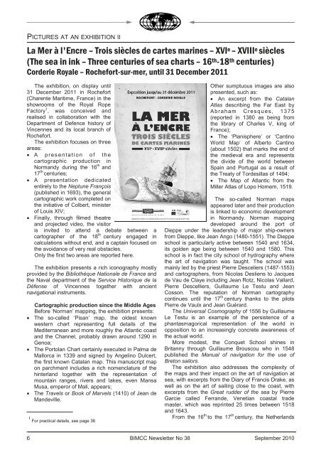
PICTURES AT AN EXHIBITION II<br />
La Mer à l'Encre – Trois siècles de cartes marines – XVI e – XVIII e siècles<br />
(The sea in ink – Three centuries of sea charts – 16 th-18 th centuries)<br />
Corderie Royale – Rochefort-sur-mer, until 31 December 2011<br />
The exhibition, on display until<br />
31 December 2011 in Rochefort<br />
(Charente Maritime, France) in the<br />
showrooms of the Royal Rope<br />
Factory 1 , was conceived and<br />
realised in collaboration with the<br />
Department of Defence history of<br />
Vincennes and its local branch of<br />
Rochefort.<br />
The exhibition focuses on three<br />
areas:<br />
• A p r e s e n t a t i o n o f t h e<br />
cartographic production in<br />
Normandy during the 16 th and<br />
17 th centuries;<br />
• A presentation dedicated<br />
entirely to the Neptune François<br />
(published in 1693), the general<br />
cartographic work completed on<br />
the initiative of Colbert, minister<br />
of Louis XIV;<br />
• Finally, through filmed theatre<br />
and projected video, the visitor<br />
is invited to attend a debate between a<br />
cartographer of the 18 th century engaged in<br />
calculations without end, and a captain focused on<br />
the avoidance of very real obstacles.<br />
Only the first two areas are reported here.<br />
The exhibition presents a rich iconography mostly<br />
provided by the Bibliothèque Nationale de France and<br />
the Naval department of the Service Historique de la<br />
Défense of Vincennes together with ancient<br />
navigational instruments.<br />
Cartographic production since the Middle Ages<br />
Before ‘Norman’ mapping, the exhibition presents:<br />
• The so-called ‘Pisan’ map, the oldest known<br />
western chart representing full details of the<br />
Mediterranean and more roughly the Atlantic coast<br />
and the Channel, probably drawn around 1290 in<br />
Genoa;<br />
• The Portolan Chart certainly executed in Palma de<br />
Mallorca in 1339 and signed by Angelino Dulcert,<br />
the first known Catalan map. This manuscript map<br />
on parchment includes a rich nomenclature of the<br />
hinterland together with the representation of<br />
mountain ranges, rivers and lakes, even Mansa<br />
Musa, emperor of Mali, appears;<br />
• The Travels or Book of Marvels (1410) of Jean de<br />
Mandeville.<br />
1 For practical details, see page 36<br />
6<br />
Other sumptuous images are also<br />
presented, such as:<br />
• An excerpt from the Catalan<br />
Atlas describing the Far East by<br />
A braham Cr esques, 1 3 75<br />
(reported in 1380 as being from<br />
the library of Charles V, king of<br />
France);<br />
• The ‘Planisphere’ or ‘Cantino<br />
World <strong>Map</strong>’ of Alberto Cantino<br />
(about 1502) that marks the end of<br />
the medieval era and represents<br />
the divide of the world between<br />
Spain and Portugal as a result of<br />
the Treaty of Tordesillas of 1494;<br />
• The <strong>Map</strong> of Atlantic from the<br />
Miller Atlas of Lopo Homem, 1519.<br />
The so-called Norman maps<br />
appeared later and their production<br />
is linked to economic development<br />
in Normandy. Norman mapping<br />
developed around the port of<br />
Dieppe under the leadership of major ship-owners<br />
from Dieppe, like Jean Ango (1480-1551). The Dieppe<br />
school is particularly active between 1540 and 1634,<br />
its golden age being between 1540 and 1580. This<br />
school is in fact the city school of hydrography where<br />
the art of navigation was taught. The school was<br />
mainly led by the priest Pierre Desceliers (1487-1553)<br />
and cartographers, from Nicolas Desliens to Jacques<br />
de Vau de Claye including Jean Rotz, Nicolas Vallard,<br />
Pierre Descelliers, Guillaume Le Testu and Jean<br />
Cosson. The reputation of Norman cartography<br />
continues until the 17 th century thanks to the pilots<br />
Pierre de Vaulx and Jean Guérard.<br />
The Universal Cosmography of 1556 by Guillaume<br />
Le Testu is an example of the persistence of a<br />
phantasmagorical representation of the world in<br />
opposition to an increasingly concrete awareness of<br />
the actual world.<br />
More modest, the Conquet School shines in<br />
Britanny through Guillaume Brouscou who in 1548<br />
published the Manual of navigation for the use of<br />
Breton sailors.<br />
The exhibition also addresses the complexity of<br />
the maps and their impact on the art of navigation at<br />
sea, with excerpts from the Diary of Francis Drake, as<br />
well as on the art of sailing close to the coast, with<br />
excerpts from the Great rudder of the sea by Pierre<br />
Garcie called Ferrande, Venetian coastal trade<br />
master, which was reprinted 25 times between 1518<br />
and 1643.<br />
From the 16 th to the 17 th century, the Netherlands<br />
BIMCC Newsletter No 38 September 2010