


Create successful ePaper yourself
Turn your PDF publications into a flip-book with our unique Google optimized e-Paper software.
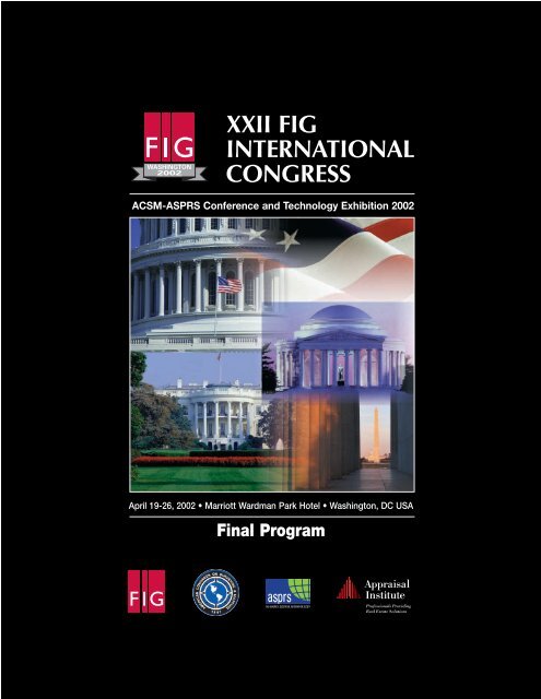
<strong>XXII</strong> <strong>FIG</strong><br />
<strong>INTERNATIONAL</strong><br />
<strong>CONGRESS</strong><br />
ACSM-ASPRS Conference and Technology Exhibition 2002<br />
April 19-26, 2002 • Marriott Wardman Park Hotel • Washington, DC USA<br />
Final Program
Sponsors TABLE OF CONTENTS<br />
<strong>FIG</strong><br />
International Federation of Surveyors<br />
<strong>FIG</strong> Office<br />
Lindevangs Alle 4<br />
DK-2000 Frederiksberg, Denmark<br />
Telephone: +45 3886 1081<br />
Fax: +45 3886 0252<br />
Email: fig@fig.net<br />
www.fig.net<br />
The International Federation of Surveyors has member associations and other<br />
members in nearly 100 countries. These associations represent more than 230,000<br />
surveying professionals. Founded in 1878 and officially recognized as a nongovernmental<br />
organization (NGO) by the United Nations, its administration is<br />
undertaken by a member country for a four-year period. In 1999, the American<br />
Congress on Surveying and Mapping (ACSM) assumed this responsibility.<br />
ACSM<br />
American Congress on Surveying and Mapping<br />
6 Montgomery Village Avenue<br />
Suite 403<br />
Gaithersburg, MD 20879<br />
Telephone: +1-240-632-9716<br />
Fax: +1-240-632-1321<br />
www.acsm.net<br />
ACSM, founded in 1941, is one of only two national associations in the United<br />
States that are members of <strong>FIG</strong>. As the member association responsible for the<br />
leadership of <strong>FIG</strong> for the four year period which began in 1999, ACSM is the host<br />
for the <strong>XXII</strong> International Congress. ACSM's 7,000 individual members, affiliated<br />
societies, and sectional groups comprise the only U S national organization that is<br />
structured to represent professionals working in the fields of cartography, geodesy,<br />
geographic information systems, and surveying.<br />
ASPRS<br />
American Society for Photogrammetry<br />
and Remote Sensing<br />
5410 Grosvenor Lane, Suite 210<br />
Bethesda, MD 20814<br />
Telephone: +1-301-493-0290<br />
Fax: +1-301-493-0208<br />
www.asprs.org<br />
Founded in 1934, ASPRS is an international professional organization of over 7,000<br />
geospatial data professionals. ASPRS is devoted to advancing knowledge and<br />
improving understanding of the mapping sciences to promote responsible<br />
application of photogrammetry, remote sensing, geographic information systems<br />
and supporting technologies. For complete information about the Society, visit<br />
www.asprs.org.<br />
AI<br />
Appraisal Institute<br />
550 W. Van Buren St., Suite 1000<br />
Chicago, IL 60607<br />
Telephone: +1-312-335-4184<br />
Fax: +1-312-335-4480<br />
www.appraisalinstitute.org<br />
The Appraisal Institute is the acknowledged worldwide leader in residential and<br />
commercial appraisal education, research, publishing, and professional designation<br />
programs. Headquartered in Chicago, Illinois, the Appraisal Institute and its<br />
predecessor organizations have been at the forefront of the real estate appraisal<br />
profession for over 60 years. The Appraisal Institute has more than 18,000<br />
members with a steadily growing international membership.<br />
4 Conference at a Glance<br />
6 General Information<br />
8 Opening Ceremony and Keynote<br />
9 ACSM Inclusive Workshops<br />
16 ASPRS Workshops<br />
21 ACSM-ASPRS Technical Program<br />
34 <strong>FIG</strong> Technical Program<br />
53 Technical Tours<br />
55 Technology Exhibition/User Groups<br />
57 ACSM Committee Meetings<br />
58 ASPRS Committee Meetings<br />
59 <strong>FIG</strong> Meetings<br />
60 Hotel Floor Plans<br />
63 Membership Applications<br />
3
4<br />
Conference at a Glance<br />
For a complete listing of ACSM, ASPRS and <strong>FIG</strong> organizational meetings, please refer to page 57-59.<br />
Saturday, April 20, 2002 Page<br />
8:30 am – 12:30 pm ACSM and ASPRS Morning Half-Day Workshops 10, 18<br />
8:30 am – 5:30 pm ACSM and ASPRS All Day Workshops 10, 17<br />
1:30 pm – 5:30 pm ACSM and ASPRS Afternoon Half-Day Workshops 11, 18<br />
8:00 pm – 10:00 pm ACSM/NSPS PAC Auction 7<br />
Sunday, April 21, 2002<br />
8:30 am – 12:30 pm ACSM Morning Half-Day Workshops 11<br />
8:30 am – 5:30 pm ACSM and ASPRS All Day Workshops 12, 19<br />
9:00 am – 4:00 pm <strong>FIG</strong> General Assembly 59<br />
1:30 pm – 5:30 pm ACSM and ASPRS Afternoon Half-Day Workshops 12, 20<br />
6:00 pm – 8:00 pm Welcome Reception-National Building Museum 7<br />
Monday, April 22, 2002<br />
9:00 am – 11:00 am ACSM Morning Half-Day Workshop 13<br />
9:00 am – 10:30 am ASPRS-ACSM Technical Sessions 21<br />
11:00 am – 12:30 pm Opening Ceremony and Keynote Address 9<br />
12:30 pm – 7:00 pm Technology Showcase/Exhibit Hall Open 55<br />
1:30 pm – 5:30 pm ACSM Afternoon Half-Day Workshops 13<br />
2:00 pm – 5:30 pm ACSM-ASPRS, <strong>FIG</strong> Technical Sessions 21, 34<br />
2:00 pm – 6:00 pm Technical Tours 53<br />
5:30 pm – 8:00 pm ACSM Awards Ceremony and Installation of Officers 7<br />
7:00 pm – 9:00 pm <strong>FIG</strong> Foundation Dinner 7<br />
Tuesday, April 23, 2002<br />
8:30 am – 12:30 pm ACSM Morning Half-Day Workshops 14<br />
8:30 am – 5:30 pm ACSM All Day Workshops 15<br />
9:00 am – 10:30 am Plenary Session 38<br />
9:00 am – 12:30 pm ACSM-ASPRS Technical Sessions 23<br />
11:00 am – 12:30 pm <strong>FIG</strong> Technical Sessions 39<br />
11:00 am – 8:00 pm Technology Showcase/Exhibit Hall Open 55<br />
1:30 pm – 5:30 pm ACSM Afternoon Half-Day Workshops 15<br />
2:00 pm – 5:30 pm ACSM-ASPRS, <strong>FIG</strong> Technical Sessions 25, 40<br />
6:00 pm – 8:00 pm Exhibit Hall Reception 8
Wednesday, April 24, 2002 Page<br />
8:30 am – 12:30 pm ACSM Morning Half-Day Workshops 15<br />
8:30 am – 5:30 pm ACSM All Day Workshops 16<br />
9:00 am – 10:30 am Plenary Session 42<br />
9:00 am – 12:30 pm ACSM-ASPRS Technical Sessions 26<br />
10:00 am – 3:00 pm Technology Showcase/Exhibit Hall Open 55<br />
11:00 am – 12:30 pm <strong>FIG</strong> Technical Sessions 43<br />
11:30 am – 2:00 pm ASPRS Annual Awards Luncheon and Business Meeting 8<br />
1:30 pm – 5:30 pm ACSM Afternoon Half-Day Workshops 16<br />
2:00 pm – 5:30 pm ACSM-ASPRS, <strong>FIG</strong> Technical Sessions 28, 44<br />
5:30 pm – 7:00 pm ASPRS Memorial Address and Reception 8<br />
Thursday, April 25, 2002<br />
7:00 am – 8:00 am ASPRS Past Presidents Breakfast 8<br />
7:30 am – 5:00 pm Technical Tours 53<br />
8:00 am – 5:00 pm User Groups 55<br />
9:00 am – 10:30 am Plenary Session 47<br />
9:00 am – 12:30 pm ACSM-ASPRS Technical Sessions 29<br />
11:00 am – 12:30 pm <strong>FIG</strong> Technical Sessions 47<br />
2:00 pm – 5:30 pm ACSM-ASPRS, <strong>FIG</strong> Technical Sessions 31, 48<br />
6:00 pm – 10:00 pm <strong>FIG</strong> Banquet 8<br />
Friday, April 26, 2002<br />
8:00 am – 12:00 noon Technical Tours 54<br />
9:00 am – 12:30 pm ACSM-ASPRS, <strong>FIG</strong> Technical Sessions 32, 50<br />
10:30 am – 1:30 pm <strong>FIG</strong> General Assembly 59<br />
12:30 pm – 2:00 pm <strong>FIG</strong> Technical Sessions 52<br />
1:30 pm – 2:00 pm <strong>FIG</strong> Closing 59<br />
2:00 pm – 4:00 pm 2006 Reception 8<br />
5
6<br />
<strong>FIG</strong> 2002 Congress Committee<br />
Steering Committee<br />
Mary Clawson, Congress Director<br />
National Imagery and Mapping Agency<br />
John Hohol, Deputy Congress Director<br />
Berntsen International<br />
Dr. Alan Stevens, Deputy Congress Director<br />
Federal Geographic Data Committee<br />
Technical Program/Workshop Chairs<br />
Dr. Janette Gervin<br />
NASA Goddard Space Flight Center<br />
Rebecca Somers<br />
Somers-St. Claire<br />
Donald Buhler<br />
Bureau of Land Management<br />
Dr. Russell Congalton<br />
University of New Hampshire<br />
Dr. Russell Congalton<br />
University of New Hampshire<br />
Surveying Sport Competition Coordinator<br />
Jerry Juarez<br />
Tri-Star Surveying, Ltd.<br />
Student Volunteer Coordinator<br />
Kristin Eickhorst<br />
University of Maine<br />
Local Organizing Committee<br />
Marc Cheves<br />
Professional Surveyor Magazine<br />
Lynne Mersfelder-Lewis, Pamela Fromhertz,<br />
Joyce Turpin, Deborah Brooks Tyler<br />
National Geodetic Survey<br />
<strong>FIG</strong> Technical Commissions<br />
Commission 1 – Professional Standards and Practice<br />
Prof John Parker (Australia)<br />
E-mail: park106@attglobal.net<br />
Commission 2 – Professional Education<br />
Prof Kirsi Virrantaus (Finland)<br />
Helsinki University of Technology<br />
Department of Surveying<br />
E-mail: kirsi.virrantaus@hut.fi<br />
Commission 3 – Spatial Information Management<br />
Jes Ryttersgaard (Denmark)<br />
National Survey and Cadastre, Denmark<br />
E-mail: JR@kms.dk<br />
Commission 4 – Hydrography<br />
Dennis A St Jacques (Canada)<br />
Fisheries and Oceans Canada<br />
Central and Arctic Region<br />
E-mail: stjacquesd@dfo-mpo.gc.ca<br />
Commission 5 – Positioning and Measurement<br />
Prof. Jean-Marie Becker (Sweden)<br />
National Land Survey of Sweden<br />
E-mail: jean-marie.becker@lm.se<br />
Commission 6 – Engineering Surveys<br />
Dr Michel Mayoud (Switzerland)<br />
European Organization for Nuclear Research CERN<br />
Applied Geodesy Group<br />
E-mail: mayoud@cern.ch<br />
Commission 7 – Cadastre and Land Management<br />
Dr Paul Munro-Faure (United Kingdom)<br />
Food and Agriculture Organization of the United Nations FAO<br />
Land Tenure Service SDAA<br />
E-mail: paul.munrofaure@fao.org<br />
Commission 8 – Spatial Planning and Development<br />
Helmut Brackmann (Germany)<br />
City of Bottrop, Germany<br />
E-mail: helmut.brackmann@ bottrop.de<br />
Commission 9 – Valuation and the Management of<br />
Real Estate<br />
Michael Yovino-Young (USA)<br />
Yovino-Young Valuation Consultants<br />
E-mail: myovino-young@ yovino.com<br />
Ad hoc commission on construction<br />
economics/management<br />
John Collinge (United Kingdom)<br />
The MDA Group UK<br />
E-mail: jcollinge@mdagroup.com<br />
The International Institution for the History of Surveying<br />
and Measurement – Permanent Institution of <strong>FIG</strong><br />
James R Smith (United Kingdom)<br />
E-mail: 101765.332@compuserve.com
General Information<br />
Social Events<br />
ACSM/NSPS PAC Auction<br />
Room: Cotillion Ballroom<br />
Saturday, April 20<br />
8:00 pm<br />
Each year our auction gets better! Join us again this year for<br />
a terrific time. Vie with your peers and our entertaining<br />
auctioneer, Joe Dolan, to secure that particular item or items<br />
that YOU CAN’T LEAVE WASHINGTON, D.C. WITHOUT! We<br />
have many tempting and novel gifts. Admission is free, and<br />
remember, the proceeds form the auction will go directly to<br />
your ACSM/NSPS PAC.<br />
Welcome Reception<br />
National Building Museum<br />
401 F Street NW<br />
Sunday, April 21<br />
6:00 pm – 8:00 pm<br />
Conference Hotel<br />
Marriott Wardman Park Hotel • 2660 Woodley Road, NW • Washington, DC 20008<br />
Phone: +1-202-328-2000<br />
Guest Fax: +1-202-234-0015<br />
Join conference delegates at the National Building Museum.<br />
Created by an act of Congress in 1980, the National Building<br />
Museum is America’s premier cultural institution dedicated to<br />
exploring and celebrating architecture, design, engineering,<br />
construction, and urban planning. Since opening its doors in<br />
1985, the Museum has become the forum for exchanging<br />
ideas and information about such topical issues as managing<br />
suburban growth, preserving landmarks and communities,<br />
and revitalizing urban centers through engaging exhibitions<br />
and education programs. To get to the museum, take the<br />
Metro’s Red Line towards Glenmont, to the Judiciary Square<br />
stop (about 4 stops from Woodley Park). Come out at the<br />
National Building Museum Exit and cross F Street to the<br />
National Building Museum’s entrance.<br />
ACSM Fellows and NSPS Past Presidents Breakfast<br />
Room: Delaware A<br />
Monday, April 22<br />
7:00 am – 9:00 am<br />
Cost: $15<br />
Please join us for the ACSM Fellows/NSPS Past President<br />
Breakfast. This year the ACSM Fellows and NSPS Past<br />
Presidents will meet jointly so that members of both groups<br />
are not forced to choose between one event or the other.<br />
Come and honor new Fellows, enjoy an interesting<br />
presentation by a prominent speaker, and network with your<br />
colleagues.<br />
ACSM Awards Ceremony and Installation of Officers<br />
Room: Wilson C<br />
Monday, April 22<br />
5:30 pm – 8:00 pm<br />
During this ceremony ACSM will present awards to the<br />
winners in the various categories of its 28th Annual Map<br />
Competition. The National Society of Professional<br />
Surveyors (NSPS), ACSM’s largest member organization,<br />
will present awards to winners in each of the categories<br />
of its Annual Map/Plat Competition. ACSM joins with its<br />
member organizations, American Association of Geodetic<br />
Surveyors (AAGS), Cartography and Geographic Information<br />
Society (CaGIS), and NSPS in presenting scholarships to<br />
students studying in surveying and mapping curriculums.<br />
Scholarships are also presented by Sustaining Members<br />
of ACSM, the NSPS Foundation, and the NSPS TrigStar<br />
Endowment Fund. NSPS is presenting awards for<br />
Excellence in Surveying, Excellence in Journalism,<br />
and for the Student Project of the Year. The Ceremony<br />
serves as the venue for the installation of ACSM officers<br />
for the year<br />
<strong>FIG</strong> Foundation Dinner<br />
Room: Maryland A<br />
Monday, April 22, 2002<br />
7:00 pm – 9:00 pm<br />
$150/plate<br />
The <strong>FIG</strong> Foundation was established under the <strong>FIG</strong><br />
with the stated purpose of funding of educational and<br />
capacity building projects and scholarships. The<br />
proceeds from the inaugural <strong>FIG</strong> Foundation Dinner<br />
will help support this effort. Jack Dangermond,<br />
President and Founder of ESRI, has graciously agreed<br />
to be the Honorary Chairman of the <strong>FIG</strong> Foundation<br />
fundraising campaign and will be the featured speaker<br />
at the dinner.<br />
7
8<br />
NSPS Student Surveying Competition 2002 —<br />
Roman Surveying Event<br />
Room: Marriott Front Lawn<br />
Tuesday, April 23<br />
1:30 pm – 5:00 pm<br />
Sponsored by SNSPS. Teams from surveying, geomatics, or<br />
similarly named degree granting programs will be competing.<br />
Competition is comprised of a problem (with constraints) which<br />
has been studied, researched and solved by the student teams.<br />
A demonstration of their solution will be displayed and judged<br />
by a panel from NSPS. First, second and third place awards<br />
will be given.<br />
Exhibit Hall Reception<br />
Room: Exhibit Hall<br />
Tuesday, April 23<br />
6:00 pm – 8:00 pm<br />
Join the exhibitors for casual conversation in the Exhibit Hall.<br />
ASPRS 13th Annual Awards Luncheon and<br />
68th Annual Business Meeting<br />
Room: Delaware<br />
Wednesday, April 24<br />
11:30 am – 2:00 pm<br />
Cost: $35<br />
ASPRS Memorial Address and Reception<br />
Room: Delaware<br />
Wednesday, April 24<br />
5:30 pm – 7:00 pm<br />
Honoree: Garrett Carper Tewinkel<br />
Presenter: Lawrence W. Fritz<br />
Honoree: Ford Bartlett<br />
Presenter: Marshall S. Wright, Jr.<br />
ASPRS Past Presidents Breakfast<br />
Room: Maryland B<br />
Thursday, April 25<br />
7:00 am – 8:00 am<br />
<strong>FIG</strong> Banquet<br />
Room: Marriott Ballroom<br />
Thursday, April 25<br />
6:00 pm – 10:00 pm<br />
Join conference delegates for dinner followed by a presentation<br />
from Allen Carroll about Surveying Sagarmatha. The Nepalese<br />
call Everest Sagarmatha, and traditionally it is an important<br />
landmark in their sacred landscape. To Westerners, Everest is<br />
an object to be explored, climbed — and surveyed. Allen<br />
Carroll, Chief Cartographer at the National Geographic Society,<br />
will give an illustrated history of the exploration and<br />
measurement of the world's highest peak, from the Great<br />
Trigonometric Survey of India in the 19th century to Bradford<br />
Washburn's GPS-enabled measurement of its summit<br />
in 2000. The LaSalle Dance Orchestra with Sally Hile,<br />
director, will be providing you with the musical entertainment<br />
while the Gaithersburg Arthur Murray Dancers will be giving<br />
a swing dancing demonstration, followed by dancing until<br />
10:00 pm.<br />
You are encouraged to reserve tables by signing up at the<br />
registration counters.<br />
If you are unable to attend the banquet, please return your<br />
ticket to the registration counter so that a student may use it.<br />
<strong>FIG</strong> 2006 Reception<br />
Room: Cotillion Ballroom<br />
Friday, April 26<br />
2:00 pm – 4:00 pm<br />
Hosted by the German Organizing Committee of <strong>FIG</strong> 2006. See<br />
a preview of what Germany has to offer in 2006.<br />
On-Site Registration<br />
The <strong>FIG</strong> 2002 Registration Area is located on the lobby level of<br />
the Marriott Wardman Park Hotel. Registration Hours are listed<br />
below:<br />
Friday, April 19 3:00 pm – 5:00 pm<br />
Saturday, April 20 7:30 am – 6:00 pm<br />
Sunday, April 21 7:30 am – 6:00 pm<br />
Monday, April 22 7:30 am – 6:00 pm<br />
Tuesday, April 23 7:30 am – 6:00 pm<br />
Wednesday, April 24 7:30 am - 6:00 pm<br />
Thursday. April 25 7:30 am – 6:00 pm<br />
Friday, April 26 7:30 am – 2:00 pm<br />
Career Fair<br />
Room: Exhibit Hall<br />
The Career Fair is the place at the convention for companies<br />
with vacancies and those seeking employment to make a<br />
connection.<br />
The Career Fair is a service provided to conference registrants<br />
at no extra charge; those with regular or exhibits only<br />
registration are welcome to participate. Hours are during all<br />
open exhibition hours. Notice boards will be available for<br />
posting position announcements and resumes. Space for<br />
conducting interviews also will be provided.
Opening Ceremony and Keynote Address<br />
Mary Clawson, Congress Director<br />
Welcoming Remarks<br />
Robert Foster, <strong>FIG</strong> President<br />
Remarks, Introduction to <strong>FIG</strong> and<br />
Introduction of Dr. Anna K. Tibaijuka<br />
Dr. Anna K. Tibaijuka, Executive Director, UN-HABITAT<br />
Mary Clawson<br />
Introduction of Jack Dangermond<br />
Dr. Anna K. Tibaijuka<br />
Executive Director<br />
UN-HABITAT United Nations Human Settlements Programme<br />
Dr. Anna K. Tibaijuka was appointed as the Executive Director of UN-<br />
HABITAT in July 2000. Prior to this she had been the Special<br />
Coordinator for Least Developed Countries, Landlocked and Small<br />
Island Developing Countries for the United Nations Conference on<br />
Trade and Development (UNCTAD). In this role, Dr. Tibaijuka was<br />
responsible for strengthening the capacity of LDCs in trade negotiations<br />
with the World Trade Organisation. A Tanzanian national, Dr.<br />
Tibaijuka holds a Doctorate of Science in Agricultural Economics from<br />
the Swedish University of Agricultural Sciences in Uppsala. From 1993<br />
to 1998, when she joined UNCTAD, Anna Tibaijuka was Associate<br />
Professor of Economics at the University of Dar-es-Salaam. During<br />
this period she was also a member of the Tanzanian Government delegation<br />
to several United Nations Summits including the United<br />
Nations Conference on Human Settlements (Istanbul, 1996); the<br />
World Food Summit (Rome 1996); the Fourth World Conference on<br />
Women (Beijing 1995) and the World Summit for Social Development<br />
(Copenhagen, 1995). At these summits, Dr. Tibaijuka was an active<br />
member of the Civil Society and NGO Forums.<br />
Jack Dangermond<br />
President<br />
ESRI<br />
Jack Dangermond is founder and president of ESRI, headquartered in<br />
Redlands, California, USA. Founded in 1969, ESRI is the leading geographic<br />
information system (GIS) company in the world, providing software<br />
such as ArcInfo, ArcView, and ArcExplorer to clients in 90 countries.<br />
Jack Dangermond is recognized in both academia and industry<br />
as a leader of and an authority on the GIS field. Over the last 30 years,<br />
he has delivered keynote addresses at numerous international conferences,<br />
published hundreds of papers on GIS, and given thousands of<br />
Monday, April 22, 2002<br />
Room: Marriott Ballroom<br />
11:00 am –12:30 pm<br />
Opening Ceremony and Keynote Address<br />
Jack Dangermond, President and Founder, ESRI<br />
Robert Foster<br />
Thank You to Speakers<br />
Robert Foster<br />
Presentation of Congress Prize<br />
Mary Clawson<br />
Closing Remarks<br />
Declare Congress and Exhibition Open<br />
presentations on GIS throughout the world. He is the recipient of a<br />
number of medals, awards, lectureships, and honorary degrees<br />
including the 2000 LaGasse Medal of the American Society of<br />
Landscape Architects, the Brock Gold Medal of the International<br />
Society for Photogrammetry & Remote Sensing, the Cullum<br />
Geographical Medal of the American Geographical Society, the EDU-<br />
CAUSE Medal of EduCause, the Horwood Award of the Urban and<br />
Regional Information Systems Association, the Anderson Medal of the<br />
Association of American Geographers, and the John Wesley Powell<br />
Award of the U.S. Geological Survey. He is a member of many professional<br />
organizations and has served on advisory committees for<br />
such U.S. agencies as NASA, EPA, NIMA, the National Academy of<br />
Sciences, and NCGIA. He was educated at California Polytechnic<br />
State University-Pomona; the University of Minnesota; and, Harvard<br />
University's Laboratory for Computer Graphics and Spatial Design.<br />
Jack Dangermond holds honorary doctorate degrees from Ferris State<br />
University, Michigan, and the University of Redlands, California.<br />
Congress Prize<br />
Congratulations to George Oner Ogalo, Kenya<br />
for winning the <strong>FIG</strong> Congress Prize for his paper<br />
GPS in Cadastres: A Case Study of Kenya<br />
A cadastre is a parcel based up-to-date register of interest in land. It<br />
usually includes a geometric description of land parcels linked to other<br />
records describing the nature of interests and ownership of control.<br />
Kenya practices a legal cadastre, which is a state register containing<br />
information about land parcels. This is supported by a detailed<br />
description of the parcel either in the form of Registry Index Maps (RIM)<br />
under RLA or Deed Plans under RTA. The index maps or deed plans<br />
are the end products of cadastral surveys. This paper is being presented<br />
Wednesday, April 24, 4:00 pm, in the Surveying & Geodesy:<br />
GPS Land Survey session in the Harding Room. See page 29.<br />
Exhibit Hall Opens at 12:30 pm<br />
9
10<br />
ACSM Inclusive Workshops<br />
The ACSM Workshop Certification Board reviews and certifies all ACSM<br />
sponsored workshops. ACSM workshops are submitted to each of the<br />
Professional Land Surveyors State Boards of Registration for continuing<br />
education credit approval. Upon completion of a workshop, participants<br />
will be mailed certificates with the appropriate amount of continuing education<br />
credit.<br />
Saturday • Half-Day Morning Workshops<br />
SURVEYING ERRORS & THEIR ANALYSIS<br />
Room: B North 1<br />
Saturday, April 20<br />
8:30 am –12:30 pm<br />
PDH Hours: 4<br />
FL CEP: 032 49<br />
Course Level: Advanced<br />
The objectives of this workshop are to create a better understanding of<br />
error in surveying measurements, and to describe the methods for analyzing<br />
and adjusting those measurements to account for their errors. This<br />
course covers the sources of errors in surveying measurements, their<br />
classifications, and the manner in which they propagate in computations.<br />
The textbook for this workshop is Adjustment Computations: Statistics<br />
and Least Squares in Surveying and GIS.<br />
Intended Audience: This workshop has been presented at several<br />
state conferences around the United States and appeals to practicing<br />
professional surveyors who are involved in management and adjustment<br />
of surveying measurements.<br />
Instructor: Dr. Charles Ghilani, Associate Professor/Program Chair,<br />
Surveying Program, Pennsylvania State University.<br />
EARLY SURVEYING TECHNIQUES AND<br />
THE EVOLUTION OF SURVEYING EQUIPMENT<br />
Room: B North 2<br />
Saturday, April 20<br />
8:30 am –12:30 pm<br />
PDH Hours: 4<br />
FL CEP: 032 129<br />
Course Level: Introductory<br />
During this seminar, a wide ranging look will be taken at early surveying<br />
methods and the equipment used by surveyors from the 1600's. Areas<br />
of study will include methods of performing field surveys, methods of calculating,<br />
directional instruments, distance measuring equipment, and<br />
other aspects of the life of the surveyor. Demonstrations of equipment<br />
and explanations of operation will be included.<br />
Instructor: David Lee Ingram, Ingram-Hagen & Co., PLC<br />
HOW TO TEACH THE BOY SCOUTS<br />
SURVEYING MERIT BADGE<br />
Room: B North 5<br />
Saturday, April 20<br />
8:30 am – 12:30 pm<br />
PDH Hours: 4<br />
FL CEP: 032 130<br />
Course Level: Introductory<br />
This presentation is designed to help Professional Surveyors understand<br />
how to explain the surveying profession to 10 to 15 year old boys,<br />
through working as Merit Badge councilors within the Boy Scouts of<br />
America’s Surveying Merit Badge Program. Thereby giving the future<br />
generation an insight into our profession and possibly recruiting the next<br />
generation of Professional Surveyors.<br />
Instructor: Thomas W. Brooks, Jr., Brooks & Brooks, Inc.<br />
Saturday • All Day Workshops<br />
HOW THINGS WORK<br />
Room: B North 4<br />
Saturday, April 20<br />
8:30 am – 5:30 pm<br />
PDH Hours: 7.5<br />
FL CEP: 032 131<br />
Course Level : Introductory<br />
The workshop will be a series of presentations covering the basic elements<br />
of surveying technology. The thrust of the presentations will be<br />
"How things work." The objective of the workshop is to introduce the<br />
surveyor to the basic design and configuration of various parts of technology<br />
of commonly used surveying systems. The purpose of this introduction<br />
is to help the surveyor better understand how to maximize performance,<br />
be it accuracy, speed, economy, etc. by understanding the<br />
capabilities and limitations of the technology being used. Each session<br />
will be 30 minutes, therefore the lectures and demonstrations will be<br />
introductory. Written course notes will be distributed to participants;<br />
where necessary, demonstrations, displays of component parts and<br />
graphical representations will be used to illustrate the presentations.<br />
Instructors: Representatives from the Geomatics Industry Association<br />
of America (GIAA)<br />
INTRODUCTION TO GPS<br />
Saturday, April 20<br />
Room: Harding<br />
8:30 am – 5:30 pm<br />
PDH Hours: 7.5<br />
FL CEP: 032 91<br />
Course Level: Intermediate<br />
Workshop Limit: 30<br />
This workshop will provide an introduction to fundamental GPS concepts<br />
and applications. Code and carrier-phase GPS will be discussed. Both<br />
GIS Mapping and Survey Control applications will be covered. Handson<br />
use of the equipment will be emphasized. (Note: Field exercises will<br />
be held rain/snow or shine. Please dress appropriately)<br />
Instructors: John Bean, Central Connecticut State University<br />
Thomas Meyer, University of Connecticut
MAPPING AND GIS WITH GPS<br />
Room: Balcony C<br />
Saturday, April 20<br />
This is also offered Sunday, April 21<br />
8:30 am – 3:30 pm<br />
PDH Hours: 6<br />
FL CEP: 032 134<br />
Course Level: Introductory<br />
Workshop Limit: 30<br />
This course will utilize GPS to collect feature and attribute data for transfer<br />
to a Geographic Information System. The course will show the participant<br />
how to create a data dictionary from scratch or from Shape files.<br />
The created dictionary will be taken into the field to collect point, line and<br />
area data. Data will be collected in real-time and for post-processing.<br />
This is a hands-on course in which the participants will be collecting the<br />
data. The collected data will be corrected if necessary and displayed in<br />
the classroom. Collected data will be transferred to a GIS for further display.<br />
Files will then be sent back to the receiver and to the field for data<br />
maintenance.<br />
This course is designed for GIS professionals as well as other surveying<br />
and mapping professionals<br />
Instructors: Brian McInnis & Elwin McLachlan Trimble Navigation<br />
Saturday • Half-Day Afternoon Workshops<br />
ADJUSTMENT OF SURVEYING ERRORS<br />
BY LEAST SQUARES<br />
Room: B North 1<br />
Saturday, April 20<br />
1:30 pm – 5:30 pm<br />
PDH Hours: 4<br />
FL CEP: 032 54<br />
Course Level: Advanced<br />
In the collection of surveying measurements, after care is taken to discover<br />
and remove the effects of mistakes and systematic errors, irregularities<br />
usually remain in harmonizing the observed measurements with<br />
known geometrical conditions. Simple rule-driven adjustment methods<br />
yield conflicting results when used with interconnected level loops and<br />
traverses, and unpredictably degrade the quality of the observed measurements.<br />
The geographically larger, geometrically more complicated<br />
surveys of increasing precision possible with modern survey equipment<br />
and methods require adjustment techniques that are theoretically based,<br />
and capable of simultaneous consideration of all observations. Least<br />
squares routines have long been known to be based on a solid theoretical<br />
foundation for the analysis and adjustment of random errors, but<br />
have never been easy to perform. This workshop seeks to furnish theoretical<br />
understanding and demonstrate computer-aided application to<br />
common survey types including level networks, horizontal survey measurement<br />
networks, and GPS baseline networks. The textbook for this<br />
workshop is Adjustment Computations: Statistics and Least Squares in<br />
Surveying and GIS. Participants in this workshop should have attend the<br />
workshop "Surveying Errors and their Analysis."<br />
Intended Audience: This workshop has been presented at several<br />
state conferences around the United States and appeals to practicing<br />
professional surveyors who are involved in management and adjustment<br />
of surveying measurements.<br />
Instructor: Dr. Charles Ghilani, Associate Professor/Program Chair,<br />
Surveying Program, Pennsylvania State University<br />
BUYING AND SELLING SURVEYING AND<br />
SMALL ENGINEERING COMPANIES<br />
Room: B North 2<br />
Saturday, April 20, also offered on Monday, April 22<br />
1:30 pm – 5:30 pm<br />
PDH Hours: 4<br />
FL CEP: 032 132<br />
Course Level: Introductory<br />
This course covers the very important information that a buyer or seller<br />
needs to know to successfully complete the transaction. The course will<br />
help answer questions such as: When is the right time to buy or sell?<br />
How do I get my company ready to sell? How much is the company<br />
worth? How do buyers and sellers find each other? How do I limit taxes<br />
on the sale of a company? Do I meet IRS Rules on the value of company<br />
stock? How can I make sure the transition is a success? How to preserve<br />
my good name after the sale?<br />
Also, information will be provided on how to increase the value of a business.<br />
What roll should a banker, attorney, or accountant play in the purchase<br />
or sale, and common sense rules that help you make sure you are<br />
making the best deal that will make the purchase or sale a success.<br />
Instructor: Milton E. Denny, 3001 Inc.<br />
INTRODUCTION TO USING CORS<br />
(CONTINUOUSLY OPERATING REFERENCE STATIONS)<br />
Room: B North 5<br />
Saturday, April 20<br />
1:30 pm – 5:30 pm<br />
PDH Hours: 4<br />
FL CEP: 032 133<br />
Course Level: Intermediate<br />
This workshop is designed for persons who use Global Positioning<br />
System (GPS) data for post-processing applications. The National<br />
CORS system comprises a network of more than 230 sites, each containing<br />
a geodetic quality receiver whose data are freely available via the<br />
Internet. Topics include a description of CORS information and its various<br />
applications (positioning, GIS development, remote sensing, etc.),<br />
how to access CORS information, and how to use publicly available utilities<br />
for processing GPS data.<br />
Instructors: Mark Eckl, & Richard Snay, National Geodetic Survey<br />
Sunday • Half-Day Morning Workshops<br />
ORTHOPHOTOGRAPHY<br />
Room: Maryland B/C<br />
Sunday, April 21<br />
8:30 am – 12:30 pm<br />
PDH Hours: 4<br />
FL CEP: 032 5<br />
Course Level: Intermediate<br />
An orthophoto is an aerial image that has been rectified in such a way that<br />
it is made to possess characteristics of a line map. The rectification process<br />
is performed by combining photogrametric principles with digital elevation<br />
models (DEM) data. Orthophotos have been used for many years by a<br />
diverse group of users. Recently, orthophotos have been re-discovered by<br />
GIS/LIS users and are rapidly becoming a leading form of base maps.<br />
This seminar will explore how orthophotos are made, accuracy and quality<br />
aspects of this data, advantages and disadvantages. A discussion on the<br />
role of surveyors in compiling this form of spatial data will also be included.<br />
Instructor: Dr. Joshua Greenfeld, Professor, New Jersey Institute of<br />
Technology (NJIT)<br />
11
12<br />
ACSM Workshops (cont.)<br />
TRACKING THE RAILROADS<br />
Room: Maryland A<br />
Sunday, April 21<br />
8:30 am - 12:30 pm<br />
PDH Hours: 4<br />
FL CEP: 032 145<br />
Course Level: Introductory<br />
Railroads have played a major part in the settlement and development of<br />
the United States. The importance of these bands of steel uniting the<br />
country was underscored by the powers granted to railroad companies<br />
to acquire land rights in whatever way necessary, whether by grant, in<br />
fee, or as easements. Surveyors involved with the original location and<br />
layout of the rails had a much easier time of it than we do today, as we<br />
try to recreate not only original configuration of rails and parcels, but also<br />
what kinds of rights the railroad companies may have had in the land<br />
beneath their tracks. We will discuss historical, legal, and practical<br />
aspects of the problems we face today as we unravel the railroad puzzle.<br />
This session will be of interest to surveyors, planners, and right of<br />
way professionals.<br />
Instructor: Wendy Lathrop, PLS<br />
Sunday • All Day Workshops<br />
ALTA-ACSM LAND TITLE SURVEYS - ADVANCED TOPICS<br />
Room: Delaware A<br />
Sunday, April 21<br />
8:30 am – 5:30 pm<br />
PDH Hours: 7.5<br />
FL CEP: 032 80<br />
Course Level: Intermediate<br />
This workshop has the objective of helping surveyors more fully understand<br />
and, therefore, more effectively perform ALTA/ACSM Land Title<br />
Surveys. The workshop will delve more deeply into the use and application<br />
of Land Title Surveys and will include discussions on various title<br />
industry issues and endorsements, preparation of "Surveyor's Reports,"<br />
dealing with the new Accuracy Standards, and more on certifications.<br />
Instructor: Gary R. Kent, Director of Surveying, The Schneider<br />
Corporation, Indianapolis, Indiana<br />
MAPPING AND GIS WITH GPS<br />
Room: Balcony C<br />
Sunday, April 21<br />
8:30 am – 3:30 pm<br />
This is also offered on Saturday, April 20, see page 8 for description<br />
PDH Hours: 6<br />
FL CEP: 032 134<br />
Course Level: Introductory<br />
Workshop Limit: 30<br />
BUREAU OF LAND MANAGEMENT CADASTRAL<br />
WORKSHOP<br />
Room: Cottillion South<br />
Sunday, April 21<br />
8:00 am – 5:00 pm<br />
PDH Hours: 7.5<br />
FL CEP: 032 135<br />
Course Level: Intermediate<br />
Separate fee required. See registration form for details<br />
Throughout time, bodies of water have been used to describe the limits<br />
of someone's legal ownership in land. These water boundaries have<br />
been used extensively throughout the Public Land Survey System in the<br />
United States. Many unique situations have arisen due to the use of<br />
water as a land ownership boundary. This session will explore some of<br />
these situations as well as a brief history of the concepts, legal principles<br />
and case law leading to the development of riparian boundary policy in<br />
the United States from the Federal perspective.<br />
Instructors: Frank Hardt, Ron Scherler, & Marc Thomas, Bureau<br />
of Land Management<br />
FIELD DATA RECORDERS<br />
Room: B North 6<br />
Sunday, April 21<br />
8:30 am – 5:30 pm<br />
PDH Hours: 7.5<br />
FL CEP: 032 116<br />
Course Level: Introductory<br />
This workshop is designed to help the basic or beginning user of data<br />
collectors become familiar with the more advanced data collector operations.<br />
The routines that will be covered by this workshop include:<br />
• Repetitive reading routines for averaging angels and distances.<br />
• Off center shots used to collect points where a prism cannot be<br />
directly shot.<br />
• Construction staking which includes:<br />
– Radial Stakeout.<br />
– Road Layout defining horizontal and vertical alignments, templates,<br />
widening and super elevation.<br />
– Digital Terrain Modeling with contours, volumes, 3D rendering etc.<br />
– Offset staking using the road definition above.<br />
– Slope staking using the road definition above.<br />
The course starts with class work with the data collector, covering the<br />
repetition, off center shots and the beginning of the Construction stakeout<br />
instruction. End users are encouraged to bring their data collectors<br />
for hands on experience. The Road Layout section is demonstrated<br />
using ForeSight CAD software and a video projector. The final portion<br />
involves hands on work with data collector and total station.<br />
The intended audience is beginning to basic data collector users or<br />
prospective data collector users.<br />
Instructor: Scott Fisher, Training Manager, Tripod Data Systems Inc.<br />
Sunday • Half-Day Afternoon Workshops<br />
LIDAR AND THE NORTH CAROLINA FLOOD PLAIN<br />
MAPPING (NCFPM) PROGRAM<br />
Room: B North 4<br />
Sunday, April 21<br />
1:30 pm – 5:30 pm<br />
PDH Hours: 4<br />
FL CEP: 032 136<br />
Course Level: Intermediate<br />
This workshop is designed for geospatial professionals working for agencies<br />
considering the use of Lidar data for the elevation layer of a community-,<br />
county-, or state-wide GIS; or for floodplain mapping or similar<br />
specialized application requiring high density, high accuracy digital elevation<br />
data. The workshop will cover the following topics:<br />
(continued next page)
• Overview of Lidar technology<br />
• Overview of the NCFPM program<br />
• Lidar calibration techniques<br />
• Quality control of the Lidar data and a review of the results from the<br />
NCFPM project<br />
• Comparison of Lidar data collected with leaf on and leaf off<br />
conditions<br />
• Generation of break lines using a combination of Lidar and<br />
Photogrammetry<br />
Instructors: Gary Thompson, North Carolina Geodetic Survey<br />
Dave Maune, PhD., CP, Dewberry and Davis<br />
CORONA WORKSHOP<br />
Room: Maryland B/C<br />
Sunday, April 21<br />
1:30 pm – 5:30 pm<br />
PDH Hours: 4<br />
FL CEP: 032 137<br />
Course Level: Intermediate<br />
CORONA was the US government spy satellite program that gave birth<br />
to remote sensing. Founded in deep secrecy in 1958, and operative from<br />
1960 to 1972, this extraordinary space-based reconnaissance program,<br />
its imagery and technical specifications were declassified by Executive<br />
order in 1995. Since then, scholars have been carefully working through<br />
the archives, assembling a first open picture of the program’s many<br />
achievements and challenges. In this workshop, we will present the<br />
technical characteristics of the whole CORONA system, its origins,<br />
issues, organizations and the many technical accomplishments. It is evident<br />
that many of the organizational consequences of the CORONA program<br />
helped to establish the contemporary world of intelligence from<br />
overhead reconnaissance, forged in periods of change and controversy.<br />
Not the least of the accomplishments of CORONA were the complete<br />
overhaul of the world’s geodetic models and control, the small scale<br />
mapping of most of the earth’s surface, and the first detailed satellite<br />
mosaic of an entire continent.<br />
Instructors: Keith Clarke, NCGIA/UCSB Geography<br />
John Cloud, Peace Studies Program, Cornell University<br />
ETHICS FOR THE PROFESSIONAL SURVEYOR<br />
Room: B North 1<br />
Sunday, April 21<br />
1:30 pm – 5:30 pm<br />
PDH Hours: 4<br />
FL CEP: 032 138<br />
Course Level: Introductory<br />
This course is an in-depth look at what can be a very confusing subject<br />
for the professional surveyor.<br />
Topics covered:<br />
• A short history of ethical theory.<br />
• A review of ethic codes from different professional associations,<br />
including National Council of Engineering Examiners, National Society<br />
of Professional Surveyors, and Center for Study of Ethics in the<br />
Professions. Plus other key professional associations.<br />
• Orient the professional surveyor to using ethics in their practice.<br />
• Study case histories of liability cases where the right application of<br />
ethics would have kept the surveyor from going to court.<br />
• Each person will be provided a complete list of ethic codes and also<br />
internet resources.<br />
As Alan Simpson, former U. S. Senator once said, "If you have integrity,<br />
nothing else matters. If you don’t have integrity, nothing else matters".<br />
Instructor: Milton E. Denny, 3001 Inc.<br />
Monday • Half-Day Morning Workshops<br />
NSPS /ACSM SURVEY TECHNICIAN CERTIFICATION<br />
PROGRAM WORKSHOP<br />
This course will be in two parts.<br />
Room: Wilson A<br />
Monday, April 22<br />
9:00 am – 11:30 am<br />
PDH Hours: 2.5<br />
FL CEP: 032 141<br />
Course Level: Introductory<br />
Part 1: The first part of the program is an overview level presentation<br />
and is aimed at individuals interested in certification programs.<br />
This part of the program will provide a detailed overview of the<br />
Certified Technician Certification Program and all of its testing<br />
levels.<br />
Part 2: The second part of the program is a technician level presentation<br />
aimed at individuals wishing to gain skills in test taking and also<br />
individuals wishing to prepare training sessions.<br />
Instructors: Donald Falken, Washington, DC, Metropolitan Area<br />
Transit Authority<br />
Ronald Torrence, Washington State Board of Registration<br />
for Professional Engineers and Land Surveyors<br />
Monday • Half-Day Afternoon Workshops<br />
EASEMENT LAW FOR SURVEYORS<br />
Room: B North 2<br />
Monday, April 22<br />
1:30 pm – 5:30 pm<br />
PDH Hours: 4<br />
FL CEP: 032 139<br />
Course Level: Introductory<br />
This presentation will focus on the issues facing surveyors concerning<br />
the legal requirements for the creation and termination of easements, the<br />
legal precedents governing their location and use, and the rules courts<br />
apply when analyzing easement cases. Examples and case law synopsis<br />
will be used to illustrate the issues.<br />
Instructor: Daniel W. Beardsley, SR/WA<br />
IMPROVING YOUR FIELD PROCEDURES<br />
Room: Maryland B/C<br />
Monday, April 22<br />
1:30 pm – 5:30 pm<br />
PDH Hours: 4<br />
FL CEP: 032 1<br />
Course Level: Introductory<br />
This workshop touches on the importance of knowing your surveying<br />
instruments. Emphasis will be placed on theodolites, distance meters,<br />
and total stations. Topics covered are well known to surveying instrument<br />
manufacturers, but not to the people in the field using the instruments.<br />
There will be a handout of all visual aids.<br />
13
14<br />
ACSM Workshops (cont.)<br />
• Land Surveying Field Procedures<br />
• Angular Measurements<br />
• Distance Measurements<br />
• Trigonometric Evaluation<br />
• Instrument Adjustment and Maintenance<br />
• General Instrument Nomenclature<br />
• How to Carry and Transport and Instrument<br />
• What to do if Your Instrument Gets Wet<br />
• Characteristics of a Good Tripod<br />
• Field Adjustment<br />
• When Should and Instrument be Serviced<br />
• Characteristics of Modern Total Stations<br />
Instructor: James P. Reilly, Dept. Head, Department of Surveying,<br />
College of Engineering, New Mexico State University<br />
BUYING AND SELLING SURVEYING AND<br />
SMALL ENGINEERING COMPANIES<br />
Room: Maryland A<br />
Monday, April 22<br />
Also offered on Saturday, April 20<br />
1:30 pm – 5:30 pm<br />
PDH Hours: 4<br />
FL CEP: 032 132<br />
See description on page 8<br />
Tuesday • Half-Day Morning Workshops<br />
GETTING INTO GIS WITHOUT GOING BROKE<br />
Room: Maryland C<br />
Tuesday, April 23<br />
8:30 am – 12:30 pm<br />
PDH Hours: 4<br />
FL CEP: 032 60<br />
Course Level: Intermediate<br />
GIS presents many business opportunities, but also many risks. This<br />
workshop will help surveying and other professional services firms develop<br />
successful GIS business practices. Participants will gain an understanding<br />
of the GIS market, learn how to determine their potential market<br />
positions and strategies, and learn how to develop their GIS capabilities<br />
and businesses.<br />
Who should attend: Surveyors, engineers, and other private sector professionals<br />
who are getting started in GIS and building GIS business practices.<br />
No prior knowledge of GIS is required.<br />
Instructor: Rebecca Somers, Somers-St.Claire, GIS Management<br />
Consultants<br />
RISK MANAGEMENT ISSUES WITH ALTA SURVEYS<br />
AND CONTRACTUAL OBLIGATIONS<br />
Room: Wilson C<br />
Tuesday, April 23<br />
8:30 am – 12:30 pm<br />
PDH Hours: 4<br />
FL CEP: 032 142<br />
Course Level: Introductory<br />
This four-hour workshop will address risk management issues with<br />
respect to ALTA surveys and those that are common in any contractual<br />
relationship. Survey managers with experience with ALTA surveys, as<br />
well as those who negotiate contracts, should attend. The format will be<br />
a lecture concluding with a question and answer session<br />
Instructors: Joseph Jones & Richard Garber, Victor O. Schinnerer and<br />
Company<br />
GIS TECHNOLOGY LAB<br />
Room: Wilson B<br />
Tuesday, April 23<br />
8:30 am – 12:30 pm<br />
PDH Hours: 4<br />
FL CEP: 032 143<br />
Course Level: Introductory<br />
This workshop is repeated on Tuesday afternoon and again on<br />
Wednesday morning/afternoon.<br />
Workshop Limit: 30<br />
This workshop is designed to give surveyors introductory level hands-on<br />
experience with the world’s leading GIS software. Surveyors with little or<br />
no GIS experience will benefit from scripted exercises designed to cover<br />
GIS basics including data input, data automation, data display and symbolization,<br />
GIS analysis and mapping. This workshop also provides<br />
those with GIS experience a chance to test-drive the world’s leading GIS<br />
system – ArcGIS.<br />
Prerequisites: Little or no desktop mapping or GIS experience is<br />
required; however, registrants should be familiar with PC based windows<br />
software.<br />
Workshop overview:<br />
a) Introduction to Desktop GIS exercises:<br />
- System overview<br />
- Data input – adding data to your GIS<br />
- Displaying data<br />
b) Getting data into your GIS exercises:<br />
- Data automation<br />
- Data conversion<br />
- Data integration<br />
- Using Image data<br />
c) Simple Map compilation exercise:<br />
- Create a map layout for plotting<br />
Instructor: Mike Weir, Surveying Industry Manager, ESRI<br />
FROM CAD TO GIS<br />
Room: Maryland B<br />
Tuesday, April 23<br />
8:30 am – 12:30 pm<br />
PDH Hours: 4<br />
FL CEP: 032 77<br />
Course Level: Intermediate<br />
Many surveyors are familiar with Computer Aided (Design) Drafting (CAD)<br />
systems. For several years now, clients of topographic maps and other<br />
surveying products require delivery of data in that digital format. The<br />
future form of digital data creation and delivery is GIS. More and more<br />
clients will require delivery of a spatial product that can be imported<br />
directly into their GIS.<br />
The seminar will examine the differences between CAD and GIS. The<br />
seminar will also answer the question: what does it take to upgrade CAD<br />
data into GIS compatible information?
Intended audience: General and practicing surveyors<br />
Prerequisite: None<br />
Structure: Lecture and demos<br />
Objective: To explain and demonstrate the process of going from<br />
CAD to GIS. To outline of the advantages and the<br />
incentives for surveyors to become involved in GIS.<br />
Instructor: Dr. Joshua Greenfeld, Professor, New Jersey Institute of<br />
Technology (NJIT)<br />
Tuesday • All Day Workshops<br />
PRACTICAL SURVEYING WITH GPS<br />
Room: Wilson A<br />
Tuesday, April 23<br />
Repeated Wednesday, April 24<br />
8:30 am – 3:00 pm<br />
PDH Hours: 6.5<br />
FL CEP: 032 84<br />
Course Level: Intermediate<br />
Workshop Limit: 30<br />
The class will take a project from initial survey to design and back to the<br />
field for stakeout in this day long course. Practical Surveying with GPS<br />
will use static and real-time kinematic GPS to accomplish the initial survey.<br />
The class participants will do the work under the direction of the<br />
instructors. The work will include both boundary and topography. The<br />
data collected will then be reduced in the classroom. A design will be<br />
made using the collected data so that stakeout can be accomplished.<br />
Field calibration to the site will be done prior to stakeout. During the<br />
stakeout, horizontal and vertical alignments, templates and roading will<br />
be utilized. This hands-on course will teach the participant how GPS can<br />
be used to take a project from beginning to end. NO HANDOUTS WILL<br />
BE AVAILABLE.<br />
Instructors: Alan R. Dragoo Trimble Navigation<br />
J. David Newcomer, Trimble Navigation.<br />
HYDROGRAPHIC SURVEYING<br />
Room: Maryland A<br />
Tuesday, April 23<br />
8:30 am – 5:30 pm<br />
PDH Hours: 7.5<br />
FL CEP: 032 52<br />
Course Level: Intermediate<br />
This workshop is designed to help meet the educational needs of the<br />
surveying community and to help prepare individuals for ACSM certification<br />
as marine surveyors.<br />
The workshop provides a technical overview of all major types of hydrographic<br />
surveys that support nautical charting, dredging, coastal engineering,<br />
and related marine construction activities. Both NOAA & Corps<br />
of Engineers hydrographic surveying procedures and specifications are<br />
emphasized, along with service contract requirements imposed by these<br />
agencies. The workshop focuses on the latest marine positioning and<br />
acoustic depth measurement systems.<br />
Who should attend:<br />
This workshop will be valuable for land surveyors wishing to obtain a<br />
broad overview of hydrographic surveying as conducted by NOAA’s<br />
Office of Coast Survey and the U.S. Army Corps of Engineers.<br />
Experienced hydrographers will also benefit from the discussion of wide<br />
ranging topics that appear on the ACSM Hydrographer Certification<br />
Examination. (Note: This workshop is not dedicated to the preparation<br />
for the examination, merely a high level overview of the major topics.)<br />
Instructors: Bill Bergen, U.S. Army Corps of Engineers (retired)<br />
Mareen Kenny, Deputy Chief of the NOAA Coast Survey<br />
Development Laboratory<br />
Jerry Mills, Hydrographic Surveys Division, NOAA<br />
Doug Moore, Chief of the Survey Section in the<br />
Philadelphia District, U.S. Army Corps of Engineers<br />
Tuesday • Half-Day Afternoon Workshops<br />
GIS TECHNOLOGY LAB<br />
Room: Wilson B<br />
Tuesday, April 23<br />
1:30 pm – 5:30 pm<br />
PDH Hours: 4<br />
FL CEP: 032 143<br />
Course Level: Introductory<br />
See description on page 13<br />
This workshop is also offered on Tuesday morning and Wednesday<br />
morning/afternoon.<br />
Workshop Limit: 30<br />
THE SURVEYOR’S ROLE IN MULTIPURPOSE GIS<br />
Room: Maryland B/C<br />
Tuesday, April 23<br />
1:30 pm – 5:30 pm<br />
PDH Hours: 4<br />
FL CEP: 032 63<br />
Course Level: Intermediate<br />
Multipurpose GISes, involving many different types of users, are becoming<br />
increasingly common in local and state governments, utilities, and<br />
other organizations. And the surveyor plays a vital role in the development<br />
of such systems. This workshops will help surveyors and other GIS<br />
participants understand how to develop multipurpose GISes effectively.<br />
Participants will gain an understanding of the multipurpose GIS environment<br />
and challenges, learn how to develop such systems, learn how the<br />
various participants work together, and understand the surveyor’s role in<br />
developing these systems.<br />
Instructor: Rebecca Somers, Somers-St.Claire, GIS Management<br />
Consultants<br />
Wednesday • Half-Day Morning Workshops<br />
GIS TECHNOLOGY LAB<br />
Room: Wilson B<br />
Wednesday, April 24<br />
8:30 am – 12:30 pm<br />
PDH Hours: 4<br />
FL CEP: 032 143<br />
Course Level: Introductory<br />
See description on page 13<br />
This workshop is also offered on Tuesday morning/afternoon and<br />
Wednesday afternoon<br />
Workshop Limit: 30<br />
GPS-DERIVED HEIGHTS PART 1; “DEVELOPMENT AND<br />
DESCRIPTION OF NGS GUIDELINES”<br />
Room: Virginia C<br />
Wednesday, April 24<br />
8:30 am – 12:30 pm<br />
PDH Hours: 4<br />
FL CEP: 032 20<br />
Course Level: Intermediate<br />
15
16<br />
ACSM Workshops (cont.)<br />
This half-day workshop provides a comprehensive discussion of NGS’<br />
guidelines for establishing GPS-derived ellipsoid heights and demonstrates<br />
the basic procedures for estimating GPS-derived orthometric<br />
heights consistent with the North American Vertical datum of 1988<br />
(NAVD 88). The following topics will be discussed:<br />
• Heights and Height Systems and Their Relationships<br />
• Development of NGS GPS-Derived Ellipsoid Height Guidelines<br />
• GPS-Derived Ellipsoid Height Guidelines<br />
• Basic Procedures for Estimating GPS-Derived Orthometric Heights<br />
Instructor: Curtis Smith, NGS, Oregon State Geodetic Advisor<br />
THE RULES OF LAND SURVEYING<br />
Room: B North 6<br />
Wednesday, April 24<br />
8:30 am – 12:30 pm<br />
PDH Hours: 4<br />
FL CEP: 032 144<br />
Course Level: Introductory<br />
The subject of the workshop is the rules of reason (specifically notice),<br />
the rules of law senior rights, adverse possession), the rules of construction<br />
(relative priority of monuments over calls), and the rules of evidence<br />
(admissibility, relevance, conclusiveness). The purpose of the workshop<br />
is to provide an understanding of these types of rules, the differences<br />
between them, and their varied role in boundary retracement. The intent<br />
is to correct a widespread mistaking of some of these rules for others<br />
(notably the rules of law and construction for rules of evidence).<br />
Instructor: Wilhelm A. Schmidt, MA, PLS<br />
Wednesday • All Day Workshops<br />
PRACTICAL SURVEYING WITH GPS<br />
Room: Wilson A<br />
Wednesday, April 24<br />
Also offered on Tuesday, April 23<br />
8:30 am – 4:00 pm<br />
PDH Hours: 6.5<br />
FL Course # CEP 032 84<br />
Course Level: Intermediate<br />
See description on page 14<br />
Workshop Limit: 30<br />
GEODESY BASICS<br />
Room: B North 5<br />
Wednesday, April 24<br />
8:30 am – 5:30 pm<br />
PDH Hours: 7.5.<br />
FL CEP: 032 21<br />
Course Level: Introductory<br />
As surveying relies more and more on GPS and GIS, surveyors need to<br />
have a greater understanding of the geodetic sciences. This seminar is<br />
for the professional land surveyor or technician and covers subjects<br />
ranging from history to datum transformations and the future of the<br />
National Spatial Reference System. It is a detailed lecture on the least<br />
understood technical part of surveying.<br />
Instructors: David R. Doyle, National Geodetic Survey<br />
James P. Reilly, Dept. Head, Department of Surveying,<br />
College of Engineering, New Mexico State University<br />
Wednesday • Half-Day Afternoon Workshops<br />
GPS-DERIVED HEIGHTS PART 2:<br />
PLANNING AND EVALUATING A GPS VERTICAL SURVEY<br />
Room: Virginia C<br />
Wednesday, April 24<br />
1:30 pm – 5:30 pm<br />
PDH Hours: 4<br />
FL CEP: 032 61<br />
Course Level: Intermediate<br />
This half-day workshop is designed to help you understand height systems<br />
better and develop the skill of determining accurate heights with<br />
GPS. Working in partnership with federal, state, and local agencies, the<br />
academia, and private surveyors, the National Geodetic Survey (NGS)<br />
developed guidelines for performing GPS surveys that are intended to<br />
achieve ellipsoid height network accuracies of 5 cm, and ellipsoid height<br />
local accuracies of 2 cm and 5 cm, all at the 95 percent confidence level.<br />
The process of developing the guidelines from representative data sets<br />
and using feedback from users is outlined in the course. The core of the<br />
workshop, however, is an in-depth discussion on procedures for estimating<br />
GPS-derived orthometric heights consistent with the North<br />
American Vertical Datum of 1988 (NAVD 88). A sample project will be<br />
used to demonstrate the steps from planning a project to estimating the<br />
final set of GPS-derived orthometric heights consistent with the National<br />
Spatial Reference System. The workshop is organized around the following<br />
topics:<br />
• GPS-derived ellipsoid height guidelines<br />
• Baseline processing and analysis of repeat baseline results<br />
• Adjustment procedures and analysis of results<br />
• Procedures for estimating project GPS-derived orthometric heights<br />
Prerequisite: GPS-Derived Heights Part 1: Development and Description<br />
of NGS Guidelines"<br />
Instructor: Curtis Smith, NGS, Oregon State Geodetic Advisor<br />
GIS TECHNOLOGY LAB<br />
Room: Wilson B<br />
Wednesday, April 24<br />
1:30 pm – 5:30 pm<br />
PDH Hours: 4<br />
FL CEP: 032 143<br />
Course Level: Introductory<br />
See description on page 13<br />
Workshop Limit: 30<br />
This workshop is also offered on Tuesday morning/afternoon and<br />
Wednesday morning.
ASPRS Workshops APRIL 20-21<br />
These ASPRS workshops are limited to 40 people per workshop. Sign up is on<br />
a first-come, first-served basis. Most of these workshops are sold out by the early<br />
registration deadline, so sign up early to ensure a spot in the workshop(s) of your<br />
choice. These workshops are not included with registration. You must register for<br />
at least one daily conference registration.<br />
Full Day Workshops<br />
ASPRS Members Only = $195* Non ASPRS members =$295*<br />
(*Workshop #6 ASPRS Members Only = $250, Non ASPRS members = $350)<br />
Half Day Workshops<br />
ASPRS Members Only = $150 Non ASPRS members = $250<br />
Saturday • All Day Workshops<br />
ASPRS WS #1. GIS Implementation<br />
Room: Delaware A<br />
8:30 am - 5:30 pm<br />
PDH Hours: 8<br />
CEUs: .8<br />
Rebecca Somers, President, Somers-St. Claire<br />
This workshop provides a practical guide for implementing GIS – all the steps to<br />
take you from concept to completion. Learn how to: plan a GIS to meet your<br />
requirements; select, acquire, and implement GIS software and hardware; convert<br />
data and build databases; develop applications; and establish GIS operations.<br />
The workshop focuses on developing strategies and managing the implementation<br />
process. These techniques are applicable to GISs of various sizes, applications,<br />
scales, and development schedules. A workbook containing presentation<br />
notes and references accompanies the workshop.<br />
I. Introduction and Overview of the GIS Implementation Process and Issues<br />
II. Planning and Analysis<br />
A. Planning a GIS project or program<br />
B. GIS requirements analysis<br />
C. Translating work processes into effective GIS applications<br />
D. Developing GIS implementation plans and resources<br />
E. Determining system components<br />
III. Database<br />
A. GIS data sources, characteristics, and acquisition<br />
B. GIS database design<br />
C. Data conversion<br />
D. Database implementation and management<br />
IV. Systems: GIS Hardware and Software<br />
A. Different types of GIS software<br />
B. GIS specification and acquisition<br />
C. Application development<br />
V. GIS Implementation Alternatives<br />
A. Selecting a GIS design and implementation approach<br />
B. Getting early results from a GIS<br />
C. GIS market products and services<br />
D. Dealing with vendors<br />
VI. Operation and Maintenance<br />
VII. Project Management Techniques<br />
A. Special issues and techniques for GIS<br />
B. What works<br />
ASPRS WS #2. Softcopy Photogrammetric Production:<br />
The Concepts And State of the Art Technology<br />
Room: Delaware B<br />
8:30 am - 5:30 pm<br />
PDH Hours: 8<br />
CEHs: .8<br />
Dr. Raad A. Saleh, S&J International, USA<br />
The goal of this workshop tutorial is to provide practitioners, photogrammetrists,<br />
and decision-makers with the knowledge in softcopy photogrammetric systems<br />
and to enhance their skills in selection and procurement of the technology. The<br />
workshop will provide an intensive, world-class, overview of the theoretical basis,<br />
design concepts, and hardware and software issues. In addition, participants will<br />
closely examine softcopy technology through a detailed, step-by-step execution<br />
of a real mapping project. The workshop will emphasize automated and<br />
advanced capabilities.<br />
I. Background on Softcopy Photogrammetry Concepts<br />
II. Development of Digital Photogrammetric Workstations<br />
III. Definition Issues: Analytical, Digital, Softcopy, Automated, Autonomous?<br />
IV. Operational Design of End-to-End Softcopy Production<br />
V. Software Functionality, Automation and Matching Techniques<br />
VI. Orthophoto Production and Updating<br />
VII. Mapping Requirements and Data Management<br />
VIII. Economics and Cost/Benefits of Softcopy Production<br />
IX. Pending Technological Advances, Breakthroughs, and Future Outlook<br />
ASPRS WS #3. Direct Georeferencing<br />
Room: Wilson C<br />
8:30 am - 5:30 pm<br />
PDH Hours: 8<br />
CEUs: .8<br />
Joe Hutton, Airborne Systems Manager, Applanix Corporation, Canada<br />
Karsten Jacobsen, Professor, Univ. of Hannover, Germany<br />
Naser El-Sheimy Assistant Professor, Univ. of Calgary, Canada<br />
This workshop is intended for both business and technical people in the photogrammetric<br />
mapping field. It provides the participants with a good understanding<br />
of the concept of direct georeferencing (directly measuring the exterior orientation<br />
parameters of each single image using GPS-aided Inertial data). In principal,<br />
this concept allows the elimination of the aerial triangulation and ground control<br />
from the mapping process except for quality assurance purposes. The workshop<br />
design will cover several examples from real applications using different sensors<br />
and applications, and mapping products. The workshop will emphasize the<br />
following topics:<br />
I. Concepts of Direct Georeferencing<br />
A. Basic concept of direct georeferencing (Sensor Integration)<br />
B. Calibration aspects in direct georeferencing systems<br />
C. Mission Planning and its implications<br />
D. Quality assurance and quality control (real-time and postmission)<br />
E. Using direct georeferencing systems for aided Automatic Aerial Triangulation<br />
II. Direct Georeferencing for Airborne Photogrammetry<br />
A. An Overview of airborne Photogrammetry<br />
1. Aerotriangulation by Ground Control.<br />
2. GPS-Assisted Aerotriangulation<br />
3. Direct Georeferencing<br />
B. Integrated system calibration<br />
1. Boresight calibration<br />
2. Camera calibration<br />
3. Lever arm Calibration (Pre-processing vs On-The-Fly)<br />
4. Simultaneous Calibration of Camera and Boresight<br />
5. Calibration Requirements<br />
C. Datum Implications In Direct Georeferencing<br />
1. Mathematical Photogrammetry in Orthogonal Coordinate System<br />
2. National Data Grid in traditional photogrammetry<br />
3. Tangential Coordinate Frame Implementation for Direct Georeferencing<br />
III. Land-Based Mobile Mapping Systems<br />
A. Direct Georeferencing Concept for Land-based Mobile Mapping applications<br />
B. Current Technology (sensor resolution, data rate, and operational parameters)<br />
C. Data acquisition and Synchronization<br />
D. Multi-Sensor System Calibration<br />
E. Integration and data fusion.<br />
F. Data flow optimization.<br />
G. Quality control (in real-time and Post-mission).<br />
17
18<br />
ASPRS Workshops (cont.)<br />
ASPRS WS #4. Alternative Methodologies for the<br />
Development of Accurate Land Cover Data<br />
CANCELLED<br />
ASPRS WS #5. Airborne GPS-controlled Aerial-Triangulation:<br />
Theory and Practical Concepts<br />
Room: Wilson A<br />
8:30 am - 5:30 pm<br />
PDH Hours: 8<br />
CEUs: .8<br />
Dr. Qassim A. Abdullah, Senior Mapping Scientist, EarthData Technologies,<br />
LLC Hagerstown, Maryland<br />
Dr. Riadh Munjy, Professor of Surveying and Civil Engineering at California State<br />
University, Fresno<br />
Dr. Mushtaq Hussain, Professor of Surveying and Civil Engineering at California<br />
State University, Fresno<br />
The workshop will provide the participants with a good understanding of the new<br />
concept of controlling the camera position with a differential carrier phase GPS<br />
receiver to dramatically reduce the amount of ground control required for conventional<br />
aerial triangulation. The workshop will also present design concepts, practical<br />
results, and strengths and shortcomings of the technology. Participants, at the end<br />
of the workshop, are expected to have enough understanding to enable them to evaluate,<br />
design, and/or execute an airborne GPS-controlled aerial-triangulation mission.<br />
I. What is airborne GPS-controlled aerial-triangulation and how does it differ from traditional<br />
aerial-triangulation?<br />
II. Fundamentals of the airborne GPS system.<br />
III. The status of airborne GPS-controlled aerial-triangulation in production today.<br />
IV. Functional system design and requirements for an airborne GPS photogrammetric<br />
system.<br />
V. Flight design and control criteria for successful airborne GPS-controlled missions.<br />
VI. Theoretical consideration of airborne-controlled aerial-triangulation<br />
VII. Practical results and errors analysis.<br />
VIII. Alternate Technologies: the Integrated GPS/Inertial Measurement Technology.<br />
ASPRS WS #6. Performance, Accuracy, and Economics of<br />
Imaging Sensors, Lidar, and Advanced Acquisition Technologies<br />
for Surface Data Generation<br />
Room: Wilson B<br />
8:30 am - 5:30 pm<br />
PDH Hours: 8<br />
CEUs: .8<br />
Mike Renslow, Vice President - Spencer B. Gross, Inc.<br />
Dr. Bryan Mercer, Chief Scientist -Intermap Technologies Corp.<br />
There are a number of existing, as well as planned, imaging and other sensing<br />
systems that are specifically designed for surface data generation. These include<br />
high-resolution satellite imagery, interferometric SAR, Lidar, as well as others.<br />
Surface extraction based on softcopy photogrammetric technology requires digital<br />
imagery as a primary input. Although the source data is usually in the form of<br />
scanned aerial photography, the other acquisition technologies need to be examined<br />
in terms of higher accuracy as well as cost effectiveness.<br />
This workshop tutorial aims at providing a comprehensive understanding of the<br />
technology, accuracy, and performance of various imagery alternatives available<br />
for surface data generation. In addition, the tutorial will examine the economic viability<br />
and cost effectiveness of such data against film-based photography for surface<br />
data generation. These alternatives are such as Lidar, high-resolution satellite<br />
imagery, in-house scanning of aerial photography, and outsourcing scanning<br />
needs. The analysis is applied with a specific set of variables, assumptions, and<br />
a forecasting risk that is within acceptable limits.<br />
I. Background on Image Acquisition Methods<br />
II. DTM Data Generation Techniques<br />
III. High Resolution Satellite Imagery<br />
IV. Lidar, SAR, and Other Technologies<br />
V. Support Technologies: GPS, INS, IMU<br />
VI. Inter-comparison and Accuracy Evaluation<br />
VII. Cost Effectiveness and Scanning of Aerial Photography<br />
VIII. Outlook<br />
Saturday • Half-Day Morning Workshops<br />
ASPRS WS #7. Close Range Photogrammetry for<br />
Building Rehabilitation<br />
Room: Hoover<br />
8:30 am - 12:30 pm<br />
PDH Hours: 4<br />
CEUs: .4<br />
Michael Clowes, English Heritage Metric Survey Team<br />
Clive Boardman, Photarc Surveys Ltd.<br />
The workshop will give an overview on the use of digital photogrammetry as an<br />
aid to architectural conservation work as typically carried out in the United<br />
Kingdom. All of the project data to be shown will have been produced using either<br />
the LH Systems SOCET SET or ISM system software and it is hoped to have a<br />
variety of digital photogrammetric workstations available for ‘hands on’ demonstrations<br />
of the various projects.<br />
A. A review of the application of digital photogrammetric techniques for the survey and<br />
recording prior to the regeneration of sites.<br />
B. The generation of digital elevation models for surface recording and monitoring.<br />
C. The production of orthophotographs for a variety of subjects such as elevations,<br />
mosaics, medieval tiled floors and painted ceilings.<br />
D. The generation of perspective views and flyrounds.<br />
Saturday • Half-Day Afternoon Workshops<br />
ASPRS WS #8. Softcopy Photogrammetry:<br />
Manual Feature Extraction & Automated DTM Collection<br />
Room: Hoover<br />
1:30 pm - 5:30 pm<br />
PDH Hours: 4<br />
CEUs: .4<br />
Claire Kiedrowski, Autometric, Inc.<br />
Jeff Yates, DAT/EM<br />
This workshop will investigate manual feature extraction and automated DTM collection<br />
of using softcopy photogrammetric tools. Discussion will focus on collection<br />
of planimetric and terrain modeling features with an emphasis on current<br />
methods and future trends of 3D mapping.<br />
I. Introduction<br />
A. Mapping timeline<br />
B. Photogrammetry today<br />
C. Softcopy evolution<br />
II. Manual Feature Extraction<br />
A. Project Examples<br />
B. Fundamentals of Softcopy compilation<br />
C. DTM generation from planimetric features<br />
D. Vector collection for GIS usage<br />
III. Automated DTM Collection<br />
A. Automated vs. manual collection<br />
B. Softcopy fundamentals<br />
C. Autocorrelation<br />
D. DTM Collection<br />
E. Project examples, accuracy assessment<br />
IV. Automated Technologies<br />
A. Current Research<br />
B. Challenges<br />
C. Trends
Sunday • All Day Workshops<br />
ASPRS WS #9. Assessing the Accuracy of GIS Information<br />
Created from Remotely Sensed Data: Principles and Practices<br />
CANCELLED<br />
ASPRS WS #10. GIS Management<br />
Room: Virginia B<br />
8:30 am - 5:30 pm<br />
PDH Hours: 8<br />
CEUs: .8<br />
Rebecca Somers, President, Somers-St. Claire<br />
This workshop provides strategies and techniques for successfully managing a<br />
GIS, and examines the major organizational and management issues involved in<br />
GIS development and operation. Learn how to manage a multi-participant GIS,<br />
implement GIS in complex organizations, expand GIS operations, integrate GIS<br />
into the organization’s information technology and operational environment, develop<br />
a GIS staff, perform GIS cost/benefit analysis, fund GIS operations, and manage<br />
geographic data sharing. The workshop is structured to include in-depth discussion<br />
of topics and issues of particular interest to the participants. A workbook<br />
containing presentation notes and references accompanies the workshop.<br />
I. Integrating GIS into the Organization<br />
A. Integrating GIS into an organization’s information technology and operational<br />
environment<br />
B. Coordinating multi-participant GIS projects: intra- and inter-organizational<br />
C. GIS organizational structures and procedures<br />
D. Organizational models: enterprise GIS, GIS service centers, and GIS business<br />
models<br />
II. Personnel and Staffing<br />
A. Developing a GIS staff organization, position descriptions, and salaries<br />
B. Training<br />
C. GIS education and staying current<br />
III. GIS Financing, Cost Recovery, and Income<br />
A. GIS cost/benefit analysis<br />
B. GIS financial planning and management<br />
C. Funding and budgeting<br />
D. Cost sharing<br />
E. Cost recovery and revenue generation<br />
IV. GIS Data Sharing and Access<br />
A. GIS data sharing: models, methods, and issues<br />
B. Distributing and selling products and services<br />
C. Public access<br />
D. Legal Issues<br />
V. GIS Management Strategies<br />
ASPRS WS #11. Geodesy, Photogrammetric Mapping,<br />
and the Global Spatial Data Model (GSDM)<br />
Room: Virginia C<br />
8:30 am - 5:30 pm<br />
PDH Hours: 8<br />
CEUs: .8<br />
Earl F. Burkholder, PS, PE , Department of Surveying Engineering,<br />
New Mexico State University<br />
This workshop will build on concepts of geodesy as related to geometry of the<br />
ellipsoid, level surfaces, and datums to show how spatial data for a GIS can be referenced<br />
in a common 3-D spatial data model whether the data are collected with<br />
GPS, by traditional total station surveying, or by photogrammetric mapping operations.<br />
Attributes of the Global Spatial Data Model (GSDM) will be described and<br />
spatial data accuracy as defined by the GSDM will be discussed. The session will<br />
close with questions about possible standardizations of procedures between disciplines<br />
for collecting, manipulating, storing, and using spatial information and for<br />
assessing the accuracy of 3-D data.<br />
I Introduction to Geodesy<br />
A. Historical Overview<br />
B. Goals, Concepts, Terminology<br />
II. Geometrical Geodesy<br />
A. Ellipsoid Elements & Relationships<br />
B. Traditional Geodetic Computations<br />
C. Spatial Data Relationships<br />
III. Physical Geodesy<br />
A. Gravity and Equipotential Surfaces<br />
B. Geoid, Elevations, and Heights<br />
C. Vertical/Normal Based Measurements<br />
IV. Mathematical Models<br />
A. Functional & Stochastic<br />
B. 2-D Horizontal and 1-D Vertical<br />
C. Integrated 3-D Global Spatial Data Model (GSDM)<br />
V. Datums & Coordinate Systems<br />
A. Horizontal - NAD27, NAD83<br />
B. Vertical - NGVD29, NAVD88<br />
C. Advantages of an Integrated 3-D Datum<br />
VI. Implications of GSDM for Spatial Referencing<br />
A. Review of Underlying Concepts & GIS Data Bases<br />
B. Using Features of the GSDM to Handle Spatial Data Accuracy<br />
C. Possible Standardization Between Disciplines<br />
ASPRS WS #12. A Handle on the Accuracy of Imagery-based<br />
Digital Elevation Data in Softcopy Environment<br />
Room: Wilson A<br />
8:30 am - 5:30 pm<br />
PDH Hours: 8<br />
CEUs: .8<br />
Dr. Raad A. Saleh, S&J International<br />
Automation has become a driving force in end-to-end softcopy production of digital<br />
elevation models and other surface data. The primary data are digital or film-based<br />
imagery. In film-based methods, accuracy specification of elevation data has been<br />
well understood, such as through the C-Factor of the production system. This<br />
workshop addresses accuracy specifications of surface data produced in the endto-end<br />
softcopy photogrammetric environment. Such an environment requires that<br />
new factors be accounted for, such as scanning resolution, automated collection<br />
techniques, and image acquisition systems. The workshop will include substantial<br />
discussion on the accuracy of other technologies for surface data, such as Lidar.<br />
I. Introduction to Softcopy Systems<br />
II. Digital Elevation Data Extraction in Softcopy Environment<br />
III. Accuracy Specifications and Standards of Surface Data<br />
IV. Digital Elevation Accuracy, Scale, and Scanning Resolution<br />
V. Theoretical versus Practical Accuracy of Digital Elevation Data<br />
VI. Digital Elevation Data from High Resolution Satellite Imagery<br />
VII. Accuracy of Digital Surface Data from Non-image Sources.<br />
ASPRS WS #13. Hyperspectral Image Processing and Machine<br />
Learning Based Feature Extraction: Maximizing Geospatial<br />
Information Retrieval through the use of Digital Imagery and a<br />
Geographic Information System (GIS)<br />
CANCELLED<br />
ASPRS WS #14. Digital Orthophotography Made Easy<br />
CANCELLED<br />
19
20<br />
ASPRS Workshops (cont.)<br />
ASPRS WS #15. Preparing For ASPRS Certification<br />
Room: B North 3<br />
8:30 am - 5:30 pm<br />
PDH Hours: 8<br />
CEUs: .8<br />
Dr. Robert Burtch, Professor, Ferris State<br />
The purpose of this workshop is to prepare individuals who are planning to sit for<br />
the ASPRS Certification exams. The workshop will begin by explaining the purpose<br />
and form of the exam. It will then begin to identify key topical areas which<br />
an applicant should be aware of prior to taking the exam. Topics will begin with a<br />
review of the basic concepts and sample questions to show how these topics will<br />
be tested for on the exam. Finally, the workshop will try to identify resources in<br />
which exam takers should be aware of and study from in their preparation for the<br />
examination.<br />
A. Purpose of the exam<br />
1. Role of the exam in the certification process<br />
2. Format of the exam<br />
3. Topical areas covered on each of the three different exams<br />
B. Photogrammetry<br />
1. Important principles<br />
2. Review questions<br />
3. Resources for further study<br />
C. Remote Sensing<br />
1. Important principles<br />
2. Review questions<br />
3. Resources for further study<br />
D. Geographic Information Systems<br />
1. Important principles<br />
2. Review questions<br />
3. Resources for further study<br />
E. Other topical areas of importance in preparation for the exam<br />
FPO<br />
Progressive Forum ad<br />
insert file / CD<br />
Sunday • Half-Day Afternoon Workshops<br />
ASPRS WS #16. Remote Sensing and GIS of Wetlands<br />
Room: Balcony A<br />
1:30 pm - 5:30 pm<br />
PDH Hours: 4<br />
CEUs: .4<br />
Dr. John G. Lyon, US Environmental Protection Agency<br />
In identifying and characterizing wetland and adjacent features, the use of remote<br />
sensor and Geographic Information Systems (GIS) technologies has been valuable.<br />
Remote sensors such as photographs and computer-sensor generated<br />
images can illustrate conditions of hydrology, extent, change over time, and<br />
impact of events such as hurricanes and tornados. Information derived from<br />
remote sensors can be stored in map or spatial form and used in a GIS or CADD<br />
system for measurements and for modeling. The technologies can also be used<br />
to evaluate adjacent non-wetland resources and determine how best to manage<br />
the resource. This presentation will show how remote sensing and GIS research<br />
can help to characterize wetlands.<br />
I. Ground features and images<br />
II. Features of wetlands<br />
III. Aerial view of wetlands<br />
IV. Multispectral advantages<br />
V. Interpretation of color infrared images<br />
VI. High altitude imagery<br />
VII. Imagery from Spacecraft<br />
VIII. Land cover thematic maps<br />
IX. Detailed multispectral sensing<br />
X. Geographic Information Systems
ACSM-ASPRS Technical Program<br />
Monday, April 22 • 9:00 am - 10:30 am<br />
Special Session Track: The Very Latest<br />
This session track will present the very latest developments in our<br />
field, from sensors to applications, running in a single room<br />
throughout the conference. It is sponsored jointly by all the divisions<br />
within ASPRS.<br />
Special Session: The Very Latest on the Analysis of Data<br />
from the New Satellites: EOS Terra<br />
Room: Virginia B<br />
Sponsored by the ASPRS Remote Sensing Applications Division (RSAD)<br />
Moderator: Jon Ranson, NASA GSFC, USA<br />
— MODIS, Vincent Salmonson, NASA GSFC, USA<br />
— MISR, David J. Diner, NASA JPL, USA<br />
— ASTER, Anne Kahle, NASA JPL, USA<br />
Special Session: A Model Curriculum for<br />
Remote Sensing Education<br />
Room: Wilson B<br />
Moderator: Pam Lawhead, University of Mississippi, USA<br />
The Center For GeoSpatial Workforce Development invites discussion<br />
of its Model Curriculum in Remote Sensing. The curriculum has been<br />
developed by an invited panel of ASPRS members and is organized<br />
into areas and by courses. It provides an ordering for the courses and<br />
a list of prerequisites for each course. Currently there are full<br />
descriptions for ten of the courses. The goal of the committee was to<br />
provide an outline of courses in Remote Sensing that could be used as<br />
the basis for the creation of approximately 50 online courses. The<br />
courses will be created by "course creation fellows" who will be offered<br />
stipends of $80,000 to provide full content for a course and to guide<br />
technology experts in their efforts to host enhanced versions of each<br />
course. A workshop will be held at the University of Mississippi in June<br />
to select fellows to write the first ten courses.<br />
Surveying & Geodesy: GPS-Derived Heights, Geoid Models<br />
and the NAVD ’88 1 - Overview<br />
Room: McKinley<br />
Moderator: David Doyle, USA<br />
Stochastic Modeling of GPS Phase Observations to Improve the Geodetic<br />
Component of Spatial Data Infrastructures<br />
Neil Brown, Australia<br />
How Far from a Single Base Station can we go With GPS Before the<br />
GPS- Derived Horizontal Surface Separates From The True Surface?<br />
Russell W. Olsen, USA<br />
Accuracy Assessment of RTK-Derived Orthometric Heights in Eastern<br />
Pennsylvania<br />
Eric M. Orndorff, USA<br />
Photogrammetry: Computational Techniques 1<br />
Room: B North 1<br />
Moderator: Joseph Hutton, Canada<br />
Handling of Very Large Blocks in Digital Photogrammetry<br />
Tobias Heuchal, Germany<br />
Block Adjustment of Satellite Imagery with Rational Polynomial Camera<br />
Models<br />
Jacek Grodecki, USA<br />
Curve-Driven Multi-Image Orientation Processes<br />
Pany Zafiropoulos, USA<br />
Evaluation of Lidar Data Classification using Third-Party<br />
Mitch Jones, USA<br />
GIS & Cartography: Data Visualization Tools<br />
Room: Virginia A<br />
Moderator: Albert Christensen, USA<br />
Development of Integrated Visualization Tool by Combining 3D Graphic<br />
Technologies with 3D GIS<br />
Eunmi Chang, Korea<br />
A Distance Measure for Describing Uncertainties in Polygon Overlay<br />
Analysis<br />
Chui Kwan Cheung, China<br />
Incorporating 3D Geo-objects into a 2D Geo-DBMS<br />
Peter van Oosterom, The Netherlands<br />
Remote Sensing: Airborne Collection Systems and<br />
Applications 1<br />
Room: Delaware B<br />
Moderator: Tim LeSiege, USA<br />
Individual Tree Crowns Delineation and Tree Enumeration in High-Spatial<br />
Resolution Aerial Imagery<br />
Le Wang, USA<br />
Comparison of Multispectral High-resolution Digital Photography and<br />
Landsat TM 7 Imagery for Forest Characterization in the Central Plateau<br />
of the Yellowstone National Park<br />
Ludmila Monika Moskal, USA<br />
Temporal Differentiation In River Channel Geometry:<br />
Natural vs. Man-made<br />
Jesse N. Ayers, USA<br />
Detection of Trucks from Georeferenced Aerial Photographs<br />
Xutong Niu, USA<br />
Monday, April 22 • 2:00 pm - 3:30 pm<br />
Special Session: The Very Latest on the Analysis<br />
of Data from the New Satellites: Earth Observer 1<br />
(EO-1) Hyperion and ALI<br />
Sponsored by the ASPRS Remote Sensing Applications Division<br />
(RSAD)<br />
Moderator: Stephen Ungar, NASA, GSFC, USA<br />
EO-1 Southern Hemisphere Campaign Results<br />
David Jupp, CSRIO, Australia<br />
How does Advanced Land Imager (ALI) compare with<br />
Landsat 7 ETM+?<br />
Stephen Ungar, NASA, GSFC, USA<br />
Summary of Hyperion Spectral Imaging Application Study Results<br />
Robert Green, NASA, JPL, USA<br />
Preliminary LEISA Atmospheric Corrector (LAC) findings<br />
Dennis Reuter, NASA, GSFC, USA<br />
(continued)<br />
21
22<br />
ACSM-ASPRS Technical Program (cont.)<br />
Comparison of High, Medium, and Low Spatial Resolution<br />
Hyperspectral Sensors for Mapping of Invasive Leafy Spurge at<br />
Theodore Roosevelt National Park, North Dakota<br />
Ralph Root, USGS Center for Biological Informatics, USA<br />
The EO-1 Extended Mission<br />
John Boyd, USGS/EDC, USA<br />
Special Session: A Panel on the Future of Camera<br />
Calibration<br />
Room: Delaware A<br />
Sponsored by USGS<br />
Moderator: George Lee, DOQ Data Thema Manager, USGS,<br />
The panel discussion will provide background and status of the<br />
camera calibration lab, steps that are being taken to address the<br />
calibration of digital cameras, and options on how camera calibration<br />
will be performed in the future. The panel will include: Barbara Ryan,<br />
USGS, Vicki Zanoni, NASA, Brad Johnson, USGS, and Bob Ryan,<br />
NASA.<br />
Surveying & Geodesy: GPS-Derived Heights,<br />
Geoid Models and the NAVD’88 2 - States<br />
Room: McKinley<br />
Moderator: Gary Thompson, USA<br />
GPS Geodetic Control for Illinois Department of Transportation District 3<br />
Shanlong Kuang, USA<br />
The West Kentucky Geoid Project<br />
Andrew C. Kellie, USA<br />
MDOT CORS: The Nation's First State-Wide Real-Time GPS Active<br />
Control Network<br />
James Stowell, USA<br />
Photogrammetry: Computational Techniques 2<br />
Room: B North 1<br />
Moderator: Cameron Ellum, Canada<br />
A Linear Approach to a Single Photo Resection in a Planar Object Space<br />
Gamal Seedahmed, USA<br />
Direct EO QA/QC Tools using Automatic Aerial Triangulation<br />
Mostafa Madani, USA<br />
Relative Orientation in the Contour Domain<br />
Pany Zafiropoulos, USA<br />
GIS & Cartography: Geographic Infrastructure for<br />
GIS Applications<br />
Room: Virginia A<br />
Moderator: Charles Toth, USA<br />
Automatic Recognition of Civil Infrastructure Objects using Hopfield Neural<br />
Network<br />
Fengliang Xu, USA<br />
Fast-Track Utility Corridor Mapping using Lidar and High-resolution Digital<br />
Orthophotography to Support a GIS<br />
Michael Renslow, USA<br />
Building a Geospatial Data Base in Mexico<br />
Jose L. Ornelas de Anda, Mexico<br />
Remote Sensing: Airborne Collection Systems and<br />
Applications 2<br />
Room: Delaware B<br />
Moderator: David Maune, USA<br />
Direct Digital Image Georeferencing from Integrated<br />
GPS/INS and ALSM Data<br />
Joong Yong Park, USA<br />
Airborne Differential GPS Positioning Without Dedicated<br />
Base Solutions<br />
Mohamed M. R. Mostafa, Canada<br />
An Accuracy Study on a Large Airborne GPS Aero<br />
Triangulation Block<br />
Ricardo Passini, Germany<br />
Monday, April 22 • 4:00 pm - 5:30 pm<br />
Special Session: Monitoring the Rubble Pile at the NY<br />
WTC Using Airborne Sensors and GIS<br />
Room: Delaware A<br />
Sponsored by ACSM<br />
Moderator: Bryan Logan, EarthData Holdings, USA<br />
This presentation describes the technical approach and results<br />
achieved by the EarthData Group in its rapid, daily production of<br />
geographic information to support recovery teams working at the NY<br />
World Trade Center following the terrorist attack of September 11,<br />
2001.<br />
How integrated airborne sensors supplied almost real time<br />
geospatial data to aid early responders and recovery workers<br />
at the World Trade Center<br />
Bryan Logan, EarthData Holdings, USA<br />
How "fully integrated" 3-D geospatial data bases can insure<br />
that early responders have sufficient up-to-date information to<br />
effectively deal with all types of disasters<br />
Bryan Logan, EarthData Holdings, USA<br />
NASA's Role in Response to the World Trade Center Disaster<br />
Bruce A. Davis, NASA Stennis Space Center, USA<br />
Special Session: The Very Latest on the Analysis of<br />
Data from the New Satellites: IKONOS, Shuttle Radar<br />
Topography Mission, Terra<br />
Room: Virginia B<br />
Sponsored by the ASPRS Remote Sensing Applications Division<br />
(RSAD)<br />
Moderator: Jan Gervin, NASA, GSFC, USA<br />
Preliminary Observations and Plans for Processing SRTM Data –<br />
James A. Slater, NIMA, USA<br />
An Investigation of IKONOS Satellite Images for Land Cover<br />
Acquisition<br />
Cynthia Berlin, University of Wisconsin LaCrosse, USA<br />
Creation of the ASTER Digital Elevation Model at the USGS EROS<br />
Data Center Distributed Active Archive Center<br />
Penny J. Weeks, USGS, USA
Surveying & Geodesy: GPS-Derived Heights, Geoid Models<br />
and the NAVD ‘88 3 - Height<br />
Room: McKinley<br />
Moderator: Gary Thompson, USA<br />
Using GIS to Support the National Height Modernization Program<br />
Jay Satalich, USA<br />
The Expected Accuracy of GPS-derived Orthometric Heights at Different<br />
Configurations of Networks<br />
Abdullah S. Alsalman, USA<br />
Design and Implementation of Drawing Plane of Foundation Gallery for<br />
Concrete Dam<br />
Shanming Qiu, China<br />
Photogrammetry: Camera Calibration<br />
Room: B North 1<br />
Moderator: Cameron Ellum, Canada<br />
Performance Analysis of Integrated High Resolution Small Format Fully<br />
Digital Systems for Airborne Mapping<br />
Mohamed M.R. Mostafa, Canada<br />
Towards Autonomous Calibration of Large Image Chips using Higher-<br />
Level Features<br />
Pany Zafiropoulos, USA<br />
Camera/IMU Boresight Calibration: New Advances<br />
Mohamed M.R. Mostafa, Canada<br />
GIS & Cartography: LIS 1<br />
Room: Virginia A<br />
Moderator: Michael Hernandez, USA<br />
Incorporating Legal Information into a Prototype LIS of a Subdivision<br />
Francis W. Derby, USA<br />
Techniques For Producing a More Accurate Digital Parcel Base Map for<br />
Use in a GIS Environment<br />
Christopher J. Robinson, USA<br />
Assessment of the Flatbed Scanners<br />
Ahmed F. Elaksher, USA<br />
GIS & Cartography: Data Availability<br />
Room: Delaware B<br />
Moderator: Paula Smit, USA<br />
Development of a Year 2000 National Landcover Database for the<br />
United States<br />
Collin Homer, USA<br />
Multispectral Imagery Available from the USGS EROS Data Center's<br />
NASA Distributed Active Archive Center<br />
Paula Smit, USA<br />
Census 2000 Cartographic Products<br />
Timothy Trainor, USA<br />
Survey Control Data Warehousing<br />
Gavin Schrock, USA<br />
Tuesday, April 23 • 9:00 am - 10:30 am<br />
Special Session: The Very Latest on Digital Imagery<br />
Acquisition, Characterization, and Quality Consideration<br />
Airborne Digital Camera Technology<br />
Room: Virginia B<br />
Sponsored by the ASPRS Primary Data Acquisition Division (PDAD)<br />
Moderator: Don Light, PAR Government Systems Corporation,<br />
USA<br />
Experiences with the Leica ADS40 Airborne Digital Sensor<br />
Roger Pacey, Leica Geosystems<br />
Results from the Digital Mapping Camera (DMC)<br />
Helmut Heir and Martin Welzenbach, Z/I Imaging<br />
An Ultra High Resolution, Electro-Optical Framing Camera for<br />
Reconnaissance and Other Applications using a 9216 by 9216 Pixel,<br />
Wafer Scale, Focal Plane Array<br />
Brian Gorin, BAE Systems<br />
Special Session: Discovery and Mapping of Local Data:<br />
Advanced Clearinghouse<br />
Room: B North 2<br />
Moderator: Dave Painter, Federal Geographic Data Committee<br />
(FGDC), USA<br />
Over 200 clearinghouse sites provide ready worldwide access to<br />
geospatial data information. This session will describe the National<br />
Spatial Data Infrastructure (NSDI) Cooperative Agreements Program<br />
(CAP) sponsored by the Federal Geographic Data Committee and<br />
provide 3 success stories. An introduction to the "Web Map CAP"<br />
will be followed by presentations on how the standard interfaces are<br />
incorporated into their public access portals.<br />
Integrating Spatial Data Discovery with Web Mapping<br />
Douglas Nebert, Clearinghouse Coordinator, FGDC, USA<br />
MetroGIS DataFinder Map Service Project<br />
Alison Slaats, MetroGIS, St. Paul, MN, USA<br />
Context, Goals, and Results of EDAC’s WMS Installation: Adding<br />
Web Map Services to an Existing Clearinghouse<br />
Karl Benedict, Earth Data Analysis Center, University of New Mexico,<br />
USA<br />
Unlocking Alaska’s Natural Resource Information: Extending the<br />
FGDC Clearinghouse Concept<br />
Russell Kunibe, Alaska Departments of Environmental Conservation<br />
and Natural Resources, USA<br />
Special Session: Ten-Year Remote Sensing Industry<br />
23
24<br />
ACSM-ASPRS Technical Program (cont.)<br />
Special Session: Ten-Year Remote Sensing Industry<br />
Forecast Phase 2 Review<br />
Room: Coolidge<br />
Moderators: Charles Mondello and Ronald Rabin, USA<br />
NASA and ASPRS have formed a Space Act Agreement (SAA) to<br />
develop an industry forecast for the Remote Sensing Market place.<br />
While many projections have been made over time, this is a forecast<br />
developed and carried out by members of our industry. This places<br />
significant credibility on the study results. The study in its second of<br />
five years has carried forward its phase one results to the industry.<br />
The first year was a baseline of the industry. This showed direction,<br />
size and key concerns within remote sensing. The SAA was<br />
performed via survey, corporate management interview, and<br />
literature review. Phase two of the SAA focuses on the end user.<br />
While we will continue with the direct survey and literature efforts,<br />
focus groups have been added to the activity. The ASPRS<br />
presentation will summarize the results to date of End User<br />
requirements, capabilities and needs.<br />
Surveying & Geodesy: GPS Technology Impacts and<br />
Integrated Aspects<br />
Room: Balcony D<br />
Moderator: David Doyle, USA<br />
GPS Technology Impacts on Commercial/Civilian Activities<br />
Okang Benjamin Akrong, Ghana<br />
Photogrammetry: Digital Imagery 1<br />
Room: B North 1<br />
Moderator: Jaeck Grodecki, USA<br />
Geo-reference Quality Control and Model Refinement<br />
Yubin Xin, Canada<br />
Automatic Image Mosaicking<br />
Victor J. D. Tsai, Taiwan<br />
A Search for the Optimum Image Database for Handling the Orthotextures<br />
in VRML<br />
Arzu Coltekin, Finland<br />
GIS & Cartography: LIS 2<br />
Room: Virginia C<br />
Moderator: Clark Nelson, USA<br />
The Cadastre in Italy: Example of the Actual Cadastre in the Autonomous<br />
Region of Trentino-South Tyrol/Alto Adiye<br />
Johann Martin Lun, Italy<br />
Control and Retracement Surveys to Produce Geospatial Information for a<br />
Prototype LIS of a Subdivision<br />
Wesley W. Parks, USA<br />
Towards Efficient Implementation of Land Title Registration in Ghana<br />
Peter Kuntu-Mensah, USA<br />
Remote Sensing: Change Detection 1 (Overview)<br />
Room: Balcony C<br />
Moderator: Collin Homer, USA<br />
A Systematic Comparison of Land Use and Land Cover Change<br />
Detection Methods<br />
Daniel L. Civco, USA<br />
Measuring Land-use/cover Change in the Toledo District, Belize from<br />
1975-2000 using Landsat Imagery<br />
Michael Emch, USA<br />
Remote Sensing Techniques for Updating and Maintenance of Roads and<br />
Bridges Spatial Databases<br />
Nicholas Guries, USA<br />
Tuesday, April 23 • 11:00 am - 12:30 pm<br />
Special Session: The Very Latest on Digital Imagery<br />
Acquisition, Characterization, and Quality<br />
Considerations<br />
Direct Georeferencing in Support of Remote Sensing<br />
Data Acquisition<br />
Room: Virginia B<br />
Sponsored by the ASPRS Primary Data Acquisition Division (PDAD)<br />
Moderator: Joseph Hutton, Applanix, Canada<br />
Operational Aspects of Direct Positioning through GPS/IMU<br />
George Hoffman, EarthData Technologies, USA<br />
Operational Considerations for Direct Geopositioning and Direct<br />
Digital Imagery<br />
Gerald J. Kinn, Emerge, USA<br />
Direct Georeferencing of Multisensor Digital Platforms<br />
Robert Kletzli, Enerquest Systems, LLC, USA<br />
Special Session on GSDI: Building a Global Spatial Data<br />
Infrastructure (GSDI)<br />
Room: Marriott Ballroom 2<br />
Moderator: Alan Stevens, Global Spatial Data Infrastructure<br />
Secretariat, USA<br />
Forty Years of Intellectual Debate, Confrontation, Broad-minded<br />
Thinking, Belief, and Staying Power and Success toward the GSDI<br />
John McLauglin, University of New Brunswick, Canada<br />
Spatial Data Infrastructures – Tools for Improving World Sustainability<br />
John Moeller, Global Spatial Data Infrastructure (GSDI) Secretariat,<br />
USA<br />
How the Open GIS Consortium is Advancing the Goals of the GSDI<br />
Cliff Kottman, Open GIS Consortium, USA
Surveying & Geodesy: Professional Practice<br />
Room: Balcony D<br />
Moderator: Wendy Lathrop. USA<br />
Coordinates or Monuments? The Changing Role of the Surveyor<br />
William E. Henning III, USA<br />
Who Qualifies as an Expert Witness?<br />
Salvatore A. Marsico, USA<br />
Ownership and Liability of Web-based Information: A Faculty Perspective<br />
Salvatore A. Marsico, USA<br />
Surveying & Geodesy: Global Reference Systems<br />
Room: Truman<br />
Moderator: Milo Robinson, USA<br />
Computing NAD 83 Coordinates Using ITRF-derived Vector Components<br />
T. Soler, USA<br />
Coordinate Reference Systems Reconsidered from the Data Point of View<br />
using the Model-Based Method<br />
Hans Rudolf Gnagi, Switzerland<br />
Coordinate Transformations in 3D Terrestrial Systems<br />
Vladimir Sedlak, Slovakia<br />
Photogrammetry: Digital Imagery 2<br />
Room: B North 1<br />
Moderator: Naser El-Sheimy, Canada<br />
An Efficient Method for Recognition of Reflective Circular Target<br />
Tetsu Ono, Japan<br />
High-precision Geopositioning from 1m Satellite Imagery<br />
Clive S. Fraser, Australia<br />
Photogrammetric Exploitation of IKONOS Imagery using the Rational<br />
Function Model (RFM)<br />
Vincent Tao, Canada<br />
GIS & Cartography: GIS Applications for Water Management<br />
Room: Virginia C<br />
Moderator: Leland Whitmill, USA<br />
Innovative Uses of GIS and Remote Sensing for Water<br />
Steven R. Schill, USA<br />
Surface Flow Modeling for Urban Storm Water Systems<br />
Derya B. Ozyurt, USA<br />
The Use of Satellite Imagery and Public Domain Spatial Data to Identify<br />
and Create a Risk Assessment Model for Pesticide Contamination Testing<br />
in Community Drinking Water Supplies<br />
Roy S. Stine, USA<br />
Remote Sensing: Change Detection 2 (Technique)<br />
Room: Balcony C<br />
Moderator: Emily Wilson, USA<br />
A New Framework of Change Detection Algorithm<br />
Joon Heo, USA<br />
Spatial Co-simulation of Vegetation Cover Change using Multi-temporal<br />
LandsatTM images<br />
Guangxing Wang, USA<br />
Near Real-time Processing of Color Image Sequences for Transportation<br />
Applications<br />
Charles Toth, USA<br />
Tuesday, April 23 • 2:00 pm - 3:30 pm<br />
Special Session: The Very Latest on Digital Imagery<br />
Acquisition, Characterization, and Quality<br />
Considerations<br />
Digital Imagery Sensor Characterization<br />
Room: Virginia B<br />
Sponsored by the ASPRS Primary Data Acquisition Division (PDAD)<br />
Moderator: Joan Zelinski, PAR Government Systems Corporation,<br />
USA<br />
Characterizing Digital Camera Systems: A Prelude to Data Standards<br />
Robert E. Ryan, Lockheed Martin, USA<br />
NASA IKONOS Characterization Methodologies<br />
Mary Pagnutti Lockheed Martin, USA<br />
Digital Imagery - Eye on Quality<br />
Gerald K. Arp, Space Imaging, USA<br />
Special Session on GSDI: German Vision Toward the<br />
Nordrhein-Westfalen/North Carolina Partnership<br />
Room: B North 2<br />
Moderator: Alan Stevens, FGDC<br />
Public Data Access through GSDI - NRW<br />
Heinz Bruggeman, Dusseldorf Ministry of the Interior, North-Rhine<br />
Westphalia,Germany<br />
CeGi, Center for Geoinformation GmbH<br />
Hans Jurgen Mortsiefer, Germany<br />
Terramapserver – a perfect Platform for managing Geospatial<br />
Information<br />
Uwe Meyer, Dortmund CEO, Terra Map Server GmbH, Germany<br />
Surveying & Geodesy: Surveying Education<br />
Room: Balcony D<br />
Moderator: William E. Henning, III, USA<br />
An Enhanced Retracement Course for the Penn State Surveying Program<br />
Wesley W. Parks, USA<br />
An Integrated Educational Experience Through Problem-Based Learning<br />
in Sequentially Linked Classes<br />
Salvatore A. Marsico, USA<br />
Teaching Undergraduate Surveying – A Multimedia Approach<br />
Sunil Sharma, USA<br />
Photogrammetry: Photogrammetric Applications 1<br />
Room: B North 1<br />
Moderator: Joseph Hutton, Canada<br />
Workflow Oriented Sensor Management Systems<br />
Lewis Graham, USA<br />
Tunnel Profile Measurement by Vision Metrology Reinforced with Auxiliary<br />
Total Station Observances<br />
Susumu Hattori, Japan<br />
A Study on Optimal Design of Images Traverse Networks for Mars Rover<br />
Localization<br />
Kaichang Di, USA<br />
25
26<br />
ACSM-ASPRS Technical Program (cont.)<br />
GIS & Cartography: Spatial Decision Making<br />
Room: Virginia C<br />
Moderator: Jay Ratcliff, USA<br />
PKUCGM: A Universal Geographical Information Service Data Model<br />
Chaowei Yang, USA<br />
Integrating Analytic Hierarchy Process with GIS Through the<br />
COM Technology<br />
Xingong Li, USA<br />
The GLOBE DEM Parameterization of the Mountain Features of<br />
Minor Asia<br />
George Ch. Miliaresis, Greece<br />
Lower Atchafalaya Basin Re-evaluation Project<br />
Jay Ratcliff, USA<br />
Remote Sensing: Change Detection 3 (Grass/Forest)<br />
Room: Balcony C<br />
Moderator: Roy Stine, USA<br />
Assessing Trends on Military Training Lands With Spectral Angle Mapping<br />
of Time Series Images<br />
Dallas W. Bash, USA<br />
Change Detection of Successional and Mature Forests Based on<br />
Forest Stand Characteristics Using LandsatTM Data in the Altamira<br />
Region of Brazil<br />
Dengsheng Lu, USA<br />
Change Detection Techniques for Mapping Southern Pine Beetle Infested<br />
Area using Landsat-7 Images<br />
Joon Heo, USA<br />
Tuesday, April 23 • 4:00 pm - 5:30 pm<br />
Special Session: The Very Latest on Digital Imagery<br />
Acquisition, Characterization, and Quality<br />
Considerations<br />
Digital Imagery Quality Issues<br />
Room: Virginia B<br />
Sponsored by the ASPRS Primary Data Acquisition Division (PDAD)<br />
Moderator: John Boland, Eastman Kodak, USA<br />
Detector Sampling and Optical Diffraction Resolution of Digital<br />
Camera Systems<br />
Robert Fiete, Eastman Kodak, USA<br />
Softcopy Display - Image Quality and the Human Visual System<br />
Paul Sprague, Eastman Kodak, USA<br />
Monitor Calibration Issues and Techniques<br />
James Luening, Eastman Kodak, USA<br />
Special Session on GSDI: The United States Vision of<br />
the Global Spatial Data Infrastructure (GSDI)<br />
Room: B North 2<br />
Moderator: Fritz Petersohn, Atlantic Institute, USA<br />
Organization, Structure, Purpose, and Goals for the North Carolina,<br />
USA Approach<br />
Tim Johnson, Partnership Representative for North Carolina, USA<br />
Technical and Manpower Support, Information, Software, Hardware<br />
and Human Expertise<br />
Jane Smith Patterson, Former Advisor to Former Governor of<br />
North Carolina, USA<br />
Closing Remarks – Multi-Purpose Geoknowledge Capabilities by 2010<br />
Fritz Petersohn and Nelson Osborn, Atlantic Institute, USA<br />
Surveying & Geodesy: History of Surveying<br />
Room: Balcony D<br />
Moderator: William E. Henning III, USA<br />
Losing Focus: An Assessment of the Alterations to the L'Enfant Plan for<br />
Washington, DC – The Visual Corridor between the U.S. Capitol and the<br />
White House<br />
Guy Munsch, USA<br />
Andrew Ellicot and the North Georgia Boundary Survey of 1811<br />
Richard D. Crim, USA<br />
The Corps of Discovery: The New Lewis and Clark National Park<br />
Sue M. Pridemore, USA<br />
Photogrammetry: Photogrammetric Applications 2<br />
Room: B North 1<br />
Moderator: Karen Schuckman, USA<br />
Airborne Remote Sensing: A Fast Track Approach to NEPA Streamlining<br />
for Transportation Corridors<br />
Karen Schuckman, USA<br />
The Determination of Tidal Shorelines using Old Aerial Photographs<br />
Albert K. Chong, USA<br />
3D Shoreline Extraction from IKONOS Imagery<br />
Ruijin Ma, USA<br />
GIS & Cartography: Temporal GIS and Dynamics of Change<br />
Room: Virginia C<br />
Moderator: Paula Smit, USA<br />
New Spatio-temporal Concepts in GIS Context<br />
Nirvana Meratnia, Netherlands<br />
Temporal Relationships and Queries of Spatio-temporal Objects<br />
Morishige Ota, Japan<br />
Approaches Towards Integration and Comparison Trajectories<br />
Nirvana Meratnia, Netherlands<br />
Remote Sensing: Change Detection 4 (Urban)<br />
Room: Balcony C<br />
Moderator: Russell G. Congalton, USA<br />
A Change-Detection Analysis: Using Remotely Sensed Data to Assess the<br />
Progression of Development in Essex County, Massachusetts from 1990<br />
to 2000<br />
Peter Sean Tardie, USA<br />
Modeling Urban Sprawl and its Impacts on a Watershed Scale<br />
W. B. Clapham, Jr., USA<br />
Sub-pixel Estimation of Urban Land Cover Intensity using Fuzzy C-means<br />
Clustering<br />
Sangbum Lee, USA<br />
A Study on Man-made Features Classification using Multi-resolution<br />
Panchromatic Images<br />
Joon-Mook Kang, Korea<br />
Wednesday, April 24 • 9:00 am - 10:30 am<br />
Special Session: An Overview of the National Flood<br />
Insurance Program<br />
9:00 am - 12:30 pm<br />
Room: Maryland C<br />
Sponsored by ACSM<br />
Bill Blanton, FEMA<br />
A related FEMA session begins at 2:00 pm. See Page 28.
Special Session: The Very Latest on Digital Analysis of<br />
"Hyper" Data<br />
Room: Hoover<br />
Sponsored by the ASPRS Remote Sensing Applications Division<br />
(RSAD)<br />
Moderator: Brett Thomassie, DigitalGlobe, USA<br />
Hyperspectral Data Analysis and Feature Extraction<br />
Margaret Shippert, Kodak Research Systems, USA<br />
IKONOS and Quickbird Orthorectification<br />
Philip Chena, Canada<br />
Quickbird Data Visualization<br />
Brett Thomassie, DigitalGlobe, USA<br />
Surveying & Geodesy: Practical Aspects of Surveying 1<br />
Room: Harding<br />
Moderator: Larry Hothem, USA<br />
Operational Aspects of Direct Positioning Through GPS/IMU<br />
George Hoffman, USA<br />
Large-Scale Topographic Survey Design<br />
James A. Elithorp, USA<br />
Next-Generation Coordinate Geometry (COGO): Mathematical Content<br />
Recognition (MCR) or Text-to-Vector<br />
USA<br />
Photogrammetry: Building Extraction 1<br />
Room: B North 1<br />
Moderator: John Irvine, USA<br />
Perceptually- and Probabilistically-driven Building Extraction from<br />
Color Imagery<br />
Pany Zafiropoulos, USA<br />
Building Extraction using Multiple Images<br />
Ahmed Elaksher, USA<br />
GIS & Cartography: Temporal GIS for Urban Applications<br />
Room: B North 4<br />
Moderator: Leland Whitmill, USA<br />
Development of a Model to Quantify and Map Urban Growth<br />
Emily Hoffhine Wilson, USA<br />
Integrated GIS and Remote Sensing-based Dynamic Modeling of Urban<br />
Growth in the Atlanta Metropolitan Area<br />
C. P. Lo, USA<br />
GIS & Cartography: Innovative Cartographic Symbolization<br />
and Representation Methods<br />
Room: McKinley<br />
Moderator: Robin Fegeas, USA<br />
Tracing Image Pixel Values - Are They Still There?<br />
Jeong Chang Seong, USA<br />
Reliability Diagrams for Demographic Maps<br />
Joshua Comenetz, USA<br />
A Near-Optimal Data Structure for Storing, Retrieving, and Indexing Threedimensional<br />
Geospatial Data<br />
Thomas H. Meyer, USA<br />
Remote Sensing: Disaster Management and Response<br />
Room: Wilson C<br />
Moderator: Roy Welch, USA<br />
Assessing Tornado Damage via Analysis of Multi-temporal Landsat-7<br />
ETM+ Data<br />
Thomas M. Lillesand, USA<br />
A GIS Approach to Fire Fuel Modeling in Eastern Deciduous Forests<br />
Marguerite Madden, USA<br />
Flooding and Soil Erosion Map Risks of the San Fernando Department,<br />
Chaco, Argentina<br />
Roberto Torra, Argentina<br />
IKONOS Sub-pixel Target Detection for Use in Marine Search and Rescue<br />
Kevin H. Pegler, Canada<br />
Wednesday, April 24 • 11:00 am - 12:30 pm<br />
Special Session: The Very Latest on Digital Analysis<br />
of Multispectral Data<br />
Room: Hoover<br />
Sponsored by the ASPRS Remote Sensing Applications Division<br />
(RSAD)<br />
Moderator: Bill Shelley, Leica Geosystems, USA<br />
Image Segmentation, Classification and Feature Extraction<br />
Nicos Spiropoulos, Definiens Imaging GmbH, Germany<br />
Knowledge-based Expert Systems Classification<br />
Bill Shelley, Leica Geosystems, USA<br />
Subpixel Analysis and Classification<br />
Ahmed Fahsi, Applied Analysis Inc., USA<br />
Spectral Analysis Tools in IMAGINE 8.5<br />
Brian Kloer, Leica Geosystems, USA<br />
Surveying & Geodesy: Practical Aspects of Surveying 2<br />
Room: B North 3<br />
Moderator: Joseph Straight, USA<br />
Field Data Acquisition Methodology<br />
Steve Colburn, USA<br />
Contracting Cadastral Surveys in Alaska<br />
Orrin Frederick, USA<br />
One Person Survey Operations and Robotics, a Winning Combination<br />
Dean D. Exline, USA<br />
Photogrammetry: Building Extraction 2<br />
Room: B North 1<br />
Moderator: Brett Thomassie, USA<br />
Practical Issues of Semi-automatic Building Extraction<br />
Werner Mayr, Germany<br />
Building Extraction from Lidar Data<br />
Ahmed Elaksher, USA<br />
Performance Evaluation of Building Extraction using the Get3D System<br />
John M. Irvine, USA<br />
Interpolation of Lidar Data for Automatic Building Extraction<br />
Michel Morgan, USA<br />
27
28<br />
ACSM-ASPRS Technical Program (cont.)<br />
GIS & Cartography: Web-enabled GIS 1<br />
Room: B North 4<br />
Moderator: Peggy Harwood, USA<br />
Developing a Hybrid Web-based GIS for Distributed Spatial Modeling<br />
Byong-Woon Jun, USA<br />
Maintenance of Complex Spatial Data Bases Via the Web<br />
Jon Ward, USA<br />
Web-Page's Search Based on Geographic Information<br />
Jang InSung, Korea<br />
Data Sharing for Web GIS Based on GML<br />
Jang InSung, Korea<br />
Remote Sensing: Hyperspectral Sensors and Applications<br />
Room: Wilson C<br />
Moderator: Jim Vrabel, USA<br />
Hyperspectral Remote Sensing Techniques in the Evaluation of the Effects<br />
of Nutrient Redistribution across Barataria Bay, Louisiana<br />
Michael Harrison, USA<br />
Application of Hyperspectral Imagery Resolution Improvement for Sitespecific<br />
Farming<br />
Jim Vrabel, USA<br />
FLAASH: A State-of-the-Art MODTRAN4-based Atmospheric Correction<br />
Algorithm<br />
Margaret Shippert, USA<br />
Wednesday, April 24 • 2:00 pm - 3:30 pm<br />
Special Session: The Elevation Certificate:<br />
Its Use and How to Complete it<br />
2:00 pm – 5:30 pm<br />
Room: Maryland C<br />
Sponsored by ACSM<br />
Jhan de la Cruz, FEMA<br />
Special Session: The Very Latest on Close Range<br />
Data Analysis<br />
Close Range Applications for Risk Preparedness in a New Era<br />
Room: Hoover<br />
Sponsored by the ASPRS Photogrammetric Applications Division<br />
(PAD)<br />
Moderator: Christopher Gray, Chairman of the Close Range<br />
Applications Committee, USA<br />
We will present some case studies where close range survey<br />
techniques have been used to collect data to mitigate against future<br />
risk and support the rehabilitation sector. Panelists will include:<br />
Simon Barnes, CEO of Plowman Craven & Associates, responsible for<br />
the photogrammetric survey of Windsor Castle and Harrods<br />
Department Store UK;<br />
Robin Letellier, Vice President of CIPA, ex Canadian Park Service, and<br />
currently consulting for laser scanning applications;<br />
Lon Addison, UC Berkeley, who was significant in the development for<br />
Cyra Technologies Laser Scanner;<br />
David Andrews, Photogrammetrict English Heritage, speaking on<br />
English Heritage’s use of close range for disaster planning including<br />
Windsor Castle.<br />
Surveying & Geodesy: Practical Aspects of Surveying 3<br />
Room: Harding<br />
Moderator: Dan Martin, USA<br />
From Contours to Terrain Models: The Surveyor's Way<br />
Albert H.J. Christensen, USA<br />
Griding from Contour with Morphological Operator<br />
Tian-Yuan Shih, Taiwan<br />
Performance Analysis of an Expensive and a Low Cost Digital Compass<br />
Guenther Retscher, Austria<br />
Image Processing: Feature Extraction 1 (Building Extraction)<br />
Room: B North 3<br />
Moderator: Vincent Tao, Canada<br />
Building Reconstruction from Lidar Data<br />
Abdullatif Alharthy, USA<br />
Classification-Guided Building Extraction from IKONOS Imagery<br />
Scott Lee, USA<br />
Building Extraction using Neuro-fuzzy Pattern Recognition<br />
Patrick Jackson, USA<br />
General Interest: Technology Advancements<br />
Room: B North 1<br />
Moderator: Jeffrey Kenner, USA<br />
Scanning in an Enterprise Environment<br />
Klaus J. Neumann, Germany<br />
A Tapestry of Time and Space: Using Internet RS/GIS to Explore Images<br />
of Past and Present<br />
Todd Helt, USA<br />
Preserving the Past: The Development of a Digital Archive of Historical<br />
Aerial Photography<br />
Donald Luman, USA<br />
GIS & Cartography: Web-enabled GIS 2<br />
Room: B North 4<br />
Moderator: Peggy Harwood, USA<br />
The Design and Implementation of a Mining Claim Management Webbased<br />
Geographic Information System<br />
Jianwei Dou, USA<br />
Non-Forest Delineation using Color-IR Digital Orthoquadrangles in a Web-<br />
Based GIS Application for Forest Appraisal<br />
Joon Heo, USA<br />
Management of Geospatial Data for GIS Applications using Web Interface<br />
Yoon-Seop Chang, Korea<br />
Remote Sensing: Infrared Sensors and Applications<br />
Room: Wilson C<br />
Moderator: Qihao Weng, USA<br />
Fractal Analysis of Satellite-detected Urban Heat Island Effect<br />
Qihao Weng<br />
Study of the Effecting Factors on Ground Ozone in the Northeastern<br />
United States using MODIS, ETM+, and in Situ Data<br />
Jiansheng Yang, USA<br />
Hydroclimatical Parameters and Their Relationship with Land Surface<br />
Temperatures (LST) and NDVI Anomalies<br />
Sunyurp Park, USA<br />
Application of NOAA/AVHRR Data for Estimating Crop Irrigation<br />
V.K. Boken, USA
Wednesday, April 24 • 4:00 pm - 5:30 pm<br />
Special Session: The Very Latest on Lidar Data Analysis<br />
The Very Latest Developments in the Analysis of Lidar Data<br />
Room: Hoover<br />
Sponsored by the ASPRS Photogrammetric Applications Division<br />
(PAD) and the ASPRS Remote Sensing Applications Division (RSAD)<br />
Moderator: Michael Renslow, Spencer Gross, USA<br />
Accurate LIDAR Processing in Flat Terrain<br />
Robert Fowler, Lasermap Image Plus/GPR, Quebec, Canada<br />
Lidar Measurements for Natural Resource Assessments<br />
David Evan etal, Mississippi State University, USA<br />
LIDAR Data as a Reference Surface for the GeoSAR System<br />
Barry Roberts and Roland Harbrink, EarthData Technologies, USA<br />
Surveying & Geodesy: GPS for Land Survey<br />
Room: Harding<br />
Moderator: Michael Londe, USA<br />
<strong>FIG</strong> Congress Prize Winner<br />
GPS in Cadastres: A Case Study of Kenya<br />
George Oner Ogalo , Kenya<br />
POS/LS Second Generation Inertial/GPS for Land Survey Applications<br />
Simon Baksh, Canada<br />
GPS Accuracy<br />
Matthew Wellslager, USA<br />
Image Processing: Feature Extraction 2<br />
(Roads, Linear Features)<br />
Room: B North 3<br />
Moderator: George A. Maaloul, USA<br />
Comprehensive Survey of Extraction Techniques of Linear Features from<br />
Remote Sensing Imagery for Updating Road Spatial Databases<br />
Nick Guries, USA<br />
An Algorithm for Linear Features Extraction from Satellite and Aerial Imagery<br />
Raad A. Saleh, USA<br />
Photogrammetry: Orthophoto 1<br />
Room: B North 1<br />
Moderator: Philip Cheng, USA<br />
Automated Generation of True Orthophotos<br />
Werner Mayr, Germany<br />
Assessing the Accuracy and Utility of Orthorectifying a Block of Color<br />
Aerial Images using Existing DOQQs as Control<br />
Frank L. Scarpace, USA<br />
Generation of Second-Generation Orthophotos<br />
Yandong Wang, USA<br />
Natural Resources: Floodplain and Coastal Mapping<br />
Room: B North 4<br />
Moderator: Steven Schill, USA<br />
Optimization of Coastal Zone Databases using Multimodal Data<br />
Roy Welch, USA<br />
North Carolina Floodplain Mapping Program<br />
Gary Thompson and David Maune, USA<br />
A Statistical Analysis of the Lidar Results from the North Carolina<br />
Floodplain Mapping Program<br />
Karen Schuckman, USA<br />
Dinkum Sands-In Search of an Island in the Far North<br />
Jerry L. Pinkerton, USA<br />
Remote Sensing: RADAR Sensors and Applications<br />
Room: Wilson C<br />
Moderator: Cheryl A. Hallam, USA<br />
Land Subsidence Monitoring using INSAR Following Rapid Methane<br />
Release from the Subsurface in Hutchison, Kansas<br />
Allyson K. Anderson, USA<br />
An Automated Approach to Mapping Coastline Based on Satellite SAR<br />
Imagery<br />
Hongxing Liu, USA<br />
The Validation and Verification of the STAR-3i Digital Elevation Model of<br />
Long Beach, MS<br />
Julie M. Sappington, USA<br />
Accuracy of Airborne IFSAR Mapping<br />
Xiaopeng Li, Canada<br />
Thursday, April 25 • 9:00 am - 10:30 am<br />
Special Session: The Very Latest on GIS, Models and<br />
Applications: Challenges for the Mapping Profession<br />
Room: Virginia B<br />
Sponsored by the ASPRS Geographic Information Systems Division<br />
(GISD)<br />
Moderator: John A. Kelmelis, USGS<br />
The United States Geological Survey (USGS) produces topographic<br />
and thematic maps and data of the United States and other areas as<br />
required. These have proved invaluable to economic development,<br />
natural resource and environmental management, disaster planning<br />
and response, and other health and well being issues. Once over<br />
topographic coverage of conterminous US and Hawaii was achieved<br />
in 1992, after which horizontal integration of individual layers became<br />
the priority. Now, vertical integration and feature-based updates share<br />
priority with monitoring activities such as Landsat 5 and 7 and analysis<br />
of the causes and effects of changes on the land surface. Together<br />
the Cooperative Topographic Mapping, Land Remote Sensing, and<br />
Geographic Analysis and Monitoring Programs result in USGS’ vision<br />
of a dynamic evolving current National Map.<br />
The National Map, Its Scientific Evolution<br />
John A. Kelmelis, USA<br />
The National Map and the U.S. Geological Survey's Cooperative<br />
Topographic Mapping Program<br />
Mark DeMulder, USA<br />
Land Remote Sensing, A Fundamental Element of the National Map<br />
R.J. Thompson, USA<br />
Image Processing: Feature Extraction 3<br />
Room: Balcony D<br />
Moderator: Barry Haack, USA<br />
A Knowledge-based Approach for Reducing Cloud and Shadow<br />
Mingjun Song, USA<br />
Removal of Shadows from High Resolution Remotely Sensed Data for<br />
Classification<br />
Dale O. Bowman, USA<br />
A Wavelet Method Approximation for Radiative Transfer Problems<br />
Mohsen Razzaghi, USA<br />
29
30<br />
ACSM-ASPRS Technical Program (cont.)<br />
Photogrammetry: Orthophoto 2<br />
Room: Maryland A<br />
Moderator: Yandong Wang, USA<br />
Generation of Orthophotos with CARTERRA Geo Images without<br />
Orientation Information<br />
Karsten Jacobsen, Germany<br />
A Simple Feathering Algorithm<br />
Peter R. Weiler, USA<br />
Orthorectification and DEM Extraction from High Resolution Satellite Data<br />
Philip Cheng, Canada<br />
Natural Resources: Land Management Planning<br />
in the 21st Century<br />
Room: Virginia C<br />
Moderator: Peggy Harwood, USA<br />
GIS and Remote Sensing for Smart Growth Research<br />
Jason A. Tullis, USA<br />
GIS Based Ecological Planning and Sustainable Management Models for<br />
the Laguna Madre, Tampulas, Mexico<br />
M. Patricia Vela, Mexico<br />
A Kinder Approach to Government Land Acquisition<br />
David Cavanaugh, USA<br />
Remote Sensing: Remote Sensing for Environmental<br />
Applications<br />
Room: Delaware B<br />
Moderator: Michael E. Craig, USA<br />
Monitoring of Desert Dust Aerosols Over the Mediterranean from NOAA-<br />
AVHRR and SKIRON Forecasting System<br />
Hatzopoulos, Greece<br />
Comparing 30 Meter Imagery from Landsat 5 and 7 for Crop Area<br />
Estimation<br />
Michael E. Craig, USA<br />
Satellite Remote Sensing of North Temperate Lakes at Multiple Spatial,<br />
Temporal, and Spectral Resolutions<br />
Jonathan W. Chipman, USA<br />
A Mathematical Model of Desertification Process in a Semi-arid<br />
Environment Employing Multi-spectral Images<br />
Jorge Lira, Mexico<br />
Thursday, April 25 • 11:00 am - 12:30 pm<br />
Special Session: The Very Latest on GIS, Models and<br />
Applications: Challenges for the Mapping Profession<br />
Room: Virginia B<br />
Sponsored by the ASPRS Geographic Information Systems Division<br />
(GISD)<br />
Moderator: John A. Kelmelis, USGS<br />
The USGS Geographic Analysis and Monitoring Program<br />
William Acevedo, USA<br />
New Research Priorities in Geography at the U.S. Geological Survey<br />
W. L Graf, USA<br />
Special Session: Panel Discussion on The Commercial<br />
Potential for Large Footprint, Waveform Capture<br />
Lidar Sensors<br />
Room: Virginia A<br />
Moderator: Martin Flood, Airborne 1 Corporation<br />
By capturing the full return waveform, detailed information on the entire<br />
vertical structure within the laser footprint is obtained and ground<br />
topography can be detected even with canopy openings of only a few<br />
percent. Airborne test beds incorporating this technique such as<br />
NASA's Laser Vegetation Imaging Sensor (LVIS) or Scanning Laser<br />
Imaging of Canopy by Echo Recovery (SLICER) have successfully<br />
flown in preparation for future satellite-based Lidar missions such as<br />
the Vegetation Canopy Lidar mission (VCL) and the Geosciences Laser<br />
Altimeter (GLAS). The panel of government and industry experts will<br />
present an overview of waveform capture Lidar methods and results<br />
and a comparison of strengths and weaknesses vs. time-of-flight<br />
sensors. Scientific and commercial applications and target markets<br />
will be discussed.<br />
Image Processing: Merging MultiSource Imagery<br />
Room: Balcony D<br />
Moderator: Barry Haack, USA<br />
Radar and Optical Data Comparison/Integration for Urban Applications<br />
Barry Haack, USA<br />
The Use of Lidar and Optical Remotely Sensed Data for Mapping Parcel<br />
Level Permeability<br />
Michael E. Hodgson, USA<br />
ARTMAP Neural Network Approach to Multisensor Image Fusion for<br />
Subpixel Classification<br />
Weiguo Liu, USA<br />
Photogrammetry: Surface Modeling 1<br />
Room: Maryland A<br />
Moderator: Karen Schuckman, USA<br />
Object Surface Reconstruction using Highly Redundant Imagery<br />
Ahmed Elaksher<br />
Evaluation of Image Resolution Effect on Elevation Data Accuracy<br />
Hamza Khamees, USA<br />
Automated DEM Extraction from Satellite Data<br />
Philip Cheng, Canada<br />
Natural Resources: Ecological Modelling<br />
Room: Virginia C<br />
Moderator: Leland Whitmill, USA<br />
A Forest Fragmentation Index to Quantify the Rate of Forest Change<br />
James D. Hurd, USA<br />
Using AVHRR Satellite Data to Model Pheasant Populations in Northwest<br />
Kansas<br />
Kevin Price, USA<br />
Image Processing Techniques for Counting Wildlife from Remotely Sensed<br />
Imagery<br />
Andrea S. Laliberte, USA
Remote Sensing: Remote Sensing for State Applications<br />
Room: Delaware B<br />
Moderator: James Hipple, USA<br />
The Illinois Interagency Land Classification Project<br />
Donald Luman, USA<br />
Remote Sensing Tools for Statewide Management: Developing the First<br />
Landsat Imagery Database of Kansas<br />
Brianna N. Mercier, USA<br />
Creating a Cropland Data Layer for an Entire State<br />
Rick Mueller, USA<br />
Thursday, April 25 • 2:00 pm - 3:30 pm<br />
Special Session: The Very Latest on<br />
Internet Image Serving<br />
Room: Virginia B<br />
Sponsored by the ASPRS Remote Sensing Applications Division<br />
(RSAD)<br />
and the Geographic Information Systems Division (GISD)<br />
Moderator: Marguerite Madden, University of Georgia, USA<br />
Image Web Serving and Publication<br />
Chris Ribbel, Earth Resources Mapping, USA<br />
Image Management and Distribution<br />
Lewis Graham, CEO, Z/I Imaging<br />
Integrated GIS and Image Delivery<br />
Daniel O'Neill and Jerry Garegnani, ESRI, USA<br />
Special Session: Panel Discussion on Linear Feature<br />
Detection Methods for Road Centerline Extraction<br />
and Maintenance<br />
Room: Virginia A<br />
Moderator: Raad A. Saleh, University of Wisconsin-Madison<br />
This panel sponsored by the NCRST-Infrastructure consortium<br />
addresses the state-of-the-art technology, research, and the<br />
challenges in automated linear feature extraction specifically<br />
designed for road centerline databases using high resolution remote<br />
sensing data.<br />
Image Processing: Image Classification 1<br />
Room: Balcony D<br />
Moderator: Larry Pettinger, USA<br />
Performing Supervised Classifications with Classification and Regression<br />
Tree Analysis: A Tutorial<br />
Rick Lawrence, USA<br />
Developing Automated Methods for Preliminary Forest Stand Maps from<br />
High Resolution Imagery<br />
Trevis J. Gigliotti, USA<br />
Classifying ADAR 5500 Imagery for Invasive Plants After Applying DIME<br />
Color Balancing<br />
Rick Lawrence, USA<br />
Photogrammetry: Surface Modeling 2<br />
Room: Maryland A<br />
Moderator: Ahmed Elaksher, USA<br />
Advances in Lidar Terrain Mapping Technologies<br />
Ronald Roth, USA<br />
Surface Modeling using Lidar Data in the McMurdo Dry Valley –<br />
The Effects of Data Resolution on Cryosphere Research<br />
Cheryl A. Hallam, USA<br />
Lidar Mapping of the Swiss Alps<br />
Juerg Luethy, Switzerland<br />
Filtering of Digital Elevation Models<br />
Ricardo Passini, Germany<br />
Natural Resources: Resource Assessment and<br />
Management Applications 1 (Mapping Floodplain Habitats)<br />
Room: Virginia C<br />
Moderator: Clark Nelson, USA<br />
Evaluation of Bathymetric Lidar to Map Riverine Habitat<br />
Peter Vila, USA<br />
Remote Sensing of Invasive Aquatic Plant Obstruction in Navigable<br />
Waterways<br />
Mark Jakubauskas, USA<br />
Research and Development of Methods for Digital Compilation of<br />
Wetland Boundaries<br />
John M. Marks, USA<br />
Remote Sensing: Sensor Quality —<br />
Calibration/Validations/Verification 1<br />
Room: Delaware B<br />
Moderator: Jonathan Smith, USA<br />
Geometric Calibration of the CAMIS Sensor<br />
Abdullatif Alharthy, USA<br />
Pleiades HR Image Quality Design<br />
Philippe Kubik, USA<br />
Quality Assessment of Georectified Radiance Products from Multi-angle<br />
Imaging Spectro-Radiometer (MISR)<br />
Jia Zong, USA<br />
Thursday, April 25 • 4:00 pm - 5:30 pm<br />
Special Session: The Very Latest on Image Visualization<br />
Room: Virginia B<br />
Sponsored by the ASPRS Remote Sensing Applications Division<br />
(RSAD) and the Geographic Information Systems Division (GISD)<br />
Moderator: Marguerite Madden, University of Georgia, USA<br />
3D Visualization with Virtual GIS<br />
Frank Obusek, Leica Geosystems, USA<br />
Terrain Visualization<br />
Archie Pedden, PCI Geomatics, USA<br />
EROS Images: Applications for Civilian and National Security Uses<br />
Michael Winterstein Gavish, Image Data International, Israel<br />
31
32<br />
Image Processing: Image Classification 2<br />
Room: Balcony D<br />
Moderator: Randolph H. Wynne, USA<br />
Training Data for Satellite-based Forest Area Estimation<br />
Rebecca Forest Musy, USA<br />
Factorial Analysis of IGSCR Parameters using a Hypothesis Testing<br />
Approach<br />
Christine E. Blinn, USA<br />
Iterative Guided Pixel Reduction (IGPR)<br />
Randolph H. Wynne, USA<br />
Photogrammetry: Lidar Sensors and Applications 1<br />
(Accuracy)<br />
Room: Maryland A<br />
Moderator: Jeffrey Shan, USA<br />
A Method for Automated Lidar Boresight Misalignment<br />
Charles Toth, USA<br />
Extracting Lidar Accuracy Information From Overlapping Flight Lines<br />
Damir Latypov, USA<br />
Sub-centimeter-resolution Digital Topography and Surface Lithology<br />
Models Obtained from a 3-D Laser Scanner Survey in the South Prong<br />
Canyon, Texas Panhandle<br />
Seiichi Nagihara, USA<br />
Natural Resources: Resource Assessment and<br />
Management Applications 2 (Forestry Applications)<br />
Room: Virginia C<br />
Moderator: Collin Homer, USA<br />
Ground Reference for Assessment of Forestry Applications in<br />
Remote Sensing<br />
Kerry Van Siclen, USA<br />
An Algorithm for Finding Tree Locations and Diameters using High<br />
Resolution Normal Color or Color-infrared Orthophotographs<br />
Zachary J. Bortolot, USA<br />
Analyzing Longleaf Pine Sandhill Leaf Area and Burn History using<br />
Remotely Sensed Imagery and Artificial Neural Networks<br />
Ryan R. Jensen, USA<br />
Remote Sensing: Sensor Quality-<br />
Calibration/Validation/Verification 2<br />
Room: Delaware B<br />
Moderator: Roger Mitchell, USA<br />
Assessment of Landscape Characteristics on Thematic Image<br />
Classification Accuracy<br />
Jonathan H. Smith, USA<br />
Discrepancy of Geospatial Accuracy in Multi-data Landsat TM Scenes of<br />
Binghamton, NY Area and Means to Remove its Effects for Change<br />
Detection<br />
Shin-yi Hsu, USA<br />
Comparison of Topographic Correction Algorithms for use with Landsat<br />
ETM+ in Mountainous Landscapes<br />
Andrew G. Bunn, USA<br />
Friday, April 26 • 9:00 am - 10:30 am<br />
Special Session: The Very Latest on the Horizon<br />
Room: Virginia B<br />
Sponsored by the ASPRS Remote Sensing Applications Division<br />
(RSAD) and the ASPRS Primary Data Acquisition Division (PDAD)<br />
Moderator: Dan Civco, U. of Connecticut, USA<br />
What Satellites and Sensors Can You Expect to See in the<br />
Next Decade.<br />
AQUA<br />
Claire Parkinson, NASA GSFC, USA<br />
Landsat Data Continuity Mission<br />
James Irons, NASA GSFC, USA<br />
Special Session: ASPRS Lidar Subcommittee:<br />
Guidelines for Lidar Applications<br />
Room: Virginia A<br />
Sponsored by the ASPRS Photogrammetric Applications Division (PAD)<br />
Moderator: Martin Flood, Chair, ASPRS Lidar Subcommittee<br />
The Lidar subcommittee of ASPRS will be releasing its draft guidelines<br />
for the professional practice of Lidar mapping at the conference.<br />
Highlights from these guidelines will be reviewed along with an update<br />
on other activities of the subcommittee including the definition and<br />
release of a common Lidar data exchange format for the industry.<br />
Image Processing: Image Classification 3<br />
Room: Maryland B<br />
Moderator: Gregory Snyder, USA<br />
A Proposed Indicator Kriging Classification Algorithm<br />
Ke-Sheng Cheng, Taiwan<br />
Investigating Texture Inversion in High-resolution Multispectral Imagery:<br />
Implications for Forest Classification<br />
Ludmila Monika Moskal, USA<br />
Combining Speckle Reduction and Edge Detection of Synthetic Aperture<br />
Radar (SAR) Images using Wavelet Decomposition<br />
Punya Thitimajshima, Thailand<br />
Photogrammetry: Lidar Sensors and Applications 2<br />
Room: Maryland A<br />
Moderator: Raad A. Saleh, USA<br />
Bald DEM Generation and Building Extraction using Range and<br />
Reflectance Lidar Data<br />
Yong Hu, Canada<br />
Sensitivity of Modeled Peak Discharge to Varying Lidar Post-Spacing and<br />
DEM Resolution<br />
Edwin Chow, USA<br />
Seeing the Trees in the Forest: Estimating Forest Biomass and Volume<br />
with Small-footprint Lidar<br />
Sorin C. Popescu, USA
Natural Resources: Resource Assessment and<br />
Management Applications 3 (Environmental Applications)<br />
Room: Virginia C<br />
Moderator: Cliff Kottman, USA<br />
Application of Remote Sensing for Mapping Surface Geology in Heavily<br />
Vegetated Cover in North Mississippi<br />
Stephen L. Ingram, USA<br />
Application of Tide and Water Level Datums and High Water Analyses to<br />
Marsh Restoration<br />
Kristen A. Tronvig, USA<br />
Remote Sensing: Innovative Technologies and Applications<br />
Room: Delaware B<br />
Moderator: Brad Doorn, USA<br />
Adaptability and Spatial Scaling of Satellite Images and their Suitability for<br />
Quantifying Local and Regional Urban Ecostructures<br />
Ramanan Kanagaratnam, USA<br />
The Use of Evolutionary and Adaptive Computing Methods for Remote<br />
Sensing<br />
William M. Stiteler IV, USA<br />
Friday, April 26 • 11:00 am - 12:30 pm<br />
Image Processing: Change Detection Technology<br />
Room: Maryland B<br />
Moderator: Dan Civco, USA<br />
Evaluation of Cross-Correlation Analysis, a Semi-Automated Change<br />
Detection, for Updating of an Existing Landcover Classification<br />
Nathaniel D. Herold, USA<br />
Semi-automated Tool for Remotely Sensed Image Change Detection<br />
Analysis<br />
Nancy E. Podger, USA<br />
Photogrammetry: Lidar Sensors and Applications 3<br />
Room: Maryland A<br />
Moderator: Sorin Popescu, USA<br />
Comparison of Lidar Data Collected Leaf-on vs. Leaf-off for the Creation<br />
of Digital Elevation Models<br />
George Raber, USA<br />
Urban DTM Generation from Raw Airborne Lidar Data<br />
Jeffrey Shan, USA<br />
Comparison of Surface Extraction Using Lidar, Automated<br />
Photogrammetric Techniques, and Manual Photogrammetric Production:<br />
Preliminary Results<br />
Raad A. Saleh, USA<br />
Natural Resources: Resource Assessment and<br />
Management Applications 4 (Rural, Loss of Cropland)<br />
Room: Virginia C<br />
Moderator: W. B. Clapham, USA<br />
Remote Sensing Applications in Rural Valuations in Argentina<br />
Héctor Vicente Laitán, Argentina<br />
LANDSATTM Assessment of Cropland Loss due to Urbanization in<br />
NW Ohio<br />
Robert K. Vincent, USA<br />
Human Dominated Ecosystems: Croplands and Urban Areas<br />
Billie Miteva, USA<br />
Poster Presentations:<br />
Posters will be available in the Exhibit Hall during all open exhibit<br />
hours. Poster presenters will be available during lunch hours on<br />
Monday, April 22, and Tuesday, April 23.<br />
1. Training Tribal Governments about the Applications of Remote<br />
Sensing: Land Cover Mapping and Change Detection on the<br />
Prairie Band Potawatomi Indian Reservation, Kansas<br />
James D. Hipple, USA<br />
2. Training Local Government about the Value of Remote Sensing<br />
Applications: Land Cover Mapping and Urban Growth in Black<br />
Hawk County, Iowa<br />
Michael W. Hernandez, USA<br />
3. The Effect of Errors in Gridded Digital Elevation Models have on<br />
Derived Topographic Parameters using Monte Carlo Simulation:<br />
A Comparison of Algorithms<br />
Lynn Raaflaub, Canada<br />
4. The Effect of Errors in Gridded Digital Elevation Data on the<br />
Distributed Hydrological Model TOPMODEL<br />
Lynn Raaflaub, Canada<br />
5. An Efficiency Analysis of Database for 3D Borehole Data<br />
Seo-Youn Yoon, Korea<br />
6. Spatial Diffusion Modeling: A New Approach in Simulation of<br />
Urban Sprawl<br />
Yuming Wen, USA<br />
7. Extended Model of OGC Simple Feature Geometry for Spatial<br />
Analysis<br />
Kyoung-Wook Min, USA<br />
8. Web GIS Service Component Based on Open Environment<br />
Do-Hyun Kim, Korea<br />
9. Detecting Land Transformation, 1951-2001, using Land Value<br />
and Remote Sensing Data in Bangladesh<br />
Md. Shahedur Rashid, GB<br />
10. Pushbroom Satellite Image in Epipolar Geometry<br />
Sooyoung Park, Korea<br />
11. Volumetric Modeling using Voxel Coloring<br />
Yasemin Kuzu, Germany<br />
12. Air-Photo Time Series Analysis of a Stretch of the<br />
Susquehanna River<br />
Jesse N Ayers, USA<br />
13. Inter-calibration of the Visible and Infrared Channels of the<br />
Moderate-Resolution Imaging Spectroradiometer and the Along<br />
— Track Scanning Radiometer — 2<br />
Nagaraja Rao, USA<br />
33
34<br />
<strong>FIG</strong> Technical Program<br />
Monday, April 22 • 2:00 pm – 3:30 pm<br />
NS1 National Showcases I<br />
Virginia C Chair: Robert W. Foster, President of <strong>FIG</strong>, USA<br />
National reports and best practices from the <strong>FIG</strong> member<br />
associations. In this session at least the following associations will<br />
make their reports:<br />
Gordon "Sam" Best, President, The American Congress on Surveying<br />
and Mapping (ACSM)<br />
Louis Armstrong, Chief Executive, The Royal Institution of Chartered<br />
Surveyors (RICS)<br />
Prof. Stig Enemark, Vice President, The Danish Association of<br />
Chartered Surveyors (DdL): The Danish Way<br />
Hagen Graeff, President, Deutscher Verein für Vermessungswesen e.<br />
V. DVW<br />
TS2.1 Virtual Academy – Case Studies and<br />
Wilson B Experiences<br />
Chair: Prof. Kirsi Virrantaus, Chair of<br />
Commission 2, Finland<br />
<strong>FIG</strong> Working Group 2.2 Report 1998–2002<br />
Prof. Henrik Haggrén, Finland and Esben Munk Sørensen, Denmark<br />
Virtual Learning, Web Based Training and Knowledge<br />
Management<br />
Tim Bennett, United Kingdom<br />
Learning Lab Geomatics – The Danish Approach to Virtual<br />
Academy<br />
Prof. Stig Enemark and Prof. Esben Munk Sørensen, Denmark<br />
Free Software – An Inspiration for Virtual Academy<br />
Ales Cepek and Jan Pytel, Czech Republic<br />
Virtual Academy on Geoinformatics – A Joint Project of Four<br />
Finnish Universities<br />
Marjaana Laurema and Prof. Kirsi Virrantaus, Finland<br />
TS3.1 Commission 3 in Progress<br />
Balcony C/D Chair: Peter Laarakker, The Netherlands<br />
Commission 3 Spatial Information Management –<br />
Progress Report<br />
Jes Ryttersgaard, Denmark<br />
Commission 3 Work Plan 2002–2006<br />
Gerhard Muggenhuber, Austria<br />
The Nairobi Conference on Spatial Information for Sustainable<br />
Development<br />
Robert P. Mahoney and Robin McLaren, United Kingdom and Jes<br />
Ryttersgaard, Denmark<br />
Land Information Management for Sustainable Development of<br />
Cities – Best Practice Guidelines<br />
Peter Laarakker, The Netherlands, Robert P. Mahoney, United<br />
Kingdom, Reinfried Mansberger, Austria, Robin McLaren, United<br />
Kingdom and Kari Strande, Norway<br />
TS4.1 Standards and Education in Hydrography<br />
Wilson A Chair: Dennis St. Jacques, Chair of<br />
Commission 4, Canada<br />
Commission 4 – Report on Activities 1998 to 2002<br />
Dennis St. Jacques, Canada<br />
Standards of Competence for Hydrographic Surveyors and for<br />
Nautical Cartographers<br />
Svante Astermo, Sweden and Hugo Gorziglia, Chile<br />
Implementing a Quality Management System for the Canadian<br />
Hydrographic Service<br />
Mike Johnston, Canada<br />
Hydrographic Education in North America<br />
Dave Wells et al. Canada and USA<br />
TS5.1 Commission 5 Activities: Yesterday<br />
Cotillion North and Tomorrow<br />
Chair: Jean-Marie Becker, Chair of Commission<br />
5, Sweden and Matthew Higgins, Australia<br />
Commission 5 Activities 1998-2002 Overview<br />
Prof. Jean-Marie Becker, Sweden<br />
Commission 5 Activities in the Future: 2002–2006 Work Plan<br />
Matthew B. Higgins, Australia<br />
Report on Standards, Quality Assurance and Calibration – <strong>FIG</strong><br />
WG 5.1 Activities in 1998–2002<br />
Prof. Hans Heister, Germany and Dr Vaclav Slaboch, Czech Republic<br />
New Modern Height Determination Techniques – Report about<br />
the WG 5.2 Activities in 1998–2002<br />
Prof. Michel Kasser, France<br />
Report on Kinematic and Integrated Positioning Systems<br />
Dr. Naser El-Sheimy, Canada<br />
Report on Integration of Techniques for Digital Mapping<br />
Dr. Nicolas Paparoditis, France<br />
Report on Reference Frame in Practice<br />
Dr. Paul Cross, United Kingdom<br />
TS6.1 Engineering Surveys for Construction<br />
Balcony A Works and Structural Engineering I<br />
Chair: Dr. Michel Mayoud, Chair of Commission<br />
6, France<br />
Commission 6 (Engineering Surveys) – Report 1998–2002 and<br />
Work Plan 2002–2006<br />
Dr. Michel Mayoud, France and Svend Kold Johansen, Denmark<br />
Underground Azimuth Determinations Using an Adapted Wild<br />
GAK1<br />
Andrew Wetherelt and Dr. Paul Hunt, United Kingdom<br />
On the Temperature Dependence of Gyroscopic<br />
Measurements Using the GYROMAT 2000<br />
Prof. Fritz Brunner and Dr. Ekkehart Grillmayer, Austria
TS7.1 Cadastral Innovation I<br />
Marriott Ballroom III Chair: Dr. Paul Munro-Faure, Chair of<br />
Commission 7, United Kingdom<br />
Report on the Activities of Commission 7: Cadastre and Land<br />
Management, 1998-2002<br />
Dr. Paul Munro-Faure, United Kingdom<br />
Benchmarking Cadastral Systems – Results of the Working<br />
Group 7.1<br />
Jürg Kaufmann, Switzerland<br />
A Framework for Benchmarking Land Administration Systems<br />
Daniel Steudler, Switzerland and Prof. Ian P. Williamson, Australia<br />
Spatial Data, Good Governance and Society<br />
Johan de Meijere, The Netherlands and Mabel Alvarez de Lopez,<br />
Argentina<br />
JS1 Professionals Role in Implementing<br />
Wilson C the Habitat<br />
Agenda and Agenda 21 – Habitat<br />
Professionals Forum<br />
Joint Session of <strong>FIG</strong> Commission 8 and the<br />
Habitat Professionals Forum<br />
Chair: Prof. Holger Magel, Vice President of <strong>FIG</strong>,<br />
Germany<br />
Professionals Role in Implementation the Habitat Agenda and<br />
Agenda 21 – Habitat Professionals Forum<br />
Dr. Irene Wiese – von Ofen, President of the International Federation of<br />
Housing and Planning (IFHP) and Chair of the Habitat Professionals<br />
Forum, Germany<br />
David Mammen, President of the Institute of Public Administration, USA<br />
Applying Good Governance to Urban Land Management – Why<br />
and How?<br />
Prof. Holger Magel, Vice President of <strong>FIG</strong> and Babette Wehrmann,<br />
Germany<br />
TS10.1 Affordable Housing<br />
Balcony B Chair: John Collinge, Chair of Commission 10,<br />
United Kingdom<br />
Procurement Systems and Project Organisational Model for Low<br />
Cost Housing<br />
Murtala A. Oladapo, Nigeria<br />
Cost Control Models for Housing and Infrastructure Development<br />
Husaini A. Dikko, Nigeria<br />
Can Private Finance Be Applied in the Provision of Housing<br />
Han C. Ong and Prof. Dennis Lenard, United Kingdom<br />
Monday, April 22 • 4:00 pm – 5:30 pm<br />
NS2 National Showcase II<br />
Virginia C Chair: Jerome C. Ives, Vice President of <strong>FIG</strong>, USA<br />
National reports and best practices from the <strong>FIG</strong> member associations.<br />
In this session at least the following associations will make their reports:<br />
Swiss Cadastre: Cadastre 2014 for Sustainability<br />
Jürg Kaufmann, Dr. Erich Gubler, Thomas Glatthard and Daniel Steudler,<br />
Switzerland<br />
National Report by the Lithuanian Association of Property<br />
Valuers<br />
Steponas Deveikis, Lithuania<br />
The National Report for Order of Surveyors - Lebanon<br />
Sarkis Fadous, President, The Order of Surveyors – Lebanon<br />
Reflections of Past and Future of Ingenieria Topografica in<br />
Colombia<br />
Elena Vargas, Executive Secretary of Sociedad Colombiana de<br />
Topografos SCT, Colombia<br />
Araik Babayan and Arthur Melikyan, Association of Private Surveyors of<br />
the Republic of Armenia APS<br />
Land Surveying Profession in Uruguay<br />
Eduardo Infantozzi, President of the Asociación de Agrimensores del<br />
Uruguay, AAC, Uruguay<br />
TS2.2 Virtual Academy and Curricula Contents<br />
Wilson B Chair: Prof. Esben Munk Sørensen, Denmark<br />
International Trends in Surveying Education<br />
Prof. Stig Enemark, Denmark<br />
<strong>FIG</strong> Educational Portal - A Method and User Interface to Manage<br />
Surveying Educational Curricula<br />
Prof. Kirsi Virrantaus and Prof. Henrik Haggrén, Finland<br />
A Prototype of <strong>FIG</strong> Surveying Education Portal<br />
Arzu Cöltekin, Finland<br />
TS3.2 Legal Aspects and GIS for Decision Support<br />
Balcony C/D Chair: Dr. Chryssy Potsiou, Greece<br />
GIS Techniques for Geo-information Delivery and Decision<br />
Support for Sustainable Development<br />
Xiaogang Chen, China / Australia and Ian Bishop, Australia<br />
Web-GIS Technologies and their Potential as Decision Support<br />
Tools for Sustainable Development<br />
Michael Sutherland and Dr. Susan Nichols, Canada<br />
Legal Issues Regarding Spatial Data<br />
Rados Sumrada, Slovenia<br />
Legal Aspects in Spatial Information Management in Russian<br />
Federation<br />
Dr. Raisa Iakovleva, Russian Federation<br />
TS4.2 Data Management<br />
Balcony A Chair: Adam Greenland, United Kingdom<br />
Data Management in the 21st Century – Emerging Technologies<br />
and their Implications for Hydrography<br />
Robert M. Stirling, United Kingdom<br />
Demonstration on Emerging Technologies and their Implications<br />
for Hydrography<br />
Paul Day, United Kingdom<br />
Canadian Hydrographic Service Information Network<br />
Stephen Forbes, Robert Burke and Gerard Costello, Canada<br />
JS2 GPS for Cadastral Applications<br />
Cotillion North Joint Session of Commissions 5 and 7<br />
Chair: Prof. Jean-Marie Becker, Chair of<br />
Commission 5, Sweden and Dr. Paul Munro-<br />
Faure, Chair of Commission 7, United Kingdom<br />
35
38<br />
<strong>FIG</strong> Technical Program (cont.)<br />
Developing and Implementing a Large Scale Cadastral Resurvey<br />
with GPS<br />
Brian Dalager, USA<br />
Standards and Guidelines for Cadastral Surveys Using Global<br />
Positioning Methods<br />
Dr. Michael D. Londe, USA<br />
Do-it-yourself Determination of Cadastral Boundaries: Will GPS<br />
Make it Happen?<br />
Dr. Martin A. Salzmann, The Netherlands<br />
A Radical Solution for the Cadastre Problem in Egypt Using<br />
Integrated GPS-GIS System<br />
Dr. Ehab Nabil Nassif, Egypt<br />
Electronic Earth as Methodology and Technology of Our Time<br />
Prof. Alexander Martynenko, Russia<br />
TS6.2 Engineering Surveys for Construction Works<br />
Wilson A and Structural Engineering II<br />
Chair: Svend Kold Johansen, Denmark<br />
Tunnel Surveys for New CERN Particle Accelerators<br />
Ralph Glaus and Prof. Hilmar Ingensand, Switzerland<br />
Large Structure Health Dynamic Monitoring Using GPS<br />
Technology<br />
Prof. Penggen Cheng, Wenzhong John Shi, and Wanxing Zheng, China<br />
Using Adaptive Filtering to Detect Multipath and Cycle Slips in<br />
GPS/Acclerometer Bridge Deflection Monitoring Data<br />
Dr. Gethin W. Roberts, Dr. Xiaolin Meng and Prof. Alan H. Dodson,<br />
United Kingdom<br />
Construction Plant Control Using RTK GPS<br />
Dr. Gethin W. Roberts, Oluropo Ogundipie and Prof. Alan H. Dodson,<br />
United Kingdom<br />
TS7.2 Cadastral Innovation II<br />
Marriott Ballroom III Chair: Dr. Paul van der Molen, The Netherlands<br />
The Cadastral "Tool Box" – a Framework for Reform<br />
Prof. Ian P. Williamson, Australia<br />
Data Capture Quality Control Issues in Cadastration<br />
Prof. Penggen Cheng, Associate Prof. Rong Liu and Chengrui Wang,<br />
China<br />
A Systems Approach to Land Registration and Cadastre<br />
Jaap Zevenbergen, The Netherlands<br />
The Importance of Cadastral Procedures for Sustainable<br />
Development<br />
Prof. Tommy Österberg, Sweden<br />
TS10.2 Finance and Infrastructure<br />
Balcony B Chair: Murtala A. Oladapo, Nigeria<br />
Infrastructure Services and Low Cost Housing in Kenya – The<br />
Policy and Policy Implementation Gaps<br />
Dr Eric Aligula, Kenya<br />
The Economic Benefits of Infrastructure Projects Procured with<br />
Private Finance<br />
Andrew W. Morley, United Kingdom<br />
Partnerships between Stakeholders in the Provision of and<br />
Access to Affordable Housing in Malaysia<br />
Han Ching Ong and Prof. Dennis Lenard, United Kingdom<br />
Tuesday, April 23 • 9:00 am-10:30 am<br />
Plenary Session Toward the implementation of local,<br />
Marriott Ballroom 2 national and regional compatible<br />
Spatial Data Infrastructure (SDI) and its<br />
contribution to a Global Spatial Data<br />
Infrastructure(GSDI)<br />
Chair: Robert W. Foster, President of <strong>FIG</strong><br />
One example of a local to global public/private partnership is the one<br />
between North-Rhine-Westphalia, Germany and North Carolina, USA<br />
in cooperation with the Atlantic Institute, US Federal Geographic<br />
Data Committee (FGDC), Intergraph Corporation, and Microsoft<br />
Corporation. The outcome is a better understanding of regional and<br />
global issues and their role on the physical, economic and social<br />
well-being as well as the creation of a more peaceful world.<br />
An Open Political and Business Agreement to Underscore the<br />
Importance of Global Co-operation<br />
Preetha Pulusani, President, Intergraph Mapping & GIS Solution,<br />
USA<br />
Spatial Data Play-Offs in Political Decisions<br />
Klaus J. Barwinski, Director of Surveying and Mapping, Agency of<br />
North-Rhine-Westphalia, Germany<br />
11:00 am – 12:30 pm<br />
Building a Global Spatial Data Infrastructure (GSDI)<br />
Marriott Ballroom 2<br />
Moderator: Alan Stevens, Global Spatial Data Infrastructure<br />
Secretariat<br />
From Data Infrastructures To Virtual Communities: The<br />
Evolution of SDI<br />
John McLauglin, University of New Brunswick, Canada<br />
Spatial Data Infrastructures – Tools for Improving World<br />
Sustainability<br />
John Moeller, Global Spatial Data Committee (FGDC)<br />
How the Open GIS Consortium is Advancing the Goals of the<br />
GSDI<br />
Cliff Kottman, Open GIS Consortium, USA<br />
2:00 pm – 3:30 pm<br />
German Vision Toward the North Rhine-Westphalia/North<br />
Carolina Partnership<br />
B North 2<br />
Moderator: Alan Stevens, Global Spatial Data Infrastructure<br />
Secretariat<br />
Public Data Access through GSDI - NRW<br />
Heinz Bruggeman, Dusseldorf Ministry of the Interior, North Rhine<br />
Westphalia, Germany<br />
CeGi, Center for Geoinformation GmbH<br />
Hans Jurgen Mortsiefer, Germnay<br />
Terramapserver - a perfect Platform for managing Geospatial<br />
Information<br />
Uwe Meyer, Dortmund CEO, Terra Map Server GmbH, Germany<br />
4:00 pm – 5:30 pm<br />
The United States Vision of the Global Spatial Data<br />
Infrastructure (GSDI)<br />
B North 2<br />
Moderator: Fritz Petersohn, Atlantic Institute
Organization, Structure, Purpose, and Goals for the North<br />
Carolina, USA Approach<br />
Tim Johnson, Partnership Representative for North Carolina<br />
Technical and Manpower Support, Information, Software,<br />
Hardware and Human Expertise<br />
Jane Smith Patterson, Former Advisor to Former Governor to<br />
North Carolina<br />
Closing Remarks – Multi-Purpose Geoknowledge Capabilities<br />
by 2010<br />
Fritz Petersohn and Nelson Osborn, Atlantic Institute<br />
Tuesday, April 23 • 9:00 am-10:30 am<br />
HS1 Surveying and Mapping the Americas —<br />
Delaware Lines of Distinction<br />
Chair: Bill Soderberg, USA<br />
Stargazers, Ax-men and Milkmaids – The Men who Surveyed<br />
Mason and Dixon’s Line<br />
Todd M. Babcock, USA<br />
The Work of Charles Mason and Jeremiah Dixon<br />
Edwin Danson, UK<br />
The Fairfax Line Survey<br />
David Lee Ingram, USA<br />
Tuesday, April 23 • 11:00 am-12:30 pm<br />
JS3 Standards – The Response by Professional<br />
Cotillion North Organisations<br />
Joint session of <strong>FIG</strong> and Space Information<br />
Societies<br />
Chair: Christian Andreasen, Vice President of <strong>FIG</strong>,<br />
USA<br />
Contributions from<br />
– International Federation of Surveyors, Iain Greenway, Chair of <strong>FIG</strong><br />
Task force on Standards: Standards and Surveyors – <strong>FIG</strong>’s Past and<br />
Future Response<br />
– International Association of Geodesy (IAG)<br />
– International Cartographic Association (ICA), Harold Moellering,<br />
Chair of the ICA Spatial Data Standards Commission: Contributions<br />
of the ICA<br />
– International Hydrographic Organization (IHO)<br />
– International Society for Photogrammetry and Remote Sensing<br />
(ISPRS), Liping Di<br />
– The International Cost Engineering Council (ICEC), John Hollman,<br />
Member of Standards Committee and Murtala Oladapo, ICEC<br />
Director Region 3<br />
– International Society for Mine Surveying (ISM), Carl Vender, ISM<br />
Presidium Senior Member, USA<br />
TS2.3 Teaching and Learning Methods and CPD<br />
Coolidge Chair: Prof. Pedro Cavero, Spain<br />
Learning in an Increasingly Complex World: Teaching of<br />
Graduate Students in Research Oriented Projects<br />
Stefan Willgalis, Germany<br />
Interactive Learning for the Property Professional in the 21st<br />
Century<br />
John Chadderton, United Kingdom<br />
Co-operative Education in Surveying<br />
Jacobus H. (Raubie) Raubenheimer, South Africa<br />
Spatial Knowledge Management in Land Administration<br />
Prof. Bela Markus, Hungary<br />
Professional Continuous Updating in Remote Sensing<br />
Applications in Argentina<br />
Dr. Analía I. Argerich and Prof. Héctor V. Laitán, Argentina<br />
TS4.3 Hydrographic Surveying I<br />
Balcony A Chair: Keith Millen, United Kingdom<br />
PDGPS and Multi Beam Echosounder Systems for Precise<br />
Surveying of Waters in the FRG<br />
Dr. Joachim Behrens, Germany<br />
A Risk Analysis of Submarine Cable Burial Operations<br />
Andy Palmer-Felgate, United Kingdom<br />
Application of Multibeam Surveying to Resource Mapping<br />
Steve Blasco, Canada<br />
TS5.2 Height Determination Questions<br />
Marriott Ballroom I Chair: Prof. Michel Kasser, France and Prof. Hilmar<br />
Ingensand, Switzerland<br />
The New Leica Digital Levels DNA03 and DNA10<br />
Felix Schneider and David Dixon, Switzerland<br />
Levelling over the Öresund Bridge at the Millimetre Level<br />
Prof. Jean- Marie Becker, Sweden:<br />
Height Determination by GPS – Accuracy with Respect to<br />
Different Geoid Models in Sweden<br />
Dr. Stig-Göran Mårtensson, Sweden<br />
A New Method to Derive Normal Height from GPS Height Based<br />
on Neural Network<br />
Dr. Wusheng Hu, Yuedong Kong, Yongfeng Deng, China P. R. and Dr.<br />
Shanlong Kuang, USA<br />
Sea Level Difference between the Mediterranean and the<br />
Red Sea<br />
Gershon Steinberg, Israel<br />
TS6.3 Deformation Measurement and Analysis I<br />
Harding Chair: Prof. Adam Chrzanowski, Canada and Dr<br />
Lothar Gründig, Germany<br />
Report of the Commission 6 Working Group 6.1 on Deformation<br />
Measurements<br />
Prof. Adam Chrzanowski, Canada<br />
Modern Deformation Monitoring: A Multi Sensor Approach<br />
Dr. Craig D. Hill and Karl D. Sippel, Switzerland<br />
Interpretation of First Results from the Automated and Integrated<br />
Monitoring Scheme at Diamond Valley Lake in California<br />
Michael A. Duffy and Cecilia Whitaker, USA and Adam Chrzanowski and<br />
James Lutes, Canada:<br />
The Geodetic Surveying Methods in the Monitoring of Large<br />
Dams in Portugal<br />
Dr. João Casaca and Dr. Maria João Henriques, Portugal<br />
TS7.3 Global Survey of Cadastral Experience<br />
Marriott Ballroom III Chair: Jürg Kaufmann, Switzerland<br />
Slovenian State Projects in the Field of Real Estate Registration<br />
Dr. Bozena Lipej, Slovenia<br />
39
40<br />
<strong>FIG</strong> Technical Program (cont.)<br />
What Do Americans Pay for Not Having a Public LIS?<br />
Bengt Kjellson, Sweden<br />
Cadastre 2020 – New Trends in Germany’s Cadastre?!<br />
Dr. Winfried Hawerk, Germany<br />
Lessons Learned: An Evaluation of Cadastral Initiatives in Latin<br />
America over the Past Two Decades<br />
Dr. Greenville Barnes, USA<br />
E-Cadastre = e-Processes + Business Rules: The Lessons of<br />
Lebanon Cadastre Automation Project<br />
Dr. Bijan Azad and Ted Huberts, Lebanon<br />
TS8.1 Basical Planning Aspects and<br />
McKinley Examples Worldwide<br />
Chair: Helmut Brackmann, Germany<br />
Commission 8 Activities 1998–2002<br />
Helmut Brackmann, Germany<br />
The Influence of Information Technology on Spatial Development<br />
Juha Talvitie, Finland<br />
Spatial Planning with Respect to Aesthetics in Mind<br />
Prof. Willy A. Schmid, Switzerland<br />
Land and the City: New Ways Towards More Dynamic Spatial<br />
Planning Methods as Recently Observed in Denmark<br />
Mette F. Kragh, Denmark<br />
Land Development and Realization of Local Physical Plans in<br />
Urban Areas in Turkey: A Model<br />
S. Sence Turk, Turkey<br />
TS9.1 Real Estate Valuation Trends and Issues<br />
Hoover Chair: G. Michael Yovino-Young, Chair of Commission 9, USA<br />
Chairman’s Report: Commission 9 1998–2002<br />
G. Michael Yovino-Young, USA<br />
Land Assembly for Development – The Role of Land Pooling,<br />
Land Re-adjustment and Land Consolidation<br />
Owen Connellan, United Kingdom<br />
Residential Price Forecasting at National and Regional Levels<br />
Dr. Ian Wilson, Stuart Paris, Dr Andrew Ware and David Jenkins, United<br />
Kingdom<br />
TS10.3 Sustainability<br />
Balcony B Chair: Andrew Morley, United Kingdom<br />
Environmental Impact Assessment as a Tool for Sustainable<br />
Development: The Nigerian Experience<br />
Ifeanyi Anago, Nigeria<br />
The Measurement of Sustainability of Buildings by Capital<br />
Energy Assessment<br />
TBD<br />
Project Risks: Proportionment and Contractual Relationships<br />
Derek Smith and David Carrick, United Kingdom<br />
HS2 Surveying and Mapping the Americas –<br />
Delaware Great Surveyors<br />
Chair: Jane Insley, United Kingdom<br />
Swiss Precision for US Mapping – Ferdinand Rudolph Hassler –<br />
First Chief of US Coast and Geodetic Survey and<br />
US Bureau of Standards<br />
Thomas Glatthard and Alfred Bollinger Switzerland<br />
Verplanck Colvin, American Wilderness Surveyor and Savior<br />
Kermit Remele, USA<br />
Major Andrew Ellicott, Esq. – Colonial American Astronomical<br />
Surveyor, Patriot, Cartographer, Legislator, Scientific Instrument<br />
Maker, Boundary Commissioner & Professor of Mathematics<br />
Gregory C. Spies, USA<br />
Tuesday, April 23 • 2:00 pm – 3:30 pm<br />
JS4 Standards – ISO/TC211 and <strong>FIG</strong><br />
Cotillion North Joint Session of Commission 1, <strong>FIG</strong> Task Force on<br />
Standards and ISO/TC211<br />
Chair: Iain Greenway, <strong>FIG</strong> Lead to ISO TC211, UK<br />
Overview and Status of ISO/TC211<br />
Olaf Ostensen, ISO/TC211<br />
ISO/TC211 Project 19122 Geographic Information/Geomatics –<br />
Qualifications and Certification of Personnel – Technical Report<br />
Prof. Hans Knoop, Germany<br />
On the Use of ISO Standards in Cadastral Information Systems in<br />
Germany<br />
Markus Seifert, Germany<br />
ISO 19119 and OGC Service Architecture<br />
George Percivall, USA<br />
TS2.4 Virtual Academy and New Teaching and<br />
Coolidge Learning Methods<br />
Chair: Prof. Henrik Haggrén, Finland<br />
The Use of Simulations and Visual Feedback in Learning Spatial<br />
Design and Analysis Concepts<br />
Mark Shortis Frank Leahy, Cliff Ogleby, Allison Kealy and Fiona Ellis,<br />
Australia<br />
Towards Virtual Academy – Teacher’s Changing Role<br />
Katri Koistinen, Finland<br />
No Educational Progress in Geomatics without Web!<br />
Prof. Jean-Robert Schneider, Switzerland<br />
University Applications Using a New Tool to Mosaic and<br />
Georeference Imagery: "New Tool = DIME Software"<br />
Dale R. Johnson, USA<br />
TS4.4 Hydrographic Surveying II<br />
Balcony A Chair: TBD<br />
The Economies of Scale: Using Autonomous Underwater<br />
Vehicles (AUVs) for Wide-Area Hydrographic Survey and Ocean<br />
Data Acquisition<br />
Edwin Danson, United Kingdom<br />
Modelling Uncertainty in the Search for HMAS Sydney<br />
Neil Brown, Timothy O’Leary, Dr. Frank Leahy and Dr. Joseph Leach,<br />
Australia<br />
Maximizing NOAA’s Ship Productivity Through the Use of<br />
Airborne Laser Hydrography<br />
John K. Longenecker and Edward J. van den Ameele, USA<br />
The Application of Autonomous Underwater Vehicle (AUV)<br />
Technology in the Oil Industry – Vision and Experiences<br />
David Bingham and Tony Drake, United Kingdom, Andrew Hill, USA and<br />
Roger Lott, United Kingdom
TS5.3 Height Determinations: Height Network<br />
B North 3/4 Chair: Prof. Hilmar Ingensand and Prof. Michel<br />
Kasser, France<br />
Definition and Realization of Vertical Reference Systems – The<br />
European Solution: EVRS /EVRF 2000–<br />
Dr. Wolfgang Augath and Dr. Johannes Ihde, Germany<br />
Validation and Preparation of Data for the Computation of a New<br />
Height System in Sweden<br />
Per-Ola Eriksson, Mikael Lilje, Per-Anders Olsson and Runar Svensson,<br />
Sweden<br />
Progress of the Maintenance of the French National Levelling<br />
Network (NGF) Using GPS<br />
Prof. Michel Kasser, France<br />
TS6.4 Deformation Measurement and Analysis II<br />
Harding Chair: Cecilia Whitaker, USA and Prof. William (Bill)<br />
Teskey, Canada<br />
Verification of Material Parameters of Earthen Dams at Diamond<br />
Valley Lake Using Geodetic Measurements<br />
Dr Anna Szostak-Chrzanowski, Michel Massiera, Dr. Adam Chrzanowski<br />
and Fabien Le Hoan, Canada and Cecilia Whitaker, USA<br />
Deformation Monitoring of Objects of the Gabcíkovo Dam by the<br />
Terrestrial Surveying Methods and GPS Methods<br />
Stefan Lukas<br />
Analyzing Europe’s Largest Suspension Bridge<br />
Henrik Lennartz-Johansen and Søren Ellegaard, Denmark<br />
GPS Software Development for Monitoring of Landslides<br />
Georg Gassner, Dr. Andreas Wieser and Prof. Fritz K. Brunner, Austria<br />
TS7.4 Land Consolidation: New Perspectives<br />
B North 5/6 Chair: Dr. Don Grant, Australia<br />
Fundamentals of Land Consolidation as an Instrument to Abolish<br />
Fragmentation of Agricultural Holdings<br />
Jan Sonnenberg, The Netherlands<br />
Land Consolidation: A Key for Sustainable Development – French<br />
Experience<br />
Franz Derlich, France<br />
Mediation as a Component in Land Consolidation<br />
Solfried Mykland Falkgård and Prof. Per Kåre Sky, Norway<br />
New Tools and Processes for Land Consolidation<br />
Mikko Uimonen, Finland<br />
Landscape Aspects in Land Consolidation Procedures in Poland<br />
Prof. Wojciech Wilkowski and Adrianna Pulecka, Poland<br />
Appraisal of the Land Inconsistent with the Cadastral Records<br />
Humphrey K. Njuguna, Kenya<br />
TS8.2 Land Readjustment and Consolidation<br />
McKinley of Land<br />
Chair: Helmut Brackmann, Chair of Commission 8,<br />
Germany<br />
Land Evaluation in Urban Development Process in Germany<br />
Rainer Müller-Jökel, Germany<br />
Sustainable Development by Land Consolidation in Bavaria from<br />
the Point of View of Good Governance<br />
Andreas Hennemann, Germany<br />
TS9.2 New Directions in Valuation Methodologies I<br />
Hoover Chair: Stephen Yip, Hong Kong, China<br />
Property Taxation – Value Banding<br />
Dr. Frances Plimmer, United Kingdom, Prof. William McCluskey, New<br />
Zealand and Owen Connellan, United Kingdom<br />
Managing Risks in Property Exposure via Valuations / Appraisal<br />
Assessment<br />
Simon Adcock, Australia<br />
Financing Property Development: The changing issues facing the<br />
public and private sector in the UK<br />
Philip Clarke, Louise Ellison and William Rodney, United Kingdom<br />
Commercial Values of Properties for Tax Purpose<br />
Raúl R. Barcelata, México<br />
Towards an Efficient Property Markets in Lithuania – The Impact<br />
on Valuation<br />
Steponas Deveikis and Arvydas Bagdonavicius, Lithuania<br />
TS10.4 Discussion Group – The Role of Professional I<br />
Balcony B Institutions in the Current<br />
International Commercial Market Place<br />
Chair: Phil Shearer, United Kingdom<br />
Introduction: John Collinge, United Kingdom<br />
Dispute Resolution UK Style – Moving into the 21st Century<br />
Tony Elven, United Kingdom<br />
HS3 Surveying and Mapping the Americas –<br />
Delaware The Influence of the Spanish and of National<br />
Organisations<br />
Chair: David Wallis, United Kingdom<br />
The Spanish Influence on Surveying and Mapping in the<br />
Americas<br />
Roy Minnick, USA<br />
The Impact of Spanish Land Grants on the Development of<br />
Florida and the South Eastern United States<br />
Dr. Joe Knetsch, USA<br />
History of Surveying in Alaska and the Arctic<br />
Gerald D. Jennings, USA<br />
Tuesday, April 23 • 4:00 pm – 5:30 pm<br />
JS5 TC211 Forum and Discussion –<br />
Cotillion North Implementation of TC211 Standards –<br />
Case Examples<br />
Joint Session of <strong>FIG</strong>, ISO/TC211 and Open GIS<br />
Consortium (OGC)<br />
Chair: Olaf Ostensen, ISO/TC211<br />
The format for the Forum is similar to the semi-annual "Workshops on<br />
Standards in Action" organised by ISO/TC211. Presentations will<br />
highlight practical information/examples on application of ISO/TC211<br />
standards.<br />
Testing the Implementation of the ISO/TC211 Positioning<br />
Services and Spatial Referencing by Coordinates Draft Standards<br />
in Mobile Mapping Software<br />
Dr Thad Mauney and Ty Hale, USA<br />
TBD<br />
TBD<br />
TBD<br />
41
42<br />
<strong>FIG</strong> Technical Program (cont.)<br />
TS2.5 Surveying Core Curriculum<br />
Coolidge Chair: Prof. Stig Enemark, Denmark<br />
US Surveying and Mapping Education Core Curricula<br />
Dr. Steven Frank, USA<br />
The "Minimal Surveying Curricula" – A Step towards<br />
Standardisation of Surveyors Education in Poland<br />
Prof. Kazimierz Czarnecki, Poland<br />
Education Programmes of the Department of Engineering<br />
Geodesy at the Moscow State University Civil Engineering<br />
Inna Sedelnikova, Russia<br />
Surveying and Geoinformatics Curriculum Development<br />
in Nigeria<br />
Dr. Peter C. Nwilo and Olusegun T. Badejo, Nigeria<br />
TS4.5 Hydrographic Surveying III<br />
Balcony A Chair: Dr. Ahmed El-Rabbany, Canada<br />
On the Integration of Sea Ice Information into ECDIS<br />
Samer Diarbakerly, Dr. Ahmed El-Rabbany and Prof. David Coleman,<br />
Canada<br />
TS5.4 Orthometric Height Determinations<br />
B North 3/4 Chair: Mikael Lilje and Per-Ola Eriksson, Sweden<br />
Deriving Orthometric Heights from GPS Measurements Using a<br />
Height Reference Surface<br />
Sverre Wisløff, Norway<br />
Orthometric Height Derivation from GPS Observations<br />
Dr. Dursun Z. Seker and Abdullah Yildirim, Turkey<br />
Renewal of the Reference Network and the Realization of<br />
Orthometric Heights Using GPS in Kosovo<br />
Dr. Alexander Kohli, Switzerland<br />
TS6.5 Deformation Measurement and Analysis III<br />
Harding Chair: Prof. Y Q Chen, Hong Kong, China and Dr.<br />
Gethin W. Roberts, United Kingdom<br />
L1, L2, Kalman Filter and Time Series Analysis in Deformation<br />
Analysis<br />
Assoc. Prof. Tor Yam Khoon, Singapore<br />
Reliability of the Conventional Deformation Analysis Methods for<br />
Vertical Networks<br />
Serif Hekimoglu, Hüseyin Demirel and Cüneyt Aydin, Turkey<br />
Tisserand Condition in ITRF2000 and its Global Plate Motion<br />
Model<br />
Yang Fu and Zhu Wenyao, China, P.R<br />
Analysis of the Geodetic Network Deformations of Chelif Region<br />
by Two-Dimension Elastic Finite Element Method<br />
Bachir Gourine, Boualem Ghezali, Abdelkader Nadir Nabed,<br />
Abdelmadjid Boudjemai and Ali Merbah, Algeria<br />
TS7.5 Land Administration for the New Millennium<br />
B North 5/6 Chair: Agneta Ericsson, Sweden<br />
Land Administration Theory: Thinking in Terms of Migration of<br />
Systems<br />
Prof. Paul van der Molen, The Netherlands<br />
Womens’ Access to Land<br />
Agneta Ericsson, Sweden<br />
United Nations – <strong>FIG</strong> Bathurst Declaration on Land Administration<br />
for Sustainable Development: Development and Impact<br />
Prof. Ian P. Williamson and Prof. Donald M. Grant, Australia<br />
Land Administration and Land Management —<br />
An Institutional Approach<br />
Prof. Hans Sevatdal, Norway<br />
Application of Innovative Techniques in Multi Purpose Land<br />
Development<br />
Martijn J. Rijsdijk, The Netherlands<br />
TS8.3 Urban Regeneration and Shaping the Future<br />
Harding Chair: Paul Lohmann, The Netherlands<br />
Planning and Regulation of Retail Trade to Protect the Inner City<br />
Environment and to Prevent Unhealthy Competition<br />
Associate Prof. Michael Tophøj Sørensen, Denmark<br />
City Development in Israel<br />
Harry Greenberg, Israel<br />
Basic Ideas and Interim Report about the Working Group on<br />
Urban Regeneration<br />
Helmut Brackmann, Germany<br />
Redevelopment of Old Industrial Sites as a Resource for Urban<br />
Development<br />
Pertti Tamminen, Finland<br />
Neighbourhood Development Corporations: A tool to combat<br />
metropolitan problems<br />
Paul A. G. Lohmann, The Netherlands<br />
JS6 New Directions in Valuation Methodologies II<br />
Hoover Joint Session of Commission 9 and 1<br />
Chair: Stephen Yip, Hong Kong, China<br />
Property Valuation & Management: In the Eye of the Tornado of<br />
Change: A Model of the Major Challenges Facing the Real Estate<br />
Profession<br />
Nick Nunnington and Dr. Tom Kennie, United Kingdom<br />
Modernising Government: A New Way to Manage Property<br />
Assets?<br />
Peter Dent, United Kingdom<br />
Contracting out Property and Facility Management Services<br />
Prof. Kari I. Leväinen, Finland<br />
Valuation Best Practice Changing a Largely Paper Based System<br />
to a Fully Electronic Valuation System – The Victorian Experience<br />
Leonie Newnham, Simon Adcock and Jack Dunham, Australia<br />
HS4 Surveying and Mapping the Americas —<br />
Delaware In the Andes of South America<br />
Chair: Jan de Graeve, Belgium<br />
The Meridian Arc Measurement in Peru 1735–1745<br />
Jim R. Smith, United Kingdom<br />
"Lower It Would Not Go" – Travels amongst the Great Andes by<br />
Edward Whymper in 1879-1880<br />
Jane Insley, United Kingdom<br />
Summary of the Seminar on Surveying and Mapping in Americas<br />
Wednesday, April 24 • 9:00 am-10:30 am<br />
Plenary Session Housing Policy in the New Millennium:<br />
Marriott Ballroom II The development of housing and housing<br />
finance in developing countries<br />
Moderator: G Michael Yovino-Young, MAI,<br />
Chair of <strong>FIG</strong> Commission 9<br />
Hon. Mel Martinez, USA (invited): Secretary, U.S. Department of<br />
Housing and Urban Development
Loïc Chiquer, Lead Housing Finance Officer, FSD Department,<br />
The World Bank<br />
Brian A. Glanville, MAI, President, Appraisal Institute, USA<br />
Bert N. Lomax, Business Development, Business Development<br />
Officer, Export-Import Bank of the U.S.<br />
Wednesday, April 24 • 11:00 am-12:30 pm<br />
TS1.1 Business Practices<br />
McKinley Chair: Prof. John Parker, Chair of Commission 1,<br />
Australia<br />
<strong>FIG</strong> Commission 1 (Professional Standards and Practice) –<br />
Report on Activities 1998–2002<br />
Prof. John Parker, Australia<br />
Business Practices: Supporting the Practising Professional<br />
Iain Greenway, United Kingdom<br />
Legal Framework of Conditions with Respect to International<br />
Surveying Activities<br />
Michael Keller and Gerhard Hofmann, Switzerland<br />
Proposal Paper for Knowledge Management Commission<br />
Tim Bennett, United Kingdom<br />
Implementing the European Foundation for Quality Management<br />
Excellence Model<br />
Dr Paul Watson, United Kingdom<br />
JS7 Education on Land Administration, Law and<br />
Coolidge Cadastre<br />
Joint Session of Commission 2 and 7<br />
Chair: Prof. Bela Markus, Hungary<br />
The Education Market of the 80’s Youngsters<br />
Dr. Klas Ernald Borges, Sweden<br />
Higher Education in the Field of Land Use Planning and Cadastre<br />
in Russia<br />
S. N. Volkov, Russia<br />
A Common Course in Real Estate Law<br />
Prof. Ulf Jensen, Sweden<br />
TS3.3 Spatial Data Infrastructure: Developing Trends<br />
Cotillion North Chair: Robin McLaren, United Kingdom<br />
Components of Spatial Information – What is Needed?<br />
Gerhard Muggenhuber, Austria<br />
Report from the Working Group 3.2 Spatial Data Infrastructure<br />
Bernd Teichert, Germany<br />
The Global Spatial Data Model (GSDM): A New Paradigm for<br />
Spatial Information<br />
Prof. Earl F. Burkholder, USA<br />
A New Geo-information Framework for Great Britain<br />
Keith Murray, United Kingdom<br />
Spatial Information Management: Knowledge,<br />
Organizations and Tools<br />
Dr Chryssy Potsiou, Greece<br />
TS4.6 Vertical Datums and Sea Levels<br />
Kennedy Chair: TBD<br />
Mediterranean Sea Level Changes over the Period 1961–2000<br />
Boris Shirman and Yossi Melzer, Israel<br />
Global Vertical Reference Frame<br />
Charles O´Reilly, Canada<br />
TS5.5 Reference Frame in Practice<br />
Cotillion South Chair: Matthew Higgins, Australia<br />
A New Co-ordinate System for Sweden<br />
Lars E. Engberg and Mikael Lilje, Sweden<br />
The World Geodetic Network System and the Amendment of the<br />
Japanese Surveying Law<br />
Masao Ishihara, Japan<br />
On Development of High Precision Geodetic Network Based on<br />
GLONASS and GPS Measurements in Russia<br />
A. V. Gorbov, N. L. Makarenko and V. L. Zoubinsky, Russia<br />
Establishment of Egyptian National Gravity Standardization<br />
Network<br />
Dr. Dalal S. Alnaggar, Dr. A. A. Saad and Dr. G. M. Dawood, Egypt<br />
TS6.6 Engineering Surveys for Industry and<br />
Harding Research<br />
Chair: Dr. Michel Mayoud, Chair of Commission 6,<br />
France<br />
Dynamic Tests of Robot Stations<br />
Iveta Ceryková, Patrik Kubanka, Dr. Alojz Kopácik and Peter Kyrinovic,<br />
Slovakia<br />
Laser Scanning in an Industrial Environment<br />
Prof. Rudolf Staiger, Germany<br />
On the Data Processing Methods of Surface Antenna’s Inspection<br />
Li Zong-chun, Prof. Li Guang-yun and Jin Chao, China P. R.<br />
On the Systematic Behaviour of the Digital Levelling System<br />
Zeiss DiNi12<br />
Dr. Mikko Takalo, Paavo Rouhiainen, Pekka Lehmuskoski and Veikko<br />
Saaranen, Finland<br />
JS8 Understanding and Supporting Land<br />
Marriott Ballroom I Market Development<br />
Joint Session of Commission 7, 3 and 9<br />
Chair: Gerda Schennach, Austria<br />
Report – Commission 7 Working Group 3 on Land Markets<br />
Activities 1998–2002<br />
Jan Sonnenberg, The Netherlands and András Osskó, Hungary<br />
Rural Land Markets in Central and Western Europe<br />
András Osskó, Hungary and Jan K. B. Sonnenberg, The Netherlands<br />
ArcCadastre and EULIS – New tools for higher value and<br />
increased efficiency in the property market<br />
Joakim Ollén, Sweden<br />
TS8.4 Economical Aspects of Planning and<br />
Balcony B Implementation<br />
Chair: Paul Lohmann, The Netherlands<br />
Regulatory Systems and the Enabling of Plans<br />
Prof. August E. Røsnes, Norway<br />
Exploring and Developing the Application of a New Information<br />
Management and Decision Support System as an Economic Land<br />
Regeneration Tool: In Coastal Cities<br />
Diane A. Dumashie and Mark Hannam, United Kingdom and Prof. H. B.<br />
Liu, China<br />
43
44<br />
<strong>FIG</strong> Technical Program (cont.)<br />
Land Development Contracts – A Comparative Study in Finland<br />
and in the Netherlands<br />
Prof. Kari I. Leväinen, Finland and Prof. Willem Korthals Altes, The<br />
Netherlands<br />
The Potential Power of Land Funds – A déjà vu of Dutch history<br />
in current Central Europe<br />
Terry van Dijk, The Netherlands<br />
JS9 Spatial Information and Land Management<br />
Balcony A Joint Session of Commissions 3 and 7<br />
Chair: Reinfried Mansberger, Austria<br />
New Method for Land Reallocation by Using a Geographic<br />
Information System<br />
Prof. Mohammed Essadiki, Morocco<br />
A Case Study of Using Remote Sensing Data and GIS for Land<br />
Management – Catalca Region<br />
Dr. Nebiye Musaoglu, Dr. Sinasi Kaya, Dr. Dursun Z. Seker and Dr.<br />
Cigdem Goksel, Turkey<br />
Methodology for Inventorying and Characterizing Non-Industrial<br />
Private Forestry<br />
M. Marey, Dr. R. Crecente, Dr. M. L. Chas, Dr. M. C. Lorenzo and Dr. U.<br />
Fra, Spain<br />
Software for Landuse Management: Modelling with GIS<br />
O. R. Sodeinde, Nigeria<br />
JS10 GSDI and Cadastre<br />
Balcony C/D Joint Session of Commissions 3 and 7 and the<br />
Global Spatial Data Infrastructure (GSDI)<br />
Chair: Dr. Paul Munro-Faure, Chair of <strong>FIG</strong><br />
Commission 7, United Kingdom and Dr Alan R<br />
Stevens, GSDI Secretariat, USA<br />
Cadastre – An Essential Component in Developing Spatial Data<br />
Infrastructures – Experiences in Argentina and Colombia<br />
Mabel Alvarez de Lopez. Argentina and Yovanny Martinez Martinez,<br />
Colombia<br />
Spatial Data Infrastructures: African Experiences<br />
Boipuso Nkwae and Dr. Susan Nichols, Canada<br />
Spatial Data Infrastructure and the Cadastral System of Trinidad<br />
and Tobago: the Caribbean Experience<br />
Jacob Opadeyi, Trinidad and Tobago<br />
Wednesday, April 24 • 2:00 pm – 3:30 pm<br />
TS1.2 The Practice of Surveying – Reform and<br />
McKinley Legislation<br />
Chair: Ken Allred, Canada<br />
Legislation for the New Land Information System in Finland<br />
Raimo Vajavaara, Finland<br />
Surveyor Licences in Poland – Professional Aspects, Association<br />
Contribution<br />
Prof. Kazimierz Czarnecki and Prof. Wojciech Wilkowski, Poland<br />
<strong>FIG</strong> Model Code of Professional Conduct: Moral and Ethical<br />
Components<br />
Wilhelm A. Schmidt, USA<br />
Privatising Cadastral Surveying in Norway<br />
Helge Onsrud, Norway<br />
Reforms in the Regulation of Surveying in New Zealand<br />
Tony Bevin and Anselm Haanen, New Zealand<br />
JS11 The Modern Profile of Surveyors – Gender<br />
Coolidge Aspects I<br />
Joint Session of Commissions 1 and 2 and Task<br />
force on Under-represented Groups in Surveying<br />
and ACSM/NSPS Forum for Equal Opportunity<br />
Chair: Gail Oliver, Chair of the ACSM/NSPS Forum<br />
for Equal Opportunity, USA<br />
Challenges for Women in a Changing Profession<br />
Gerda Schennach, Austria<br />
Wanted: Women Engineers!<br />
Gabriele Dasse, Germany<br />
Advantages and Reflections: Efforts to include women in United<br />
States surveying and mapping, 1981–2001<br />
Wendy J. Woodbury Straight, USA<br />
Mainstreaming Gender Issues in Land Administration –<br />
Awareness, Attention and Action<br />
Karin Haldrup, Denmark<br />
TS3.4 Spatial Data Infrastructure Supporting<br />
Cotillion North Sustainable Development<br />
Chair: Rob Mahoney, United Kingdom<br />
Spatial Data Infrastructures in a Social Interactionism<br />
Perspective: A challenge for sustainable development<br />
Orlando Rodríguez Pabón, Canada<br />
Land Administration and Spatial Data Infrastructures – Trends<br />
and Developments<br />
Prof. Ian P Williamson, Australia<br />
Spatial Data Infrastructure Funding Models: A necessity for the<br />
success of SDIs in Emerging Countries<br />
Garfield Giff and Dr. David Coleman, Canada<br />
Geo-Information for Sustainable Development in Ghana – The<br />
Role of the Land Surveyor as Agent for Revenue Collection<br />
Stephen Djaba, Ghana<br />
National Geographic Information Infrastructure for Sustainable<br />
Development in Nigeria<br />
Anthony A. Adeoye and Babatunde A. Okunlade, Nigeria<br />
JS12 Marine Cadastre<br />
Roosevelt Joint Session of Commissions 4 and 7<br />
Chair: TBD<br />
Marine Boundary Delimitation for Ocean Governance<br />
Michael Sutherland and Dr. Susan Nichols, Canada<br />
Effects of the Law on the Marine Cadastre: Title, Administration,<br />
Jurisdiction and Canada’s Outer Limit<br />
Sara Cockburn, Canada<br />
Using Marine Protected Areas to Visualize the Property Rights<br />
Infrastructure of a Canadian Marine Cadastre<br />
Sam Ng’ang’a and Dr. Susan Nichols, Canada<br />
A Fully Automated Delineator for Sea Boundaries<br />
Albert H. J. Christensen, USA
TS5.6 The Status of Virtual Reference Systems<br />
Cotillion South (VRS)<br />
Chair: Dr. Wolfgang Augath, Germany<br />
Australia’s Changing Surveying Infrastructure from Marks in the<br />
Ground to Virtual Reference Stations<br />
Matthew B. Higgins, Australia<br />
On Testing RTK-Network Virtual Concept<br />
Dr. Jaakko Santala and Seppo Tötterström, Finland<br />
Positioning by an Active GPS System: Experimental Investigation<br />
of the Attainable Accuracy<br />
Werner Lienhart, Dr. Andreas Wieser and Prof. Fritz K. Brunner, Austria<br />
Assessing the Multi-Base Station GPS Solutions<br />
Narve Kjørsvik, Norway<br />
Some GPS Guidelines and Recommendations for Large-Scale<br />
Applications<br />
Abdelkader Nadir Nabed, Bachir Gourine, Boualem Ghezali, Ali Zeggai<br />
and Habib Taibi, Algeria<br />
The Long Road to Establishing a National Network RTK Solution<br />
Paul Cruddace, I Wilson and Mark Graves, United Kingdom, Hans-<br />
Jürgen Euler and R. Keenan, Switzerland and G. Wuebbana, Germany<br />
TS6.7 Engineering Surveys for Transportation and<br />
Johnson Utility Lines<br />
Chair: Svend Kold Johansen, Denmark<br />
Multi-Sensor Systems for Machine Guidance and Control<br />
Dr. Günther Retscher, Austria<br />
Dynamic Surface / Grid Levelling for Optimal Surfacing<br />
Henrik Vad, Denmark<br />
High Speed Rail Alignment and Maintenance – Data Modelling,<br />
Data Acquisition and Analysis<br />
Dr. Ivo Milev and Prof. Lothar Gruendig, Germany<br />
Brenner Base Tunnel Project – Rails for Europe<br />
Gianfranco Morocutti, Italy and Gerda Schennach, Austria<br />
TS7.6 Land Tenure and Sustainable Development<br />
Marriott Ballroom I Chair: Dr. Susan E. Nichols, Canada<br />
Land Tenure in Context of Sustainable Rural Development: the<br />
Contribution of the Land Tenure Service of the Food and<br />
Agricultural Organization of the United Nations<br />
Dr. Paul Munro-Faure, FAO<br />
The Popular Coalition to Eradicate Hunger and Poverty: "In their<br />
hands": for the Rural Poor Sustainable Development Means<br />
Secure Access to Land<br />
Bruce H. Moore<br />
Land Tenure in Transition: Case Uzbekistan<br />
Mika-Petteri Törhönen, Finland<br />
Towards a Multicultural Land Tenure Model for Cross-Cultural<br />
Tenure Systems<br />
Assistant Prof. Mele E. T. Rakai and Dr. Susan E. Nichols, Canada<br />
Land Privatization in Ukraine<br />
Anatoliy Bondar, Ukraine and Boo Lilje, Sweden<br />
Land Ownership and Sustainable Development<br />
Prof. Richard Bullard, United Kingdom<br />
TS8.5 Urban Regeneration and Environment<br />
Taft Chair: Helmut Brackmann, Germany<br />
The Urban Challenge and Sustainable Development<br />
Erik Møller, Denmark<br />
The Making and Contents of Zanzibar National Land Use Plan: A<br />
brief account on a donor funded project<br />
Muhammed Haji Ali and Muhammed Salim Sulaiman, Zanzibar, Tanzania<br />
Water and Soil in a Former Industrial Region – or Shaping the<br />
Future in Sustainability<br />
Helmut Brackmann, Germany<br />
Urban and Rural Land Use Planning Instruments in Romania<br />
Dr. Violeta Puscasu, Romania<br />
JS13 Spatial Information and Cadastre<br />
Balcony B Joint Session of Commissions 3 and 7<br />
Chair. Yerach Doytsher, Israel<br />
The Cadastre as a Cornerstone in the Information Society<br />
Infrastructure<br />
Arvo Kokkonen and Matti Vahala, Finland<br />
User Interface 2000 – New standard for the new cadastral index<br />
map of Sweden<br />
Olof Olsson, Sweden<br />
Impact Analysis of Recent Geo-ICT Developments on Cadastral<br />
Systems<br />
Prof. Peter van Oosterom and Christiaan Lemmen, The Netherlands<br />
JS14 Cadastral Appraisal, Land Markets<br />
Balcony C/D and Valuation<br />
Joint Session of Commissions 7 and 9<br />
Chair: András Ossko, Hungary<br />
Methodological and Practical Aspects of Rural Land Market<br />
Assessment – the Polish Example<br />
Dr. Andrzej Hopfer and Lukasz Zuk, Poland<br />
Visualising Landvaluescape without a Cadastre<br />
Tony Vickers and Mark Thurstain-Goodwin, United Kingdom<br />
Modelling Real Property Transactions<br />
Prof. Erik Stubkjær, Denmark<br />
Land Consolidation, Valuation and Cadastre<br />
Hülya Demir, Mehmet Gür and Volkan Cagdas, Turkey<br />
JS15 Forum and Discussion on Draft Technical<br />
Balcony A Report on ISO/TC211 Project<br />
19122 Geographic Information/Geomatics,<br />
Qualifications and Certification of Personnel<br />
Joint Session of <strong>FIG</strong>, <strong>FIG</strong> Task Force on Mutual<br />
Recognition and ISO/TC211<br />
Chair: Dr Robert Maher, TC211/19122, Canada<br />
and Iain Greenway, Lead of <strong>FIG</strong> to ISO/TC211,<br />
United Kingdom<br />
Draft Technical Report on ISO/TC211 Project 19122<br />
Dr Robert Maher, TC211/19122, Canada<br />
<strong>FIG</strong> Policy on Mutual Recognition of Qualifications<br />
Prof. Stig Enemark, Denmark and Dr. Frances Plimmer, United Kingdom<br />
45
46<br />
<strong>FIG</strong> Technical Program (cont.)<br />
Wednesday, April 24 • 4:00 pm – 5:30 pm<br />
TS1.3 Organisational Practices<br />
McKinley Chair: Klaus Rürup, Germany<br />
National Mapping Agencies – A new model for the 21st Century<br />
Prof. Peter Dale, Scotland<br />
The Changing World of National Mapping in Ireland<br />
Richard Kirwan and Iain Greenway, Ireland<br />
Managing Interdisciplinary Teams<br />
Prof. Alexander Sharavin, Russia<br />
Interdisciplinary Teams in Professional Practice<br />
Aviel Ron and Joseph Forrai, Israel<br />
Benchmarking City Surveying Offices as a Tool for Development<br />
Anders Ekengren, Sweden<br />
Current Directions of Activities of the Geodetic and Cartographic<br />
Services in Poland<br />
Jerzy Albin, Poland<br />
JS16 The Modern Profile of Surveyors –<br />
Coolidge Gender Aspects II<br />
Joint Session of Commissions 1 and 2 and Task<br />
force on Under-represented Groups in Surveying<br />
and ACSM/NSPS Forum for Equal Opportunity<br />
Chair: Gabriele Dasse, Chair of <strong>FIG</strong> Task force,<br />
Germany<br />
Why Are Young Women Attracted to Survey Education in Sweden<br />
Boo G. Lilje, Sweden<br />
A Gender for Change: The Future for Women in Surveying<br />
Pat Turrell, Sara J. Wilkinson, Vanessa Astle and Samantha Yeo,<br />
United Kingdom<br />
General discussion on the Under-represented Groups in<br />
Surveying<br />
TS3.5 Spatial Data Infrastructure: National and<br />
Cotillion North Regional Examples<br />
Chair: Tarja Myllymäki, Finland<br />
Dutch NGII on Course: A Practical Approach on<br />
Implementing a Vision<br />
Bastiaan van Loenen and Bas Kok, The Netherlands<br />
The Swedish National Spatial Data Infrastructure<br />
Hans-Erik Wiberg, Sweden<br />
Improved Policy for Coordinating the Development of the<br />
National Spatial Data Infrastructure<br />
Milo Robinson, USA<br />
Environmental Management and Business Driver for<br />
Implementation of the Zambia National Spatial Infrastructure<br />
Victor Mbumwae, Zambia<br />
TS5.7 Integration of Techniques for Digital Mapping<br />
Cotillion South Chair: Dr. Nicolas Paparoditis, France and Dr.<br />
Naser El-Sheimy, Canada<br />
Application of GPS/GLONASS Combination to the Revision of<br />
Digital Map<br />
Prof. Kang Joon-Mook, Dr. Lee Young-Wook, Dr. Park Joung-hyun and<br />
Lee Eun-Soo, Republic of Korea<br />
The National Mapping Act and the Status of Cartography in the<br />
Argentine Republic<br />
Ruben C. Rodriguez and Dr. Claudio A. Brunini, Argentina and Albert H.<br />
J. Christensen, USA<br />
GPS, GIS and Video Integrated Mapping in Egypt<br />
Prof. Moustafa Baraka, Egypt<br />
JS17 Special Sensors and Techniques in<br />
Balcony A Engineering Surveys<br />
Joint Session of Commissions 6 and 5<br />
Chair: Dr. Fritz Brunner, Austria<br />
Multisensor System for Automatic Monitoring of Highway Linear<br />
Features<br />
Dr. Dorota A. Grejner-Brzezinska and Dr. Charles K. Toth, USA<br />
Monitoring Ground Settlement in Hong Kong with Satellite SAR<br />
Interferometry<br />
G. X. Liu, Prof. Y. Q. Chen, Dr. X. L. Ding, Dr. Z. L. Li and Z. W. Li, China<br />
Study of Atmospheric Effects on Satellite Synthetic Aperture<br />
Radar (SAR) Measurements in Tropical Regions<br />
Z.W. Li, X. L. Ding, G.X. Liu, Y. Q. Chen, Z.L. Li and J. J. Zhu, China<br />
Use of GPS for Determining Free Flight Performance<br />
Prof. Bill Teskey and Ryan Fox, Canada<br />
TS7.7 Land Policy and Land Reform in<br />
Marriott Ballroom I Sub-Saharan Africa<br />
Chair: Mikko Uimonen, Finland<br />
Capacity Building in Land Management – Implementing land<br />
policy reforms in Malawi<br />
Prof. Stig Enemark, Denmark and Prof. Rexford Ahene, USA<br />
Appropriate Tenure Model for Sub-Saharan Africa<br />
Augustine Mulolwa, The Netherlands<br />
Subdivisions, a Viable Option for Land Redistribution in<br />
Zimbabwe<br />
Sam Zhou, Zimbabwe<br />
Conflicts in a Rural Land Restitution Case: Reconstructing the<br />
Elandskloof Mission Community, South Africa<br />
Prof. Michael Barry and David Mayson, South Africa<br />
Perspective of Land Reform in Rwanda<br />
Eugène Rurangwa, Rwanda<br />
TS7.8 3D Cadastre<br />
Marriott Ballroom III Chair: Dr Martin A. Salzmann, The Netherlands<br />
Institutional Aspects of 3D Cadastres<br />
Dr. Paul van der Molen, The Netherlands<br />
Making Laws for 3D Cadastre in Norway<br />
Helge Onsrud, Norway<br />
Towards a 3D Cadastre<br />
Drs Jantien Stoter, Dr. Martin A. Salzmann, Prof. Peter van Oosterom<br />
and Prof. Paul van der Molen, The Netherlands<br />
Problems in Registration in the Third Vertical Dimension in the<br />
Unified Land Registry in Hungary and a Possible Solution<br />
András Osskó, Hungary<br />
A Multilayer 3D Cadastre: Problems and Solutions<br />
Moshe Benhamu and Prof. Yerach Doytsher, Israel<br />
The <strong>FIG</strong> Congress Prize winner, George Oner Ogado, will be presenting his paper, GPS in Cadastres: A Case Study of Kenya,<br />
Wednesday, April 24, at 4:00 pm in the Harding Room.
JS18 Spatial Information for Planning and<br />
Balcony B Management Models<br />
Joint Session of Commissions 3, 7 and 8<br />
Chair: Tor Valstad, Norway<br />
Study on Chinese Rural Settlements by Remote Sensing and GIS<br />
Tian Guangjin, Liu Jiyuan, Zhang Zengxiang and Zhou Quanbin, China<br />
P. R.<br />
Assessment and Analysis of Property and Land Use Changes in<br />
the Cross Border Region Austria – Hungary<br />
Dr. Erwin Heine and Dr. Reinfried Mansberger, Austria and Prof. Mihaly<br />
Agfalvi, Prof. Bela Markus and Dr. Judit Nyiri, Hungary<br />
GIS Based Ecological Planning and Sustainable Management<br />
Models for the Laguna Madre, Tamaulipas, México<br />
Patricia Vela Coiffier, José Ma. Villarreal, Julie Noriega, Dr. Fabián<br />
Lozano, Ernesto Enkerlin, Jorge Brenner, Rubén Marroquín, Romualdo<br />
López, Adriana Nelly Correa, Sergio Medellín and Miguel Angel Cruz,<br />
Mexico<br />
New Landscape of Poverty Management through Land<br />
Information System<br />
Jaeik Liou, Republic of Korea<br />
GIS for Ghana<br />
Kobina Abaka Quagraine, Ghana<br />
JS19 Solutions in a Challenging Environment:<br />
Balcony C/D Kosovo<br />
Joint Session of Commissions 7, 2, 3 and 9<br />
Chair: Dr. Winfried Hawerk, Germany<br />
Legal Aspects on the Creation of a Modern Cadastre in Kosovo<br />
Leif Eidenstedt, Sweden/Kosovo<br />
The Rebuilding of the Cadastre in Kosovo<br />
Tor Valstad and Ole-Jørgen Haugholt, Norway/Kosovo and Hyzri<br />
Llabjani, Kosovo<br />
Capacity Building as a Part of the Cadastre Development in<br />
Kosovo<br />
Pertti Onkalo, Abdurrahman Kuleta and Blerim Jashari, Kosovo<br />
Reforming the Cadastre and Land Administration in Kosovo<br />
Bengt Andersson, Sweden/Kosovo and Murat Hoxha, Kosovo<br />
A Short History of Cadastre Survey in Kosovo<br />
Skënder Tullumi, Kosovo<br />
Thursday, April 25 • 9:00 am-10:30 am<br />
Plenary Session Sustainable Development and Property<br />
Marriott Ballroom II Management<br />
Moderator and introduction: Professor Ian<br />
Williamson, Director of <strong>FIG</strong>/UN Liaison,<br />
Australia<br />
Land Administration: A Cornerstone for Economic<br />
Development<br />
Gershon Feder, Research Manager, Development Research<br />
Group, World Bank<br />
<strong>FIG</strong> Agenda 21 – Committing Surveyors to Sustainable<br />
Development<br />
Helge Onsrud, Norway<br />
Thursday, April 25 • 11:00am -12:30 pm<br />
TS1.4 Professional Associations – A Time of Change<br />
Hoover Chair: Michael Keller, Switzerland<br />
Surveying the Surveying Profession<br />
Prof. Stig Enemark, Denmark<br />
The Professional Association – Guardian of the Public Interest<br />
G. K. (Ken) Allred, Canada<br />
The Involvement of the Mediterranean Countries<br />
Gianfranco Morocutti, Italy<br />
The Professional Profile of the "Geometra" in the Third<br />
Millennium<br />
Giuseppe Rando and Fiorenzo Guaralda, Italy<br />
Public Appointment and Swearing-in of Expert Witnesses<br />
Jörg Gebauer, Germany<br />
TS2.6 Changes in Curricula<br />
Balcony A Chair: Jud Rouch, USA<br />
Geomatics and Land Management – Changing Profile and Career,<br />
UK and RICS Experiences<br />
Prof. Richard K. Bullard, United Kingdom<br />
Changes and Perspectives in University Education for Geodetic<br />
Engineers in Germany<br />
Prof. Bertold Witte and Prof. Bernhard Heck, Germany<br />
On the Introduction of Staged Bachelor and Master Courses of<br />
Study for Surveyors in Germany<br />
Prof. Wolffried Wehmann and Prof. Michael Hahn, Germany<br />
Developments in the Austrian Surveying Education<br />
Gert Steinkellner, Austria<br />
A New Curriculum for Geodetic Computation<br />
Dr. Frank J. Leahy, Australia<br />
TS3.6 Spatial Information – Open Access and<br />
Coolidge Cooperation<br />
Chair: Gerhard Muggenhuber, Austria<br />
The Economic Impacts of Open Access Policies for Public Sector<br />
Spatial Information<br />
Yvette Pluijmers, USA<br />
On the Way to Open Access to Digital Geographic Information<br />
Tarja Myllymäki, Finland<br />
Public Administration in Denmark Use GI to Make Information<br />
Available to the Citizens<br />
Anne Kjølhede Revald, Denmark<br />
GEOVEKST – A Norwegian Program for Cost Sharing in<br />
Production, Updating and Administration of Geographic Data<br />
Dr. Anne Kirsten S. Høstmark, Norway<br />
Experiences of Inter-Institutional Collaborative Work as Forms of<br />
Multiplying the Benefits of Territorial Information<br />
Mabel Alvarez de Lopez, Juan Carlos Usandivaras, Blanka Agudiak and<br />
Gwyn Jones, Argentina<br />
JS20 International Borders<br />
Cotillion North Joint Session of Commissions 5, 1, 3 and 7<br />
Chair: Matthew Higgins, Australia and Ron Adler,<br />
Israel<br />
Demarcation of International Border Lines<br />
Prof. Ralf Schroth and Hans-Dieter Arnold, Germany<br />
47
48<br />
<strong>FIG</strong> Technical Program (cont.)<br />
Surveyors Role in Delineation and Demarcation of International<br />
Land Boundaries<br />
Ron Adler, Israel<br />
State Border Line Measurement with GPS – Measuring and<br />
Processing Experiences<br />
Dr. György Busics, Hungary<br />
Borders and Globalisation<br />
Fabien Ombougou, Cameroon<br />
TS5.8 Problems Related to the Use of GPS<br />
Harding Chair: Neil Brown, Australia<br />
Quality Control and Integrity Monitoring of the Victorian GPS<br />
Reference Station Network<br />
Neil Brown, Allison Kealy, James Millner, Peter Ramm and Prof. Ian<br />
Williamson, Australia<br />
Combination of Mixed Adjustment Model and Geodetic Lines<br />
Method to Transform GPS Coordinates into National Coordinates<br />
Abdelkader Nadir Nabed, Bachir Gourine, Sid-Ahmed Benahmed Daho,<br />
Boualem Ghezali and Ali Zeggai, Algeria<br />
Analysis of Seasonal and Interannual Variations in the Positions<br />
of Permanent GPS Tracking Stations<br />
Dr. Xiaoli L. Ding, D. W. Zheng, Y. Q. Chen, C. Huang and W. Chen,<br />
China<br />
A Real Time GPS Reference Network for Recife, Brazil, Enabling<br />
Precise and Reliable Cadastral Surveys<br />
Stefan Willgalis and Prof. Günther Seeber, Germany and Prof. Cláudia<br />
Pereira Krueger and Prof. Verônica M. C. Romão, Brazil<br />
JS21 Education of Valuers – Experiences<br />
Balcony B Joint Session of Commissions 9 and 2<br />
Chair: Stephen Yip, Hong Kong, China<br />
Education of Valuers: Plans for the Coming Period – Working<br />
Group Report<br />
Prof. Kauko Viitanen, Finland<br />
New Swiss Guidelines for Valuation of Agricultural Ground<br />
Include Ecological Values and Support Sustainable Development<br />
Alfred Bollinger, Switzerland<br />
Education of Valuers – Experiences in Developing Cambodia<br />
Tuomo Heinonen, Finland<br />
Valuation Legislation Purposes in Selected Countries<br />
Henning Elmstrøm, Denmark<br />
JS22 Roundtable Discussion on the Role of<br />
Marriott Balcony C Valuation Standards<br />
Joint Session of <strong>FIG</strong> Commission 9 and<br />
International Valuation Standards Committee IVSC<br />
Chair: Brian Waldy, <strong>FIG</strong> Commission 9, United<br />
Kingdom<br />
Roundtable discussion on the international valuation standards with<br />
contributions from the World Bank, <strong>FIG</strong>, IVSC and the Appraisal<br />
Institute.<br />
Greg McNamara, Australia, Chair of the International Valuations<br />
Standards Committee IVSC<br />
Thursday, April 25 • 2:00 pm – 3:30 pm<br />
JS23 Cadastral Reform – Organisational<br />
Hoover Joint Session of Commissions 1 and 7<br />
Chair: Leonie Newnham, Australia<br />
Ten Years of Cadastral Reform in the Czech Republic: From<br />
defective cadastre to Internet access to reliable cadastral<br />
and land registry data<br />
Ivan Pesl and Dr. Vaclav Slaboch, Czech Republic<br />
Developing a Framework for Cadastre and Land Registration<br />
Systems in Land Administration Organizations<br />
Arbind Man Tuladhar, The Netherlands<br />
Cadastral Reform for Good Governance and Poverty Alleviation<br />
Dr. Clarissa Fourie, South Africa<br />
Cadastral Offices and the Reform of the Czech Cadastre<br />
Jiri Rydval, Czech Republic<br />
Designing Effective Cadastral Reform – Trinidad and Tobago<br />
Charisse Griffith-Charles, Trinidad and Tobago<br />
TS2.7 Descriptions of Curricula<br />
Balcony A Chair: Prof. Pedro Cavero, Spain<br />
The Studies of Surveying in Latin America<br />
Prof. Pedro Cavero, Spain<br />
A Proposed New Curriculum for the Master of Science Program<br />
in Surveying at KTH<br />
Dr. Tomas Egeltoft, Sweden<br />
Modern Surveying Education in Slovakia<br />
Ass. Prof. Alojz Kopácik, Slovakia<br />
Different Models on the Curriculum for the Higher Education of<br />
Surveying & Mapping in China<br />
Ning Jinsheng, Prof. Liu Yanfang and Liu Yaolin, China P. R.<br />
The Evolution of Geomatics at the University of Botswana<br />
Emmanuel Tembo and Mike Manisa, Botswana<br />
Surveying and Geomatics Curricula in Nigerian Universities – The<br />
Professional and Educational Challenges<br />
Oluwaseun Samuel Adewale, Nigeria<br />
TS3.7 Spatial Information Management –<br />
Coolidge Technical Developments<br />
Chair: Jes Ryttersgaard, Denmark<br />
Data Migration – The Component View<br />
Dr. Martin Scheu and Dr. Andreas Rose, Germany<br />
Institutional Issues of the Spatial Data Exchange in Korea<br />
Wonjun Choi, Republic of Korea<br />
A Step Toward Accuracy-Based Vector-Data Prioritizing<br />
Arie Croitoru and Prof. Yerach Doytsher, Israel<br />
A Chi-Square Statistic for Checking Satisfactory Edge Matching<br />
of Maps and Diagrams that Depict Adjacent Areas<br />
Dr. Panos Lolonis, Greece<br />
TS5.9 Digital Photogrammetry<br />
Cotillion North Chair: Dr. Nicolas Paparoditis, France<br />
Integrating Digital Cameras with Theodolites or Total Stations for<br />
Field and Building Surveys<br />
Dr Nicolas Paparoditis, France<br />
Object Reconstruction and Prediction from Three Images<br />
Dr. Ashraf Aly Elkoushy, Egypt<br />
Post-mission Adjustment Methods of Airborne Laser<br />
Scanning Data<br />
Kris Morin, USA and Dr. Naser El-Sheimy, Canada<br />
Development of an Internet-Based Mobile Equipment<br />
Management System<br />
Minha Park and Dr. Yang Gao, Canada
JS24 Valuation Standards for Global Profession<br />
Balcony C Joint Session of <strong>FIG</strong> Commission 9 and<br />
International Valuation Standards Committee IVSC<br />
Chair: G. Michael Yovino-Young, Chair of <strong>FIG</strong><br />
Commission 9, USA<br />
The Role of International Valuation Standards in the Provision of<br />
Funding for Development<br />
Brian Waldy, United Kingdom<br />
The Globalization of Real Estate Valuation<br />
John A. Edge, Chairman-Elect and UK Representative to IVSC, United<br />
Kingdom<br />
Global Standards for a Global Profession: Developing<br />
Understanding of ‘Value in Use’<br />
Dr. Sarah Sayce, Owen Connellan and Dr. Frances Plimmer, United<br />
Kingdom<br />
Another form of imperialistic colonisation of lesser-developed<br />
countries?<br />
Matthew S. Myers, Fiji: International Valuation Standards<br />
Thursday, April 25 • 4:00 pm – 5:30 pm<br />
JS25 e-Business<br />
Hoover Joint session of Commissions 1, 3 and 7<br />
Chair: Don Buhler, USA<br />
Intranet and Internet Uptake and Usage within UK Building<br />
Surveying Practices. A user based evaluation of advantages<br />
and disadvantages<br />
Sara J. Wilkinson, Pat Turrell and Simon Harbour, United Kingdom<br />
An Electronic Geoinformation Supply Model for Land Registry<br />
Organisations (LROs) in Countries in Transition – South Africa<br />
and Zimbabwe<br />
Nehemiah Mavetera, South Africa<br />
Building an E-business Framework for a Natural Resources<br />
Agency – A case study of the Victorian Department of Natural<br />
Resources and Environment e-business development<br />
Leonie Newnham, Allan Stewart and Bryan King, Australia<br />
The Development of an Application Service Provider Model for<br />
the Delivery of Government Spatial Information<br />
James Millner and Leonie Newnham, Australia<br />
Mapping the Business Processes Before Mapping the Ground:<br />
Building the e-Land Administration Infrastructure<br />
Dr Bijan Azad, Lebanon<br />
Statistics of Development the Internet of Technologies in the<br />
Field of a Geodesy and Cadastre (This paper has not been<br />
presented at the <strong>FIG</strong> 2002)<br />
Irina Fartukova, Russia<br />
TS2.8 Different Aspects in Planning and<br />
Balcony A Implementing Curricula<br />
Chair: Prof. Kirsi Virrantaus, Chair of <strong>FIG</strong><br />
Commission 2, Finland<br />
The Relationship between Funding and the University Curriculum<br />
David Rodgers, United Kingdom<br />
A Menu of Graduate Skills – The Specification of Degree Level<br />
Skills for Construction and Surveying Students<br />
Ian Frame and Mike Canter, United Kingdom<br />
Remote Sensing Education in Malaysia: A systematic approach<br />
at Universiti Teknologi Malaysia<br />
Mazlan Hashim, Mohd Ibrahim Seeni Mohd and Kasturi Devi Kanniah,<br />
Malaysia<br />
Geomatics Education in Nigeria<br />
Prof. Francis A. Fajemirokun, Dr. Peter C. Nwilo and Olusegun T.<br />
Badejo, Nigeria<br />
TS3.8 Spatial Information Based Services<br />
Coolidge Chair: Kari Strande, Norway<br />
Digital Surveying Archive and Old Maps<br />
Bengt-Olof Käck and Stefan Gustafsson, Sweden<br />
Strengths and Weaknesses of Spatial Language: Mapping<br />
activities as debating instrument in a spatial planning process<br />
Linda Carton, The Netherlands<br />
Solving a Land Use Problem by Integrating Fuzzy-LP and GIS<br />
Prof. Chulmin Jun, Republic of Korea<br />
Management of National Resources through an Electronic Atlas<br />
Database: The Case Study of Nigeria<br />
Prof. Olubodun O. Ayeni and Amos O. Adebisi, Nigeria<br />
Automated Organization of Hierarchical Catchments in River<br />
Network Based Constrained Delaunay Triangulation<br />
Liu Yaolin, Martin Molenaar and Menno-Jan Kraak, The Netherlands<br />
Problem of Optimum Visualization of Electronic Maps on the<br />
Display with Use Variable-Scale of Projections<br />
Gennady G. Pobedinsky and Alexander N. Prusakov, Russia<br />
TS5.10 Geodetic Problems and Solutions<br />
Cotillion North Chair: Dr. Yang Gao, Canada<br />
Kinematic Processing Analysis of Carrier Phase based Precise<br />
Point Positioning<br />
Xiaobing Shen and Dr. Yang Gao, Canada<br />
Synthesis Landscape Pedological Cartography Using Remote<br />
Sensing "Landsat TM Images" – Case of the Region of Ghassoul,<br />
Algeria<br />
Idriss Haddouche, Fethi Benhamouda and Kaddour Djili, Algeria<br />
Precise Determination of Hong Kong Geoid Using<br />
Heterogeneous Data<br />
Dr. Z. C. Luo and Prof. Y. Q. Chen, Hong Kong, China<br />
Nordic Geodetic Commission – A successful collaboration<br />
between the Nordic countries in the filed of geodesy<br />
Mikael Lilje and Prof. Jean-Marie Becker, Sweden, Björn Engen,<br />
Norway, Bo Jonsson, Sweden, Niels Andersen and Sigvard Stampe<br />
Villadsen, Denmark, Prof. Martin Vermeer and Risto Kuittinen, Finland,<br />
Magnus Gudmunsson and Björn Geirr Harsson, Norway and Lars<br />
Sjöberg, Sweden<br />
The Evolution of the Two Standards of Measure to the Present<br />
Day Electromagnetic Distance Measurements (EDM)<br />
E. E. Duncan, P. Baffoe and F. Bilson-Darku, Ghana<br />
JS26 Education of Valuers – Collecting the<br />
Balcony C Substance for Virtual Academy<br />
Joint Session of Commissions 9 and 2<br />
Chair: Prof. Kauko Viitanen, Finland<br />
Just Compensation in Expropriation?<br />
Prof. Kauko Viitanen, Finland<br />
49
50<br />
<strong>FIG</strong> Technical Program (cont.)<br />
On the Way to a Valuation-GIS / Valuation Information System<br />
Dieter Kertscher, Germany<br />
Kohonen Map, GIS and the Analysis of Real Estate Sales<br />
Eero Carlson, Finland<br />
Friday, April 26 • 9:00 am-10:30 am<br />
TS3.9 Spatial Information for Health Monitoring and<br />
Balcony A Population Management<br />
Chair. Dr. Martin Scheu, Germany<br />
GIS-Based Spatial Information Integration, Modeling and Digital<br />
Mapping: A New Blend of Tool for Geospatial Environmental<br />
Health Analysis for Delhi Ridge<br />
Dr. Madan Mohan, India<br />
The Use of GIS in Mapping, Analysis and Evaluation of HIV/AIDS<br />
Occurrence Patterns<br />
Armstrong Kamadi Indusa, Kenya<br />
GIS Queries for Population Data Analysis and Management<br />
Prof. Olubodun O. Ayeni and Oluwaseun S. Adewale, Nigeria<br />
The Current Status and Reform Strategies of GIS Projects for<br />
Urban Infrastructure Management in Korea<br />
Prof. Choi Yun-Soo and Koh June-Hwan, Republic of Korea<br />
TS5.11 Standards, Quality Assurance and Calibration<br />
Balcony C/D Chair: Dr. Vaclav Slaboch, Czech Republic and<br />
Prof. Hans Heister, Germany<br />
Recommendations Concerning Survey Instruments Maintenance<br />
and Quality Specification<br />
Prof. Jean-Marie Becker, Sweden<br />
The Term Uncertainty of Measurement and the Concept of Its<br />
Determination<br />
Prof. Hans Heister, Germany<br />
Investigations Concerning the Reliability and the External<br />
Accuracy of GPS Real-Time Measurements<br />
Dr. Michael Illner, Germany<br />
Check of Digital Levels<br />
Prof. Hilmar Ingensand, Switzerland<br />
TS7.9 Technical Innovation in the Cadastre<br />
Coolidge Chair: Frantz Derlich, France<br />
Security of Land Property<br />
Gerda Schennach, Austria<br />
The Multi-Purpose Cadastre: Experiences from the Automated<br />
Census Project in Norway<br />
Gotfred Rygh, Norway<br />
Interactive Graphic Software for Creating Cadastral Alterations<br />
Arne Gøtø, Denmark<br />
Investigation of the Use of the Ellipsoidal Normal to Model the<br />
Plumb Line in a Millimeter Cadastre<br />
Carlton A. Brown, USA<br />
TS7.10 Regional Experience in the Cadastre –<br />
Harding Near East<br />
Chair: Daniel Steudler, Switzerland<br />
Analytical Cadastre in Israel: Restoring Land Boundaries Based<br />
on Photogrammetric Tools<br />
Yohanan Gavish and Prof. Yerach Doytsher, Israel<br />
The Design, Development and Implementation of the Turkish<br />
Land Registry and Cadastre Information System<br />
Dr. Necdet Poyraz and Dr. Orhan Ercan, Turkey<br />
The Cadastral System in Lebanon Comparing to the other<br />
International Systems<br />
Dr. Adib Fares, Lebanon<br />
TS7.11 Regional Experience in the Cadastre –<br />
Hoover Europe I<br />
Chair: Peter Dent, United Kingdom<br />
The Reform and the New Systems of Census and Classification<br />
of the Italian Cadastre<br />
Piero Panunzi and Fiorenzo Guaralda, Italy<br />
Benchmarking and Belgian Cadastre<br />
Francis Gäbele and Marc Vanderschueren, Belgium<br />
The Hellenic Approach for Implementation of a Modern Cadastre<br />
– Difficulties and Perspectives<br />
Dr. Charalambos Ioannidis, Greece<br />
Public Law Information Regarding Land: Dutch proposal for<br />
registration<br />
Jaap Zevenbergen and Dr. Jitske de Jong, The Netherlands<br />
Cadastre 2014 in Practice – Activities of the Swiss Private Sector<br />
Peter Dütschler, Switzerland<br />
TS9.3 Special Valuation Problems I<br />
Balcony B Chair: David Smejkal, Czech Republic<br />
Market Appraisal of Real Estate in the Czech Republic via<br />
Software<br />
David Smejkal, Czech Republic<br />
Application of a New Multiple Criteria Analysis Method in the<br />
Valuation of Property<br />
Dr Vida Maliene, Prof. Arturas Kaklauskas and Prof. Edmundas<br />
Kazimieras Zavadskas, Lithuania<br />
Valuation of Hotels in France<br />
Jean-Louis Dargere, France<br />
The Real Estate Management in Lebanon and the Influence of<br />
the Urban Planning and Cadastre on the Valuation<br />
Yaacoub Saade, Lebanon<br />
A General Overview Real Estate Valuation Applications in Turkey<br />
Mehmet Gur, Volkan Cagdas and Hülya Demir, Turkey<br />
Friday, April 26 • 11:00 am-12:30 pm<br />
TS3.10 Spatial Information in Mapping and<br />
Balcony A Cadastral Systems<br />
Chair: Tarja Myllymäki, Finland<br />
Digital Map Revision – A Namibian Experience<br />
Uzochukuw Okafor, Namibia<br />
Automatic Interpretation of Raster-Based Topographic Maps by<br />
Means of Queries<br />
Bastian Graeff and Prof. Alessandro Carosio, Switzerland<br />
Renewed Topographic Data System Integrates to Cadastral Data<br />
Management in Finland<br />
Jurkka Tuokko, Finland
A Database Approach for Soil Salinity Mapping and<br />
Generalization from Remote Sensed Data and Geographic<br />
Information System<br />
Assistant Prof. Seyed Kazem Alavi Panah and Associated Prof. Gholam<br />
Reza Zehtabian, Iran<br />
The Use of Landsat Thematic Mapper Data for Mapping the<br />
Marginal Playa Soils in Damghan Playa, Iran<br />
Associated Prof. Gholam Reza Zehtabian, Assistant Prof. Seyed Kazem<br />
Alavipanah and Amir Hoshang Ehsani, Iran<br />
TS5.12 Calibration of Survey Equipment<br />
Balcony C/D Chair: Prof. Hans Heister, Germany and Dr. Vaclav<br />
Slaboch, Czech Republic<br />
Boresight Calibration of Mobile Mapping System<br />
Prof. Naser El-Sheimy, Canada<br />
Metrological Comparison of Length and Azimuth Standards<br />
between German and Czech Geodetic Laboratories According to<br />
ISO Standards<br />
Prof. Hans Heister and Martin Lang, Germany and Jiri Lechner and Dr.<br />
Vaclav Slaboch, Czech Republic<br />
Scale Determination of Digital Levelling Systems Using a Vertical<br />
Comparator<br />
Helmut Woschitz and Prof. Fritz K. Brunner, Austria and Prof. Hans<br />
Heister, Germany<br />
Automating the Calibration of Airborne Multisensor Imaging<br />
Systems<br />
Dr. Charles K. Toth, Nora Csanyi and Dorota A. Grejner-Brzezinska, USA<br />
Calibration of the Digital Modular Camera<br />
Helmut Heier, Dr Michael Kiefner and Dr. Wolfgang Zeitler, Germany<br />
JS27 Engineering Survey Databases and Facility<br />
Balcony B Management Systems<br />
Joint Session of Commissions 6 and 3<br />
Chair: Dr. Lothar Gruendig, Germany<br />
Geometrical Modeling for Facility Management Systems Applying<br />
Surface Parameters<br />
Dr. Frank Gielsdorf and Prof. Lothar Gruendig, Germany<br />
Visualisation of Buildings Using VRML – An Example<br />
Prof. Gerd Kehne, Germany<br />
Network Analysis in GIS: A Tool for Transportation and Utility<br />
Management – A Case Study of Nigerian Transportation and<br />
Utility Management<br />
Dr. James B. Olaleye and J. O. Sangodina, Nigeria<br />
Hillsborough County’s Roadway Asset GIS Street Infrastructure<br />
Survey & System Integration<br />
Dr. Kurt Novak, USA<br />
The Detection of Abandoned Mineshafts Using GPS and<br />
Capacitively Coupled Resistivity Imaging<br />
Dr. Gethin W. Roberts, Kathryn Strange and Martin Waller, United<br />
Kingdom<br />
TS7.12 Regional Experience in the Cadastre –<br />
Coolidge Europe II<br />
Chair: Francis Gäbele, Belgium<br />
3 x 3D Property Ownership and Use – Registration of apartments<br />
and premises in Finland<br />
Prof. Kauko Viitanen, Finland<br />
French Property Registering System: Evolution to a<br />
Numeric Format?<br />
Franz Derlich, France<br />
New Cadastre in Norway<br />
Leiv Bjarte Mjøs, Norway<br />
Reforming the Swedish Cadastre<br />
Lars Jansson and Göran Eriksson, Sweden<br />
Land Register in Sweden — Present and Future<br />
Monica Johansson, Sweden<br />
The Danish Digital Cadastral Map — A Tool for Land<br />
Management<br />
Søren Christensen, Denmark<br />
TS7.13 Regional Experience in the Cadastre —<br />
Harding Countries in Transition<br />
Chair: Tommy Österberg, Sweden<br />
Technological Aspects of Land Plots Surveying in Russia<br />
Prof. Y. K. Neumyvakin, Russia<br />
Cadastre – The Interface between the Human Society and the<br />
Environment<br />
Dr. Ioan Stangu, Romania<br />
Integrated Cadastral System (ICS) of Poland Supported by the<br />
European Union<br />
Prof. Hans Knoop, Germany and Prof. Wojciech Wilkowski, Poland<br />
The Bulgarian Cadastre and Property Register Act and the<br />
Pertinent Project<br />
Vladimir Evtimov, Bulgaria<br />
Cadastral Information System of Sofia<br />
Alexander Lazarov and Hristo Dechev, Bulgaria<br />
Ownership Data in Cadastral Information System of Sofia<br />
(CIS – Sofia) from the Available Cadastral Map<br />
Lydmila Lazarova, Bulgaria<br />
Creation Cadastre of Educational Institutions of Russia<br />
(This paper is not being presented at the <strong>FIG</strong> 2002)<br />
Prof. Vladimir Golubev, Russia<br />
TS7.14 Automating the Cadastre —<br />
Hoover The New Zealand Experience<br />
Chair: Tony Bevin, New Zealand<br />
e-Cadastre – Automation of the New Zealand Survey System<br />
Anselm Haanen, Tony Bevin and Neil Sutherland, New Zealand<br />
Constructing a Survey Accurate Digital Cadastre<br />
David Spaziani, New Zealand<br />
Benefits of Stakeholder Involvement<br />
Jeffrey Needham, New Zealand<br />
TS9.4 Special Valuation Problems II<br />
McKinley Chair: Henning Elmstrøm, Denmark<br />
Appraisal of the Environment and Social Values of Woodlands<br />
Prof. Krzysztof Koreleski, Poland<br />
Accounting Versus Surveying: Value as a Professional Paradigm<br />
Timothy Eccles and Andrew Holt, United Kingdom<br />
Valuation Issues in Compensation and Resettlement Action<br />
Plans: The case of Kwale Titanium Minerals Project in Kenya<br />
Gitonga Aritho, Kenya<br />
51
52<br />
<strong>FIG</strong> Technical Program (cont.)<br />
Valuation is Computerised: Market Analysis is Business<br />
Ruud M. Kathmann, The Netherlands<br />
The Challenges in Globalisation of Valuation Profession –<br />
Lessons from Nairobi Kenya<br />
Kaberere Ndungu, Mwenda Makathimo and Mary Kaaria, Kenya<br />
Friday, April 26 • 12:30 pm – 2:00 pm<br />
TS3.11 GIS – A Tool for Documentation<br />
Balcony A Chair: Dr. Bernd Teichert, Germany<br />
Using GIS Technology for the Documentation of Historical<br />
Monuments<br />
Zaide Duran, Ganer Güney, Assoc. Prof. Dursun Z. Seker and Prof.<br />
Gonul Toz, Turkey<br />
Creating a Spatial Database for Indiana’s Cemetery and Burial<br />
Ground Registry<br />
Jeannie Regan-Dinius, Dr. Hadi Yamin and R. Stephen Hansell, USA<br />
Application of Remote Sensing and Geographic Information<br />
System Technologies in the Study of Yardangs of Lut Desert, Iran<br />
Assistant Prof. Seyed Kazem Alavi Panah, Farokh Barzegar, Hassan<br />
Ahmadi, Associated Prof. Gholam Reza Zehtabian and Naser Mashhadi,<br />
Iran<br />
Potential Use of High Resolution IRS-1C Satellite Data and<br />
Detection of Urban Growth in and around of Tiruchirapalli City,<br />
Tamil Nadu State, India<br />
Dr. Sankaran Rajendran, Prof. M. Arumugam and Prof. V. A.<br />
Chandrasekaran, India<br />
GIS Application to Establish Hydraulic Development Plans<br />
Prof. El Hassane Semlali, Mohammed El Fadili and Tarik El Maftouhi,<br />
Morocco<br />
TS5.13 Integration of Techniques<br />
Balcony B Chair: Dr. Naser El-Sheimy, Canada and<br />
Dr. Yang Gao, Canada<br />
GPS and Total Stations Data Acquisition and Treatment<br />
Methodology for Automatic Drawing of Topographic Plans Using<br />
ArcCOGO<br />
Prof. El Hassane Semlali, Abdelghani Saïdi, and Mohamed Baaya,<br />
Morocco<br />
Handheld GPS: Today and Tomorrow<br />
Benlin Xiao, Dr. Kefei Zhang, Dr. Ron Grenfell and Prof. Tony Norton,<br />
Australia<br />
The Use of Augmented Reality, GPS and INS for Subsurface Data<br />
Visualisation<br />
Dr. Gethin W. Roberts, Andrew Evans, Prof. Alan H. Dodson, Prof.<br />
Bryan Denby, Simon Cooper and Dr. Robin Hollands, United Kingdom<br />
SLR for Low Orbit Satellite Observation<br />
Maris Abele, Dr. Janis Balodis, Krishs Balodis, August Rubans and Ansis<br />
Zarinjsh, Latvia<br />
AU3-Win – A Digital Photogrammetric Workstation Developed in<br />
Mexico – A step in favor of Agenda 21<br />
Henri Audirac and Juan C. Villegas, Mexico<br />
JS28 Integration of Techniques and Corrections to<br />
Balcony C/D Achieve Accurate<br />
Engineering Survey<br />
Joint Session of Commissions 5 and 6<br />
Chair: Jean M Rüeger, Australia<br />
Concepts and Solutions to Overcome the Refraction Problem in<br />
Terrestrial Precision Measurement<br />
Prof. Hilmar Ingensand, Switzerland<br />
Refractive Index Formulae for Radio Waves<br />
Jean M. Rüeger, Australia<br />
Effect of Ground Changes on the Reference Benchmarks in a<br />
Levelling Network of a Large City<br />
Stefan Cacon and Piotr Grzempowski, Poland<br />
Advantages of the Integration of Image Processing and Direct<br />
Coordinate Measurement for Architectural Surveying –<br />
Development of the System TOTAL<br />
Prof. Michael Scherer, Germany<br />
Accuracy Management in GPS Engineering Applications<br />
Dr. Otakar Svábensky and Dr. Josef Weigel, Czech Republic<br />
TS7.15 Regional Experience in the Cadastre –<br />
Coolidge Africa and the Americas<br />
Chair: Sam Zhou, Zimbabwe<br />
Establishment of a Computerised Cadastral Records System for<br />
Trinidad and Tobago West Indies<br />
Fitzherbert Reyes and Charisse Griffith-Charles, Trinidad and Tobago<br />
Management and Modernization of the Cadastral Infrastructure<br />
in Colombia<br />
Yovanny Arturo Martínez M. and Nyrian Angélica Ubaque U., Colombia<br />
Yakama Cadastral / GIS Project<br />
John D. McCauley and Raymond Wiseman, USA<br />
Improving and Facilitating Land Title Registration Processes in<br />
Tanzania<br />
Dr. Francis W. Derby, USA<br />
TS7.16 Land Consolidation Experience from the Field<br />
Harding Chair: Prof. Hans Sevatdal, Norway<br />
Central European Land Fragmentation in the Years to Come – A<br />
Scenario Study into the Future Need for Land Consolidation in<br />
Central Europe<br />
Terry van Dijk, The Netherlands<br />
Rural Development by Land Consolidation in Sweden<br />
Mats Backman, Sweden<br />
The Use of Land Readjustment as a Land Development Method<br />
in Turkey<br />
S. Sence Turk and Celil Turk, Turkey<br />
Concept of Ownership in Land Arrangement Studies in Turkey<br />
Volkan Cagdas, Hülya Demir and Mehmet Gur, Turkey<br />
Development in Rural Land Arrangement and Legal Regulations<br />
in Turkey<br />
Mehmet Gür and Zerrin Demirel, Turkey
Technical Tours<br />
All technical tour buses will depart from the 24th Street entrance of the Marriott, located next to Harry’s Pub, except where noted below.<br />
Monday, April 22<br />
2:00 pm – 6:00 pm<br />
Appraisal Institute – Woodley Park, Washington, DC.<br />
Cost: $15<br />
Meet in Taft Room<br />
Carol J. Mitten, MAI, leads a walking tour of historic properties<br />
in the Woodley Park area surrounding the Congress hotel and<br />
discusses the seldom-explored area of valuing income-producing<br />
historical properties. A minimum of 10 people is required for<br />
this tour.<br />
Coast Guard – Navigation Center. (Limit: 30 people)<br />
Cost: $25<br />
The Coast Guard Navigation Center (NAVCEN) controls and<br />
manages the United States’ radionavigation systems consisting<br />
of LORAN and DGPS. NAVCEN also provides worldwide users<br />
with timely operational status of the GPS constellation and US<br />
maritime radionavigation systems, general navigation and related<br />
information via the Navigation Information Service (NIS).<br />
EarthSat – Rockville, Md (Limit: 30 people)<br />
Cost: $25<br />
Earth Satellite Corporation (EarthSat) is an international professional<br />
services firm specializing in the development and application<br />
of remote sensing and geographic information technologies<br />
(GIS). EarthSat projects focus on the exploration, sustainable<br />
development and management of the Earth's resources and<br />
the monitoring of the environment. GeoCover, the first worldwide<br />
orthorectified LandSat TM and MSS image bases and<br />
derived landcover as well as other EarthSat capabilities will be<br />
highlighted.<br />
University of Maryland – College Park, MD (Limit: 30 people)<br />
Cost: $25<br />
The Department of Geography at the University of Maryland is a<br />
world leader in earth observation science and disciplines concerned<br />
with understanding the physical, biological, and human<br />
dimensions of Earth Systems Science. Presentations will<br />
encompass findings from some of the many research activities<br />
associated with remote sensing such as the use of EOS-MODIS<br />
data, Vegetation Canopy Lidar, and a rapid response system<br />
developed for reporting on the occurrence of fires in conjunction<br />
with the US Forest Service.<br />
Fairfax County, Virginia (Limit: 30)<br />
Cost: $25<br />
Fairfax County Virginia has a long tradition of surveying and<br />
mapping. Some of the early work was done by George<br />
Washington during the 17th century. Today the County has an<br />
high precision enterprise GIS that includes geodetic, planimetric,<br />
cadastral, and imagery data. Join members of the County's<br />
GIS and Mapping as well as Survey Branches to learn some of<br />
the history, view some of the data and systems, and discuss<br />
data transitional issues and (some of) the underlying standards<br />
the County is currently using.<br />
Loudoun County Office Of Mapping & Geographic<br />
Information – Leesburg, Virginia (Limit: 30 people)<br />
Cost: $25<br />
Loudoun County is an early local government adopter of GIS<br />
technology. Today the system is used by over 300 staff internally<br />
and by many others externally. There will be a demonstration<br />
of the County’s internet application, and a discussion about<br />
public access to GIS data.<br />
4:30 pm – 6:00 pm<br />
Smithsonian Historical Tours (limited to 100 people)<br />
Cost: Free<br />
No transportation provided<br />
Meet at the Smithsonian's Museum of Natural History for a special<br />
presentation of such national treasures as the Benjamin<br />
Rittenhouse level, the David Rittenhouse vernier compass<br />
(probably the first vernier compass made in America), and the<br />
William J. Young transit instrument (reputed to be the first ever<br />
made). This is, of course, but a small sample of what we will be<br />
shown.<br />
Thursday, April 25<br />
8:00 am – 5:30 pm<br />
Potomac and Blue Ridge Toponymic Tour<br />
Cost: $50 (includes lunch)<br />
The tour will begin in Washington, District of Columbia; extend<br />
northwest along the Maryland-side of the Potomac River to<br />
Harpers Ferry, West Virginia, and return to Washington on the<br />
Virginia side of the river. Commentary on the physical and cultural<br />
aspects of the area with specific attention to the origin<br />
and application of the regions toponyms or geographic names<br />
will be provided. Stops are scheduled at locations of scenic<br />
and historical interest, such as Great Falls Park, the<br />
Chesapeake and Ohio Canal, and Harpers Ferry National<br />
Historical Park.<br />
Chesapeake Bay — A Success Story in Coastal and<br />
Marine Resource Management<br />
CANCELLED<br />
Maryland Department of Natural Resources —<br />
Annapolis, Maryland<br />
CANCELLED<br />
(continued)<br />
53
54<br />
Technical Tours (cont.)<br />
9:00 am – 12:30 pm<br />
General Land Office Records Tour (Limit: 20 people)<br />
Cost: $30<br />
The Bureau of Land Management (BLM) established the<br />
United States’ rectangular system of survey and much of<br />
America’s heritage and development is tied to this survey.<br />
Image access is provided to more than two million Federal<br />
land title records issued between 1820 and 1908. The<br />
vaults of American land survey records are a working archive<br />
using the most modern techniques for preservation and<br />
access to surveyors, land tenure specialists and genealogist.<br />
7:30 am – 4:00 pm<br />
USGS/SPOT Image – Reston, Virginia (Limit: 30)<br />
Tour begins promptly at 9:00 AM.<br />
Cost: $30<br />
USGS – (AM)<br />
Visit the U.S. Geological Survey headquarters in Reston, VA.<br />
The facility houses nearly 1,800 employees who work on<br />
current issues in biology, cartography, geology, hydrology<br />
and other life sciences. Get an insider's view of the map<br />
printing plant, Center for Integration of Natural Disaster<br />
Information, Main Library, and the Earth Science Information<br />
Center.<br />
SPOT – (PM)<br />
SPOT Image Corporation will present the latest information<br />
on the SPOT constellation of satellites, including SPOT 5, to<br />
be launched in April 2002. A major producer of imagebased<br />
products such as global 3D terrain databases, seamless<br />
state and nationwide GIS databases, multi-resolution<br />
data stacks, land cover maps and more, SPOT will demonstrate<br />
the latest commercially available products, from the<br />
basic data source material to what is delivered ultimately to<br />
the end user. Learn how government and commercial data<br />
providers differ, and how they complement each other.<br />
8:00 am – 5:00 pm<br />
National Geodetic Survey/ Hydrographic Division of<br />
the Office of Coast Survey – Silver Spring, MD<br />
(Limit: 20 people)<br />
Cost: $40<br />
AM: The National Geodetic Survey (NGS) will illustrate use<br />
of softcopy photogrammetry techniques in NOAA’s<br />
Shoreline Mapping and the Federal Aviation Administration<br />
Airport Survey Programs. Also the U.S. National and<br />
Cooperative CORS (continuously operating reference station)<br />
Program emphasizing user-friendly, web-based utilities for<br />
accessing CORS information and performing pertinent online<br />
computations are discussed. NOAA’s hydrographic surveying<br />
and charting divisions will illustrate their latest develop-<br />
ments in surveying technology, (multibeam sonar and side<br />
scan sonar), and visualization techniques along with demonstrations<br />
on NOAA's Print-on-Demand nautical chart program,<br />
Electronic Navigational Charts (ENC's) and electronic<br />
update service for digital charts.<br />
PM: The afternoon will be spent touring the facilities at the<br />
Maritime Institute of Technology and Graduate Studies<br />
(MITAGS) which is a non-profit continuing education center<br />
for professional mariners. The Institute provides training to<br />
civilian and military mariners from around the globe. Of particular<br />
interest will be the full-mission bridge simulator which<br />
includes day and night operations and a motion base and<br />
an eight-ship interactive blind pilotage simulator equipped<br />
with an Electronic Chart Display Information System (ECDIS).<br />
8:00 am – 2:30 pm<br />
King George County<br />
Hammer, Siler, George Associates<br />
Friday, April 26<br />
8:30 am – 2:00 pm<br />
CANCELLED<br />
Smithsonian Institution — Washington, DC<br />
(Limit: 30 people)<br />
Cost: $25<br />
Geospatial Technology at the Smithsonian Institution -<br />
Researchers throughout the Smithsonian make wide use of<br />
GIS, remote sensing, and GPS. These technologies are<br />
applied in fields such as zoology, geophysics, environmental<br />
monitoring, and anthropology. Visitors will get a behind the<br />
scenes look at the Museum of Natural History and the<br />
National Air and Space Museum.
Technology Exhibition<br />
Please visit the vendors showcasing the latest technology.<br />
A complete listing of exhibitors is in the Exhibitor Directory,<br />
which was given at registration.<br />
Exhibit Hall Hours<br />
Monday, April 22, 2002<br />
12:30 pm – 7:00 pm Hall Open<br />
12:30 pm – 2:00 pm Box Lunch<br />
Tuesday, April 23, 2002<br />
11:00 am – 8:00 pm Hall Open<br />
12:30 pm – 2:00 pm Box Lunch<br />
6:00 pm – 8:00 pm Exhibit Hall Reception<br />
Wednesday, April 24, 2002<br />
10:00 am – 3:00 pm Hall Open<br />
Fifth Annual Surveying Sports<br />
Competition<br />
Exhibit Hall<br />
Tuesday, April 23, 10:00 am – 1:00 pm<br />
The following events will be held in the exhibit hall. Prizes will be<br />
donated by sponsoring exhibitors. All prizes are to be claimed at<br />
the sponsor’s booth by the close of the exhibit hall on Tuesday,<br />
April 23rd. All prizes not claimed at that time will be awarded to<br />
the second place winner.<br />
Pacing Event<br />
Sponsor: Popular Leasing<br />
Booth Number: 810<br />
Prize: Desk Clock<br />
A distance will be measured off in the exhibit hall. The object is<br />
to pace the distance and guess the correct distance. This won’t<br />
be easy as the pacing line will not be straight.<br />
User Groups Thursday, April 25<br />
Applanix North American POS AV Users Group Meeting<br />
and Workshop<br />
Room: B North 1<br />
8:30 am – 5:00 pm<br />
Opportunity for POS AV (Position and Orientation System for Airborne<br />
Vehicles) Users to obtain advanced training and learn about future<br />
product enhancements. Applanix Customer support, Engineering and<br />
Sales staff will be on hand to discuss POS as the enabling technology for<br />
airborne data acquisition and processing.<br />
Guess the Angle<br />
Sponsor: UCLID Software<br />
Booth Number: 812<br />
Prize: Golf Balls and Pens<br />
An angle will be measured somewhere in the exhibit hall. The<br />
object here is to guess the angle closest to the measured angle.<br />
Guess the Elevation Difference<br />
Sponsor: Berntsen International<br />
Booth Number: 300<br />
Prize: Replica of the Census 2000 Center of<br />
Population Marker<br />
The elevation of two points will be measured. The object is to<br />
guess the difference in elevation closest to the measured.<br />
Guess the Bearing<br />
Sponsor: SubSurface Instruments<br />
Booth Number: 715<br />
Prize: ML-1 Magnetic Locator<br />
Inside the exhibit hall will be a line of site with a magnetic bearing.<br />
The object is to guess the bearing closest to the measured bearing.<br />
Guess the Distance<br />
Sponsor: Tripod Data Systems<br />
Booth Number: 400<br />
Prize: ForeSight-A Complete COGO and<br />
Drafting Package<br />
A line or series of lines will be laid out in the exhibit hall. The object<br />
is to guess the total distance closest to the measured distance.<br />
Angle Turning Skill Event<br />
Sponsor: Professional Surveyor Magazine<br />
Booth Number: 1107<br />
Prize: ProMark 2 GPS Survey System, courtesy of<br />
Ashtech Precision Products / Thales Navigation<br />
Using a K&E Paragon or other vernier transit, measure the angle.<br />
Another angle will be measured in the exhibit hall. The person(s)<br />
closest to the measured angle wins!<br />
Survey Chain Throwing<br />
Sponsor: POB Magazine<br />
Booth Number: 718<br />
Prize: Trimble GeoExplorer<br />
Before the days of a reel, the land surveyor would conclude<br />
the day by storing his chain (tape) by throwing the chain. The<br />
contestant who can throw a 100 ft chain the quickest wins.<br />
Boeing Autometric<br />
Room: B North 5<br />
8:00 am – 5:00 pm<br />
Boeing Autometric, a leading producer of spatial data production<br />
software, is conducting it’s annual User’s Group meeting on Thursday,<br />
April 25, 2002, from 8 a.m. to 5 p.m. Topics to be covered include new<br />
features in Autometric SoftPlotter, Autometric KDMS, and Autometric<br />
KDSP, as well as plans for future enhancements to these products. In<br />
addition, there will be several product workshops covering user<br />
(continued)<br />
55
56<br />
User Groups (cont.)<br />
requested subjects. Admission to this event is FREE. For more<br />
information, contact Holly Holmes at 207-945-6353 ext. 303 or visit the<br />
Boeing Autometric booth 1001.<br />
DAT/EM Systems International User Group Meeting<br />
Room: B North 2<br />
9:00 am - 1:00 pm<br />
This half-day session is open to new and experienced users of DAT/EM's<br />
data-capture and softcopy products. The course will provide a<br />
comfortable forum for discussing the various aspects of DAT/EM's<br />
AutoCAD and MicroStation-based products. There will be hands-on<br />
technical demonstrations and discussions providing additional insights<br />
into system functionality and customization, as well as general<br />
discussions on customer needs and future products. REGISTRATION<br />
INFO: sales@datem.com or 1-800-770-3681 or at the DAT/EM booth.<br />
ESRI<br />
Room: B North 3<br />
8:00 am – 11:30 am<br />
Developing Technologies to Advance the Use of<br />
Measurement-based Data in a GIS<br />
This is a 90 min presentation. The focus is on technologies that have<br />
been developed to bring survey data into a GIS. This will cover data from<br />
survey collectors as well as legal data from scanned plats and legal<br />
descriptions. This presentation will also include a brief demonstration of<br />
some of the technologies.<br />
The next generation GIS/LIS — Integrating surveyed data in GIS<br />
This is also a 90 min presentation. The focus is on technologies<br />
developed to bring survey data into a dbms, linking GIS features to their<br />
surveyed locations and then using the surveyed location to improve the<br />
spatial quality of the existing GIS data features. This is a GIS for<br />
Surveyors... No advance registration is required.<br />
Intergraph Mapping and GIS Solutions<br />
Room: McKinley<br />
8:30 am – 4:30 pm<br />
Intergraph Mapping and GIS Solutions (booth 719) is hosting a series of<br />
workshops with focus on real-world solutions and applications for<br />
mapping, GIS, and cartographic professionals. At the conclusion of the<br />
last workshop join us at a hospitality event and network with colleagues<br />
from around the world. All Intergraph workshop participants will be eligible<br />
to win a copy of IntelliWhere‘OnDemand, a new vector-based mapping<br />
software product for personal digital assistants (PDAs) from IntelliWhere.<br />
You must be present to win. All workshops will be held in the McKinley<br />
Room on the Mezzanine level. Advance registration is not required.<br />
Workshops<br />
Digital Cartographic Suite: Automating the<br />
Map Production Workflow<br />
8:30 am - 10:00 am<br />
The Very Latest Land Information Management Solutions<br />
10:30 am - 12:00 pm<br />
The Very Latest Web Mapping and Publishing Solutions<br />
1:00 pm - 2:30 pm<br />
Bringing It Together: Location-Based Services and<br />
Mobile Workforce<br />
3:00 pm - 4:30 pm<br />
PCI Geomatics User Group<br />
Room: Kennedy<br />
9:00 am – 12:00 pm<br />
Integrating High Resolution Imagery into Geospatial Projects<br />
With the availability of new high-resolution sensor data, coinciding with<br />
an explosion in demand for geospatial information, imagery and GIS<br />
vectors are approaching common ground in resolution and accuracy.<br />
The need for accurate, geometrically-corrected and ortho-corrected<br />
imagery has never been more acute.<br />
PCI Geomatics presents a half-day workshop examining all aspects of<br />
integrating high-resolution imagery into geospatial projects. The<br />
discussion will include an overview of new high-resolution sensors (such<br />
as IKONOS, QuickBird, and more); where to get data, and how to use it<br />
— cost-effectively; and related data-processing concerns (accuracy,<br />
classification methods, data quality, and data management).<br />
During this hands-on session, participants will use PCI Geomatics'<br />
GeomaticaT OrthoEngine® software to orthorectify imagery, create<br />
DEMs from stereo image pairs, explore 3D-feature extraction, and<br />
produce seamless mosaics.<br />
If you would like to register for PCI Geomatics' Workshop, please visit us<br />
at Booth #707.<br />
Research Systems, Inc.<br />
ENVI Users Group Meeting and Workshop<br />
Room: B North 6<br />
8:30 am - 4:00 pm<br />
Join Research Systems and ENVI users as we review what’s new,<br />
preview future tools, and discuss user’s projects. In the afternoon, join<br />
our free seminar on hyperspectral image analysis. Learn about leadingedge<br />
methods for extracting information from spectral images,<br />
atmospheric corrections, spectral libraries, and more. For more<br />
information, please visit the Eastman Kodak booth number 901.<br />
Joint Trimble and Tripod Data Systems’<br />
Users’ Group Workshop<br />
Room: B North 4<br />
1:00 pm – 4:00 pm<br />
Optimizing Work Flows for Improved Productivity<br />
Combining measuring techniques and sensor technologies to fully<br />
integrate the Survey Process, to deliver an efficient and quality controlled<br />
work practice is the task of today’s surveyor. This workshop will explain<br />
the methodologies available, the applications and conditions where each<br />
technique provides the optimum solution, and will review the work flows<br />
to achieve the best results. A review will also be made to highlight the<br />
growing use of permanent surveying infrastructure for Surveying and<br />
Construction Projects. Data Flow to and from CAD, GIS and Design<br />
systems will be reviewed, with examples explaining the options available<br />
to today’s surveyor or engineer. How to register: Stop by the<br />
Trimble/TDS booth 400 to register and pick up your invitation<br />
Z/I Imaging Corporation User Group Meeting and Free<br />
Workshop for Z/I Imaging Users<br />
Room: Wilson A/B<br />
8:30 am - 2:00 pm<br />
This live workshop focuses on our enterprise production solutions and<br />
will enhance our customers' productivity and understanding of our<br />
production tools. We will demonstrate how TerraShare enables data to<br />
be shared across your network throughout all phases of production from<br />
flight planning and management to AT to generating orthophotos and<br />
distributing imagery. We will also showcase our new Airborne Sensor<br />
Management System, as well as the latest flight results from our Digital<br />
Mapping Camera. You will learn first-hand how our production tools can<br />
directly impact the efficiency in your workflow, as well as provide a high<br />
return on investment. To register, or for more information, please visit the<br />
Z/I Imaging booth, number 614.
ACSM Committee Meeting Schedule<br />
Friday, April 19, 2002<br />
2:00 pm – 6:00 pm ACSM Strategic Planning Committee Taft<br />
2:00 pm – 6:00 pm NSPS Restructure Committee Truman<br />
Saturday, April 20, 2002<br />
8:00 am – 9:00 am NSPS Board of Governors Orientation Cotillion Ballroom<br />
8:00 am – 3:00 pm ACSM Strategic Planning Taft<br />
8:00 am – 5:00 pm ACSM Government Affairs Committee Park Tower 8205<br />
8:00 am – 5:00 pm ACSM/NSPS State Executives Forum B North 3<br />
9:00 am – 11:00 am NSPS Board of Governors Meeting Cotillion Ballroom<br />
11:00 am – 1:00 pm NSPS Standards Committee Kennedy<br />
11:00 am – 1:00 pm NSPS Trig-Star Committee Roosevelt<br />
11:00 am – 2:00 pm Great Lakes Regional Council Thomas Paine<br />
11:00 am – 2:00 pm NSPS NAFTA Committee Truman<br />
11:00 am – 3:00 pm NSPS Restructure Committee Ethan Allen<br />
11:00 am – 6:00 pm NSPS County Surveyors Forum/NACS Annual Meeting B North 6<br />
1:00 pm – 3:00 pm Membership Development Committee Kennedy<br />
1:00 pm – 3:00 pm NSPS/ALTA Committee Roosevelt<br />
2:00 pm – 5:00 pm NSPS Education Committee Johnson<br />
3:00 pm – 5:00 pm NSPS Professional Ethics & Liability Committee Truman<br />
3:00 pm – 6:00 pm NSPS Private Practice Committee Ethan Allen<br />
Sunday, April 21, 2002<br />
8:00 am – 10:00 am ACSM Executive Committee Johnson<br />
8:00 am- 10:00 am NSPS Public Relations Committee Taft<br />
8:00 am – 10:00 am NSPS Mines & Minerals Committee Kennedy<br />
8:00 am – 12:00 pm NSPS Editors Forum Roosevelt<br />
8:00 am – 11:00 am ACSM Education Committee Balcony B<br />
10:00 am – 11:00 am NSPS Board of Governors Motions & Task Assignments Cotillion<br />
1:00 pm – 4:00 pm NSPS Board of Governors Meeting Cotillion<br />
1:00 pm – 5:00 pm Hydrographer Certification Board Thomas Paine<br />
1:00 pm – 5:00 pm Government Programs Committee Kennedy<br />
1:00 pm – 6:00 pm ABET Training Balcony B<br />
2:00 pm – 5:00 pm ACSM Communications Committee Johnson<br />
2:00 pm – 5:00 pm ACSM/US National Committee for ICA Balcony D<br />
3:00 pm – 5:00 pm ACSM Elections Committee Taft<br />
3:00 pm – 5:00pm ACSM Administrative Committee Roosevelt<br />
4:00 pm – 5:00 pm NSPS General Membership/Installation of Officers Maryland A<br />
5:00 pm – 7:00 pm AAGS Board of Directors Kennedy<br />
Monday, April 22, 2002<br />
7:00 am – 10:00 am ACSM Fellows/NSPS Past President’s Breakfast Delaware A<br />
8:30 am – 9:30 am NSPS Policy Review Committee Thomas Paine<br />
8:00 am – 10:00 am Surveyors Historical Society Board Meeting Lanai 144<br />
9:00 am – 11:00 am AAGS General Membership Meeting Harding<br />
9:00 am – 5:00 pm NSPS Registration Board’s Forum Cotillion Ballroom<br />
10:30 am – 6:00 pm NSPS Foundation, Inc. Board Meeting Thomas Paine<br />
10:00 am – 1:00 pm Surveyors Historical Society Membership Meeting Lanai 144<br />
10:00 am – 1:00 pm ACSM CaGIS Editorial Board Meeting Lanai 152<br />
1:00 pm – 2:00 pm GLIS Board of Directors Harding<br />
2:00 pm – 4:00 pm GLIS Membership Meeting Harding<br />
2:00 pm – 3:00 pm ACSM Annual Conference Committee Roosevelt<br />
3:00 pm – 5:00 pm ACSM Admissions Hoover<br />
4:00 pm – 6:00 pm ACSM Workshop Committee Roosevelt<br />
5:30 pm – 8:00 pm ACSM Awards Ceremony Wilson C<br />
57
58<br />
Tuesday, April 23, 2002<br />
8:00 am – 5:00 pm NSPS Board of Directors Meeting Cotillion Ballroom<br />
8:00 am – 5:00 pm CaGIS Board of Directors Meeting Roosevelt<br />
10:00 am – 12:00 pm ACSM Council of Sections Eisenhower<br />
1:00 pm – 4:00 pm ACSM Constitution & Bylaws Committee Eisenhower<br />
1:00 pm – 2:00 pm CaGIS Membership Meeting Kennedy<br />
1:30 pm – 5:00 pm NSPS Roman Surveying Event Marriott Front Lawn<br />
4:00 pm – 6:00 pm ACSM Spatial Data Standards Kennedy<br />
Wednesday, April 24, 2002<br />
8:00 am – 5:00 pm ACSM Board of Direction Maryland A/B<br />
9:00 am – 12:00 pm Hydrographer Certification Exam Truman<br />
1:00 pm – 3:00 pm NSPS Government Agency Forum Thomas Paine<br />
ASPRS Meetings<br />
Saturday, April 20, 2002<br />
7:30 am – 5:00 pm ASPRS Executive Committee Meeting Congressional<br />
Sunday, April 21, 2002<br />
9:00 am – 12:00 noon Region Officers & Directors Truman<br />
1:00 pm – 3:00 pm Certification Truman<br />
1:00 pm – 4:00pm Publications and Journal Policy Eisenhower<br />
5:00 pm – 6:00 pm Division Directors Thomas Paine<br />
Monday, April 22, 2002<br />
8:00 am – 10:00 am Education and Professional Development Eisenhower<br />
8:00 am – 10:00 am Bylaws Johnson<br />
9:00 am – 11:00 am Awards & Scholarships Roosevelt<br />
10:00 am – 12:00 noon Membership Kennedy<br />
10:00am – 12:00 noon Convention Planning and Policy Johnson<br />
10:00 am – 12:00 noon Strategic Planning Eisenhower<br />
1:00 pm – 3:00 pm Public Relations Johnson<br />
1:00 pm – 3:00 pm Electronic Communications Eisenhower<br />
1:00 pm – 3:00 pm New Board Orientation Coolidge<br />
3:00 pm – 5:00 pm Sustaining Member Council B North 3<br />
6:00 pm – 7:00 pm RSAD and GISD Virginia B<br />
Tuesday, April 23, 2002<br />
7:30 am – 9:00 am PDAD Hoover<br />
8:00 am – 5:00 pm ASPRS Board of Directors Meeting Virginia A<br />
1:00 pm – 5:00 pm PAD Transportation B North 5<br />
6:00 pm – 7:00 pm PPD Lanai 152<br />
Wednesday, April 24, 2002<br />
9:00 am – 10:30 am PDAD Digital Guidelines Committee Coolidge<br />
11:30 am – 2:00 pm 13th Annual Awards Luncheon & 68th Annual Business Meeting Delaware<br />
5:30 pm – 7:00 PM ASPRS Memorial Address and Reception Delaware<br />
Thursday, April 25, 2002<br />
7:00 am – 8:00 am ASPRS Past President's Breakfast Maryland B<br />
1:00 pm – 2:00 pm PAD Softcopy Eisenhower<br />
5:30 pm – 6:30 pm PAD Lidar Maryland A<br />
6:30 pm – 7:30 pm PAD Maryland A
<strong>FIG</strong> Meetings<br />
Friday, April 19, 2002<br />
9:00 am – 5:00 pm <strong>FIG</strong> Council Meeting Johnson<br />
Saturday, April 20, 2002<br />
9:00 am – 12:00 pm <strong>FIG</strong> Council Meeting Johnson<br />
9:00 am – 12:00 pm <strong>FIG</strong> Commission Officers Meeting (Commission Chairs and Vice Chairs) Coolidge<br />
1:00 pm – 5:00 pm <strong>FIG</strong> Advisory Committee of Commission Officers (ACCO) meeting Coolidge<br />
Sunday, April 21, 2002<br />
9:00 am – 4:00 pm <strong>FIG</strong> General Assembly Marriott Ballroom 3<br />
Monday, April 22, 2002<br />
9:00 am – 10:30 am <strong>FIG</strong> Commission Meetings (All national delegates are encouraged to attend, open also for other participants)<br />
Commission 1-Professional Standards and Practice Coolidge<br />
Commission 2-Professional Education Balcony D<br />
Commission 3-Spatial Information Management Balcony C<br />
Commission 4-Hydrography Park Tower 8210<br />
Commission 5-Positioning and Measurement Balcony A<br />
Commission 6-Engineering Surveying Hoover<br />
Commission 7-Cadastre and Land Management Balcony B<br />
Commission 8-Spatial Planning and Development Park Tower 8206<br />
Commission 9-Valuation and the Management of Real Estate Truman<br />
Ad hoc Commission on Construction and Economics Management Taft<br />
Friday, April 26, 2002<br />
9:00 am – 10:30 am <strong>FIG</strong> President’s Meeting (Presidents of <strong>FIG</strong> Associations) Maryland C<br />
10:00 am – 1:30 pm <strong>FIG</strong> General Assembly II Marriott Ballroom 3<br />
1:30 pm – 2:00 pm <strong>FIG</strong> Closing Ceremony Cotillion Ballroom<br />
2:00 pm – 4:00 pm <strong>FIG</strong> 2006 Reception Cotillion Ballroom<br />
The above pictured model of Mount Everest will be on display<br />
during the conference in the Exhibit Hall. Allen Carroll will give a<br />
presentation at the <strong>FIG</strong> Thursday Banquet. See Page 7. To<br />
Westerners, Everest is an object to be explored, climbed —and<br />
surveyed. Pictured is Allen Carroll with National Geographic, Tony<br />
Culley-Foster of Solid Terrain Modeling, the company that makes<br />
the models, and Cathy Tyson of Explorers Hall museum staff.<br />
59
60<br />
Floor Plans
The <strong>FIG</strong> Foundation —<br />
building a sustainable future<br />
The <strong>FIG</strong> Foundation is an independent body under the<br />
Inter-national Federation of Surveyors. The purpose of the<br />
Foundation is the funding of educational and capacity<br />
building projects and scholarships. Throughout the 120<br />
years of its existence, <strong>FIG</strong> has experienced a shortage of<br />
funds to finance educational projects, even though<br />
education is vital to the surveying profession and is relevant<br />
to all members of <strong>FIG</strong>.<br />
Specifically, the objects for which the Foundation is<br />
established are:<br />
• To give grants and scholarships to projects, for instance<br />
to develop curricula for surveying education and capacity<br />
building, especially in developing countries;<br />
• To promote high standards of education and training for<br />
surveyors and to facilitate continuing professional<br />
development;<br />
• To educate people in the disciplines of surveying,<br />
particularly in developing countries and countries in<br />
transition;<br />
• To promote virtual academies and the use of distance<br />
learning in surveying education;<br />
• To support by seed funding conferences and similar<br />
events in co-operation with international agencies such<br />
as the United Nations.<br />
You are invited to make a contribution to the valuable work<br />
of the <strong>FIG</strong> Foundation in conjunction with the <strong>FIG</strong> Congress<br />
2002 by either:<br />
• making a voluntary donation — US$ 25, 50 or 100 — to<br />
the Foundation when registering for the Congress — just<br />
drop off a check at the registration counters or<br />
• by attending the <strong>FIG</strong> Foundation Dinner to be held on<br />
Monday 22 April 2002 — tickets US$150. Jack<br />
Dangermond, President and Founder of ESRI, has<br />
graciously agreed to be the Honorary Chairman of the<br />
<strong>FIG</strong> Foundation fundraising campaign and will be the<br />
featured speaker at the dinner.<br />
<strong>FIG</strong> Foundation Contributors:<br />
(as of March 29)<br />
Simon Adcock<br />
Gencaga Aliyazicioglu<br />
Christian Andreasen<br />
Jesse Ayers<br />
Jan Bares<br />
Jiri Calek<br />
Charles Challstrom<br />
Mary Challstrom<br />
Mary Clawson<br />
Cynthia Edwards<br />
Stig Enemark<br />
Robert W Foster<br />
Hagen Graeff<br />
Iain Greenway<br />
Gunther Greulich<br />
Irmgard Greulich<br />
John Hohol<br />
John Holmlund<br />
Masao Ishihara<br />
Jerome Ives<br />
Sue Kennie<br />
Tom Kennie<br />
Goldbourne Mascal<br />
Andrew Morley<br />
Rendell O’Neal<br />
Robert Page<br />
John Parker<br />
Duel Thames<br />
Mikko Uimonen<br />
Ian Williamson<br />
ACSM, ASPRS,<br />
and <strong>FIG</strong><br />
thank the<br />
following companies<br />
for their support<br />
of the conference.<br />
Berntsen International<br />
ESRI<br />
Leica Geosystems<br />
Schonstedt Instrument<br />
Company<br />
SECO Manufacturing<br />
FPO<br />
HAS ad<br />
insert file /<br />
negative<br />
61


