You also want an ePaper? Increase the reach of your titles
YUMPU automatically turns print PDFs into web optimized ePapers that Google loves.
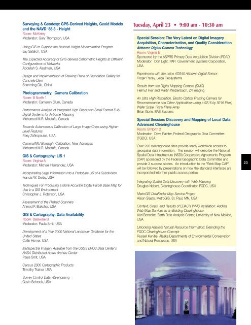
Surveying & Geodesy: GPS-Derived Heights, Geoid Models<br />
and the NAVD ‘88 3 - Height<br />
Room: McKinley<br />
Moderator: Gary Thompson, USA<br />
Using GIS to Support the National Height Modernization Program<br />
Jay Satalich, USA<br />
The Expected Accuracy of GPS-derived Orthometric Heights at Different<br />
Configurations of Networks<br />
Abdullah S. Alsalman, USA<br />
Design and Implementation of Drawing Plane of Foundation Gallery for<br />
Concrete Dam<br />
Shanming Qiu, China<br />
Photogrammetry: Camera Calibration<br />
Room: B North 1<br />
Moderator: Cameron Ellum, Canada<br />
Performance Analysis of Integrated High Resolution Small Format Fully<br />
Digital Systems for Airborne Mapping<br />
Mohamed M.R. Mostafa, Canada<br />
Towards Autonomous Calibration of Large Image Chips using Higher-<br />
Level Features<br />
Pany Zafiropoulos, USA<br />
Camera/IMU Boresight Calibration: New Advances<br />
Mohamed M.R. Mostafa, Canada<br />
GIS & Cartography: LIS 1<br />
Room: Virginia A<br />
Moderator: Michael Hernandez, USA<br />
Incorporating Legal Information into a Prototype LIS of a Subdivision<br />
Francis W. Derby, USA<br />
Techniques For Producing a More Accurate Digital Parcel Base Map for<br />
Use in a GIS Environment<br />
Christopher J. Robinson, USA<br />
Assessment of the Flatbed Scanners<br />
Ahmed F. Elaksher, USA<br />
GIS & Cartography: Data Availability<br />
Room: Delaware B<br />
Moderator: Paula Smit, USA<br />
Development of a Year 2000 National Landcover Database for the<br />
United States<br />
Collin Homer, USA<br />
Multispectral Imagery Available from the USGS EROS Data Center's<br />
NASA Distributed Active Archive Center<br />
Paula Smit, USA<br />
Census 2000 Cartographic Products<br />
Timothy Trainor, USA<br />
Survey Control Data Warehousing<br />
Gavin Schrock, USA<br />
Tuesday, April 23 • 9:00 am - 10:30 am<br />
Special Session: The Very Latest on Digital Imagery<br />
Acquisition, Characterization, and Quality Consideration<br />
Airborne Digital Camera Technology<br />
Room: Virginia B<br />
Sponsored by the ASPRS Primary Data Acquisition Division (PDAD)<br />
Moderator: Don Light, PAR Government Systems Corporation,<br />
USA<br />
Experiences with the Leica ADS40 Airborne Digital Sensor<br />
Roger Pacey, Leica Geosystems<br />
Results from the Digital Mapping Camera (DMC)<br />
Helmut Heir and Martin Welzenbach, Z/I Imaging<br />
An Ultra High Resolution, Electro-Optical Framing Camera for<br />
Reconnaissance and Other Applications using a 9216 by 9216 Pixel,<br />
Wafer Scale, Focal Plane Array<br />
Brian Gorin, BAE Systems<br />
Special Session: Discovery and Mapping of Local Data:<br />
Advanced Clearinghouse<br />
Room: B North 2<br />
Moderator: Dave Painter, Federal Geographic Data Committee<br />
(FGDC), USA<br />
Over 200 clearinghouse sites provide ready worldwide access to<br />
geospatial data information. This session will describe the National<br />
Spatial Data Infrastructure (NSDI) Cooperative Agreements Program<br />
(CAP) sponsored by the Federal Geographic Data Committee and<br />
provide 3 success stories. An introduction to the "Web Map CAP"<br />
will be followed by presentations on how the standard interfaces are<br />
incorporated into their public access portals.<br />
Integrating Spatial Data Discovery with Web Mapping<br />
Douglas Nebert, Clearinghouse Coordinator, FGDC, USA<br />
MetroGIS DataFinder Map Service Project<br />
Alison Slaats, MetroGIS, St. Paul, MN, USA<br />
Context, Goals, and Results of EDAC’s WMS Installation: Adding<br />
Web Map Services to an Existing Clearinghouse<br />
Karl Benedict, Earth Data Analysis Center, University of New Mexico,<br />
USA<br />
Unlocking Alaska’s Natural Resource Information: Extending the<br />
FGDC Clearinghouse Concept<br />
Russell Kunibe, Alaska Departments of Environmental Conservation<br />
and Natural Resources, USA<br />
Special Session: Ten-Year Remote Sensing Industry<br />
23


