Prognosis and mitigation strategy for major landslide-prone areas Varunavat Parvat landslide in Uttarkashi
Prognosis and mitigation strategy for major landslide-prone areas A case study of Varunavat Parvat landslide in Uttarkashi township of Uttarakhand (India)
Prognosis and mitigation strategy for major landslide-prone areas A case study of Varunavat Parvat landslide in Uttarkashi township of Uttarakhand (India)

Create successful ePaper yourself
Turn your PDF publications into a flip-book with our unique Google optimized e-Paper software.
DPM<br />
17,5<br />
622<br />
Disaster Prevention <strong>and</strong> Management<br />
Vol. 17 No. 5, 2008<br />
pp. 622-644<br />
q Emerald Group Publish<strong>in</strong>g Limited<br />
0965-3562<br />
DOI 10.1108/09653560810918649<br />
The current issue <strong>and</strong> full text archive of this journal is available at<br />
www.emerald<strong>in</strong>sight.com/0965-3562.htm<br />
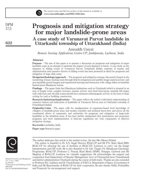
<strong>Prognosis</strong> <strong>and</strong> <strong>mitigation</strong> <strong>strategy</strong><br />
<strong>for</strong> <strong>major</strong> l<strong>and</strong>slide-<strong>prone</strong> <strong>areas</strong><br />
A case study of <strong>Varunavat</strong> <strong>Parvat</strong> l<strong>and</strong>slide <strong>in</strong><br />
<strong>Uttarkashi</strong> township of Uttarakh<strong>and</strong> (India)<br />
Aniruddh Uniyal<br />
Remote Sens<strong>in</strong>g Applications Centre-UP, Jankipuram, Lucknow, India<br />
Abstract<br />
Purpose – The aim of this paper is to present a discussion on prognosis <strong>and</strong> <strong>mitigation</strong> of <strong>major</strong><br />
l<strong>and</strong>slide zones <strong>in</strong> an attempt to m<strong>in</strong>imize the impact of such disasters <strong>in</strong> future. A case study on the<br />
sequence of slid<strong>in</strong>g events of <strong>Varunavat</strong> <strong>Parvat</strong>, <strong>Uttarkashi</strong> (India), response of masses <strong>and</strong><br />
adm<strong>in</strong>istration <strong>and</strong> causative factors of slid<strong>in</strong>g events has been presented <strong>in</strong> detail <strong>for</strong> prognosis <strong>and</strong><br />
<strong>mitigation</strong> of large slide zones.<br />
Design/methodology/approach – The prognosis <strong>and</strong> <strong>mitigation</strong> <strong>strategy</strong> discussed is based on the<br />
monitor<strong>in</strong>g of mass wast<strong>in</strong>g zones through field <strong>in</strong>vestigations <strong>and</strong> satellite image analysis (of pre- <strong>and</strong><br />
post-l<strong>and</strong>slide period images) <strong>and</strong> experiential learn<strong>in</strong>g <strong>and</strong> <strong>in</strong>teraction with village elders <strong>in</strong> l<strong>and</strong>slide<br />
hazard-<strong>prone</strong> Himalayan terra<strong>in</strong>.<br />
F<strong>in</strong>d<strong>in</strong>gs – The paper f<strong>in</strong>ds that Himalayan habitations such as <strong>Uttarkashi</strong> (which is situated <strong>in</strong> an<br />
area of fragile rocks, complex tectonics, seismic activity <strong>and</strong> cloud burst-<strong>prone</strong> unstable hill slopes<br />
with colluvium <strong>and</strong> old slide zones) should have m<strong>in</strong>imum anthropogenic activity <strong>in</strong> the <strong>for</strong>m of slope<br />
cutt<strong>in</strong>g <strong>for</strong> road or build<strong>in</strong>g construction.<br />
Research limitations/implications – The paper reflects the author’s <strong>in</strong>dividual underst<strong>and</strong><strong>in</strong>g of<br />
causative factors <strong>and</strong> <strong>in</strong>dications of l<strong>and</strong>slides <strong>in</strong> <strong>Varunavat</strong> <strong>Parvat</strong> area <strong>in</strong> <strong>Uttarkashi</strong> township of<br />
Uttarakh<strong>and</strong> (India).<br />
Orig<strong>in</strong>ality/value – The paper calls <strong>for</strong> amalgamation of experience-based local knowledge of<br />
villagers of l<strong>and</strong>slide-<strong>prone</strong> <strong>areas</strong> <strong>and</strong> modern scientific <strong>and</strong> technical know-how <strong>and</strong> above all the<br />
coord<strong>in</strong>ated ef<strong>for</strong>ts of community <strong>and</strong> authorities <strong>for</strong> prognosis <strong>and</strong> <strong>mitigation</strong> of large-scale<br />
l<strong>and</strong>slides <strong>in</strong> the <strong>in</strong>habited <strong>areas</strong>. It has been further emphasized that sensitization <strong>and</strong> awareness<br />
programs <strong>and</strong> strict implementation of l<strong>and</strong>-use regulations are vital components of effective<br />
<strong>mitigation</strong> <strong>strategy</strong>.<br />
Keywords L<strong>and</strong>slides, India<br />
Paper type Research paper<br />
The author dedicates this article to his mother-<strong>in</strong>-law, the late Mrs Meena Dobhal.<br />
The author is thankful to Dr A.N. S<strong>in</strong>gh Director RSAC-UP <strong>and</strong> Mr P.N. Shah, Head ERD,<br />
RSAC-UP <strong>for</strong> allow<strong>in</strong>g the use of facilities at RSAC-UP, Lucknow to carry out the Image<br />
Interpretation <strong>and</strong> GIS work. He is also thankful to Dr A.K. Tangri, P.I. Himalayan Glaciology<br />
Programme, RSAC-UP; Professor C. Prasad, Head (Retd.) HNBG, Sr<strong>in</strong>agar, Garhwal <strong>and</strong> Mr<br />
Meghraj of RSAC-UP, Lucknow <strong>for</strong> valuable suggestions. He acknowledges the support <strong>and</strong><br />
cooperation from Department of Disaster Management, Govt of Uttaranchal (now Uttarakh<strong>and</strong>)<br />
<strong>and</strong> district adm<strong>in</strong>istration <strong>Uttarkashi</strong> dur<strong>in</strong>g the course of field study. Thanks are also extended<br />
to Professor R.C. Lakhera <strong>and</strong> Dr V<strong>in</strong>od Kumar of N.R.S.A, Department of Space, Government of<br />
India <strong>and</strong> Mr Ramch<strong>and</strong>ra of RSAC-UP <strong>for</strong> their cooperation. He also thanks Nidhi, Prabuddha<br />
<strong>and</strong> Pranayak <strong>for</strong> encouragement <strong>and</strong> support.
Introduction<br />
Himalaya isolates the Indian subcont<strong>in</strong>ent from the rest of Asia. This highest <strong>and</strong><br />
youngest mounta<strong>in</strong> of the world was <strong>for</strong>med as a result of the com<strong>in</strong>g together <strong>and</strong><br />
eventual collision of India <strong>and</strong> ma<strong>in</strong>l<strong>and</strong> Asia. The people of Himalaya have borne the<br />
consequences of the quickened paces of the earth’s processes <strong>in</strong>clud<strong>in</strong>g the<br />
ever-threaten<strong>in</strong>g natural hazards (Valdiya, 2001). Major part of the state of<br />
Uttaranchal (now called as Uttarakh<strong>and</strong>) lies <strong>in</strong> the fragile mounta<strong>in</strong> belt of<br />
Himalaya <strong>and</strong> has experienced tectonic turmoil several times <strong>in</strong> the distant past.<br />
Dur<strong>in</strong>g the last quarter of twentieth century there has been an <strong>in</strong>crease <strong>in</strong> the frequency<br />
of natural disasters <strong>in</strong> this region. Major disasters <strong>in</strong> the last few years <strong>in</strong>clude<br />
<strong>Uttarkashi</strong> Earthquake of 1991, Chamoli Earthquake of 1999, <strong>in</strong>famous l<strong>and</strong>slides of<br />
Okhimath <strong>and</strong> Malpa <strong>in</strong> the year 1998 <strong>and</strong> cloudbursts <strong>and</strong> flash floods <strong>in</strong> Khetgaon<br />
<strong>and</strong> Budakedar area dur<strong>in</strong>g the monsoons of the year 2002. Sudden <strong>in</strong>crease <strong>in</strong><br />
anthropogenic activities like unplanned cutt<strong>in</strong>g of slope, blast<strong>in</strong>g of highly jo<strong>in</strong>ted rock<br />
mass <strong>for</strong> road construction <strong>and</strong> unplanned disposal of the slope cut debris have further<br />
added to the fragility of Himalayan mounta<strong>in</strong>s <strong>and</strong> consequently there has been an<br />
<strong>in</strong>crease <strong>in</strong> the vulnerability of this region to natural disasters (Uniyal <strong>and</strong> Prasad,<br />
2006).<br />
In the first decade of the twenty-first century no other l<strong>and</strong>slide <strong>in</strong> Himalayan region<br />
got more media attention than the l<strong>and</strong>slide events from the hill called <strong>Varunavat</strong><br />
<strong>Parvat</strong> <strong>in</strong> <strong>Uttarkashi</strong> township of Uttarakh<strong>and</strong>. <strong>Uttarkashi</strong> township <strong>in</strong> situated on the<br />
banks of Bhagirathi river (which is called Ganga <strong>in</strong> the downstream of Devprayag) at<br />
an elevation of 1,152 mts <strong>and</strong> is the district headquarters <strong>for</strong> the northern hill district of<br />
<strong>Uttarkashi</strong> named after this township (Figure 1). The township of <strong>Uttarkashi</strong> has a<br />
population of about 16,218 (Census of India, 2001, 2004) <strong>and</strong> is located on<br />
Rishikesh-Gangotri National Highway (NH-108) at a distance of about 200 km (approx.)<br />
from Dehradun, the capital of Uttarakh<strong>and</strong> state of India. This township lies <strong>in</strong> the<br />
fragile mounta<strong>in</strong>s of Himalaya <strong>and</strong> has a long history of natural disasters. Flash floods<br />
of Bhagirathi river <strong>in</strong> the late 1970s, Gyansu l<strong>and</strong>slide more than two decades back <strong>in</strong><br />
1980, earthquake of the year 1991 have caused wide spread damage to life <strong>and</strong> property<br />
<strong>in</strong> <strong>Uttarkashi</strong> township <strong>and</strong> elsewhere <strong>in</strong> the district. The most recent disaster <strong>in</strong> this<br />
township has been large-scale l<strong>and</strong>slid<strong>in</strong>g from the hill called <strong>Varunavat</strong> <strong>Parvat</strong>, s<strong>in</strong>ce<br />
<strong>Prognosis</strong> <strong>and</strong><br />
<strong>mitigation</strong><br />
<strong>strategy</strong><br />
623<br />
Figure 1.<br />
Location map of study<br />
area
DPM<br />
17,5<br />
624<br />
Plate 1.<br />
View of <strong>Varunavat</strong> <strong>Parvat</strong><br />
on 1 October, 2003 with<br />
large active zone of<br />
Ramlila Ground slide <strong>and</strong><br />
active zone of Horticulture<br />
Colony <strong>and</strong> Masjid<br />
Mohalla slide is also seen<br />
<strong>in</strong> the immediate east of<br />
the scarp of Ramlila<br />
Ground slide<br />
Plate 2.<br />
View of <strong>Varunavat</strong> <strong>Parvat</strong><br />
<strong>in</strong> mid-October, 2003<br />
September 23rd, 2003, which badly affected the commercial cum residential complexes,<br />
<strong>in</strong>frastructure facilities (a part of Rishikesh – Gangotri National Highway) <strong>in</strong> the<br />
upslope of Ramlila Ground <strong>in</strong> the heart of the township (Plates 1-4). S<strong>in</strong>ce 1 October,<br />
2003 another slide was activated from <strong>Varunavat</strong> <strong>Parvat</strong> <strong>in</strong> the vic<strong>in</strong>ity of Ramlila<br />
Ground slide <strong>and</strong> badly affected Masjid Mohalla <strong>and</strong> Horticulture colony localities<br />
(Plates 1, 2 <strong>and</strong> 5) of the township of <strong>Uttarkashi</strong> (Uniyal et al., 2004). NRSA (2001), <strong>in</strong> its<br />
L<strong>and</strong>slide Hazard Zonation Atlas has shown a part of <strong>Varunavat</strong> <strong>Parvat</strong> as high<br />
hazard zone.
Sequence of slid<strong>in</strong>g events of <strong>Varunavat</strong> <strong>Parvat</strong><br />
One month prior to this large scale slid<strong>in</strong>g small slide scarps were observed by the<br />
author on <strong>Varunavat</strong> <strong>Parvat</strong> above Bus st<strong>and</strong>, Indra Colony, Masjid Mohalla <strong>and</strong><br />
Horticulture colony <strong>areas</strong> <strong>and</strong> these small slide scarps were witness<strong>in</strong>g headward shift.<br />
This phenomenon was also observed by the geologists of Geological Survey of India<br />
<strong>and</strong> local authorities. DMMC (2003), has predicted the gradual merg<strong>in</strong>g of these small<br />
slide scarps with active scarp of nearby Tambakhani slide <strong>and</strong> possible emergence of<br />
<strong>Prognosis</strong> <strong>and</strong><br />
<strong>mitigation</strong><br />
<strong>strategy</strong><br />
625<br />
Plate 3.<br />
Close view of Ramlila<br />
Ground slide <strong>in</strong> late<br />
September, 2003. Huge<br />
volume of slide debris is<br />
accumulated <strong>in</strong> the back<br />
portion of multistoreyed<br />
hotels located <strong>in</strong> the heart<br />
of <strong>Uttarkashi</strong> township<br />
Plate 4.<br />
Close view of Ramlila<br />
Ground slide <strong>in</strong> October,<br />
2003 with most of the<br />
multi-storeyed hotels are<br />
completely buried under<br />
slide debris along with a<br />
part of Rishikesh-Gangotri<br />
National Highway. The<br />
slide debris <strong>and</strong> boulders<br />
have even spread to the<br />
immediate down slope<br />
area of Ramlila Ground
DPM<br />
17,5<br />
626<br />
Plate 5.<br />
Close view of Horticulture<br />
Colony – Masjid Mohalla<br />
slide<br />
large slide zones <strong>in</strong> Bus st<strong>and</strong>, Masjid Mohalla <strong>and</strong> Horticulture colony <strong>areas</strong>. Present<br />
study has revealed that dur<strong>in</strong>g the series of cloud burst events of July/August, 2003 the<br />
Ramlila Ground slide was triggered as a small slide zone of 40m length <strong>and</strong> 30m width<br />
<strong>in</strong> the close vic<strong>in</strong>ity of large active slide of Tambakhani on <strong>Varunavat</strong> <strong>Parvat</strong>. The<br />
active slide zones of Ramlila Ground slide witnessed rapid headward shift dur<strong>in</strong>g the<br />
months of August <strong>and</strong> September, 2003 <strong>and</strong> completely merged with the active scarp of<br />
large Tambakhani slide on 23 September, 2003, consequently, the slide debris <strong>and</strong><br />
roll<strong>in</strong>g boulders started hitt<strong>in</strong>g multi-storied hotels <strong>in</strong> the Bus St<strong>and</strong> area. It was with<br />
<strong>in</strong> the short span of 24 hours that this slide zone trans<strong>for</strong>med <strong>in</strong>to a large complex slide<br />
<strong>and</strong> multi-storied hotels, commercial <strong>and</strong> residential complexes at Bus St<strong>and</strong> along<br />
with 100 m stretch of National Highway were buried under the huge volume of slide<br />
debris that gradually extended to Ramlila Ground. On 1 October 2003 the head-ward<br />
shift<strong>in</strong>g of another active slide scarp (developed <strong>in</strong> the upslope of Masjid Mohalla <strong>and</strong><br />
Horticulture Colony localities of <strong>Uttarkashi</strong> township) completely merged with the<br />
active slide scarp of Ramlila Ground <strong>and</strong> Tambahkani slide (Plate 1), consequently, yet<br />
another large slide zone emerged <strong>and</strong> slide debris <strong>and</strong> boulders damaged <strong>major</strong> part of<br />
Masjid Mohalla <strong>and</strong> Horticulture colony.<br />
Causative factors <strong>for</strong> these slid<strong>in</strong>g events have been analyzed on the basis of<br />
satellite image study <strong>and</strong> detailed field <strong>in</strong>vestigations. Interpretation of pre <strong>and</strong> post<br />
disaster satellite images from Indian Remote Sens<strong>in</strong>g Satellites (IRS 1D LISS-III False<br />
Colour Composites of 13 April 2003 <strong>and</strong> IRS-P6 LISS-III False Colour Composites of 16<br />
April 2004; 7 September 2004; 11 April 2005 <strong>and</strong> 9 August 2005) has been carried out to<br />
precisely mark the extent of various l<strong>and</strong><strong>for</strong>ms, extension of <strong>major</strong> discont<strong>in</strong>uities <strong>and</strong><br />
changes <strong>in</strong> the l<strong>and</strong>scape after l<strong>and</strong>slide activity of September/October, 2003. ARC GIS<br />
9.0 software was used to create the morphotectonic map through <strong>in</strong>tegration of GIS<br />
layers of geo-environmental parameters viz. geomorphology, structure <strong>and</strong> l<strong>and</strong>slide <strong>in</strong><br />
order to assess the <strong>in</strong>fluence of tectonics on the l<strong>and</strong><strong>for</strong>ms <strong>and</strong> l<strong>and</strong>slide activity.<br />
Response<br />
Late <strong>in</strong> the even<strong>in</strong>g on 23 September, 2003 some locals <strong>and</strong> officials of Irrigation<br />
Department noticed <strong>major</strong> slid<strong>in</strong>g activity <strong>in</strong> the <strong>for</strong>m of large heap of debris material
accumulated <strong>in</strong> the backyards of multi-storied M<strong>and</strong>akni <strong>and</strong> Relax hotels at<br />
<strong>Uttarkashi</strong> Bus St<strong>and</strong> area. District authorities promptly responded as they were aware<br />
of the uphill events <strong>and</strong> probable consequences <strong>in</strong> the <strong>for</strong>m of large-scale l<strong>and</strong>slides.<br />
Realiz<strong>in</strong>g the fact that emergency evacuation from the area was first <strong>and</strong> <strong>for</strong>emost task,<br />
the authorities launched a coord<strong>in</strong>ated ef<strong>for</strong>t by <strong>in</strong>volv<strong>in</strong>g different l<strong>in</strong>e departments<br />
(Police, Fire Brigade, Revenue, Irrigation Department etc.) <strong>and</strong> public representatives<br />
of local bodies <strong>for</strong> emergency evacuation from the bus st<strong>and</strong> <strong>and</strong> surround<strong>in</strong>g area of<br />
the township.<br />
In sharp contrast to the devastat<strong>in</strong>g l<strong>and</strong>slide events of Okhimath <strong>and</strong> Malpa<br />
(Uttranchal) <strong>in</strong> the monsoon season of 1998, where hundreds of people lost their lives,<br />
the l<strong>and</strong>slide events of <strong>Varunavat</strong> <strong>Parvat</strong> <strong>in</strong> <strong>Uttarkashi</strong> recorded zero casualty figures.<br />
This can be attributed to the slow <strong>and</strong> gradual movement of slid<strong>in</strong>g mass from the hill<br />
(<strong>Varunavat</strong> <strong>Parvat</strong>) <strong>and</strong> awareness among masses about the onslaught of disaster <strong>and</strong><br />
furthermore, preparedness <strong>and</strong> timely <strong>in</strong>tervention by local people <strong>and</strong> adm<strong>in</strong>istration.<br />
Damage assessment<br />
Devastat<strong>in</strong>g l<strong>and</strong>slides <strong>in</strong> the <strong>Uttarkashi</strong> township dur<strong>in</strong>g the months of September<br />
<strong>and</strong> October, 2003 have badly affected Bus St<strong>and</strong> <strong>and</strong> surround<strong>in</strong>g area, part of<br />
Ramlila Ground, Masjid Mohalla <strong>and</strong> Horticulture Colony localities of the township.<br />
Consequently, about 81 build<strong>in</strong>gs <strong>in</strong>clud<strong>in</strong>g 23 government build<strong>in</strong>gs <strong>and</strong> 58 private<br />
build<strong>in</strong>gs (multi-storied commercial complexes, residential cum commercial build<strong>in</strong>gs)<br />
were damaged. Accord<strong>in</strong>g to <strong>in</strong>itial estimates by district authorities a population of<br />
2,911 from 362 families was affected. A segment of Rishikesh-Gangotri National<br />
Highway was also buried under the slide debris.<br />
The Central Technical Team has demarcated a buffer zone around l<strong>and</strong>slide<br />
affected area of <strong>Uttarkashi</strong> <strong>and</strong> advised evacuation of the population of this zone <strong>in</strong><br />
order to m<strong>in</strong>imize the risk to the <strong>in</strong>habitants <strong>in</strong> near future <strong>and</strong> to ensure the detailed<br />
<strong>in</strong>vestigations <strong>and</strong> treatment of hill slope (Central Technical Team, 2003). About 69<br />
government build<strong>in</strong>gs <strong>and</strong> 143 private build<strong>in</strong>gs located <strong>in</strong> the buffer zone are to be<br />
reconstructed/relocated.<br />
Accord<strong>in</strong>g to local authorities the estimated cost of rehabilitation of affected<br />
population, relocation of government <strong>and</strong> commercial build<strong>in</strong>gs <strong>and</strong> bridges,<br />
construction of alternate routes <strong>and</strong> hill slope stabilization is 2,552.1 million Indian<br />
Rupees (1US$ 47 Indian Rupees).<br />
Geology<br />
The rocks constitut<strong>in</strong>g <strong>Varunavat</strong> <strong>Parvat</strong> are ma<strong>in</strong>ly jo<strong>in</strong>ted <strong>and</strong> fractured phyllites<br />
<strong>and</strong> quartzites of <strong>Uttarkashi</strong> Formation of Garhwal Group of Lesser Himalayan<br />
sequence, dipp<strong>in</strong>g <strong>in</strong>to the hill at an angle of about 35 o (Plate 6e). Agarwal <strong>and</strong> Kumar<br />
(1973) carried out detailed geological mapp<strong>in</strong>g of the area <strong>and</strong> recognized the lower<br />
part of <strong>Uttarkashi</strong> Formation as Netala Quartzite <strong>and</strong> upper part as Sartali Slates.<br />
Netala Quartizite is <strong>in</strong>terbedded sequence of quartzite <strong>and</strong> slates exposed <strong>in</strong> the<br />
northern limb of NW-SE trend<strong>in</strong>g Baragadi Anticl<strong>in</strong>e (Ja<strong>in</strong>, 1971), con<strong>for</strong>mably<br />
underly<strong>in</strong>g the slates. The quartzite of this sequence is white to buff coloured, f<strong>in</strong>e<br />
gra<strong>in</strong>ed <strong>and</strong> current bedded. Sartali Slates occur as b<strong>and</strong>ed grey, green, purple slate<br />
<strong>and</strong> <strong>in</strong>terbedded quartzite <strong>and</strong> are con<strong>for</strong>mably underly<strong>in</strong>g limestone <strong>and</strong> dolomite of<br />
Syalna Formation. In Badethi-Boga section west of <strong>Uttarkashi</strong> township the Syalna<br />
<strong>Prognosis</strong> <strong>and</strong><br />
<strong>mitigation</strong><br />
<strong>strategy</strong><br />
627
DPM<br />
17,5<br />
628<br />
Plate 6.<br />
Various natural <strong>and</strong><br />
anthropogenic factors<br />
caus<strong>in</strong>g large scale slides<br />
on <strong>Varunavat</strong> <strong>Parvat</strong><br />
Limestone occur as l<strong>in</strong>ear narrow <strong>and</strong> impersistent b<strong>and</strong> but <strong>in</strong> the northeast of<br />
<strong>Uttarkashi</strong> township, immediate north of M<strong>and</strong>wa <strong>and</strong> east of Kot they atta<strong>in</strong><br />
considerable thickness. Syalna Formation <strong>in</strong>cludes massive bluish grey to black light<br />
grey limestone <strong>and</strong> dolomite at places cherty <strong>and</strong> pelletal stromatolitic with<br />
subord<strong>in</strong>ate slate <strong>and</strong> quartzite. Syalna Formation is overla<strong>in</strong> by Nagni Thank<br />
Formation. Kot Metavolcanics member consist<strong>in</strong>g of green amygdaloidal schist with<br />
th<strong>in</strong> b<strong>and</strong>s of ripple marked quartzite <strong>and</strong> arenaceous slates constitute the basal<br />
horizon of Nagni Tank Formation (Figure 2).<br />
Kot Volcanics are exposed around Sangrali area north of the active slide zones of<br />
<strong>Varunavat</strong> <strong>Parvat</strong>. The younger member of Gameri Quartzite is white to purple
coloured, medium to course gra<strong>in</strong>ed locally pebbly to conglomeratic. Pujargaon<br />
Metavolcanics is the youngest basic flow <strong>in</strong> the area <strong>and</strong> occupies southwestern corner<br />
of the study area (Figure 2). This member comprises green amygdaloidal schist which<br />
amygdules of quartz <strong>and</strong> zeolite (Agarwal <strong>and</strong> Kumar, 1973).<br />
Structure<br />
Exam<strong>in</strong>ation of satellite images <strong>and</strong> field <strong>in</strong>vestigations have revealed the existence of<br />
some <strong>major</strong> structural discont<strong>in</strong>uities (anticl<strong>in</strong>al <strong>and</strong> syncl<strong>in</strong>al axes, faults <strong>and</strong><br />
<strong>Prognosis</strong> <strong>and</strong><br />
<strong>mitigation</strong><br />
<strong>strategy</strong><br />
629<br />
Figure 2.<br />
Geological map of<br />
<strong>Uttarkashi</strong> <strong>and</strong><br />
surround<strong>in</strong>g area
DPM<br />
17,5<br />
630<br />
Figure 3.<br />
Structural map of<br />
<strong>Varunavat</strong> <strong>Parvat</strong> <strong>and</strong><br />
surround<strong>in</strong>g area of<br />
<strong>Uttarkashi</strong> township<br />
l<strong>in</strong>eaments) <strong>in</strong> the area. Most conspicuous structural discont<strong>in</strong>uity observed <strong>in</strong> the area<br />
is anticl<strong>in</strong>al axis <strong>and</strong> fault along Bhagirathi river referred to as Baragadi anticl<strong>in</strong>e <strong>and</strong><br />
fault by Agarwal <strong>and</strong> Kumar (1973) <strong>and</strong> Indravati Bhagirathi fault by NRSA (2004). In<br />
the area under <strong>in</strong>vestigation the NW-SE trend of this discont<strong>in</strong>uity is traced along<br />
Indravati river from Ladari village upto further SE of Boga village. It is at <strong>Uttarkashi</strong><br />
that the trend of this anticl<strong>in</strong>al axis <strong>and</strong> fault changes from NW-SE to E-W <strong>and</strong> this<br />
E-W trend is noticed along Badethi, Chamkot <strong>and</strong> Matli area <strong>and</strong> thereafter it extends<br />
<strong>in</strong> northwest direction. Bhagirathi river between <strong>Uttarkashi</strong> <strong>and</strong> Matli <strong>and</strong> <strong>in</strong> the<br />
further west follows this discont<strong>in</strong>uity <strong>and</strong> the broad river valley of Bhagirathi <strong>and</strong> its<br />
me<strong>and</strong>er<strong>in</strong>g channel at <strong>Uttarkashi</strong> <strong>and</strong> downstream <strong>and</strong> severe bank erosion by<br />
Indravati River <strong>and</strong> its broad valley <strong>in</strong>dicate strong tectonic control that Baragadi<br />
anticl<strong>in</strong>e <strong>and</strong> fault exhibits over the river courses of Bhagirathi <strong>and</strong> Indravati at<br />
<strong>Uttarkashi</strong> <strong>and</strong> surround<strong>in</strong>g area (Figure 3). Another geomorphic expression of this<br />
discont<strong>in</strong>uity is the sudden change <strong>in</strong> the upstream NE-SW trend of Bhagirathi river at<br />
<strong>Uttarkashi</strong>, as it flows NE-SW <strong>in</strong> the upstream of its confluence with Indravati river<br />
<strong>and</strong> <strong>in</strong> the immediate downstream of the confluence Bhagirathi river follows an E-W<br />
trend. Another E-W trend<strong>in</strong>g structural feature <strong>in</strong> the area is syncl<strong>in</strong>al axis of Sangrali<br />
- Kh<strong>and</strong> syncl<strong>in</strong>e (Figure 3) also referred to as Kot syncl<strong>in</strong>e by Agarwal <strong>and</strong> Kumar<br />
(1973). NE-SW trend<strong>in</strong>g Pata-Sangrali fault <strong>in</strong>tersects the axis of Kot syncl<strong>in</strong>e <strong>in</strong> the<br />
west of Sangrali. The slow flowage around Sangrali <strong>and</strong> Pata villages <strong>and</strong> escarpment<br />
<strong>in</strong> that area can be attributed to this discont<strong>in</strong>uity. NW-SE trend<strong>in</strong>g Kharuwan-Badethi<br />
anticl<strong>in</strong>al axis <strong>and</strong> fault is another <strong>major</strong> structural discont<strong>in</strong>uity <strong>in</strong> the area <strong>and</strong> can be<br />
traced from NW of Kharuwan to the SE of Wasunga village <strong>and</strong> extends further SE of<br />
Badethi. The NW-SE disposition of Wasunga-Badethi Fan <strong>in</strong> this area <strong>and</strong>
entrenchment of its proximal part near Kharuwan village can be attributed to<br />
Kharuwan-Badethi anticl<strong>in</strong>al axis <strong>and</strong> fault (Figure 4). At Matli village a NE-SW<br />
trend<strong>in</strong>g fault is observed <strong>and</strong> another N-S trend<strong>in</strong>g fault has been traced <strong>in</strong> the further<br />
west of Matli.<br />
Study of satellite images from Indian Remote Sens<strong>in</strong>g satellites (IRS-1D & IRS P6)<br />
has revealed the existence of three prom<strong>in</strong>ent l<strong>in</strong>eaments trend<strong>in</strong>g NE-SW NW-SE <strong>and</strong><br />
N-S direction. Prom<strong>in</strong>ent among these are NE-SW trend<strong>in</strong>g M<strong>and</strong>wa-Ujeli l<strong>in</strong>eament,<br />
Gyansu l<strong>in</strong>eament <strong>and</strong> NW-SE trend<strong>in</strong>g Chamkot l<strong>in</strong>eament. NE-SW trend<strong>in</strong>g<br />
M<strong>and</strong>wa – Ujeli l<strong>in</strong>eament controls the Bhagirathi river course <strong>in</strong> the south of Kh<strong>and</strong><br />
village upto <strong>Uttarkashi</strong> township, where it term<strong>in</strong>ates aga<strong>in</strong>st Baragadi anticl<strong>in</strong>al axis<br />
<strong>and</strong> fault, whereas, <strong>in</strong> the east of Kh<strong>and</strong> village this l<strong>in</strong>eament <strong>in</strong>tersects the axis of Kot<br />
syncl<strong>in</strong>e. Gyansu l<strong>in</strong>eament is traced <strong>in</strong> the western part of <strong>Uttarkashi</strong> township along<br />
Gyansu Nala (seasonal stream) <strong>and</strong> is characterised by narrow valley of Gyansu Nala.<br />
The excessive mass wastage on the valley walls of Gyansu Nala, <strong>in</strong> the <strong>for</strong>m of small<br />
active slides developed with<strong>in</strong> the larger old slide zones <strong>and</strong> entrenchment of the<br />
proximal part of Gyansu Fan <strong>and</strong> its NE-SW disposition are strong evidences of the<br />
existence of Gyansu l<strong>in</strong>eament (Figures 3 <strong>and</strong> 4).<br />
Geomorphology<br />
Geomorphic set up of the area is def<strong>in</strong>ed by moderate to highly dissected hills,<br />
structurally controlled ridges <strong>and</strong> river terraces of Bhagirathi <strong>and</strong> Indravati rivers with<br />
colluvial deposits <strong>and</strong> a number of alluvial fans developed at the junction of hills <strong>and</strong><br />
river terraces. However, large active <strong>and</strong> old slide zones are conspicuous <strong>in</strong> the area<br />
<strong>and</strong> many alluvial fans deposited by small tributary streams (of Bhagirathi) are<br />
<strong>Prognosis</strong> <strong>and</strong><br />
<strong>mitigation</strong><br />
<strong>strategy</strong><br />
631<br />
Figure 4.<br />
Morphotectonic map of<br />
<strong>Varunavat</strong> <strong>Parvat</strong> <strong>and</strong><br />
surround<strong>in</strong>g area of<br />
<strong>Uttarkashi</strong> township
DPM<br />
17,5<br />
632<br />
Figure 5.<br />
L<strong>and</strong>slide map of Varunat<br />
<strong>Parvat</strong> area<br />
Plate 7.<br />
View of <strong>Varunavat</strong> <strong>Parvat</strong><br />
about one <strong>and</strong> a half<br />
decade back<br />
superposed over the vast terraces of Bhagirathi river. <strong>Varunavat</strong> <strong>Parvat</strong> has witnessed<br />
extensive development of colluvial deposits due to gravity transport on its moderate to<br />
steep slopes (Figures 4 <strong>and</strong> 5; Plates 1, 7 <strong>and</strong> 8). Salra village <strong>in</strong> the NW of <strong>Uttarkashi</strong><br />
township is located over colluvium <strong>and</strong> the southern slope aspects of <strong>Varunavat</strong> <strong>Parvat</strong><br />
(towards Bhagirathi river) also have large colluvial deposits. The northeastern part of<br />
<strong>Uttarkashi</strong> township <strong>in</strong> the north of National Highway is located over the distal part of<br />
colluvial fan deposits (Figure 5). Furthermore, on the southern bank of Bhagirathi river<br />
the villages of Jaspur <strong>and</strong> Silyana are located over colluvium. On the northern bank of<br />
the river the alluvial fans of Gyansu <strong>and</strong> Padull are conspicuous <strong>and</strong> distal part of both<br />
these fans have habitations (Figure 4). On the southern bank of Bhagirathi river the<br />
alluvial fans are developed around Pokhri, Dang <strong>and</strong> Kotyalgaon. In the east of<br />
<strong>Uttarkashi</strong> township the villages of Ujeli <strong>and</strong> Tiloth are located over terrace deposits.<br />
Major part of <strong>Uttarkashi</strong> township is also located over the terrace deposits. Joshiyara,
Ladari <strong>and</strong> Kansen villages are aga<strong>in</strong> located over terrace deposits, further west of<br />
<strong>Uttarkashi</strong> town the villages of Badethi, Delesaur, Chamkot <strong>and</strong> Matli are aga<strong>in</strong><br />
occupy<strong>in</strong>g the terrace deposits (Figure 4). Indravati river the another <strong>major</strong> stream <strong>in</strong><br />
the area <strong>and</strong> left bank tributary of Bhagirathi river also has terraces <strong>and</strong> active flood<br />
pla<strong>in</strong> which are often subjected to flash floods <strong>and</strong> severe bank erosion dur<strong>in</strong>g ra<strong>in</strong>y<br />
season.<br />
L<strong>and</strong> use<br />
<strong>Varunavat</strong> <strong>Parvat</strong> has dense p<strong>in</strong>e <strong>for</strong>est on the ridges whereas the middle slopes of this<br />
hill are hav<strong>in</strong>g open p<strong>in</strong>e <strong>for</strong>est with few pockets of sparse scrub. Dur<strong>in</strong>g the past<br />
decades l<strong>and</strong>use changes have been conspicuous over the lower slopes of Varunvat<br />
<strong>Parvat</strong> due to urban sprawl of <strong>Uttarkashi</strong> township (Plates 1 <strong>and</strong> 8) <strong>and</strong> this area of<br />
natural vegetation ma<strong>in</strong>ly p<strong>in</strong>e trees has gradually trans<strong>for</strong>med <strong>in</strong>to concrete jungle.<br />
L<strong>and</strong>slid<strong>in</strong>g activity <strong>in</strong> 2003 has completely buried Bus St<strong>and</strong> <strong>and</strong> nearby hotels <strong>and</strong><br />
<strong>major</strong> part of Horticulture Colony, Masjid Mohalla <strong>and</strong> stretch of Rishikesh-Gangotri<br />
National Highway at <strong>Uttarkashi</strong> (Figure 6). The crop fields of Gyansu, Padull <strong>and</strong><br />
Wasunga <strong>in</strong> the west of <strong>Uttarkashi</strong> township are developed over alluvial fan deposits.<br />
Crop fields of Dang village <strong>in</strong> the south of Bhagirathi river are developed over alluvial<br />
fan whereas the agriculture fields of Joshiyara, M<strong>and</strong>wa, Kansen <strong>and</strong> Tiloth villages<br />
are developed over the terraces of Bhagirathi river (Figure 4).<br />
L<strong>and</strong>slide scenario <strong>in</strong> the area<br />
Pre <strong>and</strong> post l<strong>and</strong>slide field <strong>in</strong>vestigations dur<strong>in</strong>g August, 2003 <strong>and</strong> October, 2003 have<br />
revealed that the head-ward shift<strong>in</strong>g <strong>and</strong> gradual enlargement of small slide zones <strong>and</strong><br />
their merg<strong>in</strong>g with the nearby large active slide zone (Tambakhani slide) has<br />
trans<strong>for</strong>med the <strong>for</strong>mer <strong>in</strong>to large complex slide zone (Figure 5; Plates 1, 2 <strong>and</strong> 8).<br />
Three <strong>major</strong> active slide zones observed on the <strong>Varunavat</strong> <strong>Parvat</strong> are Tambakhani<br />
slide, Ramlila Ground slide <strong>and</strong> Masjid Mohalla – Horticulture Colony slide. Further<br />
west of the slide zones an active debris flow slide zone is also developed <strong>in</strong> Gyansu<br />
area. Some characteristic features of these slides are given below.<br />
<strong>Prognosis</strong> <strong>and</strong><br />
<strong>mitigation</strong><br />
<strong>strategy</strong><br />
633<br />
Plate 8.<br />
View of <strong>Varunavat</strong> <strong>Parvat</strong><br />
<strong>in</strong> August, 2003 with only<br />
s<strong>in</strong>gle prom<strong>in</strong>ent active<br />
slide zone of Tambakhani<br />
slide is seen
DPM<br />
17,5<br />
634<br />
Figure 6.<br />
H<strong>and</strong>sketch of <strong>Uttarkashi</strong><br />
township show<strong>in</strong>g active<br />
slide zones <strong>and</strong> damage to<br />
government build<strong>in</strong>gs <strong>and</strong><br />
commercial cum<br />
residential <strong>areas</strong><br />
Tambakhani slide<br />
This translational debris rock fall zone has developed on the southern slope aspect of<br />
<strong>Varunavat</strong> <strong>Parvat</strong> <strong>in</strong> mid 1990s. Accord<strong>in</strong>g to locals some cracks <strong>and</strong> a small slide zone<br />
were developed <strong>in</strong> the upper reaches of <strong>Varunavat</strong> <strong>Parvat</strong> <strong>in</strong> the aftermath of 1991<br />
<strong>Uttarkashi</strong> earthquake. This small slide zone gradually trans<strong>for</strong>med <strong>in</strong>to a large rock<br />
fall zone dur<strong>in</strong>g the monsoon seasons of successive years. Presently this active rock fall<br />
zone has a total length of about 680 meters <strong>and</strong> a width of about 40 meters <strong>in</strong> the scarp<br />
area <strong>and</strong> 5-7 meters <strong>in</strong> the root of the slide (at the <strong>in</strong>tersection of the slide zone with<br />
Rishikesh-Gangotri National Highway). Prior to the monsoon season of 2003 this was<br />
the only active slide zone (developed over <strong>Varunavat</strong> <strong>Parvat</strong>) which was affect<strong>in</strong>g<br />
<strong>Uttarkashi</strong> township as roll<strong>in</strong>g boulders <strong>and</strong> debris from this slide zone often caused<br />
road blockage on National Highway at <strong>Uttarkashi</strong> (Figures 5 <strong>and</strong> 6 <strong>and</strong> Plate 8).<br />
Ramlila ground slide<br />
Dur<strong>in</strong>g the cloud burst events of July/August, 2003 the Ramlila ground slide developed<br />
as a small slide zone of 30 meter width <strong>and</strong> about 40 meter length <strong>in</strong> the upper reaches<br />
of <strong>Varunavat</strong> <strong>Parvat</strong> <strong>in</strong> the close vic<strong>in</strong>ity (about 50 meters east) of large active slide<br />
zone of Tambakhani (Plate 6d). This small slide zone witnessed rapid head-ward<br />
expansion dur<strong>in</strong>g August <strong>and</strong> September 2003 <strong>and</strong> completely merged with the active<br />
slide scarp of large slide zone of Tambakhani on 23 September, 2003 <strong>and</strong> it was on this<br />
day that the boulders <strong>and</strong> debris material from <strong>Varunavat</strong> <strong>Parvat</strong> were first observed<br />
accumulat<strong>in</strong>g <strong>in</strong> the backyard of multi-storeyed hotels <strong>in</strong> the Bus St<strong>and</strong> area of<br />
<strong>Uttarkashi</strong> township. With<strong>in</strong> a short span of 24 hours the Ramlila Ground slide<br />
trans<strong>for</strong>med <strong>in</strong>to a large complex slide <strong>and</strong> multi-storied hotels <strong>and</strong> commercial cum<br />
residential complexes around Bus St<strong>and</strong> along with the 100 meter stretch of<br />
Rishikesh-Gangotri National Highway were buried under the huge volume of slide<br />
debris, which gradually extended to Ramlila Ground <strong>in</strong> the down slope of National<br />
Highway <strong>and</strong> large scale slid<strong>in</strong>g activity cont<strong>in</strong>ued till mid October, 2003. This large<br />
complex slide named after Ramlila Ground has a length of 720 meters (approx.) <strong>and</strong> the<br />
scarp <strong>and</strong> body portions of the slide are active furthermore, the foot of this slide is well
developed hav<strong>in</strong>g huge accumulation of debris <strong>and</strong> the toe of the slide is steep.<br />
Occasional fall<strong>in</strong>g of boulders <strong>and</strong> debris material has also been reported dur<strong>in</strong>g the<br />
successive monsoon of the year 2004 <strong>and</strong> 2005 (Figures 4-6; Plates 1-4 <strong>and</strong> Plate 6a).<br />
Horticulture Colony-Masjid Mohalla-Jal Sansthan Colony slide<br />
Dur<strong>in</strong>g the cloud burst events of July/August, 2003 another small slide zone (with<br />
dimensions more or less similar to that of Ramlila ground slide zone) developed on<br />
<strong>Varunavat</strong> <strong>Parvat</strong> <strong>in</strong> the upslope of Horticulture Colony <strong>and</strong> Masjid Mohalla localities<br />
of <strong>Uttarkashi</strong> township. In mid-August, 2003 this active slide zone was disposed about<br />
80 meters east of Tambakhani slide <strong>and</strong> merely 30 meters east of Ramlila Ground slide<br />
zone <strong>and</strong> was experienc<strong>in</strong>g cont<strong>in</strong>uous head-ward expansion. It was on 1 October 2003<br />
(i.e. eight days after the <strong>in</strong>itiation of large scale slid<strong>in</strong>g event of Ramlila Ground slide)<br />
that the active slide zone of Horticulture Colony-Masjid Mohalla slide merged with the<br />
head scarp of Tambakhani <strong>and</strong> Ramlila ground slide zones, consequently another<br />
<strong>major</strong> slide was triggered from <strong>Varunavat</strong> <strong>Parvat</strong> <strong>and</strong> slid<strong>in</strong>g cont<strong>in</strong>ued throughout<br />
the month of October, 2003. The approximate length of this slide zone is 580 meters<br />
<strong>and</strong> it bifurcates <strong>in</strong> the immediate upslope of Horticulture Colony <strong>and</strong> Masjid Mohalla<br />
slide localities (Figures 4-6; Plate 5).<br />
Gyansu slide<br />
Gyansu slide is a debris flow slide <strong>and</strong> is developed towards the western extremity of<br />
<strong>Uttarkashi</strong> township along a seasonal stream called Gyansu Nala. This slide zone has a<br />
long historyof devastation. About two <strong>and</strong> ahalf decades back on the nights of 24/25 June,<br />
1980, 24 lives were lost <strong>and</strong> a number of houses, huts <strong>and</strong> cattle yards were destroyed by<br />
large scale debris flow along Gyansu Nala. Incessant ra<strong>in</strong>s <strong>in</strong> <strong>Uttarkashi</strong> township <strong>in</strong> July<br />
<strong>and</strong> August, 2003 have once aga<strong>in</strong> activated this debris flow slide zone <strong>and</strong><br />
Rishikesh-Gangotri National Highway (NH-108) was blocked a number of times <strong>in</strong> July<br />
<strong>and</strong> August, 2003. This debris flow slide has a total length of about 1.3 km <strong>and</strong> its width<br />
varies from 10 to 20 meters <strong>and</strong> the slide material comprises boulders of phyllite <strong>and</strong><br />
quartzite along with debris material. The scarp of this flow slide is active <strong>and</strong> lies on the<br />
west bank valley wall of Gyansu Nala <strong>and</strong> has few seepage zones, furthermore a number<br />
oftrees are uprooted <strong>in</strong>this portion ofthe slide. The body ofGyansu flow slide is elongated<br />
<strong>and</strong> flow lobe is well developed with a width of about 16 meters at its <strong>in</strong>tersection with<br />
Rishikesh-Gangotri National Highway. It is <strong>in</strong> this area that the habitation of Gyansu is<br />
developed <strong>and</strong> a number of shops <strong>and</strong> houses along both the flanks of this flow slide are at<br />
very high risk dur<strong>in</strong>g the ra<strong>in</strong>y season (Figure 4, Plates 9 <strong>and</strong> 10).<br />
Discussion<br />
Cumulative effects of natural factors <strong>and</strong> anthropogenic activities have been cited as<br />
the causative factors <strong>for</strong> some of the potential slide zones of Uttaranchal (Jayan, 2004;<br />
Uniyal, 2004; Uniyal <strong>and</strong> Rautela, 2005).<br />
The phenomenon of l<strong>and</strong>slides <strong>in</strong> <strong>Uttarkashi</strong> township has been expla<strong>in</strong>ed by<br />
weav<strong>in</strong>g together the different threads of evidences adduced from seismicity, geology,<br />
morphotectonics, l<strong>and</strong>use pattern, l<strong>and</strong>slide history, hydrology, ra<strong>in</strong>fall pattern <strong>and</strong><br />
anthropogenic activities (Figures 2, 4, 5, 7 <strong>and</strong> 8; <strong>and</strong> Plate 6).<br />
Trigger<strong>in</strong>g of Tambankhani l<strong>and</strong>slide <strong>in</strong> early 1990s (accord<strong>in</strong>g to locals) can be<br />
attributed to frequent ground accelerations <strong>and</strong> heavy precipitation <strong>in</strong> an area of<br />
<strong>Prognosis</strong> <strong>and</strong><br />
<strong>mitigation</strong><br />
<strong>strategy</strong><br />
635
DPM<br />
17,5<br />
636<br />
Plate 9.<br />
View of the Gyansu flow<br />
slide<br />
Plate 10.<br />
Close view of the flow lobe<br />
of Gyansu flow slide at<br />
Rishikesh – Gangotri<br />
National Highway<br />
complex tectonics <strong>and</strong> long history of mass wast<strong>in</strong>g. Accord<strong>in</strong>g to Valdiya (2004) the<br />
<strong>Uttarkashi</strong> earthquake (Mb 6.6) <strong>in</strong> October 1991 was preceded by pronounced<br />
microseismicity <strong>for</strong> about eight years (Figure 7). Ground accelerations <strong>and</strong> movements<br />
may have most severe effects <strong>in</strong> the <strong>areas</strong> previously affected by l<strong>and</strong>slides along or<br />
near significant faults (Northmore et al., 1988). Accord<strong>in</strong>g to Valdiya (1987) seismic<br />
shocks are the biggest trigger<strong>in</strong>g factor. The ground vibrations of the <strong>in</strong>tensity VIII or<br />
more on Modified Mercalli (mm) Scale have caused l<strong>and</strong>slides on <strong>in</strong>stable hill slopes<br />
(Shah <strong>and</strong> Nagarajan, 2004).<br />
Complex tectonics has significantly contributed to the slope <strong>in</strong>stability <strong>in</strong> the area.<br />
The township of <strong>Uttarkashi</strong> is <strong>in</strong> the close vic<strong>in</strong>ity of a number of <strong>major</strong> structural<br />
discont<strong>in</strong>uities. Ma<strong>in</strong> Central Thrust (MCT) is merely 9 km NE of <strong>Uttarkashi</strong> township.<br />
The zone of MCT is highly unstable doma<strong>in</strong> nearly 5-20 km. wide <strong>and</strong> has highly<br />
sheared <strong>and</strong> pulverized rocks (Valdiya, 1985) <strong>and</strong> whole MCT zone lies <strong>in</strong> high seismic
hazard zone (Valdiya, 1991). Bhagirathi river at <strong>Uttarkashi</strong> follows an anticl<strong>in</strong>al axis<br />
<strong>and</strong> fault. NE-SW trend<strong>in</strong>g Sangrali-Pata fault <strong>and</strong> the syncl<strong>in</strong>al axis of E-W trend<strong>in</strong>g<br />
Kot syncl<strong>in</strong>e are only a few kilometers north of the presently active slide zones of<br />
<strong>Varunavat</strong> <strong>Parvat</strong>. Furthermore, Ujeli-Kh<strong>and</strong> l<strong>in</strong>eament is also <strong>in</strong> the close vic<strong>in</strong>ity of<br />
<strong>Prognosis</strong> <strong>and</strong><br />
<strong>mitigation</strong><br />
<strong>strategy</strong><br />
637<br />
Figure 7.<br />
Occurrence of small<br />
earthquakes (of M3 or less<br />
dur<strong>in</strong>g 1980-1988 period)<br />
be<strong>for</strong>e the ma<strong>in</strong> impend<strong>in</strong>g<br />
event (on 10 October 1991)<br />
of <strong>Uttarkashi</strong> earthquake<br />
of M b6.6 (after Valdiya,<br />
2004)<br />
Figure 8.<br />
Graph show<strong>in</strong>g ra<strong>in</strong>fall <strong>in</strong><br />
the study area
DPM<br />
17,5<br />
638<br />
<strong>Varunavat</strong> <strong>Parvat</strong> <strong>and</strong> towards the western extremity of <strong>Uttarkashi</strong> township another<br />
l<strong>in</strong>eament referred to as Gyansu l<strong>in</strong>eament is disposed from NE to SW.<br />
In the area under <strong>in</strong>vestigation four <strong>major</strong> sets of jo<strong>in</strong>ts are observed. The jo<strong>in</strong>t set<br />
trend<strong>in</strong>g NW-SE (N30 o W to S30 o E) is dipp<strong>in</strong>g at an angle of 80 0 towards NE <strong>and</strong> has<br />
vary<strong>in</strong>g jo<strong>in</strong>t spac<strong>in</strong>g of 30 cm to 60 cm with jo<strong>in</strong>t aperture of the order of 1-3 cm. Other<br />
near vertical jo<strong>in</strong>t set is trend<strong>in</strong>g NE-SW (N45 o E-S45 o W) <strong>and</strong> has jo<strong>in</strong>t spac<strong>in</strong>g of about<br />
30 cm with jo<strong>in</strong>t aperture vary<strong>in</strong>g between 2 to 8 cm. Another set of jo<strong>in</strong>ts is trend<strong>in</strong>g<br />
NNE-SSW <strong>and</strong> dipp<strong>in</strong>g due east at an angle of 80 0 with jo<strong>in</strong>t spac<strong>in</strong>g vary<strong>in</strong>g between<br />
30 to 60 cm <strong>and</strong> aperture of the order of 3 cm. Yet another set of jo<strong>in</strong>ts is dipp<strong>in</strong>g at an<br />
angle of 20 o due NE <strong>and</strong> has jo<strong>in</strong>t spac<strong>in</strong>g of the order of 2 to 5 cm with jo<strong>in</strong>t aperture or<br />
open<strong>in</strong>g of 1 to 5 mm.<br />
Unconsolidated colluvial deposits developed extensively over <strong>Varunavat</strong> <strong>Parvat</strong> are<br />
the <strong>major</strong> source of debris material of present day active slides of Ramlila Ground,<br />
Horticulture Colony <strong>and</strong> Masjid Mohalla localities. Large old slide zones on <strong>Varunavat</strong><br />
<strong>Parvat</strong> were reported by DMMC (2003); Uniyal et al. (2004) <strong>and</strong> NRSA (2001, 2004).<br />
Dur<strong>in</strong>g the course of present <strong>in</strong>vestigations an attempt has been made to del<strong>in</strong>eate the<br />
extent of old slide zones on <strong>Varunavat</strong> <strong>Parvat</strong>. It has been observed that two prom<strong>in</strong>ent<br />
old slide zones exist on <strong>Varunavat</strong> <strong>Parvat</strong>. One such old slide zone is developed <strong>in</strong> the<br />
crown portion of presently active slide zones of Tambakhani, Ramlila Ground, Masjid<br />
Mohalla <strong>and</strong> Horticulture Colony (Figures 5 <strong>and</strong> 6). This old slide zones is observed on<br />
the basis of concavo-convex slope morphology between 1,690 <strong>and</strong> 1,660 meter contour<br />
l<strong>in</strong>es. It is between 1,675 <strong>and</strong> 1,690 meter contour l<strong>in</strong>es that the scarp of this old slide is<br />
disposed. However, its body portion is heap<strong>in</strong>g out valley ward <strong>and</strong> has angular<br />
fragments <strong>and</strong> boulders with th<strong>in</strong> soil cover. Dist<strong>in</strong>ct change <strong>in</strong> the shape of tree trunks<br />
with downward <strong>and</strong> outward bend<strong>in</strong>g of lower trunks about one to two feet above the<br />
slop<strong>in</strong>g <strong>and</strong> undulat<strong>in</strong>g ground is also observed <strong>in</strong> this area (Plate 6c). This bend<strong>in</strong>g of<br />
the chirp<strong>in</strong>e tree trunks is <strong>in</strong> a symmetrical pattern that might have developed due to<br />
ground movement <strong>in</strong> the early stage of their growth. Contrary to this, the chirp<strong>in</strong>e trees<br />
of the surround<strong>in</strong>g area are not hav<strong>in</strong>g this k<strong>in</strong>d of symmetrical bend<strong>in</strong>g of their trunks.<br />
On the basis of the convergence of above discussed evidences viz. concavo-convex<br />
slope, step like morphology, transported rock fragments (by gravity transport) <strong>and</strong><br />
unique resemblance <strong>in</strong> curvatures of the tree trunks the existence of a large old slide<br />
zone (Old Slide Zone-I) can well be established with<strong>in</strong> <strong>and</strong> <strong>in</strong> the immediate upslope<br />
area of the presently active slide zones (of <strong>Varunavat</strong> <strong>Parvat</strong>). It is from with<strong>in</strong> this Old<br />
Slide Zone-I that the active slide scarp of Tambakhani slide might have emerged more<br />
than a decade back <strong>and</strong> it is this very old slide zone-I which has aga<strong>in</strong> witnessed the<br />
trigger<strong>in</strong>g of large scale slides (Ramlila Ground <strong>and</strong> Horticulture Colony- Masjid<br />
Mohalla slides) <strong>in</strong> September/October, 2003 (Figure 5; Plates 6b <strong>and</strong> 6c).<br />
Another <strong>major</strong> old slide zone identified <strong>in</strong> <strong>Varunavat</strong> <strong>Parvat</strong> area is developed <strong>in</strong><br />
Horticulture Colony locality <strong>and</strong> immediate upslope area. The scarp of this slide zone can<br />
be observed <strong>in</strong> the middle reaches of of <strong>Varunavat</strong> <strong>Parvat</strong> <strong>in</strong> the immediate upslope of<br />
Horticulture Colony area. Dur<strong>in</strong>g the course of present <strong>in</strong>vestigations this slide zone has<br />
been termed as Old Slide Zone-II (Figure 5). The existence of this Old Slide Zone-II is<br />
evident by the presence of large boulders with lichen growth <strong>and</strong> weathered surfaces,<br />
concavo-convex slope morphology, step like topography <strong>and</strong> vegetation anomaly (<strong>in</strong> the<br />
<strong>for</strong>m of dense trees as compared to surround<strong>in</strong>gs) <strong>in</strong> this area. The recent slid<strong>in</strong>g activity<br />
of (September/October, 2003) has however obliterated many evidences of this old slide
zone as most of the vegetation has been destroyed <strong>and</strong> well developed dra<strong>in</strong>age<br />
(important <strong>in</strong>dication of old slide zone) has been replaced by haphazard dra<strong>in</strong>age l<strong>in</strong>es.<br />
Furthermore, the large boulders of earlier slid<strong>in</strong>g activity have mostly been buried under<br />
the huge amount of debris <strong>and</strong> boulders of presently active Horticulture Colony – Masjid<br />
Mohalla slide zones. Cutt<strong>in</strong>g <strong>and</strong> digg<strong>in</strong>g of slope at the toe portion of this Old Slide<br />
Zone-II <strong>for</strong> the construction of new houses <strong>and</strong> shops <strong>in</strong> Horticulture colony <strong>and</strong> Masjid<br />
Mohalla localities has also added to slope <strong>in</strong>stability (Plate 5).<br />
Accord<strong>in</strong>g to locals the <strong>for</strong>est fire is an annual unfail<strong>in</strong>g event <strong>in</strong> the <strong>Varunavat</strong><br />
<strong>Parvat</strong> <strong>and</strong> surround<strong>in</strong>g area. Dur<strong>in</strong>g the present course of field <strong>in</strong>vestigations <strong>in</strong><br />
August, 2003 many burnt out tree trunks <strong>and</strong> shrubs were observed <strong>in</strong> the area of old<br />
slide zone-I of <strong>Varunavat</strong> <strong>Parvat</strong> (Plate 6f). Accord<strong>in</strong>g to locals this destruction of<br />
vegetation was due to <strong>for</strong>est fire <strong>in</strong> this area dur<strong>in</strong>g the summers of 2003. It is also<br />
observed that many a times <strong>for</strong>est fire over <strong>Varunavat</strong> <strong>Parvat</strong> is ignited by dangerous<br />
anthropogenic <strong>in</strong>terference. In the area of p<strong>in</strong>e <strong>for</strong>est very little grasses <strong>and</strong> shrubs can<br />
grow <strong>and</strong> most of this sparse vegetation is destroyed by <strong>for</strong>est fires dur<strong>in</strong>g summers as<br />
the dry leaves of p<strong>in</strong>e trees easily catch fire dur<strong>in</strong>g this season. Repeated destruction of<br />
grasses, shrubs <strong>and</strong> trees <strong>in</strong> <strong>Varunavat</strong> <strong>Parvat</strong> area has resulted <strong>in</strong> an <strong>in</strong>crease <strong>in</strong> the<br />
impact of ra<strong>in</strong> splashes dur<strong>in</strong>g the <strong>in</strong>cessant ra<strong>in</strong>s <strong>and</strong> cloud burst events of ra<strong>in</strong>y<br />
season. This <strong>in</strong> turn has <strong>in</strong>creased the soil erosion.<br />
Another example of anthropogenic <strong>in</strong>tervention <strong>in</strong> <strong>Varunavat</strong> <strong>Parvat</strong> area is<br />
blast<strong>in</strong>g of hill slope <strong>for</strong> time to time widen<strong>in</strong>g <strong>and</strong> clear<strong>in</strong>g (removal of boulders <strong>and</strong><br />
debris) of Rishikesh-Gangotri National Highway, particularly <strong>in</strong> the area where<br />
Tambakhani slide <strong>in</strong>tersects the National Highway. Furthermore the road l<strong>in</strong>k to<br />
Sangrali <strong>and</strong> Pata villages via Tekhala <strong>in</strong> the east of <strong>Varunavat</strong> <strong>Parvat</strong> has also been<br />
established after blast<strong>in</strong>g the hill slope at a number of places. What adds, further to<br />
this dangerous anthropogenic <strong>in</strong>terference <strong>in</strong> the fragile terra<strong>in</strong> is heavy vehicular<br />
traffic (dur<strong>in</strong>g the pilgrimage season of May to October) on Rishikesh-Gangotri<br />
National Highway, that passes through the lower slope of <strong>Varunavat</strong> <strong>Parvat</strong>. Valdiya<br />
(1987) expla<strong>in</strong>ed that the vibrations generated by the passage of heavy vehicles create<br />
oscillations of different frequency <strong>in</strong> the rocks <strong>and</strong> thus change the stress pattern<br />
reduc<strong>in</strong>g shear strength <strong>and</strong> <strong>in</strong>duc<strong>in</strong>g mass movement. <strong>Uttarkashi</strong> township is an<br />
important halt on the way to famous H<strong>in</strong>du shr<strong>in</strong>es of Gangotri <strong>and</strong> Gaumukh (the<br />
place of orig<strong>in</strong> of river Ganga). Vibrations of hundreds of vehicles (buses, trucks <strong>and</strong><br />
jeeps) which get their daily passage through Rishikesh-Gangotri National Highway <strong>in</strong><br />
the lower reaches of <strong>Varunavat</strong> <strong>Parvat</strong> <strong>and</strong> blast<strong>in</strong>g of hill slope <strong>for</strong> time to time<br />
widen<strong>in</strong>g <strong>and</strong> clear<strong>in</strong>g of National Highway may also be considered as contribut<strong>in</strong>g<br />
factors <strong>for</strong> slope <strong>in</strong>stability.<br />
It appears that <strong>major</strong> contribut<strong>in</strong>g factor <strong>for</strong> trigger<strong>in</strong>g large scale l<strong>and</strong>slides from<br />
<strong>Varunavat</strong> <strong>Parvat</strong> was excessive pore water pressure caused due to high monsoon<br />
ra<strong>in</strong>fall. <strong>Uttarkashi</strong> town experienced ra<strong>in</strong>fall of the order of 652.02 mm <strong>and</strong> 602.20 mm<br />
<strong>in</strong> the months of July <strong>and</strong> August, 2003 respectively. This was followed by 200.40 mm<br />
precipitation <strong>in</strong> the month of September, 2003. Analysis of the available ra<strong>in</strong>fall data<br />
has illustrated that the actual monthly ra<strong>in</strong>fall of 652.02 mm dur<strong>in</strong>g July, 2003 was<br />
second highest <strong>for</strong> this ra<strong>in</strong>y month <strong>in</strong> particular (after 655 mm <strong>in</strong> July, 2000) dur<strong>in</strong>g the<br />
n<strong>in</strong>e years period of 1995-2003. Furthermore, the actual monthly ra<strong>in</strong>fall of (602.20 mm)<br />
dur<strong>in</strong>g August, 2003 was maximum <strong>for</strong> this ra<strong>in</strong>y month dur<strong>in</strong>g 1996-2003 period.<br />
Interest<strong>in</strong>gly the months of July <strong>and</strong> August, 2003 have together experienced the<br />
<strong>Prognosis</strong> <strong>and</strong><br />
<strong>mitigation</strong><br />
<strong>strategy</strong><br />
639
DPM<br />
17,5<br />
640<br />
ra<strong>in</strong>fall of the order of 1,254.22 mm which is maximum <strong>for</strong> these ra<strong>in</strong>y months dur<strong>in</strong>g<br />
last n<strong>in</strong>e years i.e. dur<strong>in</strong>g 1995 to 2003 period (Figure 8).<br />
Slope <strong>in</strong>stability <strong>in</strong> <strong>Varunavat</strong> <strong>Parvat</strong> area was further enhanced by various natural<br />
<strong>and</strong> man made pathways <strong>for</strong> <strong>in</strong>filtration of ra<strong>in</strong>water. Detailed field <strong>in</strong>vestigations<br />
prior to large scale slid<strong>in</strong>g activity of September, 2003 have revealed few <strong>major</strong> cracks<br />
<strong>in</strong> the crown portion of the present day active slides (<strong>in</strong> the vic<strong>in</strong>ity of Tambakhani<br />
slide) on Varunawat <strong>Parvat</strong>. One such <strong>major</strong> crack trend<strong>in</strong>g E-W with width vary<strong>in</strong>g<br />
from few centimeter to about a meter was observed <strong>in</strong> the body portion of the Old Slide<br />
Zone-I of Varunawat <strong>Parvat</strong>. In the mid August, 2003 this crack was extend<strong>in</strong>g from<br />
the large <strong>and</strong> active slide scarp of Tambakhani slide to the small slide zones of Ramlila<br />
Ground <strong>and</strong> Masjid Mohalla. Few <strong>major</strong> cracks <strong>in</strong> the Old Slide Zone-I <strong>in</strong> the close<br />
vic<strong>in</strong>ity of the active scarp of Tambakhani slide were trend<strong>in</strong>g NW-SE with vary<strong>in</strong>g<br />
width 10 to 20 cm. Another set of cracks observed <strong>in</strong> this area was more or less<br />
trend<strong>in</strong>g ENE to WSW with a width of the order of 15 to 20 cm <strong>and</strong> these cracks were<br />
developed immediately below the ma<strong>in</strong> scarp of presently active slide zones. In<br />
addition to the E-W, NW-SE <strong>and</strong> ENE-WSW trend<strong>in</strong>g cracks the other <strong>major</strong> avenues<br />
<strong>for</strong> <strong>in</strong>filtration of water were three to four sets of jo<strong>in</strong>ts trend<strong>in</strong>g NW-SE, NE-SW <strong>and</strong><br />
E-W with vary<strong>in</strong>g jo<strong>in</strong>t aperture from 1 to 8 cm (Plate 6e).<br />
Ill conceived unl<strong>in</strong>ed dra<strong>in</strong>s immediately above the active scarp of Tambakhani<br />
slide with<strong>in</strong> the scarp <strong>and</strong> crown portion of the Old Slide Zone-I have further enhanced<br />
the slope <strong>in</strong>stability (Plate 6g). Though these dra<strong>in</strong>s were constructed to flash out the<br />
ra<strong>in</strong>water away from the slide area, yet they served as easy pathways <strong>for</strong> <strong>in</strong>filtration of<br />
ra<strong>in</strong> water because they were unl<strong>in</strong>ed <strong>and</strong> abruptly term<strong>in</strong>at<strong>in</strong>g (on the flanks of active<br />
scarp of Tambakhani slide) with no connect<strong>in</strong>g vertical dra<strong>in</strong>. Infiltration of ra<strong>in</strong> water<br />
from these horizontal dra<strong>in</strong>s <strong>in</strong>to the active scarp of Tambakhani slide <strong>and</strong> small<br />
scarps of Ramlila Ground <strong>and</strong> Masjid Mohalla slides has further <strong>in</strong>creased pore water<br />
pressure <strong>and</strong> hence enhanced the slope <strong>in</strong>stability.<br />
It can be deduced from the <strong>for</strong>ego<strong>in</strong>g discussion that prolonged sessions of<br />
<strong>in</strong>cessant ra<strong>in</strong>s <strong>in</strong> the months of July <strong>and</strong> August, 2003 <strong>and</strong> excessive <strong>in</strong>filtration from<br />
a number of surface cracks, jo<strong>in</strong>ts <strong>and</strong> unl<strong>in</strong>ed dra<strong>in</strong>s have altogether altered the<br />
hydrology <strong>and</strong> <strong>in</strong>creased the pore water pressure, this <strong>in</strong> turn has caused rapid<br />
head-ward extension of small zones of Ramlila Ground <strong>and</strong> Masjid Mohalla slides<br />
dur<strong>in</strong>g July to September, 2003 <strong>and</strong> by September 23rd, 2003 the small slide zone of<br />
present day Ramlila Ground slide completely merged with the scarp of large active<br />
zone of Tambakhani slide. Interest<strong>in</strong>gly, all these active slide zones were developed<br />
with<strong>in</strong> the large Old Slide Zone-1 of <strong>Varunavat</strong> <strong>Parvat</strong> where<strong>in</strong>, the soil was not so<br />
competent, number of open<strong>in</strong>gs were developed <strong>for</strong> <strong>in</strong>filtration of ra<strong>in</strong> water <strong>and</strong> rocks<br />
of the area were highly sheared <strong>and</strong> weak. Furthermore, the <strong>major</strong> discont<strong>in</strong>uities<br />
(faults, anticl<strong>in</strong>al <strong>and</strong> syncl<strong>in</strong>al axis) <strong>in</strong> the vic<strong>in</strong>ity of <strong>Varunavat</strong> <strong>Parvat</strong>, active<br />
tectonics, pronounced seismic activity (<strong>Uttarkashi</strong> earthquake of 1991) <strong>and</strong><br />
anthropogenic <strong>in</strong>tervention <strong>in</strong> the <strong>for</strong>m of blast<strong>in</strong>g <strong>for</strong> road cutt<strong>in</strong>g, movement of<br />
large number of vehicles through the fragile zone <strong>and</strong> alteration of hydrology due to<br />
construction of unl<strong>in</strong>ed dra<strong>in</strong>s <strong>in</strong> slide <strong>areas</strong> have been the equally contribut<strong>in</strong>g factors<br />
<strong>for</strong> large scale slid<strong>in</strong>g activity.<br />
Above case study of <strong>Varunavat</strong> <strong>Parvat</strong> l<strong>and</strong>slide takes <strong>in</strong>to account the monitor<strong>in</strong>g<br />
<strong>and</strong> assessment of sequence of l<strong>and</strong>slide events <strong>and</strong> entire episode of l<strong>and</strong>scape<br />
obliteration <strong>and</strong> also the analysis of causative factors. It is not only <strong>Uttarkashi</strong>
township but many other habitations <strong>in</strong> Himalayan region which are <strong>prone</strong> to<br />
l<strong>and</strong>slides. On the basis of this case study of <strong>Varunavat</strong> <strong>Parvat</strong> l<strong>and</strong>slide an attempt<br />
has been made <strong>for</strong> read<strong>in</strong>g the signs of large scale l<strong>and</strong>slides <strong>and</strong> preparedness,<br />
effective response <strong>and</strong> non structural <strong>mitigation</strong> are also discussed here<strong>in</strong> to m<strong>in</strong>imize<br />
the impact of such disaster <strong>in</strong> the future.<br />
<strong>Prognosis</strong> <strong>for</strong> <strong>major</strong> l<strong>and</strong>slide-<strong>prone</strong> <strong>areas</strong> <strong>and</strong> effective response<br />
Emergence of large cracks or sudden widen<strong>in</strong>g of exist<strong>in</strong>g cracks (from few<br />
centimeters to few meters) <strong>in</strong> the upper reaches of hill slope, particularly <strong>in</strong> the upslope<br />
or immediate down slope of habitation, <strong>in</strong>frastructure (road, water supply l<strong>in</strong>e, power<br />
l<strong>in</strong>e, telephone l<strong>in</strong>e or canal), agricultural l<strong>and</strong>, wild life area <strong>and</strong> protected <strong>for</strong>est area<br />
<strong>in</strong>dicate that the ground is witness<strong>in</strong>g rapid stretch<strong>in</strong>g <strong>and</strong> immediate measures are<br />
required to m<strong>in</strong>imize the risk.<br />
Emergence of small slide zones (<strong>in</strong> the vic<strong>in</strong>ity of a large active slide zone) <strong>and</strong> their<br />
head- ward shift<strong>in</strong>g towards the neighbor<strong>in</strong>g large active slide zone is an <strong>in</strong>dication of<br />
an impend<strong>in</strong>g disaster <strong>in</strong> the <strong>for</strong>m of gradual or sudden trigger<strong>in</strong>g of large scale<br />
l<strong>and</strong>slides <strong>in</strong> the area <strong>in</strong> near future. Best examples of this phenomenon are active slide<br />
zones of Ramlila Ground, Masjid Mohalla-Horticulture colony, which have developed<br />
<strong>in</strong> the year 2003 as a result of head-ward shift<strong>in</strong>g of small slide zones <strong>and</strong> their<br />
subsequent merg<strong>in</strong>g with the large active zone of Tambakhani slide.<br />
Sudden disappearance of some seepage zones, fluctuation <strong>in</strong> the discharge of other<br />
such zones <strong>and</strong> emergence of new spr<strong>in</strong>gs <strong>and</strong> seepage zones <strong>in</strong> the close vic<strong>in</strong>ity of<br />
exist<strong>in</strong>g or ab<strong>and</strong>oned seepage zones/spr<strong>in</strong>gs are some other <strong>in</strong>dications of gradual or<br />
sudden changes <strong>in</strong> the hydrology as a consequence to the imperceptible or perceptible<br />
slope movement.<br />
Few days or hours be<strong>for</strong>e a <strong>major</strong> slope failure (<strong>in</strong> the from of debris rock slide or<br />
subsidence) <strong>in</strong> an area of human habitation, the <strong>in</strong>dications are sudden snapp<strong>in</strong>g of<br />
fenc<strong>in</strong>g wires, electricity <strong>and</strong> telephone wires between pillars/poles <strong>and</strong> sudden<br />
disruption of water supply due to break<strong>in</strong>g of pipe l<strong>in</strong>es, displacement of canals (kools<br />
<strong>in</strong> local parlance) <strong>and</strong> sewer l<strong>in</strong>es. F<strong>in</strong>ally the sudden tilt<strong>in</strong>g of walls of houses coupled<br />
with the development of cracks on their roofs <strong>and</strong> walls <strong>and</strong> subsidence of floor <strong>and</strong><br />
bar<strong>and</strong>a imply that the slope failure may take place any time, may be <strong>in</strong> a few days or<br />
even few hours. Under the given circumstances the <strong>in</strong>habitants of such localities<br />
should immediately evacuate children <strong>and</strong> old persons to safer location <strong>and</strong> domestic<br />
animals should be immediately untied <strong>and</strong> be allowed to go free. Furthermore, the<br />
locality should be ab<strong>and</strong>oned as early as possible <strong>in</strong> an ef<strong>for</strong>t to m<strong>in</strong>imize the loss of<br />
human <strong>and</strong> animal lives.<br />
Under given conditions, <strong>in</strong>cessant ra<strong>in</strong>s <strong>for</strong> hours or cont<strong>in</strong>uous ra<strong>in</strong>s <strong>for</strong> days<br />
coupled with the flow of muddy water <strong>in</strong>to the dra<strong>in</strong>s (gadera <strong>in</strong> local parlance) which<br />
otherwise have fresh water <strong>and</strong> roll<strong>in</strong>g of boulders <strong>and</strong> small scale debris flows are<br />
strong <strong>in</strong>dications that the area is at the verge of experienc<strong>in</strong>g a <strong>major</strong> debris flow <strong>and</strong><br />
<strong>in</strong>habitants of the area should immediately ab<strong>and</strong>on their houses.<br />
Preparedness <strong>and</strong> <strong>mitigation</strong><br />
Participatory rural appraisal<br />
Local authorities should facilitate <strong>in</strong>teractive sessions of NGOs with the villagers <strong>and</strong><br />
(women <strong>in</strong> particular) of high-risk <strong>prone</strong> habitations <strong>in</strong> order to dissem<strong>in</strong>ate the<br />
<strong>Prognosis</strong> <strong>and</strong><br />
<strong>mitigation</strong><br />
<strong>strategy</strong><br />
641
DPM<br />
17,5<br />
642<br />
<strong>in</strong><strong>for</strong>mation perta<strong>in</strong><strong>in</strong>g to the presence or emergence of cracks <strong>in</strong> the upslope of<br />
habitations/villages. It has been observed that the local villagers dur<strong>in</strong>g day today<br />
collection of animal fodder sometimes notice newly emerg<strong>in</strong>g small slide zones, cracks<br />
<strong>and</strong> or sudden widen<strong>in</strong>g of exist<strong>in</strong>g cracks <strong>in</strong> the upslope <strong>areas</strong> of the village, but<br />
un<strong>for</strong>tunately this crucial <strong>in</strong><strong>for</strong>mation about the <strong>in</strong>itiation of slid<strong>in</strong>g activity often goes<br />
unnoticed by the Disaster Management Community due to lack of communication<br />
between villagers <strong>and</strong> Disaster Management community.<br />
Ban on construction activity <strong>in</strong> the vic<strong>in</strong>ity of l<strong>and</strong>slide zones<br />
Complete ban be imposed on new constructions <strong>in</strong> the immediate upslope of active or<br />
potential slide zones, as the active slide zones may cause gradual or rapid subsidence of<br />
upslope habitation. Similarly, the <strong>areas</strong> <strong>in</strong> the immediate down slope of l<strong>and</strong>slide zone<br />
should also be avoided <strong>for</strong> construction activity as the debris flow <strong>and</strong> rock fall from<br />
upslope area might cause damage <strong>in</strong> the near future.<br />
Effective rehabilitation policy<br />
Construction of new houses (<strong>in</strong> the safer <strong>areas</strong>) <strong>for</strong> the affected population is a better<br />
option as compared to the distribution of money to the affected people <strong>for</strong> construction<br />
of new houses. It has been observed that <strong>in</strong> many cases this money is utilized by the<br />
affected people <strong>for</strong> repair<strong>in</strong>g the same old houses which have already witnessed the<br />
damage due to l<strong>and</strong>slides. In some cases even new houses are constructed <strong>in</strong> the close<br />
vic<strong>in</strong>ity of l<strong>and</strong>slide affected old houses or otherwise on an another unsafe site.<br />
Strict implementation of l<strong>and</strong> use regulations<br />
L<strong>and</strong> use regulations should be strictly implemented to avoid unplanned cutt<strong>in</strong>g <strong>and</strong><br />
overload<strong>in</strong>g of fragile hill slope <strong>for</strong> construction activity. Furthermore, <strong>in</strong> high risk<br />
<strong>areas</strong> there should be complete ban on blast<strong>in</strong>g <strong>for</strong> road construction or road widen<strong>in</strong>g,<br />
<strong>in</strong>stead cut <strong>and</strong> fill method of road construction should be adopted. In view of the high<br />
cost of road construction through cut <strong>and</strong> fill method, restricted blast<strong>in</strong>g can be<br />
<strong>in</strong>troduced but only <strong>in</strong> moderate to low risk <strong>areas</strong>, certa<strong>in</strong>ly not <strong>in</strong> the <strong>areas</strong> of high<br />
risk. This regulation is necessary s<strong>in</strong>ce the blast<strong>in</strong>g <strong>in</strong> fragile terra<strong>in</strong> causes open<strong>in</strong>g of<br />
cracks of the rocks <strong>and</strong> <strong>in</strong> some cases even <strong>in</strong>creases the jo<strong>in</strong>t aperture (open<strong>in</strong>g) <strong>and</strong><br />
these open<strong>in</strong>gs serve as easy pathways <strong>for</strong> percolation of ra<strong>in</strong>water (<strong>in</strong>to the rock mass)<br />
which <strong>in</strong> turn <strong>in</strong>creases slid<strong>in</strong>g <strong>for</strong>ce <strong>and</strong> decreases resist<strong>in</strong>g <strong>for</strong>ce <strong>and</strong> f<strong>in</strong>ally triggers<br />
the failure.<br />
Conservation of natural dra<strong>in</strong>s<br />
On the pattern of <strong>for</strong>est conservation measures, there should be provisions <strong>for</strong><br />
conservation of the exist<strong>in</strong>g courses of natural dra<strong>in</strong>s <strong>and</strong> new constructions should<br />
not be allowed with<strong>in</strong> the active flood pla<strong>in</strong>s of perennial or seasonal steams <strong>and</strong><br />
furthermore, the constructions that block the natural dra<strong>in</strong>age courses should be<br />
removed. This can be done by time to time survey, identification <strong>and</strong> subsequent<br />
demolition of residential, commercial or residential cum commercial or any other<br />
construction that is block<strong>in</strong>g, narrow<strong>in</strong>g or divert<strong>in</strong>g the course of natural dra<strong>in</strong>s<br />
(nala/gadera <strong>in</strong> local parlance) or is otherwise caus<strong>in</strong>g chok<strong>in</strong>g of sewerage/dra<strong>in</strong>age<br />
system of municipal body or local body or village.
Waste management<br />
Clear-cut policy should be <strong>for</strong>mulated <strong>for</strong> the waste management of hill slopes<br />
particularly <strong>for</strong> the planned disposal of debris material generated from the slope cutt<strong>in</strong>g<br />
or digg<strong>in</strong>g <strong>for</strong> construction activity. As the slope cut debris not only blocks the natural<br />
dra<strong>in</strong>s butevengives rise tonewslide zones <strong>and</strong>damages agriculture <strong>and</strong><strong>for</strong>estresources<br />
of the immediate down slope area. Separate funds <strong>for</strong> planned disposal of road cut debris<br />
should be allocated to the agencies (such as Public Works Department) <strong>in</strong>volved <strong>in</strong> the<br />
road construction work. Furthermore, the expenditure to be <strong>in</strong>curred by the concerned<br />
department <strong>for</strong> the disposal of slope cut/ road cut debris should be proposed <strong>in</strong> the project<br />
estimate itself. This measure can substantially reduce the risk of l<strong>and</strong>slides <strong>and</strong><br />
subsidence to the immediate upslope <strong>and</strong> down slope <strong>areas</strong> of newly constructed hill<br />
roads <strong>and</strong> can also m<strong>in</strong>imize the annual ma<strong>in</strong>tenance cost of hill roads.<br />
Avoidance of ground-water harvest<strong>in</strong>g structures <strong>in</strong> the old slide zones<br />
Recharge wells <strong>and</strong> ground-water harvest<strong>in</strong>g structures should be avoided <strong>in</strong> the<br />
upslope <strong>areas</strong> of old <strong>and</strong> active slide zones where<strong>in</strong> habitations or critical facilities are<br />
located (over old slide zones).<br />
Ra<strong>in</strong>fall database creation<br />
Detailed database <strong>for</strong> ra<strong>in</strong>fall needs to be created <strong>in</strong> an attempt to workout the<br />
threshold amount of ra<strong>in</strong>fall that might cause slide or debris flow <strong>in</strong> the near future.<br />
For this purpose there is an urgent need to <strong>in</strong>crease the number of ra<strong>in</strong> gaze stations <strong>in</strong><br />
hill districts.<br />
L<strong>and</strong>slide risk mapp<strong>in</strong>g at municipality ward <strong>and</strong> village level<br />
L<strong>and</strong>slide hazard zon<strong>in</strong>g at municipality ward <strong>and</strong> village Level on 1:4000 <strong>and</strong> larger<br />
scale should be carried out through conjunctive use of high resolution satellite image of<br />
IKONOS, QUICKBIRD, CARTOSAT 1 <strong>and</strong> CARTOSAT 2 satellites <strong>and</strong> precision<br />
ground surveys us<strong>in</strong>g Total Station. Furthermore, the GIS techniques can be best<br />
utilized <strong>for</strong> vulnerability assessment by overlay<strong>in</strong>g the thematic layers of population,<br />
<strong>in</strong>frastructure, assets <strong>and</strong> natural resources over the l<strong>and</strong>slide hazard zone maps of the<br />
area. Risk maps at municipality ward <strong>and</strong> village Level should be created by relat<strong>in</strong>g<br />
the l<strong>and</strong>slide hazard potential <strong>and</strong> vulnerability of the area. Risk maps can provide<br />
<strong>in</strong><strong>for</strong>mation about the likelihood, dimension, extent <strong>and</strong> degree to which the<br />
communities <strong>in</strong> the area may be affected by l<strong>and</strong>slides.<br />
References<br />
Agarwal, N.C. <strong>and</strong> Kumar, G. (1973), “Geology of the upper Bhagirathi <strong>and</strong> Yamuna valleys,<br />
<strong>Uttarkashi</strong> district, Garhwal Himalaya”, Himalayan Geology, Vol. 3, pp. 2-23.<br />
Census of India 2001 (2004), Census of India 2001, Office of Registrar-General, New Delhi.<br />
Central Technical Team (2003), “Interim report on <strong>Varunavat</strong> l<strong>and</strong>slide, <strong>Uttarkashi</strong><br />
(Uttaranchal)”, unpublished technical report, Central Technical Team, Governement of<br />
India, New Delhi.<br />
DMMC (2003), “F<strong>in</strong>al report on l<strong>and</strong>slide affected Gyansu <strong>and</strong> Tambakhari area of <strong>Uttarkashi</strong>”,<br />
Technical Report No. DMMC<strong>Uttarkashi</strong>:2003:1-570, unpublished tech. report of Disaster<br />
Mitigation <strong>and</strong> Management Centre, Dehradun.<br />
<strong>Prognosis</strong> <strong>and</strong><br />
<strong>mitigation</strong><br />
<strong>strategy</strong><br />
643
DPM<br />
17,5<br />
644<br />
Ja<strong>in</strong>, A.K. (1971), “Stratigraphy <strong>and</strong> tectonics of Lesser Himalayan region of <strong>Uttarkashi</strong>, Garhwal<br />
Himalaya”, Himalayan Geology, Vol. 1, pp. 25-58.<br />
Jayan, T.V. (2004), “Ready to roll: debris <strong>in</strong>to Karnaprayag”, Down to Earth, Vol. 13 No. 14,<br />
Centre <strong>for</strong> Science <strong>and</strong> Environment 41, Tughlakabad Institutional Area, New Delhi,<br />
pp. 36-7.<br />
Northmore, K.J., Hobbs, P.R.N., Charalambous, M. <strong>and</strong> Petrides, G. (1988), “Complex l<strong>and</strong>slides <strong>in</strong><br />
the Kannavi or Melange <strong>and</strong> Mamonia <strong>for</strong>mation of South-West Cyprus”, <strong>in</strong> Bonnard, C.<br />
(Ed.), L<strong>and</strong>slides: Glissements de Terra<strong>in</strong>, Proceed<strong>in</strong>gs of the 5th International Symposium<br />
on L<strong>and</strong>slides, Vol. 1, A.A. Balkema Publishers, Brookfield, WI.<br />
NRSA (2001), Atlas on L<strong>and</strong>slide Hazard Zonation Mapp<strong>in</strong>g <strong>in</strong> the Himalayas of Uttarakh<strong>and</strong> <strong>and</strong><br />
Himanchal Pradesh States us<strong>in</strong>g Remote Sens<strong>in</strong>g <strong>and</strong> GIS Techniques, Vol 1, Uttarakh<strong>and</strong>,<br />
National Remote Sens<strong>in</strong>g Agency, Dept. of Space, Govt. of India, Hyderabad.<br />
NRSA (2004), “Aerial data analysis of <strong>Uttarkashi</strong> l<strong>and</strong>slide Uttarakh<strong>and</strong> (Part-1)”, unpublished<br />
technical report of National Remote Sens<strong>in</strong>g Agency, Hyderabad.<br />
Shah, S.D. <strong>and</strong> Nagarajan, R. (2004), “Geological structural <strong>and</strong> tectonical aspects of l<strong>and</strong>slide”,<br />
<strong>in</strong> Nagrajan, R. (Ed.), L<strong>and</strong>slide Disaster Assessment <strong>and</strong> Monitor<strong>in</strong>g, Amol Publication<br />
Pvt, Ltd, New Delhi.<br />
Uniyal, A. (2004), “L<strong>and</strong>slides at Karnaprayag: another <strong>Uttarkashi</strong> <strong>in</strong> the mak<strong>in</strong>g ?”, Current<br />
Science, Vol. 87 No. 8, pp. 1031-3.<br />
Uniyal, A. <strong>and</strong> Prasad, C. (2006), “Disaster management <strong>strategy</strong> <strong>for</strong> mass wast<strong>in</strong>g hazard <strong>prone</strong><br />
Naitwar Bazar <strong>and</strong> surround<strong>in</strong>g <strong>areas</strong> <strong>in</strong> Upper Tons valleys <strong>in</strong> <strong>Uttarkashi</strong> district,<br />
Uttaranchal (India)”, Disaster Prevention <strong>and</strong> Management: An International Journal,<br />
Vol. 15 No. 5, pp. 821-37.<br />
Uniyal, A. <strong>and</strong> Rautela, P. (2005), “Disaster management <strong>strategy</strong> <strong>for</strong> avoid<strong>in</strong>g l<strong>and</strong>slide <strong>in</strong>duced<br />
losses to the villages <strong>in</strong> the vic<strong>in</strong>ity of the Himalayan township of Mussoorie <strong>in</strong><br />
Uttarakh<strong>and</strong> (India)”, Disaster Prevention <strong>and</strong> Management: An International Journal,<br />
Vol. 14 No. 3, pp. 378-87.<br />
Uniyal, A., P<strong>and</strong>e, R.K. <strong>and</strong> Gupta, N.K. (2004), “<strong>Uttarkashi</strong> l<strong>and</strong>slide of Uttarakh<strong>and</strong> (India)”.<br />
paper presented at the session on L<strong>and</strong>slide Hazard Mitigation (Session C-3), World<br />
Congress on Natural Disaster Mitigation organized by the Indian Institute of Eng<strong>in</strong>eers<br />
(India) under the aegis of World Federation of Eng<strong>in</strong>eer<strong>in</strong>g Organization, Vigyan Bhawan,<br />
New Delhi, 19-22 February.<br />
Valdiya, K.S. (1985), “Accelerated erosion <strong>and</strong> l<strong>and</strong>slide <strong>prone</strong> zones <strong>in</strong> the Himalayan region”,<br />
<strong>in</strong> S<strong>in</strong>gh, J.S. (Ed.), Environmental Regeneration <strong>in</strong> Himalaya CHEA, Gyanodaya<br />
Prakashan, Na<strong>in</strong>ital, pp. 12-38.<br />
Valdiya, K.S. (1987), Environmental Geology Indian Context, Tata McGraw-Hill Publish<strong>in</strong>g<br />
Company, Delhi.<br />
Valdiya, K.S. (1991), “The <strong>Uttarkashi</strong> earthquake of 20th October: implications <strong>and</strong> lessons”,<br />
Current Science, Vol. 61, pp. 801-3.<br />
Valdiya, K.S. (2001), HIMALAYA: Emergence <strong>and</strong> Evolution, Universities Press (India) Ltd,<br />
Hyderguda, Hyderabad.<br />
Valdiya, K.S. (2004), Underst<strong>and</strong><strong>in</strong>g Earthquakes <strong>and</strong> L<strong>and</strong>slides: Prepar<strong>in</strong>g <strong>for</strong> Hazard,<br />
Seismology Division, Department of Science & Technology, Govt. of India, New Delhi.<br />
Correspond<strong>in</strong>g author<br />
Aniruddh Uniyal can be contacted at: aniruddhauniyal@yahoo.com<br />
To purchase repr<strong>in</strong>ts of this article please e-mail: repr<strong>in</strong>ts@emerald<strong>in</strong>sight.com<br />
Or visit our web site <strong>for</strong> further details: www.emerald<strong>in</strong>sight.com/repr<strong>in</strong>ts