Relatório do Acidente ocorrido no Incêndio Florestal de Yarnel Hill
Neste incêndio, de 30 de Junho de 2013, morreram 19 combatentes florestais da equipa "Hot Shot" de Granite Mountain.
Neste incêndio, de 30 de Junho de 2013, morreram 19 combatentes florestais da equipa "Hot Shot" de Granite Mountain.

You also want an ePaper? Increase the reach of your titles
YUMPU automatically turns print PDFs into web optimized ePapers that Google loves.
<strong>Yarnel</strong>l <strong>Hill</strong> Fire<br />
June 30, 2013<br />
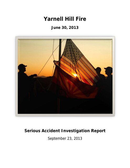
Serious Acci<strong>de</strong>nt Investigation Report<br />
September 23, 2013
Cover Photo: Raising the United States and State of Arizona flags at the Granite<br />
Mountain crew’s <strong>de</strong>ployment site. Courtesy of the Southwest Area Type 1 Inci<strong>de</strong>nt<br />
Management Team.
Andrew Sterling Ashcraft<br />
Travis Clay Carter<br />
Christopher A. MacKenzie<br />
Grant Quinn McKee<br />
Scott Daniel Norris<br />
In Memory Of<br />
Robert E. Caldwell<br />
Dustin James DeFord<br />
Eric S. Marsh<br />
Sean M. Misner<br />
Wa<strong>de</strong> S. Parker
John J. Percin, Jr.<br />
Jesse James Steed<br />
Travis Turbyfill<br />
Clayton Thomas Whitted<br />
Garret Zuppiger<br />
Anthony M. Rose<br />
Joe B. Thurston<br />
William Howard ‘Billy’ Warneke<br />
Kevin J. Woyjeck
Contents<br />
Executive Summary ....................................................................................................... 1<br />
The Investigation Process ............................................................................................... 5<br />
Background ................................................................................................................... 8<br />
Part One: Factual & Management Report ................................................................. 11<br />
Narrative ...................................................................................................................... 11<br />
Friday, 28 June 2013 ................................................................................................ 11<br />
Saturday, 29 June 2013 ............................................................................................ 12<br />
Sunday, 30 June 2013 .............................................................................................. 15<br />
Summary ................................................................................................................. 31<br />
Analysis ....................................................................................................................... 33<br />
Conclusions .................................................................................................................. 41<br />
Recommendations ........................................................................................................ 44<br />
Part Two: Learning Discussion .................................................................................. 45<br />
Discussion .................................................................................................................... 45<br />
Sensemaking Frame ................................................................................................. 46<br />
Situational Awareness ............................................................................................... 47<br />
Fireline Safety .......................................................................................................... 50<br />
Communications ....................................................................................................... 55<br />
Inci<strong>de</strong>nt Organization................................................................................................ 58<br />
Improving Resilience ................................................................................................ 60<br />
Charge to the Wildland Fire Community ...................................................................... 60<br />
Appendices ................................................................................................................ 61<br />
Appendix A: Sequence of Events .................................................................................... 61<br />
Appendix B: Fire Environment & Behavior Analysis .......................................................... 65<br />
Appendix C: Personal Protective Equipment Analysis ........................................................ 82<br />
Appendix D: Aviation Summary ...................................................................................... 96<br />
Appendix E: Work/Rest & Qualifications Summary ......................................................... 105<br />
Appendix F: Fire Acronyms & Termi<strong>no</strong>logy .................................................................... 108<br />
Appendix G: Delegation of Authority ............................................................................. 112<br />
Appendix H: Team Members & Signature Page .............................................................. 113<br />
Appendix I: Subject Matter Experts .............................................................................. 115<br />
Appendix J: Ack<strong>no</strong>wledgements ................................................................................... 116<br />
<strong>Yarnel</strong>l <strong>Hill</strong> Fire Serious Acci<strong>de</strong>nt Investigation i
<strong>Yarnel</strong>l <strong>Hill</strong> Fire Serious Acci<strong>de</strong>nt Investigation ii
Executive Summary<br />
Nineteen firefighters died on the <strong>Yarnel</strong>l <strong>Hill</strong> Fire in central Arizona on June 30, 2013 after<br />
<strong>de</strong>ploying fire shelters. They were members of the Granite Mountain Interagency Hotshot Crew<br />
(IHC), hosted by the Prescott Fire Department. One crewmember was separated from the crew<br />
earlier that day and was <strong>no</strong>t at the <strong>de</strong>ployment site.<br />
* * * * *<br />
Late after<strong>no</strong>on on June 28, the <strong>Yarnel</strong>l <strong>Hill</strong> Fire started high on a ridge west of <strong>Yarnel</strong>l, Arizona<br />
when lightning ignited multiple fires. The fire, which was un<strong>de</strong>r the jurisdiction of the Arizona<br />
State Forestry Division, started in a boul<strong>de</strong>r field in steep terrain with <strong>no</strong> vehicle access; it was<br />
about one-half acre in size. Respon<strong>de</strong>rs saw minimal fire activity or spread potential, and they<br />
had several safety concerns with putting firefighters on the hill overnight. In consi<strong>de</strong>ration of<br />
these and other factors, the Inci<strong>de</strong>nt Comman<strong>de</strong>r prepared for full suppression on the following<br />
morning.<br />
On June 29, resources held the fire in check until around 1600, when winds increased and the<br />
fire spotted outsi<strong>de</strong> containment lines. That evening, the Type 4 Inci<strong>de</strong>nt Comman<strong>de</strong>r or<strong>de</strong>red a<br />
Type 2 Inci<strong>de</strong>nt Management Team (IMT) and additional resources for the next morning. The<br />
fire grew throughout the night, to an estimated 300 to 500 acres by morning.<br />
Early on June 30, members of the Type 2 IMT began arriving. In a briefing at 0700, the<br />
incoming Granite Mountain IHC Superinten<strong>de</strong>nt accepted the role of Division Alpha Supervisor.<br />
His assignment was to establish an anchor point at the heel of the fire with the Granite<br />
Mountain IHC. The Type 2 IMT assumed command, an action formally an<strong>no</strong>unced by radio at<br />
1022.<br />
For most of the day, the fire spread to the <strong>no</strong>rtheast, threatening structures in Mo<strong>de</strong>l Creek and<br />
Peeples Valley. Around 1550, the wind shifted and the fire started pushing aggressively to the<br />
southeast, toward <strong>Yarnel</strong>l. Fire resources shifted to resi<strong>de</strong>nt evacuation and structure protection<br />
in town. Only the Granite Mountain IHC remained out on the ridge, on the southwest perimeter<br />
of the fire. Personnel who communicated with the Granite Mountain IHC knew the crew was in<br />
the black at that time and assumed they would stay there. No one realized that the crew left<br />
the black and hea<strong>de</strong>d southeast, sometime after 1604. At 1630, thun<strong>de</strong>rstorm outflows reached<br />
the southern perimeter of the fire. Winds increased substantially; the fire turned south and<br />
overran the Granite Mountain IHC at about 1642.<br />
* * * * *<br />
There is a gap of over 30 minutes in the information available for the Granite Mountain IHC.<br />
From 1604 until 1637, the Team can<strong>no</strong>t verify communications from the crew, and we have<br />
almost <strong>no</strong> direct information for them. There is much that can<strong>no</strong>t be k<strong>no</strong>wn about the crew’s<br />
<strong>de</strong>cisions and actions prior to their entrapment and fire shelter <strong>de</strong>ployment at around 1642.<br />
<strong>Yarnel</strong>l <strong>Hill</strong> Fire Serious Acci<strong>de</strong>nt Investigation 1
It is k<strong>no</strong>wn that the Granite Mountain IHC left the black sometime after 1604 and traveled<br />
through an unburned area toward a safety zone at the Boul<strong>de</strong>r Springs Ranch. Thun<strong>de</strong>rstorm<br />
outflows changed the intensity and direction of fire spread, and the rapidly advancing fire<br />
eliminated the crew’s options of reaching the safety zone or returning to the canyon rim. They<br />
had less than two minutes to improve a <strong>de</strong>ployment site. They were <strong>de</strong>ploying fire shelters<br />
when the fire overtook them. Temperatures excee<strong>de</strong>d 2000 o F, and the <strong>de</strong>ployment site was <strong>no</strong>t<br />
survivable. The nineteen crewmembers were found approximately one mile south-southeast of<br />
their last k<strong>no</strong>wn location, approximately 600 yards west of the Ranch.<br />
* * * * *<br />
The State of Arizona convened a Serious Acci<strong>de</strong>nt Investigation Team. A <strong>de</strong>legation of authority<br />
letter, signed by the State Forester on July 3, 2013, charged the Team with reviewing and<br />
reporting on the circumstances leading to entrapment of the Granite Mountain IHC. The Team<br />
used a variety of data sources and methods to reconstruct events and analyze them. In<br />
<strong>de</strong>liberations, the Team drew from their k<strong>no</strong>wledge of wildland fire operations and culture, as<br />
well as the perspectives of Subject Matter Experts. Through these processes, the Team<br />
generated the following conclusions:<br />
• The Granite Mountain IHC was a fully qualified, staffed, and trained hotshot crew. They<br />
were current with the required training and met work/rest gui<strong>de</strong>lines. The crew followed<br />
all standards and gui<strong>de</strong>lines as stated in the Standards for Interagency Hotshot Crew<br />
Operations and the Arizona State Forestry Division’s Standard Operational Gui<strong>de</strong>line 804.<br />
• The <strong>Yarnel</strong>l <strong>Hill</strong> area had <strong>no</strong>t experienced wildfire in over 45 years. It was primed to<br />
burn because of extreme drought, <strong>de</strong>ca<strong>de</strong>nt chaparral, and above average cured grass<br />
loadings.<br />
• Although Yavapai County had a Community Wildfire Protection Plan, many structures<br />
were <strong>no</strong>t <strong>de</strong>fendable by firefighters responding to the <strong>Yarnel</strong>l <strong>Hill</strong> Fire. The fire <strong>de</strong>stroyed<br />
over one hundred structures.<br />
• Radio communications were challenging throughout the inci<strong>de</strong>nt. Some radios were <strong>no</strong>t<br />
programmed with appropriate tone guards. Crews i<strong>de</strong>ntified the problem, engaged in<br />
troubleshooting, and <strong>de</strong>veloped workarounds so they could communicate using their<br />
radios. Radio traffic was heavy during critical times on the fire.<br />
• The fire’s complexity increased in a very short time, challenging all firefighting resources<br />
to keep pace with the rapidly expanding inci<strong>de</strong>nt. As complexity dramatically increased<br />
starting Saturday evening, fire management went through multiple transitions from a<br />
Type 4 through a Type 1 inci<strong>de</strong>nt in fewer than 20 hours.<br />
• The Granite Mountain IHC had been watching the active fire burn away from their<br />
position all day but their observations did <strong>no</strong>t lead them to anticipate the approaching<br />
outflow boundary or the accompanying significant fire behavior changes. These changes<br />
<strong>Yarnel</strong>l <strong>Hill</strong> Fire Serious Acci<strong>de</strong>nt Investigation 2
inclu<strong>de</strong>d a <strong>do</strong>ubling of fire intensity and flame lengths, a second 90-<strong>de</strong>gree directional<br />
change, and a dramatically accelerated rate of spread.<br />
• The Granite Mountain IHC left the lunch spot and traveled southeast on the two-track<br />
road near the ridge top. Then, they <strong>de</strong>scen<strong>de</strong>d from the two-track road and took the<br />
most direct route towards Boul<strong>de</strong>r Springs Ranch. The Team believes the crew was<br />
attempting to reposition so they could reengage.<br />
• The Granite Mountain IHC did <strong>no</strong>t perceive excessive risk in repositioning to Boul<strong>de</strong>r<br />
Springs Ranch.<br />
• The Team found <strong>no</strong> indication that the Granite Mountain IHC <strong>do</strong>ubted the black was a<br />
valid safety zone, or that they moved towards the Boul<strong>de</strong>r Springs Ranch because they<br />
feared for their safety if they stayed in the black.<br />
• Although much communication occurred among crews throughout the day, few people<br />
un<strong>de</strong>rstood Granite Mountain’s intentions, movements, and location, once they left the<br />
black. The Team believes this is due to brief, informal, and vague radio transmissions<br />
and talkarounds that can occur during wildland fire communications. Based on radio<br />
conversations, Operations and other resources had conclu<strong>de</strong>d the Granite Mountain IHC<br />
was located in the black, near the ridge top where they had started that morning. This<br />
resulted in confusion about the crew’s actual location at the time of search and rescue.<br />
• In retrospect, the importance of the 1526 weather update is clear. However, the update<br />
appears to have carried less relevance in the crew’s <strong>de</strong>cision-making process, perhaps<br />
due to the wind shift (starting at about 1550) that prece<strong>de</strong>d the outflow boundary, or<br />
perhaps because of the time it took the outflow boundary to reach the south end of the<br />
fire (at 1630). It is possible they may have interpreted the early wind shift as the<br />
anticipated wind event.<br />
• An Air Attack and/or an Aerial Supervision Module provi<strong>de</strong>d aerial supervision coverage<br />
throughout the day including at the time of the acci<strong>de</strong>nt.<br />
• The Aerial Supervision Module working the fire was very busy fulfilling leadplane duties,<br />
which limited their ability to perform full Air Attack responsibilities over the fire at the<br />
same time.<br />
• During some limited times, aircraft were <strong>no</strong>t available due to adverse weather and<br />
refueling needs.<br />
• At the time of the shelter <strong>de</strong>ployment, a Very Large Airtanker was on station over the<br />
fire waiting to drop retardant as soon as the crew’s location was <strong>de</strong>termined.<br />
• The judgments and <strong>de</strong>cisions of the inci<strong>de</strong>nt management organizations managing this<br />
fire were reasonable. Firefighters performed within their scope of duty, as <strong>de</strong>fined by<br />
<strong>Yarnel</strong>l <strong>Hill</strong> Fire Serious Acci<strong>de</strong>nt Investigation 3
their respective organizations. The Team found <strong>no</strong> indication of negligence, reckless<br />
actions, or violations of policy or protocol.<br />
This report has two parts. Part One inclu<strong>de</strong>s the fact-based Narrative of the inci<strong>de</strong>nt and offers<br />
the Team’s Analysis, Conclusions, and Recommendations. Part Two, the Discussion section, is<br />
meant to prompt discussion and facilitate learning. It explores multiples concepts and<br />
perspectives, in or<strong>de</strong>r to support the broa<strong>de</strong>r community seeking to make sense of the acci<strong>de</strong>nt<br />
and to improve safety and resilience. Appendices provi<strong>de</strong> technical <strong>de</strong>tails and other<br />
supplemental information.<br />
<strong>Yarnel</strong>l <strong>Hill</strong> Fire Serious Acci<strong>de</strong>nt Investigation 4
The Investigation Process<br />
Following the tragic loss of 19 lives on the <strong>Yarnel</strong>l <strong>Hill</strong> Fire, the State of Arizona convened a<br />
Serious Acci<strong>de</strong>nt Investigation Team. A <strong>de</strong>legation of authority letter, signed by the State<br />
Forester on July 3, 2013, charged the Team with reviewing and reporting on the circumstances<br />
leading to entrapment of the Granite Mountain Interagency Hotshot Crew (IHC).<br />
The Team inclu<strong>de</strong>d representatives from local (Missoula Fire Department, Kern County Fire<br />
Department, Boise Fire Department), State (Florida), and Fe<strong>de</strong>ral (US Forest Service, National<br />
Weather Service) governments, as well as in<strong>de</strong>pen<strong>de</strong>nt experts from across the country.<br />
Appendix H inclu<strong>de</strong>s a list of Team members.<br />
Approach and Philosophy<br />
The primary goal of this report is to facilitate learning from this tragedy, in or<strong>de</strong>r to reduce the<br />
likelihood of future acci<strong>de</strong>nts. To this end, the Team retained some of the most effective<br />
techniques of past investigations while integrating current theory and practices. The intent of<br />
this blending is to offer to the wildland fire community the highest-quality learning product<br />
possible, in a timely manner.<br />
This report <strong>do</strong>es <strong>no</strong>t i<strong>de</strong>ntify causes in the traditional sense of pointing out errors, mistakes,<br />
and violations but approaches the acci<strong>de</strong>nt from the perspective that risk is inherent in<br />
firefighting. Lea<strong>de</strong>rs are responsible for guiding<br />
firefighters in consi<strong>de</strong>ration of the tra<strong>de</strong>offs between<br />
safety, risk management, and other organizational goals.<br />
In this report, the Team tries to minimize the common<br />
human trait of hindsight bias, which is often associated<br />
with traditional acci<strong>de</strong>nt reviews and investigations.<br />
The Team based its approach on the philosophy that<br />
firefighters are expected and empowered to be<br />
resourceful and <strong>de</strong>cisive, to exercise initiative and<br />
accept responsibility, and to use their training,<br />
experience and judgment in their <strong>de</strong>cision-making. The<br />
wildland fire community uses a <strong>do</strong>ctrine approach to fire<br />
Hindsight Bias<br />
The term “hindsight bias” refers to<br />
the ten<strong>de</strong>ncy people have to view<br />
past events as more predictable<br />
than they really were before the<br />
events took place. After an event<br />
occurs, people often believe they<br />
could have predicted the outcome<br />
of the event before it actually<br />
happened.<br />
suppression, which requires the use of judgment. An individual’s judgment in a given situation<br />
<strong>de</strong>pends upon their unique training and experiences. The 10 Standard Firefighting Or<strong>de</strong>rs and<br />
18 Watch Out Situations (10 and 18) are the foundation of training in fire suppression<br />
operations, but they require judgment in application. These principles, as stated below, outline<br />
the Team’s perspective regarding the use and consi<strong>de</strong>ration of the 10 and 18 in this report:<br />
<strong>Yarnel</strong>l <strong>Hill</strong> Fire Serious Acci<strong>de</strong>nt Investigation 5
Principles of Suppression Operations<br />
“The primary means by which we implement command <strong>de</strong>cisions and maintain unity of<br />
action is through the use of common principles of suppression operations. These<br />
principles gui<strong>de</strong> our fundamental fire suppression practices, behaviors, and customs, and<br />
are mutually un<strong>de</strong>rstood at every level of command. They inclu<strong>de</strong> Risk Management,<br />
Standard Firefighting Or<strong>de</strong>rs and Watch Out Situations, LCES [Lookouts,<br />
Communications, Escape Routes, and Safety Zones], and the Downhill Line Construction<br />
Checklist. These principles are fundamental to how we perform fire suppression<br />
operations and are inten<strong>de</strong>d to improve <strong>de</strong>cision making and firefighter safety. They are<br />
<strong>no</strong>t absolute rules. They require judgment in application.” 1<br />
In light of this <strong>do</strong>ctrine, the Team attempted to use foresight rather than hindsight in this<br />
discussion. That is, the Team tried to stand with the crew to try to un<strong>de</strong>rstand, as best they<br />
could, what crewmembers were seeing and how they were making sense of unfolding<br />
conditions, when it was time to act. The Team also looked at broa<strong>de</strong>r cultural factors that may<br />
have influenced the crew. This helps set the stage for ongoing learning, which began with the<br />
Team’s efforts and which will continue over time in the greater wildland fire community.<br />
Metho<strong>do</strong>logy<br />
The Team reconstructed events through a variety of methods and data sources. They<br />
conducted over 65 interviews with firefighters, fire support personnel, lea<strong>de</strong>rship personnel, and<br />
the public. The Team also gathered photos, vi<strong>de</strong>os, audio fragments, maps, dispatch logs,<br />
inci<strong>de</strong>nt <strong>do</strong>cumentation, weather station records, and training records. They conducted site<br />
visits, equipment analysis, and wind and fire behavior mo<strong>de</strong>ling.<br />
Different individuals can perceive the same event differently. This account ack<strong>no</strong>wledges<br />
interpretations may vary from one person to the next, and there can be apparent<br />
inconsistencies between individual perspectives. However, in most cases, two or more data<br />
sources corroborated key <strong>de</strong>tails. Team members shared portions of the narrative with key<br />
interviewees to correct and clarify important <strong>de</strong>tails.<br />
The Team held two sessions with Subject Matter Experts (SMEs) to review the draft<br />
investigation report. Each session inclu<strong>de</strong>d current IHC Superinten<strong>de</strong>nts, Type 3 Inci<strong>de</strong>nt<br />
Comman<strong>de</strong>rs and Operations personnel representing local, state, and fe<strong>de</strong>ral agencies. Each<br />
participant had the opportunity to ground-truth and refine a draft report, as well as to help<br />
generate recommendations. Appendix I lists the SME session participants.<br />
1 Interagency Standards for Fire and Fire Aviation Operations, NFES 2724 (Boise, ID: Fe<strong>de</strong>ral Fire and<br />
Aviation Task Group, National Interagency Fire Center, January 2013), p. 07-1. See<br />
http://www.nifc.gov/PUBLICATIONS/redbook/2013/2013RedBook.pdf.<br />
<strong>Yarnel</strong>l <strong>Hill</strong> Fire Serious Acci<strong>de</strong>nt Investigation 6
Report Structure<br />
This report is in two parts, plus appendices.<br />
Part One inclu<strong>de</strong>s the fact-based Narrative, the Analysis, Conclusions, and<br />
Recommendations. The primary purpose of the Analysis is to provi<strong>de</strong> context for key action<br />
points associated with the entrapment and fire shelter <strong>de</strong>ployment. This supports the<br />
Conclusions section, which represents the Team’s impressions and conclusions about these<br />
events. Recommendations presented to management are opportunities for improving safety.<br />
Part Two, the Learning Discussion section, explores multiple concepts and perspectives that<br />
may help rea<strong>de</strong>rs to un<strong>de</strong>rstand and learn from this acci<strong>de</strong>nt. The intent is to prompt the<br />
wildland fire organization to think about and discuss how they can improve at the individual,<br />
team, and organizational levels, thereby improving both safety and resilience in their<br />
organizations.<br />
<strong>Yarnel</strong>l <strong>Hill</strong> Fire Serious Acci<strong>de</strong>nt Investigation 7
Background<br />
The <strong>Yarnel</strong>l <strong>Hill</strong> Fire occurred in west-central Arizona,<br />
west of the town of <strong>Yarnel</strong>l along a <strong>no</strong>rth-south<br />
mountai<strong>no</strong>us ridge with elevations of 4,500 to 6,000<br />
feet. Within the fire area, the terrain varies from steep<br />
ridges to nearly flat valley bottoms with numerous<br />
rock outcroppings and boul<strong>de</strong>r piles. The <strong>do</strong>minant<br />
vegetation type, chaparral brush, ranged in height<br />
from one to ten feet and, in some places, was nearly<br />
impenetrable. The <strong>Yarnel</strong>l <strong>Hill</strong> Fire area had <strong>no</strong>t<br />
experienced wildland fire since 1966.<br />
Conditions leading up to the <strong>Yarnel</strong>l <strong>Hill</strong> Fire consisted<br />
of very high to extreme fire danger and extreme<br />
drought during a transition to the Southwest’s summer<br />
monsoon season. During this seasonal transition,<br />
temperatures are typically very hot. Relative humidity<br />
values remain low but fluctuate as storms become<br />
more numerous and cloud cover more prevalent.<br />
Winds are highly variable with the highest wind speeds<br />
occurring during thun<strong>de</strong>rstorms. These storms can<br />
generate strong <strong>do</strong>wndrafts, micro-bursts, outflows,<br />
and gust fronts, all of which can affect fire behavior.<br />
Granite Mountain Hotshots<br />
The Prescott Fire Department created<br />
a Wildland Division in 2001 to conduct<br />
a risk assessment and <strong>de</strong>velop a<br />
Vegetation Management Plan for the<br />
City. The risk assessment found<br />
Prescott to be at risk of catastrophic<br />
wildfire. As a result, the Division<br />
formed a Fuels Management Crew to<br />
create <strong>de</strong>fensible space on private<br />
and City-owned property. The 2002<br />
Indian Fire led to an expansion of the<br />
crew’s duties. In 2004, the Fuels<br />
Management Crew evolved into Crew<br />
7, a Type 2 Initial Attack crew that,<br />
while continuing with fuels reduction<br />
work, respon<strong>de</strong>d to wildfires both<br />
regionally and nationally. Just before<br />
the 2007 season, Crew 7 gained IHC<br />
trainee status and became k<strong>no</strong>wn as<br />
the Granite Mountain Hotshots.<br />
Following the IHC certification<br />
process, Granite Mountain became a<br />
certified IHC in 2008.<br />
The Southwest Coordination Center’s Predictive Services issued a Fire Behavior Advisory on<br />
June 16, 2013 that discussed critically low fuel moistures and increased fuel loading. On June<br />
25, the National Weather Service (NWS) office in Flagstaff issued an excessive heat watch for<br />
Yavapai and <strong>no</strong>rthern Gila counties below 4000 feet.<br />
Multiple lightning ignitions occurred from thun<strong>de</strong>rstorm activity on lands southwest of Prescott<br />
at about 1700 Phoenix Standard Time (PNT) on Friday, June 28. Of the seven lightning fires<br />
discovered, four were on State, private, and adjacent Bureau of Land Management (BLM) lands.<br />
The <strong>Yarnel</strong>l <strong>Hill</strong> Fire was one of these four. Statewi<strong>de</strong>, 37 active fires—four ongoing and 33 new<br />
fires—were un<strong>de</strong>r management that day. Figure 1, <strong>Yarnel</strong>l <strong>Hill</strong> Fire Land Ownership Map <strong>de</strong>picts<br />
the boundary of the <strong>Yarnel</strong>l <strong>Hill</strong> fire and displays the land ownership within the fire boundary.<br />
The Southwest Area was in Preparedness Level 4 and had eight uncontained large fires, Types<br />
2 and 3 in complexity. These were the Silver, Jaroso, Creek, Doce, Sycamore, Thompson Ridge,<br />
Tres Lagunas, and Rock Creek fires. Some precipitation and higher humidity had begun to enter<br />
the Southwest in certain places, which assisted agencies in nearing containment on five of the<br />
eight fires. Figure 2, Arizona Wildland Fire Activity, shows locations, estimated sizes, percentage<br />
contained, and land ownership for the fires burning across the state on June 29.<br />
<strong>Yarnel</strong>l <strong>Hill</strong> Fire Serious Acci<strong>de</strong>nt Investigation 8
Figure 1. Land within the fire perimeter is a mixture of privately owned,<br />
State of Arizona, and BLM-managed land.<br />
Resource availability was average for that time of year and planning level. Resources available<br />
on June 28 were two Type 1 Inci<strong>de</strong>nt Management Teams (IMTs), four Type 2 IMTs, three<br />
Type 3 IMTs, two Type 1 airtankers, two smokejumper aircraft (2+ loads), approximately ten<br />
Single Engine Airtankers (SEATs), two Type 1 helicopters, two Type 2 helicopters, eight Type 1<br />
IHCs, and Type 2 crew capability. Some of these resources, along with other or<strong>de</strong>red resources,<br />
would eventually be committed to both the <strong>Yarnel</strong>l <strong>Hill</strong> inci<strong>de</strong>nt and to the Dean Peak inci<strong>de</strong>nt a<br />
couple of days later.<br />
<strong>Yarnel</strong>l <strong>Hill</strong> Fire Serious Acci<strong>de</strong>nt Investigation 9
Figure 2. Wildland fire activity in Arizona the morning of June 29.<br />
<strong>Yarnel</strong>l <strong>Hill</strong> Fire Serious Acci<strong>de</strong>nt Investigation 10
Part One: Factual & Management Report<br />
Narrative<br />
The purpose of this narrative is to help rea<strong>de</strong>rs un<strong>de</strong>rstand the events occurring around the<br />
Granite Mountain IHC on the day of the acci<strong>de</strong>nt. It is impossible to construct a complete<br />
account of the crew’s movement and entrapment because they can<strong>no</strong>t give their perspectives.<br />
Instead, the Team relied on others involved with the fire and with the crew, as well as on data<br />
gathered during the investigation, to reconstruct the most accurate account possible.<br />
Different individuals can perceive the same event differently. This account ack<strong>no</strong>wledges<br />
interpretations may vary from one person to the next, and there can be apparent<br />
inconsistencies between individual perspectives. However, in most cases, the Team<br />
corroborated key <strong>de</strong>tails with two or more data sources. Team members also shared portions of<br />
the narrative with key interviewees to correct and clarify important <strong>de</strong>tails.<br />
The narrative is in present tense to help rea<strong>de</strong>rs place themselves in the boots of the people<br />
involved. Instead of personal names, the Team uses Inci<strong>de</strong>nt Command System (ICS) or other<br />
acronyms to protect the privacy of personnel involved in the inci<strong>de</strong>nt (see Appendix F for fire<br />
termi<strong>no</strong>logy and acronyms). Parts of the narrative occasionally backtrack to capture a variety of<br />
perspectives and simultaneous events on different areas of the fire.<br />
Friday, 28 June 2013<br />
Several parties <strong>no</strong>tify the Arizona Dispatch Center (Dispatch) of a lightning-ignited fire<br />
on State of Arizona land west of <strong>Yarnel</strong>l at about 1730 on June 28. It is one of four fires on<br />
state lands in the vicinity caused by significant lightning activity. Dispatch begins <strong>do</strong>cumenting<br />
the inci<strong>de</strong>nt at 1736 as the <strong>Yarnel</strong>l <strong>Hill</strong> Fire.<br />
An Arizona State Forestry Division (AZSF) firefighter, a qualified Type 3 Inci<strong>de</strong>nt Comman<strong>de</strong>r<br />
(ICT3) who has worked in the local area since 1995, coordinates responses to the lightning<br />
strikes. He and the BLM Duty Officer on scene anticipate multiple new lightning-caused fires in<br />
the morning. The AZSF firefighter asks Air Attack to fly the general area around <strong>Yarnel</strong>l to<br />
confirm there are <strong>no</strong> additional fires. The Air Attack assigned to the Doce Fire flies over <strong>Yarnel</strong>l<br />
<strong>Hill</strong> and initially has difficulty finding the fire due to lack of smoke. Once he spots it, he reports<br />
the fire is in a boul<strong>de</strong>r field, has <strong>no</strong> vehicular access, and shows very little smoke. He spots <strong>no</strong><br />
additional fires. They schedule a<strong>no</strong>ther reconnaissance flight for the following morning.<br />
At 1940, the AZSF firefighter becomes the Type 4 Inci<strong>de</strong>nt Comman<strong>de</strong>r (ICT4) for the <strong>Yarnel</strong>l<br />
<strong>Hill</strong> Fire. On initial assessment, ICT4 <strong>no</strong>tes the fire is less than a half-acre in size, 80 percent<br />
<strong>Yarnel</strong>l <strong>Hill</strong> Fire Serious Acci<strong>de</strong>nt Investigation 11
out, active only in one corner, with low spread potential and <strong>no</strong> structures or people at risk. He<br />
<strong>no</strong>tes the fire is in a steep, rocky area on a west-facing slope. ICT4 is concerned about<br />
firefighters moving across the rugged terrain at night, and he k<strong>no</strong>ws he can<strong>no</strong>t provi<strong>de</strong><br />
logistical support for them overnight. He is also concerned about potentially exposing<br />
firefighters to lightning on the ridge. In consi<strong>de</strong>ration of these factors, the relatively low fire<br />
behavior and the attention required by other fire starts, he prepares to begin full suppression<br />
efforts on <strong>Yarnel</strong>l <strong>Hill</strong> the following morning. He requests two Type 2 Department of Corrections<br />
crews, a light helicopter, and an AZSF engine for the morning.<br />
Saturday, 29 June 2013<br />
ICT4, the BLM Duty Officer, and an ICT3-qualified BLM Representative together<br />
coordinate tactical response on the fire the morning of June 29. They had been planning to<br />
address new fires in multiple jurisdictions that morning but the <strong>Yarnel</strong>l <strong>Hill</strong> Fire is <strong>no</strong>w the area’s<br />
only active fire resulting from the June 28 lightning ignitions. ICT4 asks the BLM Representative<br />
to remain engaged with him that day.<br />
ICT4 assesses the fire then reports to Dispatch that little smoke is showing and they will drop<br />
retardant to hold the fire until crews arrive. At 0651, he requests two Single Engine Airtankers<br />
(SEATs). They arrive mid-morning and drop fire retardant on the south and west flanks until<br />
about <strong>no</strong>on, each making two retardant drops. These SEATs initially work out of the Prescott<br />
Airtanker Base while the closer Wickenburg Base, being a Call When Nee<strong>de</strong>d (CWN) operation,<br />
takes the necessary four to six hours to prepare for operations.<br />
Just before 1100, a BLM helicopter transports seven firefighters to within ¼ mile of the ridge.<br />
The one helitack and six Department of Corrections firefighters hike in the rest of the way to<br />
construct handline.<br />
Air Attack and the SEATs return to Prescott by 1225, after Air Attack reports retardant is<br />
securing the south and west flanks of the fire, the <strong>no</strong>rth flank is a ridge, and a two-track road is<br />
securing the east flank. The fire size is about two acres. While on the ground at Prescott, Air<br />
Attack and the SEATs refuel.<br />
The fire is holding on all four si<strong>de</strong>s and <strong>no</strong>ne of the other starts from the day before shows<br />
smoke. At 1442, ICT4 advises Dispatch he is releasing Air Attack. At 1540, he releases the BLM<br />
brush engine and a local Peeples Valley fire engine, because the multiple fire starts he had<br />
expected <strong>do</strong> <strong>no</strong>t materialize. ICT4 releases the two SEATs for new assignments and the State of<br />
Arizona Aviation Officer or<strong>de</strong>rs them to reposition to the Wickenburg SEAT Base.<br />
Weather conditions are hot and dry, and increasing west-southwest winds elevate fire activity at<br />
around 1600. ICT4 responds at 1610 by requesting the two SEATs and Air Attack to return to<br />
the <strong>Yarnel</strong>l <strong>Hill</strong> Fire. One SEAT and Air Attack launch from Wickenburg but the second SEAT<br />
stands by for potential new fire starts from active lightning across central Arizona.<br />
<strong>Yarnel</strong>l <strong>Hill</strong> Fire Serious Acci<strong>de</strong>nt Investigation 12
The fire eventually jumps the two-track road on the east<br />
flank and grows to about six acres by late after<strong>no</strong>on.<br />
ICT4 tells Dispatch they are having problems catching<br />
the fire, and he or<strong>de</strong>rs a Type 1 Heavy Helitanker and<br />
Large Airtanker (LAT). At around 1730, ICT4 requests an<br />
ICT3 and a State of Arizona Inci<strong>de</strong>nt Management Team<br />
(IMT) to take the fire in the morning, voicing concerns<br />
about potential threats to Peeples Valley and <strong>Yarnel</strong>l if<br />
the fire burns to the <strong>no</strong>rtheast in the next 24 to 48 hours.<br />
Dispatch informs ICT4 at 1742 that the Heavy Helitanker<br />
and the LAT <strong>de</strong>clined the resource or<strong>de</strong>rs because of<br />
high winds and severe weather en route from their<br />
locations. A few minutes later, Dispatch tells him a Very<br />
Large Air Tanker (VLAT), a DC-10 with an 11,400-gallon<br />
capacity, is available and can take off from an airport<br />
unaffected by the weather. ICT4 discusses the option<br />
with Air Attack over the fire and with the BLM Representative. ICT4 <strong>de</strong>clines the VLAT offer at<br />
1750 based on fire conditions. ICT4 continues to use the SEATs to drop retardant.<br />
* * * * *<br />
Arizona Inci<strong>de</strong>nt<br />
Management Team (IMT)<br />
The Arizona IMT can be configured<br />
to meet the requirements of almost<br />
any all-risk inci<strong>de</strong>nt up to and<br />
including a Type 2 level. The team<br />
can respond as a Type 3 IMT, as a<br />
Type 2 Short IMT, as a Type 2 Long<br />
IMT, or as or<strong>de</strong>red <strong>de</strong>pending on<br />
the needs and <strong>de</strong>sires of the<br />
Agency Administrators responsible<br />
for the inci<strong>de</strong>nt. The Type 2 team<br />
that arrived on the fire was a Type<br />
2 Short IMT.<br />
Source: 2013 Southwest Area<br />
Mobilization Gui<strong>de</strong>, p. 60-10.<br />
The operational tempo and complexity continue to escalate. The fire grows throughout the<br />
evening to an estimated 100 acres, prompting ICT4 to change his request for an ICT3 to a Type<br />
2 IMT. Dispatch fills the or<strong>de</strong>r with the Arizona Type 2 short IMT. ICT4 also <strong>no</strong>tifies the Yavapai<br />
County Sheriff’s Office (YCSO) to prepare for reverse 911 calls in case evacuations become<br />
necessary, and he requests additional resources for the next day including 14 engines, six water<br />
ten<strong>de</strong>rs, two Type 2 crews, two bull<strong>do</strong>zers, and numerous aircraft. ICT4 also asks for two<br />
structure group specialists, one for the <strong>no</strong>rth end (Mo<strong>de</strong>l Creek, Peeples Valley) and one for the<br />
south end (<strong>Yarnel</strong>l, Glen Ilah), and he requests three IHCs. Dispatch or<strong>de</strong>rs the IHCs through<br />
the Southwest Coordination Center (SWCC), one of the nation’s interagency Geographic Area<br />
Coordination Centers. SWCC fills two of the or<strong>de</strong>rs with the Blue Ridge IHC and the Arroyo<br />
Gran<strong>de</strong> IHC but advises Dispatch to rescind their or<strong>de</strong>r for the third crew and fill it internally<br />
with the local Granite Mountain IHC. 2<br />
By 1924, the fire is spreading actively in chaparral to the <strong>no</strong>rth-<strong>no</strong>rtheast (Figure 3). The<br />
Stanton Remote Automated Weather Station (RAWS) indicates a temperature of 101 O F and<br />
relative humidity of 12 percent with sustained winds of 10 miles per hour (mph) gusting to 20<br />
2 Arroyo Gran<strong>de</strong> IHC has mechanical problems that cause the crew to miss this assignment.<br />
<strong>Yarnel</strong>l <strong>Hill</strong> Fire Serious Acci<strong>de</strong>nt Investigation 13
Figure 3. Air Attack’s reconnaissance photo looking to the <strong>no</strong>rtheast, June 29 at 1924.<br />
mph out of the south-southwest. Assessing the fire behavior from the air is difficult but flame<br />
lengths appear to be 10 to 20 feet with rates of spread of 5 to 10 chains per hour. 3<br />
The Structure Protection Group 1 Supervisor (SPGS1) arrives at about 2340 and is assigned<br />
structure protection for <strong>Yarnel</strong>l. He drives the roads to learn the town, heading into the hills on<br />
backcountry roads, tying in with personnel on the fire, and looking for strategic options for<br />
protecting <strong>Yarnel</strong>l. He sees overgrown yards and in<strong>de</strong>fensible houses, and he recognizes there<br />
are limited options for a protection strategy. Although the fire appears in check, he thinks it<br />
could come <strong>do</strong>wn the hill during the next burn period. He spends the night building his<br />
situational awareness and <strong>de</strong>veloping contingency plans. As one contingency, he consi<strong>de</strong>rs how<br />
to tie roads together to burn off vegetation if nee<strong>de</strong>d to protect <strong>Yarnel</strong>l.<br />
That night, 13 firefighters remain on the hill while other resources (ICT4, BLM Representative,<br />
BLM Duty Officer, two structure group specialists, and four engines) remain in the <strong>Yarnel</strong>l and<br />
Peeples Valley areas.<br />
3 A chain is a unit of measure commonly used in firefighting. 1 chain = 66 feet.<br />
<strong>Yarnel</strong>l <strong>Hill</strong> Fire Serious Acci<strong>de</strong>nt Investigation 14
Sunday, 30 June 2013<br />
At the 0700 briefing on June 30, ICT4 and others from the previous shift meet at the<br />
<strong>Yarnel</strong>l Fire Station with incoming personnel including ICT2, two Operations Section Chiefs<br />
(OPS1 and OPS2), SPGS1,<br />
a fire behavior analyst<br />
(FBAN), YCSO <strong>de</strong>puties,<br />
and the Granite Mountain<br />
IHC Superinten<strong>de</strong>nt. 4 The<br />
briefing covers strategy<br />
and tactics, the previous<br />
night’s spot weather<br />
forecast (Figure 4), and<br />
radio frequencies. They<br />
review the area using<br />
Google Maps on an iPad,<br />
and they <strong>no</strong>te Boul<strong>de</strong>r<br />
Springs Ranch as an<br />
excellent safety zone.<br />
They establish the<br />
command channel setup<br />
and communications plan<br />
for the inci<strong>de</strong>nt. As part of<br />
the lea<strong>de</strong>r’s intent, they<br />
also discuss strategies for<br />
the <strong>no</strong>rth si<strong>de</strong> of the fire<br />
and for keeping the fire,<br />
<strong>no</strong>w estimated at 300 to<br />
500 acres, out of <strong>Yarnel</strong>l<br />
by improving old roads,<br />
taking advantage of<br />
previous fuel mitigation<br />
FORECAST:<br />
DISCUSSION...STRONG HIGH PRESSURE OVER THE SOUTHWEST WILL<br />
MAINTAIN THE HEAT SPELL THROUGH THE WEEKEND. LIMITED MOISTURE<br />
WILL RESULT IN ISOLATED THUNDERSTORM ACTIVITY SUNDAY AFTERNOON<br />
AND EARLY EVENING. THESE STORMS WILL PRODUCE LIGHTNING AND<br />
GUSTY WINDS...BUT LITTLE OR NO MEASURABLE PRECIPITATION.<br />
SUNDAY NIGHT WEATHER WILL BE VERY SIMILAR TO TONIGHT'S<br />
CONDITIONS.<br />
.TONIGHT...<br />
SKY/WEATHER......PARTLY CLOUDY.<br />
MIN TEMPERATURE..75 TO 78.<br />
MAX HUMIDITY.....30 TO 33 PCT.<br />
WINDS (20 FT)....SOUTHWEST WINDS AROUND 10 MPH. GUSTS UP TO 20<br />
MPH EARLY IN THE EVENING.<br />
LAL..............2.<br />
HAINES INDEX.....5 MODERATE.<br />
MIN VENT RATE....POOR (2900 KNOT-FT).<br />
.SUNDAY...<br />
SKY/WEATHER......PARTLY CLOUDY. A SLIGHT CHANCE OF SHOWERS AND<br />
THUNDERSTORMS IN THE AFTERNOON.<br />
MAX TEMPERATURE..101 TO 104.<br />
MIN HUMIDITY.....12 TO 15 PCT.<br />
WINDS (20 FT)....LIGHT WINDS...BECOMING SOUTHWEST AROUND 10<br />
MPH WITH GUSTS UP TO 25 MPH IN THE AFTERNOON.<br />
LAL..............2.<br />
HAINES INDEX.....5 MODERATE.<br />
MAX VENT RATE....VERY GOOD (95600 KNOT-FT).<br />
Figure 4. Excerpt of the spot forecast taken at 2033 on June 29<br />
and shared at the 0700 briefing on June 30.<br />
work, and constructing some new <strong>do</strong>zer line to backfire if necessary. They lay out a strategy to<br />
establish an anchor on the south end. They also agree the Granite Mountain Superinten<strong>de</strong>nt will<br />
become Division Supervisor Alpha (DIVS A) and his Assistant Superinten<strong>de</strong>nt (Granite Mountain<br />
Captain or GM Capt) will run the crew. DIVS A’s assignment is to establish an anchor point at<br />
the heel of the fire, using direct or indirect tactics as appropriate.<br />
4<br />
Operations sections carry two operations chiefs. Usually one oversees field operations while the other<br />
works a planning function.<br />
<strong>Yarnel</strong>l <strong>Hill</strong> Fire Serious Acci<strong>de</strong>nt Investigation 15
As additional resources arrive, they assemble at the Mo<strong>de</strong>l Creek School in Peeples Valley,<br />
<strong>de</strong>signated as the Inci<strong>de</strong>nt Command Post (ICP). Incoming resources receive a communications<br />
plan, have their radios cloned, and receive operational assignments. ICT4 and the incoming<br />
Type 2 Inci<strong>de</strong>nt Comman<strong>de</strong>r (ICT2) conduct a briefing starting around 0930 at the ICP. The<br />
formal transfer of command is an<strong>no</strong>unced by radio at 1022.<br />
Radio Frequencies<br />
The <strong>Yarnel</strong>l <strong>Hill</strong> Fire was assigned Group 1 A1S PHX District channels on June 28. On June 30 at<br />
1022, the communications plan was as follows:<br />
Channel<br />
No.<br />
Channel<br />
Name<br />
Assignment<br />
1 AZSF1 Command<br />
5 VFIRE21 Optional Tactical, Unassigned<br />
6 AZSFTAC1 Tactical 1, Div A and Div Z<br />
7 AZSFTAC2 Tactical 3, Structure Protection Group 1<br />
8 AZSFTAC3 Tactical 2, Structure Protection Group 2<br />
10 AZSFTAC5 Air-Ground<br />
16 AIRGUARD AIRGUARD<br />
Early in the day on June 30, there was limited use of AZSFTAC3 Tactical 3 by Granite Mountain IHC,<br />
Blue Ridge IHC, and heavy equipment boss. Tactical 3 was assigned to Structure Protection Group 1<br />
at 1200 that day.<br />
During this time, the fire continues to escalate, threatening structures in the Mo<strong>de</strong>l Creek<br />
subdivision <strong>no</strong>rth of the fire. Radio traffic increases as the fire moves into this area, particularly<br />
among Structure Protection Group 2. The YCSO issues evacuation <strong>no</strong>tices to resi<strong>de</strong>nts of Mo<strong>de</strong>l<br />
Creek and the Double Bar A Ranch around 1045. Immediately after the 0930 briefing, ICT2<br />
assigns several resources to Structure Protection Group 2 in an attempt to keep homes from<br />
burning. After the briefing, Structure Protection Group 1, un<strong>de</strong>r the direction of SPGS1, starts<br />
structure assessment in the <strong>Yarnel</strong>l area and affirms the majority of the homes are <strong>no</strong>t easily<br />
<strong>de</strong>fendable with available resources.<br />
* * * * *<br />
ICT2 talks with the State Fire Management Officer (FMO) at 1100 about the need for a<br />
full Type 2 IMT, based on the fire’s continuing escalation and complexity. At 1107, he contacts<br />
the Inci<strong>de</strong>nt Comman<strong>de</strong>r from the Southwest Area Central West Zone (SWCWZ) IMT and asks<br />
her to prepare her logistics and operations people to respond as soon as possible because he is<br />
sure they will or<strong>de</strong>r her team. ICT2 assumes SWCWZ will be the long team taking over the fire<br />
since most of its members are within the Prescott area and can respond quickly.<br />
The AZSF’s District Forester requests a complexity analysis, which he and ICT2 <strong>de</strong>velop at 1300.<br />
With this information, ICT2 recommends or<strong>de</strong>ring the SWCWZ Type 2 IMT. The District Forester<br />
<strong>Yarnel</strong>l <strong>Hill</strong> Fire Serious Acci<strong>de</strong>nt Investigation 16
and State FMO, seeing that the complexity places the fire between a Type 2 and Type 1 IMT,<br />
<strong>de</strong>ci<strong>de</strong> to or<strong>de</strong>r a Type 1 IMT instead. In less than 20 hours, the fire has transitioned from a<br />
Type 4 inci<strong>de</strong>nt to a Type 1 inci<strong>de</strong>nt. ICT4 requests a Type 1 IMT at 1402. 5<br />
Concurrently, the fire is advancing toward the ICP by 1330, forcing personnel to re-position<br />
vehicles. The fire also flanks the Double Bar A Ranch, causing responding resources from the<br />
<strong>no</strong>rth end’s structure protection group to retreat at about 1420. The fire approaches the ICP at<br />
approximately 1510, holding short of reaching the buildings.<br />
* * * * *<br />
After the 0700 briefing, SPGS1 and the Granite Mountain IHC drive through <strong>Yarnel</strong>l, stopping<br />
at a property on Sesame Street. While there, SPGS1 gestures to the southwest and reminds<br />
DIVS A about the “bomb-proof” safety zone, the Boul<strong>de</strong>r Springs Ranch. SPGS1 follows up by<br />
saying, “Of course, you also have the black [as a safety zone].”<br />
The Granite Mountain IHC parks their<br />
crew carriers in a clearing about<br />
three-quarters of the way <strong>do</strong>wn<br />
Sesame Street. DIVS A scouts further<br />
up to a point where the road is<br />
impassable with vehicles, then parks<br />
his truck. The crew hikes to DIVS A at<br />
his truck for a briefing that the<br />
Granite Mountain Lookout later<br />
recounts: the weather would be<br />
“superhot and windy,” structures are<br />
threatened, and escape routes will be<br />
into the black or back to the carriers.<br />
The lookout also recalls the crew’s<br />
assignment is to establish an anchor<br />
point, then <strong>de</strong>termine whether to go<br />
direct along the black or to go indirect<br />
and burn off a two-track road.<br />
DIVS A scouts ahead of the crew as<br />
they hike about 45 minutes along the<br />
two-track road to a potential anchor<br />
point just below a saddle. From there,<br />
DIVS A scouts out the west si<strong>de</strong> of the<br />
5 The formal transfer of command to the ICT1 occurred July 1 at 1800.<br />
Figure 5. Hikers took this photo of the Granite<br />
Mountain IHC the morning of June 30. Photo courtesy<br />
of Joy Collura.<br />
<strong>Yarnel</strong>l <strong>Hill</strong> Fire Serious Acci<strong>de</strong>nt Investigation 17
idge. A short squad of a few crewmembers follows him, working along the fire’s edge toward a<br />
cold part of the fire to establish the anchor point. On the east si<strong>de</strong>, fire activity picks up a bit<br />
and the rest of the crew slowly burns off adjacent to the two-track road, keeping pace with the<br />
fire. At approximately 0930, DIVS A is near the top of the ridge by a helispot where a BLM<br />
helicopter had dropped backpack pumps the night before. DIVS A has a short radio briefing<br />
with the helitack crewmember who served as night division on the ridge and who is heading<br />
back to camp on the last helicopter load. The helitack relays the weather and fire behavior he<br />
has seen, and he estimates the fire at around 500 acres.<br />
Fire activity increases throughout the morning as the weather gets warmer and drier. Fire<br />
personnel observe distinct cloud build-ups well to the <strong>no</strong>rth by late morning. One particular cell<br />
building to the <strong>no</strong>rth concerns OPS1 and he contacts DIVS A on the radio. He confirms that<br />
DIVS A can see it through the smoke; DIVS A says he will keep an eye on the cloud movement.<br />
As the Granite Mountain IHC continues its bur<strong>no</strong>ut, DIVS A and Air Attack discuss options. Air<br />
Attack directs two SEAT drops at 1136 and 1145 directly onto the bur<strong>no</strong>ut. DIVS A is frustrated.<br />
This is <strong>no</strong>t what he wanted but he has Granite Mountain IHC shift tactics and go direct along<br />
the fire’s edge.<br />
During this same period, the short squad on the west si<strong>de</strong> of the ridge ties into the cold black<br />
and into the steep rocky terrain. DIVS A consi<strong>de</strong>rs this a good anchor and, around <strong>no</strong>on, the<br />
short squad rejoins the crew on the east si<strong>de</strong> of the ridge near the anchor point.<br />
* * * * *<br />
Earlier that day, at 0800, the Blue Ridge IHC arrives at the ICP where they clone their<br />
radios to frequencies for the fire and stage in their crew carriers. At about 0845, they head<br />
south to the <strong>Yarnel</strong>l Fire Station for staging. OPS1 calls about 45 minutes later and tells them to<br />
drive into the fire area and to tie in with SPGS1 on their way in. Using tactical frequency 3 (Tac<br />
3), DIVS A calls Blue Ridge while they are en route and they discuss the fire.<br />
The Blue Ridge IHC parks their crew carriers next to the Granite Mountain IHC carriers. The<br />
Superinten<strong>de</strong>nt (BR Supt) and Captain (BR Capt) unload their utility task vehicle (UTV) and<br />
continue along Sesame Street. They encounter SPGS1 who requests a Heavy Equipment Boss<br />
(HEQB) to manage a <strong>do</strong>zer and clear out the two-track road on both si<strong>de</strong>s as far as possible to<br />
provi<strong>de</strong> access and to prepare for possible backfire. Blue Ridge assigns one of their squad<br />
lea<strong>de</strong>rs, who is qualified as an HEQB, to help.<br />
As BR Supt and BR Capt continue to scout, HEQB takes the <strong>do</strong>zer as far as an old aban<strong>do</strong>ned<br />
gra<strong>de</strong>r to push a clear area around it. He then heads in the direction of the saddle near Granite<br />
Mountain’s anchor point. Following this, his plan is to turn around and clear out the two-track<br />
road (an old fuel break) between Sesame Street and Shrine Road. Meanwhile, the rest of the<br />
Blue Ridge IHC stays with the crew carriers where they have “good eyes on the fire.”<br />
<strong>Yarnel</strong>l <strong>Hill</strong> Fire Serious Acci<strong>de</strong>nt Investigation 18
Figure 6. Estimated fire perimeter (418 acres) at 1000 hours on June 30.<br />
BR Supt and BR Capt reach the old gra<strong>de</strong>r around 1100. From there, they can see Granite<br />
Mountain IHC working on the east si<strong>de</strong> of the ridge, slowly burning off the two-track road. Over<br />
the radio, BR Supt and BR Capt can hear the Granite Mountain IHC is trying to get the fire<br />
squared up with the two-track road so it can<strong>no</strong>t come back up at them. BR Supt and BR Capt<br />
continue scouting before heading up toward the saddle near the anchor point.<br />
A little before <strong>no</strong>on, on the two-track road just below the saddle, BR Supt and BR Capt meet<br />
DIVS A and GM Capt at the anchor point. Over the next half hour, they discuss tactics and<br />
agree to use a Granite Mountain crewmember as a lookout (GM Lookout). GM Lookout i<strong>de</strong>ntifies<br />
a lookout spot <strong>do</strong>wn near the old gra<strong>de</strong>r at the bottom of the slope, and GM Capt agrees it will<br />
be a good vantage point. BR Supt, BR Capt, DIVS A, and GM Capt also discuss problems<br />
<strong>Yarnel</strong>l <strong>Hill</strong> Fire Serious Acci<strong>de</strong>nt Investigation 19
Figure 7. Southern portion of the <strong>Yarnel</strong>l <strong>Hill</strong> Fire.<br />
<strong>Yarnel</strong>l <strong>Hill</strong> Fire Serious Acci<strong>de</strong>nt Investigation 20
with radios on the inci<strong>de</strong>nt, <strong>no</strong>ting some radios <strong>do</strong> <strong>no</strong>t have appropriate tone guards and<br />
communication is adversely affected.<br />
Division Supervisor Zulu (DIVS Z), a single resource or<strong>de</strong>red for the Type 3 team, arrives at the<br />
Blue Ridge crew carriers around 1210 and calls DIVS A to discuss a division break and resource<br />
assignments. DIVS Z is having radio problems, so he uses a Blue Ridge crew radio to talk with<br />
DIVS A over the Blue Ridge intra-crew frequency. DIVS A and DIVS Z can<strong>no</strong>t agree on the<br />
break location or associated supervisory responsibilities, resulting in uncertainty among some<br />
personnel about the physical break between Divisions Alpha and Zulu. 6<br />
BR Supt and BR Capt <strong>de</strong>part and drive GM Lookout <strong>do</strong>wn to the old gra<strong>de</strong>r, dropping him off at<br />
1239. They feel comfortable leaving him at this spot, and BR Supt tells the lookout, “If you<br />
need me, call, and I’ll come get you.”<br />
After dropping off GM Lookout, BR Supt and BR Capt scout for opportunities to engage the fire.<br />
The HEQB continues to work the <strong>do</strong>zer to open the line between Sesame Street and Shrine<br />
Road. The Blue Ridge IHC move their crew carriers toward the Shrine of St. Joseph (the Shrine)<br />
and a youth camp area around 1500 and then start preparing for bur<strong>no</strong>ut along the <strong>do</strong>zer line.<br />
* * * * *<br />
After BR Supt drops him off at the old gra<strong>de</strong>r at 1239, GM Lookout hikes about 120<br />
yards <strong>no</strong>rth to the lookout spot and calls DIVS A to tell him he has “good eyes” on the Granite<br />
Mountain crew. The crew also has a good view of him and of the fire. The Granite Mountain<br />
IHC has good black, and is <strong>no</strong>w going direct along the fire’s edge. Although the head of the fire<br />
is pushing <strong>no</strong>rth toward structures in Peeples Valley, it is backing to the Granite Mountain IHC’s<br />
location. Some dry drainages are out ahead of the crew. The crew anticipates the fire will<br />
become more active around mid-after<strong>no</strong>on, and they expect <strong>no</strong> additional support will arrive<br />
since the focus of aircraft and firefighters is up <strong>no</strong>rth on the head of the fire. Given these<br />
conditions, Granite Mountain IHC’s plan is to construct line direct along the fire’s edge, but they<br />
<strong>do</strong> <strong>no</strong>t want to overextend or overcommit themselves. They plan to take a little piece at a time,<br />
then go back and secure the line to make sure it holds.<br />
The Granite Mountain IHC reaches a rock face and takes lunch. After eating, the crew works<br />
their way back, reinforcing their line as they go. They make sure their line is solid and they<br />
have a good anchor point. For lookouts, they have DIVS A on a k<strong>no</strong>b, GM Lookout <strong>do</strong>wn by the<br />
gra<strong>de</strong>r and GM Capt near the anchor or in the immediate vicinity of the crew. Each is looking<br />
out for the other two lookouts, the crew, and the fire. GM Lookout has trigger points for the<br />
crew and for himself in case the fire changes direction. The crew has ongoing contact with the<br />
6 DIVS A and OPS1 communicate later about the division break being at the gra<strong>de</strong>r.<br />
<strong>Yarnel</strong>l <strong>Hill</strong> Fire Serious Acci<strong>de</strong>nt Investigation 21
Blue Ridge IHC, SPGS1, and OPS1. They also contact air resources and adjoining forces as<br />
nee<strong>de</strong>d.<br />
GM Capt, GM Lookout, and others talk over the radio about thun<strong>de</strong>rstorms coming in. GM Capt<br />
mentions he might have seen a few lightning strikes.<br />
* * * * *<br />
At 1402, FBAN receives a call with a weather update from<br />
the NWS office in Flagstaff. The NWS informs him of<br />
thun<strong>de</strong>rstorms east of the fire that may produce wind gusts<br />
of 35 to 45 mph out of the <strong>no</strong>rtheast. FBAN relays the<br />
update to OPS1 and OPS2 via radio on state tactical<br />
frequency 1 (Tac 1).<br />
At 1526, NWS-Flagstaff calls FBAN with a second weather<br />
update about expected thun<strong>de</strong>rstorm outflow winds from<br />
the <strong>no</strong>rth-<strong>no</strong>rtheast with speeds between 40 and 50 mph.<br />
This update <strong>do</strong>es <strong>no</strong>t meet the NWS criteria for a Red Flag<br />
Warning for this area. FBAN radios this second update to<br />
OPS1 and OPS2 on Tac 1.<br />
* * * * *<br />
National Weather Service<br />
The NWS office in Flagstaff used<br />
social media and received<br />
several fire chat room messages<br />
from the Predictive Services staff<br />
at SWCC on the after<strong>no</strong>on of<br />
June 30. This close coordination<br />
helped increase situational<br />
awareness and better prepared<br />
them for monitoring the<br />
weather.<br />
At about 1540, DIVS A calls BR Supt and asks him to meet face-to-face. BR Supt starts heading<br />
back towards DIVS A’s location in his UTV. BR Supt hears the second weather an<strong>no</strong>uncement as<br />
he drives the UTV out Sesame Street to meet DIVS A.<br />
OPS1 is listening on the radio to make sure everyone received the most recent weather<br />
an<strong>no</strong>uncement. At about 1550, he radios DIVS A directly to ask if he got the weather<br />
update and if he is “in a good spot.” DIVS A affirms that he received the update, and he tells<br />
OPS1 the winds are starting to get “squirrely” up on the ridge. He says he is working his way off<br />
the top and OPS1 closes by advising DIVS A to hunker and be safe.<br />
At about 1550, Air Attack tells DIVS A the fire is heading quickly toward <strong>Yarnel</strong>l and could reach<br />
the town in one to two hours. He also says the Granite Mountain IHC’s crew carriers may be in<br />
the path of the fire. DIVS A ack<strong>no</strong>wledges and tells Air Attack he has a plan to address this<br />
issue. Shortly after this, Air Attack leaves the fire because of duty time limitations. 7<br />
7<br />
Pilots on Forest Service and Department of the Interior contracts may only fly a total of 8 hours and be<br />
on duty 14 hours each day.<br />
<strong>Yarnel</strong>l <strong>Hill</strong> Fire Serious Acci<strong>de</strong>nt Investigation 22
Also, at about 1550, GM Lookout is taking weather<br />
observations when GM Capt calls him to relay the weather<br />
update. DIVS A hears the transmission and copies. GM<br />
Lookout copies and continues taking weather observations.<br />
He looks at the fire to the <strong>no</strong>rth and <strong>no</strong>tes it is moving<br />
slowly toward his location. He scans back up to where the<br />
crew is working, to the thermometer, back to the crew,<br />
and then back to the fire. In that short time, the fire has<br />
started building and the wind is already beginning to shift.<br />
GM Lookout is <strong>no</strong>t worried, but he recognizes it is time for<br />
him to move. He calls GM Capt and says the fire has hit his<br />
trigger point and he is moving towards the open area at<br />
the old gra<strong>de</strong>r. GM Capt calmly replies, “Okay, cool.”<br />
Figure 8. Christopher MacKenzie took this photo at 1550 on June 30.<br />
Outflow Winds<br />
When thun<strong>de</strong>rstorms produce<br />
rain, hail, or virga (rain that<br />
evaporates before reaching the<br />
ground), strong <strong>do</strong>wndraft winds<br />
<strong>de</strong>velop un<strong>de</strong>r the storm cloud.<br />
The <strong>do</strong>wndrafts turn horizontal<br />
when they reach the earth’s<br />
surface and become “outflow<br />
winds.” These winds can reach<br />
speeds in excess of 50 miles per<br />
hour. An outflow boundary, also<br />
called a gust front, is the leading<br />
edge of the outflow winds as<br />
they move away from the<br />
thun<strong>de</strong>rstorms.<br />
GM Lookout hikes toward the gra<strong>de</strong>r. As he hikes, he<br />
i<strong>de</strong>ntifies options including an alternative lookout spot<br />
further up the road, a possible shelter <strong>de</strong>ployment site near the gra<strong>de</strong>r, and a little clearing just<br />
<strong>do</strong>wn from his original lookout spot where he could <strong>de</strong>ploy his fire shelter if the fire caught him.<br />
At this same time, BR Supt is driving back in his UTV to meet DIVS A for a face-to-face meeting.<br />
As GM Lookout reaches the gra<strong>de</strong>r, he reaches for his radio to call BR Supt and ask for a ri<strong>de</strong>,<br />
when he sees BR Supt driving around the corner. About then, GM Capt calls GM Lookout and<br />
says, “I’ve got eyes on you and the fire, and it’s making a good push.”<br />
GM Lookout loads<br />
his gear into the<br />
UTV and hands his<br />
radio to BR Supt so<br />
BR Supt can<br />
contact the Granite<br />
Mountain IHC on<br />
the Granite<br />
Mountain intra-crew<br />
frequency. BR Supt<br />
tells them GM<br />
Lookout is with him<br />
and is safe, and<br />
they will probably<br />
need to move the<br />
Granite Mountain<br />
trucks. The Granite<br />
Mountain IHC says<br />
they have “good<br />
eyes,” they are “in<br />
<strong>Yarnel</strong>l <strong>Hill</strong> Fire Serious Acci<strong>de</strong>nt Investigation 23
the black,” and they will<br />
assess from there. As GM<br />
Lookout <strong>de</strong>parts, he<br />
believes the crew is in the<br />
black and watching the<br />
fire, and DIVS A is<br />
scouting.<br />
BR Supt drops GM<br />
Lookout off at the Granite<br />
Mountain IHC Supt truck<br />
at about 1555 and then<br />
heads around the corner<br />
to get some of his crew to<br />
help move the Granite<br />
Mountain crew carriers.<br />
On the Granite Mountain<br />
intra-crew frequency, GM Figure 9. Wa<strong>de</strong> Parker texted this photo at 1604 on June 30.<br />
Lookout hears DIVS A and<br />
GM Capt talking about their options, whether to stay in the black or to come up with a plan to<br />
move.<br />
Around this time, some crewmembers take photos and send text messages to family members.<br />
At 1554, one crewmember texts, “This fire is running at <strong>Yarnel</strong>l!!!” A<strong>no</strong>ther texts a photo at<br />
1604 and writes, “This thing is runnin straight for yarnel jus starting evac. You can see fire on<br />
left town on the right.”<br />
* * * * *<br />
As BR Supt is en route to pick up drivers to move the Granite Mountain crew carriers, SPGS1<br />
contacts him to ask if they still have the option to burn out from the <strong>do</strong>zer line. BR Supt tells<br />
him <strong>no</strong>. DIVS A, hearing the transmission, agrees and says he believes the fire is almost as far<br />
as the Granite Mountain vehicles. A moment later, DIVS A says, “I want to pass on that we’re<br />
going to make our way to our escape route.” BR Supt attempts to clarify, “You guys are in the<br />
black, correct?” DIVS A responds, “Yeah, we’re picking our way through the black.” DIVS A then<br />
mentions a road in the bottom and “going out toward the ranch.” BR Supt thinks DIVS A is<br />
talking about heading <strong>no</strong>rtheast, through the black, to one of the ranches in that direction. BR<br />
Supt says, “DIVS A, to confirm, you’re talking about the road you saw me on with the UTV<br />
earlier, in the bottom.” DIVS A replies, “Yes, the road I saw you on with the Ranger [the UTV].”<br />
* * * * *<br />
Earlier that day, the YCSO issues pre-evacuation <strong>no</strong>tices to area resi<strong>de</strong>nts. In Northern<br />
<strong>Yarnel</strong>l and the Shrine area, SPGS1 has three trigger points for evacuation. The first is on a<br />
<strong>Yarnel</strong>l <strong>Hill</strong> Fire Serious Acci<strong>de</strong>nt Investigation 24
idge one mile <strong>no</strong>rth of town. Resources in the area anticipate a one-hour win<strong>do</strong>w to evacuate<br />
the resi<strong>de</strong>nts when the fire reaches this trigger point. SPGS1 establishes a closer, second trigger<br />
point for the firefighters themselves to<br />
start leaving the area. He has a third<br />
trigger point for making sure everyone is<br />
out.<br />
A task force with Structure Protection<br />
Group 1 is working in the area. They are<br />
cutting a piece of indirect line from the<br />
area near the youth camp on Shrine Road<br />
eastward to a boul<strong>de</strong>r pile, expecting that<br />
they may need to burn off this line<br />
overnight. This piece of indirect line<br />
connects to the <strong>do</strong>zer line between Shrine<br />
Road and Sesame Street, which the Blue<br />
Ridge IHC have been prepping since<br />
about 1500.<br />
Between 1530 and 1545, winds pick up<br />
and gradually shift direction from the<br />
southwest to the west-<strong>no</strong>rthwest, and the<br />
fire becomes very active. There is some<br />
spotting, and heavy ash is falling onto fire<br />
personnel working in the youth camp area.<br />
By this time, the two-mile flanking fire<br />
looks more like a head fire and is starting<br />
to move southeasterly.<br />
Summary of Wind Shifts in the After<strong>no</strong>on<br />
Until about 1550, winds have been pushing the fire<br />
generally <strong>no</strong>rtheast. At about this time, pressure<br />
changes start happening ahead of the outflow<br />
boundary. These pressure changes cause the air to<br />
become more erratic, even before the outflow<br />
boundary itself reaches the fire.<br />
Personnel on the fire see significant changes in wind<br />
and fire spread direction, even before the outflow<br />
boundary arrives and brings its full increase in wind<br />
speed. These pressure changes caused wind shifts<br />
on different parts of the fire at different times.<br />
Then, the outflow boundary itself arrived at different<br />
parts of the fire at different times. This is why there<br />
are a number of conflicting accounts of when "the<br />
wind shift" occurred. Also, personnel at various<br />
locations saw the early wind shifts and may have<br />
interpreted them to mean the anticipated wind<br />
event was fully manifested.<br />
At the Granite Mountain IHC’s location near the<br />
anchor point, wind shifts began at approximately<br />
1550. Before that, the fire was moving generally<br />
<strong>no</strong>rtheast. Around 1550, the fire shifted to moving<br />
southeast and aggressively pushing toward <strong>Yarnel</strong>l.<br />
The outflow boundary itself had <strong>no</strong>t arrived yet. It<br />
did <strong>no</strong>t hit the southern perimeter of the fire until<br />
1630. When the outflow boundary hits, winds<br />
drastically increase and drive the fire south.<br />
Fire reaches SPGS1’s first trigger point, and he requests YCSO to or<strong>de</strong>r an immediate resi<strong>de</strong>nt<br />
evacuation for <strong>Yarnel</strong>l. Around this time, drivers arrive at the Shrine area with the Granite<br />
Mountain crew carriers, and soon they are loading the Blue Ridge crewmembers and leaving the<br />
area. The fire hits the second trigger point five to seven minutes later so SPGS1 directs all<br />
resources at the youth camp to leave. The fire then spots a half mile beyond that and reaches<br />
the third trigger point—a ridge on the edge of town—covering about one mile in 15 minutes.<br />
SPGS1 reconfirms that crews are getting out.<br />
By 1622, the firefighters in the Shrine area recognize the fire has reached the second trigger<br />
point and they start moving out toward Highway 89. Blue Ridge has left and they try several<br />
times to contact SPGS1 about getting the rest of the firefighters out of the area. Some of the<br />
firefighters <strong>do</strong> <strong>no</strong>t share their sense of urgency, so BR Supt and BR Capt drive back in to hurry<br />
them, urging them out of the Shrine area. As they follow the last firefighters out, the smoke<br />
column above brings darkness. Embers fall and ignite numerous spot fires, which quickly burn<br />
<strong>Yarnel</strong>l <strong>Hill</strong> Fire Serious Acci<strong>de</strong>nt Investigation 25
together. By 1630, the fire is bearing <strong>do</strong>wn on them. The last firefighters reach Highway 89 at<br />
1640 and they call SPGS1 on Tac 1 to confirm they are out. They drive south a few minutes, to<br />
the Ranch House Restaurant to regroup and to <strong>de</strong>termine if it is a safe area or if they need to<br />
continue further south.<br />
SPGS1 gives direction for Air Attack to “drop at will” to keep the fire out of town. Later, he<br />
would say he felt they stayed too long. The fire outperformed their expectations even with<br />
many k<strong>no</strong>wledgeable people there, and their trigger points were <strong>no</strong>t valid, <strong>no</strong>t even “by one<br />
half,” given the push by the weather.<br />
Figure 10. One of the VLATs, a DC-10, drops retardant on the <strong>Yarnel</strong>l <strong>Hill</strong> Fire on June 30. Photo<br />
courtesy of Rick Tham.<br />
* * * * *<br />
Earlier, an Aerial Supervision Module (ASM2) arrives above the fire at 1447 to relieve the<br />
first ASM (ASM1), which had been on the fire since about <strong>no</strong>on. 8 The two ASMs have a 10minute<br />
briefing about the strategy and priorities for the fire then ASM1 <strong>de</strong>parts for refueling<br />
8 An Aerial Supervision Module is a fixed wing aircraft with two crewmembers who perform the functions<br />
of traditional air attack and low-level leadplane operations.<br />
<strong>Yarnel</strong>l <strong>Hill</strong> Fire Serious Acci<strong>de</strong>nt Investigation 26
with the stated intent of being back on scene at 1715. Air Attack’s pilot is getting short on duty<br />
time so he <strong>de</strong>parts about 1600 after a brief han<strong>do</strong>ff with ASM2.<br />
ASM2 is busy <strong>de</strong>aling with an arriving VLAT and with structure protection on the <strong>no</strong>rth end<br />
when the fire begins shifting, turning priorities to <strong>Yarnel</strong>l. Radio traffic is heavy in the cockpit<br />
with the pilot giving directions to incoming airtankers on the air-to-air frequency, and with the<br />
air attack member of ASM2 talking to OPS1 and ground personnel on the air-to-ground<br />
frequency. He is also repositioning aircraft, planning a sequence of tanker drops for <strong>Yarnel</strong>l, and<br />
coordinating helicopter operations.<br />
At approximately 1600, ASM2 overhears a comment on the radio referencing a crew and a<br />
safety zone. ASM2 calls OPS1 and clarifies, “I heard a crew in a safety zone, <strong>do</strong> we need to call<br />
a time out?” OPS1 replies, “No, they’re in a good place. They’re safe and it’s Granite Mountain.”<br />
They talk about flying over to check on the crew, but for <strong>no</strong>w, they think the crew is safe in the<br />
black.<br />
Following this conversation, ASM2 hears DIVS A an<strong>no</strong>unce on the radio, “We’re going <strong>do</strong>wn our<br />
escape route to our safety zone.” ASM2 asks, “Is everything okay?” to which DIVS A replies,<br />
“Yes, we’re just moving.”<br />
At 1637, ASM2 flies a drop path for a VLAT <strong>no</strong>rth of <strong>Yarnel</strong>l west to east and apparently over<br />
DIVS A, turning <strong>no</strong>rthward to avoid high ground at the end of <strong>Yarnel</strong>l. DIVS A, seeing the flight,<br />
calls and calmly says, “[ASM2], Division Alpha, That’s exactly what we’re looking for. That’s<br />
where we want the retardant.” ASM2 again circles the south end of the fire above <strong>Yarnel</strong>l to line<br />
up a final flight path for a tanker drop. The aircraft crew is in the middle of a discussion with<br />
OPS1 on the air-to-ground frequency and the pilot is talking to the VLAT on the air-to-air<br />
frequency when an overmodulated and static-filled transmission comes over the air-to-ground<br />
frequency at 1639:<br />
“Breaking in on Arizona 16, Granite Mountain Hotshots, we are in front of the flaming front.” 9<br />
Following this is a very broken, with wind in the microphone, transmission: “Air-to-ground 16,<br />
Granite Mountain, Air Attack, how <strong>do</strong> you read?”<br />
Due to poor reception, ASM2 can only un<strong>de</strong>rstand fragments of these communications. The<br />
fire’s rapid advance toward <strong>Yarnel</strong>l is generating a lot of radio traffic about structure protection<br />
so ASM2 assumes the broken and unclear transmission is one of the structure protection units<br />
calling to request a retardant drop. He <strong>do</strong>es <strong>no</strong>t suspect it’s Granite Mountain since they were<br />
safe when he talked to them earlier.<br />
9 Arizona 16 is the Airguard frequency, an emergency frequency that all aircraft have programmed into<br />
their radios and monitor. It appears the Granite Mountain crewmember thinks he is breaking in on<br />
Arizona 16 but he is on the air-to-ground frequency.<br />
<strong>Yarnel</strong>l <strong>Hill</strong> Fire Serious Acci<strong>de</strong>nt Investigation 27
OPS1 tries to reach Granite Mountain: “Granite Mountain, Operations on air-to-ground.”<br />
Seconds later, Granite Mountain calls: “Air Attack, Granite Mountain 7, how <strong>do</strong> you copy me?”<br />
Some of the firefighters near the highway overhear this radio traffic. Hearing chainsaws in the<br />
background and the Granite Mountain crewmember’s increasing urgency, they are confused—<br />
the last they had heard, Granite Mountain was in the black.<br />
Less than a minute later, they hear: “Air Attack, Granite Mountain 7!” 10<br />
At the same time, ASM2 is talking to OPS1 about how to use aircraft orbiting overhead to stop<br />
the fire heading for <strong>Yarnel</strong>l. The Granite Mountain IHC transmissions are unclear to him. He tells<br />
the unit calling on air-to-ground frequency to stop yelling. OPS1 believes the unit may be in<br />
trouble, so he tells ASM2:<br />
“Okay, Granite Mountain 7 sounds like they got some trouble, uh, go ahead and get that, he’s<br />
trying to get you on the radio, let’s go ahead and see what we’ve got going on.”<br />
ASM2: “Okay copy that, uh, I’ll get with Granite Mountain 7 then.”<br />
Just seconds later, a call from DIVS A (sounding calm): “[ASM2], Division Alpha with Granite<br />
Mountain.”<br />
ASM2: “Okay uh Division Alpha, [ASM2].”<br />
DIVS A (<strong>no</strong>w more urgent): “Yeah, I’m here with Granite Mountain Hotshots, our escape route<br />
has been cut off. We are preparing a <strong>de</strong>ployment site and we are burning out around ourselves<br />
in the brush and I’ll give you a call when we are un<strong>de</strong>r the sh— the shelters.”<br />
ASM2: “Okay copy that. So you’re on the south si<strong>de</strong> of the fire then?”<br />
At about 1642, DIVS A yells: “Affirm!”<br />
ASM2: “K, we’re gonna bring you the VLAT okay.”<br />
ASM2 then tells the VLAT to orbit to the southeast until ASM2 locates the Granite Mountain<br />
crew. The VLAT Captain replies he will keep full eyes on ASM2 and be ready for an immediate<br />
drop.<br />
Over the next four minutes, ASM2 makes seven attempts to reach the Granite Mountain IHC to<br />
<strong>de</strong>termine their location but he is unable to establish contact. Helicopter 215KA (a Type 2<br />
Medium) is preparing to lift off the heliport to go refuel elsewhere when he hears the radio<br />
10<br />
Some interviewees believe this is a reference to the crew as a whole; it may come from their earlier<br />
<strong>de</strong>signation as Crew 7 before they became an IHC.<br />
<strong>Yarnel</strong>l <strong>Hill</strong> Fire Serious Acci<strong>de</strong>nt Investigation 28
traffic. He contacts ASM2 and assists with searching. They can’t see the ground through the<br />
heavy smoke. ASM2 continues calling the Granite Mountain IHC, asking them to listen for the<br />
helicopter and let him k<strong>no</strong>w when it sounds close. There is <strong>no</strong> further contact with the Granite<br />
Mountain IHC. ASM2 reminds the pilot of 215KA about his fuel situation and 215KA <strong>de</strong>parts the<br />
area.<br />
* * * * *<br />
During the Granite Mountain IHC’s movement and <strong>de</strong>ployment, an outflow boundary<br />
moves southward toward the fire area and the atmosphere becomes more erratic ahead of this<br />
boundary. Even before the outflow boundary arrives, the wind direction shifts to west<strong>no</strong>rthwest<br />
and the fire responds with stronger movement toward the east-southeast. The<br />
outflow boundary reaches the <strong>no</strong>rthern portion of the fire around 1618, having covered 13.5<br />
miles in 50 minutes (16 mph). As it initially crosses into the fire area, several things occur: the<br />
smoke plume rises to over 31,500 feet; two fingers of concentrated smoke begin to <strong>de</strong>velop<br />
from two main heads of fire moving southward; and southward fire rates of spread begin to<br />
quickly escalate. The boundary drives the fire southeast and south at increasing speeds with<br />
rapidly increasing intensity. Thun<strong>de</strong>r rumbles and spritzes of rain or mist mixed with ash fall<br />
over portions of the fire area. The outflow boundary reaches the southern perimeter of the fire<br />
at 1630, and pushes the fire to the main ridgeline to the south and into Glen Ilah and <strong>Yarnel</strong>l.<br />
By 1648, the smoke plume top grows to 40,000 feet mean sea level (MSL).<br />
Several fire resources, beginning with firefighters on the <strong>no</strong>rth end, <strong>no</strong>tice the “spritzes” of rain.<br />
The mist reduces ASM2’s visibility as it mixes with ash on the win<strong>do</strong>ws. Thun<strong>de</strong>r heard with the<br />
smattering of rain and a very short period of calm wind conditions cause several firefighters in<br />
<strong>Yarnel</strong>l to think about the 1990 Du<strong>de</strong> Fire in Arizona and the six fatalities that occurred on that<br />
fire.<br />
* * * * *<br />
The fire reaches the Glen Ilah community at the south end of <strong>Yarnel</strong>l during Granite<br />
Mountain IHC’s communications with ASM2. The owner of the Boul<strong>de</strong>r Springs Ranch, on the<br />
town’s west edge, happens to go outsi<strong>de</strong> to check on<br />
her <strong>do</strong>g. As she gets to the <strong>do</strong>or, she realizes the fire<br />
has advanced significantly toward her house. She and<br />
her husband run outsi<strong>de</strong>, put all of their livestock into<br />
the barn, and then return to their house just as the<br />
fire sweeps over their property. The owners, their<br />
animals, and their property are unharmed thanks to<br />
fire-resistant construction and <strong>de</strong>fensible space around<br />
their buildings.<br />
“The fire way outperformed our<br />
expectations and surpassed any<br />
thoughts we had about our<br />
trigger points.”<br />
— SPGS1<br />
In town, the smoke gets thicker. Security cameras switch from day mo<strong>de</strong> to night mo<strong>de</strong>, and<br />
driving requires headlights. As the fire and smoke run through <strong>Yarnel</strong>l, YCSO <strong>de</strong>puties and<br />
<strong>Yarnel</strong>l <strong>Hill</strong> Fire Serious Acci<strong>de</strong>nt Investigation 29
firefighters quickly evacuate resi<strong>de</strong>nts. Some resi<strong>de</strong>nts are overwhelmed, <strong>no</strong>t k<strong>no</strong>wing where to<br />
go. Some they load into ambulances, others they pick up and drive to safety.<br />
* * * * *<br />
Upon hearing of the <strong>de</strong>ployment, Dispatch<br />
and resources on the fire immediately initiate a<br />
medical response using the ICS for multiple<br />
casualties including triage, treatment, and<br />
transport lea<strong>de</strong>rs. They assign OPS1 as IC for<br />
the Inci<strong>de</strong>nt within an Inci<strong>de</strong>nt (IWI). They<br />
<strong>no</strong>tify burn centers; mobilize medical personnel,<br />
ambulances, and five me<strong>de</strong>vac helicopters; and<br />
set up a triage center. Blue Ridge IHC and<br />
other firefighters begin a ground search for the<br />
Granite Mountain IHC.<br />
The crew of Ranger 58, an Arizona Department<br />
of Public Safety (DPS) helicopter assigned to<br />
the fire, loads medical gear when they overhear<br />
the Granite Mountain IHC’s transmissions on<br />
the air-to-ground frequency. 11 Ranger 58<br />
launches at 1716 and ties in with ASM2 to help<br />
aircraft and ground resources search for the<br />
crew. They begin looking over the last reported<br />
location of the crew but heavy smoke limits<br />
their search area. They see backpack pumps<br />
left at the helispot by the initial attack crew and<br />
assume they are the Granite Mountain IHC’s<br />
backpacks, adding to the confusion about the<br />
crew’s location.<br />
As the smoke clears, Ranger 58 sees the<br />
Boul<strong>de</strong>r Springs Ranch and, recalling the<br />
Granite Mountain IHC’s earlier communication<br />
about heading toward a ranch, flies in that<br />
direction. At approximately 1810, nearly an<br />
Granite Mountain Crew Movement,<br />
1605-1642<br />
During this period, the Granite Mountain<br />
IHC’s motivation and path were unk<strong>no</strong>wn to<br />
other resources on the fire. The best<br />
available information (interviews, times,<br />
evi<strong>de</strong>nce of probable route, and best<br />
possible routes) suggests the following:<br />
Around 1605 to 1610, the crew began<br />
moving from the flank of the fire where they<br />
had been working (the lunch spot area).<br />
They traversed the two-track road near the<br />
top of the ridge and procee<strong>de</strong>d southeast<br />
along the ridge until they reached a saddle.<br />
As they traveled along the ridge, they had a<br />
good view of the fire. When they reached<br />
the saddle at the logical spot to <strong>de</strong>scend,<br />
they had a direct and clear view of the<br />
Boul<strong>de</strong>r Springs Ranch but they rapidly lost<br />
their view of the fire. The Ranch appears to<br />
be very close and readily accessible. The<br />
view is <strong>de</strong>ceptive, however, because after<br />
an initial <strong>de</strong>scent, the slope quickly drops<br />
off. The route to the Ranch is arduous,<br />
strewn with boul<strong>de</strong>rs and covered with thick<br />
chaparral brush. According to one local, the<br />
terrain in the area is <strong>no</strong>t difficult but it is<br />
time consuming.<br />
Granite Mountain IHC worked their way<br />
<strong>do</strong>wn the slope through the boul<strong>de</strong>rs and<br />
brush until the flaming front cut them off.<br />
11 Ranger 58 flew two reconnaissance flights with members of the IMT earlier that day and was on<br />
standby for medical, search and rescue, and additional reconnaissance flights.<br />
<strong>Yarnel</strong>l <strong>Hill</strong> Fire Serious Acci<strong>de</strong>nt Investigation 30
hour after launching, they spot the shelters approximately one mile south-southeast of the<br />
firefighters’ last k<strong>no</strong>wn location. People involved with the fire and the search effort express<br />
surprise at the location.<br />
The pilot lands about 500 yards from the shelters. A DPS officer/paramedic hikes to the<br />
<strong>de</strong>ployment site and confirms at 1835 that <strong>no</strong>ne of the men survived. He <strong>no</strong>tes the nineteen<br />
Granite Mountain IHC crewmembers were in various stages of <strong>de</strong>ploying fire shelters about 600<br />
yards west of the Boul<strong>de</strong>r Springs Ranch when the fire overtook them.<br />
Summary<br />
This tragedy occurred when the Granite Mountain IHC was traveling through an unburned area<br />
toward a safety zone when a rapidly advancing fire of great intensity overtook them. The fire’s<br />
extreme speed of 10 to 12 miles per hour eliminated any opportunity for the crew to reach the<br />
safety zone or return up to the canyon rim. The crew had less than two minutes to improve a<br />
shelter <strong>de</strong>ployment site by using chain saws and burning out. The crew was <strong>de</strong>ploying their fire<br />
shelters close together in a small area when the fire overtook them. The <strong>de</strong>ployment site in the<br />
box canyon was <strong>no</strong>t survivable because heavy brush caused direct flame contact, and<br />
temperatures excee<strong>de</strong>d 2000 o F as the fire swept through the site.<br />
<strong>Yarnel</strong>l <strong>Hill</strong> Fire Serious Acci<strong>de</strong>nt Investigation 31
<strong>Yarnel</strong>l <strong>Hill</strong> Fire Serious Acci<strong>de</strong>nt Investigation 32
Analysis<br />
There is a gap of over 30 minutes in the information available for the Granite Mountain IHC.<br />
From 1604 until 1637, the Team can<strong>no</strong>t verify any communications from the crew, and we have<br />
almost <strong>no</strong> direct information from them. We can<strong>no</strong>t fully k<strong>no</strong>w how they ma<strong>de</strong> their <strong>de</strong>cisions<br />
prior to their entrapment and fire shelter <strong>de</strong>ployment around 1642. No crewmembers from the<br />
<strong>de</strong>ployment site survived to tell why the crew took the<br />
actions they took.<br />
However, for the sake of creating a learning tool, the<br />
Team has <strong>de</strong>veloped an un<strong>de</strong>rstanding of what the<br />
Granite Mountain IHC likely knew and saw during this<br />
period. The Team based this on information from<br />
various sources, including accounts from others on the<br />
fire, information from dispatch logs, photographs,<br />
radio conversations, and fire mo<strong>de</strong>ling. The Team<br />
conducted site visits to retrace events, drew from their<br />
un<strong>de</strong>rstanding of wildland fire operations and culture,<br />
and consi<strong>de</strong>red the perspectives and experience of<br />
SMEs.<br />
This Analysis helps reconstruct the context in which<br />
the crew was operating. The Team attempts to avoid<br />
oversimplifying and judging the crew’s actions in<br />
hindsight. Instead, we aim to un<strong>de</strong>rstand how the<br />
Granite Mountain IHC and others on the fire ma<strong>de</strong><br />
sense of their situation at the times when they took<br />
the critical actions.<br />
Foresight vs. Hindsight<br />
After an acci<strong>de</strong>nt, investigators<br />
learn information that participants<br />
may <strong>no</strong>t have k<strong>no</strong>wn at the time,<br />
such as the actual rate and<br />
direction of fire spread, the<br />
outcomes of various events, and<br />
other relevant <strong>de</strong>tails. This<br />
information can be very clear in<br />
“hindsight,” but it may <strong>no</strong>t have<br />
been so clear at the time.<br />
To un<strong>de</strong>rstand key actions more<br />
fully, it is necessary to set asi<strong>de</strong><br />
the information that we only<br />
k<strong>no</strong>w in hindsight, and try to<br />
un<strong>de</strong>rstand what they knew in<br />
“foresight.” The purpose is to try<br />
to put ourselves in their shoes<br />
and minimize “hindsight bias.”<br />
Three key actions this section focuses on are A) The<br />
Granite Mountain IHC’s movement to the southeast<br />
along the two-track road sometime after 1604; B) Their <strong>de</strong>scent from the two-track road<br />
sometime around 1620; and C) Their shelter <strong>de</strong>ployment around 1642.<br />
This is the Team’s interpretation and reconstruction of these moments. The Team may be<br />
assuming a more <strong>de</strong>liberative thought process than what the Granite Mountain IHC actually<br />
used at the time. Nobody will ever k<strong>no</strong>w how the crew actually saw their situation, the options<br />
they consi<strong>de</strong>red, or what motivated their actions. The purpose of this section is to provi<strong>de</strong> a<br />
tool that others can use for learning and prevention.<br />
<strong>Yarnel</strong>l <strong>Hill</strong> Fire Serious Acci<strong>de</strong>nt Investigation 33
Key Action A: The Granite Mountain IHC’s movement to the southeast along the<br />
two-track road, sometime after 1604.<br />
WHAT THEY LIKELY KNEW AT POINT A, AROUND 1604:<br />
Prior to 1604, the Granite Mountain IHC likely knew or perceived the following:<br />
• A spot weather forecast generated the evening before, and given to the Granite<br />
Mountain IHC early on June 30, indicated a slight chance of showers and thun<strong>de</strong>rstorms<br />
in the after<strong>no</strong>on.<br />
• A weather update received shortly after 1402 advised of thun<strong>de</strong>rstorms to the east that<br />
could produce winds of 35 to 45 mph out of the <strong>no</strong>rtheast. These winds never<br />
materialized; the crew could have perceived this as a false alarm.<br />
• FBAN provi<strong>de</strong>d a second weather update sometime after 1526 on State Tac 1. The radio<br />
transmission passed on a NWS weather update about an outflow boundary <strong>no</strong>rth of the<br />
fire that may produce <strong>no</strong>rth or <strong>no</strong>rtheast winds of 40 to 50 mph.<br />
• Over the radio, OPS1 asked DIVS A if he received the later weather update, and if they<br />
were in a good spot. DIVS A affirmed they received the update.<br />
• GM Capt relayed the update to GM Lookout around 1550, advising of possible wind<br />
direction shifts and thun<strong>de</strong>rstorms.<br />
• The flanking fire in the area below the Granite Mountain IHC had started to become<br />
more active with west winds at 10 to 12 mph.<br />
• GM Lookout left his lookout spot in response to the fire crossing a <strong>de</strong>fined trigger point.<br />
At about 1555, BR Supt picked up GM Lookout and contacted the Granite Mountain IHC,<br />
who tells BR Supt they have “good eyes” and they are “in the black.”<br />
• GM Lookout ro<strong>de</strong> with BR Supt on the UTV to the Granite Mountain IHC trucks, which<br />
were then moved to a safer location.<br />
• DIVS A had been scouting ahead of the Granite Mountain IHC to the <strong>no</strong>rth and<br />
<strong>no</strong>rtheast to monitor fire activity, watch over GM Lookout, and check on possible line<br />
construction areas. This kept him physically separated from the Granite Mountain IHC,<br />
but still within radio contact for much of the morning and early after<strong>no</strong>on. The Team<br />
<strong>do</strong>es <strong>no</strong>t k<strong>no</strong>w whether he was with the Granite Mountain IHC when they started<br />
moving after 1604.<br />
• While scouting, DIVS A encountered two local resi<strong>de</strong>nts, avid hikers who are familiar<br />
with the area. The hikers took a path <strong>do</strong>wn the two-track road along the ridge to the<br />
southeast toward the Boul<strong>de</strong>r Springs Ranch. They discussed their route with DIVS A<br />
prior to leaving.<br />
<strong>Yarnel</strong>l <strong>Hill</strong> Fire Serious Acci<strong>de</strong>nt Investigation 34
• Fire behavior observed by the Granite Mountain IHC all day was in pulses and variable,<br />
<strong>no</strong>t a consistent fire spread direction.<br />
• The Granite Mountain IHC’s original assignment to establish an anchor point and<br />
construct fireline was <strong>no</strong> longer valid based on the fire’s movement.<br />
• The Granite Mountain IHC knew they were the only resource left on the fireline. The<br />
Blue Ridge IHC was pulling back to <strong>Yarnel</strong>l.<br />
• The primary focus of operational activity on the fire that day was on structure protection<br />
to the <strong>no</strong>rth and <strong>no</strong>rtheast. However, by this time, the fire was moving southeast and<br />
was beginning to threaten <strong>Yarnel</strong>l. A Granite Mountain IHC member sent a text message<br />
at 1555: “Fire is running at <strong>Yarnel</strong>l!”<br />
• General radio traffic markedly increased with the fire heading into <strong>Yarnel</strong>l, the<br />
evacuation or<strong>de</strong>r and its immediate initiation.<br />
• A Granite Mountain IHC member sent a photo text message at 1604: “This thing is<br />
runnin straight for yarnel jus starting evac. You can see fire on left town on the right.”<br />
• The Granite Mountain IHC heard the Boul<strong>de</strong>r Springs Ranch was a “bomb proof safety<br />
zone” that morning. Using Google Maps and an iPad, they had seen the Ranch, as well<br />
as potential trails and roads leading to it.<br />
COURSES OF ACTION AVAILABLE AT POINT A, AT ABOUT 1604:<br />
Course of Action A1: Stay in the black<br />
• An active weather update called for <strong>no</strong>rth-<strong>no</strong>rtheast winds with gusts up to 50 mph. Fire<br />
spread direction was likely to change during the after<strong>no</strong>on. The fire was actively running<br />
to the east-southeast, exhibiting extreme fire behavior, which exposes a very long flank.<br />
If the <strong>no</strong>rth wind materialized, it could drive the open flank south (i.e., the flank could<br />
turn into a head fire).<br />
• The cold, black area adjacent to them was over 400 acres and exten<strong>de</strong>d over the lee<br />
si<strong>de</strong> of the ridge.<br />
• The Granite Mountain IHC was on foot, separated from their trucks with limited overall<br />
mobility.<br />
• The Granite Mountain IHC and DIVS A were the only resources remaining on the fireline;<br />
the others had withdrawn to <strong>Yarnel</strong>l.<br />
• The Granite Mountain IHC’s original assignment to establish an anchor point and<br />
construct fireline was <strong>no</strong> longer valid based on fire movement, so there was <strong>no</strong> tactical<br />
reason to remain at this location.<br />
<strong>Yarnel</strong>l <strong>Hill</strong> Fire Serious Acci<strong>de</strong>nt Investigation 35
• Radio traffic indicated a distinct threat to the community of <strong>Yarnel</strong>l so there was a<br />
tactical reason to move from this location.<br />
• The threat to GM Lookout and the Granite Mountain IHC’s trucks had been mitigated by<br />
moving them to a safer location.<br />
• Staying in the black required less arduous action.<br />
Course of Action A2: Hike to the <strong>no</strong>rth staying in the black<br />
• Could move through recently burned, black areas.<br />
• Could remain behind the fire front and eventually tie in with other resources.<br />
• Could reposition for further engagement.<br />
• Could move to the <strong>no</strong>rtheast or east and tie back in with the two-track road. Then, if<br />
conditions allowed, could be picked up by trucks and eventually get to <strong>Yarnel</strong>l.<br />
• Limited operational or tactical effectiveness – would be some time before they could reunite<br />
with vehicles and be prepared to re-engage in tactical operations.<br />
• Cross-country travel <strong>no</strong>t on trails or roads would be time consuming and arduous.<br />
Course of Action A3: Move southwest off the back si<strong>de</strong> of ridge toward Hwy 89<br />
• Lighter fuels on the backsi<strong>de</strong> of the ridge.<br />
• Moving away from the fire and from fire alignment with terrain.<br />
• Consistent with mental mo<strong>de</strong>l in that part of country: “<strong>do</strong>wn and out” is a way to get<br />
away from the hazard; bailing off a ridge to a highway is a typical route off the fire.<br />
• Current position <strong>no</strong>t un<strong>de</strong>r imminent threat from fire.<br />
• No tactical reason to move along this route.<br />
• Would require transportation by others to return to <strong>Yarnel</strong>l.<br />
• Would be a lengthy time before being able to re-engage in tactical operations.<br />
• Could be stran<strong>de</strong>d in a remote location, further away from being relevant to the ongoing<br />
threat to <strong>Yarnel</strong>l.<br />
Course of Action A4: Move southeast along the two-track road toward the Boul<strong>de</strong>r<br />
Springs Ranch<br />
• Clearest need for firefighting resources is in <strong>Yarnel</strong>l, <strong>no</strong>t near the black area.<br />
<strong>Yarnel</strong>l <strong>Hill</strong> Fire Serious Acci<strong>de</strong>nt Investigation 36
• Moving to <strong>Yarnel</strong>l provi<strong>de</strong>s the fastest opportunity to re-engage tactically.<br />
• Had <strong>no</strong>t yet observed wind direction shift as <strong>de</strong>scribed in most recent weather update–<br />
fire was still moving east-southeast, it had <strong>no</strong>t started moving south.<br />
• The Boul<strong>de</strong>r Springs Ranch, i<strong>de</strong>ntified as a “bomb proof safety zone,” is between them<br />
and <strong>Yarnel</strong>l.<br />
• Fire still appeared to be moving away from them, or at worst, parallel.<br />
• There was a very rocky ridge between the fire and where they wanted to be. They could<br />
have perceived this as a natural barrier to fire movement.<br />
• They perceived this southeast pathway as an escape route.<br />
• If they take this route, it appeared they would still have alternate escape routes<br />
southwest over the ridge or back to the black the way they came.<br />
• While traveling along the ridge, they would have a comfortable view of the fire and<br />
could see it hea<strong>de</strong>d to the east-southeast; they could serve as their own lookouts.<br />
COURSE OF ACTION TAKEN: A4<br />
At some time after 1604, the Granite Mountain IHC moved from the area where they had been<br />
working throughout the day. The Team has <strong>no</strong> indication that anyone asked them to move, and<br />
<strong>do</strong>es <strong>no</strong>t k<strong>no</strong>w for certain why they moved. The crew started traveling southeast to the Boul<strong>de</strong>r<br />
Springs Ranch along the two-track road. It is <strong>no</strong>t clear whether they planned to follow the twotrack<br />
road all the way to the Ranch, or whether they were already planning to <strong>de</strong>scend from the<br />
two-track road and take the more direct route through the box canyon.<br />
Key Action B: The Granite Mountain IHC’s <strong>de</strong>scent from the two-track road<br />
sometime around 1620.<br />
WHAT THEY LIKELY KNEW AT POINT B:<br />
As the Granite Mountain IHC was travelling southeast along the two-track road, they likely knew<br />
or perceived:<br />
• They had attempted to communicate their movement to other resources on the fire.<br />
• They could see and confirm the size of the cleared area around the Boul<strong>de</strong>r Springs<br />
Ranch and could conclu<strong>de</strong> that it appeared to be a valid, “bomb-proof” safety zone.<br />
• The Ranch appeared very close. Several Team members, looking at the Ranch from the<br />
road during site visits, agreed that it “seems so close, almost as if you could reach out<br />
and touch it.” This is due to a number of perceptual factors.<br />
<strong>Yarnel</strong>l <strong>Hill</strong> Fire Serious Acci<strong>de</strong>nt Investigation 37
• If they <strong>de</strong>scen<strong>de</strong>d from the ridge, they would maintain sight of the Ranch.<br />
• Fire was still heading east-southeast toward <strong>Yarnel</strong>l.<br />
• Smoke column was pre<strong>do</strong>minantly going east-southeast with clear air south of the fire.<br />
As the crew reached the <strong>de</strong>scent point at about 1620, they likely knew or perceived:<br />
• Below the two-track road, they could see the following:<br />
o A box canyon<br />
o Pockets of heavy brush mixed with rock-strewn hillsi<strong>de</strong>s with some large boul<strong>de</strong>rs<br />
o Washes and game trails and areas of lesser vegetation they could tie together and<br />
make a path<br />
o Steep <strong>de</strong>scent initially and then flattening terrain<br />
• The direct path to the Ranch appeared shorter, and potentially faster, than continuing to<br />
follow the two-track road around the rim of the box canyon.<br />
• The weather in the update had <strong>no</strong>t materialized at their location and the update was<br />
about 50 minutes old.<br />
WHAT THEY LIKELY DID NOT KNOW AT POINT B:<br />
• A large thun<strong>de</strong>rstorm over 15 miles to the <strong>no</strong>rth and <strong>no</strong>rtheast was creating an outflow<br />
boundary that was going to cause a wind direction shift and increase in velocity,<br />
resulting in an increase in fire spread rates and a directional change to the south.<br />
• This outflow boundary had reached the <strong>no</strong>rth end of the fire at 1618 according to<br />
Fe<strong>de</strong>ral Aviation Administration (FAA) radar.<br />
• The crew’s possible rate of travel would be less than half of what it had been to this<br />
point due to lack of a <strong>de</strong>fined trail, heavy vegetation, and rocky terrain between the<br />
crew and the Ranch.<br />
• Boul<strong>de</strong>r Springs Ranch was further away than it appeared.<br />
• Other resources did <strong>no</strong>t un<strong>de</strong>rstand fully when the Granite Mountain IHC attempted to<br />
communicate their movement.<br />
FOUR COURSES OF ACTION AVAILABLE AT POINT B, AROUND 1620:<br />
Course of Action B1: Descend here; move toward the Ranch through the box canyon<br />
• Appeared to be the most direct, shortest, and fastest path to the Ranch.<br />
• The fastest route was <strong>de</strong>sirable because of the perceived threat to the community of<br />
<strong>Yarnel</strong>l.<br />
<strong>Yarnel</strong>l <strong>Hill</strong> Fire Serious Acci<strong>de</strong>nt Investigation 38
• The fire was <strong>no</strong>t below them. They last saw it continuing parallel and away from them.<br />
• Taking this action would cause them to change their travel direction more to the east<br />
then southeast.<br />
• The Boul<strong>de</strong>r Springs Ranch seemed close.<br />
• They could see their <strong>de</strong>stination and they would continue to see it as they <strong>de</strong>scend. This<br />
would give a sense of security that the <strong>de</strong>stination seemed reachable.<br />
• They would lose sight of the fire quickly as they <strong>de</strong>scen<strong>de</strong>d toward the Ranch. However,<br />
they would see the smoke and keep some i<strong>de</strong>a what the fire is <strong>do</strong>ing.<br />
• They lost the option to head off the backsi<strong>de</strong> of the ridge southwest toward Highway 89.<br />
Course of Action B2: Continue along the two-track road<br />
• The road would permit easier travel than hiking through the brush.<br />
• Would keep them higher on the ridge and may provi<strong>de</strong> better visibility of the fire and<br />
smoke column.<br />
• Could keep open the option to move over the ridge, southwest toward Highway 89<br />
allowing for a secondary escape route.<br />
• Not the most direct route of travel to the Ranch.<br />
• A longer route with longer hiking time would increase the time before they could<br />
reengage on the fire, reunite with their other crewmember and vehicles, and resupply.<br />
Course of Action B3: Go off the back si<strong>de</strong> of the ridge, southwest toward Hwy 89<br />
• Since this option had been available all along, there would need to be a compelling<br />
reason to take this option <strong>no</strong>w as opposed to <strong>do</strong>ing it earlier.<br />
• Current position was <strong>no</strong>t un<strong>de</strong>r imminent threat from fire.<br />
• Lighter fuels on the backsi<strong>de</strong> of the ridge.<br />
• Moving away from the fire and from fire alignment with terrain.<br />
• Consistent with <strong>no</strong>rmal practice in that part of country. Heading <strong>do</strong>wn and out is a<br />
typical path away from fire.<br />
• Might become stran<strong>de</strong>d in a remote location, further from being relevant to an ongoing<br />
threat.<br />
• Would require transportation by others to return to <strong>Yarnel</strong>l.<br />
<strong>Yarnel</strong>l <strong>Hill</strong> Fire Serious Acci<strong>de</strong>nt Investigation 39
• Would face a lengthy time before being able to re-engage in tactical operations.<br />
• There was <strong>no</strong> tactical reason to move along this route.<br />
Course of Action B4: Return to the black<br />
• Since this option was available all along, there would need to be a compelling reason to<br />
take this option <strong>no</strong>w as opposed to <strong>do</strong>ing it earlier.<br />
• Current position <strong>no</strong>t un<strong>de</strong>r imminent threat from fire.<br />
• If the black was a <strong>de</strong>sired location and appropriate course of action, they could have<br />
just stayed there.<br />
COURSE OF ACTION TAKEN: B1<br />
At this point, the Granite Mountain IHC <strong>de</strong>scen<strong>de</strong>d from the two-track road, taking the most<br />
direct route toward the Boul<strong>de</strong>r Springs Ranch.<br />
Key Action C: The Granite Mountain IHC’s shelter <strong>de</strong>ployment around 1642<br />
WHAT THEY LIKELY KNEW<br />
While they were <strong>de</strong>scending the slope after about 1620, the Granite Mountain IHC likely knew<br />
or perceived:<br />
• The ridge, boul<strong>de</strong>rs, and brush sheltered them, so:<br />
o They could <strong>no</strong> longer see the fire, including its direction and rate of spread.<br />
o They lost the ability to feel or see wind changes<br />
o They had a limited view of the smoke column, a lagging indicator of fire location<br />
and fire behavior.<br />
• The smoke is heading parallel to them and as an indicator of fire spread likely means<br />
that the fire is <strong>no</strong>t hea<strong>de</strong>d toward them.<br />
As they reached a small opening in the brush and the terrain begins to flatten, at about 1639,<br />
the Granite Mountain IHC likely knew or perceived:<br />
• They sud<strong>de</strong>nly had a view of smoke in front of them and coming over the ridge behind<br />
them.<br />
• The smoke was blowing southward. Within minutes, flames were visible ahead of them<br />
and were coming over the ridge behind them.<br />
• Winds were coming out of the <strong>no</strong>rth and had pushed the flaming front into the mouth of<br />
the canyon, and the fire was spreading directly towards them.<br />
<strong>Yarnel</strong>l <strong>Hill</strong> Fire Serious Acci<strong>de</strong>nt Investigation 40
• They could <strong>no</strong>t escape the box canyon before the fire reached them.<br />
• They had limited time until the fire reached their location.<br />
• They had very few options.<br />
COURSES OF ACTION AVAILABLE AT POINT C, AT 1639:<br />
Course of Action C1: Run away from this location, seek a safer location or move to a<strong>no</strong>ther<br />
site to <strong>de</strong>ploy fire shelters:<br />
• No obvious safe locations were visible.<br />
• Nearby rock piles appeared to have less vegetation.<br />
• Rocky areas were about 120 yards uphill through heavy brush and there would <strong>no</strong>t have<br />
been e<strong>no</strong>ugh time to reach them.<br />
• Uneven terrain and rock piles are <strong>no</strong>t preferred fire shelter <strong>de</strong>ployment locations.<br />
Course of Action C2: Prepare current location and <strong>de</strong>ploy fire shelters here:<br />
• Certainty that survival from advancing fire was <strong>no</strong>t possible outsi<strong>de</strong> shelters.<br />
• Uncertainty of whether survival from advancing fire was possible insi<strong>de</strong> shelters.<br />
• Remaining together rather than scattering best maintained crew cohesion.<br />
• Very little time for any other course of action.<br />
COURSE OF ACTION TAKEN: C2<br />
By 1639, the Granite Mountain IHC was preparing the site for fire shelter <strong>de</strong>ployment. Within<br />
minutes, they were <strong>de</strong>ploying fire shelters.<br />
Summary<br />
In this Analysis, we attempted to put key actions in context. Key actions inclu<strong>de</strong>d A) Leaving<br />
the black and heading along the two-track road for the Boul<strong>de</strong>r Springs Ranch after 1604; B)<br />
Descending from the two-track road at about 1620, taking the most direct route to the Boul<strong>de</strong>r<br />
Springs Ranch; and C) Deploying fire shelters at about 1642. This is the Team’s interpretation<br />
and reconstruction of these moments. We may be presenting a more <strong>de</strong>liberative thought<br />
process than what the Granite Mountain IHC actually used at the time. Nobody will ever k<strong>no</strong>w<br />
how the crew actually saw their situation, which options they consi<strong>de</strong>red or what motivated<br />
their actions. The purpose of this section is to provi<strong>de</strong> a tool that others can use for learning<br />
and prevention.<br />
<strong>Yarnel</strong>l <strong>Hill</strong> Fire Serious Acci<strong>de</strong>nt Investigation 41
Conclusions<br />
The Team <strong>de</strong>veloped these conclusions through <strong>de</strong>liberation. The process consi<strong>de</strong>red<br />
information from a number of sources, including accounts from personnel on the fire, records<br />
and logs, physical evi<strong>de</strong>nce, k<strong>no</strong>wledge of the firefighting culture, Team observations, and SME<br />
sessions.<br />
• The Granite Mountain IHC was a fully qualified, staffed, and trained hotshot crew. They<br />
were current with the required training and met work/rest gui<strong>de</strong>lines. The crew followed<br />
all standards and gui<strong>de</strong>lines as stated in the Standards for Interagency Hotshot Crew<br />
Operations and the Arizona State Forestry Division’s Standard Operational Gui<strong>de</strong>line 804.<br />
• The <strong>Yarnel</strong>l <strong>Hill</strong> area had <strong>no</strong>t experienced wildfire in over 45 years. It was primed to<br />
burn because of extreme drought, <strong>de</strong>ca<strong>de</strong>nt chaparral, and above average cured grass<br />
loadings.<br />
• Although Yavapai County had a Community Wildfire Protection Plan, many structures<br />
were <strong>no</strong>t <strong>de</strong>fendable by firefighters responding to the <strong>Yarnel</strong>l <strong>Hill</strong> Fire. The fire <strong>de</strong>stroyed<br />
over one hundred structures.<br />
• Radio communications were challenging throughout the inci<strong>de</strong>nt. Some radios were <strong>no</strong>t<br />
programmed with appropriate tone guards. Crews i<strong>de</strong>ntified the problem, engaged in<br />
troubleshooting, and <strong>de</strong>veloped workarounds so they could communicate using their<br />
radios. Radio traffic was heavy during critical times on the fire.<br />
• The fire’s complexity increased in a very short time, challenging all firefighting resources<br />
to keep pace with the rapidly expanding inci<strong>de</strong>nt. As complexity dramatically increased<br />
starting Saturday evening, fire management went through multiple transitions from a<br />
Type 4 through a Type 1 inci<strong>de</strong>nt in fewer than 20 hours.<br />
• The Granite Mountain IHC had been watching the active fire burn away from their<br />
position all day but their observations did <strong>no</strong>t lead them to anticipate the approaching<br />
outflow boundary or the accompanying significant fire behavior changes. These changes<br />
inclu<strong>de</strong>d a <strong>do</strong>ubling of fire intensity and flame lengths, a second 90-<strong>de</strong>gree directional<br />
change, and a dramatically accelerated rate of spread.<br />
• The Granite Mountain IHC left the lunch spot and traveled southeast on the two-track<br />
road near the ridge top. Then, they <strong>de</strong>scen<strong>de</strong>d from the two-track road and took the<br />
most direct route towards Boul<strong>de</strong>r Springs Ranch. The Team believes the crew was<br />
attempting to reposition so they could reengage.<br />
• The Granite Mountain IHC did <strong>no</strong>t perceive excessive risk in repositioning to Boul<strong>de</strong>r<br />
Springs Ranch.<br />
<strong>Yarnel</strong>l <strong>Hill</strong> Fire Serious Acci<strong>de</strong>nt Investigation 42
• The Team found <strong>no</strong> indication that the Granite Mountain IHC <strong>do</strong>ubted the black was a<br />
valid safety zone, or that they moved towards the Boul<strong>de</strong>r Springs Ranch because they<br />
feared for their safety if they stayed in the black.<br />
• Although much communication occurred among crews throughout the day, few people<br />
un<strong>de</strong>rstood Granite Mountain’s intentions, movements, and location, once they left the<br />
black. The Team believes this is due to brief, informal, and vague radio transmissions<br />
and talkarounds that can occur during wildland fire communications. Based on radio<br />
conversations, Operations and other resources had conclu<strong>de</strong>d the Granite Mountain IHC<br />
was located in the black, near the ridge top where they had started that morning. This<br />
resulted in confusion about the crew’s actual location at the time of search and rescue.<br />
• In retrospect, the importance of the 1526 weather update is clear. However, the update<br />
appears to have carried less relevance in the crew’s <strong>de</strong>cision-making process, perhaps<br />
due to the wind shift (starting at about 1550) that prece<strong>de</strong>d the outflow boundary, or<br />
perhaps because of the time it took the outflow boundary to reach the south end of the<br />
fire (at 1630). It is possible they may have interpreted the early wind shift as the<br />
anticipated wind event.<br />
• An Air Attack and/or an ASM provi<strong>de</strong>d aerial supervision coverage throughout the day<br />
including at the time of the acci<strong>de</strong>nt.<br />
• The ASM working the fire was very busy fulfilling leadplane duties, which limited their<br />
ability to perform full Air Attack responsibilities over the fire at the same time.<br />
• During some limited times, aircraft were <strong>no</strong>t available due to adverse weather and<br />
refueling needs.<br />
• At the time of the shelter <strong>de</strong>ployment, a VLAT was on station over the fire waiting to<br />
drop retardant as soon as the crew’s location was <strong>de</strong>termined.<br />
• The judgments and <strong>de</strong>cisions of the inci<strong>de</strong>nt management organizations managing this<br />
fire were reasonable. Firefighters performed within their scope of duty, as <strong>de</strong>fined by<br />
their respective organizations. The Team found <strong>no</strong> indication of negligence, reckless<br />
actions, or violations of policy or protocol.<br />
<strong>Yarnel</strong>l <strong>Hill</strong> Fire Serious Acci<strong>de</strong>nt Investigation 43
Recommendations<br />
1. The Team recommends that the State of Arizona review and possibly update its<br />
approach to mitigating wildfire threat to Arizona life and property. This could be<br />
mo<strong>de</strong>led after communities such as Prescott, AZ; Santa Fe, NM; or communities in other<br />
states. This process could be a cooperative effort to reduce hazar<strong>do</strong>us fuels and improve<br />
overall suppression efforts for communities that are at a high risk from wildfire.<br />
2. The Team recommends that the State of Arizona review the statewi<strong>de</strong> wildfire<br />
communications plan and program, as well as similar programs and plans in other states,<br />
for possible improvements.<br />
3. The Team recommends that the State of Arizona work cooperatively with its fire<br />
cooperators to <strong>de</strong>velop a wildland fire staff ri<strong>de</strong> for the <strong>Yarnel</strong>l <strong>Hill</strong> Fire inci<strong>de</strong>nt. The<br />
staff ri<strong>de</strong> is a process of conveying the lessons learned from this inci<strong>de</strong>nt for future fire<br />
lea<strong>de</strong>rs.<br />
4. The Team recommends that the State of Arizona request the National Wildfire<br />
Coordination Group (NWCG) to review current tech<strong>no</strong>logy that could increase resource<br />
tracking, communications, real time weather, etc. For example, this may inclu<strong>de</strong> GPS<br />
units and weather applications.<br />
5. The Team recommends that the State of Arizona request the NWCG and/or Wildland<br />
Fire Lea<strong>de</strong>rship Council (WFLC) to charter a team of interagency wildland fire and<br />
human factors experts to conduct further analysis of this event and the wildland fire<br />
communications environment.<br />
6. The Team recommends that the State of Arizona request the NWCG to <strong>de</strong>velop guidance<br />
to i<strong>de</strong>ntify at what point is it necessary to separate the ASM and Air Attack roles to carry<br />
out required responsibilities for each platform.<br />
7. The Team recommends that the State of Arizona request the WFLC/NWCG to <strong>de</strong>velop a<br />
brief technical tip for fire supervisors/agency administrators on the effective use of<br />
VLATs. These are new, emerging fire suppression tools that the ground-based fire<br />
supervisors may be utilizing regularly in the future.<br />
<strong>Yarnel</strong>l <strong>Hill</strong> Fire Serious Acci<strong>de</strong>nt Investigation 44
Part Two: Learning Discussion<br />
Discussion<br />
The <strong>Yarnel</strong>l <strong>Hill</strong> Fire was a significant event to those personally affected and to the interagency<br />
wildland fire community at large. Because we <strong>do</strong> <strong>no</strong>t k<strong>no</strong>w, and will never k<strong>no</strong>w, many of the<br />
precise <strong>de</strong>tails surrounding the final movements and motivations of the Granite Mountain IHC,<br />
we consi<strong>de</strong>red many aspects of wildland fire operations in our discussions. This acci<strong>de</strong>nt<br />
prompted us to think about the many unk<strong>no</strong>wns and to explore multiple concepts and<br />
perspectives as we tried to reconstruct the inci<strong>de</strong>nt, to un<strong>de</strong>rstand it, and to analyze it.<br />
The intent of this Discussion is to inspire rea<strong>de</strong>rs to think about and to discuss how the wildland<br />
fire community can improve at the individual, team, and organizational levels. We <strong>do</strong> <strong>no</strong>t intend<br />
that this Discussion provi<strong>de</strong> rea<strong>de</strong>rs with finished, concrete answers; instead, we mean it to be<br />
a springboard that will prompt rea<strong>de</strong>rs to think about these issues, to try to un<strong>de</strong>rstand and<br />
learn from the acci<strong>de</strong>nt, and to find opportunities for improving safety and resilience in their<br />
organizations.<br />
Rapidly expanding fires in the urban interface are chaotic by nature. Because lives and property<br />
are threatened, emergency response organizations rapidly escalate their actions commensurate<br />
with the threat. Members of different organizations attempt to work together un<strong>de</strong>r extremely<br />
challenging and constantly changing circumstances.<br />
The military term “fog and friction” <strong>de</strong>scribes challenges these organizations face as they try to<br />
communicate, un<strong>de</strong>rstand, and respond at the right place and time with the right resources.<br />
The Oxford Dictionary <strong>de</strong>fines the fog of war as the “confusion caused by the chaos of war or<br />
battle.” “Friction” is the process of coping with ambiguous information, fatigue, and unexpected<br />
events. It explains the difference between planned and actual events. “Fog and friction” are as<br />
common to wildland fire operations as they are to military operations. The <strong>Yarnel</strong>l <strong>Hill</strong> Fire had<br />
plenty of fog and friction, as <strong>do</strong>es any other fire that quadruples in size in a few hours,<br />
threatens people and homes, and requires the integration of many different types of air and<br />
ground resources.<br />
This Discussion explores issues and questions that the <strong>Yarnel</strong>l <strong>Hill</strong> Fire brings to the forefront for<br />
all wildland fire operations. Various team members and SMEs raised these issues and questions<br />
throughout the investigation. Although we list these issues one after a<strong>no</strong>ther, they are<br />
inter<strong>de</strong>pen<strong>de</strong>nt and may overlap. We inclu<strong>de</strong>d sample questions to facilitate discussion at<br />
different levels of the fire organization, from crews and aviation resources to inci<strong>de</strong>nt<br />
management to agency administration to interagency coordination including research and<br />
<strong>de</strong>velopment.<br />
<strong>Yarnel</strong>l <strong>Hill</strong> Fire Serious Acci<strong>de</strong>nt Investigation 45
We present these issues as discussion starters, recognizing that this is <strong>no</strong>t a <strong>de</strong>finitive list of<br />
issues raised by this fire, and that these are <strong>no</strong>t the only questions to ask about wildland fire<br />
organizations and operations. We challenge every wildland fire organization to i<strong>de</strong>ntify issues<br />
and questions raised in this report that resonate within their organizations, and to initiate and<br />
facilitate ongoing discussions.<br />
Sensemaking Frame<br />
Sensemaking refers to how people select what seems important to attend to, and how this<br />
influences their actions. According to organizational theorist Karl Weick, who popularized the<br />
phrase “sensemaking in organizations,” people can<strong>no</strong>t possibly cope with all of the raw data<br />
and information coming at them at a given moment. Instead, what a person pays attention to is<br />
a function of i<strong>de</strong>ntity, past experience, their un<strong>de</strong>rstanding of their purpose, and other factors.<br />
Sensemaking is a very active process whereby people literally “make sense” of the world around<br />
them at each moment.<br />
People engage in sensemaking both individually and collectively. In fire, the term situational<br />
awareness <strong>de</strong>scribes sensemaking: how comprehensively and how accurately are you making<br />
sense of the actual fire environment you are working in? Collective sensemaking is about<br />
communication: it is about how crews, IMTs, and host agencies <strong>de</strong>termine potential strategies<br />
and tactics, and how they convey and update these during planning meetings, briefings,<br />
operations, <strong>de</strong>briefings, and in after action reviews. Effective risk management communication<br />
involves more than simply reporting and transmitting messages. It requires <strong>de</strong>veloping effective<br />
shared meaning together through dialogue and inquiry. This discussion will frequently return to<br />
the concept of collective sensemaking and the role of inquiry in that process.<br />
In a rapidly escalating transition fire, all personnel are simultaneously making sense of two<br />
environments at once: the rapidly changing fire environment and the changing organizational<br />
environment. At around 1600, an outflow boundary was approaching the <strong>Yarnel</strong>l <strong>Hill</strong> Fire area<br />
with high winds that would hit the fire from a new direction. The sensemaking part comes in<br />
terms of the interpretation that people make of that change in the environment, of indicators<br />
that change might occur, and of the organization’s changing response.<br />
It is far easier for us to k<strong>no</strong>w how we would make sense of the situation in hindsight than it is<br />
to k<strong>no</strong>w how the Granite Mountain IHC ma<strong>de</strong> sense of it. We k<strong>no</strong>w that the Granite Mountain<br />
IHC was actively making sense of their situation, but we also k<strong>no</strong>w that their sensemaking and<br />
that of others on the <strong>Yarnel</strong>l <strong>Hill</strong> Fire did <strong>no</strong>t prevent this tragedy. Because other wildland<br />
firefighters have similar training, k<strong>no</strong>wledge, and experience to the Granite Mountain IHC, it is<br />
likely that others could “make sense” in a similar manner and suffer a similar outcome. The<br />
lessons of the <strong>Yarnel</strong>l <strong>Hill</strong> Fire are <strong>no</strong>t found in second guessing crew actions in hindsight but in<br />
un<strong>de</strong>rstanding through foresight how things may have ma<strong>de</strong> sense at the time. Issues worth<br />
discussing for the safety of firefighters on future fires inclu<strong>de</strong> situational awareness, fireline<br />
safety, communications, and inci<strong>de</strong>nt organization.<br />
<strong>Yarnel</strong>l <strong>Hill</strong> Fire Serious Acci<strong>de</strong>nt Investigation 46
Situational Awareness<br />
Wildland fire training emphasizes the importance of situational awareness, or comprehensively<br />
and accurately perceiving the environment. It is <strong>no</strong>t possible to “lose” situational awareness<br />
except by falling asleep or being k<strong>no</strong>cked unconscious. The important questions are “What are<br />
people paying attention to and why?” And, “What are people <strong>no</strong>t paying attention to and why?”<br />
For the second question, although it is easy to see in hindsight those things that turned out to<br />
be important, it is important <strong>no</strong>t to engage in the counterfactual by assuming a reality that did<br />
<strong>no</strong>t exist for the crew. It is better to ask, ”Why might it have ma<strong>de</strong> sense to focus on or <strong>no</strong>t to<br />
focus on those things at the time?” because others may find themselves in the same situation in<br />
the future.<br />
We <strong>do</strong> <strong>no</strong>t have the benefit of asking questions of the people whose situational awareness we<br />
are trying to un<strong>de</strong>rstand. Nevertheless, using the information available, coupled with the<br />
Team’s and the SMEs’ un<strong>de</strong>rstanding of wildland fire culture, we <strong>de</strong>veloped two conclusions that<br />
may point to the focus of the Granite Mountain IHC:<br />
• The Granite Mountain IHC left the lunch spot and traveled southeast on the two-track<br />
road near the ridge top. Then, they <strong>de</strong>scen<strong>de</strong>d from the two-track road and took the<br />
most direct route towards Boul<strong>de</strong>r Springs Ranch. We believe the crew was attempting<br />
to reposition so they could reengage.<br />
• The Granite Mountain IHC had been watching the active fire burn away from their<br />
position all day but their observations did <strong>no</strong>t lead them to anticipate the approaching<br />
outflow boundary or the accompanying significant fire behavior changes. These changes<br />
inclu<strong>de</strong>d a <strong>do</strong>ubling of fire intensity and flame lengths, a second 90-<strong>de</strong>gree directional<br />
change, and a dramatically accelerated rate of spread.<br />
The wildland fire community recognizes that hotshots are capable of handling difficult<br />
assignments. One Team member i<strong>de</strong>ntified hotshots as “engagement experts,” k<strong>no</strong>wn to be<br />
persistent, flexible, and improvisational. This makes them valuable on many types of fires,<br />
including transition fires. As the day <strong>de</strong>veloped, action moved to the <strong>no</strong>rth end of the fire. With<br />
the fire reaching trigger points near <strong>Yarnel</strong>l and with evacuations beginning, firefighters<br />
probably realized the time it would take to evacuate a town of that size. Although we will never<br />
k<strong>no</strong>w for sure, we consi<strong>de</strong>red how the Granite Mountain IHC might have reasoned: If they stay<br />
in the black, they <strong>do</strong> <strong>no</strong> good. If they move, they might <strong>do</strong> some good even if they <strong>do</strong> <strong>no</strong>t k<strong>no</strong>w<br />
what that good will look like. They think they can move without it being especially risky.<br />
We have <strong>no</strong> indication that Operations or anyone else asked the Granite Mountain IHC to move<br />
to a new location but we assume they <strong>de</strong>ci<strong>de</strong>d this on their own, believing they could reengage<br />
and help <strong>de</strong>fend <strong>Yarnel</strong>l. A culture of engagement and a bias for action is part of wildland<br />
firefighter i<strong>de</strong>ntity and a factor in their success, and in this case, a bias for engagement may<br />
have prompted them to move.<br />
<strong>Yarnel</strong>l <strong>Hill</strong> Fire Serious Acci<strong>de</strong>nt Investigation 47
What were they <strong>no</strong>t focused on? Using available information coupled with un<strong>de</strong>rstanding of<br />
wildland fire culture, we reached the following conclusion:<br />
• In retrospect, the importance of the 1526 weather update is clear. However, the update<br />
appears to have carried less relevance in the crew’s <strong>de</strong>cision-making process, perhaps<br />
due to the wind shift (starting at about 1550) that prece<strong>de</strong>d the outflow boundary, or<br />
perhaps because of the time it took the outflow boundary to reach the south end of the<br />
fire (at 1630). It is possible that they may have interpreted the early wind shift as the<br />
anticipated wind event.<br />
The outflow boundary update that the NWS communicated to FBAN at 1526 seems to have<br />
been relayed efficiently throughout the inci<strong>de</strong>nt organization. FBAN radioed the update to<br />
Operations, and Operations checked in with the crews to make sure they received the update.<br />
The Granite Mountain IHC affirmed and passed along the information to their lookout. We<br />
consi<strong>de</strong>red why this weather update might have carried less relevance with the Granite<br />
Mountain IHC, leading to discussions of <strong>de</strong>sensitization, false alarms, and aging of information.<br />
People in the <strong>de</strong>sert southwest may become <strong>de</strong>sensitized to high temperatures and low relative<br />
humidity during certain times of year. As two SMEs figured, crews in the area likely received<br />
messages over the preceding two months similarly predicting conditions such as hot weather,<br />
dry fuels, and thun<strong>de</strong>rstorms. In other parts of the country, these kinds of predictions are rare;<br />
when they <strong>do</strong> occur, they constitute “strong signals.” Like car alarms in an urban neighborhood,<br />
repetition of strong signals resets the cognitive baseline for what is “<strong>no</strong>rmal.” People<br />
<strong>de</strong>sensitized after repeated warnings start to rely on other cues to i<strong>de</strong>ntify new and relevant<br />
conditions.<br />
There is also danger that a firefighter may become <strong>de</strong>sensitized to extreme fire behavior, based<br />
on an old mental mo<strong>de</strong>l that extreme fire behavior is rare. One SME said, “The unusual is <strong>no</strong>w<br />
usual – the scale of fires today is extreme. That’s what’s <strong>no</strong>rmal <strong>no</strong>w.” A<strong>no</strong>ther said, “This fire<br />
went from wildland to WUI (Wildland-Urban Interface) within a burn period. This is part of the<br />
new reality. The new <strong>no</strong>rmal is extreme fire behavior.”<br />
Consi<strong>de</strong>r the role of false alarms. If weather conditions <strong>de</strong>scribed in one update <strong>do</strong> <strong>no</strong>t occur, or<br />
occur at a diminished level as happened in this case, what will be the level of confi<strong>de</strong>nce in the<br />
next weather update? Does that <strong>de</strong>crease the confi<strong>de</strong>nce in future weather updates originating<br />
from the same source? Although we will never k<strong>no</strong>w the answer to this question, it is worth<br />
asking: In the absence of observed cloud and column conditions, to what extent did the Granite<br />
Mountain IHC think the weather in the second update was <strong>no</strong>t going to materialize because<br />
weather in the first update occurred on a diminished level?<br />
Regarding aging of information, people process information based on a variety of factors<br />
including perceived timeliness, reliability, and observations. Weather personnel often issue<br />
forecasts covering a set timeframe. If the forecaster consi<strong>de</strong>rs the update reliable for a finite<br />
period, the recipient may draw conclusions about its win<strong>do</strong>w of relevance. The ol<strong>de</strong>r a weather<br />
<strong>Yarnel</strong>l <strong>Hill</strong> Fire Serious Acci<strong>de</strong>nt Investigation 48
forecast or update is, the lower the receiver’s confi<strong>de</strong>nce in the update. If predicted conditions<br />
have <strong>no</strong>t materialized in an otherwise dynamic atmosphere, this could further <strong>de</strong>crease a<br />
firefighter’s confi<strong>de</strong>nce in aging weather updates.<br />
That the original forecast required updating twice during the after<strong>no</strong>on of June 30 indicates<br />
how rapidly conditions were changing on this fire. As an update ages, firefighters might base<br />
their fire behavior estimates on their observations more than on other inputs.<br />
While we <strong>do</strong> <strong>no</strong>t k<strong>no</strong>w exactly what time the Granite Mountain IHC hea<strong>de</strong>d southeast from their<br />
fire line, it is clear that they were in a place where they observed fire behavior for at least 30<br />
minutes after receiving the last update. We also k<strong>no</strong>w the crew would lose awareness of the<br />
fire’s location and rate of spread for a short time when they <strong>de</strong>scen<strong>de</strong>d from the ridge. We<br />
believe it is worth consi<strong>de</strong>ring that the Granite Mountain IHC might have assumed that the<br />
transitioning wind shift that caused their lookout to move was the strong wind shift that the<br />
weather update anticipated. It is also possible that they discounted the update because too<br />
much time had passed.<br />
While discussing <strong>de</strong>sensitization, false alarms, and aging of information, the SMEs posed the<br />
following questions for consi<strong>de</strong>ration and discussion:<br />
• How long <strong>do</strong>es a forecast keep you on the edge of your seat?<br />
• How long <strong>do</strong> weather bulletins remain fresh in your mind?<br />
• How long <strong>do</strong> you wait before you <strong>de</strong>ci<strong>de</strong> a forecasted condition is <strong>no</strong>t going to<br />
materialize?<br />
• How <strong>do</strong>es this make you think about planning for the worst-case scenario?<br />
The Team and the SMEs also discussed what might improve the signal <strong>de</strong>tection capability of<br />
individual resources. Could moving conversations from simple reports to inquiries provi<strong>de</strong> an<br />
opportunity for collective sensemaking about the meaning of a weather update? All day,<br />
firefighters get information about what might happen. Could a crew discuss what would happen<br />
if the weather were to materialize? Or, could Operations ask the crews, “We’ve got this weather<br />
coming. What’s your plan? What have you been <strong>do</strong>ing and what <strong>do</strong> you need?”<br />
Cell phones and iPads are <strong>no</strong>t available to all fire personnel in many firefighting organizations.<br />
Some inci<strong>de</strong>nts also prohibit personal use of such items except on <strong>de</strong>signated breaks. Should<br />
some crews, working un<strong>de</strong>r certain conditions, be able to access their own weather intelligence<br />
to increase the accuracy and timeliness of information that affects their own safety?<br />
Ack<strong>no</strong>wledging that there are tra<strong>de</strong>offs involved in introducing new tech<strong>no</strong>logies, this question<br />
merits consi<strong>de</strong>ration.<br />
We <strong>de</strong>veloped the following additional questions for discussion by various fire resources:<br />
<strong>Yarnel</strong>l <strong>Hill</strong> Fire Serious Acci<strong>de</strong>nt Investigation 49
Some Questions for Ground Crews and Aviation Resources<br />
• As a way to test your engagement and action orientation, how might your unit react to<br />
the instructions, “<strong>do</strong>n’t just <strong>do</strong> something, sit there.”<br />
• When working in day after day of extremely hot weather with low humidity, when<br />
thun<strong>de</strong>rstorms are predicted, what <strong>do</strong> you <strong>do</strong> to stay alert to changing conditions?<br />
• When weather updates come in over the radio, what kinds of conversations typically<br />
take place to process the information as a group?<br />
• What kinds of signals in the fire environment make the hair on the back of your neck<br />
stand up, and why?<br />
• When was the last time you were surprised by fire behavior? What clues, in hindsight,<br />
were there to help you see that things were changing more rapidly than you knew?<br />
Some Questions for Inci<strong>de</strong>nt Managers<br />
• How <strong>do</strong> you as a manager transfer your and your staff’s thoughts about the special<br />
concerns on this fire to the incoming resources?<br />
• How <strong>do</strong> you ensure that all resources assigned to your fire receive and un<strong>de</strong>rstand<br />
weather forecasts and updates?<br />
Some Questions for Agency Managers/Interagency Coordinators<br />
• In situations where the system is unavoidably <strong>de</strong>pen<strong>de</strong>nt on an individual resource,<br />
what could we <strong>do</strong> differently to give firefighters on the ground better information to<br />
make <strong>de</strong>cisions?<br />
• What are the benefits and drawbacks of equipping firefighters with handheld tech<strong>no</strong>logy<br />
inten<strong>de</strong>d to increase their situational awareness?<br />
Some Questions for Researchers in Human Factors, Organizations, Fire Behavior, etc.<br />
• How might emotion trigger “automatic” movement, and how can we interrupt this circuit<br />
to engage in reflection that leads to more purposeful action?<br />
• How might firefighters stay alert to changing conditions when message repetition might<br />
encourage <strong>de</strong>sensitization (e.g., working in day after day of extremely hot weather and<br />
low humidity with thun<strong>de</strong>rstorms predicted)?<br />
Fireline Safety<br />
The <strong>Yarnel</strong>l <strong>Hill</strong> Fire also points to issues of fireline safety and risk management while on the<br />
move. As <strong>no</strong>ted in the Conclusions section:<br />
<strong>Yarnel</strong>l <strong>Hill</strong> Fire Serious Acci<strong>de</strong>nt Investigation 50
• We found <strong>no</strong> indication that the Granite Mountain IHC <strong>do</strong>ubted that the black was a<br />
valid safety zone, or that they moved towards the Boul<strong>de</strong>r Springs Ranch because they<br />
feared for their safety if they stayed in the black.<br />
• The Granite Mountain IHC did <strong>no</strong>t perceive excessive risk in repositioning to Boul<strong>de</strong>r<br />
Springs Ranch.<br />
The intent of discussing fireline safety is <strong>no</strong>t to second-guess the crew’s actions on this inci<strong>de</strong>nt.<br />
Rather, the intent is to point to issues regarding fireline safety that this fire leads us to<br />
contemplate regarding all fires.<br />
Safety Zones<br />
The <strong>Yarnel</strong>l <strong>Hill</strong> Fire calls attention to how the phrase “good black” conveys a measure of one<br />
crew’s safety to other resources on the fire. In generally chaotic conditions when a fire is<br />
expanding rapidly and organizational complexity is increasing, if an experienced crew like an<br />
IHC reports that they are “good” and “in the black,” this relieves Operations from having to<br />
attend to a<strong>no</strong>ther <strong>de</strong>tail on an already busy fire. Anyone hearing such a report from a crew<br />
would automatically consi<strong>de</strong>r that they are about as safe as it is possible to be in such a<br />
situation.<br />
In terms of collective sensemaking and inquiry, one aspect of the crew’s communication stands<br />
out. The crew communicated that they were moving along their escape route to a safety zone,<br />
yet others on the fire believed their location was in a safety zone (the black). Personnel in a<br />
safety zone <strong>do</strong> <strong>no</strong>t need an escape route. Others on the fire inquired with the Granite Mountain<br />
IHC about their status and location, yet that inquiry did <strong>no</strong>t lead to mutually accurate<br />
un<strong>de</strong>rstanding.<br />
One communication exchange illustrates how inquiry might lead to collective reassessment. At<br />
about 1600 after hearing about “a crew in a safety zone,” the ASM asked if they nee<strong>de</strong>d to call<br />
a time out. Operations replied that it was the Granite Mountain IHC and that they were safe.<br />
Then, sometime later, DIVS A followed up and said they were traveling along their escape route<br />
to a safety zone. The ASM’s question about pausing operations is a good example of one<br />
resource updating situational awareness about a<strong>no</strong>ther resource’s location and relative safety,<br />
and even recommending an action that could have helped update everyone’s collective sense of<br />
the crew’s status and location. Nevertheless, we might consi<strong>de</strong>r how Operations and the Granite<br />
Mountain IHC’s subsequent radio conversation may have led many on the fire to mentally file<br />
the crew back in the “safe” category.<br />
The <strong>Yarnel</strong>l <strong>Hill</strong> Fire also calls attention to firefighter sensemaking about the “green,” including<br />
whether there is such a thing as “good green.” Firefighters k<strong>no</strong>w that being “in the green” on a<br />
fire, surroun<strong>de</strong>d by unburned vegetation, can be unsafe. During indirect attack, there is always<br />
unburned fuel between the firefighter and the fire. But consi<strong>de</strong>r that prior to 1604 on this<br />
inci<strong>de</strong>nt, all ground personnel assigned to the <strong>Yarnel</strong>l <strong>Hill</strong> Fire except for the Granite Mountain<br />
<strong>Yarnel</strong>l <strong>Hill</strong> Fire Serious Acci<strong>de</strong>nt Investigation 51
IHC were in the green. Only the Granite Mountain crew was in the black, <strong>no</strong>rmally consi<strong>de</strong>red a<br />
“safe” location, potentially leading others on the fire to have greater concern for people working<br />
in the green than for the Granite Mountain IHC.<br />
We consi<strong>de</strong>red what provi<strong>de</strong>d for the safety of all the other personnel: possibly distance from<br />
the fire, mobility, ability to make sense of what the fire was <strong>do</strong>ing and react appropriately, or a<br />
combination of these factors. Members of the Blue Ridge IHC moved through the green all day<br />
in areas that subsequently burned. It is conjecture, but possible, that their actions may have<br />
assisted in saving the life of GM Lookout as well as preventing the Granite Mountain IHC’s<br />
trucks from burning. Obviously, <strong>de</strong>cisions to operate in the green are la<strong>de</strong>n with a variety of<br />
assessments of the relative risk of <strong>do</strong>ing so.<br />
We will never k<strong>no</strong>w for sure, but we won<strong>de</strong>red whether the Granite Mountain IHC’s <strong>de</strong>cision to<br />
hike through the green might have seemed to them to be a <strong>de</strong>cision to operate in the green<br />
just like everyone else. For the crew, this would have meant moving away from a safe location<br />
at the time of day when the fire would be most active. Decision makers base such <strong>de</strong>cisions on<br />
what they k<strong>no</strong>w at the time and their assessment of the risks associated with various courses of<br />
action.<br />
Regarding their inten<strong>de</strong>d <strong>de</strong>stination, the 0700 briefing on June 30 inclu<strong>de</strong>d i<strong>de</strong>ntification of the<br />
Boul<strong>de</strong>r Springs Ranch as a safety zone. SPGS1 (who had just arrived the evening before)<br />
<strong>de</strong>scribed it as “bomb proof,” a label indicating the Ranch was <strong>no</strong>t only a safety zone, but that it<br />
seemed to be an especially good safety zone that could withstand extreme fire behavior.<br />
Because i<strong>de</strong>ntifying a safety zone requires judgment and is therefore subjective, firefighters<br />
often k<strong>no</strong>w the actual effectiveness of a safety zone only in retrospect. If a fire never affects a<br />
safety zone with firefighters in it, firefighters may never k<strong>no</strong>w whether it would have proven<br />
safe. In this case, fire progression maps and aerial photos taken after the fact <strong>de</strong>monstrate that<br />
the large Ranch was well prepared to act as a fuel break in the hills above <strong>Yarnel</strong>l. Insi<strong>de</strong> the<br />
perimeter of the Ranch, the preparation and arrangement of the buildings proved effective to<br />
minimize damage to the home, livestock, and other values on the property. For these reasons,<br />
the label “bomb proof safety zone” seems to have accurately <strong>de</strong>scribed the Boul<strong>de</strong>r Springs<br />
Ranch.<br />
Escape Routes<br />
Continuing from this previous point, the <strong>Yarnel</strong>l <strong>Hill</strong> Fire also prompts us to think about the<br />
connections that firefighters make between escape routes and safety zones. As <strong>no</strong>ted above,<br />
we believe the Granite Mountain IHC did <strong>no</strong>t perceive their route as overly risky, or they would<br />
<strong>no</strong>t have taken it. Wildland firefighters should consi<strong>de</strong>r to what extent a strong vote of<br />
confi<strong>de</strong>nce about the effectiveness of a safety zone might be interpreted as a strong vote of<br />
confi<strong>de</strong>nce about potential escape routes for getting there. Conversely, is there some implied<br />
measure of the safety along an escape route because it leads to a safety zone?<br />
<strong>Yarnel</strong>l <strong>Hill</strong> Fire Serious Acci<strong>de</strong>nt Investigation 52
One might view traveling through an escape route to a safety zone as making educated guesses<br />
as to the route and anticipated travel speed while running to a specific point. The educated<br />
guess is that the crew can reach the safety zone before the fire reaches them. There are many<br />
variables involved in this equation but perhaps the most important one is speed. If the fire can<br />
travel at a faster rate than the firefighters, they will lose the race. If they can travel faster than<br />
the fire, they will win the race. In or<strong>de</strong>r for the educated guess to prove out, the firefighters<br />
must predict three things with some <strong>de</strong>gree of accuracy: how fast the fire will travel, which<br />
direction the fire will travel, and how fast they will travel. It is possible to misestimate all these<br />
factors and suffer <strong>no</strong> consequences, for example if the firefighters misestimate the fire’s<br />
direction of travel but it moves away from their position. However, misestimating any of these<br />
variables could cause serious trouble and firefighters misestimating them all may pay the<br />
ultimate price.<br />
Unfortunately, all three of these variables are difficult to estimate accurately. Estimating how<br />
fast a fire will travel, along with its direction of travel, involves making an accurate fire behavior<br />
prediction while also <strong>do</strong>ing a number of other things. Even in hindsight, k<strong>no</strong>wing what the fire<br />
actually did and using the best available hardware and software, fire behavior analysts can still<br />
only approximate how a fire behaved in a blowup situation. Firefighters in the field must use<br />
available information and their own sensemaking to estimate both what the fire is likely to <strong>do</strong>,<br />
and what it could <strong>do</strong> un<strong>de</strong>r a worst-case scenario. Estimates of how fast firefighters can travel<br />
can also be problematic. A crew can only move as fast as its slowest member, and unexpected<br />
barriers in the route of travel such as rocks, thick vegetation or cliffs, can significantly change<br />
the amount of time required to cover a piece of ground.<br />
This points to a key dilemma of wildland firefighting: firefighters on a fire are one educated<br />
guess away from potential entrapment. Increased mobility increases the tolerable margin of<br />
error; <strong>de</strong>creased mobility <strong>de</strong>creases it in terms of how fast a person can travel versus how fast<br />
the fire can travel. Firefighters on foot are perhaps the most vulnerable, but many firefighters<br />
have become entrapped in vehicles as well.<br />
Wildland firefighters often discuss the need to have multiple safety zones; many firefighters also<br />
i<strong>de</strong>ntify multiple escape routes to the same safety zone, if they exist, although this can require<br />
extensive scouting. In hindsight, we k<strong>no</strong>w that the Granite Mountain IHC might have arrived at<br />
the Boul<strong>de</strong>r Springs Ranch if they had stayed on the two-track road, although it is unclear<br />
whether the crew knew that, or how long it might have taken to get there. This highlights<br />
a<strong>no</strong>ther problem posed by limited mobility: because the Granite Mountain IHC was on foot,<br />
their ability to scout potential escape routes was limited.<br />
Lookouts<br />
Lookouts, Communications, Escape Routes, and Safety Zones (LCES) is an interconnected<br />
system approach to fireline safety, so it is difficult to discuss safety zones and escape routes<br />
without also addressing lookouts. The Granite Mountain IHC had a <strong>de</strong>signated lookout for most<br />
of the day, until the advancing fire threatened the lookout’s location and forced him to<br />
<strong>Yarnel</strong>l <strong>Hill</strong> Fire Serious Acci<strong>de</strong>nt Investigation 53
withdraw. This points to one para<strong>do</strong>x of firefighting: Crews post lookouts to increase safety, but<br />
there is <strong>no</strong> guarantee of the lookout’s own safety. The Granite Mountain IHC never took explicit<br />
action to replace this lookout after he was forced to withdraw, but it is likely that DIVS A was<br />
serving as a lookout for the crew and that the crew was also exercising their own vigilance. In<br />
all the photos of the crew at the lunch spot, they appear focused on the active fire.<br />
Ground resources can also use aviation resources to gather information, but crews are<br />
cautioned <strong>no</strong>t to rely on them because aircraft move around, have to land to refuel, and are<br />
diverted to other missions. When both airtankers and helicopters are conducting operations in<br />
the same airspace, the complexity of the air operations and the communications necessary to<br />
accomplish this may preclu<strong>de</strong> routine requests by ground resources for situation updates. While<br />
aircraft might have provi<strong>de</strong>d situation updates to the Granite Mountain IHC during the time they<br />
were hiking and prior to their shelter <strong>de</strong>ployment, there is <strong>no</strong> evi<strong>de</strong>nce that communication<br />
occurred. In the current system, ground resources would have to request such an update.<br />
We contemplated a key question arising from the <strong>Yarnel</strong>l <strong>Hill</strong> Fire that also likely applies to<br />
many other fires: Is it necessary to post a lookout when a crew is moving? In some situations,<br />
it may <strong>no</strong>t be feasible to post a lookout while a crew is moving due to time and distance<br />
consi<strong>de</strong>rations. This raises the question of whether a crew can perform its own lookout<br />
functions without <strong>de</strong>signating and posting a lookout in a separate location. It is likely that the<br />
Granite Mountain IHC was very vigilant to their surrounding environment as they hiked<br />
southeast along the two-track road. Because the crew was moving quickly between two safety<br />
zones, it was likely <strong>no</strong>t feasible to post a lookout from the crew at a<strong>no</strong>ther location. Given<br />
previous events that day, the crew was likely very aware that posting a lookout in such a<br />
dynamic fire environment can pose challenges to the lookout’s own safety and may serve only<br />
to separate a crewmember from the rest of the crew.<br />
Whether the crew recognized it or <strong>no</strong>t, their <strong>de</strong>cision to go <strong>do</strong>wn the hillsi<strong>de</strong> from the Descent<br />
Point was a <strong>de</strong>cision to sacrifice some of their effectiveness in serving as their own lookouts.<br />
Taking a more direct escape route to minimize exposure in the green generally means traveling<br />
a shorter distance and potentially reaching the safety zone more quickly. Moving <strong>do</strong>wn the<br />
slope into the box canyon meant the Granite Mountain IHC would <strong>no</strong> longer be able to see the<br />
fire. We won<strong>de</strong>red: Is it possible that they relied on the rock outcropping as a barrier to fire<br />
spread? But is it also possible that the outcropping blocked their view of the fire? We will never<br />
k<strong>no</strong>w if the crew un<strong>de</strong>rstood that this route of travel required that they sacrifice some of their<br />
capacity to serve as their own lookouts. We will also never k<strong>no</strong>w if they un<strong>de</strong>rstood the<br />
calculated risk involved in traversing the final distance to the Ranch without the level of<br />
situational awareness that a different vantage point might have affor<strong>de</strong>d.<br />
With the help of our SMEs, we <strong>de</strong>veloped the following questions for discussion by various fire<br />
resources regarding fireline safety.<br />
<strong>Yarnel</strong>l <strong>Hill</strong> Fire Serious Acci<strong>de</strong>nt Investigation 54
Some Questions for Ground Crews and Aviation Resources<br />
• How <strong>do</strong> you and your crew <strong>de</strong>fine “good black”? Firefighters i<strong>de</strong>ntify and discuss good<br />
black, but is there also such a thing as “good green”?<br />
• How <strong>do</strong> you assess the risk of hiking into a fire in the green? What differs about your<br />
risk assessment when hiking out through the green?<br />
• When others point out a safety zone to you, what questions <strong>do</strong> you ask about how they<br />
assessed the viability of the site and the safety of the route(s) for getting there?<br />
• Since all escape routes are necessarily “through the green” or through black that is <strong>no</strong>t<br />
very “good,” what characteristics make one escape route better than a<strong>no</strong>ther?<br />
• When you i<strong>de</strong>ntify an escape route, <strong>do</strong> you also discuss trigger conditions that would<br />
prompt reassessment?<br />
• What assumptions <strong>do</strong> you make about the safety of other resources? How often <strong>do</strong> you<br />
update that information?<br />
• Other than at a required annual refresher, how many times per season <strong>do</strong> you and your<br />
crew simulate or play out what you would <strong>do</strong> during an entrapment, including practicing<br />
fire shelter <strong>de</strong>ployments?<br />
Some Questions for Inci<strong>de</strong>nt Managers<br />
• When resources leave the black, <strong>do</strong> you think of it as a move from safety to danger?<br />
Should a <strong>de</strong>cision to leave the black, or any other area <strong>de</strong>emed safe, be consi<strong>de</strong>red a<br />
<strong>de</strong>cision to accept more risk? Un<strong>de</strong>r what circumstances <strong>do</strong>es this require <strong>no</strong>tification to<br />
others?<br />
• What are your own judgments about crews falling back and disengaging? How <strong>do</strong> you<br />
convey this on an inci<strong>de</strong>nt?<br />
Communications<br />
Communications issues on wildland fires are common. Firefighters usually associate<br />
communications problems with tech<strong>no</strong>logy issues, but communication challenges can occur<br />
even when radio systems are working well. Two team conclusions were:<br />
• Radio communications were challenging throughout the inci<strong>de</strong>nt. Some radios were <strong>no</strong>t<br />
programmed with appropriate tone guards. Crews i<strong>de</strong>ntified the problem, engaged in<br />
troubleshooting, and <strong>de</strong>veloped workarounds so they could communicate using their<br />
radios. Radio traffic was heavy during critical times on the fire.<br />
• Although much communication occurred among crews throughout the day, few people<br />
un<strong>de</strong>rstood Granite Mountain’s intentions, movements, and location, once they left the<br />
black. The Team believes this is due to brief, informal, and vague radio transmissions<br />
and talkarounds that can occur during wildland fire communications. Based on radio<br />
<strong>Yarnel</strong>l <strong>Hill</strong> Fire Serious Acci<strong>de</strong>nt Investigation 55
conversations, Operations and other resources had conclu<strong>de</strong>d that the Granite Mountain<br />
IHC was located in the black, near the ridge top where they had started that morning.<br />
This resulted in confusion about the crew’s actual location at the time of search and<br />
rescue.<br />
The benefit of radio communication is that when the system is working properly everyone can<br />
hear the same messages from multiple sources on the fire. Firefighters commonly experience<br />
radio issues on fires but they are used to adapting to problems and <strong>de</strong>veloping workarounds.<br />
There were problems on the <strong>Yarnel</strong>l <strong>Hill</strong> Fire with tone guards and “<strong>de</strong>ad spots,” or areas where<br />
handheld radios could <strong>no</strong>t reach repeaters to transmit messages to other ground resources. To<br />
overcome these issues, individuals and crews used time to troubleshoot problems, to reset or<br />
reconfigure radios, or to travel to face-to-face meetings. Physical workarounds inclu<strong>de</strong>d lending<br />
or sharing radios among crews and using cell phones (text messages and voice calls) as<br />
alternatives to radios. Although these alternatives <strong>de</strong>monstrate initiative and creativity and may<br />
permit lengthier, more <strong>de</strong>tailed conversations and interactions, it is worth consi<strong>de</strong>ring the<br />
potential tra<strong>de</strong>offs.<br />
Moreover, most firefighters constantly monitor more than one radio channel. They might<br />
simultaneously scan three or four channels including the tactical channel for their Division or<br />
Group, the Command frequency for the inci<strong>de</strong>nt, the air-to-ground frequency, and their intracrew<br />
channel. They always <strong>de</strong>signate one channel as a “priority” so that traffic on it will<br />
preempt traffic on other scanned channels. This makes it is easy to miss partial or entire<br />
transmissions when all channels are busy, even on a channel that the radio is set to monitor.<br />
Rapidly emerging initial or exten<strong>de</strong>d attack actions are hectic, resulting in increased radio<br />
communication, competition for radio time, and limited time to convey information. As one<br />
Team member said, firefighters have “<strong>no</strong>rmalized” overloa<strong>de</strong>d radio traffic when operational<br />
tempo increases. During busy times, this can cause a firefighter to feel an increased reluctance<br />
to get on the radio. Radio traffic was heavy on the after<strong>no</strong>on of June 30 on the <strong>Yarnel</strong>l <strong>Hill</strong> Fire.<br />
The situation compoun<strong>de</strong>d in one operational period as the fire moved from wildland firefocused<br />
activity to a fire with concurrent actions in multiple wildland and urban areas. Ground<br />
crews, aviation resources, and structure protection resources were all vying for radio airtime.<br />
We believe it is worth consi<strong>de</strong>ring whether early radio problems and heavy radio traffic caused<br />
the Granite Mountain IHC to hesitate to add to the radio traffic early in the day, when they<br />
might have otherwise relayed periodic updates of their crew’s location.<br />
Firefighters learn in their training to speak in “clear text” (plain English, <strong>no</strong> co<strong>de</strong>s) during radio<br />
conversations and to keep their conversations brief. The reason for clear text is that some users<br />
may <strong>no</strong>t un<strong>de</strong>rstand numeric co<strong>de</strong>s, and asking for clarifications uses airtime. Clear text works<br />
well for sharing straightforward information and it works very well when both parties are of a<br />
common un<strong>de</strong>rstanding. However, clear text has limitations when reaching a mutual<br />
un<strong>de</strong>rstanding requires longer interactions. Shortened messages may <strong>no</strong>t fully explain a point,<br />
situation, or request; may send an incomplete message; or may lead the recipient to act upon<br />
<strong>Yarnel</strong>l <strong>Hill</strong> Fire Serious Acci<strong>de</strong>nt Investigation 56
something they thought they heard. Recipients may carry on with a misun<strong>de</strong>rstood message or<br />
assumption rather than asking for clarification. While these misun<strong>de</strong>rstandings likely had <strong>no</strong><br />
direct impact on the Granite Mountain IHC’s fire shelter <strong>de</strong>ployment, confusion over the location<br />
of the break between Divisions Alpha and Zulu, and over SEAT drops on the Granite Mountain<br />
IHC’s bur<strong>no</strong>ut that morning are two examples of communication disconnects that emerged<br />
during reliance on radio communications.<br />
Some people knew the Granite Mountain IHC was on the move, but only the Granite Mountain<br />
IHC knew their location and inten<strong>de</strong>d <strong>de</strong>stination. An early miscommunication caused confusion<br />
later about which two-track road the crew was on and which ranch they were heading towards.<br />
When DIVS A told BR Supt that they were “picking our way through the black” toward the road<br />
at the bottom then to a ranch, BR Supt thought Granite Mountain was going out the two-track<br />
road to the <strong>no</strong>rtheast. After leaving the lunch spot, the Granite Mountain IHC traveled in a<br />
different direction toward the Boul<strong>de</strong>r Springs Ranch. It is clear <strong>no</strong>w, in hindsight, that the<br />
message BR Supt perceived was <strong>no</strong>t the message DIVS A believed he relayed. All day, the<br />
Granite Mountain IHC and BR Supt were in frequent contact with one a<strong>no</strong>ther and mutually<br />
believed they had a clear un<strong>de</strong>rstanding between them, so neither <strong>no</strong>ted this<br />
miscommunication at the time of occurrence. Unbek<strong>no</strong>wnst to them, they were <strong>no</strong>t<br />
communicating in the sense of actually un<strong>de</strong>rstanding one a<strong>no</strong>ther’s movements.<br />
The Inci<strong>de</strong>nt Response Pocket Gui<strong>de</strong> sets out five communication responsibilities for wildland<br />
firefighting, including 1) Brief others as nee<strong>de</strong>d; 2) Debrief your actions; 3) Communicate<br />
hazards to others; 4) Ack<strong>no</strong>wledge messages; and 5) Ask if you <strong>do</strong>n’t k<strong>no</strong>w. These<br />
responsibilities emphasize the importance of communication content in the overall system,<br />
reminding firefighters to share information that others might need and ack<strong>no</strong>wledge information<br />
communicated to them. Point 5 reminds firefighters to make an effort to clarify things they <strong>do</strong><br />
<strong>no</strong>t un<strong>de</strong>rstand. The gui<strong>de</strong> <strong>do</strong>es <strong>no</strong>t currently capture the need for firefighters to inquire to<br />
ensure they have the right un<strong>de</strong>rstanding. We consi<strong>de</strong>red that perhaps point 5 be phrased “Ask<br />
questions until you k<strong>no</strong>w and you are sure you un<strong>de</strong>rstand.”<br />
Some Questions for Ground Crews and Aviation Resources<br />
• When you communicate your assessment of your location, how much <strong>de</strong>tail <strong>do</strong> you<br />
provi<strong>de</strong> to also help others “picture” what you are seeing?<br />
• Can people who are in other locations help you to assess the risks where you are?<br />
Some Questions for Inci<strong>de</strong>nt Managers<br />
• In what ways <strong>do</strong> WUI fires make already-challenging radio issues more complex?<br />
• When checking in with your resources, what is the best way to ask for an update to<br />
ensure that you receive a report that allows you to visualize what the resources see and<br />
k<strong>no</strong>w what factors they consi<strong>de</strong>r in their assessment?<br />
<strong>Yarnel</strong>l <strong>Hill</strong> Fire Serious Acci<strong>de</strong>nt Investigation 57
Inci<strong>de</strong>nt Organization<br />
Rapidly expanding fires in the WUI are chaotic by nature. Because lives and property are<br />
threatened, emergency response organizations escalate their response commensurate with the<br />
escalating threat. Our conclusions inclu<strong>de</strong>d:<br />
• The fire’s complexity increased in a very short time, challenging all firefighting resources<br />
to keep pace with the rapidly expanding inci<strong>de</strong>nt. As complexity dramatically increased<br />
starting Saturday evening, fire management went through multiple transitions from a<br />
Type 4 through a Type 1 inci<strong>de</strong>nt in fewer than 20 hours.<br />
Like many high complexity wildland fires, the <strong>Yarnel</strong>l <strong>Hill</strong> Fire passed through a series of<br />
“mo<strong>de</strong>s.” 12 In this case, we consi<strong>de</strong>red Mo<strong>de</strong> 1 to be the initial sizing up and engagement of<br />
the fire, characterized first by direct attack at the heel and flanks of the fire. A transition to<br />
Mo<strong>de</strong> 2 happened when firefighters largely aban<strong>do</strong>ned efforts to contain the fire through direct<br />
perimeter control and shifted to point protection around structures. Mo<strong>de</strong> 2 centered on taking<br />
actions to protect values at risk, while anticipating the fire spread and recognizing the<br />
ina<strong>de</strong>quacy of attempts at perimeter control. Mo<strong>de</strong> 3 was largely about survival of inci<strong>de</strong>nt<br />
respon<strong>de</strong>rs and the public, about disengaging and running away from the fire and helping<br />
civilians evacuate. Later, firefighters were able to shift back into Mo<strong>de</strong>s 1 and 2.<br />
The <strong>Yarnel</strong>l <strong>Hill</strong> Fire inci<strong>de</strong>nt management organization had a dynamic organizational strategy,<br />
scaling up within 20 hours with two fronts of structure protection. In a rapidly escalating fire<br />
environment, firefighters simultaneously try to make sense of what the fire is <strong>do</strong>ing and how<br />
the inci<strong>de</strong>nt organization is changing. This prompted us to consi<strong>de</strong>r whether some fire<br />
personnel might remain focused on one mo<strong>de</strong> while others have moved on to a<strong>no</strong>ther mo<strong>de</strong>,<br />
and we consi<strong>de</strong>red the potential implications of this disconnect.<br />
This characterization helps illustrate collective sensemaking because it highlights the importance<br />
of all resources mutually un<strong>de</strong>rstanding which mo<strong>de</strong> the fire is in and whether they are all<br />
making the same sense of being in that mo<strong>de</strong>. This ties into the operational strategy, and how<br />
different people working on the fire un<strong>de</strong>rstand and interpret that strategy.<br />
Response to transition fires <strong>no</strong>rmally starts with in-briefings and good orientation to individual<br />
and collective sensemaking. Mo<strong>de</strong> 1 response is strategic leading to tactical, formulating a plan<br />
and initial implementation. In Mo<strong>de</strong> 1, the initial briefings and assignments show that the<br />
<strong>Yarnel</strong>l <strong>Hill</strong> inci<strong>de</strong>nt started the day well organized. However, as complexity increases and the<br />
situation changes, the initial response plan requires adjustment, or actions revert to individual<br />
sensemaking. Mo<strong>de</strong> 2 is more of a tactical orientation and on this fire involved a shift from a<br />
12 The Team numbered these mo<strong>de</strong>s for illustration only. Different fires may go through different mo<strong>de</strong>s.<br />
<strong>Yarnel</strong>l <strong>Hill</strong> Fire Serious Acci<strong>de</strong>nt Investigation 58
wildland and WUI focus to primarily a WUI/point protection focus. Mo<strong>de</strong> 3 involves immediate,<br />
reactive actions and movement to survival: moving, disengaging, retreating, evacuating.<br />
The Granite Mountain IHC’s initial actions at the heel of the fire could be interpreted as the<br />
crew being engaged in Mo<strong>de</strong> 1. Moving toward the Ranch would be a movement toward Mo<strong>de</strong><br />
2. In the analysis, the Team <strong>no</strong>ted that the Granite Mountain IHC likely thought it was safe to<br />
move to the Ranch, first on the two-track road and later by dropping <strong>do</strong>wn at the Descent Point.<br />
As a consequence, the Granite Mountain IHC would <strong>no</strong>t have transitioned into Mo<strong>de</strong> 3 until<br />
after reaching the <strong>de</strong>ployment site, when they had little time and limited options.<br />
We won<strong>de</strong>red: How might personnel ensure that they are individually and collectively oriented<br />
to the same Mo<strong>de</strong>? In discussing this issue, we contemplated several questions:<br />
• How might formally giving up on “Mo<strong>de</strong> 1” make it more likely for a crew to disengage?<br />
• Could formally ack<strong>no</strong>wledging a shift in mo<strong>de</strong> on the fire help individual crews reassess<br />
their place in the collective effort?<br />
• But is it also possible that recognizing a shift to “Mo<strong>de</strong> 2” might pull people toward the<br />
structures?<br />
• Signal strength is a potential factor in an individual’s interpretation of mo<strong>de</strong>. During the<br />
worst time of day for bur<strong>no</strong>vers to occur, if conditions are all lining up, is it possible to<br />
<strong>de</strong>liver a strong signal about mo<strong>de</strong> that prompts everyone to change their behaviors,<br />
including communication behaviors?<br />
We <strong>de</strong>veloped additional questions that others should consi<strong>de</strong>r.<br />
Some Questions for Inci<strong>de</strong>nt Managers<br />
• When inci<strong>de</strong>nt complexity and operational tempo escalate rapidly, what are some of the<br />
things you can <strong>do</strong> to minimize resultant confusion? Who can help you in managing all<br />
the incoming information?<br />
• Do you think it is important to update resources on your fire as to what strategic and<br />
tactical mo<strong>de</strong> the inci<strong>de</strong>nt organization is in? What i<strong>de</strong>as <strong>do</strong> you have on how best to<br />
accomplish such an update?<br />
• What are some ways that you can encourage collective sensemaking among the<br />
resources assigned to you?<br />
Some Questions for Agency Managers/Interagency Coordinators<br />
• Organizational culture on transitioning fires tends to make sense of things individually or<br />
in small groups or individual crews. How can we increase our ability to make sense of<br />
and share what is happening at the inci<strong>de</strong>nt scale?<br />
<strong>Yarnel</strong>l <strong>Hill</strong> Fire Serious Acci<strong>de</strong>nt Investigation 59
Some Questions for Researchers in Human Factors, Organizations, Fire Behavior, etc.<br />
• What are some communication strategies to cultivate inquiry that firefighters and<br />
inci<strong>de</strong>nt managers can use to create more effective collective sensemaking?<br />
Improving Resilience<br />
On rapidly escalating transition fires like the <strong>Yarnel</strong>l <strong>Hill</strong> Fire, complexity can outpace<br />
organizational attempts to respond. In other words, collective sensemaking can fall behind the<br />
curve, particularly when a fire simultaneously affects multiple fronts. Collective sensemaking<br />
often starts strong early in the operational period with face-to-face briefings and agreement on<br />
plans. The <strong>Yarnel</strong>l <strong>Hill</strong> Fire prompts us to consi<strong>de</strong>r how, as complexity increases, as resources<br />
are adapting to the fire environment, and as operations sli<strong>de</strong> into and out of different mo<strong>de</strong>s, it<br />
is necessary to <strong>de</strong>velop a new kind of collective plan. This evolution could occur several times in<br />
a single day.<br />
Time pressures, radio limitations, crew familiarity, and other issues can hamper efforts to check<br />
in and contribute to sensemaking. For example, the need for communication from multiple<br />
resources that are focused on direct actions at the same time crowds the airwaves. As a result,<br />
the organization <strong>de</strong>signed during initial attack tends to ero<strong>de</strong> and revert to sensemaking by<br />
individual resources until an<strong>no</strong>uncement of the next operational period’s strategies, tactics, and<br />
assignments. This means that collective sensemaking is particularly necessary and difficult at<br />
the very moments when auto<strong>no</strong>mous crews most need it: during high tempo situations with<br />
escalating complexity.<br />
We consi<strong>de</strong>red whether routine use of “inquiry” in communication might increase ground crew<br />
capabilities by connecting them to information and expertise available in the larger system. If so,<br />
the wildland fire community should consi<strong>de</strong>r what it could <strong>do</strong> to cultivate inquiry, to move<br />
wildland fire communications beyond “reporting” and “<strong>de</strong>briefing,” and to help everyone make<br />
sense together, for everyone’s benefit.<br />
Charge to the Wildland Fire Community<br />
This discussion i<strong>de</strong>ntifies some issues that the <strong>Yarnel</strong>l <strong>Hill</strong> Fire prompts the wildland fire<br />
community to consi<strong>de</strong>r. We introduced issues and questions that rea<strong>de</strong>rs may find useful as<br />
they try to un<strong>de</strong>rstand this acci<strong>de</strong>nt and learn from it, but this is only a start. Because<br />
sensemaking is ongoing and social, we challenge every wildland fire organization to i<strong>de</strong>ntify and<br />
discuss issues and questions raised in this report that resonate within their organizations, to<br />
continue the ongoing process of sensemaking.<br />
<strong>Yarnel</strong>l <strong>Hill</strong> Fire Serious Acci<strong>de</strong>nt Investigation 60
Appendices<br />
Appendix A: Sequence of Events<br />
Note to rea<strong>de</strong>r: This timeline provi<strong>de</strong>s as accurate a sequence of events as possible. This<br />
reconstructed sequence of events draws from multiple sources including dispatch records and<br />
personal interviews. These sources of information are subject to some variability. Times are<br />
approximate. For acronyms, see Appendix F.<br />
TIME EVENT<br />
June 28, 2013<br />
1736 Dispatch opens a WildCAD inci<strong>de</strong>nt card upon receiving reports of a<br />
lightning-ignited fire on <strong>Yarnel</strong>l <strong>Hill</strong>.<br />
1841 Request is ma<strong>de</strong> for an Air Attack to fly the area.<br />
1905 Lat, Long 34 o 13.7’,-112 o 47.5’. Fire is reported to be on State-owned land,<br />
is 1/4 to 1/2 acre with 80% of fire out, only active on one corner, and has<br />
low spread potential with <strong>no</strong> structures or people at risk.<br />
1919 ICT4 elects to take <strong>no</strong> action on the fire this evening but plans full<br />
suppression strategy the next morning.<br />
2053 Discussion occurs regarding pre-positioning a fire crew in Prescott,<br />
utilization of the SEATs, and logistics.<br />
June 29, 2013<br />
TIME EVENT<br />
0649 First person on scene reports a few smokes showing.<br />
0651 ICT4 requests 2 SEATS to drop on the fire before the crews arrive.<br />
1011 Air Attack reports the fire is showing a few smokes and he plans to have<br />
the SEATS drop retardant to hold the fire perimeter. ICT4 requests a<br />
helicopter to shuttle crews.<br />
1048 Helicopter H-4HX arrives and drops off 7 firefighters.<br />
1222 ICT4 reports the fire is 2 acres, the south and west flanks were “hit” with<br />
retardant and the east flank is an old road.<br />
1442 ICT4 releases Air Attack.<br />
1540 ICT4 releases the BLM and Peeples Valley engines.<br />
1555 ICT4 requests the launch of an Air Attack for a reconnaissance flight.<br />
1610 ICT4 requests two SEATs and an Air Attack be launched.<br />
<strong>Yarnel</strong>l <strong>Hill</strong> Fire Serious Acci<strong>de</strong>nt Investigation 61
TIME EVENT<br />
1613 Dispatch reports only one SEAT is available as they are holding the other<br />
one for a new start near Kingman.<br />
1615 ICT4 reports they are still having problems catching it and they’ll use<br />
more retardant on it if nee<strong>de</strong>d but will wait until Air Attack gets over the<br />
fire to confirm.<br />
1655 ICT4 or<strong>de</strong>rs the closest heavy helitanker, which is located at Prescott.<br />
1718 ICT4 reports the fire has jumped the two-track road on the east si<strong>de</strong> and<br />
gained about 2 acres but has started to quiet <strong>do</strong>wn and a helitanker and<br />
SEAT should be effective.<br />
1729 ICT4 or<strong>de</strong>rs a heavy airtanker<br />
1730 ICT4 or<strong>de</strong>rs an Arizona IMT<br />
1742 Dispatch is <strong>no</strong>tified the heavy airtanker (Tanker 06) and the Heavy<br />
Helicopter in Prescott both <strong>de</strong>clined the mission due to unsafe weather<br />
conditions.<br />
1743 Dispatch offers the VLAT from Albuquerque in place of the heavy airtanker<br />
that could <strong>no</strong>t respond.<br />
1750 Based on conditions over the fire ICT4 elects <strong>no</strong>t to or<strong>de</strong>r the VLAT.<br />
1801 ICT4 requests the second SEAT if it is available, Dispatch responds they<br />
will check with the Dean Peak inci<strong>de</strong>nt and check availability.<br />
1803 SWCC tells Dispatch who advises ICT4 they would <strong>no</strong>t be able to support<br />
the <strong>Yarnel</strong>l <strong>Hill</strong> inci<strong>de</strong>nt with heavy airtankers (LAT) due to weather<br />
concerns and other priority fire commitments.<br />
1821 ICT4 places 2 or<strong>de</strong>rs for Type 1 Interagency Hotshot Crews to be at<br />
<strong>Yarnel</strong>l at 0600.<br />
2010 Dispatch places or<strong>de</strong>r for Type 1 Crew to be filled by the Granite Mountain<br />
IHC.<br />
2010 ICT4 reports fire is running to the <strong>no</strong>rth lateral of topography, 1 1/2 mile<br />
from the closest structure and 2½ miles from a subdivision, about 100<br />
acres in brush operations. Tactics are to anchor and flank the southeast<br />
corner to the <strong>no</strong>rth.<br />
2033 NWS Flagstaff issues a spot weather forecast for <strong>Yarnel</strong>l <strong>Hill</strong><br />
2105 ADC advised by SWCC to assign the Granite Mountain IHC internally to<br />
<strong>Yarnel</strong>l <strong>Hill</strong> inci<strong>de</strong>nt and to retrieve their or<strong>de</strong>r from SWCC.<br />
2155 IMT Type 2 or<strong>de</strong>red<br />
~2340 SPGS1 arrives at fire, starts assessing structures, and building strategy and<br />
contingency plans<br />
<strong>Yarnel</strong>l <strong>Hill</strong> Fire Serious Acci<strong>de</strong>nt Investigation 62
TIME EVENT<br />
June 30, 2013<br />
~0700 Briefing at <strong>Yarnel</strong>l Fire Station inclu<strong>de</strong>s SPGS1, OPS1, OPS2, ICT2, Granite<br />
Mountain IHC, FBAN, and YCSO <strong>de</strong>puties.<br />
SPGS1 and Granite Mountain IHC drive out to the fire together.<br />
0800 Blue Ridge IHC arrives at ICP, stage in trucks<br />
~0845 Blue Ridge IHC drives to <strong>Yarnel</strong>l Fire Station and stages there.<br />
~0930 OPS1 directs Blue Ridge IHC to drive into fire area and tie in with SPGS1<br />
~0930 Team briefing begins at ICP In Mo<strong>de</strong>l Creek School in Peeples Valley<br />
0945 Spot weather forecast is received and relayed during the 0930 briefing<br />
1022 Formal transfer of command to ICT2 is an<strong>no</strong>unced on Command frequency<br />
1045 YCSO issues evacuation <strong>no</strong>tices to resi<strong>de</strong>nts of Mo<strong>de</strong>l Creek and Double<br />
Bar A Ranch<br />
1153-1239 Blue Ridge Supt and Capt drive UTV up to the anchor point just below<br />
saddle; meet Granite Mountain IHC there; leave with the Granite Mountain<br />
Lookout in the UTV and drop him off at lookout location<br />
1402 NWS-Flagstaff calls FBAN with weather update; FBAN relays the update to<br />
OPS1 and OPS2 using Tac 1.<br />
ICT4 requests a Type 1 IMT<br />
~1447 ASM2 arrives over fire<br />
~1510 Fire reaches ICP Mo<strong>de</strong>l Creek/Peeples Valley<br />
1526 NWS-Flagstaff calls FBAN with weather update; FBAN relays the update to<br />
OPS1 and OPS2<br />
1530 Shifts in wind direction begin, in advance of the outflow boundary. Fire<br />
spread begins shifting from NE to SE.<br />
~1550 Granite Mountain Capt hears weather update, relays to Granite Mountain<br />
Lookout.<br />
1552 Granite Mountain Lookout sees slight wind shift and increase in fire<br />
behavior. He tells Granite Mountain Capt he is leaving lookout location due<br />
to fire reaching his trigger point. He then heads to the end of Sesame<br />
Street where Blue Ridge Supt picks him up<br />
1555 Granite Mountain Lookout and Blue Ridge IHC start moving Granite<br />
Mountain IHC trucks to Shrine area<br />
1558 Air Attack leaves fire, heads to Deer Valley<br />
1600 Evacuation of <strong>Yarnel</strong>l<br />
ASM2 and OPS1 discuss Granite Mountain’s comment about a safety zone<br />
1618 Outflow boundary reaches <strong>no</strong>rthern perimeter of fire<br />
1622 Fire reaches the trigger point for firefighters to start pulling out of <strong>Yarnel</strong>l<br />
<strong>Yarnel</strong>l <strong>Hill</strong> Fire Serious Acci<strong>de</strong>nt Investigation 63
TIME EVENT<br />
1630 Outflow boundary reaches southern perimeter of fire, brings drastic<br />
increase in wind speed and drives the fire south. Winds of 50 mph+ funnel<br />
west and southwest into the box canyon which will become the future<br />
<strong>de</strong>ployment site.<br />
1637 ASM2 flies a drop path for a VLAT <strong>no</strong>rth of <strong>Yarnel</strong>l west to east. DIVS A<br />
ack<strong>no</strong>wledges the drop.<br />
~1639 Granite Mountain IHC attempts to contact Air Attack;<br />
ASM2 attempts to contact Granite Mountain<br />
1640 Last firefighters leave the <strong>no</strong>rthern subdivision of <strong>Yarnel</strong>l and reach Hwy<br />
89<br />
~1641:30 Division A tells Air Attack their escape route has been cut off and they’re<br />
<strong>de</strong>ploying shelters. ASM2 asks if they are on the south end of the fire.<br />
Division A says “Affirm!”<br />
1643 Fire resources regroup at the Ranch House Restaurant in southern <strong>Yarnel</strong>l<br />
1653 Electricity goes off at Boul<strong>de</strong>r Springs Ranch<br />
1716 DPS helicopter Ranger 58 is requested to assist with search and rescue;<br />
they begin near the anchor point. Ground resources work their way in.<br />
1829 OPS2 reports to the IC the fire has crossed Hwy 89<br />
1835 DPS officer/medic on scene confirms 19 fatalities<br />
<strong>Yarnel</strong>l <strong>Hill</strong> Fire Serious Acci<strong>de</strong>nt Investigation 64
Appendix B: Fire Environment & Behavior Analysis<br />
ENVIRONMENT<br />
Topography: The <strong>Yarnel</strong>l <strong>Hill</strong> Fire occurred on a plateau in west central Arizona with<br />
elevations ranging from 4,500 to 6,052 feet above sea level. The fire area is characterized by a<br />
mountai<strong>no</strong>us ridge that runs <strong>no</strong>rth-south through the western third of the fire area with more<br />
rolling terrain to the east (Figure 1). A one-mile long spur-ridge projects WNW-ESE from the<br />
main ridge at about the mid-point of the fire. Slopes vary from flat on the east si<strong>de</strong> to 50%,<br />
with isolated steeper sites in the mountains on the west si<strong>de</strong>. Numerous rocks and rock<br />
outcroppings are scattered through the fire area (Figure 2).<br />
Figure 1. Typical topography of the <strong>Yarnel</strong>l <strong>Hill</strong> Fire area<br />
Figure 2. Frequent rock outcrops are scattered throughout the <strong>Yarnel</strong>l <strong>Hill</strong> Fire area<br />
Fuels: The fire area was characterized by chaparral type brush (Figure 3) consisting primarily<br />
of turbinella oak (Quercus turbinella), catclaw acacia (Acacia greggii), manzanita (genus<br />
Arctostaphylos), and scattered juniper (Juniperus <strong>de</strong>ppeana). The brush varied in height from<br />
three to eight feet <strong>de</strong>pending on site conditions. The drainages on the site ten<strong>de</strong>d to have<br />
better soil conditions and higher soil moisture than the surrounding soils, and had thicker and<br />
taller vegetation than the surrounding areas. The last <strong>do</strong>cumented fire in the area was 1966. All<br />
of these conditions combined to produce very <strong>de</strong>nse stands of chaparral, characterized by<br />
substantial fuel continuity, both horizontally and vertically, which supported increased potential<br />
<strong>Yarnel</strong>l <strong>Hill</strong> Fire Serious Acci<strong>de</strong>nt Investigation 65
fire rate of spread and intensity, and introduced increased challenges to firefighter mobility.<br />
There was also a heavier than average cured grass component in the fuel complex due to<br />
abundant rain during the 2012 monsoon season.<br />
Figure 3. Fuel complex typical of the <strong>Yarnel</strong>l <strong>Hill</strong> Fire area<br />
On June 30, fine <strong>de</strong>ad fuel moistures were 6% for sha<strong>de</strong>d fuels and 3% for <strong>no</strong>n-sha<strong>de</strong>d fuels.<br />
The calculated probability of ignition was 60% in the sha<strong>de</strong> and 90% in <strong>no</strong>n-sha<strong>de</strong>d areas.<br />
Live fuel moisture measurements taken five miles from the fire location indicated varying levels<br />
of <strong>de</strong>viation from average. Cea<strong>no</strong>thus and mahogany had much lower than average moisture<br />
contents while juniper and oak were at or slightly above average.<br />
Climate: No weather stations in <strong>Yarnel</strong>l have current and long-term weather data, so two<br />
sources of weather data were used. These weather stations are the Stanton Remote Automated<br />
Weather Station (RAWS) and the weather station at Prescott’s Love Field. Stanton RAWS is<br />
approximately 4 miles south-southeast and 1,200 feet lower than the town of <strong>Yarnel</strong>l. Love<br />
Field is 40 miles <strong>no</strong>rtheast of and 245 feet higher than the town of <strong>Yarnel</strong>l.<br />
Precipitation Previous 12 Months April, May and June Total<br />
Average 7/12-6/13 % of<br />
Normal<br />
Average 2013 Percent of<br />
Normal<br />
Stanton 10.35 11.91 115% 0.73 0.12 16%<br />
Prescott 13.97 10.41 75% 1.35 0.13 10%<br />
Table 1. Average annual precipitation for the general <strong>Yarnel</strong>l <strong>Hill</strong> Fire area (Source: Stanton RAWS<br />
and Prescott Love Field)<br />
<strong>Yarnel</strong>l <strong>Hill</strong> Fire Serious Acci<strong>de</strong>nt Investigation 66
Climate data indicates a <strong>no</strong>n-typical drying trend that began in the Spring of 2012 (Table 1).<br />
Figure 4. Drought severity on June 29, 2013.<br />
The Drought Severity In<strong>de</strong>x showed the fire area as being in “extreme drought” on June 29,<br />
2013, one day before the entrapment (Figure 4).<br />
By mid-June, fuel conditions had become e<strong>no</strong>ugh of a concern that the Predictive Services<br />
Section of the Southwest Coordination Center issued a Fuels and Fire Behavior Advisory<br />
concerning fire behavior potential. It inclu<strong>de</strong>d a section titled “Concerns to Firefighters and the<br />
Public”:<br />
• Surface fire will quickly transition to crown fire and only requires low to mo<strong>de</strong>rate<br />
surface fire intensity to transition.<br />
• Active/running crown fire has produced long range spotting up to one mile un<strong>de</strong>r the<br />
influence of an unstable atmosphere.<br />
• Active fire behavior can extend well into night and early morning hours even with<br />
mo<strong>de</strong>rate RH recovery.<br />
• Thun<strong>de</strong>rstorm activity will create a mosaic pattern of surface fuel moistures. Surface fire<br />
intensity and fire behavior may change abruptly when fires cross these boundaries of<br />
moist and dry surface fuels.<br />
<strong>Yarnel</strong>l <strong>Hill</strong> Fire Serious Acci<strong>de</strong>nt Investigation 67
Weather: The Southwest region of the United States experiences a weather phe<strong>no</strong>me<strong>no</strong>n<br />
k<strong>no</strong>wn as the Summer Monsoon. The monsoon period represents a switch in wind patterns<br />
from a drier westerly flow to a moist southerly or easterly flow. This typically occurs from mid-<br />
June through mid-July and generally lasts into September. During the initial stages of the<br />
monsoon, drier thun<strong>de</strong>rstorms are <strong>do</strong>minant but generally give way to larger footprints of<br />
wetter storms. Gusty outflow winds <strong>do</strong>minate the drier thun<strong>de</strong>rstorm period. Storms typically<br />
form over the higher terrain such as the Mogollon Rim and then try to move off the higher<br />
terrain as the day progresses. Terrain features pertinent to thun<strong>de</strong>rstorm formation inclu<strong>de</strong> the<br />
Bradshaw Mountains and Mogollon Rim. There is typically a one to two-week period when the<br />
moisture shift is dynamic and provi<strong>de</strong>s highly variable weather.<br />
Temperatures are typically hot just prior to and during this transition. Relative humidity values<br />
will start out low and then fluctuate wi<strong>de</strong>ly as storms and cloud cover become more numerous.<br />
Winds are highly variable during this period with highest wind speeds tied to thun<strong>de</strong>rstorms.<br />
These winds, k<strong>no</strong>wn as <strong>do</strong>wndrafts, micro-bursts, outflows, and gust fronts, generally <strong>de</strong>liver<br />
erratic wind shifts and short bursts of strong speeds.<br />
The dynamic monsoonal transition started the last week of June. On June 28, wi<strong>de</strong>ly scattered<br />
thun<strong>de</strong>rstorms formed over the Mogollon Rim. The cells tracked southwestward bringing cloudto-ground<br />
lightning to the <strong>Yarnel</strong>l area (Figure 5). The region was in its initial stages of a<br />
significant heat wave prior to the thun<strong>de</strong>rstorm. The Phoenix airport, about 110 miles southeast<br />
of <strong>Yarnel</strong>l, reported a high of 110 o F, 4 o above <strong>no</strong>rmal. The fire area reported high temperatures<br />
between 101 o to 107 o F. Humidity was low, ranging between 8 to 10 percent.<br />
During the thun<strong>de</strong>rstorm<br />
on June 28, temperatures<br />
fell and humidity values<br />
rose. The Peeples Valley<br />
weather-observing site<br />
seven miles <strong>no</strong>rth of<br />
<strong>Yarnel</strong>l reported<br />
measurable rain (0.04").<br />
Storms generally were drier<br />
and produced gusty<br />
outflow winds. The RAWS<br />
reported gusts between 38<br />
to 43 mph during the<br />
thun<strong>de</strong>rstorm passage.<br />
Figure 5. Cloud-to-ground lightning observed between 0900 to 1800<br />
MST, June 28, 2013. Graphic courtesy of BLM.<br />
Temperatures increased on<br />
June 29. The Phoenix<br />
airport reported a high temperature of 116 o F, 10 o above <strong>no</strong>rmal and 1 o away from tying the<br />
record for that day. Storm coverage was lighter with less intensity than the 28. Storms did <strong>no</strong>t<br />
<strong>Yarnel</strong>l <strong>Hill</strong> Fire Serious Acci<strong>de</strong>nt Investigation 68
directly affect the fire area although they did<br />
affect an area near Prescott, 27 miles<br />
<strong>no</strong>rtheast of <strong>Yarnel</strong>l, during the late<br />
after<strong>no</strong>on to early evening. Humidity values<br />
were again low, generally ranging from 9 to<br />
10 percent that after<strong>no</strong>on. Winds took on a<br />
typical south-southwest orientation turning<br />
more west-southwest during the after<strong>no</strong>on.<br />
Sustained values generally ranged between<br />
10 to 15 mph with gusts in the 20s at times.<br />
The morning of June 30 was warm and dry.<br />
Maximum relative humidity usually occurs at<br />
night when the temperatures are the coolest<br />
but overnight relative humidity recoveries<br />
were poor, ranging from 25 to 35 percent.<br />
Minimum temperatures across the broa<strong>de</strong>r<br />
fire area ranged between the mid 70s to mid<br />
80s. The Phoenix airport recor<strong>de</strong>d a low<br />
temperature that was 10 o Figure 6. Doppler radar image from June 30 at<br />
1200 MST. Graphic courtesy of NWS-Albuquerque<br />
above <strong>no</strong>rmal. Warm overnight temperatures and poor humidity<br />
recoveries are two critical fire weather indicators for daytime significant fire growth across the<br />
Southwest. Wind speeds were low overnight.<br />
The Phoenix and Flagstaff National Weather Service (NWS) offices released routine weather<br />
balloons to capture<br />
atmospheric profiles of<br />
temperature-humidity and<br />
winds at 0400 MST. These<br />
balloons reported increased<br />
moisture and instability<br />
across the middle portion<br />
of the atmosphere,<br />
indicating potential for<br />
thun<strong>de</strong>rstorm <strong>de</strong>velopment<br />
and a high likelihood for<br />
strong <strong>do</strong>wndraft winds<br />
and subsequent outflows.<br />
As the morning progressed,<br />
temperatures increased<br />
and humidity values<br />
dropped. The observed<br />
southerly wind flow was<br />
Figure 7. Desert thermal boundary <strong>de</strong>tected by FAA radar at 1332<br />
MST.<br />
<strong>Yarnel</strong>l <strong>Hill</strong> Fire Serious Acci<strong>de</strong>nt Investigation 69
typical for the area. By late morning, field personnel <strong>no</strong>ted cloud buildups to the <strong>no</strong>rth. By 1200,<br />
temperatures were in the mid to upper 90s un<strong>de</strong>r full sun conditions with humidity values<br />
ranging from the upper teens to around 20%. The Flagstaff Doppler radar indicated a broken<br />
line of thun<strong>de</strong>rstorms extending from near Flagstaff southeast to Forest Lakes along the<br />
Mogollon Rim (Figure 6). These storms were moving towards the west-southwest. Red colors<br />
indicate the most intense storms.<br />
Between 1200 to 1300 MST, Fe<strong>de</strong>ral Aviation Administration (FAA) radar <strong>de</strong>tected the formation<br />
of a weak but discernible boundary west of the fire location. Boundaries indicate changes or<br />
discontinuities in the atmosphere that can inclu<strong>de</strong> changes in temperature, humidity, or wind.<br />
The boundary was orientated southwest to <strong>no</strong>rtheast. The boundary may have formed due to<br />
the intense heat coming off the surface, terrain interactions, and significant mid-level wind<br />
shear found above. The Flagstaff Doppler radar did <strong>no</strong>t <strong>de</strong>tect the boundary, indicating it was<br />
shallow.<br />
The boundary sharpened and slowly progressed over the fire area between 1300 to 1330 MST.<br />
The yellow arrows on Figure 7 show the boundary in relation to the fire area (yellow line) at<br />
1332 MST. The boundary appeared to create instability above the fire and it caused a slight<br />
<strong>de</strong>cline in humidity and a slight rise in temperature. The winds increased and flow fluctuated,<br />
becoming westerly, especially near the <strong>no</strong>rth end of the fire area. Table 2, a sy<strong>no</strong>psis of Peeples<br />
Valley weather observations between 1209 to 1509 MST, shows the boundary-induced changes<br />
in temperature, humidity, wind speed, and direction over time. The boundary coinci<strong>de</strong>d with an<br />
increase in fire behavior according to fire personnel interviewed. The red box in Figure 7 shows<br />
a weak smoke signature and a strong thun<strong>de</strong>rstorm to the east of Prescott with weaker cells<br />
<strong>de</strong>veloping over the Bradshaw Mountains.<br />
Table 2: Peeples Valley Observations Between 1209 to 1509 MST, June 30, 2013<br />
Peeples Valley<br />
Temperature<br />
(˚F)<br />
Relative<br />
Humidity (%)<br />
Wind speed<br />
(mph)<br />
Wind direction<br />
1209 97 18 6 SSW<br />
1224 98 18 6 SW<br />
1239 97 18 6 WSW<br />
1254 97 17 11 SSW<br />
1309 98 17 4 SW<br />
1324 99 15 10 WNW<br />
1339 98 16 7 WSW<br />
1354 99 17 17 W<br />
1409 99 15 12 W<br />
1424 98 16 14 W<br />
1439 98 17 17 SW<br />
1454 96 15 15 W<br />
1509 96 15 11 WSW<br />
<strong>Yarnel</strong>l <strong>Hill</strong> Fire Serious Acci<strong>de</strong>nt Investigation 70
At 1500 MST, the FAA radar<br />
showed a slight shift in the<br />
Desert Thermal boundary<br />
towards the east and south<br />
with some weakening based<br />
on radar returns. A line of<br />
thun<strong>de</strong>rstorms over the<br />
Bradshaw Mountains to the<br />
<strong>no</strong>rth and <strong>no</strong>rtheast moved<br />
towards the fire area,<br />
darkening the skies.<br />
Temperatures remained<br />
around 100 o with humidity<br />
values between 14 and 20%.<br />
West-southwest winds<br />
continued, but were<br />
somewhat variable based on<br />
field reports. Figure 8 shows<br />
the lightning between 1300 and 1530 as the storms were tracking west-southwest. It was<br />
during this time that a fire official, responding to the <strong>Yarnel</strong>l <strong>Hill</strong> fire from Prescott, recalled<br />
driving through an intense thun<strong>de</strong>r cell between Prescott to Skull Valley along Highway 89.<br />
Intense rain significantly lowered his visibility. This person also observed strong winds from the<br />
pass into Skull Valley below.<br />
From 1500 to 1530 MST, the<br />
FAA radar showed an<br />
outflow boundary originating<br />
from the thun<strong>de</strong>rstorms to<br />
the <strong>no</strong>rtheast. An outflow<br />
boundary, or gust front, is<br />
the leading edge of an<br />
outflow wind system caused<br />
by <strong>do</strong>wndrafts from<br />
cumulonimbus clouds. It<br />
acts similarly to a cold front,<br />
bringing a wind shift and<br />
usually a drop in<br />
temperature. The yellow<br />
arrows on Figure 9 show the<br />
outflow boundary has raced<br />
out ahead of the parent line<br />
of storms towards the fire<br />
Figure 8. Thun<strong>de</strong>rstorm generated lightning activity 1300-1530<br />
MST. Image courtesy of Earth Networks<br />
Figure 9: FAA radar <strong>de</strong>tects a distinct outflow boundary at 1604<br />
MST moving towards the fire area.<br />
<strong>Yarnel</strong>l <strong>Hill</strong> Fire Serious Acci<strong>de</strong>nt Investigation 71
area at 1604. The red<br />
shape shows the fire<br />
plume. After this<br />
movement, the original<br />
line of storms slowly<br />
began to weaken.<br />
Lightning trends<br />
associated with this<br />
<strong>de</strong>caying line of storms<br />
showed <strong>no</strong> change in<br />
location. Skies remained<br />
dark towards the <strong>no</strong>rth<br />
and <strong>no</strong>rtheast and field<br />
personnel would have had<br />
a har<strong>de</strong>r time gauging<br />
storm movement and the<br />
potential threat to the<br />
<strong>Yarnel</strong>l area.<br />
Figure 10. FAA radar <strong>de</strong>tects an outflow boundary very near the<br />
<strong>no</strong>rthern end of the fire area at 1618 MST.<br />
As the outflow boundary approached the fire area, the wind field gradually shifted to the west<strong>no</strong>rthwest,<br />
pushing the fire towards the east-southeast. At 1618, the FAA radar showed the<br />
outflow boundary nearing the <strong>no</strong>rthern most end of the fire area (Figure 10). The boundary had<br />
traveled 16 mph, covering 13.5 miles in 50 minutes. The mid and upper-level winds influencing<br />
the smoke plume had also begun to shift. The red shape in Figure 10 shows the smoke plume.<br />
Two fingers of concentrated smoke had begun to <strong>de</strong>velop by this time.<br />
Around 1620 MST, field personnel near Highway 89 in the <strong>Yarnel</strong>l area began to hear thun<strong>de</strong>r,<br />
and shortly afterward <strong>no</strong>ted<br />
spritzes of rain or mist mixed<br />
with ash. The Earth Networks<br />
Total Lightning Network verified<br />
the thun<strong>de</strong>r, showing two incloud<br />
lightning flashes at 1620<br />
(Figure 11).<br />
Meteorologists use Doppler<br />
radar to <strong>de</strong>tect thun<strong>de</strong>rstorm<br />
height, generating imagery<br />
called echo-top data. The<br />
imagery, which the general<br />
aviation community uses for<br />
monitoring trends in<br />
thun<strong>de</strong>rstorm intensity, can<br />
Figure 11. Earth Network's in-cloud lightning <strong>de</strong>tection on a<br />
Google Earth map at 1620 MST.<br />
<strong>Yarnel</strong>l <strong>Hill</strong> Fire Serious Acci<strong>de</strong>nt Investigation 72
help <strong>de</strong>tect trends in fire behavior<br />
based on smoke plume<br />
<strong>de</strong>velopment. The Flagstaff Doppler<br />
radar showed an increase in plume<br />
height shortly after the outflow<br />
boundary initially passed, likely<br />
indicative of increased fire behavior.<br />
At 1624, Doppler radar indicated a<br />
31,500-foot MSL plume top. By<br />
1633, the plume top (Figure 12)<br />
had pulsed up to 38,700 feet. The<br />
plume during this time began to<br />
shift towards the southeast (yellow<br />
circle on Figure 12) as the outflow<br />
boundary crossed the <strong>no</strong>rthern half<br />
of the fire area. The NWS uses<br />
Doppler radar to <strong>de</strong>tect various<br />
kinds of moving particles in the<br />
atmosphere. At 1629, the Flagstaff Doppler radar showed a distinct contrast between the<br />
smoke plume and the approaching shower band (Figure 13). The main smoke plume, indicated<br />
by blue and white colors, shows a shift towards the south-southeast. The red and yellow colors<br />
indicate mixed precipitation such as ice crystals and water droplets to the <strong>no</strong>rth and east of the<br />
fire area. The line of thun<strong>de</strong>rstorms<br />
that had initially affected the<br />
Bradshaw Mountains and Prescott<br />
area the past few hours had<br />
weakened and turned into higherbased<br />
showers and virga.<br />
The FAA radar at 1630 showed the<br />
outflow boundary draped across the<br />
southern end of the fire area. Yellow<br />
arrows on Figure 14 show the<br />
boundary. A photo taken by a<br />
professional photographer showed<br />
the outflow boundary initially cresting<br />
the ridgeline at 1639 (Figure 15).<br />
A<strong>no</strong>ther photo taken at 1642 (Figure<br />
16) shows the outflow boundary<br />
spilling over the ridgeline further<br />
south of the initial crest.<br />
Figure 12. NWS Flagstaff Doppler radar echo-top image<br />
1633 MST<br />
Figure 13. Specialized Doppler radar image showing<br />
moving particles in the atmosphere at 1629 MST<br />
<strong>Yarnel</strong>l <strong>Hill</strong> Fire Serious Acci<strong>de</strong>nt Investigation 73
During 1643 to 1652, the<br />
Flagstaff radar showed<br />
significant growth in the fire<br />
column. The top of the fire<br />
column grew from 32,800 to<br />
40,000 feet MSL. This was the<br />
peak value observed by the<br />
Doppler radar on June 30. A<br />
satellite image provi<strong>de</strong>d by<br />
the Cooperative Institute of<br />
Meteorological Satellite<br />
Services showed a wellformed<br />
pyro-cumulus<br />
punching through the mid-<br />
Figure 14. Outflow boundary on FAA radar at 1642 MST.<br />
level cloud <strong>de</strong>ck that had<br />
overtaken the fire area at 1645 MST. The red circle in Figure 17 shows the pyro-cumulus cloud.<br />
Temperatures between 1600 to 1700 MST <strong>de</strong>clined slightly while humidity values rose following<br />
the outflow passage. Winds increased substantially and direction changed from out of the west<strong>no</strong>rthwest<br />
to out of the <strong>no</strong>rth-<strong>no</strong>rtheast. Based on weather-observing equipment and interviews,<br />
the wind speed varied significantly. Wind speeds associated with the outflow boundary<br />
generally ranged between 30 to 40 mph, with gusts recor<strong>de</strong>d as high as 43 mph at the Stanton<br />
RAWS. Stronger wind most likely would have occurred across portions of the fire area due to<br />
fire plume dynamics and terrain channeling. During this intense fire period, the smoke column<br />
began to rotate, and may have been rotating in two locations.<br />
Figure 15. Initial outflow signature <strong>no</strong>rtheast of Congress, Arizona at 1639 MST.<br />
Photo courtesy of Matt Oss Photography.<br />
<strong>Yarnel</strong>l <strong>Hill</strong> Fire Serious Acci<strong>de</strong>nt Investigation 74
Figure 16. A more pro<strong>no</strong>unced outflow signature is observed over the ridgeline<br />
Northeast of Congress, Arizona. Photo courtesy of Matt Oss Photography.<br />
The post-fire analysis inclu<strong>de</strong>d asking some field personnel whether they had <strong>no</strong>ted any helpful<br />
weather indicators. Traditional Southwest area indicators inclu<strong>de</strong> lightning trends, cell<br />
movement and buildups, as well as blowing dust as a precursor to potential erratic and strong<br />
winds. The above-<strong>no</strong>rmal and continuous grass crop in the area reduced the amount of barren<br />
or open ground lowering the potential for raised dust. Radar analysis up until 1430 MST showed<br />
distinct and singular thun<strong>de</strong>r cell <strong>de</strong>velopment to the <strong>no</strong>rth and east of the fire area. This<br />
activity would have been<br />
easier for the fire crews to<br />
visually track, especially<br />
personnel on a ridgeline. After<br />
1430, a long line of storms<br />
formed to the <strong>no</strong>rth and<br />
<strong>no</strong>rtheast and the skies would<br />
have shown less contrast. One<br />
interviewee mentioned, “It<br />
was dark to the <strong>no</strong>rth all the<br />
way to the horizon and grey<br />
above.” As the outflow<br />
boundary raced towards the<br />
fire location between 1500 to<br />
1600 MST, the parent line of<br />
storms lagged several miles<br />
Figure 17. Visible satellite image at 1645 MST.<br />
behind. Various lightning<br />
<strong>Yarnel</strong>l <strong>Hill</strong> Fire Serious Acci<strong>de</strong>nt Investigation 75
<strong>de</strong>tection systems showed lightning flashes within the parent storms, but lightning strike<br />
locations and trends would <strong>no</strong>t indicate a significant change in storm movement. Field<br />
personnel, using traditional visual indicators, would <strong>no</strong>t easily have <strong>no</strong>ted the approaching<br />
outflow boundary.<br />
Some indicators appeared after 1600. Subtle indicators inclu<strong>de</strong>d the gradual change in wind<br />
direction as the boundary approached (west-<strong>no</strong>rthwest) as well as a brief lull just prior to the<br />
outflow passage. Distinct indicators inclu<strong>de</strong>d an abrupt change in wind direction and speeds,<br />
referred to as “ripping” when the outflow boundary hit the <strong>no</strong>rthern end of the fire. Other<br />
distinct indicators inclu<strong>de</strong>d “spritzes” of rain, thun<strong>de</strong>r, and some flashes of lightning (both<br />
cloud-to-ground and in-cloud) that coinci<strong>de</strong>d with the rapidly increasing fire column and fire<br />
behavior.<br />
FIRE BEHAVIOR<br />
Local firefighters shared that, in their experience during a “<strong>no</strong>rmal” year, a strong wind is<br />
required to support active fire spread in the Arizona chaparral, but that this year was <strong>no</strong>t a<br />
<strong>no</strong>rmal year. Prior to the <strong>Yarnel</strong>l <strong>Hill</strong> Fire, local firefighters had been observing higher fire<br />
intensities and rates of spread on other fires. Two contributing factors that can help explain<br />
these observations are:<br />
• Above-average loading of cured grass fuels which increased the horizontal fuel<br />
continuity<br />
• Drought-stressed live fuels<br />
These factors combined to allow for faster-moving fires, with or without winds, and for<br />
increased fire intensities and flame lengths.<br />
The <strong>Yarnel</strong>l <strong>Hill</strong> Fire exhibited problematic fire behavior almost from the start. Active fire<br />
behavior on the flanks and heel of the fire where there were continuous fuels hampered initial<br />
attack. At one point, the fire burned over a cache of food, water, and other equipment.<br />
Early in the morning of June 30, fire activity was minimal. Mid-morning burning activity picked<br />
up due to a south wind. Variable winds caused the fire flanks to increase and <strong>de</strong>crease in<br />
activity, best <strong>de</strong>scribed as pulsating in character. The fire began to spread to the <strong>no</strong>rth,<br />
eventually accelerating to one mile per hour. Flames at the head were 15 to 20 feet in length.<br />
By <strong>no</strong>on, the fire was a long finger that had moved approximately two miles to the <strong>no</strong>rth.<br />
Around 1200, the wind <strong>de</strong>veloped a partial westerly component and the fire started moving<br />
<strong>no</strong>rtheast toward the Inci<strong>de</strong>nt Command Post in Peeples Valley. By 1500, the wind shifted to<br />
out of the west, and the east flank transitioned into a two-mile wi<strong>de</strong> head of flames. The<br />
<strong>no</strong>rthern and southern perimeters continued to spread as flanking fires.<br />
An outflow boundary originating from a line of thun<strong>de</strong>rstorms to the <strong>no</strong>rth-<strong>no</strong>rtheast swept over<br />
the fire area approximately between 1618 to 1630 MST. The outflow boundary moved from<br />
<strong>Yarnel</strong>l <strong>Hill</strong> Fire Serious Acci<strong>de</strong>nt Investigation 76
<strong>no</strong>rth to south affecting the fire area near Peeples Valley first. The effect on the fire was<br />
immediate and impressive. The primary fire spread direction changed to the south; fire<br />
intensities and resulting flame lengths <strong>do</strong>ubled while rates of spread tripled. What had been<br />
problematic fire behavior became extreme.<br />
The fire ma<strong>de</strong> a major run into the town of <strong>Yarnel</strong>l. The fire reached the west si<strong>de</strong> of the main<br />
part of town and then moved through the southern Glen Ilah neighborhood.<br />
These changes dramatically affected the fire in the flatter terrain east of the origin. It moved<br />
from along the base of the main ridge and reached the bottom of the middle bowl, one-half<br />
mile south-southeast of the origin, and split into two heads. The southern head entered an<br />
unnamed drainage that this report refers to as the “middle bowl.” The <strong>no</strong>rthern head continued<br />
burning along the base of the ridge. (Figure 18)<br />
Figure 18. Fire splitting with south head entering the middle bowl and <strong>no</strong>rth head moving toward<br />
the entrapment bowl.<br />
The fire entered the middle bowl and moved southwest. The middle bowl, a natural chimney,<br />
funneled the fire at a rapid rate of spread toward the top of the ridge. A professional<br />
photographer took a series of time-lapse images from a location near Congress and compressed<br />
20 minutes of images into a 16-second vi<strong>de</strong>o. The footage captured vortices that <strong>de</strong>veloped in<br />
the smoke. The fire crested the ridge top and was <strong>de</strong>scribed as a “dragon’s tongue” by one of<br />
the aircrews in orbit over the fire. Estimated flame lengths were 150 to 200 feet above the<br />
ridge top (Figure 19).<br />
<strong>Yarnel</strong>l <strong>Hill</strong> Fire Serious Acci<strong>de</strong>nt Investigation 77
Figure 19. Fire cresting the ridge top as seen near Congress, Arizona. Image courtesy of Matt Oss<br />
Photography.<br />
The in-draft from the fire in the middle bowl temporarily slowed the advance of the second<br />
head. The second head continued southeast from the base of the middle bowl, around a granite<br />
k<strong>no</strong>ll. Once past the k<strong>no</strong>ll, the fire accelerated into the <strong>de</strong>ployment bowl. A drainage bottom<br />
exits the bowl to the <strong>no</strong>rtheast, which was the direction of approach by the main fire. This<br />
drainage bottom would have had thicker stands of chaparral capable of supporting much higher<br />
fire intensity. The drainage was also parallel with mo<strong>de</strong>led wind vectors that would have<br />
resulted in increased rates of spread. The fire accelerated a second time as it entered the<br />
<strong>de</strong>ployment bowl and winds aligned with the drainage, funneling to increase velocities (Figure<br />
20). The estimated time between the sighting of the fire front from the <strong>de</strong>ployment site to the<br />
time the fire reached the <strong>de</strong>ployment site was less than two minutes.<br />
Fire behavior estimates for the <strong>de</strong>ployment site is a rate-of-spread of 10 to 12 miles per hour<br />
with flame lengths of 60 to 80 feet. The effect of uneven terrain on wind speeds caused<br />
variability in fire spread and intensity. A combination of factors influenced wind speeds in and<br />
around the <strong>de</strong>ployment site, including general outflow winds, topographic channeling and<br />
eddying, and the influence of the fire’s convective heat. Evi<strong>de</strong>nce found at the site indicates<br />
that the combined influences resulted in winds causing flames to impinge the entire <strong>de</strong>ployment<br />
site. The fire front continued past the <strong>de</strong>ployment site and topped out at the crest of the ridge,<br />
merging with the fire from the middle basin.<br />
<strong>Yarnel</strong>l <strong>Hill</strong> Fire Serious Acci<strong>de</strong>nt Investigation 78
Figure 20. Wind vectors around the <strong>de</strong>ployment site mo<strong>de</strong>led using WindWizard<br />
The fire shelter <strong>de</strong>ployment was at a time and in a location where all fuels, weather, and<br />
topography aligned to produce rapid rates of spread, long flame lengths, flames being bent to<br />
nearly parallel with the surface, and extreme heat estimated at 2000°F. The fire shelter<br />
<strong>de</strong>ployment drainage showed evi<strong>de</strong>nce of these extreme conditions throughout.<br />
METHODOLOGY<br />
Winds: The WindWizard simulates wind flow un<strong>de</strong>r different general (sy<strong>no</strong>ptic) wind speed and<br />
direction scenarios based on user-specified parameters. It is a grid<strong>de</strong>d wind mo<strong>de</strong>l that uses<br />
computational fluid dynamics to generate information about the effect of topography on local<br />
wind flow. WindWizard generates a predicted wind speed and direction at a user-specified<br />
height above the ground (i.e., 20 feet) useful for mapping of surface behavior. For this<br />
simulation, the program calculated wind speeds at 20 feet above the assumed vegetation<br />
(brush/shrubs) and output the speeds in miles per hour. Wind direction, output in <strong>de</strong>grees,<br />
represented the direction the wind came from. The fire behavior/weather team for the<br />
<strong>Yarnel</strong>l <strong>Hill</strong> Fire Serious Acci<strong>de</strong>nt Investigation 79
investigation received outputs in multiple formats, including Google Earth KMZ files, GIS-ready<br />
shape files, and ASCII Grids.<br />
Fire Behavior Experts created an<br />
estimate of the <strong>Yarnel</strong>l <strong>Hill</strong> Fire<br />
behavior using various methods:<br />
1. Eyewitness accounts.<br />
Interviews of many personnel<br />
assigned to the inci<strong>de</strong>nt inclu<strong>de</strong>d<br />
time and location of significant<br />
weather and fire behavior events.<br />
2. Photographic images and<br />
vi<strong>de</strong>os. Numerous individuals<br />
<strong>do</strong>cumented fire activity during<br />
the <strong>Yarnel</strong>l <strong>Hill</strong> Fire. Many still<br />
digital images had time stamps.<br />
Photographs have varying<br />
<strong>de</strong>grees of precision in time<br />
stamps so experts used images<br />
taken at verifiable times showing<br />
a locatable feature on the fire<br />
Figure 21. Extreme heat in the fire shelter <strong>de</strong>ployment<br />
area caused this granite boul<strong>de</strong>r to spall (flake).<br />
perimeter to <strong>do</strong>cument fire location and activity. Many digital photographs may be georeferenced<br />
if the <strong>de</strong>vice that takes them has location tracking enabled. Where possible, the<br />
team used geo-referenced information to ascertain locations for photographs. This<br />
information was very valuable in <strong>de</strong>termining locations, views, and fire activity and was<br />
useful in validating fire perimeter reconstruction. Other images lacking credible time stamps<br />
and/or geo-reference information were validated through a comparison with Google Earth<br />
pre-fire images, visible landmarks, and k<strong>no</strong>wn time-stamped photographs to add<br />
information about fire perimeters.<br />
3. Remote Sensing. The team mo<strong>de</strong>led fire perimeters and intensities using remote sensing.<br />
US Forest Service National Infrared Operations imagery taken from nighttime flights<br />
supports daily fire growth <strong>do</strong>cumentation. The satellite-based Mo<strong>de</strong>rate Resolution Imaging<br />
Spectroradiometer system heat imagery helped to verify fire locations at various times.<br />
4. Mo<strong>de</strong>ling Rates of Spread and Fire Intensities. The team used the BEHAVE Plus<br />
program and the embed<strong>de</strong>d Short Term Fire Behavior Mo<strong>de</strong>l in the Wildland Fire Decision<br />
Support System to mo<strong>de</strong>l fire behavior. Inputs were from site visits, fuels data, the closest<br />
RAWS, fireline weather observations, local fuels information, and wind mo<strong>de</strong>ls. Photographic<br />
time-stamped information corroborated fire locations, active flaming fronts, and smoke<br />
columns around the fire and pinpointed on the landscape. This verified fire behavior<br />
mo<strong>de</strong>ling, specifically rate of spread and flame length.<br />
<strong>Yarnel</strong>l <strong>Hill</strong> Fire Serious Acci<strong>de</strong>nt Investigation 80
Figure 22. <strong>Yarnel</strong>l <strong>Hill</strong> Fire Progression Map, June 29 through July 3, 2013.<br />
<strong>Yarnel</strong>l <strong>Hill</strong> Fire Serious Acci<strong>de</strong>nt Investigation 81
Appendix C: Personal Protective Equipment Analysis<br />
Note: This appendix contains graphic information. Rea<strong>de</strong>r discretion is advised.<br />
INTRODUCTION<br />
PPE Inspection: This report compiles information from acci<strong>de</strong>nt site visits, examination of<br />
photographs of the site taken by the Yavapai County Sheriff’s Department and the acci<strong>de</strong>nt<br />
investigation team, and inspections of recovered personal protective equipment (PPE). All PPE<br />
inspections occurred at the Yavapai County Sheriff’s Office Evi<strong>de</strong>nce Building. The condition of fire<br />
shelter materials is expressed in percentage of the item burned away. This was <strong>do</strong>ne by using<br />
visual estimates.<br />
Fire Shelter Construction: The fire shelter is ma<strong>de</strong> of two separate layers of laminated material.<br />
The outer shell is aluminum foil laminated to a silica cloth; the inner shell is aluminum foil<br />
laminated to a fiberglass cloth. The floor of the shelter is a silica cloth laminated with aluminum foil<br />
on both si<strong>de</strong>s. The shelter is sewn with both fiberglass and quartz thread.<br />
Figure 1. The fire shelter is constructed to be<br />
roun<strong>de</strong>d.<br />
Figure 2. The fire shelter consists of two<br />
layers.<br />
Deployment Site: Satellite imagery shows heavy brush surrounding the <strong>de</strong>ployment site before<br />
the fire. There appear to be very few, if any, survivable shelter <strong>de</strong>ployment sites within the general<br />
location of the <strong>de</strong>ployment site (Lat 34 13.228, Long -112 46.654).<br />
Figure 3. Satellite photo of shelter <strong>de</strong>ployment site Figure 4. Representative brush of the area<br />
<strong>Yarnel</strong>l <strong>Hill</strong> Fire Serious Acci<strong>de</strong>nt Investigation 82
DISCUSSION<br />
Deployment Site Preparation:<br />
In radio transmissions, the crew superinten<strong>de</strong>nt stated they were preparing a <strong>de</strong>ployment site and<br />
burning out around the crew. Chainsaws were audible in the background and it is clear the crew<br />
was taking steps to improve the <strong>de</strong>ployment site. Burning out and removing brush would make the<br />
<strong>de</strong>ployment site larger, which would improve their chances of survival. From their first k<strong>no</strong>wn radio<br />
transmission at the <strong>de</strong>ployment site (where chainsaws can be heard) to the last k<strong>no</strong>wn<br />
transmission, less than 2 minutes transpired.<br />
A chainsaw gas/oil bottle was found by itself 30 feet from the <strong>no</strong>rth corner of the <strong>de</strong>ployment site.<br />
This particular bottle was <strong>no</strong>t ruptured, in contrast to most fuel bottles found in and around the<br />
<strong>de</strong>ployment site. In addition, a<strong>no</strong>ther bottle was found by itself off the south corner of the site and<br />
some fusees without ignition caps were found to the <strong>no</strong>rtheast of the site. The crew may have<br />
used these gas/oil bottles and fusees during a <strong>de</strong>ployment site bur<strong>no</strong>ut attempt.<br />
There were up to eight sawed brush stumps of one to two inches in diameter found on the<br />
<strong>no</strong>rtheast and southeast si<strong>de</strong>s of the <strong>de</strong>ployment site. The fire most likely consumed the ends of<br />
the smaller cut brush. There were three saws found 20 to 40 feet off the southeast and east si<strong>de</strong><br />
of the <strong>de</strong>ployment site. The furthest cut brush stump is approximately 45 feet from the east corner<br />
of the site.<br />
The estimated fire rate of spread near the <strong>de</strong>ployment site was about 11 miles-per-hour. At this<br />
rate, the fire front would have travelled 100 yards in about 19 seconds. It takes a well-trained<br />
firefighter approximately 15 to 25 seconds to <strong>de</strong>ploy a fire shelter from pulling the shelter PVC bag<br />
tear strip to fully <strong>de</strong>ployed.<br />
After the last heard radio transmission from Granite Mountain, there were several audible radio<br />
squelch breaks of unk<strong>no</strong>wn origin and radio frequency. It is unclear if anyone from Granite<br />
Mountain IHC ma<strong>de</strong> radio transmissions while insi<strong>de</strong> their fire shelter.<br />
Fire Shelter Deployment:<br />
A few packs were thrown clear of the <strong>de</strong>ployment site, but some fireline packs with fusees and<br />
saw gas and oil, hand tools, and a chainsaw were found throughout the <strong>de</strong>ployment site. Some<br />
firefighters lied on or directly next to some of these items.<br />
Nine firefighters were wearing gloves.<br />
Seven firefighters were found insi<strong>de</strong> fully <strong>de</strong>ployed fire shelters. A<strong>no</strong>ther four firefighters were<br />
insi<strong>de</strong> their shelters mostly <strong>de</strong>ployed. Eight of the firefighters were found with partially <strong>de</strong>ployed<br />
shelters; five of the eight were outsi<strong>de</strong> of their shelters, lying supine. The evi<strong>de</strong>nce is unclear as to<br />
whether the partially-<strong>de</strong>ployed firefighters were in the process of <strong>de</strong>ploying their shelters when<br />
they were overtaken, or if they were fully <strong>de</strong>ployed insi<strong>de</strong> their shelters and then attempted to<br />
move with the shelter or attempted to exit the shelter.<br />
<strong>Yarnel</strong>l <strong>Hill</strong> Fire Serious Acci<strong>de</strong>nt Investigation 83
Figure 5. The area <strong>no</strong>rtheast of the <strong>de</strong>ployment site contained sawed and burnt brush stobs, and<br />
the burned remnants of a hand tool, chainsaws and packs.<br />
During a shelter <strong>de</strong>ployment, it is <strong>no</strong>rmal to see higher temperatures at the end facing the<br />
oncoming fire than on the lee si<strong>de</strong> of the shelter. In this case, the condition of the shelters <strong>do</strong>es<br />
<strong>no</strong>t indicate a difference between the two ends. The only difference seen was among the fully<br />
<strong>de</strong>ployed fire shelters; the firefighter clothing from the east corner had a higher amount consumed<br />
by fire versus the firefighter clothing from the west corner. This evi<strong>de</strong>nce would suggest the west<br />
corner received slightly less intense heat and flame exposure than the east corner of the<br />
<strong>de</strong>ployment site.<br />
Two Fire Shelter PVC Bags were recovered from the <strong>de</strong>ployment site; it appears that those two<br />
bags functioned as <strong>de</strong>signed.<br />
Rescue and Recovery:<br />
The Department of Public Safety officer who confirmed the fatalities reported that he checked the<br />
condition of each firefighter who was <strong>de</strong>ployed in a fire shelter. Some of the shelters’ conditions<br />
(e.g. seam separation, tears, and holes to the brittle material) likely happened during this check as<br />
well as during body recovery.<br />
Condition of Fire Shelters:<br />
All firefighters were equipped with the required fire shelter ma<strong>de</strong> to Forest Service specification<br />
5100-606 (M-2002).<br />
The temperature and flame contact during this event burned away much of the aluminum foil and<br />
fiberglass cloth. Much of the remaining fiberglass cloth was very brittle. The remaining silica cloth<br />
was generally intact, though many areas were brittle. The fiberglass and quartz thread were also<br />
brittle, which allowed seams to come apart. The violence of the fire motion and air turbulence<br />
during the event as well as the disturbance during rescue and recovery worked to break apart the<br />
seams when both the thread and cloth became too brittle to hold.<br />
<strong>Yarnel</strong>l <strong>Hill</strong> Fire Serious Acci<strong>de</strong>nt Investigation 84
Figure 6. The burned remnants of a fire shelter that was recovered from the <strong>Yarnel</strong>l <strong>Hill</strong> Fire <strong>de</strong>ployment<br />
site shows signs of extremely high heat. The photo was taken during equipment inspection.<br />
Flame-Resistant Clothing and Protective Equipment:<br />
The Individual PPE Analysis section of this appendix lists all items of PPE recovered with each<br />
firefighter. The inspected clothing appeared to have been appropriate, according to NWCG<br />
standards. All the inspected pants appeared to meet Forest Service specification 5100-92, Type II<br />
– para-armid (Kevlar) blend. All inspected shirts appeared to be ma<strong>de</strong> of meta-aramid (Nomex)<br />
blend cloth.<br />
Tools:<br />
The fire totally consumed many woo<strong>de</strong>n tool handles, leaving only the metal parts of the tools.<br />
Tool handle areas that were covered by firefighters and shelters remained uncharred. Fiberglass<br />
fibers were all that remained of tool handles constructed of fiberglass composite.<br />
SUMMARY<br />
Several observations point to a very rushed shelter <strong>de</strong>ployment:<br />
1. The firefighters nee<strong>de</strong>d to take time to saw brush and bur<strong>no</strong>ut around the <strong>de</strong>ployment site<br />
prior to <strong>de</strong>ployment.<br />
2. The furthest saw cut was only 45 feet from <strong>de</strong>ployment site.<br />
3. Fireline packs with fusees and chainsaw gas and oil bottles, hand tools, and a chainsaw<br />
were left within the <strong>de</strong>ployment site.<br />
4. Ten firefighters were <strong>no</strong>t wearing gloves.<br />
5. Seven firefighters were fully <strong>de</strong>ployed insi<strong>de</strong> shelters, while 12 firefighters had shelters<br />
either mostly or partially <strong>de</strong>ployed.<br />
6. Not all firefighters <strong>de</strong>ployed shelters with their feet toward the oncoming fire.<br />
<strong>Yarnel</strong>l <strong>Hill</strong> Fire Serious Acci<strong>de</strong>nt Investigation 85
7. In the vicinity of the <strong>de</strong>ployment site, the fire front travelled an estimated 100 yards in 19<br />
seconds.<br />
Winds mo<strong>de</strong>led in excess of 50 miles-per-hour pushed a flaming front that was very <strong>de</strong>ep and<br />
turbulent. Flame lengths, estimated at 70 feet, tilted to near horizontal as the fire moved through<br />
the <strong>de</strong>ployment site. Several observations point to extremely high temperatures and radiant and<br />
convective heat exposure with extremely high heat flux (rate of energy transfer). Observations<br />
inclu<strong>de</strong>:<br />
1. The fire’s consumption of the heavy brush surrounding the <strong>de</strong>ployment site left very little in<br />
the way of blackened stobs of brush.<br />
2. Thermal break<strong>do</strong>wn of the high temperature-resistant materials used in the fire shelters.<br />
3. No evi<strong>de</strong>nt difference in fire exposure between the front si<strong>de</strong>s versus the lee si<strong>de</strong>s of the<br />
fire shelters.<br />
4. Only slight differences in flame and temperature exposure between the leading (<strong>no</strong>rtheast<br />
si<strong>de</strong>) and the back si<strong>de</strong> (southwest si<strong>de</strong>) of the <strong>de</strong>ployment site.<br />
The temperatures, heat flux, and the radiant and convective heat of this bur<strong>no</strong>ver appear to have<br />
been well beyond the protective capabilities of the fire shelters and protective equipment.<br />
Figure 7. The box canyon opens to the <strong>no</strong>rtheast; the south end of <strong>Yarnel</strong>l is visible in the distance.<br />
<strong>Yarnel</strong>l <strong>Hill</strong> Fire Serious Acci<strong>de</strong>nt Investigation 86
Temperatures:<br />
The table below lists temperature data corresponding to the various post-inci<strong>de</strong>nt material<br />
conditions, as reported by manufacturers and in<strong>de</strong>pen<strong>de</strong>nt testing. For human tenability, the<br />
National Research Council of Canada (NRCC) fire tests indicate that 300 o F is the maximum<br />
survivable breathing air temperature, but only for short periods and in the absence of moisture.<br />
Material Temperature<br />
Silica cloth – Brittle Estimated 2000 o F<br />
Quartz Thread – Brittle 2000 o F<br />
Fiberglass – Brittle 1350 to 1610 o F<br />
Aluminum Foil – Melt 1,220 o F<br />
Aramid Cloth – Char 824 o F<br />
Aramid Cloth– Stiff/Brittle 710 o F<br />
Glove Leather – Shrinkage 45% 600 o F<br />
Foil/Shelter Cloth Bond – Delamination 500 o F<br />
Aramid Cloth Dye – Sublimation (Discolored) 400 o F<br />
Glove Leather – Shrinkage 10% 350 o F<br />
Helmet Polycarbonate – Softens 325 o F<br />
Human Tenability 300 o F<br />
<strong>Yarnel</strong>l <strong>Hill</strong> Fire Serious Acci<strong>de</strong>nt Investigation 87
Deployment Site of the <strong>Yarnel</strong>l <strong>Hill</strong> Fire:<br />
Figure 8. Body positions at the <strong>de</strong>ployment site. Numbers are based on the crew manifest.<br />
1. Eric Marsh 12. Anthony Rose<br />
2. Jesse Steed 13. Garret Zuppiger<br />
3. Clayton Whitted 14. Scott Norris<br />
4. Robert Caldwell 15. Dustin DeFord<br />
5. Travis Carter 16. William Warneke<br />
6. Christopher MacKenzie 17. Kevin Woyjeck<br />
7. Travis Turbyfill 18. John Percin, Jr.<br />
8. Andrew Ashcraft 19. Grant McKee<br />
10. Joe Thurston 20. Sean Misner<br />
11. Wa<strong>de</strong> Parker<br />
<strong>Yarnel</strong>l <strong>Hill</strong> Fire Serious Acci<strong>de</strong>nt Investigation 88
Individual PPE Analysis:<br />
Eric Marsh, Granite Mountain #1<br />
1. Shelter Condition:<br />
a. Outer Shell: 100% of foil burned away; silica cloth brittle with numerous small holes.<br />
b. Inner Shell: 98% of foil burned away; 95% of fiberglass burned away.<br />
c. Floor: 95% of foil burned away; silica cloth brittle in some areas.<br />
d. Seams: End cap seam had a 20 inch separation.<br />
2. PPE Items:<br />
a. Clothing: Shirt, collar, front and some sleeve intact, but was discolored and charred,<br />
the shirt back was burned away. Only pants waistband recovered.<br />
b. Helmet: The firefighter’s red helmet was found melted on the foot end of the fire<br />
shelter of Granite Mountain #12.<br />
3. Body Position: The firefighter was found lying prone with feet towards the <strong>no</strong>rtheast.<br />
4. Shelter Use –The firefighter was <strong>no</strong>t fully <strong>de</strong>ployed. Feet were through the separated end<br />
cap seam, most of the shelter was found by the right si<strong>de</strong> of the firefighter.<br />
Jesse Steed, Granite Mountain #2<br />
1. Shelter Condition:<br />
a. Outer Shell: 80% of foil burned away; silica cloth brittle in some areas.<br />
b. Inner Shell: 75% of foil burned away; 50% fiberglass burned away.<br />
c. Floor: 70% of foil burned away, silica cloth brittle in some areas<br />
d. Seams: Intact.<br />
2. PPE:<br />
a. Clothing: The shirt back charred and burned away; the front area tucked into pants<br />
and parts of the sleeves remained yellow and intact. Pants, back of legs and seat<br />
charred. Much of the front of pants remained intact and green in color.<br />
b. Helmet: Right si<strong>de</strong> of red helmet melted.<br />
3. Body position: The firefighter was found lying prone, feet toward the <strong>no</strong>rthwest.<br />
4. Shelter Use: The firefighter was fully <strong>de</strong>ployed insi<strong>de</strong> the shelter.<br />
Clayton Whitted, Granite Mountain #3<br />
1. Shelter Condition:<br />
a. Outer Shell: 99% of foil burned away; silica cloth brittle in some areas.<br />
b. Inner Shell: 90% of foil burned away; 50% of fiberglass burned away.<br />
c. Floor: 80% foil burned away; silica cloth brittle in some areas.<br />
d. Seams: Middle seam, one end cap seam, and one middle seam of floor separated.<br />
2. PPE Items:<br />
a. Clothing: Back of shirt was charred and burned away; front and one sleeve was<br />
discolored, but mostly intact. Most of the pants were charred and burned away,<br />
only the front waist area remained intact.<br />
b. Gloves: Right glove was intact with some fingertips charred; left glove was<br />
shrunken 40%.<br />
<strong>Yarnel</strong>l <strong>Hill</strong> Fire Serious Acci<strong>de</strong>nt Investigation 89
c. Helmet: Melted on the back half.<br />
3. Body Position: The firefighter was found lying prone with feet towards the <strong>no</strong>rtheast.<br />
4. Shelter Use – It is unclear whether the firefighter was able to fully <strong>de</strong>ploy the shelter. The<br />
firefighter was mostly <strong>de</strong>ployed insi<strong>de</strong> the fire shelter; the legs and back were covered by<br />
the shelter.<br />
Robert Caldwell, Granite Mountain #4<br />
1. Shelter Condition:<br />
a. Outer Shell: 98% of foil burned away; silica cloth brittle in some areas<br />
b. Inner Shell: 98% of foil and fiberglass burned away<br />
c. Floor: 50% of foil burned away. One si<strong>de</strong> of floor remained mostly intact.<br />
d. Seams: One insi<strong>de</strong> corner of floor was separated.<br />
2. PPE:<br />
a. Clothing: Shirt shoul<strong>de</strong>r area was charred and burned away, front was mostly<br />
intact and yellow. Pants, buttocks and back of legs area was discolored and charred,<br />
front was mostly intact and remained green.<br />
b. Helmet: Back one quarter of helmet was melted.<br />
c. Gloves: Intact, little shrinkage.<br />
3. Body position: The firefighter was found lying prone with feet toward <strong>no</strong>rtheast.<br />
4. Shelter use: The firefighter was fully <strong>de</strong>ployed insi<strong>de</strong> the shelter.<br />
Travis Carter, Granite Mountain #5<br />
1. Shelter condition:<br />
a. Outer Shell: 100% of foil burned away; silica cloth brittle in some areas.<br />
b. Inner Shell: 100% of foil burned away; 90% of fiberglass burned away.<br />
c. Floor: 100% of foil burned away; silica cloth brittle in some areas.<br />
2. PPE:<br />
a. Clothing: Most of shirt was burned away, part of the collar and front were<br />
discolored and charred. Most of the pants were burned away; the upper front legs<br />
were discolored.<br />
b. Chainsaw Chaps: One chainsaw chap pad remained.<br />
3. Body position: The firefighter was found lying prone with feet towards <strong>no</strong>rtheast.<br />
4. Shelter Use: It is unclear if the firefighter was able to fully <strong>de</strong>ploy the shelter. The<br />
firefighter was mostly <strong>de</strong>ployed insi<strong>de</strong> the fire shelter; the shelter was <strong>no</strong>t covering the left<br />
leg and right foot of the firefighter. The burned remnants of a fireline pack were found<br />
outsi<strong>de</strong> of the shelter next to the left si<strong>de</strong> of firefighter.<br />
Christopher MacKenzie, Granite Mountain #6<br />
1. Shelter Condition:<br />
a. Outer Shell: 95% of foil burned away; silica cloth brittle in some areas.<br />
b. Inner Shell: 95% of foil burned away; 50% of fiberglass burned away.<br />
c. Floor: 50% of foil burned away; silica cloth brittle in some areas.<br />
d. Seams: End cap seam has 12-inch separation.<br />
<strong>Yarnel</strong>l <strong>Hill</strong> Fire Serious Acci<strong>de</strong>nt Investigation 90
2. PPE Items:<br />
a. Clothing: Back of the shirt was charred and burned away; the collar, front, sleeves<br />
and bottom (tucked into pants) were still intact. The front of the pants was still<br />
intact and only showed a small amount of discoloration and char. Back of the lower<br />
pants legs was burned away. Most of the upper legs and seat of pants was<br />
discolored, but still intact.<br />
b. Gloves: Both gloves appear shrunken 10%.<br />
c. Helmet: Back of the helmet was melted.<br />
3. Body Position: The firefighter was found lying prone with feet towards the southeast.<br />
4. Shelter Use: It is unclear if the firefighter was able to fully <strong>de</strong>ploy the shelter. The<br />
firefighter was mostly <strong>de</strong>ployed insi<strong>de</strong> the fire shelter; the shelter was <strong>no</strong>t covering the<br />
lower legs.<br />
Travis Turbyfill, Granite Mountain #7<br />
1. Shelter Condition:<br />
a. Outer Shell: 98% of foil burned away; silica cloth brittle in some areas.<br />
b. Inner Shell: 75% of foil burned away; 50 % of fiberglass burned away.<br />
c. Floor: 90% of foil burned away; silica cloth brittle in some areas.<br />
d. Middle seam separated.<br />
2. PPE Items: None recovered.<br />
3. Body Position: Firefighter was found lying supine with feet towards the southwest.<br />
4. Shelter Use: It is unclear if the firefighter was able to fully <strong>de</strong>ploy the fire shelter. The fire<br />
shelter was found un<strong>de</strong>r the firefighter.<br />
Andrew Ashcraft, Granite Mountain #8<br />
1. Shelter Condition:<br />
a. Outer Shell: 100% of foil burned away; silica cloth brittle in some areas<br />
b. Inner Shell: 100% of foil burned away; 95% of fiberglass burned away.<br />
c. Floor: 100% of foil burned away; silica cloth brittle in some areas.<br />
d. Seams: Both end cap seams separated; parts of floor seams separated.<br />
2. PPE:<br />
a. Clothing: Most of the shirt was burned away; the front and parts of the sleeves<br />
remained. Most of the pants were burned away; the front waist area remained<br />
intact.<br />
3. Body position: The firefighter was found lying prone, feet towards the <strong>no</strong>rtheast.<br />
4. Shelter Use: It is unclear if the firefighter was able to fully <strong>de</strong>ploy the shelter. The<br />
firefighter was mostly <strong>de</strong>ployed insi<strong>de</strong> the fire shelter; the shelter was <strong>no</strong>t covering the<br />
right leg of the firefighter. The burned remnants of a fireline pack with saw gas/oil bottles<br />
was found directly next to the right si<strong>de</strong> of the firefighter.<br />
Joe Thurston, Granite Mountain #10<br />
1. Shelter Condition:<br />
a. Outer Shell: 95% of foil burned away; silica cloth brittle in some areas.<br />
<strong>Yarnel</strong>l <strong>Hill</strong> Fire Serious Acci<strong>de</strong>nt Investigation 91
. Inner Shell: 95% of foil burned away; 80% fiberglass burned away.<br />
c. Floor: 50% of foil burned away; half of floor intact.<br />
d. Seams: End cap seam separated. Floor seam separated 15 inches. Burned si<strong>de</strong> of<br />
floor, corner seams separated.<br />
2. PPE:<br />
a. Clothing: Shirt back charred and burned away, much of the front and sleeves<br />
remained yellow. Pants, back of legs charred and burned away, much of the front<br />
remained intact.<br />
b. Gloves: Some areas of char, but mostly remained intact.<br />
c. Chainsaw chaps: Both leg pads remain mostly intact; nylon webbing was melted.<br />
3. Body position: The firefighter was found lying prone with feet toward <strong>no</strong>rtheast.<br />
4. Shelter Use – Fully <strong>de</strong>ployed, right foot through a section of the separated floor seam. The<br />
burned remnants of a fireline pack were found next to the firefighter.<br />
Wa<strong>de</strong> Parker, Granite Mountain #11<br />
1. Shelter Condition:<br />
a. Outer Shell: 100% of foil burned away; silica cloth brittle in some areas.<br />
b. Inner Shell: 100% of foil and fiberglass burned away.<br />
c. Floor: 100% of foil burned away; silica cloth brittle in some areas.<br />
d. Seams: One end cap seam separated. The floor insi<strong>de</strong> corner seams separated.<br />
2. PPE Items:<br />
a. Clothing: None recovered.<br />
b. Gloves: Charred and shrunken 50%.<br />
c. Helmet: Melted.<br />
3. Body Position: The firefighter was found lying prone with feet toward the <strong>no</strong>rtheast.<br />
4. Shelter Use: It is unclear if the firefighter was able to fully <strong>de</strong>ploy the fire shelter. The<br />
firefighter’s right foot was through the separated end cap seam, the rest of the shelter was<br />
besi<strong>de</strong> the firefighter.<br />
Anthony Rose, Granite Mountain #12<br />
1. Shelter Condition:<br />
a. Outer Shell: 100% of foil burned away; silica cloth brittle in some areas. The red<br />
helmet of Granite Mountain #1 is melted on the foot end.<br />
b. Inner Shell: 100% of foil burned away; 80% fiberglass burned away. The melted<br />
black helmet of the firefighter was found in the fire shelter.<br />
c. Floor: 80% of foil is burned away; silica cloth brittle in some areas.<br />
d. Seams: Mid seam separated; one end cap seam separated.<br />
2. PPE:<br />
a. Clothing: Shirt collar and small portion of back of shirt were discolored and charred,<br />
other parts of shirt burned away. Pants waistband and left front and rear pocket<br />
area were discolored and charred, other parts of the pants burned away.<br />
b. Gloves: Right only, 40% shrunk.<br />
c. Helmet: Melted.<br />
<strong>Yarnel</strong>l <strong>Hill</strong> Fire Serious Acci<strong>de</strong>nt Investigation 92
3. Body position: The firefighter was found lying supine with feet toward <strong>no</strong>rtheast.<br />
4. Shelter use: It is unclear if the firefighter was able to fully <strong>de</strong>ploy the fire shelter. The fire<br />
shelter was found un<strong>de</strong>r the firefighter. Since the melted helmet was found insi<strong>de</strong> the<br />
shelter, the firefighter was most likely at least partially <strong>de</strong>ployed insi<strong>de</strong> the shelter.<br />
Garret Zuppiger, Granite Mountain #13<br />
1. Shelter Condition:<br />
a. Outer Shell: 80% of foil burned away; silica cloth brittle in some areas.<br />
b. Inner Shell: 95% of foil burned away; 90% fiberglass burned away.<br />
c. Floor: 60% of foil burned away, silica cloth mostly intact.<br />
d. Seams: Intact.<br />
2. PPE:<br />
a. Clothing: Shirt, shoul<strong>de</strong>r areas were charred and burned away, the rest of the back<br />
was discolored and charred. The front button area and area tucked into pants was<br />
mostly intact and yellow. Pants, right leg mostly charred and burned away. Back of<br />
the left leg was charred, front of the left leg was mostly intact and green.<br />
b. Helmet was melted on the back.<br />
c. Gloves are intact, little shrinkage.<br />
d. Chainsaw Chaps, bottom edges are charred.<br />
3. Body position: The firefighter was found lying prone with feet toward the <strong>no</strong>rtheast.<br />
4. Shelter Use: The firefighter was fully <strong>de</strong>ployed insi<strong>de</strong> the shelter; tip of right foot was<br />
exposed un<strong>de</strong>r the shelter.<br />
Scott Norris, Granite Mountain #14<br />
1. Shelter Condition:<br />
a. Outer Shell: 98% of foil burned away; silica cloth brittle in some areas.<br />
b. Inner Shell: 95% of foil was burned away; 75% fiberglass burned away.<br />
c. Floor: 50% of foil was burned away, silica cloth mostly intact<br />
d. Seams: Shell/floor seam separated where right foot was through.<br />
2. PPE:<br />
a. Clothing: Shirt upper back and sleeves were discolored, charred and brittle. The<br />
area tucked into pants remains intact and yellow. The back of legs and seat of<br />
pants were discolored, charred and brittle. Front of legs mostly intact and green.<br />
3. Body position: The firefighter was found lying prone with feet towards east<br />
4. Shelter Use: The firefighter was fully <strong>de</strong>ployed insi<strong>de</strong> the shelter; right foot was exposed<br />
through a separation of the shell/floor seam. A hand tool was un<strong>de</strong>r the upper body.<br />
Fireline pack next to left si<strong>de</strong> of the firefighter.<br />
Dustin DeFord, Granite Mountain #15<br />
1. Shelter Condition:<br />
a. Outer Shell: 100% of foil burned away; silica cloth is brittle in some areas.<br />
b. Inner Shell: 90% of foil burned away; 85% of fiberglass burned away.<br />
c. Floor: 15% of foil burned away; silica cloth is brittle in some areas.<br />
<strong>Yarnel</strong>l <strong>Hill</strong> Fire Serious Acci<strong>de</strong>nt Investigation 93
d. Seams: End cap seam separated. Floor seam had a 48-inch separation.<br />
2. PPE Items:<br />
a. Clothing: Shirt was mostly intact except for the area of the upper back that was<br />
charred and burned away. Much of the back si<strong>de</strong> of the pants was charred and<br />
burned away. The front areas of the pants remain mostly intact.<br />
b. Gloves: Both gloves appeared shrunk 10%.<br />
c. Helmet: Most of the helmet was melted.<br />
d. Chainsaw chaps: Edges of the nylon chap shell, nylon webbing and 1-inch buckles<br />
were melted. Kevlar pads remained mostly intact.<br />
3. Body position: The firefighter was lying prone with feet towards the <strong>no</strong>rtheast.<br />
4. Shelter Use – The firefighter was fully <strong>de</strong>ployed insi<strong>de</strong> the shelter. The burned remnants of<br />
a chain saw were next to the right si<strong>de</strong> of the firefighter.<br />
William Warneke, Granite Mountain #16<br />
1. Shelter Condition:<br />
a. Outer Shell: 100% of foil burned away; silica cloth was brittle in some areas.<br />
b. Inner Shell: 100% of foil was burned away; 98% of fiberglass burned away.<br />
c. Floor: 98% of foil burned away; silica cloth brittle in some areas.<br />
d. Seams: 10 inch tear in silica cloth at end cap.<br />
2. PPE Items:<br />
a. Clothing: Shirt collar and bottom area where shirt was tucked into pants was intact.<br />
Pants waistband was intact; all other parts of clothing were burned away.<br />
b. Gloves: Shrunken 40%<br />
3. Body Position: The firefighter was found lying supine with feet towards the southeast.<br />
4. Shelter Use: It is unclear if the firefighter was able to fully <strong>de</strong>ploy the fire shelter. The<br />
firefighter had feet insi<strong>de</strong> end cap of shelter; the rest of the shelter was un<strong>de</strong>rneath the<br />
firefighter.<br />
Kevin Woyjeck, Granite Mountain #17<br />
1. Shelter Condition:<br />
a. Outer Shell: 100% of foil burned away; silica cloth brittle in some areas.<br />
b. Inner Shell: 80% of foil burned away; 40% of fiberglass burned away.<br />
c. Floor: 40% of foil burned away; silica cloth brittle in some areas.<br />
d. Seams: One end cap seam separated; one middle seam of floor separated.<br />
2. PPE Items:<br />
a. Clothing: Back of shirt was charred and burned away, front of shirt and medial<br />
areas of sleeves were discolored, but mostly intact. Pants <strong>no</strong>t recovered.<br />
b. Gloves: Left glove appeared charred and shrunken 40%; right glove charred on the<br />
fingertips.<br />
c. Helmet: Partially melted on the back half, the bill was cracked on the right si<strong>de</strong>.<br />
3. Body Position: The firefighter was found lying prone with feet towards the <strong>no</strong>rth.<br />
4. Shelter Use: The firefighter was fully <strong>de</strong>ployed insi<strong>de</strong> the shelter.<br />
<strong>Yarnel</strong>l <strong>Hill</strong> Fire Serious Acci<strong>de</strong>nt Investigation 94
John Percin, Jr., Granite Mountain #18<br />
1. Shelter Condition:<br />
a. Outer Shell: 100% of foil burned away; silica cloth brittle with numerous holes.<br />
b. Inner Shell: 100% of foil burned away; 80% of fiberglass burned away.<br />
c. Floor: 98% of foil burned away; silica cloth brittle in some areas.<br />
d. Seams: Middle seam had a 30-inch separation.<br />
2. PPE Items:<br />
a. Clothing: Only small pieces of shirt recovered. Pants waistband and upper right<br />
rear leg intact, rest of pants charred and burned away.<br />
b. Gloves: shrunken 45%.<br />
3. Body position: The firefighter was found lying supine, feet towards the southeast.<br />
4. Shelter Use: It is unclear if the firefighter was able to fully <strong>de</strong>ploy the shelter. Part of the<br />
fire shelter was found wrapped around the left foot, with the rest of the shelter laid out on<br />
the ground toward the <strong>no</strong>rth.<br />
Grant McKee, Granite Mountain #29 (believe manifest has typo error, should be #19)<br />
1. Shelter Condition:<br />
a. Outer Shell: 95% of foil burned away; silica cloth brittle throughout.<br />
b. Inner Shell: 100% of foil burned away; 98% fiberglass burned away.<br />
c. Floor: 95% of foil burned away; silica cloth brittle in some areas.<br />
d. Seams: One end cap seam separated.<br />
2. PPE:<br />
a. Clothing: Only a small area of the back of the shirt remained. The rear pocket area<br />
of the pants remained.<br />
3. Body Position: The firefighter was found lying supine with feet towards <strong>no</strong>rtheast.<br />
4. Shelter Use: Only the firefighter’s left foot was in one end of shelter. The shelter was<br />
un<strong>de</strong>rneath the firefighter. The burned remnants of a fireline pack are un<strong>de</strong>rneath the right<br />
leg of the firefighter.<br />
Sean Misner, Granite Mountain #20<br />
1. Shelter Condition:<br />
a. Outer Shell: 99% of foil burned away; silica cloth brittle in some areas.<br />
b. Inner Shell: 100% of foil burned away; 90% of fiberglass burned away.<br />
c. Floor: 98% of foil burned away; silica cloth brittle in some areas.<br />
d. Seams: Middle seam of shell separated.<br />
2. PPE Items: None recovered.<br />
3. Body Position: The firefighter was found lying prone with feet toward the southwest.<br />
4. Shelter Use: It is unclear if the firefighter was able to fully <strong>de</strong>ploy the shelter. The<br />
firefighter’s feet were in one end of the shelter, the rest of the shelter was lying on the<br />
ground behind the firefighter. The burned remnants of a modified combi-tool and a fireline<br />
pack were found un<strong>de</strong>r the right si<strong>de</strong> of the firefighter.<br />
<strong>Yarnel</strong>l <strong>Hill</strong> Fire Serious Acci<strong>de</strong>nt Investigation 95
Appendix D: Aviation Summary<br />
June 28, 2013<br />
Arizona Dispatch Center (Dispatch) placed the first aviation or<strong>de</strong>rs for the <strong>Yarnel</strong>l <strong>Hill</strong> Inci<strong>de</strong>nt on<br />
June 28 at 2253 hours Phoenix Standard Time (PNT). As is the <strong>no</strong>rm with emerging fires, Dispatch<br />
requested exclusive use of the pre-authorized “Air to Air” AM and “Air to Ground” FM<br />
communication frequencies un<strong>de</strong>r aircraft or<strong>de</strong>rs A-1 and A-2. Inci<strong>de</strong>nts routinely or<strong>de</strong>r such<br />
frequencies to ensure mission aircraft flying the inci<strong>de</strong>nt have private clear channels to<br />
communicate with each other and with ground personnel absent radio interference from civilians<br />
or other inci<strong>de</strong>nts.<br />
The Air Attack assigned to the Doce Fire flew from Prescott that evening to assess the <strong>Yarnel</strong>l <strong>Hill</strong><br />
Fire.<br />
June 29, 2013<br />
The following morning, June 29, the inci<strong>de</strong>nt or<strong>de</strong>red a Fixed Wing Air Tactical aircraft, dispatched<br />
as an air attack platform to carry the Air Tactical Group Supervisor (ATGS).The ATGS, addressed<br />
on the radio as “Air Attack,” is responsible for supervising and coordinating tactical and logistical<br />
aircraft operations when fixed and/or rotary-wing aircraft are working an inci<strong>de</strong>nt. Inci<strong>de</strong>nt<br />
specifics and complexities dictate the level of supervision required to conduct safe and effective<br />
aerial operations.<br />
The next aviation or<strong>de</strong>rs were for two Type 3 or 4 Single Engine Airtankers (SEATs) to report<br />
directly to the inci<strong>de</strong>nt, and the inci<strong>de</strong>nt requested activation of the State of Arizona’s Wickenburg<br />
SEAT retardant reloading base located 14 nautical miles from the fire. The aircraft dispatcher filled<br />
the aircraft or<strong>de</strong>rs with Tanker 413 (T-413) and Tanker 830 (T-830). T-413 <strong>de</strong>parted the Marana<br />
Regional Airport at 0924 with 450 gallons of fire retardant. The second aircraft, T-830 left Wilcox<br />
en route to the fire at 0943 carrying 750 gallons. At 0953, Dispatch informed Air Attack that T-830<br />
was 1 hour and 25 minutes from arriving on the fire and T-413 was 25 minutes out. These SEATs<br />
initially worked out of the Prescott Airtanker Base (ATB) while the Wickenburg Base, being a “Call<br />
When Nee<strong>de</strong>d” operation, took the necessary four to six hours to prepare for operations.<br />
Concurrent with the SEAT operations, at 1018, ICT4 requested that Dispatch divert a Bureau of<br />
Land Management (BLM) contract helicopter from a recon mission to use as an inci<strong>de</strong>nt crew<br />
shuttle. At 1048, BLM helicopter 4HX to drop six firefighters from the Department of Corrections’<br />
Lewis Crew and one helitack crewmember approximately one-quarter mile from the inci<strong>de</strong>nt and<br />
establish a helispot. At about 1220, ICT4 sized up the inci<strong>de</strong>nt as two acres (as reported to him by<br />
Air Attack, <strong>do</strong>wn from eight acres in the original report), <strong>no</strong>ting that the south and west flanks<br />
were “hit” with retardant and the east flank was an old road. A crew was working the ridge top<br />
and planning to prepare for the next lightning event and possible new starts.<br />
The SEATs released fire retardant on the inci<strong>de</strong>nt un<strong>de</strong>r the supervision of an ATGS until Dispatch<br />
placed them on hold at 1225 in Prescott, when the inci<strong>de</strong>nt reported the retardant had secured the<br />
south and west flanks of the fire and a road secured the east flank. Aircraft use reports indicate<br />
<strong>Yarnel</strong>l <strong>Hill</strong> Fire Serious Acci<strong>de</strong>nt Investigation 96
that the SEATs each ma<strong>de</strong> two retardant drops prior to this time. While on the ground at Prescott,<br />
Air Attack and the SEATs fueled and ate lunch. ICT4 instructed the SEATs to fly to the Wickenburg<br />
base as soon as it opened in case “something happens this after<strong>no</strong>on.” At 1238, the Air Attack<br />
platform pilot <strong>no</strong>ticed an oil leak and took the aircraft out of service. Dispatch <strong>no</strong>tified ICT4 of the<br />
Air Attack platform’s unavailability and stated, “We <strong>do</strong>n’t need the air attack unless we get more<br />
starts.” At 1438, the ATGS reported the Air Attack aircraft back on contract availability. At 1442,<br />
ICT4 released the Air Attack from Prescott to return to their home base at Phoenix-Mesa Gateway<br />
Airport. Dispatch relayed the release to the pilot at 1525.<br />
By mid-after<strong>no</strong>on, State of Arizona personnel opened the Wickenburg base, approximately 36<br />
nautical miles closer to the inci<strong>de</strong>nt than the Prescott ATB. At 1455, Dispatch or<strong>de</strong>red the SEATs T-<br />
413 and T-830 to ferry (fly) from Prescott to the Wickenburg base. A few minutes after the SEATs<br />
<strong>de</strong>parted, a general weather update <strong>no</strong>ted, “thun<strong>de</strong>rstorms are building up <strong>no</strong>rtheast of Kingman<br />
to the I-40 moving south.” At 1511, T-413 an<strong>no</strong>unced, “Landing assured at Wickenburg” where<br />
both SEATs went on hold to respond to any new fires.<br />
At about 1600, ICT4 requested the launch of an Air Attack for a recon flight over the fire, followed<br />
10 minutes later by a request to launch two SEATS. Dispatch informed ICT4 that only one of the<br />
two SEATs at Wickenburg was available, as they were holding the other SEAT for a potential<br />
launch to a new fire near Kingman. ICT4 reported to Dispatch they were still having problems<br />
catching the fire and were going to sling more retardant on it if nee<strong>de</strong>d, but would wait until Air<br />
Attack got over the fire to <strong>de</strong>termine if more was necessary. At 1620, Air Attack reported they<br />
were 20 minutes out from the fire (ETA 1640). Shortly after Air Attack arrived, ICT4 or<strong>de</strong>red the<br />
closest heavy helitanker, which is based at Prescott. Over the next 20 minutes, there was<br />
confusion about the status of the helitanker or<strong>de</strong>r, between the dispatcher, the Southwest<br />
Coordination Center (SWCC), and ICT4.<br />
At about 1700, ICT4 reported the fire had jumped the road on the east si<strong>de</strong>, but had quieted <strong>do</strong>wn<br />
some, was about two acres, and the SEAT should be effective. About 15 minutes later, ICT4<br />
or<strong>de</strong>red a heavy airtanker and reported that the slop over was about two acres and increasing, the<br />
overall fire was about six acres, and that there were 12 to 15 personnel on the hill that would stay<br />
in place. He further reported that there were <strong>no</strong> structures threatened at the time but in the next<br />
24 to 48 hours, the towns of Peeples Valley and <strong>Yarnel</strong>l may be threatened. At 1703, ICT4 asked<br />
Dispatch if the other SEAT was available and about the status of the helitanker. Dispatch replied<br />
they had <strong>no</strong>t had time to look at that. At 1707, ICT4 or<strong>de</strong>red one Type 1 large airtanker (LAT).<br />
The remaining SEAT, which had been holding in Wickenburg, launched at 1722 to support the<br />
inci<strong>de</strong>nt.<br />
At 1742, Dispatch reported that the LAT T-06 in Albuquerque (308 nautical miles away) and<br />
Helitanker H-736 in Prescott (23 nautical miles away) had <strong>de</strong>clined the resource or<strong>de</strong>rs due to<br />
severe weather concerns. Aviation Resource Or<strong>de</strong>rs A-7 and A-8 show “Cancelled UTF” for T-06<br />
and H-716.<br />
At 1745, Dispatch offered the inci<strong>de</strong>nt a Very Large Airtanker (VLAT), a DC-10 capable of carrying<br />
5,000 gallons of fire retardant when or<strong>de</strong>red in the large airtanker class and 11,400 gallons when<br />
<strong>Yarnel</strong>l <strong>Hill</strong> Fire Serious Acci<strong>de</strong>nt Investigation 97
or<strong>de</strong>red as a Very Large Airtanker (LAT). ICT4, after conferring with Air Attack, <strong>de</strong>clined the VLAT<br />
offer at 1750.<br />
At about 1800, SWCC <strong>no</strong>tified Dispatch, who in turn briefed ICT4, that SWCC would <strong>no</strong>t be able to<br />
support the <strong>Yarnel</strong>l <strong>Hill</strong> Fire with heavy airtankers due to weather concerns and other priority fires.<br />
At 1924, the inci<strong>de</strong>nt reported they were continuing to utilize SEATs T-413 and T-830 until cut off<br />
(one-half hour after sunset). On the evening of June 29, the inci<strong>de</strong>nt placed multiple aircraft<br />
or<strong>de</strong>rs for the next day (see Table 2, or<strong>de</strong>rs A-11 through A-23).<br />
June 30 2013<br />
Status 0335– Mo<strong>de</strong>l Creek Subdivision Peeples Valley 42 homes 1 mi. away threatened in next<br />
12 hours from the head of the fire. <strong>Yarnel</strong>l with 500 homes is 1 1/2 miles away from fire with the<br />
threat coming from the flank in the next 12 to 24 hours. There was slop over on the west si<strong>de</strong> of<br />
the fire, <strong>no</strong> threat unless the winds shift.<br />
Status 0450- Fire is still moving and active. Get aviation up early; it will help on the southern<br />
flank and the eastern part in the interior and on the <strong>no</strong>rthern flank.<br />
The Wickenburg SEAT Base started the day with 35 SEAT loads of retardant to support the <strong>Yarnel</strong>l<br />
<strong>Hill</strong> Fire. The SEAT Base told Dispatch that operations may have to relocate to the Prescott ATB<br />
later in the day due to this limitation and that more retardant was on or<strong>de</strong>r. At the base, SEAT T-<br />
810 became available at 0759, completed launch <strong>do</strong>cumentation at 0817, and subsequently left for<br />
the inci<strong>de</strong>nt at 0904. At 0802, Dispatch checked the Show Low SEAT base for aircraft availability,<br />
and Show Low managers ma<strong>de</strong> SEAT T-874 available. T-874 <strong>de</strong>parted empty for the Wickenburg<br />
base, arrived at 1039, and <strong>de</strong>parted at 1107 to join T-413 and T-830. The inci<strong>de</strong>nt also or<strong>de</strong>red<br />
Helitanker 716, but they learned it would take about 45 minutes to get ready plus one hour to fly<br />
to Prescott for fuel before it could report to the inci<strong>de</strong>nt.<br />
Around 0830, the fire became increasingly active and inci<strong>de</strong>nt management requested a VLAT and<br />
two LATs. At 0915, the two LATs, T-06 from Albuquerque, NM and T-45 from Durango, CO, and<br />
the Aerial Supervision Module (ASM) launched to the inci<strong>de</strong>nt. While they were en route, Dispatch<br />
diverted both of the LATs to the Dean Peak Fire. To fill the or<strong>de</strong>rs of the diverted LATs, Dispatch<br />
or<strong>de</strong>red LAT T-07 from the Fort Huachuca ATB (<strong>de</strong>parted at 1033) and a military C-130 from<br />
Pueblo, CO with a Forest Service (slip on) retardant-dispensing system. The latter, k<strong>no</strong>wn as<br />
MAFFS, was loa<strong>de</strong>d with retardant for the mission but was unable to <strong>de</strong>part due to weather that<br />
moved rapidly into the area.<br />
At about 1000, the inci<strong>de</strong>nt or<strong>de</strong>red an Air Attack relief platform but SWCC asked them to consi<strong>de</strong>r<br />
using ASM1 until SWCC was able to fill the or<strong>de</strong>r. After some confusion between ASM1 and SWCC,<br />
SWCC informed Dispatch that the ASM would be over the fire in time to relieve the local Air Attack<br />
(at approximately 1135 hours). SWCC also <strong>no</strong>tified Dispatch that the VLAT T-910 was preparing to<br />
<strong>de</strong>part and would arrive in 1 hour and 45 minutes (ETA 1150).<br />
At 1100, Air Attack reported the <strong>Yarnel</strong>l <strong>Hill</strong> Fire was approximately 1500 acres and moving to the<br />
<strong>no</strong>rth and east. SWCC directed T-06 and T-45 (previously diverted to the Dean Peak Fire) back to<br />
the <strong>Yarnel</strong>l <strong>Hill</strong> Fire. Due to the fire’s rapid spread and resources at risk, the inci<strong>de</strong>nt then<br />
<strong>Yarnel</strong>l <strong>Hill</strong> Fire Serious Acci<strong>de</strong>nt Investigation 98
equested a second VLAT, an or<strong>de</strong>r SWCC filled as requested. VLAT T-911 <strong>de</strong>parted Pueblo, CO at<br />
1304, which committed both DC-10 airtankers in the nation to the <strong>Yarnel</strong>l <strong>Hill</strong> Fire. 13<br />
At 1145, Air Attack <strong>de</strong>parted the fire to refuel at Prescott and conducted a hand off with incoming<br />
ASM1. At approximately 1200, ASM1 began conducting retardant operations with the VLAT<br />
working from the Phoenix-Mesa Gateway Airport ATB, the four SEATs from the Wickenburg SEAT<br />
Base, the three LATs from the Prescott ATB. At 1201, Helitanker 716 reported to be in contact with<br />
ASM1.<br />
At 1603, the ASM1 requested Dispatch to place resource or<strong>de</strong>rs for six additional LATs with SWCC,<br />
necessary due to the wind shift of 300 <strong>de</strong>grees, structures threatened and thun<strong>de</strong>rstorms pushing<br />
the fire in multiple directions. At 1608, SWCC sent these or<strong>de</strong>rs to the National Interagency<br />
Coordination Center (NICC) in Boise, ID, which <strong>de</strong>nied all the requests as UTF due to the “Very<br />
limited availability of airtankers with increasing activity in the western states. Unable to fill at this<br />
time.” The NICC Coordinator on Duty followed direction from the Multi-Agency Coordinating Group,<br />
responsible for the national reallocation of scarce resources at the National Interagency Fire Center,<br />
in issuing the airtanker UTFs to SWCC.<br />
UTFs: The UTFs did <strong>no</strong>t affect the tragic outcome. When Dispatch placed the or<strong>de</strong>rs at 1603, the<br />
inci<strong>de</strong>nt team already had half of the available airtanker fleet, representing 74% of the retardant<br />
dropping capability in the nation, the equivalency of fourteen 2,000-gallon airtankers.<br />
At 1312, Dispatch informed the inci<strong>de</strong>nt that ASM2 would arrive over the fire at 1430 to relieve<br />
ASM1, and or<strong>de</strong>rs for large helitankers were being UTF’d as they [SWCC] were tapped out. At<br />
about 1425, VLAT 911 arrived over the fire, the last airtanker assigned during the shift.<br />
Shortly after ICT2 assessed the fire, at 1444, the LATs (T-06, T-07 and T-45) and large helitanker<br />
T-716 went on a tactical hold at the Prescott ATB, due to severe weather in the area. At 1447,<br />
ASM2 arrived over the fire, relieved ASM1 and, after a han<strong>do</strong>ff, coordinated retardant application<br />
with VLATs T-910 and T-911 who continued to load at Phoenix-Mesa Gateway Airport ATB and the<br />
SEATs working from the Wickenburg SEAT base. The ASM1 reported, as he was flying to<br />
Wickenburg for fuel, that he would return to the fire to relieve ASM2 at 1715 hours.<br />
At 1544, Air Attack <strong>no</strong>tified Dispatch that the Wickenburg base was running out of retardant and<br />
that the SEATs would have to begin reloading at the Prescott ATB. Prescott ATB recommen<strong>de</strong>d <strong>no</strong>t<br />
using their base due to adverse weather and already-groun<strong>de</strong>d heavy airtankers, and<br />
recommen<strong>de</strong>d using the Phoenix-Mesa Gateway Base instead.<br />
During the LATs’ tactical hold for weather at the Prescott ATB, VLATs T-910 and T-911 continued<br />
operating from Phoenix-Mesa Gateway Airport ATB, <strong>de</strong>livering three retardant loads for a total of<br />
32,457 gallons to the inci<strong>de</strong>nt. At 1646, weather conditions at Prescott improved to allow the<br />
resumption of operations from there with T-06 <strong>de</strong>parting at 1659, T-07 at 1706, and T-45 at 1712.<br />
13 Assigning both VLATs to single fire occurs on less than one-third of all dispatches.<br />
<strong>Yarnel</strong>l <strong>Hill</strong> Fire Serious Acci<strong>de</strong>nt Investigation 99
At approximately 1615, ASM2 heard radio traffic between Division Supervisor A (DIVS A, which<br />
inclu<strong>de</strong>d Granite Mountain Hotshots) and Operations about Granite Mountain going <strong>do</strong>wn their<br />
escape route to a safety zone. ASM2 asked Operations if they should check on the crew in the<br />
safety zone. After Operations stated that Granite Mountain was ”in a good place” and safe, ASM2<br />
continued retardant applications, including dry practice runs that are conducted to properly align<br />
the live drop, west to east behind <strong>Yarnel</strong>l. After one dry run, ASM2 heard DIVS A say over the<br />
radio, “that’s what we are looking for.” Approximately eleven minutes later at 1648, ASM2 relayed<br />
<strong>no</strong>tification of shelter <strong>de</strong>ployments to Dispatch. At 1712, ASM1 arrived over the fire and relieved<br />
ASM2 who <strong>de</strong>parted for Prescott to refuel.<br />
W eather: Although there were sufficient airtankers assigned to the fire, the after<strong>no</strong>on’s severe<br />
weather hampered the tankers’ effectiveness by closing reloading bases periodically and at other<br />
times by making flying to and from the fire unsafe. However, this was <strong>no</strong>t the case at the time of<br />
the entrapment as a Very Large Airtanker (VLAT) was over the fire carrying 10,743 gallons of<br />
retardant and was prepared to drop at the ASM’s or<strong>de</strong>r if the crew could be located.<br />
At 1707, LAT T-43, responding to the <strong>Yarnel</strong>l <strong>Hill</strong> Fire from Southern California suffered a left<br />
reciprocal piston engine mechanical failure that forced them to jettison their retardant load and<br />
return to the base of <strong>de</strong>parture. Dispatch revised this or<strong>de</strong>r to UTF as T-43 went out of service the<br />
remain<strong>de</strong>r of the day. At 1729, the Wickenburg base closed due to weather and the SEATs began<br />
using the Prescott ATB. Aviation operations en<strong>de</strong>d 30 minutes after sunset (2017), the Official<br />
Cutoff Time for the day.<br />
Table 1. Aircraft Hourly Rates and Flight Hour Summary<br />
VLAT – DC-10 Flight Rate (5000 gallons of retardant or less) $ 4,553/hr.<br />
VLAT – DC-10 Flight Rate (5000 gallons of retardant or more) $ 12,500/hr.<br />
LAT – P2V Flight Rate (2,082 gallons of retardant) $ 8,495/hr.<br />
SEAT – Single Engine Airtanker Flight Rate (750 gallons of retardant) $ 3,242/hr.<br />
SEAT – Single Engine Airtanker Flight Rate (450 gallons of retardant) $ 2,305/hr.<br />
Date Type Flights Gallons Hours<br />
29 June 2013 SEAT 15 7,626 6.92<br />
30 June 2013 SEAT 47 31,268 15.2<br />
LAT 17 35,379 15.36<br />
VLAT 8 88,106 10.52<br />
1 July 2013 SEAT 25 15,990 6.71<br />
LAT 2 4,887 2.1<br />
VLAT 2 22,458 2.22<br />
Totals<br />
116 205,714 59.03<br />
<strong>Yarnel</strong>l <strong>Hill</strong> Fire Serious Acci<strong>de</strong>nt Investigation 100
Table 2. Resource Or<strong>de</strong>ring<br />
Resource Requested, listed<br />
by Request Number<br />
Date &<br />
Time<br />
Nee<strong>de</strong>d<br />
Resource Assigned ETA<br />
A-3 Fixed Wing, Air Tactical<br />
Air Attack Platform<br />
6/29 0900<br />
N9QY originally assigned, broke <strong>do</strong>wn<br />
before T/O. Replaced by 9WA 1 6/29 1000<br />
A-4 Airtanker Type 3 or 4 6/29 0900 Airtanker 830 Type 3 SE, N802SG 6/29 1738<br />
A-5 Airtanker Type 3 or 4 6/29 0900 Airtanker 413 Type 4 SE, N32973 7/4 0800<br />
A-6 Fixed Wing, Air Tactical 6/29 0930 N50AB 6/29 1525<br />
A-7 Helicopter Type 1 Limited 6/29 1707 Unable to Fill (UTF), gusts to 37 2 NA, UTF<br />
A-8 Airtanker Type 1 6/29 1707 UTF, T-06 <strong>de</strong>clined due to weather 3 NA, UTF<br />
A-9 Helicopter Type 2 Standard 6/30 0800 Type 2 S – N215KA 7/3 2030<br />
A-11 Type 1 or 2 Airtanker 6/30 0900 Type 2, T-45, P2V N445NA 4 6/30 2005<br />
A-12 Type 1 or 2 Airtanker<br />
Heavy<br />
6/30 0900 Type 2, T-06, P2V N9855F 7/1 0840 5<br />
A-13 Fixed Wing Leadplane 6/30 0900 Fixed Wing Leadplane, N38V 7/1 0905<br />
A-14 Type 3 or 4 Airtanker<br />
1<br />
Foot<strong>no</strong>te for A-3, ROSS<br />
2<br />
Foot<strong>no</strong>te for A-7, ROSS<br />
3<br />
Foot<strong>no</strong>te for A-8, ROSS<br />
6/30 0800 Type 3 SE, T-830 N802SG 6/30 2000<br />
4<br />
Revised original request from Type 1 to Type 1 or 2 according to Foot<strong>no</strong>te for A-12 in ROSS<br />
5<br />
Foot<strong>no</strong>te 6 in ROSS report shows 07/01 as the reporting date for T-06. The national ATKR Report<br />
reflects T-06 reported to the inci<strong>de</strong>nt on 06/30.<br />
Table 3. Large and Very Large Airtanker Record<br />
Flight<br />
Date<br />
ATKR Gallons Origin End<br />
FLT<br />
HRS<br />
Start Stop Notes<br />
6/30/2013 T-06 2,070 ABQ PRC 2.38 0851 1114 Divert from Dean Peak<br />
6/30/2013 T-45 0 DRO PRC 1.45 0909 1036 Direct PRC<br />
6/30/2013 T-07 2,079 FHU PRC 2.02 1033 1234<br />
6/30/2013 T-910 11,400 ABQ IWA 1.85 1046 1237<br />
6/30/2013 T-45 2,083 PRC PRC 1.1 1053 1159<br />
6/30/2013 T-06 2,081 PRC PRC 0.98 1129 1228<br />
6/30/2013 T-45 2,082 PRC PRC 0.67 1213 1253<br />
6/30/2013 T-07 2,082 PRC PRC 0.5 1252 1322<br />
6/30/2013 T-911 10,441 PUB IWA 2.13 1304 1512<br />
6/30/2013 T-45 2,082 PRC PRC 0.53 1307 1339<br />
6/30/2013 T-910 11,119 IWA IWA 0.95 1313 1410<br />
6/30/2013 T-06 2,082 PRC PRC 0.68 1325 1406<br />
6/30/2013 T-45 2,083 PRC PRC 0.47 1351 1419 WX Closes PRC<br />
6/30/2013 T-910 11,061 IWA IWA 1.03 1440 1542 IWA Open<br />
6/30/2013 T-911 10,743 IWA IWA 1.13 1543 1651 IWA Open<br />
6/30/2013 T-910 10,653 IWA IWA 1.32 1615 1734 IWA Open<br />
<strong>Yarnel</strong>l <strong>Hill</strong> Fire Serious Acci<strong>de</strong>nt Investigation 101
Flight<br />
Date<br />
ATKR Gallons Origin End<br />
FLT<br />
HRS<br />
Start Stop Notes<br />
6/30/2013 T-06 2,082 PRC PRC 0.62 1659 1736 PRC Reopens<br />
6/30/2013 T-07 2,084 PRC PRC 0.58 1706 1741<br />
6/30/2013 T-45 2,083 PRC PRC 0.63 1712 1750<br />
6/30/2013 T-911 11,400 IWA IWA 1.08 1723 1828<br />
6/30/2013 T-06 2,082 PRC PRC 0.58 1748 1823<br />
6/30/2013 T-07 2,081 PRC PRC 0.62 1755 1832<br />
6/30/2013 T-45 2,083 PRC PRC 0.48 1803 1832<br />
6/30/2013 T-910 11,089 IWA IWA 1.03 1806 1908<br />
6/30/2013 T-06 2,079 PRC PRC 0.52 1857 1928<br />
6/30/2013 T-07 2,081 PRC PRC 0.55 1919 1952<br />
7/1/2013 T-911 11,364 IWA IWA 1.1 1143 1253<br />
7/1/2013 T-41 2,543 IWA IWA 1.12 1223 1330<br />
7/1/2013 T-911 11,094 IWA IWA 1.12 1323 1435<br />
7/1/2013 T-41 2,344 IWA IWA 0.98 1345 1444<br />
Table 4. Single Engine Airtanker Record<br />
Flight<br />
Date<br />
ATKR Gallons Origin End<br />
FLT<br />
HRS<br />
Start Stop<br />
6/29/2013 T-413 450 AVQ PRC 1.24 0924 1048<br />
6/29/2013 T-830 750 P33 PRC 1.37 0943 1120<br />
6/29/2013 T-413 399 PRC PRC 0.44 1127 1211<br />
6/29/2013 T-830 627 PRC PRC 0.34 1137 1211<br />
6/29/2013 T-830 0 PRC E25 0.27 1453 1520<br />
6/29/2013 T-413 450 PRC E25 0.25 1628 1653<br />
6/29/2013 T-413 450 E25 E25 0.22 1659 1721<br />
6/29/2013 T-830 750 E25 E25 1.11 1722 1833<br />
6/29/2013 T-413 450 E25 E25 0.24 1726 1750<br />
6/29/2013 T-413 450 E25 E25 0.23 1755 1818<br />
6/29/2013 T-413 450 E25 E25 0.23 1838 1901<br />
6/29/2013 T-413 450 E25 E25 0.22 1906 1928<br />
6/29/2013 T-830 750 E25 E25 0.24 1911 1935<br />
6/29/2013 T-413 450 E25 E25 0.27 1933 2000<br />
6/29/2013 T-830 750 E25 E25 0.25 1943 2008<br />
6/30/2013 T-810 750 E25 E25 1.50 836 1026<br />
6/30/2013 T-413 450 E25 E25 0.24 838 902<br />
6/30/2013 T-830 750 E25 E25 0.24 843 907<br />
6/30/2013 T-413 450 E25 E25 0.23 906 929<br />
6/30/2013 T-830 750 E25 E25 0.24 912 936<br />
6/30/2013 T-413 450 E25 E25 0.23 935 958<br />
<strong>Yarnel</strong>l <strong>Hill</strong> Fire Serious Acci<strong>de</strong>nt Investigation 102
Flight<br />
Date<br />
ATKR Gallons Origin End<br />
FLT<br />
HRS<br />
Start Stop<br />
6/30/2013 T-874 0 SOW E25 1.04 940 1044<br />
6/30/2013 T-830 750 E25 E25 0.23 943 1006<br />
6/30/2013 T-413 450 E25 E25 0.25 1005 1030<br />
6/30/2013 T-830 750 E25 E25 0.23 1012 1035<br />
6/30/2013 T-413 450 E25 E25 0.25 1034 1059<br />
6/30/2013 T-830 750 E25 E25 0.24 1041 1105<br />
6/30/2013 T-810 750 E25 E25 0.23 1051 1114<br />
6/30/2013 T-874 710 E25 E25 0.25 1103 1128<br />
6/30/2013 T-830 750 E25 E25 0.21 1112 1133<br />
6/30/2013 T-810 750 E25 E25 0.27 1120 1147<br />
6/30/2013 T-413 450 E25 E25 0.34 1130 1204<br />
6/30/2013 T-874 710 E25 E25 0.30 1141 1211<br />
6/30/2013 T-810 750 E25 E25 0.31 1158 1229<br />
6/30/2013 T-830 750 E25 E25 0.33 1204 1237<br />
6/30/2013 T-413 450 E25 E25 0.34 1210 1244<br />
6/30/2013 T-874 710 E25 E25 0.26 1222 1248<br />
6/30/2013 T-810 750 E25 E25 0.27 1236 1303<br />
6/30/2013 T-830 750 E25 E25 0.25 1243 1308<br />
6/30/2013 T-413 450 E25 E25 0.29 1249 1318<br />
6/30/2013 T-874 710 E25 E25 0.26 1300 1326<br />
6/30/2013 T-830 750 E25 E25 0.26 1315 1341<br />
6/30/2013 T-413 450 E25 E25 0.33 1325 1358<br />
6/30/2013 T-874 710 E25 E25 0.28 1331 1359<br />
6/30/2013 T-810 750 E25 E25 0.42 1341 1423<br />
6/30/2013 T-830 750 E25 E25 0.27 1351 1418<br />
6/30/2013 T-810 750 E25 E25 0.25 1435 1500<br />
6/30/2013 T-830 750 E25 E25 0.23 1435 1458<br />
6/30/2013 T-413 450 E25 E25 0.27 1439 1506<br />
6/30/2013 T-874 710 E25 E25 0.26 1447 1513<br />
6/30/2013 T-413 0 PRC E25 0.30 1451 1521<br />
6/30/2013 T-810 750 E25 E25 0.34 1507 1541<br />
6/30/2013 T-874 710 E25 E25 0.28 1519 1547<br />
6/30/2013 T-830 750 E25 E25 0.28 1534 1602<br />
6/30/2013 T-413 450 E25 E25 0.29 1542 1611<br />
6/30/2013 T-810 750 E25 E25 0.34 1547 1621<br />
6/30/2013 T-874 710 E25 E25 0.36 1600 1636<br />
6/30/2013 T-830 750 E25 E25 0.25 1616 1641<br />
6/30/2013 T-413 450 E25 E25 0.26 1619 1645<br />
6/30/2013 T-830 750 E25 E25 0.24 1644 1708<br />
6/30/2013 T-810 750 E25 PRC 0.28 1647 1715<br />
6/30/2013 T-830 750 E25 PRC 0.58 1718 1816<br />
6/30/2013 T-810 688 PRC E25 0.51 1734 1825<br />
<strong>Yarnel</strong>l <strong>Hill</strong> Fire Serious Acci<strong>de</strong>nt Investigation 103
Flight<br />
Date<br />
ATKR Gallons Origin End<br />
FLT<br />
HRS<br />
Start Stop<br />
6/30/2013 T-830 750 PRC E25 0.30 1908 1938<br />
7/1/2013 T-874 710 E25 E25 0.32 926 958<br />
7/1/2013 T-810 750 E25 E25 0.31 933 1004<br />
7/1/2013 T-413 450 E25 E25 0.33 944 1017<br />
7/1/2013 T-874 710 E25 E25 0.23 1004 1027<br />
7/1/2013 T-413 450 E25 E25 0.28 1021 1049<br />
7/1/2013 T-810 750 E25 E25 0.24 1035 1035<br />
7/1/2013 T-874 710 E25 E25 0.25 1035 1100<br />
7/1/2013 T-413 450 E25 E25 0.28 1053 1121<br />
7/1/2013 T-874 710 E25 E25 0.24 1106 1130<br />
7/1/2013 T-810 750 E25 E25 0.24 1107 1107<br />
7/1/2013 T-413 450 E25 E25 0.29 1128 1157<br />
7/1/2013 T-874 710 E25 E25 0.25 1137 1202<br />
7/1/2013 T-810 750 E25 E25 0.24 1140 1140<br />
7/1/2013 T-810 750 E25 E25 0.25 1214 1214<br />
7/1/2013 T-413 450 E25 E25 0.28 1229 1257<br />
7/1/2013 T-874 710 E25 E25 0.27 1241 1308<br />
7/1/2013 T-810 750 E25 E25 0.25 1246 1246<br />
7/1/2013 T-413 450 E25 E25 0.30 1302 1332<br />
7/1/2013 T-874 710 E25 E25 0.25 1315 1340<br />
7/1/2013 T-413 450 E25 E25 0.26 1339 1405<br />
7/1/2013 T-874 710 E25 E25 0.30 1349 1419<br />
7/1/2013 T-810 750 E25 E25 0.24 1354 1354<br />
7/1/2013 T-413 450 E25 E25 0.27 1419 1446<br />
7/1/2013 T-810 750 FHU E25 0.25 1428 1428<br />
7/1/2013 T-874 710 E25 E25 0.29 1428 1457<br />
<strong>Yarnel</strong>l <strong>Hill</strong> Fire Serious Acci<strong>de</strong>nt Investigation 104
Appendix E: Work/Rest & Qualifications Summary<br />
WORK/REST EVALUATION<br />
A review of Crew Time Reports and Prescott Fire Department (PFD) time records for the Granite<br />
Mountain IHC’s last 30 calendar days prior to the acci<strong>de</strong>nt (June 1-30, 2013) shows compliance<br />
with the appropriate work/rest gui<strong>de</strong>lines. The crewmembers were currently on Day 3 of a<br />
continuous fire assignment (June 26 and 27 were 8-hour days spent at their home unit <strong>do</strong>ing fuels<br />
work) and on Day 13 since their last days off (June 16-17).<br />
Fe<strong>de</strong>ral gui<strong>de</strong>lines suggest two days off after working 14 days (exclusive of travel) on fire<br />
assignments or two days off after 21 days (inclusive of travel) on fire assignments. Although these<br />
are fe<strong>de</strong>ral standards and <strong>do</strong> <strong>no</strong>t apply to State or local firefighters, the Granite Mountain IHC<br />
abi<strong>de</strong>d by them.<br />
TRAINING EVALUATION<br />
A review of training records shows Granite Mountain IHC, which was vetted un<strong>de</strong>r the IHC<br />
certification process in 2008, followed all standards and gui<strong>de</strong>lines found in the Standards for<br />
Interagency Hotshot Crew Operations and in the Arizona State Forestry Division’s Standard<br />
Operational Gui<strong>de</strong>line 804 (SOG 804) with one exception. Reviewers could <strong>no</strong>t confirm whether all<br />
crewmembers completed the course titled “IS-700 - National Inci<strong>de</strong>nt Management System<br />
(NIMS): An Introduction,” which became a required course by the National Wildfire Coordinating<br />
Group (NWCG) in October 2012 and by the PFD in January 2013. The course “provi<strong>de</strong>s a basic<br />
introduction to NIMS. It is <strong>no</strong>t <strong>de</strong>signed to replace Inci<strong>de</strong>nt Command System (ICS) and positionspecific<br />
training.”<br />
While the City of Prescott hosted the Granite Mountain IHC, it is clear they were exclusively hired<br />
and trained as an Interagency Hotshot Crew. They operated within a much larger system, that of<br />
the NWCG where local, State and Fe<strong>de</strong>ral firefighting agencies come together as part of the<br />
nation’s wildfire response.<br />
DISCUSSION<br />
NWCG Compliance with NIMS Training<br />
Homeland Security Presi<strong>de</strong>ntial Directive (HSPD-5) requires training for all emergency respon<strong>de</strong>rs<br />
to support the National Response Framework (NRF). Required courses inclu<strong>de</strong> NIMS: An<br />
Introduction (IS-700) and NRF: An Introduction (IS-800B). 14 All positions i<strong>de</strong>ntified in the National<br />
Interagency Inci<strong>de</strong>nt Management System Wildland Fire Qualification System Gui<strong>de</strong>, PMS 310-1,<br />
have National Interagency Inci<strong>de</strong>nt Management System (NIIMS) training requirements attached.<br />
14 “NIMS and the Inci<strong>de</strong>nt Command System,” http://www.fema.gov/txt/nims/nims_ics_position_paper.txt.<br />
<strong>Yarnel</strong>l <strong>Hill</strong> Fire Serious Acci<strong>de</strong>nt Investigation 105
According to the NIMS Integration Center, emergency management and response personnel<br />
already trained in the ICS using the NIMS ICS curriculum mo<strong>de</strong>l <strong>do</strong> <strong>no</strong>t need retraining if their<br />
previous training is consistent with the Department of Homeland Security standard. This previous<br />
training would inclu<strong>de</strong> (but <strong>no</strong>t be restricted to) courses managed, administered, or <strong>de</strong>livered by<br />
the Emergency Management Institute, the U.S. Fire Administration’s National Fire Aca<strong>de</strong>my, the<br />
National Wildfire Coordinating Group, the U.S. Department of Agriculture, the Environmental<br />
Protection Agency, and the U.S. Coast Guard.<br />
The 2013 Fire Manual for the PFD states the NIMS requirement is <strong>no</strong>w mandated. All fire personnel<br />
will take IS-700 starting January 2013 and, when nee<strong>de</strong>d, will take IS-800.<br />
PMS 310-1<br />
The National Interagency Inci<strong>de</strong>nt Management System Wildland Fire Qualification System Gui<strong>de</strong>,<br />
PMS 310-1, is in compliance with and supports the ability of agency personnel to meet the<br />
requirements of the NRF and the NIMS. Developed un<strong>de</strong>r the sponsorship of the NWCG, PMS 310-<br />
1 is <strong>de</strong>signed to:<br />
• Establish minimum requirements for training, experience, physical fitness level, and<br />
currency standards for wildland fire positions, which all participating agencies have agreed<br />
to meet for national mobilization. Standards may be augmented to meet specific needs<br />
within an agency, but the augmentation can<strong>no</strong>t be imposed by an agency on its<br />
cooperators who meet the minimums outlined in this gui<strong>de</strong>.<br />
• Require any organization or agency providing resources for a national interagency request<br />
for all types of wildland fire inci<strong>de</strong>nts to meet the minimum NWCG requirements <strong>de</strong>scribed<br />
in the PMS 310-1.<br />
• Allow cooperating agencies to jointly agree upon training, experience, physical fitness level,<br />
and currency standards to meet fire management needs for wildland fire (wildland fire<br />
inclu<strong>de</strong>s wildfire and prescribed fire).<br />
SOG 804: Arizona’s Supplemental Requirements<br />
AZSF a<strong>do</strong>pted “Standard Operational Gui<strong>de</strong>line Section 800, Training/Qualifications (SOG 804)” as<br />
a supplement to the PMS 310-1. Effective May 6, 2013, it superse<strong>de</strong>d the State’s FM Policy 25<br />
dated November 22, 2005. SOG 804 establishes the minimum criteria required for certification as<br />
an AZSF employee or as personnel operating within a Cooperative Fire State Agreement with the<br />
AZSF. SOG 804 exceeds fe<strong>de</strong>ral agency requirements and should be ack<strong>no</strong>wledged for establishing<br />
and launching highly skilled and qualified wildland firefighters.<br />
The number of hours, the variety and complexity of assignments (experience), and the diversity of<br />
training evaluators are important to the Arizona State Wildfire Qualifications Review Committee in<br />
<strong>de</strong>termining whether an individual is fully prepared for wildland positions. Examples of SOG 804<br />
requirements that supplement the PMS 310-1 requirements are as follows:<br />
<strong>Yarnel</strong>l <strong>Hill</strong> Fire Serious Acci<strong>de</strong>nt Investigation 106
Position<br />
Required<br />
Training<br />
FFT2 No additional<br />
training<br />
FFT1 No additional<br />
training<br />
CRWB No additional<br />
training<br />
however the<br />
Committee<br />
strongly<br />
recommends<br />
completing<br />
S-234 & S-260<br />
Required Experience<br />
FFT2 PTB 1 optional and if<br />
completed, 1 evaluator<br />
completion during class<br />
120 Fireline hours (60<br />
Hotline) as FFT1 trainee:<br />
• 3 different evaluators from<br />
3 separate inci<strong>de</strong>nts<br />
• 2 fuel types<br />
120 Fireline hours (60<br />
Hotline) as CRWB<br />
trainee:<br />
• 3 different evaluators from<br />
3 separate inci<strong>de</strong>nts<br />
• 2 fuel types<br />
Required Experience<br />
before Advancing to the<br />
Next ICS Level<br />
120 Fireline hrs (60 Hotline) 2<br />
as a FFT2 to inclu<strong>de</strong> the<br />
following assignments:<br />
• 2 type 1, 2, or 3 inci<strong>de</strong>nts<br />
• 3 type 4 or 5 inci<strong>de</strong>nts<br />
• 1 grass/<strong>de</strong>sert/chaparral fuel<br />
type<br />
• 1 timber fuel type<br />
• 1 urban interface 3<br />
60 Fireline hrs (30 Hotline) as<br />
a qualified FFT1 to inclu<strong>de</strong><br />
the following assignments:<br />
• 2 type 1, 2, or 3 inci<strong>de</strong>nts<br />
• 1 type 4 or 5 inci<strong>de</strong>nt<br />
• 1 grass/<strong>de</strong>sert/chaparral fuel<br />
type<br />
• 1 timber fuel type<br />
• 1 urban interface<br />
120 Fireline hrs (60 Hotline) as<br />
a qualified CRWB in the<br />
equivalent STL Position<br />
to inclu<strong>de</strong> the following<br />
assignments:<br />
• 2 type 1, 2 or 3 inci<strong>de</strong>nts<br />
• 1 grass/<strong>de</strong>sert/chaparral fuel<br />
type<br />
• 1 timber fuel type<br />
• 1 urban interface<br />
Required<br />
Documented<br />
Hours<br />
Classroom<br />
training plus<br />
120 additional<br />
FFT2 hours<br />
(60 hotline)<br />
120 hours as<br />
a FFT2<br />
(60 hotline)<br />
120 hours as a<br />
FFT1-T<br />
(60 hotline)<br />
plus additional<br />
60 hours<br />
(30 hotline)<br />
300 hours as<br />
a FFT2/ FFT1<br />
(150 hotline)<br />
120 hours as a<br />
CRWB-T<br />
(60 hotline)<br />
plus additional<br />
120 hours<br />
(60 hotline)<br />
540 hours as<br />
a FFT2/ FFT1/<br />
CRWB<br />
(270 hotline)<br />
1<br />
PTB = Position Task Book.<br />
2<br />
Hotline Hours = Actual time on fireline prior to containment with active flame in the vicinity. Twenty<br />
percent of the total required fireline hours (24 hours) may be from a controlled or prescribed fire project.<br />
3<br />
In the FFT1 PTB and in the Single Resource Boss PTB there are <strong>no</strong> “urban interface” tasks required to<br />
show k<strong>no</strong>wledge and competency in their performance.<br />
By the time an AZSF employee (or personnel operating within a Cooperative Fire State Agreement<br />
with the AZSF) is qualified as a Crew Boss, Single Resource, they will have over 540 hours of<br />
<strong>do</strong>cumented wildland fireline proficiencies, with 270 of these hours being hotline hours. They will<br />
also have multiple experiences in five inci<strong>de</strong>nt levels and various fuels types, and at least three<br />
urban interface experiences.<br />
Per the SOG 804, it is the local unit’s responsibility to maintain training records for their wildland<br />
firefighters. The PFD uses the Inci<strong>de</strong>nt Qualification System (IQS) software application <strong>de</strong>veloped<br />
by the National Association of State Foresters (current version is IQSweb V3.0). The Prescott Fire<br />
Department 2010-2011 Annual Report summarizes the PFD’s multiple training opportunities and<br />
achievements.<br />
<strong>Yarnel</strong>l <strong>Hill</strong> Fire Serious Acci<strong>de</strong>nt Investigation 107
Appendix F: Fire Acronyms & Termi<strong>no</strong>logy<br />
ADC Arizona Dispatch Center<br />
ASM Aerial Supervision Module<br />
ATB Airtanker Base<br />
ATGS Air Tactical Group Supervisor<br />
AZSF Arizona State Forestry Division<br />
CRWB Crew Boss<br />
CWPP Community Wildfire Protection Plan<br />
DIVS Division Supervisor<br />
DPS Department of Public Safety<br />
FAA Fe<strong>de</strong>ral Aviation Administration<br />
FBAN Fire Behavior Analyst<br />
FFT1 Advanced Firefighter/Squad Boss<br />
FFT2 Firefighter<br />
IC Inci<strong>de</strong>nt Comman<strong>de</strong>r<br />
ICP Inci<strong>de</strong>nt Command Post<br />
ICS Inci<strong>de</strong>nt Command System<br />
ICT1 Inci<strong>de</strong>nt Comman<strong>de</strong>r, Type 1<br />
ICT2 Inci<strong>de</strong>nt Comman<strong>de</strong>r, Type 2<br />
ICT4 Inci<strong>de</strong>nt Comman<strong>de</strong>r, Type 4<br />
IHC Interagency Hotshot Crew<br />
IMT Inci<strong>de</strong>nt Management Team<br />
LAT Large Airtanker<br />
LCES Lookout(s), Communication(s), Escape Route(s), and Safety Zone(s)<br />
MSL Mean Sea Level<br />
NASF National Association of State Foresters<br />
NICC National Interagency Coordination Center<br />
NIIMS National Interagency Inci<strong>de</strong>nt Management System<br />
NIMS National Inci<strong>de</strong>nt Management System<br />
NWCG National Wildfire Coordination Group<br />
NWS National Weather Service<br />
OPS Operations Section Chief<br />
PPE Personal Protective Equipment<br />
PTB Position Task Book<br />
RAWS Remote Automated Weather Station<br />
SEAT Single Engine Airtanker<br />
SME Subject Matter Expert<br />
SPG Structure Protection Group<br />
SPGS1 Structure Protection Group Supervisor 1<br />
SPGS2 Structure Protection Group Supervisor 2<br />
SWCC Southwest Coordination Center<br />
SWCWZ Southwest Area Central West Zone<br />
VLAT Very Large Airtanker<br />
<strong>Yarnel</strong>l <strong>Hill</strong> Fire Serious Acci<strong>de</strong>nt Investigation 108
WFLC Wildland Fire Lea<strong>de</strong>rship Council<br />
WUI Wildland-Urban Interface<br />
YCSO Yavapai County Sheriff’s Office<br />
Aerial Supervision Module: A fixed wing aircraft with two crewmembers who perform the<br />
functions of traditional air attack and low-level leadplane operations.<br />
Air Attack: The <strong>de</strong>ployment of fixed-wing or rotary aircraft on a wildland fire, to drop retardant or<br />
extinguishing agents, shuttle and <strong>de</strong>ploy crews and supplies, or perform aerial reconnaissance of<br />
the overall fire situation.<br />
Anchor Point: An advantageous location, usually a barrier to fire spread, from which to start<br />
constructing a fireline. The anchor point is used to minimize the chance of being flanked by the fire<br />
while the line is being constructed.<br />
Backfire: A fire set along the inner edge of a fireline to consume the fuel in the path of a wildfire<br />
or change the direction of force of the fire’s convection column.<br />
Backing Fire: 1) Fire spreading, or ignited to spread, into (against) the wind or <strong>do</strong>wnslope. A fire<br />
spreading on level ground in the absence of wind is a backing fire. 2) That portion of the fire with<br />
slower rates of fire spread and lower intensity <strong>no</strong>rmally moving into the wind and/or <strong>do</strong>wn slope.<br />
Also called: heel fire<br />
the Black: A burned area.<br />
Burn Out: Setting fire insi<strong>de</strong> a control line to consume fuel between the edge of the fire and the<br />
control line.<br />
Cell: Convection in the form of a single updraft, <strong>do</strong>wndraft, or updraft/<strong>do</strong>wndraft couplet, typically<br />
seen as a vertical <strong>do</strong>me or tower as in a towering cumulus cloud. A typical thun<strong>de</strong>rstorm consists<br />
of several cells.<br />
Chain: Unit of measure in land survey, equal to 66 feet (20 M) (80 chains equal 1 mile).<br />
Commonly used to report fire perimeters and other fireline distances, this unit is popular in fire<br />
management because of its convenience in calculating acreage (e.g., 10 square chains equal one<br />
acre).<br />
Clear Text: The use of plain English in radio communications transmissions. No Ten Co<strong>de</strong>s or<br />
agency specific co<strong>de</strong>s are used when using Clear Text.<br />
Cloning Radios: Automated copying of radio frequencies from one radio to a<strong>no</strong>ther via a cable.<br />
Cold Black: A burned area that can<strong>no</strong>t re-burn and <strong>no</strong> longer retains heat.<br />
Cold Trailing: A method of controlling a partly <strong>de</strong>ad fire edge by carefully inspecting and feeling<br />
with the hand for heat to <strong>de</strong>tect any fire, digging out every live spot, and trenching any live edge.<br />
<strong>Yarnel</strong>l <strong>Hill</strong> Fire Serious Acci<strong>de</strong>nt Investigation 109
Direct: Any treatment applied directly to burning fuel such as wetting, smothering, or chemically<br />
quenching the fire or by physically separating the burning from unburned fuel. K<strong>no</strong>wn more fully<br />
as “Direct Attack.”<br />
Fusees: A colored flare <strong>de</strong>signed as a railway warning <strong>de</strong>vice, wi<strong>de</strong>ly used to ignite backfires and<br />
other prescribed fires.<br />
Head Fire: A fire spreading or set to spread with the wind. (Sy<strong>no</strong>nym: Advancing Fire)<br />
Head of a Fire: The most rapidly spreading portion of a fire’s perimeter, usually to the leeward or<br />
up slope.<br />
Heel of a Fire: The area of the fire with the lowest rate of spread.<br />
Indirect: A method of suppression (k<strong>no</strong>wn more fully as “Indirect Attack”) in in which the control<br />
line is located some consi<strong>de</strong>rable distance away from the fire's active edge. Generally <strong>do</strong>ne in the<br />
case of a fast-spreading or high-intensity fire and to utilize natural or constructed firebreaks or<br />
fuelbreaks and favorable breaks in the topography. The intervening fuel is usually backfired; but<br />
occasionally the main fire is allowed to burn to the line, <strong>de</strong>pending on conditions.<br />
Outflow: Air that flows outward from a thun<strong>de</strong>rstorm.<br />
Point Protection: Firefighting tactics that are specific to a given location, usually used for<br />
structure protection where individual structures are being protected instead of large areas.<br />
Red Flag Warning: A warning in which critical fire weather conditions are either occurring or will<br />
occur shortly. A combination of strong winds, low relative humidity, and warm temperatures will<br />
create explosive fire growth potential.<br />
Safety Zone: An area cleared of flammable materials used for escape in the event the line is<br />
outflanked or in case a spot fire causes fuels outsi<strong>de</strong> the control line to ren<strong>de</strong>r the line unsafe. In<br />
firing operations, crews progress so as to maintain a safety zone close at hand allowing the fuels<br />
insi<strong>de</strong> the control line to be consumed before going ahead. Safety zones may also be constructed<br />
as integral parts of fuelbreaks; they are greatly enlarged areas which can be used with relative<br />
safety by firefighters and their equipment in the event of blowup in the vicinity.<br />
Square Up: To burn out fuel along the control line to a point that is even with the lowest point of<br />
active fire, then “squaring” up the corner.<br />
Staff Ri<strong>de</strong>: A case study of a previous inci<strong>de</strong>nt that is conducted on the actual physical site where<br />
the inci<strong>de</strong>nt occurred. A staff ri<strong>de</strong> is an experiential learning method that involves three distinct<br />
parts: a preliminary study, a site visit, and a post-visit integration session.<br />
Tone Guard: Controls access to a specific frequency on a two-way radio. Tone guard provi<strong>de</strong>s a<br />
way for radio users to transmit and monitor only the transmissions with the same tone. A radio will<br />
only activate if a<strong>no</strong>ther radio is transmitting with the same tone guard.<br />
<strong>Yarnel</strong>l <strong>Hill</strong> Fire Serious Acci<strong>de</strong>nt Investigation 110
Trigger Points: Geographic points on the ground or specific points in time where an escalation or<br />
alternative of management actions is warranted. These points are <strong>de</strong>fined and the management<br />
actions to be taken are clearly <strong>de</strong>scribed in an approved Wildland Fire Implementation Plan or<br />
Prescribed Fire Plan. Timely implementation of the actions when the fire reaches the action point is<br />
generally critical to successful accomplishment of the objectives. Also called Management Action<br />
Points.<br />
Two-Track Road: Ungra<strong>de</strong>d dirt roads where people have driven e<strong>no</strong>ugh times to leave two tire<br />
ruts in the soil.<br />
<strong>Yarnel</strong>l <strong>Hill</strong> Fire Serious Acci<strong>de</strong>nt Investigation 111
Appendix G: Delegation of Authority<br />
<strong>Yarnel</strong>l <strong>Hill</strong> Fire Serious Acci<strong>de</strong>nt Investigation 112
Appendix H: Team Members & Signature Page<br />
<strong>Yarnel</strong>l <strong>Hill</strong> Fire Serious Acci<strong>de</strong>nt Investigation 113
SUPPORT TEAM<br />
Sam Amato, Fire Tech<strong>no</strong>logy Specialist, Wildland Fire Management RD&A, USFS Rocky Mountain<br />
Research Station<br />
Andy Bidwell, Technical Specialist, Geospatial Equipment and Tech<strong>no</strong>logy Application Group;<br />
Assistant Engine Foreman, Lolo National Forest<br />
Ben Butler, Geographic Information Specialist, Wildland Fire Management RD&A, USFS Rocky<br />
Mountain Research Station<br />
Lisa Elenz, Fire Management Specialist, Wildland Fire Management RD&A, USFS Rocky Mountain<br />
Research Station<br />
Matt Gibson, Technical Specialist, Geospatial Equipment and Tech<strong>no</strong>logy Application Group; Squad<br />
Lea<strong>de</strong>r, Lolo Interagency Hotshot Crew<br />
Ian Grob, Photographic Tech<strong>no</strong>logist, USFS Missoula Tech<strong>no</strong>logy and Development Center<br />
Karen Grubbs, Administrative Support Assistant, USFS Southwest Region<br />
Wolfgang Grunberg, GIS Specialist, Arizona Game and Fish Department<br />
Robert Kuhn, Aviation Specialist, National Interagency Fire Center<br />
Chuck McHugh, Fire Spatial Analyst, Wildland Fire Management RD&A, USFS Rocky Mountain<br />
Research Station<br />
Billy Phillips, Technical Specialist, Geospatial Equipment and Tech<strong>no</strong>logy Application Group; Squad<br />
Lea<strong>de</strong>r, Missoula Smokejumpers<br />
Jennifer Plumb, Dispatcher, Apache-Sitgreaves National Forest<br />
Dean Pokrajac, GIS Specialist, Arizona Game and Fish Department<br />
Carrie Templin, Public Information Officer, Bureau of Land Management, Arizona<br />
Jim Saveland, Human Factors Specialist, USFS Rocky Mountain Research Station<br />
Larry Sutton, Fire Operations Risk Management Officer, National Interagency Fire Center<br />
Elizabeth (Betsy) Walatka, Editor; Management & Program Analyst, USFS Business Operations<br />
<strong>Yarnel</strong>l <strong>Hill</strong> Fire Serious Acci<strong>de</strong>nt Investigation 114
Appendix I: Subject Matter Experts<br />
Brian Car<strong>do</strong>za, Superinten<strong>de</strong>nt, Idaho City IHC, Boise National Forest<br />
Paul Cerda, Superinten<strong>de</strong>nt, Alpine IHC, Rocky Mountain National Park<br />
Heath Cota, District Fire Management Officer, Sawtooth National Forest<br />
Sarah Doehring, Smokejumper Program Manager, Grangeville Smokejumpers, Nez Perce National<br />
Forest; IC Type 3<br />
Frank Esposito, Superinten<strong>de</strong>nt, Big Bear IHC, San Bernardi<strong>no</strong> National Forest<br />
Rich Harvey, Deputy State Forester, Nevada Division of Forestry; IC Type 1, Great Basin IMT 2<br />
John Kennedy, Captain, City of Re<strong>no</strong> Fire Department; Operations Branch Director, Great Basin<br />
IMT 1<br />
Erik Litzenberg, Fire Chief, Santa Fe Fire Department<br />
Elizabeth Lund, Deputy Director, USFS R4 Fire & Aviation Management; IC Type 1, Great Basin<br />
IMT 1<br />
Kelly Martin, Chief of Fire & Aviation Management, Yosemite National Park; Operations Branch<br />
Director, California Interagency Inci<strong>de</strong>nt Management Team 5<br />
Leif Mathiesen, Superinten<strong>de</strong>nt, Kern Valley IHC, BLM Central California District<br />
Ted Mead, Chief of Fire and Aviation, Montana Dept. of Natural Resources & Conservation<br />
Les Rogers, Chief of Law Enforcement, State of Texas; IC Type 2<br />
Brit Rosso, Center Manager, Wildland Fire Lessons Learned Center<br />
Aaron Schuh, Superinten<strong>de</strong>nt, Rogue River IHC, Rogue River- Siskiyou National Forest<br />
Bobbie Scopa, Assistant Director of Fire Operations, USFS R6 Fire & Aviation Management<br />
Terry Sonner, Engine Module Lea<strong>de</strong>r, BLM Boise District<br />
Eddie Tu<strong>do</strong>r, Resource Management Bureau Chief, New Mexico State Forestry Division; ICT3<br />
John Wood, Superinten<strong>de</strong>nt, Bitterroot IHC, Bitterroot National Forest<br />
<strong>Yarnel</strong>l <strong>Hill</strong> Fire Serious Acci<strong>de</strong>nt Investigation 115
Appendix J: Ack<strong>no</strong>wledgements<br />
The following people and organizations contributed to this report by providing information,<br />
assistance, and resources. Their efforts profoundly contributed to the investigation process.<br />
Arizona Department of Public Safety<br />
Arizona Dispatch Center<br />
Arizona Game and Fish Department<br />
Arizona State Forestry Division<br />
Bureau of Land Management, Arizona<br />
Colora<strong>do</strong> State Forest Service<br />
Joy Collura and Sonny Gilligan<br />
Lee and DJ Helm<br />
Matt Oss Photography<br />
National Interagency Fire Center<br />
National Oceanic and Atmospheric Administration<br />
National Weather Service—Albuquerque, Flagstaff, and Phoenix Offices<br />
Peeples Valley Fire Department<br />
Prescott Chapter, International Association of Firefighters Local 3066<br />
Prescott Fire Department<br />
Rick Tham<br />
Sean Kriner<br />
Shawn Sonnentag<br />
Southwest Area Geographic Area Coordination Center<br />
Southwest Area Type 1 Inci<strong>de</strong>nt Management (Templin) Team<br />
Tom Garigan<br />
Tom Story<br />
US Forest Service, Missoula Tech<strong>no</strong>logy and Development Center<br />
US Forest Service, San Dimas Tech<strong>no</strong>logy and Development Center<br />
US Forest Service, Wildland Fire Management Research, Development, and Application Program<br />
Warner College of Natural Resources, Colora<strong>do</strong> State University<br />
<strong>Yarnel</strong>l Fire Department<br />
Yavapai County Sheriff’s Office<br />
<strong>Yarnel</strong>l <strong>Hill</strong> Fire Serious Acci<strong>de</strong>nt Investigation 116