Gannawarra Shire Heritage Study Stage One Volume One Thematic ...
Gannawarra Shire Heritage Study Stage One Volume One Thematic ...
Gannawarra Shire Heritage Study Stage One Volume One Thematic ...

Create successful ePaper yourself
Turn your PDF publications into a flip-book with our unique Google optimized e-Paper software.
out of excess water from State works during the height of the flood. Benjeroop residents signed a petition<br />
asking the Minister of Water Supply to ‘let the flood water of the Loddon River take its natural course through<br />
the Lakes’. Since cutting the Lakes off, they wrote, the river had to take all the flood waters causing hardship<br />
to those who lived on its lower reaches. 95<br />
Other unsettling aspects were uncovered by the 1916 Royal Commission on Closer Settlement<br />
established after continuing criticism by settlers about purchases of land in electorates of government<br />
ministers. The suitability of land chosen for irrigation estates was brought into focus when evidence was given<br />
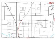
that much of the land selected for irrigated lucerne blocks was low-lying ‘worn-out’ wheat land. At Cohuna<br />
1,200 acres in the district of Mead became so water logged and affected by salinity that the land was unfit for<br />
any kind of production. A report in 1912 described ‘the rise in the soil water-level’ caused by ‘excessive use<br />
of water by irrigators’. So near to the surface was it that with evaporation an ‘accumulation of alkali’ was<br />
evident. 96 An investigation by the Department of Agriculture in 1913 found that chlorides and sulphates had<br />
accumulated within two years from the start of irrigation in the Cohuna area in 1910. When a deputation,<br />
including Mead and the premier William Watt, arrived in Cohuna in 1913 to inspect affected land, local<br />
resident Angus Martin demanded that action for drainage of the area be taken immediately. 97 Free water was<br />
allocated to wash out the salt, and drainage schemes such as those undertaken on ‘alkali land’ in California<br />
were recommended. 98 Relief for settlers whose allotments were affected by salt in the Cohuna district was<br />
introduced in May 1914. ‘Conditions of Alkali Relief’ allowed settlers to relinquish affected blocks with<br />
compensation made for capital improvements. Payment of instalments was suspended until the land had<br />
improved, and drainage outlets had been provided to orchards of four or more acres. 99 By 1914, channels<br />
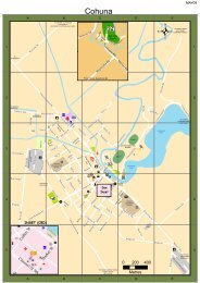
drained surface water into Leitchs Creek and Barr Creek at Cohuna, which by the following year had had ‘a<br />
marked effect in lowering the level of the water table’. 100<br />
Another round of major projects was undertaken by the SRWSC to support soldier and migrant<br />
settlement. The River Murray Commission, appointed in August 1915, oversaw the construction of the<br />
Torrumbarry Weir and Lock on the River Murray downstream from the Gunbower Creek off-take at<br />
Torrumbarry in the period 1919-1923. The opening of the Torrumbarry Weir-Lock in 1923 boosted irrigation<br />
supplies to the districts of Koondrook, <strong>Gannawarra</strong>, Cohuna and Kerang. The weir, ‘the key to the North<br />
95<br />
"1508 Letters and Memos." PROV, VA 723 State Rivers and Water Supply Commission, VPRS 3844/P0 General<br />
Correspondence Files, unit 108.<br />
96<br />
"State Rivers and Water Supply Commission Eighth Annual Report 1912-13". Victorian Parliamentary Papers, vol. 3,<br />
no. 46, 1913, 19-20.<br />
97<br />
Angus Martin, "My Life Story." Held by Kerang Branch <strong>Gannawarra</strong> Library Service, 1955, 59.<br />
98<br />
As the sea retreated from the Murray Basin in Tertiary times, seawater was trapped in the underground sands and<br />
limestones. Since that time, high levels of salinity have been taken into rivers and groundwater storages by natural<br />
drainage, especially in the lower reaches of the rivers. The addition of water by flood irrigation to the natural<br />
groundwater mobilised salts. Drainage schemes aim to decrease salinity and waterlogging in low lying areas through the<br />
removal of irrigation water after use via channels or underground tile drains to evaporation basins and the River Murray.<br />
99<br />
Murphy, "Where There's Mud There's Money: Irrigated Closer Settlement on Cohuna Estate First Subdivision 1909".<br />
100<br />
"State Rivers and Water Supply Commission Eleventh Annual Report 1915-16". Victorian Parliamentary Papers, vol.<br />
2, no. 34, 1916, 13.<br />
<strong>Gannawarra</strong> <strong>Shire</strong> <strong>Heritage</strong> <strong>Study</strong> <strong>Stage</strong> <strong>One</strong> <strong>Volume</strong> <strong>One</strong> <strong>Thematic</strong> Environmental History<br />
Robyn Ballinger (History in the Making) December 2008<br />
34