Gannawarra Shire Heritage Study Stage One Volume One Thematic ...
Gannawarra Shire Heritage Study Stage One Volume One Thematic ...
Gannawarra Shire Heritage Study Stage One Volume One Thematic ...

Create successful ePaper yourself
Turn your PDF publications into a flip-book with our unique Google optimized e-Paper software.
<strong>Gannawarra</strong> <strong>Shire</strong> <strong>Heritage</strong> <strong>Study</strong> <strong>Stage</strong> <strong>One</strong><br />
<strong>Volume</strong> <strong>One</strong> <strong>Thematic</strong> Environmental History<br />
Prepared by Robyn Ballinger for the <strong>Gannawarra</strong> <strong>Shire</strong><br />
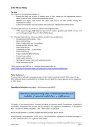
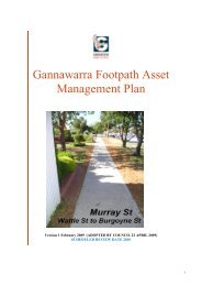
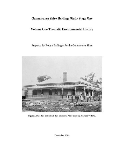
Figure 1. Bael Bael homestead, date unknown. Photo courtesy Museum Victoria.<br />
December 2008
Acknowledgements<br />
The <strong>Gannawarra</strong> <strong>Shire</strong> <strong>Heritage</strong> <strong>Study</strong> <strong>Stage</strong> <strong>One</strong> was undertaken with the assistance of funds made available<br />
from the Victorian State Government’s Victorian <strong>Heritage</strong> Programme.<br />
This <strong>Study</strong> would not have been possible without the commitment and interest of the following members of<br />
the <strong>Heritage</strong> <strong>Study</strong> Steering Committee: Councillor Oscar Aertssen, Councillor Graeme Mann, John McCurdy<br />
Manager Planning and Regulatory Services, Lyn Merrett Land Use Planner, Stephen Monk Land Use Planner,<br />
Geoff Austin Manager Local Government Services <strong>Heritage</strong> Victoria, and David Helms from <strong>Heritage</strong><br />
Victoria. We would like to express our heartfelt gratitude to the following members of local history groups<br />
who provided significant amounts of time and help: Diana Mitchell-Dorrity from the Cohuna and District<br />
Historical Society, Pat Gillingham from the Kerang Family History Group, Rhonda Frankling and Allan<br />
Tompkins from the Barham-Koondrook Historical Society, and Rhonda Coughlan from Quambatook. In<br />
addition, a number of <strong>Gannawarra</strong> <strong>Shire</strong> residents gave generously of their time to help us identify places of<br />
potential cultural significance, providing on some days with much needed and welcome victuals. Thankyou to<br />
Tom Lowe, Stuart Simms, Marianne and Graham Cockroft, Ray Jewson, and members of the Benjeroop Hall<br />
Committee for providing help in this area. Thankyou to Geoff Dale and residents who attended community<br />
meetings at Cohuna, Kerang, Koondrook, Lake Charm, Leitchville, Murrabit, and Quambatook for providing<br />
invaluable information in identifying places, and to those people who provided useful feedback on the<br />
thematic environmental history.<br />
Thankyou to <strong>Heritage</strong> Victoria staff for undertaking the entry of information into the HERMES database.<br />
Conversions<br />
Weights and measures<br />
In this work imperial units for common measurements are used until 1970 when the present metric system<br />
was introduced.<br />
1 inch (in) = 2.54 cm<br />
I foot (ft) = 0.30 m<br />
1 yard (yd) = 0.91 m<br />
1 chain (ch) = 20.11 m<br />
1 mile = 1.61 km<br />
1 ounce (oz) = 28.3 g<br />
1 pound (lb) = 454 g<br />
1 hundredweight (cwt) = 50.802 kg<br />
1 ton = 1.02 t<br />
Monetary Values<br />
Before 1966, Australian currency was expressed in<br />
pounds, shillings and pence (£ s. d.). The<br />
following form is used: £2 13s. 6d.<br />
1 acre = 0.405 ha<br />
1 square mile = 2.59 km<br />
1 horsepower (hp) = 0.746 kw<br />
1 mile per hour (mph) = 1.61 km/h<br />
<strong>Gannawarra</strong> <strong>Shire</strong> <strong>Heritage</strong> <strong>Study</strong> <strong>Stage</strong> <strong>One</strong> <strong>Volume</strong> <strong>One</strong> <strong>Thematic</strong> Environmental History<br />
Robyn Ballinger (History in the Making) December 2008<br />
2
Table of contents<br />
Statement of Significance.........................................................................................................................5<br />
1. Introduction ...............................................................................................................................................6<br />
2. Exploratory expeditions and overlanding................................................................................................8<br />
3. Pastoral occupation .................................................................................................................................10<br />
Pastoral landscape...................................................................................................................................12<br />
4. Farming settlement..................................................................................................................................13<br />
4.1 Selection ............................................................................................................................................13<br />
The selection Acts...............................................................................................................................13<br />
The Mallee Pastoral Leases Act.........................................................................................................15<br />
The selection landscape......................................................................................................................16<br />
4.2 Closer settlement .............................................................................................................................18<br />
The closer settlement landscape.........................................................................................................22<br />
4.3 Aboriginal settlement .......................................................................................................................24<br />
5. Water .......................................................................................................................................................26<br />
5.1 General water supply strategies .......................................................................................................26<br />
5.2 Irrigation............................................................................................................................................27<br />
The irrigation landscape .....................................................................................................................33<br />
6. Transport..................................................................................................................................................36<br />
6.1 Tracks, roads and bridges.................................................................................................................36<br />
6.2 The river trade...................................................................................................................................38<br />
6.3 Railways ............................................................................................................................................39<br />
7. Government .............................................................................................................................................41<br />
7.1 Roads Boards ....................................................................................................................................41<br />
7.2 Municipalities....................................................................................................................................42<br />
7.3 Policing..............................................................................................................................................42<br />
8. Building towns and settlements .............................................................................................................43<br />
8.1 River settlements...............................................................................................................................43<br />
Kerang .................................................................................................................................................43<br />
Koondrook...........................................................................................................................................45<br />
8.2 Agricultural settlements ...................................................................................................................45<br />
Benjeroop ............................................................................................................................................45<br />
Cohuna.................................................................................................................................................46<br />
<strong>Gannawarra</strong> .........................................................................................................................................47<br />
Koroop.................................................................................................................................................48<br />
Tragowel..............................................................................................................................................48<br />
8.3 Railway settlements..........................................................................................................................49
Mystic Park .........................................................................................................................................49<br />
Lake Charm.........................................................................................................................................50<br />
Lalbert..................................................................................................................................................51<br />
Leitchville............................................................................................................................................52<br />
Macorna...............................................................................................................................................52<br />
Quambatook ........................................................................................................................................53<br />
8.4 Closer settlement towns....................................................................................................................54<br />
Murrabit...............................................................................................................................................54<br />
Myall....................................................................................................................................................54<br />
9. Industries .................................................................................................................................................56<br />
9.1 Dryland agriculture...........................................................................................................................56<br />
Sheep and cattle ..................................................................................................................................56<br />
Crops....................................................................................................................................................56<br />
9.2 Irrigated agriculture ..........................................................................................................................57<br />
Dairying...............................................................................................................................................57<br />
Fruit and vegetable growing...............................................................................................................59<br />
Tobacco growing ................................................................................................................................60<br />
9.3 Forest industries................................................................................................................................60<br />
9.4 Extractive industries .........................................................................................................................63<br />
Gypsum................................................................................................................................................63<br />
Salt and fish.........................................................................................................................................63<br />
10. Community life .....................................................................................................................................64<br />
10.1 Health services................................................................................................................................64<br />
10.2 Schools ............................................................................................................................................65<br />
10.3 Halls and meeting places................................................................................................................65<br />
10.4 Places of worship............................................................................................................................66<br />
10.5 Wars.................................................................................................................................................67<br />
10.6 Cemeteries and lone graves............................................................................................................68<br />
10.7 Hotels and inns................................................................................................................................68<br />
10.8 Leisure .............................................................................................................................................68<br />
11. Conclusion.............................................................................................................................................71<br />
Select bibliography .....................................................................................................................................72<br />
<strong>Gannawarra</strong> <strong>Shire</strong> <strong>Heritage</strong> <strong>Study</strong> <strong>Stage</strong> <strong>One</strong> <strong>Volume</strong> <strong>One</strong> <strong>Thematic</strong> Environmental History<br />
Robyn Ballinger (History in the Making) December 2008<br />
4
Statement of Significance<br />
The physical environment of the <strong>Gannawarra</strong> <strong>Shire</strong>, the natural element in the process of human<br />
settlement, has evoked various responses from those who have travelled it, settled it, and worked it, and it has<br />
been this interaction that has shaped the <strong>Shire</strong>’s cultural landscape. The <strong>Shire</strong>’s post-contact history can be<br />
traced through the key stages of settlement: pastoralism, selection, and closer settlement. In this semi-arid<br />
place, rainfall can double or halve the median rainfall of between 354 millimetres at Quambatook in the west<br />
to 374 millimetres at Cohuna in the east. It has therefore been the accessing of a water supply that has directed<br />
much of the human activity in the <strong>Shire</strong>.<br />
Myriad water places exist to tell the story of settlement. Bridges show the way people have crossed<br />
the plethora of watercourses that snake their way across the <strong>Shire</strong>. Early public tanks, sometimes established<br />
on former squatter dams and Aboriginal soaks are in evidence. Original irrigation infrastructure, put in place<br />
by irrigation trusts established in the 1880s and later by the State Rivers and Water Supply Commission from<br />
1907, is still in use. This landscape evidences the way in which water was brought to, and used in the area,<br />
and the way in which, after the effects of water logging and salinity were realised, the way water was drained<br />
away.<br />
This landscape also contains various signs of settlement programmes introduced by successive<br />
governments to people the plains of northern Victoria. These initiatives included settlement from the 1860s<br />
under the Land Acts, from the 1890s under closer settlement initiatives, and again from 1922 under the<br />
Empire Settlement Act. In addition, soldier settlement schemes were established after World War <strong>One</strong> and<br />
Two.<br />
To the west of the <strong>Shire</strong> in the Mallee under the 1869 Land Act and the 1893 Mallee Pastoral Leases<br />
Act and facilitated by railways, farmers adapted to the semi-arid climate through using machinery and<br />
superphosphate to grow wheat on large holdings.<br />
The lives of various waves of settlers, and the government infrastructure which has supported this life<br />
is evidenced by myriad places. The subdivision of land, and extant houses, public buildings, schools,<br />
churches, memorials, gardens and trees, railway lines and station buildings, bridges and roads trace the<br />
distinct phases of irrigated and dryland agricultural settlement. Of particular interest is the wave of inter-war<br />
building, especially in Kerang, that reflects the wealth brought to communities of the <strong>Shire</strong> by good rainfall<br />
seasons and high produce prices of the 1920s. Through these places the key stages of post-contact settlement<br />
development can be traced.<br />
<strong>Gannawarra</strong> <strong>Shire</strong> <strong>Heritage</strong> <strong>Study</strong> <strong>Stage</strong> <strong>One</strong> <strong>Volume</strong> <strong>One</strong> <strong>Thematic</strong> Environmental History<br />
Robyn Ballinger (History in the Making) December 2008<br />
5
1. Introduction<br />
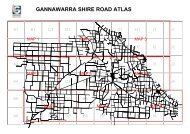
The <strong>Gannawarra</strong> <strong>Shire</strong> covers an area of 3,732 square kilometres and is located on the Murray<br />
River in northern Victoria (see Figure 2) in the country of the Aboriginal Barapa Barapa and Wamba<br />
Wamba clans. The rediscovery in 1967 at the Museum of Victoria of what became known as the ‘Cohuna<br />
cranium’, found in 1925 at Kow Swamp in the neighbouring <strong>Shire</strong> of Campapse, has aroused worldwide<br />
interest in burials of Aboriginal peoples in the area. The Kow Swamp burials are the largest single<br />
localised population group of late Pleistocene antiquity yet found anywhere in the world. Some forty<br />
burials have been excavated and date from 20,000 years ago. 1<br />
The <strong>Gannawarra</strong> <strong>Shire</strong> municipal strategic statement provides a snapshot of the <strong>Shire</strong> in 2008. The<br />
<strong>Shire</strong>’s residents, numbering 11,610 in 2006, live in the main centres of Kerang, Cohuna, Koondrook,<br />
Leitchville, and Quambatook. The <strong>Shire</strong>’s economic base is centred on the agricultural industry, value<br />
added processing industries, small scale manufacturing industries, retailing, and tourism. The Murray<br />
Goulburn cheese factory at Leitchville is the <strong>Shire</strong>’s major industry. The <strong>Shire</strong> has two distinct agricultural<br />
areas, irrigated and broad acre farming, which include cropping, dairying, grazing, horticulture and<br />
viticulture. Agricultural diversity is made possible by access to water from the Murray River, Loddon<br />
River, Gunbower Creek, and the Kerang Lakes. 2<br />
In addition to Mallee land to the west, the country of the <strong>Gannawarra</strong> <strong>Shire</strong> incorporates the<br />
alluvial plains of three major rivers, the Murray, Loddon, and Avoca. Remnant grassland communities are<br />
found along streams and waterways, the Kerang Lakes area, Gunbower State Forest, the Murray River<br />
environs, and other state parks and reserves. Black box grassy woodlands, Buloke grassy woodlands, river<br />
red gum forests and various shrublands evidence the vegetation that once covered the <strong>Shire</strong>. The<br />
municipality also contains rare and threatened fauna species such as the plains-wanderer, barking owl,<br />
grey-crowned babbler and the carpet python. The wetlands of the Kerang Lakes and Gunbower Forest are<br />
listed under the International Convention on Wetlands (the RAMSAR convention) and are of national and<br />
international significance for migratory birds. These areas have significant conservation value for native<br />
flora and fauna and important cultural and recreational value for the local community. Koorangie State<br />
Wildlife Reserve and The Marshes and Cullen Lake Area are listed on the Register of National Estate.<br />
1<br />
Tim Stone, and Mathew L. Cupper, "Last Glacial Maximum Ages for Robust Humans at Kow Swamp, Southern<br />
Australia," Journal of Human Evolution 45, no. 2 (2003). John Mulvaney and Johan Kamminga, Prehistory of Australia<br />
(St. Leonards: Allen and Unwin Pty. Ltd., 1999), 156-7.<br />
2<br />
<strong>Gannawarra</strong> Planning Scheme Municipal Strategic Statement (Department of Planning and Community Development,<br />
2008 [cited 20 January 2008]); available from<br />
http://www.dse.vic.gov.au/planningschemes/gannawarra/ordinance/21_mss01_gann.pdf.<br />
<strong>Gannawarra</strong> <strong>Shire</strong> <strong>Heritage</strong> <strong>Study</strong> <strong>Stage</strong> <strong>One</strong> <strong>Volume</strong> <strong>One</strong> <strong>Thematic</strong> Environmental History<br />
Robyn Ballinger (History in the Making) December 2008<br />
6
Figure 2: <strong>Gannawarra</strong> <strong>Shire</strong> boundaries and main townships 2008.
2. Exploratory expeditions and overlanding<br />
The land and water forms of the northern plains had been embraced as home for many thousands of<br />
years by the first peoples of the country of the <strong>Gannawarra</strong> <strong>Shire</strong> - the Barapa Barapa and Wamba Wamba -<br />
before the arrival of white explorers and overlanders. 3 In 1836, Governor Sir Richard Bourke instructed<br />
Surveyor-General of New South Wales Major Thomas Mitchell to finish tracing the course of the Darling<br />
River to the Murray River which he had earlier attempted in 1835. From this point, Mitchell was ordered to<br />
follow the Murray to its junction with the Murrumbidgee, and then to follow the southern bank of the Murray<br />
back to the settled parts of the colony. He was also empowered to follow the most ‘promising’ stream flowing<br />
into the Murray.<br />
Mitchell, aged forty-three, and his party of twenty-five men, nine of whom were, or had been<br />
convicts, twelve horses, fifty-two bullocks, five drays, five tents, two boats, one hundred sheep, five oxen, and<br />
other equipment and provisions for a five month journey, set off from a property named Boree in central-<br />
western New South Wales in March 1836, a year of heavy rains. Mitchell’s first glimpse of the country of<br />
what was to become <strong>Gannawarra</strong> <strong>Shire</strong> was from a hill just north of present-day Tresco on 22 June 1836. 4<br />
En route to a hill that Mitchell had from a distance named Burnett’s Hill, over 21-23 June 1836 the<br />
expedition passed through what Mitchell described as ‘a very singular country’ of numerous lakes ‘enclosed<br />
by semicircular ridges on their Eastern shores’ (today’s Lake Boga, Lake Tutchewop, Lake Kelly, Lake<br />
Charm, Third Lake, Middle Lake and Reedy Lake). The expedition camped at a place near today’s Fish Point<br />
on 21 June, and near Lake Kelly on 22 June. At another camp site on 23 June east of present-day Kerang on a<br />
watercourse that Mitchell named Moonlight Creek (today’s Barr Creek), Mitchell noted the existence of<br />
Aboriginal cooking hearths. The expedition camped at what is known today as the settlement of <strong>Gannawarra</strong><br />
on 24 June, and passed though today’s Cohuna on 25 June. Another camp was made at Wee Wee Rup over<br />
the period 25-28 June. On 28 June, passing north of today’s Leitchville through box forest, the party crossed a<br />
creek and immediately entered an extensive plain, beyond which Mitchell recorded that he had ‘the<br />
satisfaction of seeing the hopeful hill straight before me.’ 5 Upon re-naming Burnett’s Hill Mount Hope, and<br />
from atop its summit Mitchell wrote:<br />
The…country consisted as far as the glass enabled me examine it, of open, grassy plains, beautifully<br />
variegated with serpentine lines of wood...The country which I had seen this day beyond Mount Hope,<br />
was too inviting to be left behind us unexplored; and I, therefore, determined to turn into it without<br />
further delay. 6<br />
3 Aboriginal language boundaries are taken from Ian D. Clark, Aboriginal Languages and Clans: An Historical Atlas of<br />
Western and Central Victoria, 1800-1900, Monash Publications in Geography No. 37 (Melbourne: Department of<br />
Geography and Environmental Science, Monash University, 1990).<br />
4 References to present-day locations that Mitchell’s expedition moved through are taken from The Major Mitchell Trail:<br />
Exploring Australia Felix, (Melbourne: Department Conservation and Environment, 1990).<br />
5 Major T. L. Mitchell, Three Expeditions into the Interior of Eastern Australia, with Descriptions of the Recently<br />
Explored Region of Australia Felix, and of the Present Colony of New South Wales, 2nd Edition, Carefully Revised.<br />
<strong>Volume</strong> Two, vol. 2 (London: T. & W. Boone, 1839; reprint, Adelaide: Library Board of Australia, 1965), 155.<br />
6 Ibid., 159.
It was at this point that Mitchell broke away from his instructions to return to the settled areas via the Murray<br />
River and instead continued southwest across the Port Phillip district.<br />
Future travellers to the plains used Mitchell’s journals, then in the form of despatches to Bourke, as an<br />
interpretive guide to the country – and his tracks across the landscape as a physical guide. In these despatches<br />
Mitchell described the Yarrayne river as running westward. 7 This conjecture led to confusion when parties set<br />
off in 1837-8 to chart an overland route from New South Wales to Adelaide to sell stock to the Adelaide<br />
market, the colony of South Australia then experiencing a food shortage.<br />
Charles Bonney and Joseph Hawdon began their overland journey to Adelaide in January 1838 with a<br />
party of nine men and three hundred head of cattle. Hawdon and Bonney followed the Goulburn River to its<br />
junction with the Hume, 8 travelled along the Hume on its left bank and then picked up Mitchell’s tracks.<br />
Following what was later named Gunbower Creek, Hawdon and Bonney came across a group of older Barapa<br />
Barapa men and women dragging a fishing net along the creek. Hawdon opined that Mitchell had encountered<br />
very different weather conditions: ‘The weather must have been very wet, every impression left on the ground<br />
still being so distinct.’ 9 On 2 February, the men camped at Mitchell’s site at Wee Wee Rup. After crossing<br />
‘dry country…[of] thick bushy scrub’ and extensive plains, from the vantage point of Mount Hope on 3<br />
February 1838 Hawdon wrote:<br />
From this eminence we had a most extensive view: to the Eastward plains spread out as far as the<br />
horizon; to the Southward also more immense plains, here and there intersected by belts of trees,<br />
which in wet seasons mark the water-courses…to the Westward we again beheld boundless plains;<br />
and to the northward a dead-level of black forest. Altogether the scenery was of an imposing<br />
character. The land, however, was of the worst description; the plains have a thin sprinkling of small<br />
tufts of grass, but are for the most part covered with the salsuginous plant vulgarly called ‘Pig’s<br />
face’. 10<br />
On 3 November 1829 Charles Sturt’s expedition left Sydney to begin an investigation of the Lachlan-<br />
Murrumbidgee river system. In January 1830 with seven other men, Sturt rowed a whaleboat down the<br />
Murrumbidgee River to a ‘broad and noble river’ which he named the Murray. By 1838, financial difficulties<br />
had forced Sturt to join a venture for overlanding cattle to South Australia. The cattle were driven along<br />
the Murray, moved to the left bank at Barmah Forest and then on to Adelaide using the tracks of Hawdon and<br />
Eyre. Although in the process Sturt was able to add something to knowledge of the Murray River, the<br />
journey almost ended in disaster because of what he described as the ‘dry and barren’ nature of the land<br />
that was to become part of the <strong>Shire</strong> of <strong>Gannawarra</strong>. Sturt’s record of the journey fed the image of the<br />
7 Dispatch from Surveyor-General Thomas Mitchell to the Colonial Government in Sir Thomas Mitchell, "Journal of<br />
Exploring Journey 1836." Sir Thomas Mitchell Papers 1708-1855, CY789 C54, Manuscript Collection, Mitchell Library,<br />
State Library New South Wales, 1836.<br />
8 The Hume was named by Hamilton Hume in 1824. The Murray was named by Charles Sturt in 1830 downstream from<br />
its junction with the Murrumbidgee. By 1836, the river had been proven to be one in the same and was named the<br />
Murray.<br />
9 Entry for 1 February 1838 in Joseph Hawdon, A Journal of a Journey from New South Wales to Adelaide Performed in<br />
1838 by Mr Joseph Hawdon (Melbourne: Georgian House, 1952), 20.<br />
10 Ibid., 21.<br />
<strong>Gannawarra</strong> <strong>Shire</strong> <strong>Heritage</strong> <strong>Study</strong> <strong>Stage</strong> <strong>One</strong> <strong>Volume</strong> <strong>One</strong> <strong>Thematic</strong> Environmental History<br />
Robyn Ballinger (History in the Making) December 2008<br />
9
Murray River overlanding route as the ‘great high road of the interior’. The intensive use of the River<br />
Murray track to drove stock led to hostile clashes between Aborigines and overlanders.<br />
In 1860, the Burke and Wills exploration party on its expedition north passed through the area and<br />
camped at Tragowel station.<br />
Mitchell’s expedition is marked by cairns at Cohuna and Kerang, and a tree believed to have been<br />
marked by Mitchell on his 1836 expedition through the area is held by the Cohuna and District Historical<br />
Society museum.<br />
3. Pastoral occupation<br />
Pastoral settlement of the Port Phillip District commenced at Portland Bay in 1834 and Port Phillip<br />
Bay in 1835. Other squatters came looking for Mitchell’s country although some of them were already on<br />
their way before the district’s official opening in September 1836, and before Mitchell had even returned to<br />
Sydney in October of the same year. 11 Word reached Bathurst via Aboriginal communication routes that<br />
Mitchell had discovered a carbaun (from the Aboriginal word cabonne meaning ‘big’) water - Portland Bay.<br />
This discovery was reported officially in the Sydney Gazette on 29 September 1836. 12 Subsequently, squatters<br />
overlanded from north of the River Murray following Mitchell’s tracks. Other important routes radiated from<br />
Portland Bay and Port Phillip Bay where squatters arrived from Van Diemens Land. In 1837 in an effort to<br />
control this expansion, Governor Richard Bourke introduced the Crown Lands Occupation Act which<br />
disallowed depasturing of lands beyond the limits of location unless they were taken up under an annual lease<br />
or licence based on a stock assessment costing £10; in 1839 an additional stock fee was introduced to raise<br />
revenue to establish border police to oversee the process of taking up the country. Even so, a major expansion<br />
into Port Phillip took place in the period 1838-40 when, with a sheep in 1838 worth £3, profits from the<br />
pastoral industry soared and squatters continued to assess the capabilities and capacity of the new country of<br />
Port Phillip with a fair degree of independence from official control. With most of the better-watered land<br />
claimed and stock numbers increasing due to breeding, fierce competition forced run seekers to move further<br />
afield to find fresh pastures. There remained only the areas of Gippsland, the Wimmera, the Mallee, and ‘the<br />
scantily watered plains in the north’. 13<br />
The former pessimistic views of the plains of northern Victoria were eroded as the country with its<br />
large expanses of native grasses in the high rainfall years of 1845-6 came to be seen as some of the best winter<br />
lamb fattening land in the colony. 14 Under the title ‘Progress and Cause of Settlement of the Inferior Northern<br />
11 The term ‘squatter’ first applied to those pastoralists who took possession of land before legislature was introduced in<br />
1836. It is used in this study for the sake of consistency.<br />
12 Gregory C. Eccleston, ed., Granville Stapylton's 1836 Journal (unpublished manuscript).<br />
13 Stephen Roberts, History of Australian Land Settlement (South Melbourne: Macmillan, 1968), 169.<br />
14 Rainfall was not officially recorded at weather stations in the <strong>Gannawarra</strong> <strong>Shire</strong> until 1881. Information about rainfall<br />
before that time has been gleaned from anecdotal evidence contained in written accounts, and from rainfall records kept<br />
at Bendigo and Echuca.<br />
<strong>Gannawarra</strong> <strong>Shire</strong> <strong>Heritage</strong> <strong>Study</strong> <strong>Stage</strong> <strong>One</strong> <strong>Volume</strong> <strong>One</strong> <strong>Thematic</strong> Environmental History<br />
Robyn Ballinger (History in the Making) December 2008<br />
10
Country’ Charles Browning Hall explained how the negative views of the plains were replaced by different<br />
judgements:<br />
At this time [1840-1] the richer portions only of the colony found favour in the eyes of the intending<br />
settlers as only being calculated to afford marketable stock. Afterwards, when melting down had been<br />
established into a system rendering settlers independent of the limited market of Melbourne, and giving<br />
a value to lean stock in consequence of their being in demand to replace stock boiled down from the<br />
richer runs, country till then despised was greedily taken up. The northern plains and the parts more<br />
readily watered by the Wimmera and its tributaries were occupied under these circumstances. Then it<br />
was discovered that tracts which had been passed over as barren in summer had a peculiar value in<br />
winter, and in fact it gradually became apparent that they were second to no district in their capacity for<br />
producing fat stock, the fattening seasons, however, being different. 15<br />
The majority of runs in the study area were licensed in 1845. 16 Squatters took up land along the Murray<br />
and the Loddon Rivers building on the string of stations already formed downstream. Those that came later<br />
were left with the ‘back country’, their stock dependant on water from the smaller creeks and streams. No<br />
doubt influenced by the pending Order in Council which promised leases and pre-emptive rights, by 1847 the<br />
country of the <strong>Gannawarra</strong> <strong>Shire</strong> had been divided into six runs controlled by eight men involved in the<br />
business of pastoralism.<br />
Squatters established runs along the same watercourses that Aboriginal peoples depended upon.<br />
Grazing regimes mirrored traditional Aboriginal movements: in winter animals were fed and watered in the<br />
‘back country’ away from rivers, and in summer they were moved to water frontages. Dams were sunk, often<br />
in the areas of soaks used by Aboriginal people, and watercourses diverted. The use and alteration of<br />
watercourses, as well as changing the natural hydrology of the plains, impacted dramatically on indigenous<br />
populations. Ian Clark has remarked that Aboriginal-European violence may have been exacerbated by<br />
competing needs for limited water in times of drought. 17<br />
The second wave of squatters over the period 1855-69 turned the squatting activity of their<br />
predecessors into money making pastoral enterprises of a much larger scale. The great wool houses financed<br />
purchases of runs, made advances on the next wool clip, handled its transport and sale, supplied stores, and<br />
ultimately often took over properties when their clients ran too deeply into debt. 18 From 1855 those with the<br />
available finance were able to acquire large numbers of stations in the study area. Charles Ebden who hin<br />
1835 had taken up runs at the present-day sites of Bonegilla and Albury, was the son of prominent merchant<br />
15 Letter from Charles Browning Hall 6 September 1853 in T. F. Bride, Letters from Victorian Pioneers (Melbourne:<br />
Trustees of the Public Library, Museums, and National Gallery of Victoria, 1898; reprint, South Yarra: Currey O'Neil,<br />
1983), 265.<br />
16 The date of the first occupation of pastoral runs in the Port Philip district is difficult to establish. Depasturing licences<br />
before the 1847 Order in Council were not officially recorded. First occupation dates have been ascertained by consulting<br />
Robert and Hugh Anderson Spreadborough, ed., Victorian Squatters (Ascot Vale: Red Rooster Press, 1983).<br />
17 Ian D. Clark, Scars in the Landscape: A Register of Massacre Sites in Western Victoria, 1803-1859, Australian<br />
Institute of Aboriginal and Torres Strait Islander Studies Report Series (Canberra: Australian Institute of Aboriginal and<br />
Torres Strait Islander Studies, 1995), 9.<br />
18 Geoffrey Serle, The Golden Age: A History of the Colony of Victoria, 1851-1861 (Carlton: Melbourne University<br />
Press, 1963), 48.<br />
<strong>Gannawarra</strong> <strong>Shire</strong> <strong>Heritage</strong> <strong>Study</strong> <strong>Stage</strong> <strong>One</strong> <strong>Volume</strong> <strong>One</strong> <strong>Thematic</strong> Environmental History<br />
Robyn Ballinger (History in the Making) December 2008<br />
11
anker and politician in the Cape Colony, John Bardwell Ebden. The Ebden wealth, combined with the<br />
opportunities provided in holding runs elsewhere, furnished Ebden with the resources to have within his<br />
control over the period 1854-1861 nearly 500,000 acres in the Kerang region. 19 Merchant and financier Henry<br />
‘Money’ Miller of Queen Street was the largest shareholder in the Bank of Victoria in the early 1850s. Miller<br />
profited from the sale of run licences by taking over the leases of Restdown Plains West (with John Matheson<br />
general manager of the same bank), Pine Hills, <strong>Gannawarra</strong> and Gunbower in 1864-66. William ‘Big’ Turner<br />
Clarke of Rupertswood extended his extensive pastoral interests to the plains, acquiring the leases to<br />
<strong>Gannawarra</strong>, Meering Lake, Wharparilla, Pine Grove, Pine Hills Loddon, and Terrick Terrick West in the<br />
early 1870s.<br />
Pastoral landscape<br />
The squatters and the workers they employed went about the singular business of sheep and cattle<br />
raising. On a practical level this activity involved the building of fences, hurdles, yards, huts and outstations.<br />
More substantial homesteads replaced original huts after the 1847 Order in Council recognised pre-emptive<br />
rights, and when nine-year leases were introduced in 1852. Aboriginal labour formed an important component<br />
of station life. Men were employed as shearers, wood cutters, shepherds, water carters, and fencers, and<br />
women as needleworkers and bark cutters. Yet the relationships between indigenous and non-indigenous<br />
settlers were more complex than that of just ‘worker-boss’. John Hinkin, for instance, first manager of<br />
Gunbower run in the mid 1840s gave over care of his small daughter Jenny to ‘Cockie’, an Aboriginal man<br />
whilst he was employed on station business. Women of the camp dressed her in a possum skin bonnet, swam<br />
with her on their backs, and exchanged language with her, and the men invited her to ceremonies. When<br />
Hinkins left the station in 1847, the Aborigines were grief stricken. Hinkins remembered the ‘wailing and<br />
howling’ of the women and children, and the ‘cutting and burning’ by the men that marked his departure. 20<br />
The largest run in the <strong>Shire</strong> was Reedy Lake or Bael Bael run, taken up in the country of the Bael<br />
Bael Gundidj, a clan of the Wamba Wamba people. The word ‘bael’ derives from the Wamba Wamba word<br />
Beal-beal meaning forest of red gum trees and is believed to refer to the red gum trees that once grew along<br />
the banks of Lake Bael Bael. 21 In February 1845, the run of 370,000 acres was licensed to two Sydney<br />
merchants G. C. Curlewis and Robert Tertius Campbell Jnr. According to Archibald Macarthur Campbell who<br />
occupied the <strong>Gannawarra</strong> run on the River Murray, two shepherds were murdered by Aborigines near the<br />
north end of a lake later named Murdering Lake (today’s Lake Charm). Curlewis lost high numbers of cattle<br />
in retaliation for the subsequent shooting of Aboriginal people by station men. 22 The Reedy Lake or Bael Bael<br />
19<br />
A. G. L. and Clark Shaw, C. M. H., ed., Australian Dictionary of Biography <strong>Volume</strong> 1 1788-1850 (Melbourne:<br />
Melbourne University Press, 1968), 350.<br />
20<br />
John T. Hinkins, Life Amongst the Native Race: With Extracts from a Diary by the Late John T. Hinkins. (Melbourne:<br />
Haase McQueen and Co., 1884), 45.<br />
21<br />
Ian D. Clark and Toby Heydon, Dictionary of Aboriginal Placenames of Northwest Victoria (Melbourne: Victorian<br />
Aboriginal Corporation for Languages, 2002), 16.<br />
22 Bride, Letters from Victorian Pioneers.<br />
<strong>Gannawarra</strong> <strong>Shire</strong> <strong>Heritage</strong> <strong>Study</strong> <strong>Stage</strong> <strong>One</strong> <strong>Volume</strong> <strong>One</strong> <strong>Thematic</strong> Environmental History<br />
Robyn Ballinger (History in the Making) December 2008<br />
12
un was subdivided in March 1848 into No. 14 Swan Hill and Lake Boga, No. 15 Bael Bael, Reedy Lake,<br />
Loddon and Marabout (the writer Rolf Boldrewood – the non-de plume of Thomas Brown - held the Murrabit<br />
run from February 1862 to October 1863), and No. 16 Bael Bael, Combatook or Avoca. 23<br />
Other runs in the study area included the Lalbert run of 76,800 acres licensed to Thomas and Jabez<br />
Ham in 1846, the Loddon run of 32,000 acres licensed to James Cowper in 1845, the <strong>Gannawarra</strong> run of<br />
103,680 acres licensed in 1846 to A. M. Campbell, the Tragowel run of 120,820 acres licensed to A.<br />
McCallum in 1846, the Gunbower run of 180,000 acres licensed to James Hutton Rowan in 1846, the Mount<br />
Hope run licensed in 1846 to A. McCallum, and the unoccupied Ultima run resumed in 1851 and licensed to<br />
George Govett. 24<br />
Evidence of this era in the <strong>Shire</strong> today includes the drop-log homestead associated with the Bael Bael<br />
run (see cover photo Figure 1). Believed to have been erected when the run was licensed to C. H. Ebden for<br />
use by his son-in-law and business partner Theophilus Keene, the building is marked on a survey undertaken<br />
by W. S. Urquhart dated 24 April 1848, although George Robinson made mention of the homestead being in<br />
existence as early as April 1846. 25 A shearing shed evidences the Quambatook run. Parts of the <strong>Gannawarra</strong><br />
station complex remain, including the homestead moved to its present location c1860. A shearing shed<br />
associated with the Reedy Lake run is still in existence.<br />
4. Farming settlement 26<br />
times:<br />
4.1 Selection<br />
The selection Acts<br />
The white settlement of Australia was shaped by a complexity of motives. They were, at various<br />
to domesticate the wilderness; to prevent the retrogression of the settlers into barbarianism; to recreate<br />
pre-industrial Britain; to destroy the image of industrial Britain that was being created in Australia; to<br />
relieve Britain of its destitute, poor and surplus populations; to destroy squatter monopoly; to achieve<br />
an egalitarian, even utopian, society; to counterbalance the growth of the urban centres; to consolidate<br />
Australia’s hold on the continent against real and imaginary threats. 27<br />
23<br />
Robert Spreadborough and Hugh Anderson, eds., Victorian Squatters (Ascot Vale, Vic.: Red Rooster Press, 1983),<br />
203, 39-40.<br />
24<br />
Only the dates of first licensees are noted here. For details of later subdivisions see Spreadborough, ed., Victorian<br />
Squatters, passim.<br />
25<br />
Ian D. Clark, ed., The Journals of George Augustus Robinson Chief Protector, Port Phillip Aboriginal Protectorate,<br />
<strong>Volume</strong> Five: 25 October 1845 - 9 June 1849 (Ballarat, Vic.: <strong>Heritage</strong> Matters, 2000), 20.<br />
26<br />
This section is based on research conducted by Robyn Ballinger for her unpublished PhD thesis ‘An inch of rain and<br />
what it means: landscapes of the northern plains of Victoria 1836-1930’.<br />
27<br />
M. Williams, “More is Smaller and Better: Australian Rural Settlement 1788-1914” in J. M. and Michael Williams<br />
Powell, Australian Space, Australian Time: Geographical Perspectives. (Melbourne: Oxford University Press, 1975), 98.<br />
<strong>Gannawarra</strong> <strong>Shire</strong> <strong>Heritage</strong> <strong>Study</strong> <strong>Stage</strong> <strong>One</strong> <strong>Volume</strong> <strong>One</strong> <strong>Thematic</strong> Environmental History<br />
Robyn Ballinger (History in the Making) December 2008<br />
13
Gold was discovered in Victoria in 1851, and by 1858, 150,000 people were at work on the goldfields in<br />
central Victoria. 28 With diminishing returns of alluvial gold on the fields of central Victoria, diggers<br />
demanded that land be freed from the hold of the squatter. ‘Every man a vote, a rifle, and farm’ was the cry of<br />
a demonstration outside parliament house in Melbourne in 1860. The subsequent Land Acts of the 1860s<br />
promoted the ideal of the creation of a new rural society of an ‘industrious yeomanry’ of freeholders.<br />
Under Duffy’s Land Act of 1862, it was proposed to open for selection an area of ten million acres of<br />
the most valuable agricultural land in Victoria for nine-year leases. The Grant Land Act of 1865 focused on<br />
controlled settlement in designated Agricultural Areas. Despite the fact that the best land in Victoria had been<br />
licensed by this time, the maximum holding-size was reduced to 320 acres. Each Act brought with it<br />
conditions that made it more difficult for squatting interests to select land. However through manipulating the<br />
legislation of the Acts, by 1869 squatters had in actuality consolidated their holdings.<br />
As exemplified by the actions of <strong>Gannawarra</strong> run licensee C. B. Fisher, although the 1869 Land Act<br />
was designed specifically to break the hold of the pastoralists who continued to monopolize the best lands,<br />
dummying continued. 29 Under the Act all unalienated land in the whole Colony was opened for selection of up<br />
to 320 acres. Land could only be selected once and squatters were able to purchase 640 acres around their<br />
homesteads (a pre-emptive right). Licences (Section 19s) were taken up for three years at 2s. per acre annual<br />
rental. Conditions under which licences were taken up under the 1869 Act were aimed at ‘improving’ the<br />
land. The selector was required to live on the selection for at least two and a half years, and within three years<br />
build a house to fulfil residency conditions, fence the selection, cultivate at least ten per cent of the land, and<br />
effect other improvements such as clearing vegetation, constructing water storages, and erecting outbuildings.<br />
If improvements at a rate of £1 per acre were made within this time, the selector could either purchase the<br />
land by paying the balance of 14/- per acre, or obtain a seven year lease (Section 20) paid at an annual rent of<br />
2/- per acre and credited as part payment of the fee-simple. Under this Act one million acres were selected in<br />
1872, and in the four years from 1873 to 1876 over five million. By the end of 1878, nearly eleven million<br />
acres had been taken up, mostly in the mountainous country of Gippsland and on the plains of the north. 30<br />
This Act and the high rainfall years of the early 1870s brought selectors in numbers to the country of<br />
the present day <strong>Gannawarra</strong> <strong>Shire</strong>. Some settlers selected land in family groups and farmed the land as one<br />
holding in an effort to make farming more viable. Small acreages of wheat or oats were cultivated, a vegetable<br />
garden planted, and pigs and poultry raised along with a few head of sheep and cattle. Cows were kept for the<br />
sale of butter and cream. By the dry year of 1876 however, farmers in the area were experiencing difficulties.<br />
Continuous cropping, the invasion of rabbits from the Mallee, low prices, and the production for international<br />
28<br />
Graeme Davison, John Hirst, and Stuart Macintyre, eds., The Oxford Companion to Australian History (Melbourne:<br />
Oxford University Press, 1998), 283.<br />
29<br />
‘Dummies’ were nominal selectors acting on behalf of someone else to apply for land or in fulfilling the residency<br />
conditions. After paying off their leases under the Land Act, they transferred title to the squatter.<br />
30<br />
John Andrews, “The Emergence of the Wheat Belt in Southeastern Australia in 1930” in John Andrews, ed., Frontiers<br />
and Men: A <strong>Volume</strong> in Memory of Griffith Taylor (1880-1963) (Melbourne: F. W. Cheshire, 1966).<br />
<strong>Gannawarra</strong> <strong>Shire</strong> <strong>Heritage</strong> <strong>Study</strong> <strong>Stage</strong> <strong>One</strong> <strong>Volume</strong> <strong>One</strong> <strong>Thematic</strong> Environmental History<br />
Robyn Ballinger (History in the Making) December 2008<br />
14
consumption and the resultant reorganization of marketing and handling facilities impacted on the farmers<br />
involved in the growing of wheat. 31<br />
These years, exacerbated by drought from 1876, brought another wave of change to the landscape of<br />
the <strong>Shire</strong>. A progress report on agricultural settlement in 1878 estimated that one-third of selectors in the Land<br />
Districts of Echuca, Kerang and St. Arnaud were ‘in danger of losing their lands from inability to pay their<br />
debts’:<br />
Generally speaking, the bona fides of the great majority of the selectors in taking up land for<br />
settlement does not admit of doubt; but the necessity of carrying out within the prescribed time the<br />
improvements on their land which the law requires has involved them in debt, and the drought of the<br />
last two seasons has proved so fatal to their crops and their live stock, that they have got little or no<br />
returns from their land to enable them to met their liabilities. The consequence is that at the present<br />
time many of them continue to be rather deeply in debt to banks, to money-lending agents, and to<br />
storekeepers. 32<br />
In August 1884, the Kerang Times reported that the weather in the Gunbower district ‘is causing some alarm<br />
on account of its continued dryness’, and that ‘all kinds of vegetation are in an exceedingly backward state.’ 33<br />
Most settlers found it impossible to pay the required rent and improve the land to the extent of £320 with the<br />
limited resources that were available. Many left the land enabling those with capital to buy up neighbouring<br />
properties to increase their holdings. Successful farmers in this era of selection were often those who had<br />
taken up selections near blocks farmed by other family members, those who were able to consolidate<br />
allotments through marriage, or those who farmed cooperatively with their countrymen who had settled in the<br />
same area.<br />
The introduction of the 1884 Tucker Land Act transferred the emphasis from the sale of land to<br />
leasing, and attention was focused on achieving settlement of marginal agricultural lands hitherto neglected by<br />
selectors. A series of county maps which classified lands under Pastoral, Agricultural and Grazing,<br />
Auriferous, Swamplands, Auction and State Forests and other Reserves were produced to accompany the Act.<br />
Different conditions of tenure were prescribed for the various categories of land. Holdings of 320 acres could<br />
only be taken up in designated Agricultural and Grazing Lands.<br />
The Mallee Pastoral Leases Act<br />
Rabbit infestation and abandonment of runs by pastoralists encouraged authorities to look anew at the<br />
area in the early 1880s. The Mallee was chosen as the new frontier to be settled in an effort to rid the area of<br />
rabbits and to preserve the land for the Crown for disposal in 1903. In an attempt to reduce dingo numbers, a<br />
31 Ibid.<br />
32 "Crown Lands Commission of Inquiry Progress Report on the Agricultural Settlement of the Country under the<br />
Existing Land System, and Upon All Matters Therewith Together with Suggestions for an Amending Land Bill October<br />
9 1878". no. 65. Melbourne: John Ferres Government Printer, 1878, 3. The Report listed the acreages of mortgages taken<br />
out in the Land Districts on the northern plains as follows: Echuca 5,933 acres, Kerang 636 acres, and St. Arnaud 413<br />
acres.<br />
33 "Gunbower (from Our Own Correspondent)." Kerang Times, 26 August 1884.<br />
<strong>Gannawarra</strong> <strong>Shire</strong> <strong>Heritage</strong> <strong>Study</strong> <strong>Stage</strong> <strong>One</strong> <strong>Volume</strong> <strong>One</strong> <strong>Thematic</strong> Environmental History<br />
Robyn Ballinger (History in the Making) December 2008<br />
15
‘wild-dog’ fence was erected in 1883 from the South Australia border to a point near Lalbert and then north to<br />
the Murray River. In the same year under the Mallee Pastoral Leases Act, the Mallee was divided into ‘fringe’<br />
and ‘interior’ sectors. In the ‘fringe’ sector, allotments of between five hundred and 1200 acres extending to<br />
20,000 acres were offered. In the ‘interior’, land was divided into ‘A’ and ‘B’ blocks ranging from sixty to<br />
over five hundred square miles. ‘A’ blocks fronted all available water sources and were able to be taken up on<br />
twenty-year leases. ‘B’ blocks were available on five-year leases. In addition, compensation for vermin<br />
control was to be paid at the expiration of the lease. The Bael Bael run was subdivided and taken up for wheat<br />
growing from 1893. 34<br />
The Australasian summed up these early years in the Mallee:<br />
The first years of Mallee settlement were characterised by keen struggle, want of capital, ‘scratch’<br />
methods of farming and occasional despondency. The support - moral and financial - of the business<br />
and commercial community, as well as the State, should be accorded to those who, by their efforts,<br />
were attempting to transform a barren wilderness into fertile fields of grain. 35<br />
Those able to endure these hardships experienced more favourable conditions in ensuing years, however for<br />
many, inadequate acreages, lack of capital necessary for clearing, fencing, building, and the purchase of<br />
machinery, plus a surplus of wheat on the world market meant that many settlers either defaulted on their rates<br />
or simply walked off the land. Spurred on by the construction of the railway from Kerang to Swan Hill, others<br />
made quick profits through land speculation and subdivision. By 1902, the Mallee fringe had been settled as<br />
far as the existing railways extended.<br />
The difficulties endured by settlers in taking up land under the Mallee Pastoral Leases Act was<br />
recognised by another Act in 1889 passed to allow the alienation of an additional 320 acres as an Agricultural<br />
Allotment. In 1896, the Mallee Lands Act increased selection of land to the maximum of 640 acres available<br />
either as an Agricultural Allotment or perpetual lease payable over forty years. Other changes to the Act were<br />
made in 1898, 1900 and 1903. Land Acts in 1901, 1911 and 1915 saw the dividing up of Mallee Pastoral<br />
Leases upon their expiration.<br />
The selection landscape<br />
The first selectors built homes of locally available materials. Dwellings consisted of crude log cabins<br />
made windproof with clay, hessian-lined drop log cabins, wattle and daub constructions, and mud brick<br />
buildings. In the Mallee, sleeping quarters were often constructed underground and later converted to cellars.<br />
By the turn of the century, new building materials were available. Internal linings were available in cardboard,<br />
pressed steel (Wunderlich), pine boarding and sheet plaster.<br />
Settlers in the Mallee were faced with the prospect of clearing mallee vegetation. It could not be<br />
merely felled and burnt as its massive stumps produced new growth within a year or so. Each stump, with its<br />
large root system, needed to be grubbed. This proved a slow, difficult and expensive task. The technology to<br />
34 "Mallee Area Review." Melbourne: Land Conservation Council, 1987, 38.<br />
35 Australasian, 18 November, 1916<br />
<strong>Gannawarra</strong> <strong>Shire</strong> <strong>Heritage</strong> <strong>Study</strong> <strong>Stage</strong> <strong>One</strong> <strong>Volume</strong> <strong>One</strong> <strong>Thematic</strong> Environmental History<br />
Robyn Ballinger (History in the Making) December 2008<br />
16
conquer the scrub was perfected specifically for Mallee conditions in South Australia. Farmers rolled a tree<br />
trunk or steam-engine boiler, pulled by horses or a bullock team, across standing scrub, snapping it off at the<br />
roots. Larger scrub was felled by hand. After leaving it to dry, it was then burnt. New shoots would develop<br />
from the root mass left in the ground. The common treatment was to scratch in a crop of long-strawed wheat<br />
which grew between the woody masses in the soil. After establishing a crop using this process, one settler<br />
remarked that ‘the shoots from the stumps are nearly as high as the crops and the reaping machine looks like a<br />
ship in a storm, as it rocks about going over the stumps’. 36 The land was then tackled with the stump-jump<br />
plough, invented in 1876, on which the ploughshares would rise and tilt upon meeting an obstacle. Stump-<br />
jumping harrows and wheat-strippers were also used. The stripper was indispensable because it harvested the<br />
grain but left both wheat stalks and mallee shoots standing. After harvesting, the mallee shoots were burnt,<br />
and after three or four years, the mallee roots finally died. Mallee stumps were grubbed and stacked, and then<br />
used for a multiple of purposes - fences, construction of outbuildings, shelter for stock, and fuel for fires. It<br />
was possible to roll ten acres of mallee a day using this method at the relatively inexpensive rate of 17s. 6d.<br />
per acre. Clearing costs were thus slashed and farms brought quickly into production. In later years, steam<br />
traction engines, and then tractors, quickened the process. An example of a mallee roller owned by the Castle<br />
family and drawn by thirteen horses is still in evidence at Beauchamp.<br />
After experience proved that farming 320 acre blocks in northern Victoria was not economically<br />
viable, farmers utilised agricultural machinery such as stripper-harvesters and reaper-binders to crop larger<br />
holdings. By the turn of the twentieth century, they had incorporated bare fallowing in a three-year rotation.<br />
Paddocks were sown to a crop in the first year, grazed the second year by livestock, then the next year kept<br />
under fallow and prepared for cultivation by ploughing and harrowing after the rain. ‘Bare fallowing’, or<br />
breaking up the soil, diminished weed growth, checked evaporation through reducing water take up by weeds,<br />
and posited a dust layer over the soil. After experiments by individual farmers, the Department of Agriculture<br />
detected deficiency of phosphorous in most of Victoria’s soils and advised the application of superphosphate<br />
to wheat crops to increase yields. Advice was provided by the Department on applying the fertilizers of<br />
superphosphate, farmyard manure, guano, nitrate of soda, potash salts, sulphate of ammonia, and lime. 37 By<br />
1903, the application of light dressings of ‘phosphatic manures’ was in general use in northern Victoria. 38<br />
Improved varieties of seed were developed through systematic cross-breeding of seed saved by farmers from<br />
plants displaying drought or rust-resistant qualities. South Australian farmers were experimenting with<br />
drought-resistant wheat varieties before William J. Farrer began crossing drought-resistant Indian wheats with<br />
quality Canadian baking wheats and Purple Straw wheats to produce ‘Federation’ variety. 39 Wheat was grown<br />
36 Tony Dingle, The Victorians: Settling (McMahons Point: Fairfax, Syme and Weldon Associates, 1984), 110.<br />
37 James Cuming is credited with establishing the superphosphate industry in Victoria when in 1872 he exported bonechar<br />
treated with sulphuric acid to Mauritius in exchange for sugar. P. Rankin Scott and Will C. Robertson, "Fertilizers<br />
and the Fertilizer Industry," The Journal of the Department of Agriculture of Victoria (1925): 66. Bone dust was<br />
manufactured from bones collected from farms on the northern plains and crushed at a mill in Echuca.<br />
38 "Summary of Results in the North," Agricultural Journal of Victoria (1903-4): 14.<br />
39 R. L. Heathcote, "Managing the Droughts? Perception of Resource Management in the Face of Drought Hazard in<br />
Australia," Vegetation 91 (1991): 225.<br />
<strong>Gannawarra</strong> <strong>Shire</strong> <strong>Heritage</strong> <strong>Study</strong> <strong>Stage</strong> <strong>One</strong> <strong>Volume</strong> <strong>One</strong> <strong>Thematic</strong> Environmental History<br />
Robyn Ballinger (History in the Making) December 2008<br />
17
in the Northern District on 685,782 acres in 1909-10, and 599,287 acres in 1912-13, equivalent to 32.09 per<br />
cent of the wheat grown in the state in that year. 40<br />
While new methods allowed rapid colonisation, they did not guarantee settlers would be able to stay.<br />
The lack of surface water was the bane of the early settler. Bores more often than not yielded brackish water,<br />
thus necessitating the carting of water from often fifteen to twenty miles away. The increased pressure on the<br />
land was also evident. Widespread dust storms occurred from the early 1900s. Dawn Clemann who lived near<br />
Lake Charm remembered the dust in the 1920s:<br />
I remember trying to beat the dust by doing the washing late at night and bringing it in again before<br />
sunrise but we could not win, the dust engulfed everything all the time. It was the custom, before<br />
sitting down to the meal to shovel, sweep and dust the table to get a cleaner place to eat off. We must<br />
have carted out barrow loads of dirt from the house. 41<br />
The 1950s and early 1960s saw a return of good seasons, control of rabbits, and record prices for<br />
wheat and wool. Wheat intake at Quambatook peaked at 851,010 bushels in 1948-50, and 909,991 bushels in<br />
1950-51. 42 Since the 1960s, many properties have been consolidated. Original selections of 320 and 640-acre<br />
blocks have been amalgamated to form holdings of 1500 acres and more, and some farmers are growing<br />
alternative crops. Others have diversified into horticulture and viticulture activities.<br />
4.2 Closer settlement 43<br />
In the cities of Australia industrialization was seen as limiting opportunities for workers and as having<br />
contributed to the 1890s economic depression. Settlement in the country, a manifestation of the agrarian myth<br />
which had seeped through Australian life from first white settlement, was called on once again to ameliorate<br />
the effects of urban problems. Industrialisation had created new social and economic issues but had also<br />
produced technological innovations that gave humans increasing power over nature. Under the new closer<br />
settlement vision agriculture was to be encouraged, wheat and dairying areas settled, railways constructed,<br />
and roads opened up so that the colony of Victoria could take its place as part of a progressive federated<br />
Australia. Popular ideas argued that the ‘unused labour’ of the unemployed of the cities should be transferred<br />
‘to the unused or under-used land’. 44 Villages intended to become self sufficient were established under the<br />
Village Settlement Act of 1892 to settle the ‘deserving poor’ from Melbourne in rural forest and irrigated<br />
areas. The idea, developed by Christian Socialist Rev H. F. Tucker, was based on co-operative enterprise<br />
evolving into eventual private enterprise. Similarly, under the State scheme enacted by the Settlement of Land<br />
40 A. M. and T. S. Hall Laughton, ed., Handbook to Victoria [Compiled for] the British Association for the Advancement<br />
of Science Australian Meeting 1914 (Melbourne: n.p., 1914), 76, 272.<br />
41 Interview with Mrs Dawn Clemann in Linleigh Hall and Fay Hobson, "Kerang History Research Project Prepared for<br />
the Borough and <strong>Shire</strong> of Kerang." Held by Kerang Branch <strong>Gannawarra</strong> Library Service, 1985.<br />
42 Quambatook: A Story of Progress 1949-1971, (Boort: Back to Quambatook Committee, 1971), 76.<br />
43 This section is based on research conducted by Robyn Ballinger for her PhD thesis ‘An inch of rain and what it means:<br />
landscapes of the northern plains of Victoria 1836-1930’.<br />
44 Michael Williams, "More and Smaller Is Better: Australian Rural Settlement 1788-1914," in Australian Space,<br />
Australian Time: Geographical Perspectives, eds. J. M. Powell and Michael Williams (Melbourne: Oxford University<br />
Press, 1975), 82.<br />
<strong>Gannawarra</strong> <strong>Shire</strong> <strong>Heritage</strong> <strong>Study</strong> <strong>Stage</strong> <strong>One</strong> <strong>Volume</strong> <strong>One</strong> <strong>Thematic</strong> Environmental History<br />
Robyn Ballinger (History in the Making) December 2008<br />
18
Acts 1893, families were given cash advances to take up dryland and irrigation allotments of one to twenty<br />
acres in village communities, labour colonies and homestead associations. The aim of the scheme was to settle<br />
families in areas where seasonal work was available to supplement their own farm work. By 1897, settlements<br />
under this Act had been established on Gunbower Island, Koondrook (Myall), and Murrabit West. 45 Most<br />
settlements collapsed due to the inexperience of settlers and poorly chosen land.<br />
In 1898 and 1904, closer settlement legislation was introduced. Large freehold estates were resumed<br />
by the Crown and subdivided into smaller holdings. Turning to New Zealand’s example of compulsory<br />
acquisition of large estates, the Closer Settlement Act of 1904 provided for the establishment in 1905 of the<br />
Lands Purchase and Management Board to acquire land, either compulsorily or by agreement, for closer<br />
settlement. Under conditional leases, settlers were required to live on the land (in a dwelling erected by the<br />
Board if they so wished), to fence the land, destroy vermin and noxious weeds, and to make general<br />
improvements. Under this scheme, houses drawn to government plans were erected, fences built and soils<br />
graded in preparation for settlers who were given 21! years to purchase their properties at 4! per cent<br />
interest. Advice on irrigated farming was provided by the Department of Agriculture which took its lead from<br />
the Australian Commonwealth Bureau of Agriculture. Over ten years, the Board acquired 500,000 acres of<br />
land, 100,000 acres of which was developed by the State Rivers and Water Supply Commission (SRWSC) for<br />
irrigated farming. Land at Cohuna was purchased under this legislation.<br />
Closer settlement in Victoria was taken to another level when engineer Elwood Mead, Chief of the<br />
Irrigation and Drainage Investigations Bureau in the United States Department of Agriculture, was appointed<br />
SRWSC chairman in 1907. On his arrival in Victoria, Mead was quick to condemn the irrigation landscape of<br />
northern Victoria. The scattered plots over a large area ‘where one could ride for miles without meeting a man<br />
or seeing a horse’, supported by costly channel systems did not marry with his vision of large irrigation<br />
settlements serviced by central pumping facilities located on higher plain country. 46 Mead made it clear that<br />
closer settlement was ‘the surest way to success in irrigation development’ and the only way to advance the<br />
public interest of the State. An important objective of the government’s closer settlement vision was the<br />
stemming of the population drift from country to city, and from Victoria to other states. Mead claimed ‘that a<br />
20 and 40 acre block will give a chance to industrious men of small means to secure for themselves and their<br />
families shelter, food, a healthy comfortable living, and, in addition, saleable products at least equal in value<br />
to the wages of the skilled city worker’. 47 He issued a call to populate Victoria to reinstate it once more as the<br />
‘foremost agricultural State of the Commonwealth’.<br />
The 1909 Water Act, an amendment of the 1905 Act, took up the thrust of Mead’s policy. The Act<br />
allowed for the compulsory acquisition of irrigable lands and introduced a compulsory water charge (see<br />
Chapter 5.2 Water Supply Strategies). After Mead’s determined push to make the SRWSC responsible for the<br />
45<br />
"Report on the Proceedings Taken under the Provisions of the Settlement on Lands Act 1893". no. 37. Melbourne:<br />
Robt. S. Brain Government Printer, 1897.<br />
46<br />
Elwood Mead, Policy to Be Followed in Irrigation Development No. 2 (Melbourne: State Rivers and Water Supply<br />
Commission, 1909), 4.<br />
47 Ibid., 7.<br />
<strong>Gannawarra</strong> <strong>Shire</strong> <strong>Heritage</strong> <strong>Study</strong> <strong>Stage</strong> <strong>One</strong> <strong>Volume</strong> <strong>One</strong> <strong>Thematic</strong> Environmental History<br />
Robyn Ballinger (History in the Making) December 2008<br />
19
allocation of land for closer settlement, in 1912, in addition to the planning and carrying out of irrigation<br />
schemes, another Closer Settlement Act handed full control of irrigated estates to the SRWSC for the<br />
following six years. After the 1916 Royal Commission into Closer Settlement found that the Closer<br />
Settlement Board had purchased land unsuitable for irrigation, this role was transferred permanently to the<br />
SRWSC. Under Mead, closely settled irrigation districts were to be established including model irrigation<br />
estates, designed to overcome opposition by dryland farmers. The Cohuna Estate of 20,000 acres, the first<br />
fully closer settlement irrigated estate in Victoria, opened in 1909 and was watered from the River Murray by<br />
pump. Part of it was named ‘Mead’ in 1910. 48 Most northern Victorian farmers though displayed an aversion<br />
to the cultivation of small-scale products over this period. So strongly did some farmers feel about the<br />
detrimental effects of irrigation on the value of their land that in 1904 they passed resolutions to block the<br />
government from extending the Waranga channel west to the Loddon River. 49<br />
Mead reckoned some 200,000 extra settlers as necessary to secure the full benefits of irrigation in<br />
northern Victoria, 50 and those most likely to be open to education, he argued, were those from overseas. An<br />
injection of new blood was seen as the answer. The blood, however, had to be of a particular type. ‘Wanted’, a<br />
promotional poster declared, ‘20,000,000 People for Good Old Sunny Australia…The Land of Promise. The<br />
White Man’s Hope’. 51 In 1910, a delegation led by Mead and Hugh McKenzie, Minister of Lands, travelled<br />
abroad to the British Isles, Denmark, Italy, the United States and Canada to gather information and recruit<br />
settlers with irrigation experience and some capital behind them to take up closer settlement blocks.<br />
Government promotions which focused particularly on the Cohuna and Rochester districts promised<br />
‘prosperity and independence’ to ‘the settler who has industry and thrift.’ 52 <strong>One</strong> booklet declared:<br />
The northern part of the State is a vast fertile plain, capable, under irrigation, of supporting a dense<br />
population in much more than average comfort. This plain is watered by Australia’s largest river, the<br />
Murray, and some of its most important tributaries. The State has been engaged for several years in<br />
building channels, reservoirs, and pumping plants to utilize the waters of the Murray and Goulburn<br />
Rivers; and it is to the irrigable lands under the completed State works that settlement is specially<br />
invited…The lands in the Victorian irrigation areas…are of unusual fertility. Without irrigation they<br />
have long been noted wheat-growing areas, and it is the old wheat farms which are now being<br />
converted into prosperous irrigation settlements. The soil is a red or grey loam, with a porous subsoil,<br />
giving good drainage for irrigation, and with a rainfall of only 15 inches a year it has yielded as much<br />
as 14 bags of wheat to the acre. 53<br />
48 Margaret Murphy, "Where There's Mud There's Money: Irrigated Closer Settlement on Cohuna Estate First<br />
Subdivision 1909" (Graduate Diploma of Regional Studies History, La Trobe University, 1995).<br />
49 George Swinburne, "Water Acts and Consolidation and Amendment Bill - Speech by the Hon. George Swinburne in<br />
the Legislative Assembly". Melbourne: R. S. Brain Government Printer, 1904, 13.<br />
50 Mead, Policy to Be Followed in Irrigation Development No. 2, 14.<br />
51 In John Rutherford, "Interplay of American and Australian Ideas for Development of Water Projects in Northern<br />
Victoria," Annals of the Association of American Geographers 54, no. 1 (1964): 100.<br />
52 Victoria: The Irrigation State of Australia - Information for Prospective Settlers, (n.p.: 1912?), 15, 22.<br />
53 Ibid., 4, 6, 10.<br />
<strong>Gannawarra</strong> <strong>Shire</strong> <strong>Heritage</strong> <strong>Study</strong> <strong>Stage</strong> <strong>One</strong> <strong>Volume</strong> <strong>One</strong> <strong>Thematic</strong> Environmental History<br />
Robyn Ballinger (History in the Making) December 2008<br />
20
With the advent of World War <strong>One</strong>, another wave of closer settlement was instigated. Through<br />
participation in the war, Australia’s confidence in its role as an integral part of the British Empire was<br />
boosted. The booming economic climate fed by the assumption that prosperity would endure provided the<br />
foundation for the introduction of two new closer settlement schemes: the settlement of Australian returned<br />
servicemen, and the British Empire Migration programme.<br />
Discharged Soldier Settlement Acts passed in the period 1917-24 in conjunction with the Closer<br />
Settlement Acts of 1915, 1918 and 1922 formed the legislative basis for Victorian soldier settlement on the<br />
land. The Discharged Soldier Settlement Act of 1917 provided for sustenance money to be paid during the<br />
establishment period, and for advances of up to £500 for every settler. Interest commenced at the low rate of<br />
3! percent for the first year, increasing ! percent per year until the ruling rate of interest was reached. The<br />
Commonwealth and State governments shared the costs of these concessions equally. Under the 1918<br />
Discharged Soldier Settlement Act, advances of up to £1,000 were provided for and training facilities were to<br />
be established for inexperienced farmers. Seen as repaying the ‘debt of honour’, the soldier settlement scheme<br />
enjoyed widespread public and political support. Land for soldier settlement was made available in the study<br />
area at Cohuna and Kerang. By 1921, in the Burnewang (<strong>Shire</strong> of Campaspe), Cohuna and Kerang districts,<br />
sixty-two discharged soldiers were involved in fruit culture and dairying supplemented by pig-raising. 54<br />
Railways were extended, including the Border Railway which crossed the River Murray at Gonn Crossing<br />
(later Murrabit) in 1926.<br />
The Empire Settlement Act introduced in 1922 was based on an agreement reached at the Imperial<br />
Conference in London in 1921 whereby Britain was to supply people (where unemployment in 1921-2<br />
measured fourteen per cent), and Australia the land. 55 British civilians and ex-service personnel were to be<br />
assisted in taking up residence in the under-populated and under-developed Dominions, and in return,<br />
Australia was promised ‘Imperial Preference’ - a ready market for food and raw materials. Australia’s future<br />
was thus ensured, Prime Minster Bruce claimed, through the combination of ‘men, money and markets’.<br />
British migrants numbering 450,000 were expected in a decade. Under an agreement made between the<br />
Commonwealth and Victorian governments on 21 September 1922, 10,000 approved British migrants were to<br />
be advanced loans of up to £1,500, repayable over 36! years, to take up farms. The State offered farms on<br />
irrigated land of between fifteen and 120 acres, and dry land of up to 640 acres. Supervision and training were<br />
to be provided to those without farming experience. Farm jobs were to be found for those without capital. Of<br />
the 34,500 acres of irrigated land put aside for migrant settlement in 1922-3, 3,660 acres were located at<br />
Tye’s, Roberts’s, and Anderson’s Estates in the Murrabit district, and 2,500 acres were set aside in the<br />
Cohuna district. 56<br />
54<br />
"State Rivers and Water Supply Commission Sixteenth Annual Report 1920-21". Victorian Parliamentary Papers, 2nd<br />
Session, no. 11, 1921, 27.<br />
55<br />
Richard Broome, The Victorians: Arriving (McMahons Point: Fairfax, Syme and Weldon Associates, 1984), 141.<br />
56<br />
"Closer Settlement 1914-26." PROV, VA 723 State Rivers and Water Supply Commission, VPRS 3844/P0 General<br />
Correspondence Files, unit 31.<br />
<strong>Gannawarra</strong> <strong>Shire</strong> <strong>Heritage</strong> <strong>Study</strong> <strong>Stage</strong> <strong>One</strong> <strong>Volume</strong> <strong>One</strong> <strong>Thematic</strong> Environmental History<br />
Robyn Ballinger (History in the Making) December 2008<br />
21
During the economic depression of the 1930s, unemployed people from Melbourne were established<br />
in camps throughout the <strong>Shire</strong> to undertake specific government projects such as railway work, channel<br />
clearing, and road building.<br />
Although some soldier settlement took place after World War Two, for the most part closer settlement<br />
as an active policy was wound down from 1938.<br />
The closer settlement landscape<br />
A snapshot of closer settlement development in Cohuna in 1911 is provided in a report from the<br />
Weekly Times. It stated that seventeen new settler families had taken up irrigation blocks in the first few<br />
months of that year and were mostly involved in the growing of lucerne and dairying with a view to fruit<br />
cultivation. Twelve of the families had come to the area in response to the McKenzie-Mead delegation: ‘they<br />
are – with two exceptions – Englishmen with English wives and fresh-faced healthy children…and [they]<br />
consider that the bulk of the promises made to them by the delegation have been fulfilled.’ Four of them,<br />
wrote the reporter, were living in two-roomed cottages erected by the Government – other houses stood<br />
awaiting occupants. As to the farming experience possessed by an Irish settler, ‘[it] is represented on the right<br />
side of a decimal, but his coat is off and a shovel is raising blisters on his willing hands formerly troubled with<br />
writer’s cramp.’ Families were viewed as having the natural advantage of a secure labour force: ‘Mr Stone is a<br />
good type of the steady Gloucester farmer…This gentlemen is in an exceptional condition to go in for dairy<br />
farming, having a wife and nine children.’ Mr McKillop from Liverpool was described as ‘young, strong and<br />
anxious, and…assisted by a capable wife and family.’ Mr Woodward was to be aided in his dairying<br />
enterprise by ‘his wife and two buxom daughters.’ 57 Earlier, Russians, ‘ordinary middle-aged farmers – sturdy<br />
Russian yeomen inured to hardship’, had taken up land at McMillans near Cohuna in October 1909. 58<br />
Many of those who came were unhappy about living conditions. At Cohuna in 1911, new settlers<br />
complained that the two-roomed government cottages were inadequate for their needs and the promised<br />
railway line from Elmore to Cohuna was nonexistent. Settlers at Mead formed an association in 1911,<br />
ostensibly to provide each other support and advice, however they were soon lobbying the government for<br />
houses, canals and railways. Locals argued that the best land was reserved for the newcomers and that only<br />
‘stiff, clayey land unsuited for closer settlement purposes’ was left for the Australians. 59 Russian families at<br />
McMillans (where today the land is still referred to as Siberia) soon departed. A local resident described the<br />
discomfort during the hot summer months where ‘they spent the…days sitting up to their necks in the channel<br />
behind Mr McWhae’s house and begged us as a favour to cut the reeds to insulate their ceilings.’ 60 Settlers’<br />
houses, ‘Government-built two-roomed cottages, with front verandahs, each a replica of the others…[and]<br />
57 "New Settlers." The Weekly Times, 7 January 1911.<br />
58 "Russians Settle at McMillans." The Cohuna Farmers Weekly, 31 March 2004. For a detailed study of immigrants who<br />
took up land on the Cohuna Estate see Murphy, "Where There's Mud There's Money: Irrigated Closer Settlement on<br />
Cohuna Estate First Subdivision 1909".<br />
59 "Developing Cohuna." The Weekly Times, 4 February 1911, 49.<br />
60 Gwenyth Gordon, Phyllis Hetherington, Rose Peatling and Mavis Spark, ed., Unlock the Land: A History of the<br />
Cohuna District 1875-1975 (Echuca: Riverina Herald Print, n.d.), 33.<br />
<strong>Gannawarra</strong> <strong>Shire</strong> <strong>Heritage</strong> <strong>Study</strong> <strong>Stage</strong> <strong>One</strong> <strong>Volume</strong> <strong>One</strong> <strong>Thematic</strong> Environmental History<br />
Robyn Ballinger (History in the Making) December 2008<br />
22
patch of sorghum and graded land’ had ‘a considerable sameness.’ It would be quite possible, the Weekly<br />
Times reported, for a settler to return after a successful evening and mistake his home.’ 61<br />
Corresponding with the economic depression of the early 1930s and the failure of Victoria’s wheat<br />
crop in 1929-30 due to drought, by 1931 fifty per cent of all Victoria’s civilian, soldier and migrant settlers<br />
were receiving assistance from the Closer Settlement Board, and only seventeen per cent had paid their debts<br />
to the Board in full. 62 At the local level at Murrabit in 1929, thirty-nine mostly British migrant families were<br />
involved in dairying and citrus growing on irrigated blocks. In the following year, nine families left fulfilling<br />
the prophecy by a SRWSC officer that twenty of those involved in dairying were judged as having ‘no<br />
chance’ of success. 63 Settlers at Murrabit formed a branch of the British Overseas Settlers’ Association to<br />
vehemently protest at what they saw as the failure to deliver on the promises made to them before leaving the<br />
United Kingdom. Families relied on their wives and children to work their blocks with an average return of<br />
only £3 10s. per week. The ‘reasons for this lamentable state of affairs’, according to P. R. Nightingale<br />
chairman of the Association, were the infestation of land with thistles, the uneven and heavy nature of the land<br />
requiring expensive grading, the over watering of land by previous owners, the non-existence of channels or a<br />
resident supervisor in the first months of settlement, cheating of settlers by selling them ‘dud’ cows,<br />
unsuitable implements and cramped buildings, and a lack of promised training. ‘Two floods and a drought<br />
have completed the devastation,’ he wrote. 64 A Royal Commission established in 1931 found that ‘migrants<br />
were placed on the inferior and more remote blocks.’ 65 Other causes of failure were rising salinity levels<br />
(described under Chapter 5.2 Water Strategies) associated with flood irrigation. Subsequently, indebtedness<br />
was written down, and a re-evaluation of blocks was undertaken so as to place the settler on a better financial<br />
footing.<br />
Evidence of this period of closer settlement in the <strong>Shire</strong> can be seen today in houses of the era. ‘Bing<br />
bong’ houses, structures built cheaply of tin that contracted and expanded with the heat, are still in place at<br />
Murrabit (see Figure 3). 66<br />
61 "Developing Cohuna."<br />
62 "Report of the Closer Settlement Board for the Year Ended 30th June, 1931". Victorian Parliamentary Papers, vol. 1,<br />
no. 8, 1931, 5.<br />
63 "Migrant Settlers General Complaints Victoria. Murrabit Settlers, 161/1, 1928-35." National Archives of Australia:<br />
Development Branch Prime Minister's Department; A786, Correspondence Files, 1930-1935<br />
64 Letter to the British Government Representative for Migration from P. R. Nightingale, Chairman Oversea Settlers’<br />
Association of Victoria Murrabit Branch, 25 January 1929 in Ibid.<br />
65 Lesley Scholes, A History of the <strong>Shire</strong> of Swan Hill: Public Land, Private Profit and Settlement (Swan Hill: <strong>Shire</strong> of<br />
Swan Hill, 1989), 147.<br />
66 Ollie Jane, "Ollie Jane's 3rd Field Trip to Murrabit and Area with Ian McDonald". Ibis <strong>Heritage</strong> Newsletter of the<br />
Kerang and District Family History Group, no. 54, 2006.<br />
<strong>Gannawarra</strong> <strong>Shire</strong> <strong>Heritage</strong> <strong>Study</strong> <strong>Stage</strong> <strong>One</strong> <strong>Volume</strong> <strong>One</strong> <strong>Thematic</strong> Environmental History<br />
Robyn Ballinger (History in the Making) December 2008<br />
23
Figure 3. A ‘bing bong’ house in Murrabit 2008. Photo by Tom Henty<br />
4.3 Aboriginal settlement<br />
The period of selection impacted significantly on Aboriginal residents of the <strong>Shire</strong>. Under the 1869<br />
Aborigines Act, the Central Board Appointed to Watch Over the Interests of the Aborigines became the Board<br />
for the Protection of the Aborigines and provided for the setting up of six Aboriginal reserves. The coercive<br />
Act allowed the Governor to prescribe where and how Aborigines lived, and to take charge of orphaned and<br />
neglected children. Local guardians appointed to districts ‘most frequented by Aborigines’ on pastoral stations<br />
in northern Victoria in 1862 managed depots that supplied basic provisions. ‘Stores for the use of Aborigines’<br />
consisted of flour, tea, sugar, tobacco, soap, rice, oatmeal, blankets, twill shirts, serge shirts, men’s trousers,<br />
boys’ trousers, dresses, petticoats, boys’ jumpers, and chemises. Tomahawks proved a popular item under the<br />
category of ‘miscellaneous’ stores. 67 In May 1869 it was estimated that sixty Aboriginal people lived in the<br />
Boort-Loddon district, and eighty in the Gunbower and Terrick Terrick district. Mr Green, superintendent of<br />
Coranderrk Aboriginal Reserve near Healseville, recommended that all the children should be removed from<br />
their ‘old haunts’, and recorded that only thirty Aborigines remained at Gunbower station. 68 By 1873, police<br />
were involved in removing children from pastoral stations to reserves. 69 Some Aborigines sought refuge at the<br />
67<br />
"Seventh Report of the Board for the Protection of Aborigines of the Colony of Victoria". Victorian Parliamentary<br />
Papers, vol. 3, no. 41, 1871, 24.<br />
68<br />
Ibid., 19. It is not possible to estimate the original number of Aboriginal people living in the <strong>Gannawarra</strong> <strong>Shire</strong> as both<br />
Wamba Wamba and Barapa Barapa clan boundaries extended over the River Murray into New South Wales.<br />
69<br />
Richard Broome, Aboriginal Victorians: A History since 1800 (Crows Nest: Allen & Unwin, 2005), 134.<br />
<strong>Gannawarra</strong> <strong>Shire</strong> <strong>Heritage</strong> <strong>Study</strong> <strong>Stage</strong> <strong>One</strong> <strong>Volume</strong> <strong>One</strong> <strong>Thematic</strong> Environmental History<br />
Robyn Ballinger (History in the Making) December 2008<br />
24
Maloga Mission Reserve in New South Wales established in Bangerang and Yorta Yorta country in 1874 by<br />
Daniel and Janet Mathews.<br />
A. G. Adams recalled the life of Aboriginal people when he arrived in Kerang in 1875. He<br />
remembered an all Aborigine cricket team from Melool station near Koondrook playing in the local<br />
competition. Groups of middle-aged Aboriginal people with children camped next to a swamp (most likely<br />
Tragowel) near Kerang. Deprived of their traditional systems of food, they begged for bread, tea and sugar<br />
and were rarely refused. Many of these people were known by the names of the owners of the stations, or by<br />
the names of their country. Young Aborigines were employed on nearby sheep and cattle stations. <strong>One</strong> in<br />
particular was known for his fine horse-handling skills. Others stripped bark to sell as roofing for the<br />
increasing number of houses being erected by selectors. The bark was stripped in spring when the sap was<br />
rising, passed over a fire, straightened, and weighted with logs to flatten it. Many of these indigenous people<br />
were removed to Coranderrk Aboriginal Station established near Healesville established in 1863 where<br />
Adams went to visit them. 70 Others were relocated to Moonacullah Aboriginal Station near Deniliquin in New<br />
South Wales established on Barapa Barapa country in 1898. Cummeragunga station was gazetted next to the<br />
Mathews Maloga property in New South Wales in 1889. The population of Cummeragunga decreased<br />
dramatically over the period 1915-18 when amendments to the 1909 New South Wales Aborigine Act gave the<br />
Board powers to remove children from their families.<br />
Other Aboriginal people continued to live in the <strong>Gannawarra</strong> <strong>Shire</strong>, taking up work as farm labourers,<br />
shearers, timber cutters, charcoal burners, and fruit pickers. Archie Pepper’s family, for example, established a<br />
permanent camp on the northern end of the Mystic Park timber reserve, watching over stock grazing in the<br />
reserve and adjoining paddocks until the 1930s (see Figure 4). 71 In 1939, Cummeragunga residents on strike to<br />
highlight the living conditions of Aboriginal people, crossed the River Murray. From here, many returned to<br />
take up residence in towns and rekindle relationships with their families and ancestral homelands in Victoria. 72<br />
Aboriginal people continue to have a strong presence in the life of the <strong>Shire</strong> today. Unemployment and lack of<br />
educational opportunities remain major concerns. Support on issues of importance to Aboriginal people is<br />
provided through the Allinjarra Aboriginal Association located in Kerang.<br />
70 A. G. Adams, "Scraps from Memory's Storehouse (Regarding the Early Days of Settlement in Kerang District)."<br />
Kerang New Times, May-June 1936, held by Kerang and District Family History Group.<br />
71 Colin Heggen, Mystic Park Memories: A History of Mystic Park and District (Bulleen: Colin Heggen, 1993), xvii.<br />
72 Wayne Atkinson, and A. Berryman, "Aboriginal Associations," in Report on the Murray Valley Area (Melbourne:<br />
Land Conservation Council, 1983), 13-28.<br />
<strong>Gannawarra</strong> <strong>Shire</strong> <strong>Heritage</strong> <strong>Study</strong> <strong>Stage</strong> <strong>One</strong> <strong>Volume</strong> <strong>One</strong> <strong>Thematic</strong> Environmental History<br />
Robyn Ballinger (History in the Making) December 2008<br />
25
Figure 4. The Pepper family c1930s alongside an Inland Mission Memorial van in the timber reserve<br />
Mystic Park. Photo courtesy Pat Gillingham.<br />
5. Water 73<br />
Three major rivers, the Murray, Loddon, and Avoca flow across the <strong>Shire</strong>. The rivers and their<br />
subsidiary creeks have a natural tendency to spread waters over a wide area of the floodplain to create lakes<br />
and swamps in low-lying depressions.<br />
5.1 General water supply strategies<br />
Selectors in the <strong>Shire</strong> accessed whatever supply was available locally on their blocks. Swamps were<br />
drained and dams were built. Others selectors altered natural watercourses or carted water from available<br />
water holes. Former soaks once used by Aboriginal peoples and later by squatters were fenced. In the Mallee,<br />
public funds were made available as loans to <strong>Shire</strong> councils to enlarge or construct large public tanks as part<br />
of water reserves, and at the turn of the century, channels were built to take water to farms. Many of these<br />
reserves remain today and are readily distinguishable by the surviving natural bushland which stands in stark<br />
contrast to the surrounding wheat paddocks. A wave of government infrastructure was put into place to<br />
provide settlements with water. Wells were sunk and standpipes and windmills connected to dams supplied<br />
water to growing populations. In later years, water towers and reservoirs were built.<br />
73 This section is based on research conducted by Robyn Ballinger for her unpublished PhD thesis ‘An inch of rain and<br />
what it means: landscapes of the northern plains of Victoria 1836-1930’.<br />
<strong>Gannawarra</strong> <strong>Shire</strong> <strong>Heritage</strong> <strong>Study</strong> <strong>Stage</strong> <strong>One</strong> <strong>Volume</strong> <strong>One</strong> <strong>Thematic</strong> Environmental History<br />
Robyn Ballinger (History in the Making) December 2008<br />
26
The onset of dry years from 1876 encouraged the development of water supply schemes for northern<br />
Victoria. The Water Conservancy Board established in 1880 comprised George Gordon, former chief<br />
hydraulic engineer, and Alexander Black, deputy surveyor-general. Gordon and Black were instructed to<br />
firstly, ‘inquire and report as to the feasibility of providing, at a reasonable expense, a supply of water to the<br />
northern plains for domestic purposes and the use of stock’, and secondly ‘as to irrigation’. 74 Gordon and<br />
Black proposed a system of water supply for stock and domestic use. Weirs and dams were to be constructed<br />
in watercourses to direct seasonal overflows from rivers into creeks. Water was to be pumped where<br />
necessary from channels and creeks. Public tanks were to be excavated every five to seven miles, and swamps<br />
used as storage basins for floodwaters for use in drier seasons. In this way Gordon and Black envisaged a<br />
water supply for stock and domestic purposes brought to ‘a maximum distance of about three miles to every<br />
part of the country.’ 75 Their fifth report recommended the constitution of Water Trusts, managed locally by<br />
members chosen from shire councillors, and a government representative. The Water Conservation Act,<br />
introduced in 1881, incorporated the key ideas of Gordon and Black and enabled the establishment of Urban<br />
and Rural Waterworks Trusts to supply stock and domestic water. By the end of 1882, twelve Waterworks<br />
Trusts had been established.<br />
5.2 Irrigation<br />
Gordon and Black submitted their first report expressly on the subject of irrigation on 22 September,<br />
1882. Drawing upon the irrigation experience of India, Spain, Italy, California, and France, they cautioned<br />
against the provision of a national plan of irrigation. Their report lacked vision according to Hugh McColl,<br />
MLA for the seat of Mandurang and partner of Benjamin Dod in the Great Victorian North-West Canal<br />
Company. McColl argued strongly for the adoption of the efficient American system of carrying water on<br />
higher land in long semi-surface canals from which water could be distributed by gravitation. 76 He was<br />
supported by Elisha (Elizee) Clement De Garis Wesleyan who was appointed minister at Durham Ox and<br />
Kerang in the middle of the 1882 drought. De Garis called for urgent action to bring a water supply to the dry<br />
north. At a conference of six shire councils from the northwest of the state in 1883, the North-Western Water<br />
Conservation and Irrigation League was formed, with members at Swan Hill, Kerang, and in the Loddon<br />
region. Later in the year, irrigation league delegates from Echuca, the Terricks, Korong, Rochester and<br />
Kerang resolved at a conference in Sandhurst to form a central league. The Central Irrigation League of<br />
Victoria was thereby established with McColl installed as League president and De Garis as vice-president.<br />
James Moorhouse, Anglican Bishop of Melbourne from 1877 to 1886, took a pragmatic approach to<br />
the issue of water supply. In arguing against a day of prayer for rain in February 1882, he suggested that<br />
people look not to God but to the government. In March 1882, Moorhouse visited Kerang to witness the<br />
74 "Supply of Water to the Northern Plains: Reports of the Board Appointed to Advise on the Feasibility of Giving a<br />
Supply of Water to the Northern Plains - Part 1 Supply of Water for Domestic Purposes and Use of Stock". John Ferres,<br />
Government Printer, Melbourne, 1881, 5.<br />
75 Ibid., 5, 11.<br />
76 H. McColl, "Surface Irrigation Canals Memorial ". Victorian Parliamentary Papers, vol. I, no. C10, 1883.<br />
<strong>Gannawarra</strong> <strong>Shire</strong> <strong>Heritage</strong> <strong>Study</strong> <strong>Stage</strong> <strong>One</strong> <strong>Volume</strong> <strong>One</strong> <strong>Thematic</strong> Environmental History<br />
Robyn Ballinger (History in the Making) December 2008<br />
27
effects of ‘water famine’ first hand. His reactions were published in letters to the Argus in March 1882: ‘As I<br />
drove in the heat and glare and dust,’ Moorhouse wrote, ‘I have seen plains almost as bare of green grass as<br />
the high road; houses deserted and the windows nailed up; vast stretches of country without traces on them of<br />
man or beast.’ 77 Moorhouse dismissed Gordon and Black’s scheme, which, he declared, would ‘not enable us<br />
to grow a single additional blade of grass, or ear of corn’. Regional and Melbourne newspapers republished<br />
the letter and editorials were vocal in their support of Moorhouse’s call for government to establish irrigation<br />
in the dry north.<br />
The practical experience of farmers was furnished as evidence of the benefits of irrigation. Woodford<br />
Patchell from Kerang had practised small-scale irrigation on thirteen acres from 1864, 78 extending this area in<br />
later years. In 1882, John Garden at Cohuna used a ‘simple and efficient’ method of pumping 5,000 gallons of<br />
water per minute from Barr Creek to his paddocks via channels with a ten horse-power Robison centrifugal<br />
pump. Such a method applied to other farms, it was stated, would ‘convert thousands of acres which are now<br />
comparatively unproductive into productive land…and employ a large amount of labor.’ 79 In 1882, a Kerang<br />
settler, perhaps Patchell, described a voluntary association of twenty-one farmers who by combining their<br />
labour managed to bring water for a distance of thirteen miles, and to irrigate 3,000 acres. 80 Henry Hawken<br />
pumped water from Kow Swamp to irrigate 1,400 acres of his farm with a portable engine from 1883. In the<br />
Benjeroop area in the early 1880s, irrigation pumps were driven by steam engines which were moved by a<br />
horse team from farm to farm (see Figure 5).<br />
Figure 5. Irrigation on the Loddon River at Benjeroop. Illustration courtesy of State Library of Victoria.<br />
77 Bishop Moorhouse, "Letter to the Editor." The Argus, 20 March 1882.<br />
78 "Irrigation on the Loddon." The Australasian, 13 January 1883, 55.<br />
79 "Reports of Results of Irrigation". Victorian Parliamentary Papers, vol. I, no. C 1, 1883, 4.<br />
80 "Royal Commission on Conservation of Water - First Report". New South Wales Parliamentary Papers, vol. 6, 1885,<br />
129.<br />
<strong>Gannawarra</strong> <strong>Shire</strong> <strong>Heritage</strong> <strong>Study</strong> <strong>Stage</strong> <strong>One</strong> <strong>Volume</strong> <strong>One</strong> <strong>Thematic</strong> Environmental History<br />
Robyn Ballinger (History in the Making) December 2008<br />
28
Influenced by reports of the success of private irrigation and the lobbying of McColl and De Garis,<br />
Alfred Deakin appointed to the position of Minister for Public Works and Water Supply in 1883 proposed the<br />
amending of the 1881 Water Conservation Act to provide for Irrigation Trusts. Passed late in 1883, this was<br />
the first Victorian legislation to expressly provide for the construction of irrigation works. Because of a<br />
shortage of loan capital in London however, no financial support was given by the State and only two<br />
Irrigation Trusts, Leaghur and Meering, and Cohuna were formed under this Act.<br />
On 16 December 1886 another irrigation Act was passed. The initiatives of State support and private<br />
enterprise were combined. Trusts were able to borrow up to seventy percent of the gross value of the land<br />
within the Trust boundaries with capital advanced by the government at the rate of 4! per cent. Rates on<br />
irrigable lands were to be collected by Trusts to repay the interest and to provide a sinking fund of 1! per cent<br />
annually. Drawing directly from legislative practice in Colorado which declared that all streams were public<br />
property, Deakin vested the control and management of all water resources within the colony in the Crown.<br />
A programme of national headworks was immediately instituted and storages were underway by<br />
1890. On the same day as the 1886 Irrigation Act was enacted, the River Goulburn Weir Act was approved.<br />
Based on Murray’s modification of Gordon and Black’s 1884 irrigation report, it authorised a sum of £20,000<br />
for the construction of a weir on the Goulburn River. Petitions for the establishment of Irrigation Trusts were<br />
soon drawn up. By 1887 six Trusts had been constituted: Benjeroop and Murrabit, Cohuna, Koondrook,<br />
Leaghur and Meering, Tragowel Plains, and Twelve Mile. 81 In the same year, fifteen new applications for the<br />
constitution of Irrigation and Waterworks Trusts were received. Thirteen of these were for Irrigation Trusts in<br />
northern Victoria west of the Campaspe River: Benjeroop West, Boort East, Boort North, Echuca <strong>Shire</strong>,<br />
Kerang East, Lake Charm, Lower Loddon, Marquis Hill, Myall, Pine Hills, Pyramid Hill, Swan Hill, and<br />
Wandella (see Figure 6).<br />
These schemes relied on pumps or gravity to deliver water to farms. The Cohuna Irrigation Trust, for<br />
instance, installed two thirty-four inch Weymouth pumps on the River Murray. These steam driven pumps<br />
delivered water via an earthen channel constructed through Gunbower State Forest to channels and creeks by<br />
which water was transported to Gunbower Creek and Barr Creek to flood irrigate 150 acre feet per day. 82 It<br />
was envisaged that the flood irrigation facilitated by these schemes would encourage new and intensive forms<br />
of land use, such as dairying, fruit cultivation, and the growing of fodder crops such as lucerne. Selectors<br />
would not only boost their incomes but also provide against drought.<br />
81 Leaghur and Meering and Cohuna Irrigation Trusts were formed under the 1883 Act. Cohuna Irrigation Trust put<br />
forward a more extensive scheme under the 1886 Irrigation Act.<br />
82 Gordon, ed., Unlock the Land: A History of the Cohuna District 1875-1975, 31.<br />
<strong>Gannawarra</strong> <strong>Shire</strong> <strong>Heritage</strong> <strong>Study</strong> <strong>Stage</strong> <strong>One</strong> <strong>Volume</strong> <strong>One</strong> <strong>Thematic</strong> Environmental History<br />
Robyn Ballinger (History in the Making) December 2008<br />
29
Figure 6. Irrigation trusts formed by 1888. Map by Stuart Billington.<br />
On 7 March 1894, the newly appointed Turner government appointed a Royal Commission to enquire<br />
into the dire financial situation of the irrigation trust schemes. The failure of irrigation trusts, the 1896 Royal<br />
Commission on Water Supply found, was due to human miscalculation and misadventure. Responsibility was<br />
sheeted home to the settlers, the Commissioners of the Irrigation Trusts, former Minister for Water Supply<br />
Alfred Deakin, and the employees of the Department of Water Supply. In 1899 the Water Supply Advance<br />
Relief Act wrote off three-quarters of the Trusts’ liabilities, reduced interest to four percent, and the sinking<br />
fund to ! percent and declared all headworks and the water from them free.<br />
In northern Victoria, the severe drought of 1895-1902 necessitated the transporting of water by train<br />
and prompted the government to begin construction of the Waranga Western Channel to bring water from the<br />
more ‘reliable’ Goulburn River. In this era, however, much more than local mitigation schemes were<br />
established. The visitation of the Federation Drought served to strengthen official determination to bring the<br />
uncertain environment of the northern Victoria under control through rational policies based on science and<br />
government planning. Minister for Water Supply George Swinburne predicted that with proper management,<br />
the existing irrigable land between the Loddon and Goulburn Rivers could be extended to 1,250,000 acres.<br />
<strong>Gannawarra</strong> <strong>Shire</strong> <strong>Heritage</strong> <strong>Study</strong> <strong>Stage</strong> <strong>One</strong> <strong>Volume</strong> <strong>One</strong> <strong>Thematic</strong> Environmental History<br />
Robyn Ballinger (History in the Making) December 2008<br />
30
This region, once irrigated, Swinburne envisaged, would ‘vie in the near future…with the best lands of the<br />
Western District’. 83<br />
A new Liberal government under W. H. Irvine subsequently introduced the Water Act of 1905. The<br />
Act introduced three major policy changes: all Irrigation Trusts except for Mildura were replaced by a central<br />
agency; the beds and banks of all watercourses were ‘nationalised’; and a compulsory minimum annual<br />
charge was levied on each irrigation farm. Defined under the Act, land was divided into three classes and a<br />
‘water right’ allocated to each irrigation holding. The annual charge was calculated as one-fifth of the<br />
unimproved capital value of the irrigated property. 84 Parliamentary members objected that the Act prejudiced<br />
their constituents in favour of northern residents, arguing that those south of the Divide had for twenty years<br />
subsidised farmers in the ‘arid districts’. However the way was paved for the establishment of extensive<br />
irrigation schemes in northern Victoria. The SRWSC was appointed on 1 May 1906 with Stuart Murray as<br />
Chairman to take control of the assets of the former Irrigation Trusts and responsibility for the management of<br />
future irrigation works. Engineer Elwood Mead, former Chief of the Irrigation and Drainage Investigations<br />
Bureau in the United States Department of Agriculture, took control of the irrigation vision when he was<br />
appointed SRWSC chairman in 1907.<br />
Under the advice of Mead, the 1909 Water Act, an amendment of the 1905 Act, introduced a<br />
compulsory water charge ‘to make men learn how to use it properly’, especially those ‘decrying<br />
irrigation…who are not irrigating or paying their fair share of the cost of irrigation works’. 85 The rate of<br />
payment in each irrigation district was calculated to cover maintenance and management, as well as a<br />
redemption fund on the cost of works. This rate was set at ten shillings an acre for those lands watered by the<br />
Goulburn channels. It provided for a scale of water charges based on the actual cost of supplying the water<br />
and rated according to the use of the irrigable land, and legislated for a proportionate charge for irrigation<br />
water to be met by landholders whether or not it was used. 86 The compulsory charge was bitterly opposed by<br />
the majority of landholders. Mead appreciated the reasons for the hostility, but told delegates at a Farmers’<br />
Congress at Bendigo in 1909 ‘the inclination of the individual runs counter to the welfare of the State.’ 87<br />
In December 1886, the Waterworks Construction Encouragement Act was passed, paving the way for<br />
the establishment of private companies to purchase, subdivide, and sell irrigated land to others. Consequently,<br />
the Marshes Irrigation Company formed c1900 to pump water from Kangaroo Lake for stock, domestic and<br />
irrigation purposes to land to the north and west. The Mystic Park Irrigation Supply Company was<br />
incorporated in 1910 to irrigate by gravity 15,000 acres of land by raising the level of Kangaroo Lake three<br />
feet. Headed by Henry Angus, a group of interested farmers was formed to provide irrigation and domestic<br />
water to farms to the west and north of Mystic Park township. The scheme was financed on a cooperative<br />
83<br />
Swinburne, "Water Acts and Consolidation and Amendment Bill - Speech by the Hon. George Swinburne in the<br />
Legislative Assembly".<br />
84<br />
In actuality reduced rates were applied to encourage the take up of irrigation.<br />
85<br />
Mead, Policy to Be Followed in Irrigation Development No. 2, 4, 15.<br />
86<br />
Ibid., 1-2.<br />
87<br />
Pioneers of Victorian Irrigation (Goulburn Murray Water, 1997-2006 [cited 7 April 2006]); available from<br />
http://www.gmwater.com.au/browse.asp?ContainerID=pioneers.<br />
<strong>Gannawarra</strong> <strong>Shire</strong> <strong>Heritage</strong> <strong>Study</strong> <strong>Stage</strong> <strong>One</strong> <strong>Volume</strong> <strong>One</strong> <strong>Thematic</strong> Environmental History<br />
Robyn Ballinger (History in the Making) December 2008<br />
31
asis with each of the beneficiaries taking out shares. The scheme operated for some eleven years. 88 Part of the<br />
delivery pipe from this system is held by the Kerang Museum.<br />
The progress of irrigation was evident. The Bendigonian Annual of 1910 described the changes made<br />
possible by the technology of irrigation (see Figure 7) to ‘the outposts of civilisation secluded amid the box<br />
timber and red gums of the Gunbower Creek’ that once comprised Cohuna:<br />
not many years ago…hot summer months were occupied driving thirsty stock to a chain of<br />
waterholes, the residue of a drying creek…Often the broken farmer was forced to leave the barren arid<br />
holding and trek to more hospitable pastures. Today, this is all changed. A thriving township of nearly<br />
three hundred inhabitants stands as a growing monument to the SUCCESS OF IRRIGATION. 89<br />
Irrigated acres in 1909-10 compared with 1912-3 increased at Cohuna from 19,825 acres to 26,884 acres, and<br />
on the Tragowel Plains from 20,000 acres to 38,103 acres. 90<br />
Figure 7. Cohuna headworks Gunbower Island c1910. Photo courtesy Cohuna and District Historical<br />
Society.<br />
88 Heggen, Mystic Park Memories: A History of Mystic Park and District, 25-7.<br />
89 In Gordon, ed., Unlock the Land: A History of the Cohuna District 1875-1975, 62, 66.<br />
90 Laughton, ed., Handbook to Victoria [Compiled for] the British Association for the Advancement of Science Australian<br />
Meeting 1914, 256.<br />
<strong>Gannawarra</strong> <strong>Shire</strong> <strong>Heritage</strong> <strong>Study</strong> <strong>Stage</strong> <strong>One</strong> <strong>Volume</strong> <strong>One</strong> <strong>Thematic</strong> Environmental History<br />
Robyn Ballinger (History in the Making) December 2008<br />
32
The irrigation landscape<br />
Under irrigation, the country of the study area was imagined as an ordered landscape no longer at the<br />
mercy of natural forces. In the Cohuna Trust District in 1899 ‘blazed lines, rough embankments, and miles of<br />
clearing’ evidenced the energy of the Commissioners and contrasted sharply with the wasted waters of the<br />
‘unlovely slime coated creek beds, with here and there a pestiferous tadpole swarmed puddle’. 91 The<br />
Laanecoorie Weir with a storage capacity of 610,000,000 cubic feet was constructed over the years 1889-91<br />
above Bridgewater to regulate the Loddon River by providing water flow during dry seasons. By 1900, Kow<br />
Swamp had been converted into a storage basin. Contracts were let for the deepening of Gunbower Creek to<br />
convey floodwaters from the River Murray where an intake and regulator were built. Taylors Creek was<br />
deepened and straightened to channel water to Kow Swamp. The Waranga Basin (formerly Gunns swamp)<br />
reservoir was completed in 1905. The Waranga Western Main Channel carried an irrigation and stock and<br />
domestic supply from the Goulburn River via Waranga Basin to the plains west of the Campapse River,<br />
reaching Serpentine in 1912. Further work was undertaken at Reedy Lake, Lake Charm, Cullen’s Lake,<br />
Kangaroo Lake, and Lake Tutchewop. These seasonal lakes, once fed by the floodwaters of the Loddon River,<br />
were filled occasionally by water diverted from the Kerang Weir under the Irrigation Trust system. After<br />
works were destroyed by floods in 1893-4 and water evaporated in the dry years from 1895, regulating weirs<br />
were constructed and supply channels built to all lakes. The Kerang Lakes National Works opened in 1901 to<br />
provide ‘considerable supplies for irrigation’. 92 By 1904, 9,190 million cubic feet of water from the Loddon<br />
River, 3,250 million cubic feet from Kow Swamp, and 1,930 million cubic feet from the North West Lakes<br />
was being provided for irrigation and stock and domestic supplies. 93 The irrigation season in northern Victoria<br />
started two months early in August 1914 because of the continuing drought. The demand on water was so<br />
heavy due to increased acreages of orchards, dairying and lucerne crops, it exhausted the gravitation supply<br />
from the Waranga Basin early in 1915. As a result, work began to enlarge the reservoir by raising the<br />
embankment to provide for a further depth of ten feet of water. Work on Sugarloaf (later named Eildon)<br />
Reservoir began in 1915 and investigations established to raise the surface level of Lake Charm, Race-course<br />
Lake and Kangaroo Lake by about four feet. 94 The Murray Waters Agreement, ratified in 1914, bolstered<br />
support for extensive irrigation development.<br />
However not all was going according to plan. Few overseas settlers had been recruited and most<br />
farmers continued to irrigate wheat and native grasses on broad acre holdings. The floods of 1909 brought into<br />
relief the altered hydrology wrought by the construction of irrigation works. Numerous complaints were<br />
received by the SRWSC from farmers about the flooding of their land caused by obstructions on watercourses<br />
such as government built dams, privately constructed embankments and timber drop-bar weirs, and the letting<br />
91 Thomas G. Pearce, Glimpses of Irrigation in Victoria (Bairnsdale, Vic. : News Office, n.d.), 18-19.<br />
92 "Annual Report of the Secretary for Water Supply for the Year 1904 to the Honorable George Swinburne, M.P.,<br />
Minister of Water Supply for Victoria". no. 36. Melbourne: Robt. S. Brain Government Printer, 1905, 9.<br />
93 Ibid., 38.<br />
94 "State Rivers and Water Supply Commission Tenth Annual Report 1914-15". Victorian Parliamentary Papers, vol. 3,<br />
no. 42, 1915, 23.<br />
<strong>Gannawarra</strong> <strong>Shire</strong> <strong>Heritage</strong> <strong>Study</strong> <strong>Stage</strong> <strong>One</strong> <strong>Volume</strong> <strong>One</strong> <strong>Thematic</strong> Environmental History<br />
Robyn Ballinger (History in the Making) December 2008<br />
33
out of excess water from State works during the height of the flood. Benjeroop residents signed a petition<br />
asking the Minister of Water Supply to ‘let the flood water of the Loddon River take its natural course through<br />
the Lakes’. Since cutting the Lakes off, they wrote, the river had to take all the flood waters causing hardship<br />
to those who lived on its lower reaches. 95<br />
Other unsettling aspects were uncovered by the 1916 Royal Commission on Closer Settlement<br />
established after continuing criticism by settlers about purchases of land in electorates of government<br />
ministers. The suitability of land chosen for irrigation estates was brought into focus when evidence was given<br />
that much of the land selected for irrigated lucerne blocks was low-lying ‘worn-out’ wheat land. At Cohuna<br />
1,200 acres in the district of Mead became so water logged and affected by salinity that the land was unfit for<br />
any kind of production. A report in 1912 described ‘the rise in the soil water-level’ caused by ‘excessive use<br />
of water by irrigators’. So near to the surface was it that with evaporation an ‘accumulation of alkali’ was<br />
evident. 96 An investigation by the Department of Agriculture in 1913 found that chlorides and sulphates had<br />
accumulated within two years from the start of irrigation in the Cohuna area in 1910. When a deputation,<br />
including Mead and the premier William Watt, arrived in Cohuna in 1913 to inspect affected land, local<br />
resident Angus Martin demanded that action for drainage of the area be taken immediately. 97 Free water was<br />
allocated to wash out the salt, and drainage schemes such as those undertaken on ‘alkali land’ in California<br />
were recommended. 98 Relief for settlers whose allotments were affected by salt in the Cohuna district was<br />
introduced in May 1914. ‘Conditions of Alkali Relief’ allowed settlers to relinquish affected blocks with<br />
compensation made for capital improvements. Payment of instalments was suspended until the land had<br />
improved, and drainage outlets had been provided to orchards of four or more acres. 99 By 1914, channels<br />
drained surface water into Leitchs Creek and Barr Creek at Cohuna, which by the following year had had ‘a<br />
marked effect in lowering the level of the water table’. 100<br />
Another round of major projects was undertaken by the SRWSC to support soldier and migrant<br />
settlement. The River Murray Commission, appointed in August 1915, oversaw the construction of the<br />
Torrumbarry Weir and Lock on the River Murray downstream from the Gunbower Creek off-take at<br />
Torrumbarry in the period 1919-1923. The opening of the Torrumbarry Weir-Lock in 1923 boosted irrigation<br />
supplies to the districts of Koondrook, <strong>Gannawarra</strong>, Cohuna and Kerang. The weir, ‘the key to the North<br />
95<br />
"1508 Letters and Memos." PROV, VA 723 State Rivers and Water Supply Commission, VPRS 3844/P0 General<br />
Correspondence Files, unit 108.<br />
96<br />
"State Rivers and Water Supply Commission Eighth Annual Report 1912-13". Victorian Parliamentary Papers, vol. 3,<br />
no. 46, 1913, 19-20.<br />
97<br />
Angus Martin, "My Life Story." Held by Kerang Branch <strong>Gannawarra</strong> Library Service, 1955, 59.<br />
98<br />
As the sea retreated from the Murray Basin in Tertiary times, seawater was trapped in the underground sands and<br />
limestones. Since that time, high levels of salinity have been taken into rivers and groundwater storages by natural<br />
drainage, especially in the lower reaches of the rivers. The addition of water by flood irrigation to the natural<br />
groundwater mobilised salts. Drainage schemes aim to decrease salinity and waterlogging in low lying areas through the<br />
removal of irrigation water after use via channels or underground tile drains to evaporation basins and the River Murray.<br />
99<br />
Murphy, "Where There's Mud There's Money: Irrigated Closer Settlement on Cohuna Estate First Subdivision 1909".<br />
100<br />
"State Rivers and Water Supply Commission Eleventh Annual Report 1915-16". Victorian Parliamentary Papers, vol.<br />
2, no. 34, 1916, 13.<br />
<strong>Gannawarra</strong> <strong>Shire</strong> <strong>Heritage</strong> <strong>Study</strong> <strong>Stage</strong> <strong>One</strong> <strong>Volume</strong> <strong>One</strong> <strong>Thematic</strong> Environmental History<br />
Robyn Ballinger (History in the Making) December 2008<br />
34
Central Irrigation Districts’, 101 commanded 600,000 acres. In 1923 the Waranga Channel, renamed the<br />
Waranga Western Channel, reached the Loddon River where a new weir had been constructed in 1920. Work<br />
on the enlargement of the Waranga Basin and the construction of the Sugarloaf (Eildon) Reservoir continued.<br />
The years of 1925-26 heralded the start of ‘remodelling’ the irrigation districts administered by the<br />
Kerang, Cohuna, Rochester and Loddon Centres. During 1925-26, the Leitchville Irrigation District of 10,300<br />
acres and Third Lake Irrigation District of 14,800 acres were constituted. So effective were remodelling works<br />
in the Tragowel Plains District, that by 1928 practically all the ‘surplus water’ was passed into the Macorna<br />
Channel, thus resulting in a ‘considerable saving of water’ and in a marked reduction ‘in the water in the<br />
creeks in the Kerang area.’ 102 Drainage work to ameliorate salinity and channel clearing continued in the<br />
Cohuna, Kerang, and Tragowel districts during the economic depression of the 1930s with labour supplied by<br />
unemployed workers from Melbourne.<br />
In 1945, the SRWSC embarked on a post-war construction expansion which saw an extension of<br />
irrigation. Cairn Curran Reservoir was constructed between 1947 and 1956. In 1951, work began to enlarge<br />
the Eildon storage to its present capacity of 3,334,158 megalitres.<br />
By 1950, productivity losses in the areas of Kerang, Cohuna and Tragowel Plains due to salinity had<br />
reached fifty percent. 103 In 1956 the Kerang Agricultural Research Farm was established by local farmers<br />
show how land could be reclaimed. Aided by government scientists, in order to lower salinity levels<br />
experiments were undertaken with crops and pastures, trees, water use, farming practices, and drainage. This<br />
community initiative operated until 1992 when the land was sold. The issue of salinity and its impacts gained<br />
widespread publicity in the 1960s, and in 1968, to prevent saline drainage into the Murray River, Lake<br />
Tutchewop was turned into a salt disposal basin for water from Barr Creek. This action effectively isolated<br />
Lake Tutchewop from the Loddon and Avoca River systems. In 1976 a Parliamentary Public Works<br />
Committee inquiry into Salinity Control and Drainage took evidence from irrigators in the <strong>Shire</strong>. The Kerang<br />
Irrigation Region Salinity Action Committee (KIRSAC), formed in the same year to tackle salinity and<br />
drainage issues on a catchment or regional basis, made submissions to this inquiry. In the late 1970s, laser<br />
grading was introduced to direct earth moving equipment to cut and till the land to reduce waterlogging. In<br />
addition, farmers were encouraged to install irrigation re-use systems although this initiative was not<br />
embraced. Laser grading helped increase run-off on farms but, without re-use of water, actually introduced<br />
much higher levels of saline water into local watercourses such as Barr Creek and into the River Murray.<br />
Under the Cain Labor government, in the mid 1980s fifty Local Action and Advisory Groups (LAAGs) were<br />
established across Victoria to investigate solutions to rising salinity. This initiative saw the establishment of<br />
working groups focused on Barr Creek, the Kerang Lakes area, and Tragowel Plains. As a result of the work<br />
of these groups, some farmers took up re-use systems and whole farm planning.<br />
101<br />
"State Rivers and Water Supply Commission Twenty-Third Annual Report". Victorian Parliamentary Papers, vol. 2,<br />
no. 30, 1928, 15.<br />
102<br />
Ibid., 17.<br />
103<br />
For a more detailed discussion of the impacts of salinity and initiatives undertaken to ameliorate its effects, see Peter<br />
Russ, The Salt Traders: A History of Salinity in Victoria (East Melbourne: The Department of Premier and Cabinet,<br />
1995).<br />
<strong>Gannawarra</strong> <strong>Shire</strong> <strong>Heritage</strong> <strong>Study</strong> <strong>Stage</strong> <strong>One</strong> <strong>Volume</strong> <strong>One</strong> <strong>Thematic</strong> Environmental History<br />
Robyn Ballinger (History in the Making) December 2008<br />
35
In 1984, the Rural Water Commission was established to operate and maintain most of the state’s<br />
water supply system, including storages and watercourses. The 1989 Water Act enabled the permanent or<br />
temporary trading of water rights separately from the land to which it was attached. In 1992, with the<br />
establishment of the Rural Water Corporation, regions were consolidated and greater local management<br />
powers given to Regional Management Boards. Five rural water authorities were created in 1994. Goulburn-<br />
Murray Water was given responsibility for the retailing of rural water supplies in the <strong>Gannawarra</strong> <strong>Shire</strong>, and<br />
since 1995, the management of headworks in the region. 104<br />
New farming methods aided by technology and programmes established to address salinity have<br />
ensured that irrigated agriculture remains an economic mainstay of the <strong>Shire</strong>. Water tables have dropped with<br />
the continuing drought, however communities and the country itself continue to experience significant<br />
challenges because of the effects of continuing dry conditions exacerbated by hydrology patterns<br />
fundamentally altered by 163 years of white settlement, and the trading of water rights away from the region.<br />
The current low water quality in local streams and rivers evidences the impacts of historical land and water<br />
management practices.<br />
The changing nature of infrastructure established to provide a water supply to a township is typified at<br />
Leitchville where a concrete lined reservoir filled with channel water was constructed privately by storekeeper<br />
John McKay in 1915. A charge of £1 per quarter was levied for every household connected to cover costs. 105<br />
In 1936, under the direction of the SRWSC, the tank was replaced by a metal water tower. This tower was<br />
removed in recent years when a pressurised water supply was provided to the town. Examples of rural water<br />
supply infrastructure established by water trusts under the 1881 Water Conservation Act, by irrigation trusts<br />
under the 1886 Water Act, and by the SRWSC from 1907 is still in use throughout the <strong>Shire</strong>. A Ruston-<br />
Proctor engine used in the Benjeroop district has been restored and can be seen today at the Benjeroop Hall.<br />
6. Transport<br />
6.1 Tracks, roads and bridges<br />
Early European tracks formed across the study included the ‘Major’s Line’ formed by Mitchell’s<br />
exploratory expedition in 1836. The Line acted as a kind of internal boundary for the Port Phillip District with<br />
some of the first squatting runs defined in relation to it. The track became a droving route, and in later years,<br />
parts of it were graded and laid with bitumen. Sections between Wee Wee Rup and <strong>Gannawarra</strong> are known<br />
today as the Murray Valley Highway. The diversion of this highway through Kerang instead of the planned<br />
route of Gannwarra, Koondrook and Murrabit caused some controversy.<br />
Pastoralists droving stock from the Diamantina in Queensland by way of the Paroo River to Ivanhoe<br />
104 History of Irrigation (Goulburn Murray Water, [cited 21 March 2004]); available from<br />
http://www.gmwater.com.au/browse.asp.<br />
105 John McKay, ‘History of Leitchville’. c1930, supplied by Betty Baker, Cohuna and District Historical Society<br />
<strong>Gannawarra</strong> <strong>Shire</strong> <strong>Heritage</strong> <strong>Study</strong> <strong>Stage</strong> <strong>One</strong> <strong>Volume</strong> <strong>One</strong> <strong>Thematic</strong> Environmental History<br />
Robyn Ballinger (History in the Making) December 2008<br />
36
went either via Hay to Deniliquin, or via Balranald to Swan Hill from where they brought their stock across<br />
the country of the <strong>Gannawarra</strong> <strong>Shire</strong> to the railhead at Echuca. An alternative droving route from Ivanhoe in<br />
Queensland to Maude and thence through Moulamein to Barham opened in 1891. This route offered better<br />
water and grass and a shorter distance of one hundred miles. Squatters travelled between homesteads and<br />
inns as they sought company, and moved stock to and from market, to river ports at Echuca or Swan Hill,<br />
and to the railhead at Echuca. Early maps show the north-south routes across the study area following the<br />
rivers, with secondary tracks making east-west connections. In 1851, one track from the Murray and<br />
Murumbidgee Rivers ran along the west of the Loddon River through Kangaroo Lake forking at Reedy<br />
Lake with one track leading to Bael Bael station and the other to Gunbower station. Some early droving<br />
routes were turned into three chain roads and are evidenced today by their diagonal orientation across the<br />
landscape.<br />
The movement of passengers and mails by road was formalised prior to the arrival of the railways by<br />
a network of coach routes. A weekly mail run was established in 1854 between Ingelwood and Swan Hill with<br />
postal services provided at Kangaroo Inn at Lake Charm from 1858. Coaches plied regularly between Swan<br />
Hill and Lalbert and Tittybong stations. They were little more than wheel tracks, impassable in the winter<br />
except to the lightest of vehicles including the American style coaches of Cobb and Co. which operated a<br />
service between Swan Hill and Bendigo from 1859. In 1870, a three-chain bullock road was constructed from<br />
Swan Hill via Lake Boga, Mystic Park, Lake Bael Bael and Quambatook to Charlton. Today, a section of this<br />
road forms part of Guthrie Street in Quambatook. On the Swan Hill to Wycheproof road running through the<br />
Lalbert run, a ‘black gate’ was located on the Towanninie boundary, and a ‘white gate’ situated on the<br />
northern boundary of the Lalbert run. 106 With the advent of car ownership in the 1920s, the making of metal<br />
roads was undertaken by the Country Roads Board with the support of <strong>Shire</strong> councils.<br />
River crossings made by Mitchell were used by squatters who moved into the study area from 1845.<br />
The first squatters crossed rivers where and how they could, some having to swim their stock when waterways<br />
were high. In later years, punts operated on the Murray River, including one at the busy Gonn crossing. A<br />
punt also operated from 1884 at Barham-Koondrook but by the early 1900s pastoralists were reluctant to use<br />
it. It was slow, and the ‘knocking about’ that sheep received lowered their market price. When in 1891 an<br />
alternative droving route from Ivanhoe in Queensland brought increased trade to the area, the Kerang New<br />
Times declared that the lack of a bridge at Barham ‘retarded the development of the surrounding district, as<br />
well as the “backcountry” further inland’. Supporters of the Koondrook-Kerang Tramway also had an interest<br />
in a bridge. Its manager said there were some two hundred new settlers within a radius of fifty miles of<br />
Barham for whom Koondrook would be the natural outlet for their produce, and the settlement of the Riverina<br />
would continue to grow. Commercial and banking interests in the Barham-Koondrook area added further<br />
weight to the campaign. The construction of a lift-span bridge was overseen by engineer John Monash. 107 It<br />
106<br />
Jan Power and Jeannine Power, Lalbert Reflections (Mildura: J. & J. Power, 1983), 25. The black gate site is marked<br />
today by Black Gate Road south east of Dumosa.<br />
107<br />
Alan Holgate, John Monash Engineering Enterprise Prior to WW1 (2008 [cited 12 January 2008]); available from<br />
http://home.vicnet.net.au/~aholgate/jm/nonrcbrs/koondrook_maj.html#kdmsec1.<br />
<strong>Gannawarra</strong> <strong>Shire</strong> <strong>Heritage</strong> <strong>Study</strong> <strong>Stage</strong> <strong>One</strong> <strong>Volume</strong> <strong>One</strong> <strong>Thematic</strong> Environmental History<br />
Robyn Ballinger (History in the Making) December 2008<br />
37
opened in October 1904 and formed an important link between the two towns as well as linking New South<br />
Wales to the Victorian railhead at Koondrook. The Barham-Koondrook Bridge is today listed by the National<br />
Trust (Victoria) (see Figure 8).<br />
With the establishment of the railway from Kerang to Murrabit in 1925, the construction of a road and<br />
railway bridge across the River Murray at Murrabit began in 1924 and opened in 1926. The rail extension to<br />
Stony Crossing in New South Wales from Murrabit opened in 1928.<br />
Miss M. G. Keats, the first woman to graduate from the Veterinary Faculty at University of<br />
Melbourne in 1923, was appointed Inspector of Stock for the Gonn Crossing on the River Murray. Her<br />
contribution to the district is marked today by the Miss M. G. Keats Picnic Area at Murrabit.<br />
Figure 8. Barham-Koondrook bridge in 1993. Photo courtesy of Barham-Koondrook Historical Society.<br />
6.2 The river trade<br />
Trade on the Murray-Darling river system served South Australia, western New South Wales, the<br />
Riverina, and northern Victoria. The first steamboats were introduced by William and Thomas Randall and<br />
Francis Cadell in 1853. Cadell was induced to form the River Murray Navigation Company by the South<br />
Australian Legislative Council to deliver goods to Victoria’s burgeoning goldfields. Squatters in the study<br />
area relied on ports of entry and clearance at Echuca and Swan Hill, declared under the Customs Act of 1857,<br />
for supplies of flour, sugar and tea, and to export livestock and wool. Stations such as Reedy Lake and<br />
<strong>Gannawarra</strong> runs had access to the steamers (at today’s Benjeroop and Koondrook respectively) which<br />
continued to deliver provisions to homes on the river as late as 1914. Wheat farmers in the north of the <strong>Shire</strong><br />
depended on paddle steamers to transport their wheat. The steamer ‘Little Wonder’, for instance, plied the<br />
<strong>Gannawarra</strong> <strong>Shire</strong> <strong>Heritage</strong> <strong>Study</strong> <strong>Stage</strong> <strong>One</strong> <strong>Volume</strong> <strong>One</strong> <strong>Thematic</strong> Environmental History<br />
Robyn Ballinger (History in the Making) December 2008<br />
38
iver between Echuca and Koondrook in January 1884 picking up thousands of bags of wheat stacked along<br />
the river. 108 In 1922, timber was brought in by boat to build houses for British settlers at Murrabit. Barges<br />
were involved in regular work hauling timber, railway sleepers and logs for the fellers and saw millers in the<br />
red gum forests of Koondrook and Gunbower Island. Boats freighted oranges grown in the Gonn Crossing<br />
district until 1926. A number of local families were involved in the work of cutting and stacking wood for use<br />
by the riverboats.<br />
River traffic declined in the 1880s with the building of railway lines to the region. River transport<br />
from the western Riverina ended when rail lines were opened from Echuca to Balranald in 1926. At Gonn<br />
crossing, a shed still standing at the Dunbar property, also known locally as Port Dunbar, was once used to<br />
store the cargo shipped by riverboats.<br />
6.3 Railways<br />
Selection in northern Victoria with the introduction of the 1869 Land Act and good rains of the early<br />
1870s preceded the building of railways. The only line in existence in the early 1870s was the Bendigo-<br />
Echuca railway opened in 1864. With increasing wheat yields requiring transportation, lobbying by settlers,<br />
and the government’s own vision of irrigated closer settlement, other lines were tendered out from the 1880s.<br />
Communities lobbied hard for lines to be surveyed through their local area. Land was subdivided as<br />
speculators gambled on the railway passing through a particular region, and whole settlements moved when<br />
the lines were constructed. When deciding where the railways should be routed, the government took into<br />
consideration the distance of primary producers from markets. To this end, before deciding on the final route<br />
for the extension of the line north of Quambatook, in 1898 the Railway Standing Committee took evidence<br />
from local farmers on wheat yields received the year before and noted how far their farms were situated from<br />
existing railway stations. 109<br />
The route of the Swan Hill railway line north of the junction at Eaglehawk to Kerang was fiercely<br />
debated. Cohuna residents petitioned for it to be surveyed east of Mount Hope, but the influence of large<br />
landholders west of Mitiamo and on the Tragowel ensured the line went via Pyramid Hill. 110 The Pyramid Hill<br />
to Kerang section was let on 25 October 1884 to F. Wilkins and a Mr. Strevens. Messrs Johnson and Garrett<br />
won the contract for the supply of eight gatekeeper cottages between Eaglehawk and Kerang. As the railway<br />
network spread and budgets diminished, standards of accommodation at stations were downgraded. During<br />
the 1870s, the main buildings were of brick construction built to a standard design. Later buildings were of<br />
timber construction. On the Pyramid Hill to Kerang section at least one former gatehouse was relocated to<br />
serve as the station office at Macorna. Other contracts let in connection with the line prior to its opening<br />
included the platform at Reedy Lake (the name of which later changed to Fairley), goods shed and platform at<br />
Lake Charm let on 27 December 1889 to A. Ringholm, and goods shed and platforms at Mystic Park and<br />
108 From notes supplied by Barham Koondrook Historical Society.<br />
109 Allan E. Keating, And Then the Mallee Fringe (St. Arnaud: Allan E. Keating, 1983), 194.<br />
110 Gordon, ed., Unlock the Land: A History of the Cohuna District 1875-1975, 91.<br />
<strong>Gannawarra</strong> <strong>Shire</strong> <strong>Heritage</strong> <strong>Study</strong> <strong>Stage</strong> <strong>One</strong> <strong>Volume</strong> <strong>One</strong> <strong>Thematic</strong> Environmental History<br />
Robyn Ballinger (History in the Making) December 2008<br />
39
Lake Boga let on 10 January 1890 to G. Flood. The line was finished with the opening of rail heads in Swan<br />
Hill on 30 May 1890.<br />
The Kerang-Koondrook tramway, constructed by the Swan Hill <strong>Shire</strong> Council, opened in 1889. The<br />
cost of construction of this line was £27,285 paid out of a loan advanced by the Victorian Government. The<br />
total length was 13.94 miles. The service transported school children and members of sporting teams as<br />
well as freight, produce and large numbers of sleepers cut from Gunbower Island (see Figure 9). The<br />
passenger service closed in 1977, the parcel and freight service in 1978, and the line closed completely in<br />
1981. 111<br />
Figure 9. Koondrook children en route to school at Kerang via the tramway. Photo courtesy of Barham-<br />
Koondrook Historical Society.<br />
The Cohuna line from Elmore had been mooted since 1890, but because of debates about the<br />
route of the line (finally resolved to take in the closer settlement estate of Bamawm), it did not open until<br />
November 10, 1915. A record of the stock and products shipped by train from Cohuna in 1933 provides an<br />
insight into the industry of the region at that time. Products transported in that year included: 5,919 sheep,<br />
3,740 pigs, 3! tons of asparagus, 2" tons of tobacco, 521 tons of butter, 4,112 cases of tomatoes, 514 bales of<br />
wool, and 68,000 sleepers. 112 Services on the Cohuna-Bendigo line ceased in 1977, and the Cohuna-Diggora<br />
line closed in 1981. The Border Railway line from Kerang to Stony Crossing in New South Wales opened<br />
at Murrabit in 1925, reducing the reliance of the area on river transport. The railway closed in 1961.<br />
When the Mallee Select Committee of 1891 met it concluded ‘That the promiscuous settlement of<br />
agriculturists throughout the Mallee could only end in disaster [and that it] should be accompanied as far as<br />
111 From notes supplied by Barham-Koondrook Historical Society.<br />
112 ‘Cohuna Time-Line’ in Cohuna Farmers Weekly, 11 May 1934.<br />
<strong>Gannawarra</strong> <strong>Shire</strong> <strong>Heritage</strong> <strong>Study</strong> <strong>Stage</strong> <strong>One</strong> <strong>Volume</strong> <strong>One</strong> <strong>Thematic</strong> Environmental History<br />
Robyn Ballinger (History in the Making) December 2008<br />
40
possible by railway accommodation and the conservation of water for stock and domestic purposes.’ 113 As a<br />
consequence, a railway construction programme was commenced. The railway line was extended during the<br />
economic depression of the 1890s from Boort to connect Oakvale and Quambatook using the labour of<br />
unemployed men from Melbourne. It opened on 7 August 1894. The railway station at Quambatook built in<br />
1910 was one of the few brick structures erected on the line. The line to Ultima opened in 1900 connecting<br />
Quambatook with Cannie and Lalbert.<br />
The process of depopulation in conjunction with the development of roads spelt an end for the era of<br />
railway domination, leading inevitably to the withdrawal of passenger services and the curtailment of whole<br />
sections of line. By the 1920s the motor truck was making inroads on the transport scene. By the early post<br />
war period the railway system had been starved of funds for capital improvements, allowing the motor<br />
industry to expand to a point at which government control exercised through the Transport Regulation Board<br />
was unable to stem the drift away from rail transport. Following Henry Bland’s watershed Report of the<br />
Board of Inquiry into the Victorian Land Transport System of 1971-72, a severe reduction in rail services was<br />
implemented. Eventually the infrastructure required to provide a traditional rail transport system in the area<br />
was closed down. Today, railways through the <strong>Shire</strong> convey grain in bulk to the seaboard, and more recently a<br />
twice daily passenger train service has been re-established at Kerang. Station buildings remain at Kerang,<br />
Koondrook, and Quambatook, and at the sidings of Teal Point, Hinkson and <strong>Gannawarra</strong>. Leitchville Railway<br />
Station has been restored by the local Lions Club. Grain silos, gate posts, fence lines, crane bases and earth<br />
mounds are the principal indicators of a once extensive railway network. 114<br />
7. Government<br />
7.1 Roads Boards<br />
By the late 1850s, the task of road making was proving beyond the capabilities of one central body.<br />
Roads Boards were created in 1862 to take on the responsibility for road-making, issuing of slaughtering<br />
licences and dog licences, collecting of fees for brewer and spirit merchant licences, recommending of<br />
publicans’ licences, and the controlling of the spread of European thistles. 115 The Swan Hill Road District,<br />
based at Kerang, was proclaimed in June 1862. In 1864, the western boundary was extended to the South<br />
Australian border thereby increasing the District to encompass 15,000 square miles, one-fifth of the colony.<br />
The Swan Hill Roads Board had the responsibility of laying out the road network, grubbing tree<br />
stumps, crossing watercourses, and making connections with rail lines. During the heaviest rainfalls the water<br />
washed across the plains causing extensive damage to the roads and bridges. To complicate matters, the<br />
owners of large land holdings invariably claimed ownership of surveyed transport routes dividing their land.<br />
113 Alfred S. Kenyon, The Story of the Mallee: A History of the Victorian Mallee Read before the Historical Society of<br />
Victoria 18 March 1912 (Clayton, Victoria: Wilke and Company Limited, 1982), 95-6.<br />
114 This section has been developed from information provided by Andrew Ward.<br />
115 Scholes, A History of the <strong>Shire</strong> of Swan Hill: Public Land, Private Profit and Settlement, 152.<br />
<strong>Gannawarra</strong> <strong>Shire</strong> <strong>Heritage</strong> <strong>Study</strong> <strong>Stage</strong> <strong>One</strong> <strong>Volume</strong> <strong>One</strong> <strong>Thematic</strong> Environmental History<br />
Robyn Ballinger (History in the Making) December 2008<br />
41
After complaints had been received from overlanders unable to access roads because of fencing used by<br />
pastoralists, in 1871 the Roads Board resolved to direct all owners of fences to remove them from main roads.<br />
7.2 Municipalities<br />
The <strong>Shire</strong> of Swan Hill, the same area of 15,000 square miles that formed the Roads District was<br />
proclaimed in 1871 and continued to be governed from Kerang. In 1872-3 it was divided into three Ridings:<br />
East Loddon, West Loddon, and Lower Murray. Petitions from settlers resulted in the severance of a southern<br />
area to create the Gordon <strong>Shire</strong> in 1885. The Mildura <strong>Shire</strong>, created through the severing of the north-west<br />
portion of the Lower Murray Riding, was proclaimed in 1890. The balance of the Lower Murray Riding, and<br />
northern parts of the East and West Loddon Ridings became the Castle Donnington <strong>Shire</strong> in 1893. On 31<br />
December 1898, the remaining area of the Swan Hill <strong>Shire</strong> was renamed the <strong>Shire</strong> of Kerang. After lobbying<br />
by the Cohuna Severance League led by J. H. Nichol, on 8 March 1922 parts of the North East and South East<br />
Ridings were severed and incorporated as the <strong>Shire</strong> of Cohuna. In 1938, a referendum instigated by the<br />
Chamber of Commerce resulted in the severance of the township of Swan Hill to form the Swan Hill Borough<br />
Council in 1939. The area around Kerang was incorporated as the Borough of Kerang on 1 April 1966.<br />
At various times over the years, residents in the west of the <strong>Shire</strong> have formed severance movements.<br />
In 1893, for example, residents in the parishes of Quambatook, Tittybong, Towaninny, Budgerum West and<br />
Budgerum East who believed the district was not receiving its fair share of expenditure raised from rates<br />
formed an association to lobby for severance from the <strong>Shire</strong>.<br />
In January 1995, despite protests from the Cohuna <strong>Shire</strong>, through state wide amalgamation of councils<br />
the present-day <strong>Shire</strong> of <strong>Gannawarra</strong> was formed by merging the Borough of Kerang, the <strong>Shire</strong> of Kerang<br />
(excluding the Tresco area) and the <strong>Shire</strong> of Cohuna (excluding the Gunbower area).<br />
7.3 Policing<br />
A police paddock was in existence at Mount Kerang (the present day site of Kerang) by 1845. A new<br />
police residence was constructed in 1912 in Victoria Street Kerang, and a new police station opened in 1966-7<br />
in Albert Street.<br />
The first courthouse in Kerang was built in 1861 and a small lockup was situated out of town. A new<br />
courthouse was constructed in Kerang in 1877 where the Licensing Court was held in addition to Petty and<br />
County Court sessions. The current building was erected in 1912. 116 Both Koondrook and Gunbower had a<br />
police presence in the 1870s, and a police station was established in Cohuna in later years.<br />
116 "A Brief History of Court House and Police at Kerang". Ibis <strong>Heritage</strong> Newsletter of the Kerang and District Family<br />
History Group, no. 31, October 1995.<br />
<strong>Gannawarra</strong> <strong>Shire</strong> <strong>Heritage</strong> <strong>Study</strong> <strong>Stage</strong> <strong>One</strong> <strong>Volume</strong> <strong>One</strong> <strong>Thematic</strong> Environmental History<br />
Robyn Ballinger (History in the Making) December 2008<br />
42
8. Building towns and settlements 117<br />
The establishment of towns in the <strong>Shire</strong> of <strong>Gannawarra</strong> followed the movement of people.<br />
Settlements were formed on droving and coach routes, on river crossings and ports, at the centre of<br />
agricultural activity brought by the eras of selection and closer settlement, and on railway lines. 118 In this place<br />
of intermittent rainfall, a common factor in the establishment of townships was the accessing of water. Where<br />
possible, natural water sources were tapped. In the Mallee, settlements centred on station dams. Once<br />
established, the priority for townships was to secure a reliable supply from these sources.<br />
8.1 River settlements<br />
Kerang<br />
The Loddon Inn was licensed to Richard Beyes c1845 at a crossing place on the Loddon River<br />
(traversed by a paved road in dry periods) approximately five kilometres upstream of the present day site of<br />
Kerang. In 1849, Edmund Hill and his wife Agnes, workers on the <strong>Gannawarra</strong> station, opened the Bridge<br />
Store near the inn. The store was taken over by Thomas Farmer in 1853-4. The 1850s saw the settlement<br />
develop due to its location on the droving route from Adelaide to the thriving goldfields at Castlemaine,<br />
Maryborough, and Sandhurst. A cemetery was established, and a saddlery opened in 1856.<br />
A new Kerang town site was surveyed on a less flood prone site approximately five kilometres north<br />
of the original settlement and in 1856 the first land township sales took place. After a land dispute with<br />
Farmer on the old Kerang town site, Woodford J. W. Patchell, formerly Ebden’s storekeeper on Reedy Lake<br />
station, built a store and house in the new township in 1858. The settlement at this location was proclaimed as<br />
Kerang in 1861 and had a population of fifty-nine. The Swan Hill Roads Board was proclaimed in 1862 and<br />
was governed from Kerang. A cemetery and post office were established in 1862. In 1863 a bridge was<br />
constructed across the Loddon River at this site, ensuring the town’s future as a river crossing point. After the<br />
flood of 1870, buildings from the old Kerang township were moved to the new site and the centre grew as it<br />
served selectors who took up land in the area in the 1870s. A second sale of township allotments took place in<br />
1872, and a Lands and Survey office was built to process applications for land made under the 1869 Land Act.<br />
By 1881 Kerang’s population measured 387. The town continued to grow after the railway from Bendigo<br />
reached there in 1884. In 1889 a tramway to Koondrook was constructed. The population in 1891 was 1,082<br />
living in 202 dwellings, and in 1901 was 1,122 living in 210 dwellings . 119<br />
The Victoria Street post office was constructed in 1884. In 1892 St. Andrews Uniting Church was<br />
117 It is not possible to note every event in the history of the towns of the <strong>Shire</strong>. This section instead records the main<br />
developments that parallel the more general history of land settlement as outlined in Chapter 4.<br />
118 It is evident that development of settlements and towns has been influenced by more than one factor. In this section,<br />
the major influence in the present day siting of towns and settlements has been referenced in order to group them into<br />
particular categories.<br />
119 Angus B. Watson, Lost and Almost Forgotten Towns of Colonial Victoria: A Comprehensive Analysis of Census<br />
Results for Victoria 1841-1901 (n.p.: Angus B. Watson and Andrew MacMillan Art & Design, 2003), 239.<br />
<strong>Gannawarra</strong> <strong>Shire</strong> <strong>Heritage</strong> <strong>Study</strong> <strong>Stage</strong> <strong>One</strong> <strong>Volume</strong> <strong>One</strong> <strong>Thematic</strong> Environmental History<br />
Robyn Ballinger (History in the Making) December 2008<br />
43
uilt in the town to a design by Evander McIver. By 1912, the town included a post telegraph, money order<br />
office and savings bank in one building, State school, public hall, <strong>Shire</strong> hall and offices, fire brigade station,<br />
five churches, branches of five banks, electric light and power house, mechanics’ institute, flour mill, co-<br />
operative butter factory, two newspaper offices, an iron and brass foundry, carriage factories, agencies for ten<br />
insurance companies, a new courthouse, and six hotels. 120 Hawthorne’s Department Store was an important<br />
Kerang business. Established in 1878 by David Hawthorne, in the 1920s it drew people from as far away as<br />
Wycheproof and Deniliquin. Two views of Kerang in 1915 and 1921 can be seen in Figure 10. The Memorial<br />
Municipal Chambers (<strong>Gannawarra</strong> <strong>Shire</strong> offices) were built in 1926. In 1933 the Karlie McDonald Memorial<br />
Clock Tower was erected to honour the death of Kerang High School Teacher who gave her life to save<br />
students from drowning in the Loddon River during swimming training in March 1927.<br />
Kerang today is the commercial centre for irrigated holdings and Mallee farmland and is located at<br />
the heart of a wetlands system which supports many water birds and is a major ibis breeding ground.<br />
The site of old Kerang is evidenced by a cemetery marked by the gravesite and memorial tombstone<br />
of Lake Leaghur settlers John and Margaret MacMillan. 121<br />
Figure 10. Top - Fitzroy Street Kerang looking south in 1921. Bottom – Wellington Street looking west in 1915.<br />
Photo courtesy Kerang Family History Group.<br />
120 Kerang Online: Attractions - History of Kerang (Kerang Online Pty Ltd, 2006 [cited 10 November 2008]); available<br />
from http://www.kerangonline.com.au/history_of_kerang/.<br />
121 Kerang history based on information provided by Kerang and District Family History Group and G. H. Morton, The<br />
Kerang District: Its Description and Resources (Kerang: Kerang New Times, 1906). Bill Webster and Graham Gardner,<br />
Glimpses of the Past...Kerang: 1848 to Present (Kerang: Back to Kerang Committee, 1984).<br />
<strong>Gannawarra</strong> <strong>Shire</strong> <strong>Heritage</strong> <strong>Study</strong> <strong>Stage</strong> <strong>One</strong> <strong>Volume</strong> <strong>One</strong> <strong>Thematic</strong> Environmental History<br />
Robyn Ballinger (History in the Making) December 2008<br />
44
Koondrook<br />
After sawmillers arrived on Gunbower Island, selectors took up land in the area c1873 under the 1869<br />
Land Act. At this time the settlement known as ‘The Junction’ was a paddle steamer stopping point. The<br />
settlement site, surveyed c1877, by 1878 was named Koondrook. Much of the early development began to the<br />
west of Vine Street, with blocks later subdivided on the river side. The Gunbower Junction Steam Flour Mill<br />
opened in 1878 to process wheat form the Murrumbidgee district. The timber industry developed rapidly. The<br />
nearby red gum forests provided the timber for fuel for steamers on the Murray, railway sleepers, shingles,<br />
blocks for stables, and water drains. The local timber was also used in the town to build paddle steamers and<br />
boats. Henry William began to supply wood to passing steamers in 1878, Thomas Buzza commenced his<br />
sawmilling business in the same year, and Arbuthnot’s saw mill began operation in 1889, building many of<br />
the paddle steamers that plied the River Murray. A school and hotel were built in 1880. Two years later an<br />
Anglican Church was built in the town. Three hotels in town were offered for sale in 1882, perhaps because of<br />
news that a new township was to be surveyed on the opposite side of the Murray. A punt began operation<br />
between Koondrook and the newly surveyed township of Barham in 1884. The town of Koondrook was<br />
proclaimed in 1888.<br />
A private tramway between Koondrook and Kerang opened in 1889. In 1901, the population of 339<br />
were living in 64 dwellings. 122 In 1904 the Barham-Koondrook Bridge was built across the river between the<br />
two towns. The lift-span bridge allowed for the passage of paddle steamers along the Murray although river<br />
trade at that time was drawing to a close.<br />
Koondrook is today credited as the main production centre in Australia for quality redgum timber and<br />
furniture. Agriculture and tourism provide other local industries, with visitors attracted to the history of this<br />
Murray River town and scenery including the rich biodiversity of Gunbower Island. 123<br />
8.2 Agricultural settlements<br />
Benjeroop<br />
The Benjeroop district was settled under the 1869 Land Act. With the arrival of selectors from the<br />
early 1870s, Benjeroop State School No. 2321 opened in 1880. Benjeroop East State School No. 2615 opened<br />
in 1883 and was moved in 1890. The Murrabit West State School No. 2616 opened in 1885. A bridge over the<br />
Loddon River was constructed in 1880 and opened the area between the Tyntynder and <strong>Gannawarra</strong> stations.<br />
The post office opened in 1883 and the Baptist church in 1885. In the same year, the Benjeroop Turf Club<br />
held a race meeting. A creamery was established in 1894.<br />
122<br />
Watson, Lost and Almost Forgotten Towns of Colonial Victoria: A Comprehensive Analysis of Census Results for<br />
Victoria 1841-1901, 247.<br />
123<br />
Koondrook history based on information supplied by the Barham and Koondrook Historical Society and "The Early<br />
Days of Koondrook District". Ibis <strong>Heritage</strong> Newsletter of the Kerang and District Family History Group. 7, no. 4, 1991-<br />
92.<br />
<strong>Gannawarra</strong> <strong>Shire</strong> <strong>Heritage</strong> <strong>Study</strong> <strong>Stage</strong> <strong>One</strong> <strong>Volume</strong> <strong>One</strong> <strong>Thematic</strong> Environmental History<br />
Robyn Ballinger (History in the Making) December 2008<br />
45
Private irrigators pumped water from the Loddon River from the early 1880s. In 1886 under the<br />
Irrigation Act, the Benjeroop and Murrabit Irrigation Trust was formed. Like other Trusts in Victoria, the<br />
SRWSC took over its management in 1905. In 1909, almost every house in the town was evacuated when the<br />
Loddon River flooded. A hall was built in 1912. In the 1920s with the settlement of returned servicemen and<br />
women from World War <strong>One</strong>, and the recruitment of British settlers under the Empire Settlement Act, the<br />
district experienced increased population.<br />
The Benjeroop Hall was rebuilt in 1958. A heritage centre on the site today comprises the hall, a<br />
shepherd’s hut, and a restored steam engine which once operated irrigation pumps in the area.<br />
Cohuna<br />
The Cohuna area was taken up by selectors under the 1869 Land Act. Allotments were made available<br />
on Gunbower Island under the 1884 Land Act. A hotel existed in the 1870s, and the village of Cohuna on the<br />
Gunbower Creek was surveyed in 1875. By 1884, the town consisted of several private dwellings, a post<br />
office, three churches, a school, a hotel, a blacksmith’s shop, and a cobbler. Several sawmills operated in the<br />
area. In 1882 the cemetery was established. 124 In 1891 the population measured twenty-four living in five<br />
dwellings, and in 1901 stood at ninety-eight living in twenty-one dwellings. 125<br />
Cohuna’s growth was directly linked to the development of irrigation. Private irrigators, including<br />
John Garden at Cullen Park, drew on water from Gunbower and Barr Creeks to water large orchards in the<br />
1880s. Irrigation increased in the district after the formation of the Cohuna Irrigation Trust in 1886 under the<br />
Water Conservation Act. A fruit growers’ association was subsequently formed in the 1890s. A Catholic<br />
church was opened in 1904. A co-operative butter factory commenced business in 1905. The Cohuna weir<br />
was built in 1908 and quickly became a favourite swimming area. With the establishment of State supported<br />
irrigation schemes under the direction of the SRWSC established in 1907, through compulsory land<br />
acquisition in 1909 Cohuna was established as the first fully closer settled irrigated estate in Victoria. The<br />
town grew rapidly in size with the establishment of closer settlement. The Bendigonian Annual of 1910<br />
recorded the replacement of ‘the outposts of civilisation secluded amid the box timber and red gums of the<br />
Gunbower Creek’ by a<br />
thriving township of nearly three hundred inhabitants stands as a growing monument to the<br />
SUCCESS OF IRRIGATION...Out from the town a fertile tract of land, a veritable Eden, where<br />
growing lucerne waves waist high in the breeze, where fruit orchards and rolling fields of hay add to<br />
the beauty of the one time scrub land, and to the independence of the land owner. 126<br />
A town water supply was established with the erection of a water tower in 1912, the same year unique purpose<br />
built offices were constructed to house the courthouse and SRWSC (see Figure 11). The Market Gardeners<br />
124<br />
Gordon, ed., Unlock the Land: A History of the Cohuna District 1875-1975, 77.<br />
125<br />
Watson, Lost and Almost Forgotten Towns of Colonial Victoria: A Comprehensive Analysis of Census Results for<br />
Victoria 1841-1901, 106.<br />
126<br />
In Gordon, ed., Unlock the Land: A History of the Cohuna District 1875-1975, 62, 66.<br />
<strong>Gannawarra</strong> <strong>Shire</strong> <strong>Heritage</strong> <strong>Study</strong> <strong>Stage</strong> <strong>One</strong> <strong>Volume</strong> <strong>One</strong> <strong>Thematic</strong> Environmental History<br />
Robyn Ballinger (History in the Making) December 2008<br />
46
Association was formed in 1915, and the railway from Elmore opened in the same year. In 1916, a levee bank<br />
was constructed to protect the town from rising floodwaters.<br />
Figure 11. Cohuna courthouse and SRWSC offices in 1933. Photo courtesy of Cohuna and District<br />
Historical Society.<br />
The Cohuna <strong>Shire</strong>, governed from Cohuna, was formed in 1922. After the post office was housed in<br />
leased premises from 1875 until 1926, the present day building was erected in 1927. By 1939, the township<br />
had 305 buildings and 1,020 people.<br />
Today Cohuna continues to serve its hinterland through supplying a range of goods and services<br />
provided by churches, schools, pre-school, hotels, library, hospital, nursing home, and retirement village. The<br />
progress association, established in 1908, is still in operation. Cohuna’s industries include AWMA<br />
(Automated Water Management Australia), Archards Laser Grading and Irrigation, ELLWASTE, and<br />
Mawsons quarries and subsidiaries. 127<br />
<strong>Gannawarra</strong><br />
The <strong>Gannawarra</strong> district was opened up for settlement under the 1869 Land Act. <strong>One</strong> of the first<br />
selectors, Henry Safe, built a store, hotel and racecourse in 1875 at a point mid-way between Koondrook and<br />
Cohuna. The hotel also incorporated a blacksmith’s shop, a butcher’s shop, from 1878 a post office, and from<br />
1904 a butter factory. State School No. 1959 (then named Cohuna) opened in 1877, the <strong>Gannawarra</strong> Baptist<br />
127 Cohuna history based on information supplied by Diana Mitchell-Dorrity, Cohuna and District Historical Society and<br />
Ibid.<br />
<strong>Gannawarra</strong> <strong>Shire</strong> <strong>Heritage</strong> <strong>Study</strong> <strong>Stage</strong> <strong>One</strong> <strong>Volume</strong> <strong>One</strong> <strong>Thematic</strong> Environmental History<br />
Robyn Ballinger (History in the Making) December 2008<br />
47
Church opened in 1883, and a creamery was established in 1890. A school building was moved in 1893 to<br />
house <strong>Gannawarra</strong> State School 1959, with a new school building erected in 1926. The <strong>Gannawarra</strong> siding<br />
opened with the establishment of the Kerang-Koondrook railway in 1889. Another school, <strong>Gannawarra</strong> North<br />
State School No. 4547, opened in 1938 in a school building shifted from Yungera West.<br />
A hall, still in operation, built from funds raised through hay carting and barbeques, opened in 1979.<br />
The site of State School No. 1959 is marked today by a sugar gum planted in 1907. 128<br />
Koroop<br />
The Koroop area was taken up by selectors under the 1869 Land Act c1874. The settlement of Koroop<br />
was situated either side of the Barr Creek over which a footbridge was opened in 1879. Even though a road<br />
bridge was planned by Council in 1878, by 1888 it still had not been built so residents constructed a bridge in<br />
this year themselves. In 1879, a post office was established, and in the same year a school building was<br />
transported from Sampsons Bridge and opened as Koroop State School No. 2205. The Koroop area was<br />
incorporated into the Cohuna Irrigation Trust district in 1886. A creamery was in existence in 1893. A<br />
Methodist church opened in 1913 and was moved to a different site in 1947. The Koroop Hall, formerly the<br />
hall at Horfield used as a skating rink, opened in 1926. The school was renovated in 1928. The hall was<br />
rebuilt in 1954 after the building collapsed in a wind storm, and was vinyl clad in 1990. A new concrete<br />
bridge sited further upstream was opened in 1939 and demolished in 1998 when a new bridge was<br />
constructed. A new school was established in 1965. 129<br />
Tragowel<br />
The Tragowel township was established on the Tragowel run after selectors took up land from 1873 in<br />
the district under the 1869 Land Act. By 1878, eighty families had selected 170 blocks in the Parish of<br />
Tragowel. In dry years from 1876, farmers travelled as far as Bridgewater to access the water of the Loddon<br />
River. In 1878 a post office was established in conjunction with a store. A portable school with a two-room<br />
residence was erected and opened in 1880 as Tragowel State School No. 2227. The Tragowel South State<br />
School opened in 1884. The railway to Kerang, with a station at Tragowel, was opened in 1884 and the post<br />
office transferred to the railway station in this year. The Tragowel Plains Irrigation Trust constituted in 1886,<br />
and the Macorna North Irrigation Trust formed in 1893, supplied irrigation, stock, and domestic water to<br />
farmers in the district. Some selectors subsequently took up dairying to supplement wheat growing. The<br />
Tragowel Cheese Factory opened in 1888. A church building was transported from Kerang and opened in<br />
1887 near Tragowel as a place of worship for Presbyterian, Methodist and Baptist denominations. A telegraph<br />
office opened at the station in 1889, and stockyards and cool storage accommodation were constructed soon<br />
128 From information supplied by Barham and Koondrook Historical Society.<br />
129 Koroop history based on Koroop Looking Back: Back to Koroop 6th and 7th March 1999, (n.p.: Back to Koroop<br />
Committee, 1999). Gordon, ed., Unlock the Land: A History of the Cohuna District 1875-1975, 53.<br />
<strong>Gannawarra</strong> <strong>Shire</strong> <strong>Heritage</strong> <strong>Study</strong> <strong>Stage</strong> <strong>One</strong> <strong>Volume</strong> <strong>One</strong> <strong>Thematic</strong> Environmental History<br />
Robyn Ballinger (History in the Making) December 2008<br />
48
after. A store was constructed c1900, and the post office was once again transferred to this store in 1914. A<br />
public hall opened in 1906. A new school was built in 1915, and the former school building was transported to<br />
a site next to the church which had been moved in from Kerang. The 1915 school burnt down in 1935 and was<br />
rebuilt the following year. In 1925, the Tragowel church was moved into the township. The cheese and butter<br />
factory, rebuilt in 1936 after a fire, closed down in 1955.<br />
8.3 Railway settlements<br />
Mystic Park<br />
The district of Mystic Park was settled under the 1869 Land Act. In 1877, J. H. (Paddy) Bell selected<br />
320 acres in 1877 on the western side of Swan Hill-Kerang Road at Box Creek (now the Avoca Outfall),<br />
between the Lake Charm Hotel and Lake Boga Hotel. By 1879 he had built a hotel on this land and named it<br />
Mystic Park after, it is believed, a horse racing track in America. A racecourse was established by Bell north<br />
of the hotel c1880. The Kerang to Swan Hill railway line opened in 1890, and one of the stations took the<br />
name of Mystic Park.<br />
In 1892, Robert Wilson built a boarding house, blacksmith’s forge, and the Mallee Birds Refuge wine<br />
shade, and in 1894 a store, on his allotment near the Mystic Park railway station. In the same year, a library<br />
was in operation. The town was proclaimed in 1893, and a creamery, butcher, saddlery, and blacksmith and<br />
wheelwright opened. A mechanics’ institute hall was erected in 1894. Wilson built a new hotel on the site of<br />
the wine shade in 1895-6, retaining the Mallee Birds Refuge name. A cemetery was reserved in 1899, and<br />
State School No. 3366 commenced in 1900 in the mechanics’ hall. In 1891, the population of sixty lived in<br />
sixteen dwellings, but by 1901, had declined to twenty-eight people. 130 The Kerang Lakes National Works<br />
delivered irrigation water to the district from 1901 and brought an increased population to the area. In 1903,<br />
Lake Boga State School No. 2596 was moved to house the new Mystic Park school. The Macorna Yeomanry<br />
Store built in Wilson Street in 1900 was replaced by a bigger store in 1907. The post office, initially operated<br />
from the railway station, opened in new premises in 1908.<br />
After the Mystic Park irrigation scheme commenced in 1911, and permanent water delivered to the<br />
Kerang Lakes with the opening of the Torrumbarry Weir in 1923, irrigation development accompanied by<br />
closer settlement legislation brought another wave of people. A hotel built in 1910 and named the Mystic Park<br />
Hotel was pulled down and a new brick hotel building constructed in 1936-7. The post office moved from the<br />
railway station in 1908 to a private residence, and a separate building was erected in the 1920s. A war<br />
memorial was installed and school opened in 1922, and the hall extended in 1924.<br />
Soldier settlement post World War Two in the Mallee instigated the establishment of other services.<br />
An Anglican church moved from Amherst in 1952 was opened in 1954. The ROAB Lodge was formed in<br />
130 Watson, Lost and Almost Forgotten Towns of Colonial Victoria: A Comprehensive Analysis of Census Results for<br />
Victoria 1841-1901, 326.<br />
<strong>Gannawarra</strong> <strong>Shire</strong> <strong>Heritage</strong> <strong>Study</strong> <strong>Stage</strong> <strong>One</strong> <strong>Volume</strong> <strong>One</strong> <strong>Thematic</strong> Environmental History<br />
Robyn Ballinger (History in the Making) December 2008<br />
49
1956 and used the former Fairley school, moved to Mystic Park, for meetings. A new school opened in 1971<br />
and closed in 1976. 131<br />
Lake Charm<br />
The Lake Charm settlement began on the Reedy Lake station. The first site of the settlement was<br />
marked by a pine log inn built by William Scott at Lake Charm in 1858 on the west side of the Swan Hill<br />
road. Named Kangaroo Inn, mail services ran from this year and the inn operated as a changing station for the<br />
Cobb and Co. Bendigo to Swan Hill coach run established in 1859. The inn was licensed in 1863 and a post<br />
office continued to operate from the hotel in the 1870s when selectors took up land in the district under the<br />
1869 Land Act. John Scantleton erected a new hotel building in brick in 1876-7, and in the same year, the post<br />
office was officially named Lake Charm. On a second site, the proclaimed village reserve east of the Swan<br />
Hill road, Lake Charm State School No. 2122 opened in 1879, a mechanics’ institute opened in 1892, and a<br />
Baptist church was built in 1913. The opening of the Kerang-Swan Hill railway line with a stop at Lake<br />
Charm in 1890 instigated the establishment of a third settlement site with the opening of the Lake Charm Rail<br />
post office at the station, the building of the Commonwealth Store close to the railway station in 1890, and the<br />
establishment of a Church of England in 1928.<br />
The Kerang Lakes National Works delivered irrigation water to the district from 1901 and facilitated<br />
closer settlement. The opening of the Torrumbarry Weir-Lock in 1923 boosted irrigation by supplying<br />
permanent water to the lakes. A new school building for Lake Charm State School No. 2122 was erected in<br />
1915 near Racecourse Lake, and a room was added in 1966. In 1920, Lake Charm East State School No. 4020<br />
opened on the eastern side of Lake Charm.<br />
In 1949 the mechanics’ institute was moved to its current site on Murray Valley Highway for use as a<br />
public hall. In the same year, the Baptist church was moved to a new site. Memorial gates at the hall were<br />
erected in 1959. A fire brigade building was constructed in 1979, and in 1992 post office services were moved<br />
to a redeveloped store. The final church service was held in the Anglican church in 1991, and in the Baptist<br />
church in 1997. 132<br />
Today, the Lake Charm school, hall, supermarket, fire brigade, information centre, and three caravan<br />
parks continue to provide services to the community and visitors to the area. A closed Anglican church and<br />
houses (one the former Commonwealth store) mark the site of the settlement that grew around the railway<br />
station from 1890.<br />
131 Mystic Park history based on Heggen, Mystic Park Memories: A History of Mystic Park and District.<br />
132 Lake Charm history based on information supplied by Pat Gillingham Kerang Family History Group. Grant Angus,<br />
"Lake Charm." 2006. Lake Charm Reflections: A History of Lake Charm, (Kerang: Lake Charm State School, c1979).<br />
<strong>Gannawarra</strong> <strong>Shire</strong> <strong>Heritage</strong> <strong>Study</strong> <strong>Stage</strong> <strong>One</strong> <strong>Volume</strong> <strong>One</strong> <strong>Thematic</strong> Environmental History<br />
Robyn Ballinger (History in the Making) December 2008<br />
50
Lalbert<br />
Lalbert State School No. 2990 opened in 1889, before the survey of the township. Allotments in the<br />
Lalbert township were surveyed and sold by the Tampion brothers in 1893 on their selection taken up on the<br />
Lalbert run. The township was located near Lake Lalbert on the three-chain road from Charlton and<br />
Wycheproof. A hotel opened c1892, a pound was established in 1895, and in the same year the Lalbert State<br />
School moved to new leased premises in the township. Cemetery trustees were appointed in 1900, and in the<br />
same year a mechanics’ institute hall was built. The railway line from Quambatook to Ultima reached Lalbert<br />
in 1900 and instigated a wave of building construction. In 1909, the Victorian Towns Directory described the<br />
Lalbert township as comprising a Church of England, a visiting National Bank, a post office, a state school, a<br />
public hall, a railway station, and several businesses. 133 The Lalbert Hotel was rebuilt in 1909 (see Figure 12).<br />
A Catholic church was erected c1910. Street trees were planted and a new building for the Lalbert State<br />
School opened in 1914. A Presbyterian church was opened in 1915. After the mechanics’ hall burnt down in<br />
1919, a new hall was opened in 1920. The Lalbert Sheep Dip Company was formed in 1920. Land for a<br />
recreation reserve was purchased in 1923, and a building erected on the site in 1924. A branch of the National<br />
Bank was opened in permanent premises in 1926. A kitchen and supper room were added to the hall in 1933.<br />
A concrete silo was erected at the railway station in 1941-2. Football club rooms were opened in 1956. A new<br />
Catholic church building was opened in 1953, and a National Bank building was erected in 1958. Steel silos<br />
were established in 1965, and a grain shed built in 1969. The hall was clad over the period 1973-7. 134<br />
133 Power and Power, Lalbert Reflections, 70.<br />
134 Lalbert history based on Ibid.<br />
Figure 12. Lalbert Hotel 2008. Photo by Tom Henty.<br />
<strong>Gannawarra</strong> <strong>Shire</strong> <strong>Heritage</strong> <strong>Study</strong> <strong>Stage</strong> <strong>One</strong> <strong>Volume</strong> <strong>One</strong> <strong>Thematic</strong> Environmental History<br />
Robyn Ballinger (History in the Making) December 2008<br />
51
Leitchville<br />
Agricultural settlement in the Echunga district occurred from the early 1870s with the take up of land<br />
under the 1869 Land Act. Two settlements provided services to the selectors of the area. Wee Wee Rup was<br />
established c1878 with the building of a hotel, hall, saleyards, blacksmith’s shop, school and punt to<br />
Gunbower Island. In later years at Box Creek, named Leitchville after Duncan Leitch a manager of the<br />
Gunbower run, a post office, state school, a creamery and Congregational church were established.<br />
In 1914, with the pending arrival of the Elmore-Cohuna railway line a township site, later taking the<br />
name of Leitchville, was surveyed. The Congregational church was moved from Box Creek to the township<br />
c1914. No doubt attracted by the imminent arrival of the railway which opened in 1915, John McKay from<br />
Pyramid Hill began the construction of a store in 1914. A sawmill was opened by McKay in the town in 1916.<br />
Leitchville State School 2087, built in 1914, was moved from ‘The Mile Corner’ to Leitchville in 1919 and<br />
enlarged. 135 A butter factory opened in 1922. In 1923, Leitchville was described in the Municipal Directory as<br />
part of a prosperous grazing district with post office, telegraph station, sawmill, bank, butter factory, public<br />
hall and stock saleyards. A brick garage, Church of England, and memorial hall were built in 1924. The<br />
township site was gazetted in 1927. 136<br />
Under the direction of the SRWSC, during 1925-6 the Leitchville Irrigation District of 10,300 acres<br />
was constituted. Most irrigators took up dairying or the raising of fat cattle and pigs. This declaration of the<br />
new irrigation district triggered another wave of development in the town. In November 1926 an application<br />
was made to the Kerang Licensing Court by Mrs Agnes Rennes of the Wee Wee Rup Hotel for a liquor<br />
license for a proposed new hotel at Leitchville. In 1927, a contract was let to erect a modern two-storey hotel<br />
at the cost of £5,000. Tea rooms opened in the same year. To provide Leitchville with a more effective water<br />
supply, a water tower was erected in 1936. The Ballendella Anglican church was moved to Leitchville in<br />
1940. 137<br />
Kraft Foods took over the butter factory in 1945, and the factory was acquired by Murray Goulburn<br />
Co-operative Company in 2001 who employs over one hundred workers.<br />
Macorna<br />
Macorna was established as an agricultural settlement when selectors arrived in the district in the<br />
early 1870s under the 1869 Land Act. A post office opened in 1877. The current site of Macorna was surveyed<br />
as a private township near the Macorna railway station when the Bendigo-Kerang line opened in 1884. It<br />
served as the railhead for the Cohuna and Leitchville area for both passengers and goods until the Cohuna line<br />
opened in 1915. A new post office opened in the railway station. Macorna Rail State School (later changed to<br />
Macorna) opened in 1889. In 1891 the population of 140 were housed in twenty-six dwellings, and in 1901,<br />
135 John McKay, ‘History of Leitchville’. c1930, supplied by Betty Baker, Cohuna and District Historical Society<br />
136 Gordon, ed., Unlock the Land: A History of the Cohuna District 1875-1975, 79.<br />
137 Leitchville history based on information provided by Betty Baker, Cohuna and District Historical Society.<br />
<strong>Gannawarra</strong> <strong>Shire</strong> <strong>Heritage</strong> <strong>Study</strong> <strong>Stage</strong> <strong>One</strong> <strong>Volume</strong> <strong>One</strong> <strong>Thematic</strong> Environmental History<br />
Robyn Ballinger (History in the Making) December 2008<br />
52
105 people lived in twenty-three dwellings. 138 After the Macorna North Irrigation Trust was established in<br />
1893, dairying and fruit growing was taken up. By 1906, the Macorna township comprised a Church of<br />
England, Baptist church, Welch’s hall, a Rechabite hall, hotel, stores, bank, and a state school. 139 A large<br />
boarding coffee palace provided accommodation for workers engaged in the building of the line to the north.<br />
A butter factory was established in 1888 and the Macorna Yeomanry Store opened branches in towns<br />
throughout northern Victoria.<br />
Quambatook<br />
Land was taken up for selection in the Parish of Quambatook under the 1869 Land Act from 1874<br />
along the Avoca River and Lalbert Creek. A small settlement centring on a state school and hotel was<br />
established by 1881 near the Two Mile dam on Quambatook station, later the site of the weir built in 1882 by<br />
the Swan Hill <strong>Shire</strong> Council. In the Swan Hill <strong>Shire</strong> rate books, mention is made of a flour mill at<br />
Quambatook in 1882 operated by Joseph Hawkins. 140 The settlement moved to the current town site located on<br />
land owned by Thomas Guthrie. Guthrie, who held the pre-emptive rights of Quambatook West and East runs,<br />
offered township blocks for sale to take advantage of the arrival of the railway line which opened in 1894. The<br />
first survey of the town west of the three chain road (Guthrie Street) was organised by Guthrie in 1893. The<br />
second section on the east side was laid out by the government in 1894, and the third section was opened<br />
north of the Kerang Road. A postal service commenced in 1893. A Baptist church was erected in 1895. In<br />
1897-8, rows of peppercorn trees were planted in the main street. The mechanics’ hall from the former<br />
settlement at the weir was moved to the new town site in 1899. The newly constructed grain shed opened with<br />
a concert and dance in the same year and a recreation reserve was proclaimed. The first town reservoir was<br />
excavated in 1900.<br />
In 1901 the population of Quambatook was 100. 141 A Catholic church opened in 1906, a Presbyterian<br />
church c1907, and a Church of England opened in 1912. Sheepyards opened in 1910, and the Quambatook<br />
Stores Pty. Ltd. were launched in 1912. The Quambatook school was added to in 1922. A general store, still<br />
in operation, opened in 1926. The present day post office opened in 1930. The Quambatook Consolidated<br />
School formed in 1948 on a new site, and comprised buildings from Quambatook, Gredgwin, Oakvale,<br />
Quambatook East, Talgitcha and Dumosa. 142 A memorial hall was opened in 1961. A new Catholic church<br />
opened in 1970. A caravan park, opened in 1976, is operated by a committee of local residents.<br />
138<br />
Watson, Lost and Almost Forgotten Towns of Colonial Victoria: A Comprehensive Analysis of Census Results for<br />
Victoria 1841-1901, 281.<br />
139<br />
Morton, The Kerang District: Its Description and Resources.<br />
140<br />
Power and Power, Lalbert Reflections, 57.<br />
141<br />
Watson, Lost and Almost Forgotten Towns of Colonial Victoria: A Comprehensive Analysis of Census Results for<br />
Victoria 1841-1901, 372.<br />
142<br />
Quambatook history based on Keating, And Then the Mallee Fringe.<br />
<strong>Gannawarra</strong> <strong>Shire</strong> <strong>Heritage</strong> <strong>Study</strong> <strong>Stage</strong> <strong>One</strong> <strong>Volume</strong> <strong>One</strong> <strong>Thematic</strong> Environmental History<br />
Robyn Ballinger (History in the Making) December 2008<br />
53
8.4 Closer settlement towns<br />
Murrabit<br />
The Gonn station downstream of Barham on the New South Wales side of the Murray was first<br />
licensed to Robert Beauchamp in 1850. A punt operated across the river between New South Wales and<br />
Victoria. The Murrabit area was selected under the 1869 Land Act and a settlement, a boarding house, post-<br />
office, and blacksmiths developed at Gonn Crossing on the Victorian side. A township site was surveyed in<br />
1878. The Murrabit post office opened in 1880. The Murrabit West Butter and Cheese Company Ltd. opened<br />
in 1890 but operated for only two years. A hall was built further south in 1912, and schools operated at<br />
Murrabit West and Rabbit Point.<br />
The Gonn Crossing settlement was dependent on the river trade and there was agitation for a rail link<br />
to join the line which had reached Kerang in 1884 and Swan Hill in 1889. In the 1920s with the settlement of<br />
returned servicemen and women from World War <strong>One</strong>, and the recruitment of British settlers under the<br />
Empire Settlement Act, the district experienced increased population. To serve closer settlement, the Victorian<br />
Railways agreed to build a branch line from Kerang to a place four kilometres upstream from the Gonn punt.<br />
The settlement relocated with the surveying of a new township in 1923 near the railway line from Kerang<br />
which opened in 1925 and was extended to Stony Crossing in 1928. The first twenty-six township blocks put<br />
up for sale were south of the present day hall. Gonn Crossing Bridge, a lift span steel girder bridge carrying<br />
both rail and traffic, opened in 1926. The hall built in 1912 was shifted to Murrabit in 1924 and expanded to<br />
form a new public hall in 1926. 143 A Church of England was dedicated in the same year. A number of British<br />
settlers who took up irrigated closer settlement blocks at this time had, by 1930, left the land and returned to<br />
England (see Chapter 4.2 Closer Settlement).<br />
A Presbyterian church opened in 1954, and a Catholic church in 1961. The Murrabit Group School<br />
was formed when parents from Murrabit West, Benjeroop East and Gonn Crossing voted to close the small<br />
schools. The Group School opened in 1971.<br />
Today in Murrabit citrus producing and dairying are major industries. Milk is sold to processing<br />
plants at Leitchville and Rochester. Murrabit is known for its regular country market established in 1977.<br />
Myall<br />
The Myall area was taken up by selectors in the 1870s under the 1869 Land Act. Irrigation was<br />
established in the area with the constitution of the Myall Irrigation Trust in 1887, which in later years<br />
amalgamated with the Koondrook Irrigation Trust. Under the Settlement of Land Act 1893, land was<br />
subdivided into 18-20 acre blocks and families given cash advances to take up irrigation allotments in the<br />
Myall village settlement. The Myall State School built of redgum slabs opened in 1896, the same year that<br />
Baptist church services commenced in private homes. From 1905, the district’s population was boosted with<br />
143 Murrabit history based on Jean Kibby, Murrabit Thru the Years 1845-1977 (Maryborough: Back To Murrabit<br />
Committee, 1977), passim. Jill Sutherland, Murrabit Our Murrabit (Bendigo: Jill Sutherland, 2000), passim.<br />
<strong>Gannawarra</strong> <strong>Shire</strong> <strong>Heritage</strong> <strong>Study</strong> <strong>Stage</strong> <strong>One</strong> <strong>Volume</strong> <strong>One</strong> <strong>Thematic</strong> Environmental History<br />
Robyn Ballinger (History in the Making) December 2008<br />
54
closer settlement of irrigated blocks which supported citrus and dairying. The Kelly family extended their<br />
store premises at Myall to cater for the increased trade. A hall opened in 1912 and was used for church<br />
services. A new weatherboard school operated from 1915. A tennis club was founded in 1919, and football<br />
and cricket clubs were established in the 1920s. The Myall railway siding opened with the construction of the<br />
railway line from Kerang in 1925. In May 1937, a church building from Teal Point was moved to Myall for<br />
use as a Baptist church. A switch-on ceremony was held in 1962 to celebrate the bringing of electricity to the<br />
district. 144 In 1995, the Myall school was moved to Koondrook to house the Barham and Koondrook Historical<br />
Society.<br />
The settlement is evidenced today by a hall and heritage centre situated in the former Baptist church<br />
building (see Figure 13).<br />
Figure 13. Myall Hall in 2008. Photo by Tom Henty.<br />
144 Myall history based on information from Myall <strong>Heritage</strong> Centre, and "From the Dummy on a Horse: A Slice of Myall<br />
History." n.p.: Myall <strong>Heritage</strong> Committee, 2008.<br />
<strong>Gannawarra</strong> <strong>Shire</strong> <strong>Heritage</strong> <strong>Study</strong> <strong>Stage</strong> <strong>One</strong> <strong>Volume</strong> <strong>One</strong> <strong>Thematic</strong> Environmental History<br />
Robyn Ballinger (History in the Making) December 2008<br />
55
9. Industries<br />
9.1 Dryland agriculture<br />
Dryland agriculture in <strong>Shire</strong> has concentrated on the growing of wheat, sheep and cattle. An unusual<br />
industry commenced at Reedy Lake before the turn of the twentieth century. The Messrs Officer ran an ostrich<br />
farm and harvested feathers for export to London. 145<br />
Sheep and cattle<br />
The first industries in the <strong>Shire</strong> were those developed by pastoralists. Land was used to run sheep and<br />
cattle. By the 1870s because of the introduction of a series of land acts, pastoral pursuits were in decline.<br />
Intensive pig farming was taken up in the 1960s and 1970s. Today, most beef cattle are grazed on irrigation<br />
properties, and sheep are run as an adjunct to cropping.<br />
Crops<br />
Selectors cultivated land to grow crops (mainly wheat) in the <strong>Shire</strong> from the 1870s. Flour mills at<br />
Koondrook and Kerang processed local and interstate wheat. The opening of the Mallee in the 1890s<br />
consolidated the development of the wheat industry (see Chapter 4.1 Selection). E. H. Lascelles, who acquired<br />
a run at present-day Hopetoun, demonstrated that with the clearing of the mallee scrub wheat-growing was<br />
practicable. Based on the success of this experiment, land was opened up for the cultivation of wheat across<br />
the Mallee. During these years, the settler had to sow repeatedly all the land cleared so that the stubble would<br />
carry a fire after harvest and thus scorch and kill the mallee shoots. Resources were limited and implements<br />
primitive and few. Without fallow, yields were erratic; if the harvest was good, six or seven bags to the acre<br />
(1,200-1,400 kilogram per hectare) were harvested. Yields in the Mallee and on the riverine plains were<br />
improved through the practice of fallowing adopted widely after the drought of 1902, the widespread use of<br />
superphosphate by 1905, and the introduction of Federation wheat cultivated specifically for Australian<br />
conditions. During the 1920s, about forty to forty-five percent of the area sown to wheat in Victoria was in the<br />
Mallee. 146<br />
Mechanisation in the post-war period of World War Two, coupled with consolidation of farm<br />
holdings, resulted in vast acreages being put under cultivation. Bulk handling of wheat, introduced with the<br />
1939-40 harvest, resulted in the building of silos at railway stations across the <strong>Shire</strong>. Today, wheat remains<br />
the major crop grown in the district. Barley and pea crops are also cultivated.<br />
Structures that testify to the importance of wheat growing in the economy of the <strong>Shire</strong> include silos<br />
which exist at most railway stations. At Quambatook, a grain shed built in 1898 was replaced by cement silos<br />
in 1943. In 1962, fourteen steel silos which held one million bushels, and grain elevator, were constructed (see<br />
145 Morton, The Kerang District: Its Description and Resources, n.p.<br />
146 H.J Sims & C.G. Webb Mallee Sand to Gold: the Mallee Research Station Walpeup 1932-1982. Victorian Department<br />
of Agriculture, Melbourne, 1982, pp.4-5<br />
<strong>Gannawarra</strong> <strong>Shire</strong> <strong>Heritage</strong> <strong>Study</strong> <strong>Stage</strong> <strong>One</strong> <strong>Volume</strong> <strong>One</strong> <strong>Thematic</strong> Environmental History<br />
Robyn Ballinger (History in the Making) December 2008<br />
56
Figure 14). This enabled the delivery of 360 tons of wheat per hour. 147 Today, wheat is stored in a bunker and<br />
community groups raise funds by providing the labour to transport the wheat to the silos so that it can be<br />
loaded for transport.<br />
Figure 14. <strong>One</strong> million bushels silos built at Quambatook in 1962. Photo by Tom Henty.<br />
9.2 Irrigated agriculture<br />
With the provision of water under the establishment of Irrigation Trusts from 1886, widespread<br />
irrigation of crops and native grasses occurred in the <strong>Shire</strong>. By 1930, perennial sown grasses had replaced the<br />
utilisation of native grasses, and most irrigation water was being used for horticulture and dairying on closer<br />
settlement blocks.<br />
Dairying<br />
Dairying was an important addition to farming income in the study area during the era of selection.<br />
From the early 1880s, farmers took their milk to local creameries, two of which were established at Benjeroop<br />
and Cohuna. Creameries processed the milk using steam driven separators and sent the cream to the butter<br />
factory in Bendigo. The skim milk was taken back to the farm to feed pigs. With the purchase of home<br />
separators by individual farmers, cooperative butter and cheese factories were established from the late 1880s.<br />
Facilitated by refrigerated shipping and the erection of cool rooms at railway stations, government policies<br />
147 Quambatook: A Story of Progress 1949-1971, 75.<br />
<strong>Gannawarra</strong> <strong>Shire</strong> <strong>Heritage</strong> <strong>Study</strong> <strong>Stage</strong> <strong>One</strong> <strong>Volume</strong> <strong>One</strong> <strong>Thematic</strong> Environmental History<br />
Robyn Ballinger (History in the Making) December 2008<br />
57
promoted an export trade. Factories opened in Macorna in 1888, Tragowel in 1888, Murrabit West in 1890,<br />
Murphys Lake in 1893, Appin in 1894, Mincha in 1899, Cohuna in 1900, Kerang in 1905, Wee Wee Rup<br />
c1907, Leitchville in 1922 (see Figure 15), and Koondrook. 148 Many creameries subsequently closed, with the<br />
Fresh Food and Frozen Storage Company selling off between seventy and eighty creameries across northern<br />
Victoria in 1902. 149<br />
Figure 15. Hansen and Farrell’s cheese factory built 1922 in Leitchville. Photo courtesy Betty Baker.<br />
With the advent of irrigation from 1910, dairying was developed in the <strong>Shire</strong> on fifty to one hundred<br />
acre farms with a carrying capacity of twelve to fifteen cows milked by hand. Superphosphate, introduced to<br />
fodder crops on dairy farms on a widespread basis from the mid-1920s, increased the carrying capacity of<br />
blocks and hence milk production. Reflecting the emphasis on butter fat production, the Department of<br />
Agriculture encouraged the monitoring of each cow’s individual yield through herd testing during the same<br />
period. With the introduction of perennial pastures at the same time, dairy farmers in the <strong>Shire</strong> were well<br />
positioned to take advantage of post World War <strong>One</strong> economic boom conditions. By 1930, it was said, the<br />
Cohuna district carried more dairy cows than any other district of its size in Victoria. 150<br />
Technological advancement of the industry further increased production. Initiatives included the<br />
introduction of the milking machine, the provision of power to many parts of the <strong>Shire</strong> by the State Electricity<br />
148 Information supplied by Diana Mitchell-Dorrity, Cohuna and District Historical Society.<br />
149 Heggen, Mystic Park Memories: A History of Mystic Park and District, 20.<br />
150 <strong>Shire</strong> Secretary F. Bloomfield quoted in the Bendigo Advertiser 17 September, 1930. Article provided by Cohuna and<br />
District Historical Society.<br />
<strong>Gannawarra</strong> <strong>Shire</strong> <strong>Heritage</strong> <strong>Study</strong> <strong>Stage</strong> <strong>One</strong> <strong>Volume</strong> <strong>One</strong> <strong>Thematic</strong> Environmental History<br />
Robyn Ballinger (History in the Making) December 2008<br />
58
Commission in the 1960s, the refrigeration of holding vats and transport, the herringbone shed, and bulk milk<br />
collection, The Murray Goulburn Co-operative Company in Cohuna supplied edible casein to astronauts for<br />
the 1969 Apollo mission to the moon (see Figure 16).<br />
Dairy deregulation in July 2000 has contributed to structural change with a trend towards rationalized<br />
and larger farming units. In 2001, approximately two hundred dairies in the district supplied milk to the<br />
Murray Goulburn Co-operative in Leitchville. After Kraft Foods took over in 1945, the butter factory at<br />
Leitchville was acquired by Murray Goulburn Co-operative Company in 2001. The acquisition allowed for<br />
increased milk processing capacity and the manufacture of additional cheese and whey products.<br />
Figure 16. Casein leaving Cohuna for America. Photo courtesy Cohuna and District Historical Society.<br />
Fruit and vegetable growing<br />
Chinese gardeners grew vegetables in Kerang from the 1860s, and the cultivation of orchards in the<br />
Cohuna and Kerang districts increased with the establishment of state irrigation schemes from 1909. A portion<br />
of Barr Park was subdivided into irrigated market garden allotments of five and ten acres. The purchasers of<br />
the allotments formed a cooperative gardeners’ association and enlisted the help of experienced Chinese<br />
gardeners, but the enterprise was short lived. Other gardens were established by Italian and Spanish families.<br />
Tomatoes were railed to Melbourne markets, and a tomato pulping and canning factory owned by Rosella<br />
<strong>Gannawarra</strong> <strong>Shire</strong> <strong>Heritage</strong> <strong>Study</strong> <strong>Stage</strong> <strong>One</strong> <strong>Volume</strong> <strong>One</strong> <strong>Thematic</strong> Environmental History<br />
Robyn Ballinger (History in the Making) December 2008<br />
59
commenced business in Koondrook in 1924. The tomato industry declined later in the 1920s due to rising salt<br />
levels and remoteness from markets. 151<br />
In the 1890s, C. H. McDonald established orange groves and lucerne at Gonn Crossing. Impressed<br />
with McDonald’s orchards, the Tye brothers from Melbourne who had earlier visited citrus groves in<br />
California, bought 4,000 acres of land in 1914 in the same area. They established Riverside, an extensive<br />
citrus growing enterprise. 152 In 1922, the Riverside Cirtus Growers Association was formed and a packing<br />
shed built. In the same year, the estate was purchased for soldier settlement. The industry relocated to<br />
Murrabit with the opening of the railway there in 1925. The packing shed was moved into Murrabit and taken<br />
over by the Murrabit Packing Company in 1927, a major employer in the district for many years. The<br />
Company ceased operation on 18 May 1995. A packing shed continues to operate at Koondrook today. Citrus<br />
growing was also undertaken on a large scale by John Rose Gorton who headed a syndicate of Melbourne<br />
businessmen who developed the Lake Kangaroo Estates on 1,200 acres on the west side of Kangaroo Lake<br />
from c1920. 153 His son, John Grey Gorton, who became Prime Minister of Australia in 1968, managed the<br />
orchard in later years. In the late 1960s, Brown Brothers winery purchased some of this land to grow grapes<br />
and have since extended their holdings to over one thousand hectares. Along with other wine grapes grown at<br />
Lake Charm, the viticulture industry is an important employer and contributor to the economy of the <strong>Shire</strong>.<br />
Tobacco growing<br />
Instigated by the raising of import tariffs and the reduction on tobacco excise, and encouraged by the<br />
Victorian Department of Agriculture, tobacco growing on sand hills was taken up by some farmers in 1931 on<br />
Gunbower Island and at Leitchville, Koondrook and <strong>Gannawarra</strong>. A tobacco glut instigated a decline in the<br />
industry in Australia from 1961. Tall rectangular kilns with roof apertures were built to dry the plant and can<br />
still be seen in the area today.<br />
9.3 Forest industries<br />
The forests of the <strong>Shire</strong> have been heavily harvested for timber over the years. The first white settlers<br />
harvested timber for fence posts, housing, and fuel. The Cypress Pine of the Riverine Plain and the Mallee, for<br />
instance, was sought for constructing outbuildings and fence posts. Similarly, swamp woodlands were felled<br />
for construction materials and fuel. Red gum forests were utilized extensively during the paddle-steamer,<br />
railway and gold eras, especially with the operation of quartz reef mining during the 1860s and 1870s.<br />
Estimates suggest that on average, a paddle steamer burnt half a tonne of fuel an hour in its boilers. Similarly,<br />
steam driven pumps for irrigation utilized massive amounts of timber. ‘Dirty Kate’, a twenty-five horsepower<br />
151 Gordon, ed., Unlock the Land: A History of the Cohuna District 1875-1975, 37.<br />
152 Kibby, Murrabit Thru the Years 1845-1977, 18-19.<br />
153 Heggen, Mystic Park Memories: A History of Mystic Park and District, 45.<br />
<strong>Gannawarra</strong> <strong>Shire</strong> <strong>Heritage</strong> <strong>Study</strong> <strong>Stage</strong> <strong>One</strong> <strong>Volume</strong> <strong>One</strong> <strong>Thematic</strong> Environmental History<br />
Robyn Ballinger (History in the Making) December 2008<br />
60
steam engine installed in the early 1900s to drive pumps on Lake Charm, was said to burn wood as fast as<br />
most drivers could stoke it. 154<br />
Commercial sawmills were established along the creeks and rivers of the Cohuna, Leitchville and<br />
Koondrook districts to access the forests of Gunbower Island. With the opening of the railway from<br />
Melbourne to Echuca in 1864, several mills were set up in the area to provide red gum to the export markets<br />
of the British colonies which were heavily engaged in railway and wharf building. Sawmills were the largest<br />
employer in the district from 1874 until the decline of river boats from the 1890s. Building of barges and<br />
paddle steamers was undertaken at Koondrook by Arbuthnots, and on Gunbower Island by Blair, Westergate<br />
and Chadwick (see Figure 17). Saw mills on Gunbower Island were owned by Blair and McGouther, Nelson,<br />
and Gray and Robson. So large was the one hundred mile mill on the Murray River (one hundred miles by<br />
river from Echuca) that several homes for workers, a school and a store were established as part of the<br />
enterprise. 155 In 1924, the Koondrook sawmill incorporated the making of tomato boxes into its business. The<br />
massive demand for timber for boat building, bridge construction, underground timbering, sleepers, and fuel<br />
for boilers had taken a significant toll on forests by the early 1870s (see Figure 18).<br />
Figure 17. Arbuthnot’s slipway at Koondrook. Photo courtesy of Barham-Koondrook Historical Society.<br />
154 Lake Charm Reflections: A History of Lake Charm, 16.<br />
155 Gordon, ed., Unlock the Land: A History of the Cohuna District 1875-1975, 21-3.<br />
<strong>Gannawarra</strong> <strong>Shire</strong> <strong>Heritage</strong> <strong>Study</strong> <strong>Stage</strong> <strong>One</strong> <strong>Volume</strong> <strong>One</strong> <strong>Thematic</strong> Environmental History<br />
Robyn Ballinger (History in the Making) December 2008<br />
61
Figure 18. Sleeper cutters Gunbower Island. Photo courtesy Cohuna and District Historical Society.<br />
Charcoal burning took place along the Murray River from the earliest days of settlement through until<br />
the 1970s. Charcoal was used for blacksmithing purposes, and later to fuel the gas-producer plants of crushing<br />
batteries in gold mines. Charcoal burning enterprises, significant during the petrol-rationing of Word War<br />
Two, also operated on the Avoca Marshes and in the Mallee utilising mallee stumps for fuel. Charcoal making<br />
was undertaken by Aboriginal people, local farmers, itinerant workers, internees and prisoners of war working<br />
at camps on the river by burning wood in clay-based or brick-lined pits, or metal drums, covered with<br />
corrugated iron sheets. Charcoal was produced and railed to Melbourne to be used in the production of gas as<br />
an alternative to liquid fuel, most often in gas-producing units fitted to trucks and cars.<br />
The Arbuthnot Sawmill at Koondrook, opened by Alexander (Sandy) Arbuthnot in 1889, is still<br />
operating today. It provides timber to commercial building and trade centres across Australia as well as<br />
supplying the local red gum furniture industry. The timber industry that once operated on Gunbower Island is<br />
evidenced by timber cutter steps etched into trees, a levee bank thought to have been built by a community<br />
associated with a timber mill in operation from the 1870s, and a clearing linked to Robson’s mill site. The site<br />
of a Forest Commission nursery, established on Gunbower Island in 1887, is evidenced by the growth of<br />
Gippsland pine and mountain ash.<br />
<strong>Gannawarra</strong> <strong>Shire</strong> <strong>Heritage</strong> <strong>Study</strong> <strong>Stage</strong> <strong>One</strong> <strong>Volume</strong> <strong>One</strong> <strong>Thematic</strong> Environmental History<br />
Robyn Ballinger (History in the Making) December 2008<br />
62
9.4 Extractive industries<br />
Gypsum<br />
The highly saline groundwater is the source of the Mallee’s widespread gypsum deposits. Industries,<br />
which continue today, were established near saline lakes in the early 1900s to extract gypsum, used mostly on<br />
local farms to break up clayey soils.<br />
Salt and fish<br />
Salt was harvested at Spencers Lake, Lake Kelly, Lake William and Little Lake Kelly in the early<br />
1880s and transported by paddle steamer from Benjeroop (see Figure 19). With the establishment of the<br />
Kerang-Swan Hill line in 1890, the salt was carried by rail from Lake Charm station. 156 It was also collected<br />
from Little Salt Lake at Benjeroop in the early 1900s and taken to grinding plants at Kunat and Lake William<br />
for table and cooking use. The majority was sold to skin merchants and butchers for curing hides and to<br />
farmers for their stock. 157 Salt continues to be harvested in the <strong>Shire</strong> today. From the late 1890s, fish from the<br />
lakes area were dispatched to Melbourne from the Lake Charm Railway Station.<br />
Figure 19. Salt harvesting at Lake William 1905. 158<br />
156 Angus, "Lake Charm."<br />
157 Morton, The Kerang District: Its Description and Resources, n.p.<br />
158 From Lake Charm Reflections: A History of Lake Charm, (Kerang: Lake Charm District and State School Centenary<br />
Committee, 1973), 10.<br />
<strong>Gannawarra</strong> <strong>Shire</strong> <strong>Heritage</strong> <strong>Study</strong> <strong>Stage</strong> <strong>One</strong> <strong>Volume</strong> <strong>One</strong> <strong>Thematic</strong> Environmental History<br />
Robyn Ballinger (History in the Making) December 2008<br />
63
10. Community life<br />
The establishment of services and the construction of community buildings developed as populations<br />
in the <strong>Gannawarra</strong> <strong>Shire</strong> settled in the one place. A common theme in tracing the shifting settlement patterns<br />
is the moving of buildings to different districts as populations increased and declined.<br />
10.1 Health services<br />
Early settlers in the area experienced increased risks to their health due to the remoteness of<br />
settlements and lack of facilities. Beyond the everyday health issues of the community, the district<br />
experienced a number of epidemics which stretched available health care facilities to their limit. These<br />
included scarlet fever in the 1870s, typhoid and diphtheria carried by contaminated water in the 1880s,<br />
typhoid and cerebrospinal meningitis in 1915, and pneumonic influenza in 1918-20.<br />
Early medical practices in the <strong>Shire</strong> were run in Kerang by Dr George Moore and Dr James King in<br />
1853 and 1856 respectively. 159 Dr. Benjamin Gummow was appointed superintendent of the Lower Murray<br />
and District Hospital when it opened in 1860 on five acres near the river in Swan Hill. The establishment of a<br />
hospital came about because of squatters’ concern over the remoteness of the area from medical care, the<br />
closest hospitals being at Deniliquin and Sandhurst. The Lower Murray and District Hospital was intended to<br />
cater for the needs of white male labourers, however patients seeking admission included Aborigines suffering<br />
from pulmonary diseases and syphilis. Most were refused treatment because they could make no financial<br />
contribution. Prior to the 1890s, few women were allowed admission to hospitals. Childbirth and the<br />
treatment of women’s illnesses were carried out at home with the help of visiting bush nurses, midwives or<br />
relatives. Midwives (including Aboriginal women) and bush nurses played a vital role in providing care for<br />
settlers in the district from the days of early settlement right through until the 1950s in the more isolated<br />
towns. Midwives and nurses walked or drove buggies to reach their patients; some set up beds in their own<br />
homes. Payment for their services was often made in farm produce.<br />
A number of private hospitals were established in the area from the 1880s. These included hospitals<br />
opened at Kerang in the early 1900s for the treatment of typhoid in the residence at the property known today<br />
as the ‘Model Farm’, Glenarm Private Hospital in Kerang c1911, and Reston in Cohuna in 1931. Nurse<br />
Elizabeth Rosen opened the Karnovan Private Hospital in Koondrook c1923. Bush nursing hospitals were<br />
established in the 1930s. The Kerang Bush Nursing Hospital opened in the Glenarm building in 1938, and a<br />
bush nursing hospital opened in Quambatook in 1934.<br />
In 1937, the Travelling Baby Health Centre began fortnightly visits to Mallee towns including<br />
Lalbert. Trained nurses in a fully equipped truck, which also housed their accommodation, dispensed advice<br />
on the health of mothers and their children. Child welfare centres opened in the main towns of the <strong>Shire</strong> from<br />
the 1940s. New hospitals were opened across the <strong>Shire</strong> in the 1950s, including the Kerang and District<br />
Hospital commenced in 1950 and opened in 1954. A nursing home was added in 1979, and a redevelopment<br />
159 Kerang information supplied by Geoff Dale and Jenny Bottcher.<br />
<strong>Gannawarra</strong> <strong>Shire</strong> <strong>Heritage</strong> <strong>Study</strong> <strong>Stage</strong> <strong>One</strong> <strong>Volume</strong> <strong>One</strong> <strong>Thematic</strong> Environmental History<br />
Robyn Ballinger (History in the Making) December 2008<br />
64
of the hospital commenced in 1993. The Cohuna District Hospital was established in 1952 after being<br />
purchased from private ownership. It was rebuilt in 1954, and a major redevelopment took place in 1996-7. A<br />
nursing home was opened in 1985 and added to in 1994.<br />
10.2 Schools<br />
During the period of first white settlement of the area, most station homesteads were too isolated to<br />
send children to school. Some children attended boarding schools in the city; others were instructed by<br />
governesses and tutors at home. Early school buildings were constructed of local materials. The first school in<br />
Kerang, for example, was built of bark in 1871.<br />
State schools were erected from the 1870s in the <strong>Shire</strong> after the Victorian Education Act of 1872<br />
established a central public school system based on the principles of free, secular and compulsory education.<br />
Local residents, often represented by Progress Associations, petitioned the Department of Education to give<br />
approval for the opening of a school. Schools were built at an average of ten miles apart so that children could<br />
walk or ride. Settlers often donated the land, provided half the cost of the school (sometimes more), and<br />
boarded the teacher, while the government paid teachers’ wages, provided some equipment and the balance of<br />
school costs. Because of a lack of financial resources of many of the settler communities, schools often did<br />
not appear until some ten or fifteen years after settlement. School buildings were used for a variety of<br />
purposes.<br />
School buildings were often moved because of floods, or as populations grew or declined. The current<br />
Leitchville State School 2087, for example, comprises a building erected in 1914 as well as the original Box<br />
Creek Gunbower school building constructed in 1878 and relocated to the current site with a steam tractor and<br />
bullock dray in 1919. In 1949 because of growing student numbers, the Terrick Terrick teacher’s residence<br />
was transported to the site, and in 1960, an additional room added. 160 The Murrabit West State School 2616<br />
was eventually moved after floods from the Loddon River inundated it in the years 1892-95 and 1903-05.<br />
Kerang High School opened in 1919 and Cohuna Higher Elementary School opened in 1924. Many of<br />
the timber schools in outlying areas were moved in to Cohuna to form a consolidated school in that town in<br />
1948. Cohuna High School opened in 1955. A new Cohuna Consolidated School opened in 1978. Large<br />
peppercorn trees and a red brick building mark the original school site. St. Mary’s Convent school opened in<br />
1926 in Cohuna.<br />
10.3 Halls and meeting places<br />
Public, memorial, shire and church halls became the focus of district social life. The erection of a<br />
public or memorial hall, often through the efforts of the local Progress Association, symbolised progress and<br />
stood as a measure of faith in the future of the community. Often built of timber, or only partly finished, halls<br />
required regular upkeep and often rebuilding. Communities came up with creative ideas on how to raise the<br />
160 ‘A Brief History of Leitchville School Number 2087’ supplied by Betty Baker, Cohuna and District Historical<br />
Society.<br />
<strong>Gannawarra</strong> <strong>Shire</strong> <strong>Heritage</strong> <strong>Study</strong> <strong>Stage</strong> <strong>One</strong> <strong>Volume</strong> <strong>One</strong> <strong>Thematic</strong> Environmental History<br />
Robyn Ballinger (History in the Making) December 2008<br />
65
equired funds.Halls built in the 1920s were often financed in part by the running of ‘Queen Competitions’<br />
which involved young women of the community in a round of fund-raising activities. Additions to halls were<br />
sometimes built from funds raised though the sale of wheat harvests. When the Koroop Hall, which opened in<br />
1926, remained in debt in 1950, a rabbit drive netting 1,016 pairs of rabbits raised £84 in revenue.<br />
Mechanics’ institutes were established from the 1880s. The Lake Charm Mechanics’ Institute and<br />
Free Reading Library was established in 1892 and continues to be used today as the Lake Charm Public Hall.<br />
Halls became the focus of community life and housed a variety of activities, including school classes,<br />
dances, meetings, church services, wedding receptions, drama and musical entertainments, kitchen teas, court<br />
cases, debates, horticulture shows, and film screenings. Halls were also the focus of sadder occasions such as<br />
gatherings to commemorate the lives of servicemen who did not return, or send offs to settler families leaving<br />
the district.<br />
10.4 Places of worship<br />
A church was often one of the first buildings erected as the nucleus of a settlement. Prior to the<br />
erection of permanent structures services were conducted wherever shelter was available. The first pastoralists<br />
conducted services in their huts. With the arrival of clergymen in the area, often in small missionary boats<br />
such as the ‘Etona’, services were conducted as part of circuits under trees, in tents, private homes, coffee<br />
palaces, and hotels. A Catholic mass was held in a tent for the workers on the River Murray bridge at Murrabit<br />
in 1924. 161<br />
Church buildings were erected in the <strong>Shire</strong> as settlements grew and funds were raised for the<br />
establishment of permanent structures. Early structures were often constructed from local timber, and if<br />
finances allowed, were replaced by more substantial brick buildings in later years. <strong>One</strong> of the first<br />
denominations to hold services in the <strong>Shire</strong> were the Baptists. In Benjeroop, land was purchased for a Baptist<br />
church in 1876, and at <strong>Gannawarra</strong> local farmers erected a Baptist church in 1883 from materials brought<br />
from Echuca by dray. The Gunbower Creek was used to baptise new church members.<br />
During the latter half of the twentieth century, churches have consolidated with the formation of the<br />
Uniting Church in 1977 and the dropping away of congregation numbers. In many towns throughout the <strong>Shire</strong><br />
today church buildings have closed leaving only one denomination being represented by a single operating<br />
church, or several denominations operating from the one building.<br />
161 Kibby, Murrabit Thru the Years 1845-1977, 42.<br />
<strong>Gannawarra</strong> <strong>Shire</strong> <strong>Heritage</strong> <strong>Study</strong> <strong>Stage</strong> <strong>One</strong> <strong>Volume</strong> <strong>One</strong> <strong>Thematic</strong> Environmental History<br />
Robyn Ballinger (History in the Making) December 2008<br />
66
Vietnam Wars.<br />
10.5 Wars<br />
Local residents served in the Boer war, World War <strong>One</strong>, World War Two, and the Korean and<br />
Women played an important role during the wars. Red Cross committees formed during World War<br />
<strong>One</strong> to put together parcels of food and clothes for those serving overseas, and were instrumental in raising<br />
funds for the war effort. During World War Two, local women joined the Land Army and worked on fruit<br />
blocks alongside Italian internees and prisoners of war.<br />
The advent of wars, especially World War <strong>One</strong> and World War Two, impacted greatly on community<br />
life in the <strong>Shire</strong>. Residents commemorated those who served in the wars through the erection of war<br />
memorials. <strong>One</strong> such memorial, the sculpture of a bugler in Quambatook, was erected in 1923 after an<br />
Australia-wide design competition. Other marks of remembrance included the building of memorial halls and<br />
the hanging of honour rolls. In Cohuna, a memorial hall was opened in 1922, and the Memorial Library and<br />
Reading Room opened in 1925. In Kerang, in addition to the Memorial Municipal Chambers constructed in<br />
1926 (see Figure 21), and the Memorial Community Centre built in 1948, a shelter was erected as a memorial<br />
to two servicemen, George Carter and Robert Edmund, killed in World War <strong>One</strong>. Leitchville Memorial Hall<br />
opened in 1924 (see Figure 20), and Koondrook opened its memorial hall in 1925. Honour rolls and memorial<br />
gates are in evidence at many of the local halls across the <strong>Shire</strong>, including the Lake Charm and Benjeroop<br />
Halls.<br />
After World War <strong>One</strong>, the Returned Sailors and Soldiers Imperial League of Australia (RSL) was<br />
established and sub-branches formed in most towns across the <strong>Shire</strong>.<br />
Figure 20. Left – Leitchville Memorial Hall c1924. Photo courtesy Betty Baker.<br />
Figure 21. Right – Kerang Memorial Municipal Chambers 1950. Photo courtesy State Library Victoria.<br />
<strong>Gannawarra</strong> <strong>Shire</strong> <strong>Heritage</strong> <strong>Study</strong> <strong>Stage</strong> <strong>One</strong> <strong>Volume</strong> <strong>One</strong> <strong>Thematic</strong> Environmental History<br />
Robyn Ballinger (History in the Making) December 2008<br />
67
10.6 Cemeteries and lone graves<br />
Cemeteries throughout the <strong>Shire</strong> still in use are associated with larger townships. Other cemeteries no<br />
longer in operation evidence the decline in population of some settlements. Examples of the latter type can be<br />
seen at the site of the former Budgerum and Kerang settlements. Elsewhere single graves testify to the isolated<br />
deaths of early settlers before public cemeteries were established. <strong>One</strong> of three graves at Cemetery Bend on<br />
Gunbower Island is thought to belong to the son of sawmiller William Mathers. Records exist of less<br />
conventional ceremonies to mark the death of Indian hawkers who used to ply their wares to businesses and<br />
private homes across the <strong>Shire</strong> before the 1920s. Traditional Hindu cremations were performed with the coffin<br />
packed with pounds of butter and doused with kerosene. It is believed that one of the headstones at the<br />
Budgerum cemetery commemorates the life of one of these hawkers cremated in 1917. 162<br />
10.7 Hotels and inns<br />
Early inns in the district provided accommodation, food and alcoholic refreshment to travellers, and<br />
gave a focus to communities by providing a meeting place. The first inns established in the area were along<br />
stock routes. Richard Beyes opened the Loddon Inn c1845 at a crossing place on the Loddon River to take<br />
advantage of the drovers and travellers from South Australia and the Murrumbidgee-Darling who followed<br />
Mitchell’s tracks along the Murray to the fresh water at Lake Boga and the Loddon River. Other hotels wre<br />
opened by selectors on main roads. Hotels, for example, were established in the 1870s at Sampsons Bridge on<br />
the Pyramid Creek at <strong>Gannawarra</strong>, at Cohuna and at Wee Wee Rup. De-licensing of hotels in townships in the<br />
period 1910-20 often meant the closure of the attached general store, a process impacted on again with the<br />
establishment of supermarkets in larger towns in the 1960s. 163<br />
10.8 Leisure<br />
Leisure activities enjoyed by the residents of the <strong>Shire</strong> of <strong>Gannawarra</strong> have centred on the region’s<br />
waterways and lake systems. Social gatherings on Sunday afternoons often took place on sand bars along the<br />
River Murray, or at popular swimming places such as the Kerang Lakes. <strong>One</strong> such place on Kangaroo Lake<br />
still in use today is known as Palm Beach, and bathing boxes on Lake Tutchewop mark a place known locally<br />
as the St. Kilda beach of the north (see Figure 22). Picnics were traditionally conducted on Boxing Day and<br />
New Year’s Day. Community picnics have been held in Myall since 1894, and continue today as heritage<br />
picnics. A well-known photo captures the Myall community en route to an Easter Sunday school picnic in the<br />
dry bed of the River Murray in 1915 (see Figure 23). Swimming competitions between schools in the<br />
Murrabit district were held in the River Murray in the early 1940s, and in later years, in channels. Public<br />
Olympic sized swimming pools were constructed across the <strong>Shire</strong> in the 1960s.<br />
162 Information supplied by Rhonda Coughlan, Quambatook.<br />
163 Hotel and general store information from Geoff Dale and Jenny Bottcher.<br />
<strong>Gannawarra</strong> <strong>Shire</strong> <strong>Heritage</strong> <strong>Study</strong> <strong>Stage</strong> <strong>One</strong> <strong>Volume</strong> <strong>One</strong> <strong>Thematic</strong> Environmental History<br />
Robyn Ballinger (History in the Making) December 2008<br />
68
Figure 22. Lake Tutchewop c1920s. Photos courtesy Tom Lowe.<br />
<strong>Gannawarra</strong> <strong>Shire</strong> <strong>Heritage</strong> <strong>Study</strong> <strong>Stage</strong> <strong>One</strong> <strong>Volume</strong> <strong>One</strong> <strong>Thematic</strong> Environmental History<br />
Robyn Ballinger (History in the Making) December 2008<br />
69
Figure 23. Myall picnic party crossing the dry bed of the River Murray in 1915. 164<br />
Dances were held from the first years of pastoral settlement. From the 1880s, dances were held<br />
regularly at the Dunbar homestead woolshed at Murrabit. A special floor, named the Murrabit public floor,<br />
measuring fifty feet by sixteen feet and made of red Baltic pine on red gum joists, was laid down for these<br />
occasions. 165 Local dance band the Gay Charmers from Lake Charm formed fifty years ago and continue to<br />
play today. Three singing brothers from the Baulch family at Mystic Park also entertained at dances and other<br />
functions in the district for many years.<br />
Sporting activities have played an important role in communities throughout the <strong>Shire</strong>. Settlements<br />
were quick to form sport teams and utilise available spaces until funds allowed the erection of permanent<br />
facilities or the setting aside of recreation reserves. Football ‘line leagues’, comprising teams on the railway<br />
lines, formed from 1910. Members were transported to matches by rail-motor vehicles. Bowling, croquet, golf<br />
and tennis clubs were established from the 1880s.<br />
Horse racing clubs were established throughout the district. Lake Charm Racing Club, for example,<br />
utilised either the Racecourse Lake in dry years or a racetrack about one kilometre further away to run events.<br />
The construction of Olympic size swimming pools in the 1960s were undertaken in Cohuna, Kerang,<br />
Leitchville, and Koondrook. Agricultural shows have been conducted in various towns over the years.<br />
Activities held to raise the necessary funds to ensure provision of services, such as annual hospital<br />
fetes, served to bring communities together in celebration.<br />
164 From "Myall 1915: Picnic in the Murray in Defiance of the Drought." Myall: Myall <strong>Heritage</strong> Centre, 2007.<br />
165 Kibby, Murrabit Thru the Years 1845-1977, 10.<br />
<strong>Gannawarra</strong> <strong>Shire</strong> <strong>Heritage</strong> <strong>Study</strong> <strong>Stage</strong> <strong>One</strong> <strong>Volume</strong> <strong>One</strong> <strong>Thematic</strong> Environmental History<br />
Robyn Ballinger (History in the Making) December 2008<br />
70
From the 1920s, numbers of urban dwellers began ‘wintering in the north’ and the district experienced<br />
the beginnings of a profitable tourist trade.<br />
Football, tennis and cricket competitions have continued as popular contests throughout the district<br />
and have been added to by basketball, netball, and lawn-bowls competitions. The <strong>Shire</strong>’s diverse natural<br />
features continue to be enjoyed by locals and visitors alike through the activities of fishing, walking,<br />
swimming, boating, camping and bird watching. Duck shooting was popular in the <strong>Shire</strong> until the 1990s.<br />
Cultural and historical sites provide additional attractions.<br />
11. Conclusion<br />
The cultural landscape of the <strong>Gannawarra</strong> <strong>Shire</strong> evidences the interactions of its residents with the<br />
physical environment of the riverine plain and the Mallee country. It tells a story of waves of European<br />
settlers entering a landscape and changing and interacting with it to make it what it is today. With community<br />
interest and vigilance, remaining examples of a fascinating past can be preserved to remind future generations<br />
of the richness of the history that has shaped the landscape of the region that is known today as the<br />
<strong>Gannawarra</strong> <strong>Shire</strong>.<br />
<strong>Gannawarra</strong> <strong>Shire</strong> <strong>Heritage</strong> <strong>Study</strong> <strong>Stage</strong> <strong>One</strong> <strong>Volume</strong> <strong>One</strong> <strong>Thematic</strong> Environmental History<br />
Robyn Ballinger (History in the Making) December 2008<br />
71
Select bibliography<br />
"1508 Letters and Memos." PROV, VA 723 State Rivers and Water Supply Commission, VPRS 3844/P0<br />
General Correspondence Files, unit 108.<br />
"A Brief History of Court House and Police at Kerang". Ibis <strong>Heritage</strong> Newsletter of the Kerang and District<br />
Family History Group, no. 31, October 1995.<br />
Adams, A. G. "Scraps from Memory's Storehouse (Regarding the Early Days of Settlement in Kerang<br />
District)." Kerang New Times, May-June 1936, held by Kerang and District Family History Group.<br />
Andrews, John, ed. Frontiers and Men: A <strong>Volume</strong> in Memory of Griffith Taylor (1880-1963). Melbourne: F.<br />
W. Cheshire, 1966.<br />
Angus, Grant. "Lake Charm." 2006.<br />
"Annual Report of the Secretary for Water Supply for the Year 1904 to the Honorable George Swinburne,<br />
M.P., Minister of Water Supply for Victoria". no. 36. Melbourne: Robt. S. Brain Government Printer,<br />
1905.<br />
Atkinson, Wayne, and A. Berryman. "Aboriginal Associations." In Report on the Murray Valley Area.<br />
Melbourne: Land Conservation Council, 1983.<br />
Bride, T. F. Letters from Victorian Pioneers. Melbourne: Trustees of the Public Library, Museums, and<br />
National Gallery of Victoria, 1898. Reprint, South Yarra: Currey O'Neil, 1983.<br />
Broome, Richard. The Victorians: Arriving. McMahons Point: Fairfax, Syme and Weldon Associates, 1984.<br />
———. Aboriginal Victorians: A History since 1800. Crows Nest: Allen & Unwin, 2005.<br />
Clark, Ian D. Aboriginal Languages and Clans: An Historical Atlas of Western and Central Victoria, 1800-<br />
1900, Monash Publications in Geography No. 37. Melbourne: Department of Geography and<br />
Environmental Science, Monash University, 1990.<br />
———. Scars in the Landscape: A Register of Massacre Sites in Western Victoria, 1803-1859, Australian<br />
Institute of Aboriginal and Torres Strait Islander Studies Report Series. Canberra: Australian Institute<br />
of Aboriginal and Torres Strait Islander Studies, 1995.<br />
———, ed. The Journals of George Augustus Robinson Chief Protector, Port Phillip Aboriginal<br />
Protectorate, <strong>Volume</strong> Five: 25 October 1845 - 9 June 1849. Ballarat, Vic.: <strong>Heritage</strong> Matters, 2000.<br />
Clark, Ian D., and Toby Heydon. Dictionary of Aboriginal Placenames of Northwest Victoria. Melbourne:<br />
Victorian Aboriginal Corporation for Languages, 2002.<br />
"Closer Settlement 1914-26." PROV, VA 723 State Rivers and Water Supply Commission, VPRS 3844/P0<br />
General Correspondence Files, unit 31.<br />
"Crown Lands Commission of Inquiry Progress Report on the Agricultural Settlement of the Country under<br />
the Existing Land System, and Upon All Matters Therewith Together with Suggestions for an<br />
Amending Land Bill October 9 1878". no. 65. Melbourne: John Ferres Government Printer, 1878.<br />
Davison, Graeme, John Hirst, and Stuart Macintyre, eds. The Oxford Companion to Australian History.<br />
Melbourne: Oxford University Press, 1998.<br />
"Developing Cohuna." The Weekly Times, 4 February 1911, 49.<br />
Dingle, Tony. The Victorians: Settling. McMahons Point: Fairfax, Syme and Weldon Associates, 1984.<br />
Eccleston, Gregory C., ed. Granville Stapylton's 1836 Journal, unpublished manuscript.<br />
"From the Dummy on a Horse: A Slice of Myall History." n.p.: Myall <strong>Heritage</strong> Committee, 2008.<br />
<strong>Gannawarra</strong> Planning Scheme Municipal Strategic Statement. 2008. Department of Planning and Community<br />
Development,<br />
http://www.dse.vic.gov.au/planningschemes/gannawarra/ordinance/21_mss01_gann.pdf. (accessed 20<br />
January, 2008).<br />
Gordon, Gwenyth, Phyllis Hetherington, Rose Peatling and Mavis Spark, ed. Unlock the Land: A History of<br />
the Cohuna District 1875-1975. Echuca: Riverina Herald Print, n.d.<br />
"Gunbower (from Our Own Correspondent)." Kerang Times, 26 August 1884.<br />
Hall, Linleigh, and Fay Hobson. "Kerang History Research Project Prepared for the Borough and <strong>Shire</strong> of<br />
Kerang." Held by Kerang Branch <strong>Gannawarra</strong> Library Service, 1985.<br />
Hawdon, Joseph. A Journal of a Journey from New South Wales to Adelaide Performed in 1838 by Mr Joseph<br />
Hawdon. Melbourne: Georgian House, 1952.<br />
Heathcote, R. L. "Managing the Droughts? Perception of Resource Management in the Face of Drought<br />
Hazard in Australia." Vegetation 91 (1991): 219-30.<br />
Heggen, Colin. Mystic Park Memories: A History of Mystic Park and District. Bulleen: Colin Heggen, 1993.<br />
<strong>Gannawarra</strong> <strong>Shire</strong> <strong>Heritage</strong> <strong>Study</strong> <strong>Stage</strong> <strong>One</strong> <strong>Volume</strong> <strong>One</strong> <strong>Thematic</strong> Environmental History<br />
Robyn Ballinger (History in the Making) December 2008<br />
72
Hinkins, John T. Life Amongst the Native Race: With Extracts from a Diary by the Late John T. Hinkins.<br />
Melbourne: Haase McQueen and Co., 1884.<br />
History of Irrigation. Goulburn Murray Water, http://www.gmwater.com.au/browse.asp. (accessed 21 March,<br />
2004).<br />
Holgate, Alan. 2008. John Monash Engineering Enterprise Prior to WW1.<br />
http://home.vicnet.net.au/~aholgate/jm/nonrcbrs/koondrook_maj.html#kdmsec1. (accessed 12<br />
January, 2008).<br />
"Irrigation on the Loddon." The Australasian, 13 January 1883, 55.<br />
Jane, Ollie. "Ollie Jane's 3rd Field Trip to Murrabit and Area with Ian McDonald". Ibis <strong>Heritage</strong> Newsletter of<br />
the Kerang and District Family History Group, no. 54, 2006.<br />
Keating, Allan E. And Then the Mallee Fringe. St. Arnaud: Allan E. Keating, 1983.<br />
Kenyon, Alfred S. The Story of the Mallee: A History of the Victorian Mallee Read before the Historical<br />
Society of Victoria 18 March 1912. Clayton, Victoria: Wilke and Company Limited, 1982.<br />
Kerang Online: Attractions - History of Kerang. 2006. Kerang Online Pty Ltd,<br />
http://www.kerangonline.com.au/history_of_kerang/. (accessed 10 November, 2008).<br />
Kibby, Jean. Murrabit Thru the Years 1845-1977. Maryborough: Back To Murrabit Committee, 1977.<br />
Koroop Looking Back: Back to Koroop 6th and 7th March 1999. n.p.: Back to Koroop Committee, 1999.<br />
Lake Charm Reflections: A History of Lake Charm. Kerang: Lake Charm District and State School Centenary<br />
Committee, 1973.<br />
Lake Charm Reflections: A History of Lake Charm. Kerang: Lake Charm State School, c1979.<br />
Laughton, A. M. and T. S. Hall, ed. Handbook to Victoria [Compiled for] the British Association for the<br />
Advancement of Science Australian Meeting 1914. Melbourne: n.p., 1914.<br />
"Mallee Area Review." Melbourne: Land Conservation Council, 1987.<br />
Martin, Angus. "My Life Story." Held by Kerang Branch <strong>Gannawarra</strong> Library Service, 1955.<br />
McColl, H. "Surface Irrigation Canals Memorial ". Victorian Parliamentary Papers, vol. I, no. C10, 1883.<br />
Mead, Elwood. Policy to Be Followed in Irrigation Development No. 2. Melbourne: State Rivers and Water<br />
Supply Commission, 1909.<br />
"Migrant Settlers General Complaints Victoria. Murrabit Settlers, 161/1, 1928-35." National Archives of<br />
Australia: Development Branch Prime Minister's Department; A786, Correspondence Files, 1930-<br />
1935<br />
Mitchell, Major T. L. Three Expeditions into the Interior of Eastern Australia, with Descriptions of the<br />
Recently Explored Region of Australia Felix, and of the Present Colony of New South Wales, 2nd<br />
Edition, Carefully Revised. <strong>Volume</strong> Two. Vol. 2. London: T. & W. Boone, 1839. Reprint, Adelaide:<br />
Library Board of Australia, 1965.<br />
Mitchell, Sir Thomas. "Journal of Exploring Journey 1836." Sir Thomas Mitchell Papers 1708-1855, CY789<br />
C54, Manuscript Collection, Mitchell Library, State Library New South Wales, 1836.<br />
Moorhouse, Bishop. "Letter to the Editor." The Argus, 20 March 1882.<br />
Morton, G. H. The Kerang District: Its Description and Resources. Kerang: Kerang New Times, 1906.<br />
Mulvaney, John, and Johan Kamminga. Prehistory of Australia. St. Leonards: Allen and Unwin Pty. Ltd.,<br />
1999.<br />
Murphy, Margaret. "Where There's Mud There's Money: Irrigated Closer Settlement on Cohuna Estate First<br />
Subdivision 1909." Graduate Diploma of Regional Studies History, La Trobe University, 1995.<br />
"Myall 1915: Picnic in the Murray in Defiance of the Drought." Myall: Myall <strong>Heritage</strong> Centre, 2007.<br />
"New Settlers." The Weekly Times, 7 January 1911.<br />
Pearce, Thomas G. Glimpses of Irrigation in Victoria. Bairnsdale, Vic. : News Office, n.d.<br />
Pioneers of Victorian Irrigation. 1997-2006. Goulburn Murray Water,<br />
http://www.gmwater.com.au/browse.asp?ContainerID=pioneers. (accessed 7 April, 2006).<br />
Powell, J. M. and Michael Williams. Australian Space, Australian Time: Geographical Perspectives.<br />
Melbourne: Oxford University Press, 1975.<br />
Power, Jan, and Jeannine Power. Lalbert Reflections. Mildura: J. & J. Power, 1983.<br />
Quambatook: A Story of Progress 1949-1971. Boort: Back to Quambatook Committee, 1971.<br />
"Report of the Closer Settlement Board for the Year Ended 30th June, 1931". Victorian Parliamentary Papers,<br />
vol. 1, no. 8, 1931.<br />
"Report on the Proceedings Taken under the Provisions of the Settlement on Lands Act 1893". no. 37.<br />
Melbourne: Robt. S. Brain Government Printer, 1897.<br />
"Reports of Results of Irrigation". Victorian Parliamentary Papers, vol. I, no. C 1, 1883.<br />
<strong>Gannawarra</strong> <strong>Shire</strong> <strong>Heritage</strong> <strong>Study</strong> <strong>Stage</strong> <strong>One</strong> <strong>Volume</strong> <strong>One</strong> <strong>Thematic</strong> Environmental History<br />
Robyn Ballinger (History in the Making) December 2008<br />
73
Roberts, Stephen. History of Australian Land Settlement. South Melbourne: Macmillan, 1968.<br />
"Royal Commission on Conservation of Water - First Report". New South Wales Parliamentary Papers, vol.<br />
6, 1885.<br />
Russ, Peter. The Salt Traders: A History of Salinity in Victoria. East Melbourne: The Department of Premier<br />
and Cabinet, 1995.<br />
"Russians Settle at McMillans." The Cohuna Farmers Weekly, 31 March 2004.<br />
Rutherford, John. "Interplay of American and Australian Ideas for Development of Water Projects in Northern<br />
Victoria." Annals of the Association of American Geographers 54, no. 1 (1964): 88-106.<br />
Scholes, Lesley. A History of the <strong>Shire</strong> of Swan Hill: Public Land, Private Profit and Settlement. Swan Hill:<br />
<strong>Shire</strong> of Swan Hill, 1989.<br />
Scott, P. Rankin, and Will C. Robertson. "Fertilizers and the Fertilizer Industry." The Journal of the<br />
Department of Agriculture of Victoria (1925): 65-73.<br />
Serle, Geoffrey. The Golden Age: A History of the Colony of Victoria, 1851-1861. Carlton: Melbourne<br />
University Press, 1963.<br />
"Seventh Report of the Board for the Protection of Aborigines of the Colony of Victoria". Victorian<br />
Parliamentary Papers, vol. 3, no. 41, 1871.<br />
Shaw, A. G. L. and Clark, C. M. H., ed. Australian Dictionary of Biography <strong>Volume</strong> 1 1788-1850.<br />
Melbourne: Melbourne University Press, 1968.<br />
Spreadborough, Robert , and Hugh Anderson, eds. Victorian Squatters. Ascot Vale, Vic.: Red Rooster Press,<br />
1983.<br />
Spreadborough, Robert and Hugh Anderson, ed. Victorian Squatters. Ascot Vale: Red Rooster Press, 1983.<br />
"State Rivers and Water Supply Commission Eighth Annual Report 1912-13". Victorian Parliamentary<br />
Papers, vol. 3, no. 46, 1913.<br />
"State Rivers and Water Supply Commission Eleventh Annual Report 1915-16". Victorian Parliamentary<br />
Papers, vol. 2, no. 34, 1916.<br />
"State Rivers and Water Supply Commission Sixteenth Annual Report 1920-21". Victorian Parliamentary<br />
Papers, 2nd Session, no. 11, 1921.<br />
"State Rivers and Water Supply Commission Tenth Annual Report 1914-15". Victorian Parliamentary Papers,<br />
vol. 3, no. 42, 1915.<br />
"State Rivers and Water Supply Commission Twenty-Third Annual Report". Victorian Parliamentary Papers,<br />
vol. 2, no. 30, 1928.<br />
Stone, Tim, and Mathew L. Cupper. "Last Glacial Maximum Ages for Robust Humans at Kow Swamp,<br />
Southern Australia." Journal of Human Evolution 45, no. 2 (2003): 99-111.<br />
"Summary of Results in the North." Agricultural Journal of Victoria (1903-4): 12-14.<br />
"Supply of Water to the Northern Plains: Reports of the Board Appointed to Advise on the Feasibility of<br />
Giving a Supply of Water to the Northern Plains - Part 1 Supply of Water for Domestic Purposes and<br />
Use of Stock". John Ferres, Government Printer, Melbourne, 1881.<br />
Sutherland, Jill. Murrabit Our Murrabit. Bendigo: Jill Sutherland, 2000.<br />
Swinburne, George. "Water Acts and Consolidation and Amendment Bill - Speech by the Hon. George<br />
Swinburne in the Legislative Assembly". Melbourne: R. S. Brain Government Printer, 1904.<br />
"The Early Days of Koondrook District". Ibis <strong>Heritage</strong> Newsletter of the Kerang and District Family History<br />
Group. 7, no. 4, 1991-92.<br />
The Major Mitchell Trail: Exploring Australia Felix. Melbourne: Department Conservation and Environment,<br />
1990.<br />
Victoria: The Irrigation State of Australia - Information for Prospective Settlers. n.p., 1912?<br />
Watson, Angus B. Lost and Almost Forgotten Towns of Colonial Victoria: A Comprehensive Analysis of<br />
Census Results for Victoria 1841-1901. n.p.: Angus B. Watson and Andrew MacMillan Art & Design,<br />
2003.<br />
Webster, Bill, and Graham Gardner. Glimpses of the Past...Kerang: 1848 to Present. Kerang: Back to Kerang<br />
Committee, 1984.<br />
Williams, Michael. "More and Smaller Is Better: Australian Rural Settlement 1788-1914." In Australian<br />
Space, Australian Time: Geographical Perspectives, edited by J. M. Powell and Michael Williams.<br />
Melbourne: Oxford University Press, 1975, 61-103.<br />
<strong>Gannawarra</strong> <strong>Shire</strong> <strong>Heritage</strong> <strong>Study</strong> <strong>Stage</strong> <strong>One</strong> <strong>Volume</strong> <strong>One</strong> <strong>Thematic</strong> Environmental History<br />
Robyn Ballinger (History in the Making) December 2008<br />
74