US Army - FM 21-31 - Topographic Symbols.pdf
US Army - FM 21-31 - Topographic Symbols.pdf
US Army - FM 21-31 - Topographic Symbols.pdf

Create successful ePaper yourself
Turn your PDF publications into a flip-book with our unique Google optimized e-Paper software.
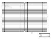
6675-S13<br />
6675-S15<br />
6675-S16<br />
6675-S17<br />
6675-S18<br />
6675-S19<br />
6675-S20<br />
6675-S<strong>21</strong><br />
6675-S22<br />
6675-S23<br />
6675-S24<br />
6675-S30<br />
6675-S<strong>31</strong><br />
6675-S48<br />
Drafting Equipment Set, <strong>Topographic</strong><br />
Battalion, Photomapping<br />
Company: For<br />
Map Revision, Compilation<br />
and Color Separation.<br />
Drafting and Duplication<br />
Equipment Set: For Small<br />
Sketches, Notes and Orders.<br />
Drafting Instrument Set:<br />
Field.<br />
Drafting Instrument Set:<br />
Office.<br />
Drafting Instrument Set:<br />
Pocket.<br />
Plotting Instrument Set,<br />
Stereoplotter Multiplex Control<br />
Booth.<br />
Plotting Instrument Set,<br />
Stereoplotter, Multiplex<br />
Drafting Unit.<br />
Plotting Instrument Set,<br />
Stereoplotter, Multiplex<br />
Laboratory.<br />
Plotting Instrument Set,<br />
Stereoplotter, Multiplex<br />
Plotting Booth.<br />
Plotting Instrument Repair<br />
Set, Stereoplotter, Projection:<br />
For Minor Mechanical<br />
Repairs.<br />
Plotting Instrument Repair<br />
Set, Stereoplotter, Projection:<br />
Supplementary.<br />
Sketching Set, Surveying:<br />
Military Field Sketching.<br />
Stereometer Set, Stereocomparagraph,Photogrammetric.<br />
Map Distribution Set: Portable.<br />
6675-S49 Map Distribution Set: Depot.<br />
7520-S01 Sign Painting Set.<br />
7610-S07 Book Set: <strong>Topographic</strong>, General<br />
Purpose.<br />
7610-S09 Book Set: <strong>Topographic</strong> Battalion,<br />
Photomapping Company.<br />
7610-S10 Book Set: <strong>Topographic</strong> ‘Battalion,<br />
Reproduction Company.<br />
10. Department of Commerce Publications<br />
a. U.S. Coast and Geodetic Survey Special<br />
Publications.<br />
No.<br />
8<br />
28<br />
68<br />
193<br />
200<br />
235<br />
241<br />
242<br />
b.<br />
580<br />
Tables and Formulas for the Computation<br />
of Geodetic Positions.<br />
Application of the Theory of Least<br />
Squares to the Adjustment of Triangulations.<br />
Elements of Map Projection.<br />
Manual of Plane Coordinate Computation.<br />
Formulas am-l Tables for the Computation<br />
of Geodetic Positions on the International<br />
Ellipsoid.<br />
State Coordinate System (Manual for<br />
Surveyors).<br />
Natural Tables for the Computation of<br />
Geodetic Positions.<br />
Definitions of Terms Used in Geodetic and<br />
Other Surveys.<br />
U.S. Coast and Geodetic Survey Serial.<br />
Control Surveys and Their Uses.<br />
11. Department of Interior Publications<br />
U.S. Geological Survey Bulletin<br />
<strong>Topographic</strong> Instructions: <strong>Symbols</strong> for standard<br />
topographic maps published at the scale of<br />
1:63,360 and larger, to be scribed at 1:24,000”<br />
and 1:48,000, dated May 1958.<br />
93