US Army - FM 21-31 - Topographic Symbols.pdf
US Army - FM 21-31 - Topographic Symbols.pdf
US Army - FM 21-31 - Topographic Symbols.pdf

You also want an ePaper? Increase the reach of your titles
YUMPU automatically turns print PDFs into web optimized ePapers that Google loves.
8. Scope<br />
This chapter illustrates and explains the<br />
topographic symbols used on military maps of<br />
all scales. The symbols are in general the same<br />
for all categories, but because of differences in<br />
use and scales, certain symbols are modified<br />
or omitted on medium- and small-scale maps.<br />
9. Drainage Features<br />
a. A perennial feature contains water during<br />
most of the year.<br />
CHAPTER 2<br />
TOPOGRAPHIC SYMBOLS<br />
b. An intermittent feature contains water<br />
during only part of the year. The shoreline of<br />
an intermittent lake or pond is represented as<br />
indefinite and approximate.<br />
c. A dry or cyclical feature or a wash is<br />
usually dry. The limits of such features are<br />
represented as indefinite.<br />
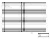
d. <strong>Symbols</strong>. The following pages contain the<br />
approved symbols for drainage features:<br />
5