

Development Contributions Plan - Growth Areas Authority
Development Contributions Plan - Growth Areas Authority
Development Contributions Plan - Growth Areas Authority

Create successful ePaper yourself
Turn your PDF publications into a flip-book with our unique Google optimized e-Paper software.
OAD<br />
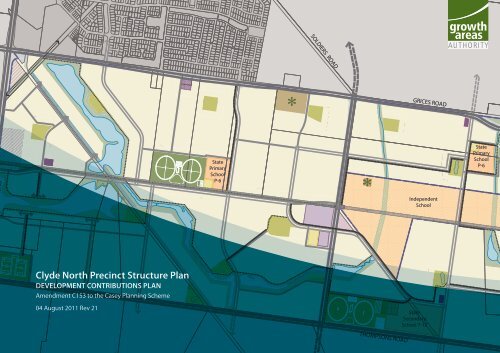
Clyde North Precinct Structure <strong>Plan</strong><br />
DEVELOPMENT CONTRIBUTIONS PLAN<br />
Amendment C153 to the Casey <strong>Plan</strong>ning Scheme<br />
04 August 2011 Rev 21<br />
State<br />
Primary<br />
School<br />
P-6<br />
SOLDIERS ROAD<br />
THOMPSONS ROAD<br />
GRICES ROAD<br />
Independent<br />
School<br />
State<br />
Secondary<br />
School 7-12<br />
State<br />
Primary<br />
School<br />
P-6
2<br />
CLYDE NORTH PSP DEVELOPMENT CONTRIBUTIONS PLAN<br />
This page has been intentionally left blank
CONTENTS<br />
1.0 PART 1: STRATEGIC BASIS 7<br />
1.1 PLANNING AND ENVIRONMENT ACT 1987 7<br />
1.2 PRECINCT STRUCTURE PLAN 9<br />
1.3 THE AREA TO WHICH THE DEVELOPMENT CONTRIBUTIONS<br />
PLAN APPLIES 9<br />
1.4 INFRASTRUCTURE PROJECT JUSTIFICATION 11<br />
1.4.1 Introduction 11<br />
1.4.2 Items not included in the <strong>Development</strong> <strong>Contributions</strong> <strong>Plan</strong> 11<br />
1.5 INFRASTRUCTURE PROJECTS 13<br />
1.5.1 Transport 13<br />
1.5.2 Community Facilities 15<br />
1.5.3 Unencumbered Local Passive Open Space 17<br />
1.5.4 Active Recreation 17<br />
1.5.5 Strategic <strong>Plan</strong>ning 17<br />
1.5.6 Project Timing 17<br />
1.5.7 Distinction between Community and <strong>Development</strong><br />
Infrastructure 17<br />
2.0 PART 2: CALCULATION OF CONTRIBUTIONS 19<br />
2.1 CALCULATION OF NET DEVELOPABLE AREA AND<br />
DEMAND UNITS 19<br />
2.1.1 Introduction 19<br />
2.1.2 Net Developable Area 19<br />
2.1.3 Land Budget and Demand Units 19<br />
2.1.4 <strong>Development</strong> and Population Projections 19<br />
2.2 CALCULATION OF CONTRIBUTION CHARGES 21<br />
2.2.1 Calculation of Costs 21<br />
2.2.2 External Use 21<br />
2.2.3 Cost Apportionment 21<br />
2.2.4 Main Catchment <strong>Areas</strong> 21<br />
CLYDE NORTH PSP DEVELOPMENT CONTRIBUTIONS PLAN<br />
3.0 PART 3: ADMINISTRATION AND IMPLEMENTATION32<br />
3.1 ADMINISTRATION OF THE DEVELOPMENT CONTRIBUTIONS<br />
PLAN 32<br />
3.1.1 Payment of Contribution Levies and Timing 32<br />
3.1.2 Cost of the Preparation of the PSP 32<br />
3.1.3 Works in kind 32<br />
3.1.4 Credit for over provision 33<br />
3.1.5 Funds Administration 33<br />
3.1.6 Construction and Land Value Costs and Indexation 33<br />
3.1.7 <strong>Development</strong> <strong>Contributions</strong> <strong>Plan</strong> Review Period 34<br />
3.1.8 Collecting Agency<br />
(Agency responsible for collecting infrastructure levy) 34<br />
3.1.9 <strong>Development</strong> Agency<br />
(Agency Responsible for Works) 34<br />
3.2 IMPLEMENTATION STRATEGY 34<br />
3.2.1 Rationale for the Implementation Strategy 34<br />
3.2.2 Implementation mechanism 34<br />
4.0 PART 4: OTHER INFORMATION 35<br />
4.1 ACRONYMS 35<br />
4.2 GLOSSARY 35<br />
4.3 SUPPORTING INFORMATION 36<br />
5.0 PART 5: PROJECT DETAILS 37<br />
5.1 TRANSPORT PROJECTS 37<br />
5.2 COMMUNITY FACILITIES PROJECTS 51<br />
5.3 ACTIVE RECREATION PROJECTS 55<br />
PLANS<br />
<strong>Plan</strong> 1: growth area framework 6<br />
<strong>Plan</strong> 2: future urban structure 8<br />
<strong>Plan</strong> 3: <strong>Development</strong> <strong>Contributions</strong> plan 10<br />
<strong>Plan</strong> 4: Road and Transport Projects 12<br />
<strong>Plan</strong> 5: Community Projects 14<br />
<strong>Plan</strong> 6: Open Space Projects 16<br />
<strong>Plan</strong> 7: Land use Budget 18<br />
TABLES<br />
Table 1: Summary Land Use Budget 20<br />
Table 2: Property specific land use budget 22<br />
Table 3: Overall Housing Yields Summary 23<br />
Table 4: Overall Housing Yield Details 23<br />
Table 5: Infrastructure project justification 24<br />
Table 6: Calculation of Costs 27<br />
Table 7: Schedule of Costs 30<br />
Contents 3
4<br />
CLYDE NORTH PSP DEVELOPMENT CONTRIBUTIONS PLAN<br />
This page has been intentionally left blank
INTRODUCTION<br />
The Clyde North Precinct Structure <strong>Plan</strong> <strong>Development</strong> <strong>Contributions</strong><br />
<strong>Plan</strong> has been prepared by the <strong>Growth</strong> <strong>Areas</strong> <strong>Authority</strong> with the<br />
assistance of the Casey City Council, Government agencies, service<br />
authorities and major stakeholders.<br />
The <strong>Development</strong> <strong>Contributions</strong> <strong>Plan</strong> has been developed to support<br />
the provision of works, services, and facilities to be used by the future<br />
community of Clyde North which is generally covered by the Clyde<br />
North Precinct Structure <strong>Plan</strong> in the Casey-Cardinia <strong>Growth</strong> Area (refer<br />
to <strong>Plan</strong> 1 for location).<br />
The <strong>Development</strong> <strong>Contributions</strong> <strong>Plan</strong> outlines projects required to<br />
ensure that future residents, visitors and workers within the Clyde<br />
North area can be provided with timely access to services and transport<br />
necessary to support a quality, affordable lifestyle.<br />
It also details requirements that must be met by future land use<br />
and development and provides developers, investors and local<br />
communities with certainty about development contribution<br />
requirements and how they will be administered.<br />
This <strong>Development</strong> <strong>Contributions</strong> <strong>Plan</strong> establishes a framework for<br />
development proponents to contribute a fair proportion towards<br />
the cost of works, services and facilities for the new community at<br />
Clyde North. It ensures the cost of providing new infrastructure and<br />
services is shared equitably between various developers and the wider<br />
community. Fairness requires costs to be apportioned according to the<br />
projected share of use and the required works, services and facilities<br />
items.<br />
PART ONE<br />
CLYDE NORTH PSP DEVELOPMENT CONTRIBUTIONS PLAN<br />
<strong>Development</strong> <strong>Contributions</strong> <strong>Plan</strong> Structure<br />
The <strong>Development</strong> <strong>Contributions</strong> <strong>Plan</strong> document comprises three parts.<br />
Part 1 clearly explains the strategic basis for the<br />
<strong>Development</strong> <strong>Contributions</strong> <strong>Plan</strong>, which includes<br />
information about the Clyde North Precinct Structure <strong>Plan</strong><br />
and justification for the various infrastructure projects<br />
included in the <strong>Development</strong> <strong>Contributions</strong> <strong>Plan</strong>.<br />
PART TWO<br />
Part 2 sets out how the development contributions are<br />
calculated and costs apportioned.<br />
PART THREE<br />
Part 3 focuses on the administrative and implementation of<br />
the <strong>Development</strong> <strong>Contributions</strong> <strong>Plan</strong><br />
Introduction<br />
5
Land Use<br />
Urban <strong>Growth</strong> Boundary<br />
Existing Urban Area<br />
Employment - Existing<br />
Urban Land Supply<br />
Mixed Use Employment - Proposed<br />
Strategic <strong>Development</strong> Area<br />
Clyde North DCP Boundary<br />
Proposed UGZ<br />
Strategic Road Network<br />
Freeway<br />
Arterial Road<br />
Principal Public Transport Network (PPTN)<br />
Rail Line<br />
Station - Existing or Committed<br />
Rail<br />
PPTN Bus Route<br />
Activity Centre Existing<br />
Neighbourhood (Large)<br />
Major<br />
Principal<br />
Environment<br />
Regional Open Space<br />
Potential Environmental Sensitivity<br />
(Subject to further investigation)<br />
Other Waterway<br />
Metropolitan Trail Network<br />
(Existing and proposed)<br />
Part 1 – Strategic Basis<br />
6<br />
CLYDE NORTH PSP DEVELOPMENT CONTRIBUTIONS PLAN<br />
Police<br />
Police<br />
Paddocks Paddocks Paddocks Paddocks Paddocks Paddocks Paddocks<br />
Reserve Reserve Reserve Reserve Reserve Reserve Reserve<br />
Heatherton Rd<br />
Eumemmerring Eumemmerring Eumemmerring Eumemmerring Eumemmerring Eumemmerring Eumemmerring Creek<br />
Creek<br />
Parklands Parklands Parklands Parklands Parklands Parklands<br />
Parklands<br />
Princes Hwy<br />
Endeavour Endeavour Endeavour Endeavour Endeavour Endeavour Endeavour Hills<br />
Hills<br />
Lyndhurst Lyndhurst Lyndhurst Lyndhurst Lyndhurst Lyndhurst Lyndhurst<br />
Lynbrook Lynbrook Lynbrook Lynbrook Lynbrook Lynbrook Lynbrook<br />
Rodds Drain<br />
KM KM KM KM KM KM KM Reedy Reedy Reedy Reedy Reedy Reedy Reedy Reedy Reedy Reserve Reserve Reserve Reserve Reserve Reserve Reserve Reserve Reserve<br />
Merinda Merinda Merinda Merinda Merinda Merinda Merinda<br />
Park<br />
Park<br />
Hallam Hallam Hallam Hallam Hallam Hallam Hallam<br />
Gippsland Hwy<br />
Cranbourne<br />
Cranbourne<br />
Cranbourne<br />
Cranbourne<br />
Cranbourne<br />
Cranbourne<br />
Cranbourne<br />
Western Port Hwy PrincesFwy<br />
Hall Rd<br />
Hallam Rd<br />
South<br />
Eumemmerring Creek<br />
Troups Creek<br />
Hampton Hampton Hampton Hampton Hampton Hampton Hampton Park<br />
Park<br />
Cranbourne<br />
Cranbourne<br />
Cranbourne<br />
Cranbourne<br />
Cranbourne<br />
Cranbourne<br />
Cranbourne<br />
Cranbourne<br />
Cranbourne<br />
Cranbourne<br />
Cranbourne<br />
Cranbourne<br />
Cranbourne<br />
Cranbourne<br />
Recreation Recreation Recreation Recreation Recreation Recreation Recreation<br />
Reserve Reserve Reserve Reserve Reserve Reserve Reserve<br />
Royal Royal Botanic Botanic Botanic Botanic Botanic Botanic Botanic Gardens Gardens Gardens Gardens Gardens Gardens Gardens<br />
Cranbourne<br />
Cranbourne<br />
Cranbourne<br />
Cranbourne<br />
Cranbourne<br />
Cranbourne<br />
Cranbourne<br />
Lysterfield Lysterfield Lysterfield Lysterfield Lysterfield Lysterfield Lysterfield Park<br />
Park<br />
West Branch<br />
RivergumCreek<br />
Narre Narre Warren Warren Warren Warren Warren Warren Warren<br />
Narre Warren - Cranbourne Rd<br />
Hallam Valley<br />
Ray<br />
Ray<br />
Bastin<br />
Bastin<br />
Reserve Reserve Reserve Reserve Reserve Reserve Reserve<br />
Drain<br />
Narre Warren North Rd<br />
Casey Casey Casey Casey Casey Casey Casey Central Central Central Central Central Central Central<br />
Thompsons Rd<br />
Ti-Tree<br />
Fountain Fountain Fountain Fountain Fountain Fountain Fountain Gate Gate -<br />
-<br />
Narre Narre Narre Narre Narre Narre Narre Warren Warren Warren Warren Warren Warren Warren<br />
Creek<br />
Casey<br />
Casey<br />
Fields<br />
Fields<br />
Linsell Blvd<br />
Sweeney Sweeney Sweeney Sweeney Sweeney Sweeney Sweeney<br />
Reserve Reserve Reserve Reserve Reserve Reserve Reserve<br />
Clyde Rd<br />
Wilson Wilson Wilson Wilson Wilson Wilson Wilson<br />
Botanic Botanic Botanic Botanic Botanic Botanic Botanic<br />
Park<br />
Park<br />
Berwick Berwick Berwick Berwick Berwick Berwick Berwick<br />
Glasscocks Rd<br />
Berwick Berwick Berwick Berwick Berwick Berwick Berwick<br />
Cardinia Cardinia Cardinia Cardinia Cardinia Cardinia Cardinia Creek<br />
Creek<br />
Regional Regional Regional Regional Regional Regional Regional Park<br />
Park<br />
Edwin Edwin Flack<br />
Flack<br />
Reserve Reserve Reserve Reserve Reserve Reserve Reserve<br />
Beaconsfield<br />
Beaconsfield<br />
Beaconsfield<br />
Beaconsfield<br />
Beaconsfield<br />
Beaconsfield<br />
Beaconsfield<br />
C21<br />
C21<br />
Business Business Business Business Business Business Business<br />
Park<br />
Park<br />
Cardinia Creek<br />
Cardinia<br />
Creek<br />
Princes Hwy<br />
Beaconsfield<br />
Beaconsfield<br />
Beaconsfield<br />
Beaconsfield<br />
Beaconsfield<br />
Beaconsfield<br />
Beaconsfield<br />
Reservoir Reservoir Reservoir Reservoir Reservoir Reservoir Reservoir<br />
Officer Officer Officer Officer Officer Officer Officer<br />
Officer<br />
Officer<br />
Princes Fwy<br />
Lower Gum Scrub Creek<br />
Cardinia Cardinia Cardinia Cardinia Cardinia Cardinia Cardinia Road<br />
Road<br />
Cardinia Rd<br />
Koo Koo Wee Wee Rup Rup Swamp Swamp Swamp Swamp Swamp Swamp<br />
Packenham<br />
Packenham<br />
Packenham<br />
Packenham<br />
Packenham<br />
Packenham<br />
Packenham<br />
Recreation Recreation Recreation Recreation Recreation Recreation Recreation<br />
Reserve Reserve Reserve Reserve Reserve Reserve Reserve<br />
Toomuc Creek<br />
Pakenham<br />
Pakenham Rd<br />
Pakenham<br />
Pakenham<br />
Pakenham<br />
Pakenham<br />
Pakenham<br />
Pakenham<br />
Pakenham<br />
Pakenham Pakenham Pakenham Pakenham Pakenham Pakenham Pakenham<br />
Bypass<br />
clyde north development contributions plan<br />
Koo Wee Rup Rd<br />
Upper Deep Creek<br />
plan 1<br />
growth area framework
1.0 PART 1: STRATEGIC BASIS<br />
The strategic basis for this <strong>Development</strong> <strong>Contributions</strong> <strong>Plan</strong> is<br />
established by the State and Local <strong>Plan</strong>ning Policy Framework<br />
of the Casey <strong>Plan</strong>ning Scheme. Key documents are Melbourne<br />
2030, the <strong>Growth</strong> Area Framework <strong>Plan</strong>s, the Municipal Strategic<br />
Statement and the Clyde North Precinct Structure <strong>Plan</strong> (and<br />
supporting documents), which set out a broad, long term<br />
vision for the sustainable development of the <strong>Development</strong><br />
<strong>Contributions</strong> <strong>Plan</strong> area.<br />
The <strong>Growth</strong> Area Framework <strong>Plan</strong>s, September 2006, have<br />
been incorporated into the Victoria <strong>Plan</strong>ning Provisions and<br />
illustrate the planned extent of residential, employment and<br />
other development as well as the location of larger activity<br />
centres for each growth area. They also include key elements of<br />
infrastructure and services including the regional open space<br />
network, the location of public transport networks, freeways and<br />
arterial roads.<br />
The Clyde North Precinct Structure <strong>Plan</strong> has been developed<br />
following a comprehensive planning process and provides<br />
a greater level of detail to guide the preparation of the<br />
<strong>Development</strong> <strong>Contributions</strong> <strong>Plan</strong>.<br />
CLYDE NORTH PSP DEVELOPMENT CONTRIBUTIONS PLAN<br />
1.1 PLANNING AND ENVIRONMENT ACT 1987<br />
This <strong>Development</strong> <strong>Contributions</strong> <strong>Plan</strong> has been prepared in<br />
accordance with Part 3B of the <strong>Plan</strong>ning and Environment Act<br />
1987 (the Act) and has been developed in line with the State and<br />
Local <strong>Plan</strong>ning Policy Frameworks of the Casey <strong>Plan</strong>ning Scheme<br />
as well as Victorian Government Guidelines.<br />
The <strong>Development</strong> <strong>Contributions</strong> <strong>Plan</strong> provides for the charging<br />
of a ‘development infrastructure levy’ pursuant to Section 46J(a)<br />
of the Act towards works, services or facilities. It also provides<br />
for the charging of a ‘community infrastructure levy’ pursuant<br />
to Section 46J(b) of the Act as some items are classified as<br />
community infrastructure under the Act.<br />
This <strong>Development</strong> <strong>Contributions</strong> <strong>Plan</strong> forms part of the Casey<br />
<strong>Plan</strong>ning Scheme pursuant to Section 46I of the Act, and is an<br />
incorporated document under Clause 81 of the Casey <strong>Plan</strong>ning<br />
Scheme.<br />
The <strong>Development</strong> <strong>Contributions</strong> <strong>Plan</strong> is linked to Schedule 12<br />
of the <strong>Development</strong> <strong>Contributions</strong> <strong>Plan</strong> Overlay in the Casey<br />
<strong>Plan</strong>ning Scheme.<br />
7<br />
Part 1 – Strategic Basis 7
Precinct Structure <strong>Plan</strong> Area<br />
GRICES ROAD<br />
Conventional Residential<br />
Potential Commercial & Employment<br />
Local Town Centre (NAC) - Medium<br />
Local Town Centre (NAC) - Small<br />
Local Centre<br />
Employment<br />
Community Facilities<br />
State School<br />
Non-Government Education Facility<br />
(subject to permit)<br />
Part 1 – Strategic Basis<br />
8<br />
CLYDE NORTH PSP DEVELOPMENT CONTRIBUTIONS PLAN<br />
BERWICK-CRANBOURNE ROAD<br />
Unencumbered Active Open Space<br />
Unencumbered Passive Open Space<br />
Encumbered Open Space<br />
Flow Path Through School<br />
Indoor Centre<br />
Cardinia Creek Conservation Corridor<br />
Arterial Road<br />
Additional Land for Arterial Roads<br />
Connector Street<br />
Access Street<br />
Potential Future Road Alignment<br />
(to be determined)<br />
Shared Path (within open space)<br />
Shared Path (within widened road reserve)<br />
Major Gas Easement<br />
Desalination Pipeline<br />
Heritage Site<br />
Waterbodies<br />
Native Vegetation (to be retained)<br />
Gasnet Property<br />
Future Urban Area<br />
Existing Urban Area<br />
State<br />
Primary<br />
School<br />
P-6<br />
SOLDIERS ROAD<br />
THOMPSONS ROAD<br />
GRICES ROAD<br />
Independent<br />
School<br />
State<br />
Secondary<br />
School 7-12<br />
State<br />
Primary<br />
School<br />
P-6<br />
CARDININA<br />
CREEK<br />
plan 2<br />
future urban structure<br />
clyde north development contributions plan<br />
Scale: 1:15000m @ A3<br />
1:7500 m @ A1<br />
Date: 29 July 2011<br />
Revision: DCP 09<br />
0 150 300 450m
1.2 PRECINCT STRUCTURE PLAN<br />
The Clyde North Precinct Structure <strong>Plan</strong> is located to the southeast<br />
of Berwick in the outer south-east region of Melbourne.<br />
The Clyde North Precinct Structure <strong>Plan</strong> area is expected to:<br />
• Provide for a population of approximately 18,500people.<br />
• Deliver approximately 6,600 households.<br />
The Precinct Structure <strong>Plan</strong> establishes the future urban structure<br />
of the new community which includes a range of networks<br />
including transport, open space and active recreation, social<br />
infrastructure, activity centres, and residential neighbourhoods<br />
(refer to <strong>Plan</strong> 2).<br />
The need for the infrastructure has been determined according<br />
to the anticipated development scenario for Clyde North as<br />
described in the Clyde North Precinct Structure <strong>Plan</strong>. The<br />
<strong>Development</strong> <strong>Contributions</strong> <strong>Plan</strong> emanates from the Precinct<br />
Structure <strong>Plan</strong>, as the Precinct Structure <strong>Plan</strong> provides the<br />
rationale and justification for infrastructure items that have<br />
been included within the <strong>Development</strong> <strong>Contributions</strong> <strong>Plan</strong>.<br />
Accordingly, the <strong>Development</strong> <strong>Contributions</strong> <strong>Plan</strong> is an<br />
implementation based planning tool which identifies the<br />
infrastructure items required by the new community and<br />
apportions the cost of this infrastructure in an equitable manner<br />
across the plan area.<br />
CLYDE NORTH PSP DEVELOPMENT CONTRIBUTIONS PLAN<br />
1.3 THE AREA TO WHICH THE DEVELOPMENT<br />
CONTRIBUTIONS PLAN APPLIES<br />
In accordance with Section 46K(1)(a) of the <strong>Plan</strong>ning and<br />
Environment Act 1987, the Clyde North <strong>Development</strong><br />
<strong>Contributions</strong> <strong>Plan</strong> applies to land shown in <strong>Plan</strong> 3. The area is<br />
also indicated in the relevant <strong>Development</strong> <strong>Contributions</strong> <strong>Plan</strong><br />
Overlay in the Casey <strong>Plan</strong>ning Scheme (Schedule 12).<br />
The <strong>Development</strong> <strong>Contributions</strong> <strong>Plan</strong> applies to approximately<br />
612 hectares of land as shown in <strong>Plan</strong> 3.<br />
The <strong>Development</strong> <strong>Contributions</strong> <strong>Plan</strong> forms a single catchment<br />
area as shown in <strong>Plan</strong> 3, consistent with the Clyde North<br />
Precinct Structure <strong>Plan</strong>.<br />
9<br />
Part 1 – Strategic Basis 9
10<br />
GRICES ROAD<br />
DCP Area<br />
Existing Road<br />
Charge Area<br />
CLYDE NORTH PSP DEVELOPMENT CONTRIBUTIONS PLAN<br />
Part 1 – Strategic Basis<br />
BERWICK-CRANBOURNE ROAD<br />
SOLDIERS ROAD<br />
THOMPSONS ROAD<br />
GRICES ROAD<br />
CARDININA<br />
CREEK<br />
plan 3<br />
development contributions plan<br />
clyde north development contributions plan<br />
Scale: 1:15000m @ A3<br />
1:7500 m @ A1<br />
Date: 21 July 2011<br />
Revision.: PSP 08<br />
0 150 300 450m
1.4 INFRASTRUCTURE PROJECT JUSTIFICATION<br />
1.4.1 Introduction<br />
The need for infrastructure has been determined according<br />
to the anticipated development scenario for Clyde North as<br />
described in the Clyde North Precinct Structure <strong>Plan</strong> and its<br />
supporting documents.<br />
Items can be included in a <strong>Development</strong> <strong>Contributions</strong> <strong>Plan</strong><br />
if they will be used by the future community of an area. New<br />
development does not have to trigger the need for new<br />
items in its own right. The development is charged in line<br />
with its projected share of use. An item can be included in a<br />
<strong>Development</strong> <strong>Contributions</strong> <strong>Plan</strong> regardless of whether it is<br />
within or outside the <strong>Development</strong> <strong>Contributions</strong> <strong>Plan</strong> area.<br />
In selecting items, consideration has been given to ensure they<br />
are not already wholly funded through another contribution<br />
mechanism, such as a mandatory infrastructure construction<br />
requirement of the Clyde North Precinct Structure <strong>Plan</strong>, an<br />
existing local development contributions plan, an agreement<br />
under Section 173 of the Act or as a condition on an existing<br />
planning permit.<br />
Before inclusion in this <strong>Development</strong> <strong>Contributions</strong> <strong>Plan</strong>, all<br />
items have been assessed to ensure they have a relationship or<br />
nexus to proposed development in the Clyde North Precinct<br />
Structure <strong>Plan</strong> area. The cost apportionment methodology<br />
adopted in this <strong>Development</strong> <strong>Contributions</strong> <strong>Plan</strong> relies on the<br />
nexus principle. A new development is deemed to have a<br />
nexus with an item if it is expected to make use of that item.<br />
A summary of how each item relates to projected growth<br />
area development is set out below and individual item use<br />
catchments are identified in Table 5.<br />
The items that have been included in the <strong>Development</strong><br />
<strong>Contributions</strong> <strong>Plan</strong> all have the following characteristics:<br />
• They are essential to the health, safety and well-being of<br />
the community;<br />
• They will be used by a broad cross-section of the<br />
community;<br />
• They reflect the vision and strategic aspirations as<br />
expressed in the Clyde North Precinct Structure <strong>Plan</strong>; and,<br />
• They are not recurrent items.<br />
CLYDE NORTH PSP DEVELOPMENT CONTRIBUTIONS PLAN<br />
1.4.2 Items not included in the <strong>Development</strong><br />
<strong>Contributions</strong> <strong>Plan</strong><br />
The following items are not included in the <strong>Development</strong><br />
<strong>Contributions</strong> <strong>Plan</strong>, as they are not considered to be higher<br />
order items, but must be provided by developers as a matter of<br />
course:<br />
• Internal streets and connector streets, and associated<br />
traffic management measures. This includes streets on<br />
the edge of the Clyde North Precinct Structure <strong>Plan</strong>.<br />
• Flood mitigation works;<br />
• Local drainage systems;<br />
• Main drainage works;<br />
• Intersections connecting the development to the existing<br />
road network, except where specified as <strong>Development</strong><br />
Contribution <strong>Plan</strong> projects;<br />
• Water, sewerage, underground power, gas, and<br />
telecommunication services;<br />
• Local pathways and connections to the regional and/or<br />
district pathway network;<br />
• Basic leveling, water tapping and landscaping of open<br />
space;<br />
• Passive open space reserve masterplans and any agreed<br />
associated works required by the Precinct Structure <strong>Plan</strong>;<br />
• Council’s plan checking and supervision costs; and,<br />
• Bus stops.<br />
Table 3– Infrastructure Project Justification provides an<br />
explanation of all projects in the <strong>Development</strong> <strong>Contributions</strong><br />
<strong>Plan</strong>.<br />
11<br />
Part 1 – Strategic Basis 11
12<br />
Construction<br />
Land<br />
4 way Intersection<br />
Intersection Flaring<br />
CLYDE NORTH PSP DEVELOPMENT CONTRIBUTIONS PLAN<br />
GRICES ROAD<br />
RD15<br />
RD12<br />
Part 1 – Strategic Basis<br />
BERWICK-CRANBOURNE ROAD<br />
RD18<br />
RD13<br />
RD14<br />
RD07<br />
RD19<br />
RD02<br />
RD05<br />
RD20<br />
RD08<br />
SOLDIERS ROAD<br />
RD01<br />
RD21<br />
RD04<br />
RD10<br />
RD09<br />
RD11<br />
THOMPSONS ROAD<br />
GRICES ROAD<br />
RD06<br />
RD16<br />
RD03<br />
RD17<br />
CARDININA<br />
CREEK<br />
plan plan 4<br />
road and & transport projects<br />
clyde north development contributions plan plan<br />
Scale: 1:15000m @ A3<br />
1:7500 m @ A1<br />
Date: 21 July 2011<br />
Revision.: PSP 08<br />
0 150 300 450m
1.5 INFRASTRUCTURE PROJECTS<br />
1.5.1 Transport<br />
The Transport related projects in the <strong>Development</strong> <strong>Contributions</strong><br />
<strong>Plan</strong> are based on the transport network depicted in <strong>Plan</strong> 4 which<br />
is derived from the Clyde North Precinct Structure <strong>Plan</strong> Transport<br />
Assessment Report (GTA Consultants, May 2011). The transport<br />
projects comprise two categories:<br />
• Road construction and duplication including land<br />
requirements; and,<br />
• Construction of major controlled intersections.<br />
The transport plan was prepared taking into account the<br />
requirements and objectives of the Clyde North Precinct<br />
Structure <strong>Plan</strong>.<br />
The road and intersection projects funded by the <strong>Development</strong><br />
<strong>Contributions</strong> <strong>Plan</strong> include:<br />
DCP Project<br />
number<br />
CLYDE NORTH PSP DEVELOPMENT CONTRIBUTIONS PLAN<br />
Project Description<br />
RD01 North-South Arterial – Land to achieve a 41 metre road reserve. Total land required is 7.69 hectares.<br />
RD02 Grices Road (West) – Land required to achieve a 34 metre road reserve (including a 31 metre narrowing point at the<br />
heritage site) between Berwick Cranbourne Road and the North-South Arterial. Total land required is 4.91 hectares.<br />
RD03 Grices Road (East) – Land required for the construction of a 34 metre road reserve between the North –South Arterial<br />
and Cardinia Creek. Total land required is 5.848 ha.<br />
RD04 North-South Arterial – Construction of road, 2 lanes urban standard. Includes the construction of one culvert.<br />
RD05 Grices Road (West) – Construction of Grices Road between Viewgrand Drive and the North-South Arterial, 2 lanes urban<br />
standard, including connections to the northern service road and pedestrian crossing point.<br />
RD06 Grices Road (East) Construction of Grices Road between North-South Arterial and the Eastern Connector Road, 2 lanes<br />
urban standard.<br />
RD07 Grices Road West, Western Connector Road – Signalised Intersection 1. Construction.<br />
RD08 Grices Road West, Eastern Connector Road – Signalised Intersection 2. Construction.<br />
RD09 Grices Road/North South Arterial - Construction of roundabout.<br />
RD10 North-South Arterial/Local Town Centre (Medium) – Signalised Intersection 3. Construction.<br />
RD11 North-South Arterial and East-West Connector - Signalised Intersection 4. Construction<br />
RD12 East-West Collector - Mid Block Berwick-Cranbourne Road - Signalised Intersection 5. Construction<br />
RD13 Thompsons Road - Berwick-Cranborne Road to Soldiers Road. Construction to 2 lanes .<br />
RD14 Grices Road (West) Duplication from Berwick-Cranbourne Road to Viewgrand Drive, 4 lanes urban standard.<br />
RD15 Land for additional lane at Berwick-Cranbourne Road and Thompsons Road roundabout.<br />
RD16 North-South Collector Road - Land for Hillcrest Christian College collector road<br />
RD17 North-South Collector Road - Construction of Hillcrest Christian College collector road<br />
RD18 Berwick-Cranbourne Road, Grices Road - Signalised Intersection 6. Construction<br />
RD19 Intersection flaring 0.2ha<br />
RD20 Intersection flaring 0.2ha<br />
RD21 Intersection flaring 0.2ha<br />
13<br />
Part 1 – Strategic Basis 13
14<br />
CLYDE NORTH PSP DEVELOPMENT CONTRIBUTIONS PLAN<br />
GRICES ROAD<br />
Part 1 – Strategic Basis<br />
BERWICK-CRANBOURNE ROAD<br />
Cl03 & Cl04<br />
Community Centre 2<br />
Triple Kindergarten<br />
Maternal and Child Health (Short term)<br />
SOLDIERS ROAD<br />
Cl01 & Cl02<br />
Community Centre 1<br />
Public Hall<br />
Consulting Rooms<br />
Adult Education<br />
Maternal and Child Health<br />
THOMPSONS ROAD<br />
GRICES ROAD<br />
CARDININA<br />
CREEK<br />
Cl05 & Cl06<br />
Community Centre 3<br />
Triple Kindergarten<br />
plan 5<br />
community projects<br />
clyde north development contributions plan<br />
Scale: 1:15000m @ A3<br />
1:7500 m @ A1<br />
Date: 21 July 2011<br />
Revision.: PSP 08<br />
0 150 300 450m
1.5.2 Community Facilities<br />
The Community Infrastructure Assessment undertaken by ASR<br />
Research and assessment by Casey City Council determined<br />
the requirement for a range of community facilities which are<br />
illustrated in <strong>Plan</strong> 5.<br />
The community facility projects funded by the <strong>Development</strong><br />
<strong>Contributions</strong> <strong>Plan</strong> include:<br />
DCP Project number Project Description<br />
CI01 Community Centre 1 – Local Town Centre (Medium). Land required is 0.8 hectares.<br />
CI02 Community Centre 1 – Local Town Centre (Medium). Construction of public hall, community rooms, maternal and<br />
child health, and NGO rooms (adult education).<br />
CI03 Community Centre 2 – Western Area (co-located with school). Land required is 0.4 hectares.<br />
CI04 Community Centre 2 – Western Area (co-located with school). Construction of centre to include triple kindergarten<br />
and maternal and child health (interim only - to be relocated to Community Centre 1 in the long term).<br />
CI05 Community Centre 3 – Eastern Area (co-located with school). Land required is 0.4 hectares.<br />
CI06 Community Centre 3 – Eastern Area (co-located with school). Construction of centre to include triple kindergarten.<br />
CLYDE NORTH PSP DEVELOPMENT CONTRIBUTIONS PLAN<br />
15<br />
Part 1 – Strategic Basis 15
AR07, OS04<br />
Active Playing Fields 3<br />
3 Soccer Pitches<br />
Pavilion<br />
16<br />
CLYDE NORTH PSP DEVELOPMENT CONTRIBUTIONS PLAN<br />
GRICES ROAD<br />
Part 1 – Strategic Basis<br />
BERWICK-CRANBOURNE ROAD<br />
AR05, AR06 & OS03<br />
Active Playing Fields 3<br />
2 Football/Cricket Ovals<br />
Cricket nets<br />
2 Netball courts<br />
Pavilion<br />
SOLDIERS ROAD<br />
THOMPSONS ROAD<br />
GRICES ROAD<br />
AR03, AR04 & OS02<br />
Active Playing Fields 2<br />
2 Cricket/football Ovals<br />
Cricket nets<br />
6 Tennis courts<br />
2 Netball Courts<br />
Pavilion<br />
CARDININA<br />
CREEK<br />
AR07<br />
Indoor Recreation Centre<br />
AR01, AR02 & OS01<br />
Active Playing Fields<br />
1 Football/Cricket Oval<br />
Cricket nets<br />
2 Netball courts<br />
Pavilion<br />
plan plan 6<br />
open open space projects<br />
clyde north development contributions plan<br />
Scale: 1:15000m @ A3<br />
1:7500 m @ A1<br />
Date: 21 July 2011<br />
Revision.: PSP 08<br />
0 150 300 450m
1.5.3 Unencumbered Local Passive Open Space<br />
Pursuant to Clause 52.01 of the Casey <strong>Plan</strong>ning Scheme,<br />
subdivision is required to contribute to the provision of<br />
unencumbered local passive open space (neighbourhood parks).<br />
Land for active open space is included in the <strong>Development</strong><br />
<strong>Contributions</strong> <strong>Plan</strong> as shown in the table below.<br />
DCP Project<br />
number<br />
1.5.4 Active Recreation<br />
DCP Project<br />
number<br />
Project Description<br />
OS01 Land (5.251 ha) for Active Playing Fields 1 (Northeastern<br />
area) to accommodate construction of 1<br />
football/cricket oval, cricket nets, 2 netball courts and<br />
car park.<br />
OS02 Land (9.31ha) for Active Playing Fields 2 (Southeastern<br />
area) to accommodate construction of 2<br />
football/cricket ovals, cricket nets, 6 tennis courts, 2<br />
netball courts and car park. Includes land (part 0.4ha)<br />
required for indoor sporting complex.<br />
OS03 Land (8.22ha) for Active Playing Fields 3 (Western area)<br />
to accommodate construction of 2 football/cricket<br />
ovals, cricket nets, 2 netball courts and car park.<br />
OS04 Land (5.603 ha) for Active Playing Fields 4 (Southwestern<br />
area) to accommodate construction of 3<br />
soccer pitches, a pavillion and car park.<br />
As these projects are included in the <strong>Development</strong> <strong>Contributions</strong><br />
<strong>Plan</strong>, they do not form part of the contribution under Clause<br />
52.01.<br />
The analysis undertaken by ASR Research and Casey City Council<br />
determined a number of facilities required to be built on the<br />
various active open space areas to meet the needs of the future<br />
community, refer <strong>Plan</strong> 6.<br />
The active recreation projects funded by the <strong>Development</strong><br />
<strong>Contributions</strong> <strong>Plan</strong> include:<br />
Project Description<br />
AR01 Active Playing fields 1 – North-eastern area.<br />
Construction of 1 football/cricket oval, cricket nets, 2<br />
netball courts and car park.<br />
AR02 Pavilion 1 – North-eastern area. Construction of<br />
Pavilion to serve active playing fields 1 (football/<br />
cricket/netball).<br />
AR03 Active Playing fields 2 – South-eastern area.<br />
Construction of 2 football/cricket ovals, cricket nets, 6<br />
tennis courts, 2 netball courts and car park.<br />
DCP Project<br />
number<br />
CLYDE NORTH PSP DEVELOPMENT CONTRIBUTIONS PLAN<br />
Project Description<br />
AR04 Pavilion 2 - South-eastern area. Construction of<br />
Pavilion to serve active playing fields 2 (cricket/tennis/<br />
netball/football)<br />
AR05 Active Playing fields 3 – Western area. Construction of<br />
2 football/cricket ovals, cricket nets, 2 netball courts<br />
and car park.<br />
AR06 Pavilion 3 – Western area. Construction of Pavilion to<br />
serve active playing fields 3 (football/cricket/netball).<br />
AR07 Construction of Indoor sporting complex co-located<br />
with the secondary school.<br />
AR08 Active Playing Fields 4 - South western area.<br />
Construction of 3 soccer pitches and carpark.<br />
AR09 Pavilion 4 - South-western area. Construction of a<br />
Pavilion to serve active playing fields 4 (soccer).<br />
1.5.5 Strategic <strong>Plan</strong>ning<br />
Funding for the preparation of the Precinct Structure <strong>Plan</strong> and<br />
<strong>Development</strong> <strong>Contributions</strong> <strong>Plan</strong> was made available up front by<br />
major development proponents. The funding of $900,000 has<br />
been included in the <strong>Development</strong> <strong>Contributions</strong> <strong>Plan</strong> so that<br />
the burden of providing advance funding is shared equitably<br />
over the area benefiting from the project which is covered by<br />
this <strong>Development</strong> <strong>Contributions</strong> <strong>Plan</strong>.<br />
1.5.6 Project Timing<br />
Each item in the <strong>Development</strong> <strong>Contributions</strong> <strong>Plan</strong> has an<br />
assumed indicative provision trigger specified in Table 3. The<br />
timing of the provision of the items in this <strong>Development</strong><br />
<strong>Contributions</strong> <strong>Plan</strong> is consistent with information available at the<br />
time that the <strong>Development</strong> <strong>Contributions</strong> <strong>Plan</strong> was prepared.<br />
The <strong>Development</strong> Agency will monitor and assess the required<br />
timing for individual items and may seek an amendment to the<br />
Casey <strong>Plan</strong>ning Scheme to adjust indicative provision triggers as<br />
part of the 5 year review (or earlier if justified).<br />
While indicative provision triggers are provided these do not<br />
preclude the early provision of certain infrastructure to be<br />
constructed/provided by development proponents as works or<br />
land in-kind, if agreed to by the Collecting Agency.<br />
1.5.7 Distinction between Community and<br />
<strong>Development</strong> Infrastructure<br />
In accordance with the <strong>Plan</strong>ning and Environment Act 1987 and<br />
the Ministerial Direction on <strong>Development</strong> <strong>Contributions</strong>, the<br />
<strong>Development</strong> <strong>Contributions</strong> <strong>Plan</strong> makes a distinction between<br />
“development” and “community” infrastructure. The timing of<br />
payment of contributions is linked to the type of infrastructure in<br />
question.<br />
For community infrastructure, contributions are to be made<br />
by the home-builder at the time of building approval.<br />
<strong>Contributions</strong> relating to community infrastructure will be paid<br />
for at a “per dwelling” rate.<br />
The <strong>Plan</strong>ning and Environment Act 1987 stipulates that<br />
the amount that may be contributed under a community<br />
infrastructure levy is no more than $900 per dwelling. If the cap<br />
is ever increased and the increased amount is equal to or less<br />
than the amount required by the <strong>Development</strong> <strong>Contributions</strong><br />
<strong>Plan</strong>, this higher amount will be collected from the date a<br />
change to the cap is introduced.<br />
DCP Project<br />
number<br />
Project Description<br />
AR02 Pavilion 1 – North-eastern area. Construction of<br />
Pavilion to serve active playing fields 1 (football/<br />
cricket/netball).<br />
AR04 Pavilion 2 - South-eastern area. Construction of<br />
Pavilion to serve active playing fields 2 (football/<br />
cricket/tennis/netball).<br />
AR06 Pavilion 3 – Western area. Construction of<br />
Pavilion to serve active playing fields 3 (football/<br />
cricket/netball).<br />
AR07 Construction of Indoor sporting complex colocated<br />
with the secondary school.<br />
AR09 Pavilion 4 - South-western area. Construction of a<br />
Pavilion to serve active playing fields 4 (soccer).<br />
The following infrastructure projects are deemed to be<br />
community infrastructure:<br />
All other infrastructure projects are considered to be in the<br />
development infrastructure category. <strong>Contributions</strong> relating to<br />
development infrastructure are to be made by developers at the<br />
time of subdivision. If subdivision is not applicable, payments<br />
must be made prior to construction of works.<br />
17<br />
Part 1 – Strategic Basis 17
18<br />
CLYDE NORTH PSP DEVELOPMENT CONTRIBUTIONS PLAN<br />
GRICES ROAD<br />
Part 1 – Strategic Basis<br />
1<br />
Pound Road<br />
BERWICK-CRANBOURNE ROAD<br />
24<br />
25<br />
28<br />
27<br />
Arterial<br />
Road Widening<br />
2<br />
3<br />
4<br />
26<br />
26<br />
23<br />
22<br />
21<br />
4<br />
6<br />
5<br />
Pound Road<br />
20<br />
7<br />
8<br />
9<br />
State<br />
Primary<br />
School<br />
P-6<br />
10<br />
19<br />
11<br />
11<br />
SOLDIERS ROAD<br />
15<br />
Soldiers Road<br />
THOMPSONS ROAD<br />
GRICES ROAD<br />
Independent<br />
School<br />
State<br />
Secondary<br />
School 7-12<br />
13<br />
12<br />
18<br />
14<br />
State<br />
Primary<br />
School<br />
P-6<br />
CARDININA<br />
CREEK<br />
17 16<br />
Precinct Structure <strong>Plan</strong> Area<br />
Property Reference Number<br />
Conventional Residential<br />
Medium Density Residential (preferred indicative locations)<br />
High Density Residential (preferred indicative locations)<br />
Local Town Centre (NAC) - Medium<br />
Local Town Centre (NAC) - Small<br />
Local Centre<br />
Employment<br />
Community Facilities<br />
State Primary School (P6)<br />
Non-Government Education Facility (subject to permit)<br />
Gasnet Property<br />
Unencumbered Active Open Space/Playing Fields<br />
Unencumbered Passive Open Space<br />
Encumbered Open Space<br />
Cardinia Creek Conservation Corridor<br />
Desalination Reservation<br />
Flow Path Through School<br />
Conservation Open Space<br />
Heritage Land<br />
Indoor Centre<br />
Arterial Road<br />
Future Urban Area<br />
Existing Urban Area<br />
plan 7<br />
land use budget<br />
clyde north development contributions plan<br />
57<br />
Scale: 1:15000m @ A3<br />
1:7500 m @ A1<br />
Date: 21 July 2011<br />
Revision.: PSP 08<br />
0 150 300 450m
2.0 PART 2: CALCULATION OF CONTRIBUTIONS<br />
Part 1 sets out the strategic basis for this <strong>Development</strong><br />
<strong>Contributions</strong> <strong>Plan</strong> and identifies infrastructure items to be<br />
included in the <strong>Development</strong> <strong>Contributions</strong> <strong>Plan</strong>. Part 2 focuses<br />
on the calculation of contributions and apportionment of costs.<br />
The general cost apportionment method includes the following<br />
steps: -<br />
• Calculation of the net developable area and demand units<br />
(refer Tables 1 and 2);<br />
• Calculation of projects costs (refer Table 3);<br />
• Identification and allowance for external use (refer Table 4);<br />
• Cost apportionment (refer Table 4);<br />
• Calculation of service catchments (refer Table 4);<br />
• Identification of development types required to pay the<br />
levy (refer Table 6);<br />
• Summary of costs payable by development type and<br />
precinct for each infrastructure category (refer Table 5);<br />
and,<br />
• A charge per net developable hectare for all land included<br />
in the <strong>Development</strong> <strong>Contributions</strong> <strong>Plan</strong> (Table 4).<br />
CLYDE NORTH PSP DEVELOPMENT CONTRIBUTIONS PLAN<br />
2.1 CALCULATION OF NET DEVELOPABLE AREA<br />
AND DEMAND UNITS<br />
2.1.1 Introduction<br />
The following section sets out how Net Developable Area is<br />
calculated, provides a detailed land budget for every property<br />
within the Clyde North Precinct Structure <strong>Plan</strong> and outlines<br />
the residential and employment projection anticipated for the<br />
Precinct Structure <strong>Plan</strong> area.<br />
2.1.2 Net Developable Area<br />
In this <strong>Development</strong> <strong>Contributions</strong> <strong>Plan</strong>, all development<br />
infrastructure contributions are payable on the net developable<br />
land on any given development site.<br />
Residential development land will contribute to all items forming<br />
part of the <strong>Development</strong> <strong>Contributions</strong> <strong>Plan</strong>.<br />
Employment development land will contribute to the road,<br />
intersection and structure planning items of the <strong>Development</strong><br />
<strong>Contributions</strong> <strong>Plan</strong>.<br />
For the purposes of this <strong>Development</strong> <strong>Contributions</strong> <strong>Plan</strong>, Net<br />
Developable Area is defined as the total amount of land within<br />
the precinct that is made available for development of housing,<br />
employment, including lots, local streets and connector streets.<br />
It is the total precinct area minus community facilities,<br />
government schools, existing educational facilities, open space,<br />
encumbered land and arterial roads. Additional small local parks<br />
defined at the subdivision stage are included in Net Developable<br />
Area.<br />
The Net Developable Area (NDA) for the <strong>Development</strong><br />
<strong>Contributions</strong> <strong>Plan</strong> (DCP) has been calculated in Tables 1 and 2 to<br />
ensure the levies are properly apportioned.<br />
2.1.3 Land Budget and Demand Units<br />
Net developable hectares is the demand unit for this<br />
<strong>Development</strong> <strong>Contributions</strong> <strong>Plan</strong>.<br />
The NDA is the basis upon which the development contribution<br />
levies are payable.<br />
2.1.4 <strong>Development</strong> and Population Projections<br />
The Clyde North <strong>Development</strong> <strong>Contributions</strong> <strong>Plan</strong> covers a total<br />
area of 612 hectares.<br />
The NDA is established by deducting the land requirements for<br />
community facilities, education facilities, encumbered land and<br />
land for arterial roads and open space (both active and passive)<br />
from the precinct area.<br />
As such the NDA for the Clyde North <strong>Development</strong> <strong>Contributions</strong><br />
<strong>Plan</strong> is 432.213ha which equates to approximately 71% of<br />
the <strong>Development</strong> <strong>Contributions</strong> <strong>Plan</strong> area. This includes<br />
431.458ha of residential and activity centre land, and 0.755ha of<br />
employment land.<br />
It should be noted that the areas designated for the<br />
neighbourhood activity centres have been included as part of<br />
the NDA and are required to pay a development contribution.<br />
19<br />
Part 2 – Calculation of <strong>Contributions</strong> 19
20<br />
DESCRIPTION Area<br />
Hectares % of Total Precinct % of NDA<br />
TOTAL PRECINCT AREA (ha) 612.314 100.00%<br />
Transport<br />
Arterial Roads 16.533 2.70% 3.83%<br />
Tree Reserve / Buffer 1.081 0.18% 0.25%<br />
Existing Road Reserve 4.162 0.68% 0.96%<br />
Sub-total 21.776 3.56% 5.04%<br />
Community Facilities<br />
Community Services Facilities 1.600 0.26% 0.37%<br />
Subtotal 1.600 0.26% 0.37%<br />
Education<br />
Government Schools 15.393 2.51% 3.56%<br />
Subtotal 15.393 2.51% 3.56%<br />
Open Space<br />
Encumbered Land Available for Recreation 0.000 0.00% 0.00%<br />
Gas Easements 5.054 0.83% 1.17%<br />
Desalination Pipe Easement 4.390 0.72% 1.02%<br />
Melbourne Water Easement 1.199 0.20% 0.28%<br />
Waterway / Drainage Line / Wetland / Retarding 67.756 11.07% 15.68%<br />
Cardinia Creek Conservation Corridor 14.742 2.41% 3.41%<br />
Conservation - Other 0.906 0.15% 0.21%<br />
Sub-total 94.047 15.36% 21.76%<br />
Unencumbered Land Available for Recreation<br />
Active Open Space 28.384 4.64% 6.57%<br />
Passive Open Space 15.305 2.50% 3.54%<br />
Subtotal 43.689 7.14% 10.11%<br />
TOTALS OPEN SPACE 137.736 22.49% 31.87%<br />
Other<br />
CLYDE NORTH PSP DEVELOPMENT CONTRIBUTIONS PLAN<br />
Table 1: Summary Land Use Budget<br />
Heritage 3.540 0.58% 0.82%<br />
Gasnet Property 0.056 0.01% 0.01%<br />
Subtotal 3.596 0.59% 0.83%<br />
NET DEVELOPABLE AREA (NDA) ha 432.213 70.59% 0.00%<br />
Part 2 – Calculation of <strong>Contributions</strong>
2.2 CALCULATION OF CONTRIBUTION CHARGES<br />
2.2.1 Calculation of Costs<br />
Each project has been assigned a land and/or construction cost.<br />
These costs are listed in Table 5. The costs are expressed in July<br />
2011 dollars and will be indexed annually in accordance with the<br />
indexation method specified in Section 3.1.6. A summary of the<br />
total costs for each charge area by infrastructure category are<br />
provided in Table 7.<br />
Valuation of Land<br />
The cost of each land project was determined by a registered<br />
valuer appointed by the <strong>Growth</strong> <strong>Areas</strong> <strong>Authority</strong> based on a<br />
compensation based valuation to determine the current market<br />
value of the land required in accordance with the Precinct<br />
Structure <strong>Plan</strong> and <strong>Development</strong> <strong>Contributions</strong> <strong>Plan</strong>.<br />
Calculation of Construction Costs<br />
All road construction costs have been determined by a certified<br />
engineer appointed by the <strong>Growth</strong> <strong>Areas</strong> <strong>Authority</strong>. Detailed<br />
project cost sheets are included in Section 5 of this DCP.<br />
All sports fields and community building construction costs<br />
have been determined by a certified engineer appointed by<br />
the <strong>Growth</strong> <strong>Areas</strong> <strong>Authority</strong>, with inout from Casey City Council<br />
Building Services and Engineering Services sections.<br />
2.2.2 External Use<br />
The strategic planning undertaken has determined the<br />
allowance for other use external to the Main Catchment Area<br />
(MCA) for specific projects – that is use that does not emanate<br />
from the Clyde North Precinct Structure <strong>Plan</strong> <strong>Development</strong><br />
<strong>Contributions</strong> <strong>Plan</strong> area alone.<br />
Table 6 quantifies any external demand (as a percentage) for<br />
each infrastructure project. Where this is the case, a percentage<br />
discount has been made to the dollar amount that will be<br />
recovered (refer to column 7, Table 6).<br />
In addition, any pre-existing funding commitments under other<br />
<strong>Development</strong> <strong>Contributions</strong> <strong>Plan</strong>s & Section 173 Agreements<br />
that impact upon this <strong>Development</strong> <strong>Contributions</strong> <strong>Plan</strong> are<br />
identified and quantified in Table 6.<br />
Active Recreation<br />
Project AR07 services a catchment beyond the area located in<br />
the Clyde North <strong>Development</strong> <strong>Contributions</strong> <strong>Plan</strong> MCA. 38% of<br />
the demand for the indoor sporting complex is generated by<br />
catchments external to the Clyde North MCA.<br />
2.2.3 Cost Apportionment<br />
CLYDE NORTH PSP DEVELOPMENT CONTRIBUTIONS PLAN<br />
This <strong>Development</strong> <strong>Contributions</strong> <strong>Plan</strong> apportions a charge to<br />
new development according to its projected share of use of<br />
identified infrastructure items. Since development contributions<br />
charges are levied ‘up-front’, a measure of actual use by<br />
individual development sites is not possible. Therefore costs<br />
must be shared in accordance with the estimated share of use.<br />
This <strong>Development</strong> <strong>Contributions</strong> <strong>Plan</strong> cannot and does not<br />
require payment from existing or approved development.<br />
However, the share of use that existing development receives<br />
from these items is taken into account when calculating the<br />
contributions expected from new development. This means<br />
new development only pays its fair share of the estimated cost of<br />
new infrastructure and services (and does not pay for the use by<br />
existing development).<br />
This <strong>Development</strong> <strong>Contributions</strong> <strong>Plan</strong> calculates what each new<br />
development should pay towards provision of the identified<br />
infrastructure item. This is the total cost of the items (after<br />
deducting other funding sources and making allowance for<br />
any external demand) divided by total (existing and proposed)<br />
demand units within its catchment, then aggregated for all items<br />
used by a new development.<br />
If a new development is not in the catchment for a particular<br />
item, it does not pay towards the cost of that item. The balance<br />
of the cost of the items not recovered under this <strong>Development</strong><br />
<strong>Contributions</strong> <strong>Plan</strong> will be funded from alternative sources.<br />
To support this approach, a Main Catchment Area has been<br />
determined for each item.<br />
2.2.4 Main Catchment <strong>Areas</strong><br />
The Main Catchment Area (MCA) is the geographic area from<br />
which a given item of infrastructure will draw most of its use. The<br />
<strong>Development</strong> <strong>Contributions</strong> <strong>Plan</strong> has a single MCA to which the<br />
use of local infrastructure has been allocated.<br />
The spatial extent of the MCA is illustrated in <strong>Plan</strong> 3.<br />
It is important to note that the number of demand units (net<br />
developable hectares) in the MCA is based on the land budgets<br />
in Tables 1 and 2.<br />
The per hectare contributions will not be amended to respond<br />
to minor changes to land budgets that may result from<br />
the subdivision process. In other words, the <strong>Development</strong><br />
<strong>Contributions</strong> <strong>Plan</strong> is permanently linked to the Detailed Land<br />
Budget in Table 2.<br />
For the purposes of the <strong>Development</strong> <strong>Contributions</strong> <strong>Plan</strong>,<br />
the number of developable hectares will only change if the<br />
Collecting Agency agrees to a variation to the Precinct and<br />
Detailed Land Budget and associated tables. Table 2 should be<br />
used to determined the number of developable hectares (for<br />
<strong>Development</strong> <strong>Contributions</strong> <strong>Plan</strong> purposes) on individual parcels.<br />
21<br />
Part 2 – Calculation of <strong>Contributions</strong> 21
22<br />
CLYDE NORTH PSP DEVELOPMENT CONTRIBUTIONS PLAN<br />
Table 2: Property specific land use budget<br />
Property Number<br />
Total Area (Hectares)<br />
Arterial Road /<br />
Widening<br />
Not<br />
included<br />
in NDA<br />
Part 2 – Calculation of <strong>Contributions</strong><br />
Transport Community Encumbered Land Available for Recreation Unencumbered Land for Recreation<br />
Tree Reserve/ Buffer<br />
(Thompsons Road)<br />
Not<br />
included in<br />
NDA<br />
Existing Road Reserve<br />
Community Facilities<br />
Not<br />
included in<br />
NDA<br />
Government Schools<br />
Not<br />
included<br />
in NDA<br />
Gas Easement<br />
Not<br />
included<br />
in OS %<br />
Desalination Pipe<br />
Easement<br />
Not<br />
included<br />
in OS %<br />
Melbourne Water<br />
Easement<br />
Not<br />
included<br />
in OS %<br />
Waterway / Drainage<br />
Line / Wetland /<br />
Retarding<br />
Not<br />
included in<br />
OS %<br />
Floodplain (Creek<br />
Corridor)<br />
Not<br />
included<br />
in NDA<br />
Conservation - Cardinia<br />
Ck Corridor<br />
Not<br />
included<br />
in OS %<br />
Cardinia Ck<br />
Conservation Corridor<br />
Not<br />
included<br />
in OS %<br />
Conservation - Other<br />
Not<br />
included in<br />
OS %<br />
Active Open Space<br />
Included<br />
in OS %<br />
Passive Open Space<br />
Included<br />
in OS %<br />
Other- Regional<br />
Recreation (Indoor<br />
Centre)<br />
Included in<br />
OS %<br />
Heritage<br />
Not<br />
included in<br />
NDA<br />
Gasnet Property<br />
Not<br />
included in<br />
NDA<br />
Total Net Developable<br />
Area (Hectares)<br />
Not including<br />
Arterial,<br />
Commercial &<br />
Recreational<br />
Property 1 0.387 0.387 0.000 0.000 0.000 0.000 0.000 0.000 0.000 0.000 0.000 0.000 0.000 0.000 0.000 0.000 0.000 0.000 0.000 0.000 0.000<br />
Property 2 0.008 0.008 0.000 0.000 0.000 0.000 0.000 0.000 0.000 0.000 0.000 0.000 0.000 0.000 0.000 0.000 0.000 0.000 0.000 0.000 0.000<br />
Property 3 0.712 0.074 0.000 0.000 0.000 0.000 0.000 0.000 0.000 0.000 0.000 0.000 0.000 0.000 0.000 0.000 0.000 0.000 0.000 0.638 0.896<br />
Property 4 53.140 1.171 0.000 0.000 0.000 0.000 0.558 1.942 0.473 16.047 0.000 0.000 0.000 0.000 0.000 1.004 0.000 0.000 0.000 31.945 0.601<br />
Property 5 0.499 0.055 0.000 0.000 0.000 0.000 0.000 0.000 0.000 0.000 0.000 0.000 0.000 0.000 0.000 0.000 0.000 0.000 0.000 0.444 0.890<br />
Property 6 0.511 0.063 0.000 0.000 0.000 0.000 0.000 0.000 0.000 0.000 0.000 0.000 0.000 0.000 0.000 0.000 0.000 0.000 0.000 0.448 0.877<br />
Property 7 20.633 0.474 0.000 0.000 0.000 0.000 0.500 0.000 0.000 0.000 0.000 0.000 0.000 0.000 5.541 0.000 0.000 0.000 0.000 14.118 0.684<br />
Property 8 0.485 0.225 0.000 0.000 0.000 0.000 0.000 0.000 0.000 0.000 0.000 0.000 0.000 0.000 0.000 0.000 0.000 0.000 0.000 0.260 0.536<br />
Property 9 21.731 0.835 0.000 0.000 0.400 2.788 0.522 0.000 0.000 0.000 0.000 0.000 0.000 0.000 2.680 1.000 0.000 0.000 0.000 13.506 0.622<br />
Property 10 22.849 0.739 0.000 0.000 0.000 0.712 0.559 0.000 0.000 0.000 0.000 0.000 0.000 0.000 0.000 0.000 0.000 0.000 0.000 20.839 0.912<br />
Property 11 43.855 2.104 0.000 0.000 0.000 0.000 1.043 0.000 0.000 0.000 0.000 0.000 0.000 0.000 0.000 1.009 0.000 3.540 0.000 36.159 0.000<br />
Property 12 40.404 4.450 0.000 0.000 0.400 1.093 0.000 0.000 0.000 1.921 0.000 0.000 4.689 0.000 4.358 1.000 0.000 0.000 0.000 22.493 0.557<br />
Property 13 40.348 0.000 0.000 0.000 0.000 2.407 0.000 0.000 0.000 1.595 0.000 0.000 3.494 0.220 0.893 0.999 0.000 0.000 0.000 30.740 0.762<br />
Property 15 0.056 0.000 0.000 0.000 0.000 0.000 0.000 0.000 0.000 0.000 0.000 0.000 0.000 0.000 0.000 0.000 0.000 0.000 0.056 0.000 0.000<br />
Property 16 2.340 0.000 0.000 0.000 0.000 0.000 0.000 0.000 0.000 0.000 0.000 0.000 2.340 0.000 0.000 0.000 0.000 0.000 0.000 0.000 0.000<br />
Property 17 43.280 0.000 0.000 0.000 0.000 0.000 0.000 0.000 0.000 7.316 0.000 0.000 4.219 0.032 0.000 1.582 0.000 0.000 0.000 30.131 0.696<br />
Property 18 48.478 0.000 0.001 0.000 0.000 2.419 0.000 0.000 0.000 0.000 0.000 0.000 0.000 0.186 0.000 1.002 0.000 0.000 0.000 44.870 0.926<br />
Property 19 135.225 3.610 1.046 0.000 0.800 5.382 0.000 2.448 0.000 19.485 0.000 0.000 0.000 0.000 9.309 3.937 0.000 0.000 0.000 89.208 0.660<br />
Property 20 22.032 0.000 0.000 0.000 0.000 0.000 0.000 0.000 0.000 0.878 0.000 0.000 0.000 0.152 0.000 1.800 0.000 0.000 0.000 19.202 0.872<br />
Property 21 13.866 0.000 0.000 0.000 0.000 0.000 0.000 0.000 0.000 3.090 0.000 0.000 0.000 0.000 0.000 0.000 0.000 0.000 0.000 10.776 0.777<br />
Property 22 10.479 0.000 0.000 0.000 0.000 0.000 0.000 0.000 0.000 0.941 0.000 0.000 0.000 0.000 0.000 0.000 0.000 0.000 0.000 9.538 0.910<br />
Property 23 8.467 0.051 0.000 0.000 0.000 0.000 0.000 0.000 0.000 0.000 0.000 0.000 0.000 0.000 0.000 0.000 0.000 0.000 0.000 8.416 0.994<br />
Property 24 7.560 0.409 0.000 0.000 0.000 0.000 0.000 0.000 0.000 0.000 0.000 0.000 0.000 0.000 5.603 0.000 0.000 0.000 0.000 1.548 0.205<br />
Property 25 7.708 0.000 0.000 0.000 0.000 0.000 0.000 0.000 0.000 0.000 0.000 0.000 0.000 0.000 0.000 0.000 0.000 0.000 0.000 7.708 1.000<br />
Property 26 56.887 0.000 0.000 0.000 0.000 0.000 1.889 0.000 0.000 15.601 0.000 0.000 0.000 0.252 0.000 1.216 0.000 0.000 0.000 37.929 0.667<br />
Property 27 0.666 0.000 0.000 0.000 0.000 0.000 0.000 0.000 0.666 0.000 0.000 0.000 0.000 0.000 0.000 0.000 0.000 0.000 0.000 0.000 0.000<br />
Property 28 1.298 0.000 0.000 0.000 0.000 0.000 0.000 0.000 0.000 0.000 0.000 0.000 0.000 0.000 0.000 0.000 0.000 0.000 0.000 1.298 1.000<br />
Pound Road 4.515 0.217 0.000 2.694 0.000 0.000 0.056 0.000 0.060 0.742 0.000 0.000 0.000 0.064 0.000 0.682 0.000 0.000 0.000 0.000 0.000<br />
Soldiers Road 3.895 1.661 0.034 1.468 0.000 0.592 0.000 0.000 0.000 0.140 0.000 0.000 0.000 0.000 0.000 0.000 0.000 0.000 0.000 0.000 0.000<br />
Total 612.314 16.533 1.081 4.162 1.600 15.393 5.127 4.390 1.199 67.756 0.000 0.000 14.742 0.906 28.384 15.231 0.000 3.540 0.056 432.214 0.706<br />
Net Developable Area for<br />
calculation of Open Space<br />
(Excludes Hillcrest SC)
Table 2: Property specific land use budget (Continued)<br />
Property Number<br />
Net Developable Area<br />
% of Precinct<br />
Active Open Space<br />
% NDA<br />
Key Percentages<br />
Passive Open Space<br />
% NDA<br />
Property 1 0.00% 0.00% 0.00% 0.00% 10.09% -10.09% 0.00%<br />
Property 2 0.00% 0.00% 0.00% 0.00% 10.09% -10.09% 0.00%<br />
Property 3 89.61% 0.00% 0.00% 0.00% 10.09% -10.09% -6.44%<br />
Property 4 60.11% 0.00% 3.14% 3.14% 10.09% -6.95% -222.02%<br />
Property 5 88.98% 0.00% 0.00% 0.00% 10.09% -10.09% -4.48%<br />
Property 6 87.67% 0.00% 0.00% 0.00% 10.09% -10.09% -4.52%<br />
Property 7 68.42% 39.25% 0.00% 39.25% 10.09% 29.16% 411.68%<br />
Property 8 53.61% 0.00% 0.00% 0.00% 10.09% -10.09% -2.62%<br />
Property 9 62.15% 19.84% 7.40% 27.25% 10.09% 17.16% 231.76%<br />
Property 10 91.20% 0.00% 0.00% 0.00% 10.09% -10.09% -210.27%<br />
Property 11 82.45% 0.00% 2.79% 2.79% 10.09% -7.30% -263.96%<br />
Property 12 55.67% 19.37% 4.45% 23.82% 10.09% 13.73% 308.83%<br />
Property 13 76.19% 2.91% 3.25% 6.15% 10.09% -3.94% -121.12%<br />
Property 15 0.00% 0.00% 0.00% 0.00% 10.09% -10.09% 0.00%<br />
Property 16 0.00% 0.00% 0.00% 0.00% 10.09% -10.09% 0.00%<br />
Property 17 69.62% 0.00% 5.25% 5.25% 10.09% -4.84% -145.83%<br />
Property 18 92.56% 0.00% 2.23% 2.23% 10.09% -7.86% -352.68%<br />
Property 19 65.97% 10.44% 4.41% 14.85% 10.09% 4.76% 424.63%<br />
Property 20 87.16% 0.00% 9.37% 9.37% 10.09% -0.72% -13.83%<br />
Property 21 77.72% 0.00% 0.00% 0.00% 10.09% -10.09% -108.73%<br />
Property 22 91.02% 0.00% 0.00% 0.00% 10.09% -10.09% -96.24%<br />
Property 23 99.40% 0.00% 0.00% 0.00% 10.09% -10.09% -84.92%<br />
Property 24 20.48% 361.95% 0.00% 361.95% 10.09% 351.86% 544.68%<br />
Property 25 100.00% 0.00% 0.00% 0.00% 10.09% -10.09% -77.77%<br />
Property 26 66.67% 0.00% 3.21% 3.21% 10.09% -6.89% -261.33%<br />
Property 27 0.00% 0.00% 0.00% 0.00% 10.09% -10.09% 0.00%<br />
Property 28 100.00% 0.00% 0.00% 0.00% 10.09% -10.09% -13.10%<br />
Pound Road 0.00% 0.00% 0.00% 0.00% 10.09% -10.09% 0.00%<br />
Soldiers Road 0.00% 0.00% 0.00% 0.00% 10.09% -10.09% 0.00%<br />
Total 70.59% 6.57% 3.52% 10.09% 10.09% 0.00% 0.00%<br />
Total Passive & Active<br />
Open Space %<br />
Open Space <strong>Development</strong><br />
Target %<br />
Difference<br />
Equivalent Land Area<br />
(Hectares)<br />
CLYDE NORTH PSP DEVELOPMENT CONTRIBUTIONS PLAN<br />
Table 3: Overall Housing Yields Summary<br />
Density Target Area Ha<br />
Net Developable Area 432.213<br />
Total No.<br />
Dwellings<br />
Net Residential Area 426.344 6,610<br />
Conventional Residential Density (Min. Av.<br />
of 15 lots for NRHa)<br />
Medium Density Housing (Min. Av. 20<br />
dwellings per NRHa)<br />
High Density/Specialised Housing (Min.<br />
Av. 30 dwellings per NRHa)<br />
Table 4: Overall Housing Yields in Detail<br />
Description Area 1<br />
Retail / Emp & Other Ha<br />
Activity Centre (retail / office / mixed use) 5.115<br />
Other Employment 0.755<br />
Subtotal 5.870<br />
% of Total Net<br />
Residential Area<br />
% of Total Lots<br />
Av. Lot Size<br />
(sqm)<br />
386.366 5,795 90.62% 87.68% 500<br />
38.466 769 9.02% 11.64% 375<br />
1.512 45 0.35% 0.69% 251<br />
Residential NRA (Ha) Dwell / NRHa Dwellings<br />
Residential - Conventional Density<br />
Residential<br />
386.366 15 5,795<br />
Residential - Medium Density 38.466 20 769<br />
Residential - High Density 1.512 30 45<br />
Subtotal Against Net Residential Area (NRA) 426.344 15.5 6,610<br />
Combined Res/ Retail / Emp / Other NDA (Ha) Dwell / NDHa Dwellings<br />
Totals Residential Yield Against NDA 432.213 15.3 6,610<br />
23<br />
Part 2 – Calculation of <strong>Contributions</strong> 23
Table 5: Infrastructure Project Justification<br />
Roads<br />
DCP Project No.<br />
Infrastructure<br />
Category<br />
Description<br />
Estimated Project Cost<br />
land value construction total<br />
Indicative Provision Trigger Strategic Justification<br />
RD01 <strong>Development</strong> North-South Arterial – Land to achieve a 41 metre road reserve. Total land required is 7.69 hectares. $4,765,000 $0 $4,765,000 At the time of subdivision Traffic modelling byGTA.<br />
RD02 <strong>Development</strong> Grices Road (West) – Land required to achieve a 34 metre road reserve (including a 31m narrowing<br />
point at the heritage site) between Berwick Cranbourne Road and the North-South Arterial. Total land<br />
required is 6.135 hectares.<br />
RD03 <strong>Development</strong> Grices Road (East) – Land required for the construction of a 34 metre road reserve between the North –<br />
South Arterial and Cardinia Creek. Total land required is 4.430 ha.<br />
RD04 <strong>Development</strong> North-South Arterial – Construction of road, 2 lanes urban standard. Includes the construction of one<br />
culvert.<br />
RD05 <strong>Development</strong> Grices Road (West) – Construction of Grices Road between Viewgrand Drive and the North-South<br />
Arterial, 2 lanes urban standard, including connections to the northern service road and pedestrian<br />
crossing point.<br />
RD06 <strong>Development</strong> Grices Road (East) Construction of Grices Road between North-South Arterial and the Eastern Connector<br />
Road, 2 lanes urban standard.<br />
$4,897,000 $0 $4,897,000 At the time of subdivision As above<br />
$2,950,000 $0 $2,950,000 At the time of subdivision As above<br />
$0 $3,219,298 $3,219,298 At the time of subdivision As above<br />
$0 $2,908,884 $2,908,884 At the time of subdivision As above<br />
$0 $2,265,708 $2,265,708 At the time of subdivision As above<br />
RD13 <strong>Development</strong> Thompsons Road - Berwick Cranbourne Road to Soldiers Road. Construction to 2 lanes. $0 $2,576,700 $2,576,700 To be agreed with VicRoads<br />
and Council, but no later that<br />
construction of RD01<br />
RD14 <strong>Development</strong> Grices Road (West) Duplication from Berwick-Cranbourne Road to Viewgrand Drive, 4 lanes urban<br />
standard.<br />
As above<br />
$0 $1,989,298 $1,989,298 At the time of subdivision As above<br />
RD15 <strong>Development</strong> Land for additional lane at Berwick-Cranbourne Road and Thompsons Road roundabout. $491,000 $0 $491,000 To be agreed with VicRoads<br />
and Council, but no later that<br />
construction of RD01<br />
RD16 <strong>Development</strong> North-South Collector Road - Land for Hillcrest Christian College collector road $599,000 $0 $599,000 Once land acquired through<br />
Master <strong>Plan</strong> process<br />
RD17 <strong>Development</strong> North-South Collector Road - Construction of Hillcrest Christian College collector road $0 $1,171,894 $1,171,894 Once land acquired through<br />
Master <strong>Plan</strong> process<br />
Sub-total $13,702,000 $14,131,782 $27,833,782<br />
Intersections<br />
RD07 <strong>Development</strong> Grices Road West, Western Connector Road – Signalised Intersection 1. Construction. $0 $3,817,307 $3,817,307 At the time of subdivision Traffic modelling by GTA<br />
RD08 <strong>Development</strong> Grices Road West, Eastern Connector Road – Signalised Intersection 2. Construction. $0 $3,398,465 $3,398,465 At the time of subdivision. As above<br />
RD09 <strong>Development</strong> Grices Road/North South Arterial - Construction of roundabout. $0 $1,581,831 $1,581,831 At the time of subdivision. As above<br />
RD10 <strong>Development</strong> North-South Arterial/Town Centre (Medium) – Signalised Intersection 3. Construction. $0 $2,551,278 $2,551,278 At the time of subdivision As above<br />
RD11 <strong>Development</strong> North-South Arterial/East-West Connector Road - Signalised Intersection 4. Construction. $0 $3,192,761 $3,192,761 At the time of subdivision As above<br />
RD12 <strong>Development</strong> East-West Collector Road/Mid-Block Berwick Cranbourne Road - Signalised Intersection 5. Construction.<br />
(56% total cost $3,312,062)<br />
As above<br />
As above<br />
As above<br />
$0 $1,862,424 $1,862,424 At the time of subdivision As above<br />
RD18 <strong>Development</strong> Berwick-Cranbourne Road, Grices Road - Signalised Intersection 6. Construction $0 $1,589,970 $1,589,970 At the time of subdivision As above<br />
RD19 <strong>Development</strong> Intersection flaring 0.02ha $20,000 $0 $20,000 At the time of subdivision As above<br />
RD20 <strong>Development</strong> Intersection flaring 0.02ha $20,000 $0 $20,000 At the time of subdivision As above<br />
RD21 <strong>Development</strong> Intersection flaring 0.02ha $20,000 $0 $20,000 At the time of subdivision As above<br />
Sub-total $60,000 $17,994,036 $18,054,036<br />
Community Facilities<br />
CI01 <strong>Development</strong> Community Centre 1 – Local Town Centre (Medium). Land required is 0.8 hectares. $2,800,000 $0 $2,800,000 When population growth<br />
triggers requirement for<br />
additional facilities.<br />
24<br />
CLYDE NORTH PSP DEVELOPMENT CONTRIBUTIONS PLAN<br />
Part 2 – Calculation of <strong>Contributions</strong><br />
Community Infrastructure<br />
Assessment, ASR Research
Table 5: Infrastructure Project Justification (Continued)<br />
DCP Project No.<br />
Infrastructure<br />
Category<br />
Description<br />
CI02 <strong>Development</strong> Community Centre 1 – Local Town Centre (Medium). Construction of public hall, community rooms,<br />
maternal and child health and NGO rooms (adult education).<br />
Estimated Project Cost<br />
land value construction total<br />
$0 $3,414,211 $3,414,211 When population growth<br />
triggers requirement for<br />
additional facilities.<br />
CI03 <strong>Development</strong> Community Centre 2 – Western Area (co-located with school). Land required is 0.4 hectares. $1,400,000 $0 $1,400,000 When population growth<br />
triggers requirement for<br />
additional facilities.<br />
CI04 <strong>Development</strong> Community Centre 2 – Western Area (co-located with school). Construction of centre to include triple<br />
kindergarten and maternal and child health (interim only - to be relocated to Community Centre 1 in the<br />
long term).<br />
$0 $3,887,801 $3,887,801 When population growth<br />
triggers requirement for<br />
additional facilities.<br />
CI05 <strong>Development</strong> Community Centre 3 – Eastern Area (co-located with school). Land required is 0.4 hectares. $1,400,000 $0 $1,400,000 When population growth<br />
triggers requirement for<br />
additional facilities.<br />
CI06 <strong>Development</strong> Community Centre 3 – Eastern Area (co-located with school). Construction of centre to include triple<br />
kindergarten.<br />
$0 $3,548,933 $3,548,933 When population growth<br />
triggers requirement for<br />
additional facilities.<br />
Sub-total $5,600,000 $10,850,945 $16,450,945<br />
Unencumbered land<br />
for active open space<br />
OS01 <strong>Development</strong> Land (5.25ha) for Active Playing Fields 1 (North-eastern area) to accommodate construction of 1<br />
football/cricket oval, cricket nets, 2 netball courts and car park.<br />
OS02 <strong>Development</strong> Land (9.32ha) for Active Playing Fields 2 (South-eastern area) to accommodate construction of 2 football/<br />
cricket ovals, cricket nets, 6 tennis courts, 2 netball courts and car park. Includes land for indoor sporting<br />
complex (0.4ha).<br />
OS03 <strong>Development</strong> Land (8.22ha) for Active Playing Fields 3 (Western area) to accommodate construction of 2 football/<br />
cricket ovals, cricket nets, 2 netball courts and car park.<br />
OS04 <strong>Development</strong> Land (5.60ha) for Active Playing Fields 4 (South-western area) to accommodate 3 soccer pitches and 1<br />
pavilion<br />
$6,301,000 $0 $6,301,000 When population growth<br />
triggers requirement for<br />
additional facilities.<br />
$11,636,000 $0 $11,636,000 When population growth<br />
triggers requirement for<br />
additional facilities.<br />
$9,043,000 $0 $9,043,000 When population growth<br />
triggers requirement for<br />
additional facilities.<br />
$7,004,000 $0 $7,004,000 When population growth<br />
triggers requirement for<br />
additional facilities.<br />
Sub-total $33,984,000 $0 $33,984,000<br />
Outdoor Active<br />
Recreation<br />
AR01 <strong>Development</strong> Active Playing fields 1 – North-eastern area. Construction of 1 junior football/cricket oval, cricket nets, 2<br />
netball courts and car park.<br />
AR02 Community Pavilion 1 – North-eastern area. Construction of Pavilion to serve active playing fields 1 (football/cricket/<br />
netball).<br />
AR03 <strong>Development</strong> Active Playing fields 2 – South-eastern area. Construction of 2 football/cricket ovals, cricket nets, 6 tennis<br />
courts, 2 netball courts and car park.<br />
AR04 Community Pavilion 2 - South-eastern area. Construction of Pavilion to serve active playing fields 2 (football/cricket/<br />
tennis/netball).<br />
CLYDE NORTH PSP DEVELOPMENT CONTRIBUTIONS PLAN<br />
$0 $1,773,536 $1,773,536 When population growth<br />
triggers requirement for<br />
additional facilities.<br />
$0 $1,520,796 $1,520,796 When population growth<br />
triggers requirement for<br />
additional facilities.<br />
$0 $4,075,167 $4,075,167 When population growth<br />
triggers requirement for<br />
additional facilities.<br />
$0 $1,927,111 $1,927,111 When population growth<br />
triggers requirement for<br />
additional facilities.<br />
Indicative Provision Trigger Strategic Justification<br />
As above<br />
As above<br />
As above<br />
As above<br />
As above<br />
Community Infrastructure<br />
Assessment, ASR Research.<br />
As above.<br />
As above.<br />
As above.<br />
Community Infrastructure<br />
Assessment, ASR Research.<br />
As above.<br />
As above.<br />
As above.<br />
25<br />
Part 2 – Calculation of <strong>Contributions</strong> 25
Table 5: Infrastructure Project Justification (Continued)<br />
DCP Project No.<br />
Infrastructure<br />
Category<br />
Description<br />
AR05 <strong>Development</strong> Active Playing fields 3 – Western area. Construction of 2 football/cricket ovals, cricket nets, 2 netball<br />
courts and car park.<br />
AR06 Community Pavilion 3 – Western area. Construction of Pavilion to serve active playing fields 3 (football/cricket/<br />
netball).<br />
AR07 Community Construction of Indoor sporting complex co-located with the secondary school. (DCP constitutes 62% of<br />
total catchment)<br />
Estimated Project Cost<br />
land value construction total<br />
$0 $3,278,738 $3,278,738 When population growth<br />
triggers requirement for<br />
additional facilities.<br />
$0 $1,727,569 $1,727,569 When population growth<br />
triggers requirement for<br />
additional facilities.<br />
$0 $2,468,132 $2,468,132 When population growth<br />
triggers requirement for<br />
additional facilities.<br />
AR08 <strong>Development</strong> Active Playing Fields 4 - South Western Area. Construction of 3 soccer pitches and car park. $0 $2,315,134 $2,315,134 When population growth<br />
triggers requirement for<br />
additional facilities.<br />
AR09 Community Pavilion 4 - South-western area. Constuction of Pavilion to serve active playing fields 4 (soccer). $0 $2,245,221 $2,245,221 When population growth<br />
triggers requirement for<br />
additional facilities.<br />
Sub Total $0 $21,331,404 $21,331,404<br />
Structure <strong>Plan</strong>ning<br />
Indicative Provision Trigger Strategic Justification<br />
PL01 0 Structure <strong>Plan</strong> and <strong>Development</strong> <strong>Contributions</strong> <strong>Plan</strong> Preparation. $0 $0 $1,100,000 Not applicable Not applicable.<br />
Sub- Total $0 $0 $0<br />
TOTAL $53,346,000 $64,308,167 $118,754,167<br />
26<br />
CLYDE NORTH PSP DEVELOPMENT CONTRIBUTIONS PLAN<br />
Part 2 – Calculation of <strong>Contributions</strong><br />
As above.<br />
As above.<br />
As above.<br />
As above.<br />
As above.
Table 6: Calculation of Costs<br />
Roads<br />
DCP Project no.<br />
Infrastructure<br />
Category<br />
Description<br />
RD01 <strong>Development</strong> North-South Arterial – Land to achieve a 41 metre road reserve. Total land<br />
required is 7.69 hectares.<br />
RD02 <strong>Development</strong> Grices Road (West) – Land required to achieve a 34 metre road reserve<br />
(including a 31m narrowing point at the heritage site) between Berwick<br />
Cranbourne Road and the North-South Arterial. Total land required is 6.135<br />
hectares.<br />
RD03 <strong>Development</strong> Grices Road (East) – Land required for the construction of a 34 metre road<br />
reserve between the North –South Arterial and Cardinia Creek. Total land<br />
required is 5.848 ha.<br />
RD04 <strong>Development</strong> North-South Arterial – Construction of road, 2 lanes urban standard. Includes<br />
the construction of one culvert.<br />
RD05 <strong>Development</strong> Grices Road (West) – Construction of Grices Road between Viewgrand Drive<br />
and the North-South Arterial, 2 lanes urban standard, including connections<br />
to the northern service road and pedestrian crossing point.<br />
RD06 <strong>Development</strong> Grices Road (East) Construction of Grices Road between North-South Arterial<br />
and the Eastern Connector Road, 2 lanes urban standard.<br />
RD13 <strong>Development</strong> Thompsons Road - Berwick Cranbourne Road to Soldiers Road. Construction<br />
to 2 lanes.<br />
RD14 <strong>Development</strong> Grices Road (West) Duplication from Berwick-Cranbourne Road to Viewgrand<br />
Drive, 4 lanes urban standard.<br />
RD15 <strong>Development</strong> Land for additional lane at Berwick-Cranbourne Road and Thompsons Road<br />
roundabout.<br />
RD16 <strong>Development</strong> North-South Collector Road - Land for Hillcrest Christian College collector<br />
road<br />
RD17 <strong>Development</strong> North-South Collector Road - Construction of Hillcrest Christian College<br />
collector road<br />
Estimated Project Cost Estimated<br />
Land Construction Total External Use %<br />
Total Cost<br />
Attributable to MCA<br />
Dev. Types making<br />
contributors<br />
$4,765,000 $0 $4,765,000 0% $4,765,000 Residential and<br />
employment.<br />
$4,897,000 $0 $4,897,000 0% $4,897,000 Residential and<br />
employment.<br />
$2,950,000 $0 $2,950,000 0% $2,950,000 Residential and<br />
employment.<br />
$0 $3,219,298 $3,219,298 0% $3,219,298 Residential and<br />
employment.<br />
$0 $2,908,884 $2,908,884 0% $2,908,884 Residential and<br />
employment.<br />
$0 $2,265,708 $2,265,708 0% $2,265,708 Residential and<br />
employment.<br />
$0 $2,576,700 $2,576,700 0% $2,576,700 Residential and<br />
employment.<br />
$0 $1,989,298 $1,989,298 0% $1,989,298 Residential and<br />
employment.<br />
$491,000 $0 $491,000 0% $491,000 Residential and<br />
employment.<br />
$599,000 $0 $599,000 0% $599,000 Residential and<br />
employment.<br />
$0 $1,171,894 $1,171,894 0% $1,171,894 Residential and<br />
employment.<br />
No. NDHa in MCA<br />
Contribution per<br />
NDHa<br />
432.213 $11,025<br />
432.213 $11,330<br />
432.213 $6,825<br />
432.213 $7,448<br />
432.213 $6,730<br />
432.213 $5,242<br />
432.213 $5,962<br />
432.213 $4,603<br />
432.213 $1,136<br />
432.213 $1,386<br />
432.213 $2,711<br />
Sub-total $13,702,000 $14,131,782 $27,833,782 0% $27,833,782 $64,398<br />
Intersections<br />
RD07 <strong>Development</strong> Grices Road West, Western Connector Road – Signalised Intersection 1.<br />
Construction.<br />
RD08 <strong>Development</strong> Grices Road West, Eastern Connector Road – Signalised Intersection 2.<br />
Construction.<br />
$0 $3,817,307 $3,817,307 0% $3,817,307 Residential and<br />
employment.<br />
$0 $3,398,465 $3,398,465 0% $3,398,465 Residential and<br />
employment.<br />
RD09 <strong>Development</strong> Grices Road/North South Arterial - Construction of roundabout. $0 $1,581,831 $1,581,831 0% $1,581,831 Residential and<br />
employment.<br />
RD10 <strong>Development</strong> North-South Arterial/Local Town Centre (Medium) – Signalised Intersection 3.<br />
Construction.<br />
RD11 <strong>Development</strong> North-South Arterial/East-West Connector Road - Signalised Intersection 4.<br />
Construction.<br />
RD12 <strong>Development</strong> East-West Collector Road/Mid-Block Berwick Cranbourne Road - Signalised<br />
Intersection 5. Construction.<br />
RD18 <strong>Development</strong> Berwick-Cranbourne Road, Grices Road - Signalised Intersection 6.<br />
Construction<br />
CLYDE NORTH PSP DEVELOPMENT CONTRIBUTIONS PLAN<br />
$0 $2,551,278 $2,551,278 0% $2,551,278 Residential and<br />
employment.<br />
$0 $3,192,761 $3,192,761 0% $3,192,761 Residential and<br />
employment.<br />
$0 $1,862,424 $1,862,424 0% $1,862,424 Residential and<br />
employment.<br />
$0 $1,589,970 $1,589,970 0% $1,589,970 Residential and<br />
employment.<br />
RD19 <strong>Development</strong> Intersection flaring 0.02ha $20,000 $0 $20,000 0% $20,000 Residential and<br />
employment.<br />
432.213 $8,832<br />
432.213 $7,863<br />
432.213 $3,660<br />
432.213 $5,903<br />
432.213 $7,387<br />
432.213 $4,309<br />
432.213 $3,679<br />
432.213 $46<br />
27<br />
Part 2 – Calculation of <strong>Contributions</strong> 27
DCP Project no.<br />
Infrastructure<br />
Category<br />
Description<br />
Estimated Project Cost Estimated<br />
Land Construction Total External Use %<br />
Total Cost<br />
Attributable to MCA<br />
Dev. Types making<br />
contributors<br />
RD20 <strong>Development</strong> Intersection flaring 0.02ha $20,000 $0 $20,000 0% $20,000 Residential and<br />
employment.<br />
RD21 <strong>Development</strong> Intersection flaring 0.02ha $20,000 $0 $20,000 0% $20,000 Residential and<br />
employment.<br />
No. NDHa in MCA<br />
432.213 $46<br />
432.213 $46<br />
Sub-total $60,000 $17,994,036 $18,054,036 0% $18,054,036 $41,771<br />
Community Facilities<br />
CI01 <strong>Development</strong> Community Centre 1 – Local Town Centre (Medium). Land required is 0.8<br />
hectares.<br />
CI02 <strong>Development</strong> Community Centre 1 – Local Town Centre (Medium) Construction of public<br />
hall, community rooms, maternal and child health and NGO rooms (adult<br />
education).<br />
CI03 <strong>Development</strong> Community Centre 2 – Western Area (co-located with school). Land required<br />
is 0.4 hectares.<br />
CI04 <strong>Development</strong> Community Centre 2 – Western Area (co-located with school). Construction<br />
of centre to include double kindergarten and maternal and child health<br />
(interim only - to be relocated to Community Centre 1 in the long term).<br />
CI05 <strong>Development</strong> Community Centre 3 – Eastern Area (co-located with school). Land required<br />
is 0.4 hectares.<br />
CI06 <strong>Development</strong> Community Centre 3 – Eastern Area (co-located with school). Construction of<br />
centre to include double kindergarten.<br />
$2,800,000 $0 $2,800,000 0% $2,800,000 Residential 426.344 $6,567<br />
$0 $3,414,211 $3,414,211 0% $3,414,211 Residential 426.344 $8,008<br />
$1,400,000 $0 $1,400,000 0% $1,400,000 Residential 426.344 $3,284<br />
$0 $3,887,801 $3,887,801 0% $3,887,801 Residential 426.344 $9,119<br />
$1,400,000 $0 $1,400,000 0% $1,400,000 Residential 426.344 $3,284<br />
$0 $3,548,933 $3,548,933 0% $3,548,933 Residential 426.344 $8,324<br />
Sub-total $5,600,000 $10,850,945 $16,450,945 0% $16,450,945 $38,586<br />
Unencumbered Land For Active Open Space<br />
OS01 <strong>Development</strong> Land (5.251ha) for Active Playing Fields 1 (North-eastern area) to<br />
accommodate construction of 1 football/cricket oval, cricket nets, 2 netball<br />
courts and car park.<br />
OS02 <strong>Development</strong> Land (9.31ha) for Active Playing Fields 2 (South-eastern area) to<br />
accommodate construction of 2 football/cricket ovals, cricket nets, 6 tennis<br />
courts, 2 netball courts and car park.. Includes land for indoor sporting<br />
complex.<br />
OS03 <strong>Development</strong> Land (8.22ha) for Active Playing Fields 3 (Western area) to accommodate<br />
construction of 2 football/cricket ovals, cricket nets, 2 netball courts and car<br />
park.<br />
OS04 <strong>Development</strong> Land (5.603ha) for Active Playing Fields 4 (South-western area) to<br />
accommodate 3 soccer pitches and 1 pavillion<br />
Contribution per<br />
NDHa<br />
$6,301,000 $0 $6,301,000 0% $6,301,000 Residential 426.344 $14,779<br />
$11,636,000 $0 $11,636,000 0% $11,636,000 Residential 426.344 $27,293<br />
$9,043,000 $0 $9,043,000 0% $9,043,000 Residential 426.344 $21,211<br />
$7,004,000 $0 $7,004,000 0% $7,004,000 Residential 426.344 $16,428<br />
Sub-total $33,984,000 $0 $33,984,000 0% $33,984,000 $79,710<br />
Outdoor Active Recreation<br />
AR01 <strong>Development</strong> Active Playing fields 1 – North-eastern area. Construction of 1 football/cricket<br />
oval, cricket nets, 2 netball courts and car park.<br />
AR02 Community Pavilion 1 – North-eastern area. Construction of Pavilion to serve active<br />
playing fields 1 (football/cricket/netball).<br />
AR03 <strong>Development</strong> Active Playing fields 2 – South-eastern area. 4 soccer fields, 2 cricket ovals,<br />
cricket nets, 6 tennis courts, 2 netball courts and car park.<br />
AR04 Community Pavilion 2 - South-eastern area. Construction of Pavilion to serve active<br />
playing fields 1 (cricket/tennis/netball).<br />
28<br />
CLYDE NORTH PSP DEVELOPMENT CONTRIBUTIONS PLAN<br />
Table 6: Calculation of Costs (Continued)<br />
Part 2 – Calculation of <strong>Contributions</strong><br />
$0 $1,773,536 $1,773,536 0% $1,773,536 Residential 426.344 $4,160<br />
$0 $1,520,796 $1,520,796 0% $1,520,796 Residential 426.344 $3,567<br />
$0 $4,075,167 $4,075,167 0% $4,075,167 Residential 426.344 $9,558<br />
$0 $1,927,111 $1,927,111 0% $1,927,111 Residential 426.344 $4,520
Table 6: Calculation of Costs (Continued)<br />
DCP Project no.<br />
Infrastructure<br />
Category<br />
Description<br />
AR05 <strong>Development</strong> Active Playing fields 3 – Western area. Construction of 2 football/cricket<br />
ovals, cricket nets, 2 netball courts and car park.<br />
AR06 Community Pavilion 3 – Western area. Construction of Pavilion to serve active playing<br />
fields 1 (football/cricket/netball).<br />
AR07 Community Construction of Indoor sporting complex co-located with the secondary<br />
school.<br />
AR08 <strong>Development</strong> Active Playing Fields 4 - South Western Area. Construction of 3 soccer pitches<br />
and car park.<br />
AR09 Community Pavillion 4 - South-western area. Constuction of Pavillion to serve active<br />
playing fields 4 (soccer).<br />
Estimated Project Cost Estimated<br />
Land Construction Total External Use %<br />
Total Cost<br />
Attributable to MCA<br />
Dev. Types making<br />
contributors<br />
No. NDHa in MCA<br />
$0 $3,278,738 $3,278,738 0% $3,278,738 Residential 426.344 $7,690<br />
$0 $1,727,569 $1,727,569 0% $1,727,569 Residential 426.344 $4,052<br />
$0 $2,468,132 $2,468,132 38% $1,530,242 Residential 426.344 $3,589<br />
$0 $2,315,134 $2,315,134 0% $2,315,134 Residential 426.344 $5,430<br />
$0 $2,245,221 $2,245,221 0% $2,245,221 Residential 426.344 $5,266<br />
Sub-total $0 $21,331,404 $21,331,404 0% $20,393,514 $47,833<br />
Structure <strong>Plan</strong>ning<br />
PL01 0 Structure <strong>Plan</strong> and <strong>Development</strong> <strong>Contributions</strong> <strong>Plan</strong> Preparation. $0 $0 $1,100,000 0% $1,100,000 Residential and<br />
employment.<br />
Sub- Total<br />
CLYDE NORTH PSP DEVELOPMENT CONTRIBUTIONS PLAN<br />
432.213 $2,545<br />
TOTAL $53,346,000 $64,308,167 $118,754,167 0% $117,816,277 $274,844<br />
Contribution per<br />
NDHa<br />
29<br />
Part 2 – Calculation of <strong>Contributions</strong> 29
Table 7: Schedule of Costs<br />
30<br />
DCP Project No.<br />
CLYDE NORTH PSP DEVELOPMENT CONTRIBUTIONS PLAN<br />
Infrastructure<br />
Category<br />
Part 2 – Calculation of <strong>Contributions</strong><br />
Description<br />
Residential Charge<br />
Area<br />
Roads 431.459 0.755<br />
Employment<br />
Charge Area<br />
Total Project Cost<br />
RD01 <strong>Development</strong> North-South Arterial – Land to achieve a 41 metre road reserve. Total land required is 7.69 hectares. $4,756,687 $8,324 $4,765,000 $4,765,000<br />
RD02 <strong>Development</strong> Grices Road (West) – Land required to achieve a 34 metre road reserve (including a 31m narrowing point at the heritage site) between Berwick Cranbourne Road and the North-South Arterial. Total<br />
land required is 4.91 hectares.<br />
Total Funded via<br />
Clyde North DCP<br />
$4,888,457 $8,554 $4,897,000 $4,897,000<br />
RD03 <strong>Development</strong> Grices Road (East) – Land required for the construction of a 34 metre road reserve between the North –South Arterial and Cardinia Creek. Total land required is 5.848 ha. $2,944,854 $5,153 $2,950,000 $2,950,000<br />
RD04 <strong>Development</strong> North-South Arterial – Construction of road, 2 lanes urban standard. Includes the construction of one culvert. $3,213,682 $5,624 $3,219,298 $3,219,298<br />
RD05 <strong>Development</strong> Grices Road (West) – Construction of Grices Road between Viewgrand Drive and the North-South Arterial, 2 lanes urban standard, including connections to the northern service road and pedestrian<br />
crossing point.<br />
$2,903,809 $5,081 $2,908,884 $2,908,884<br />
RD06 <strong>Development</strong> Grices Road (East) Construction of Grices Road between North-South Arterial and the Eastern Connector Road, 2 lanes urban standard. $2,261,755 $3,958 $2,265,708 $2,265,708<br />
RD13 <strong>Development</strong> Thompsons Road - Berwick Cranbourne Road to Soldiers Road. Construction to 2 lanes. $2,572,205 $4,501 $2,576,700 $2,576,700<br />
RD14 <strong>Development</strong> Grices Road (West) Duplication from Berwick-Cranbourne Road to Viewgrand Drive, 4 lanes urban standard. $1,985,828 $3,475 $1,989,298 $1,989,298<br />
RD15 <strong>Development</strong> Land for additional lane at Berwick-Cranbourne Road and Thompsons Road roundabout. $490,143 $858 $491,000 $491,000<br />
RD16 <strong>Development</strong> North-South Collector Road - Land for Hillcrest Christian College collector road $597,955 $1,046 $599,000 $599,000<br />
RD17 <strong>Development</strong> North-South Collector Road - Construction of Hillcrest Christian College collector road $1,169,850 $2,047 $1,171,894 $1,171,894<br />
Sub-total $27,785,226 $48,621 $27,833,782 $27,833,782<br />
Intersections<br />
RD07 <strong>Development</strong> Grices Road West, Western Connector Road – Signalised Intersection 1. Construction. $3,810,648 $6,668 $3,817,307 $3,817,307<br />
RD08 <strong>Development</strong> Grices Road West, Eastern Connector Road – Signalised Intersection 2. Construction. $3,392,536 $5,937 $3,398,465 $3,398,465<br />
RD09 <strong>Development</strong> Grices Road/North South Arterial - Construction of roundabout. $1,579,071 $2,763 $1,581,831 $1,581,831<br />
RD10 <strong>Development</strong> North-South Arterial/Local Town Centre (Medium) – Signalised Intersection 3. Construction. $2,546,827 $4,457 $2,551,278 $2,551,278<br />
RD11 <strong>Development</strong> North-South Arterial/East-West Connector Road - Signalised Intersection 4. Construction. $3,187,191 $5,577 $3,192,761 $3,192,761<br />
RD12 <strong>Development</strong> East-West Collector Road/Mid-Block Berwick Cranbourne Road - Signalised Intersection 5. Construction. $1,859,175 $3,253 $1,862,424 $1,862,424<br />
RD18 <strong>Development</strong> Berwick-Cranbourne Road, Grices Road - Signalised Intersection 6. Construction $1,587,196 $2,777 $1,589,970 $1,589,970<br />
RD19 <strong>Development</strong> Intersection flaring 0.02ha $19,965 $35 $20,000 $20,000<br />
RD20 <strong>Development</strong> Intersection flaring 0.02ha $19,965 $35 $20,000 $20,000<br />
RD21 <strong>Development</strong> Intersection flaring 0.02ha $19,965 $35 $20,000 $20,000<br />
Sub-total $18,022,541 $31,537 $18,054,036 $18,054,036<br />
Community Facilities<br />
CI01 <strong>Development</strong> Community Centre 1 – Local Town Centre (Medium) Land required is 0.8 hectares. $2,800,000 $0 $2,800,000 $2,800,000<br />
CI02 <strong>Development</strong> Community Centre 1 – Local Town Centre (Medium). Construction of public hall, community rooms, maternal and child health and NGO rooms (adult education). $3,414,211 $0 $3,414,211 $3,414,211<br />
CI03 <strong>Development</strong> Community Centre 2 – Western Area (co-located with school). Land required is 0.4 hectares. $1,400,000 $0 $1,400,000 $1,400,000<br />
CI04 <strong>Development</strong> Community Centre 2 – Western Area (co-located with school). Construction of centre to include triple kindergarten and maternal and child health (interim only - to be relocated to Community Centre<br />
1 in the long term).<br />
$3,887,801 $0 $3,887,801 $3,887,801<br />
CI05 <strong>Development</strong> Community Centre 3 – Eastern Area (co-located with school). Land required is 0.4 hectares. $1,400,000 $0 $1,400,000 $1,400,000<br />
CI06 <strong>Development</strong> Community Centre 3 – Eastern Area (co-located with school). Construction of centre to include triple kindergarten. $3,548,933 $0 $3,548,933 $3,548,933<br />
Sub-total $16,450,945 $0 $16,450,945 $16,450,945<br />
Unencumbered Land For Active Open Space<br />
OS01 <strong>Development</strong> Land (5.25ha) for Active Playing Fields 1 (North-eastern area) to accommodate construction of 1 football/cricket oval, cricket nets, 2 netball courts and car park. $6,301,000 $0 $6,301,000 $6,301,000<br />
OS02 <strong>Development</strong> Land (9.32ha) for Active Playing Fields 2 (South-eastern area) to accommodate construction of 2 football/cricket ovals, cricket nets, 6 tennis courts, 2 netball courts and car park. Includes land for<br />
indoor sporting complex.<br />
$11,636,000 $0 $11,636,000 $11,636,000<br />
OS03 <strong>Development</strong> Land (8.22ha) for Active Playing Fields 3 (Western area) to accommodate construction of 2 football/cricket ovals, cricket nets, 2 netball courts and car park $9,043,000 $0 $9,043,000 $9,043,000<br />
OS04 <strong>Development</strong> Land (5.60ha) for Active Playing Fields 4 (South-western area) to accommodate 3 soccer pitches and 1 pavillion $7,004,000 $0 $7,004,000 $7,004,000<br />
Sub-total $33,984,000 $0 $33,984,000 $33,984,000<br />
Outdoor Active<br />
Recreation
Table 7: Schedule of Costs (Continued)<br />
DCP Project No.<br />
Infrastructure<br />
Category<br />
Description<br />
CLYDE NORTH PSP DEVELOPMENT CONTRIBUTIONS PLAN<br />
Residential Charge<br />
Area<br />
Employment<br />
Charge Area<br />
Total Project Cost<br />
AR01 <strong>Development</strong> Active Playing fields 1 – North-eastern area. Construction of 1 football/cricket oval, cricket nets, 2 netball courts and car park. $1,773,536 $0 $1,773,536 $1,773,536<br />
AR02 Community Pavilion 1 – North-eastern area. Construction of Pavilion to serve active playing fields 1 (football/cricket/netball). $1,520,796 $0 $1,520,796 $1,520,796<br />
AR03 <strong>Development</strong> Active Playing fields 2 – South-eastern area. 2 football/cricket ovals, cricket nets, 6 tennis courts, 2 netball courts and car park. $4,075,167 $0 $4,075,167 $4,075,167<br />
AR04 Community Pavilion 2 - South-eastern area. Construction of Pavilion to serve active playing fields 2 (football/cricket/tennis/netball). $1,927,111 $0 $1,927,111 $1,927,111<br />
AR05 <strong>Development</strong> Active Playing fields 3 – Western area. Construction of 2 football/cricket ovals, cricket nets, 2 netball courts and car park. $3,278,738 $0 $3,278,738 $3,278,738<br />
AR06 Community Pavilion 3 – Western area. Construction of Pavilion to serve active playing fields 3 (football/cricket/netball). $1,727,569 $0 $1,727,569 $1,727,569<br />
AR07 Community Construction of Indoor sporting complex co-located with the secondary school. $1,530,242 $0 $1,530,242 $1,530,242<br />
AR08 <strong>Development</strong> Active Playing Fields 4 - South Western Area. Construction of 3 soccer pitches and car park. $2,315,134 $0 $2,315,134 $2,315,134<br />
AR09 Community Pavillion 4 - South-western area. Constuction of Pavillion to serve active playing fields 4 (soccer). $2,245,221 $0 $2,245,221 $2,245,221<br />
Sub Total $20,393,514 $0 $20,393,514 $20,393,514<br />
Structure <strong>Plan</strong>ning<br />
PL01 Structure <strong>Plan</strong> and <strong>Development</strong> <strong>Contributions</strong> <strong>Plan</strong> Preparation $1,098,081 $1,922 $1,100,000 $1,100,000<br />
Sub-Total $1,098,081 $1,922 $1,100,000 $1,100,000<br />
TOTAL $0 $0 $117,816,277 $117,816,277<br />
Total Funded via<br />
Clyde North DCP<br />
31<br />
Part 2 – Calculation of <strong>Contributions</strong> 31
32<br />
CLYDE NORTH PSP DEVELOPMENT CONTRIBUTIONS PLAN<br />
3.0 PART 3: ADMINISTRATION AND IMPLEMENTATION<br />
3.1 ADMINISTRATION OF THE DEVELOPMENT<br />
CONTRIBUTIONS PLAN<br />
This section clearly sets out how the <strong>Development</strong> <strong>Contributions</strong><br />
<strong>Plan</strong> will be administered and includes the timing of payment,<br />
provision of works and land in kind and how the <strong>Development</strong><br />
<strong>Contributions</strong> <strong>Plan</strong> fund will be managed in terms of reporting,<br />
indexation and review periods.<br />
The Clyde North Precinct Structure <strong>Plan</strong> <strong>Development</strong><br />
<strong>Contributions</strong> <strong>Plan</strong> Infrastructure Levy applies to subdivision<br />
and/or development of land.<br />
The Clyde North Precinct Structure <strong>Plan</strong> Community<br />
Infrastructure Levy applies to the construction of dwellings and<br />
must be paid prior to the issue of a Building Permit.<br />
3.1.1 Payment of Contribution Levies and Timing<br />
<strong>Development</strong> Infrastructure<br />
For subdivision of land<br />
• An infrastructure levy must be paid to the Collecting<br />
Agency for the land within the following specified<br />
time, namely after certification of the relevant plan of<br />
subdivision but not more than 21 days prior to the issue of<br />
a Statement of Compliance with respect to that plan.<br />
• Where the subdivision is to be developed in stages the<br />
infrastructure levy for the stage to be developed only may<br />
only be paid to the Collecting Agency within 21 days prior<br />
to the issue of a Statement of Compliance for that stage<br />
provided that a Schedule of <strong>Development</strong> <strong>Contributions</strong><br />
is submitted with each stage of the plan of subdivision.<br />
This Schedule must show the amount of the development<br />
contributions payable for each stage and the value of the<br />
contributions for prior stages to the satisfaction of the<br />
Collecting Agency.<br />
• If the Collecting Agency agrees to works or provision of<br />
land in lieu of the payment of the infrastructure levy, the<br />
land owner must enter into an agreement under Section<br />
173 of the <strong>Plan</strong>ning and Environment Act 1987 with respect<br />
to the proposed works or provision of land in lieu to<br />
specify implementation requirements.<br />
For development of land where no subdivision is proposed<br />
• Provided an infrastructure levy has not already been<br />
paid on the subject land, an infrastructure levy must be<br />
paid to the Collecting Agency in accordance with the<br />
Part 3 – Administration and Implementation<br />
provision of the approved <strong>Development</strong> <strong>Contributions</strong><br />
<strong>Plan</strong> for each demand unit (net developable hectare)<br />
proposed to be developed prior to the commencement<br />
of any development (for example: development includes<br />
buildings, car parks, access ways, landscaping and ancillary<br />
components). The Collecting Agency may require that<br />
contributions be made at either the planning or building<br />
permit stage for <strong>Development</strong> Infrastructure.<br />
• If the Collection Agency agrees to works or provision of<br />
land in lieu of the payment of the infrastructure levy, the<br />
land owner must enter into an agreement or other suitable<br />
arrangement under Section 173 of the <strong>Plan</strong>ning and<br />
Environment Act 1987 in relation to the proposed works or<br />
land in lieu.<br />
Where no planning permit is required<br />
The following requirements apply where no planning permit<br />
is required.<br />
The land may only be used and developed subject to the<br />
following requirements being met.<br />
• Unless some other arrangement has been agreed to by<br />
Collecting Agency in a Section 173 Agreement, prior to<br />
the commencement of any development, an infrastructure<br />
levy must be paid to the Collecting Agency in accordance<br />
with the provisions of this approved <strong>Development</strong><br />
<strong>Contributions</strong> <strong>Plan</strong> for the land.<br />
• If the Collecting Agency agrees to works or provision of<br />
land in lieu of the payment of the infrastructure levy, the<br />
land owner must enter into an agreement under Section<br />
173 of the <strong>Plan</strong>ning and Environment Act 1987 in respect of<br />
the proposed works or provision of land in lieu.<br />
Community Infrastructure<br />
<strong>Contributions</strong> relating to community infrastructure are to be<br />
made by the home-builder prior to the issue of a Building Permit.<br />
However, development proponents are encouraged to pay the<br />
levy prior to the issue of a Statement of Compliance to reduce<br />
the administrative burden of collection from individual home<br />
builders.<br />
Levies for ‘residential buildings’ will be calculated at the rate<br />
for a single dwelling. In all other forms of accommodation,<br />
the dwelling is the individual unit (such as each dwelling in a<br />
residential village, retirement village, serviced apartment and so<br />
on) ‘corrective institutions’ are exempt.<br />
A community infrastructure levy is not payable for a dwelling on<br />
a lot which was created prior to the date that this <strong>Development</strong><br />
<strong>Contributions</strong> <strong>Plan</strong> was first incorporated into the Casey <strong>Plan</strong>ning<br />
Scheme.<br />
3.1.2 Cost of the Preparation of the PSP<br />
The initial cost of the preparation of the Precinct Structure <strong>Plan</strong><br />
has been borne by Australand Holdings Limited. The cost of the<br />
structure <strong>Plan</strong>ning preparation was $900,000. This cost has been<br />
included in the <strong>Development</strong> <strong>Contributions</strong> <strong>Plan</strong>.<br />
Upon Gazettal of the planning scheme amendment and<br />
incorporation of the <strong>Development</strong> <strong>Contributions</strong> <strong>Plan</strong> into<br />
the <strong>Plan</strong>ning Scheme, the full cost of the Strucutre <strong>Plan</strong>ning<br />
preparation (i.e. $1.1 million) should be acknowleged as<br />
an immediate credit against development contributions<br />
attributable to Australand Holdings Limited.<br />
3.1.3 Works in kind<br />
Works may be constructed in-lieu of a cash contribution on some<br />
projects. This is only possible where the arrangement has been<br />
approved in writing by the Collecting Agency.<br />
As outlined in Section 3.1.1, payment of development<br />
contributions is to be made in cash.<br />
Alternatively, infrastructure works and land may be provided by<br />
developers, with a credit provided against their development<br />
contribution, subject to the written agreement of the Collecting<br />
Agency. In determining whether to agree to the provision of<br />
works in lieu of cash the Collecting Agency will have regard to<br />
the following:<br />
• Only works or land identified in the <strong>Development</strong><br />
<strong>Contributions</strong> <strong>Plan</strong> can be provided in lieu of cash;<br />
• Works must be provided to a standard that generally<br />
accords with the <strong>Development</strong> <strong>Contributions</strong> <strong>Plan</strong> unless<br />
agreed between the Collecting Agency and the developer;<br />
• Detailed design must be approved by the Collecting<br />
Agency and generally accord with the standards outlined<br />
in the <strong>Development</strong> <strong>Contributions</strong> <strong>Plan</strong> unless agreed by<br />
the Collecting Agency and the developer;<br />
• The construction of works must be completed to the<br />
satisfaction of the Collecting Agency; and,<br />
• There is no additional financial impact on the<br />
<strong>Development</strong> <strong>Contributions</strong> <strong>Plan</strong>.
Where the Collecting Agency agrees that works are to<br />
be provided by a development proponent in lieu of cash<br />
contributions:<br />
• The credit for the works provided shall equal the value<br />
identified in the <strong>Development</strong> <strong>Contributions</strong> <strong>Plan</strong>, taking<br />
into account the impact of indexation;<br />
• The value of works provided in accordance with the<br />
principles outlined above, will be offset against the<br />
development contributions liable to be paid by the<br />
development proponent; and;<br />
• The development proponent will not be required to make<br />
cash payments for contributions until the agreed value of<br />
any credits for the provision of agreed works –in-kind are<br />
exhausted/balanced.<br />
3.1.4 Credit for over provision<br />
Where the Collection Agency agrees that a development<br />
proponent can physically provide an infrastructure item (either<br />
works and/or land) the situation may arise where the developer<br />
makes a contribution with a value that exceeds that required by<br />
the <strong>Development</strong> <strong>Contributions</strong> <strong>Plan</strong> for the individual project.<br />
In such a case the developer may be entitled to credits against<br />
other projects in the <strong>Development</strong> <strong>Contributions</strong> <strong>Plan</strong> to the<br />
extent that they ‘over contributed’. Alternatively, a developer may<br />
seek an agreement with the Collecting Agency to provide for a<br />
cash reimbursement where a significant over contribution has<br />
been made on a particular project.<br />
The details of credits and reimbursements will need to be<br />
negotiated with, and agreed to by the Collecting Agency.<br />
3.1.5 Funds Administration<br />
The administration of the contributions made under the<br />
<strong>Development</strong> <strong>Contributions</strong> <strong>Plan</strong> will be transparent and<br />
development contributions charges will be held until required<br />
for provision of the item. Details of funds received and<br />
expenditures will be held by the Collecting Agency in accordance<br />
with the provisions of the Local Government Act 1993 and the<br />
<strong>Plan</strong>ning and Environment Act 1987.<br />
The administration of contributions made under the<br />
<strong>Development</strong> <strong>Contributions</strong> <strong>Plan</strong> will be transparent and<br />
demonstrate:<br />
• The amount and timing of funds collected;<br />
• The source of the funds collected;<br />
CLYDE NORTH PSP DEVELOPMENT CONTRIBUTIONS PLAN<br />
• The amount and timing of expenditure on specific<br />
projects;<br />
• The project on which the expenditure was made;<br />
• The account balances for individual projects; and<br />
• Clearly show any pooling of funds to deliver specific<br />
projects where applicable.<br />
The Collecting Agency will provide for regular monitoring,<br />
reporting and review of the monies received and expended in<br />
accordance with this <strong>Development</strong> <strong>Contributions</strong> <strong>Plan</strong>.<br />
The Collecting Agency will establish interest bearing accounts<br />
and all monies held in these accounts will be used solely for<br />
the provision of infrastructure as itemised in this <strong>Development</strong><br />
<strong>Contributions</strong> <strong>Plan</strong>, as required under Section 46QB(2) of the<br />
<strong>Plan</strong>ning and Environment Act 1987.<br />
Should the Collecting Agency resolve not to proceed with<br />
any of the infrastructure projects listed in this <strong>Development</strong><br />
<strong>Contributions</strong> <strong>Plan</strong>, the funds collected for these items will be<br />
used for the provision of additional works, services or facilities<br />
where approved by the Minister responsible for the <strong>Plan</strong>ning<br />
and Environment Act, or will be refunded to developers and/or<br />
owners of land subject to these infrastructure charges.<br />
3.1.6 Construction and Land Value Costs and<br />
Indexation<br />
Capital costs of all infrastructure items are in 1st January 2010<br />
dollars and will be indexed by the Collecting Agency annually for<br />
inflation in the following way. Capital costs of land are at 1 July<br />
2011.<br />
In relation to the costs associated with the infrastructure items<br />
other than land, the cost must be adjusted according to the<br />
following method:<br />
• The capital cost for each infrastructure item will be<br />
adjusted by applying the Building Price Index, as published<br />
in the latest edition of Rawlinson’s Australian Construction<br />
handbook on 1st January and 1st July each year;<br />
• In relation to the cost of land, the land value must<br />
be adjusted by adopting a revised value determined<br />
according to the following method:<br />
• The land value will be adjusted on 1 July each year<br />
following site specific land valuations undertaken by a<br />
registered valuers. Within 14 days of the adjustments<br />
being made, the Collecting Agency will publish the<br />
amended contributions on the Collecting Agency’s<br />
website.<br />
3.1.7 <strong>Development</strong> <strong>Contributions</strong> <strong>Plan</strong> Review Period<br />
This <strong>Development</strong> <strong>Contributions</strong> <strong>Plan</strong> adopts a long-term<br />
outlook for development. It takes into account future<br />
development in Clyde North. A ‘full development’ horizon of<br />
land within the current Urban <strong>Growth</strong> Boundary to the year 2025<br />
has been adopted for this <strong>Development</strong> <strong>Contributions</strong> <strong>Plan</strong>.<br />
This <strong>Development</strong> <strong>Contributions</strong> <strong>Plan</strong> commenced on the<br />
date when it was first incorporated into the Casey <strong>Plan</strong>ning<br />
Scheme. This <strong>Development</strong> <strong>Contributions</strong> <strong>Plan</strong> will end when<br />
development within the <strong>Development</strong> <strong>Contributions</strong> <strong>Plan</strong> area<br />
is complete and when the <strong>Development</strong> <strong>Contributions</strong> <strong>Plan</strong> is<br />
removed from the <strong>Plan</strong>ning Scheme.<br />
The <strong>Development</strong> <strong>Contributions</strong> <strong>Plan</strong> is expected to be revised<br />
and updated every 5 years (or more often if required). This will<br />
require an amendment to the Casey <strong>Plan</strong>ning Scheme to replace<br />
this document with an alternative, revised document. This<br />
review is anticipated to include:<br />
• Update any aspect of the plan which is required.<br />
• Review of projects required, as well as their costs and<br />
scope (as relevant) and indicative provision trigger.<br />
• Review of estimated net developable area (this will also<br />
be required if the Precinct Structure <strong>Plan</strong> is subject to a<br />
substantive amendment).<br />
• Review of land values for land to be acquired through the<br />
plan.<br />
33<br />
Part 3 – Administration and Implementation 33
34<br />
CLYDE NORTH PSP DEVELOPMENT CONTRIBUTIONS PLAN<br />
3.1.8 Collecting Agency<br />
(Agency responsible for collecting infrastructure levy)<br />
Casey City Council is the Collecting Agency pursuant to<br />
Section 46K(1)(fa) of the <strong>Plan</strong>ning and Environment Act 1987<br />
which means that it is the public authority to whom all levies<br />
are payable. As the Collecting Agency, Casey City Council is<br />
also responsible for the administration of this <strong>Development</strong><br />
<strong>Contributions</strong> <strong>Plan</strong> and also its enforcement pursuant to Section<br />
46QC of the <strong>Plan</strong>ning and Environment Act 1987.<br />
3.1.9 <strong>Development</strong> Agency<br />
(Agency Responsible for Works)<br />
Casey City Council is the <strong>Development</strong> Agency and is<br />
responsible for the provision of the works funded. In the future<br />
the <strong>Development</strong> Agency for several road and intersection<br />
infrastructure projects may change from Casey City Council to<br />
VicRoads. However, any such transfer of responsibility would be<br />
dependent on the written agreement from VicRoads.<br />
3.2 IMPLEMENTATION STRATEGY<br />
This section provides further details regarding how the<br />
Collecting Agency intends to implement the <strong>Development</strong><br />
<strong>Contributions</strong> <strong>Plan</strong>. In particular, this section clearly identifies<br />
the rationale for the implementation strategy and details the<br />
various measures that have been adopted to reduce the risk<br />
posed by the <strong>Development</strong> <strong>Contributions</strong> <strong>Plan</strong> to all parties.<br />
3.2.1 Rationale for the Implementation Strategy<br />
This Implementation Strategy has been incorporated into<br />
the <strong>Development</strong> <strong>Contributions</strong> <strong>Plan</strong> to provide certainty to<br />
both the Collecting Agency and development proponents.<br />
The implementation strategy recognises the complexities<br />
associated with infrastructure provision and funding and seeks<br />
to minimise risk to the Collecting Agency, <strong>Development</strong> Agency,<br />
development proponent and future community.<br />
The implementation strategy has been formulated by:<br />
• Assessing the risk posed by the Precinct Structure <strong>Plan</strong><br />
layout (identifying high risk items);<br />
• Having regard to the development context;<br />
• Assessing the need for finance requirements – upfront<br />
financing and pooling of funds;<br />
• Agreeing the land value and indexing it appropriately<br />
(where possible);<br />
Part 3 – Administration and Implementation<br />
• Seeking direct delivery of infrastructure and land by<br />
development proponents where appropriate;<br />
• Identifying preferred implementation mechanism to<br />
achieve the above outcomes and reducing the risk<br />
associate with the <strong>Development</strong> <strong>Contributions</strong> <strong>Plan</strong> to<br />
ensure that it will be delivered as intended; and,<br />
• Provision of adequate resources to administer the<br />
<strong>Development</strong> <strong>Contributions</strong> <strong>Plan</strong>.<br />
3.2.2 Implementation mechanism<br />
As set out in Section 46P of the <strong>Plan</strong>ning and Environment Act<br />
1987, the Collecting Agency may accept (with the consent of the<br />
<strong>Development</strong> Agency where the Collecting Agency is not also<br />
the <strong>Development</strong> Agency) the provision of land, works, services<br />
or facilities by the applicant in part or full satisfaction of the<br />
amount of levy payable.<br />
This can be agreed with the Collecting Agency before or after<br />
the application for the permit is made or before or after the<br />
development is carried out.<br />
To coordinate the provision of infrastructure, the Urban <strong>Growth</strong><br />
Zone Schedule for the Clyde North PSP requires an application<br />
for subdivision to be accompanied by an infrastructure plan<br />
to the satisfaction of the Responsible <strong>Authority</strong>. The Public<br />
Infrastructure and Land <strong>Plan</strong> needs to show the location, type,<br />
staging and timing of infrastructure on the land as identified<br />
in the Clyde North PSP or reasonably required as a result of the<br />
subdivision of the land and address the following:<br />
• Stormwater drainage works;<br />
• Road works internal or external to the land consistent with any<br />
relevant traffic report or assessment;<br />
• The reserving or encumbrance of land for infrastructure,<br />
including for public open space and community facilities;<br />
• Any infrastructure works which an applicant proposes to provide<br />
in lieu of development contributions in accordance with the<br />
Clyde North DCP;<br />
• The effects of the provision of infrastructure on the land or any<br />
other land; and,<br />
• Any other relevant matter related to the provision of<br />
infrastructure reasonably required by the Responsible <strong>Authority</strong>.<br />
Through the approval of this plan the Council (acting as the<br />
Collecting Agency) would consider if and what infrastructure<br />
should be provided as in-kind works under the Clyde North<br />
DCP in accordance with Section 46P of the Act. The approved<br />
Infrastructure <strong>Plan</strong> must include a list of DCP infrastructure<br />
which the Collecting Agency has agreed in writing to allow to be<br />
provided as works in lieu.<br />
Once approved, the Public Infrastructure and Land <strong>Plan</strong> must be<br />
implemented to the satisfaction of the Responsible <strong>Authority</strong>.<br />
The implementation of the Public Infrastructure <strong>Plan</strong> may<br />
include the requirement to enter into a Section 173 Agreement.
4.0 PART 4: OTHER INFORMATION<br />
4.1 Acronyms<br />
AHD Australian Height Datum<br />
AFL Australian Football League ovals<br />
CAD Central Activities District<br />
CALC Cranbourne Aquatic & Leisure Centre<br />
CBD Central Business District<br />
CIL Community Infrastructure Levy<br />
DEECD Department of Education & Early Childhood<br />
<strong>Development</strong><br />
DII <strong>Development</strong> Infrastructure Levy<br />
DPCD Department of <strong>Plan</strong>ning & Community <strong>Development</strong><br />
DoT Department of Transport<br />
DSE Department of Sustainability & Environment<br />
ECV Environmental Conservation Value<br />
GM <strong>Growth</strong> <strong>Areas</strong> <strong>Authority</strong><br />
GDA Gross Developable Area<br />
I-Ia Hectare<br />
HO Heritage Overlay<br />
MCH Maternal & Child Health<br />
MSS Municipal Strategic Statement<br />
NAC Neighbourhood Activity Centre<br />
NDA Net Developable Area<br />
NDHa Net Developable Hectare<br />
NGO Non Government Organisation<br />
PAC Principle Activity Centre<br />
PPTN Principle Public Transport Network<br />
PSP Precinct Structure <strong>Plan</strong><br />
P-6 State School Prep to Year 6<br />
P-12 StateSchool Prep to Year 12<br />
RBGC Royal Botanic Gardens Cranbourne<br />
Sqm Square Metres<br />
UGB Urban <strong>Growth</strong> Boundary<br />
UGZ Urban <strong>Growth</strong> Zone<br />
4.2 Glossary<br />
CLYDE NORTH PSP DEVELOPMENT CONTRIBUTIONS PLAN<br />
Land set aside for the specific purpose of formal organised/club<br />
based sports.<br />
Active Open Space<br />
Land set aside for the specific purpose of formal/organised club<br />
based sports.<br />
Activity Centre<br />
Provide the focus for services, commercial and retail based<br />
employment and social interaction. They are where people<br />
shop, work, meet, relax and live. They are well-served by public<br />
transport, they range in size and intensity of use. In the growth<br />
areas, these are referred to as principal activity centres, major<br />
activity centres, neighbourhood activity centres and local<br />
centres. For further information refer to Melbourne 2030.<br />
Arterial Road<br />
A higher order road providing for moderate to high volumes at<br />
relatively high speeds typically used for inter-suburban journeys and<br />
linking to freeways, and identified under the Road Management Act<br />
2004. All arterials are managed by the State Government.<br />
Co-location<br />
Adjoining land uses to enable complementary programs,<br />
activities and services and shared use of resources and facilities.<br />
For example, the co-location of schools and active open space.<br />
Community Facilities<br />
Infrastructure provided by government or non-government<br />
organisations for accommodating a range of community support<br />
services, programs and activities. This includes facilities for<br />
education and learning (e.g. government and non-government<br />
schools, universities, adult learning centres); early years (e.g.<br />
preschool, maternal and child health, childcare); health and<br />
community services (eg. hospitals, aged care, doctors, dentists,<br />
family and youth services, specialist health services); community<br />
(e.g. civic centres, libraries, neighbourhood houses); arts and<br />
culture (e.g. galleries, museums, performance space); sport,<br />
recreation and leisure (e.g. swimming pools); justice (e.g.<br />
law courts); voluntary and faith (e.g. places of worship) and<br />
emergency services (e.g. police, fire and ambulance stations).<br />
Connector Street<br />
A lower order street providing for low to moderate volumes and<br />
moderate speeds linking local streets to the arterial network<br />
Managed by the relevant local council. (See Table C1 in clause 56)<br />
Conventional Density Housing<br />
Housing with an average density of 1O to 15 dwellings per net<br />
developable hectare.<br />
<strong>Development</strong> <strong>Contributions</strong> <strong>Plan</strong><br />
Document that sets out the contributions expected from each<br />
individual landowner to fund infrastructure and services. Refer to<br />
Part 3B of the <strong>Plan</strong>ning and Environment Act l987<br />
Encumbered Land<br />
Land that is constrained for development purposes. Includes<br />
easements for power/transmission lines, sewers, gas, waterways!<br />
drainage; retarding basins/wetlands; landfill; conservation and<br />
heritage areas. This land may be used for a range of activities<br />
(e.g. walking trails, sports fields).<br />
Freeway<br />
A high speed and high volume road with the highest level of<br />
access control and typically used for longer distance journeys<br />
across the metropolitan area and country Victoria. All freeways<br />
are managed by VicRoads.<br />
<strong>Growth</strong> Area<br />
<strong>Areas</strong> on the fringe of metropolitan Melbourne around major<br />
regional transport corridors that are designated for large-scale<br />
change, over many years from rural to urban use. Melbourne has<br />
five growth areas called Casey-Cardinia; Hume; Melton-Caroline<br />
Springs; Whittlesea and Wyndham.<br />
<strong>Growth</strong> Area Framework <strong>Plan</strong><br />
Government document that sets long-term strategic planning<br />
direction to guide the creation of a more sustainable community<br />
in the growth areas.<br />
High Density Housing<br />
Housing with an average density of more than 30 dwellings per<br />
net developable hectare.<br />
Housing Density (Net)<br />
The number of houses divided by net developable area<br />
Linear Open Space Network<br />
Corridors of open space, mainly along waterways that link<br />
together forming a network.<br />
Land BudgetTable<br />
A table setting out the total precinct area, net developable area<br />
and constituent land uses proposed within the precinct.<br />
35<br />
Part 4 – Other Information 35
36<br />
CLYDE NORTH PSP DEVELOPMENT CONTRIBUTIONS PLAN<br />
Lot<br />
A part (consisting of one or more pieces) of any land (except a<br />
road, a reserve, or common property) shewn on a plan, which can<br />
be disposed of separately and includes a unit or accessory unit<br />
on a registered plan of strata subdivision and a lot or accessory<br />
lot on a registered cluster plan.<br />
Lower Density Housing<br />
Housing with an average density of less than 10 dwellings per<br />
hectare.<br />
Major Activity Centre<br />
Activity centres that have similar characteristics to Principal<br />
Activity Centres but serve smaller catchment areas. For further<br />
information refer to Melbourne 2030.<br />
Major Employment Area<br />
<strong>Areas</strong> identified on the <strong>Growth</strong> Area Framework <strong>Plan</strong> for<br />
economic and employment growth.<br />
Medium Density Housing<br />
Housing with an average density of 16 to 30 dwellings per net<br />
developable hectare.<br />
Native Vegetation<br />
<strong>Plan</strong>ts that are indigenous to Victoria, including trees, shrubs,<br />
herbs, and grasses.<br />
Net Developable Area<br />
Total amount of land within the precinct that is made available<br />
for development of housing and employment buildings,<br />
including lots, local and connector streets. Total precinct area<br />
minus community facilities, schools and educational facilities<br />
and open space, arterial roads and encumbered land. Small<br />
local parks defined at subdivision stage are included in net<br />
developable area.<br />
Net Residential Area<br />
As per net developable area but excluding neighbourhood<br />
activity centres, non-government schools and golf course sites.<br />
Passive Open Space<br />
Open space that is set aside for parks, gardens, linear corridors,<br />
conservation bushlands, nature reserves, public squares<br />
and community gardens that are made available for passive<br />
recreation, play and unstructured physical activity including<br />
walking, cycling, hiking, revitalisation, contemplation and<br />
enjoying nature.<br />
Part 4 – Other Information<br />
Precinct Structure <strong>Plan</strong><br />
A statutory document that describes how a precinct or series<br />
of sites within a growth area will be developed over time. A<br />
precinct structure plan sets out the broad environmental, social<br />
and economic parameters for the use and development of land<br />
within the precinct.<br />
Principal Public Transport Network<br />
A high-quality public transport network that connects Principal<br />
and Major Activity Cent res, and comprises the existing radial<br />
fixed-rail network, extensions to this radial network and new<br />
cross-town bus routes.<br />
Public Open Space<br />
Land that is set aside in the precinct structure plan for public<br />
recreation or public resort; or as parklands; or for similar<br />
purposes. Incorporates active and passive open space.<br />
Urban <strong>Growth</strong> Boundary<br />
A statutory planning management tool used to set clear limits to<br />
metropolitan Melbourne’s urban development.<br />
Urban <strong>Growth</strong> Zone<br />
Statutory zone that applies to land that has been identified for<br />
future urban development. The UGZ has four purposes: (1) to<br />
manage transition of non-urban land into urban land; (2) to<br />
encourage development of well-planned and well-serviced new<br />
urban communities in accordance with an overall plan; (3) to<br />
reduce the number of development approvals needed in areas<br />
where an agreed plan is in place; and (4) to safeguard non-urban<br />
land from use and development that could prejudice its future<br />
urban development.<br />
4.3 Supporting Information<br />
The following documents may assist in understanding the<br />
background to the vision, objectives and other requirements of<br />
this Precinct Structure <strong>Plan</strong>.<br />
Pound Road and Clyde North Precinct Structure <strong>Plan</strong> (Combined<br />
PSP Area), Transport Impact Assessment, August 2011.<br />
Community Infrastructure Assessment, ASR Research, September<br />
2009.<br />
<strong>Plan</strong>ning for infrastructure in <strong>Growth</strong> <strong>Areas</strong>, April 2008<br />
http://www.wyndham.vic.gov.au/council/pub/10410.<br />
Leisure Facilities and <strong>Development</strong> <strong>Plan</strong> (LFDP)- Volume 1 -<br />
Appendix 4, Casey City Council http://www.casey.vic.gov.au/<br />
policiesstrategies/article.asp ?lteme13835.
5.0 PART 5: PROJECT DETAILS<br />
This section includes drawings and specifications for the<br />
construction projects included in this DCP.<br />
5.1 Transport Projects<br />
The drawings and specifications for the Transport Projects<br />
included in this DCP are included in the following DCP Costing<br />
Sheets:<br />
• RD04 - North South Arterial, Construction - DCP Costing<br />
Sheet 1;<br />
• RD05 - Grices Road (West) Construction - DCP Costing<br />
Sheet 2;<br />
• RD06 - Grices Road (East) Construction - DCP Costing Sheet<br />
3;<br />
• RD07 - Grices Road West, Western Connector Road -<br />
Signalised Intersection 1, Construction - DCP Costing Sheet<br />
4;<br />
• RD08 - Grices Road West, Eastern Connector Road -<br />
Signalised Intersection 2, Construction - DCP Costing Sheet<br />
5;<br />
• RD09 - Grices Road/North South Arterial - Construction of<br />
roundabout - DCP Costing Sheet 6; and,<br />
• RD10 - North-South Arterial/Local Town Centre (Medium)<br />
- Signalised Intersection 3, Construction - DCP Costing<br />
Sheet 7;<br />
• RD11 - North-South Arterial and East-West Connector - Signalised Intersection<br />
4. Construction - DCP Costing Sheet 8;<br />
• RD12 - East-West Collector - Mid Block Berwick-Cranbourne Road - Signalised<br />
Intersection 5. Construction - DCP Costing Sheet 9;<br />
• RD13 - Thompsons Road - Berwick-Cranborne Road to Soldiers Road.<br />
Construction to 2 lanes rural standard - DCP Costing Sheet 10;<br />
• RD14 - Duplication of Grices Road from Berwick-Cranbourne Road and<br />
Viewgrand Drive - DCP Costing Sheet 11;<br />
• RD16 - North-South Collector Road, Hillcrest Christian College - DCP Costing<br />
Sheet 12; and<br />
• RD17 - Berwick-Cranbourne Road, Grices Road - Signalised Intersection 6.<br />
Construction - DCP Costing Sheet 13.<br />
CLYDE NORTH PSP DEVELOPMENT CONTRIBUTIONS PLAN<br />
37<br />
Part 5 – Project Details 37
38<br />
CLYDE NORTH PSP DEVELOPMENT CONTRIBUTIONS PLAN<br />
DCP Costing Sheet 1 - RD04 - North South Arterial, Construction.<br />
Part 5 – Project Details
DCP Costing Sheet 2 - RD05 - Grices Road (West), Construction.<br />
CLYDE NORTH PSP DEVELOPMENT CONTRIBUTIONS PLAN<br />
39<br />
Part 5 – Project Details 39
40<br />
CLYDE NORTH PSP DEVELOPMENT CONTRIBUTIONS PLAN<br />
DCP Costing Sheet 3 - RD06 - Grices Road (East), Construction.<br />
Part 5 – Project Details
DCP Costing Sheet 4 - RD07 - Grices Road West, Western Connector Road - Signalised Intersection 1, Construction<br />
CLYDE NORTH PSP DEVELOPMENT CONTRIBUTIONS PLAN<br />
41<br />
Part 5 – Project Details 41
42<br />
CLYDE NORTH PSP DEVELOPMENT CONTRIBUTIONS PLAN<br />
DCP Costing Sheet 5 - RD08 - Grices Road West, Eastern Connector Road - Signalised Intersection , Construction<br />
Part 5 – Project Details
DCP Costing Sheet 6 - RD09 - Grices Road/North South Arterial - Construction of roundabout<br />
CLYDE NORTH PSP DEVELOPMENT CONTRIBUTIONS PLAN<br />
43<br />
Part 5 – Project Details 43
44<br />
CLYDE NORTH PSP DEVELOPMENT CONTRIBUTIONS PLAN<br />
DCP Costing Sheet 7 - RD10 - North South Arterial/Local Town Centre (Medium) - Signalised Intersection 3, Construction.<br />
Part 5 – Project Details
DCP Costing Sheet 8 - RD11 - North South Arterial and East West Collector - Signalised Intersection 3, Construction.<br />
CLYDE NORTH PSP DEVELOPMENT CONTRIBUTIONS PLAN<br />
45<br />
Part 5 – Project Details 45
46<br />
CLYDE NORTH PSP DEVELOPMENT CONTRIBUTIONS PLAN<br />
DCP Costing Sheet 9 - RD12 - East West Collector/ Mid Block Berwick-Cranbourne Road- Signalised Intersection 3,<br />
Construction.<br />
Part 5 – Project Details
47<br />
CLYDE NORTH PSP DEVELOPMENT CONTRIBUTIONS CLYDE PLAN NORTH PSP DEVELOPMENT CONTRIBUTIONS PLAN<br />
DCP Costing Sheet 10 - RD13 -Thompsons Road - Berwick-Cranbourne Road to Soldiers Road. Constriuction to 2 lanes rural standard.<br />
Part 5 – Project Details
48<br />
CLYDE NORTH PSP DEVELOPMENT CONTRIBUTIONS PLAN<br />
DCP Costing Sheet 11 - RD14 - Grices Road Duplication.<br />
Part 5 – Project Details
49<br />
CLYDE NORTH PSP DEVELOPMENT CONTRIBUTIONS CLYDE PLAN NORTH PSP DEVELOPMENT CONTRIBUTIONS PLAN<br />
DCP Costing Sheet 12 - RD16- North south Collector - Hillcrest College Only<br />
Part 5 – Project Details
50<br />
CLYDE NORTH PSP DEVELOPMENT CONTRIBUTIONS PLAN<br />
DCP Costing Sheet 13 - RD17- Grices Road/Berwick-Cranbourne Road, Signalised Intersection 6. Construction.<br />
Part 5 – Project Details
5.2 Community Facilities Projects<br />
The drawings and specifications for the Community Facilities<br />
Projects included in this DCP are included in the following DCP<br />
Costing Sheets:<br />
• CI02 - Community Centre 1, Construction - DCP Costing<br />
Sheet 14;<br />
• CI04 - Communitiy Centre 2, Construction - DCP Costing<br />
Sheet 15; and,<br />
• CI06 - Community Centre 3, Construction - DCP Costing<br />
Sheet 16.<br />
CLYDE NORTH PSP DEVELOPMENT CONTRIBUTIONS PLAN<br />
51<br />
Part 5 – Project Details 51
52<br />
CLYDE NORTH PSP DEVELOPMENT CONTRIBUTIONS PLAN<br />
Part 5 – Project Details<br />
Community Centre 1<br />
Name: Community Centre 1 Site 0.8ha<br />
Scope of works: Integrated Community Centre<br />
Detail Public Hall, Community meeting rooms, Adult education, Maternal & Child Health<br />
Notes: Costs based on estimate from previous community centres<br />
Estimate based on normal earthworks on fairly level site<br />
Item Unit Rate area comments No. cost Unit cost Quantity subset subtotal Amount<br />
Playing Fields<br />
Football/Cricket:<br />
Soccer:<br />
Netball:<br />
Tennis:<br />
Community Centre<br />
Number cost<br />
Building subtotal 941 square metres $ 2,158,720.00<br />
1 $ 2,158,720<br />
Public Hall m² $ 2,280.00 500 1 $ 1,140,000.00<br />
$ 1,140,000.00<br />
Maternal & Child Health m² $ 2,377.00 100 1 $ 237,700.00<br />
$ 237,700.00<br />
Foyer & Toilets m² $ 2,377.00 60 1 $ 142,620.00<br />
$ 142,620.00<br />
Community rooms m² $ 2,280.00 140 1 $ 319,200.00<br />
$ 319,200.00<br />
NGO rooms (Adult Ed) m² $ 2,280.00 140 1 $ 319,200.00<br />
$ 319,200.00<br />
Pavilion m² 0 $ -<br />
Carpark works subtotal per 100 car spaces $ 195,275.00 0.42 42 Car Spaces $ 82,016<br />
Bulk Earthworks m³ $ 35.00 700 metres $24,500 $ 24,500.00<br />
Crushed Rock (Gravel) m² $ 32.00 2000 metres $64,000 $ 64,000.00<br />
Timber edging Lm $ 15.00 500 $7,500 $ 7,500.00<br />
Side entry pits std drw S305 unit $ 1,200.00 2 interval metres $2,400 $ 2,400.00<br />
Drainage , subgrade drain m $ 14.70 250 $3,675 $ 3,675.00<br />
Granitic path m² $ 30.00 2500 1 $75,000 $ 75,000.00<br />
300mm dia conc drain Cr BF per metre $ 182.00 100 metres $18,200 $ 18,200.00<br />
Landscaping Level B m² $ 40.00 640 Level B $ 25,600<br />
Landscaping Level A m² $ 55.00 640 Level A $ 35,200<br />
Subtotal $ 2,353,995<br />
$ 2,353,995.00<br />
estimated total $ 2,301,536<br />
Contingence 20.0% $ 460,307<br />
Total + contingencies $ 2,761,843<br />
Services for buildings Item $ 100,000<br />
Survey and Design 12% $ 276,184<br />
Overheads (supervision etc) 12% $ 276,184<br />
Total excluding land cost $ 3,414,211<br />
Total Estimated Cost<br />
Adopted Cost<br />
$ 3,414,211<br />
DCP Costing Estimate Sheet Prepared 14- CI02 by: - Communitiy CDCECentre 1, Construction<br />
Oct-09
Community Centre 2<br />
Name: Community Centre 2 Site 0.4ha<br />
Scope of works: Integrated Community Centre<br />
Detail Triple Kindergarten,Child Care, Maternal & Child Health, Community room<br />
Notes: Costs based on estimate from previous community centres<br />
Estimate based on normal earthworks on fairly level site<br />
CLYDE NORTH PSP DEVELOPMENT CONTRIBUTIONS PLAN<br />
Item Unit Rate area comments No. cost Unit cost Quantity subset subtotal Amount<br />
Playing Fields<br />
Football/Cricket:<br />
Soccer:<br />
Netball:<br />
Tennis:<br />
Community Centre<br />
Number cost<br />
Building subtotal 980 square metres $ 2,525,880.00<br />
1 $ 2,525,880<br />
Kindergarten m² $ 2,377.00 300 1 $ 713,100.00<br />
$ 713,100.00<br />
Maternal & Child Health m² $ 2,377.00 100 1 $ 237,700.00<br />
$ 237,700.00<br />
Child Care m² $ 2,377.00 350 1 $ 831,950.00<br />
$ 831,950.00<br />
Foyer & Toilets m² $ 2,377.00 90 1 $ 213,930.00<br />
$ 213,930.00<br />
Community rooms m² $ 2,280.00 140 1 $ 319,200.00<br />
$ 319,200.00<br />
Playground m² $ 70,000.00 1 3 $ 210,000.00<br />
$ 210,000.00<br />
Carpark works subtotal per 100 car spaces $ 157,775.00 0.5 50 Car Spaces $ 78,888<br />
Bulk Earthworks m³ $ 35.00 700 metres $24,500 $ 24,500.00<br />
Crushed Rock (Gravel) m² $ 32.00 2000 metres $64,000 $ 64,000.00<br />
Timber edging Lm $ 15.00 500 $7,500 $ 7,500.00<br />
Side entry pits std drw S305 unit $ 1,200.00 2 interval metres $2,400 $ 2,400.00<br />
Drainage , subgrade drain m $ 14.70 250 $3,675 $ 3,675.00<br />
Granitic path m² $ 30.00 1250 1 $37,500 $ 37,500.00<br />
300mm dia conc drain Cr BF per metre $ 182.00 100 metres $18,200 $ 18,200.00<br />
Landscaping Level B m² $ 40.00 270 Level B $ 10,800<br />
Landscaping Level A m² $ 55.00 270 Level A $ 14,850<br />
Subtotal $ 2,683,655<br />
$ 2,683,655.00<br />
estimated total $ 2,630,418<br />
Contingence 20.0% $ 526,084<br />
Total + contingencies $ 3,156,501<br />
Services for buildings Item $ 100,000<br />
Survey and Design 12% $ 315,650<br />
Overheads (supervision etc) 12% $ 315,650<br />
Total excluding land cost $ 3,887,801<br />
Total Estimated Cost<br />
Adopted Cost<br />
$ 3,887,801<br />
Estimate Prepared by: CDCE Jul-11<br />
DCP Costing Sheet 15- CI04 - Communitiy Centre 2, Construction<br />
53<br />
Part 5 – Project Details 53
54<br />
CLYDE NORTH PSP DEVELOPMENT CONTRIBUTIONS PLAN<br />
Part 5 – Project Details<br />
Community Centre 3<br />
Name: Community Centre 3 Site 0.4ha<br />
Scope of works: Integrated Community Centre<br />
Detail Triple Kindergarten,Child Care, Community room<br />
Notes: Costs based on estimate from previous community centres<br />
Estimate based on normal earthworks on fairly level site<br />
Item Unit Rate area comments No. cost Unit cost Quantity subset subtotal Amount<br />
Playing Fields<br />
Football/Cricket:<br />
Soccer:<br />
Netball:<br />
Tennis:<br />
Community Centre<br />
Number cost<br />
Building subtotal 880 square metres $ 2,288,180.00<br />
1 $ 2,288,180<br />
Kindergarten m² $ 2,377.00 300 1 $ 713,100.00<br />
$ 713,100.00<br />
Child Care m² $ 2,377.00 350 1 $ 831,950.00<br />
$ 831,950.00<br />
Foyer & Toilets m² $ 2,377.00 90 1 $ 213,930.00<br />
$ 213,930.00<br />
Community rooms m² $ 2,280.00 140 1 $ 319,200.00<br />
$ 319,200.00<br />
Playground m² $ 70,000.00 1 3 $ 210,000.00<br />
$ 210,000.00<br />
Pavilion m² 0 $ -<br />
Carpark works subtotal per 100 car spaces $ 157,775.00 0.5 50 Car Spaces $ 78,888<br />
Bulk Earthworks m³ $ 35.00 700 metres $24,500 $ 24,500.00<br />
Crushed Rock (Gravel) m² $ 32.00 2000 metres $64,000 $ 64,000.00<br />
Timber edging Lm $ 15.00 500 $7,500 $ 7,500.00<br />
Side entry pits std drw S305 unit $ 1,200.00 2 interval metres $2,400 $ 2,400.00<br />
Drainage , subgrade drain m $ 14.70 250 $3,675 $ 3,675.00<br />
Granitic path m² $ 30.00 1250 1 $37,500 $ 37,500.00<br />
300mm dia conc drain Cr BF per metre $ 182.00 100 metres $18,200 $ 18,200.00<br />
Landscaping Level B m² $ 40.00 295 Level B $ 11,800<br />
Landscaping Level A m² $ 55.00 295 Level A $ 16,225<br />
Subtotal $ 2,445,955<br />
$ 2,445,955.00<br />
estimated total $ 2,395,093<br />
Contingence 20.0% $ 479,019<br />
Total + contingencies $ 2,874,111<br />
Services for buildings Item $ 100,000<br />
Survey and Design 12% $ 287,411<br />
Overheads (supervision etc) 12% $ 287,411<br />
Total excluding land cost $ 3,548,933<br />
Total Estimated Cost<br />
Adopted Cost<br />
$ 3,548,933<br />
Estimate Prepared by: CDCE Jul-11<br />
DCP Costing Sheet 16- CI06 - Communitiy Centre 3, Construction
5.3 Active Recreation Projects<br />
The drawings and specifications for the Active Recreation<br />
Projects included in this DCP are included in the following DCP<br />
Costing Sheets:<br />
• AR01 - Active Playing Fields 1, Construction - DCP Costing<br />
Sheet 17;<br />
• AR02 - Pavilion 1, Construction - DCP Costing Sheet 17;<br />
• AR03 - Active Playing Fields 2, Construction - DCP Costing<br />
Sheet 18;<br />
• AR04 - Pavilion 2, Construction - DCP Costing Sheet 18;<br />
• AR05 - Active Playing Fields 3, Construction - DCP Costing<br />
Sheet 19;<br />
• AR06 - Pavilion 3, Construction - DCP Costing Sheet 19;<br />
• AR07 - Indoor Sporting Complex, Construction - DCP<br />
Costing Sheet 20.<br />
• AR08 - Active Playing Fields 4, Construction - DCP Costing<br />
Sheet 21; and,<br />
• AR09 - Pavillion 4, Construction - DCP Costing Sheet 21.<br />
CLYDE NORTH PSP DEVELOPMENT CONTRIBUTIONS PLAN<br />
55<br />
Part 5 – Project Details 55
56<br />
CLYDE NORTH PSP DEVELOPMENT CONTRIBUTIONS PLAN<br />
DCPCosting Sheet 17- AR01 & AR02 - Active Playing Fields 1 and Pavilion 1, Construction<br />
Part 5 – Project Details
DCPCosting Sheet 18- AR03 & AR04 - Active Playing Fields 2, Pavilion 2, Construction<br />
CLYDE NORTH PSP DEVELOPMENT CONTRIBUTIONS PLAN<br />
57<br />
Part 5 – Project Details 57
58<br />
CLYDE NORTH PSP DEVELOPMENT CONTRIBUTIONS PLAN<br />
DCP Costing Sheet 19- AR05 & AR06 - Active Playing Fields 3 and Pavilion 3, Construction<br />
Part 5 – Project Details
DCP Costing Sheet 20- AR07 - Indoor Sports Complex, Construction<br />
CLYDE NORTH PSP DEVELOPMENT CONTRIBUTIONS PLAN<br />
59<br />
Part 5 – Project Details 59
60<br />
CLYDE NORTH PSP DEVELOPMENT CONTRIBUTIONS PLAN<br />
DCP Costing Sheet 21- AR08 & AR09 - Active Playing Fields 4 and Pavillion 4, Construction<br />
Part 5 – Project Details
CLYDE NORTH PSP DEVELOPMENT CONTRIBUTIONS PLAN<br />
This page has been intentionally left blank<br />
61
<strong>Growth</strong> <strong>Areas</strong> <strong>Authority</strong> Level 29, 35 Collins Street MELBOURNE VIC 3000<br />
www.gaa.vic.gov.au<br />
partners in creating new communities


