

Review of Greenland Avtivities 2001 - Geus
Review of Greenland Avtivities 2001 - Geus
Review of Greenland Avtivities 2001 - Geus

Create successful ePaper yourself
Turn your PDF publications into a flip-book with our unique Google optimized e-Paper software.
GEOLOGY OF GREENLAND SURVEY BULLETIN 191 • 2002<br />
<strong>Review</strong> <strong>of</strong> <strong>Greenland</strong> activities<br />
<strong>2001</strong><br />
GEOLOGICAL SURVEY OF DENMARK AND GREENLAND<br />
MINISTRY OF THE ENVIRONMENT<br />
G E U S
GEOLOGY OF GREENLAND SURVEY BULLETIN 191 • 2002<br />
<strong>Review</strong> <strong>of</strong> <strong>Greenland</strong> activities<br />
<strong>2001</strong><br />
Edited by<br />
A.K. Higgins, Karsten Secher and Martin Sønderholm<br />
GEOLOGICAL SURVEY OF DENMARK AND GREENLAND<br />
MINISTRY OF THE ENVIRONMENT
Geology <strong>of</strong> <strong>Greenland</strong> Survey Bulletin 191<br />
Keywords<br />
Geological mapping, <strong>Greenland</strong> activities <strong>2001</strong>, limnology, marine geophysics, mineral resources, palynology, petroleum geology,<br />
sedimentology, sequence stratigraphy, stratigraphy.<br />
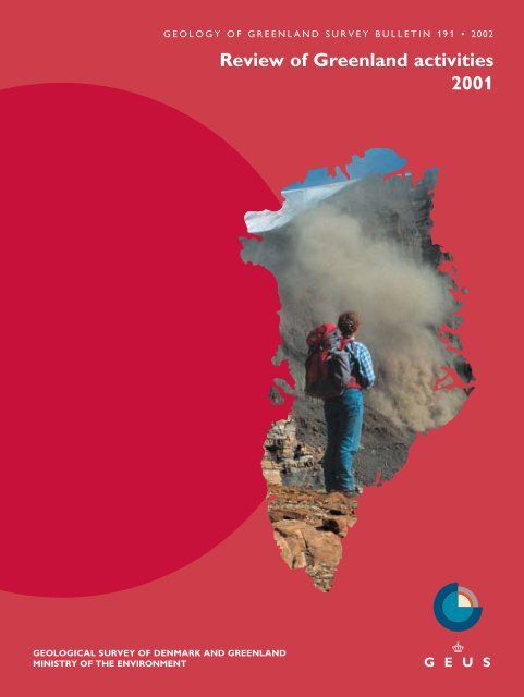
Cover<br />
A major landslide was reported from the southern shore <strong>of</strong> the Nuussuaq peninsula in November 2000 (see Pedersen et al., page 73).<br />
During the follow-up field studies, periodic minor rock falls created dust clouds that prompted the local population to designate the<br />
area as the ‘smoking mountains’. Highest summits are 1900 m above the fjord. View to the east from a vantage point on the island <strong>of</strong><br />
Disko. Photo: Stig A. Schack Pedersen.<br />
Frontispiece: facing page<br />
Outcrop <strong>of</strong> the contact zone <strong>of</strong> a 20 m wide kimberlitic dyke south-west <strong>of</strong> Kangerlussuaq airport, southern West <strong>Greenland</strong>. This<br />
dyke is one <strong>of</strong> the largest known kimberlite dykes in the world. The locality is marked J on Fig. 2 in Jensen et al. (page 58).<br />
Photo: Sven Monrad Jensen.<br />
Chief editor <strong>of</strong> this series: Peter R. Dawes<br />
Scientific editors: A.K. Higgins, Karsten Secher and Martin Sønderholm<br />
Technical editing: Esben W. Glendal<br />
Illustrations: Annabeth Andersen, Lis Duegaard, Jette Halskov and Stefan Sølberg<br />
Lay-out and graphic production: Carsten E. Thuesen<br />
Printers: Schultz Grafisk, Albertslund, Denmark<br />
Manuscripts submitted: 28 January – 25 February 2002<br />
Final versions approved: 9 August 2002<br />
Printed: 3rd December 2002<br />
ISBN 87-7871-098-7<br />
ISSN 1397-1905<br />
Geology <strong>of</strong> <strong>Greenland</strong> Survey Bulletin<br />
The series Geology <strong>of</strong> <strong>Greenland</strong> Survey Bulletin is a continuation <strong>of</strong> Bulletin Grønlands Geologiske Undersøgelse and incorporates<br />
Rapport Grønlands Geologiske Undersøgelse.<br />
Citation <strong>of</strong> the name <strong>of</strong> this series<br />
It is recommended that the name <strong>of</strong> this series is cited in full, viz. Geology <strong>of</strong> <strong>Greenland</strong> Survey Bulletin.<br />
If abbreviation <strong>of</strong> this volume is necessary the following form is suggested: Geology <strong>Greenland</strong> Surv. Bull. 191, 161 pp.<br />
Available from<br />
Geological Survey <strong>of</strong> Denmark and <strong>Greenland</strong><br />
Øster Voldgade 10, DK-1350 Copenhagen K, Denmark<br />
Phone: +45 38 14 20 00, fax: +45 38 14 20 50, e-mail: geus@geus.dk<br />
or<br />
Geografforlaget ApS<br />
Fruerhøjvej 43, DK-5464 Brenderup, Denmark<br />
Phone: +45 63 44 16 83, fax: +45 63 44 16 97, e-mail: go@geografforlaget.dk<br />
© Danmarks og Grønlands Geologiske Undersøgelse (GEUS), 2002
16<br />
9, 10<br />
14<br />
11<br />
1<br />
4<br />
6<br />
7<br />
8<br />
3<br />
2 4<br />
5<br />
17<br />
15<br />
12, 13<br />
500 km<br />
18<br />
Physiographic map <strong>of</strong> <strong>Greenland</strong> showing the locations discussed in the 18 technical papers <strong>of</strong> this volume. The map is reproduced<br />
with courtesy <strong>of</strong> the National Survey and Cadastre, Copenhagen. For a full list <strong>of</strong> Survey field activities in <strong>2001</strong> and for the geographical<br />
subdivisions as used in this bulletin, see the map in the directorial review (Fig. 1, page 10).<br />
4
Contents<br />
Numbers <strong>of</strong> articles correspond to those on the map opposite<br />
The year in focus, <strong>2001</strong><br />
K. Sørensen<br />
1. Precambrian geology <strong>of</strong> the northern Nagssugtoqidian orogen, West <strong>Greenland</strong>:<br />
mapping in the Kangaatsiaq area<br />
J.A.M. van Gool, G.I. Alsop, U.E. Árting, A.A. Garde, C. Knudsen, A.W. Krawiec, S. Mazur, J. Nygaard, S.<br />
Piazolo, C.W. Thomas and K. Thrane<br />
2. The Precambrian supracrustal rocks in the Naternaq (Lersletten) and Ikamiut areas,<br />
central West <strong>Greenland</strong><br />
C. Østergaard, A.A. Garde, J. Nygaard, J. Blomsterberg, B.M. Nielsen, H. Stendal and C.W. Thomas<br />
3. A coastal survey in the southern part <strong>of</strong> the Palaeoproterozoic Rinkian fold belt,<br />
central West <strong>Greenland</strong><br />
A.A. Garde, J.N. Connelly, A.W. Krawiec, S. Piazolo and K. Thrane<br />
4. The mineral resource potential <strong>of</strong> the Nordre Strømfjord – Qasigiannguit region,<br />
southern and central West <strong>Greenland</strong><br />
H. Stendal, J. Blomsterberg, S.M. Jensen, M. Lind, H.B. Madsen, B.M. Nielsen, L. Thorning and C. Østergaard<br />
5. Geological correlation <strong>of</strong> magnetic susceptibility and pr<strong>of</strong>iles from Nordre Strømfjord,<br />
southern West <strong>Greenland</strong><br />
B.M. Nielsen and T.M. Rasmussen<br />
6. Kimberlites and other ultramafic alkaline rocks in the Sisimiut–Kangerlussuaq region,<br />
southern West <strong>Greenland</strong><br />
S.M. Jensen, H. Hansen, K. Secher, A. Steenfelt, F. Schjøth and T.M. Rasmussen<br />
7. Aeromagnetic survey in central West <strong>Greenland</strong>: project Aeromag <strong>2001</strong><br />
T.M. Rasmussen<br />
8. Tsunami-generating rock fall and landslide on the south coast <strong>of</strong> Nuussuaq,<br />
central West <strong>Greenland</strong><br />
S.A.S. Pedersen, L.M. Larsen, T. Dahl-Jensen, H.F. Jepsen, G.K. Pedersen, T. Nielsen, A.K. Pedersen, F. von<br />
Platen-Hallermund and W. Weng<br />
9. Petroleum geological activities in West <strong>Greenland</strong> in <strong>2001</strong><br />
F.G. Christiansen, J.A. Bojesen-Koefoed, J.A. Chalmers, F. Dalh<strong>of</strong>f, C. Marcussen, T. Nielsen, H. Nøhr-Hansen<br />
and M. Sønderholm<br />
10. A multidisciplinary study <strong>of</strong> the Palaeogene succession <strong>of</strong>fshore southern West <strong>Greenland</strong><br />
F. Dalh<strong>of</strong>f, J.A. Chalmers, H. Nøhr-Hansen, J.A. Rasmussen, E. Sheldon and U. Gregersen<br />
11. Evidence for continental crust in the <strong>of</strong>fshore Palaeogene volcanic province,<br />
central West <strong>Greenland</strong><br />
N. Skaarup<br />
12. The post-basaltic Palaeogene and Neogene sediments at Kap Dalton and Savoia Halvø,<br />
East <strong>Greenland</strong><br />
M. Larsen, S. Piasecki and L. Stemmerik<br />
13. Paleocene sub-basaltic sediments on Savoia Halvø, East <strong>Greenland</strong><br />
H. Nøhr-Hansen and S. Piasecki<br />
14. Lower–Middle Ordovician stratigraphy <strong>of</strong> North-East <strong>Greenland</strong><br />
S. Stouge, W.D. Boyce, J.L. Christiansen, D.A.T. Harper and I. Knight<br />
15. Late Permian carbonate concretions in the marine siliciclastic sediments <strong>of</strong> the Ravnefjeld Formation,<br />
East <strong>Greenland</strong><br />
J.K. Nielsen and N.-M. Hanken<br />
9<br />
13<br />
24<br />
33<br />
39<br />
48<br />
57<br />
67<br />
73<br />
84<br />
90<br />
97<br />
103<br />
111<br />
117<br />
126<br />
5
16. Qaanaaq <strong>2001</strong>: mineral exploration reconnaissance in North-West <strong>Greenland</strong><br />
B. Thomassen, P.R. Dawes, A. Steenfelt and J.D. Krebs<br />
17. Lake-catchment interactions with climate in the low Arctic <strong>of</strong> southern West <strong>Greenland</strong><br />
N.J. Anderson, S.C. Fritz, C.E. Gibson, B. Hasholt and M.J. Leng<br />
18. Glaciological investigations on ice-sheet response in South <strong>Greenland</strong><br />
C. Mayer, C.E. Bøggild, S. Podlech, O.B. Olesen, A.P. Ahlstrøm and W. Krabill<br />
Scientific publications on <strong>Greenland</strong> by the Survey, <strong>2001</strong><br />
P.R. Dawes<br />
133<br />
144<br />
150<br />
157<br />
6
■<br />
■<br />
■<br />
■<br />
■<br />
■<br />
■<br />
■<br />
■<br />
■<br />
■<br />
■<br />
■<br />
■<br />
■<br />
■<br />
■<br />
■<br />
■<br />
■<br />
■<br />
■<br />
■<br />
■<br />
■<br />
■<br />
■<br />
■<br />
■<br />
■<br />
■<br />
■<br />
■<br />
■<br />
■<br />
■<br />
■<br />
■<br />
■<br />
■<br />
■<br />
■<br />
■<br />
■<br />
■<br />
■<br />
■<br />
■<br />
■<br />
■<br />
▲<br />
■<br />
■<br />
■<br />
■<br />
■<br />
■<br />
■■<br />
■<br />
■<br />
■<br />
■<br />
■<br />
■<br />
■<br />
■<br />
■<br />
■<br />
■<br />
■ ■<br />
▲<br />
▲<br />
■<br />
■<br />
■<br />
■<br />
▲<br />
■<br />
▲<br />
▲<br />
▲<br />
▲<br />
▲<br />
▲<br />
▲<br />
▲<br />
▲<br />
▲<br />
▲<br />
▲<br />
■<br />
■<br />
■<br />
■<br />
■<br />
■ ■<br />
■<br />
■<br />
■<br />
■<br />
■<br />
■<br />
■<br />
■<br />
■<br />
■<br />
■<br />
■<br />
■<br />
■<br />
■<br />
■<br />
■<br />
■<br />
■<br />
■<br />
■<br />
■<br />
■<br />
■<br />
■<br />
■ ■<br />
■<br />
■<br />
■<br />
■<br />
■<br />
■<br />
■<br />
■<br />
■<br />
■<br />
■<br />
■<br />
■<br />
■<br />
■<br />
■<br />
90°<br />
Ellesmere Island<br />
78°<br />
80°<br />
76°<br />
90° 80° 70° 60° 50° 40° 30° 20° 10° 0° 10°<br />
Canada<br />
Qaanaaq<br />
■ ■<br />
■<br />
Nares<br />
IMB<br />
t<br />
Strai<br />
■<br />
■<br />
■<br />
Lincoln<br />
Alert<br />
Sea<br />
■<br />
IO<br />
▲ ▲<br />
Wandel<br />
Sea<br />
▲ ▲ ▲ ▲<br />
▲▲ ▲<br />
▲<br />
▲<br />
▲ ▲ ▲<br />
▲<br />
Station<br />
Nord<br />
■<br />
■ ■<br />
G r<br />
■ ■<br />
e e n l<br />
■ ■ ■<br />
a n d<br />
S e a<br />
80°<br />
10°<br />
78°<br />
0°<br />
76°<br />
Geological map<br />
<strong>of</strong><br />
<strong>Greenland</strong>:<br />
onshore/<strong>of</strong>fshore<br />
Based on map compiled by<br />
T.C.R. Pulvertaft, Geological<br />
Survey <strong>of</strong> Denmark and<br />
<strong>Greenland</strong>. The bathymetric<br />
contour shown is at 500 m.<br />
■ ■ ■ ■ ■<br />
■ ■ ■<br />
■<br />
■ ■ ■ ■<br />
■<br />
■ ■<br />
■<br />
■<br />
Melville<br />
▲<br />
■<br />
▲<br />
■ ■<br />
74°<br />
70°<br />
■<br />
■ ■<br />
■<br />
■<br />
■<br />
Bugt<br />
<strong>Greenland</strong><br />
74°<br />
10°<br />
■<br />
■<br />
Daneborg<br />
72°<br />
Baffin<br />
Bay<br />
■ ■<br />
■<br />
Upernavik<br />
■ ■<br />
Inland Ice<br />
▲<br />
▲<br />
■<br />
■ ■<br />
72°<br />
RMB<br />
■ ■<br />
▲ ▲<br />
70°<br />
with C anada<br />
■ ■<br />
■<br />
■<br />
▲<br />
▲<br />
▲<br />
▲<br />
▲<br />
▲<br />
▲<br />
▲<br />
■ ■<br />
70°<br />
Illoqqortoormiut /<br />
Scoresbysund<br />
Border<br />
■ ■<br />
68°<br />
500 m<br />
■<br />
Disko<br />
Bugt<br />
Ilulissat<br />
■ ■ ■<br />
68°<br />
■ ■<br />
66°<br />
60°<br />
64°<br />
62°<br />
60°<br />
Davis<br />
Strait<br />
■<br />
■<br />
▲<br />
■<br />
■<br />
▲<br />
▲<br />
■<br />
▲<br />
■<br />
▲<br />
▲<br />
■<br />
Labrador<br />
Sea<br />
■ ■<br />
▲<br />
■<br />
■ ■<br />
■ ■<br />
■<br />
▲<br />
■<br />
■<br />
■<br />
■ ■<br />
■ ■<br />
■<br />
■<br />
■<br />
■<br />
Sisimiut<br />
Nuuk<br />
■<br />
■<br />
▲<br />
■<br />
▲ ▲<br />
■<br />
■<br />
NMB<br />
Qaqortoq<br />
KMB<br />
60°<br />
50° 40°<br />
▲<br />
▲ ▲ ▲<br />
■<br />
Tasiilaq<br />
■ ■<br />
▲ ▲<br />
500 m<br />
▲<br />
500 km<br />
D e n m a r k S t r a i t<br />
30°<br />
66°<br />
64°<br />
62°<br />
Offshore basins with substantial<br />
sediment thicknesses<br />
Offshore basins where deeper<br />
sedimentary successions are concealed<br />
by Palaeogene basalts<br />
North Atlantic<br />
Ocean<br />
Landward limit <strong>of</strong> proven oceanic crust<br />
Extensional fault<br />
Compressional fault, thrust<br />
Strike-slip fault<br />
Transform fault<br />
Iceland Permanent ice<br />
500 m<br />
35° 30° 25°<br />
66°<br />
Intrusive complexes; Palaeogene in East<br />
<strong>Greenland</strong>, 20° Mesoproterozoic in South <strong>Greenland</strong><br />
Basalts: Palaeogene in East and West <strong>Greenland</strong>;<br />
Upper Cretaceous in North <strong>Greenland</strong><br />
Cretaceous–Palaeogene sediments,<br />
Reykjavik West 64° <strong>Greenland</strong> and East <strong>Greenland</strong>;<br />
Nuussuaq and Kangerlussuaq Basins<br />
Carboniferous–Palaeogene sediments,<br />
Wandel Sea Basin in North <strong>Greenland</strong><br />
Carboniferous–Cretaceous sediments,<br />
East <strong>Greenland</strong>, Jameson Land Basin<br />
62°<br />
and North-East <strong>Greenland</strong><br />
Devonian sediments and volcanics,<br />
North-East <strong>Greenland</strong><br />
Shelf<br />
Trough*<br />
60°<br />
Lower Palaeozoic sediments, North<br />
<strong>Greenland</strong>. * Reaches Devonian<br />
Franklinian Basin, IO: Innuitian orogen<br />
Meso- to Neoproterozoic sediments and<br />
volcanic rocks<br />
Caledonian orogenic belt, contains Archaean,<br />
Proterozoic and Palaeozoic rocks<br />
Palaeoproterozoic orogenic belts, contain<br />
both Archaean and Proterozoic rocks<br />
IMB: Inglefield mobile belt;<br />
RMB: Rinkian mobile belt;<br />
KMB: Ketilidian mobile belt;<br />
NMB: Nagssugtoqidian mobile belt<br />
Site <strong>of</strong> exploration well<br />
Archaean craton<br />
7
The year in focus, <strong>2001</strong><br />
Kai Sørensen<br />
Director<br />
Field activities in <strong>Greenland</strong> by the Geological Survey<br />
<strong>of</strong> Denmark and <strong>Greenland</strong> (GEUS) in <strong>2001</strong> were again<br />
many and varied. They included economic investigations<br />
<strong>of</strong> crystalline basement and sedimentary rocks in<br />
North-West <strong>Greenland</strong>, and a systematic mapping project<br />
combined with resource evaluation in the boundary<br />
zone <strong>of</strong> the Nagssugtoqidian and Rinkian mobile<br />
belts <strong>of</strong> central and southern West <strong>Greenland</strong>. In addition,<br />
studies <strong>of</strong> the Vendian to Lower Palaeozoic successions<br />
in North-East <strong>Greenland</strong> and <strong>of</strong> the Palaeogene<br />
sediments <strong>of</strong> central East <strong>Greenland</strong> were carried out,<br />
a major aeromagnetic survey was flown in central West<br />
<strong>Greenland</strong>, and investigations <strong>of</strong> Holocene lake sediments<br />
in southern West <strong>Greenland</strong> were continued.<br />
In <strong>2001</strong> the proportion <strong>of</strong> GEUS human resources<br />
committed to <strong>Greenland</strong> activities compared favourably<br />
with that in preceding years, although financial resources<br />
allocated to <strong>Greenland</strong> have experienced a marked<br />
downward trend over recent years (Table 1). The latter<br />
reflects primarily the decrease in <strong>Greenland</strong> field activities<br />
<strong>of</strong> the Danish Lithosphere Centre (DLC), which is<br />
administratively attached to GEUS, as well as a reduction<br />
in funding from external sources. Despite their<br />
much reduced field activities in <strong>Greenland</strong>, a significant<br />
proportion <strong>of</strong> DLC’s research in <strong>2001</strong> was still related<br />
to <strong>Greenland</strong>. An additional factor influencing the figures<br />
for expenditure quoted in Table 1 is <strong>of</strong> a technical<br />
nature in the sense that although aeromagnetic<br />
surveys were flown in both 1999 and <strong>2001</strong>, the contractual<br />
expenses <strong>of</strong> acquisition were included in the<br />
figures for external funding in 1999, but not in the figures<br />
for <strong>2001</strong>.<br />
The primary source <strong>of</strong> the Survey’s funding is the<br />
Finance Law appropriation from the Danish State. The<br />
proportion <strong>of</strong> this grant allocated to <strong>Greenland</strong>-related<br />
activities is based on annual work programmes planned<br />
in consultation with the <strong>Greenland</strong> authorities, in particular<br />
the Bureau <strong>of</strong> Minerals and Petroleum (BMP) <strong>of</strong><br />
the Government <strong>of</strong> <strong>Greenland</strong>. The planned activities<br />
are approved by the Board <strong>of</strong> GEUS, on which BMP is<br />
represented.<br />
External sources <strong>of</strong> funding for <strong>Greenland</strong> activities<br />
in <strong>2001</strong>, as in previous years, came primarily from BMP<br />
and from Danish and international research foundations<br />
<strong>of</strong> which the most important are the Danish Natural<br />
Science Research Council, the Carlsberg Foundation,<br />
the Commission for Scientific Research in <strong>Greenland</strong> and<br />
the European Union. DLC is funded by the Danish<br />
National Research Foundation.<br />
Regional geology and mapping<br />
Systematic mapping was undertaken in <strong>2001</strong> in the<br />
Aasiaat region <strong>of</strong> central West <strong>Greenland</strong>, located at<br />
the transition between the Rinkian and Nagssugtoqidian<br />
Table 1. Key statistics on Survey resources<br />
RESOURCES <strong>2001</strong> 2000 1999<br />
HUMAN RESOURCES<br />
Permanent staff (man-years)<br />
GEUS personnel* 346 354 356<br />
Allocated to <strong>Greenland</strong> work 80 93 87<br />
<strong>Greenland</strong> field work (persons)<br />
Total number <strong>of</strong> participants† 77 92 85<br />
DLC persons involved 3 21 27<br />
FINANCIAL RESOURCES (million DKK)<br />
GEUS Finance Law appropriation 140 138 135<br />
Of this spent on <strong>Greenland</strong> activities 32 32 33<br />
GEUS external funding‡ 63 77 78<br />
Of this spent on <strong>Greenland</strong> activities 17 22 28<br />
DLC spending on <strong>Greenland</strong> activities 8 14 18<br />
Total expenditure on <strong>Greenland</strong> activities 57 68 79<br />
* excludes DLC staff <strong>of</strong> c. 20.<br />
† includes DLC and external scientists.<br />
‡ excludes DLC funds.<br />
From Annual Accounts 2000/<strong>2001</strong> and internal/external sources.<br />
Geology <strong>of</strong> <strong>Greenland</strong> Survey Bulletin 191, 9–12 (2002) © GEUS, 2002<br />
9
Canada<br />
Pituffik<br />
O 1 Thule Air Base<br />
Q<br />
52°<br />
Ellesmere<br />
Island<br />
Nares Strait<br />
Upernavik<br />
F<br />
Nuussuaq<br />
Disko<br />
D<br />
Disko Bugt<br />
Sisimiut<br />
E<br />
Maniitsoq<br />
Nuuk<br />
P<br />
M<br />
N<br />
G<br />
central<br />
western eastern<br />
North<br />
North - West<br />
C<br />
central<br />
West<br />
southern<br />
West<br />
South -<br />
West<br />
H<br />
South<br />
Alert<br />
A+B<br />
Kangerlussuaq<br />
North - East<br />
Inland<br />
Ice<br />
central<br />
East<br />
southern<br />
East<br />
South -<br />
East<br />
N<br />
Nanortalik<br />
O<br />
N<br />
2<br />
44° Kap Farvel<br />
Tasiilaq<br />
N<br />
36°<br />
Station Nord<br />
J<br />
L<br />
Jameson<br />
Land<br />
Kangerlussuaq<br />
400 km<br />
80°<br />
76°<br />
Daneborg<br />
K<br />
72°<br />
Mestersvig<br />
I<br />
Iceland<br />
Scoresby<br />
Sund<br />
28°<br />
Q<br />
68°<br />
64°<br />
60°<br />
Fig. 1. Map showing the regions in which Survey field activities<br />
were carried out in <strong>2001</strong>: frames A–Q. Letters in bold in the list<br />
below indicate those regions for which articles are presented in<br />
this volume; numbers 1–18 in parentheses refer to the articles<br />
as listed in the Contents and on the adjoining index map (pages<br />
4 and 5).<br />
A: West <strong>Greenland</strong>; regional mapping (1, 2, 3)<br />
B: West <strong>Greenland</strong>; mineral resource assessment (4, 5, 6)<br />
C: Svartenhuk Halvø region; airborne geophysics (7)<br />
D: Nuussuaq region; general geology, landslide investigations<br />
(8)<br />
E: Kangerlussuaq area, southern West <strong>Greenland</strong>; investigations<br />
<strong>of</strong> lake sediments (17)<br />
F: West <strong>Greenland</strong>; petroleum geology and seismic interpretation<br />
(10, 11, 12)<br />
G: Isukasia region; Isua Multidisciplinary Research Project, regional<br />
geology and geochronology<br />
H: Narsaq region; glaciology (18)<br />
I: Scoresby Sund region; stratigraphy (12, 13)<br />
J: North-East <strong>Greenland</strong>; stratigraphy and palaeontology (14)<br />
K: North-East <strong>Greenland</strong>; geochemistry (15)<br />
L: North-East <strong>Greenland</strong>; MINEO and HyperGreen projects, hyperspectral<br />
ground control<br />
M: Qaanaaq <strong>2001</strong>; mineral resource assessment, geochemistry<br />
and regional geology (16)<br />
N: South, South-East and central West <strong>Greenland</strong>; ornamental<br />
stone investigations<br />
O 1 and O 2 : North-West and South <strong>Greenland</strong>, respectively; environmental<br />
history research<br />
P: North-West <strong>Greenland</strong>; geophysical research<br />
Q: Throughout <strong>Greenland</strong>; GLATIS and NEAT projects, geophysical<br />
research<br />
Proterozoic mobile belts (Fig. 1, A). This project is<br />
aimed at the production <strong>of</strong> two 1:100 000 geological map<br />
sheets, and is an extension <strong>of</strong> the field work in 2000<br />
on the Ussuit map sheet <strong>of</strong> the Nordre Strømfjord area<br />
immediately to the south.<br />
Field work for the Isua Multidisciplinary Research<br />
Project in the Isukasia area <strong>of</strong> southern West <strong>Greenland</strong>,<br />
focused on the ‘Earth’s oldest rocks’, was completed in<br />
<strong>2001</strong> (Fig. 1, G); this was the last summer <strong>of</strong> a planned<br />
series <strong>of</strong> field seasons involving a large number <strong>of</strong><br />
Danish and international scientists.<br />
The studies <strong>of</strong> the Vendian to early Palaeozoic rocks<br />
<strong>of</strong> Ella Ø and surroundings in North-East <strong>Greenland</strong><br />
were continued in <strong>2001</strong> (Fig. 1, J); these are part <strong>of</strong> a<br />
continuing project investigating the passive margin succession<br />
<strong>of</strong> the Laurentian continent. Studies <strong>of</strong> the<br />
Palaeogene sediments <strong>of</strong> central East <strong>Greenland</strong> form<br />
part <strong>of</strong> regional petroleum geology investigations, and<br />
are described below.<br />
Mineral resources<br />
A field party visited the Qaanaaq region <strong>of</strong> North-West<br />
<strong>Greenland</strong> (Fig. 1, M) in <strong>2001</strong>, focused on an assessment<br />
<strong>of</strong> the economic potential in the basement crystalline<br />
rocks as well as the overlying Mesoproterozoic<br />
sediments <strong>of</strong> the Thule Supergroup.<br />
A regional aeromagnetic survey financed by BMP<br />
was carried out in central West <strong>Greenland</strong> covering a<br />
broad onshore and <strong>of</strong>fshore region centred on<br />
Svartenhuk Halvø (Fig. 1, C). A total <strong>of</strong> 70 000 line km<br />
<strong>of</strong> high quality data was acquired. Regional aeromagnetic<br />
data coverage now extends from the southern tip<br />
10
<strong>of</strong> <strong>Greenland</strong> northwards along the entire western coast<br />
as far as latitude 72°12´N.<br />
In conjunction with the systematic regional mapping<br />
programme in the Aasiaat region <strong>of</strong> central West<br />
<strong>Greenland</strong>, a resource assessment <strong>of</strong> the region between<br />
Nuussuaq and Maniitsoq was undertaken in <strong>2001</strong> (Fig.<br />
1, B). Economic studies were carried out by field teams,<br />
and included investigations <strong>of</strong> the kimberlitic rocks in<br />
the Sisimiut–Kangerlussuaq region.<br />
Other activities have included sample collections aimed<br />
at ground control <strong>of</strong> the hyperspectral data acquisition<br />
carried out in 2000 in central East and North-East<br />
<strong>Greenland</strong>. In addition, localities in South-East, South and<br />
southern West <strong>Greenland</strong> (Fig. 1, N) were visited in order<br />
to assess the potential for ornamental stone quarrying.<br />
Petroleum geology<br />
Most petroleum geology activities undertaken in <strong>2001</strong><br />
were in preparation for the licensing round planned for<br />
mid-2002. The focus was mainly on promotion <strong>of</strong> the<br />
exploration opportunities in the licensing round area<br />
between 63° and 68°N, together with the launching <strong>of</strong><br />
new seismic and geological projects.<br />
Special mapping projects have been directed towards<br />
the Palaeogene sediments <strong>of</strong>fshore southern West <strong>Greenland</strong><br />
(Fig. 1, F) and the <strong>of</strong>fshore area with volcanic rocks<br />
at the seabed north <strong>of</strong> latitude 68°N. A geohazard study<br />
covering the major part <strong>of</strong> the <strong>of</strong>fshore licence area<br />
between 63° and 68°N was carried out for BMP in <strong>2001</strong>.<br />
A major source rock project involving collection and<br />
comparison <strong>of</strong> mid-Cretaceous source rocks from the<br />
interior <strong>of</strong> North America, the Canadian Arctic and the<br />
Baffin Bay – Davis Strait region was initiated. This is<br />
aimed at advancing the understanding <strong>of</strong> potential petroleum<br />
systems <strong>of</strong>fshore West <strong>Greenland</strong>.<br />
In continuation <strong>of</strong> earlier field work in the pre-basaltic,<br />
Cretaceous and Paleocene sediments <strong>of</strong> the Kangerlussuaq<br />
region in East <strong>Greenland</strong>, a field party visited<br />
the Kap Dalton and Savoia Halvø areas (Fig. 1, I); here<br />
the youngest pre-basaltic, and oldest post-basaltic sediments<br />
are exposed. Relationships at these localities are<br />
<strong>of</strong> particular importance for the understanding <strong>of</strong> predrift<br />
North Atlantic geology.<br />
General scientific activities<br />
Sampling <strong>of</strong> Holocene lake sediments has been carried<br />
out for a number <strong>of</strong> years in West <strong>Greenland</strong>, with the<br />
objective <strong>of</strong> assessing the influence <strong>of</strong> increased global<br />
warming on the sensitive Arctic ecosystems. These activities<br />
were continued in <strong>2001</strong>, with sampling in southern<br />
West <strong>Greenland</strong> (Fig. 1, E). Strong local climate<br />
gradients exist between the coast and the Inland Ice,<br />
and the lakes preserve important signals relating to<br />
Holocene environmental conditions.<br />
In order to investigate indications <strong>of</strong> thinning <strong>of</strong> the<br />
Inland Ice in South <strong>Greenland</strong>, GEUS has installed<br />
instrumentation to monitor one <strong>of</strong> the major outlet glaciers<br />
(Sermilik Bræ) from the Inland Ice in the Narsaq<br />
region (Fig. 1, H).<br />
A field team collected samples <strong>of</strong> frozen peat on<br />
Carey Øer in order to study the early dispersion <strong>of</strong><br />
heavy metals in North-West <strong>Greenland</strong> (Fig. 1, O 1 ). The<br />
same team collected submarine lake sediments in South<br />
<strong>Greenland</strong>, as part <strong>of</strong> a project to evaluate sea-level<br />
changes (Fig. 1, O 2 ).<br />
In November 2000, a major rock fall occurred on the<br />
south coast <strong>of</strong> Nuussuaq near Paatuut (Fig. 1, D). It<br />
was registered on seismic stations in West <strong>Greenland</strong><br />
and at Summit on the Inland Ice, and triggered a tsunami<br />
in the Vaigat strait which caused damage at coastal settlements,<br />
but no loss <strong>of</strong> life. The Survey undertook<br />
studies <strong>of</strong> the geometry and volume <strong>of</strong> this rock fall,<br />
and assessed the risk <strong>of</strong> additional rock falls in the<br />
region.<br />
DLC carried out seismological research in southern<br />
Nares Strait in North-West <strong>Greenland</strong> as part <strong>of</strong> a<br />
German–Canadian geoscience cruise (Fig. 1, P) and<br />
continued the GLATIS and NEAT projects including the<br />
monitoring <strong>of</strong> 11 temporary broad band seismological<br />
earthquake stations located throughout <strong>Greenland</strong><br />
(Fig. 1, Q).<br />
GEUS and higher education<br />
The Survey, together with DLC, plays an active role in<br />
earth science university education with GEUS staff scientists<br />
and research pr<strong>of</strong>essors being involved in student<br />
training for higher degrees. Close co-operation<br />
with Danish and foreign universities and research institutions<br />
is fostered, and students involved in <strong>Greenland</strong>/North<br />
Atlantic-oriented projects <strong>of</strong>ten take part in<br />
Survey-sponsored field work. In <strong>2001</strong>, dissertations on<br />
<strong>Greenland</strong>-related subjects were submitted to the<br />
Universities <strong>of</strong> Copenhagen and Aarhus, Denmark for<br />
degrees at M.Sc. (Danish cand.scient.) and Ph.D. levels<br />
(see list <strong>of</strong> publications concluding this volume).<br />
11
Publications<br />
A complete list <strong>of</strong> geoscientific publications on <strong>Greenland</strong><br />
issued by the Survey is found in the Catalogue <strong>of</strong><br />
<strong>Greenland</strong> publications and data, which is also available<br />
on the web (for web address, see below). A data<br />
directory specifying the range <strong>of</strong> data and services available<br />
at the Survey covers various databases, map, sample<br />
and drill-core archives, bibliographic and library<br />
facilities, including unpublished maps and reports from<br />
the Survey’s own activities and those <strong>of</strong> industry. Indexes<br />
covering projects, authors and selected topics are<br />
included in the catalogue.<br />
The main part <strong>of</strong> the Survey’s <strong>Greenland</strong> publications<br />
is printed in three series: a peer-reviewed bulletin series<br />
(Geology <strong>of</strong> <strong>Greenland</strong> Survey Bulletin), a peer-reviewed<br />
map series (Geology <strong>of</strong> Denmark and <strong>Greenland</strong> Map<br />
Series) and an open-file report series in English or<br />
Danish (Danmarks og Grønlands Geologiske Undersøgelse<br />
Rapport) that is not subject to outside refereeing<br />
or central editing. During <strong>2001</strong>, two bulletins and<br />
23 reports relating to <strong>Greenland</strong> geoscience were<br />
released to the public (a small number <strong>of</strong> reports are<br />
classified). In addition, two geological map sheets in<br />
the national map sheet series were published as well<br />
as two special maps. The two bulletins published are<br />
multi-article volumes containing 33 papers; in half <strong>of</strong><br />
these GEUS staff members are authors or co-authors.<br />
About 50 scientific papers on <strong>Greenland</strong> and surrounding<br />
seas were published in <strong>2001</strong> in external outlets. These<br />
international publications document the results <strong>of</strong> extensive<br />
GEUS field investigations and associated activities<br />
in Copenhagen, including those <strong>of</strong> DLC and research<br />
partners in surveys and geological institutes elsewhere<br />
in the world (see list <strong>of</strong> publications concluding this volume).<br />
An important role <strong>of</strong> the Survey is to provide up-todate<br />
geoscientific and legislatory information to the<br />
petroleum and mining industries. Hence two newsletters,<br />
the GHEXIS Newsletter and MINEX, launched over<br />
a decade ago, are published jointly by GEUS and BMP.<br />
One issue <strong>of</strong> GHEXIS and three issues <strong>of</strong> MINEX were<br />
published in <strong>2001</strong>.<br />
The demand for digital versions <strong>of</strong> geoscientific data<br />
is increasing rapidly, and the Survey is meeting this<br />
challenge by releasing geological information, maps<br />
and data on CD-ROM. Three CD-ROMs were issued in<br />
<strong>2001</strong>. The GHEXIS and MINEX newsletters have been<br />
available on the GEUS and BMP websites for several<br />
years; however, two new sites were developed in <strong>2001</strong>,<br />
GHEXIS Online and MINEX Online (for web addresses,<br />
see below). GHEXIS Online is fully developed and now<br />
provides information on licensing policy, geology,<br />
hydrocarbon potential, available data, and operational<br />
conditions in connection with the licensing round <strong>of</strong>fshore<br />
West <strong>Greenland</strong> in 2002, in addition to the GHEXIS<br />
Newsletter. MINEX Online also provides information<br />
on licensing policy and operational conditions.<br />
The Survey’s publication web addresses are:<br />
GEUS publications online service – www.geus.dk/publications/publ-uk.htm<br />
Catalogue <strong>of</strong> <strong>Greenland</strong> publications – www.geus.dk/publications/cat-publ-greenland-uk.htm<br />
GHEXIS Online – www.geus.dk/ghexis<br />
MINEX Online – www.geus.dk/minex<br />
Author’s address<br />
Geological Survey <strong>of</strong> Denmark and <strong>Greenland</strong>, Øster Voldgade 10, DK-1350 Copenhagen K, Denmark. E-mail: ks@geus.dk<br />
12
Precambrian geology <strong>of</strong> the northern Nagssugtoqidian<br />
orogen,West <strong>Greenland</strong>: mapping in the Kangaatsiaq area<br />
Jeroen A.M. van Gool, G. Ian Alsop, Uni E. Árting,Adam A. Garde, Christian Knudsen,<br />
Adam W. Krawiec, Stanislaw Mazur, Jeppe Nygaard, Sandra Piazolo, Christopher W.Thomas and<br />
Kristine Thrane<br />
The Nagssugtoqidian orogen and its transition into the<br />
Rinkian orogen to the north were the main focus <strong>of</strong> the<br />
field activities <strong>of</strong> the Geological Survey <strong>of</strong> Denmark and<br />
<strong>Greenland</strong> (GEUS) in West <strong>Greenland</strong> in the summer <strong>of</strong><br />
<strong>2001</strong>. This work was carried out within the framework<br />
<strong>of</strong> the Survey’s three-year programme <strong>of</strong> bedrock<br />
mapping and mineral resource evaluation to enhance<br />
the understanding <strong>of</strong> the Archaean and Palaeoproterozoic<br />
crustal evolution in the transition zone between<br />
the Nagssugtoqidian and Rinkian orogens (Fig. 1). The<br />
work in the field season <strong>of</strong> <strong>2001</strong> comprised geological<br />
mapping <strong>of</strong> the 1:100 000 Kangaatsiaq map sheet<br />
described in this paper (Fig. 2), an investigation <strong>of</strong> the<br />
supracrustal rocks at Naternaq / Lersletten (Østergaard<br />
et al. 2002, this volume), a geochronological reconnaissance<br />
<strong>of</strong> the southern Rinkian orogen in the northern<br />
Disko Bugt region (Garde et al. 2002, this volume),<br />
a resource evaluation <strong>of</strong> the Nagssugtoqidian orogen<br />
(Stendal et al. 2002, this volume), a synthesis and interpretation<br />
<strong>of</strong> geophysical data <strong>of</strong> the central part <strong>of</strong> the<br />
Nagssugtoqidian orogen (Nielsen et al. 2002, this<br />
volume) and a report on investigations <strong>of</strong> the kimberlites<br />
and related intrusive rocks in the southern<br />
Nagssugtoqidian orogen and its foreland (Jensen et al.<br />
2002, this volume).<br />
The present investigations build on recent previous<br />
activities in the region. The Disko Bugt project <strong>of</strong> the<br />
former Geological Survey <strong>of</strong> <strong>Greenland</strong> investigated<br />
the geology and evaluated the resource potential <strong>of</strong><br />
the southern part <strong>of</strong> the Rinkian orogen between<br />
Nuussuaq and Jakobshavn Isfjord from 1988 to 1992<br />
(Fig. 1; Kalsbeek 1999). The Danish Lithosphere<br />
Centre (DLC) led a research project from 1994–1999<br />
into the tectonic evolution <strong>of</strong> the Nagssugtoqidian<br />
orogen concentrating on the southern and central<br />
segments <strong>of</strong> the orogen between Sukkertoppen Iskappe<br />
and Nordre Strømfjord (Marker et al. 1995; van<br />
Gool et al. 1996, in press; Mengel et al. 1998; Connelly<br />
et al. 2000). Previous activity in the area between<br />
Nordre Strømfjord and Jakobshavn Isfjord (Fig. 1)<br />
included reconnaissance mapping by Noe-Nygaard &<br />
Ramberg (1961), 1:250 000 scale mapping by Henderson<br />
(1969), and visits to key localities during the DLC<br />
project (Marker et al. 1995; Mengel et al. 1998) from<br />
which a few reconnaissance age determinations are<br />
known (Kalsbeek & Nutman 1996). Most <strong>of</strong> this area<br />
was known from coastal exposures, while map information<br />
for large parts <strong>of</strong> the inland areas was based<br />
only on photogeological interpretation. The mineralised<br />
parts <strong>of</strong> the Naternaq supracrustal belt were investigated<br />
in detail by Kryolitselskabet Øresund A/S from<br />
1962–1964 (Keto 1962; Vaasjoki 1965). Immediately<br />
south <strong>of</strong> latitude 68°N the 1:100 000 scale Agto (Attu)<br />
map sheet was published by Olesen (1984), and the<br />
adjacent Ussuit map sheet to the east is in preparation<br />
(Fig. 1). Mapping in <strong>2001</strong> concentrated on the Kangaatsiaq<br />
map sheet area and the Naternaq area<br />
(Østergaard et al. 2002, this volume), while mapping<br />
activity for 2002 is planned between Naternaq and<br />
Jakobshavn Isfjord (Fig. 1).<br />
The field work in <strong>2001</strong> was supported by M/S<br />
Søkongen as a floating base from which field camps<br />
were established. The shoreline exposures are excellent<br />
and the many islands and extensive fjord systems<br />
in the map area provide easy access. Limited helicopter<br />
support was available for establishment <strong>of</strong> a<br />
few inland camps and reconnaissance in areas far from<br />
the coast.<br />
The Nagssugtoqidian orogen<br />
The Nagssugtoqidian orogen is a 300 km wide belt <strong>of</strong><br />
predominantly Archaean gneisses which were reworked<br />
during Palaeoproterozoic orogenesis. It is<br />
characterised by E–W-trending kilometre-scale folds<br />
and ENE–WSW-trending linear belts. It is divided into<br />
three tectonic segments: the southern, central and<br />
Geology <strong>of</strong> <strong>Greenland</strong> Survey Bulletin 191, 13–23 (2002) © GEUS, 2002<br />
13
Canada<br />
<strong>Greenland</strong><br />
<strong>Greenland</strong><br />
Inland Ice<br />
Inland<br />
Ice<br />
500 km<br />
PHANEROZOIC<br />
Cretaceous–Palaeogene sediments<br />
and Oil volcanic check rocks in 1999<br />
Minor oil staining<br />
PROTEROZOIC<br />
Intensive oil staining and seepage<br />
Sarfartoq Carbonatite Complex<br />
Deep well<br />
Anap Nunâ Group<br />
(metasediments)<br />
Extensional fault<br />
Supracrustal rocks<br />
(undifferentiated)<br />
Fault with lateral or<br />
Calc-alkaline<br />
alternating<br />
intrusions<br />
displacements<br />
Arfersiorfik and Sisimiut suites<br />
Granitic Eocene intrusions and y (s.l.)<br />
Archaean gneiss reworked<br />
in the Palaeogene Palaeoproterozoic basalts<br />
ARCHAEANMaastrichtian Paleocene<br />
sediments<br />
Supracrustal rocks<br />
Albian Campanian<br />
sediments<br />
Granitic intrusions (s.l.)<br />
Orthogneisses Precambrian basement<br />
t t<br />
Intermediate to basic intrusions<br />
Boye Sø anorthosite complex<br />
Thrust<br />
Iceland<br />
70°<br />
68°<br />
66°<br />
Innerit<br />
Svartenhuk<br />
Halv<br />
Kangaatsiaq<br />
B<br />
vik<br />
Qeqertarsuaq<br />
Attu<br />
Sisimiut<br />
A<br />
Schade<br />
t<br />
Simiuttap Kuua<br />
Disko<br />
er<br />
Ubekendt<br />
Ejland<br />
Aasiaat<br />
t<br />
t<br />
Vaigat<br />
Itsaku<br />
D i s k o<br />
Nuussuaq<br />
Fig. 2<br />
t<br />
B u g t<br />
Qeqertarsuaq<br />
Qasigiannguit<br />
Naternaq<br />
aigat<br />
Nordre Str ø mfjord<br />
t<br />
t<br />
Sukkertoppen<br />
Iskappe<br />
Ilulissat<br />
t<br />
t<br />
K<br />
t<br />
Jakobshavn Isfjord<br />
Arfersiorfik<br />
t<br />
Søndre Strømfjord<br />
t<br />
t<br />
51°<br />
Ussuit<br />
t<br />
t<br />
t<br />
0 50 km<br />
t<br />
C<br />
Kangerlussuaq<br />
Inland<br />
Ice<br />
NNO<br />
NSSZ<br />
SNO CNO<br />
ITZ<br />
Nagssugtoqidian orogen Rinkian orogen<br />
North Atlantic craton<br />
Fig. 1. Geological map <strong>of</strong> southern and central West <strong>Greenland</strong>, showing the divisions <strong>of</strong> the Nagssugtoqidian orogen and the boundaries<br />
with the North Atlantic craton to the south and the Rinkian orogen to the north. Outlined areas indicated A, B and C are, respectively,<br />
the Kangaatsiaq, Agto (Attu) and Ussuit 1:100 000 map sheets. ITZ: Ikertôq thrust zone. NSSZ: Nordre Strømfjord shear zone.<br />
SNO, CNO and NNO are, respectively, the southern, central and northern Nagssugtoqidian orogen. Modified from Escher & Pulvertaft<br />
(1995) and Mengel et al. (1998).<br />
14
53°30'W<br />
Kangaatsiaq<br />
53°W<br />
Qeqertarsuatsiaq<br />
52°30'W<br />
68°15'N<br />
53°30´<br />
54°30'W 52°30'W<br />
68°15'N<br />
Tarajomitsoq<br />
Aappilattoq<br />
Tunorsuup Nunaa<br />
g<br />
g<br />
g<br />
g<br />
Alanngorsuup Imaa<br />
d<br />
d<br />
Ikerasarsuk<br />
Ataneq<br />
Tuttulik<br />
Ikerasak<br />
53° 52°30´<br />
Naternaq<br />
Arfersiorfik<br />
Imaa<br />
g<br />
Qeqertarsuatsiaap Tunuata<br />
d<br />
Quaternary<br />
Globule dyke,<br />
dashed where inferred<br />
Metadolerite dyke<br />
Granite or<br />
granitic gneiss<br />
Quartzo-feldspathic<br />
orthogneiss (tonalitic)<br />
Dioritic to quartz-dioritic<br />
gneiss<br />
Quartzo-feldspathic<br />
paragneiss<br />
Mica schist and other<br />
metasedimentary rocks<br />
d<br />
d<br />
Tunorsuaq<br />
Mafic supracrustal<br />
sequence<br />
Mafic intrusive<br />
complex<br />
Fault<br />
68°15´<br />
10 km<br />
Saqqarput<br />
Atarngup Nunaa<br />
Fig. 2. Simplified geology <strong>of</strong> the Kangaatsiaq map sheet. For location, see Fig. 1, frame A.<br />
15
northern Nagssugtoqidian orogen (SNO, CNO and<br />
NNO, Fig. 1; Marker et al. 1995). These segments are<br />
interpreted by van Gool et al. (2002) as, respectively,<br />
a southern parautochthonous foreland zone, a central<br />
collisional core <strong>of</strong> the orogen and a northern transition<br />
zone to the Rinkian orogen. Archaean granulite-facies<br />
gneisses <strong>of</strong> the North Atlantic Craton, which forms the<br />
southern foreland, were reworked in the SNO at<br />
amphibolite facies during south-directed thrusting and<br />
folding. The CNO comprises, besides Archaean gneisses,<br />
two main bodies <strong>of</strong> Palaeoproterozoic calc-alkaline<br />
intrusive rocks: the Sisimiut charnockite suite in the<br />
south-west and the Arfersiorfik intrusive suite in the<br />
north-east (Kalsbeek & Nutman 1996; Whitehouse et al.<br />
1998), which are interpreted as remnants <strong>of</strong> magmatic<br />
arcs associated with subduction (Kalsbeek et al. 1987).<br />
Palaeoproterozoic metasedimentary rocks are known<br />
from narrow belts in the CNO and in the northern part<br />
<strong>of</strong> the SNO. In the northern part <strong>of</strong> the CNO they are<br />
intruded by quartz diorite and tonalite <strong>of</strong> the Arfersiorfik<br />
intrusive suite (Kalsbeek & Nutman 1996; van Gool et al.<br />
1999). This association <strong>of</strong> Palaeoproterozoic intrusive<br />
and supracrustal rocks was interleaved with Archaean<br />
gneisses by NW-directed thrust stacking during early<br />
stages <strong>of</strong> collision (van Gool et al. 1999, 2002; Connelly<br />
et al. 2000). Thrust stacks and associated fabrics were<br />
subsequently folded in several generations <strong>of</strong> folds,<br />
the latest forming shallowly east-plunging upright<br />
folds on the scale <strong>of</strong> tens <strong>of</strong> kilometres. The CNO is<br />
largely at granulite facies, with the exception <strong>of</strong> its<br />
north-eastern corner which is at amphibolite facies. Its<br />
northern boundary is formed by the Nordre Strømfjord<br />
shear zone (Fig. 1; Marker et al. 1995; Hanmer et al.<br />
1997).<br />
The NNO is the least known part <strong>of</strong> the orogen.<br />
Tonalitic orthogneisses <strong>of</strong> Archaean age are interleaved<br />
with supracrustal rocks <strong>of</strong> both volcanic and sedimentary<br />
origin, most <strong>of</strong> which form belts up to 500 m wide<br />
(Mengel et al. 1998). Supracrustal rocks are less common<br />
than in the CNO, but the up to 2 km wide Naternaq<br />
supracrustal belt in the north-east is one <strong>of</strong> the largest<br />
coherent supracrustal belts in the orogen (Fig. 1). The<br />
main deformational features are a regional foliation,<br />
large-scale ENE–WSW-trending folds and several ductile<br />
high-strain zones, both steeply and shallowly dipping.<br />
The metamorphic grade is predominantly amphibolite<br />
facies, but increases southwards to granulite facies<br />
around Attu (Mengel et al. 1998; Connelly et al. 2000).<br />
40 Ar/ 39 Ar age determinations on hornblende from the<br />
NNO indicate that Nagssugtoqidian metamorphic<br />
temperatures <strong>of</strong> at least 500°C prevailed as far north as<br />
Ilulissat (Willigers et al. 2002). Nagssugtoqidian deformation<br />
in the Nordre Strømfjord shear zone at the<br />
southern boundary <strong>of</strong> the NNO resulted in a penetrative<br />
gneissic high-grade fabric, large-scale upright folds and<br />
localised shear zones, as seen in the deformation <strong>of</strong><br />
Palaeoproterozoic intrusive and sedimentary rocks<br />
(Hanmer et al. 1997; Mengel et al. 1998; van Gool et al.<br />
2002). It is not clear to what extent the structures and<br />
lithologies in the NNO can be correlated with those in<br />
the Nordre Strømfjord shear zone or further south.<br />
Geology <strong>of</strong> the Kangaatsiaq area<br />
The Kangaatsiaq map sheet covers a large part <strong>of</strong> the<br />
western half <strong>of</strong> the NNO (Figs 1, 2). Supracrustal rocks<br />
were previously recognised in a zone trending from<br />
the north-eastern to the south-western quadrant <strong>of</strong> the<br />
map where they outline major fold structures. The<br />
south-central and south-eastern parts were indicated<br />
as homogeneous orthogneiss due to lack <strong>of</strong> observations<br />
(Escher 1971). A quartz-diorite body was distinguished<br />
in the south-eastern part <strong>of</strong> the map area by<br />
Henderson (1969). A few minor occurrences <strong>of</strong> granite<br />
were known, <strong>of</strong> which that at Naternaq is the<br />
largest (Figs 1, 2).<br />
During field work in <strong>2001</strong>, twelve lithological units<br />
were distinguished, <strong>of</strong> which several were previously<br />
unknown. Ten <strong>of</strong> these rock types are represented on<br />
the map in Fig. 2, while occurrences <strong>of</strong> the others are<br />
too small for the scale <strong>of</strong> the map. Relative age relationships<br />
were established for most <strong>of</strong> the rock types<br />
but absolute ages are still largely unknown. The few<br />
available geochronological data are discussed in a<br />
separate section below. The Naternaq supracrustal<br />
sequence is described by Østergaard et al. (2002, this<br />
volume). The other lithological units are described<br />
below from oldest to youngest.<br />
Mafic intrusive complexes<br />
Dismembered, layered mafic to ultramafic intrusive<br />
complexes are dominated by medium- to coarsegrained,<br />
massive to moderately foliated, homogeneous<br />
amphibolite, but locally igneous layering is preserved<br />
(Fig. 3). The rocks contain hornblende and plagioclase,<br />
with or without clinopyroxene, orthopyroxene,<br />
biotite, quartz or garnet. The protolith rock types include<br />
gabbro, gabbro-norite, ultramafic rocks (mostly pyroxenite<br />
and hornblendite), and rarely thin anorthosite<br />
sheets occur. This association occurs within the domi-<br />
16
Fig. 3. Well-preserved metamorphosed<br />
layered gabbro in an outcrop <strong>of</strong> the<br />
mafic intrusive complex on the island <strong>of</strong><br />
Ikerasak in the south-western corner <strong>of</strong><br />
the map area.<br />
nant tonalitic orthogneisses mainly as lenses up to tens<br />
<strong>of</strong> metres in diameter, but also forms larger bodies up<br />
to 2 km across. The rocks are cut by tonalitic and<br />
granitic intrusive sheets and veins and occur <strong>of</strong>ten<br />
strongly agmatised. The mafic lenses contain remnants<br />
<strong>of</strong> a foliation and subsequent folding, which predate<br />
the intrusion <strong>of</strong> the regional orthogneisses. The mafic<br />
intrusive complexes are most abundant in the southern<br />
part <strong>of</strong> the map area.<br />
Mafic supracrustal sequences<br />
Thinly layered mafic to intermediate sequences with<br />
thin felsic intercalations are interpreted as supracrustal,<br />
predominantly meta-volcanic sequences (Fig. 4). They<br />
are layered on a millimetre- to centimetre-scale and<br />
contain variable amounts <strong>of</strong> hornblende and plagioclase,<br />
with or without clinopyroxene, biotite, garnet<br />
and quartz. Isolated, thin quartzo-feldspathic layers,<br />
c. 5 to 20 cm thick, are interpreted as psammitic incursions<br />
in which presumed granule and pebble-sized<br />
detrital grains were observed north-east <strong>of</strong> Kangaatsiaq.<br />
These rocks are intruded by the dominant<br />
tonalitic gneiss and occur both as up to 500 m thick,<br />
laterally extensive sequences and as smaller xenoliths.<br />
In several cases the boundary between the tonalitic<br />
gneiss and the supracrustal sequence is tectonically<br />
reworked. The age relationship between the mafic<br />
supracrustal and mafic intrusive rocks could not be<br />
established. The mafic supracrustal rocks are common<br />
in a c. 20 km wide belt that extends from the south-<br />
Fig. 4. Mafic supracrustal sequence consisting <strong>of</strong> layered (metavolcanic)<br />
amphibolite alternating with thin layers <strong>of</strong> psammite<br />
and quartzite. Outcrop is located 18 km south-east <strong>of</strong> Kangaatsiaq.<br />
Lens cap, centre, is 7 cm in diameter.<br />
17
western to the north-eastern corner <strong>of</strong> the map area<br />
(Fig. 2). The mafic supracrustal sequences contain rare,<br />
up to 5 m thick layers <strong>of</strong> medium-grained, forsteritehumite<br />
marble or medium- to coarse-grained, diopsiderich<br />
calc-silicate rocks.<br />
Mica schist<br />
Sequences <strong>of</strong> mica-rich rocks vary from biotite-rich<br />
semi-pelitic schists to biotite, garnet- and sillimanitebearing<br />
schists and gneisses, which are intercalated<br />
with thin quartzo-feldspathic layers and some quartzite.<br />
In the northern part <strong>of</strong> the area the gneisses locally<br />
contain muscovite, kyanite or cordierite. The schists<br />
are generally associated with mafic supracrustal rocks,<br />
and rarely form isolated occurrences. They are especially<br />
abundant in a belt in the central part <strong>of</strong> the map<br />
area and in the Naternaq area (Østergaard et al. 2002,<br />
this volume).<br />
Quartzo-feldspathic paragneisses<br />
Quartzo-feldspathic gneisses form 2–3 km thick sequences<br />
in the south-eastern part <strong>of</strong> the map area<br />
where they are interpreted as metapsammitic rocks.<br />
These grey, medium-grained paragneisses are rather<br />
homogeneous, <strong>of</strong>ten quartz-rich and poor in biotite,<br />
and may contain abundant small (1–2 mm) garnets.<br />
Local rounded quartz and feldspar grains up to 1 cm<br />
across are interpreted as pebbles. The quartzo-feldspathic<br />
paragneisses are interlayered with 5–100 cm wide<br />
amphibolite layers, which are probably <strong>of</strong> volcanic<br />
origin. Slightly discordant, deformed mafic dykes (see<br />
below) have also been observed. Rare, biotite-rich<br />
micaceous layers locally contain garnet and sillimanite.<br />
Contact relationships with the surrounding grey<br />
orthogneisses and their relative ages are uncertain,<br />
and locally these two litholigical units can be difficult<br />
to distinguish in the field.<br />
Dioritic to quartz-dioritic gneiss<br />
This unit consists <strong>of</strong> medium-grained, uniform, darkgrey<br />
migmatitic or agmatitic orthogneisses, containing<br />
hornblende, plagioclase, quartz and minor biotite. It<br />
occurs mainly as small lenses in the tonalitic orthogneiss<br />
unit and only seldom forms larger, mappable<br />
bodies in the south. The largest bodies and layers <strong>of</strong><br />
quartz-diorite are up to 50 m wide and occur in the<br />
Arfersiorfik area (Fig. 2). Contact relationships with the<br />
tonalitic gneisses are not clear everywhere, but a few<br />
dioritic bodies occur as xenoliths. None <strong>of</strong> the quartzdiorite<br />
bodies have so far been correlated with the<br />
Palaeoproterozoic Arfersiorfik quartz diorite (Kalsbeek<br />
et al. 1987) that occurs in the eastern end <strong>of</strong> Arfersiorfik<br />
and Nordre Strømfjord (Fig. 1). However, this correlation<br />
cannot be ruled out for at least some <strong>of</strong> the occurrences,<br />
and geochemical analyses and possibly<br />
geochronology will be used to test this. The large body<br />
<strong>of</strong> quartz-dioritic gneiss north and south <strong>of</strong> the fjord<br />
Tarajomitsoq in the eastern part <strong>of</strong> the map area, indicated<br />
by Henderson (1969), could not be confirmed.<br />
Fig. 5. Tonalitic gneiss with amphibolite<br />
lenses, presumed to be mafic dyke<br />
remnants. Pink granitic veins give the<br />
rock a migmatitic texture. Near<br />
Alanngorsuup Imaa.<br />
18
Tonalitic and associated quartzo-feldspathic<br />
orthogneiss<br />
The predominant orthogneiss unit comprises a wide<br />
range <strong>of</strong> lithologies, which in most cases lack sharp<br />
mutual contacts and cannot be mapped out as separate<br />
units. Grey, fine- to medium-grained biotite-bearing<br />
tonalitic gneiss predominates (Fig. 5). Tonalitic gneiss<br />
with abundant medium-grained hornblende occurs<br />
commonly in the proximity <strong>of</strong> mafic inclusions, and a<br />
plagioclase-porphyric, hornblende-bearing tonalitic<br />
gneiss, characterised by up to 2 cm large clusters <strong>of</strong><br />
hornblende occurs mainly in the north-western part <strong>of</strong><br />
the map area. In places, the orthogneiss is migmatitic,<br />
containing up to 30% coarse-grained, K-feldspar-rich<br />
melt veins up to 5 cm thick (Fig. 5). Another less<br />
common melt phase intruding all varieties <strong>of</strong> the grey<br />
orthogneiss consists <strong>of</strong> leucocratic, white, medium- to<br />
coarse-grained granodiorite to granite and occurs predominantly<br />
in the south. It forms veins and larger<br />
coherent bodies up to one metre wide and can locally<br />
form up to 30% <strong>of</strong> the rock volume.<br />
High-grade, mafic dyke relics<br />
These metadolerite dyke relics are homogeneous,<br />
fine- to medium-grained, and consist <strong>of</strong> hornblende,<br />
plagioclase and clinopyroxene, with or without orthopyroxene,<br />
biotite and quartz. Garnet is seen rarely at<br />
the margins. Commonly the dykes are intensely<br />
deformed, foliated and lineated, boudinaged, or transformed<br />
to mafic schlieren which can be difficult to<br />
identify as dykes (Fig. 5). The less deformed dykes are<br />
commonly about 20 cm thick, but can reach 50 cm.<br />
Discordant relationships can be preserved in areas <strong>of</strong><br />
low strain, but angles <strong>of</strong> discordance are always small.<br />
The dykes are widespread and locally form up to 25%<br />
<strong>of</strong> the rock volume, but they do not form a map unit<br />
that can be depicted on the scale <strong>of</strong> Fig. 2. They were<br />
commonly observed in the southern part <strong>of</strong> the map<br />
area, where they form dense swarms in the grey<br />
orthogneisses (Fig. 6).<br />
Granite and granitic gneiss<br />
Numerous small and large intrusive bodies <strong>of</strong> granite<br />
with a wide range <strong>of</strong> lithological appearances and<br />
different states <strong>of</strong> deformation were mapped. Coarsegrained,<br />
homogeneous pink granite predominates and<br />
may grade into megacrystic granite, sometimes with<br />
rapakivi-textures, pink microgranite, or pegmatite.<br />
Fig. 6. Cliff exposing orthogneisses invaded by a dyke swarm which<br />
is boudinaged and folded. Vertical dark streaks are caused by water<br />
flowing over the cliff. Height <strong>of</strong> cliff is about 50 m. The outcrop<br />
is located at the southern boundary <strong>of</strong> the map area, 6 km east<br />
<strong>of</strong> the fjord Ataneq.<br />
White, leucocratic granite is also observed. Based on<br />
their deformational state and contact relationships the<br />
granite bodies fall into two main categories (not<br />
distinguished on the map): foliated granites with<br />
gradational boundaries to their host rocks, and relatively<br />
undeformed granites with obvious intrusive<br />
contacts. The contact zones between tonalitic orthogneiss<br />
and the granites can be tens to hundreds <strong>of</strong><br />
metres wide, beginning with a few thin granitic veinlets<br />
in the orthogneiss, grading into granite or granitic<br />
gneiss with abundant orthogneiss inclusions, and<br />
ending with almost inclusion-free granite. The gneissic<br />
fabric in the inclusions is commonly cut by the granites,<br />
which may nevertheless themselves be strongly<br />
foliated.<br />
Pegmatite<br />
Several generations <strong>of</strong> pegmatite have been observed,<br />
<strong>of</strong>ten cross-cutting and in different stages <strong>of</strong> deformation.<br />
They are commonly coarse-grained, rich in pink<br />
K-feldspar, and contain quartz and plagioclase with or<br />
without biotite. In general, two main types can be<br />
distinguished. The older pegmatites are slightly discordant,<br />
commonly irregular in shape and can be folded<br />
and strongly sheared, resulting in porphyroclastic,<br />
mylonitic textures. They appear to be associated with<br />
the granitic gneisses described above. Some <strong>of</strong> these<br />
pegmatites can be shown to be syn-kinematic with the<br />
latest fold phase (see below). The second, younger<br />
19
group consists <strong>of</strong> conjugate sets <strong>of</strong> late, straight-walled<br />
pegmatites. They are undeformed and commonly<br />
associated with steep brittle faults that have <strong>of</strong>fsets<br />
which are consistent with north–south compression.<br />
These pegmatites may be younger than the metadolerite<br />
dykes described below.<br />
Metadolerite dykes<br />
Massive, 1–20 m wide metadolerite dykes occur mainly<br />
in the southern part <strong>of</strong> the map area. They cut the<br />
regional gneissic fabric and most have E–W trends.<br />
Foliation is only well developed in the dyke margins<br />
although a weak linear fabric can be observed locally<br />
in the unfoliated cores. The dykes have metamorphic<br />
mineral assemblages <strong>of</strong> fine- to medium-grained hornblende,<br />
plagioclase and clinopyroxene, with or without<br />
orthopyroxene, garnet and rarely biotite. In contrast to<br />
the older foliated dyke remnants they always occur as<br />
isolated bodies.<br />
Globule dyke<br />
A single, N–S-trending, 20–50 m wide composite dolerite<br />
dyke with unusual globular structures was described<br />
by Ellitsgaard-Rasmussen (1951). The name for the<br />
dyke was based on the local presence <strong>of</strong> spheres with<br />
igneous textures that comprise plagioclase and pyroxene<br />
phenocrysts in the core, surrounded by glassy<br />
mantles. Several locations were revisited and showed<br />
the dyke to be undeformed and to consist <strong>of</strong> a c. 10 m<br />
thick central dyke with thinner multiple intrusions on<br />
both sides which have glassy, chilled margins. The<br />
dyke is exposed in a few outcrops along a 60 km long<br />
stretch from the entrance <strong>of</strong> the fjord Arfersiorfik<br />
northwards to the coast east <strong>of</strong> Aasiaat. On the aeromagnetic<br />
map <strong>of</strong> the NNO (Thorning 1993) this trace<br />
is clearly visible, with several right-lateral steps as<br />
depicted in Fig. 2.<br />
Geochronology<br />
U-Pb zircon age determinations have been carried out<br />
on six samples from the map area (Kalsbeek &<br />
Nutman 1996). Archaean ages in the range 2.7–2.8 Ga<br />
were derived from four biotite orthogneiss samples. A<br />
porphyric granite yielded zircons <strong>of</strong> c. 2.7 Ga, indistinguishable<br />
in age from a gneiss which forms the host<br />
rock at the same location. It is uncertain whether these<br />
two lithologies are indeed <strong>of</strong> approximately the same<br />
age, or whether the granite contains locally derived<br />
inherited zircons. One <strong>of</strong> two samples from the<br />
Naternaq supracrustal sequence contained Proterozoic<br />
detrital zircons, suggesting that at least part <strong>of</strong> the<br />
sequence is <strong>of</strong> Proterozoic age (Østergaard et al. 2002,<br />
this volume).<br />
Kalsbeek et al. (1984) derived an Archaean Pb-Pb<br />
isochron age <strong>of</strong> 2653 ± 110 Ma for a granite that is<br />
intrusive into the regional gneisses just south <strong>of</strong> the<br />
map area. An undeformed granite sampled near<br />
Aasiaat just north <strong>of</strong> the map area yielded an intrusive<br />
age <strong>of</strong> 2778 +7<br />
–3 Ma (TIMS U-Pb on zircon, Connelly &<br />
Mengel 2000). Preliminary LAM-ICPMS Pb-Pb reconnaissance<br />
analyses on detrital zircons from a felsic<br />
layer <strong>of</strong> a dominantly mafic supracrustal sequence<br />
north-east <strong>of</strong> Kangaatsiaq have yielded Archaean ages.<br />
The available isotope data establish that the regionally<br />
dominant tonalitic gneisses have Archaean protolith<br />
ages, and that at least some granites in the NNO<br />
are also Archaean. The ages <strong>of</strong> the younger pegmatites<br />
and <strong>of</strong> the metadolerite dykes are at present uncertain.<br />
A regional dating programme <strong>of</strong> rocks in the northern<br />
Nagssugtoqidian orogen and southern Rinkian orogen<br />
is underway to establish the ages <strong>of</strong> the main lithologies<br />
and tectonic events (Garde et al. 2002, this volume).<br />
Metamorphism<br />
The map area is dominated by upper amphibolite facies,<br />
medium-pressure mineral assemblages, but has been<br />
affected by granulite facies metamorphism south <strong>of</strong> the<br />
fjords Arfersiorfik and Alanngorsuup Imaa (Fig. 2).<br />
Mineral assemblages in metapelites include garnetbiotite-sillimanite<br />
in most <strong>of</strong> the area, with minor kyanite<br />
or cordierite observed locally north-east <strong>of</strong> Kangaatsiaq.<br />
Muscovite is stable in the northernmost part <strong>of</strong> the<br />
map area. Partial melt veins occur in most <strong>of</strong> the<br />
region giving the gneisses a migmatitic texture. Relic<br />
granulite facies rocks occur as patches in the south<br />
within areas <strong>of</strong> amphibolite facies. The granulite facies<br />
grade is reflected in the weathered appearance <strong>of</strong> the<br />
rocks, but orthopyroxene is seldom visible in hand<br />
specimen. It does, however, appear as relics in thin<br />
section. The age <strong>of</strong> the granulite facies metamorphism<br />
is uncertain, but Palaeoproterozoic rocks in the nearby<br />
Nordre Strømfjord shear zone (Fig. 1) are also at<br />
granulite facies, and were retrogressed to amphibolite<br />
facies in high-strain zones during a late phase <strong>of</strong><br />
Nagssugtoqidian orogenesis.<br />
20
Structure<br />
Detailed field observations combined with the map<br />
pattern show that at least four generations <strong>of</strong> regionally<br />
penetrative structures are recorded in the dominant<br />
orthogneisses, while an even older penetrative planar<br />
fabric and isoclinal folds are preserved in mafic inclusions.<br />
The regional gneissosity dips to the NNW or SSE<br />
at steep to moderate angles, and carries a subhorizontal,<br />
ENE–WSW-trending mineral grain lineation or<br />
aggregate lineation. It is a high-temperature fabric, and<br />
commonly migmatitic veins are developed parallel to<br />
it. Locally the gneissosity is axial planar to isoclinal,<br />
<strong>of</strong>ten rootless, folds. The main gneissosity is a<br />
composite fabric, heterogeneously developed either<br />
progressively over an extended period <strong>of</strong> time or in<br />
several phases before and after intrusion <strong>of</strong> the mafic<br />
dyke swarm in the south.<br />
At least two phases <strong>of</strong> folding affected the area. The<br />
early isoclinal folds have no consistent orientation and<br />
may represent several generations <strong>of</strong> folds, as reported<br />
from the Attu area by Sørensen (1970) and Skjernaa<br />
(1973). Map-scale isoclinal folds are most obvious in<br />
the north-eastern and south-western map quadrants,<br />
outlined by the supracrustal sequences. At several<br />
locations the isoclinal folding resulted in interleaving<br />
<strong>of</strong> ortho- and paragneisses. It is also possible that<br />
some interleaving occurred by thrust repetition, as<br />
reported from the Attu area (Skjernaa 1973) and from<br />
south <strong>of</strong> the Nordre Strømfjord shear zone (van Gool<br />
et al. 1999), but so far no unambiguous evidence for<br />
thrust repetition has been found in the map area.<br />
Shear zones are uncommon and <strong>of</strong> local extent, mainly<br />
associated with the reworking <strong>of</strong> intrusive contacts<br />
between supracrustal rocks and orthogneisses and<br />
lacking consistent kinematic indicators. Their relative<br />
age with respect to the fold phases is uncertain.<br />
Parasitic folds associated with the youngest, major<br />
phase <strong>of</strong> upright folds are sub-horizontal to moderately<br />
plunging, with predominantly WSW-plunging axes.<br />
Near the hinges <strong>of</strong> kilometre-scale folds the parasitic<br />
folds are commonly steeply inclined, plunging to the<br />
south. Mineral lineations are commonly parallel to<br />
sub-parallel with the axes <strong>of</strong> parasitic folds. Sets <strong>of</strong><br />
late, steeply dipping conjugate fractures trend NE–SW<br />
and NW–SE and some <strong>of</strong> these are filled with a<br />
pegmatitic melt phase.<br />
Summary and conclusions<br />
The Kangaatsiaq region in the northern Nagssugtoqidian<br />
orogen predominantly consists <strong>of</strong> Archaean orthogneisses.<br />
It includes a major ENE–WSW-trending belt<br />
with abundant supracrustal rocks, which runs from<br />
south <strong>of</strong> Kangaatsiaq to the southern part <strong>of</strong> Naternaq.<br />
A second, previously unknown but extensive belt <strong>of</strong><br />
quartzo-feldspathic paragneisses, presumably <strong>of</strong><br />
Archaean age, occupies part <strong>of</strong> the south-eastern<br />
corner <strong>of</strong> the map area.<br />
The main events in the geological evolution <strong>of</strong> the area<br />
comprise:<br />
1. intrusion <strong>of</strong> mafic igneous complexes and deposition<br />
<strong>of</strong> mafic and associated supracrustal rocks;<br />
2. formation <strong>of</strong> a foliation and isoclinal folds;<br />
3. intrusion <strong>of</strong> the main tonalitic and associated granitoid<br />
rocks;<br />
4. formation <strong>of</strong> the regional gneissic fabric;<br />
5. intrusion <strong>of</strong> a mafic dyke swarm in the south;<br />
6. further deformation, probably associated with isoclinal<br />
folding and intensification <strong>of</strong> the regional<br />
gneissosity;<br />
7. intrusion <strong>of</strong> granite and pegmatite;<br />
8. formation <strong>of</strong> a foliation and gneissosity in the granites,<br />
in part during their intrusion and associated<br />
with upright folding;<br />
9. intrusion <strong>of</strong> the E–W-trending, isolated metadolerite<br />
dykes;<br />
10. formation <strong>of</strong> upright brittle fractures during intrusion<br />
<strong>of</strong> pegmatite.<br />
At present, an evaluation <strong>of</strong> the tectonic evolution <strong>of</strong><br />
the Kangaatsiaq area in a regional perspective is difficult,<br />
since the absolute ages <strong>of</strong> several lithological<br />
units and deformational events are still unknown. It is<br />
uncertain to what extent the Palaeoproterozoic tectonic<br />
events known from south <strong>of</strong> the Nordre Strømfjord<br />
shear zone can be correlated with those <strong>of</strong> the<br />
Kangaatsiaq area. The map area lacks the abundance<br />
<strong>of</strong> Proterozoic supracrustal sequences intruded by<br />
quartz-diorite and the shear zones associated with<br />
their emplacement, that are typical for the central<br />
Nagssugtoqidian orogen (van Gool et al. 1999). The<br />
most likely candidate for a Palaeoproterozoic supracrustal<br />
sequence in the map area is the Naternaq<br />
supracrustal belt. Furthermore, the shear zones in the<br />
Kangaatsiaq area are not <strong>of</strong> regional extent. The lack<br />
<strong>of</strong> consistent kinematic indicators in the shear zones<br />
suggests that deformation may have been dominated<br />
21
y pure shear. Coincidence <strong>of</strong> the orientation and style<br />
<strong>of</strong> the youngest upright, E–W-trending folds in the<br />
Kangaatsiaq area with similar structures <strong>of</strong> Palaeoproterozoic<br />
age to the south (Sørensen 1970; Skjernaa<br />
1973; van Gool et al. 2002) and in the Disko Bugt area<br />
to the north (several papers in Kalsbeek 1999) was<br />
suggested by Mengel et al. (1998) as a possible indication<br />
for direct correlation.<br />
Acknowledgements<br />
Hans Myrup and Malene Weyhe <strong>of</strong> M/S Søkongen are acknowledged<br />
for transport during the expedition and for generally<br />
lending many helping hands. We thank helicopter pilot Jan<br />
Wilken for efficient helicopter transport.<br />
References<br />
Connelly, J.N. & Mengel, F.C. 2000: Evolution <strong>of</strong> Archean components<br />
in the Nagssugtoqidian Orogen, West <strong>Greenland</strong>.<br />
Geological Society <strong>of</strong> America Bulletin 112, 747–763.<br />
Connelly, J.N., van Gool, J.A.M. & Mengel F.C. 2000: Temporal<br />
evolution <strong>of</strong> a deeply eroded orogen: the Nagssugtoqidian orogen,<br />
West <strong>Greenland</strong>. Canadian Journal <strong>of</strong> Earth Sciences 37,<br />
1121–1142.<br />
Ellitsgaard-Rasmussen, K. 1951: A West <strong>Greenland</strong> globule dyke.<br />
Meddelelser fra Dansk Geologisk Forening 12, 83–101.<br />
Escher, A. (compiler) 1971: Geological map <strong>of</strong> <strong>Greenland</strong>,<br />
1:500000, Søndre Strømfjord – Nûgssuaq, sheet 3. Copenhagen:<br />
Geological Survey <strong>of</strong> <strong>Greenland</strong>.<br />
Escher, J.C. & Pulvertaft, T.C.R. 1995: Geological map <strong>of</strong> <strong>Greenland</strong>,<br />
1:2 500 000. Copenhagen: Geological Survey <strong>of</strong> <strong>Greenland</strong>.<br />
Garde, A.A., Connelly, J.N., Krawiec, A.W., Piazolo, S. & Thrane,<br />
K. 2002: A coastal survey in the southern part <strong>of</strong> the Palaeoproterozoic<br />
Rinkian fold belt, central West <strong>Greenland</strong>. Geology<br />
<strong>of</strong> <strong>Greenland</strong> Survey Bulletin 191, 33–38 (this volume).<br />
Hanmer, S., Mengel, F.[C.], Connelly, J.[N.] & van Gool, J.[A.M.]<br />
1997: Significance <strong>of</strong> crustal-scale shear zones and synkinematic<br />
mafic dykes in the Nagssugtoqidian orogen, SW <strong>Greenland</strong>: a<br />
re-examination. Journal <strong>of</strong> Structural Geology 19, 59–75.<br />
Henderson, G. 1969: The Precambrian rocks <strong>of</strong> the Egedesminde–<br />
Christianshåb area, West <strong>Greenland</strong>. Rapport Grønlands Geologiske<br />
Undersøgelse 23, 37 pp.<br />
Jensen, S.M., Hansen, H., Secher, K., Steenfelt, A., Schjøth, F. &<br />
Rasmussen, T.M. 2002: Kimberlites and other ultramafic alkaline<br />
rocks in the Sisimiut–Kangerlussuaq region, southern<br />
West <strong>Greenland</strong>. Geology <strong>of</strong> <strong>Greenland</strong> Survey Bulletin 191,<br />
57–66 (this volume).<br />
Kalsbeek, F. (ed.) 1999: Precambrian geology <strong>of</strong> the Disko Bugt<br />
region, West <strong>Greenland</strong>. Geology <strong>of</strong> <strong>Greenland</strong> Survey Bulletin<br />
181, 179 pp.<br />
Kalsbeek, F. & Nutman, A.P. 1996: Anatomy <strong>of</strong> the Early Proterozoic<br />
Nagssugtoqidian orogen, West <strong>Greenland</strong>, explored by reconnaissance<br />
SHRIMP U-Pb dating. Geology 24, 515–518.<br />
Kalsbeek, F., Taylor, P.N. & Henriksen, N. 1984: Age <strong>of</strong> rocks,<br />
structures, and metamorphism in the Nagssugtoqidian mobile<br />
belt, West <strong>Greenland</strong> – field and Pb-isotope evidence. Canadian<br />
Journal <strong>of</strong> Earth Sciences 21, 1126–1131.<br />
Kalsbeek, F., Pidgeon, R.T. & Taylor, P.N. 1987: Nagssugtoqidian<br />
mobile belt <strong>of</strong> West <strong>Greenland</strong>: cryptic 1850 Ma suture between<br />
two Archaean continents – chemical and isotopic evidence.<br />
Earth and Planetary Science Letters 85, 365–385.<br />
Keto, L. 1962: Aerial prospecting between Holsteinsborg and<br />
Umanak W-<strong>Greenland</strong> 1962, 65 pp. Unpublished report,<br />
Kryolitselskabet Øresund A/S, Copenhagen, Denmark (in<br />
archives <strong>of</strong> the Geological Survey <strong>of</strong> Denmark and <strong>Greenland</strong>,<br />
GEUS Report File 20154).<br />
Marker, M. et al. 1995: Evolution <strong>of</strong> the Palaeoproterozoic<br />
Nagssugtoqidian orogen: DLC investigations in West <strong>Greenland</strong>.<br />
Rapport Grønlands Geologiske Undersøgelse 165, 100–105.<br />
Mengel, F.[C.] et al. 1998: Archaean and Palaeoproterozoic orogenic<br />
processes: Danish Lithosphere Centre studies <strong>of</strong> the<br />
Nagssugtoqidian orogen, West <strong>Greenland</strong>. Geology <strong>of</strong><br />
<strong>Greenland</strong> Survey Bulletin 180, 100–110.<br />
Nielsen, B.M. & Rasmussen, T.M. 2002: Geological correlation <strong>of</strong><br />
magnetic susceptibility and pr<strong>of</strong>iles from Nordre Strømfjord,<br />
southern West <strong>Greenland</strong>. Geology <strong>of</strong> <strong>Greenland</strong> Survey<br />
Bulletin 191, 48–56 (this volume).<br />
Noe-Nygaard, A. & Ramberg, H. 1961: Geological reconnaissance<br />
map <strong>of</strong> the country between latitudes 69°N and 63°45´N, West<br />
<strong>Greenland</strong>. Meddelelser om Grønland 123(5), 9 pp.<br />
Olesen, N.Ø. 1984: Geologisk kort over Grønland, 1:100 000,<br />
Agto, 67 V.1 Nord. København: Grønlands Geologiske Undersøgelse<br />
(English legend).<br />
Østergaard, C., Garde, A.A., Nygaard, J., Blomsterberg, J., Nielsen,<br />
B.M., Stendal, H. & Thomas, C.W. 2002: The Precambrian<br />
supracrustal rocks in the Naternaq (Lersletten) and Ikamiut<br />
areas, central West <strong>Greenland</strong>. Geology <strong>of</strong> <strong>Greenland</strong> Survey<br />
Bulletin 191, 24–32 (this volume).<br />
Skjernaa, L. 1973: Precambrian structures <strong>of</strong> the Ikorfat peninsula,<br />
Agto region, West <strong>Greenland</strong>. Rapport Grønlands Geologiske<br />
Undersøgelse 52, 22 pp.<br />
Sørensen, K. 1970: Some observations on the structural and metamorphic<br />
chronology on Agto and surrounding islands, central<br />
West <strong>Greenland</strong>. Rapport Grønlands Geologiske Undersøgelse<br />
27, 32 pp.<br />
Stendal, H., Blomsterberg, J., Jensen, S.M., Lind, M., Madsen,<br />
H.B., Nielsen, B.M., Thorning, L. & Østergaard, C. 2002: The<br />
mineral resource potential <strong>of</strong> the Nordre Strømfjord –<br />
Qasigiannguit region, southern and central West <strong>Greenland</strong>.<br />
Geology <strong>of</strong> <strong>Greenland</strong> Survey Bulletin 191, 39–47 (this volume).<br />
Thorning, L. 1993: Project AEROMAG-92: a new high resolution<br />
aeromagnetic survey <strong>of</strong> the Lersletten area, central West<br />
<strong>Greenland</strong> (68°15´ to 68°55´N, 50°25´ to 53°35´W). Open File<br />
Series Grønlands Geologiske Undersøgelse 93/2, 34 pp.<br />
Vaasjoki, O. 1965: Conclusions on the geology and ore mineralisation<br />
investigated in the Lersletten area, West <strong>Greenland</strong>, 22<br />
pp. Unpublished report, Kryolitselskabet Øresund A/S,<br />
Copenhagen, Denmark (in archives <strong>of</strong> the Geological Survey<br />
<strong>of</strong> Denmark and <strong>Greenland</strong>, GEUS Report File 20070).<br />
22
van Gool, J.[A.M.] et al. 1996: The Palaeoproterozoic<br />
Nagssugtoqidian orogen in West <strong>Greenland</strong>: current status <strong>of</strong><br />
work by the Danish Lithosphere Centre. Bulletin Grønlands<br />
Geologiske Undersøgelse 172, 88–94.<br />
van Gool, J.A.M., Kriegsman, L., Marker, M. & Nichols, G.T. 1999:<br />
Thrust stacking in the inner Nordre Strømfjord area, West<br />
<strong>Greenland</strong>: significance for the tectonic evolution <strong>of</strong> the<br />
Palaeoproterozoic Nagssugtoqidian orogen. Precambrian<br />
Research 93, 71–86.<br />
van Gool, J.A.M., Connelly, J.N., Marker, M. & Mengel, F.C. 2002:<br />
The Nagssugtoqidian Orogen <strong>of</strong> West <strong>Greenland</strong>: tectonic<br />
evolution and regional correlations from a West <strong>Greenland</strong> perspective.<br />
Canadian Journal <strong>of</strong> Earth Sciences 39, 665–686.<br />
Whitehouse, M.J., Kalsbeek, F. & Nutman, A.P. 1998: Crustal<br />
growth and crustal recycling in the Nagssugtoqidian orogen<br />
<strong>of</strong> West <strong>Greenland</strong>: constraints from radiogenic isotope systematics<br />
and U-Pb zircon geochronology. Precambrian Research<br />
91, 365–381.<br />
Willigers, B.J.A., van Gool, J.A.M., Wijbrans, J.R., Krogstad, E.J.<br />
& Mezger, K. 2002: Post-tectonic cooling <strong>of</strong> the Nagssugtoqidian<br />
Orogen and a comparison <strong>of</strong> contrasting cooling histories in<br />
Precambrian and Phanerozoic orogens. Journal <strong>of</strong> Geology 110,<br />
503–517.<br />
Authors’ addresses<br />
J.A.M.v.G., A.A.G., C.K., J.N., S.P. & K.T., Geological Survey <strong>of</strong> Denmark and <strong>Greenland</strong>, Øster Voldgade 10, DK-1350 Copenhagen K,<br />
Denmark. E-mail: jvg@geus.dk<br />
G.I.A., School <strong>of</strong> Geography & Geosciences, University <strong>of</strong> St. Andrews, St. Andrews, Fife, KY16 9AL, UK.<br />
U.E.Á., Geological Institute, University <strong>of</strong> Copenhagen, Øster Voldgade 10, DK-1350 Copenhagen K, Denmark.<br />
A.W.K., Department <strong>of</strong> Geological Sciences, University <strong>of</strong> Texas at Austin, Austin, TX, 78712, USA.<br />
S.M., Institute <strong>of</strong> Geological Sciences, University <strong>of</strong> Wroclaw, Pl. Maxa Borna 9, 50–204 Wroclaw, Poland.<br />
C.W.T., British Geological Survey, Murchison House, West Mains Road, Edinburgh, EH9 3LA, UK.<br />
23
The Precambrian supracrustal rocks in the Naternaq<br />
(Lersletten) and Ikamiut areas, central West <strong>Greenland</strong><br />
Claus Østergaard,Adam A. Garde, Jeppe Nygaard, Jette Blomsterberg, Bo Møller Nielsen,<br />
Henrik Stendal and Christopher W.Thomas<br />
Naternaq, or Lersletten, in central West <strong>Greenland</strong> is an<br />
extensive Quaternary outwash plain characterised by<br />
light grey, silty sediments. Scattered low hills with outcrops<br />
<strong>of</strong> crystalline Precambrian basement rocks protrude<br />
from the outwash plain and form the northern part<br />
<strong>of</strong> the Nagssugtoqidian orogen (e.g. Connelly et al.<br />
2000). The prominent Naternaq supracrustal belt, at<br />
least 25 km long and up to c. 2 km wide, occurs along<br />
the north-western margin <strong>of</strong> Lersletten, bordered on<br />
both sides by Archaean orthogneisses and granitic rocks;<br />
the supracrustal rocks outline a major fold structure<br />
with an irregular and sporadically exposed hinge zone<br />
(Fig. 1). The supracrustal rocks, including the fold closure,<br />
exhibit a negative signature on the regional aeromagnetic<br />
map (Fig. 2). The belt is known for its<br />
disseminated and massive iron sulphide mineralisation<br />
with minor copper and zinc, which is common in the<br />
south-eastern part <strong>of</strong> the belt.<br />
Study <strong>of</strong> the Naternaq supracrustal belt was an important<br />
objective <strong>of</strong> the Survey’s field work in <strong>2001</strong> (Stendal<br />
et al. 2002, this volume). Boundaries, contact relationships<br />
and principal rock types were established in the western<br />
part <strong>of</strong> the belt (van Gool et al. 2002, this volume). Wellexposed<br />
parts <strong>of</strong> the belt were mapped in detail (Fig. 3),<br />
and the main lithologies and their mineralisations were<br />
investigated and sampled. Preliminary results <strong>of</strong> the mapping<br />
are presented in this report, together with a brief<br />
discussion <strong>of</strong> the depositional environment, likely age, and<br />
mineralisation processes <strong>of</strong> the supracrustal sequence.<br />
Large tracts <strong>of</strong> supracrustal rocks in the adjacent Ikamiut<br />
area (Fig. 1) and near Qasigiannguit/Christianshåb some<br />
50 km further to the east may once have been contiguous<br />
with the Naternaq supracrustal belt, but further mapping<br />
is required to substantiate this.<br />
Previous work<br />
The earliest coastal geological reconnaissance in central<br />
West <strong>Greenland</strong> was carried out by Noe-Nygaard<br />
& Ramberg (1961), who noted the obvious supracrustal<br />
origin <strong>of</strong> garnet-mica schists at Ikamiut and in the<br />
Qasigiannguit area. The Naternaq supracrustal belt itself<br />
was outlined by Henderson (1969) on his preliminary<br />
map <strong>of</strong> the Egedesminde–Christianshåb area.<br />
Kryolitselskabet Øresund A/S (KØ) undertook a major<br />
base metal exploration programme in the region in<br />
1962–1964, which concentrated on the most extensively<br />
mineralised southern part <strong>of</strong> the Naternaq supracrustal<br />
belt, following the discovery <strong>of</strong> the mineralisation in 1962<br />
(Keto 1962; Vaasjoki 1965). General geological, electromagnetic,<br />
magnetic and gravimetric ground surveys<br />
were carried out which helped define drilling targets<br />
characterised by anomalous electromagnetic signatures<br />
and Cu-Zn geochemical anomalies. These were drilled<br />
and trenched, and indicate a sulphide resource <strong>of</strong> 2.4–4.8<br />
million tonnes grading 30–35 wt% Fe and locally up to<br />
2.7% Cu and 3.75% Zn (Vaasjoki 1964, 1965). In 1978<br />
a regional airborne magnetic and electromagnetic survey<br />
by KØ covered parts <strong>of</strong> central West <strong>Greenland</strong><br />
including Naternaq (Peltonen 1978). In 1990–1993<br />
Nunaoil A/S (now Nuna Minerals A/S) prospected at<br />
Naternaq with ground geophysical VLF and magnetic<br />
surveys, as well as a regional sediment sampling programme<br />
(Gowen 1992; Sieborg 1992; Grahl-Madsen<br />
1994). Nunaoil also re-analysed the KØ drill cores for gold,<br />
and found Au values <strong>of</strong> up to 0.6 ppm over 0.35 m.<br />
These exploration programmes only paid limited attention<br />
to the genesis and structural evolution <strong>of</strong> the host<br />
rocks and their mineralisation processes.<br />
In 1992 a high resolution aeromagnetic survey was carried<br />
out in central West <strong>Greenland</strong> by Geoterrex Ltd<br />
(Canada), financed by Danish and <strong>Greenland</strong>ic sources<br />
(Thorning 1993). Part <strong>of</strong> the resulting aeromagnetic map<br />
is shown in Fig. 2. A regional interpretation <strong>of</strong> the aeromagnetic<br />
data by Schacht (1992) distinguished several<br />
areas <strong>of</strong> supracrustal rocks, including those at Naternaq,<br />
as well as other geological features. The Lersletten<br />
supracrustal belt stands out as a prominent magnetic<br />
low, whereas orthogneisses generally produce banded<br />
24<br />
Geology <strong>of</strong> <strong>Greenland</strong> Survey Bulletin 191, 24–32 (2002) © GEUS, 2002
Fig. 1. Geological sketch map <strong>of</strong> the<br />
Naternaq–Ikamiut area based on field<br />
work in <strong>2001</strong> and reconnaissance data<br />
from Henderson (1969). The inset map<br />
shows the position in West <strong>Greenland</strong><br />
(arrow), and the location <strong>of</strong> Fig. 3 is<br />
shown by a red frame.<br />
Nivaap Paa<br />
52°<br />
Naajannguit<br />
10 km<br />
Puagiarsuup Ilua<br />
Ikamiut<br />
Sydostbugten<br />
<strong>Greenland</strong><br />
68°30′ 68°30′<br />
Naternaq/<br />
Lersletten<br />
Fig. 3<br />
Quaternary deposits<br />
Tonalitic–granodioritic–<br />
granitic orthogneiss<br />
Mica schist and other<br />
metasedimentary rocks<br />
Undifferentiated amphibolite<br />
52°<br />
Fig. 2. Magnetic total-field<br />
intensity map with shaded<br />
relief <strong>of</strong> the Naternaq–<br />
Ikamiut area, the same area<br />
as shown on Fig. 1. The<br />
magnetic patterns clearly<br />
reflect the major fold<br />
structure and lithologies<br />
evident from Fig. 1. The<br />
shading was undertaken<br />
with an inclination <strong>of</strong> 20°<br />
and illumination from 330°.<br />
Data from the Aeromag<br />
1992 programme (Schacht<br />
1992; Thorning 1993).<br />
262<br />
221<br />
185<br />
164<br />
150<br />
137<br />
127<br />
118<br />
111<br />
104<br />
98<br />
92<br />
87<br />
81<br />
76<br />
70<br />
66<br />
62<br />
58<br />
54<br />
50<br />
46<br />
41<br />
36<br />
31<br />
25<br />
20<br />
14<br />
80<br />
–10<br />
–21<br />
–32<br />
–43<br />
–57<br />
–73<br />
–89<br />
–106<br />
nT<br />
68°30′ 68°30′<br />
52°<br />
10 km<br />
25
68°25′<br />
52°<br />
68°25′<br />
BIF<br />
0 3 km<br />
‘Finger Lake’<br />
Figs 6, 7<br />
Fig. 5<br />
BIF<br />
Fig. 4<br />
‘Round Lake’<br />
Unexposed (inside the area <strong>of</strong> supracrustal rocks)<br />
Palaeoproterozoic<br />
Granite and pegmatite<br />
Siliceous muscovite schist and garnet-mica schist<br />
BIF<br />
Banded iron-formation<br />
Exhalitic rocks, locally with sulphide mineralisation<br />
Marble, calc-silicate rocks and local quartzite<br />
Amphibolite<br />
52°<br />
Archaean<br />
Tonalitic–granodioritic–granitic orthogneiss<br />
Pale colours: inferred lithologies<br />
Fig. 3. Detailed geological map from the southern part <strong>of</strong> the Naternaq supracrustal belt. ‘Round Lake’ and ‘Finger Lake’ are informal<br />
KØ names (see the main text). The position in the Naternaq area is shown on Fig. 1. Positions <strong>of</strong> photographs (Figs 4–7) are shown<br />
by arrows.<br />
linear anomalies <strong>of</strong> intermediate amplitude. Amphibolite,<br />
with intermediate to very high amplitudes, can be difficult<br />
to distinguish from orthogneiss. They are both visible<br />
as clusters <strong>of</strong> high amplitude anomalies with<br />
half-widths in the order <strong>of</strong> 1–2 km. Mica schists produce<br />
banded linear zones with low magnetic response, whereas<br />
granites produce equidimensional, homogeneous zones<br />
with high response.<br />
Sparse geochronological data from the Naternaq area<br />
suggest that the Naternaq supracrustal belt itself is <strong>of</strong><br />
Palaeoproterozoic age, whereas the supracrustal rocks<br />
at Ikamiut are probably Archaean. Kalsbeek (1993) and<br />
Kalsbeek & Taylor (1999) obtained a Palaeoproterozoic<br />
Rb-Sr whole-rock age from metasedimentary rocks at<br />
Ikamiut which shows that this area was reworked during<br />
the Nagssugtoqidian orogeny, but the inferred initial<br />
87 Sr/ 86 Sr ratio is so high that these rocks were<br />
interpreted as Archaean. Ion probe U-Pb age determinations<br />
carried out by the Danish Lithosphere Centre<br />
in the mid-1990s <strong>of</strong> a few zircons from one <strong>of</strong> the granodioritic<br />
to granitic orthogneiss bodies that appear to<br />
cut the supracrustal belt indicated an emplacement age<br />
between 2750 and 2900 Ma (Kalsbeek & Nutman 1996);<br />
however, details <strong>of</strong> the contact relationships between<br />
the orthogneisses and supracrustal rocks were not<br />
reported, and the contact may be tectonic. Four zircons<br />
were also analysed from a rock interpreted in the<br />
field as a meta-andesite, which was collected from the<br />
apparent continuation <strong>of</strong> the Naternaq supracrustal belt<br />
10 km to the east <strong>of</strong> the area shown in Fig. 1. One <strong>of</strong><br />
the zircons gave an Archaean age, whereas the three<br />
others gave ages <strong>of</strong> 1900–2000 Ma that could either be<br />
metamorphic or protolith ages. Preliminary 207 Pb/ 206 Pb<br />
ages <strong>of</strong> around 2000 Ma recently obtained from detrital<br />
or volcanic zircons in a mica schist near ‘Finger Lake’<br />
(Fig. 3; J.N. Connelly & K. Thrane, personal communication<br />
2002) support the latter interpretation.<br />
Naternaq supracrustal belt<br />
The Naternaq supracrustal belt outlines a major, composite,<br />
overturned fold with an amplitude <strong>of</strong> about 25 km<br />
and straight limbs (Fig. 1). The thicker, south-eastern limb<br />
is up to c. 2 km wide, subvertical, and seems to extend<br />
c. 60 km towards the east-north-east; a large part is con-<br />
26
cealed by the Lersletten Quaternary deposits. The somewhat<br />
thinner north-western limb is c. 25 km long and has<br />
steep south-easterly dips. Axes <strong>of</strong> small-scale folds in the<br />
hinge zone, interpreted as representative for the orientation<br />
<strong>of</strong> the major fold, generally plunge moderately to<br />
steeply to the south-east. Steeply west-plunging folds are<br />
found within the south-eastern limb, which is commonly<br />
intensely folded internally. Outcrop patterns in different<br />
parts <strong>of</strong> the poorly exposed hinge zone suggest that the<br />
major fold structure is the result <strong>of</strong> more than one phase<br />
<strong>of</strong> folding, and refolded folds have been observed at a<br />
number <strong>of</strong> localities. It has, however, not been possible<br />
to establish a detailed deformation history. Intensely<br />
deformed horizons <strong>of</strong> supracrustal rocks with a northward<br />
concave flexure immediately to the west <strong>of</strong> the major<br />
fold may indicate the presence <strong>of</strong> a late NNE–SSW-trending<br />
(sinistral?) shear zone in this area.<br />
Contacts between the supracrustal rocks and the<br />
regional tonalitic–granodioritic orthogneiss along the<br />
limbs <strong>of</strong> the major fold are generally sharp and intensely<br />
deformed, but the primary age relationships and nature<br />
<strong>of</strong> the contact are ambiguous. Variably deformed to<br />
almost undeformed masses <strong>of</strong> pink granite-pegmatite<br />
are particularly common in the hinge zone and postdate<br />
the orthogneiss. They are locally clearly discordant<br />
to the intensely deformed marginal part <strong>of</strong> the<br />
supracrustal belt and may have been emplaced during<br />
the development <strong>of</strong> the major overturned fold.<br />
Three main rock types dominate the Naternaq<br />
supracrustal belt: amphibolite, fine-grained siliceous<br />
quartzo-feldspathic rocks, and garnet-mica schist.<br />
Quartzitic rocks, marble and calc-silicate rocks, carbonate<br />
and oxide facies iron-formation, and chert-rich<br />
layers interpreted as exhalites, are minor constituents.<br />
In spite <strong>of</strong> internal folding and possibly thrusting the<br />
supracrustal belt possesses a crude lithological stratigraphy<br />
which is interpreted as a primary feature.<br />
Amphibolite is consistently found along the outer margin<br />
<strong>of</strong> the major fold, succeeded towards the core by<br />
fine-grained siliceous quartzo-feldspathic rocks alternating<br />
with garnet-mica schist in which other horizons<br />
<strong>of</strong> amphibolite are intercalated. Where marble is present,<br />
mostly intercalated with calc-silicate rocks, it immediately<br />
succeeds the marginal amphibolite (Fig. 3).<br />
Amphibolitic rocks<br />
The amphibolites in most parts <strong>of</strong> the supracrustal belt<br />
are granoblastic to intensely schistose or lineated, mostly<br />
very fine-grained rocks primarily composed <strong>of</strong> hornblende<br />
and plagioclase, commonly with minor quartz<br />
and biotite, and locally garnet. Varieties with deformed,<br />
1–5 cm long plagioclase aggregates (possibly former<br />
phenocrysts) have also been observed. In places<br />
medium-grained, homogeneous, plagioclase-rich ‘grey<br />
amphibolite’ and hornblende-quartz rocks occur. The<br />
main c. 200–400 m thick amphibolite unit at the margin<br />
<strong>of</strong> the belt commonly contains irregular, interconnected<br />
calc-silicate bands and lenses which are up to a<br />
few centimetres thick and more or less conformable<br />
with the main foliation; the adjacent amphibolite is commonly<br />
garnet-bearing. Locally, the calc-silicate rich layers<br />
are up to c. 20 cm thick and may be followed for tens<br />
<strong>of</strong> metres along strike. The fine-grained, calc-silicate<br />
banded amphibolites are interpreted as variably spilitised<br />
or hydrothermally altered, and subsequently strongly<br />
deformed, lavas and breccias. Small bodies <strong>of</strong> mediumgrained,<br />
foliated to granoblastic, hornblende- or plagioclase-porphyroblastic<br />
varieties <strong>of</strong> probable intrusive<br />
origin also occur. Up to 10 m thick layers <strong>of</strong> biotite<br />
(-garnet) schist are common within the amphibolite. In<br />
the westernmost part <strong>of</strong> the hinge zone, as well as in<br />
other parts <strong>of</strong> the marginal amphibolite, 1–30 cm thick<br />
layers <strong>of</strong> very fine-grained siliceous, muscovite- and<br />
biotite-bearing, pale grey metasedimentary or metavolcanic<br />
rocks are interleaved with the amphibolite.<br />
Chemical sedimentary rocks, banded ironformation<br />
and sulphide mineralisation<br />
In the southern and north-western parts <strong>of</strong> the<br />
supracrustal belt, especially near the lakes designated<br />
‘Round Lake’ and ‘Finger Lake’ by KØ (Fig. 3), the marginal<br />
amphibolite is succeeded by an irregular, and in<br />
most places intensely deformed sequence <strong>of</strong> chemical<br />
sediments. These mainly consist <strong>of</strong> marble, with minor<br />
carbonate and oxide facies banded iron-formation and<br />
cherty exhalites, the latter locally with semi-massive to<br />
massive sulphide mineralisation (see below). The<br />
detailed map <strong>of</strong> this area (Fig. 3) shows up to three separate<br />
sequences <strong>of</strong> marble and exhalites with sulphide<br />
mineralisation, which is due to repetition <strong>of</strong> a single original<br />
sequence by folding.<br />
The scattered, up to c. 100 m thick marble occurrences<br />
near ‘Round Lake’ and ‘Finger Lake’ (Fig. 4) mainly<br />
consist <strong>of</strong> impure, greyish to brownish weathering, finegrained<br />
dolomitic marble, commonly with centimetreto<br />
decimetre-thick intercalations <strong>of</strong> calcite marble and<br />
calc-silicate rocks dominated by tremolite-actinolite +<br />
diopside ± dolomite and late talc. The lack <strong>of</strong> forsterite<br />
and the presence <strong>of</strong> sillimanite in adjacent pelitic rocks<br />
suggest P–T conditions <strong>of</strong> approximately 650 ± 50°C at<br />
27
Fig. 4. Dolomitic marble in the southern<br />
part <strong>of</strong> the Naternaq supracrustal belt<br />
(location shown on Fig. 3).<br />
Fig. 5. Carbonate-oxide facies banded iron-formation in the southern<br />
part <strong>of</strong> the Naternaq supracrustal belt (location shown on Fig.<br />
3). Hammer: 50 cm.<br />
Fig. 6. Weathered-out chert-sulphide concretions <strong>of</strong> possible diagenetic<br />
origin in sulphide-mineralised host in the southern part<br />
<strong>of</strong> the Naternaq supracrustal belt (location shown on Fig. 3).<br />
Hammer: 50 cm.<br />
4.5 ± 0.5 kbar; tremolite-actinolite may have grown during<br />
decreasing temperature. A few other marble horizons<br />
up to about two metres thick have also been found<br />
at approximately the same stratigraphic level, e.g. in the<br />
hinge zone <strong>of</strong> the major fold. The banded iron-formation<br />
forms sporadic, 0.5–1 m thick layers on the southeastern<br />
fold flank along strike <strong>of</strong> the dolomite marble,<br />
and consists <strong>of</strong> alternating centimetre-thick layers <strong>of</strong><br />
dolomite, magnetite, siderite, quartz and calc-silicate<br />
minerals. A single, larger, c. 30 x 40 m fold closure with<br />
the same type <strong>of</strong> banded iron-formation crops out eastnorth-east<br />
<strong>of</strong> ‘Finger Lake’ (Fig. 5).<br />
A range <strong>of</strong> variably altered, conformable horizons <strong>of</strong><br />
very fine-grained siliceous and sulphidic lithologies<br />
associated with either amphibolite or marble are interpreted<br />
as volcanogenic-exhalitic rocks. Light grey, finely<br />
laminated (millimetre-scale) cherty rocks predominate<br />
and usually contain up to c. 20% dark, very fine-grained<br />
sulphidic seams. The fine lamination, which may be a<br />
primary feature, is in most places destroyed by intense<br />
secondary alteration characterised in the field by a sulphide-yellow,<br />
variably rusty appearance. Seams <strong>of</strong> finegrained<br />
dolomite and micaceous metasediments are<br />
commonly intercalated with the mineralised cherty layers,<br />
resulting in composite, rusty weathering outcrops<br />
with variable mineralogy.<br />
The largest semi-massive to massive pyrrhotite-rich<br />
sulphide mineralised zones are found near ‘Round Lake’<br />
and ‘Finger Lake’ (Fig. 3). Massive sulphides form up to<br />
c. 2 m wide and 10 m long lenses (maximum size 2 x<br />
10 m); the mineralised rocks are iron-rich and dominated<br />
by pyrrhotite, with minor chalcopyrite and sphalerite (up<br />
to c. 3%) and subordinate pyrite, arsenopyrite, magnetite<br />
28
Fig. 7. Sulphide mineralisation concentrated<br />
in the hinge areas <strong>of</strong> metre-scale<br />
angular folds. Southern part <strong>of</strong> the<br />
Naternaq supracrustal belt (location<br />
shown on Fig. 3). Hammer: 50 cm.<br />
and graphite. Thinner, conformable horizons containing<br />
disseminated to semi-massive sulphides may be followed<br />
for up to a few hundred metres. Within one <strong>of</strong> the mineralised<br />
zones at ‘Finger Lake’, a number <strong>of</strong> 10–40 cm<br />
chert-sulphide concretions were observed in a pyrrhotiterich,<br />
semi-massive sulphidic host rock (Fig. 6). It is considered<br />
likely that these concretions were formed during<br />
the mineralising event itself, or the subsequent diagenesis.<br />
Disseminated sulphides are common in the host<br />
amphibolite, marble and mica schist adjacent to the massive<br />
and semi-massive sulphide occurrences.<br />
Metre-sized and larger, tight, overturned, angular<br />
folds are common in the mineralised areas. Many <strong>of</strong> the<br />
massive sulphide lenses occur in the hinge zones <strong>of</strong> such<br />
small-scale folds (Fig. 7), indicating a certain degree <strong>of</strong><br />
hydrothermal sulphide remobilisation during the pervasive<br />
ductile deformation. However, detailed mapping<br />
south-east <strong>of</strong> both ‘Round Lake’ and ‘Finger Lake’ shows<br />
that these lenses could be stratigraphically connected<br />
with each other. The sulphidic, exhalite horizons are<br />
commonly extensively crushed along narrow, secondary<br />
fault zones.<br />
Quartzitic rocks<br />
Discrete, 1–5 m thick, fine-grained quartzitic horizons s.s.<br />
with thin magnetite-rich seams, presumably <strong>of</strong> clastic<br />
sedimentary origin, are found locally adjacent to the<br />
marble. Another quartzitic unit without magnetite seams,<br />
but containing dispersed, fine-grained biotite, occurs on<br />
the south-eastern limb <strong>of</strong> the major fold some 15 km<br />
east <strong>of</strong> the area shown in Fig. 3. It has a strike length<br />
<strong>of</strong> c. 2 km and is up to 30–40 m thick.<br />
Fine-grained siliceous and pelitic<br />
metasediments<br />
The interior part <strong>of</strong> the supracrustal belt at Naternaq with<br />
respect to the major overturned fold is a c. 200–300 m<br />
thick succession <strong>of</strong> mainly siliceous, muscovite schists<br />
together with minor biotite-garnet schists and amphibolite.<br />
The siliceous schists are generally light grey to<br />
light brown in colour and very fine-grained; they commonly<br />
have a very massive appearance without much<br />
apparent lithological variation, and no primary structures<br />
have been observed. In some places they contain<br />
up to centimetre-sized porphyroblasts or pseudomorphs<br />
<strong>of</strong> andalusite. Garnet-rich horizons are common adjacent<br />
to amphibolite contacts. The origin <strong>of</strong> the siliceous<br />
schists is not clear from their field appearance alone;<br />
they may be metasedimentary or metavolcanic rocks,<br />
or a mixture <strong>of</strong> both (see discussion).<br />
Garnet-mica schists, commonly sillimanite-bearing,<br />
generally fine- to medium-grained and with a strong<br />
penetrative S fabric, are intercalated with the siliceous<br />
schist and fine-grained amphibolite in layers from a<br />
few centimetres to tens <strong>of</strong> metres thick. In some areas<br />
the schists contain irregular to strongly planar quartz<strong>of</strong>eldspathic<br />
melt veins on a centimetre-scale, which give<br />
them a migmatitic appearance.<br />
Supracrustal rocks <strong>of</strong> the Ikamiut district<br />
Supracrustal rocks crop out extensively south and west<br />
<strong>of</strong> Ikamiut, the settlement between the bays <strong>of</strong> Nivaap<br />
Paa and Sydostbugten in the south-east corner <strong>of</strong> Disko<br />
29
Bugt (Fig. 1; Henderson 1969). The area was mapped<br />
in some detail in August <strong>2001</strong>, allowing refinement and<br />
simplification <strong>of</strong> Henderson’s original map and resolving<br />
some <strong>of</strong> the peculiarities <strong>of</strong> outcrop pattern that<br />
arose from his reconnaissance mapping. The supracrustal<br />
rocks are dominated by siliciclastic rocks, with subordinate<br />
but important amphibolite horizons.<br />
Relationships between orthogneisses and<br />
supracrustal rocks<br />
The supracrustal rocks are interlayered with granodioritic<br />
to tonalitic orthogneisses. As far as could be determined,<br />
the interlayering is tectonic. Where contacts<br />
between supracrustal rocks and orthogneisses can be<br />
observed unambiguously, they are generally marked by<br />
high strain and extensive mylonitic developments.<br />
On the west coast <strong>of</strong> Naajannguit, 5.7 km due west<br />
<strong>of</strong> Ikamiut in the northern part <strong>of</strong> the area (Fig. 1), a<br />
unit <strong>of</strong> supracrustal rocks is sandwiched between orthogneisses.<br />
The contacts on both sides <strong>of</strong> this supracrustal<br />
unit are highly strained and marked by mylonites, indicating<br />
tectonic interleaving. The orthogneisses seen<br />
here seem to contain an additional phase <strong>of</strong> deformation<br />
to that affecting both the orthogneisses and the<br />
supracrustal rocks as a whole.<br />
Relationships between the orthogneisses and supracrustal<br />
rocks are somewhat obscure in the central part<br />
<strong>of</strong> the Naajannguit area, where distinction between<br />
siliceous and psammitic supracrustal lithologies and<br />
orthogneisses is rendered difficult by similarities in composition<br />
and partial melting effects. No cross-cutting relationships<br />
that would indicate an intrusive relationship have<br />
been observed, but such relationships may have been<br />
obscured by the deformation. Such extremely limited<br />
evidence as there is suggests that the supracrustal rocks<br />
were deposited upon the orthogneisses, but this remains<br />
to be confirmed. The orthogneisses and metasedimentary<br />
rocks are disposed about kilometre-scale open to<br />
tight upright folds that fold the penetrative fabric in the<br />
rocks as well as the mylonitic contacts between the orthogneisses<br />
and the metasedimentary rocks. A strong, penetrative<br />
stretching lineation is consistently parallel to the<br />
WSW-plunge <strong>of</strong> the major folds.<br />
Supracrustal lithologies<br />
The dominant supracrustal lithologies are psammites,<br />
micaceous psammites, schistose to gneissose pelites<br />
and semipelites. Siliceous psammitic and quartzitic<br />
lithologies are also present, and amphibolites form a<br />
subordinate but important component. No unambiguous<br />
evidence <strong>of</strong> younging was found, although possible<br />
graded bedding was observed at one locality, suggesting<br />
the rocks are the right way up.<br />
The semipelitic and pelitic lithologies are well exposed<br />
on the north-western side <strong>of</strong> Puagiarsuup Ilua. They are<br />
coarse, schistose to gneissose migmatitic rocks with ubiquitous<br />
thin, centimetre-scale, lenticular quartz-feldspar leucosome<br />
veins, commonly with biotite-rich selvages.<br />
Garnet is commonly abundant and is wrapped by the<br />
penetrative schistose to gneissose fabric. Sillimanite is present<br />
locally and, in one or two places, appears to be a<br />
pseudomorph after kyanite. Sillimanite is also seen replacing<br />
biotite. Locally, coarse quartz-plagioclase pegmatite<br />
is abundant, forming metre-thick, lenticular bodies within<br />
the micaceous host rock. Local garnet, muscovite and sillimanite<br />
in the pegmatites indicate derivation from a<br />
metasedimentary source. Other ‘pegmatitic’ bodies <strong>of</strong><br />
pale rock in this area are layered internally and may be<br />
deformed psammites within the more pelitic rocks.<br />
The psammitic rocks vary from medium- to coarsegrained,<br />
dark, micaceous psammites to pale, quartzitic<br />
rocks. Contacts with the semipelitic–pelitic lithologies<br />
are transitional to sharp. The psammitic rocks are locally<br />
garnet-bearing and, where amphibolites occur in adjacent<br />
outcrops, may also contain amphibole, suggesting<br />
a volcanic input. The more micaceous psammitic rocks<br />
are commonly migmatitic, with a quartz-feldspar leucosome.<br />
While all the siliceous rocks are likely to be<br />
sedimentary in origin, it is possible that some <strong>of</strong> them<br />
may have been acid volcanic rocks.<br />
Although subordinate in volume, there are significant<br />
units <strong>of</strong> amphibolite, some <strong>of</strong> which contain abundant<br />
large garnet porphyroblasts with very fine-grained quartzplagioclase<br />
pressure shadows. The amphibolites are<br />
locally massive, but tend generally to be layered and<br />
heterogeneous, with diopsidic and plagioclase-rich layers<br />
and marginal developments <strong>of</strong> thinly layered, calcsilicate-bearing<br />
units. The amphibolite units are lenticular<br />
and <strong>of</strong> limited lateral extent. A particularly fine sequence<br />
<strong>of</strong> layered calc-silicate-bearing rocks crops out on the<br />
peninsula north-west <strong>of</strong> Ikamiut, where they are characterised<br />
by the presence <strong>of</strong> diopside with some dark<br />
brown orthopyroxene. From their lithological character,<br />
it is considered that the amphibolites and associated<br />
rocks are most likely to be metavolcanic in origin. Sulphide<br />
mineralisation occurs locally at the margins <strong>of</strong> amphibolites,<br />
where calc-silicate-bearing units are developed.<br />
30
Regional correlation<br />
The Ikamiut supracrustal rocks are, in general, very<br />
similar to those described from Naternaq, although no<br />
carbonate rocks, marbles, banded iron-formation or<br />
layered cherts have been recorded in the Ikamiut area.<br />
Thus the Ikamiut rocks are provisionally correlated with<br />
those from Naternaq, with a possible continuation to<br />
the north-east along strike from Ikamiut.<br />
Discussion and conclusions<br />
An interpretation <strong>of</strong> the depositional age and plate-tectonic<br />
setting <strong>of</strong> the Naternaq supracrustal belt is essential<br />
for an evaluation <strong>of</strong> its economic potential. However,<br />
the available geochronological data are not sufficient<br />
to confidently determine its age. While observations<br />
from adjacent areas in <strong>2001</strong> indicate that the orthogneiss<br />
precursors are likely to have been intruded into<br />
supracrustal packages (van Gool et al. 2002, this volume),<br />
in the Ikamiut area there are hints <strong>of</strong> a depositional<br />
unconformity.<br />
Age determinations <strong>of</strong> orthogneisses farther south in<br />
the Nagssugtoqidian orogen have shown that almost all<br />
are Archaean. The only exception is the c. 1900 Ma<br />
Arfersiorfik quartz diorite, which was emplaced between<br />
the two Archaean continents that collided during the<br />
Nagssugtoqidian orogeny and was involved in the ensuing<br />
thrust stacking <strong>of</strong> Archaean and Palaeoproterozoic<br />
crust in the central part <strong>of</strong> the orogen (e.g. Kalsbeek et<br />
al. 1984, 1987; Connelly et al. 2000). Field observations<br />
in <strong>2001</strong> by one <strong>of</strong> the authors (A.A.G.) suggest that the<br />
northern limit <strong>of</strong> the thrust stack straddles 68°N. A preliminary<br />
conjecture based on the structural and<br />
geochronological data currently available indicates that<br />
the orthogneisses in the Naternaq area belong to the<br />
northern continent and are late Archaean in age, that<br />
large fold structures farther to the south-west and hence<br />
also the supracrustal rocks in that area are Archaean,<br />
but that the Naternaq supracrustal belt and its fold structures<br />
are Palaeoproterozoic.<br />
Due to ubiquitous high strain along the contacts<br />
between the Naternaq supracrustal belt and the<br />
orthogneisses it is not known with certainty whether<br />
the former were deposited on the latter with a primary<br />
depositional unconformity, or whether the two units are<br />
tectonically interleaved. A third possibility, that the<br />
gneiss precursors intruded the supracrustal sequence,<br />
seems less likely in view <strong>of</strong> the recent age determinations<br />
<strong>of</strong> zircons from the supracrustal belt reported<br />
above. This unresolved problem has an important bearing<br />
on the evaluation <strong>of</strong> the economic potential <strong>of</strong> the<br />
supracrustal belt: is this a predominantly clastic epicontinental<br />
sequence with a low economic potential,<br />
or is it an arc-related, predominantly volcanic, bimodal<br />
sequence comprising a lower, basic sequence (the marginal<br />
amphibolite) and an upper, acid sequence (the<br />
siliceous mica schists), and thus with an interesting<br />
base metal and gold potential? Further study <strong>of</strong> the<br />
siliceous mica schists, including geochemistry and more<br />
precise age determinations <strong>of</strong> their zircons, may provide<br />
an answer to this question. In addition, future<br />
work may show that both Archaean and Palaeoproterozoic<br />
supracrustal rock sequences occur side by<br />
side in the Naternaq area.<br />
References<br />
Connelly, J.N., van Gool, J.A.M. & Mengel, F.C. 2000: Temporal<br />
evolution <strong>of</strong> a deeply eroded orogen; the Nagssugtoqidian<br />
Orogen, West <strong>Greenland</strong>. Canadian Journal <strong>of</strong> Earth Sciences<br />
37, 1121–1142.<br />
Gowen, J. 1992: AVANNAA 1991: Reconnaissance prospecting in<br />
Nordre Strømfjord and Lersletten, 12 pp. Unpublished report,<br />
Nunaoil A/S, Nuuk, <strong>Greenland</strong> (in archives <strong>of</strong> Geological<br />
Survey <strong>of</strong> Denmark and <strong>Greenland</strong>, GEUS Report File 21075).<br />
Grahl-Madsen, L. 1994: AVANNAA 1993: Geochemical, geological<br />
and geophysical prospecting in Lersletten and at<br />
Akuliaquseq, 35 pp. Unpublished report, Nunaoil A/S, Nuuk,<br />
<strong>Greenland</strong> (in archives <strong>of</strong> Geological Survey <strong>of</strong> Denmark and<br />
<strong>Greenland</strong>, GEUS Report File 21331).<br />
Henderson, G. 1969: The Precambrian rocks <strong>of</strong> the Egedesminde-<br />
Christianshåb area, West <strong>Greenland</strong>. Rapport Grønlands<br />
Geologiske Undersøgelse 23, 37 pp.<br />
Kalsbeek, F. 1993: Use <strong>of</strong> Rb-Sr isotope data to constrain the time<br />
<strong>of</strong> deposition <strong>of</strong> Precambrian metasediments: an example<br />
from Hamborgerland, West <strong>Greenland</strong>. Rapport Grønlands<br />
Geologiske Undersøgelse 159, 95–100.<br />
Kalsbeek, F. & Nutman, A.P. 1996: Anatomy <strong>of</strong> the Early Proterozoic<br />
Nagssugtoqidian orogen, West <strong>Greenland</strong>, explored by reconnaissance<br />
SHRIMP U-Pb zircon dating. Geology 24, 515–518.<br />
Kalsbeek, F. & Taylor, P.N. 1999: <strong>Review</strong> <strong>of</strong> isotope data for<br />
Precambrian rocks from the Disko Bugt region, West <strong>Greenland</strong>.<br />
In: Kalsbeek, F. (ed.): Precambrian geology <strong>of</strong> the Disko Bugt<br />
region, West <strong>Greenland</strong>. Geology <strong>of</strong> <strong>Greenland</strong> Survey Bulletin<br />
181, 41–47.<br />
Kalsbeek, F., Taylor, P.N. & Henriksen, N. 1984: Age <strong>of</strong> rocks,<br />
structures, and metamorphism in the Nagssugtoqidian mobile<br />
belt, West <strong>Greenland</strong> – field and Pb-isotope evidence. Canadian<br />
Journal <strong>of</strong> Earth Sciences 21, 1126–1131.<br />
Kalsbeek, F., Pidgeon, R.T. & Taylor, P.N. 1987: Nagssugtoqidian<br />
mobile belt <strong>of</strong> West <strong>Greenland</strong>; a cryptic 1850 Ma suture<br />
between two Archaean continents; chemical and isotopic evidence.<br />
Earth and Planetary Science Letters 85, 365–385.<br />
31
Keto, L. 1962: Aerial prospecting between Holsteinsborg and<br />
Umanak W-<strong>Greenland</strong> 1962, 65 pp. Unpublished report,<br />
Kryolitselskabet Øresund A/S, Copenhagen, Denmark (in<br />
archives <strong>of</strong> Geological Survey <strong>of</strong> Denmark and <strong>Greenland</strong>,<br />
GEUS Report File 20154).<br />
Noe-Nygaard, A. & Ramberg, H. 1961: Geological reconnaissance<br />
map <strong>of</strong> the country between latitudes 69°N and 63°45´N, West<br />
<strong>Greenland</strong>. Meddelelser om Grønland 123(5), 9 pp.<br />
Peltonen, P. 1978: Airborne magnetic and electromagnetic survey.<br />
Conducted in <strong>Greenland</strong> during the June–August 1978<br />
in the Sydostbugten and Atâ areas, 29 pp. Unpublished report,<br />
Kryolitselskabet Øresund A/S, Copenhagen, Denmark (in<br />
archives <strong>of</strong> Geological Survey <strong>of</strong> Denmark and <strong>Greenland</strong>,<br />
GEUS Report File 20209).<br />
Schacht, B. 1992: Report <strong>of</strong> a high resolution aeromagnetic survey<br />
over the Lersletten area, central West <strong>Greenland</strong> for the<br />
Geological Survey <strong>of</strong> <strong>Greenland</strong>, 18 pp. Unpublished report,<br />
Geoterrex Ltd., Ottawa, Canada (in archives <strong>of</strong> Geological<br />
Survey <strong>of</strong> Denmark and <strong>Greenland</strong>).<br />
Sieborg, B. 1992: Geochemical exploration in West <strong>Greenland</strong>.<br />
July–August 1991, 36 pp. Unpublished report, Nunaoil A/S,<br />
Nuuk, <strong>Greenland</strong> (in archives <strong>of</strong> Geological Survey <strong>of</strong> Denmark<br />
and <strong>Greenland</strong>, GEUS Report File 21080).<br />
Stendal, H., Blomsterberg, J., Jensen, S.M., Lind, M., Madsen, H.B.,<br />
Nielsen, B.M., Thorning, L. & Østergaard, C. 2002: The mineral<br />
resource potential <strong>of</strong> the Nordre Strømfjord – Qasigiannguit<br />
region, southern and central West <strong>Greenland</strong>. Geology <strong>of</strong> <strong>Greenland</strong><br />
Survey Bulletin 191, 39–47 (this volume).<br />
Thorning, L. 1993: Project AEROMAG-92: a new high resolution<br />
aeromagnetic survey <strong>of</strong> the Lersletten area, central West<br />
<strong>Greenland</strong> (68°15´ to 68°55´N, 50°25´ to 53°35´W). Open File<br />
Series Grønlands Geologiske Undersøgelse 93/2, 34 pp.<br />
Vaasjoki, O. 1964: The Lersletten expedition in 1964, 14 pp.<br />
Unpublished report, Kryolitselskabet Øresund A/S, Copenhagen,<br />
Denmark (in archives <strong>of</strong> Geological Survey <strong>of</strong> Denmark<br />
and <strong>Greenland</strong>, GEUS Report File 21249).<br />
Vaasjoki, O. 1965: Conclusions on the geology and ore mineralisation<br />
investigated in the Lersletten area, West <strong>Greenland</strong>, 1964,<br />
22 pp. Unpublished report, Kryolitselskabet Øresund A/S,<br />
Copenhagen, Denmark (in archives <strong>of</strong> Geological Survey <strong>of</strong><br />
Denmark and <strong>Greenland</strong>, GEUS Report File 20070).<br />
van Gool, J.A.M. et al. 2002: Precambrian geology <strong>of</strong> the northern<br />
Nagssugtoqidian orogen, West <strong>Greenland</strong>: mapping in the<br />
Kangaatsiaq area. Geology <strong>of</strong> <strong>Greenland</strong> Survey Bulletin 191,<br />
13–23 (this volume).<br />
Authors’ addresses<br />
C.Ø., Aggersvoldvej 15, 2. tv., DK-2700 Brønshøj, Denmark. E-mail: thin.air@get2net.dk<br />
A.A.G., B.M.N. & H.S., Geological Survey <strong>of</strong> Denmark and <strong>Greenland</strong>, Øster Voldgade 10, DK-1350 Copenhagen K, Denmark.<br />
J.N., Jægersborggade 2, 1. th., DK-2200 Copenhagen N, Denmark.<br />
J.B., Bureau <strong>of</strong> Minerals and Petroleum, Government <strong>of</strong> <strong>Greenland</strong>, P.O. Box 930, DK-3900 Nuuk, <strong>Greenland</strong>.<br />
C.W.T., British Geological Survey, Murchison House, West Mains Road, Edinburgh EH9 3LA, UK.<br />
32
A coastal survey in the southern part <strong>of</strong> the<br />
Palaeoproterozoic Rinkian fold belt, central West<br />
<strong>Greenland</strong><br />
Adam A. Garde, James N. Connelly,Adam W. Krawiec, Sandra Piazolo and Kristine Thrane<br />
A brief but potentially important part <strong>of</strong> the <strong>2001</strong> field<br />
investigations in the Precambrian <strong>of</strong> West <strong>Greenland</strong> (van<br />
Gool et al. 2002, this volume) was devoted to the southernmost<br />
part <strong>of</strong> the Palaeoproterozoic Rinkian fold belt<br />
east <strong>of</strong> Disko Bugt (Fig. 1). From 9–17 August the five<br />
authors carried out a reappraisal <strong>of</strong> critical Archaean and<br />
Proterozoic relationships and collected samples for precise<br />
geochronological studies. The principal aims are to<br />
date the main Rinkian tectonic and metamorphic events<br />
in this region as precisely as possible and compare<br />
them with the evolution <strong>of</strong> the Nagssugtoqidian orogen<br />
to the south (see van Gool et al. 2002, this volume,<br />
fig. 1). The vessel M/S Søkongen provided logistic support;<br />
a helicopter provided transport to Nunatarsuaq.<br />
Geological background<br />
The Archaean continental terrains in West and East<br />
<strong>Greenland</strong>, north-eastern Canada, Scotland and<br />
Scandinavia were gradually amalgamated during a series<br />
<strong>of</strong> major Palaeoproterozoic orogenic events to form<br />
one <strong>of</strong> the earliest large continents on Earth. Recent structural<br />
and geochronological studies have significantly<br />
improved the correlation between the individual orogens<br />
and the understanding <strong>of</strong> the overall plate-tectonic<br />
framework (e.g. Clowes et al. 1999), but there<br />
remain significant geographical, chronological and structural<br />
uncertainties. One <strong>of</strong> these concerns the boundary<br />
zone between the Nagssugtoqidian and Rinkian<br />
orogenic belts in central West <strong>Greenland</strong> (van Gool et al.<br />
2002, this volume, fig. 1). It is quite possible that the<br />
two belts formed contemporaneously within a common,<br />
or at least related, plate-tectonic setting. However,<br />
the structural styles <strong>of</strong> the two belts are different; at least<br />
one part <strong>of</strong> the contact region between the two belts<br />
only displays very weak Palaeoproterozoic reworking,<br />
and only a rudimentary geochronological data base is<br />
currently available for the Rinkian belt.<br />
Recent geochronological and structural studies in the<br />
southern and central Nagssugtoqidian orogen by the<br />
Danish Lithosphere Centre have established an accurate<br />
and robust time-frame for the accretion <strong>of</strong> its<br />
Archaean magmatic elements, the Palaeoproterozoic<br />
magmatic arc component, its subsequent tectonic accretion,<br />
and final stabilisation (Connelly et al. 2000; Willigers<br />
et al. 2002). These insights are being largely corroborated<br />
by ongoing work in the northern Nagssugtoqidian<br />
orogen (van Gool et al. 2002, this volume).<br />
Such constraints are not yet available for the Rinkian<br />
fold belt (Henderson & Pulvertaft 1987; Grocott &<br />
Pulvertaft 1990; Kalsbeek et al. 1998). During the most<br />
recent investigations by the Survey conducted in<br />
1988–1991 (Kalsbeek 1999), it was established that<br />
Rinkian structural reworking was strong in eastern<br />
Nuussuaq, southern Arveprinsen Ejland and areas to the<br />
east. In contrast, the intervening Ataa domain was largely<br />
unaffected by reworking (Fig. 1; Kalsbeek et al. 1988;<br />
Escher et al. 1999; Garde & Steenfelt 1999a, b; Grocott<br />
& Davies 1999). An Ar-Ar and K-Ar geochronological<br />
study confirmed this general interpretation but with a<br />
broad spread <strong>of</strong> ages (Rasmussen & Holm 1999). A few<br />
ion probe U-Pb zircon ages, whole-rock Pb-Pb and Rb-<br />
Sr ages and model Sm-Nd ages showed that both the<br />
Atâ tonalite and adjacent supracrustal lithologies in the<br />
Ataa domain were magmatically accreted at 2800 Ma<br />
(Kalsbeek & Taylor 1999; Nutman & Kalsbeek 1999).<br />
However, the age histories <strong>of</strong> the reworked, supposedly<br />
Archaean basement <strong>of</strong> Nuussuaq and the Palaeoproterozoic<br />
reworking north and south <strong>of</strong> the Ataa<br />
domain have yet to be unravelled.<br />
In this contribution, we present a summary <strong>of</strong> our<br />
main objectives in the southern part <strong>of</strong> the Rinkian fold<br />
belt and relate them to the geological problems outlined<br />
above. An overview <strong>of</strong> the southern part <strong>of</strong> the Rinkian<br />
belt can be found in Garde & Steenfelt (1999a).<br />
Geology <strong>of</strong> <strong>Greenland</strong> Survey Bulletin 191, 33–38 (2002) © GEUS, 2002<br />
33
▲ ▲ ▲<br />
▲<br />
▲ ▲ ▲<br />
▲<br />
▲<br />
▲<br />
▲<br />
▲<br />
Boye Sø<br />
Nuussuaq<br />
Puiattup Qaqqaa shear zone<br />
Puiattup Qaqqaa<br />
▲<br />
Itilli<br />
▲ ▲<br />
Saqqaq<br />
Ikorfat<br />
Oqaatsut<br />
Itilliarsuup Nuua<br />
▲ ▲ ▲<br />
▲ ▲<br />
▲<br />
▲ ▲ ▲<br />
Torsukattak<br />
Inussuk<br />
Anap<br />
Nunaa<br />
70°<br />
<strong>Greenland</strong><br />
R<br />
Ataa<br />
domain<br />
▲<br />
▲<br />
▲ ▲<br />
▲<br />
N<br />
▲ ▲<br />
▲<br />
Laksebugt<br />
Ataa<br />
▲<br />
▲<br />
▲<br />
▲ ▲<br />
▲<br />
▲<br />
69°<br />
▲<br />
Quaternary deposits<br />
Cretaceous–Palaeogene province<br />
Arveprinsen<br />
Ejland<br />
▲ ▲ ▲ ▲<br />
▲<br />
▲ ▲<br />
▲<br />
▲<br />
▲<br />
Palaeoproterozoic<br />
▲<br />
▲ ▲ ▲<br />
▲ ▲<br />
Shear zone<br />
▲<br />
▲<br />
▲<br />
▲<br />
▲<br />
Archaean<br />
Ductile thrust<br />
Albitised rocks<br />
Dolerite dykes and sills<br />
Anap nunâ Group: sandstone, siltstone<br />
Anap nunâ Group: marble<br />
Discordant granitic bodies (c. 2750 Ma)<br />
Qitermiunnguit<br />
'Falcon<br />
cliff'<br />
Paakitsoq<br />
▲<br />
▲ ▲<br />
▲<br />
▲<br />
▲<br />
▲<br />
▲<br />
▲<br />
▲<br />
▲<br />
▲<br />
▲<br />
▲<br />
▲<br />
▲<br />
▲<br />
▲<br />
▲<br />
69°<br />
Atâ tonalite (c. 2800 Ma)<br />
Rodebay granodiorite<br />
Inland Ice<br />
Tonalitic–granodioritic orthogneiss<br />
Dioritic gneiss<br />
Augen granite (Saqqaq, Nuussuaq)<br />
Rodebay<br />
Itilli diorite (Nuussuaq)<br />
Acid metavolcanic rocks<br />
Pillow lava and undifferentiated amphibolite<br />
Nunatarsuaq<br />
Metagabbro<br />
Garnet-mica schist<br />
Muscovite schist<br />
Anorthosite<br />
10 km<br />
Ilulissat<br />
52°<br />
50°<br />
Fig. 1. Geological sketch map <strong>of</strong> the area north-east <strong>of</strong> Disko Bugt with place names used in the text, modified from Garde (1994).<br />
Dash lines: domain boundaries. Filled circles: towns, settlements. Open circle: abandoned settlement. Dash-dot lines: faults.<br />
N and R on the inset map <strong>of</strong> <strong>Greenland</strong> denote the Nagssugtoqidian and Rinkian belts, with the map area at the arrow (also shown<br />
on van Gool et al. 2002, this volume, fig. 1).<br />
34
Archaean acid metavolcanic rocks and<br />
the Torsukattak shear zone, south coast<br />
<strong>of</strong> Nuussuaq<br />
The Survey’s field work in Nuussuaq in 1988–1991 was<br />
largely restricted to helicopter reconnaissance; due to<br />
difficult ice conditions and lack <strong>of</strong> a suitably large boat,<br />
the south coast was not mapped. Nevertheless, a preliminary<br />
lithostratigraphy <strong>of</strong> the main, supposedly<br />
Archaean supracrustal sequences in southern Nuussuaq<br />
was established (Garde & Steenfelt 1999a), and two<br />
major Proterozoic shear zones were proposed: (1) the<br />
well-exposed, NW–SE-trending Puiattup Qaqqaa shear<br />
zone in southern Nuussuaq, and (2) the Torsukattak<br />
shear zone, a largely unexposed younger extensional<br />
shear zone along the fjord Torsukattak with oblique<br />
downthrow to the south-east (Fig. 1). The existence <strong>of</strong><br />
the latter shear zone was mainly inferred from numerous<br />
inland observations <strong>of</strong> intense SE-plunging extension<br />
lineations, apparent tectonic reworking <strong>of</strong> the<br />
Puiattup Qaqqaa shear zone towards Torsukattak, and<br />
an abrupt decrease in the overall metamorphic grade<br />
between southern Nuussuaq and the Ataa domain (for<br />
details see Garde & Steenfelt 1999b).<br />
In <strong>2001</strong>, it was possible to study the outcrops along<br />
the coast <strong>of</strong> Nuussuaq by boat in spite <strong>of</strong> much ice<br />
(Fig. 2). An acid metavolcanic rock with pale, finegrained<br />
volcanic clasts (Fig. 3) from a previously reported<br />
supracrustal sequence north <strong>of</strong> Itilliarsuup Nuua (Fig. 1;<br />
Garde 1994) was sampled in order to obtain a depositional<br />
age for the metavolcanic rock by U-Pb dating <strong>of</strong><br />
its igneous zircons (using the conventional thermal ionisation<br />
method, TIMS); this will also provide a minimum<br />
age for the underlying Nuussuaq gneisses, and will<br />
allow us to compare the timing <strong>of</strong> volcanism at the<br />
continental margin <strong>of</strong> southern Nuusuaq with the arctype<br />
volcanism in the Ataa domain, which was previously<br />
dated at c. 2800 Ma (Kalsbeek & Taylor 1999). In<br />
addition, the zircon U-Pb system might also provide a<br />
discordia age for the Torsukattak shear zone.<br />
During a boat traverse <strong>of</strong> the excellently exposed,<br />
SSE-dipping acid metavolcanic and associated metasedimentary<br />
rocks we observed asymmetric volcanic clasts<br />
and garnet porphyroclasts within the intense, SE-plunging<br />
LS fabric. The asymmetric fabric elements clearly<br />
indicate relative downthrow <strong>of</strong> the southern hanging<br />
wall towards the south-east along the steep lineation<br />
(Fig. 4), corroborating Garde & Steenfelt’s (1999b) interpretation<br />
that the Torsukattak structure is a major,<br />
oblique extensional shear zone. It was previously noted<br />
in inland areas that the intensity <strong>of</strong> the LS strain fabric<br />
Fig 2. M/S Søkongen in the ice-filled waters <strong>of</strong> Torsukattak, northwest<br />
<strong>of</strong> Anap Nunaa.<br />
Fig. 3. Fragmental acid metavolcanic rocks at Itilliarsuup Nuua.<br />
Pencil for scale.<br />
Fig. 4. Asymmetric fabric elements (volcanic clasts) at Ililliarsuup<br />
Nuua, indicating relative downthrow <strong>of</strong> the southern (right-hand)<br />
side <strong>of</strong> the Torsukattak shear zone. View eastwards along the south<br />
coast <strong>of</strong> Nuussuaq.<br />
35
increases towards the south. We observed that the strain<br />
intensity reaches a maximum about 50 m from the point<br />
<strong>of</strong> Itilliarsuup Nuua, where ultramylonitic rocks occur.<br />
Further south, towards the point itself, the intensity <strong>of</strong><br />
the LS fabric decreases significantly. It is concluded that<br />
the central part <strong>of</strong> the Torsukattak shear zone is probably<br />
not hidden in the fjord as hitherto believed, but<br />
may be located close to Itilliarsuup Nuua.<br />
Other supracrustal rocks <strong>of</strong> supposed<br />
Archaean and Palaeoproterozoic age<br />
Garnet- and biotite-rich metasedimentary rocks at<br />
Inussuk near the head <strong>of</strong> Torsukattak, Oqaatsut and on<br />
Nunatarsuaq were sampled for U-Pb ion probe studies<br />
<strong>of</strong> detrital zircons and microtextural and metamorphic<br />
studies. In addition, dating <strong>of</strong> metamorphic minerals may<br />
allow determination <strong>of</strong> the cooling path (U-Pb: titanite,<br />
apatite; Rb-Sr: biotite, muscovite). Samples <strong>of</strong> lowgrade<br />
sedimentary rocks from the Anap nunâ Group<br />
were also collected on northern and south-eastern Anap<br />
Nunaa.<br />
Archaean basement <strong>of</strong> southern<br />
Nuussuaq and in the<br />
Ilulissat/Jakobshavn area<br />
Representative samples <strong>of</strong> orthogneiss and granitic rocks<br />
were collected from various parts <strong>of</strong> the Archaean basement<br />
in the southern Rinkian belt and the border region<br />
to the Nagssugtoqidian orogen as part <strong>of</strong> an ongoing<br />
regional age characterisation <strong>of</strong> the Archaean basement<br />
in West <strong>Greenland</strong>. The sampled units include grey<br />
tonalitic orthogneiss and associated younger granitoid<br />
phases at the embayment 2 km west <strong>of</strong> Ikorfat, granodioritic<br />
augen gneiss c. 5 km west <strong>of</strong> Saqqaq, Itilli diorite<br />
north <strong>of</strong> inner Torsukattak, grey tonalitic orthogneiss<br />
at western Arveprinsen Ejland at Laksebugt, Ilulissat<br />
harbour and Ilulissat airport, and Rodebay granite at<br />
Rodebay (Fig. 1).<br />
North- to west-directed Proterozoic<br />
thrusting <strong>of</strong> Archaean orthogneisses at<br />
Paakitsoq<br />
In the area south <strong>of</strong> the Ataa domain, which was affected<br />
by significant Palaeoproterozoic reworking, Escher et al.<br />
(1999) reported major low-angle ductile imbrication <strong>of</strong><br />
Fig. 5. Mylonitised orthogneiss with asymmetric porphyroclasts<br />
and extension lineation, north coast <strong>of</strong> Qitermiunnguit.<br />
Archaean orthogneisses in the vicinity <strong>of</strong> Paakitsoq.<br />
The main thrusting is envisaged to have occurred during<br />
an early phase <strong>of</strong> Proterozoic deformation, and<br />
according to Escher et al. (1999) the predominant movement<br />
direction <strong>of</strong> the thrusts was westwards. The thrusting<br />
event was followed by open to tight folding, and<br />
the thrusts were reactivated during the emplacement <strong>of</strong><br />
a suite <strong>of</strong> up to c. 100 m thick mafic sills. These were<br />
commonly emplaced along thrust planes and were subsequently<br />
boudinaged and their margins deformed<br />
during continued movement along the thrusts (Escher<br />
et al. 1999, table 1). The sills and their host rocks are<br />
cut by dolerite dykes as well as thin lamprophyre dykes<br />
and sills; the latter were dated at c. 1750 Ma by Larsen<br />
& Rex (1992).<br />
It is <strong>of</strong> critical importance for the correlation between<br />
the Rinkian and Nagssugtoqidian belts that a comparison<br />
can be made between the timing <strong>of</strong> the Rinkian<br />
west-directed thrusting and the main crustal shortening<br />
event in the central Nagssugtoqidian orogen at c.<br />
1860–1820 Ma (Connelly et al. 2000). Therefore, it is<br />
important to determine as precisely as possible when<br />
the main episode <strong>of</strong> thrusting at Paakitsoq prior to the<br />
sill emplacement took place. Our attention was focused<br />
on the orthogneisses at Qitermiunnguit and on the coast<br />
<strong>of</strong> north-eastern Paakitsoq (Fig. 1) which are readily<br />
accessible and in structural continuation with those at<br />
the ‘Falcon cliff’ <strong>of</strong> Escher et al. (1999, fig. 8). At both<br />
localities subhorizontal, upper greenschist to lower<br />
amphibolite facies high-strain zones up to a few metres<br />
36
thick, which are commonly ultramylonitic, are separated<br />
by up to c. 100 m thick zones <strong>of</strong> much less<br />
deformed rocks. In the high-strain zones there are abundant,<br />
well-developed, asymmetric δ- and σ-shaped K-<br />
feldspar and plagioclase porphyroclasts within the LS<br />
fabric (Fig. 5), which is dominated by an intense, shallowly<br />
east-plunging extension lineation. It was easy to<br />
confirm the main westerly transport direction previously<br />
reported from other localities, e.g. at ‘Falcon cliff’.<br />
Several orthogneiss samples were collected for U-Pb zircon<br />
geochronology: we hope to date the intense ductile<br />
deformation by means <strong>of</strong> precise lower concordia<br />
intercepts.<br />
The c. 1650 Ma Melville Bugt dyke<br />
swarm at inner Torsukattak<br />
In order to close the present gap in the existing data<br />
set <strong>of</strong> palaeomagnetic poles used to constrain Palaeoproterozoic<br />
to Mesoproterozoic plate reconstructions <strong>of</strong><br />
Laurentia and Baltica (Buchan et al. 2000, <strong>2001</strong>), a c.<br />
100 m wide dyke belonging to the Melville Bugt dyke<br />
swarm <strong>of</strong> North-West <strong>Greenland</strong> and its contact rocks<br />
were sampled in inner Torsukattak. This particular dyke<br />
has a strike length <strong>of</strong> 400 km and was previously studied<br />
by Kalsbeek & Taylor (1986), who obtained a Rb-<br />
Sr age <strong>of</strong> 1645 ± 35 Ma. In addition to a sample set for<br />
the palaeomagnetic studies, a very large sample was collected<br />
from the dyke centre in the hope <strong>of</strong> retrieving<br />
magmatic zircon or badelleyite for precise dating.<br />
Concluding remarks<br />
The survey north-east <strong>of</strong> Disko Bugt initiated in <strong>2001</strong><br />
is a geochronological, structural and metamorphic study<br />
that aims to update understanding <strong>of</strong> the Rinkian orogen<br />
and its position in the contemporaneous framework<br />
<strong>of</strong> Palaeoproterozoic orogens in <strong>Greenland</strong> and<br />
eastern Canada. In 2002, with support from the Carlsberg<br />
Foundation, the survey will be extended into the central<br />
part <strong>of</strong> the Rinkian fold belt.<br />
Acknowledgements<br />
We thank the owners <strong>of</strong> M/S Søkongen, Hans Myrup and Malena<br />
Weyhe, as well as Jesper W. Andersen and Jakob Lautrup for their<br />
excellent support on board the ship.<br />
References<br />
Buchan, K.L., Mertanen, S., Park, R.G., Pesonen, L.J., Elming,<br />
S.A., Abrahamsen, N. & Bylund, G. 2000: Comparing the drift<br />
<strong>of</strong> Laurentia and Baltica in the Proterozoic; the importance <strong>of</strong><br />
key palaeomagnetic poles. Tectonophysics 319, 167–198.<br />
Buchan, K.L, Ernst, R.E., Hamilton, M.A., Mertanen, S., Pesonen,<br />
L.J. & Elming, S.A. <strong>2001</strong>: Rodinia: the evidence from integrated<br />
palaeomagnetism and U-Pb geochronology. Precambrian<br />
Research 110, 9–32.<br />
Clowes, R., Cook, F.A., Hajnal, Z., Hall, J., Lewry, J., Lucas, S. &<br />
Wardle, R. 1999: Canada’s LITHOPROBE Project (collaborative,<br />
multidisciplinary geoscience research leads to new understanding<br />
<strong>of</strong> continental evolution). Episodes 22, 3–20.<br />
Connelly, J.N., van Gool, J. & Mengel, F.C. 2000: Temporal evolution<br />
<strong>of</strong> a deeply eroded orogen; the Nagssugtoqidian Orogen,<br />
West <strong>Greenland</strong>. Canadian Journal <strong>of</strong> Earth Sciences 37,<br />
1121–1142.<br />
Escher, J.C., Ryan, M.J. & Marker, M. 1999: Early Proterozoic thrust<br />
tectonics east <strong>of</strong> Ataa Sund, north-east Disko Bugt, West<br />
<strong>Greenland</strong>. In: Kalsbeek, F. (ed.): Precambrian geology <strong>of</strong> the<br />
Disko Bugt region, West <strong>Greenland</strong>. Geology <strong>of</strong> <strong>Greenland</strong><br />
Survey Bulletin 181, 171–179.<br />
Garde, A.A. 1994: Precambrian geology between Qarajaq Isfjord<br />
and Jakobshavn Isfjord, West <strong>Greenland</strong>, 1:250 000. Copenhagen:<br />
Geological Survey <strong>of</strong> <strong>Greenland</strong>.<br />
Garde, A.A. & Steenfelt, A. 1999a: Precambrian geology <strong>of</strong><br />
Nuussuaq and the area north-east <strong>of</strong> Disko Bugt, West <strong>Greenland</strong>.<br />
In: Kalsbeek, F. (ed.): Precambrian geology <strong>of</strong> the Disko<br />
Bugt region, West <strong>Greenland</strong>. Geology <strong>of</strong> <strong>Greenland</strong> Survey<br />
Bulletin 181, 6–40.<br />
Garde, A.A. & Steenfelt, A. 1999b: Proterozoic tectonic overprinting<br />
<strong>of</strong> Archaean gneisses in Nuussuaq, West <strong>Greenland</strong>.<br />
In: Kalsbeek, F. (ed.): Precambrian geology <strong>of</strong> the Disko Bugt<br />
region, West <strong>Greenland</strong>. Geology <strong>of</strong> <strong>Greenland</strong> Survey Bulletin<br />
181, 141–154.<br />
Grocott, J. & Davies, S.C. 1999: Deformation at the southern<br />
boundary <strong>of</strong> the late Archaean Atâ tonalite and the extent <strong>of</strong><br />
Proterozoic reworking <strong>of</strong> the Disko terrane, West <strong>Greenland</strong>.<br />
In: Kalsbeek, F. (ed.): Precambrian geology <strong>of</strong> the Disko Bugt<br />
region, West <strong>Greenland</strong>. Geology <strong>of</strong> <strong>Greenland</strong> Survey Bulletin<br />
181, 155–169.<br />
Grocott, J. & Pulvertaft, T.C.R. 1990: The Early Proterozoic Rinkian<br />
belt <strong>of</strong> central West <strong>Greenland</strong>. In: Lewry, J.F. & Stauffer, M.R.<br />
(eds): The Early Proterozoic Trans-Hudson Orogen <strong>of</strong> North<br />
America. Geological Association <strong>of</strong> Canada Special Paper 37,<br />
443–463.<br />
Henderson, G. & Pulvertaft, T.C.R. 1987: Geological map <strong>of</strong><br />
<strong>Greenland</strong>, 1:100 000, Mârmorilik 71 V.2 Syd, Nûgâtsiaq 71<br />
V.2 Nord, Pangnertôq 72 V.2 Syd. Descriptive text, 72 pp., 8<br />
plates. Copenhagen: Geological Survey <strong>of</strong> <strong>Greenland</strong>.<br />
Kalsbeek, F. (ed.) 1999: Precambrian geology <strong>of</strong> the Disko Bugt<br />
region, West <strong>Greenland</strong>. Geology <strong>of</strong> <strong>Greenland</strong> Survey Bulletin<br />
181, 179 pp.<br />
Kalsbeek, F. & Taylor, P.N. 1986: Chemical and isotopic homogeneity<br />
<strong>of</strong> a 400 km long basic dyke in central West <strong>Greenland</strong>.<br />
Contributions to Mineralogy and Petrology 93, 439–448.<br />
37
Kalsbeek, F. & Taylor, P.N. 1999: <strong>Review</strong> <strong>of</strong> isotope data for<br />
Precambrian rocks from the Disko Bugt region, West <strong>Greenland</strong>.<br />
In: Kalsbeek, F. (ed.): Precambrian geology <strong>of</strong> the Disko Bugt<br />
region, West <strong>Greenland</strong>. Geology <strong>of</strong> <strong>Greenland</strong> Survey Bulletin<br />
181, 41–47.<br />
Kalsbeek, F., Taylor, P.N. & Pidgeon, R.T. 1988: Unreworked<br />
Archaean basement and Proterozoic supracrustal rocks from<br />
northeastern Disko Bugt, West <strong>Greenland</strong>: implications for<br />
the nature <strong>of</strong> Proterozoic mobile belts in <strong>Greenland</strong>. Canadian<br />
Journal <strong>of</strong> Earth Sciences 25, 773–782.<br />
Kalsbeek, F., Pulvertaft, T.C.R. & Nutman, A.P. 1998: Geochemistry,<br />
age and origin <strong>of</strong> metagreywackes from the Palaeoproterozoic<br />
Karrat Group, Rinkian belt, West <strong>Greenland</strong>. Precambrian<br />
Research 91, 383–399.<br />
Larsen, L.M. & Rex, D.C. 1992: A review <strong>of</strong> the 2500 Ma span <strong>of</strong><br />
alkaline-ultramafic, potassic and carbonatitic magmatism in<br />
West <strong>Greenland</strong>. Lithos 28, 367–402.<br />
Nutman, A.P. & Kalsbeek, F. 1999: SHRIMP U-Pb zircon ages for<br />
Archaean granitoid rocks, Ataa area, north-east <strong>of</strong> Disko Bugt,<br />
West <strong>Greenland</strong>. In: Kalsbeek, F. (ed.): Precambrian geology<br />
<strong>of</strong> the Disko Bugt region, West <strong>Greenland</strong>. Geology <strong>of</strong><br />
<strong>Greenland</strong> Survey Bulletin 181, 49–54.<br />
Rasmussen, H. & Holm, P.M. 1999: Proterozoic thermal activity<br />
in the Archaean basement <strong>of</strong> the Disko Bugt region and eastern<br />
Nuussuaq, West <strong>Greenland</strong>: evidence from K-Ar and 40 Ar-<br />
39 Ar mineral age investigations. In: Kalsbeek, F. (ed.):<br />
Precambrian geology <strong>of</strong> the Disko Bugt region, West <strong>Greenland</strong>.<br />
Geology <strong>of</strong> <strong>Greenland</strong> Survey Bulletin 181, 55–64.<br />
van Gool, J.A.M. et al. 2002: Precambrian geology <strong>of</strong> the northern<br />
Nagssugtoqidian orogen, West <strong>Greenland</strong>: mapping in the<br />
Kangaatsiaq area. Geology <strong>of</strong> <strong>Greenland</strong> Survey Bulletin 191,<br />
13–23 (this volume).<br />
Willigers, B.J.A., van Gool, J.A.M., Wijbrans, J.R., Krogstad, E.J.<br />
& Mezger, K. 2002: Post-tectonic cooling <strong>of</strong> the Nagssugtoqidian<br />
Orogen and a comparison <strong>of</strong> contrasting cooling histories<br />
in Precambrian and Phanerozoic orogens. Journal <strong>of</strong><br />
Geology 110, 503–517.<br />
Authors’ addresses<br />
A.A.G., S.P. & K.T., Geological Survey <strong>of</strong> Denmark and <strong>Greenland</strong>, Øster Voldgade 10, DK-1350 Copenhagen K, Denmark. E-mail:<br />
aag@geus.dk<br />
J.N.C. & A.W.K., Department <strong>of</strong> Geological Sciences, University <strong>of</strong> Texas at Austin, Austin, TX 78712, USA.<br />
38
The mineral resource potential <strong>of</strong> the Nordre Strømfjord<br />
– Qasigiannguit region, southern and central West<br />
<strong>Greenland</strong><br />
Henrik Stendal, Jette Blomsterberg, Sven Monrad Jensen, Mogens Lind, Heine Buus Madsen,<br />
Bo Møller Nielsen, Leif Thorning and Claus Østergaard<br />
Assessment <strong>of</strong> the mineral resource potential <strong>of</strong> the<br />
region between Sukkertoppen Iskappe and the southern<br />
part <strong>of</strong> Nuussuaq, West <strong>Greenland</strong> (66°N to 70°15´N;<br />
Fig. 1) is part <strong>of</strong> a regional resource assessment programme<br />
<strong>of</strong> the Geological Survey <strong>of</strong> Denmark and<br />
<strong>Greenland</strong> (GEUS) for 2000–2003. The year 2000 was<br />
dedicated to the compilation <strong>of</strong> existing data and the<br />
outlining <strong>of</strong> target areas for the field work in <strong>2001</strong> and<br />
2002. This report gives a review <strong>of</strong> the work related to<br />
the gold and base metal potential in the Nordre Strømfjord<br />
– Qasigiannguit region, mainly based on results<br />
from the <strong>2001</strong> field work.<br />
Significant geological data have been collected from<br />
the region by the Survey, research groups and exploration<br />
companies during the past several decades; see<br />
Kalsbeek & Nutman (1996), Connelly & Mengel (2000)<br />
and van Gool et al. (2002, this volume) for geology,<br />
Steenfelt (<strong>2001</strong>) for geochemistry and Rasmussen & van<br />
Gool (2000) and Nielsen & Rasmussen (2002, this volume)<br />
for geophysics. Most <strong>of</strong> the region is easy <strong>of</strong><br />
access, and exposures are excellent along the shores<br />
<strong>of</strong> the numerous fjords. However, inland areas may<br />
locally have extensive Quaternary cover.<br />
The target areas (Fig. 2) for the search for mineral<br />
occurrences in <strong>2001</strong> were chosen on the basis <strong>of</strong> compilations<br />
<strong>of</strong> all types <strong>of</strong> existing data, including the<br />
Ujarassiorit (‘public mineral hunt’) programme (e.g.<br />
Roos 1998).<br />
Previous exploration<br />
Exploration companies have been active in different<br />
parts <strong>of</strong> the region since 1960. Kryolitselskabet Øresund<br />
A/S conducted mineral exploration and prospecting<br />
from the early 1960s until the late 1970s, with particular<br />
emphasis on investigations <strong>of</strong> rust zones (Keto 1963;<br />
Vaasjoki 1964, 1965; Kurki 1965a, b; Gothenborg 1980;<br />
Gothenborg & Keto 1980). During the geological mapping<br />
for the Survey’s 1:100 000 Agto (= Attu) map sheet<br />
between 1965 and 1978, discontinuous, stratiform massive<br />
iron sulphide mineralisations were found in<br />
supracrustal rocks around the fjord Ataneq (Fig. 2;<br />
Platou 1967). Nunaoil A/S prospecting in the Agto map<br />
sheet area during the early 1990s included helicopterbased<br />
regional heavy mineral concentrate and stream<br />
sediment sampling that was followed up in selected<br />
areas by further investigations (Geyti & Pedersen 1991;<br />
Gowen 1992; Sieborg 1992; Grahl-Madsen 1993, 1994).<br />
The main target <strong>of</strong> their investigations was location <strong>of</strong><br />
base and noble metal deposits in exhalative settings.<br />
Later in the 1990s, RTZ Mining and Exploration Ltd<br />
(Coppard 1995) and Inco Ltd (Car 1997) prospected<br />
for Ni-Cu and PGM deposits, inspired by the spectacular<br />
discoveries in rocks <strong>of</strong> comparable age at Voisey’s<br />
Bay, Labrador (Li & Naldrett 1999).<br />
Geological setting<br />
The study region comprises parts <strong>of</strong> the Palaeoproterozoic<br />
Rinkian mobile belt and Nagssugtoqidian orogenic<br />
belt (van Gool et al. 2002, this volume). The <strong>2001</strong> investigations<br />
were concentrated in the northern Nagssugtoqidian<br />
orogen (NNO), which consists dominantly <strong>of</strong><br />
Archaean orthogneisses and paragneisses with several<br />
thin belts <strong>of</strong> supracrustal and intrusive rocks. Granitic<br />
rocks and numerous pegmatites intrude the gneisses.<br />
Palaeoproterozoic rock units are limited to the Arfersiorfik<br />
intrusive suite and minor supracrustal sequences<br />
(Connelly & Mengel 2000).<br />
Metamorphic grade is mainly amphibolite facies; the<br />
southern part <strong>of</strong> the NNO south <strong>of</strong> Ataneq (Fig. 1) is<br />
in granulite facies, as is most <strong>of</strong> the central Nagssugtoqidian<br />
orogen (CNO). The gneisses are intensely<br />
folded and exhibit general E–W and NE–SW trends.<br />
The Palaeoproterozoic reworking <strong>of</strong> the Archaean<br />
gneisses in the NNO decreases gradually northwards,<br />
Geology <strong>of</strong> <strong>Greenland</strong> Survey Bulletin 191, 39–47 (2002) © GEUS, 2002<br />
39
Canada<br />
Nuussuaq<br />
0 50 km<br />
PROTEROZOIC<br />
<strong>Greenland</strong><br />
Anap Nunâ Group<br />
(metasediments)<br />
Supracrustal rocks<br />
(undifferentiated)<br />
Calc-alkaline intrusions<br />
Arfersiorfik and Sisimiut suites<br />
Granitic intrusions (s.l.)<br />
Archaean gneiss reworked<br />
in the Palaeoproterozoic<br />
Supracrustal rocks<br />
Granitic intrusions (s.l.)<br />
Orthogneisses<br />
Intermediate to basic intrusions<br />
Iceland<br />
PHANEROZOIC<br />
Cretaceous–Palaeogene sediments<br />
and volcanic rocks<br />
ARCHAEAN<br />
t t<br />
Sarfartoq carbonatite complex<br />
Boye Sø anorthosite complex<br />
Thrust<br />
70°<br />
68°<br />
66°<br />
Kangaatsiaq<br />
t<br />
Disko<br />
Qeqertarsuaq<br />
Attu<br />
Sisimiut<br />
Aasiaat<br />
t<br />
t<br />
Vaigat<br />
D i s k o<br />
Ataneq<br />
t<br />
B u g t<br />
Qasigiannguit<br />
Naternaq<br />
t<br />
Ilulissat<br />
Nordre Str ø mfjord<br />
t<br />
Sukkertoppen<br />
Iskappe<br />
t<br />
t<br />
t<br />
Jakobshavn Isfjord<br />
Arfersiorfik<br />
t<br />
Søndre Strømfjord<br />
t<br />
t<br />
51°<br />
t<br />
t<br />
t<br />
t<br />
Kangerlussuaq<br />
Inland<br />
Ice<br />
SNO CNO NNO<br />
Nagssugtoqidian orogen Rinkian orogen<br />
North Atlantic craton<br />
Fig. 1. Geological map <strong>of</strong> the assessment region in West <strong>Greenland</strong>. Red frame delineates the <strong>2001</strong> field study region. SNO, CNO<br />
and NNO are, respectively, the southern, central and northern Nagssugtoqidian orogen. Slightly modified from van Gool et al. (2002,<br />
this volume).<br />
40
69°00′<br />
54°00′ 50°00′<br />
Aasiaat<br />
Ikamiut<br />
Laksebugt<br />
Qasigiannguit<br />
6<br />
★<br />
★<br />
16<br />
12<br />
★ ★<br />
Kangilinaaq<br />
14<br />
Kangersuneq<br />
Sydostbugten<br />
Kangaatsiaq<br />
Oqaatsut<br />
Ikerasaarsuk<br />
★<br />
10<br />
15<br />
★<br />
★<br />
★<br />
11 5<br />
Tunerssuaq<br />
Niaqornaarsuk<br />
★<br />
1<br />
Naternaq<br />
Inland Ice<br />
Arfersiorfik<br />
Ataneq<br />
A<br />
Attu<br />
13<br />
★<br />
★<br />
★<br />
8<br />
★ ★<br />
Inuarullikkat<br />
3<br />
G<br />
2<br />
★ ★<br />
Nordre<br />
Strømfjord<br />
4 7<br />
★<br />
17<br />
★<br />
9<br />
★<br />
Ussuit<br />
Kuup Akua<br />
67°30′<br />
0<br />
50 km<br />
Fig. 2. Index map <strong>of</strong> the <strong>2001</strong> study region. The framed areas are where the main <strong>2001</strong> field work was carried out. Numbers refer<br />
to the described localities in the text. A: Akuliaruseq; G: Giesecke Sø.<br />
e.g. from high strain in the south to a more open style<br />
<strong>of</strong> deformation in the north. Steep- and shallow-dipping<br />
shear and fault zones are common in contact zones<br />
between different types <strong>of</strong> lithologies. Major fault zones<br />
generally trend between NNE–SSW and NE–SW.<br />
The gneisses <strong>of</strong> the NNO have yielded late Archaean<br />
ages between 2870 and 2700 Ma (Kalsbeek & Nutman<br />
1996; Connelly & Mengel 2000), and a discordant<br />
Archaean granite occurs in the central part <strong>of</strong> the NNO<br />
(Kalsbeek & Nutman 1996). Only a few younger<br />
Palaeoproterozoic ages have been recorded, including<br />
an age <strong>of</strong> about 1790 Ma from an undeformed pegmatite<br />
between Attu and Aasiaat (Connelly & Mengel 2000).<br />
Mineral occurrences<br />
Most <strong>of</strong> the mineral occurrences in the region are small<br />
and their economic potential is limited; at present, the<br />
largest known occurrence is the Naternaq pyrrhotite<br />
41
deposit. Descriptions <strong>of</strong> the different types <strong>of</strong> mineral<br />
occurrences are given below, where the reference numbers<br />
refer to localities in Fig. 2.<br />
Naternaq massive sulphides<br />
The Naternaq supracrustal belt consists <strong>of</strong> metavolcanic<br />
rocks interlayered with pelitic and psammitic metasediments,<br />
carbonate/marble units, exhalites and/or chertrich<br />
layers, and minor quartzite and banded ironformation.<br />
In total, these units make up an up to 3 km<br />
thick supracrustal sequence which is folded into a major<br />
shallow-dipping ENE–WSW-trending antiform; the<br />
supracrustal sequence can be traced for approximately<br />
30 km along strike, around the nose <strong>of</strong> the antiform and<br />
into the northern limb. Massive granite sheets and pegmatite<br />
veins intrude the supracrustal rocks in the central<br />
part <strong>of</strong> the belt. A detailed description <strong>of</strong> the stratigraphy<br />
<strong>of</strong> the supracrustal rocks is given by Østergaard et al.<br />
2002 (this volume).<br />
Massive to semi-massive sulphide occurrences are<br />
found in several distinct rusty beds within the Naternaq<br />
supracrustal belt (1; Fig. 2), which occur close to the<br />
contact <strong>of</strong> a fine-grained metavolcanic amphibolite with<br />
a discontinuous carbonate unit. The mineralised beds<br />
consist <strong>of</strong> banded chert layers, ‘black ore’ sediments and<br />
calcareous schists, and are found both within the amphibolite<br />
and the adjacent calc-silicate developments<br />
(Fig. 3). Banded iron-formation occurs locally in the<br />
amphibolite as exhalite zones composed <strong>of</strong> cm-banded<br />
layers <strong>of</strong> magnetite, siderite ± quartz and calc-silicates.<br />
Massive sulphide lenses (70–90 vol.%) are usually<br />
2 x 4 m in size, but lenses up to 2 x 10 m across have<br />
been observed. Semi-massive sulphides (20–50 vol.%)<br />
occur as 0.5–1 m thick parallel zones that can be followed<br />
for 50–100 m along strike. The Fe-sulphide content<br />
is generally high. The occurrences are characterised<br />
by pyrrhotite with minor chalcopyrite and sphalerite,<br />
together with subordinate pyrite, arsenopyrite, magnetite<br />
and graphite. The sulphide ore may occur within<br />
the core <strong>of</strong> folds, as a result <strong>of</strong> remobilisation by<br />
hydrothermal/metamorphic fluids. Chemical analyses<br />
have yielded up to 2.7% Cu and 3.75% Zn, with gold<br />
values <strong>of</strong> 20–80 ppb (Vaasjoki 1965). The sulphide concentrations<br />
were estimated by Vaasjoki (1964) to amount<br />
to 2.4–4.8 million tonnes <strong>of</strong> indicated resource and<br />
8.1–16.2 million tonnes <strong>of</strong> inferred resource.<br />
Nordre Strømfjord pyrrhotite<br />
Between Giesecke Sø (Fig. 2) and Ataneq, semi-massive<br />
pyrrhotite lenses can be traced over a strike length<br />
<strong>of</strong> about 22 km (2; Fig. 2). The lenses occur in two parallel<br />
layers up to one metre thick and with varying length<br />
(10–100 m) within a supracrustal sequence composed<br />
<strong>of</strong> foliated amphibolite and biotite-garnet (± graphite<br />
± sillimanite) paragneisses. The supracrustal rocks have<br />
a general strike <strong>of</strong> 265° and dip 60°N, parallel to the<br />
Nordre Strømfjord shear zone (van Gool et al. 2002, this<br />
volume). The most common host rocks to the pyrrhotite<br />
lenses are skarn, amphibolite, biotite-garnet gneiss and<br />
altered silicified lithologies, occasionally with conspicuous<br />
amounts <strong>of</strong> graphite. Chip samples <strong>of</strong> the mineralised<br />
pyrrhotite beds yield up to 0.3% Cu, 4% Mn, 600<br />
ppm Ni and 400 ppm Zn.<br />
Fig. 3. Naternaq massive sulphide<br />
deposit (‘Rust Hill’) with the characteristic<br />
yellow-brown weathering colour<br />
(locality 1 in Fig. 2). Distance across the<br />
hill is c. 100 m.<br />
42
Iron-formation at Inuarullikkat<br />
At the fjord Inuarullikkat a well-exposed, 10–20 m wide<br />
magnetite-bearing amphibolite occurs intercalated with<br />
brown coloured gneisses (3; Fig. 2) and can be followed<br />
continuously along the coast for several kilometres.<br />
The magnetite-bearing layer (Fig. 4) is a 1.5 m<br />
thick banded iron-formation with a NE–SW strike and<br />
54° dip to the north-west, and comprises alternating<br />
1–10 mm wide bands <strong>of</strong> magnetite and quartz. Adjacent<br />
to the iron-formation, quartz-bearing rusty horizons<br />
contain disseminated pyrite and magnetite.<br />
The occurrences <strong>of</strong> loose sulphide-bearing blocks<br />
in the Inuarullikkat area, thought to be <strong>of</strong> local origin,<br />
suggest the area has a potential for sulphide mineralisation.<br />
The main sulphide is pyrite, both disseminated<br />
and as veins and veinlets in quartz-rich lithologies;<br />
some samples contain graphite. The studied samples<br />
have elevated values <strong>of</strong> Cu (741 ppm), Mn (1170 ppm),<br />
Ni (271 ppm), and Zn (272 ppm).<br />
Graphite-pyrrhotite schist<br />
Graphite-pyrrhotite schists are common in the<br />
supracrustal successions <strong>of</strong> the study area, <strong>of</strong> which<br />
the best known occurrence is the graphite deposit at<br />
Akuliaruseq (Fig. 2), which contains 1.6 million tonnes<br />
<strong>of</strong> ore grading 14.8% graphite and 6 million tonnes with<br />
9.5% graphite (Bondam 1992; Grahl-Madsen 1994). The<br />
mineralisation is believed to be stratiform. Other graphitebearing<br />
supracrustal rocks occur at Nordre Strømfjord<br />
(4; Fig. 2). Graphite layers in the schists range from<br />
1–10 m in width, and are clearly concentrated in fold<br />
closures and within shear zones. Iron sulphides range from<br />
1 to 5 vol.% in the most sulphide-rich parts <strong>of</strong> the schists,<br />
and gold is recorded in small amounts (10–100 ppb).<br />
Mafic to ultramafic rocks<br />
Small gabbroic bodies are found throughout the study<br />
region (5, 6, 7; Fig. 2). Locally they preserve well-developed<br />
magmatic layering and contain small amounts <strong>of</strong><br />
magnetite, pyrite, pyrrhotite, and chalcopyrite. One<br />
gabbro body north <strong>of</strong> Ataneq (5), 300 x 400 m in size,<br />
is medium-grained, brownish weathering, and preserves<br />
magmatic banding as 1–5 cm wide light and dark bands.<br />
Some parts <strong>of</strong> the gabbro contain magnetite-bearing<br />
layers and occasional malachite staining is seen. The<br />
texture <strong>of</strong> the gabbro is similar to that <strong>of</strong> many <strong>of</strong> the<br />
magnetite-bearing amphibolites <strong>of</strong> the Attu and Ataneq<br />
regions.<br />
A hitherto undescribed 10 x 30 m gabbroic body was<br />
found on the steep, eastern side <strong>of</strong> a small island north<br />
<strong>of</strong> Qasigiannguit (6), where it has tectonic contacts<br />
against the enveloping banded gneisses. The gabbro is<br />
coarse-grained and completely altered; medium- to<br />
coarse-grained magnetite occurs throughout the body,<br />
with the largest concentration in the centre <strong>of</strong> the alteration<br />
zone. Disseminated pyrite is found throughout the<br />
gabbro.<br />
Isolated pods <strong>of</strong> ultramafic rock up to 30 m thick are<br />
common in the supracrustal units <strong>of</strong> the Ussuit region<br />
(7), where they are cut by SSW–NNE-trending joints<br />
parallel to the regional faults <strong>of</strong> the region. They are<br />
invariably pervasively altered to light green actinolite,<br />
and contain small amounts <strong>of</strong> interstitial iron sulphides.<br />
Fig. 4. Banded iron-formation with<br />
magnetite and rusty pyrite-bearing mica<br />
gneiss zone at the fjord Inuarullikkat<br />
(locality 3 in Fig. 2).<br />
43
Pegmatites<br />
The gneisses throughout the study region are commonly<br />
cut by red-coloured pegmatites in which the K-feldspar<br />
crystals <strong>of</strong>ten reach more than 10 cm in size. These pegmatites<br />
occur as concordant and discordant bodies and<br />
bands up to 1 m across. Some contain conspicuous<br />
aggregates <strong>of</strong> magnetite, allanite and occasionally pyrite,<br />
but they do not seem to have any economic potential.<br />
White-coloured pegmatites are less common than<br />
the red K-feldspar pegmatites, and contain minor contents<br />
<strong>of</strong> iron sulphides; up to 400 ppb gold was recorded<br />
in a composite chip sample from a sulphide-mineralised<br />
pegmatite from the Kangaatsiaq area. This type<br />
<strong>of</strong> pegmatite also carries monazite (Secher 1980).<br />
Shear zones<br />
In the southern Attu area a 100–330 m wide mylonite<br />
zone (8; Fig. 2) cuts through granulite and high amphibolite<br />
facies gneisses, and forms part <strong>of</strong> a complex<br />
shear system consisting <strong>of</strong> three parallel fault systems<br />
striking NNE–SSW and dipping 60–70°W.<br />
Gold-bearing Ujarassiorit samples originate from a<br />
coastal cliff along the mylonite and shear zone, which<br />
here consists <strong>of</strong> 5–20 cm wide bands <strong>of</strong> mylonite and<br />
a rusty band (10–20 cm thick) containing pyrite, magnetite<br />
and some chalcopyrite (Fig. 5). The host rock is<br />
grey gneiss, which is silicified at its contact with the mineralised<br />
zone. New samples collected in <strong>2001</strong> confirm<br />
gold contents <strong>of</strong> up to 4 ppm.<br />
Fault zones<br />
Mineralised faults occur between the inner parts <strong>of</strong> Kuup<br />
Akua (9; Fig. 2) and Ussuit. Semi-massive 5–10 cm thick<br />
lenses <strong>of</strong> pyrrhotite with pyrite and chalcopyrite occur<br />
along both margins <strong>of</strong> the central part <strong>of</strong> the fault zone,<br />
which is up to 5 m wide, with a high content <strong>of</strong> graphite.<br />
In a zone up to 100 m wide east <strong>of</strong> the fault zone,<br />
intense malachite staining occurs in supracrustal rocks<br />
in patches up to 2 m across (Fig. 6).<br />
Prominent SSW–NNE-trending faults cut through all<br />
lithologies in the region, and are commonly characterised<br />
by red and green colouring due to conspicuous<br />
amounts <strong>of</strong> K-feldspar and epidote, which are related<br />
to zones <strong>of</strong> intense silicification along the fault planes<br />
(e.g. 10; Fig. 2).<br />
A crush zone striking 030° occurs on the island<br />
Oqaatsut (11; Fig. 2). Along the main crush zone ankerite<br />
occurs on joints, and patches <strong>of</strong> malachite staining occur<br />
in the host gneiss. On north-east Oqaatsut the crush zone<br />
is locally up to 50 m wide and cuts gneiss, amphibolite<br />
and pegmatite. The crush breccia is clast supported<br />
(clasts 1–10 cm in size), veined by ankerite and silicified;<br />
joints are filled with epidote and chlorite. Several<br />
boudins (1 x 4 m) <strong>of</strong> amphibolite with small amounts<br />
<strong>of</strong> iron sulphides are enclosed in the crush zone.<br />
Fig. 5. Shear zone south <strong>of</strong> Attu (locality 8 in Fig. 2), with mylonite<br />
and associated magnetite, pyrite and gold mineralisation.<br />
Eqaluit ‘supracrustals’<br />
A thick NE–SW-trending amphibolite encloses a 5 m<br />
thick, rusty weathering garnet-quartz rock (garnetite)<br />
which hosts a sulphide mineralisation south <strong>of</strong> Eqaluit<br />
(12; Fig. 2). Pyrrhotite has been identified, and a light<br />
brown alteration is caused by haematisation associated<br />
with pervasive jointing.<br />
44
Fig. 6. Fault zone in paragneiss in southern Kuup Akua. Malachite staining occurs in jointed, but unaltered country rock. The pattern<br />
<strong>of</strong> blocky jointing can be recognised in a several hundred metres wide zone along the trace <strong>of</strong> the fault (locality 9 in Fig. 2).<br />
Quartz and carbonate veins<br />
Gold-bearing quartz veins were found in an Ujarassiorit<br />
sample from an island south <strong>of</strong> Attu (13; Fig. 2), and<br />
this site was revisited in <strong>2001</strong>. The quartz veins occur<br />
as concordant up to 30 cm thick veins and as 5–10 cm<br />
thick discordant veins; gold contents <strong>of</strong> up to 0.5 ppm<br />
have been recorded.<br />
At Kangilinaaq on the northern shore <strong>of</strong> the fjord<br />
Kangersuneq (14; Fig. 2) an up to 15 m wide boudinaged<br />
metadolerite dyke can be followed along strike<br />
for several kilometres. The necks <strong>of</strong> the boudins are<br />
cross-cut by quartz-calcite veins (3–4 cm wide and up<br />
to 50 cm long) and pegmatites which contain disseminated<br />
sulphides and magnetite (less than 1 vol.%).<br />
Lithological contacts<br />
Contact zones between different lithologies are <strong>of</strong>ten<br />
the site <strong>of</strong> mineralisations, with locally up to one metre<br />
wide zones <strong>of</strong> mineralised host rocks containing disseminated<br />
pyrite (max. 5 vol.%) and magnetite (e.g.<br />
15; Fig. 2). These appear to be associated with pegmatitic<br />
developments, which has led to enhanced sulphide<br />
contents in the host rocks as a consequence <strong>of</strong> remobilisation<br />
along the contacts.<br />
On the Kangilinaaq peninsula a band <strong>of</strong> semi-massive<br />
pyrrhotite occurs in a reaction zone between mafic<br />
and supracrustal rocks. Spectacular rust horizons are also<br />
associated with an approximately 50 m thick, coarsegrained,<br />
hornblende-garnet-rich mafic unit containing<br />
disseminated magnetite and hematite (16; Fig. 2). This<br />
area has previously been targeted for prospecting by<br />
Kryolitselskabet Øresund A/S (Gothenborg 1980) and<br />
Nunaoil A/S (Petersen 1997).<br />
Marble and calc-silicate-rich rocks<br />
Marble and calc-silicate rocks occur in supracrustal<br />
sequences over most <strong>of</strong> the region. At a few localities<br />
(e.g. 17; Fig. 2) fluorite occurs in minor amounts in the<br />
marble and calc-silicate rocks, especially near the con-<br />
45
tacts with quartzo-feldspathic country rocks. Graphite<br />
is also a common accessory mineral, and is especially<br />
common in marbles on the north-west shore <strong>of</strong> Kuup<br />
Akua. In the Naternaq area, carbonate rocks are associated<br />
with the sulphide horizons (see Østergaard et al.<br />
2002, this volume).<br />
Summary<br />
Amphibolites south <strong>of</strong> Ataneq have gabbroic textures<br />
and contain magnetite in thin layers <strong>of</strong> probable magmatic<br />
origin. The amphibolites and supracrustal rocks<br />
north <strong>of</strong> Ataneq are reminiscent <strong>of</strong> supracrustal<br />
sequences in the Naternaq area, but lack the carbonate<br />
and exhalite components. Carbonates are more<br />
common in the southern part <strong>of</strong> the study area (e.g. Kuup<br />
Akua). Exhalite rocks are known from the Naternaq<br />
area and from the area between Giesecke Sø and Ataneq<br />
in the vicinity <strong>of</strong> Nordre Strømfjord.<br />
In the study region the only major mineral deposits<br />
known are the Naternaq pyrrhotite deposit and the<br />
Akuliaruseq graphite deposit. The former is further discussed<br />
by Østergaard et al. (2002, this volume).<br />
Gold anomalies south <strong>of</strong> Attu appear to be related<br />
to both shear zones and quartz veins. Gold is also found<br />
in white pegmatite veins in the Kangaatsiaq area. Gold<br />
anomalies in the Attu area are related to shear zones<br />
associated with a complex fault system; the gold is associated<br />
with pyrite, chalcopyrite and magnetite.<br />
Granite and pegmatite intrusions are <strong>of</strong>ten associated<br />
with sulphide and magnetite mineralisation in the adjacent<br />
host rocks.<br />
Hydrothermal activity along NE–SW-trending lineaments<br />
seems to be responsible for sulphide and oxide<br />
mineralisation and secondary malachite staining. Crush<br />
and mylonite zones with carbonatisation (ankerite) and<br />
silicification characterise lineaments and fault zones.<br />
Narrow zones <strong>of</strong> silicification are common throughout<br />
the study region.<br />
None <strong>of</strong> the presently known mineral occurrences<br />
seem to have economic potential. The sulphide occurrences<br />
are dominated by pyrrhotite with only minor<br />
pyrite and chalcopyrite.<br />
Acknowledgements<br />
The skipper and crew <strong>of</strong> M/S Søkongen are thanked for good<br />
seamanship and much practical help.<br />
References<br />
Bondam, J. 1992: Graphite occurrences in <strong>Greenland</strong>. A review.<br />
Open File Series Grønlands Geologiske Undersøgelse 92/6,<br />
32 pp.<br />
Car, D. 1997: Assessment report for exploration licence 16/96,<br />
West <strong>Greenland</strong>, 14 pp. Unpublished report, Inco Limited,<br />
Sudbury, Canada (in archives <strong>of</strong> Geological Survey <strong>of</strong> Denmark<br />
and <strong>Greenland</strong>, GEUS Report File 21472).<br />
Connelly, J.N. & Mengel, F.C. 2000: Evolution <strong>of</strong> Archean components<br />
in the Paleoproterozoic Nagssugtoqidian orogen,<br />
West <strong>Greenland</strong>. Geological Society <strong>of</strong> America Bulletin 112,<br />
747–763.<br />
Coppard, J. 1995: <strong>Greenland</strong> – Sondre Stromfjord area, Voiseys<br />
Bay analogy interim report. West <strong>Greenland</strong>, 17/92, non exclusive<br />
exploration licence, 5 pp. Unpublished report, RTZ Mining<br />
and Exploration Ltd, Bristol, UK (in archives <strong>of</strong> Geological<br />
Survey <strong>of</strong> Denmark and <strong>Greenland</strong>, GEUS Report File 21459).<br />
Geyti, A. & Pedersen, J.L. 1991: West <strong>Greenland</strong>. Helicopter reconnaissance<br />
for hard minerals 1990. Final report, 54 pp.<br />
Unpublished report, Nunaoil A/S, Copenhagen, Denmark (in<br />
archives <strong>of</strong> Geological Survey <strong>of</strong> Denmark and <strong>Greenland</strong>,<br />
GEUS Report File 21070).<br />
Gothenborg, J. 1980: Report on the preliminary geological exploration<br />
in Christianshåb and Jacobshavn areas 1978, 34 pp.<br />
Unpublished report, Kryolitselskabet Øresund A/S, Copenhagen,<br />
Denmark (in archives <strong>of</strong> Geological Survey <strong>of</strong> Denmark<br />
and <strong>Greenland</strong>, GEUS Report File 20210).<br />
Gothenborg, J. & Keto, L. 1980: Report on the aerial reconnaissance<br />
between Sukkertoppen Ice Calot and Nordenskiölds<br />
Gletscher 1977, 84 pp. Unpublished report, Kryolitselskabet<br />
Øresund A/S, Copenhagen, Denmark (in archives <strong>of</strong> Geological<br />
Survey <strong>of</strong> Denmark and <strong>Greenland</strong>, GEUS Report File 20071).<br />
Gowen, J. 1992: Avannaa 1991. Reconnaissance prospecting in<br />
Nordre Strømfjord and Lersletten, 12 pp. Unpublished report,<br />
Nunaoil A/S, Copenhagen, Denmark (in archives <strong>of</strong> Geological<br />
Survey <strong>of</strong> Denmark and <strong>Greenland</strong>, GEUS Report File 21075).<br />
Grahl-Madsen, L. 1993: Avannaa 1992. Geological reconnaissance<br />
in the Nordre Strømfjord, the Lersletten, and the Kangersuneq<br />
areas, 52 pp. Unpublished report, Nunaoil A/S, Copenhagen,<br />
Denmark (in archives <strong>of</strong> Geological Survey <strong>of</strong> Denmark and<br />
<strong>Greenland</strong>, GEUS Report File 21316).<br />
Grahl-Madsen, L. 1994: Avannaa 1993: Geochemical, geological,<br />
and geophysical prospecting in Lersletten and at Akuliaquseq,<br />
licence: 03/92 & 02/93, 35 pp. Unpublished report, Nunaoil<br />
A/S, Copenhagen, Denmark (in archives <strong>of</strong> Geological Survey<br />
<strong>of</strong> Denmark and <strong>Greenland</strong>, GEUS Report File 21331).<br />
Kalsbeek, F. & Nutman, A.P. 1996: Anatomy <strong>of</strong> the Early Proterozoic<br />
Nagssugtoqidian orogen, West <strong>Greenland</strong>, explored by reconnaissance<br />
SHRIMP U-Pb zircon dating. Geology 24, 515–518.<br />
Keto, L. 1963: Aerial prospecting between Holsteinsborg and<br />
Umanak, West <strong>Greenland</strong> 1962 (including a minor area east<br />
<strong>of</strong> Sukkertoppen), 65 pp. Unpublished report, Kryolitselskabet<br />
Øresund A/S, Copenhagen, Denmark (in archives <strong>of</strong> Geological<br />
Survey <strong>of</strong> Denmark and <strong>Greenland</strong>, GEUS Report File 20154).<br />
Kurki, J. 1965a: Den metamorfa bergartsserien med tilhörande sulfidmineralisationer,<br />
Lersletten, Väst Grönland, 1964, 37 pp.<br />
46
Unpublished report, Kryolitselskabet Øresund A/S, Copenhagen,<br />
Denmark (in archives <strong>of</strong> Geological Survey <strong>of</strong> Denmark<br />
and <strong>Greenland</strong>, GEUS Report File 21250).<br />
Kurki, J. 1965b: On supracrustal gneiss series with associated<br />
sulphide mineralization at Nisat Qaqa, Christianshåb district,<br />
14 pp. Unpublished report, Kryolitselskabet Øresund A/S,<br />
Copenhagen, Denmark (in archives <strong>of</strong> Geological Survey <strong>of</strong><br />
Denmark and <strong>Greenland</strong>, GEUS Report File 21259).<br />
Li, C. & Naldrett, A.J. 1999: Geology and petrology <strong>of</strong> the Voiseys<br />
Bay Intrusion: reaction <strong>of</strong> olivine with sulfide and silicate liquids.<br />
Lithos 47,1–31.<br />
Nielsen, B.M. & Rasmussen, T.M. 2002: Geological correlation <strong>of</strong><br />
magnetic susceptibility and pr<strong>of</strong>iles from Nordre Strømfjord,<br />
southern West <strong>Greenland</strong>. Geology <strong>of</strong> <strong>Greenland</strong> Survey<br />
Bulletin 191, 48–56 (this volume).<br />
Østergaard, C., Garde, A.A., Nygaard, J., Blomsterberg, J., Nielsen,<br />
B.M., Stendal, H. & Thomas, C.W. 2002: The Precambrian<br />
supracrustal rocks in the Naternaq (Lersletten) and Ikamiut<br />
areas, central West <strong>Greenland</strong>. Geology <strong>of</strong> <strong>Greenland</strong> Survey<br />
Bulletin 191, 24–32 (this volume).<br />
Petersen, J.S. 1997: Gold exploration in the Saqqaq, Itilliarsuup,<br />
Eqe and Christianshaab areas. Nunaoil Field Report 1996, 26<br />
pp. Unpublished report, Nunaoil A/S, Copenhagen, Denmark<br />
(in archives <strong>of</strong> Geological Survey <strong>of</strong> Denmark and <strong>Greenland</strong>,<br />
GEUS Report File 21497).<br />
Platou, S.W. 1967: Foreløbig rapport om kobbermineraliseringerne<br />
ved Ataneq. Agto kortblad, 11 pp. Unpublished report,<br />
Geologisk Institut, Aarhus Universitet, Danmark.<br />
Rasmussen, T.M. & van Gool, J.A.M. 2000: Aeromagnetic survey<br />
in southern West <strong>Greenland</strong>: project Aeromag 1999. Geology<br />
<strong>of</strong> <strong>Greenland</strong> Survey Bulletin 186, 73–77.<br />
Roos, M. 1998: Ujarassiorit 1997. Public mineral hunt programme<br />
in <strong>Greenland</strong>. Danmarks og Grønlands Geologiske Undersøgelse<br />
Rapport 1998/72, 9 pp.<br />
Secher, K. 1980: Distribution <strong>of</strong> radioactive mineralisation in central<br />
West <strong>Greenland</strong>. Rapport Grønlands Geologiske Undersøgelse<br />
100, 61–65.<br />
Sieborg, B. 1992: Geochemical exploration in West <strong>Greenland</strong>.<br />
July–August 1991, 36 pp. Unpublished report, Nunaoil A/S,<br />
Copenhagen, Denmark (in archives <strong>of</strong> Geological Survey <strong>of</strong><br />
Denmark and <strong>Greenland</strong>, GEUS Report File 21080).<br />
Steenfelt, A. <strong>2001</strong>: Geochemical atlas <strong>of</strong> <strong>Greenland</strong> – West and<br />
South <strong>Greenland</strong>. Danmarks og Grønlands Geologiske Undersøgelse<br />
Rapport <strong>2001</strong>/46, 39 pp.<br />
Vaasjoki, O. 1964: The Lersletten expedition in 1964, 14 pp.<br />
Unpublished report, Kryolitselskabet Øresund A/S, Copenhagen,<br />
Denmark (in archives <strong>of</strong> Geological Survey <strong>of</strong> Denmark<br />
and <strong>Greenland</strong>, GEUS Report File 21249).<br />
Vaasjoki, O. 1965: Conclusions on the geology and ore mineralisations<br />
investigated in the Lersletten area, West <strong>Greenland</strong>,<br />
1964, 22 pp. Unpublished report, Kryolitselskabet Øresund A/S,<br />
Copenhagen, Denmark (in archives <strong>of</strong> Geological Survey <strong>of</strong><br />
Denmark and <strong>Greenland</strong>, GEUS Report File 20070).<br />
van Gool, J.A.M. et al. 2002: Precambrian geology <strong>of</strong> the northern<br />
Nagssugtoqidian orogen, West <strong>Greenland</strong>: mapping in the<br />
Kangaatsiaq area. Geology <strong>of</strong> <strong>Greenland</strong> Survey Bulletin 191,<br />
13–23 (this volume).<br />
Authors’ addresses<br />
H.S., S.M.J., M.L., B.M.N. & L.T., Geological Survey <strong>of</strong> Denmark and <strong>Greenland</strong>, Øster Voldgade 10, DK-1350 Copenhagen K, Denmark.<br />
E-mail: hst@geus.dk<br />
J.B., Bureau <strong>of</strong> Minerals and Petroleum, P.O. Box 930, DK-3900 Nuuk, <strong>Greenland</strong>.<br />
H.B.M., Geological Institute, University <strong>of</strong> Aarhus, DK-8000 Århus C, Denmark.<br />
C.Ø., Aggersvoldvej 15, 2. tv., DK-2700 Brønshøj, Denmark.<br />
47
Geological correlation <strong>of</strong> magnetic susceptibility and pr<strong>of</strong>iles<br />
from Nordre Strømfjord, southern West <strong>Greenland</strong><br />
Bo M. Nielsen and Thorkild M. Rasmussen<br />
The Palaeoproterozoic Nagssugtoqidian orogen is<br />
dominated by reworked Archaean gneisses with minor<br />
Palaeoproterozoic intrusive and supracrustal rocks.<br />
The Nagssugtoqidian orogen (Fig. 1) was the focus <strong>of</strong><br />
regional geological investigations by the Geological<br />
Survey <strong>of</strong> Denmark and <strong>Greenland</strong> (GEUS) in <strong>2001</strong><br />
(van Gool et al. 2002, this volume). In conjunction<br />
with this project, geophysical studies in the inner part<br />
<strong>of</strong> Nordre Strømfjord, Kuup Akua and Ussuit were<br />
undertaken as part <strong>of</strong> the Survey’s mineral resource<br />
assessment programme in central West <strong>Greenland</strong>.<br />
The studies include geophysical modelling <strong>of</strong> airborne<br />
magnetic data, follow-up studies <strong>of</strong> aeromagnetic<br />
anomalies by magnetic ground surveying, and geostatistical<br />
treatment and integration <strong>of</strong> different geological,<br />
geophysical and geochemical data. The aim is to<br />
obtain an interpretation <strong>of</strong> the region in terms <strong>of</strong> both<br />
regional geological features and modelling <strong>of</strong> local<br />
features <strong>of</strong> relevance for the mineral resource assessment.<br />
This paper presents an account <strong>of</strong> the field work<br />
and some <strong>of</strong> the new data.<br />
The work was carried out from a rubber dinghy in<br />
the fjords and from helicopter-supported inland camps.<br />
In situ measurements <strong>of</strong> the magnetic susceptibility <strong>of</strong><br />
rocks and magnetic ground pr<strong>of</strong>iles were carried out<br />
during a period <strong>of</strong> 25 days in June and July <strong>2001</strong>. In total<br />
133 localities were visited from three camps.<br />
The data collected will be used together with<br />
magnetic properties and density <strong>of</strong> rock samples determined<br />
in the laboratory for geophysical modelling<br />
<strong>of</strong> the area. The petrophysical data will constrain the<br />
geophysical and geological interpretations and thus<br />
provide a higher degree <strong>of</strong> confidence in the models.<br />
Magnetic susceptibility<br />
Magnetisation is defined as the magnetic moment per<br />
unit volume. The total magnetisation <strong>of</strong> a rock is the<br />
vector sum <strong>of</strong> the remanent magnetic moment that<br />
exists irrespective <strong>of</strong> any ambient external magnetic<br />
field, and the induced magnetic moment that exists<br />
because <strong>of</strong> the presence <strong>of</strong> the external magnetic field.<br />
The strength and direction <strong>of</strong> the induced magnetic<br />
moment is proportional to the strength and direction<br />
<strong>of</strong> the external magnetic field. The proportionality<br />
factor is termed the magnetic susceptibility (denoted<br />
with the symbol χ and assumed to be a scalar quantity).<br />
In the following sections all quantities are referred<br />
to the SI system (Système International) in which the<br />
magnetic susceptibility becomes dimensionless.<br />
The magnetic susceptibility <strong>of</strong> rocks was measured<br />
with a hand-held magnetic susceptibility meter (Fig. 2).<br />
To obtain estimates <strong>of</strong> the remanent magnetic component<br />
and more precise results <strong>of</strong> the magnetic susceptibility<br />
it is also necessary to investigate rock samples<br />
in the laboratory. The in situ measurements presented<br />
in this paper were obtained during the field work; the<br />
results <strong>of</strong> laboratory investigations currently being<br />
carried out at the petrophysical laboratory at the Geological<br />
Survey <strong>of</strong> Finland are not yet available.<br />
The amount and distribution <strong>of</strong> the magnetic minerals<br />
in a rock determine the magnetic response<br />
measured along a pr<strong>of</strong>ile. The content <strong>of</strong> magnetite<br />
(Fe 3 O 4 ) and its solid solution ulvöspinel (Fe 2 TiO 4 ) is<br />
the dominating factor in crustal rocks (Blakely &<br />
Connard 1989). The magnetic susceptibility <strong>of</strong> gneiss is<br />
normally between 0.1 x 10 –3 SI and 25 x 10 –3 SI (Telford<br />
et al. 1998).<br />
Data acquisition and processing<br />
The magnetic susceptibility meter used in the field was<br />
a Geo Instrument GMS-2 (Fig. 2). Depending on the<br />
homogeneity <strong>of</strong> the rocks and the size <strong>of</strong> the outcrop,<br />
ten to forty readings were taken at each locality to<br />
ensure a proper statistical treatment <strong>of</strong> the measurements.<br />
Outcrops were selected so as to provide the<br />
most representative measurements <strong>of</strong> the rock on<br />
unweathered, smooth surfaces. In total 3444 readings<br />
were taken at the 133 localities. In the statistical treat-<br />
48<br />
Geology <strong>of</strong> <strong>Greenland</strong> Survey Bulletin 191, 48–56 (2002) © GEUS, 2002
Canada<br />
50 km<br />
Jakobshavn Isfjord<br />
Aasiaat<br />
Qasigiannguit<br />
Ikamiut<br />
NNO<br />
<strong>Greenland</strong><br />
Inland Ice<br />
Iceland<br />
500 km<br />
68°<br />
Kangaatsiaq<br />
Attu<br />
In<br />
Nordre<br />
Lersletten<br />
Arfersiorfik<br />
Str ø mfjord<br />
Ussuit<br />
Inland<br />
Ice<br />
CNO<br />
Nagssugtoqidian orogen<br />
northern<br />
Nagssugtoqidian<br />
orogen (NNO)<br />
Kuup Akua<br />
Arfersiorfik<br />
Ussuit<br />
66°<br />
Nordre<br />
Isortoq<br />
NSSZ<br />
Sisimiut<br />
Holsteinsborg<br />
northern CNO<br />
flat belt<br />
t<br />
K a ng e<br />
lu<br />
r<br />
t<br />
s<br />
s<br />
uaq<br />
t<br />
68°<br />
Nordre Isortoq<br />
steep belt<br />
southern CNO<br />
t<br />
t<br />
t<br />
t<br />
t<br />
t t<br />
Søndre Strømfjord<br />
t<br />
t<br />
t<br />
51°<br />
t<br />
t<br />
t t<br />
Kangerlussuaq<br />
Ikertôq<br />
thrust zone<br />
SNO<br />
North Atlantic<br />
craton<br />
67°30´<br />
10 km<br />
PROTEROZOIC<br />
Supracrustal rocks<br />
(undifferentiated)<br />
Arfersiorfik quartz diorite<br />
Granitic intrusion (s.l.)<br />
Archaean gneiss reworked<br />
in Palaeoproterozoic<br />
Sisimiut charnockite suite<br />
Syntectonic granite suite<br />
51° 50°<br />
t t t<br />
ARCHAEAN<br />
t t<br />
Supracrustal rocks<br />
Granitic intrusion (s.l.)<br />
Orthogneiss<br />
t<br />
Ikertôq thrust<br />
zone<br />
UNDIFFERENTIATED<br />
t t<br />
Basic dykes<br />
Structural trend line<br />
Fault<br />
Thrust<br />
central<br />
Nagssugtoqidian<br />
orogen (CNO)<br />
southern<br />
Nagssugtoqidian<br />
orogen (SNO)<br />
Fig. 1. Simplified geological map <strong>of</strong><br />
the study region and the Nagssugtoqidian<br />
orogen, southern West<br />
<strong>Greenland</strong>. The geological subregions<br />
(northern CNO flat belt,<br />
Nordre Isortoq steep belt, southern<br />
CNO) are also shown. Modified<br />
from van Gool et al. (1996, 2002,<br />
this volume).<br />
NSSZ: Nordre Strømfjord shear zone;<br />
In: Inuarullikkat.<br />
49
Fig. 2. The hand-held magnetic susceptibility meter is small and<br />
easy to use. Measurements are taken first with the meter at the<br />
rock surface, followed by a reference reading with the meter<br />
held up in the air. The photograph shows the first step <strong>of</strong> the<br />
measurements on typical gneiss lithologies in the central part <strong>of</strong><br />
Ussuit fjord.<br />
ment the measurements were grouped according to<br />
locality, rock type and geological province. In cases <strong>of</strong><br />
very heterogeneous rocks, the relative proportions <strong>of</strong><br />
the rock types present were estimated and data weighted<br />
accordingly. Magnetic susceptibility measurements<br />
were also made as a secondary task by two other field<br />
teams in the western part <strong>of</strong> Nordre Strømfjord, at Attu,<br />
in the Ikamiut area and at Lersletten, but these data are<br />
not included in this presentation.<br />
Two long magnetic pr<strong>of</strong>iles were made (Fig. 3) with<br />
measurements <strong>of</strong> both the total field and the vertical<br />
gradient using a magnetic gradiometer (Geometrics<br />
G-858); another magnetometer (Geometrics 856) was<br />
used as base magnetometer. The sampling distance<br />
along the pr<strong>of</strong>iles was approximately 1 m. As an example,<br />
the magnetic total field intensity from the south-<br />
Nordre Strømfjord<br />
shear zone<br />
northern CNO<br />
flat belt<br />
nT<br />
67°45´<br />
67°30´<br />
10 km<br />
A<br />
C D<br />
B<br />
51° 50°<br />
Nordre<br />
Isortoq steep belt<br />
southern<br />
CNO<br />
Ikertôq<br />
thrust zone<br />
549<br />
465<br />
408<br />
367<br />
330<br />
299<br />
269<br />
243<br />
219<br />
197<br />
177<br />
159<br />
142<br />
126<br />
112<br />
98<br />
86<br />
74<br />
63<br />
52<br />
42<br />
32<br />
22<br />
12<br />
1<br />
–10<br />
–20<br />
–32<br />
–44<br />
–58<br />
–73<br />
–88<br />
–106<br />
–125<br />
–147<br />
–172<br />
–206<br />
–261<br />
Fig. 3. Magnetic total-field intensity map with shaded relief. The tectonic boundaries and subregions <strong>of</strong> the central Nagssugtoqidian<br />
orogen stand out as distinct lineaments and zones in the magnetics. Shading is with illumination from the north-north-west. Black<br />
triangles mark the position <strong>of</strong> the three field camps in the study area. Dotted lines mark the boundaries within the central<br />
Nagssugtoqidian orogen. Closely spaced dots indicate boundaries mapped in the field, and wider-spaced dots extrapolations<br />
based on the aeromagnetic data. The airborne and ground magnetic pr<strong>of</strong>iles are shown with dashed (A–B) and full white lines<br />
(C–D), respectively. The part <strong>of</strong> the ground pr<strong>of</strong>ile used for modelling is shown as the grey part <strong>of</strong> the line C to D (see also Fig. 5).<br />
50
ernmost two kilometres <strong>of</strong> the pr<strong>of</strong>ile undertaken from<br />
the eastern inland camp south <strong>of</strong> Ussuit is discussed in<br />
a later section.<br />
Regional geology<br />
Reworked Archaean gneisses with minor Palaeoproterozoic<br />
supracrustal and intrusive rocks dominate the<br />
Nagssugtoqidian orogen. The region studied in this<br />
paper lies in the eastern part <strong>of</strong> the central Nagssugtoqidian<br />
orogen (CNO; Marker et al. 1995). The CNO<br />
is bounded by the Nordre Strømfjord shear zone to the<br />
north and the Ikertôq thrust zone to the south (Fig. 1).<br />
The CNO can be divided into three subregions: (1)<br />
the northern CNO flat belt; (2) the Nordre Isortoq steep<br />
belt; and (3) the southern CNO (van Gool et al. 1996;<br />
Connelly & Mengel 2000).<br />
Subregion 1. The rocks <strong>of</strong> the northern CNO flat<br />
belt are dominated by Archaean orthogneisses with a<br />
grey to white colour and variably developed banding;<br />
major open upright antiformal structures are characteristic.<br />
The gneisses are intercalated with narrow belts<br />
<strong>of</strong> Palaeoproterozoic supracrustal rocks, spatially associated<br />
with the calc-alkaline Arfersiorfik intrusive suite.<br />
The supracrustal rocks are <strong>of</strong>ten strongly foliated and<br />
migmatised with several leucosome phases, and<br />
comprise mafic amphibolite bodies and layers, ultramafic<br />
bodies, pelitic schists, marble and calc-silicate<br />
rocks, and fine- to medium-grained quartz-rich paragneisses<br />
with biotite and garnet.<br />
Subregion 2. The Nordre Isortoq steep belt separates<br />
the northern CNO flat belt and the southern CNO.<br />
The steep belt is a zone <strong>of</strong> steeply dipping and isoclinally<br />
folded orthogneiss and paragneiss, and is dominated<br />
by an up to five kilometres wide belt <strong>of</strong><br />
supracrustal rocks. The supracrustal rocks comprise<br />
mainly pelitic and psammitic paragneisses, with lesser<br />
amounts <strong>of</strong> mafic to ultramafic bodies and layers,<br />
amphibolites and calc-silicate rocks. The gneisses are<br />
very variable in appearance, and range from felsic<br />
migmatitic gneiss types to more pelitic and mafic types.<br />
The rocks are in granulite facies.<br />
Subregion 3. The southern CNO consists dominantly<br />
<strong>of</strong> homogenous orthogneisses.<br />
The study region is cross-cut by several NE–SWtrending<br />
faults <strong>of</strong> unknown age. The rocks to the west<br />
<strong>of</strong> Kuup Akua and north <strong>of</strong> the northern border <strong>of</strong> the<br />
Nordre Isortoq steep belt, including the Ussuit area,<br />
are all in amphibolite facies. The rocks to the east <strong>of</strong><br />
Kuup Akua and further north are in granulite facies.<br />
Regional aeromagnetic data<br />
The aeromagnetic anomaly data for the study region<br />
resulting from project Aeromag 1999 (Rasmussen &<br />
van Gool 2000) were obtained by subtraction <strong>of</strong> the<br />
International Geomagnetic Reference Field (IGRF) from<br />
the measured data, and correlate well with the surface<br />
geology <strong>of</strong> the region (Figs 1, 3).<br />
The subdivision <strong>of</strong> the CNO and the boundary<br />
features are clearly reflected in the aeromagnetic anomaly<br />
data. The Nordre Strømfjord shear zone stands out as<br />
a sharp discontinuous ENE–WSW lineament. Magnetic<br />
domains can also be recognised coinciding with the<br />
three geological subregions.<br />
Subregion 1. The northern CNO flat belt is characterised<br />
by elongated and curved, short wavelength<br />
anomalies reflecting the folded nature <strong>of</strong> this domain.<br />
These anomalies are superimposed on a regional<br />
magnetic field level <strong>of</strong> around zero.<br />
Subregion 2. The Nordre Isortoq steep belt stands<br />
out as an ENE–WSW-trending regional magnetic low<br />
with superimposed low amplitude, elongated, short<br />
wavelength anomalies. Based on the magnetic data<br />
alone, it may be argued that the northern border <strong>of</strong> the<br />
steep belt should be placed more northerly than that<br />
depicted in Fig. 3, for which only the central part has<br />
so far been confirmed by mapping. The low magnetic<br />
anomaly is partly due to the presence <strong>of</strong> supracrustal<br />
rocks. Uniform low magnetic response <strong>of</strong> supracrustal<br />
rocks is confirmed from many other regions <strong>of</strong> the<br />
world (Card & Poulsen 1998).<br />
Subregion 3. The southern CNO has a high magnetic<br />
regional level and is characterised by closely spaced<br />
short wavelength anomalies with steep horizontal<br />
gradients. Several fold structures can be recognised in<br />
the magnetic anomaly patterns. A NNW–SSE-trending<br />
low magnetic feature cross-cuts the eastern part <strong>of</strong> the<br />
southern CNO. The anomaly is weak in the steep and<br />
flat belt regions.<br />
The border between the CNO and the southern<br />
Nagssugtoqidian orogen (SNO; Fig. 1; van Gool et al.<br />
2002, this volume) stands out as a very sharp and large<br />
gradient, which can be correlated with the Ikertôq<br />
thrust zone.<br />
Magnetic susceptibilities <strong>of</strong> different<br />
rock types<br />
The magnetic susceptibility measurements presented<br />
here show that the different rock types exhibit a wide<br />
51
Susceptibility distribution (%)<br />
Susceptibility distribution (%)<br />
Susceptibility distribution (%)<br />
Susceptibility distribution (%)<br />
Susceptibility distribution (%)<br />
Susceptibility distribution (%)<br />
range <strong>of</strong> susceptibility values within the same formation,<br />
and even on the same outcrop. The measurements<br />
for the main rock types <strong>of</strong> the studied area are<br />
given in Fig. 4 and Table 1.<br />
The susceptibility in SI units for the entire data set<br />
ranges from 0.0 to 91.41 x 10 –3 SI. The rock types<br />
examined include orthogneisses, paragneisses, a variety<br />
<strong>of</strong> supracrustal rocks, and intrusives related to the<br />
Arfersiorfik quartz diorite. The highest values correspond<br />
to orthogneisses, whereas some marbles and<br />
gneisses are virtually non-magnetic.<br />
Gneiss<br />
The susceptibility distribution for all types <strong>of</strong> gneisses is<br />
shown in Fig. 4A. In total, 2372 measurements were<br />
made on 77 gneiss localities. The variability <strong>of</strong> the<br />
gneisses in the field is reflected in very variable magnetic<br />
susceptibilities ranging from 0.0 to 68.18 x 10 –3 SI,<br />
with a geometric mean value <strong>of</strong> about 1.21 x 10 –3 SI.<br />
The negative skewness (Table 1) <strong>of</strong> the measurements<br />
in Fig. 4A shows an asymmetric tail extending towards<br />
lower values. This may reflect that the generally low<br />
measured susceptibility values have a too low mean,<br />
perhaps due to near-surface weathering <strong>of</strong> the rocks.<br />
In general, the metamorphic facies is reflected in<br />
the susceptibility values, with high values for granulite<br />
facies gneisses and lower values for amphibolite facies<br />
gneisses. This is probably caused by the formation <strong>of</strong><br />
magnetite under granulite facies metamorphism (Clark<br />
1997). Moreover, the gneiss type is clearly reflected in the<br />
susceptibility values, with low values for paragneisses<br />
and higher values for orthogneisses. Visible magnetite<br />
was <strong>of</strong>ten observed in migmatites, which possibly indicates<br />
formation <strong>of</strong> magnetite during migmatisation, and<br />
is reflected in the high susceptibility values.<br />
Gneiss<br />
30<br />
n = 2372<br />
25<br />
A<br />
Schist<br />
30<br />
n = 250<br />
25<br />
D<br />
20<br />
15<br />
10<br />
5<br />
0<br />
0.001 0.01 0.1 1 10 100<br />
Amphibolite<br />
30<br />
n = 192<br />
25<br />
20<br />
B<br />
20<br />
15<br />
10<br />
5<br />
0<br />
0.001 0.01 0.1 1 10 100<br />
Marble<br />
30<br />
n = 100<br />
25 52%<br />
E<br />
20<br />
15<br />
10<br />
5<br />
0<br />
0.001 0.01 0.1 1 10 100<br />
Ultramafic rocks<br />
30<br />
n = 240<br />
25<br />
C<br />
15<br />
10<br />
5<br />
0<br />
0.001 0.01<br />
0.1<br />
Arfersiorfik quartz diorite<br />
30<br />
n = 180<br />
25<br />
1<br />
10<br />
F<br />
100<br />
20<br />
15<br />
10<br />
20<br />
15<br />
10<br />
5<br />
5<br />
0<br />
0.001 0.01 0.1 1 10 100<br />
0<br />
0.001 0.01 0.1 1 10 100<br />
Magnetic susceptibility (SI 10 –3 ) Magnetic susceptibility (SI 10 –3 )<br />
Fig. 4. Magnetic susceptibility distribution<br />
in per cent for different rock<br />
types.<br />
52
Table 1. Measurements <strong>of</strong> magnetic susceptibility<br />
Rock type<br />
Number <strong>of</strong><br />
measurements<br />
Minimum<br />
Sl x 10–3<br />
Maximum<br />
Sl x 10–3<br />
Geometric mean<br />
Sl x 10–3<br />
Skewness<br />
Gneiss 2372 0.00 68.18 1.21 –0.12<br />
Amphibolite 192 0.17 7.33 0.94 –0.02<br />
Ultramafic rocks 240 1.00 19.44 2.75 1.92<br />
Schist 250 0.00 34.70 0.59 0.21<br />
Marble 100 0.00 0.30 0.05 –0.29<br />
Arfersiorfik quartz diorite 180 0.69 6.88 0.53 –0.45<br />
The skewness characterises the degree <strong>of</strong> asymmetry <strong>of</strong> a distribution around its mean. The geometric mean is the mean <strong>of</strong> all the<br />
obtained susceptibility values larger than zero for the given rock type.<br />
Amphibolite<br />
Measurements <strong>of</strong> magnetic susceptibility <strong>of</strong> mafic<br />
amphibolite (Fig. 4B) were taken at eight localities,<br />
and give a susceptibility range from 0.17 x 10 –3 SI to<br />
7.33 x 10 –3 SI. The amphibolites are characterised by<br />
fairly uniform distribution <strong>of</strong> the values with a geometric<br />
mean <strong>of</strong> 0.94 x 10 –3 SI. These susceptibility values<br />
are typical for amphibolite, reflecting their mafic, paramagnetic<br />
mineralogy (Henkel 1991; Clark 1997). The<br />
highest values were obtained from amphibolites within<br />
gneiss lithologies, and the lowest values from<br />
amphibolites in supracrustal sequences.<br />
Ultramafic rocks<br />
The susceptibility distribution for ultramafic rocks is<br />
shown in Fig. 4C. Compared to the mafic amphibolites,<br />
the ultramafics have higher susceptibility values<br />
ranging from 1.0 to 19.44 x 10 –3 SI for seven localities.<br />
The high values reflect the high iron content <strong>of</strong> the<br />
ultramafic rocks. Despite the high skewness (Table 1),<br />
the high values are in accordance with general values<br />
for ultramafic rocks (Clark 1997). Some <strong>of</strong> the highest<br />
values were obtained on magnetite-rich reaction rims<br />
along contacts with the neighbouring rocks. The ultramafic<br />
rocks are <strong>of</strong>ten heavily altered, which can explain<br />
some <strong>of</strong> the lower susceptibility values obtained.<br />
Schist<br />
The susceptibility values for mica schists range from<br />
0.0 to 34.7 x 10 –3 SI (Fig. 4D) taken at eight localities.<br />
Susceptibility values obtained for pelitic schists were<br />
higher than for more psammitic schist types; higher<br />
iron content <strong>of</strong> the pelitic schists in an oxidising environment<br />
favours metamorphic formation <strong>of</strong> magnetite.<br />
It should be noted, however, that both pelitic and<br />
psammitic schists at several localities had a large<br />
content <strong>of</strong> graphite. The carbon from the graphite can<br />
nT<br />
Fig. 5. Magnetic total-field intensity map<br />
with shaded relief. The response<br />
observed from the airborne and ground<br />
magnetic survey pr<strong>of</strong>iles south <strong>of</strong> Ussuit<br />
(see Fig. 1). The NNW–SSE-trending<br />
white line C–D shows the location <strong>of</strong><br />
the ground pr<strong>of</strong>ile. The N–S-trending<br />
white line is the airborne magnetic<br />
pr<strong>of</strong>ile. The white lines also define the<br />
zero level for the magnetic total field<br />
intensity data shown as a black curve.<br />
The grey circles show locations where<br />
selected susceptibility values were<br />
obtained in the field.<br />
0.10<br />
0.21<br />
67°41′<br />
67°40´<br />
1 km<br />
50°9′<br />
C<br />
0.24 3.01<br />
3.68<br />
D<br />
50°3′<br />
386<br />
354<br />
319<br />
285<br />
259<br />
238<br />
218<br />
201<br />
186<br />
173<br />
160<br />
149<br />
135<br />
123<br />
113<br />
101<br />
91<br />
80<br />
70<br />
61<br />
53<br />
47<br />
41<br />
38<br />
29<br />
20<br />
–9 8<br />
–23<br />
–39<br />
–53<br />
–66<br />
–81<br />
–94<br />
–109<br />
–121<br />
–132<br />
–140<br />
53
have a reducing effect, which hinders the formation <strong>of</strong><br />
magnetite. As was the case for the amphibolites, the<br />
negative tail <strong>of</strong> the distribution possibly reflects weathered<br />
rocks.<br />
Marble<br />
Marbles from five localities are very similar, all with<br />
very low susceptibility values (Fig. 4E) due to the high<br />
content <strong>of</strong> non-magnetic calc-silicate minerals. The<br />
highest values for marble were obtained at one locality<br />
where the marble contained thin intercalated mafic<br />
mica schist bands and was penetrated by pegmatite<br />
veins. In general, the magnetic susceptibility is almost<br />
negligible, and the marble lithologies can thus be<br />
considered as forming non-magnetic units.<br />
Intrusive rocks: Arfersiorfik quartz diorite<br />
Susceptibility values were taken at six outcrops <strong>of</strong> the<br />
Arfersiorfik quartz diorite, and fall into two groups<br />
(Fig. 4F). The first group has high values ranging from<br />
0.69 to 6.88 x 10 –3 SI, while the second group has<br />
lower values between 0.01 and 1.10 x 10 –3 SI. Field<br />
observations indicate that the quartz diorite varies in<br />
appearance from dark to light coloured types, due to<br />
varying amounts <strong>of</strong> mafic components, quartz content<br />
and grain size, which may explain the variance <strong>of</strong> the<br />
susceptibility values.<br />
Magnetic pr<strong>of</strong>ile data<br />
The NNW–SSE pr<strong>of</strong>ile measured from the eastern<br />
inland camp south <strong>of</strong> Ussuit is perpendicular to the<br />
southern border <strong>of</strong> the Nordre Isortoq steep belt (line<br />
C to D in Figs 3, 5). The pr<strong>of</strong>ile runs from the low<br />
magnetic zone <strong>of</strong> the steep belt into a more irregular<br />
high magnetic anomaly zone. The pr<strong>of</strong>ile was laid out<br />
as a straight line, with start and end points together<br />
with every 100 m interval determined by use <strong>of</strong> the<br />
Global Positioning System (GPS).<br />
The central part <strong>of</strong> this ground pr<strong>of</strong>ile crosses a small<br />
positive anomaly. One <strong>of</strong> the aims was to compare the<br />
details obtained from the ground measurements with a<br />
pr<strong>of</strong>ile from the Aeromag 1999 survey (Rasmussen &<br />
van Gool 2000). The airborne magnetic pr<strong>of</strong>ile was<br />
flown at an altitude <strong>of</strong> 300 m, runs N–S and intersects<br />
the ground pr<strong>of</strong>ile (Fig. 5). The difference in content<br />
<strong>of</strong> short wavelength anomalies in the two survey types<br />
(Fig. 5) clearly illustrates the attenuation with increased<br />
distance to the sources, which has significant implications<br />
for the amount <strong>of</strong> detail that can be acquired<br />
from the airborne data. However, a clear correlation<br />
with the observed surface geology is confirmed by the<br />
ground pr<strong>of</strong>ile.<br />
The sharp positive anomalies observed in the<br />
central part <strong>of</strong> the ground pr<strong>of</strong>ile correlate with a<br />
100–150 m wide zone containing ultramafic rocks,<br />
whereas the lower magnetic anomalies reflect gneiss<br />
lithologies. The locations <strong>of</strong> the lowest anomalies can<br />
be related to calc-silicate horizons observed in the<br />
field. Based on these observations it can be concluded<br />
that the small positive anomaly in the aeromagnetic<br />
data originates from the presence <strong>of</strong> ultramafic rocks.<br />
Combined forward modelling and inversion undertaken<br />
with tabular bodies as the principal model is<br />
shown in Fig. 6 for both the ground and airborne<br />
pr<strong>of</strong>ile. The free parameters in the final inversion are<br />
location, size, thickness and magnetic properties.<br />
Some initial modelling with the dip angle as free parameter<br />
indicates that a steep northward dip <strong>of</strong> the<br />
bodies gave the best data-fit. In the final inversion the<br />
dip angles for all bodies were identical, except one<br />
body for which it was necessary to deviate slightly<br />
from the common angle in order to obtain a proper<br />
data-fit. The relatively thin alternating bodies <strong>of</strong> rocks<br />
with different magnetic properties, necessary in the<br />
modelling, reflect the banded nature <strong>of</strong> the geology in<br />
the study region.<br />
To test the agreement <strong>of</strong> the field susceptibility<br />
measurements with the values obtained by the modelling,<br />
the modelling was undertaken without any constraints<br />
on the magnetic properties, but with the<br />
assumption that the direction <strong>of</strong> magnetisation was<br />
aligned along the present direction <strong>of</strong> the geomagnetic<br />
field. Thus the modelling does not distinguish between<br />
a remanent magnetisation in the direction <strong>of</strong> the geomagnetic<br />
field and the induced magnetic component.<br />
The magnetic susceptibility values for the bodies in the<br />
modelling range from 0 to 92 x 10 -3 , with a mean around<br />
30 x 10 -3 . This is one order <strong>of</strong> magnitude higher than<br />
the geometric mean values <strong>of</strong> the measured susceptibility<br />
values, but within the range obtained from the<br />
measured values. An explanation to this discrepancy<br />
may be that the remanent magnetic component contributes<br />
considerably to magnetisation; however, this<br />
has not been confirmed by laboratory measurements<br />
on rock sample from the Survey’s archive.<br />
Although modelling <strong>of</strong> potential field data is known<br />
to be highly ambiguous, the model presented above<br />
includes features that are expected to be common to all<br />
54
Fig. 6. A: The airborne pr<strong>of</strong>ile data (A–B,<br />
the dashed white line in Fig. 3) and the<br />
resulting model from the modelling with<br />
the projection <strong>of</strong> the ground pr<strong>of</strong>ile (line<br />
C–D in Figs 3, 5). B: The ground pr<strong>of</strong>ile<br />
data and the resulting model from the<br />
modelling. Measured magnetic total field<br />
intensity data are shown in black, and<br />
the response <strong>of</strong> the models in red.<br />
Green-coloured bodies are the magnetic<br />
bodies used to model the measured<br />
data. The grey shaded regions in the<br />
model correspond to magnetic reference<br />
level; i.e. zero magnetic susceptibility.<br />
A<br />
N<br />
500 nT<br />
250<br />
A<br />
0<br />
2000<br />
4000<br />
6000 m<br />
Projection <strong>of</strong><br />
ground pr<strong>of</strong>ile<br />
C D<br />
Airborne survey<br />
pr<strong>of</strong>ile S<br />
5000 m 10000 15000<br />
20000<br />
25000<br />
B<br />
B<br />
1500 nT<br />
1000<br />
NW<br />
Ground pr<strong>of</strong>ile<br />
SE<br />
500<br />
C<br />
0<br />
D<br />
-500<br />
500 m 1000 1500<br />
500<br />
1000<br />
1500<br />
2000 m<br />
models that are realistic representations <strong>of</strong> the geology.<br />
More detailed modelling and further study including<br />
measurements <strong>of</strong> the magnetic properties are warranted.<br />
Conclusions and further work<br />
The aeromagnetic data reflect the regional geology<br />
well. Further work will involve interpretation through<br />
processing and modelling.<br />
The ongoing construction <strong>of</strong> a large database <strong>of</strong> magnetic<br />
susceptibilities and other petrophysical parameters,<br />
coupled with observations on rock types and structures,<br />
will help to elucidate the correlation between the geology<br />
and magnetic responses, and is a prerequisite for<br />
realistic geological interpretations <strong>of</strong> the aeromagnetic<br />
surveys from the area.<br />
The field measurements show that the magnetic<br />
susceptibility is variable within the same rock type,<br />
and even on individual outcrops there are considerable<br />
variations. Gneiss and schist lithologies in particular<br />
have very variable susceptibilities, probably reflecting<br />
the variable nature <strong>of</strong> the lithologies, e.g. pelitic to psammitic.<br />
Ultramafic rocks and amphibolites, and to a lesser<br />
extent some intrusives <strong>of</strong> the Arfersiorfik quartz diorite<br />
suite, show relatively high magnetic susceptibilities within<br />
a narrow range. Marble is essentially a non-magnetic<br />
rock type. All susceptibility values obtained from the<br />
different lithologies are within the typical range for<br />
such rock types (Clark & Emerson 1991; Shive et al.<br />
1992; Clark 1997; Telford et al. 1998), and are in agreement<br />
with values obtained in previous investigations<br />
(Thorning 1986). The variable susceptibility values <strong>of</strong><br />
the rock types reflect the different nature <strong>of</strong> the rocks<br />
and their different geological histories, e.g. metamorphism,<br />
hydrothermal alteration, bulk composition, etc.<br />
More work will be necessary to analyse the susceptibility<br />
values in relation to these factors. The discrep-<br />
55
ancy between the susceptibility values obtained in the<br />
field and those indicated by modelling will also have<br />
to be investigated further. The ground magnetic pr<strong>of</strong>ile<br />
carried out during the field season illustrates well the<br />
significant difference in resolution <strong>of</strong> the geological<br />
details that are possible from different survey types, at<br />
the same time confirming the correlation <strong>of</strong> geology<br />
and airborne anomalies.<br />
The investigations will continue in the 2002 field<br />
season, when ground geophysical surveys will be<br />
undertaken in connection with lineament studies and<br />
the study <strong>of</strong> a mineralised horizon in amphibolite at the<br />
fjord Inuarullikkat (Stendal et al. 2002, this volume).<br />
The database <strong>of</strong> the magnetic susceptibility <strong>of</strong> rocks<br />
will be supplemented with new measurements and<br />
with laboratory determinations <strong>of</strong> petrophysical properties<br />
when these become available.<br />
Acknowledgements<br />
Jette Blomsterberg and Aaju Simonsen (both Bureau <strong>of</strong> Minerals<br />
and Petroleum, Government <strong>of</strong> <strong>Greenland</strong>) are thanked for their<br />
contributions to the field work. The project is part <strong>of</strong> a Ph.D.<br />
study by B.M.N. at the University <strong>of</strong> Aarhus and is funded by<br />
GEUS and the Danish Research Agency. The Geological Institute<br />
<strong>of</strong> the University <strong>of</strong> Copenhagen is thanked for lending us the<br />
magnetic gradiometer.<br />
References<br />
Blakely, R.J. & Connard, G.G. 1989: Crustal studies using<br />
magnetic data. In: Mooney, W.D. (ed.): Geophysical framework<br />
<strong>of</strong> the continental United States. Geological Society <strong>of</strong><br />
America Memoir 172, 45–60.<br />
Card, K.D. & Poulsen, K.H. 1998: Geology and mineral deposits<br />
<strong>of</strong> the Superior Province <strong>of</strong> the Canadian Shield. In: Lucas, S.<br />
(ed.): Geology <strong>of</strong> the Precambrian Superior and Grenville<br />
Provinces and Precambrian fossils in North America. Geology<br />
<strong>of</strong> Canada 7, 13–194. Ottawa: Geological Survey <strong>of</strong> Canada<br />
(also The geology <strong>of</strong> North America C-1, Geological Society<br />
<strong>of</strong> America).<br />
Clark, D.A. 1997: Magnetic petrophysics and magnetic petrology:<br />
aids to geological interpretation <strong>of</strong> magnetic surveys. AGSO<br />
Journal <strong>of</strong> Australian Geology and Geophysics 17(2), 83–103.<br />
Clark, D.A. & Emerson, D.W. 1991: Notes on rock magnetization<br />
characteristics in applied geophysical studies. Exploration<br />
Geophysics 22, 547–555.<br />
Connelly, J.N. & Mengel, F.C. 2000: Evolution <strong>of</strong> Archaean<br />
components in the Paleoproterozoic Nagssugtoqidian orogen,<br />
West <strong>Greenland</strong>. Geological Society <strong>of</strong> America Bulletin<br />
112(5), 747–763.<br />
Henkel, H. 1991: Petrophysical properties (density and magnetization)<br />
<strong>of</strong> rocks from the northern part <strong>of</strong> the Baltic Shield.<br />
Tectonophysics 192, 1–19.<br />
Marker, M., Mengel, F.[C.] & van Gool, J.[A.M.] 1995: Evolution <strong>of</strong><br />
the Palaeoproterozoic Nagssugtoqidian orogen: DLC investigations<br />
in West <strong>Greenland</strong>. Rapport Grønlands Geologiske<br />
Undersøgelse 165, 100–105.<br />
Rasmussen, T.M. & van Gool, J.[A.M.] 2000: Aeromagnetic survey<br />
in southern West <strong>Greenland</strong>: project Aeromag 1999. Geology<br />
<strong>of</strong> <strong>Greenland</strong> Survey Bulletin 186, 73–77.<br />
Shive, P.N., Blackely, R.J., Frost, B.R. & Fountain, D.M. 1992:<br />
Magnetic properties <strong>of</strong> the lower continental crust. In: Kay,<br />
R.W. (ed.): Continental crust. Developments in geotectonics<br />
23, 145–177.<br />
Stendal, H., Blomsterberg, J., Jensen, S.M., Lind, M., Madsen, H.B.,<br />
Nielsen, B.M., Thorning, L. & Østergaard, C. 2002: The mineral<br />
resource potential <strong>of</strong> the Nordre Strømfjord – Qasigiannguit<br />
region, southern and central West <strong>Greenland</strong>. Geology <strong>of</strong><br />
<strong>Greenland</strong> Survey Bulletin 191, 39–47 (this volume).<br />
Telford, W.M., Geldart, L.P. & Sheriff, R.E. 1998: Applied geophysics,<br />
2nd edition, 770 pp. Cambridge: Cambridge University<br />
Press.<br />
Thorning, L. 1986: A decade <strong>of</strong> geophysical surveying in -<br />
<strong>Greenland</strong>. Rapport Grønlands Geologiske Undersøgelse 128,<br />
123–133.<br />
van Gool, J.[A.M.], Marker, M., Mengel, F.[C.] & field party1996:<br />
The Palaeoproterozoic Nagssugtoqidian orogen in West <strong>Greenland</strong>:<br />
current status <strong>of</strong> work by the Danish Lithosphere Centre.<br />
Bulletin Grønlands Geologiske Undersøgelse 172, 88–94.<br />
van Gool, J.A.M. et al. 2002: Precambrian geology <strong>of</strong> the northern<br />
Nagssugtoqidian orogen, West <strong>Greenland</strong>: mapping in<br />
the Kangaatsiaq area. Geology <strong>of</strong> <strong>Greenland</strong> Survey Bulletin<br />
191, 13–23 (this volume).<br />
Authors’ address<br />
Geological Survey <strong>of</strong> Denmark and <strong>Greenland</strong>, Øster Voldgade 10, DK-1350 Copenhagen K, Denmark. E-mail: bmn@geus.dk<br />
56
Kimberlites and other ultramafic alkaline rocks in the<br />
Sisimiut–Kangerlussuaq region, southern West <strong>Greenland</strong><br />
Sven Monrad Jensen, Henriette Hansen, Karsten Secher,Agnete Steenfelt, Frands Schjøth and<br />
Thorkild M. Rasmussen<br />
The alkaline province <strong>of</strong> southern West <strong>Greenland</strong><br />
includes swarms <strong>of</strong> dykes described as kimberlites and<br />
lamproites (Larsen 1991), and these rock types are<br />
widely distributed in the Sisimiut–Sarfartoq–Kangerlussuaq<br />
region (Figs 1, 2). Kimberlites and lamproites<br />
are potential carriers <strong>of</strong> diamond, and since the description<br />
<strong>of</strong> the Sarfartoq carbonatite complex and the kimberlitic<br />
dykes related to this complex (Larsen 1980;<br />
Secher & Larsen 1980), the Sisimiut–Sarfartoq–Kangerlussuaq<br />
region has seen several campaigns <strong>of</strong> commercial<br />
diamond exploration. The latest and most<br />
persistent stage <strong>of</strong> exploration began in the mid-1990s<br />
and has continued to date, with varying intensity.<br />
Numerous reports <strong>of</strong> diamond-favourable indicator minerals<br />
from till sampling, finds <strong>of</strong> kimberlitic dykes, and<br />
recovery <strong>of</strong> actual diamonds from kimberlitic rocks<br />
have emerged since 1995 (Olsen et al. 1999). A drilling<br />
programme in late <strong>2001</strong> confirmed the unusually great<br />
length and width <strong>of</strong> a magnetic kimberlitic dyke<br />
(Ferguson <strong>2001</strong>).<br />
The alkaline ultramafic dykes within the Sisimiut–<br />
Kangerlussuaq and Sarfartoq regions intrude the border<br />
zone between the Archaean craton and the Palaeoproterozoic<br />
Nagssugtoqidian orogen (van Gool et al.<br />
2002, this volume). This border is defined as the southern<br />
boundary <strong>of</strong> Palaeoproterozoic reworking <strong>of</strong> the<br />
Archaean basement gneisses. The reworking has affected<br />
the Palaeoproterozoic Kangâmiut dolerite dykes, which<br />
Nordre<br />
Strømfjord<br />
Nordre<br />
Isortoq<br />
<strong>Greenland</strong><br />
Ikertooq<br />
steep belt<br />
67°<br />
Sisimiut<br />
Ikertooq<br />
67°<br />
Inland<br />
Ice<br />
66°<br />
Itilleq<br />
Kangaamiut<br />
Søndre<br />
fjord<br />
Strø m<br />
Sukkertoppen<br />
Iskappe<br />
Palaeoproterozoic<br />
Syntectonic granite suite<br />
Arfersiorfik quartz diorite<br />
Sisimiut charnockite<br />
Kangâmiut dyke swarm<br />
Archaean<br />
Archaean gneiss (s.l.)<br />
Early Archaean gneiss<br />
Fig. 1. Geological map <strong>of</strong> the region with<br />
the project area (Fig. 2) outlined in a red<br />
frame. Modified from Mengel et al. (1998).<br />
50 km<br />
54°<br />
Maniitsoq<br />
52°<br />
Undifferentiated<br />
Supracrustal rocks<br />
Mafic dykes<br />
Thrust<br />
High strain zone<br />
Geology <strong>of</strong> <strong>Greenland</strong> Survey Bulletin 191, 57–66 (2002) © GEUS, 2002<br />
57
67°<br />
Sisimiut •<br />
53° 52° 51° 50°<br />
• Kangerlussuaq<br />
Inland Ice<br />
F<br />
G<br />
Søndre Strømfjord<br />
66°30´<br />
•<br />
H<br />
Itilleq<br />
C<br />
D<br />
E<br />
Sarfartoq<br />
J<br />
I<br />
B<br />
A<br />
0 20<br />
40 km<br />
Fig. 2. Distribution <strong>of</strong> kimberlitic and lamprophyric occurrences within the project area. A–J are localities mentioned in the text. Red<br />
triangles are kimberlitic and lamprophyric dykes known prior to the present study: lamproites predominate in the region between<br />
Sisimiut and Itilleq, kimberlites in the Sarfartoq region (Larsen & Rex 1992). Green triangles are observations from the present study.<br />
Heavy colouring represents in situ finds and light colouring represents boulders (float).<br />
were intruded into the Archaean gneisses prior to deformation<br />
and are now highly strained and boudinaged<br />
north <strong>of</strong> the boundary.<br />
The intrusion <strong>of</strong> alkaline dykes appears to have taken<br />
place during two events. Lamproite dykes in the Sisimiut<br />
region are around 1.2 Ga old, whereas the Sarfartoq complex<br />
(Fig. 2) and a swarm <strong>of</strong> associated kimberlitic<br />
dykes have ages <strong>of</strong> around 0.6 Ga (Larsen & Rex 1992).<br />
A precise spatial relationship between the two intrusive<br />
events has not been established.<br />
A project concerned with general scientific aspects<br />
<strong>of</strong> kimberlitic and related rocks in the Sisimiut–<br />
Kangerlussuaq region was established in 2000. The aim<br />
is to gather knowledge from companies’ exploration<br />
activities and to incorporate Survey expertise such as<br />
petrology, structural geology, isotope geology, geochemistry,<br />
geophysics and the geographic information<br />
system (GIS). Field work was carried out in 2000 and<br />
<strong>2001</strong>, with the Kangerlussuaq International Science<br />
Support (KISS) centre at Kangerlussuaq airport as logistical<br />
base. A combination <strong>of</strong> daily reconnaissance covering<br />
large areas using a helicopter, and fly camps <strong>of</strong><br />
2–3 days duration was applied.<br />
The broad term ‘kimberlitic’ is used here in acknowledgement<br />
<strong>of</strong> the fact that the classification <strong>of</strong> the ultramafic<br />
dyke rocks <strong>of</strong> West <strong>Greenland</strong> is not resolved<br />
with unanimity. Many <strong>of</strong> the dyke rocks resemble kimberlites<br />
and have previously been described as such<br />
(Larsen 1980, 1991; Scott 1981; Larsen & Rex 1992).<br />
Mitchell et al. (1999), however, take the view that the<br />
dyke rocks are not ‘archetypal’ kimberlites, but ultramafic<br />
lamprophyres that should be termed melnoites<br />
or aillikites. In the light <strong>of</strong> the actual occurrence <strong>of</strong> diamonds<br />
in the West <strong>Greenland</strong> dyke rocks, Mitchell et<br />
al. (1999) consider them to represent one <strong>of</strong> the few<br />
examples <strong>of</strong> diamond-bearing ultramafic lamprophyres.<br />
One <strong>of</strong> the aims <strong>of</strong> the present project is to contribute<br />
to a generally accepted classification <strong>of</strong> the West<br />
<strong>Greenland</strong> kimberlitic and related rocks.<br />
Distribution <strong>of</strong> kimberlitic and<br />
related rocks<br />
Larsen’s (1991) compilation <strong>of</strong> <strong>Greenland</strong>’s kimberlite,<br />
lamproite and ultramafic lamprophyre occurrences<br />
proved to be a valuable initial guide to companies when<br />
the ongoing diamond exploration commenced in West<br />
<strong>Greenland</strong> in the mid-1990s (Olsen et al. 1999). The compilation<br />
includes data collected by earlier workers (e.g.<br />
Scott 1981), who typically operated by boat and thus<br />
were <strong>of</strong>ten restricted to working near the coast. As a<br />
58
consequence, the known occurrences had an uneven<br />
distribution, and some areas appeared to be without<br />
occurrences.<br />
Many <strong>of</strong> the occurrences <strong>of</strong> in situ dykes and boulders<br />
(float) in the Sisimiut–Sarfartoq–Kangerlussuaq<br />
region known at present are indicated in Fig. 2. The<br />
approximately 600 occurrences include those from<br />
Larsen’s (1991) compilation and new localities added<br />
by exploration companies and recent field work by the<br />
Geological Survey <strong>of</strong> Denmark and <strong>Greenland</strong> (GEUS).<br />
It should be noted that the map does not include a<br />
large number <strong>of</strong> company localities that are at present<br />
confidential because they lie within active exclusive<br />
exploration licence areas. The map illustrates the concentration<br />
<strong>of</strong> occurrences in the vicinity <strong>of</strong> the Sarfartoq<br />
carbonatite complex, which Larsen (1980) interpreted<br />
as a swarm <strong>of</strong> kimberlitic cone-sheets centred on the<br />
carbonatite.<br />
Bedrock exposure is generally poor in the study<br />
region, and dykes and sills <strong>of</strong> kimberlite, lamproite and<br />
carbonatite can be difficult to trace because they are<br />
thin, easily eroded and <strong>of</strong>ten covered by overburden<br />
and vegetation. Therefore, both stream geochemical<br />
data and aeromagnetic data are investigated with the<br />
aim <strong>of</strong> identifying geochemical and geophysical signatures<br />
reflecting occurrences <strong>of</strong> kimberlitic and related<br />
dykes.<br />
Field activities<br />
Field work in 2000 consisted <strong>of</strong> one week’s reconnaissance<br />
and visits to new dyke occurrences discovered<br />
by exploration companies. The <strong>2001</strong> field work was<br />
focused on the spatial distribution <strong>of</strong> kimberlitic dyke<br />
rocks in areas with little or no previous information, and<br />
detailed studies on mantle xenoliths from the kimberlitic<br />
dykes. Studies <strong>of</strong> mantle xenolith-bearing rocks are<br />
described in a separate section below. The field work<br />
also included testing the ease <strong>of</strong> locating occurrences<br />
described in companies’ assessment reports using various<br />
Global Positioning System (GPS) equipment and<br />
GIS methods.<br />
Locality F (Fig. 2) provides an example <strong>of</strong> the density<br />
<strong>of</strong> new observations made in an area with no previously<br />
reported kimberlitic or lamproitic occurrences.<br />
Within the framed area 26 kimberlitic boulders and one<br />
new dyke were registered (Fig. 3). Three <strong>of</strong> the boulders<br />
measure about 1 x 1 x 1 m in size, indicating that<br />
the dyke or dykes from which they originated must be<br />
<strong>of</strong> substantial dimensions. Several large boulders were<br />
broken up into many smaller fragments, resulting in a<br />
much higher count <strong>of</strong> individual pieces <strong>of</strong> kimberlitic<br />
rock. The high number <strong>of</strong> kimberlitic boulders in this<br />
small area suggests they may have been derived from<br />
a nearby dyke outcrop. Similar observations were made<br />
at localities G and H (Fig. 2).<br />
Stream sediment geochemical<br />
anomalies reflecting alkaline rocks<br />
Geochemical reconnaissance-scale stream sediment surveys<br />
have been carried out over large parts <strong>of</strong> West<br />
<strong>Greenland</strong>, including the project region considered<br />
here. The chemical analyses have been compiled and<br />
Fig. 3. View <strong>of</strong> the area <strong>of</strong> locality F. A<br />
small outcrop <strong>of</strong> a new kimberlitic dyke<br />
(arrow) is located in the lineament<br />
marked by dotted line. Length <strong>of</strong> dotted<br />
line is approximately 200 m.<br />
59
Table 1. Range <strong>of</strong> Nb concentrations<br />
<strong>of</strong> various rock types in the<br />
Sisimiut–Sarfartoq–Kangerlussuaq region<br />
Rock type Age Nb ppm<br />
Gneiss Archaean 0.5–11<br />
Charnockite 1.9 Ga 1–25<br />
Syenite 1.9 Ga 5–25<br />
Lamproite 1.2 Ga 95<br />
Kimberlite 0.6 Ga 163–311<br />
Beforsite 0.6 Ga 151<br />
Carbonatite 0.6 Ga 2.3–22<br />
From Larsen & Rex (1992) and GEUS database (unpublished).<br />
calibrated (Steenfelt 1999, <strong>2001</strong>a), and presented in a<br />
geochemical atlas <strong>of</strong> West and South <strong>Greenland</strong> (Steenfelt<br />
<strong>2001</strong>b). The atlas displays element distribution patterns<br />
for 43 major and trace elements based on analysis <strong>of</strong><br />
the < 0.1 mm grain size fraction <strong>of</strong> stream sediment samples<br />
collected systematically with a density <strong>of</strong> about<br />
one sample per 30 km 2 . The atlas also includes maps<br />
<strong>of</strong> high-pressure mineral phases <strong>of</strong> assumed mantle<br />
derivation, so-called kimberlite indicator minerals, identified<br />
in the 0.1 to 1 mm fraction <strong>of</strong> stream sediment<br />
samples collected between latitudes 61°N and 67°N.<br />
The Sarfartoq carbonatite complex comprises rocks<br />
enriched in P, Ba, Sr and rare-earth elements (REE),<br />
and hosts a niobium-rich pyrochlore mineralisation<br />
(Secher & Larsen 1980). In the geochemical maps, the<br />
Sarfartoq complex is easily recognised as a local but very<br />
pronounced anomaly with high concentrations <strong>of</strong> P,<br />
Ba, Sr, Nb and REE, as well as Mo, Ta and Th.<br />
Kimberlites and lamproites have olivine- and carbonate-rich<br />
groundmass (high Mg and Ca) and high<br />
concentrations <strong>of</strong> the trace elements Ba, Cr, Ni, Nb, Sr,<br />
P, Ti and light REE. In view <strong>of</strong> the particular mineralogy<br />
and chemistry <strong>of</strong> the alkaline rocks, their presence<br />
within the gneiss-dominated Archaean basement should<br />
be readily detectable in the stream sediment geochemical<br />
survey. However, because <strong>of</strong> the small volume <strong>of</strong> alkaline<br />
rocks, their geochemical imprint on the stream sediment<br />
composition may be obscured by the presence<br />
<strong>of</strong> other igneous rocks that have intruded the tonalitic<br />
gneisses in the same region. Gabbroic inclusions within<br />
the gneisses, and the Palaeoproterozoic Kangâmiut<br />
dolerite dyke swarm, release so much Ni, Cr and Ti to<br />
the streams that the contribution <strong>of</strong> these metals from<br />
alkaline ultramafic rocks is easily disguised. Furthermore,<br />
Palaeoproterozoic intrusions within the Nagssugtoqidian<br />
domain comprise considerable volumes <strong>of</strong> charnockite<br />
and syenite, enriched in Ba, Sr, P and REE (Steenfelt<br />
1997), which give rise to anomalies that are similar to<br />
those expected to be caused by kimberlites and lamproites.<br />
However, one element, niobium, has proved convincing<br />
as a ‘pathfinder’ for kimberlites and lamproites.<br />
Table 1 illustrates the high Nb concentrations <strong>of</strong> kimberlites<br />
and lamproites relative to Archaean gneisses;<br />
even the Palaeoproterozoic syenites have relatively low<br />
Nb<br />
ppm<br />
0–11<br />
12–15<br />
16–24<br />
> 24<br />
67°<br />
Søndre Strømfjord<br />
▲<br />
▲<br />
▲<br />
Itilleq<br />
▲<br />
▲<br />
S<br />
★<br />
▲<br />
66°30´<br />
0 40 km<br />
53° 52°<br />
▲<br />
51° 50°<br />
Fig. 4. Distribution <strong>of</strong> Nb in the < 0.1 mm<br />
fraction <strong>of</strong> stream sediments. S: Sarfartoq;<br />
black triangles: high-Mg, high-Cr<br />
chromite; black diamonds: high-Cr,<br />
low-Ca pyrope garnet.<br />
60
contents <strong>of</strong> Nb. The regional stream sediment anomaly<br />
pattern for Nb in the study region (Fig. 4) does, in fact,<br />
coincide with the province <strong>of</strong> known kimberlites and<br />
lamproites.<br />
It was recognised at an early stage that the Sarfartoq<br />
complex and surroundings were characterised by a<br />
regional stream sediment Nb anomaly (Steenfelt 1991).<br />
The anomaly was then attributed partly to Nb mineralisation,<br />
and partly to the known ultramafic alkaline<br />
dykes. As more stream sediment data became available<br />
(Steenfelt et al. 1993) and more kimberlite occurrences<br />
were registered, the apparent spatial relationship<br />
between the high Nb in stream sediments and occurrences<br />
<strong>of</strong> ultramafic alkaline dykes was strengthened.<br />
Field visits to high-Nb stream sites were carried out<br />
in 2000 and <strong>2001</strong> to test the validity <strong>of</strong> high Nb in stream<br />
sediments as an indicator <strong>of</strong> kimberlite and lamproite.<br />
At one site with a very high Nb value a lamproite dyke<br />
was seen in outcrop in a stream gorge, and at other sites<br />
boulders <strong>of</strong> kimberlite were observed along the stream<br />
course. Outcrops or boulders <strong>of</strong> kimberlite or lamproite<br />
were not found in all the high-Nb sites visited. However,<br />
it is worthy <strong>of</strong> note that thin dykes and float <strong>of</strong> beforsite<br />
have been recorded some distance from the Sarfartoq<br />
carbonatite complex; beforsite is a magnesiocarbonatite<br />
rock with high concentrations <strong>of</strong> Nb and LREE,<br />
which probably contributes to the Nb-enriched province.<br />
Stream sediment samples with high Nb and highpressure<br />
chromite have been collected in areas east<br />
and south-east <strong>of</strong> known kimberlite occurrences suggesting<br />
a wider extent <strong>of</strong> the kimberlite field than recognised<br />
hitherto. A small cluster <strong>of</strong> high Nb values in the<br />
north-eastern part <strong>of</strong> Fig. 4 is at present unexplained.<br />
Kimberlites or lamproites have not so far been recorded<br />
here. However, the generally poor exposure in the<br />
stream surroundings would hinder ready recognition <strong>of</strong><br />
alkaline dykes or other rocks with high Nb such as<br />
granitic pegmatites.<br />
High concentrations <strong>of</strong> P, REE, Ba and Sr are recorded<br />
in stream sediment samples collected in a 15 x 15 km<br />
area near the coast south <strong>of</strong> Itilleq (locality I, Fig. 2).<br />
The geochemical signature <strong>of</strong> these samples is similar<br />
to that obtained in streams draining Palaeoproterozoic<br />
syenitic intrusives in the Nagssugtoqidian domain<br />
(Steenfelt 1998). It is noteworthy that the Nb concentrations<br />
are as low as in the Nagssugtoqidian syenites,<br />
and hence it was not expected to find kimberlites, but<br />
some other kind <strong>of</strong> alkaline rock.<br />
Two field days were spent in a valley upstream from<br />
the most pronounced stream sediment anomaly. The<br />
area is dominated by a gneiss complex intruded by a<br />
10 to 15 m wide Kangâmiut dyke and numerous thin,<br />
less than 0.5 m wide, dykes and sills <strong>of</strong> grey lamprophyre<br />
and a brown dolerite with star-shaped aggregates <strong>of</strong> phenocrystic<br />
plagioclase. Blocks <strong>of</strong> a coarse-grained alkaline<br />
ultramafic rock were frequently seen in the moraines<br />
<strong>of</strong> the valley glacier and were particularly abundant in<br />
the screes covering the southern valley slopes. The<br />
alkaline rock is dominated by black, shiny amphibole<br />
and has variable to large amounts <strong>of</strong> brown phlogopite<br />
and light green apatite. The finds explain the geochemical<br />
anomaly and enlarge the province <strong>of</strong> known<br />
alkaline rocks in this part <strong>of</strong> <strong>Greenland</strong>.<br />
Mantle xenoliths in kimberlitic rocks<br />
Mantle xenoliths are widely used in studies <strong>of</strong> the mantle<br />
lithosphere (Menzies & Hawkesworth 1987; Nixon<br />
1987, 1995), and are here used to shed light on how<br />
the plate-tectonic history affected the deeper parts <strong>of</strong><br />
the lithosphere across the Archaean–Proterozoic transition<br />
in the Sisimiut–Sarfartoq–Kangerlussuaq region.<br />
An extensive collection <strong>of</strong> xenoliths from several kimberlitic<br />
occurrences in the unreworked Archaean terrane<br />
south <strong>of</strong> Søndre Strømfjord was made in 2000,<br />
and two kimberlitic dykes containing abundant mantle<br />
xenoliths (localities A and B, Fig. 2) were visited and<br />
sampled in <strong>2001</strong>. At least 90% <strong>of</strong> the xenoliths encountered<br />
have peridotitic or pyroxenitic compositions, and<br />
range in size from less than 1 cm to 15 cm across. Some<br />
xenoliths contain visible purple pyrope garnet (Fig. 5)<br />
and green Cr diopside, minerals that – given the right<br />
Fig. 5. Kimberlitic dyke with many different types <strong>of</strong> mantle xenoliths<br />
(locality A, Fig. 2). Note purple garnets indicated with<br />
arrows; hammer and pencil for scale.<br />
61
chemical composition – may indicate P–T conditions<br />
within the diamond stability field.<br />
In the Palaeoproterozoic reworked Archaean terrane<br />
north <strong>of</strong> Søndre Strømfjord another kimberlitic dyke<br />
reported by exploration companies was visited (locality<br />
C, Fig. 2). The dyke consists <strong>of</strong> a 5–10 m wide, c. 500 m<br />
long train <strong>of</strong> kimberlitic boulders and outcrops in banded<br />
grey gneiss. Peridotitic and pyroxenitic xenoliths are<br />
abundant, ranging in size from less than 1 cm to around<br />
10 cm. Dunitic (ol), harzburgitic (ol + opx) and lherzolitic<br />
(ol + opx + cpx ± gt) xenoliths were identified<br />
in the field. The Survey campaign located two further<br />
dykes north <strong>of</strong> Søndre Strømfjord (localities D and E,<br />
Fig. 2). The locality D dyke is vertical, 2–5 m wide and<br />
can be traced for c. 1.5 km. Xenoliths are much less<br />
abundant here than in the dykes south <strong>of</strong> Søndre Strømfjord,<br />
and their sizes range from less than 1 cm to about<br />
5 cm. Macroscopically, the peridotitic xenolith types<br />
are dunite (ol) and lherzolite (ol + cpx + opx). The locality<br />
E dyke is a gently dipping (16–20°S), 30–50 cm thick<br />
sheet, and contains small xenoliths that are mostly less<br />
than 2 cm in diameter.<br />
Preliminary results<br />
Seven xenoliths from the locality A dyke have been<br />
analysed for major element mineral chemistry by electron<br />
microprobe at the Geological Institute, University<br />
<strong>of</strong> Copenhagen, and garnets in three <strong>of</strong> them have been<br />
subjected to reconnaissance laser ablation analyses at<br />
the Survey. Garnets in the same three xenoliths were<br />
subjected to high-precision analysis <strong>of</strong> Ni by electron<br />
microprobe, and the xenolith rock types (Table 2) have<br />
been determined from their mineral assemblages and<br />
estimated mineral proportions (e.g. LeBas & Streckeisen<br />
1991).<br />
Generally, the major element compositions <strong>of</strong> minerals<br />
within individual xenoliths are homogeneous<br />
Cr 2 O 3 (wt%)<br />
12<br />
10<br />
8<br />
6<br />
4<br />
2<br />
0<br />
464002<br />
464007.1<br />
464006<br />
464003<br />
STD<br />
G10<br />
464008.8<br />
464008.10<br />
464008.11<br />
0 2 4 6 8<br />
CaO (wt%)<br />
Fig. 6. Garnet compositions in xenoliths from the locality A dyke,<br />
analysed by electron microprobe. The G9–G10 boundary line is<br />
from Gurney (1984) and Gurney & Zweistra (1995), and STD is<br />
a reference garnet analysed along with microprobe standards. GGU<br />
464xxx numbers refer to sample material in the files <strong>of</strong> the<br />
Geological Survey <strong>of</strong> Denmark and <strong>Greenland</strong>.<br />
(Table 2). The average forsterite (Fo) content <strong>of</strong> the<br />
olivines ranges from Fo87 to Fo92; garnet wehrlites contain<br />
the olivines with the lowest Fo, garnet harzburgites<br />
and garnet lherzolites the olivines with the highest Fo.<br />
Average Ni contents are within the range <strong>of</strong> 2900 ± 360<br />
ppm reported by Ryan et al. (1996) for garnet peridotites.<br />
Orthopyroxenes contain less than 1.6 wt% CaO<br />
and have relatively low Al 2 O 3 , the lowest values being<br />
from ilmenite-free garnet lherzolites (0.49–0.53 wt%).<br />
Clinopyroxene Mg/(Mg + Fe 2+ ) ratios correlate positively<br />
with Cr 2 O 3 . Garnet Mg/(Mg + Fe 2+ ) ratios tend to<br />
correlate positively with Fo contents <strong>of</strong> olivine. CaO and<br />
Cr 2 O 3 contents <strong>of</strong> garnets show limited variation within<br />
individual xenoliths but large overall variations (Fig. 6),<br />
and the garnets from two harzburgite xenoliths clearly<br />
G9<br />
Table 2. Calculated temperatures and pressures for xenolith minerals from the locality A dyke<br />
Mineral GGU sample 464002.2 464003 464006 464008.10 464008.11<br />
analysed Rock type gt hzb gt lhz gt lhz gt lhz gt weh<br />
Minerals ol-opx-gt ol-opx-cpx-gt ol-opx-cpx-gt ol-opx-cpx-gt-ilm ol-cpx-gt<br />
cpx T (°C) * 1039 ± 30 1194 ± 30 1124 ± 30 1030 ± 30<br />
cpx P (kbar) * 48.9 ± 2.3 57.8 ± 2.3 68.7 ± 2.3 52.5 ± 2.3<br />
gt T Ni (°C) † 1143 ± 42 1101 ± 18 1221 ± 30<br />
T, P and T Ni calculated according to: * Nimis & Taylor (2000), † Ryan et al. (1996).<br />
ol: olivine, opx: orthopyroxene, cpx: clinopyroxene, gt: garnet, ilm: ilmenite, hzb: harzburgite, lhz: lherzolite, weh: wehrlite.<br />
The GGU numbers refer to material from <strong>Greenland</strong> in the files <strong>of</strong> the Geological Survey <strong>of</strong> Denmark and <strong>Greenland</strong>.<br />
62
plot within the G10 field <strong>of</strong> Gurney (1984) and Gurney<br />
& Zweistra (1995). G10-class pyrope garnets are considered<br />
to be strongly indicative <strong>of</strong> conditions favourable<br />
for diamond stability.<br />
Equilibration temperatures (T) and pressures (P) for<br />
the clinopyroxene-bearing xenoliths were calculated<br />
using the Nimis & Taylor (2000) single clinopyroxene<br />
thermobarometry equations (Table 2), and these temperature<br />
estimates are comparable to T Ni values calculated<br />
using the high-precision Ni analyses and the<br />
empirical Ni-in-garnet thermometer <strong>of</strong> Ryan et al. (1996).<br />
Variations <strong>of</strong> Zr vs. Y in garnets <strong>of</strong> three xenoliths from<br />
the locality A dyke are shown in Fig. 7, and averaged<br />
chondrite-normalised REE patterns for garnet and clinopyroxene<br />
in each xenolith in Fig. 8. The very low Zr and<br />
Y contents in garnets <strong>of</strong> a garnet harzburgite xenolith<br />
(sample GGU 464002.2) are consistent with their low-<br />
Ca character (Fig. 6) and indicate that this xenolith represents<br />
original lherzolite mantle depleted by partial<br />
melting (Griffin et al. 1992). The garnet in sample GGU<br />
464002.2 is more depleted in the middle and heavy REE<br />
than the garnets in lherzolites from samples GGU 464003<br />
and 464006. The sinuous pattern resembles that <strong>of</strong> low-<br />
Ca garnet in a harzburgite xenolith from the Sarfartoq<br />
area (Garrit 2000). The low REE contents support the<br />
idea that the garnet is hosted in a rock depleted by partial<br />
melting, whereas the sinuous shape may indicate postdepletion<br />
metasomatic enrichment processes (Hoal et al.<br />
1984) or disequilibrium garnet growth (Shimizu & Sobolev<br />
1995). Garnet lherzolites from samples GGU 464003 and<br />
464006 have much higher Zr and Y concentrations in<br />
the garnets, and their chondrite-normalised REE patterns<br />
are more like those <strong>of</strong> typical LREE-depleted and<br />
MREE- to HREE-enriched garnets <strong>of</strong> primitive mantle<br />
(e.g. Haggerty 1995). Garnets from samples GGU 464003<br />
and 464006 plot within fields indicating phlogopite and<br />
melt metasomatism <strong>of</strong> previously depleted mantle, respectively<br />
(Fig. 7). Phlogopite occurs in the xenoliths as part<br />
<strong>of</strong> kelyphitic rims on garnets, and in sample GGU 464003<br />
also as a minor phase away from garnets. Ti contents<br />
<strong>of</strong> garnets, which follow Zr in some metasomatic<br />
processes (Griffin et al. 1999), show no significant zoning.<br />
This may indicate that if metasomatic processes<br />
affected garnet compositions, there was sufficient time<br />
for equilibration with the metasomatising agents.<br />
Geophysical properties <strong>of</strong> kimberlites<br />
Airborne geophysical surveys play an important role in<br />
diamond exploration, as kimberlites are <strong>of</strong>ten hidden<br />
under surficial deposits but also <strong>of</strong>ten have magnetic<br />
properties that make them distinguishable from the<br />
country rocks (e.g. Keating 1995; Macnae 1995). Since<br />
1996 several helicopter-borne surveys have been commissioned<br />
by exploration companies to cover their<br />
licence areas in the Maniitsoq and Kangerlussuaq regions<br />
(Olsen et al. 1999). Data from the latest helicopterborne<br />
survey in the Kangerlussuaq region in 2000 were<br />
used to outline targets for the drilling that led to the<br />
Fig. 7. Laser ablation ICP-MS analyses <strong>of</strong><br />
Zr and Y in garnets from xenoliths in the<br />
locality A dyke (this study, data from<br />
GEUS), garnet lherzolite and garnet<br />
harzburgite xenoliths from the Sarfartoq<br />
area (Garrit 2000, data from Memorial<br />
University, Canada) and in garnet<br />
separates from the Sarfartoq area<br />
(brown dots: Garrit 2000, data from<br />
Macquarie University, Australia). The<br />
coloured fields are from Griffin & Ryan<br />
(1995) and Griffin et al. (1999), and<br />
arrows indicate core-to-rim zonation<br />
direction in metasomatised garnets <strong>of</strong><br />
Griffin et al. (1999).<br />
Y (ppm)<br />
60<br />
50<br />
40<br />
30<br />
20<br />
10<br />
Undepleted garnets<br />
(high geotherm)<br />
Melt metasomatism<br />
Phlogopite metasomatism<br />
0<br />
0 100 200 300 400<br />
Depleted garnets<br />
Zr (ppm)<br />
Gt SEP<br />
464002.2<br />
464006<br />
464003<br />
Lh-1<br />
Lh-2<br />
Hz<br />
63
Concentration/C1 chondrite<br />
100.00<br />
10.00<br />
1.00<br />
0.10<br />
0.01<br />
La Ce Nd Sm Eu Gd Dy Ho Yb Lu<br />
REE<br />
464002.2-GT<br />
464006-GT<br />
464003-GT<br />
Lh-1-GT<br />
Lh-2-GT<br />
Hz-GT<br />
Fig. 8. Chondrite-normalised REE patterns <strong>of</strong> garnets in xenoliths<br />
from the locality A dyke (this study) and <strong>of</strong> garnets in Sarfartoq<br />
xenoliths (Garrit 2000). Laser ablation ICP-MS analyses, same<br />
sources as in Fig. 7.<br />
confirmation <strong>of</strong> a 5 km long and 20 m wide kimberlitic<br />
dyke in late <strong>2001</strong> (locality J, Fig. 2; Fig. 9; Ferguson <strong>2001</strong>).<br />
The petrophysical properties <strong>of</strong> 22 representative kimberlitic<br />
samples collected in <strong>2001</strong> have been determined<br />
by the Geological Survey <strong>of</strong> Finland, and these data will<br />
be used in modelling the geophysical response obtained<br />
in the airborne surveys. It is planned to collect further<br />
samples for petrophysical measurements in 2002.<br />
Conclusions and plans for further work<br />
Field work in 2000 and <strong>2001</strong> in poorly known areas has<br />
added approximately 50 samples <strong>of</strong> kimberlitic dykes<br />
and more than 300 kimberlitic boulders to the existing<br />
databank.<br />
Niobium in the fine fraction (< 0.1 mm) <strong>of</strong> stream<br />
sediments has proved to be a convincing ‘pathfinder’<br />
element for kimberlites and lamproites in the Sisimiut–<br />
Sarfartoq–Kangerlussuaq region. Nb anomalies and the<br />
presence <strong>of</strong> high-pressure chromite in the stream sediment<br />
samples in the eastern and south-eastern part <strong>of</strong><br />
the study area warrant follow-up.<br />
The different xenolith types from the locality A dyke<br />
and their distinctive mineral compositions clearly demonstrate<br />
the heterogeneous character <strong>of</strong> the West <strong>Greenland</strong><br />
lithospheric mantle, with a vertical zonation <strong>of</strong> depleted<br />
and metasomatised zones beneath the Archaean craton.<br />
Temperature and pressure calculations suggest that all<br />
xenoliths were derived from within the diamond stability<br />
field at a depth interval <strong>of</strong> 49–69 kbar, corresponding<br />
to approximately 150–215 km.<br />
Although magnetic data have been used with some<br />
success in the search for kimberlitic dykes in the<br />
Kangerlussuaq region, there is a need for establishing<br />
a database with petrophysical properties <strong>of</strong> both kimberlitic<br />
dykes and host rocks in order to fully utilise the<br />
geophysical data available. Magnetic pr<strong>of</strong>iling at ground<br />
1 km<br />
nT<br />
55476<br />
55450<br />
55440<br />
55433<br />
55428<br />
55424<br />
55420<br />
55416<br />
55412<br />
55408<br />
55404<br />
55399<br />
55392<br />
Fig. 9. Magnetic total field anomaly <strong>of</strong><br />
locality J (Fig. 2), where a 5 km long and<br />
20 m wide kimberlitic dyke shows up as<br />
pronounced linear feature. Data from<br />
helicopter-borne DIGHEM survey carried<br />
out for Dia Met Minerals Ltd., reproduced<br />
with permission.<br />
64
level should be conducted at selected kimberlitic dyke<br />
occurrences in future field work.<br />
Exploration companies have produced a large volume<br />
<strong>of</strong> data relevant to diamond exploration since<br />
1995. The data include mineral analyses <strong>of</strong> heavy minerals<br />
recovered from till samples, dyke and boulder<br />
distribution maps, helicopter-borne geophysical surveys,<br />
results <strong>of</strong> diamond testing <strong>of</strong> mini-bulk sampled<br />
dykes, drill logs, etc. Compilation and publication <strong>of</strong><br />
all non-confidential company data submitted in assessment<br />
reports to the Bureau <strong>of</strong> Minerals and Petroleum,<br />
Government <strong>of</strong> <strong>Greenland</strong>, is planned for 2002. A compilation<br />
<strong>of</strong> this type covering the North Slave Craton in<br />
Nunavut, Canada (Armstrong 2002) has received very<br />
positive response from industry.<br />
The ultramafic alkaline rocks observed within the<br />
region north-west <strong>of</strong> the Sarfartoq cone sheet structure<br />
(Larsen 1980) have not been proved to be diamondiferous.<br />
However, the finds <strong>of</strong> diamonds in kimberlitic<br />
dykes <strong>of</strong> the Torngat orogen (Derbuch <strong>2001</strong>) – the<br />
Canadian counterpart <strong>of</strong> the Nagssugtoqidian orogen –<br />
is an encouragement for further exploration in West<br />
<strong>Greenland</strong>.<br />
Acknowledgements<br />
Majken Poulsen, a trainee funded by the Bureau <strong>of</strong> Minerals and<br />
Petroleum, Government <strong>of</strong> <strong>Greenland</strong>, is thanked for cheerful company<br />
and valuable assistance during three weeks <strong>of</strong> the <strong>2001</strong><br />
field work. Berit Wenzell is thanked for assistance during electron<br />
microprobe analysis, and Jørn Rønsbo for access to the<br />
microprobe laboratory at the University <strong>of</strong> Copenhagen. The<br />
Danish Lithosphere Centre, funded by the Danish National<br />
Research Foundation, supplied microscope and computer facilities<br />
for H.H., and the xenolith study is funded by a Carlsberg<br />
Foundation grant to H.H., and by GEUS. Dia Met Minerals Ltd.<br />
is thanked for permission to reproduce the magnetic anomaly<br />
map <strong>of</strong> Fig. 9.<br />
References<br />
Armstrong, J.P. 2002: Diamond exploration data, North Slave Craton,<br />
Nunavut. NU Open Report 2002-01, 1 CD-ROM. Iqaluit, Canada:<br />
Department <strong>of</strong> Indian Affairs and Northern Development.<br />
Derbuch, H. <strong>2001</strong>: Twin Mining’s Torngat results advance project.<br />
News Release, 3 pp. Toronto, Canada: Twin Mining Corporation<br />
(issued 5 April, <strong>2001</strong>).<br />
Ferguson, J. <strong>2001</strong>: Citation confirms large kimberlitic dyke in<br />
<strong>Greenland</strong>. News Release <strong>2001</strong>-8, 1 pp. Vancouver, Canada:<br />
Citation Resources Inc. (issued 27 September, <strong>2001</strong>).<br />
Garrit, D. 2000: The nature <strong>of</strong> Archaean and Proterozoic lithospheric<br />
mantle and lower crust in West <strong>Greenland</strong> illustrated<br />
by the geochemistry and petrography <strong>of</strong> xenoliths from kimberlites,<br />
289 pp. Unpublished Ph.D. thesis, University <strong>of</strong> Copenhagen,<br />
Denmark.<br />
Griffin, W.L. & Ryan, C.G. 1995: Trace elements in indicator minerals:<br />
area selection and target evaluation in diamond exploration.<br />
In: Griffin, W.L. (ed.): Diamond exploration into the<br />
21st century. Journal <strong>of</strong> Geochemical Exploration 53(1–3),<br />
311–337.<br />
Griffin, W.L., Gurney, J.J. & Ryan, C.G. 1992: Variations in trapping<br />
temperatures and trace elements in peridotite-suite inclusions<br />
from African diamonds: evidence for two inclusion suites,<br />
and implications for lithosphere stratigraphy. Contributions to<br />
Mineralogy and Petrology 110, 1–15.<br />
Griffin, W.L., Shee, S.R., Ryan, C.G., Win, T.T. & Wyatt, B.A. 1999:<br />
Harzburgite to lherzolite and back again: metasomatic processes<br />
in ultramafic xenoliths from the Wesselton kimberlite, Kimberley,<br />
South Africa. Contributions to Mineralogy and Petrology 134,<br />
232–250.<br />
Gurney, J.J. 1984: A correlation between garnets and diamonds<br />
in kimberlites. In: Glover, J.E. & Harris, P.G. (eds): Kimberlite<br />
occurrence and origin: a basis for conceptual models in exploration.<br />
Publication 8, 143–166. Perth: Geology Department &<br />
University Extension, The University <strong>of</strong> Western Australia.<br />
Gurney, J.J. & Zweistra, P. 1995: The interpretation <strong>of</strong> the major<br />
element compositions <strong>of</strong> mantle minerals in diamond exploration.<br />
In: Griffin, W.L. (ed.): Diamond exploration into the<br />
21st century. Journal <strong>of</strong> Geochemical Exploration 53(1–3),<br />
293–309.<br />
Haggerty, S.E. 1995: Upper mantle mineralogy. Journal <strong>of</strong> Geodynamics<br />
20, 331–364.<br />
Hoal, K.E.O., Hoal, B.G., Erlank, A.J. & Shimizu, N. 1984:<br />
Metasomatism <strong>of</strong> the mantle lithosphere recorded by rare<br />
earth elements in garnets. Earth and Planetary Science Letters<br />
126, 303–313.<br />
Keating, P. 1995: A simple technique to identify magnetic anomalies<br />
due to kimberlite pipes. Exploration and Mining Geology<br />
4(2), 121–125.<br />
Larsen, L.M. 1980: Lamprophyric and kimberlitic dykes associated<br />
with the Sarfartôq carbonatite complex, southern West <strong>Greenland</strong>.<br />
Rapport Grønlands Geologiske Undersøgelse 100, 65–69.<br />
Larsen, L.M. 1991: Occurrences <strong>of</strong> kimberlite, lamproite and ultramafic<br />
lamprophyre in <strong>Greenland</strong>. Open File Series Grønlands<br />
Geologiske Undersøgelse 91/2, 36 pp.<br />
Larsen, L.M. & Rex, D.C. 1992: A review <strong>of</strong> the 2500 Ma span <strong>of</strong><br />
alkaline-ultramafic, potassic and carbonatitic magmatism in<br />
West <strong>Greenland</strong>. Lithos 28, 367–402.<br />
LeBas, M.J. & Streckeisen, A.L. 1991: The IUGS systematics <strong>of</strong><br />
igneous rocks. Journal <strong>of</strong> the Geological Society <strong>of</strong> London<br />
148, 825–833.<br />
Macnae, J. 1995: Applications <strong>of</strong> geophysics for the detection<br />
and exploration <strong>of</strong> kimberlites and lamproites. In: Griffin, W.L.<br />
(ed.): Diamond exploration into the 21st century. Journal <strong>of</strong><br />
Geochemical Exploration 53(1–3), 213–243.<br />
Mengel, F. et al. 1998: Archaean and Palaeoproterozoic orogenic<br />
processes: Danish Lithosphere Centre studies <strong>of</strong> the Nagssugtoqidian<br />
orogen, West <strong>Greenland</strong>. Geology <strong>of</strong> <strong>Greenland</strong><br />
Survey Bulletin 180, 100–110.<br />
65
Menzies, M.A. & Hawkesworth, C.J. (eds) 1987: Mantle metasomatism,<br />
472 pp. London: Academic Press.<br />
Mitchell, R.H., Scott Smith, B.H. & Larsen, L.M. 1999: Mineralogy<br />
<strong>of</strong> ultramafic dikes from the Sarfartoq, Sisimiut and Maniitsoq<br />
areas, West <strong>Greenland</strong>. In: Gurney, J.J. et al. (eds): Proceedings<br />
<strong>of</strong> the VIIth International Kimberlite Conference 2, 574–583.<br />
Cape Town: Red Ro<strong>of</strong> Design cc.<br />
Nimis, P. & Taylor, W.R. 2000: Single clinopyroxene thermobarometry<br />
for garnet peridotites. Part I. Calibration and testing<br />
<strong>of</strong> a Cr-in-Cpx barometer and an enstatite-in-Cpx thermometer.<br />
Contributions to Mineralogy and Petrology 139, 541–554.<br />
Nixon, P.H. (ed.) 1987: Mantle xenoliths, 864 pp. Chichester:<br />
John Wiley & Sons.<br />
Nixon, P.H. 1995: A review <strong>of</strong> mantle xenoliths and their role in<br />
diamond exploration. Journal <strong>of</strong> Geodynamics 20, 302–329.<br />
Olsen, H.K., Jensen, S.M., Schønwandt, H.K. & Helmstaedt, H.H.<br />
1999: <strong>Review</strong> <strong>of</strong> diamond exploration in <strong>Greenland</strong>. North<br />
Atlantic Minerals Symposium, Dublin, Ireland, 19–22 September,<br />
1999. Extended abstracts volume, 166–168.<br />
Ryan, C.G., Griffin, W.L. & Pearson, N.J. 1996: Garnet geotherms:<br />
pressure–temperature data from Cr-pyrope garnet xenocrysts<br />
in volcanic rocks. Journal <strong>of</strong> Geophysical Research 101,<br />
5611–5625.<br />
Scott, B.H. 1981: Kimberlite and lamproite dykes from Holsteinsborg,<br />
West <strong>Greenland</strong>. Meddelelser om Grønland Geoscience<br />
4, 24 pp.<br />
Secher, K. & Larsen, L.M. 1980: Geology and mineralogy <strong>of</strong> the<br />
Sarfartôq carbonatite complex, southern West <strong>Greenland</strong>.<br />
Lithos 13, 199–212.<br />
Shimizu, N. & Sobolev, N.V. 1995: Young peridotitic diamonds<br />
from the Mir kimberlite pipe. Nature 375, 394–397.<br />
Steenfelt, A. 1991: Reconnaissance geochemical mapping <strong>of</strong> southern<br />
West <strong>Greenland</strong> from 62°30´ N to 64°00´ N – 1991 results.<br />
Open File Series Grønlands Geologiske Undersøgelse 91/9,<br />
21 pp.<br />
Steenfelt, A. 1997: High Ba–Sr–P–REE components in Early<br />
Proterozoic magmas within the Nagssugtoqidian orogen, West<br />
<strong>Greenland</strong>. Posters and Abstracts. 9th EUG symposium. Terra<br />
Nova 9, 360 only.<br />
Steenfelt, A. 1998: The Nagssugtoqidian orogen imaged by geochemical<br />
maps. In: Wilson, J.R. (ed.): 23. Nordiske geologiske<br />
vintermøde, Aarhus, Denmark, 13–16 January, 1998. Abstract<br />
volume, 234 only. Aarhus, Denmark: University <strong>of</strong> Aarhus.<br />
Steenfelt, A. 1999: Compilation <strong>of</strong> data sets for a geochemical atlas<br />
<strong>of</strong> West and South <strong>Greenland</strong> based on stream sediment<br />
surveys 1977 to 1997. Danmarks og Grønlands Geologiske<br />
Undersøgelse Rapport 1999/41, 33 pp.<br />
Steenfelt, A. <strong>2001</strong>a: Calibration <strong>of</strong> stream sediment data from<br />
West and South <strong>Greenland</strong>. A supplement to GEUS Report<br />
1999/41. Danmarks og Grønlands Geologiske Undersøgelse<br />
Rapport <strong>2001</strong>/47, 43 pp.<br />
Steenfelt, A. <strong>2001</strong>b: Geochemical atlas <strong>of</strong> <strong>Greenland</strong> – West and<br />
South <strong>Greenland</strong>. Danmarks og Grønlands Geologiske Undersøgelse<br />
Rapport <strong>2001</strong>/46, 39 pp. + 1 CD-ROM.<br />
Steenfelt, A., Dam, E. & Nielsen, J.P. 1993: Reconnaissance geochemical<br />
mapping <strong>of</strong> map sheets 67 V.1 and 68 V.1 (66° to<br />
68° N, 51°25´ to 54°W), West <strong>Greenland</strong>. Open File Series<br />
Grønlands Geologiske Undersøgelse 93/1, 18 pp.<br />
van Gool, J.A.M. et al. 2002: Precambrian geology <strong>of</strong> the northern<br />
Nagssugtoqidian orogen, West <strong>Greenland</strong>: mapping in the<br />
Kangaatsiaq area. Geology <strong>of</strong> <strong>Greenland</strong> Survey Bulletin 191,<br />
13–23 (this volume).<br />
Authors’ address<br />
Geological Survey <strong>of</strong> Denmark and <strong>Greenland</strong>, Øster Voldgade 10, DK-1350 Copenhagen K, Denmark. E-mail: smj@geus.dk<br />
66
Aeromagnetic survey in central West <strong>Greenland</strong>:<br />
project Aeromag <strong>2001</strong><br />
Thorkild M. Rasmussen<br />
The series <strong>of</strong> government-funded geophysical surveys in<br />
<strong>Greenland</strong> was continued during the spring and summer<br />
<strong>of</strong> <strong>2001</strong> with a regional aeromagnetic survey north <strong>of</strong><br />
Uummannaq, project Aeromag <strong>2001</strong> (Fig. 1). The survey<br />
added about 70 000 line kilometres <strong>of</strong> high-quality magnetic<br />
measurements to the existing database <strong>of</strong> modern<br />
airborne geophysical data from <strong>Greenland</strong>. This database<br />
includes both regional high-resolution aeromagnetic<br />
surveys and detailed surveys with combined electromagnetic<br />
and magnetic airborne measurements.<br />
High-quality magnetic data are now available for all<br />
the ice-free area <strong>of</strong> West and South <strong>Greenland</strong> from the<br />
southern tip <strong>of</strong> <strong>Greenland</strong> to Upernavik Kujalleq/Søndre<br />
Upernavik (Fig. 1). The total surveyed area with highresolution<br />
magnetic data is 250 000 km 2 and corresponds<br />
to a total <strong>of</strong> 515 000 line kilometres. Detailed<br />
surveys with combined electromagnetic and magnetic<br />
measurements were carried out in six separate surveys<br />
in selected areas <strong>of</strong> high mineral potential during project<br />
AEM <strong>Greenland</strong> 1994–1998, a total <strong>of</strong> 75 000 line<br />
kilometres. Descriptions <strong>of</strong> the previous surveys can be<br />
found in Thorning (1993), Stemp & Thorning (1995),<br />
Thorning & Stemp (1996, 1998), Stemp (1997), Rasmussen<br />
& Thorning (1999), Rasmussen & van Gool (2000)<br />
and Rasmussen et al. (<strong>2001</strong>).<br />
The primary objective <strong>of</strong> the government-funded airborne<br />
geophysical programme is to provide the industry<br />
and the geoscientific community with modern data<br />
that are relevant to the exploration for mineral resources<br />
and for the general understanding <strong>of</strong> the geology <strong>of</strong><br />
<strong>Greenland</strong>. Most <strong>of</strong> the previous surveys have covered<br />
onshore areas. However, the survey in <strong>2001</strong>, like the<br />
survey in 1997 in the Disko Bugt region, also included<br />
significant <strong>of</strong>fshore areas. Approximately one third <strong>of</strong><br />
the <strong>2001</strong> survey region is <strong>of</strong>fshore, and includes an area<br />
well known for its hydrocarbon potential (Christiansen<br />
et al. 1995, 2000).<br />
The Aeromag <strong>2001</strong> survey block in central West<br />
<strong>Greenland</strong> extends between latitudes 70°30´ and<br />
72°12´N, covering the entire ice-free land area together<br />
with a part <strong>of</strong> the <strong>of</strong>fshore area and the border <strong>of</strong> the<br />
Inland Ice (Figs 1, 2). The <strong>2001</strong> survey was flown for<br />
the Bureau <strong>of</strong> Minerals and Petroleum, Government <strong>of</strong><br />
<strong>Greenland</strong> by Sander Geophysics Ltd, Ottawa from late<br />
May to mid-September. The project was supervised and<br />
managed by the Geological Survey <strong>of</strong> Denmark and<br />
<strong>Greenland</strong> (GEUS).<br />
The field operation was based at Qaarsut airport as<br />
was the magnetic base station utilised for correction <strong>of</strong><br />
magnetic diurnal variations. Details <strong>of</strong> the survey operation<br />
and equipment can be found in a report by Sander<br />
Geophysics Ltd (2002).<br />
Products<br />
The survey was carried out by flying along a gently<br />
draped surface 300 m above the ground and sea level.<br />
Survey lines were aligned in a N–S direction with a separation<br />
<strong>of</strong> 500 m. Orthogonal tie-lines were flown with<br />
a separation <strong>of</strong> 5000 m. Total magnetic field data were<br />
recorded with a sampling rate <strong>of</strong> 0.1 sec which corresponds<br />
to a sampling distance <strong>of</strong> 7 m. The magnetic field<br />
at the base station was recorded with a 0.5 sec sampling<br />
rate. Aircraft positional data from GPS (Global Positioning<br />
System) measurements were recorded with a 1 sec sampling<br />
rate, and aircraft altitude measurements obtained<br />
from barometric altimeter and radar were recorded with<br />
a sampling rate <strong>of</strong> 0.25 sec. A continuous video-tape<br />
record <strong>of</strong> the terrain passing below the aircraft was<br />
made.<br />
In addition to the line data obtained from the measurements,<br />
maps at scales 1:250 000 and 1:50 000 have<br />
been produced by interpolation and gridding <strong>of</strong> the<br />
measured data. Vertical gradient data <strong>of</strong> the magnetic<br />
total field were calculated from the gridded magnetic<br />
total field data. Altogether five new maps (magnetic<br />
total field intensity, associated vertical gradient, shadow<br />
<strong>of</strong> the total magnetic intensity, combined shadow and<br />
colour <strong>of</strong> magnetic total field intensity and topography)<br />
at scale 1:250 000 <strong>of</strong> the entire survey area and three<br />
sets <strong>of</strong> maps (colour and contours <strong>of</strong> magnetic total<br />
Geology <strong>of</strong> <strong>Greenland</strong> Survey Bulletin 191, 67–72 (2002) © GEUS, 2002<br />
67
72°30´<br />
Aeromag <strong>2001</strong><br />
50 km<br />
Upernavik Kujalleq<br />
Inngia<br />
Inland<br />
Ice<br />
72°<br />
Svartenhuk Halvø<br />
Nuugaatsiaq<br />
71°30´<br />
Upernavik Ø<br />
Ubekendt Ejland<br />
Maarmorilik<br />
71°<br />
Nuussuutaa<br />
Itilli fault<br />
Uummannaq<br />
Qaarsut<br />
Nuussuaq<br />
56° 54° 52°<br />
70°30´<br />
50°<br />
70°<br />
50° 30°<br />
10°<br />
Canada<br />
80°<br />
nT<br />
<strong>Greenland</strong><br />
500 km<br />
75°<br />
70°<br />
65°<br />
60°<br />
510<br />
380<br />
305<br />
245<br />
195<br />
160<br />
125<br />
100<br />
80<br />
60<br />
40<br />
20<br />
0<br />
–20<br />
– 45<br />
– 70<br />
– 105<br />
– 175<br />
– 340<br />
50°<br />
30°<br />
Fig. 1. Coverage <strong>of</strong> government-financed aeromagnetic surveys in western <strong>Greenland</strong> during the period 1992–<strong>2001</strong>. The location <strong>of</strong><br />
the aeromagnetic survey in <strong>2001</strong> is circumscribed by a black line.<br />
68
56° 54° 52°<br />
72°<br />
72°<br />
71°30′<br />
71°<br />
70°30′<br />
50 km<br />
71°30′<br />
71°<br />
nT<br />
608<br />
364<br />
233<br />
150<br />
78<br />
35<br />
6<br />
– 13<br />
– 29<br />
– 43<br />
– 55<br />
– 66<br />
– 75<br />
– 84<br />
– 92<br />
– 100<br />
– 108<br />
– 117<br />
– 124<br />
– 131<br />
– 138<br />
– 145<br />
– 151<br />
– 159<br />
– 166<br />
– 175<br />
– 184<br />
– 194<br />
– 206<br />
– 222<br />
– 242<br />
– 271<br />
– 325<br />
– 387<br />
– 460<br />
– 546<br />
– 653<br />
– 815<br />
56° 54° 52°<br />
Fig. 2. Magnetic total field intensity with shaded relief for the area in central West <strong>Greenland</strong> covered by project Aeromag <strong>2001</strong>.<br />
The location <strong>of</strong> the aeromagnetic survey in <strong>2001</strong> is circumscribed by a grey line and the new data have been merged with data from<br />
project Aeromag 1997.<br />
field intensity and flight path) each comprising 32 sheets<br />
at scale 1:50 000 are included in the map series.<br />
The gridded magnetic total field data from Aeromag<br />
<strong>2001</strong> are shown in Fig. 2. The data have been merged<br />
with those from the Aeromag 1997 project. The International<br />
Geomagnetic Reference Field corresponding<br />
to the date <strong>of</strong> measurement has been subtracted from<br />
the data. Shaded relief data, superimposed on the magnetic<br />
total field data, have been modelled by using a lightsource<br />
illumination from north with an inclination <strong>of</strong> 45°.<br />
The magnetic anomalies are in the range from –2500 to<br />
2000 nT. The calculated vertical gradient <strong>of</strong> the magnetic<br />
total field is shown in Fig. 3 for the merged data set.<br />
Some implications <strong>of</strong> the new geophysical data for the<br />
interpretation <strong>of</strong> the geology are given below after a short<br />
introduction to the geology.<br />
Geology <strong>of</strong> the surveyed area<br />
Five geological maps at scale 1:100 000 have been published<br />
<strong>of</strong> the surveyed area by the Survey; a descriptive<br />
text for three <strong>of</strong> the map sheets is given by<br />
Henderson & Pulvertaft (1987). The surveyed area<br />
between Uummannaq and Upernavik Kujalleq/Søndre<br />
Upernavik comprises Archaean crystalline basement<br />
rocks overlain by a several kilometres thick succession<br />
<strong>of</strong> Palaeoproterozoic supracrustal rocks; they are intruded<br />
by a Palaeoproterozoic granitic complex. Minor units<br />
<strong>of</strong> down-faulted Cretaceous sediments occur, and<br />
Palaeogene plateau basalts are prominent onshore and<br />
<strong>of</strong>fshore. The Precambrian rocks have been correlated<br />
with similar rocks on Baffin Island in Canada, and were<br />
folded and metamorphosed during the Hudsonian<br />
69
56° 54°<br />
52°<br />
72°<br />
72°<br />
nT<br />
71°30′<br />
71°<br />
70°30′<br />
50 km<br />
71°30′<br />
71°<br />
0.335<br />
0.223<br />
0.163<br />
0.122<br />
0.092<br />
0.068<br />
0.051<br />
0.037<br />
0.027<br />
0.019<br />
0.014<br />
0.010<br />
0.006<br />
0.004<br />
0.001<br />
– 0.001<br />
– 0.003<br />
– 0.005<br />
– 0.007<br />
– 0.009<br />
– 0.011<br />
– 0.014<br />
– 0.016<br />
– 0.021<br />
– 0.027<br />
– 0.035<br />
– 0.049<br />
– 0.077<br />
– 0.126<br />
– 0.210<br />
– 0.402<br />
56° 54° 52°<br />
Fig. 3. Calculated vertical gradient <strong>of</strong> the total magnetic field intensity with shaded relief for the area in central West <strong>Greenland</strong> covered<br />
by project Aeromag <strong>2001</strong>. The location <strong>of</strong> the aeromagnetic survey in <strong>2001</strong> is circumscribed by a grey line and the new data have<br />
been merged with data from project Aeromag 1997.<br />
orogeny at around 1.85 Ga, and intruded by a 1.65 Ga<br />
old swarm <strong>of</strong> dolerite dykes.<br />
The Palaeoproterozoic metasediments (the Karrat<br />
Group) host the now exhausted Black Angel Pb-Zn ore<br />
bodies (13.5 mill. tonnes ore at 4.0% Pb and 12.3% Zn)<br />
which were mined from 1973–1990. Similar marblehosted<br />
lead-zinc occurrences at other localities indicate<br />
an additional potential for this type <strong>of</strong> mineralisation.<br />
The clastic facies <strong>of</strong> the Karrat Group include extensive<br />
sulphide facies iron formation and vein-type base and<br />
precious metals mineralisation, and <strong>of</strong>fer a potential for<br />
shale-hosted massive sulphides and turbidite-hosted goldbearing<br />
veins and shear zones (Thomassen 1992).<br />
The Karrat Group crops out within the Rinkian Belt<br />
<strong>of</strong> central West <strong>Greenland</strong>, a region that is characterised<br />
by gneiss domes and fold nappes with sheath-like geometry<br />
and flat-lying axial surfaces that affect both Archaean<br />
basement gneisses and the Palaeoproterozoic Karrat<br />
Group. Grocott & Pulvertaft (1990) identified seven<br />
phases in the tectonic evolution <strong>of</strong> the region, <strong>of</strong> which<br />
three involve extension and four compression.<br />
The southern and south-western part <strong>of</strong> the surveyed<br />
region preserves extensive areas <strong>of</strong> Palaeogene volcanic<br />
rocks, related to the plate break-up between<br />
<strong>Greenland</strong> and Baffin Island. These volcanic rocks represent,<br />
together with similar volcanic rocks on the<br />
Canadian side <strong>of</strong> Davis Strait and on the east coast <strong>of</strong><br />
<strong>Greenland</strong>, the results <strong>of</strong> mantle plume activity along<br />
the track <strong>of</strong> the present Iceland mantle plume (Storey<br />
et al. 1998). In the surveyed area volcanic activity started<br />
in mid-Paleocene time with deposition <strong>of</strong> the Vaigat<br />
Formation. The earliest volcanics were extruded below<br />
sea level as hyaloclastite breccias, while most later volcanism<br />
was subaerial. The Vaigat Formation is dominated<br />
by picritic and other olivine-rich tholeiitic basalts;<br />
it is between 0 and 3 km thick on Svartenhuk Halvø<br />
and more than 5 km thick on Ubekendt Ejland (Hald<br />
& Pedersen 1975). In the northern part <strong>of</strong> the basalt-<br />
70
covered area, the Vaigat Formation was followed by<br />
deposition <strong>of</strong> about 50 m <strong>of</strong> fluvio-lacustrine sediments<br />
and hyaloclastite breccias. The succeeding volcanic<br />
rocks <strong>of</strong> the Svartenhuk Formation are characterised<br />
by plagioclase-porphyritic and aphyric basalts, and have<br />
a minimum thickness <strong>of</strong> 2.8 km. Determinations <strong>of</strong> the<br />
magnetic palaeodirection and palaeointensity from samples<br />
<strong>of</strong> the Vaigat Formation at Nuussuutaa on Nuussuaq<br />
have been presented by Riisager & Abrahamsen (1999)<br />
and Riisager et al. (1999). The lower part <strong>of</strong> the Vaigat<br />
Formation (the Anaanaa Member and part <strong>of</strong> the<br />
Naujánguit Member) has normal magnetisation (C27N),<br />
whereas the upper part <strong>of</strong> the Vaigat Formation is<br />
reversely magnetised. Palaeomagnetic data for the<br />
Maligât Formation on Nuussuaq, a stratigraphic equivalent<br />
to the Svartenhuk Formation, yielded reverse magnetisation<br />
directions; a detailed chronostratigraphy has<br />
not yet been established. The Palaeogene volcanics are<br />
characterised by units <strong>of</strong> strongly reduced lavas with<br />
native iron, indicating a potential for Norilsk-type nickelcopper-PGM<br />
in the plateau basalt areas.<br />
Magnetic anomaly maps and geological<br />
implications<br />
The geophysical data illustrated in Figs 2 and 3 are considerably<br />
simplified representations <strong>of</strong> the original data<br />
sets, but major anomalies can be discerned. Onshore, six<br />
sub-parallel linear anomalies striking NNW–SSE cross<br />
the entire survey area. Some <strong>of</strong> these coincide with the<br />
locations <strong>of</strong> mapped Mesoproterozoic mafic dykes <strong>of</strong><br />
the Melville Bugt dyke swarm (Nielsen 1987). The dolerite<br />
dykes and thin layers <strong>of</strong> hornblende schist and amphibolite<br />
at many inland locations (Henderson & Pulvertaft<br />
1987) are seen very clearly in the magnetic response.<br />
Elongated anomalies with variable strikes between<br />
40–65° and with distinct minimum magnetic total field<br />
values are visible in the eastern half <strong>of</strong> Figs 2 and 3.<br />
These structures, many in areas covered by ice, appear<br />
not to have been deformed, which implies that they are<br />
younger than the Rinkian orogeny. Of the five anomalies<br />
<strong>of</strong> this type, the most prominent is a NE–SW feature<br />
with its south-western termination at Upernivik Ø.<br />
This anomaly may be an extension <strong>of</strong> the Itilli fault that<br />
crosses the westernmost part <strong>of</strong> Nuussuaq, and is marked<br />
by a sharp transition between positive and negative<br />
magnetic total field anomaly values. However, none <strong>of</strong><br />
these anomalies have so far been correlated with any<br />
confidence with known geological structures. The amplitudes<br />
<strong>of</strong> the anomalies are in the order <strong>of</strong> –150 nT and<br />
may have a magnetisation direction opposite to the<br />
present geomagnetic field direction.<br />
The Palaeogene basalts dominate the magnetic response<br />
in the coastal region and the <strong>of</strong>fshore part <strong>of</strong> the survey.<br />
Differences in polarities <strong>of</strong> the basalts are clearly defined<br />
by the low magnetic field values on Svartenhuk Halvø<br />
and the positive values west <strong>of</strong> Nuussuaq. On Ubekendt<br />
Ejland both the acid tuff/ignimbrite mapped on the<br />
western part <strong>of</strong> the island and the granite intrusion on<br />
the southern part are associated with positive magnetic<br />
anomalies.<br />
A distinct pattern <strong>of</strong> elongated, arcuate anomalies is<br />
dominated by low magnetic values. A similar anomaly<br />
pattern is not visible in the area with high magnetic field<br />
values. Comparison with mapped faults and dykes on<br />
Svartenhuk Halvø (Larsen & Pulvertaft 2000) shows an<br />
excellent correlation between the magnetic lineaments<br />
and geologically mapped structures, e.g. dykes and<br />
presumed non-exposed dykes associated with faults.<br />
However, basalt with normal magnetisation at depth in<br />
conjunction with vertical displacement along faults may<br />
also contribute to the anomalies. Topographic effects<br />
clearly contribute to the anomaly pattern, but are not<br />
sufficient to explain the anomalies. The distinct differences<br />
in anomaly pattern between areas with positive<br />
and negative magnetic anomaly values may be a result<br />
<strong>of</strong> difference in: (1) rheology due to difference in thermal<br />
state and pressure at the time <strong>of</strong> magmatic activity;<br />
(2) crustal composition; (3) volcanic source type. Firstly,<br />
the time span between the eruption <strong>of</strong> two different<br />
magma types may have been sufficiently long that the<br />
thermal state and pressure in the crust may have<br />
changed, leading to a difference in eruption style and<br />
in the amount <strong>of</strong> dyke intrusion. Secondly, the initial<br />
composition <strong>of</strong> the crust at the location <strong>of</strong> the magnetic<br />
high may have been unfavourable for the creation <strong>of</strong><br />
faults and intrusion <strong>of</strong> dykes. Thirdly, the basalt region<br />
with reverse magnetisation may be an amalgamation <strong>of</strong><br />
lavas from numerous eruptions with limited flow distances<br />
whereas the basalt with normal magnetisation<br />
may represent episodes with flows <strong>of</strong> a much larger<br />
extent. The magnetic data alone are not conclusive with<br />
respect to which <strong>of</strong> the three interpretations are correct.<br />
Establishment <strong>of</strong> age relationships between the<br />
two types <strong>of</strong> basalts is essential for a reliable interpretation.<br />
In particular, if the basalt <strong>of</strong> the area with high<br />
magnetic field values was extruded after the basalt causing<br />
low magnetic values, a mechanism must be found<br />
that explains why none <strong>of</strong> the elongated anomalies<br />
within the area <strong>of</strong> low magnetic intensity are truncated<br />
by basalts with normal magnetisation.<br />
71
Conclusions<br />
The aeromagnetic survey has revealed a number <strong>of</strong><br />
regional anomalies that must be accounted for when<br />
interpreting the geology <strong>of</strong> the region. Some <strong>of</strong> the major<br />
structures seen on the map <strong>of</strong> the magnetic total field intensity<br />
do not correlate with geologically mapped structures,<br />
and further geological and geophysical mapping, <strong>of</strong>fshore<br />
as well as onshore, is necessary in order to gain<br />
more insights into the structural development <strong>of</strong> the area.<br />
This paper has focused mainly on anomalies <strong>of</strong><br />
regional extent. Many local anomalies can be identified,<br />
but interpretation requires a thorough modelling <strong>of</strong><br />
topographic effects. A discussion <strong>of</strong> these anomalies and<br />
their implications for mineral prospecting in the region<br />
will be presented elsewhere.<br />
Acknowledgements<br />
Funding <strong>of</strong> the project was provided by the Bureau <strong>of</strong> Minerals<br />
and Petroleum, Government <strong>of</strong> <strong>Greenland</strong>. Thanks are due to<br />
Sander Geophysics Ltd for fulfilling all aspects <strong>of</strong> their contracts<br />
in a pr<strong>of</strong>essional manner. The airport manager, Ib Larsen, and<br />
staff at Qaarsut airport are thanked for co-operation and providing<br />
excellent conditions for the geophysical field work.<br />
References<br />
Christiansen, F.G., Marcussen, C. & Chalmers, J.A. 1995: Geophysical<br />
and petroleum geological activities in the Nuussuaq<br />
– Svartenhuk Halvø area 1994: promising results for an <strong>of</strong>fshore<br />
exploration potential. Rapport Grønlands Geologiske<br />
Undersøgelse 165, 32–41.<br />
Christiansen, F.G. et al. 2000: Petroleum geological activities in<br />
West <strong>Greenland</strong> in 1999. Geology <strong>of</strong> <strong>Greenland</strong> Survey Bulletin<br />
186, 88–96.<br />
Grocott, J. & Pulvertaft, T.C.R. 1990: The Early Proterozoic Rinkian<br />
Belt <strong>of</strong> central West <strong>Greenland</strong>. In: Lewry, J.F. & Stauffer, M.R.<br />
(eds): The Early Proterozoic Trans-Hudson Orogen <strong>of</strong> North<br />
America. Geological Association <strong>of</strong> Canada Special Paper 37,<br />
443–463.<br />
Hald, N. & Pedersen, A.K. 1975: Lithostratigraphy <strong>of</strong> the early<br />
Tertiary volcanic rocks <strong>of</strong> central West <strong>Greenland</strong>. Rapport<br />
Grønlands Geologiske Undersøgelse 69, 17–24.<br />
Henderson, G. & Pulvertaft, T.C.R. 1987: Geological map <strong>of</strong><br />
<strong>Greenland</strong>, 1:100 000, Mârmorilik 71 V.2 Syd, Nûgâtsiaq 71<br />
V.2 Nord, Pangnertôq 72 V.2 Syd. Descriptive text, 72 pp., 8<br />
plates. Copenhagen: Geological Survey <strong>of</strong> <strong>Greenland</strong>.<br />
Larsen, J.G. & Pulvertaft, T.C.R. 2000: The structure <strong>of</strong> the<br />
Cretaceous–Palaeogene sedimentary-volcanic area <strong>of</strong> Svartenhuk<br />
Halvø, central West <strong>Greenland</strong>. Geology <strong>of</strong> <strong>Greenland</strong><br />
Survey Bulletin 188, 40 pp.<br />
Nielsen, T.F.D. 1987: Mafic dyke swarms in <strong>Greenland</strong>: a review.<br />
In: Halls, H.C. & Fahrig, W.F. (eds): Mafic dyke swarms.<br />
Geological Association <strong>of</strong> Canada Special Paper 34, 349–360.<br />
Rasmussen, T.M. & Thorning, L. 1999: Airborne geophysical surveys<br />
in <strong>Greenland</strong> in 1998. Geology <strong>of</strong> <strong>Greenland</strong> Survey<br />
Bulletin 183, 34–38.<br />
Rasmussen, T.M. & van Gool, J.A.M. 2000: Aeromagnetic survey<br />
in southern West <strong>Greenland</strong>: project Aeromag 1999. Geology<br />
<strong>of</strong> <strong>Greenland</strong> Survey Bulletin 186, 73–77.<br />
Rasmussen, T.M., Thorning, L., Stemp, R.W., Jørgensen, M.S. &<br />
Schjøth, F. <strong>2001</strong>: AEM <strong>Greenland</strong> 1994–1998 – summary report.<br />
Danmarks og Grønlands Geologiske Undersøgelse Rapport<br />
<strong>2001</strong>/58, 46 pp., 1 CD-ROM.<br />
Riisager, P. & Abrahamsen, N. 1999: Magnetostratigraphy <strong>of</strong><br />
Palaeocene basalts from the Vaigat Formation <strong>of</strong> West<br />
<strong>Greenland</strong>. Geophysical Journal International 137(3), 774–782.<br />
Riisager, J., Riisager, P. & Perrin, M. 1999: Palaeodirectional and<br />
palaeointensity results <strong>of</strong> Paleocene and Eocene basalts from<br />
West <strong>Greenland</strong>. Bulletin <strong>of</strong> the Geological Society <strong>of</strong> Denmark<br />
46(1), 69–78.<br />
Sander Geophysics Ltd 2002: Project report. Airborne magnetometer<br />
survey <strong>Greenland</strong> – <strong>2001</strong>, 27 pp., 8 app. + data vol.<br />
Unpublished report, Sander Geophysics Ltd, Ottawa, Canada<br />
(in archives <strong>of</strong> Geological Survey <strong>of</strong> Denmark and <strong>Greenland</strong>,<br />
Copenhagen, Denmark).<br />
Stemp, R.W. 1997: Airborne geophysical surveys in <strong>Greenland</strong> – 1996<br />
update. Geology <strong>of</strong> <strong>Greenland</strong> Survey Bulletin 176, 75–79.<br />
Stemp, R.W. & Thorning, L. 1995: A new airborne electromagnetic<br />
and magnetic survey <strong>of</strong> Inglefield Land, North-West<br />
<strong>Greenland</strong>: Project AEM <strong>Greenland</strong> 1994–1998. Rapport Grønlands<br />
Geologiske Undersøgelse 165, 64–68.<br />
Storey, M., Duncan, R.A., Pedersen, A.K., Larsen, L.M. & Larsen,<br />
H.C. 1998: 40 Ar/ 39 Ar geochronology <strong>of</strong> the West <strong>Greenland</strong><br />
Tertiary volcanic province. Earth and Planetary Science Letters<br />
160, 569–586.<br />
Thomassen, B. 1992: The gold and base metal potential <strong>of</strong> the<br />
Lower Proterozoic Karrat Group, West <strong>Greenland</strong>. Rapport<br />
Grønlands Geologiske Undersøgelse 155, 57–66.<br />
Thorning, L. 1993: Project AEROMAG-92: a new high resolution<br />
aeromagnetic survey <strong>of</strong> the Lersletten area, central West<br />
<strong>Greenland</strong> (68°15´ to 68°55´N, 50°25´ to 53°35´W). Open File<br />
Series Grønlands Geologiske Undersøgelse 93/2, 34 pp.<br />
Thorning, L. & Stemp, R.W. 1996: Airborne geophysical surveys in<br />
1995. Bulletin Grønlands Geologiske Undersøgelse 172, 71–73.<br />
Thorning, L. & Stemp, R.W. 1998: Airborne geophysical surveys<br />
in central West <strong>Greenland</strong> and central East <strong>Greenland</strong> in 1997.<br />
Geology <strong>of</strong> <strong>Greenland</strong> Survey Bulletin 180, 63–66.<br />
Author’s address<br />
Geological Survey <strong>of</strong> Denmark and <strong>Greenland</strong>, Øster Voldgade 10, DK-1350 Copenhagen K, Denmark. E-mail: tmr@geus.dk<br />
72
Tsunami-generating rock fall and landslide on the south<br />
coast <strong>of</strong> Nuussuaq, central West <strong>Greenland</strong><br />
Stig A. Schack Pedersen, Lotte Melchior Larsen,Trine Dahl-Jensen, Hans F. Jepsen, Gunver Krarup<br />
Pedersen,Tove Nielsen,Asger Ken Pedersen, Frants von Platen-Hallermund and Willy Weng<br />
During the afternoon <strong>of</strong> 21 November 2000 the village<br />
<strong>of</strong> Saqqaq in central West <strong>Greenland</strong> was hit by a series<br />
<strong>of</strong> giant waves. Ten small boats were destroyed, but<br />
luckily neither humans nor dogs were killed. The<br />
following day a police inspection by helicopter revealed<br />
that the giant waves were caused by a major landslide<br />
at Paatuut, c. 40 km north-west <strong>of</strong> Saqqaq on the south<br />
coast <strong>of</strong> Nuussuaq (Figs 1, 2). The landslide deposits<br />
were dark grey-brown in colour, in marked contrast to<br />
the snow-covered slopes, and protruded as a lobe into<br />
the Vaigat strait. Along the adjacent coastlines the<br />
snow had been washed <strong>of</strong>f up to altitudes about 50 m<br />
a.s.l. and severe damage had been caused at the abandoned<br />
coal-mining town Qullissat on the opposite side<br />
<strong>of</strong> Vaigat.<br />
Landslides in <strong>Greenland</strong><br />
Landslides in <strong>Greenland</strong> are influenced by permafrost,<br />
glacial ice, high topographic relief and repeated freezing<br />
and thawing (Pedersen et al. 1989). In most parts <strong>of</strong><br />
<strong>Greenland</strong> where gneisses and granites dominate, slides<br />
are rare. By contrast, the Nuussuaq Basin comprises<br />
weakly consolidated sedimentary rocks overlain by a<br />
thick pile <strong>of</strong> dense volcanic rocks. This stratigraphical<br />
succession is favourable to the generation <strong>of</strong> slides.<br />
Consequently, large parts <strong>of</strong> Disko, Nuussuaq and<br />
Svartenhuk Halvø are strongly affected by landslides,<br />
especially along the coasts (Fig. 2).<br />
Tsunamis<br />
In coastal areas landslides may reach the sea and generate<br />
swells which may travel considerable distances. The<br />
swells present a much larger risk than do the landslides<br />
because they affect much larger areas. A wave (swell)<br />
may not be noticeable in open waters <strong>of</strong>f the coast, but<br />
grows rapidly as it approaches the shore. Swells <strong>of</strong> this<br />
type are known as tsunamis and are frequently generated<br />
by submarine earthquakes. The giant waves which<br />
hit Saqqaq, Qullissat and the shores <strong>of</strong> the Vaigat in<br />
November 2000, are referred to below as a tsunami,<br />
although they were initiated by a landslide.<br />
1400 m a.s.l.<br />
900 m a.s.l.<br />
Head <strong>of</strong> slide<br />
350 m a.s.l.<br />
Bypass zone<br />
Fig. 1. The 21 November 2000 landslide<br />
at Paatuut, viewed from the sea a few<br />
days later. The slide lacks snow cover; cf.<br />
Fig. 4. Note the black shale (Sh)<br />
cropping out in the lower part <strong>of</strong> the<br />
coastal escarpment. Photo: Christ<strong>of</strong>fer<br />
Schander, Arktisk Station, Qeqertarsuaq.<br />
Vaigat<br />
Toe <strong>of</strong> slide<br />
Sh<br />
Geology <strong>of</strong> <strong>Greenland</strong> Survey Bulletin 191, 73–83 (2002) © GEUS, 2002<br />
73
53°<br />
51°<br />
Inland Ice<br />
<strong>Greenland</strong><br />
72°<br />
Upernavik<br />
•<br />
Summit<br />
•<br />
Svartenhuk<br />
Halvø<br />
Nuugaatsiaq<br />
Nuuk •<br />
500 km<br />
Illorsuit<br />
Palaeogene volcanic rocks<br />
71°<br />
Ukkusissat<br />
Cretaceous sandstones and shales<br />
Niaqornat<br />
Qaarsut<br />
Precambrian basement<br />
Areas where landslides<br />
may generate tsunamis<br />
Nuussuaq<br />
Uummannaq<br />
Areas with high risk <strong>of</strong> landslides<br />
Fig. 2. Geological map <strong>of</strong> the<br />
Nuussuaq Basin with the landslideprone<br />
areas indicated. Frame shows<br />
location <strong>of</strong> Fig. 3, a detailed map <strong>of</strong><br />
the Paatuut area.<br />
70°<br />
Nuusap<br />
Qaqqarsua<br />
Disko<br />
Asuk<br />
Qullissat<br />
Ataata Kuua<br />
Fig. 3<br />
Vaigat<br />
Paatuut<br />
Saqqaq<br />
Ujarasussuk<br />
Qeqertaq<br />
Sermersuaq<br />
Kangerluk<br />
Qeqertarsuaq<br />
Ilulissat<br />
69°<br />
Disko Bugt<br />
50 km<br />
Aasiaat<br />
Qasigiannguit<br />
55° 51°<br />
74
Landslides may move at different speeds, and slowly<br />
moving slides or debris flows are not considered dangerous.<br />
To initiate a tsunami the landslide must almost<br />
instantly displace huge volumes <strong>of</strong> water, and the likelihood<br />
<strong>of</strong> such an event increases with the steepness <strong>of</strong><br />
the coast. The risk <strong>of</strong> tsunamis following landslides is<br />
consequently particularly high along the steep south<br />
coast <strong>of</strong> Nuussuaq where erosion is rapid and large<br />
volumes <strong>of</strong> debris accumulate at high altitudes (Fig. 2).<br />
Furthermore, tsunamis generated along the south coast<br />
<strong>of</strong> Nuussuaq are confined by the narrow Vaigat strait<br />
and are reflected from the opposite coast.<br />
Rock falls and landslides in the<br />
Disko–Nuussuaq area<br />
Old slide areas are recognisable from their geomorphological<br />
expression, and sometimes also by brickred<br />
colours produced by self-combustion in slipped<br />
carbon-rich shales. Such burnt lithologies are prominent<br />
at Paatuut and Ataata Kuua (Fig. 3) and indicate<br />
a high frequency <strong>of</strong> slides. Many slides are indicated<br />
on the Survey’s 1:100 000 geological maps <strong>of</strong> the<br />
region. Most <strong>of</strong> these slides must be less than 10 000<br />
years old, as they post-date the last glaciation. In the<br />
period 10 000–3000 B.P. relative sea level was falling<br />
in the Disko Bugt area, and marine terraces as well as<br />
raised beaches were formed. Since 2800 B.P. sea level<br />
has been rising (Long et al. 1999). Along that part <strong>of</strong><br />
the south coast <strong>of</strong> Nuussuaq where landslides are<br />
frequent, marine terraces are generally not seen; this<br />
indicates that the landslides present are probably<br />
younger than 3000 B.P.<br />
The Paatuut area is characterised by large landslides<br />
(Fig. 3). Between Paatuut and Ataata Kuua in particular,<br />
large lobes <strong>of</strong> rock debris superpose the glacial morphological<br />
surface. Huge solitary blocks <strong>of</strong> volcanic rocks on<br />
the slopes facing Vaigat are evidence <strong>of</strong> occasional rock<br />
falls, some <strong>of</strong> which may have generated tsunamis.<br />
The first published account <strong>of</strong> a landslide in <strong>Greenland</strong><br />
is that <strong>of</strong> Steenstrup (1900), who recorded an<br />
event that occurred in 1870 near Ujarasussuk on the<br />
north coast <strong>of</strong> Disko. A mudflow with large floating<br />
blocks <strong>of</strong> basalt built a lobe into the sea and hindered<br />
passage on foot along the coast. This landslide does<br />
not appear to have caused a tsunami or any damage<br />
to houses or inhabitants in Ujarasussuk.<br />
Landslides are a recurring phenomenon near Niaqornat<br />
in northern Nuussuaq. In most cases spontaneous<br />
combustion in shales is reported about one year<br />
after the slide (Rosenkrantz 1967; Henderson 1969).<br />
The village Niaqornat was hit by falling rocks in 1978,<br />
and west <strong>of</strong> the village the risk <strong>of</strong> future slides is high<br />
(Pulvertaft 1979).<br />
70°21′<br />
Ataata Kuua<br />
Landslide<br />
15.12.1952<br />
Tupaasat<br />
70°18′<br />
Landslide<br />
Escarpment at head <strong>of</strong> slide<br />
Basalt scree below steep basalt cliff<br />
Fig. 3. Map <strong>of</strong> part <strong>of</strong> the south coast <strong>of</strong><br />
Nuussuaq showing the many large and<br />
small landslides in the area, including the<br />
new slide at Paatuut. The contours are<br />
drawn from vertical aerial photographs at<br />
scale 1:150 000 taken in 1985 and, for the<br />
Paatuut slide, from oblique photographs<br />
taken in July <strong>2001</strong>.<br />
70°15′<br />
Alluvial fan<br />
Undifferentiated Quaternary cover<br />
Palaeogene basalt formations<br />
Atane Formation, sandstones interlayered<br />
with shales and coal seams<br />
Atane Formation with Quaternary cover<br />
5 km<br />
Contour interval 100 m<br />
53°<br />
Vaigat<br />
Landslide<br />
Paatuut<br />
21.11.2000<br />
52°45′<br />
75
On the south coast <strong>of</strong> Nuussuaq, west <strong>of</strong> Tupaasat<br />
(Fig. 3), a large landslide occurred on 15 December<br />
1952. The slide was initiated 700 m a.s.l. and had a<br />
width <strong>of</strong> 1 km where it reached the sea. It generated a<br />
tsunami which caused some damage in Qullissat; areas<br />
50–100 m from the shoreline were flooded, the electricity<br />
plant was damaged and a boat (22 ft cutter) with<br />
a crew <strong>of</strong> three was washed ashore with the loss <strong>of</strong><br />
one man.<br />
In the period 1984–1988 a mudflow at Paatuut was<br />
active. Black shales derived from an altitude <strong>of</strong> 800 m<br />
constituted the bulk <strong>of</strong> the flow. This section <strong>of</strong> the<br />
coast appears to have been affected by a number <strong>of</strong><br />
flows ranging from dilute mudflows building alluvial<br />
fans to denser mudflows. The last <strong>of</strong> these occurred in<br />
1997 and is not reported to have generated a tsunami.<br />
Evidence from geophysical investigations<br />
The Vaigat strait is up to 650 m deep with a U-shaped<br />
cross-section. This is interpreted as the result <strong>of</strong> erosion<br />
during the Pleistocene by the Vaigat Ice Stream, which<br />
drained from the Inland Ice into the Davis Strait.<br />
During the summer <strong>of</strong> 2000, the Survey acquired a<br />
large number <strong>of</strong> reflection seismic pr<strong>of</strong>iles in Vaigat<br />
with a 600 m streamer and 40 l airgun array (Marcussen<br />
et al. <strong>2001</strong>). In the seismic pr<strong>of</strong>iles a number <strong>of</strong><br />
chaotic local accumulations <strong>of</strong> sediment are apparent,<br />
which are interpreted to be old submarine slides or<br />
subaqueous aggradations from subaerial landslides.<br />
The thickness <strong>of</strong> such slide-deposited sediments is<br />
generally 50–100 m, but may locally exceed 200 m.<br />
The data do not allow a distinction between sediments<br />
deposited by a single slide and the composite accumulations<br />
formed by numerous slides.<br />
The 21 November 2000 landslide<br />
Stratigraphy<br />
The stratigraphic succession at Paatuut comprises siliciclastic<br />
sediments <strong>of</strong> the Cretaceous Atane Formation<br />
and the Danian Quikavsak Formation, overlain by<br />
hyaloclastite breccias and subaerial lava flows <strong>of</strong> the<br />
Paleocene Vaigat and Maligât Formations (Pedersen &<br />
Pulvertaft 1992; Pedersen et al. 1993; Dam & Sønderholm<br />
1998; Dam & Nøhr-Hansen <strong>2001</strong>).<br />
The Atane Formation is exposed up to altitudes <strong>of</strong><br />
800 m. Lithologies consist <strong>of</strong> white to yellow, weakly<br />
consolidated 1–10 m thick sandstones interbedded with<br />
dark grey, 2–15 m thick shales and coal seams typically<br />
0.5–1 m thick. In places the coal seams have undergone<br />
self-combustion after landslides, and the black<br />
shales are converted into brick-red, orange or pink tiles.<br />
The Quikavsak Formation constitutes palaeovalley fill<br />
and is exposed locally at altitudes <strong>of</strong> 400–900 m. It<br />
consists <strong>of</strong> whitish pebbly sand overlain by black<br />
mudstones. The mudstone level around 900 m a.s.l.<br />
corresponds to the level above which material was<br />
removed during the landslide. This level is clearly seen<br />
in the post-slide terrain model (see below).<br />
The lowest volcanic rocks are 260 m thick hyaloclastite<br />
breccias <strong>of</strong> the Ordlingassoq Member <strong>of</strong> the<br />
Vaigat Formation. At altitudes <strong>of</strong> 1160–1450 m these<br />
are overlain by thin, greyish picritic subaerial lava<br />
flows <strong>of</strong> the same member. The volcanic rocks above<br />
1450 m a.s.l. are brownish subaerial lava flows <strong>of</strong> the<br />
Maligât Formation. Dykes and up to 20 m thick sills cut<br />
the succession, and the sills <strong>of</strong>ten form prominent ledges<br />
on the sandstone slopes. Blocks <strong>of</strong> all the volcanic and<br />
intrusive lithologies have been recognised amongst the<br />
material in the landslide.<br />
Slide morphology<br />
The morphology and main features <strong>of</strong> the landslide<br />
can be clearly seen in the photographs <strong>of</strong> Figs 1 and 4,<br />
taken respectively a few days after the event and in<br />
July <strong>2001</strong>. The slide was initiated at altitudes <strong>of</strong><br />
1000–1400 m a.s.l., referred to as the head <strong>of</strong> the slide<br />
(Fig. 1). The material transported by the slide comprises<br />
partly blocks <strong>of</strong> basalt that formed a steep scree<br />
prior to the slide, and partly solid slabs <strong>of</strong> basalt<br />
broken <strong>of</strong>f from the cliff.<br />
The central part <strong>of</strong> the slide is a series <strong>of</strong> gullies and<br />
ridges in the Atane Formation; the material was transported<br />
downwards through these pre-existing gullies.<br />
They were not deepened significantly due to erosion<br />
during the slide, and this area is classified as a bypass<br />
zone.<br />
The lower part <strong>of</strong> the slide is a lobate accumulation<br />
<strong>of</strong> material deposited on the former alluvial fan at the<br />
base <strong>of</strong> the slope (Fig. 4). This aggradational toe <strong>of</strong> the<br />
landslide has a width <strong>of</strong> c. 2 km and is bounded seawards<br />
by a coastal escarpment (Fig. 4). The research<br />
vessel Porsild collected a number <strong>of</strong> echo sounder<br />
pr<strong>of</strong>iles <strong>of</strong>f the coast <strong>of</strong> Paatuut in July <strong>2001</strong>. These data<br />
provide the first approach to a detailed map <strong>of</strong> the sea<br />
floor (Pedersen et al. <strong>2001</strong>, fig. 29) and reveal a rapid<br />
increase in water depth and very uneven sea-floor<br />
topography. Earlier seismic investigations have also<br />
76
1480<br />
1400<br />
1786<br />
Escarpment<br />
1695<br />
Basalt formations<br />
1000<br />
Basalt formations<br />
700<br />
Avalanche<br />
Atane Formation<br />
355<br />
Maximum<br />
cross-section<br />
Atane Formation<br />
145<br />
Side ridge<br />
Side ridge<br />
Lake in mud tongue<br />
Trench<br />
Coastal escarpment<br />
Fig. 4. Oblique photograph <strong>of</strong> the Paatuut landslide taken in July <strong>2001</strong> from a helicopter. The photograph was used in the multi-model<br />
photogrammetric work; low-lying areas are concealed by coastal fog. The direction <strong>of</strong> main flow in the bypass zone is indicated by<br />
an arrow, and the cross-section <strong>of</strong> the avalanche at its maximum is marked by a dotted contour. Some ridges and trenches in the<br />
toe <strong>of</strong> the slide are indicated. The light, smeared patch above the escarpment is a dust cloud raised by continuing small rock falls<br />
from the back wall. Elevations are in m a.s.l.<br />
documented an uneven topography <strong>of</strong>fshore Paatuut<br />
(Marcussen et al. <strong>2001</strong>), which is believed to reflect the<br />
distribution <strong>of</strong> a succession <strong>of</strong> submarine slides.<br />
Head <strong>of</strong> slide (denudation zone)<br />
The slide escarpment along which material slipped and<br />
slid bounds the head <strong>of</strong> the slide (Figs 1, 4). The escarpment<br />
comprises two steep (c. 60°) surfaces, which meet<br />
at a high angle. Along the eastern escarpment surface<br />
the slip was down-dip, and the vertical <strong>of</strong>fset seen on<br />
the denudated surfaces ranges from 121 m to 182 m;<br />
this surface is interpreted as a pre-existing fault plane,<br />
and the newly exposed rock has a pale colour (Fig. 4).<br />
The western surface constitutes a side escarpment<br />
which was clearly affected by oblique lateral movement<br />
during the landslide event, as indicated by<br />
groove mark striation on the cliff. Based on the<br />
disrupted character <strong>of</strong> the landslide material and the<br />
steepness <strong>of</strong> the slide escarpment, the process at the<br />
head <strong>of</strong> the slide is interpreted as a rock fall.<br />
A platform at an altitude <strong>of</strong> 800–900 m occurs at the<br />
base <strong>of</strong> the escarpment. Prior to the landslide this platform<br />
was characterised by accumulation <strong>of</strong> glacial<br />
deposits. The platform may mark the boundary<br />
between the shaly lithologies and the sandstones <strong>of</strong><br />
the Quikavsak Formation and the hyaloclastite breccias<br />
<strong>of</strong> the Ordlingassoq Member. After the slide, the<br />
platform appears as a barren landscape characterised<br />
by huge blocks and chaotic disrupted material on<br />
which frost mounds have subsequently developed<br />
(Pedersen et al. <strong>2001</strong>).<br />
Central part <strong>of</strong> slide (bypass zone)<br />
The central part <strong>of</strong> the slide is a bypass zone where the<br />
slide material was transported through the gullies in<br />
the Atane Formation. The gradient in the gullies varies<br />
77
Fig. 5. Blocks and boulders in the central<br />
part <strong>of</strong> the toe <strong>of</strong> the Paatuut landslide<br />
are interpreted as grain flow deposits.<br />
Arrow indicates person for scale.<br />
Photograph taken July <strong>2001</strong>.<br />
from 26° to 36°. Field work in <strong>2001</strong> showed that some<br />
slide material was deposited about 200 m above the<br />
floor <strong>of</strong> the gullies during transport through the bypass<br />
zone. Groove marks with a gentle plunge towards the<br />
coast were observed on the sides <strong>of</strong> the gullies. A<br />
minor quantity <strong>of</strong> white sandstones <strong>of</strong> the Atane<br />
Formation was removed from the top <strong>of</strong> a gully and<br />
deposited in a separate lobe in the aggradation zone<br />
(lower right corner <strong>of</strong> Fig. 4). This suggests that the<br />
transport and deposition <strong>of</strong> the sandstones occurred as<br />
a discrete event during a late phase <strong>of</strong> the slide.<br />
The drape <strong>of</strong> mud, stones and boulders on the sides<br />
<strong>of</strong> the gullies outlines the space taken up by the flow.<br />
The maximum cross-sectional area through which the<br />
avalanche passed is calculated to 70 000 m 2 . Seismic data<br />
(see below) show that the main event lasted for approximately<br />
80 seconds; however, the maximum crosssection<br />
would only have been sustained during a<br />
considerably shorter period. This gives a minimum<br />
velocity <strong>of</strong> the slide through the bypass zone <strong>of</strong> 60 km/h,<br />
indicating that in the bypass zone the landslide had the<br />
character <strong>of</strong> a rock avalanche. The seismic data give<br />
considerably higher average velocities.<br />
Toe <strong>of</strong> slide (aggradation zone)<br />
Morphologically the lower part <strong>of</strong> the slide comprises<br />
two lobes which merge downwards into one, with a<br />
surface lined by trenches, ridges and flats (Figs 4, 5).<br />
The floors <strong>of</strong> the trenches may be as much as 50 m<br />
below the crests <strong>of</strong> the ridges. The alluvial fan upon<br />
which the landslide was deposited had a dip <strong>of</strong> 6°–9°,<br />
and the aggradation is up to 60 m (see later). The<br />
ridges consist <strong>of</strong> clast-supported, apparently matrixfree<br />
conglomerates and are interpreted as grain flow<br />
deposits. The flats consist <strong>of</strong> clast-supported, matrixbearing<br />
conglomerates and matrix-supported conglomerates,<br />
indicating deposition from modified grain flows<br />
and debris flows. In the flat areas frost mounds are<br />
common, indicating the presence <strong>of</strong> fine-grained sediment<br />
at the base <strong>of</strong> the deposit.<br />
On the western side <strong>of</strong> the landslide a tongue <strong>of</strong><br />
mud extends away from the main slide. Field observations<br />
(Pedersen et al. <strong>2001</strong>) indicate that this tongue<br />
formed due to gravity spreading <strong>of</strong> the avalanche as it<br />
settled on the alluvial fan. In the tail end depression <strong>of</strong><br />
this tongue a small lake was formed, dammed by the<br />
toe <strong>of</strong> the slide (Fig. 4).<br />
The toe <strong>of</strong> the slide reached the coast and advanced<br />
into the sea, where a steep (37°) escarpment terminates<br />
the subaerial part <strong>of</strong> the slide. This coastal escarpment<br />
provides the only exposed section through the slide<br />
deposits (Fig. 1); it shows a predominance <strong>of</strong> matrixsupported<br />
conglomerates at the base <strong>of</strong> the slide and<br />
a clast-supported boulder-conglomerate at the top.<br />
Locally the slide contains a significant proportion <strong>of</strong><br />
black shales, probably originating from the mudstone<br />
level around 900 m a.s.l.<br />
The coastal escarpment indicates the collapse <strong>of</strong> a<br />
protruding tongue which originally formed the front <strong>of</strong><br />
the toe. The collapse is believed to have generated a<br />
submarine slide and subsequently the tsunami. Volume<br />
calculations (see below) suggest that about 30 million m 3<br />
<strong>of</strong> material slid below sea level.<br />
78
Effects <strong>of</strong> the tsunami<br />
The tsunami generated by the landslide affected not<br />
only Saqqaq but, as noted above, also the abandoned<br />
coal mining village <strong>of</strong> Qullissat 20 km across the fjord<br />
where buildings at altitudes below 30 m a.s.l. were<br />
almost completely destroyed. A line <strong>of</strong> timber debris<br />
100–250 m from the coast marks the upper limit <strong>of</strong> the<br />
tsunami. A hut on the shore at Asuk 20 km from<br />
Paatuut (Fig. 2) was completely destroyed.<br />
On the large alluvial fan at the outlet from Ataata<br />
Kuua 7 km north-west <strong>of</strong> Paatuut, several icebergs<br />
were stranded 300–700 m from the coast. Wreckage,<br />
including fish crates, was scattered across the alluvial<br />
fan up to 800 m inland and at altitudes up to 40 m<br />
a.s.l., and in the summer <strong>of</strong> <strong>2001</strong> certain vegetation<br />
species in the same area had withered, presumably<br />
due to saltwater incursion.<br />
Seismic activity<br />
A seismometer at Qeqertarsuaq registered a distinct<br />
seismic signal on 21 November 2000 at 15:05:10 local<br />
time (Fig. 6). People in Saqqaq noted that the tsunami<br />
arrived at 15:15, and the seismic signal is thus clearly<br />
related either to the landslide itself or to an earthquake<br />
which triggered the landslide. Seismic stations at<br />
Upernavik c. 250 km north <strong>of</strong> Paatuut and at Summit,<br />
the drilling camp at the centre <strong>of</strong> the Inland Ice c. 550<br />
km to the east (Fig. 2), also registered a seismic event<br />
on 21 November 2000 (Fig. 6). An analysis <strong>of</strong> the seismic<br />
records suggests that a seismic event occurred at<br />
15:04:52 at Paatuut, and that it was probably caused by<br />
the release <strong>of</strong> the basaltic cliff at the head <strong>of</strong> the slide<br />
(Pedersen et al. <strong>2001</strong>). This event is seen as the arrival<br />
<strong>of</strong> the primary wave (P) and secondary and surface<br />
waves (S and Lg) at all stations (Fig. 6). The following<br />
stronger signal reflects the surface waves generated by<br />
the activity <strong>of</strong> the avalanche, estimated to have a<br />
magnitude <strong>of</strong> 2.3 on the Richter scale. The constant<br />
time difference between the surface waves from the<br />
first and the second events at seismic stations at<br />
increasing distances from Paatuut indicates that the two<br />
seismic signals were generated at Paatuut, separated by<br />
approximately one minute. The main slide event was<br />
accomplished within approximately 80 seconds. With<br />
an average slide distance <strong>of</strong> 3 km, this implies an average<br />
slide velocity <strong>of</strong> 140 km/h. Maximum velocities<br />
would have been close to 200 km/h.<br />
The analysis <strong>of</strong> the seismic signals does not support<br />
the hypothesis that a deep-seated earthquake generated<br />
Fig. 6. Seismic events related to the rock<br />
fall and landslide at Paatuut 21 November<br />
2000 recorded at Qeqertarsuaq, Upernavik<br />
and Summit (Fig. 2). The red lines mark<br />
the calculated arrival times <strong>of</strong> P (primary),<br />
S (secondary), and Lg (surface) waves<br />
from an initial release event at Paatuut.<br />
The time is determined by interpreting<br />
the P arrival at Qeqertarsuaq. The initial<br />
release <strong>of</strong> the fall occurred at 18:04:52<br />
GMT (15:04:52 local time) and generated<br />
P, S and Lg waves. Subsequently, the<br />
energy released by the sliding <strong>of</strong> 90<br />
million m 3 <strong>of</strong> rocks down onto the<br />
coastal slopes is visible as an additional<br />
surface wave culminating approximately<br />
one minute after the initial event. This<br />
second and much larger event – estimated<br />
at 2.3 on the Richter scale – is also<br />
visible in seismograms from Nuuk,<br />
Tasiilaq, Thule and possibly Alert in<br />
Canada. E, N and Z are the east–west,<br />
north–south and vertical components in<br />
the ground movements.<br />
7: SUM N<br />
(Summit)<br />
6: UPN E<br />
(Upernavik)<br />
5: UPN N<br />
(Upernavik)<br />
4: UPN Z<br />
(Upernavik)<br />
3: GDH E<br />
(Qeqertarsuaq)<br />
2: GDH N<br />
(Qeqertarsuaq)<br />
1: GDH Z<br />
(Qeqertarsuaq)<br />
-50<br />
frost crack<br />
15:04:52 local time<br />
upn P<br />
gdh P gdh S<br />
gdh Lg<br />
sum P<br />
upn S upn Lg<br />
1 min.<br />
1 min.<br />
sum S<br />
main slide<br />
sum Lg<br />
1 min.<br />
0 50<br />
100 150 200<br />
main slide<br />
main slide<br />
seconds<br />
79
2000<br />
SW<br />
NE<br />
1500<br />
Surface trace 1985<br />
Surface trace <strong>2001</strong><br />
area <strong>of</strong> denudation<br />
A<br />
1000<br />
500<br />
area <strong>of</strong> aggradation<br />
AB = slide escarpment<br />
BC = platform<br />
D<br />
CD = gully in Atane Formation<br />
DE = aggradation zone<br />
0<br />
0 E 500 1000 1500 2000 2500 3000 3500 4000 4500 m<br />
Fig. 7. The relationship between denudation (removal) and aggradation (deposition) regimes in a vertical topographic pr<strong>of</strong>ile along<br />
the landslide area, based on aerial photographs from 1985 and <strong>2001</strong>.<br />
m a.s.l.<br />
coast<br />
bypass zone<br />
C<br />
B<br />
the landslide. This is in line with the statistics provided<br />
by Keefer (1999), who noted that earthquakes with<br />
magnitudes below 4 are unlikely to generate landslides.<br />
Terrain model and volume calculations<br />
Photogrammetrical mapping at the Survey has provided<br />
two topographical models <strong>of</strong> the terrain around<br />
Paatuut before and after the landslide. The first model<br />
was based on vertical aerial photographs taken in 1985<br />
(scale 1:150 000), and the second model on oblique<br />
colour stereo photographs taken with a small-frame<br />
camera from a helicopter during the field work in July<br />
<strong>2001</strong>. From these models (Fig. 7) the volume <strong>of</strong><br />
displaced material (denudation) has been calculated to<br />
c. 90 million m 3 . The subaerial volume <strong>of</strong> the toe <strong>of</strong> the<br />
slide (aggradation) amounts to c. 60 million m 3 , which<br />
indicates that c. 30 million m 3 <strong>of</strong> rock material entered<br />
the sea giving rise to the tsunami.<br />
Discussion <strong>of</strong> landslide dynamics<br />
The mechanism that triggered the landslide at Paatuut<br />
is open to discussion. The seismic data suggest that the<br />
event was initiated by instantaneous fracturing. The<br />
appearance <strong>of</strong> the escarpment at the head <strong>of</strong> the slide<br />
indicates that the escarpment may have formed along<br />
a pre-existing fault or fracture zone. The disrupted<br />
character <strong>of</strong> the slide and the number <strong>of</strong> still ongoing<br />
small rock falls accompanied by clouds <strong>of</strong> dust, as<br />
observed in July <strong>2001</strong>, support the idea <strong>of</strong> a fractured<br />
cliff. However, the question remains as to what initiated<br />
the release <strong>of</strong> the large volume involved in the slide.<br />
The weather situation in the area prior to the release<br />
<strong>of</strong> the slide may be significant. A week before the<br />
event the weather was cold with temperatures below<br />
–10°C. Three days before the event a föhn wind blowing<br />
from the Inland Ice brought the air temperature up<br />
to about +6°C, but on the day before, the weather<br />
returned to colder conditions with temperatures down<br />
to –6°C. Free water produced during passage <strong>of</strong> the<br />
föhn may have seeped along fractures and fissures,<br />
subsequently freezing when it came into contact with<br />
the surrounding permafrozen rocks <strong>of</strong> the cliff and air<br />
temperature again dropped below zero. Frost action<br />
and resulting increased pore pressure may have triggered<br />
the rock fall.<br />
The transformation <strong>of</strong> the rock fall into an enormous<br />
avalanche also raises questions. From the<br />
section at the coastal escarpment, black shale can be<br />
seen to have been involved in the landslide, and the<br />
shale may have acted as a lubricant facilitating the<br />
passage <strong>of</strong> the rock fall. The high velocity <strong>of</strong> the<br />
avalanche during passage through the gullies may<br />
have been accentuated by the presence <strong>of</strong> snow on<br />
the slopes. The data available suggest that a combination<br />
<strong>of</strong> grain flow processes and debris flow processes<br />
prevailed during transport through the bypass zone.<br />
80
Grain flow is indicated by the presence <strong>of</strong> boulders<br />
deposited on the shoulders <strong>of</strong> the gullies at an elevation<br />
<strong>of</strong> 350 m a.s.l. Debris flow is interpreted from the<br />
matrix-supported conglomerate at the base <strong>of</strong> the<br />
section at the coastal escarpment, and this is further<br />
suggested by the large number <strong>of</strong> frost-mounds in the<br />
flat areas, reflecting the fine-grained character <strong>of</strong> the<br />
subsurface material.<br />
Based on the considerations provided here and on<br />
the photogrammetric studies, a four-stage block diagram<br />
model <strong>of</strong> the landslide was constructed and is presented<br />
in Fig. 8.<br />
1<br />
Basalt<br />
Mudstone<br />
Sandstone<br />
Before slide<br />
Risk <strong>of</strong> landslides in the<br />
Disko–Nuussuaq–Svartenhuk area<br />
Areas <strong>of</strong> low risk include most <strong>of</strong> Svartenhuk Halvø,<br />
where the mountains are neither high nor steep, and<br />
catastrophic landslides and tsunamis are unlikely to<br />
occur. Similarly the south coast <strong>of</strong> Nuussuaq south-east<br />
<strong>of</strong> Paatuut has a gentle slope, and the basaltic succession<br />
is thin and some distance from the coast. Landslides<br />
are known to occur in this area (Koch 1959), but<br />
mostly as slowly moving coherent slumps or block<br />
slides which are unlikely to initiate tsunamis.<br />
Areas <strong>of</strong> moderate risk are encountered on the north<br />
coasts <strong>of</strong> Disko and Nuussuaq. Around Niaqornat slides<br />
form at low altitudes and apparently cause little<br />
damage, although houses should not be built closer to<br />
the mountain or west <strong>of</strong> the present village (Pulvertaft<br />
2<br />
3<br />
Rock fall<br />
Avelanche and slide<br />
Fig. 8. The development <strong>of</strong> the landslide event at Paatuut on 21<br />
November 2000, viewed from the west.<br />
1, Cliff and valley slope prior to the landslide event. Note the<br />
small crescent-shaped feature in the right side <strong>of</strong> the diagram which<br />
is the head <strong>of</strong> a slide that was active in the last part <strong>of</strong> the 1980s.<br />
2, Rock fall is triggered by frost fracturing and cliff cracking at<br />
the head <strong>of</strong> the slide. A large amount <strong>of</strong> dust is released during<br />
the cliff cracking.<br />
3, Rock avalanche, grain flow and debris flow form the deposits<br />
at the toe <strong>of</strong> the landslide, building out into the sea. Note the<br />
lobe at the left side <strong>of</strong> the slide, which is mainly formed by a<br />
debris flow squeezed out by gravity spreading from the main landslide<br />
aggradation area. In the tailing end depression <strong>of</strong> this lobe<br />
a small lake was later formed, dammed by the toe <strong>of</strong> the slide.<br />
4, One third <strong>of</strong> the landslide deposits, forming the tongue built<br />
into the sea, subsequently collapses and continues as a submarine<br />
slide, generating the tsunami. The steep coastal escarpment<br />
constitutes the head <strong>of</strong> this slide.<br />
4<br />
Collapse <strong>of</strong> slide foot<br />
into the sea<br />
triggers tsunami<br />
81
1979). Along other sections <strong>of</strong> the north-facing coasts the<br />
slides that occur are slow earth slides or rock glaciers.<br />
Areas with a high risk <strong>of</strong> landslides accompanied by<br />
tsunamis are found on the south coast <strong>of</strong> Nuussuaq<br />
between Paatuut and Nuusap Qaqqarsua (Fig. 2).<br />
Here, the very steep slopes and the active erosion <strong>of</strong><br />
the thick pile <strong>of</strong> hyaloclastite breccias generate thick,<br />
steep, high-lying debris fans, which are unstable and<br />
may easily slide.<br />
Studies <strong>of</strong> aerial photographs show that at least 17<br />
major landslides have occurred in the high-risk section<br />
prior to 1985, but only three <strong>of</strong> these slides are known<br />
to have reached the sea. In addition three landslides<br />
occurred at Paatuut between 1988 and 2000. Four <strong>of</strong><br />
the twenty landslides generated within the last 3000<br />
years reached the sea, and the minimum frequency <strong>of</strong><br />
tsunamis is thus 1–2 per 1000 years. However, two <strong>of</strong><br />
the four slides occurred within the last 50 years (1952<br />
and 2000), and it may be that some older landslides<br />
have not been recognised due to fluvial reworking.<br />
The historical record indicates that catastrophic<br />
landslides are not common. The town Qullissat was<br />
founded in 1924 and, apart from the slide in 1952 which<br />
caused some material damage and the loss <strong>of</strong> one life,<br />
the town has not been damaged by tsunamis in<br />
76 years. In the coastal cliff at Asuk, the tsunami in 2000<br />
disturbed graves several hundred years old. Although<br />
the graves were already somewhat damaged by ground<br />
creep or perhaps previous tsunamis, it is obvious that a<br />
tsunami like the one in 2000 is a rare event.<br />
Prediction <strong>of</strong> future slides is not possible. However,<br />
it is certain that the lithologies and the morphology <strong>of</strong><br />
the south coast <strong>of</strong> Nuussuaq from Paatuut and westwards<br />
will continue to generate landslides in the future.<br />
Conclusions<br />
The landslide at Paatuut on 21 November 2000 is<br />
interpreted as a rock avalanche initiated by a rock fall<br />
(Fig. 8). The fall was probably initiated by thawing<br />
and freezing in fractures at altitudes <strong>of</strong> 1000–1400 m<br />
a.s.l. The landslide removed 90 million m 3 <strong>of</strong> scree and<br />
volcanic rocks which were transported to the coastal<br />
area with an average velocity <strong>of</strong> about 140 km/h. It<br />
built a lobe comprising c. 60 million m 3 , and c. 30<br />
million m 3 continued seawards in a submarine slide<br />
which initiated a tsunami and caused heavy damage in<br />
the coastal areas <strong>of</strong> the Vaigat strait. The slide deposited<br />
clast-supported conglomerates from modified grain<br />
flows, and matrix-supported conglomerates from debris<br />
flows. Despite the high risk <strong>of</strong> landslides on the south<br />
coast <strong>of</strong> Nuussuaq the frequency <strong>of</strong> catastrophic landslides<br />
and tsunamis is not high. The seismic records<br />
make the Paatuut 2000 landslide one <strong>of</strong> the best-documented<br />
events <strong>of</strong> its type.<br />
Acknowledgements<br />
This project was funded by the Bureau <strong>of</strong> Minerals and<br />
Petroleum, Government <strong>of</strong> <strong>Greenland</strong>. Arktisk Station, Qeqertarsuaq,<br />
is thanked for use <strong>of</strong> their research vessel Porsild and for<br />
support during the field work.<br />
References<br />
Dam, G. & Nøhr-Hansen, H. <strong>2001</strong>: Mantle plumes and sequence<br />
stratigraphy: Late Maastrichtian – Early Paleocene <strong>of</strong> West<br />
<strong>Greenland</strong>. Bulletin <strong>of</strong> the Geological Society <strong>of</strong> Denmark 48,<br />
189–207.<br />
Dam, G. & Sønderholm, M. 1998: Sedimentological evolution <strong>of</strong><br />
a fault-controlled Early Paleocene incised valley system,<br />
Nuussuaq Basin, West <strong>Greenland</strong>. In: Shanley, K.W. & McCabe,<br />
P.J. (eds): Relative role <strong>of</strong> eustasy, climate and tectonism in<br />
continental rocks. Society <strong>of</strong> Economic Paleontologists and<br />
Mineralogists Special Publication 59, 109–121.<br />
Henderson, G. 1969: Oil and gas prospects in the Cretaceous–<br />
Tertiary basin <strong>of</strong> West <strong>Greenland</strong>. Rapport Grønlands Geologiske<br />
Undersøgelse 22, 63 pp.<br />
Keefer, D.K. 1999: Earthquake-induced landslides and their effects<br />
on alluvial fans. Journal <strong>of</strong> Sedimentary Research 69, 84–104.<br />
Koch, B.E. 1959: Contribution to the stratigraphy <strong>of</strong> the nonmarine<br />
Tertiary deposits on the south coast <strong>of</strong> Nûgssuaq<br />
Peninsula, Northwest <strong>Greenland</strong>. Bulletin Grønlands Geologiske<br />
Undersøgelse 22, 100 pp. (also Meddelelser om Grønland 162(1)).<br />
Long, A.J., Roberts, D.H. & Wright, R. 1999: Isolation basin stratigraphy<br />
and Holocene relative sea-level change on Arveprinsen<br />
Ejland, Disko Bugt, West <strong>Greenland</strong>. Journal <strong>of</strong> Quaternary<br />
Science 14(4), 323–345.<br />
Marcussen, C., Chalmers, J.A., Andersen, H.L., Rasmussen, R. &<br />
Dahl-Jensen, T. <strong>2001</strong>: Acquisition <strong>of</strong> high-resolution multichannel<br />
seismic data in the <strong>of</strong>fshore part <strong>of</strong> the Nuussuaq<br />
Basin, central West <strong>Greenland</strong>. Geology <strong>of</strong> <strong>Greenland</strong> Survey<br />
Bulletin 189, 34–40.<br />
Pedersen, A.K., Larsen, L.M. & Dueholm, K.S. 1993: Geological<br />
section along the south coast <strong>of</strong> Nuussuaq, central West<br />
<strong>Greenland</strong>, 1:20000, coloured sheet. Copenhagen: Geological<br />
Survey <strong>of</strong> <strong>Greenland</strong>.<br />
Pedersen, G.K. & Pulvertaft, T.C.R. 1992: The nonmarine Cretaceous<br />
<strong>of</strong> the West <strong>Greenland</strong> basin, onshore West <strong>Greenland</strong>.<br />
Cretaceous Research 13, 263–272.<br />
Pedersen, S.A.S., Foged, N. & Frederiksen, J. 1989: Extent and<br />
economic significance <strong>of</strong> landslides in Denmark, Faroe Islands<br />
and <strong>Greenland</strong>. In: Brabb, E.E. & Harrod, B.L. (eds): Landslides,<br />
extent and economic significance, 153–156. Rotterdam: Balkema.<br />
82
Pedersen, S.A.S., Dahl-Jensen, T., Jepsen, H., Larsen, L.M.,<br />
Pedersen, G.K., Nielsen, T., Pedersen, A.K. & Weng, W. <strong>2001</strong>:<br />
Fjeldskred ved Paatuut. Danmarks og Grønlands Geologiske<br />
Undersøgelse Rapport <strong>2001</strong>/99, 47 pp.<br />
Pulvertaft, T.C.R. 1979: Stenfald og fjeldskred ved Niakornat,<br />
Umanak Kommune, Vest-Grønland. Rapport til Umanak<br />
Kommune, 12 pp. Unpublished report, Grønlands Geologiske<br />
Undersøgelse, København (in archives <strong>of</strong> Geological Survey<br />
<strong>of</strong> Denmark and <strong>Greenland</strong>, Copenhagen, Denmark).<br />
Rosenkrantz, A. 1967: Bjørnefælden ved Nûgssuaq og nordboernes<br />
Eysunes i geologisk belysning. Tidsskriftet Grønland<br />
12, 377–384. Charlottenlund, Danmark: Det grønlandske<br />
Selskab.<br />
Steenstrup, K.J.V. 1900: Beretning om en Undersøgelsesrejse til<br />
Øen Disko i Sommeren 1898. Meddelelser om Grønland 24(3),<br />
249–306.<br />
Authors’ addresses<br />
S.A.S.P., L.M.L., T.D.-J., H.F.J., T.N., F.v.P.-H. & W.W., Geological Survey <strong>of</strong> Denmark and <strong>Greenland</strong>, Øster Voldgade 10, DK-1350 Copenhagen<br />
K, Denmark. E-mail: sasp@geus.dk<br />
G.K.P., Geological Institute, University <strong>of</strong> Copenhagen, Øster Voldgade 10, DK-1350 Copenhagen K, Denmark.<br />
A.K.P., Geological Museum, University <strong>of</strong> Copenhagen, Øster Voldgade 5–7, DK-1350 Copenhagen K, Denmark.<br />
83
Petroleum geological activities in West <strong>Greenland</strong> in <strong>2001</strong><br />
Flemming G. Christiansen, Jørgen A. Bojesen-Koefoed, James A. Chalmers, Finn Dalh<strong>of</strong>f, Christian<br />
Marcussen,Tove Nielsen, Henrik Nøhr-Hansen and Martin Sønderholm<br />
<strong>Greenland</strong> petroleum geological activities at the Geological<br />
Survey <strong>of</strong> Denmark and <strong>Greenland</strong> (GEUS) during <strong>2001</strong><br />
were focused mainly on the preparation <strong>of</strong> the 2002<br />
licensing round <strong>of</strong>fshore West <strong>Greenland</strong>. Promotion <strong>of</strong><br />
the exploration opportunities in the licensing round area<br />
between 63° and 68°N has played an important role<br />
together with launching <strong>of</strong> new seismic and geological projects.<br />
Critical evaluation <strong>of</strong> the results from the Qulleq-1<br />
well drilled in 2000 has continued in this context.<br />
The Statoil group relinquished the eastern subarea <strong>of</strong><br />
the Fylla licence at the end <strong>of</strong> April 2000, making all the<br />
Qulleq-1 data available for promotion purposes (see<br />
Christiansen et al. <strong>2001</strong>a). The entire remaining area was<br />
relinquished by the end <strong>of</strong> the year. However, as part <strong>of</strong><br />
outstanding working commitments, the Statoil group<br />
acquired approximately 1000 km <strong>of</strong> new seismic data,<br />
mainly from the western part <strong>of</strong> the licence area. These<br />
data have proven to be <strong>of</strong> great interest for companies<br />
evaluating West <strong>Greenland</strong> (see below). The Phillips<br />
group relinquished the entire Sisimiut-West licence area<br />
by the end <strong>of</strong> the year, without entering the next phase<br />
<strong>of</strong> exploration which called for a firm commitment well.<br />
The seismic company TGS-NOPEC extended its activities<br />
from 1999 and 2000 with the acquisition <strong>of</strong> two<br />
regional non-exclusive surveys, GreenCan<strong>2001</strong> and<br />
Green<strong>2001</strong>. The first is a regional joint-venture programme<br />
between TGS-NOPEC and the Bureau <strong>of</strong> Minerals<br />
and Petroleum (BMP), Government <strong>of</strong> <strong>Greenland</strong>; the second<br />
is a conventional speculative survey, mainly in the<br />
northern open-door area (see below).<br />
Several Survey projects relevant to petroleum exploration<br />
in West <strong>Greenland</strong> were finalised in <strong>2001</strong>. A study<br />
<strong>of</strong> the Palaeogene succession, combining seismic<br />
sequence stratigraphy, sedimentological reinterpretation<br />
<strong>of</strong> petrophysical logs, new biostratigraphy and facies<br />
analysis in a sequence stratigraphic framework, is summarised<br />
in a paper by Dalh<strong>of</strong>f et al. (2002, this volume).<br />
A seismic study <strong>of</strong> the Palaeogene volcanic rocks from<br />
the region west <strong>of</strong> Disko is also summarised in a separate<br />
paper in this volume (Skaarup 2002). Furthermore,<br />
a study <strong>of</strong> potential geohazards in West <strong>Greenland</strong>, that<br />
included a systematic interpretation and mapping <strong>of</strong> the<br />
Neogene succession, was completed (see below).<br />
Two important petroleum geological projects were<br />
initiated at GEUS in <strong>2001</strong>. One concerns biostratigraphic<br />
correlation <strong>of</strong> the <strong>of</strong>fshore wells from West <strong>Greenland</strong><br />
and the shelf <strong>of</strong>fshore Labrador, Canada; the other is a<br />
regional correlation study <strong>of</strong> mid-Cretaceous source rocks<br />
and oils from West <strong>Greenland</strong> and North America (see<br />
below).<br />
The 2002 licensing round<br />
The 2002 licensing round <strong>of</strong>fshore West <strong>Greenland</strong> covers<br />
the entire area between 63°N and 68°N and thus<br />
includes the former Fylla and Sisimiut-West licensing<br />
areas. A major effort promoting the petroleum exploration<br />
potential has been carried out by BMP in close<br />
co-operation with GEUS, the <strong>Greenland</strong>–Danish national<br />
oil company Nunaoil and the owners <strong>of</strong> major seismic<br />
surveys (principally TGS-NOPEC). Numerous presentations<br />
on the geology <strong>of</strong> West <strong>Greenland</strong> have been<br />
given during <strong>2001</strong> at petroleum-related meetings and<br />
conferences (Bojesen-Koefoed et al. <strong>2001</strong>a; Chalmers<br />
& Oakey <strong>2001</strong>; Chalmers et al. <strong>2001</strong>a; Christiansen et al.<br />
<strong>2001</strong>b; Dam et al. <strong>2001</strong>; Middleton et al. <strong>2001</strong>; Oakey<br />
& Chalmers <strong>2001</strong>; Rasmussen & Sheldon <strong>2001</strong>; Sønderholm<br />
et al. <strong>2001</strong>). Presentations have also been given<br />
to a large number <strong>of</strong> companies both at their own<br />
<strong>of</strong>fices in Europe, Canada and the United States and at<br />
the Survey’s headquarters in Copenhagen.<br />
All relevant information relating to petroleum exploration<br />
in West <strong>Greenland</strong> has been made available on<br />
the internet on a newly developed portal: GhexisOnline<br />
(www.geus.dk/ghexis). On this site, information on the<br />
West <strong>Greenland</strong> licensing round, geology (including<br />
prospectivity, source rocks and maturity, and play types),<br />
available data types (well data, seismic data, source<br />
rock data, cultural data, etc.), operational conditions,<br />
exploration history and relevant literature can be found,<br />
together with online versions <strong>of</strong> the GHEXIS Newsletter.<br />
84<br />
Geology <strong>of</strong> <strong>Greenland</strong> Survey Bulletin 191, 84–89 (2002) © GEUS, 2002
24<br />
24<br />
Canada<br />
65°<br />
60° 55°<br />
70°<br />
Border with Canada<br />
?<br />
Disko<br />
Nuussuaq<br />
<strong>Greenland</strong><br />
?<br />
Ikermiut FZ<br />
H-1<br />
SB<br />
65°<br />
Baffin Island<br />
▲<br />
▲<br />
K-1<br />
LFB<br />
I-1<br />
N-2<br />
N-1<br />
Q-1<br />
<strong>Greenland</strong><br />
SW2000<br />
GreenCan<strong>2001</strong><br />
Green<strong>2001</strong><br />
Fylla<strong>2001</strong>-W<br />
Fylla<br />
licence<br />
250 km<br />
N-18<br />
G-37<br />
O-71<br />
Ungava FZ<br />
60°<br />
?<br />
65°<br />
60°<br />
Basement outcrop or shallow shelf<br />
200 km<br />
Ordovician sediment Labrador outcrop<br />
Mesozoic basin<br />
Palaeogene basalts<br />
Possible oceanic/serpentinite crust<br />
24<br />
26<br />
27<br />
24<br />
25<br />
H-81<br />
26<br />
24<br />
27<br />
55°<br />
Transition zone<br />
25 27<br />
26<br />
25<br />
26<br />
27<br />
25<br />
24<br />
24<br />
21<br />
25<br />
SFZ<br />
21<br />
Palaeogene oceanic crust<br />
Unknown crustal type<br />
Fault<br />
Transform fault<br />
26<br />
21<br />
50°<br />
Extinct spreading centre<br />
26<br />
2<br />
25<br />
26GB01.07-058-MS<br />
K-1<br />
Borehole<br />
25<br />
25<br />
55 N<br />
26<br />
21<br />
27<br />
Relinquished licences<br />
2002 licensing round area<br />
60 N<br />
Fig. 1. Map <strong>of</strong> West <strong>Greenland</strong> showing main structural elements, sedimentary basins and position <strong>of</strong> seismic surveys<br />
mentioned in text. SB: Sisimiut Basin, LFB: Lady Franklin Basin, FZ: Fault Zone. Two <strong>of</strong>fshore licences were relinquished<br />
in <strong>2001</strong>: the Fylla licence (Statoil Group) to the south and the Sisimiut-West licence (Phillips Group) to the<br />
north.<br />
85
Seismic acquisition during summer<br />
<strong>2001</strong> – the search for the deep basins in<br />
the boundary zone between Canada<br />
and <strong>Greenland</strong><br />
The development <strong>of</strong> the continental margins <strong>of</strong> the<br />
Labrador Sea is still relatively poorly known due to a<br />
limited seismic and geophysical database. The literature<br />
and data have recently been reviewed in detail by<br />
Chalmers & Pulvertaft (<strong>2001</strong>). A plate-tectonic reconstruction<br />
project has also been initiated in a collaboration<br />
between GEUS and the Geological Survey <strong>of</strong> Canada<br />
to increase the geotectonic knowledge <strong>of</strong> the region<br />
(Chalmers & Oakey <strong>2001</strong>; Oakey & Chalmers <strong>2001</strong>).<br />
In the year 2000, TGS-NOPEC acquired some highquality<br />
seismic lines along the Ungava Fault Zone in<br />
the vicinity <strong>of</strong> the <strong>Greenland</strong>–Canada border (the SW2000<br />
survey; Fig. 1). These data, in combination with reprocessed<br />
satellite gravity data, indicate that deep sedimentary<br />
basins that earlier had been recognised in the<br />
Sisimiut Basin are more extensive than previously<br />
believed (Chalmers et al. <strong>2001</strong>b; Christiansen et al. <strong>2001</strong>a).<br />
Better mapping <strong>of</strong> the distribution and internal features<br />
<strong>of</strong> these sedimentary basins may have a significant influence<br />
on petroleum exploration concepts in the region.<br />
Source rocks older than those already known from the<br />
Paleocene, and inferred mid-Cretaceous, may be present<br />
in a system <strong>of</strong> basins along the boundary zone<br />
n<br />
Fig. 2. Seismic lines from the Fylla<strong>2001</strong>-W survey showing closures<br />
at several levels in the Cretaceous succession, primarily as<br />
roll-overs formed by later compression along the main Fylla fault.<br />
between <strong>Greenland</strong> and Canada. This is expected to lead<br />
to completely new exploration models, both within the<br />
deep basins themselves and, due to the possibility <strong>of</strong><br />
long-distance migration, in the surrounding shallower<br />
basin areas.<br />
In order to follow the deeper basins along the Ungava<br />
Fault Zone northwards and to outline and study potential<br />
kitchens for petroleum generation in the Lady<br />
Franklin Basin, the GreenCan<strong>2001</strong> survey was acquired<br />
during summer <strong>2001</strong> (Fig. 1). A tie-line connecting the<br />
<strong>Greenland</strong> Qulleq-1 well and the Canadian Gjoa G-37,<br />
Ralegh N-18 and Hekja O-71 wells was acquired (Fig. 1).<br />
This line is important both for tectonic reconstructions<br />
and for biostratigraphic/organic geochemical correlations.<br />
The survey, which is a regional joint-venture project<br />
between TGS-NOPEC and BMP, with GEUS as<br />
technical advisor, resulted in a total <strong>of</strong> 2829 km <strong>of</strong> seismic<br />
data; <strong>of</strong> these, 1213 km were acquired in <strong>Greenland</strong><br />
waters and 1616 km in Canadian waters (Fig. 1).<br />
In addition, TGS-NOPEC acquired the Green<strong>2001</strong><br />
survey in the northern open-door area (Fig. 1). This survey<br />
was designed to follow possible deep basinal trends<br />
from the Ungava Fault Zone towards the oil seep region<br />
<strong>of</strong> Disko–Nuussuaq (Christiansen et al. 2000). In total,<br />
904 km <strong>of</strong> seismic data were acquired.<br />
Seismic acquisition in the western<br />
Fylla area<br />
In order to fulfil the remaining work obligations in the<br />
Fylla licence, the Statoil group acquired 948 km <strong>of</strong> seismic<br />
data, mainly in the western part <strong>of</strong> the licence<br />
(Fylla<strong>2001</strong>-W survey; Fig. 1). Although there are some<br />
problems in correlating the Cretaceous seismic units<br />
across the main Fylla fault, there are good indications<br />
from maturity modelling that the inferred Cenomanian–<br />
Turonian source rock is thermally mature in this area<br />
(Christiansen et al. <strong>2001</strong>a, fig. 7). The survey was mainly<br />
designed to map leads and prospects, either comparable<br />
to the Santonian reservoir sandstones known from<br />
the Qulleq-1 well, or to contemporaneous or younger<br />
hanging-wall and basin floor fans just west <strong>of</strong> the main<br />
Fylla fault. A preliminary inspection <strong>of</strong> data demonstrates<br />
closures at several levels in the Cretaceous succession,<br />
primarily as roll-overs formed by later<br />
compression along the main Fylla fault (Fig. 2).<br />
With the relinquishment <strong>of</strong> the Fylla licence, this area<br />
is open for licensing in the coming round. A large and<br />
modern database is now available which provides<br />
opportunities <strong>of</strong> mapping very large leads and prospects.<br />
86
The results from the Qulleq-1 well demonstrate the<br />
presence <strong>of</strong> good seals and reservoir rocks and a significant<br />
untested up-dip potential (see Christiansen et al.<br />
<strong>2001</strong>a). The main risk, until deeper stratigraphic successions<br />
have been penetrated by drilling, is still verification<br />
<strong>of</strong> the presence <strong>of</strong> good oil-prone source rocks<br />
and, in some areas, also thermal maturity.<br />
70°<br />
60°<br />
55°<br />
GRO#3<br />
Nuussuaq<br />
Disko<br />
50°<br />
Ploughmarks<br />
Hard bottom/BSR ?<br />
Diapiric features 70°N<br />
Buried channels and canyons<br />
Channels and canyons<br />
Faults at seabed<br />
Mass flow deposits<br />
Geohazard study<br />
During <strong>2001</strong>, a study <strong>of</strong> possible geohazards <strong>of</strong>fshore<br />
West <strong>Greenland</strong> was completed at GEUS in preparation<br />
for the 2002 licensing round. Apart from mapping seabed<br />
and sub-seabed geohazard features, the post mid-Eocene<br />
succession was mapped for the first time using the most<br />
important seismic units <strong>of</strong> regional to semi-regional<br />
scale integrated with existing biostratigraphic and welllog<br />
data. The mapped seabed geohazard features include<br />
bathymetry, gradient, channels, canyons and iceberg<br />
ploughmarks, seabed reflector amplitude anomalies,<br />
hard bottom and possible ‘bottom simulating reflectors’<br />
(BSRs), mass flow deposits and current-related features.<br />
Sub-seabed features include buried channels and<br />
canyons, buried mass flow deposits, diapiric features<br />
and dewatering fractures (Fig. 3).<br />
68°<br />
66°<br />
64°<br />
Border with Canada<br />
Hellefisk-1<br />
Ikermiut-1<br />
Kangâmiut-1<br />
Nukik-2<br />
Nukik-1<br />
Qulleq-1<br />
Sisimiut<br />
Nuuk<br />
Erosion/scouring 68°N<br />
Contourite deposits<br />
Kangerlussuaq<br />
66°<br />
64°<br />
New stratigraphic and source rock<br />
studies<br />
Two studies relevant for petroleum exploration were<br />
initiated at the Survey in <strong>2001</strong>: (1) a biostratigraphic correlation<br />
study between West <strong>Greenland</strong> and Canada, and<br />
(2) an organic geochemical project on mid-Cretaceous<br />
source rocks and oils throughout the United States and<br />
Canada in comparison with West <strong>Greenland</strong>.<br />
The aim <strong>of</strong> the first project is to present a biostratigraphic<br />
correlation <strong>of</strong> the West <strong>Greenland</strong> wells, especially<br />
Ikermiut-1 and Qulleq-1 where Cretaceous<br />
sediments are present (Nøhr-Hansen 1998; Nøhr-Hansen<br />
et al. 2000), with selected Canadian wells on the Baffin<br />
Island and Labrador shelves (Gjoa G-37, Ralegh N-18,<br />
Hekja O-71, Skolp E-07 and Ogmund E-72).<br />
The aim <strong>of</strong> the second project is to analyse and<br />
describe marine oil-prone source rocks deposited during<br />
the Cenomanian–Turonian anoxic event (e.g.<br />
Schlanger & Jenkyns 1976; Hallam 1987), but also during<br />
other periods in the Cretaceous and Palaeogene<br />
(especially in the Aptian–Albian and in the Paleocene)<br />
in order to erect models for source rock deposition and<br />
100 km<br />
60° 55° 50°<br />
Fig. 3. Map showing compilation <strong>of</strong> possible geohazard features<br />
<strong>of</strong>fshore West <strong>Greenland</strong> (see text for further details). BSR: bottom<br />
simulating reflector.<br />
prediction. The project focuses on a comparison <strong>of</strong><br />
source rocks and oils in West <strong>Greenland</strong> with the Arctic<br />
basins in Canada and Alaska, the east coast basins <strong>of</strong><br />
Canada and the United States and basins from the<br />
Cretaceous Western Interior Seaway (central Canada<br />
and the United States). The provincialism <strong>of</strong> the fauna<br />
and flora <strong>of</strong> the source rock units will also be addressed<br />
in order to test palaeogeographic, palaeo-oceanographic<br />
and palaeoclimatic models for the region. In particular,<br />
possible seaway connections in Cretaceous time<br />
from central West <strong>Greenland</strong> towards the north (Sverdrup<br />
Basin and other Arctic basins), west (Canadian Interior)<br />
and south (Atlantic basins) are important for source<br />
rock models.<br />
87
Other petroleum geological work<br />
Although the main focus in <strong>2001</strong> was on the West<br />
<strong>Greenland</strong> 2002 licensing round, field work was also<br />
carried out in East <strong>Greenland</strong>. A project on the postbasaltic,<br />
Palaeogene and Neogene sediments in central<br />
East <strong>Greenland</strong> was initiated (Larsen et al. 2002, this volume;<br />
Nøhr-Hansen & Piasecki 2002, this volume). These<br />
sediments have received renewed interest as a result<br />
<strong>of</strong> the recent exploration activities around the Faeroe<br />
Islands. Lithostratigraphy, biostratigraphy and sequence<br />
stratigraphy studies will provide further insights into<br />
basin evolution and uplift history <strong>of</strong> the northern North<br />
Atlantic during Palaeogene time.<br />
After almost 10 years <strong>of</strong> intensive field work in the<br />
Disko–Nuussuaq region in West <strong>Greenland</strong>, many results<br />
important for the evaluation <strong>of</strong> the exploration potential<br />
<strong>of</strong> the <strong>of</strong>fshore areas are emerging. Although field<br />
work was completed in 1999 (Christiansen et al. 2000),<br />
several studies have been published in <strong>2001</strong>, including<br />
those on organic geochemistry <strong>of</strong> coals (Bojesen-Koefoed<br />
et al. <strong>2001</strong>b), sequence stratigraphy (Dam et al. <strong>2001</strong>),<br />
taxonomy (Nøhr-Hansen & Heilmann-Clausen <strong>2001</strong>;<br />
Nøhr-Hansen et al. in press) and discussions <strong>of</strong> the tectonic<br />
history (Chalmers & Pulvertaft <strong>2001</strong>). The last <strong>of</strong><br />
the planned 1:100 000 geological maps <strong>of</strong> the region<br />
was also printed in <strong>2001</strong> (Pedersen et al. <strong>2001</strong>). Many<br />
other studies <strong>of</strong> basin history, sedimentological and<br />
structural models, lithostratigraphy, organic geochemistry<br />
<strong>of</strong> seeps, etc. are in progress.<br />
Acknowledgements<br />
Funding <strong>of</strong> the biostratigraphic project Regional correlation <strong>of</strong><br />
Mesozoic–Paleogene sequences across the <strong>Greenland</strong>–Canada<br />
boundary was provided by the Danish Energy Research Programme<br />
(ENS J.nr. 1313/01-0022), the Bureau <strong>of</strong> Minerals and Petroleum<br />
(BMP), Government <strong>of</strong> <strong>Greenland</strong>, and Phillips Petroleum on<br />
behalf <strong>of</strong> the Sisimiut-West licence group. Funding <strong>of</strong> the source<br />
rock project Cretaceous source rocks, comparison between West<br />
<strong>Greenland</strong> and relevant Canadian and US basins was provided<br />
by BMP. The Geological Survey <strong>of</strong> Canada, the U. S. Geological<br />
Survey, the Canada–Newfoundland Offshore Petroleum Board,<br />
St. John’s and the Nova Scotia Offshore Petroleum Board have all<br />
been very helpful in the selection and handling <strong>of</strong> sample material<br />
for these two projects. Funding <strong>of</strong> the Geohazard project was<br />
also provided by BMP.<br />
References<br />
Bojesen-Koefoed, J.A., Chalmers, J.A., Christiansen, F.G., Dalh<strong>of</strong>f,<br />
F., Dam, G., Mathiesen, A., Nyt<strong>of</strong>t, H.P., Pedersen, A.K.,<br />
Petersen, H.I. & Rosenberg, P. <strong>2001</strong>a: Petroleum in West<br />
<strong>Greenland</strong>: the role <strong>of</strong> geochemistry and petrography in exploration<br />
activities. 53rd meeting <strong>of</strong> the International Committee<br />
for Coal and Organic Petrology, Copenhagen, Denmark, 12–19<br />
August, <strong>2001</strong>. TSOP/ICCP Session. Abstracts, 31–34.<br />
Bojesen-Koefoed, J.A., Dam, G., Nyt<strong>of</strong>t, H.P., Pedersen, G.K. &<br />
Petersen, H.I. <strong>2001</strong>b: Drowning <strong>of</strong> a nearshore peat-forming<br />
environment, Atâne Formation (Cretaceous) at Asuk, West<br />
<strong>Greenland</strong>: sedimentology, organic petrography and geochemistry.<br />
Organic Geochemistry 32, 967–980.<br />
Chalmers, J.A. & Oakey, G. <strong>2001</strong>: Tectonic evolution <strong>of</strong> the<br />
Labrador Sea and Baffin Bay. VNIGRI/AAPG Regional<br />
International Conference, St. Petersburg, Russia, 15–18 July,<br />
<strong>2001</strong>. Abstracts poster presentations, P6-4 only.<br />
Chalmers, J.A. & Pulvertaft, T.C.R. <strong>2001</strong>: Development <strong>of</strong> the continental<br />
margins <strong>of</strong> the Labrador Sea: a review. In: Wilson, R.C.L.<br />
et al. (eds): Non-volcanic rifting <strong>of</strong> continental margins: a comparison<br />
<strong>of</strong> evidence from land and sea. Geological Society<br />
Special Publication (London) 167, 77–105.<br />
Chalmers, J.A., Christiansen, F.G., Bojesen-Koefoed, J.A., Dalh<strong>of</strong>f,<br />
F., Nøhr-Hansen, H., Marcussen, C. & Sønderholm, M. <strong>2001</strong>a:<br />
Offshore West <strong>Greenland</strong>: basin geology, petroleum potential<br />
and exploration activity. GAC/MAC Annual Meeting, St.<br />
John’s, Newfoundland, Canada, 27–30 May, <strong>2001</strong>. Abstract<br />
volume 26, 25 only.<br />
Chalmers, J.A., Christiansen, F.G., Sønderholm, M., Olsen, J.C.,<br />
Myklebust, R. & Schønwandt, H.K. <strong>2001</strong>b: Geological information<br />
base growing on North Atlantic rift basins. Offshore<br />
61(11), 87–89, 100.<br />
Christiansen, F.G. et al. 2000: Petroleum geological activities in<br />
West <strong>Greenland</strong> in 1999. Geology <strong>of</strong> <strong>Greenland</strong> Survey Bulletin<br />
186, 88–96.<br />
Christiansen, F.G. et al. <strong>2001</strong>a: Petroleum geological activities in<br />
West <strong>Greenland</strong> in 2000. Geology <strong>of</strong> <strong>Greenland</strong> Survey Bulletin<br />
189, 24–33.<br />
Christiansen, F.G., Bojesen-Koefoed, J.A., Mathiesen, A. & Nyt<strong>of</strong>t,<br />
H.-P. <strong>2001</strong>b: Potential petroleum systems in West <strong>Greenland</strong>:<br />
information from onshore seep and source rock studies. VNI-<br />
GRI/AAPG Regional International Conference, St. Petersburg,<br />
Russia, 15–18 July, <strong>2001</strong>. Abstracts poster presentations, P10-<br />
3 only.<br />
Dalh<strong>of</strong>f, F., Chalmers, J.A., Nøhr-Hansen, H., Rasmussen, J.A.,<br />
Sheldon, E. & Gregersen, U. 2002: A multidisciplinary study<br />
<strong>of</strong> the Palaeogene succession <strong>of</strong>fshore southern West <strong>Greenland</strong>.<br />
Geology <strong>of</strong> <strong>Greenland</strong> Survey Bulletin 191, 90–96 (this<br />
volume).<br />
Dam, G., Bojesen-Koefoed, J.A., Chalmers, J.A., Christiansen, F.G.,<br />
Hamann, N.E., Nøhr-Hansen, H. & Pedersen, A.K. <strong>2001</strong>: Geological<br />
evolution <strong>of</strong> the petroliferous Nuussuaq Basin: an outcrop<br />
analogue for the Cretaceous–Palaeogene basins <strong>of</strong>fshore<br />
West <strong>Greenland</strong>. GAC/MAC Annual Meeting, St. John’s,<br />
Newfoundland, Canada, 27–30 May, <strong>2001</strong>. Abstract volume 26,<br />
33 only.<br />
88
Hallam, A. 1987: Mesozoic marine organic-rich shales. In: Brooks,<br />
J. & Fleet, A.J. (eds): Marine petroleum source rocks. Geological<br />
Society Special Publication (London) 26, 251–261.<br />
Larsen, M., Piasecki, S. & Stemmerik, L. 2002: The post-basaltic<br />
Palaeogene and Neogene sediments at Kap Dalton and Savoia<br />
Halvø, East <strong>Greenland</strong>. Geology <strong>of</strong> <strong>Greenland</strong> Survey Bulletin<br />
191, 103–110 (this volume).<br />
Middleton, D.W.J., Parnell, J., Christiansen, F.G. & Zhou, J. <strong>2001</strong>:<br />
Hydrocarbon charge histories <strong>of</strong> the onshore Tertiary section<br />
<strong>of</strong> West <strong>Greenland</strong>. GAC/MAC Annual Meeting, St. John’s,<br />
Newfoundland, Canada, 27–30 May, <strong>2001</strong>. Abstract volume 26,<br />
102 only.<br />
Nøhr-Hansen, H. 1998: Din<strong>of</strong>lagellate cyst stratigraphy <strong>of</strong> the<br />
Upper Cretaceous to Paleogene strata from the Hellefisk-1,<br />
Ikermiut-1, Kangâmiut-1 and Nukik-1 wells, <strong>of</strong>fshore central<br />
West <strong>Greenland</strong>. Danmarks og Grønlands Geologiske Undersøgelse<br />
Rapport 1998/54, 58 pp.<br />
Nøhr-Hansen, H. & Heilmann-Clausen, C. <strong>2001</strong>: Cerodinium<br />
kangiliense n. sp. and Senegalinium iterlaaense n. sp. – two new<br />
stratigraphically important Paleocene species from West <strong>Greenland</strong><br />
and Denmark. Neues Jahrbuch für Geologie und Paläontologie<br />
Abhandlungen 219(1/2), 153–170.<br />
Nøhr-Hansen, H. & Piasecki, S. 2002: Paleocene sub-basaltic sediments<br />
on Savoia Halvø, East <strong>Greenland</strong>. Geology <strong>of</strong> <strong>Greenland</strong><br />
Survey Bulletin 191, 111–116 (this volume).<br />
Nøhr-Hansen, H., Piasecki, S., Rasmussen, J.A. & Sheldon, E.<br />
2000: Biostratigraphy <strong>of</strong> well 6354/4-1 (Qulleq-1), West<br />
<strong>Greenland</strong>. Danmarks og Grønlands Geologiske Undersøgelse<br />
Rapport 2000/101, 81 pp.<br />
Nøhr-Hansen, H., Sheldon, E. & Dam, G. in press: A new biostratigraphic<br />
scheme for the Paleocene onshore West <strong>Greenland</strong><br />
and its implications for the timing <strong>of</strong> the pre-volcanic evolution.<br />
In: Jolley, D.W. & Bell, B.R. (eds): The North Atlantic<br />
igneous province: stratigraphy, tectonic, volcanic and magmatic<br />
processes. Geological Society Special Publication (London) 197.<br />
Oakey, G.N. & Chalmers, J.A. <strong>2001</strong>: Constraints on the kinematic<br />
model <strong>of</strong> Tertiary motion <strong>of</strong> <strong>Greenland</strong>. GAC/MAC Annual<br />
Meeting, St. John’s, Newfoundland, Canada, 27–30 May, <strong>2001</strong>.<br />
Abstract volume 26, 109 only.<br />
Pedersen, A.K., Larsen, L.M., Ulff-Møller, F., Pedersen, G.K. &<br />
Dueholm, K.S. <strong>2001</strong>: Geological map <strong>of</strong> <strong>Greenland</strong>, 1:100 000,<br />
Pingu, 69 V.2 Nord. Copenhagen: Geological Survey <strong>of</strong><br />
Denmark and <strong>Greenland</strong>.<br />
Rasmussen, J.A. & Sheldon, E. <strong>2001</strong>: Cenozoic foraminifera from<br />
the Davis Strait, <strong>of</strong>fshore southern West <strong>Greenland</strong>. GAC/MAC<br />
Annual Meeting, St. John’s, Newfoundland, Canada, 27–30<br />
May, <strong>2001</strong>. Abstract volume 26, 123 only.<br />
Schlanger, S.O. & Jenkyns, H.C. 1976: Cretaceous anoxic events:<br />
causes and consequences. Geologie en Mijnbouw 55, 179–184.<br />
Skaarup, N. 2002: Evidence for continental crust in the <strong>of</strong>fshore<br />
Palaeogene volcanic province, central West <strong>Greenland</strong>. Geology<br />
<strong>of</strong> <strong>Greenland</strong> Survey Bulletin 191, 97–102 (this volume).<br />
Sønderholm, M., Bojesen-Koefoed, J.[A.], Chalmers, J.A.,<br />
Christiansen, F.G., Dalh<strong>of</strong>f, F., Dam, G., Gregersen, U., Hamann,<br />
N.E., Nøhr-Hansen, H. & Mathiesen, A. <strong>2001</strong>: Petroleum potential<br />
<strong>of</strong> West <strong>Greenland</strong>. AAPG Annual Convention, Denver,<br />
Colorado, 3–6 June, <strong>2001</strong>. Extended abstracts, A197 only.<br />
Authors’ address<br />
Geological Survey <strong>of</strong> Denmark and <strong>Greenland</strong>, Øster Voldgade 10, DK-1350 Copenhagen K, Denmark. E-mail: fgc@geus.dk<br />
89
A multidisciplinary study <strong>of</strong> the Palaeogene succession<br />
<strong>of</strong>fshore southern West <strong>Greenland</strong><br />
Finn Dalh<strong>of</strong>f, James A. Chalmers, Henrik Nøhr-Hansen, Jan A. Rasmussen, Emma Sheldon<br />
and Ulrik Gregersen<br />
A project with the aim <strong>of</strong> amalgamating an interpretation<br />
<strong>of</strong> reflection seismic data from <strong>of</strong>fshore southern<br />
West <strong>Greenland</strong> with a new interpretation <strong>of</strong> well data<br />
was finalised at the Geological Survey <strong>of</strong> Denmark and<br />
<strong>Greenland</strong> (GEUS) in <strong>2001</strong> (Chalmers et al. <strong>2001</strong>b). As<br />
part <strong>of</strong> this study, seismic and depositional sequences<br />
between major regional unconformities <strong>of</strong> Danian and<br />
mid-Eocene age were delineated and dated.<br />
New palaeoenvironmental and sedimentological interpretations<br />
using din<strong>of</strong>lagellate cyst, micr<strong>of</strong>ossil and<br />
nannoplankton stratigraphies and palaeoenvironmental<br />
interpretations from the five exploration wells drilled<br />
<strong>of</strong>fshore West <strong>Greenland</strong> in the 1970s have been combined<br />
with a revised interpretation <strong>of</strong> lithology and correlated<br />
with the aid <strong>of</strong> seismic stratigraphy. The Qulleq-1<br />
well drilled in 2000 was relinquished late in the project<br />
period (Christiansen et al. 2002, this volume), and<br />
it has therefore only been possible to incorporate biostratigraphic<br />
information from this well into the project.<br />
The results show that the region <strong>of</strong>fshore southern<br />
West <strong>Greenland</strong> (Fig. 1) was subject to major uplift and<br />
erosion during the Danian, when uppermost Cretaceous<br />
sediments were removed. Sedimentation resumed in<br />
the late Danian, and was coeval with major volcanism<br />
in central West <strong>Greenland</strong> and the start <strong>of</strong> sea-floor<br />
spreading in the Labrador Sea. Upper Paleocene sediments<br />
were deposited in a predominantly extensional<br />
tectonic environment. The extensional stresses continued<br />
in most areas during the Early Eocene, but in the<br />
northern and north-western part <strong>of</strong> the region, a transtensional<br />
system developed along a major strike-slip fault<br />
system that transferred sea-floor spreading movements<br />
between the Labrador Sea and Baffin Bay.<br />
A stratigraphic framework for the basins <strong>of</strong>fshore<br />
southern West <strong>Greenland</strong> has been erected based on<br />
knowledge from the six drilled exploration wells and<br />
the onshore exposures <strong>of</strong> sediments and volcanic rocks<br />
in the Nuussuaq Basin and at Cape Dyer, Canada (Rolle<br />
1985; Nøhr-Hansen 1998; Nøhr-Hansen et al. 2000;<br />
Chalmers et al. <strong>2001</strong>b; Christiansen et al. <strong>2001</strong>). Furthermore,<br />
seismic sequence studies have been carried out<br />
in the southern West <strong>Greenland</strong> basins (Chalmers et al.<br />
1993, 1995, <strong>2001</strong>a; Chalmers & Pulvertaft <strong>2001</strong>) and<br />
these have been compared with the drilled successions<br />
<strong>of</strong>fshore Labrador (Balkwill 1987).<br />
Of the five wells drilled in the 1970s, three penetrated<br />
only Cenozoic sediments before terminating in Paleocene<br />
basalts (Hellefisk-1, Nukik-2) or Precambrian basement<br />
(Nukik-1). The Kangâmiut-1 well drilled through an<br />
Eocene and younger, sand-dominated succession, then<br />
Lower Eocene and Paleocene mudstones, below which<br />
the well penetrated a coarse arkosic sand interleaved<br />
with mudstone before terminating in Precambrian basement.<br />
Only one well from the 1970s (Ikermiut-1) drilled<br />
a significant section <strong>of</strong> pre-Cenozoic sediments, sampling<br />
an 850 m mudstone section <strong>of</strong> Santonian–?Campanian<br />
age (unpublished data, H. Nøhr-Hansen 2002) before<br />
drilling was stopped. However, the well drilled in 2000<br />
(Qulleq-1), also penetrated thick Campanian mudstones<br />
below a Neogene and a thin Palaeogene succession,<br />
and terminated in sandstones <strong>of</strong> Santonian age (Nøhr-<br />
Hansen et al. 2000; Christiansen et al. <strong>2001</strong>; Pegrum<br />
et al. <strong>2001</strong>).<br />
The sediments forming the subject <strong>of</strong> this study lie<br />
above a major, regional unconformity <strong>of</strong> Danian age.<br />
The package is bounded above by an unconformity<br />
that can be traced over the whole <strong>of</strong> the southern West<br />
<strong>Greenland</strong> basin (Fig. 1; Chalmers et al. <strong>2001</strong>a), here<br />
referred to as the mid-Eocene unconformity. The sediments<br />
immediately above the mid-Eocene unconformity<br />
are <strong>of</strong> middle to late Lutetian age (Nøhr-Hansen<br />
1998, <strong>2001</strong>), which coincides with the time at which seafloor<br />
spreading slowed abruptly in the Labrador Sea<br />
(magnetochrons 20–21; Roest & Srivastava 1989;<br />
Chalmers & Pulvertaft <strong>2001</strong>). The package <strong>of</strong> sediments<br />
forming the subject <strong>of</strong> this report was thus deposited<br />
during active sea-floor spreading in the Labrador Sea<br />
between magnetochrons 27n and 20r.<br />
90<br />
Geology <strong>of</strong> <strong>Greenland</strong> Survey Bulletin 191, 90–96 (2002) © GEUS, 2002
500<br />
58° 57° 56° 55° 54°<br />
68°<br />
Eroded at ‘B a se<br />
Hellefisk-1<br />
A<br />
53°<br />
Limits <strong>of</strong> horizon<br />
due to either erosion<br />
or onlap<br />
1500<br />
Depths in metres<br />
below sea level<br />
1000<br />
Quaternary’<br />
Mound<br />
67°<br />
Davis Strait High/<br />
Ikermiut Fault Zone<br />
1500<br />
Ikermiut-1<br />
SB<br />
A'<br />
Syn-rift wedge<br />
Amplitudes indicating<br />
turbidites on prograding<br />
wedge<br />
Fan complexes <strong>of</strong> late<br />
Cretaceous age<br />
1500<br />
2000<br />
Kangâmiut-1<br />
NB<br />
Seismic grid<br />
Nuussuaq Basin<br />
66°<br />
SB<br />
Sisimiut Basin<br />
2500<br />
Nukik-2<br />
2500<br />
Nukik-1<br />
<strong>Greenland</strong><br />
1500<br />
65°<br />
Maniitsoq<br />
High<br />
NB<br />
1000<br />
1500<br />
2000<br />
1500<br />
64°<br />
63°<br />
1500<br />
Hecla<br />
High<br />
100 km<br />
Qulleq-1<br />
Fig. 1. Locality map showing the extent<br />
<strong>of</strong> the investigated region and the<br />
positions <strong>of</strong> the wells and the seismic<br />
lines used to interpret the seismic<br />
sequences in this study. The contours<br />
show the depths in metres below sea<br />
level to the mid-Eocene unconformity.<br />
The described Paleocene to mid-Eocene<br />
seismic sequences lie under this unconformity,<br />
and their distribution shows the<br />
maximum extent <strong>of</strong> the Paleocene to<br />
mid-Eocene succession. The map also<br />
indicates the distribution <strong>of</strong> seismic facies<br />
representing possible hydrocarbon<br />
reservoirs. Seismic line A–A’ is shown in<br />
Fig. 2.<br />
91
Seismic interpretation<br />
The grid <strong>of</strong> seismic reflection data used in this interpretation<br />
is shown in Fig. 1. The data are all multichannel<br />
lines, acquired in 1990, 1991, 1992 and 1995,<br />
with the addition <strong>of</strong> some reprocessed regional lines<br />
acquired in 1977. Twenty-nine seismic sequences have<br />
been recognised within the studied sediment package,<br />
and these seismic sequences have been grouped into<br />
11 third-order depositional sequences (Chalmers et al.<br />
<strong>2001</strong>a). The seismic stratigraphic interpretations have<br />
been used to infer two distinct episodes <strong>of</strong> tectonism.<br />
During the Late Paleocene, coinciding with the stage<br />
<strong>of</strong> sea-floor spreading in the Labrador Sea between<br />
magnetochrons 27 and 25, tectonism was predominantly<br />
extensional. During the Early to Middle Eocene,<br />
extension continued in most <strong>of</strong> the region, but became<br />
transpressional along the Ikermiut Fault Zone. Major tectonism<br />
ceased during the Middle Eocene at the same<br />
time as sea-floor spreading in the Labrador Sea slowed<br />
substantially (Chalmers et al. <strong>2001</strong>a).<br />
A seismic sequence has been identified that is equivalent<br />
in age to the sediments that include the Marraat<br />
source rock in the Nuussuaq Basin (Bojesen-Koefoed<br />
et al. 1999). If this seismic sequence also includes a<br />
source rock facies, it will be mature for oil generation<br />
in the region between the Maniitsoq High and the<br />
Kangâmiut-1 well (Chalmers et al. <strong>2001</strong>a).<br />
In the distal parts <strong>of</strong> many <strong>of</strong> the seismic sequences,<br />
it is possible to recognise and map discrete seismic facies<br />
interpreted as basin-floor fans, syn-tectonic wedges and<br />
turbidite channel complexes that could act as hydro-<br />
0<br />
N<br />
A<br />
1000 2000 3000<br />
Sea bed<br />
4000 5000 S.P.<br />
A'<br />
S<br />
500<br />
1000<br />
TWT (msec) TWT (msec)<br />
1500<br />
2000<br />
2500<br />
0<br />
500<br />
1000<br />
1500<br />
1000 2000 3000 4000 5000 S.P.<br />
Quaternary<br />
SS150<br />
SS100<br />
SS250<br />
Sea bed<br />
SS500<br />
SS4500<br />
SS2500<br />
SS4000<br />
SS3750<br />
SS3600<br />
SS3000<br />
SS2000<br />
SS5000<br />
SS1000<br />
SS3500<br />
SS6000<br />
'Mid-Eocene unconformity'<br />
SS10000<br />
SS9500<br />
SS9000<br />
SS7000<br />
Quaternary<br />
SS7500<br />
SS8500<br />
20 km<br />
SS8000<br />
SS7750<br />
SS8250<br />
2000<br />
2500<br />
Brackish to inner neritic palaeoecology<br />
Neritic to bathyal palaeoecology<br />
Mounded mass flows – possibly slumps or basin floor fans<br />
Mass flows – possibly turbidites<br />
Offlap break<br />
GGU/92-03<br />
Fig. 2. North–south seismic line GGU/92-03 across the Sisimiut Basin showing the maximum thickness <strong>of</strong> the seismic<br />
sequences. This line illustrates many <strong>of</strong> the relationships between the seismic sequences, their internal seismic facies and<br />
interpretation <strong>of</strong> palaeoenvironments. For location, see Fig. 1.<br />
92
carbon reservoirs, sealed by surrounding mudstone<br />
(Figs 1, 2). Based on thickness variation throughout the<br />
basin it is suggested that sediment input was dominantly<br />
from the north, probably representing a continuation <strong>of</strong><br />
the Cretaceous drainage system from the Nuussuaq<br />
Basin, as described by Pedersen & Pulvertaft (1992).<br />
Lesser amounts <strong>of</strong> sediments came from the mainland<br />
<strong>of</strong> <strong>Greenland</strong> to the east and minor amounts from highs<br />
to the west. The sediments were deposited in environments<br />
that ranged from freshwater/marginal marine to<br />
upper bathyal. Proximal environments are probably generally<br />
sand-prone, whereas distal environments probably<br />
contain larger amounts <strong>of</strong> mud, some <strong>of</strong> which could<br />
contain a mature source rock for oil.<br />
Well log interpretation<br />
Sedimentological and palaeoenvironmental interpretations<br />
are based on well log interpretation, cuttings and<br />
sidewall core descriptions, and palynological and micr<strong>of</strong>ossil<br />
studies. A lithostratigraphic and biostratigraphic<br />
correlation <strong>of</strong> the five wells from the 1970s <strong>of</strong>fshore West<br />
<strong>Greenland</strong> has been achieved and a log panel displaying<br />
correlation <strong>of</strong> the palyno- and micr<strong>of</strong>ossil zonation<br />
and seismic sequences is presented here (Fig. 3). Sixteen<br />
sequences have been described and dated using log<br />
motifs, lithology, micr<strong>of</strong>ossils and palynomorphs, and a<br />
depositional environment has been suggested for each.<br />
The sediments are predominantly sandstones in the<br />
basin-marginal wells (Hellefisk-1, Nukik-1, Nukik-2) and<br />
shales in the basin-centre wells (Ikermiut-1, Kangâmiut-1).<br />
Based on the re-interpretation <strong>of</strong> the log data, the<br />
sand/shale ratio and facies distributions have been modified<br />
from that presented by Rolle (1985). Most <strong>of</strong> the<br />
Palaeogene sediments in Hellefisk-1, Nukik-1, and to a<br />
certain degree Nukik-2, were deposited in a littoral to<br />
inner neritic environment, whereas most Palaeogene sediments<br />
in Kangâmiut-1 and Ikermiut-1 were deposited<br />
in an outer neritic to bathyal turbiditic environment<br />
(Dalh<strong>of</strong>f et al. <strong>2001</strong>).<br />
Biostratigraphy<br />
A new Palaeogene din<strong>of</strong>lagellate cyst stratigraphy from<br />
<strong>of</strong>fshore West <strong>Greenland</strong> has been described based on<br />
data from the Hellefisk-1, Ikermiut-1, Kangâmiut-1,<br />
Nukik-1, Nukik-2 and Qulleq-1 wells (Nøhr-Hansen<br />
<strong>2001</strong>). The din<strong>of</strong>lagellate cyst stratigraphy has been correlated<br />
with the micr<strong>of</strong>ossil zonation and previously<br />
established zonations in the North Sea. Twenty-one<br />
stratigraphic intervals are defined from the upper Lower<br />
Paleocene to the Upper Eocene. The stratigraphy and<br />
well correlation are based on last appearance datum<br />
events and abundances <strong>of</strong> stratigraphically important<br />
species from 355 samples, 148 <strong>of</strong> which are sidewall<br />
core samples.<br />
A nann<strong>of</strong>ossil study has been carried out in the<br />
Kangâmiut-1 and Nukik-2 wells (Sheldon <strong>2001</strong>). The<br />
stratigraphy has been correlated with previously established<br />
nann<strong>of</strong>ossil zonation schemes and, where possible,<br />
used to indicate palaeoenvironmental changes during<br />
the Early and Middle Eocene. The stratigraphy and dating<br />
are based on stratigraphically important species, and<br />
palaeoenvironmental signals are based on species<br />
influxes. A total <strong>of</strong> 69 samples (26 sidewall cores and<br />
43 ditch cuttings samples) were examined and compared<br />
with findings from nearby DSDP and ODP sites.<br />
A micr<strong>of</strong>ossil-based biostratigraphy <strong>of</strong> the Paleocene<br />
and Lower Eocene sediments <strong>of</strong> the Hellefisk-1,<br />
Ikermiut-1, Kangâmiut-1, Nukik-1 and Nukik-2 wells has<br />
been established (Rasmussen & Sheldon <strong>2001</strong>). In general,<br />
the five wells contain fairly well-preserved, diverse<br />
micr<strong>of</strong>ossil faunas and floras consisting mainly <strong>of</strong><br />
foraminifera, radiolaria, ostracods, bivalves and fish<br />
remains, together with diatom and palynomorph floras.<br />
Nann<strong>of</strong>loras (mainly coccoliths) occur in relatively low<br />
numbers (Sheldon <strong>2001</strong>). The biozones are more easily<br />
recognised in the two basinal wells (Ikermiut-1 and<br />
Kangâmiut-1) than in the three more nearshore wells<br />
(Nukik-1, Nukik-2 and Hellefisk-1) due to a higher<br />
micr<strong>of</strong>ossil diversity and abundance.<br />
The Middle Eocene and upper Lower Eocene intervals<br />
<strong>of</strong> the Hellefisk-1 well in particular are poorly represented<br />
by micr<strong>of</strong>auna, with samples <strong>of</strong>ten being barren<br />
or only containing coal fragments.<br />
Concluding remarks<br />
The new interpretation <strong>of</strong> seismic and well data suggests<br />
that an equivalent to the Marraat oil source rock<br />
may be present – and mature – in large parts <strong>of</strong> the<br />
Sisimiut Basin. The Marraat oil, one <strong>of</strong> the oils that have<br />
been discovered seeping to the surface in the Nuussuaq<br />
Basin, has been attributed to a source rock not older<br />
than the latest Cretaceous (Bojesen-Koefoed et al. 1999).<br />
The source rock appears to have been encountered in<br />
the GRO#3 well (Christiansen et al. 1999), and this interval<br />
is dated as belonging to the Early Paleocene (Nøhr-<br />
Hansen et al. in press). Only the lower part <strong>of</strong> sequence<br />
93
Middle<br />
Eocene<br />
Lower Eocene<br />
Upper Paleocene<br />
Paly Zones<br />
MD (m)<br />
TWT (ms)<br />
E5<br />
E5a<br />
E3<br />
E3a<br />
E2c<br />
E2<br />
E2b<br />
P6/E1?<br />
E2a<br />
P5<br />
P4<br />
1350<br />
1400<br />
1450<br />
1500<br />
1550<br />
1600<br />
1650<br />
1700<br />
1750<br />
1800<br />
1850<br />
1900<br />
1950<br />
2000<br />
2500 2450 2400 2350 2300 2250 2200 2150 2100 2050<br />
Hellefisk-1<br />
2000 1950 1900 1850 1800 1750 1700 1650 1600 1550 1500 1450 1400 1350 1300 1250<br />
Sonic<br />
150 50<br />
Gamma Ray<br />
0<br />
100<br />
mid-Eocene<br />
unconformity<br />
6000<br />
5750<br />
5500<br />
5250<br />
t. P.o.Z.<br />
5000<br />
t. O.Z.<br />
t. F.a.–C.m.Z.<br />
3500<br />
3000<br />
t. T.w.Z.<br />
t. S.b.Z.<br />
1000<br />
Middle<br />
Eocene<br />
Lower Eocene<br />
Upper Paleocene<br />
Paly Zones<br />
MD (m)<br />
TWT (ms)<br />
P5<br />
E6<br />
E2<br />
E2a E2c<br />
P6 E1<br />
P5b<br />
P5a<br />
P4<br />
1550<br />
2750 2700 2650 2600 2550 2500 2450 2400 2350 2300 2250 2200 2150 2100 2050 2000 1950 1900 1850 1800 1750 1700 1650 1600<br />
Upper<br />
Santonian<br />
Ikermiut-1<br />
1550<br />
1600<br />
1650<br />
2500 2450 2400 2350 2300 2250 2200 2150 2100 2050 2000 1950 1900 1850 1800 1750 1700<br />
Sonic<br />
150 50<br />
Gamma Ray<br />
0<br />
100<br />
t. Cd.–Cs.Z.<br />
6000<br />
t. P.–o.Z.<br />
5000<br />
4000<br />
3750<br />
t. A.h.Z.<br />
t. O.Z.<br />
3500<br />
t. F.a. – C.m.Z<br />
3000<br />
t. S.b..Z<br />
1000<br />
mid-Eocene<br />
unconformity<br />
Fig. 3. Log panel showing the correlation <strong>of</strong> the Palaeogene<br />
succession in the five wells from <strong>of</strong>fshore West <strong>Greenland</strong><br />
drilled in the 1970s. The seismic sequences are numbered<br />
sequentially (500–10 000); the marine flooding surface within<br />
sequence 3000 is used as the datum. It should be noticed that<br />
some sequences are very local, especially above Sequence<br />
6000 in the Kangâmiut-1 well. The crossing between the A.<br />
hirtus Zone correlation line and the seismic sequence boundaries<br />
between Ikermiut-1 and Kangâmiut-1 may be explained<br />
by a lower resolution <strong>of</strong> the former. The palynological<br />
zonation adopted here is based on that <strong>of</strong> Bujak & Mudge<br />
(1994) and Mudge & Bujak (1996a, b). Modified from Dalh<strong>of</strong>f<br />
et al. (<strong>2001</strong>).<br />
SS500 and older seismic sequences are as old as this,<br />
and the extent <strong>of</strong> an equivalent to the Marraat oil source<br />
rock is restricted to the extent <strong>of</strong> SS500 (Chalmers et al.<br />
<strong>2001</strong>a, figs 8, 31).<br />
Acknowledgements<br />
Funding <strong>of</strong> the multidisciplinary project Palaeogene southern<br />
West <strong>Greenland</strong> was provided by the Danish Energy Research<br />
Programme (ENS J.nr. 1313/99-0025) and by the Geological Survey<br />
<strong>of</strong> Denmark and <strong>Greenland</strong>.<br />
94
M. Eocene<br />
Upper Paleocene Lower Eocene<br />
Kangâmiut-1<br />
Paly Zones<br />
MD (m)<br />
TWT (ms)<br />
E6<br />
E2 E3 E4<br />
E2a E2b E2c E3a E3b E3c E4c<br />
E1<br />
P5 P6<br />
P4<br />
2550<br />
3600 3550 3500 3450 3400 3350 3300 3250 3200 3150 3100 3050 3000 2950 2900 2850 2800 2750 2700 2650 2600<br />
2900 2850 2800 2750 2700 2650 2600 2550 2500 2450 2400 2350 2300 2250 2200 2150 2100 2050<br />
3650<br />
Turonian –<br />
L. Santonian<br />
Sonic<br />
150 50<br />
Gamma Ray<br />
0<br />
100<br />
10000<br />
9500<br />
9000<br />
t. P.w.Z.<br />
8500<br />
8000<br />
6000<br />
t. A.h.Z<br />
t. P.o.Z<br />
5000<br />
t. O.Z.<br />
3500<br />
t. F.a. – C.m.Z<br />
3000<br />
t. T.w.Z<br />
t. S.b.Z<br />
1000<br />
500<br />
mid-Eocene<br />
unconformity<br />
Micr<strong>of</strong>ossil zonation:<br />
t.Cd. – Cs.Z.: top Cenodiscus–Cenosphaera Zone<br />
t.P.o.Z.: top P. ovata Zone<br />
t.A.h.Z.: top A. hirtus Zone<br />
t.O.Z.: top Ostracod Zone<br />
t.F.a. – C.m.Z.: top F. antiqua – C. morsianus Zone<br />
t.T.w.Z.: top T. wittana Zone<br />
t.S.b.Z.: top S. beccariiformis Zone<br />
t.P.w.Z.: top P. wilcoxensis Zone.<br />
Lower Eocene<br />
Upper Paleocene<br />
L. Palaeocene<br />
Paly Zones<br />
MD (m)<br />
TWT (ms)<br />
E2 E3<br />
E2b E3b E3c<br />
E2a<br />
E1<br />
P6<br />
P4 P5<br />
P2/P3a?<br />
1850<br />
2550 2500 2450 2400 2350 2300 2250 2200 2150 2100 2050 2000 1950 1900<br />
Nukik-2<br />
1500<br />
1900 1850 1800 1750 1700 1650 1600 1550<br />
1950<br />
Sonic<br />
150 50<br />
Gamma Ray<br />
0<br />
100<br />
8500<br />
6000<br />
5000<br />
3500<br />
3000<br />
t. S.b.Z.<br />
1000<br />
500<br />
mid-Eocene<br />
unconformity<br />
U. Paleocene Lower Eocene<br />
Paly Zones<br />
MD (m)<br />
TWT (ms)<br />
E3<br />
E3a E3b<br />
E2<br />
E2b<br />
E2a<br />
P6/E1?<br />
P5<br />
5000<br />
1950<br />
1550<br />
2350 2300 2250 2200 2150 2100 2050 2000<br />
Seismic sequence boundary<br />
Maximum flooding surface<br />
Micropalaeontological<br />
correlation surface<br />
Lithology<br />
Shale<br />
Sandstone<br />
Limestone<br />
Volcanic<br />
Tuff<br />
Acidic intrusive igneous rock<br />
Nukik-1<br />
1650 1600<br />
1700<br />
1750<br />
1800<br />
Sonic<br />
150 50<br />
Gamma Ray<br />
0<br />
100<br />
mid-Eocene<br />
unconformity<br />
8500<br />
t. A.h.Z<br />
6000<br />
5000<br />
3500<br />
3000<br />
1000<br />
References<br />
Balkwill, H.R. 1987: Labrador Basin: structural and stratigraphic<br />
style. In: Beaumont, C. & Tankard, A.J. (eds): Sedimentary basins<br />
and basin forming mechanisms. Canadian Society <strong>of</strong> Petroleum<br />
Geologists Memoir 12, 17–43.<br />
Bojesen-Koefoed, J.A., Christiansen, F.G., Nyt<strong>of</strong>t, H.P. & Pedersen,<br />
A.K. 1999: Oil seepage onshore West <strong>Greenland</strong>: evidence <strong>of</strong><br />
multiple source rocks and oil mixing. In: Fleet, A.J. & Boldy,<br />
S.A.R. (eds): Petroleum geology <strong>of</strong> Northwest Europe: Proceedings<br />
<strong>of</strong> the 5th conference, 305–314. London: Geological Society.<br />
Bujak, J.P. & Mudge, D. 1994: A high-resolution North Sea Eocene<br />
dinocyst zonation. Journal <strong>of</strong> the Geological Society (London)<br />
151, 449–462.<br />
Chalmers, J.A. & Pulvertaft, T.C.R. <strong>2001</strong>: Development <strong>of</strong> the continental<br />
margins <strong>of</strong> the Labrador Sea: a review. In: Wilson, R.C.L.,<br />
Whitmarsh, R.B. & Froitzheim, N. (eds): Non-volcanic rifting <strong>of</strong><br />
continental margins: a comparison <strong>of</strong> evidence from land and<br />
sea. Geological Society Special Publication (London) 187, 77–105.<br />
Chalmers, J.A., Pulvertaft, T.C.R., Christiansen, F.G., Larsen, H.C.,<br />
Laursen, K.H. & Ottesen, T.G. 1993: The southern West<br />
<strong>Greenland</strong> continental margin: rifting history, basin development,<br />
and petroleum potential. In: Parker, J.R. (ed.): Petroleum<br />
geology <strong>of</strong> Northwest Europe: Proceedings <strong>of</strong> the 4th conference,<br />
915–931. London: Geological Society.<br />
95
Chalmers, J.A., Dahl, J.T., Bate, K.J. & Whittaker, R.C. 1995:<br />
Geology and petroleum prospectivity <strong>of</strong> the region <strong>of</strong>fshore<br />
southern West <strong>Greenland</strong> – a summary. Rapport Grønlands<br />
Geologiske Undersøgelse 165, 13–21.<br />
Chalmers, J.A., Gregersen, U., Dalh<strong>of</strong>f, F., Nøhr-Hansen, H.,<br />
Rasmussen, J.A. & Sheldon, E. <strong>2001</strong>a: Mapping and facies<br />
analysis <strong>of</strong> Paleocene – mid-Eocene seismic sequences, <strong>of</strong>fshore<br />
southern west <strong>Greenland</strong>. In: Chalmers, J.A. et al. (eds):<br />
Stratigraphy, seismic sequences and depositional evolution<br />
<strong>of</strong> the Paleocene–Eocene succession, <strong>of</strong>fshore West <strong>Greenland</strong>.<br />
Danmarks og Grønlands Geologiske Undersøgelse Rapport<br />
<strong>2001</strong>/103, Appendix 1, 61 pp.<br />
Chalmers, J.A., Gregersen, U., Dalh<strong>of</strong>f, F., Nøhr-Hansen, H., Rasmussen,<br />
J.A. & Sheldon, E. <strong>2001</strong>b: Stratigraphy, seismic sequences<br />
and depositional evolution <strong>of</strong> the Paleocene–Eocene succession,<br />
<strong>of</strong>fshore southern West <strong>Greenland</strong>. Danmarks og Grønlands<br />
Geologiske Undersøgelse Rapport <strong>2001</strong>/103, 286 pp.<br />
Christiansen, F.G. et al. 1999: Petroleum geological activities in<br />
West <strong>Greenland</strong> in 1998. Geology <strong>of</strong> <strong>Greenland</strong> Survey Bulletin<br />
183, 46–56.<br />
Christiansen, F.G. et al. <strong>2001</strong>: Petroleum geological activities in<br />
West <strong>Greenland</strong> in 2000. Geology <strong>of</strong> <strong>Greenland</strong> Survey Bulletin<br />
189, 24–33.<br />
Christiansen, F.G., Bojesen-Koefoed, J.A., Chalmers, J.A., Dalh<strong>of</strong>f,<br />
F., Marcussen, C., Nielsen, T., Nøhr-Hansen, H. & Sønderholm,<br />
M. 2002: Petroleum geological activities in West <strong>Greenland</strong> in<br />
<strong>2001</strong>. Geology <strong>of</strong> <strong>Greenland</strong> Survey Bulletin 191, 84–89 (this<br />
volume).<br />
Dalh<strong>of</strong>f, F., Nøhr-Hansen, H., Rasmussen, J.A., Sheldon, E.,<br />
Chalmers, J.A. & Gregersen, U. <strong>2001</strong>: Revised sedimentology<br />
and palaeoenvironmental interpretation <strong>of</strong> the Palaeogene sediments<br />
drilled <strong>of</strong>fshore southern West <strong>Greenland</strong>. In: Chalmers,<br />
J.A. et al. (eds): Stratigraphy, seismic sequences and depositional<br />
evolution <strong>of</strong> the Paleocene–Eocene succession, <strong>of</strong>fshore southern<br />
West <strong>Greenland</strong>. Danmarks og Grønlands Geologiske<br />
Undersøgelse Rapport <strong>2001</strong>/103, Appendix 2, 65 pp.<br />
Mudge, D.C. & Bujak, J.P. 1996a: An integrated stratigraphy for<br />
the Paleocene and Eocene <strong>of</strong> the North Sea. In: Knox, R.W.O.B.,<br />
Corfield, R.M. & Dunay, R.E. (eds): Correlation <strong>of</strong> the Early<br />
Paleogene in Northwest Europe. Geological Society Special<br />
Publication (London) 101, 91–113.<br />
Mudge, D.C. & Bujak, J.P. 1996b: Paleocene biostratigraphy and<br />
sequence stratigraphy <strong>of</strong> the UK central North Sea. Marine and<br />
Petroleum Geology 13, 295–312.<br />
Nøhr-Hansen, H. 1998: Din<strong>of</strong>lagellate cyst stratigraphy <strong>of</strong> the<br />
Upper Cretaceous to Paleogene strata from the Hellefisk-1,<br />
Ikermiut-1, Kangâmiut-1 and Nukik-1 wells, <strong>of</strong>fshore central<br />
West <strong>Greenland</strong>. Danmarks og Grønlands Geologiske Undersøgelse<br />
Rapport 1998/54, 58 pp.<br />
Nøhr-Hansen, H. <strong>2001</strong>: Din<strong>of</strong>lagellate cyst stratigraphy <strong>of</strong> the<br />
Palaeogene strata from the wells Hellefisk-1, Ikermiut-1,<br />
Kangâmiut-1, Nukik-1, Nukik-2 and Qulleq-1, <strong>of</strong>fshore West<br />
<strong>Greenland</strong>. In: Chalmers, J.A. et al. (eds): Stratigraphy, seismic<br />
sequences and depositional evolution <strong>of</strong> the Paleocene– Eocene<br />
succession, <strong>of</strong>fshore southern West <strong>Greenland</strong>. Danmarks og<br />
Grønlands Geologiske Undersøgelse Rapport <strong>2001</strong>/103,<br />
Appendix 3, 40 pp.<br />
Nøhr-Hansen, H., Piasecki, S., Rasmussen, J.A. & Sheldon, E.<br />
2000: Biostratigraphy <strong>of</strong> well 6354/4-1 (Qulleq-1), West <strong>Greenland</strong>.<br />
Danmarks og Grønlands Geologiske Undersøgelse<br />
Rapport 2000/101, 81 pp.<br />
Nøhr-Hansen, H., Sheldon, E. & Dam, G. in press: A new biostratigraphic<br />
scheme for the Paleocene onshore West <strong>Greenland</strong><br />
and its implications for the timing <strong>of</strong> the pre-volcanic evolution.<br />
In: Jolley, D.W. & Bell, B.R. (eds): The North Atlantic igneous<br />
province: Stratigraphy, tectonic, volcanic and magmatic processes.<br />
Geological Society Special Publication (London) 197.<br />
Pedersen, G.K. & Pulvertaft, T.C.R. 1992: The nonmarine Cretaceous<br />
<strong>of</strong> the West <strong>Greenland</strong> Basin, onshore West <strong>Greenland</strong>. Cretaceous<br />
Research 13, 263–272.<br />
Pegrum, R.M., Ødegard, T., Bonde, K. & Hamann, N.E. <strong>2001</strong>:<br />
Exploration in the Fylla area, SW <strong>Greenland</strong>. VNIGRI/AAPG<br />
Regional International Conference, St. Petersburg, Russia,<br />
15–18 July, <strong>2001</strong>. Abstracts oral presentations, O9-2.<br />
Rasmussen, J.A. & Sheldon, E. <strong>2001</strong>: Micr<strong>of</strong>ossil biostratigraphy<br />
<strong>of</strong> the Palaeogene succession in the Davis Strait, <strong>of</strong>fshore West<br />
<strong>Greenland</strong>. In: Chalmers, J.A. et al. (eds): Stratigraphy, seismic<br />
sequences and depositional evolution <strong>of</strong> the Paleocene–Eocene<br />
succession, <strong>of</strong>fshore southern West <strong>Greenland</strong>. Danmarks og<br />
Grønlands Geologiske Undersøgelse Rapport <strong>2001</strong>/103,<br />
Appendix 5, 22 pp.<br />
Roest, W.R. & Srivastava, S.P. 1989: Sea-floor spreading in the<br />
Labrador Sea: a new reconstruction. Geology 17, 1000–1003.<br />
Rolle, F. 1985: Late Cretaceous – Tertiary sediments <strong>of</strong>fshore central<br />
West <strong>Greenland</strong>: lithostratigraphy, sedimentary evolution,<br />
and petroleum potential. Canadian Journal <strong>of</strong> Earth Sciences<br />
22, 1001–1019.<br />
Sheldon, E. <strong>2001</strong>: Palaeogene nann<strong>of</strong>ossil biostratigraphy <strong>of</strong> the<br />
Kangâmiut-1 and Nukik-2 wells, <strong>of</strong>fshore West <strong>Greenland</strong>. In:<br />
Chalmers, J.A. et al. (eds): Stratigraphy, seismic sequences<br />
and depositional evolution <strong>of</strong> the Paleocene–Eocene succession,<br />
<strong>of</strong>fshore West <strong>Greenland</strong>. Danmarks og Grønlands Geologiske<br />
Undersøgelse Rapport <strong>2001</strong>/103, Appendix 4, 21 pp.<br />
Authors’ addresses<br />
F.D., J.A.C., H.N.-H., J.A.R. & E.S., Geological Survey <strong>of</strong> Denmark and <strong>Greenland</strong>, Øster Voldgade 10, DK-1350 Copenhagen K, Denmark.<br />
E-mail: fd@geus.dk<br />
U.G., Bureau <strong>of</strong> Minerals and Petroleum, Government <strong>of</strong> <strong>Greenland</strong>, P.O. Box 930, DK-3900 Nuuk, <strong>Greenland</strong>.<br />
96
Evidence for continental crust in the <strong>of</strong>fshore Palaeogene<br />
volcanic province, central West <strong>Greenland</strong><br />
Nina Skaarup<br />
The Palaeogene volcanic province <strong>of</strong> central West<br />
<strong>Greenland</strong> extends for 550 km from north to south and<br />
200 km from east to west (Henderson 1973; Henderson<br />
et al. 1981; Whittaker 1996). In a preliminary interpretation<br />
<strong>of</strong> the area <strong>of</strong>fshore Disko and Nuussuaq, based<br />
on older seismic data, Whittaker (1996) described a<br />
number <strong>of</strong> large rotated fault blocks containing structural<br />
closures at top volcanic level that could indicate<br />
leads capable <strong>of</strong> trapping hydrocarbons. This work,<br />
combined with the discovery <strong>of</strong> oil in the basalts onshore,<br />
led the Geological Survey <strong>of</strong> Denmark and <strong>Greenland</strong><br />
(GEUS) to acquire 1960 km <strong>of</strong> multi-channel 2D seismic<br />
data in the area between 68°N and 71°N in 1995<br />
(Fig. 1). These seismic data are the primary data source<br />
for the interpretation presented in this paper.<br />
By combining the interpretation <strong>of</strong> the seismic data<br />
with modelling <strong>of</strong> gravity data, the possibility <strong>of</strong> oceanic<br />
crust being present in the volcanic <strong>of</strong>fshore area has been<br />
tested. It has been found that the observed gravity field<br />
is inconsistent with the presence <strong>of</strong> oceanic crust, whereas<br />
continental crust with sediments below the volcanic section<br />
fits the modelling. In the uppermost part <strong>of</strong> the <strong>of</strong>fshore<br />
volcanic rocks, divergent flow directions indicate<br />
the presence <strong>of</strong> an eruption zone (Skaarup <strong>2001</strong>). Dating<br />
<strong>of</strong> onshore volcanic rocks, a new date from an <strong>of</strong>fshore<br />
well, and the interpretation <strong>of</strong> seismic units suggest that<br />
the volcanic rocks in the <strong>of</strong>fshore area were erupted at<br />
the earliest during magnetic chron C26r (60.9–58.4 Ma),<br />
and not much later than C24n (53.6–52.4 Ma).<br />
Structures, stratigraphy and thickness<br />
<strong>of</strong> the <strong>of</strong>fshore volcanic rocks<br />
Volcanic rocks have been mapped in the <strong>of</strong>fshore area<br />
between 68°N and 71°N (Fig. 1). The top volcanic surface<br />
crops out close to the western coast <strong>of</strong> Nuussuaq<br />
and Disko, and dips westwards below sediments <strong>of</strong><br />
Eocene age and younger. The volcanic rocks are not<br />
limited to this area, but continue west <strong>of</strong> longitude<br />
58°30´W, which is the western limit <strong>of</strong> the data.<br />
Structures at top volcanic level have been interpreted<br />
and mapped. The fault pattern is dominated by steep,<br />
normal faults with N–S trends curving towards the northwest<br />
north <strong>of</strong> latitude 70°30´N (Fig. 1). The major faults<br />
outline horst and graben structures and complex minor<br />
faulting is commonly found within the grabens (Skaarup<br />
et al. 2000). This structural system is probably associated<br />
with transform strike-slip faults arising from seafloor<br />
spreading in Labrador Sea and Baffin Bay (Chalmers<br />
et al. 1993).<br />
The volcanic section can be divided into five mappable<br />
seismic units (Figs 1A, 2). The predominant seismic<br />
facies in the volcanic rocks is parallel to subparallel,<br />
with various degrees <strong>of</strong> downlap. These parallel-bedded<br />
units pass into downlapping units <strong>of</strong> both oblique<br />
and sigmoidal to almost chaotic hummocky clin<strong>of</strong>orms<br />
(Fig. 2). They form a direct equivalent to the onshore<br />
exposures where horizontal subaerial volcanic rocks<br />
pass into downlapping subaqueous hyaloclastites<br />
(Pedersen et al. 1993).<br />
On several seismic lines, foresets in the uppermost<br />
volcanic unit show divergence eastwards and westwards<br />
(Fig. 1B). This indicates the presence <strong>of</strong> an eruption<br />
zone, and the pattern <strong>of</strong> distribution suggests that<br />
it is dissected into several en échelon segments as seen<br />
on Iceland at the mid-Atlantic Ridge.<br />
Gravity modelling<br />
It has not been possible to interpret the base <strong>of</strong> the volcanic<br />
rocks from the seismic data alone, mainly because<br />
<strong>of</strong> the transmission loss <strong>of</strong> the seismic signal within the<br />
volcanic rocks. Modelling <strong>of</strong> the thickness <strong>of</strong> the volcanic<br />
rocks can, however, be carried out by combining<br />
gravity data and seismic interpretation.<br />
Onshore western Disko, a monoclinal flexuring <strong>of</strong><br />
the basaltic succession has been interpreted to represent<br />
a seaward-dipping reflector sequence derived from<br />
a plume-related plate break-up (Ge<strong>of</strong>froy et al. 1998,<br />
<strong>2001</strong>). According to this interpretation the ocean–con-<br />
Geology <strong>of</strong> <strong>Greenland</strong> Survey Bulletin 191, 97–102 (2002) © GEUS, 2002<br />
97
95-06<br />
▲<br />
▲<br />
58°<br />
95-12<br />
95-10<br />
56° 52°<br />
Svartenhuk<br />
Halvø<br />
Unit B<br />
A<br />
Unit A<br />
A<br />
71°<br />
95-08A<br />
D<br />
Unit D<br />
95-08<br />
B<br />
A<br />
95-14<br />
Ittlli fault zon e<br />
A<br />
A<br />
B<br />
95-15<br />
GRO#3<br />
B<br />
B<br />
Nuussuaq<br />
B<br />
70°<br />
Vaigat<br />
B<br />
95-17<br />
Disko<br />
B<br />
Hellefisk-1<br />
A<br />
Flow directions<br />
Seismic unit<br />
50 km<br />
B<br />
69°<br />
95-11<br />
95-03<br />
▲<br />
Unit C<br />
95-01<br />
Unit E<br />
▲<br />
<strong>Greenland</strong><br />
54°W<br />
68°<br />
Hellefisk-1<br />
Palaeogene intrusive complex<br />
Palaeogene basalts<br />
Albian–Paleocene sediments<br />
Precambrian basement<br />
50 km<br />
▲<br />
Seismic lines aquired by<br />
GEUS in 1995<br />
Extensional fault<br />
Fault with lateral or<br />
alternating displacements<br />
Reverse fault<br />
Deep well<br />
A<br />
Sediment basin<br />
Palaeogene basalts<br />
Fig. 1. A: Map <strong>of</strong> the study area showing structures at top volcanic level and the distribution <strong>of</strong> seismic units A–E. Onshore geology<br />
slightly modified from Chalmers et al. (1999). White areas are ice. B: The eruption zone in the <strong>of</strong>fshore area marked by the en échelon<br />
segments interpreted from divergence <strong>of</strong> the volcanic foreset directions observed in seismic units A, B and D (indicated).<br />
tinent boundary lies close to the west coast <strong>of</strong> Disko.<br />
This hypothesis may be tested by modelling two scenarios<br />
<strong>of</strong> ocean crust <strong>of</strong>fshore Disko: a warm, Icelandic<br />
plume type and a cool, normal type. In the ‘warm’<br />
model, Moho is assumed to lie at a depth <strong>of</strong> 25 km,<br />
and the continental crust has been terminated a short<br />
distance <strong>of</strong>fshore. This model results in a difference<br />
between the calculated and measured gravity data <strong>of</strong><br />
120–160 mGal in the area <strong>of</strong> assumed oceanic crust. In<br />
the ‘cool’ model, the Moho is assumed to lie at a depth<br />
<strong>of</strong> 12–13 km. This model shows an even greater difference<br />
between calculated and measured gravity data<br />
amounting to 250–300 mGal. The most likely solution<br />
to reducing the excess mass in these models is by incorporating<br />
a layer <strong>of</strong> sediment. Further modelling was<br />
carried out assuming continental crust in the <strong>of</strong>fshore<br />
98
Fig. 2. Part <strong>of</strong> seismic line GGU/95-08A,<br />
just north-west <strong>of</strong> Nuussuaq. Several<br />
basin fill structures can be seen as<br />
seismic units A–E. In this area seismic<br />
unit A has a strongly downlapping<br />
appearance where the top reflection<br />
passes into eastward prograding facies.<br />
The vertical height <strong>of</strong> the downlapping<br />
units is 700−800 m, which is directly<br />
equivalent to the 700 m high foresets<br />
observed in the Vaigat Formation on the<br />
south coast <strong>of</strong> Nuussuaq (Pedersen et al.<br />
1993).<br />
W<br />
B<br />
C<br />
D<br />
E<br />
E<br />
5500 5400 5300 5200 5100 5000 shotpoints<br />
A<br />
5 km<br />
GGU/95-08A<br />
500<br />
1000<br />
1500<br />
2000<br />
500<br />
1000<br />
1500<br />
2000<br />
twt (ms)<br />
twt (ms)<br />
WSW<br />
ENE<br />
1000 2000 3000 4000 shotpoints<br />
Unit B<br />
Unit C<br />
Unit E<br />
0<br />
1000<br />
2000<br />
3000<br />
twt (ms)<br />
GGU/95-17<br />
4000<br />
120<br />
calculated<br />
observed<br />
80<br />
40<br />
0<br />
mGal<br />
4<br />
Itilli fault zone<br />
Fig. 3. Geological model <strong>of</strong> the region<br />
west <strong>of</strong> Disko based on gravity modelling<br />
assuming continental crust in the<br />
<strong>of</strong>fshore area. Based on onshore<br />
geological data, a rather uniform<br />
thickness <strong>of</strong> 2.5–3.5 km has been<br />
assigned to the volcanic section. The<br />
depression in the gravity signal west <strong>of</strong><br />
the Itilli fault zone is partly compensated<br />
by a postulated abrupt increase in<br />
thickness <strong>of</strong> the pre-volcanic sediments<br />
and by a change in the topography <strong>of</strong><br />
the volcanic surface.<br />
100 km<br />
75 50<br />
Distance from west coast <strong>of</strong> Disko<br />
Water<br />
Upper sediments<br />
Volcanic rocks<br />
Lower sediments<br />
12<br />
20<br />
28<br />
25 0<br />
Crust<br />
Mantle<br />
depth km<br />
99
70°<br />
71°<br />
60°<br />
2000<br />
2000<br />
2400<br />
400<br />
1200<br />
2800<br />
2400<br />
2800<br />
2400<br />
58°<br />
2000<br />
4000<br />
5200<br />
2400<br />
4000<br />
2800<br />
Svartenhuk<br />
Halvø<br />
2400<br />
2400<br />
2800<br />
2800<br />
2000<br />
2400<br />
2800<br />
2400<br />
2000<br />
2400<br />
2800<br />
5200<br />
Hareøen<br />
2800<br />
Disko<br />
69° 69°<br />
▲<br />
▲<br />
56°<br />
2000<br />
54°<br />
71°<br />
70°<br />
(Christiansen et al. 1999). Fifteen kilometres to the east<br />
<strong>of</strong> the GRO#3 well (Fig. 1A) a short seismic line shows<br />
at least 4.5–6 km, and possibly as much as 7–8 km <strong>of</strong> sediments<br />
below the volcanic section (Christiansen et al. 1995;<br />
Chalmers et al. 1999). Furthermore, the occurrence <strong>of</strong><br />
sedimentary xenoliths and metallic iron in many volcanic<br />
rocks on western Disko, is strongly indicative <strong>of</strong> the presence<br />
<strong>of</strong> pre-volcanic sediments there (Pedersen 1981).<br />
The resulting model (Fig. 3) shows a good correlation<br />
between the observed and calculated gravity data<br />
supporting the contention that the region <strong>of</strong>fshore Disko<br />
and Nuussuaq is underlain by continental and not<br />
oceanic crust.<br />
There is, <strong>of</strong> course, no unique solution to the gravity<br />
modelling. It must, however, be based on all available<br />
geological data and in the end show a good fit<br />
between the observed and calculated gravity data. The<br />
<strong>of</strong>fshore volcanic succession thickens towards the west<br />
(Fig. 4). The sedimentary section below the volcanic<br />
rocks displays more or less the same outline as the volcanic<br />
rocks, where the sedimentary basin deepens very<br />
rapidly <strong>of</strong>f the coast to attain a maximum thickness <strong>of</strong><br />
7–9 km (Fig. 3; Skaarup et al. 2000).<br />
68°<br />
60°<br />
100<br />
2800<br />
Extensional fault<br />
2000<br />
Thickness <strong>of</strong> Palaeogene<br />
succession in metres<br />
2000<br />
area and sediments between the volcanic rocks and<br />
the continental basement.<br />
In order to further constrain the modelling, geological<br />
data from onshore Disko and Nuussuaq have been<br />
incorporated into the model shown in Fig. 3. The<br />
Palaeogene volcanic rocks on western Nuussuaq comprise<br />
the Maligât Formation (estimated thickness c. 3 km)<br />
and the 1–2 km thick Paleocene–Eocene Vaigat<br />
Formation (Chalmers et al. 1999). On the south coast<br />
<strong>of</strong> Nuussuaq, the GRO#3 well recorded at least 2700 m<br />
<strong>of</strong> Upper Cretaceous sediments below the volcanic rocks<br />
2000<br />
▲<br />
2800<br />
50 km<br />
58° 56° 54°<br />
Fault with lateral or<br />
alternating displacements<br />
Reverse fault<br />
Fig. 4. Isopach map <strong>of</strong> the Palaeogene volcanic succession, based<br />
on the results <strong>of</strong> the gravity modelling. The isolines showing the<br />
thickness <strong>of</strong> the volcanic section curve around Disko and display<br />
thicknesses <strong>of</strong> 2.5–3.5 km, with a local maximum just west<br />
<strong>of</strong> Hareøen with more than 5 km. The determination <strong>of</strong> the base<br />
<strong>of</strong> the volcanic section is based only on gravity modelling, since<br />
it cannot be seen on the seismic data.<br />
Dating <strong>of</strong> the <strong>of</strong>fshore volcanic rocks<br />
An estimate <strong>of</strong> the age <strong>of</strong> the <strong>of</strong>fshore volcanic rocks<br />
can be given by comparing the seismic interpretation<br />
<strong>of</strong> the volcanic units in the <strong>of</strong>fshore area with an Ar/Ar<br />
age determination from the <strong>of</strong>fshore Hellefisk-1 well and<br />
with Ar/Ar and K/Ar age determinations and geomagnetic<br />
polarity determinations from onshore exposures.<br />
Onshore, most <strong>of</strong> the exposed volcanic rocks were<br />
erupted in two phases (Storey et al. 1998; Riisager &<br />
Abrahamsen 1999). The first phase (represented by the<br />
Vaigat and Maligât Formations) between 60.7 Ma and<br />
59.4 Ma and the second, mainly represented by dykes,<br />
between 54.8 Ma and 53.6 Ma (Fig. 5). Offshore, the<br />
uppermost seismic unit (unit A) is normally magnetised<br />
(Rasmussen 2002, this volume) and probably overlies<br />
the <strong>of</strong>fshore equivalent to the youngest volcanic rocks<br />
on western Nuussuaq. The onshore volcanic rocks are<br />
reversely magnetised (Riisager et al. 1999) and were possibly<br />
erupted during magnetic chron C24r. Therefore,<br />
seismic unit A could have been erupted during chron C24n.<br />
Seismic unit B is interpreted to reach the Hellefisk-1 well,<br />
where an Ar/Ar date shows an age <strong>of</strong> 57.7 ± 1.2 Ma<br />
(Williamson et al. <strong>2001</strong>), and seismic unit B could have<br />
been erupted during C25 at the latest, and more probably<br />
during C26.<br />
100
Onshore<br />
Offshore<br />
Fig. 5. Overview <strong>of</strong> the onshore volcanic<br />
succession compared to the seismic units<br />
in the <strong>of</strong>fshore area. The lithostratigraphy<br />
and 40 Ar/ 39 Ar ages are from Storey et al.<br />
(1998), the 40 K/ 40 Ar date for the<br />
Svartenhuk dykes from Ge<strong>of</strong>froy et al.<br />
(<strong>2001</strong>), the geomagnetic time scale from<br />
Cande & Kent (1995), the measurements<br />
<strong>of</strong> the magnetic chrons and reversals in<br />
the Vaigat and Maligât Formations from<br />
Riisager & Abrahamsen (1999) and<br />
Riisager et al. (1999) and the 40 Ar/ 39 Ar<br />
measurement from the Hellefisk-1 well<br />
from Williamson et al. (<strong>2001</strong>).<br />
Lithostratigraphy 40 Ar/ 39 Ar ages Time (Ma) Chrons Polarity Seismic units<br />
Maligât Fm<br />
Vaigat Fm<br />
53.6 ± 0.6 Ma<br />
54.6 ± 0.6 Ma<br />
54.8 ± 0.4 Ma<br />
59.4 ± 0.5 Ma<br />
60.3 ± 0.4 Ma<br />
60.5 ± 0.4 Ma<br />
60.7 ± 0.5 Ma<br />
60.3 ± 1.0 Ma<br />
60.4 ± 0.5 Ma<br />
51<br />
52<br />
53<br />
54<br />
55<br />
56<br />
57<br />
58<br />
59<br />
60<br />
61<br />
62<br />
C23<br />
C24<br />
C25<br />
C26<br />
C27<br />
50.8<br />
51.7<br />
52.4<br />
53.6<br />
Early<br />
Eocene<br />
55.9<br />
56.7<br />
Late<br />
Paleocene<br />
57.6<br />
58.4<br />
60.9<br />
61.3<br />
Early<br />
Paleocene<br />
?<br />
unit A<br />
?<br />
unit B<br />
Hellefisk-1 well<br />
57.7 ± 1.2 Ma<br />
unit E<br />
?<br />
References<br />
Cande, S.C. & Kent, D.V. 1995: Revised calibration <strong>of</strong> the geomagnetic<br />
polarity timescale for the Late Cretaceous and<br />
Cenozoic. Journal <strong>of</strong> Geophysical Research 100, 6093–6095.<br />
Chalmers, J.A., Pulvertaft, T.C.R., Christiansen, F.G., Larsen, H.C.,<br />
Laursen, K.H. & Ottesen, T.G. 1993: The southern West<br />
<strong>Greenland</strong> continental margin: rifting history, basin development,<br />
and petroleum potential. In: Parker, J.R. (ed.): Petroleum<br />
geology <strong>of</strong> Northwest Europe: Proceedings <strong>of</strong> the 4th<br />
Conference, 915–931. London: Geological Society.<br />
Chalmers, J.A., Pulvertaft, T.C.R., Marcussen, C. & Pedersen, A.K.<br />
1999: New insight into the structure <strong>of</strong> the Nuussuaq Basin,<br />
central West <strong>Greenland</strong>. Marine and Petroleum Geology 16,<br />
197–224.<br />
Christiansen, F.G., Marcussen, C. & Chalmers, J.A. 1995: Geophysical<br />
and petroleum geological activities in the Nuussuaq<br />
– Svartenhuk Halvø area 1994: promising results for an onshore<br />
exploration potential. Rapport Grønlands Geologiske Undersøgelse<br />
165, 32–41.<br />
Christiansen, F.G. et al. 1999: Petroleum geological activities in<br />
West <strong>Greenland</strong> in 1998. Geology <strong>of</strong> <strong>Greenland</strong> Survey Bulletin<br />
183, 44–56.<br />
Ge<strong>of</strong>froy, L., Gelard, J.P., Lepvrier, C. & Olivier, P. 1998: The coastal<br />
flexure <strong>of</strong> Disko (West <strong>Greenland</strong>), onshore expression <strong>of</strong> the<br />
‘oblique reflectors’. Journal <strong>of</strong> the Geological Society (London)<br />
155, 463–473.<br />
Ge<strong>of</strong>froy, L. et al. <strong>2001</strong>: Southeast Baffin volcanic margin and the<br />
North American – <strong>Greenland</strong> plate separation. Tectonics 20,<br />
566–584.<br />
Henderson, G. 1973: The geological setting <strong>of</strong> the West <strong>Greenland</strong><br />
basin in the Baffin Bay region. Geological Survey <strong>of</strong> Canada<br />
Paper 71-23, 521–544.<br />
Henderson, G., Schiener, E.J., Risum, J.B., Croxton, C.A. & Andersen,<br />
B.B. 1981: The West <strong>Greenland</strong> Basin. In: Kerr, J.W. & Fergusson,<br />
A.J. (eds): Geology <strong>of</strong> the North Atlantic borderlands. Canadian<br />
Society <strong>of</strong> Petroleum Geologists Memoir 7, 399–428.<br />
Pedersen, A.K. 1981: Armalcolite-bearing Fe-Ti oxide assemblages<br />
in graphite-equilibrated salic volcanic rocks with native<br />
iron from Disko, central West <strong>Greenland</strong>. Contributions to<br />
Mineralogy and Petrology 77, 307–324.<br />
Pedersen, A.K., Larsen, L.M. & Dueholm, K.S. 1993: Geological<br />
section along the south coast <strong>of</strong> Nuussuaq, central West<br />
<strong>Greenland</strong>, 1:20 000, coloured sheet. Copenhagen: Geological<br />
Survey <strong>of</strong> <strong>Greenland</strong>.<br />
Rasmussen, T.M. 2002: Aeromagnetic survey in central West<br />
<strong>Greenland</strong>: project Aeromag <strong>2001</strong>. Geology <strong>of</strong> <strong>Greenland</strong> Survey<br />
Bulletin 191, 67–72 (this volume).<br />
Riisager, P. & Abrahamsen, N. 1999: Magnetostratigraphy <strong>of</strong><br />
Paleocene basalts from the Vaigat Formation <strong>of</strong> West <strong>Greenland</strong>.<br />
Geophysical Journal International 137, 774–782.<br />
Riisager, J., Riisager, P. & Perrin, M. 1999: Palaeodirectional and<br />
palaeointensity results <strong>of</strong> Paleocene and Eocene basalts from<br />
West <strong>Greenland</strong>. Bulletin <strong>of</strong> the Geological Society <strong>of</strong> Denmark<br />
46, 69–78.<br />
Skaarup, N. <strong>2001</strong>: Offshore volcanic rocks in Baffin Bay: a seismic<br />
interpretation <strong>of</strong> the structures and development <strong>of</strong> the<br />
Palaeogene <strong>of</strong>fshore volcanic rocks in central West <strong>Greenland</strong><br />
and on the Baffin Island margin, eastern Canada. Danmarks<br />
og Grønlands Geologiske Undersøgelse Rapport <strong>2001</strong>/117,<br />
154 pp. (Ph.D. thesis).<br />
Skaarup, N., Chalmers, J.A. & White, D. 2000: An AVO study <strong>of</strong><br />
a possible new hydrocarbon play, <strong>of</strong>fshore central West<br />
<strong>Greenland</strong>. American Association <strong>of</strong> Petroleum Geologists<br />
Bulletin 84, 174–182.<br />
101
Storey, M., Duncan, R.A., Pedersen, A.K., Larsen, L.M. & Larsen,<br />
H.C. 1998: 40Ar/39Ar geochronology <strong>of</strong> the West <strong>Greenland</strong><br />
Tertiary volcanic province. Earth and Planetary Science Letters<br />
160, 569–586.<br />
Whittaker, R.C. 1996: A preliminary seismic interpretation <strong>of</strong> an<br />
area with extensive Tertiary basalts <strong>of</strong>fshore central West<br />
<strong>Greenland</strong>. Bulletin Grønlands Geologiske Undersøgelse 172,<br />
28–31.<br />
Williamson, M.-C., Villeneuve, M.E., Larsen, L.M., Jackson, H.R.,<br />
Oakey, G.N. & MacLean, B. <strong>2001</strong>: Age and petrology <strong>of</strong> <strong>of</strong>fshore<br />
basalts from the southeast Baffin Shelf, Davis Strait, and<br />
western <strong>Greenland</strong> continental margin. Geological Association<br />
<strong>of</strong> Canada & Mineralogical Association <strong>of</strong> Canada (GCA/MAC)<br />
Annual Meeting, St. John’s, New Foundland, Canada, 27–30<br />
May <strong>2001</strong>, Abstract volume 26, 162 only.<br />
Author’s address<br />
Geological Survey <strong>of</strong> Denmark and <strong>Greenland</strong>, Øster Voldgade 10, DK-1350 Copenhagen K, Denmark. E-mail: nsk@geus.dk<br />
102
The post-basaltic Palaeogene and Neogene sediments at<br />
Kap Dalton and Savoia Halvø, East <strong>Greenland</strong><br />
Michael Larsen, Stefan Piasecki and Lars Stemmerik<br />
The Palaeogene flood basalts in East <strong>Greenland</strong> are<br />
part <strong>of</strong> the North Atlantic Igneous Province (NAIP)<br />
formed during continental rifting and opening <strong>of</strong> the<br />
northern North Atlantic (Saunders et al. 1997). Along<br />
the Blosseville Kyst in southern and central East<br />
<strong>Greenland</strong> the basalts are exposed onshore from<br />
Kangerlussuaq in the south to Scoresby Sund in the<br />
north (Larsen et al. 1989). The base <strong>of</strong> the volcanic succession<br />
is exposed at Kangerlussuaq and at Savoia Halvø<br />
whereas post-basaltic sediments are found at two isolated<br />
localities, Kap Dalton and Savoia Halvø (Fig. 2).<br />
These three outcrop areas are thus key sources for biostratigraphic<br />
data to constrain the onset and duration<br />
<strong>of</strong> the Palaeogene volcanism in East <strong>Greenland</strong>, and are<br />
widely used in reconstructions <strong>of</strong> the North Atlantic<br />
region during continental break-up (e.g. Clift et al. 1998;<br />
Dam et al. 1999). In August <strong>2001</strong> the Geological Survey<br />
<strong>of</strong> Denmark and <strong>Greenland</strong> (GEUS) carried out field<br />
work in the sedimentary successions at Kap Dalton and<br />
Savoia Halvø. This was the first visit by geologists to<br />
Kap Dalton since 1975, and it is expected that the new<br />
data will provide important new biostratigraphic information<br />
and help to refine models for the Palaeogene<br />
<strong>of</strong> the North Atlantic. This report, and the palynological<br />
study <strong>of</strong> the sediments immediately below the basalts<br />
at Savoia Halvø presented by Nøhr-Hansen & Piasecki<br />
(2002, this volume), present the preliminary results <strong>of</strong><br />
the field work.<br />
West European marine faunas, although the close resemblance<br />
between the <strong>Greenland</strong>ic crustacean Coeloma<br />
bicarinatum in the ‘Coeloma Beds’ and European Middle<br />
Oligocene species was noted (Ravn 1904).<br />
New studies <strong>of</strong> the sedimentary succession at Kap<br />
Dalton were undertaken by L.R. Wager during the<br />
Scoresby Sound Committee’s 2nd East <strong>Greenland</strong><br />
Expedition in 1932 (Wager 1935). Wager recognised a<br />
Previous work<br />
The presence <strong>of</strong> sediments at Kap Dalton was first<br />
recognised by O. Nordenskjöld and N.E.K. Hartz in<br />
1900 during the Amdrup–Hartz Expedition to East<br />
<strong>Greenland</strong> (Fig. 1; Hartz 1902). A collection <strong>of</strong> sedimentary<br />
rocks and fossils brought back by the expedition<br />
was examined by Ravn (1904) and formed the<br />
basis for dividing the succession into the sandy ‘Cyrena<br />
Beds’ and the shaly ‘Coeloma Beds’. Both units were<br />
interpreted to be <strong>of</strong> Eocene age by comparison with<br />
Fig. 1. The Amdrup–Hartz depot hut in the bay north-west <strong>of</strong> the<br />
basaltic headland Kap Dalton.<br />
Geology <strong>of</strong> <strong>Greenland</strong> Survey Bulletin 191, 103–110 (2002) © GEUS, 2002<br />
103
24°<br />
100 km<br />
30° 27°<br />
21 °<br />
Jameson<br />
Land<br />
<strong>Greenland</strong><br />
70°<br />
Inland<br />
Ice<br />
Scoresby S u n d<br />
A<br />
Savoia<br />
Halvø<br />
70°<br />
B<br />
Kap<br />
Dalton<br />
69°<br />
69°<br />
K yst<br />
lle<br />
Blossevi<br />
Palaeogene basaltic rocks<br />
Cretaceous–Palaeogene<br />
sediments<br />
Carboniferous–Jurassic<br />
sediments<br />
Kangerlussuaq<br />
68°<br />
Crystalline basement<br />
30°<br />
27° 24°<br />
A<br />
Kap Brewster<br />
B<br />
■■ ■■ ■■<br />
■■ ■■<br />
■■ ■■ ■■ ■■ ■■ ■■ ■■ ■■ ■■<br />
Muslingehjørnet<br />
3 km<br />
Bopladsdalen<br />
■■ ■■ ■■<br />
Krabbedalen<br />
■■<br />
■■<br />
Savoia<br />
Halvø<br />
■■ ■■<br />
■■ ■■ ■■<br />
Danmark Stræde<br />
■■ ■■<br />
■■<br />
3 km<br />
■■<br />
■■<br />
■■<br />
■■<br />
▲<br />
Amdrup–Hartz<br />
depot hut<br />
■■<br />
■■<br />
Kap<br />
Dalton<br />
Scree and ice<br />
Krabbedalen Fm<br />
Basalt – Igtertivâ Fm<br />
Paleocene sediments<br />
Kap Brewster Fm<br />
Bopladsdalen Fm<br />
Upper basalt sequence<br />
■■<br />
Fault<br />
Fig. 2. Map <strong>of</strong> central and southern East <strong>Greenland</strong> showing distribution <strong>of</strong> the Carboniferous–Palaeogene sediments and Palaeogene<br />
flood basalts. A: Savoia Halvø; B: Kap Dalton (modified from, respectively, Nøhr-Hansen & Piasecki 2002, this volume and Birkenmajer<br />
1972).<br />
104
Ma<br />
0<br />
Plio.<br />
Ravn (1904) Ravn (1933)<br />
Wager (1935)<br />
KD<br />
KD<br />
Hassan (1953)<br />
KD & SH<br />
Birkenmajer<br />
(1972)<br />
SH<br />
Soper et al. (1976)<br />
Soper & Costa<br />
(1976)<br />
KD<br />
Birkenmajer &<br />
Jednorowska<br />
(1977, 1997)<br />
(KD) & SH<br />
10<br />
20<br />
30<br />
40<br />
50<br />
60<br />
Miocene<br />
Oligocene<br />
Eocene<br />
Pal.<br />
U L M U L U L M U<br />
?<br />
‘Cyrena Beds’<br />
‘Coeloma Beds’<br />
Upper Series<br />
‘Coeloma Beds’<br />
Middle Series<br />
‘Yellow sst.’<br />
Lower Series<br />
‘Cyrena Beds’<br />
Kap Brewster Series<br />
Kap Dalton Series<br />
‘Chlamys<br />
Beds’<br />
‘Coeloma<br />
Beds’<br />
‘Cyrena<br />
Beds’<br />
Kap Brewster<br />
Formation<br />
Krabbedal<br />
Member<br />
Bopladsdalen<br />
Member<br />
Krabbedalen<br />
Member<br />
?<br />
?<br />
Bopladsdalen<br />
Mb<br />
Krabbedalen<br />
Formation<br />
?<br />
?<br />
Bopladsdalen<br />
Fm<br />
Fig. 3. Stratigraphic scheme showing different interpretations <strong>of</strong> the Palaeogene sediments at Kap Dalton (KD) and Savoia Halvø (SH).<br />
Kap Dalton Formation<br />
Kap Dalton Formation<br />
Kap Dalton Group<br />
Kap Brewster<br />
Formation<br />
small graben structure in which the top <strong>of</strong> the basalts<br />
and the overlying sedimentary succession are preserved.<br />
He referred the sediments to the Lower, Middle and<br />
Upper Series <strong>of</strong> the Kap Dalton Series and established<br />
the correct stratigraphic succession: the ‘Cyrena Beds’<br />
being the oldest and the ‘Coeloma Beds’ the youngest<br />
(Fig. 3). The main part <strong>of</strong> his paper, however, was<br />
devoted to the petrology <strong>of</strong> the underlying basalt succession<br />
and alkaline basalt pebbles in a conglomerate<br />
found at the base <strong>of</strong> the sedimentary succession.<br />
The sedimentary successions at Savoia Halvø (Kap<br />
Brewster) were discovered by D. Mackney and F.W.<br />
Sherrell during the Danish Expedition to East <strong>Greenland</strong><br />
in 1951 (Hassan 1953). The sediments are preserved in<br />
a series <strong>of</strong> small grabens and were divided by Hassan<br />
(1953) into an Infra-Basalt unit below the lavas and the<br />
Kap Dalton and Kap Brewster Series above (Fig. 3). The<br />
Kap Dalton Series was further subdivided into the<br />
‘Cyrena Beds’ and ‘Coeloma Beds’ following the established<br />
stratigraphy at the type locality. Based on macr<strong>of</strong>ossils,<br />
Hassan (1953) assigned the Kap Brewster Series<br />
(‘Chlamys Beds’) to the Miocene.<br />
Kap Dalton and Savoia Halvø were revisited by geologists<br />
in the 1960s and 1970s as part <strong>of</strong> a mapping campaign<br />
by the former Geological Survey <strong>of</strong> <strong>Greenland</strong><br />
(GGU), and a formal lithostratigraphy was established.<br />
Based on field work at Savoia Halvø, Birkenmajer (1972)<br />
renamed the ‘Cyrena Beds’ and ‘Coeloma Beds’ originally<br />
defined at Kap Dalton as the Bopladsdalen and<br />
Krabbedalen Formations using geographical names<br />
from Savoia Halvø (Fig. 3). More importantly, however,<br />
new biostratigraphic data based on studies <strong>of</strong> din<strong>of</strong>lagellate<br />
cysts and foraminifera considerably improved age<br />
constraints on the units (Birkenmajer 1972; Soper & Costa<br />
1976; Soper et al. 1976; Birkenmajer & Jednorowska<br />
1977, 1997).<br />
105
Oligocene<br />
Krabbedalen Fm<br />
Eocene<br />
Bopladsdalen Fm<br />
Kap Dalton<br />
composite<br />
m<br />
90<br />
80<br />
70<br />
60<br />
50<br />
40<br />
30<br />
20<br />
10<br />
0<br />
Mudstone<br />
Mud F M C Gr Pb<br />
Arkosic sandstone<br />
Sandstone/conglomerate<br />
rich in basaltic material<br />
Conglomerate with<br />
alkaline pebbles<br />
Basaltic lava<br />
Pebble/boulder<br />
Fossil wood<br />
Bivalve<br />
Inner shelf<br />
Shallow<br />
marine<br />
Reworked fluvial<br />
Gastropod<br />
Crab (Coeloma bicarinatum)<br />
Diplocraterion<br />
Ophiomorpha<br />
Planolites<br />
Degree <strong>of</strong> bioturbation<br />
Fish<br />
Palaeocurrent direction<br />
Fig. 4. Composite sedimentological pr<strong>of</strong>ile <strong>of</strong> the Eocene–<br />
Oligocene succession at Kap Dalton.<br />
Fig. 5. Concretions with perfectly preserved imprints <strong>of</strong> the crab<br />
Coeloma bicarinatum from the Oligocene Krabbedalen Formation<br />
at Kap Dalton. Concretion is 6 cm across.<br />
Kap Dalton<br />
Stratigraphy<br />
The post-basaltic sedimentary succession at Kap Dalton<br />
consists <strong>of</strong> the lower, sandstone-dominated Bopladsdalen<br />
Formation and the upper, siltstone-dominated Krabbedalen<br />
Formation (Birkenmajer 1972; Birkenmajer &<br />
Jednorowska 1997). In the initial descriptions <strong>of</strong> the<br />
sediments at Kap Dalton the field relationships between<br />
the two formations were poorly constrained and both<br />
formations were believed to be <strong>of</strong> Early to Middle<br />
Eocene age based on macr<strong>of</strong>ossils (Ravn 1904, 1933;<br />
Wager 1935). Later studies <strong>of</strong> din<strong>of</strong>lagellate cyst assemblages<br />
confirmed an Early Eocene age <strong>of</strong> the Bopladsdalen<br />
Formation whereas the age <strong>of</strong> the Krabbedalen<br />
Formation was revised to the Oligocene (probably Early<br />
Oligocene) suggesting the presence <strong>of</strong> a hiatus at the formation<br />
boundary (Soper & Costa 1976; Soper et al. 1976).<br />
Sedimentology<br />
The sedimentary succession is generally poorly exposed<br />
and correlation is further hampered by later faulting.<br />
However, based on correlation <strong>of</strong> seven detailed sedimentary<br />
sections measured in <strong>2001</strong> it is possible to construct<br />
a composite pr<strong>of</strong>ile, approximately 95 m thick,<br />
comprising the entire post-basaltic stratigraphy (Fig. 4).<br />
The sediments rest unconformably on a weathered<br />
surface <strong>of</strong> subaerially extruded basalt flows <strong>of</strong> the<br />
Igtertivâ Formation (Larsen et al. 1989). The basal unit<br />
consists <strong>of</strong> a conglomerate, 2–3 m thick, with wellrounded<br />
basalt pebbles. The petrology <strong>of</strong> the pebbles<br />
was carefully examined by Wager (1935) who concluded<br />
that the assemblage contained an exotic suite<br />
<strong>of</strong> alkaline basalts not present anywhere else along the<br />
coast. The basal conglomerate is overlain by approximately<br />
50 m <strong>of</strong> fine- to coarse-grained sandstones forming<br />
the bulk <strong>of</strong> the Bopladsdalen Formation. The<br />
succession consists mainly <strong>of</strong> poorly indurated brown<br />
and black sandstones rich in reworked basaltic material<br />
forming the ‘Cyrena Beds’ (sensu Ravn 1904).<br />
However, yellowish, arkosic sandstones form distinct<br />
marker units at two stratigraphic levels. The yellow sandstones<br />
are slightly better cemented than the brown sandstones<br />
and show well-preserved sedimentary structures,<br />
mostly planar and trough cross-bedding indicating<br />
palaeocurrent directions towards the south and southeast.<br />
Locally, U-shaped vertical burrows <strong>of</strong> Diplocraterion<br />
and Ophiomorpha types are abundant. The bivalve<br />
Cyrena occurs in 10–30 cm thick beds <strong>of</strong> well-cemented,<br />
106
medium- to coarse-grained brown sandstone packed<br />
with disarticulated shells <strong>of</strong> Cyrena and scattered gastropods<br />
in the middle part <strong>of</strong> the succession.<br />
The boundary between the Bopladsdalen and<br />
Krabbedalen Formations is marked by a change from<br />
coarse-grained, arkosic sandstones below to poorly<br />
consolidated, grey-brown, fine-grained sandstones<br />
above. The latter form the lower 20 m <strong>of</strong> the Krabbedalen<br />
Formation and are overlain by approximately 20 m <strong>of</strong><br />
laminated, fine-grained sandstones and siltstones, carrying<br />
numerous concretions (the ‘Coeloma Beds’ sensu<br />
Ravn 1904). With few exceptions the concretions contain<br />
perfectly preserved imprints <strong>of</strong> the crab Coeloma<br />
bicarinatum (Fig. 5).<br />
Interpretation<br />
The weathered surface <strong>of</strong> the basalts suggests a period<br />
<strong>of</strong> subaerial exposure prior to the onset <strong>of</strong> sedimentary<br />
deposition. The clast-supported conglomerate carrying<br />
well-rounded, exotic clasts is accordingly interpreted as<br />
laid down by a fluvial system transporting coarse erosional<br />
products from the volcanic hinterland. The fluvial<br />
channels were apparently restricted to topographic<br />
lows in the lava surface and the conglomerate is only<br />
very locally developed. During Early Eocene times the<br />
area was transgressed and the fluvial deposits and the<br />
adjacent basaltic surface were reworked. A thick shallow<br />
marine succession punctuated by at least two<br />
progradational events was deposited during the remaining<br />
part <strong>of</strong> Bopladsdalen Formation time. The top <strong>of</strong><br />
the Bopladsdalen Formation is a distinct flooding surface<br />
reflecting a change towards deeper marine conditions.<br />
The frequent occurrence <strong>of</strong> small crabs and the<br />
general fine-grained lithology <strong>of</strong> the overlying Krabbedalen<br />
Formation suggest deposition in a low energy,<br />
possibly oxygen deficient environment. The interpretation<br />
<strong>of</strong> the entire post-basaltic succession as deposited<br />
during an overall transgression does not support the existence<br />
<strong>of</strong> a major hiatus at the boundary between the<br />
two formations as suggested by Soper & Costa (1976).<br />
Savoia Halvø<br />
Stratigraphy<br />
The pre-basaltic sediments exposed on the north coast<br />
<strong>of</strong> Savoia Halvø adjacent to the former Kap Brewster<br />
settlement are described by Nøhr-Hansen & Piasecki<br />
(2002, this volume), and focus in this study is on the<br />
post-basaltic sediments <strong>of</strong> the Palaeogene Kap Dalton<br />
and the Neogene Kap Brewster Formations (Hassan<br />
1953; Birkenmajer 1972). The Palaeogene sediments<br />
were divided by Hassan (1953) into the ‘Cyrena Beds’<br />
and ‘Coeloma Beds’ following the stratigraphic scheme<br />
from Kap Dalton. Based on macr<strong>of</strong>ossils the ‘Cyrena<br />
Beds’ were interpreted to be <strong>of</strong> Late Eocene age, thus<br />
differing from the age assigned to the succession at<br />
Kap Dalton (Fig. 4; Ravn 1904, 1933). The overlying<br />
‘Coeloma Beds’ were suggested to be <strong>of</strong> Early Oligocene<br />
age at Savoia Halvø, thus following conformably upon<br />
the ‘Cyrena Beds’. An Early Oligocene age was supported<br />
by the foraminifer assemblage described by<br />
Birkenmajer (1972) and Birkenmajer & Jednorowska<br />
(1977, 1997). In their publications Birkenmajer &<br />
Jednorowska presented a revised stratigraphic scheme<br />
changing the age <strong>of</strong> the Bopladsdalen Formation to<br />
Early Eocene (Fig. 4), but this new interpretation was<br />
not discussed nor supported by new data.<br />
The Neogene Kap Brewster Formation (‘Chlamys<br />
Beds’ sensu Hassan 1953) was thought to be <strong>of</strong> Miocene<br />
age based on the macr<strong>of</strong>ossils, although Hassan (1953)<br />
stressed that this age was to be regarded as tentative<br />
until supported or revised by further evidence.<br />
Unfortunately, no such evidence has yet come to light<br />
and the presumed Miocene age <strong>of</strong> the Kap Brewster<br />
Formation has still to be confirmed.<br />
Sedimentology<br />
The sediments on Savoia Halvø are exposed along the<br />
river flowing east and north through the valleys<br />
Krabbedalen and Bopladsdalen (Fig. 6). The sandstonedominated<br />
Bopladsdalen Formation, 90 m thick, and<br />
the lower part <strong>of</strong> the mudstone-dominated Krabbedalen<br />
Formation, 40 m thick, are exposed in a continuous outcrop<br />
(Fig. 7A). The approximately 110 m thick conglomeratic<br />
Kap Brewster Formation is limited to an<br />
isolated outcrop at Muslingehjørnet some 1–2 km further<br />
to the north, and cannot be correlated with the other<br />
post-basaltic units on field criteria.<br />
The sediments <strong>of</strong> the Bopladsdalen Formation unconformably<br />
overlie a weathered surface <strong>of</strong> basalts with pillow<br />
structures. The lowermost unit is 1–2 m thick and<br />
consists <strong>of</strong> a matrix-supported conglomerate carrying<br />
well-rounded basaltic boulders. The conglomerate is<br />
overlain by a thick sandstone-dominated succession<br />
showing a general fining-upward trend (Fig. 7A). In<br />
the lower part numerous incursions <strong>of</strong> coarse-grained<br />
material <strong>of</strong> angular basalt pebbles are concentrated in<br />
erosional layers and elongate lenses showing normal<br />
107
grading. Bivalve shell material is locally present on bedding<br />
surfaces. Higher in the succession silicified tree<br />
trunks, up to 5 m long, are interbedded within fine- to<br />
medium-grained sandstones. Associated with the silicified<br />
trees are large isolated boulders <strong>of</strong> well-rounded<br />
basalt. Bioturbation is present throughout the succession<br />
although diagenetic alteration <strong>of</strong> the sandstone<br />
locally hinders recognition <strong>of</strong> sedimentary and biogenetic<br />
structures. The boundary with the overlying<br />
Krabbedalen Formation is placed at the first distinctive<br />
mudstone bed (Fig. 7A). The latter formation consists<br />
<strong>of</strong> alternating beds <strong>of</strong> laminated siltstone and massive<br />
fine-grained sandstones. Large calcareous concretions<br />
are present throughout the succession and like the similar<br />
concretions in the formation at Kap Dalton contain<br />
imprints <strong>of</strong> the crab Coeloma bicarinatum in two discrete<br />
horizons in the middle part. The concretions also<br />
contain fragments <strong>of</strong> bivalves, gastropods, silicified<br />
wood and in one case part <strong>of</strong> a fish spine.<br />
The conglomerates <strong>of</strong> the Kap Brewster Formation<br />
are preserved in the hanging-wall block immediately<br />
south <strong>of</strong> a major NE–SW-trending normal fault. Neither<br />
the base nor top <strong>of</strong> the formation is exposed, and the<br />
relationships to the basalts and the other post-basaltic sediments<br />
are not known. The succession can be divided<br />
into three distinct units with a middle sandstone unit<br />
separating a lower and an upper conglomeratic unit<br />
(Fig. 7B). The lower unit is approximately 40 m thick,<br />
and consists <strong>of</strong> stacked, matrix-supported conglomerate<br />
beds, up to 5 m thick, carrying well-rounded basaltic boulders<br />
up to 1.5 m in diameter. The matrix varies in grainsize<br />
from poorly sorted, gravelly mudstones to pebbly<br />
sandstones. Most <strong>of</strong> the beds show a crude fining-upward<br />
trend in clast size. The stacked conglomerates are overlain<br />
by poorly exposed basaltic sandstones forming the<br />
middle unit, up to 45 m thick (Fig. 7B). Locally, exposures<br />
allow recognition <strong>of</strong> ripple cross-laminated, pebbly<br />
sandstone beds, up to 20 cm thick. These beds are<br />
rich in fragmented oysters and other bivalves. The sandstones<br />
are overlain by matrix-supported boulder conglomerates<br />
<strong>of</strong> the upper unit reaching up to 25 m in<br />
thickness.<br />
A<br />
Savoia Halvø<br />
composite<br />
m<br />
130<br />
B<br />
Oligocene<br />
Krabbedalen Fm<br />
120<br />
110<br />
100<br />
Inner shelf<br />
Savoia Halvø,<br />
Muslingehjørnet<br />
composite<br />
m<br />
110<br />
90<br />
80<br />
100<br />
90<br />
Fan delta<br />
70<br />
80<br />
Eocene<br />
Bopladsdalen Fm<br />
60<br />
50<br />
40<br />
Shallow<br />
marine<br />
Miocene (?)<br />
Kap Brewster Fm<br />
70<br />
60<br />
50<br />
Shallow marine<br />
30<br />
40<br />
20<br />
30<br />
10<br />
20<br />
Fan delta<br />
0<br />
10<br />
Mud F M CGr Pb<br />
0<br />
Mud F M CGrPbCbBld<br />
Fig. 6. Eocene sandstones <strong>of</strong> the Bopladsdalen Formation exposed<br />
at Savoia Halvø. The river bank is approximately 35 m high.<br />
Fig. 7. Composite sedimentological pr<strong>of</strong>iles <strong>of</strong> the Palaeogene and<br />
?Neogene successions at Savoia Halvø. A: Bopladsdalen and<br />
Krabbedalen Formations measured along the river flowing through<br />
Krabbedalen. B: Kap Brewster Formation measured at<br />
Muslingehjørnet (see Fig. 1A for locations and Fig. 4 for legend).<br />
108
Interpretation<br />
The pillow structures present in the basalts immediately<br />
below the Bopladsdalen Formation suggest that<br />
the uppermost preserved lavas were extruded below<br />
water. However, the weathered zone forming the transition<br />
to the sediments indicates a period <strong>of</strong> uplift and<br />
subaerial exposure prior to the start <strong>of</strong> deposition. The<br />
rounded boulders in the basal conglomerate <strong>of</strong> the<br />
Bopladsdalen Formation were probably locally derived,<br />
and may have been rounded either during current or<br />
wave action. The few diagnostic structures in the overlying<br />
overall fining-upward succession suggest that<br />
deposition took place in a shallow marine environment.<br />
The frequent scour-and-fill and the graded beds<br />
present in the lower part suggest deposition close to<br />
storm-wave base, possibly close to the mouth <strong>of</strong> a major<br />
river system in view <strong>of</strong> the abundant tree trunks. A continued<br />
rise in the relative sea level is indicated by a<br />
decrease in the amount <strong>of</strong> coarse-grained material and<br />
wood, and deposition <strong>of</strong> fine-grained sand and mud <strong>of</strong><br />
the Krabbedalen Formation in Early Oligocene time.<br />
The matrix-supported conglomerates <strong>of</strong> the Kap<br />
Brewster Formation were probably deposited by gravity<br />
flow processes in a marine fan-delta. The tripartite<br />
upbuilding suggests at least two progradational pulses<br />
leading to gradual fining-upward successions. Although<br />
the stratigraphical data are sparse and the field relationships<br />
with the other post-basaltic sediments are<br />
unknown, the lithological resemblance between the<br />
fine-grained parts <strong>of</strong> the Kap Brewster Formation and<br />
the lower part <strong>of</strong> the Bopladsdalen Formation is striking,<br />
and the two formations may represent different<br />
parts <strong>of</strong> the same depositional basin rather than two distinct<br />
depositional events.<br />
Future work<br />
The <strong>2001</strong> season concluded the geological field work<br />
in the pre- and early post-basaltic sedimentary successions<br />
along the Blosseville Kyst initiated in 1995 with<br />
field work in Kangerlussuaq in the southern part (Larsen<br />
et al. 1996, <strong>2001</strong>). Future work will focus on the litho-,<br />
bio- and sequence-stratigraphy. Based on the accumulated<br />
knowledge, the basin evolution and uplift history<br />
<strong>of</strong> the northern North Atlantic during Palaeogene time<br />
will be evaluated.<br />
Following the <strong>2001</strong> field work the sample database<br />
at GEUS comprises more than 600 samples covering all<br />
lithologies and formations from the Cretaceous–<br />
Palaeogene successions <strong>of</strong> southern and central East<br />
<strong>Greenland</strong>. Mudstones and fine-grained sandstones<br />
sampled for palynological work will be analysed at the<br />
Geological Institute, University <strong>of</strong> Aarhus and at GEUS.<br />
Based on field observations, two units at Kap Dalton<br />
having a distinct arkosic composition will be examined<br />
petrographically and geochemically in order to define<br />
their provenance areas. The results <strong>of</strong> this work will be<br />
reported elsewhere. A revised lithostratigraphy will be<br />
proposed based on the new lithological, sedimentological<br />
and palynological data.<br />
Conclusions<br />
1. The post-basaltic successions rest on a deeply weathered<br />
basaltic surface that at Kap Dalton dips southeastwards.<br />
2. At Kap Dalton the basal conglomerates consist <strong>of</strong><br />
alkaline basaltic pebbles most likely transported in<br />
fluvial channels from a westerly source, whereas the<br />
remaining part <strong>of</strong> the post-basaltic succession was<br />
deposited in a shallow marine environment.<br />
3. Material from at least three different source areas is<br />
present in the successions: (1) alkaline pebbles, (2)<br />
siliciclastic sand, (3) sand rich in reworked basaltic<br />
material. Of these, only the latter was locally derived.<br />
The source area <strong>of</strong> the alkaline pebbles is unknown,<br />
whereas the siliciclastic sand was probably derived<br />
from exhumed basement areas to the north-east.<br />
4. Sedimentological data from Savoia Halvø suggest<br />
that the Kap Dalton and Kap Brewster Formations<br />
may form proximal–distal correlatives <strong>of</strong> the same<br />
depositional system in this area. Biostratigraphic data<br />
are, however, needed in order to confirm this interpretation.<br />
Acknowledgements<br />
The field work was part <strong>of</strong> the Survey’s studies in stratigraphy,<br />
sedimentology and basin evolution in <strong>Greenland</strong> and the northern<br />
North Atlantic. The helicopter programme and general logistics<br />
in East <strong>Greenland</strong> were co-ordinated by T.I. Hauge Andersson<br />
(Danish Polar Center).<br />
109
References<br />
Birkenmajer, K. 1972: Report on investigations <strong>of</strong> Tertiary sediments<br />
at Kap Brewster, Scoresby Sund, East <strong>Greenland</strong>. Rapport<br />
Grønlands Geologiske Undersøgelse 48, 85–91.<br />
Birkenmajer, K. & Jednorowska, A. 1977: Foraminiferal evidence<br />
for the East <strong>Greenland</strong> Current during the Oligocene. Rapport<br />
Grønlands Geologiske Undersøgelse 85, 86–89.<br />
Birkenmajer, K. & Jednorowska, A. 1997: Early Oligocene<br />
foraminifera from Kap Brewster, East <strong>Greenland</strong>. Annales<br />
Societatis Geologorum Poloniae 67, 155–173.<br />
Clift, P.D., Carter, A. & Hurford, A.J. 1998: The erosional and<br />
uplift history <strong>of</strong> NE Atlantic passive margins: constraints <strong>of</strong> a<br />
passing plume. Journal <strong>of</strong> the Geological Society (London) 155,<br />
787–800.<br />
Dam, G., Larsen, M., Nøhr-Hansen, H. & Pulvertaft, T.C.R. 1999:<br />
Discussion on the erosional and uplift history <strong>of</strong> NE Atlantic<br />
passive margins: constraints on a passing plume. Journal <strong>of</strong><br />
the Geological Society (London) 156, 653–656.<br />
Hartz, N. 1902: Skibsekspeditionen til Grønlands Østkyst. Meddelelser<br />
om Grønland 27, 153–181.<br />
Hassan, M.Y. 1953: Tertiary faunas from Kap Brewster, East<br />
<strong>Greenland</strong>. Meddelelser om Grønland 111(5), 42 pp.<br />
Larsen, L.M., Watt, W.S. & Watt, M. 1989: Geology and petrology<br />
<strong>of</strong> the Lower Tertiary plateau basalts <strong>of</strong> the Scoresby Sund<br />
region, East <strong>Greenland</strong>. Bulletin Grønlands Geologiske Undersøgelse<br />
157, 164 pp.<br />
Larsen, M., Hamberg, L., Olaussen, S. & Stemmerik, L. 1996:<br />
Cretaceous–Tertiary pre-drift sediments <strong>of</strong> the Kangerlussuaq<br />
area, southern East <strong>Greenland</strong>. Bulletin Grønlands Geologiske<br />
Undersøgelse 172, 37–41.<br />
Larsen, M., Bjerager, M., Nedkvitne, T., Olaussen, S. & Preuss, T.<br />
<strong>2001</strong>: Pre-basaltic sediments (Aptian–Paleocene) <strong>of</strong> the Kangerlussuaq<br />
Basin, southern East <strong>Greenland</strong>. Geology <strong>of</strong> <strong>Greenland</strong><br />
Survey Bulletin 189, 99–106.<br />
Nøhr-Hansen, H. & Piasecki, S. 2002: Paleocene sub-basaltic sediments<br />
on Savoia Halvø, East <strong>Greenland</strong>. Geology <strong>of</strong> <strong>Greenland</strong><br />
Survey Bulletin 191, 111–116 (this volume).<br />
Ravn, J.P.J. 1904: The Tertiary fauna at Kap Dalton in East-<br />
<strong>Greenland</strong>. Meddelelser om Grønland 29(1), 95–140.<br />
Ravn, J.P.J. 1933: New investigations <strong>of</strong> the Tertiary at Cape Dalton,<br />
East <strong>Greenland</strong>. Meddelelser om Grønland 105(1), 1–15.<br />
Saunders, A.D., Fitton, J.G., Kerr, A.C., Norry, M.J. & Kent, R.W.<br />
1997: The North Atlantic Igneous Province. Geophysical Monograph<br />
100, 45–93.<br />
Soper, N.J. & Costa, L.I. 1976: Palynological evidence for the age<br />
<strong>of</strong> Tertiary basalts and post-basaltic sediments at Kap Dalton,<br />
central East <strong>Greenland</strong>. Rapport Grønlands Geologiske Undersøgelse<br />
80, 123–127.<br />
Soper, N.J., Downie, C., Higgins, A.C. & Costa, L.I. 1976:<br />
Biostratigraphic ages <strong>of</strong> Tertiary basalts on the East <strong>Greenland</strong><br />
continental margin and their relationship to plate separation<br />
in the North-East Atlantic. Earth and Planetary Science Letters<br />
32, 149–157.<br />
Wager, L.R. 1935: Geological investigations in East <strong>Greenland</strong>. Part<br />
II: Geology <strong>of</strong> Kap Dalton. Meddelelser om Grønland 105(3),<br />
1–32.<br />
Authors’ address<br />
Geological Survey <strong>of</strong> Denmark and <strong>Greenland</strong>, Øster Voldgade 10, DK-1350 Copenhagen K, Denmark. E-mail: mil@geus.dk<br />
110
Paleocene sub-basaltic sediments on Savoia Halvø, East<br />
<strong>Greenland</strong><br />
Henrik Nøhr-Hansen and Stefan Piasecki<br />
Field work by the Geological Survey <strong>of</strong> Denmark and<br />
<strong>Greenland</strong> (GEUS) on Savoia Halvø, central East <strong>Greenland</strong><br />
in <strong>2001</strong> (see also Larsen et al. 2002, this volume)<br />
included a study <strong>of</strong> sediments underlying the Palaeogene<br />
basalts on the south coast <strong>of</strong> Scoresby Sund (Fig. 1). The<br />
importance <strong>of</strong> this small exposure is based on the fact<br />
that it provides one <strong>of</strong> the few opportunities for establishing<br />
a marine biostratigraphic date for the sediments<br />
below the basalts. Din<strong>of</strong>lagellate cysts from the sediments<br />
provide a maximum Early Paleocene age for the<br />
onset <strong>of</strong> the volcanism in central East <strong>Greenland</strong>. Reports<br />
from previous field work have mentioned the sediments<br />
(Hassan 1953; Birkenmajer 1972), but no precise age<br />
assignment was presented due to the absence <strong>of</strong> diagnostic<br />
fossils. The sub-volcanic sediments <strong>of</strong> Savoia Halvø<br />
represent the youngest preserved marine sedimentary<br />
deposits <strong>of</strong> the Upper Palaeozoic – Cenozoic rift-basins<br />
onshore East <strong>Greenland</strong>. The overlying Palaeogene flood<br />
basalts occasionally contain very thin sedimentary beds<br />
between the lava flows, but these were deposited above<br />
sea level. Neogene uplift <strong>of</strong> the East <strong>Greenland</strong> margin<br />
brought a definitive end to accumulation in the old sedimentary<br />
basins (Watt et al. 1986; Christiansen et al. 1992).<br />
Geology<br />
South <strong>of</strong> Scoresby Sund (70°N), the Palaeozoic–Cenozoic<br />
rift basins <strong>of</strong> East <strong>Greenland</strong> are concealed by thick<br />
and extensive continental flood basalts <strong>of</strong> Palaeogene<br />
age. The basalts extend uninterrupted for more than 200<br />
km towards the south (c. 68°N). North <strong>of</strong> Scoresby Sund<br />
an irregular sub-basaltic peneplain rises above sea level<br />
and basalt outliers cap the mountains on Milne Land<br />
and areas to the west (Watt et al. 1986). A second, less<br />
extensive area <strong>of</strong> Palaeogene basalts occurs further<br />
north in North-East <strong>Greenland</strong> in the Hold with Hope –<br />
Clavering Ø region (Fig. 1).<br />
In the Scoresby Sund region the earliest basalts unconformably<br />
overlie Caledonian crystalline gneisses and<br />
Mesozoic–Palaeogene sedimentary rocks. The earliest<br />
flows erupted into palaeovalleys locally developed as<br />
hyaloclastic deposits indicative <strong>of</strong> extrusion into lakes,<br />
but pene-contemporaneous marine sediments are only<br />
known to crop out at one locality on Savoia Halvø,<br />
adjacent to the Kap Brewster settlement (Fig. 1).<br />
Elsewhere in East <strong>Greenland</strong>, contemporaneous subbasaltic<br />
terrestrial sediments are known c. 450 km to<br />
the north on Clavering Ø and Hold with Hope but have<br />
not yet yielded any clear indication <strong>of</strong> their age. About<br />
250 km towards the south (c. 68°N) in the Kangerlussuaq<br />
region the earliest volcanics are associated with terrestrial<br />
to marginal marine sedimentary deposits.<br />
The Kap Brewster locality<br />
Adjacent to the abandoned Kap Brewster settlement<br />
(Fig. 1), the almost vertical basalt cliffs are 200–1000 m<br />
high. To the west <strong>of</strong> the settlement, steep scree-slopes<br />
<strong>of</strong> large basalt blocks at the foot <strong>of</strong> the cliffs are partly<br />
covered by permanent ice and snow. To the east, the<br />
valley Bopladsdalen provides easy access to the plateau<br />
on southern Savoia Halvø where down-faulted, postbasaltic<br />
sediments crop out (Bopladsdalen, Krabbedalen<br />
and Kap Brewster Formations; Fig. 1; see Larsen et al.<br />
2002, this volume). The Kap Brewster houses are situated<br />
on a narrow beach just west <strong>of</strong> the entrance to<br />
Bopladsdalen, and the first in situ sediments appear 50<br />
m up the cliff behind the houses. Approximately 40 m<br />
<strong>of</strong> poorly exposed, dark grey, bioturbated mudstone<br />
occurs between 50 and 90 m above sea level (Larsen<br />
et al. 2002, this volume). Except for imprints <strong>of</strong> spatangid<br />
echinoderms (Hassan 1953) no macro-fossils have been<br />
reported from the mudstone, but din<strong>of</strong>lagellate cysts have<br />
been mentioned (Watt & Watt 1983; Larsen & Marcussen<br />
1992). The contact between sediments and the lowest<br />
basalt flow, at approximately 91 m, is not exposed; the<br />
lowest outcrop <strong>of</strong> volcanic rocks is a volcanic conglomerate<br />
about 50 m to the east.<br />
Thirteen samples from the uppermost 40 m <strong>of</strong> the<br />
mudstone were analysed for din<strong>of</strong>lagellates; the highest<br />
Geology <strong>of</strong> <strong>Greenland</strong> Survey Bulletin 191, 111–116 (2002) © GEUS, 2002<br />
111
B<br />
A<br />
72°<br />
Palaeogene basalts<br />
Gl<br />
50 km<br />
I I I I I I I I I I<br />
Milne<br />
Land<br />
Vb<br />
Scoresby<br />
Jameson<br />
Land<br />
VBK<br />
Sund<br />
25° 23°<br />
71°<br />
C<br />
I I I I I I II I I I<br />
Kap Brewster<br />
Muslingehjørnet<br />
C<br />
Post-Caledonian basins<br />
Caledonian<br />
Bopladsdalen<br />
I I<br />
Krabbedalen<br />
Savoia Halvø<br />
I I<br />
I<br />
I<br />
II<br />
I I I<br />
I<br />
<strong>Greenland</strong><br />
1<br />
3<br />
Danmark Stræde<br />
Scree and ice<br />
Kap Brewster Fm<br />
Krabbedalen Fm<br />
Bopladsdalen Fm<br />
Basalts<br />
Paleocene sediments<br />
Fault<br />
Settlement<br />
2<br />
B<br />
I I I I I I I<br />
3 km<br />
Fig. 1. Map <strong>of</strong> East <strong>Greenland</strong> with a simplified geological map <strong>of</strong> Savoia Halvø based on Birkenmajer (1972, fig. 1). The locality<br />
with exposed sub-basaltic sediments is situated adjacent to the Kap Brewster settlement. Inset A: <strong>Greenland</strong> map; 1: West<br />
<strong>Greenland</strong>, Nuussuaq; 2: North-East <strong>Greenland</strong>, Wollaston Forland – Hold with Hope – Clavering Ø region; 3: East <strong>Greenland</strong>,<br />
Kangerlussuaq region. Inset B: VBK: Volquart Boon Kyst; Vb: Vikingebugt; Gl: Gåseland.<br />
112
sample was taken 1 m below the first basalt flow. The<br />
samples were prepared by standard palynological techniques<br />
with HCl and HF. The organic residue was oxidised<br />
with HNO 3 , and the microscopic fossils were<br />
separated from the terrestrial debris by swirling or the<br />
tube separation method <strong>of</strong> Hansen & Gudmundsson<br />
(1979).<br />
Marine flora<br />
Moderately to well-preserved din<strong>of</strong>lagellate cysts are<br />
abundant in the mudstone together with an abundance<br />
<strong>of</strong> terrestrial organic material, spores and pollen. All<br />
analysed samples contain a rich din<strong>of</strong>lagellate flora<br />
composed <strong>of</strong> a mixture <strong>of</strong> reworked Lower to Upper<br />
Cretaceous din<strong>of</strong>lagellate cyst assemblages, together<br />
with Paleocene marker species.<br />
Cretaceous din<strong>of</strong>lagellate cysts<br />
Stratigraphically significant din<strong>of</strong>lagellate cysts in the composite<br />
assemblage suggest reworking from multiple sources<br />
<strong>of</strong> Cretaceous sediments or perhaps repeated reworking<br />
<strong>of</strong> Cretaceous din<strong>of</strong>lagellate assemblages. Cretaceous<br />
din<strong>of</strong>lagellate assemblages in East <strong>Greenland</strong> have been<br />
described by Nøhr-Hansen (1993), and mid-Cretaceous<br />
to Paleocene din<strong>of</strong>lagellate assemblages have been<br />
described from corresponding latitudes in West <strong>Greenland</strong><br />
(Nøhr-Hansen 1996; Nøhr-Hansen et al. in press).<br />
The presence <strong>of</strong> Leptodinium cancelatum and Pseudoceratium<br />
expolitum indicates reworking from middle<br />
Albian (Lower Cretaceous) strata according to Nøhr-<br />
Hansen (1993). Epelidosphaeridia spinosa, Hapsocysta<br />
benteae, Ovoidinium sp. 1 Nøhr-Hansen 1993, Rhombodinium<br />
paucispina and Subtilisphaera kalaalliti indicate<br />
reworking from Upper Albian to Lower Cenomanian<br />
strata (Nøhr-Hansen 1993). Chatangiella spp. and Isabelidinium<br />
spp. suggest reworking from Upper Cenomanian<br />
to Upper Maastrichtian (Upper Cretaceous) strata, and<br />
the presence <strong>of</strong> the pollen genus Aquilapollenites spp.<br />
indicates reworking from Campanian to Upper Maastrichtian<br />
strata (Upper Cretaceous) according to Nøhr-<br />
Hansen (1996). The possibility that even Paleocene strata<br />
could be reworked is indicated by the presence <strong>of</strong> a few<br />
Spongodinium delitiense which have a range from<br />
Campanian to lower Danian, Paleocene (Hardenbol et al.<br />
1998). These reworked Cretaceous assemblages are very<br />
similar to the assemblages described from North-East<br />
<strong>Greenland</strong> (Nøhr-Hansen 1993) and West <strong>Greenland</strong><br />
(Nøhr-Hansen 1996).<br />
Paleocene din<strong>of</strong>lagellate cysts<br />
Paleocene din<strong>of</strong>lagellate cysts are rare to very rare and<br />
are generally poorly preserved, but occur in all studied<br />
samples (Fig. 2). Poorly preserved Alisocysta spp.<br />
(probably A. margarita; Fig. 3a–c) occurs together with<br />
Areoligera spp. (Fig. 3d–e), Cerodinium striatum (Fig.<br />
3g–h) and Palaeoperidinium pyrophorum throughout<br />
the studied section whereas Phelodinium kozlowskii<br />
(Fig. 3i), Palaeocystodinium bulliforme (Fig. 3j–k),<br />
Spiniferites septatus (Fig. 3f) and Thalassiphora delicata<br />
(Fig. 3l) are restricted to the upper part.<br />
The presence <strong>of</strong> probable Alisocysta margarita suggests<br />
a late Danian (61.58 Ma) to early Thanetian (57.16<br />
Ma) age (Hardenbol et al. 1998), but according to the<br />
same authors the presence <strong>of</strong> Palaeocystodinium bulliforme<br />
and Palaeoperidinium pyrophorum excludes<br />
Paleocene<br />
Age<br />
early Selandian ?<br />
late Danian<br />
50 60 70 80 90 Metres above sea level<br />
Kap Brewster<br />
GGU sample numbers<br />
246950<br />
246949<br />
246948<br />
246947<br />
246946<br />
246945<br />
246944<br />
246943<br />
246942<br />
246941<br />
246940<br />
459739<br />
459738<br />
Areoligera spp.<br />
Cerodinium striatum<br />
Palaeoperidinium pyrophorum<br />
Alisocysta margarita<br />
Spiniferites septatus<br />
Areoligera aff. gippingensis<br />
Cerodinium spp.<br />
Palaeocystodinium bulliforme<br />
Phelodinium kozlowskii<br />
Thalassiphora delicata<br />
Fig. 2. Stratigraphic occurrence <strong>of</strong> selected in situ Paleocene<br />
din<strong>of</strong>lagellate cysts in pre-basaltic mudstones at Kap Brewster.<br />
113
a<br />
b<br />
c<br />
d<br />
e<br />
f<br />
g<br />
h<br />
20 µm<br />
i j<br />
k l<br />
Fig. 3. Stratigraphically important din<strong>of</strong>lagellate cysts. The scale bars represent 20 µm. GGU numbers identify the samples, followed<br />
by preparation-slide number and the co-ordinates <strong>of</strong> the microscope table. MI and LVR numbers identify records in the MicroImage<br />
database. The illustrated specimens are deposited in the type collection <strong>of</strong> the Geological Museum, University <strong>of</strong> Copenhagen and<br />
are identified by the MGUH number.<br />
a: Alisocysta margarita, GGU 459738-4, 37.0–102.5, MI 11762, LVR 1.23519, MGUH 26.391.<br />
b: Alisocysta margarita, GGU 246940-13, 33.2–108.2, MI 11728, LVR 1.23439, MGUH 26.392.<br />
c: Alisocysta margarita, GGU 246940-12, 28.5–112.2, MI 11729, LVR 1.23440, MGUH 26.393.<br />
d: Areoligera spp., GGU 246940-12, 31.5–103.0, MI 11730, LVR 1.23441, MGUH 26.394.<br />
e: Areoligera spp., GGU 246945-7, 43.0–108.6, MI 11735, LVR 1.23451, MGUH 26.395.<br />
f: Spiniferites septatus, GGU 246943-4, 33.7–106.4, MI 11733, LVR 1.23447, MGUH 26.396.<br />
g: Cerodinium speciosum, GGU 246946-7, 27.0–109.0, MI 11736, LVR 1.23452, MGUH 26.397.<br />
h: Cerodinium striatum, GGU 246943-4, 20.3–100.5, MI 11740, LVR 1.23456, MGUH 26.398.<br />
i: Phelodinium kozlowskii, GGU 246942-4, 39.6–111.6, MI 11741, LVR 1.23457, MGUH 26.399.<br />
j: Palaeocystodinium bulliforme, GGU 246950-4, 38.7–109.3, MI 11739, LVR 1.23455, MGUH 26.400.<br />
k: Palaeocystodinium bulliforme, GGU 246947-8, 29.5–95.0, MI 11738, LVR 1.23454, MGUH 26.401.<br />
l: Thalassiphora delicata, GGU 246949-7, 36.4–93.9, MI 11737, LVR 1.23453, MGUH 26.402.<br />
114
Thanetian and suggests an age no younger than late<br />
Selandian (58.04 Ma). The first occurrence <strong>of</strong> Thalassiphora<br />
delicata in the upper part <strong>of</strong> the succession suggests<br />
an early Selandian or younger age for this part <strong>of</strong><br />
the section according to Thomsen & Heilmann-Clausen<br />
(1985) although Köthe (1990) recorded rare T. delicata<br />
from the latest Danian in Germany.<br />
Therefore, it can be concluded that the din<strong>of</strong>lagellate<br />
assemblage indicates a late Danian age for the lower<br />
part (50–72 m) and a late Danian – early Selandian? age<br />
for the upper part (74–90 m) <strong>of</strong> the succession, based<br />
on correlations with North-West Europe (Köthe 1990;<br />
Powell 1992) and West <strong>Greenland</strong> (Nøhr-Hansen et al.<br />
in press).<br />
Geological implications<br />
The axis <strong>of</strong> the Mesozoic Jameson Land basin dips southwards<br />
below the fjord <strong>of</strong> Scoresby Sund. Seismic lines<br />
in the fjord reveal sediments intruded by numerous sills<br />
and dykes such that stratigraphical correlation with the<br />
onshore succession on Jameson Land is difficult; however,<br />
sediments younger than the topmost, Lower Cretaceous<br />
succession <strong>of</strong> Jameson Land are known to occur<br />
below the basalts (Larsen & Marcussen 1992). Seismic<br />
data along Volquart Boon Kyst show that the base <strong>of</strong> the<br />
basalt succession reaches 500 m below sea level in the<br />
central part <strong>of</strong> the basin (Larsen & Marcussen 1992) but<br />
gradually approaches sea level towards the basin margins<br />
(i.e. at Kap Brewster in the east and Vikingebugt–Gåseland<br />
in the west; Fig. 1B). Pre-basaltic erosion<br />
planed <strong>of</strong>f basinal areas <strong>of</strong> sediments between highs <strong>of</strong><br />
crystalline rocks <strong>of</strong> the basin margins (Larsen et al. 1989).<br />
In Gåseland and Milne Land basalts rest on Jurassic sediments<br />
and in the central part <strong>of</strong> the basin on presumed<br />
Upper Cretaceous – Paleocene sediments which provide<br />
a maximum age for the overlying volcanic rocks.<br />
On Savoia Halvø near the Kap Brewster settlement<br />
the base <strong>of</strong> the basalts comprises the basal Milne Land<br />
Formation (Larsen et al. 1989; L.M. Larsen, personal<br />
communication 2002). Observations at the Kap Brewster<br />
locality and seismic data from the central Jameson Land<br />
basin (Larsen & Marcussen 1992) suggest that the basalts<br />
are conformable with the youngest sedimentary unit.<br />
Correlation <strong>of</strong> the extended Milne Land Formation<br />
(includes the earlier Magga Dan Formation; L.M. Larsen,<br />
personal communication 2002) with the lowermost<br />
Middle Series <strong>of</strong> the Faeroe Islands basalt succession<br />
indicates equivalence to lower Chron 24R, latest<br />
Paleocene age, 55 Ma (Larsen et al. 1999). However, the<br />
onset <strong>of</strong> volcanism in East <strong>Greenland</strong> as recorded from<br />
boreholes <strong>of</strong>fshore South-East <strong>Greenland</strong> (Sinton &<br />
Duncan 1998) and onshore in the Kangerlussuaq region<br />
occurred at maximum 61–62 Ma, corresponding to<br />
Chron 27N <strong>of</strong> latest Danian, Early Paleocene (Hansen<br />
et al. in press). The latter is contemporaneous with the<br />
earliest West <strong>Greenland</strong> volcanic rocks (60–61 Ma; Storey<br />
et al. 1998) whereas the proposed correlation <strong>of</strong> the East<br />
<strong>Greenland</strong> flood basalts (e.g. at Kap Brewster) with a<br />
second, younger magmatic phase in West <strong>Greenland</strong> at<br />
approximately 55–52.5 Ma is more speculative.<br />
The dark mudstones below the basalts at Kap<br />
Brewster have previously been considered Cretaceous<br />
on the basis <strong>of</strong> screening <strong>of</strong> din<strong>of</strong>lagellate assemblages<br />
(Watt & Watt 1983; Larsen & Marcussen 1992), and indeed<br />
the sediments are rich in well-preserved but reworked<br />
Cretaceous din<strong>of</strong>lagellate cysts. However, the new din<strong>of</strong>lagellate<br />
flora described above clearly indicates a late<br />
Danian – early Selandian? (Paleocene) age for these mudstones,<br />
i.e. significantly older than the overlying basalts.<br />
It can be surmised that a distinct hiatus corresponding to<br />
most <strong>of</strong> the Upper Paleocene separates the mudstone<br />
from the overlying basalts. This hiatus may reflect either<br />
pre-basaltic erosion <strong>of</strong> the basin margin (e.g. at Kap<br />
Brewster) or a basal unconformity, even though there is<br />
an apparent seismic conformity <strong>of</strong> basalts and the youngest<br />
sediments in the central part <strong>of</strong> the basin.<br />
Conclusions<br />
No sedimentary successions from which the distinctly<br />
reworked din<strong>of</strong>lagellate Cretaceous assemblages were<br />
derived are known in the onshore outcrops <strong>of</strong> the<br />
Jameson Land basin in the Scoresby Sund region,<br />
although corresponding strata may be represented in<br />
the <strong>of</strong>fshore Lower Cretaceous – Paleocene succession<br />
beneath Scoresby Sund.<br />
The in situ Paleocene din<strong>of</strong>lagellate cyst assemblage<br />
can be correlated with Paleocene assemblages from the<br />
uppermost pre-volcanic sedimentary successions known<br />
onshore Nuussuaq in West <strong>Greenland</strong> (Nøhr-Hansen<br />
et al. in press), and corresponds in age to the upper,<br />
marine part <strong>of</strong> the Ryberg Formation in the Kangerlussuaq<br />
region (Soper et al. 1976).<br />
The latest Danian – early Selandian? (Paleocene) age<br />
<strong>of</strong> the youngest pre-basaltic sediments both in West <strong>Greenland</strong><br />
and in the Kangerlussuaq region (East <strong>Greenland</strong>)<br />
corresponds to the age <strong>of</strong> the earliest volcanic rocks in<br />
these regions. The biostratigraphic age is also in agreement<br />
with the radiometric age <strong>of</strong> the earliest eruptives<br />
115
<strong>of</strong>fshore South-East <strong>Greenland</strong>, onshore at Kangerlussuaq<br />
(East <strong>Greenland</strong>) and in West <strong>Greenland</strong>. In contrast, a<br />
significant hiatus separates the Danian – lowermost<br />
Selandian? sediments from the uppermost Paleocene –<br />
Lower Eocene volcanics at Kap Brewster.<br />
Acknowledgements<br />
The work is part <strong>of</strong> the Survey’s programme <strong>of</strong> studies in stratigraphy,<br />
sedimentology and basin evolution in <strong>Greenland</strong> and the<br />
northern North Atlantic.<br />
References<br />
Birkenmajer, K. 1972: Report on investigations <strong>of</strong> Tertiary sediments<br />
at Kap Brewster, Scoresby Sund, East <strong>Greenland</strong>. Rapport<br />
Grønlands Geologiske Undersøgelse 48, 85–91.<br />
Christiansen, F.G., Larsen, H.C., Marcussen, C., Hansen, K., Krabbe,<br />
H., Larsen, L.M., Piasecki, S., Stemmerik, L. & Watt, W.S. 1992:<br />
Uplift study <strong>of</strong> the Jameson Land basin, East <strong>Greenland</strong>. In:<br />
Jensen, L.N., Riis, F. & Boyd, R. (eds): Post-Cretaceous uplift<br />
and sedimentation along the western Fennoscandian Shield.<br />
Norsk Geologisk Tidsskrift 72(3), 291–294.<br />
Hansen, H., Pedersen, A.K., Duncan, R.A., Bird, D.K., Brooks,<br />
C.K., Fawcett, J.J., Gittings, J., Gorton, M. & O’Day, P. in press:<br />
Volcanic stratigraphy <strong>of</strong> the southern Prinsen af Wales Bjerge<br />
region, East <strong>Greenland</strong> North Atlantic igneous province: stratigraphy,<br />
tectonics, volcanic and magmatic processes. Geological<br />
Society Special Publication (London).<br />
Hansen, J.M. & Gudmundsson, L. 1979: A method for separating<br />
acid-insoluble micr<strong>of</strong>ossils from organic debris. Micropaleontology<br />
25(2), 113–117.<br />
Hardenbol, J., Thierry, J., Farley, M.B., Jacquin, T., Graciansky, P.-<br />
C.D. & Vail, P.R. 1998: Mesozoic and Cenozoic sequence chronostratigraphic<br />
framework <strong>of</strong> European basins. In: Hardenbol, J.<br />
et al. (eds): Mesozoic and Cenozoic sequence chronostratigraphic<br />
framework <strong>of</strong> European basins. Society <strong>of</strong> Economic<br />
Paleontologists and Mineralogists Special Publication 60, 1–13.<br />
Hassan, M.Y. 1953: Tertiary faunas from Kap Brewster, East<br />
<strong>Greenland</strong>. Meddelelser om Grønland 111(5), 42 pp.<br />
Köthe, A. 1990: Paleogene din<strong>of</strong>lagellates from Northwest Germany<br />
– biostratigraphy and paleoenvironment. Geologisches Jahrbuch<br />
Reihe A 118, 3–111.<br />
Larsen, H.C. & Marcussen, C. 1992: Sill-intrusion, flood basalt emplacement<br />
and deep crustal structure <strong>of</strong> the Scoresby Sund<br />
region, East <strong>Greenland</strong>. In: Storey, B.C., Alabaster, T. & Pankhurst,<br />
R.J. (eds): Magmatism and the causes <strong>of</strong> continental break-up.<br />
Geological Society Special Publication (London) 68, 365–386.<br />
Larsen, L.M., Watt, W.S. & Watt, M. 1989: Geology and petrology<br />
<strong>of</strong> the Lower Tertiary plateau basalts <strong>of</strong> the Scoresby Sund<br />
region, East <strong>Greenland</strong>. Bulletin Grønlands Geologiske<br />
Undersøgelse 157, 164 pp.<br />
Larsen, L.M., Waagstein, R., Pedersen, A.K. & Storey, M. 1999: Trans-<br />
Atlantic correlation <strong>of</strong> the Palaeogene volcanic successions in<br />
the Faeroe Islands and East <strong>Greenland</strong>. Journal <strong>of</strong> the Geological<br />
Society (London) 156(6), 1081–1095.<br />
Larsen, M., Piasecki, S. & Stemmerik, L. 2002: The post-basaltic<br />
Palaeogene and Neogene sediments at Kap Dalton and Savoia<br />
Halvø, East <strong>Greenland</strong>. Geology <strong>of</strong> <strong>Greenland</strong> Survey Bulletin<br />
191, 103–110 (this volume).<br />
Nøhr-Hansen, H. 1993: Din<strong>of</strong>lagellate cyst stratigraphy <strong>of</strong> the<br />
Barremian to Albian, Lower Cretaceous, North-East <strong>Greenland</strong>.<br />
Bulletin Grønlands Geologiske Undersøgelse 166, 171 pp.<br />
Nøhr-Hansen, H. 1996: Upper Cretaceous din<strong>of</strong>lagellate cyst<br />
stratigraphy, onshore West <strong>Greenland</strong>. Bulletin Grønlands<br />
Geologiske Undersøgelse 170, 104 pp.<br />
Nøhr-Hansen, H., Sheldon, E. & Dam, G. in press: A new biostratigraphic<br />
scheme for the Paleocene onshore West <strong>Greenland</strong><br />
and its implications for the timing <strong>of</strong> the pre-volcanic evolution.<br />
In: Jolley, D.W. & Bell, B.R. (eds): The North Atlantic<br />
igneous province: stratigraphy, tectonics, volcanic and magmatic<br />
processes. Geological Society Special Publication (London).<br />
Powell, A.J. 1992: Din<strong>of</strong>lagellate cysts <strong>of</strong> the Tertiary System. In:<br />
Powell, A.J. (ed.): A stratigraphic index <strong>of</strong> din<strong>of</strong>lagellate cysts,<br />
155–252. London: Chapman & Hall.<br />
Sinton, C.W. & Duncan, R.A. 1998: 40Ar-39Ar ages <strong>of</strong> lavas from<br />
the Southeast <strong>Greenland</strong> margin, ODP Leg 152, and the Rockall<br />
Plateau, DSDP Leg 81. In: Saunders, A.D., Larsen, H.C. & Wise,<br />
S.W.J. (eds): Proceedings <strong>of</strong> the Ocean Drilling Program,<br />
Scientific Results 152, 387–402. College Station, Texas (Ocean<br />
Drilling Program).<br />
Soper, N.J., Higgins, A.C., Downie, C., Matthews, D.W. & Brown,<br />
P.E. 1976: Late Cretaceous – Early Tertiary stratigraphy <strong>of</strong> the<br />
Kangerdlugssuaq area, East <strong>Greenland</strong>, and the age <strong>of</strong> the<br />
opening <strong>of</strong> the north-east Atlantic. Journal <strong>of</strong> the Geological<br />
Society (London) 132, 85–104.<br />
Storey, M., Duncan, R.A., Pedersen, A.K., Larsen, L.M. & Larsen,<br />
H.C. 1998: 40Ar/39Ar geochronology <strong>of</strong> the West <strong>Greenland</strong><br />
Tertiary volcanic province. Earth and Planetary Science Letters<br />
160, 569–586.<br />
Thomsen, E. & Heilmann-Clausen, C. 1985: The Danian–Selandian<br />
boundary at Svejstrup with remarks on the biostratigraphy <strong>of</strong><br />
the boundary in western Denmark. Bulletin <strong>of</strong> the Geological<br />
Society <strong>of</strong> Denmark 33, 341–362.<br />
Watt, [W.]S. & Watt, M. 1983: Stratigraphy <strong>of</strong> the basalts <strong>of</strong> Savoia<br />
Halvø, central East <strong>Greenland</strong>. Rapport Grønlands Geologiske<br />
Undersøgelse 115, 83–88.<br />
Watt, W.S., Larsen, L.M. & Watt, M. 1986: Volcanic history <strong>of</strong> the<br />
Lower Tertiary plateau basalts in the Scoresby Sund region, East<br />
<strong>Greenland</strong>. Rapport Grønlands Geologiske Undersøgelse 128,<br />
147–156.<br />
Authors’ address<br />
Geological Survey <strong>of</strong> Denmark and <strong>Greenland</strong>, Øster Voldgade 10, DK-1350 Copenhagen K, Denmark. E-mail: hnh@geus.dk<br />
116
Lower–Middle Ordovician stratigraphy <strong>of</strong> North-East<br />
<strong>Greenland</strong><br />
Svend Stouge,W. Douglas Boyce, Jørgen L. Christiansen, David A.T. Harper and Ian Knight<br />
The Upper Proterozoic (Riphean) to Lower Palaeozoic<br />
succession in North-East <strong>Greenland</strong> is exposed in a<br />
broad N–S-trending belt in the fjord region between<br />
71°38´ and 74°25´N (Fig. 1). The succession comprises<br />
mainly marine sediments accumulated during the later<br />
stages <strong>of</strong> the break-up <strong>of</strong> the Rodinia supercontinent,<br />
the subsequent opening <strong>of</strong> the Iapetus Ocean and formation<br />
<strong>of</strong> the passive margin along the edge <strong>of</strong> the<br />
Laurentian palaeocontinent.<br />
Investigations <strong>of</strong> the sedimentary succession were initiated<br />
on Ella Ø in the summer <strong>of</strong> 2000 as part <strong>of</strong> a project<br />
to investigate the development <strong>of</strong> the Laurentian<br />
margin facing the Iapetus Ocean in the Early Palaeozoic,<br />
when studies <strong>of</strong> the uppermost formations <strong>of</strong> the<br />
Riphean Eleonore Bay Supergroup to the Lower<br />
Ordovician Antiklinalbugt Formation on Ella Ø were<br />
undertaken (Stouge et al. <strong>2001</strong>). Ella Ø was revisited<br />
during the summer <strong>of</strong> <strong>2001</strong>, with the focus on the<br />
Ordovician formations. In addition, investigations were<br />
undertaken in the Albert Heim Bjerge area where the<br />
uppermost part <strong>of</strong> the Ordovician succession is preserved<br />
(Fig. 1).<br />
The scientific station at Solitærbugt on Ella Ø (Fig. 1)<br />
was used as the operational base, and helicopter support<br />
allowed the establishment <strong>of</strong> camps on the plateau<br />
<strong>of</strong> Ella Ø and in the Albert Heim Bjerge area.<br />
Ella Ø<br />
Ella Ø preserves exposures <strong>of</strong> the uppermost part <strong>of</strong><br />
the Riphean Eleonore Bay Supergroup and the whole<br />
<strong>of</strong> the Vendian Tillite Group, while the Lower Palaeozoic<br />
sequence ranges from the Lower Cambrian to the lower<br />
Middle Ordovician (Fig. 2; Poulsen 1930; Poulsen &<br />
Rasmussen 1951; Cowie & Adams 1957; Hambrey 1989).<br />
This succession is unconformably overlain by Devonian<br />
continental aeolian and fluviatile clastic rocks.<br />
The main aims <strong>of</strong> the work on Ella Ø in <strong>2001</strong> were<br />
to carry out detailed stratigraphic logging <strong>of</strong> the upper<br />
Lower Ordovician Cape Weber Formation and the lower<br />
Middle Ordovician Narwhale Sound Formation, to collect<br />
samples for biostratigraphical control throughout<br />
the succession in order to constrain the duration <strong>of</strong> the<br />
major hiatus recorded in the Lower Ordovician part <strong>of</strong><br />
the succession, and to define the lithological boundaries<br />
between the recognised units.<br />
Excellent exposures <strong>of</strong> the Lower to Middle Ordovician<br />
strata are found on the 500–900 m high central<br />
plateau <strong>of</strong> Ella Ø (Fig. 1, section 4; Fig. 3) and along<br />
the steep cliffs around Antiklinalbugt (Fig. 1, section 5;<br />
Fig. 4) which were reached from the base camp using<br />
a rubber dinghy.<br />
The overall succession through the stratigraphic interval<br />
<strong>of</strong> the upper Canadian Series (Lower Ordovician)<br />
and into the lower Whiterockian (Middle Ordovician)<br />
is a conformable, shallowing-upward carbonate succession<br />
that begins disconformably above the silty,<br />
dolomitic beds forming the top <strong>of</strong> the Antiklinalbugt<br />
Formation (Figs 2, 4).<br />
Cape Weber Formation<br />
The basal contact <strong>of</strong> the Cape Weber Formation is placed<br />
at the top <strong>of</strong> the dolomitic beds mentioned above. The<br />
upper boundary <strong>of</strong> the Cape Weber Formation is placed<br />
at the appearance <strong>of</strong> the finely laminated, light grey,<br />
yellow-weathering dolostone and dolomitic limestone<br />
<strong>of</strong> the overlying Narwhale Sound Formation.<br />
Cowie & Adams (1957) subdivided the Cape Weber<br />
Formation on Ella Ø into a lower ‘Banded Limestones’,<br />
the ‘Main Limestones’ and the upper ‘Dolomites and<br />
Dolomitic Limestones’. In this study the formation has<br />
been measured to be 1140 m thick on Ella Ø, and four<br />
informal mappable lithological units are distinguished:<br />
units A–D. Unit A and the lower part <strong>of</strong> Unit B correspond<br />
to the ‘Banded Limestones’, Unit C is equivalent<br />
to the ‘Main Limestones’ and Unit D comprises the<br />
upper part <strong>of</strong> the ‘Main Limestones’ and the ‘Dolomites<br />
and Dolomitic Limestones’ <strong>of</strong> Cowie & Adams (1957).<br />
Geology <strong>of</strong> <strong>Greenland</strong> Survey Bulletin 191, 117–125 (2002) © GEUS, 2002<br />
117
▲<br />
Albert Heim<br />
Bjerge<br />
Wordie Gletcher<br />
<strong>Greenland</strong><br />
Reservatet<br />
27°<br />
C. H. Ostenfeld Nunatak<br />
Albert Heim Bjerge<br />
21°<br />
74°<br />
▲<br />
▲<br />
▲<br />
▲<br />
▲<br />
74°<br />
Vibeke Elv<br />
Albert Heim<br />
Bjerge<br />
6<br />
Inland Ice<br />
▲<br />
▲<br />
▲<br />
▲<br />
▲<br />
Kap<br />
Weber<br />
Kejser Franz Joseph Fjord<br />
Ymer Ø<br />
Ella Ø<br />
Bastionb ugt<br />
Promenadedal<br />
Solitærbugt<br />
Fimbulfjeld<br />
10 km<br />
50 km<br />
▲<br />
Ella Ø<br />
Traill Ø<br />
Bastionen<br />
Antiklinalbugt<br />
4<br />
72°<br />
▲<br />
▲<br />
27°<br />
Kong Oscar Fjord<br />
Mestersvig<br />
21°<br />
10 km<br />
5<br />
POST-CALEDONIAN<br />
CALEDONIAN OROGENIC BELT<br />
ELLA Ø / ALBERT HEIM BJERGE<br />
Palaeogene igneous rocks<br />
Caledonian granites<br />
Quaternary<br />
Base camp<br />
East <strong>Greenland</strong> Basin<br />
Carboniferous–Cretaceous<br />
sediments<br />
LATE TO POST-CALEDONIAN<br />
Devonian<br />
continental sediments<br />
CALEDONIAN FORELAND<br />
Crystalline rocks<br />
<strong>Greenland</strong> shield<br />
▲<br />
▲<br />
Neoproterozoic–Ordovician<br />
sediments<br />
Crystalline complexes<br />
(Archaean–Mesoproterozoic)<br />
Thrust<br />
Fault/shear zone<br />
Devonian<br />
continental sediments<br />
Ordovician<br />
marine sediments<br />
Cambrian<br />
fluviatile and marine sediments<br />
Vendian, Tillite Group<br />
tillites and marine sediments<br />
Riphean, Eleanore Bay Supergroup<br />
marine sediments<br />
Measured section<br />
Fig. 1. Locality map <strong>of</strong> North-East <strong>Greenland</strong> with simplified geology. The inset maps <strong>of</strong> Ella Ø and Albert Heim Bjerge show locations<br />
<strong>of</strong> the investigated sections 4, 5 and 6. Geology modified from Cowie & Adams (1957) and Henriksen (1999).<br />
Unit A<br />
Unit A is 100 m thick. The sequence is made up <strong>of</strong><br />
metre-thick carbonate beds composed <strong>of</strong> domal to<br />
broad, flat stromatolitic and thrombolitic mounds (Fig. 5),<br />
laminated lime mudstone and dolostone, intraclastic<br />
limestones, minor chert nodules and white-weathering<br />
silty interbeds.<br />
The macr<strong>of</strong>auna recorded from the unit includes<br />
trilobites, cephalopods and gastropods. The lower interval<br />
is characterised by the trilobite Peltabellia sp. whereas<br />
the higher part <strong>of</strong> Unit A is referred to the Strigigenalis<br />
brevicauda Zone (Boyce 1989; Boyce & Stouge 1997).<br />
These two faunal intervals represent the Jeffersonian<br />
Stage <strong>of</strong> the Canadian Series. The sparse conodont<br />
fauna (Smith 1991) is included in the comprehensive<br />
Fauna D <strong>of</strong> Ethington & Clark (1971). Smith (1991) had<br />
118
System<br />
Series<br />
North<br />
America<br />
Stage<br />
Ibex-Utah, USA<br />
Trilobite<br />
zones<br />
Ross (1951);<br />
Hintze (1953, 1973)<br />
W. Newfoundland<br />
Trilobite<br />
zones<br />
Boyce & Stouge (1997)<br />
Albert Heim<br />
Bjerge<br />
North-East <strong>Greenland</strong><br />
Formations<br />
informal units<br />
Ella Ø<br />
Middle<br />
Whiterockian<br />
O<br />
L<br />
(Not zoned)<br />
Heimbjerge<br />
Narwhale<br />
Sound<br />
Hiatus<br />
Narwhale Sound<br />
Ordovician<br />
Lower<br />
Canadian<br />
Cassinian<br />
Jeffersonian<br />
J<br />
I<br />
H<br />
G<br />
Benthamaspis<br />
gibberula<br />
Strigigenalis caudata<br />
Strigigenalis<br />
brevicaudata<br />
(‘Peltabellia sp.’)<br />
Cape<br />
Weber<br />
Cape<br />
Weber<br />
Unit D<br />
Unit C<br />
Unit B<br />
Unit A<br />
Demingian<br />
E/F<br />
Randaynia<br />
saundersi<br />
?<br />
Hiatus<br />
Gasconadian<br />
B<br />
Symphysurina<br />
Antiklinalbugt<br />
Antiklinalbugt<br />
Fig. 2. The upper Lower to Middle Ordovician stratigraphy <strong>of</strong> North-East <strong>Greenland</strong> compared to trilobite zones <strong>of</strong> Utah, USA and<br />
western Newfoundland, Canada.<br />
Vega Sund<br />
Kong Oscar Fjord<br />
Fig. 3. Plateau <strong>of</strong> Ella Ø<br />
showing the lower part <strong>of</strong><br />
section 4 looking northeast.<br />
The banded unit to<br />
the left is Unit B, which is<br />
succeeded by Unit C.<br />
Camp (in circle) for scale.<br />
119
T<br />
D<br />
A CW NS<br />
placed the lowermost c. 50 m <strong>of</strong> his Cape Weber Formation<br />
within the Rossodus manitouensis Zone, which<br />
is Tremadoc (Gasconadian–Demingian) in age. However,<br />
this packet <strong>of</strong> carbonate sediments occurs below the<br />
extensive disconformity recognised by Stouge et al.<br />
(<strong>2001</strong>; Fig. 2), and on lithological criteria these older<br />
sediments are better placed within the Antiklinalbugt<br />
Formation.<br />
Unit B<br />
Unit B is 250 m thick. The lower part consists <strong>of</strong> peritidal<br />
cycles composed <strong>of</strong> well-bedded bioturbated and stylonodular<br />
limestones, thrombolitic mounds and thinly<br />
bedded, laminated dolomitic limestones; ostracodes and<br />
trilobites are recorded. The upper part <strong>of</strong> Unit B is characterised<br />
by bedded, bioturbated and peloidal limestones,<br />
mounds and abundant brown-weathering chert nodules.<br />
The chert nodules are stratabound and richly fossiliferous;<br />
coiled and straight cephalopods are common.<br />
The lower part <strong>of</strong> Unit B belongs to the conodont<br />
Fauna D <strong>of</strong> Ethington & Clark (1971), whereas the upper<br />
cherty part <strong>of</strong> Unit B is included in the Oepikodus communis<br />
Zone (Smith 1991; Boyce & Stouge 1997). The<br />
Strigigenalis brevicaudata trilobite zone extends into<br />
the lower portion <strong>of</strong> Unit B, whereas the upper part <strong>of</strong><br />
the unit is in the Strigigenalis caudata Zone.<br />
Unit C<br />
Unit C is 330 m thick and composed <strong>of</strong> thick-bedded,<br />
grey to dark grey peloidal and bioturbated packstone<br />
Fig. 5. Stromatolite and thrombolite<br />
mounds from Unit A, Cape Weber<br />
Formation, Ella Ø.<br />
120
D<br />
Fig. 4. Section 5 in Antiklinalbugt on the southern side <strong>of</strong> Ella<br />
Ø. Devonian clastic rocks at right unconformably overlie the<br />
Middle Ordovician Narwhale Sound Formation.<br />
A: Antiklinalbugt Formation<br />
CW: Cape Weber Formation<br />
NS: Narwhale Sound Formation<br />
D: Devonian<br />
T: 1047 m above sea level<br />
to grainstone associated with mounds and closely<br />
spaced, stratabound nodular chert. The macr<strong>of</strong>auna is<br />
rich and varied and <strong>of</strong>ten silicified. Faunal elements<br />
include brachiopods, trilobites, gastropods, cephalopods,<br />
crinoids and sessile insertae sedis, possibly representative<br />
<strong>of</strong> sponges. The trilobite fauna indicates equivalence<br />
with the S. caudata Zone or perhaps the Benthamaspis<br />
gibberula Zone. The conodont fauna is sparse and<br />
corresponds to the upper part <strong>of</strong> the O. communis Zone<br />
(Smith 1991; Boyce & Stouge 1997).<br />
Unit D<br />
Unit D, about 460 m thick, is composed <strong>of</strong> grey lime<br />
mudstone and peloidal limestone, dark bituminous<br />
mudstone and peloidal, thickly bedded, bioturbated<br />
carbonates with minor dolomitic horizons containing<br />
chert. A characteristic marker bed about 100 m from the<br />
top <strong>of</strong> the unit is composed <strong>of</strong> thrombolites and stromatolites<br />
with grainstone intrabeds. The marker horizon<br />
is overlain by medium-bedded wackestone and<br />
peloidal lime mudstones and dolomitic bioturbated<br />
limestone associated with chert. The macr<strong>of</strong>auna is<br />
highly diverse and rich below the local marker horizon,<br />
and cephalopods are common (Fig. 6). The trilobites<br />
are assigned to the Benthamaspis gibberula Zone, which<br />
is coeval with Zones H and I sensu Ross (1951) and<br />
Hintze (1953, 1973) <strong>of</strong> the Utah–Nevada sections (Boyce<br />
& Stouge 1997). It is possible, however, that Unit D<br />
may be as young as Zone J (= Pseudocybele nasuta Zone<br />
<strong>of</strong> Fortey & Droser 1996) <strong>of</strong> the Utah–Nevada successions.<br />
The conodont fauna (Stouge 1978; Smith 1991)<br />
Fig. 6. Straight silicified cephalopod from<br />
Unit D, Cape Weber Formation, Ella Ø.<br />
121
is abundant and highly diverse, and is referred to the<br />
Jumodontus gananda – ?Reutterodus andinus Interval<br />
<strong>of</strong> Ethington & Clark (1981). In the uppermost 100 m<br />
<strong>of</strong> the unit (above the grainstone marker horizon) the<br />
conodont fauna is, however, <strong>of</strong> low diversity and not<br />
biostratigraphically distinctive (Smith 1991).<br />
Narwhale Sound Formation<br />
On Ella Ø the Narwhale Sound Formation was only<br />
studied in section 4 (Fig. 1); in section 5 many closely<br />
spaced and nearly coast-parallel faults disrupt the succession.<br />
The sediments comprise sucrosic dolostones<br />
with a vuggy texture, and no original sedimentary structures<br />
are preserved.<br />
The base <strong>of</strong> the Narwhale Sound Formation is<br />
recorded as a prominent 7 m thick bed <strong>of</strong> laminated<br />
and cross-bedded dolostone and dolomitic bioturbated<br />
limestone. The remainder <strong>of</strong> the 260 m thick succession<br />
consists <strong>of</strong> pale grey to cream grey microcrystalline<br />
to sucrosic dolostone, pale grey to grey fine-grained<br />
dolomitic limestone and pale grey limestone. Small<br />
thrombolitic mounds are present and cross-bedding is<br />
common. Individual beds vary in thickness from 5 cm<br />
to over 7 m. Throughout the formation beds <strong>of</strong> brown<br />
to black cherts and chert-like silicified dolostones occur.<br />
The upper boundary is the Devonian unconformity.<br />
Silicified macr<strong>of</strong>ossils are present. The fauna primarily<br />
consists <strong>of</strong> gastropods, cephalopods and occasional<br />
brachiopods, sponges and trilobites.<br />
Conodonts recorded from the upper part <strong>of</strong> the formation<br />
are Middle Ordovician in age (Smith & Bjerreskov<br />
1994), and the Lower to Middle Ordovician boundary<br />
is probably within the lower part <strong>of</strong> the Narwhale Sound<br />
Formation (Fig. 2; Stouge 1978; Smith 1991).<br />
Albert Heim Bjerge<br />
The Albert Heim Bjerge are bounded by Wordie<br />
Gletscher to the north-east and Reservatet to the north<br />
(Fig. 1). The major E–W-trending valley <strong>of</strong> Promenadedal<br />
and the river Vibeke Elv form the southern limit <strong>of</strong> the<br />
study area (Fig. 1). The area is noted for the exposures<br />
<strong>of</strong> the Middle Ordovician Heimbjerge Formation, which<br />
is the youngest preserved pre-Caledonian unit in this<br />
part <strong>of</strong> North-East <strong>Greenland</strong> (Bütler 1940; Cowie &<br />
Adams 1957; Frykman 1979). As is the case on Ella Ø,<br />
Devonian clastic sediments unconformably overlie the<br />
Ordovician rocks.<br />
Investigations in the Albert Heim Bjerge area were<br />
focused on the ‘Black Limestones’ <strong>of</strong> the Cape Weber<br />
Formation and the type area <strong>of</strong> the Heimbjerge<br />
Formation (Fig. 1, section 6; Cowie & Adams 1957).<br />
Cape Weber Formation<br />
Cowie & Adams (1957) subdivided the Cape Weber<br />
Formation in the Albert Heim Bjerge into ‘Lower<br />
Limestones’, ‘Black Limestones’, ‘Upper Limestones’ and<br />
‘Dolomites and Dolomitic Limestones’. The ‘Black<br />
Limestones’ facies has so far only been distinguished<br />
in the Albert Heim Bjerge area (Cowie & Adams 1957),<br />
where it is 80−100 m thick and consists <strong>of</strong> black, bituminous<br />
wackestone to grainstone with shaly partings,<br />
and with chert in the upper part. Fossils are common<br />
and trilobites, including a species <strong>of</strong> the cosmopolitic<br />
genus Carolinites, have been reported (Cowie & Adams<br />
1957). In <strong>2001</strong> macr<strong>of</strong>ossils were collected from the<br />
‘Black Limestones’, and samples were collected throughout<br />
the unit for conodont studies.<br />
The ‘Black Limestones’ represent a deep-water marine<br />
incursion on the outer margins <strong>of</strong> the platform <strong>of</strong> North-<br />
East <strong>Greenland</strong>. On Ella Ø the coeval interval may be<br />
either the dark limestones and cherts <strong>of</strong> the upper part<br />
<strong>of</strong> Unit C, or the dark bituminous limestones <strong>of</strong> Unit D.<br />
Heimbjerge Formation<br />
The basal 10–15 m <strong>of</strong> the Heimbjerge Formation are<br />
dominated by brown and dark red laminated lime mudstones<br />
with birds-eye structures, stromatolites and bioturbated<br />
limestones. Above follows c. 50 m <strong>of</strong> laminated,<br />
grey brown lime mudstone with intraclast conglomerates<br />
overlain by platy carbonate mudstones with thin<br />
layers <strong>of</strong> calcite. A further 10 m are represented by a<br />
heterogeneous succession <strong>of</strong> massive and platy limestones,<br />
in places bioturbated, and marked by the development<br />
<strong>of</strong> small stromatoporoid mounds. Thick beds<br />
<strong>of</strong> light grey, bioturbated clean wacke- to grainstones<br />
with discontinuous horizons <strong>of</strong> chert nodules occur<br />
throughout the overlying 80 m <strong>of</strong> section. The highest<br />
exposed 50 m comprise a platy limestone facies dominated<br />
by the development <strong>of</strong> stromatoporoid bioherms.<br />
The preserved succession <strong>of</strong> the Heimbjerge Formation<br />
is only 300 m at the type locality in Albert Heim Bjerge,<br />
but Frykman (1979) recorded more than 1200 m <strong>of</strong><br />
strata belonging to the formation on C.H. Ostenfeld<br />
Nunatak about 25 km to the north (Fig. 1). The<br />
Heimbjerge Formation is Whiterockian in age (Middle<br />
Ordovician; Smith & Bjerreskov 1994).<br />
122
Thermal and burial history <strong>of</strong> the Ella<br />
Ø succession<br />
Smith (1991) briefly reported on the conodont alteration<br />
indices (CAI; Epstein et al. 1977) from the upper Lower<br />
to Middle Ordovician rocks <strong>of</strong> the study area. Low values<br />
(CAI 1–1.5) are characteristic for the study area, and<br />
higher values (CAI 2) are found in the C.H. Ostenfeld<br />
Nunatak succession to the north (Smith 1991). The provisional<br />
results <strong>of</strong> CAI studies on samples collected in<br />
2000 and <strong>2001</strong> are reported below.<br />
The sequential change in colour <strong>of</strong> conodont elements<br />
reflects the progressive and irreversible alteration <strong>of</strong><br />
organic matter preserved in the conodont elements in<br />
response to temperature, usually a consequence <strong>of</strong><br />
thickness <strong>of</strong> overburden. The CAI values 1–5 have been<br />
experimentally calibrated with temperature ranges and<br />
correlated with other indices <strong>of</strong> organic metamorphism<br />
by Epstein et al. (1977). Thus, CAI 1 (50–80°C) and CAI<br />
1.5 (50–90°C) are unaltered to nearly unaltered paleyellow<br />
to yellow conodont elements, CAI 2 (60–140°C)<br />
are yellow to light brown, whereas CAI 3 (110–200°C)<br />
comprises brown altered conodont elements.<br />
CAI determinations from limestones <strong>of</strong> the Antiklinalbugt<br />
Formation on Ella Ø give values <strong>of</strong> CAI 3 decreasing<br />
upwards to CAI 1.5 in the Cape Weber Formation<br />
and CAI 1 in the Middle Ordovician Narwhale Sound<br />
Formation. In Albert Heim Bjerge, CAI values are about<br />
CAI 1 in the Heimbjerge Formation. The CAI values<br />
recorded from the Ordovician succession on Ella Ø<br />
suggest that increased depth <strong>of</strong> burial was the major<br />
factor for the organic metamorphism and that the subsidence<br />
in the study area occurred during the Early<br />
Palaeozoic.<br />
A conservative estimate <strong>of</strong> the overburden responsible<br />
for the low CAI values in the Narwhale Sound<br />
Formation on Ella Ø and the Heimbjerge Formation in<br />
Albert Heim Bjerge is about 1.5 to 1.7 km. Thus, 1–1.5 km<br />
<strong>of</strong> strata <strong>of</strong> the formerly overlying carbonate sequence<br />
has been removed from the area between Albert Heim<br />
Bjerge and Ella Ø. It follows that the 1200 m thick<br />
sequence <strong>of</strong> the Heimbjerge Formation reported from<br />
C.H. Ostenfeld Nunatak by Frykman (1979) is virtually<br />
complete. Overburden estimates are based on the geothermal<br />
gradient estimates by Rasmussen & Smith (<strong>2001</strong>)<br />
in the Ordovician carbonates <strong>of</strong> the northernmost East<br />
<strong>Greenland</strong> Caledonides and the estimates <strong>of</strong> heat flow<br />
by Armstrong et al. (1994).<br />
Synthesis<br />
The summer <strong>of</strong> <strong>2001</strong> was devoted mainly to the Ordovician<br />
succession overlying the disconformity separating<br />
the Antiklinalbugt Formation and the Cape Weber<br />
Formation (Stouge et al. <strong>2001</strong>). The hiatus corresponds<br />
to all <strong>of</strong> the Demingian Stage and the early part <strong>of</strong> the<br />
Jeffersonian Stage <strong>of</strong> the Canadian Series (Fig. 2).<br />
Faunal evidence from the Cape Weber Formation<br />
shows that the four informal units (A–D) represent most<br />
<strong>of</strong> the Jeffersonian and the Cassinian stages <strong>of</strong> the upper<br />
Canadian Series. The Canadian–Whiterockian Series<br />
boundary is apparently conformable and can be placed<br />
within the lower part <strong>of</strong> the Narwhale Sound Formation.<br />
The Heimbjerge Formation is Whiterockian in age, and<br />
sedimentary sequences younger than Whiterockian have<br />
not been recorded from the study area.<br />
The Ordovician strata below the Demingian disconformity<br />
have conodonts with CAI values <strong>of</strong> about 3, suggesting<br />
that organic maturity had been reached. The<br />
overlying strata <strong>of</strong> the upper Canadian – lower Whiterockian<br />
above the disconformity are organically mature<br />
to immature with CAI values 1.5 to 1.<br />
The upper Lower Ordovician – lower Middle Ordovician<br />
Cape Weber Formation and Narwhale Sound Formation<br />
represent a cycle <strong>of</strong> sedimentation beginning with subtidal<br />
facies and concluding with peritidal facies. There<br />
is a change from deposition on a slow subsiding passive<br />
margin to a faster subsiding margin characterised<br />
by rapid accumulation <strong>of</strong> carbonates. The cycle concluded<br />
with a regression in early Whiterockian time.<br />
The ‘Black Limestones’ <strong>of</strong> Albert Heim Bjerge and the<br />
coeval strata on Ella Ø possibly mark the global sea-level<br />
rise corresponding to the ‘evae’ transgression (= zones<br />
H–I), which is the highest sea-level stand in the Early<br />
Ordovician (Stouge 1982; Barnes 1984; Fortey 1984;<br />
Nielsen 1992). This sea-level rise can be traced in coeval<br />
shelf and slope deposits along the margins around the<br />
Laurentian palaeocontinent (Barnes 1984), and is characterised<br />
by the appearance <strong>of</strong> marginal shelf to slope<br />
faunal elements in the shallow-water carbonates on the<br />
shelf. A second sea-level rise may also be reflected by<br />
the ‘Black Limestones’ that correspond to Zone J <strong>of</strong> the<br />
upper Canadian Series. In <strong>Greenland</strong>, this younger sealevel<br />
rise has been recorded from the Nunatami<br />
Formation in North-West <strong>Greenland</strong> (i.e. the ‘Bifidus’<br />
shale <strong>of</strong> Poulsen 1927) and has also been recognised<br />
in western and central North <strong>Greenland</strong> (Higgins et al.<br />
1991). In western Newfoundland the sea-level rise has<br />
been identified on the basis <strong>of</strong> faunal evidence (Boyce<br />
et al. 2000).<br />
123
The Heimbjerge Formation comprises a second carbonate<br />
depositional cycle characterised by shallowmarine<br />
subtidal facies. Carbonate accumulation kept<br />
pace with sea-level change. The diverse metazoan fauna<br />
(stromatoporoids) suggests that clear water and highenergy<br />
environments prevailed.<br />
Acknowledgements<br />
The research project is supported by the Danish Natural Science<br />
Research Council (Grant no. 9901696). Helicopter transport was<br />
funded by the National Geographic Society, Washington D.C., USA.<br />
The project represents an inter-disciplinary co-operation<br />
between GEUS, the Geological Survey Division <strong>of</strong> the Government<br />
<strong>of</strong> Newfoundland and Labrador, Canada, the Geological Museum,<br />
Copenhagen, Denmark and the Holbaek College <strong>of</strong> Education,<br />
Denmark. Logistics for this season were organised by T.I. Hauge<br />
Andersson <strong>of</strong> the Danish Polar Center (DPC). The support <strong>of</strong><br />
Sebastian Rasmussen (DPC) in the field is greatly appreciated.<br />
The Sirius Patrol personnel at Ella Ø are thanked for their help<br />
and hospitality.<br />
References<br />
Armstrong, H.A., Smith, M.P., Aldridge, R.J. & Tull, S. 1994: Thermal<br />
maturation <strong>of</strong> the Lower Palaeozoic strata <strong>of</strong> northern <strong>Greenland</strong><br />
from conodont colour alteration index (CAI) data: implications<br />
for burial history and hydrocarbon exploration. Geological<br />
Magazine 131(2), 219–230.<br />
Barnes, C.R. 1984: Early Ordovician eustatic events in Canada.<br />
In: Bruton, D.L. (ed.): Aspects <strong>of</strong> the Ordovician System. Palaeontological<br />
Contributions from the University <strong>of</strong> Oslo 295,<br />
51–63. Oslo: Universitetsforlaget.<br />
Boyce, W.D. 1989: Early Ordovician trilobite faunas <strong>of</strong> the Boat<br />
Harbour and Catoche formations (St. George Group) in the<br />
Boat Harbour – Cape Norman area, Great Northern Peninsula,<br />
western Newfoundland. Newfoundland Department <strong>of</strong> Mines<br />
and Energy Report 89-2, 169 pp.<br />
Boyce, W.D. & Stouge, S. 1997: Trilobite and conodont biostratigraphy<br />
<strong>of</strong> the St. George Group, Eddies Cove West area,<br />
western Newfoundland. Newfoundland Department <strong>of</strong> Mines<br />
and Energy Report 91-1, 183–200.<br />
Boyce, W.D., Knight, I., Rohr, D.M., Williams, S.H. & Measures,<br />
E.A. 2000: The upper St. George Group, western Port au Port<br />
Peninsula: lithostratigraphy, biostratigraphy, depositional environments<br />
and regional implications. Newfoundland Department<br />
<strong>of</strong> Mines and Energy Report 2000-1, 101–125.<br />
Bütler, H. 1940: Das devonische Faltungsgebiet nördlich des<br />
Moskusoksefjordes in Ost-Grönland. Bericht über Untersuchungen<br />
aus den Jahren 1936 und 1938 im Hudson- und<br />
Ole Rømerland. Meddelelser om Grønland 114(3), 32 pp.<br />
Cowie, J.W. & Adams, P.J. 1957: The geology <strong>of</strong> the Cambro-<br />
Ordovician rocks <strong>of</strong> central East <strong>Greenland</strong>. Pt. I. Stratigraphy<br />
and structure. Meddelelser om Grønland 153(1), 193 pp.<br />
Epstein, A.G., Epstein, J.B. & Harris, L.D. 1977: Conodont color<br />
alteration – an index to organic metamorphism. US Geological<br />
Survey, Pr<strong>of</strong>essional Paper 995, 27 pp.<br />
Ethington, R.L. & Clark, D.L. 1971: Lower Ordovician conodonts<br />
in North America. In: Sweet, W.C. & Bergström, S.M. (eds):<br />
Conodont biostratigraphy. Geological Society <strong>of</strong> America Memoir<br />
127, 63–82.<br />
Ethington, R.L. & Clark, D.L. 1981: Lower and Middle Ordovician<br />
conodonts from the Ibex area, western Millard County, Utah.<br />
Brigham Young University Geology Studies 28(2), 155 pp.<br />
Fortey, R.A. 1984: Global early Ordovician transgressions and<br />
regressions and their biological implications. In: Bruton, D.L.<br />
(ed.): Aspects <strong>of</strong> the Ordovician System. Palaeontological<br />
Contributions from the University <strong>of</strong> Oslo 295, 37–50. Oslo:<br />
Universitetsforlaget.<br />
Fortey, R.A. & Droser, M.L. 1996: Trilobites at the base <strong>of</strong> the Middle<br />
Ordovician, western United States. Journal <strong>of</strong> Paleontology<br />
70(1), 73–99.<br />
Frykman, P. 1979: Cambro-Ordovician rocks <strong>of</strong> C.H. Ostenfeld<br />
Nunatak, northern East <strong>Greenland</strong>. Rapport Grønlands Geologiske<br />
Undersøgelse 91, 125–132.<br />
Hambrey, M.J. 1989: The Late Proterozoic sedimentary record <strong>of</strong><br />
East <strong>Greenland</strong>: its place in understanding the evolution <strong>of</strong><br />
the Caledonide Orogen. In: Gayer, R.A. (ed.): The Caledonide<br />
geology <strong>of</strong> Scandinavia, 257–262. London: Graham & Trotman.<br />
Henriksen, N. 1999: Conclusion <strong>of</strong> the 1:500000 mapping project<br />
in the Caledonian fold belt in North-East <strong>Greenland</strong>. Geology<br />
<strong>of</strong> <strong>Greenland</strong> Survey Bulletin 183, 10–22.<br />
Higgins, A.K., Ineson, J.R., Peel, J.S., Surlyk, F. & Sønderholm, M.<br />
1991: Lower Palaeozoic Franklinian Basin <strong>of</strong> North <strong>Greenland</strong>.<br />
In: Peel, J.S. & Sønderholm, M. (eds): Sedimentary basins <strong>of</strong><br />
North <strong>Greenland</strong>. Bulletin Grønlands Geologiske Undersøgelse<br />
160, 71–139.<br />
Hintze, L.F. 1953: Lower Ordovician trilobites from western Utah<br />
and eastern Nevada. Utah Geological and Mineralogical Survey<br />
Bulletin 48, 249 pp.<br />
Hintze, L.F. 1973: Lower and Middle Ordovician stratigraphic sections<br />
in the Ibex area, Millard County, Utah. Brigham Young<br />
University Geology Studies 20(4), 3–36.<br />
Nielsen, A.T. 1992: International correlation <strong>of</strong> the Arenigian<br />
(Early Ordovician) based on sequence and ecostratigraphy.<br />
In: Webby, B.D. & Laurie, J.R. (eds): Global perspectives on<br />
Ordovician geology, 367–379. Rotterdam: A.A. Balkema.<br />
Poulsen, C. 1927: The Cambrian, Ozarkodian and Canadian faunas<br />
<strong>of</strong> northwest <strong>Greenland</strong>. Meddelelser om Grønland 70(2),<br />
233–243.<br />
Poulsen, C. 1930: Contributions to the stratigraphy <strong>of</strong> the Cambro-<br />
Ordovician <strong>of</strong> East <strong>Greenland</strong>. Meddelelser om Grønland<br />
74(12), 297–316.<br />
Poulsen, C. & Rasmussen, H.W. 1951: Geological map (scale<br />
1:50000) and description <strong>of</strong> Ella Ø. Bulletin Grønlands Geologiske<br />
Undersøgelse 3, 25 pp. (also Meddelelser om Grønland<br />
151(5)).<br />
Rasmussen, J.A. & Smith, M.P. <strong>2001</strong>: Conodont geothermometry<br />
and tectonic overburden in the northernmost East <strong>Greenland</strong><br />
Caledonides. Geological Magazine 138(6), 687–698.<br />
124
Ross, R.J. Jr. 1951: Stratigraphy <strong>of</strong> the Garden City Formation in<br />
northeastern Utah and its trilobite faunas. Yale University,<br />
Peabody Museum <strong>of</strong> Natural History Bulletin 6, 161 pp.<br />
Smith, M.P. 1991: Early Ordovician conodonts <strong>of</strong> East and North<br />
<strong>Greenland</strong>. Meddelelser om Grønland Geoscience 26, 81 pp.<br />
Smith, M.P. & Bjerreskov, M. 1994: The Ordovician System in<br />
<strong>Greenland</strong>. Correlation chart and stratigraphic lexicon. International<br />
Union <strong>of</strong> Geological Sciences Special Publication<br />
29A, 46 pp.<br />
Stouge, S. 1978: Upper Canadian (Lower Ordovician) conodonts<br />
from central East-<strong>Greenland</strong>. Geological Association <strong>of</strong> Canada,<br />
Mineralogical Association <strong>of</strong> Canada, Geological Society <strong>of</strong><br />
America Joint Annual Meeting 1978. Abstracts with programs<br />
3, 499 only.<br />
Stouge, S. 1982: Preliminary conodont biostratigraphy and correlation<br />
<strong>of</strong> lower to middle Ordovician carbonates <strong>of</strong> the St.<br />
George Group, Great Northern Peninsula, Newfoundland.<br />
Department <strong>of</strong> Mines and Energy Report 83-3, 59 pp.<br />
Stouge, S., Boyce, D.W., Christiansen, J.[L.], Harper, D.A.T. &<br />
Knight, I. <strong>2001</strong>: Vendian – Lower Ordovician stratigraphy <strong>of</strong><br />
Ella Ø, North-East <strong>Greenland</strong>: new investigations. Geology <strong>of</strong><br />
<strong>Greenland</strong> Survey Bulletin 189, 107–114.<br />
Authors’ addresses<br />
S.S., Geological Survey <strong>of</strong> Denmark and <strong>Greenland</strong>, Øster Voldgade 10, DK-1350 Copenhagen K, Denmark. E-mail: ss@geus.dk<br />
W.D.B. & I.K., Government <strong>of</strong> Newfoundland and Labrador, Mines and Energy, Geological Survey Division, Regional Geology Section,<br />
P.O. Box 8700, St. John’s, Newfoundland, Canada A1B 4J6.<br />
J.L.C., Holbaek College <strong>of</strong> Education, Seminarieparken 2, Holbæk, DK-4300 Denmark.<br />
D.A.T.H., Geological Museum, University <strong>of</strong> Copenhagen, Øster Voldgade 5–7, DK-1350 Copenhagen K, Denmark.<br />
125
Late Permian carbonate concretions in the marine<br />
siliciclastic sediments <strong>of</strong> the Ravnefjeld Formation,<br />
East <strong>Greenland</strong><br />
Jesper Kresten Nielsen and Nils-Martin Hanken<br />
This investigation <strong>of</strong> carbonate concretions from the<br />
Late Permian Ravnefjeld Formation in East <strong>Greenland</strong><br />
forms part <strong>of</strong> the multi-disciplinary research project<br />
Resources <strong>of</strong> the sedimentary basins <strong>of</strong> North and East<br />
<strong>Greenland</strong> (TUPOLAR; Stemmerik et al. 1996, 1999).<br />
The TUPOLAR project focuses on investigations and<br />
evaluation <strong>of</strong> potential hydrocarbon and mineral<br />
resources <strong>of</strong> the Upper Permian – Mesozoic sedimentary<br />
basins. In this context, the Upper Permian Ravnefjeld<br />
Formation occupies a pivotal position because it contains<br />
local mineralisations and has source rock potential<br />
for hydrocarbons adjacent to potential carbonate<br />
reservoir rocks <strong>of</strong> the partly time-equivalent Wegener<br />
Halvø Formation (Harpøth et al. 1986; Surlyk et al. 1986;<br />
Stemmerik et al. 1998; Pedersen & Stendal 2000). A better<br />
understanding <strong>of</strong> the sedimentary facies and diagenesis<br />
<strong>of</strong> the Ravnefjeld Formation is therefore crucial<br />
for an evaluation <strong>of</strong> the economic potential <strong>of</strong> East<br />
<strong>Greenland</strong>.<br />
The original field work was carried out in 1998, when<br />
sampling was undertaken <strong>of</strong> representative carbonate<br />
concretions and surrounding beds from a limited number<br />
<strong>of</strong> well-exposed sections in the Ravnefjeld Formation.<br />
The sampled material was subsequently investigated<br />
by a combination <strong>of</strong> petrography and stable isotope<br />
chemistry to decipher the relationships between the<br />
diagenetic development <strong>of</strong> the carbonate concretions<br />
and the mineralisation in the sequence. The sequential<br />
precipitation <strong>of</strong> the cement generations was analysed<br />
in cement-filled primary voids in gastropods because<br />
these showed the most complete development <strong>of</strong> the<br />
different cement generations. The geochemistry <strong>of</strong> stable<br />
isotopes (δ 13 C, δ 18 O and δ 34 S) was also studied<br />
(Nielsen <strong>2001</strong>). During the petrographic work, we<br />
became aware <strong>of</strong> a hitherto unrecognised biota dominated<br />
by calcispheres. The well-developed cement generations<br />
in primary cavities in skeletal material were used<br />
to elucidate the diagenesis.<br />
Geology and carbonate concretions<br />
The East <strong>Greenland</strong> Basin was formed through a combination<br />
<strong>of</strong> Late Carboniferous rifting and Early Permian<br />
subsidence related to thermal contraction <strong>of</strong> the crust<br />
(Surlyk et al. 1986). A major transgression in the Upper<br />
Permian brought a change from continental to marginal<br />
marine deposition characterised by the formation <strong>of</strong><br />
fluvio-marine conglomerates, hypersaline algae-laminated<br />
carbonates and evaporites. After a new regressive<br />
phase with the development <strong>of</strong> karstified palaeosurfaces<br />
(Surlyk et al. 1984, 1986), a eustatic sea-level rise led<br />
to the establishment <strong>of</strong> marine conditions under which<br />
the muddy sediments <strong>of</strong> the Ravnefjeld Formation were<br />
deposited in a partially restricted basin with euxinic<br />
(super-anoxic) bottom water (Fig. 1; Piasecki & Stemmerik<br />
1991; Nielsen <strong>2001</strong>). Contemporaneously, the<br />
open marine carbonate platforms and bryozoan buildups<br />
<strong>of</strong> the Wegener Halvø Formation were formed along<br />
the basin margins and on submarine structural highs,<br />
leading to a partially closed basin which was at least<br />
400 km long and 80 km wide (Surlyk et al. 1986).<br />
In the Kap Stosch area (Fig. 1), the Ravnefjeld<br />
Formation comprises calcareous and micaceous shales<br />
and bioturbated siltstones subdivided into two laminated<br />
(L1 and L2) and three bioturbated (B1, B2 and<br />
B3) intervals (Figs 2, 3). This subdivision is similar to<br />
that described elsewhere in the basin (Piasecki 1990;<br />
Piasecki & Stemmerik 1991). The thickness <strong>of</strong> the laminated<br />
intervals, including the intercalated bioturbated<br />
interval (B2), is remarkably uniform in the exposed<br />
parts <strong>of</strong> the basin and usually amounts to 12 to 15 m,<br />
whereas the lower and upper bioturbated intervals (B1<br />
and B3) vary significantly in thickness due to the<br />
palaeotopography <strong>of</strong> the underlying karstified palaeosurfaces<br />
and structural elements (Piasecki & Stemmerik<br />
1991).<br />
126<br />
Geology <strong>of</strong> <strong>Greenland</strong> Survey Bulletin 191, 126–132 (2002) © GEUS, 2002
Compilation and lithostratigraphic correlation <strong>of</strong><br />
pr<strong>of</strong>iles along the coastline <strong>of</strong> Kap Stosch indicate a subbasin<br />
about 25–30 km wide in an east–west direction,<br />
connected by a seaway with the southern part <strong>of</strong> the<br />
28<br />
<strong>Greenland</strong><br />
74°<br />
Post-Devonian main fault<br />
24° 22°<br />
Kap<br />
Stosch<br />
?<br />
Clavering<br />
Ø<br />
Hold<br />
with<br />
Hope<br />
74°<br />
East <strong>Greenland</strong> Basin (Piasecki 1990; Piasecki &<br />
Stemmerik 1991). Deposition <strong>of</strong> the basinal, shaledominated<br />
Ravnefjeld Formation was confined to the<br />
sub-basin centre, enclosed by partly time-equivalent<br />
carbonate buildups <strong>of</strong> the Wegener Halvø Formation to<br />
the west along the post-Devonian main fault, the<br />
Stauning Alper fault, and at the Clavering Ø high northeast<br />
<strong>of</strong> Kap Stosch (Fig. 1; Christiansen et al. 1993).<br />
Carbonate concretions occur in the laminated intervals<br />
(L1 and L2) <strong>of</strong> the Ravnefjeld Formation at Kap<br />
Stosch and in the similarly developed sequence at<br />
Triaselv to the south (Fig. 1). These concretions are<br />
typically distributed in distinct horizons that are traceable<br />
throughout the outcrops in the Kap Stosch and<br />
Triaselv areas. Carbonate concretions are more frequent<br />
in the bioturbated intervals (B1 and B3) at Kap Stosch<br />
than in other parts <strong>of</strong> the basin. The concretions are<br />
?<br />
73°<br />
73°<br />
Traill Ø<br />
72°<br />
Stauning Alper fault<br />
Scoresby<br />
Land Wegener Halvø<br />
?<br />
72°<br />
Triaselv<br />
Jameson<br />
Land<br />
?<br />
71°<br />
Liverpool Land<br />
71°<br />
50 km<br />
26° 24° 22°<br />
Carbonates Shales Sandstones<br />
Fault<br />
Outcrop<br />
Fig. 1. Map <strong>of</strong> central East <strong>Greenland</strong> showing the distribution<br />
and extent <strong>of</strong> the Upper Permian outcrops, the shale, sandstone<br />
and carbonate facies <strong>of</strong> the East <strong>Greenland</strong> Basin and structural<br />
lineaments. Modified from Christiansen et al. (1993).<br />
Fig. 2. The Upper Permian – Lower Triassic succession on the<br />
Kap Stosch peninsula on Hold with Hope. The Ravnefjeld<br />
Formation (c. 25 m shown) in the lower part <strong>of</strong> the photograph<br />
is unconformably overlain by the lowermost Triassic sediments<br />
<strong>of</strong> the Wordie Creek Formation. Dark screes are Palaeogene<br />
basalt blocks derived from about 1300 m above sea level.<br />
127
m<br />
25<br />
20<br />
15<br />
B3<br />
L2<br />
B2<br />
Fig. 3. Simplified sedimentological<br />
log showing the typical<br />
five-fold division <strong>of</strong> the<br />
Ravnefjeld Formation. L1 and<br />
L2 are laminated intervals, and<br />
B1, B2 and B3 are bioturbated<br />
intervals. The compilation is<br />
based on lithological features<br />
observed at Kap Stosch and<br />
Triaselv, and elsewhere in the<br />
region (Piasecki 1990; Piasecki<br />
& Stemmerik 1991; Nielsen<br />
<strong>2001</strong>).<br />
A<br />
Py<br />
0.50 mm<br />
L1<br />
B<br />
10<br />
Calcareous,<br />
micaceous mudstone<br />
Bioturbated siltstone<br />
Py<br />
5<br />
0<br />
B1<br />
Carbonate beds<br />
Carbonate concretions<br />
Fish remains<br />
0.50 mm<br />
slightly elliptical and range from a few centimetres to<br />
more than three metres in diameter. Their long axes are<br />
parallel to the bedding, but they show no sign <strong>of</strong> parallel<br />
orientation. Although fish remains have been found<br />
both in the concretions and in the surrounding sediments<br />
since the late 1920s (e.g. Bendix-Almgreen 1993),<br />
knowledge <strong>of</strong> the nature <strong>of</strong> concretion formation was<br />
very limited prior to initiation <strong>of</strong> the present project.<br />
The Ravnefjeld Formation comprises most <strong>of</strong> the former<br />
Posidonia (originally Posidonomya) Shale (Newell<br />
1955; Maync 1961) considered to be <strong>of</strong> Kazanian age,<br />
which is roughly equivalent to the European Zechstein<br />
cycle 1 (Piasecki 1984; Rasmussen et al. 1990; Utting &<br />
Piasecki 1995); it is <strong>of</strong> latest Wuchiapingian age, based<br />
on the conodont fauna (Stemmerik et al. <strong>2001</strong>).<br />
Biological constituents <strong>of</strong> the carbonate<br />
concretions<br />
Both pellets and trace fossils are very common in the<br />
carbonate concretions. The pellets show signs <strong>of</strong> bedding-parallel,<br />
compactional deformation, indicating<br />
loading due to overburden before cementation.<br />
Fig. 4. Micrographs <strong>of</strong> the abundant calcispheres, partially replaced<br />
by euhedral pyrite (Py) as viewed in transmitted light (A) and<br />
ultraviolet fluorescence (B) (sample GGU 446352). The pyrite contains<br />
fluorescent calcite inclusions.<br />
Some carbonate concretions contain a rich skeletal<br />
fauna consisting mostly <strong>of</strong> small fragments due to<br />
mechanical breakage before final deposition. No systematic<br />
investigation <strong>of</strong> the skeletal fauna has been<br />
undertaken, but some aspects that are important for<br />
the facies analysis and diagenesis <strong>of</strong> the Ravnefjeld<br />
Formation are pointed out.<br />
Calcispheres (calcareous, hollow, spherical bodies<br />
about 75–200 microns in diameter) are very abundant<br />
in the laminated concretions from the L1 and L2 intervals<br />
(Fig. 4A, B). The origin <strong>of</strong> calcispheres has been a<br />
matter <strong>of</strong> debate, but most are believed to represent<br />
reproductive cysts <strong>of</strong> green algae belonging to the family<br />
Dasycladaceae (Wray 1977). Upper Palaeozoic calcispheres<br />
are <strong>of</strong>ten encountered in shallow-water<br />
deposits (especially in restricted or back-reef environments),<br />
and as such they provide a useful palaeoenvironmental<br />
indicator. This interpretation is in good<br />
agreement with Piasecki & Stemmerik (1991) and Nielsen<br />
128
A<br />
B<br />
Ba<br />
Ba<br />
0.5 mm<br />
0.5 mm<br />
C<br />
E<br />
0.5 mm<br />
D<br />
0.5 mm<br />
0.5 mm<br />
F<br />
G<br />
0.5 mm<br />
0.5 mm<br />
Fig. 5. Micrographs <strong>of</strong> the millimetre-sized gastropods containing authigenic calcite and baryte (Ba) viewed in transmitted<br />
light (A) and cathodoluminescence (B); compaction has not affected these shells. Bivalve shell in transmitted light (C) and<br />
cathodoluminescence view (D) is affected by micritisation and authigenic calcite crystals. The youngest calcite generation<br />
(E) is confined to veins and displays orange luminescence. Weak disintegration and displacement <strong>of</strong> the prismatic crystals <strong>of</strong><br />
a thin-shelled fossil (F, G) followed by calcite cementation <strong>of</strong> the cavity (sample GGU 446370-2).<br />
129
(<strong>2001</strong>), who pointed out the restricted nature <strong>of</strong> the<br />
basin during deposition <strong>of</strong> the sediments in the Ravnefjeld<br />
Formation.<br />
Disarticulated bivalves <strong>of</strong> Posidonia permica are<br />
common in carbonate concretions from intervals L1<br />
and L2. The bivalves have two distinct shell layers: an<br />
outer layer that has retained the original, normal prismatic<br />
microstructure, and an inner layer preserved as<br />
drusy sparite, indicating that this part <strong>of</strong> the shell was<br />
originally composed <strong>of</strong> aragonite which dissolved during<br />
early diagenesis leaving a void that was later filled<br />
with sparry calcite. The outline <strong>of</strong> the aragonitic layer<br />
has <strong>of</strong>ten been preserved as a dark micritic envelope<br />
(Fig. 5C, D). Such envelopes are usually produced by<br />
endolithic cyanobacteria which bore into the skeletal<br />
debris. Micritic envelopes due to endolithic cyanobacteria<br />
can be used as a depth criterion, indicating deposition<br />
within the photic zone (less than 100–200 m); this is<br />
in good agreement with the facies analysis <strong>of</strong> the Ravnefjeld<br />
Formation carried out by Christiansen et al. (1993).<br />
Small gastropods occasionally occur in the carbonate<br />
concretions <strong>of</strong> the L1 and L2 intervals. Their original<br />
wall structure is preserved as drusy sparite, indicating<br />
that the shell was originally composed <strong>of</strong> aragonite that<br />
dissolved leaving a void filled with sparry calcite at a<br />
later diagenetic stage. Many specimens have a muddy<br />
geopetal fill in the lower part <strong>of</strong> the cavity, with sparry<br />
calcite filling the upper part (Fig. 5A, B).<br />
Diagenesis <strong>of</strong> the carbonate concretions<br />
An investigation <strong>of</strong> the cement generations in the primary<br />
cavities <strong>of</strong> gastropods has been undertaken. Since these<br />
cavities are the largest encountered in the carbonate concretions,<br />
the various cement generations are best developed<br />
here. A cathodoluminescence study <strong>of</strong> these cavities<br />
has shown a distinct pattern <strong>of</strong> zoning, representing a<br />
series <strong>of</strong> cement generations or phases <strong>of</strong> crystal growth.<br />
Each zone represents the precipitation <strong>of</strong> calcite from pore<br />
waters with different chemical compositions (Meyers<br />
1991; Machel 2000). Four distinct calcite generations have<br />
been detected (Fig. 5B, E, G). The initial carbonate cement<br />
shows dark brown luminescence and the second generation<br />
bright yellow; both these generations are volumetrically<br />
small. The third calcite generation displays<br />
brownish luminescence and is volumetrically dominant,<br />
while the fourth and youngest calcite generation shows<br />
orange luminescence and is limited to veins cutting<br />
through all the other cement generations.<br />
The cathodoluminescence colours in calcite cements<br />
depend upon the concentration <strong>of</strong> Mn 2+ and/or Fe 2+ ions<br />
(e.g. Smith & Dorobek 1993), and normally the earliest<br />
is black, precipitated from shallow oxic water, followed<br />
by yellow and brownish generations that reflect<br />
gradually more reducing conditions due to increased<br />
burial. The lack <strong>of</strong> non-luminescent carbonate cement<br />
in the concretions implies that all the carbonate cement<br />
was precipitated from reducing pore water. Prior to calcite<br />
cementation, there had also been sufficient overburden<br />
to cause incipient compaction <strong>of</strong> both pellets<br />
and thin-shelled fossils (Fig. 5F, G).<br />
Authigenic baryte crystals are present in primary<br />
voids in some gastropods (Fig. 5A, B). Petrographic<br />
investigations show that the baryte crystals were precipitated<br />
on the yellow luminescent calcite generation,<br />
and overgrown by the brownish, indicating an early diagenetic<br />
precipitation <strong>of</strong> baryte. Baryte seems to be limited<br />
to concretions which contain a high concentration<br />
<strong>of</strong> originally aragonitic skeletal material. As shown by<br />
Turekian & Armstrong (1960) the concentration <strong>of</strong> barium<br />
in recent aragonitic gastropods and bivalves can<br />
be fairly high. If this was also the case in Upper Palaeozoic<br />
time, the early diagenetic dissolution <strong>of</strong> aragonite<br />
may have provided a local barium source for precipitation<br />
<strong>of</strong> baryte.<br />
Both pyrite framboids and euhedral pyrite crystals<br />
are common. A combination <strong>of</strong> stable isotope analyses<br />
and a study <strong>of</strong> the size distributions <strong>of</strong> small pyrite<br />
framboids indicates that these formed within the euxinic<br />
parts <strong>of</strong> the water column while the laminated sediments<br />
were being deposited (Nielsen <strong>2001</strong>). When they reached<br />
0.05 mm<br />
Fig. 6. Micrograph <strong>of</strong> a pyrite framboid in the bioturbated sediments<br />
(B3 interval) <strong>of</strong> the Ravnefjeld Formation (sample GGU<br />
446358).<br />
130
a maximum size <strong>of</strong> about 10 microns, they became<br />
hydrodynamically unstable and sank to the sea floor<br />
where they were incorporated in the bottom sediments<br />
(Wilkin & Barnes 1997; Cutter & Kluckholm 1999).<br />
Larger authigenic pyrite framboids are commonly found<br />
within and around burrows (Fig. 6). This association is<br />
well known from recent deposits where it results from<br />
the sharp redox transition between the burrow and the<br />
surrounding sediments arising from the decay <strong>of</strong> organic<br />
matter in the burrows during bacterial sulphate reduction<br />
(Berner & Westrich 1985). In addition to these early<br />
diagenetic pyrite framboids, later diagenetic euhedral<br />
pyrite partly replaces both the calcareous matrix and<br />
calcite cements, leaving calcareous inclusions in the<br />
euhedral pyrite (Fig. 4B; Nielsen <strong>2001</strong>).<br />
Chalcedonic quartz, with its characteristic bundles <strong>of</strong><br />
thin fibres, is only known as sporadic infill in calcispheres<br />
and articulated ostracods. The silica most likely<br />
originated from the dissolution <strong>of</strong> opaline sponge<br />
spicules, which have been identified in thin sections.<br />
There is no sign <strong>of</strong> calcite cement together with chalcedonic<br />
quartz which indicates that precipitation <strong>of</strong><br />
quartz was prior to calcite precipitation.<br />
Rhombohedral microdolomite crystals (< 20 microns)<br />
are disseminated throughout the calcareous matrix,<br />
<strong>of</strong>ten associated with fecal pellets. Mesodolomite crystals<br />
(> 20 microns) occur only sparsely. As shown by<br />
Nielsen (<strong>2001</strong>), the dolomite is characterised by a depletion<br />
in 18 O, which indicates that the partial dolomitisation<br />
might be due to meteoric water invasion at a<br />
shallow burial depth.<br />
Timing <strong>of</strong> the carbonate concretion<br />
formation<br />
The investigations in the Kap Stosch area have revealed<br />
a succession <strong>of</strong> five laminated and bioturbated intervals,<br />
with several distinct horizons <strong>of</strong> carbonate concretions.<br />
The concretions studied from the bioturbated intervals<br />
B1 and B3 show well-preserved bioturbation, and this<br />
indicates that concretion formation was initiated subsequent<br />
to the infaunal activity. Compactional deformation<br />
such as deflected laminae and very thin beds<br />
at the outermost rims <strong>of</strong> the studied concretions, which<br />
are distinctive for the concretions in the L1 and L2 intervals,<br />
points to formation after some compaction. This view<br />
is also supported by the finds <strong>of</strong> slightly deformed pellets<br />
and thin-shelled fossils, which clearly indicate that<br />
some compaction <strong>of</strong> the s<strong>of</strong>t, fine-grained sediment had<br />
occurred before carbonate precipitation took place.<br />
Acknowledgements<br />
B.M. Nielsen, M. Pedersen, S. Piasecki and H. Stendal (GEUS)<br />
are thanked for many helpful discussions during the 1998 field<br />
season. R. Binns kindly improved the English <strong>of</strong> the manuscript.<br />
J.K.N. gratefully acknowledges the financial support <strong>of</strong> a Ph.D.<br />
studentship at the Geological Institute, University <strong>of</strong> Copenhagen.<br />
H. Stendal (GEUS) and B. Buchardt (Geological Institute) are<br />
thanked for help and advice during the Ph.D. studentship completed<br />
in <strong>2001</strong>. This paper is a contribution to the project Resources<br />
<strong>of</strong> the sedimentary basins <strong>of</strong> North and East <strong>Greenland</strong>, supported<br />
by the Danish Research Councils.<br />
References<br />
Bendix-Almgreen, S.E. 1993: Adamantina benedictae n.g. et sp. –<br />
en nyhed fra Østgrønlands marine Øvre Perm. In: Johnsen, O.<br />
(ed.): Geologisk Museum – 100 år på Østervold, 48–58. København:<br />
Rhodos.<br />
Berner, R.A. & Westrich, J.T. 1985: Bioturbation and the early<br />
diagenesis <strong>of</strong> carbon and sulfur. American Journal <strong>of</strong> Science<br />
285, 193–206.<br />
Christiansen, F.G., Piasecki, S., Stemmerik, L. & Telnæs, N. 1993:<br />
Depositional environment and organic geochemistry <strong>of</strong> the<br />
Upper Permian Ravnefjeld Formation source rock in East<br />
<strong>Greenland</strong>. American Association <strong>of</strong> Petroleum Geologists<br />
Bulletin 77, 1519–1537.<br />
Cutter, G.A. & Kluckholm, R.S. 1999: The cycling <strong>of</strong> particulate<br />
carbon, nitrogen, sulfur, and sulfur species (iron monosulfide,<br />
greigite, pyrite, and organic sulfur) in the water columns<br />
<strong>of</strong> Framvaren Fjord and the Black Sea. Marine Chemistry 67,<br />
149–160.<br />
Harpøth, O., Pedersen, J.L., Schønwandt, H.K. & Thomassen, B.<br />
1986: The mineral occurrences <strong>of</strong> central East <strong>Greenland</strong>.<br />
Meddelelser om Grønland Geoscience 17, 139 pp.<br />
Machel, H.G. 2000: Application <strong>of</strong> cathodoluminescence to carbonate<br />
diagenesis. In: Pagel, M. et al. (eds): Cathodoluminescence<br />
in geosciences, 271–301. Heidelberg: Springer-Verlag.<br />
Maync, W. 1961: The Permian <strong>of</strong> <strong>Greenland</strong>. In: Raasch, G.O. (ed.):<br />
Geology <strong>of</strong> the Arctic 1, 214–223. Toronto: University <strong>of</strong><br />
Toronto Press.<br />
Meyers, W.J. 1991: Calcite cement stratigraphy: an overview. In:<br />
Barker, C.E. & Kopp, O.C. (eds): Luminescence microscopy<br />
and spectroscopy – qualitative and quantitative applications.<br />
SEPM Short Course 25, 133–148.<br />
Newell, N.D. 1955: Permian pelecypods <strong>of</strong> East <strong>Greenland</strong>. Meddelelser<br />
om Grønland 110(4), 1–36.<br />
Nielsen, J.K. <strong>2001</strong>: Anoxia levels and biogeochemical processes<br />
in ancient marine sediments: the Upper Permian Ravnefjeld<br />
Formation, East <strong>Greenland</strong>, 262 pp. Unpublished Ph.D. thesis,<br />
Geological Institute, University <strong>of</strong> Copenhagen, Denmark.<br />
Pedersen, M. & Stendal, H. 2000: Mineral occurrences in central<br />
East and North-East <strong>Greenland</strong> – new possibilities. Transactions<br />
<strong>of</strong> the Institution <strong>of</strong> Mining and Metallurgy (Section B: Applied<br />
Earth Science) 109, B42–48.<br />
131
Piasecki, S. 1984: Preliminary palynostratigraphy <strong>of</strong> the Permian<br />
– Lower Triassic sediments in Jameson Land and Scoresby<br />
Land, East <strong>Greenland</strong>. Bulletin <strong>of</strong> the Geological Society <strong>of</strong><br />
Denmark 32, 139–144.<br />
Piasecki, S. 1990: The litho- and biostratigraphy <strong>of</strong> the Ravnefjeld<br />
Formation, East <strong>Greenland</strong>. In: Stemmerik, L., Christiansen, F.G.<br />
& Piasecki, S. (eds): Oliepotentialet i Østgrønland nord for 72°N.<br />
Bilag 21, 26 pp. Unpublished report, Grønlands Geologiske<br />
Undersøgelse (available from the archives <strong>of</strong> the Geological<br />
Survey <strong>of</strong> Denmark and <strong>Greenland</strong>).<br />
Piasecki, S. & Stemmerik, L. 1991: Late Permian anoxia in central<br />
East <strong>Greenland</strong>. In: Tyson, R.V. & Pearson, T.H. (eds): Modern<br />
and ancient continental shelf anoxia. Geological Society Special<br />
Publication (London) 58, 275–290.<br />
Rasmussen, J.A., Piasecki, S., Stemmerik, L. & Stouge, S. 1990:<br />
Late Permian conodonts from central East <strong>Greenland</strong>. Neues<br />
Jahrbuch für Geologie und Paläontologie Abhandlungen 178,<br />
309–324.<br />
Smith, T.M. & Dorobek, S.L. 1993: Stable isotopic composition <strong>of</strong><br />
meteoric calcites: evidence for Early Missisippian climate<br />
change in the Mission Canyon Formation, Montana. Tectonophysics<br />
222, 317–331.<br />
Stemmerik, L., Jensen, S.M., Korstgård, J., Schønwandt, H.K.,<br />
Surlyk, F., Clausen, O.R., Fougt, H., Kragh, K., Langdahl, B.R.<br />
& Therkelsen, J. 1996: Resources <strong>of</strong> the sedimentary basins <strong>of</strong><br />
North and East <strong>Greenland</strong> – an integrated petroleum and ore<br />
geological research project. Bulletin Grønlands Geologiske<br />
Undersøgelse 172, 32–36.<br />
Stemmerik, L., Dam, G., Noe-Nygaard, N., Piasecki, S. & Surlyk,<br />
F. 1998: Sequence stratigraphy <strong>of</strong> source and reservoir rocks<br />
in the Upper Permian and Jurassic <strong>of</strong> Jameson Land, East<br />
<strong>Greenland</strong>. Geology <strong>of</strong> <strong>Greenland</strong> Survey Bulletin 180, 43–54.<br />
Stemmerik, L. et al. 1999: Resources <strong>of</strong> the sedimentary basins <strong>of</strong><br />
North and East <strong>Greenland</strong>. Danmarks og Grønlands Geologiske<br />
Undersøgelse Rapport 1999/54, 35 pp.<br />
Stemmerik, L., Bendix-Almgreen, S.E. & Piasecki, S. <strong>2001</strong>: The<br />
Permian–Triassic boundary in central East <strong>Greenland</strong>: past<br />
and present views. Bulletin <strong>of</strong> the Geological Society <strong>of</strong><br />
Denmark 48, 159–167.<br />
Surlyk, F., Hurst, J.M., Marcussen, C., Piasecki, S., Rolle, F., Scholle,<br />
P.A., Stemmerik, L. & Thomsen, E. 1984: Oil geological studies<br />
in the Jameson Land basin, East <strong>Greenland</strong>. Rapport Grønlands<br />
Geologiske Undersøgelse 120, 85–90.<br />
Surlyk, F., Hurst, J.M., Piasecki, S., Rolle, F., Scholle, P.A., Stemmerik,<br />
L. & Thomsen, E. 1986: The Permian <strong>of</strong> the western margin<br />
<strong>of</strong> the <strong>Greenland</strong> Sea – a future exploration target. In: Halbouty,<br />
M.T. (ed.): Future petroleum provinces <strong>of</strong> the world. American<br />
Association <strong>of</strong> Petroleum Geologists Memoir 40, 629–659.<br />
Turekian, K.K. & Armstrong, R.L. 1960: Magnesium, strontium and<br />
barium concentrations and calcite-aragonite ratios <strong>of</strong> some<br />
recent molluscan shells. Journal <strong>of</strong> Marine Research 18,<br />
133–151.<br />
Utting, J. & Piasecki, S. 1995: Palynology <strong>of</strong> the Permian <strong>of</strong> northern<br />
continents: a review. In: Scholle, P.A., Peryt, T.M. & Ulmer-<br />
Scholle, D.S. (eds): The Permian <strong>of</strong> northern Pangea, 236–261.<br />
Berlin, Heidelberg: Springer-Verlag.<br />
Wilkin, R.T. & Barnes, H.L. 1997: Pyrite formation in an anoxic<br />
estuarine basin. American Journal <strong>of</strong> Science 297, 620–650.<br />
Wray, J.L. 1977: Calcareous algae. Developments in palaeontology<br />
and stratigraphy 4, 185 pp. New York: Elsevier.<br />
Authors’ addresses<br />
J.K.N., Geological Institute, University <strong>of</strong> Copenhagen, Øster Voldgade 10, DK-1350 Copenhagen K, Denmark. Present address: Department<br />
<strong>of</strong> Geology, University <strong>of</strong> Tromsø, Dramsveien 201, N-9037 Tromsø, Norway. E-mail: jesper.kresten.nielsen@ibg.uit.no<br />
N.-M.H., Department <strong>of</strong> Geology, University <strong>of</strong> Tromsø, Dramsveien 201, N-9037 Tromsø, Norway.<br />
132
Qaanaaq <strong>2001</strong>: mineral exploration reconnaissance in<br />
North-West <strong>Greenland</strong><br />
Bjørn Thomassen, Peter R. Dawes,Agnete Steenfelt and Johan Ditlev Krebs<br />
Project Qaanaaq <strong>2001</strong>, involving one season’s field<br />
work, was set up to investigate the mineral occurrences<br />
and potential <strong>of</strong> North-West <strong>Greenland</strong> between Olrik<br />
Fjord and Kap Alexander (77°10´N – 78°10´N; Fig. 1).<br />
Organised by the Geological Survey <strong>of</strong> Denmark and<br />
<strong>Greenland</strong> (GEUS) and the Bureau <strong>of</strong> Minerals and<br />
Petroleum (BMP), Government <strong>of</strong> <strong>Greenland</strong>, the project<br />
is mainly funded by the latter and has the overall goal<br />
<strong>of</strong> attracting the interest <strong>of</strong> the mining industry to the<br />
region.<br />
The investigated region – herein referred to as the<br />
Qaanaaq region – comprises 4300 km 2 <strong>of</strong> ice-free land<br />
centred on Qaanaaq, the administrative capital <strong>of</strong> Qaanaap<br />
(Thule) municipality. Much <strong>of</strong> the region is characterised<br />
by a 500–800 m high plateau capped by local<br />
ice caps and intersected by fjords and glaciers. High<br />
dissected terrain occurs in Northumberland Ø and in the<br />
hinterland <strong>of</strong> Prudhoe Land where nunataks are common<br />
along the margin <strong>of</strong> the Inland Ice.<br />
The field work covered three main topics: (1) systematic<br />
drainage sampling, (2) reconnaissance mineral exploration,<br />
and (3) geological mapping. It was carried out<br />
between 22 July and 30 August by the authors assisted<br />
by two young men from Qaanaaq (Thomassen <strong>2001</strong>). A<br />
chartered 75-foot vessel, M/S Kissavik, served as a base,<br />
working from 12 anchorages (Fig. 2). Two rubber dinghies<br />
enabled access to coastal localities and a helicopter<br />
was available for a 14-day period. The work was<br />
initiated in the north where the winter sea ice breaks up<br />
first, then continued in Inglefield Bredning to reach the<br />
outer islands and Olrik Fjord at the end <strong>of</strong> August. This<br />
ensured that reasonable ice conditions were encountered<br />
in all areas, apart from innermost Inglefield<br />
Bredning, north <strong>of</strong> Josephine Peary Ø, where thick calf<br />
ice rendered navigation impossible. Sixty percent <strong>of</strong> the<br />
field period was seriously hampered by bad weather,<br />
with seven days completely lost. Regional coverage<br />
was therefore not as thorough as planned.<br />
Geological setting and map status<br />
The Qaanaaq region is underlain by two bedrock<br />
provinces: a high-grade Archaean–Palaeoproterozoic<br />
crystalline shield overlain by the unmetamorphosed<br />
Mesoproterozoic sediments and volcanics <strong>of</strong> the intracratonic<br />
Thule Basin. The pr<strong>of</strong>ound unconformity<br />
between these units is well preserved. The Thule Basin<br />
straddles the northern extremity <strong>of</strong> Baffin Bay, and the<br />
western outcrops are in coastal Ellesmere Island,<br />
Canada (Fig. 1). In <strong>Greenland</strong>, exposures <strong>of</strong> the Thule<br />
Basin crop out on islands and the outer coastal areas,<br />
bordered on the east by the crystalline shield.<br />
The Qaanaaq region has not been systematically<br />
mapped at a consistent scale. The western part where<br />
the Thule Basin is exposed has been mapped at<br />
1:100 000; the area at the head <strong>of</strong> Inglefield Bredning,<br />
composed entirely <strong>of</strong> the crystalline shield, has been<br />
depicted at 1:200 000 (Dawes 1988). The only detailed<br />
mapping undertaken was <strong>of</strong> the Smithson Bjerge<br />
(Nutman 1984). The Survey’s 1:500 000 geological map<br />
sheet (Thule, sheet 5; Dawes 1991) has a northern<br />
border at 78°N; the northernmost part <strong>of</strong> the project<br />
region around Kap Alexander is featured in Dawes<br />
(1997) and Dawes et al. (2000).<br />
Much <strong>of</strong> the Survey’s mapping work for the Thule<br />
1:500 000 map sheet (1971–1980) was based on shoreline<br />
investigations with only limited helicopter traverses<br />
inland. The helicopter support during Qaanaaq <strong>2001</strong><br />
was reserved for geochemical sampling and mineral<br />
reconnaissance, but enabled some inland areas to be<br />
visited for the first time leading to new geological<br />
observations and revision <strong>of</strong> some boundaries.<br />
Geological results<br />
Geological results given here are mainly those having<br />
significance for mineral potential. Where not otherwise<br />
stated, rock unit names are those used on the Survey’s<br />
1:500 000 geological map sheet (Dawes 1991).<br />
Geology <strong>of</strong> <strong>Greenland</strong> Survey Bulletin 191, 133–143 (2002) © GEUS, 2002<br />
133
66°<br />
68°<br />
•<br />
•<br />
•<br />
•<br />
•<br />
•<br />
70°<br />
72°<br />
I n<br />
L a n d<br />
g l e f i e l d<br />
Kap Alexander<br />
McCormick Fjord<br />
Kangerlussuaq<br />
Inglefield Bredning<br />
Northumberland Ø<br />
Siorapaluk<br />
Red Cliffs<br />
Inland Ice<br />
P<br />
Sonntag<br />
Bugt<br />
n d<br />
r u d h o e L a<br />
Morris Jesup<br />
Gletscher<br />
Robertson<br />
Fjord Hubbard<br />
Gletscher<br />
Qaanaaq<br />
Tikeraussaq<br />
Josephine<br />
Peary Ø<br />
Qeqertat<br />
Kangerlussuaq<br />
Smithson<br />
Bjerge<br />
Bowdoin<br />
Scarlet Heart<br />
Gletscher<br />
Permanent ice<br />
Surficial deposits<br />
Main fault<br />
QUATERNARY<br />
Prudhoe Land<br />
supracrustal complex<br />
Undifferentiated gneiss complex<br />
incl. Etah Group <strong>of</strong> Inglefield Land<br />
78°<br />
Smithson Bjerge<br />
magmatic association<br />
Thule mixed-gneiss complex<br />
MESOPROTEROZOIC<br />
ARCHAEAN<br />
PALAEO-<br />
PROTEROZOIC<br />
THULE BASIN<br />
Dundas Group<br />
Baffin Bay Group<br />
Nares Strait Group<br />
Smith Sound Group<br />
PRECAMBRIAN SHIELD<br />
•N<br />
BI<br />
BB<br />
EI<br />
CH P<br />
MB<br />
<strong>Greenland</strong><br />
Fjord<br />
77°30′<br />
Academy<br />
Bugt<br />
Kap Trautwine<br />
Olrik Fjord<br />
'Hill 620'<br />
'Mount<br />
Gyrfalco'<br />
0 40 km<br />
Fig. 1. Geological map <strong>of</strong> the Qaanaaq region with place names used in the text; project limits <strong>of</strong> Qaanaaq <strong>2001</strong> are shown by red dashed lines. Basic sills, that in some areas <strong>of</strong><br />
the Dundas Group form large outcrops, are not shown. Only faults affecting disposition <strong>of</strong> groups <strong>of</strong> the Thule Supergroup are depicted. Black dots are settlements; red dots other<br />
localities. Inset map: BB, Baffin Bay; BI, Baffin Island; CH, Clarence Head; EL, Ellesmere Island; MB, Melville Bugt; N, Nanisivik; P, Pituffik (Thule Air Base). Red frame, location<br />
<strong>of</strong> Qaanaaq region. Compiled from Dawes (1991) and Dawes et al. (2000) with modifications from Qaanaaq <strong>2001</strong>.<br />
134
Precambrian shield<br />
Thule mixed-gneiss complex. This is an Archaean<br />
complex <strong>of</strong> highly deformed amphibolite- to granulitefacies<br />
gneisses <strong>of</strong> variable lithology and derivation,<br />
with genetically related granitic rocks. The <strong>2001</strong> work<br />
confirmed the intricate association <strong>of</strong> paragneisses and<br />
orthogneisses and it is clear that some intermixed<br />
packages can only be unravelled by future detailed<br />
mapping. Of note are widespread light coloured garnetbearing<br />
quartzitic layers interleaved with gneisses. At<br />
the head <strong>of</strong> Olrik Fjord, these rock associations<br />
contain a rusty unit <strong>of</strong> banded iron-formation (BIF),<br />
e.g. north-east <strong>of</strong> ‘Mount Gyrfalco’ (see later under<br />
Mineralisation). Several amphibolite bodies were<br />
found to grade into ultramafic rocks and new occurrences<br />
<strong>of</strong> ultramafic bodies were discovered, the<br />
largest being a boudin (c. 500 x 150 m) within orthogneiss<br />
at the head <strong>of</strong> Academy Bugt.<br />
Prudhoe Land supracrustal complex. These supracrustal<br />
rocks, <strong>of</strong> supposed Palaeoproterozoic age, comprise a<br />
thick succession <strong>of</strong> pelitic, semi-pelitic and quartzitic<br />
rocks with some mafic units (amphibolite and pyribolite).<br />
The supracrustal complex has conspicuous rusty<br />
weathering, and is considered to be a cover sequence<br />
to the Thule mixed-gneiss complex (Fig. 3). Both units<br />
are interleaved by large-scale isoclinal folds. New outcrops<br />
<strong>of</strong> supracrustal rocks were noted around Bowdoin<br />
Fjord and in Robertson Fjord, and units <strong>of</strong> marble, not<br />
hitherto known in the succession, were discovered at<br />
Bowdoin Fjord and Morris Jesup Gletscher. This<br />
strengthens our view that the supracrustal rocks are a<br />
correlative <strong>of</strong> the Etah Group <strong>of</strong> Inglefield land in<br />
which marble units are common.<br />
Fig. 2. The basic logistics <strong>of</strong> Qaanaaq <strong>2001</strong> with typical weather:<br />
M/S Kissavik and rubber dinghies with overcast, low cloud and<br />
rain. View is across Olrik Fjord in late August.<br />
Thule Basin<br />
The Thule Supergroup is a thick, multicoloured, mainly<br />
shallow water sedimentary succession with one<br />
main interval <strong>of</strong> volcanic rocks. Basic sills are common<br />
at several levels. Five groups are recognised (Dawes<br />
1997), all but one <strong>of</strong> which (Narssârssuk Group) crop<br />
out in the Qaanaaq region (Fig. 1). The Smith Sound<br />
Group, present north <strong>of</strong> Sonntag Bugt, represents the<br />
northern basin margin equivalent <strong>of</strong> the Nares Strait<br />
Group and the overlying Baffin Bay Group.<br />
Access to inland exposures in <strong>2001</strong> resulted in some<br />
adjustments to group/formation distribution on existing<br />
maps. One revision concerns the distribution <strong>of</strong><br />
the Nares Strait Group with its volcanic component <strong>of</strong><br />
hypabyssal, effusive and pyroclastic rocks and associated<br />
red beds – the Cape Combermere Formation<br />
(Dawes 1997). Breccias <strong>of</strong> the formation have proved<br />
to be mineralised. The Nares Strait Group was deemed<br />
Fig. 3. Basement–cover relationship.<br />
Rusty-weathering pelitic and quartzitic<br />
rocks with amphibolites <strong>of</strong> the<br />
Palaeoproterozoic Prudhoe Land<br />
supracrustal complex overlying darker<br />
gneisses <strong>of</strong> the Archaean Thule mixedgneiss<br />
complex. The pelitic schists, rich<br />
in graphite and pyrite, generate several<br />
Landsat anomalies. North side <strong>of</strong><br />
Inglefield Bredning, west <strong>of</strong> Josephine<br />
Peary Ø, with main summit 770 m above<br />
sea level.<br />
135
absent at Tikeraussaq where a postulated fault block<br />
was considered to be draped by the younger Baffin Bay<br />
Group. In <strong>2001</strong>, a greenish basaltic unit, at least 20 m<br />
thick and in places veined and brecciated, was located<br />
within a red bed section directly overlying the crystalline<br />
shield: this succession is now referred to the Nares Strait<br />
Group. Similar basaltic rocks are also present at<br />
Bowdoin Fjord, and in <strong>2001</strong> were also identified farther<br />
to the east at Hubbard Gletscher. In North-West <strong>Greenland</strong>,<br />
the Cape Combermere Formation has its maximum<br />
thickness on Northumberland Ø (c. 200 m); it thins eastwards<br />
towards the basin margin, petering out somewhere<br />
between Hubbard Gletscher and Kangerlussuaq.<br />
Structure<br />
Compared to the gneisses and supracrustal rocks <strong>of</strong> the<br />
Precambrian shield, the Thule Supergroup is little<br />
disturbed; the main structures are fault blocks, grabens<br />
and large-scale flexures, as well as some local folds<br />
associated with faults. Prominent faults vary from<br />
NW–SE-trending, e.g. the fault blocks <strong>of</strong> Prudhoe Land,<br />
to ESE–WNW-trending as in the Olrik Fjord graben in<br />
which the Dundas Group is downthrown against the<br />
shield (Fig. 1). In <strong>2001</strong>, new faults <strong>of</strong> both trends were<br />
located. Of these, a steep fault at Scarlet Heart Gletscher<br />
(Fig. 1) has appreciable downthrow, juxtaposing the<br />
Baffin Bay Group against gneisses <strong>of</strong> the shield.<br />
Remote sensing study: a prospecting tool<br />
An integral part <strong>of</strong> the Qaanaaq <strong>2001</strong> project was a<br />
pre-season remote sensing study <strong>of</strong> the Qaanaaq<br />
region aimed at delineating areas <strong>of</strong> potential economic<br />
interest. This study was based on four images <strong>of</strong><br />
Landsat 7 ETM data recorded during the season <strong>of</strong> minimum<br />
snow cover. The aim was to pin-point localities<br />
with mineralisation potential by means <strong>of</strong> mapping<br />
minerals that carry iron oxides (rust zones) and<br />
hydroxyl ions (argillic alteration).<br />
Two different techniques were used for the processing<br />
<strong>of</strong> the data: (1) standard band ratios (Crippen<br />
1989) and (2) feature-oriented Principal Component<br />
Analysis (PCA, also called the Crosta technique after its<br />
originator: Crosta & McMoore 1989). Anomalies were<br />
registered, where an anomaly is defined as a pixel<br />
where both processing techniques gave a digital<br />
number (DN) above 253, corresponding to 0.0008% <strong>of</strong><br />
the data, in both the iron oxide and the alteration<br />
images. Using this criterion, 28 anomalies were registered:<br />
two in the Thule mixed-gneiss complex, eleven<br />
in the Prudhoe Land supracrustal complex, four in the<br />
Baffin Bay Group and eleven in the Dundas Group.<br />
For field use the image data were reproduced as paper<br />
copies <strong>of</strong> Crosta maps.<br />
A rough distinction between the major lithological<br />
units was apparent in the image data with the Dundas<br />
Group showing up as iron oxide stained. Unfortunately,<br />
this meant that small erosional windows or isolated<br />
exposures <strong>of</strong> the Dundas Group were registered as<br />
anomalies that proved <strong>of</strong> little interest from a prospecting<br />
viewpoint. Previously known zones <strong>of</strong> alteration<br />
and rust colouring were all represented by anomalies in<br />
the image data and most <strong>of</strong> these were visited; e.g. the<br />
rusty supracrustal rocks north <strong>of</strong> Inglefield Bredning<br />
(Fig. 3). However, it became apparent that the statistical<br />
criteria selected had too high a cut<strong>of</strong>f value, as several<br />
exploration targets encountered during the season were<br />
visible in the image data but not registered as being<br />
abnormal. It transpires that a very small reduction <strong>of</strong> the<br />
selected DN cut<strong>of</strong>f value from 253 to 252 would have<br />
resulted in 306 anomalies. All areas <strong>of</strong> alteration and/or<br />
rust coloration observed in the field were also registered<br />
in the processed Landsat data.<br />
Geochemical survey<br />
The geochemical survey carried out in <strong>2001</strong> forms part<br />
<strong>of</strong> the reconnaissance-scale geochemical mapping <strong>of</strong><br />
<strong>Greenland</strong> (Steenfelt 1993, <strong>2001</strong>). The stream sediment<br />
sampling was undertaken by a two-man team using<br />
dinghy or helicopter. Prior to the field work preferred<br />
sample locations were marked on aerial photographs,<br />
the aim being to obtain an even distribution in first or<br />
second order streams with drainage basins not larger<br />
than 10 km 2 .<br />
At each location representative stream sediment<br />
material from 3 to 15 different sites along c. 50 m <strong>of</strong> the<br />
stream course was combined to a bulk sample <strong>of</strong> c. 500 g<br />
and placed in a paper bag. The total gamma-radiation<br />
from rock exposures or predominant boulders was<br />
measured using a scintillometer. A duplicate sample set<br />
<strong>of</strong> stream sediment material, collected at c. 5% <strong>of</strong> the<br />
localities, had the purpose <strong>of</strong> estimating the degree <strong>of</strong><br />
local variation. Suitable streams were lacking in some <strong>of</strong><br />
the chosen sampling sites, e.g. along glaciers and on<br />
nunataks with low relief. In such cases, scree fines or<br />
soil from patterned ground were sampled instead <strong>of</strong><br />
stream sediment.<br />
136
The sample bags were provisionally dried onboard<br />
the ship, and subsequently packed and shipped to<br />
Copenhagen where the sediments were dried, sieved<br />
and split. The fine fractions (< 0.1 mm) were analysed<br />
at Activation Laboratories Ltd, Canada, the 0.1 to 1 mm<br />
fractions were archived while fractions above 1 mm<br />
were discarded. Major elements were determined by<br />
X-ray fluorescence spectrometry using fused samples;<br />
trace elements were determined by a combination <strong>of</strong><br />
instrumental neutron activation analysis (INAA) and<br />
inductively coupled plasma emission spectrometry<br />
(ICP-ES).<br />
Results<br />
A total <strong>of</strong> 343 stream sediment samples from 331 locations<br />
were analysed. Summary results are shown in<br />
Table 1 for 37 trace elements together with lower<br />
detection limits for the analytical methods. In cases<br />
where the same trace element has been determined by<br />
both INAA and ICP-ES the most reliable data are<br />
presented. Complete evaluation <strong>of</strong> the chemical data<br />
has yet to be undertaken, and here only some features<br />
<strong>of</strong> interest to mineral exploration are presented.<br />
High concentrations <strong>of</strong> one or more elements in a<br />
sample may reflect mineralisation, or the presence <strong>of</strong><br />
rock units with unusual chemistry. Figure 4 shows all<br />
sample locations together with locations with high<br />
concentrations <strong>of</strong> Au and the base metals Cu, Ni, Pb<br />
and Zn. The highest concentrations, i.e. anomalies, are<br />
defined here as those above the 98th percentile <strong>of</strong> the<br />
frequency distribution for an element.<br />
Gold anomalies are scattered, with no clusters<br />
suggesting mineralisation <strong>of</strong> any particular stratigraphical<br />
unit or tectonic structure. However, the three<br />
anomalies occurring in the Thule Supergroup, i.e. from<br />
Northumberland Ø, the snout <strong>of</strong> Hubbard Gletscher<br />
and the south coast <strong>of</strong> Inglefield Bredning, are tentatively<br />
related to occurrences <strong>of</strong> volcanic rocks <strong>of</strong> the<br />
Nares Strait Group (Cape Combermere Formation). The<br />
remaining two anomalies are sited on shield lithologies.<br />
The base metal anomalies are all associated with<br />
shield lithologies. Two conspicuous clusters are within<br />
the Thule mixed-gneiss complex. The combination<br />
<strong>of</strong> high Zn, Cu and Ni is usually attributable to mafic<br />
volcanic rocks (now amphibolite); the data therefore<br />
suggest that such rocks are part <strong>of</strong> the mixed-gneiss<br />
complex both east <strong>of</strong> the snout <strong>of</strong> Hubbard Gletscher<br />
(see Fig. 6) and in southern Smithson Bjerge. The two<br />
Pb-anomalies east <strong>of</strong> Hubbard Gletscher are in streams<br />
draining the Prudhoe Land supracrustal complex. These<br />
samples also have very high concentrations <strong>of</strong> Th and<br />
rare earth elements (REE). The highest values <strong>of</strong> Th<br />
and REE are over 10 times higher than the median<br />
values, and all anomalous samples are from streams<br />
within the Prudhoe Land supracrustal complex. Metasedimentary<br />
units enriched in heavy minerals such as<br />
monazite and garnet are probably the source <strong>of</strong> these<br />
anomalies.<br />
The anomalous values <strong>of</strong> Zn and Pb are not so<br />
much higher than the median values, that the scattered<br />
Table 1. Summary <strong>of</strong> chemical analyses <strong>of</strong> the < 0.1 mm<br />
grain size fraction <strong>of</strong> 343 stream sediment samples<br />
from the Qaanaaq region<br />
Element Method l.l.d. Maximum Median 98th perc.<br />
Au (ppb) INAA 2 55 < 2 8<br />
As INAA 0.5 48 2 9<br />
Ba INAA 50 5400 690 1400<br />
Br INAA 0.5 197 3 72<br />
Co INAA 1 56 20 43<br />
Cr INAA 2 350 108 280<br />
Cs INAA 1 9 < 1 7<br />
Hf INAA 1 85 16 56<br />
Rb INAA 15 240 84 197<br />
Sb INAA 0.1 1 < 0.1 1<br />
Sc INAA 0.1 42 16 32<br />
Ta INAA 0.5 6 < 0.5 4<br />
Th INAA 0.2 240 17 113<br />
U INAA 0.5 18 3 14<br />
W INAA 1 19 < 1 4<br />
La INAA 0.5 661 53 343<br />
Ce INAA 3 1200 110 657<br />
Nd INAA 5 470 46 245<br />
Sm INAA 0.1 63 8 33<br />
Eu INAA 0.2 5 2 4<br />
Tb INAA 0.5 5 < 0.5 2<br />
Yb INAA 0.2 9 3 6<br />
Lu INAA 0.05 1 < 0.05 1<br />
Ag ICP-ES 0.3 3 1 3<br />
Cd ICP-ES 0.3 2 < 0.3 1<br />
Cu ICP-ES 1 151 33 115<br />
Mn ICP-ES 1 5099 656 1510<br />
Mo ICP-ES 1 15 2 7<br />
Ni ICP-ES 1 245 35 138<br />
Pb ICP-ES 1 77 19 47<br />
Zn ICP-ES 1 225 67 194<br />
Be ICP-ES 1 3.3 1.4 2.7<br />
Bi ICP-ES 2 3.7 < 2 2.5<br />
Sr ICP-ES 2 578 187 463<br />
V ICP-ES 2 269 109 212<br />
Y ICP-ES 1 69 23 47<br />
S (%) ICP-ES 0.01 0.80 0.03 0.21<br />
All elements in ppm, except Au (ppb) and S (%).<br />
Analyses by Activation Laboratories Ltd, Ontario, Canada.<br />
ICP-ES: inductively coupled plasma emission spectrometry.<br />
INAA: instrumental neutron activation analysis.<br />
l.l.d.: lower limit <strong>of</strong> detection.<br />
perc.: percentile <strong>of</strong> the frequency distribution.<br />
137
72°<br />
70°<br />
68°<br />
66°<br />
Sample locality<br />
78°<br />
Inland Ice<br />
Ni > 138 ppm<br />
Cu > 115 ppm<br />
▲<br />
▲<br />
Zn<br />
Pb<br />
> 200 ppm<br />
> 50 ppm<br />
Au<br />
><br />
10 ppb<br />
Siorapaluk<br />
77°30′<br />
Qaanaaq<br />
▲<br />
▲ ▲<br />
▲<br />
Kangerlussuaq<br />
Inglefield Bredning<br />
▲<br />
Qeqertat<br />
▲<br />
▲<br />
▲<br />
▲<br />
▲<br />
0 40 km<br />
Fig. 4. Map <strong>of</strong> the Qaanaaq region showing anomalous concentrations <strong>of</strong> gold, copper, lead, zinc and nickel based on stream sediment<br />
samples. For location and place names, see Fig. 1. Red dashed lines demarcate the project area.<br />
occurrences outside the clusters are considered indicative<br />
<strong>of</strong> mineralisation. Three Cu anomalies are associated<br />
with the Undifferentiated gneiss complex, but<br />
again the concentrations are not sufficiently high as to<br />
suggest significant mineralisation.<br />
Mineral exploration<br />
Limited mineral exploration has previously been<br />
carried out in the Qaanaaq region. In 1969 Greenarctic<br />
Consortium discovered malachite-stained sandstone at<br />
a locality known as ‘Hill 620’ in Olrik Fjord (Greenarctic<br />
1971). In 1975 and 1977 the Geological Survey <strong>of</strong> <strong>Greenland</strong><br />
(GGU) investigated selected mineral occurrences<br />
found during regional mapping (Cooke 1978), and in<br />
1978 BIF was recorded at Smithson Bjerge by Nutman<br />
(1984). Nunaoil A/S explored the Qaanaaq region in<br />
1994 and 1995, and reported scattered malachite in the<br />
Thule Supergroup as well as pyrite in a variety <strong>of</strong><br />
settings (Gowen & Sheppard 1994; Gowen & Kelly<br />
1996). Several mineralised rock samples from the<br />
Qaanaaq region collected by <strong>Greenland</strong>ic residents<br />
have been submitted to the <strong>Greenland</strong> mineral hunt<br />
programme, Ujarassiorit (Dunnells 1995).<br />
During the <strong>2001</strong> field work a systematic visual<br />
inspection for signs <strong>of</strong> mineralisation was attempted<br />
along all the accessible coasts <strong>of</strong> the Qaanaaq region.<br />
The work was carried out partly as shoreline prospecting<br />
– observations from a rubber dinghy sailing slowly<br />
along the coast, combined with onshore investigations<br />
<strong>of</strong> promising localities – and partly as traverses <strong>of</strong> lateral<br />
and terminal moraines <strong>of</strong> active glaciers looking for<br />
mineralised blocks. This work was supplemented by<br />
limited helicopter-supported checks <strong>of</strong> inland localities.<br />
In addition to this reconnaissance work, special<br />
attention was paid to anomalies detected on Landsat<br />
images, known mineral indications, Ujarassiorit localities,<br />
and promising lithologies and structures. Since<br />
previous work had concentrated on the Thule Super-<br />
138
Fig. 5. New iron-formation locality in the<br />
Thule mixed-gneiss complex, north-east<br />
<strong>of</strong> ‘Mount Gyrfalco’, Olrik Fjord.<br />
Above: general view eastwards <strong>of</strong> tightly<br />
folded, rusty gneisses: arrow marks an<br />
isoclinal fold hinge. The regional plateau<br />
surface in the distance is 500–800 m<br />
high. The cliff with the rusty scree in the<br />
left foreground is about 400 m high.<br />
Below: detail <strong>of</strong> banded iron-formation<br />
above with the magnet pen 12 cm long.<br />
group, our emphasis during Qaanaaq <strong>2001</strong> was on<br />
the various lithologies <strong>of</strong> the Precambrian shield.<br />
A total <strong>of</strong> 152 mineralised rock samples were<br />
collected, mainly loose blocks from moraines, stream<br />
beds and screes. All have been analysed by Activation<br />
Laboratories Ltd, Canada, for a suite <strong>of</strong> elements<br />
including precious and base metals, and 40 <strong>of</strong> the<br />
samples have also been assayed for gold, platinum<br />
and palladium. The main results are summarised in<br />
Table 2 and commented on below.<br />
Thule mixed-gneiss complex<br />
Magnetite, <strong>of</strong>ten in the form <strong>of</strong> iron-formation, is<br />
common in paragneiss blocks wherever the Thule<br />
mixed-gneiss complex crops out. Many <strong>of</strong> these blocks<br />
are BIF consisting <strong>of</strong> mm- to cm-scale interbedded magnetite,<br />
silicates and quartz rocks, while others are near<br />
massive magnetite-silicate rocks without any obvious<br />
macrostructure. A new occurrence was found north-east<br />
<strong>of</strong> ‘Mount Gyrfalco’ (Fig. 5), associated with a rust zone<br />
registered as a Landsat anomaly, and consisting <strong>of</strong> a<br />
c. 20 m thick unit with a strike length <strong>of</strong> approximately<br />
500 m. It comprises cm-scale interbedded magnetite,<br />
quartz, pyroxene and garnet with minor iron sulphides.<br />
Chip samples over 6.5 m returned 30.5% Fe, 2.1% Mn,<br />
0.8% S and 8 ppb Au.<br />
Ferruginous quartzite akin to silicate facies BIF occurs<br />
on Smithson Bjerge (Nutman 1984). Blocks <strong>of</strong> comparable<br />
quartz-garnet(-pyroxene) rocks with disseminated<br />
pyrrhotite, magnetite and traces <strong>of</strong> chalcopyrite were<br />
encountered at several localities in the eastern part <strong>of</strong><br />
139
Table 2. Summary <strong>of</strong> selected elements for mineralised rock samples from the Qaanaaq region<br />
Geological unit Samples Au ppb Cu ppm Pb ppm Zn ppm Ni ppm Ti% Fe% S%<br />
Quartz veins<br />
and basic dykes<br />
Dundas Group<br />
Baffin Bay<br />
Group<br />
Nares Strait<br />
Group<br />
Prudhoe Land<br />
supracrustal<br />
complex<br />
Undifferentiated<br />
gneiss complex<br />
Thule mixedgneiss<br />
complex<br />
6 < 2–5 11–1081 < 3–13 3–104 4–63 0.02–3.06 1.2–10.5 0.03–3.40<br />
10 < 2–5 12–426 < 3–157 3–20986 3–48 0.02–0.49 2.0–9.4 0.07–4.46<br />
< 2 57 12 76 26 0.13 5.5 1.82<br />
10 < 2–7 7–15247 < 3–15 4–47 1–46 0.01–0.39 0.2–3.0 0.03–2.20<br />
< 2 251 10 6 5 0.05 1.1 0.15<br />
6 < 2 30–10167 < 3–12 22–60 44–119 0.22–0.46 4.3–10.6 0.01–0.18<br />
< 2 920 5 33 65 0.38 4.6 0.01<br />
14 < 2–11 8–886 < 3–135 < 1–637 < 1–581 < 0.01–3.12 0.4–21.7 0.04–18.21<br />
< 2 40 13 31 26 0.09 6.3 3.17<br />
25 < 2–76 15–1901 < 3–171 37–1769 7–3582 0.06–1.82 1.8–15.5 0.12–6.05<br />
< 2 354 11 98 90 0.43 8.8 1.43<br />
81 < 2–83 8–1748 < 3–45 22–793 4–3282 0.01–1.72 1.8–35.6 0.01–10.15<br />
< 2 123 < 3 93 50 0.24 14.8 1.11<br />
Numbers are ranges and medians.<br />
Analyses by Activation Laboratories Ltd, Ontario, Canada.<br />
Analytical methods: Inductively coupled plasma emission spectrometry: Cu, Pb, Zn, Ni, Ti, S.<br />
Instrumental neutron activation analysis: Au, Fe.<br />
the region, but returned only slightly enhanced gold<br />
and copper values (max. 83 ppb Au and 931 ppm Cu).<br />
Faint malachite staining, caused by oxidation <strong>of</strong><br />
minor disseminated pyrite and chalcopyrite, was observed<br />
over a distance <strong>of</strong> 3–4 km in steep coastal cliffs<br />
<strong>of</strong> banded gneisses east <strong>of</strong> the snout <strong>of</strong> Hubbard<br />
Gletscher; this is also marked by a multi-element<br />
anomaly in the stream sediment samples (Fig. 6). Rock<br />
samples were collected at one locality, but these<br />
returned no significant metal values. Faint malachite<br />
coatings caused by minor disseminated pyrite and chalcopyrite<br />
were also observed on amphibolitic and ultramafic<br />
lenses and pods in the gneisses; samples returned<br />
up to 31 ppb Au, 8 ppb Pt, 19 ppb Pd, 1748 ppm Cu<br />
and 1298 ppm Ni.<br />
Undifferentiated gneiss complex<br />
A number <strong>of</strong> moraine blocks derived from this unit (see<br />
Fig. 1) contain disseminated iron sulphides, graphite and<br />
traces <strong>of</strong> chalcopyrite. Some samples are slightly enriched<br />
in gold and base metals (Table 2).<br />
Prudhoe Land supracrustal complex<br />
This unit is characterised by conspicuous red and<br />
yellow rust zones in sulphidic semi-pelitic schist<br />
(Gowen & Sheppard 1994), and these correspond to<br />
concentrations <strong>of</strong> Landsat anomalies (Fig. 3). Checks<br />
east <strong>of</strong> Bowdoin Fjord revealed units <strong>of</strong> highly graphitic<br />
and pyritic schist several tens <strong>of</strong> metres thick with<br />
intense argillic alteration; remobilisation <strong>of</strong> pyrite into<br />
veinlets in quartz-rich pinch-and-swell layers is interpreted<br />
as due to a hydrothermal overprint. Analyses <strong>of</strong><br />
chip and grab samples show no significant concentrations<br />
<strong>of</strong> economic metals (Table 2).<br />
Nares Strait Group<br />
Blocks <strong>of</strong> malachite-stained volcanic breccia on Northumberland<br />
Ø were reported by Gowen & Sheppard<br />
(1994), and almost certainly derive from the Cape<br />
Combermere Formation. This mineralisation was<br />
found to consist <strong>of</strong> specks <strong>of</strong> malachite-covellite-chalcocite<br />
and hematite in moraine boulders collected<br />
below the Kiatak fault, a major NW–SE-trending dislocation<br />
(Fig. 1) juxtaposing the Dundas and Nares Strait<br />
140
Fig. 6. Mixed orthogneisses and paragneisses, east <strong>of</strong> the snout<br />
<strong>of</strong> Hubbard Gletscher. The pale units are garnet-rich quartzites<br />
and granitic sheets. Sporadic malachite staining occurs for 3–4 km<br />
along these c. 600 m high cliffs and the coast constitutes a multielement<br />
geochemical anomaly.<br />
Groups (Dawes 1997). Samples returned up to 1.0%<br />
Cu, 11 ppm Ag and 0.9% Ba. Malachite staining has<br />
also been reported from the basal clastics <strong>of</strong> the Nares<br />
Strait Group on Northumberland Ø (Jackson 1986) as<br />
well as in the Cape Combermere Formation at Clarence<br />
Head, Ellesmere Island (Frisch & Christie 1982).<br />
Baffin Bay Group<br />
Faint malachite staining on pale sandstones was observed<br />
at several localities in the Qaanaaq Formation <strong>of</strong><br />
the Baffin Bay Group. This is caused by oxidation <strong>of</strong><br />
flecks and disseminations <strong>of</strong> minor pyrite and chalcopyrite.<br />
The highest copper concentrations were encountered<br />
at Red Cliffs and ‘Hill 620’. At Red Cliffs<br />
dm-thick layers <strong>of</strong> interbedded pale sandstone and<br />
black shales occur in a small outcrop. In addition to<br />
faint malachite staining, interstitial chalcopyrite and<br />
minor pyrite were found in a composite sample which<br />
returned 1.5% Cu and 0.8% Ba. ‘Hill 620’ comprises an<br />
isolated, 100 x 100 m showing adjacent to an E–W-striking<br />
fault and covered by cm–dm-sized blocks <strong>of</strong> malachite-sprinkled<br />
white sandstone. The only primary<br />
copper mineral seen under the microscope is chalcopyrite<br />
as few µ sized disseminated grains. A composite<br />
sample returned 0.4% Cu and 5 ppm Ag.<br />
Dundas Group<br />
The Dundas Group on Northumberland Ø shows various<br />
signs <strong>of</strong> mineralisation. As noted by Dawes (1997),<br />
stratiform pyrite is common in sandy shales, but no<br />
Fig. 7. Interbedded dark shales and stromatolitic carbonate beds,<br />
Dundas Group, north-eastern Northumberland Ø. The base <strong>of</strong><br />
the carbonate bed (at the notebook) contains zinc mineralisation.<br />
signs <strong>of</strong> base metal concentrations were found associated<br />
with this mineralisation in <strong>2001</strong>. In a sequence <strong>of</strong><br />
interbedded shale and stromatolitic limestone, minor<br />
sphalerite was observed at the base <strong>of</strong> a limestone unit<br />
(Fig. 7). A composite sample returned 2.1% Zn and<br />
0.01% Pb. Also worthy <strong>of</strong> note is the observation by<br />
Marcos Zentilli (personal communication 2002) in the<br />
same area <strong>of</strong> minor galena-barite mineralisation at a<br />
basic sill – shale contact.<br />
Structures<br />
The pyrite mineralisation along the syn- to post-depositional<br />
southern boundary fault <strong>of</strong> the Olrik Fjord<br />
graben noted by Gowen & Sheppard (1994) was<br />
checked at one locality, but no gold or base metals<br />
occur in the samples collected.<br />
141
Concluding remarks<br />
Observations during Qaanaaq <strong>2001</strong> <strong>of</strong> magnetite-rich<br />
rocks in blocks and outcrops in the Thule mixedgneiss<br />
complex may be interpreted as the northward<br />
extension <strong>of</strong> the Archaean magnetite province that<br />
stretches for 350 km along the coast <strong>of</strong> Melville Bugt<br />
and into the Pituffik (Thule Air Base) area (Dawes<br />
1976, 1991; Dawes & Frisch 1981). This <strong>Greenland</strong> iron<br />
province is a prime candidate for correlation with the<br />
Algoma-type iron deposits <strong>of</strong> the Mary River Group <strong>of</strong><br />
northern Baffin Island (Jackson 2000). In addition to<br />
iron, BIF provinces have a potential for gold, so much<br />
so that in many regions <strong>of</strong> the world BIF is used as an<br />
exploration guide for gold (Kerswill 1996).<br />
The banded gneisses east <strong>of</strong> the snout <strong>of</strong> Hubbard<br />
Gletscher with their malachite staining and multielement<br />
geochemical anomaly have a base metal<br />
potential. These gneisses, as well as those in the<br />
anomalous area <strong>of</strong> southern Smithson Bjerge, warrant<br />
further attention.<br />
No convincing signs <strong>of</strong> economic mineral concentrations<br />
were found in the hydrothermally overprinted<br />
pyrite-rich graphitic schists <strong>of</strong> the Prudhoe Land<br />
supracrustal complex, but this unit needs closer scrutiny<br />
to verify whether it has gold and base metal potential.<br />
The stream sediment geochemistry suggests the<br />
presence <strong>of</strong> metasedimentary units with concentrations<br />
<strong>of</strong> REE-rich minerals.<br />
An interesting result <strong>of</strong> the Landsat study is the presence<br />
<strong>of</strong> rust zones in the Prudhoe Land supracrustal<br />
complex and their paucity in other shield lithologies.<br />
In Inglefield Land to the north, rust zones caused by<br />
iron sulphides and graphite are concentrated in supracrustal<br />
rocks <strong>of</strong> the Etah Group and derived paragneisses<br />
(Dawes et al. 2000; Thomassen et al. 2000).<br />
This supports our view that the Prudhoe Land supracrustal<br />
complex is a correlative <strong>of</strong> the Etah Group.<br />
The copper mineralisation in the Cape Combermere<br />
Formation <strong>of</strong> the Nares Strait Group resembles a<br />
‘volcanic redbed copper’ deposit type (Kirkham 1996),<br />
possibly associated with the NW–SE-trending Kiatak<br />
fault crossing Northumberland Ø. The geochemical<br />
results for this volcanic formation also indicate a gold<br />
potential, and the formation and the faults dissecting it<br />
warrant further exploration. The disseminated copper<br />
mineralisation in sandstones <strong>of</strong> the Qaanaaq Formation<br />
<strong>of</strong> the Baffin Bay Group is probably <strong>of</strong> diagenetic<br />
origin, perhaps controlled by local faults. It constitutes a<br />
low-priority exploration target.<br />
The carbonates <strong>of</strong> the Dundas Group with their zinc<br />
mineralisation, albeit <strong>of</strong> modest size, show a potential<br />
for carbonate-hosted lead-zinc deposits, and in this<br />
respect it is worth noting that extensive outcrops <strong>of</strong> the<br />
group occur south <strong>of</strong> the Qaanaaq region. Also <strong>of</strong> relevance<br />
is the fact that commercial lead-zinc concentrations<br />
exist in carbonate rocks <strong>of</strong> comparable age at<br />
Nanisivik in the coeval Borden Basin <strong>of</strong> Baffin Island,<br />
Canada (Olson 1984).<br />
Acknowledgements<br />
We gratefully acknowledge the help and support <strong>of</strong> the following<br />
persons during the field programme: Jes Burghardt, Nuuk, skipper<br />
<strong>of</strong> M/S Kissavik and his crew; Grønlandsfly A/S pilot Glenn<br />
Lindström; field assistants Piuaitsoq Petersen and Peter Peary<br />
Aleqatsiaq from Qaanaaq; Hans Jensen and company, Hotel<br />
Qaanaaq; and Svend Erik Ascaneus, Geophysical Observatory <strong>of</strong><br />
the Danish Meteorological Institute, Qaanaaq.<br />
References<br />
Cooke, H.R. 1978: Mineral reconnaissance <strong>of</strong> the Thule district,<br />
North-West <strong>Greenland</strong>. Rapport Grønlands Geologiske Undersøgelse<br />
90, 17–22.<br />
Crippen, R.E. 1989: Selection <strong>of</strong> Landsat TM band and band-ratio<br />
combinations to maximize lithologic information in colour<br />
composite displays. Proceedings <strong>of</strong> the 7th thematic conference<br />
on remote sensing for exploration geology, Calgary,<br />
Canada, Oct. 2–6, 917–921. Michigan: Environmental Research<br />
Institute <strong>of</strong> Michigan.<br />
Crosta, A.P. & McMoore, J. 1989: Enhancement <strong>of</strong> landsat thematic<br />
imagery for residual soil mapping in SW Minais Gerais<br />
State, Brazil: a prospecting case history in greenstone belt terrain.<br />
Proceedings <strong>of</strong> the 7th thematic conference on remote<br />
sensing for exploration geology, Calgary, Canada, Oct. 2–6,<br />
1173–1187. Michigan: Environmental Research Institute <strong>of</strong><br />
Michigan.<br />
Dawes, P.R. 1976: 1:500 000 mapping <strong>of</strong> the Thule district, North-<br />
West <strong>Greenland</strong>. Rapport Grønlands Geologiske Undersøgelse<br />
80, 23–28.<br />
Dawes, P.R. 1988: Geological map <strong>of</strong> the Thule district, North-<br />
West <strong>Greenland</strong>, 1:100 000, sheets Siorapaluk, Qaanaaq,<br />
Hvalsund, Olrik Fjord and 1:200000, sheet Inglefield Bredning.<br />
Unpublished maps, Geological Survey <strong>of</strong> <strong>Greenland</strong> (in archives<br />
<strong>of</strong> Geological Survey <strong>of</strong> Denmark and <strong>Greenland</strong>).<br />
Dawes, P.R. 1991: Geological map <strong>of</strong> <strong>Greenland</strong>, 1:500000, Thule,<br />
sheet 5. Copenhagen: Geological Survey <strong>of</strong> <strong>Greenland</strong>.<br />
Dawes, P.R. 1997: The Proterozoic Thule Supergroup, <strong>Greenland</strong><br />
and Canada: history, lithostratigraphy and development.<br />
Geology <strong>of</strong> <strong>Greenland</strong> Survey Bulletin 174, 150 pp.<br />
Dawes, P.R. & Frisch, T. 1981: Geological reconnaissance <strong>of</strong> the<br />
<strong>Greenland</strong> shield in Melville Bugt, North-West <strong>Greenland</strong>.<br />
142
Rapport Grønlands Geologiske Undersøgelse 105, 18–26.<br />
Dawes, P.R. et al. 2000: Kane Basin 1999: mapping, stratigraphic<br />
studies and economic assessment <strong>of</strong> Precambrian and Lower<br />
Palaeozoic provinces in north-western <strong>Greenland</strong>. Geology <strong>of</strong><br />
<strong>Greenland</strong> Survey Bulletin 186, 11–28.<br />
Dunnells, D. 1995: Ujarassiorit: 1989 to 1994. A summary report<br />
<strong>of</strong> years 1–6, 41 pp. Unpublished report, Nunaoil A/S, Nuuk,<br />
<strong>Greenland</strong> (in archives <strong>of</strong> Geological Survey <strong>of</strong> Denmark and<br />
<strong>Greenland</strong>, GEUS Report File 21421).<br />
Frisch, T. & Christie, R.L. 1982: Stratigraphy <strong>of</strong> the Proterozoic<br />
Thule Group, southeastern Ellesmere Island, Arctic Archipelago.<br />
Geological Survey <strong>of</strong> Canada Paper 81-19, 12 pp.<br />
Gowen, J. & Kelly, J.G. 1996: Follow-up mineral exploration in<br />
the Thule area, North West <strong>Greenland</strong>, 1995, 10 pp. Unpublished<br />
report, Nunaoil A/S, Nuuk, <strong>Greenland</strong> (in archives<br />
<strong>of</strong> Geological Survey <strong>of</strong> Denmark and <strong>Greenland</strong>, GEUS Report<br />
File 21449).<br />
Gowen, J. & Sheppard, B. 1994: Reconnaissance mineral exploration<br />
in the Thule area, North West <strong>Greenland</strong>, 24 pp. Unpublished<br />
report, Nunaoil A/S, Nuuk, <strong>Greenland</strong> (in archives<br />
<strong>of</strong> Geological Survey <strong>of</strong> Denmark and <strong>Greenland</strong>, GEUS Report<br />
File 21418).<br />
Greenarctic 1971: The geology <strong>of</strong> <strong>Greenland</strong> north <strong>of</strong> latitude<br />
74º30´N. Report No. 2, 2. Mineral prospects <strong>of</strong> northern<br />
<strong>Greenland</strong>, 62 pp. Unpublished report, J.C. Sproule and<br />
Associates Ltd., Calgary, Canada for Greenarctic Consortium<br />
(in archives <strong>of</strong> Geological Survey <strong>of</strong> Denmark and <strong>Greenland</strong>,<br />
GEUS Report File 20811).<br />
Jackson, G.D. 1986: Notes on the Proterozoic Thule Group, northern<br />
Baffin Bay. Geological Survey <strong>of</strong> Canada Paper 86-1A,<br />
541–552.<br />
Jackson, G.D. 2000: Geology <strong>of</strong> the Clyde–Cockburn Land map<br />
area, north-central Baffin Island, Nunavut. Geological Survey<br />
<strong>of</strong> Canada Memoir 440, 303 pp.<br />
Kerswill, J.A. 1996: Iron-formation-hosted stratabound gold. In:<br />
Eckstrand, O.R., Sinclair, W.D. & Thorpe, R.I. (eds): Geology<br />
<strong>of</strong> Canadian mineral deposit types. Geology <strong>of</strong> Canada 8,<br />
367–382. Ottawa: Geological Survey <strong>of</strong> Canada (also The geology<br />
<strong>of</strong> North America P-1, Geological Society <strong>of</strong> North America).<br />
Kirkham, R.V. 1996: Volcanic redbed copper. In: Eckstrand, O.R.,<br />
Sinclair, W.D. & Thorpe, R.I. (eds): Geology <strong>of</strong> Canadian mineral<br />
deposit types. Geology <strong>of</strong> Canada 8, 241–252. Ottawa:<br />
Geological Survey <strong>of</strong> Canada (also The geology <strong>of</strong> North<br />
America P-1, Geological Society <strong>of</strong> North America).<br />
Nutman, A.P. 1984: Precambrian gneisses and intrusive anorthosite<br />
<strong>of</strong> Smithson Bjerge, Thule district, North-West <strong>Greenland</strong>.<br />
Rapport Grønlands Geologiske Undersøgelse 119, 31 pp.<br />
Olson, R.A. 1984: Genesis <strong>of</strong> paleokarst and strata-bound zinclead<br />
sulfide deposits in a Proterozoic dolostone, northern<br />
Baffin Island, Canada. Economic Geology 79, 1056–1103.<br />
Steenfelt, A. 1993: Geochemical mapping – progress in <strong>Greenland</strong>.<br />
Journal <strong>of</strong> Geochemical Exploration 49, 5–13.<br />
Steenfelt, A. <strong>2001</strong>: Geochemical atlas <strong>of</strong> <strong>Greenland</strong> – West and<br />
South <strong>Greenland</strong>. Danmarks og Grønlands Geologiske Undersøgelse<br />
Rapport <strong>2001</strong>/46, 39 pp. + 1 CD-ROM.<br />
Thomassen, B. <strong>2001</strong>: Feltrapport for Qaanaaq <strong>2001</strong> projektet.<br />
September <strong>2001</strong>. Danmarks og Grønlands Geologiske Undersøgelse<br />
Rapport <strong>2001</strong>/101, 8 pp.<br />
Thomassen, B., Pirajno, F., Iannelli, T.R., Dawes, P.R. & Jensen,<br />
S.M. 2000: Economic geology investigations in Inglefield Land,<br />
North-West <strong>Greenland</strong>: part <strong>of</strong> the project Kane Basin 1999.<br />
Danmarks og Grønlands Geologiske Undersøgelse Rapport<br />
2000/100, 98 pp.<br />
Authors’ addresses<br />
B.T., P.R.D. & A.S., Geological Survey <strong>of</strong> Denmark and <strong>Greenland</strong>, Øster Voldgade 10, DK-1350 Copenhagen K, Denmark. E-mail:<br />
bth@geus.dk<br />
J.D.K., Vejdammen 68, DK-2840 Holte, Denmark.<br />
143
Lake-catchment interactions with climate in the low<br />
Arctic <strong>of</strong> southern West <strong>Greenland</strong><br />
N. John Anderson, Sherilyn C. Fritz, Christopher E. Gibson, Bent Hasholt and Melanie J. Leng<br />
Arctic hydrology plays a central role in the earth’s heat<br />
balance and ocean circulation (Vörösmarty et al. <strong>2001</strong>).<br />
Future changes associated with human influence on<br />
the climate system are also predicted to cause major<br />
changes in the energy and hydrologic mass balance <strong>of</strong><br />
Arctic catchments. Climate change will likely affect permafrost<br />
and snowmelt, which dominate Arctic hydrology<br />
and control the chemistry <strong>of</strong> surface run<strong>of</strong>f (and<br />
hence streams and lakes) as water percolates through<br />
the active layer. However, the controls and dynamic<br />
impact <strong>of</strong> snowmelt are poorly understood, because<br />
this critical timeframe is <strong>of</strong>ten missed by sampling programmes.<br />
In the Søndre Strømfjord area only the broadest<br />
aspects <strong>of</strong> hydrologic variability have so far been<br />
documented (Hasholt & Søgaard 1976).<br />
Lakes respond to climatic forcing at a variety <strong>of</strong><br />
timescales. For example, at relatively high frequencies<br />
(days), thermal stratification can be weakened or broken<br />
down by increased wind speeds associated with<br />
the passage <strong>of</strong> frontal systems. Seasonally, lake temperatures<br />
reflect annual changes in radiative heating<br />
and ambient air temperatures (Hostetler 1995). Year to<br />
year variability in climate can reduce the ice-free period<br />
(Magnuson et al. 2000; Doran et al. 2002). Over the<br />
longer term, (i.e. Holocene, hundreds to thousands <strong>of</strong><br />
years) changes in the hydrological mass balance <strong>of</strong><br />
Aasivissuit Tasiat<br />
Søndre<br />
Strømfjord<br />
K<br />
<strong>Greenland</strong><br />
Lake G<br />
Lake E<br />
> 300 m elevation<br />
Lake<br />
Hydrological station<br />
Automatic weather station (AWS)<br />
Thermistor<br />
0 5 km<br />
Fig. 1. Location map showing study area with hydrological monitoring stations, automatic weather stations and lakes with thermistor<br />
chains. K: Kangerlussuaq.<br />
144<br />
Geology <strong>of</strong> <strong>Greenland</strong> Survey Bulletin 191, 144–149 (2002) © GEUS, 2002
lakes reflect hemispheric changes in climate systems and<br />
regional precipitation patterns (Overpeck et al. 1997).<br />
Some <strong>of</strong> these processes can be recorded in lake sediments,<br />
but it is clear that a better understanding <strong>of</strong> contemporary<br />
processes is crucial for interpreting sediment<br />
records unambiguously in terms <strong>of</strong> climate change.<br />
The area <strong>of</strong> southern West <strong>Greenland</strong> between 66°N<br />
and 68°N contains approximately 20 000 lakes. There<br />
is a strong climatic gradient between the Inland Ice<br />
margin and the coast. The zone immediately adjacent<br />
to the ice sheet is continental with low precipitation<br />
(< 170 mm) and a mean annual temperature <strong>of</strong> –6°C.<br />
The coastal zone has a reduced annual temperature<br />
range and considerably greater annual precipitation;<br />
the summers are cooler, fog is common, and snow<br />
packs remain late into July. In contrast, closer to the<br />
ice sheet, summers are warmer and drier. Not surprisingly,<br />
the limnology <strong>of</strong> lakes in this area reflects this<br />
strong gradient. Lakes at the coast tend to be dilute<br />
and oligotrophic, whereas closer to the head <strong>of</strong> Søndre<br />
Strømfjord (Fig. 1), where evaporation exceeds precipitation<br />
on an annual basis, many <strong>of</strong> the closed basin<br />
lakes have become ‘saline’ due to long-term evaporation.<br />
Catchments close to the head <strong>of</strong> the fjord are characterised<br />
by minimal surface run<strong>of</strong>f during the summer<br />
– most run<strong>of</strong>f is via the active layer and occurs during<br />
the spring thaw. There are <strong>of</strong>ten large areas <strong>of</strong> bare rock,<br />
as well as aeolian deposits (<strong>of</strong>ten on the drier, southfacing<br />
slopes), and the more luxuriant vegetation is associated<br />
with damper hollows and lake outflows (Fig. 2).<br />
Initially, our work in southern West <strong>Greenland</strong> had<br />
the aim <strong>of</strong> using the oligosaline lakes as archives <strong>of</strong> past<br />
changes in effective precipitation. Work to date has primarily<br />
been concerned with sediment core studies and<br />
long-term climate change (Anderson & Bennike 1997;<br />
Anderson et al. 2000). More recently, however, field<br />
activity has concentrated on two main aspects <strong>of</strong> the<br />
interaction <strong>of</strong> lakes with local and regional climatic variability:<br />
namely, timing <strong>of</strong> icemelt and patterns <strong>of</strong> thermal<br />
stratification (Anderson & Brodersen <strong>2001</strong>).<br />
However, a more complete understanding <strong>of</strong> the hydrological<br />
links between lakes, local climate as well as<br />
their catchments is still lacking, and the rationale for<br />
the present project was therefore to combine these<br />
varying interactions in a more holistic manner.<br />
Aims <strong>of</strong> the present project<br />
In an attempt to integrate some <strong>of</strong> the contrasting but<br />
complementary aspects <strong>of</strong> lake-climate-catchment interactions<br />
in West <strong>Greenland</strong>, it was decided to focus<br />
specifically on a limited number <strong>of</strong> lakes and their catchment<br />
hydrology. Two neighbouring lakes were chosen,<br />
one with an outflow and one without, but both experiencing<br />
a similar regional climate and having similar<br />
geology and vegetation. The aim is an integrated study<br />
that combines an energy and hydrological mass balance<br />
<strong>of</strong> two contrasting lake catchments with measurements<br />
<strong>of</strong> contemporary and long-term sedimentation in the<br />
Fig. 2. The hydrological station at the<br />
outflow from Lake G in August. The<br />
more extensive vegetation growth is<br />
apparent despite there being no flow<br />
from the lake.<br />
145
lakes. As in earlier reports (e.g. Anderson & Brodersen<br />
<strong>2001</strong>), we here follow the convention <strong>of</strong> referring to the<br />
fjord as Søndre Strømfjord and the airport at the head<br />
<strong>of</strong> the fjord as Kangerlussuaq (Fig. 1).<br />
Study sites<br />
Field activity during <strong>2001</strong> was concentrated on two<br />
lakes – E and G (Fig. 1) that were identified as possible<br />
study sites during field work in May 2000 (Bindler<br />
et al. <strong>2001</strong>). The lakes have contrasting water chemistry<br />
and are reasonably representative <strong>of</strong> the type <strong>of</strong> lakes<br />
that occur close to the head <strong>of</strong> Søndre Strømfjord<br />
(Anderson et al. <strong>2001</strong>). Lake E is a closed-basin lake<br />
(mean conductivity is 3000 µS cm –1 ) and is surrounded<br />
by extensive fossil shorelines (Fig. 3). In contrast, Lake<br />
G has an outflow (and consequently lower conductivity,<br />
220 µS cm –1 ) that drains the lake on the north side, flowing<br />
via two small ponds and a wetland area (Fig. 4) into<br />
Aasivissuit Tasiat (see Fig. 1).<br />
Field work in <strong>2001</strong><br />
Field work was conducted during three periods: late April<br />
to early May, June and August. The initial field work<br />
undertaken in late April – early May used the ice cover<br />
Fig. 3. Looking down on Lake E. The<br />
fossil shoreline development on the far<br />
(north-eastern) shore is clear. The upper<br />
limit <strong>of</strong> the shoreline is approximately 7 m<br />
above present lake level (arrowed).<br />
Width <strong>of</strong> the lake is c. 500 m.<br />
Fig. 4. The outflow from lake G, showing<br />
the two ponds and associated wetland<br />
areas. The hydrological station, which is<br />
just visible (arrowed), provides scale.<br />
The lake in the centre <strong>of</strong> the view is<br />
approximately 100 m across.<br />
146
on the lakes as a platform for retrieving sediment cores<br />
(‘Russian’ and freeze cores) from both lakes (see<br />
Anderson et al. 2000 for a description <strong>of</strong> field methods).<br />
At the same time, sediment traps and strings <strong>of</strong> temperature<br />
thermistors were also deployed (Anderson &<br />
Brodersen <strong>2001</strong>). Both lakes have laminated sediments,<br />
although the quality <strong>of</strong> laminations at Lake E deteriorates<br />
with sediment depth. Lake G, however, is characterised<br />
by fine, calcite laminated sediments throughout<br />
its length.<br />
The Technicap sediment traps (~1 m high and approximately<br />
25 kg in weight; Fig. 5A) were dropped through<br />
the ice, with the major buoyancy floats at a depth <strong>of</strong><br />
3 m to avoid being caught in the ice. The traps, which<br />
are fully automatic with a motorised carousel and 12<br />
collecting bottles (Fig. 5B), were programmed to change<br />
bottles every 18 days.<br />
The hydrological monitoring <strong>of</strong> the lakes forms an<br />
important component <strong>of</strong> the present project. In establishing<br />
the hydrological stations prior to the start <strong>of</strong> the<br />
spring thaw, it was hoped that the changes in flow and<br />
lake level associated with this critical period could be<br />
recorded. The hydrological stations, which are based<br />
on a sturdy V-shaped frame (Fig. 2), include a variety<br />
<strong>of</strong> sensors (precipitation, pressure transducers for lake<br />
level, snow depth, soil temperature, stream flow) and<br />
a Campbell Scientific CR10X data logger. At Lake G the<br />
station was set up over the outflow. At Lake E, where<br />
there is no outflow, the station was located on the western<br />
shore, straddling the lake margin. In conjunction<br />
with the hydrological station at Lake E, a new automatic<br />
weather station (AWS) was set up at the southern end<br />
<strong>of</strong> the lake. As well as standard temperature and wind<br />
monitors, this station also included a full suite <strong>of</strong> radiation<br />
sensors, a soil heat-flux sensor and soil temperature<br />
recorders. Finally, an initial snow taxation (snow<br />
depth and density) was made for both catchments. Field<br />
activity in June included a detailed mapping <strong>of</strong> the<br />
catchments using a Trimble 4000SE base station with<br />
two roving systems (a Trimble 4000SE and a Trimble<br />
Pathfinder) differentially corrected against the base station.<br />
A Topcon GTS-6 was used for more accurate surveying<br />
<strong>of</strong> the terrain immediately surrounding the lake<br />
shorelines. This surveying was to enable the development<br />
<strong>of</strong> a digital terrain model for each catchment. Lake<br />
bathymetric surveys were also undertaken.<br />
In an effort to determine sediment transport within<br />
the catchment, a number <strong>of</strong> simple sediment traps were<br />
set out to determine surface transport and atmospheric<br />
inputs to the lakes. The hydrological stations were<br />
checked in June, and those sensors that could not be<br />
A<br />
B<br />
Fig. 5. A: A Technicap sediment trap on the ice at Lake E prior<br />
to deployment; 26 April <strong>2001</strong>. B: A sediment trap lying on the<br />
improvised raft prior to redeployment in August <strong>2001</strong>; the collecting<br />
bottles are clearly visible.<br />
deployed in April were put out in the lakes. An AWS<br />
previously located halfway to the coast was upgraded<br />
and moved to the shore <strong>of</strong> Lake G. Individual temperature<br />
thermistors were put in 15 additional lakes around<br />
the two detailed study sites. These continuous measurements<br />
will provide a detailed record <strong>of</strong> the variability<br />
<strong>of</strong> icemelt (in spring 2002) and summer temperatures<br />
(for both <strong>2001</strong> and 2002) for a specific area, with good<br />
meteorological control provided by the two AWSs.<br />
In August, the sediment traps were emptied, and the<br />
carousels changed and re-programmed for the next 12<br />
months. Temperature thermistors were relocated to the<br />
central deepest part <strong>of</strong> each lake on metal wires to<br />
increase their chance <strong>of</strong> surviving the winter. On all three<br />
visits during the year, samples were taken for chemical<br />
and isotope analyses <strong>of</strong> surface water, together with<br />
water-column pr<strong>of</strong>iling <strong>of</strong> oxygen, temperature and<br />
conductivity.<br />
147
Discussion<br />
Global climate models predict considerable future<br />
change in the Arctic, although response will not be uniform.<br />
This variability is clear from a synthesis <strong>of</strong> longterm<br />
monitoring data, which shows that around Søndre<br />
Strømfjord temperature has declined in the period<br />
1970–2000 (Serreze et al. 2000). Future predicted changes<br />
include altered mass and energy inputs, with resultant<br />
increased precipitation in some areas and decreases in<br />
others. However, our understanding <strong>of</strong> the hydrological<br />
cycle in the Arctic is characterised by a relatively<br />
sparse observational network, and the length <strong>of</strong> monitoring<br />
records is <strong>of</strong>ten very short and sporadic. Hence<br />
it is difficult to detect trends and identify abnormal<br />
years.<br />
Although our contemporary monitoring programme<br />
is located in a crucial area <strong>of</strong> the Arctic, where present<br />
hydrological information is limited, by necessity it will<br />
provide only a short-term view <strong>of</strong> environmental variation.<br />
Our aim, however, is to use this contemporary<br />
hydrological and meteorological data to calibrate longterm<br />
lake response. High-resolution sediment core studies<br />
can then be used to identify decadal trends in lake<br />
water conductivity. These core records can be coupled<br />
with energy-balance models derived from modern hydrological<br />
data to estimate the past climate conditions that<br />
were required to produce the past lake level (and lake<br />
water conductivity) changes. The objective <strong>of</strong> the present<br />
project, therefore, is to integrate, as far as possible<br />
across a range <strong>of</strong> temporal scales, longer-term<br />
(102–103 years) to short-term (i.e. seasonal) processes.<br />
In a multidisciplinary approach to palaeoenvironmental<br />
reconstruction, it is also planned to couple geomorphic<br />
studies <strong>of</strong> large-scale landscape features, such<br />
as palaeoshorelines and terraces, with the finer scale<br />
record embedded in the sediment cores.<br />
Previously, a number <strong>of</strong> lake sites with finely laminated<br />
sediments have been recorded (Anderson et al.<br />
1999). Although they are not annual (i.e. varves), the<br />
palaeoenvironmental significance <strong>of</strong> the changing structure<br />
<strong>of</strong> these laminations is considerable, if the dominant<br />
processes and frequency can be determined. Some<br />
<strong>of</strong> the structure can be readily interpreted, for example<br />
calcite precipitation and deposition <strong>of</strong> purple sulphur<br />
bacteria form unambiguous laminations. It is<br />
unknown, however, whether calcite precipitation in<br />
these lakes occurs under ice (due to salinisation effects<br />
associated with salt expulsion from ice) or during the<br />
summer due to photosynthesis (increasing pH), or how<br />
<strong>of</strong>ten this occurs. The processes underlying the interplay<br />
<strong>of</strong> other organic/inorganic fractions are even less<br />
clear. The Technicap sediment traps were originally<br />
developed for the marine environment but are ideally<br />
suited to remote Arctic lakes where regular emptying<br />
is problematical. Aspects <strong>of</strong> our catchment studies are<br />
aimed at determining how much minerogenic matter<br />
is derived from the catchment, as many <strong>of</strong> the lakes<br />
around the head <strong>of</strong> Søndre Strømfjord lack discrete<br />
inflows. The amount <strong>of</strong> material brought in during the<br />
spring thaw is also unknown. Thus the sediment traps<br />
will allow us to couple the lake sediment record with<br />
the climatic/meteorological processes giving rise to the<br />
sediment flux, both from the catchment and within the<br />
lake.<br />
Conclusion<br />
Understanding future changes in the hydrology <strong>of</strong> Arctic<br />
catchments will be difficult, because <strong>of</strong> the paucity <strong>of</strong><br />
contemporary data. Similarly, our interpretation <strong>of</strong> past<br />
changes in the hydrological mass balance <strong>of</strong> lakes and<br />
catchments, as exemplified by fossil shorelines in the<br />
Søndre Strømfjord area, can only be strengthened by<br />
understanding contemporary processes. Combined with<br />
hydrologic mass balances and an assessment <strong>of</strong> the<br />
geomorphic setting, we aim to quantify seasonal sediment<br />
input through the use <strong>of</strong> sediment cores and sediment<br />
traps. These historical scenarios and the associated<br />
palaeoclimatic inferences can then be validated by lake<br />
energy balance models (Hostetler 1995).<br />
Acknowledgements<br />
The field work was undertaken with financial support from the<br />
Danish Natural Science Research Council (SNF), National Science<br />
Foundation (NSF, USA) and the European Commission (EMERGE).<br />
Assistance in the field was provided by William Clarke (Department<br />
<strong>of</strong> Agriculture Northern Ireland, UK), Ulf Thomas, Marianne<br />
Grauert, Mikael Kamp-Sørensen, Kim Edmunds (all University <strong>of</strong><br />
Copenhagen) and Neil Rose, Simon Patrick, Sergi Pla, Chris Curtis,<br />
Mike Hughes and Martin Kernan (all University College London,<br />
UK).<br />
References<br />
Anderson, N.J. & Bennike, O. 1997: Holocene lake sediments in<br />
West <strong>Greenland</strong> and their palaeoclimatic and palaeoecological<br />
implications. Geology <strong>of</strong> <strong>Greenland</strong> Survey Bulletin 176,<br />
89–94.<br />
148
Anderson, N.J. & Brodersen, K.P. <strong>2001</strong>: Determining the date <strong>of</strong><br />
ice-melt for low Arctic lakes along Søndre Strømfjord, southern<br />
West <strong>Greenland</strong>. Geology <strong>of</strong> <strong>Greenland</strong> Survey Bulletin 189,<br />
54–58.<br />
Anderson, N.J., Bennike, O., Christ<strong>of</strong>ferson, K., Jeppesen, E.,<br />
Markager, S., Miller, G. & Renberg, I. 1999: Limnological and<br />
palaeolimnological studies <strong>of</strong> lakes in south-western <strong>Greenland</strong>.<br />
Geology <strong>of</strong> <strong>Greenland</strong> Survey Bulletin 183, 68–74.<br />
Anderson, N.J., Clarke, A., Juhler, R.K., McGowan, S. & Renberg, I.<br />
2000: Coring <strong>of</strong> laminated lake sediments for pigment and<br />
mineral magnetic analyses, Søndre Strømfjord, southern West<br />
<strong>Greenland</strong>. Geology <strong>of</strong> <strong>Greenland</strong> Survey Bulletin 186, 83–87.<br />
Anderson, N.J., Harriman, R., Ryves, D.B. & Patrick, S.T. <strong>2001</strong>:<br />
Dominant factors controlling variability in the ionic composition<br />
<strong>of</strong> West <strong>Greenland</strong> lakes. Arctic, Antarctic & Alpine<br />
Research 33, 418–425.<br />
Bindler, R., Anderson, N.J., Renberg, I. & Malmquist, C. <strong>2001</strong>:<br />
Palaeolimnological investigation <strong>of</strong> atmospheric pollution in<br />
the Søndre Strømfjord region, southern West <strong>Greenland</strong>: accumulation<br />
rates and spatial patterns. Geology <strong>of</strong> <strong>Greenland</strong><br />
Survey Bulletin 189, 48–53.<br />
Doran, P.T. et al. 2002: Antarctic climate cooling and terrestrial<br />
ecosystem response. Nature 415, 517–520.<br />
Hasholt, B. & Søgaard, H. 1976: Et forsøg på en klimatisk-hydrologisk<br />
regionsinddeling af Holsteinsborg Kommune (Sisimiut).<br />
Geografisk Tidsskrift 77, 72–92.<br />
Hostetler, S.W. 1995: Hydrological and thermal response <strong>of</strong> lakes<br />
to climate: description and modeling. In: Lerman, A., Imboden,<br />
D. & Gat, J. (eds): Physics and chemistry <strong>of</strong> lakes, 63–82.<br />
Berlin: Springer Verlag.<br />
Magnuson, J.J. et al. 2000: Historical trends in lake and river ice<br />
cover in the Northern Hemisphere. Science 289, 1743–1746.<br />
Overpeck, J.P. et al. 1997: Arctic environmental change <strong>of</strong> the last<br />
four centuries. Science 278, 1251–1256.<br />
Serreze, M.C., Walsh, J.E., Chapin, F.S., Osterkamp, T., Dyurgerov,<br />
M., Romanovsky, V., Oechel, W.C., Morison, J., Zhang, T. &<br />
Barry, R.G. 2000: Observational evidence <strong>of</strong> recent change in<br />
the northern high-latitude environment. Climatic Change 46,<br />
159–207.<br />
Vörösmarty, C.J., Hinzman, L.D., Petersen, B.J., Bronwich, D.H.,<br />
Hamilton, L.C., Morison, J., Romanovsky, V.E., Sturm, M. &<br />
Webb, R.S. <strong>2001</strong>: The hydrological cycle and its role in Arctic<br />
and global environmental change: a rationale and strategy for<br />
synthesis study, 84 pp. Fairbanks, Alaska: Arctic Research<br />
Consortium <strong>of</strong> the U.S.<br />
Authors’ addresses<br />
N.J.A., Geological Survey <strong>of</strong> Denmark and <strong>Greenland</strong>, Øster Voldgade 10, DK-1350 Copenhagen K, Denmark. E-mail: nja@geus.dk<br />
S.C.F., Department <strong>of</strong> Geosciences, University <strong>of</strong> Nebraska, 214 Bessey Hall, Lincoln, NE 68588, USA.<br />
C.E.G., Department <strong>of</strong> Agriculture and Rural Development, Agricultural and Environmental Science Division, Newforge Lane, Belfast<br />
BT9 5PX, UK.<br />
B.H., Institute <strong>of</strong> Geography, University <strong>of</strong> Copenhagen, Øster Voldgade 10, DK-1350 Copenhagen K, Denmark.<br />
M.J.L., NERC Isotope Geoscience Laboratory, British Geological Survey, Keyworth, Nottingham, NG12 5GG, UK.<br />
149
Glaciological investigations on ice-sheet response in<br />
South <strong>Greenland</strong><br />
Christoph Mayer, Carl E. Bøggild, Steffen Podlech, Ole B. Olesen,Andreas P.Ahlstrøm and<br />
William Krabill<br />
The reaction <strong>of</strong> the world’s large ice sheets to global climate<br />
change is still in the focus <strong>of</strong> scientific debate. Recent<br />
investigations have shown pronounced thinning in the<br />
southern part <strong>of</strong> the <strong>Greenland</strong> ice sheet (Inland Ice). In<br />
order to investigate the cause <strong>of</strong> the observed thinning<br />
and to judge the sensitivity <strong>of</strong> this part <strong>of</strong> the ice sheet a<br />
combined field work, remote sensing and modelling project<br />
was designed. A glaciological transect was established<br />
in May <strong>2001</strong> on one <strong>of</strong> the main outlet glaciers in<br />
South <strong>Greenland</strong> (Fig. 1), and the first data are now available.<br />
In addition, the history <strong>of</strong> the glacier variations during<br />
the last 40 years has been reconstructed.<br />
The Inland Ice in relation to sea-level<br />
and climate change<br />
During the past few decades increasing scientific evidence<br />
has indicated that global climate is changing pr<strong>of</strong>oundly<br />
over a wide variety <strong>of</strong> timescales, including<br />
the possibility <strong>of</strong> fast (less than centuries) temperature<br />
fluctuations <strong>of</strong> several degrees (Johnsen et al. 1998;<br />
Flückiger et al. 1999). Accumulated evidence shows<br />
that since the onset <strong>of</strong> the industrial revolution in the<br />
middle <strong>of</strong> the 19th century human activities have significantly<br />
influenced the world’s climate system<br />
(Houghton et al. 1996). Over roughly the same period<br />
an increase in annual mean temperatures in the northern<br />
hemisphere <strong>of</strong> about half a degree has been<br />
observed (Mann et al. 1998), which may or may not be<br />
attributed to human activities. The relationship between<br />
human impact and natural climate variations still remains<br />
unclear, and a better understanding <strong>of</strong> the complex climate<br />
interactions is thus highly desirable.<br />
One <strong>of</strong> the key factors in understanding the climatic<br />
system is the interaction <strong>of</strong> the cryosphere with other<br />
components <strong>of</strong> global climate. Especially important are<br />
the high reflectivity <strong>of</strong> snow and ice for solar radiation<br />
46°30′<br />
Sea<br />
<strong>Greenland</strong><br />
Inland Ice<br />
AMS 72<br />
Lake<br />
Land<br />
N<br />
Flight route<br />
10 km<br />
Na<br />
500 km<br />
Stake<br />
#1250<br />
47°00′<br />
Stake<br />
#1000<br />
Stake<br />
#750<br />
61°00′<br />
Stake<br />
#500<br />
AMS 71<br />
Bræ<br />
Sermilik<br />
Qalerallit Sermia W<br />
Qalerallit<br />
Sermia E<br />
Fig. 1. Map <strong>of</strong> the investigated area and<br />
its location. The automatic mass-balance<br />
stations (AMS) and the mass-balance<br />
stakes are marked. The flight track <strong>of</strong> the<br />
NASA laser altimetry measurements from<br />
summer <strong>2001</strong> is shown in red. N: Nuuk;<br />
Na: Narsarsuaq. Topographic base:<br />
G/250 Vector. Copyright: Kort &<br />
Matrikelstyrelsen, 1998.<br />
150<br />
Geology <strong>of</strong> <strong>Greenland</strong> Survey Bulletin 191, 150–156 (2002) © GEUS, 2002
(albedo) and the influence <strong>of</strong> meltwater run<strong>of</strong>f from the<br />
large ice sheets <strong>of</strong> Antarctica and <strong>Greenland</strong> on deep<br />
ocean water circulation (Fairbanks 1989). In addition,<br />
meltwater from glaciers and from the ice sheets have<br />
a direct influence on sea level. Fluctuations range from<br />
120 m below the present sea level during the last glacial<br />
maximum to 6 m above in the last interglacial (130 000<br />
to 110 000 years ago; Hvidberg 2000), where the contribution<br />
from the <strong>Greenland</strong> ice sheet may have been<br />
as much as four to five metres (Cuffey & Marshall 2000).<br />
The potential influence <strong>of</strong> the Inland Ice on future sealevel<br />
changes, as well as on climatic feedback mechanisms,<br />
therefore seems to be <strong>of</strong> considerable importance.<br />
However, present knowledge about the state <strong>of</strong> balance<br />
and especially the sensitivity <strong>of</strong> the ice sheet to shortand<br />
medium-term climate fluctuations is insufficient for<br />
a clear evaluation <strong>of</strong> its contribution to current and near<br />
future sea-level changes (Warrick et al. 1996).<br />
Over the past few years great efforts have been undertaken<br />
to gain insight into the mass-balance conditions<br />
<strong>of</strong> the Inland Ice (e.g. Reeh & Starzer 1996; Van de Wal<br />
& Ekholm 1996; Ohmura et al. 1999; Van der Veen &<br />
Bolzan 1999; Janssens & Huybrechts 2000). One <strong>of</strong> the<br />
most comprehensive initiatives to obtain information<br />
on the state <strong>of</strong> the <strong>Greenland</strong> ice sheet is the Program<br />
for Arctic Climate Assessment (PARCA; for web address<br />
see end <strong>of</strong> paper) co-ordinated by NASA. Results from<br />
extensive field programmes, including ice-penetrating<br />
radar, laser altimetry, GPS measurements and automatic<br />
weather stations, show no substantial elevation changes<br />
in the higher parts <strong>of</strong> the ice sheet (Thomas et al. 2000).<br />
However, at lower altitudes areas with extensive thinning,<br />
but also minor areas <strong>of</strong> thickening, <strong>of</strong> the ice sheet<br />
seem to exist (Krabill et al. 1999, 2000). Specifically,<br />
strong thinning and recession are indicated for the ice<br />
margin in East <strong>Greenland</strong>, and over the south-western<br />
lobe <strong>of</strong> the Inland Ice in the study area (Fig. 1).<br />
At present no clear answers can be given as to the<br />
state <strong>of</strong> balance <strong>of</strong> the Inland Ice and its future reaction<br />
to changing climate conditions. This holds especially<br />
for the ablation zone, where reactions may be rapid<br />
in contrast to the general millennium-scale reaction<br />
time <strong>of</strong> the ice sheet as a whole. In this area remote<br />
sensing data need to be supported and supplemented<br />
by detailed ground-based, high-resolution studies in<br />
order to detect sensitive areas and determine the governing<br />
processes.<br />
An integrated project on marginal<br />
ice-sheet response<br />
The study area in South <strong>Greenland</strong> is probably one <strong>of</strong><br />
the most vulnerable areas <strong>of</strong> the Inland Ice in respect<br />
to climate induced thinning. The observed thinning<br />
rates seem to be due to a combination <strong>of</strong> variations in<br />
mass balance and the dynamic response <strong>of</strong> the ice flow<br />
to recent climatic changes (Krabill et al. 1999; Houghton<br />
et al. <strong>2001</strong>). The main aims <strong>of</strong> the project initiated in<br />
<strong>2001</strong>, apart from improved and continued remote sensing<br />
observations, are to improve estimates for surface<br />
mass balance from in situ observations and balance<br />
models, to improve modelling the dynamics <strong>of</strong> ice<br />
sheets (requiring combined studies <strong>of</strong> glaciological and<br />
satellite observations), and to establish a baseline for<br />
long-term glacier/ice-sheet observations (Houghton et<br />
al. <strong>2001</strong>). The project by the glaciology group at the<br />
Geological Survey <strong>of</strong> Denmark and <strong>Greenland</strong> (GEUS)<br />
on the ice-sheet lobe in the study area is closely linked<br />
to the PARCA project and the ICESAT mission coordinated<br />
by NASA which is a new satellite with laser altimeter<br />
onboard. Furthermore a Ph.D. study is sponsored<br />
by the Copenhagen Global Change Initiative (COGCI;<br />
for web address see end <strong>of</strong> paper).<br />
One <strong>of</strong> the main parts <strong>of</strong> the project is the establishment<br />
<strong>of</strong> a mass-balance transect along a representative<br />
flow line. Mass-balance measurements along this<br />
transect will allow current ablation conditions to be<br />
related to geographic position and elevation. Measurements<br />
<strong>of</strong> surface elevation, ice velocity and ice thickness<br />
are necessary for calibration <strong>of</strong> remote sensing<br />
applications and as input for ice-dynamic models.<br />
Another main focus <strong>of</strong> the programme is to reconstruct<br />
the history <strong>of</strong> the ice-sheet margin on the basis<br />
<strong>of</strong> aerial photographs and satellite images, which extend<br />
back for nearly half a century. This time series allows<br />
detailed estimates <strong>of</strong> the mass loss, or gain, during a<br />
part <strong>of</strong> the 20th century marked by significant climatic<br />
changes. In combination with climate data for this time<br />
period, this series <strong>of</strong> images will be used as a control<br />
data set for ice-dynamic model development, which<br />
constitutes the third part <strong>of</strong> the project.<br />
The ice-dynamic model will be specifically adapted<br />
to questions arising from the field data and general<br />
observations on thinning. This model will then be used<br />
for investigating the sensitivity and response time to<br />
changes where a new evaluation <strong>of</strong> the relationships<br />
between climate change, sea-level and ice-sheet response<br />
is anticipated.<br />
151
Fig. 2. The new one-mast design <strong>of</strong> the automatic mass-balance<br />
stations installed in the field in May <strong>2001</strong>; height c. 2.2 m (AMS<br />
71). The gallows with the sonic ranger for surface height measurements<br />
can be seen to the right.<br />
Field work<br />
In late May <strong>2001</strong> a glaciological transect was established<br />
on Sermilik Bræ (formerly Sermitsialik Bræ) in<br />
South <strong>Greenland</strong> at the margin <strong>of</strong> the Inland Ice. The<br />
transect extends from an altitude <strong>of</strong> 270 m a.s.l. on<br />
Sermilik Bræ (glacier code 1 AI 5001, Weidick et al.<br />
1992) up to a height <strong>of</strong> 1150 m a.s.l. on the southern<br />
dome <strong>of</strong> the Inland Ice (Fig. 1). The transect consists<br />
<strong>of</strong> two automatic mass-balance stations (AMS) placed<br />
at each end <strong>of</strong> the transect and four ablation stakes<br />
placed along the flow line.<br />
Due to the risk <strong>of</strong> loss <strong>of</strong> data in areas with high ablation<br />
rates, a new concept for the station layout has<br />
been developed to replace the former set-up <strong>of</strong> using<br />
several long stakes drilled into the ice, which <strong>of</strong>ten<br />
became unstable. The new AMS concept consists <strong>of</strong> one<br />
mast, supported by wires, and set on a tripod (Fig. 2).<br />
The AMS can be transported, and installed on site by<br />
two persons in about two hours. The stations measure<br />
a variety <strong>of</strong> climatic and glaciological parameters at<br />
hourly intervals. The orientation <strong>of</strong> the mast to the vertical<br />
and to magnetic north is also recorded, in order<br />
to allow for possible corrections <strong>of</strong> the parameter records.<br />
Day <strong>of</strong> year<br />
120 150 180 210 240 270<br />
Day <strong>of</strong> year<br />
120 150 180 210 240 270<br />
12<br />
24 hour running average AMS 71<br />
24 hour running average AMS 72<br />
12<br />
24 hour running average AMS 71<br />
24 hour running average AMS 72<br />
Temperature (°C)<br />
8<br />
4<br />
Wind speed (m/s)<br />
8<br />
4<br />
0<br />
-4<br />
30/04/<strong>2001</strong> 30/05/<strong>2001</strong> 29/06/<strong>2001</strong> 29/07/<strong>2001</strong> 28/08/<strong>2001</strong> 27/09/<strong>2001</strong><br />
Date<br />
0<br />
30/04/<strong>2001</strong> 30/05/<strong>2001</strong> 29/06/<strong>2001</strong> 29/07/<strong>2001</strong> 28/08/<strong>2001</strong> 27/09/<strong>2001</strong><br />
Fig. 3. Data examples from the automatic mass-balance stations for the summer season <strong>of</strong> <strong>2001</strong>. Red: lower station. Blue: upper station.<br />
Displayed are the daily means <strong>of</strong> temperature (left) and wind speed (right) for both stations. The temperature variation ranges<br />
from –6.2 to +17.4°C for the upper and –1.1 to +12.0°C for the lower station. The maximum wind speed during the measured period<br />
was 15.8 m/s at the upper station.<br />
Date<br />
152
Table 1. Temporal distribution <strong>of</strong> the images used for the determination <strong>of</strong> the glacier margin position<br />
Image source<br />
Image date<br />
Aerial<br />
photography<br />
CORONA<br />
satellites<br />
Landsat 2<br />
(channel 3)<br />
Landsat 5<br />
(channel 3)<br />
Landsat 7<br />
(channel 3)<br />
05.09.1953<br />
21.07.1965<br />
21.08.1967<br />
09.06.1979<br />
09.07.1979<br />
26.08.1980<br />
17.07.1993<br />
14.07.1995<br />
04.08.2000<br />
x (1.5 m)<br />
x (~ 3 m)<br />
x (~ 3 m)<br />
x (80 m)<br />
x (80 m)<br />
x (80 m)<br />
x (80 m)<br />
x (80 m)<br />
x (30 m)<br />
Pixel resolution is given in brackets<br />
In order to measure ablation automatically over several<br />
years without having to re-drill stakes at every visit,<br />
a new system was installed at the lower AMS. This consists<br />
<strong>of</strong> a ventilated stainless steel pressure transducer<br />
connected to a 20 m fibre-reinforced PVC hose filled<br />
with alcohol.<br />
At the revisit to the site in September <strong>2001</strong> the new<br />
ablation system was still functioning, and the recordings<br />
from the logger are in very good agreement with<br />
data from the sonic ranger and the classically measured<br />
melting <strong>of</strong> 4.95 m in 106 days.<br />
The positions <strong>of</strong> both AMSs and stakes were remeasured<br />
by a high-precision GPS receiver on the September<br />
visit, except for stake no. 750. The analysis <strong>of</strong> the measurements<br />
shows a velocity <strong>of</strong> the upper station <strong>of</strong> 0.4<br />
m/day, increasing downstream to 1.4 m/day at the<br />
lower station close to the glacier front. Data records for<br />
temperature and wind speed at both stations during<br />
the summer <strong>of</strong> <strong>2001</strong> are shown in Fig. 3. Both parameters<br />
are generally in phase for the two stations, but temperature<br />
inversions can be found on days with very low<br />
wind speed at the lower station. The data sets for the<br />
stations will be used for further analysis <strong>of</strong> melting conditions<br />
and the distribution <strong>of</strong> melting in this area.<br />
During the <strong>2001</strong> field season the NASA airborne ice<br />
radar and laser altimetry system was used for investigations<br />
in southern <strong>Greenland</strong> within the PARCA project.<br />
By request, one flight track was planned to cover<br />
the GEUS glaciological transect (Fig. 1). Unfortunately,<br />
the ice radar data could not provide thickness data over<br />
this track because <strong>of</strong> heavily crevassed and irregular surface<br />
conditions. However, the laser altimetry data are<br />
<strong>of</strong> very good quality, and are currently being analysed<br />
in combination with the GPS measurements and information<br />
from the satellite images.<br />
Glacier-margin detection from satellite<br />
imagery<br />
During the past 50 years the glacier Sermilik Bræ has<br />
undergone significant variations in its dimensions. Within<br />
A<br />
B<br />
N<br />
Fig. 4. Aerial views <strong>of</strong> the Sermilik Bræ<br />
region. A: Aerial photograph from 1953;<br />
B: Satellite image from Landsat 7<br />
obtained in 2000. In the Landsat image<br />
shown in Fig. 5 Qalerallit Sermia W and<br />
Qalerallit Sermia E are also seen.<br />
1953 2000<br />
5 km<br />
153
A<br />
B<br />
N<br />
20 km<br />
1993 1995<br />
Fig. 5. Satellite images from Landsat 5 obtained in 1993 (A) and 1995 (B) showing changes <strong>of</strong> the snout <strong>of</strong> Sermilik Bræ. See also<br />
text and Table 1.<br />
the framework <strong>of</strong> the project, investigations are focused<br />
on the retreat <strong>of</strong> Sermilik Bræ and on the two branches<br />
<strong>of</strong> Qalerallit Sermia (formerly Qaleragdlit sermia, glacier<br />
code 1 AH 0<strong>2001</strong>, Weidick et al. 1992), the glacier<br />
to the east (Fig. 1). The retreat <strong>of</strong> these glaciers can be<br />
determined from aerial photography from 1953 and<br />
comparisons <strong>of</strong> satellite images from 1965, 1967, 1979,<br />
1980, 1993, 1995 and 2000. The satellite images were<br />
obtained from the CORONA satellite mission and from<br />
the continuous Landsat series, including images from<br />
Landsat 2, 5 and 7. Information about the available<br />
images and the channels used is given in Table 1. As<br />
an example, the pronounced retreat <strong>of</strong> Sermilik Bræ<br />
between 1953 and 2000 is illustrated in Fig. 4.<br />
The resolution <strong>of</strong> all images is better than 80 m,<br />
which allows a high-resolution determination <strong>of</strong> the<br />
glacier retreat over several kilometres. Identification <strong>of</strong><br />
between 20 to 40 ground control points over the area<br />
<strong>of</strong> interest in each <strong>of</strong> the images allows correlation <strong>of</strong><br />
all images with a master image, for which a Landsat 7<br />
image with a pixel resolution <strong>of</strong> 30 m was used. The<br />
measurements <strong>of</strong> glacier tongue variations were determined<br />
from central flow lines on the glaciers. For<br />
Qalerallit Sermia W and Qalerallit Sermia E retreat is<br />
measured with respect to 1965 as reference year.<br />
The earliest observations on Sermilik Bræ date from<br />
the mid-19th century, but there are insufficient records<br />
prior to 1947 to establish a continuous history <strong>of</strong> retreat<br />
or advance. Between 1947 and 1953, the glacier front <strong>of</strong><br />
Sermilik Bræ was reported as stationary (Weidick 1959),<br />
but since 1953 our observations indicate a semi-continuous<br />
retreat. This general trend has also been observed<br />
for nearby glaciers on the series <strong>of</strong> satellite images.<br />
However, an aerial photograph from 1985 shows the<br />
glacier front <strong>of</strong> Sermilik Bræ at almost the same position<br />
as it was in 1980, followed by a retreat once again.<br />
Satellite images from 1993 show that the tongue <strong>of</strong><br />
Sermilik Bræ was floating over several kilometres <strong>of</strong> the<br />
front at this time. The rate <strong>of</strong> retreat changed considerably<br />
between 1985 and 1993. The break up <strong>of</strong> a considerable<br />
part <strong>of</strong> the glacier tongue (Figs 4, 5) cannot yet<br />
be precisely dated. Between 1995 and 2000 retreat events<br />
sum up to about 1900 m at Sermilik Bræ (Fig. 6).<br />
Climatic effects, such as a general global warming,<br />
cannot account for the regional retreat <strong>of</strong> the glaciers<br />
in southern <strong>Greenland</strong>. Recent studies have shown that<br />
temperatures in western <strong>Greenland</strong> and adjacent regions<br />
in the North Atlantic have experienced a slight cooling<br />
over the last half century, in contrast to the global trend<br />
(Chapman & Walsh 1993; Hansen et al. in press). In<br />
agreement with these findings, meteorological observations<br />
at Nuuk and Narsarsuaq have also shown a<br />
cooling trend over the last 50 years. However, relatively<br />
warmer periods have been noted between 1940<br />
and 1950 and also during the 1980s and 1990s (Jørgensen<br />
<strong>2001</strong>). The latter short-term temperature increases may<br />
have led to higher melt rates, particularly at the ice-sheet<br />
margin, and may be linked to the rapid disintegration<br />
<strong>of</strong> the floating glacier tongue and an associated massive<br />
ice discharge observed at Sermilik Bræ between<br />
1993 and 1995 (Fig. 5A).<br />
The satellite images show an extensive moraine corresponding<br />
to the position <strong>of</strong> the last major glacier<br />
advance in the late 19th century, which extends through-<br />
154
5000<br />
04/08/2000<br />
Further information<br />
4000<br />
PARCA project see: http://cires.colorado.edu/parca.html<br />
ICESAT mission see: http://icesat.gsfc.nasa.gov/intro.html<br />
COGCI school see: http://www.cogci.dk<br />
Glacier retreat (m)<br />
3000<br />
2000<br />
1000<br />
26/08/1980<br />
09/07/1979<br />
03/06/1979<br />
21/08/1967<br />
14/07/1995<br />
17/07/1993<br />
Acknowledgements<br />
Support from COGCI to S.P. for a Ph.D. study based on this project<br />
is gratefully acknowledged. Thanks are due to Frands Schjøth<br />
and Tapani Tukiainen (GEUS) for making the necessary maps available,<br />
and to the Bureau <strong>of</strong> Minerals and Petroleum, Government<br />
<strong>of</strong> <strong>Greenland</strong>, for providing financial support.<br />
05/09/1953 21/07/1965<br />
0<br />
01/01/1953 01/01/1963 01/01/1974 01/01/1985 01/01/1996 01/01/2007<br />
out the fjord. The submerged part <strong>of</strong> this moraine acts<br />
as a natural barrier, which prevents the icebergs floating<br />
out <strong>of</strong> the fjord (Figs 4B, 5B). This observation<br />
essentially corresponds to the situation described by<br />
Bloch (1893) and the outline <strong>of</strong> the glacier front on his<br />
handdrawn map.<br />
Future perspectives<br />
Date<br />
Fig. 6. Measured mean retreat <strong>of</strong> the glacier terminus <strong>of</strong> Sermilik<br />
Bræ determined from the available aerial photographs and satellite<br />
images. The total retreat accumulates to more than 4.7 km<br />
since 1953.<br />
Glacier variations in southern <strong>Greenland</strong> do not seem<br />
to be related only to climatic influence on the surface<br />
mass balance. Dynamic changes in ice-sheet geometry<br />
and basal conditions connected to climatic variations<br />
on a much longer timescale appear also to be significant.<br />
With the mass-balance transect in place, and also<br />
surveyed with laser altimetry, future changes in the<br />
study area can be mapped accurately and compared with<br />
the actual climatic and surface mass-balance data, which<br />
will allow discrimination between mass-balance effects<br />
and dynamic reactions. Climatic conditions during the<br />
periods <strong>of</strong> recession <strong>of</strong> the past 40 years need to be investigated<br />
using climate data from nearby weather stations,<br />
or from climate proxy data. This compiled glacier<br />
history can then be used as a benchmark for testing <strong>of</strong><br />
the ice-dynamic model.<br />
References<br />
Bloch, J.C.D. 1893: Bemærkninger til Kaartet fra Tiningnertok til<br />
Julianehaab fra 62°18´ til 60°30´ N. Br. paa Grønlands Vestkyst.<br />
Meddelelser om Grønland 7, 5 only.<br />
Chapman, W.L. & Walsh, J.E. 1993: Recent variations <strong>of</strong> sea ice<br />
and air temperature in high latitudes. Bulletin <strong>of</strong> the Meteorological<br />
Society <strong>of</strong> America 73, 34–47.<br />
Cuffey, K.M. & Marshall, S.J. 2000: Substantial contribution to<br />
sea-level rise during the last interglacial from the <strong>Greenland</strong><br />
ice sheet. Nature 404, 591–594.<br />
Fairbanks, R.G. 1989: A 17,000-year glacio-eustatic sea level<br />
record: influence <strong>of</strong> glacial melting dates on the Younger<br />
Dryas event and deep ocean circulation. Nature 342, 637–642.<br />
Flückiger, J., Dällenbach, A., Blunier, T., Stauffer, B., Stocker, T.F.,<br />
Raynaud, D. & Barnola, J.-M. 1999: Variations in atmospheric<br />
N 2 O concentrations during abrupt climatic changes. Science<br />
285, 227–230.<br />
Hansen, J. et al. in press: Climate forcings in GISS SI2000 simulations.<br />
Journal <strong>of</strong> Geophysical Research.<br />
Hvidberg, C.S. 2000: When <strong>Greenland</strong> ice melts. Nature 404,<br />
551–552.<br />
Houghton, J.T., Meira Filho, L.G., Callander, B.A., Harris, N.,<br />
Kattenberg, A. & Maskell, K. (eds) 1996: Climate change 1995,<br />
the science <strong>of</strong> climate change, 572 pp. Cambridge, UK: Press<br />
Syndicate, University <strong>of</strong> Cambridge.<br />
Houghton, J.T., Ding, Y., Griggs, D.J., Noguer, M., van der Linden,<br />
P.J., Dai, X., Maskell, K. & Johnson, C.A. (eds) <strong>2001</strong>: Climate<br />
change <strong>2001</strong>: the scientific basis, 881 pp. Cambridge, UK:<br />
Press Syndicate, University <strong>of</strong> Cambridge.<br />
Janssens, I. & Huybrechts, P. 2000: The treatment <strong>of</strong> meltwater<br />
retention in mass-balance parameterizations <strong>of</strong> the <strong>Greenland</strong><br />
Ice Sheet. Annals <strong>of</strong> Glaciology 31, 133–140.<br />
Johnsen, S. et al. 1998: The δ 18 O record along the GRIP deep ice<br />
core and the problem <strong>of</strong> possible Eemian climatic instability.<br />
Journal <strong>of</strong> Geophysical Research 102(C12), 26,397–26,410.<br />
Jørgensen, A.M.K., Buch, E., Bødtker, E., Cappelen, J., Christiansen,<br />
B., Kaas, E., Larsen, N. & Wester-Andersen, L. <strong>2001</strong>: Danmarks,<br />
Færøernes og Grønlands klima. Danmarks Klimacenter Rapport<br />
01-4, 28 pp.<br />
155
Krabill, W., Frederick, E., Manizade, S., Martin, C., Sonntag, J.,<br />
Swift, R., Thomas, R., Wright, W. & Yungel, J. 1999: Rapid<br />
thinning <strong>of</strong> parts <strong>of</strong> the southern <strong>Greenland</strong> Ice Sheet. Science<br />
283, 1522–1524.<br />
Krabill, W., Abdalati, W., Frederick, E., Manizade, S., Martin, C.,<br />
Sonntag, J., Swift, R., Thomas, R., Wright, W. & Yungel, J.<br />
2000: <strong>Greenland</strong> Ice Sheet: high-elevation balance and peripheral<br />
thinning. Science 289, 428–430.<br />
Mann, E.M., Bradley, R.S. & Hughes, M.K. 1998: Global-scale<br />
temperature patterns and climate forcing over the past six<br />
centuries. Nature 392, 779–787.<br />
Ohmura, A., Calanca, P., Wild, M. & Anklin, M. 1999: Precipitation,<br />
accumulation and mass balance <strong>of</strong> the <strong>Greenland</strong> Ice Sheet.<br />
Zeitschrift für Gletscherkunde und Glazialgeologie 35, 1–20.<br />
Reeh, N. & Starzer, W. 1996: Spatial resolution <strong>of</strong> ice-sheet topography:<br />
influence on <strong>Greenland</strong> mass-balance modelling. In:<br />
Olesen, O.B. (ed.): Mass balance and related topics <strong>of</strong> the<br />
<strong>Greenland</strong> ice sheet. Danmarks og Grønlands Geologiske<br />
Undersøgelse Rapport 1996/53, 85–94.<br />
Thomas, R., Akins, T., Csatho, B., Fahnestock, M., Gogineni, P.,<br />
Kim, C. & Sonntag, J. 2000: Mass balance <strong>of</strong> the <strong>Greenland</strong><br />
Ice Sheet at high elevations. Science 289, 426–428.<br />
Van de Wal, R.S.W. & Ekholm, S. 1996: On elevation models as<br />
input for mass balance calculations <strong>of</strong> the <strong>Greenland</strong> Ice Sheet.<br />
Annals <strong>of</strong> Glaciology 23, 181–186.<br />
Van der Veen, C.J. & Bolzan, J.F. 1999: Interannual variability in<br />
net accumulation on the <strong>Greenland</strong> Ice Sheet: observations<br />
and implications for mass balance measurements. Journal <strong>of</strong><br />
Geophysical Research 104, 2009–2014.<br />
Warrick, R.A., Provost, C. Le, Meier, M.F., Oerlemans, J. &<br />
Woodworth, P.L. 1996: Changes in sea level. In: Houghton,<br />
J.T. et al. (eds): Climate change 1995, the science <strong>of</strong> climate<br />
change, 359–405. Cambridge, UK: Press Syndicate, University<br />
<strong>of</strong> Cambridge.<br />
Weidick, A. 1959: Glacial variations in West <strong>Greenland</strong> in historical<br />
time. Part 1. Southwest <strong>Greenland</strong>. Bulletin Grønlands<br />
Geologiske Undersøgelse 18, 196 pp. (also Meddelelser om<br />
Grønland 158(4)).<br />
Weidick, A., Bøggild, C.E. & Knudsen, N.T. 1992: Glacier inventory<br />
and atlas <strong>of</strong> West <strong>Greenland</strong>. Rapport Grønlands<br />
Geologiske Undersøgelse 158, 194 pp.<br />
Authors’ addresses<br />
C.M., C.E.B, S.P, O.B.O. & A.P.A., Geological Survey <strong>of</strong> Denmark and <strong>Greenland</strong>, Øster Voldgade 10, DK-1350 Copenhagen K, Denmark.<br />
E-mail: cm@geus.dk<br />
W.K., Laboratory for Hydrospheric Processes, NASA Goddard Space Flight Center, Wallops Flight Facility, Building N-159, Wallops<br />
Island, VA 23337, USA.<br />
156
Scientific publications on <strong>Greenland</strong> by the Survey, <strong>2001</strong><br />
Compiled by Peter R. Dawes<br />
Geology <strong>of</strong> Denmark and <strong>Greenland</strong><br />
Map Series<br />
This peer-reviewed series comprises map sheets <strong>of</strong> the national<br />
map sheet coverages <strong>of</strong> Denmark and <strong>Greenland</strong> including <strong>of</strong>fshore<br />
areas planned to be issued with short explanatory notes.<br />
Geological map <strong>of</strong> <strong>Greenland</strong>, 1:500 000, Kong Oscar<br />
Fjord, sheet 11. Compiled by J.C. Escher. Copenhagen:<br />
Geological Survey <strong>of</strong> Denmark and <strong>Greenland</strong>.<br />
Geological map <strong>of</strong> <strong>Greenland</strong>, 1:100 000, Pingu 69 V.2<br />
Nord. Compiled by A.K. Pedersen, L.M. Larsen, F. Ulff-<br />
Møller, G.K. Pedersen & K.S. Dueholm. Copenhagen:<br />
Geological Survey <strong>of</strong> Denmark and <strong>Greenland</strong>.<br />
Satellite image map<br />
This mosaic map is compiled from standard ETM (Enhanced<br />
Thematic Mapper) scenes acquired by the Landsat 7 satellite.<br />
Iita–Savissivik, North-West <strong>Greenland</strong>, 1:300 000. Compiled<br />
by T. Tukiainen & B. Thomassen. Copenhagen:<br />
Geological Survey <strong>of</strong> Denmark and <strong>Greenland</strong>.<br />
Geology <strong>of</strong> <strong>Greenland</strong> Survey Bulletin<br />
This is a peer-reviewed series; an exception is the annual <strong>Review</strong><br />
<strong>of</strong> <strong>Greenland</strong> activities which is refereed internally.<br />
189: <strong>Review</strong> <strong>of</strong> <strong>Greenland</strong> activities 2000. Edited by A.K.<br />
Higgins & K. Secher, 131 pp. (17 articles). See<br />
http://www.geus.dk/publications/review-greenland-<br />
00/gb189-uk.htm for contents and download <strong>of</strong><br />
articles.<br />
190: The Ilímaussaq alkaline complex, South <strong>Greenland</strong>:<br />
status <strong>of</strong> mineralogical research with new results.<br />
Edited by H. Sørensen, 167 pp. (18 articles). See<br />
http://www.geus.dk/publications/bull-gl/gree-190-<br />
uk.htm for contents.<br />
Danmarks og Grønlands Geologiske<br />
Undersøgelse Rapport<br />
This open file-type series comprises unedited reports in limited<br />
numbers. It includes confidential reports, some <strong>of</strong> which are<br />
released when confidentiality expires. Only unclassified numbers<br />
dealing with <strong>Greenland</strong> geoscientific topics are listed. Manuscripts<br />
submitted for M.Sc. and Ph.D. degrees are released in this series.<br />
<strong>2001</strong>/4: Qulleq-1 (6354/4-1): sidewall core description.<br />
Service report prepared for Statoil a.s.<br />
By T. Preuss, G. Dam & F. Dalh<strong>of</strong>f, 32 pp.<br />
(Released 1 April <strong>2001</strong>.)<br />
<strong>2001</strong>/18: Seismic data acquisition in the <strong>of</strong>fshore part<br />
<strong>of</strong> the Nuussuaq Basin during summer 2000<br />
– Cruise report. EFP-Project NuussuaqSeis<br />
2000. Structure and hydrocarbon potential<br />
<strong>of</strong> the Nuussuaq Basin: acquisition and interpretation<br />
<strong>of</strong> high-resolution multichannel<br />
seismic data. By C. Marcussen, H.L. Andersen,<br />
J.A. Chalmers, P. Trinhammer, R. Rasmussen<br />
& E. Hansen, 66 pp.<br />
<strong>2001</strong>/23: The palladium potential <strong>of</strong> the Skaergaard<br />
Intrusion, South-East <strong>Greenland</strong>. By T.F.D.<br />
Nielsen, 39 pp.<br />
<strong>2001</strong>/27: A Neoproterozoic carbonate ramp and base<strong>of</strong>-slope<br />
succession, the Andrée Land Group,<br />
Eleonore Bay Supergroup, North-East<br />
<strong>Greenland</strong>: sedimentary facies, stratigraphy<br />
and basin evolution. By K.S. Frederiksen,<br />
248 pp. (Ph.D. thesis, University <strong>of</strong> Copenhagen,<br />
Denmark.)<br />
<strong>2001</strong>/33: Qulleq-1 (6354/4-1): petrography <strong>of</strong> selected<br />
sidewall cores. Service report prepared for<br />
Statoil a.s. By T. Preuss & F. Dalh<strong>of</strong>f, 14 pp.<br />
(Released 1 April <strong>2001</strong>.)<br />
<strong>2001</strong>/42: Sen palæozoisk udvikling af den nordatlantiske<br />
rand af superkontinentet Pangæa.<br />
Dansk resumé. By L. Stemmerik, 7 pp.<br />
<strong>2001</strong>/46: Geochemical atlas <strong>of</strong> <strong>Greenland</strong> – West and<br />
South <strong>Greenland</strong>. By A. Steenfelt, 43 pp. +<br />
CD-ROM.<br />
157
<strong>2001</strong>/47: Calibration <strong>of</strong> stream sediment data from<br />
West and South <strong>Greenland</strong>. By A. Steenfelt,<br />
43 pp.<br />
<strong>2001</strong>/58: AEM <strong>Greenland</strong> 1994–1998 – summary<br />
report. By T.M. Rasmussen, L. Thorning, R.W.<br />
Stemp, M.S. Jørgensen & F. Schjøth, 46 pp. +<br />
CD-ROM.<br />
<strong>2001</strong>/90: Seismic data processing <strong>of</strong> data from the<br />
NuusuaqSeis 2000 survey. EFP-Project<br />
NuussuaqSeis 2000: structure and hydrocarbon<br />
potential <strong>of</strong> the Nuussuaq Basin:<br />
acquisition and interpretation <strong>of</strong> high-resolution<br />
multi-channel sesmic data. By R.<br />
Rasmussen & T.D. Jensen, 30 pp.<br />
<strong>2001</strong>/94: Sen palæozoisk palæoklima og palæogeografi<br />
i det nordatlantiske område. By L.<br />
Stemmerik, 11 pp.<br />
<strong>2001</strong>/95: Sprækkeundersøgelse og beskrivelse af<br />
fjeldbeskaffenhed ved Nuuk. En forundersøgelse<br />
af to tunneler, henholdsvis til<br />
Qinngorput og Ulaajuk, udført for Nuuk<br />
Kommune af GEUS og ASIAQ. By P.R.<br />
Jakobsen & H.G. Karlsen, 26 pp.<br />
<strong>2001</strong>/99: Fjeldskred ved Paatuut. Undersøgelse af<br />
fjeldskred som var årsag til flodbølge den<br />
21. november 2000 ved sydkysten af<br />
Nuussuaq, Vestgrønland. By S.A.S. Pedersen,<br />
T. Dahl-Jensen, H.[F.] Jepsen, L.M. Larsen,<br />
G.K. Pedersen, T. Nielsen, A.K. Pedersen &<br />
W. Weng, 47 pp.<br />
<strong>2001</strong>/101: Feltrapport for Qaanaaq <strong>2001</strong> projektet.<br />
September <strong>2001</strong>. By B. Thomassen, 9 pp.<br />
<strong>2001</strong>/102: Inventory <strong>of</strong> the literature on the Ilímaussaq<br />
alkaline complex, South <strong>Greenland</strong>. By J.<br />
Rose-Hansen, H. Sørensen & W.S. Watt, 42<br />
pp. + CD-ROM.<br />
<strong>2001</strong>/103: Stratigraphy, seismic sequences and depositional<br />
evolution <strong>of</strong> the Paleocene–Eocene<br />
succession, <strong>of</strong>fshore southern West<br />
<strong>Greenland</strong>. Edited by J.A. Chalmers, U.<br />
Gregersen, F. Dalh<strong>of</strong>f, H. Nøhr-Hansen, J.A.<br />
Rasmusssen & E. Sheldon, 286 pp.<br />
<strong>2001</strong>/115: Blyklippen lead-zinc mine, Mestersvig.<br />
Existing knowledge. Mineo site report. By P.<br />
Aastrup, M. Tamsdorf & T. Tukiainen, 39 pp.<br />
<strong>2001</strong>/116: En vurdering af de geokemiske forhold i de<br />
grønlandske byers vandressourceoplande<br />
i relation til indflydelsen på kvaliteten af<br />
råvandet. By A. Steenfelt, 78 pp.<br />
<strong>2001</strong>/117: Offshore volcanic rocks in Baffin Bay. A<br />
seismic interpretation <strong>of</strong> the structures and<br />
development <strong>of</strong> the Palaeogene <strong>of</strong>fshore<br />
volcanic rocks in central West <strong>Greenland</strong><br />
and on the Baffin Island margin eastern<br />
Canada. By N. Skaarup, 153 pp. (Ph.D. thesis,<br />
University <strong>of</strong> Copenhagen, Denmark.)<br />
<strong>2001</strong>/123: The Pd + Pt dispersion in noritic and undifferentiated<br />
mafic rocks <strong>of</strong> the Archaean craton<br />
east <strong>of</strong> Maniitsoq, southern West<br />
<strong>Greenland</strong>. By K. Secher, 22 pp.<br />
<strong>2001</strong>/131: Isua workshop, Berlin 17 to 20 january 2002.<br />
Harnack Haus, Berlin, Programme and<br />
abstracts. By P.W.U. Appel & S. Moorbath,<br />
75 pp. (31 abstracts).<br />
<strong>2001</strong>/132: GEUSGREEN. GimmeX database relateret til<br />
GEUS’ nummersystem for geologiske prøver<br />
fra Grønland. By T. Tukiainen & L. Christensen,<br />
27 pp.<br />
<strong>2001</strong>/133: Palaeogene gold- and silver-bearing epithermal<br />
veins at Amdrup Fjord, southern East<br />
<strong>Greenland</strong>. By B. Thomassen & J.D. Krebs,<br />
83 pp.<br />
GHEXIS<br />
<strong>Greenland</strong> Hydrocarbon Exploration Information Service is a<br />
newsletter bringing geological and regulatory information on<br />
<strong>Greenland</strong> to the international petroleum industry.<br />
In <strong>2001</strong> there was a single issue (no. 19). See GHEXIS<br />
Online on http://www.geus.dk/ghexis/ for this, back<br />
issues and other information pertaining to petroleum<br />
exploration in <strong>Greenland</strong>.<br />
MINEX<br />
This newsletter (<strong>Greenland</strong> Mineral Exploration Newsletter; formerly<br />
<strong>Greenland</strong> MINEX News) brings geological and regulatory<br />
information on <strong>Greenland</strong> to the international mining industry.<br />
In <strong>2001</strong> there were three issues (nos 19–21). See MINEX<br />
Online on http://www.geus.dk/minex/ for these, back<br />
issues and other information relevant to mineral exploration<br />
in <strong>Greenland</strong>.<br />
158
Scientific publications in external<br />
outlets<br />
The articles listed are international publications in English on<br />
<strong>Greenland</strong> and the surrounding seas. Articles by staff <strong>of</strong> the<br />
Danish Lithosphere Centre, Copenhagen (administratively attached<br />
to the Survey), as well as non-survey staff where the work was<br />
initiated under the Survey’s auspices or expeditions, are included.<br />
Aastrup, P., Tamstorf, M.P. & Tukiainen, T. <strong>2001</strong>: MINEO.<br />
Use <strong>of</strong> hyperspectral data for monitoring pollution<br />
from the lead-zinc mine, Mestersvig, in Northeast<br />
<strong>Greenland</strong>. In: Olsen, H.K., Lorentzen, L. & Rendal,<br />
O. (eds): Mining in the Arctic, 25–28. Lisse, The<br />
Netherlands: A.A. Balkema Publishers. (Proceedings<br />
<strong>of</strong> the Sixth International Symposium on Mining in<br />
the Arctic, Nuuk, <strong>Greenland</strong>, 28–31 May <strong>2001</strong>.)<br />
Albani, R., Bagnoli, G., Maletz, J. & Stouge, S. <strong>2001</strong>:<br />
Integrated chitinozoan, conodont, and graptolite<br />
biostratigraphy from the upper part <strong>of</strong> the Cape<br />
Cormorant Formation (Middle Ordovician), western<br />
Newfoundland. Canadian Journal <strong>of</strong> Earth Sciences<br />
38(3), 387–409.<br />
Anderson, N.J., Harriman, R., Ryves, D.B. & Patrick,<br />
S.T. <strong>2001</strong>: Dominant factors controlling variability<br />
in the ionic composition <strong>of</strong> West <strong>Greenland</strong> lakes.<br />
Arctic, Antarctic, and Alpine Research 33(4), 418–425.<br />
Appel, P.W.U., Rollinson, H.R. & Touret, J.L.R. <strong>2001</strong>:<br />
Remnants <strong>of</strong> an Early Archaean (> 3.75 Ga) seafloor,<br />
hydrothermal system in the Isua Greenstone<br />
Belt. Precambrian Research 112(1–2), 27–49.<br />
Bäckström, D.L., Kuijpers, A. & Heinemeier, J. <strong>2001</strong>:<br />
Late Quaternary North Atlantic paleoceanographic<br />
records and stable isotopic variability in four planktonic<br />
foraminiferal species. Journal <strong>of</strong> Foraminiferal<br />
Research 31(1), 25–32.<br />
Bennike, O. & Weidick, A. <strong>2001</strong>: Late Quaternary history<br />
around Nioghalvfjerdsfjorden and Jøkelbugten,<br />
North-East <strong>Greenland</strong>. Boreas 30(3), 205–227.<br />
Bernstein, S., Brooks, C.K. & Stecher, O. <strong>2001</strong>: Enriched<br />
component <strong>of</strong> the proto-Icelandic mantle plume<br />
revealed in alkaline Tertiary lavas from East<br />
<strong>Greenland</strong>. Geology 29(9), 859–862.<br />
Bojesen-Koefoed, J.A., Dam, G., Nyt<strong>of</strong>t, H.P., Pedersen,<br />
G.K. & Petersen, H.I. <strong>2001</strong>: Drowning <strong>of</strong> a nearshore<br />
peat-forming environment, Atâne Formation<br />
(Cretaceous) at Asuk, West <strong>Greenland</strong>: sedimentology,<br />
organic petrography and geochemistry. Organic<br />
Geochemistry 32(8), 967–980.<br />
Chadwick, B., Claeys, P. & Simonson, B. <strong>2001</strong>: New<br />
evidence for a large Palaeoproterozoic impact:<br />
spherules in a dolomite layer in the Ketilidian orogen,<br />
South <strong>Greenland</strong>. Journal <strong>of</strong> the Geological<br />
Society (London) 158(2), 331–340.<br />
Chalmers, J.A. & Pulvertaft, T.C.R. <strong>2001</strong>: Development<br />
<strong>of</strong> the continental margins <strong>of</strong> the Labrador Sea: a<br />
review. In: Wilson, R.C.L. et al. (eds): Non-volcanic<br />
rifting <strong>of</strong> continental margins: a comparison <strong>of</strong> evidence<br />
from land and sea. Geological Society Special<br />
Publication (London) 187, 77–105.<br />
Chalmers, J.A., Christiansen, F.G., Sønderholm, M.,<br />
Olsen, J.C., Myklebust, R. & Schønwandt, H.K. <strong>2001</strong>:<br />
Geological information base growing on North<br />
Atlantic rift basins. Offshore 61(11), 87–89 + p. 100.<br />
Chalmers, J.A., Pulvertaft, T.C.R., Marcussen, C. &<br />
Pedersen, A.K. <strong>2001</strong>: Reply to Dr L. Ge<strong>of</strong>froy et al.<br />
<strong>2001</strong>: The structure <strong>of</strong> volcanic margins: some problematics<br />
from the North-Atlantic Labrador-Baffin system.<br />
Marine and Petroleum Geology 18(8), 953–957.<br />
Dam, G. & Nøhr-Hansen, H. <strong>2001</strong>: Mantle plumes and<br />
sequence stratigraphy; Late Maastrichtian – Early<br />
Paleocene <strong>of</strong> West <strong>Greenland</strong>. Bulletin <strong>of</strong> the<br />
Geological Society <strong>of</strong> Denmark 48(2), 189–208.<br />
Davydov, V.I., Nilsson, I. & Stemmerik, L. <strong>2001</strong>: Fusulinid<br />
zonation <strong>of</strong> the Upper Carboniferous Kap Jungersen<br />
and Foldedal Formations, southern Amdrup Land,<br />
eastern North <strong>Greenland</strong>. Bulletin <strong>of</strong> the Geological<br />
Society <strong>of</strong> Denmark 48(1), 31–77.<br />
Fedo, C.M., Myers, J.S. & Appel, P.W.U. <strong>2001</strong>:<br />
Depositional setting and paleogeographic implications<br />
<strong>of</strong> earth’s oldest supracrustal rocks, the > 3.7<br />
Ga Isua greenstone belt, West <strong>Greenland</strong>. In:<br />
Eriksson, P.G. et al. (eds): The influence <strong>of</strong> magmatism,<br />
tectonics, sea level change and palaeoclimate<br />
on Precambrian basin evolution: change over<br />
time. Sedimentary Geology 141/142(1–4), 61–77.<br />
Fitton, G. & Larsen, L.M. <strong>2001</strong>: The geological history<br />
<strong>of</strong> the North Atlantic Ocean. In: Fellows-Jensen, G.<br />
(ed.): Denmark and Scotland: the cultural and environmental<br />
resources <strong>of</strong> small nations. Det Kongelige<br />
Danske Videnskabernes Selskab, Historisk-filos<strong>of</strong>iske<br />
Meddelelser 82, 9–27. København: C.A. Reitzel.<br />
Funder, S., Bennike, O., Böcher, J., Israelson, C., Petersen,<br />
K.S. & Símonarson, L.A. <strong>2001</strong>: Late Pliocene<br />
<strong>Greenland</strong> – The Kap København Formation in North<br />
<strong>Greenland</strong>. Bulletin <strong>of</strong> the Geological Society <strong>of</strong><br />
Denmark 48(2), 117–134.<br />
Håkansson, E. & Pedersen, S.A.S. <strong>2001</strong>: The Wandel<br />
Hav strike-slip mobile belt – a Mesozoic plate boundary<br />
in North <strong>Greenland</strong>. Bulletin <strong>of</strong> the Geological<br />
Society <strong>of</strong> Denmark 48(2), 149–158.<br />
159
Hanghøj, K., Kelemen, P., Bernstein, S., Blusztajn, J. &<br />
Frei, R. <strong>2001</strong>: Osmium isotopes in the Wiedemann<br />
Fjord mantle xenoliths: a unique record <strong>of</strong> cratonic<br />
mantle formation by melt depletion in the Archaean.<br />
Geochemistry, Geophysics, Geosystems (G3) 2,<br />
Paper no. 2000GC000085.<br />
Higgins, A.K., Leslie, A.G. & Smith, M.P. <strong>2001</strong>:<br />
Neoproterozoic – Lower Palaeozoic stratigraphical<br />
relationships in the marginal thin-skinned thrust belt<br />
<strong>of</strong> the East <strong>Greenland</strong> Caledonides: comparisons<br />
with the foreland in Scotland. Geological Magazine<br />
138(2), 143–160.<br />
Higgins, A.K., Smith, M.P., Soper, N.J., Leslie, A.G.,<br />
Rasmussen, J.A. & Sønderholm, M. <strong>2001</strong>: The<br />
Neoproterozoic Hekla Sund Basin, eastern North<br />
<strong>Greenland</strong>: a pre-Iapetan extensional sequence thrust<br />
across its rift shoulders during the Caledonian<br />
orogeny. Journal <strong>of</strong> the Geological Society (London)<br />
158(3), 487–499.<br />
Jamtveit, B., Brooker, R., Brooks, [C.]K., Larsen, L.M. &<br />
Pedersen, T. <strong>2001</strong>: The water content <strong>of</strong> olivines<br />
from the North Atlantic Volcanic Province. Earth and<br />
Planetary Science Letters 186(3–4), 401–415.<br />
Jensen, S.M. & Thorning, L. <strong>2001</strong>: Challenges to exploration<br />
in <strong>Greenland</strong>’s High Arctic plains and plateaus.<br />
In: Olsen, H.K., Lorentzen, L. & Rendal, O. (eds):<br />
Mining in the Arctic, 65–70. Risse, The Netherlands:<br />
A.A. Balkema Publishers. (Proceedings <strong>of</strong> the Sixth<br />
International Symposium on Mining in the Arctic,<br />
Nuuk, <strong>Greenland</strong>, 28–31 May <strong>2001</strong>.)<br />
Kalsbeek, F. <strong>2001</strong>: Geochemical comparison between<br />
Archaean and Proterozoic orthogneisses from the<br />
Nagssugtoqidian orogen, West <strong>Greenland</strong>. In: Brewer,<br />
T.S. & Windley, B.F. (eds): Aspects <strong>of</strong> Precambrian<br />
crustal evolution with special reference to the North<br />
Atlantic regions. Precambrian Research 105(2–4),<br />
165–181.<br />
Kalsbeek, F., Jepsen, H.F. & Jones, K.A. <strong>2001</strong>:<br />
Geochemistry and petrogenesis <strong>of</strong> S-type granites in<br />
the East <strong>Greenland</strong> Caledonides. Lithos 57(2–3),<br />
91–109.<br />
Kalsbeek, F., Jepsen, H.F. & Nutman, A.P. <strong>2001</strong>: From<br />
source migmatites to plutons: tracking the origin <strong>of</strong><br />
ca. 435 Ma S-type granites in the East <strong>Greenland</strong><br />
Caledonian orogen. Lithos 57(1), 1–21.<br />
Kontak, D.J., Jensen, S.M., Dostal, J., Archibald, D.A. &<br />
Kyser, T.K. <strong>2001</strong>: Cretaceous mafic dyke swarm,<br />
Peary Land, northernmost <strong>Greenland</strong>: geochronology<br />
and petrology. The Canadian Mineralogist 39(4),<br />
997–1020.<br />
Kreiner-Møller, M. & Stemmerik, L. <strong>2001</strong>: Upper Permian<br />
lowstand fans <strong>of</strong> the Bredehorn Member, Schuchert<br />
Dal Formation, East <strong>Greenland</strong>. In: Martinsen, O.J.<br />
& Dreyer, T. (eds): Sedimentary environments <strong>of</strong>fshore<br />
Norway – Palaeozoic to Recent. Norwegian<br />
Petroleum Society (NPF) Special Publication 10,<br />
51–65. (Proceedings <strong>of</strong> the Norwegian Petroleum<br />
Society conference, Bergen, Norway, 3–5 May 1999.)<br />
Landvik, J.Y., Weidick, A. & Hansen, A. <strong>2001</strong>: The glacial<br />
history <strong>of</strong> the Hans Tausen Iskappe and the last<br />
glaciation <strong>of</strong> Peary Land, North <strong>Greenland</strong>. In:<br />
Hammer, C.U. (ed.): The Hans Tausen Ice Cap.<br />
Glaciology and glacial geology. Meddelelser om<br />
Grønland Geoscience 39, 27–44.<br />
Lang, H.M. & Gilotti, J.A. <strong>2001</strong>: Plagioclase replacement<br />
textures in partially eclogitised gabbros from the<br />
Sanddal mafic-ultramafic complex, <strong>Greenland</strong><br />
Caledonides. Journal <strong>of</strong> Metamorphic Geology 19(5),<br />
495–515.<br />
Larsen, M., Nedkvitne, T. & Olaussen, S. <strong>2001</strong>: Lower<br />
Cretaceous (Barremian–Albian) deltaic and shallow<br />
marine sandstones in North-East <strong>Greenland</strong> – sedimentology,<br />
sequence stratigraphy and regional implications.<br />
In: Martinsen, O.J. & Dreyer, T. (eds):<br />
Sedimentary environments <strong>of</strong>fshore Norway –<br />
Palaeozoic to Recent. Norwegian Petroleum Society<br />
(NPF) Special Publication 10, 259–278. (Proceedings<br />
<strong>of</strong> the Norwegian Petroleum Society conference,<br />
Bergen, Norway, 3–5 May 1999.)<br />
Moorbath, S.M. <strong>2001</strong>: Geological and geochronological<br />
constraints for the age <strong>of</strong> the oldest putative biomarkers<br />
in the Early Archaean rocks <strong>of</strong> West<br />
<strong>Greenland</strong>. In: Chela-Flores, J., Owen, T. & Raulin,<br />
F. (eds): First steps in the origin <strong>of</strong> Life in the Universe,<br />
217–222. Dordrecht, The Netherlands: Kluwer<br />
Academic Publishers.<br />
Myers, J.S. <strong>2001</strong>: Protoliths <strong>of</strong> the 3.8–3.7 Ga Isua greenstone<br />
belt, West <strong>Greenland</strong>. In: Brewer, T.S. &<br />
Windley, B.F. (eds): Aspects <strong>of</strong> Precambrian crustal<br />
evolution with special reference to the North Atlantic<br />
regions. Precambrian Research 105(2–4), 129–141.<br />
Nøhr-Hansen, H. & Heilmann-Clausen, C. <strong>2001</strong>:<br />
Cerodinium kangiliense n. sp. and Senegalinium<br />
iterlaaense n. sp. – two new stratigraphically important<br />
Paleocene species from West <strong>Greenland</strong> and<br />
Denmark. Neues Jahrbuch für Geologie und<br />
Paläontologie Abhandlungen 219(1–2), 153–170.<br />
Rasmussen, J.A. & Smith, M.P. <strong>2001</strong>: Conodont geothermometry<br />
and tectonic overburden in the northernmost<br />
East <strong>Greenland</strong> Caledonides. Geological<br />
Magazine 138(6), 687–698.<br />
160
Piasecki, S. <strong>2001</strong>: Three new Middle Jurassic din<strong>of</strong>lagellate<br />
cysts from East <strong>Greenland</strong>. Neues Jahrbuch<br />
für Geologie und Paläontologie Abhandlungen<br />
219(1–2), 15–31.<br />
Pirajno, F., Thomassen, B. & Dawes, P.R. <strong>2001</strong>: Coppergold<br />
mineralisation in the Palaeoproterozoic Inglefield<br />
mobile belt, Northwest <strong>Greenland</strong>. AIG News 66,<br />
1–10. Perth: Australian Institute <strong>of</strong> Geoscientists.<br />
Reeh, N., Olesen, O.B., Thomsen, H.H., Starzer, W. &<br />
Bøggild, C.E. <strong>2001</strong>: Mass balance parameterisation<br />
for Hans Tausen Iskappe, Peary Land, North<br />
<strong>Greenland</strong>. In: Hammer, C.U. (ed.): The Hans Tausen<br />
Ice Cap. Glaciology and glacial geology. Meddelelser<br />
om Grønland Geoscience 39, 57–69.<br />
Reeh, N., Thomsen, H.H., Higgins, A.K. & Weidick, A.<br />
<strong>2001</strong>: Sea ice and the stability <strong>of</strong> north and northeast<br />
<strong>Greenland</strong> floating glaciers. Annals <strong>of</strong> Glaciology<br />
33, 474–480. (International symposium on sea ice<br />
and its interactions with the ocean, atmosphere and<br />
biosphere, Fairbanks, Alaska, USA, 19–23 June 2000.)<br />
Starzer, W. & Reeh, N. <strong>2001</strong>: Digital elevation models<br />
<strong>of</strong> the Hans Tausen ice cap. In: Hammer, C.U. (ed.):<br />
The Hans Tausen Ice Cap. Glaciology and glacial<br />
geology. Meddelelser om Grønland Geoscience 39,<br />
45–56.<br />
Stemmerik, L. <strong>2001</strong>: Sequence stratigraphy <strong>of</strong> a low productivity<br />
carbonate platform succession: the Upper<br />
Permian Wegener Halvø Formation, Karstryggen<br />
area, East <strong>Greenland</strong>. Sedimentology 48(1), 79–97.<br />
Stemmerik, L., Bendix-Almgreen, S.E. & Piasecki, S.<br />
<strong>2001</strong>: The Permian–Triassic boundary in central East<br />
<strong>Greenland</strong>: past and present views. Bulletin <strong>of</strong> the<br />
Geological Society <strong>of</strong> Denmark 48(2), 159–167.<br />
Stendal, H., Frei, R., Hamilton, M.A. & Mueller, W.U. <strong>2001</strong>:<br />
The Palaeoproterozoic Kangerluluk gold-copper<br />
mineralization (southeast <strong>Greenland</strong>): Pb and Nd<br />
isotopic constraints on its timing and genesis.<br />
Mineralium Deposita 36(2), 177–188.<br />
Stoker, M.S., Andersen, M.S., Larsen, M., Gillespie, E.J.<br />
& Schjøth, F. <strong>2001</strong>: Stratigraphical-range chart for<br />
Upper Mesozoic and Cenozoic rocks from the conjugate<br />
margins <strong>of</strong> Rockall–Faroes–NW Britain–Ireland<br />
and SE <strong>Greenland</strong>, and proposal for a digital ArcView<br />
version. British Geological Survey Commissioned<br />
Report CR/01/105, 16 pp. + 2 maps.<br />
Strachan, R.A., Martin, M.W. & Friderichsen, J.D. <strong>2001</strong>:<br />
Evidence for contemporaneous yet contrasting styles<br />
<strong>of</strong> granite magmatism during extensional collapse<br />
<strong>of</strong> the northeast <strong>Greenland</strong> Caledonides. Tectonics<br />
20(4), 458–473.<br />
Watt, G.R. & Thrane, K. <strong>2001</strong>: Early Neoproterozoic<br />
events in East <strong>Greenland</strong>. In: Powell, C.McA. &<br />
Meeret, J.G. (eds): Assembly and breakup <strong>of</strong> Rodinia.<br />
Precambrian Research 110(1–4), 165–184.<br />
Weidick, A. <strong>2001</strong>: Neoglacial glaciations around Hans<br />
Tausen Iskappe, Peary Land, North <strong>Greenland</strong>. In:<br />
Hammer, C.U. (ed.): The Hans Tausen Ice Cap.<br />
Glaciology and glacial geology. Meddelelser om<br />
Grønland Geoscience 39, 5–26.<br />
Whitehouse, M.J., Kamber, B.S. & Moorbath, S. <strong>2001</strong>:<br />
Age significance <strong>of</strong> U-Th-Pb zircon data from early<br />
Archaean rocks <strong>of</strong> West <strong>Greenland</strong> – a reassessment<br />
based on combined ion-microprobe and imaging<br />
studies. Reply. Chemical Geology 175(3–4), 201–208.<br />
Willigers, B.J.A., Krogstad, E.J. & Wijbrans, J.R. <strong>2001</strong>:<br />
Comparison <strong>of</strong> thermochronometers in a slowly<br />
cooled granulite terrain: Nagssugtoqidian orogen,<br />
West <strong>Greenland</strong>. Journal <strong>of</strong> Petrology 42(9),<br />
1729–1749.<br />
161
Danmarks og Grønlands Geologiske Undersøgelse (GEUS)<br />
Geological Survey <strong>of</strong> Denmark and <strong>Greenland</strong><br />
Øster Voldgade 10, DK-1350 Copenhagen K<br />
Denmark<br />
Bulletin Grønlands Geologiske Undersøgelse<br />
150 Stratigraphy and structure <strong>of</strong> the Fiskenæsset Complex, southern West <strong>Greenland</strong>. 1985. 72 pp.<br />
By J.S. Myers. 200.00<br />
151 The geology <strong>of</strong> the Qôrqut granite complex north <strong>of</strong> Qôrqut, Godthåbsfjord, southern West<br />
<strong>Greenland</strong>. 1985. 43 pp.<br />
By C.R.L. Friend, M. Brown, W.T. Perkins & A.D.M. Burwell. 155.00<br />
152 Reaction between picrite magma and continental crust: early Tertiary silicic basalts and magnesian<br />
andesites from Disko, West <strong>Greenland</strong>. 1985. 126 pp.<br />
By A.K. Pedersen. 275.00<br />
153 The Kimmeridgian ammonite faunas <strong>of</strong> Milne Land, central East Greeenland. 1985. 56 pp.<br />
By T. Birkelund & J.H. Callomon. 185.00<br />
154 The early Archaean to Proterozoic history <strong>of</strong> the Isukasia area, southern West <strong>Greenland</strong>. 1986. 80 pp.<br />
By A.P. Nutman. 235.00<br />
155 Topographical and geological maps <strong>of</strong> Hall Land, North <strong>Greenland</strong>. Description <strong>of</strong> a computersupported<br />
photogrammetrical research programme for production <strong>of</strong> new maps, and the Lower<br />
Palaeozoic and surficial geology. 1987. 88 pp.<br />
By P.R. Dawes. 425.00<br />
156 Stratabound scheelite and stratiform tourmalinites in the Archaean Malene supracrustal rocks,<br />
southern West <strong>Greenland</strong>. 1987. 26 pp.<br />
By P.W.U. Appel & A.A. Garde. 130.00<br />
157 Geology and petrology <strong>of</strong> the Lower Tertiary plateau basalts <strong>of</strong> the Scoresby Sund region,<br />
East <strong>Greenland</strong>. 1989. 164 pp.<br />
By L.M. Larsen, W.S. Watt & M. Watt. 275.00<br />
158 Petroleum geology <strong>of</strong> North <strong>Greenland</strong>. 1989. 92 pp. (9 articles)<br />
Edited by F.G. Christiansen. 200.00<br />
159 Conodonts from the Upper Ordovician – Lower Silurian carbonate platform <strong>of</strong> North <strong>Greenland</strong>.<br />
1990. 151 pp.<br />
By H.A. Armstrong. 295.00<br />
160 Sedimentary basins <strong>of</strong> North <strong>Greenland</strong>. 1991. 164 pp. (6 articles)<br />
Edited by J.S. Peel & M. Sønderholm. 295.00<br />
161 Functional morphology, evolution and systematics <strong>of</strong> Early Palaeozoic univalved molluscs.<br />
1991. 116 pp. (2 articles)<br />
By J.S. Peel. 210.00<br />
162 Upper Cretaceous – Lower Tertiary decapod crustaceans from West <strong>Greenland</strong>. 1992. 46 pp.<br />
By J.S.H. Collins & H. Wienberg Rasmussen. 85.00<br />
163 Upper Llandovery and Wenlock Cyrtograptus from the Silurian Peary Land Group, North <strong>Greenland</strong>.<br />
1992. 31 pp.<br />
By M. Bjerreskov. 65.00<br />
164 Acritarchs from the Lower Cambrian Buen Formation in North <strong>Greenland</strong>. 1993. 35 pp.<br />
By G. Vidal & J.S. Peel. 75.00<br />
165 Lithostratigraphy <strong>of</strong> the continental Devonian sediments in North-East <strong>Greenland</strong>. 1993. 108 pp.<br />
By H. Olsen & P.-H. Larsen. 170.00<br />
166 Din<strong>of</strong>lagellate cyst stratigraphy <strong>of</strong> the Barremian to Albian, Lower Cretaceous, North-East <strong>Greenland</strong>.<br />
1993. 171 pp.<br />
By H. Nøhr-Hansen. 300.00<br />
167 Lithostratigraphic framework <strong>of</strong> the Upper Proterozoic Eleonore Bay Supergroup <strong>of</strong> East and<br />
North-East <strong>Greenland</strong>. 1993. 38 pp.<br />
By M. Sønderholm & H. Tirsgaard. 75.00<br />
168 Sedimentary basin analysis <strong>of</strong> the continental Devonian basin in North-East <strong>Greenland</strong>. 1993. 80 pp.<br />
By H. Olsen. 145.00<br />
169 Palaeontology, stratigraphy and environmental setting <strong>of</strong> Middle Cambrian outer shelf deposits, North<br />
<strong>Greenland</strong>. 1994. 155 pp. (5 articles)<br />
Edited by J.S. Peel. 290.00
170 Upper Cretaceous din<strong>of</strong>lagellate cyst stratigraphy, onshore West <strong>Greenland</strong>. 1996. 104 pp.<br />
By H. Nøhr-Hansen. 235.00<br />
171 Research Papers. Collection <strong>of</strong> scientific articles. 1996. 90 pp. (4 articles) 110.00<br />
172 Report <strong>of</strong> activities, 1995. 1996. 119 pp. (20 articles) 180.00<br />
Geology <strong>of</strong> <strong>Greenland</strong> Survey Bulletin<br />
173 Cambrian shelf stratigraphy <strong>of</strong> North <strong>Greenland</strong>. 1997. 120 pp.<br />
By J.R. Ineson & J.S. Peel. 250.00<br />
174 The Proterozoic Thule Supergroup, <strong>Greenland</strong> and Canada: history, lithostratigraphy and development.<br />
1997. 150 pp.<br />
By P.R. Dawes. 300.00<br />
175 Stratigraphy <strong>of</strong> the Neill Klinter Group; a Lower – lower Middle Jurassic tidal embayment succession,<br />
Jameson Land, East <strong>Greenland</strong>. 1998. 80 pp.<br />
By G. Dam & F. Surlyk. 250.00<br />
176 <strong>Review</strong> <strong>of</strong> <strong>Greenland</strong> activities 1996. 1997. 112 pp. (18 articles)<br />
Edited by A.K. Higgins & J.R. Ineson. 200.00<br />
177 Accretion and evolution <strong>of</strong> an Archaean high-grade grey gneiss – amphibolite complex: the Fiskefjord<br />
area, southern West <strong>Greenland</strong>. 1997. 115 pp.<br />
By A.A. Garde. 200.00<br />
178 Lithostratigraphy, sedimentary evolution and sequence stratigraphy <strong>of</strong> the Upper Proterozoic Lyell Land<br />
Group (Eleonore Bay Supergroup) <strong>of</strong> East and North-East <strong>Greenland</strong>. 1997. 60 pp.<br />
By H. Tirsgaard & M. Sønderholm. 200.00<br />
179 The Citronen Fjord massive sulphide deposit, Peary Land, North <strong>Greenland</strong>: discovery, stratigraphy,<br />
mineralization and structural setting. 1998. 40 pp.<br />
By F.W. van der Stijl & G.Z. Mosher. 200.00<br />
180 <strong>Review</strong> <strong>of</strong> <strong>Greenland</strong> activities 1997. 1998. 176 pp. (26 articles)<br />
Edited by A.K. Higgins & W.S. Watt. 200.00<br />
181 Precambrian geology <strong>of</strong> the Disko Bugt region, West <strong>Greenland</strong>. 1999. 179 pp. (15 articles)<br />
Edited by F. Kalsbeek. 240.00<br />
182 Vertebrate remains from Upper Silurian – Lower Devonian beds <strong>of</strong> Hall Land, North <strong>Greenland</strong>.<br />
1999. 80 pp.<br />
By H. Blom. 120.00<br />
183 <strong>Review</strong> <strong>of</strong> <strong>Greenland</strong> activities 1998. 1999. 81 pp. (10 articles)<br />
Edited by A.K. Higgins & W.S. Watt. 200.00<br />
184 Collected research papers: palaeontology, geochronology, geochemistry. 1999. 62 pp. (6 articles) 150.00<br />
185 <strong>Greenland</strong> from Archaean to Quaternary. Descriptive text to the Geological map <strong>of</strong> <strong>Greenland</strong>,<br />
1:2 500 000. 2000. 93 pp.<br />
By N. Henriksen, A.K. Higgins, F. Kalsbeek & T.C.R. Pulvertaft. 225.00<br />
186 <strong>Review</strong> <strong>of</strong> <strong>Greenland</strong> activities 1999. 2000. 105 pp. (13 articles)<br />
Edited by P.R. Dawes & A.K. Higgins. 225.00<br />
187 Palynology and deposition in the Wandel Sea Basin, eastern North <strong>Greenland</strong>. 2000. 101 pp. (6 articles)<br />
Edited by L. Stemmerik. 160.00<br />
188 The structure <strong>of</strong> the Cretaceous–Palaeogene sedimentary-volcanic area <strong>of</strong> Svartenhuk Halvø, central<br />
West <strong>Greenland</strong>. 2000. 40 pp.<br />
By J. Gutzon Larsen & T.C.R. Pulvertaft. 130.00<br />
189 <strong>Review</strong> <strong>of</strong> <strong>Greenland</strong> activities 2000. <strong>2001</strong>. 131 pp. (17 articles)<br />
Edited by A.K. Higgins & K. Secher. 160.00<br />
190 The Ilímaussaq alkaline complex, South <strong>Greenland</strong>: status <strong>of</strong> mineralogical research with new results.<br />
<strong>2001</strong>. 167 pp. (19 articles)<br />
Edited by H. Sørensen. 160.00<br />
191 <strong>Review</strong> <strong>of</strong> <strong>Greenland</strong> activities <strong>2001</strong>. 2002. 161 pp. (20 articles)<br />
Edited by A.K. Higgins, K. Secher & M. Sønderholm.<br />
Prices are in Danish kroner exclusive <strong>of</strong> local taxes, postage and handling
GEOLOGY OF GREENLAND<br />
SURVEY BULLETIN 191<br />
Printed 2002<br />
ISSN 1397-1905<br />
ISBN 87-7871-098-7<br />
Continuation <strong>of</strong>:<br />
Bulletin Grønlands Geologiske Undersøgelse<br />
and incorporating:<br />
Rapport Grønlands Geologiske Undersøgelse<br />
<strong>Review</strong> <strong>of</strong> <strong>Greenland</strong> activities <strong>2001</strong><br />
The <strong>Review</strong> <strong>of</strong> <strong>Greenland</strong> activities summarises the main operations carried out in<br />
<strong>Greenland</strong> each year by the Geological Survey <strong>of</strong> Denmark and <strong>Greenland</strong> (GEUS).<br />
This volume contains 18 technical papers reflecting field projects undertaken in<br />
<strong>2001</strong>, introduced by a directorial review. A list <strong>of</strong> the Survey’s scientific<br />
publications on <strong>Greenland</strong> is also included.<br />
The technical papers report onshore and <strong>of</strong>fshore activities based on both<br />
ground and shipborne surveys and from widely spaced regions stretching<br />
from southern <strong>Greenland</strong> (60°N) to North-East and North-West<br />
<strong>Greenland</strong> (80°N). Topics include economic geology and regional mapping<br />
in the Archaean <strong>of</strong> the Disko Bugt – Nordre Strømfjord region, petroleum<br />
geological studies, marine geophysical data acquisition and interpretation,<br />
stratigraphy and sedimentology <strong>of</strong> Lower Palaeozoic to Quaternary<br />
successions, and climate change.<br />
Danmarks og Grønlands<br />
Geologiske Undersøgelse (GEUS)<br />
Geological Survey <strong>of</strong> Denmark and <strong>Greenland</strong><br />
Øster Voldgade 10<br />
DK-1350 Copenhagen K<br />
Denmark<br />
GEUS is a research and advisory<br />
institution in the Ministry <strong>of</strong> the<br />
Environment


