

CGW Masterplan Review Final Sept11.indd - City of Greater Geelong
CGW Masterplan Review Final Sept11.indd - City of Greater Geelong
CGW Masterplan Review Final Sept11.indd - City of Greater Geelong

You also want an ePaper? Increase the reach of your titles
YUMPU automatically turns print PDFs into web optimized ePapers that Google loves.
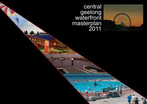
central<br />
geelong<br />
waterfront<br />
masterplan<br />
2011
Contact: Andrew Ross<br />
Coordinator Central <strong>Geelong</strong> & Waterfront<br />
aross@geelongcity.vic.gov.au<br />
03 5272 4835<br />
1
CONTENTS<br />
Context &UN-HABITAT ................................................................................................................................ 5<br />
Environmentally Sustainable Design & Summary <strong>of</strong> Awards won by Waterfront <strong>Geelong</strong>............................. 6<br />
Background.................................................................................................................................................. 7<br />
Design Principles.......................................................................................................................................... 8<br />
Development & Building Guidelines............................................................................................................. 9<br />
Development & Management Priorities........................................................................................................ 10<br />
Strategic Waterfront Projects.................................................................................................................. 11-13<br />
Western Precinct.......................................................................................................................................... 14<br />
Site a Rippleside to Griffi n's Gully............................................................................................... 15<br />
Site b Griffi n's Gully to Western Beach Boat Club.................................................................. 16-17<br />
Central Precinct............................................................................................................................................ 18<br />
Western Beach Marine Precinct & Development Guidelines...................................................... 19<br />
Site c1 Western Beach Boat Club............................................................................................... 20<br />
Site c2 T.S. Barwon Sea Scouts.................................................................................................. 21<br />
Site c3 & c4 Western Beach Boat Yard & Seaplane Mooring...................................................... 22<br />
Site d Western Beach Car Park.................................................................................................. 23<br />
Site e Youth Activities Area & Children's Playground.................................................................. 24<br />
Site f Cunningham Pier & Forecourt...................................................................................... 25-26<br />
Site g Waterfront Pavilion Site.................................................................................................... 27<br />
Site h & i Steampacket Quay, Carousel & Alexander Thompson Jetty....................................... 28<br />
Site j Customs Plaza................................................................................................................... 29<br />
Site k & l Steampacket Gardens, Wharf Shed & Le Parisien...................................................... 30<br />
Site m Yarra Street Pier............................................................................................................... 31<br />
Site n Fishermen's Basin............................................................................................................. 32<br />
Site o, p & q Fishermen's Pier Restaurant, Fairnie & Transvaal Parks....................................... 33<br />
Site r Royal <strong>Geelong</strong> Yacht Club................................................................................................. 34<br />
Site s Victorian Sailing School..................................................................................................... 35<br />
Site t Hi Lite Park......................................................................................................................... 35<br />
Eastern Precinct........................................................................................................................................... 36<br />
Site u Eastern Beach Hills & Flats............................................................................................... 37<br />
Site v Ritchie Boulevard.............................................................................................................. 38<br />
Site w Eastern Beach Swimming Pool and Sea Baths............................................................... 39<br />
Site x Eastern Park Foreshore & Embankment.......................................................................... 40<br />
APPENDICES<br />
1 Central <strong>Geelong</strong> Urban Design Guidelines Element 8: Contribution to the Public<br />
Environment & Waterfront<br />
2a Guidelines for small scale commercial (kiosk) facilities<br />
2b Guidelines for small scale fi xed fi tness/recreation facilities<br />
3 Concept <strong>of</strong> possible Spa Development at Eastern Beach Mineral Spring<br />
4 Planning Zones<br />
5 Planning Overlays<br />
6 Waterfront <strong>Geelong</strong> Design and Development Code 1996 - Design Objectives and<br />
Design & Development Principles Summary<br />
7 Bibliography/Reference Documents<br />
8a Materials and Surfaces Inventory - Western Precinct - Rippleside to Griffi n's Gully<br />
8b Materials and Surfaces Inventory - Western Precinct - Griffi n's Gully to Western Beach Boat Club<br />
9 Materials and Surfaces Inventory - Central Waterfront - Western Beach Boat Club to Cunningham Pier<br />
10 Materials and Surfaces Inventory - Central Waterfront - Waterfront Quay to Fishermen's Basin<br />
11 Materials and Surfaces Inventory - Central Waterfront - Fairnie Park to Hi Lite Park<br />
12a Materials and Surfaces Inventory - Eastern Beach Reserve - Eastern Beach Flats, Hills & Ritchie Boulevard<br />
12b Materials and Surfaces Inventory - Eastern Beach Reserve - Eastern Beach Swimming Baths & Pool<br />
13 Materials and Surfaces Inventory - Eastern Park - Eastern Park Foreshore and Embankment<br />
CENTRAL GEELONG WATERFRONT MASTERPLAN 2011<br />
3<br />
Urban Initiatives
CENTRAL GEELONG WATERFRONT MASTERPLAN 2011<br />
eastern precinct<br />
western precinct<br />
central precinct<br />
Urban Initiatives<br />
4
context<br />
The <strong>City</strong> <strong>of</strong> <strong>Greater</strong> <strong>Geelong</strong> encompasses rural, coastal and urban communities. Council’s ambition is to promote prosperous and cohesive communities throughout the municipality that <strong>of</strong>fer a range <strong>of</strong> exceptional environments. Council<br />
plans to further develop <strong>Geelong</strong> as an international waterfront city that boasts fi rst class facilities and caters for a wide range <strong>of</strong> events and activities. By strengthening the city’s unique urban identity, promoting sustainable growth and<br />
through further improvements to the public environment, Council aims to position <strong>Geelong</strong> and its waterfront as a highly desirable destination.<br />
The Corio Bay waterfront lies at the heart <strong>of</strong> the city. From 1996 to 2000, the <strong>City</strong> in conjunction with the State Government spent over $30million on public realm improvements, positioning Waterfront <strong>Geelong</strong> as a premier waterfront<br />
location. This environment needs to be maintained by delivering a consistently higher level <strong>of</strong> cleanliness and maintenance than is generally found in other parts <strong>of</strong> the city to support and build upon the high level <strong>of</strong> programmed and<br />
unprogrammed activities already achieved in the precinct. Continuous improvement is essential to retain the popularity <strong>of</strong> Waterfront <strong>Geelong</strong>.<br />
un-habitat - united nations human settlements programme - 10 principles for sustainable urban waterfront development<br />
The United Nations Human Settlements Programme, UN-HABITAT, is mandated by the UN General Assembly to promote socially and environmentally sustainable towns and cities with the goal <strong>of</strong> providing adequate shelter for all.<br />
The following 10 principles <strong>of</strong> Sustainable Urban Waterfront Development were approved by the United Nations Urban 21 project and were drawn up at a series <strong>of</strong> international seminars promoted by Wasserstadt GmbH, Berlin with the co-operation <strong>of</strong> the<br />
International Centre Cities on Water, Venice.<br />
Principle 1 - Secure the quality <strong>of</strong> water and the environment. The quality <strong>of</strong> water in the system <strong>of</strong> streams, rivers, canals, lakes, bays and the sea is a prerequisite for all waterfront developments.<br />
Principle 2 - Waterfronts are part <strong>of</strong> the existing urban fabric. New waterfronts should be concieved as an integral part <strong>of</strong> the existing city and contribute to its vitality. Water is a part <strong>of</strong> the urban landscape and should be utilised for specific functions such<br />
as waterborne transport, entertainment and culture.<br />
Principle 3 - The historic identity gives character. Collective heritage <strong>of</strong> water and city, <strong>of</strong> events, landmarks and nature should be utilised to give the waterfront redevelopment character and meaning. The preservation <strong>of</strong> the industrial past is an integral<br />
element <strong>of</strong> sustainable redevelopment.<br />
Principle 4 - Mixed use is a priority. Waterfronts should celebrate the water by <strong>of</strong>fering a diversity <strong>of</strong> cultural, commerical and residential uses. Those that require access to water should have priority. Housing neighbourhoods should be mixed both<br />
functionally and socially.<br />
Principle 5 - Public access is a prerequisite. Waterfronts should be both physically and visually accessible for<br />
locals and tourists <strong>of</strong> all ages and income. Public spaces should be <strong>of</strong> high quality construction and robust<br />
materials to allow for intensive use.<br />
Principle 6 - Planning in public-private partnerships speeds the process. New waterfront developments<br />
should be planned in public-private partnerships. Public authorities must ensure the quality <strong>of</strong> the design,<br />
supply infrastructure and generate social equilibrium. Private developers should be involved early on<br />
to ensure knowledge <strong>of</strong> the market and facilitate development. The coordinators <strong>of</strong> complex waterfront<br />
developments must guarantee their long term economic, social and ecological success.<br />
Principle 7 - Public participation is an element <strong>of</strong> sustainability<br />
Cities should benefit from sustainable waterfront development not only in ecological and economical terms<br />
but also socially. The community should be informed and involved in discussions continuously from the start.<br />
Principle 8 - Waterfronts are long term projects<br />
Waterfronts need to be redeveloped step by step so the entire city can benefit from their potentials.<br />
They are a challenge for more than one generation and need a variety <strong>of</strong> characters both in<br />
architecture, public space and art. Public administration must give impulses on a political level to ensure that<br />
the objectives are realised independantly <strong>of</strong> economic cycles or short-term interests.<br />
Principle 9 - Re-vitalisation is an ongoing process<br />
All masterplaning must be based on the detailled analysis <strong>of</strong> the principle functions and meanings the<br />
waterfront concerned. Plans should be flexible, adapt to change and incorporate all relevant disciplines. To<br />
encourage a system <strong>of</strong> sustainable growth, the management and operation <strong>of</strong> waterfronts during the day and<br />
at night must have equal priority to building them.<br />
Principle 10 - Waterfronts pr<strong>of</strong>it from international networking<br />
The redevelopment <strong>of</strong> waterfronts is a highly complex task that involves pr<strong>of</strong>essionals <strong>of</strong> many<br />
disciplines. The exchange <strong>of</strong> knowledge in an international network between contacts involved in<br />
waterfronts on different levels <strong>of</strong>fers both individual support and information about the most important<br />
projects completed or underway. Further information at www.waterfront-net.org.<br />
CENTRAL GEELONG WATERFRONT MASTERPLAN 2011<br />
5<br />
Urban Initiatives
environmental sustainability<br />
CENTRAL GEELONG WATERFRONT MASTERPLAN 2011<br />
The intention <strong>of</strong> sustainable design is to reduce or eliminate negative environmental impact through skillful, sensitive design which allows people to relate with the natural environment.<br />
With our changing global environment, all actions undertaken, or future developments referenced in this document must take into consideration sustainable design principles and climate change adaptation.<br />
The built environment should comply with the principles <strong>of</strong> economic, social and ecological sustainability, including, but not limited to:<br />
• The use <strong>of</strong> low impact materials - non-toxic, sustainably produced or recycled;<br />
• Energy effi cient manufacturing processes and the production <strong>of</strong> materials, products or equipment that requires less energy to operate or maintain;<br />
• Quality and durability - longer lasting and better functioning materials, products and equipment requires less maintenance and generally lasts longer needing less replacement;<br />
• Materials should be locally or regionally sourced from sustainably managed renewable sources.<br />
summary <strong>of</strong> awards won by the geelong waterfront<br />
1996<br />
• Royal Australian Planning Institute, Award for Planning Excellence in Urban Planning Achievement, Waterfront <strong>Geelong</strong> Design and Development Code<br />
1998<br />
• Australian Institute <strong>of</strong> Landscape Architects, National Project Award <strong>of</strong> Merit for design <strong>of</strong> public spaces, Waterfront <strong>Geelong</strong><br />
• Streetsmart, Best Overall Project, Waterfront <strong>Geelong</strong><br />
• Streetsmart, Best Project – Pedestrian Precincts, Waterfront <strong>Geelong</strong><br />
1999<br />
• Waterfront Centre Honour Award (Charleston, USA), Excellence in Waterfront Design, Waterfront <strong>Geelong</strong><br />
• Property Council <strong>of</strong> Australia, Top 16 Public Sector Projects to attract significant private sector investment, Waterfront <strong>Geelong</strong>.<br />
2000<br />
• Australian Institute <strong>of</strong> Landscape Architects, Victorian Chapter Merit Award for transport infrastructure, Waterfront <strong>Geelong</strong><br />
2001<br />
• Australian Property Institute Excellence in Property Awards, Land Victoria Local Government Property Award, Waterfront <strong>Geelong</strong><br />
• Streetsmart, Best Project, Waterfront <strong>Geelong</strong><br />
• Australian Institute <strong>of</strong> Landscape Architects, Victorian and Tasmanian Chapter Merit Award for Civic Design, Waterfront <strong>Geelong</strong><br />
• Australian Institute <strong>of</strong> Landscape Architects, Victorian and Tasmanian Chapter Landscape Excellence Award, Waterfront <strong>Geelong</strong><br />
• Australian Institute <strong>of</strong> Landscape Architects, Victorian & Tasmanian Chapter, Transport & Infrastructure Award, Waterfront <strong>Geelong</strong><br />
2002<br />
• Planning Institute <strong>of</strong> Australia, Australia Award for Urban Design Excellence, Waterfront <strong>Geelong</strong><br />
• Australian Steel Construction Industry, Victorian Architectural Award, Carousel Pavilion<br />
• Australian Steel Construction Industry, Premier Award, Commendation, Carousel Pavilion<br />
• Australian Institute <strong>of</strong> Landscape Architects, Award for Landscape Excellence - Most Outstanding Project Nationally, Waterfront <strong>Geelong</strong><br />
• Australian Institute <strong>of</strong> Landscape Architects, Project Award for Public Open Spaces - Most outstanding project, Waterfront <strong>Geelong</strong><br />
• International Waterfront Centre (Washington DC, USA) Top Honour Project, Waterfront <strong>Geelong</strong>.<br />
2003<br />
• Victorian Coastal Council, Awards for Excellence, Building and Design, Carousel Pavilion<br />
2004<br />
• International Federation <strong>of</strong> Landscape Architects, Vice Presidents Award for Built Environment (Eastern Region), Waterfront <strong>Geelong</strong>.<br />
• Year <strong>of</strong> the Built Environment, Dept. <strong>of</strong> Sustainability & Environment, Towards Sustainable Communities. My Favourite Place Competition – Waterfront <strong>Geelong</strong>.<br />
• <strong>Geelong</strong> Advertiser Business Excellence Awards, New and Emerging Business Award - Carousel.<br />
2006<br />
• <strong>Geelong</strong> Advertiser Business Excellence Awards. Attractions, Events & Services Award - Carousel.<br />
2009<br />
• Australian Institute <strong>of</strong> Landscape Architects, Winner, “Award <strong>of</strong> Excellence in Landscape Architecture”, Southern Region Design Awards, Youth Activity Area<br />
• Australian Institute <strong>of</strong> Landscape Architects, Winner, “Victoria Medal for Landscape Architecture”, Annual Design Awards, Youth Activities Area<br />
• Cement & Concrete Association <strong>of</strong> Australia, Public Domain Awards, State Winner Victoria, Youth Activity Area.<br />
• Cement & Concrete Association <strong>of</strong> Australia, Public Domain Awards, Winner Precincts, Youth Activity Area.<br />
• Institute <strong>of</strong> Public Works Engineering Australia. Victorian Excellence Awards. Youth Activities Area<br />
• Keep Australia Beautiful Victoria - Sustainable Cities. Friendly Beach Award - Eastern Beach<br />
2010<br />
• Australia Award for Urban Design, Planning Institute <strong>of</strong> Australia. Youth Activity Area.<br />
• Australian Institute <strong>of</strong> Landscape Architects, Winner, “Landscape Architecture Award”, National Design Awards, Youth Activity Area<br />
• National Trust <strong>of</strong> Australia, <strong>Geelong</strong> Region, “Heritage Award”, Eastern Beach Seawalls.<br />
Urban Initiatives<br />
6
ackground<br />
This document updates the Waterfront <strong>Geelong</strong> Design and Development<br />
Code 1996 (the Code), a master plan document prepared by Keys Young in<br />
conjunction with the <strong>City</strong> <strong>of</strong> <strong>Greater</strong> <strong>Geelong</strong>.<br />
The Code laid the groundwork for the development that occurred on the<br />
waterfront from 2000 until 2010. During that time most <strong>of</strong> the key sites were<br />
developed and many <strong>of</strong> the improvements to the public realm foreshadowed<br />
in the Code were completed. It is timely to refl ect on past achievements and<br />
remaining opportunities. Following public realm improvements that generally<br />
occured from 1996 to 2000, the precinct experienced rapid growth with the<br />
development <strong>of</strong> privately owned sites from 2000 to 2010. There are a few<br />
development sites still available, as well as various proposals for further<br />
waterfront infrastructure. This review aims to canvass some <strong>of</strong> the remaining<br />
development options in the context <strong>of</strong> the original Code’s design principles<br />
and <strong>of</strong>fers an analysis <strong>of</strong> the changes that fl owed from them.<br />
In addition to the immediate waterfront area, the Code encompassed a small<br />
part <strong>of</strong> the central <strong>Geelong</strong> retail precinct. This review will narrow its scope<br />
by concentrating on the waterfront between Rippleside Park and Limeburners<br />
Point. Work subsequent to the Code has seen the production <strong>of</strong> various<br />
planning documents that specifi cally cover development in the Central<br />
Activities Area and the inner western area <strong>of</strong> the city. These include:<br />
• <strong>Geelong</strong> Western Wedge Framework - 2005<br />
• Central <strong>Geelong</strong>: Looking Forward Structure Plan - 2007<br />
• Central <strong>Geelong</strong> Urban Design Guidelines - 2008<br />
This review <strong>of</strong> the Waterfront <strong>Geelong</strong> Master Plan is premised upon Council's<br />
view that the central waterfront will continue to be managed and developed<br />
as a dynamic recreation destination for residents and visitors. The western<br />
and eastern precincts <strong>of</strong> Corio Bay will continue to be locally focused <strong>of</strong>fering<br />
quieter passive areas, attractive parkland and waterfront spaces, trails and<br />
landscapes.<br />
The Central <strong>Geelong</strong> Waterfront Master Plan 2011 is intended to be appended<br />
as a reference document to the <strong>Greater</strong> <strong>Geelong</strong> Planning Scheme. It will be<br />
referred to by:<br />
• Council <strong>of</strong>fi cers and their consultants when dealing with applications to<br />
develop waterfront property including public spaces;<br />
• Council <strong>of</strong>fi cers and their consultants when modifying or managing<br />
existing public spaces along the waterfront;<br />
• Developers and their consultants and business operators when<br />
considering a development or business proposal.<br />
The redevelopment <strong>of</strong> the <strong>Geelong</strong> waterfront in the 1990s from an industrial<br />
and maritime precinct into one <strong>of</strong> Australia's most vibrant recreational and<br />
tourism waterfront sites, has become the cornerstone <strong>of</strong> the city's economic<br />
revitalisation and a great source <strong>of</strong> community pride.<br />
In 1994, the State Government and the <strong>City</strong> <strong>of</strong> <strong>Greater</strong> <strong>Geelong</strong> funded a<br />
$30 million redevelopment <strong>of</strong> the <strong>Geelong</strong> waterfront. The project, completed<br />
in 2000, has been the catalyst for approximately $350 million in private<br />
investment to date. A further $150 million in private investment is anticipated<br />
by the end <strong>of</strong> 2012.<br />
Set in a new urban landscape based on the city's maritime history and a<br />
contemporary urban culture, the waterfront is the setting for a range <strong>of</strong><br />
restaurants, cafes, hotels, museums and public artworks. Opportunities<br />
to enjoy the outdoors include sites such as the <strong>Geelong</strong> Botanic Gardens,<br />
a range <strong>of</strong> public open spaces, the Baywalk along Corio Bay, pools and<br />
playgrounds as well as countless events and water-based activities.<br />
The waterfront has become the reason why local people to stay in their<br />
own backyard on weekends and holidays, and also the motivating factor for<br />
thousands <strong>of</strong> visitors who journey to <strong>Geelong</strong> each year. Waterfront <strong>Geelong</strong><br />
has assumed iconic status in the marketing <strong>of</strong> the city and now attracts<br />
and plays host to a range <strong>of</strong> local, national and international events. The<br />
waterfront has now proven its potential to generate business investment and<br />
boost tourim expenditure in the region. Visitor numbers have grown to 1.7<br />
million annually and the precinct is now the setting for over 50 public events<br />
each year.<br />
The <strong>City</strong> <strong>of</strong> <strong>Greater</strong> <strong>Geelong</strong> is responsible for much <strong>of</strong> the urban foreshore<br />
area as well as adjacent areas <strong>of</strong> public open space. In accordance with<br />
the Crown Land (Reserves) Act 1978, the Department <strong>of</strong> Sustainability and<br />
Environment has delegated the management <strong>of</strong> waterfront Crown land to the<br />
<strong>City</strong> <strong>of</strong> <strong>Greater</strong> <strong>Geelong</strong>.<br />
The <strong>Geelong</strong> Lands (Steampacket Place) Act 1996 also allows for Crown land<br />
in the precinct be capable <strong>of</strong> being leased for longer periods and for different<br />
purposes from those set out in the Land Act 1958 and the Crown Land<br />
(Reserves) Act 1978.<br />
Additionally the <strong>City</strong> administers the the <strong>Greater</strong> <strong>Geelong</strong> Planning Scheme<br />
and is owner and manager <strong>of</strong> other public coastal land and facilities including<br />
roads, boat ramps and drainage infrastructure.<br />
Given the high level <strong>of</strong> use and the harsh nature <strong>of</strong> the coastal setting, the<br />
infrastructure, buildings, fi xtures and landscapes along the waterfront area<br />
need to be robust and well maintained.<br />
The <strong>City</strong> <strong>of</strong> <strong>Greater</strong> <strong>Geelong</strong> is committed to the continual improvement <strong>of</strong> Waterfront <strong>Geelong</strong>.<br />
This document seeks to guide that process in the interests <strong>of</strong> the people <strong>of</strong> <strong>Geelong</strong>.<br />
CENTRAL GEELONG WATERFRONT MASTERPLAN 2011<br />
7<br />
Urban Initiatives
design principles<br />
CENTRAL GEELONG WATERFRONT MASTERPLAN 2011<br />
Although this review broadly endorses the principles underpinning the<br />
1996 <strong>Masterplan</strong> (Appendix 6) they are reformulated here to express some<br />
additional contemporary priorities.<br />
Future development <strong>of</strong> the waterfront must:<br />
• Protect and enhance the coastal environment;<br />
• Ensure the waterfront is an attractive, accessible destination <strong>of</strong>fering a<br />
range <strong>of</strong> experiences and places, including access to and engagement<br />
with the water;<br />
• Prevent the alienation <strong>of</strong> public open space and maximise public access<br />
throughout the waterfront precinct;<br />
• Ensure that developments make a positive contribution to adjoining<br />
public space and contribute to the prevailing character <strong>of</strong> the precint;<br />
• Protect and enhance important views across, and to Corio Bay, as<br />
well as vistas to buildings and other landmarks <strong>of</strong> heritage and cultural<br />
signifi cance;<br />
• Protect and enhance the views <strong>of</strong> the waterfront from the north-south<br />
streets <strong>of</strong> Central <strong>Geelong</strong>;<br />
• Promote pedestrian priority, improved pedestrian links back to the city,<br />
East and West <strong>Geelong</strong> and aim to achieve a continuous path <strong>of</strong> travel<br />
along the water's edge.<br />
• Promote waterfront development that is environmentally, socially and<br />
economically sustainable and responsible;<br />
• Avoid over-development and ensure protection and adaptive reuse <strong>of</strong><br />
heritage buildings and places;<br />
• Contain active frontages at ground level to encourage street life.<br />
• Include on-site screened enclosures for rubbish, recycling and other<br />
utilites to ensure they are visually unobtrusive.<br />
Further, ongoing management <strong>of</strong> the waterfront should aim for the orderly<br />
and harmonious coordination <strong>of</strong> a variety <strong>of</strong> activities and events while<br />
maintenance <strong>of</strong> public open space should continue to a high standard.<br />
A healthy balance between commercial and free activities should be promoted<br />
in the waterfront precinct with the aim <strong>of</strong> maintaining the precinct as a busy,<br />
vital location. Such management will contribute to perceptions <strong>of</strong> the <strong>Geelong</strong><br />
waterfront as a welcoming and attractive destination.<br />
Urban Initiatives<br />
8
development & building guidelines<br />
The Central <strong>Geelong</strong> Urban Design Guidelines adopted by Council in October<br />
2008 provide guidelines for the development <strong>of</strong> built form in the waterfront<br />
area, consistent with the aims <strong>of</strong> the Central <strong>Geelong</strong> Waterfront <strong>Masterplan</strong><br />
2011. The guidelines are cited in full in Appendix 1 <strong>of</strong> this document.<br />
The guidelines suggest that building height and scale on the waterfront<br />
should be subservient to the built form <strong>of</strong> the city, except in the case <strong>of</strong><br />
potentially 'iconic' buildings. Such buildings must provide a nett community<br />
benefi t in the form <strong>of</strong> improved access, increased activation <strong>of</strong> adjacent<br />
spaces and an increase in on-street activity such as al-fresco dinning.<br />
The guidelines also seek to ensure that development in the waterfront area<br />
separates building segments to avoid continuous built form. This provides<br />
greater accesability and protects views across Corio Bay and back towards<br />
the city. The principal implication <strong>of</strong> this is that buildings along the waterfront<br />
should be less than 24 metres or 6 storeys in height, stepping down further<br />
in height towards Western/Eastern Beach Roads unless a proposal was so<br />
singular that it achieved the level <strong>of</strong> 'iconic' building status. Buildings on piers<br />
and along the foreshore should respond to the adjacent environment, and not<br />
exceed a maximum height <strong>of</strong> 16 metres or 4 storeys.<br />
The precinct currently sits in Special Use Zone 2 <strong>of</strong> the <strong>Greater</strong> <strong>Geelong</strong><br />
Planning Scheme. This will change to an Activity Centre Zone in the near<br />
future. Further information can be obtained from Council's Planning Unit.<br />
CENTRAL GEELONG WATERFRONT MASTERPLAN 2011<br />
9<br />
Urban Initiatives
CENTRAL GEELONG WATERFRONT MASTERPLAN 2011<br />
development & management priorities<br />
In addition to the broad design principles above, future development and<br />
ongoing management <strong>of</strong> the waterfront should aim to pursue the following<br />
priorities:<br />
• A reasonable balance between open water and marine activity should be<br />
maintained.<br />
• Swing moorings should be contained as much as possible to the<br />
existing area <strong>of</strong>f Western Beach generally between Cunningham Pier<br />
and Griffi ths Gully jetty allowing open water to be maintained between<br />
Cunningham Pier and the western side <strong>of</strong> the Royal <strong>Geelong</strong> Yacht Club<br />
Marina and the eastern side <strong>of</strong> the Royal <strong>Geelong</strong> Yacht Club Marina<br />
and Limeburners Point.<br />
• Views to and across the bay should be maintained or enhanced in any<br />
future development on or adjacent to the waterfront.<br />
• Views from north/south city streets should be unimpeded by city<br />
developments.<br />
• Redevelopment <strong>of</strong>/on piers which propose built form above pier decks<br />
or over water should not include continuous structures that impede east/<br />
west views across Corio Bay.<br />
• Any new development or modifi cations to existing facilities or lease<br />
arrangements should seek to maximise public access to the waterfront<br />
and in particular direct access to the water's edge.<br />
• Wayfi nding signage should be enhanced to provide clear directions<br />
around the waterfront and from the city to the waterfront.<br />
• Existing trees should be maintained to a high standard and damaged or<br />
sick trees should be replaced on a timely basis. New plantings should<br />
be carefully considered to enhance the existing landscape and achieve<br />
high levels <strong>of</strong> amenity and sustainability. Specifically, planting should<br />
aim to build upon the signature tree plantings <strong>of</strong> the central waterfront<br />
and the eastern enbankement and be suffi ciently robust to withstand<br />
the marine environment. Where possible, tree planting should create<br />
generous areas <strong>of</strong> shade but not interrupt ground level views to the<br />
water. Ornamental planting should be low maintenance and drought<br />
tolerant.<br />
• The palette <strong>of</strong> materials used on the waterfront must be robust and<br />
long lasting. The central waterfront should continue to be characterised<br />
by high quality materials such as timber, natural stone and aggregate<br />
concrete, stainless and Corten steel and custom designed lighting and<br />
furniture. The materials palette <strong>of</strong> the more informal areas <strong>of</strong> the western<br />
and eastern precincts includes asphalt and concrete, bluestone, painted<br />
timber, grass and gravel and should generally continue to be used in<br />
these areas. (See appendices for Materials & Surfaces Inventory).<br />
• Further comissioning <strong>of</strong> major art installations should be pursued for<br />
selected sites and as part <strong>of</strong> new developments and public spaces.<br />
• Public conveniences on the waterfront are limited. The existing facilities<br />
should be improved and additional accessible facilities should be added.<br />
This is a critical consideration for new developments.<br />
• Additional small retail facilities such as refreshment, newspaper or fl ower<br />
kiosks could be developed on the waterfront.<br />
• Fixed small-scale recreational and fi tness facilities could be installed on<br />
the waterfront. (See appendix 2B for guidelines).<br />
Urban Initiatives<br />
10
strategic waterfront projects<br />
A number <strong>of</strong> strategic projects are being considered for Waterfront <strong>Geelong</strong><br />
including the <strong>Geelong</strong> Exhibition & Convention Centre, the rebuilding <strong>of</strong> the<br />
Yarra Street Pier and the development <strong>of</strong> the Eastern Beach Mineral Springs<br />
Spa. In addition, other strategic projects include the Stage 2 development <strong>of</strong><br />
the Youth Activities Area at Western Beach and the transition <strong>of</strong> the Western<br />
Beach Boat Yard from industrial to public use.<br />
yarra street pier<br />
“Boating is an important recreational and social outlet for many people. Boat<br />
registration is increasing faster than population growth. The size <strong>of</strong> boats<br />
is increasing, as is the demand for launching, retrieval and storage. The<br />
boating industry contributes signifi cantly to employment and economic activity<br />
in Victoria, with direct expenditure on boating <strong>of</strong> $1.4 billion in 2005, as well<br />
as contributing to our health and enjoyment <strong>of</strong> the coast". (Central Coastal<br />
Board, 2007).<br />
It is important to understand and strategically manage the increasing demand<br />
for improved and new boating facilities. We need to provide safe access to,<br />
from and on the water while ensuring impacts on the natural environment and<br />
coastal processes are minimised. The safety <strong>of</strong> boat users and swimmers is<br />
paramount”. Victorian Coastal Strategy, 2008<br />
As stated in the Victorian Coastal Strategy, there is an increasing demand<br />
for recreational boating destinations. Economically important commercial<br />
fi shing fl eets, diving vessels, tourism operations and marine management,<br />
research, and search and rescue boats also operate from boat ramps and<br />
facilities along the coast. As one <strong>of</strong> the only north-facing bays in Australia,<br />
Corio Bay is well positioned to capitalize on the growth in recreational boating<br />
as it provides exceptional access to Melbourne and Port Phillip Heads and<br />
supports an interesting array <strong>of</strong> sea life including migrating whales, sun fi sh<br />
and seals.<br />
Corio Bay annually hosts the largest sailing event in the southern hemisphere,<br />
Victoria Week, a major event attracting over 400 national and international<br />
yachts and more than 4,000 competitors.<br />
Yarra Street Pier was originally built in the middle <strong>of</strong> the nineteenth century as<br />
a commercial wharf. It was totally destroyed by fi re in 1988. Remnants <strong>of</strong> the<br />
old pier remain on the sea bed and are a boating and swimming hazard.<br />
Due to the private ownership <strong>of</strong> Cunningham Pier to the west, the city lacks a<br />
full-sized public pier suitable for itinerant berthing and large vessels.<br />
This project will see the reinstatement <strong>of</strong> the public pier at the termination <strong>of</strong><br />
Yarra Street incorporating wave attenuation and itinerant berthing facilities.<br />
It will also see the development <strong>of</strong> functional and accessible wharfage in<br />
Fishermen’s Basin and the expansion <strong>of</strong> the Royal <strong>Geelong</strong> Yacht Club<br />
Marina, currently at capacity.<br />
Private sector commercial investment will be sought for business<br />
opportunities on and adjacent to the pier.<br />
The project will provide a strong visible connection between the city and the<br />
water and will deliver diverse social and recreational opportunities for the<br />
community. The project will create and support jobs in related industries and<br />
will reinforce <strong>Geelong</strong>’s reputation as an attractive and accessible boating<br />
destination.<br />
CENTRAL GEELONG WATERFRONT MASTERPLAN 2011<br />
11<br />
Urban Initiatives
geelong convention and exhibition centre<br />
CENTRAL GEELONG WATERFRONT MASTERPLAN 2011<br />
The tourism sector is one <strong>of</strong> the fastest growing sectors in the economy. It<br />
is projected to 2020 that 43% <strong>of</strong> national economic growth will be in tourism.<br />
The high level <strong>of</strong> commitment to exploiting emerging opportunities in this<br />
sector provides strong impetus for a project <strong>of</strong> this type for the <strong>Geelong</strong><br />
region. A convention and exhibition facility in the <strong>Geelong</strong> region will not<br />
only enhance the <strong>of</strong>fering provided to both leisure and business tourists to<br />
the <strong>Geelong</strong> region, it will drive continued economic and industrial growth<br />
in a nationally important region. The <strong>Geelong</strong> Convention and Exhibition<br />
Centre will provide an opportunity to implement the strategies the Federal<br />
Government has set out in its Tourism White Paper.<br />
The <strong>Geelong</strong> Convention and Exhibition Centre is proposed to be sized to<br />
cater for 1000 delegates and have 3000m 2 <strong>of</strong> exhibition space with associated<br />
catering and break-out facilities. A centre <strong>of</strong> this scale would attract a hotel<br />
development <strong>of</strong> 150 to 200 rooms.<br />
The <strong>Geelong</strong> Convention and Exhibition Centre would create a new industry<br />
for <strong>Geelong</strong> with the potential to create 1,400 jobs and inject $663m into<br />
the economy. A convention Centre would also maximise return on existing<br />
industries in <strong>Geelong</strong> by providing a knowledge centre to for the region.<br />
The most desirable location for the <strong>Geelong</strong> Convention and Exhibition<br />
Centre would be Waterfront <strong>Geelong</strong> with its stunning views across Corio Bay<br />
to the You Yangs. This addition to the waterfront would enhance the precinct<br />
and capitalize on <strong>Geelong</strong>’s reputation as a waterfront city.<br />
This project is likely to be a public-private partnership with the State<br />
Government.<br />
eastern beach mineral springs spa<br />
The Eastern Beach Mineral Springs Spa development will be a facility<br />
designed for the <strong>Geelong</strong> community and visitors. It will provide further<br />
diversifi cation <strong>of</strong> waterfront activities and will promote the city to a wider<br />
audience. It is important that the project provides affordable services to the<br />
local community and provides a public benefi t due to the site status. The<br />
development may include spa baths (including a communal facility), salt water<br />
baths, wellness, health and beauty services.<br />
The development <strong>of</strong> a spa complex is fully supported by Tourism Victoria<br />
who have provided fi nancial assistance to undertake research and feasibility<br />
studies.<br />
The project is designed to be delivered and operated by the private sector.<br />
Melbourne Convention Centre<br />
Melbourne Convention Centre<br />
Le Mirage Spa, Namibia<br />
Urban Initiatives<br />
12
youth activities area<br />
The <strong>Geelong</strong> Youth Activities Area (YAA) is a public recreational plaza at<br />
Western Beach on the waterfront adjacent to the CBD. It is an innovatively<br />
designed, flexible, multi-purpose outdoor youth-focused area that contains<br />
open-air spaces suitable for a range <strong>of</strong> activities and events including<br />
markets, live music, art exhibitions, catwalk, dance, street theatre, BMX<br />
riding, basketball, skate boarding, interactive media, wireless internet and<br />
seating.<br />
The aim <strong>of</strong> the project was to provide young people with a venue, programs<br />
and activities that are accessible in location, choice and affordability and<br />
that encourage participation, social interaction, recreation and community<br />
inclusiveness. <strong>Geelong</strong> youth were actively involved in the planning and<br />
design <strong>of</strong> the facility through focus groups, surveys, site visits and one-on-one<br />
meetings.<br />
The precinct <strong>of</strong>fers a unique, non-threatening and highly personal space and<br />
is a practical solution to connecting young people with their community which<br />
in turn improves the wellbeing <strong>of</strong> all <strong>of</strong> residents and contributes in a positive<br />
way to the liveability <strong>of</strong> the city.<br />
The YAA covers an area <strong>of</strong> around 4,000m 2 on the waters edge. Stage 1 was<br />
completed in 2008 and has not only been successful with users, but has also<br />
received several notable awards for planning, design and construction.<br />
Stage 2 <strong>of</strong> the project includes the future expansion <strong>of</strong> the area to include<br />
viewing terraces, a climbing wall and improved pedestrian access at<br />
Gheringhap Street & Western Beach Road.<br />
Stage 2 is projected to cost approximately $1.2 million and would require a<br />
joint funding arrangement between Council and other tiers <strong>of</strong> government.<br />
other anchor activities<br />
For the waterfront to continue to grow it needs more anchor activities to<br />
provide a broader tourist experience. Further activities will widen the appeal<br />
<strong>of</strong> the waterfront.<br />
These activites could be provided by the private sector with support from two<br />
or more tiers <strong>of</strong> government.<br />
CENTRAL GEELONG WATERFRONT MASTERPLAN 2011<br />
13<br />
Urban Initiatives
western precinct<br />
CENTRAL GEELONG WATERFRONT MASTERPLAN 2011<br />
This area constitutes the western edge <strong>of</strong> the <strong>Geelong</strong> waterfront running<br />
from Rippleside Park to the northern edge <strong>of</strong> the Western Beach Boat<br />
Club and is zoned PPRZ (Public Park and Recreation Zone) in it’s entirety.<br />
(The <strong>City</strong> <strong>of</strong> <strong>Greater</strong> <strong>Geelong</strong> forms the Committee <strong>of</strong> Management for the<br />
foreshore area <strong>of</strong> Western Beach under the Crown Land (Reserves) Act<br />
1978, although this currently excludes the seabed in the western precinct.<br />
Negotiations have commenced to transfer management <strong>of</strong> this area to<br />
CoGG.)<br />
The western beach embankment and paths together form a narrow linear<br />
edge to Corio Bay. From the path at the water's edge the steep embankment<br />
rises to meet The Esplanade above. The waterfront pedestrian path is a<br />
well used recreation trail. It affords panoramic views back to the city and<br />
across the bay to Limeburner's Point. The waterfront paths <strong>of</strong>fer the twin<br />
experiences <strong>of</strong> an immediate engagement with the water and a privileged<br />
view from the higher path along the embankment.<br />
This area <strong>of</strong> the <strong>Geelong</strong> waterfront has an unpretentious quality that lends<br />
it a distinct charm. This quality provides a contrasting yet complementary<br />
experience to the more active, highly designed, central waterfront area.<br />
Western Precinct<br />
The Western area includes the following sections <strong>of</strong> the foreshore:<br />
A. Rippleside to Griffins Gully<br />
B. Griffins Gully to Western Beach Boat Club<br />
The informal western edge <strong>of</strong> the <strong>Geelong</strong> waterfront, together with Eastern Park, bracket the busier central waterfront <strong>of</strong> Corio Bay. The waters edge and<br />
embankment paths as well as Griffi n's Gully Jetty afford panoramic views back to the city and across the bay to Limeburner's Point.<br />
Urban Initiatives<br />
14
a<br />
rippleside to griffins gully<br />
Rippleside Park at the northern end <strong>of</strong> the waterfront sits on an escarpment<br />
and is accesible by car from Bell Parade. A sealed, shared path runs south<br />
along the water’s edge while a second path at the top <strong>of</strong> the cliff serves<br />
as the footpath along The Esplanade. The waterside path is retained by a<br />
bluestone sea-wall which is generally in good condition. This wall and the<br />
companion bluestone edging to the ramped and stepped asphalt connections<br />
between the higher and lower paths contribute to the distinctive character<br />
<strong>of</strong> this zone. The lower path enables a direct water's edge experience, set<br />
as it is, just above the water level. In fact the path diverts across the water<br />
on a jetty structure in this stretch <strong>of</strong> the foreshore; a diversion brought about<br />
by continuing cliff instability and the resulting measures to stabilise the<br />
embankment. The higher path on the eastern side <strong>of</strong> The Esplanade includes<br />
occasional, diagonal, branching connections from the embankment to the<br />
foreshore path below.<br />
On the embankment there is an informal mix <strong>of</strong> planted and self sown<br />
vegetation - Wattles, Sheokes, Tamarix, Gorse, Canary Island Date Palms,<br />
native and exotic grasses - forming a plantation which is dense enough to<br />
discourage pedestrian access while the understorey grassing is managed<br />
informally.<br />
There is very little public seating along this section <strong>of</strong> the waterfront and an<br />
increase in the path width would be desirable. The apron area at Rippleside<br />
Park is somewhat degraded. As with the embankment, this edge <strong>of</strong> the<br />
park is in need <strong>of</strong> replanting. Smaller alcoves along the pathway are also<br />
in poor condition. The path, however, is well lit with pole top luminaires at<br />
approximately 30 metre spacings.<br />
This western area has an unpretentious quality that lends it a distinct charm.<br />
This quality provides a contrasting yet complementary experience to the more<br />
active, highly designed, central waterfront area.<br />
The Western Beach Landscape Plan exists for this area and should be<br />
referenced in relation to any landscpae changes.<br />
A<br />
Rippleside to Griffins Gully<br />
Recommendations and Specific Actions<br />
• Use to remain passive, public and low impact with direct water access.<br />
• Restrict the growth <strong>of</strong> existing swing moorings beyond the notional line between Cunningham Pier and Griffi ns Gully Jetty.<br />
• Redevelop foreshore and embankments as recommended in the Western Beach Landscape Plan.<br />
• Limit sea weed accumulation and litter.<br />
CENTRAL GEELONG WATERFRONT MASTERPLAN 2011<br />
15<br />
Urban Initiatives
CENTRAL GEELONG WATERFRONT MASTERPLAN 2011<br />
b<br />
griffins gully to western beach boat club<br />
The long, narrow fi shing jetty is the principal attraction at Griffi n's Gully.<br />
The jetty <strong>of</strong>fers relatively unrestricted views across Corio bay to the city,<br />
Eastern Park and Limeburner's Point, except for the impediment <strong>of</strong> the linear<br />
structure running along the eastern side <strong>of</strong> Cunnimgham Pier.<br />
A sealed asphalt roadway connects The Esplanade to an informal carpark<br />
bounded loosely with treated pine bollards on its southern side and a curved<br />
bluestone edge on its northern side. The shared paths <strong>of</strong> the embankment<br />
and the lower water's edge converge at this point.<br />
The waterfront path continues through to the Western Beach Boat Club and<br />
is well used by cyclists, joggers, dog walkers, strollers and fi sher-people.<br />
This path is retained by a bluestone seawall and abuts a steep embankment<br />
that rises to the Esplanade above. Again it would be desirable to extend the<br />
width <strong>of</strong> the path to provide a shared zone. The embankment is sparsely<br />
vegetated with a mixture <strong>of</strong> Sheoke and Peppercorn trees and a smattering<br />
<strong>of</strong> self-sown Date Palms. The rough understorey <strong>of</strong> grass and weeds<br />
contribute to an air <strong>of</strong> neglect.<br />
The embankment would benefi t from a thoughtful horticultural treatment<br />
which might include a regular planting <strong>of</strong> specimen trees to lend some<br />
additional structure to the landscape. The embankment planting should be<br />
considered in relation to both the signature plantings <strong>of</strong> the central waterfront<br />
and specifi cally to any renewal <strong>of</strong> planting along The Esplanade. Additional<br />
seating along the waterfront path in selected locations should be considered.<br />
B<br />
Griffins Gully to Western Beach Boat Club<br />
Recommendations and Specifi c Actions<br />
• To be treated in the same manner as section A.<br />
Urban Initiatives<br />
16
Care should be taken to protect the relatively ‘forgotten’ nature <strong>of</strong> this western<br />
beach area, distinct as it is from the central waterfront precinct.<br />
Additions or developments in this western beach zone should take account<br />
<strong>of</strong> this informal character and not dramatically change the path system or the<br />
prevailing landscape character.<br />
Access to the higher path is served by ramped asphalt paths across the<br />
embankment which meet the water's edge path every few hundred metres<br />
and these should be retained.<br />
At the easternmost point <strong>of</strong> this area, adjacent to the western edge <strong>of</strong> the<br />
Western Beach Boat Club, seaweed and water-borne rubbish collects. A<br />
clear opportunity exists to clean up this area <strong>of</strong> western beach through regular<br />
maintenance practices. At the same time interpretive material should be<br />
provided that explains the local ecology <strong>of</strong> the seagrass beds found around<br />
this part <strong>of</strong> western beach.<br />
Specifi c Actions<br />
• Install additional public seating<br />
CENTRAL GEELONG WATERFRONT MASTERPLAN 2011<br />
17<br />
Urban Initiatives
central precinct<br />
CENTRAL GEELONG WATERFRONT MASTERPLAN 2011<br />
The central waterfront extends from the western boundary <strong>of</strong> the Western<br />
Beach Boat Club to Ritchie Boulevarde at the beginning <strong>of</strong> Eastern Beach<br />
and is generally zoned SUZ2 (Special use Zone 2) apart from three sites,<br />
Transvaal Square, the former Hi-Lite Park site and the Victorian Sailing and<br />
Water Safety School, which are all zoned PPRZ.<br />
The special use zoning aims to "realise <strong>Geelong</strong>'s potential as a city by<br />
the water and as a destination <strong>of</strong>fering a wide range <strong>of</strong> waterfront related<br />
activities" <strong>Greater</strong> <strong>Geelong</strong> Planning Scheme.<br />
The central waterfront is a more dynamic area than western beach, forming<br />
the interface between the Central Activities Area and Corio Bay.<br />
Changes over the preceding two decades have seen a diverse range <strong>of</strong><br />
facilities, spaces and activities develop in the central zone and some further<br />
development opportunities remain.<br />
This process <strong>of</strong> change and the loss <strong>of</strong> traditional waterfront enterprises<br />
does, however, place this area at risk <strong>of</strong> greater homogenisation. This trend<br />
should be considered in any redevelopment proposals for Cunningham and<br />
Yarra Street Piers and the adjacent Fishermen's Basin. Development <strong>of</strong> the<br />
piers has the potential to bring further maritime and fi shing related activity<br />
back to Corio Bay and to restore in part some <strong>of</strong> the atmosphere <strong>of</strong> a working<br />
port.<br />
Central Precinct<br />
c1<br />
c2<br />
c3<br />
c4<br />
d<br />
e<br />
f<br />
g<br />
f<br />
j<br />
h<br />
i<br />
k<br />
l<br />
The Central area includes these sites and features:<br />
c1 Western Beach Boat Club,<br />
c2 T.S. Barwon Sea Scouts<br />
c3 Western Beach Boat Yard<br />
c4 Seaplane Mooring<br />
d Western Beach Car Park<br />
e Youth Activities Area and Children's Playground<br />
f Cunningham Pier and Forecourt<br />
g Waterfront Pavilion Site<br />
h Waterfront Quay<br />
i The Carousel<br />
j Customs Plaza<br />
k Steampacket Gardens<br />
l Wharf Shed & Le Parisien<br />
m Yarra Street Pier site<br />
n Fishermen's Basin<br />
o Fishermen's Pier Restaurant<br />
p Fairnie Park<br />
q Transvaal Square<br />
r Royal <strong>Geelong</strong> Yacht Club<br />
s Victorian Sailing School<br />
t Hi Lite Park<br />
m<br />
o<br />
q<br />
p<br />
n<br />
r<br />
s<br />
t<br />
Urban Initiatives<br />
18
western beach marine precinct<br />
As the uses in the western beach marine precinct evolve and sites are<br />
modifi ed or become available, new uses that are compatible with a waterfront<br />
location should be sought. Maximising public use and access along this<br />
section <strong>of</strong> the waterfront should be a priority in any redevelopment. (Refer to<br />
Development Guidelines below).<br />
Changes in the marine precinct should also address the shared use path<br />
connection. Currently, casual parking occurs along the access road through<br />
the precinct and there is no clear path <strong>of</strong> pedestrian priority.<br />
The embankment immediately behind the marine precinct should be<br />
considered as part <strong>of</strong> the linear landscape that continues through to Griffi n's<br />
Gully and landscaped accordingly. Access from the embankment to the<br />
marine precinct should be upgraded as part <strong>of</strong> any redevelopment <strong>of</strong> the site.<br />
The Western Beach Boat Yard site, together with the Western Beach car<br />
park, have been canvassed as possible sites, among others, for a potential<br />
convention and exhibition facility. The <strong>City</strong> <strong>of</strong> <strong>Greater</strong> <strong>Geelong</strong> harbours an<br />
ambition <strong>of</strong> developing a centre to attract signifi cant business tourism and a<br />
waterfront site is seen as being part <strong>of</strong> the drawcard <strong>of</strong> this development. This<br />
site, if large enough, would require a secondary site for the ancillary hotel<br />
facilities that would be associated with a Convention Centre. The waterfront<br />
site may be better suited to particular parts <strong>of</strong> the Convention Centre<br />
development (such as the banquet facilities) if other components were to be<br />
sited elsewhere on the southern side <strong>of</strong> The Esplanade/Western Beach Road.<br />
The principles outlined above will guide any such development proposed for<br />
these waterfront sites.<br />
development guidelines - western beach<br />
marine precinct & car park<br />
• Uses proposed for these sites must be compatible with their waterfront<br />
location.<br />
• Redevelopment proposals should aim to achieve a water's edge<br />
alignment for the public waterfront path.<br />
• Any new buildings on these sites must sit below the height <strong>of</strong> the<br />
embankment and not be visible from The Esplanade/Western Beach<br />
Road.<br />
• No single building should extend in a continuous form along the full length<br />
<strong>of</strong> the marine precinct and car park sites.<br />
• Any building on the marine precinct site should serve as a complementary<br />
bookend attraction to the Mineral Springs Spa proposed for Eastern<br />
Beach.<br />
• Developments should aim to minimise encroachment over the water.<br />
• Any new developments must be architecturally designed, present well on<br />
all elevations and be activated on their edges.<br />
• Any new developments must include on-site screened enclosures<br />
for rubbish, recycling and other utilites to ensure they are visually<br />
unobtrusive.<br />
Specifi c Actions<br />
• Undertake a Business Case for the future development <strong>of</strong> the Western<br />
Beach Marine Precinct.<br />
This western marine precinct can be seen as one <strong>of</strong> a pair with the Royal <strong>Geelong</strong> Yacht Club on the eastern side <strong>of</strong> the central waterfront.<br />
These marine compounds bracket the open spaces <strong>of</strong> the central waterfront and serve as thresholds to the western and eastern beach precincts.<br />
CENTRAL GEELONG WATERFRONT MASTERPLAN 2011<br />
19<br />
Urban Initiatives
CENTRAL GEELONG WATERFRONT MASTERPLAN 2011<br />
c1<br />
western beach boat club<br />
The western beach marine precinct houses the remaining marine industrial<br />
enterprises on the <strong>Geelong</strong> waterfront as well as the facilities <strong>of</strong> the Sea<br />
Cadets and Western Beach Boat Club. This fenced area, catering largely for<br />
recreational boats, directly abuts the water and therefore hinders direct public<br />
access to the water's edge.<br />
The Western Beach Boat Club has relatively modest facilities for the<br />
maintenance <strong>of</strong> recreational boats, club rooms, equipment storage and<br />
swing moorings for 75 boats. The club is a relatively accessible, low cost<br />
community facility that adds interest and activity to the western precinct.<br />
There is scope for expansion or redevelopment <strong>of</strong> the boat club facilities<br />
given the likelihood <strong>of</strong> other changes in the precinct.<br />
Recommendations and Specifi c Actions<br />
• Facilitate greater public use <strong>of</strong> the site and direct access to the water.<br />
• Upgrade existing infrastructure to be sympathetic with the historic<br />
character <strong>of</strong> the building.<br />
• Ensure that any changes to the Western Beach Boat Club incorporate<br />
transparent security fencing.<br />
• Any new developments must include on-site screened enclosures<br />
for rubbish, recycling and other utilites to ensure they are visually<br />
unobtrusive.<br />
Urban Initiatives<br />
20
c2<br />
t.s. barwon sea scouts<br />
The T.S. Barwon, a community group <strong>of</strong> Sea Cadets associated with the<br />
Australian Navy, has a long tradition <strong>of</strong> service in <strong>Geelong</strong> although given its<br />
current small numbers its long term viability is uncertain.<br />
The T.S. Barwon facility should be reviewed as part <strong>of</strong> any plan to provide<br />
new youth oriented boating education facilities on the waterfront. In the<br />
future, consolidation <strong>of</strong> organised sailing and other boating activities for<br />
young people may occur at a more suitable location however this current<br />
arrangement will be maintained whilst viable.<br />
Recommendations and Specifi c Actions<br />
• Facilitate greater public use <strong>of</strong> the site and direct access to the water.<br />
• Investigate the potential future shared use <strong>of</strong> the Victorian Sailing Shcool<br />
infrastructure at Eastern Beach.<br />
• Explore opportunities to allow pedestrian access along the waters edge.<br />
• Any new developments must include on-site screened enclosures<br />
for rubbish, recycling and other utilites to ensure they are visually<br />
unobtrusive.<br />
C1 Western Beach Boat Club<br />
C2 T.S. Barwon Sea Scouts<br />
C3 Western Beach Boat Yard<br />
C4 Seaplane Mooring<br />
CENTRAL GEELONG WATERFRONT MASTERPLAN 2011<br />
21<br />
Urban Initiatives
CENTRAL GEELONG WATERFRONT MASTERPLAN 2011<br />
c3<br />
western beach boat yard<br />
The <strong>Geelong</strong> <strong>City</strong> Foreshore: Boating Needs Strategy (2004) and the Coastal<br />
Action Plan recommend the relocation <strong>of</strong> the commercial slipway/boatyard.<br />
It is anticipated that marine industrial activities will ultimately move to a<br />
dedicated marine industrial area in North <strong>Geelong</strong> (<strong>Geelong</strong> Marine Industry/<br />
Osborne House Project), in line with trends to move such industry on land so<br />
as to contain risks <strong>of</strong> pollution to the marine environment and improve public<br />
access to the waterfront.<br />
c4<br />
seaplane mooring<br />
Adjacent to the boat yard there is a small leasehold space with jetty which is<br />
used for overnight mooring <strong>of</strong> the seaplane. There may be scope to relocate<br />
this acivity to Fishermen's Basin in the future. This site should be treated in<br />
the same manner as those above.<br />
Recommendations and Specifi c Actions<br />
• Corio Bay Coastal Action Plan recommends cessation <strong>of</strong> industrial uses for this site.<br />
• This site, together with the Seaplan Mooring site (c4) and the Western Beach Car Park (d) represents one <strong>of</strong> the few remaining undeveloped areas in the<br />
central precinct and has the capacity for medium-sized development.<br />
• Future use <strong>of</strong> the site along with sites c4 & d is to include public access to the waters edge.<br />
• Any new developments must include on-site screened enclosures for rubbish, recycling and other utilites to ensure they are visually unobtrusive.<br />
Urban Initiatives<br />
22
d<br />
western beach car park<br />
The Western Beach car park occupies a signifi cant site on the waterfront<br />
and is accessed from Lower Western Beach Road. This car park, although<br />
concealed from the Baywalk by a linear grassed mound, still dominates this<br />
section <strong>of</strong> the waterfront between the marine precinct and the Youth Activity<br />
Area. Any redevelopment <strong>of</strong> this site should aim to minimise at-grade car<br />
parking.<br />
Currently, a lack <strong>of</strong> trees and the bare swale in the car park detract from the<br />
amenity <strong>of</strong> the area and contribute to a sense <strong>of</strong> disconnection between the<br />
landscapes <strong>of</strong> the western beach and central waterfront zones.<br />
A feature considered critical to<br />
the success <strong>of</strong> the waterfront is<br />
the waterfront pathway, known as<br />
the Baywalk. The central section<br />
<strong>of</strong> the Baywalk from the Western<br />
Beach car park to Eastern Beach<br />
was constructed in 1998 during the<br />
redevelopment. With the inclusion <strong>of</strong><br />
the pre-existing outer sections to the<br />
west and east, this continuous high<br />
quality path enables people to move<br />
safely and without interruption along<br />
the waterfront from Rippleside Park<br />
to Limeburners Point, for the most<br />
park along the water's edge.<br />
D. Western Beach Car Park<br />
Recommendations<br />
• Publicly accessible uses that are appropriate for the waterfront must be encouraged with any redeveopment <strong>of</strong> this site;<br />
• Minimise at-grade car parking;<br />
• Ensure that any redevelopment <strong>of</strong> maintains the adjacency <strong>of</strong> the Baywalk to the water's edge;<br />
• This site could be incorporated into the redevelopment <strong>of</strong> sites c3 & c4.<br />
• Any new developments must include on-site screened enclosures for rubbish, recycling and other utilites to ensure they are visually unobtrusive.<br />
Specific Actions<br />
• Replant the car park area with appropriate shade trees and add public seating.<br />
• Reinstate the planted swale to the edge <strong>of</strong> the grassed mounds facing the carpark;<br />
CENTRAL GEELONG WATERFRONT MASTERPLAN 2011<br />
23<br />
Urban Initiatives
CENTRAL GEELONG WATERFRONT MASTERPLAN 2011<br />
e<br />
youth activities area & childrens<br />
playground<br />
The YAA is an innovatively designed, multi use outdoor youth area and<br />
contains open-air spaces suitable for a range <strong>of</strong> activities and events<br />
including markets, live music, art exhibitions, a catwalk, dance, street theatre,<br />
BMX riding, basketball practice area, skateable surfaces, interactive media,<br />
wireless internet and seating. Potential users were actively involved in the<br />
planning and design <strong>of</strong> the facility through focus groups, surveys and oneon-one<br />
meetings The area covers around 4,000m 2 . Future expansion plans<br />
include viewing terraces, a climbing wall and direct pedestrian access to<br />
Gheringhap Street (see Strategic Projects section).<br />
The area provides young people with a venue, programs and activities<br />
that encourages participation, social interaction, recreation and community<br />
inclusiveness. It is accessible in location, choice and affordability. Prior<br />
to the constuction <strong>of</strong> the area, young people were under-represented in<br />
available activities on the waterfront.<br />
The area consists <strong>of</strong> different levels and planes constructed <strong>of</strong> coloured insitu<br />
concrete, honed quartz-seeded insitu concrete, honed bluestone, granite,<br />
stainless steel and Corten . The materials provide visual differentation,<br />
robustness and high-quality fi nishes.<br />
Green zones were added to provide passive recreation areas and separate<br />
concrete expanses.<br />
The Children’s Playground complements the Youth Activities Area and<br />
encourages family use <strong>of</strong> the zone. A grassed area separates the playground<br />
and the Youth Activites Area, providing an appropriate balance between<br />
separation and proximity.<br />
A steep, planted embankment separates the Baywalk from the Youth Activities<br />
Area. The steepness <strong>of</strong> the bank has led to some erosion and the planting<br />
requires consideration. Slope erosion protection may be required in the<br />
childrens playground.<br />
Additional facilities for picnics and barbeques would be desirable. The<br />
introduction <strong>of</strong> low-impact food retailing would be <strong>of</strong> benefi t to the area.<br />
E. Youth Activities Area & Children's Playground<br />
Key Recommendations<br />
• Current usage and programming is successful and should be maintained.<br />
• Continue to support youth-based activity and facilities along the<br />
waterfront.<br />
• Any new developments must include on-site screened enclosures<br />
for rubbish, recycling and other utilites to ensure they are visually<br />
unobtrusive.<br />
Specifi c Actions<br />
• Implement the second stage <strong>of</strong> the Youth Activities Area expansion.<br />
• Address erosion <strong>of</strong> the embankment between the Youth Activities Area<br />
and the Baywalk by the installation <strong>of</strong> a retaining wall that can serve as<br />
additional seating.<br />
• Retain and protect the grassed area between the children's playground<br />
and the Youth Activities Area.<br />
• Consider alternative slope retention methods in the children's playground<br />
to overcome erosion.<br />
• Investigate the provision <strong>of</strong> a free barbeque, picnic and shelter facilities<br />
adjacent to the Youth Activities Area and children's playground.<br />
• Investigate the potential for low-impact food retailing or mobile food<br />
vendors.<br />
Urban Initiatives<br />
24
f<br />
cunningham pier & forecourt<br />
Cunningham Pier is a privately owned structure located on an area <strong>of</strong> leased<br />
sea bed. The current 99 year lease ends in 2093. The 330 metre pier meets<br />
the waterfront at a paved forecourt which serves as a car park and provides<br />
vehicle access to the pier. There is also meter parking for 170 vehicles on the<br />
pier.<br />
The building on the north end <strong>of</strong> the pier, known as The Pier, contains a<br />
function area, restaurant, bar and café. This is the only commercial use on<br />
the pier. The building is generally two-storey with taller architectural elements<br />
forming part <strong>of</strong> the facade. The pier has the capacity to berth large ships by<br />
arrangement with the lessee.<br />
Public use <strong>of</strong> the pier includes fi shing, walking and sight-seeing confi ned to<br />
circulation zones along the western and eastern edges. A low, corrugated<br />
iron structure with a curved pr<strong>of</strong>i le runs along the eastern edge <strong>of</strong> the pier<br />
to shield pedestrians from rain but has the disadvantage <strong>of</strong> blocking views<br />
across Corio Bay and along the waterfront.<br />
Any development on the pier must carefully consider building scale and<br />
siting in relation to both the topography and built form <strong>of</strong> the city and allow<br />
unimpeded cross-bay views.<br />
Given that most <strong>of</strong> the pier is currently used for car parking, proposals for<br />
more intense and varied use should be welcomed for their potential to further<br />
activate the pier. Obviously such proposals need to be considered in ithe<br />
context <strong>of</strong> the various options being canvassed for the redevelopment <strong>of</strong> the<br />
Yarra Street Pier and the Fishermen's Basin.<br />
F. Cunnimgham Pier and Forecourt<br />
CENTRAL GEELONG WATERFRONT MASTERPLAN 2011<br />
25<br />
Urban Initiatives
CENTRAL GEELONG WATERFRONT MASTERPLAN 2011<br />
f<br />
cunningham pier & forecourt (continued)<br />
Cunningham Pier Development Principles<br />
• Any redevelopment must be architecturally designed with well resolved<br />
elevations and active edges.<br />
• The scale and siting <strong>of</strong> structures on the pier must be considered<br />
in relation to the built form and topography <strong>of</strong> the city, including the<br />
headlands <strong>of</strong> the bay and must not block sightlines across Corio Bay from<br />
Rippleside to Limeburners. Specifi cally, building height on the pier should<br />
be subservient to the built form <strong>of</strong> the city and generally be less than 16<br />
metres or four storeys in height. Height variations may be considered<br />
in the case <strong>of</strong> an exceptionally designed building that delivers a nett<br />
community gain.<br />
• Ensure that new built form includes strategic breaks rather than<br />
consituting a single continuous form.<br />
• Encourage the development <strong>of</strong> a narrow, linear building to balance the<br />
built form <strong>of</strong> the quay.<br />
• Consider redevelopment proposals for the pier within the context <strong>of</strong><br />
potential future development <strong>of</strong> the Pavilion site, Steampacket Quay,<br />
Fisherman's Basin and the Yarra Street Pier.<br />
• In relation to any new development, views to Corio Bay from Western<br />
Beach and Eastern Beach Roads must be maintained and enhanced.<br />
• Maintain pedestrian priority on the Baywalk at its intersection with<br />
Cunningham Pier forecourt.<br />
• Any new developments must include on-site screened enclosures<br />
for rubbish, recycling and other utilites to ensure they are visually<br />
unobtrusive.<br />
Specifi c Actions<br />
• Encourage the removal <strong>of</strong> the structure running along the east side <strong>of</strong><br />
the pier that impedes cross-bay views and the entry arches that impedes<br />
views to the pier and along the waters edge.<br />
• Upgrade the public toilets on the forecourt.<br />
• Encourage future use in the areas <strong>of</strong> marine or tourist retail, ship and<br />
boat berthing.<br />
Buildings or other proposed structures on the pier must be seen in the context <strong>of</strong> both the natural and built topography <strong>of</strong> the city and Corio Bay.<br />
Urban Initiatives<br />
26
g<br />
waterfront pavilion site<br />
The Waterfront Pavilion site (approximately 1000m 2 ) lies between the<br />
Cunningham Pier forecourt and Steampacket Quay. It is a passive grassed<br />
open space with seating. Timber decking runs along the northern and<br />
eastern sides with adjacent concrete paving.<br />
The relationship <strong>of</strong> the Waterfront Pavilion site to the Carousel Pavilion on<br />
the east side <strong>of</strong> Steampacket Quay suggests that a modestly scaled building<br />
in this location would lend balance to the built form <strong>of</strong> the quay. The site<br />
is suited to a pavilion-style building housing facilities such as ticketing that<br />
supports the seaplane, fi shing, commuter or charter vessels, a fl orist or<br />
tourism retail or take-away food and refreshment businesses.<br />
Medium to large development <strong>of</strong> the site is hampered by the physical<br />
constraints <strong>of</strong> sub-surface drainage infrastructure and the overland fl ood path.<br />
Recommendations<br />
• The view from Customs House across to the carousel, "North" and the<br />
Steampacket Quay should be protected.<br />
• Any new developments must include on-site screened enclosures<br />
for rubbish, recycling and other utilites to ensure they are visually<br />
unobtrusive.<br />
Specifi c Actions<br />
• Gross Pollutant Trap needs surface treatment to improve the aesthetic.<br />
G. Waterfront Pavilion Site<br />
Artsits concept <strong>of</strong> possible development on the Waterfront Pavilion site.<br />
CENTRAL GEELONG WATERFRONT MASTERPLAN 2011<br />
27<br />
Urban Initiatives
CENTRAL GEELONG WATERFRONT MASTERPLAN 2011<br />
h<br />
steampacket quay<br />
Steampacket Quay, together with the Waterfront Pavilion Site and the<br />
Carousel Pavilion function as a hub for tourist-oriented businesses. The sea<br />
plane, bicycle hire and several tour boat operators are based here.<br />
Limited short-term berthing suitable for small to medium boats is available<br />
on the western side <strong>of</strong> the quay. It would be desirable to increase the<br />
mooring facilites in the vicinity <strong>of</strong> the quay, particularly if the Yarra Street Pier<br />
redevelopment does not proceed.<br />
There is potential to further develop the Steampacket Quay to service<br />
additional commercial operations, particularly in relation to any future<br />
development on the Waterfront Pavilion Site.<br />
On the southern edge <strong>of</strong> the quay is the public art work 'North' by Mark<br />
Stoner.<br />
i<br />
the carousel pavilion & alexander<br />
thompson jetty<br />
The fully-restored 1892 Amitage Herschell Carousel is an important tourist<br />
attraction, function venue and meeting place on the <strong>Geelong</strong> waterfront.<br />
Since opening in October 2000, the carousel has become a central symbol<br />
<strong>of</strong> the revitalisation <strong>of</strong> the <strong>Geelong</strong> waterfront. The Carousel is owned and<br />
operated by the <strong>City</strong> <strong>of</strong> <strong>Greater</strong> <strong>Geelong</strong>.<br />
Alexander Thompson Jetty is a valuable embarkation/disembarkation on the<br />
waterfront. However, the jetty is in poor condition and needs considerable<br />
repairs.<br />
H. Waterfront Quay<br />
I. The Carousel<br />
Specific Actions<br />
• Increase mooring facilities in the vicinity <strong>of</strong> Steampacket Quay if the<br />
Yarra Street Pier redevelopment does not proceed.<br />
• Upgrade Alexander Thompson Jetty to the same standard as the<br />
adjacent decking.<br />
Urban Initiatives<br />
28
j<br />
customs plaza<br />
This rectangular plaza lies on the southern side <strong>of</strong> Eastern Beach Road and<br />
is bordered by hospitality businesses on its remaining three boundaries. The<br />
central grass plane is bounded on its western side by a bluestone edged<br />
water rill and broad timber decking and to the east a compacted gravel<br />
surface that would benefi t from upgrading to a timber or paved surface.<br />
Informal native tree plantings fl ank these sides. The southern edge <strong>of</strong> the<br />
plaza is a paved forecourt at the rear <strong>of</strong> the Customs House building. In the<br />
south-western corner an elegant staircase connects the plaza to Brougham<br />
Street and the central city.<br />
The existing form <strong>of</strong> the plaza, although strong, does not take full advantage<br />
<strong>of</strong> the architecturally elegant Customs House or the staircase to Brougham<br />
Street. Customs House recedes in the picture when viewed from Eastern<br />
Beach Road and the stairs are concealed behind the dense plantation <strong>of</strong><br />
trees. Lowering and levelling the grassed ground plane would help address<br />
the former problem while pruning up the lower branches <strong>of</strong> the trees would<br />
open the view to the stairs. Events such as music concerts on summer<br />
evenings would be ideally suited to Customs Plaza and relatively simple<br />
modifi cations to the landscape would increase its suitability as a performance<br />
and gathering space.<br />
The 1996 Code identifi ed two further development sites between the<br />
Sailor's Rest building and the Brougham Street stairs. Sensitively designed<br />
and scaled buildings here could help further activate the plaza without<br />
compromising its landscape qualities.<br />
J. Custom Plaza<br />
Recommendations<br />
• Any new developments must include on-site screened enclosures for rubbish, recycling and other utilites to ensure they are visually unobtrusive.<br />
Specific actions<br />
• Re-grade, lower and re-sow the grassed plane <strong>of</strong> the plaza to distinguish it from the forecourt at the rear <strong>of</strong> Customs House and the perimeter walkway <strong>of</strong><br />
the plaza.<br />
• Re-grade and re-sow the grassed plane whether lowered or not.<br />
• Install timber decking or paving along the eastern side <strong>of</strong> the plaza to the same standard as the western side to improve the appearance and provide an<br />
all-weather surface.<br />
• Investigate development opportunities presented by the site/s on the western side (at the rear <strong>of</strong> Sailor's Rest) for their potential to further activate the<br />
plaza and Moorabool Street.<br />
• If commercial leasing on the western side is not possible, more extensive landscape treatment <strong>of</strong> the slope should be undertaken.<br />
CENTRAL GEELONG WATERFRONT MASTERPLAN 2011<br />
29<br />
Urban Initiatives
CENTRAL GEELONG WATERFRONT MASTERPLAN 2011<br />
k<br />
steampacket gardens<br />
Steampacket Gardens is the major, fl exible, public event space. Running<br />
from the Carousel to the wharf shed, the gardens are a large, open, grassed<br />
space that accommodates picnicking, informal sports and active recreation as<br />
well as monthly markets and major events. A paved, palm-lined promenade<br />
borders the gardens to the north, adjacent to the water's edge.<br />
The Steampacket Gardens function well on many levels and forms the<br />
backbone <strong>of</strong> the central waterfront.<br />
l<br />
wharf shed & le parisien restaurant<br />
Situated at the eastern edge <strong>of</strong> Steampacket Gardens, the two storey former<br />
wharf shed houses two restaurants on a leasehold basis. On the ground fl oor<br />
is an informal, bistro-style operation, and the top fl oor houses a more formal<br />
french restaurant.<br />
The al-fresco dining at the front <strong>of</strong> the building is close to the water's edge<br />
and affords impressive views across Corio Bay, as does the upper balcony.<br />
The building successfully bookends the eastern end <strong>of</strong> the Steampacket<br />
Gardens. Given the property's prominent location, it is important that it's<br />
immediate environs are clean and well maintained.<br />
K. Steampacket Gardens<br />
L. Wharf Shed Site<br />
Recommendations and Specifi c Actions<br />
• Maintain the Steampacket Gardens to a high standard to ensure its capacity to cater for informal activity and events.<br />
• Maintain the clear-trunked palm trees along the Baywalk as a visually permeable edge between the gardens and the water.<br />
• Upgrade power supply to 3-phase and supply additional outlets in the central section.<br />
• Improve overland water-fl ow from Eastern and Western Beach Roads to Corio Bay.<br />
• <strong>Review</strong> maintenance <strong>of</strong> the slate crazy-paving outside the service area <strong>of</strong> the wharf shed.<br />
• Investigate possible screening <strong>of</strong> the refuse and storage at the rear <strong>of</strong> the wharf shed.<br />
• <strong>Review</strong> the appropriatness <strong>of</strong> the shared public/private bathroom facilities at the wharf shed.<br />
• Any new developments must include on-site screened enclosures for rubbish, recycling and other utilites to ensure they are visually unobtrusive.<br />
Urban Initiatives<br />
30
m<br />
yarra street pier<br />
The original Yarra Street Pier, built in the 1800’s, was destroyed by fi re in<br />
1988. Funding is being sought to rebuild the pier which is viewed as a crucial<br />
piece <strong>of</strong> infrastructure to provide various facilities with resultant benefi ts to<br />
the city including:<br />
• safe harbour;<br />
• itinerant berthing;<br />
• re-fuelling;<br />
• sullage removal;<br />
• public access for promenading and fi shing;<br />
• ferry berth;<br />
• large ship berth;<br />
• tourism or maritime related retail activities;<br />
• small hospitality retailing (cafes);<br />
• wave attenuation for the Royal <strong>Geelong</strong> Yacht Club marina.<br />
With the exception <strong>of</strong> wave attenuation for the RGYC marina, the above uses<br />
should also be considered as part <strong>of</strong> any development <strong>of</strong> Cunningham Pier,<br />
the Waterfront Pavilion or Steampacket Quay. Rebuilding <strong>of</strong> the Yarra Street<br />
Pier should not be considered in isolation from these other sites or from the<br />
rest <strong>of</strong> Fisherman's Basin.<br />
Recommendations<br />
• Proposals for the reconstruction <strong>of</strong> the Yarra Street Pier should be considered in the context <strong>of</strong> any similar or competing development ideas being<br />
suggested for Fishermen's Basin, Cunningham Pier, the Waterfront Pavilion site and Steampacket Quay.<br />
• Public use and access to the entire pier should be given the highest priority in any development proposal.<br />
• Development should seek active maritime or tourism uses.<br />
• The design <strong>of</strong> the pier should ensure it is capable <strong>of</strong> accommodating a range <strong>of</strong> uses and structures.<br />
Silver Spirit berthed at Cunningham Pier, February 2011<br />
Aerial view showing the burnt out Yarra Street Pier c.1989<br />
• Any structures proposed for a pier should be architecturally designed, visually light, allow for cross-bay views and present well on all elevations.<br />
• Building heights on the pier should be subservient to the built form <strong>of</strong> the waterfront and generally be less than 16 metres <strong>of</strong> four storeys in height.<br />
Exceptions to this should only be allowed in the case <strong>of</strong> singular 'iconic' building that delivers a nett community gain (Refer appendix 1).<br />
• Ensure that any horizontal built form includes wide 'breaks' rather than constituting a single continuous form along the pier.<br />
• Pier development should include a traffi c management solution at the termination <strong>of</strong> Yarra Street to ensure pedestrian priority and maintain continuity <strong>of</strong> the<br />
Baywalk.<br />
• Any new developments must include on-site screened enclosures for rubbish, recycling and other utilites to ensure they are visually unobtrusive.<br />
Artists concept Yarra Street Pier<br />
Artists concept Yarra Street Pier<br />
Artists concept showing a possible design for the rebuilt Yarra Street Pier<br />
Floating marina refueling facility<br />
CENTRAL GEELONG WATERFRONT MASTERPLAN 2011<br />
31<br />
Urban Initiatives
CENTRAL GEELONG WATERFRONT MASTERPLAN 2011<br />
n<br />
fishermen’s basin<br />
Historically Fishermen’s Basin was home to <strong>Geelong</strong>'s Fishing fl eet. Due to<br />
the decline <strong>of</strong> commercial fi shing in Corio Bay it has ceased to play this role.<br />
The basin now largely <strong>of</strong>fers recreational mooring. A seafood restaurant is<br />
located on the south-west corner while a linear green space, Fairnie Park,<br />
borders the basin to the south. The Royal <strong>Geelong</strong> Yacht Club is situated to<br />
the immediate east <strong>of</strong> Fishermen's Basin.<br />
Public access through Fishermen’s Basin, both on the shore and the pier<br />
structures, provides a singular waterfront experience and should be retained<br />
in any redevelopment. The degree <strong>of</strong> intimacy that the basin <strong>of</strong>fers contrasts<br />
with other more expansive areas <strong>of</strong> the waterfront and should be protected.<br />
Redevelopment should consider adding to the sense <strong>of</strong> enclosure <strong>of</strong> the basin<br />
at ground level.<br />
The loss <strong>of</strong> commercial fi shing boats could be replaced by other forms <strong>of</strong><br />
commercial marine activity. Regular boat operations such as fi shing charter<br />
boats or dive operators could be encouraged to base their operations here<br />
while retail seafood businesses that trade from boats in the basin should be<br />
further explored.<br />
Existing problems at the shoreline, where the shallow water combines with<br />
storm water outfall resulting in an <strong>of</strong>ten upleasant visual experience, needs to<br />
rectifi ed.<br />
N. Fishermen's Basin<br />
M. Yarra Street Pier<br />
Recommendations and Specifi c Actions<br />
• Small scale marine, leisure and tourist boat services, fi shing businesses and seafood retailing should be encouraged to replace the loss <strong>of</strong> commercial<br />
fi shers in the Basin.<br />
• Views from Fisherman’s Basin to the moored boats and across Corio Bay should be maintained.<br />
• Fishermen's Basin should remain publicly accessible so that the particular scale <strong>of</strong> the smaller piers and moorings can be experienced at close hand.<br />
• The stagnant area <strong>of</strong> shallow water along the shoreline needs to be rectified.<br />
• Any new developments must include on-site screened enclosures for rubbish, recycling and other utilites to ensure they are visually unobtrusive.<br />
Urban Initiatives<br />
32
o<br />
Fishermen's Pier Restaurant<br />
Fishermen's Pier Restaurant is housed is a large building on the south-west<br />
corner <strong>of</strong> Fishermen's Basin. Use to remain as current.<br />
p<br />
Fairnie Park<br />
Fairnie Park is a simple and elegant green space that directly addresses<br />
Fisherman’s Basin. The diagonal path across the site smoothly negotiates<br />
a level change between the Baywalk and the footpath. The lawn segments<br />
are bounded by a paved perimeter path and the signature Araucaria<br />
Cunninghamii (Hoop Pine) planting extends into the space. This creates a<br />
strong link to Transvaal Square on the southern side <strong>of</strong> the road. Although<br />
this small park is a comfortable place to sit, it is exposed to strong sunlight<br />
and glare due to a lack <strong>of</strong> shade. A planting <strong>of</strong> smaller shade trees through<br />
the grassed areas would overcome this problem.<br />
A small contemporary pavilion on the western edge <strong>of</strong> Fairnie Park houses a<br />
fi sh cafe that trades during the day.<br />
q<br />
transvaal square<br />
Transvaal Square is a large, undulating green space on the opposite side<br />
<strong>of</strong> Fairnie Park. It runs between Yarra and Bellerine Streets and folds down<br />
the hill from Brougham Street to Eastern Beach Road. The square contains<br />
mature specimen trees, a large public toilet block, picnic tables and public<br />
seating.<br />
Q. Transvaal Square<br />
P. Fairnie Park<br />
O. Fisherman's Pier Restaurant<br />
Fig C44<br />
Recommendations<br />
• Retain Fairnie Park and Transvaal Square as public open space.<br />
• Retain visual and spatial connections from Transvaal Square to Fairnie<br />
Park, Fishermen's Basin and Corio Bay.<br />
• Any new developments must include on-site screened enclosures<br />
for rubbish, recycling and other utilites to ensure they are visually<br />
unobtrusive.<br />
Specifi c Actions<br />
• Develop a shade planting proposal for Fairnie Park.<br />
• Impliment the Landscape Plan for Transvaal Square which revises<br />
circulation, furniture and planting.<br />
CENTRAL GEELONG WATERFRONT MASTERPLAN 2011<br />
33<br />
Urban Initiatives
CENTRAL GEELONG WATERFRONT MASTERPLAN 2011<br />
r<br />
royal geelong yacht club<br />
The Royal <strong>Geelong</strong> Yacht Club provides recreation opportunities for the<br />
local community and visitors. The enclosure that houses the RGYC and<br />
the Victorian Sailing School mirrors the Western Beach Marine Precinct as<br />
it limits direct public access to the waterfront. These marine compounds<br />
bracket the open spaces <strong>of</strong> the central waterfront and serve as thresholds to<br />
the outer precincts.<br />
The club's facilities include boat maintenance yard, equipment storage,<br />
club rooms, dry storage, 200+ marina berths and a small number <strong>of</strong> swing<br />
moorings. Transparent fencing allows glimpses <strong>of</strong> the activity within the site.<br />
The club's role as host <strong>of</strong> the Victoria Week Regatta reinforces its importance<br />
to state and national tourism and as a site <strong>of</strong> intense waterfront activity.<br />
The '<strong>Geelong</strong> <strong>City</strong> Foreshore: Boating Needs Strategy 2004', refers to a<br />
number <strong>of</strong> issues associated with space, car parking, appropriate facilities,<br />
scale <strong>of</strong> development and the potential for joint use, management and funding<br />
<strong>of</strong> facilities that should be addressed in a more detailed Site Development<br />
Plan for the Yarra Street Pier, Royal <strong>Geelong</strong> Yacht Club and associated<br />
facilities in this area.<br />
Future expansion <strong>of</strong> the club should be accommodated in a seaward direction<br />
and its on-land footprint contained as current. Opportunity for greater public<br />
access should be pursued, including the extension <strong>of</strong> the Baywalk along the<br />
water's edge through the site.<br />
Fig C48<br />
R. Royal <strong>Geelong</strong> Yacht Club<br />
Recommendations<br />
• Growth and development on the RGYC site should be addressed in the context <strong>of</strong> surrounding potential future developments.<br />
• The RGYC is a strong local institution, generating important waterfront activity and should be supported in expansion plans. Expansion <strong>of</strong> land-based<br />
activities needs to be accommodated by increased density within the current site or over the water in a northerly direction, and not to the east or west on<br />
the adjacent land.<br />
• Marina expansion may be possible in conjunction with surrounding potential future developments.<br />
• Any physical changes to the site should provide greater public access to the waterfront and provide an extension to the Baywalk through the site.<br />
• Any new developments must include on-site screened enclosures for rubbish, recycling and other utilites to ensure they are visually unobtrusive.<br />
Urban Initiatives<br />
34
s<br />
victorian sailing school<br />
The Victorian Sailing School was built in 1990 with a grant from the Victoria<br />
150th Committee and assistance from the <strong>City</strong> <strong>of</strong> <strong>Greater</strong> <strong>Geelong</strong>. It is run<br />
by the Victorian Department <strong>of</strong> Education and Early Childhood Development<br />
and <strong>of</strong>fers yachting education opportunities to secondary schools.<br />
The building housing the school is two storeys and in need <strong>of</strong> refurbishment<br />
to upgrade facilities and improve its appearance. The school shares a fenced<br />
grass enclosure with the Royal <strong>Geelong</strong> Yacht Club which is generally used<br />
for sail drying and boat storage. The relatively protected site is well suited to<br />
its purpose, given its proximity to Eastern Beach for <strong>of</strong>f-the-beach sailing and<br />
the prevailing winds.<br />
There may be future potential to develop a partnership facility that could <strong>of</strong>fer<br />
public sail training for all ages and abilities based on the example <strong>of</strong> 'The<br />
Boatshed' supported by Yachting Victoria at Albert Park Lake.<br />
t<br />
former hi-lite park site<br />
This small grassed park on the water's edge next to the parking apron for the<br />
Victorian Sailing School is the residual part <strong>of</strong> a once larger park. Formally<br />
a tram terminus, and from 1956 and the mid-1980's an amusement park,<br />
the park serves as the threshold space prior to Eastern Beach. The site is<br />
periodically used as spillover for major events.<br />
Further activating this site with other commercial or entertainment activities<br />
should be considered. Activites would need to be compatible with the<br />
foreshore location, character and history.<br />
T. Hi Lite Park<br />
S. Victorian Sailing School<br />
The then larger Hi Lite Park was once the site <strong>of</strong> a tram terminus, and<br />
between 1956 and the mid-1980s an amusement park.<br />
Recommendations<br />
• The Victorian Sailing School should continue to operate on the current site.<br />
• Visual transparency <strong>of</strong> the site should be maintained and enhanced.<br />
• Opportunities to consolidate sailing and water-safety training facilities or activities should be pursued.<br />
• Opportunities to improve physical or visual access through the site and the RGYC should be explored, specifically to extend the Baywalk through both<br />
sites along the waters edge.<br />
• The former Hi-Lite Park site should be promoted as a small park for entertainment activites and amusements in keeping with its historical use.<br />
• Any new developments must include on-site screened enclosures for rubbish, recycling and other utilites to ensure they are visually unobtrusive.<br />
CENTRAL GEELONG WATERFRONT MASTERPLAN 2011<br />
35<br />
Urban Initiatives
eastern precinct<br />
CENTRAL GEELONG WATERFRONT MASTERPLAN 2011<br />
This area constitutes the eastern edge <strong>of</strong> the <strong>Geelong</strong> waterfront extending<br />
from the Victorian Sailing School to Limeburners Point and is zoned PPRZ<br />
(Public Park and Recreation). Eastern Beach Reserve is bounded by Eastern<br />
Beach Road to the south and the water's edge to the north. It is bisected<br />
by Ritchie Boulevard, a large area <strong>of</strong> car parking running parallel to the<br />
waterfront. Further east lies Eastern Park, a large foreshore reserve. The<br />
Eastern area includes the following sites and features:<br />
u. Eastern Beach Flats and Hills<br />
v. Ritchie Boulevard<br />
w. Eastern Beach Swimming Pool and Sea Baths<br />
eastern park foreshore & embankment<br />
The Eastern Beach Reserve that takes in the Eastern Beach Flats, Hills,<br />
Swimming Pool, Sea Baths and associated pavilions and landscape is listed<br />
on the Victorian Heritage Register (number H929). The citation reads:<br />
"Constructed between 1928 and 1939, the Eastern Beach Bathing Complex<br />
is the last major enclosed sea bathing facility to be constructed on Port Phillip<br />
Bay, and represents the culmination <strong>of</strong> the ethos <strong>of</strong> sea bathing. Eastern<br />
Beach has provided a focal point for <strong>Geelong</strong>’s outdoor activities.<br />
Eastern Beach Promenade is also signifi cant in being the only original<br />
structure that survives <strong>of</strong> the many sea-baths which once dominated Port<br />
Phillip Bay’.<br />
Eastern Beach represents an innovative example <strong>of</strong> the work <strong>of</strong> structural<br />
engineer and architect, Harry Hare, whose design for the Eastern Beach<br />
foreshore redevelopment works won the competition in 1924-5. The baths,<br />
including timber promenade and concrete children’s pool were constructed to<br />
a plan drawn up by <strong>City</strong> Surveyor Ian McDonald in 1937 and is unique within<br />
Victoria.<br />
The sea-baths are illustrative <strong>of</strong> the traditional pastime <strong>of</strong> sea bathing, popular<br />
since the 1840s and are representative <strong>of</strong> the transition from segregated and<br />
private bathing in the 19th century to mixed public bathing and pursuit <strong>of</strong> sport<br />
and leisure in the early 20th century.<br />
The design <strong>of</strong> Eastern Beach Bathing Complex and landscaped reserve with<br />
curved sea walls, circular promenade (baths), circular concrete children’s<br />
pool, symmetry <strong>of</strong> the landscaping and structures about the staircase, original<br />
buildings, shelters, fountain, lamp standards and extensive original planting<br />
forms an area <strong>of</strong> consistent and quite outstanding character and it is the only<br />
known example within Victoria".<br />
Specific Actions<br />
• Investigate the possible provision <strong>of</strong> outdoor fi tness equipment along the waterfront.<br />
Urban Initiatives<br />
36
u<br />
eastern beach flats & hills<br />
Eastern Beach Flats and Hills <strong>of</strong>fer an unusual combination <strong>of</strong> north facing<br />
sandy beach and grassy hills.<br />
The grassed slopes <strong>of</strong> Eastern Beach run steeply down from Eastern Beach<br />
Road to the large grassed plane <strong>of</strong> the Eastern Beach Flats. This parkland is<br />
highly valued as a place for passive recreation and public events.<br />
Any change proposed to the fl ats and hills must be mindful <strong>of</strong> the existing<br />
natural and constructed elements that together comprise this special place.<br />
The Eastern Precinct, together with the informal western edge <strong>of</strong> the <strong>Geelong</strong><br />
waterfront, bracket the busier central waterfront precinct. The Eastern Beach<br />
Flats, Ritchie Boulevard and particularly the Eastern Hills afford panoramic<br />
views back to the city and across the bay to Griffi ns Gully, Rippleside and<br />
beyond to the You Yangs and the Melbourne skyline.<br />
Eastern Beach (1 Ritchie Boulevard) is included in the Victorian Heritage<br />
Register, Ref.No.HO929, Heritage Overlay No. HO903 (Victorian Heritage Act<br />
1995). Eastern Beach Bathing Complex and Pergola is listed by the <strong>City</strong> <strong>of</strong><br />
<strong>Greater</strong> <strong>Geelong</strong>. The Eastern Beach Complex is listed by the National Trust.<br />
Eastern Precinct<br />
CENTRAL GEELONG WATERFRONT MASTERPLAN 2011<br />
37<br />
Urban Initiatives
CENTRAL GEELONG WATERFRONT MASTERPLAN 2011<br />
v<br />
ritchie boulevard<br />
Ritchie Boulevard provides an important connection between Bellerine Street<br />
and the Eastern Beach swimming area. The boulevard serves as parking<br />
area for approximately 250 vehicles. A palm tree and grass promenade runs<br />
along the waterfront separating the beach from the parking area.<br />
The simple concrete paved promenade is over 500 metres long with a single<br />
landscape treatment along its full length. The journey along this path would<br />
benefi t from some form <strong>of</strong> mid point variation or 'punctuation'. This might be<br />
some distinct variation in the landscape treatment such as the addition <strong>of</strong><br />
larger canopied shade trees with associated seating and the siting <strong>of</strong> a low<br />
key food retailing or vendor stall area.<br />
The beach itself is the only sandy beach available to the general public in<br />
central <strong>Geelong</strong> and is therefore highly valued. It is imperative that sand<br />
renourishment continues on a regular basis.<br />
Recommendations<br />
• The natural ampitheatre <strong>of</strong> the eastern Beach Reserve should be<br />
maintained and protected.<br />
• Works and maintenance must be planned within the requirements <strong>of</strong> the<br />
heritage listings and overlays.<br />
• Consider a mid-point landscape addition along the Baywalk to enhance<br />
the pedestrian experience.<br />
V. Ritchie Boulevard<br />
U. Eastern Beach Flats and Hills<br />
Urban Initiatives<br />
38
w<br />
eastern beach swimming pool & sea baths<br />
Built between 1928 and 1939 and renovated in 1992, the Eastern Beach<br />
Bathing Complex retains its heritage protected Art Deco form. The semicircular<br />
sea baths lie adjacent to the oval shaped swimming pool and the<br />
kiosk and amenities buildings which sits in a concrete paved plaza. This<br />
ensemble can be approached by the grand axial staircase from Eastern<br />
Beach.<br />
The area is characterised by its landscape <strong>of</strong> curved sea walls, the semicircular<br />
promenade around the sea baths, the circular concrete pool, the<br />
symmetry <strong>of</strong> the landscape design and surrounding buildings, the axial<br />
staircase, pavilion shelters, ornamental fountain, standard lamps and<br />
signature plantings. Eastern Beach Bathing Complex and pergola is listed<br />
by the <strong>City</strong> <strong>of</strong> <strong>Greater</strong> <strong>Geelong</strong>. The Eastern Beach Complex is listed by the<br />
National Trust.<br />
In addition to the purpose-built swimming and recreational facilities <strong>of</strong> Eastern<br />
Beach, the area includes beach to the western and eastern side <strong>of</strong> the<br />
promenade which is used by swimmers for water access. It is critical that<br />
the beach areas are continually renourished to maintain a high standard <strong>of</strong><br />
amenity and that dredging continue in the swimming enclosure to ensure<br />
appropriate depth is maintained for public safety.<br />
This area <strong>of</strong>fers a unique waterfront experience. The concourse effi ciently<br />
connects the various facilities and attractions. Future consideration might be<br />
given to the provision <strong>of</strong> additional shade through s<strong>of</strong>t landscaping.<br />
Recommendations and Specifi c Actions<br />
• Investigate the provision <strong>of</strong> additional shade on the concrete apron in<br />
front <strong>of</strong> the café/restaurant.<br />
• Regular programmed dredging and beach renourishment to continue<br />
with major renourishment scheduled every 4-5 years to maintain a high<br />
degree <strong>of</strong> user safety and amenity.<br />
• Improve natural beach entry on the eastern side <strong>of</strong> the promenade with<br />
sand renourishment.<br />
• The swimming pool and baths to remain as free public facilities.<br />
• Works and maintenance must be planned within the requirements <strong>of</strong> the<br />
heritage listings and overlays.<br />
W. Eastern Beach Swimming Pool and Sea Baths<br />
CENTRAL GEELONG WATERFRONT MASTERPLAN 2011<br />
39<br />
Urban Initiatives
CENTRAL GEELONG WATERFRONT MASTERPLAN 2011<br />
x<br />
eastern park foreshore & embankment<br />
The Baywalk continues from Eastern Beach Reserve around the water's<br />
edge through Eastern Park just beyond the Eastern Beach Mineral Spring.<br />
The roadside path from Eastern Reserve continues at the top <strong>of</strong> the cliff on<br />
Hearne Parade through to Limeburner's Point. Although Eastern Park is a far<br />
more expansive landscape than the western end <strong>of</strong> the <strong>Geelong</strong> Waterfont,<br />
it shares the informal character and many <strong>of</strong> the physical attributes <strong>of</strong> the<br />
western end.<br />
The Baywalk, which is in part sealed asphalt and part compacted granitic<br />
sand, is retained by a bluestone sea-wall that is generally in good condition.<br />
This bluestone seawall and waterside path contribute to the distinctive<br />
character <strong>of</strong> the zone. The path allows the walker to get right down to the<br />
water's edge.<br />
Above the cliffs an open, grassed embankment slopes gently up to meet the<br />
rest <strong>of</strong> Eastern Park and the Botanic Gardens. The panoramic views out<br />
across Corio Bay to the north and west from the Eastern Park embankment<br />
are uninterrupted.<br />
The Eastern Park and <strong>Geelong</strong> Botanic Gardens Master Plan identifi ed<br />
Eastern Park's potential as an additional event precinct to operate in<br />
conjunction with the central waterfront precinct. The plan calls for the<br />
realisation <strong>of</strong> a "compelling link" between Eastern Beach and Limeburner's<br />
point; a generous seaside promenade that caters for all users and draws<br />
people along the Eastern Park foreshore to possible new facilities and<br />
event spaces such as a Minerals Spring Spa (Refer to appendix 3) and a<br />
great landscaped amphitheatre. Such a development would require that<br />
the foreshore connection be upgraded to provide: "...a broad walkway with<br />
opportunities for direct engagement with the waters <strong>of</strong> Corio Bay through the<br />
provision <strong>of</strong> fi shing platforms, landings, seating areas and other elements<br />
designed to encourage an appreciation <strong>of</strong>, and interaction with, Corio Bay'.<br />
Eastern Park and <strong>Geelong</strong> Botanic Gardens Master Plan.<br />
The bare, grassed, north facing slopes <strong>of</strong> Eastern Park should be better<br />
connected as a landscape to the wooded sections <strong>of</strong> Eastern Park through<br />
considered tree planting. An open treed landscape that drifts down to the<br />
water's edge would improve the amenity <strong>of</strong> the park and reconnect the<br />
waterfront within the larger park environment.<br />
X Eastern Park Foreshore & Embankment<br />
Recommendations<br />
• Development opportunites in Eastern Park should be investigated and managed such that they contribute to improvements to the Baywalk and the wider<br />
park landscape without compromising the relatively open and exposed nature <strong>of</strong> the landscape.<br />
• Any development <strong>of</strong> this area must retain and enhance public accessiblity; the ultimate aim being to achieve continuous public access along the full length<br />
<strong>of</strong> the waterfront from Rippleside Park to Limeburners Point.<br />
• An appropriate and contextual horticultural treatment between the road and the water should be developed with consideration given to both its coastal<br />
setting and its wooded parkland backdrop.<br />
• Maintain and enhance water access on the eastern side <strong>of</strong> the sea baths near the existing storage shed.<br />
• Any new developments must include on-site screened enclosures for rubbish, recycling and other utilites to ensure they are visually unobtrusive.<br />
Specific Actions<br />
• Implement recomendations from the Eastern Park <strong>Masterplan</strong>.<br />
• Extend the Baywalk beyond Eastern Beach to Limeburners Point.<br />
Urban Initiatives<br />
40


