

Newtown Heritage Study Review 2008 - City of Greater Geelong
Newtown Heritage Study Review 2008 - City of Greater Geelong
Newtown Heritage Study Review 2008 - City of Greater Geelong

You also want an ePaper? Increase the reach of your titles
YUMPU automatically turns print PDFs into web optimized ePapers that Google loves.
<strong>City</strong> <strong>of</strong> <strong>Greater</strong> <strong>Geelong</strong><br />
<strong>Newtown</strong> <strong>Heritage</strong> <strong>Study</strong> <strong>Review</strong><br />
<strong>2008</strong><br />
Volume 1<br />
Prepared by: <strong>City</strong> <strong>of</strong> <strong>Greater</strong> <strong>Geelong</strong><br />
ADOPTED July 2009
<strong>City</strong> <strong>of</strong> <strong>Greater</strong> <strong>Geelong</strong><br />
<strong>Newtown</strong> <strong>Heritage</strong> <strong>Study</strong> <strong>Review</strong> <strong>2008</strong><br />
Volume 1<br />
Adopted July 2009<br />
Prepared by: <strong>City</strong> <strong>of</strong> <strong>Greater</strong> <strong>Geelong</strong><br />
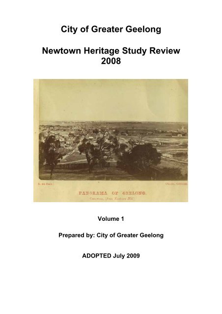
Front cover: Panorama <strong>of</strong> <strong>Geelong</strong>, Chilwell from <strong>Newtown</strong> Hill<br />
Copyright E. de Balk, 1866<br />
<strong>Geelong</strong> <strong>Heritage</strong> Centre Collection GRS 2009/2020
<strong>Newtown</strong> <strong>Heritage</strong> <strong>Study</strong> <strong>Review</strong>, July 2009 – Volume 1<br />
TABLE OF CONTENTS<br />
VOLUME 1<br />
Page<br />
Executive Summary 1<br />
Maps 4<br />
SECTION 1<br />
1.0 Introduction and Methodology 18<br />
1.1 The <strong>Study</strong> Team 18<br />
1.2 Acknowledgments 19<br />
1.3 The Project Description 19<br />
1.4 The Project Output and Outcomes 20<br />
1.5 Post Project Implementation 20<br />
1.6 The <strong>Study</strong> Area 21<br />
1.7 Selected <strong>Heritage</strong> Studies 21<br />
1.8 Terminology 22<br />
1.9 Methodology 22<br />
1.9.1 Preliminary Research 22<br />
1.9.2 Fieldwork 23<br />
1.9.3 Individual <strong>Heritage</strong> Places Researched, Assessed and<br />
Documented 23<br />
1.9.4 <strong>Heritage</strong> Precincts 24<br />
1.10 Scope <strong>of</strong> Works 24<br />
1.10.1 <strong>Heritage</strong> Places 24<br />
1.10.2 <strong>Heritage</strong> Precincts 24<br />
1.10.3 Individual <strong>Heritage</strong> Places 25<br />
1.10.4 Existing Individual <strong>Heritage</strong> Places 26<br />
1.11 Assessment <strong>of</strong> Significance 26<br />
1.11.1 Basis <strong>of</strong> Assessment 26<br />
1.11.2 Assessment Criteria for the Register <strong>of</strong> the National Estate 27<br />
1.12 Precinct Evaluation Criteria 29<br />
1.13 Precinct Significance Integrity Thresholds 30<br />
1.14 Levels <strong>of</strong> Significance 31<br />
1.15 Recommendations 32<br />
1.15.1 Statutory Protection 32<br />
1.15.2 Reference Documents 32<br />
1.15.3 <strong>Heritage</strong> Places 32<br />
1.15.4 HERMES and Victorian heritage database 32<br />
SECTION 2<br />
2.0 Aberdeen <strong>Heritage</strong> Precinct 33<br />
2.1 Precinct Boundaries 33<br />
2.2 Contextual Background 33<br />
2.3 Physical Evidence 35<br />
2.3.1 Building Character and Appearance 35<br />
2.3.2 Urban Design and Engineering Infrastructure 38<br />
2.3.3 Landscaping 38<br />
2.4 Statement <strong>of</strong> Significance 39<br />
2.5 Aberdeen Street <strong>Heritage</strong> Precinct Map 40<br />
2.6 Aberdeen Street Precinct Historical Figures 41<br />
2.7 Contemporary Photographs 50<br />
Prepared by <strong>City</strong> <strong>of</strong> <strong>Greater</strong> <strong>Geelong</strong><br />
i
<strong>Newtown</strong> <strong>Heritage</strong> <strong>Study</strong> <strong>Review</strong>, July 2009 – Volume 1<br />
SECTION 3<br />
3.0 Eyre <strong>Heritage</strong> Precinct 53<br />
3.1 Precinct Boundaries 53<br />
3.2 Contextual Background 53<br />
3.3 Physical Evidence 58<br />
3.3.1 Building Character and Appearance 58<br />
3.3.2 Urban Design and Engineering Infrastructure 62<br />
3.3.3 Landscaping 63<br />
3.4 Statement <strong>of</strong> Significance 63<br />
3.5 Eyre <strong>Heritage</strong> Precinct Map 65<br />
3.6 Eyre Precinct Historical Figures 66<br />
3.7 Contemporary Photographs 80<br />
SECTION 4<br />
4.0 Hermitage <strong>Heritage</strong> Precinct 85<br />
4.1 Precinct Boundaries 85<br />
4.2 Historical Evidence 85<br />
4.2.1 The Initial Years 85<br />
4.2.2 Early Land Holdings and Developments 85<br />
4.2.3 Establishment <strong>of</strong> the Borough <strong>of</strong> <strong>Newtown</strong> and Chilwell 87<br />
4.2.4 Street Names 87<br />
4.3 Physical Evidence 90<br />
4.3.1 Building Character and Appearance 90<br />
4.3.2 Urban Design and Engineering Infrastructure 93<br />
4.3.3 Landscaping 93<br />
4.4 Statement <strong>of</strong> Significance 94<br />
4.5 Hermitage <strong>Heritage</strong> Precinct Map 95<br />
4.6 Hermitage <strong>Heritage</strong> Historical Figures 96<br />
4.7 Contemporary Photographs 110<br />
SECTION 5<br />
5.0 William and Margaret Street <strong>Heritage</strong> Precinct 113<br />
5.1 Precinct Boundaries 113<br />
5.2 Contextual Background 113<br />
5.3 Physical Evidence 119<br />
5.3.1 Building Character and Appearance 119<br />
5.3.2 Urban Design and Engineering Infrastructure 121<br />
5.3.3 Landscaping 122<br />
5.4 Statement <strong>of</strong> Significance 122<br />
5.5 William and Margaret Street <strong>Heritage</strong> Precinct Map 124<br />
5.6 William and Margaret Street Precinct Historical Figures 125<br />
5.7 Contemporary Photographs 140<br />
SECTION 6<br />
6.0 Shannon Avenue <strong>Heritage</strong> Precinct 144<br />
6.1 Precinct Boundaries 144<br />
6.2 Contextual Background 144<br />
6.3 Physical Evidence 149<br />
6.3.1 Building Character and Appearance 149<br />
6.3.2 Urban Design and Engineering Infrastructure 151<br />
6.3.3 Landscaping 152<br />
6.4 Statement <strong>of</strong> Significance 152<br />
6.5 Shannon Avenue <strong>Heritage</strong> Precinct Map 154<br />
6.6 Shannon Avenue Precinct Historical Figures 155<br />
6.7 Contemporary Photographs 175<br />
Prepared by <strong>City</strong> <strong>of</strong> <strong>Greater</strong> <strong>Geelong</strong><br />
ii
<strong>Newtown</strong> <strong>Heritage</strong> <strong>Study</strong> <strong>Review</strong>, July 2009 – Volume 1<br />
SECTION 7<br />
7.0 Clarkes Hill <strong>Heritage</strong> Precinct 179<br />
7.1 Precinct Boundaries 179<br />
7.2 Contextual Background 179<br />
7.3 Physical Evidence 184<br />
7.3.1 Building Character and Appearance 184<br />
7.3.2 Urban Design and Engineering Infrastructure 188<br />
7.3.3 Landscaping 188<br />
7.4 Statement <strong>of</strong> Cultural Significance 189<br />
7.5 Clarkes Hill <strong>Heritage</strong> Precinct Map 190<br />
7.6 Clarkes Hill Precinct Historical Figures 191<br />
7.7 Contemporary Photographs 204<br />
SECTION 8<br />
8.0 Bareena Estate <strong>Heritage</strong> Precinct 207<br />
8.1 Precinct Boundaries 207<br />
8.2 Contextual Background 207<br />
8.3 Physical Evidence 212<br />
8.3.1 Building Character and Appearance 212<br />
8.3.2 Urban Design and Engineering Infrastructure 215<br />
8.3.3 Landscaping 216<br />
8.4 Statement <strong>of</strong> Cultural Significance 217<br />
8.5 Bareena Estate <strong>Heritage</strong> Precinct Map 219<br />
8.6 Bareena Estate Historical Figures 220<br />
8.7 Contemporary Photographs 234<br />
SECTION 9<br />
9.0 Mercer’s Hill <strong>Heritage</strong> Precinct 239<br />
9.1 Precinct Boundaries 239<br />
9.2 Contextual Background 239<br />
9.3 Mercer’s Hill <strong>Heritage</strong> Area 239<br />
9.4 Physical Evidence 242<br />
9.4.1 Building Character and Appearance 242<br />
9.4.2 Urban Design and Engineering Infrastructure 243<br />
9.4.3 Landscaping 244<br />
9.5 Statement <strong>of</strong> Cultural Significance 244<br />
9.6 Mercer’s Hill <strong>Heritage</strong> Precinct Map 246<br />
9.7 Mercer’s Hill Historical Figures 247<br />
9.8 Contemporary Photographs 260<br />
SECTION 10<br />
10.0 Cairns Avenue <strong>Heritage</strong> Precinct 263<br />
10.1 Precinct Boundaries 263<br />
10.2 Contextual Background 263<br />
10.3 Cairns Avenue <strong>Heritage</strong> Area 263<br />
10.4 Physical Evidence 265<br />
10.4.1 Building Character and Appearance 265<br />
10.4.2 Urban Design and Engineering Infrastructure 266<br />
10.4.3 Landscaping 267<br />
10.5 Statement <strong>of</strong> Cultural Significance 267<br />
10.6 Cairns Avenue <strong>Heritage</strong> Precinct Map 269<br />
10.7 Cairns Avenue Historical Figures 270<br />
10.8 Contemporary Photographs 280<br />
Prepared by <strong>City</strong> <strong>of</strong> <strong>Greater</strong> <strong>Geelong</strong><br />
iii
<strong>Newtown</strong> <strong>Heritage</strong> <strong>Study</strong> <strong>Review</strong>, July 2009 – Volume 1<br />
SECTION 11<br />
11.0 Fairview <strong>Heritage</strong> Precinct 282<br />
11.1 Precinct Boundaries 282<br />
11.2 Contextual Background 282<br />
11.3 Physical Evidence 285<br />
11.3.1 Building Character and Appearance 285<br />
11.3.2 Urban Design and Engineering Infrastructure 288<br />
11.3.3 Landscaping 288<br />
11.4 Statement <strong>of</strong> Cultural Significance 289<br />
11.5 Fairview <strong>Heritage</strong> Precinct Map 291<br />
11.6 Fairview Historical Figures 292<br />
11.7 Contemporary Photographs 307<br />
SECTION 12<br />
12.0 Bona Vista <strong>Heritage</strong> Precinct 311<br />
12.1 Precinct Boundaries 311<br />
12.2 Contextual Background 311<br />
12.3 Bona Vista <strong>Heritage</strong> Area 311<br />
12.4 Physical Evidence 314<br />
12.4.1 Building Character and Appearance 314<br />
12.4.2 Urban Design and Engineering Infrastructure 316<br />
12.4.3 Landscaping 316<br />
12.5 Statement <strong>of</strong> Cultural Significance 316<br />
12.6 Bona Vista <strong>Heritage</strong> Precinct Map 318<br />
12.7 Bona Vista Historical Figures 319<br />
12.8 Contemporary Photographs 331<br />
SECTION 13<br />
13.0 Bibliography 334<br />
13.1 Primary Sources 334<br />
13.1.1 Official Publications and Reports 334<br />
13.1.2 Maps and Plans 336<br />
13.1.3 Images 336<br />
13.2 Unpublished Material (manuscripts, reports, thesis,<br />
conference papers etc) 336<br />
APPENDICIES<br />
Appendix 1 <strong>Newtown</strong>/Chilwell Project Charter 337<br />
Appendix 2 Burra Charter 347<br />
Appendix 3 <strong>Heritage</strong> Precinct Maps 358<br />
Appendix 4 Criteria for the Register <strong>of</strong> the National Estate 360<br />
Prepared by <strong>City</strong> <strong>of</strong> <strong>Greater</strong> <strong>Geelong</strong><br />
iv
<strong>Newtown</strong> <strong>Heritage</strong> <strong>Study</strong> <strong>Review</strong>, July 2009 – Volume 1<br />
1.0 EXECUTIVE SUMMARY<br />
INTRODUCTION<br />
The <strong>City</strong> <strong>of</strong> <strong>Greater</strong> <strong>Geelong</strong> has prepared the <strong>Newtown</strong> <strong>Heritage</strong> <strong>Study</strong>, dated<br />
August <strong>2008</strong>.<br />
The review has assessed all buildings, landscapes and engineering<br />
infrastructure in the area bounded by Shannon Avenue, Latrobe Terrace,<br />
Aberdeen Street and West Fyans Street, <strong>Newtown</strong> that are currently located<br />
outside the existing <strong>Heritage</strong> Overlay areas identified in the <strong>Greater</strong> <strong>Geelong</strong><br />
Planning Scheme.<br />
This Report comprises the first <strong>of</strong> three (3) Volumes. This Volume includes the<br />
supporting background, statements <strong>of</strong> significance, heritage area maps and<br />
historical figures for each <strong>of</strong> the nominated heritage precinct areas in <strong>Newtown</strong>.<br />
Volume 2 is the Inventory <strong>of</strong> Places within each <strong>of</strong> the heritage areas, including<br />
the significance status <strong>of</strong> each place and identifies the style/era within these<br />
areas.<br />
Volume 3 includes the heritage citations for individual places <strong>of</strong> significance in<br />
<strong>Newtown</strong>, outside the proposed heritage areas.<br />
<strong>Study</strong> Area<br />
The study area includes all <strong>of</strong> the area bounded by Aberdeen Street, LaTrobe<br />
Terrace, West Fyans Street and Shannon Avenue, <strong>Newtown</strong>.<br />
Prepared by <strong>City</strong> <strong>of</strong> <strong>Greater</strong> <strong>Geelong</strong> 1
<strong>Newtown</strong> <strong>Heritage</strong> <strong>Study</strong> <strong>Review</strong>, July 2009 – Volume 1<br />
HERITAGE PLACES<br />
Introduction<br />
The study area includes 11 heritage overlay areas (heritage precincts),<br />
together with 31 individual heritage places located outside the heritage<br />
precincts.<br />
<strong>Heritage</strong> Precincts<br />
The following breakdown provides an indication <strong>of</strong> the number <strong>of</strong> heritage<br />
places assessed, according to their location and level <strong>of</strong> significance:<br />
Precinct<br />
Name<br />
No Local<br />
Significance<br />
No<br />
Contributory<br />
Significance<br />
Aberdeen 0 21 4<br />
Eyre 7 39 12<br />
Hermitage 5 6 6<br />
William<br />
and<br />
Margaret<br />
Street<br />
1 46 12<br />
Shannon 3 27 4<br />
Avenue<br />
Clarkes<br />
2 51 13<br />
Hill<br />
Bareena 6 66 32<br />
Estate<br />
Mercers<br />
3 12 4<br />
Hill<br />
Cairns<br />
0 22 12<br />
Avenue<br />
Fairview 4 32 11<br />
Bona<br />
0 22 2<br />
Vista<br />
Total 31 344 112<br />
Total 487 sites within the 11 heritage precinct areas.<br />
No<br />
Non-<br />
Significance<br />
A study area map including the heritage precincts can be found at section 3.1<br />
<strong>of</strong> this report<br />
Individual <strong>Heritage</strong> Places<br />
The following is a list <strong>of</strong> potential places <strong>of</strong> individual significance located<br />
outside the heritage precinct areas:<br />
• 21 Aberdeen Street “Felicita”;<br />
• 23 Aberdeen Street;<br />
• 25 Aberdeen Street;<br />
• 27 Aberdeen Street;<br />
• 31-61 Aberdeen Street<br />
(St John’s Lutheran<br />
School);<br />
• 84 Aphrasia Street;<br />
• 86 Aphrasia Street;<br />
• 92 Aphrasia Street;<br />
• 35/37 Cumberland Street<br />
(duplex pair);<br />
• 39 Cumberland Street;<br />
• 318 LaTrobe Terrace;<br />
• 364/366 LaTrobe Terrace;<br />
• 18 Marshall Street;<br />
• 8 Mercer Parade;<br />
• 25 Mercer Parade;<br />
• 104 Nicholas Street;<br />
• 106 Nicholas Street;<br />
Prepared by <strong>City</strong> <strong>of</strong> <strong>Greater</strong> <strong>Geelong</strong> 2
<strong>Newtown</strong> <strong>Heritage</strong> <strong>Study</strong> <strong>Review</strong>, July 2009 – Volume 1<br />
• 2 Noble Street<br />
(Sawyers Arms Hotel);<br />
• 288 Pakington Street;<br />
• 289 Pakington Street;<br />
• 293 Pakington Street;<br />
• 312 Pakington Street;<br />
• 313 Pakington Street;<br />
• 331 Pakington Street;<br />
• 333 Pakington Street;<br />
• 336 Pakington Street<br />
(Cremorne Hotel);<br />
• 366A Pakington Street;<br />
• 46 Retreat Road<br />
• 11 Stinton Avenue;<br />
• 16 Stinton Avenue;<br />
• 35 Stinton Avenue<br />
Other individual places <strong>of</strong> significance are included, and identified within the<br />
respective heritage precincts. Places identified as having local significance, but<br />
without detailed heritage citations, will be included within a heritage precinct<br />
until resources allow for their further assessment and subsequent inclusion in<br />
the <strong>Greater</strong> <strong>Geelong</strong> Planning Scheme as part <strong>of</strong> a future amendment<br />
Recommendations<br />
It is recommended that the heritage places identified, assessed and<br />
documented according to the Australia ICOMOS Burra Charter and the Criteria<br />
for the Register <strong>of</strong> the National Estate (as prescribed in the VPP Practice Note:<br />
Applying the <strong>Heritage</strong> Overlay) be considered for the following statutory<br />
protection:<br />
• 11 heritage precinct areas for the <strong>Greater</strong> <strong>Geelong</strong> Planning Scheme (to<br />
be included in the Schedule to the <strong>Heritage</strong> Overlay to Clause 43.01 <strong>of</strong><br />
the planning scheme).<br />
• 31 places outside the heritage precinct areas for the <strong>Greater</strong> <strong>Geelong</strong><br />
Planning Scheme (to be included in the Schedule to the <strong>Heritage</strong> Overlay<br />
to Clause 43.01 <strong>of</strong> the planning scheme).<br />
All places will be mapped in the relevant planning scheme HO maps.<br />
As an interim measure, all the places including individual heritage places and<br />
precinct areas recommended for inclusion in Clause 43.01 <strong>Heritage</strong> Overlay in<br />
the planning scheme should be included in an interim heritage control during<br />
the preparation <strong>of</strong> a formal planning scheme amendment.<br />
It is recommended that the <strong>Newtown</strong> <strong>Heritage</strong> <strong>Review</strong> <strong>Study</strong> (all Volumes) be<br />
included as Reference Documents in the “References” sections <strong>of</strong> Clauses<br />
21.16 and 22.20, and in the relevant sections <strong>of</strong> each local heritage precinct<br />
policy in the <strong>Greater</strong> <strong>Geelong</strong> Planning Scheme.<br />
All places identified in the <strong>Study</strong> will be subject to the planning policies in<br />
Clause 21.16 Cultural <strong>Heritage</strong> and Clause 22.20 Cultural <strong>Heritage</strong> to the<br />
planning scheme. In addition places identified in the heritage precinct areas<br />
will be subject to the relevant policy to be prepared for each precinct. This is in<br />
addition to the policies in the State Planning Policy Framework Clause 15.11<br />
<strong>Heritage</strong>.<br />
HERMES & Victorian <strong>Heritage</strong> Database<br />
All data from the <strong>Newtown</strong> <strong>Heritage</strong> <strong>Study</strong> <strong>Review</strong> Volume 2 Inventory are<br />
recommended to be included on the HERMES database. This will allow for<br />
filtered information to be made available to the public online.<br />
Prepared by <strong>City</strong> <strong>of</strong> <strong>Greater</strong> <strong>Geelong</strong> 3
<strong>Newtown</strong> <strong>Heritage</strong> <strong>Study</strong> <strong>Review</strong>, July 2009 – Volume 1<br />
HERITAGE PRECINT MAP<br />
Prepared by <strong>City</strong> <strong>of</strong> <strong>Greater</strong> <strong>Geelong</strong> 4
<strong>Newtown</strong> <strong>Heritage</strong> <strong>Study</strong> <strong>Review</strong>, July 2009 – Volume 1<br />
<strong>Study</strong> Area Including Proposed <strong>Heritage</strong> Precincts<br />
Prepared by <strong>City</strong> <strong>of</strong> <strong>Greater</strong> <strong>Geelong</strong> 5
<strong>Newtown</strong> <strong>Heritage</strong> <strong>Study</strong> <strong>Review</strong>, July 2009 – Volume 1<br />
<strong>Heritage</strong> Area Maps<br />
Prepared by <strong>City</strong> <strong>of</strong> <strong>Greater</strong> <strong>Geelong</strong> 6
<strong>Newtown</strong> <strong>Heritage</strong> <strong>Study</strong> <strong>Review</strong>, July 2009 – Volume 1<br />
Prepared by <strong>City</strong> <strong>of</strong> <strong>Greater</strong> <strong>Geelong</strong> 7
<strong>Newtown</strong> <strong>Heritage</strong> <strong>Study</strong> <strong>Review</strong>, July 2009 – Volume 1<br />
Prepared by <strong>City</strong> <strong>of</strong> <strong>Greater</strong> <strong>Geelong</strong> 8
<strong>Newtown</strong> <strong>Heritage</strong> <strong>Study</strong> <strong>Review</strong>, July 2009 – Volume 1<br />
Prepared by <strong>City</strong> <strong>of</strong> <strong>Greater</strong> <strong>Geelong</strong> 9
<strong>Newtown</strong> <strong>Heritage</strong> <strong>Study</strong> <strong>Review</strong>, July 2009 – Volume 1<br />
Prepared by <strong>City</strong> <strong>of</strong> <strong>Greater</strong> <strong>Geelong</strong> 10
<strong>Newtown</strong> <strong>Heritage</strong> <strong>Study</strong> <strong>Review</strong>, July 2009 – Volume 1<br />
Prepared by <strong>City</strong> <strong>of</strong> <strong>Greater</strong> <strong>Geelong</strong> 11
<strong>Newtown</strong> <strong>Heritage</strong> <strong>Study</strong> <strong>Review</strong>, July 2009 – Volume 1<br />
Prepared by <strong>City</strong> <strong>of</strong> <strong>Greater</strong> <strong>Geelong</strong> 12
<strong>Newtown</strong> <strong>Heritage</strong> <strong>Study</strong> <strong>Review</strong>, July 2009 – Volume 1<br />
Prepared by <strong>City</strong> <strong>of</strong> <strong>Greater</strong> <strong>Geelong</strong> 13
<strong>Newtown</strong> <strong>Heritage</strong> <strong>Study</strong> <strong>Review</strong>, July 2009 – Volume 1<br />
Prepared by <strong>City</strong> <strong>of</strong> <strong>Greater</strong> <strong>Geelong</strong> 14
<strong>Newtown</strong> <strong>Heritage</strong> <strong>Study</strong> <strong>Review</strong>, July 2009 – Volume 1<br />
Prepared by <strong>City</strong> <strong>of</strong> <strong>Greater</strong> <strong>Geelong</strong> 15
<strong>Newtown</strong> <strong>Heritage</strong> <strong>Study</strong> <strong>Review</strong>, July 2009 – Volume 1<br />
Prepared by <strong>City</strong> <strong>of</strong> <strong>Greater</strong> <strong>Geelong</strong> 16
<strong>Newtown</strong> <strong>Heritage</strong> <strong>Study</strong> <strong>Review</strong>, July 2009 – Volume 1<br />
Prepared by <strong>City</strong> <strong>of</strong> <strong>Greater</strong> <strong>Geelong</strong> 17
<strong>Newtown</strong> <strong>Heritage</strong> <strong>Study</strong> <strong>Review</strong>, July 2009 – Volume 1<br />
SECTION 1<br />
1.0 INTRODUCTION AND METHODOLOGY<br />
This heritage precinct review <strong>of</strong> the <strong>Newtown</strong>/Chilwell areas has been<br />
undertaken by Council as part <strong>of</strong> the adoption <strong>of</strong> the Medium Density Housing<br />
Strategy.<br />
The study also has been prepared in response to identified gaps in the<br />
previous <strong>Newtown</strong> <strong>Heritage</strong> <strong>Study</strong> undertaken in 1991, given the subsequent<br />
demolition/removal <strong>of</strong> significant buildings and a level <strong>of</strong> community support<br />
for a heritage review to be undertaken.<br />
The heritage review was conducted and prepared in-house from February<br />
<strong>2008</strong> and has been completed with some input from Council’s <strong>Heritage</strong><br />
Advisor.<br />
The review has assessed all buildings, landscapes and engineering<br />
infrastructure in the area bounded by Shannon Avenue, Latrobe Terrace,<br />
Aberdeen Street and West Fyans Street, <strong>Newtown</strong> that are currently located<br />
outside the existing <strong>Heritage</strong> Overlay areas identified in the <strong>Greater</strong> <strong>Geelong</strong><br />
Planning Scheme.<br />
This report comprises the first <strong>of</strong> three (3) Volumes. This Volume includes the<br />
supporting background, statements <strong>of</strong> significance, heritage area maps and<br />
historical figures for each <strong>of</strong> the nominated heritage precinct areas in<br />
<strong>Newtown</strong>.<br />
Volume 2 is the Inventory <strong>of</strong> Places within each <strong>of</strong> the heritage areas,<br />
including the significance status <strong>of</strong> each place and style/era within these<br />
areas.<br />
Volume 3 includes the heritage citations for individual places <strong>of</strong> significance in<br />
<strong>Newtown</strong>, outside the proposed heritage areas.<br />
The volumes <strong>of</strong> this study are intended to be included as Reference<br />
Documents in the <strong>Greater</strong> <strong>Geelong</strong> Planning Scheme.<br />
The first two Volumes <strong>of</strong> this study – including the significance status <strong>of</strong> the<br />
places within the heritage areas comprising the Inventory <strong>of</strong> Places in Volume<br />
2 - have been independently peer-reviewed by Dr David Rowe <strong>of</strong> Authentic<br />
<strong>Heritage</strong> Services Pty Ltd <strong>of</strong> <strong>Geelong</strong>.<br />
1.1 The <strong>Study</strong> Team<br />
The study team comprised:<br />
• Kevin Krastins, <strong>Heritage</strong> Planner as the Project Manager and Principal<br />
Author.<br />
• Ms Susie Zada <strong>of</strong> Zades Pty Ltd, the historian who was responsible for<br />
undertaking the historic research.<br />
• Dr David Rowe who peer-reviewed some <strong>of</strong> the documents.<br />
Prepared by <strong>City</strong> <strong>of</strong> <strong>Greater</strong> <strong>Geelong</strong> 18
<strong>Newtown</strong> <strong>Heritage</strong> <strong>Study</strong> <strong>Review</strong>, July 2009 – Volume 1<br />
1.2 Acknowledgments<br />
Council sincerely appreciates the assistance, guidance and considerable<br />
support provided by Dr David Rowe - <strong>Heritage</strong> Consultant and <strong>Heritage</strong><br />
Advisor and <strong>of</strong>ficers in the <strong>City</strong> <strong>of</strong> <strong>Greater</strong> <strong>Geelong</strong> including Cameron<br />
Brenton - Co-ordinator Economic Development, Terry Demeo - Manager<br />
Planning Strategy and Economic Development, Tim Hellsten - Co-Ordinator<br />
Projects and Rick Whiteworth - SIS Administrator. The valuable help <strong>of</strong> Ms<br />
Karen Wyld - Cartographer, <strong>City</strong> <strong>of</strong> <strong>Greater</strong> <strong>Geelong</strong>, is also appreciated.<br />
The staff <strong>of</strong> the <strong>Geelong</strong> <strong>Heritage</strong> Centre, and in particular, Mr Mark Beasley<br />
(Archivist), Cheryl Timbury and Melody McDonald, for their excellent<br />
assistance and support.<br />
Mr Ian McGlachlan from Barwon Water for his valuable assistance and loan<br />
<strong>of</strong> the early sewerage and drainage maps, and plans including Field Books.<br />
1.3 The Project Description<br />
The heritage precinct review sought to:<br />
• Build on the recent strategic heritage planning studies undertaken by<br />
Council, including the <strong>Geelong</strong> Region Historic Buildings and Objects<br />
<strong>Study</strong> (3 volumes) prepared by Allan Willingham 1986 and the <strong>City</strong> <strong>of</strong><br />
<strong>Newtown</strong> Urban Conservation <strong>Study</strong> 1991 (further assessments were<br />
added as additional Volumes 5 (a) and (b) <strong>of</strong> the <strong>Newtown</strong> Urban<br />
Conservation <strong>Study</strong> prepared by Richard Peterson and Daniel Catrice in<br />
1996), prepared by Context P/L and Ors;<br />
• <strong>Review</strong> all buildings, landscape and engineering infrastructure in the area<br />
bounded by Shannon Ave, Latrobe Terrace, Aberdeen Street and West<br />
Fyans Street, <strong>Newtown</strong> that are currently located outside the existing<br />
<strong>Heritage</strong> Overlay areas as identified in the <strong>Greater</strong> <strong>Geelong</strong> Planning<br />
Scheme.<br />
• Photograph every property within the study area excluding those<br />
properties currently included with a <strong>Heritage</strong> Overlay.<br />
• Undertake historical research on real estate agent plans and subdivision<br />
plans to determine subdivision dates and building construction;<br />
• Prepare supporting background material including historical context and<br />
concise statement <strong>of</strong> significance;<br />
• Identify the significance status <strong>of</strong> all buildings within the proposed<br />
heritage areas including potential places <strong>of</strong> individual significance,<br />
contributory heritage places and places <strong>of</strong> no significance within the new<br />
heritage precinct areas;<br />
• Prepare a heritage overlay area that is consistent in its planning and<br />
approach with the other 33 discreet heritage overlay areas in the <strong>Geelong</strong><br />
region as set out in the <strong>Greater</strong> <strong>Geelong</strong> Planning Scheme and apply the<br />
heritage provisions <strong>of</strong> Clause 43.01 <strong>of</strong> the <strong>Greater</strong> <strong>Geelong</strong> Planning<br />
Scheme to the <strong>Heritage</strong> Overlay area; and<br />
The heritage precinct review seeks to provide a strategic direction for<br />
development consistent with both local and state planning policies. The<br />
review utilises current state and local policy development and data from<br />
recent studies.<br />
Prepared by <strong>City</strong> <strong>of</strong> <strong>Greater</strong> <strong>Geelong</strong> 19
<strong>Newtown</strong> <strong>Heritage</strong> <strong>Study</strong> <strong>Review</strong>, July 2009 – Volume 1<br />
The identification <strong>of</strong> the heritage areas is dealt with as part <strong>of</strong> the State<br />
Planning Policy Framework in Clause 15.11 <strong>of</strong> the <strong>Greater</strong> <strong>Geelong</strong> Planning<br />
Scheme. The policy states that planning authorities should have regard to the<br />
Local Government <strong>Heritage</strong> Guidelines (Department <strong>of</strong> Planning & Housing,<br />
1991). These guidelines were prepared some years before the introduction <strong>of</strong><br />
the new format planning schemes and the Victoria Planning Provisions, but<br />
contain useful advice on the preparation <strong>of</strong> heritage amendments and the<br />
conservation <strong>of</strong> Victoria’s post contact cultural heritage.<br />
In relation to heritage areas the Guidelines state that:<br />
A heritage area might encompass a small urban or suburban area, a town or<br />
a landscape <strong>of</strong> cultural significance. A heritage area might be significant<br />
because:<br />
• the area itself, or the places within it have intrinsic heritage value;<br />
• the area is composed <strong>of</strong> places that individually have little or no intrinsic<br />
value but which are important for what they tell us as a group or collection<br />
<strong>of</strong> places.<br />
<strong>Heritage</strong> areas, particularly those <strong>of</strong> a large size, are also likely to include<br />
places that have little or no intrinsic value and are not contributory to the<br />
significance <strong>of</strong> the area. Within a heritage area, the primary objective is to<br />
ensure the conservation <strong>of</strong> those elements that contribute to the area’s<br />
significance. The removal or alteration <strong>of</strong> non-contributory elements or the<br />
development <strong>of</strong> their sites, while requiring a planning permit, is usually not a<br />
major concern. The objective is to ensure that where development does<br />
occur, it occurs in a manner that is appropriate to the significance, character<br />
and appearance <strong>of</strong> the heritage area.<br />
1.4 The Project Output And Outcomes<br />
The project output and outcomes include:<br />
• Identification <strong>of</strong> potential heritage precinct areas and contributory heritage<br />
places outside the existing heritage overlay areas in <strong>Newtown</strong>/Chilwell.<br />
• All heritage areas <strong>of</strong> cultural significance marked on the base maps to be<br />
bound into the report.<br />
• Inclusion <strong>of</strong> the heritage precinct areas with a <strong>Heritage</strong> Overlay to the<br />
<strong>Greater</strong> <strong>Geelong</strong> Planning Scheme.<br />
• Inclusion and preparation <strong>of</strong> individual citation sheets for properties<br />
located outside the heritage precinct areas.<br />
• Preparation <strong>of</strong> local planning policies to support appropriate forms <strong>of</strong><br />
development within the heritage precinct areas.<br />
Details <strong>of</strong> the Project Charter that relate to this <strong>Study</strong> are included as<br />
Appendix 7.1.<br />
1.5 Post Project Implementation<br />
The <strong>Study</strong> will be implemented as follows:<br />
• Preparation <strong>of</strong> a revised local policy section in the LPPF based on the<br />
recommendations <strong>of</strong> the <strong>Newtown</strong> <strong>Heritage</strong> <strong>Review</strong>.<br />
• Preparing any Planning Scheme Amendments in relation to local policy<br />
and overlays reflecting the recommendations <strong>of</strong> the <strong>Newtown</strong> <strong>Heritage</strong><br />
<strong>Review</strong> or undertaking further strategic work to support scheme change<br />
recommendations.<br />
Prepared by <strong>City</strong> <strong>of</strong> <strong>Greater</strong> <strong>Geelong</strong> 20
<strong>Newtown</strong> <strong>Heritage</strong> <strong>Study</strong> <strong>Review</strong>, July 2009 – Volume 1<br />
1.6 The <strong>Study</strong> Area<br />
The study area includes all <strong>of</strong> the area bounded by Aberdeen Street, LaTrobe<br />
Terrace, West Fyans Street and Shannon Avenue, <strong>Newtown</strong> as per the<br />
following below.<br />
1.7 Selected <strong>Heritage</strong> Studies<br />
Comprehensive <strong>Heritage</strong> Studies within the <strong>Geelong</strong> region have been<br />
completed for the <strong>Newtown</strong> area, including:<br />
• <strong>City</strong> <strong>of</strong> <strong>Newtown</strong> Urban Conservation <strong>Study</strong> 1991, Volumes 1-4, prepared<br />
by Context Pty Ltd in association with Brian Stafford, Richard Peterson<br />
and Carlotta Kellaway.<br />
• Citation sheets for all individual heritage places prepared by Richard<br />
Peterson, Architect and Daniel Catrice Historian in 1996.<br />
• A publication by Allan Willingham entitled <strong>Geelong</strong> Region Historic<br />
Buildings and Objects <strong>Study</strong>, 3 Volumes, <strong>Geelong</strong> Regional Commission,<br />
1986, identified 61 key sites in <strong>Newtown</strong> including various sites within the<br />
study area included in Volume 3. This volume includes heritage citations<br />
for these 61 selected properties that have been included in the <strong>Greater</strong><br />
<strong>Geelong</strong> Planning Scheme with heritage protection.<br />
Prepared by <strong>City</strong> <strong>of</strong> <strong>Greater</strong> <strong>Geelong</strong> 21
<strong>Newtown</strong> <strong>Heritage</strong> <strong>Study</strong> <strong>Review</strong>, July 2009 – Volume 1<br />
1.8 Terminology<br />
The terminology <strong>of</strong> The Australia ICOMOS Charter for the Conservation <strong>of</strong><br />
Places <strong>of</strong> Cultural Significance (The Burra Charter) is used throughout this<br />
study. Refer to Appendix 7.2 for a copy <strong>of</strong> the Burra Charter. The<br />
identification and documentation <strong>of</strong> potential post-contact places <strong>of</strong> cultural<br />
significance has been interpreted using the definitions provided in the Burra<br />
Charter. Some <strong>of</strong> the critical definitions identified in the Burra Charter and<br />
used in this study are:<br />
Article 1.1:<br />
Article 1.2:<br />
Place means site, area, building or other work, group <strong>of</strong><br />
buildings or other works, together with associated contents<br />
and surroundings. Place includes structures, ruins,<br />
archaeological sites and landscapes modified by human<br />
activity.<br />
Cultural significance means aesthetic, historic, scientific or<br />
social value for past, present or future generations.<br />
1.9 Methodology<br />
1.9.1 Preliminary Research<br />
<strong>Review</strong> <strong>of</strong> existing <strong>City</strong> <strong>of</strong> <strong>Newtown</strong> Urban Conservation<br />
<strong>Study</strong> 1991.<br />
The <strong>Study</strong> recommended 13 heritage precinct areas and 6<br />
individual places <strong>of</strong> “A” or State level <strong>of</strong> Significance and 54 <strong>of</strong><br />
“B” or Regional level <strong>of</strong> Significance. Places <strong>of</strong> “C” and “D”<br />
level <strong>of</strong> Significance where listed in the Street Schedule<br />
(Volume 4). No detailed citations sheets were initially prepared<br />
for the “C” level places. This was subsequently undertaken in<br />
a further assessment in 1996. The <strong>Study</strong> comprised <strong>of</strong> 4<br />
volumes namely:<br />
• Volume 1 Conserving <strong>Newtown</strong>’s heritage.<br />
• Volume 2 Urban Character.<br />
• Volume 3 <strong>Heritage</strong> Places and Areas.<br />
• Volume 4 Street Schedule.<br />
Preliminary historical research involved reviewing:<br />
• All major relevant documentation relating to the broad<br />
context <strong>of</strong> the study area, both in Victoria and Australia, in<br />
the form <strong>of</strong> publications, reports, manuscripts, journals,<br />
thesis and archival material from the <strong>Geelong</strong> <strong>Heritage</strong><br />
Centre.<br />
• The Barwon Water database, Detail Sewerage Plans,<br />
Individual Plans <strong>of</strong> Drainage<br />
• The <strong>Newtown</strong> and Chilwell rate books and maps,<br />
• The collection <strong>of</strong> subdivision plans that are available at the<br />
<strong>Geelong</strong> <strong>Heritage</strong> Centre.<br />
• Other resources including local histories, directories and<br />
photo collections.<br />
Prepared by <strong>City</strong> <strong>of</strong> <strong>Greater</strong> <strong>Geelong</strong> 22
<strong>Newtown</strong> <strong>Heritage</strong> <strong>Study</strong> <strong>Review</strong>, July 2009 – Volume 1<br />
Preliminary architectural research involved a review <strong>of</strong>:<br />
• Allan Willingham's <strong>Geelong</strong> Region Historic Buildings and<br />
Objects <strong>Study</strong><br />
• The <strong>City</strong> <strong>of</strong> <strong>Newtown</strong> Urban Conservation <strong>Study</strong> 1991<br />
prepared by Context P/L and Ors.<br />
• Major documentary material related to architectural (and<br />
other) publications, reports, thesis, journals and archival<br />
material relevant to the study area, leading towards the<br />
development <strong>of</strong> a bibliography.<br />
• Historic and contemporary maps <strong>of</strong> the study area from the<br />
<strong>Geelong</strong> <strong>Heritage</strong> Centre and the <strong>City</strong> <strong>of</strong> <strong>Greater</strong> <strong>Geelong</strong>.<br />
These were copied and studied as a basis for undertaking<br />
the field survey <strong>of</strong> the study area.<br />
Preliminary archaeological research:<br />
• Discussions with Mr Jeremy Smith regarding the Victorian<br />
<strong>Heritage</strong> Inventory at <strong>Heritage</strong> Victoria particularly around<br />
the potential <strong>of</strong> gold mining activity and whether any sites<br />
were recorded on the inventory in Mercer’s Hill.<br />
1.9.2 Fieldwork<br />
Research:<br />
• All relevant historical and contemporary maps were<br />
examined, and used to organise the study area into<br />
manageable and numbered survey areas. A field survey<br />
(by car and particularly on foot) including a photographic<br />
record <strong>of</strong> all properties (excluding those there were already<br />
included with a <strong>Heritage</strong> Overlay in Clause 43.01 to the<br />
<strong>Greater</strong> <strong>Geelong</strong> Planning Scheme) was undertaken and<br />
recorded. Comprehensive Record Sheets were used to<br />
systematically record relevant details about the potential<br />
heritage precinct: description, cadastral location, brief<br />
history, address/location stylistic character, architectural<br />
features, condition, integrity, engineering infrastructure.<br />
Brief notes (where applicable) and photographs <strong>of</strong><br />
buildings, relics, gardens, trees, fences, gates, etc. were<br />
made during this survey.<br />
Potential <strong>Heritage</strong> Precincts:<br />
• Initial potential precinct areas were mapped and further<br />
refined, and are detailed below to identify the 11 potential<br />
heritage precincts within the study area.<br />
1.9.3 Individual <strong>Heritage</strong> Places Researched, Assessed &<br />
Documented<br />
This aspect <strong>of</strong> the study involved:<br />
Further analysis <strong>of</strong> the Individual <strong>Heritage</strong> Places:<br />
• All places were analysed and assessed. The format and<br />
content <strong>of</strong> the Record Sheet is consistent with citation<br />
sheets used in recent heritage studies prepared for<br />
Council.<br />
Documentary Research:<br />
Prepared by <strong>City</strong> <strong>of</strong> <strong>Greater</strong> <strong>Geelong</strong> 23
<strong>Newtown</strong> <strong>Heritage</strong> <strong>Study</strong> <strong>Review</strong>, July 2009 – Volume 1<br />
• The references provided on the Record Sheets, together<br />
with historical maps and/or plans, rate books, directories,<br />
local historical manuscripts and notes, and historical<br />
photographs were researched and tabulated onto research<br />
datasheets and/or compiled as part <strong>of</strong> individual research<br />
packages for each heritage place.<br />
Documentation & Assessment:<br />
• The descriptions, histories, comparative lists and<br />
statements <strong>of</strong> cultural significance for each individual<br />
heritage place were then carried out. Importantly, the<br />
statements <strong>of</strong> cultural significance were developed<br />
according to the Australia ICOMOS Burra Charter and the<br />
Australian <strong>Heritage</strong> Commission’s Assessment Criteria <strong>of</strong><br />
the Register <strong>of</strong> the National Estate as prescribed in VPP<br />
Practice Note: Applying the <strong>Heritage</strong> Overlay. See Section<br />
4 for the Assessment Criteria.<br />
1.9.4 <strong>Heritage</strong> Precincts<br />
Research:<br />
• <strong>Newtown</strong> and Chilwell Rate Books.<br />
• <strong>Geelong</strong> Waterworks and Sewerage Trust Field Books<br />
(1912). These books show the outline <strong>of</strong> houses<br />
constructed prior to 1912 as well as individual Plans <strong>of</strong><br />
Drainage that show the house outline and other particular<br />
features ranging in dates from 1917 to present.<br />
• <strong>Geelong</strong> Waterworks and Sewerage Trust Detail Plans that<br />
show the outline <strong>of</strong> the house on a broader, street by street<br />
level.<br />
• Auction Notices and Subdivision Plans.<br />
• Secondary References.<br />
Documentation & Assessment:<br />
• During the research process, each potential precinct area<br />
was assessed according to the criteria for the Australian<br />
<strong>Heritage</strong> Council. Three main categories were used to<br />
determine the significance <strong>of</strong> these areas, with these<br />
categories being: Urban Design, Neighbouring Buildings<br />
and Landscaping. Historical maps and plans were also<br />
used during the fieldwork process.<br />
1.10 SCOPE OF WORKS<br />
1.10.1 <strong>Heritage</strong> Places<br />
The study area includes 11 heritage overlay areas (heritage<br />
precincts), together with 31 individual heritage places located<br />
outside the heritage precincts.<br />
1.10.2 <strong>Heritage</strong> Precincts<br />
The following breakdown provides an indication <strong>of</strong> the number<br />
<strong>of</strong> heritage places assessed, according to their location and<br />
level <strong>of</strong> significance:<br />
Prepared by <strong>City</strong> <strong>of</strong> <strong>Greater</strong> <strong>Geelong</strong> 24
<strong>Newtown</strong> <strong>Heritage</strong> <strong>Study</strong> <strong>Review</strong>, July 2009 – Volume 1<br />
Precinct Name<br />
No Local No<br />
No<br />
Significance Contributory Non-<br />
Significance Significance<br />
Aberdeen 0 21 4<br />
Eyre 7 39 12<br />
Hermitage 5 6 6<br />
William and Margaret 1 46 12<br />
Street<br />
Shannon Avenue 3 27 4<br />
Clarkes Hill 2 51 13<br />
Bareena Estate 6 66 32<br />
Mercers Hill 3 12 4<br />
Cairns Avenue 0 22 12<br />
Fairview 4 32 11<br />
Bona Vista 0 22 2<br />
Total 31 344 112<br />
Total 487 sites within the 11 heritage precinct areas.<br />
Maps <strong>of</strong> the heritage precincts areas are included in Appendix 7.3 also at the<br />
end <strong>of</strong> the Executive Summary.<br />
1.10.3 Individual <strong>Heritage</strong> Places<br />
The following is a list <strong>of</strong> potential places <strong>of</strong> individual significance<br />
located outside heritage precinct areas:<br />
• 21 Aberdeen Street<br />
• 104 Nicholas Street;<br />
“Felicita”;<br />
• 106 Nicholas Street;<br />
• 23 Aberdeen Street;<br />
• 2 Noble Street<br />
• 25 Aberdeen Street;<br />
(Sawyers Arms Hotel);<br />
• 27 Aberdeen Street;<br />
• 288 Pakington Street;<br />
• 31-61 Aberdeen Street<br />
• 289 Pakington Street;<br />
(St John’s Lutheran<br />
• 293 Pakington Street;<br />
School);<br />
• 312 Pakington Street;<br />
• 84 Aphrasia Street;<br />
• 313 Pakington Street;<br />
• 86 Aphrasia Street;<br />
• 331-333 Pakington<br />
• 92 Aphrasia Street;<br />
Street;<br />
• 35/37 Cumberland Street<br />
(duplex pair);<br />
• 336 Pakington Street<br />
(Cremorne Hotel);<br />
• 39 Cumberland Street;<br />
• 366A Pakington Street;<br />
• 318 LaTrobe Terrace;<br />
• 46 Retreat Road<br />
• 364/366 LaTrobe Terrace; • 11 Stinton Avenue;<br />
• 18 Marshall Street;<br />
• 16 Stinton Avenue;<br />
• 8 Mercer Parade;<br />
• 35 Stinton Avenue;<br />
• 25 Mercer Parade;<br />
Other individual places <strong>of</strong> significance are included, and identified within the<br />
respective heritage precincts. No detailed citation sheets have been prepared<br />
for these places as they are proposed to be included with a heritage overlay.<br />
Places identified as having local significance, but without detailed heritage<br />
citations, should be considered as having contributory heritage status until<br />
Prepared by <strong>City</strong> <strong>of</strong> <strong>Greater</strong> <strong>Geelong</strong> 25
<strong>Newtown</strong> <strong>Heritage</strong> <strong>Study</strong> <strong>Review</strong>, July 2009 – Volume 1<br />
resources allow for their further assessment and subsequent inclusion in the<br />
<strong>Greater</strong> <strong>Geelong</strong> Planning Scheme as part <strong>of</strong> a future amendment.<br />
1.10.4 Existing Individual <strong>Heritage</strong> Places<br />
Within the proposed heritage areas are 4 places currently identified in the<br />
Schedule to the <strong>Heritage</strong> Overlay with individual heritage overlays. It is<br />
recommended that where the Schedule controls for these individual places are<br />
identical to those <strong>of</strong> the proposed heritage areas, they be removed from the<br />
Schedule (this does not remove or diminish the heritage status or significance <strong>of</strong><br />
these affected places, but it ensures that the Schedule accords with the Victoria<br />
Planning Provisions).<br />
1.11 Assessment <strong>of</strong> Significance<br />
1.11.1 Basis <strong>of</strong> Assessment<br />
This study has used the principles <strong>of</strong> the Australia ICOMOS Charter for<br />
the Conservation <strong>of</strong> Places <strong>of</strong> Cultural Significance (the Burra Charter)<br />
and its Guidelines as the basis to all <strong>of</strong> the assessments in this study.<br />
The Burra Charter defines cultural significance by aesthetic, historic,<br />
scientific and social values. These values are also largely prescribed in<br />
the VPP Practice Note: Applying the <strong>Heritage</strong> Overlay which states:<br />
All places that are proposed for planning protection, including places<br />
identified in a heritage study, should be documented in a manner that<br />
clearly substantiates their scientific, aesthetic, architectural or<br />
historical interest or other special cultural or natural values The<br />
documentation for each heritage place includes a statement <strong>of</strong><br />
significance that clearly establishes the importance <strong>of</strong> the place.<br />
The Burra Charter Criteria<br />
Article 2.2:<br />
Article 2.3:<br />
Aesthetic value: includes aspects <strong>of</strong> sensory perception<br />
for which criteria can, and should be stated. Such criteria<br />
may include consideration <strong>of</strong> the form, scale, colour,<br />
texture and material <strong>of</strong> the fabric; the smells and sounds<br />
associated with the place and its use.<br />
Places <strong>of</strong> aesthetic value may:<br />
• demonstrate a high degree <strong>of</strong> creative or technical<br />
accomplishment;<br />
• demonstrate important designs or visual qualities.<br />
Historic value: encompasses the history <strong>of</strong> aesthetics,<br />
science and society, and therefore, to a large extent,<br />
underlies all <strong>of</strong> the terms set out in this section.<br />
A place may have historic value because:<br />
• it is <strong>of</strong> importance for its association with events,<br />
developments or cultural phases which have had a<br />
significant role in the occupation and evolution <strong>of</strong> the<br />
community;<br />
• it illustrates part <strong>of</strong> the evolution or pattern <strong>of</strong> the<br />
cultural heritage;<br />
• it is an example <strong>of</strong> rare, endangered or uncommon<br />
aspects <strong>of</strong> the cultural heritage;<br />
Prepared by <strong>City</strong> <strong>of</strong> <strong>Greater</strong> <strong>Geelong</strong> 26
<strong>Newtown</strong> <strong>Heritage</strong> <strong>Study</strong> <strong>Review</strong>, July 2009 – Volume 1<br />
• it has a strong association with the life or work <strong>of</strong> a<br />
person or group <strong>of</strong> people <strong>of</strong> significance to the cultural<br />
heritage;<br />
• it is an important representative <strong>of</strong> the range <strong>of</strong> places<br />
which make up the cultural heritage <strong>of</strong> a community;<br />
• it has been influenced by an historic figure, event,<br />
phase or activity.<br />
Article 2.4:<br />
Scientific value: or research value <strong>of</strong> a place will depend<br />
upon the importance <strong>of</strong> the data involved, on its rarity,<br />
quality or representational value, and on the degree to<br />
which the place may contribute further substantial<br />
information.<br />
A place may have scientific value because:<br />
• it illustrates some technological, creative, technical or<br />
scientific processes or advances;<br />
• it is <strong>of</strong> importance for information contributing to an<br />
understanding <strong>of</strong> the history <strong>of</strong> human occupation and<br />
the cultural history <strong>of</strong> the area.<br />
Article 2.5:<br />
Social value: embraces the qualities for which a place<br />
has become a focus <strong>of</strong> spiritual, political, national or other<br />
cultural sentiment to a majority or minority group.<br />
A place may have social value because:<br />
• it is highly valued by a community for reasons <strong>of</strong><br />
religious, spiritual, cultural, educational or social<br />
associations;<br />
• it is recognised by the community as having public<br />
value or is held in high esteem for its associations<br />
with the whole or part <strong>of</strong> the community whose history<br />
or culture is interwoven with the history <strong>of</strong> the place;<br />
• it forms a particular and significant component <strong>of</strong> the<br />
heritage <strong>of</strong> a local area;<br />
• it demonstrates a distinctive way <strong>of</strong> life or custom that is<br />
no longer in use or is in danger <strong>of</strong> being lost or is <strong>of</strong><br />
exceptional interest.<br />
1.11.2 Assessment Criteria for the Register <strong>of</strong> the National Estate<br />
The following simplified criteria – based solely upon the Burra Charter and<br />
Criteria for the Assessment <strong>of</strong> Cultural Significance <strong>of</strong> the Register <strong>of</strong> the<br />
National Estate (Appendix 7.4) were adopted for this study. Each relevant<br />
National Estate Code has been cross-referenced on the Records Sheets for<br />
each heritage place. The criteria are:<br />
Prepared by <strong>City</strong> <strong>of</strong> <strong>Greater</strong> <strong>Geelong</strong> 27
<strong>Newtown</strong> <strong>Heritage</strong> <strong>Study</strong> <strong>Review</strong>, July 2009 – Volume 1<br />
Value Type Value National<br />
Estate<br />
Code<br />
Aesthetic • demonstrates a high degree <strong>of</strong> creative or<br />
technical accomplishment and/or involves the<br />
major characteristics <strong>of</strong> a specific type <strong>of</strong> place,<br />
ie. representative <strong>of</strong> a particular architectural<br />
style;<br />
D.2, E.1<br />
• demonstrates important design or visual D.2<br />
qualities;<br />
• historic townscapes, streetscapes, cultural E.1<br />
landscapes;<br />
• demonstrates a high degree <strong>of</strong> integrity and F.1<br />
design excellence;<br />
Historic • is <strong>of</strong> importance for its association with events, A.4<br />
developments or cultural phases which have<br />
had a significant role in the occupation and<br />
evolution <strong>of</strong> the community;<br />
• is an example <strong>of</strong> rare, endangered or<br />
uncommon aspects <strong>of</strong> the cultural heritage;<br />
B.2<br />
• has a strong association with the life or work <strong>of</strong><br />
a person or group <strong>of</strong> people <strong>of</strong> significance to<br />
the cultural heritage;<br />
H.1<br />
• close association with individuals who have had<br />
a long and significant impact on the place;<br />
H.1<br />
• has been influenced by an historic figure, event, A.4<br />
phase or activity, significant to the history <strong>of</strong> the<br />
nation, state, region or local community;<br />
• may have historic value as the site <strong>of</strong> an C.2<br />
important event;<br />
• is <strong>of</strong> importance for information contributing to C.2<br />
an understanding <strong>of</strong> the history <strong>of</strong> human<br />
occupation and the cultural history <strong>of</strong> an area;<br />
Scientific • illustrates some technological, creative, F.1<br />
technical or scientific processes or advances;<br />
• is <strong>of</strong> importance for information contributing to C.2<br />
an understanding <strong>of</strong> the history <strong>of</strong> human<br />
occupation and the cultural history <strong>of</strong> an area ,<br />
and has a strong presumption <strong>of</strong> archaeological<br />
research potential;<br />
Prepared by <strong>City</strong> <strong>of</strong> <strong>Greater</strong> <strong>Geelong</strong> 28
<strong>Newtown</strong> <strong>Heritage</strong> <strong>Study</strong> <strong>Review</strong>, July 2009 – Volume 1<br />
Value Type Value National<br />
Estate<br />
Code<br />
Social • is highly valued by a community for reasons <strong>of</strong><br />
religious, spiritual, cultural, educational or social<br />
associations;<br />
G.1<br />
• is recognised by the community as having public G.1<br />
value or is held in high esteem for its<br />
associations with the whole or part <strong>of</strong> the<br />
community whose history or culture is<br />
interwoven with the history <strong>of</strong> the place;<br />
• forms a particular and significant component <strong>of</strong><br />
the heritage <strong>of</strong> a local area;<br />
G.1<br />
• demonstrates a distinctive way <strong>of</strong> life or custom<br />
that is no longer in use or is in danger <strong>of</strong> being<br />
lost or is <strong>of</strong> exceptional interest;<br />
G.1<br />
(Burra Charter value) (According to the Criteria for the Register <strong>of</strong> the National Estate)<br />
1.12 Precinct Evaluation Criteria<br />
The evaluation criteria developed and utilised in this <strong>Heritage</strong> <strong>Study</strong> have been<br />
established according to the <strong>Heritage</strong> Criteria <strong>of</strong> the Register <strong>of</strong> the National<br />
Estate, as prescribed in the VPP Practice Note: Applying the <strong>Heritage</strong> Overlay.<br />
The Criteria below was adopted for all precincts in this study, with particular<br />
emphasis being placed on those features and qualities that contributed to the<br />
overall heritage and visual character <strong>of</strong> each particular area.<br />
The architectural qualities <strong>of</strong> the individual house, and the predominantly single<br />
storey, weatherboard, interwar Bungalow characteristics <strong>of</strong> the houses in the<br />
precincts are <strong>of</strong> the most significance.<br />
The establishment <strong>of</strong> the boundaries <strong>of</strong> each <strong>of</strong> the precincts listed in the<br />
following section was dependent upon: important visual connections <strong>of</strong> particular<br />
heritage places within the precinct and the potential impact <strong>of</strong> these visual<br />
connections with other buildings, landscapes, urban foci and views. In<br />
conjunction with the Assessment Criteria for the Register <strong>of</strong> the National Estate<br />
and the Significance & Integrity Thresholds (Sections 1.13 and 1.14), the<br />
following approach was adopted, consistent with recent heritage studies<br />
prepared for Council:<br />
Guide to determining the extent <strong>of</strong> significant fabric in a permit<br />
a. Neighbouring Buildings<br />
• Building use, ie residential, commercial<br />
• Building type, ie detached, semi-detached<br />
• Number <strong>of</strong> storeys<br />
• Scale <strong>of</strong> Buildings<br />
• Setbacks<br />
• Appropriate signage (where applicable)<br />
• Ro<strong>of</strong> form & pitch, ie. gabled/hipped/flat & range <strong>of</strong> pitch<br />
• Architectural style &/or age <strong>of</strong> buildings<br />
• Building construction/cladding<br />
ie walls - horizontal weatherboard – brick<br />
ie ro<strong>of</strong>s - painted/unpainted, galvanised corrugated iron - terracotta<br />
tile, cement tile, etc<br />
Prepared by <strong>City</strong> <strong>of</strong> <strong>Greater</strong> <strong>Geelong</strong> 29
<strong>Newtown</strong> <strong>Heritage</strong> <strong>Study</strong> <strong>Review</strong>, July 2009 – Volume 1<br />
ie windows - types and construction<br />
• Eaves characteristics<br />
ie wide or narrow (range) - Exposed rafters<br />
• Early chimneys<br />
• Early front door characteristics<br />
ie timber & glazed, four panel timber, etc<br />
• Appropriate architectural detailing (including verandah detailing)<br />
• Range <strong>of</strong> front and side setbacks, and access/location <strong>of</strong> driveway<br />
ie front – side, rear<br />
• Height range and type, design & location appropriateness <strong>of</strong> fences<br />
b. Urban Design<br />
• Historical development<br />
• Street & allotment pattern and average size/s (where applicable)<br />
• Significant Urban Focii<br />
• Significant Views<br />
• Engineering infrastructure<br />
ie early kerbing, early paving, verges, footpaths, etc<br />
• Appropriate street furniture and post boxes<br />
• Overhead power lines<br />
• Treelines<br />
• Public Gardens<br />
• Median Strips<br />
• Nature Strips<br />
1.13 Precinct Significance Integrity Thresholds<br />
The integrity thresholds for places in precincts are as follows:<br />
• Date range <strong>of</strong> area including subdivision date(s)<br />
• Date range <strong>of</strong> streets in the area<br />
• Percentage contribution to the area <strong>of</strong> buildings in<br />
each street in the heritage overlay<br />
• Integrity to the creation date <strong>of</strong> contributory<br />
buildings<br />
− Predominantly Intact<br />
− Moderately Intact<br />
− Altered (original character & appearance clearly discernible)<br />
−<br />
−<br />
Substantially altered<br />
whether the building has been relocated (and contributes to the<br />
significant development period for the precinct)<br />
The integrity <strong>of</strong> places within precincts (when viewed from the public realm) may<br />
include to varying degrees the following, such that the place is discernible to its<br />
creation date<br />
• Overall form & composition<br />
• Construction materials<br />
• Building details<br />
• Verandahs<br />
• Front windows and doors<br />
• Fence details<br />
Places with later additions may continue to contribute to the significance <strong>of</strong> the<br />
precinct if:<br />
• The additions are recessive and do not dominate over the building,<br />
streetscape or area<br />
Prepared by <strong>City</strong> <strong>of</strong> <strong>Greater</strong> <strong>Geelong</strong> 30
<strong>Newtown</strong> <strong>Heritage</strong> <strong>Study</strong> <strong>Review</strong>, July 2009 – Volume 1<br />
Non significant buildings within heritage precincts are those that do not<br />
contribute to the significant development periods in the area or are <strong>of</strong> such low<br />
integrity/intactness that they do not meet the threshold for inclusion. These<br />
buildings also include recently constructed buildings. In general terms, buildings<br />
need to be <strong>of</strong> at least the “altered” integrity category to be assessed as being <strong>of</strong><br />
contributory significance.<br />
1.14 Levels <strong>of</strong> Significance:<br />
The values <strong>of</strong> A = State or National significance, B = Regional significance, C =<br />
Local significance, D = Contributory significance and Not Significant were used.<br />
The definitions for each significance value are:<br />
National<br />
Places that are considered significant to the nation.<br />
They meet the Criteria <strong>of</strong> the Register <strong>of</strong> the National Estate and the Criteria <strong>of</strong><br />
the <strong>Heritage</strong> Council <strong>of</strong> Victoria, but most importantly, these places make an<br />
outstanding contribution to Australia's cultural heritage.<br />
State - A<br />
Places that are considered significant to the State <strong>of</strong> Victoria.<br />
They meet the Criteria <strong>of</strong> the <strong>Heritage</strong> Council <strong>of</strong> Victoria and the Criteria <strong>of</strong> the<br />
Register <strong>of</strong> the National Estate.<br />
Regional - B<br />
Places that are considered significant to the <strong>Geelong</strong> Region (within the<br />
boundaries <strong>of</strong> the <strong>City</strong> <strong>of</strong> <strong>Greater</strong> <strong>Geelong</strong>).<br />
They meet the Criteria <strong>of</strong> the Register <strong>of</strong> the National Estate. These places<br />
identify with the specific heritage values <strong>of</strong> the particular community/suburb.<br />
Local - C<br />
Places that are considered significant to a local area, (whether individually<br />
significant or as a contributor to the urban character and/or heritage value<br />
<strong>of</strong> the area).<br />
They meet the Criteria <strong>of</strong> the Register <strong>of</strong> the National Estate. These places<br />
identify with the specific heritage values <strong>of</strong> the particular community/suburb.<br />
Contributory - D<br />
Places that demonstrate the heritage values <strong>of</strong> the heritage area, but<br />
would fail to meet the threshold for heritage significance if located outside<br />
the heritage area.<br />
Not Significant<br />
Places considered not to have heritage significance.<br />
Prepared by <strong>City</strong> <strong>of</strong> <strong>Greater</strong> <strong>Geelong</strong> 31
<strong>Newtown</strong> <strong>Heritage</strong> <strong>Study</strong> <strong>Review</strong>, July 2009 – Volume 1<br />
1.15 RECOMMENDATIONS<br />
1.15.1 Statutory Protection<br />
It is recommended that the heritage places identified, assessed and<br />
documented according to the Australia ICOMOS Burra Charter and the<br />
Criteria for the Register <strong>of</strong> the National Estate (as prescribed in the VPP<br />
Practice Note: Applying the <strong>Heritage</strong> Overlay) be considered for the<br />
following statutory protection:<br />
• 11 heritage precinct areas for the <strong>Greater</strong> <strong>Geelong</strong> Planning Scheme<br />
(to be included in the Schedule to the <strong>Heritage</strong> Overlay to Clause 43.01<br />
<strong>of</strong> the planning scheme). Copies <strong>of</strong> maps can be found at the end <strong>of</strong> this<br />
section.<br />
• 31 places outside the heritage precinct areas for the <strong>Greater</strong> <strong>Geelong</strong><br />
Planning Scheme (to be included in the Schedule to the <strong>Heritage</strong> Overlay<br />
to Clause 43.01 <strong>of</strong> the planning scheme).<br />
All places will be mapped in the relevant planning scheme HO maps.<br />
As an interim measure, all the places including individual heritage places<br />
and precinct areas recommended for inclusion in a <strong>Heritage</strong> Overlay in<br />
the planning scheme be included in an interim heritage control through<br />
Clause 43.01 <strong>Heritage</strong> Overlay during the preparation <strong>of</strong> a formal<br />
planning scheme amendment.<br />
1.15.2 Reference Documents<br />
It is recommended that the <strong>Newtown</strong> <strong>Heritage</strong> <strong>Review</strong> <strong>Study</strong> (all<br />
Volumes) be included as Reference Documents in the “References”<br />
sections <strong>of</strong> Clauses 21.16 and 22.20 and in the relevant sections <strong>of</strong> each<br />
local heritage precinct policy in the <strong>Greater</strong> <strong>Geelong</strong> Planning Scheme.<br />
1.15.3 <strong>Heritage</strong> Places<br />
All places identified in the <strong>Study</strong> will be subject to the planning policies in<br />
Clause 21.16 Cultural <strong>Heritage</strong> and Clause 22.20 Cultural <strong>Heritage</strong> to the<br />
planning scheme. In addition places identified in the heritage precinct<br />
areas will be subject to the relevant policy to be prepared for each<br />
precinct. This is in addition to the policies contained in the State<br />
Planning Policy Framework Clause 15.11 <strong>Heritage</strong>.<br />
1.15.4 HERMES & Victorian <strong>Heritage</strong> Database<br />
All data from the <strong>Newtown</strong> <strong>Heritage</strong> <strong>Study</strong> <strong>Review</strong> Volume 2 Inventory<br />
are recommended to be included on the HERMES database. This will<br />
allow for filtered information to be made available to the public online.<br />
Prepared by <strong>City</strong> <strong>of</strong> <strong>Greater</strong> <strong>Geelong</strong> 32
<strong>Newtown</strong> <strong>Heritage</strong> <strong>Study</strong> <strong>Review</strong>, July 2009 – Volume 1<br />
SECTION 2<br />
2 Aberdeen <strong>Heritage</strong> Precinct<br />
2.1 Precinct Boundaries<br />
The Aberdeen <strong>Heritage</strong> Precinct is located between 117 -153 Aberdeen<br />
Street in <strong>Newtown</strong>. The precinct also consists <strong>of</strong> properties at 2 to 6<br />
Cumberland Street (evens) and 42, 42, 43 and 45 George Street, <strong>Newtown</strong> in<br />
the Parish <strong>of</strong> Moorpanyal, County <strong>of</strong> Grant.<br />
2.2 Contextual Background<br />
Historical Evidence (refer to historical figures at the rear <strong>of</strong> this section)<br />
The initial Years<br />
In 1837, <strong>Newtown</strong> and Chilwell formed part <strong>of</strong> the earliest suburbs in the<br />
<strong>Geelong</strong> area, then under the control <strong>of</strong> New South Wales. Earlier that year,<br />
Governor Bourke <strong>of</strong> New South Wales visited <strong>Geelong</strong> with Government<br />
Surveyor, Robert Hoddle. It was at this time when <strong>Newtown</strong> was described<br />
by early visitors as a delightful place for a village. 1 As a result <strong>of</strong> Hoddle’s<br />
visit, Henry Wilson Smythe was sent over from Sydney with instructions to<br />
survey a site between “Corio Bay and the Barwon River for a township and<br />
streets”. The plan drawn up by Smythe was revised by Hoddle and signed by<br />
him on the 21 st August 1838. 2<br />
The first land sale on 3 October 1839, made available land bound by today’s<br />
Shannon Avenue, Aberdeen and Pakington Streets and the Barwon River,<br />
mostly 25 acre blocks, except for the irregular river allotments <strong>of</strong> Section V,<br />
Parish <strong>of</strong> Moorpanyal. 3 Sales by auction and private contract continued<br />
slowly throughout 1841. The area was first known as New Town.<br />
The first Crown owners acquired land from 1840. G F Read was the first<br />
purchaser <strong>of</strong> Allotment 4, Section 7, Parish <strong>of</strong> Moorpanyal, County <strong>of</strong> Grant at<br />
the Crown land sales in Melbourne, 26 th August 1840. The allotment<br />
contained 25 acres located on the west side <strong>of</strong> Frederick Street (now<br />
Cumberland Street) and had a frontage to what is now Aberdeen Street<br />
(Figure 2.01). 4<br />
Residential Developments<br />
As part the McLeods Estate in the 1850’s land fronting the southern side <strong>of</strong><br />
Aberdeen Street (between Frederick Street (Cumberland Street) and George<br />
Street) was subdivided for residential development. The lot sizes to the<br />
frontage are small between 35 feet to 41 feet and it would appear that this<br />
plan did not eventuate (Figure 2.02). 5 A subdivision plan prepared by<br />
Gibbons and Grist Surveyors dated c. 1858 shows land between Pakington<br />
Street (known as Great North Road) and Cumberland Road (referred to as<br />
Frederick Street) and Skene Street and Great Western Road (Aberdeen<br />
Street) (Figure 2.03). 6 The plan identifies some buildings within Skene Street.<br />
1 <strong>City</strong> <strong>of</strong> <strong>Newtown</strong> and Chilwell Centenary 1858-1958 page 3.<br />
2 The Earlier Days <strong>of</strong> <strong>Newtown</strong> and Chilwell 1858-1958 page 5.<br />
3 Model Borough “An Introduction to old <strong>Newtown</strong> and Chilwell” by Gladys Seaton p 13.<br />
4 Moorpanyal Parish Plan, Source: <strong>Geelong</strong> <strong>Heritage</strong> Centre, 1989.<br />
5 N McLeods Subdivision Plan 1850’s.<br />
6 Plan <strong>of</strong> Subdivision prepared by Gibbons and Grist Surveyors 1858.<br />
Prepared by <strong>City</strong> <strong>of</strong> <strong>Greater</strong> <strong>Geelong</strong> 33
<strong>Newtown</strong> <strong>Heritage</strong> <strong>Study</strong> <strong>Review</strong>, July 2009 – Volume 1<br />
An undated sales plan (most likely to be c. 1889) <strong>of</strong> <strong>Geelong</strong> Town Properties<br />
indicates land sales in Aberdeen Street (between Pakington Street and<br />
Frederick Street (now Cumberland Street) and land in Skene Street (Figure<br />
2.04). This plan indicates “Fittons Cottage” located on the south-west corner<br />
<strong>of</strong> Aberdeen Street and Frederick Street and “St James School” on the<br />
opposite corner (east side <strong>of</strong> Frederick Street), southern side <strong>of</strong> Aberdeen<br />
Street. The allotment on the south east corner <strong>of</strong> Frederick Street and<br />
Aberdeen Street was shown on a Robert Balding map <strong>of</strong> the <strong>Geelong</strong>, South<br />
Barwon and <strong>Newtown</strong> in 1864. The Balding map <strong>of</strong> the Borough <strong>of</strong> <strong>Newtown</strong><br />
and Chilwell c. June 1864, shows Aberdeen Street, George Street,<br />
Cumberland Street and an unnamed road south <strong>of</strong> Eureka Street (north side<br />
<strong>of</strong> Aberdeen Street) parallel with George Street and Skene Street (Figure<br />
2.05) 7 . No physical evidence <strong>of</strong> these buildings appear to survive today.<br />
Subdivision plan LP8891 dated 1922 indicates the subdivision <strong>of</strong> seven<br />
allotments in Aberdeen Street west side <strong>of</strong> Frederick (Cumberland Street)<br />
(Figure 2.06).<br />
Aberdeen Street <strong>Heritage</strong> Area<br />
It was from the early 20 th century when dwellings in this precinct were<br />
constructed. The first house in the area was constructed in 1908 at 141<br />
Aberdeen Street, with other houses constructed prior to World War 1. Yet, it<br />
was after the war when residential activity increased with 14 houses<br />
constructed between 1923 and 1931. The area is closely situated to<br />
<strong>Newtown</strong> State School No 1887 in Aberdeen Street which may have given<br />
further impetus for residential development. The increase in population may<br />
also have resulted from the opening <strong>of</strong> the tram route along Aberdeen Street<br />
in 1912. Aberdeen Street was also a major traffic route from the <strong>City</strong> centre<br />
to Fyansford and beyond to the Western District and Ballarat.<br />
History <strong>of</strong> Street Names 8<br />
Aberdeen Street<br />
Aberdeen Street was named by Alexander J. Skene, District Surveyor, who<br />
was born in Aberdeen, which is close to Skene- the native home <strong>of</strong> the Skene<br />
clan. It was previously called Great Western Road.<br />
Cumberland Street<br />
Cumberland Street was named after the English county North End. It was<br />
previously known as Frederick Street and the name was changed on 21<br />
November 1956.<br />
Building Owners and Construction Dates<br />
A table <strong>of</strong> the original construction dates <strong>of</strong> the dwellings and the original<br />
owners is given as follows. This data has been collated from various<br />
Directories, <strong>Geelong</strong> Water and Sewerage Trust Field Books and Rate Books.<br />
These relate to the historical evolution to the era including Victorian,<br />
Federation/Edwardian and Interwar dwellings.<br />
7 Map <strong>of</strong> the Town <strong>of</strong> <strong>Geelong</strong>, Boroughs <strong>of</strong> South Barwon and <strong>Newtown</strong> and Chilwell 30 June<br />
1864.<br />
8 Compiled from W Morrow and I Wynd Street Names <strong>of</strong> <strong>Geelong</strong>, unpublished database.<br />
Prepared by <strong>City</strong> <strong>of</strong> <strong>Greater</strong> <strong>Geelong</strong> 34
<strong>Newtown</strong> <strong>Heritage</strong> <strong>Study</strong> <strong>Review</strong>, July 2009 – Volume 1<br />
Property Address Date <strong>of</strong> Construction Original Building Owner<br />
117 Aberdeen Street c. 1923 Frederick H Lewis<br />
119 Aberdeen Street c. 1925 Michael J Denno<br />
121 Aberdeen Street c. 1923 Michael J Denno<br />
123 Aberdeen Street c. 1923 Caroline E Brown<br />
125 Aberdeen Street c. 1924 Anthony Rowley<br />
127 Aberdeen Street c. 1930 Thomas W Bigmore<br />
129 Aberdeen Street c. 1923 Charles J Taylor<br />
131 Aberdeen Street c. 1911 W M McRorie<br />
135 Aberdeen Street c. 1923 John Lindros<br />
137 Aberdeen Street c. 1924 John W Carr<br />
141 Aberdeen Street c. 1908 Edward Chant<br />
143 Aberdeen Street c. 1931 Gilbert R Hill<br />
147 Aberdeen Street c. 1912 John Ince<br />
149 Aberdeen Street c. 1921 with a later Patrick Francis Minogue<br />
addition<br />
151 Aberdeen Street c. 1926 George Robinson<br />
153 Aberdeen Street c. 1927 George Shanks<br />
2 Cumberland Street c. 1924 Edwin Chant<br />
4 Cumberland Street c. 1910 Alfred Carter<br />
6 Cumberland Street c. 1911 Thomas Mills<br />
43 George Street c. 1912 Matthew Slaughter<br />
45 George Street c. 1912 Matthew Slaughter<br />
6 The Lairds Way Vacant site -<br />
The table shows that most houses were built from the early 20 th century<br />
commencing in 1908 with a marked number built from the 1920s. It appears<br />
that the First World War halted residential progress. The <strong>Geelong</strong> Water and<br />
Sewerage Trust Detail Plans (96 and 98), dated 1964 and 1915 show the<br />
dwellings in the heritage area at that time (Figure 2.07 and 2.08).<br />
The Aberdeen <strong>Heritage</strong> Precinct was originally a working class area. It<br />
included residents such as Anthony Rowley, butcher <strong>of</strong> 125 Aberdeen Street<br />
and Hugh J Lawler <strong>of</strong> 6 Cumberland Street, painter. Some middle class<br />
residents included Frederick H Lewis, engineer <strong>of</strong> 117 Aberdeen Street, and<br />
R Gilbert, manager who resided at 143 Aberdeen Street.<br />
2.3 Physical Evidence<br />
2.3.1 Building Character & Appearance<br />
The Aberdeen Street <strong>Heritage</strong> Precinct is a residential area predominantly<br />
identified by detached dwellings.<br />
Height<br />
The dwellings in the heritage area are predominantly single storey in<br />
appearance and height (photos 2.01 -2.08) There are some two storey<br />
dwellings that have a single storey appearance as viewed from the street,<br />
with the two storey elements largely included in the ro<strong>of</strong> gable or are well<br />
recessed from the front (photo 2.09)<br />
Form, Design and Scale, Construction and Finish<br />
The dwellings in the Aberdeen Street <strong>Heritage</strong> Precinct comprise early 20 th<br />
century and interwar eras (Federation, Edwardian, Interwar Bungalow and<br />
Interwar Californian Bungalow design buildings).<br />
Prepared by <strong>City</strong> <strong>of</strong> <strong>Greater</strong> <strong>Geelong</strong> 35
<strong>Newtown</strong> <strong>Heritage</strong> <strong>Study</strong> <strong>Review</strong>, July 2009 – Volume 1<br />
There is a significant concentration <strong>of</strong> Federation and Edwardian dwellings<br />
interwar dwellings comprising interwar Californian Bungalow and interwar<br />
Bungalow styles in Aberdeen Street.<br />
Edwardian and Federation Style Buildings<br />
The early 20 th century era buildings are largely designed in Edwardian and<br />
Federation styles and reflect the following type:<br />
The Edwardian buildings in the precinct reflect the following key<br />
characteristics:<br />
• asymmetrical compositions and three dimensional composition <strong>of</strong> the<br />
overall form <strong>of</strong> the building.<br />
• Recessive hipped ro<strong>of</strong> forms, and a gable and front verandah that<br />
projects towards the street some, with front verandahs formed under<br />
the main ro<strong>of</strong>. Alternatively, broad hipped, gabled or gambrel ro<strong>of</strong><br />
forms.<br />
• Strapped and/or corbelled brick chimneys.<br />
• The verandahs are largely supported by timber posts and feature<br />
decorative timber fretwork valances and brackets.<br />
• Timber framed double hung windows and timber framed doorways with<br />
sidelights and highlights.<br />
• Timber joinery and roughcast gable infill.<br />
• Dwellings are constructed <strong>of</strong> horizontal timber weatherboards.<br />
• Galvanized corrugated steel (non-zincalume) ro<strong>of</strong> cladding pitched at<br />
25-35 degrees.<br />
• Timber eave bracket and exposed rafters.<br />
• Timber window hoods.<br />
• Rounded picket fence or capped timber picket.<br />
Examples <strong>of</strong> Edwardian era buildings include 4 Cumberland Street (Photo<br />
2.06) and 43 George Street.<br />
The Federation era buildings in the precinct reflect the following key<br />
characteristics:<br />
• asymmetrical compositions and three dimensional composition <strong>of</strong> the<br />
overall form <strong>of</strong> the building.<br />
• Complex hipped and gable ro<strong>of</strong> forms clad in slate or in Marseilles terra<br />
cotta tiles or galvanized corrugated steel (non-zincalume) ro<strong>of</strong> cladding<br />
pitched at between 25-35 degrees.<br />
• Terra cotta ro<strong>of</strong> ridge decoration and terra cotta finials.<br />
• Unpainted red brick construction.<br />
• Bowed projecting bay windows.<br />
• Timber framed or casement or double hung window<br />
• Dominant face red brick chimneys, commonly strapped with terra cotta<br />
pots.<br />
• Decorative timber fretwork, brackets and posts to verandahs.<br />
• Timber joinery and roughcast gable infill.<br />
• Timber window hoods.<br />
• Timber shingling.<br />
Examples <strong>of</strong> Federation dwellings include 123 Aberdeen Street and 131<br />
Aberdeen Street.<br />
Prepared by <strong>City</strong> <strong>of</strong> <strong>Greater</strong> <strong>Geelong</strong> 36
<strong>Newtown</strong> <strong>Heritage</strong> <strong>Study</strong> <strong>Review</strong>, July 2009 – Volume 1<br />
Bungalow Style Buildings<br />
The interwar era dwellings are designed as interwar Bungalows and interwar<br />
Californian bungalows and include the following types:<br />
• A gable or hipped ro<strong>of</strong> form that traverses the site, together with a<br />
minor gable and/or verandah that project towards the street frontage or<br />
at the side.<br />
• Timber framed double hung windows, arranged singularly, in pairs.<br />
• Verandahs are mainly supported by timber posts and brick piers, or<br />
solely with brick piers.<br />
• There are plain rectilinear brick chimneys, with some featuring<br />
rendered or soldier-coursed tops.<br />
• The gable infill comprises timber shingles.<br />
• Gable ventilator.<br />
• Street facing gable.<br />
• Constructed in horizontal timber weatherboards.<br />
• Low pitched ro<strong>of</strong> forms between 25-35 degree ro<strong>of</strong> pitch.<br />
• Wide eaves with exposed timber rafters.<br />
• Galvanized corrugated steel ro<strong>of</strong> cladding.<br />
• interwar Bungalows with multiple hipped ro<strong>of</strong> forms having front or side<br />
verandahs and several <strong>of</strong> the features listed for the interwar Californian<br />
Bungalows.<br />
There is a concentration <strong>of</strong> interwar Bungalows in Aberdeen Street between<br />
Cumberland Street and George Street. Typical example <strong>of</strong> an interwar<br />
Californian Bungalow include the timber dwellings at 135 Aberdeen Street<br />
(Photo 2.08) and 137 Aberdeen Street. An example <strong>of</strong> interwar Bungalow<br />
dwellings are at 125 Aberdeen Street (Photo 2.07) and 129 Aberdeen Street.<br />
Garages and Carports<br />
More than half <strong>of</strong> the properties fronting Aberdeen Street have vehicle access<br />
from Aberdeen Street. The properties at 121-129 Aberdeen Street have rear<br />
vehicle access from the rear right <strong>of</strong> way. Dwellings with front vehicular<br />
access have their carports or garages located to the rear <strong>of</strong> the existing<br />
dwelling and are therefore are not streetscape features.<br />
Significance <strong>of</strong> Dwellings<br />
Twenty one <strong>of</strong> the twenty four dwellings (87%) within the Aberdeen Street<br />
<strong>Heritage</strong> precinct are considered to have significance within the area. Further<br />
details and a photograph <strong>of</strong> each <strong>of</strong> the dwellings are provided in the<br />
Inventory <strong>of</strong> Places as Volume 2.<br />
The dwellings that have contributory significance (D) listing within the heritage<br />
precinct are:<br />
• 117 Aberdeen Street • 143 Aberdeen Street<br />
• 119 Aberdeen Street • 147 Aberdeen Street<br />
• 121 Aberdeen Street • 149 Aberdeen Street<br />
• 123 Aberdeen Street • 151 Aberdeen Street<br />
• 125 Aberdeen Street • 153 Aberdeen Street<br />
• 127 Aberdeen Street • 2 Cumberland Street<br />
• 129 Aberdeen Street • 4 Cumberland Street<br />
• 131 Aberdeen Street • 6 Cumberland Street<br />
• 135 Aberdeen Street • 43 George Street<br />
• 137 Aberdeen Street • 45 George Street<br />
Prepared by <strong>City</strong> <strong>of</strong> <strong>Greater</strong> <strong>Geelong</strong> 37
<strong>Newtown</strong> <strong>Heritage</strong> <strong>Study</strong> <strong>Review</strong>, July 2009 – Volume 1<br />
• 141 Aberdeen Street<br />
The properties that are not considered to have significance within the precinct<br />
are at:<br />
• 133 Aberdeen Street (six • 42 George Street.<br />
units).<br />
• 40 George Street. • 6 The Lairds Way (vacant).<br />
2.3.2 Urban Design & Engineering Infrastructure<br />
Layout and Subdivision<br />
The layout <strong>of</strong> allotments within the Aberdeen Street <strong>Heritage</strong> precinct follow a<br />
traditional grid pattern subdivision.<br />
The allotment sizes are generally uniform within the street and the precinct as<br />
a whole.<br />
The allotment sizes in Aberdeen Street are typically 50 feet (15.24 metres).<br />
Some are slightly larger up to 70 feet (21.3 metres).<br />
Setbacks<br />
Throughout the precinct are regular front setbacks. Most dwellings form a<br />
consistent front setback pattern.<br />
All dwellings have side setbacks with clear visual building separation.<br />
Engineering Infrastructure<br />
The Aberdeen Street <strong>Heritage</strong> precinct has no early engineering<br />
infrastructure. There are, however, asphalt footpaths.<br />
Front Fences<br />
The streetscapes within the Aberdeen Street heritage precinct are identified<br />
by a substantial number <strong>of</strong> introduced front fences possibly due to the heavy<br />
traffic that frequents Aberdeen Street.<br />
In Aberdeen Street there are a number <strong>of</strong> high fences approx 1.8 metres in<br />
height and low fences approx 1.0 metres in height which are introduced.<br />
Appropriate style fences relating to the era <strong>of</strong> the building include the property<br />
at 109A and the recently constructed fence at 121 and 123 Aberdeen Street.<br />
There are also some properties with introduced brick and timber infill fences,<br />
low timber picket or other fences that do not relate to the design and<br />
construction <strong>of</strong> the interwar and postwar dwellings.<br />
Landmarks<br />
While located outside the heritage precinct the two storey commercial building<br />
located at the corner <strong>of</strong> Aberdeen Street and St James Street opposite the<br />
heritage precinct is visually connected to the heritage precinct and forms a<br />
strong local landmark.<br />
2.3.3 Landscaping<br />
There are street trees in Aberdeen Street but no grassed nature strips within<br />
the Aberdeen Street <strong>Heritage</strong> precinct.<br />
The setbacks to the properties include grassed areas, <strong>of</strong>ten bordered with<br />
flower beds or shrubbery and trees on the larger allotments.<br />
Prepared by <strong>City</strong> <strong>of</strong> <strong>Greater</strong> <strong>Geelong</strong> 38
<strong>Newtown</strong> <strong>Heritage</strong> <strong>Study</strong> <strong>Review</strong>, July 2009 – Volume 1<br />
2.4 Statement <strong>of</strong> Cultural Significance<br />
The Aberdeen Street <strong>Heritage</strong> Precinct is significant for its select and notable<br />
concentration <strong>of</strong> intact Federation/Edwardian and especially interwar era<br />
dwellings. While the allotments fronting Aberdeen Street were initially laid out<br />
in the mid 19 th century, it was not until the early 20 th century and particularly<br />
during the interwar (c.1920-45) period when the area was transformed by the<br />
dwellings that survive today. These dwellings are predominantly single storey<br />
with detached compositions, hipped and gabled ro<strong>of</strong> forms, front or return<br />
verandahs, corrugated sheet metal ro<strong>of</strong> cladding, horizontal timber<br />
weatherboard wall cladding, timber framed windows and detailing consistent<br />
with Edwardian, Federation and interwar Bungalow styles. Also contributing<br />
to the significance <strong>of</strong> the area is the rear location <strong>of</strong> carports and garaging.<br />
The Aberdeen Street <strong>Heritage</strong> Precinct is architecturally significant at a<br />
LOCAL level (AHC criterion D.2). It demonstrates original and early design<br />
qualities associated with the residential development <strong>of</strong> the area from the<br />
early 20 th century. These qualities are expressed in the<br />
Edwardian/Federation and interwar Bungalow styled dwellings that are<br />
predominantly single storey in appearance and have detached compositions.<br />
The buildings include the following design characteristics: hipped and gabled<br />
ro<strong>of</strong> forms (with simple or complex ro<strong>of</strong> outlines having a pitch between 25<br />
and 35 degrees), front or return verandahs, corrugated galvanised steel ro<strong>of</strong><br />
cladding, horizontal timber weatherboard wall construction, brick chimneys<br />
(detailed to reflect the design era), brick cladding and brick verandah<br />
supports, narrow or wide eaves, timber verandah posts timber brackets<br />
and/or valances, timber framed windows arranged singularly, in pairs or bays,<br />
and the rear location <strong>of</strong> carports and garaging. Overall, these dwellings<br />
constitute 87% <strong>of</strong> the building stock in the area.<br />
The Aberdeen Street <strong>Heritage</strong> Precinct is historically significant at a LOCAL<br />
level (AHC criteria A.4, H.1). It is associated with important eras <strong>of</strong> residential<br />
development from the mid 19 th century but it was not until the early 20 th<br />
century and particularly after the First World War that the area was developed<br />
with the dwellings that survive today. The arrival <strong>of</strong> the tram route in 1912<br />
that extended from the city along Aberdeen Street to Pakington Street and<br />
along Aphrasia Street made land nearby more desirable for residential<br />
development.<br />
Overall, the Aberdeen Street <strong>Heritage</strong> Precinct is <strong>of</strong> LOCAL significance.<br />
Prepared by <strong>City</strong> <strong>of</strong> <strong>Greater</strong> <strong>Geelong</strong> 39
<strong>Newtown</strong> <strong>Heritage</strong> <strong>Study</strong> <strong>Review</strong>, July 2009 – Volume 1<br />
2.5: Aberdeen Street <strong>Heritage</strong> Area Map<br />
Prepared by <strong>City</strong> <strong>of</strong> <strong>Greater</strong> <strong>Geelong</strong> 40
<strong>Newtown</strong> <strong>Heritage</strong> <strong>Study</strong> <strong>Review</strong>, July 2009 – Volume 1<br />
2.6: Aberdeen Street Precinct Historical Figures<br />
Prepared by <strong>City</strong> <strong>of</strong> <strong>Greater</strong> <strong>Geelong</strong> 41
<strong>Newtown</strong> <strong>Heritage</strong> <strong>Study</strong> <strong>Review</strong>, July 2009 – Volume 1<br />
Parish <strong>of</strong> Moorpanyal Plan 1850’s<br />
Figure 2.01 Parish <strong>of</strong> Moorpanyal Plan 1850’s<br />
Source: <strong>Geelong</strong> <strong>Heritage</strong> Centre.<br />
Prepared by <strong>City</strong> <strong>of</strong> <strong>Greater</strong> <strong>Geelong</strong> 42
<strong>Newtown</strong> <strong>Heritage</strong> <strong>Study</strong> <strong>Review</strong>, July 2009 – Volume 1<br />
N. McLeods Subdivision Plan c. 1850’s<br />
Figure 2.02 N. McLeods Subdivision Plan dated 1850’s showing Aberdeen Street (Great Western<br />
Road) and George Street.<br />
Source: <strong>Geelong</strong> <strong>Heritage</strong> Centre Maps and Plans Collection.<br />
Prepared by <strong>City</strong> <strong>of</strong> <strong>Greater</strong> <strong>Geelong</strong> 43
<strong>Newtown</strong> <strong>Heritage</strong> <strong>Study</strong> <strong>Review</strong>, July 2009 – Volume 1<br />
Grist and Gibbons Subdivision Plan c. 1858<br />
Figure 2.03 Gibbons and Grist Surveyors Plan dated 1858 showing Aberdeen Street (Great Western<br />
Road) and Skene Street.<br />
Source: <strong>Geelong</strong> <strong>Heritage</strong> Centre Maps and Plans Collection.<br />
Prepared by <strong>City</strong> <strong>of</strong> <strong>Greater</strong> <strong>Geelong</strong> 44
<strong>Newtown</strong> <strong>Heritage</strong> <strong>Study</strong> <strong>Review</strong>, July 2009 – Volume 1<br />
Plan <strong>of</strong> Subdivision <strong>Geelong</strong> Town Properties c. 1889<br />
Figure 2.04 Plan <strong>of</strong> Subdivision <strong>Geelong</strong> Town Properties c1889 showing the subdivision along Skene<br />
Street and Aberdeen Street.<br />
Source: <strong>Geelong</strong> <strong>Heritage</strong> Centre Maps and Plans Collection, G15.<br />
Prepared by <strong>City</strong> <strong>of</strong> <strong>Greater</strong> <strong>Geelong</strong> 45
<strong>Newtown</strong> <strong>Heritage</strong> <strong>Study</strong> <strong>Review</strong>, July 2009 – Volume 1<br />
Robert Balding Map <strong>of</strong> the Town <strong>of</strong> <strong>Geelong</strong>, and Boroughs <strong>of</strong> South Barwon<br />
and <strong>Newtown</strong> and Chilwell c. 1864<br />
Figure 2.05 Robert Balding Map <strong>of</strong> the Town <strong>of</strong> <strong>Geelong</strong> and the Boroughs <strong>of</strong> South Barwon and<br />
<strong>Newtown</strong> c. 1864 showing the subdivision along Skene Street and Aberdeen Street.<br />
Source: Planning Strategy Unit <strong>City</strong> <strong>of</strong> <strong>Greater</strong> <strong>Geelong</strong>.<br />
Prepared by <strong>City</strong> <strong>of</strong> <strong>Greater</strong> <strong>Geelong</strong> 46
<strong>Newtown</strong> <strong>Heritage</strong> <strong>Study</strong> <strong>Review</strong>, July 2009 – Volume 1<br />
Plan <strong>of</strong> Subdivision 1922 LP8891<br />
Figure 2.06 Plan <strong>of</strong> Subdivision <strong>of</strong> part <strong>of</strong> Crown Allotment 4 Section 7 Parish <strong>of</strong> Moorpanyal County <strong>of</strong><br />
Grant LP8891 June 1922, showing subdivision <strong>of</strong> land <strong>of</strong> seven allotments and excised parcel <strong>of</strong> land<br />
west <strong>of</strong> Cumberland Street (previously Frederick Street) fronting Aberdeen Street.<br />
Source: Subdivision Plans held by <strong>City</strong> <strong>of</strong> <strong>Greater</strong> <strong>Geelong</strong>.<br />
Prepared by <strong>City</strong> <strong>of</strong> <strong>Greater</strong> <strong>Geelong</strong> 47
<strong>Newtown</strong> <strong>Heritage</strong> <strong>Study</strong> <strong>Review</strong>, July 2009 – Volume 1<br />
<strong>Geelong</strong> Waterworks and Sewerage Trust No 96<br />
Figure 2.07 <strong>Geelong</strong> Waterworks and Sewerage Trust Plans No 96<br />
Source: Barwon Water.<br />
Prepared by <strong>City</strong> <strong>of</strong> <strong>Greater</strong> <strong>Geelong</strong> 48
<strong>Newtown</strong> <strong>Heritage</strong> <strong>Study</strong> <strong>Review</strong>, July 2009 – Volume 1<br />
<strong>Geelong</strong> Waterworks and Sewerage Trust No 98<br />
Figure 2.08 <strong>Geelong</strong> Waterworks and Sewerage Trust Plans No 98<br />
Source: Barwon Water.<br />
Prepared by <strong>City</strong> <strong>of</strong> <strong>Greater</strong> <strong>Geelong</strong> 49
<strong>Newtown</strong> <strong>Heritage</strong> <strong>Study</strong> <strong>Review</strong>, July 2009 – Volume 1<br />
2.7: Contemporary Photographs<br />
Prepared by <strong>City</strong> <strong>of</strong> <strong>Greater</strong> <strong>Geelong</strong> 50
<strong>Newtown</strong> <strong>Heritage</strong> <strong>Study</strong> <strong>Review</strong>, July 2009 – Volume 1<br />
Photo 2.01 Streetscape view <strong>of</strong> Aberdeen Street<br />
looking west from Cumberland Street.<br />
Source: Kevin Krastins May <strong>2008</strong>.<br />
Photo 2.02 Streetscape view <strong>of</strong> Cumberland Street<br />
looking south from Aberdeen Street.<br />
Source: Kevin Krastins May <strong>2008</strong>.<br />
Photo 2.03 Streetscape view <strong>of</strong> west side <strong>of</strong><br />
Cumberland Street.<br />
Source: Kevin Krastins May <strong>2008</strong>.<br />
Photo 2.04 view south side <strong>of</strong> Aberdeen Street<br />
looking east from George Street.<br />
Source: Kevin Krastins May <strong>2008</strong>.<br />
Photo 2.05 George Street looking south from<br />
Aberdeen Street.<br />
Source: Kevin Krastins May <strong>2008</strong>.<br />
Photo 2.06 View <strong>of</strong> 4 Cumberland Street.<br />
Source: Kevin Krastins May <strong>2008</strong>.<br />
Prepared by <strong>City</strong> <strong>of</strong> <strong>Greater</strong> <strong>Geelong</strong> 51
<strong>Newtown</strong> <strong>Heritage</strong> <strong>Study</strong> <strong>Review</strong>, July 2009 – Volume 1<br />
Photo 2.07 125 Aberdeen Street- interwar<br />
Bungalow.<br />
Source: Kevin Krastins May <strong>2008</strong>.<br />
Photo 2.08 135 Aberdeen Street inter war<br />
Californian Bungalow.<br />
Source: Kevin Krastins May <strong>2008</strong>.<br />
Photo 2.09 view along Aberdeen Street from<br />
George Street.<br />
Source: Kevin Krastins May <strong>2008</strong>.<br />
Prepared by <strong>City</strong> <strong>of</strong> <strong>Greater</strong> <strong>Geelong</strong> 52
<strong>Newtown</strong> <strong>Heritage</strong> <strong>Study</strong> <strong>Review</strong>, July 2009 – Volume 1<br />
SECTION 3<br />
3 Eyre <strong>Heritage</strong> Precinct<br />
3.1 Precinct Boundaries<br />
The Eyre <strong>Heritage</strong> Precinct is comprised <strong>of</strong> properties within the area<br />
bounded by Aberdeen Street (south side generally between Pakington<br />
Street and Shannon Avenue), Cumberland Street (part), Skene Street (part),<br />
Manning Street (part), Pescott Street (part) and Chadwick Street (part),<br />
<strong>Newtown</strong>. The heritage precinct is located within the Parish <strong>of</strong> Moorpanyal,<br />
County <strong>of</strong> Grant.<br />
3.2 Contextual background<br />
Historical Evidence (refer to historical figures at the rear <strong>of</strong> this section)<br />
The initial Years<br />
In 1837, <strong>Newtown</strong> and Chilwell formed part <strong>of</strong> the earliest suburbs in the<br />
<strong>Geelong</strong> area, then under the control <strong>of</strong> New South Wales. Earlier in that<br />
year, Governor Bourke <strong>of</strong> New South Wales visited <strong>Geelong</strong> with Government<br />
Surveyor, Robert Huddle. As a result <strong>of</strong> that visit, Henry Wilson Smythe was<br />
sent over from Sydney with instructions to survey a site between “Corio Bay<br />
and the Barwon River for a township and streets”. The plan drawn up by<br />
Smythe was revised by Hoddle and signed by him on the 21 st August 1838. 1<br />
In 1837, Chilwell with its grassy slopes extending to the Barwon River and its<br />
magnificent red gum trees studded along the river valley, and New Town, with<br />
its commanding view <strong>of</strong> Corio Bay and Point Henry presenting one <strong>of</strong> the<br />
finest panoramas in the district was described by early visitors to <strong>Geelong</strong> as<br />
a delightful place for a village. 2<br />
Residential Developments<br />
The first sale, 3 October 1839, made available land bounded by today’s<br />
Shannon Avenue, Aberdeen and Pakington Streets and the Barwon River,<br />
mostly 25 acre blocks, except for the irregular river allotments <strong>of</strong> Section V,<br />
Parish <strong>of</strong> Moorpanyal. 3 Sales by auction and private contract continued<br />
slowly throughout 1841 (Figure 3.01). The area was first known as New<br />
Town.<br />
Edward Curr was the first purchaser <strong>of</strong> Allotment 6, Section VII, Parish <strong>of</strong><br />
Moorpanyal, County <strong>of</strong> Grant (located on the eastern side <strong>of</strong><br />
Cumberland/Frederick Street) which cost him £100 at the Crown land sales in<br />
Melbourne October 3, 1839. The allotment contained 25 acres and had a<br />
frontage <strong>of</strong> one thousand links to what is now Pakington Street (Figure<br />
3.02). 4<br />
E B Addis purchased on 30 January 1841, Allotment 5, Section VII, Parish <strong>of</strong><br />
Moorpanyal, County <strong>of</strong> Grant at the Crown land sales in Melbourne (located<br />
on the eastern side <strong>of</strong> Cumberland/Frederick Street), on an allotment<br />
containing 25 acres and a frontage to what is now Aberdeen Street. 5<br />
1 The Earlier Days <strong>of</strong> <strong>Newtown</strong> and Chilwell 1858-1958 page 5.<br />
2 <strong>City</strong> <strong>of</strong> <strong>Newtown</strong> and Chilwell Centenary 1858-1958 page3.<br />
3 Model Borough “An Introduction to old <strong>Newtown</strong> and Chilwell” by Gladys Seaton p13.<br />
4 P.L. Brown, ‘Building and Early History <strong>of</strong> the Hermitage’, <strong>Geelong</strong> Advertiser, 21 December<br />
1960.<br />
5 Moorpanyal Parish Plan, Source: <strong>Geelong</strong> <strong>Heritage</strong> Centre, 1989.<br />
Prepared by <strong>City</strong> <strong>of</strong> <strong>Greater</strong> <strong>Geelong</strong> 53
<strong>Newtown</strong> <strong>Heritage</strong> <strong>Study</strong> <strong>Review</strong>, July 2009 – Volume 1<br />
J P Fawkner was the first purchaser <strong>of</strong> Allotment 3, Section VII, Parish <strong>of</strong><br />
Moorpanyal, County <strong>of</strong> Grant at the Crown land sales on 26 August, 1840.<br />
The allotment contained 25 acres located on the west side <strong>of</strong> Frederick Street<br />
(now Cumberland Street). 6<br />
An early resident was A.J Eyre, appointed Clerke to the Bench on 4 October<br />
1839. On an early plan, from the 1840’s or 1850’s, his name was written<br />
across two and half acres on the south-eastern corner <strong>of</strong> Skene and Frederick<br />
(now Cumberland) Streets (Figure 3.03). 7<br />
During 1844, subdivision <strong>of</strong> suburban land became more common. Both<br />
Ashby (<strong>Geelong</strong> West) and <strong>Newtown</strong> were sold in this way, sometimes in<br />
building sites, others in one acre lots. The activity led to an increase in the<br />
population. By 1846, New Town had a population <strong>of</strong> 256 and Irish Town<br />
(further south between Belfast Street and Pakington Street) with 135.<br />
It was from the 1850’s that land in this area soon began to be subdivided. N.<br />
McLeod subdivided his estate into residential allotments with frontages to<br />
Aberdeen Street, Frederick Street (now Cumberland Street) and Skene Street<br />
(Figures 3.05 and 3.06). 8<br />
The subdivision plan prepared by Gibbons and Grist Surveyors dated 1858<br />
indicates further subdivision <strong>of</strong> land between Pakington Street (known as<br />
Great North Road) and Cumberland Road (referred to as Frederick Street)<br />
and Skene Street and Great Western Road (Aberdeen Street) (Figure 3.04). 9<br />
James Austin was the owner <strong>of</strong> this land in 1858. There are a number <strong>of</strong><br />
buildings shown on the plan including a chapel on the south east corner <strong>of</strong><br />
Frederick Street and Great Western Road, a residence probably at 66 Skene<br />
Street and two other buildings to the east <strong>of</strong> this building fronting Skene<br />
Street. Another building is located on the south west corner <strong>of</strong> Skene Street<br />
and Frederick Street.<br />
By June 1864 other secondary streets, including Cumberland, Blessington,<br />
Charles (now Chadwick), Park and Hermitage Streets had been laid out as<br />
shown on the map <strong>of</strong> the Borough <strong>of</strong> <strong>Newtown</strong> and Chilwell (Figure 3.07). 10<br />
At the turn <strong>of</strong> century the pace <strong>of</strong> development was slow with occasional<br />
building blocks released when larger properties were divided. This did not<br />
encourage uniformity. Parts <strong>of</strong> <strong>Newtown</strong> at the turn <strong>of</strong> century seemed to be<br />
hardly built on. 11<br />
Between 1906-1915 the average rate <strong>of</strong> house construction was a little over<br />
thirty per year. 12 In the twenty and thirties it was about forty per year, with a<br />
noticeable decline in building permits in 1930.<br />
Eyre <strong>Heritage</strong> Area<br />
In addition to the land sales <strong>of</strong>fered by N. Mcleod’s Estate and the Gibbons<br />
and Grist plan <strong>of</strong> 1858, further residential development occurred after other<br />
subdivisions in the late 19 th and early 20 th centuries. The Plan <strong>of</strong> Subdivision<br />
6 Ibid<br />
7 Model Borough “An Introduction to old <strong>Newtown</strong> and Chilwell” by Gladys Seaton p14.<br />
8 N McLeods Subdivision Plan 1850’s.<br />
9 Plan <strong>of</strong> Subdivision prepared by Gibbons and Grist Surveyors 1858.<br />
10 Map <strong>of</strong> the Town <strong>of</strong> <strong>Geelong</strong> and Boroughs <strong>of</strong> South Barwon and <strong>Newtown</strong> and Chilwell,<br />
1864.<br />
11 Ibid p 28.<br />
12 Ibid p 30.<br />
Prepared by <strong>City</strong> <strong>of</strong> <strong>Greater</strong> <strong>Geelong</strong> 54
<strong>Newtown</strong> <strong>Heritage</strong> <strong>Study</strong> <strong>Review</strong>, July 2009 – Volume 1<br />
<strong>of</strong> <strong>Geelong</strong> Town Properties (Figure 3.08) probably dated 1889 shows<br />
allotments for sale along Aberdeen Street between Frederick Street and<br />
Pakington Street and to the north in <strong>Geelong</strong> West (Virginia Street and<br />
Virginia Terrace). The undated (probably 1910-12) Plan <strong>of</strong> subdivision for<br />
Kenwith Estate shows seven allotments fronting the east side <strong>of</strong> Park Street<br />
(now Pescott Street), three allotments fronting Retreat Road and eight<br />
allotments on the west side <strong>of</strong> Manning Street (Figure 3.09). 13 This plan<br />
shows a residence known as “Kenwith” House on a large allotment referred to<br />
as Allotment No 1 fronting Retreat Road (an image <strong>of</strong> the Victorian styled<br />
Kenwith House is shown on the sales plan), with a large parcel <strong>of</strong> vacant land<br />
to the north referred to as Allotment No 11 (now known as Kenwith Reserve).<br />
Houses are marked on the plan on the west side <strong>of</strong> Park Street. No physical<br />
evidence remains <strong>of</strong> the residence <strong>of</strong> A. J Eyre or “Kenwith” House today.<br />
Land in the area was considered to be ideal for residential development, as<br />
declared in the description on the “Kenwith” real estate plan 1910-12 as<br />
follows:<br />
“This estate comprises one <strong>of</strong> the picked positions in <strong>Geelong</strong>. Gas,<br />
Water and Electric Light mains pass this property. Very close to the<br />
approved Electric Tram route. New residences going up all round.”<br />
At a similar time as shown on the Overton Estate subdivision plan <strong>of</strong> 1909,<br />
there were eight residential allotments fronting Manning Street, and a large<br />
undeveloped allotment fronting Skene Street (south side) (Figure 3.10).<br />
Physical evidence shows that the area largely developed in the early 20 th<br />
century, as most (but not all) <strong>of</strong> the dwellings which survive today were built<br />
between 1909 and 1935.<br />
Commercial activity<br />
Shops were built in the Eyre heritage precinct to serve the needs <strong>of</strong> the<br />
people living locally in <strong>Newtown</strong>. In the period 1850-1880 the following<br />
commercial development was entered in the Council rate books. 14<br />
Gold Diggers Hotel<br />
The Gold Diggers Hotel was first listed in the rate books from 1854 and<br />
licensed to William Lindsay. In 1895 Mary Breheny was listed as licensee in<br />
1895. In 1922 Mary J Breheny was listed as the publican.<br />
Shops<br />
William Bennett, Thomas Parker, John O’Neill, Charles Wilkinson, Robert<br />
Stow, Edward Fowler, E. Farrell, William Hill, John Hobbs, William Matthews,<br />
James Hart, and John Cotton all operated shops in Skene Street. Other<br />
shopping strips at this time included Clarendon Street, Russell Street,<br />
LaTrobe Terrace and Pakington Street all located south in Chilwell.<br />
Baker<br />
There was a baker operated by Robert Cottle in Frederick Street (Cumberland<br />
Street) and Anderson Bros in Aberdeen Street.<br />
Butcher<br />
13 Kenwith Sales Plan c. 1910-12.<br />
14 The Earlier days <strong>of</strong> <strong>Newtown</strong> and Chilwell complied by Charles S Walker 1958 p42.<br />
Prepared by <strong>City</strong> <strong>of</strong> <strong>Greater</strong> <strong>Geelong</strong> 55
<strong>Newtown</strong> <strong>Heritage</strong> <strong>Study</strong> <strong>Review</strong>, July 2009 – Volume 1<br />
John Hobbs in Skene Street and Thomson Bros, corner <strong>of</strong> Skene and<br />
Cumberland Street were the local butchers in the precinct.<br />
Boot Repairs<br />
Steve Hadley operated a boot repair shop in Skene Street.<br />
Libraries<br />
The first reported library in <strong>Newtown</strong> was situated in the Mechanics Institute<br />
located in Skene Street in 1860 near the Gold Diggers Arms Hotel located on<br />
the south east corner <strong>of</strong> Skene Street and Pescott Street. It was called the<br />
<strong>Newtown</strong> Mechanics Institute and its opening was celebrated by a service<br />
held at St James Schoolroom which is shown as a Chapel on Figure 3.04.<br />
The Institute found it difficult to carry on and after several years ceased<br />
operation. 15<br />
History <strong>of</strong> Street Names 16<br />
Aberdeen Street<br />
Aberdeen Street was named by Alexander J. Skene, District Surveyor, who<br />
was born in Aberdeen, which is close to Skene- the native home <strong>of</strong> the Skene<br />
clan. It was previously called Great Western Road.<br />
Cumberland Street<br />
Cumberland Street was named after the English county north end. It was<br />
previously known as Frederick Street the name changed occurred on 21 st<br />
November 1956.<br />
Kenwith Grove<br />
Kenwith Grove is a small street that is located on the east side <strong>of</strong>f Pescott<br />
Street. This street provided access behind the former historic property,<br />
known as “Kenwith” that was once occupied by Mr E.H. Wilson, but probably<br />
built by Charles Nantes, first mayor <strong>of</strong> <strong>Newtown</strong> and Chilwell.<br />
Little Pescott Street<br />
Little Pescott Street was previously known as Little Park Street.<br />
Manning Street<br />
The Overton Estate 1909 had William Herbert Manning as its trustee, so the<br />
only street in the subdivision apparently took his name.<br />
Pescott Street<br />
Formerly Park Street, its name change was reported in the <strong>Geelong</strong><br />
Advertiser 1 st September 1964, when duplicated street names were being<br />
adjusted. It no doubt carries the name <strong>of</strong> Thomas Pescott, a builder, who was<br />
also a leading pioneer <strong>of</strong> the <strong>Newtown</strong> Wesleyan Church. Trevor and John<br />
Pescott are direct descendants.<br />
Retreat Road<br />
The 1858 Directory <strong>of</strong> <strong>Geelong</strong> shows that Retreat Road was named at that<br />
time. There is no reference appeared to it in the 1854 Directory so it must be<br />
assumed that it was named between the two dates. It is known that ‘The<br />
Grove’, located in Retreat Road, was the site <strong>of</strong> volunteer encampments<br />
during the Russian scare <strong>of</strong> the 1850s and an army drill hall was situated<br />
north <strong>of</strong> that site until relatively recently; therefore it is possible that the road<br />
15 Ibid p43.<br />
16 Compiled from W Morrow and I Wynd Street Names <strong>of</strong> <strong>Geelong</strong>, unpublished database.<br />
Prepared by <strong>City</strong> <strong>of</strong> <strong>Greater</strong> <strong>Geelong</strong> 56
<strong>Newtown</strong> <strong>Heritage</strong> <strong>Study</strong> <strong>Review</strong>, July 2009 – Volume 1<br />
obtained its name from the Army’s use <strong>of</strong> the word ‘retreat’ - the place to<br />
which troops retired at night when ‘retreat’ was sounded.<br />
Skene Street<br />
Skene Street was named after Alexander Skene (1820-1894), Government<br />
Surveyor who took charge <strong>of</strong> the <strong>Geelong</strong> district survey <strong>of</strong>fice in 1843. He<br />
lived in a house called Skene House which was at the south west corner <strong>of</strong><br />
Skene and George Streets in a large block <strong>of</strong> land see Figure 3.03.<br />
Building Owners & Construction Dates<br />
A table <strong>of</strong> the original construction dates <strong>of</strong> the dwellings and the original<br />
owners is given.<br />
This data has been collated from various Directories, <strong>Geelong</strong> Water and<br />
Sewerage Trust Field Books and Rate Books. These relate to the historical<br />
evolution to the era including Late Victorian, Federation/Edwardian and<br />
Interwar dwellings and commercial buildings.<br />
Property Address Date <strong>of</strong> Construction Original Building Owner<br />
105 Aberdeen Street c. 1935 Robert Lavery<br />
107 Aberdeen Street c. 1910 Michael V Broderick<br />
109 Aberdeen Street c. 1907 Henry N Denmead<br />
109A Aberdeen Street c. 1921 Walter V Stott<br />
111 Aberdeen Street c. 1903 Henry C Treyvaud<br />
5 Cumberland Street c. 1915 Theophilus H Gane<br />
7 Cumberland Street c. 1915 Stanley A Wood<br />
10 Little Pescott Street & 10<br />
Kenwith Grove<br />
c. 1909 Part <strong>of</strong> Kenwith House<br />
Estate.<br />
17 Manning Street c. 1911 Frank Higgins<br />
19 Manning Street c. 1912 Edith Daniel<br />
21 Manning Street c. 1916 Joseph Kelly<br />
23 Manning Street c. 1915 Miss Hobbs<br />
11 Pescott Street c. 1911 David Creighton<br />
13 Pescott Street c. 1918-19 Frederick Wood<br />
15 Pescott Street c. 1909 Alice Coulson<br />
17 Pescott Street c. 1909 Donald McDonald<br />
19 Pescott Street c. 1911 W P Chrisfield<br />
67 Skene Street c. 1912 Gunn<br />
69 Skene Street c. 1909 Edward J Howells<br />
71 Skene Street c. 1909 James Dixon<br />
73 Skene Street c. 1909 Val Noseda<br />
75 Skene Street c. 1910 Mrs E Cotton<br />
77 Skene Street c. 1910 Charles Akstedt<br />
79 Skene Street c. 1910 Smart<br />
81 Skene Street c. 1915 Walter C Kernot<br />
83 Skene Street c. possibly 1934 John Hook<br />
87 Skene Street (Gold c. 1864 with 20 th century William Lindsay c. 1854<br />
Diggers Arms Hotel)<br />
additions<br />
89 Skene Street- shop c. possibly 1938 Gipsy and Mavis Young<br />
91 Skene Street c. 1937 William R Denmead (owner?)<br />
97 Skene Street c. 1911 George Smart<br />
99 Skene Street c. 1911 Harry Hedges<br />
101 Skene Street c. 1910 George Brown<br />
103 Skene Street c. 1918 Barthy L Hollard<br />
105 Skene Street (shops) c. 1933-34 Corio Trading Co<br />
88 Skene Street c. 1909 Robert J Dew<br />
94 Skene Street c. possibly pre 1895 C A & J E Hobbs<br />
100 Skene Street c. possibly 1922 John Littleton<br />
102 Skene Street c. 1941 Mary A Gray<br />
104 Skene Street c. 1924 May Kennedy<br />
Prepared by <strong>City</strong> <strong>of</strong> <strong>Greater</strong> <strong>Geelong</strong> 57
<strong>Newtown</strong> <strong>Heritage</strong> <strong>Study</strong> <strong>Review</strong>, July 2009 – Volume 1<br />
106 Skene Street c. 1940 George P Brunton<br />
108 Skene Street c. 1915 extended 1921 Charles Pearson<br />
110 Skene Street c. 1921 Henry N Denmead<br />
112 Skene Street c. 1915 extended c. 1921 Charles Piper<br />
114 Skene Street c. pre 1895 extended by William Robbins<br />
1912<br />
126 Skene Street (shop) c. 1953 1950 Chas R O’Neill<br />
Early Owners<br />
By the early 20 th Century, the Eyre <strong>Heritage</strong> Precinct was made up <strong>of</strong> a mix <strong>of</strong><br />
residents <strong>of</strong> varying socio-economic circumstances.<br />
The middle class residents included dealer, managers, engineer, clerk,<br />
farmer, publican, including manager Leslie A F Horne from 105 Aberdeen<br />
Street, Michael Vincent Broderick, commercial traveller from 107 Aberdeen<br />
Street and George Smart, dealer from 97 Skene Street.<br />
The working class was comprised <strong>of</strong> mechanics, dressmaker, builders,<br />
cement miller, butcher, printer, hairdresser, bricklayer, painter, bootmaker,<br />
carpenter and postal sorter. These residents included Mr Smart <strong>of</strong> 77 Skene<br />
Street who was a builder, R A Eastman <strong>of</strong> 81 Skene Street, cement miller ,<br />
R J Dew <strong>of</strong> 88 Skene Street, painter and W Robbins <strong>of</strong> 114 Skene Street,<br />
bootmaker.<br />
3.3 Physical Evidence<br />
3.3.1 Building Character & Appearance<br />
The Eyre <strong>Heritage</strong> Precinct is predominantly a residential area with some<br />
commercial activity, comprised <strong>of</strong> 46 dwellings, one hotel and carpark<br />
associated with the hotel (located opposite the subject site), three shops (one<br />
attached with a dwelling), a Council reserve known as Kenwith Reserve and a<br />
naval clubroom in Skene Street.<br />
Height<br />
The dwellings in the heritage area are predominantly single storey in<br />
appearance and height (Photo 3.05, Photo 3.08 and Photo 3.14) apart from<br />
the more recent two storey dwellings at 9 and 21 Pescott Street, 84 Skene<br />
Street and a greatly altered dwelling that has a two storey extension at 15<br />
Pescott Street. The Gold Diggers Arms Hotel is an early and prominent two<br />
storey brick building, located on the corner <strong>of</strong> Pescott Street and Skene Street<br />
(Photo 3.07). The hotel is an important atypical landmark in the area. The<br />
other commercial shops are single storey in height.<br />
Form, Design and Scale<br />
Residential Buildings<br />
The dwellings in the precinct have largely been constructed in the<br />
Federation/Edwardian era, although these are two intact Victorian era houses,<br />
together with a contextually small number <strong>of</strong> interwar Bungalows.<br />
The two 19 th Century era dwellings are Victorian and Late Victorian in style at<br />
94 Skene Street and 111 Aberdeen Street they are characterised by:<br />
• Symmetrical facades.<br />
• Hipped and/or gabled ro<strong>of</strong> forms with a 30-35 degree pitch.<br />
• Galvanized corrugated steel ro<strong>of</strong> cladding.<br />
• Ogee form or half round gutters.<br />
• Square edged timber weatherboard cladding.<br />
• Cast iron verandah valances with timber posts.<br />
Prepared by <strong>City</strong> <strong>of</strong> <strong>Greater</strong> <strong>Geelong</strong> 58
<strong>Newtown</strong> <strong>Heritage</strong> <strong>Study</strong> <strong>Review</strong>, July 2009 – Volume 1<br />
• timber framed front doorways (with timber framed sidelights and<br />
highlights).<br />
• narrow eaves (with decorative timber brackets).<br />
• corbelled brick chimney.<br />
• timber framed double hung windows (arranged singularly, paired or as<br />
tripartite windows),<br />
The early 20 th century era buildings are largely designed in Edwardian and<br />
Federation styles and reflect the following type:<br />
The Edwardian buildings in the precinct reflect the following key<br />
characteristics:<br />
• asymmetrical compositions and three dimensional composition <strong>of</strong> the<br />
overall form <strong>of</strong> the building.<br />
• Recessive hipped ro<strong>of</strong> forms, and a gable and front verandah that<br />
projects towards the street some, with front verandahs formed under<br />
the main ro<strong>of</strong>. Alternatively, broad hipped, gabled or gambrel ro<strong>of</strong><br />
forms.<br />
• Strapped and/or corbelled brick chimneys.<br />
• The verandahs are largely supported by timber posts and feature<br />
decorative timber fretwork valances and brackets.<br />
• Timber framed double hung windows and timber framed doorways<br />
with sidelights and highlights.<br />
• Timber joinery and roughcast gable infill.<br />
• Most <strong>of</strong> these dwellings are constructed <strong>of</strong> horizontal timber<br />
weatherboards.<br />
• Galvanized corrugated steel (non-zincalume) ro<strong>of</strong> cladding pitched at<br />
30-35 degrees.<br />
• Timber eave bracket and exposed rafters.<br />
• Timber window hoods.<br />
• Rounded picket fence or capped timber picket.<br />
Examples <strong>of</strong> brick Edwardian buildings include 81 and 99 Skene Street and<br />
examples <strong>of</strong> Edwardian timber dwellings include 21 Manning Street (Photo<br />
3.17) and 77 Skene Street (Photo 3.20).<br />
The Federation era buildings in the precinct reflect the following key<br />
characteristics:<br />
• asymmetrical compositions and three dimensional composition <strong>of</strong> the<br />
overall form <strong>of</strong> the building.<br />
• Complex hipped and gable ro<strong>of</strong> forms clad in slate or galvanized<br />
corrugated steel (non-zincalume) ro<strong>of</strong> cladding pitched at 25 to 35<br />
degrees.<br />
• Unpainted red brick construction.<br />
• Bowed projecting bay windows.<br />
• Timber framed or casement or double hung window<br />
• Dominant face red brick chimneys, commonly strapped with terra cotta<br />
pots.<br />
• Decorative timber fretwork, brackets and posts to verandahs.<br />
• Timber joinery and roughcast gable infill.<br />
• Timber window hoods.<br />
• Timber shingling.<br />
Examples <strong>of</strong> more elaborate Federation dwellings include 107 Aberdeen<br />
Street and 67 Skene Street (Photo 3.18).<br />
Prepared by <strong>City</strong> <strong>of</strong> <strong>Greater</strong> <strong>Geelong</strong> 59
<strong>Newtown</strong> <strong>Heritage</strong> <strong>Study</strong> <strong>Review</strong>, July 2009 – Volume 1<br />
The interwar era dwellings are designed as interwar Bungalows and interwar<br />
Californian bungalows and include the following types:<br />
• A gable or hipped ro<strong>of</strong> form that traverses the site, together with a<br />
minor gable and/or verandah that project towards the street frontage<br />
or at the side.<br />
• Timber framed double hung windows, arranged singularly, in pairs.<br />
• Verandahs are mainly supported by timber posts and brick piers, or<br />
solely with brick piers.<br />
• There are plain rectilinear brick chimneys, with some featuring<br />
rendered or soldier-coursed tops.<br />
• The gable infill comprises timber shingles.<br />
• Gable ventilator.<br />
• Street facing gable.<br />
• Constructed in horizontal timber weatherboards.<br />
• Low pitched ro<strong>of</strong> forms.<br />
• Wide eaves with exposed timber rafters.<br />
• Galvanized corrugated steel ro<strong>of</strong> cladding.<br />
• interwar Bungalows with multiple hipped ro<strong>of</strong> forms having front or<br />
side verandahs and several <strong>of</strong> the features listed for the interwar<br />
Californian Bungalows.<br />
Examples <strong>of</strong> interwar dwellings are located at 109A Aberdeen Street, 13<br />
Pescott Street and 83 Skene Street.<br />
Commercial Buildings<br />
The Eyre <strong>Heritage</strong> Precinct is also defined by 4 commercial buildings. The<br />
earliest is the Gold Diggers Hotel, 87 Skene Street, initially built in c. 1854. It<br />
has been remodelled on a number <strong>of</strong> occasions and now reflects a<br />
streamlined interwar cream brick façade surmounted by a parapet.<br />
The other buildings have been built in the interwar and post war periods. The<br />
Corio Trading Co building at 105 Skene Street has a distinctive curved façade<br />
that addresses its corner location. A cantilevered parapet (with early pressed<br />
metal s<strong>of</strong>fit) projects over the footpath. The building is dominated by a curved<br />
parapet with Art Deco-like parrallel line motifs defined by the projecting -<br />
courses <strong>of</strong> brickwork. On the west facing façade is early signage which reads<br />
“[B]utcher”. 17 Early metal framed shopfront windows with tile surrounds<br />
comprise the façade below the verandah. A similar but more streamlined<br />
building located at 124 Skene Street, constructed <strong>of</strong> cream brick and lacking a<br />
verandah, it is a standard representation <strong>of</strong> a surburban post war building.<br />
Also distinctive is the interwar shop at 89 Skene Street, with its Spanish<br />
Mission parapet defined by the rendered parapet capped with terra cotta<br />
cordova tiles. The building has an early canterlevering verandah, timber<br />
framed shopfront windows, door opening and tile surrounds.<br />
Residential Garages and Carports<br />
A majority <strong>of</strong> the properties fronting Aberdeen Street, Skene Street and<br />
Pescott Street have vehicle access from the rear right <strong>of</strong> way. In other cases,<br />
the garage or carports are either detached or attached towards the rear <strong>of</strong> the<br />
dwelling, accessed by side driveways from the front <strong>of</strong> the properties. There<br />
is a more recent carport projecting forward <strong>of</strong> the front building line at 17<br />
17 The letter “B” is missing from the sign.<br />
Prepared by <strong>City</strong> <strong>of</strong> <strong>Greater</strong> <strong>Geelong</strong> 60
<strong>Newtown</strong> <strong>Heritage</strong> <strong>Study</strong> <strong>Review</strong>, July 2009 – Volume 1<br />
Manning Street. Generally the location <strong>of</strong> carports and garages are not<br />
streetscape features in the Eyre <strong>Heritage</strong> Precinct.<br />
Significance <strong>of</strong> Dwellings/Commercial buildings<br />
Forty five (45) places <strong>of</strong> the fifty three (53) places (or 85%) within the Eyre<br />
<strong>Heritage</strong> Precinct are considered to have significance within the area.<br />
The buildings and places include multiple residential dwellings, one hotel,<br />
three shops (one attached with a dwelling), naval clubroom and Kenwith Park.<br />
The precinct also has six buildings that have potential individual significance.<br />
Further details and a photograph <strong>of</strong> each <strong>of</strong> the dwellings are provided in the<br />
Inventory <strong>of</strong> Places as Volume 2.<br />
The properties that are considered to have individual Local Significance (C)<br />
are:<br />
• 107 Aberdeen Street.<br />
• 10 Kenwith Grove & 10 Little Pescott Street (Pescott Park).<br />
• 67 Skene Street.<br />
• 87 Skene Street (Gold Diggers Arms Hotel) including Stone Pine tree<br />
at No’s 5 and 7 Pescott Street.<br />
• 89 Skene Street (Shop).<br />
• 105 Skene Street (Shop/Office).<br />
• 124 Skene Street (Shop).<br />
The dwellings that have contributory significance (D) listing within the heritage<br />
precinct are:<br />
• 105 Aberdeen Street • 77 Skene Street<br />
• 109 Aberdeen Street • 79 Skene Street<br />
• 109A Aberdeen Street • 81 Skene Street<br />
• 111 Aberdeen Street • 83 Skene Street<br />
• 5 Cumberland Street • 88 Skene Street<br />
• 7 Cumberland Street • 91 Skene Street<br />
• 17 Manning Street • 94 Skene Street<br />
• 19 Manning Street • 97 Skene Street<br />
• 21 Manning Street • 99 Skene Street<br />
• 23 Manning Street • 100 Skene Street<br />
• 11 Pescott Street • 101 Skene Street<br />
• 13 Pescott Street • 102 Skene Street<br />
• 15 Pescott Street • 103 Skene Street<br />
• 17 Pescott Street • 104 Skene Street<br />
• 19 Pescott Street • 106 Skene Street<br />
• 69 Skene Street • 108 Skene Street<br />
• 71 Skene Street • 110 Skene Street<br />
• 73 Skene Street • 112 Skene Street<br />
• 75 Skene Street • 114 Skene Street<br />
The properties that are NOT considered to have significance within the<br />
precinct are at:<br />
• 13 Cumberland Street. • 86 Skene Street<br />
• 15 Cumberland Street • 90 Skene Street<br />
• 9 Pescott Street • 95 Skene Street<br />
• 21 Pescott Street • 96-98 Skene Street (vacantcar<br />
park)<br />
• 80 Skene Street • 118 Skene Street<br />
• 82 Skene Street • 126 Skene Street<br />
Prepared by <strong>City</strong> <strong>of</strong> <strong>Greater</strong> <strong>Geelong</strong> 61
<strong>Newtown</strong> <strong>Heritage</strong> <strong>Study</strong> <strong>Review</strong>, July 2009 – Volume 1<br />
• 84 Skene Street<br />
(residence)<br />
3.3.2 Urban Design & Engineering Infrastructure<br />
Layout and Subdivision<br />
The allotments within the Eyre <strong>Heritage</strong> Precinct follow a traditional grid<br />
pattern layout <strong>of</strong> subdivision.<br />
The allotment sizes vary significantly within each street and the precinct as a<br />
whole.<br />
The allotment frontage size varies generally between 30 feet (9.1 metres) to<br />
70 feet (21.3 metres) in Aberdeen Street to 40 feet (8 metres) to 50 feet<br />
(15.24 metres) in Skene Street. In Pescott Street the allotments have a<br />
frontage 50 feet (15.24 metres) and in Manning Street they vary between 33<br />
feet (10 metres) to 50 feet (15.24 metres).<br />
Setbacks<br />
Throughout the precinct are regular front setbacks. Most dwellings form a<br />
consistent front setback pattern.<br />
The shops and hotel are located on the street boundary. All residential<br />
dwellings are setback from the street frontage.<br />
Apart from very few dwellings that abut a side boundary, most dwellings have<br />
side setbacks with clear visual building separation.<br />
Engineering Infrastructure<br />
The Eyre <strong>Heritage</strong> Precinct retains very little early engineering infrastructure<br />
with the exception <strong>of</strong> the following locations:<br />
• Little Pescott Street (Photo 3.15) :a bluestone drain in the laneway<br />
between Pescott Street and Manning Street,<br />
• Pescott Street (Photo 3.12),: bluestone kerb and two pitcher wide<br />
bluestone channel including asphalt footpath.<br />
• Cumberland Street (Photo 3.10) on both sides between Aberdeen<br />
Street and Skene Street: Bluestone kerb and three pitcher wide<br />
bluestone channel including asphalt footpath, and<br />
• Manning Street (Photo 3.14): bluestone kerb and two pitcher wide<br />
bluestone channel including asphalt footpath.<br />
Crossovers to the private driveways are constructed <strong>of</strong> concrete.<br />
In Skene Street and Aberdeen Street there are more recent concrete kerb<br />
and channel (Photo 3.08 and Photo 3.16). Asphalt footpaths have been<br />
constructed in Skene Street, Pescott Street, Cumberland Street and<br />
Aberdeen Street (Photo 3.08, Photo 3.12 and Photo 3.16).<br />
There are overhead power lines in all the streets within the Eyre heritage<br />
precinct.<br />
Front Fences<br />
The streetscapes within the Aberdeen and Skene Street are identified by a<br />
substantial number <strong>of</strong> introduced front fences. Some relate to the period <strong>of</strong><br />
the dwelling.<br />
Prepared by <strong>City</strong> <strong>of</strong> <strong>Greater</strong> <strong>Geelong</strong> 62
<strong>Newtown</strong> <strong>Heritage</strong> <strong>Study</strong> <strong>Review</strong>, July 2009 – Volume 1<br />
In Aberdeen Street there are a number <strong>of</strong> introduced high timber and brick<br />
fences. Skene Street properties are characterised by a variety <strong>of</strong> fencing<br />
heights ranging from 1.0 metres to 2.0 metres.<br />
Most properties have introduced brick, corrugated iron sheeting and timber<br />
infill fences, low timber picket or other fences including landscaped hedging.<br />
Landmarks<br />
The two storey Gold Diggers Arms Hotel (Photo 3.07) at the corner <strong>of</strong> Skene<br />
Street and Pescott Street forms a local architectural and historical landmark.<br />
The interwar and post war shops located at the corner <strong>of</strong> Skene Street and<br />
Cumberland Street (Photo 3.01, Photo 3.02 and Photo 3.04) also form local<br />
landmarks but at a more modest scale.<br />
Recreational Park<br />
A local Council public park known as Kenwith Park is located at the rear <strong>of</strong> the<br />
Pescott Street, Manning Street and Skene Street properties (Photo 3.13).<br />
This land once formed part <strong>of</strong> the land associated with Kenwith House. The<br />
park includes grassed areas bounded by a post and rail fence and two<br />
asphalt tennis courts. The park has a small number <strong>of</strong> trees on the perimeter.<br />
3.3.3 Landscaping<br />
With the exception <strong>of</strong> a narrow nature strip and street trees in Manning Street<br />
there are no grassed nature strips and street trees within the Eyre <strong>Heritage</strong><br />
Precinct.<br />
The setbacks to the properties include grassed areas, <strong>of</strong>ten bordered with<br />
flower beds or shrubbery and trees on the larger allotments.<br />
There is a large tree located at the rear <strong>of</strong> the Gold Diggers Arms Hotel<br />
fronting Pescott Street (Photo 3.09) known as a Stone Pine, (Pinus pinea).<br />
The tree is approximately 15 metres in height by 15 metres in canopy width.<br />
It has a trunk diameter estimated at about 1.25 metres at 1 metre above<br />
ground level. The Stone Pine is generally not uncommon or rare, however in<br />
the <strong>Newtown</strong> area the tree is rare given it’s species, age and size. The<br />
history <strong>of</strong> the tree is not known but it is likely to be about 100-120 years old,<br />
associated with the c. 1854 Gold Diggers Arms hotel on the same site. 18<br />
3.4 Statement <strong>of</strong> Cultural Significance<br />
The Eyre <strong>Heritage</strong> Precinct is significant for its notable concentration <strong>of</strong><br />
Victorian, and particularly Edwardian/Federation, interwar and postwar<br />
buildings constructed between c.1864 and c.1953. Parts <strong>of</strong> the area were<br />
initially laid out from the 1840s and 1850s, but the precinct largely reflects<br />
important eras <strong>of</strong> building development from the late 19 th and early 20 th<br />
centuries and during the interwar period. The majority <strong>of</strong> the dwellings <strong>of</strong><br />
heritage value are single storey and are typical examples <strong>of</strong> Edwardian,<br />
Federation, interwar and postwar Bungalow styles. Most are built <strong>of</strong> timber<br />
weatherboard wall construction with slate or more particularly corrugated<br />
sheet metal hipped and gabled ro<strong>of</strong>s, and front or return verandahs. Carports<br />
and garages are located towards the rear. The precinct is also identified by a<br />
small number <strong>of</strong> commercial buildings that form local landmarks in Skene<br />
Street, including the Gold Diggers Hotel at 87 Skene Street, former shop at 89<br />
18 Advice received from Ian Rogers <strong>City</strong> <strong>of</strong> <strong>Greater</strong> <strong>Geelong</strong> 6 th March <strong>2008</strong>.<br />
Prepared by <strong>City</strong> <strong>of</strong> <strong>Greater</strong> <strong>Geelong</strong> 63
<strong>Newtown</strong> <strong>Heritage</strong> <strong>Study</strong> <strong>Review</strong>, July 2009 – Volume 1<br />
Skene Street, corner shops at 105 Skene Street and the shop at 125 Skene<br />
Street. Kenwith Park, which was laid out in c.1909, forms an important<br />
landscaped public park in the area, while the stone pine tree at the rear <strong>of</strong> the<br />
Gold Diggers Hotel represents another notable landscape feature. Also<br />
contributing to the significance <strong>of</strong> the area are the asphalt footpaths, as well<br />
as the bluestone kerbs and channels in Manning and Pescott Streets.<br />
The Eyre <strong>Heritage</strong> Precinct is architecturally significant at a LOCAL level<br />
(AHC criterion D.2). It demonstrates original and early design qualities<br />
associated with the residential development <strong>of</strong> the area from the late 19 th<br />
century but predominantly from the early 20 th century until c.1953. These<br />
qualities are expressed in the Victorian, but predominantly<br />
Edwardian/Federation and interwar Bungalow styled dwellings and post war<br />
commercial shops that are predominantly single storey in appearance. The<br />
buildings include the following design characteristics: hipped and gabled ro<strong>of</strong><br />
forms (with simple or complex ro<strong>of</strong> outlines having a pitch between 25 and 35<br />
degrees for residential dwellings and flat ro<strong>of</strong>s and/or pitched ro<strong>of</strong>s for<br />
commercial buildings some with parapets), front or return verandahs (some<br />
commercial buildings have verandahs over street footpath), slate and<br />
corrugated galvanised steel ro<strong>of</strong> cladding, horizontal timber weatherboard<br />
wall construction, brick chimneys (detailed to reflect the design era), brick<br />
cladding and brick verandah supports, narrow or wide eaves, timber verandah<br />
posts with decorative cast iron or timber brackets and/or valances, timber<br />
framed windows arranged singularly, in pairs or bays, and the rear location <strong>of</strong><br />
carports and garaging. Overall, these dwellings constitute 85% <strong>of</strong> the building<br />
stock in the area.<br />
The Eyre precinct also demonstrates important visual qualities that reflect the<br />
historical and residential development <strong>of</strong> the area. These qualities include the<br />
layout <strong>of</strong> the roads, streets and allotment configuration. The two storey Hotel<br />
at the corner <strong>of</strong> Skene Street and Pescott Street forms a local landmark. The<br />
early bluestone kerb and channel in Manning Street and Pescott Street and<br />
asphalt footpaths also contribute to the significance <strong>of</strong> the place. The lack <strong>of</strong><br />
a visual presence <strong>of</strong> garages and carports from the street frontages further<br />
retains the aesthetic heritage values <strong>of</strong> the area.<br />
The Eyre <strong>Heritage</strong> Precinct is historically significant at a LOCAL level (AHC<br />
criteria A.4, H.1). It is associated with important eras <strong>of</strong> residential and<br />
commercial development after the subdivision <strong>of</strong> the area from the c.1840s<br />
and 1850s and in the late 19 th and early 20 th centuries and during the interwar<br />
(c.1920-1953) period. Allotments in the first subdivision were sold from<br />
1850’s. However, it was especially from the Federation period with the<br />
construction <strong>of</strong> dwellings in Aberdeen, Manning and Skene Streets when the<br />
area was transformed into the residential neighborhood identified today.<br />
Further residential building development occurred during the interwar period<br />
as shown in the interwar Bungalows. Limited commercial developed occurred<br />
initially from c.1864 with the construction <strong>of</strong> the Gold Diggers Hotel. It was<br />
remodeled during the early 20 th century when a small number <strong>of</strong> shops were<br />
built in Skene Street to service the local residents.<br />
Overall, the Eyre <strong>Heritage</strong> Precinct is <strong>of</strong> LOCAL significance.<br />
Prepared by <strong>City</strong> <strong>of</strong> <strong>Greater</strong> <strong>Geelong</strong> 64
<strong>Newtown</strong> <strong>Heritage</strong> <strong>Study</strong> <strong>Review</strong>, July 2009 – Volume 1<br />
3.5: Eyre <strong>Heritage</strong> Area Map<br />
Prepared by <strong>City</strong> <strong>of</strong> <strong>Greater</strong> <strong>Geelong</strong> 65
<strong>Newtown</strong> <strong>Heritage</strong> <strong>Study</strong> <strong>Review</strong>, July 2009 – Volume 1<br />
3.6: Eyre Precinct Historical Figures<br />
Prepared by <strong>City</strong> <strong>of</strong> <strong>Greater</strong> <strong>Geelong</strong> 66
<strong>Newtown</strong> <strong>Heritage</strong> <strong>Study</strong> <strong>Review</strong>, July 2009 – Volume 1<br />
<strong>Geelong</strong> Land Sales to 1841<br />
Figure 3.01 <strong>Geelong</strong> Land Sales 1841 showing land owners in <strong>Geelong</strong> West and <strong>Newtown</strong> and<br />
Chilwell<br />
Source: <strong>Geelong</strong> <strong>Heritage</strong> Centre<br />
Prepared by <strong>City</strong> <strong>of</strong> <strong>Greater</strong> <strong>Geelong</strong> 67
Parish <strong>of</strong> Moorpanyal Plan<br />
<strong>Newtown</strong> <strong>Heritage</strong> <strong>Study</strong> <strong>Review</strong>, July 2009 – Volume 1<br />
Figure 3.02 Parish <strong>of</strong> Moorpanyal Plan 1850’s<br />
Source: <strong>Geelong</strong> <strong>Heritage</strong> Centre<br />
Prepared by <strong>City</strong> <strong>of</strong> <strong>Greater</strong> <strong>Geelong</strong> 68
<strong>Newtown</strong> <strong>Heritage</strong> <strong>Study</strong> <strong>Review</strong>, July 2009 – Volume 1<br />
Portion <strong>of</strong> the Parish <strong>of</strong> Moorpanyal <strong>Newtown</strong> and Chilwell 1840-1851<br />
Figure 3.03 Portion <strong>of</strong> the Parish <strong>of</strong> Moorpanyal to illustrate <strong>Newtown</strong> and Chilwell 1840-1851, showing<br />
early residents.<br />
Source: Model Borough An Introduction to Old <strong>Newtown</strong> and Chilwell by Gladys Seaton pages 16-17.<br />
Prepared by <strong>City</strong> <strong>of</strong> <strong>Greater</strong> <strong>Geelong</strong> 69
<strong>Newtown</strong> <strong>Heritage</strong> <strong>Study</strong> <strong>Review</strong>, July 2009 – Volume 1<br />
Gibbons and Grist Surveyors Plan 1858<br />
Figure 3.04 Gibbons and Grist Surveyors Plan dated 1858 showing Aberdeen Street (Great Western<br />
Road) and Skene Street.<br />
Source: <strong>Geelong</strong> <strong>Heritage</strong> Centre<br />
Prepared by <strong>City</strong> <strong>of</strong> <strong>Greater</strong> <strong>Geelong</strong> 70
<strong>Newtown</strong> <strong>Heritage</strong> <strong>Study</strong> <strong>Review</strong>, July 2009 – Volume 1<br />
N McLeods map 1850’s<br />
Figure 3.05 N. McLeod’s Subdivision Plan dated 1850’s showing Aberdeen Street (Great Western<br />
Road) and George Street.<br />
Source: <strong>Geelong</strong> <strong>Heritage</strong> Centre<br />
Prepared by <strong>City</strong> <strong>of</strong> <strong>Greater</strong> <strong>Geelong</strong> 71
<strong>Newtown</strong> <strong>Heritage</strong> <strong>Study</strong> <strong>Review</strong>, July 2009 – Volume 1<br />
N McLeods map 1850’s<br />
Figure 3.06 N. McLeod’s Subdivision Plan dated 1850’s showing Cumberland Street (Frederick Street)<br />
and George Street.<br />
Source: <strong>Geelong</strong> <strong>Heritage</strong> Centre<br />
Prepared by <strong>City</strong> <strong>of</strong> <strong>Greater</strong> <strong>Geelong</strong> 72
<strong>Newtown</strong> <strong>Heritage</strong> <strong>Study</strong> <strong>Review</strong>, July 2009 – Volume 1<br />
Robert Balding Map <strong>of</strong> the Town <strong>of</strong> <strong>Geelong</strong> and Borough’s <strong>of</strong> South Barwon<br />
and <strong>Newtown</strong> and Chilwell c. 1864<br />
Figure 3.07 Robert Balding Map <strong>of</strong> the Town <strong>of</strong> <strong>Geelong</strong> and Borough’s <strong>of</strong> South Barwon and <strong>Newtown</strong><br />
and Chilwell dated June 1864, showing the layout <strong>of</strong> streets in Aberdeen Street, Park Street, Charles<br />
Street, Retreat Street and Hermitage Street.<br />
Source: <strong>City</strong> <strong>of</strong> <strong>Greater</strong> <strong>Geelong</strong> Planning Strategy Unit<br />
<strong>Geelong</strong> Town Properties Plan <strong>of</strong> Subdivision<br />
Figure 3.08 <strong>Geelong</strong> Town Properties Sales Plan Properties c1889? showing Cumberland Street<br />
(Frederick Street), Skene Street and Aberdeen Street.<br />
Source: <strong>Geelong</strong> <strong>Heritage</strong> Centre G15.<br />
Prepared by <strong>City</strong> <strong>of</strong> <strong>Greater</strong> <strong>Geelong</strong> 73
<strong>Newtown</strong> <strong>Heritage</strong> <strong>Study</strong> <strong>Review</strong>, July 2009 – Volume 1<br />
Kenwith Plan <strong>of</strong> Subdivision c. 1910-12<br />
Figure 3.09 Kenwith Sales Plan early 1910-12 showing Pescott Street (Park Street), Skene Street and<br />
Retreat Road.<br />
Source: <strong>Geelong</strong> <strong>Heritage</strong> Centre, Maps and Plans Collection K15<br />
Prepared by <strong>City</strong> <strong>of</strong> <strong>Greater</strong> <strong>Geelong</strong> 74
<strong>Newtown</strong> <strong>Heritage</strong> <strong>Study</strong> <strong>Review</strong>, July 2009 – Volume 1<br />
“Overton” Estate Plan <strong>of</strong> Subdivision 1909<br />
Figure 3.10 Overton Sales Plan September 1909 showing Hermitage Road, Manning Street, Skene<br />
Street and Retreat Road.<br />
Source: <strong>Geelong</strong> <strong>Heritage</strong> Centre, Maps and Plans Collection N02<br />
Prepared by <strong>City</strong> <strong>of</strong> <strong>Greater</strong> <strong>Geelong</strong> 75
<strong>Newtown</strong> <strong>Heritage</strong> <strong>Study</strong> <strong>Review</strong>, July 2009 – Volume 1<br />
<strong>Geelong</strong> Waterworks and Sewerage Trust Plan No 95<br />
Figure 3.11 <strong>Geelong</strong> Waterworks and Sewerage Trust Plans No 95<br />
Source: Barwon Water<br />
Prepared by <strong>City</strong> <strong>of</strong> <strong>Greater</strong> <strong>Geelong</strong> 76
<strong>Newtown</strong> <strong>Heritage</strong> <strong>Study</strong> <strong>Review</strong>, July 2009 – Volume 1<br />
<strong>Geelong</strong> Waterworks and Sewerage Trust Plan No 96<br />
Figure 3.12 <strong>Geelong</strong> Waterworks and Sewerage Trust Plans No 96<br />
Source: Barwon Water<br />
Prepared by <strong>City</strong> <strong>of</strong> <strong>Greater</strong> <strong>Geelong</strong> 77
<strong>Newtown</strong> <strong>Heritage</strong> <strong>Study</strong> <strong>Review</strong>, July 2009 – Volume 1<br />
<strong>Geelong</strong> Waterworks and Sewerage Trust No 97<br />
Figure 3.13 <strong>Geelong</strong> Waterworks and Sewerage Trust Plans No 97 c. 1957<br />
Source: Barwon Water.<br />
Prepared by <strong>City</strong> <strong>of</strong> <strong>Greater</strong> <strong>Geelong</strong> 78
<strong>Newtown</strong> <strong>Heritage</strong> <strong>Study</strong> <strong>Review</strong>, July 2009 – Volume 1<br />
<strong>Geelong</strong> Waterworks and Sewerage Trust Plan No 98<br />
Figure 3.14 <strong>Geelong</strong> Waterworks and Sewerage Trust Plans No 98 c. 1915<br />
Source: Barwon Water.<br />
Prepared by <strong>City</strong> <strong>of</strong> <strong>Greater</strong> <strong>Geelong</strong> 79


