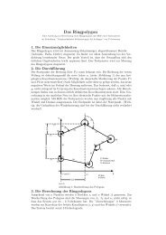
Waterland–People: On Structure and Origin of Crannogs ...
Waterland–People: On Structure and Origin of Crannogs ...
Waterland–People: On Structure and Origin of Crannogs ...

You also want an ePaper? Increase the reach of your titles
YUMPU automatically turns print PDFs into web optimized ePapers that Google loves.
CHAPTER 2. GENERAL REVIEW<br />
2.4. THE GEOPHYSICAL APPROACH<br />
accumulate in the basins where all the Orkney Lochs are located. Therefore, most<br />
sites are momentarily inaccessible unless they have been grazed after a dry summer. In<br />
wintertime, wading <strong>and</strong> crossing <strong>of</strong> causeways is impractical due to the high water level<br />
<strong>and</strong> strong currents across the causeways.<br />
All desk–based information that can be gathered at present will be given in section ?? at<br />
the end <strong>of</strong> chapter 3.<br />
2.4 The geophysical approach<br />
The combination <strong>of</strong> desk–based, environmental <strong>and</strong> geophysical analysis is a strong<br />
tool for site investigation. It can provide information that can lead to the decision, that<br />
an excavation would be worthwhile <strong>and</strong> costefficient. Even without the possibility or<br />
necessity <strong>of</strong> a succeding excavation, the information gained is useful as it is undisturbant.<br />
In this special case the method was chosen because <strong>of</strong> the latter facts <strong>and</strong> because <strong>of</strong> the<br />
idea, that geophysics could be a very good method for investigations on crannogs <strong>of</strong> a<br />
particular type, that is, those with surface cover for electrode connection <strong>and</strong> without<br />
too much vegetation because <strong>of</strong> the sensitivity <strong>of</strong> radar equipment to rough surface<br />
conditions. The question, whether a crannog is structurally differing from another might<br />
not be one <strong>of</strong> the easiest to answer because the conditions can vary from wet to dry <strong>and</strong><br />
rubbly but because there is a good chance that one or the other method might work,<br />
it is always a matter <strong>of</strong> trying. Underwater equipment such as sonar can be extremely<br />
cost efficient but has to be operated from a boat. As there was one site proposed for<br />
this work that would have implied the shipping <strong>of</strong> equipment which was not covered<br />
by any insurance, this is usually one <strong>of</strong> the more difficult approaches, not in therms <strong>of</strong><br />
practicability but <strong>of</strong> funding. This is most definitely one <strong>of</strong> the reasons why crannog<br />
research is still in it’s awaikening phase, with so many sites inacessible without a boat.<br />
2.5 Aims <strong>of</strong> study<br />
The extend to which geophysical investigations can be applied will be investigated,<br />
<strong>and</strong> how the data compares to reality (if known) <strong>and</strong> other sites. Here, a strategy that is<br />
variable <strong>and</strong> practical will be established.<br />
The tasks that were already outlined in the project design (Christen 2007, 4,5) can be<br />
subdivided into the following objectives:<br />
2.5.1 Desk based<br />
1. Site assessments, place names, environmental ascpects<br />
11