The Danube submarine canyon (Black Sea ... - geo.edu.ro
The Danube submarine canyon (Black Sea ... - geo.edu.ro
The Danube submarine canyon (Black Sea ... - geo.edu.ro
You also want an ePaper? Increase the reach of your titles
YUMPU automatically turns print PDFs into web optimized ePapers that Google loves.
254<br />
I. Popescu et al. / Marine Geology 206 (2004) 249–265<br />
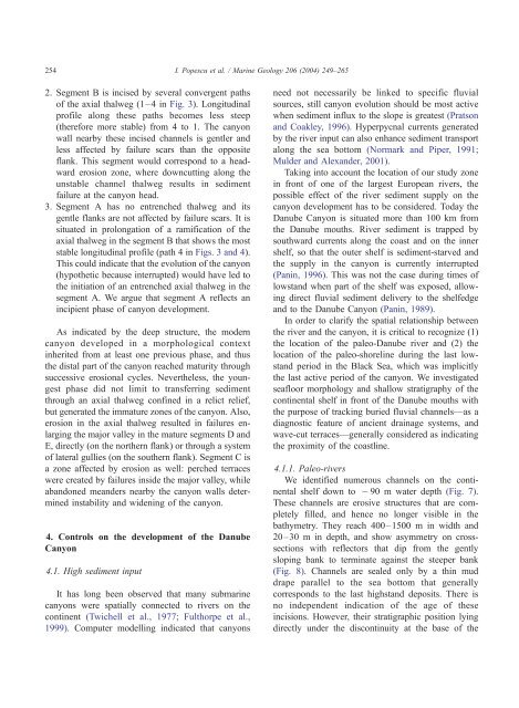
2. Segment B is incised by several convergent paths<br />
of the axial thalweg (1–4 in Fig. 3). Longitudinal<br />
p<strong>ro</strong>file along these paths becomes less steep<br />
(therefore more stable) f<strong>ro</strong>m 4 to 1. <st<strong>ro</strong>ng>The</st<strong>ro</strong>ng> <st<strong>ro</strong>ng>canyon</st<strong>ro</strong>ng><br />
wall nearby these incised channels is gentler and<br />
less affected by failure scars than the opposite<br />
flank. This segment would correspond to a headward<br />
e<strong>ro</strong>sion zone, where downcutting along the<br />
unstable channel thalweg results in sediment<br />
failure at the <st<strong>ro</strong>ng>canyon</st<strong>ro</strong>ng> head.<br />
3. Segment A has no entrenched thalweg and its<br />
gentle flanks are not affected by failure scars. It is<br />
situated in p<strong>ro</strong>longation of a ramification of the<br />
axial thalweg in the segment B that shows the most<br />
stable longitudinal p<strong>ro</strong>file (path 4 in Figs. 3 and 4).<br />
This could indicate that the evolution of the <st<strong>ro</strong>ng>canyon</st<strong>ro</strong>ng><br />
(hypothetic because interrupted) would have led to<br />
the initiation of an entrenched axial thalweg in the<br />
segment A. We argue that segment A reflects an<br />
incipient phase of <st<strong>ro</strong>ng>canyon</st<strong>ro</strong>ng> development.<br />
As indicated by the deep structure, the modern<br />
<st<strong>ro</strong>ng>canyon</st<strong>ro</strong>ng> developed in a morphological context<br />
inherited f<strong>ro</strong>m at least one previous phase, and thus<br />
the distal part of the <st<strong>ro</strong>ng>canyon</st<strong>ro</strong>ng> reached maturity th<strong>ro</strong>ugh<br />
successive e<strong>ro</strong>sional cycles. Nevertheless, the youngest<br />
phase did not limit to transferring sediment<br />
th<strong>ro</strong>ugh an axial thalweg confined in a relict relief,<br />
but generated the immature zones of the <st<strong>ro</strong>ng>canyon</st<strong>ro</strong>ng>. Also,<br />
e<strong>ro</strong>sion in the axial thalweg resulted in failures enlarging<br />
the major valley in the mature segments D and<br />
E, directly (on the northern flank) or th<strong>ro</strong>ugh a system<br />
of lateral gullies (on the southern flank). Segment C is<br />
a zone affected by e<strong>ro</strong>sion as well: perched terraces<br />
were created by failures inside the major valley, while<br />
abandoned meanders nearby the <st<strong>ro</strong>ng>canyon</st<strong>ro</strong>ng> walls determined<br />
instability and widening of the <st<strong>ro</strong>ng>canyon</st<strong>ro</strong>ng>.<br />
4. Cont<strong>ro</strong>ls on the development of the <st<strong>ro</strong>ng>Danube</st<strong>ro</strong>ng><br />
Canyon<br />
4.1. High sediment input<br />
It has long been observed that many <st<strong>ro</strong>ng>submarine</st<strong>ro</strong>ng><br />
<st<strong>ro</strong>ng>canyon</st<strong>ro</strong>ng>s were spatially connected to rivers on the<br />
continent (Twichell et al., 1977; Fulthorpe et al.,<br />
1999). Computer modelling indicated that <st<strong>ro</strong>ng>canyon</st<strong>ro</strong>ng>s<br />
need not necessarily be linked to specific fluvial<br />
sources, still <st<strong>ro</strong>ng>canyon</st<strong>ro</strong>ng> evolution should be most active<br />
when sediment influx to the slope is greatest (Pratson<br />
and Coakley, 1996). Hyperpycnal currents generated<br />
by the river input can also enhance sediment transport<br />
along the sea bottom (Normark and Piper, 1991;<br />
Mulder and Alexander, 2001).<br />
Taking into account the location of our study zone<br />
in f<strong>ro</strong>nt of one of the largest Eu<strong>ro</strong>pean rivers, the<br />
possible effect of the river sediment supply on the<br />
<st<strong>ro</strong>ng>canyon</st<strong>ro</strong>ng> development has to be considered. Today the<br />
<st<strong>ro</strong>ng>Danube</st<strong>ro</strong>ng> Canyon is situated more than 100 km f<strong>ro</strong>m<br />
the <st<strong>ro</strong>ng>Danube</st<strong>ro</strong>ng> mouths. River sediment is trapped by<br />
southward currents along the coast and on the inner<br />
shelf, so that the outer shelf is sediment-starved and<br />
the supply in the <st<strong>ro</strong>ng>canyon</st<strong>ro</strong>ng> is currently interrupted<br />
(Panin, 1996). This was not the case during times of<br />
lowstand when part of the shelf was exposed, allowing<br />
direct fluvial sediment delivery to the shelfedge<br />
and to the <st<strong>ro</strong>ng>Danube</st<strong>ro</strong>ng> Canyon (Panin, 1989).<br />
In order to clarify the spatial relationship between<br />
the river and the <st<strong>ro</strong>ng>canyon</st<strong>ro</strong>ng>, it is critical to recognize (1)<br />
the location of the paleo-<st<strong>ro</strong>ng>Danube</st<strong>ro</strong>ng> river and (2) the<br />
location of the paleo-shoreline during the last lowstand<br />
period in the <st<strong>ro</strong>ng>Black</st<strong>ro</strong>ng> <st<strong>ro</strong>ng>Sea</st<strong>ro</strong>ng>, which was implicitly<br />
the last active period of the <st<strong>ro</strong>ng>canyon</st<strong>ro</strong>ng>. We investigated<br />
seafloor morphology and shallow stratigraphy of the<br />
continental shelf in f<strong>ro</strong>nt of the <st<strong>ro</strong>ng>Danube</st<strong>ro</strong>ng> mouths with<br />
the purpose of tracking buried fluvial channels—as a<br />
diagnostic feature of ancient drainage systems, and<br />
wave-cut terraces—generally considered as indicating<br />
the p<strong>ro</strong>ximity of the coastline.<br />
4.1.1. Paleo-rivers<br />
We identified nume<strong>ro</strong>us channels on the continental<br />
shelf down to 90 m water depth (Fig. 7).<br />
<st<strong>ro</strong>ng>The</st<strong>ro</strong>ng>se channels are e<strong>ro</strong>sive structures that are completely<br />
filled, and hence no longer visible in the<br />
bathymetry. <st<strong>ro</strong>ng>The</st<strong>ro</strong>ng>y reach 400–1500 m in width and<br />
20–30 m in depth, and show asymmetry on c<strong>ro</strong>sssections<br />
with reflectors that dip f<strong>ro</strong>m the gently<br />
sloping bank to terminate against the steeper bank<br />
(Fig. 8). Channels are sealed only by a thin mud<br />
drape parallel to the sea bottom that generally<br />
corresponds to the last highstand deposits. <st<strong>ro</strong>ng>The</st<strong>ro</strong>ng>re is<br />
no independent indication of the age of these<br />
incisions. However, their stratigraphic position lying<br />
directly under the discontinuity at the base of the


