Manor Woods - The Village of Glen Ellyn
Manor Woods - The Village of Glen Ellyn
Manor Woods - The Village of Glen Ellyn

You also want an ePaper? Increase the reach of your titles
YUMPU automatically turns print PDFs into web optimized ePapers that Google loves.
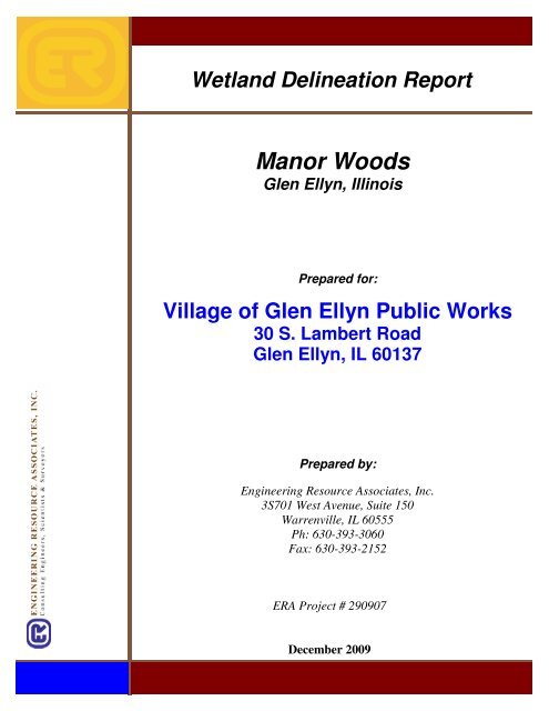
Wetland Delineation Report<br />
<strong>Manor</strong> <strong>Woods</strong><br />
<strong>Glen</strong> <strong>Ellyn</strong>, Illinois<br />
Prepared for:<br />
<strong>Village</strong> <strong>of</strong> <strong>Glen</strong> <strong>Ellyn</strong> Public Works<br />
30 S. Lambert Road<br />
<strong>Glen</strong> <strong>Ellyn</strong>, IL 60137<br />
Prepared by:<br />
Engineering Resource Associates, Inc.<br />
3S701 West Avenue, Suite 150<br />
Warrenville, IL 60555<br />
Ph: 630-393-3060<br />
Fax: 630-393-2152<br />
ERA Project # 290907<br />
December 2009
Table <strong>of</strong> Contents<br />
Property Location and Land Uses 2<br />
Purpose <strong>of</strong> the Field Investigation 2<br />
Methodology 2<br />
Hydrology 2<br />
Soils 3<br />
Vegetation 3<br />
Regulatory Requirements 4<br />
U.S. Army Corps <strong>of</strong> Engineers 4<br />
DuPage County 5<br />
Jurisdictional Wetlands and Waters <strong>of</strong> the U.S.<br />
Wetland/Drainageway 1 7<br />
Wetland 2 8<br />
Wetland 3 9<br />
Waters <strong>of</strong> the U.S. 1-3 10<br />
Conclusions & Recommendations 10<br />
Exhibits<br />
1. Location Map<br />
2. DuPage County Wetland Map<br />
3. National Wetland Inventory<br />
4. Aerial Photograph<br />
5. NRCS Soils Map<br />
6. Topographic Map<br />
7. DuPage County Regulatory Flood Map<br />
8. Approximate Wetland/ Waters <strong>of</strong> the U.S. Boundary<br />
Appendices<br />
A. Data forms<br />
B. Floristic Quality Assessment<br />
C. MDNR<br />
D. Photographs<br />
E. IDNR Consultation<br />
F. High Quality Aquatic Resource Description<br />
References<br />
1
Property Location and Land Uses<br />
<strong>Manor</strong> <strong>Woods</strong> is located in incorporated <strong>Village</strong> <strong>of</strong> <strong>Glen</strong> <strong>Ellyn</strong>, DuPage County, IL<br />
(Exhibit 1). <strong>The</strong> property is bounded by residential property to the north, Brandon<br />
Avenue to the east, Illinois Street to the south, and Newton Avenue to the west. <strong>The</strong> legal<br />
description is SE ¼ S.15, T39N, R10E, 3 rd P.M. <strong>The</strong> property consists <strong>of</strong> approximately a<br />
14-acre woodland, which contains evidence <strong>of</strong> historic fill. This was based on<br />
observations <strong>of</strong> uneven land and the presence <strong>of</strong> utility lines. Furthermore, the installation<br />
<strong>of</strong> a stormwater utility running through the property may have lead to the draining <strong>of</strong> a<br />
larger historic wetland system.<br />
Purpose <strong>of</strong> the Field Investigation<br />
<strong>The</strong> purpose <strong>of</strong> the field investigation was to determine the existence, location, and size<br />
<strong>of</strong> any jurisdictional wetlands or Waters <strong>of</strong> the U.S. within the scope <strong>of</strong> the site. <strong>The</strong><br />
United States Army Corps <strong>of</strong> Engineers (Corps) outlined methods for delineating<br />
wetlands in the Corps <strong>of</strong> Engineers Wetlands Delineation Manual (Manual) dated 1987/<br />
Interim Regional Supplement to the Corps <strong>of</strong> Engineers Wetland Delineation Manual:<br />
Midwest Region dated September 2008. <strong>The</strong>se methods were used to delineate any<br />
jurisdictional areas. A floristic quality assessment was performed for each wetland by<br />
calculating the Coefficient <strong>of</strong> Conservatism (ĉ) and Floristic Quality Index (I) using plant<br />
species observed in the field and nomenclature given in Plants <strong>of</strong> the Chicago Region<br />
(Swink and Wilhelm 1994). In addition, a wildlife habitat and use assessment was<br />
determined using the Modified Michigan Department <strong>of</strong> Natural Resources Method<br />
(MDNR) and evaluation score sheet. Photographs have been provided in the appendices.<br />
Methodology<br />
<strong>The</strong> Corps Federal Register (1982) and Environmental Protection Agency (EPA) Federal<br />
Register (1980) jointly define wetlands as: “Those areas that are inundated or saturated<br />
by surface or ground water at a frequency and duration sufficient to support, and that<br />
under normal circumstances do support, a prevalence <strong>of</strong> vegetation typically adapted for<br />
life in saturated soil conditions.” <strong>The</strong>refore, in order to be considered a jurisdictional<br />
wetland, three criteria: soils, hydrology, and vegetation must be met.<br />
<strong>The</strong> Corps requires data forms and technical information as part <strong>of</strong> a delineation report to<br />
document the three criteria for any area determined to be a wetland. <strong>The</strong> corresponding<br />
data forms for this project are provided in Appendix A. A description <strong>of</strong> the three<br />
criteria, field methods, and floristic quality assessment are provided below.<br />
Hydrology:<br />
An area has wetland hydrology if it is inundated or saturated within the root zone and/or<br />
within 12” <strong>of</strong> the surface continuously for at least 5% <strong>of</strong> the growing season,<br />
approximately 9-14 days, in most years. <strong>The</strong> Manual defines the growing season as the<br />
portion <strong>of</strong> the year when the soil temperature (measured 20in below the surface) is above<br />
2
iological zero (5 o C or 41 o F) which can be approximated by the number <strong>of</strong> “frost free”<br />
days (>28 o F at a frequency <strong>of</strong> 5 years in 10).<br />
Recorded data such as: aerial photographs (Exhibit 4), stream gage data, planning<br />
documents, and federal, state, county, and local agency records were examined prior to<br />
the site investigation to determine if hydrology may be present. Primary and secondary<br />
indicators were investigated in the field. Inundation, saturation in the upper 12”, water<br />
marks, drift lines, sediment deposits, drainage patterns, oxidized root channels in the<br />
upper 12”, water-stained leaves, local soil survey data, and the FAC-neutral test are all<br />
examples <strong>of</strong> field indicators. Seasonal factors and pr<strong>of</strong>essional judgment were also taken<br />
into account when hydrology was determined.<br />
Soils:<br />
Hydric soils are those soils that are sufficiently wet in the upper part to develop anaerobic<br />
conditions during the growing season. <strong>The</strong> field indicators <strong>of</strong> hydric soils in LRR, K, L,<br />
M, N, O, P for Illinois were used to determine if hydric soild are present. Natural<br />
Resources Conservation Service (NRCS) soil maps were examined prior to the site<br />
investigation to determine if hydric soils were present (Exhibit 5). Mapped types and/or<br />
the presence <strong>of</strong> field indicators were confirmed by digging soil pits. Soil pits at all data<br />
points were dug to a depth <strong>of</strong> approximately 24”, if able, as field indicators are typically<br />
observed within 20-36 inches <strong>of</strong> the soil surface. Soil colors were determined using the<br />
Munsell Soils Color Charts, dated 2000.<br />
Vegetation:<br />
In order to be considered a wetland greater than 50% <strong>of</strong> the dominant plant species in the<br />
community must be hydrophytic. <strong>The</strong> USFWS published a regional list <strong>of</strong> plant species<br />
occurring in wetlands in 1988. Each species is assigned to a Wetland indicator category<br />
based upon its probability <strong>of</strong> naturally occurring in a wetland (Table 1). According to<br />
the Manual, when species that adapt for life in anaerobic soil conditions (OBL, FACW,<br />
FAC )immediately exceed 50% <strong>of</strong> the total dominance for each stratum, hydrophytic<br />
vegetation is present.<br />
Table 1. Plant Indicator Status Categories* (USFWS 1988)<br />
Indicator category Region 3 Definition<br />
Indicator<br />
Obligate Wetland OBL Occur almost always (estimated probability >99%)<br />
under natural conditions in wetlands, but which may<br />
also occur rarely (estimated probability
wetlands (estimated probability 1%-33%).<br />
Obligate Upland UPL Occur almost always (estimated probability >99%)<br />
under natural conditions in non-wetlands in the<br />
region specified, but which may also occur rarely<br />
(estimated probability
<strong>The</strong> Chicago District <strong>of</strong> the Corps issued a Regional Permit Program (RRP) for activities<br />
with minimal impacts for Cook and the surrounding collar counties. <strong>The</strong> RRP authorizes<br />
structures or work in or affecting navigable waters <strong>of</strong> the U.S. under RHA Section 10 and<br />
CWA Section 404. Authorization under RHA Section 10 is required for construction <strong>of</strong><br />
structures such as piers, decks, breakwaters, jetties, utility lines, and activities such as<br />
dredging within, over, or under navigable waters <strong>of</strong> the United States. While,<br />
authorization for the discharge <strong>of</strong> dredged or fill material within CWA Section 404<br />
Waters <strong>of</strong> the U.S. is required.<br />
Activities are divided into two categories under the RRP (Category I & II). Projects that<br />
impact less than 0.10 acres <strong>of</strong> waters <strong>of</strong> the U.S. and do not impact any high-quality<br />
aquatic resources are processed under Category I. Compensatory mitigation is not<br />
required for impacts under 0.10 acres. Projects that impact over 0.10 acres and up to 2.0<br />
acres <strong>of</strong> waters <strong>of</strong> the U.S., or impact high-quality aquatic resources, are processed under<br />
Category II. Compensatory mitigation for impacts between 0.10 and 2.0 acres is<br />
required. High-Quality Aquatic Resources (HQARs) are generally considered unsuitable<br />
for dredge or fill activities. A description and list <strong>of</strong> HQARs as described by the Corps in<br />
the RRP is provided in Appendix F. Impacts to a high-quality aquatic resource or<br />
impacts over 2.0 acres require an Individual Permit (IP) as a more thorough examination<br />
<strong>of</strong> the project must be performed, in addition to public comment.<br />
A native upland buffer (or other appropriate vegetation approved by the Corps) adjacent<br />
to all created, restored, enhanced or preserved waters <strong>of</strong> the U.S. and wetlands must be<br />
established or enhanced. According to the RRP the following buffer widths are required:<br />
1) For a linear body <strong>of</strong> water (e.g., river, stream, creek, etc.), the buffer shall be a<br />
minimum <strong>of</strong> 50 feet from the Ordinary High Water Mark (OHWM) on both sides<br />
<strong>of</strong> the linear waterbody;<br />
2) For any waters <strong>of</strong> the U.S., including wetlands, over 0.10 acres and up to 0.5 acres<br />
in size, the buffer shall be 30 feet wide;<br />
3) For any waters <strong>of</strong> the U.S. including wetlands, 0.5 acres or larger in size, the<br />
buffer shall be 50 feet wide; and<br />
4) For any area determined to be a high-quality resource, the buffer shall be 100 feet<br />
wide;<br />
<strong>The</strong> above requirements do not apply to linear road crossings.<br />
DuPage County:<br />
Per Article 10 Section 15-147 <strong>of</strong> the January 2004 DuPage County Countywide<br />
Stormwater and Flood Plain Ordinance (DCSFPO), a stormwater permit is required if<br />
the development involves one or more special management areas. Special management<br />
areas include regulatory floodplains, wetlands, riparian areas, and wetland buffers. Both<br />
isolated and adjacent wetlands are jurisdictional under the (DCSFPO). All wetland<br />
determinations and delineations that are conducted in DuPage County are required to use<br />
procedures in accordance with the current Federal wetland delineation methodology<br />
authorized under Section 404 <strong>of</strong> the CWA. As such, the above methodology as set forth<br />
in the Manual was used. All wetland delineations must be verified by DuPage County or<br />
the authorized Ordinance Administrator for all complete waiver communities. <strong>The</strong> Corps<br />
has issued DuPage County Department <strong>of</strong> Development and Economic Planning a<br />
5
Programmatic General Permit (RP-25), which designates the County as the lead agency<br />
to review permits involving wetlands.<br />
Per Section 15-134.3 <strong>of</strong> the DCSFPO all wetlands must be classified as critical or<br />
regulatory based on the assessment <strong>of</strong> certain functions and values. <strong>The</strong>y are as follows:<br />
• <strong>The</strong> wetland is identified as a critical wetland in the County's wetland inventory.<br />
• <strong>The</strong> wetland is known to possess a Federal or State listed threatened or<br />
endangered species based on the consultation with the Illinois Department <strong>of</strong><br />
Natural Resources.<br />
• <strong>The</strong> plant community within the wetland is determined to have a native floristic<br />
quality index <strong>of</strong> 20 or higher during a single season assessment, a native mean C-<br />
value <strong>of</strong> 3.5 or greater, or alternatively a natural area rating index (NARI) value <strong>of</strong><br />
35.0 or higher during a spring, summer, and fall assessment, as calculated by the<br />
Swink & Wilhelm methodology. If both methods are performed, the NARI value<br />
shall prevail as the determining value.<br />
• <strong>The</strong> initial wildlife quality value using the Modified Michigan Department <strong>of</strong><br />
Natural Resources Method is 5.0 or higher, or alternatively the mean rated<br />
wildlife quality (MWRQ) is determined to be 8.0 or higher, as calculated by the<br />
Ludwig wildlife habitat evaluation methodology. If both methods are performed,<br />
the Ludwig value shall prevail as the determining value.<br />
Development within or affecting critical wetlands under the DCFSPO is prohibited,<br />
unless documentation is submitted that conclusively proves that the presence <strong>of</strong> critical<br />
wetlands precludes all economic use <strong>of</strong> the entire parcel, and that no practicable<br />
alternative to wetland modification exists. Mitigation for impacts to critical wetlands is<br />
required at a minimum proportional rate <strong>of</strong> three to one (3:1).<br />
All other wetlands that do not meet any <strong>of</strong> the functions and values described above are<br />
considered regulatory. Development within or affecting a regulatory wetland that is<br />
equal to or greater than 0.10 acre shall be prohibited unless documentation is submitted<br />
that conclusively proves that no practicable alternative to wetland modification exists.<br />
While, development within or affecting a regulatory wetland that includes contiguous<br />
waters <strong>of</strong> DuPage less than 0.10 acre does not require documentation showing that no<br />
practicable alternatives to wetland modification exists. Waters <strong>of</strong> DuPage are defined as:<br />
all waters such as lakes, rivers, streams (including intermittent streams), mudflats,<br />
wetlands, sloughs, wet meadows, or natural ponds, all impoundments <strong>of</strong> waters not<br />
otherwise defined as waters <strong>of</strong> DuPage under the definition, tributaries <strong>of</strong> waters<br />
identified above, and wetlands adjacent to waters identified above. Mitigation for<br />
impacts to regulatory wetlands is required at a minimum proportional rate <strong>of</strong> one and a<br />
half to one (1.5:1).<br />
Per Section 15-135.14, to the extent practicable, development within 50ft <strong>of</strong> a regulatory<br />
wetland and 100ft <strong>of</strong> a critical wetland shall not, without mitigation: adversely change the<br />
quantity, quality, or temporal and aerial distribution <strong>of</strong> flows entering any adjacent<br />
wetlands or waters; nor destroy or damage vegetation that stabilizes wetland fringe areas<br />
or provides overland flow filtration to wetlands; nor adversely affect any ground water<br />
infiltration functions.<br />
6
Jurisdictional Wetlands and Waters <strong>of</strong> the U.S.<br />
<strong>The</strong>re are three wetland/ draingeway areas and three Waters <strong>of</strong> the U.S. located within the<br />
scope <strong>of</strong> the project. <strong>The</strong> boundaries <strong>of</strong> the wetlands were staked with pink pin flags with<br />
the wording “Wetland Delineation.” Data points were taken both within and outside <strong>of</strong><br />
the wetland boundaries to support our conclusions. <strong>The</strong>se data points are marked on an<br />
aerial photograph with the approximate wetland boundary (Exhibit 8). <strong>The</strong><br />
corresponding data forms are provided in Appendix A. <strong>The</strong> following text characterizes<br />
the each wetland.<br />
Wetland/ Drainageway 1:<br />
This system is a wetland swale formed by drainage from a storm sewer outlet which runs<br />
underneath Brandon Road. Both the U.S. Fish and Wildlife Service (USFWS) National<br />
Wetland Inventory (NWI) Map (Exhibit 3) and the DuPage County Wetland Inventory<br />
Maps (Exhibit 2) identity wetlands within the project location. One wetland and one<br />
upland data point were taken in and adjacent to the wetland.<br />
Hydrology is provided by the stormwater culvert, precipitation, surface run<strong>of</strong>f, and<br />
possibly groundwater. Surface water, saturation in the upper twelve inches and drainage<br />
patterns were the indicators used to determine persistent hydrology. Soils are mapped as<br />
903A - Muskego and Houghton Mucks, a hydric, as identified by the Soil Survey <strong>of</strong><br />
DuPage County, IL, dated 1997. <strong>The</strong> hydric qualities associated with these soils were<br />
verified, via test indicators A12- Thick Dark Surface and F2- Loamy Gleyed Matrix.<br />
Dominant vegetation consisted <strong>of</strong> Box Elder (Acer negundo), Garlic Mustard (Alliaria<br />
petiolata) and Honewort (Cryptotaenia Canadensis). As such, this wetland area satisfies<br />
all three criteria and qualifies as a wetland.<br />
<strong>The</strong> Coefficient <strong>of</strong> Conservatism (C), Floristic Quality Index (I), and Mean Wetness<br />
Coefficient for the wetland were 1.0, 1.73, and -1.7, respectively. <strong>The</strong>refore, this wetland<br />
is not indicative <strong>of</strong> a High Quality Aquatic Resource (Appendix F). <strong>The</strong> floristic quality<br />
assessment is provided in Appendix B.<br />
<strong>The</strong> MDNR Wildlife Habitat/Use Evaluation Score Sheet was used to evaluate the<br />
wildlife quality <strong>of</strong> the area. <strong>The</strong> total score was determined to be 2.5; the evaluation<br />
score sheet is provided in Appendix C. As such, the wetland does not receive a critical<br />
status, rather, it receives a regulatory status. <strong>The</strong> Illinois Department <strong>of</strong> Natural<br />
Resources (IDNR) was consulted regarding the existence <strong>of</strong> threatened and endangered<br />
species on the property. After receiving their response, it was concluded that no<br />
threatened and endangered species inhabit the area and therefore the consultation was<br />
terminated. <strong>The</strong>ir findings have been included in Appendix E.<br />
This wetland provides limited functions due to its small size and location. Several<br />
functions include: sediment and nutrient assimilation from upland areas thus reducing the<br />
impact <strong>of</strong> urbanization on water quality by filtering and assimilating nutrients discharged<br />
from surrounding uplands, and forage, shelter and perching habitat for local wildlife.<br />
7
As this wetland is considered to be regulatory, a 50ft buffer is present. <strong>The</strong> buffer<br />
currently provides limited functions due to the surrounding land use. <strong>The</strong> existing buffer<br />
surrounding the wetland is consists <strong>of</strong> scrub shrub and overstory trees, which provides<br />
some soil stabilization, ground water infiltration, and pollutant assimilation functions.<br />
Wetland 2:<br />
This system is a drainage sheet flow area formed by drainage from a storm sewer outlet.<br />
Both the U.S. Fish and Wildlife Service (USFWS) National Wetland Inventory (NWI)<br />
Map (Exhibit 3) and the DuPage County Wetland Inventory Maps (Exhibit 2) identity<br />
wetlands at this location. One wetland and one upland data point were taken in and<br />
adjacent to the wetland.<br />
Hydrology is provided by the stormwater culvert, direct precipitation, and surface run<strong>of</strong>f.<br />
Saturation in the upper twelve inches, water stained leaves and drainage patterns were the<br />
indicators used to determine persistent hydrology. Soils are mapped as 223C2 - Varna<br />
Silt Loam and 903A - Muskego and Houghton Mucks at this location. Both are hydric or<br />
have hydric inclusions <strong>of</strong> hydric soils as identified by the Soil Survey <strong>of</strong> DuPage County,<br />
IL, dated 1997. <strong>The</strong> hydric qualities associated with these soils were verified via test<br />
indicators A12- Thick Dark Surface and F2- Loamy Gleyed Matrix. Dominant vegetation<br />
consisted <strong>of</strong> Garlic Mustard (Alliaria petiolata), Pokeweed (Phytolacca americana), and<br />
Reed Canary Grass (Phalaris arundinacea). As such, this wetland area satisfies all three<br />
criteria and qualifies as a wetland.<br />
<strong>The</strong> Coefficient <strong>of</strong> Conservatism (C), Floristic Quality Index (I), and Mean Wetness<br />
Coefficient for the wetland were 0.67, 1.15, and -1.0, respectively. <strong>The</strong>refore, this<br />
wetland is not indicative <strong>of</strong> a High Quality Aquatic Resource (Appendix F). <strong>The</strong><br />
floristic quality assessment is provided in Appendix B.<br />
<strong>The</strong> MDNR Wildlife Habitat/Use Evaluation Score Sheet was used to evaluate the<br />
wildlife quality <strong>of</strong> the area. <strong>The</strong> total score was determined to be 2.0; the evaluation<br />
score sheet is provided in Appendix C. As such, the wetland does not receive a critical<br />
status, rather, it receives a regulatory status. <strong>The</strong> Illinois Department <strong>of</strong> Natural<br />
Resources (IDNR) was consulted regarding the existence <strong>of</strong> threatened and endangered<br />
species on the property. After receiving their response, it was concluded that no<br />
threatened and endangered species inhabit the area and therefore the consultation was<br />
terminated. <strong>The</strong>ir findings have been included in Appendix E.<br />
This wetland provides limited functions due to its small size and location. Several<br />
functions include: sediment and nutrient filtration, and nutrient assimilation from upland<br />
areas thus reducing the impact <strong>of</strong> urbanization on water quality by filtering and<br />
assimilating nutrients discharged from surrounding uplands, and limited forage, shelter<br />
and perching habitat for local wildlife.<br />
As this wetland is considered to be regulatory, a 50ft buffer is present. <strong>The</strong> buffer<br />
currently provides limited functions due to the surrounding land use. <strong>The</strong> existing buffer<br />
surrounding the wetland is consists <strong>of</strong> scrub shrub, overstory trees and manicured turf<br />
8
grass, which provides some soil stabilization, ground water infiltration, pollutant<br />
assimilation functions, and forage, shelter and perching habitat for local wildlife<br />
Wetland 3:<br />
This system is a wetland swale formed by drainage from a storm sewer outlet. Both the<br />
U.S. Fish and Wildlife Service (USFWS) National Wetland Inventory (NWI) Map<br />
(Exhibit 3) and the DuPage County Wetland Inventory Maps (Exhibit 2) identity<br />
wetlands within the project location. One wetland and one upland data point was taken in<br />
and adjacent to the wetland.<br />
Hydrology is provided by the stormwater culvert, direct precipitation and surface run<strong>of</strong>f.<br />
Saturation in the upper twelve inches, water stained leaves and drainage patterns were the<br />
indicators used to determine persistent hydrology. Soils are mapped as 903A - Muskego<br />
and Houghton Mucks, hydric, as identified by the Soil Survey <strong>of</strong> DuPage County, IL,<br />
dated 1997. <strong>The</strong> hydric qualities associated with these soils were verified via test<br />
indicators F6- Redox Dark Surface. Dominant vegetation consisted <strong>of</strong> Garlic Mustard<br />
(Alliaria petiolata), Common Buckthorn (Rhamnus cathartica), Elderberry (Sambucus<br />
canadensis), and Reed Canary Grass (Phalaris arundinacea). As such, this wetland area<br />
satisfies all three criteria and qualifies as a wetland.<br />
<strong>The</strong> Coefficient <strong>of</strong> Conservatism (C), Floristic Quality Index (I), and Mean Wetness<br />
Coefficient for the wetland were 1.67, 2.89, and -2.0, respectively. <strong>The</strong>refore, this<br />
wetland is not indicative <strong>of</strong> a High Quality Aquatic Resource (Appendix F). <strong>The</strong><br />
floristic quality assessment is provided in Appendix B.<br />
<strong>The</strong> MDNR Wildlife Habitat/Use Evaluation Score Sheet was used to evaluate the<br />
wildlife quality <strong>of</strong> the area. <strong>The</strong> total score was determined to be 2.0; the evaluation<br />
score sheet is provided in Appendix C. As such, the wetland does not receive a critical<br />
status, rather, it receives a regulatory status. <strong>The</strong> Illinois Department <strong>of</strong> Natural<br />
Resources (IDNR) was consulted regarding the existence <strong>of</strong> threatened and endangered<br />
species on the property. After receiving their response, it was concluded that no<br />
threatened and endangered species inhabit the area and therefore the consultation was<br />
terminated. <strong>The</strong>ir findings have been included in Appendix E.<br />
This wetland provides limited functions due to its small size and location. Several<br />
functions include: sediment filtration from upland areas thus reducing the impact <strong>of</strong><br />
urbanization on water quality by filtering and assimilating nutrients discharged from<br />
surrounding uplands, and limited forage, shelter and perching habitat for local wildlife.<br />
As this wetland is considered to be regulatory, a 50ft buffer is present. <strong>The</strong> buffer<br />
currently provides limited functions due to the surrounding land use. <strong>The</strong> existing buffer<br />
surrounding the wetland is consists <strong>of</strong> scrub shrub, overstory trees and manicured turf<br />
grass, which provides some soil stabilization, ground water infiltration, and pollutant<br />
assimilation functions.<br />
9
Waters <strong>of</strong> the U.S 1:<br />
This area is located at the northwest corner <strong>of</strong> the site and contains a braided channel<br />
formed by a storm sewer outlet. <strong>The</strong> vegetation in this area is limited and hydrology is<br />
provided by <strong>of</strong>f-site drainage from surrounding impervious areas.<br />
Waters <strong>of</strong> the U.S 2:<br />
This area is located at the northeast corner <strong>of</strong> the site and contains a channel formed by a<br />
storm sewer outlet. <strong>The</strong> vegetation in this area is limited and hydrology is provided by<br />
<strong>of</strong>f-site drainage from surrounding impervious areas.<br />
Waters <strong>of</strong> the U.S 3:<br />
This area is located at the southwest corner <strong>of</strong> the site and contains a channel formed by a<br />
storm sewer outlet. <strong>The</strong> vegetation in this area is limited and hydrology is provided by<br />
<strong>of</strong>f-site drainage from surrounding impervious areas.<br />
Conclusions and Recommendations<br />
Regarding future permit submittals for construction on the lots in question, the DCSFPO<br />
requires the following additional information with regard to wetlands:<br />
1. <strong>The</strong> wetland boundaries should be surveyed under the direction <strong>of</strong> an Illinois<br />
Registered Land Surveyor and the surveyed delineation line should be transposed<br />
onto the site topographic survey. <strong>The</strong> wetland buffer should also be shown on the<br />
survey.<br />
2. <strong>The</strong> wetlands appear to be isolated and are therefore unlikely to be Corps<br />
jurisdictional. A Jurisdictional Determination (JD) from the Army Corps <strong>of</strong><br />
Engineers should be applied for to verify if the wetlands/Waters are Corps<br />
jurisdictional. All wetlands regardless <strong>of</strong> size and function are considered<br />
jurisdictional under the DCSFPO.<br />
3. Wetland Buffers must be identified (50’ from the wetland edge) and mitigation<br />
provided for any loss <strong>of</strong> buffer functions (vegetation, habitat, water quality) due to<br />
development.<br />
4. An avoidance and minimization argument must be made if impacts to the wetland<br />
are proposed.<br />
5. If impacts to the wetland are proposed mitigation must be provided on-site or<br />
through wetland banking.<br />
10
6. In addition to the submittal <strong>of</strong> a Stormwater Management Permit Application, a<br />
Joint Permit Application must be made to the appropriate Federal and State<br />
agencies.<br />
7. <strong>The</strong> <strong>Village</strong> <strong>of</strong> <strong>Glen</strong> <strong>Ellyn</strong> Planning Department should be notified in writing<br />
prior to the commencement <strong>of</strong> any vegetation removal.<br />
8. A formal Vegetative Maintenance Plan should be submitted to the <strong>Village</strong> <strong>of</strong> <strong>Glen</strong><br />
<strong>Ellyn</strong> Planning Department prior to the commencement <strong>of</strong> any vegetation<br />
removal.<br />
11
Project Location<br />
EXHIBIT 1<br />
Location Map<br />
SE ¼ S.15, T39N, R10E, 3rd P.M.<br />
Project Location<br />
2009 Google Maps<br />
<strong>Village</strong> <strong>of</strong> <strong>Glen</strong> <strong>Ellyn</strong> Public Works<br />
<strong>Manor</strong> <strong>Woods</strong><br />
Job # 290901
Project Location<br />
EXHIBIT 2<br />
DuPage County Wetland Map<br />
Project Location<br />
Image courtesy <strong>of</strong> DuPage County Milton Township Wetland Map<br />
<strong>Village</strong> <strong>of</strong> <strong>Glen</strong> <strong>Ellyn</strong> Public Works<br />
<strong>Manor</strong> <strong>Woods</strong><br />
Job # 290907
Project Location<br />
EXHIBIT 3<br />
National Wetlands Inventory<br />
Project Location<br />
<strong>Village</strong> <strong>of</strong> <strong>Glen</strong> <strong>Ellyn</strong> Public Works<br />
<strong>Manor</strong> <strong>Woods</strong><br />
Job # 290907<br />
Image courtesy <strong>of</strong> Geocortex Internet Mapping Framework (IMF)
EXHIBIT 4<br />
Aerial Photograph<br />
Project Location<br />
<strong>Village</strong> <strong>of</strong> <strong>Glen</strong> <strong>Ellyn</strong> Public Works<br />
<strong>Manor</strong> <strong>Woods</strong><br />
Job # 290907<br />
Image courtesy <strong>of</strong> Google Imagery 2009
Project Location<br />
EXHIBIT 5<br />
NRCS Soils Map<br />
Project Location<br />
Image courtesy <strong>of</strong> NRCS Web Soil Survey 2009<br />
Soils Onsite:<br />
903A - Muskego and Houghton Mucks (Hydric)<br />
232A - Ashkum Silty Clay Loam (Hydric)<br />
189A - Martinton Silt Loam (Hydric)<br />
223B, 223C2 - Varna Silt Loam (Hydric)<br />
330A - Peotone Silty Clay Loam (Hydric)<br />
<strong>Village</strong> <strong>of</strong> <strong>Glen</strong> <strong>Ellyn</strong> Public Works<br />
<strong>Manor</strong> <strong>Woods</strong><br />
Job # 290907
Project Location<br />
EXHIBIT 6<br />
Topography Map<br />
Project Location<br />
<strong>Village</strong> <strong>of</strong> <strong>Glen</strong> <strong>Ellyn</strong> Public Works<br />
<strong>Manor</strong> <strong>Woods</strong><br />
Job # 290907<br />
Image courtesy <strong>of</strong> MyTopo.com
Project Location<br />
EXHIBIT 7<br />
DuPage County Regulatory Flood Map<br />
Project Location<br />
<strong>Village</strong> <strong>of</strong> <strong>Glen</strong> <strong>Ellyn</strong> Public Works<br />
<strong>Manor</strong> <strong>Woods</strong><br />
Job # 290907<br />
Milton Township: Map # 17043C0505 H and 17043C0506 F
Waters <strong>of</strong> the U.S. 1<br />
Stormwater Culvert<br />
Investigative Data Point 1<br />
Stormwater Culvert<br />
Waters <strong>of</strong> the U.S. 2<br />
A1<br />
Wetland 1<br />
Stormwater Culvert<br />
A2<br />
B2<br />
B1<br />
C2<br />
Stormwater Culvert<br />
Wetland 2<br />
C1<br />
Stormwater Culvert<br />
Wetland 2<br />
Waters <strong>of</strong> the U.S. 3<br />
St<br />
EXHIBIT 8<br />
Approximate Wetland Boundary<br />
A<br />
Project Location Boundary<br />
On-Site Wetland<br />
Data Point Waters <strong>of</strong> U.S.<br />
Not To Scale<br />
<strong>Village</strong> <strong>of</strong> <strong>Glen</strong> <strong>Ellyn</strong> Public Works<br />
<strong>Manor</strong> <strong>Woods</strong><br />
Job # 290907<br />
2009 Google Earth
APPENDIX B<br />
SITE: <strong>Manor</strong> <strong>Woods</strong> Wetland /Drainageway 1<br />
LOCALE: <strong>Glen</strong> <strong>Ellyn</strong>, DuPage County, IL<br />
DATE 10-29-09<br />
BY: Richard Gundlach<br />
FILE: Project # 290907, <strong>Glen</strong> <strong>Ellyn</strong> Public Works<br />
FLORISTIC QUALITY DATA NATIVE 50.0% ADVENTIVE 50.0%<br />
3 NATIVE SPECIES 1 Tree 16.7% 0 Tree 0.0%<br />
6 Total Species 0 Shrub 0.0% 1 Shrub 16.7%<br />
1.00 NATIVE MEAN C 0 W-Vine 0.0% 0 W-Vine 0.0%<br />
0.50 W/Adventives 0 H-Vine 0.0% 0 H-Vine 0.0%<br />
1.73 NATIVE FQI 1 P-Forb 16.7% 0 P-Forb 0.0%<br />
1.22 W/Adventives 0 B-Forb 0.0% 2 B-Forb 33.3%<br />
-1.7 NATIVE MEAN W 1 A-Forb 16.7% 0 A-Forb 0.0%<br />
0.5 W/Adventives 0 P-Grass 0.0% 0 P-Grass 0.0%<br />
AVG: FACW- 0 A-Grass 0.0% 0 A-Grass 0.0%<br />
0 P-Sedge 0.0% 0 P-Sedge 0.0%<br />
0 A-Sedge 0.0% 0 A-Sedge 0.0%<br />
0 Cryptogam 0.0%<br />
ACRONYM C SCIENTIFIC NAME W WETNESS PHYSIOG. COMMON NAME<br />
ACENEG 0 Acer negundo -2 FACW- Nt TREE BOX ELDER<br />
ALLPET * ALLIARIA PETIOLATA 0 FAC Ad B-FORB GARLIC MUSTARD<br />
ARCMIN * ARCTIUM MINUS 5 UPL Ad B-FORB COMMON BURDOCK<br />
BIDFRO 1 Bidens frondosa -3 FACW Nt A-FORB COMMON BEGGAR'S TICKS<br />
CRYCAN 2 Cryptotaenia canadensis 0 FAC Nt P-FORB HONEWORT<br />
RHACAT * RHAMNUS CATHARTICA 3 FACU Ad SHRUB COMMON BUCKTHORN
APPENDIX B<br />
SITE: <strong>Manor</strong> <strong>Woods</strong> Wetland 2<br />
LOCALE: <strong>Glen</strong> <strong>Ellyn</strong>, DuPage County, IL<br />
DATE 10-29-09<br />
BY: Richard Gundlach<br />
FILE: Project # 290907, <strong>Glen</strong> <strong>Ellyn</strong> Public Works<br />
FLORISTIC QUALITY DATA NATIVE 42.9% ADVENTIVE 57.1%<br />
3 NATIVE SPECIES 1 Tree 14.3% 0 Tree 0.0%<br />
7 Total Species 1 Shrub 14.3% 1 Shrub 14.3%<br />
0.67 NATIVE MEAN C 0 W-Vine 0.0% 0 W-Vine 0.0%<br />
0.29 W/Adventives 0 H-Vine 0.0% 0 H-Vine 0.0%<br />
1.15 NATIVE FQI 1 P-Forb 14.3% 0 P-Forb 0.0%<br />
0.76 W/Adventives 0 B-Forb 0.0% 1 B-Forb 14.3%<br />
-1.0 NATIVE MEAN W 0 A-Forb 0.0% 0 A-Forb 0.0%<br />
-0.4 W/Adventives 0 P-Grass 0.0% 2 P-Grass 28.6%<br />
AVG: FACW- 0 A-Grass 0.0% 0 A-Grass 0.0%<br />
0 P-Sedge 0.0% 0 P-Sedge 0.0%<br />
0 A-Sedge 0.0% 0 A-Sedge 0.0%<br />
0 Cryptogam 0.0%<br />
ACRONYM C SCIENTIFIC NAME W WETNESS PHYSIOG. COMMON NAME<br />
ACENEG 0 Acer negundo -2 FACW- Nt TREE BOX ELDER<br />
ALLPET * ALLIARIA PETIOLATA 0 FAC Ad B-FORB GARLIC MUSTARD<br />
RHACAT * RHAMNUS CATHARTICA 3 FACU Ad SHRUB COMMON BUCKTHORN<br />
PHYAME 1 Phytolacca americana 1 FAC- Nt P-FORB POKEWEED<br />
PHAARU * PHALARIS ARUNDINACEA -4 FACW+ Ad P-GRASS REED CANARY GRASS<br />
POAPRA * POA PRATENSIS 1 FAC- Ad P-GRASS KENTUCKY BLUE GRASS<br />
SAMCAN 1 Sambucus canadensis -2 FACW- Nt SHRUB ELDERBERRY
APPENDIX B<br />
SITE: <strong>Manor</strong> <strong>Woods</strong> Wetland 3<br />
LOCALE: <strong>Glen</strong> <strong>Ellyn</strong>, DuPage County, IL<br />
DATE 11-20-09<br />
BY: Richard Gundlach<br />
FILE: Project # 290907, <strong>Glen</strong> <strong>Ellyn</strong> Public Works<br />
FLORISTIC QUALITY DATA NATIVE 27.3% ADVENTIVE 72.7%<br />
3 NATIVE SPECIES 0 Tree 0.0% 0 Tree 0.0%<br />
11 Total Species 1 Shrub 9.1% 2 Shrub 18.2%<br />
1.67 NATIVE MEAN C 0 W-Vine 0.0% 0 W-Vine 0.0%<br />
0.45 W/Adventives 0 H-Vine 0.0% 0 H-Vine 0.0%<br />
2.89 NATIVE FQI 2 P-Forb 18.2% 2 P-Forb 18.2%<br />
1.51 W/Adventives 0 B-Forb 0.0% 2 B-Forb 18.2%<br />
-2.0 NATIVE MEAN W 0 A-Forb 0.0% 0 A-Forb 0.0%<br />
0.0 W/Adventives 0 P-Grass 0.0% 2 P-Grass 18.2%<br />
AVG: FACW- 0 A-Grass 0.0% 0 A-Grass 0.0%<br />
0 P-Sedge 0.0% 0 P-Sedge 0.0%<br />
0 A-Sedge 0.0% 0 A-Sedge 0.0%<br />
0 Cryptogam 0.0%<br />
ACRONYM C SCIENTIFIC NAME W WETNESS PHYSIOG. COMMON NAME<br />
ARCMIN * ARCTIUM MINUS 5 UPL Ad B-FORB COMMON BURDOCK<br />
ALLPET * ALLIARIA PETIOLATA 0 FAC Ad B-FORB GARLIC MUSTARD<br />
RHACAT * RHAMNUS CATHARTICA 3 FACU Ad SHRUB COMMON BUCKTHORN<br />
PHYAME 1 Phytolacca americana 1 FAC- Nt P-FORB POKEWEED<br />
PHAARU * PHALARIS ARUNDINACEA -4 FACW+ Ad P-GRASS REED CANARY GRASS<br />
POAPRA * POA PRATENSIS 1 FAC- Ad P-GRASS KENTUCKY BLUE GRASS<br />
SAMCAN 1 Sambucus canadensis -2 FACW- Nt SHRUB ELDERBERRY<br />
ROSMUL * ROSA MULTIFLORA 3 FACU Ad SHRUB MULTIFLORA ROSE<br />
PHLPAN * PHLOX PANICULATA 3 FACU Ad P-FORB GARDEN PHLOX<br />
MENPIP * MENTHA X PIPERITA -5 OBL Ad P-FORB PEPPERMINT<br />
ASTSII 3 Aster simplex interior -5 [OBL] Nt P-FORB MARSH ASTER
APPENDIX C<br />
WILDLIFE HABITAT/USE EVALUATION SCORE SHEET<br />
To assess the existing and/or potential wildlife habitat use <strong>of</strong> the subject wetland, the<br />
applicant must first complete this score sheet. <strong>The</strong> attached documentation provides<br />
examples <strong>of</strong> each scoring parameter.<br />
A separate sheet must be completed for each wetland being considered.<br />
Applicants must document their basis for scoring decisions with field surveys followed<br />
by current photographs, aerial photographs, and other appropriate information.<br />
A. Utilization by Wildlife<br />
Observer: Richard Gundlach<br />
Date: October 29, 2009<br />
Wildlife Use Score Location: <strong>Manor</strong> <strong>Woods</strong><br />
Significant 3<br />
Wetland/Drainageway 1,<br />
Evident 2<br />
<strong>Glen</strong> <strong>Ellyn</strong>, DuPage<br />
Low 1<br />
County, IL<br />
Occasional 0.5<br />
Non-Existent 0 Sub-Total Score= 1<br />
B. Interspersion <strong>of</strong> Vegetative Cover<br />
Interspersion Score<br />
High 3<br />
Medium 2<br />
Low 1 Sub-Total Score= 1<br />
C. Vegetative Cover to Open Water<br />
Cover<br />
Score<br />
>95% Cover 0.5<br />
76%-95% Cover, Peripheral 1.5<br />
76%-95% Cover, Various 2.5<br />
26%-75% Cover, Peripheral 2.0<br />
26%-75% Cover, Patches 3.0<br />
5%-25% Cover, Peripheral 1.0<br />
APPENDIX C<br />
WILDLIFE HABITAT/USE EVALUATION SCORE SHEET<br />
To assess the existing and/or potential wildlife habitat use <strong>of</strong> the subject wetland, the<br />
applicant must first complete this score sheet. <strong>The</strong> attached documentation provides<br />
examples <strong>of</strong> each scoring parameter.<br />
A separate sheet must be completed for each wetland being considered.<br />
Applicants must document their basis for scoring decisions with field surveys followed<br />
by current photographs, aerial photographs, and other appropriate information.<br />
A. Utilization by Wildlife<br />
Observer: Richard Gundlach<br />
Date: October 29, 2009<br />
Wildlife Use Score Location: <strong>Manor</strong> <strong>Woods</strong> Wetland 2<br />
Significant 3<br />
<strong>Glen</strong> <strong>Ellyn</strong>, DuPage<br />
Evident 2<br />
County, IL<br />
Low 1<br />
Occasional 0.5<br />
Non-Existent 0 Sub-Total Score= 0.5<br />
B. Interspersion <strong>of</strong> Vegetative Cover<br />
Interspersion Score<br />
High 3<br />
Medium 2<br />
Low 1 Sub-Total Score= 1<br />
C. Vegetative Cover to Open Water<br />
Cover<br />
Score<br />
>95% Cover 0.5<br />
76%-95% Cover, Peripheral 1.5<br />
76%-95% Cover, Various 2.5<br />
26%-75% Cover, Peripheral 2.0<br />
26%-75% Cover, Patches 3.0<br />
5%-25% Cover, Peripheral 1.0<br />
APPENDIX C<br />
WILDLIFE HABITAT/USE EVALUATION SCORE SHEET<br />
To assess the existing and/or potential wildlife habitat use <strong>of</strong> the subject wetland, the<br />
applicant must first complete this score sheet. <strong>The</strong> attached documentation provides<br />
examples <strong>of</strong> each scoring parameter.<br />
A separate sheet must be completed for each wetland being considered.<br />
Applicants must document their basis for scoring decisions with field surveys followed<br />
by current photographs, aerial photographs, and other appropriate information.<br />
A. Utilization by Wildlife<br />
Observer: Richard Gundlach<br />
Date: November 20, 2009<br />
Wildlife Use Score Location: <strong>Manor</strong> <strong>Woods</strong> Wetland 3<br />
Significant 3<br />
<strong>Glen</strong> <strong>Ellyn</strong>, DuPage<br />
Evident 2<br />
County, IL<br />
Low 1<br />
Occasional 0.5<br />
Non-Existent 0 Sub-Total Score= 0.5<br />
B. Interspersion <strong>of</strong> Vegetative Cover<br />
Interspersion Score<br />
High 3<br />
Medium 2<br />
Low 1 Sub-Total Score= 1<br />
C. Vegetative Cover to Open Water<br />
Cover<br />
Score<br />
>95% Cover 0.5<br />
76%-95% Cover, Peripheral 1.5<br />
76%-95% Cover, Various 2.5<br />
26%-75% Cover, Peripheral 2.0<br />
26%-75% Cover, Patches 3.0<br />
5%-25% Cover, Peripheral 1.0<br />
Appendix D<br />
Photo 1<br />
Site: <strong>Manor</strong> <strong>Woods</strong>, <strong>Glen</strong> <strong>Ellyn</strong>,<br />
DuPage County, IL<br />
Date: October 29, 2009<br />
Description: Photo looking North toward<br />
Wetland/drainageway 1.<br />
Note: Stormwater culvert running under<br />
Brandon Rd.<br />
Investigator: Engineering Resource<br />
Assoc. (R. Gundlach)<br />
Photo 2<br />
Site: <strong>Manor</strong> <strong>Woods</strong>, <strong>Glen</strong> <strong>Ellyn</strong>,<br />
DuPage County, IL<br />
Date: November 13, 2009<br />
Description: Photo looking West toward<br />
Wetland/drainageway 1<br />
Investigator: Engineering Resource<br />
Assoc. (R. Gundlach)<br />
Photo 3<br />
Site: <strong>Manor</strong> <strong>Woods</strong>, <strong>Glen</strong> <strong>Ellyn</strong>,<br />
DuPage County, IL<br />
Date: November 13, 2009<br />
Description: Photo looking Southtoward<br />
Wetland/drainageway 1.<br />
Note: Stormwater culvert running under<br />
Brandon Rd.<br />
Investigator: Engineering Resource<br />
Assoc. (R. Gundlach)
Photo 4<br />
Site: <strong>Manor</strong> <strong>Woods</strong>, <strong>Glen</strong> <strong>Ellyn</strong>,<br />
DuPage County, IL<br />
Date: October 29, 2009<br />
Description: Photo looking West toward<br />
Wetland/drainageway 2.<br />
Investigator: Engineering Resource<br />
Assoc. (R. Gundlach)<br />
Photo 5<br />
Site: <strong>Manor</strong> <strong>Woods</strong>, <strong>Glen</strong> <strong>Ellyn</strong>,<br />
DuPage County, IL<br />
Date: October 29, 2009<br />
Description: Photo looking North toward<br />
Wetland/drainageway 2.<br />
Investigator: Engineering Resource<br />
Assoc. (R. Gundlach)<br />
Photo 6<br />
Site: <strong>Manor</strong> <strong>Woods</strong>, <strong>Glen</strong> <strong>Ellyn</strong>,<br />
DuPage County, IL<br />
Date: October 29, 2009<br />
Description: Photo looking South toward<br />
Wetland/drainageway 2.<br />
Investigator: Engineering Resource<br />
Assoc. (R. Gundlach)
Photo 7<br />
Site: <strong>Manor</strong> <strong>Woods</strong>, <strong>Glen</strong> <strong>Ellyn</strong>,<br />
DuPage County, IL<br />
Date: November 13, 2009<br />
Description: Photo looking Northwest<br />
toward Wetland/drainageway 3.<br />
Investigator: Engineering Resource<br />
Assoc. (R. Gundlach)<br />
Photo 8<br />
Site: <strong>Manor</strong> <strong>Woods</strong>, <strong>Glen</strong> <strong>Ellyn</strong>,<br />
DuPage County, IL<br />
Date: November 13, 2009<br />
Description: Photo looking Southeast<br />
toward Wetland/drainageway 3.<br />
Investigator: Engineering Resource<br />
Assoc. (R. Gundlach)<br />
Photo 9<br />
Site: <strong>Manor</strong> <strong>Woods</strong>, <strong>Glen</strong> <strong>Ellyn</strong>,<br />
DuPage County, IL<br />
Date: November 13, 2009<br />
Description: Photo looking Northwest<br />
toward Wetland/drainageway 3.<br />
Investigator: Engineering Resource<br />
Assoc. (R. Gundlach)
Photo 10<br />
Site: <strong>Manor</strong> <strong>Woods</strong>, <strong>Glen</strong> <strong>Ellyn</strong>,<br />
DuPage County, IL<br />
Date: November 23, 2009<br />
Description: Photo facing West toward<br />
culvert discharge point and<br />
braided channel.<br />
Investigator: Engineering Resource<br />
Assoc. (R. Gundlach)<br />
Photo 11<br />
Site: <strong>Manor</strong> <strong>Woods</strong>, <strong>Glen</strong> <strong>Ellyn</strong>,<br />
DuPage County, IL<br />
Date: November 23, 2009<br />
Description: Photo facing Northwest<br />
toward culvert discharge point and<br />
braided channel.<br />
Investigator: Engineering Resource<br />
Assoc. (R. Gundlach)<br />
Photo 12<br />
Site: <strong>Manor</strong> <strong>Woods</strong>, <strong>Glen</strong> <strong>Ellyn</strong>,<br />
DuPage County, IL<br />
Date: November 23, 2009<br />
Description: Photo looking south <strong>of</strong><br />
braided channel and culvert discharge<br />
point.<br />
Investigator: Engineering Resource<br />
Assoc. (R. Gundlach)
Applicant: Engineering Resource Associates, Inc. IDNR Project #: 1003763<br />
Contact: Richard Gundlach Date: 11/11/2009<br />
Address: 3S701 West Avenue, Suite 150<br />
Warrenville, IL 60555<br />
Project:<br />
Address:<br />
<strong>Manor</strong> <strong>Woods</strong><br />
Illinois Street and Brandon Road, <strong>Glen</strong> <strong>Ellyn</strong><br />
Description: Invasive plant species removal at a local nature preserve.<br />
Natural Resource Review Results<br />
Consultation for Endangered Species Protection and Natural Areas Preservation (Part 1075)<br />
<strong>The</strong> Illinois Natural Heritage Database contains no record <strong>of</strong> State-listed threatened or endangered species, Illinois<br />
Natural Area Inventory sites, dedicated Illinois Nature Preserves, or registered Land and Water Reserves in the<br />
vicinity <strong>of</strong> the project location.<br />
Consultation is terminated. This consultation is valid for two years unless new information becomes available<br />
that was not previously considered; the proposed action is modified; or additional species, essential habitat, or<br />
Natural Areas are identified in the vicinity. If the project has not been implemented within two years <strong>of</strong> the date <strong>of</strong><br />
this letter, or any <strong>of</strong> the above listed conditions develop, a new consultation is necessary. Termination does not<br />
imply IDNR's authorization or endorsement.<br />
Location<br />
<strong>The</strong> applicant is responsible for the<br />
accuracy <strong>of</strong> the location submitted<br />
for the project.<br />
County: DuPage<br />
Township, Range, Section:<br />
39N, 10E, 14 39N, 10E, 15<br />
IL Department <strong>of</strong> Natural Resources Contact<br />
Rick Pietruszka<br />
217-785-5500<br />
Division <strong>of</strong> Ecosystems & Environment<br />
Local or State Government Jurisdiction<br />
<strong>Village</strong> <strong>of</strong> <strong>Glen</strong> <strong>Ellyn</strong> Dept. <strong>of</strong> Planning and Develo<br />
Staci Hulseberg, Director<br />
535 Duane Street<br />
<strong>Glen</strong> <strong>Ellyn</strong>, Illinois 60137<br />
Page 1 <strong>of</strong> 2
IDNR Project Number: 1003763<br />
Disclaimer<br />
<strong>The</strong> Illinois Natural Heritage Database cannot provide a conclusive statement on the presence, absence, or<br />
condition <strong>of</strong> natural resources in Illinois. This review reflects the information existing in the Database at the time <strong>of</strong><br />
this inquiry, and should not be regarded as a final statement on the site being considered, nor should it be a<br />
substitute for detailed site surveys or field surveys required for environmental assessments. If additional protected<br />
resources are encountered during the project’s implementation, compliance with applicable statutes and<br />
regulations is required.<br />
Terms <strong>of</strong> Use<br />
By using this website, you acknowledge that you have read and agree to these terms. <strong>The</strong>se terms may be revised<br />
by IDNR as necessary. If you continue to use the EcoCAT application after we post changes to these terms, it will<br />
mean that you accept such changes. If at any time you do not accept the Terms <strong>of</strong> Use, you may not continue to<br />
use the website.<br />
1. <strong>The</strong> IDNR EcoCAT website was developed so that units <strong>of</strong> local government, state agencies and the public could<br />
request information or begin natural resource consultations on-line for the Illinois Endangered Species Protection<br />
Act, Illinois Natural Areas Preservation Act, and Illinois Interagency Wetland Policy Act. EcoCAT uses databases,<br />
Geographic Information System mapping, and a set <strong>of</strong> programmed decision rules to determine if proposed actions<br />
are in the vicinity <strong>of</strong> protected natural resources. By indicating your agreement to the Terms <strong>of</strong> Use for this<br />
application, you warrant that you will not use this web site for any other purpose.<br />
2. Unauthorized attempts to upload, download, or change information on this website are strictly prohibited and may<br />
be punishable under the Computer Fraud and Abuse Act <strong>of</strong> 1986 and/or the National Information Infrastructure<br />
Protection Act.<br />
3. IDNR reserves the right to enhance, modify, alter, or suspend the website at any time without notice, or to<br />
terminate or restrict access.<br />
Security<br />
EcoCAT operates on a state <strong>of</strong> Illinois computer system. We may use s<strong>of</strong>tware to monitor traffic and to identify<br />
unauthorized attempts to upload, download, or change information, to cause harm or otherwise to damage this site.<br />
Unauthorized attempts to upload, download, or change information on this server is strictly prohibited by law.<br />
Unauthorized use, tampering with or modification <strong>of</strong> this system, including supporting hardware or s<strong>of</strong>tware, may<br />
subject the violator to criminal and civil penalties. In the event <strong>of</strong> unauthorized intrusion, all relevant information<br />
regarding possible violation <strong>of</strong> law may be provided to law enforcement <strong>of</strong>ficials.<br />
Privacy<br />
EcoCAT generates a public record subject to disclosure under the Freedom <strong>of</strong> Information Act. Otherwise, IDNR<br />
uses the information submitted to EcoCAT solely for internal tracking purposes.<br />
Page 2 <strong>of</strong> 2
APPENDIX F<br />
HIGH-QUALITY AQUATIC RESOURCES<br />
U.S. Army Corps <strong>of</strong> Engineers, Chicago District Regional Permit Program<br />
High-quality aquatic resources (HQARs) are aquatic areas considered to be regionally critical due to their<br />
uniqueness, scarcity, and/or value, and other wetlands considered to perform functions important to the<br />
public interest, as defined in 33 CFR Part 320.4(b)(2). <strong>The</strong>se resources include Advanced Identification<br />
(ADID) sites, bogs, ephemeral pools, fens, forested wetlands, sedge meadows, seeps, streams rated Class A<br />
or B in the Illinois Biological Stream Characterization study, streamside marshes, wet prairies, wetlands<br />
supporting Federal or Illinois endangered or threatened species, and wetlands with a floristic quality index<br />
<strong>of</strong> 20 or greater or mean C-value <strong>of</strong> 3.5 or greater. <strong>The</strong> following descriptions <strong>of</strong> high-quality aquatic<br />
resources apply to the Chicago District only.<br />
Advanced Identification (ADID) sites: Aquatic sites that have been identified by the District and U.S.<br />
Environmental Protection Agency, in advance <strong>of</strong> specific permit requests, as areas generally unsuitable for<br />
disposal <strong>of</strong> dredged or fill material. ADID sites include various waters <strong>of</strong> the U.S., including wetlands,<br />
identified in Lake and McHenry Counties.<br />
Bog: A low nutrient peatland, usually in a glacial depression, that is acidic in the surface stratum and <strong>of</strong>ten<br />
dominated at least in part by the genus Sphagnum.<br />
Ephemeral pool: A seasonally inundated depression within a forested wetland or upland community,<br />
usually located on a moraine, glacial outwash plain, or in an area shallow to bedrock; also known locally as<br />
a “vernal pool.” <strong>The</strong>se areas may not be permanently vegetated.<br />
Fen: A peatland, herbaceous (including calcareous floating mats) or wooded, with calcareous groundwater<br />
flow.<br />
Forested wetland: A wetland dominated by native woody vegetation with at least one <strong>of</strong> the following<br />
species or genera present: Carya spp., Cephalanthus occidentalis, Cornus alternifolia, Fraxinus nigra,<br />
Juglans cinerea, Nyssa sylvatica, Quercus spp.,or Thuja occidentalis.<br />
Sedge meadow: A wetland dominated by at least one <strong>of</strong> the following genera: Carex, Calamagrostis,<br />
Cladium, Deschampsia, Eleocharis, Rhynchospora, Scleria, or Eriophorum.<br />
Seep: A wetland, herbaceous or wooded, with saturated soil or inundation resulting from the diffuse flow<br />
<strong>of</strong> groundwater to the surface stratum.<br />
Streams rated A or B in the Illinois Biological Stream Characterization study:<br />
Reference Illinois Environmental Protection Agency’s Biological Stream<br />
Characterization (BSC): Biological Assessment <strong>of</strong> Illinois Stream Quality (latest edition) for a current<br />
listing.<br />
Streamside marsh: A wetland that is adjacent to, and contiguous with, a body <strong>of</strong> flowing water or<br />
supported by stream baseflow and dominated by herbaceous species.<br />
Wet prairie: A wetland dominated by native graminoid species with a diverse indigenous forb component<br />
that is seasonally saturated and/or temporarily inundated.<br />
Wetlands supporting Federal or Illinois endangered or threatened species: For<br />
current state-listed species, reference Illinois Endangered Species Protection Board’s “Checklist <strong>of</strong><br />
Endangered and Threatened Animals and Plants <strong>of</strong> Illinois” and/or contact the Illinois Department <strong>of</strong><br />
Natural Resources. For Federally-listed species, reference the U.S. Fish and Wildlife Service’s<br />
“Endangered and Threatened Wildlife and Plants” list (latest edition) and/or contact the U.S. Fish and<br />
Wildlife Service.<br />
Wetlands with a Floristic Quality Index <strong>of</strong> 20 or greater or a mean C-value <strong>of</strong> 3.5 or<br />
greater: Reference Plants <strong>of</strong> the Chicago Region (F. Swink and G. Wilhelm, 4 th edition, Indianapolis:<br />
Indiana Academy <strong>of</strong> Science, 1994).<br />
Further information on the areas described above can be found in the U.S. Environmental Protection<br />
Agency’s Advanced Identification studies for Lake and McHenry Counties, the Chicago Wilderness’<br />
Biodiversity Recovery Plan, the Forest Preserve District <strong>of</strong> Cook County’s <strong>The</strong> Natural Communities <strong>of</strong><br />
Cook County: An Ecological Classification System for Terrestrial Communities, Swink and Wilhelm’s<br />
Plants <strong>of</strong> the Chicago Region, and the Illinois Environmental Protection Agency’s Biological Stream<br />
Characterization (BSC): Biological Assessment <strong>of</strong> Illinois Stream Quality (latest edition).
References<br />
Department <strong>of</strong> Defense, Corps <strong>of</strong> Engineers, Department <strong>of</strong> the Army, November 18,<br />
1986, Federal Register, 33 C.F.R. Parts 320 through 330.<br />
DuPage County, 2004, “DuPage County Countywide Stormwater and Flood Plain<br />
Ordinance”, January 2004, Prepared by DuPage County Stormwater<br />
Management Committee and Department <strong>of</strong> Economic Development and<br />
Planning, Stormwater Management Division.<br />
Environmental Laboratory, 1987, “Corps <strong>of</strong> Engineers Wetlands Delineation Manual,”<br />
Technical report Y-87-1, U.S. Army Corps <strong>of</strong> Engineers, Washington, D.C.<br />
Munsell Color, 2000, “Munsell Soil Color Charts,” New Windsor, NY.<br />
Rand McNally, 2004, “Chicago 7-County Street Guide,” Skokie, IL.<br />
Reed, P.B., Jr. 1988, “National list <strong>of</strong> plant species that occur in wetlands: North Central<br />
(region 3),” U.S. Fish and Wildlife Serv. Biol. Rep. 88(26.3). 99 pp.<br />
Swink, F. and G. Wilhelm, 1994, “Plants <strong>of</strong> the Chicago Region, 4 th Edition,”<br />
Indianapolis: Indiana Academy <strong>of</strong> Science.<br />
United States Department <strong>of</strong> Agriculture, Natural Resources Conservation Service, 1998,<br />
“Field Indicators <strong>of</strong> Hydric Soils in the United States,” Version 4.0, March 1998.<br />
United States Department <strong>of</strong> Agriculture, Natural Resources Conservation Service, 1997,<br />
“Soil Survey <strong>of</strong> DuPage County, Illinois.”<br />
United States Department <strong>of</strong> Agriculture, Soil Conservation Service. 1979, “Soil Survey<br />
<strong>of</strong> DuPage and Part <strong>of</strong> Cook Counties, Illinois.”<br />
United States Department <strong>of</strong> the Army, Corps <strong>of</strong> Engineers and U.S. Environmental<br />
Protection Agency, “Supreme Court Ruling Concerning CWA Jurisdiction over<br />
Isolated Waters,” January 19, 2001.<br />
United States Department <strong>of</strong> the Army Corps <strong>of</strong> Engineers, Chicago District, “Regional<br />
Permit Program,” March 1, 2001.<br />
United States Fish and Wildlife Service and Illinois Department <strong>of</strong> Conservation, 1992,<br />
“Atlas <strong>of</strong> National Wetlands Inventory Maps in the Chicago Metro Area,”<br />
Bloomington, MN, September 1992.<br />
U.S. Geological Survey, 2002, “Urban Areas Ortho Imagery,” http://terraserverusa.com/,<br />
April 10, 2002.
U.S. Geological Survey, 1983, “Topographic Map,” http://terraserver-usa.com/, July 1,<br />
1983.<br />
U.S. Geological Survey, <strong>The</strong> National Map Viewer, http://nmviewogc.cr.usgs.gov/<br />
United States Government, “Memorandum <strong>of</strong> Agreement Among the Department <strong>of</strong><br />
Agriculture, Department <strong>of</strong> the Army, Department <strong>of</strong> the Interior and the<br />
Environmental Protection Agency Concerning the Delineation <strong>of</strong> Wetlands for<br />
Purposes <strong>of</strong> Section 404 <strong>of</strong> the Clean water Act and Subtitle B <strong>of</strong> the Food<br />
Security Act,” January 6, 1994.<br />
Wilhelm, G. Floyd Swink, and Linda Masters, 1994, “Checklist <strong>of</strong> the Plants <strong>of</strong> the<br />
Chicago Region,” September 1994.<br />
United States Supreme Court, “Solid Waste Agebcy <strong>of</strong> Northern Cook County vs. United<br />
States Army Corps <strong>of</strong> Engineers (No. 99-1178),” January 9, 2001.