

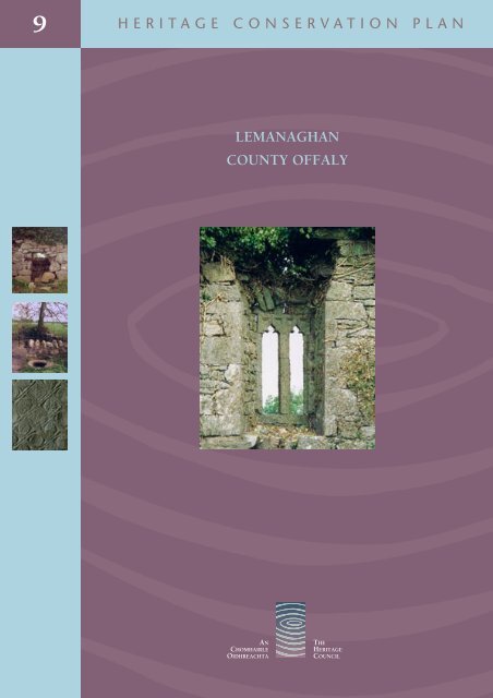
Lemanaghan, County Offaly [PDF 1.96 - The Heritage Council
Lemanaghan, County Offaly [PDF 1.96 - The Heritage Council
Lemanaghan, County Offaly [PDF 1.96 - The Heritage Council

Create successful ePaper yourself
Turn your PDF publications into a flip-book with our unique Google optimized e-Paper software.
9<br />
H E R I T A G E C O N S E R V A T I O N P L A N<br />
LEMANAGHAN<br />
COUNTY OFFALY<br />
AN<br />
CHOMHAIRLE<br />
OIDHREACHTA<br />
THE<br />
HERITAGE<br />
COUNCIL
<strong>The</strong> <strong>Heritage</strong> <strong>Council</strong><br />
Rothe House<br />
Parliament Street<br />
Kilkenny<br />
Ireland<br />
Report No. B3781A.R01<br />
February 2002<br />
ROTHE HOUSE<br />
CONSERVATION PLAN<br />
Commercial-in-Confidence<br />
LEMANAGHAN<br />
ROTHE HOUSE<br />
CONSERVATION PLAN<br />
COUNTY OFFALY<br />
CONSERVATION PLAN<br />
Margaret Quinlan and Rachel Moss<br />
AN<br />
CHOMHAIRLE<br />
OIDHREACHTA<br />
THE<br />
HERITAGE<br />
COUNCIL<br />
NOTE:<br />
Copyright and reproduction rights belong to the <strong>Heritage</strong> <strong>Council</strong>.<br />
No part of this document may be reproduced, stored in a retrieval system, or transmitted<br />
in any form without the prior permission of the copyright owner.
© An Chomhairle Oidhreachta /<strong>The</strong> <strong>Heritage</strong> <strong>Council</strong> 2007<br />
All rights reserved.<br />
No part of this publication may be reproduced or transmitted in any<br />
form or by any means, electronic or mechanical, including photocopying,<br />
recording, or any other information storage and retrieval system, now<br />
known or hereafter invented, without either the prior written consent of the<br />
publishers or licence permitting restricted copying in Ireland issued by the<br />
Irish Copyright Licencing Agency Ltd<br />
<strong>The</strong> Writers' Centre,<br />
19 Parnell Square, Dublin 1<br />
Published by the <strong>Heritage</strong> <strong>Council</strong><br />
Designed and Produced by<br />
B. Magee Design<br />
Editorial Consultant: Roberta Reeners<br />
ISSN 1393 - 68 08<br />
<strong>The</strong> <strong>Heritage</strong> <strong>Council</strong> of Ireland Series<br />
ISBN 1 901137 52 x<br />
PRICE €15<br />
75<br />
Printed on Recycled paper containing a minimum of 75% de-inked post consumer waste.
C O N T E N T S<br />
F O R E W O R D 7<br />
ACKNOWLEDGEMENTS 8<br />
EXECUTIVE SUMMARY 9<br />
1. BACKGROUND 10<br />
1.1 DESCRIPTION OF THE HISTORIC SITE 10<br />
1.2 WHY THE PLAN WAS COMMISSIONED 11<br />
1.3 THE STEERING GROUP 11<br />
1.4 THE PROJECT TEAM 12<br />
1.5 AIMS AND OBJECTIVES 12<br />
1.6 STATUTORY PROTECTION 12<br />
2. METHODOLOGY 14<br />
2.1 GUIDING PRINCIPLES 14<br />
2.2 RESEARCH AND ANALYSIS 14<br />
2.3 CONSULTATION 15<br />
2.4 PLACENAMES 15<br />
3. UNDERSTANDING THE PLACE 16<br />
3.1 SHORT HISTORICAL BACKGROUND 16<br />
3.2 SHORT DESCRIPTION OF THE HISTORIC PLACE 18<br />
3.3 ARTEFACTS ASSOCIATED WITH THE SITE 31<br />
3.4 THE EVOLUTION OF THE SITE 32<br />
3.5 GEOLOGICAL SETTING 35<br />
3.6 ECOLOGY 35<br />
3.7 FOLKLORE 36<br />
3.8 ST MANAGHAN’S POEM 39<br />
3.9 PLACENAMES 39<br />
4. ASSESSMENT OF SIGNIFICANCE 44<br />
4.1 INTRODUCTION 44<br />
4.2 STATEMENT OF SIGNIFICANCE 44<br />
5. DEFINING THE ISSUES AND ASSESSING VULNERABILITY 46<br />
5.1 OWNERSHIPS AND RESPONSIBILITIES 46<br />
5.2 VULNERABILITY OF SURVIVING MONUMENTS 47<br />
5.3 APPROPRIATE ROUTE FOR THE PILGRIM PATH 48<br />
5.4 PROPER UNDERSTANDING OF THE PLACE 50
5.5 LEVELS OF PROTECTIO 50<br />
5.6 LAND USE 51<br />
5.7 CONTINUATION OF TRADITIONAL PRACTICES 51<br />
5.8 INFRASTRUCTURE 52<br />
5.9 POTENTIAL FUTURE CONFLICTS 52<br />
6. CONSERVATION POLICIES 53<br />
POLICY STATEMENT: THE OVERVIEW 53<br />
6.1 OWNERSHIPS AND RESPONSIBILITIES 54<br />
6.2 VULNERABILITY OF SURVIVING MONUMENTS 54<br />
6.3 APPROPRIATE ROUTE FOR PILGRIM PATH 55<br />
6.4 PROPER UNDERSTANDING OF THE PLACE 55<br />
6.5 LEVELS OF PROTECTION 56<br />
6.6 LAND USE 56<br />
6.7 CONTINUATION OF TRADITIONAL PRACTICES 57<br />
6.8 INFRASTRUCTURE 57<br />
6.9 POTENTIAL FUTURE CONFLICTS 57<br />
7. IMPLEMENTATION AND REVIEW 58<br />
7.1 ADOPT THE CONSERVATION PLAN 58<br />
7.2 RESOLVE THE ISSUES OF OWNERSHIP 58<br />
7.3 ESTABLISH COMPLEMENTARY POLICIES AND COORDINATE THE STAKEHOLDERS’<br />
IMPLEMENTATION PROCEDURES 59<br />
7.4 RESOURCES 60<br />
7.5 REVIEW 61<br />
END NOTES 62<br />
BIBLIOGRAPHY 66
LIST OF PLATES<br />
PLATE 1: APPROACH TO THE LEMANAGHAN COMPLEX 11<br />
PLATE 2: WOODEN PLATFORMS IN DERRYNAGUN BOG. 17<br />
PLATE 3: THE SCHOOLHOUSE 20<br />
PLATES 4 AND 5: A GENERAL VIEW OF A TRACKWAY ACROSS THE BOG,<br />
WITH A CLOSE-UP VIEW FOLLOWING EXCAVATION 23<br />
PLATES 6, 7 AND 8: DRAWINGS OF STONE SLABS AT LEMANAGHAN<br />
FROM AN ARTICLE BY HENRY CRAWFORD (1911) 23<br />
PLATES 9 AND 10: TWO VIEWS OF THE MONASTIC COMPLEX 24<br />
PLATE 11: THE WEST END OF ST MANAGHAN’S CHURCH 24<br />
PLATE 12: THE NORTH WALL 25<br />
PLATES 13 AND 14: THE EAST GABLE AND EAST WINDOW 25<br />
PLATES 15 AND 16: THE SOUTH WALL - CLOSE UP AND AS SEEN FROM THE GRAVEYARD 26<br />
PLATE 17: TOGHER 27<br />
PLATES 18 AND 19: THE EARLY MEDIEVAL SPIRAL-PATTERN STONE 27<br />
PLATE 20: THE WOODED AREA AROUND ST MELLA’S CELL 28<br />
PLATE 21: THE DOORWAY OF ST MELLA’S CELL 29<br />
PLATES 22 AND 23: TWO VIEWS OF THE HOLY WELL 29<br />
PLATES 24 AND 25: DRAWINGS OF TWO SLABS FROM AN ARTICLE BY HENRY CRAWFORD (1911) 30<br />
PLATE 26: LEMANAGHAN CASTLE 30<br />
PLATE 27: ST MANAGHAN'S SHRINE 31<br />
PLATES 28 AND 29: ABOVE: POLISHED STONE AXE-HEAD FOUND IN CORHILL BOG;<br />
BELOW: A SHOE FOUND ON THE SITE DATING FROM THE MEDIEVAL PERIOD 32<br />
PLATE 30: AN 1874 DRAWING OF THE DOORWAY INTO ST MELLA’S CELL 33<br />
PLATE 31: THE HOLY WELL FROM THE MANGAN COLLECTION 36<br />
PLATE 32: THE HOLY TREE 37<br />
PLATE 33: VOTIVE OFFERINGS ARE LEFT AT THE FONT OR PISCINA 37<br />
PLATES 34 AND 35: TWO DRAWINGS OF THE WALLS AROUND ST MELLA’S CELL 38
LIST OF FIGURES<br />
FIGURE 1: MAP SHOWING THE LOCATION OF LEMANAGHAN 10<br />
FIGURE 2: 1687 MAP OF KING'S COUNTY BY PETTY & LAMBE 16<br />
FIGURE 3: SITE MAP 19<br />
FIGURE 4: THE GEOLOGICAL SURVEY MAP, C. 1840 21<br />
FIGURE 5: DETAIL FROM MAPS DRAWN UP FOR THE COMMISSIONERS<br />
FOR THE BOGS, 1811 22<br />
FIGURE 6: PHASES OF DEVELOPMENT OF THE CHURCH 34<br />
FIGURE 7: PETTY’S BARONY MAP OF 1685 40<br />
FIGURE 8: A MAP OF THE PILGRIM PATH 49<br />
APPENDICES<br />
THIS CONSERVATION PLAN IS BASED ON THE FOLLOWING EXTENSIVE REPORTS WHICH MAY BE<br />
EXAMINED BY ARRANGEMENT WITH THE HERITAGE COUNCIL.<br />
A. BIBLIOGRAPHY<br />
B. BUILDING RECORD<br />
DESCRIPTION<br />
PHOTOGRAPHIC RECORD<br />
SURVEY DRAWINGS<br />
C. CONDITION ASSESSMENT<br />
D. DOCUMENTARY HISTORY: 7TH – 17TH CENTURIES<br />
E. ARCHAEOLOGY<br />
WETLANDS<br />
UPLAND<br />
F. ECOLOGY<br />
G. ARTEFACTS ASSOCIATED WITH THE SITE<br />
H. ST MANAGHAN’S POEM<br />
I. THE PILGRIM PATH<br />
J. MAPS, DRAWINGS AND PHOTOGRAPHS<br />
K. THE BURRA CHARTER<br />
6
F O R E W O R D<br />
In 1997, the <strong>Heritage</strong> <strong>Council</strong> set up a millennium project, the Pilgrim Paths<br />
Project, which involved the establishment of walking routes along authenticated<br />
medieval pilgrimage routes, including the pilgrim way to Clonmacnoise. Two<br />
starting points were proposed for the walking route, <strong>Lemanaghan</strong> and Boher.<br />
As part of the initial stages (1999), the vulnerability of the heritage along the route<br />
was assessed by a team led by Mary Tubridy. One of the main recommendations<br />
was that the sites at <strong>Lemanaghan</strong> were too fragile to withstand the number of<br />
visitors that might be expected.<br />
Freda Rountree, the first chairperson of the <strong>Heritage</strong> <strong>Council</strong>, urged us to work<br />
with the local community, local authorities and Dúchas (now the Department of<br />
the Environment, <strong>Heritage</strong> and Local Government) to find an imaginative solution<br />
to the situation at <strong>Lemanaghan</strong>.<br />
<strong>The</strong> <strong>Heritage</strong> <strong>Council</strong> had been working with a number of groups on Conservation<br />
Plans as a way to manage complex heritage sites. <strong>The</strong> aim of such a plan is<br />
to find the best way to preserve a site for the future, with the agreement of<br />
all involved. <strong>The</strong> process is dependent on the cooperation of all those with an<br />
interest in the site, in particular the local community, land owners, State heritage<br />
agencies, and local authorities.<br />
Following discussions with the local community at <strong>Lemanaghan</strong> and <strong>Offaly</strong><br />
<strong>County</strong> <strong>Council</strong>, it was agreed that a Conservation Plan be carried out for all<br />
the sites in <strong>Lemanaghan</strong>: St Managhan's church and associated monuments,<br />
St Mella’s Cell (known locally as Kell), the Holy Well and Tree, the togher, the<br />
schoolhouse. This would be done in partnership with <strong>Offaly</strong> <strong>County</strong> <strong>Council</strong> and<br />
the local community.<br />
Margaret Quinlan Architects was commissioned by the <strong>Heritage</strong> <strong>Council</strong> and<br />
<strong>Offaly</strong> <strong>County</strong> <strong>Council</strong> to carry out the plan in May 2001; the plan was finalised<br />
in November of that year. <strong>The</strong> success of this plan owes much to their team in<br />
researching the site, and discussing the findings with a range of people — from<br />
land owners, Garda Siochána, Dúchas (now the Department of the Environment,<br />
<strong>Heritage</strong> and Local Government), and the National Museum of Ireland.<br />
This plan was a starting point, setting out the framework for work needed, and<br />
this has been demonstrated by the works carried out on the sites since 2001.<br />
<strong>The</strong>se include five years of conservation works on St Managhan’s Church and on<br />
St Mella’s Cell/Kell. <strong>The</strong> efforts of <strong>Offaly</strong> <strong>County</strong> <strong>Council</strong> in accessing funding to<br />
allow these works to take place must be acknowledged.<br />
<strong>The</strong> <strong>Heritage</strong> <strong>Council</strong> would like to thank the members of the local community<br />
who took part in the project steering group, and the representatives of <strong>Offaly</strong><br />
<strong>County</strong> <strong>Council</strong> whose dedication to this project has ensured its success.<br />
<strong>The</strong> development and agreement of this plan demonstrates the ability of<br />
local communities to work with local authorities, State agencies and State<br />
departments in planning for the future of our heritage. We hope the continuing<br />
implementation of this Conservation Plan will see the sustained cooperation of<br />
all involved.<br />
Dr Tom O’Dwyer<br />
Chairperson<br />
Michael Starrett<br />
Chief Executive<br />
7
A C K N O W L E D G E M E N T S<br />
We would like to thank all members of the Steering Group — Beatrice Kelly,<br />
Amanda Pedlow, Gerry Doolin and Seamus Corcoran — for their help and<br />
support.<br />
<strong>The</strong> members of the Project Team who contributed to the report also deserve<br />
our thanks: Dr John Feehan, Dr Elizabeth Fitzpatrick, Prof. Loughlin Kealy, Ellen<br />
O’Carroll and Aidan Smith,<br />
For their help in compiling various aspects of the report, thanks are due to<br />
Dr Conor McDermott and staff of the Irish Wetlands Unit, UCD Department of<br />
Archaeology;. Raghnall Ó Floinn of the National Museum; Conleth Manning, Willie<br />
Cumming, Dr Ann Lynch and Tony Roche of Dúchas <strong>The</strong> <strong>Heritage</strong> Service; Donal<br />
Wynne of Bord na Móna; Stephen J. MacNeill of <strong>Offaly</strong> Historical Society; Sgt<br />
Oliver Duggan of the Banagher Gardaí; Tom Shanahan, Vincent Hussey of <strong>Offaly</strong><br />
<strong>County</strong> <strong>Council</strong>, <strong>Council</strong> outdoor staff, Pat Joe Bermingham, Sean Halligan,<br />
Pat Kilmartin and the people of <strong>Lemanaghan</strong>; Susan Minet, Brigid Tiernan,<br />
and finally, Rudiger Liedtke and Phelim Manning who surveyed and made the<br />
drawings on behalf of Margaret Quinlan Architects.<br />
Margaret Quinlan and Rachel Moss<br />
8
E X E C U T I V E S U M M A R Y<br />
<strong>The</strong> Conservation Plan for <strong>Lemanaghan</strong>, <strong>County</strong> <strong>Offaly</strong>, provides a framework<br />
for the conservation of the historic place. It has gathered and summarised<br />
a body of knowledge leading to an understanding of the significance of the<br />
complex. It sets out principles and formulates appropriate policies to protect<br />
that significance.<br />
<strong>The</strong> Plan has established that <strong>Lemanaghan</strong> is:<br />
• A sacred place of great antiquity<br />
• A place containing buildings of architectural significance<br />
• A place rich in documentary history and archaeological potential<br />
• A place where there is a long tradition of devotional practice<br />
• A place 'apart', possessing a strong sense of being untouched by the<br />
modern world<br />
<strong>The</strong> <strong>Lemanaghan</strong> Conservation Plan recommends actions to maintain the layers<br />
of significance embodied in the place, within the context of the delicate physical<br />
state of buildings and archaeology, and the strong local traditions of continued<br />
devotion.<br />
Policies are set out for the care and management of the historic place within its<br />
setting. <strong>The</strong>se may be summarised as follows:<br />
• Clarify ownerships and responsibilities.<br />
• Protect the surviving monuments and provide guidance on their<br />
conservation.<br />
• Foster greater understanding and awareness of the significance of the<br />
historic place.<br />
• Ensure that other initiatives relating to historic <strong>Lemanaghan</strong> are compatible<br />
with the preservation of its significance.<br />
• Provide a framework for decision-making on future developments to<br />
infrastructure and land use.<br />
• <strong>The</strong> Plan, as presented in the following pages, was completed in 2001.<br />
Since then, a number of the recommendations and policies have been<br />
implemented. <strong>The</strong>se are summarised in the End Notes of the report.<br />
9
1 B A C K G R O U N D<br />
1.1 D E S C R I P T I O N O F T H E H I S T O R I C S I T E<br />
<strong>The</strong> historic complex at <strong>Lemanaghan</strong>, with its focus at the early monastic site<br />
dedicated to St Managhan, is located at the crossroads between the main<br />
Ferbane-to-Ballycumber road, and the <strong>Lemanaghan</strong>-to-Pollagh road. Close by<br />
are a holy well and tree. Linked to these by a medieval trackway or togher is<br />
a further Early Christian site known locally as ‘Kell’, or St Mella’s Cell. (St Mella<br />
is said to be the mother of St Managhan.) <strong>The</strong>se monuments occupy an upland<br />
area in <strong>Lemanaghan</strong> Bog which is bordered to the south by the callows of the<br />
River Brosna. Surrounding them is an exceptional number of archaeological find<br />
sites, many relating to a complex infrastructure of trackways or toghers which<br />
were built and repaired over several centuries. Dating evidence suggests that the<br />
greatest concentration of track construction coincides with the foundation of the<br />
monastery, indicating the importance of the site in the context of the monastic<br />
infrastructure of <strong>County</strong> <strong>Offaly</strong>, particularly <strong>Lemanaghan</strong>’s links with Clonmacnoise<br />
and other monasteries along the River Shannon and its tributaries.<br />
Figure 1: Map showing the location of <strong>Lemanaghan</strong> [Courtesy Ordinance Survey]<br />
10
Plate 1: Approach to the <strong>Lemanaghan</strong> Complex [Project Team May 2001 – January 2002]<br />
1.2 W H Y T H E P L A N W A S C O M M I S S I O N E D<br />
In 1995, a report was commissioned by St Managhan’s Rural Development<br />
Association to develop the tourism potential of the site, principally by converting<br />
<strong>Lemanaghan</strong> schoolhouse into an interpretative facility. Four years later, the<br />
<strong>Heritage</strong> <strong>Council</strong> commissioned an Environmental Impact Study (EIS) to be carried<br />
out along the proposed route of the Pilgrim Path from Ballycumber/<strong>Lemanaghan</strong><br />
to Clonmacnoise. <strong>The</strong> findings of the EIS suggested: prior to publicising the<br />
route, the poor condition of the standing structures should be addressed; and<br />
the impact on the delicate archaeology of the bog linking St Mella’s Cell to the<br />
road should be further investigated. In the light of these reports, the <strong>Heritage</strong><br />
<strong>Council</strong> and <strong>Offaly</strong> <strong>County</strong> <strong>Council</strong> commissioned a Conservation Plan for the<br />
historic complex. This was accomplished in partnership with other stakeholders,<br />
including the local community and Dúchas <strong>The</strong> <strong>Heritage</strong> Service.<br />
1.3 T H E S T E E R I N G G R O U P<br />
<strong>The</strong> Steering Group was formed of representatives from these major<br />
stakeholders.<br />
Beatrice Kelly, Chair<br />
Amanda Pedlow<br />
Seamus Corcoran<br />
Gerry Doolin<br />
Representative<br />
<strong>The</strong> <strong>Heritage</strong> <strong>Council</strong><br />
<strong>Offaly</strong> <strong>County</strong> <strong>Council</strong><br />
<strong>Lemanaghan</strong> Rural Development Association<br />
Pilgrim Paths steering committee<br />
Dúchas <strong>The</strong> <strong>Heritage</strong> Service<br />
11
1.4 T H E P R O J E C T T E A M<br />
<strong>The</strong> consultants appointed to prepare the Conservation Plan were Margaret<br />
Quinlan Architects. In recognition of the broad range of issues relating to the<br />
site, the full Project Team assembled by the consultants is as follows:<br />
Margaret Quinlan<br />
Dr Rachel Moss<br />
Prof. Loughlin Kealy<br />
Dr John Feehan<br />
Dr Elizabeth Fitzpatrick<br />
Ellen O’Carroll<br />
Aidan Smith<br />
Architect, project leader<br />
Architectural Historian, project manager<br />
Architect<br />
Ecologist<br />
Archaeologist<br />
Archaeologist<br />
Structural Consultant<br />
1.5 A I M S A N D O B J E C T I V E S<br />
This Conservation Plan will assist the stakeholders to do the following:<br />
• Prepare management proposals.<br />
• Plan a programme of conservation.<br />
• Plan new developments.<br />
• Manage a programme of regular maintenance for the site and its setting.<br />
• Provide a framework for supporting action by others and build on<br />
the existing statutory protection as set out in Section 1.6.<br />
<strong>The</strong> overall aim of all the policies and conservation actions embodied in<br />
the Plan is the retention of the cultural significance of <strong>Lemanaghan</strong> and the<br />
provision of security and maintenance in the future.<br />
1.6 S T A T U T O R Y P R O T E C T I O N ¹<br />
<strong>The</strong> existing statutory framework for the protection of the architectural heritage<br />
is provided by the following:<br />
• National Monuments Acts, 1930-2004, and as subsequently amended<br />
• Record of Monuments and Places established under Section 12 of the<br />
National Monuments (Amendment) Act 1994<br />
• Register of Historic Monuments<br />
• Local Government (Planning and Development) Act, 2000 - 2002<br />
¹ This section refers to 2001. Statutory protection for the monuments has since been updated.<br />
12
• <strong>Heritage</strong> Act, 1995<br />
• <strong>The</strong> Architectural <strong>Heritage</strong> (National Inventory) and Historic Monuments<br />
(Miscellaneous Provisions) Act, 1999<br />
Existing statutory protection extended to the monuments, site and setting is as<br />
follows:<br />
• Sites listed on the Record of Monuments and Places and on the Register of<br />
Historic Monuments are afforded notification protection under the National<br />
Monuments Acts. At present, no structure in <strong>Lemanaghan</strong> is protected by a<br />
Preservation Order.<br />
• No structures in the immediate vicinity of <strong>Lemanaghan</strong> were listed for<br />
preservation or ‘considered for preservation’ in the 1996 <strong>Offaly</strong> <strong>County</strong><br />
<strong>Council</strong> Development Plan.<br />
• Looking to the future, when the National Inventory of Architectural <strong>Heritage</strong><br />
is compiled for <strong>County</strong> <strong>Offaly</strong>, additions to the Record of Protected Structures<br />
may be made.²<br />
In commissioning this Conservation Plan, the <strong>Heritage</strong> <strong>Council</strong> and <strong>Offaly</strong> <strong>County</strong><br />
<strong>Council</strong> have indicated, in principle, their continuing support for the safeguarding<br />
of the <strong>Lemanaghan</strong> complex<br />
² This was completed in 2004.<br />
13
2 . M E T H O D O L O G Y<br />
2.1 G U I D I N G P R I N C I P L E S<br />
<strong>The</strong> preparation of this Conservation Plan has been guided by the definitions<br />
and principles of the ICOMOS Charter for the Conservation of Places of Cultural<br />
Significance (Burra Charter), 1988 amendment.<br />
Article 5 of the Burra Charter states that conservation of a place should take<br />
into consideration all aspects of its cultural significance without unwarranted<br />
emphasis on any one aspect at the expense of others.<br />
Definitions provided by the Charter have been adopted for the purposes of this<br />
Conservation Plan.<br />
Conservation is defined as all of the processes of looking after a place in order<br />
to retain its cultural significance. <strong>The</strong> term includes maintenance and may,<br />
according to circumstance, include preservation, restoration, reconstruction and<br />
adaptation. It will commonly be a combination of two or more of these.<br />
Cultural significance is defined as the aesthetic, historic, scientific or social value<br />
for past, present or future generations.<br />
Place is defined as a site, area, building or other work, group of buildings or<br />
other works, together with associated contents and surrounds.<br />
<strong>The</strong> full text of the Burra Charter is included in the Appendix K and is available,<br />
by arrangement, from the <strong>Heritage</strong> <strong>Council</strong>.<br />
2.2 R E S E A R C H A N D A N A L Y S I S<br />
<strong>The</strong> holistic approach to understanding the historic place was achieved through<br />
the research and analysis of the different aspects that define or affect its<br />
cultural significance. In the case of <strong>Lemanaghan</strong>, these were understood as the<br />
documentary history of the site, the archaeology, the art/architectural history, the<br />
devotional and folkloric aspects of the place, and the ecology in terms of flora,<br />
fauna and geology.<br />
Research and analysis were carried out through deskwork and fieldwork. A wide<br />
range of historical documents was consulted to establish the history and folklore<br />
of the place. Interviews with local people informed a further understanding of<br />
the extent to which folklore and the devotional use of the site continue to<br />
thrive.<br />
Survey work was carried out on the standing fabric of St Managhan’s Church<br />
and St Mella’s Cell. Detailed examination and analysis of the fabric enabled<br />
the verification of the evolution of the structures, phases of development and<br />
condition. <strong>The</strong> removal of heavy vegetation during the preparation of the plan<br />
revealed much of the surviving masonry for the first time in many years. Field<br />
walking was undertaken in order to clarify both the ecological and archaeological<br />
development of the site.<br />
14
2.3 C O N S U L T A T I O N<br />
<strong>The</strong> consultation process took place at two principal levels: through the<br />
Steering Group and the local community. <strong>The</strong> members of the Steering Group<br />
represent most of the major stakeholders and have contributed their views<br />
to the consultants at various stages. Consultation occurred separately with<br />
other stakeholders, including owners of monuments or lands giving access to<br />
monuments, as well as Bord na Móna and the National Museum of Ireland.<br />
Consultation with the local community has been ongoing. Information explaining<br />
the principles of the Conservation Plan was circulated in the local area and<br />
submissions were invited.<br />
At a public meeting, the process of the Conservation Plan was explained<br />
and the issues outlined by the consultants. A discussion followed on various<br />
issues affecting the site that might influence the policies to be decided. <strong>The</strong>re<br />
was a broad consensus on the basic principles of protection of the site and<br />
its setting.<br />
2.4 P L A C E N A M E S<br />
A number of different names and spellings are in current use for the places<br />
referred to in this Plan. <strong>The</strong> spelling of <strong>Lemanaghan</strong> itself, and of places within<br />
<strong>Lemanaghan</strong>, has been based on the Ordnance Survey. This is in recognition<br />
of the OS as the source of standardised Irish placename spellings and of the<br />
readership of this Plan beyond local level. However, the importance of spelling<br />
and placenames in current local usage is recognised and is dealt with in Sections<br />
3.9 and 5.7.<br />
15
3 . U N D E R S TA N D I N G T H E P L A C E<br />
<strong>The</strong> accounts provided in this section are summaries of fuller information<br />
provided in the Appendices which may be examined by arrangement with the<br />
<strong>Heritage</strong> <strong>Council</strong>.<br />
3.1 S H O R T H I S T O R I C A L B A C K G R O U N D<br />
Archaeological remains in <strong>Lemanaghan</strong> Bog date back over 5,500 years. It is<br />
not until the 7th century AD, however, that the history of the area began to<br />
be documented. In AD 645, land at Tuaim na nErc was given to the monks at<br />
Clonmacnoise by Diarmuid, son of Aedh Slaine, as a reward for their prayers for<br />
victory in a battle against Guaire, king of Connaught. <strong>The</strong>re the monks founded<br />
a cell, known as Leith.<br />
<strong>The</strong> death of Abbot Managhan, probably the first abbot of the monastery, is<br />
recorded in AD 664-5. <strong>The</strong> deaths of several more abbots are recorded up to the<br />
beginning of the 13th century, suggesting that <strong>Lemanaghan</strong> was a monastery<br />
of some standing during that period, possibly due to its connections with<br />
Clonmacnoise. <strong>The</strong> close links with Clonmacnoise appear to be confirmed by a<br />
reference (AD 1039) to the ‘prey[ing] and spoil[ing]’ of <strong>Lemanaghan</strong> by ‘those of<br />
Imaine’ (Meath) in revenge for a fray that had arisen between the Meath men and<br />
the men from Delvin McCoughlan (the area roughly corresponding to the modern<br />
barony of Garrycastle) on St Ciaran’s Day at Clonmacnoise the year before. <strong>The</strong><br />
evidence of artefacts, buildings and archaeology associated with the site during<br />
this time suggests further links to Clonmacnoise.<br />
Figure 2: 1687 map of King’s <strong>County</strong> by Petty & Lambe<br />
16
<strong>The</strong> last reference to the site as a monastery comes in 1205 when the death of the<br />
coarb, (a type of administrator), Gillebrenyn O’ Bichollye, is recorded. Although<br />
the exact date of its conversion to parish church status (within the diocese of<br />
Clonmacnoise) is unknown, it had certainly taken place by 1302-6 when the<br />
papal taxation records record no return from the vicarage of <strong>Lemanaghan</strong> which<br />
had been ‘laid to waste by the ravages of war’.<br />
Throughout the 14th century, the fortunes of the vicarage do not appear to have<br />
improved, although repairs to the trackways around the site of this date, as well<br />
as a find of coins from the period beside one of the trackways, suggest that it<br />
still occupied a relatively prominent place within the infrastructure of the area.<br />
By the 15th century, its fortunes were in further decline. In 1410, the perpetual<br />
vicarage had been vacant for so long that it was granted to the prior of St Mary<br />
Gallen. In 1489, the vicarage had been unlawfully seized by Philip O Buachalla<br />
and then in 1508, it was granted to Maurice Macohclayn, a canon of the church<br />
of Clonmacnoise. Close ties with the Augustinians at Gallen appear to have<br />
continued. In 1531, Murtough, son of Conor Mac Coughlan, Prior of Gallen and<br />
Vicar of Liath-Manachain, was ‘treacherously slain’ by Turlogh Oge O’Melaghin.<br />
<strong>The</strong> earliest known map of the area, drawn up for a survey of the barony of<br />
Garrycastle which was carried out in 1620, no longer exists. Thus we have no<br />
way of knowing where the principal secular settlement was during this period.<br />
<strong>The</strong> castle, only demolished in 1959, was certainly in place by this time, as it<br />
is described by de Renzi in 1620 and mentioned in the Foreword to the English<br />
translation of the Annals of Clonmacnoise as the place where the translation was<br />
carried out in 1627. <strong>The</strong> poll tax survey, carried out in 1659, records a population<br />
of only 26 people in the parish of <strong>Lemanaghan</strong>, all of them Irish.<br />
St Managhan’s Church at <strong>Lemanaghan</strong> continued in use probably until the 1641<br />
rebellion. It is mentioned in the Martyrology of Donegal, compiled in 1630,<br />
because of the shrine kept on its altar, thereby implying that at the very least<br />
it still had a roof. However, by 1682-5, the church was recorded as being in a<br />
ruinous condition, with church services being held in a nearby house.<br />
Archaeological evidence in the form of a large number of timber platforms built<br />
in the surrounding bogs suggests widespread activity in the <strong>Lemanaghan</strong> area<br />
between the 15th and 17th centuries.<br />
Plate 2: Wooden platforms in Derrynagun Bog. Radiocarbon dated by UCD from AD 1411 – 1654<br />
1717
3.2 S H O R T D E S C R I P T I O N O F T H E H I S T O R I C P L A C E<br />
<strong>Lemanaghan</strong> is situated on the R436 between Ballycumber and Ferbane at<br />
the junction of the road to Pollagh. It consists of a two-room, 19th-century<br />
schoolhouse, now redundant, and a cluster of relatively small dwellings, the<br />
largest of which, <strong>Lemanaghan</strong> House, is to the south-west of the monastic site.<br />
Settlement on the upland area is concentrated in a number of small clusters.<br />
<strong>The</strong> first is in the vicinity of the old castle and schoolhouse, and along the road<br />
in the direction of Ferbane. Comparison between first edition Ordnance Survey<br />
(1837) and more recent OS maps reveals that the density of building in this area<br />
has decreased over the past 160 years. Two clachan-type settlements close to<br />
the southern ‘shore’ of the upland are denoted as Srah and Camwerth on the<br />
OS maps, although Camwerth has always been known locally as ‘Convert’. <strong>The</strong>se<br />
settlements have apparently changed little in terms of building density since the<br />
publication of the first edition OS. More isolated settlements also occur along<br />
the road to the south-east of St Mella’s Cell and on the hillock to the north of<br />
the cell known locally as ‘Townagh’. <strong>The</strong>re is now no trace of settlement on the<br />
latter site. Lewis records the population of the village of <strong>Lemanaghan</strong> as 290<br />
in 1837. A marked decrease in the population of the townland took place over<br />
the ten years between 1841 and 1851 when census returns record populations<br />
of 597 and 367 respectively.<br />
<strong>The</strong> Ballycumber-Ferbane road appears to be the oldest still in use in the area<br />
and is marked on the earliest map of the area drawn up for the Commissioners<br />
of the Bogs in 1811. It is difficult to establish when this road was constructed. It<br />
does not appear to have been in place in the 17th century, when de Renzi wrote<br />
in relation to <strong>Lemanaghan</strong> Castle that ‘many wicked members are harboured<br />
there about and are transported there over the river Brosnagh’, implying that<br />
during this period it was the river, not the road, which was the main means of<br />
transport to the site. Smaller roads serving the settlement around the castle<br />
and at Srah and Camwerth are marked on the first edition OS (1837) and<br />
were presumably in existence as long as the settlements. Other roads around<br />
<strong>Lemanaghan</strong> are more recent. Both the road from <strong>Lemanaghan</strong> to Healy’s in<br />
Ballycumber and the Pollagh-<strong>Lemanaghan</strong> road were only built in the 20th<br />
century, the latter constructed in 1928.<br />
<strong>The</strong> slow development of the infrastructure of metalled roads in the area may be<br />
attributable to the recommendations of Thomas Townsend in 1811 who advised<br />
against the construction of roads across the bogs because they would obstruct<br />
and interfere with the principal drains.<br />
<strong>The</strong> Clara-Banagher railway line also passes through the townland. It opened in<br />
1884 and closed in 1963.<br />
18
Figure 3: Site Map<br />
19
T H E S C H O O L H O U S E<br />
<strong>Lemanaghan</strong> schoolhouse was built in the late 19th century and consisted of<br />
two rooms with fireplaces. An extension was added to the rear of the building<br />
in the late 1950s, at the same time as dry toilets were built at the rear of the<br />
building. <strong>The</strong> school was closed in 1972 and left unused for approximately 20<br />
years, during which time it fell into disrepair. In the early 1990s, the school was<br />
restored by St Managhan’s Restoration and Development Association with the<br />
ultimate aim of using the building as a visitor centre. Works carried out at this<br />
time included replacement of rafters and slates, installation of new floorboards,<br />
installation of a new timber-sheeted ceiling, and the replastering of walls. Since<br />
this time, the building has remained vacant and is used occasionally for special<br />
events in the locality such as the Pattern Day on 24 January.<br />
Plate 3: <strong>The</strong> Schoolhouse<br />
T H E R I V E R B R O S N A A N D I T S C A L L O W S<br />
As intimated by de Renzi, the River Brosna would have played an important role<br />
in the infrastructure of the <strong>Lemanaghan</strong> area, forming a well-drained passage<br />
through the extensive surrounding bogland. It linked <strong>Lemanaghan</strong> with a number<br />
of adjacent ecclesiastical sites including Gallen Priory, Kilreaghan, Wheery and<br />
Tisaran, and ultimately to the Shannon. On the Geological Survey map of c.<br />
1840, the flood line and callows of the Brosna are shown as extending quite<br />
close to the line of the southern ‘shore’ of the ‘island’. This situation would<br />
have continued until the 1940s when the river was drained to reclaim land for<br />
agricultural purposes.<br />
2020
Figure 4: Geological Survey Map, c.1840. <strong>The</strong> <strong>Lemanaghan</strong> complex is<br />
marked in red. <strong>The</strong> ‘island’ is marked in green. <strong>The</strong> floodline is marked in blue.<br />
L E M A N A G H A N B O G S<br />
<strong>The</strong> <strong>Lemanaghan</strong> Bogs are located to the north of the River Brosna, surrounding<br />
<strong>Lemanaghan</strong> ‘island’ on its three northern sides. <strong>The</strong> group of bogs comprises<br />
<strong>Lemanaghan</strong> Bog, Corhill Bog, Tumbeagh Bog, Kilnagarnagh Bog, Killaghintober<br />
Bog, Castletown Bog and Derrynagun Bog, with one further island known as<br />
Broder’s island or Derrevan.<br />
An 1811 description of the bog made for the Commissioners for the Bogs records<br />
that it then covered an area of 2,961 Irish or 4,797 English acres (1992 hectares),<br />
with the surface of the bog from 43 to 86 feet (13.1 – 26.2m) above the River<br />
Shannon, and with the borings from 15 to 32 feet (8.57 – 9.664m) deep.<br />
21
Figure 5: Detail from maps drawn up for the Commissioners for the Bogs, 1811<br />
Bord na Móna acquired <strong>Lemanaghan</strong> Bog in 1949, attracting a number of new<br />
families to the area (pers. comm. Seamus Corcoran). Following a number of<br />
developmental stages, the bog began to be utilised for the production of sod<br />
peat as fuel. A German bagger machine which removed the top 2m (6'8") of sod<br />
was used. Between 1959 and 1980, the <strong>Lemanaghan</strong> works produced 378,000<br />
tonnes of sod peat. In 1980, most of the peat had been extracted and the<br />
<strong>Lemanaghan</strong> sod works was closed and amalgamated with the Boora Works.<br />
<strong>The</strong> remaining peat is harvested as milled peat for conversion into electricity at<br />
Ferbane Power Station.<br />
Since 1993, Bord na Móna, in consultation with Dúchas, has funded a programme<br />
of survey and excavation in the bog. It is as a result of this programme that the<br />
extent of the trackway network around <strong>Lemanaghan</strong> island has come to light<br />
(see Appendix E).<br />
22
Plates 4 and 5: A general view of a trackway across the bog, with a close-up view following<br />
excavation [Courtesy Ellen O’Carroll]<br />
In 1994, faced with the pending closure of Ferbane Power Station, <strong>Lemanaghan</strong><br />
and Boora were linked to Shannonbridge by rail. <strong>The</strong> milled peat will eventually<br />
fuel the proposed Shannonbridge ESB Power Station which was scheduled for<br />
completion by 2004. 3<br />
T H E M O N A S T I C C O M P L E X<br />
<strong>The</strong> monastic complex comprises two principal sites. <strong>The</strong> first is enclosed<br />
by a modern graveyard wall and contains St Managhan’s Church and house.<br />
<strong>The</strong> second is marked by a rectangular medieval enclosure containing (above<br />
ground) a single oratory, St Mella’s Cell. <strong>The</strong> two sites are linked by a medieval<br />
togher. In addition to these two elements are a holy well and tree, two bullauns 4 ,<br />
a collection of early Christian grave slabs and carved stones (now housed in<br />
the schoolhouse), and a number of more remote associated archaeological sites<br />
and artefacts.<br />
Plates 6, 7 and 8: Drawings of stone slabs at <strong>Lemanaghan</strong> by Henry Crawford (1911)<br />
3 Shannonbridge Power Station started production on 30 June 2005<br />
4 A bullaun is a stone with one or more circular depressions<br />
23
Plates 9 and 10: Two views of the monastic complex [Project Team May 2001 – January 2002]<br />
S T M A N A G H A N ’ S C H U R C H<br />
As it now stands, the church is rectangular, measuring 19.4m x 7.5m. (63’6” x<br />
24’6”) It is roofless, and by 2001 had a vigorous ivy growth on all walls. This was<br />
cleared during the summer of 2001. <strong>The</strong> fabric consists mainly of roughly coursed<br />
limestone and sandstone, with dressed limestone details. <strong>The</strong>re are some traces<br />
of render on the internal walls.<br />
West Gable<br />
This survives only to a height of 4.5m. (14’9”). It is pierced at the centre by<br />
a late 12th-century doorway that survives to only two courses in height. <strong>The</strong><br />
doorway has squat bulbous bases with leaf spurs and three-quarter engaged<br />
shafts. All are of finely tooled limestone. Some further sections of the doorway<br />
are lying close by in the north-west angle of the church and in the schoolhouse.<br />
<strong>The</strong> angle quoins of this gable were apparently also dressed but some robbing<br />
of stone has occurred.<br />
Plate 11: <strong>The</strong> West end of St Managhan’s Church [Project Team May 2001 – January 2002]<br />
24
North Wall<br />
<strong>The</strong> north wall is completely devoid of opes. <strong>The</strong> only features of note are two<br />
clear vertical breaks in the fabric referred to below.<br />
Plate 12: <strong>The</strong> North Wall [Project Team May 2001 – January 2002]<br />
East Gable<br />
This is built up on a prominent sloping plinth with fine dressed angle quoins.<br />
<strong>The</strong> gable is centrally pierced by a two-light ogee-headed window with squared<br />
hood mould, probably dating to the late 15th or early 16th century. <strong>The</strong>re is a<br />
large breach in the wall directly above the east window. Internally, there is a<br />
small rectangular ambry to the south of the window.<br />
Plates 13 and 14: <strong>The</strong> East Gable and East Window [Project Team May 2001 – January 2002]<br />
25
South Wall<br />
<strong>The</strong> south wall is pierced by three windows in its eastern end. From east to<br />
west, the first is a single light with a cusped trefoil head. <strong>The</strong> central window<br />
was originally a twin light with cusped trefoil heads. <strong>The</strong> west jamb survives to<br />
springer height and the east jamb to three-quarters of its original height. On the<br />
west side there is a hood stop with an elaborate vine and rosette motif. <strong>The</strong><br />
corresponding eastern stop is carved with an amphisbaena 5 and a man; it is<br />
stored in the schoolhouse. A section of cusped trefoil with foliate ornamentation<br />
and a section of mullion, both probably from this window, are also stored in the<br />
schoolhouse. <strong>The</strong> third window is a tall round-headed ope, probably dating to the<br />
late 12th century. Internally, the south wall has a niche with a two-centred arch<br />
with a piscina. An ambry is situated immediately below the twin light window.<br />
Plates 15 and 16: <strong>The</strong> South Wall — close up and as seen from the graveyard [Project Team May<br />
2001 – January 2002]<br />
A large breach in the wall closer to the west end marks the position usually<br />
occupied by a door in later medieval parish churches. It is likely that a 15th/16thcentury<br />
doorway has been robbed from this position.<br />
St Managhan’s ‘House’<br />
To the north-west of the church are the remains of a rectangular building which<br />
measures 6.8m x 8.4m. (22’4” x 27’6”) Only the south-west angle of the building<br />
is upstanding, although the wall footings are still visible. <strong>The</strong> masonry is similar<br />
to the east end of the church, suggesting a 15th/early 16th-century date for<br />
the building. Sections of dressed stonework similar to those found in nearby<br />
<strong>Lemanaghan</strong> Castle were removed from the structure some years ago (pers.<br />
comm. S. Corcoran). <strong>The</strong> proportions and apparent date of this structure suggest<br />
that it may have functioned as a priest’s residence similar to (although smaller<br />
than) St Brendan’s house at Kilmalkedar, <strong>County</strong> Kerry.<br />
5 An amphisbaena is a twin-headed mythical beast.<br />
26
<strong>The</strong> Graveyard Enclosure<br />
A relatively modern wall surrounds the graveyard. Although the date of this is<br />
uncertain, it is marked in its present form on the first edition OS map (1837).<br />
<strong>The</strong>re is a coffin shelf on the western perimeter of the wall, gates opening onto<br />
the Pollagh road, and a track which leads to the well and togher.<br />
Plate 17: <strong>The</strong> togher as it leads from the St Managhan’s site to the Holy Well and St Mella’s Cell<br />
One early medieval stone which has been reused as a grave marker remains in<br />
the graveyard. It is decorated with a sophisticated fret and spiral pattern similar<br />
to forms found on 10th-century high crosses (see Appendix G). Apart from this,<br />
the majority of grave markers date to the 19th and 20th centuries. <strong>The</strong> ground<br />
in the graveyard falls quite steeply to the east of the church.<br />
Plates 18 and 19: <strong>The</strong> early medieval spiral-pattern stone<br />
27
<strong>The</strong> Togher<br />
<strong>The</strong> togher is located to the south-east of the church and now appears to link<br />
the church and oratory. It is 368m (402 yards) in length with an average width<br />
of 4m (13’). Its surface is composed of outcropping limestone and sandstone<br />
flagstones. <strong>The</strong> word togher is generally used to describe a causeway. At most,<br />
however, this land would have been marshy, so it is perhaps not a togher in<br />
the usual sense. <strong>The</strong>re are several large sandstone blocks in the vicinity of the<br />
togher that were probably pushed into the edges of the fields in which they<br />
originally stood. Until the 1980s, there were two large upright stones about midway<br />
along the togher. <strong>The</strong>se were allegedly dislodged during drainage works and<br />
are now in the ditch beside the togher.<br />
St Mella’s Cell (Kell) and Enclosure<br />
<strong>The</strong> enclosure is rectangular, measuring 41.7m x 30.7m (136’9” x 100’6”) and<br />
delineated by an earthen bank faced with large slabs of limestone to a maximum<br />
thickness of 1.6m (5’3”). It is orientated east-north-east. <strong>The</strong> vegetation and<br />
condition of the enclosure wall make it difficult to ascertain the original location<br />
of the entrance. <strong>The</strong> first edition OS, which denotes the building and enclosure<br />
as ‘the abbey’, shows the togher meeting the enclosure wall to the west, while<br />
later editions show it twisting around the enclosure to just beyond the southwest<br />
corner. With the possible exception of a section in the north-east corner,<br />
it appears that the enclosure wall was never rebuilt and may be contemporary<br />
with the cell. <strong>The</strong>re is no trace of the foundations of other buildings or of burial<br />
within the enclosure.<br />
Plate 20: <strong>The</strong> wooded area around St Mella’s Cell [Project Team May 2001 – January 2002]<br />
<strong>The</strong> ‘Kell’, ‘Kyle’ or ‘St Mella’s Cell’ is single-cell oratory, the only unaltered early<br />
Christian oratory in <strong>County</strong> <strong>Offaly</strong>. It is rectangular and measures 5.5m x 3.1m<br />
internally. <strong>The</strong> walls are 0.8m thick and are constructed from large blocks of<br />
mortared masonry, randomly coursed. <strong>The</strong> doorway, located in the west/northwest<br />
end of the building, is square-headed and inclined. <strong>The</strong> lintel and one of<br />
28
the jambstones pass through the thickness of the wall. <strong>The</strong>re is evidence of an<br />
iron door fixing in the north jamb of the ope. <strong>The</strong> east gable has fallen, and<br />
there is some indication of minor repair works. <strong>The</strong>re is no indication remaining<br />
of the original form of the east window, and there are no windows in the side<br />
walls of the building. <strong>The</strong> oratory is orientated east/north-east.<br />
Plate 21: <strong>The</strong> doorway of St Mella’s Cell [Project Team May 2001 – January 2002]<br />
St Managhan’s Well<br />
<strong>The</strong> holy well lies to the north of the togher. When it was renovated during the<br />
1930s, four grave slabs in upright positions were revealed, set out in a cruciform<br />
pattern.<br />
Plates 22 and 23: <strong>The</strong> Holy Well. Left: Note bullaun stone in the foreground [Project Team]<br />
29
Bullauns<br />
Two bullauns of local sandstone are associated with the site. One is located at<br />
the junction between the Clara-Ferbane road and the <strong>Lemanaghan</strong>-Pollagh road;<br />
the other is located at the entrance to the holy well.<br />
Cross Slabs<br />
<strong>The</strong>re are 12 cross slabs from the site (described in greater detail in the Appendix<br />
G). Most are quite crudely carved and therefore difficult to date. However, they<br />
are probably early Christian, dating from the 8th to the 10th centuries. <strong>The</strong><br />
majority are now stored in the nearby schoolhouse, and two are affixed to the<br />
wall of St Managhan’s Church.<br />
Plates 24 and 25: Drawings of two slabs from an article by Henry Crawford (1911)<br />
L E M A N A G H A N C A S T L E<br />
<strong>The</strong> castle was demolished in 1959. Only the south-west angle survives, with<br />
5.8m (19 feet) lengths of west wall and 4.3m of south wall, both standing to<br />
a height of 2.5m (8.2 feet). <strong>The</strong> surviving wall portions are 0.96m thick and<br />
show evidence of a slight base batter. One-half of a two-centred punch-dressed<br />
doorway of late medieval date was recorded in the Dúchas <strong>Offaly</strong> Archaeological<br />
Survey as lying on the ground to the south. Attempts to locate this in 1999 and<br />
2001 failed. A Sheela-na-Gig, recorded by Cooke in 1875 but now lost, is thought<br />
to have belonged to the castle<br />
Plate 26: <strong>Lemanaghan</strong> Castle<br />
[<strong>The</strong> Dúchas Collection]<br />
30
3.3 A R T E F A C T S A S S O C I A T E D W I T H T H E S I T E<br />
A number of significant artefacts is related to the site but are now remote<br />
from it.<br />
• St Managhan’s Shrine — a 12th-century gilt bronze, enamel and yew wood<br />
reliquary casket, now on display in the Roman Catholic parish church<br />
at Boher.<br />
Plate 27: St Managhan’s Shrine [Courtesy National Museum of Ireland]<br />
<strong>The</strong> following artefacts are in the National Museum of Ireland, Dublin:<br />
• <strong>The</strong> <strong>Lemanaghan</strong> Crozier — an 11th-century crozier of gilt bronze and wood<br />
discovered in two parts in <strong>Lemanaghan</strong> Bog.<br />
• <strong>The</strong> Wooden Staff — a blackthorn staff discovered stuck upright in<br />
<strong>Lemanaghan</strong> Bog adjacent to a medieval trackway.<br />
• Polished stone axe-head — discovered in Corhill Bog to the north-west of<br />
<strong>Lemanaghan</strong> Island.<br />
• Stone axe-head — polished stone axe-head, discovered in Straduff townland<br />
in 1996.<br />
• Flint scraper — Neolithic flint scraper, found during excavation by the IAWU<br />
a little to the west of the find place of the stone axe-head.<br />
• Spearhead — discovered in Leabeg townland during commercial turf-cutting<br />
operations. <strong>The</strong> blade is oval. <strong>The</strong> socket, now misshapen, is of circular<br />
cross-section and extended to the tip of the weapon, forming a very<br />
pronounced midrib on both faces of the blade.<br />
• Shoes — One well-made leather shoe and fragments of another were<br />
recovered from Curraghalassa Bog. One is post-medieval and the other<br />
medieval.<br />
31
• Wooden Finds — Wooden finds from Curraghalassa Bog include the lid and<br />
base of a stave-built wooden vessel, probably Late Iron Age, and a number<br />
of perforated and dowelled shafts. Parts of an ash-wood turned bowl were<br />
found associated with one of the shoes.<br />
• A hoard of silver coins, the only find of coins in an Irish bog, was discovered<br />
in Curraghalassa Bog. <strong>The</strong>re are 20 coins in all, dating to the reign of<br />
King Edward 1 (1279-1301). Nineteen were minted in London and one in<br />
Waterford.<br />
<strong>The</strong>se artefacts are described in greater detail in Appendix G.<br />
Plates 28 and 29: Above: Polished stone axe-head found in Corhill Bog; Below: a shoe found on the<br />
site dating from the medieval period<br />
3.4 T H E E V O L U T I O N O F T H E S I T E<br />
In the early Christian period, <strong>Lemanaghan</strong> occupied a fertile island of mineral<br />
land surrounded by bog on all sides. <strong>The</strong> island nature of <strong>Lemanaghan</strong> is less<br />
apparent today, however. In the centuries since the monastery was established,<br />
an aureole of land around the mineral island was drained and reclaimed. By<br />
reclaiming the bog fringes (edges) in the north-west, north-east and southwest<br />
quadrants, as well as the fen and callows on the banks of the Brosna<br />
to the south-east, new clachan-type (cluster of small farmsteads/homesteads)<br />
settlements grew up in places such as Srah and Camwerth. <strong>The</strong>se developments<br />
were greatly facilitated, not only by the cutting of the Grand Canal in the 18th<br />
century, but also by the removal of Turraun Bog to the south-east of the canal.<br />
<strong>The</strong>y may, however, reflect earlier settlement patterns, as excavations at Lisheen<br />
in <strong>County</strong> Tipperary have exposed areas of relatively dense occupation on the<br />
fringes of the bogs (Appendix E1).<br />
32
<strong>The</strong> relationship between the two monastic sites and the way in which they<br />
evolved in relation to one another is far from clear. TL Cooke, a local 19th-century<br />
historian, asserted that the St Mella’s Cell site represented the original hermetic<br />
site, known as ‘Kyle’, and that the St Managhan’s site was relatively ‘modern’.<br />
Parallels for this type of settlement pattern can be found at other early Irish<br />
monastic sites such as Glendalough, where the original monastery, located close<br />
to the hermitage of St Kevin, moved to a larger site nearby as the population<br />
of the monastery expanded.<br />
Plate 30: An 1874 drawing of the doorway into St Mella's Cell<br />
Certainly, there is little visible evidence of development of the St Mella’s Cell site<br />
after the period of its construction, which may date to anything from the 10th<br />
to the 12th centuries. As there are no historical documentary references that<br />
distinguish this site specifically from the other, one can only surmise that probably<br />
by the 13th century, the church had all but fallen out of use. <strong>The</strong> site would not<br />
have been fully abandoned, however, as it lay on the routeway from Derrynagun<br />
Bog which was still in use to the 14th century when it underwent repairs.<br />
<strong>The</strong> development of the principal ‘St Managhan’s’ site is a little easier to trace. As<br />
stated above, the earliest remains from the site are probably the cross-inscribed<br />
grave slabs. Several of these are comparable to forms found at Clonmacnoise,<br />
usually dated to the 8th-10th centuries. Although moveable, the find context for<br />
most of these was the St Managhan’s site. At the time when some of them were<br />
carved, there may have been wooden church buildings on the site.<br />
<strong>The</strong> central portion of the church represents the earliest surviving building on<br />
the site. This is constructed from large rectangular blocks with bevelled edges,<br />
evenly coursed. It was roughly 9m (30 feet) in length; its original width was 7.5m<br />
(25 feet). This proportion of 1 : 1.2 suggests a church of 10th or 11th-century<br />
construction.<br />
33
<strong>The</strong> next phase of building revealed following the removal of ivy from the fabric<br />
of the church comprises the westward extension of the church by about 3.4m<br />
(11 feet). This includes a fine western Romanesque doorway, and the insertion<br />
of a round-headed Romanesque window slightly to the east of an earlier ope<br />
in the south wall of the nave. <strong>The</strong> fabric of this extension comprises a mixture<br />
of roughly coursed, relatively sizeable blocks of limestone and sandstone.<br />
Stylistically, the detailing of the door and window place this phase at the end of<br />
the 12th century. This coincides quite closely with the period during which the<br />
building may have became a parish rather than a monastic church. <strong>The</strong> need<br />
to extend westwards may have arisen from the need to accommodate a greater<br />
volume of lay parishioners.<br />
Figure 6: Phases of development of the church [Margaret Quinlan Architects]<br />
<strong>The</strong> final phase of building in the church was the extension to the east by 5.5m<br />
(18 feet). This is constructed from smaller roughly coursed rubble limestone,<br />
with finely dressed quoins and a distinctive battered plinth at the east end, 2m<br />
(6.5 feet) in height. <strong>The</strong> quality of the windows incorporated during this time is<br />
good, suggesting that whoever patronised the extension had some wealth at his<br />
or her disposal. Documentary references to the vicarage at <strong>Lemanaghan</strong> during<br />
the 15th century suggest that, if anything, the vicarage was in decline during<br />
this period. In the early 16th century, the parish was temporarily unified with<br />
Clonmacnoise for the lifetime of Maurice Macohclayn who also held the cure of<br />
Clonmacnoise. While impossible to confirm with any certainty, the alterations<br />
may be attributable to him.<br />
34
3.5 G E O L O G I C A L S E T T I N G<br />
<strong>The</strong> geological situation of <strong>Lemanaghan</strong> is within a faulted syncline of muddy<br />
limestone of Lower Carboniferous age; the syncline is surrounded by Waulsortian<br />
mudbank (‘reef’) limestone, and further to the east by a pure fine limestone<br />
(one of the Irish ‘grey marbles’). Large drift blocks of sandstone also abound<br />
in the area, especially in the wooded area, known locally as ‘<strong>The</strong> Rocks’, about<br />
2km (1.25 miles) to the north-east of the monastic settlement. <strong>The</strong>se come from<br />
the Basal Sandstone unit of the Lower Carboniferous which is encountered in<br />
boreholes rather than in outcrop in the Ferbane area.<br />
Stonework<br />
Most of the stone used in the buildings at <strong>Lemanaghan</strong> is of local drift origin;<br />
numerous very large blocks of limestone are characteristic of the local hummocky<br />
drift. <strong>The</strong> sandstone seems to be of more directly local provenance; drift-derived<br />
boulders of sandstone are generally less rounded but some of the material may<br />
derive from sub-outcrop in the wood to the north-east of the site.<br />
All except the most recent tombstones in the graveyard are limestone, sourced<br />
by local headstone makers outside the immediate area. <strong>The</strong> early carved slab<br />
in the graveyard is sandstone, as are the few stones that seem to have been<br />
footstones. <strong>The</strong> cut limestone in the windows and elsewhere in the church is not<br />
of immediately local origin.<br />
3.6 E C O L O G Y<br />
Hedgerows<br />
<strong>The</strong>re is very little out of the ordinary in the ecological heritage of the immediate<br />
site. <strong>The</strong> hedges by the toghar at the side of the St Managhan's site and<br />
along the <strong>Lemanaghan</strong>/Pollagh road are of little interest, being predominantly<br />
blackthorn and bramble, with a little elder and birch. <strong>The</strong> herbaceous vegetation<br />
is mainly weedy species: cleavers, creeping buttercup, couch grass, dandelion,<br />
white clover, perennial rye grass, broad-leaved plantin, ribwort plantin, nettle,<br />
common bent, red fescue, ivy, butterbur, creeping thistle and broad-leaved<br />
dock.<br />
Grassland<br />
<strong>The</strong>re are two grassland communities in the graveyard: one of improved<br />
grassland in the graveyard proper, and a semi-natural grassland at the lower end<br />
dominated by false oat-grass.<br />
<strong>The</strong> species in the hedge along the togher include sycamore, blackthorn,<br />
whitethorn, elder and privet, with a flora similar to that around the graveyard.<br />
<strong>The</strong> ditch along the side of the togher has the usual common species for this<br />
type of habitat: wild iris, fool’s water parsley, water horsetail etc. <strong>The</strong> most<br />
interesting plants are the few specimens of bay willow to the side of the togher<br />
just where it heads across the field.<br />
A noteworthy feature of St Mella’s Cell is the abundance of hemlock, a<br />
poisonous plant that has been widely used in herbal medicine. However,<br />
there is nothing to suggest that its presence here has anything to do with the<br />
archaeological context.<br />
35
Trees<br />
<strong>The</strong>re is an attractive Scots pine in the graveyard, and a poor coppiced ash<br />
nearby. <strong>The</strong> fringe of beech outside the graveyard wall (with a few younger ash<br />
at the lower end) is attractive, if somewhat out of scale.<br />
<strong>The</strong>re are a number of large Scots pine in the St Mella’s Cell enclosure. <strong>The</strong> large<br />
grey poplar beside St Mella’s Cell is an attractive feature, although it threatens<br />
the integrity of the structure. <strong>The</strong> enclosure wall has some very old hawthorns<br />
in poor condition, with some elder and a little grey poplar. <strong>The</strong> holy tree at the<br />
well is an aged ash.<br />
3.7 F O L K L O R E<br />
A particularly vibrant folklore continues to be preserved in the locality. Much of<br />
this relates to features in the landscape, both man-made and natural, which still<br />
survive today.<br />
<strong>The</strong> Holy Well<br />
Folklore relating to the well suggests that it was formed when St Managhan<br />
struck a rock. Another version says that it was blessed by him. Tradition states<br />
that nearly every ailment is cured at the well, but particularly neuralgia, cancer<br />
and warts. <strong>The</strong> folklore suggests that the person to be cured must apply water to<br />
the affected part and walk three times around the well. According to the Schools<br />
Manuscripts 6 , toothache is cured by going to St Managhan’s well, praying, and<br />
putting some of the water on the tooth. Warts are cured in the same manner,<br />
but only on Fridays. <strong>The</strong> same source also records the use of water from the<br />
well for drinking and cooking. Gifts are still brought to the well, and it is a focal<br />
point on 24 January, Pattern Day.<br />
Plate 31: <strong>The</strong> Holy Well and tree from the Mangan Collection<br />
<strong>The</strong> Holy Tree<br />
Near the well is a misshapen ash tree with a hollow trunk. <strong>The</strong> Schools<br />
Manuscripts record that people removed parts of the tree and put them in<br />
their houses. <strong>The</strong> lower branches continue to be festooned with rags and other<br />
devotional offerings.<br />
36<br />
6 <strong>The</strong> Schools Manuscripts is a collection of schoolchildren’s accounts of their areas dating from the 1930s and held in the UCD<br />
Folklore Department.
Plate 32: <strong>The</strong> Holy Tree [Project Team May 2001 – January 2002]<br />
St Managhan’s Church<br />
Another story relates that it was necessary to visit the well on three consecutive<br />
Fridays at three o’clock. Each Friday, water should be taken from the well and put<br />
into the font (the piscina) of the ruined church. <strong>The</strong> penitent must bless himself<br />
and say a Pater and three Aves to St Managhan. On the third visit, he must<br />
come through the window in the end of the ruin and, by believing in the saint,<br />
he will be cured. In return, the penitent must leave something like a button, pin<br />
or penny (Catholic Yearbook for Ballynahowen Parish, 1939).<br />
Plate 33: Votive offerings are left at the font or piscina [Project Team May 2001 – January 2002]<br />
37
St Managhan’s Cow<br />
<strong>The</strong> most famous story about St Managhan involves his cow, the milk from which<br />
was never to be sold but given away. Because the cow was so prolific, she was<br />
stolen by jealous farmers in Kilnamanaghan. As she objected to being taken from<br />
<strong>Lemanaghan</strong>, she marked her route by leaving the tracks of her hooves and tail<br />
on the stones. <strong>The</strong> saint followed the trail, but by the time he found her, she<br />
had been killed and was being cooked. Such were the powers of St Managhan<br />
that he brought the cow back to life by picking the pieces out of the pot and<br />
putting them back together again. Even though she lived to a ripe old age, the<br />
cow suffered a lame step because she had lost part of her thigh bone during<br />
her ordeal. In the 19th century, tradition claimed that a draught of milk was to<br />
be given free to wayfarers by the farmer’s wife as milk was not be sold there.<br />
<strong>The</strong> tradition of not producing milk for sale within the townland continues to<br />
the present day.<br />
St Managhan and St Ciaran<br />
Another commonly told story relates to St Managhan and St Ciaran.<br />
‘St Ciaran and St Managhan wanted to decide the boundary line between one<br />
another’s territories. It was decided that they would rise early one morning and<br />
start walking toward one another’s territories, and where they met would mark<br />
the boundary. On the appointed day, St Managhan arose early. He walked all the<br />
way to Clonmacnoise where he discovered that St Ciaran had slept in. Being a fair<br />
man, Managhan gave Ciaran another opportunity to claim his territory and told<br />
him that he could throw his cap and where it landed would mark the boundary.<br />
Ciaran threw his cap and as he did so, a great wind got up and carried the cap as<br />
far as Ballinahowen. On 9 September, there is always a great wind known as “St<br />
Ciaran’s Wind”.’<br />
St Managhan and his Mother<br />
St Managhan had taken a vow that he would never look at a women. As a<br />
consequence, he and his mother (St Mella) had to meet at two upright slabs<br />
along the togher. In order to converse, they would sit back-to-back on either side<br />
of the slabs. <strong>The</strong>se stones were dislodged during the 1980s, reputedly falling<br />
into a modern drain beside the togher.<br />
Plates 34 and 35: <strong>The</strong> enclosure walls around St Mella’s Cell (1874)<br />
38
St Managhan’s Burial Place<br />
<strong>The</strong>re is some confusion regarding where St Managhan is buried. <strong>The</strong> Schools<br />
Manuscripts tells the following story.<br />
‘On the death of St Managhan, there was a dispute between the people of<br />
<strong>Lemanaghan</strong> and Kilnamanaghan as to who had the right to the saint’s remains.<br />
When the coffin came out of the church for burial, a fight started between the two<br />
communities. Suddenly an old grey-haired man appeared and told the people to<br />
put the coffin down and turn their backs to it. When the people turned around<br />
again, the old man was gone and there were two coffins, one facing towards<br />
<strong>Lemanaghan</strong> and the other towards Kilnamanaghan. To this day, it is not known<br />
who holds the saint’s true remains.’<br />
According to another school child, St Managhan’s remains are buried under a flat<br />
inscribed stone that formerly lay to the east side of the church. Local tradition<br />
states that Managhan is buried under the 16th or 17th-century O’Buachalla grave<br />
slab at Boher. <strong>The</strong> O’Buachallas were traditionally the ‘herdsmen’ of Managhan.<br />
St Mella’s Cell (Kell)<br />
Local tradition says that this building is thought to have been the house of<br />
St Managhan’s mother, St Mella. Another tradition recounts that a witch lived<br />
there. In the earlier part of the 20th century, there was a story that treasure<br />
was buried under the threshold of the door. <strong>The</strong>re is no tradition in the local<br />
folklore of devotional practices or burials taking place around St Mella’s Cell or<br />
the enclosure.<br />
3.8 S T M A N A G H A N ’ S P O E M<br />
A 10th-century poem attributed to St Managhan is important in its description<br />
of the early Irish concept of the perfect monastery, the imitation of Christ and<br />
his apostles — the abbot and his twelve brethren. St Managhan is represented<br />
as setting down the criteria for such a monastery. <strong>The</strong> poem describes the<br />
perfect church, ‘sweet with hangings’, which accommodates six men standing on<br />
each side of the central aisle — it is tempting to picture St Mella’s Cell in this<br />
description, a building just big enough to accommodate a community of this size.<br />
Fertile soil for plants is also seen as a necessity, with the choice provision being<br />
‘good fragrant leeks, hens, speckled salmon and bees’ (see Appendix H).<br />
3.9 P L A C E N A M E S<br />
Until AD 645, the area now known as <strong>Lemanaghan</strong> was called Tuaim na nErc<br />
(Toymanercke) — the mound of Erc. <strong>The</strong> use of the word Tuaim is often<br />
associated with a tumulus or pre-Christian burial mound and can imply usage<br />
as a place of pre-Christian ritual. Pre-Christian ritual usage is also implied by<br />
the number of places incorporating this name which later became colonised by<br />
the early Christian church — as Tuam, <strong>County</strong> Galway. Pre-Christian worship at<br />
<strong>Lemanaghan</strong> may be reflected in the presence of the holy well, typically situated<br />
at the periphery of the monastery enclosure.<br />
39
Annalistic references to the foundation of the monastery ‘in honour of St<br />
Ciaran’ refer to the name of the place both as Leith and Liavanchan. Given<br />
that Managhan did not die until c. AD 665, presumably the place was initially<br />
named Leith or ‘grey place’, with the Managhan suffix, making ‘the grey place of<br />
Managhan’, being added at a later time. <strong>The</strong> use of the term Leith implies that<br />
the naturally occurring limestone of the island may have been more visible in<br />
the 7th century than it is now.<br />
Figure 7: Petty’s Barony map of 1685<br />
Historically, the spelling and form of the name varies hugely, often varying<br />
within the same source. For example, the Annals of Clonmacnoise, transcribed at<br />
<strong>Lemanaghan</strong>, use the forms Liath Manachan, Leyeuanchan, Liavanahan and Leithmancan,<br />
probably within the space of the same year. Various spellings of the<br />
name, together with the year in which the spelling was used, are listed below:<br />
Leith (1302-6) Lyevanaghin (1602)<br />
Lecmankan (1400) <strong>Lemanaghan</strong> in Druinn (1620)<br />
Lyachmanachan (1410) Leith-mancan (1627)<br />
Lyach (1438) Leyeuanchan (1627)<br />
Liachmanthayn (1489) Liath-Manchan (1627, 1615)<br />
Leyanantha (1497) Liavanachan (1627)<br />
Liathmanchayn (1508) Lamonahan (1911)<br />
Liath-Manchain (1531)<br />
Levanaghan (1587, 1687)<br />
Lethmanaghan (1571)<br />
Leamonaghan (current)<br />
<strong>Lemanaghan</strong> (current)<br />
40
Matthew de Renzi, in his description of the McCoughlan castles (1620), refers<br />
to <strong>Lemanaghan</strong> Castle twice: once as ‘Leamonaghan Castle in Druinn’, and<br />
once simply as ‘Druinn’ (in a list of McCoughlan possessions). This is the only<br />
instance known where the place is referred to as Druinn. It may derive from<br />
drum, meaning ridge, as at this time the island may still have stood out from<br />
the lower, flatter bog and the callows around it.<br />
Writing in 1837, Lewis refers to the village of <strong>Lemanaghan</strong> (as opposed to the<br />
parish) as also being known as Mealin. Following the destruction of the church<br />
at <strong>Lemanaghan</strong>, worship was transferred to a thatched chapel which stood on<br />
higher ground on the esker road between Boher and the Doon at Mealin or<br />
Millane (‘brow’, or ‘brow of the hill’). Although this chapel had been destroyed<br />
by fire several decades prior to 1837, the two names may have become<br />
interchangeable as the focus of worship for the area.<br />
Within the island are a number of more localised placenames. <strong>The</strong> principal<br />
monastic site located close to <strong>Lemanaghan</strong> village is known simply as St<br />
Managhan’s or <strong>Lemanaghan</strong>. <strong>The</strong> second site is now known locally as Kell. In<br />
1853, it is referred to as Kyle and marked on the 1910 OS map as ‘abbey’, with<br />
later editions denoting it ‘St Mella’s Cell’. Cell and Kell are obvious derivations of<br />
cill, meaning church. Kyle is usually either a derivation of cill or Choill, meaning<br />
‘wood’. When derived from cill, it is often a relatively modern application used<br />
to denote the use of an early Christian site as a burial place for unbaptised<br />
children, particularly in the south of the country (Joyce, Vol. I, 316).<br />
<strong>The</strong> first edition OS map (1837) shows a small area of raised land to the northeast<br />
of the cell site with two structures marked on it. This area is known locally<br />
as Townagh, meaning ‘the field’. <strong>The</strong>re are two further settlements to the south<br />
of the village. Srah, located on the edge of the island, derives its name from An<br />
tsraith, meaning ‘the riverside meadow’. <strong>The</strong> other settlement is marked on OS<br />
maps as ‘Camwerth’, although it is known locally as ‘Convert’. No satisfactory<br />
source for this name has been found. It was formerly known as ‘<strong>The</strong> Crooked<br />
Cornfield’.<br />
41
L E M A N A G H A N — E A R L Y C H R O N O L O G Y<br />
3500BC<br />
Earliest traces of human activity in <strong>Lemanaghan</strong> Bog. Stone axe head<br />
found in Corhill Bog (1996).<br />
1500 BC Trackways built at the northern end of Derrynagun bog, and at Kilnagarnagh<br />
bog.<br />
900 BC Trackway sites built across Corhill and <strong>Lemanaghan</strong> bogs.<br />
c.AD 500-700 Dated archaeological sites from Castletown, Derrynagun and Curraghalassa<br />
bogs indicate considerable human activity around this period.<br />
AD 645<br />
Monastery of <strong>Lemanaghan</strong> founded at ‘Tuaim na nErc’ by the Abbots of<br />
Clonmacnoise in ‘honour of God and St Ciaran’.<br />
AD 663/665 Death of St Managhan, first Abbot of <strong>Lemanaghan</strong>.<br />
717 Death of Managhan, Abbot of Leith.<br />
851 Death of Flann, son of Reachtabhra, abbot of Liath.<br />
767- 893 Recorded deaths of four further abbots of <strong>Lemanaghan</strong>.<br />
c. 900-1100 Construction of earliest section of St Managhan’s Church and St Mella’s Cell<br />
and enclosure.<br />
c. 1000-1100 Manufacture of the <strong>Lemanaghan</strong> crozier.<br />
c. 1100-1200 Manufacture of St Managhan’s shrine.<br />
c.1200 Extension westward of St Managhan’s Church.<br />
1205 Death of Gillebrenyn O’ Bichollye, Abbot of <strong>Lemanaghan</strong>.<br />
1302-6 <strong>The</strong> Papal taxation notes that nothing is received from the vicar at Leith<br />
as ‘the vicarage is devastated by war’.<br />
c. 1301 A hoard of 20 silver coins, all dating to the reign of King Edward I (1279-<br />
1301) placed in Curraghalassa Bog.<br />
1400 Vicarage of ‘Lecmanikin’ recorded as vacant following the death of Cristinus<br />
O Buachala. It is valued as not exceeding 8 marks.<br />
1410 Vicarage of ‘Lyachmanachan’ is granted to the Augustinian prior of St Mary<br />
Galynne (Gallen). It is valued at 6 marks.<br />
1411 – 1654 Construction of wooden platforms in Derrynagun Bog.<br />
1426 Vicarage and parish church granted to Mattheo Ochemyghi. It is valued<br />
at 5 marks.<br />
1489 Robert Macadagayn is granted the perpetual vicarage of the parish church<br />
of Liachmanthayn. He is given permission to remove Philip O Buachalla<br />
who had claimed the vicarage without any lawful title to it.<br />
1497 Vicarage and parish church of <strong>Lemanaghan</strong> granted to Nemeas O<br />
Dalachayn. It is valued at ‘not exceeding 8 marks’.<br />
42
1508 Maurice Macohclayn, canon of the church of Clonmacnoise, is granted the<br />
vicarage and parish church of Liathmanchayn. He holds this jointly with<br />
the vicarage to the canonry and prebend of the church of Clonmacnoise.<br />
<strong>The</strong> union between the two was dissolved on his death.<br />
c. 1500-1600 Extension eastwards of St Managhan’s Church. Construction of ‘St<br />
Managhan’s house’— probably as a priests’ residence.<br />
1531 Murtough, the son of Conor Mac Coughlan, Prior of Gallen and vicar of Liath-<br />
Manachain was treacherously slain by Turlough Oge O’Melaghlin and Rory.<br />
1571-1602 Royal pardons granted to Donell McCoughlan, Feardrghe McEdmond and<br />
Cohergry McCoughlin, husbandmen all from <strong>Lemanaghan</strong>.<br />
1615 Description of the old church of <strong>Lemanaghan</strong> as situated in the middle of<br />
a bog impassable in the time of winter.<br />
1620 Earliest known survey of the barony of Garrycastle is carried out.<br />
Description by Matthew de Renzi of <strong>Lemanaghan</strong> castle.<br />
1627 Annals of Clonmacnoise are translated in the castle by Conell MacGeoghagan<br />
and dedicated to Terence McCoghlin.<br />
1630 Martyrology of Donegal refers to a great shrine kept on the altar of the<br />
church of Liath-Manachan in Dealbna-Mhec-Cochlain.<br />
1641 Church at <strong>Lemanaghan</strong> probably destroyed during the rebellion,<br />
<strong>Lemanaghan</strong> castle passes into the hands of the Duke of Buckingham.<br />
1659 <strong>The</strong> census of Ireland records a population of 26 people in ‘Leaghmanagh’<br />
in the barony of Garrycastle, all of them Irish.<br />
1682-5 Visitation of Bishop Dopping — <strong>The</strong> church at <strong>Lemanaghan</strong> is recorded<br />
as being in a ruinous condition, with church services being held in a<br />
nearby house.<br />
43
4 . A S S E S S M E N T O F S I G N I F I C A N C E<br />
4.1 I N T R O D U C T I O N<br />
<strong>The</strong> examination of each element of the historic place contributes to a<br />
perspective of the whole. <strong>The</strong> assessment of those elements which single out<br />
<strong>Lemanaghan</strong> as a special place have been arrived at through an examination of<br />
the ways in which these various elements combine.<br />
4.2 S T A T E M E N T O F S I G N I F I C A N C E<br />
<strong>Lemanaghan</strong> is a sacred place of great antiquity.<br />
<strong>The</strong> site was an important centre of Christian worship throughout the Middle<br />
Ages. <strong>The</strong>re is also evidence to suggest that it may have provided a focus for<br />
pagan ritual before the establishment of the monastery. <strong>The</strong> place retains a<br />
sense of peace and tranquillity, and is relatively untouched by modern life.<br />
<strong>The</strong> site is of national archaeological significance.<br />
<strong>Lemanaghan</strong> is exceptional in the survival of a range of both ecclesiastical and<br />
secular features, along with sections of associated infrastructure. <strong>The</strong>se enable<br />
the compilation of a chronology and a narrative of the occupation of the site<br />
and its setting over c. 1,000 years that is without parallel.<br />
<strong>The</strong> setting of <strong>Lemanaghan</strong> is significant in the context of early Christian<br />
monasticism.<br />
<strong>The</strong> monastery at <strong>Lemanaghan</strong> was founded on an isolated upland area<br />
surrounded by inhospitable bog, an area which may once have been a centre<br />
of pagan worship. This follows the pattern of many early Irish monasteries.<br />
It was founded as a cell of nearby Clonmacnoise, one of the most powerful<br />
monasteries in early Christian Ireland. Close links between the two monasteries<br />
throughout their histories are confirmed by archaeological, art historical and<br />
documentary evidence.<br />
<strong>The</strong> structures associated with the site are all of architectural<br />
significance.<br />
St Managhan’s Church incorporates fabric from three of the most important<br />
phases of church building in the Middle Ages and as such, it documents the<br />
fortunes of the monastery through this period. <strong>The</strong> late 15th or 16th-century work<br />
in the east end is of particularly high quality. St Mella’s Cell is a rare example of<br />
a pre-Romanesque oratory which does not appear to have undergone any major<br />
alteration or repair since it was constructed. It is the only unaltered example of<br />
its type in <strong>County</strong> <strong>Offaly</strong>.<br />
44
St Mella’s Cell and Enclosure are of national archaeological importance.<br />
<strong>The</strong> enclosure in which St Mella’s Cell is located is exceptional in its rectangular<br />
form and method of construction. <strong>The</strong> choice of a rectangular enclosure, as<br />
opposed to the more commonplace circular or D-shaped forms, is difficult to<br />
explain, suggesting that when it was built, the oratory may have served a very<br />
particular function. <strong>The</strong> lack of any evidence of modern burial/disturbance of the<br />
ground within the enclosure and the cell is very unusual in the context of early<br />
Christian buildings.<br />
<strong>The</strong> number and quality of artefacts associated with the site are of<br />
archaeological and art historical significance.<br />
St Managhan’s shrine, the wooden staff and the metalwork crozier are items<br />
of national importance. St Managhan’s shrine is unique both in artistic<br />
accomplishment, and in the fact that it is still associated with the locality for<br />
which it was made. <strong>The</strong> number and range of items found in the bogs around<br />
<strong>Lemanaghan</strong> provide a rare insight into the material culture of the settlement.<br />
<strong>The</strong> documented history of <strong>Lemanaghan</strong> is rich for a site of this type and<br />
ties in particularly closely with the archaeological evidence.<br />
This applies to both the earlier and later periods of its history, first as a monastic<br />
site and later as a parish church. Seventeenth-century documentation of the<br />
secular occupation of the parish is also quite rich and is included in a number<br />
of early surveys and census returns. <strong>The</strong> castle was of significance as being the<br />
location where the Annals of Clonmacnoise were translated.<br />
<strong>The</strong> site is significant in its continued use for devotional practices.<br />
Although the church at <strong>Lemanaghan</strong> fell out of use in 1641, the holy well, holy<br />
tree and the piscina in St Managhan’s church all continue to provide a focus for<br />
worship, as evidenced by an ever-changing array of offerings.<br />
<strong>The</strong>re is a vibrant folklore associated with the place.<br />
Continuity of worship is mirrored in the vibrant folklore which, linked directly<br />
to the monuments in many instances, has contributed to keeping the history of<br />
the site very much alive.<br />
45
5 . D E F I N I N G T H E I S S U E S A N D<br />
A S S E S S I N G V U L N E R A B I L I T Y<br />
This section describes the factors that impact on the monuments and surrounding<br />
area, along with the degree to which the significance of the place is now affected<br />
by them or may be in the future.<br />
<strong>The</strong> order in which these issues are treated is not a reflection of their relative<br />
importance, as each is significant in its own way. To a certain extent, however,<br />
the order does reflect the sequence in which policies designed to deal with these<br />
issues will require implementation, as dealt with in Sections 6 and 7.<br />
Factors which have impacted on the significance of the monument in the past,<br />
or which are likely to affect its significance in the future, are:<br />
• Ownerships and responsibilities<br />
• Vulnerability of surviving monuments<br />
• Appropriate route for the Pilgrim Path<br />
• Proper understanding of the place<br />
• Levels of protection<br />
• Land use<br />
• Continuation of traditional practices<br />
• Infrastructure<br />
• Potential future conflicts<br />
5.1 O W N E R S H I P S A N D R E S P O N S I B I L I T I E S<br />
• <strong>The</strong> various elements which make up the area under consideration in this<br />
Conservation Plan are in a number of different ownerships. St Managhan’s<br />
Church and graveyard are in the ownership of the local authority. St<br />
Managhan’s Well, the togher leading from it to St Mella’s Cell, the cell itself<br />
and the castle are in four different private ownerships. Prior to the promotion<br />
and development of these different aspects of the site, it is crucial that<br />
consensus be reached with the owners in terms of public access and the<br />
integrated long-term management of the different elements.<br />
• In the early 1990s, St Managhan’s Restoration and Development Association<br />
took possession of the schoolhouse and carried out various works. Although<br />
they are the current key holders, title to the building is unclear. Before any<br />
development of visitor facilities in this location is progressed or permission<br />
applied for, legal title must be formally established.<br />
• During the 1990s, the collection of Early Christian slabs and some carved<br />
stone, currently stored in the schoolhouse, was brought in from the site<br />
for safekeeping. This was done without the approval of Dúchas (then the<br />
Office of Public Works) or any other statutory body; the original locations<br />
of the slabs were not recorded. As ex situ archaeological artefacts, they<br />
46
come under the legal protection of the National Museum of Ireland and, in<br />
accordance with the National Monuments Acts, should be housed in a ‘Place<br />
of Designated Safety’, i.e. either the National Museum itself or a county<br />
museum. <strong>The</strong> artefacts are now housed in a place and in a manner which is<br />
not in accordance with legislation. In order to keep the stones associated<br />
with the site, ownership must be formally established and responsibility for<br />
their long-term care taken in a manner approved by the National Museum of<br />
Ireland.<br />
• <strong>The</strong>re is local evidence that two slabs were removed from the site by a<br />
private individual during the 1960s. <strong>The</strong> whereabouts of these artefacts is<br />
known, and their return to the main collection would be favourable.<br />
5.2 V U L N E R A B I L I T Y O F S U R V I V I N G M O N U M E N T S<br />
• <strong>The</strong> condition survey carried out on both St Mella’s Cell and St Managhan’s<br />
Church revealed that the fabric will continue to deteriorate unless corrected.<br />
Excessive ivy growth on both structures has led to the dislodgement of<br />
masonry. In some cases, fabric is held in place only by ivy stems. Old<br />
photographs reveal that decay has accelerated over the past few decades,<br />
and much of the fallen masonry around the structures has only recently<br />
become dislodged.<br />
• St Mella’s Cell has also suffered damage caused by livestock and the removal<br />
of stone. In addition, it is suffering from the threat of adjacent mature trees<br />
whose condition and proximity to the structure pose a potential danger to<br />
its integrity. <strong>The</strong>re is evidence of the occasional use of the building as a<br />
gathering place, with the lighting of campfires and discarded bottles and<br />
wrappers within the structure.<br />
• In the case of St Managhan’s Church, there is concern for the future security<br />
of some of the higher quality carved stone associated with the site.<br />
• <strong>The</strong> two early Christian slabs attached to the wall of St Managhan’s Church<br />
are at risk of theft and should be made more secure. As these are not in<br />
their original location, it would be desirable to remove them and store them<br />
with the rest of the collection of slabs from the site. Similarly, while the<br />
slabs and other worked stone currently stored in the schoolhouse are safe<br />
from the threat of casual theft, their long-term storage in this location is<br />
unsatisfactory and must be regularised.<br />
• <strong>The</strong> potential of increased visitors to the site poses the risk of additional<br />
wear and tear to the structures, and perhaps to the togher.<br />
• Vegetation growth on the togher is strong. While at present this has the<br />
beneficial effect of discouraging all but the most interested of visitors from<br />
using it, a method of vegetation control will be required in the longer term.<br />
47
5.3 A P P R O P R I A T E R O U T E F O R T H E P I L G R I M P A T H<br />
<strong>The</strong> route for the Pilgrim Path, as proposed in the 1999 report, passes through<br />
the graveyard of St Managhan’s Church, past the holy well, and up the medieval<br />
togher to St Mella’s Cell. It then progresses north-west to meet the line of the<br />
Derrynagun Bog trackway and proceeds on to Boher. <strong>The</strong> findings of the current<br />
Conservation Plan suggest that there are a number of significant difficulties with<br />
the route from <strong>Lemanaghan</strong> to Boher in its present form. In summary, these<br />
difficulties are as follows:<br />
• <strong>The</strong> fabric of St Mella’s Cell is very fragile. Without consolidation, an increase<br />
of visitors to the site would be dangerous both to visitors and the building.<br />
• Sections of the trackway in Derrynagun Bog have been exposed by drainage<br />
ditches across the bog. While these are of great interest in terms of the<br />
stratification of the road, providing a tangible link for modern walkers to<br />
their medieval counterparts, the track is extremely vulnerable in this state<br />
and highly susceptible to damage.<br />
• <strong>The</strong> structure of the togher which leads from the holy well to St Mella’s Cell is<br />
unknown. If, as is likely, the togher is of similar construction to the trackway in<br />
Derrynagun Bog, the surface slabs may lie on vulnerable, preserved timbers.<br />
• Without a proper survey of the togher, there would be no means of monitoring<br />
damage or subsidence to the togher caused by an increase in visitors.<br />
• Large numbers of non-cultural/day-tripper tourists could have a detrimental<br />
effect on the devotional use of St Managhan’s Church and Well.<br />
• <strong>The</strong> number of moveable carved stones stored in St Managhan’s Church<br />
would be at an increased risk of theft.<br />
<strong>The</strong> combination of these issues suggests the need to adopt, in the short term<br />
at least, the proposed, alternative Pilgrim Path route from <strong>Lemanaghan</strong> to Boher.<br />
This is shown in Figure 8 and dealt with in Section 6.3 and in Appendix I.<br />
48
Figure 8: A map of the Pilgrim Path.<br />
FIGURE 8 NOTE: <strong>The</strong> recommended route is on a line which has been agreed in principle with Bord na Móna.<br />
It is not intended to imply that, in its present state, the surface and terrain are necessarily suitable for visitors.<br />
49
5.4 P R O P E R U N D E R S T A N D I N G O F T H E P L A C E<br />
• Until now, the importance of <strong>Lemanaghan</strong> has been recognised only at<br />
local and specialist levels. Recent archaeological work carried out by the<br />
Irish Archaeological Wetlands Unit (IAWU) and Archaeological Developments<br />
Services (ADS) Ltd has revealed an important but delicate archaeology in the<br />
immediate environs of the site. <strong>The</strong> number of tracks leading to the island<br />
across the surrounding bogland highlights the archaeological importance of<br />
the entire upland area. Knowledge of the evolution of upland settlement,<br />
both ecclesiastical and secular, is scant. Potentially, all parts of the upland<br />
area could yield important archaeology; thus care will be required to identify<br />
potential archaeology in any future developments.<br />
• Investigation of the fabric of St Managhan’s Church, and more generally<br />
of the archaeology and documentary history of <strong>Lemanaghan</strong>, has revealed<br />
something of the evolution of the historical complex. <strong>The</strong> relationship<br />
between St Mella’s Cell and the principal section of the site remains obscure.<br />
<strong>The</strong>re is need for further investigation, in particular in the vicinity of St<br />
Mella’s Cell where features may lay hidden below ground.<br />
• <strong>The</strong> area has a diverse flora and fauna from a variety of different habitats,<br />
comprising bogland, upland, bog and bog fringes, and including some<br />
natural woodland. Although a survey of the ecology along the route of the<br />
Pilgrim Path was carried out in 1999, the area would benefit from a more<br />
far-reaching study.<br />
• With regard to interpretation, some limited information is available locally<br />
in the form of road signage and interpretative panels in Boher Church. <strong>The</strong><br />
recent publication on the archaeology of the bog has also done much to<br />
increase local knowledge and awareness. However, a coherent presentation<br />
on the site as a whole which encompasses the history, archaeology,<br />
industrial archaeology and natural history is lacking.<br />
5.5 L E V E L S O F P R O T E C T I O N<br />
• At present, St Managhan’s Church and graveyard, the togher and St Mella’s<br />
Cell are recorded in the Record of Monuments and Places. As such they are<br />
afforded notification protection under the National Monuments Acts.<br />
• <strong>The</strong> upland area of <strong>Lemanaghan</strong> is one of archaeological potential. At<br />
present it is afforded protection only through its context as a curtilage for<br />
the monuments (see Section 5.9).<br />
• Local pride in the history and archaeology of <strong>Lemanaghan</strong> is strong. However,<br />
an increased awareness of the national significance of the site would be of<br />
benefit in terms of providing further protection. This is particularly true of<br />
educational projects at school levels which will ensure understanding and<br />
protection by future generations.<br />
50
5.6 L A N D U S E<br />
• <strong>The</strong> landscape setting of <strong>Lemanaghan</strong> has changed beyond recognition<br />
from the period when the first monastery was established. Changing<br />
agricultural practices, the commercial working of the bog, and drainage work<br />
to the River Brosna are just some of the factors that have had perhaps the<br />
most profound effect, altering the very island nature of the site. As agricultural<br />
practices continue to change, and exploitation of the bog is planned for<br />
at least a further 20 years, the natural setting of <strong>Lemanaghan</strong> is set to<br />
evolve further.<br />
• Against this background, there is a need for a sensitive approach to landscape<br />
management and development in the area, in addition to the preservation<br />
of areas of natural significance which have benefited from a lesser degree of<br />
intervention. This would include changes to hedgerows, in particular those<br />
which appear well-established around Srah and Camwerth, and the excavation<br />
of new drains which might affect the archaeology of the area.<br />
• <strong>Lemanaghan</strong> Bog will continue to be worked for at least another 20 years.<br />
At present, Bord na Móna policy supports sustainable re-use of cutaway<br />
bog. Recently published guidelines (Cutaway Bog Rehabilitation: Condition 10<br />
Integrated Pollution Control Licence) outline various options considered for<br />
bog rehabilitation, including coniferous and hardwood plantation forestry,<br />
agricultural farmland, or wetland rehabilitation; also listed are primary<br />
and secondary factors used to identify the appropriate after-use. Primary<br />
factors that may influence the post-industrial use of the bog will depend<br />
on physical characteristics such as peat type, peat depth, drainage, subsurface<br />
contours and subsoil type. Secondary influencing factors will be<br />
accessibility, adjacent land use, proximity to NHAs and SACs, archaeological<br />
interest and community imperatives. Currently, it is not possible to forecast<br />
what after-use might be proposed for <strong>Lemanaghan</strong> Bog, but it is likely that<br />
secondary factors may supersede primary ones. It is important that the<br />
options considered for the post-industrial use of the bog are sympathetic to<br />
the significance of the site.<br />
• At present, St Managhan’s Church is shielded from traffic on the R436<br />
Ballycumber/Ferbane road by a strip of land and a row of beech trees,<br />
providing a more peaceful aspect to the site than would otherwise be the<br />
case. It is important that this, and the clear view of the church from the<br />
approaches, be maintained.<br />
5.7 C O N T I N U A T I O N O F T R A D I T I O N A L P R A C T I C E S<br />
• <strong>The</strong> annual Pattern Day on 24 January is always well attended, and the<br />
range of coins, rags and other devotional items left both in the piscina<br />
of St Managhan’s Church and around the well is constantly changing. This<br />
highlights the manner in which local people still view the site as a holy<br />
place. Should visitor numbers increase, in particular numbers of day-trippers<br />
as opposed to cultural/educational visitors, this traditional use of the site<br />
could be compromised.<br />
51
• <strong>The</strong> holy tree and holy well may represent the continuity of devotional<br />
practices at the site extending back to the pre-Christian era. <strong>The</strong> holy tree,<br />
an ash, is now old, and although still alive, is in a poor state.<br />
• <strong>The</strong>re is a particularly vibrant folklore attached to <strong>Lemanaghan</strong>. It is<br />
important that this be kept alive and that its particularly strong relationship<br />
to the landscape be preserved.<br />
• A number of local placenames differ from those names recorded on the OS<br />
map. Examples of these include ‘Kell’, recorded on OS maps as ‘the abbey’,<br />
and ‘St Mella’s Cell’ and ‘Camwerth’, known locally as ‘Convert’. Should<br />
publicity around the site increase and utilise OS names, it is likely that the<br />
local names will die out.<br />
5.8 I N F R A S T R U C T U R E<br />
• <strong>The</strong> schoolhouse and St Managhan’s site are situated at a busy crossroads.<br />
Until recently, there were no advance warning signs. <strong>The</strong>re are no speed<br />
restrictions. Blind corners at the crossroads, coupled with speeding vehicles,<br />
pose a risk to both drivers and pedestrians visiting the site.<br />
• While space would be available at the rear of the schoolhouse for carparking,<br />
the promotion of the site for educational purposes will necessitate<br />
provision for coach set-down and turning points.<br />
• At present, the schoolhouse is serviced by neither electricity nor water. Both<br />
would need to be provided prior to its use as a visitor facility.<br />
• Large tracts of <strong>Lemanaghan</strong> Bog, adjacent to the upland area, are currently<br />
being worked by Bord na Móna, and this will continue to be the case for<br />
approximately 20 years. <strong>The</strong>re are no established walking routes across<br />
the bogs, which are potentially hazardous in terms of working machinery,<br />
deep drainage ditches, and the general instability of the bog surface. In<br />
the summer months, opening the bogs to the public also poses the threat<br />
of fire. Without the provision of a designated boardwalk/track, it would be<br />
unsafe to allow visitors to walk across the bog.<br />
5.9 P O T E N T I A L F U T U R E C O N F L I C T S<br />
• As the significance of the monument becomes more widely known, an<br />
increase in visitor numbers is to be expected. <strong>The</strong> essential character of<br />
the site and its archaeological integrity will be threatened by a substantial<br />
increase in visitor numbers.<br />
• Any developments in the immediate vicinity of the site would need to be<br />
sensitive to the site and its setting.<br />
• Changes to the infrastructure or development in the locality could have<br />
adverse environmental effects, ultimately affecting the monuments.<br />
• <strong>The</strong> continuing practice of burial both inside and around the church could, if<br />
not managed in an appropriate manner, adversely affect the substructure.<br />
52
6 . C O N S E RVAT I O N P O L I C I E S<br />
Policy Statement: <strong>The</strong> Overview<br />
<strong>The</strong> group of monuments at <strong>Lemanaghan</strong> within their setting is of national<br />
significance. <strong>The</strong> range and extent of survival of the monuments and their<br />
associated artefacts are practically unequalled in the country. <strong>The</strong>ir history<br />
represents a microcosm of the rise and fall of many rural Irish settlements,<br />
embodying the evolution of a probable pagan site to an important Early Christian<br />
monastery, to a secular parish and on to a modern-day small settlement.<br />
<strong>The</strong> objective of this Conservation Plan is to recommend actions to maintain the<br />
layers of significance embodied in the place, the monuments and their setting,<br />
in the context of the delicate physical state of the buildings and archaeology,<br />
and the strong local traditions of continued devotion at the site.<br />
Following the original brief, policies are set out for:<br />
• <strong>The</strong> structures<br />
• <strong>The</strong> provision of a route for the Pilgrim Path from <strong>Lemanaghan</strong><br />
to Boher<br />
• For the provision of visitor facilities at the Schoolhouse, including parking<br />
and toilet facilities<br />
As these elements are inextricably linked, they are dealt with in an integrated<br />
manner below.<br />
Section 5 identifies nine key issues that affect, or have the potential to affect,<br />
the significance of the site. <strong>The</strong>se are:<br />
• Ownerships and responsibilities<br />
• Vulnerability of surviving monuments<br />
• Appropriate route for the Pilgrim Path<br />
• Proper understanding of the place<br />
• Levels of protection<br />
• Land use<br />
• Continuation of traditional practices<br />
• Infrastructure<br />
• Potential future conflicts<br />
Policies to deal with each of these are presented below.<br />
<strong>The</strong> implementation of policies will require the setting up of two groups<br />
— an initial working group to establish ownerships and responsibilities, and a<br />
management group to look after the site (see Section 7.2).<br />
53
6.1 O W N E R S H I P S A N D R E S P O N S I B I L I T I E S<br />
Policy 1: Establish ownerships and clarify responsibilities.<br />
• Establish ownerships of and responsibilities for the monuments, the<br />
adjoining lands which give access, the schoolhouse, and the collection of<br />
early Christian slabs and carved stone currently stored in the schoolhouse.<br />
• Take St Mella’s Cell into State care and establish a way leave to the site.<br />
• Establish proper title to and agree future responsibility for the schoolhouse<br />
and curtilage.<br />
• Agree ownership of and responsibility for the collection of medieval stone<br />
currently in the schoolhouse, and agree a location and form of secure<br />
storage for the slabs (see 6.2).<br />
6.2 V U L N E R A B I L I T Y O F S U R V I V I N G M O N U M E N T S<br />
Policy 2: <strong>The</strong> owners of St Managhan’s Church, St Mella’s Cell and enclosure, the<br />
holy well and the togher should ensure that the appropriate expertise is brought<br />
to bear on all matters impacting on the fabric and usage of the historic place.<br />
Policy 3: To retain the full authenticity and integrity of the place, the evidence of<br />
various stages of evolution should maintain in situ.<br />
Policy 4: Halt the deterioration of the fabric and prevent further deterioration<br />
by putting a range of conservation measures in place. This would be aimed at<br />
retaining material integrity and countering adverse conditions brought about by<br />
the excessive vegetative intrusion on standing structures.<br />
• Carry out urgent temporary works to structures to prevent rapid deterioration<br />
(see Section 7.3 and Appendix C).<br />
• In consultation with appropriate bodies, establish a methodology for the<br />
removal of ivy and stabilisation of the masonry at St Managhan’s Church and<br />
St Mella’s Cell and enclosure.<br />
• Based on the agreed methodology, a conservation programme for the fabric<br />
of the church should be implemented by <strong>Offaly</strong> <strong>County</strong> <strong>Council</strong>, the owners<br />
of the church and graveyard.<br />
• As prospective owners or guardians of St Mella’s Cell and enclosure, the<br />
Department of the Environment, <strong>Heritage</strong> and Local Government should<br />
establish a conservation programme.<br />
• In conjunction with Dúchas, investigate the possibility of reassembling the<br />
loose stone at both St Managhan’s Church and St Mella’s Cell. This should<br />
be based on documentary evidence and by a trial dry assembly.<br />
• Following agreement on ownership, construct secure housing for the slabs.<br />
This should offer protection against the natural elements, damage and<br />
theft, as well as allowing for a visitors’ display which does not require the<br />
attendance of a caretaker. This storage/display area will be close to, but<br />
distinct from, the schoolhouse. Depending on decisions of the working<br />
group, it may be necessary to reserve part of the schoolhouse site and vest<br />
or lease to the statutory body responsible for the collection of slabs.<br />
54
• On a quinquennial basis, complete and maintain a full record of the fabric of<br />
St Managhan’s Church, St Mella’s Cell and graveyard. This could form part of<br />
the Pilgrim Path monitoring regime.<br />
6.3 A P P R O P R I A T E R O U T E F O R T H E P I L G R I M P A T H<br />
Policy 5: Adopt the proposed alternative route for the Pilgrim Path between<br />
<strong>Lemanaghan</strong> and Boher.<br />
This will allow the visitor to experience the historical and natural significance of<br />
the place in a manner which will minimise detrimental effects to the monuments<br />
and their surroundings (see Appendix I). This will be managed by the management<br />
group which will include a representative from the local authority.<br />
• Make an electronic record of the togher and monitor it on an agreed basis<br />
to check whether any subsidence is taking place. A test archaeological trench<br />
could be cut to establish construction and discover whether timbers underlie<br />
the stone flags.<br />
• Pending conservation and survey works, discourage access to St Mella’s Cell,<br />
the togher and the Derrynagun trackway.<br />
6.3 P R O P E R U N D E R S T A N D I N G O F T H E P L A C E<br />
Policy 6: Put measures in place which improve knowledge and awareness of the<br />
significance of the place.<br />
Where appropriate, the management group will liaise with the established<br />
Pilgrim Path steering committee, owners and appropriate statutory bodies, and<br />
will inter alia be responsible for initiating the following measures.<br />
• Develop a design brief for a visitor centre to be housed in the schoolhouse.<br />
Include a display area for information panels, models etc. (no original<br />
artefacts to be displayed). Allow space for an audio-visual presentation. <strong>The</strong><br />
exhibition should include information on the buildings, artefacts associated<br />
with the site, the archaeology of the bog, the industrial archaeology of the<br />
bog, folklore, and information on the local flora and fauna.<br />
• Promote the schoolhouse and site as an educational resource for schools<br />
from its historical, art historical, archaeological, geographical and natural<br />
perspectives.<br />
• Produce a ‘Schools Pack’ to complement the exhibition material, and the<br />
man-made and natural heritage of the area.<br />
• Produce a publication that deals with all aspects of the area in an accessible<br />
and coherent manner.<br />
• Erect appropriate signage and information panels.<br />
• Conduct a geophysical survey. Dig a trial archaeological trench on the togher.<br />
Conduct a geophysical survey of the area within the St Mella’s Cell enclosure.<br />
• Conduct a natural history survey of the area, and along any revised sections<br />
of the Pilgrim Path route. This could be a parish heritage survey based on<br />
the lines of the proposal for a rural <strong>Heritage</strong> Survey for <strong>County</strong> <strong>Offaly</strong>.<br />
55
6.5 L E V E L S O F P R O T E C T I O N<br />
Policy 7: Promote complementary actions by the statutory bodies with<br />
responsibility for heritage and the community for the protection of the site.<br />
• <strong>The</strong> historic complex at <strong>Lemanaghan</strong> is already afforded statutory protection<br />
under the National Monuments Acts, 1930-2004, and the Local Government<br />
(Planning and Development) Acts, 2000. <strong>The</strong> Planning Authority, in<br />
conjunction with Dúchas (Department of the Environment, <strong>Heritage</strong> and<br />
Local Government), should establish measures which will raise awareness of<br />
the existing protections in the local community. In addition, the community<br />
should be informed of the facilities offered for preparing consultation with<br />
the Planning Authorities and with Dúchas. <strong>The</strong> benefits involved in availing<br />
of this service should be made clear.<br />
• Dúchas should develop guidelines which will assist developers and property<br />
owners in avoiding or minimising disturbance to archaeological material.<br />
• <strong>The</strong> owners of the monuments and the management group should promote<br />
knowledge of the area, as outlined in Section 6.4, in order to strengthen its<br />
protection.<br />
6.6 L A N D U S E<br />
Policy 8: Put measures in place to ensure land use that is sensitive to the<br />
significance of the place.<br />
• In order to retain the setting of the site, the management group will liaise,<br />
where appropriate, with local farmers to ensure that current land use<br />
practices are continued, or that any changes to current usage would not<br />
negatively affect the setting.<br />
• <strong>The</strong> management group will also liaise with Bord na Móna and ensure that<br />
the continued working of the bog and its use when work ceases are sensitive<br />
to the significance of the place.<br />
• Ensure that the piece of land immediately to the north of St Managhan’s<br />
graveyard continues to act as an effective natural buffer between the road<br />
and church site, and that the line of beech trees along the boundary wall is<br />
maintained.<br />
• Ensure that the view of St Managhan’s Church, from approximately 300m<br />
(984 feet) on the southern and western approaches, is not obscured by<br />
large-scale agricultural or commercial development. Small-scale, single-storey<br />
building on the existing building line will not affect sightlines. It is preferable<br />
that any boundaries in the vicinity be kept to a height which would not<br />
obstruct the view of the church.<br />
56
6.7 C O N T I N U A T I O N O F T R A D I T I O N A L P R A C T I C E S<br />
Policy 9: Protect the continued devotional use of St Managhan’s Church and well.<br />
• Publicity for the site should discourage all but devotional/cultural/educational<br />
visitors from visiting the well. It should emphasise the importance of<br />
continuity of devotion at <strong>Lemanaghan</strong>.<br />
• <strong>The</strong> management group should ensure a proper understanding of the manner<br />
in which the well and piscina are used so that offerings are not disturbed.<br />
• <strong>The</strong> holy tree should be propagated so that, in the event of damage or<br />
destruction, a new tree from the same source can replace it.<br />
• Support the annual Pattern Day (24 January) by ensuring that facilities at the<br />
schoolhouse are made available to those attending on a regular basis.<br />
• Support the survival of traditional placenames by including them in signage<br />
and educational material.<br />
6.8 I N F R A S T R U C T U R E<br />
Policy 10: Establish improvements to the area’s infrastructure which will increase<br />
visitor safety and facilitate an appropriate increase in visitor numbers.<br />
• Address the problem of road traffic at <strong>Lemanaghan</strong> crossroads in consultation<br />
with <strong>Offaly</strong> <strong>County</strong> <strong>Council</strong> and Gardaí. This could be dealt with by the<br />
introduction of traffic-calming measures, allowing pedestrian traffic to move<br />
between the schoolhouse and church site, with cars entering and leaving the<br />
schoolhouse site without adding to existing hazards.<br />
• In agreement with <strong>Offaly</strong> <strong>County</strong> <strong>Council</strong>, provide a bus drop-off point at the<br />
front of the schoolhouse. This could be achieved by rebuilding the low road<br />
boundary wall closer to the building. Provide turn-around points a short<br />
distance from the schoolhouse along the R436 Ballycumber/Ferbane road.<br />
• Install those amenities associated with the visitor facility at the schoolhouse<br />
to include items mentioned below.<br />
• Provide a limited number of car-parking spaces (maximum 10) at the rear of<br />
the schoolhouse.<br />
• Provide toilet facilities within the 1950s extension, with associated sewage<br />
treatment at the rear of schoolhouse, in a manner that minimises interference<br />
with potential archaeology.<br />
• Provide water and electricity to the schoolhouse.<br />
• Obtain planning permission for the above.<br />
• Discourage visitors from leaving the Pilgrim Path route and walking on the bog.<br />
6.9 P O T E N T I A L F U T U R E C O N F L I C T S<br />
Policy 11: Establish procedures to anticipate and resolve future conflicts.<br />
• At regular intervals, the management group should review the various issues<br />
outlined above which have the potential to affect the significance of the<br />
place. <strong>The</strong> various conflicts are listed under appropriate headings and include<br />
land use, inappropriate development, increased visitor numbers etc.<br />
57
7. I M P L E M E N TAT I O N A N D R E V I E W<br />
<strong>The</strong> successful implementation of the Conservation Plan depends on several<br />
factors:<br />
• <strong>The</strong> major stakeholders should adopt the general and specific policies in<br />
the Plan.<br />
• Resolve the issues of ownership and responsibility.<br />
• Establish complementary policies and co-ordinate stakeholders’ implementation<br />
procedures.<br />
• Provide adequate resources.<br />
• Conduct a periodic review of the Conservation Plan and implementation<br />
measures.<br />
7.1 A D O P T T H E C O N S E R V A T I O N P L A N<br />
<strong>The</strong> production of a Conservation Plan is only the first stage of the process.<br />
It is the end result of a process of investigation, analysis and consultation<br />
among the principal stakeholders, culminating in agreed actions which should<br />
be taken to conserve the historic place. <strong>The</strong> principal stakeholders in the case<br />
of <strong>Lemanaghan</strong> are <strong>Offaly</strong> <strong>County</strong> <strong>Council</strong>, the Department of the Environment,<br />
<strong>Heritage</strong> and Local Government, the <strong>Heritage</strong> <strong>Council</strong>, Bord na Móna, other<br />
landowners, and the local community in which the monuments are situated.<br />
<strong>The</strong> next step involves the stakeholders’ acceptance of the significance of the<br />
studies’ findings, followed by the endorsement of the policies developed to<br />
protect the historic place.<br />
<strong>The</strong> stakeholders, whose responsibilities towards the monuments vary, must<br />
then determine those procedures which are required for the implementation of<br />
the Plan.<br />
7.2 R E S O L V E T H E I S S U E S O F O W N E R S H I P<br />
A N D R E S P O N S I B I L I T Y<br />
As co-sponsors of the Conservation Plan, the <strong>Heritage</strong> <strong>Council</strong> and <strong>Offaly</strong> <strong>County</strong><br />
<strong>Council</strong> should establish a working group, formed by representatives of the<br />
stakeholders and the National Museum of Ireland, to clarify ownerships and<br />
responsibilities. <strong>The</strong> remit of this group should encompass the following:<br />
• Take St Mella’s Cell and enclosure into State care.<br />
• Establish ownership of the ex situ carved slabs and agree on the manner of<br />
their protection.<br />
• Establish ownership of the schoolhouse.<br />
• Agree on responsibility for establishing the visitor centre and the continuing<br />
maintenance of the schoolhouse.<br />
58
• Agree the revised route for the Pilgrim Path with Bord na Móna, other local<br />
landowners and the Pilgrim Path committee. This forum should also agree<br />
management procedures for the path.<br />
An early resolution of the issues of ownership and responsibility is a prerequisite<br />
for any future action. <strong>The</strong> working group’s terms of reference will be confined<br />
to resolving those issues which enable the handover of a package of clear and<br />
well-defined elements to a management group.<br />
7.3 E S T A B L I S H C O M P L E M E N T A R Y P O L I C I E S<br />
A N D C O - O R D I N A T E T H E S T A K E H O L D E R S ’<br />
I M P L E M E N T A T I O N P R O C E D U R E S<br />
As co-sponsors of the Conservation Plan, the <strong>Heritage</strong> <strong>Council</strong> and <strong>Offaly</strong><br />
<strong>County</strong> <strong>Council</strong> should initiate a management group, comprised of stakeholders’<br />
representatives, to oversee the implementation of the Conservation Plan. This<br />
group will act as a channel for communication and coordination with regard to<br />
the implementation of complementary policies and procedures by each of the<br />
stakeholders.<br />
<strong>The</strong> group will be responsible for the following:<br />
• Prepare management proposals<br />
• Establish a programme of conservation<br />
• Plan new developments<br />
• Manage a programme of maintenance and repair<br />
• Provide a framework for supporting action by others<br />
<strong>The</strong> group will also establish and coordinate the following urgent works in<br />
consultation with appropriate bodies.<br />
Short term<br />
• Erect a temporary electric fence to exclude livestock from the immediate area<br />
of St Mella’s Cell.<br />
• Assess the condition of trees at St Mella’s Cell. Remove any trees or branches<br />
which are causing an immediate threat to St Mella’s Cell.<br />
• Establish a methodology and initiate the removal of ivy from St Mella’s Cell<br />
and St Managhan’s Church, along with stabilising the masonry.<br />
• <strong>The</strong> slabs currently fixed to the wall of St Managhan’s Church and the worked<br />
stone currently in the north-west corner should be moved to a place of<br />
secure storage.<br />
• Propagate the holy tree.<br />
59
Medium to longer term<br />
Prepare a management plan which allocates resources to a programme of continuing<br />
conservation, development works, repair and maintenance in accordance with the<br />
provisions of the Conservation Plan. <strong>The</strong>se include inter alia:<br />
• Establish a conservation programme based on the agreed methodology (see<br />
Section 6.2).<br />
• Carry out a geophysical survey of St Mella’s Cell enclosure and the togher.<br />
• Produce a design brief for the schoolhouse/visitor centre project and appoint<br />
a design team.<br />
• Arrange secure housing for slabs.<br />
• Obtain statutory permissions and carry out all necessary conservation work.<br />
• Commission a natural history survey of the area.<br />
• Arrange the design and production of an exhibition, educational material,<br />
signage etc.<br />
• Organise a system of light grazing to control vegetation along the togher.<br />
7.4 R E S O U R C E S<br />
<strong>The</strong> Conservation Plan allows the stakeholders to identify and agree priorities and<br />
to allocate resources on the basis of these priorities.<br />
<strong>The</strong> allocation of resources will, to a large degree, be related to a resolution<br />
of the issues of ownership and responsibility, particularly in relation to St<br />
Mella’s Cell, the secure store for carved stone, the schoolhouse building and<br />
the togher.<br />
Initial work to the buildings should be exploratory. It should first establish<br />
knowledge of the specific construction and characteristics of the masonry before<br />
proceeding further.<br />
<strong>The</strong> first season’s work should be regarded as a pilot project that would address<br />
all aspects of the problems faced in applying the agreed methodology, after<br />
which the remaining work may be quantified in a more realistic way.<br />
<strong>The</strong> most effective and economical approach to the stabilising works is to<br />
appoint a contractor with experience of working with historic fabric who would<br />
deploy a small team of two/three operatives on an annual basis for the summer<br />
months. Depending on the outcome of the pilot stage, the number of phases<br />
necessary may be estimated.<br />
60
Grant Aid<br />
Grant aid is available for some of the works under the DoELG/NDP/EU for Urban<br />
and Village Renewal, Regional Operational Programmes, 2000–2006, operated<br />
by the Department of Environment, <strong>Heritage</strong> and Local Government. Under<br />
this scheme, grants are provided for the restoration and conservation of the<br />
architectural heritage involving buildings, which are in public ownership or<br />
open to the public generally, and which are considered to be of considerable<br />
architectural merit.<br />
Temporary works to St Managhan’s Church to prevent collapse were funded<br />
under the Urban and Village Renewal, Regional Operational Programme in 2001;<br />
a further application was made for 2002. This programme continues until 2006<br />
and application for grant aid phased work may be made each year.<br />
7.5 R E V I E W<br />
<strong>The</strong> Conservation Plan will be subject to ongoing review by the management<br />
group until completion of the works to stabilise the fabric. <strong>The</strong>reafter, the Plan<br />
should be reviewed and updated on an annual basis.<br />
61
E N D N O T E S<br />
A Conservation Plan is generally adopted before any action is taken on the<br />
policies recommended within it. However, in this case, the following necessary<br />
actions were taken prior to adoption:<br />
• In order to facilitate survey work on the structures, ivy was cut back and the<br />
methodology for ivy removal was agreed with Dúchas.<br />
• Temporary works were put in place at both gables of St Managhan’s Church<br />
to prevent collapse. <strong>The</strong> wall around the east window was supported by<br />
planks bolted through the ope. At the west end, the surviving part of the<br />
gable, almost completely freestanding, was supported by scaffolding poles<br />
tied back to a concrete base.<br />
• Arising from consultation on issues affecting road safety, the Gardaí visited<br />
the site, and liaised with <strong>Offaly</strong> <strong>County</strong> <strong>Council</strong> who erected advance warning<br />
signs on the Ferbane/Ballycumber approaches to <strong>Lemanaghan</strong> crossroads.<br />
Between adoption of the Plan and its publication, much progress was made<br />
in implementing recommendations. Repair work to the building fabric was<br />
carried out under the direction of Margaret Quinlan Architects. Archaeological<br />
consultancy and monitoring was by Martin Fitzpatrick. <strong>The</strong> geophysical study<br />
was carried out by Dr Paul Gibson of NUI Maynooth.<br />
<strong>The</strong> work carried out between 2002 and the publication of the Conservation Plan<br />
is summarised below.<br />
S T M A N A G H A N ’ S C H U R C H<br />
Work to the church has been carried out by <strong>Offaly</strong> <strong>County</strong> <strong>Council</strong> over a fouryear<br />
period with the assistance of grants from the Urban and Village Renewal<br />
Measures of the Regional Operational Programmes, 2000–2006, operated by the<br />
Department of Environment, <strong>Heritage</strong> & Local Government.<br />
2002<br />
– Removal of ivy and stabilisation of the masonry. This included removal of<br />
humus, root systems and other vegetation, and the flaunching of wall tops<br />
with mortar.<br />
– Some concrete blockwork was introduced to secure unstable masonry pending<br />
proper repair.<br />
– Preparation of rectified photography (the condition of masonry was so poor<br />
when ivy died back that the record was made in case of a partial collapse).<br />
62
R E C T I F I E D P H O T O G R A P H S O F E L E V A T I O N S<br />
[ARC Survey Photographic]<br />
North wall external<br />
North wall internal<br />
East wall external<br />
Part west wall external showing surviving part of doorway<br />
South wall internal<br />
63
South wall external<br />
2003<br />
– Stabilisation of the masonry to east gable.<br />
– Rebedding displaced stones from base batter. Quoins from south were located and rebedded.<br />
Those on north are of new stone as the originals were not located.<br />
– Stabilisation at the southwest corner was carried out by rebuilding the core of the wall reinforced<br />
to provide adequate support to surviving gable.<br />
– Repointing to walls generally.<br />
East gable with ivy growth<br />
East gable following repairs<br />
2004<br />
– Trial assembly of west portal. Statutory consents sought for reassembly.<br />
– Repointing to north and south nave walls.<br />
– Repairs to windows, including the rebedding of the carved hood stops at central window<br />
in south wall.<br />
Carved hood stops (James Fraher)<br />
64
2005/6<br />
– Assembly of Romanesque doorway. Removal of all temporary blockwork and<br />
completion of stabilisation at west end.<br />
– Semi-permanent reversible propping at breach in south wall (work in<br />
progress).<br />
– Removal of ivy, stabilisation and soft capping to north-west corner (work in<br />
progress).<br />
West gable before and after repair<br />
Ivy root system removed from Northwest corner<br />
NW corner following removal of ivy<br />
S T M E L L A ’ S C E L L ( K E L L )<br />
Work was carried out to Kell under the auspices of <strong>Offaly</strong> <strong>County</strong> <strong>Council</strong>, with<br />
the consent of the owner and with the aid of grants from the <strong>Heritage</strong> <strong>Council</strong><br />
and Bord Fáilte.<br />
2003<br />
– <strong>The</strong> site was fenced against livestock.<br />
– A gate installed at the boundary between the defined togher and the field<br />
before the enclosure to Kell.<br />
– <strong>The</strong> tree overhanging the building was taken down.<br />
65
2006<br />
– Removal of ivy and stabilisation of masonry to south and west walls .<br />
– Resetting of stones in doorway and introduction of some new stone, datemarked<br />
2006.<br />
– Stabilisation and soft capping to north and east walls (work in progress).<br />
Doorway before and after repair<br />
T O G H E R, K E L L E N C L O S U R E A N D G R A V E Y A R D<br />
Heavy vegetation was cleared from the togher and Kell enclosure by the local<br />
community, with the assistance from the local FÁS programme who continue to<br />
keep growth under control and to maintain the graveyard.<br />
Togher heading towards church<br />
Togher heading towards Kell [James Fraher]<br />
66
F U R T H E R I N V E S T I G A T I O N<br />
In 2004, a geophysical study of the area was undertaken by Dr Paul Gibson.<br />
<strong>The</strong> probable outline of the Early Christian enclosure was established with clear<br />
delineation in two sections. A clear profile of the form of the togher emerged,<br />
outlining the concealed layers of foundations. It appears that the togher was<br />
built later than the enclosure as it cuts across it. No evidence of burial was found<br />
in the enclosure at Kell<br />
Aerial view of church site showing probable outline of enclosure to north-east and south-west.<br />
( Dr Paul Gibson)<br />
Profiles of Togher ( Dr Paul Gibson)<br />
67
C A R V E D S T O N E<br />
In the course of the works, some worked stones were uncovered including a small<br />
fragment with a cross in relief; a large boulder with a dressed face bearing a<br />
carved geometric pattern, also in relief; and a large stone with an incised cross.<br />
Repointing.<br />
68
B I B L I O G R A P H Y<br />
‘Policy Documents<br />
BORD NA MÓNA, 2002, Cutaway bog Rehabilitation: Condition 10 Integrated<br />
Pollution Control Licence: Management guidelines for the planning and<br />
implementation of cutaway bog rehabilitation in accordance with condition 10 of<br />
IPC Licences Nos. 500-507<br />
DEPARTMENT OF ARTS, HERITAGE, GAELTACHT AND THE ISLANDS, Framework and<br />
Principles for the Protection of the Archaeological <strong>Heritage</strong> (Dublin, 1998).<br />
HERITAGE LOTTERY FUND, Conservation Plans for Historic Places, (London,<br />
1998).<br />
ICOMOS, <strong>The</strong> Australia ICOMOS Charter for the Conservation of Places of Cultural<br />
Significance (the Burra Charter) 1988.<br />
KERR, (J.S.), <strong>The</strong> Conservation Plan: a guide to the Preparation of Conservation<br />
Plans for Places of European Cultural Significance (4th ed., <strong>The</strong> National Trust of<br />
Australia (NSW), Sydney)<br />
OFFALY COUNTY COUNCIL, 1997, <strong>Offaly</strong> <strong>County</strong> Development Plan<br />
Published Sources for the History of <strong>Lemanaghan</strong><br />
— ‘Parish Really has a tradition worth the telling’, Irish Times, December 2 nd ,<br />
1999.<br />
— Catholic Yearbook and Souvenir; parish of Ballinahowen (1939)<br />
— Archaeologist Uncovers 6 th Century Crozier in <strong>Offaly</strong>’, Irish Times, June 22 nd ,<br />
2000.<br />
—‘Farmers refuse to sell milk out of respect’, Irish Times, March 4 th , 1999.<br />
— ‘Tests may Explain Mystery of Ancient Bog Bodies’, Irish Times, October 29 th ,<br />
1998.<br />
— <strong>The</strong> Irish Fiants of the Tudor Sovereigns, 5 vols. (Dublin, 1875-90)<br />
ANDERSEN (J), <strong>The</strong> Witch in the Wall; Medieval Erotic Sculpture in the British Isles<br />
(Copenhagen, 1977)<br />
COOKE (T. L.), <strong>The</strong> early history of the town of Birr or Parsonstown with the<br />
particulars of remarkable events there in more recent times also the towns<br />
of Nenagh, Roscrea, Banagher, Tullamore, Philipstown, Frankford, Shinrone,<br />
Kinnetty and Ballyboy and the ancient septs, princes, and celebrated places of the<br />
surrounding country (Dublin, 1875, reprinted, Tullamore, 1990).<br />
COOTE (Sir Charles), General view of the agriculture and manufactures of the<br />
King’s <strong>County</strong> with observations on the means of their improvement drawn up in<br />
the year 1801. For the consideration, and under the direction of the Dublin Society<br />
(Dublin, 1801).<br />
69
CORKERY (John), Saint Manchan and his Shrine (Longford, 1970).<br />
CRAWFORD (Henry S.), ‘<strong>The</strong> early slabs at Leamonaghan, King’s <strong>County</strong>’, JRSAI,<br />
xli, (1911), pp 151-56.<br />
CURTIS (E) ‘<strong>The</strong> survey of <strong>Offaly</strong> in 1550’, Hermathena, no. 45 (1930), pp 312-<br />
53.<br />
DE PAOR, (L), ‘<strong>The</strong> Monastic ideal; a poem attributed to St. Manachan’ in Ireland<br />
and Europe (Dublin 1998), pp. 163-169.<br />
DEVINE (Joe), Down the great road: a journey to Lemonaghan (n.d., n.p. but<br />
Dublin, c. 1990).<br />
DUNLOP (Robert), ‘<strong>The</strong> plantation of Leix and <strong>Offaly</strong>, 1556-1622’, English<br />
Historical Review, vi (1891), pp 61-96.<br />
ELLISON, C.C., ‘Bishop Dopping’s Visitation Book 1682-85’, Riocht na Midhe, v.,<br />
no 1 (1971), pp. 28-39; no.2 ( 1972), pp 3-13; no. 3 (1973), pp. 3-11.<br />
FITZPATRICK (E.) and LEONARD (A.), ‘<strong>The</strong> human face of the Territory of Eile’,<br />
Archaeology Ireland, vi, no. 2 (Summer 1992), pp 12-15. See also Archaeology<br />
Ireland, vi, no. 4 (Winter 1992), p 31.<br />
FITZPATRICK (Elizabeth) and O’BRIEN (Caiman), Medieval churches of <strong>County</strong><br />
<strong>Offaly</strong> (Dublin, 1998).<br />
GRAVES (J.), ‘<strong>The</strong> Church and Shrine of St. Manchan’ JRSAI, xiii (1874), pp 134-<br />
150. Also published in 1875 as a separate volume limited to 50 copies.<br />
GREENE (D) and O’ CONNOR (F.), A Golden Anthology of Irish Poetry AD 600-1200<br />
(Dublin, 1967).<br />
GWYNN, (A.) AND HADCOCK (R.N.), Medieval Religious Houses, Ireland (London,<br />
1970)<br />
HAREN, (M.) (ed.), Calendar of entries in the papal registers relating to Great<br />
Britain and Ireland : Papal letters. Vol.15,; Innocent VIII : Lateran registers 1484-<br />
1492 (Dublin, 1978)<br />
HAREN, (M.) (ed.), Calendar of entries in the papal registers relating to Great<br />
Britain and Ireland : papal letters. Vol.19,; 1503-1513.; Lateran registers.; Part 2<br />
(Dublin, 1998)<br />
HITCHCOCK (F.R. Montgomery), <strong>The</strong> Midlands Septs and the Pale: an account of<br />
the early septs and the later settlers of King’s <strong>County</strong> and of the life of the English<br />
Pale (Dublin, 1908).<br />
HORE (Herbert F.). Note on a facsimile of an ancient map of Leix, <strong>Offaly</strong>, Irry,<br />
Clanmalier, Iregan and Slievemargy, preserved in the British Museum, JRSAI., vii,<br />
pt. 2 (1863) pp 345-72.<br />
IAWU, ‘Filling in the Blanks: an Archaeological Survey of Leamonaghan Bogs, Co.<br />
<strong>Offaly</strong>’, Archaeology Ireland (Summer 1997), ii, no.2, pp.22-25<br />
ICOMOS , Guide to Recording Historic Buildings (London, 1990)<br />
JOYCE, (P.W.), Irish Names of Places, 3 vols (repr. Dublin, 1995)<br />
70
KENDRICK (T.D.) and Senior (Elizabeth), ‘St Manchan’s shrine’, Archaeologia,<br />
lxxxvi (1937), pp 105-118.<br />
Leamonaghan Parish Millennium Committee, A Pilgrim People (<strong>Offaly</strong>, 1999)<br />
LEWIS (Samuel), A Topographical Dictionary of Ireland, 2 vols (London, 1837).<br />
MAC CONNELL, (S.), ‘Taking a Closer Look at Ancient Bogland Sites’, Irish Times,<br />
September 9 th , 1999.<br />
MCDERMOTT (C.) ‘<strong>The</strong> potential protection of archaeological sites from peatlands’<br />
in (eds) G. O’Leary and F. Gormley, Towards a conservation strategy for the bogs<br />
of Ireland; proceedings of the Peatlands 2000 conference (Dublin, 1998).<br />
MCDERMOTT (C.)and O’CARROLL, (E.) ‘Recently identified archaeological sites in<br />
Leamonaghan Works, Co. <strong>Offaly</strong>’, in F.J.G. Mitchell and C. Delaney, <strong>The</strong> Quaternary<br />
of the Irish Midlands (Blessington, 1997), pp. 46-7.<br />
MONAHAN (John), Records relating to the dioceses of Ardagh and Clonmacnoise<br />
(Dublin, 1886; Roscrea, 1945; second ed., 1948; third ed., 1960).<br />
MURPHY (Denis) (ed.), <strong>The</strong> Annals of Clonmacnoise (Dublin, 1896; reprinted<br />
Llanerch, 1993).<br />
MURPHY (G.), Early Irish Lyrics, 8th –12th Centuries (Dublin, 1998)<br />
NEWENHAM JOHNSON (D), ‘An Unusual Amphisbaena in Galway City’ in (ed.)<br />
Etienne Rynne, Figures from the Past; Studies on Figurative Art in Christian Ireland<br />
in honour of Helen Roe (Dublin, 1987), pp 233-242<br />
O’CARROLL, (E.), ‘Leamanaghan’ in (ed.) I. Bennett, Excavations 1996: summary<br />
accounts of archaeological excavations in Ireland (Dublin, 1997), pp. 93-4<br />
O’CARROLL, (E.), <strong>The</strong> Archaeology of Leamonaghan: the Story of an Irish Bog<br />
(Dublin, 2001).<br />
O’SULLIVAN, (R.), ‘Riddle of the Legs in the Bog’, Irish Times, April 30 th , 1999.<br />
O’BRIEN (C.) and SWEETMAN (DAVID P.) (eds), Archaeological Inventory of<br />
<strong>County</strong> <strong>Offaly</strong> (Dublin, 1997).<br />
O’MAOLEACHLAINN (Padraig L.), ‘Clonmacnois and the Twelfth century synods’,<br />
Teathba, i, no. 3 (1973), pp 195-201.<br />
Ordnance Survey maps. Scale one inch to a mile, 1855-1900. For <strong>Offaly</strong> see<br />
sheets 108, 109, 110, 117, 118, 119.<br />
OTWAY-RUTHVEN (Jocelyn), ‘Knights fees in Kildare, Leix and <strong>Offaly</strong>’, J.R.S.A.I.,<br />
xci, pt ii (1961), pp 163-181.<br />
PENDER, (S.) (ed.), A Census of Ireland c.1659 (Dublin, 1939)<br />
RUSSELL (Mathew) ,<strong>The</strong> literature of the King’s <strong>County</strong>’, <strong>The</strong> Irish Monthly, xxxii,<br />
no. 337 (July 1904), pp 361-67.<br />
SADLIER (Thomas U.), ‘High Sheriffs of the King’s <strong>County</strong>, 1655-1915’, Kildare<br />
Arch. Soc. Jn., viii, pt. 1 (1915-17), pp 30-49.<br />
SANDERLIN (Sarah), <strong>The</strong> manuscripts of the Annals of Clonmacnoise’, P.R.I.A,<br />
lxxxii, ser. C, no. 5 (1982), pp 111-123.<br />
71
SHEEHY ( Margaret), ‘Architecture in <strong>Offaly</strong>’, Kildare Arch. Soc. Jn., xiv, no. 1<br />
(1964-65), pp 1-28.<br />
SIMINGTON (R.C.), <strong>The</strong> Civil Survey, 1654-56, x . miscellanea (Dublin, 1961).<br />
STOKES (Margaret) (ed.), Christian Inscriptions in the Irish language, chiefly<br />
collected and drawn by George Petrie, 2 vols. (Dublin, 1872 and 1878).<br />
SWEETMAN, (H.S.) (ed.), Calendar of documents relating to Ireland, preserved in<br />
Her Majesty’s Public Record Office, London, 5 vols. (London, 1886)<br />
TWEMLOW, (J.A.) (ed.), Calendar of Papl Registers Relating to Great Britain and<br />
Ireland, vol. V1, 1404-1415 (London, 1904)<br />
Unpublished sources<br />
BRADLEY (John), Urban archaeology survey, v, <strong>County</strong> <strong>Offaly</strong>. (Unpublished<br />
Typescript, 1989. OPW with contributions from Andrew Halpin and Heather A.<br />
King.)<br />
COOKE, (T.L.) Letter to George Petrie about Leamonaghan, 1851, NLI MS 789,<br />
p.278<br />
CRAIG (Maurice), Preliminary report of surveys of areas and sites of historical and<br />
architectural interest in <strong>County</strong> <strong>Offaly</strong> (Unpublished Typescript, Foras Forbartha.<br />
June, 1973).<br />
DELANEY (J.), Folklore in <strong>Offaly</strong> ( Unpblished Typescript, 1975 in <strong>Offaly</strong> <strong>County</strong><br />
Library).<br />
DEPARTMENT OF FOLKLORE, U.C.D Schoolbook vol 810, Leamonaghan (1939).<br />
GARNER (William), Churches and houses of architectural interest in Co. <strong>Offaly</strong><br />
(Unpublished Typescript with photographs, <strong>Offaly</strong> Historical Society, Tullamore,<br />
1985).<br />
HEALY, (T.), St. Managhan’s Shrine Boher, Co. <strong>Offaly</strong> (Unpublished Undergraduate<br />
<strong>The</strong>sis, Trinity College Dublin, Department of History of art, 1991)<br />
MARTIN (Catherine), Leamonaghan, Co. <strong>Offaly</strong>; An archaeological report compiled<br />
by Co. <strong>Offaly</strong> Archaeology project (Unpublished Typescript, 1994, OCL).<br />
O’DONOVAN (John) et al., Letters containing information relative to the antiquities<br />
of the King’s <strong>County</strong>, collected during the progress of the Ordnance Survey in 1837-<br />
1838, 2 vols (Unpublished Typescript prepared under the direction of Michael<br />
O’Flanagan, Bray, 1927).<br />
SITES AND MONUMENTS RECORD Leamonaghan site no. 00401-004011<br />
TUBRIDY (M.). Leamonaghan archaeological complex, Co. <strong>Offaly</strong> (Unpublished<br />
Outline development plan, Typescript, Dublin, 1995).<br />
72


