Angler education program celebrates 25 years - Wisconsin ...
Angler education program celebrates 25 years - Wisconsin ...
Angler education program celebrates 25 years - Wisconsin ...
You also want an ePaper? Increase the reach of your titles
YUMPU automatically turns print PDFs into web optimized ePapers that Google loves.
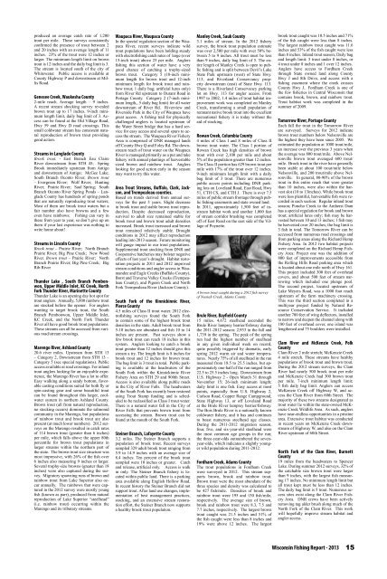
produced an average catch rate of 1,200<br />
trout per mile. These surveys consistently<br />
confirmed the presence of trout between 2<br />
and 20 inches with an average length of 11<br />
inches. 23% of the trout were 12 inches or<br />
larger. The minimum length limit on brown<br />
trout is 12 inches and the daily bag limit is 3.<br />
The stream is located south of the city of<br />
Whitewater. Public access is available at<br />
County Highway P and downstream at Millis<br />
Road.<br />
Genesee Creek, Waukesha County<br />
2-mile reach. Average length – 9 inches.<br />
A recent stream shocking survey revealed<br />
brown trout up to 17 inches. 9-inch minimum<br />
length limit, daily bag limit of 3. Access<br />
can be found at the Old Village Road,<br />
Hwy 59 and Hwy D road crossings. This<br />
small coldwater stream has consistent natural<br />
reproduction of brown trout providing<br />
good action.<br />
Streams in Langlade County<br />
Brook trout. - East Branch Eau Claire<br />
River downstream from STH 45; Spring<br />
Brook immediately upstream from Antigo<br />
and downstream of Antigo; McGee Lake;<br />
South Branch Oconto River, Brown trout<br />
– Evergreen River; Wolf River; Hunting<br />
River; Prairie River; Saul Spring; South<br />
Branch Oconto River Spring Ponds – Langlade<br />
County has hundreds of spring ponds<br />
that are naturally reproducing trout waters;<br />
Most of them are brook trout waters but a<br />
fair number also have browns and a few<br />
even have rainbows; Fishing can vary in<br />
these from year to year, so don’t give up on<br />
them if your last experience was nothing to<br />
write home about!<br />
Streams in Lincoln County<br />
Brook trout – Prairie River; North Branch<br />
Prairie River; Big Pine Creek; New Wood<br />
River. Brown trout – Prairie River; North<br />
Branch Prairie River; Big Pine Creek; Big<br />
Rib River<br />
Thunder Lake , South Branch Pembonwon,<br />
Upper Middle Inlet, KC Creek, North<br />
Fork Thunder River, Marinette County<br />
Thunder Lake is an opening day hot spot for<br />
trout anglers. Annually, 5,000 rainbow trout<br />
are stocked before the opener. For anglers<br />
wanting to target brook trout, the South<br />
Branch Pembonwon, Upper Middle Inlet,<br />
KC Creek, and the North Fork Thunder<br />
River all have good brook trout populations.<br />
These streams can all be accessed from various<br />
road/stream crossings.<br />
Marengo River, Ashland County<br />
20.6 river miles. Upstream from STH 13<br />
– Category 2, Downstream from STH 13 –<br />
Category 5 (see special regulations). Public<br />
access available at road crossings. For inland<br />
trout anglers looking for an enjoyable experience,<br />
the Marengo River has a lot to offer.<br />
Easy walking along a sandy bottom, favorable<br />
casting conditions suited for both fly or<br />
spin-casting gear and some beautiful trout<br />
can be found throughout this larger, coolwater<br />
system in northern Ashland County.<br />
Brown trout (all from natural reproduction,<br />
no stocking occurs) dominate the salmonid<br />
community in the Marengo, but populations<br />
of rainbow trout and brook trout are also<br />
present (at much lower numbers). 2012 surveys<br />
on the Marengo resulted in catch rates<br />
of 114 brown trout (greater than 6 inches)<br />
per mile, which falls above the upper 80th<br />
percentile for brown trout populations in<br />
larger streams within the northern part of<br />
the state. The brown trout size structure was<br />
most impressive, with 26% of the fish over<br />
6 inches also measuring 9 inches or larger.<br />
Several trophy-size browns (greater than 18<br />
inches) were also captured during the survey.<br />
Migratory spawning runs of brown and<br />
rainbow trout from Lake Superior also occur<br />
annually. The rainbows that were captured<br />
in the 2012 survey were mostly young<br />
fish (known as parr), produced from natural<br />
reproduction of Lake Superior “steelhead”<br />
(i.e. rainbow trout) occurring within the<br />
Marengo and its tributary streams.<br />
Waupaca River, Waupaca County<br />
In the special regulation section of the Waupaca<br />
River, recent surveys indicate wild<br />
trout populations have been holding steady<br />
with electrofishing catch rates of large (over<br />
15-inch trout) above <strong>25</strong> per mile. <strong>Angler</strong>s<br />
fishing this section of water have a very<br />
good chance of catching a trophy-sized<br />
brown trout. Category 5 (18-inch minimum<br />
length for brown trout and 12-inch<br />
minimum length for brook trout and rainbow<br />
trout; 1 daily bag; artificial lures only)<br />
from River Rd upstream to Durant Road in<br />
Portage County. Category 2 (7-inch minimum<br />
length,, 5 daily bag limit) for all water<br />
downstream of River Rd. Riverview and<br />
Riverside Park in the City of Waupaca have<br />
great access. A fishing trail for physically<br />
challenged anglers is located upstream of<br />
the Water Street bridge that has a hard service<br />
for easy access and several spurs to access<br />
the stream. The Waupaca River Fishery<br />
Area is comprised of DNR managed lands<br />
off County Hwy Q and Foley Rd. The downstream<br />
reach of trout water on the Waupaca<br />
River is managed primarily as a put and take<br />
fishery with annual plantings of harvestable<br />
sized brown and rainbow trout. <strong>Angler</strong>s<br />
looking for good action early in the season<br />
may want to try this water.<br />
Area Trout Streams, Buffalo, Clark, Jackson,<br />
and Trempealeau counties.<br />
Based on trends derived from annual surveys<br />
for the past 3 <strong>years</strong>. Slight decrease<br />
in brook trout and stable brown trout reproduction.<br />
Despite decreased reproduction,<br />
survival to adult size remained stable for<br />
brook trout and brown trout adult densities<br />
increased. Brook trout increased and brown<br />
trout remained relatively stable. Drought<br />
conditions in 2012 may affect reproduction<br />
leading into 2013 season. Future monitoring<br />
will gauge impact to our trout populations.<br />
Supplemental trout stocking from DNR and<br />
Cooperative hatcheries may bolster negative<br />
effects of last year’s drought. Habitat restoration<br />
projects in 2011 and 2012 improved<br />
stream conditions and angler access in Waumandee<br />
and Eagle Creeks (Buffalo County),<br />
Borst and Traverse Valley Creeks (Trempealeau<br />
County), and Pigeon Creek and North<br />
Fork Trempealeau River (Jackson County).<br />
South Fork of the Kinnickinnic River,<br />
Pierce County<br />
4.5 miles of Class II trout water. 2012 electrofishing<br />
surveys found the South Fork<br />
to contain some of the highest brook trout<br />
densities in the state. Adult brook trout from<br />
5-10 inches are abundant and fish 10 to 14<br />
inches are present. Past surveys show a<br />
few brook trout can reach 18 inches in this<br />
system. <strong>Angler</strong>s looking to catch a brook<br />
trout greater than 12 inches should give this<br />
stream a try. The length limit is 8 inches for<br />
brook trout and 12 inches for brown trout.<br />
The bag limit is 3 trout in total. Public parking<br />
is available at the headwaters of the<br />
South Fork within the Kinnickinnic River<br />
Fishery Area on STH 29 and 900th Street.<br />
Access is also available along public roads<br />
in the City of River Falls. The headwaters<br />
of the South Fork has recently been restored<br />
using Trout Stamp funding and is scheduled<br />
to be reclassified as Class I trout water.<br />
There is a natural water fall in the City of<br />
River Falls that prevents brown trout from<br />
accessing the stream. Brown trout can be<br />
found at the mouth of the South Fork.<br />
Steiner Branch, Lafayette County<br />
3.2 miles. The Steiner Branch supports a<br />
population of brook trout. Recent surveys<br />
sampled 329 adult brook trout ranging from<br />
5.9 to 14.9 inches with an average size of<br />
8.4 inches. Ten percent of the brook trout<br />
sampled were 10 inches or greater. Catch<br />
and release, artificial only. Access is walk<br />
in only. The Steiner Branch fishery is located<br />
within public land. There is a parking<br />
area available along English Hollow Road.<br />
In recent history the Steiner Branch did not<br />
support trout. After land use changes, implementation<br />
of best management practices,<br />
stocking, and an extensive stream restoration<br />
effort, the Steiner Branch now supports<br />
a healthy brook trout population.<br />
Manley Creek, Sauk County<br />
3.1 miles of stream. In the 2012 fishery<br />
survey, the brook trout population estimate<br />
was over 2,500 per mile with over 50% between<br />
5 to 9 inches. All trout must be less<br />
than 9 inches, daily bag limit of 5. The entire<br />
length of Manley Creek is open to public<br />
fishing and is split between Devil’s Lake<br />
State Park upstream (west) of State Hwy.<br />
113, and Riverland Conservancy property<br />
downstream (east) of State Hwy. 113.<br />
There is a Riverland Conservancy parking<br />
lot on Hwy. 113 for angler access. From<br />
1997 to 2002, 1.4 miles of trout habitat improvement<br />
work was completed on Manley<br />
Creek, transforming a small population of<br />
remnant native brook trout into the excellent<br />
recreational fishery it is today without the<br />
aid of stocking.<br />
Rowan Creek, Columbia County<br />
4 miles of Class I and 8 miles of Class II<br />
brown trout water. The Class I portion of<br />
Rowan Creek has high densities of brown<br />
trout with over 2,100 per mile and about<br />
5% of the population greater than 12 inches.<br />
The Class II portion has 629 brown trout per<br />
mile with 17% of the trout over 12 inches.<br />
9-inch minimum length limit with a daily<br />
bag limit of 3 trout. There are numerous<br />
public access points including DNR parking<br />
lots on Loveland Road, East Road, Hwy<br />
51, CTH CS, and CTH J. There is over 7.5<br />
miles of public stream frontage through public<br />
fishing easements and state owned land.<br />
In 2011, approximately 1,500 feet of instream<br />
habitat work and another 1,000 feet<br />
of stream corridor brushing was completed<br />
off of East Road on the east side of the Village<br />
of Poynette.<br />
A brown trout caught during a 2012 fish survey<br />
of Neenah Creek, Adams County.<br />
Brule River, Bayfield County<br />
15 miles. 4,672 steelhead ascended the<br />
Brule River lamprey barrier/fishway during<br />
the 2011-2012 season: 2,933 in the fall and<br />
1,739 in the spring. The peak of the spring<br />
run had the highest number of steelhead<br />
in any given individual week on record,<br />
quite possibly triggered by dramatic, early<br />
spring 2012 warm air and water temperatures.<br />
Nearly 75% of all steelhead in the run<br />
measured from 18.5 to <strong>25</strong>.5 inches, but approximately<br />
one-half of the run ranged from<br />
22.5 to <strong>25</strong>.5 inches long. Downstream from<br />
U.S. Highway 2 - Open March 31 through<br />
November 15; 26-inch minimum length;<br />
daily limit is one fish. Easy access at most<br />
points, especially from U.S. Highway 2,<br />
Carlson Road, Copper Range Campground,<br />
State Highway 13, or off Loveland Road<br />
at the Brule River lamprey barrier/fishway.<br />
The Bois Brule River is a nationally known<br />
coldwater fishery, and it has and continues<br />
to boast numerous steelhead age classes.<br />
During the 2011-2012 migration season,<br />
four, five, and six-year-old steelhead were<br />
the most common age groups in the run;<br />
the three-year-olds outnumbered the sevenyear-olds,<br />
which indicates a slightly younger<br />
wild population during 2011-2012.<br />
Fordham Creek, Adams County<br />
The trout populations in Fordham Creek<br />
were surveyed in 2012. This stream supports<br />
brown, brook and rainbow trout.<br />
Brown trout were the most abundant of the<br />
three species and density was calculated to<br />
be 427 fish/mile. Densities of brook and<br />
rainbow trout were 195 and 130 fish/mile,<br />
respectively. The average size of brown,<br />
brook and rainbow trout were 8.3, 7.5 and<br />
7.7 inches, respectively. The largest brown<br />
trout caught was 21.5 inches and 51% of<br />
the fish caught were less than 8 inches and<br />
19% were above 12 inches. The largest<br />
brook trout caught was 10.5 inches and 71%<br />
of the fish caught were less than 8 inches.<br />
The largest rainbow trout caught was 11.6<br />
inches and 53% of the fish caught were less<br />
than 8 inches. Inland trout season; Daily bag<br />
and length limit: 5 trout under 8 inches, or<br />
4 trout under 8 inches and 1 over 12 inches.<br />
<strong>Angler</strong>s have access to Fordham Creek<br />
through State owned land along County<br />
Hwy J and 8th Drive, and access with a<br />
fishing easement where the creek crosses<br />
County Hwy J.. Fordham Creek is one of<br />
the few fisheries in Central <strong>Wisconsin</strong> that<br />
contains brook, brown, and rainbow trout.<br />
Trout habitat work was completed in the<br />
summer of 2009.<br />
Tomorrow River, Portage County<br />
Each fall the trout in the Tomorrow River<br />
are surveyed. Surveys for 2012 indicate<br />
brown trout numbers below Nelsonville are<br />
the highest they have been since 2005. We<br />
estimated the population at 1000 trout/mile,<br />
an increase over the previous 3 <strong>years</strong> when<br />
the average was 800 trout/mile. Above Nelsonville<br />
brown trout averaged 600 trout/<br />
mile. Brook trout in the river have generally<br />
been stable at about 100 trout/mile below<br />
Nelsonville, and 200 trout/mile above Nelsonville.<br />
In general, 80-90% of the brown<br />
trout in this entire reach that were greater<br />
than 10 inches, were also within the harvest<br />
slot (10 to 13inches). While brook trout<br />
were less plentiful, harvestable fish were recorded<br />
in each section. Regular inland trout<br />
season; Poncho Creek to the Amherst Dam<br />
has a special regulation for brook and brown<br />
trout; artificial lures only; fish may be harvested<br />
between 10 and 13 inches; 1 fish may<br />
be harvested over 20 inches; the bag limit is<br />
3 fish in total. The Tomorrow River can be<br />
accessed from numerous road crossings and<br />
from parking areas along the Richard Hemp<br />
Fishery Area. In 2012 two habitat projects<br />
were completed on the Richard Hemp Fishery<br />
Area: Project one was the addition of<br />
800 feet of improvements accessible from<br />
the Rolling Hills Road parking area which<br />
is located about one mile north of Hwy 161.<br />
This project included 300 feet of overhead<br />
covers, and about 500 feet of stream narrowing<br />
which included one plunge pool.<br />
The second project, located upstream of<br />
Lake Meyers Road, was a 1000 foot reach<br />
upstream of the farm machinery crossing.<br />
This was the third section completed in a<br />
multiyear project funded by Natural Resource<br />
Conservation Service. It included<br />
another 700 feet of wing deflectors, installed<br />
to narrow and deepen the channel along with<br />
180 feet of overhead cover, one island was<br />
lengthened and 75 boulders were installed.<br />
Clam River and McKenzie Creek, Polk<br />
County<br />
Clam River 2 mile stretch; McKenzie Creek<br />
4 mile stretch. These streams have healthy<br />
populations of brook trout and brown trout.<br />
During the 2012 stream surveys, the Clam<br />
River had nearly 500 brook trout per mile<br />
and McKenzie Creek had 300 brown trout<br />
per mile. 7-inch minimum length limit;<br />
5 fish daily bag limit. <strong>Angler</strong>s can access<br />
McKenzie Creek off Highway W, and access<br />
the Clam River from 60th Street. The<br />
majority of these two streams designated as<br />
trout water lie within the state-owned McKenzie<br />
Creek Wildlife Area. As such, anglers<br />
have near-endless opportunities in a pristine<br />
area. Extensive trout habitat was conducted<br />
in recent <strong>years</strong> on McKenzie Creek downstream<br />
of Highway W, and also on the Clam<br />
River upstream of 60th Street.<br />
North Fork of the Clam River, Burnett<br />
County<br />
19 miles from the headwaters to Spencer<br />
Lake. During summer 2012 surveys, 32% of<br />
the catchable size brown trout were larger<br />
than 9 inches, with the largest fish measuring<br />
17 inches. No minimum length limit but<br />
all trout kept must be less than 12 inches.<br />
The daily bag limit is 5 trout. Numerous access<br />
sites exist along the Clam River Fishery<br />
Area. DNR crews have been actively<br />
removing tag alder brush along much of the<br />
North Fork of the Clam River. This work<br />
will hopefully improve stream habitat and<br />
angler access.<br />
<strong>Wisconsin</strong> Fishing Report - 2013<br />
15


![Nature program winter schedule [PDF] - Wisconsin DNR](https://img.yumpu.com/22471254/1/190x245/nature-program-winter-schedule-pdf-wisconsin-dnr.jpg?quality=85)
![City of Middleton [PDF] - Wisconsin Department of Natural Resources](https://img.yumpu.com/22300392/1/190x245/city-of-middleton-pdf-wisconsin-department-of-natural-resources.jpg?quality=85)
![Wetland Conservation Activities [PDF] - Wisconsin Department of ...](https://img.yumpu.com/21975633/1/190x245/wetland-conservation-activities-pdf-wisconsin-department-of-.jpg?quality=85)
![Baraboo River Region[PDF] - Wisconsin Department of Natural ...](https://img.yumpu.com/21975619/1/190x245/baraboo-river-regionpdf-wisconsin-department-of-natural-.jpg?quality=85)
