24 streams - Wisconsin Department of Natural Resources
24 streams - Wisconsin Department of Natural Resources
24 streams - Wisconsin Department of Natural Resources
You also want an ePaper? Increase the reach of your titles
YUMPU automatically turns print PDFs into web optimized ePapers that Google loves.
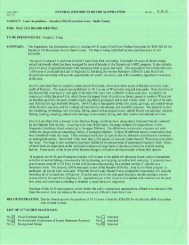
DNR PROPOSES NEW TROUT STREAM CLASSIFICATIONS IN BAYFIELD COUNTY<br />
SUPERIOR – Twenty-three (<strong>24</strong>) <strong>streams</strong> in Bayfield County are proposed for trout water<br />
classification or reclassification based on their habitats and abilities to support natural<br />
reproduction, under a <strong>Department</strong> <strong>of</strong> <strong>Natural</strong> <strong>Resources</strong> proposal open for public comment.<br />
Classification helps ensure high, long-term habitat quality necessary to support healthy fisheries.<br />
Twenty-three (23) <strong>of</strong> the <strong>streams</strong> will be classified as Class 1 and one stream will become Class<br />
2, all <strong>of</strong> which have not been previously classified, according to Paul Piszczek, DNR Senior<br />
Fisheries Biologist in Superior. Many <strong>of</strong> these <strong>streams</strong> are small and unnamed, and DNR<br />
surveys documented multiple year classes (including young-<strong>of</strong>-year) <strong>of</strong> resident and migratory<br />
Lake Superior trout and salmon species.<br />
“The DNR surveys used for this proposal demonstrate that the <strong>streams</strong>, in part, function<br />
significantly as natural fish hatcheries for Lake Superior’s near shore fisheries,” Piszczek said.<br />
The stream being newly classified to Class 2 is:<br />
• Unnamed Tributary to Whittlesey Creek in Barksdale Township (T48N, R5W, Sects. 34 and 35).<br />
1.3 miles beginning approximately 350 feet upstream from and parallel to the Ondossagon Road<br />
stream crossing, downstream to the confluence with the mainstem Whittlesey Creek.<br />
The 23 <strong>streams</strong> being newly classified to Class 1 are:<br />
• Unnamed tributary to Bark River in Clover Township (T50N, R7W, Sect. 12) and Bell Township<br />
(T50N, R6W, Sects. 7 and 18); the first major tributary upstream from Lake Superior. 1.6 miles,<br />
located near the abandoned powerline corridor that extends approximately 1.9 miles east <strong>of</strong> the<br />
intersection <strong>of</strong> Deswart Road and Bark River Road and approximately 0.8 mile west <strong>of</strong> the<br />
intersection <strong>of</strong> Keystone Road and West Lake Shore Drive, downstream to the confluence with<br />
the Bark River.<br />
• Unnamed tributary to Bark River in Bell Township (T50N, R6W, Sects. 7 and 18). 0.6 mile<br />
beginning from approximately 2.0 miles east <strong>of</strong> the intersection <strong>of</strong> Clover Cemetery Road and<br />
Bark River Road, downstream to the confluence with an unnamed tributary to the Bark River.<br />
• Unnamed tributary to Bark River in Clover Township (T50N, R7W, Sect. 12): The tributary<br />
immediately upstream from the first major tributary from Lake Superior. 0.1 mile beginning at<br />
the southeast corner <strong>of</strong> Section 12, approximately 0.6 mile southeast <strong>of</strong> Bark River Road, where<br />
the road bends 90 o to the west approximately 1.1 mile south <strong>of</strong> STH 13, downstream to the<br />
confluence with Bark River.<br />
• Unnamed tributary to Bark River in Clover Township (T50N, R7W, Sect. 13). 1.0 mile<br />
beginning at the abandoned powerline corridor, located approximately 1.7 miles east from the<br />
intersection <strong>of</strong> Deswart Road and Bark River Road, downstream to the confluence with Bark<br />
River.<br />
• Unnamed tributary to Bark River in Clover Township (T50N, R7W, Sects. 13 and <strong>24</strong>). 0.8 mile<br />
beginning approximately 0.6 mile upstream from the abandoned powerline corridor, located<br />
<strong>Wisconsin</strong> DNR Fisheries Management Public Notice Page 1
approximately 0.9 mile east from the intersection <strong>of</strong> Deswart Road and Bark River Road,<br />
downstream to the confluence with an unnamed tributary to Bark River<br />
• Unnamed tributary to Bark River in Clover Township (T50N, R7W, Sects. 13 and <strong>24</strong>). 0.8 mile<br />
beginning approximately 0.6 mile upstream from the abandoned powerline corridor, located<br />
approximately 0.7 mile east from the intersection <strong>of</strong> Deswart Road and Bark River Road,<br />
downstream to the confluence <strong>of</strong> an unnamed tributary to Bark River.<br />
• Unnamed tributary to Bark in Clover Township (T50N, R7W, Sects. 13 and <strong>24</strong>). 0.5 mile<br />
beginning approximately at the abandoned powerline corridor, located approximately 1.2 miles<br />
east from the intersection <strong>of</strong> Deswart Road and Bark River Road, downstream to the confluence<br />
<strong>of</strong> an unnamed tributary to Bark River.<br />
• Unnamed tributary to East Fork Cranberry in Clover Township (T50N R7W Sect. 34). 1.1 miles<br />
beginning approximately 0.4 mile upstream from Campbell Road to the confluence with an<br />
unnamed tributary to the East Fork Cranberry River.<br />
• Unnamed tributary to East Fork Flag River in Port Wing Township (T49N, R7W, Sect. 6). 143<br />
feet beginning approximately 1.0 mile east <strong>of</strong> the 45 o bend in County Forest Road (Flag Road),<br />
and approximately 0.2 mile north <strong>of</strong> Section lines 6 and 7, downstream to the confluence with an<br />
Unnamed tributary to the East Fork Flag River.<br />
• Unnamed tributary to East Fork Flag River in Port Wing Township (T49N, R7W, Sect. 6). 0.6<br />
mile beginning approximately 1.0 mile southeast <strong>of</strong> the end <strong>of</strong> Almstead Road and near the center<br />
<strong>of</strong> Port Wing Section 6, downstream to the confluence with an Unnamed Tributary to the East<br />
Fork Flag River.<br />
• Unnamed tributary to East Fork Flag River in Port Wing Township (T49N, R8W, Sects. 1 and 6).<br />
1.3 miles beginning approximately 1.1 miles southeast <strong>of</strong> the end <strong>of</strong> Almstead Road and<br />
approximately 0.3 mile west <strong>of</strong> Section Lines 6 and 5, downstream to the confluence with the<br />
Unnamed Tributary to the East Fork Flag River.<br />
• Unnamed tributary to East Fork Flag River in Port Wing Township (T49N, R8W, Sect. 1 and 6).<br />
1.2 miles beginning approximately 1.0 mile east <strong>of</strong> the 45 o bend in County Forest Road (Flag<br />
Road), and 0.1 mile north <strong>of</strong> Section Lines 6 and 7, downstream to the confluence with the<br />
Unnamed tributary to East Fork Flag River.<br />
• Unnamed tributary to East Fork Flag River in Port Wing Township (T49N, R8W, Sect. 1) and<br />
Clover Township (T50N, R7W, Sect. 31). 1.0 mile beginning approximately 1.0 mile southeast<br />
<strong>of</strong> the end <strong>of</strong> Almstead Road and 0.1 mile west <strong>of</strong> Clover Township Section Lines 31 and 32,<br />
downstream to the confluence with East Fork Flag River.<br />
• Unnamed tributary to Flag River in Orienta Township (T49N, R8W, Sect. 36). 0.1 mile<br />
beginning approximately 0.7 mile north <strong>of</strong> the east end <strong>of</strong> Hennessey Road, downstream to the<br />
Flag River.<br />
• Unnamed tributary to Little Pine River in Pilsen Township (T47N, R6W, Sect 10). 0.1 mile<br />
beginning approximately 0.1 mile upstream from the Tri-County Corridor and 0.1 mile west <strong>of</strong><br />
Ottman Road, downstream to an unnamed tributary to the Little Pine River.<br />
<strong>Wisconsin</strong> DNR Fisheries Management Public Notice Page 2
• North Fish Creek in Keystone Township (T47N, R6W, Sect 29). 0.4 mile beginning at the<br />
confluence with an unnamed tributary approximately 0.2 mile southeast from the intersection <strong>of</strong><br />
Section Lines 29 and 30 and U.S. Highway 2, downstream to U.S Highway 2. This segment joins<br />
with the existing 9.6-mile, Class 1 segment that continues downstream to the existing 7.5-mile<br />
Class 2 segment that continues to Chequamegon Bay.<br />
• Unnamed tributary to North Fish Creek in Pilsen Township (T47N, R6W, Sects. 16 and 22). 0.3<br />
mile beginning at the confluence with an unnamed tributary at SW corner <strong>of</strong> Section 15 and NW<br />
corner <strong>of</strong> Section 22, downstream to the confluence with North Fish Creek.<br />
• Unnamed tributary to North Fish Creek in Pilsen Township (T47N, R6W, Sect 22). 0.4 mile<br />
beginning approximately 201 feet west <strong>of</strong> CTH G and north <strong>of</strong> Smerchik Road, downstream to<br />
the confluence with an unnamed tributary to North Fish Creek.<br />
• Unnamed tributary to North Pikes Creek in Bayfield Township (T50, R4W, Sects. 4 and 5). 1.1<br />
miles beginning at the confluence with an unnamed tributary, approximately 1,300 feet west <strong>of</strong><br />
Section Lines 4 and 5, and 0.3 mile south <strong>of</strong> Schultz Fire Lane Road, downstream to the<br />
confluence with North Pikes Creek.<br />
• Unnamed tributary to Pikes Creek in Bayfield Township (T50, R4W, Sects. 20, 21, and 28). 0.6<br />
mile beginning at the powerline corridor just north <strong>of</strong> Section Lines 20 and 29 and 1.0 mile west<br />
<strong>of</strong> the intersection <strong>of</strong> Milligan Road and Bruhn Road, downstream to the confluence with Pikes<br />
Creek.<br />
• Unnamed tributary to Pikes Creek in Bayfield Township (T50, R4W, Sects. 20, 28, and 29). 0.9<br />
mile beginning approximately 0.2 miles upstream from the powerline corridor that is 0.1 mile<br />
upstream from Section Lines 20 and 21, and 1.0 mile northwest <strong>of</strong> the intersection <strong>of</strong> Milligan<br />
Road and Bruhn Road, downstream to the confluence with Pikes Creek<br />
• Sandy Run Creek in Hughes Township (T47N R9W Sect. 18). 0.3 mile beginning at the<br />
headwaters approximately 0.2 mile west <strong>of</strong> Anderson Road between the Tri-County Corridor and<br />
U.S. Highway 2, downstream to the Bayfield-Douglas County lines. This segment will join with<br />
the existing 1.65-mile, Class 1 segment that continues downstream to the confluence with the<br />
Little Bois Brule River.<br />
• Whittlesey Creek in Barksdale Township (T48N, R5W, Sects. 28, 33, and 34). 1.2 miles<br />
beginning approximately 0.3 miles northeast from the end <strong>of</strong> Galligan Road and at an exposed<br />
bluff located approximately 400 feet north <strong>of</strong> Section Lines 28 and 33, downstream to the<br />
confluence with North Fork Whittlesey Creek.<br />
The <strong>Department</strong> shall waive any hearing requirement on this classification unless a written<br />
request for a hearing is received before November <strong>24</strong>, 2013. Requests should be sent to: Paul<br />
Piszczek, Senior Fisheries Biologist, <strong>Wisconsin</strong> DNR, 1701 North 4 th Street, Superior, WI<br />
54880. He can be contacted by telephone at (715) 392-7990.<br />
<strong>Wisconsin</strong> DNR Fisheries Management Public Notice Page 3


![Nature program winter schedule [PDF] - Wisconsin DNR](https://img.yumpu.com/22471254/1/190x245/nature-program-winter-schedule-pdf-wisconsin-dnr.jpg?quality=85)
![City of Middleton [PDF] - Wisconsin Department of Natural Resources](https://img.yumpu.com/22300392/1/190x245/city-of-middleton-pdf-wisconsin-department-of-natural-resources.jpg?quality=85)
![Wetland Conservation Activities [PDF] - Wisconsin Department of ...](https://img.yumpu.com/21975633/1/190x245/wetland-conservation-activities-pdf-wisconsin-department-of-.jpg?quality=85)

![Baraboo River Region[PDF] - Wisconsin Department of Natural ...](https://img.yumpu.com/21975619/1/190x245/baraboo-river-regionpdf-wisconsin-department-of-natural-.jpg?quality=85)
