Program, Abstracts, and Guidebooks - University of Minnesota Duluth
Program, Abstracts, and Guidebooks - University of Minnesota Duluth
Program, Abstracts, and Guidebooks - University of Minnesota Duluth

You also want an ePaper? Increase the reach of your titles
YUMPU automatically turns print PDFs into web optimized ePapers that Google loves.
-ç<br />
—<br />
—<br />
I:<br />
.t.<br />
F<br />
Geology<br />
Superior<br />
On<br />
Lake<br />
nstitute<br />
I<br />
a<br />
S<br />
>f•<br />
i\ v<br />
tA I<br />
r
TECHNICAL SESSIONS<br />
ABSTRACTS<br />
<strong>and</strong><br />
FIELD GUIDES<br />
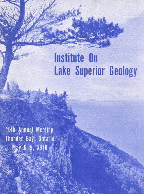
16th ANNUAL<br />
INSTITUTE ON LAKE SUPERIOR GEOLOGV<br />
heLd cit<br />
LAKEHEAD UNI VERSITV<br />
Thanaeir. Bay, Ont<br />
May 6 - 9, 1910<br />
Edited by<br />
JL. Talbot<br />
J.M. Franklin<br />
C. Kuatra
TABLE OF CONTENTS<br />
INSTITUTE DIRECTORS AND LOCAL COMMITTEE 1.<br />
PROGRAM 2.<br />
ABSTRACTS OF TECHNICAL SESSIONS 7.<br />
FIELD TRIPS<br />
A- Proterozoic formations in the<br />
Thunder Bay Area. 49.<br />
8- Sturgeon River Metavolcanic - 69.<br />
Metasedimentary Formations in<br />
the Beardznore-Geraldton area.<br />
C- The Port Coldwell alkalic complex 8S.
—1—<br />
16-tk AnvwsZ<br />
INSTITUTE ON LAKE SUPERIOR GEOLOGy<br />
Lake head UrL.Lvex4Lty<br />
Th<strong>and</strong>v. Bay,<br />
OntaLo<br />
May 7-8, 1970<br />
INSTITUTE BOARD OF DIRECTORS<br />
* 3.<br />
*<br />
R.<br />
A.<br />
N.<br />
A.<br />
G.<br />
M.<br />
W. Avery (Treasurer), Jones F, Laughlin Steel Corp.,<br />
Negaunee, Michigan.<br />
C. Reed (Secretary), Michigan Geological Survey,<br />
Lansing, Michigan.<br />
K. Snelgrove, Michigan Techological <strong>University</strong>,<br />
Houghton, Michigan.<br />
J. Hinze, Michigan State <strong>University</strong>, East Lansing,<br />
Michigan.<br />
B. Dickas, Wisconsin State <strong>University</strong>, Superior,<br />
Wisconsin.<br />
L. LaBerge, Wisconsin State <strong>University</strong>, Oshkosh,<br />
Wisconsin.<br />
W. Bartley, Thunder Bay, Ontario.<br />
* Permanent members.<br />
LOCAL COMMITTEE<br />
Chairmen:<br />
Progrcxnne Committee:<br />
GeneraF Members:<br />
M. N. Bartley<br />
3. Talbot<br />
A. Boerner<br />
V. B. Cook<br />
E. Mercy<br />
F. Harris E. Brinley<br />
3. Mothersill<br />
A. Temple<br />
FIELD TRIP COMMITTEE<br />
C. Kustra<br />
3. Franklin<br />
H. Loubat
-2-<br />
"P R 0 G R A M"<br />
Tate day, Ma9 5th, 1970<br />
6.00 p.m. Field Trip '8' (Ceraldton-Beardjnor) leaves the<br />
Prince Arthur Hotel, Thunder Bay, Ontario.<br />
Wed4e2day, May 6th, 1970<br />
7.00 p.m. Field Trip 'B' returns to Prince Arthur Hotel<br />
7.00 p.m.<br />
to Institute Registration — Prince Arthur Hotel<br />
10.00 p.m.<br />
7.00 p.m. American Institute <strong>of</strong> Pr<strong>of</strong>essional Geologists,<br />
Dinner3 Prince Arthur Hotel<br />
Thwt4ç4y,<br />
M04 7th, 197Q<br />
7.30 a.m.<br />
to<br />
9.00 a.m.<br />
Registration, Main Cafeteria, LAKEHEAD UNIVERSITY
-.3-<br />
$ E S S I<br />
°.JL<br />
Thwchday, May 7th, 1970<br />
Page<br />
No.<br />
8.15 R. Oja Keweenanwan Copper Deposits in the 31<br />
Archean <strong>of</strong> Northwes tern Ontario<br />
8.30 D. C. Mulder Ore Controls <strong>and</strong> Open Pit Geological 30<br />
Procedures in Steep Rock Iron Mines<br />
Limi ted<br />
9.00 W. •F. Read Is the Limestone Mountain Structure 36<br />
an Astrobleme?<br />
9.20 S. Viswanathan A classification <strong>of</strong> granitic rocks 40<br />
with reference to Giants Range<br />
Batholith, Northern <strong>Minnesota</strong><br />
9.35 G. N. Hanson K-Ar Ages <strong>of</strong> Mafic Dikes in North- 19<br />
R. Malhotra eastern <strong>Minnesota</strong><br />
9.50 C. W. Keighi.n Age <strong>and</strong> Petrology <strong>of</strong> the Fort 26<br />
Ridgely Granite, Southwestern<br />
<strong>Minnesota</strong><br />
10.10 W. Bonnichsen The southern part <strong>of</strong> the <strong>Duluth</strong> Complex 10<br />
<strong>and</strong> associated Keweenawan rocks,<br />
<strong>Minnesota</strong><br />
10.40 J. D Mancuso Structure <strong>of</strong> the <strong>Duluth</strong> Gabbro Complex 27<br />
J. D. Dolence in the Babbitt area, <strong>Minnesota</strong><br />
11.10 J. C. Green Ultrainafic bodies in the Vermilion 17<br />
District near Ely, <strong>Minnesota</strong><br />
11.40 J. M. Berkson Side-Scan Sonar Survey <strong>of</strong> the Lake 9<br />
C. S. Clay Superior floor near Freda, Michigan<br />
12.00 NOON - LUNCH - Student Cafeteria
-4-<br />
SESSTOM 2<br />
1.00 Business Meeting<br />
'AjteA.vzoovz'<br />
jNo.<br />
1.30 M. Y. I-lsu Deformation <strong>of</strong> the Seine conglomerate 20<br />
P. M. Clifford in the Rainy River area, Ontario.<br />
2.00 11. M. Mooney Refraction Seismic Investigations <strong>of</strong> 28<br />
et al<br />
Northern Midcontinent Gravity High<br />
2.30 IL N. Annells Keweenawan Volcanic Geology <strong>of</strong> 7<br />
Michipicoten Isl<strong>and</strong>, Lake Superior<br />
3.00 3. Wood Evidence for a Tropical Climate <strong>and</strong> 45<br />
Oxygenic Atmosphere in Upper Huronian<br />
Rocks <strong>of</strong> the Rawhide Lake - Flack<br />
Lake area, Ontario.<br />
3.30 G. M. Young Widespread occurrence <strong>of</strong> A luminous<br />
Minerals in Aphebian Quartzites<br />
4.00 C. Powell Structurat <strong>and</strong>+rnetwnorphic history 35<br />
<strong>of</strong> the Marquette Sync linoriurn<br />
4.30 W. Jenks Root severance <strong>and</strong> tectonic transport 25<br />
<strong>of</strong> orebodies in Metavolcanic Host<br />
Rocks<br />
'EvekvLvlg'<br />
6.00 p.m. CoaktaLto - CAFETERiA - Lakahac4 WvLv&ui.ig<br />
7.75 p.m. Baitque.t - RESZVENCE Vlt'1ING ROOM Lcththead th'tkvexaUg<br />
AVVRESS: J. C. Rudolph, <strong>of</strong><br />
GENERAL EXPLORATION CO. OF CANADA LTD.<br />
speaking on 'A philosophy <strong>of</strong> exploration'.
-5.-<br />
FtLday, MayUh, 1970<br />
SYMPOSIUM ON GREENSTONE BELTS<br />
LB. Wilson- General Chairman<br />
'Mokn,üig'<br />
9.00 U. B. Wilson Introduction<br />
9.15 L. D. Ayres Synthesis <strong>of</strong> early Precambrian S<br />
Stratigraphy north <strong>of</strong> Lake<br />
Superiqr<br />
9,45 Z. Peterinan Early Precambrian Geology <strong>of</strong> the 34<br />
S. Goldich Rainy Lake District<br />
10.15 P. Clifford Mt. St. Joseph An Archaean Volcano 14<br />
10.45 W. C. Brisbin The structure <strong>of</strong> the Northern Lake <strong>of</strong> 12<br />
the Woods Greens tone Belt, a Deformational<br />
Mosaic<br />
11.15 R. H. RidIer Archaean Volcanic Stratigraphy <strong>of</strong> the 37<br />
Kirkl<strong>and</strong>-Larder Lakes area <strong>of</strong> Northeastern<br />
Ontario.<br />
11.45 DISCUSSION<br />
12 NOON LUNCH - Student Cafeteria
-6-<br />
F'viday, May Slit, 1970<br />
Page<br />
No.<br />
1.30 G. N. Hanson Early Precambrian Geology <strong>of</strong> the 18<br />
S. Goldich Saganaga-Northern Light Lakes<br />
area, <strong>Minnesota</strong>- Ontario.<br />
2.00 1. F. Ermanovics A Model for Tectonic Variation <strong>of</strong> 16<br />
'Granitic Terrain' in Southeastern<br />
Manitoba<br />
2.30 R. IV. Ojakangas Geology <strong>of</strong> a Greenstone Belt in 32<br />
<strong>Minnesota</strong>: Rainy Lake to Lake <strong>of</strong><br />
the Woods<br />
3.00 D. H. Watkinson Geology <strong>of</strong> the Alkalic rock - Carbonatite 44<br />
complex at Prairie Lake, Ontario.<br />
3.30 P. NI. Clifford Behaviour <strong>of</strong> an Archaean Granite 13<br />
Diapir<br />
4.00 R. W. Hutchinson Mineral Potential in Greenstone 22<br />
Belts <strong>of</strong> Northwestern Ontario<br />
4.30 H. B. Wilson CONCLUDING REMARKS<br />
4.45 End Teahnicc2 Sws.Lon4<br />
4.45 DINNER<br />
(Field Trip participants are advised to have<br />
dinner before leaving Thunder Bay)<br />
6.00 Departure for Field Trip "8". (Geraldton-Beardinore)<br />
Field Trip "C". (Port Coldwell)<br />
Field Trip "V". (Atikokan)<br />
Buses will depart from the <strong>University</strong> but<br />
will call at Hotels as necessary.<br />
* * * * * * * * * * * *<br />
Sa-ttvtday, May 9th, 1970<br />
8.00 a.m. Departure for Field Trip "Y'. (Gunf lint-Sibley)<br />
Buses will depart from the Prince Arthur Hotel<br />
7.30 p.m. (approx.) RETURN OF ALL FIELD TRIP BUSES.
-7-<br />
KEWEENAWAN VOLCANIC GEOLOGY OF MICIIIPICOTEN ISLAND,<br />
LAKE SUPERIOR<br />
it.<br />
N. ANNELLS<br />
Postdoctorate Fellow<br />
Geological Survey <strong>of</strong> Canada, Ottawa<br />
ABSTRACT<br />
Recent re—mapping <strong>and</strong> petrographic examination by the author<br />
<strong>of</strong> the Keweenawan lava flows building Michipicoten Isl<strong>and</strong> shows that<br />
they form a highly differentiated 11,500—foot sequence <strong>of</strong> types ranging<br />
from coarse ophitic olivine—bearing basalts through olivine—free basalts<br />
<strong>and</strong> <strong>and</strong>esitic types to glassy porphyritic <strong>and</strong>esites <strong>and</strong> rhyolites. Some<br />
volcaniclastic horizons are intercalated in this south—dipping lava<br />
series <strong>and</strong> a few intercalations <strong>of</strong> conglomerate <strong>and</strong> s<strong>and</strong>stone outcrop at<br />
the west end <strong>of</strong> the isl<strong>and</strong>.<br />
The different- lava types are well intermixed <strong>and</strong> there is no<br />
obvious vertical gradation or cyclic distribution <strong>of</strong> lava types in the<br />
Michipicoten isl<strong>and</strong> succession. The lavas tend to occur in grouj,s <strong>of</strong><br />
petrographically similar flows which can be traced as distinct strati—<br />
graphic units; an <strong>and</strong>esite group near the top <strong>of</strong> the succession can be<br />
followed across the entire isl<strong>and</strong>, a distance <strong>of</strong> 16 miles along strike.<br />
Near the median part <strong>of</strong> the succession the lavas show some lateral variation<br />
which may be the result <strong>of</strong> simultaneous extrusion <strong>of</strong> different<br />
flow types at the same general level from different vents.<br />
An agglomerate bearing large angular <strong>and</strong> rounded blocks <strong>of</strong><br />
isl<strong>and</strong> lava types outcrops on the northwest shore <strong>of</strong> the isl<strong>and</strong>, <strong>and</strong><br />
indicates proximity to an eruptive vent. The lower half <strong>of</strong> the exposed<br />
lava sequence is intruded at numerous different horizons by sheet—like<br />
or lentJ.cular bodies <strong>of</strong> pink acid quartz porphyry crowded with large<br />
phenocrysts <strong>of</strong> feldspar <strong>and</strong> quartz. These bodies are sometimes discordant<br />
to<br />
the lava flows <strong>and</strong> field evidence suggests that they are intrusions<br />
Basic intrusions are extremely rare on Michipicoten Isl<strong>and</strong>, only about<br />
six very thin basic inclined sheets being found on the entire shoreline.<br />
The varied basalt—<strong>and</strong>esite—rhycalite sequence <strong>and</strong> associated<br />
volcaniclastic rocks <strong>of</strong> Michipicoten Isl<strong>and</strong> are believed to have been<br />
erupted from a central volcano fed by a high level magma source. The<br />
presence <strong>of</strong> large volumes <strong>of</strong> acid material in the isl<strong>and</strong> sequence is a<br />
phenomenon' very similar to that seen in the Icel<strong>and</strong>ic central volcanoes,<br />
which consist <strong>of</strong> highly diffentiated lavafvolcaniclastic edifices inter—<br />
finggred with widespread flood basalts <strong>and</strong> <strong>of</strong>ten intruded by acid material.
-8-<br />
SYNTHESIS OF EARLY PRECAMBRIAN STRATIGRAPHY<br />
NORTH OF LAKE SUPERIOR<br />
LORNE D. AYRES<br />
Ontario Department <strong>of</strong> Mines<br />
Toronto<br />
A section from Lake Superior Park to Geraldton, Ontario crosses three<br />
major, east-trending, Early Precambrian, lithologic <strong>and</strong> structural elements<br />
<strong>of</strong> the Superior Province <strong>of</strong> the Canadian Shield. From south to north these<br />
are the northern part <strong>of</strong> the Abitibi isl<strong>and</strong> arc, the Quetico sedimentary<br />
basin, <strong>and</strong> the southern part <strong>of</strong> the Keewatin isl<strong>and</strong> arc.<br />
Both the Abitibi <strong>and</strong> Keewatin arcs are formed from coalescing, subaqueous,<br />
basaltic shield volcanoes capped by subaerial to subaqueous, felsic to<br />
intermediate pyroclastic cones. Volcaniclastic greywacke sequences derived<br />
from felsic volcanism accumulated in intervolcano basins <strong>and</strong> partly overlap<br />
the felsic pyroclastic deposits. Small trondhjemite cratons within the<br />
isl<strong>and</strong> arcs were a local sOurce <strong>of</strong> sedimentary detritus. Although the<br />
isl<strong>and</strong> arcs have easterly trends, individual basins <strong>and</strong> volcanoes have<br />
diverse trends.<br />
Along the north edge <strong>of</strong> the Abitibi arc from Schreiber to Wawa, three<br />
isolated sedimentary formations were deposited in intervolcano basins, but<br />
they are all tongues <strong>of</strong> an extremely thick greywacke <strong>and</strong> siltstone formation<br />
deposited in the Quetico basin north <strong>of</strong> the arc. The formations become<br />
progressively younger from west to east.<br />
The sedimentary rocks <strong>of</strong> the Quetico basin, which are equivalent to the<br />
Couchiching Formation <strong>of</strong> western Ontario, overlie <strong>and</strong> intertongue with. the<br />
volcanic formations <strong>of</strong> the Abitibi arc <strong>and</strong> the source area was probably within<br />
the arc. Along the north edge <strong>of</strong> the basin, however, the sedimentary rocks<br />
underlie <strong>and</strong> intertongue with the volcanic formations <strong>of</strong> the Keewatin arc.!<br />
In this area, Keewatin volcanism is thus younger than Abitibi volcanism.
-9-<br />
SIDE-SCAN SONAR SURVEY OF THE<br />
LAKE<br />
SUPERIOR FLOOR NEAR FREDA, MICRIGAN<br />
J. N. BERKSON & C. S. CLAY<br />
<strong>University</strong> <strong>of</strong> Wisconsin<br />
Geophysical <strong>and</strong> Polar Research Center<br />
ABS TRACT<br />
Approximately 300 miles <strong>of</strong> side-scan sonar pr<strong>of</strong>iles were made<br />
in Lake Superior near Freda, Michigan. The instrument scans to<br />
the side approximately 1/4 mile <strong>and</strong> gives the location <strong>of</strong> features<br />
on the lake floor which scatter sound. The shape <strong>of</strong> the scattering<br />
features can <strong>of</strong>ten be correlated with geological features.<br />
The ship's tracks were close enough together so that nearly continuous<br />
sonar coverage was obtained. Underwater photographs <strong>and</strong><br />
divers were used to identify some <strong>of</strong> the scattering features.<br />
Three distinct bottom types were observed in the survey area:<br />
rocky, s<strong>and</strong>y, <strong>and</strong> bedrock. The bedrock appears to correlate<br />
with the Freda s<strong>and</strong>stone, which outcrops on the l<strong>and</strong>. This study<br />
was supported in part by The National Center for Atmospheric Research<br />
<strong>and</strong> The Office <strong>of</strong> Naval Research.
-10-<br />
THE SOUTHERN<br />
ASSOCIATED<br />
PART OF THE DULUTH COMPLEX AND<br />
KEWEENAWAN ROCKS, MINNESOTA<br />
BILL BONNICHSEN<br />
Cornell <strong>University</strong>,<br />
Ithaca, N.Y. 14850<br />
A B ST EtA CT<br />
The southern part <strong>of</strong> the <strong>Duluth</strong> Complex was reported to consist<br />
mainly <strong>of</strong> troctolitic rocks <strong>and</strong> older anorthositic rocks at the<br />
15th Annual Institute on Lake Superior Geology <strong>and</strong> elsewhere (Bonni—<br />
chsen, 1969). Geologic mapping in several 7½—minute quadrangles in<br />
the Babbitt—Hoyt Lakes area (Bonnichsen, 1970) shows that troctolitic<br />
rocks lie north <strong>and</strong> west <strong>of</strong> the principal occurrences <strong>of</strong> anorthositic<br />
rocks, thus forming the footwall side <strong>of</strong> the complex in the same manner<br />
as at <strong>Duluth</strong> (Taylor, 1964). Between <strong>Duluth</strong> <strong>and</strong> the Babbitt—Hoyt Lakes<br />
area, troctolitic rocks predominate across the width <strong>of</strong> the complex;<br />
exposures <strong>of</strong> anorthositic rocks are restricted to isolated occurrences<br />
<strong>and</strong> inclusions within the troctolitic rocks, rather than large areas<br />
with contiguous outcrops.<br />
In 1969, the writer suggested that troctolitic magmas had<br />
intruded along a contemporaneously widening fracture zone between the<br />
previously—formed anorthositic rocks to the east <strong>and</strong> the Early <strong>and</strong><br />
Middle Precambrian basement to the west. Field work during the summer<br />
<strong>of</strong> 1969 <strong>and</strong> examination <strong>of</strong> drill core in recent months tends to substantiate<br />
this view. Recently obtained knowledge on the variety <strong>and</strong><br />
diversity <strong>of</strong> rock types within the southernpart <strong>of</strong> the complex indicates<br />
the development <strong>of</strong> the troctolitic rocks was a complex event<br />
involving multiple injections <strong>of</strong> magma, the incorporation <strong>of</strong> a great<br />
amount <strong>of</strong> previously—formed Keweenawan igneous rocks as inclusions <strong>and</strong><br />
the development <strong>of</strong> relatively small quantities <strong>of</strong> Fe— <strong>and</strong> Ti—rich magma,<br />
some <strong>of</strong> which was ultramafic, from nagmas which initially were troc—<br />
tolitic.<br />
Much <strong>of</strong> the 1969 field season was devoted to looking for<br />
<strong>and</strong> examining outcrops along, <strong>and</strong> east <strong>of</strong>, the eastern or hanging<br />
wall margin <strong>of</strong> the complex. This margin, for the first 30 miles north<br />
<strong>of</strong> <strong>Duluth</strong>, is mainly a contact between troctolitic <strong>and</strong> locally anor—<br />
thositic rocks to the west <strong>and</strong> gabbroic <strong>and</strong> dioritic intrusives to<br />
the east. Exposures <strong>of</strong> mafic volcanics are uncommon east <strong>of</strong> the<br />
southern part <strong>of</strong> the complex, except within one or two miles <strong>of</strong> Lake<br />
Superior.
In the Mt. Weber—Greenwood Lake area, about 40 miles N.N.E.<br />
<strong>of</strong> <strong>Duluth</strong>, a number <strong>of</strong> granophyre exposures occur but the area underlain<br />
by granophyre is much less than shown on the 1932 <strong>Minnesota</strong> state<br />
geologic map. Gabbros, ferrogabbros, <strong>and</strong> magnetite troctolites are<br />
exposed north <strong>of</strong> the granophyre area; these rocks are responsible for<br />
the intense magnetic anomalies in that area. Exposures <strong>of</strong> rhyolite,<br />
other felsites <strong>and</strong> magnetic basalts occur south <strong>of</strong> the granophyre area.<br />
In the central part <strong>of</strong> this volcanic area is a one—fourth mile long<br />
outcrop area <strong>of</strong> strongly—laminated, locally cross—beddé4,::weakly meta—<br />
morçhosed, feldspathic rock that is interpreted to be equivalent to<br />
the Virginip Formation; this occurrence is about 25 miles east <strong>of</strong> the<br />
footwall <strong>of</strong> the complex where other Virginia Formation is exposed.<br />
Bodies <strong>of</strong> hornfels are common throughout the southern part<br />
<strong>of</strong> the complex; many <strong>of</strong> these, especially in the Babbitt—Hoyt Lakes<br />
area, are inclusions <strong>of</strong> the Virginia Formation which forms the foot—<br />
wall <strong>of</strong> the complex in that area. The majority <strong>of</strong> hornfels bodies<br />
in the southern part <strong>of</strong> the complex, however, are considered to be<br />
metamorphosed basalt, probably <strong>of</strong> Keweenawan age. This type <strong>of</strong> horn—<br />
fels occurs throughout the complex, including along the western margin.<br />
It is suggested that along parts <strong>of</strong> the western margin <strong>of</strong> the<br />
complex between <strong>Duluth</strong> <strong>and</strong> Hoyt Lakes, the footwall consists <strong>of</strong> vol—<br />
canics which overlie the Virginia Formation <strong>and</strong> the equivalent Thompson<br />
Slate, much like the situation af <strong>Duluth</strong>.<br />
A feature <strong>of</strong> interest in the southern part <strong>of</strong> the complex<br />
are a number <strong>of</strong> bodies <strong>of</strong> titaniferous peridotite <strong>and</strong> similar ultra—<br />
inafic rocks. These dike— or sill—like bodies are known from drilling<br />
to locally have thicknesses <strong>of</strong> hundreds <strong>of</strong> feet. These rocks are<br />
characterized by lithologic heterogeneity, medium to coarse grain<br />
sizes, local rhythmic layering <strong>and</strong> abundant titanaugite, olivine, <strong>and</strong><br />
ilmenite; locally, magnetite, graphite, plagioclase, <strong>and</strong> pyrrhotite<br />
are abundant. These rocks may have crystallized from liquids approximating<br />
their present composition because they are the latest intrusive<br />
rocks known inthat area <strong>and</strong> because fine—grained dikes with<br />
identical mineralogical compositions cut adjacent rock bodies in the<br />
vicinity <strong>of</strong> the large peridotite bodies.<br />
Re ferenc es:<br />
Bonnichsen, Bill, 1969, Geology <strong>of</strong> the southern part <strong>of</strong> the <strong>Duluth</strong> Complex,<br />
<strong>Minnesota</strong>; Proc. <strong>of</strong> 30th Annual Mining Symposium, Univ.<br />
<strong>of</strong> Minn.; p. 89—93.<br />
Bonnichsen, Bill, 1970, Geologic maps <strong>of</strong> the <strong>Duluth</strong> Complex in the<br />
i3abhitt—Hoyt Lakes area, <strong>Minnesota</strong>; geologic maps <strong>and</strong> accompanying<br />
explanation for the Allen, Babbitt, Babbitt NE, Babbitt<br />
SE <strong>and</strong> Babbitt SW 7½—minute quadrangles, 1/24,000; on open<br />
file with the <strong>Minnesota</strong> Geological Survey, <strong>University</strong> <strong>of</strong> Minn.,<br />
Minneapolis, Minn.<br />
Taylor, R. B., 1964, Geology <strong>of</strong> the <strong>Duluth</strong> Gabbro Complex near <strong>Duluth</strong>,<br />
<strong>Minnesota</strong>; Minn. Geol. Survey Bull. 44, 63 p.
-12-<br />
THE STRUCTURE OF THE NORTHERN LAKE OF THE WOODS GREENSTONE BELT,<br />
A DEFORNATIONAL W)SAIC.<br />
W. C. BRISBIN<br />
<strong>University</strong> <strong>of</strong> Manitoba<br />
ABSTRACT<br />
The structure <strong>of</strong> the northern portion <strong>of</strong> the Lake <strong>of</strong> the Woods<br />
greenstone belt may be described as a complex mosaic, consisting <strong>of</strong><br />
the effects <strong>of</strong> several deformation events, each <strong>of</strong> which has been<br />
developed spatially to differing degrees. Individual domains, within<br />
the mosaic, may show strain effects <strong>of</strong> one, or more, <strong>of</strong> three widespread<br />
<strong>and</strong> dominant tectonic events, the chronology <strong>and</strong> tectonic styles <strong>of</strong><br />
which are remarkably persistent.<br />
The earliest deformational period is manifest by folds in layering<br />
which are seldom unaffected by later events. Where structural overprinting<br />
is poorly developed the evidence suggests that these folds<br />
were developed by a flexural mechanism, under conditions <strong>of</strong> low mean<br />
ductility, where layer contacts were active. These folds are interpreted<br />
as having developed post lithification <strong>and</strong> prior to any major metamorphic<br />
event.<br />
Large areas <strong>of</strong> the greenstone belt show evidence <strong>of</strong> a second<br />
deformational event which has led to the development <strong>of</strong> a penetrative<br />
<strong>and</strong> tectonically active foliation. Differential movements, either<br />
leading to, or on, the foliation have resulted in passive folds which,<br />
in many areas, have been superimposed on earlier sets. Evidence on,<br />
all scales, from deformed clasts to deformed early plutons, indicates<br />
that strain during this event was accomplished by a combination <strong>of</strong><br />
simple shear <strong>and</strong> differential pure shear. The directions <strong>of</strong> extensive<br />
strain <strong>and</strong> simple shear movements during this event had strong vertical<br />
components; the strain effects <strong>of</strong> this event are linked to the reorganization<br />
<strong>of</strong> upper crustal masses which accompanied the emplacement<br />
<strong>of</strong> the numerous granitic diapirs which have intruded the greenstone.<br />
The third period <strong>of</strong> deformation is portrayed best in many <strong>of</strong> the<br />
areas where the second period penetrative foliation occurs. The earlier<br />
foliation served as an active surface for the development <strong>of</strong> flexural<br />
folds on all scales; from microscopic crenulations, to mesoscopic kink<br />
b<strong>and</strong>s, to major folds with structural relief <strong>of</strong> several thous<strong>and</strong> feet.<br />
Movement directions during this event were variable within, <strong>and</strong> between,<br />
domains, suggesting a wide variety <strong>of</strong> late stress conditions both<br />
temporally <strong>and</strong> spatially.
+ flattening<br />
-13-<br />
BEHAVIOUR OF AN ARCHAEAN GRANITE DIAFIR<br />
PAUL M. LIFF0RD<br />
Department <strong>of</strong> Geology<br />
McMaster <strong>University</strong><br />
A B S T R A C t<br />
Much evidence now is available linking part, possibly all,<br />
<strong>of</strong> the deform.ation in Archaean greenstone belts with the emplacement <strong>of</strong><br />
diapiric granites. This is now well documented for the Keewatin—type<br />
belts <strong>of</strong> the Canadian Shield, <strong>and</strong> their analogues in Southern Africa,<br />
Western Australia <strong>and</strong> elsewhere. These granites are large ovoid, lobate<br />
masses in plareview, commonly heterogeneous internally. Between clusters<br />
<strong>of</strong> such granites lie linear <strong>and</strong> stellate arrays <strong>of</strong> volcanic—sedimentary<br />
rocks — greenstones. set in a granite seas<br />
The Bainaji Granite about 300 kins. N.N.E. <strong>of</strong> Thunder Bay is one<br />
such granite mass. It <strong>and</strong> the Carling Granite lie N.W. <strong>and</strong> N.E. respectively<br />
<strong>of</strong> the Lake St. Joseph volcanic—sedimentary basin. Pillows<br />
in the lavas within 500 metres <strong>of</strong> the Baxnaji Granite margin have suffered<br />
considerable flattening in a plareparallel to the margin. The amount<br />
<strong>of</strong> flattening increases towards the granite, reaching values <strong>of</strong> about<br />
80%, with an average <strong>of</strong> 60% in this distance. In the same zone, "granitic"<br />
dykes which emanate from the granite into the lavas are buckled. The<br />
axial surfaces <strong>of</strong> the buckles are statistically parallel to the granite<br />
margin. The shortening implied by the dykes is 40% or less. Both these<br />
features suggest that emplacement <strong>of</strong> the granite led to<br />
effective compression <strong>of</strong> the lower levels <strong>of</strong> the supracrustal pile on<br />
axes everywhere normal to the granite margin, <strong>and</strong> that there was probably<br />
stretching on subvertical axes in order to accommodate the distortion.<br />
The discrepancy between compressions in pillows <strong>and</strong> dykes suggests that<br />
the dykes were intruded some time after compression commenced.<br />
At certain localities right at the granite margin, tlchocolate•<br />
tablet" boundinage occurs in already flattened lavas. This implies late<br />
extenson in all directions within the plane parallel to the granite<br />
margin. This in turn implies an axially symmetric stress field, whose<br />
unique symmetry axis lay normal to the granite margin. The best explanation<br />
for this late stage extensional strain is that the granite was<br />
then being inflated by the introduction pf low—viscosity granitic material<br />
(? magma).
-14-<br />
MT. ST. JOSEPH - AN<br />
ARC}IAEAN VOLCANO<br />
PAUL M. CLIFFORD<br />
Department <strong>of</strong> Geology<br />
McMaster <strong>University</strong><br />
ABSTRACT<br />
An Archaean composite strata—volcano is preserved about 300<br />
kms. N.N.E. <strong>of</strong> Thunder Bay. Despite severe deformation <strong>and</strong> modest<br />
metaorphism, a fairly clear picture af the histary <strong>of</strong> this volcano,<br />
Mt. St. Joseph, can be gained.<br />
The lower portion <strong>of</strong> the valcana pile is now some 2700 metres<br />
thick, but allowance for tectonic flattening raises this to 3700 metres<br />
at least, <strong>and</strong> the true thickness was probably much more, if large xeno—<br />
liths within flanking granites can be assigned to this sequence. This<br />
effusive sequence, dominantly mafic, consists af unstructured flaws<br />
intercalated with piflowed lavas, autobreccias <strong>and</strong> pillow breccias.<br />
About two—thirds up the sequence, there is an erosional unconformity<br />
developed on a diarite intrusive into the lavas. A conglomerate lies<br />
on the unconformity, <strong>and</strong> this is succeeded by the upper levels <strong>of</strong> the<br />
effusive sequence.<br />
Abave the effusive sequence lie about 3250 metres <strong>of</strong> volcanic<br />
fragmental rocks af mainly silicic composition — the çplosive seqnce.<br />
The lower units af the sequence consist <strong>of</strong> large accidental blocks in a<br />
finer grained matrix. The higher units are generally finer—grained.<br />
The effusive racks are commonly vesiculated. The degree ot<br />
vesiculation in pillows generally increases with height in the pile.<br />
This implies progressive shallowing af the water into which the lavas<br />
were emitted. The upward decrease. in size <strong>of</strong> adcidental fragments in<br />
the explosive sequence suggests an increase in the intensity <strong>of</strong> explosive<br />
force as the volcano matured.<br />
Chemically, lavas range from 45% to 75% 5i02. The change from<br />
effusive to explasive activity occurred at abaut 58% 5i02. The estimated<br />
explosive index af the volcano is less than ten. The silicic materials<br />
now preserved form a relatively minor portion <strong>of</strong> the total volume <strong>of</strong><br />
volcanic rocks. In an Osborne—type plot, the lavas 'evolve' on a line<br />
intermediate between the lines for Skaergaard <strong>and</strong> the Cascades.<br />
The volcanic history, taken in conjunction with the tectonic<br />
development <strong>of</strong> the area, implies very restricted areas <strong>of</strong> deposition,
—Is—<br />
capable <strong>of</strong> accepting considerable thicknesses <strong>of</strong> volcanic rock <strong>and</strong><br />
derived sediments. This, in turn, implies considerable crustal mobility<br />
at the time. Note that no deformed belts occur without a volcanic<br />
pile. The local mobility <strong>and</strong> the vulcanicity are inextricably linked<br />
for this area, as they seem to be for analgous areas elsewhere.
-16-<br />
A MODEL FOR TECTONIC VARIATION OF 'GRM4ITIC TERRAIN'<br />
IN SOUTHEASTERN MANITOBA<br />
I. F. ERMANOVICS<br />
Geological Survey <strong>of</strong> Canada, Ottawa<br />
A B ST RA CT<br />
The Precambrian rocks <strong>of</strong> the Superior (Structural) Province<br />
<strong>of</strong> southeastern Manitoba, between latitudes 51 <strong>and</strong> 54 degrees fall into<br />
three groups: metavolcanic—sedimentary rocks (domain I); an adjacent,<br />
hybrid mobile zone (domain II) <strong>and</strong> a siliceous (sialic) nucleus (domain III).<br />
Domain III, situated between 510 15' <strong>and</strong> 30' N, comprises<br />
augen-gneiss <strong>and</strong> weakly layered to stratiform layered gnefss (SO per cent<br />
<strong>of</strong> the domain) whose compositions range from quartz monzonite to gran—<br />
odiorite; mafic hornblende gneiss <strong>and</strong> amphibolite are abdundant locally.<br />
Siliceous mafic—noor quartz monzonite to granodiorite intrude these<br />
gneisses <strong>and</strong> the magnetite content <strong>of</strong> the massive rocks is correlatable<br />
to regional magnetic 'highs'. Metavolcanic—sedimentary rocks (3 per cent<br />
<strong>of</strong> domain III) <strong>and</strong> mafic granodioritic gneiss occupy relict keels <strong>of</strong><br />
folds; 'down—plunge' views <strong>of</strong> such structures show that these remnants<br />
are underlain by siliceous gneiss <strong>and</strong> massive rocks peculiar to rocks<br />
<strong>of</strong> domain III.<br />
Rocks <strong>of</strong> domain II, flanking belts <strong>of</strong> uietavolcanic—sedimentary<br />
rocks, consist <strong>of</strong> high—grade aluminoüs <strong>and</strong> inafic gneiss intruded by<br />
diapiric mafic granodiorite to quartz gabbro; large bodies <strong>of</strong> quartz<br />
monzonite are absent from this domain. The coarse—grained igneous rocks<br />
may be the intrusive equivalents (cogenetic magtnas) <strong>of</strong> the lavas <strong>of</strong><br />
domain I <strong>and</strong> both domains constitute the total volcanic—sedimentary<br />
tectogene.<br />
A seismic !break!, located along the lithologic boundary between<br />
domains II <strong>and</strong> III, indicates displacement <strong>of</strong> the Conrad discontinuity<br />
downward beneath domains I <strong>and</strong> II with respect to domain III. Thus if<br />
the seismic break is a fault (albeit annealed by later intrusions) <strong>and</strong><br />
if the volcanic—sedimentary tectogene is underlain by rocks <strong>of</strong> domain III,<br />
then the sialic nucleus (domain iii) is exposed by virtue <strong>of</strong> erosion.<br />
It is concluded that the volcanic—sedimentary rocks were<br />
deposited upon a sialic (relatively siliceous) basement which is now<br />
represented by !granitic gneiss'.
-17-<br />
ULTRA}IAFIC BODIES IN THE VERMILION DISTRICT<br />
NEAR ELY, MINNESOTA<br />
JOHN<br />
C. GREEN<br />
<strong>University</strong> <strong>of</strong> Mitinesota, <strong>Duluth</strong><br />
ABSTRACT<br />
A few dozen pods <strong>of</strong> harzburgitic peridotite have been intruded<br />
into the greenstones <strong>of</strong> the belt immediately north <strong>of</strong> Ely (Nevton<br />
Lake Formation). They range up to two miles in length by up to 1,000<br />
feet in width. They have undergone varying degrees <strong>of</strong> serpentinization,<br />
evidently after emplacement; tectonic fractures uniformly crosscut<br />
magmatic minerals <strong>and</strong> textures (olivine <strong>and</strong> poilcilitic pyroxene) <strong>and</strong><br />
predate serpentinization. They carry negligible Ni, Cu, Au,, <strong>and</strong> Pt —<br />
group values <strong>and</strong> about 5,000 ppm Cr. No significant amounts <strong>of</strong> asbestos<br />
have been seen.<br />
Art area in the Ely Greenstone east <strong>of</strong> a1l Lake contains<br />
unserpentinized ultramafic rocks, transitional to gabbros, that are<br />
characterized by hornblende <strong>and</strong> biotite instead <strong>of</strong> olivine.
-18-<br />
EARLY PRECAMBRIAN GEOLOGY OF THE SAGkNAGA-NO1HEBN<br />
LIGHT LAKES AREA, MINNESOTA-ONTARIO<br />
G. N. HANSON<br />
State <strong>University</strong> <strong>of</strong> New York at Stony Brook<br />
Stony Brook, N. Y. 11790<br />
5. 5. GOLDICH<br />
Northern Illinois <strong>University</strong><br />
DeKalb, Illinois 60115<br />
ABSTRACT<br />
The principal Early Precambrian rock units<br />
in the Saganaga—Northern<br />
Light Lakes area <strong>of</strong> Ontario <strong>and</strong> <strong>Minnesota</strong>, from oldest to youngest, include<br />
the Keewatin volcanic <strong>and</strong> related rocks, the Northern Light Gneiss, the<br />
Saganaga Tonalite, formerly called the Saganaga Granite, <strong>and</strong> the Knife<br />
Lake Group. These units were intruded by numerous small plutons <strong>and</strong> dikes.<br />
The Northern Light Gneiss, the Saganaga Tonalite, <strong>and</strong> syenodioritic<br />
to granodioritic phases <strong>of</strong> a small pluton at Icarus Lake, from oldest<br />
to youngest on the basis <strong>of</strong> field relationships, have been dated by the<br />
Rb-Sr, whole-rock technique.<br />
The isochron ages range from 2700 to<br />
2750 m.y. <strong>and</strong> are indistinguishable but suggest that all these rocks formed<br />
within a time span o' less than 100 m.y. <strong>and</strong> probably less than 50 m.y.<br />
Modal <strong>and</strong> chemical analyses show that the greater part <strong>of</strong> the Northern<br />
Light Gneiss is trondhjemitic. in composition. As suggested originally by<br />
Frank Grout the gneiss nay have resulted from the lit—par—lit injection<br />
<strong>of</strong> the Keewatin greenstones during a period <strong>of</strong> folding. The gneiss,<br />
however, may have been formed by folding <strong>and</strong> metamorphism <strong>of</strong> a Keewatin<br />
volcanic pile composed <strong>of</strong> basaltic, trondhjeniitic, <strong>and</strong> rhyolitic volcanic<br />
rocks, <strong>and</strong> possibly some sediments.<br />
The Saganaga Tonalite is a late or postkinematic intrusion emplaced<br />
in the greenstones <strong>and</strong> the Northern Light Gneiss, <strong>and</strong> inclusions <strong>of</strong> both<br />
rock types are found in the tonalite. The Icarus Lake pluton intrudes<br />
both the Northern Light Gneiss <strong>and</strong> the Saganaga Tonalite. It wnsists <strong>of</strong><br />
an older western phase <strong>of</strong> syenodiorite <strong>and</strong> a younger eastern phase <strong>of</strong><br />
granodiorite. Both rocks are alkalic, containing aegerine-augite <strong>and</strong><br />
hastingsite.<br />
Rb—Sr <strong>and</strong> K-Ar mineral ages from the principal rock units range from<br />
2500 to 2700 n.y. <strong>and</strong> are difficult to interpret. In part these ages<br />
may be related to faulting <strong>and</strong> alteration. Movements on the major fault<br />
zones ceased before the deposition <strong>of</strong> the Anini.ikie sediments. Metamorphism<br />
is low-grade, greenschist facies <strong>of</strong> the Abukuma type.
-19-<br />
K—AR AGES<br />
OF btkFIC DIKES IN NORTHEASTERN MINNESOTA<br />
C. N. HANSON <strong>and</strong> R. MALMOTRA<br />
Department <strong>of</strong> Earth <strong>and</strong> Space Sciences<br />
State <strong>University</strong> <strong>of</strong> New York<br />
Stony Brook, New York<br />
ABSTRACT<br />
Sixteen mafic dikes in the Vermilion District, <strong>Minnesota</strong><br />
<strong>and</strong> in the Saganaga—Northern Light Lakes area, <strong>Minnesota</strong>—Ontario<br />
botder, give K—Ar whole—rock <strong>and</strong> mineral ages <strong>of</strong> 2600 m.y.., 1900-<br />
2000 m.y., 1500—1600 m.y., 1400 n.y., <strong>and</strong> 100—1100 n.y. One sample<br />
<strong>of</strong> a Logan Sill near Suomi, Ontario gives a whole—rock K—Ar age <strong>of</strong><br />
.1380 m.y. The dikes range in composition from hornblende <strong>and</strong>esite<br />
with modal quartz <strong>and</strong> microcline to tholeiitic basalt. There does not<br />
appear to be a clear—cut difference in composition as a function <strong>of</strong><br />
age nor. a difference in strike. Most dikes have a north—northwest<br />
strike in the Vermilion district <strong>and</strong> a northerly strike in the Saganaga—<br />
Nor them Light Lakes area.<br />
Dikes with ages greater tjtan 1500 m.y. have a characteristic<br />
alteration, possibly due to burial metamorphism, as shown by highly<br />
sericitized plagioclase <strong>and</strong> the development <strong>of</strong> actinolite, chlorite,<br />
epidote, sphene, prehnite, <strong>and</strong> calcite. The younger dikes do not show<br />
this same style <strong>of</strong> alteration nor are they as highly altered. The<br />
dikes which give 1500—1600 m.y. whole rock K—Ar ages are extensively<br />
altered, <strong>and</strong> these ages may indicate the time <strong>of</strong> recrystallization<br />
rather than the time <strong>of</strong> intrusion.
DEFORMATION OF THE SEINE CONGLOMERATE<br />
IN THE RAINY RIVER AREA, ONTARIO<br />
MAO-YANG HSU <strong>and</strong> PAUL M.<br />
CLIFFORD<br />
Department <strong>of</strong> Geology<br />
McMaster <strong>University</strong><br />
ABSTRACT<br />
The Seine conglomerate exposed betweexi t&ine Centre <strong>and</strong> Fl<strong>and</strong>ers,<br />
Ontario, is <strong>of</strong> Archaean age ( > 2500 m.yj. The conglomerate has been<br />
subjected to low—grade regional metamorphism, so that pebbles now lie<br />
in a fine—grained foliated matrix <strong>of</strong> mica schist. The foliation is<br />
intensely developed over the whole area studied, but mineral lineation<br />
is indifferently developed.<br />
-20-<br />
Pebbles vary in lithology, shape, size <strong>and</strong> orientation. Most<br />
are good approximations to oblate triaxial ellipsoids, with the XY<br />
planes parallel to foliations <strong>and</strong> the )( axis commonly subparallel to<br />
mineral lineation or to intersections <strong>of</strong> bedding with foliation. Elongations<br />
<strong>of</strong> pebbles on a major fold hinge are parallel to the fold axis.<br />
We think that buckling preceded passive slip or flow.<br />
Principal planes <strong>of</strong> finite strain cannot be identified with<br />
any confidence in the field. A new method has been developed which<br />
allows the calculation <strong>of</strong> finite strain ellipsoids from average axial<br />
ratios uieasured in any two rectiplanar surfaces in an outcrop oriented<br />
at a fairly large angle one to another. Plots based on these calculations<br />
for thirty—four stations show that the average pebble shape is an<br />
oblate triaxial ellipsoid, with axial ratios which vary independently<br />
<strong>of</strong> location when followed parallel to the foliation trace. Pebbles <strong>of</strong><br />
different tithology occurring on fold limbs lie along the same defor—<br />
macion path. This means that original pebble orientations were about<br />
the same for all lithologies studied, <strong>and</strong> that ductilities varied from<br />
lithology to lithology. Pebbles <strong>of</strong> the same lithology lying on the<br />
same shortening curve, imply that pebbles <strong>of</strong> roughly identical shape<br />
had different original orientations. Mildly deformed granite pebbles<br />
seem not to have suffered rotational strain.<br />
A few examples <strong>of</strong> ripple marks <strong>and</strong> cross—bedding in metarenites<br />
intercalated with the conglomerate imply that the palaeo transport<br />
direction was generally towards the present day south. A plot <strong>of</strong> volcanic<br />
pebble orientations against axial ratios <strong>of</strong> individual pebbles, measured
-21-.<br />
in the foliation plane (parallel or sub—parallel to bedding) has a<br />
skewed unirnodal distribution. A comparable plot for planes normal to<br />
foliation has a symmetrical unimodal distribution. These imply that<br />
the original volcanic pebbles were deposited with their original iCY<br />
planes parallel or sub—parallel to the bedding plane with their longest<br />
axes generally easterly.
-22-<br />
MINERAL POTENTIAL IN CREENSTONE BELTS<br />
OF NORTHWESTERN ONTARIO<br />
R. W HUTCHINSON<br />
<strong>University</strong> <strong>of</strong> Western Ontario<br />
ABSTRACT<br />
The distribution <strong>of</strong> producing metal mines has, until recently,<br />
suggested that the Archaean greenstone belts <strong>of</strong> northwestern Ontario<br />
were favourable only for gold deposits <strong>and</strong> iron formations, in con—<br />
trast to similar belts <strong>of</strong> northeastern Ontario — northwestern Quebec<br />
that are obviously favourable f or base metal suiphides as well as gold<br />
<strong>and</strong> iron formations. The metal distribution is no longer so distinctive.<br />
Important base metal deposits were discovered at Manitouwadge<br />
in 1953 <strong>and</strong> recently near Uchi <strong>and</strong> Sturgeon Lakes in northwestern Ontario.<br />
Important iron production has commenced from Algoman—type iron<br />
formations in eastern Ontario.<br />
Detailed geologic work in the northwestern Ontario greenstone<br />
belts shows extensive development <strong>of</strong> rhythmically—b<strong>and</strong>ed, shelf—fades<br />
"Coutchiching—type" rocks, <strong>of</strong> immature, first—cycle "Tiiniskarning—type"<br />
rocks <strong>and</strong> <strong>of</strong> thick, well differentiated "Keewatin—type" volcanic sequences1<br />
All these have lithologic counterparts in the Abitibi region,<br />
where the latter are long—recognized hosts for base—metal sulphides,<br />
<strong>and</strong> where the stratigraphic succession <strong>of</strong> the three "types" appears<br />
similar. Age dating methods fail to reveal any significant age<br />
differences between these rocks in northwestern Ontario <strong>and</strong> their<br />
counterparts in eastern Ontario—Quebec. All these features suggest<br />
that the greenstone belts <strong>of</strong> northwestern Ontario are similar in<br />
origin <strong>and</strong> age to those farther southeast, <strong>and</strong> therefore that all have<br />
more—or—less equivalent mineral potential for base metal sulphide, iron<br />
formation, <strong>and</strong> gold deposits. These three types <strong>of</strong> deposit appear<br />
metallogenically characteristic <strong>of</strong> Archaean sequences. They may be<br />
lith<strong>of</strong>acies—related equivalents <strong>of</strong> one another; the base metal sul—<br />
phides forming under reducing conditions near exhalative centres, the<br />
iron formations forming under oxidizing conditions remote from the<br />
centres, <strong>and</strong> the gold <strong>of</strong> similar exhalative derivation but perhaps<br />
initially "fixed" in other sedimentary lith<strong>of</strong>acies such as pyritic<br />
or carbonate iron formations, or montmorillonitic, volcanic—derived<br />
Timiskaming sediments.<br />
Locally, as at Manitouwadge, the northwesterly greenstone<br />
belts have been more highly metamorphosed than those <strong>of</strong> Ontario—Quebec,
-23-<br />
<strong>and</strong> this complicates exploration for base metal deposits. It Vs<br />
essential to recognize markedly metamorphosed exhalative centres.<br />
These centres, originally defined by accumulations <strong>of</strong> felsic flows,<br />
pyroclastics <strong>and</strong> cherts may be represented by quartz—sericite schists<br />
or gneisses, quartzites, quartzitic "conglomerates" or "breccias".<br />
Their bulk composition is important, for it survives metamorphisw,<br />
but primary textures may be much altered or obliterated. Minor—<br />
element geochemical studies <strong>of</strong> oxide, sulphide <strong>and</strong> carbonate—facies<br />
iron formations may be useful in guiding exploration from remote<br />
lateral lith<strong>of</strong>acies toward exhalatLve centres.
-25--<br />
ROOT SEVERANCE AND TECTONIC TRANSPORT OF OREBODIES<br />
IN METAVOLCANIC HOST ROCKS<br />
WILLIAM F. JENKS<br />
<strong>University</strong> <strong>of</strong> Cincinnati<br />
ABSTRACT<br />
Association <strong>of</strong> lenticular, concordant, semi—concordant, <strong>and</strong><br />
cross—cutting massive sulfide bodies with mafic <strong>and</strong> felsic volcanic<br />
sequences is well known. Some are clearly <strong>of</strong> submarine exhalative<br />
or replacement origin. Others may well be related to subaerial<br />
volcanism, but near sea level in a zone <strong>of</strong> negative crustal movement,<br />
since preservation <strong>of</strong> near surface phenomena in a eugeosynclinal<br />
environment requires relatively rapid covering <strong>and</strong> burial. Meta—<br />
volcanic sequences originating in active <strong>and</strong> subsiding tectonic belts<br />
have been subjected to all postvolcanic events affecting the<br />
enclosing metasedimentary rocks; they may have undergone deformation<br />
by overthrust faulting, nappe folding, <strong>and</strong> refolding. Separation<br />
<strong>of</strong> the volcanic pile (<strong>and</strong> associated ores) from its roots during<br />
such deformation would be expected. These structures, in meta—<br />
volcanic terranes, can go unrecognized because <strong>of</strong> originally complex<br />
volcanic—stratigraphic relations, transposition by sliding, md<br />
deep folding <strong>and</strong> metamorphism.<br />
Tectonic severance appears to be the reason for the absence <strong>of</strong><br />
obvious plutonic source rocks in many metavolcanic sequences <strong>and</strong><br />
their ores. Separation <strong>of</strong> ores from roots may be more than 50 1cm<br />
if we take Alpine deformation as a model. Certain types <strong>of</strong><br />
volcanic masses such as rhyolite domes would yield to tectonic<br />
transport in a manner controlled by local contrasts in ductility,<br />
shape, <strong>and</strong> size., The deformational style is quite unlike that<br />
produced in regularly layered rocks. Orebodies, with their normal<br />
envelopes <strong>of</strong> hydrothermal alteration, may 'be transported in an<br />
environment especially susceptible to structural irregularity<br />
because they are in ductile shells adjacent to irregular volcanic<br />
masses. Resultant structural details would be expected to be<br />
still more complicated by selective flowage <strong>of</strong> some sulfide minerals<br />
<strong>and</strong> by migration in response to new chemical gradients.
-26-<br />
AGE AND PETILOGY OF THE FDffl' RIDGELY GRANITE, SOUTHWESTERN MINNESOTA<br />
C. W. KEIGHIN<br />
Northern Illinois <strong>University</strong>, DeKalb, Illinois<br />
ABSTRACT<br />
A number <strong>of</strong> small outcrops <strong>of</strong> granite were mapped by .Lund in 1949<br />
in the <strong>Minnesota</strong> River Valley west <strong>and</strong> southwest <strong>of</strong> Fort Ridgely. Lund<br />
(1956) described the Fort Ridgely Granite as a pinkish—gray porphyritic<br />
granite with aligned phenocrysts, some <strong>of</strong> which are two inches or more in<br />
length. Lund suggested that the granite may represent a less contaminated<br />
<strong>and</strong> more massive phase <strong>of</strong> the Morton Gneiss.<br />
Preliminary whole-rock Rb-Sr data give an isochron age <strong>of</strong> 2650 m.y.<br />
If this value is accepted, the Fort Ridgely granite is similar in age to<br />
granite in the valley south <strong>of</strong> Sacred Heart <strong>and</strong> is much younger than the<br />
Morton Gneiss, 3300—3550 m.y., as reported by Goldich in 1968.<br />
Two rock types are present in outcrops <strong>of</strong> the Fort Ridgely Granite.<br />
A dark—gray rock containing plagioclase, quartz, K—feldspar, hornblende,<br />
<strong>and</strong> biotite appears to be older than a leucocratic phase composed <strong>of</strong><br />
K-feldspar, quartz, plagioclase, <strong>and</strong> minor biotite. Textural features<br />
suggest granulation <strong>and</strong> recrystallization with the development <strong>of</strong> intricately<br />
sutured contacts between quartz <strong>and</strong> feldspar. It appears possible<br />
that the Fort Ridgely Granite may be an older rock that was metamorphosed<br />
2650 m.y. ago. Additional isotopic analyses, field, <strong>and</strong> laboratory<br />
studies are being made to eliminate one <strong>of</strong> the two alternatives.
-27-<br />
STRUCTURE OF ThE DULUTH GABBRO COMPLEX<br />
IN ThE BABBIfl AREA, MINI'IESOTA<br />
J. D. Mancuso <strong>and</strong> J. D. Dolence<br />
Humble Oil & Refining Company<br />
ABSTRACT<br />
The Babbitt area is located about 60 miles north <strong>of</strong> the City <strong>of</strong><br />
<strong>Duluth</strong> juSt northeast <strong>of</strong> where the trend <strong>of</strong> the trace <strong>of</strong> the lower<br />
contact <strong>of</strong> the <strong>Duluth</strong> gabbro complex changes from north to northeast.<br />
The complex in this area intrudes Archean greenstone, AlgOman granite,<br />
<strong>and</strong> Animikie iron formation <strong>and</strong> slate-argillite. The basal contact <strong>of</strong><br />
the complex is irregular; the dip ranges from almost vertical to flat,<br />
but generally dips to the southeast. Major influences on the structure<br />
<strong>of</strong> the contact are i) stratiraphic: the gabbro selectively rode on<br />
top <strong>of</strong> the iron formation, 2) pre-gabbro folding: an anticline is<br />
reflected at the base <strong>of</strong> the complex, <strong>and</strong> 3) faulting: both pre <strong>and</strong><br />
post-gabbro faulting affect the floor <strong>of</strong> the complex. Various geologic<br />
features at <strong>and</strong> beneath the complex are indicated by aeromanetics <strong>and</strong><br />
gravity. The termination <strong>of</strong> the iron formation beneath the complex is<br />
suggested by an inflection in the aeromagnetic data, arid a probable<br />
contact between greenstone. <strong>and</strong> granite is indicated by gravity.<br />
We suggest that the complex was intruded as irregular sheets<br />
<strong>and</strong> caine up from the southeast. It cut weaker units such as the<br />
Virginia slate, utilized the Virginia slate--Biwabik iron formation<br />
contact, a pre-existing zone <strong>of</strong> weakness, as a platform to ride upon,<br />
<strong>and</strong> stoped, plucked, <strong>and</strong> assimilated pre-gabbro rock on its way up.<br />
The bottQm <strong>of</strong> the intrusion probably did not influence the structure<br />
<strong>of</strong> the older rocks, but instead its structure was influenced by preexisting<br />
conditions.
-28-<br />
REFRACTION SEISMIC INVESTIGATIONS OF THE<br />
NORTHERN MIDCONTINENT GRAVITY HIGH<br />
HAROLD M. MOONEY, CAMPBELL CRADDOCKt, PAUL R. FARNHAM2,<br />
STEPHEN H. JOHNSON3, AND GARY VOLZ4<br />
Department <strong>of</strong> Geology <strong>and</strong> Geophysics<br />
<strong>University</strong> <strong>of</strong> <strong>Minnesota</strong><br />
Minneapolis, <strong>Minnesota</strong><br />
A B S T R A C T<br />
Eighty—seven seismic refraction pr<strong>of</strong>iles have been obtained<br />
to define the geologic structure in the upper crust associated with<br />
the Midcontinent Gravity High in <strong>Minnesota</strong> <strong>and</strong> Wisconsin. The seismic<br />
measurements were taken across a fixed spread <strong>of</strong> seven geophones from<br />
distances up to 13 km. A structural section was prepared for each pr<strong>of</strong>ile<br />
by interpretation <strong>of</strong> the travel—time graph, <strong>and</strong> the individual<br />
sections were compiled into regional cross sections.<br />
Measured seismic velocities in bedrock fall in the 2.5 —<br />
7.1 km./sec. range. Observed velocities can be assigned to seven<br />
groups corresponding to Paleozoic, upper, middle, <strong>and</strong> lower Upper Kewee—<br />
nawan strata, Middle Keweenawaivolcanics, pre—Keweenawan felsic intru—<br />
sives, <strong>and</strong> pre-Keweenawan mafic intrusives. These groups display good<br />
continuity through the area <strong>and</strong> allow tentative correlation <strong>of</strong> rock<br />
bodies between geologic provinces.<br />
The St. Croix Horst <strong>and</strong> its flanking basins underlie the<br />
Midcontinent Gravity High <strong>and</strong> its parallel gravity lows north <strong>of</strong> Minneapolis.<br />
Minimum throw along the western <strong>and</strong> eastern boundary fault<br />
zones reaches about 3.0 <strong>and</strong> 2.0 km. Sedimentary rocks in the Eastern<br />
Basin reach a thickness <strong>of</strong> at least 2.6 km. A complex horst—like structure<br />
also underlies the Midcontinent Gravity High in southern <strong>Minnesota</strong>;<br />
an uplifted basaltic bady is bordered by sedimentary basins about 3.0 km.<br />
thick.<br />
Middle Keweenawan basalts are nresent lncilly in the Eastern<br />
<strong>and</strong> Western Basins underlying the Upper Keweenawan strata. Rocks<br />
probably equivalent to the Oronto Group are rare in the Western Basin,<br />
conmion in small basins on the St. Croix Horst, <strong>and</strong> abundant in the<br />
Eastern Basin. Rocks probably enulvalnt to the Bavfield Group are<br />
extensive in the Western <strong>and</strong> Eastern Basins, but they have not been<br />
found on the St. Croix Horst. The Bayfield Group seems to be several<br />
km. thick across Douglas County north <strong>of</strong> the Douglas Fault, <strong>and</strong> it<br />
does not appear to increase in thickness under the Bayfield Peninsula.
-29-<br />
1. Department <strong>of</strong> Geology <strong>and</strong> G°oohystcs, <strong>University</strong> <strong>of</strong> Wisconsin,<br />
Madiqon Wisconsin, 53706.<br />
2. Department <strong>of</strong> Geology, College <strong>of</strong> St. Thomas, St. Paul, <strong>Minnesota</strong>.<br />
3. Department <strong>of</strong> Oceanography, Oregon State <strong>University</strong>, Corvallis,<br />
Oregon, 97331.<br />
4. Chevron Oil Comnany. Houston. Texas. 77027.
-30-<br />
ORE CONTROLS AND OPEN PIT GEOLOGICAL PROCEDURES<br />
AT STEEP ROCK IRON MINES LIMITED<br />
DAVID C. MULDER<br />
Steep Rock Iron Mines Limited,<br />
Atikokan, Ontario<br />
ABSTRACT<br />
The ore controls <strong>of</strong> the Middle Arm orebodies <strong>of</strong> the Steep<br />
Rock Iron Range have been well established as the result <strong>of</strong> an almost<br />
continuous programme <strong>of</strong> mapping, sampling, <strong>and</strong> development drilling<br />
from 1945 to the present time, during which period Steep Rock Iron<br />
Mines Limited has shipped a total <strong>of</strong> thirty—five million tons <strong>of</strong> ore.<br />
The remarkably uniform stratigraphic sequence <strong>of</strong> the Steep—<br />
rock Group, which lies within a sedimentary—volcanic sequence <strong>of</strong><br />
Archean age, has proven to be the most useful ore control, particularly<br />
with regard to projections on the smaller scale. A major fault system<br />
strikes from 020 to 065 with steep dips mainly to the east; a minor<br />
fault system strikes a fairly consistent 115 with steep dips to the<br />
north <strong>and</strong> south. Both fault systems are <strong>of</strong> post—orezone age with the<br />
majority <strong>of</strong> the vertical <strong>and</strong> horizontal <strong>of</strong>fsets ranging from 15 feet to<br />
60 feet. Cross—cutting <strong>and</strong> conformable altered basic dykes <strong>of</strong> post—<br />
orezone age <strong>of</strong>ten occupy planes <strong>of</strong> weakness, such as faults <strong>and</strong> strati—<br />
graphic contacts, <strong>and</strong> are erratically distributed causing considerable<br />
dilution <strong>of</strong> high grade ore to crude ore in the mining process. Sill—<br />
fication <strong>of</strong> the Goethite Member is quite erratic on the larger scale,<br />
<strong>and</strong> produces a type <strong>of</strong> crude ore which is difficult to beneficiate.<br />
The above ore controls play a very important role in pit<br />
planning, both on the short <strong>and</strong> long term. Due to the complexity <strong>of</strong><br />
the total geological picture, it is continually necessary to gather<br />
new data <strong>and</strong> reinterpret previous vertical projections. A major underground<br />
development drilling programme, which commenced in 1967 <strong>and</strong> is<br />
presently nearing completion, is establishing the position <strong>of</strong> the<br />
major geological contacts at the proposed ultimate pit elevation for<br />
pit planning purposes. Highly successful new techniques in drilling<br />
<strong>and</strong> identifying rubbly goethitic formations were developed during the<br />
early stages <strong>of</strong> this progranune. The drilling results provide an<br />
invaluable control when projecting the geology on the vertical plane<br />
below the present pit bottom. Experience has provided invaluable<br />
guidelines in the form <strong>of</strong> approximate limits <strong>of</strong> projection with relation<br />
to allowable limits <strong>of</strong> error. Besides estimating reserves over the<br />
long term, the Geology Department plays a vital role in controlling the<br />
recovery <strong>of</strong> ore during the daily mining operations.
-31-.<br />
KEWEENANWAN COPPER DEPOSITS IN TIlE ARCHEAN OF NORTHWESTERN ONTARIO<br />
by<br />
R. OJA<br />
Thunder Bay, Ontario<br />
AB ST RA CT<br />
A number <strong>of</strong> copper showings related to breccia zones in highly<br />
metamorphosed sedimentary rocks <strong>and</strong> in granitic gneisses have been<br />
discovered north <strong>of</strong> Lake Superior but south <strong>of</strong> the volcanic—sedimentary<br />
Leitth—Geraldton—Little Long Lac gold belt in Northwestern Ontario.<br />
Geological mapping <strong>and</strong> diamond drilling has been carried out at some<br />
<strong>of</strong> the more promising prospects. The mineralization, which occurs in<br />
breccia zones up to 150 feet wide, consists primarily <strong>of</strong> pyrite <strong>and</strong><br />
chalcopyrite with small quantities <strong>of</strong> bornite. The breccia zones are<br />
seen to accompany both large <strong>and</strong> small fault zones. The largest fault<br />
zones are thought to cut both the late Keweenawan—Logan diabase sill<br />
as well as the Keweenawan sedimentary <strong>and</strong> volcanic formations <strong>of</strong> the<br />
Sibley <strong>and</strong> Osler series.
-32-<br />
OF A GREENSTONE BELT IN MINNESOTA:<br />
GEOLOGY<br />
RAINY LAKE TO LAKE OF T}E WOODS<br />
Richard W. Ojakangas<br />
<strong>University</strong> <strong>of</strong> <strong>Minnesota</strong>, <strong>Duluth</strong><br />
<strong>and</strong><br />
<strong>Minnesota</strong>' Geological Survey<br />
ABSTRACT<br />
A poorly exposed greenstone belt located between Rainy Lake <strong>and</strong><br />
Lake <strong>of</strong> the Woods is currently being explored actively by drilling.<br />
Outcrops are, in general, found only within fifteen miles <strong>of</strong> the<br />
Rainy River; the clays <strong>of</strong> Glacial Lake Agassiz cover the rest <strong>of</strong> the<br />
area. A generalized geologic map has been drawn on the bases <strong>of</strong> the<br />
limited .,outcrops, aeromagnetic maps, asd a gravity map furnished by<br />
IL Ikola. The structural trends <strong>and</strong> lithologic assemblages are similar<br />
to those in adjacent Canada (Fletcher <strong>and</strong> Irvine, 1955; Ontario<br />
Department <strong>of</strong> Mines Map 2115, 1967). Pillowed greenstones, felsic to<br />
intermediate metavolcarjics, metatuffs, <strong>and</strong> metasediments are the main<br />
rocks <strong>of</strong> the belt.<br />
Most bedding <strong>and</strong> foliation trends northeastward <strong>and</strong> dips steeply,<br />
<strong>and</strong> apparently reflects the limbs <strong>of</strong> major folds. Lineations in the<br />
metavolcanics, metatuffs, <strong>and</strong> metasediments generally plunge steeply<br />
to the southwest or northeast. Lineations in gneisses <strong>and</strong> granites<br />
have variable orientations.<br />
Outcrops exist on three zones <strong>of</strong> pillowed greenstone. One zone<br />
south <strong>of</strong> Bircbdale is apparently four miles wide <strong>and</strong> appears to lie<br />
within a northeast—trending syncline. Another zone just east <strong>of</strong><br />
Clementson is less than a mile wide <strong>and</strong> appears to be on the southeastern<br />
flank <strong>of</strong> another northeast—trending syncline. The third zone<br />
trends east—west in the vicinitg <strong>of</strong> Indus <strong>and</strong> Manitou.<br />
Several small <strong>and</strong> large granitic plutons are present in the belt;<br />
all except a big body on Lake <strong>of</strong> the Woods contain abundant K-feldspar.<br />
The metamorphic grade <strong>of</strong> the metatuffs <strong>and</strong> metasediments is generally<br />
high; biotite <strong>and</strong> blue—green amphibole are common whereas chlorite is<br />
relatively scarce. Biotite—quartz—plagioclase schists, hornblende—<br />
quartz—plagioclase schists, <strong>and</strong> biotite-.hornblende—quartz—plagioclase<br />
schists are common. Hornblende—quartz—plagioclase gneisses are prevalent<br />
in the western <strong>and</strong> southern parts <strong>of</strong> the area near the larger<br />
plutons.
—33-<br />
The youngest rocks in the area are northwesterly trending dioritic<br />
dikes up to hoc ft. wide. Some are intermittently exposed over a total<br />
distance <strong>of</strong> 65 miles in <strong>Minnesota</strong> <strong>and</strong> Ontario. These contain plagio—<br />
clase, bornblende, quartz, <strong>and</strong> opaques.<br />
Minor gossans were observed in the field. Cores from holes drilled<br />
in the belt on state—owned l<strong>and</strong> contain pyrite, pyrrhotite <strong>and</strong> minor<br />
chalcopyrite. These minerals are disseminated in the metavolcanics,<br />
inetatuffs <strong>and</strong> metasediments, <strong>and</strong> are massive in thin zones <strong>of</strong> black<br />
shale. Iron formation is associated with metasediments in the southeastern<br />
part <strong>of</strong> the area.<br />
References:<br />
Fletcher, 0 L., & Irvin, T. N., 1955, Geology <strong>of</strong> the Emo Area:<br />
63rd Annual Report, Ontario Department <strong>of</strong> Mines, Part 5, 36 p.<br />
Ontario Department <strong>of</strong> Mines, 1967', Kenora—Fort Frances Sheet, Geologicaj<br />
Compilation Series, Map 2115.
-34-<br />
EAIUJY PRECAMBRIAN GS)LOGY OF THE RAINY LAKE DISTRICT<br />
Z. E. PFTTEBIIAN<br />
U. S. Geological, Survey, Denver, Colorado 80225<br />
S. S. GOLDICH<br />
Northern Illinois <strong>University</strong>, DeKalb, Illinois 60115<br />
ABSTRACT<br />
Geologic relations <strong>of</strong> major rock units in the Rainy Lake region<br />
have been,.variously interpreted since the classic studies <strong>of</strong> A. C. Lawson<br />
around the turn <strong>of</strong> the century. Although radiometric dating has not<br />
resolved the controversy over the relative ages <strong>of</strong> the Keewatin <strong>and</strong><br />
Coutchiching Series, many ages determined by different methods have<br />
provided some insight into the complex history <strong>of</strong> this region. Results<br />
<strong>of</strong> total rock Rb—Sr dating <strong>of</strong> major units in the area are summarized<br />
below:<br />
Algoman Granites:<br />
Unit Isochron4ge (ni.y'.I Initial Sr87/Sr86<br />
Small stocks, Rainy Lake 2540 ± 90 0.7015 ± 0.0009<br />
Vermilion Granite 2680 ± 95 0.7005 ± 0.0012<br />
Keewatin Series 2595 ± 45 0.7005 ± 0.0009<br />
Coutchiching Series 2625 ± 85 0.7011 ± 0.0023<br />
Uncertainty represents the 95% confidence level<br />
Isochron ages for the Coutchiching <strong>and</strong> Keewatin Series probably<br />
register a metamorphic event since zircons from both units as well as from<br />
the Laurentian Granite gives ages <strong>of</strong> about 2750 m.y. as reported by S. H. Hart<br />
<strong>and</strong> G. L. Davis in 1969. The age <strong>of</strong> 2680 m.y. may represent the time <strong>of</strong><br />
emplacement <strong>of</strong> the Vermilion Granite. Mineral ages <strong>of</strong> small stocks <strong>of</strong><br />
Algoman Granite show discordances between biotite <strong>and</strong> muscovite. Three<br />
muscovites average 2650 m.y. whereas biotite ages are as low as 2150 xn.y.<br />
Loss <strong>of</strong> radiogenic strontium preferentially from the biotites may have<br />
lowered the total rack isochron. Older ages for the muscovites may approach<br />
the true time <strong>of</strong> emplacement for these granites.
-35-<br />
STRUCTURAL AN!) METAMORPHIC HISTORY<br />
OF ThE MARQUETTE SYNCLINORIUM<br />
DR.<br />
C. McA. POWELL<br />
<strong>University</strong> <strong>of</strong> Cincinnati<br />
ABSTRACT<br />
The Menominee Group <strong>of</strong> the early Proterozoic Marquette Synclinorium<br />
is composed <strong>of</strong> three formattons: the Ajibik Quartzite grades conformably<br />
upwards into the Siamo Slate which by stratigraphic transition <strong>and</strong> inter—<br />
digitation passes into the overlying Negaunee Iron Formation. Structural<br />
analysis <strong>of</strong> the Siamo Slate reveals two periods <strong>of</strong> deformation. The<br />
first deformation, was the more intense, <strong>and</strong> produced the main east—<br />
west folds, <strong>and</strong> was accompanied by development <strong>of</strong> a quasi—vertical slaty<br />
cleavage. Tabular s<strong>and</strong>stone dykes <strong>and</strong> thin pelitic foliae intruded<br />
parallel to the cleavage during deformation indicate that the cleavage<br />
formed when the sediments were only partially lithified. Fb deformation<br />
continued after cleavage formation, <strong>and</strong> rotation <strong>of</strong> the more competent<br />
psainmitic beds accompanied by plastic deformation in the interbedded<br />
pelitic layers produced refraction <strong>of</strong> cleavage. Little or no heat<br />
accompanied the F1deformation.<br />
Subsequent to Fb the Marquette Synclinorium was affected by thermal<br />
metamorphism <strong>of</strong> regional extent. Isograds centered on a sillimanite—<br />
grade node near Republic cut obliquely across the Ft structures. Relict<br />
diagenetic textures <strong>and</strong> structures including overgrowths on rounded<br />
quartz grains are preserved in all metamorphic facies as high as the<br />
staurolite facies near the western end <strong>of</strong> the Marquette Synclinorium.<br />
In the lower metamorphic grades, the b<strong>and</strong>ing produced by intrusive<br />
pelitic cleavage foliae is accentuated owing to reconstitution <strong>of</strong> the<br />
intrafolial phyllosilicates <strong>and</strong> migration <strong>of</strong> silica into the interfolial<br />
lenses. At higher grades crystallization <strong>of</strong> more r<strong>and</strong>omly oriented<br />
phyllosilicates has reduced the microscopic b<strong>and</strong>ing, <strong>and</strong> many <strong>of</strong> the<br />
large, overgrown, detrital quartz grains have polygonized into smaller<br />
equidimensional grains. The regional metamorphism involved thermal<br />
recrystallization only, <strong>and</strong> did not produce preferred dimensional<br />
orientation <strong>of</strong> quartz.<br />
A weak deformation, I after the climax <strong>of</strong> the thermal metamorphism<br />
produced a steeply plunging, crenulation lineation, La, <strong>and</strong> a few open<br />
angular folds. Pennine chlorite was developed later in many <strong>of</strong> the<br />
rocks during widespread retrogressive metamorphism.
-36-<br />
IS THE LIMESTONE MOUNTAIN STRUCTURE AN ASTROBLEME?<br />
W. F. READ<br />
Lawrence <strong>University</strong><br />
ABSTRACT<br />
Limestone Mountain is located about 10 miles WNW <strong>of</strong> Baraga,<br />
Michigan. The term "Limestone Mountain structure" is here used to<br />
include, not just the "mountain" itself, but flso Sherman Hill, another<br />
Ordovician outlier about 2 miles to the northeast,:.artd.an:jarea <strong>of</strong><br />
disturbed Jacobsville s<strong>and</strong>stone a mile <strong>and</strong><br />
Hill.<br />
a half south <strong>of</strong> Sherman<br />
Exposures are limited due to abundance <strong>of</strong> glacial drift. If the<br />
structure has a center, i€s location is not revealed by known<br />
exoosures,<br />
Ellis Roberts (1940) <strong>and</strong> Thwaites (1943) attributed the deformation<br />
here to a major fault striking NE, Bucner put Limestone Mountain on<br />
the TectonicMap <strong>of</strong> the United Stites (l9e4) a&.a possible 'cryptovolcanic<br />
structure!.<br />
If the structure is considered as an astrobleme, then the Ordovician<br />
outliers presumably belong to an encircling graben or downwarp.<br />
Limestone Mountain is, in general, a syncline, but with much cross—<br />
faulting <strong>and</strong> other complexities, In Sherman Hill, the limestone<br />
(actually dolomite), though perhaps slightly synclinal, is nearly flatlying.<br />
Joints are so numerous in both places as to give the rock a<br />
"shattered" appearance.<br />
The disturbed Jacobsville exhibits both folding <strong>and</strong> faulting. Thin<br />
sections show grains <strong>of</strong> quartz <strong>and</strong> feldspar with microstructures similar to<br />
those found in quartz <strong>and</strong> feldspar from generally accepted astroblemes.<br />
However it cannot be said with certainty that the Jacobsville here has<br />
been Ishocked. No shatter cones or breccia dikes have yet been found.<br />
in<br />
Available gravity <strong>and</strong> magnetic readings suggest structural complexity<br />
the area but do not particularly favor either the astrobleme or the<br />
NE—trending..fault hypothesis,
-37.-<br />
ARCHAEAN VOLCANIC STRATIGRAPHY OF THE KIRKLAND-LARDER LAKES<br />
AREA OF NORTHEASTERN ONTARIO<br />
R. H. RIDLER<br />
<strong>University</strong> <strong>of</strong> Western Ontario<br />
ABSTRACT<br />
The Archaean volcano—sedimentary complex <strong>of</strong> the Kirkl<strong>and</strong>—<br />
Larder Lakes area has served as a tectonic—stratigraphic model in<br />
the Superior Province for over thirty years. Traditionally, an older,<br />
predominantly volcanic sequence, the Keewatin, is separated by a pronounced<br />
angular unconformity equivalent to the Laurentian orogenic<br />
epoch from a younger predominantly sedimentary sequence, the Timislcaniing.<br />
The Timiskaming complex also includes a suite <strong>of</strong> hyperalkaline igneous<br />
rocks unique in the Superior Province (Cooke <strong>and</strong> Moorhouse, 1969;<br />
Roscoe, 1965). The accessibility, mineral wealth <strong>and</strong> geological complexity<br />
have encouraged so much geological study that the area ranks as<br />
one <strong>of</strong> the best mapped in the Superior Province (Thomson, 1948).<br />
Recent volcano—stratigraphic studies (Ridler, 1969 — 1970),<br />
suggest a revision <strong>of</strong> the classical stratigraphy into a succession<br />
<strong>of</strong> three maf Ic to salic volcanic cycles (Fig. 1). The Tirniskaming<br />
volcanic complex (Fig. 1) represents the salicvolcanic culmination <strong>of</strong><br />
the second cycle. Thus, the Tirniskaniing complex is not only preceded<br />
but also followed by volcanics traditionally classified as "Keewatin".<br />
Further, a major volcanic centre co—axial with the Lebel Syenite is<br />
recognized <strong>and</strong> correlated closely with the salic phase <strong>of</strong> the second<br />
cycle. Typical Archaean volcano—genic ,sediments associated with this<br />
centre include several fades <strong>of</strong> exhalative iron formation.<br />
The volcanic rocks within a few miles <strong>of</strong> Kirkl<strong>and</strong> Lake tend<br />
to be anomalously alkaline <strong>and</strong> sub-siliceous compared to Archaean calc—<br />
alkaline suites. Older, sub—alkalic tholeiites, <strong>and</strong>esites <strong>and</strong> dacites<br />
are succeeded gradually by under-saturated hyper-alkaline volcanics.<br />
Thus the uniquely alkaline volcanics <strong>of</strong> Timiskan:ing complex are preceded<br />
<strong>and</strong> presaged by a trend to potash enrichment. This overall<br />
increase in potash with time makes relative potash content a useful<br />
local index for correlation.<br />
In place <strong>of</strong> the traditional concept <strong>of</strong> a pre—Timiskamir.g<br />
orogeny followed by peneplanation, the author suggests a history <strong>of</strong><br />
polyphase deformation consistent with the concept <strong>of</strong> a continuously<br />
evolving volcanic mobile belt. "Granjti" cobbles in Timiskazuing conglomerates<br />
record erosion <strong>of</strong> pre—Timiskaming hypabyssal plutons (Hewitt,<br />
1963), during an early, geographically restricted, non-orogenic period<br />
<strong>of</strong> deformatlou. At least two periods <strong>of</strong> ductile deformation within<br />
the mobile belt followed Timiskaming sedimentation.
-38-<br />
REFERENCES:<br />
Cooke, D. L., <strong>and</strong> Moorhouse, W. W., 1969, Timiskanting Volcanism in the<br />
Kirkl<strong>and</strong> Lake Area, Ontario, C&ntada: Can. J. Earth Science,<br />
v. 6, no. 1, pp. 117—132.<br />
hewitt, I).<br />
Ridler, R.<br />
F., 1963, The flmiskaming Series <strong>of</strong> the Kirkl<strong>and</strong> Lake Area:<br />
Canadian Mineralogist, v. 7, pt. 3, pp. 497—522.<br />
II., 1969, The Relationship <strong>of</strong> Mineralization to Volcanic<br />
Stratigraphy in the Kirkl<strong>and</strong> Lake Area, Northeastern Ontario,<br />
Canada; Unpublished Ph.D. Thesis, U. <strong>of</strong> Wisconsin, Madison,<br />
p. 141.<br />
Ridler, R. II., 1970, Relationship <strong>of</strong> Mineralization to Volcanic Stra—<br />
tigraphy in the Kirkl<strong>and</strong>—Larder Lakes Area, Ontario: Proc.<br />
Geol. Assoc. Can. v. 21, pp. (not known at this time).<br />
Roscoe, S. M., 1965, Geochemical <strong>and</strong> Isotopic Studies, Nor<strong>and</strong>a <strong>and</strong><br />
Matagaini Areas; Symposium on Strata—Bound Sulphides, Bull.<br />
Can. Inst. Mitt. Met. v. 58, no. 641, pp. 965—911.<br />
Thomson, J. E., 1948, Geology <strong>of</strong> Teck Township <strong>and</strong> Kenogami Lake Area:<br />
Ont. Dept. <strong>of</strong> Mines, Ann. Rept., v. 57, pt. 5, pp. 1—53.<br />
LiST OF iLLUSTRATIONS:<br />
Fig. 1 — idealized Stratigraphic Synthesis <strong>of</strong> the Kirkl<strong>and</strong> Lake Area<br />
with folding removed.
______<br />
__________<br />
_____<br />
IDEALIZED STRATIGRAPHIC SYNTHESIS OF THE KIRKLAND LAKE<br />
AREA WITH FOLDING REMOVED<br />
R.H. RIDLER,; Figure I<br />
7 -2--- 7<br />
C-)<br />
HIGHWAY II BASALTS 3RD CYCLE<br />
O'—SOOO' TUFFS a IRON FORMATION<br />
C UPPER<br />
THOLEIITIC ANDESITES<br />
I PILLOW LAVAS I<br />
RCHEAN<br />
x2o<br />
— NJ (S A (5 th '1 fl<br />
MINOR DACITE TUFF<br />
TIMISICAMING<br />
I000— II. 000'<br />
CONGLOMERATE, GREYWACKE<br />
TRACHYTE, SYENITE<br />
MCVITTIE BASALTS<br />
0"— 34,000 2<br />
ALL MAFIC LAVA COMPOSITIONS<br />
•'.'9.y':t<br />
.4<br />
Fe _,,OXIOE<br />
oa<br />
COMPLEX<br />
GREYWACIC E<br />
EsITE01hhhhhhih1IIiIIIIIIIIIIIIIIII'0: :1:;::oo<br />
DIFFERENTIATED<br />
I ( 40)<br />
SKEAD (McELROY) PYPOCLASTICSIf<br />
0' — 23,000'<br />
ANDESITE TO RHYODACITE<br />
TUFFS & BRECCIAS<br />
MINOR TRACHYT E ______"" C,.,<br />
eoUSoOM"".%,, a<br />
CATHARINE (BOSTON)<br />
BASALTS<br />
6,900'— 28,000'<br />
THOLEIITIC PILLOW LAVAS<br />
MINOR BASANITE<br />
PILLOW LAVAS SILL<br />
-J<br />
—<br />
2ND CYCLE<br />
MIODLE<br />
ARCHE AN<br />
SHEARED CONTACT LOCALLY\ 'ST CYCLE<br />
C<br />
LOWER<br />
ARCHEAN<br />
--1><br />
----' ± 0z<br />
0 -q<br />
-O<br />
0<br />
Ca,<br />
r<br />
—I<br />
r<br />
Ca)<br />
—I<br />
—I<br />
C)<br />
r<br />
-O<br />
(-3<br />
r<br />
rn<br />
C)<br />
r—I<br />
PACAUD TUFFS<br />
1,000'— 5,000'<br />
THOLEIITE TUFFS<br />
SUL PHIDE —<br />
IRON F0RMA1ON .,,,— (Co) —<br />
ROUND LAKE BATHOLITH
-4O-<br />
A ULASSiIUAflCbi 0 GRAiCLI'IU aQUKS iJITh Rthu Pu<br />
GIANTS RAP.G JIATHOLITFI, N.iRThiRi L'LIJ'1'A5UTA<br />
S.<br />
i'iinnsota Goniogical thrvey, <strong>University</strong> : rliniiu rmth<br />
24inneapolis, <strong>Minnesota</strong> 55455<br />
A B S T it A U P<br />
Figure 1 shows a clnsification or granitic <strong>and</strong> relate6 roc<br />
Vavo'ired by many field geologists. The inadequacy <strong>of</strong> this scherac<br />
<strong>and</strong> some <strong>of</strong> its flaws became apparent while investigating granitic<br />
rocks from the western part <strong>of</strong> the Giants -Range tatholith (Algn:nj<br />
in Northern iinnesota. For example, rocks which plotted in Uc<br />
acianollitc: field were found to lack the characteristics <strong>of</strong> ar<br />
udarncllite: their plagioclases+ were aibite rathor than olioclae,<br />
<strong>and</strong> their muscovite conthnt was as high as 10 percent iiistrd <strong>of</strong><br />
Lei.nj insignificant. A revised classification proposed in this<br />
paper, :il'own in Figaro 2, differs substantiaaly iron the other erie,<br />
zln(i. mainly as follows:<br />
(1) The edamelllte field is compressed, <strong>and</strong> the upper limit<br />
<strong>of</strong> its quartz content fixed at 30 percent as against 50 percent.<br />
This chane is made lecause adamellites that plot below the 10<br />
percent quartz level (Group 1 adamollites) arid those that plot<br />
above the 30 percent quartz level (Group 2 a1ameilites) show the<br />
followinj important petrographic differences:<br />
(a) muscovite is rare in Group 1 adamel.lites<br />
but rniy be present in amounts as hih as<br />
10 percent in Group 2 adamellites,<br />
(b)<br />
plagioclase in Group 1 ãdaraellites<br />
gonorally is more caicic than that in<br />
Group 2 adameilites, aid<br />
(c) non—opaque dalcic trace minerals (sphene,<br />
enidote, apatite) in Group 1 adat;iellites<br />
total more than 1 percent, whereas Group 2<br />
adarnellitos generally have a substantially<br />
lo'er content <strong>of</strong> those trace minerals.<br />
(2) The granite Itoh is extended not only laterally to incJ1xie<br />
the Group 2 ádarnellites, tat also vertically upto the 61) ercent<br />
quartz level.
—41-<br />
(3) The upper liimit <strong>of</strong> 30 percent quartz fixed for the adFwellite<br />
field is extended towards the Flagioclase-Quartz jnin <strong>and</strong> the Alkali<br />
feldspar—unrtz join; thereby, the granodiorite, tonalito <strong>and</strong> l'ranite<br />
fields <strong>of</strong> the classification shown in Figure 1 have teen sub—divided<br />
into the granodiorite (c30 percent quartz)—quartz granodiorite S>'30<br />
percent quartz), tonalite (30<br />
percent quartz) <strong>and</strong> the syehogranite c30 percent. quartz)—.rarito<br />
(>30 percent quartz) fields.<br />
Although one cannot assert that feldenar types rt:vc'nl the tectn:ic<br />
,;rouping <strong>of</strong> c'r&tites, a correlatioji betweezi the two scouts to oxist.<br />
In<br />
the noenc1ature <strong>of</strong> granites, therefore, it is desiratl to izLlicvte<br />
the Yeldspar tyne as well as colour, text,'ire, alteration, a;.d Qccassory<br />
ainrals. One could thus have niodified root ncuavz like "nicroclinc—<br />
calcic oligoclasegranit&', "microcline—albite—granite", "orthocla;..e—<br />
ml crocline—calc ic olloc1ase—gran ite", etc. In general terms, these<br />
three inodif led root names are correlatable with synkineinatic,<br />
kineina tic, <strong>and</strong> pos t-.kiueina tic grani tes, respectively.<br />
late—<br />
An application <strong>of</strong> the revised classification combined wit!' 'idd<br />
osorvations has enabled no to recognize twelve distinctiv major rock.<br />
units<br />
in the western part ot' the Giants Rane batholith where only t.wo<br />
principal units were distinguished previously. Its applicability to<br />
adjacent areas <strong>of</strong> the lake Superior region, <strong>and</strong> elsewhere, needs to Le<br />
tested.
-42-<br />
Figure 1<br />
U1ir;siVication <strong>of</strong> granitic <strong>and</strong> relatwi rock;<br />
favotred by ninny flr!1c1 geoio:ists; it is Lased<br />
on the modes <strong>of</strong> quartz, K—Yeldspar <strong>and</strong> plagic—<br />
c1are rocalcuin ted to 100 percent.<br />
Quartz<br />
50 50<br />
Granite Adainelli te iorite<br />
10<br />
$srcniod ionte<br />
I<br />
-feldspar<br />
iterlairc<br />
33 67 90
-43-<br />
Fjgire 2<br />
The revised classification; it is based on the<br />
modes <strong>of</strong> alkali feldspar, plagioclase <strong>and</strong> quartz<br />
recalculated to 100 percent.<br />
Quartz<br />
90 90<br />
Quartz<br />
60<br />
Granite<br />
30 30<br />
Syeriograni te Adarne lute Granodiorite<br />
10<br />
In<br />
/sY<br />
'eld;par<br />
includes<br />
dhite — An0..5)<br />
10 35 65<br />
P1<br />
(An(
—44—<br />
GEOLOGY OF TEE ALKALIC ROCK — CARBONATITE<br />
COMPLEX AT PRAIRIE LAKE, ONTARIO<br />
DAVID H. WATKINSON<br />
Department <strong>of</strong> Geology<br />
<strong>University</strong> <strong>of</strong> Toronto<br />
ABSTRACT<br />
The Prairie Lake complex <strong>of</strong> ijolitic rocks <strong>and</strong> carbonatite (age:<br />
1112 million years) is intrusive into granitic gneisses 25 miles<br />
northwest <strong>of</strong> Marathon, Ontario. The complex has positive relief, is<br />
somewhat circular in plan, <strong>and</strong> is composed <strong>of</strong> concentric arrangements<br />
<strong>of</strong> carbonatites <strong>and</strong> rocks <strong>of</strong> the pyroxenite — melteigite — ijolite —<br />
urtite series. The latter series has two culminations: nepheline—<br />
rich rocks characterized by melanite, wollastonite <strong>and</strong> alkali feldspar<br />
with interstitial calcite <strong>and</strong> nepheline —feldspar intergrowths; <strong>and</strong><br />
pyroxene—rich rocks characterized by magnetite <strong>and</strong> biotite. Pyroxenitic<br />
rocks are <strong>of</strong>ten separated from carbonatite by micaceous zones. The<br />
carbonatites are strongly b<strong>and</strong>ed with near—vertical dips; b<strong>and</strong>ing is<br />
a consequence <strong>of</strong> biotite <strong>and</strong> olivine + magnetite concentrations. Most<br />
carbonatites are calcite—rich, but some are dolomitic <strong>and</strong> breccias<br />
with groundmass dolomite intrude the calcitic rocks. Pyrochlore is<br />
common in the carbonatites <strong>and</strong> in calcite—rich interstices <strong>and</strong> lenses<br />
in pyroxenites. In some zones pyrochlore contains as much as 30 weight<br />
Z U3O. Some fenitized country—rock occurs at the contact with<br />
carbonatite. The complex is interpreted to have formed by intrusions<br />
<strong>of</strong> magmas generated by strong differentiation <strong>of</strong> a carbonated, neph—<br />
elinitic parent.
—45—<br />
EVIDENCE FOR A TROPICAL CLIMATE AND OXYGENIC ATMOSPHERE<br />
IN UPPER HURONIAN ROCKS OF THE RAWHIDE LAKE - FLACK LAKE<br />
AREA, ONTARIO<br />
JOHN WOOD<br />
Department <strong>of</strong> Geology<br />
<strong>University</strong> <strong>of</strong> Western Ontario<br />
ABSTRACT<br />
The upper Huronian <strong>of</strong> the Rawhide Lake-Flack Lake Area Ontario is<br />
comprised <strong>of</strong> four formations - the Gowg<strong>and</strong>a, Lorrain, Cordon Lake <strong>and</strong><br />
Bar River, in ascending stratigraphic order.<br />
The Gowg<strong>and</strong>a Formation consists <strong>of</strong> orthoconglomerates (with clasts<br />
up to 2 metres in diarqeter), paraconglomerates, graded greywackes, finely<br />
b<strong>and</strong>ed siltstones, finely b<strong>and</strong>ed arkoses (with dropped stones), <strong>and</strong> massive<br />
arko ses.<br />
The Lorrain Formation can be divided into three parts. Rocks in the<br />
lower part, although variable in grain size <strong>and</strong> colour, are all arkosic.<br />
Feldspar (both sodic <strong>and</strong> potassic) is fresh near the base, but towards<br />
the top becomes progressively more weathered until only pseudomorphs are<br />
visible. Diaspore, kaolinite,<strong>and</strong> pyrophyllite are present at the top <strong>of</strong><br />
the lower unit <strong>and</strong> at the base <strong>of</strong> the middle unit. Concentrations <strong>of</strong><br />
heavy minerals including hematite <strong>and</strong> U/Th minerals are associated with<br />
these aluminous minerals. The middle Lorrain is a sequence <strong>of</strong> interbedded<br />
kaoliniti quartzites <strong>and</strong> quartz jasper pebble conglomerates, while the<br />
upper Lorrain is essentially an orthoquartzite sequence. Feldspar is not<br />
present in the middle or upper parts <strong>of</strong> the Lorrain Formation.<br />
In contrast rocks <strong>of</strong> the Gordon Lake Formation are quite feldspathic<br />
<strong>and</strong> much finer grained. Van-coloured quartzo-feldspathic siltstones<br />
<strong>and</strong> shales with intraformational breccias are the dominant rock types.<br />
Chert is present near the bottom <strong>and</strong> top <strong>of</strong> the formation while gypsum<br />
<strong>and</strong> anhydrite are concentrated in the lower parts. Authigenic hematite<br />
<strong>and</strong> hematite ooliths occur in the middle <strong>and</strong> upper parts <strong>of</strong> the formation.<br />
Ripple marks <strong>and</strong> shrinkage cracks are present throughout.<br />
The Bar River Formation consists essentially <strong>of</strong> cross-bedded orthoquartzites<br />
(<strong>of</strong>ten cemented by hematite), with some interbedded siltstones.<br />
The ltter who contain shrinkage cracks are ripple marked, <strong>and</strong> include<br />
many small scale sedimentary intrusions.<br />
Most geologists who have studied sediments <strong>of</strong> the Cowg<strong>and</strong>a Formation<br />
have concludea that these rocks were deposited during a frigid climatic<br />
regime. Accepting their conclusions <strong>and</strong> using feldspars as indicators<br />
<strong>of</strong> climatic conditions, there would appear to have been a rapid aninelioration<br />
<strong>of</strong> climate while sediments <strong>of</strong> the lower Lorrain Formationwere being<br />
deposited. Diaspore <strong>and</strong> kaolinite are considered to be the products <strong>of</strong><br />
'in situ' feldspar alteration under tropical climatic conditions. The<br />
presence <strong>of</strong> kaolinite <strong>and</strong> pyrophyllite in drill-core samples from -3,500<br />
feet rule out a late surface weathering origin for these minerals. This<br />
change from frigid to tropical conditions is represented in a stratigraphic<br />
thickness <strong>of</strong> 160 metres. These tropical conditions persisted while sediments
—46—<br />
<strong>of</strong> the middle <strong>and</strong> upper Lorrain Fottuation were being laid down.<br />
The clatic hematite beds in the Lorrain Formation, the hematite<br />
ooliths in the Gordon Lake Formation <strong>and</strong> the hematite cement in the Bar<br />
River orthoquartaites, together with the presence <strong>of</strong> suiphates in the<br />
Gordon Lakc Formation, are indicative <strong>of</strong> an oxidising atmosphere in upper<br />
Ruronian times. This conclusion is important in relation to uranium<br />
exploration.<br />
The chert, aniaydrite, gypsum, <strong>and</strong> hematite as well as demonstrating<br />
conditions <strong>of</strong> chemical sedimentation provide nvre evidence for proposed<br />
correlations <strong>of</strong> upper Ruronian rocks with those <strong>of</strong> the Animikie Series<br />
Marquette Range Supergroup <strong>of</strong> Michigan. Postulation <strong>of</strong> a tropical climatic<br />
regime during deposition <strong>of</strong> part <strong>of</strong> the upper Huronian sequence removes<br />
one <strong>of</strong> the previous barriers to this correlation, for previously only<br />
frigid climatic regimes have been documented in the Ruronian, while the<br />
ferruginous sediments <strong>of</strong> Michigan were considered to have been deposited<br />
pnder tropical or sub-tropical conditions (James et al.).<br />
REFERENCES<br />
Frarey, M. J. 1966. Discussion: Huronian stratigraphy <strong>of</strong> the McGregor<br />
Bay area, Ontario: Relevance to the paleogeography <strong>of</strong> the Lake Superior<br />
region, by Grant N. Young. Can. J. Earth Sci. 3, 997.<br />
James, H. L., Clark, L. D., Lamey, C. A, <strong>and</strong> Pttijohn, F. J. 1961. Geology<br />
<strong>of</strong> central Dickinson County,+Michigan, U.Sk Geol. Surv. pr<strong>of</strong>ess. Papers,<br />
310;
—47--<br />
WIDESPREAD OCCURRENCE OF ALUMINOUS MINERALS IN APH.EBIAN QUA.RTZITES<br />
GRANT M. YOUNG<br />
Department <strong>of</strong> Geology<br />
<strong>University</strong> <strong>of</strong> Western Ontario<br />
ABSIRACT<br />
After the conclusion <strong>of</strong> the world-wide Kenoran thermo-tectonic events<br />
(Ca. 2.5 b.y. ago) there was development <strong>of</strong> the first extensively preserved<br />
stable shelf assemblages <strong>of</strong> the geological record. Rocks <strong>of</strong> this type<br />
were first studied in Canada in the region north <strong>of</strong> Lake Huron by Murray.<br />
(1849) <strong>and</strong> Logan <strong>and</strong> Sterry Hunt (1855). The Huronian succession includes<br />
several polyrnictic conglomerates which have been interpreted as glacial<br />
deposits. The youngest <strong>of</strong> these conglomerates (Gowg<strong>and</strong>a Formation) is thick<br />
<strong>and</strong> extensive <strong>and</strong> has recently been considered correlative with other<br />
early Proterozoic (Aphebian) tillites in a large area extending from S.E.<br />
Wyoming to the Keewatin District <strong>of</strong> the N.W.T. (Young, in press).<br />
The upper stratitified unit <strong>of</strong> the Gowg<strong>and</strong>a Formation is overlain by<br />
a thick (5-6,000 ft.) quartzite formation (Lorrain) that is also very<br />
extensive. Many different subdivisions <strong>of</strong> this unit have been proposed,<br />
but on a regional scale, a threefold subdivision seems most reasonable.<br />
The lowest subdivision is a varicoloured (red, white <strong>and</strong> green) succession<br />
<strong>of</strong> felspathic grits <strong>and</strong> s<strong>and</strong>stones. This is followed by a unit charac—<br />
tensed by the presence <strong>of</strong> quartz <strong>and</strong> jasper pebble conglomerates <strong>and</strong> the<br />
uppermost unit is an extremely pure orthoquartzite. In many areas the<br />
middle unit <strong>and</strong> the lower.part <strong>of</strong> the upper unit contain aluminous minerals<br />
such as kaolinite, diaspore, pyrophyllite, kyanite <strong>and</strong> <strong>and</strong>alusite (Church,<br />
1967; Ch<strong>and</strong>ler et al., 1969). These minerals are thought to represent<br />
an in situ weathering (bauxitization) process which occurred shortly<br />
after deposition <strong>and</strong> gave rise to kaolinite which wa.s later changed by<br />
further diagenesis <strong>and</strong> metamorphism to the other minerals listed above.<br />
The reasons for invoking this mode <strong>of</strong> origin rather than origin by deposition<br />
<strong>of</strong> "primary" kaolinite at the time <strong>of</strong> sedimentation or by late<br />
post depositional weathering are as follows: -<br />
1. Fresh felspars are abundant in other Huronian outcrops.<br />
2. The kaolinite commonly occurs as "clots" <strong>of</strong> the same order <strong>of</strong><br />
size as the associated quartz grains, suggesting that each clot<br />
represents an altered felspar grain.<br />
3. It is difficult to envisage the conditions under which fine<br />
Jcaolinitic crystals could be sedimented together with coarse<br />
quartz grains (see Ojakangas, 1965, for discussion <strong>of</strong> the same<br />
problem in Jatulian quartzites <strong>of</strong> Finl<strong>and</strong>).<br />
4. In some sections metamorphic minerals may be seen developing<br />
from kaolinite.
—48—<br />
Aluminous minerals similar to those <strong>of</strong> the Lorrain Formation occpr<br />
in quartzites in the lower part <strong>of</strong> the Animikie "Series" = Marquette<br />
Range Supergroup (Church <strong>and</strong> Young, in press) <strong>of</strong> the south shore <strong>of</strong> Lake<br />
Superior (Keyes Lake quartzite, Sturgeon quartzite, Ajibik quartzite <strong>and</strong><br />
Breakwater quartzite). Kaolinite is also present in the Baraboo <strong>and</strong><br />
Barron quartzites <strong>of</strong> Wisconsin <strong>and</strong> pyrophyllite <strong>and</strong> diaspore were reported<br />
from the Sioux quartzite <strong>of</strong> <strong>Minnesota</strong> <strong>and</strong> South Dakota (Berg, 1931).<br />
Kyanite is present in the Medicine Peak Quartzite <strong>of</strong> S.E. Wyoming, the<br />
Petaca Schist <strong>of</strong> New Mexico <strong>and</strong> kaolinite, <strong>and</strong>alusite <strong>and</strong> diaspore have<br />
been found in the Hurwitz C quartzites <strong>of</strong> the Keewatin District <strong>of</strong> N.W.T.<br />
Bimodal size distribution in many <strong>of</strong> these quartzites may indicate that<br />
much <strong>of</strong> the clastic material was wind transported prior to sedimentation<br />
in an aqueous medium (Folk, 1968).<br />
Similar aluminous quartzites <strong>of</strong> similar age from other continents<br />
include those <strong>of</strong> Finl<strong>and</strong> (Jatulian quartzites), Brazil (Jacobina Series),<br />
India (Iron Ore Series) <strong>and</strong> South Africa (Witwatersr<strong>and</strong> System). Some<br />
<strong>of</strong> these extremely widespread quartzites may be deposits formed as a<br />
result <strong>of</strong> post-glacial transgression. If the formation <strong>of</strong> kaolinite in<br />
the quartzites took place under climatic conditions similar to those unde,r<br />
which present day bauxites <strong>and</strong> laterites are formed, there must have been<br />
a significant amelioration <strong>of</strong> climate following deposition <strong>of</strong> the Cowg<strong>and</strong>a<br />
Formation <strong>and</strong> its possible correlatives.<br />
REF ERENCES<br />
Berg, B. L. 1937. An occurrence <strong>of</strong> diaspore in quartzite. Amer. Mineralogists<br />
.v. 22, pp. 997—999.<br />
Church, W. R. 1967. The occurrence <strong>of</strong> kyanite, <strong>and</strong>alusite <strong>and</strong> kaolinite<br />
in Lower Proterozoic (Ruronian) rocks <strong>of</strong> Odtario (abst.) Tech. Prog.<br />
Geol. Assoc. Can. Meet. Kingston, Ontario, pp. 14-15.<br />
Church, W. ft. <strong>and</strong> Young, C. M. (in press). Discussion <strong>of</strong> the Progress<br />
report <strong>of</strong> the Federal-Provincial Committee on Huronian stratigraphy.<br />
Can. J. Earth Sc. v. 7.<br />
Folk, R. L. 1968. Bimodal süpermature s<strong>and</strong>stones: product <strong>of</strong> the desert<br />
flc,or. XXIII International Geological Congress Section 8; Genesis<br />
<strong>and</strong> Classification <strong>of</strong> Sedimentary Rocks. pp. 9-32.<br />
Logan, W. B. <strong>and</strong> Sterry Hunt, T. 1855.<br />
H. Bossange et fils, Paris. 100 pp.<br />
Esquisse geologique du Canada.<br />
Murray, Alex<strong>and</strong>er. 1849. On the north coast <strong>of</strong> Lake Huron. Geol. Surv.<br />
Canada, Rept. Prog. pp. 93-124.<br />
Ojakangas, R. W. 1965. Petrography arid sedimentation <strong>of</strong> the Precambrian<br />
Jatulian quartzites<strong>of</strong> Finl<strong>and</strong>. Bull. Comm. Geol. Finl<strong>and</strong>e. No. 214,<br />
74 pp.<br />
Young,<br />
G. M. (in press). An extensive Early Proterozoie glaciation in<br />
North America? Palaeogeog. Palaeoclimat. Palaeoecol.
—49—<br />
PROTEROZOIC ROCKS IN THE THUNDER BAY AREA<br />
May 9, 1970<br />
Prepared by.<br />
J. M. Franklin, Lakehead <strong>University</strong>, Thunder Bay<br />
CR. Kustra, Ontario Department <strong>of</strong> Mines, Thunder Bay
— 50A—<br />
lOji<br />
1 (a): Micr<strong>of</strong>ossils in Gunflint chert from shore <strong>of</strong> Lake Superior<br />
near Schreiber, Ontario; spheroids are Huroniospora, filaments<br />
are Gunflintia.<br />
1 (b): Side view <strong>of</strong> a weathered block <strong>of</strong> Sibley stromatolites; note<br />
polygonal columns <strong>of</strong> Conopiyton.<br />
Plate 1.
—51—<br />
Guide to the Proterozoic Rocks <strong>of</strong> the Northwestern<br />
Lake Superior Area, Ontario<br />
INTRODUCTtON:<br />
The Froterozoic rocks <strong>of</strong> Northwestern Ontario, which form part<br />
<strong>of</strong> the "Animikie" <strong>and</strong> Keweenawan unit; represent one <strong>of</strong> the most<br />
complete geological records <strong>of</strong> middle <strong>and</strong> late Proterozoic sedimentation<br />
<strong>and</strong> igneous activity in eastern North America. These rocks<br />
are virtually uninetamorphosed <strong>and</strong> only slightly deformed.<br />
Mineral deposits in these Proterozoic rocks include silver in<br />
Keweenawan dykes <strong>and</strong> the Rove Formation, iron in the Gunf lint Formation,<br />
nickel in mafic intrusive rocks, copper in various volcanic<br />
<strong>and</strong> sedimentary strata, <strong>and</strong> lead-zinc-barite associated with the<br />
Sibley Group. During the last century, the famous Silver Islet mine<br />
produced over three million dollars in silver. Currently, a minor<br />
amount <strong>of</strong> silver is recovered from the Creswel mine near Stanley<br />
(Fig. 1).<br />
GENERAL GEOLOGY<br />
The Proterozoic rocks lie unconforinably on the peneplained<br />
Archean surface. Archean meta volcanic <strong>and</strong> meta sedimentary rocks<br />
form a "belt" extending from west <strong>of</strong> Sheb<strong>and</strong>owan to Thunder Bay city.<br />
Another similar belt crops out in the Schreiber—Big Duck Lake area<br />
(Pye, 1964). To the north, the Geraldton-Beardmore belt may be<br />
traced westward by aeromagnetic interpretation under Lake Nipigon,<br />
<strong>and</strong> may possibly join with the Lac Des Mille Lacs—Atikokan belts.<br />
The remainder <strong>of</strong> Archean outcrop is composed <strong>of</strong> intrusive <strong>and</strong> metamorphic<br />
granitic rocks, <strong>and</strong> small ultrainafic bodies.<br />
The Proterozoic rocks are subdivided as shown in Table 1.<br />
- TABLE 1 —<br />
Proterozoic Stratigraphy <strong>of</strong> Northwestern Ontario<br />
Neohelikian<br />
Osler Group: basalt, minor rhyolite <strong>and</strong> sedimentary rocks<br />
Intrusive rocks: gabbro plugs<br />
undersaturated plugs<br />
layered bodies<br />
northeast trending dykes<br />
Logan diabase sills<br />
Paleohelikian<br />
Sibley Group: red beds, stromatolite zone<br />
Apheb ian<br />
Animikie Group<br />
Rove Formation: shale<br />
Gunf lint FormatioB: iron formation
—52—<br />
APHEB IAN<br />
The Gunflint Formation (Figs. 1*, 3, 4, 5) has been studied<br />
in<br />
detail by Goodwin (1956) <strong>and</strong> Moorhouse (1960), the Rove Formation<br />
by Morey (1967). Much <strong>of</strong> the descriptive detail is taken from these<br />
authors.<br />
Gunf lint Formation (adapted from Goodwin, 1956)<br />
Deposition <strong>of</strong> the Gunflint Formation was in part cyclical. A<br />
basal conglomerate member is overlain by two members each composed<br />
<strong>of</strong> chert, tuffaceous shale, <strong>and</strong> carbonate—taconite submembers. These<br />
members are in turn overlain by a discontinuous limestone member,<br />
(Fig. 2 <strong>and</strong> Table 2). The Gunf lint Formation was deposited 1635±24<br />
million years ago (Faure <strong>and</strong> ICovach, 1969).<br />
-TABLE 2-<br />
Stratigraphy <strong>of</strong> the Gunf lint Formation<br />
(modified from Goodwin 1956)<br />
Limestone—dolomite member<br />
Upper Member<br />
Taconite—chert carbonate submember; taconite (west) fades<br />
chert carbonate (east) facies<br />
Tuffaceous shale submember<br />
Algal chert submember<br />
Lower Member<br />
Taconite—chert carbonate submember;<br />
Tuffaceous shale submember<br />
Algal chert submember<br />
ICakabeka conglomerate member<br />
west taconite facies<br />
chert carbonate facies<br />
east taconite facies<br />
(a)<br />
Basal ICakabeka Conglomerate Member<br />
This member ranges to five feet in thickness <strong>and</strong> is composed <strong>of</strong><br />
polymictic conglomerate. Clasts <strong>of</strong> Archean volcanic rocks <strong>and</strong> granite<br />
are cemented in a matrix <strong>of</strong> chlorite <strong>and</strong> quartz. The unit is discontinuous<br />
but persistent.<br />
(b)<br />
Lower Member<br />
The lower algal chert submember (Fig. 2) consists <strong>of</strong> reef—like<br />
mounds <strong>of</strong> finely b<strong>and</strong>ed black, red, <strong>and</strong> white oolite chert. These<br />
mounds are intergrown or cemented in dolomite. This submember forms<br />
the western margin <strong>of</strong> Gunf lint outcrop (Fig. 1), but is continuous<br />
only to the west <strong>of</strong> ICakabeka Falls. It contains abundant micr<strong>of</strong>lora<br />
remains (Baarghorn <strong>and</strong> Tyler, 1965) (Plate la).<br />
The lower tuffaceous shale submember ranges to 20 feet thick<br />
<strong>and</strong> overlies the lower algal chert in the area west <strong>of</strong> ICakabeka Falls<br />
is composed <strong>of</strong> fissile black shale containing much volcanic ash.<br />
* see back cover
WEST<br />
EAST<br />
f<br />
*<br />
. . .. . .<br />
S S S S 5SS S S S S 55 5 S 555S<br />
S S S S 5,S S S S S S S S S S S<br />
S S S S S • • • • S S S S S S S S • S S<br />
• S S S S S S •S S S S S 5 S S 5 5 5 S<br />
S S S S S S S S S S S S S S S S S S S<br />
S • • • • •<br />
S<br />
CHERT CARBONATE'Ø',,<br />
a • s S S S S S S S S S S<br />
• , •*,S5S5555çry_)r,.....%4__,__ . . .. . s a • • • • s s s •<br />
S S S S S S S S S<br />
S S S S S 55*55 S S....<br />
• S S S S S S S S S S s—c2j<br />
S 5555 SSSS S SS S<br />
r.sSsSSSSSSSSSS S<br />
S... LOWER CHERT<br />
55 SS 55 555 sSS SSS SSS * S 5555<br />
S S S S S S S S S S S S S S * S S<br />
EAST TACONITE<br />
0<br />
THUNDER BAY<br />
150<br />
A'A/(ABE/(A<br />
100<br />
CONGLOMERATE MEMBER<br />
50<br />
(4)<br />
STOPS DESCRIBED IN FIELD GUiDE<br />
10 .5<br />
0<br />
0 MILES<br />
— SCALE —<br />
0<br />
VERY. SCALE<br />
Fig. 2 Longitudinal section <strong>of</strong> the Gunflint formation (after Goodwin, 1956).
______<br />
00<br />
D<br />
S<br />
Z:f<br />
0<br />
0 0<br />
I DD o<br />
0<br />
0 —'<br />
D<br />
L E G E p1 0<br />
DJD<br />
o'Do:<br />
FIIiIIIIllllh1 GUNFLINT FORMATION<br />
$<br />
C' :ç:<br />
$<br />
0<br />
D" 2 _<br />
FAULT<br />
Figure 3.<br />
4 2<br />
* V V<br />
—p<br />
-I— -<br />
p p p q . p p p<br />
V p p p<br />
- D;s;%<br />
' o D<br />
0<br />
$<br />
S<br />
$ $<br />
D'D<br />
Di,'<br />
r<br />
S<br />
$<br />
S<br />
S<br />
$<br />
0<br />
$<br />
oc;<br />
5,_q_ s s<br />
?— c_;--s o 0<br />
$<br />
i___D<br />
0<br />
$<br />
o o<br />
0'• :t-' ;c_<br />
So<br />
0<br />
0<br />
,,<br />
0<br />
-;'P--_Y\<br />
0<br />
o<br />
0r _2——_1 ts, DDt5<br />
o Aa<br />
o<br />
".4 D. SCDP.a.',.,<br />
0<br />
0<br />
0<br />
0<br />
$<br />
0 D_.,'0<br />
-0 S_'o<br />
-4-'J---;<br />
o<br />
$<br />
0<br />
' $<br />
•:c<br />
_)<br />
$ S_ 0 Q<br />
$<br />
$<br />
--3:q4?$ $<br />
' .-rb;s sç<br />
'1:1 / s $ $ r'<br />
.0 0 0 0 0<br />
0<br />
0 o_<br />
__oj")<br />
D '<br />
0:5 s<br />
D $<br />
0<br />
a<br />
S<br />
S<br />
GRANITE<br />
Vs $ $1 ROVE SHALE<br />
SIOLEY GROUP<br />
NETASEDIMENTS<br />
0<br />
0<br />
$<br />
S<br />
$<br />
METAVOLC ANI CS<br />
ARGIL LUTE — TUFF<br />
$<br />
S<br />
$<br />
('I<br />
w
________<br />
— ;—=- — —-- — — -r — _rt — — —z-—_ — r — -—_ — - —I- -t 1—<br />
V.<br />
V V<br />
V V V<br />
V V V V<br />
-— +%<br />
ç.V -%<br />
1--'-'<br />
- -#<br />
:—:-=-_-7-+- + . -f 4 -<br />
—-—'t-4- -f--i-f-ij-E<br />
± -I- cV<br />
-fr<br />
—I. *<br />
—4- 1<br />
-i-,<br />
-1--P--f-'<br />
r<br />
-4- -4- -F'<br />
+ ± tt -4- 4--<br />
-4- ± -1- 4n,<br />
-47,V V<br />
>V<br />
2<br />
V VV<br />
:_€ -<br />
V<br />
V<br />
-<br />
V<br />
-4-\<br />
V<br />
V V<br />
THUNDER<br />
BAY<br />
a<br />
55.<br />
.AxE<br />
LE 0 E N D<br />
rH0t'°<br />
84Y<br />
G UNFLINT<br />
-S<br />
FORMATION<br />
SIBLEY GROUP<br />
GRANITE<br />
1 ARGILLITE — lUFF<br />
ROVE SHALE<br />
— FAULT<br />
METASEGISENTS<br />
— SCALE —<br />
4 MILES<br />
a'<br />
N<br />
C)
;-i, STEWARD<br />
cFLAKE<br />
BLACK<br />
BAY<br />
0<br />
If<br />
g0<br />
I'<br />
ii<br />
I,<br />
1 ci<br />
'So<br />
1<br />
;1<br />
' Figure 5.<br />
D<br />
%D D<br />
D<br />
......................+...., '%....L(...:-<br />
.:cc•:c:c>>>C4 /IY<br />
-L<br />
_____'<br />
D D<br />
DDDD<br />
0 D<br />
0 D<br />
0<br />
a<br />
2<br />
0<br />
- SCALE —<br />
4 MILES<br />
DD) :;D3_.ts<br />
i <strong>of</strong><br />
D D<br />
D ——<br />
o<br />
LEGEND<br />
I DØDD1 DIASASE<br />
÷ ÷+ ++<br />
GRANITE<br />
s-s<br />
— FAULT<br />
SI8LEY GROUP<br />
ARGILLITE — lUFF
—53—<br />
The uppermost submember <strong>of</strong> the lower member is subdivided into<br />
three facies (Fig. 2). The lower west taconite fades, which is<br />
150 feet thick, extends northeastward from Gunf lint Lake to Kakabeka<br />
Falls, is composed <strong>of</strong> wavy—b<strong>and</strong>ed granular chert, carbonate, <strong>and</strong><br />
oxides. The lower half contains disseminated greenalite granules<br />
in pale grey chert; siderite forms local beds. The upper half<br />
contains increasing amounts <strong>of</strong> hematite <strong>and</strong> magnetite. This fades<br />
grades upward into jaspilitic upper algal chert <strong>and</strong> grades laterally<br />
into the lower b<strong>and</strong>ed chert—carbonate facies.<br />
The lower b<strong>and</strong>ed chert—carbonate facies extends from Kakabeka<br />
Falls to Thunder Bay city, <strong>and</strong> consists <strong>of</strong> 4 to 6 inch siderite beds,<br />
with interbedded 2 to 6 inch grey cherty beds. Carbonaceous material<br />
<strong>and</strong> pyrite are common in shale interbeds. This facies grades into<br />
granular taconite towards the northeast.<br />
The lower east granular taconite fades extends from Thunder<br />
Bay city to Loon Lake. The basal 2 to 6 feet are formed <strong>of</strong> inter—<br />
bedded granular chert <strong>and</strong> ankerite. The upper 10 to 20 feet consist<br />
<strong>of</strong> interbedded red to green mottled chert <strong>and</strong> dolomitic limestone.<br />
This facies grades upward into the tuffaceous shale submember <strong>of</strong> the<br />
upper member.<br />
(c)<br />
Upper Member<br />
The upper algal chert submember extends west from Nolalu to Gunf<br />
lint Lake <strong>and</strong> consists <strong>of</strong> basal granular chert overlain by algal<br />
chert <strong>and</strong>, in the Mink Mountain area, amygdular basalt flows. The<br />
flow <strong>and</strong> algal chert are overlain in turn by granular chert <strong>and</strong> bedded<br />
jasper. Jasper beds grade into tuffaceous shale <strong>of</strong> the overlying<br />
submember.<br />
The tipper tuffaceous shale is the only continuous submember in<br />
the Gunf lint Formation <strong>and</strong> forms a key stratigraphic marker (Figs.<br />
3, 4). It ranges to 100 feet thick <strong>and</strong> thins laterally in either<br />
direction from Kakabeka Falls. It consists <strong>of</strong> black tuffaceous shale<br />
<strong>and</strong> siltstone with interbedded siderite <strong>and</strong> pyrite <strong>and</strong> extensive beds<br />
<strong>of</strong> volcanic ash. The ash contains ellipsoidal structures which<br />
resemble mudballs <strong>and</strong> are composed <strong>of</strong> concentric layers <strong>of</strong> small<br />
angular tuff fragments, arranged about a larger central fragment.<br />
The upper tuffaceous shale submember grades into the upper tac—<br />
onite <strong>and</strong> b<strong>and</strong>ed chert—carbonate submember. The upper taconite facies<br />
extends from Gunf lint Lake to the City <strong>of</strong> Thunder Bay (Fig. 2), <strong>and</strong><br />
is composed <strong>of</strong> wavy b<strong>and</strong>s <strong>of</strong> granular greenalite—bearing chert. The<br />
greenalite—bearing granules are round to oval, evenly distributed<br />
throughout a layer, <strong>and</strong> appear to have formed "in situ". The unit<br />
exibits a rusty weathering, contains abundant hematite <strong>and</strong> magnetite<br />
in granules towards the top, <strong>and</strong> grades laterally (Fig. 2) into the<br />
upper b<strong>and</strong>ed chert—carbonate facies which extends from west <strong>of</strong> Thunder<br />
Bay city to Loon Lake. The latter facies consists <strong>of</strong> interbedded<br />
grey chart <strong>and</strong> brown carbonate. The carbonate consists <strong>of</strong> siderite<br />
with lesser dolomite <strong>and</strong> ankerite. Brecciation <strong>and</strong> folding, apparently<br />
contemporaneous with deposition, are common.
—54—<br />
(d)<br />
Upper Limestone Member<br />
The upper limestone member marks the top <strong>of</strong> the Gunf lint Formation.<br />
Minor chert beds, illite <strong>and</strong> volcanic shards are present, <strong>and</strong> tuffaceous<br />
shale is most prevalent in the eastern area <strong>of</strong> Gunf lint outcrop.<br />
Stratigraphic Interpretation<br />
Goodwin (1956) concluded that Gunf lint deposition occurred in a<br />
shallow basin which had limited circulation with an open sea. After<br />
initial algal activity in the neritic zone, volcanic activity (tuff—<br />
argillite) was accompanied by sinking <strong>of</strong> the basin. Silicate—bearing<br />
material (taconite) was deposited in the deepest portions while in<br />
the neritic, or intertidal zone (between Kakabeka Falls <strong>and</strong> Thunder<br />
Bay city) b<strong>and</strong>ed chert—carbonate formed. Further to the northeast,<br />
the lower east taconite facies formed in agitated, oxygenated, waters.<br />
As the basin filled, conditions <strong>of</strong> algal growth returned, initiating<br />
the "Upper Gunf lint?' cycle.<br />
Volcanic activity, marked by local basalt flows <strong>and</strong> crustal unrest,<br />
terminated the upper algal chert deposition <strong>and</strong> resulted in widespread<br />
distribution <strong>of</strong> pyroclastics <strong>of</strong> the upper tuffaceous shale. Downwarp—<br />
ing resulted in.deposition <strong>of</strong> granular iron silicate rocks in the<br />
deeper, southwest portion <strong>of</strong> the basin, while on the shallow northeast<br />
shore, chert carbonate was deposited. As the basin filled, -<br />
sporadic but violent volcanic activity was accompanied by entry <strong>of</strong><br />
sea water, resulting in formation <strong>of</strong> the upper limestone member.<br />
Basinal sinking set the stage for deposition <strong>of</strong> the Rove shale.<br />
Goodwin (1956), in drawing an analogy with the Santorin volcano<br />
<strong>of</strong> the Aegean Sea, suggests that volcanism was the chief source <strong>of</strong><br />
iron <strong>and</strong> silica. Alternatively, Rough (1958) suggests deposition in<br />
a fresh water basin, with material derived through weathering <strong>of</strong><br />
adjacent l<strong>and</strong>mass, <strong>and</strong> deposition controlled by limnie cycles. Clearly,<br />
re—evaluation <strong>of</strong> both ideas is necessary in light <strong>of</strong> recent data<br />
on both Santorin (Butozova, 1966) <strong>and</strong> bottom sedimentation studies<br />
in Lake Superior, (Nothersill, 1969).<br />
Rove Formation<br />
The Rove Formation conformably overlies the Gunf lint Formation<br />
<strong>and</strong> consists <strong>of</strong> up to 3200 feet <strong>of</strong> argillite <strong>and</strong> s<strong>and</strong>stone (Morey,<br />
1967). Morey subdivides the Rove into three lithologic units, which<br />
are, in ascending order: (1) lower argillite, (2) transition<br />
sequence, <strong>and</strong> (3) thin—bedded greywacke. The Lower argillite is<br />
the dominantly exposed unit in Ontario <strong>and</strong> consists <strong>of</strong> grey to black<br />
highly fissile, thin-bedded, pyritic shale, with minor limestone <strong>and</strong><br />
san4stone beds. Calcite <strong>and</strong> dolomite concretions are common near<br />
the base <strong>of</strong> this unit.<br />
The transition sequence consists <strong>of</strong> interbedded argillite <strong>and</strong><br />
s<strong>and</strong>stone. The topmost thin—bedded greywacke, consisting <strong>of</strong> grey to<br />
pink greywacke <strong>and</strong> s<strong>and</strong>stone, is the thickest unit <strong>of</strong> the Rove, <strong>and</strong><br />
is exposed predominantly in northern <strong>Minnesota</strong>.
—55—<br />
Morey notes that sediment transport was from the north <strong>and</strong> that<br />
material was derived from Archean granite, gneiss <strong>and</strong> greenstone.<br />
PALEOHELIKIAN<br />
Siby Group<br />
he Sibley Group is a red bed sequence, deposited 1298±33 million<br />
years ago (Rb—Sr whole rock isochron, Franklin, 1970) extending from<br />
the Sibley Peninsula north to Armstrong, Ontario, <strong>and</strong> east to Rossport.<br />
The seven units which compose the Sibley Group are<br />
(a) basal conglomerate<br />
(b) s<strong>and</strong>stone<br />
(c) s<strong>and</strong>y red muds tone<br />
(d) chert—stromatolite<br />
(e) limey red mudstone<br />
(f) purple mudstone<br />
(g) limestone<br />
Polymictic basal conglomerate lentils are most common on the<br />
western margin <strong>of</strong> Sibley outcrop. Locally derived Gunf lint taconite<br />
boulders are found where the Sibley overlies the Gunf lint, but gran—<br />
itic boulders prevail where the Sibley overlies Archean rock. Lentils<br />
range to 15 feet in thickness, <strong>and</strong> occur in pre—Sibley valleys.<br />
Cream, green, <strong>and</strong> pink s<strong>and</strong>stone forms the lowest semicontinuous<br />
unit <strong>of</strong> the Sibley Group, <strong>and</strong> attains a thickness in the basin margins<br />
<strong>of</strong> over 200 feet. Beds are poorly graded; ripple marks <strong>and</strong> cross<br />
beds are present throughout, but are common only in the eastern margin<br />
<strong>of</strong> sedimentation near Rossport. Beds are composed <strong>of</strong> 50 to 70 per<br />
cent quartz, up to 8 per cent chert, 5 per cent feldspar, <strong>and</strong> 5 per<br />
cent mica, cemented with calcite <strong>and</strong> minor barite. Syneresis cracks<br />
are common near Edward Isl<strong>and</strong>. At the top <strong>of</strong> the unit, interbedded<br />
s<strong>and</strong>stone <strong>and</strong> mudstone mark the beginning <strong>of</strong> the s<strong>and</strong>y red mudstone<br />
unit.<br />
The s<strong>and</strong>y red mudstone unit is composed <strong>of</strong> less than 50 per cent<br />
quartz <strong>and</strong> feldspar clasts, in a red hematite—carbonate—clay—feldspar<br />
matrix, <strong>and</strong> ranges to 300 feet thick near Rossport. Bedding is<br />
moderately well developed. Brecciation <strong>and</strong> s<strong>of</strong>t—sediment folding<br />
are common in this unit; chaotic conglomerate lentils are exposed in<br />
the western margin <strong>of</strong> outcrop near Dorion.<br />
In the area south <strong>and</strong> east <strong>of</strong> Nipigon, the s<strong>and</strong>y red mudstone<br />
is separated from the limey red mudstone by a thin, but laterally<br />
continuous, chert unit. To the north <strong>and</strong> west <strong>of</strong> Nipigon a stro—<br />
matolite unit may occupy the same position. The stromatolites exposed<br />
1<br />
using l.47x10U yr. Rb87 decay constant; using l.39x1011 yr.<br />
constant, age is 1376±33 m.y. The latter may be compared with the<br />
date <strong>of</strong> Faure <strong>and</strong> Kovach (1969).
a<br />
—56—<br />
at Disraeli Lake <strong>and</strong> near Stewart Lake belong to the group Conophyton<br />
(H<strong>of</strong>fman, 1969), formed <strong>of</strong> vuggy columnar "cone in cone" structures<br />
(Plate lb). The chert facies ranges to 10 feet in thickness at Ross—<br />
port, <strong>and</strong> is composed <strong>of</strong> finely laminated grey to black chert <strong>and</strong><br />
brown dolomite. Anthraxolite, accumulations are common along the base<br />
<strong>of</strong> this unit.<br />
The overlying limey red mudstone contains less than 20 per cent<br />
coarse microcline with less than 2 per cent hematite. The clay<br />
exp<strong>and</strong>s itt ethylene glycol, <strong>and</strong> is a mixed layer chlorite—montmor—<br />
illonite, similar to corrensite (Peterson, 1961). The feldspar is<br />
very fine—grained (less than 10 p diameter) <strong>and</strong> is probably authigenic.<br />
The overlying purple mudstone unit is finely laminated,<br />
moderately but irregularly fissile, <strong>and</strong> is composed <strong>of</strong> approximately<br />
40 per cent each <strong>of</strong> corrensite <strong>and</strong> microcline, with less than 4 per<br />
cent hematite, less than 15 per cent quartz, <strong>and</strong> minor calcite. Less<br />
than 10 per cent coarse clastic material is present in most <strong>of</strong> this<br />
unit.<br />
The uppermost limestone unit is grey to buff, poorly bedded,<br />
<strong>and</strong> crops out only north <strong>and</strong> west <strong>of</strong> Nipigon.<br />
The Sibley Group is distributed over both the edge <strong>of</strong> an older<br />
mobile belt (the Penokean orogenic deformation <strong>of</strong> Aphebian rocks)<br />
<strong>and</strong> the stable Archean craton. Deposition occurred in a basin restricted<br />
on the south <strong>and</strong> west by uplifted Aphebian rocks. A shallow,<br />
periodically dry, basin transgressed northward over the craton.<br />
Material was derived from both the Aphebian highl<strong>and</strong>s <strong>and</strong> adjacent<br />
Archean granitic rocks in a semi—arid, warm environment, (Franklin,<br />
1970).<br />
NEOHELIKIAN<br />
Osler Grçp<br />
Volcanic <strong>and</strong> sedimentary rocks <strong>of</strong> the Osler Group disconformably<br />
overlie the Sibley Group <strong>and</strong> are exposed on an arcuate belt <strong>of</strong> isl<strong>and</strong>s<br />
parallel to the shore <strong>of</strong> Lake Superior, <strong>and</strong> on Black Bay Peninsula<br />
(Ont. Dept. Mines Map 2137). The lavas are similar to those <strong>of</strong> the<br />
Portage Lake Lava Supergroup (DuBois, 1962) <strong>and</strong> are composed <strong>of</strong> thin,<br />
laterally extensive sheets <strong>of</strong> vesicular, tholeiitic flood basalt with<br />
minor interf low greywacke beds, & rhyolite (quartz porphyry) bodies.<br />
Intrusive Rocks<br />
The four types <strong>of</strong> intrusive rocks present in this area are as<br />
follows:<br />
(a) Logan sills: laterally extensive thin diabase sheets,<br />
cutting Archean, Aphebian, <strong>and</strong> Paleohelikian rocks<br />
(b) northeast—trending gabbro dykes, parallel to the<br />
shore <strong>of</strong> Lake Superior, extending from Pigeon Point to Edward Isl<strong>and</strong>
—57—<br />
(c) layered mafic bodies, as at Great Lakes Nickel Company<br />
property in Pardee Township<br />
(d) dykes <strong>and</strong> associated stocks cutting all Helikian <strong>and</strong><br />
Aphebian rocks.<br />
The Coldwell syenite complex near Marathon is an undersaturated<br />
laccolith, similar in age to the other Helikian intrusive rocks<br />
(Pairbairn et al, 1959).<br />
STRUCTURE<br />
Structural deformation is limited to block faulting <strong>and</strong> regional<br />
tilting, imposed during <strong>and</strong> after Keweenawan intrusive <strong>and</strong> volcanic<br />
periods. Two parallel major fracture or fault zones bound the block<br />
<strong>of</strong> Aphebian <strong>and</strong> Paleohelikian rocks exposed in the northwestern Lake<br />
Superior region. The most northerly <strong>of</strong> these is a steeply dipping<br />
fracture zone, five miles in width extending from west <strong>of</strong> Whitefish<br />
Lake to east <strong>of</strong> Pass Lake. Dragfolding <strong>of</strong> sediments along faults<br />
suggests slight uplift <strong>of</strong> the southern side. The northern boundary<br />
is marked by a fracture zone which is occupied by the northeast—<br />
trending dyke set. The block between these faults has been slightly<br />
tilted, resulting .in a 3 to 5 degree dip <strong>of</strong> the sediments to the southeast.<br />
ACKNOWLEDGEMENT<br />
The authors wish to acknowledge the assistance <strong>of</strong> S. Spivak, who<br />
compiled <strong>and</strong> drafted the figures.<br />
S ELECT ED<br />
REFERENCES<br />
Baarghorn, D.S. &<br />
Tyler, S.A., 1965;<br />
Butuzova, G.Y., 1966;<br />
DuBois, P.M., 1962<br />
Micro—organisms from the Gunf lint chert:<br />
Science, v. 147, p.563—577.<br />
Iron ore sediments <strong>of</strong> the fumarole field<br />
<strong>of</strong> Santorin volcano, their composition<br />
<strong>and</strong> origin: (Zhelezorudngye osadki<br />
fumarol 'ngo polya vulkana Santorin,<br />
ikh sostav i genezis): Doklady Akad.<br />
Nauk., S.S.SR., v.168, no.6, p.1400—1402.<br />
Paleomagnetism <strong>and</strong> correlation <strong>of</strong><br />
Keweenawan rocks: Geol. Survey, Canada,<br />
Bull. 71.<br />
Fairbairn, B,W.,<br />
Age -investigation <strong>of</strong> syenites from<br />
Bullwinkel, 113., Coldwell, Ontario: Proc. Geol. Assoc.<br />
Pinson, W.B., &<br />
Can., v.11, i'l4ll44.<br />
Burley, P.M., 1959;
—58—<br />
SELECTED REFERENCES<br />
Faure, G. & Kovach<br />
J., 1969;<br />
Franklin, J. M., 1970;<br />
Goodwin, A.M., 1956;<br />
R<strong>of</strong>fmaii, H.J.., 1969;<br />
The age <strong>of</strong> the Gunf lint Iron Formation<br />
<strong>of</strong> the Animikie Series in Ontario,<br />
Canada. Ohio State <strong>University</strong> Laboratory<br />
for Isotope Geology <strong>and</strong> Geochemistry<br />
Contribution no. 8.<br />
Metallogeny <strong>of</strong> the Proterozoic rocks <strong>of</strong><br />
Thunder Bay District, Ontario, Ph.D.,<br />
thesis, Unpublished., <strong>University</strong> <strong>of</strong><br />
Western Ontario, London, Ontario.<br />
Facies relations in the Gunf lint Iron<br />
Formation: Econ. Geol., v.51, no.6,<br />
p. 505—595<br />
Stromatolites from the Proterozoic<br />
Animikie, <strong>and</strong> Sibley Groups, Ontario:<br />
Geol. Survey, Canada, paper 68—69,<br />
Rough, J.L., 1958;<br />
Fresh—water environment <strong>of</strong> deposition<br />
<strong>of</strong> Precambrian b<strong>and</strong>ed iron formations:<br />
Jour. Seth Pet., v.28, no. 4, p.414—430.<br />
Moorehouse, W. W., 1960; Gunf lint Iron Range in the vicinity <strong>of</strong><br />
Port Arthur: Ont. Dept. Mines, v.LXIX,<br />
pt.7, p.1—leO.<br />
Morey, G.B., 1967;<br />
Stratigraphy <strong>and</strong> sedimentology <strong>of</strong> the<br />
Middle Precambrian Rove formation in<br />
northeastern <strong>Minnesota</strong>. Jour. Sed. Pet.,<br />
v.37, p.llS9—ll62.<br />
Mothersill, J. 5., 1969; A grain size analysis <strong>of</strong> longshore—<br />
bars <strong>and</strong> troughs, Lake Superior, Ont.,<br />
Jour. Sed. Pet., v.39 no.4, p.l3l7—l324.<br />
Peterson, N.M.A., 1961;<br />
Pye, E. G., 1964;<br />
Exp<strong>and</strong>able chloritic clay minerals from<br />
upper Mississippian carbonate rocks <strong>of</strong><br />
the Cumberl<strong>and</strong> plateau, in Tenn.: Am.<br />
Mineralogist, v.46, p.1745—1764.<br />
Mineral deposits <strong>of</strong> the Big Duck Lake<br />
area; Ont. Dept. Mines, Geol. Rept.<br />
no. 27.
—59—<br />
DESCRIPTION OF STOPS<br />
Mileage count begins west <strong>of</strong> Nolalu, a small community on Highway<br />
590, approximately 35 miles southwest <strong>of</strong> Lakehead <strong>University</strong>,<br />
<strong>and</strong> may be reached via Highways 17—11, 588 <strong>and</strong> 590.<br />
Mileage<br />
0.0 1.8 miles west <strong>of</strong> Nolalu. The exposure is located in the<br />
bed <strong>of</strong> the Whitefish River, on the north side, approximately<br />
OO feet downstream from the bridge.<br />
STOP 1<br />
LOWER GUNFLINT MEMBER, LOWER ALGAL CHERT UBMEMBER OVERLYING<br />
BASAL CONGLOMERATE AND ARCHEAN ASEMENT (FIG. 2)<br />
Lower algal chert in the shape <strong>of</strong> concretionary, cthuli—<br />
flower—like growths, forms an irregular, hummocky surface.<br />
It is underlain by a thin veneer <strong>of</strong> basal (Kakabeka) conglom—<br />
erate, resting unconformably upon metamorphosed, little<br />
weathered Archean granodiorite.<br />
The chert forms thiqly b<strong>and</strong>ed, white, red <strong>and</strong> black algal<br />
structures resembling piles <strong>of</strong> inverted thimbles; red, white<br />
<strong>and</strong> brown chert—hetnatite oolitic granules are dispersed within<br />
the structures. Fossil micr<strong>of</strong>lora occur in the darker, almost<br />
black, variety <strong>of</strong> chert.<br />
Note several exposures <strong>of</strong> -algal chert mounds in the area<br />
between the road <strong>and</strong> the river bank.<br />
1.9 Co—op store, NolaLu.<br />
2.4 Junction, Highways 588 <strong>and</strong> 590. Turn north on Highway 590.<br />
17.9 Junction, Highways 590 <strong>and</strong> 17—11. Outcrop is the road cut<br />
300 feet north <strong>of</strong> junction, west side <strong>of</strong> Highway 17—11.<br />
STOP .2a BASAL KAKABEKA CONGLOMERATE,<br />
(FIG. 2).<br />
LOWER ALGAL CHERT SUBMEMBER<br />
Basal conglomerate, grading-upward into reddish, lower<br />
algaL chert <strong>and</strong> granular chert, consists <strong>of</strong> pebbles <strong>of</strong> white<br />
quartz, chert <strong>and</strong> jasper set in a matrix <strong>of</strong> s<strong>and</strong>y quartz<br />
grains <strong>and</strong> minor carbonate (calcite). Near the north end oif<br />
the outcrop, the Gunf lint Formation is in fault contact with<br />
Archean granitic gneiss.
-bU-<br />
STOP 2b Road cut, west side <strong>of</strong> Highway 590, 250 feet south <strong>of</strong> junction<br />
<strong>and</strong> 500 feet south <strong>of</strong> stop 2a.<br />
UPPER CHERT-CARBONATE EAGlES (FIG. 2).<br />
Orange—brown weathered, b<strong>and</strong>ed chert—carbonate is inter—<br />
bedded with tuffaceous shale.<br />
18.3 Entrance to kakabeka Falls Park. Proceed over old bridge to<br />
parking lot by Greenmantle restaurant, thence by foot to<br />
falls rim.<br />
STOP .3 UPPER TIJFFAGEOUS SHALE SUBHEMER (FIG. 2)<br />
Kakabeka Falls drop 128 feet intp a gorge formed in<br />
fissile, thinly bedded upper tuffaceous shale subinember<br />
(Goodwin, 1956).<br />
A more resistant, massive two—foot bed <strong>of</strong> thinly b<strong>and</strong>ed<br />
chevt—carbonate caps the escarpment.<br />
18.7 Access road to Ontario Hydro station. Turn right just before<br />
the Kakabeka Falls motel. Proceed to the parking lot by the<br />
station, thence by foot to the west side <strong>of</strong> the plant, via a<br />
cat—walk over the penstock pipes. Follow the riverbank for<br />
approximately 600 feet to the spiliway cut. Beware <strong>of</strong> poison<br />
ivy.<br />
Be advised that permission to trespass the Hydro property<br />
must be obtained from the plant supervisor. The spiliway<br />
serves as a safety valve to bleed-<strong>of</strong>f excess water in the<br />
event <strong>of</strong> generator failure at the power station.<br />
STOP 4 UPPER TUFFACEOUS SHALE SUBMENBER (FIG. 2)<br />
The best section <strong>of</strong> upper tuffaceous shale submember is<br />
exposed at this locality. Pyrite—bearing chert <strong>of</strong> the upper<br />
algal chert submember occurs at the base <strong>of</strong> the section; it<br />
is overlain by shale containing pyrite nodules <strong>and</strong> calcareous<br />
concretions, interbedded shale <strong>and</strong> tuff <strong>and</strong> a tap <strong>of</strong> thinly<br />
bedded upper chert—carbonate.<br />
One <strong>of</strong> the best exposures <strong>of</strong> "mud ball tuff" in the shale<br />
occurs near the bottom <strong>of</strong>the section; the tuff is formed <strong>of</strong><br />
closely packed ellipsoidal structures, elongated along the<br />
bedding. Individual ellipsoids contain small, angular fragments<br />
<strong>of</strong> uniform size, grouped concentrically around a larger<br />
shard fragment:. The remainder <strong>of</strong> the materihl comprising the<br />
beds consists <strong>of</strong> fragments <strong>of</strong> lava in a groundmass <strong>of</strong> a green,<br />
clay material. (Goodwin, 1956)
—6 P-<br />
Note downwarping <strong>of</strong> beds on the west side <strong>of</strong> the exposure<br />
<strong>and</strong> the fault filled with quartz—carbonate <strong>and</strong> anthraxolite.<br />
Return to Highway 17—11 <strong>and</strong> proceed east.<br />
19.2 Junction Highways 17-11 <strong>and</strong> 590 north. Proceed on Highway<br />
590 north.<br />
29.0 Thunder Bay city limit, Good view <strong>of</strong> the mesa topography <strong>of</strong><br />
the Nor'westers,<br />
30.1 Junction, Highways 590 <strong>and</strong> 130. Highway 590 ends.<br />
37.0 Lakehead <strong>University</strong>.<br />
38.0 Intersection, High St. <strong>and</strong> Oliver Road (Highway 130)<br />
Turn left at the traffic lights <strong>and</strong> proceed up High<br />
Street.<br />
38.6 Entrance to Hillcrest Park.<br />
STOP 5 UPPER LIMESTONE MEMBER (FIG. 2)<br />
Hillcrest Park. The park st<strong>and</strong>s about 160 feet above<br />
the level <strong>of</strong> Lake Superior <strong>and</strong> <strong>of</strong>fers a panoramic view <strong>of</strong><br />
Thunder Bay harbour, the Sleeping Giant, the Welcome Isl<strong>and</strong>s,<br />
Pie Isl<strong>and</strong> <strong>and</strong> the Nor'westers.<br />
Dolomitic limestone <strong>and</strong> chert layers are exposed at the<br />
base <strong>of</strong> the flag pole <strong>and</strong> bell.<br />
Follow stairs to base <strong>of</strong> hill where the fragmental limestone<br />
<strong>of</strong> Goodwints upper limestone member is exposed. The<br />
rock consists <strong>of</strong> many angular to rounded chert fragments in<br />
a matrix <strong>of</strong> coarsely crystalline, iron—bearing carbonate,<br />
<strong>and</strong> thin chert Interbeds. Traces <strong>of</strong> volcanic shards <strong>and</strong> frag—<br />
ments occur in the limestone (Goodwin, 1956).<br />
Proceed north on High Street.<br />
40.1 Intersection with Balsam St. Turn left on Balsam Street.<br />
40.7 Huron St., 300 feet south <strong>of</strong> Highway 17—11. Turn right on<br />
Huron St., then immediate left.
—62—<br />
42.1 Bridge over Current River, cross bridge, turn right into<br />
Boulevard Lake Park <strong>and</strong> proceed 0.3 miles; park on right<br />
side <strong>of</strong> road. Traverse begins on creek bed.<br />
STOP 6 LOWER CäERT-CAR.BONATE FACIES (FIG. 2)<br />
The lower chert-carbonate facies is overlain by the upper<br />
tuffaceous shale subñiember. An upstream traverse encounters<br />
ferrugineous carbonate, interrupted by thin layers <strong>and</strong> lenses<br />
<strong>of</strong> granular <strong>and</strong> algal chert, <strong>and</strong> dark, fissile shale. At<br />
the beginning <strong>of</strong> the traverse, note the rounded chert lenses<br />
showing concretionary structures, attributed to action <strong>of</strong><br />
algae. Please refrain from sampling some <strong>of</strong> the better preserved<br />
structures.<br />
Features to observe include stylolite surfaces lined<br />
with anthraxolite, pyrite veinlets, imbrication <strong>of</strong> thin chert<br />
layers <strong>and</strong> the striking, weathered appearance <strong>of</strong> the rock.<br />
Under the bridge, a bed <strong>of</strong> gray, massive limestone,<br />
enclosing pancake—like lenses <strong>of</strong> serpentine material, <strong>and</strong><br />
interrupted by a thin b<strong>and</strong> <strong>of</strong> pyrite—bearing chert, is over—<br />
lain by upper tuffaceous shale. Note the humrnocky upper surface<br />
<strong>of</strong> the limestone at the shale-limestone interface.<br />
Several hundred feet north <strong>of</strong> the bridge, at the lookout,<br />
a diabase sheet caps the shale. East <strong>of</strong> the bridge, in the<br />
picnic area, several well developed river terraces are preserved.<br />
Prom bridge, proceed east along Arundel Street.<br />
43.1 Intersection, Arundel St. <strong>and</strong> Hodder Ave. Turn left on Hodder<br />
Ave. at Hodder Avenue Hotel.<br />
44.1 Highway 17—11, Turn right.<br />
44.7 Scenic lookout. View <strong>of</strong> Thunder Bay harbour. Park car <strong>and</strong><br />
walk 500 feet east to roadcut, on north side <strong>of</strong> road. Exercise<br />
extreme caution.<br />
STOP 7<br />
UPPER LiMESTONE MEMBER OVEELAIN BY DIABASE<br />
Sill <strong>of</strong> Logan diabase overlies argillite <strong>and</strong> fragmental<br />
limestone <strong>of</strong> the upper limestone member. The contact is gently<br />
undulating <strong>and</strong> visible effects <strong>of</strong> contact metamorphism are<br />
little evident. In thin section, however, a microporphyroblastic<br />
texture is developed in the argillite. Pyrite is altered to<br />
pyrrhotite.
—63—<br />
Note the lenticular chert patches within the limestone,<br />
some veined with pyrrhotite, exhibiting agate textures.<br />
46.1 highway BOO. Turn right.<br />
47.5 highway 17-11 (Nipigon highway). Turn left.<br />
66.1 Blende Creek. The outcrop is situated 200 feet northwest<br />
<strong>of</strong> the highway <strong>and</strong> is accessible by a dirt road +located approximately<br />
0.7 miles southwest <strong>of</strong> the intersection <strong>of</strong> Highway<br />
17—11 with Highway 587.<br />
STOP S UPPER CHERT-CARBONATE FACIES (FIG. 2)<br />
Regularly bedded upper chert-carbonate is interbedded<br />
with thin, fissile tuffaceous shale <strong>and</strong> underlain by cross—<br />
bedded to massive greywacke.<br />
The severe drag folding <strong>of</strong> the chert-carbonate beds on<br />
the northwest side <strong>of</strong> the outcrop is a manifestation <strong>of</strong> a<br />
regional fault system<br />
Note that chert layers are brecciated <strong>and</strong> cemented +by<br />
carbonate. A vertical fracture at the east end <strong>of</strong> the outcrop<br />
is filled with fragments <strong>of</strong> chert carbonate cemented<br />
by calcite.<br />
66.8 highway 587.<br />
68.8 First roadcut beyond West Loon road, on northwest side <strong>of</strong><br />
highway.<br />
STOP 9 EAST TACONITE FACIES, LOWER MEMBER (FIG. 2)<br />
The exposure shows wavy-b<strong>and</strong>ed, hematitic greenalite<br />
taconite, locally folded <strong>and</strong> brecciated. A thin b<strong>and</strong> <strong>of</strong><br />
algal structures at the top <strong>of</strong> the section is correlated<br />
with the upper algal chert fades southwest <strong>of</strong> Thunder Bay.<br />
0.0 Intersection <strong>of</strong> highways 17—11 <strong>and</strong> 587. Proceed southeast<br />
on highway 587.<br />
2.3 Quarry on west side <strong>of</strong> highway 587. Park on top <strong>of</strong> hill<br />
<strong>and</strong> walk back.
STOP 10<br />
ROVE FORMATION<br />
Rove shale is black, carbonaceous, <strong>and</strong> forms part <strong>of</strong><br />
the lower argillite unit (Morey, 1967); it contains several<br />
large, irregular "mushroom" shaped concretions. The concre—<br />
tions are composed <strong>of</strong> calcite with pyrite—marcasite b<strong>and</strong>s <strong>and</strong><br />
anthraxolite, <strong>and</strong> appear to have formed diagenetically.<br />
Remnant shale bedding planes are evident in some concretions.<br />
Shale beds are warped around the top <strong>and</strong> bottom <strong>of</strong> some<br />
concretions. Concretions are found throughout the lower<br />
argillite, <strong>and</strong> more commonly, have a distinct ablate spheroid<br />
shape.<br />
Proceed southeast on Highway 587.<br />
4.1 A large area <strong>of</strong> outcrop extends along the north side <strong>of</strong> the<br />
C.N.R. railway tracks <strong>and</strong> Highway 587 where they parallel<br />
Pass Lake.<br />
STOP lla SIBLEY GROUP - +ROVE<br />
FORMATION<br />
At the western end <strong>of</strong> this outcrop, a s<strong>and</strong>stone quarry<br />
provides an excellent exposure <strong>of</strong> Sibley s<strong>and</strong>stone. In the<br />
railway cut at the western edge <strong>of</strong> the quarry, Rove shale<br />
is altered to a reddish colour. This alteration affected<br />
the Rove for several feet below its contact with the Sibley<br />
Group. Basal conglomerate is absent at this point but is<br />
exposed to the east behind the small railroad house along<br />
the siding opposite the Pass Lake station.<br />
Clasts in the basal po1ymictic conglomerate are composed<br />
<strong>of</strong> 93 per cent Gun! lint iron formation, 6 per cent quartz<br />
<strong>and</strong> 1 per cent granite. Boulders are <strong>of</strong> variable size <strong>and</strong><br />
angularity, <strong>and</strong> are cemented in a s<strong>and</strong>y matrix. The contact<br />
with overlying s<strong>and</strong>stone is sharp; only a few pebbles are<br />
found in the base <strong>of</strong> the overlying unit. The s<strong>and</strong>stone is<br />
moderately to poorly indurated, thick bedded at the bottom<br />
<strong>of</strong> the section, <strong>and</strong> composed <strong>of</strong> quartz, with minor chert <strong>and</strong><br />
feldspar, in a calcite matrix.<br />
STOP llb<br />
At the west end <strong>of</strong> Pass Lake, a quarry, which may be<br />
reached by a short road leading from Highway 587 just east<br />
<strong>of</strong> the entrance to Sibley Provincial Park, has an excellent<br />
exposure <strong>of</strong> the contact between Rove shale <strong>and</strong> Sibley s<strong>and</strong>stone.<br />
The contact is occupied by a thin porphyritic dia—<br />
base sheet. S<strong>and</strong>stone beds have a few poorly developed<br />
cross laminations <strong>and</strong> ripple marks. Very little basal<br />
conglomerate is present in this outcrop.<br />
Return to Highway 587 <strong>and</strong> follow it back to Highwar<br />
11—17.
—65—<br />
0.0 From the intersection <strong>of</strong> Highways 587 <strong>and</strong> 11—17, proceed<br />
east toward Dorion <strong>and</strong> Nipigon.<br />
3.3 East Loon Road<br />
5.2 Outcrop on southeast <strong>of</strong> road.<br />
STOP 12<br />
SIBLEY GROUP, BRECCIATED RED MUDSTONE<br />
This outcrop <strong>of</strong> highly brecciated conglomeratic<br />
red mudstone probably forms either the lower part <strong>of</strong> the<br />
limey red mudstone or upper part <strong>of</strong> the s<strong>and</strong>y red mudstone.<br />
Balls <strong>of</strong> red mudstone <strong>and</strong> fragments <strong>of</strong> angular chart, s<strong>and</strong>stone<br />
<strong>and</strong> mudstone are cemented iii red mudstone <strong>of</strong> similar<br />
composition, suggesting an intraclastic conglomerate. Possibly<br />
periodic, rapid flooding <strong>of</strong>f adjacent Archean highl<strong>and</strong>s caused<br />
chaotic re—distribution <strong>of</strong> partially consolidated muds. S.ich<br />
conglomerates are common along the western margin <strong>of</strong>, Sibley<br />
outcrop <strong>and</strong> are generally lenticular in shape. On the eastern<br />
margin <strong>of</strong> Sibley outcrop brecciation is less chaotic.<br />
Continue east on Highway 17—11.<br />
14.3 Note outcrops <strong>of</strong> brecciated red mudstone.<br />
38.4 Historical marker, west side <strong>of</strong> Highway 17—li ilear Beaver<br />
Valley tent <strong>and</strong> trailer park.<br />
STOP l3a RED ROCK CUESTA<br />
This stop provides a panoramic view <strong>of</strong> the Red Rock<br />
cUesta. Diabase forms a cap on the "red rock" <strong>of</strong> Sibley mud--<br />
stone. The colour is due to less than 2 per cent hematite<br />
which coats clay, feldspar <strong>and</strong> carbonate grains.<br />
Progeed to the next major road—cut.<br />
38.6 Road—cut.<br />
STOP 13b DLABASE SILL CUTTING ARCHEAN ROCKS AND SIBLEY GROUP<br />
At the north end <strong>of</strong> the road—cut, a diabase dyke leaves<br />
Archean rocks, cuts across the Sibley section <strong>and</strong> becomes a<br />
Logan sill. On the top <strong>of</strong> the road—cut a small selvage <strong>of</strong><br />
Sibley mudstone may be seen. The chilled margin at the base<br />
<strong>of</strong> this sill in the road cut gave a K—Ar age <strong>of</strong> 1000±140<br />
million years (Franklin, 1970). Fractures in this sill are
—66—<br />
filled with pectolite <strong>and</strong> calcite. An almost complete Sibley<br />
section is evident along this hill. Above the limey red<br />
mudstone, a white weathering unit which forms a steep cliff<br />
beneath the diabase,is composed <strong>of</strong> purple mudstone overlain<br />
by limestone Unfortunately, access to these units is<br />
difficult,<br />
Proceed east along Highway 11—17 to the town <strong>of</strong> Nipigon.<br />
431 Nipigon lookout <strong>and</strong> historical marker.<br />
STOP 14<br />
CUESTAS<br />
This lookout provides a panoramic view <strong>of</strong> the Nipigon—<br />
Red Rock area. Diabase capped cuestas form high flat topped<br />
hills in the, area. Isl<strong>and</strong>s in the distance are composed <strong>of</strong><br />
Osler basalt.<br />
0.0 From lookout, continue east on Highway 17—11 to the 17—<br />
11 intersection; continue on Highway 17.<br />
69 Small outcrops <strong>of</strong> interbedded white s<strong>and</strong>stone <strong>and</strong> red s<strong>and</strong>y<br />
mudstone are exposed in road cuts near Fire Hill.<br />
14.0 A thick sheet <strong>of</strong> columnar—jointed diebase caps the Sibley<br />
Group at Kama Bay.<br />
14.5 First lookout, Kama Hill.<br />
STOP 15<br />
SANDY RED MUDSTONE, SIBLEY GROUP<br />
A broad anticline <strong>of</strong> s<strong>and</strong>y red mudstone is exposed in<br />
the prominant road cut to the north <strong>of</strong> this lookout. S<strong>of</strong> t—<br />
sediment deformation probably produced this structure. Three<br />
thin diabase sheets follow bedding planes; the sills pinch<br />
out, <strong>and</strong> locally cut across bedding at a high angle.<br />
Proceed southeast along the highway towards the second<br />
lookout. Kama Hill may be cut by a northeast—trending fault<br />
system. Movement has resulted in uplifting <strong>of</strong> the west side.<br />
Thus the s<strong>and</strong>y red mudstone north <strong>of</strong> the first lookout,<br />
although low in the stratigraphic section, is slightly higher<br />
in elevation than those beds described in the next stop.<br />
This fault cuts the hill between the "anticline" <strong>and</strong> the<br />
first lookout.<br />
15.3 Second (southern) lookout.
—67—<br />
STOP 16<br />
In the roadcut to the north <strong>of</strong> the second lookout, the following<br />
features may be observed:<br />
(1) Two thin Keweenawan diabase sills, partially replaced by<br />
carbonate, cut across the poorly developed bedding plane at<br />
a low angle.<br />
(2) Finely lamiqated chert <strong>of</strong> the chert—stromatolite unit<br />
cuts out below the lower sill. Up to six Inches <strong>of</strong> anthraxolitic<br />
carbonate has accumulated at the base <strong>of</strong> the chert. An oily<br />
smell may be detected when this anthraxolite is freshly broken!<br />
(3) Limey red mudstoneabove this unit is marked by many<br />
cream—coloured spots, (average diameter ½ inch)! Similar<br />
spots are evident throughout this unit, <strong>and</strong> commonly have a<br />
siiall amount <strong>of</strong> graphite or hydrocarbon at the center. In<br />
thiii seçtion, the only apparent.mineralogical change in the<br />
spots is the lack <strong>of</strong> hematite coa4ing on clay <strong>and</strong> carbonate<br />
grains.<br />
(4) Irregular, flame—shaped, bleached zones follow fractures<br />
<strong>and</strong> bedding plane cleavage in the red lintey mudstone. Leaching<br />
<strong>of</strong> hematite, <strong>and</strong> destruction <strong>of</strong> clay minerals <strong>and</strong> feldspar<br />
has occurred along the fractures!<br />
(5) Above the road cut <strong>and</strong> overlying talus slope, the purple<br />
mudstone crops out. It is more highly fissile,a4 cokltains<br />
approximately 4 per cent hematite, which coats.vexy fine<br />
.grained corrensite <strong>and</strong> microcline, <strong>and</strong> forms blades <strong>of</strong> spec—<br />
ularite in tiny vugs. Bleaching along fractures is common in<br />
this rock!<br />
End <strong>of</strong> Trip<br />
For anyone interested in a more complete view <strong>of</strong> the Sibley Group,<br />
two additional areas should be visited.<br />
(1) From Rossport, a boat trip to Quarry Channel <strong>and</strong> Wilson<br />
Isl<strong>and</strong>s, which lie one to two miles <strong>of</strong>f shore, will allow the visitor<br />
to see an almost complete section <strong>of</strong> Sibley rocks! Op Quarry Isl<strong>and</strong>,<br />
Rove shale is overlain by a thick section <strong>of</strong> Sibley s<strong>and</strong>stone. Here,<br />
crossbeds <strong>and</strong> ripple marks are abundant.<br />
On Channel Isl<strong>and</strong>, the upper part <strong>of</strong> the s<strong>and</strong>ston unit, s<strong>and</strong>y<br />
red muçistone units are all exposed. The latter is disconformably over—<br />
lain by Osler volcanic rocks.<br />
(2) The stromatolites near Disraeli Lake may be reachdd by following<br />
the Armstrong road n<strong>of</strong>lhfrow Hurkett for 21.6 m.iles, to the Disraeli<br />
Lake road, which connects the Armstrong road with the Spruce River road
—68—<br />
(Hwy. 800). Follow the Disraeli Lake road west for 222 miles past<br />
Shillabeer <strong>and</strong> Seagull creeks to the Disraeli campground road.<br />
for 3 <strong>of</strong> a mile beyond this, to the first bu8h road leading •north.<br />
Follow this road for two miles. Blocks <strong>of</strong> stroniatolite are strewn<br />
along side the road for some distance. Stromatolite blocks are common<br />
throughout the Disraeli area, <strong>and</strong> may be found in outcrop <strong>and</strong> float<br />
along most <strong>of</strong> the bush roads.<br />
Proceed
—69—<br />
ThE BEARDMORE-GERALDTON BELT<br />
May 6 <strong>and</strong> 9, 1970<br />
Prepared by<br />
W. 0. Mackasey, Ontario Department <strong>of</strong> Nines, Toronto<br />
Published by permission <strong>of</strong> the Chief Geologist,<br />
Ontario Department <strong>of</strong> Mines
—71—<br />
Guide to Sturgeon River Metavolcanic—Metasedirnentary<br />
Formations in the Beardmore—Geraldton area<br />
INTRODUCTION<br />
This field trip is a one—day excursion to illustrate •the<br />
stratigraphy <strong>and</strong> structure <strong>of</strong> an Early Precambrian metavolcanic—<br />
metasedimentary sequence in the Beardmore—Geraldton area (Fig. 1),<br />
120 miles northeast <strong>of</strong> Thunder Bay. Late Precambrian sedimentary<br />
rocks <strong>and</strong> diabase sheets will also be examined. The area is part<br />
<strong>of</strong> an east—trending metavolcanic—metasedimentary belt that is at<br />
least 60 miles long <strong>and</strong> is bounded by younger granitic batholiths<br />
except on the west where it is covered by Lake Nipigon <strong>and</strong> by<br />
Late Precambrian diabase sheets.<br />
The Mineral potential <strong>of</strong> the region has been studied since<br />
the turn <strong>of</strong> the century; the first memoir <strong>of</strong> the Geological Survey<strong>of</strong><br />
Canada described the geology <strong>and</strong> mineral deposits <strong>of</strong> the<br />
t1Nipigon Basin" (Wilson, 1910). iron was the magnet which attracted<br />
most <strong>of</strong> the early prospectors, but the discovery <strong>of</strong> gold in 1925<br />
near the present town <strong>of</strong> Eeardmore established the area as a major<br />
gold camp. Many gold mines were in operation in the late 1930's,<br />
but several <strong>of</strong> the smaller ones closed down with the entry <strong>of</strong> the<br />
United States into the Second World War. Major producers were the<br />
Leitch, Little Long Lac, Hard Rock Consolidated Mosher <strong>and</strong> MacLeod—<br />
Cockshut Mines. Macleod—Mosher Cold Mines Limited is the only mine<br />
still operating in the area. Interest in iron, pyrite ,<strong>and</strong> base<br />
metal sulphide deposits is continuing.<br />
The' pulp <strong>and</strong> paper industry has played a m4jor role in the<br />
economy ot the area in recent years, while tourism <strong>and</strong> commercial<br />
fishing are also important industries.<br />
Many <strong>of</strong> the Stops for the field trip were suggested by Dr.<br />
E. G. Pye. Discussions with Dr. L. D Ayres, <strong>and</strong> his review <strong>of</strong><br />
the paper, are greatly appreciated Mr. S. Spivak, Lakehead<br />
<strong>University</strong>, drafted the figures.<br />
GENERAL GEQLUGY<br />
Regional Setting<br />
The metavolcanic—metasedimentary sequence is part <strong>of</strong> the Early<br />
Precambrian Superior Province <strong>of</strong> the Canadian Shield <strong>and</strong> occurs<br />
along the boundary between two major east—trending, lithologic <strong>and</strong><br />
structural units <strong>of</strong> the Superior Province. These are the northern<br />
Keewatin belt composed piedominantly <strong>of</strong> metavolcanic <strong>and</strong> granitic<br />
rocks (Goodwin, 1966)<strong>and</strong> ametsedimentary—granitic complex, termed
—72—<br />
the Quetico belt by Stockwell (1964). The relationship between<br />
these two belts has been considered in recent papers by Goodwin<br />
(1968), Kalliokoski (1968) <strong>and</strong> Ayres (1969, 1970). Goodwin <strong>and</strong><br />
Kalliokoski postulate that the Keewatin belt is older than the<br />
Quetico belt while Ayres suggested that Quetico rocks are over—<br />
lain by those <strong>of</strong> the Keewatin belt.<br />
Early Precambrian Metavolcanic <strong>and</strong> Metasedimentar"T Rocks<br />
1. Lithologies:<br />
A — Metasediments<br />
Metasedimentary rocks form two distinct lithologic groups:<br />
a thick sequence <strong>of</strong> relatively uniform greywacke, siltstone, <strong>and</strong><br />
argillite that is predominantly within the Quetico belt; <strong>and</strong> a<br />
thinner sequence more variable <strong>and</strong> coarser—grained <strong>of</strong> conglomerate,<br />
greywacke, argillite <strong>and</strong> iron formation that isinterlayered with<br />
metavolcanic formations <strong>of</strong> the Keewatin belt. The finer—grained<br />
metasediments within the Quetico belt <strong>and</strong> the southern part <strong>of</strong> the<br />
Keewatin belt have been tentatively correlated with the Couchiching<br />
formation by many authors (liorwood <strong>and</strong> Pye, 1955; Macdonald, 1942;<br />
Pye, 1952). The coarser grained metasediments within the Keewatin<br />
belt form part <strong>of</strong> the Windigokan series <strong>of</strong> Tanton (1921).<br />
B —<br />
Metavolcanics<br />
The metavolcanic rocks in the southern part <strong>of</strong> the area are<br />
predominantly maf Ic to intermediate, massive, pillowed <strong>and</strong> amygdaloidal<br />
flows. In the northwestern part <strong>of</strong> the belt, however, intermediate to<br />
felsic volcanic breccias <strong>and</strong> flows are abundant.<br />
2. Stratigraphic Relationships:<br />
Reconstruction <strong>of</strong> the stratigraphy is difficult because <strong>of</strong><br />
paucity <strong>of</strong> good exposure along contacts, deformation by folding <strong>and</strong><br />
faulting, <strong>and</strong> interfingering <strong>of</strong> the various units.<br />
In the southern part <strong>of</strong> the area the finer—grained relatively<br />
un:iform metasediments (Couchiching) are overlain in most cases by<br />
the coarser—grained lithologically heterogeneous<br />
m?tasediments (Windigokan). Both <strong>of</strong> these units thin northward<br />
<strong>and</strong> interfinger the metavolcanic sequence.<br />
The finer—grained metasedimentary unit contains a thin but<br />
laterally extensive mafic metavolcanic unit that defines the boundary<br />
between the Quetico <strong>and</strong> Keewatin belts. Metasediments above<br />
<strong>and</strong> below this metavolcanic unit are lithologically similar (Peach,<br />
1951; Mackasey, 1970). Metasedimepts above the metavolcanic unit<br />
are part <strong>of</strong> PyeTs (1952) group B defined in the eastern part <strong>of</strong> the
-p 4 -4-<br />
dcx. +t .++4+t - . ..<br />
•<br />
+ +1s ' • . .<br />
•<br />
. .<br />
a<br />
S ..'+\\4tP.<br />
.+ -F<br />
c+i\\ ±pf? S'S S S S ttervie II<br />
r<br />
"')+-44+4++#gfr)c tcj+÷÷y . . . .<br />
L<br />
A '<br />
+ tfk + r + F5 11+. . . .-. , • .-.'- ..t-..(.J-*<br />
K '##" +÷t+t• t. ,••<br />
E ÷ +<br />
S<br />
-1-<br />
tt+.S4S1S l+r+ 584 ±+-r<br />
1- -,- -4- -4 + -I-<br />
5 0+ 4 + + i- 'ç-f- 4 -r -t- t +<br />
e ... ± , -I- + • • y-t . . . . . 1+ s • • . s...-.' s + -4- - 4 + + -t + 4 4 -+ -f<br />
_....e9'<br />
-,- ÷ ± + + S<br />
5 5 S4 t•••••••••••% + + —f4-tp.•.•.•-•-•-•-•-•-•-,.s I .e- + ÷ -- + + ± -s- -r ÷ -- -r -+ ± +<br />
4; +—;<br />
f's.!. — -i- -4- -,- + • SIISS ra74!c • 4-<br />
?;;tttit:*it -i!!<br />
r. - — + -4- . . . . . . - -. yy.•.•.• •.... . lb + + 10 S S S S S S S S S ..tC —— —— —<br />
555555 St _...E S<br />
)D D -' '+ .<br />
.<br />
. ÷ . . . S S a- r- . . eli.' I<br />
-I— 7—s . . • • . a • , , ,<br />
% 0 0 '. 5 5 S 5 5 .\ 1W-. 4 t_ +.&..................4.!Jr. . . . . . . t*.-—Y--.r. S 5 5 5 5 5Th. _ØS S<br />
D D<br />
• "" • -"'"-'' - Y'÷# VM S<br />
S<br />
p-..t..S--,% —t,. ctr rwlLogxsE • S S S S S S S S S<br />
D<br />
. • _t_ :.SSS• _s 5__55S___S<br />
..• s<br />
- '--c-:-=- --,ri .&.tz nr.-.. • -<br />
D<br />
o -<br />
- D 0 Ø'5 • SO —<br />
N<br />
:t2ZDDe 6tC. t-JTcT-i<br />
•:-<br />
itLf!<br />
:--<br />
t' _— JELLICOE -E-I—ET-ET— _Jff€?-<br />
. . D<br />
— — — r rr_-.-.-- rf5 ' • o .r _Fr_*c_Th<br />
D/ . ,S.!a: T—su_t_t0tt •r-r— — —<br />
- :*•S.S.S.a.S .t -<br />
-<br />
6- S I<br />
— s---- — S — — —<br />
— - _ -r1 •<br />
DC • •• ' -_z__ z_._r__rn —— —<br />
—._ —j . . •<br />
D 0 iY -, V D D \ __S + •••t +%'•••••••••••••••••'S S S S S<br />
4-<br />
• . . • . . sa-_rr-t_ - .rr-w5 . S S<br />
N '— • N +.-f-' ± S S S S SllS . ._a,r _.._-j- S S S S S S S S S S S<br />
S S S S 5 5 5 5<br />
t' 6<br />
•.::rVVs'Y<br />
o 0 D<br />
.<br />
' S<br />
S S S S S ± *I••••5b•••a S S S S S'S S S S S S S S S S S C:nrt.'S S S 5 5 0 5 5 5 5<br />
D oNa-...<br />
10 t:: 7:,-,,t-f 5,.<br />
55<br />
- GERALDTON = -— D<br />
—--LAKEt-<br />
Ct-_ —:-E-: Ri<br />
D12, 42-Th-i n5--S I<br />
I! iE1 &1Li-E-T :7 - -ti<br />
2= • BEARDMORE:i n fl;—j-- - —<br />
—<br />
D,SoDt_ — — — — — —<br />
.fl4C<br />
—:<br />
• S ÷t-<br />
*÷-J-_4_-f<br />
o,._ ç.si *÷-J-_4_-f<br />
_: - - ÷ ± -s- 4 -r<br />
- D.---O- _____D(T___ -<br />
olr..j1D I/C 1'°rLDt— LEGEND<br />
LI<br />
LI<br />
LI<br />
D<br />
LI<br />
__D<br />
6 4 2 0 6MILES<br />
LI LI LI<br />
6 0 D DIABASE FELSIC VOLCANICS<br />
'1<br />
—4- —I-i FEL SIC NTRUS1VES 2 IS<br />
S j MAFIC VOLCANICS<br />
I,'<br />
SCALE MAFIC INTRUSIVES I<br />
SEDIMENTS<br />
PAINT LAKE FAULT<br />
4.<br />
FIELD TRIè STOP<br />
Figure 1 -<br />
(MWIFIELI AFTER PYE ET ki - 1966)
—72 B—<br />
ABITIBI BELT —ø.jsourti<br />
QIJETICO BELT KEEWATIN BELT<br />
NORJ/<br />
lilliHi Iii — —<br />
U<br />
——<br />
LEGEND<br />
FINE METAGREYWACKE AND METASILT STONE<br />
2<br />
COARSE METAGREY WACKE AND METACONGLOMERATE<br />
FELSIC<br />
MAFIC<br />
METAVOLCANICS<br />
METAVOLCANICS<br />
FIELD TRW STOP<br />
APPROXIMATE SCALE IN MILES<br />
After AYRES I<br />
1969<br />
Figure 2.<br />
biagrammatic cross-section showing relationship between<br />
Abitibi, Quetico, <strong>and</strong> Keewatin belts. Section through<br />
Abitibi belt approximately corresponds to Jackfish-<br />
Middleton area (Walker, 1967); section through<br />
Keewatin belt approximately corresponds to Little Long<br />
Lac area (Pye, 1952).
—73—<br />
belt.<br />
Near Geraldton the finer—grained metasediments (Pye's group B)<br />
are disconformably overlain by conglomerate (Pye, 1952)\which is<br />
the lowermost unit <strong>of</strong> the upper metasedimentary sequenc (Windigokan<br />
or group A). The same general lithological changes havd been observed<br />
in the Beardmore area (Mackasey, 1969) but disconformble relationships<br />
have not been recognized.<br />
A mafic to intermediate volcanic unit overlies the upper (Wind—<br />
igokan) metagediments in the Beardrnore area.<br />
•3,.<br />
Origin<br />
The metasediments in the Beardmore—Geraldton belt thin <strong>and</strong><br />
become coarser grained to the north. The metavolcanic rocks on the<br />
oiher h<strong>and</strong>, are thickest in the northern part <strong>of</strong> the belt <strong>and</strong> thin<br />
southward (Bruce, 1937; Macdonald 1942, 1943).<br />
Ayres (L969) suggested that the metavolcanic rocks <strong>of</strong> the Beard—<br />
more—Geraldton area were part <strong>of</strong> an east—trending metavolcanic arc<br />
that is now represented by the Keewatin belt. This arc developed<br />
in an older sedimentary basin within which metasediments <strong>of</strong> the<br />
Quetico belt were deposited Volcanism commenced with subaqueous<br />
extrusion <strong>of</strong> mafic to intermediate flows that built up submarine<br />
shield volcanoes. The flows interfinger southward with the metasediments<br />
<strong>of</strong> the basin. Later felsic pyroclastic volcanism built<br />
subaqueous to subaerial cones on top <strong>of</strong> the older mafic shield volcanoes,<br />
The change in sedimentation from relatively uniform fine—<br />
grained s<strong>and</strong> <strong>and</strong> silt to more heterogeneous, coarser grained gravel,<br />
s<strong>and</strong>, <strong>and</strong> silt corresponds to the initiation <strong>of</strong> major felsic<br />
volcanism <strong>and</strong> the emergence <strong>of</strong> the volcanoes above sea level. (Ayres,<br />
1969)<br />
The coarser—grained metasediments <strong>of</strong> the upper metasedimentary<br />
formations contain abundant clasts <strong>of</strong> felsic to intermediate volcanic<br />
rocks.<br />
Figure 2 is a diagrammatic cross—section (after Ayres, 1969),<br />
showing the interfingerlng relationships existing between rqcks <strong>of</strong><br />
the Keewatin <strong>and</strong> Quetico belts.<br />
Igneous Activity <strong>and</strong> Regional Metamorphism<br />
The metavolcanic—metasedimentary sequence has been intrudad<br />
by large felsic batholiths ranging in composition from granitic<br />
gneiss to quartz diorite. These batholiths form the north <strong>and</strong><br />
south boundaries <strong>of</strong> the Beardmore—Geraldton belt. Relatively<br />
small lenticular bodies <strong>of</strong> mafic intrusives occur in the central<br />
part <strong>of</strong> the belt.
—74—<br />
Most <strong>of</strong> the metavolcanic—metasedimentary sequence has been<br />
metamorphosed to greenschist facies but metamorphic grade increases<br />
southward within the Quetico belt (Macdonald, 1942; Peach, 1951).<br />
Structure<br />
The early Precambrian metavolcanic—metasedimentary sequence<br />
has been isoclinally folded along east—trending axes. Detailed<br />
work by Elorwood <strong>and</strong> Pye (1955) <strong>and</strong> Pye (1952), based on surface<br />
<strong>and</strong> subsurface mapping <strong>and</strong> geophysical data, outlined the style<br />
bf folding in the Geraldton area.<br />
Several prominent east—trending faults have been recognized.<br />
The Paint Lake fault is a major structural discontinuity in the<br />
Beardmore area <strong>and</strong> marks a change in both lithology <strong>and</strong> structural<br />
style. South <strong>of</strong> the fault, interbedded metasediments <strong>and</strong> mafic<br />
metavolcanic flows are folded along east—trending axes, but to<br />
the north, intermediate to felsic pyroclastic rocks predominate<br />
<strong>and</strong> fold axes trend north <strong>and</strong> northwest.<br />
Late Precambrian Rocks<br />
Relatively flat—lying sedimentary <strong>and</strong> volcanic rocks uncon—<br />
formably overlie Early Precambrian rocks in many places along the<br />
north shore <strong>of</strong> Lake Superior. Rare exposures <strong>of</strong> conglomerate,<br />
s<strong>and</strong>stone, shale, <strong>and</strong> dolomite <strong>of</strong> the Sibley Group are present in<br />
the western part <strong>of</strong> the Beardmore—Geraldton area near Lake Nipigon.<br />
Keweenawan diabase forms north—trending dikes throughout the<br />
Beardmore—Geraldton area <strong>and</strong> flat—lying sheets near Lake Nipigon.<br />
A diabase sheet, 400 to 650 feet thick forms a cuesta just east <strong>of</strong><br />
Beardmore. The sheet dips gently westward <strong>and</strong> at the Leitch Gold<br />
Mine, four miles west <strong>of</strong> Beardmore is 1871 feet below surface<br />
(Benedict <strong>and</strong> Titcomb, 1948; Ferguson, 1967). Porphyritic diabase<br />
dikes, locally known as "Greenspar porphyry" are thought to be<br />
older than the sheets <strong>and</strong> equigranular dikes.<br />
Late faulting has disrupted the Keweenawan diabase sheets <strong>and</strong><br />
dikes <strong>and</strong> probably represents reactivation <strong>of</strong> older faults.<br />
Pleistocene<br />
Thick deposits <strong>of</strong> s<strong>and</strong> <strong>and</strong> gravel are present throughout the<br />
belt <strong>and</strong> in some areas outcrop is scarce. Spillway channels, <strong>and</strong><br />
deltaic s<strong>and</strong> <strong>and</strong> valley train deposits have been outlined by Zoltai<br />
(1965). Wave—cut terraces <strong>and</strong> s<strong>and</strong> dunes are found near Lake<br />
Nipigon.<br />
ECONOMIC GEOLOGX<br />
Concentrations <strong>of</strong> gold, silver, iron, copper, nickel, molybdenum,
—75—<br />
pyrite, zinc, lead, tungsten, s<strong>and</strong> <strong>and</strong> gravel are present within<br />
the Beardmore—Geraldton belt.<br />
Gold <strong>and</strong> Silver<br />
The Northern Empire Nine (near Beardmore), which began operation<br />
in March 1934, was the first producer in the region. By<br />
1940, 11 mines were in operation. Today, however, MacLeod—Mosher<br />
Mines Limited, near Geraldton, is the sole producer.<br />
The gold deposits, which contain minor silver, were classified<br />
by Horwood (1948) into four types: 1. Simple fractures filled by<br />
quartz veins, 2. Shear or breccia zones containLng both quartz<br />
<strong>and</strong> sulphides, 3. Fracture zones containing quartz stringers,<br />
<strong>and</strong> 4. Fracture zones containing massive pyrite.<br />
Most <strong>of</strong> the gold deposits occur in metasediments <strong>of</strong> the upper<br />
(group A or Windigokan) formation but gold mineralization is also<br />
found in the lower metasedimencary formation, in metavolcanic rocks,<br />
in early felsic <strong>and</strong> mafic intrusive rocks, <strong>and</strong> along the contacts<br />
between different lithologic units,<br />
Iron.<br />
Iron deposits in the belt are interbedded with clastic meta—<br />
sedimentary rocks <strong>and</strong> are composed <strong>of</strong> interlayered hematite <strong>and</strong>/<br />
or magnetite with greywacke <strong>and</strong> argillite <strong>and</strong>, in places, jasper,<br />
chart <strong>and</strong> iron silicates.<br />
Sulphides<br />
Chalcopyrite, pyrite, sphalerite, pyrrhotite, <strong>and</strong> galena<br />
occur in fracture—filling quartz veins <strong>and</strong> in shear zones. Many<br />
<strong>of</strong> the known occurrences are in the metavolcanic rocks north <strong>of</strong><br />
the Paint Lake Fault. Nolybdenite occurs near the west end <strong>of</strong><br />
the belt in quartz veins <strong>and</strong> is also disseminated with chalcopyrité<br />
in altered quartz diorite Copper <strong>and</strong> nickel sulphides are associated<br />
wicha gabbroic intrusion in Elmhirst Township.<br />
A brecciated pyritic iron formation at least 2½ miles long<br />
within metavolcanic rocks in Summers Township has been explored<br />
for its sulphur contentS<br />
Other Commodities<br />
Ninor scheelite was recovered from the gold ores <strong>of</strong> tUe tittle<br />
Long Lac Nine during the Second World War (Pye, 1952).<br />
S<strong>and</strong> <strong>and</strong> gravel deposits have been used in highway <strong>and</strong> railroad<br />
construction.
—76—<br />
SELECTED REFERENCES<br />
Anonymous, 1965; Longlac, Ontario; Ontario Department Mines,<br />
Geol. Survey. Canada. Aeromagnetic series,<br />
Map 7102 G.<br />
Ayres, L. D. 1969;<br />
Early Precambrian stratigraphy <strong>of</strong> part <strong>of</strong><br />
Lake Superior Provincial Park, Ontario,<br />
Canada, <strong>and</strong> its implications for the origin<br />
<strong>of</strong> the Superior Province; Unpublished Ph.D.<br />
thesis, Princeton <strong>University</strong>, 399 pages.<br />
Synthesis <strong>of</strong> Early Precambrian stratigraphy<br />
north <strong>of</strong> Lake Superior (abstract); see<br />
this volume.<br />
Benedict, P. C. &<br />
Titcombe, J. A. 1948; The Northern Empire Mine; in Structural<br />
Geology <strong>of</strong> Canadian Ore Deposits; C.I.M.M.,<br />
p. 389—399.<br />
Bruce, E. L., 1935;<br />
Little Long Lac gold area; Ontario Depart—j<br />
ment Nines, v.44, pt.3, 1935, 6Op.<br />
1937; The eastern part <strong>of</strong> the Sturgeon River area;<br />
Ontario Department Mines, v.45, pt.2, 1936,<br />
p.l—59.<br />
Carlisle, D., 1963;<br />
Ferguson, S. A., 1967;<br />
Goodwin, A. N., 1966;<br />
Pillow breccias <strong>and</strong> their aquagene tuffs,<br />
Quadra Isl<strong>and</strong>, British Columbia; Jour.<br />
Geol., v.71, p.48—71.<br />
Leitch Gold Nines Limited,. surface plan <strong>of</strong><br />
eastern part <strong>of</strong> property, parts <strong>of</strong> Eva <strong>and</strong><br />
Summers Townships, District <strong>of</strong> Thunder Bay;<br />
Ontario Department Mines, Geol. Map P.484.<br />
Archaean protocontinental growth <strong>and</strong> mineralization;<br />
Can. Mm. Jour., v.87, No. 5,<br />
p • 57—60.<br />
1968; Evolution <strong>of</strong> the Canadian Shield; Proc.<br />
Geol. Assoc. Canada, v.19, p.1—14.<br />
Henderson, J.F., 1953;<br />
Henderson, J.F., &<br />
Brown, I.D., 1966;<br />
On the formation <strong>of</strong> pillow lavas <strong>and</strong> breccias;<br />
Trans. Roy. Soc. Canada, v.47, ser. III,<br />
Sec. 4, p.23—32.<br />
Geology <strong>and</strong> structure <strong>of</strong> the Yellowknife<br />
greenstone belt, District <strong>of</strong> Mackenzie;<br />
Geol. Surv. Canada, Bull. 141, 87 p.
—77-.<br />
Horwood, H, C., 1948; General structural relationships <strong>of</strong> ore<br />
deposits in the Little Long Lac—Sturgeon<br />
River area; in Structural Geology <strong>of</strong><br />
Canadian Ore Deposits; C.IM.M.<br />
Horwood, H. C., & Geology <strong>of</strong> Ashmore Township; Ontario<br />
Pye, E. C., 1955; Department Mines, Vol. 60, Pt. 5, 1951,<br />
lOSp.<br />
Kalliokoski, J., 1968;<br />
Laird, H. C., 1937;-<br />
Structural features <strong>and</strong> some metallogenic<br />
patterns in the southern part <strong>of</strong> the<br />
Superior Province, Canada; Can. Jour.<br />
Earth Sd., v.5, p.ll99—l208.<br />
The western part <strong>of</strong> the Sturgeon River area;<br />
Ontario Department Mines, v.45, pt. 2,<br />
1936, p.60—117.<br />
Langford, C.. B., 1929; Geology at the Beardmore—Nezak Gold area;<br />
Ontario Department Mines, Vol. 37, pt.4,<br />
1928, p.83—108.<br />
Macdonald, R. D., 1942;<br />
Geology <strong>of</strong> the Kenogamisis River area;<br />
Ontario Department Mines, v.49, pt.7, 1940,<br />
p. 12—28.<br />
1943; Geology <strong>of</strong> the Hutchison Lake area; Ontario<br />
Department Mines, v. 50, Pt. 3, 1941, 2lp.<br />
Mackasey, W. 0., 1968— Preliminary Maps <strong>of</strong> District <strong>of</strong> Thunder Bay<br />
1970; Ontario Department Mines<br />
Dorothea Tp. P479 196S<br />
S<strong>and</strong>ra Tp. P480 1968<br />
Irwin Tp. P481 1968<br />
Walters Tp. E539 1969<br />
Leduc Tp. P540 1969<br />
Eva Tp. (in press)<br />
Summers Tp. (in press)<br />
Peach, P. A., 1951;<br />
PrelimInary report on the'geology <strong>of</strong> the<br />
Blaclcwater—Beardmore area; Ontario Department<br />
Mines, Prel. Rept. 1951—7, 6p.<br />
Petti}ohn, F. J., 1943; Archean sedimentation;<br />
Bull., v.54, p.925—972.<br />
Geol. Soc. America<br />
Pye, E G., 1952;<br />
Geology <strong>of</strong> Errington Township, Little Long<br />
Lac area; Ontario Department Mines, v.60,<br />
pt. 6, 1951, l4Op.<br />
Pye, E. C.. 1952, & Tashota--Geraldton sheet; Ontario Department<br />
Harris, F. R., Fenwick Mines, Map 21102.<br />
-K. C., & Baillie, J.,<br />
1966;
—78—<br />
Stockwell, C. II., 1964; Fourth report on structural provinces,<br />
orogenies, <strong>and</strong> time—classification <strong>of</strong><br />
rocks <strong>of</strong> the Canadian Precambrian Shield,<br />
in Age determinations <strong>and</strong> geological studies,<br />
pt. II, geological studies; Geol. Surv.<br />
Canada, Pap. 64—17 (pt.II), p.1—21.<br />
Tanton, T. L., 1921;<br />
Tyson, A. E., 1945;<br />
Walker, J.W.R., 1967;<br />
Explored routes in a belt traversed by the<br />
Canadian National Railway between Long Lac<br />
<strong>and</strong> Nipigon; Cecil. Survey, Canada, Sum.,<br />
Rept., 1917, pt. E. p.1—6.<br />
Report on gold belts in the Little Longlac—<br />
Sturgeon River District; Can. Mining Jour.,<br />
Vol. 66, no.12, p.839—850.<br />
Geology <strong>of</strong> the Jackfish—Middleton area;<br />
Ontario Department Mines, Geol. Rept. 50,<br />
41 p.<br />
Wilson, A. C. W., 1910; Geology <strong>of</strong> the Nipigon Basin;<br />
Can., Memoir 1.<br />
Ceol. Survey<br />
Zoltai, S.C., 1965;<br />
Surficial Geology, Thunder Bay District;<br />
Ontario Department L<strong>and</strong>s <strong>and</strong> Forests,<br />
Map 5 265.
—79—<br />
FIELD TRIP<br />
The field trip has been designed as a one—day excursion<br />
starting from Geraldton, where some <strong>of</strong> the oldest rocks <strong>of</strong> the<br />
belt can be viewed, <strong>and</strong> finishing south <strong>of</strong> Beardmore at an<br />
exposure <strong>of</strong> the younger, Sibley Group rocks.,<br />
A cross—section <strong>of</strong> the belt, made by traversing north on<br />
secondary Highway 801 in Walters Township (near Jellicoe), has<br />
been chosen to show the variety <strong>of</strong> metasedimentary <strong>and</strong> meta—<br />
volcanic rocks types. Although some <strong>of</strong> the exposures along the<br />
highway are relatively small, larger outcrops occur along strike<br />
<strong>and</strong>, in &ome cases, can be reached by means <strong>of</strong> trails <strong>and</strong>/or boat<br />
The tour continues west to Beardinore, the Leitch Gold Mine<br />
area, <strong>and</strong> Lake Nipigon to examine Keweenawan diabase exposures,<br />
folded iron—rich metasediments, <strong>and</strong> vplcanic structures<br />
Emphasis has been placed on the viewing <strong>of</strong> megascopic features<br />
<strong>and</strong> field relationships.<br />
ROUTE<br />
The Road Log has been set—up to enable use by others at a<br />
I<br />
later date.<br />
Location <strong>of</strong> all Stops are shown on map in Figure 1. The<br />
relative position <strong>of</strong> some Stops has also been located on the<br />
cross—section in Figure 2.<br />
Time limitations may not allow viewing <strong>of</strong>all Stops listed.<br />
Some stops are intended for viewing frrom the bus only.<br />
Conservation <strong>of</strong> Outcrop<br />
Several groups will be making this tour in conjunction with<br />
the 1970 Lake Superior Institute, <strong>and</strong> possibly on an individual<br />
basis at a later date. Care should be taken to preserve the more<br />
delicate features when collecting specimens, making hardness tests,<br />
etc.
—80—<br />
ae<br />
DESCRIPTION OF STOPS<br />
0.0 Leave junction <strong>of</strong> Highways 11 <strong>and</strong> 584 (south <strong>of</strong> Geraldton).<br />
Head west on Highway 11 (Trans Canada Route).<br />
2.5 Turn right <strong>and</strong> leav.e Ejighway 11.<br />
0.0 Head northeast on gravel road.<br />
0.6 South side <strong>of</strong> road under power line.<br />
STOP 1<br />
This outcrop consists <strong>of</strong> fine grained clastic sediments<br />
with interbedded conglomerate <strong>and</strong> iron formation.<br />
Porphyry similar to that associated with the nearby gold<br />
deposits can be found on the north side <strong>of</strong> the exposure.<br />
Drag folds <strong>and</strong> crenulations reflect the regional, structure.<br />
Note stretched pebbles, gentle plunges <strong>of</strong> crenulations,<br />
<strong>and</strong> quartz veining.<br />
Backtrack to Highway 11.<br />
0.0 Junction to Highway 11 <strong>and</strong> gravel road. Head west on<br />
Highway 11.<br />
4.0 South side <strong>of</strong> Highway 11 about 400 feet west <strong>of</strong> Magnet<br />
Creek. Walk south on old bush road for about 400 feet<br />
then turn west (right) aht old headframe timbers <strong>and</strong><br />
continue for approximately 300 feet to outcrop area.<br />
S<br />
This marks the location <strong>of</strong> the disconformity separating<br />
group A <strong>and</strong> group B sediments as outlined by Pye (1952).<br />
The thin bedded, fine grained clastics <strong>of</strong> group B<br />
(lithologically similai to the Quetico metasediments) are<br />
overlain by Timiskaming—type conglomerate. See Pye (1952, P17)<br />
for photograph <strong>of</strong> lichen—free outcrop.<br />
27.1 General store at Jellicoe (Rock <strong>and</strong> mineral dealer)<br />
30.8 North side <strong>of</strong> Highway 11 near bush road.<br />
STOP 3<br />
Road cut <strong>of</strong> Timiskaming—type greywacke succession sediments<br />
with well developed graded bedding. These sediments form<br />
part <strong>of</strong> the "Windigokan series" as mapped by Tanton in 1917.<br />
33.0 Junction <strong>of</strong> Highways 11 <strong>and</strong> 801,
—81—<br />
G.0 Head north on Highway 801 (gravel).<br />
1.2 Road cut at crest <strong>of</strong> ridge.<br />
STOP 4<br />
This stop illustrates the thin bedded aspect <strong>of</strong> the fine—<br />
grained "black slate" sediments in the area. Bedding is<br />
more easily recognized on the weathered surface along the<br />
top <strong>of</strong> the road •cut.<br />
1.4 Outcrops on the north side <strong>of</strong> the road, approximately 800<br />
feet northwest, display well bedded argillite, siltstone<br />
<strong>and</strong> greywacke with thin iron—rich layers. The magnetic<br />
expression <strong>of</strong> this horizon can be traced for several miles<br />
west along strike, (see O.DM.—G.S.C. Map 7102G, 1965).<br />
2.4 North end <strong>of</strong> road cut on east side <strong>of</strong> Highway 801.<br />
STOP 5 Fine grained green lavawith jasper amygdules. Breccia<br />
fragments are visible on weathered surface <strong>of</strong> outcrop.<br />
2.8 On Highway 801, north <strong>and</strong> south <strong>of</strong> the gate to Pasha Lake<br />
Lodge.<br />
STOP 6<br />
These relatively small exposures serve to illustrate facies<br />
changes in the sedimentary rocks.<br />
The southern exposure (broken outcrop) displays the<br />
blocky, massive nature <strong>of</strong> the s<strong>and</strong>stones in the area.<br />
The northern exposure is typical "Windigokan" conglomerate.<br />
klthough jasper pebbles are readily apparent in the<br />
conglomerate, pebble counts indicate that jasper is only<br />
a minor constituent.<br />
These two rock units can be traced for several miles<br />
along strike.<br />
4.3 The road cut at top <strong>of</strong> ridge.<br />
STOP 7 Massive mafic lava typical <strong>of</strong> the area. Note epidotic<br />
alteration <strong>and</strong> minor copper mineralization.<br />
The disrupted b<strong>and</strong>ed <strong>and</strong> massive cherty horizons present<br />
in this outcrop area can be found at several locations along<br />
stike, <strong>and</strong> are thought to be the result <strong>of</strong> fumerolic activity.<br />
5.6 West end <strong>of</strong> Paint Lake.
—82—<br />
STOP 8 (Paint Lake Fault). This lineament can be traced for<br />
several miles along strike <strong>and</strong> is considered a major<br />
fault zone, Pebbles <strong>and</strong> boulders in the sedimentary<br />
rocks on the south side <strong>of</strong> the fault have undergone<br />
marked plastic deformation.<br />
6.2 Road cut at "5" turn on east side <strong>of</strong> Highway 801.<br />
STOP 9<br />
Stops 9 <strong>and</strong> 10 serve to illustrate the fragmental character<br />
<strong>of</strong> the voloanic rocks north <strong>of</strong> the Paint Lake Fault.<br />
The weathered surface at the south end <strong>of</strong> the road<br />
cut reveals the agglomeratic nature <strong>of</strong> these volcanic<br />
rocks. The irregular <strong>and</strong> feathery edges <strong>of</strong> some fragments<br />
suggest that the pyroclastic material was in a plastic<br />
condition when deposited,<br />
Note:<br />
outcrop.<br />
Please do not damage the south part <strong>of</strong> the<br />
69 Outcrop on the east side <strong>of</strong> Highway 801.<br />
STOP 10<br />
Volcanic breccia containing Ttcigar_shaped?t tapered frag—<br />
merits up to six inches long.<br />
This marks the last stop <strong>of</strong> the cross—section on<br />
Highway 801. Now backtrack to Higway 11.<br />
0.0 Junction <strong>of</strong> Highways 11 <strong>and</strong> .801. Head west on Highway 11.<br />
12.0<br />
STOP 11<br />
Highway 11 passes through a wind<br />
gap in a north trending cuesta. The cuesta is formed<br />
by a west dipping diabase sheet which intrudes the<br />
Archean rocks.<br />
14.7 Junction <strong>of</strong> Highways 11 <strong>and</strong> 580.<br />
0.0 Turn right <strong>and</strong> coptinue on Highway 580. (This road heads<br />
west to Lake Nipigon).<br />
4.4 Turn right at intersection <strong>and</strong> head northwest along gravel<br />
road entering Leitch Mine area.<br />
4.5 Outcrop ridge approximately 200 feet south <strong>of</strong> gravel road,<br />
Scattered outcrops to north <strong>of</strong> road.
—83--<br />
STOP 12<br />
This stop illustrates tight drag folding in a unit composed<br />
<strong>of</strong> interbedded fine grained clastic sediments, jasper, <strong>and</strong><br />
hematite—rnagnetite layers.<br />
Note If collecting specimens, please do not mar the<br />
the crenulated section <strong>of</strong> the southern exposure.<br />
Most <strong>of</strong> the "mineral showings" near the mine have ben<br />
covered with waste rock from underground workings.<br />
Keep away from fenced <strong>of</strong>f areas. Continue west on<br />
Highway 580. (Highway can be reached by following service<br />
road, or by backtracking).<br />
6.4 Lake Nipigon (Poplar Lodge) <strong>and</strong> end <strong>of</strong> Highway 580<br />
0.0 Head north (right turn) along gravel road. Peninsula near<br />
large red—stained cottage. (Note: road conditions may<br />
require leaving vehicle up to 1000 feet south <strong>of</strong> here).<br />
STOP 13<br />
ExcelJent exposures <strong>of</strong> pillow lava, anygdaloidal lava an4<br />
volcanic breccia can be found along the shore in this<br />
vicinity, <strong>and</strong> on the nearby isl<strong>and</strong>s.<br />
Pillow breccia may be observed along the waterline<br />
<strong>of</strong> the northern tip <strong>of</strong> the peninsula. Here well packed<br />
pillow lava grades into breccia containing isolatedpillows.<br />
This occurrence is similar to pillow breccia described<br />
by Henderson (1953), Henderson <strong>and</strong> Brown (1966) <strong>and</strong><br />
Carlisle (1963)<br />
Now return to Highway 11<br />
0.0 Junction <strong>of</strong> Highways 11 <strong>and</strong> 580. Head south on Highway<br />
11 (cross Blackwater River).<br />
0.8 Turn east (left) <strong>of</strong>f. Highway 11 <strong>and</strong> follow gravel road<br />
(Empire Mine Road). Cross railway track <strong>and</strong> continue<br />
east.<br />
ii Power line. Examine exposures along power line clearing<br />
for approximately 1200 feet south <strong>of</strong> road. Footpath<br />
crosses some <strong>of</strong> the best exposures.<br />
STOP 14<br />
This Stop illustrates age relationships between two <strong>of</strong><br />
the Proterozoic diabase intrusives, as well as their<br />
lithological differences.
-84—<br />
Outcrops near the road are <strong>of</strong> a wide, north striking,<br />
porphyritic diabase dike that closely resembles Matachewan<br />
diabase. The altered green feldspar phenocrysts in the<br />
dike have given rise to the local term "Greenspar porphyry".<br />
Faulted <strong>of</strong>fsets <strong>of</strong> what is believed to be the same dike,<br />
can be followed for more than ten miles to the north.<br />
A contact between porphyritic diabase <strong>and</strong> younger<br />
massive diabase is exposed on the first main ridge south<br />
<strong>of</strong> the road. The younger diabase is believed to be a<br />
part <strong>of</strong> the same diabase sheet seefl at STOP 11.<br />
Inclusions <strong>of</strong> foliated mafic lava <strong>and</strong> rounded to<br />
angular fragments <strong>of</strong> granitic material <strong>and</strong> quartz can be<br />
observed further south along the footpath.<br />
Return to Highway 11 <strong>and</strong> enter Beardmore.<br />
0.0 Leave Beardmore <strong>and</strong> head south on Highway 11. Mileage<br />
count begin at railway crossing.<br />
8.6 Road cut on east side <strong>of</strong> Highway 11.<br />
STOP 15<br />
This stop demonstrates the unconformable relationship<br />
existing between the Proterozoic strata <strong>of</strong> the region <strong>and</strong><br />
the underlying Archean rocks.<br />
Pink s<strong>and</strong>stone <strong>of</strong> the Sibley Group rests with angular<br />
unconformity on an eroded Quetico metasediment surface.<br />
Fragments <strong>of</strong> the underlying rock can be found suspended in<br />
what is a possible paleosol or limestone layer along the<br />
unconformity.<br />
the pink colour <strong>of</strong> the s<strong>and</strong>stone is caused by the<br />
presence <strong>of</strong> approximately 0J% hematite. (3. M. Franklin,<br />
personal communication).
—85—<br />
THE<br />
PORT COLOWELL ALKALI COMPLEX<br />
May 9, 1970<br />
Prepared by<br />
F. PUSKAS*<br />
*present address:<br />
The International Nickel Company <strong>of</strong> Canada Ltd.,<br />
Copper Cliff, Ontario.
—87—<br />
Guide to the Port Coldwell alkalic complex<br />
INTRODUCTION:<br />
The Port Coldwell Alkali Massif (Fig. 1) is located within<br />
an Archean volcanic—sedimentary belt extending along the North<br />
shore <strong>of</strong> Lake Superior near Marathon. Previous work on the<br />
complex consists <strong>of</strong> reconnaissence work by Kerr (1910), detailed<br />
mapping by Tuominen in 1958—1959 (O.D.M. Prelim. Map P 114) <strong>and</strong><br />
by Puskas in 1960 (O.D.M. Prelim. Map P 114, revised). The<br />
western contact <strong>of</strong> the complex wag mapped by Walker (1956); the<br />
easter-n contact by Thomson (1931) <strong>and</strong> Milne (1964).<br />
The present study was largely carried out by the writer<br />
<strong>and</strong> associates while employed by the Ontario Department <strong>of</strong> Mines.<br />
The author wishes to express his thanks to Pr<strong>of</strong>essor Henri Loubat<br />
<strong>of</strong> Lakehead <strong>University</strong> <strong>and</strong> Clarence Kustra, Ontario Department<br />
<strong>of</strong> Mines, Resident Geologist, for their constant interest <strong>and</strong><br />
co—operationh S. Spivak drafted the diagrams.<br />
FIELD AND GENETIC<br />
RELATIONSHIPS<br />
The Port Coldwell Alkali Massif (Fig. 1) lies within the<br />
eugeosynclinal portion <strong>of</strong> an Archean volcanosedimentary belt,<br />
approximately 18 miles wide <strong>and</strong> extending westward from White<br />
Lake, along the north shore <strong>of</strong> Lake Superior.<br />
The volcanosediments have been tightly folded in a N 70°E<br />
direction; less important, more northerly trending, structures<br />
may be attributed to cross—folding.<br />
The Archean rocks have been successively intruded by sill—<br />
like bodies <strong>of</strong> basic <strong>and</strong> ultrabasic composition, granitoids,<br />
dikes <strong>of</strong> diabasic composition, <strong>and</strong> lastly by the Port Coldwell<br />
Alkali Massif.<br />
The Alkali Massif is a lopolith (Puskas, 1964; Corbett,<br />
1968) circular in plan <strong>and</strong> approximately 580 sq. kilometers in<br />
area. The Massif is considered to typify the so—called (Benson)<br />
Laccomorphic class <strong>of</strong> emplacements.<br />
The rocks <strong>of</strong> the massif can be divided into two groups<br />
called here the Main Group <strong>and</strong> the Secondary Group. However,<br />
in common with many intrusions <strong>of</strong> this type the long crystal—<br />
lisation history has resulted in numerous complex <strong>and</strong> sometimes<br />
confusing cross cutting relationships.<br />
The Main Group is composed <strong>of</strong> gabbros, the oldest <strong>and</strong><br />
more-peripherally located rock—type Map unit 2), <strong>and</strong> laurvikites<br />
(Map unit 3). Both the gabbros <strong>and</strong> laurvikites can exhibit<br />
rhythmic layering which dips inward at moderate angles. The
—88—<br />
laurvikites highest in the group are commonly porphyritic.<br />
Several zones are recognized within the main group.<br />
Upper Zone<br />
Lower Zone<br />
Inner Border Zone 'B'<br />
Inner Border Zone 'A'<br />
Outer Border Zone<br />
massive laurvikite<br />
layered laurvikite<br />
layered gabbro<br />
massive gabbro<br />
chilled gabbro<br />
The Secondary Group is composed <strong>of</strong> an older, saturated series<br />
which includes syenodiorites (Map Unit 4) <strong>and</strong> nordmarkites (Map<br />
Unit 5) <strong>and</strong> a younger, undersaturated, series with several varieties<br />
<strong>of</strong> feldspathoidal syeniie (Map Unit 6). Generally, within this group,<br />
rocks comprising the saturated series are peripheral to the felds—<br />
pathoidal syenites.<br />
Except for the feldspathoidal syenites, which are layered at<br />
some localities, the rocks Of the Secondary Group are massive <strong>and</strong><br />
apparently structureless.<br />
The Secondary Group is characteristically associated with<br />
xenolithic bodies. Although widespread, these bodies are thought<br />
to belong to one large unit, the so—called Coubran Lake meta—<br />
volcanic cap. Common variants, generally gradational one to the<br />
other, include aphanitic amygdular <strong>and</strong> diabasic volcanics. The<br />
'cap' rocks <strong>and</strong> the rocks <strong>of</strong> the Secondary Group are preferentially<br />
concentrated in that portion <strong>of</strong> the massif which is west<br />
<strong>of</strong> Wolf Camp Lake. (ref to Stop 3, Fig 4).<br />
It is noted that the 'cap' appears to be 'free—floating'<br />
in the north <strong>and</strong> 'attached' in the southern part1<br />
These <strong>and</strong> other relationships suggest a near—ro<strong>of</strong><br />
situation <strong>of</strong> the present level <strong>of</strong> exposure.<br />
The Port Coldwell magma, which apparently contained solid<br />
plagioclase fledspar, was emplaced (1) from a probable source<br />
located to the SSW, (2) by a process <strong>of</strong> doming, stoping, <strong>and</strong><br />
forceful injection, <strong>and</strong> (3) at P—T conditions sufficient to gener<br />
ate a thermal aureole within the pyroxene—hornfels facies.<br />
The rocks <strong>of</strong> the aureole show rheomorphic veining, <strong>and</strong> ana—<br />
texites which commonly exhibit flow layering or schlieren trending<br />
parallel to the immediate gabbro contact. Areas <strong>of</strong> more intense<br />
migma development were probably controlled by the distribution<br />
pattern <strong>of</strong> favourable.lithologies as modified by folding, faulting<br />
<strong>and</strong> emplacement characteristics <strong>of</strong> the massif. The coincidence<br />
<strong>of</strong> numerous geological contacts with lineaments is compatable with<br />
a magma cooling history involving doming <strong>and</strong> fissuring, with<br />
probable block subsidence, <strong>and</strong> the 'near—ro<strong>of</strong>' level <strong>of</strong> Massif<br />
exposure.
AGE RELATIONSHIPS<br />
The volcanosedimentary assemblage was intruded by various<br />
bodies which are as follows (oldest first): — sill—like bodies<br />
<strong>of</strong> basics <strong>and</strong> ultrabasics, granitoids, dikes <strong>of</strong> diabase, <strong>and</strong> the<br />
Port Coldwell Alkali Massif.<br />
The diabase dikes are typical <strong>of</strong> those reported throughout<br />
the Superior Province <strong>and</strong> which have been dated at approximately<br />
1700 m.y.<br />
The author originally thought the Port Coidwell Alkali Massif<br />
to have been intruded in the northwest by a younger granitoid, the<br />
so—called Little Pic River batholith (Puskas, 1964). But the<br />
observed field relations are better explained by assuming the<br />
formation <strong>of</strong> a palingenetic magma from an overlying granite.<br />
Minerals front the massif give ages <strong>of</strong> 1065 m.y. (K—Ar, Rb—Sr<br />
ages on biotites from nepheline syenites from Stop 5) <strong>and</strong> 1225 m.y.<br />
(Rb—Sr age on perthite from the laurvikite)(Fairbairn et al, 1959).<br />
In view <strong>of</strong> the widespread contamination <strong>of</strong> the magma further work<br />
is necessary. However, the massif is similar in age to the widespread<br />
Keweenawan intrusives <strong>of</strong> the Superior Basin (1000± myra)<br />
<strong>and</strong> may be from the same parental magma.<br />
ECONOMIC GEOLOGY<br />
The Port Coldwell Alkali Massif has been prospected for iron,<br />
base metals, radioactive minerals, nepheline, perthitic feldspar,<br />
<strong>and</strong> building stone. To date there has been no ore production.<br />
Iron<br />
The exposed gahbros along the periphery have been investigated<br />
for iron <strong>and</strong> base metals.<br />
The iron occurs as ilmenomagmetite—enriched layers or bodies,<br />
one inch to 70 feet wide, predominantly conformable to the layering<br />
<strong>of</strong> the adjacent gabbros. The high titanium content, 5 to 8 percent,<br />
<strong>and</strong> sub—marginal tonnages make the deposits uneconomic at this time.<br />
Base Metals<br />
Base metal investigations by various companies, including<br />
Moneta Porcupine; Lakehead,: Denison Mines, Keevil, Anaconda, <strong>and</strong><br />
Conwest Exploration, have concentrated on the coarser grained,<br />
massive, gabbros (Inner Border zone 'A').<br />
Stone<br />
Small scale quarrying <strong>of</strong> both 'red' <strong>and</strong> 'black', i.e. thirk<br />
varieties <strong>of</strong> laurvikite was begun in 1927 <strong>and</strong> continued into the<br />
l930's on a property located approximately 2 3/4 miles north <strong>of</strong>
—90--<br />
Marathon <strong>and</strong> transected by the C.P.R.<br />
Although these syenites, particularly the 'dark' varieties,<br />
are similar to the famous laurvikites from Norway, no markets<br />
could be secured <strong>and</strong> maintained.<br />
Nçpheline<br />
Denison Mines Limited in 1960 attempted to determine the<br />
nepheline potential <strong>of</strong> the feldspathoidal syenites from two areas<br />
located south <strong>of</strong> Highway 17 <strong>and</strong> west <strong>of</strong> Red Sucker Cove. However,.<br />
nepheline separation proved hard to achieve, <strong>and</strong> iron content <strong>of</strong><br />
the concentrate was too high, so the project was ab<strong>and</strong>oned.<br />
SELECTED REFERENCES<br />
The following is a selected list <strong>of</strong> references pertaining to<br />
the geological features discussed in this report:<br />
Adams, F. P., 1900;<br />
Coletnan A. P., 1898;<br />
Coleman A. P., 1899;<br />
Coleman A. P., 1899;<br />
Coleman A. 7., 1900;<br />
Coleman A. P., 1902;<br />
On the Probable Occurrence <strong>of</strong> a Large Area<br />
<strong>of</strong> Nepheline-Bearing Rocks on the Northeast<br />
Coast <strong>of</strong> Lake Superior, Journal <strong>of</strong><br />
Geology, Vol. VIII, pp 322—325.<br />
Port Coldwell Region, Ann. Rep. Bur. <strong>of</strong><br />
Mines, Ont., pp 146—149.<br />
Dykè Rocks near Heron Bay, Ann. Rep. Bur.<br />
<strong>of</strong> Mines, Ont., pp 172—174.<br />
A new Analcite Rock from Lake Superior,<br />
Journal <strong>of</strong> Geology, Vol. VII, pp 431—436.<br />
Heronite or Analcite Tinguaite, Ann. Rep.<br />
Bur. <strong>of</strong> Mines, Ont., pp 186—191.<br />
Syenites near Port Coldwell, Ann. Rep. Bur.<br />
<strong>of</strong> Mines, Ont., pp 208—213.<br />
Collins & Camsell, 1913; The Nepheline <strong>and</strong> Alkali Syenites <strong>of</strong> the<br />
Port Coldwell Area, Transcontinental<br />
Excursion Cl, Toronto to Victoria <strong>and</strong><br />
return via Canadian Pacific <strong>and</strong> Canadian<br />
Northern Railways, Guide Book No. 8, Part 1,<br />
+<br />
pp 16—24.<br />
Corbett, J., 1968;<br />
Paper presented to I.L.S. meeting at East<br />
Lansing.<br />
Farr<strong>and</strong>, W. R.-, 1960; Former Shorelines in Western <strong>and</strong> Northern<br />
Lake Superior Basin, Unpublished Ph.D.,<br />
dissertation, Dept. <strong>of</strong> Geology, <strong>University</strong><br />
<strong>of</strong> Michigan, Ann Arbor.
.• ____________________<br />
. — .._...........LLIr,a<br />
—91—<br />
Fairbairn, H.<br />
Age investigations <strong>of</strong> syenites from Port<br />
et al, 1959; Coldwell, Ontario, Geol. Assoc. Canada,<br />
Proc. Vol. 11, pp 141—144.<br />
Rough, J 1.,, 1958; Geology <strong>of</strong> the Great Lakes, <strong>University</strong> <strong>of</strong><br />
Illinois Press, Urbana, Illinois, Chapter II.<br />
Kerr, H. L., 1910; Nepheline Syenites <strong>of</strong> Port Coldwell, Ann<br />
Rep. But. <strong>of</strong> Mines, Ont., pp 194—232, with<br />
map.<br />
Logan, Sir Win. E., 1847 Report <strong>of</strong> Ptogress, G. . C. pp 29—30.<br />
Logan, Sir. Wm. E. 1863 Geology <strong>of</strong> Canada, pp 80—81, 480, 647.<br />
Mime, V. G., 1967;<br />
Puskas, F. P., 1964;<br />
Geology <strong>of</strong> Cirrus Lake—Bamoos Lake area;<br />
Ontario Department <strong>of</strong> Mines, Report 43.<br />
Geology <strong>of</strong> the Port Coldwell Area, Open<br />
File, O.D.M. T.B.<br />
Thomson, Jas. E., 1931; Geology <strong>of</strong> the Heron Bay Area, O.D.M.,<br />
Vol. XL, pt 2.<br />
Thomson, Jas. E., 1934; Unpublished Ph.D. dissertation, Department<br />
<strong>of</strong> Geology, Wisconsin <strong>University</strong>, Madison,<br />
Wise.<br />
Walker, T. L., & lJniversity <strong>of</strong> Toronto Studies, Geol. Ser.<br />
Parsons A. L., 1927; No. 24, pp 28—32.<br />
Walker, 3. W. R., 1956; Geology <strong>of</strong> the Jackfish—Middleton Area,<br />
District <strong>of</strong> Thunder Bay, Ont. O.D.M. Geol.<br />
Cir. No. 4.
To<br />
-92—<br />
DESCRIPTION OF STOPS<br />
The town <strong>of</strong> Marathon is at one <strong>of</strong> the few naturally protected<br />
harbours along this part <strong>of</strong> the North shore <strong>of</strong> Lake Superior.<br />
An extensive s<strong>and</strong> <strong>and</strong> gravel deposit underlies the townsite<br />
<strong>and</strong> extends eastward to Heron Bay <strong>and</strong> northward approximately 2½<br />
miles. +<br />
the north these s<strong>and</strong> <strong>and</strong> gravel deposits are seen to<br />
overlay broad terrace <strong>of</strong> varved clays which trends parallel to<br />
the present course <strong>of</strong> the Big Pie River for more than 50 miles<br />
(Farr<strong>and</strong>, 1960).<br />
There are at least six beach terraces at Marathon (Thomson,<br />
1934; Puskas, 1964). The highest beach is 710 feet above Mean<br />
Sea Level or 108 feet above the present surface <strong>of</strong> Lake Superior<br />
(Hough, 1958). The vertical interval between these beach terraces<br />
is 5 to 45 feet. Walker (1956) states that the vertical interval<br />
between terraces occurring 20 or more miles to the west is 5 to<br />
10 feet. These differences may indicate a relative increase in<br />
the rate <strong>of</strong> post glacial isostatic adjustment to the east in dir—<br />
ection <strong>of</strong> the Marathon area.<br />
qae<br />
0.0 Intersection <strong>of</strong> Highway 17 <strong>and</strong> turn <strong>of</strong>f to Marathon.<br />
Continue south east on Highway 17.<br />
2.4 Eastern contact <strong>of</strong> Massif with country rock.<br />
STOP 1 (Fig. 1 & 2) is a 2 mile traverse across the eastern part<br />
<strong>of</strong> the massif beginning at the contact <strong>of</strong> gabbro <strong>and</strong><br />
anatexite. (Fig. 2)<br />
Because <strong>of</strong> the close proximity <strong>of</strong>, the country rocks<br />
to a considerable portion <strong>of</strong> the traversed gabbros, the<br />
gabbros are highly charged with xenoliths, variably assimilated,<br />
<strong>and</strong> variably hybridized.<br />
STOP1A EASTERN CONTACT OF MASSIF (Fig. 2).<br />
The local contact zone between gabbro, occurring as<br />
a topographic 'high', <strong>and</strong> anatex±tes shows the following<br />
features;<br />
(1) in plan, the contact appears flexured<br />
or arcuate.<br />
(2) dip relations <strong>of</strong> contact indicate 'on—<br />
lap' by anatexite.
-I-<br />
+<br />
-4.-<br />
-I-<br />
- - - - — -<br />
4- ; E-E EL<br />
-- c—_ z-_—= =—_:-=<br />
r_ -:?—_-= r.r..cjr..<br />
+<br />
—4- -f1_nnn r-<br />
+ c -n -<br />
-4-- \- —-<br />
-I;--—-- —,<br />
rr-<br />
—<br />
n:<br />
OLDWELL<br />
p/c<br />
2i.: ISLAND<br />
—<br />
— - 'fr—s - - .L<br />
I 0<br />
------ 2 MILES<br />
Figure 1.<br />
a<br />
LAKE<br />
Pen/nsa/c Bay<br />
SUPER/OR<br />
Port Coldwell Igneous Complex<br />
SECONDARY<br />
GROUP<br />
1-4- +<br />
Lti+t<br />
I'<br />
NEPHELINE<br />
1: I<br />
SYENITES<br />
SYENODIORITE<br />
LITTLE PlC<br />
GRANITE<br />
PRE—COLOWELL COMPLEX ROCKS<br />
(0 N)
—92 8 —<br />
APPROXIMATE LiMIT OF PYROXENE —HORNFELS ISOGRAD<br />
Pig. Z<br />
Contacts between dountry rock',<br />
gabbros <strong>and</strong> laurvikites.
—93—<br />
(3) 'flow—layering' exhi)bited by anatexite<br />
are parallel to the contact <strong>and</strong> contact<br />
irregularities.<br />
C) presence <strong>of</strong> areas <strong>of</strong> breccia development.<br />
These field relations, schematically illustrated in<br />
Fig. 3, can best be explained by assuming the peripheral<br />
development <strong>of</strong> migma ,in the country rocks surrounding<br />
the cupola <strong>of</strong> gabbro.<br />
Breccia development appears to be, in part, the<br />
product <strong>of</strong> an irregular cooling history involving magma<br />
pulsatidn followed by fissuring <strong>and</strong> intrusion <strong>of</strong> more—<br />
peripheral areas.<br />
Note the abundant xenoliths in the gabbro (apparently<br />
reflecting the 'high' level <strong>of</strong> cupola exposure); the<br />
rheomorphic dikes <strong>of</strong> granophyre with tourmaline±prehnite<br />
in the anatexites; <strong>and</strong> dikes <strong>of</strong> laurvikite in the gabbros.<br />
The laurvikite dikes commonly show;<br />
(1) angular inclusions <strong>of</strong> gabbro,<br />
obviously locally derived;<br />
(2) contact relations indicative <strong>of</strong><br />
emplacement during periods <strong>of</strong><br />
extension;<br />
(3) composite appearance.<br />
Thin âections <strong>of</strong> the anatexites show porphyroblasts <strong>of</strong><br />
•(in decreasing order <strong>of</strong> relative abundance); clinopyroxene,<br />
IC—spar, quartz, orthopyroxene (Fs 25—35), biotite, oxides,<br />
<strong>and</strong> sulfides. l4ineralogically the anatexites lie within<br />
the orthopyroxene clinopyroxene — plagioclase triangular<br />
field <strong>of</strong> an ACF plot for the pyroxene—honfels fades.<br />
Physical <strong>and</strong>/or optical alignment <strong>of</strong> some <strong>of</strong> the minerals<br />
especially plagioclase (An20 to An40), is not uncommon.<br />
The gabbros vary from fine to coarse grained but all<br />
varieties are essentially anhydrous two pyroxene gabbros<br />
with or without phenocrysts <strong>of</strong> plagioclase <strong>of</strong> (An65_70).<br />
The medium to coarse gabbros <strong>of</strong> 'Inner Border Zone A' show.<br />
anomalous amounts <strong>of</strong> quartz <strong>and</strong> K—spar, probably due to<br />
assimilation.<br />
OO<br />
Thin sections <strong>of</strong> the syenite dikes, generally composite,<br />
show perthites (generally extensively exsolved, patch<br />
perthite) with varying proportions <strong>of</strong> aegirine—augite,<br />
riebeckite, calcite, zircon, fluorite, quartz, <strong>and</strong> oxide<br />
(ilmenite ± magnetite). These dikes are considered to be<br />
apophyses from the main body <strong>of</strong> laurvikite.<br />
Turn round <strong>and</strong> proceed north towards Marathon.
-<br />
-a<br />
—94—<br />
STOP lB XENOLITH-HYBRIDIZED GABBRO—BANDED GABBRO (Fig. 2)<br />
A large, relatively inhomogeneous, xenolith <strong>of</strong><br />
anatexite appears to be engulfed within massive, inclusionbearing,<br />
hybridized gabbro.<br />
Massive gabbro is overlain by gabbro with discontinuous<br />
<strong>and</strong>/or disturbed layering, <strong>and</strong> moderately well developed<br />
foliation <strong>of</strong> plagioclase. These gabbros are essentially<br />
two pyroxene, olivine poor, bictite—oxide (magnetite present<br />
up to 15 percent) rich, rocks.<br />
STO? 1C GABBROS - LAURVIKITES (Fig. 2)<br />
Continuation <strong>of</strong> traverse northward, along Highway 17,<br />
across layered gabbros, with zones <strong>of</strong> anatexite <strong>and</strong> intruded<br />
by dikes <strong>of</strong> laurvikite; <strong>and</strong> layered laurvikites.<br />
The gabbros show;<br />
(1) rhythmic (<strong>and</strong> cryptic) layering;<br />
(2) foliated <strong>and</strong> possibly lineated<br />
fabric as exhibited by plagioclase<br />
<strong>and</strong> clinopyroxene;<br />
(3) zones <strong>of</strong> reaction inclusions;<br />
(4) several ring (?) dikes, with<br />
associated apophyses, <strong>of</strong> láurvikite.<br />
Greater volume <strong>of</strong> dikes is indicative <strong>of</strong> the nearness<br />
<strong>of</strong> contact with overlying laurvikites. Dike emplacement<br />
occurred during periods <strong>of</strong> gabbro extension.<br />
The gabbros contain pagioclase, clinopyroxene, olivine<br />
(up to Fa75±5) with minor, but significant amounts <strong>of</strong><br />
ilmenomagnetite, biotite, sodic amphibole, apatite, idding—<br />
site, sulf ides, <strong>and</strong> antigorite.<br />
The contact between overlying, layered laurvikites<br />
<strong>and</strong> layered gabbros appears conformable <strong>and</strong> gradadional<br />
over a short distance.<br />
The laurvikites show;<br />
(1) zones <strong>of</strong> abundant xenoliths;<br />
(2) colour variation from dark green to<br />
red corresponding to a transition,<br />
apparently gradational <strong>and</strong> cyclic,<br />
from a more melanocratic, anhydrous<br />
mineralogy, further characterized by<br />
the presence <strong>of</strong> hematite perthite;
GOSSAN ZONE IN SULPHIDE BEARING GABBRO,<br />
NOTE PRESENCE OF 'BOULDERY' XENOLITHS Dr<br />
COUNTRY ROCKS.<br />
ON -LAP CONTACT RELATIONS TYPICAL<br />
OF GABBROIC CUPOLA DEVELOPMENT.<br />
GABBRO CHARACTERIZED BY<br />
(I) MARKED VARIATION 1N DEGREE OF CRYSTAL —<br />
LINITY APPARENTLY REFLECTING AN<br />
AUREOLE ROCKS le ANATEXITES ARE CHARACTERIZED 0Y<br />
Iii FLOW LINES, SCHLIEREN, WHICH PARALLEL CONTACT<br />
WITH GABBRO — DRAG FOLDS ARE COMMON.<br />
(2) 'BLEACHED APPEARANCE.<br />
(3 PRESENCE OF INCLUSIONS OF LOCAL LITHOLOGIES<br />
AND RESTITE.<br />
(1 PRESENCE OF RHEOMORPHIC VEINS AND DIKES<br />
GRANOPHYRIC IN COMPOSITION WITH<br />
TOURMgLINE + PREHNITE.<br />
(2)<br />
IRREGULAR COOLING HISTORY.<br />
PRESENCE OF SULPHIDES IN COARSER —<br />
GRAINED, HYBRIDIZED PHASES.<br />
PRESENCE OF NUMEROUS INCLUSIONS OF<br />
COUNTRY ROCK.<br />
PRESENCE OF NUMEROUS COMPOSITE<br />
DIKES OF LAURVIKITE.<br />
---1<br />
TRACE OF PORTION OF PERIPHERY<br />
OF GABBRO CUPOLA<br />
I<br />
/ /<br />
/ POSTULATED<br />
LI THOLOG Y<br />
Fig. 3 Contact relations shown at Stop la Stop la
Fig. 4 Contact relations between xenolith <strong>and</strong> massif<br />
(p<br />
aw<br />
I
—95—<br />
(3) feldspars variably foliated;<br />
(4) mafic schlieren, the attitude ot which<br />
is conformable with the attitude <strong>of</strong><br />
layering;<br />
(5) gradation into more pegmatitic or<br />
porphyritic varieties.<br />
The laurvikites are primarily composed <strong>of</strong> perthitic<br />
feldspar, with variable amounts <strong>of</strong> aegirine—augite, olivine<br />
(up to Fa100), barkevikitic amphibole, biotite, iddingsite,<br />
quartz, zircon, fluorite <strong>and</strong> calcite. Variations in<br />
mineral compositions, <strong>and</strong> in the thermal histories <strong>of</strong><br />
alkali feldspars may be cyclic.<br />
2.4 Marathon turn—<strong>of</strong>f.<br />
0.0 Continue west on+Highway 17.<br />
2.3<br />
STOP 2 DARK GREEN LAIJRVIKITE - LAURVIKITE PEGMATITE (Fig. 1)<br />
4.7<br />
These rocks aresimilar to the laurvikites from<br />
Oslo. The perthites from the pegmatites are extensively<br />
exsolved, patch perthites, which are more sodic (Or27)<br />
than the less exsolved, braided perthites (Or62) from<br />
the less—pegmatitic, laurvikitic host.<br />
STOP 3<br />
CONTACT BETWEEN LAURVIKITE AND BASIC METAVOLCANIC<br />
XENOLITH. (Fig. 1 & 4).<br />
This section <strong>of</strong> the highway reveals a broad exposure<br />
<strong>of</strong> the contact phase <strong>of</strong> syenite which can be seen to grade<br />
into more normal laurvikite.<br />
The basic metavolcanic is basaltic in composition<br />
<strong>and</strong> comprises a portion <strong>of</strong> the so—called Coubran Lake<br />
metavolcanic cap. Although more commonly amygdular in<br />
appearance, fine grained to aphanitic phases are distributed<br />
in such a manner as to suggest the contacts are<br />
flat lying.<br />
The contact between the overlying basaltic cap <strong>and</strong><br />
the medium to coarse—grained, red coloured, hornblende—<br />
rich syenite is generally sharp <strong>and</strong> fragmented. The<br />
syenite, which is a hydrated equivalent <strong>of</strong> the laurvikite,<br />
contains abundant mafic clots, stringers, wisps <strong>and</strong><br />
veinlets from 2 to 6 inches in size. These 'enclaves',<br />
which are amphibolite or syenodioritic in composition,<br />
tend to be aligned parallel to the contact.<br />
fL.5<br />
STOP 4 TRA}ISITIONAL PHASE OF LAURVIKITE (Fig. 1).<br />
To the south similar rocks reportedly (Tuominen)
—96—<br />
exhibit both gradational <strong>and</strong> sharp contact relations<br />
to an overlying "syenodiorite" phase <strong>of</strong> netavolcanic<br />
cap rock. Because <strong>of</strong> the gradational relations the<br />
syenites were included with the syenodiorites on the<br />
revised map.<br />
Thin sections show phenocrysts <strong>of</strong> alkali feldspar<br />
(unexsolved) in a fine—grained groundmass <strong>of</strong> alkali<br />
feldspar (highly exsolved) ophitically enclosed by<br />
barkevikite. Relict clinopyroxene (variety augite —<br />
sodic augite) has been observed. Hematite staining<br />
<strong>of</strong> feldspars is generally extensive.<br />
This mineral assemblage is not much different from<br />
the 'darker' varieties <strong>of</strong> porphyritic laurvikite <strong>and</strong><br />
likewise this rock type appears to represent a 'high'<br />
level variety.<br />
8.6<br />
STOP 5 NEPHELINE SYENITE (Pig. 1, 5 & 6).<br />
16.8<br />
This outcrop (Fig. 5) is typical <strong>of</strong> nepheline<br />
syenites where in contact with 'diabasic' lava. The<br />
gross zonation within the feldspathoidal body is<br />
generally parallel to the contact with the 'diabase'.<br />
The diabase is variably nephelinized.<br />
One can conclude that,<br />
STOP 6 LAURVIKITE (Fig. 1)<br />
18.4<br />
(1) there were at least two periods <strong>of</strong><br />
dilation <strong>and</strong> emplacement (Fig. 61);<br />
(2) emplacement <strong>of</strong> feldspathoidal magma<br />
was controlled by jointing within the<br />
'diabase' (see Figs. 6a, 6b, 6c);<br />
(3) emplacements along the more vertical<br />
joints preceded those along flats<br />
lying joints (Fig. 6c);<br />
(4) where present,<br />
the later feldspathoidal intrusions show<br />
nepheline pseudomorphed by the zeolite<br />
natrolite (with associated thomsonite)<br />
which is orange in colour.<br />
'Red' contact variety <strong>of</strong> laurvikite highly charged with<br />
inclusions <strong>of</strong> nearby 'diabase'.<br />
STOP 7 PEGMATITE (Fig. I & 7).<br />
Traverse along a composite, nepheline (zeolitized)<br />
pegmatite emplaced into gabbros (Fig. 7).
—97—<br />
Fig. 6c<br />
Fig. 6b<br />
;' TRAIL TO . a<br />
GORDIE LAKE<br />
a<br />
0 S a<br />
\<br />
0<br />
.-T-_<br />
IS<br />
— a a<br />
C<br />
0<br />
- : :<br />
'<br />
.<br />
0 •<br />
-: o<br />
0 0<br />
0<br />
0<br />
0 a<br />
LEGEND<br />
ZEOLI TIZE D FELDSPATHOIDAL SYEN1TE FEMAGS.<br />
INCLUDE BIOTITE + BARKEVIKITE<br />
0<br />
a<br />
0<br />
C<br />
C,<br />
o<br />
S 0 0<br />
AVENITE WITH 8IOTITE + BARKEVIKITE<br />
0 C<br />
TUN NEL<br />
BARKEVIKITE — NEPHELINE<br />
SYENITE<br />
8<br />
LII<br />
VARIABLY NEPHELINIZED DIABASIC LAVA (Pp<br />
NONOMARKITE<br />
SUCKER a 0<br />
COVE<br />
LINE AIdE NTS<br />
NUMEROUS INCLUSIONS<br />
OF OIABASIC" LAVA U)<br />
Fig. 5<br />
Nepheline syenite — "Diabase" contacts.<br />
1/4 I/B 0 /4 MiLE<br />
SCALE<br />
Stop 5
LOOKING NORTH<br />
LOOKING NORTH<br />
—<br />
OF COMPOSItrE DYKE STRIKE NW 50° DIP 55° NE<br />
40° DIP 25° NE<br />
S<br />
15° DIP 50° NE<br />
L F G C N D<br />
z—...— ZEOLITIZED F€LDSPATHOIDAL SYENITE, FEMAGS, INCLUDE<br />
BIOTITE + BARKEVIKITE<br />
NEPHE LINE SYENITE WITA BIOTITE + flRKEVIKITE<br />
VARIABLY NEPHELINIZED "DIABASIC LAVA ifl<br />
Rig. 6 Details <strong>of</strong> nepheline syenite veins. (See Fig. S<br />
for location).<br />
Stop 5
Pig. 7 West contact <strong>of</strong><br />
CROSS SECTION<br />
OF DYICE<br />
Stop 7
-100-<br />
ACKNOWLEVGMENIS<br />
Front Cover Photo,<br />
Sibley Park, near Thunder Bay, Ontario.<br />
Courtesy <strong>of</strong> Ontario Departn?ent <strong>of</strong> Travel & Publicity<br />
Geological Maps.<br />
All maps used in the field guides were modified from.<br />
Ontario Department <strong>of</strong> Mines maps.<br />
Maps covering the Field Trips are:-<br />
Atikokan - Lakehead 0DM Map 2065<br />
Nipigon - Schreiber 0DM Map 2137<br />
Tashota - Geraldton 0DM Map 2102<br />
Port Coldwell 0DM Ptelim Map 114<br />
Mr. Sam Spivak drafted all <strong>of</strong> the diagrams except those on<br />
pages 41 & 42. Many <strong>of</strong> these diagrams were compiled by Mr.<br />
Spivak from several sources, <strong>and</strong> many <strong>of</strong> the originals were<br />
rough field sketches. His patience <strong>and</strong> resourcefulness is<br />
duly acknowledged by the editors.<br />
The Committee would also like to acknowledge the secretarial<br />
services <strong>of</strong> Mrs. Jean Helliwell, for so ably organizing us in<br />
assembling the manuscript <strong>and</strong> pushing us towards the deadlines.
PRINCE AR THUR HOTEL<br />
®<br />
0<br />
®<br />
SHOREL INE MOTOR HOTEL<br />
NOR-SHOR MOTOR HOTEL<br />
SLEEPING GIANT MOTOR MOTEL<br />
ROYAL EDWARD HOTEL<br />
HOLIDAY INN INTERNATIONAL<br />
UPTOWN MOTOR HOTEL<br />
Am LANE MOTOR HOTEL<br />
ro- THUNDER LAKE<br />
BAY<br />
SUPER/Of?<br />
0<br />
c5, WELCOME<br />
ISLANDS<br />
0<br />
2 MILES<br />
SCALE